CITY OF DETROIT GENERAL SERVICES DEPARTMENT JOE LOUIS GREENWAY FRAMEWORK PLAN VOL. 1 THE VISION RELEASED MAY 2021 Avenue Lonyo onrail DEARBORN M Lonyo Dix DETROIT 8

Welcome message from author
This document is posted to help you gain knowledge. Please leave a comment to let me know what you think about it! Share it to your friends and learn new things together.
Transcript
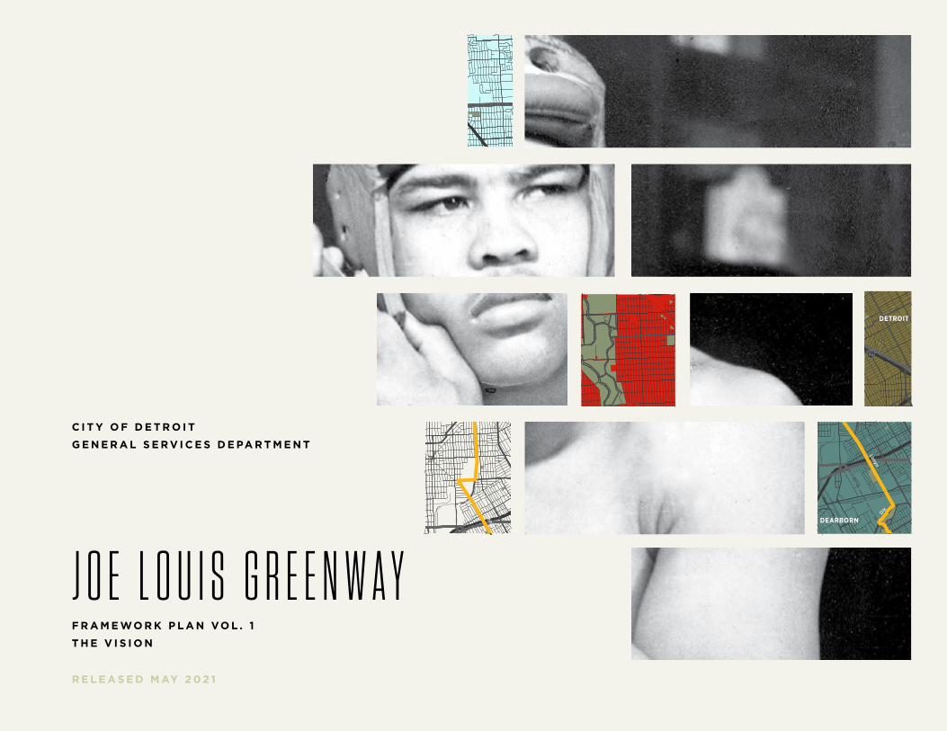
C I T Y O F D E T R O I T
G E N E R A L S E R V I C E S D E PA R T M E N T
J O E L O U I S G R E E N W A YF R A M E WO R K P L A N VO L . 1
T H E V I S I O N
R E L E A S E D M AY 2 0 2 1
94
94
94
94
75
75
75
10
10
HIGHLANDPARK
DETROIT
DEARBORN
Michigan Avenue
Telegrap
h
Telegrap
h
Plymouth
Warren Avenue
Bagley
Je�erson Avenue
Dearborn
Detroit Riverwalk
Dequindre Cut
Lonyo
Dix
Woodm
ere
Campbell
W. G
rand
8 Mile
Fort
Fort
Woodw
ard Avenue
Woodw
ard
Gra
tiot
Aven
ue
Grand River Avenue
Davison
Joseph Campau
Ham
tram
ck D
r
Conrail
Conrail
Oakm
an
McNichols
Live
rnoi
s
GORDIE HOWEBRIDGE
HAMTRAMCK
BELLE ISLE
WINDSOR
D
e t
r o i t
R i v
e r
Detroit–W
indsor Tunnel
Ambassador Bridge
Gordie Howe Bridge
J OE
LOU
I S G
RE
EN
WA
Y
94
94
94
94
75
75
75
10
10
HIGHLANDPARK
DETROIT
DEARBORN
Michigan Avenue
Telegrap
h
Telegrap
h
Plymouth
Warren Avenue
Bagley
Je�erson Avenue
Dearborn
Detroit Riverwalk
Dequindre Cut
Lonyo
Dix
Woodm
ere
Campbell
W. G
rand
8 Mile
Fort
Fort
Woodw
ard Avenue
Woodw
ard
Gra
tiot
Aven
ue
Grand River Avenue
Davison
Joseph Campau
Ham
tram
ck D
r
Conrail
Conrail
Oakm
an
McNichols
Live
rnoi
s
GORDIE HOWEBRIDGE
HAMTRAMCK
BELLE ISLE
WINDSOR
D
e t
r o i t
R i v
e r
Detroit–W
indsor Tunnel
Ambassador Bridge
Gordie Howe Bridge
J OE
LOU
I S G
RE
EN
WA
Y
C I T Y O F D E T R O I T • J O E LO U I S G R E E N WAY F R A M E WO R K P L A N2
C I T Y O F D E T R O I T
G E N E R A L S E R V I C E S D E PA R T M E N T
J O E L O U I S G R E E N W A YF R A M E WO R K P L A N VO L . 1
T H E V I S I O N
R E L E A S E D M AY 2 0 2 1
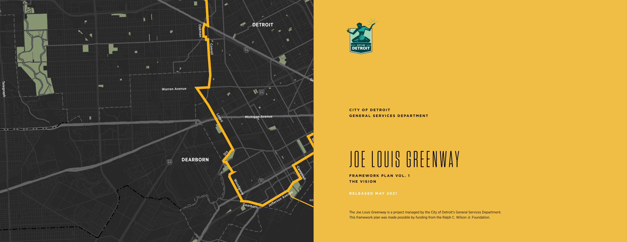
The Joe Louis Greenway is a project managed by the City of Detroit’s General Services Department. This framework plan was made possible by funding from the Ralph C. Wilson Jr. Foundation.
94
94
94
94
75
75
75
10
10
HIGHLANDPARK
DETROIT
DEARBORN
Michigan Avenue
Telegrap
h
Telegrap
h
Plymouth
Warren Avenue
Bagley
Je�erson Avenue
Dearborn
Detroit Riverwalk
Dequindre Cut
Lonyo
Dix
Woodm
ere
Campbell
W. G
rand
8 Mile
Fort
Fort
Woodw
ard Avenue
Woodw
ard
Gra
tiot
Aven
ue
Grand River Avenue
Davison
Joseph Campau
Ham
tram
ck D
r
Conrail
Conrail
Oakm
an
McNichols
Live
rnoi
s
GORDIE HOWEBRIDGE
HAMTRAMCK
BELLE ISLE
WINDSOR
C I T Y O F D E T R O I T • J O E LO U I S G R E E N WAY F R A M E WO R K P L A N2 TA B L E O F C O N T E N T S 3
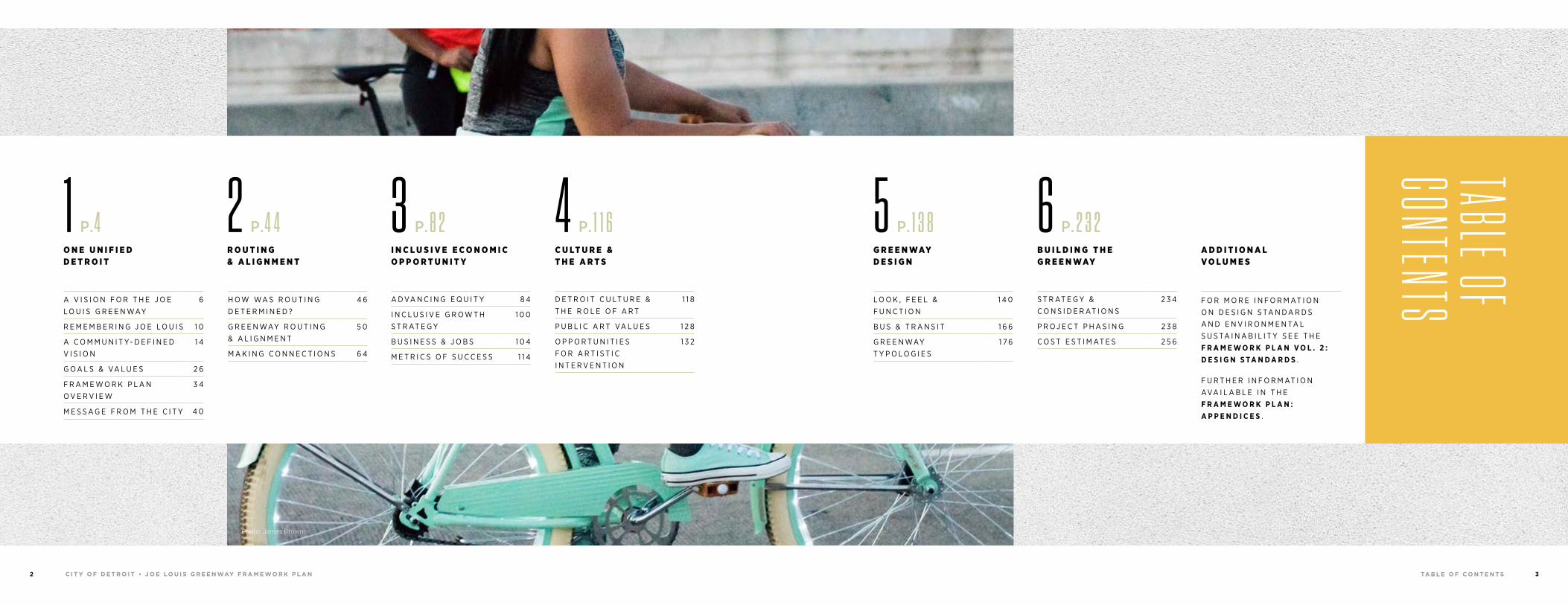
TABLE OF CONTENTSS T R AT E G Y &
C O N S I D E R AT I O N S2 3 4
P R O J E C T P H A S I N G 2 3 8
C O S T E S T I M AT E S 2 5 6
6 P. 2 3 2 B U I L D I N G T H E G R E E N WAY
A D D I T I O N A L V O L U M E S
1 P.4 O N E U N I F I E D D E T R O I T
A V I S I O N F O R T H E J O E L O U I S G R E E N WAY
6
R E M E M B E R I N G J O E L O U I S 1 0
A C O M M U N I T Y- D E F I N E D V I S I O N
1 4
G O A L S & VA L U E S 2 6
F R A M E W O R K P L A N O V E R V I E W
3 4
M E S S A G E F R O M T H E C I T Y 4 0
5 P. 1 3 8 G R E E N WAY D E S I G N
L O O K , F E E L & F U N C T I O N
1 4 0
B U S & T R A N S I T 1 6 6
G R E E N WAY T Y P O L O G I E S
1 7 6
2 P.4 4 R O U T I N G & A L I G N M E N T
H O W WA S R O U T I N G D E T E R M I N E D ?
4 6
G R E E N WAY R O U T I N G & A L I G N M E N T
5 0
M A K I N G C O N N E C T I O N S 6 4
Photo: James Brown
3 P.8 2 I N C L U S I V E E C O N O M I C O P P O R T U N I T Y
A D VA N C I N G E Q U I T Y 8 4
I N C L U S I V E G R O W T H S T R AT E G Y
1 0 0
B U S I N E S S & J O B S 1 0 4
M E T R I C S O F S U C C E S S 1 1 4
4 P. 1 1 6 C U LT U R E & T H E A R T S
D E T R O I T C U LT U R E & T H E R O L E O F A R T
1 1 8
P U B L I C A R T VA L U E S 1 2 8
O P P O R T U N I T I E S F O R A R T I S T I C I N T E R V E N T I O N
1 3 2
F O R M O R E I N F O R M AT I O N O N D E S I G N S TA N D A R D S A N D E N V I R O N M E N TA L S U S TA I N A B I L I T Y S E E T H E F R A M E W O R K P L A N V O L . 2 : D E S I G N S TA N D A R D S .
F U R T H E R I N F O R M AT I O N AVA I L A B L E I N T H E F R A M E W O R K P L A N : A P P E N D I C E S .
0 1 O N E U N I F I E D D E T R O I TC I T Y O F D E T R O I T • J O E LO U I S G R E E N WAY F R A M E WO R K P L A N4 5
94
94
94
94
75
75
75
10
10
HIGHLANDPARK
DETROIT
DEARBORN
Michigan Avenue
Telegrap
h
Telegrap
h
Plymouth
Warren Avenue
Bagley
Je�erson Avenue
Dearborn
Detroit Riverwalk
Dequindre Cut
Lonyo
Dix
Woodm
ere
Campbell
W. G
rand
8 Mile
Fort
Fort
Woodw
ard Avenue
Woodw
ard
Gra
tiot
Aven
ue
Grand River Avenue
Davison
Joseph Campau
Ham
tram
ck D
r
Conrail
Conrail
Oakm
an
McNichols
Live
rnoi
s
GORDIE HOWEBRIDGE
HAMTRAMCK
BELLE ISLE
WINDSOR
A V I S I O N F O R T H E J O E L O U I S G R E E N WAY
6
R E M E M B E R I N G J O E L O U I S 1 0
A C O M M U N I T Y- D E F I N E D V I S I O N
1 4
G O A L S & VA L U E S 2 6
F R A M E W O R K P L A N O V E R V I E W
3 4
M E S S A G E F R O M T H E C I T Y 4 0
1O
NE
UN
IFIE
D D
ET
RO
IT
CHAP
TER 1
Photo: James Brown
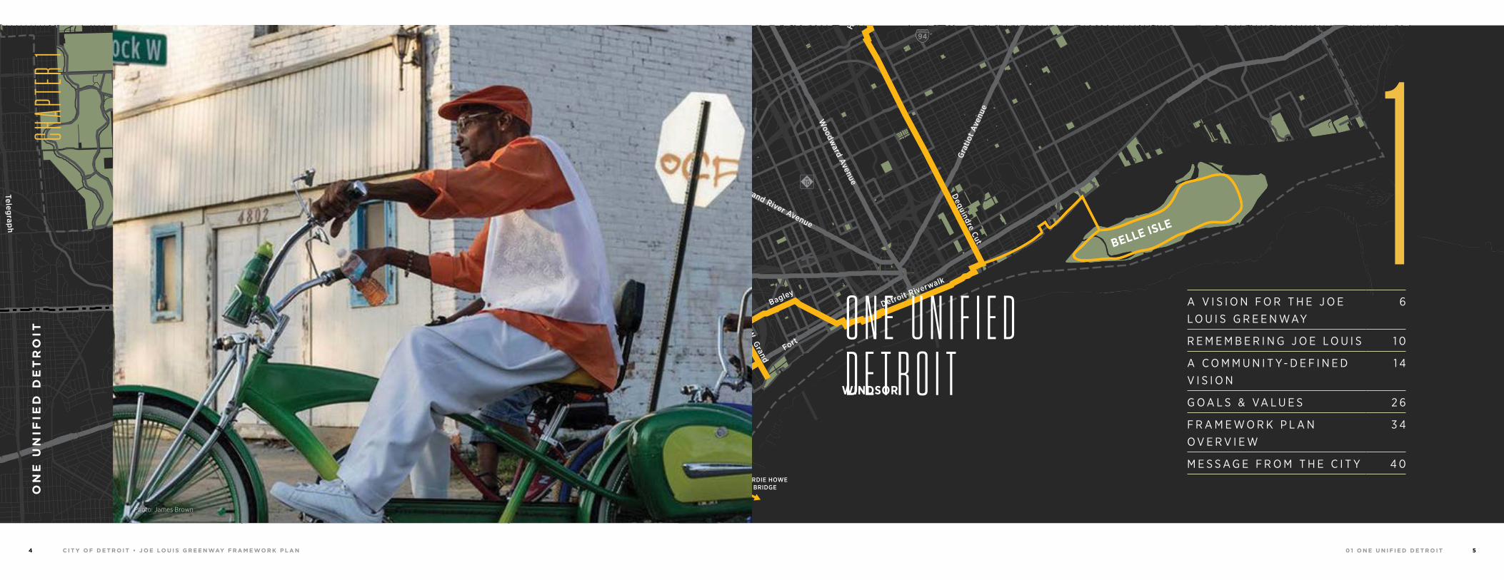
O N E U N I F I E D D E T R O I T
0 1 O N E U N I F I E D D E T R O I TC I T Y O F D E T R O I T • J O E LO U I S G R E E N WAY F R A M E WO R K P L A N6 7
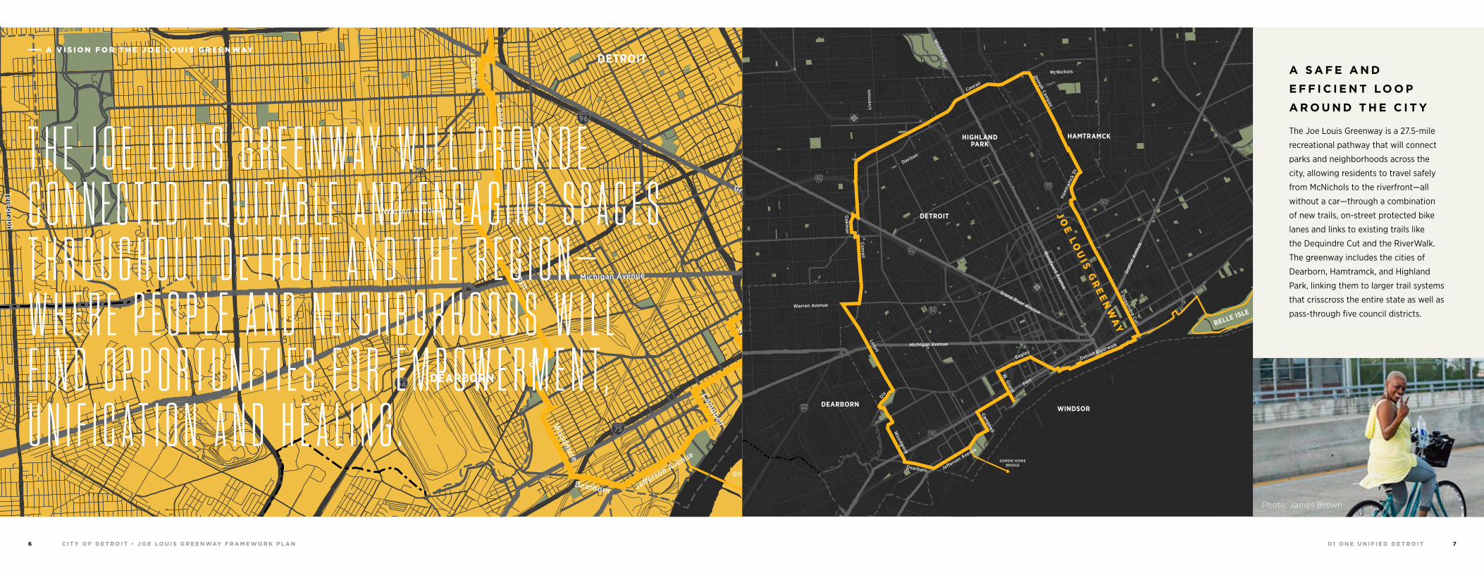
A S A F E A N D
E F F I C I E N T LO O P
A R O U N D T H E C I T Y
The Joe Louis Greenway is a 27.5-mile
recreational pathway that will connect
parks and neighborhoods across the
city, allowing residents to travel safely
from McNichols to the riverfront—all
without a car—through a combination
of new trails, on-street protected bike
lanes and links to existing trails like
the Dequindre Cut and the RiverWalk.
The greenway includes the cities of
Dearborn, Hamtramck, and Highland
Park, linking them to larger trail systems
that crisscross the entire state as well as
pass-through five council districts.
94
94
94
94
75
75
75
10
10
HIGHLANDPARK
DETROIT
DEARBORN
Michigan Avenue
Telegrap
h
Telegrap
h
Plymouth
Warren Avenue
Bagley
Je�erson Avenue
Dearborn
Detroit Riverwalk
Dequindre Cut
Lonyo
Dix
Woodm
ere
Campbell
W. G
rand
8 Mile
Fort
Fort
Woodw
ard Avenue
Woodw
ard
Gra
tiot
Aven
ue
Grand River Avenue
Davison
Joseph Campau
Ham
tram
ck D
r
Conrail
Conrail
Oakm
an
McNichols
Live
rnoi
s
GORDIE HOWEBRIDGE
HAMTRAMCK
BELLE ISLE
WINDSOR
J OE
LOU
I S G
RE
EN
WA
Y
Photo: James Brown
94
94
94
94
75
75
75
10
10
HIGHLANDPARK
DETROIT
DEARBORN
Michigan Avenue
Telegrap
h
Telegrap
h
Plymouth
Warren Avenue
Bagley
Je�erson Avenue
Dearborn
Detroit Riverwalk
Dequindre Cut
Lonyo
Dix
Woodm
ere
Campbell
W. G
rand
8 Mile
Fort
Fort
Woodw
ard Avenue
Woodw
ard
Gra
tiot
Aven
ue
Grand River Avenue
Davison
Joseph Campau
Ham
tram
ck D
r
Conrail
Conrail
Oakm
an
McNichols
Live
rnoi
s
GORDIE HOWEBRIDGE
HAMTRAMCK
BELLE ISLE
WINDSOR
J OE
LOU
I S G
RE
EN
WA
Y
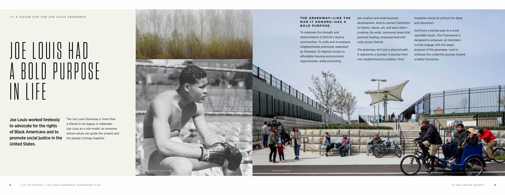
T H E J O E L O U I S G R E E N W A Y W I L L P R O V I D E C O N N E C T E D , E Q U I T A B L E A N D E N G A G I N G S P A C E S T H R O U G H O U T D E T R O I T A N D T H E R E G I O N — W H E R E P E O P L E A N D N E I G H B O R H O O D S W I L L F I N D O P P O R T U N I T I E S F O R E M P O W E R M E N T , U N I F I C A T I O N A N D H E A L I N G .
A V I S I O N F O R T H E J O E LO U I S G R E E N WAY
0 1 O N E U N I F I E D D E T R O I TC I T Y O F D E T R O I T • J O E LO U I S G R E E N WAY F R A M E WO R K P L A N8 9
T H E G R E E N WAY— L I K E T H E M A N I T H O N O R S — H A S A B O L D P U R P O S E .
To celebrate the strength and
determination of Detroit’s diverse
communities. To unify and re-energize
neighborhoods previously separated
by freeways. To improve access to
affordable housing and economic
opportunities, while promoting
job creation and small business
development. And to connect Detroiters
to history, nature, art, and each other—
creating city-wide, communal areas that
promote healing, empowerment and
unity across Detroit.
The greenway isn’t just a physical path.
It represents a journey. A journey from
one neighborhood to another. From
forgotten voices to a forum for ideas
and discussion.
And from a storied past to a more
equitable future. This Framework is
designed to empower all Detroiters
to fully engage with the larger
purpose of the greenway—and to
embrace this collective journey toward
a better tomorrow.
Photo: SmithGroup
J O E L O U I S H A D A B O L D P U R P O S E I N L I F EJoe Louis worked tirelessly to advocate for the rights of Black Americans and to promote social justice in the United States.
The Joe Louis Greenway is more than
a tribute to his legacy. It celebrates
Joe Louis as a role model, as someone
whose values can guide this project and
the people it brings together.
A V I S I O N F O R T H E J O E LO U I S G R E E N WAY
Source: Barrow Family Photo
0 1 O N E U N I F I E D D E T R O I TC I T Y O F D E T R O I T • J O E LO U I S G R E E N WAY F R A M E WO R K P L A N1 0 1 1
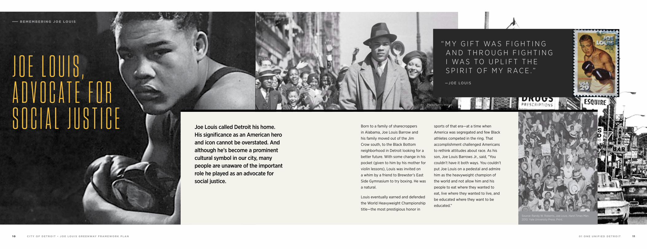
“ M Y G I F T WA S F I G H T I N G A N D T H R O U G H F I G H T I N G I WA S T O U P L I F T T H E S P I R I T O F M Y R A C E . ” — J O E L O U I S
Photo: Getty ImagesSource: Candice & George Joseph
Source: Candice & George Joseph Source: Randy W. Roberts, Joe Louis, Hard Times Man. 2010. Yale University Press. Print.
J O E L O U I S , A D V O C A T E F O R S O C I A L J U S T I C E Born to a family of sharecroppers
in Alabama, Joe Louis Barrow and
his family moved out of the Jim
Crow south, to the Black Bottom
neighborhood in Detroit looking for a
better future. With some change in his
pocket (given to him by his mother for
violin lessons), Louis was invited on
a whim by a friend to Brewster’s East
Side Gymnasium to try boxing. He was
a natural.
Louis eventually earned and defended
the World Heavyweight Championship
title —the most prestigious honor in
sports of that era—at a time when
America was segregated and few Black
athletes competed in the ring. That
accomplishment challenged Americans
to rethink attitudes about race. As his
son, Joe Louis Barrows Jr., said, “You
couldn’t have it both ways. You couldn’t
put Joe Louis on a pedestal and admire
him as the heavyweight champion of
the world and not allow him and his
people to eat where they wanted to
eat, live where they wanted to live, and
be educated where they want to be
educated.”
Joe Louis called Detroit his home. His significance as an American hero and icon cannot be overstated. And although he’s become a prominent cultural symbol in our city, many people are unaware of the important role he played as an advocate for social justice.
R E M E M B E R I N G J O E LO U I S
0 1 O N E U N I F I E D D E T R O I TC I T Y O F D E T R O I T • J O E LO U I S G R E E N WAY F R A M E WO R K P L A N1 2 1 3
T H E F I G H T TO O K O N G R E AT SY M B O L I S M F O R B OT H S I D E S
To the Nazis, a victory over Louis
would prove Aryan supremacy while
establishing Germany’s ascendancy
over the United States. To Americans,
a victory for Louis would represent a
moral victory over Hitler’s ideology.
Unifying against Nazism, Americans of
all races and ethnicities rallied behind
Louis. After he delivered a first-round
KO against Schmeling, the people of
Detroit took to the streets to declare,
“Joe knocked out Hitler cold.”
The entire country joined in celebration,
hailing Joe Louis as an American hero,
and ultimately, a racial unifier. The
Philadelphia Independent wrote that
Louis defeating Schmeling had created
more goodwill for American Blacks than
anything since the civil war.
“[Louis had] created more goodwill for American Blacks than anything since the Civil War.”
Louis left his successful career as a
fighter to join the military in WWII,
where he continued to advocate for
racial justice. He called for the Officer’s
Candidate School to accept Black
soldiers so that they could move up in
rank, and refused to box unless Black
spectators were allowed to sit closer to
the ring.
Although he didn’t take credit for his
role in improving race relations, Louis
has been credited with helping to pave
the way for the Civil Rights Movement
of the 1950s and 1960s, during which
other Black athletes—including Jackie
Robinson, Jim Brown and Bill Russell—
crossed racial barriers and were also
hailed as American heroes.
Source: Candice & George Joseph
R E M E M B E R I N G J O E LO U I S
“ J O E K N O C K E D O U T H I T L E R C O L D . ”As tensions mounted between the US and Germany prior the outbreak of WWII, Louis was matched with German boxer Max Schmeling, who had come to be known as a symbol of the Third Reich.
Photo: Getty Images
Source: World-Telegram photo Source: Candice & George JosephSource: Candice & George JosephSource: Daily News
0 1 O N E U N I F I E D D E T R O I TC I T Y O F D E T R O I T • J O E LO U I S G R E E N WAY F R A M E WO R K P L A N1 4 1 5
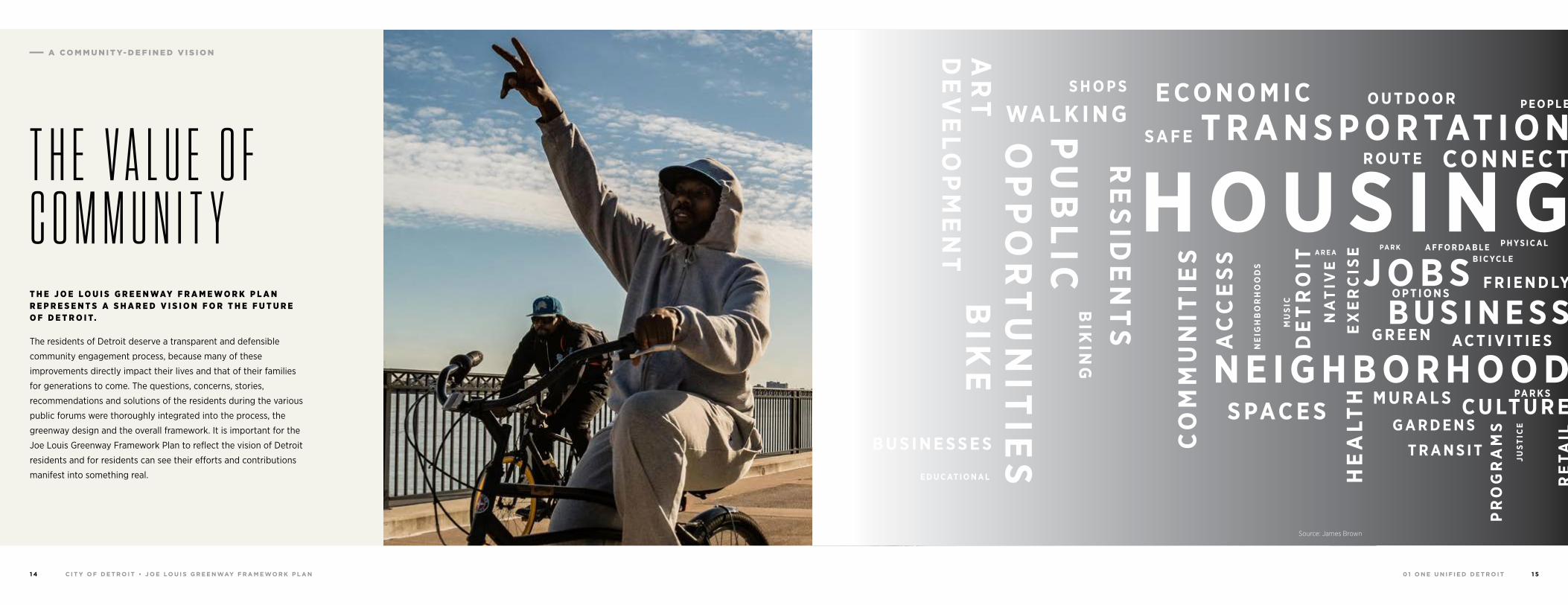
T H E V A L U E O F C O M M U N I T YT H E J O E L O U I S G R E E N WAY F R A M E W O R K P L A N R E P R E S E N T S A S H A R E D V I S I O N F O R T H E F U T U R E O F D E T R O I T.
The residents of Detroit deserve a transparent and defensible
community engagement process, because many of these
improvements directly impact their lives and that of their families
for generations to come. The questions, concerns, stories,
recommendations and solutions of the residents during the various
public forums were thoroughly integrated into the process, the
greenway design and the overall framework. It is important for the
Joe Louis Greenway Framework Plan to reflect the vision of Detroit
residents and for residents can see their efforts and contributions
manifest into something real.
E C O N O M I C
E D U C AT I O N A L
B U S I N E S S E S
S A F EOP
PO
RT
UN
ITIE
S
DE
VE
LOP
ME
NT
RE
SID
EN
TS
BIK
E
WA L K I N GS H O P S
PU
BL
IC
AR
T
BIK
ING
H O U S I N GT R A N S P O R TAT I O N
O U T D O O R
R O U T E C O N N E C T
P E O P L E
O P T I O N S
G R E E N AC T I V I T I E S
F R I E N D LY
A F F O R DA B L EB I C YC L E
P H Y S I C A L
G A R D E N S
T R A N S I T
PR
OG
RA
MS
HE
ALT
HS PAC E S
NE
IGH
BO
RH
OO
DS
MU
SIC
DE
TR
OIT
NA
TIV
EE
XE
RC
ISE
RE
TAIL
JUS
TIC
E
M U R A L S C U LT U R EPA R K S
N E I G H B O R H O O D
CO
MM
UN
ITIE
S
B U S I N E S SJ O B S
A R E APA R K
AC
CE
SS
Source: James Brown
A C O M M U N I T Y- D E F I N E D V I S I O N
0 1 O N E U N I F I E D D E T R O I TC I T Y O F D E T R O I T • J O E LO U I S G R E E N WAY F R A M E WO R K P L A N1 6 1 7
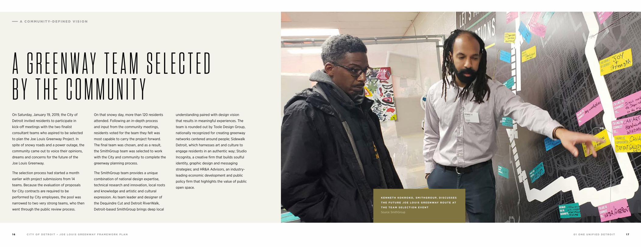
A G R E E N W A Y T E A M S E L E C T E D B Y T H E C O M M U N I T YOn Saturday, January 19, 2019, the City of
Detroit invited residents to participate in
kick-off meetings with the two finalist
consultant teams who aspired to be selected
to plan the Joe Louis Greenway Project. In
spite of snowy roads and a power outage, the
community came out to voice their opinions,
dreams and concerns for the future of the
Joe Louis Greenway.
The selection process had started a month
earlier with project submissions from 14
teams. Because the evaluation of proposals
for City contracts are required to be
performed by City employees, the pool was
narrowed to two very strong teams, who then
went through the public review process.
On that snowy day, more than 120 residents
attended. Following an in-depth process
and input from the community meetings,
residents voted for the team they felt was
most capable to carry the project forward.
The final team was chosen, and as a result,
the SmithGroup team was selected to work
with the City and community to complete the
greenway planning process.
The SmithGroup team provides a unique
combination of national design expertise,
technical research and innovation, local roots
and knowledge and artistic and cultural
expression. As team leader and designer of
the Dequindre Cut and Detroit RiverWalk,
Detroit-based SmithGroup brings deep local
understanding paired with design vision
that results in meaningful experiences. The
team is rounded out by Toole Design Group,
nationally recognized for creating greenway
networks centered around people; Sidewalk
Detroit, which harnesses art and culture to
engage residents in an authentic way; Studio
Incognita, a creative firm that builds soulful
identity, graphic design and messaging
strategies; and HR&A Advisors, an industry-
leading economic development and public
policy firm that highlights the value of public
open space.
K E N N E T H KO K R O KO, S M I T H G R O U P, D I S C U S S E S
T H E F U T U R E J O E LO U I S G R E E N WAY R O U T E AT
T H E T E A M S E L E C T I O N E V E N T
Source: SmithGroup
A C O M M U N I T Y- D E F I N E D V I S I O N
0 1 O N E U N I F I E D D E T R O I TC I T Y O F D E T R O I T • J O E LO U I S G R E E N WAY F R A M E WO R K P L A N1 8 1 9
A V I S I O N F O R T H E J O E LO U I S G R E E N WAY
94
94
94
94
75
75
75
10
10
HIGHLANDPARK
DETROIT
DEARBORN
Michigan Avenue
Telegrap
h
Telegrap
h
Plymouth
Warren Avenue
Bagley
Je�erson Avenue
Dearborn
Detroit Riverwalk
Dequindre Cut
Lonyo
Dix
Woodm
ere
Campbell
W. G
rand
8 Mile
Fort
Fort
Woodw
ard Avenue
Woodw
ard
Gra
tiot
Aven
ue
Grand River Avenue
Davison
Joseph Campau
Ham
tram
ck D
r
Conrail
Conrail
Oakm
an
McNichols
Live
rnoi
s
GORDIE HOWEBRIDGE
HAMTRAMCK
BELLE ISLE
WINDSOR
J OE
LOU
I S G
RE
EN
WA
Y
T H E P R O C E S S :
E X I S T I N G
C O N D I T I O N S
G R E E N WAY
D E S I G N
F R A M E WO R K
P L A N
T H E G R E E N WAY D E S I G N P H A S E :
Includes recommendations for land use, zoning, wayfinding and
green infrastructure such as natural landscaping and effective
stormwater management techniques.
Determines the trail’s alignment, access points, connections to
nearby destinations and linkages to trails, public transit and the
new Gordie Howe International Bridge.
Identifies the best pedestrian and bicycle design practices that
make up a signature greenway.
T H E F R A M E WO R K P L A N P H A S E :
Determines a feasible phasing and implementation plan with
respect to available funding sources and stewardship opportunities.
Includes a maintenance and operations plan that details
requirements to keep the greenway beautiful, safe and accessible.
Connects to larger planning efforts, networks and greenways that
build and strengthen accessibility across the region.
O U R P R O C E S S WA S D I V I D E D I N TO T H R E E P H A S E S — E AC H W I T H E N G AG E M E N T T H R O U G H O U T
Community input is an important component of this framework
planning process. The greenway must reflect the needs and
desires of the local communities through which is passes. Certainly
many communities have concerns beyond those of a trail such as
persistent land vacancy, dumping and safety. While the Joe Louis
Greenway may not solve all of these critical issues, this project
may be an opportunity—and a first step—to identify and address
these problems as part of the overall success of the greenway.
In this way, the Joe Louis Greenway is much more than just a trail. It is an opportunity to bring additional investment and attention to the neighborhoods that need it the most.
T H E E X I S T I N G C O N D I T I O N S P H A S E :
Considers existing land uses within a half-mile on either side of
the greenway to identify housing gaps, economic barriers and
limitations of access to quality green space.
Evaluates other successful greenways, their strategies and
supplemental policies and their applicability to Detroit.
Connects the Joe Louis Greenway planning to existing planning
efforts in Detroit, namely the Strategic Neighborhood Fund
Frameworks and other important districts and job centers.
W H AT H A P P E N S N E X T ?
The City of Detroit will finalize the design of the greenway once framework planning is completed in 2021. The Detroit Strategic Plan for Transportation sets the following benchmarks to be completed by 2022:
• Construct the first phase of the Joe Louis Greenway.
• Implement on-street sections of the Joe Louis Greenway through Road Bond Complete Streets projects with Detroit Public Works, Michigan Department of Transportation and Wayne County through Complete Streets, repaving and other road safety projects.
A C O M M U N I T Y- D E F I N E D V I S I O N
0 1 O N E U N I F I E D D E T R O I TC I T Y O F D E T R O I T • J O E LO U I S G R E E N WAY F R A M E WO R K P L A N2 0 2 1
94
94
94
94
75
75
75
10
10
HIGHLANDPARK
DETROIT
DEARBORN
Michigan Avenue
Telegrap
h
Telegrap
h
Plymouth
Warren Avenue
Bagley
Je�erson Avenue
Dearborn
Detroit Riverwalk
Dequindre Cut
Lonyo
Dix
Woodm
ere
Campbell
W. G
rand
8 Mile
Fort
Fort
Woodw
ard Avenue
Woodw
ard
Gra
tiot
Aven
ue
Grand River Avenue
Davison
Joseph Campau
Ham
tram
ck D
r
Conrail
Conrail
Oakm
an
McNichols
Live
rnoi
s
GORDIE HOWEBRIDGE
HAMTRAMCK
BELLE ISLE
WINDSOR
J OE
LOU
I S G
RE
EN
WA
Y
H O W T H E C O M M U N I T Y D E F I N E D A V I S I O N F O R T H E J O E L O U I S G R E E N W A Y
94
94
94
94
75
75
75
10
10
HIGHLANDPARK
DETROIT
DEARBORN
Michigan Avenue
Telegrap
h
Telegrap
h
Plymouth
Warren Avenue
Bagley
Je�erson Avenue
Dearborn
Detroit Riverwalk
Dequindre Cut
Lonyo
Dix
Woodm
ere
Campbell
W. G
rand
8 Mile
Fort
Fort
Woodw
ard Avenue
Woodw
ard
Gra
tiot
Aven
ue
Grand River Avenue
Davison
Joseph Campau
Ham
tram
ck D
r
Conrail
Conrail
Oakm
an
McNichols
Live
rnoi
s
GORDIE HOWEBRIDGE
HAMTRAMCK
BELLE ISLE
WINDSOR
J OE
LOU
I S G
RE
EN
WA
Y
J OE
LOU
I S G
RE
EN
WA
Y
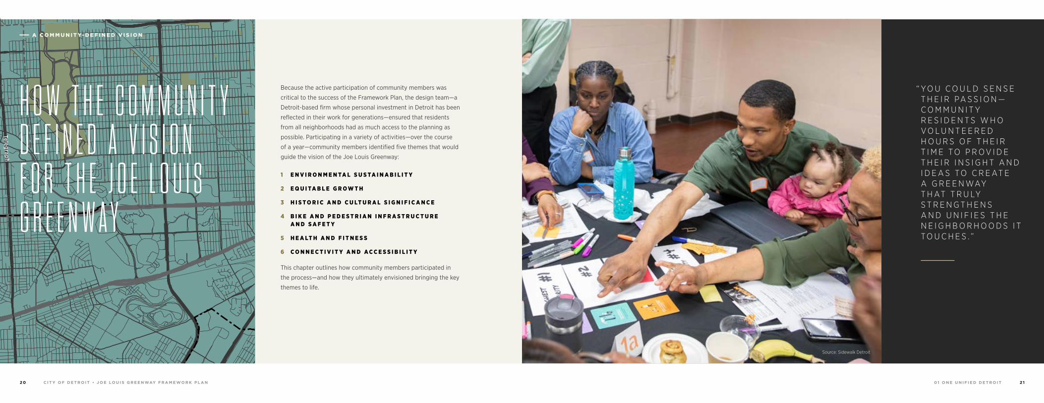
“ Y O U C O U L D S E N S E T H E I R PA S S I O N —C O M M U N I T Y R E S I D E N T S W H O V O L U N T E E R E D H O U R S O F T H E I R T I M E T O P R O V I D E T H E I R I N S I G H T A N D I D E A S T O C R E AT E A G R E E N WAY T H AT T R U LY S T R E N G T H E N S A N D U N I F I E S T H E N E I G H B O R H O O D S I T T O U C H E S . ”
Because the active participation of community members was
critical to the success of the Framework Plan, the design team—a
Detroit-based firm whose personal investment in Detroit has been
reflected in their work for generations—ensured that residents
from all neighborhoods had as much access to the planning as
possible. Participating in a variety of activities—over the course
of a year—community members identified five themes that would
guide the vision of the Joe Louis Greenway:
1 E N V I R O N M E N TA L S U S TA I N A B I L I T Y
2 E Q U I TA B L E G R O W T H
3 H I S T O R I C A N D C U LT U R A L S I G N I F I C A N C E
4 B I K E A N D P E D E S T R I A N I N F R A S T R U C T U R E A N D S A F E T Y
5 H E A LT H A N D F I T N E S S
6 C O N N E C T I V I T Y A N D A C C E S S I B I L I T Y
This chapter outlines how community members participated in
the process—and how they ultimately envisioned bringing the key
themes to life.
Source: Sidewalk Detroit
A C O M M U N I T Y- D E F I N E D V I S I O N
0 1 O N E U N I F I E D D E T R O I TC I T Y O F D E T R O I T • J O E LO U I S G R E E N WAY F R A M E WO R K P L A N2 2 2 3
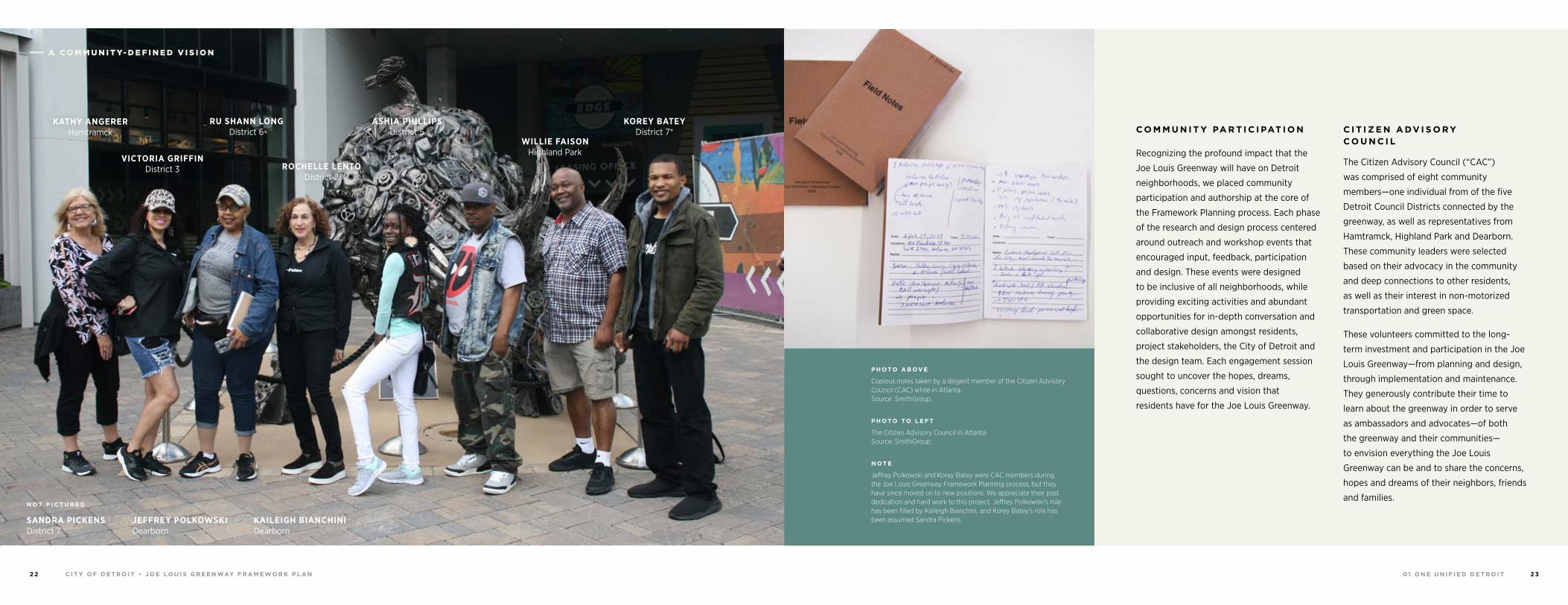
C O M M U N I T Y PA R T I C I PAT I O N
Recognizing the profound impact that the
Joe Louis Greenway will have on Detroit
neighborhoods, we placed community
participation and authorship at the core of
the Framework Planning process. Each phase
of the research and design process centered
around outreach and workshop events that
encouraged input, feedback, participation
and design. These events were designed
to be inclusive of all neighborhoods, while
providing exciting activities and abundant
opportunities for in-depth conversation and
collaborative design amongst residents,
project stakeholders, the City of Detroit and
the design team. Each engagement session
sought to uncover the hopes, dreams,
questions, concerns and vision that
residents have for the Joe Louis Greenway.
C I T I Z E N A DV I S O R Y C O U N C I L
The Citizen Advisory Council (“CAC”)
was comprised of eight community
members—one individual from of the five
Detroit Council Districts connected by the
greenway, as well as representatives from
Hamtramck, Highland Park and Dearborn.
These community leaders were selected
based on their advocacy in the community
and deep connections to other residents,
as well as their interest in non-motorized
transportation and green space.
These volunteers committed to the long-
term investment and participation in the Joe
Louis Greenway—from planning and design,
through implementation and maintenance.
They generously contribute their time to
learn about the greenway in order to serve
as ambassadors and advocates—of both
the greenway and their communities—
to envision everything the Joe Louis
Greenway can be and to share the concerns,
hopes and dreams of their neighbors, friends
and families.
KATHY ANGERERHamtramck
VICTORIA GRIFFINDistrict 3
RU SHANN LONGDistrict 6
ROCHELLE LENTODistrict 2
ASHIA PHILLIPSDistrict 5
WILLIE FAISONHighland Park
KOREY BATEYDistrict 7*
N OT P I C T U R E D
SANDRA PICKENS District 7
JEFFREY POLKOWSKI Dearborn
KAILEIGH BIANCHINI Dearborn
P H OTO A B OV E
Copious notes taken by a diligent member of the Citizen Advisory Council (CAC) while in Atlanta. Source: SmithGroup.
P H OTO TO L E F T
The Citizen Advisory Council in Atlanta. Source: SmithGroup.
N OT E
Jeffrey Polkowski and Korey Batey were CAC members during the Joe Louis Greenway Framework Planning process, but they have since moved on to new positions. We appreciate their past dedication and hard work to this project. Jeffrey Polkowski’s role has been filled by Kaileigh Bianchini, and Korey Batey’s role has been assumed Sandra Pickens.
A C O M M U N I T Y- D E F I N E D V I S I O N
0 1 O N E U N I F I E D D E T R O I TC I T Y O F D E T R O I T • J O E LO U I S G R E E N WAY F R A M E WO R K P L A N2 4 2 5
WO R K I N G G R O U P S
To facilitate deep engagement with a very
large and diverse community, the design team
worked with the General Services Department,
the Department of Neighborhoods and
the Mayor’s Office to research and identify
community leaders across the Joe Louis
Greenway impact area.
Working Group members were selected
based on involvement in Detroit bike
culture, community advocacy groups, green
coalitions and block clubs, as well as through
recommendations from City officials. Most
important, selection criteria for the Working
Group prioritized adequate representation
from different geographies along the
greenway, as well as representation from
various stakeholder and interest groups to
offer diverse perspectives.
Most importantly, members of the Working
Group were socio-economically diverse
in terms of age, ethnicity, income level,
neighborhood, ability and education.
Working Group members met throughout
the design period in sessions ranging from
3-5 hours, working in neighborhood-specific
groups on activities that included asset and
cultural mapping exercises, goal setting and
visioning sessions for the greenway and
topics such as greenway safety, amenities, the
function and value of art and culture on the
Joe Louis Greenway, economics, equity and
more. Approximately 100 individuals were
invited to each work session, with about 60
attendees per event.
Working Group leaders worked hand-in-hand
with the design team and City officials and
were given contact information to address
concerns, hopes and ideas to the design
team at their own convenience. Findings
and feedback from Working Group sessions
informed and refined our approach to the
public meetings. These champions were
instrumental in disseminating information
beyond community gatherings and providing
other environments for safe exchange.
“ L E T U S S I T AT T H E TA B L E W H E N Y O U D E C I D E T O M A K E D E T E R M I N AT I O N S F O R O U R N E I G H B O R H O O D . L E T U S T E L L Y O U S O M E O F T H E T H I N G S W E W O U L D L I K E T O S E E I N S T E A D O F P E O P L E F R O M T H E O U T S I D E D E C I D I N G W H AT T O P U T I N O R N O T P U T I N T O O U R C O M M U N I T I E S . ”
“ P E O P L E I N T H E S E N E I G H B O R H O O D S H AV E A L M O S T G I V E N U P H O P E T H AT A N Y B O D Y I S I N T E R E S T E D , ” L O N G S AY S .
“ W E ’ R E O N E O F T H E F O R G O T T E N N E I G H B O R H O O D S — A N D T H E R E A R E L O T S O F T H E M . ”
Source: Sidewalk Detroit — C O M M U N I T Y R E S I D E N TSource: www.wxyz.com/news/detroit-residents-fight-to-remove-blight-bring-back-services-by-giving-tours
— R U S H A N N L O N G , D I S T R I C T 6 C O M M U N I T Y
A D V I S O R Y C O U N C I L R E P R E S E N TAT I V E
A C O M M U N I T Y- D E F I N E D V I S I O N
0 1 O N E U N I F I E D D E T R O I TC I T Y O F D E T R O I T • J O E LO U I S G R E E N WAY F R A M E WO R K P L A N2 6 2 7
T H E R E ’ S S O M E T H I N G M AG I C A L A B O U T T H I S C I T Y.
There was in Joe Louis’s time,
and there is now. Perhaps it’s
the air of possibility that always
surrounds us here. A sense of
energy and resiliency. We see
people who know and care for
one another. We see mutual
respect. Solidarity. A desire to
create and protect. And a passion
for finding better ways of life, for
reevaluating and reinventing our
social order.
A vision for the Joe Louis
Greenway began to emerge over
the course of more than 15 years
of grassroots advocacy. And
throughout the year-long process
of developing the Framework
Plan, an even larger and more
representative community of
Detroit residents expanded and
transformed that vision into an
actionable plan for a greenway
that fosters empowerment,
unification and healing.
T H E G R E E N WAY
W I L L E N H A N C E
R E S I D E N T S ’
Q U A L I T Y O F L I F E
A N D P R O M OT E
C O M M U N I T Y
D E V E LO P M E N T
The greenway has tremendous potential to
enhance the urban environment, making
Detroit more beautiful and enjoyable.
This Framework includes incentives for
economic redevelopment in core corridors
to support the local economy and benefit
long-term residents.
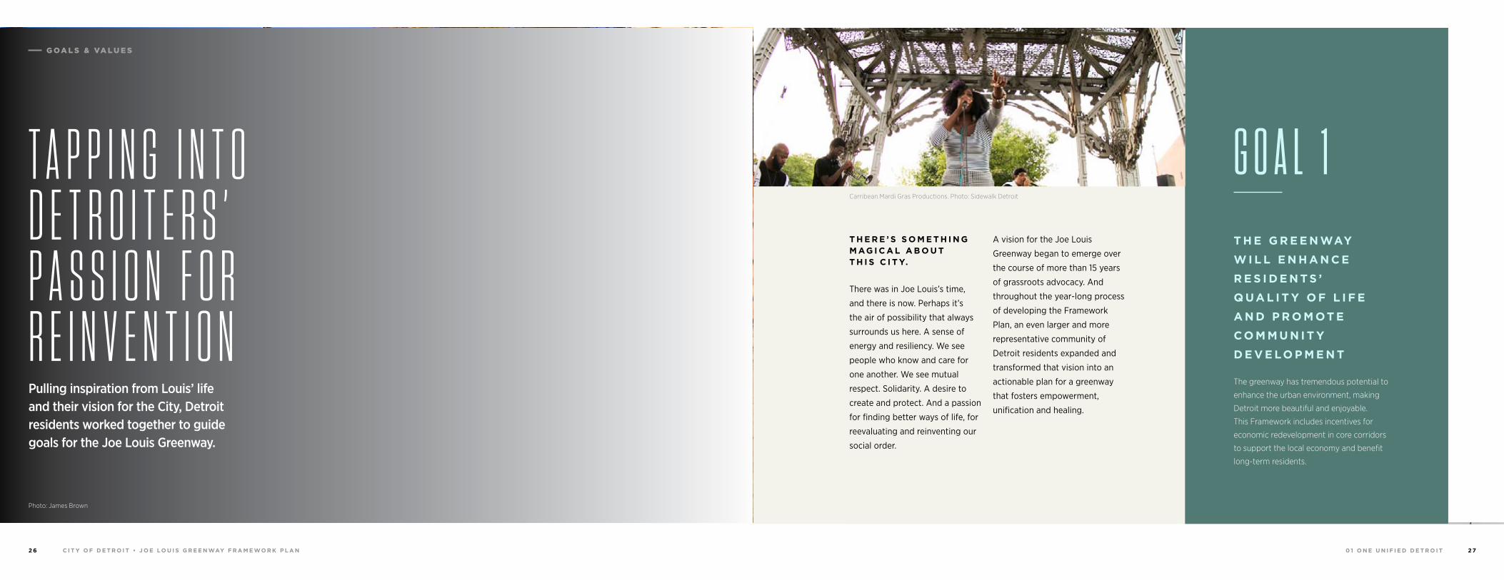
G O A L 1T A P P I N G I N T O D E T R O I T E R S ’ P A S S I O N F O R R E I N V E N T I O N
Photo: James Brown
Pulling inspiration from Louis’ life and their vision for the City, Detroit residents worked together to guide goals for the Joe Louis Greenway.
Carribean Mardi Gras Productions. Photo: Sidewalk Detroit
G OA L S & VA L U E S
0 1 O N E U N I F I E D D E T R O I TC I T Y O F D E T R O I T • J O E LO U I S G R E E N WAY F R A M E WO R K P L A N2 8 2 9
T H E G R E E N WAY
W I L L B E A U N I F Y I N G ,
C O N N E C T I V E ,
M U LT I - M O DA L
T R A N S P O R TAT I O N
N E T WO R K
The greenway will greatly improve access
in the City of Detroit by linking to and
improving on existing non-motorized
connections. This Framework connects
key destinations, Detroit’s neighborhoods
and major transportation routes, ensuring
accessibility for people of all needs
and abilities.
G O A L 3
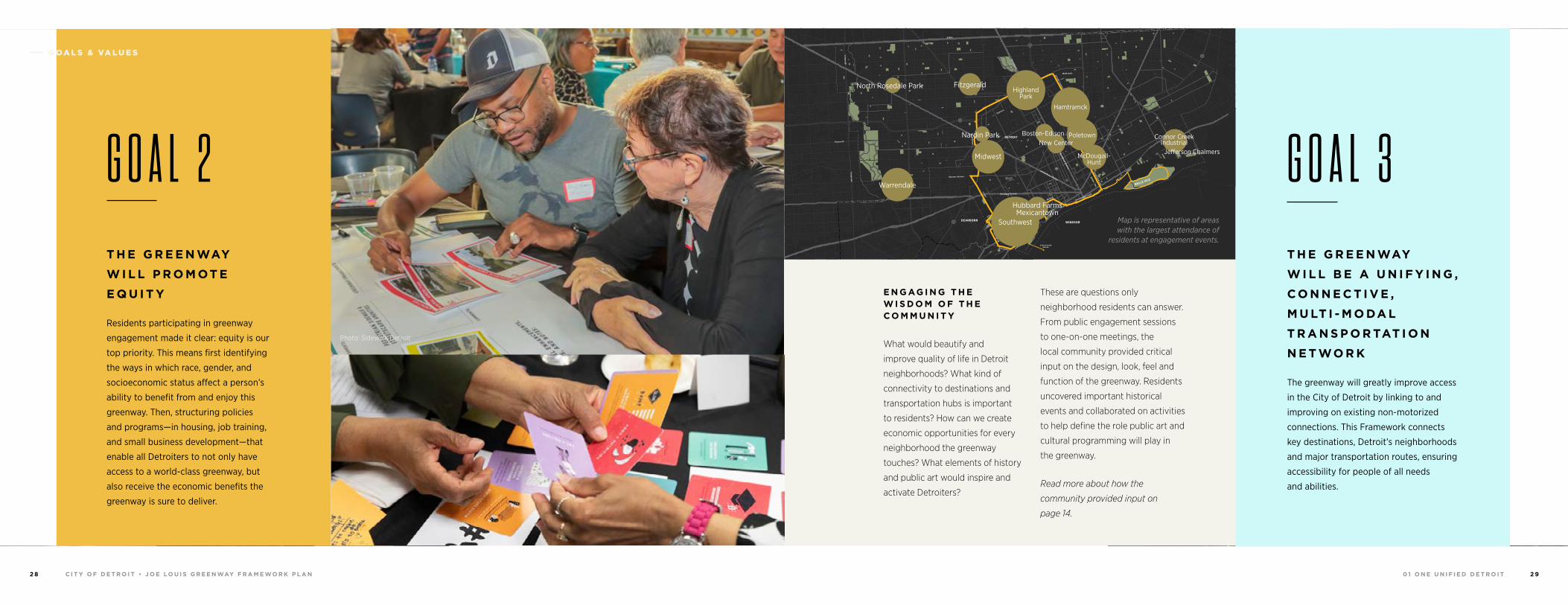
E N G AG I N G T H E W I S D O M O F T H E C O M M U N I T Y
What would beautify and
improve quality of life in Detroit
neighborhoods? What kind of
connectivity to destinations and
transportation hubs is important
to residents? How can we create
economic opportunities for every
neighborhood the greenway
touches? What elements of history
and public art would inspire and
activate Detroiters?
These are questions only
neighborhood residents can answer.
From public engagement sessions
to one-on-one meetings, the
local community provided critical
input on the design, look, feel and
function of the greenway. Residents
uncovered important historical
events and collaborated on activities
to help define the role public art and
cultural programming will play in
the greenway.
Read more about how the
community provided input on
page 14.
94
94
94
94
75
75
75
10
10
HIGHLANDPARK
DETROIT
DEARBORN
Michigan Avenue
Telegrap
h
Telegrap
h
Plymouth
Warren Avenue
Bagley
Je�erson Avenue
Dearborn
Detroit Riverwalk
Dequindre Cut
Lonyo
Dix
Woodm
ere
Campbell
W. G
rand
8 Mile
Fort
Fort
Woodw
ard Avenue
Woodw
ard
Gra
tiot
Aven
ue
Grand River Avenue
Davison
Joseph Campau
Ham
tram
ck D
r
Conrail
Conrail
Oakm
an
McNichols
Live
rnoi
s
GORDIE HOWEBRIDGE
HAMTRAMCK
BELLE ISLE
WINDSOR
Hamtramck
HighlandPark
Poletown
Jefferson Chalmers
Connor Creek Industrial
McDougall-Hunt
New CenterBoston-Edison
Southwest
Hubbard FarmsMexicantown
North Rosedale Park Fitzgerald
Midwest
Warrendale
Nardin Park
Map is representative of areas with the largest attendance of
residents at engagement events.
T H E G R E E N WAY
W I L L P R O M OT E
E Q U I T Y
Residents participating in greenway
engagement made it clear: equity is our
top priority. This means first identifying
the ways in which race, gender, and
socioeconomic status affect a person’s
ability to benefit from and enjoy this
greenway. Then, structuring policies
and programs—in housing, job training,
and small business development—that
enable all Detroiters to not only have
access to a world-class greenway, but
also receive the economic benefits the
greenway is sure to deliver.
G O A L 2
Photo: Sidewalk Detroit
Photo: Sidewalk Detroit
G OA L S & VA L U E S
0 1 O N E U N I F I E D D E T R O I TC I T Y O F D E T R O I T • J O E LO U I S G R E E N WAY F R A M E WO R K P L A N3 0 3 1
94
94
94
94
75
75
75
10
10
HIGHLANDPARK
DETROIT
DEARBORN
Michigan Avenue
Telegrap
h
Telegrap
h
Plymouth
Warren Avenue
Bagley
Je�erson Avenue
Dearborn
Detroit Riverwalk
Dequindre Cut
Lonyo
Dix
Woodm
ere
Campbell
W. G
rand
8 Mile
Fort
Fort
Woodw
ard Avenue
Woodw
ard
Gra
tiot
Aven
ue
Grand River Avenue
Davison
Joseph Campau
Ham
tram
ck D
r
Conrail
Conrail
Oakm
an
McNichols
Live
rnoi
s
GORDIE HOWEBRIDGE
HAMTRAMCK
BELLE ISLE
WINDSOR
J OE
LOU
I S G
RE
EN
WA
Y
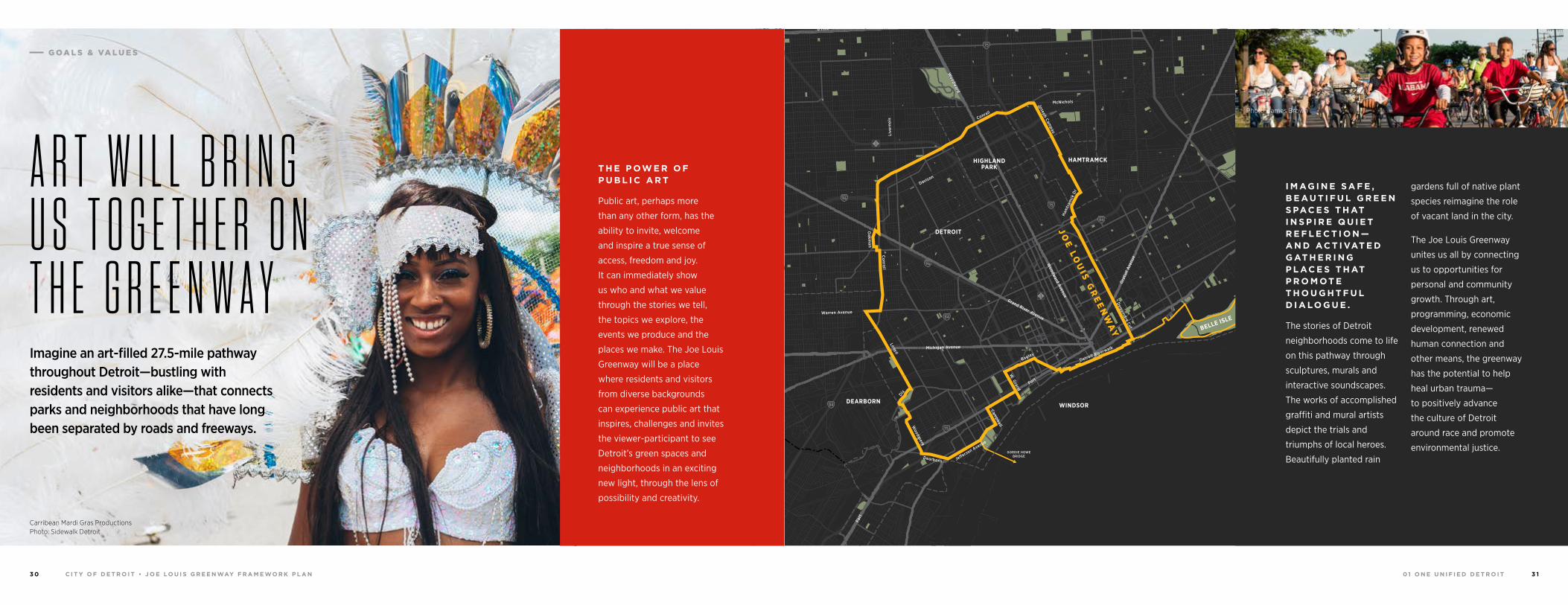
I M AG I N E S A F E , B E A U T I F U L G R E E N S PAC E S T H AT I N S P I R E Q U I E T R E F L E C T I O N —A N D AC T I VAT E D G AT H E R I N G P L AC E S T H AT P R O M OT E T H O U G H T F U L D I A LO G U E .
The stories of Detroit
neighborhoods come to life
on this pathway through
sculptures, murals and
interactive soundscapes.
The works of accomplished
graffiti and mural artists
depict the trials and
triumphs of local heroes.
Beautifully planted rain
gardens full of native plant
species reimagine the role
of vacant land in the city.
The Joe Louis Greenway
unites us all by connecting
us to opportunities for
personal and community
growth. Through art,
programming, economic
development, renewed
human connection and
other means, the greenway
has the potential to help
heal urban trauma—
to positively advance
the culture of Detroit
around race and promote
environmental justice.
Photo: James Brown
A R T W I L L B R I N G U S T O G E T H E R O N T H E G R E E N W A Y Imagine an art-filled 27.5-mile pathway throughout Detroit—bustling with residents and visitors alike—that connects parks and neighborhoods that have long been separated by roads and freeways.
T H E P OW E R O F P U B L I C A R T
Public art, perhaps more
than any other form, has the
ability to invite, welcome
and inspire a true sense of
access, freedom and joy.
It can immediately show
us who and what we value
through the stories we tell,
the topics we explore, the
events we produce and the
places we make. The Joe Louis
Greenway will be a place
where residents and visitors
from diverse backgrounds
can experience public art that
inspires, challenges and invites
the viewer-participant to see
Detroit’s green spaces and
neighborhoods in an exciting
new light, through the lens of
possibility and creativity.
Carribean Mardi Gras Productions Photo: Sidewalk Detroit
G OA L S & VA L U E S
0 1 O N E U N I F I E D D E T R O I TC I T Y O F D E T R O I T • J O E LO U I S G R E E N WAY F R A M E WO R K P L A N3 2 3 3
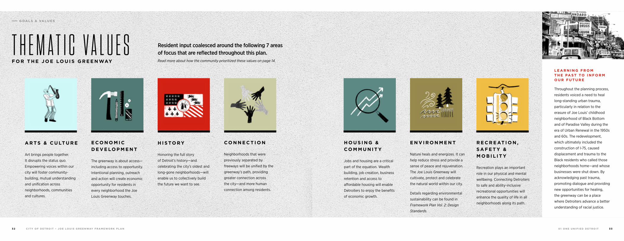
H O U S I N G &
C O M M U N I T Y
Jobs and housing are a critical
part of the equation. Wealth
building, job creation, business
retention and access to
affordable housing will enable
Detroiters to enjoy the benefits
of economic growth.
E N V I R O N M E N T
Nature heals and energizes. It can
help reduce stress and provide a
sense of peace and rejuvenation.
The Joe Louis Greenway will
cultivate, protect and celebrate
the natural world within our city.
Details regarding environmental
sustainability can be found in
Framework Plan Vol. 2: Design
Standards.
L E A R N I N G F R O M T H E PA S T TO I N F O R M O U R F U T U R E
Throughout the planning process,
residents voiced a need to heal
long-standing urban trauma,
particularly in relation to the
erasure of Joe Louis’ childhood
neighborhood of Black Bottom
and of Paradise Valley during the
era of Urban Renewal in the 1950s
and 60s. The redevelopment,
which ultimately included the
construction of I-75, caused
displacement and trauma to the
Black residents who called those
neighborhoods home—and whose
businesses were shut down. By
acknowledging past trauma,
promoting dialogue and providing
new opportunities for healing,
the greenway can be a place
where Detroiters advance a better
understanding of racial justice.
R E C R E AT I O N ,
S A F E T Y &
M O B I L I T Y
Recreation plays an important
role in our physical and mental
wellbeing. Connecting Detroiters
to safe and ability-inclusive
recreational opportunities will
enhance the quality of life in all
neighborhoods along its path.
A R T S & C U LT U R E
Art brings people together.
It disrupts the status quo.
Empowering voices within our
city will foster community-
building, mutual understanding
and unification across
neighborhoods, communities
and cultures.
H I S TO R Y
Honoring the full story
of Detroit’s history—and
celebrating the city’s oldest and
long-gone neighborhoods—will
enable us to collectively build
the future we want to see.
E C O N O M I C
D E V E LO P M E N T
The greenway is about access—
including access to opportunity.
Intentional planning, outreach
and action will create economic
opportunity for residents in
every neighborhood the Joe
Louis Greenway touches.
C O N N E C T I O N
Neighborhoods that were
previously separated by
freeways will be unified by the
greenway’s path, providing
greater connection across
the city—and more human
connection among residents.
Read more about how the community prioritized these values on page 14.
T H E M A T I C V A L U E SF O R T H E J O E LO U I S G R E E N WAY
Resident input coalesced around the following 7 areas of focus that are reflected throughout this plan.
G OA L S & VA L U E S
0 1 O N E U N I F I E D D E T R O I TC I T Y O F D E T R O I T • J O E LO U I S G R E E N WAY F R A M E WO R K P L A N3 4 3 5
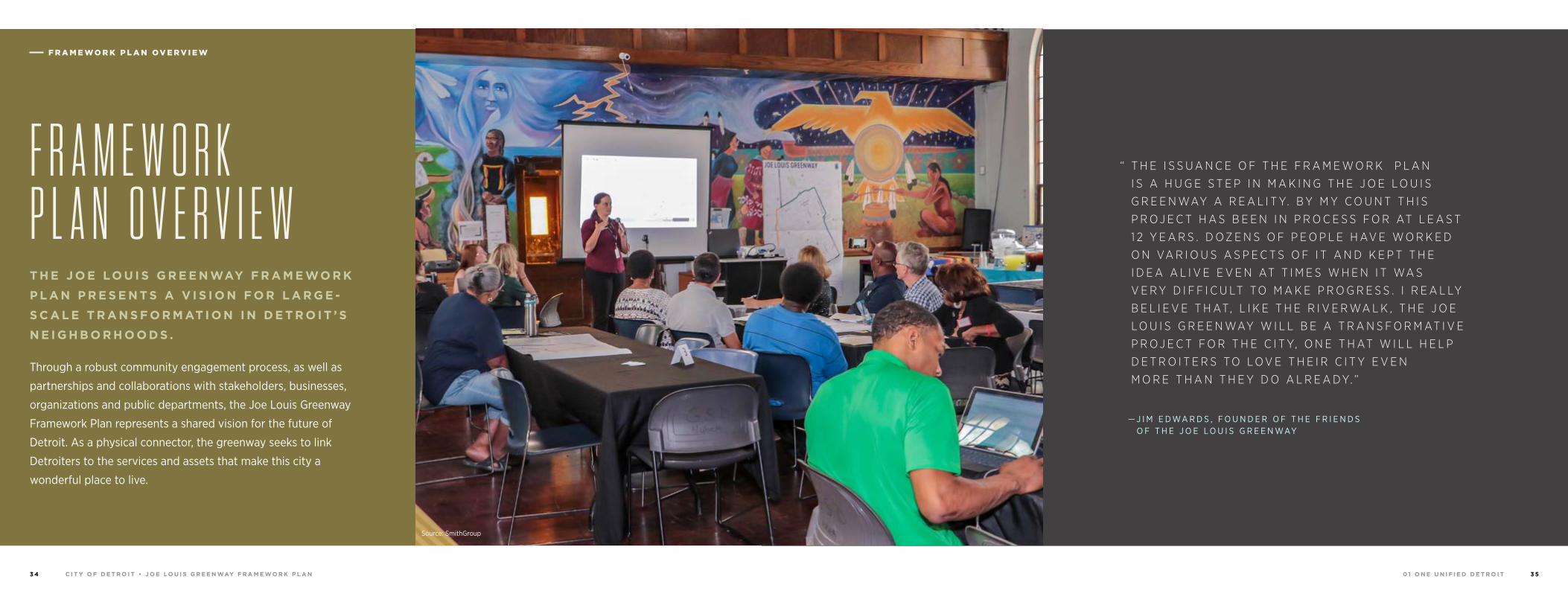
“ T H E I S S U A N C E O F T H E F R A M E W O R K P L A N
I S A H U G E S T E P I N M A K I N G T H E J O E L O U I S
G R E E N WAY A R E A L I T Y. B Y M Y C O U N T T H I S
P R O J E C T H A S B E E N I N P R O C E S S F O R AT L E A S T
1 2 Y E A R S . D O Z E N S O F P E O P L E H AV E W O R K E D
O N VA R I O U S A S P E C T S O F I T A N D K E P T T H E
I D E A A L I V E E V E N AT T I M E S W H E N I T WA S
V E R Y D I F F I C U LT T O M A K E P R O G R E S S . I R E A L LY
B E L I E V E T H AT, L I K E T H E R I V E R WA L K , T H E J O E
L O U I S G R E E N WAY W I L L B E A T R A N S F O R M AT I V E
P R O J E C T F O R T H E C I T Y, O N E T H AT W I L L H E L P
D E T R O I T E R S T O L O V E T H E I R C I T Y E V E N
M O R E T H A N T H E Y D O A L R E A D Y. ”
— J I M E D WA R D S , F O U N D E R O F T H E F R I E N D S O F T H E J O E L O U I S G R E E N WAY
F R A M E WO R K P L A N OV E R V I E W
Source: SmithGroup
T H E J O E LO U I S G R E E N WAY F R A M E WO R K
P L A N P R E S E N T S A V I S I O N F O R L A R G E -
S C A L E T R A N S F O R M AT I O N I N D E T R O I T ’ S
N E I G H B O R H O O D S .
Through a robust community engagement process, as well as
partnerships and collaborations with stakeholders, businesses,
organizations and public departments, the Joe Louis Greenway
Framework Plan represents a shared vision for the future of
Detroit. As a physical connector, the greenway seeks to link
Detroiters to the services and assets that make this city a
wonderful place to live.
F R A M E W O R K P L A N O V E R V I E W
0 1 O N E U N I F I E D D E T R O I TC I T Y O F D E T R O I T • J O E LO U I S G R E E N WAY F R A M E WO R K P L A N3 6 3 7
The following design standards for the future construction of the
Joe Louis Greenway are the result of more than ten years of hard
work and advocacy by City of Detroit staff, community residents
and partner organizations. To build on this work, numerous local,
regional and national greenway projects and guidelines have been
studied and referenced to develop standards which will help create
a world-class non-motorized trail for the City of Detroit.
G R E E N WAY D E S I G N I N D E T R O I T
At the local and regional level, reference guides including the City
of Detroit Non-Motorized Urban Transportation Master Plan, the
SEMCOG & MDOT Non-motorized Plan for Southeast Michigan,
the Detroit Bicycle Network Strategy and the City’s Safe Routes to
School program, among others, have informed the recommended
design standards. Local existing greenways and trails like the
Dequindre Cut, Detroit RiverWalk and Palmer Park trails were
studied to understand how urban trails are used in Detroit.
D E S I G N R E Q U I R E M E N T S
Additionally, greenway planning and design guides such as the
City of Detroit’s own bike network, mobility and field marking
standards, MDOT standards and national standards including the
NACTO Urban Bikeway Design Guide and ADA requirements have
all been referenced to enhance safety and accessibility for
greenway users of all levels and abilities.
Source: James Brown
U S E [ T H E G R E E N WAY ] T O C O N N E C T P E O P L E T O E X I S T I N G PA R K S I N D E T R O I T— E S P E C I A L LY T H E O N E S W E H A R D LY U S E N O W.
— C O M M U N I T Y R E S I D E N T
F R A M E WO R K P L A N OV E R V I E W
0 1 O N E U N I F I E D D E T R O I TC I T Y O F D E T R O I T • J O E LO U I S G R E E N WAY F R A M E WO R K P L A N3 8 3 9
The Joe Louis Greenway Framework Plan provides a record of
the planning and design process—while establishing a guiding
direction for the future implementation, management and
operations of the greenway. Woven throughout this document
and foundational to the decisions presented in each section, are
the voices and vision of Detroit’s residents and stakeholders. This
document is organized into 8 planning topics, including:
• Project Process• Community Engagement• Routing and Alignment• Greenway Design Guidelines• Environment and Sustainability• Housing and Economic Development• Implementation• Operations and Management
The greenway will provide connections to Windsor, Ontario via the Gordie Howe
International Bridge—and to Ferndale by way of future on-street infrastructure
improvements. The Joe Louis Greenway will include the Dequindre Cut and
portions of the Detroit RiverWalk, as well as portions of the planned Iron Belle
Trail and Southwest Greenway.
When completed, it will provide a place for people of all abilities to safely walk,
bike and run while connecting neighborhoods, parks, schools, jobs, historic sites,
commercial corridors and public transit.
This greenway concept began in 2007 with the Friends of the Inner Circle
Greenway and became part of the Detroit Greenways Coalition Network Vision
in 2009. The Coalition continued to advocate for the development of the Inner
Circle Greenway, working closely with the City of Detroit, local experts, property
owners and stakeholders to refine the alignment and vision for the route. In
2017, the City of Detroit formally adopted the greenway plans. As the first step
in this important process, Mayor Mike Duggan announced the renaming of the
Inner Circle Greenway to the Joe Louis Greenway, after the legendary boxer and
Detroiter, Joe Louis.
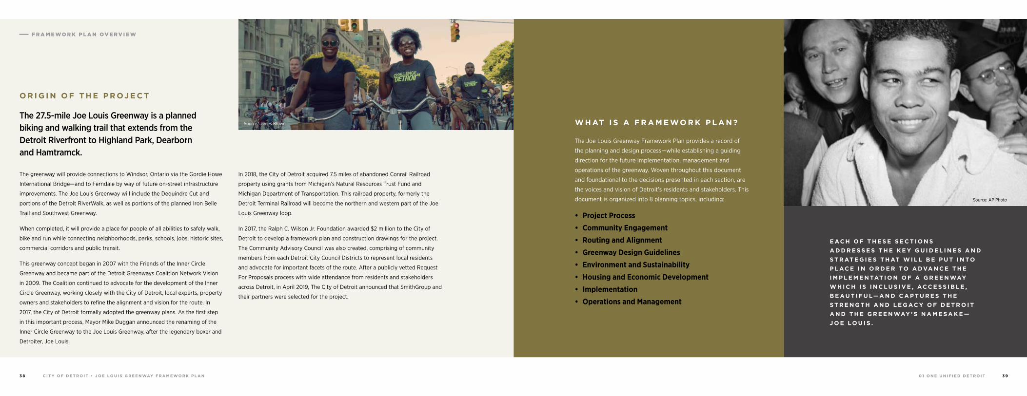
In 2018, the City of Detroit acquired 7.5 miles of abandoned Conrail Railroad
property using grants from Michigan’s Natural Resources Trust Fund and
Michigan Department of Transportation. This railroad property, formerly the
Detroit Terminal Railroad will become the northern and western part of the Joe
Louis Greenway loop.
In 2017, the Ralph C. Wilson Jr. Foundation awarded $2 million to the City of
Detroit to develop a framework plan and construction drawings for the project.
The Community Advisory Council was also created, comprising of community
members from each Detroit City Council Districts to represent local residents
and advocate for important facets of the route. After a publicly vetted Request
For Proposals process with wide attendance from residents and stakeholders
across Detroit, in April 2019, The City of Detroit announced that SmithGroup and
their partners were selected for the project.
O R I G I N O F T H E P R OJ E C T
W H AT I S A F R A M E WO R K P L A N ?The 27.5-mile Joe Louis Greenway is a planned biking and walking trail that extends from the Detroit Riverfront to Highland Park, Dearborn and Hamtramck.
E AC H O F T H E S E S E C T I O N S
A D D R E S S E S T H E K E Y G U I D E L I N E S A N D
S T R AT E G I E S T H AT W I L L B E P U T I N TO
P L AC E I N O R D E R TO A DVA N C E T H E
I M P L E M E N TAT I O N O F A G R E E N WAY
W H I C H I S I N C L U S I V E , AC C E S S I B L E ,
B E A U T I F U L—A N D C A P T U R E S T H E
S T R E N G T H A N D L E G AC Y O F D E T R O I T
A N D T H E G R E E N WAY ’ S N A M E S A K E —
J O E LO U I S .
Source: James Brown
Source: AP Photo
F R A M E WO R K P L A N OV E R V I E W
0 1 O N E U N I F I E D D E T R O I TC I T Y O F D E T R O I T • J O E LO U I S G R E E N WAY F R A M E WO R K P L A N4 0 4 1
A M E S S AG E F R O M M AYO R M I K E D U G G A N
M E S S AG E F R O M T H E C I T Y
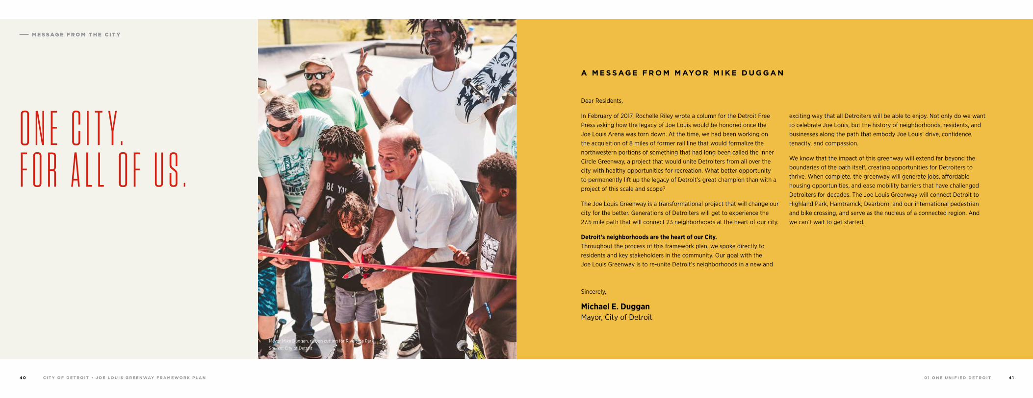
O N E C I T Y .F O R A L L O F U S .
Mayor Mike Duggan, ribbon cutting for Riverside Park
Source: City of Detroit
Michael E. Duggan Mayor, City of Detroit
In February of 2017, Rochelle Riley wrote a column for the Detroit Free Press asking how the legacy of Joe Louis would be honored once the Joe Louis Arena was torn down. At the time, we had been working on the acquisition of 8 miles of former rail line that would formalize the northwestern portions of something that had long been called the Inner Circle Greenway, a project that would unite Detroiters from all over the city with healthy opportunities for recreation. What better opportunity to permanently lift up the legacy of Detroit’s great champion than with a project of this scale and scope?
The Joe Louis Greenway is a transformational project that will change our city for the better. Generations of Detroiters will get to experience the 27.5 mile path that will connect 23 neighborhoods at the heart of our city.
Detroit’s neighborhoods are the heart of our City. Throughout the process of this framework plan, we spoke directly to residents and key stakeholders in the community. Our goal with the Joe Louis Greenway is to re-unite Detroit’s neighborhoods in a new and
exciting way that all Detroiters will be able to enjoy. Not only do we want to celebrate Joe Louis, but the history of neighborhoods, residents, and businesses along the path that embody Joe Louis’ drive, confidence, tenacity, and compassion.
We know that the impact of this greenway will extend far beyond the boundaries of the path itself, creating opportunities for Detroiters to thrive. When complete, the greenway will generate jobs, affordable housing opportunities, and ease mobility barriers that have challenged Detroiters for decades. The Joe Louis Greenway will connect Detroit to Highland Park, Hamtramck, Dearborn, and our international pedestrian and bike crossing, and serve as the nucleus of a connected region. And we can’t wait to get started.
Dear Residents,
Sincerely,
0 1 O N E U N I F I E D D E T R O I TC I T Y O F D E T R O I T • J O E LO U I S G R E E N WAY F R A M E WO R K P L A N4 2 4 3
Dr. Meagan Elliott with her two sons kicking off a community meeting.
Photo: Evan Gonzalez
Above all else, the strategic framework you are about to read is an exercise in listening. Not just to residents’ views on the best route for the Joe Louis Greenway, or the destinations they hope to connect to, but how this project relates to their lives, their city and its history. It is about listening to Detroiters’ experiences in nature (good, neutral and bad) and how those are reflected in the cultural landscape of this path. It is about hearing frustrations with navigating bureaucracy or traumatic memories of Urban Renewal, and learning how those experiences informed their willingness to participate in this process. Residents’ thoughts, fears, hopes and opinions reverberate through every page of this document and most especially in the words that make up our mission statement:
The Joe Louis Greenway provides connected, equitable and engaging spaces throughout our city and region, where we offer opportunities for empowerment, unification and healing for our neighborhoods and people.
Strategic plans are often criticized for their dust-collecting abilities, famous for setting out a grand vision that is never realized. In Detroit Parks and Recreation, we are cognizant of the fatigue residents feel, having given their time and energy for decades to processes that don’t have the possibility of
implementation. This is why we typically do not convene communities to redesign a park until we have the funds in hand and know we can deliver results, which has helped us to build trust with residents in every corner of this city.
Owing to the sheer size and scope of Joe Louis Greenway, this planning process looked a little different. The greenway is 27.5 miles in length, running through 23 distinct neighborhoods with their own strong identities, and will serve not only residents’ transportation needs, but will bolster economic opportunity, the development of affordable housing, and support for small businesses adjacent to the route. The magnitude of this project necessitates an additional amount of trust from the communities that surround it and a commitment to work with us far in advance of any shovels in the ground. Residents often spoke of healing historical injustice and creating spaces that serve communities of color first, with the intent and ability to unify our neighborhoods. It has been an honor to serve with this team, selected by residents themselves, working to elevate the voices of so many residents who stand to gain from this investment in their neighborhoods. I hope you are as inspired as I am by this vision, and I am looking forward to working with you to make this a reality.
B U I L D I N G T R U S T A N D C O M M U N I T Y H E A L I N G
B E G I N W I T H T H E AC T O F L I S T E N I N G .
A M E S S AG E F R O M D E T R O I T ’ S
G E N E R A L S E R V I C E S D E PA R T M E N T
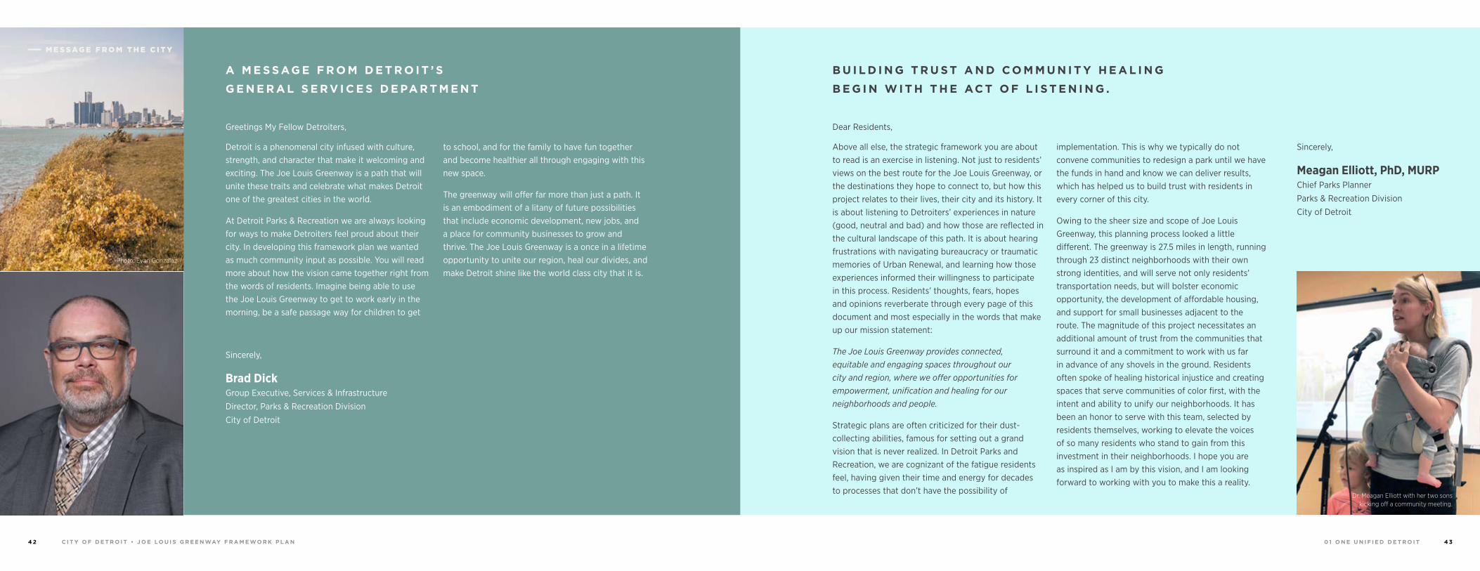
Detroit is a phenomenal city infused with culture, strength, and character that make it welcoming and exciting. The Joe Louis Greenway is a path that will unite these traits and celebrate what makes Detroit one of the greatest cities in the world.
At Detroit Parks & Recreation we are always looking for ways to make Detroiters feel proud about their city. In developing this framework plan we wanted as much community input as possible. You will read more about how the vision came together right from the words of residents. Imagine being able to use the Joe Louis Greenway to get to work early in the morning, be a safe passage way for children to get
to school, and for the family to have fun together and become healthier all through engaging with this new space.
The greenway will offer far more than just a path. It is an embodiment of a litany of future possibilities that include economic development, new jobs, and a place for community businesses to grow and thrive. The Joe Louis Greenway is a once in a lifetime opportunity to unite our region, heal our divides, and make Detroit shine like the world class city that it is.
Greetings My Fellow Detroiters, Dear Residents,
Brad Dick Group Executive, Services & Infrastructure
Director, Parks & Recreation Division
City of Detroit
Sincerely,
Meagan Elliott, PhD, MURP Chief Parks Planner
Parks & Recreation Division
City of Detroit
Sincerely,
M E S S AG E F R O M T H E C I T Y
0 2 R O U T I N G & A L I G N M E N TC I T Y O F D E T R O I T • J O E LO U I S G R E E N WAY F R A M E WO R K P L A N4 4 4 5
94
94
94
94
75
75
75
10
10
HIGHLANDPARK
DETROIT
DEARBORN
Michigan Avenue
Telegrap
h
Telegrap
h
Plymouth
Warren Avenue
Bagley
Je�erson Avenue
Dearborn
Detroit Riverwalk
Dequindre Cut
Lonyo
Dix
Woodm
ere
Campbell
W. G
rand
8 Mile
Fort
Fort
Woodw
ard Avenue
Woodw
ard
Gra
tiot
Aven
ue
Grand River Avenue
Davison
Joseph Campau
Ham
tram
ck D
r
Conrail
Conrail
Oakm
an
McNichols
Live
rnoi
s
GORDIE HOWEBRIDGE
HAMTRAMCK
BELLE ISLE
WINDSOR
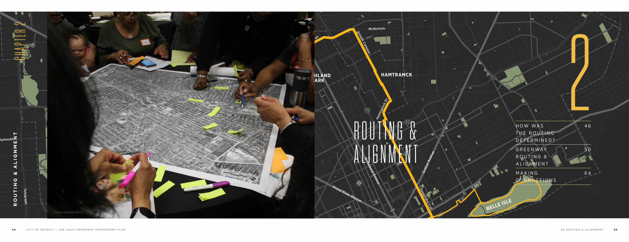
H O W WA S T H E R O U T I N G D E T E R M I N E D ?
4 6
G R E E N WAY R O U T I N G & A L I G N M E N T
5 0
M A K I N G C O N N E C T I O N S
6 4
R O U T I N G & A L I G N M E N T
RO
UT
ING
& A
LIG
NM
EN
T
CHAP
TER 2
2Source: Sidewalk Detroit

0 2 R O U T I N G & A L I G N M E N TC I T Y O F D E T R O I T • J O E LO U I S G R E E N WAY F R A M E WO R K P L A N4 6 47
The Joe Louis Greenway will connect neighborhoods, people, jobs and amenities.
The path of the Joe Louis Greenway traverses a
variety of ecosystems, neighborhoods, cultures,
cities and environments. As the context changes, so
does the experience. From the sights and smells of
Eastern Market to Hamtramck’s call to prayer—from
the peaceful beauty of Patton Park to the vibrant
commercial corridors of Mexicantown—and from the
sounds of skateboarding kids at Riverside Park to the
patter of children’s’ feet on Detroit’s RiverWalk—these
environments are at the core of every experience along
the Joe Louis Greenway.
M A K I N G C O N N E C T I O N S
Joe Louis Greenway Path at Davison Elementary. Source: A Fine Mess
H OW WA S R O U T I N G D E T E R M I N E D ?
0 2 R O U T I N G & A L I G N M E N TC I T Y O F D E T R O I T • J O E LO U I S G R E E N WAY F R A M E WO R K P L A N4 8 4 9
Sour
ce: C
ity o
f Det
roit
H OW WA S
T H E R O U T I N G
D E T E R M I N E D ?
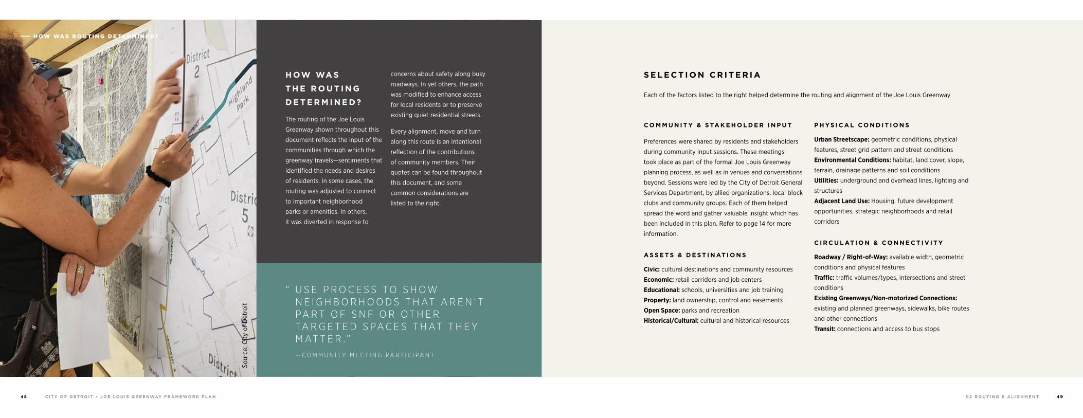
The routing of the Joe Louis
Greenway shown throughout this
document reflects the input of the
communities through which the
greenway travels—sentiments that
identified the needs and desires
of residents. In some cases, the
routing was adjusted to connect
to important neighborhood
parks or amenities. In others,
it was diverted in response to
concerns about safety along busy
roadways. In yet others, the path
was modified to enhance access
for local residents or to preserve
existing quiet residential streets.
Every alignment, move and turn
along this route is an intentional
reflection of the contributions
of community members. Their
quotes can be found throughout
this document, and some
common considerations are
listed to the right.
S E L E C T I O N C R I T E R I A
Each of the factors listed to the right helped determine the routing and alignment of the Joe Louis Greenway
C O M M U N I T Y & S TA K E H O L D E R I N P U T
Preferences were shared by residents and stakeholders
during community input sessions. These meetings
took place as part of the formal Joe Louis Greenway
planning process, as well as in venues and conversations
beyond. Sessions were led by the City of Detroit General
Services Department, by allied organizations, local block
clubs and community groups. Each of them helped
spread the word and gather valuable insight which has
been included in this plan. Refer to page 14 for more
information.
A S S E T S & D E S T I N AT I O N S
Civic: cultural destinations and community resources
Economic: retail corridors and job centers
Educational: schools, universities and job training
Property: land ownership, control and easements
Open Space: parks and recreation
Historical/Cultural: cultural and historical resources
P H YS I C A L C O N D I T I O N S
Urban Streetscape: geometric conditions, physical
features, street grid pattern and street conditions
Environmental Conditions: habitat, land cover, slope,
terrain, drainage patterns and soil conditions
Utilities: underground and overhead lines, lighting and
structures
Adjacent Land Use: Housing, future development
opportunities, strategic neighborhoods and retail
corridors
C I R C U L AT I O N & C O N N E C T I V I T Y
Roadway / Right-of-Way: available width, geometric
conditions and physical features
Traffic: traffic volumes/types, intersections and street
conditions
Existing Greenways/Non-motorized Connections: existing and planned greenways, sidewalks, bike routes
and other connections
Transit: connections and access to bus stops
“ U S E P R O C E S S T O S H O W N E I G H B O R H O O D S T H AT A R E N ' T PA R T O F S N F O R O T H E R TA R G E T E D S PA C E S T H AT T H E Y M AT T E R . ”— C O M M U N I T Y M E E T I N G P A R T I C I P A N T
H OW WA S R O U T I N G D E T E R M I N E D ?
0 2 R O U T I N G & A L I G N M E N T5 0 5 1C I T Y O F D E T R O I T • J O E LO U I S G R E E N WAY F R A M E WO R K P L A N
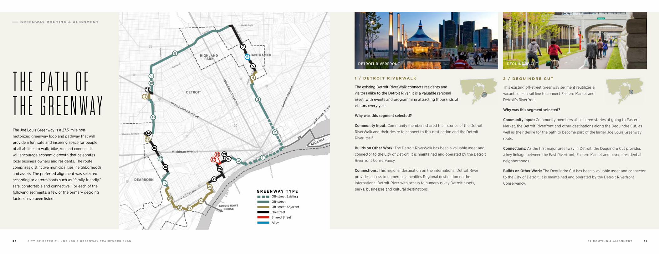
The Joe Louis Greenway is a 27.5-mile non-
motorized greenway loop and pathway that will
provide a fun, safe and inspiring space for people
of all abilities to walk, bike, run and connect. It
will encourage economic growth that celebrates
local business owners and residents. The route
comprises distinctive municipalities, neighborhoods
and assets. The preferred alignment was selected
according to determinants such as “family friendly,”
safe, comfortable and connective. For each of the
following segments, a few of the primary deciding
factors have been listed.
T H E P A T H O F T H E G R E E N W A Y
2 / D E Q U I N D R E C U T
This existing off-street greenway segment reutilizes a
vacant sunken rail line to connect Eastern Market and
Detroit’s Riverfront.
Why was this segment selected?
Community Input: Community members also shared stories of going to Eastern
Market, the Detroit Riverfront and other destinations along the Dequindre Cut, as
well as their desire for the path to become part of the larger Joe Louis Greenway
route.
Connections: As the first major greenway in Detroit, the Dequindre Cut provides
a key linkage between the East Riverfront, Eastern Market and several residential
neighborhoods.
Builds on Other Work: The Dequindre Cut has been a valuable asset and connector
to the City of Detroit. It is maintained and operated by the Detroit Riverfront
Conservancy.
DEQUINDRE CUT
1 / D E T R O I T R I V E R WA L K
The existing Detroit RiverWalk connects residents and
visitors alike to the Detroit River. It is a valuable regional
asset, with events and programming attracting thousands of
visitors every year.
Why was this segment selected?
Community Input: Community members shared their stories of the Detroit
RiverWalk and their desire to connect to this destination and the Detroit
River itself.
Builds on Other Work: The Detroit RiverWalk has been a valuable asset and
connector to the City of Detroit. It is maintained and operated by the Detroit
Riverfront Conservancy.
Connections: This regional destination on the international Detroit River
provides access to numerous amenities Regional destination on the
international Detroit River with access to numerous key Detroit assets,
parks, businesses and cultural destinations.
DETROIT RIVERFRONT
G R E E N WAY T Y P E Off-street Existing
Off-street
Off-street Adjacent
On-street
Shared Street
Alley
18
16
14
13
8
3
2
1
12
11
7
5
6
15
4
1731
19
2930
25
23
21 22
24
20
26
27
9
10
28
G R E E N WAY R O U T I N G & A L I G N M E N T
0 2 R O U T I N G & A L I G N M E N TC I T Y O F D E T R O I T • J O E LO U I S G R E E N WAY F R A M E WO R K P L A N5 2 5 3
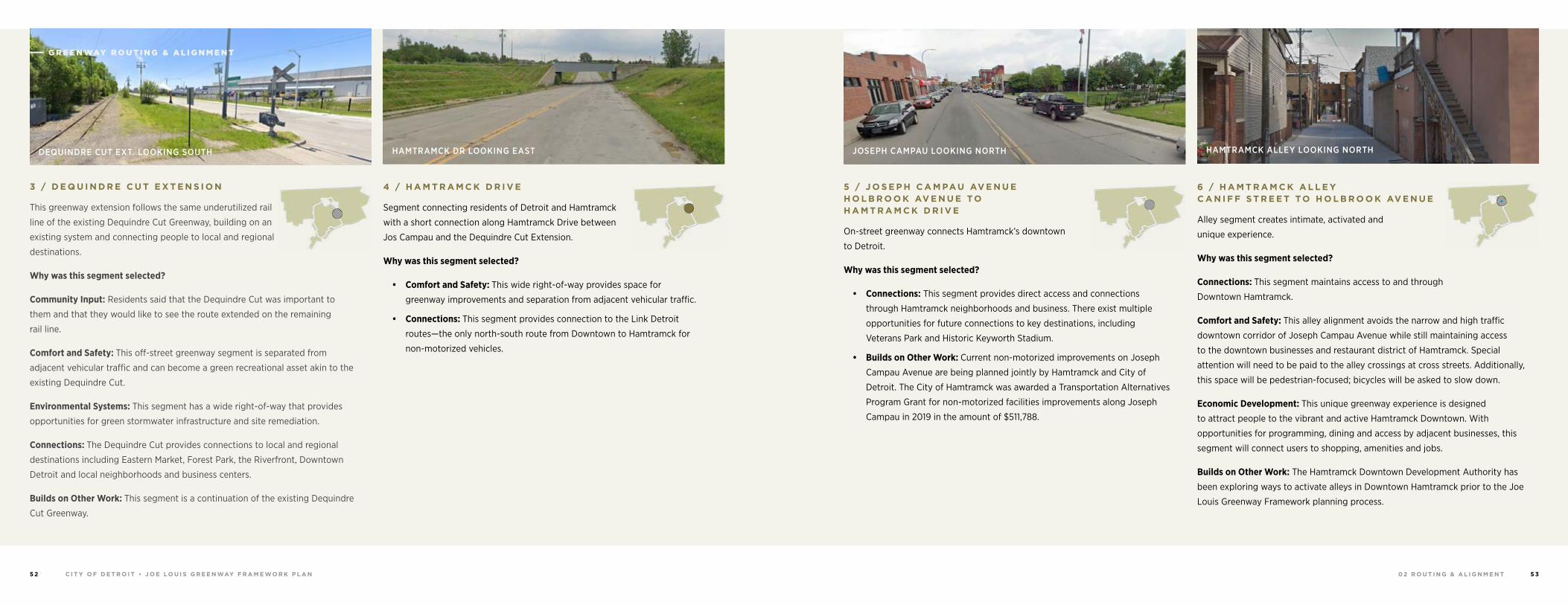
3 / D E Q U I N D R E C U T E X T E N S I O N
This greenway extension follows the same underutilized rail
line of the existing Dequindre Cut Greenway, building on an
existing system and connecting people to local and regional
destinations.
Why was this segment selected?
Community Input: Residents said that the Dequindre Cut was important to
them and that they would like to see the route extended on the remaining
rail line.
Comfort and Safety: This off-street greenway segment is separated from
adjacent vehicular traffic and can become a green recreational asset akin to the
existing Dequindre Cut.
Environmental Systems: This segment has a wide right-of-way that provides
opportunities for green stormwater infrastructure and site remediation.
Connections: The Dequindre Cut provides connections to local and regional
destinations including Eastern Market, Forest Park, the Riverfront, Downtown
Detroit and local neighborhoods and business centers.
Builds on Other Work: This segment is a continuation of the existing Dequindre
Cut Greenway.
DEQUINDRE CUT EXT. LOOKING SOUTH
G R E E N WAY R O U T I N G & A L I G N M E N T
6 / H A M T R A M C K A L L E Y C A N I F F S T R E E T TO H O L B R O O K AV E N U E
Alley segment creates intimate, activated and
unique experience.
Why was this segment selected?
Connections: This segment maintains access to and through
Downtown Hamtramck.
Comfort and Safety: This alley alignment avoids the narrow and high traffic
downtown corridor of Joseph Campau Avenue while still maintaining access
to the downtown businesses and restaurant district of Hamtramck. Special
attention will need to be paid to the alley crossings at cross streets. Additionally,
this space will be pedestrian-focused; bicycles will be asked to slow down.
Economic Development: This unique greenway experience is designed
to attract people to the vibrant and active Hamtramck Downtown. With
opportunities for programming, dining and access by adjacent businesses, this
segment will connect users to shopping, amenities and jobs.
Builds on Other Work: The Hamtramck Downtown Development Authority has
been exploring ways to activate alleys in Downtown Hamtramck prior to the Joe
Louis Greenway Framework planning process.
HAMTRAMCK ALLEY LOOKING NORTH
5 / J O S E P H C A M PA U AV E N U E H O L B R O O K AV E N U E TO H A M T R A M C K D R I V E
On-street greenway connects Hamtramck’s downtown
to Detroit.
Why was this segment selected?
• Connections: This segment provides direct access and connections
through Hamtramck neighborhoods and business. There exist multiple
opportunities for future connections to key destinations, including
Veterans Park and Historic Keyworth Stadium.
• Builds on Other Work: Current non-motorized improvements on Joseph
Campau Avenue are being planned jointly by Hamtramck and City of
Detroit. The City of Hamtramck was awarded a Transportation Alternatives
Program Grant for non-motorized facilities improvements along Joseph
Campau in 2019 in the amount of $511,788.
JOSEPH CAMPAU LOOKING NORTH
4 / H A M T R A M C K D R I V E
Segment connecting residents of Detroit and Hamtramck
with a short connection along Hamtramck Drive between
Jos Campau and the Dequindre Cut Extension.
Why was this segment selected?
• Comfort and Safety: This wide right-of-way provides space for
greenway improvements and separation from adjacent vehicular traffic.
• Connections: This segment provides connection to the Link Detroit
routes—the only north-south route from Downtown to Hamtramck for
non-motorized vehicles.
HAMTRAMCK DR LOOKING EAST
0 2 R O U T I N G & A L I G N M E N TC I T Y O F D E T R O I T • J O E LO U I S G R E E N WAY F R A M E WO R K P L A N5 4 5 5
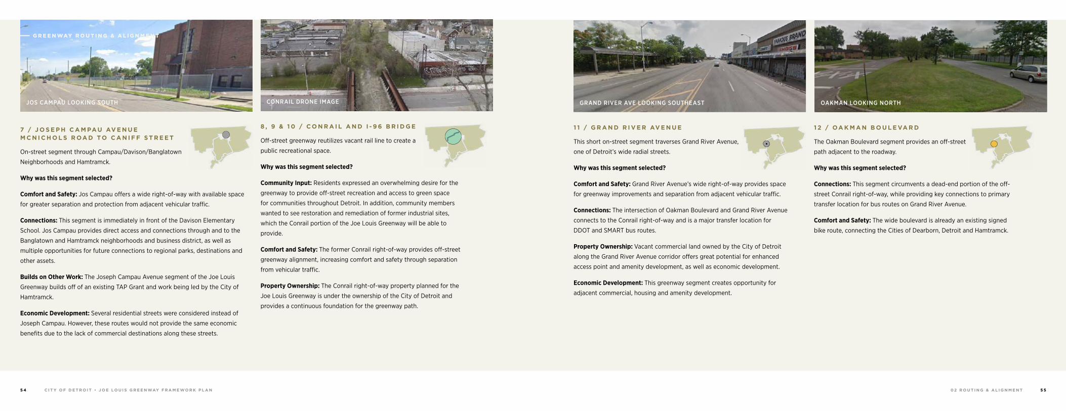
7 / J O S E P H C A M PA U AV E N U E M C N I C H O L S R OA D TO C A N I F F S T R E E T
On-street segment through Campau/Davison/Banglatown
Neighborhoods and Hamtramck.
Why was this segment selected?
Comfort and Safety: Jos Campau offers a wide right-of-way with available space
for greater separation and protection from adjacent vehicular traffic.
Connections: This segment is immediately in front of the Davison Elementary
School. Jos Campau provides direct access and connections through and to the
Banglatown and Hamtramck neighborhoods and business district, as well as
multiple opportunities for future connections to regional parks, destinations and
other assets.
Builds on Other Work: The Joseph Campau Avenue segment of the Joe Louis
Greenway builds off of an existing TAP Grant and work being led by the City of
Hamtramck.
Economic Development: Several residential streets were considered instead of
Joseph Campau. However, these routes would not provide the same economic
benefits due to the lack of commercial destinations along these streets.
JOS CAMPAU LOOKING SOUTH
G R E E N WAY R O U T I N G & A L I G N M E N T
1 2 / OA K M A N B O U L E VA R D
The Oakman Boulevard segment provides an off-street
path adjacent to the roadway.
Why was this segment selected?
Connections: This segment circumvents a dead-end portion of the off-
street Conrail right-of-way, while providing key connections to primary
transfer location for bus routes on Grand River Avenue.
Comfort and Safety: The wide boulevard is already an existing signed
bike route, connecting the Cities of Dearborn, Detroit and Hamtramck.
OAKMAN LOOKING NORTH
8 , 9 & 1 0 / C O N R A I L A N D I - 9 6 B R I D G E
Off-street greenway reutilizes vacant rail line to create a
public recreational space.
Why was this segment selected?
Community Input: Residents expressed an overwhelming desire for the
greenway to provide off-street recreation and access to green space
for communities throughout Detroit. In addition, community members
wanted to see restoration and remediation of former industrial sites,
which the Conrail portion of the Joe Louis Greenway will be able to
provide.
Comfort and Safety: The former Conrail right-of-way provides off-street
greenway alignment, increasing comfort and safety through separation
from vehicular traffic.
Property Ownership: The Conrail right-of-way property planned for the
Joe Louis Greenway is under the ownership of the City of Detroit and
provides a continuous foundation for the greenway path.
CONRAIL DRONE IMAGE
1 1 / G R A N D R I V E R AV E N U E
This short on-street segment traverses Grand River Avenue,
one of Detroit’s wide radial streets.
Why was this segment selected?
Comfort and Safety: Grand River Avenue’s wide right-of-way provides space
for greenway improvements and separation from adjacent vehicular traffic.
Connections: The intersection of Oakman Boulevard and Grand River Avenue
connects to the Conrail right-of-way and is a major transfer location for
DDOT and SMART bus routes.
Property Ownership: Vacant commercial land owned by the City of Detroit
along the Grand River Avenue corridor offers great potential for enhanced
access point and amenity development, as well as economic development.
Economic Development: This greenway segment creates opportunity for
adjacent commercial, housing and amenity development.
GRAND RIVER AVE LOOKING SOUTHEAST
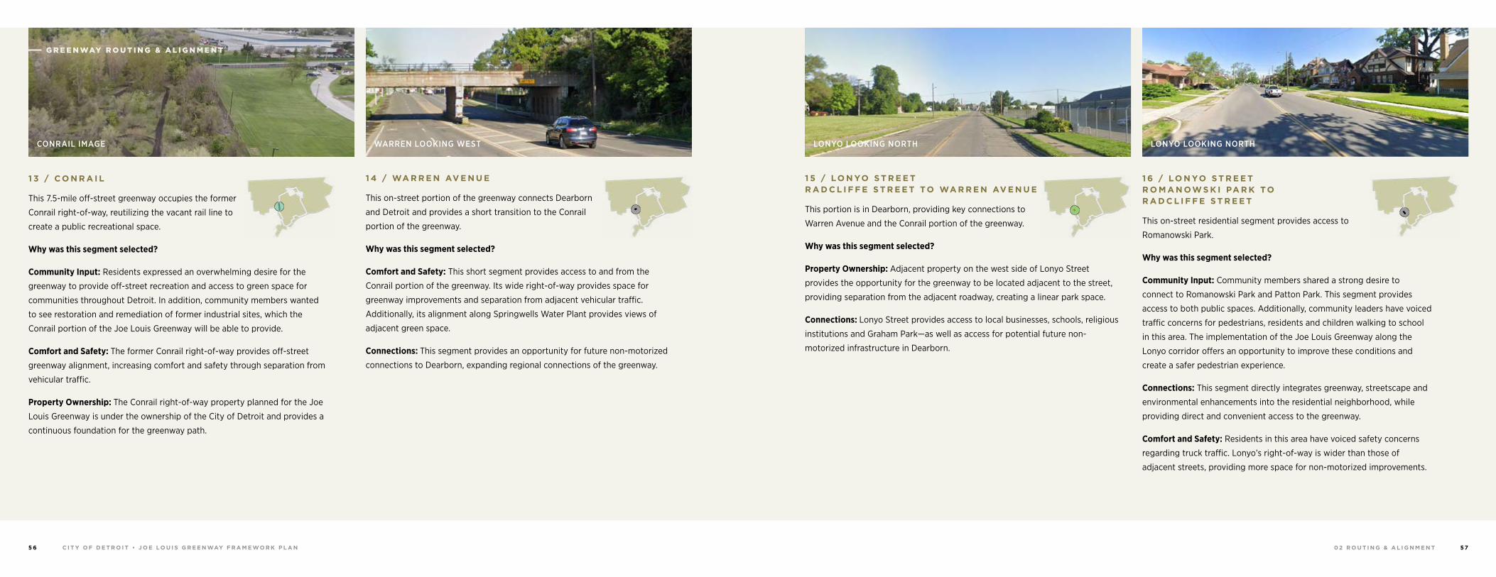
0 2 R O U T I N G & A L I G N M E N TC I T Y O F D E T R O I T • J O E LO U I S G R E E N WAY F R A M E WO R K P L A N5 6 57
1 6 / LO N YO S T R E E T R O M A N OW S K I PA R K TO R A D C L I F F E S T R E E T
This on-street residential segment provides access to
Romanowski Park.
Why was this segment selected?
Community Input: Community members shared a strong desire to
connect to Romanowski Park and Patton Park. This segment provides
access to both public spaces. Additionally, community leaders have voiced
traffic concerns for pedestrians, residents and children walking to school
in this area. The implementation of the Joe Louis Greenway along the
Lonyo corridor offers an opportunity to improve these conditions and
create a safer pedestrian experience.
Connections: This segment directly integrates greenway, streetscape and
environmental enhancements into the residential neighborhood, while
providing direct and convenient access to the greenway.
Comfort and Safety: Residents in this area have voiced safety concerns
regarding truck traffic. Lonyo’s right-of-way is wider than those of
adjacent streets, providing more space for non-motorized improvements.
LONYO LOOKING NORTH
1 5 / LO N YO S T R E E T R A D C L I F F E S T R E E T TO WA R R E N AV E N U E
This portion is in Dearborn, providing key connections to
Warren Avenue and the Conrail portion of the greenway.
Why was this segment selected?
Property Ownership: Adjacent property on the west side of Lonyo Street
provides the opportunity for the greenway to be located adjacent to the street,
providing separation from the adjacent roadway, creating a linear park space.
Connections: Lonyo Street provides access to local businesses, schools, religious
institutions and Graham Park—as well as access for potential future non-
motorized infrastructure in Dearborn.
LONYO LOOKING NORTH
1 4 / WA R R E N AV E N U E
This on-street portion of the greenway connects Dearborn
and Detroit and provides a short transition to the Conrail
portion of the greenway.
Why was this segment selected?
Comfort and Safety: This short segment provides access to and from the
Conrail portion of the greenway. Its wide right-of-way provides space for
greenway improvements and separation from adjacent vehicular traffic.
Additionally, its alignment along Springwells Water Plant provides views of
adjacent green space.
Connections: This segment provides an opportunity for future non-motorized
connections to Dearborn, expanding regional connections of the greenway.
WARREN LOOKING WEST
1 3 / C O N R A I L
This 7.5-mile off-street greenway occupies the former
Conrail right-of-way, reutilizing the vacant rail line to
create a public recreational space.
Why was this segment selected?
Community Input: Residents expressed an overwhelming desire for the
greenway to provide off-street recreation and access to green space for
communities throughout Detroit. In addition, community members wanted
to see restoration and remediation of former industrial sites, which the
Conrail portion of the Joe Louis Greenway will be able to provide.
Comfort and Safety: The former Conrail right-of-way provides off-street
greenway alignment, increasing comfort and safety through separation from
vehicular traffic.
Property Ownership: The Conrail right-of-way property planned for the Joe
Louis Greenway is under the ownership of the City of Detroit and provides a
continuous foundation for the greenway path.
CONRAIL IMAGE
G R E E N WAY R O U T I N G & A L I G N M E N T
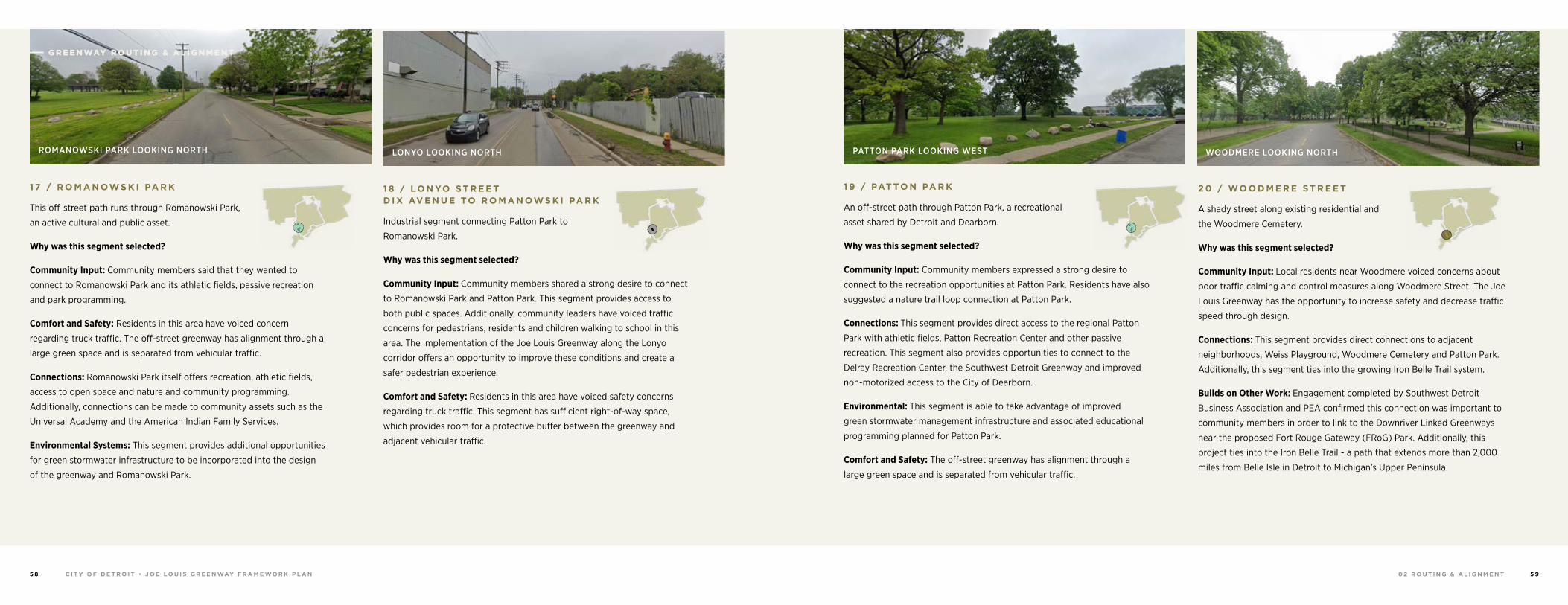
0 2 R O U T I N G & A L I G N M E N TC I T Y O F D E T R O I T • J O E LO U I S G R E E N WAY F R A M E WO R K P L A N5 8 5 9
2 0 / WO O D M E R E S T R E E T
A shady street along existing residential and
the Woodmere Cemetery.
Why was this segment selected?
Community Input: Local residents near Woodmere voiced concerns about
poor traffic calming and control measures along Woodmere Street. The Joe
Louis Greenway has the opportunity to increase safety and decrease traffic
speed through design.
Connections: This segment provides direct connections to adjacent
neighborhoods, Weiss Playground, Woodmere Cemetery and Patton Park.
Additionally, this segment ties into the growing Iron Belle Trail system.
Builds on Other Work: Engagement completed by Southwest Detroit
Business Association and PEA confirmed this connection was important to
community members in order to link to the Downriver Linked Greenways
near the proposed Fort Rouge Gateway (FRoG) Park. Additionally, this
project ties into the Iron Belle Trail - a path that extends more than 2,000
miles from Belle Isle in Detroit to Michigan’s Upper Peninsula.
WOODMERE LOOKING NORTH
1 9 / PAT TO N PA R K
An off-street path through Patton Park, a recreational
asset shared by Detroit and Dearborn.
Why was this segment selected?
Community Input: Community members expressed a strong desire to
connect to the recreation opportunities at Patton Park. Residents have also
suggested a nature trail loop connection at Patton Park.
Connections: This segment provides direct access to the regional Patton
Park with athletic fields, Patton Recreation Center and other passive
recreation. This segment also provides opportunities to connect to the
Delray Recreation Center, the Southwest Detroit Greenway and improved
non-motorized access to the City of Dearborn.
Environmental: This segment is able to take advantage of improved
green stormwater management infrastructure and associated educational
programming planned for Patton Park.
Comfort and Safety: The off-street greenway has alignment through a
large green space and is separated from vehicular traffic.
PATTON PARK LOOKING WEST
1 8 / LO N YO S T R E E T D I X AV E N U E TO R O M A N OW S K I PA R K
Industrial segment connecting Patton Park to
Romanowski Park.
Why was this segment selected?
Community Input: Community members shared a strong desire to connect
to Romanowski Park and Patton Park. This segment provides access to
both public spaces. Additionally, community leaders have voiced traffic
concerns for pedestrians, residents and children walking to school in this
area. The implementation of the Joe Louis Greenway along the Lonyo
corridor offers an opportunity to improve these conditions and create a
safer pedestrian experience.
Comfort and Safety: Residents in this area have voiced safety concerns
regarding truck traffic. This segment has sufficient right-of-way space,
which provides room for a protective buffer between the greenway and
adjacent vehicular traffic.
LONYO LOOKING NORTH
1 7 / R O M A N OW S K I PA R K
This off-street path runs through Romanowski Park,
an active cultural and public asset.
Why was this segment selected?
Community Input: Community members said that they wanted to
connect to Romanowski Park and its athletic fields, passive recreation
and park programming.
Comfort and Safety: Residents in this area have voiced concern
regarding truck traffic. The off-street greenway has alignment through a
large green space and is separated from vehicular traffic.
Connections: Romanowski Park itself offers recreation, athletic fields,
access to open space and nature and community programming.
Additionally, connections can be made to community assets such as the
Universal Academy and the American Indian Family Services.
Environmental Systems: This segment provides additional opportunities
for green stormwater infrastructure to be incorporated into the design
of the greenway and Romanowski Park.
ROMANOWSKI PARK LOOKING NORTH
G R E E N WAY R O U T I N G & A L I G N M E N T
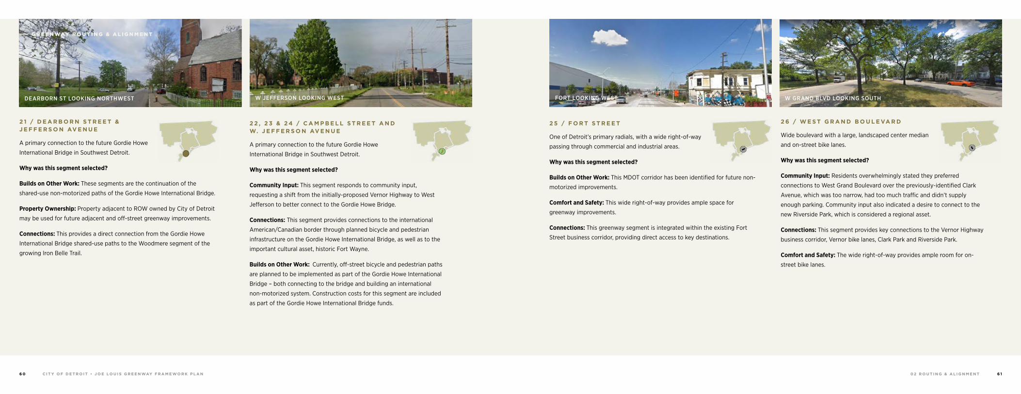
0 2 R O U T I N G & A L I G N M E N TC I T Y O F D E T R O I T • J O E LO U I S G R E E N WAY F R A M E WO R K P L A N6 0 6 1
2 6 / W E S T G R A N D B O U L E VA R D
Wide boulevard with a large, landscaped center median
and on-street bike lanes.
Why was this segment selected?
Community Input: Residents overwhelmingly stated they preferred
connections to West Grand Boulevard over the previously-identified Clark
Avenue, which was too narrow, had too much traffic and didn’t supply
enough parking. Community input also indicated a desire to connect to the
new Riverside Park, which is considered a regional asset.
Connections: This segment provides key connections to the Vernor Highway
business corridor, Vernor bike lanes, Clark Park and Riverside Park.
Comfort and Safety: The wide right-of-way provides ample room for on-
street bike lanes.
W GRAND BLVD LOOKING SOUTH
2 5 / F O R T S T R E E T
One of Detroit’s primary radials, with a wide right-of-way
passing through commercial and industrial areas.
Why was this segment selected?
Builds on Other Work: This MDOT corridor has been identified for future non-
motorized improvements.
Comfort and Safety: This wide right-of-way provides ample space for
greenway improvements.
Connections: This greenway segment is integrated within the existing Fort
Street business corridor, providing direct access to key destinations.
FORT LOOKING WEST
2 2 , 2 3 & 2 4 / C A M P B E L L S T R E E T A N D W. J E F F E R S O N AV E N U E
A primary connection to the future Gordie Howe
International Bridge in Southwest Detroit.
Why was this segment selected?
Community Input: This segment responds to community input,
requesting a shift from the initially-proposed Vernor Highway to West
Jefferson to better connect to the Gordie Howe Bridge.
Connections: This segment provides connections to the international
American/Canadian border through planned bicycle and pedestrian
infrastructure on the Gordie Howe International Bridge, as well as to the
important cultural asset, historic Fort Wayne.
Builds on Other Work: Currently, off-street bicycle and pedestrian paths
are planned to be implemented as part of the Gordie Howe International
Bridge – both connecting to the bridge and building an international
non-motorized system. Construction costs for this segment are included
as part of the Gordie Howe International Bridge funds.
W JEFFERSON LOOKING WEST
2 1 / D E A R B O R N S T R E E T & J E F F E R S O N AV E N U E
A primary connection to the future Gordie Howe
International Bridge in Southwest Detroit.
Why was this segment selected?
Builds on Other Work: These segments are the continuation of the
shared-use non-motorized paths of the Gordie Howe International Bridge.
Property Ownership: Property adjacent to ROW owned by City of Detroit
may be used for future adjacent and off-street greenway improvements.
Connections: This provides a direct connection from the Gordie Howe
International Bridge shared-use paths to the Woodmere segment of the
growing Iron Belle Trail.
DEARBORN ST LOOKING NORTHWEST
G R E E N WAY R O U T I N G & A L I G N M E N T
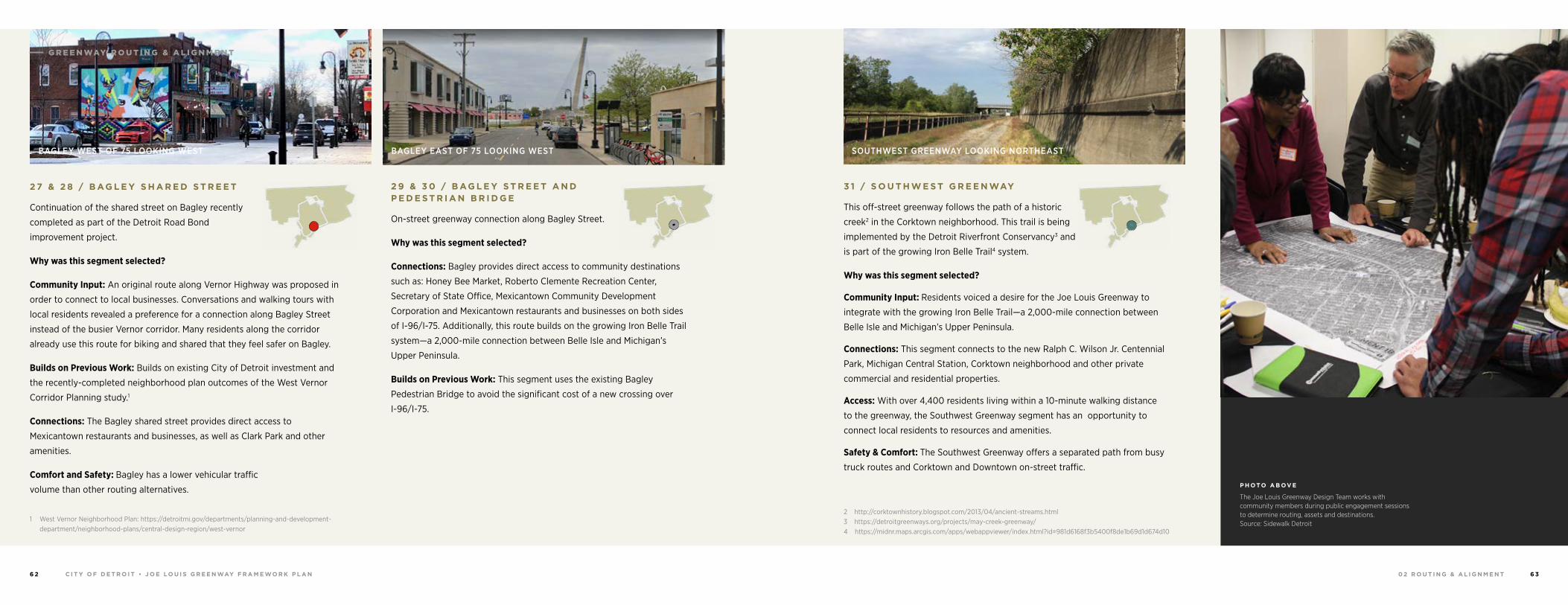
0 2 R O U T I N G & A L I G N M E N TC I T Y O F D E T R O I T • J O E LO U I S G R E E N WAY F R A M E WO R K P L A N6 2 6 3
P H OTO A B OV E
The Joe Louis Greenway Design Team works with community members during public engagement sessions to determine routing, assets and destinations. Source: Sidewalk Detroit
3 1 / S O U T H W E S T G R E E N WAY
This off-street greenway follows the path of a historic
creek2 in the Corktown neighborhood. This trail is being
implemented by the Detroit Riverfront Conservancy3 and
is part of the growing Iron Belle Trail4 system.
Why was this segment selected?
Community Input: Residents voiced a desire for the Joe Louis Greenway to
integrate with the growing Iron Belle Trail—a 2,000-mile connection between
Belle Isle and Michigan’s Upper Peninsula.
Connections: This segment connects to the new Ralph C. Wilson Jr. Centennial
Park, Michigan Central Station, Corktown neighborhood and other private
commercial and residential properties.
Access: With over 4,400 residents living within a 10-minute walking distance
to the greenway, the Southwest Greenway segment has an opportunity to
connect local residents to resources and amenities.
Safety & Comfort: The Southwest Greenway offers a separated path from busy
truck routes and Corktown and Downtown on-street traffic.
2 http://corktownhistory.blogspot.com/2013/04/ancient-streams.html3 https://detroitgreenways.org/projects/may-creek-greenway/4 https://midnr.maps.arcgis.com/apps/webappviewer/index.html?id=981d6168f3b5400f8de1b69d1d674d10
SOUTHWEST GREENWAY LOOKING NORTHEAST
2 9 & 3 0 / B AG L E Y S T R E E T A N D P E D E S T R I A N B R I D G E
On-street greenway connection along Bagley Street.
Why was this segment selected?
Connections: Bagley provides direct access to community destinations
such as: Honey Bee Market, Roberto Clemente Recreation Center,
Secretary of State Office, Mexicantown Community Development
Corporation and Mexicantown restaurants and businesses on both sides
of I-96/I-75. Additionally, this route builds on the growing Iron Belle Trail
system—a 2,000-mile connection between Belle Isle and Michigan’s
Upper Peninsula.
Builds on Previous Work: This segment uses the existing Bagley
Pedestrian Bridge to avoid the significant cost of a new crossing over
I-96/I-75.
BAGLEY EAST OF 75 LOOKING WEST
2 7 & 2 8 / B AG L E Y S H A R E D S T R E E T
Continuation of the shared street on Bagley recently
completed as part of the Detroit Road Bond
improvement project.
Why was this segment selected?
Community Input: An original route along Vernor Highway was proposed in
order to connect to local businesses. Conversations and walking tours with
local residents revealed a preference for a connection along Bagley Street
instead of the busier Vernor corridor. Many residents along the corridor
already use this route for biking and shared that they feel safer on Bagley.
Builds on Previous Work: Builds on existing City of Detroit investment and
the recently-completed neighborhood plan outcomes of the West Vernor
Corridor Planning study.1
Connections: The Bagley shared street provides direct access to
Mexicantown restaurants and businesses, as well as Clark Park and other
amenities.
Comfort and Safety: Bagley has a lower vehicular traffic
volume than other routing alternatives.
1 West Vernor Neighborhood Plan: https://detroitmi.gov/departments/planning-and-development-department/neighborhood-plans/central-design-region/west-vernor
BAGLEY WEST OF 75 LOOKING WEST
G R E E N WAY R O U T I N G & A L I G N M E N T
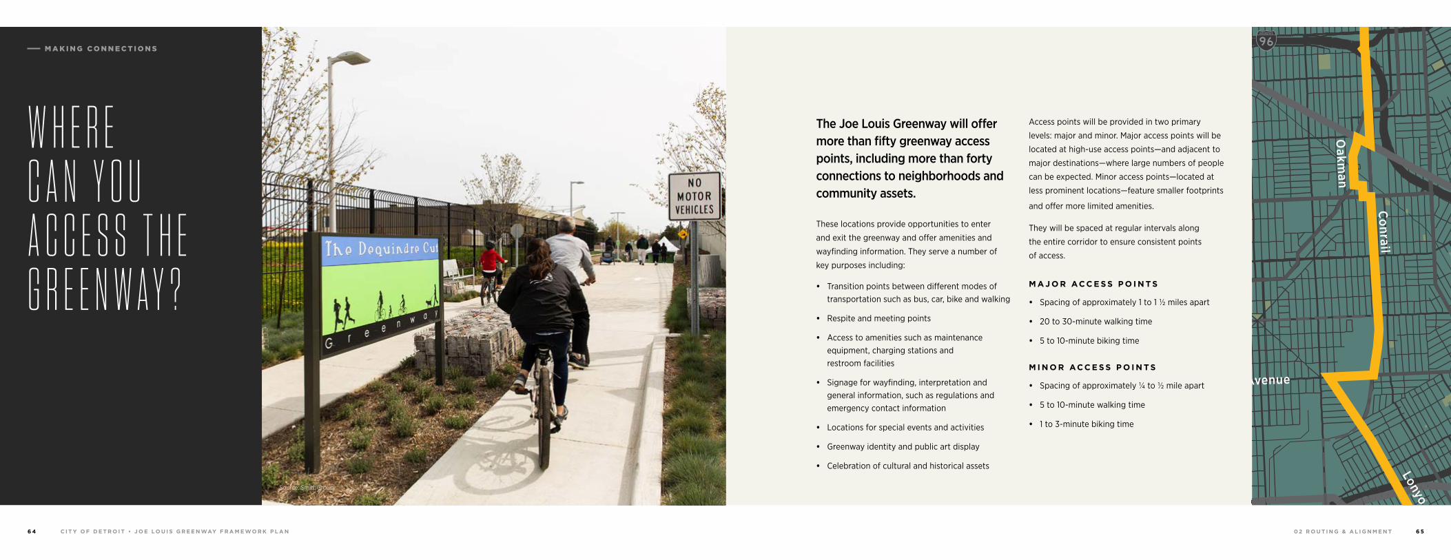
0 2 R O U T I N G & A L I G N M E N TC I T Y O F D E T R O I T • J O E LO U I S G R E E N WAY F R A M E WO R K P L A N6 4 6 5
W H E R E C A N Y O U A C C E S S T H E G R E E N W A Y ?
Source: SmithGroup
The Joe Louis Greenway will offer more than fifty greenway access points, including more than forty connections to neighborhoods and community assets.
These locations provide opportunities to enter
and exit the greenway and offer amenities and
wayfinding information. They serve a number of
key purposes including:
• Transition points between different modes of transportation such as bus, car, bike and walking
• Respite and meeting points
• Access to amenities such as maintenance equipment, charging stations and restroom facilities
• Signage for wayfinding, interpretation and general information, such as regulations and emergency contact information
• Locations for special events and activities
• Greenway identity and public art display
• Celebration of cultural and historical assets
Access points will be provided in two primary
levels: major and minor. Major access points will be
located at high-use access points—and adjacent to
major destinations—where large numbers of people
can be expected. Minor access points—located at
less prominent locations—feature smaller footprints
and offer more limited amenities.
They will be spaced at regular intervals along
the entire corridor to ensure consistent points
of access.
M A J O R AC C E S S P O I N T S
• Spacing of approximately 1 to 1 ½ miles apart
• 20 to 30-minute walking time
• 5 to 10-minute biking time
M I N O R AC C E S S P O I N T S
• Spacing of approximately ¼ to ½ mile apart
• 5 to 10-minute walking time
• 1 to 3-minute biking time
94
94
94
94
75
75
75
10
10
HIGHLANDPARK
DETROIT
DEARBORN
Michigan Avenue
Telegrap
h
Telegrap
h
Plymouth
Warren Avenue
Bagley
Je�erson Avenue
Dearborn
Detroit Riverwalk
Dequindre Cut
Lonyo
Dix
Woodm
ere
Campbell
W. G
rand
8 Mile
Fort
Fort
Woodw
ard Avenue
Woodw
ard
Gra
tiot
Aven
ue
Grand River Avenue
Davison
Joseph Campau
Ham
tram
ck D
r
Conrail
Conrail
Oakm
an
McNichols
Live
rnoi
s
GORDIE HOWEBRIDGE
HAMTRAMCK
BELLE ISLE
WINDSOR
M A K I N G C O N N E C T I O N S
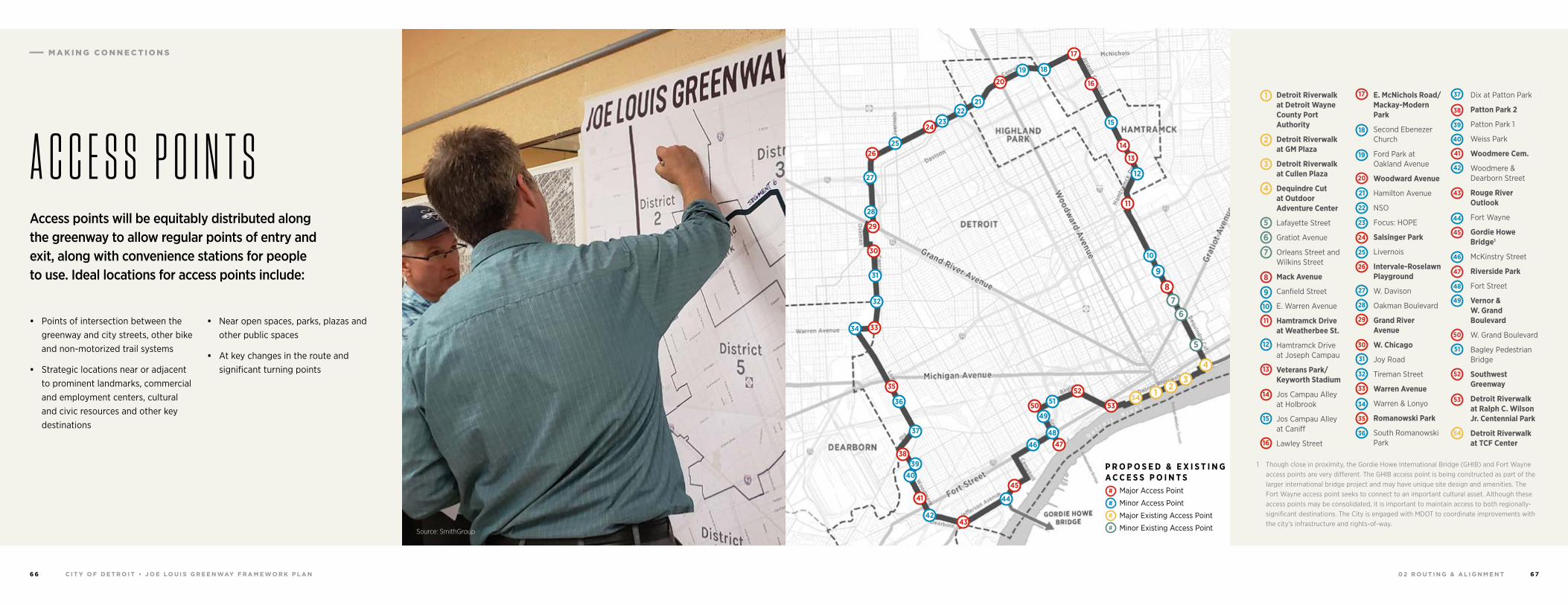
0 2 R O U T I N G & A L I G N M E N TC I T Y O F D E T R O I T • J O E LO U I S G R E E N WAY F R A M E WO R K P L A N6 6 6 7
Detroit Riverwalk at Detroit Wayne County Port Authority
Detroit Riverwalk at GM Plaza
Detroit Riverwalk at Cullen Plaza
Dequindre Cut at Outdoor Adventure Center
Lafayette Street
Gratiot Avenue
Orleans Street and Wilkins Street
Mack Avenue
Canfield Street
E. Warren Avenue
Hamtramck Drive at Weatherbee St.
Hamtramck Drive at Joseph Campau
Veterans Park/Keyworth Stadium
Jos Campau Alley at Holbrook
Jos Campau Alley at Caniff
Lawley Street
1 Though close in proximity, the Gordie Howe International Bridge (GHIB) and Fort Wayne access points are very different. The GHIB access point is being constructed as part of the larger international bridge project and may have unique site design and amenities. The Fort Wayne access point seeks to connect to an important cultural asset. Although these access points may be consolidated, it is important to maintain access to both regionally-significant destinations. The City is engaged with MDOT to coordinate improvements with the city’s infrastructure and rights-of-way.
E. McNichols Road/Mackay-Modern Park
Second Ebenezer Church
Ford Park at Oakland Avenue
Woodward Avenue
Hamilton Avenue
NSO
Focus: HOPE
Salsinger Park
Livernois
Intervale-Roselawn Playground
W. Davison
Oakman Boulevard
Grand River Avenue
W. Chicago
Joy Road
Tireman Street
Warren Avenue
Warren & Lonyo
Romanowski Park
South Romanowski Park
Dix at Patton Park
Patton Park 2
Patton Park 1
Weiss Park
Woodmere Cem.
Woodmere & Dearborn Street
Rouge River Outlook
Fort Wayne
Gordie Howe Bridge1
McKinstry Street
Riverside Park
Fort Street
Vernor & W. Grand Boulevard
W. Grand Boulevard
Bagley Pedestrian Bridge
Southwest Greenway
Detroit Riverwalk at Ralph C. Wilson Jr. Centennial Park
Detroit Riverwalk at TCF Center
1
2
3
4
5
6
7
10
21
24
39
42
26
29
48
51
52
53
54
30
32
35
13
14
16
18
8
9
11
12
19
20
22
23
25
40
41
43
44
45
46
47
49
50
27
28
31
33
34
36
37
38
15
17
A C C E S S P O I N T S
• Points of intersection between the greenway and city streets, other bike and non-motorized trail systems
• Strategic locations near or adjacent to prominent landmarks, commercial and employment centers, cultural and civic resources and other key destinations
• Near open spaces, parks, plazas and other public spaces
• At key changes in the route and significant turning points
2154
53
52
50
38
35
20
17
33
30
11
87
6
5
29
24
46
45
43
41
51
49
4847
4039
37
36
34
19 18
16
15
14
13
12
10
9
32
31
28
27
2625
2322
21
44
42
4
3
P R O P O S E D & E X I S T I N G A C C E S S P O I N T S Major Access Point
Minor Access Point
Major Existing Access Point
Minor Existing Access Point#
#
#
#
Access points will be equitably distributed along the greenway to allow regular points of entry and exit, along with convenience stations for people to use. Ideal locations for access points include:
Source: SmithGroup
M A K I N G C O N N E C T I O N S
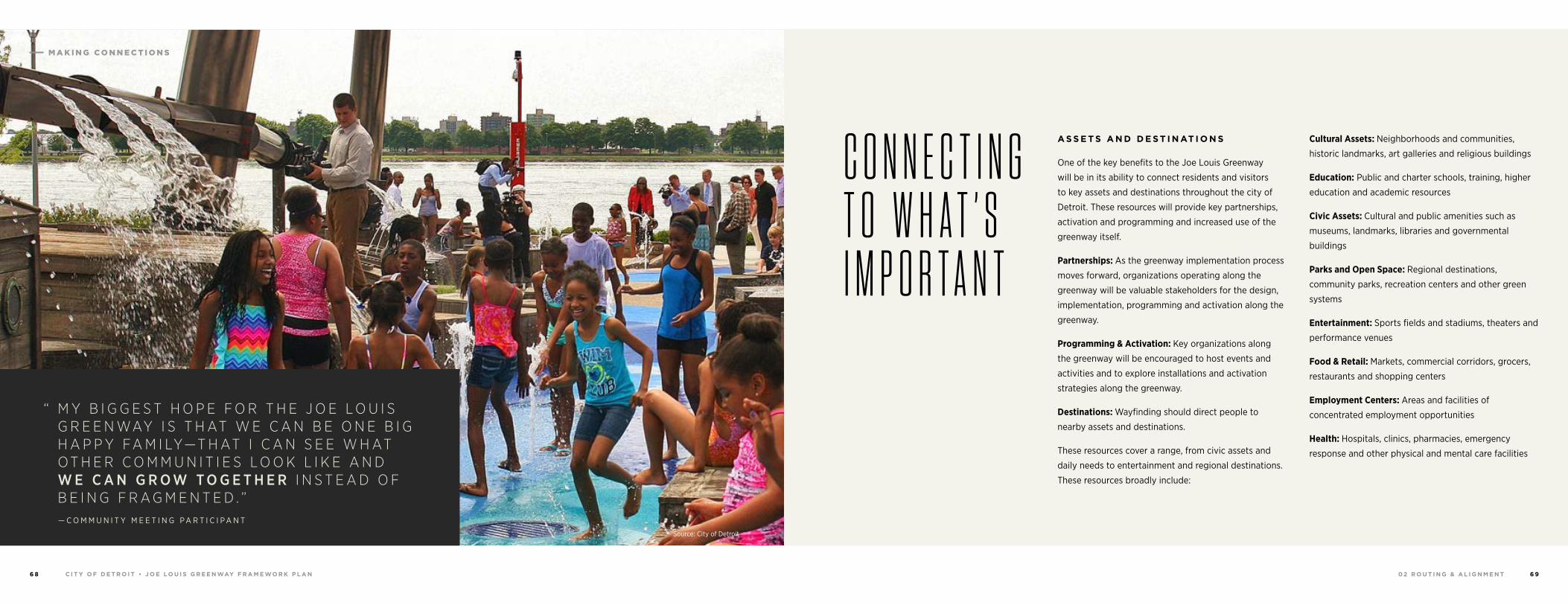
0 2 R O U T I N G & A L I G N M E N TC I T Y O F D E T R O I T • J O E LO U I S G R E E N WAY F R A M E WO R K P L A N6 8 6 9
Source: City of Detroit
A S S E T S A N D D E S T I N AT I O N S
One of the key benefits to the Joe Louis Greenway
will be in its ability to connect residents and visitors
to key assets and destinations throughout the city of
Detroit. These resources will provide key partnerships,
activation and programming and increased use of the
greenway itself.
Partnerships: As the greenway implementation process
moves forward, organizations operating along the
greenway will be valuable stakeholders for the design,
implementation, programming and activation along the
greenway.
Programming & Activation: Key organizations along
the greenway will be encouraged to host events and
activities and to explore installations and activation
strategies along the greenway.
Destinations: Wayfinding should direct people to
nearby assets and destinations.
These resources cover a range, from civic assets and
daily needs to entertainment and regional destinations.
These resources broadly include:
Cultural Assets: Neighborhoods and communities,
historic landmarks, art galleries and religious buildings
Education: Public and charter schools, training, higher
education and academic resources
Civic Assets: Cultural and public amenities such as
museums, landmarks, libraries and governmental
buildings
Parks and Open Space: Regional destinations,
community parks, recreation centers and other green
systems
Entertainment: Sports fields and stadiums, theaters and
performance venues
Food & Retail: Markets, commercial corridors, grocers,
restaurants and shopping centers
Employment Centers: Areas and facilities of
concentrated employment opportunities
Health: Hospitals, clinics, pharmacies, emergency
response and other physical and mental care facilities
C O N N E C T I N G T O W H A T ’ S I M P O R T A N T
“ M Y B I G G E S T H O P E F O R T H E J O E L O U I S G R E E N WAY I S T H AT W E C A N B E O N E B I G H A P P Y FA M I LY—T H AT I C A N S E E W H AT O T H E R C O M M U N I T I E S L O O K L I K E A N D W E C A N G R O W T O G E T H E R I N S T E A D O F B E I N G F R A G M E N T E D . ”— C O M M U N I T Y M E E T I N G P A R T I C I P A N T
M A K I N G C O N N E C T I O N S
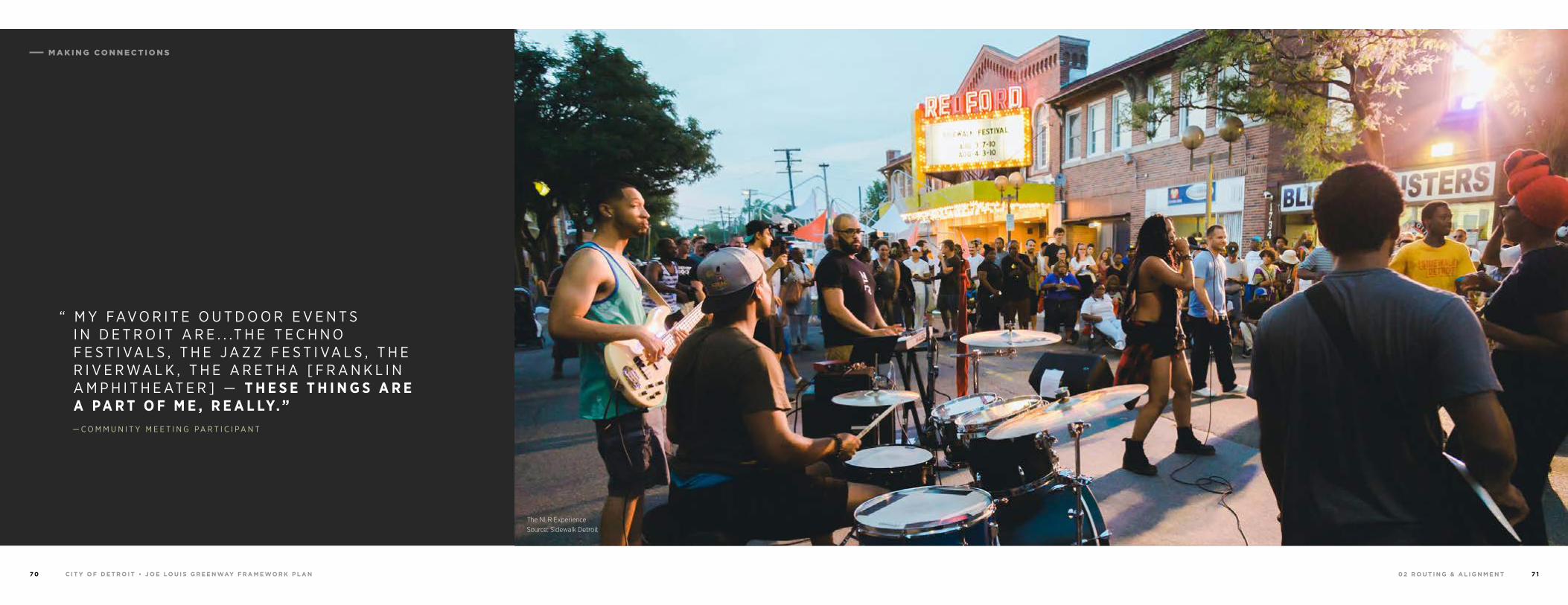
0 2 R O U T I N G & A L I G N M E N TC I T Y O F D E T R O I T • J O E LO U I S G R E E N WAY F R A M E WO R K P L A N7 0 7 1
“ M Y FAV O R I T E O U T D O O R E V E N T S I N D E T R O I T A R E . . .T H E T E C H N O F E S T I VA L S , T H E J A Z Z F E S T I VA L S , T H E R I V E R WA L K , T H E A R E T H A [ F R A N K L I N A M P H I T H E AT E R ] — T H E S E T H I N G S A R E A P A R T O F M E , R E A L LY. ”
The NLR Experience Source: Sidewalk Detroit
— C O M M U N I T Y M E E T I N G P A R T I C I P A N T
M A K I N G C O N N E C T I O N S
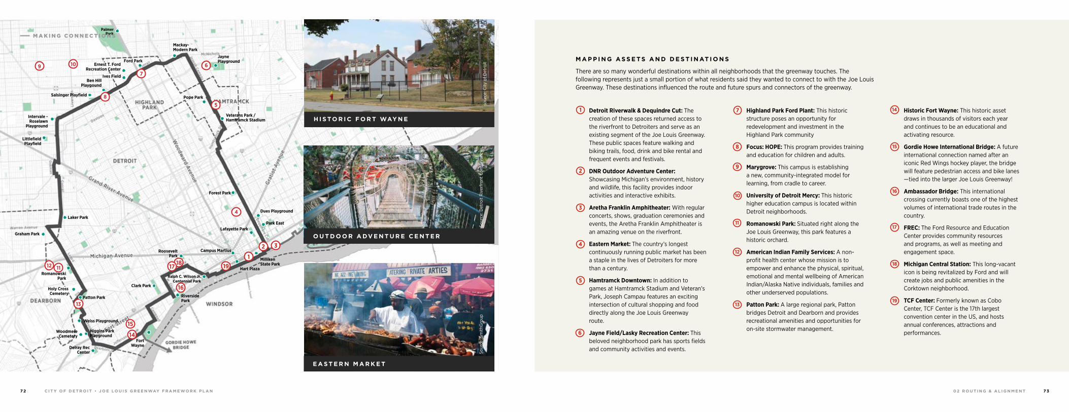
0 2 R O U T I N G & A L I G N M E N TC I T Y O F D E T R O I T • J O E LO U I S G R E E N WAY F R A M E WO R K P L A N7 2 7 3
2
8
1
9
10
11
12
13
14
15
18
16
19
3
4
5
6
7
6
5
1
2
191817
16
17
15
14
13
12
3
4
Patton Park
Weiss Playground
Higgins Park Playground
Graham Park
Woodmere Cemetery
Delray Rec Center
Pope Park
Jayne Playground
Mackay-Modern Park
Forest Park
Dues Playground
Park EastLafayette Park
Ralph C. Wilson Jr. Centennial Park
Clark Park
Fort Wayne
Riverside Park
Roosevelt Park
Campus Martius
Milliken State Park
Hart Plaza
Veterans Park / Hamtramck Stadium
Palmer Park
Salsinger Playfield
Ben Hill Playgound
Ives Field
Ernest T. Ford Recreation Center
Ford Park
Intervale - Roselawn
Playground
Littlefield Playfield
Laker Park
RomanowskiPark
8
7
Holy Cross Cemetery
11
109
H I S TO R I C F O R T WAY N E
O U T D O O R A DV E N T U R E C E N T E R
Sour
ce: D
etro
it R
iver
fron
t C
onse
rvan
cyso
urce
: City
of D
etro
it
E A S T E R N M A R K E T
Sour
ce: S
mith
Gro
up
M A P P I N G A S S E T S A N D D E S T I N AT I O N S
There are so many wonderful destinations within all neighborhoods that the greenway touches. The following represents just a small portion of what residents said they wanted to connect to with the Joe Louis Greenway. These destinations influenced the route and future spurs and connectors of the greenway.
Detroit Riverwalk & Dequindre Cut: The creation of these spaces returned access to the riverfront to Detroiters and serve as an existing segment of the Joe Louis Greenway. These public spaces feature walking and biking trails, food, drink and bike rental and frequent events and festivals.
DNR Outdoor Adventure Center: Showcasing Michigan’s environment, history and wildlife, this facility provides indoor activities and interactive exhibits.
Aretha Franklin Amphitheater: With regular concerts, shows, graduation ceremonies and events, the Aretha Franklin Amphitheater is an amazing venue on the riverfront.
Eastern Market: The country’s longest continuously running public market has been a staple in the lives of Detroiters for more than a century.
Hamtramck Downtown: In addition to games at Hamtramck Stadium and Veteran’s Park, Joseph Campau features an exciting intersection of cultural shopping and food directly along the Joe Louis Greenway route.
Jayne Field/Lasky Recreation Center: This beloved neighborhood park has sports fields and community activities and events.
Highland Park Ford Plant: This historic structure poses an opportunity for redevelopment and investment in the Highland Park community
Focus: HOPE: This program provides training and education for children and adults.
Marygrove: This campus is establishing a new, community-integrated model for learning, from cradle to career.
University of Detroit Mercy: This historic higher education campus is located within Detroit neighborhoods.
Romanowski Park: Situated right along the Joe Louis Greenway, this park features a historic orchard.
American Indian Family Services: A non-profit health center whose mission is to empower and enhance the physical, spiritual, emotional and mental wellbeing of American Indian/Alaska Native individuals, families and other underserved populations.
Patton Park: A large regional park, Patton bridges Detroit and Dearborn and provides recreational amenities and opportunities for on-site stormwater management.
Historic Fort Wayne: This historic asset draws in thousands of visitors each year and continues to be an educational and activating resource.
Gordie Howe International Bridge: A future international connection named after an iconic Red Wings hockey player, the bridge will feature pedestrian access and bike lanes —tied into the larger Joe Louis Greenway!
Ambassador Bridge: This international crossing currently boasts one of the highest volumes of international trade routes in the country.
FREC: The Ford Resource and Education Center provides community resources and programs, as well as meeting and engagement space.
Michigan Central Station: This long-vacant icon is being revitalized by Ford and will create jobs and public amenities in the Corktown neighborhood.
TCF Center: Formerly known as Cobo Center, TCF Center is the 17th largest convention center in the US, and hosts annual conferences, attractions and performances.
M A K I N G C O N N E C T I O N S
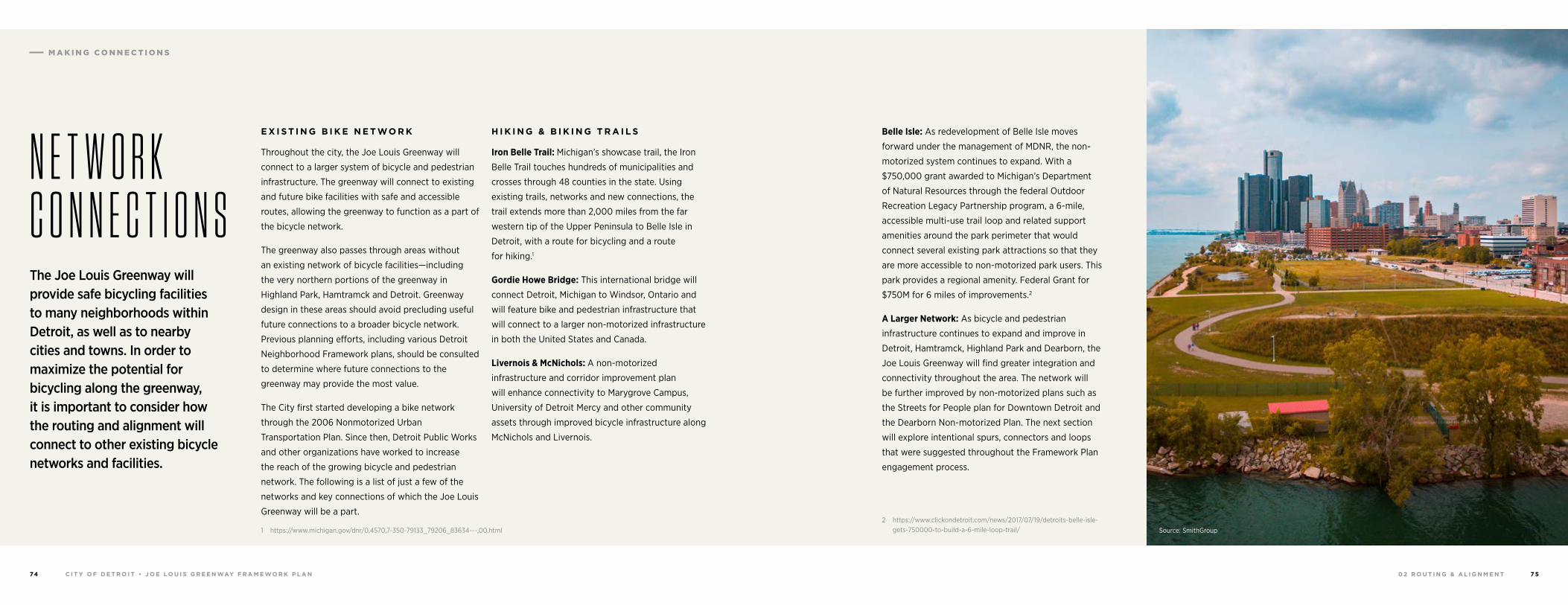
0 2 R O U T I N G & A L I G N M E N TC I T Y O F D E T R O I T • J O E LO U I S G R E E N WAY F R A M E WO R K P L A N74 75
E X I S T I N G B I K E N E T WO R K
Throughout the city, the Joe Louis Greenway will
connect to a larger system of bicycle and pedestrian
infrastructure. The greenway will connect to existing
and future bike facilities with safe and accessible
routes, allowing the greenway to function as a part of
the bicycle network.
The greenway also passes through areas without
an existing network of bicycle facilities—including
the very northern portions of the greenway in
Highland Park, Hamtramck and Detroit. Greenway
design in these areas should avoid precluding useful
future connections to a broader bicycle network.
Previous planning efforts, including various Detroit
Neighborhood Framework plans, should be consulted
to determine where future connections to the
greenway may provide the most value.
The City first started developing a bike network
through the 2006 Nonmotorized Urban
Transportation Plan. Since then, Detroit Public Works
and other organizations have worked to increase
the reach of the growing bicycle and pedestrian
network. The following is a list of just a few of the
networks and key connections of which the Joe Louis
Greenway will be a part.
1 https://www.michigan.gov/dnr/0,4570,7-350-79133_79206_83634---,00.html
H I K I N G & B I K I N G T R A I L S
Iron Belle Trail: Michigan’s showcase trail, the Iron
Belle Trail touches hundreds of municipalities and
crosses through 48 counties in the state. Using
existing trails, networks and new connections, the
trail extends more than 2,000 miles from the far
western tip of the Upper Peninsula to Belle Isle in
Detroit, with a route for bicycling and a route
for hiking.1
Gordie Howe Bridge: This international bridge will
connect Detroit, Michigan to Windsor, Ontario and
will feature bike and pedestrian infrastructure that
will connect to a larger non-motorized infrastructure
in both the United States and Canada.
Livernois & McNichols: A non-motorized
infrastructure and corridor improvement plan
will enhance connectivity to Marygrove Campus,
University of Detroit Mercy and other community
assets through improved bicycle infrastructure along
McNichols and Livernois.
N E T W O R K C O N N E C T I O N S
Belle Isle: As redevelopment of Belle Isle moves
forward under the management of MDNR, the non-
motorized system continues to expand. With a
$750,000 grant awarded to Michigan’s Department
of Natural Resources through the federal Outdoor
Recreation Legacy Partnership program, a 6-mile,
accessible multi-use trail loop and related support
amenities around the park perimeter that would
connect several existing park attractions so that they
are more accessible to non-motorized park users. This
park provides a regional amenity. Federal Grant for
$750M for 6 miles of improvements.2
A Larger Network: As bicycle and pedestrian
infrastructure continues to expand and improve in
Detroit, Hamtramck, Highland Park and Dearborn, the
Joe Louis Greenway will find greater integration and
connectivity throughout the area. The network will
be further improved by non-motorized plans such as
the Streets for People plan for Downtown Detroit and
the Dearborn Non-motorized Plan. The next section
will explore intentional spurs, connectors and loops
that were suggested throughout the Framework Plan
engagement process.
2 https://www.clickondetroit.com/news/2017/07/19/detroits-belle-isle-gets-750000-to-build-a-6-mile-loop-trail/
The Joe Louis Greenway will provide safe bicycling facilities to many neighborhoods within Detroit, as well as to nearby cities and towns. In order to maximize the potential for bicycling along the greenway, it is important to consider how the routing and alignment will connect to other existing bicycle networks and facilities.
Source: SmithGroup
M A K I N G C O N N E C T I O N S
0 2 R O U T I N G & A L I G N M E N TC I T Y O F D E T R O I T • J O E LO U I S G R E E N WAY F R A M E WO R K P L A N7 6 7 7
S P U R S , C O N N E C TO R S & LO O P S
The Joe Louis Greenway is part of a dynamic and
growing green system in the City of Detroit and
Southeast Michigan. By working with communities
around the greenway to identify the connections
and assets that are most important to their
lives, the system can become a key driver of
the revitalization and sustainability of the
urban environment.
Because neighborhood strength is built through
the access to culture, neighborhoods and
resources, green and non-motorized systems
have the opportunity to become central to the
repositioning of communities for long-term
growth and prosperity. The Joe Louis Greenway
seeks to establish a transportation system that
enhances connections to local amenities and
creates a recreation and mobility system that
enhances community health and quality of life.
1 City of Detroit Non-motorized Urban Transportation Master Plan, 2006: http://greenwaycollab.com/Projects/SEMCOG_NoMo_Facilities_Inventory/Documents/Detroit/Plans/detroit%20nonmotorized%20urban%20transportation%20master%20plan.pdf
Through the full course of the Joe Louis Greenway,
there are numerous potential connections, spurs
and loops. These connections could range from
full protected off-street paths to neighborhood
bikeways with only traffic calming and signage.
These connectors will be further explored through
the Streets for People Plan. These connectors
could provide access to:
• Local and regional destinations that are near to, but not directly along, the greenway
• Alternative routes or loops through nearby commercial districts. While these area provide much-needed access to amenities and jobs, there may be increased volumes of conflicting vehicular traffic, or there may not be adequate space for the main greenway alignment
• Nearby greenways and non-motorized facilities
• Neighborhoods and communities that do not have direct access to the greenway—especially those that are particularly disconnected from other neighborhoods, parks, jobs and amenities
I M P L E M E N TAT I O N
The implementation of the Joe Louis Greenway
comes at a critical time in the City of Detroit’s
growth of non-motorized infrastructure. Detroit’s
most recent non-motorized plan was completed
in 2006,1 and since this time, the city has seen a
substantial growth of its bicycle and pedestrian
networks. The Joe Louis Greenway provides
an opportunity to build on the momentum and
growth of this system to revisit the non-motorized
plan and create a vision for a holistic network.
The diagram at right identifies a few of the spurs,
connectors and loops that may connect to the
Joe Louis Greenway in the near future. These
segments provide key connections that will
support the success of the greenway. As the Joe
Louis Greenway moves into future design and
implementation, relevant jurisdictions and
agencies should be included in the streetscape
planning and design for spurs, connectors and
loops, and communities should continue to be
engaged throughout.
C O M M U N I T Y- G U I D E D C O N N E C T I O N S
Throughout the Joe Louis Greenway
Framework Plan engagement process,
residents and stakeholders were encouraged
to share their hopes and vision for the future
of their communities—and for the Joe Louis
Greenway. Through mapping exercises and
idea exchange, residents shared insights into
the assets and connections most valuable
to their communities. With the Joe Louis
Greenway as the green spine from which
these connections, spurs and loops trace their
origin, a system and story begin to form that
unite neighborhoods around the greenway
and link people to the destinations that matter
most to them.
The following diagram reflects just a portion
of the input received during the Framework
Planning process. The linkages shown reflect
a variety of projects, including those existing,
planned or imagined. Where relevant, quotes
from residents who participated in the
engagement process are included, as well
as any additional information about routes
or destinations.
This diagram is not exhaustive; it is merely an
illustration of what this system may become.
Like the environmental systems the Joe Louis
Greenway seeks to restore, the path and its
network are living things that will change and
adapt over time, connecting people to the
destinations most valuable to their lives.
These connectors suggested by the
community will be shared with the Streets
for People initiative led by the Public Works
Department. More information can be found
at: detroitmi.gov/streetsforpeople.
M A K I N G C O N N E C T I O N S
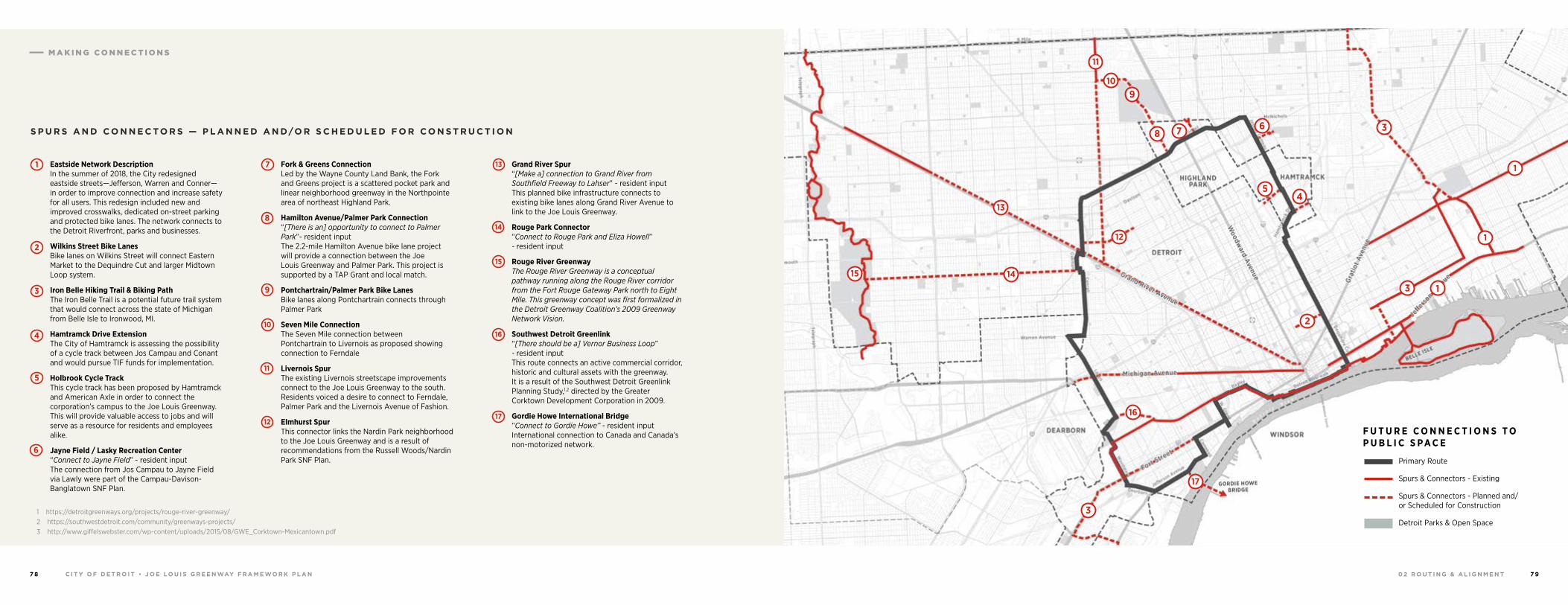
0 2 R O U T I N G & A L I G N M E N TC I T Y O F D E T R O I T • J O E LO U I S G R E E N WAY F R A M E WO R K P L A N7 8 7 9
16
15
17
3
3
3
14
13
12
10
8 7 6
5 4
2
1
1
1
11
9
2
8
1
9
10
11
12
13
14
15
16
17
3
4
5
6
F U T U R E C O N N E C T I O N S T O P U B L I C S P A C E
Primary Route
Spurs & Connectors - Existing
Spurs & Connectors - Planned and/ or Scheduled for Construction
Detroit Parks & Open Space
Eastside Network Description In the summer of 2018, the City redesigned eastside streets—Jefferson, Warren and Conner—in order to improve connection and increase safety for all users. This redesign included new and improved crosswalks, dedicated on-street parking and protected bike lanes. The network connects to the Detroit Riverfront, parks and businesses.
Wilkins Street Bike Lanes Bike lanes on Wilkins Street will connect Eastern Market to the Dequindre Cut and larger Midtown Loop system.
Iron Belle Hiking Trail & Biking Path The Iron Belle Trail is a potential future trail system that would connect across the state of Michigan from Belle Isle to Ironwood, MI.
Hamtramck Drive Extension The City of Hamtramck is assessing the possibility of a cycle track between Jos Campau and Conant and would pursue TIF funds for implementation.
Holbrook Cycle Track This cycle track has been proposed by Hamtramck and American Axle in order to connect the corporation’s campus to the Joe Louis Greenway. This will provide valuable access to jobs and will serve as a resource for residents and employees alike.
Jayne Field / Lasky Recreation Center “Connect to Jayne Field” - resident input The connection from Jos Campau to Jayne Field via Lawly were part of the Campau-Davison-Banglatown SNF Plan.
1 https://detroitgreenways.org/projects/rouge-river-greenway/2 https://southwestdetroit.com/community/greenways-projects/3 http://www.giffelswebster.com/wp-content/uploads/2015/08/GWE_Corktown-Mexicantown.pdf
Fork & Greens Connection Led by the Wayne County Land Bank, the Fork and Greens project is a scattered pocket park and linear neighborhood greenway in the Northpointe area of northeast Highland Park.
Hamilton Avenue/Palmer Park Connection “[There is an] opportunity to connect to Palmer Park”- resident input The 2.2-mile Hamilton Avenue bike lane project will provide a connection between the Joe Louis Greenway and Palmer Park. This project is supported by a TAP Grant and local match.
Pontchartrain/Palmer Park Bike Lanes Bike lanes along Pontchartrain connects through Palmer Park
Seven Mile Connection The Seven Mile connection between Pontchartrain to Livernois as proposed showing connection to Ferndale
Livernois Spur The existing Livernois streetscape improvements connect to the Joe Louis Greenway to the south. Residents voiced a desire to connect to Ferndale, Palmer Park and the Livernois Avenue of Fashion.
Elmhurst Spur This connector links the Nardin Park neighborhood to the Joe Louis Greenway and is a result of recommendations from the Russell Woods/Nardin Park SNF Plan.
Grand River Spur “[Make a] connection to Grand River from Southfield Freeway to Lahser” - resident input This planned bike infrastructure connects to existing bike lanes along Grand River Avenue to link to the Joe Louis Greenway.
Rouge Park Connector “Connect to Rouge Park and Eliza Howell” - resident input
Rouge River Greenway The Rouge River Greenway is a conceptual pathway running along the Rouge River corridor from the Fort Rouge Gateway Park north to Eight Mile. This greenway concept was first formalized in the Detroit Greenway Coalition’s 2009 Greenway Network Vision.
Southwest Detroit Greenlink “[There should be a] Vernor Business Loop” - resident input This route connects an active commercial corridor, historic and cultural assets with the greenway. It is a result of the Southwest Detroit Greenlink Planning Study,1,2 directed by the Greater Corktown Development Corporation in 2009.
Gordie Howe International Bridge “Connect to Gordie Howe” - resident input International connection to Canada and Canada’s non-motorized network.
7
S P U R S A N D C O N N E C TO R S — P L A N N E D A N D/O R S C H E D U L E D F O R C O N S T R U C T I O N
M A K I N G C O N N E C T I O N S
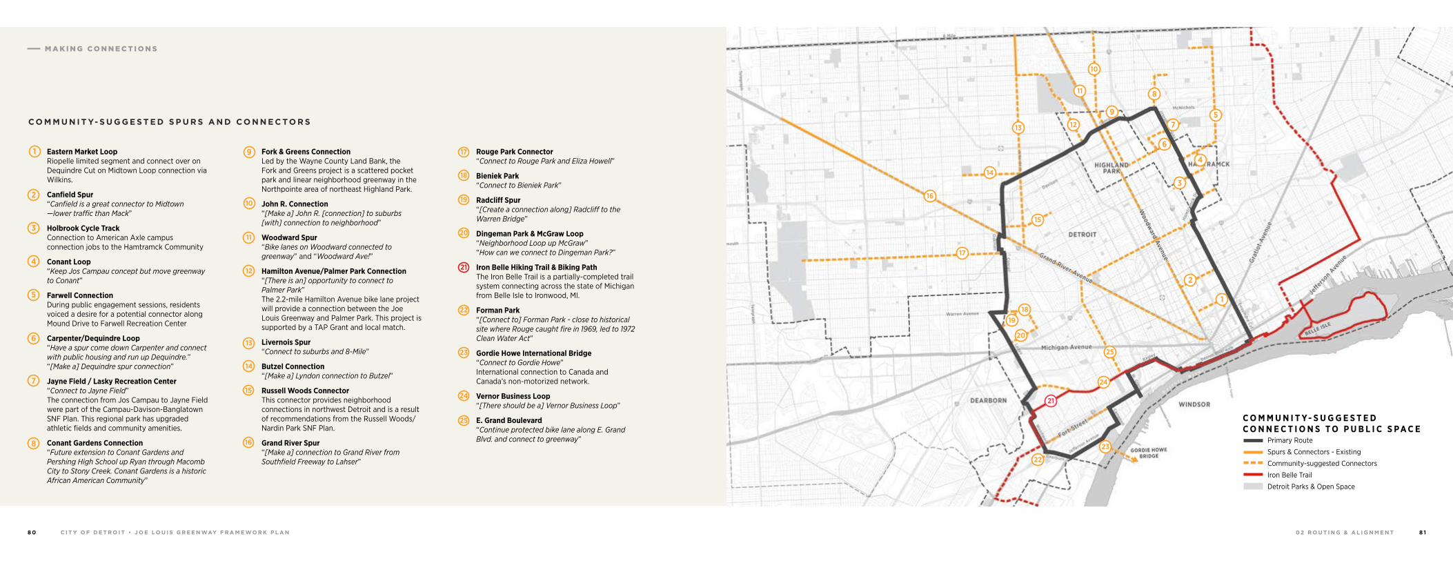
0 2 R O U T I N G & A L I G N M E N TC I T Y O F D E T R O I T • J O E LO U I S G R E E N WAY F R A M E WO R K P L A N8 0 8 1
25
24
22
23
20
21
18
17
16
14
15
13 12
11
10
8
97
6
4
5
2
1
3
19
C O M M U N I T Y- S U G G E S T E D C O N N E C T I O N S T O P U B L I C S P A C E
Primary Route
Spurs & Connectors - Existing
Community-suggested Connectors
Iron Belle Trail
Detroit Parks & Open Space
C O M M U N I T Y- S U G G E S T E D S P U R S A N D C O N N E C TO R S
1
4
2
6
3
7
8
9
10
15
16
17
18
19
20
21
22
23
24
25
5
Eastern Market Loop Riopelle limited segment and connect over on Dequindre Cut on Midtown Loop connection via Wilkins.
Canfield Spur “Canfield is a great connector to Midtown —lower traffic than Mack”
Holbrook Cycle Track Connection to American Axle campus connection jobs to the Hamtramck Community
Conant Loop “Keep Jos Campau concept but move greenway to Conant”
Farwell Connection During public engagement sessions, residents voiced a desire for a potential connector along Mound Drive to Farwell Recreation Center
Carpenter/Dequindre Loop “Have a spur come down Carpenter and connect with public housing and run up Dequindre.” “[Make a] Dequindre spur connection”
Jayne Field / Lasky Recreation Center “Connect to Jayne Field” The connection from Jos Campau to Jayne Field were part of the Campau-Davison-Banglatown SNF Plan. This regional park has upgraded athletic fields and community amenities.
Conant Gardens Connection “Future extension to Conant Gardens and Pershing High School up Ryan through Macomb City to Stony Creek. Conant Gardens is a historic African American Community”
Fork & Greens Connection Led by the Wayne County Land Bank, the Fork and Greens project is a scattered pocket park and linear neighborhood greenway in the Northpointe area of northeast Highland Park.
John R. Connection “[Make a] John R. [connection] to suburbs [with] connection to neighborhood”
Woodward Spur “Bike lanes on Woodward connected to greenway” and “Woodward Ave!”
Hamilton Avenue/Palmer Park Connection “[There is an] opportunity to connect to Palmer Park” The 2.2-mile Hamilton Avenue bike lane project will provide a connection between the Joe Louis Greenway and Palmer Park. This project is supported by a TAP Grant and local match.
Livernois Spur “Connect to suburbs and 8-Mile”
Butzel Connection “[Make a] Lyndon connection to Butzel”
Russell Woods Connector This connector provides neighborhood connections in northwest Detroit and is a result of recommendations from the Russell Woods/Nardin Park SNF Plan.
Grand River Spur “[Make a] connection to Grand River from Southfield Freeway to Lahser”
Rouge Park Connector “Connect to Rouge Park and Eliza Howell”
Bieniek Park “Connect to Bieniek Park”
Radcliff Spur “[Create a connection along] Radcliff to the Warren Bridge”
Dingeman Park & McGraw Loop “Neighborhood Loop up McGraw” “How can we connect to Dingeman Park?”
Iron Belle Hiking Trail & Biking Path The Iron Belle Trail is a partially-completed trail system connecting across the state of Michigan from Belle Isle to Ironwood, MI.
Forman Park “[Connect to] Forman Park - close to historical site where Rouge caught fire in 1969, led to 1972 Clean Water Act”
Gordie Howe International Bridge “Connect to Gordie Howe” International connection to Canada and Canada’s non-motorized network.
Vernor Business Loop “[There should be a] Vernor Business Loop”
E. Grand Boulevard “Continue protected bike lane along E. Grand Blvd. and connect to greenway”
11
12
13
14
M A K I N G C O N N E C T I O N S
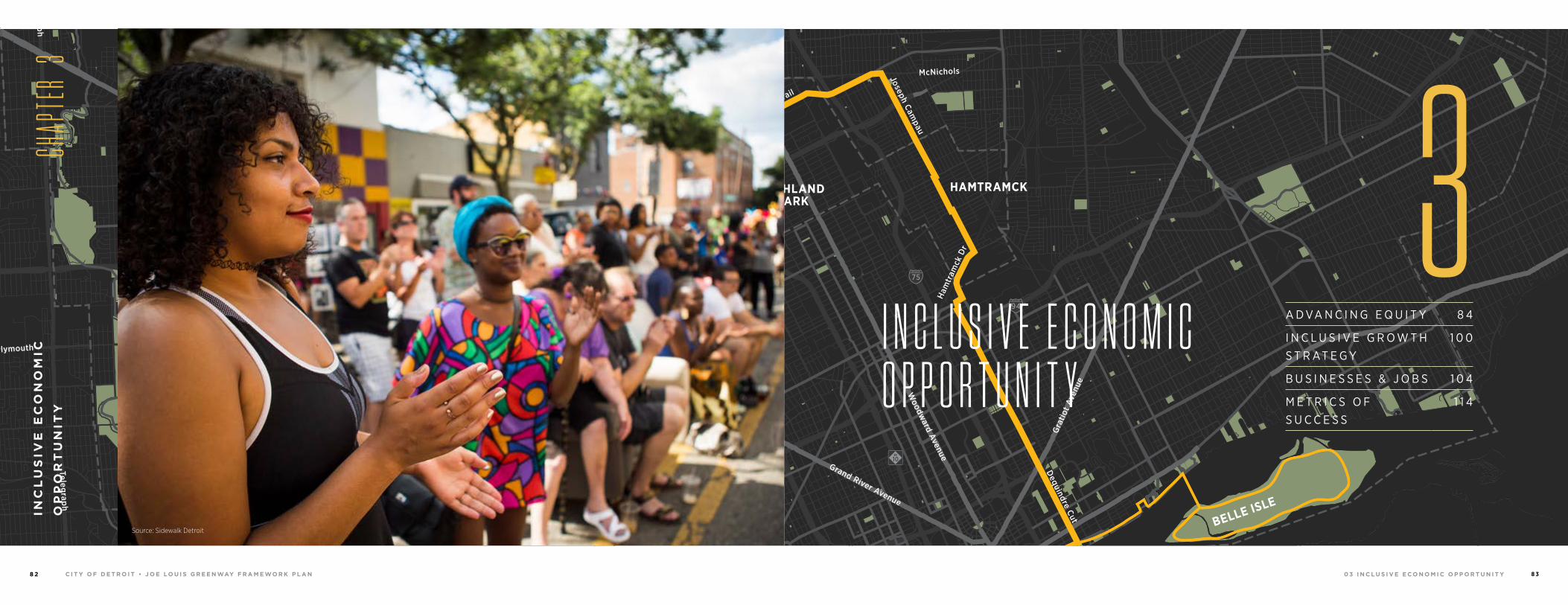
0 3 I N C L U S I V E E C O N O M I C O P P O R T U N I T YC I T Y O F D E T R O I T • J O E LO U I S G R E E N WAY F R A M E WO R K P L A N8 2 8 3
94
94
94
94
75
75
75
10
10
HIGHLANDPARK
DETROIT
DEARBORN
Michigan Avenue
Telegrap
h
Telegrap
h
Plymouth
Warren Avenue
Bagley
Je�erson Avenue
Dearborn
Detroit Riverwalk
Dequindre Cut
Lonyo
Dix
Woodm
ere
Campbell
W. G
rand
8 Mile
Fort
Fort
Woodw
ard Avenue
Woodw
ard
Gra
tiot
Aven
ue
Grand River Avenue
Davison
Joseph Campau
Ham
tram
ck D
r
Conrail
Conrail
Oakm
an
McNichols
Live
rnoi
s
GORDIE HOWEBRIDGE
HAMTRAMCK
BELLE ISLE
WINDSOR
A D VA N C I N G E Q U I T Y 8 4
I N C L U S I V E G R O W T H S T R AT E G Y
1 0 0
B U S I N E S S E S & J O B S 1 0 4
M E T R I C S O F S U C C E S S
1 1 4
I N C L U S I V E E C O N O M I C O P P O R T U N I T Y
INC
LU
SIV
E E
CO
NO
MIC
OP
PO
RT
UN
ITY
CH
APTE
R 3
3Source: Sidewalk Detroit
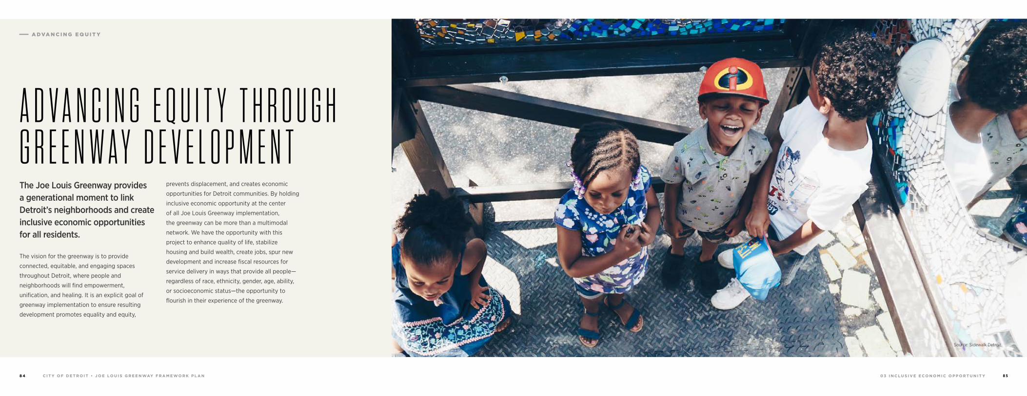
0 3 I N C L U S I V E E C O N O M I C O P P O R T U N I T YC I T Y O F D E T R O I T • J O E LO U I S G R E E N WAY F R A M E WO R K P L A N8 4 8 5
The Joe Louis Greenway provides a generational moment to link Detroit’s neighborhoods and create inclusive economic opportunities for all residents.
The vision for the greenway is to provide
connected, equitable, and engaging spaces
throughout Detroit, where people and
neighborhoods will find empowerment,
unification, and healing. It is an explicit goal of
greenway implementation to ensure resulting
development promotes equality and equity,
prevents displacement, and creates economic
opportunities for Detroit communities. By holding
inclusive economic opportunity at the center
of all Joe Louis Greenway implementation,
the greenway can be more than a multimodal
network. We have the opportunity with this
project to enhance quality of life, stabilize
housing and build wealth, create jobs, spur new
development and increase fiscal resources for
service delivery in ways that provide all people—
regardless of race, ethnicity, gender, age, ability,
or socioeconomic status—the opportunity to
flourish in their experience of the greenway.
Source: Sidewalk Detroit
A D V A N C I N G E Q U I T Y T H R O U G H G R E E N W A Y D E V E L O P M E N T
A DVA N C I N G E Q U I T Y
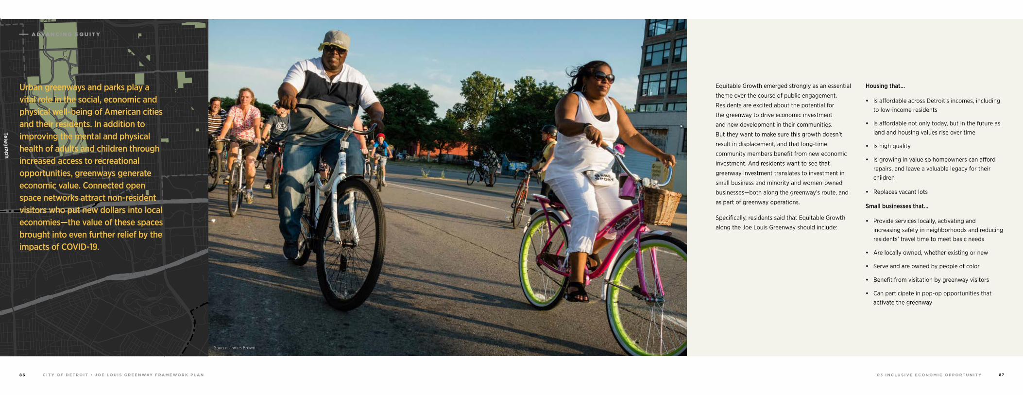
0 3 I N C L U S I V E E C O N O M I C O P P O R T U N I T YC I T Y O F D E T R O I T • J O E LO U I S G R E E N WAY F R A M E WO R K P L A N8 6 8 7
94
94
94
94
75
75
75
10
10
HIGHLANDPARK
DETROIT
DEARBORN
Michigan Avenue
Telegrap
h
Telegrap
h
Plymouth
Warren Avenue
Bagley
Je�erson Avenue
Dearborn
Detroit Riverwalk
Dequindre Cut
Lonyo
Dix
Woodm
ere
Campbell
W. G
rand
8 Mile
Fort
Fort
Woodw
ard Avenue
Woodw
ard
Gra
tiot
Aven
ue
Grand River Avenue
Davison
Joseph Campau
Ham
tram
ck D
r
Conrail
Conrail
Oakm
an
McNichols
Live
rnoi
s
GORDIE HOWEBRIDGE
HAMTRAMCK
BELLE ISLE
WINDSOR
Equitable Growth emerged strongly as an essential
theme over the course of public engagement.
Residents are excited about the potential for
the greenway to drive economic investment
and new development in their communities.
But they want to make sure this growth doesn’t
result in displacement, and that long-time
community members benefit from new economic
investment. And residents want to see that
greenway investment translates to investment in
small business and minority and women-owned
businesses—both along the greenway’s route, and
as part of greenway operations.
Specifically, residents said that Equitable Growth
along the Joe Louis Greenway should include:
Housing that…
• Is affordable across Detroit’s incomes, including to low-income residents
• Is affordable not only today, but in the future as land and housing values rise over time
• Is high quality
• Is growing in value so homeowners can afford repairs, and leave a valuable legacy for their children
• Replaces vacant lots
Small businesses that…
• Provide services locally, activating and increasing safety in neighborhoods and reducing residents’ travel time to meet basic needs
• Are locally owned, whether existing or new
• Serve and are owned by people of color
• Benefit from visitation by greenway visitors
• Can participate in pop-op opportunities that activate the greenway
Urban greenways and parks play a vital role in the social, economic and physical well-being of American cities and their residents. In addition to improving the mental and physical health of adults and children through increased access to recreational opportunities, greenways generate economic value. Connected open space networks attract non-resident visitors who put new dollars into local economies—the value of these spaces brought into even further relief by the impacts of COVID-19.
Source: James Brown
A DVA N C I N G E Q U I T Y
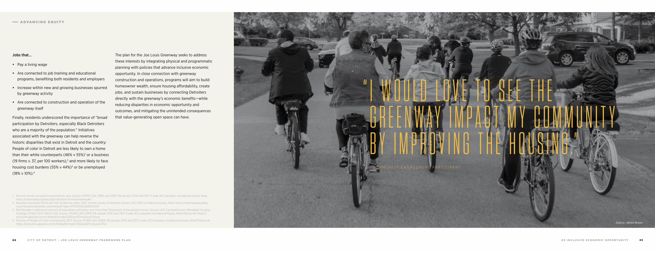
0 3 I N C L U S I V E E C O N O M I C O P P O R T U N I T YC I T Y O F D E T R O I T • J O E LO U I S G R E E N WAY F R A M E WO R K P L A N8 8 8 9
Jobs that…
• Pay a living wage
• Are connected to job training and educational programs, benefiting both residents and employers
• Increase within new and growing businesses spurred by greenway activity
• Are connected to construction and operation of the
greenway itself
Finally, residents underscored the importance of “broad
participation by Detroiters, especially Black Detroiters
who are a majority of the population.” Initiatives
associated with the greenway can help reverse the
historic disparities that exist in Detroit and the country:
People of color in Detroit are less likely to own a home
than their white counterparts (46% v 55%)1 or a business
(19 firms v. 37, per 100 workers),2 and more likely to face
housing cost burdens (55% v 44%)3 or be unemployed
(18% v 10%).4
1 Percent owner-occupied households by race. Source: IPUMS USA (1990 and 2000 5% sample; 2010 and 2017 5-year ACS samples) via National Equity Atlas: https://nationalequityatlas.org/indicators/Homeownership#/
2 Business ownership (firms per 100 workers by race), 2012. Source: survey of business owners, ACS 2012 via National Equity Atlas: https://nationalequityatlas.org/indicators/Business-ownership#/?geo=07000000002622000
3 Rent Burden is defined as percent of population with gross rent more than 30 percent of household income. Source: HUD Comprehensive Affordable Housing Strategy (CHAS) 2017. Detroit City. Source: IPUMS USA (2000 5% sample; 2010 and 2017 5-year ACS samples) via National Equity Atlas/PolicyLink: https://policylink.app.box.com/s/4ddsd5ormgk3z352sow57mzlywwx70ocq
4 Percent of People of Color Unemployed, 2017. Source: IPUMS USA (2000 5% sample; 2010 and 2017 5-year ACS samples) via National Equity Atlas/PolicyLink: https://policylink.app.box.com/s/4ddsd5ormgk3z352sow57mzlywwx70oc
The plan for the Joe Louis Greenway seeks to address
these interests by integrating physical and programmatic
planning with policies that advance inclusive economic
opportunity. In close connection with greenway
construction and operations, programs will aim to build
homeowner wealth, ensure housing affordability, create
jobs, and sustain businesses by connecting Detroiters
directly with the greenway’s economic benefits—while
reducing disparities in economic opportunity and
outcomes, and mitigating the unintended consequences
that value-generating open space can have.
Source: James Brown
“ I W O U L D L O V E T O S E E T H E G R E E N W A Y I M P A C T M Y C O M M U N I T Y B Y I M P R O V I N G T H E H O U S I N G . ”— C O M M U N I T Y E N G A G E M E N T PA R T I C I PA N T
Source: James Brown
A DVA N C I N G E Q U I T Y
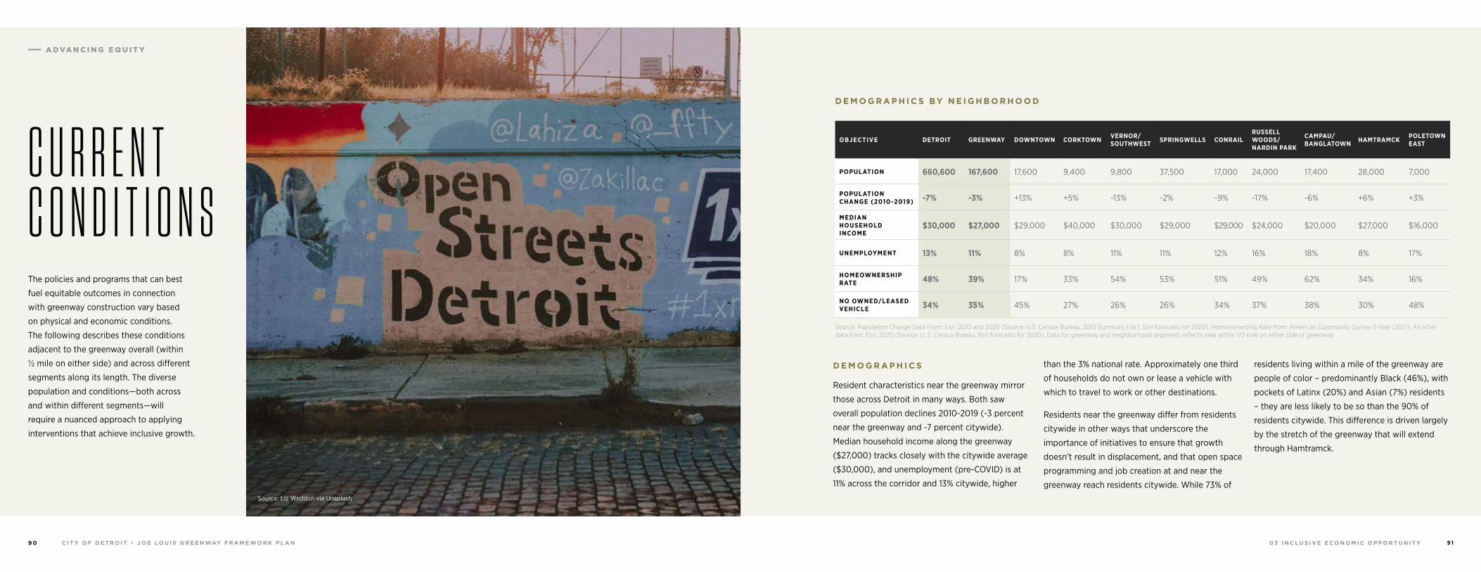
0 3 I N C L U S I V E E C O N O M I C O P P O R T U N I T YC I T Y O F D E T R O I T • J O E LO U I S G R E E N WAY F R A M E WO R K P L A N9 0 9 1
The policies and programs that can best
fuel equitable outcomes in connection
with greenway construction vary based
on physical and economic conditions.
The following describes these conditions
adjacent to the greenway overall (within
½ mile on either side) and across different
segments along its length. The diverse
population and conditions—both across
and within different segments—will
require a nuanced approach to applying
interventions that achieve inclusive growth.
C U R R E N T C O N D I T I O N S
D E M O G R A P H I C S
Resident characteristics near the greenway mirror
those across Detroit in many ways. Both saw
overall population declines 2010-2019 (-3 percent
near the greenway and -7 percent citywide).
Median household income along the greenway
($27,000) tracks closely with the citywide average
($30,000), and unemployment (pre-COVID) is at
11% across the corridor and 13% citywide, higher
than the 3% national rate. Approximately one third
of households do not own or lease a vehicle with
which to travel to work or other destinations.
Residents near the greenway differ from residents
citywide in other ways that underscore the
importance of initiatives to ensure that growth
doesn’t result in displacement, and that open space
programming and job creation at and near the
greenway reach residents citywide. While 73% of
residents living within a mile of the greenway are
people of color – predominantly Black (46%), with
pockets of Latinx (20%) and Asian (7%) residents
– they are less likely to be so than the 90% of
residents citywide. This difference is driven largely
by the stretch of the greenway that will extend
through Hamtramck.
D E M O G R A P H I C S BY N E I G H B O R H O O D
OBJECTIVE DETROIT GREENWAY DOWNTOWN CORKTOWN VERNOR/SOUTHWEST SPRINGWELLS CONRAIL
RUSSELL WOODS/ NARDIN PARK
CAMPAU/ BANGLATOWN HAMTRAMCK POLETOWN
EAST
POPULATION 660,600 167,600 17,600 9,400 9,800 37,500 17,000 24,000 17,400 28,000 7,000
POPULATION CHANGE (2010-2019) -7% -3% +13% +5% -13% -2% -9% -17% -6% +6% +3%
MEDIAN HOUSEHOLD INCOME
$30,000 $27,000 $29,000 $40,000 $30,000 $29,000 $29,000 $24,000 $20,000 $27,000 $16,000
UNEMPLOYMENT 13% 11% 8% 8% 11% 11% 12% 16% 18% 8% 17%
HOMEOWNERSHIP RATE 48% 39% 17% 33% 54% 53% 51% 49% 62% 34% 16%
NO OWNED/LEASED VEHICLE 34% 35% 45% 27% 26% 26% 34% 37% 38% 30% 48%
Source: Population Change Data From: Esri, 2010 and 2020 (Source: U.S. Census Bureau, 2010 Summary File 1, Esri forecasts for 2020). Homeownership Rate from: American Community Survey 5-Year (2017). All other data from: Esri, 2020 (Source: U .S. Census Bureau, Esri forecasts for 2020). Data for greenway and neighborhood segments reflects area within 1/2 mile on either side of greenway.
Source: Liz Weddon via Unsplash
A DVA N C I N G E Q U I T Y
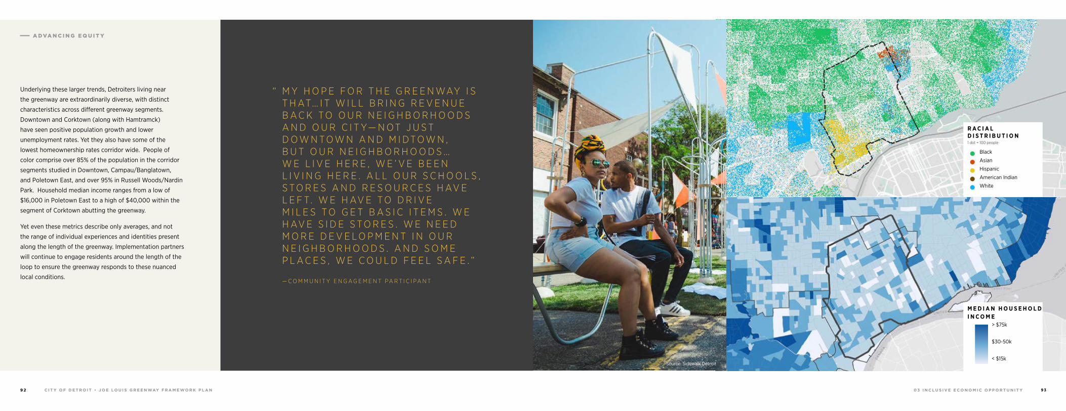
0 3 I N C L U S I V E E C O N O M I C O P P O R T U N I T YC I T Y O F D E T R O I T • J O E LO U I S G R E E N WAY F R A M E WO R K P L A N9 2 9 3
Underlying these larger trends, Detroiters living near
the greenway are extraordinarily diverse, with distinct
characteristics across different greenway segments.
Downtown and Corktown (along with Hamtramck)
have seen positive population growth and lower
unemployment rates. Yet they also have some of the
lowest homeownership rates corridor wide. People of
color comprise over 85% of the population in the corridor
segments studied in Downtown, Campau/Banglatown,
and Poletown East, and over 95% in Russell Woods/Nardin
Park. Household median income ranges from a low of
$16,000 in Poletown East to a high of $40,000 within the
segment of Corktown abutting the greenway.
Yet even these metrics describe only averages, and not
the range of individual experiences and identities present
along the length of the greenway. Implementation partners
will continue to engage residents around the length of the
loop to ensure the greenway responds to these nuanced
local conditions.
“ M Y H O P E F O R T H E G R E E N WAY I S T H AT… I T W I L L B R I N G R E V E N U E B A C K T O O U R N E I G H B O R H O O D S A N D O U R C I T Y— N O T J U S T D O W N T O W N A N D M I D T O W N , B U T O U R N E I G H B O R H O O D S …W E L I V E H E R E , W E ’ V E B E E N L I V I N G H E R E . A L L O U R S C H O O L S , S T O R E S A N D R E S O U R C E S H AV E L E F T. W E H AV E T O D R I V E M I L E S T O G E T B A S I C I T E M S . W E H AV E S I D E S T O R E S . W E N E E D M O R E D E V E L O P M E N T I N O U R N E I G H B O R H O O D S . A N D S O M E P L A C E S , W E C O U L D F E E L S A F E . ”
M E D I A N H O U S E H O L D I N C O M E > $75k
$30-50k
< $15k
R A C I A L D I S T R I B U T I O N
Black
Asian
Hispanic
American Indian
White
1 dot = 100 people
Source: Sidewalk Detroit
— C O M M U N I T Y E N G A G E M E N T PA R T I C I PA N T
A DVA N C I N G E Q U I T Y
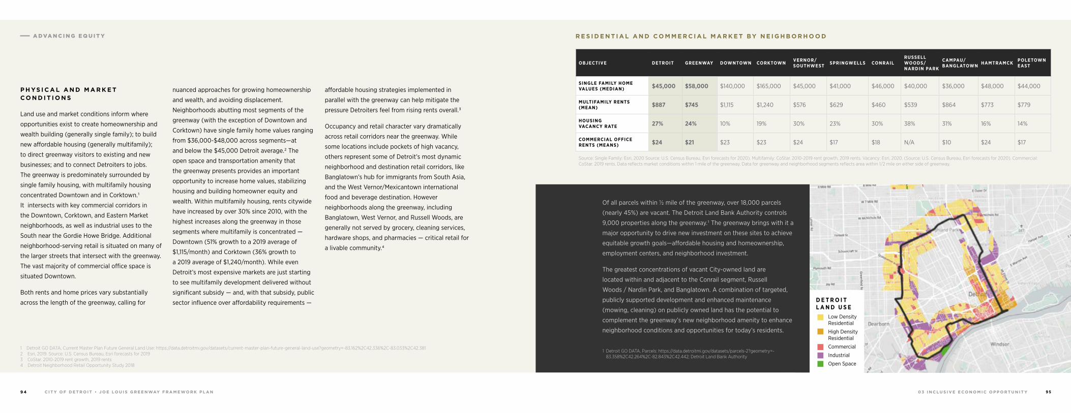
0 3 I N C L U S I V E E C O N O M I C O P P O R T U N I T YC I T Y O F D E T R O I T • J O E LO U I S G R E E N WAY F R A M E WO R K P L A N9 4 9 5
P H YS I C A L A N D M A R K E T C O N D I T I O N S
Land use and market conditions inform where
opportunities exist to create homeownership and
wealth building (generally single family); to build
new affordable housing (generally multifamily);
to direct greenway visitors to existing and new
businesses; and to connect Detroiters to jobs.
The greenway is predominately surrounded by
single family housing, with multifamily housing
concentrated Downtown and in Corktown.1
It intersects with key commercial corridors in
the Downtown, Corktown, and Eastern Market
neighborhoods, as well as industrial uses to the
South near the Gordie Howe Bridge. Additional
neighborhood-serving retail is situated on many of
the larger streets that intersect with the greenway.
The vast majority of commercial office space is
situated Downtown.
Both rents and home prices vary substantially
across the length of the greenway, calling for
1 Detroit GO DATA, Current Master Plan Future General Land Use: https://data.detroitmi.gov/datasets/current-master-plan-future-general-land-use?geometry=-83.162%2C42.336%2C-83.033%2C42.381 2 Esri, 2019. Source: U.S. Census Bureau, Esri forecasts for 20193 CoStar. 2010-2019 rent growth, 2019 rents4 Detroit Neighborhood Retail Opportunity Study 2018
nuanced approaches for growing homeownership
and wealth, and avoiding displacement.
Neighborhoods abutting most segments of the
greenway (with the exception of Downtown and
Corktown) have single family home values ranging
from $36,000-$48,000 across segments—at
and below the $45,000 Detroit average.2 The
open space and transportation amenity that
the greenway presents provides an important
opportunity to increase home values, stabilizing
housing and building homeowner equity and
wealth. Within multifamily housing, rents citywide
have increased by over 30% since 2010, with the
highest increases along the greenway in those
segments where multifamily is concentrated —
Downtown (51% growth to a 2019 average of
$1,115/month) and Corktown (36% growth to
a 2019 average of $1,240/month). While even
Detroit’s most expensive markets are just starting
to see multifamily development delivered without
significant subsidy — and, with that subsidy, public
sector influence over affordability requirements —
affordable housing strategies implemented in
parallel with the greenway can help mitigate the
pressure Detroiters feel from rising rents overall.3
Occupancy and retail character vary dramatically
across retail corridors near the greenway. While
some locations include pockets of high vacancy,
others represent some of Detroit’s most dynamic
neighborhood and destination retail corridors, like
Banglatown’s hub for immigrants from South Asia,
and the West Vernor/Mexicantown international
food and beverage destination. However
neighborhoods along the greenway, including
Banglatown, West Vernor, and Russell Woods, are
generally not served by grocery, cleaning services,
hardware shops, and pharmacies — critical retail for
a livable community.4
R E S I D E N T I A L A N D C O M M E R C I A L M A R K E T BY N E I G H B O R H O O D
OBJECTIVE DETROIT GREENWAY DOWNTOWN CORKTOWN VERNOR/SOUTHWEST SPRINGWELLS CONRAIL
RUSSELL WOODS/ NARDIN PARK
CAMPAU/ BANGLATOWN HAMTRAMCK POLETOWN
EAST
SINGLE FAMILY HOME VALUES (MEDIAN) $45,000 $58,000 $140,000 $165,000 $45,000 $41,000 $46,000 $40,000 $36,000 $48,000 $44,000
MULTIFAMILY RENTS (MEAN) $887 $745 $1,115 $1,240 $576 $629 $460 $539 $864 $773 $779
HOUSING VACANCY RATE 27% 24% 10% 19% 30% 23% 30% 38% 31% 16% 14%
COMMERCIAL OFFICE RENTS (MEANS) $24 $21 $23 $23 $24 $17 $18 N/A $10 $24 $17
Source: Single Family: Esri, 2020 Source: U.S. Census Bureau, Esri forecasts for 2020). Multifamily: CoStar. 2010-2019 rent growth, 2019 rents. Vacancy: Esri, 2020. (Source: U.S. Census Bureau, Esri forecasts for 2020). Commercial: CoStar. 2019 rents. Data reflects market conditions within 1 mile of the greenway. Data for greenway and neighborhood segments reflects area within 1/2 mile on either side of greenway.
D E T R O I T L A N D U S E
Low Density Residential
High Density Residential
Commercial
Industrial
Open Space
Of all parcels within ½ mile of the greenway, over 18,000 parcels
(nearly 45%) are vacant. The Detroit Land Bank Authority controls
9,000 properties along the greenway.1 The greenway brings with it a
major opportunity to drive new investment on these sites to achieve
equitable growth goals—affordable housing and homeownership,
employment centers, and neighborhood investment.
The greatest concentrations of vacant City-owned land are
located within and adjacent to the Conrail segment, Russell
Woods / Nardin Park, and Banglatown. A combination of targeted,
publicly supported development and enhanced maintenance
(mowing, cleaning) on publicly owned land has the potential to
complement the greenway’s new neighborhood amenity to enhance
neighborhood conditions and opportunities for today’s residents.
1 Detroit GO DATA, Parcels: https://data.detroitmi.gov/datasets/parcels-2?geometry=-83.358%2C42.264%2C-82.843%2C42.442; Detroit Land Bank Authority
A DVA N C I N G E Q U I T Y
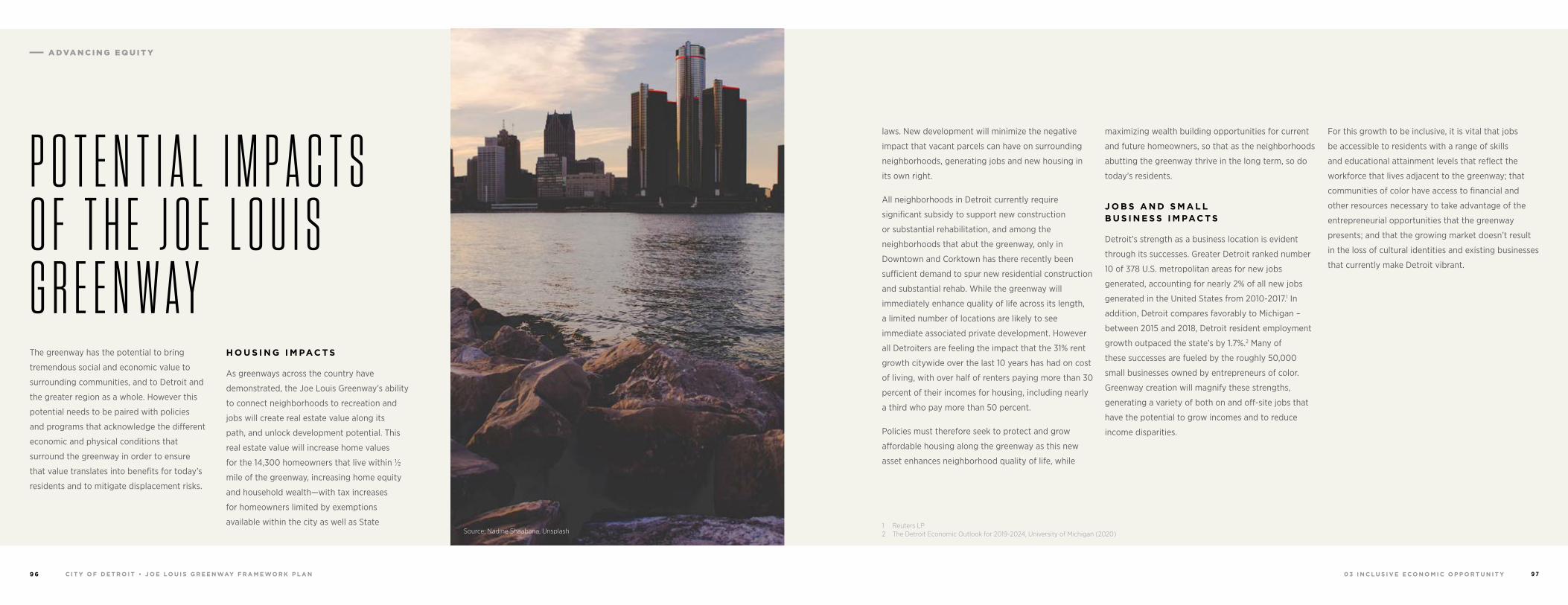
0 3 I N C L U S I V E E C O N O M I C O P P O R T U N I T YC I T Y O F D E T R O I T • J O E LO U I S G R E E N WAY F R A M E WO R K P L A N9 6 9 7
laws. New development will minimize the negative
impact that vacant parcels can have on surrounding
neighborhoods, generating jobs and new housing in
its own right.
All neighborhoods in Detroit currently require
significant subsidy to support new construction
or substantial rehabilitation, and among the
neighborhoods that abut the greenway, only in
Downtown and Corktown has there recently been
sufficient demand to spur new residential construction
and substantial rehab. While the greenway will
immediately enhance quality of life across its length,
a limited number of locations are likely to see
immediate associated private development. However
all Detroiters are feeling the impact that the 31% rent
growth citywide over the last 10 years has had on cost
of living, with over half of renters paying more than 30
percent of their incomes for housing, including nearly
a third who pay more than 50 percent.
Policies must therefore seek to protect and grow
affordable housing along the greenway as this new
asset enhances neighborhood quality of life, while
1 Reuters LP2 The Detroit Economic Outlook for 2019-2024, University of Michigan (2020)
maximizing wealth building opportunities for current
and future homeowners, so that as the neighborhoods
abutting the greenway thrive in the long term, so do
today’s residents.
J O B S A N D S M A L L B U S I N E S S I M PAC T S
Detroit’s strength as a business location is evident
through its successes. Greater Detroit ranked number
10 of 378 U.S. metropolitan areas for new jobs
generated, accounting for nearly 2% of all new jobs
generated in the United States from 2010-2017.1 In
addition, Detroit compares favorably to Michigan –
between 2015 and 2018, Detroit resident employment
growth outpaced the state’s by 1.7%.2 Many of
these successes are fueled by the roughly 50,000
small businesses owned by entrepreneurs of color.
Greenway creation will magnify these strengths,
generating a variety of both on and off-site jobs that
have the potential to grow incomes and to reduce
income disparities.
For this growth to be inclusive, it is vital that jobs
be accessible to residents with a range of skills
and educational attainment levels that reflect the
workforce that lives adjacent to the greenway; that
communities of color have access to financial and
other resources necessary to take advantage of the
entrepreneurial opportunities that the greenway
presents; and that the growing market doesn’t result
in the loss of cultural identities and existing businesses
that currently make Detroit vibrant.
The greenway has the potential to bring
tremendous social and economic value to
surrounding communities, and to Detroit and
the greater region as a whole. However this
potential needs to be paired with policies
and programs that acknowledge the different
economic and physical conditions that
surround the greenway in order to ensure
that value translates into benefits for today’s
residents and to mitigate displacement risks.
H O U S I N G I M PAC T S
As greenways across the country have
demonstrated, the Joe Louis Greenway’s ability
to connect neighborhoods to recreation and
jobs will create real estate value along its
path, and unlock development potential. This
real estate value will increase home values
for the 14,300 homeowners that live within ½
mile of the greenway, increasing home equity
and household wealth—with tax increases
for homeowners limited by exemptions
available within the city as well as State Source: Nadine Shaabana, Unsplash
P O T E N T I A L I M P A C T S O F T H E J O E L O U I S G R E E N W A Y
A DVA N C I N G E Q U I T Y
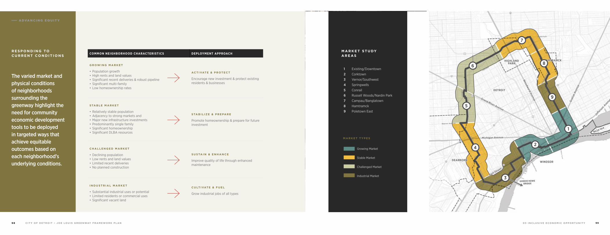
0 3 I N C L U S I V E E C O N O M I C O P P O R T U N I T YC I T Y O F D E T R O I T • J O E LO U I S G R E E N WAY F R A M E WO R K P L A N9 8 9 9
COMMON NEIGHBORHOOD CHARACTERISTICS DEPLOYMENT APPROACH
G R OW I N G M A R K E T
• Population growth• High rents and land values• Significant recent deliveries & robust pipeline• Significant multi-family• Low homeownership rates
AC T I VAT E & P R OT E C T
Encourage new investment & protect existing residents & businesses
S TA B L E M A R K E T
• Relatively stable population• Adjacency to strong markets and • Major new infrastructure investments• Predominantly single family• Significant homeownership• Significant DLBA resources
S TA B I L I Z E & P R E PA R E
Promote homeownership & prepare for future investment
C H A L L E N G E D M A R K E T
• Declining population• Low rents and land values• Limited recent deliveries • No planned construction
S U S TA I N & E N H A N C E
Improve quality of life through enhanced maintenance
I N D U S T R I A L M A R K E T
• Substantial industrial uses or potential• Limited residents or commercial uses• Significant vacant land
C U LT I VAT E & F U E L
Grow industrial jobs of all types
2
3
4
5
6
7
8
9
1
The varied market and physical conditions of neighborhoods surrounding the greenway highlight the need for community economic development tools to be deployed in targeted ways that achieve equitable outcomes based on each neighborhood’s underlying conditions.
R E S P O N D I N G TO C U R R E N T C O N D I T I O N S
M A R K E T T Y P E S
Growing Market
Stable Market
Challenged Market
Industrial Market
M A R K E T S T U DY A R E A S
1 Existing/Downtown
2 Corktown
3 Vernor/Southwest
4 Springwells
5 Conrail
6 Russell Woods/Nardin Park
7 Campau/Banglatown
8 Hamtramck
9 Poletown East
A DVA N C I N G E Q U I T Y
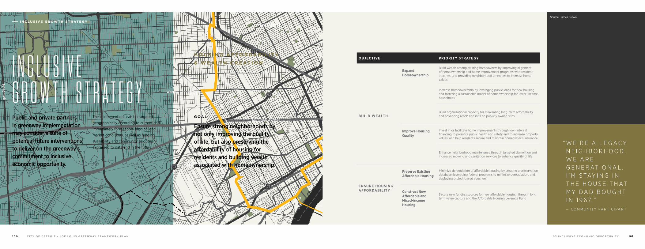
0 3 I N C L U S I V E E C O N O M I C O P P O R T U N I T YC I T Y O F D E T R O I T • J O E LO U I S G R E E N WAY F R A M E WO R K P L A N1 0 0 1 0 1
Source: Glenn Kujansuu, Sidewalk Detroit
OBJECTIVE PRIORITY STRATEGY
BUILD WEALTH
Expand Homeownership
Build wealth among existing homeowners by improving alignment of homeownership and home improvement programs with resident incomes, and providing neighborhood amenities to increase home values
Increase homeownership by leveraging public lands for new housing and fostering a sustainable model of homeownership for lower-income households
Build organizational capacity for stewarding long-term affordability and advancing rehab and infill on publicly owned sites
Improve Housing Quality
Invest in or facilitate home improvements through low- interest financing to promote public health and safety and to increase property values, and help residents secure and maintain homeowner’s insurance
Enhance neighborhood maintenance through targeted demolition and increased mowing and sanitation services to enhance quality of life
ENSURE HOUSING AFFORDABILITY
Preserve Existing Affordable Housing
Minimize deregulation of affordable housing by creating a preservation database, leveraging federal programs to minimize deregulation, and deploying project-based vouchers
Construct New Affordable and Mixed-income Housing
Secure new funding sources for new affordable housing, through long term value capture and the Affordable Housing Leverage Fund
Source: James Brown
94
94
94
94
75
75
75
10
10
HIGHLANDPARK
DETROIT
DEARBORN
Michigan Avenue
Telegrap
h
Telegrap
h
Plymouth
Warren Avenue
Bagley
Je�erson Avenue
Dearborn
Detroit Riverwalk
Dequindre Cut
Lonyo
Dix
Woodm
ere
Campbell
W. G
rand
8 Mile
Fort
Fort
Woodw
ard Avenue
Woodw
ard
Gra
tiot
Aven
ue
Grand River Avenue
Davison
Joseph Campau
Ham
tram
ck D
r
Conrail
Conrail
Oakm
an
McNichols
Live
rnoi
s
GORDIE HOWEBRIDGE
HAMTRAMCK
BELLE ISLE
WINDSOR
I N C L U S I V E G R O W T H S T R A T E G YPublic and private partners in greenway implementation may consider a suite of potential future interventions to deliver on the greenway’s commitment to inclusive economic opportunity.
These interventions can be targeted
geographically according to current and
immediately foreseeable physical and
market conditions, as well as funding
availability and community priorities
expressed to date and in the future.
I N C L U S I V E G R OW T H S T R AT E G Y
“ W E ' R E A L E G A C Y N E I G H B O R H O O D . W E A R E G E N E R AT I O N A L . I ' M S TAY I N G I N T H E H O U S E T H AT M Y D A D B O U G H T I N 1 9 6 7. ”
— C O M M U N I T Y PA R T I C I PA N T
G OA L
Ensure strong neighborhoods by not only improving the quality of life, but also preserving the affordability of housing for residents and building wealth associated with homeownership.
H O U S I N G A F F O R DA B I L I T Y
& W E A LT H C R E AT I O N
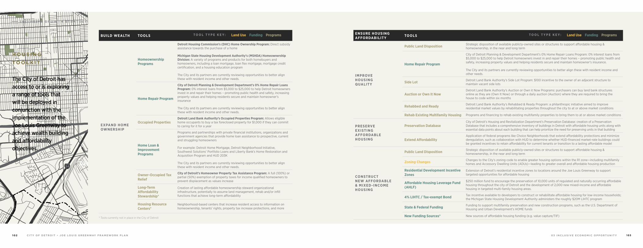
0 3 I N C L U S I V E E C O N O M I C O P P O R T U N I T YC I T Y O F D E T R O I T • J O E LO U I S G R E E N WAY F R A M E WO R K P L A N1 0 2 1 0 3
ENSURE HOUSING AFFORDABILITY TOOLS
IMPROVE HOUSING QUALITY
Public Land Disposition Strategic disposition of available publicly-owned sites or structures to support affordable housing & homeownership, in the near and long term
Home Repair Program
City of Detroit Planning & Development Department’s 0% Home Repair Loans Program: 0% interest loans from $5,000 to $25,000 to help Detroit homeowners invest in and repair their homes – promoting public health and safety, increasing property values and helping residents secure and maintain homeowner’s insurance.
The City and its partners are currently reviewing opportunities to better align these with resident income and other needs.
Side Lot Detroit Land Bank Authority’s Side Lot Program: $100 incentive to the owner of an adjacent structure to maintain vacant side lots
Auction or Own It NowDetroit Land Bank Authority’s Auction or Own it Now Programs: purchasers can buy land bank structures online as they are (Own It Now) or through a daily auction (Auction) where they are required to bring the house to code within six months
Rehabbed and Ready Detroit Land Bank Authority’s Rehabbed & Ready Program: a philanthropic initiative aimed to improve residential market values by rehabilitating properties throughout the city to at or above market conditions
Rehab Existing Multifamily Housing Programs and financing to rehab existing multifamily properties to bring them to at or above market conditions
PRESERVE EXISTING AFFORDABLE HOUSING
Preservation DatabaseCity of Detroit’s Housing and Revitalization Department’s Preservation Database: creation of a Preservation Database that includes a comprehensive inventory of buildings in Detroit with affordable housing units along with essential data points about each building that can help prioritize the need for preserving units in that building
Extend AffordabilityApplication of federal programs like Choice Neighborhoods that extend affordability protections and minimize deregulation, such as collaboration with HUD to determine whether HUD-financed market-rate buildings could be granted incentives to retain affordability for current tenants or transition to a lasting affordable model
CONSTRUCT NEW AFFORDABLE & MIXED-INCOME HOUSING
Public Land Disposition Strategic disposition of available publicly-owned sites or structures to support affordable housing & homeownership, in the near and long term
Zoning Changes Changes to the City’s zoning code to enable greater housing options within the R1 zone—including multifamily homes and Accessory Dwelling Units (ADUs)—leading to greater overall and affordable housing production
Residential Development Incentive Zones
Extension of Detroit’s residential incentive zones to locations around the Joe Louis Greenway to support targeted opportunities for affordable housing
Affordable Housing Leverage Fund (AHLF)
$250 million fund to encourage the preservation of 10,000 units of regulated and naturally occurring affordable housing throughout the city of Detroit and the development of 2,000 new mixed-income and affordable housing in targeted multi-family housing areas.
4% LIHTC / Tax-exempt Bond Tax incentive available to developers to construct or rehabilitate affordable housing for low-income households; the Michigan State Housing Development Authority administers the roughly $20M LIHTC program
State & Federal Funding Funding to support multifamily preservation and new construction programs, such as the U.S. Department of Housing and Urban Development’s HOME funds
New Funding Sources* New sources of affordable housing funding (e.g. value capture/TIF)
BUILD WEALTH TOOLS
EXPAND HOME OWNERSHIP
Homeownership Programs
Detroit Housing Commission’s (DHC) Home Ownership Program: Direct subsidy assistance towards the purchase of a home
Michigan State Housing Development Authority’s (MSHDA) Homeownership Division: A variety of programs and products for both homebuyers and homeowners, including a loan mortgage, loan flex mortgage, mortgage credit certification, and a housing education program
The City and its partners are currently reviewing opportunities to better align these with resident income and other needs.
Home Repair Program
City of Detroit Planning & Development Department’s 0% Home Repair Loans Program: 0% interest loans from $5,000 to $25,000 to help Detroit homeowners invest in and repair their homes – promoting public health and safety, increasing property values and helping residents secure and maintain homeowner’s insurance
The City and its partners are currently reviewing opportunities to better align these with resident income and other needs.
Occupied PropertiesDetroit Land Bank Authority’s Occupied Properties Program: Allows eligible home occupants to buy a tax foreclosed property for $1,000 if they can commit to caring for it for a year
Home Loan & Improvement Programs
Programs and partnerships with private financial institutions, organizations and government agencies that provide home loan assistance to prospective, current and struggling homeowners
For example: Detroit Home Mortgage, Detroit Neighborhood Initiative, Southwest Solutions’ Portfolio Loans and Liberty Bank’s Home Restoration and Acquisition Program and HUD 203K
The City and its partners are currently reviewing opportunities to better align these with resident income and other needs.
Owner-Occupied Tax Relief
City of Detroit’s Homeowner Property Tax Assistance Program: A full (100%) or partial (50%) exemption of property taxes for income qualified homeowners to prevent displacement as values increase
Long-Term Affordability Stewardship*
Creation of lasting affordable homeownership steward organizational infrastructure, potentially to assume land management, rehab and/or infill functions that achieve long-term affordability
Housing Resource Centers*
Neighborhood-based centers that increase resident access to information on homeownership, tenants’ rights, property tax increase protections, and more
Land Use Funding ProgramsT O O L T Y P E K E Y :Land Use Funding ProgramsT O O L T Y P E K E Y :
* Tools currently not in place in the City of Detroit
94
94
94
94
75
75
75
10
10
HIGHLANDPARK
DETROIT
DEARBORN
Michigan Avenue
Telegrap
h
Telegrap
h
Plymouth
Warren Avenue
Bagley
Je�erson Avenue
Dearborn
Detroit Riverwalk
Dequindre Cut
Lonyo
Dix
Woodm
ere
Campbell
W. G
rand
8 Mile
Fort
Fort
Woodw
ard Avenue
Woodw
ard
Gra
tiot
Aven
ue
Grand River Avenue
Davison
Joseph Campau
Ham
tram
ck D
r
Conrail
Conrail
Oakm
an
McNichols
Live
rnoi
s
GORDIE HOWEBRIDGE
HAMTRAMCK
BELLE ISLE
WINDSOR
The City of Detroit has access to or is exploring a range of tools that will be deployed in conjunction with the implementation of the Joe Louis Greenway to achieve wealth building and affordability objectives.
H O U S I N G
TO O L K I T
I N C L U S I V E G R OW T H S T R AT E G Y
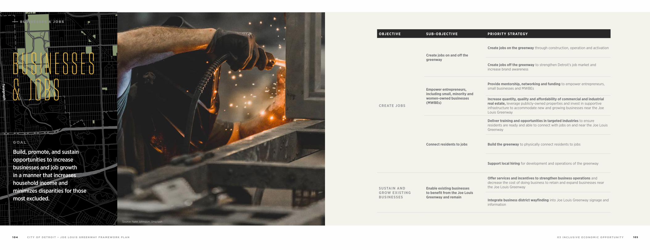
0 3 I N C L U S I V E E C O N O M I C O P P O R T U N I T YC I T Y O F D E T R O I T • J O E LO U I S G R E E N WAY F R A M E WO R K P L A N1 0 4 1 0 5
OBJECTIVE SUB-OBJECTIVE PRIORITY STRATEGY
CREATE JOBS
Create jobs on and off the greenway
Create jobs on the greenway through construction, operation and activation
Create jobs off the greenway to strengthen Detroit’s job market and increase brand awareness
Empower entrepreneurs, including small, minority and women-owned businesses (MWBEs)
Provide mentorship, networking and funding to empower entrepreneurs, small businesses and MWBEs
Increase quantity, quality and affordability of commercial and industrial real estate, leverage publicly-owned properties and invest in supportive infrastructure to accommodate new and growing businesses near the Joe Louis Greenway
Connect residents to jobs
Deliver training and opportunities in targeted industries to ensure residents are ready and able to connect with jobs on and near the Joe Louis Greenway
Build the greenway to physically connect residents to jobs
Support local hiring for development and operations of the greenway
SUSTAIN AND GROW EXISTING BUSINESSES
Enable existing businesses to benefit from the Joe Louis Greenway and remain
Offer services and incentives to strengthen business operations and decrease the cost of doing business to retain and expand businesses near the Joe Louis Greenway
Integrate business district wayfinding into Joe Louis Greenway signage and information
B U S I N E S S E S & J O B S
94
94
94
94
75
75
75
10
10
HIGHLANDPARK
DETROIT
DEARBORN
Michigan Avenue
Telegrap
h
Telegrap
h
Plymouth
Warren Avenue
Bagley
Je�erson Avenue
Dearborn
Detroit Riverwalk
Dequindre Cut
Lonyo
Dix
Woodm
ere
Campbell
W. G
rand
8 Mile
Fort
Fort
Woodw
ard Avenue
Woodw
ard
Gra
tiot
Aven
ue
Grand River Avenue
Davison
Joseph Campau
Ham
tram
ck D
r
Conrail
Conrail
Oakm
an
McNichols
Live
rnoi
s
GORDIE HOWEBRIDGE
HAMTRAMCK
BELLE ISLE
WINDSOR
B U S I N E S S E S & J O B S
G OA L
Build, promote, and sustain opportunities to increase businesses and job growth in a manner that increases household income and minimizes disparities for those most excluded.
Source: Nate Johnston, Unsplash
B U S I N E S S E S & J O B S
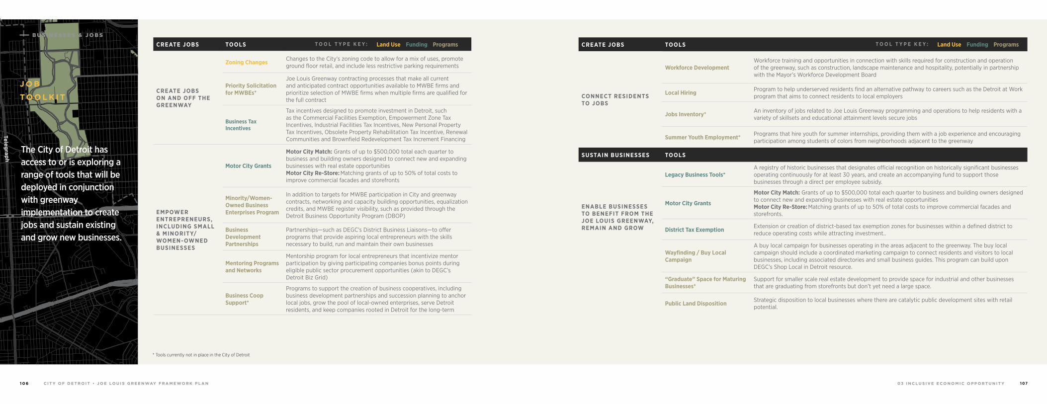
0 3 I N C L U S I V E E C O N O M I C O P P O R T U N I T YC I T Y O F D E T R O I T • J O E LO U I S G R E E N WAY F R A M E WO R K P L A N1 0 6 1 0 7
CREATE JOBS TOOLS
CONNECT RESIDENTS TO JOBS
Workforce DevelopmentWorkforce training and opportunities in connection with skills required for construction and operation of the greenway, such as construction, landscape maintenance and hospitality, potentially in partnership with the Mayor’s Workforce Development Board
Local Hiring Program to help underserved residents find an alternative pathway to careers such as the Detroit at Work program that aims to connect residents to local employers
Jobs Inventory* An inventory of jobs related to Joe Louis Greenway programming and operations to help residents with a variety of skillsets and educational attainment levels secure jobs
Summer Youth Employment* Programs that hire youth for summer internships, providing them with a job experience and encouraging participation among students of colors from neighborhoods adjacent to the greenway
SUSTAIN BUSINESSES TOOLS
ENABLE BUSINESSES TO BENEFIT FROM THE JOE LOUIS GREENWAY, REMAIN AND GROW
Legacy Business Tools*A registry of historic businesses that designates official recognition on historically significant businesses operating continuously for at least 30 years, and create an accompanying fund to support those businesses through a direct per employee subsidy.
Motor City Grants
Motor City Match: Grants of up to $500,000 total each quarter to business and building owners designed to connect new and expanding businesses with real estate opportunitiesMotor City Re-Store: Matching grants of up to 50% of total costs to improve commercial facades and storefronts.
District Tax Exemption Extension or creation of district-based tax exemption zones for businesses within a defined district to reduce operating costs while attracting investment..
Wayfinding / Buy Local Campaign
A buy local campaign for businesses operating in the areas adjacent to the greenway. The buy local campaign should include a coordinated marketing campaign to connect residents and visitors to local businesses, including associated directories and small business guides. This program can build upon DEGC’s Shop Local in Detroit resource.
“Graduate” Space for Maturing Businesses*
Support for smaller scale real estate development to provide space for industrial and other businesses that are graduating from storefronts but don’t yet need a large space.
Public Land Disposition Strategic disposition to local businesses where there are catalytic public development sites with retail potential.
94
94
94
94
75
75
75
10
10
HIGHLANDPARK
DETROIT
DEARBORN
Michigan Avenue
Telegrap
h
Telegrap
h
Plymouth
Warren Avenue
Bagley
Je�erson Avenue
Dearborn
Detroit Riverwalk
Dequindre Cut
Lonyo
Dix
Woodm
ere
Campbell
W. G
rand
8 Mile
Fort
Fort
Woodw
ard Avenue
Woodw
ard
Gra
tiot
Aven
ue
Grand River Avenue
Davison
Joseph Campau
Ham
tram
ck D
r
Conrail
Conrail
Oakm
an
McNichols
Live
rnoi
s
GORDIE HOWEBRIDGE
HAMTRAMCK
BELLE ISLE
WINDSOR
J O B
TO O L K I T
The City of Detroit has access to or is exploring a range of tools that will be deployed in conjunction with greenway implementation to create jobs and sustain existing and grow new businesses.
CREATE JOBS TOOLS
CREATE JOBS ON AND OFF THE GREENWAY
Zoning Changes Changes to the City’s zoning code to allow for a mix of uses, promote ground floor retail, and include less restrictive parking requirements
Priority Solicitation for MWBEs*
Joe Louis Greenway contracting processes that make all current and anticipated contract opportunities available to MWBE firms and prioritize selection of MWBE firms when multiple firms are qualified for the full contract
Business Tax Incentives
Tax incentives designed to promote investment in Detroit, such as the Commercial Facilities Exemption, Empowerment Zone Tax Incentives, Industrial Facilities Tax Incentives, New Personal Property Tax Incentives, Obsolete Property Rehabilitation Tax Incentive, Renewal Communities and Brownfield Redevelopment Tax Increment Financing
EMPOWER ENTREPRENEURS, INCLUDING SMALL & MINORITY/ WOMEN-OWNED BUSINESSES
Motor City Grants
Motor City Match: Grants of up to $500,000 total each quarter to business and building owners designed to connect new and expanding businesses with real estate opportunitiesMotor City Re-Store: Matching grants of up to 50% of total costs to improve commercial facades and storefronts
Minority/Women-Owned Business Enterprises Program
In addition to targets for MWBE participation in City and greenway contracts, networking and capacity building opportunities, equalization credits, and MWBE register visibility, such as provided through the Detroit Business Opportunity Program (DBOP)
Business Development Partnerships
Partnerships—such as DEGC’s District Business Liaisons—to offer programs that provide aspiring local entrepreneurs with the skills necessary to build, run and maintain their own businesses
Mentoring Programs and Networks
Mentorship program for local entrepreneurs that incentivize mentor participation by giving participating companies bonus points during eligible public sector procurement opportunities (akin to DEGC’s Detroit Biz Grid)
Business Coop Support*
Programs to support the creation of business cooperatives, including business development partnerships and succession planning to anchor local jobs, grow the pool of local-owned enterprises, serve Detroit residents, and keep companies rooted in Detroit for the long-term
* Tools currently not in place in the City of Detroit
B U S I N E S S E S & J O B S
Land Use Funding ProgramsT O O L T Y P E K E Y :Land Use Funding ProgramsT O O L T Y P E K E Y :
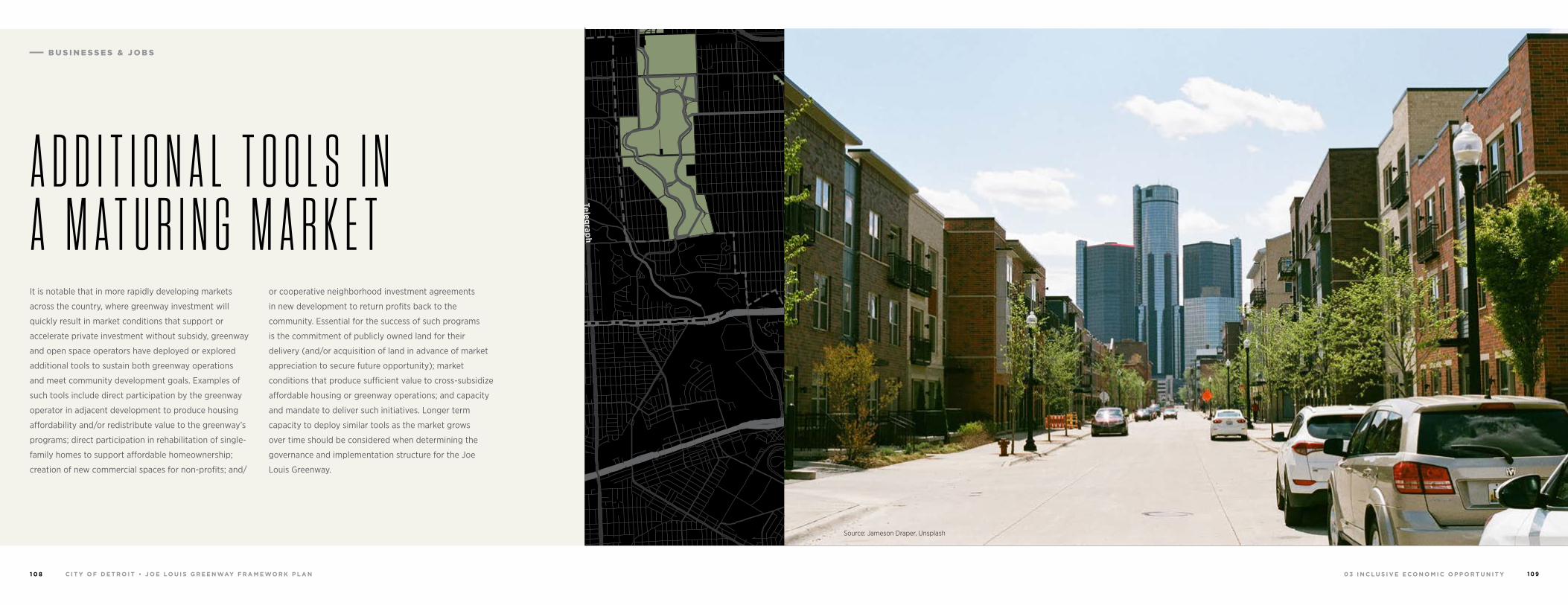
0 3 I N C L U S I V E E C O N O M I C O P P O R T U N I T YC I T Y O F D E T R O I T • J O E LO U I S G R E E N WAY F R A M E WO R K P L A N1 0 8 1 0 9
94
94
94
94
75
75
75
10
10
HIGHLANDPARK
DETROIT
DEARBORN
Michigan Avenue
Telegrap
h
Telegrap
h
Plymouth
Warren Avenue
Bagley
Je�erson Avenue
Dearborn
Detroit Riverwalk
Dequindre Cut
Lonyo
Dix
Woodm
ere
Campbell
W. G
rand
8 Mile
Fort
Fort
Woodw
ard Avenue
Woodw
ard
Gra
tiot
Aven
ue
Grand River Avenue
Davison
Joseph Campau
Ham
tram
ck D
r
Conrail
Conrail
Oakm
an
McNichols
Live
rnoi
s
GORDIE HOWEBRIDGE
HAMTRAMCK
BELLE ISLE
WINDSOR
It is notable that in more rapidly developing markets
across the country, where greenway investment will
quickly result in market conditions that support or
accelerate private investment without subsidy, greenway
and open space operators have deployed or explored
additional tools to sustain both greenway operations
and meet community development goals. Examples of
such tools include direct participation by the greenway
operator in adjacent development to produce housing
affordability and/or redistribute value to the greenway’s
programs; direct participation in rehabilitation of single-
family homes to support affordable homeownership;
creation of new commercial spaces for non-profits; and/
or cooperative neighborhood investment agreements
in new development to return profits back to the
community. Essential for the success of such programs
is the commitment of publicly owned land for their
delivery (and/or acquisition of land in advance of market
appreciation to secure future opportunity); market
conditions that produce sufficient value to cross-subsidize
affordable housing or greenway operations; and capacity
and mandate to deliver such initiatives. Longer term
capacity to deploy similar tools as the market grows
over time should be considered when determining the
governance and implementation structure for the Joe
Louis Greenway.
A D D I T I O N A L T O O L S I N A M A T U R I N G M A R K E T
Source: Jameson Draper, Unsplash
B U S I N E S S E S & J O B S
0 3 I N C L U S I V E E C O N O M I C O P P O R T U N I T YC I T Y O F D E T R O I T • J O E LO U I S G R E E N WAY F R A M E WO R K P L A N1 1 0 1 1 1
94
94
94
94
75
75
75
10
10
HIGHLANDPARK
DETROIT
DEARBORN
Michigan Avenue
Telegrap
h
Telegrap
h
Plymouth
Warren Avenue
Bagley
Je�erson Avenue
Dearborn
Detroit Riverwalk
Dequindre Cut
Lonyo
Dix
Woodm
ere
Campbell
W. G
rand
8 Mile
Fort
Fort
Woodw
ard Avenue
Woodw
ard
Gra
tiot
Aven
ue
Grand River Avenue
Davison
Joseph Campau
Ham
tram
ck D
r
Conrail
Conrail
Oakm
an
McNichols
Live
rnoi
s
GORDIE HOWEBRIDGE
HAMTRAMCK
BELLE ISLE
WINDSOR
Many housing, jobs, and business interventions are
universally applicable across the range of neighborhood
conditions in Detroit, but some distinct approaches
are necessary to respond to specific market and
physical contexts.
In growing and stable neighborhoods, implementation
partners will serve existing residents by building wealth
through improved home values and new homeownership
opportunities, ensuring housing affordability by
protecting existing and building new affordable housing,
creating and retaining jobs including small businesses
and minority and women-owned businesses (MWBEs),
and connecting residents to jobs. The City will also aim to
serve future residents through strategic and coordinated
new developments that will expand both the housing and
job markets.
In challenged and industrial neighborhoods, priority
strategies are more targeted to protect and improve the
existing fabric of the neighborhoods. In these areas, the
City will strive to grow wealth for the existing residents,
and focus heavily on job creation and connecting
residents to jobs.
It is important to acknowledge that the neighborhoods
around the greenway are extraordinarily diverse, not
only mile by mile, but also block by block. Alignment of
inclusive economic development tools by neighborhood
conditions as defined by the geographic segments
analyzed here is necessarily high level. There are
most certainly specific locations within each segment
that call for unique approaches not reflected below.
Implementation will require dedicated focus to and more
fine-grained planning to meet desired outcomes.
D E P L O Y M E N T & G R O W T H
B U S I N E S S E S & J O B S
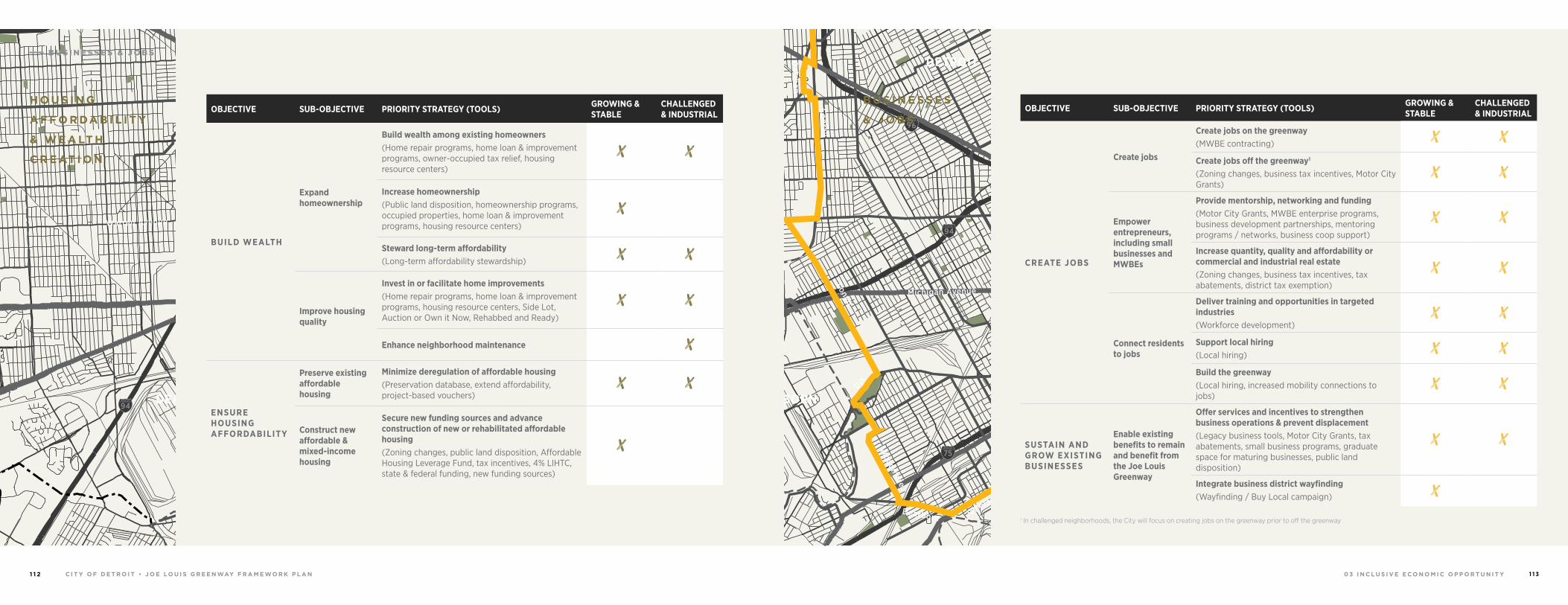
0 3 I N C L U S I V E E C O N O M I C O P P O R T U N I T YC I T Y O F D E T R O I T • J O E LO U I S G R E E N WAY F R A M E WO R K P L A N1 1 2 1 1 3
94
94
94
94
75
75
75
10
10
HIGHLANDPARK
DETROIT
DEARBORN
Michigan Avenue
Telegrap
h
Telegrap
h
Plymouth
Warren Avenue
Bagley
Je�erson Avenue
Dearborn
Detroit Riverwalk
Dequindre Cut
Lonyo
Dix
Woodm
ere
Campbell
W. G
rand
8 Mile
Fort
Fort
Woodw
ard Avenue
Woodw
ard
Gra
tiot
Aven
ue
Grand River Avenue
Davison
Joseph Campau
Ham
tram
ck D
r
Conrail
Conrail
Oakm
an
McNichols
Live
rnoi
s
GORDIE HOWEBRIDGE
HAMTRAMCK
BELLE ISLE
WINDSOR 94
94
94
94
75
75
75
10
10
HIGHLANDPARK
DETROIT
DEARBORN
Michigan Avenue
Telegrap
h
Telegrap
h
Plymouth
Warren Avenue
Bagley
Je�erson Avenue
Dearborn
Detroit Riverwalk
Dequindre Cut
Lonyo
Dix
Woodm
ere
Campbell
W. G
rand
8 Mile
Fort
Fort
Woodw
ard Avenue
Woodw
ard
Gra
tiot
Aven
ue
Grand River Avenue
Davison
Joseph Campau
Ham
tram
ck D
r
Conrail
Conrail
Oakm
an
McNichols
Live
rnoi
s
GORDIE HOWEBRIDGE
HAMTRAMCK
BELLE ISLE
WINDSOR
OBJECTIVE SUB-OBJECTIVE PRIORITY STRATEGY (TOOLS) GROWING & STABLE
CHALLENGED & INDUSTRIAL
CREATE JOBS
Create jobs
Create jobs on the greenway(MWBE contracting)
Create jobs off the greenway1
(Zoning changes, business tax incentives, Motor City Grants)
Empower entrepreneurs, including small businesses and MWBEs
Provide mentorship, networking and funding(Motor City Grants, MWBE enterprise programs, business development partnerships, mentoring programs / networks, business coop support)
Increase quantity, quality and affordability or commercial and industrial real estate(Zoning changes, business tax incentives, tax abatements, district tax exemption)
Connect residents to jobs
Deliver training and opportunities in targeted industries (Workforce development)
Support local hiring(Local hiring)
Build the greenway(Local hiring, increased mobility connections to jobs)
SUSTAIN AND GROW EXISTING BUSINESSES
Enable existing benefits to remain and benefit from the Joe Louis Greenway
Offer services and incentives to strengthen business operations & prevent displacement(Legacy business tools, Motor City Grants, tax abatements, small business programs, graduate space for maturing businesses, public land disposition)
Integrate business district wayfinding(Wayfinding / Buy Local campaign)
1 In challenged neighborhoods, the City will focus on creating jobs on the greenway prior to off the greenway
OBJECTIVE SUB-OBJECTIVE PRIORITY STRATEGY (TOOLS) GROWING & STABLE
CHALLENGED & INDUSTRIAL
BUILD WEALTH
Expand homeownership
Build wealth among existing homeowners(Home repair programs, home loan & improvement programs, owner-occupied tax relief, housing resource centers)
Increase homeownership(Public land disposition, homeownership programs, occupied properties, home loan & improvement programs, housing resource centers)
Steward long-term affordability(Long-term affordability stewardship)
Improve housing quality
Invest in or facilitate home improvements(Home repair programs, home loan & improvement programs, housing resource centers, Side Lot, Auction or Own it Now, Rehabbed and Ready)
Enhance neighborhood maintenance
ENSURE HOUSING AFFORDABILITY
Preserve existing affordable housing
Minimize deregulation of affordable housing(Preservation database, extend affordability, project-based vouchers)
Construct new affordable & mixed-income housing
Secure new funding sources and advance construction of new or rehabilitated affordable housing(Zoning changes, public land disposition, Affordable Housing Leverage Fund, tax incentives, 4% LIHTC, state & federal funding, new funding sources)
H O U S I N G
A F F O R DA B I L I T Y
& W E A LT H
C R E AT I O N
B U S I N E S S E S
& J O B S
B U S I N E S S E S & J O B S
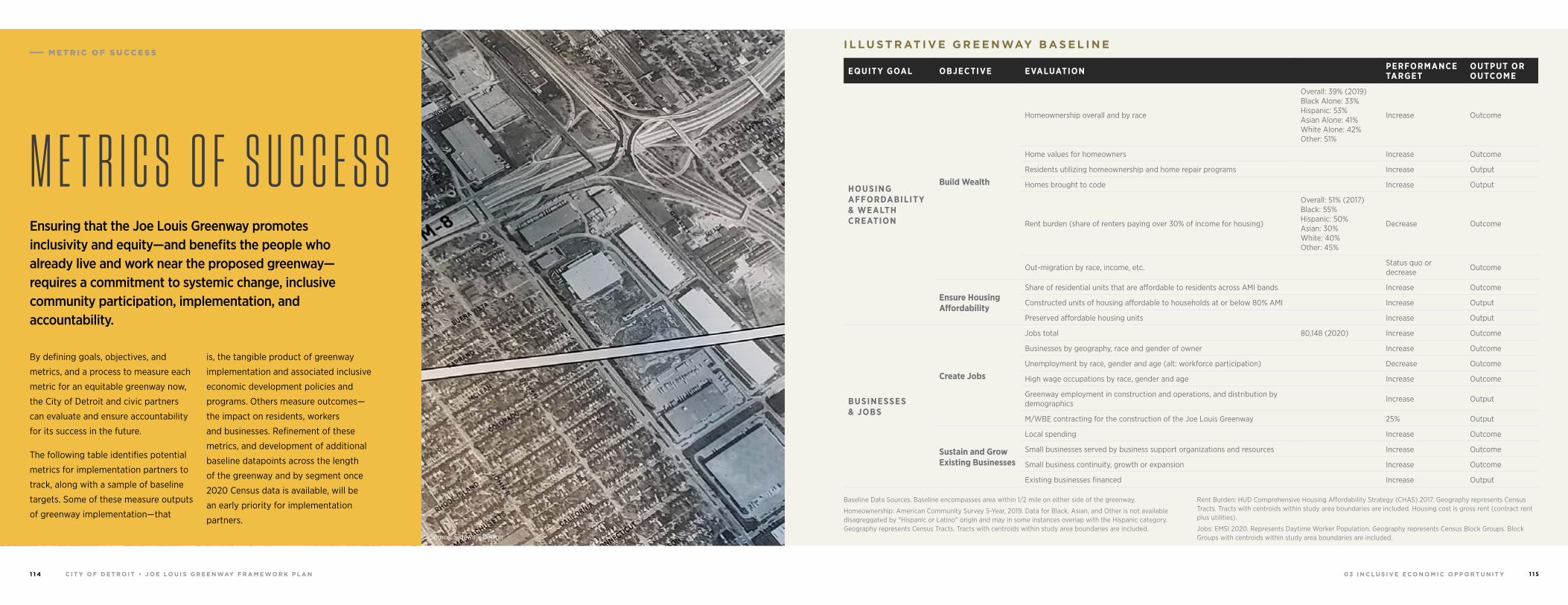
0 3 I N C L U S I V E E C O N O M I C O P P O R T U N I T YC I T Y O F D E T R O I T • J O E LO U I S G R E E N WAY F R A M E WO R K P L A N1 1 4 1 1 5
EQUITY GOAL OBJECTIVE EVALUATION PERFORMANCE TARGET
OUTPUT OR OUTCOME
HOUSING AFFORDABILITY & WEALTH CREATION
Build Wealth
Homeownership overall and by race
Overall: 39% (2019)Black Alone: 33%Hispanic: 53%Asian Alone: 41%White Alone: 42%Other: 51%
Increase Outcome
Home values for homeowners Increase Outcome
Residents utilizing homeownership and home repair programs Increase Output
Homes brought to code Increase Output
Rent burden (share of renters paying over 30% of income for housing)
Overall: 51% (2017)Black: 55%Hispanic: 50%Asian: 30%White: 40%Other: 45%
Decrease Outcome
Out-migration by race, income, etc. Status quo or decrease Outcome
Ensure Housing Affordability
Share of residential units that are affordable to residents across AMI bands Increase Outcome
Constructed units of housing affordable to households at or below 80% AMI Increase Output
Preserved affordable housing units Increase Output
BUSINESSES & JOBS
Create Jobs
Jobs total 80,148 (2020) Increase Outcome
Businesses by geography, race and gender of owner Increase Outcome
Unemployment by race, gender and age (alt: workforce participation) Decrease Outcome
High wage occupations by race, gender and age Increase Outcome
Greenway employment in construction and operations, and distribution by demographics Increase Output
M/WBE contracting for the construction of the Joe Louis Greenway 25% Output
Sustain and Grow Existing Businesses
Local spending Increase Outcome
Small businesses served by business support organizations and resources Increase Outcome
Small business continuity, growth or expansion Increase Outcome
Existing businesses financed Increase Output
Ensuring that the Joe Louis Greenway promotes inclusivity and equity—and benefits the people who already live and work near the proposed greenway—requires a commitment to systemic change, inclusive community participation, implementation, and accountability.
M E T R I C S O F S U C C E S S
By defining goals, objectives, and
metrics, and a process to measure each
metric for an equitable greenway now,
the City of Detroit and civic partners
can evaluate and ensure accountability
for its success in the future.
The following table identifies potential
metrics for implementation partners to
track, along with a sample of baseline
targets. Some of these measure outputs
of greenway implementation—that
is, the tangible product of greenway
implementation and associated inclusive
economic development policies and
programs. Others measure outcomes—
the impact on residents, workers
and businesses. Refinement of these
metrics, and development of additional
baseline datapoints across the length
of the greenway and by segment once
2020 Census data is available, will be
an early priority for implementation
partners.
Source: Sidewalk Detroit
Baseline Data Sources. Baseline encompasses area within 1/2 mile on either side of the greenway.
Homeownership: American Community Survey 5-Year, 2019. Data for Black, Asian, and Other is not available disagreggated by "Hispanic or Latino" origin and may in some instances overlap with the Hispanic category. Geography represents Census Tracts. Tracts with centroids within study area boundaries are included.
Rent Burden: HUD Comprehensive Housing Affordability Strategy (CHAS) 2017. Geography represents Census Tracts. Tracts with centroids within study area boundaries are included. Housing cost is gross rent (contract rent plus utilities).
Jobs: EMSI 2020. Represents Daytime Worker Population. Geography represents Census Block Groups. Block Groups with centroids within study area boundaries are included.
I L L U S T R AT I V E G R E E N WAY B A S E L I N E M E T R I C O F S U C C E S S
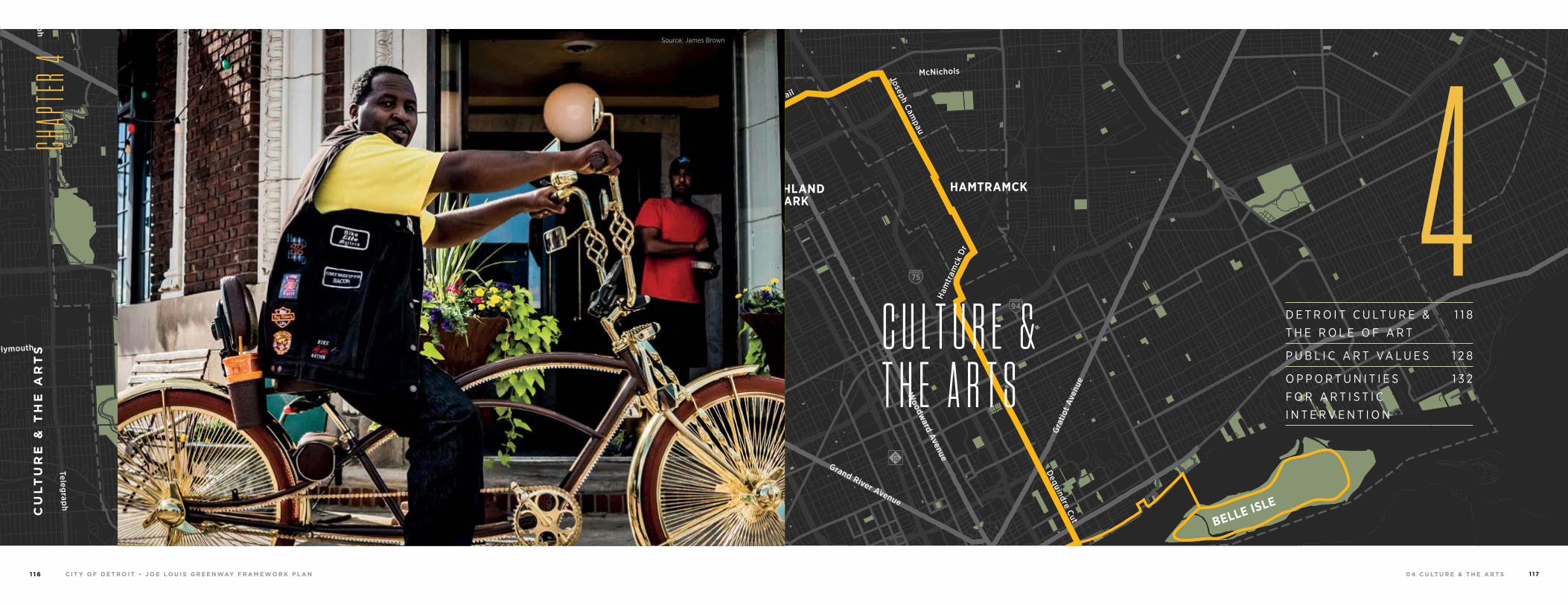
0 4 C U LT U R E & T H E A R T S 1 1 7C I T Y O F D E T R O I T • J O E LO U I S G R E E N WAY F R A M E WO R K P L A N1 1 6
94
94
94
94
75
75
75
10
10
HIGHLANDPARK
DETROIT
DEARBORN
Michigan Avenue
Telegrap
h
Telegrap
h
Plymouth
Warren Avenue
Bagley
Je�erson Avenue
Dearborn
Detroit Riverwalk
Dequindre Cut
Lonyo
Dix
Woodm
ere
Campbell
W. G
rand
8 Mile
Fort
Fort
Woodw
ard Avenue
Woodw
ard
Gra
tiot
Aven
ue
Grand River Avenue
Davison
Joseph Campau
Ham
tram
ck D
r
Conrail
Conrail
Oakm
an
McNichols
Live
rnoi
s
GORDIE HOWEBRIDGE
HAMTRAMCK
BELLE ISLE
WINDSOR
D E T R O I T C U LT U R E & T H E R O L E O F A R T
1 1 8
P U B L I C A R T VA L U E S 1 2 8
O P P O R T U N I T I E S F O R A R T I S T I C I N T E R V E N T I O N
1 3 2
C U L T U R E & T H E A R T S
CU
LT
UR
E &
TH
E A
RT
S
CHAP
TER 4
4Source: Sidewalk Detroit
Source: James Brown
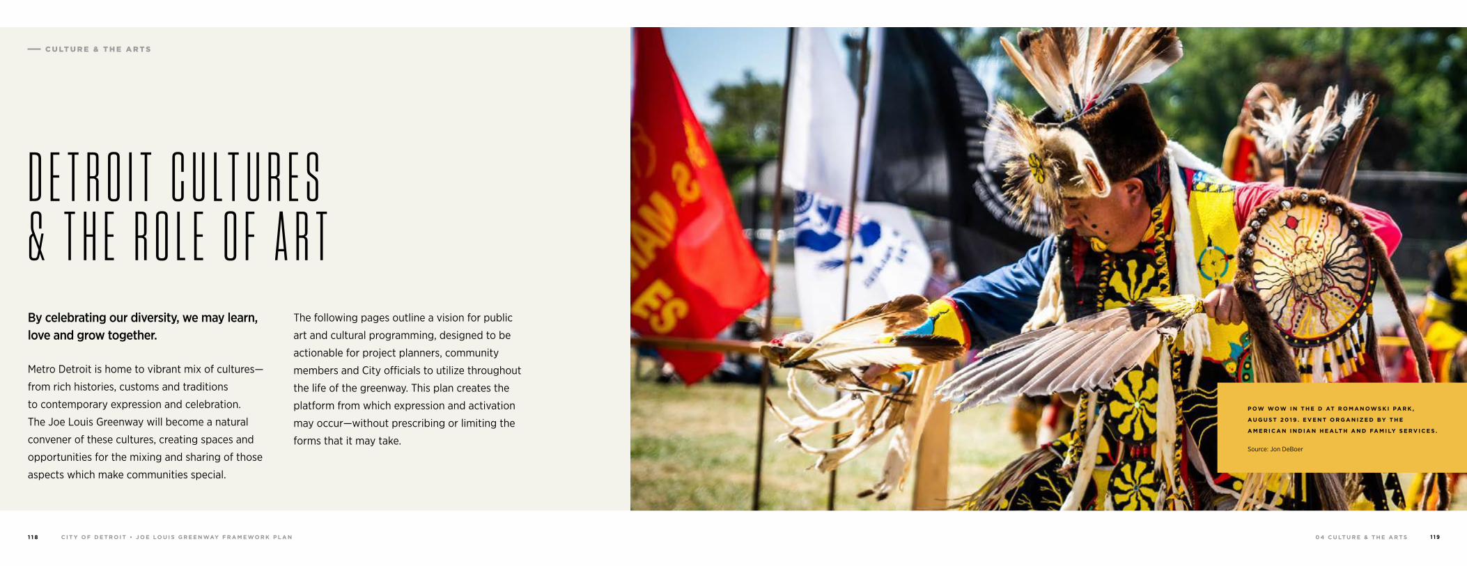
0 4 C U LT U R E & T H E A R T S 1 1 9C I T Y O F D E T R O I T • J O E LO U I S G R E E N WAY F R A M E WO R K P L A N1 1 8
C U LT U R E & T H E A R T S
D E T R O I T C U L T U R E S & T H E R O L E O F A R TBy celebrating our diversity, we may learn, love and grow together.
Metro Detroit is home to vibrant mix of cultures—
from rich histories, customs and traditions
to contemporary expression and celebration.
The Joe Louis Greenway will become a natural
convener of these cultures, creating spaces and
opportunities for the mixing and sharing of those
aspects which make communities special.
P OW WOW I N T H E D AT R O M A N OW S K I PA R K ,
A U G U S T 2 0 1 9 . E V E N T O R G A N I Z E D BY T H E
A M E R I C A N I N D I A N H E A LT H A N D FA M I LY S E R V I C E S .
Source: Jon DeBoer
The following pages outline a vision for public
art and cultural programming, designed to be
actionable for project planners, community
members and City officials to utilize throughout
the life of the greenway. This plan creates the
platform from which expression and activation
may occur—without prescribing or limiting the
forms that it may take.
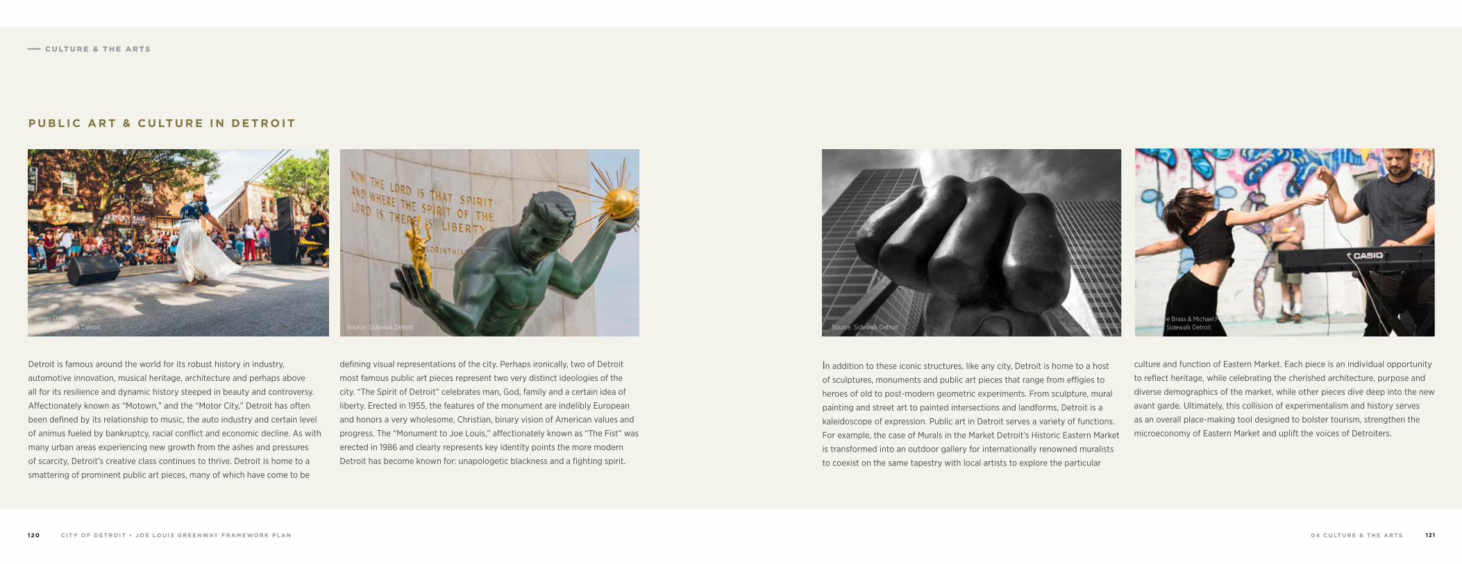
0 4 C U LT U R E & T H E A R T S 1 2 1C I T Y O F D E T R O I T • J O E LO U I S G R E E N WAY F R A M E WO R K P L A N1 2 0
C U LT U R E & T H E A R T S
Detroit is famous around the world for its robust history in industry,
automotive innovation, musical heritage, architecture and perhaps above
all for its resilience and dynamic history steeped in beauty and controversy.
Affectionately known as “Motown,” and the “Motor City,” Detroit has often
been defined by its relationship to music, the auto industry and certain level
of animus fueled by bankruptcy, racial conflict and economic decline. As with
many urban areas experiencing new growth from the ashes and pressures
of scarcity, Detroit’s creative class continues to thrive. Detroit is home to a
smattering of prominent public art pieces, many of which have come to be
defining visual representations of the city. Perhaps ironically, two of Detroit
most famous public art pieces represent two very distinct ideologies of the
city. “The Spirit of Detroit” celebrates man, God, family and a certain idea of
liberty. Erected in 1955, the features of the monument are indelibly European
and honors a very wholesome, Christian, binary vision of American values and
progress. The “Monument to Joe Louis,” affectionately known as “The Fist” was
erected in 1986 and clearly represents key identity points the more modern
Detroit has become known for: unapologetic blackness and a fighting spirit.
P U B L I C A R T & C U LT U R E I N D E T R O I T
Iyawo Dance TheatreSource: Sidewalk Detroit Source: Sidewalk Detroit
In addition to these iconic structures, like any city, Detroit is home to a host
of sculptures, monuments and public art pieces that range from effigies to
heroes of old to post-modern geometric experiments. From sculpture, mural
painting and street art to painted intersections and landforms, Detroit is a
kaleidoscope of expression. Public art in Detroit serves a variety of functions.
For example, the case of Murals in the Market Detroit’s Historic Eastern Market
is transformed into an outdoor gallery for internationally renowned muralists
to coexist on the same tapestry with local artists to explore the particular
culture and function of Eastern Market. Each piece is an individual opportunity
to reflect heritage, while celebrating the cherished architecture, purpose and
diverse demographics of the market, while other pieces dive deep into the new
avant garde. Ultimately, this collision of experimentalism and history serves
as an overall place-making tool designed to bolster tourism, strengthen the
microeconomy of Eastern Market and uplift the voices of Detroiters.
Source: Sidewalk DetroitMarianne Brass & Michael Malis Source: Sidewalk Detroit
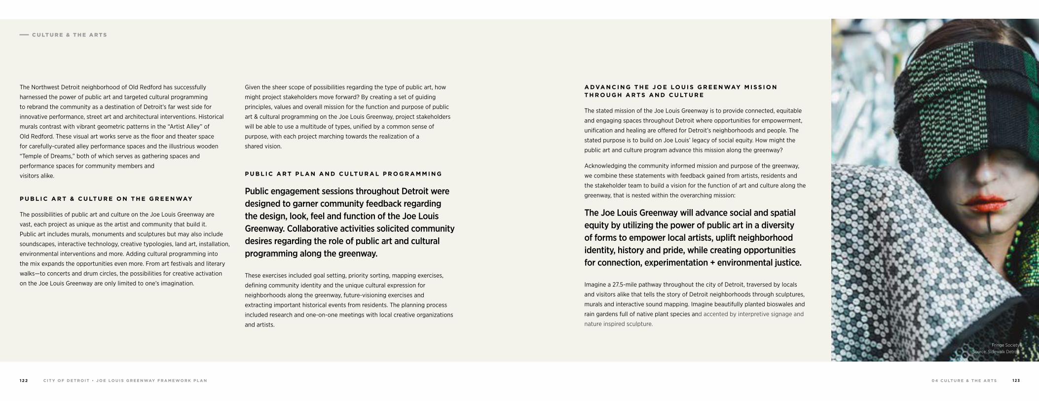
0 4 C U LT U R E & T H E A R T S 1 2 3C I T Y O F D E T R O I T • J O E LO U I S G R E E N WAY F R A M E WO R K P L A N1 2 2
C U LT U R E & T H E A R T S
The Northwest Detroit neighborhood of Old Redford has successfully
harnessed the power of public art and targeted cultural programming
to rebrand the community as a destination of Detroit’s far west side for
innovative performance, street art and architectural interventions. Historical
murals contrast with vibrant geometric patterns in the “Artist Alley” of
Old Redford. These visual art works serve as the floor and theater space
for carefully-curated alley performance spaces and the illustrious wooden
“Temple of Dreams,” both of which serves as gathering spaces and
performance spaces for community members and
visitors alike.
P U B L I C A R T & C U LT U R E O N T H E G R E E N WAY
The possibilities of public art and culture on the Joe Louis Greenway are
vast, each project as unique as the artist and community that build it.
Public art includes murals, monuments and sculptures but may also include
soundscapes, interactive technology, creative typologies, land art, installation,
environmental interventions and more. Adding cultural programming into
the mix expands the opportunities even more. From art festivals and literary
walks—to concerts and drum circles, the possibilities for creative activation
on the Joe Louis Greenway are only limited to one’s imagination.
Given the sheer scope of possibilities regarding the type of public art, how
might project stakeholders move forward? By creating a set of guiding
principles, values and overall mission for the function and purpose of public
art & cultural programming on the Joe Louis Greenway, project stakeholders
will be able to use a multitude of types, unified by a common sense of
purpose, with each project marching towards the realization of a
shared vision.
P U B L I C A R T P L A N A N D C U LT U R A L P R O G R A M M I N G
Public engagement sessions throughout Detroit were designed to garner community feedback regarding the design, look, feel and function of the Joe Louis Greenway. Collaborative activities solicited community desires regarding the role of public art and cultural programming along the greenway.
These exercises included goal setting, priority sorting, mapping exercises,
defining community identity and the unique cultural expression for
neighborhoods along the greenway, future-visioning exercises and
extracting important historical events from residents. The planning process
included research and one-on-one meetings with local creative organizations
and artists.
A DVA N C I N G T H E J O E LO U I S G R E E N WAY M I S S I O N T H R O U G H A R T S A N D C U LT U R E
The stated mission of the Joe Louis Greenway is to provide connected, equitable
and engaging spaces throughout Detroit where opportunities for empowerment,
unification and healing are offered for Detroit’s neighborhoods and people. The
stated purpose is to build on Joe Louis’ legacy of social equity. How might the
public art and culture program advance this mission along the greenway?
Acknowledging the community informed mission and purpose of the greenway,
we combine these statements with feedback gained from artists, residents and
the stakeholder team to build a vision for the function of art and culture along the
greenway, that is nested within the overarching mission:
The Joe Louis Greenway will advance social and spatial equity by utilizing the power of public art in a diversity of forms to empower local artists, uplift neighborhood identity, history and pride, while creating opportunities for connection, experimentation + environmental justice.
Imagine a 27.5-mile pathway throughout the city of Detroit, traversed by locals
and visitors alike that tells the story of Detroit neighborhoods through sculptures,
murals and interactive sound mapping. Imagine beautifully planted bioswales and
rain gardens full of native plant species and accented by interpretive signage and
nature inspired sculpture.
Fringe Society Source: Sidewalk Detroit
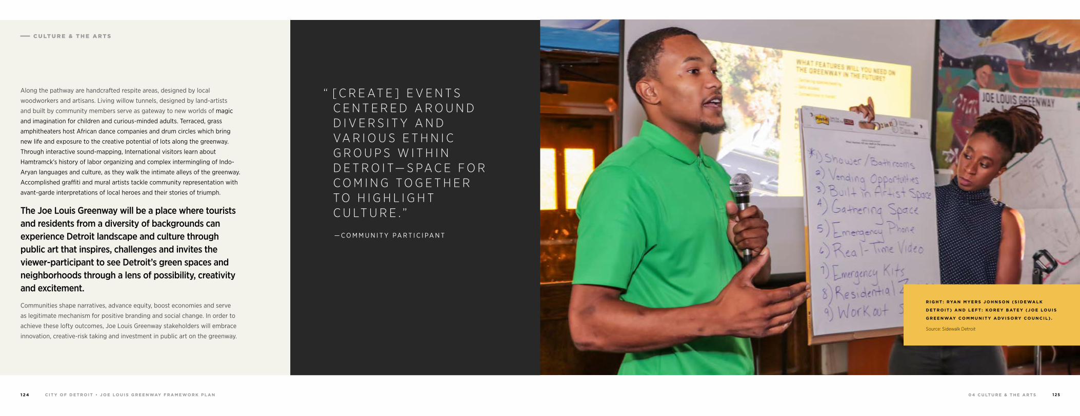
0 4 C U LT U R E & T H E A R T S 1 2 5C I T Y O F D E T R O I T • J O E LO U I S G R E E N WAY F R A M E WO R K P L A N1 2 4
C U LT U R E & T H E A R T S
Along the pathway are handcrafted respite areas, designed by local
woodworkers and artisans. Living willow tunnels, designed by land-artists
and built by community members serve as gateway to new worlds of magic
and imagination for children and curious-minded adults. Terraced, grass
amphitheaters host African dance companies and drum circles which bring
new life and exposure to the creative potential of lots along the greenway.
Through interactive sound-mapping, International visitors learn about
Hamtramck’s history of labor organizing and complex intermingling of Indo-
Aryan languages and culture, as they walk the intimate alleys of the greenway.
Accomplished graffiti and mural artists tackle community representation with
avant-garde interpretations of local heroes and their stories of triumph.
The Joe Louis Greenway will be a place where tourists and residents from a diversity of backgrounds can experience Detroit landscape and culture through public art that inspires, challenges and invites the viewer-participant to see Detroit’s green spaces and neighborhoods through a lens of possibility, creativity and excitement.
Communities shape narratives, advance equity, boost economies and serve
as legitimate mechanism for positive branding and social change. In order to
achieve these lofty outcomes, Joe Louis Greenway stakeholders will embrace
innovation, creative-risk taking and investment in public art on the greenway.
R I G H T : R YA N M Y E R S J O H N S O N ( S I D E WA L K
D E T R O I T ) A N D L E F T : KO R E Y B AT E Y ( J O E LO U I S
G R E E N WAY C O M M U N I T Y A DV I S O RY C O U N C I L ) .
Source: Sidewalk Detroit
“ [ C R E AT E ] E V E N T S C E N T E R E D A R O U N D D I V E R S I T Y A N D VA R I O U S E T H N I C G R O U P S W I T H I N D E T R O I T— S PA C E F O R C O M I N G T O G E T H E R T O H I G H L I G H T C U LT U R E . ”
— C O M M U N I T Y PA R T I C I PA N T
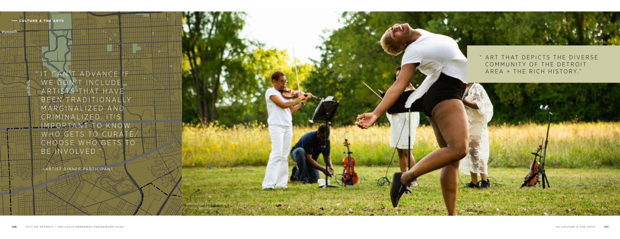
0 4 C U LT U R E & T H E A R T S 1 2 7C I T Y O F D E T R O I T • J O E LO U I S G R E E N WAY F R A M E WO R K P L A N1 2 6
94
94
94
94
75
75
75
10
10
HIGHLANDPARK
DETROIT
DEARBORN
Michigan Avenue
Telegrap
h
Telegrap
h
Plymouth
Warren Avenue
Bagley
Je�erson Avenue
Dearborn
Detroit Riverwalk
Dequindre Cut
Lonyo
Dix
Woodm
ere
Campbell
W. G
rand
8 Mile
Fort
Fort
Woodw
ard Avenue
Woodw
ard
Gra
tiot
Aven
ue
Grand River Avenue
Davison
Joseph Campau
Ham
tram
ck D
r
Conrail
Conrail
Oakm
an
McNichols
Live
rnoi
s
GORDIE HOWEBRIDGE
HAMTRAMCK
BELLE ISLE
WINDSOR
“ I T C A N ’ T A D VA N C E I F W E D O N ’ T I N C L U D E A R T I S T S T H AT H AV E B E E N T R A D I T I O N A L LY M A R G I N A L I Z E D A N D C R I M I N A L I Z E D . I T ’ S I M P O R TA N T T O K N O W W H O G E T S T O C U R AT E /C H O O S E W H O G E T S T O B E I N V O LV E D . ”
Big Red Wall & The Nina Strings Source: Sidewalk Detroit
“ A R T T H AT D E P I C T S T H E D I V E R S E C O M M U N I T Y O F T H E D E T R O I T A R E A + T H E R I C H H I S T O R Y. ”
— A R T I S T D I N N E R PA R T I C I PA N T
C U LT U R E & T H E A R T S
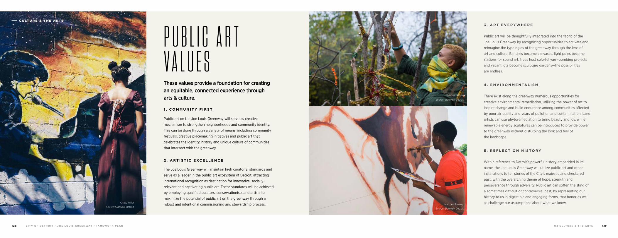
0 4 C U LT U R E & T H E A R T S 1 2 9C I T Y O F D E T R O I T • J O E LO U I S G R E E N WAY F R A M E WO R K P L A N1 2 8
Sabrina Nelson
Source: Sidewalk Detroit
Matthew Massey
Source: Sidewalk Detroit
These values provide a foundation for creating an equitable, connected experience through arts & culture.
1 . C O M M U N I T Y F I R S T
Public art on the Joe Louis Greenway will serve as creative
mechanism to strengthen neighborhoods and community identity.
This can be done through a variety of means, including community
festivals, creative placemaking initiatives and public art that
celebrates the identity, history and unique culture of communities
that intersect with the greenway.
2 . A R T I S T I C E XC E L L E N C E
The Joe Louis Greenway will maintain high curatorial standards and
serve as a leader in the public art ecosystem of Detroit, attracting
international recognition as destination for innovative, socially-
relevant and captivating public art. These standards will be achieved
by employing qualified curators, conservationists and artists to
maximize the potential of public art on the greenway through a
robust and intentional commissioning and stewardship process.
3 . A R T E V E R Y W H E R E
Public art will be thoughtfully integrated into the fabric of the
Joe Louis Greenway by recognizing opportunities to activate and
reimagine the typologies of the greenway through the lens of
art and culture. Benches become canvases, light poles become
stations for sound art, trees host colorful yarn-bombing projects
and vacant lots become sculpture gardens—the possibilities
are endless.
4 . E N V I R O N M E N TA L I S M
There exist along the greenway numerous opportunities for
creative environmental remediation, utilizing the power of art to
inspire change and build endurance among communities affected
by poor air quality and years of pollution and contamination. Land
artists can use phytoremediation to bring beauty and joy, while
renewable energy sculptures can be introduced to provide power
to the greenway without disturbing the look and feel of
the landscape.
5 . R E F L E C T O N H I S TO R Y
With a reference to Detroit’s powerful history embedded in its
name, the Joe Louis Greenway will utilize public art and other
installations to tell stories of the City’s majestic and checkered
past, with the overarching theme of hope, strength and
perseverance through adversity. Public art can soften the sting of
a sometimes difficult or controversial past, by representing our
history to us in digestible and engaging forms, that honor as well
as challenge our assumptions about what we know.Chazz Miller
Source: Sidewalk Detroit
P U B L I C A R T V A L U E S
C U LT U R E & T H E A R T S
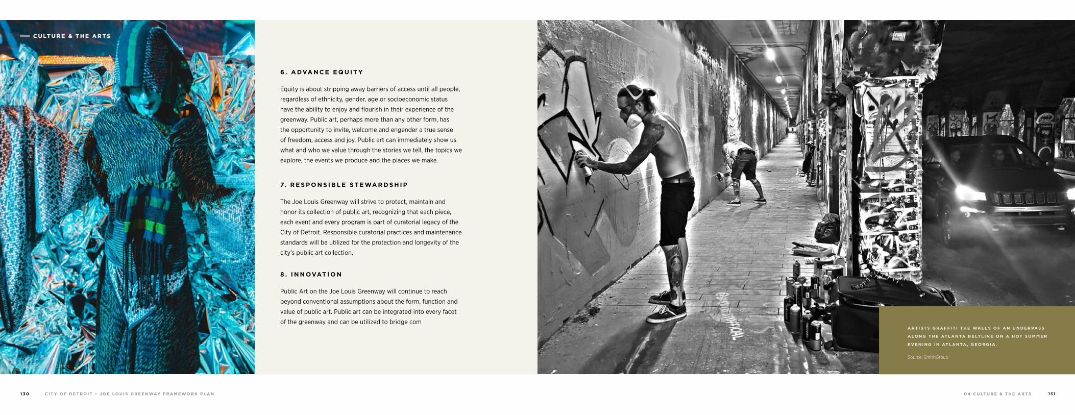
0 4 C U LT U R E & T H E A R T S 1 3 1C I T Y O F D E T R O I T • J O E LO U I S G R E E N WAY F R A M E WO R K P L A N1 3 0
Fringe Society
Source: Sidewalk Detroit
6 . A DVA N C E E Q U I T Y
Equity is about stripping away barriers of access until all people,
regardless of ethnicity, gender, age or socioeconomic status
have the ability to enjoy and flourish in their experience of the
greenway. Public art, perhaps more than any other form, has
the opportunity to invite, welcome and engender a true sense
of freedom, access and joy. Public art can immediately show us
what and who we value through the stories we tell, the topics we
explore, the events we produce and the places we make.
7. R E S P O N S I B L E S T E WA R D S H I P
The Joe Louis Greenway will strive to protect, maintain and
honor its collection of public art, recognizing that each piece,
each event and every program is part of curatorial legacy of the
City of Detroit. Responsible curatorial practices and maintenance
standards will be utilized for the protection and longevity of the
city’s public art collection.
8 . I N N OVAT I O N
Public Art on the Joe Louis Greenway will continue to reach
beyond conventional assumptions about the form, function and
value of public art. Public art can be integrated into every facet
of the greenway and can be utilized to bridge comA R T I S T S G R A F F I T I T H E WA L L S O F A N U N D E R PA S S
A LO N G T H E AT L A N TA B E LT L I N E O N A H OT S U M M E R
E V E N I N G I N AT L A N TA , G E O R G I A .
Source: SmithGroup
C U LT U R E & T H E A R T S
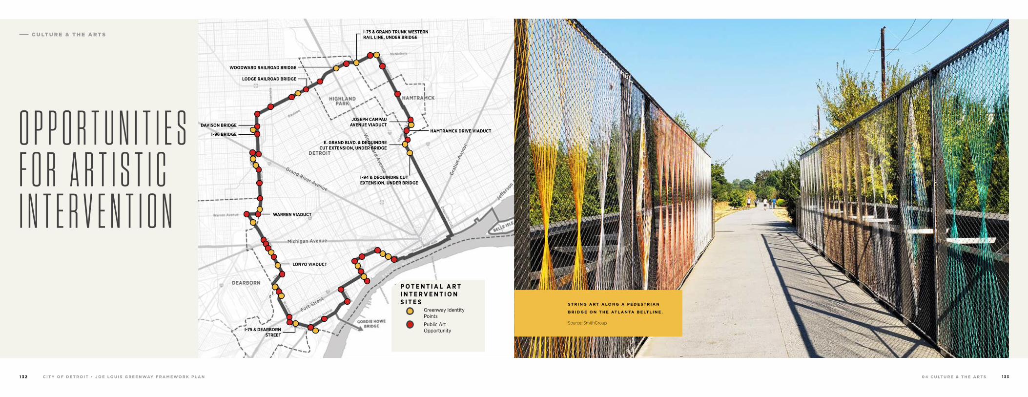
0 4 C U LT U R E & T H E A R T S 1 3 3C I T Y O F D E T R O I T • J O E LO U I S G R E E N WAY F R A M E WO R K P L A N1 3 2
S T R I N G A R T A LO N G A P E D E S T R I A N
B R I D G E O N T H E AT L A N TA B E LT L I N E .
Source: SmithGroup
O P P O R T U N I T I E S F O R A R T I S T I C I N T E R V E N T I O N
HAMTRAMCK DRIVE VIADUCT
WARREN VIADUCT
LONYO VIADUCT
I-94 & DEQUINDRE CUT EXTENSION, UNDER BRIDGE
JOSEPH CAMPAU AVENUE VIADUCT
I-75 & GRAND TRUNK WESTERN RAIL LINE, UNDER BRIDGE
WOODWARD RAILROAD BRIDGE
DAVISON BRIDGE
I-75 & DEARBORN STREET
I-96 BRIDGE
LODGE RAILROAD BRIDGE
E. GRAND BLVD. & DEQUINDRE CUT EXTENSION, UNDER BRIDGE
P O T E N T I A L A R T I N T E R V E N T I O N S I T E S Greenway Identity Points
Public Art Opportunity
C U LT U R E & T H E A R T S
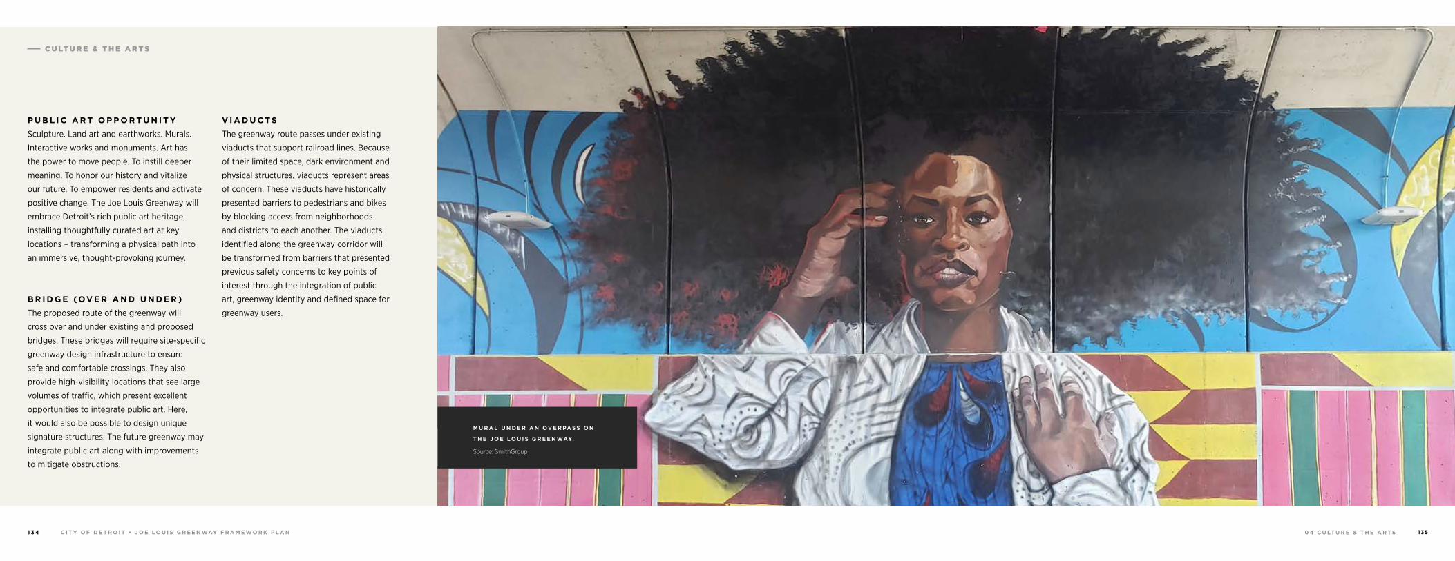
0 4 C U LT U R E & T H E A R T S 1 3 5C I T Y O F D E T R O I T • J O E LO U I S G R E E N WAY F R A M E WO R K P L A N1 3 4
P U B L I C A R T O P P O R T U N I T Y
Sculpture. Land art and earthworks. Murals.
Interactive works and monuments. Art has
the power to move people. To instill deeper
meaning. To honor our history and vitalize
our future. To empower residents and activate
positive change. The Joe Louis Greenway will
embrace Detroit’s rich public art heritage,
installing thoughtfully curated art at key
locations – transforming a physical path into
an immersive, thought-provoking journey.
B R I D G E (OV E R A N D U N D E R )
The proposed route of the greenway will
cross over and under existing and proposed
bridges. These bridges will require site-specific
greenway design infrastructure to ensure
safe and comfortable crossings. They also
provide high-visibility locations that see large
volumes of traffic, which present excellent
opportunities to integrate public art. Here,
it would also be possible to design unique
signature structures. The future greenway may
integrate public art along with improvements
to mitigate obstructions.
V I A D U C T S
The greenway route passes under existing
viaducts that support railroad lines. Because
of their limited space, dark environment and
physical structures, viaducts represent areas
of concern. These viaducts have historically
presented barriers to pedestrians and bikes
by blocking access from neighborhoods
and districts to each another. The viaducts
identified along the greenway corridor will
be transformed from barriers that presented
previous safety concerns to key points of
interest through the integration of public
art, greenway identity and defined space for
greenway users.
M U R A L U N D E R A N OV E R PA S S O N
T H E J O E LO U I S G R E E N WAY.
Source: SmithGroup
C U LT U R E & T H E A R T S
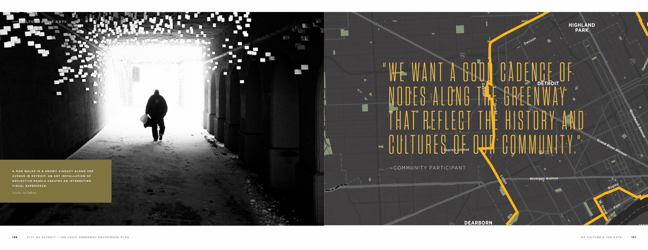
0 4 C U LT U R E & T H E A R T S 1 3 7C I T Y O F D E T R O I T • J O E LO U I S G R E E N WAY F R A M E WO R K P L A N1 3 6
A M A N WA L K S I N A S N OW Y V I A D U C T A LO N G 2 N D
AV E N U E I N D E T R O I T. A N A R T I N S TA L L AT I O N O F
R E F L E C T I V E PA N E L S C R E AT E S A N I N T E R E S T I N G
V I S U A L E X P E R I E N C E .
Source: Jon DeBoer.
94
94
94
94
75
75
75
10
10
HIGHLANDPARK
DETROIT
DEARBORN
Michigan Avenue
Telegrap
h
Telegrap
h
Plymouth
Warren Avenue
Bagley
Je�erson Avenue
Dearborn
Detroit Riverwalk
Dequindre Cut
Lonyo
Dix
Woodm
ere
Campbell
W. G
rand
8 Mile
Fort
Fort
Woodw
ard Avenue
Woodw
ard
Gra
tiot
Aven
ue
Grand River Avenue
Davison
Joseph Campau
Ham
tram
ck D
r
Conrail
Conrail
Oakm
an
McNichols
Live
rnoi
s
GORDIE HOWEBRIDGE
HAMTRAMCK
BELLE ISLE
WINDSOR
“ W E W A N T A G O O D C A D E N C E O F N O D E S A L O N G T H E G R E E N W A Y T H A T R E F L E C T T H E H I S T O R Y A N D C U L T U R E S O F O U R C O M M U N I T Y . ” — C O M M U N I T Y PA R T I C I PA N T
C U LT U R E & T H E A R T S
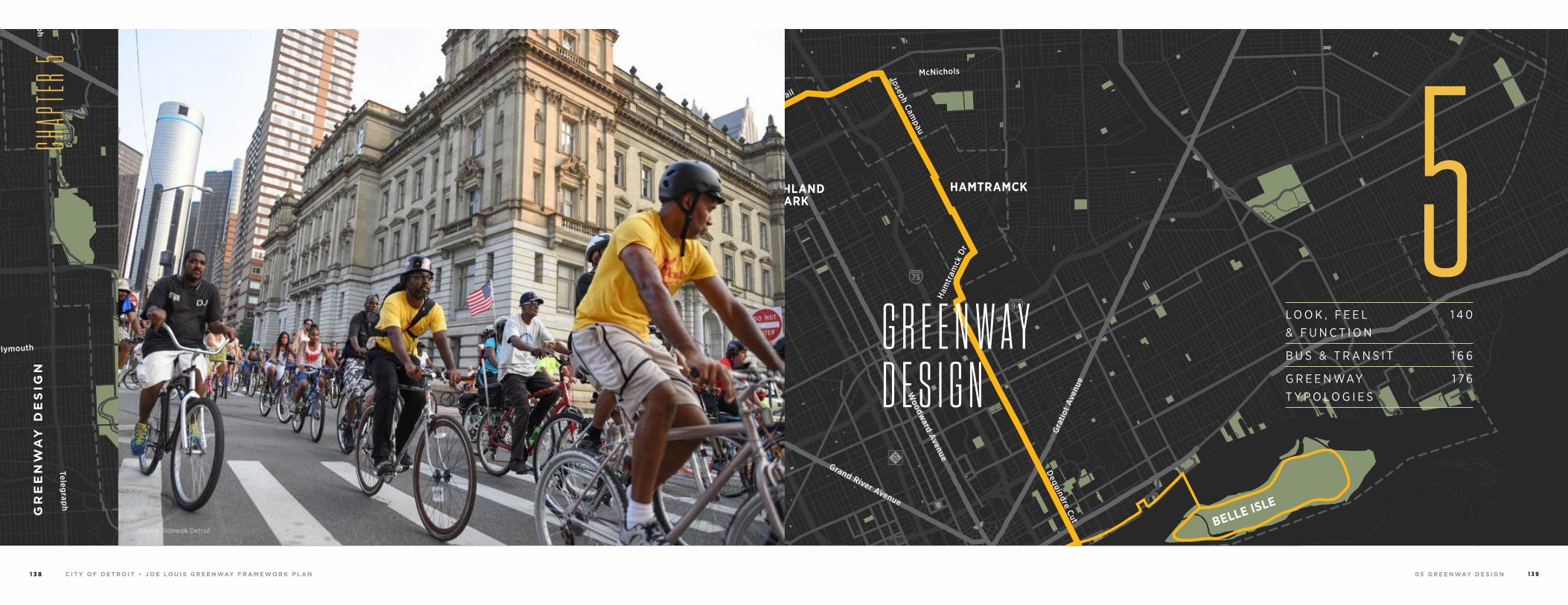
0 5 G R E E N WAY D E S I G NC I T Y O F D E T R O I T • J O E LO U I S G R E E N WAY F R A M E WO R K P L A N1 3 8 1 3 9
94
94
94
94
75
75
75
10
10
HIGHLANDPARK
DETROIT
DEARBORN
Michigan Avenue
Telegrap
h
Telegrap
h
Plymouth
Warren Avenue
Bagley
Je�erson Avenue
Dearborn
Detroit Riverwalk
Dequindre Cut
Lonyo
Dix
Woodm
ere
Campbell
W. G
rand
8 Mile
Fort
Fort
Woodw
ard Avenue
Woodw
ard
Gra
tiot
Aven
ue
Grand River Avenue
Davison
Joseph Campau
Ham
tram
ck D
r
Conrail
Conrail
Oakm
an
McNichols
Live
rnoi
s
GORDIE HOWEBRIDGE
HAMTRAMCK
BELLE ISLE
WINDSOR
L O O K , F E E L & F U N C T I O N
1 4 0
B U S & T R A N S I T 1 6 6
G R E E N WAY T Y P O L O G I E S
1 7 6
G R E E N W A YD E S I G N
GR
EE
NW
AY
DE
SIG
N
CHAP
TER 5
5Source: Sidewalk Detroit
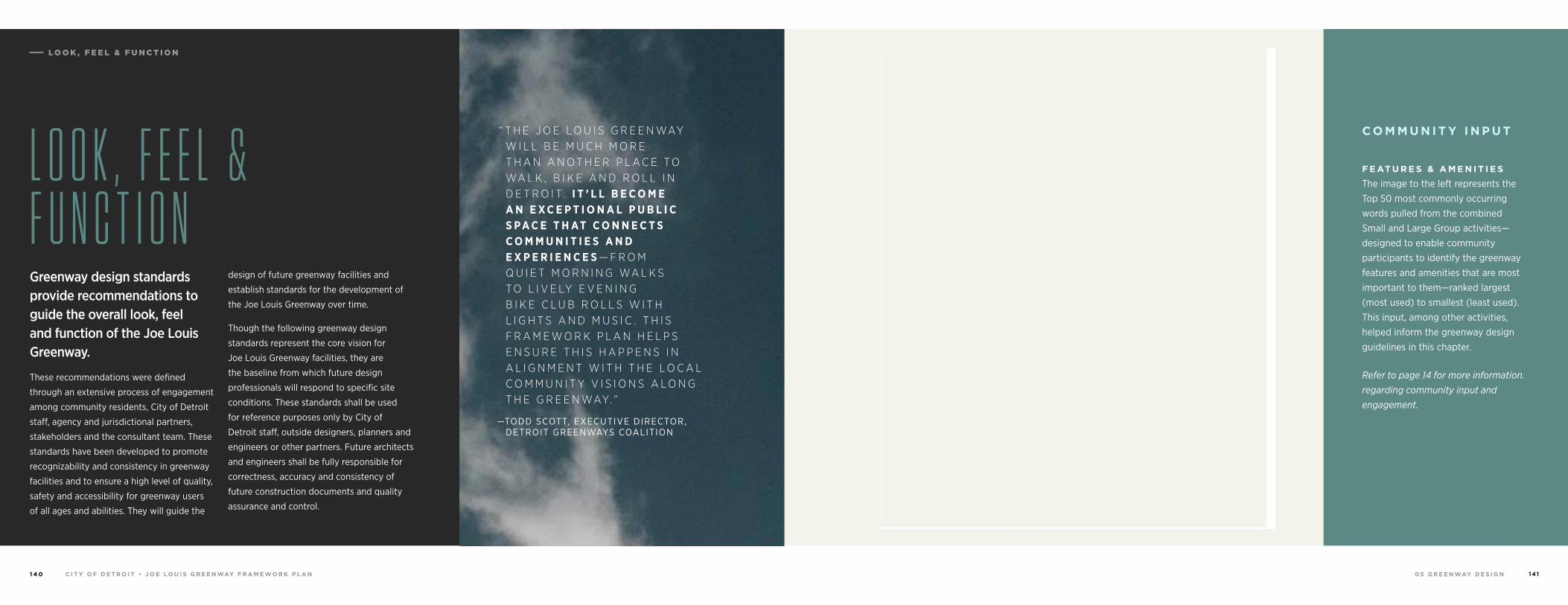
LO O K , F E E L & F U N C T I O N
0 5 G R E E N WAY D E S I G NC I T Y O F D E T R O I T • J O E LO U I S G R E E N WAY F R A M E WO R K P L A N1 4 0 1 4 1
“ T H E J O E L O U I S G R E E N WAY W I L L B E M U C H M O R E T H A N A N O T H E R P L A C E T O WA L K , B I K E A N D R O L L I N D E T R O I T. I T ’ L L B E C O M E A N E X C E P T I O N A L P U B L I C S P A C E T H AT C O N N E C T S C O M M U N I T I E S A N D E X P E R I E N C E S — F R O M Q U I E T M O R N I N G WA L K S T O L I V E LY E V E N I N G B I K E C L U B R O L L S W I T H L I G H T S A N D M U S I C . T H I S F R A M E W O R K P L A N H E L P S E N S U R E T H I S H A P P E N S I N A L I G N M E N T W I T H T H E L O C A L C O M M U N I T Y V I S I O N S A L O N G T H E G R E E N WAY. ”
— TODD SCOTT, EXECUTIVE DIRECTOR, DETROIT GREENWAYS COALITION
L O O K , F E E L & F U N C T I O NGreenway design standards provide recommendations to guide the overall look, feel and function of the Joe Louis Greenway.
These recommendations were defined
through an extensive process of engagement
among community residents, City of Detroit
staff, agency and jurisdictional partners,
stakeholders and the consultant team. These
standards have been developed to promote
recognizability and consistency in greenway
facilities and to ensure a high level of quality,
safety and accessibility for greenway users
of all ages and abilities. They will guide the
design of future greenway facilities and
establish standards for the development of
the Joe Louis Greenway over time.
Though the following greenway design
standards represent the core vision for
Joe Louis Greenway facilities, they are
the baseline from which future design
professionals will respond to specific site
conditions. These standards shall be used
for reference purposes only by City of
Detroit staff, outside designers, planners and
engineers or other partners. Future architects
and engineers shall be fully responsible for
correctness, accuracy and consistency of
future construction documents and quality
assurance and control.
C O M M U N I T Y I N P U T
F E AT U R E S & A M E N I T I E S
The image to the left represents the Top 50 most commonly occurring words pulled from the combined Small and Large Group activities—designed to enable community participants to identify the greenway features and amenities that are most important to them—ranked largest (most used) to smallest (least used). This input, among other activities, helped inform the greenway design guidelines in this chapter.
Refer to page 14 for more information. regarding community input and engagement.

0 5 G R E E N WAY D E S I G NC I T Y O F D E T R O I T • J O E LO U I S G R E E N WAY F R A M E WO R K P L A N1 4 2 1 4 3
The design standards outlined in this chapter reflect more than ten years of hard work and advocacy among City of Detroit staff, community residents and partner organizations.
The Joe Louis Greenway Framework Plan builds on this work,
incorporating critical input from community residents and
stakeholders, along with helpful precedents from numerous
local, regional and national greenways concerning process,
recommendations, design, implementation and performance.
Every segment, intersection, connection and design element
of the pathway will support the mission of the Joe Louis
Greenway—to unify Detroit’s neighborhoods, people and
parks by providing equitable spaces through programming,
economic opportunities, and arts. Through continued
community participation, ongoing analysis and evaluation,
we can ensure the greenway provides inclusive benefits for
all Detroiters— fostering economic development and housing
for residents; celebrating history, arts and culture; improving
mobility and access; and expanding green spaces and
inclusive opportunities for recreation.
D E S I G N G U I D E L I N E S & S T A N D A R D S
G R E E N WAY D E S I G N I N D E T R O I T
At the local and regional level, a number of
reference guides have informed the recommended
design standards. These include: the City of Detroit
Non-motorized Urban Transportation Master Plan,
the SEMCOG and MDOT Non-motorized Plan for
Southeast Michigan, the Detroit Bicycle Network
Strategy and the City’s Safe Routes to School
program, among others. Local existing greenways
and trails—including the Dequindre Cut, Detroit
RiverWalk and Palmer Park trails—were studied to
understand how urban trails are designed, perceived
and used in Detroit.
To enhance safety and accessibility for greenway
users of all levels and abilities, greenway planning
and design guides such as the City of Detroit’s bike
network, mobility and field marking standards,
MDOT standards and national standards including
the NACTO Urban Bikeway Design Guide and ADA
requirements were consulted.
Source: James Brown
LO O K , F E E L & F U N C T I O N
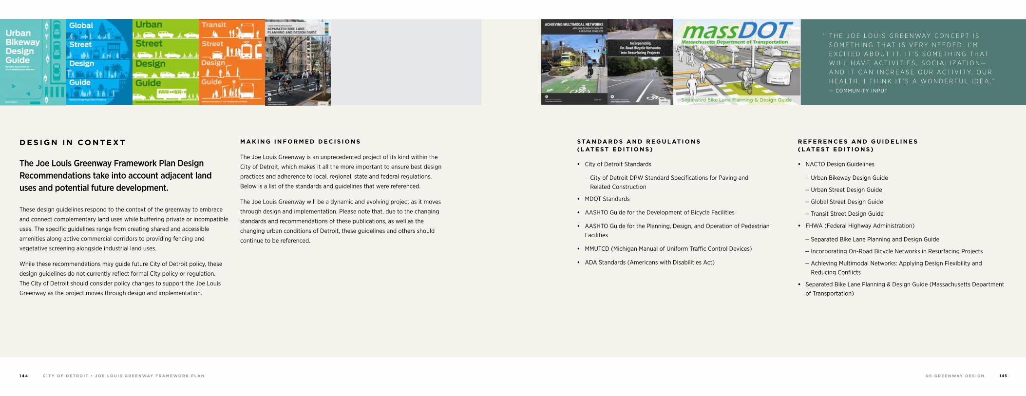
0 5 G R E E N WAY D E S I G NC I T Y O F D E T R O I T • J O E LO U I S G R E E N WAY F R A M E WO R K P L A N1 4 4 1 4 5
D E S I G N I N C O N T E X T
The Joe Louis Greenway Framework Plan Design Recommendations take into account adjacent land uses and potential future development.
These design guidelines respond to the context of the greenway to embrace
and connect complementary land uses while buffering private or incompatible
uses. The specific guidelines range from creating shared and accessible
amenities along active commercial corridors to providing fencing and
vegetative screening alongside industrial land uses.
While these recommendations may guide future City of Detroit policy, these
design guidelines do not currently reflect formal City policy or regulation.
The City of Detroit should consider policy changes to support the Joe Louis
Greenway as the project moves through design and implementation.
M A K I N G I N F O R M E D D E C I S I O N S
The Joe Louis Greenway is an unprecedented project of its kind within the
City of Detroit, which makes it all the more important to ensure best design
practices and adherence to local, regional, state and federal regulations.
Below is a list of the standards and guidelines that were referenced.
The Joe Louis Greenway will be a dynamic and evolving project as it moves
through design and implementation. Please note that, due to the changing
standards and recommendations of these publications, as well as the
changing urban conditions of Detroit, these guidelines and others should
continue to be referenced.
S TA N DA R D S A N D R E G U L AT I O N S ( L AT E S T E D I T I O N S )
• City of Detroit Standards
— City of Detroit DPW Standard Specifications for Paving and Related Construction
• MDOT Standards
• AASHTO Guide for the Development of Bicycle Facilities
• AASHTO Guide for the Planning, Design, and Operation of Pedestrian Facilities
• MMUTCD (Michigan Manual of Uniform Traffic Control Devices)
• ADA Standards (Americans with Disabilities Act)
R E F E R E N C E S A N D G U I D E L I N E S ( L AT E S T E D I T I O N S )
• NACTO Design Guidelines
— Urban Bikeway Design Guide
— Urban Street Design Guide
— Global Street Design Guide
— Transit Street Design Guide
• FHWA (Federal Highway Administration)
— Separated Bike Lane Planning and Design Guide
— Incorporating On-Road Bicycle Networks in Resurfacing Projects
— Achieving Multimodal Networks: Applying Design Flexibility and Reducing Conflicts
• Separated Bike Lane Planning & Design Guide (Massachusetts Department of Transportation)
“ T H E J O E L O U I S G R E E N WAY C O N C E P T I S S O M E T H I N G T H AT I S V E R Y N E E D E D . I ’ M E X C I T E D A B O U T I T. I T ’ S S O M E T H I N G T H AT W I L L H AV E A C T I V I T I E S , S O C I A L I Z AT I O N —A N D I T C A N I N C R E A S E O U R A C T I V I T Y, O U R H E A LT H . I T H I N K I T ’ S A W O N D E R F U L I D E A . ”
— COMMUNITY INPUT
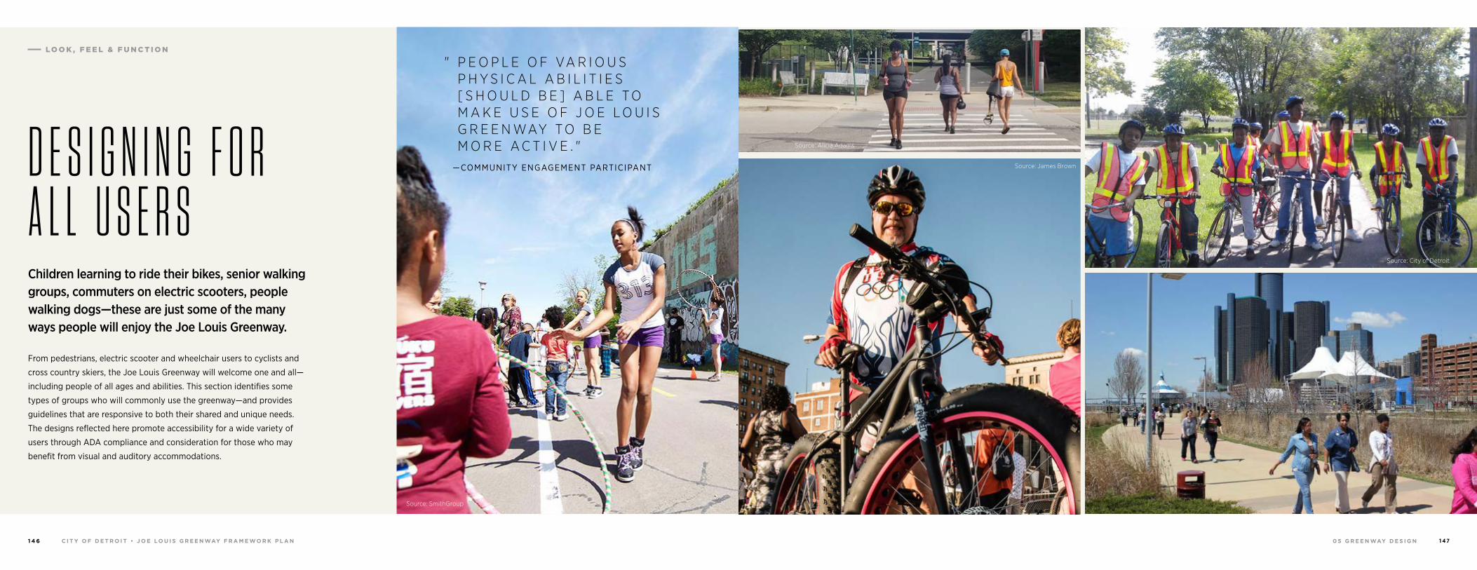
0 5 G R E E N WAY D E S I G NC I T Y O F D E T R O I T • J O E LO U I S G R E E N WAY F R A M E WO R K P L A N1 4 6 1 4 7
Children learning to ride their bikes, senior walking groups, commuters on electric scooters, people walking dogs—these are just some of the many ways people will enjoy the Joe Louis Greenway.
From pedestrians, electric scooter and wheelchair users to cyclists and
cross country skiers, the Joe Louis Greenway will welcome one and all—
including people of all ages and abilities. This section identifies some
types of groups who will commonly use the greenway—and provides
guidelines that are responsive to both their shared and unique needs.
The designs reflected here promote accessibility for a wide variety of
users through ADA compliance and consideration for those who may
benefit from visual and auditory accommodations.
" P E O P L E O F VA R I O U S P H Y S I C A L A B I L I T I E S [ S H O U L D B E ] A B L E T O M A K E U S E O F J O E L O U I S G R E E N WAY T O B E M O R E A C T I V E . "
—COMMUNITY ENGAGEMENT PARTICIPANTD E S I G N I N G F O R A L L U S E R S
Source: SmithGroup
Source: Alicia Adams
Source: James Brown
Source: City of Detroit
LO O K , F E E L & F U N C T I O N
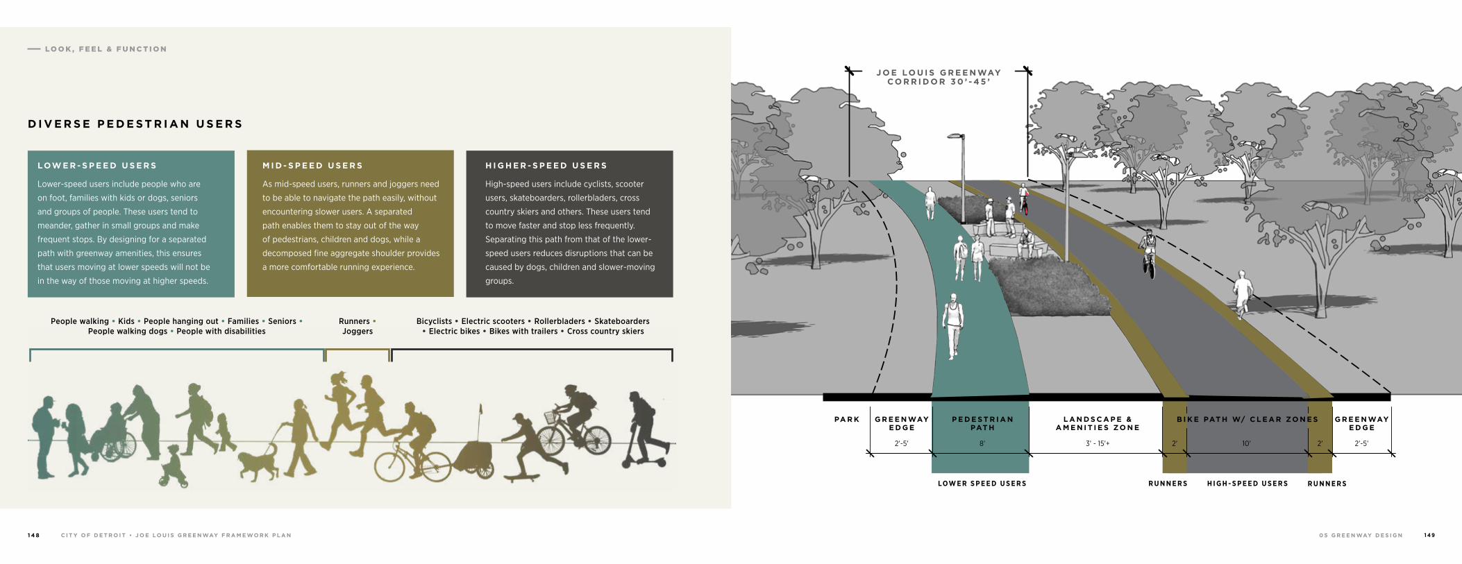
0 5 G R E E N WAY D E S I G NC I T Y O F D E T R O I T • J O E LO U I S G R E E N WAY F R A M E WO R K P L A N1 4 8 1 4 9
People walking • Kids • People hanging out • Families • Seniors • People walking dogs • People with disabilities
Bicyclists • Electric scooters • Rollerbladers • Skateboarders • Electric bikes • Bikes with trailers • Cross country skiers
Runners • Joggers
LOW E R - S P E E D U S E R S
Lower-speed users include people who are
on foot, families with kids or dogs, seniors
and groups of people. These users tend to
meander, gather in small groups and make
frequent stops. By designing for a separated
path with greenway amenities, this ensures
that users moving at lower speeds will not be
in the way of those moving at higher speeds.
M I D - S P E E D U S E R S
As mid-speed users, runners and joggers need
to be able to navigate the path easily, without
encountering slower users. A separated
path enables them to stay out of the way
of pedestrians, children and dogs, while a
decomposed fine aggregate shoulder provides
a more comfortable running experience.
H I G H E R - S P E E D U S E R S
High-speed users include cyclists, scooter
users, skateboarders, rollerbladers, cross
country skiers and others. These users tend
to move faster and stop less frequently.
Separating this path from that of the lower-
speed users reduces disruptions that can be
caused by dogs, children and slower-moving
groups.
D I V E R S E P E D E S T R I A N U S E R S
LOW E R S P E E D U S E R S R U N N E R S R U N N E R SH I G H - S P E E D U S E R S
P E D E S T R I A N PAT H
G R E E N WAY E D G E
G R E E N WAY E D G E
PA R K L A N D S C A P E & A M E N I T I E S ZO N E
B I K E PAT H W/ C L E A R ZO N E S
8’2’-5’ 2’-5’3’ - 15’+ 2’ 2’10’
J O E LO U I S G R E E N WAY C O R R I D O R 3 0 ’ - 4 5 ’
LO O K , F E E L & F U N C T I O N
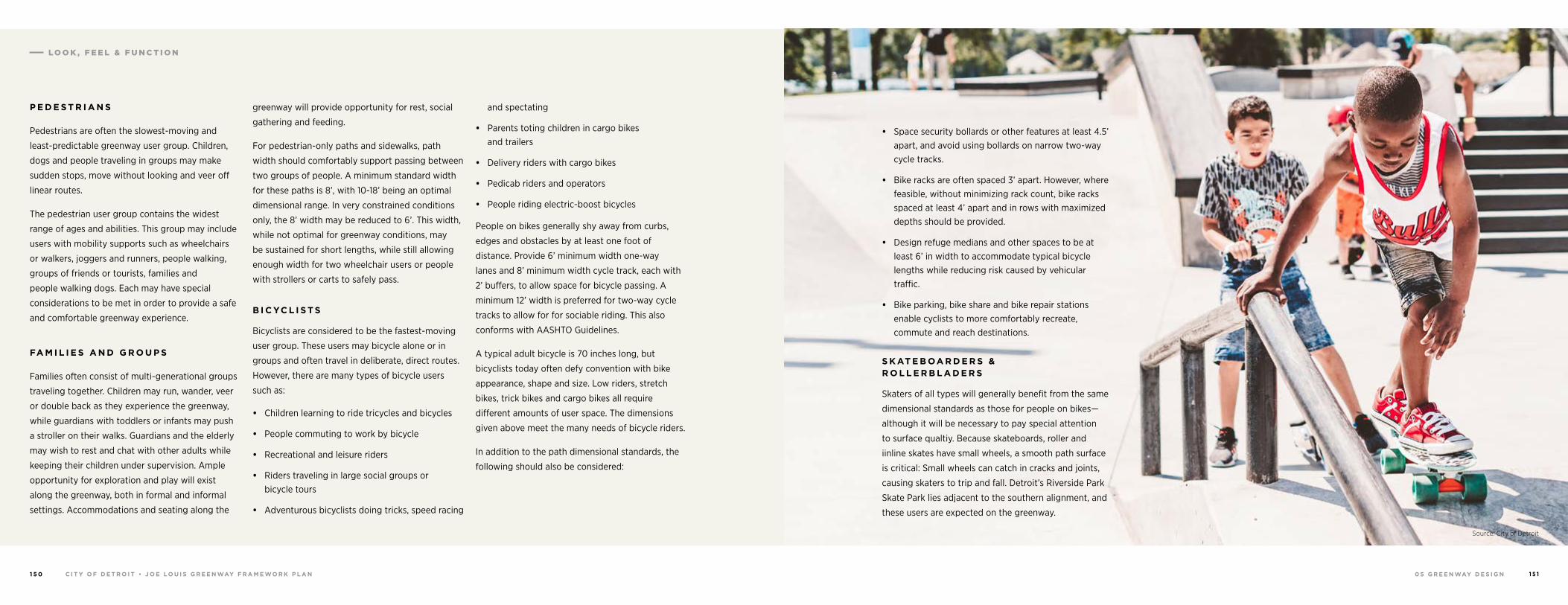
0 5 G R E E N WAY D E S I G NC I T Y O F D E T R O I T • J O E LO U I S G R E E N WAY F R A M E WO R K P L A N1 5 0 1 5 1
P E D E S T R I A N S
Pedestrians are often the slowest-moving and
least-predictable greenway user group. Children,
dogs and people traveling in groups may make
sudden stops, move without looking and veer off
linear routes.
The pedestrian user group contains the widest
range of ages and abilities. This group may include
users with mobility supports such as wheelchairs
or walkers, joggers and runners, people walking,
groups of friends or tourists, families and
people walking dogs. Each may have special
considerations to be met in order to provide a safe
and comfortable greenway experience.
FA M I L I E S A N D G R O U P S
Families often consist of multi-generational groups
traveling together. Children may run, wander, veer
or double back as they experience the greenway,
while guardians with toddlers or infants may push
a stroller on their walks. Guardians and the elderly
may wish to rest and chat with other adults while
keeping their children under supervision. Ample
opportunity for exploration and play will exist
along the greenway, both in formal and informal
settings. Accommodations and seating along the
greenway will provide opportunity for rest, social
gathering and feeding.
For pedestrian-only paths and sidewalks, path
width should comfortably support passing between
two groups of people. A minimum standard width
for these paths is 8’, with 10-18’ being an optimal
dimensional range. In very constrained conditions
only, the 8’ width may be reduced to 6’. This width,
while not optimal for greenway conditions, may
be sustained for short lengths, while still allowing
enough width for two wheelchair users or people
with strollers or carts to safely pass.
B I C YC L I S T S
Bicyclists are considered to be the fastest-moving
user group. These users may bicycle alone or in
groups and often travel in deliberate, direct routes.
However, there are many types of bicycle users
such as:
• Children learning to ride tricycles and bicycles
• People commuting to work by bicycle
• Recreational and leisure riders
• Riders traveling in large social groups or bicycle tours
• Adventurous bicyclists doing tricks, speed racing
and spectating
• Parents toting children in cargo bikes and trailers
• Delivery riders with cargo bikes
• Pedicab riders and operators
• People riding electric-boost bicycles
People on bikes generally shy away from curbs,
edges and obstacles by at least one foot of
distance. Provide 6’ minimum width one-way
lanes and 8’ minimum width cycle track, each with
2’ buffers, to allow space for bicycle passing. A
minimum 12’ width is preferred for two-way cycle
tracks to allow for for sociable riding. This also
conforms with AASHTO Guidelines.
A typical adult bicycle is 70 inches long, but
bicyclists today often defy convention with bike
appearance, shape and size. Low riders, stretch
bikes, trick bikes and cargo bikes all require
different amounts of user space. The dimensions
given above meet the many needs of bicycle riders.
In addition to the path dimensional standards, the
following should also be considered:
• Space security bollards or other features at least 4.5’ apart, and avoid using bollards on narrow two-way cycle tracks.
• Bike racks are often spaced 3’ apart. However, where feasible, without minimizing rack count, bike racks spaced at least 4’ apart and in rows with maximized depths should be provided.
• Design refuge medians and other spaces to be at least 6’ in width to accommodate typical bicycle lengths while reducing risk caused by vehicular traffic.
• Bike parking, bike share and bike repair stations enable cyclists to more comfortably recreate, commute and reach destinations.
S K AT E B OA R D E R S & R O L L E R B L A D E R S
Skaters of all types will generally benefit from the same
dimensional standards as those for people on bikes—
although it will be necessary to pay special attention
to surface qualtiy. Because skateboards, roller and
iinline skates have small wheels, a smooth path surface
is critical: Small wheels can catch in cracks and joints,
causing skaters to trip and fall. Detroit’s Riverside Park
Skate Park lies adjacent to the southern alignment, and
these users are expected on the greenway.
Source: City of Detroit
LO O K , F E E L & F U N C T I O N
0 5 G R E E N WAY D E S I G NC I T Y O F D E T R O I T • J O E LO U I S G R E E N WAY F R A M E WO R K P L A N1 5 2 1 5 3
Consider providing small clusters of skateable
features along the greenway to develop a sense
of ownership among that group of users. Provide
landscape furniture that holds up to hard and
unconventional use. And offer secure storage
lockers near greenway entrances, destinations,
commercial districts and job centers to encourage
people to use the path for transporation and
commuting.
P E O P L E W I T H D O G S
Spending quality time with our dogs improves our
quality of life. The Joe Louis Greenway will ensure
an enjoyable experience for both pets and owners.
Split paths will keep dogs and their leashes out of
the way of bikers and runners, and amenities such
as dog parks, waste bag dispensers and dog-height
water fountains will provide a fun, safe and healthy
greenway experience.
R U N N E R S
Runners often prefer decomposed fine aggregate
over concrete pavement; the softer surface material
is easier on joints and results in fewer stress-related
injuries. For off-street portions of the greenway,
2’ wide decomposed fine aggregate shoulders are
to be provided on both sides of the bike path to
accommodate joggers and runners.
C R O S S C O U N T R Y S K I E R S
The Joe Louis Greenway will provide recreational
opportunities throughout all four seasons. While
road bike and pedestrian volumes may decrease in
the colder winter months, fat tire bikers and cross
country skiers will be thrilled to find snow-covered
trails in the heart of Detroit.
It will be important to consider the different spatial
needs of these bikers and skiers. While classic cross
country skiers need a minimum path width of 5’,
skate skiers benefit from a wider 8’ path. And in
the cold weather, supporting amenities—such as
seating, lighting and wayfinding—will be especially
important.
E A S E O F AC C E S S
Greenway path configurations and widths are
designed to accommodate users of all ages and
abilities. Path widths should be greater than 6’ to
support passing of wheelchair users or people with
carts or strollers. Railings and adequate landing
space will be incorporated into stair and ramp
designs, and ample seating along the greenway will
provide space for rest and recovery.
P E O P L E W I T H I M PA I R E D M O B I L I T Y
Users of all types may have cognitive and/or
physical impairments. These users include, but are
not limited to, the elderly, injured or differently-
abled persons, expecting mothers and persons
with vision or auditory impairment. The greenway
should be designed to be accessible to everyone
and should consider the following:
• Visual Clarity
— Visual and textural contrasts that are consistently applied the length of the greenway
— Pedestrian-height lighting
— Clear and identifiable signage and wayfinding
• Ease of Access
— Detectable warning surfaces where paths and sidewalks meet vehicular traffic
— Seating and other furniture meeting ADA dimensional requirements
— Path surfaces, abrupt height changes and slopes that meet ADA guidelines
— Temporary routes (due to construction or event closures) with advance warning signals, detectable barriers and smooth grade transitions
— Where bike paths and sidewalks merge, there should be longitudinal delineation of detectable warning
• Auditory Support
— Audible warning signals
— Audible interpretive elements where feasible
1 Detroit Horse Power website: https://www.detroithorsepower.org/
R E S T R I C T E D &
P R O H I B I T E D U S E S
E Q U E S T R I A N S
During community engagement, Detroit residents
voiced a desire for horse access along the Joe
Louis Greenway. They shared information regarding
existing and emerging horse-related programs
such as Detroit Horse Power.1 Through the
planning process, the City of Detroit met with local
advocates to understand the infrastructural and
safety needs for horse trails.
The Joe Louis Greenway cannot currently support
horses along its path. The limitations arise from
path width constraints, necessary safety measures
for horseback riders, cyclists and pedestrians, need
for environmental mitigation and infrastructural
and amenity improvements. However, while horses
are not permitted along the greenway, the youth
and community-oriented horse programs along
its route will provide key destinations for those
traveling to and from their locations.
It’s possible that, with adequate targeted funding
and community interest, the City of Detroit may
be able to undertake studies and potentially
implement horse-related infrastructure along the
greenway.
AT V S A N D M OTO R V E H I C L E S
The speed and size of All Terrain Vehicles (ATVs)
and motor vehicles are incompatible with other
greenway uses. These vehicles may be dangerous
to other uses and destructive to greenway features
and surfaces. Additionally, the excessive noise
and exhaust fumes from such vehicles make
them incompatible with residential areas along
the greenway – and with the goal of providing
a healthy recreational opportunities. For these
reasons, motor vehicles and ATVs are restricted
uses on the Joe Louis Greenway.
The exception to this restriction may include
maintenance, emergency and service vehicles.
LO O K , F E E L & F U N C T I O N
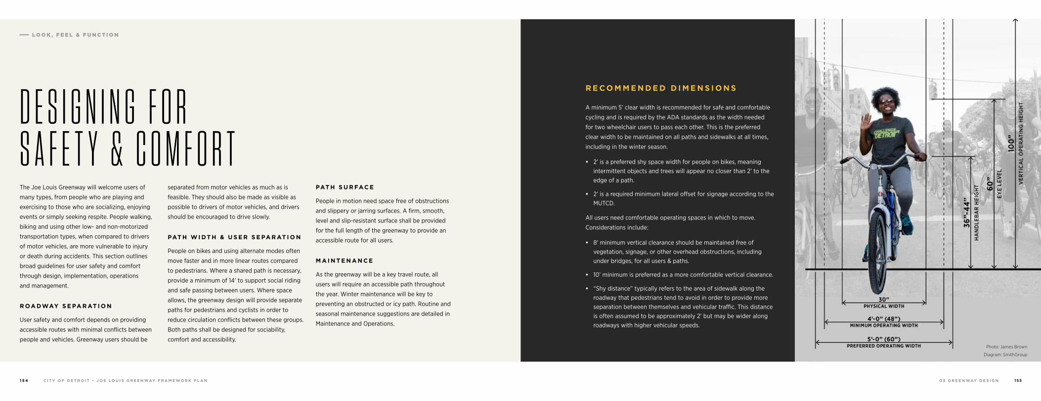
0 5 G R E E N WAY D E S I G NC I T Y O F D E T R O I T • J O E LO U I S G R E E N WAY F R A M E WO R K P L A N1 5 4 1 5 5
The Joe Louis Greenway will welcome users of
many types, from people who are playing and
exercising to those who are socializing, enjoying
events or simply seeking respite. People walking,
biking and using other low- and non-motorized
transportation types, when compared to drivers
of motor vehicles, are more vulnerable to injury
or death during accidents. This section outlines
broad guidelines for user safety and comfort
through design, implementation, operations
and management.
R OA DWAY S E PA R AT I O N
User safety and comfort depends on providing
accessible routes with minimal conflicts between
people and vehicles. Greenway users should be
separated from motor vehicles as much as is
feasible. They should also be made as visible as
possible to drivers of motor vehicles, and drivers
should be encouraged to drive slowly.
PAT H W I DT H & U S E R S E PA R AT I O N
People on bikes and using alternate modes often
move faster and in more linear routes compared
to pedestrians. Where a shared path is necessary,
provide a minimum of 14’ to support social riding
and safe passing between users. Where space
allows, the greenway design will provide separate
paths for pedestrians and cyclists in order to
reduce circulation conflicts between these groups.
Both paths shall be designed for sociability,
comfort and accessibility.
PAT H S U R FAC E
People in motion need space free of obstructions
and slippery or jarring surfaces. A firm, smooth,
level and slip-resistant surface shall be provided
for the full length of the greenway to provide an
accessible route for all users.
M A I N T E N A N C E
As the greenway will be a key travel route, all
users will require an accessible path throughout
the year. Winter maintenance will be key to
preventing an obstructed or icy path. Routine and
seasonal maintenance suggestions are detailed in
Maintenance and Operations.
D E S I G N I N G F O R S A F E T Y & C O M F O R T
Photo: James Brown
Diagram: SmithGroup
R E C O M M E N D E D D I M E N S I O N S
A minimum 5’ clear width is recommended for safe and comfortable
cycling and is required by the ADA standards as the width needed
for two wheelchair users to pass each other. This is the preferred
clear width to be maintained on all paths and sidewalks at all times,
including in the winter season.
• 2’ is a preferred shy space width for people on bikes, meaning intermittent objects and trees will appear no closer than 2’ to the edge of a path.
• 2’ is a required minimum lateral offset for signage according to the MUTCD.
All users need comfortable operating spaces in which to move.
Considerations include:
• 8’ minimum vertical clearance should be maintained free of vegetation, signage, or other overhead obstructions, including under bridges, for all users & paths.
• 10’ minimum is preferred as a more comfortable vertical clearance.
• “Shy distance” typically refers to the area of sidewalk along the roadway that pedestrians tend to avoid in order to provide more separation between themselves and vehicular traffic. This distance is often assumed to be approximately 2’ but may be wider along roadways with higher vehicular speeds.
LO O K , F E E L & F U N C T I O N
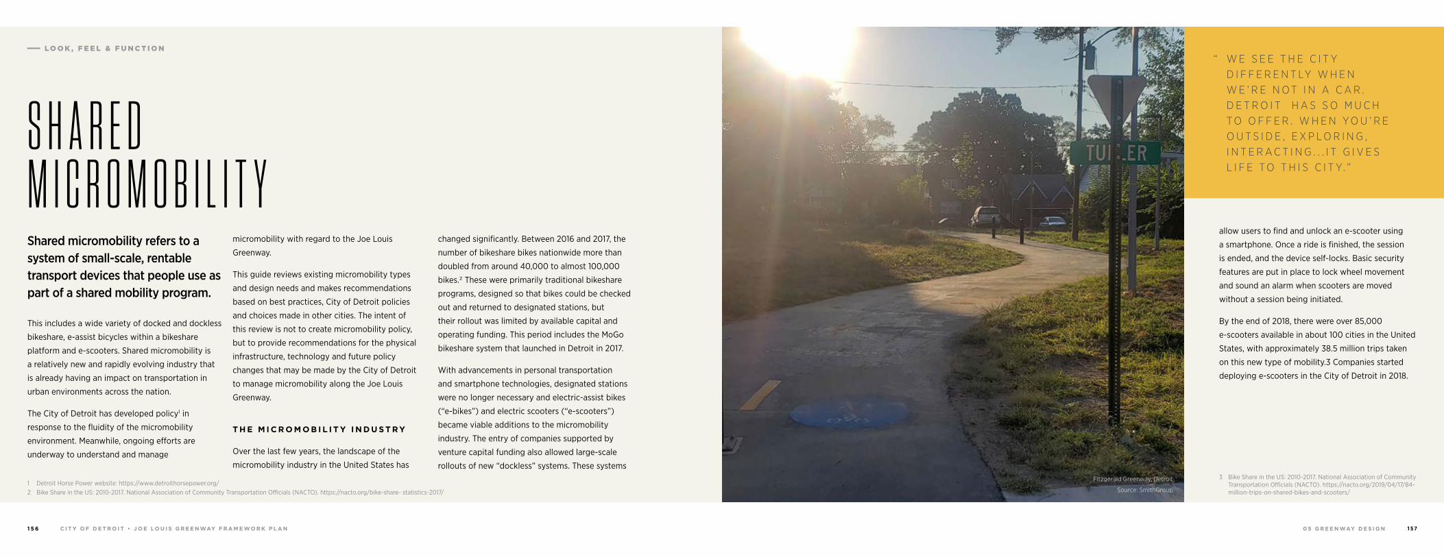
0 5 G R E E N WAY D E S I G NC I T Y O F D E T R O I T • J O E LO U I S G R E E N WAY F R A M E WO R K P L A N1 5 6 1 5 7
Shared micromobility refers to a system of small-scale, rentable transport devices that people use as part of a shared mobility program.
This includes a wide variety of docked and dockless
bikeshare, e-assist bicycles within a bikeshare
platform and e-scooters. Shared micromobility is
a relatively new and rapidly evolving industry that
is already having an impact on transportation in
urban environments across the nation.
The City of Detroit has developed policy1 in
response to the fluidity of the micromobility
environment. Meanwhile, ongoing efforts are
underway to understand and manage
1 Detroit Horse Power website: https://www.detroithorsepower.org/2 Bike Share in the US: 2010-2017. National Association of Community Transportation Officials (NACTO). https://nacto.org/bike-share- statistics-2017/
micromobility with regard to the Joe Louis
Greenway.
This guide reviews existing micromobility types
and design needs and makes recommendations
based on best practices, City of Detroit policies
and choices made in other cities. The intent of
this review is not to create micromobility policy,
but to provide recommendations for the physical
infrastructure, technology and future policy
changes that may be made by the City of Detroit
to manage micromobility along the Joe Louis
Greenway.
T H E M I C R O M O B I L I T Y I N D U S T R Y
Over the last few years, the landscape of the
micromobility industry in the United States has
changed significantly. Between 2016 and 2017, the
number of bikeshare bikes nationwide more than
doubled from around 40,000 to almost 100,000
bikes.2 These were primarily traditional bikeshare
programs, designed so that bikes could be checked
out and returned to designated stations, but
their rollout was limited by available capital and
operating funding. This period includes the MoGo
bikeshare system that launched in Detroit in 2017.
With advancements in personal transportation
and smartphone technologies, designated stations
were no longer necessary and electric-assist bikes
(“e-bikes”) and electric scooters (“e-scooters”)
became viable additions to the micromobility
industry. The entry of companies supported by
venture capital funding also allowed large-scale
rollouts of new “dockless” systems. These systems
S H A R E D M I C R O M O B I L I T Y
allow users to find and unlock an e-scooter using
a smartphone. Once a ride is finished, the session
is ended, and the device self-locks. Basic security
features are put in place to lock wheel movement
and sound an alarm when scooters are moved
without a session being initiated.
By the end of 2018, there were over 85,000
e-scooters available in about 100 cities in the United
States, with approximately 38.5 million trips taken
on this new type of mobility.3 Companies started
deploying e-scooters in the City of Detroit in 2018.
3 Bike Share in the US: 2010-2017. National Association of Community Transportation Officials (NACTO). https://nacto.org/2019/04/17/84- million-trips-on-shared-bikes-and-scooters/
Fitzgerald Greenway, Detroit
Source: SmithGroup
“ W E S E E T H E C I T Y D I F F E R E N T LY W H E N W E ’ R E N O T I N A C A R . D E T R O I T H A S S O M U C H T O O F F E R . W H E N Y O U ’ R E O U T S I D E , E X P L O R I N G , I N T E R A C T I N G . . . I T G I V E S L I F E T O T H I S C I T Y. ”
LO O K , F E E L & F U N C T I O N
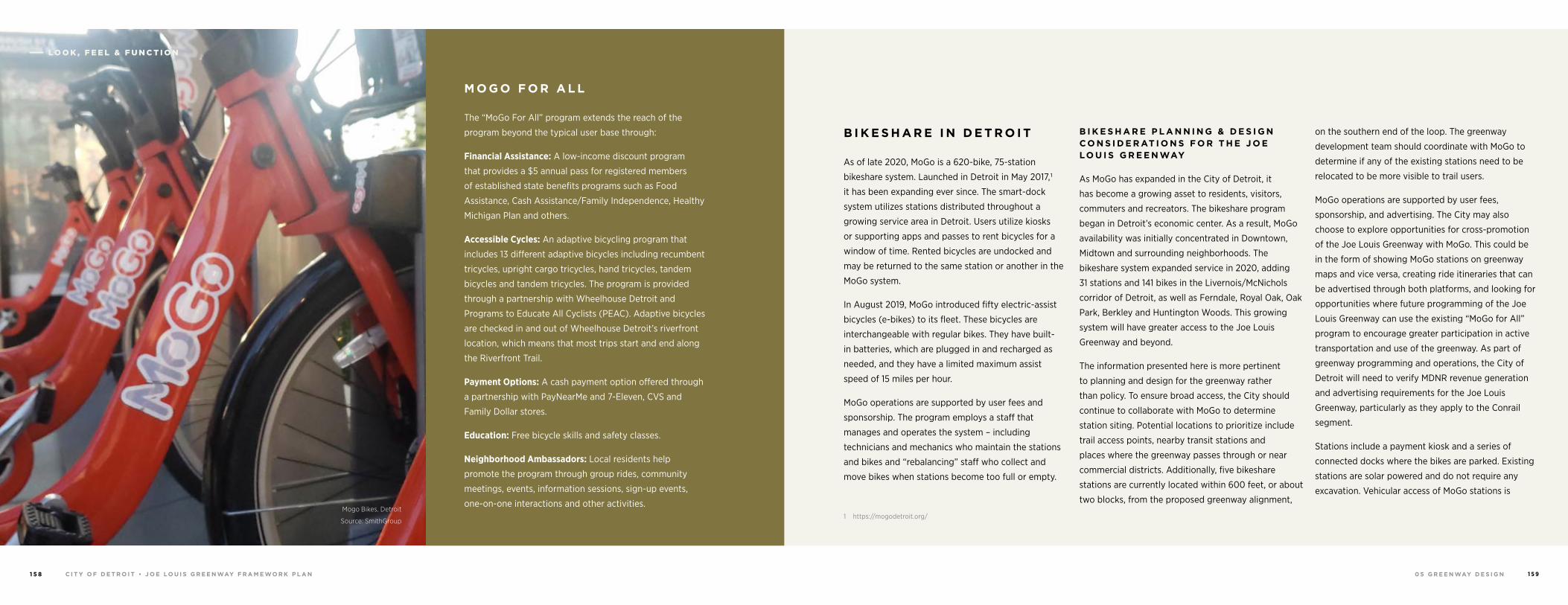
0 5 G R E E N WAY D E S I G NC I T Y O F D E T R O I T • J O E LO U I S G R E E N WAY F R A M E WO R K P L A N1 5 8 1 5 9
M O G O F O R A L L
The “MoGo For All” program extends the reach of the
program beyond the typical user base through:
Financial Assistance: A low-income discount program
that provides a $5 annual pass for registered members
of established state benefits programs such as Food
Assistance, Cash Assistance/Family Independence, Healthy
Michigan Plan and others.
Accessible Cycles: An adaptive bicycling program that
includes 13 different adaptive bicycles including recumbent
tricycles, upright cargo tricycles, hand tricycles, tandem
bicycles and tandem tricycles. The program is provided
through a partnership with Wheelhouse Detroit and
Programs to Educate All Cyclists (PEAC). Adaptive bicycles
are checked in and out of Wheelhouse Detroit’s riverfront
location, which means that most trips start and end along
the Riverfront Trail.
Payment Options: A cash payment option offered through
a partnership with PayNearMe and 7-Eleven, CVS and
Family Dollar stores.
Education: Free bicycle skills and safety classes.
Neighborhood Ambassadors: Local residents help
promote the program through group rides, community
meetings, events, information sessions, sign-up events,
one-on-one interactions and other activities.
B I K E S H A R E I N D E T R O I T
As of late 2020, MoGo is a 620-bike, 75-station
bikeshare system. Launched in Detroit in May 2017,1
it has been expanding ever since. The smart-dock
system utilizes stations distributed throughout a
growing service area in Detroit. Users utilize kiosks
or supporting apps and passes to rent bicycles for a
window of time. Rented bicycles are undocked and
may be returned to the same station or another in the
MoGo system.
In August 2019, MoGo introduced fifty electric-assist
bicycles (e-bikes) to its fleet. These bicycles are
interchangeable with regular bikes. They have built-
in batteries, which are plugged in and recharged as
needed, and they have a limited maximum assist
speed of 15 miles per hour.
MoGo operations are supported by user fees and
sponsorship. The program employs a staff that
manages and operates the system – including
technicians and mechanics who maintain the stations
and bikes and “rebalancing” staff who collect and
move bikes when stations become too full or empty.
1 https://mogodetroit.org/
B I K E S H A R E P L A N N I N G & D E S I G N C O N S I D E R AT I O N S F O R T H E J O E LO U I S G R E E N WAY
As MoGo has expanded in the City of Detroit, it
has become a growing asset to residents, visitors,
commuters and recreators. The bikeshare program
began in Detroit’s economic center. As a result, MoGo
availability was initially concentrated in Downtown,
Midtown and surrounding neighborhoods. The
bikeshare system expanded service in 2020, adding
31 stations and 141 bikes in the Livernois/McNichols
corridor of Detroit, as well as Ferndale, Royal Oak, Oak
Park, Berkley and Huntington Woods. This growing
system will have greater access to the Joe Louis
Greenway and beyond.
The information presented here is more pertinent
to planning and design for the greenway rather
than policy. To ensure broad access, the City should
continue to collaborate with MoGo to determine
station siting. Potential locations to prioritize include
trail access points, nearby transit stations and
places where the greenway passes through or near
commercial districts. Additionally, five bikeshare
stations are currently located within 600 feet, or about
two blocks, from the proposed greenway alignment,
on the southern end of the loop. The greenway
development team should coordinate with MoGo to
determine if any of the existing stations need to be
relocated to be more visible to trail users.
MoGo operations are supported by user fees,
sponsorship, and advertising. The City may also
choose to explore opportunities for cross-promotion
of the Joe Louis Greenway with MoGo. This could be
in the form of showing MoGo stations on greenway
maps and vice versa, creating ride itineraries that can
be advertised through both platforms, and looking for
opportunities where future programming of the Joe
Louis Greenway can use the existing “MoGo for All”
program to encourage greater participation in active
transportation and use of the greenway. As part of
greenway programming and operations, the City of
Detroit will need to verify MDNR revenue generation
and advertising requirements for the Joe Louis
Greenway, particularly as they apply to the Conrail
segment.
Stations include a payment kiosk and a series of
connected docks where the bikes are parked. Existing
stations are solar powered and do not require any
excavation. Vehicular access of MoGo stations is
Mogo Bikes, Detroit
Source: SmithGroup
LO O K , F E E L & F U N C T I O N
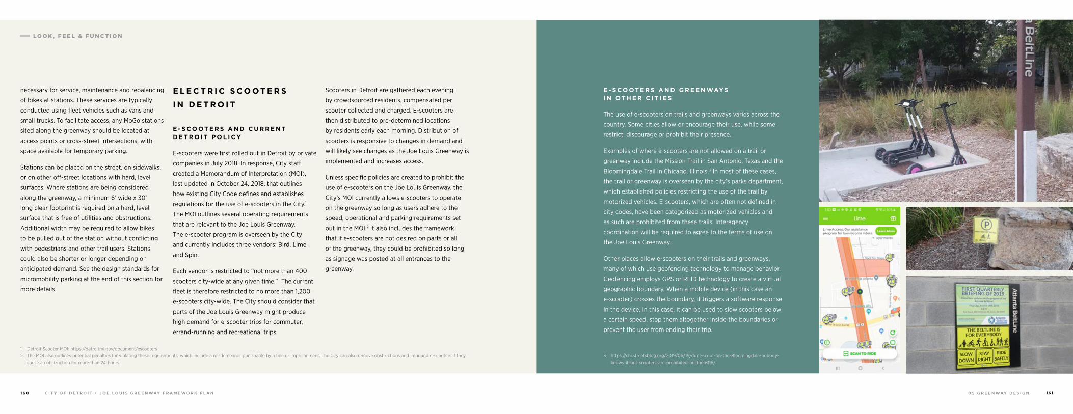
0 5 G R E E N WAY D E S I G NC I T Y O F D E T R O I T • J O E LO U I S G R E E N WAY F R A M E WO R K P L A N1 6 0 1 6 1
necessary for service, maintenance and rebalancing
of bikes at stations. These services are typically
conducted using fleet vehicles such as vans and
small trucks. To facilitate access, any MoGo stations
sited along the greenway should be located at
access points or cross-street intersections, with
space available for temporary parking.
Stations can be placed on the street, on sidewalks,
or on other off-street locations with hard, level
surfaces. Where stations are being considered
along the greenway, a minimum 6’ wide x 30’
long clear footprint is required on a hard, level
surface that is free of utilities and obstructions.
Additional width may be required to allow bikes
to be pulled out of the station without conflicting
with pedestrians and other trail users. Stations
could also be shorter or longer depending on
anticipated demand. See the design standards for
micromobility parking at the end of this section for
more details.
1 Detroit Scooter MOI: https://detroitmi.gov/document/escooters2 The MOI also outlines potential penalties for violating these requirements, which include a misdemeanor punishable by a fine or imprisonment. The City can also remove obstructions and impound e-scooters if they
cause an obstruction for more than 24-hours.
E L E C T R I C S C O OT E R S
I N D E T R O I T
E - S C O OT E R S A N D C U R R E N T D E T R O I T P O L I C Y
E-scooters were first rolled out in Detroit by private
companies in July 2018. In response, City staff
created a Memorandum of Interpretation (MOI),
last updated in October 24, 2018, that outlines
how existing City Code defines and establishes
regulations for the use of e-scooters in the City.1
The MOI outlines several operating requirements
that are relevant to the Joe Louis Greenway.
The e-scooter program is overseen by the City
and currently includes three vendors: Bird, Lime
and Spin.
Each vendor is restricted to “not more than 400
scooters city-wide at any given time.” The current
fleet is therefore restricted to no more than 1,200
e-scooters city-wide. The City should consider that
parts of the Joe Louis Greenway might produce
high demand for e-scooter trips for commuter,
errand-running and recreational trips.
Scooters in Detroit are gathered each evening
by crowdsourced residents, compensated per
scooter collected and charged. E-scooters are
then distributed to pre-determined locations
by residents early each morning. Distribution of
scooters is responsive to changes in demand and
will likely see changes as the Joe Louis Greenway is
implemented and increases access.
Unless specific policies are created to prohibit the
use of e-scooters on the Joe Louis Greenway, the
City’s MOI currently allows e-scooters to operate
on the greenway so long as users adhere to the
speed, operational and parking requirements set
out in the MOI.2 It also includes the framework
that if e-scooters are not desired on parts or all
of the greenway, they could be prohibited so long
as signage was posted at all entrances to the
greenway.
E - S C O OT E R S A N D G R E E N WAYS I N OT H E R C I T I E S
The use of e-scooters on trails and greenways varies across the
country. Some cities allow or encourage their use, while some
restrict, discourage or prohibit their presence.
Examples of where e-scooters are not allowed on a trail or
greenway include the Mission Trail in San Antonio, Texas and the
Bloomingdale Trail in Chicago, Illinois.3 In most of these cases,
the trail or greenway is overseen by the city’s parks department,
which established policies restricting the use of the trail by
motorized vehicles. E-scooters, which are often not defined in
city codes, have been categorized as motorized vehicles and
as such are prohibited from these trails. Interagency
coordination will be required to agree to the terms of use on
the Joe Louis Greenway.
Other places allow e-scooters on their trails and greenways,
many of which use geofencing technology to manage behavior.
Geofencing employs GPS or RFID technology to create a virtual
geographic boundary. When a mobile device (in this case an
e-scooter) crosses the boundary, it triggers a software response
in the device. In this case, it can be used to slow scooters below
a certain speed, stop them altogether inside the boundaries or
prevent the user from ending their trip.
3 https://chi.streetsblog.org/2019/06/19/dont-scoot-on-the-Bloomingdale-nobody-knows-it-but-scooters-are-prohibited-on-the-606/
LO O K , F E E L & F U N C T I O N
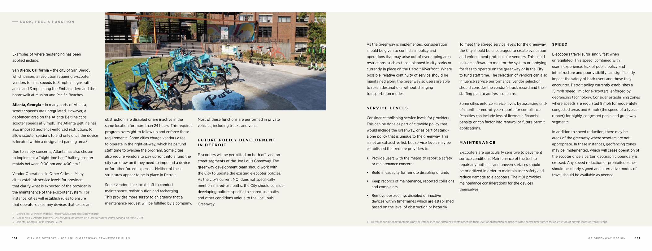
0 5 G R E E N WAY D E S I G NC I T Y O F D E T R O I T • J O E LO U I S G R E E N WAY F R A M E WO R K P L A N1 6 2 1 6 3
Examples of where geofencing has been
applied include:
San Diego, California – the city of San Diego1,
which passed a resolution requiring e-scooter
vendors to limit speeds to 8 mph in high-traffic
areas and 3 mph along the Embarcadero and the
boardwalk at Mission and Pacific Beaches.
Atlanta, Georgia – In many parts of Atlanta,
scooter speeds are unregulated. However, a
geofenced area on the Atlanta Beltline caps
scooter speeds at 8 mph. The Atlanta Beltline has
also imposed geofence-enforced restrictions to
allow scooter sessions to end only once the device
is located within a designated parking area.2
Due to safety concerns, Atlanta has also chosen
to implement a “nighttime ban,” halting scooter
rentals between 9:00 pm and 4:00 am.3
Vendor Operations in Other Cities – Many
cities establish service levels for providers
that clarify what is expected of the provider in
the maintenance of the e-scooter system. For
instance, cities will establish rules to ensure
that operators clear any devices that cause an
1 Detroit Horse Power website: https://www.detroithorsepower.org/2 Collin Kelley, Atlanta INtown, BeltLine puts the brakes on e-scooter users, limits parking on trails, 2019 3 Atlanta, Georgia Press Release, 2019
obstruction, are disabled or are inactive in the
same location for more than 24 hours. This requires
program oversight to follow up and enforce these
requirements. Some cities charge vendors a fee
to operate in the right-of-way, which helps fund
staff time to oversee the program. Some cities
also require vendors to pay upfront into a fund the
city can draw on if they need to impound a device
or for other forced expenses. Neither of these
structures appear to be in place in Detroit.
Some vendors hire local staff to conduct
maintenance, redistribution and recharging.
This provides more surety to an agency that a
maintenance request will be fulfilled by a company.
Most of these functions are performed in private
vehicles, including trucks and vans.
F U T U R E P O L I C Y D E V E LO P M E N T I N D E T R O I T
E-scooters will be permitted on both off- and on-
street segments of the Joe Louis Greenway. The
greenway development team should work with
the City to update the existing e-scooter policies.
As the city’s current MOI does not specifically
mention shared-use paths, the City should consider
developing policies specific to shared-use paths
and other conditions unique to the Joe Louis
Greenway.
As the greenway is implemented, consideration
should be given to conflicts in policy and
operations that may arise out of overlapping area
restrictions, such as those planned in city parks or
currently in place on the Detroit Riverfront. Where
possible, relative continuity of service should be
maintained along the greenway so users are able
to reach destinations without changing
transportation modes.
S E R V I C E L E V E L S
Consider establishing service levels for providers.
This can be done as part of citywide policy that
would include the greenway, or as part of stand-
alone policy that is unique to the greenway. This
is not an exhaustive list, but service levels may be
established that require providers to:
• Provide users with the means to report a safety or maintenance concern
• Build in capacity for remote disabling of units
• Keep records of maintenance, reported collisions and complaints
• Remove obstructing, disabled or inactive devices within timeframes which are established based on the level of obstruction or hazard4
4 Tiered or conditional timetables may be established for different events based on their level of obstruction or danger, with shorter timeframes for obstruction of bicycle lanes or transit stops.
To meet the agreed service levels for the greenway,
the City should be encouraged to create evaluation
and enforcement protocols for vendors. This could
include software to monitor the system or lobbying
for fees to operate on the greenway or in the City
to fund staff time. The selection of vendors can also
influence service performance; vendor selection
should consider the vendor’s track record and their
staffing plan to address concerns.
Some cities enforce service levels by assessing end-
of-month or end-of-year reports for compliance.
Penalties can include loss of license, a financial
penalty or can factor into renewal or future permit
applications.
M A I N T E N A N C E
E-scooters are particularly sensitive to pavement
surface conditions. Maintenance of the trail to
repair any potholes and uneven surfaces should
be prioritized in order to maintain user safety and
reduce damage to e-scooters. The MOI provides
maintenance considerations for the devices
themselves.
S P E E D
E-scooters travel surprisingly fast when
unregulated. This speed, combined with
user inexperience, lack of public policy and
infrastructure and poor visibility can significantly
impact the safety of both users and those they
encounter. Detroit policy currently establishes a
15 mph speed limit for e-scooters, enforced by
geofencing technology. Consider establishing zones
where speeds are regulated 8 mph for moderately
congested areas and 6 mph (the speed of a typical
runner) for highly-congested parks and greenway
segments.
In addition to speed reduction, there may be
areas of the greenway where scooters are not
appropriate. In these instances, geofencing zones
may be implemented, which will cease operation of
the scooter once a certain geographic boundary is
crossed. Any speed reduction or prohibited zones
should be clearly signed and alternative modes of
travel should be available as needed.
LO O K , F E E L & F U N C T I O N
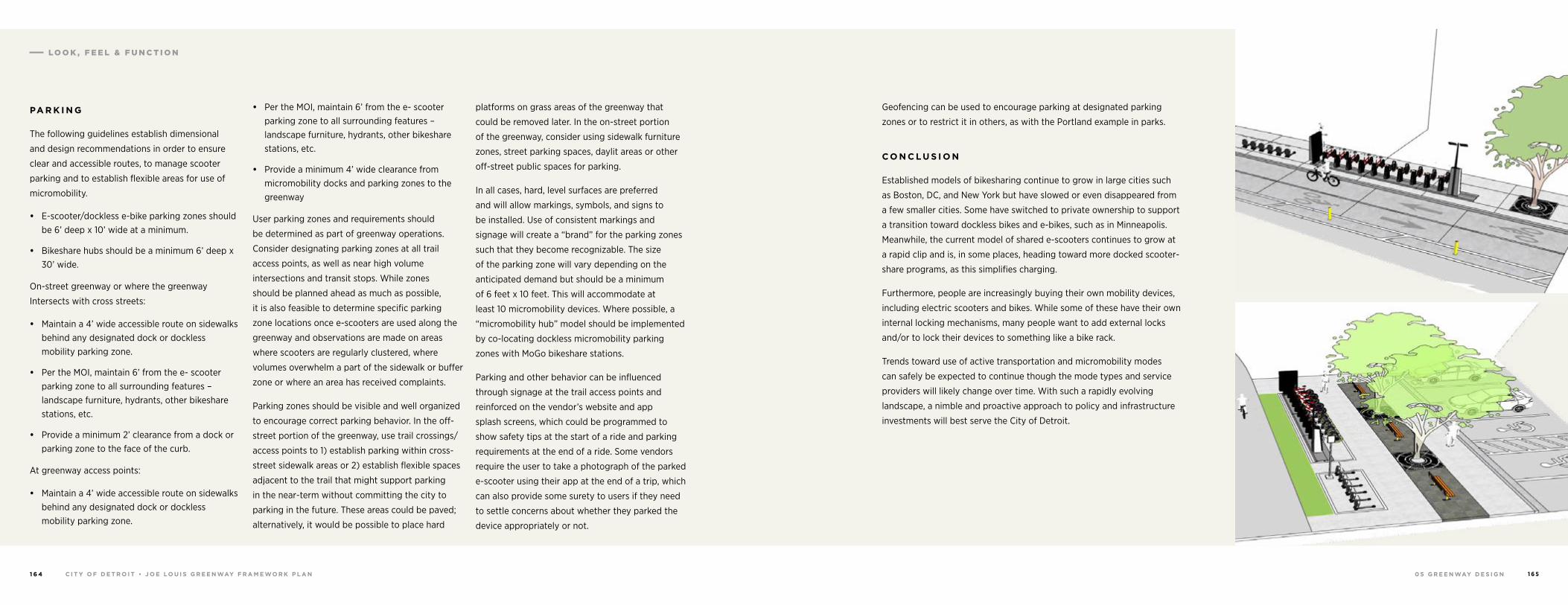
0 5 G R E E N WAY D E S I G NC I T Y O F D E T R O I T • J O E LO U I S G R E E N WAY F R A M E WO R K P L A N1 6 4 1 6 5
PA R K I N G
The following guidelines establish dimensional
and design recommendations in order to ensure
clear and accessible routes, to manage scooter
parking and to establish flexible areas for use of
micromobility.
• E-scooter/dockless e-bike parking zones should be 6’ deep x 10’ wide at a minimum.
• Bikeshare hubs should be a minimum 6’ deep x 30’ wide.
On-street greenway or where the greenway
Intersects with cross streets:
• Maintain a 4’ wide accessible route on sidewalks behind any designated dock or dockless mobility parking zone.
• Per the MOI, maintain 6’ from the e- scooter parking zone to all surrounding features – landscape furniture, hydrants, other bikeshare stations, etc.
• Provide a minimum 2’ clearance from a dock or parking zone to the face of the curb.
At greenway access points:
• Maintain a 4’ wide accessible route on sidewalks behind any designated dock or dockless mobility parking zone.
• Per the MOI, maintain 6’ from the e- scooter parking zone to all surrounding features – landscape furniture, hydrants, other bikeshare stations, etc.
• Provide a minimum 4’ wide clearance from micromobility docks and parking zones to the greenway
User parking zones and requirements should
be determined as part of greenway operations.
Consider designating parking zones at all trail
access points, as well as near high volume
intersections and transit stops. While zones
should be planned ahead as much as possible,
it is also feasible to determine specific parking
zone locations once e-scooters are used along the
greenway and observations are made on areas
where scooters are regularly clustered, where
volumes overwhelm a part of the sidewalk or buffer
zone or where an area has received complaints.
Parking zones should be visible and well organized
to encourage correct parking behavior. In the off-
street portion of the greenway, use trail crossings/
access points to 1) establish parking within cross-
street sidewalk areas or 2) establish flexible spaces
adjacent to the trail that might support parking
in the near-term without committing the city to
parking in the future. These areas could be paved;
alternatively, it would be possible to place hard
platforms on grass areas of the greenway that
could be removed later. In the on-street portion
of the greenway, consider using sidewalk furniture
zones, street parking spaces, daylit areas or other
off-street public spaces for parking.
In all cases, hard, level surfaces are preferred
and will allow markings, symbols, and signs to
be installed. Use of consistent markings and
signage will create a “brand” for the parking zones
such that they become recognizable. The size
of the parking zone will vary depending on the
anticipated demand but should be a minimum
of 6 feet x 10 feet. This will accommodate at
least 10 micromobility devices. Where possible, a
“micromobility hub” model should be implemented
by co-locating dockless micromobility parking
zones with MoGo bikeshare stations.
Parking and other behavior can be influenced
through signage at the trail access points and
reinforced on the vendor’s website and app
splash screens, which could be programmed to
show safety tips at the start of a ride and parking
requirements at the end of a ride. Some vendors
require the user to take a photograph of the parked
e-scooter using their app at the end of a trip, which
can also provide some surety to users if they need
to settle concerns about whether they parked the
device appropriately or not.
Geofencing can be used to encourage parking at designated parking
zones or to restrict it in others, as with the Portland example in parks.
C O N C L U S I O N
Established models of bikesharing continue to grow in large cities such
as Boston, DC, and New York but have slowed or even disappeared from
a few smaller cities. Some have switched to private ownership to support
a transition toward dockless bikes and e-bikes, such as in Minneapolis.
Meanwhile, the current model of shared e-scooters continues to grow at
a rapid clip and is, in some places, heading toward more docked scooter-
share programs, as this simplifies charging.
Furthermore, people are increasingly buying their own mobility devices,
including electric scooters and bikes. While some of these have their own
internal locking mechanisms, many people want to add external locks
and/or to lock their devices to something like a bike rack.
Trends toward use of active transportation and micromobility modes
can safely be expected to continue though the mode types and service
providers will likely change over time. With such a rapidly evolving
landscape, a nimble and proactive approach to policy and infrastructure
investments will best serve the City of Detroit.
LO O K , F E E L & F U N C T I O N
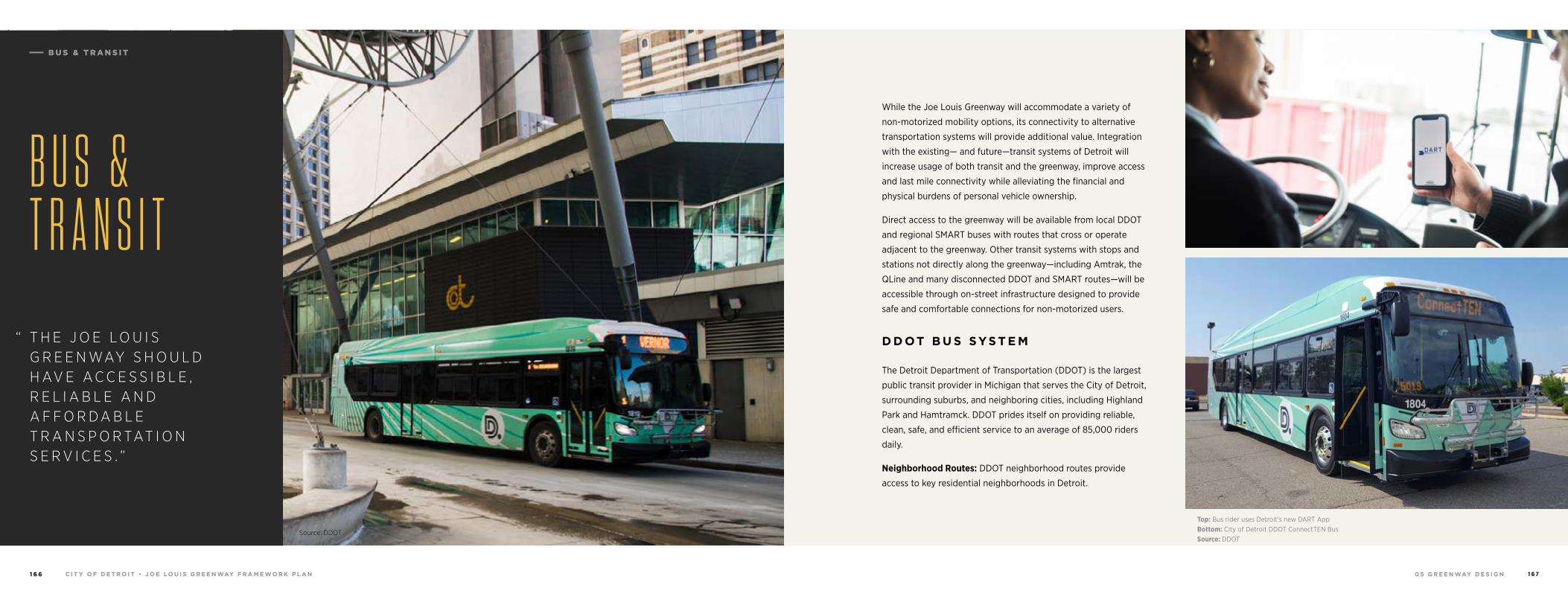
0 5 G R E E N WAY D E S I G NC I T Y O F D E T R O I T • J O E LO U I S G R E E N WAY F R A M E WO R K P L A N1 6 6 1 6 7
Source: DDOT
“ T H E J O E L O U I S G R E E N WAY S H O U L D H AV E A C C E S S I B L E , R E L I A B L E A N D A F F O R D A B L E T R A N S P O R TAT I O N S E R V I C E S . ”
B U S & T R A N S I T
While the Joe Louis Greenway will accommodate a variety of
non-motorized mobility options, its connectivity to alternative
transportation systems will provide additional value. Integration
with the existing— and future—transit systems of Detroit will
increase usage of both transit and the greenway, improve access
and last mile connectivity while alleviating the financial and
physical burdens of personal vehicle ownership.
Direct access to the greenway will be available from local DDOT
and regional SMART buses with routes that cross or operate
adjacent to the greenway. Other transit systems with stops and
stations not directly along the greenway—including Amtrak, the
QLine and many disconnected DDOT and SMART routes—will be
accessible through on-street infrastructure designed to provide
safe and comfortable connections for non-motorized users.
D D OT B U S SYS T E M
The Detroit Department of Transportation (DDOT) is the largest
public transit provider in Michigan that serves the City of Detroit,
surrounding suburbs, and neighboring cities, including Highland
Park and Hamtramck. DDOT prides itself on providing reliable,
clean, safe, and efficient service to an average of 85,000 riders
daily.
Neighborhood Routes: DDOT neighborhood routes provide
access to key residential neighborhoods in Detroit.
Top: Bus rider uses Detroit’s new DART AppBottom: City of Detroit DDOT ConnectTEN BusSource: DDOT
B U S & T R A N S I T
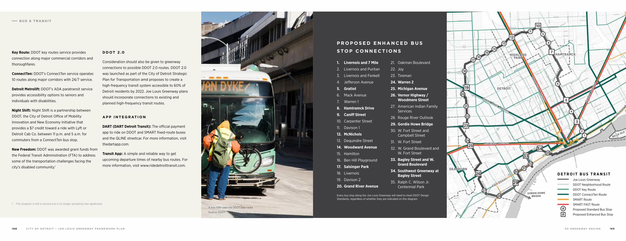
0 5 G R E E N WAY D E S I G NC I T Y O F D E T R O I T • J O E LO U I S G R E E N WAY F R A M E WO R K P L A N1 6 8 1 6 9
Key Route: DDOT key routes service provides
connection along major commercial corridors and
thoroughfares.
ConnectTen: DDOT’s ConnectTen service operates
10 routes along major corridors with 24/7 service.
Detroit Metrolift: DDOT’s ADA paratransit service
provides accessibility options to seniors and
individuals with disabilities.
Night Shift: Night Shift is a partnership between
DDOT, the City of Detroit Office of Mobility
Innovation and New Economy Initiative that
provides a $7 credit toward a ride with Lyft or
Detroit Cab Co. between 11 p.m. and 5 a.m. for
commuters from a ConnectTen bus stop.
New Freedom: DDOT was awarded grant funds from
the Federal Transit Administration (FTA) to address
some of the transportation challenges facing the
city’s disabled community.1
1 This program is still in service but is no longer accepting new applicants.
D D OT 2 . 0
Consideration should also be given to greenway
connections to possible DDOT 2.0 routes. DDOT 2.0
was launched as part of the City of Detroit Strategic
Plan for Transportation amd proposes to create a
high-frequency transit system accessible to 60% of
Detroit residents by 2022. Joe Louis Greenway plans
should incorporate connections to existing and
planned high-frequency transit routes.
A P P I N T E G R AT I O N
DART (DART Detroit Transit): The official payment
app to ride on DDOT and SMART fixed-route buses
and the QLINE streetcar. For more information, visit
thedartapp.com.
Transit App: A simple and reliable way to get
upcoming departure times of nearby bus routes. For
more information, visit www.ridedetroittransit.com.
1. Livernois and 7 Mile
2. Livernois and Puritan
3. Livernois and Fenkell
4. Jefferson Avenue
5. Gratiot
6. Mack Avenue
7. Warren 1
8. Hamtramck Drive
9. Caniff Street
10. Carpenter Street
11. Davison 1
12. McNichols
13. Dequindre Street
14. Woodward Avenue
15. Hamilton
16. Ben Hill Playground
17. Salsinger Park
18. Livernois
19. Davison 2
20. Grand River Avenue
21. Oakman Boulevard
22. Joy
23. Tireman
24. Warren 2
25. Michigan Avenue
26. Vernor Highway / Woodmere Street
27. American Indian Family Services
28. Rouge River Outlook
29. Gordie Howe Bridge
30. W. Fort Street and Campbell Street
31. W. Fort Street
32. W. Grand Boulevard and W. Fort Street
33. Bagley Street and W. Grand Boulevard
34. Southwest Greenway at Bagley Street
35. Ralph C. Wilson Jr. Centennial Park
Every bus stop along the Joe Louis Greenway will need to meet DDOT Design Standards, regardless of whether they are indicated on this diagram.
P R O P O S E D E N H A N C E D B U S
S TO P C O N N E C T I O N S
A bus rider uses the DDOT bike racks
Source: DDOT
Joe Louis Greenway
DDOT Neighborhood Route
DDOT Key Route
DDOT ConnectTen Route
SMART Route
SMART FAST Route
Proposed Standard Bus Stop
Proposed Enhanced Bus Stop
D E T R O I T B U S T R A N S I T
#
#
B U S & T R A N S I T
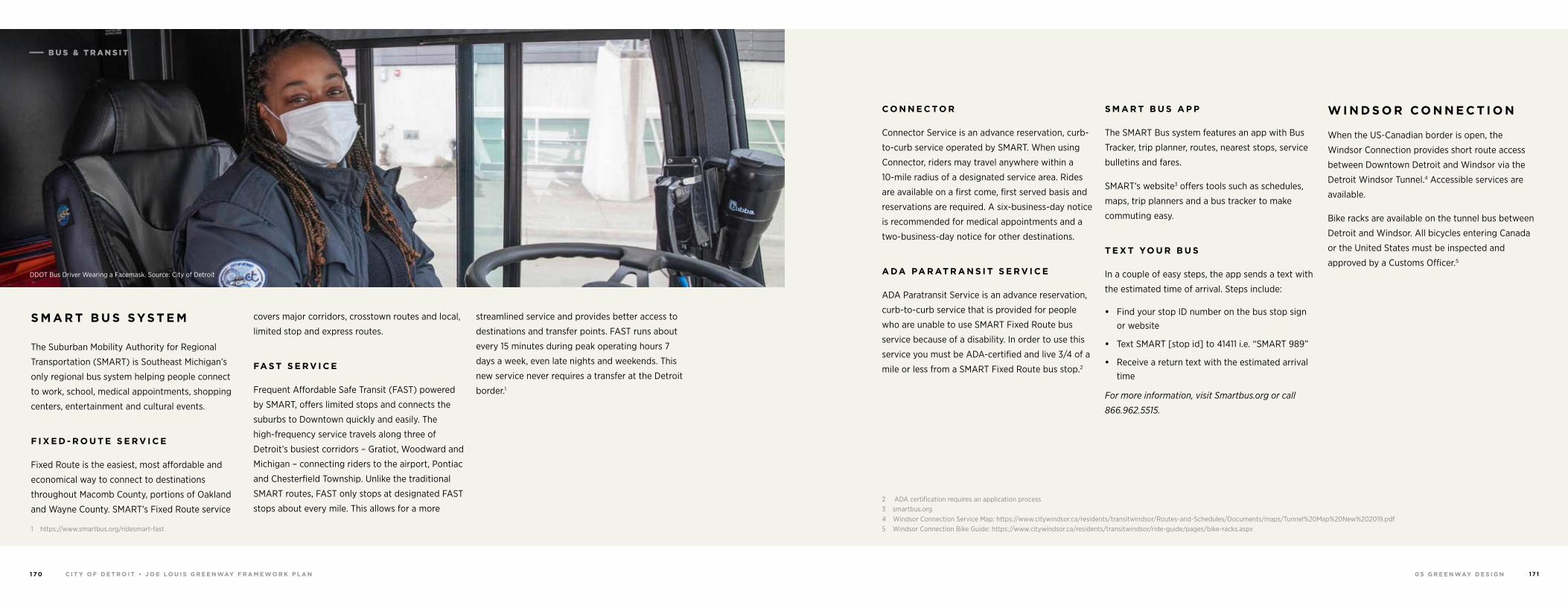
0 5 G R E E N WAY D E S I G NC I T Y O F D E T R O I T • J O E LO U I S G R E E N WAY F R A M E WO R K P L A N1 7 0 1 7 1
S M A R T B U S SYS T E M
The Suburban Mobility Authority for Regional
Transportation (SMART) is Southeast Michigan’s
only regional bus system helping people connect
to work, school, medical appointments, shopping
centers, entertainment and cultural events.
F I X E D - R O U T E S E R V I C E
Fixed Route is the easiest, most affordable and
economical way to connect to destinations
throughout Macomb County, portions of Oakland
and Wayne County. SMART’s Fixed Route service
1 https://www.smartbus.org/ridesmart-fast
covers major corridors, crosstown routes and local,
limited stop and express routes.
FA S T S E R V I C E
Frequent Affordable Safe Transit (FAST) powered
by SMART, offers limited stops and connects the
suburbs to Downtown quickly and easily. The
high-frequency service travels along three of
Detroit’s busiest corridors – Gratiot, Woodward and
Michigan – connecting riders to the airport, Pontiac
and Chesterfield Township. Unlike the traditional
SMART routes, FAST only stops at designated FAST
stops about every mile. This allows for a more
streamlined service and provides better access to
destinations and transfer points. FAST runs about
every 15 minutes during peak operating hours 7
days a week, even late nights and weekends. This
new service never requires a transfer at the Detroit
border.1
DDOT Bus Driver Wearing a Facemask. Source: City of Detroit
C O N N E C TO R
Connector Service is an advance reservation, curb-
to-curb service operated by SMART. When using
Connector, riders may travel anywhere within a
10-mile radius of a designated service area. Rides
are available on a first come, first served basis and
reservations are required. A six-business-day notice
is recommended for medical appointments and a
two-business-day notice for other destinations.
A DA PA R AT R A N S I T S E R V I C E
ADA Paratransit Service is an advance reservation,
curb-to-curb service that is provided for people
who are unable to use SMART Fixed Route bus
service because of a disability. In order to use this
service you must be ADA-certified and live 3/4 of a
mile or less from a SMART Fixed Route bus stop.2
2 ADA certification requires an application process3 smartbus.org4 Windsor Connection Service Map: https://www.citywindsor.ca/residents/transitwindsor/Routes-and-Schedules/Documents/maps/Tunnel%20Map%20New%202019.pdf5 Windsor Connection Bike Guide: https://www.citywindsor.ca/residents/transitwindsor/ride-guide/pages/bike-racks.aspx
S M A R T B U S A P P
The SMART Bus system features an app with Bus
Tracker, trip planner, routes, nearest stops, service
bulletins and fares.
SMART’s website3 offers tools such as schedules,
maps, trip planners and a bus tracker to make
commuting easy.
T E X T YO U R B U S
In a couple of easy steps, the app sends a text with
the estimated time of arrival. Steps include:
• Find your stop ID number on the bus stop sign or website
• Text SMART [stop id] to 41411 i.e. “SMART 989”
• Receive a return text with the estimated arrival time
For more information, visit Smartbus.org or call
866.962.5515.
W I N D S O R C O N N E C T I O N
When the US-Canadian border is open, the
Windsor Connection provides short route access
between Downtown Detroit and Windsor via the
Detroit Windsor Tunnel.4 Accessible services are
available.
Bike racks are available on the tunnel bus between
Detroit and Windsor. All bicycles entering Canada
or the United States must be inspected and
approved by a Customs Officer.5
B U S & T R A N S I T
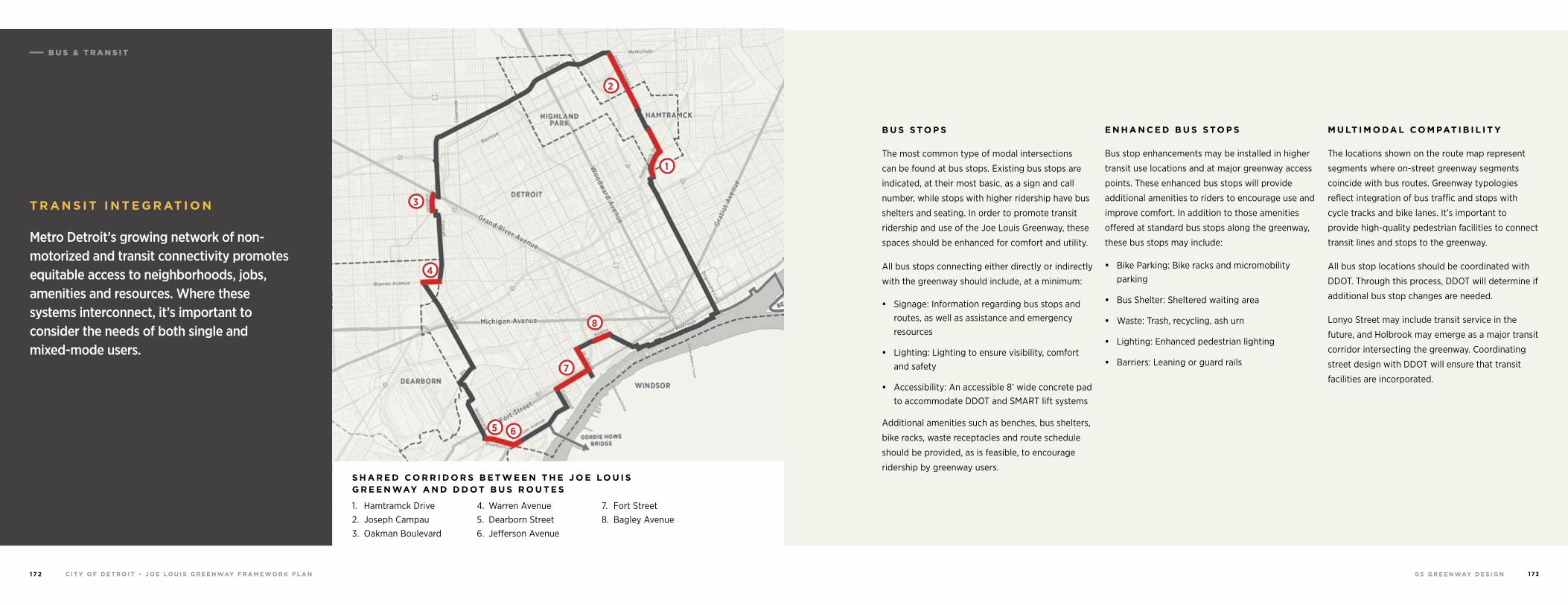
0 5 G R E E N WAY D E S I G NC I T Y O F D E T R O I T • J O E LO U I S G R E E N WAY F R A M E WO R K P L A N1 7 2 1 7 3
8
7
65
4
3
2
1
T R A N S I T I N T E G R AT I O N
Metro Detroit’s growing network of non-motorized and transit connectivity promotes equitable access to neighborhoods, jobs, amenities and resources. Where these systems interconnect, it’s important to consider the needs of both single and mixed-mode users.
1. Hamtramck Drive2. Joseph Campau3. Oakman Boulevard
4. Warren Avenue5. Dearborn Street6. Jefferson Avenue
7. Fort Street8. Bagley Avenue
S H A R E D C O R R I D O R S B E T W E E N T H E J O E LO U I S G R E E N WAY A N D D D OT B U S R O U T E S
B U S S TO P S
The most common type of modal intersections
can be found at bus stops. Existing bus stops are
indicated, at their most basic, as a sign and call
number, while stops with higher ridership have bus
shelters and seating. In order to promote transit
ridership and use of the Joe Louis Greenway, these
spaces should be enhanced for comfort and utility.
All bus stops connecting either directly or indirectly
with the greenway should include, at a minimum:
• Signage: Information regarding bus stops and routes, as well as assistance and emergency resources
• Lighting: Lighting to ensure visibility, comfort and safety
• Accessibility: An accessible 8’ wide concrete pad to accommodate DDOT and SMART lift systems
Additional amenities such as benches, bus shelters,
bike racks, waste receptacles and route schedule
should be provided, as is feasible, to encourage
ridership by greenway users.
E N H A N C E D B U S S TO P S
Bus stop enhancements may be installed in higher
transit use locations and at major greenway access
points. These enhanced bus stops will provide
additional amenities to riders to encourage use and
improve comfort. In addition to those amenities
offered at standard bus stops along the greenway,
these bus stops may include:
• Bike Parking: Bike racks and micromobility parking
• Bus Shelter: Sheltered waiting area
• Waste: Trash, recycling, ash urn
• Lighting: Enhanced pedestrian lighting
• Barriers: Leaning or guard rails
M U LT I M O DA L C O M PAT I B I L I T Y
The locations shown on the route map represent
segments where on-street greenway segments
coincide with bus routes. Greenway typologies
reflect integration of bus traffic and stops with
cycle tracks and bike lanes. It’s important to
provide high-quality pedestrian facilities to connect
transit lines and stops to the greenway.
All bus stop locations should be coordinated with
DDOT. Through this process, DDOT will determine if
additional bus stop changes are needed.
Lonyo Street may include transit service in the
future, and Holbrook may emerge as a major transit
corridor intersecting the greenway. Coordinating
street design with DDOT will ensure that transit
facilities are incorporated.
B U S & T R A N S I T
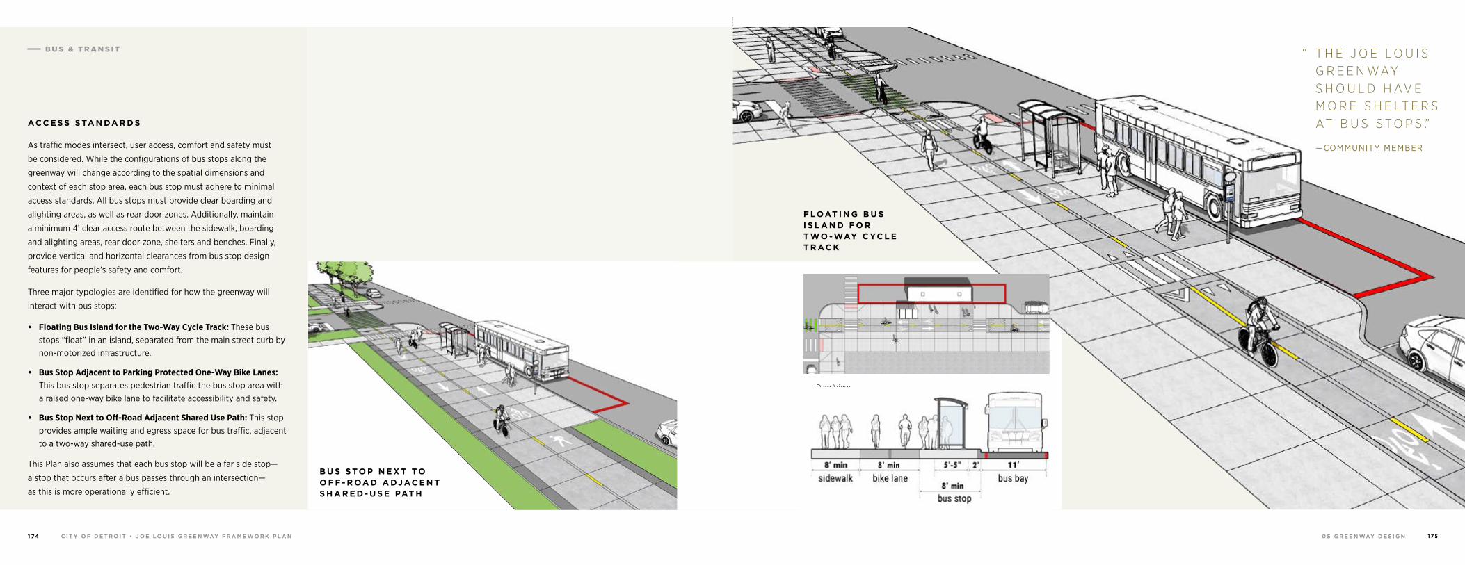
0 5 G R E E N WAY D E S I G NC I T Y O F D E T R O I T • J O E LO U I S G R E E N WAY F R A M E WO R K P L A N1 74 1 7 5
AC C E S S S TA N DA R D S
As traffic modes intersect, user access, comfort and safety must
be considered. While the configurations of bus stops along the
greenway will change according to the spatial dimensions and
context of each stop area, each bus stop must adhere to minimal
access standards. All bus stops must provide clear boarding and
alighting areas, as well as rear door zones. Additionally, maintain
a minimum 4’ clear access route between the sidewalk, boarding
and alighting areas, rear door zone, shelters and benches. Finally,
provide vertical and horizontal clearances from bus stop design
features for people’s safety and comfort.
Three major typologies are identified for how the greenway will
interact with bus stops:
• Floating Bus Island for the Two-Way Cycle Track: These bus stops “float” in an island, separated from the main street curb by non-motorized infrastructure.
• Bus Stop Adjacent to Parking Protected One-Way Bike Lanes: This bus stop separates pedestrian traffic the bus stop area with a raised one-way bike lane to facilitate accessibility and safety.
• Bus Stop Next to Off-Road Adjacent Shared Use Path: This stop provides ample waiting and egress space for bus traffic, adjacent to a two-way shared-use path.
This Plan also assumes that each bus stop will be a far side stop—
a stop that occurs after a bus passes through an intersection—
as this is more operationally efficient.
B U S S TO P N E X T TO O F F - R OA D A DJ AC E N T S H A R E D - U S E PAT H Section View
Plan View
F LOAT I N G B U S I S L A N D F O R T WO -WAY C YC L E T R AC K
B U S S TO P A DJ AC E N T TO PA R K I N G - P R OT E C T E D O N E -WAY B I K E L A N E S
“ T H E J O E L O U I S G R E E N WAY S H O U L D H AV E M O R E S H E LT E R S AT B U S S T O P S .”
—COMMUNITY MEMBER
B U S & T R A N S I T
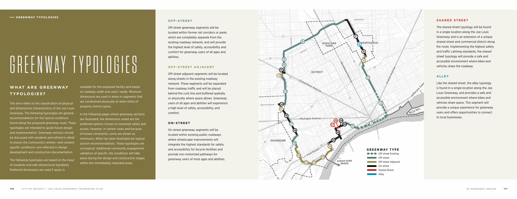
0 5 G R E E N WAY D E S I G NC I T Y O F D E T R O I T • J O E LO U I S G R E E N WAY F R A M E WO R K P L A N1 7 6 1 7 7
W H AT A R E G R E E N WAY
T Y P O LO G I E S ?
This term refers to the classification of physical
and dimensional characteristics of the Joe Louis
Greenway. The following typologies are general
recommendations for the typical conditions
found along the proposed greenway route. These
typologies are intended to guide future design
and implementation. Greenway sections should
be discussed with residents and refined in detail
to ensure the community’s wishes—and context-
specific conditions—are reflected in design
development and construction documentation.
The following typologies are based on the input
of residents and safe dimensional standards.
Preferred dimensions are used if space is
available for the proposed facility and based
on roadway width and users’ needs. Minimum
dimensions are used in areas or segments that
are constrained physically or when limits of
property restrict space.
In the following pages where greenway sections
are illustrated, the dimensions noted are the
preferred options chosen to maximize safety and
access. However, in certain cases and because
of known constraints, some are shown as
minimums. What has been illustrated are typical
section recommendations. These typologies are
conceptual. Additional community engagement
validation of specific site conditions will take
place during the design and construction stages
within the immediately impacted areas.
G R E E N W A Y T Y P O L O G I E S
O F F - S T R E E T
Off-street greenway segments will be
located within former rail corridors or parks
which are completely separate from the
existing roadway network, and will provide
the highest level of safety, accessibility and
comfort for greenway users of all ages and
abilities.
O F F - S T R E E T A DJ AC E N T
Off-street adjacent segments will be located
along streets in the existing roadway
network. These segments will be separated
from roadway traffic and will be placed
behind the curb line and buffered spatially
or physically where space allows. Greenway
users of all ages and abilities will experience
a high level of safety, accessibility, and
comfort.
O N - S T R E E T
On-street greenway segments will be
located within existing public roadways
where streetscape improvements will
integrate the highest standards for safety
and accessibility for bicycle facilities and
provide non-motorized pathways for
greenway users of most ages and abilities.
S H A R E D S T R E E T
The shared street typology will be found
in a single location along the Joe Louis
Greenway and is an extension of a unique
shared street and commercial district along
the route. Implementing the highest safety
and traffic calming standards, the shared
street typology will provide a safe and
accessible environment where bikes and
vehicles share the roadway.
A L L E Y
Like the shared street, the alley typology
is found in a single location along the Joe
Louis Greenway, and provides a safe and
accessible environment where bikes and
vehicles share space. This segment will
provide a unique experience for greenway
users and offers opportunities to connect
to local businesses.
G R E E N WAY T Y P E Off-street Existing
Off-street
Off-street Adjacent
On-street
Shared Street
Alley
18
16
14
13
8
3
2
1
12
11
7
5
6
15
4
1731
19
2930
25
23
21 22
24
20
26
27
9
10
28
G R E E N WAY T Y P O LO G I E S
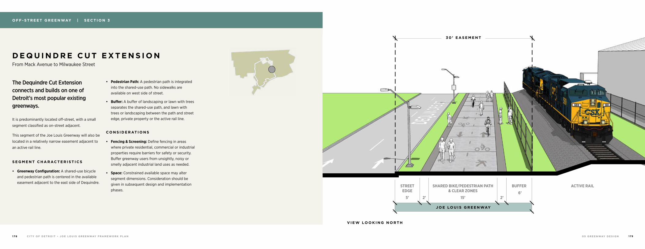
0 5 G R E E N WAY D E S I G NC I T Y O F D E T R O I T • J O E LO U I S G R E E N WAY F R A M E WO R K P L A N1 7 8 1 7 9
O F F - S T R E E T G R E E N WAY | S E C T I O N 3
D E Q U I N D R E C U T E X T E N S I O N From Mack Avenue to Milwaukee Street
The Dequindre Cut Extension connects and builds on one of Detroit’s most popular existing greenways.
It is predominantly located off-street, with a small
segment classified as on-street adjacent.
This segment of the Joe Louis Greenway will also be
located in a relatively narrow easement adjacent to
an active rail line.
S E G M E N T C H A R AC T E R I S T I C S
• Greenway Configuration: A shared-use bicycle and pedestrian path is centered in the available easement adjacent to the east side of Dequindre.
• Pedestrian Path: A pedestrian path is integrated into the shared-use path. No sidewalks are available on west side of street.
• Buffer: A buffer of landscaping or lawn with trees separates the shared-use path, and lawn with trees or landscaping between the path and street edge, private property or the active rail line.
C O N S I D E R AT I O N S
• Fencing & Screening: Define fencing in areas where private residential, commercial or industrial properties require barriers for safety or security. Buffer greenway users from unsightly, noisy or smelly adjacent industrial land uses as needed.
• Space: Constrained available space may alter segment dimensions. Consideration should be given in subsequent design and implementation phases.
J O E LO U I S G R E E N WAY
ACTIVE RAIL
3 0 ’ E A S E M E N T
SHARED BIKE/PEDESTRIAN PATH & CLEAR ZONES
STREET EDGE
5’ 2’ 2’15’
BUFFER
6’
V I E W LO O K I N G N O R T H
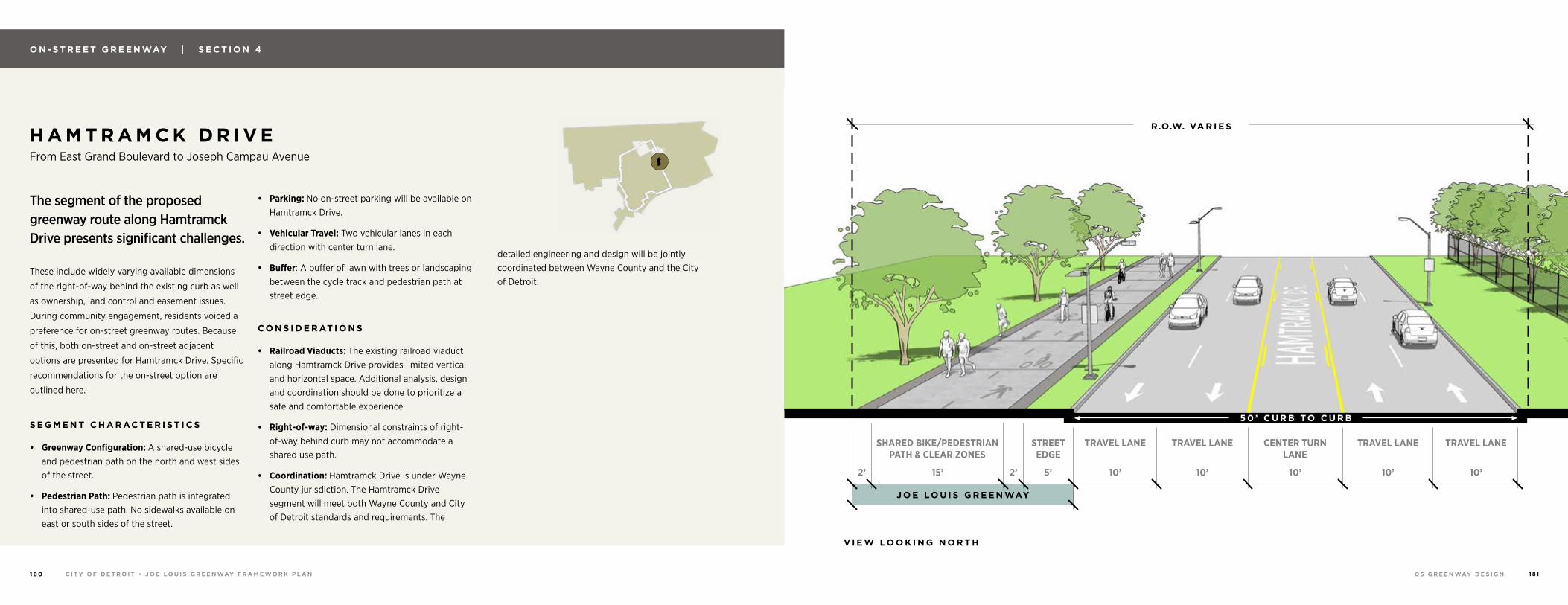
0 5 G R E E N WAY D E S I G NC I T Y O F D E T R O I T • J O E LO U I S G R E E N WAY F R A M E WO R K P L A N1 8 0 1 8 1
O N - S T R E E T G R E E N WAY | S E C T I O N 4
H A M T R A M C K D R I V E From East Grand Boulevard to Joseph Campau Avenue
The segment of the proposed greenway route along Hamtramck Drive presents significant challenges.
These include widely varying available dimensions
of the right-of-way behind the existing curb as well
as ownership, land control and easement issues.
During community engagement, residents voiced a
preference for on-street greenway routes. Because
of this, both on-street and on-street adjacent
options are presented for Hamtramck Drive. Specific
recommendations for the on-street option are
outlined here.
S E G M E N T C H A R AC T E R I S T I C S
• Greenway Configuration: A shared-use bicycle and pedestrian path on the north and west sides of the street.
• Pedestrian Path: Pedestrian path is integrated into shared-use path. No sidewalks available on east or south sides of the street.
• Parking: No on-street parking will be available on Hamtramck Drive.
• Vehicular Travel: Two vehicular lanes in each direction with center turn lane.
• Buffer: A buffer of lawn with trees or landscaping between the cycle track and pedestrian path at street edge.
C O N S I D E R AT I O N S
• Railroad Viaducts: The existing railroad viaduct along Hamtramck Drive provides limited vertical and horizontal space. Additional analysis, design and coordination should be done to prioritize a safe and comfortable experience.
• Right-of-way: Dimensional constraints of right-of-way behind curb may not accommodate a shared use path.
• Coordination: Hamtramck Drive is under Wayne County jurisdiction. The Hamtramck Drive segment will meet both Wayne County and City of Detroit standards and requirements. The
detailed engineering and design will be jointly coordinated between Wayne County and the City of Detroit.
J O E LO U I S G R E E N WAY
TRAVEL LANE TRAVEL LANETRAVEL LANE CENTER TURN LANE
TRAVEL LANE
10’ 10’10’ 10’ 10’5’2’2’ 15’
R.O.W. VA R I E S
STREET EDGE
SHARED BIKE/PEDESTRIAN PATH & CLEAR ZONES
V I E W LO O K I N G N O R T H
5 0 ’ C U R B TO C U R B
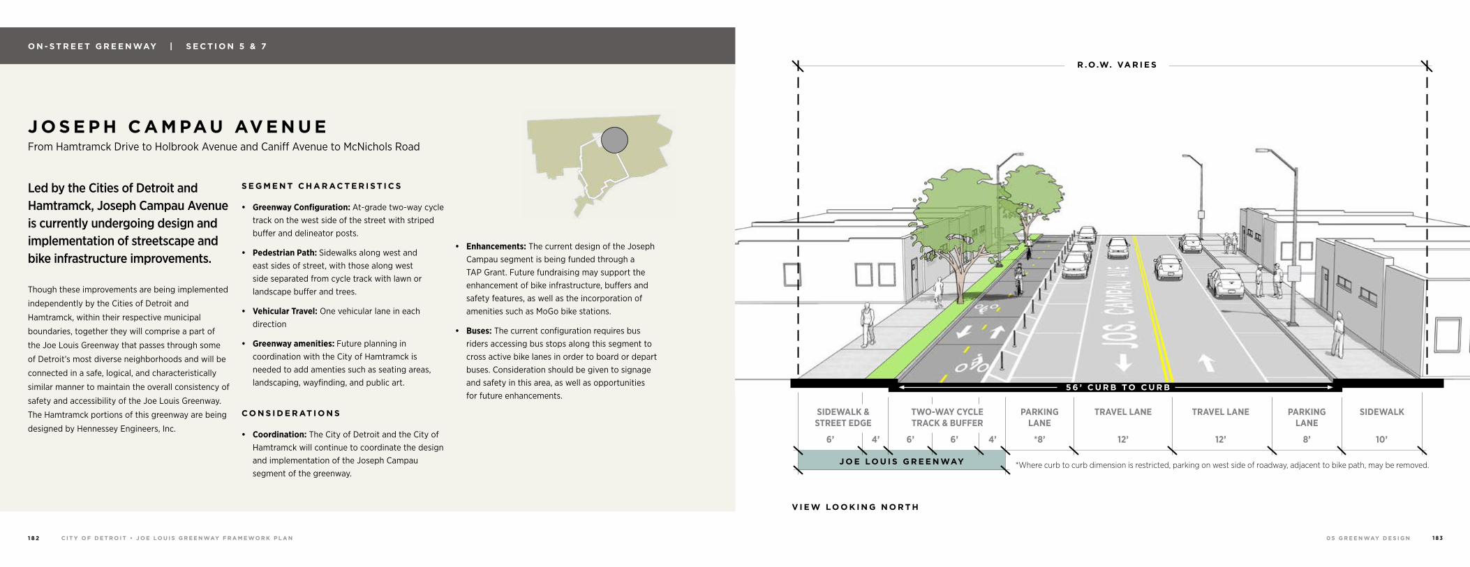
0 5 G R E E N WAY D E S I G NC I T Y O F D E T R O I T • J O E LO U I S G R E E N WAY F R A M E WO R K P L A N1 8 2 1 8 3
O N - S T R E E T G R E E N WAY | S E C T I O N 5 & 7
J O S E P H C A M PAU AV E N U E From Hamtramck Drive to Holbrook Avenue and Caniff Avenue to McNichols Road
Led by the Cities of Detroit and Hamtramck, Joseph Campau Avenue is currently undergoing design and implementation of streetscape and bike infrastructure improvements.
Though these improvements are being implemented
independently by the Cities of Detroit and
Hamtramck, within their respective municipal
boundaries, together they will comprise a part of
the Joe Louis Greenway that passes through some
of Detroit’s most diverse neighborhoods and will be
connected in a safe, logical, and characteristically
similar manner to maintain the overall consistency of
safety and accessibility of the Joe Louis Greenway.
The Hamtramck portions of this greenway are being
designed by Hennessey Engineers, Inc.
S E G M E N T C H A R AC T E R I S T I C S
• Greenway Configuration: At-grade two-way cycle track on the west side of the street with striped buffer and delineator posts.
• Pedestrian Path: Sidewalks along west and east sides of street, with those along west side separated from cycle track with lawn or landscape buffer and trees.
• Vehicular Travel: One vehicular lane in each direction
• Greenway amenities: Future planning in coordination with the City of Hamtramck is needed to add amenties such as seating areas, landscaping, wayfinding, and public art.
C O N S I D E R AT I O N S
• Coordination: The City of Detroit and the City of Hamtramck will continue to coordinate the design and implementation of the Joseph Campau segment of the greenway.
• Enhancements: The current design of the Joseph Campau segment is being funded through a TAP Grant. Future fundraising may support the enhancement of bike infrastructure, buffers and safety features, as well as the incorporation of amenities such as MoGo bike stations.
• Buses: The current configuration requires bus riders accessing bus stops along this segment to cross active bike lanes in order to board or depart buses. Consideration should be given to signage and safety in this area, as well as opportunities for future enhancements.
J O E LO U I S G R E E N WAY
SIDEWALKTRAVEL LANE TRAVEL LANETWO-WAY CYCLE TRACK & BUFFER
SIDEWALK & STREET EDGE
12’ 12’6’6’ 6’ 4’4’ 10’
R .O.W. VA R I E S
PARKING LANE
PARKING LANE
8’*8’
5 6 ’ C U R B TO C U R B
*Where curb to curb dimension is restricted, parking on west side of roadway, adjacent to bike path, may be removed.
V I E W LO O K I N G N O R T H
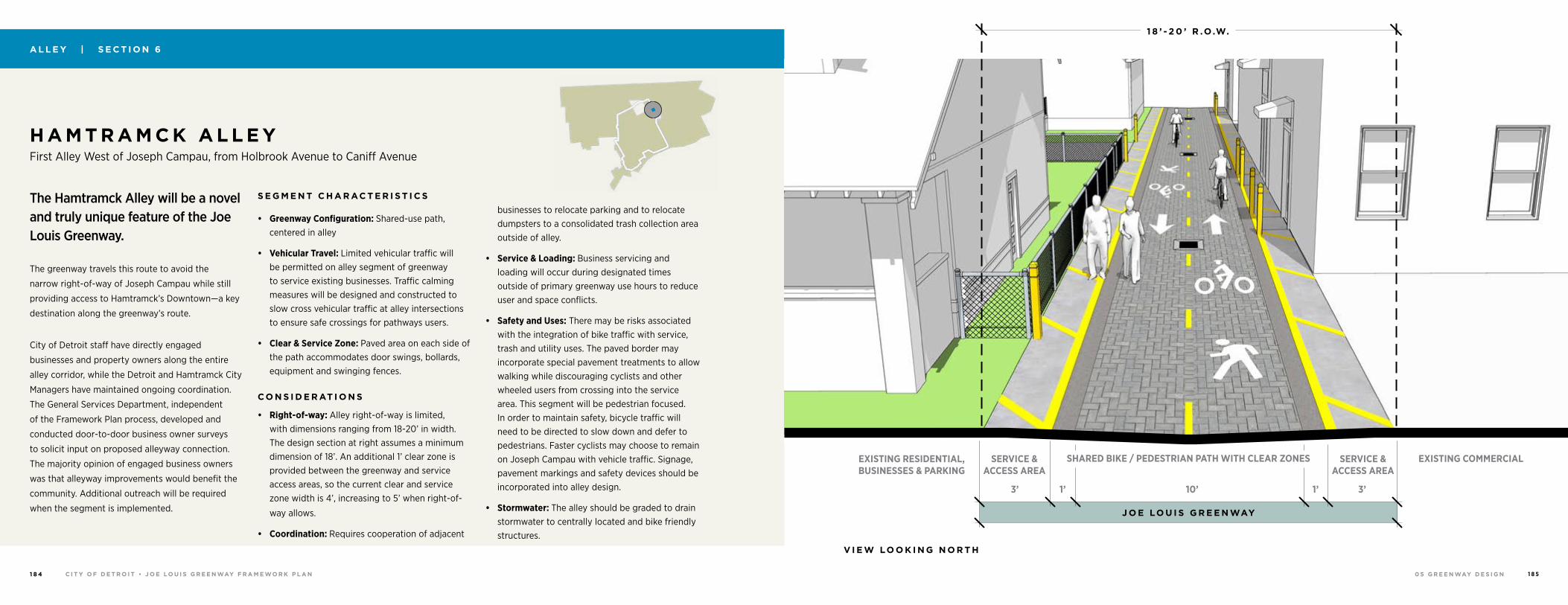
0 5 G R E E N WAY D E S I G NC I T Y O F D E T R O I T • J O E LO U I S G R E E N WAY F R A M E WO R K P L A N1 8 4 1 8 5
A L L E Y | S E C T I O N 6
H A M T R A M C K A L L E Y First Alley West of Joseph Campau, from Holbrook Avenue to Caniff Avenue
The Hamtramck Alley will be a novel and truly unique feature of the Joe Louis Greenway.
The greenway travels this route to avoid the
narrow right-of-way of Joseph Campau while still
providing access to Hamtramck’s Downtown—a key
destination along the greenway’s route.
City of Detroit staff have directly engaged
businesses and property owners along the entire
alley corridor, while the Detroit and Hamtramck City
Managers have maintained ongoing coordination.
The General Services Department, independent
of the Framework Plan process, developed and
conducted door-to-door business owner surveys
to solicit input on proposed alleyway connection.
The majority opinion of engaged business owners
was that alleyway improvements would benefit the
community. Additional outreach will be required
when the segment is implemented.
S E G M E N T C H A R AC T E R I S T I C S
• Greenway Configuration: Shared-use path, centered in alley
• Vehicular Travel: Limited vehicular traffic will be permitted on alley segment of greenway to service existing businesses. Traffic calming measures will be designed and constructed to slow cross vehicular traffic at alley intersections to ensure safe crossings for pathways users.
• Clear & Service Zone: Paved area on each side of the path accommodates door swings, bollards, equipment and swinging fences.
C O N S I D E R AT I O N S
• Right-of-way: Alley right-of-way is limited, with dimensions ranging from 18-20’ in width. The design section at right assumes a minimum dimension of 18’. An additional 1’ clear zone is provided between the greenway and service access areas, so the current clear and service zone width is 4’, increasing to 5’ when right-of-
way allows.
• Coordination: Requires cooperation of adjacent
businesses to relocate parking and to relocate dumpsters to a consolidated trash collection area outside of alley.
• Service & Loading: Business servicing and loading will occur during designated times outside of primary greenway use hours to reduce user and space conflicts.
• Safety and Uses: There may be risks associated with the integration of bike traffic with service, trash and utility uses. The paved border may incorporate special pavement treatments to allow walking while discouraging cyclists and other wheeled users from crossing into the service area. This segment will be pedestrian focused. In order to maintain safety, bicycle traffic will need to be directed to slow down and defer to pedestrians. Faster cyclists may choose to remain on Joseph Campau with vehicle traffic. Signage, pavement markings and safety devices should be incorporated into alley design.
• Stormwater: The alley should be graded to drain stormwater to centrally located and bike friendly structures.
“ C O N N E C T T O N E I G H B O R H O O D S V I A A L L E Y WAY T O P R O M O T E H E A LT H ”
J O E LO U I S G R E E N WAY
1 8 ’ - 2 0 ’ R .O.W.
SERVICE & ACCESS AREA
SERVICE & ACCESS AREA
EXISTING RESIDENTIAL, BUSINESSES & PARKING
EXISTING COMMERCIAL
3’1’1’3’ 10’
SHARED BIKE / PEDESTRIAN PATH WITH CLEAR ZONES
V I E W LO O K I N G N O R T H
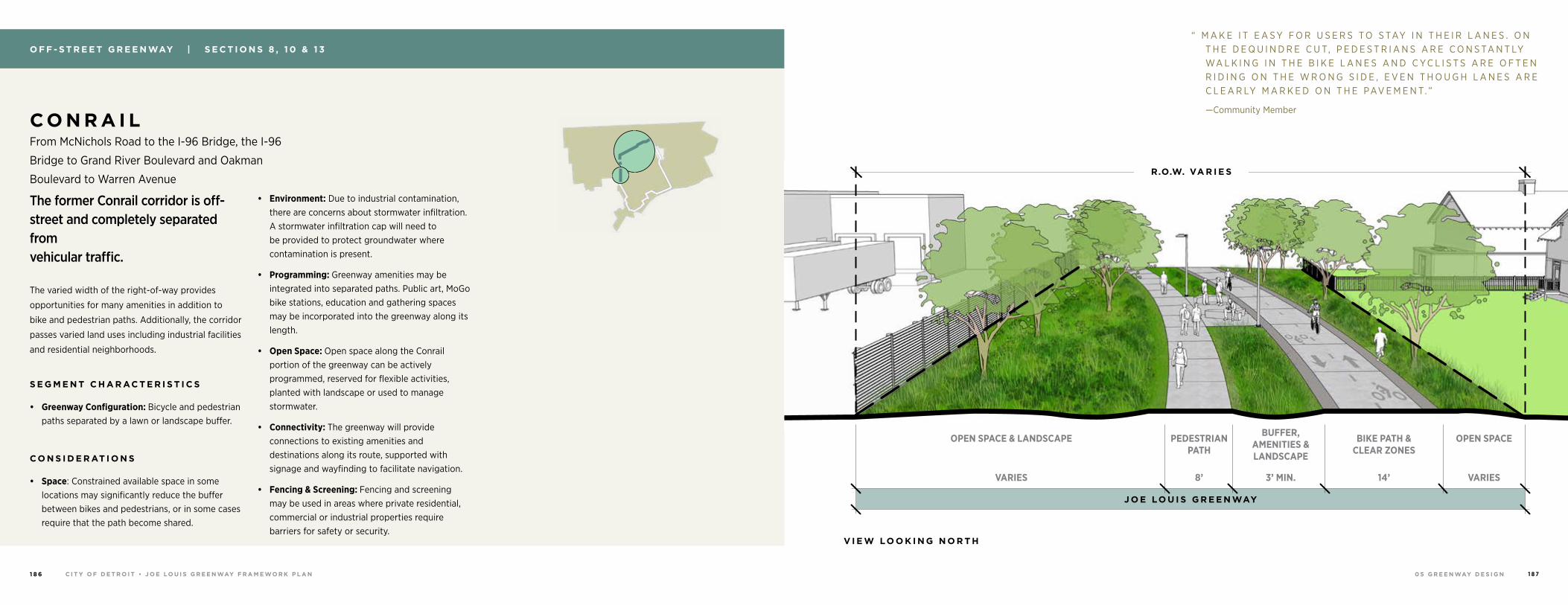
0 5 G R E E N WAY D E S I G NC I T Y O F D E T R O I T • J O E LO U I S G R E E N WAY F R A M E WO R K P L A N1 8 6 1 8 7
O F F - S T R E E T G R E E N WAY | S E C T I O N S 8 , 1 0 & 1 3
C O N R A I L From McNichols Road to the I-96 Bridge, the I-96
Bridge to Grand River Boulevard and Oakman
Boulevard to Warren Avenue
The former Conrail corridor is off-street and completely separated from vehicular traffic.
The varied width of the right-of-way provides
opportunities for many amenities in addition to
bike and pedestrian paths. Additionally, the corridor
passes varied land uses including industrial facilities
and residential neighborhoods.
S E G M E N T C H A R AC T E R I S T I C S
• Greenway Configuration: Bicycle and pedestrian paths separated by a lawn or landscape buffer.
C O N S I D E R AT I O N S
• Space: Constrained available space in some locations may significantly reduce the buffer between bikes and pedestrians, or in some cases require that the path become shared.
• Environment: Due to industrial contamination, there are concerns about stormwater infiltration. A stormwater infiltration cap will need to be provided to protect groundwater where contamination is present.
• Programming: Greenway amenities may be integrated into separated paths. Public art, MoGo bike stations, education and gathering spaces may be incorporated into the greenway along its length.
• Open Space: Open space along the Conrail portion of the greenway can be actively programmed, reserved for flexible activities, planted with landscape or used to manage stormwater.
• Connectivity: The greenway will provide connections to existing amenities and destinations along its route, supported with signage and wayfinding to facilitate navigation.
• Fencing & Screening: Fencing and screening may be used in areas where private residential, commercial or industrial properties require barriers for safety or security.
“ M A K E I T E A S Y F O R U S E R S T O S TAY I N T H E I R L A N E S . O N T H E D E Q U I N D R E C U T, P E D E S T R I A N S A R E C O N S TA N T LY WA L K I N G I N T H E B I K E L A N E S A N D C YC L I S T S A R E O F T E N R I D I N G O N T H E W R O N G S I D E , E V E N T H O U G H L A N E S A R E C L E A R LY M A R K E D O N T H E PAV E M E N T. ”
—Community Member
J O E LO U I S G R E E N WAY
R.O.W. VA R I E S
OPEN SPACEOPEN SPACE & LANDSCAPE PEDESTRIAN PATH
3’ MIN.VARIES 8’ VARIES14’
BUFFER, AMENITIES & LANDSCAPE
BIKE PATH & CLEAR ZONES
V I E W LO O K I N G N O R T H
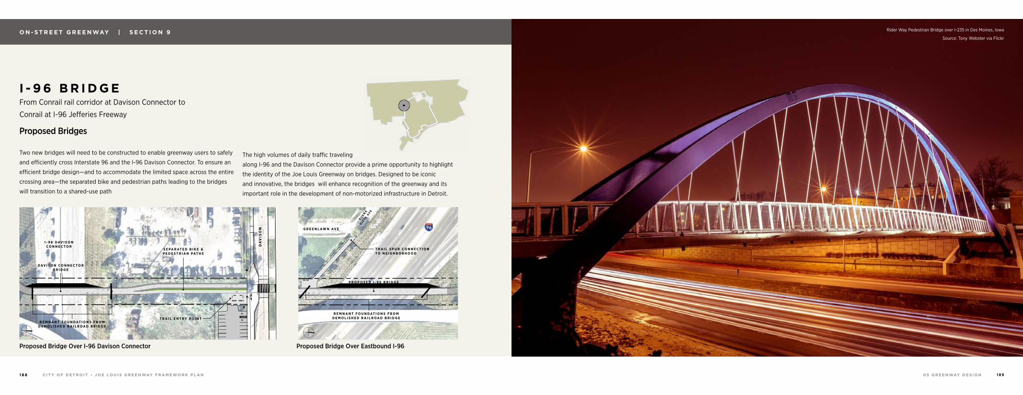
0 5 G R E E N WAY D E S I G NC I T Y O F D E T R O I T • J O E LO U I S G R E E N WAY F R A M E WO R K P L A N1 8 8 1 8 9
O N - S T R E E T G R E E N WAY | S E C T I O N 9
I - 9 6 B R I D G E From Conrail rail corridor at Davison Connector to
Conrail at I-96 Jefferies Freeway
Proposed Bridges
Two new bridges will need to be constructed to enable greenway users to safely
and efficiently cross Interstate 96 and the I-96 Davison Connector. To ensure an
efficient bridge design—and to accommodate the limited space across the entire
crossing area—the separated bike and pedestrian paths leading to the bridges
will transition to a shared-use path
The high volumes of daily traffic traveling
along I-96 and the Davison Connector provide a prime opportunity to highlight
the identity of the Joe Louis Greenway on bridges. Designed to be iconic
and innovative, the bridges will enhance recognition of the greenway and its
important role in the development of non-motorized infrastructure in Detroit.
15015
5160
145
140
150
150
155
155
160
160
145
145
155
165
150
160
0' 200'100'50'
SCALE:
G R E E N L AW N AV E
BUEN
A
VI S
TA A
VE
P R O P O S E D I - 9 6 B R I D G E
T R A I L S P U R C O N N E C T I O N T O N E I G H B O R H O O D
R E M N A N T F O U N D AT I O N S F R O M D E M O L I S H E D R A I L R O A D B R I D G E
Rider Way Pedestrian Bridge over I-235 in Des Moines, Iowa
Source: Tony Webster via Flickr
15015
5160
145
140
150
150
155
155
160
160
145
145
155
165
150
160
0' 200'100'50'
SCALE:
S E P A R AT E D B I K E & P E D E S T R I A N P AT H S
DA
VIS
ON
T R A I L E N T R Y P O I N T
I - 9 6 D AV I S O N C O N N E C T O R
D AV I S O N C O N N E C T O R B R I D G E
R E M N A N T F O U N D AT I O N S F R O M D E M O L I S H E D R A I L R O A D B R I D G E
Proposed Bridge Over I-96 Davison Connector Proposed Bridge Over Eastbound I-96
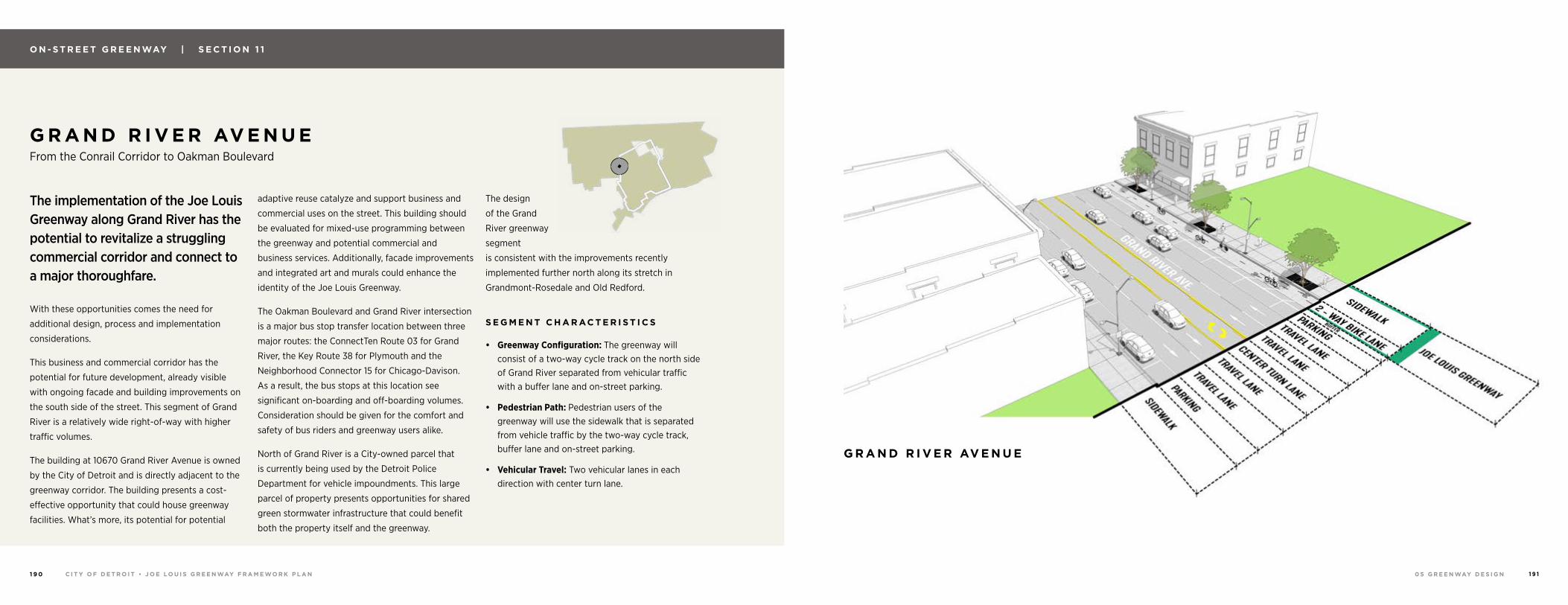
0 5 G R E E N WAY D E S I G NC I T Y O F D E T R O I T • J O E LO U I S G R E E N WAY F R A M E WO R K P L A N1 9 0 1 9 1
O N - S T R E E T G R E E N WAY | S E C T I O N 1 1
G R A N D R I V E R AV E N U E From the Conrail Corridor to Oakman Boulevard
The implementation of the Joe Louis Greenway along Grand River has the potential to revitalize a struggling commercial corridor and connect to a major thoroughfare.
With these opportunities comes the need for
additional design, process and implementation
considerations.
This business and commercial corridor has the
potential for future development, already visible
with ongoing facade and building improvements on
the south side of the street. This segment of Grand
River is a relatively wide right-of-way with higher
traffic volumes.
The building at 10670 Grand River Avenue is owned
by the City of Detroit and is directly adjacent to the
greenway corridor. The building presents a cost-
effective opportunity that could house greenway
facilities. What’s more, its potential for potential
adaptive reuse catalyze and support business and
commercial uses on the street. This building should
be evaluated for mixed-use programming between
the greenway and potential commercial and
business services. Additionally, facade improvements
and integrated art and murals could enhance the
identity of the Joe Louis Greenway.
The Oakman Boulevard and Grand River intersection
is a major bus stop transfer location between three
major routes: the ConnectTen Route 03 for Grand
River, the Key Route 38 for Plymouth and the
Neighborhood Connector 15 for Chicago-Davison.
As a result, the bus stops at this location see
significant on-boarding and off-boarding volumes.
Consideration should be given for the comfort and
safety of bus riders and greenway users alike.
North of Grand River is a City-owned parcel that
is currently being used by the Detroit Police
Department for vehicle impoundments. This large
parcel of property presents opportunities for shared
green stormwater infrastructure that could benefit
both the property itself and the greenway.
The design
of the Grand
River greenway
segment
is consistent with the improvements recently
implemented further north along its stretch in
Grandmont-Rosedale and Old Redford.
S E G M E N T C H A R AC T E R I S T I C S
• Greenway Configuration: The greenway will consist of a two-way cycle track on the north side of Grand River separated from vehicular traffic with a buffer lane and on-street parking.
• Pedestrian Path: Pedestrian users of the greenway will use the sidewalk that is separated from vehicle traffic by the two-way cycle track, buffer lane and on-street parking.
• Vehicular Travel: Two vehicular lanes in each direction with center turn lane.
G R A N D R I V E R AV E N U E
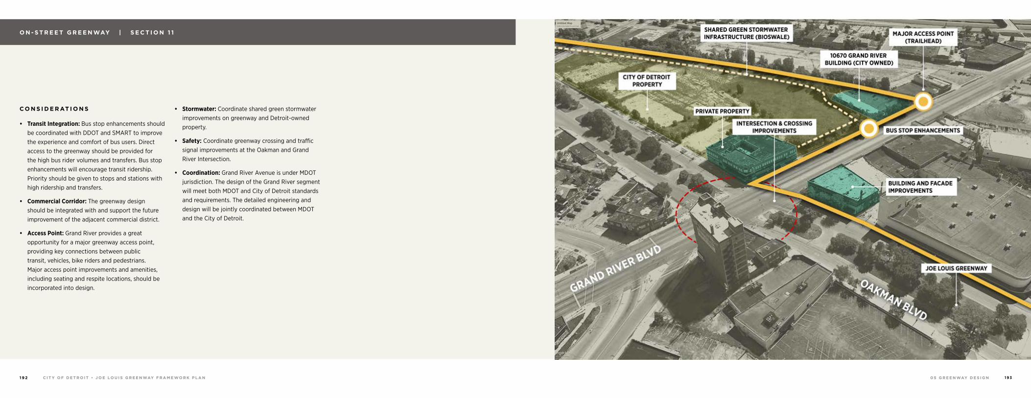
0 5 G R E E N WAY D E S I G NC I T Y O F D E T R O I T • J O E LO U I S G R E E N WAY F R A M E WO R K P L A N1 9 2 1 9 3
C O N S I D E R AT I O N S
• Transit Integration: Bus stop enhancements should be coordinated with DDOT and SMART to improve the experience and comfort of bus users. Direct access to the greenway should be provided for the high bus rider volumes and transfers. Bus stop enhancements will encourage transit ridership. Priority should be given to stops and stations with high ridership and transfers.
• Commercial Corridor: The greenway design should be integrated with and support the future improvement of the adjacent commercial district.
• Access Point: Grand River provides a great opportunity for a major greenway access point, providing key connections between public transit, vehicles, bike riders and pedestrians. Major access point improvements and amenities, including seating and respite locations, should be incorporated into design.
• Stormwater: Coordinate shared green stormwater improvements on greenway and Detroit-owned property.
• Safety: Coordinate greenway crossing and traffic signal improvements at the Oakman and Grand River Intersection.
• Coordination: Grand River Avenue is under MDOT jurisdiction. The design of the Grand River segment will meet both MDOT and City of Detroit standards and requirements. The detailed engineering and design will be jointly coordinated between MDOT and the City of Detroit.
O N - S T R E E T G R E E N WAY | S E C T I O N 1 1
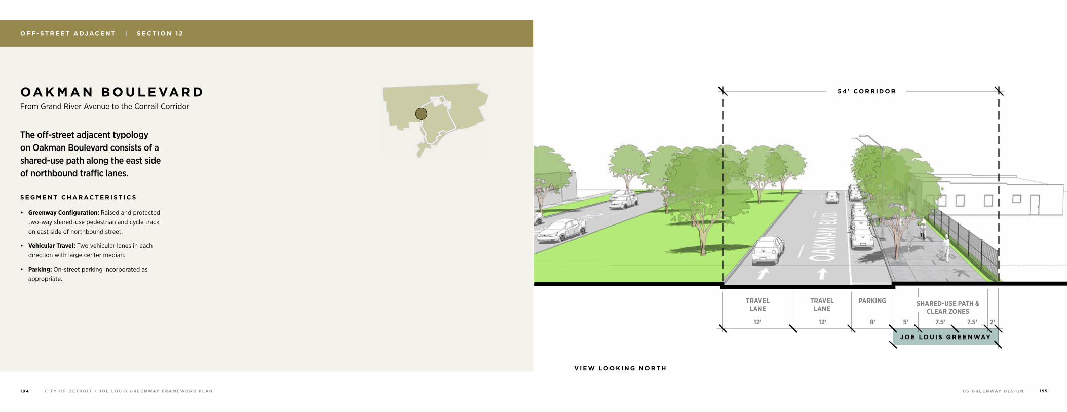
0 5 G R E E N WAY D E S I G NC I T Y O F D E T R O I T • J O E LO U I S G R E E N WAY F R A M E WO R K P L A N1 9 4 1 9 5
O F F - S T R E E T A DJ AC E N T | S E C T I O N 1 2
OA K M A N B O U L E VA R D From Grand River Avenue to the Conrail Corridor
The off-street adjacent typology on Oakman Boulevard consists of a shared-use path along the east side of northbound traffic lanes.
S E G M E N T C H A R AC T E R I S T I C S
• Greenway Configuration: Raised and protected two-way shared-use pedestrian and cycle track on east side of northbound street.
• Vehicular Travel: Two vehicular lanes in each direction with large center median.
• Parking: On-street parking incorporated as appropriate.
J O E LO U I S G R E E N WAY
V I E W LO O K I N G N O R T H
SHARED-USE PATH & CLEAR ZONES
TRAVEL LANE
TRAVEL LANE
PARKING
7.5’7.5’5’8’12’12’ 2’
5 4 ’ C O R R I D O R
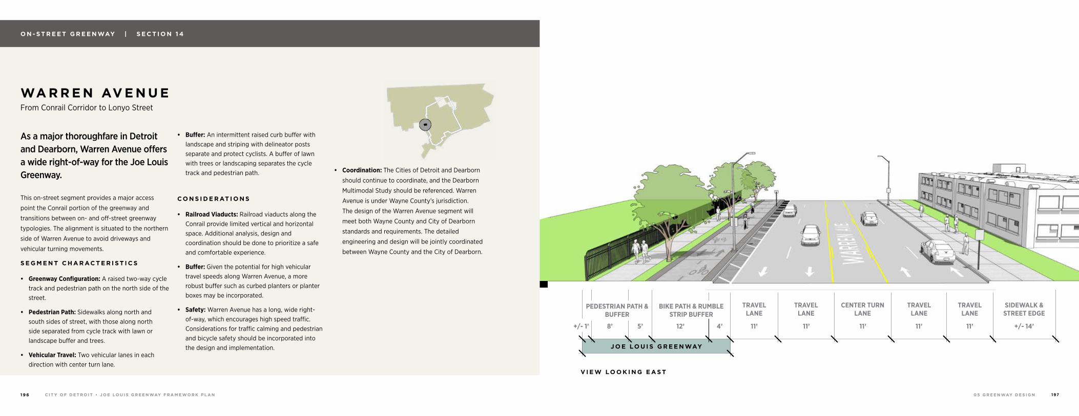
0 5 G R E E N WAY D E S I G NC I T Y O F D E T R O I T • J O E LO U I S G R E E N WAY F R A M E WO R K P L A N1 9 6 1 9 7
O N - S T R E E T G R E E N WAY | S E C T I O N 1 4
WA R R E N AV E N U E From Conrail Corridor to Lonyo Street
As a major thoroughfare in Detroit and Dearborn, Warren Avenue offers a wide right-of-way for the Joe Louis Greenway.
This on-street segment provides a major access
point the Conrail portion of the greenway and
transitions between on- and off-street greenway
typologies. The alignment is situated to the northern
side of Warren Avenue to avoid driveways and
vehicular turning movements.
S E G M E N T C H A R AC T E R I S T I C S
• Greenway Configuration: A raised two-way cycle track and pedestrian path on the north side of the street.
• Pedestrian Path: Sidewalks along north and south sides of street, with those along north side separated from cycle track with lawn or landscape buffer and trees.
• Vehicular Travel: Two vehicular lanes in each direction with center turn lane.
• Buffer: An intermittent raised curb buffer with landscape and striping with delineator posts separate and protect cyclists. A buffer of lawn with trees or landscaping separates the cycle track and pedestrian path.
C O N S I D E R AT I O N S
• Railroad Viaducts: Railroad viaducts along the Conrail provide limited vertical and horizontal space. Additional analysis, design and coordination should be done to prioritize a safe and comfortable experience.
• Buffer: Given the potential for high vehicular travel speeds along Warren Avenue, a more robust buffer such as curbed planters or planter boxes may be incorporated.
• Safety: Warren Avenue has a long, wide right-of-way, which encourages high speed traffic. Considerations for traffic calming and pedestrian and bicycle safety should be incorporated into the design and implementation.
• Coordination: The Cities of Detroit and Dearborn
should continue to coordinate, and the Dearborn
Multimodal Study should be referenced. Warren
Avenue is under Wayne County’s jurisdiction.
The design of the Warren Avenue segment will
meet both Wayne County and City of Dearborn
standards and requirements. The detailed
engineering and design will be jointly coordinated
between Wayne County and the City of Dearborn.
J O E LO U I S G R E E N WAY
1 0 0 ’ R.O.W.
BIKE PATH & RUMBLE STRIP BUFFER
TRAVEL LANE
TRAVEL LANE
TRAVEL LANE
TRAVEL LANE
CENTER TURN LANE
PEDESTRIAN PATH & BUFFER
SIDEWALK & STREET EDGE
8’ +/- 14’12’5’+/- 1’ 4’ 11’ 11’ 11’ 11’11’
V I E W LO O K I N G E A S T
7 2 ’ C U R B TO C U R B
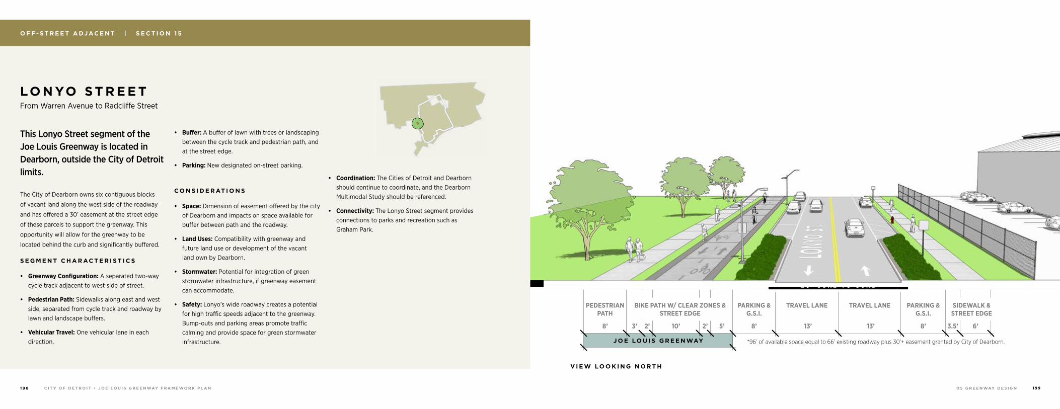
0 5 G R E E N WAY D E S I G NC I T Y O F D E T R O I T • J O E LO U I S G R E E N WAY F R A M E WO R K P L A N1 9 8 1 9 9
O F F - S T R E E T A DJ AC E N T | S E C T I O N 1 5
LO N YO S T R E E T From Warren Avenue to Radcliffe Street
This Lonyo Street segment of the Joe Louis Greenway is located in Dearborn, outside the City of Detroit limits.
The City of Dearborn owns six contiguous blocks
of vacant land along the west side of the roadway
and has offered a 30’ easement at the street edge
of these parcels to support the greenway. This
opportunity will allow for the greenway to be
located behind the curb and significantly buffered.
S E G M E N T C H A R AC T E R I S T I C S
• Greenway Configuration: A separated two-way cycle track adjacent to west side of street.
• Pedestrian Path: Sidewalks along east and west side, separated from cycle track and roadway by lawn and landscape buffers.
• Vehicular Travel: One vehicular lane in each direction.
• Buffer: A buffer of lawn with trees or landscaping between the cycle track and pedestrian path, and at the street edge.
• Parking: New designated on-street parking.
C O N S I D E R AT I O N S
• Space: Dimension of easement offered by the city of Dearborn and impacts on space available for buffer between path and the roadway.
• Land Uses: Compatibility with greenway and future land use or development of the vacant land own by Dearborn.
• Stormwater: Potential for integration of green stormwater infrastructure, if greenway easement can accommodate.
• Safety: Lonyo’s wide roadway creates a potential for high traffic speeds adjacent to the greenway. Bump-outs and parking areas promote traffic calming and provide space for green stormwater infrastructure.
• Coordination: The Cities of Detroit and Dearborn should continue to coordinate, and the Dearborn Multimodal Study should be referenced.
• Connectivity: The Lonyo Street segment provides connections to parks and recreation such as Graham Park.
J O E LO U I S G R E E N WAY
TRAVEL LANETRAVEL LANE PARKING & G.S.I.
PARKING & G.S.I.
SIDEWALK & STREET EDGE
BIKE PATH W/ CLEAR ZONES & STREET EDGE
13’13’
* E X I S T I N G 6 6 ’ R.O.W.
PEDESTRIAN PATH
3.5’8’8’2’2’3’ 5’10’ 6’8’
V I E W LO O K I N G N O R T H
*96’ of available space equal to 66’ existing roadway plus 30’+ easement granted by City of Dearborn.
2 6 ’ C U R B TO C U R B* 3 0 ’ G R E E N WAY E A S E M E N T
*A D D I T I O N A L F U T U R E R .O.W
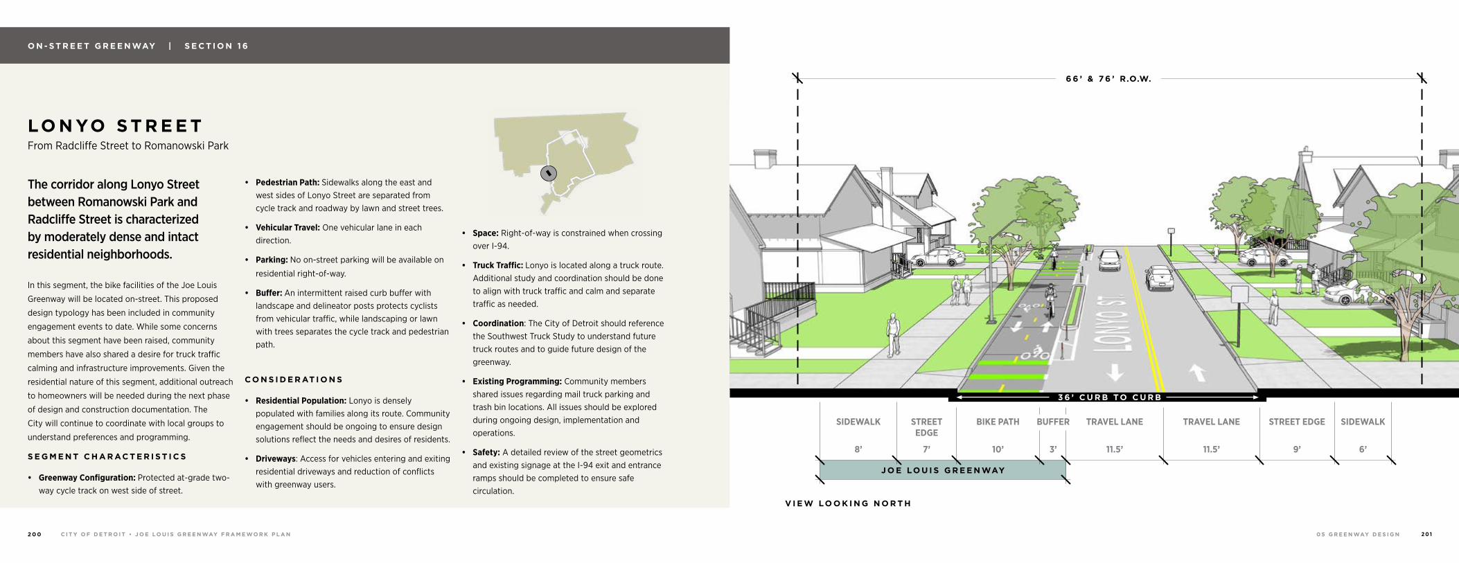
0 5 G R E E N WAY D E S I G NC I T Y O F D E T R O I T • J O E LO U I S G R E E N WAY F R A M E WO R K P L A N2 0 0 2 0 1
O N - S T R E E T G R E E N WAY | S E C T I O N 1 6
LO N YO S T R E E T From Radcliffe Street to Romanowski Park
The corridor along Lonyo Street between Romanowski Park and Radcliffe Street is characterized by moderately dense and intact residential neighborhoods.
In this segment, the bike facilities of the Joe Louis
Greenway will be located on-street. This proposed
design typology has been included in community
engagement events to date. While some concerns
about this segment have been raised, community
members have also shared a desire for truck traffic
calming and infrastructure improvements. Given the
residential nature of this segment, additional outreach
to homeowners will be needed during the next phase
of design and construction documentation. The
City will continue to coordinate with local groups to
understand preferences and programming.
S E G M E N T C H A R AC T E R I S T I C S
• Greenway Configuration: Protected at-grade two-way cycle track on west side of street.
• Pedestrian Path: Sidewalks along the east and west sides of Lonyo Street are separated from cycle track and roadway by lawn and street trees.
• Vehicular Travel: One vehicular lane in each direction.
• Parking: No on-street parking will be available on
residential right-of-way.
• Buffer: An intermittent raised curb buffer with landscape and delineator posts protects cyclists from vehicular traffic, while landscaping or lawn with trees separates the cycle track and pedestrian path.
C O N S I D E R AT I O N S
• Residential Population: Lonyo is densely populated with families along its route. Community engagement should be ongoing to ensure design solutions reflect the needs and desires of residents.
• Driveways: Access for vehicles entering and exiting residential driveways and reduction of conflicts with greenway users.
• Space: Right-of-way is constrained when crossing over I-94.
• Truck Traffic: Lonyo is located along a truck route. Additional study and coordination should be done to align with truck traffic and calm and separate traffic as needed.
• Coordination: The City of Detroit should reference the Southwest Truck Study to understand future truck routes and to guide future design of the greenway.
• Existing Programming: Community members shared issues regarding mail truck parking and trash bin locations. All issues should be explored during ongoing design, implementation and operations.
• Safety: A detailed review of the street geometrics and existing signage at the I-94 exit and entrance ramps should be completed to ensure safe circulation.
J O E LO U I S G R E E N WAY
SIDEWALK SIDEWALKBUFFER TRAVEL LANE TRAVEL LANEBIKE PATH
11.5’ 11.5’10’8’ 6’3’
STREET EDGE
STREET EDGE
7’ 9’
V I E W LO O K I N G N O R T H
3 6 ’ C U R B TO C U R B
6 6 ’ & 7 6 ’ R.O.W.
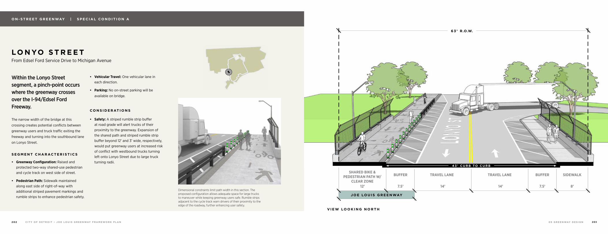
0 5 G R E E N WAY D E S I G NC I T Y O F D E T R O I T • J O E LO U I S G R E E N WAY F R A M E WO R K P L A N2 0 2 2 0 3
Dimensional constraints limit path width in this section. The proposed configuration allows adequate space for large trucks to maneuver while keeping greenway users safe. Rumble strips adjacent to the cycle track warn drivers of their proximity to the edge of the roadway, further enhancing user safety.
O N - S T R E E T G R E E N WAY | S P E C I A L C O N D I T I O N A
LO N YO S T R E E T From Edsel Ford Service Drive to Michigan Avenue
Within the Lonyo Street segment, a pinch-point occurs where the greenway crosses over the I-94/Edsel Ford Freeway.
The narrow width of the bridge at this
crossing creates potential conflicts between
greenway users and truck traffic exiting the
freeway and turning into the southbound lane
on Lonyo Street.
S E G M E N T C H A R AC T E R I S T I C S
• Greenway Configuration: Raised and protected two-way shared-use pedestrian and cycle track on west side of street.
• Pedestrian Path: Sidewalk maintained along east side of right-of-way with additional striped pavement markings and rumble strips to enhance pedestrian safety.
• Vehicular Travel: One vehicular lane in each direction.
• Parking: No on-street parking will be
available on bridge.
C O N S I D E R AT I O N S
• Safety: A striped rumble strip buffer at road grade will alert trucks of their proximity to the greenway. Expansion of the shared path and striped rumble strip buffer beyond 12’ and 3’ wide, respectively, would put greenway users at increased risk of conflict with westbound trucks turning left onto Lonyo Street due to large truck turning radii.
J O E LO U I S G R E E N WAY
SIDEWALKBUFFER BUFFERTRAVEL LANE TRAVEL LANE
14’ 14’12’ 8’7.5’ 7.5’
SHARED BIKE & PEDESTRIAN PATH W/
CLEAR ZONE
V I E W LO O K I N G N O R T H
4 3 ’ C U R B TO C U R B
6 3 ’ R.O.W.
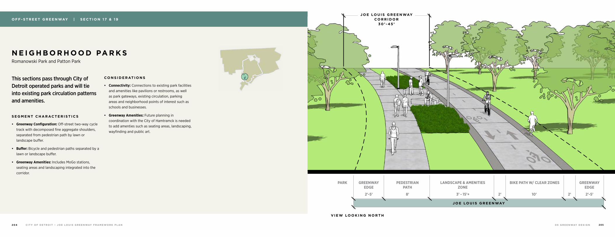
0 5 G R E E N WAY D E S I G NC I T Y O F D E T R O I T • J O E LO U I S G R E E N WAY F R A M E WO R K P L A N2 0 4 2 0 5
N E I G H B O R H O O D PA R K S Romanowski Park and Patton Park
This sections pass through City of Detroit operated parks and will tie into existing park circulation patterns and amenities.
S E G M E N T C H A R AC T E R I S T I C S
• Greenway Configuration: Off-street two-way cycle track with decomposed fine aggregate shoulders, separated from pedestrian path by lawn or landscape buffer.
• Buffer: Bicycle and pedestrian paths separated by a lawn or landscape buffer.
• Greenway Amenities: Includes MoGo stations, seating areas and landscaping integrated into the corridor.
C O N S I D E R AT I O N S
• Connectivity: Connections to existing park facilities and amenities like pavilions or restrooms, as well as park gateways, existing circulation, parking areas and neighborhood points of interest such as schools and businesses.
• Greenway Amenities: Future planning in coordination with the City of Hamtramck is needed to add amenties such as seating areas, landscaping, wayfinding and public art.
O F F - S T R E E T G R E E N WAY | S E C T I O N 1 7 & 1 9
J O E LO U I S G R E E N WAY
PEDESTRIAN PATH
GREENWAY EDGE
GREENWAY EDGE
PARK LANDSCAPE & AMENITIES ZONE
BIKE PATH W/ CLEAR ZONES
8’2’-5’ 2’-5’3’ - 15’+ 2’ 2’10’
V I E W LO O K I N G N O R T H
J O E LO U I S G R E E N WAY C O R R I D O R
3 0 ’ - 4 5 ’
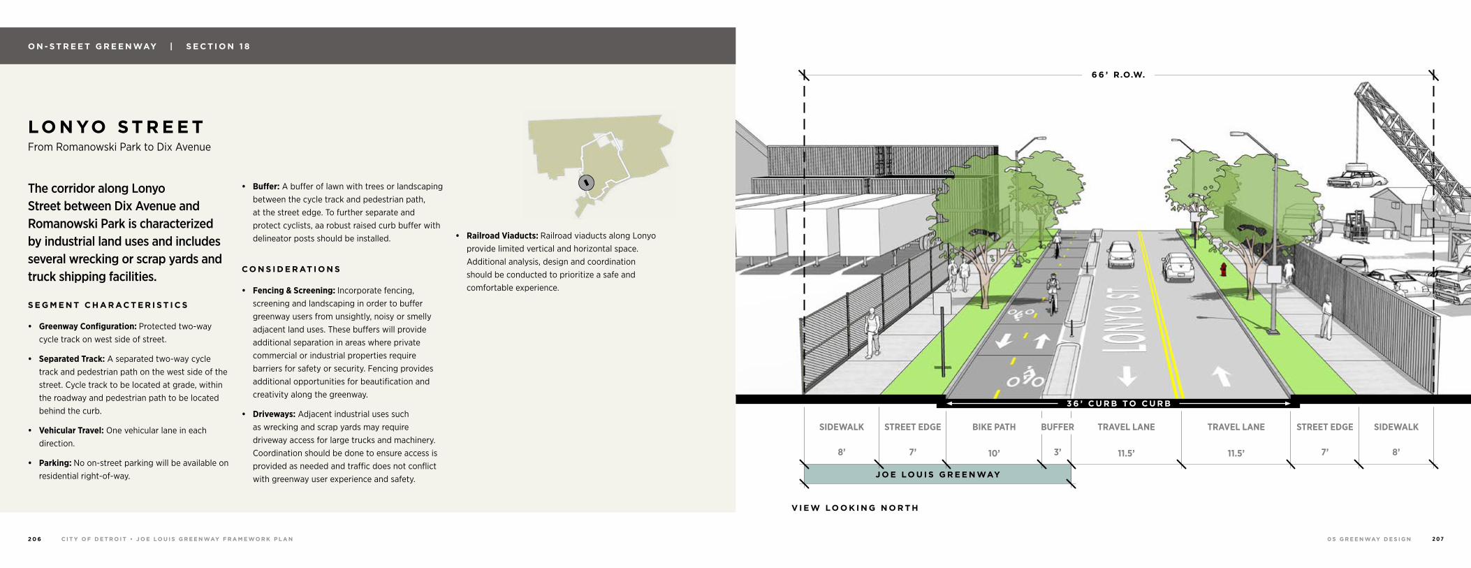
0 5 G R E E N WAY D E S I G NC I T Y O F D E T R O I T • J O E LO U I S G R E E N WAY F R A M E WO R K P L A N2 0 6 2 0 7
LO N YO S T R E E T From Romanowski Park to Dix Avenue
The corridor along Lonyo Street between Dix Avenue and Romanowski Park is characterized by industrial land uses and includes several wrecking or scrap yards and truck shipping facilities.
S E G M E N T C H A R AC T E R I S T I C S
• Greenway Configuration: Protected two-way cycle track on west side of street.
• Separated Track: A separated two-way cycle track and pedestrian path on the west side of the street. Cycle track to be located at grade, within the roadway and pedestrian path to be located behind the curb.
• Vehicular Travel: One vehicular lane in each direction.
• Parking: No on-street parking will be available on residential right-of-way.
• Buffer: A buffer of lawn with trees or landscaping between the cycle track and pedestrian path, at the street edge. To further separate and protect cyclists, aa robust raised curb buffer with delineator posts should be installed.
C O N S I D E R AT I O N S
• Fencing & Screening: Incorporate fencing, screening and landscaping in order to buffer greenway users from unsightly, noisy or smelly adjacent land uses. These buffers will provide additional separation in areas where private commercial or industrial properties require barriers for safety or security. Fencing provides additional opportunities for beautification and creativity along the greenway.
• Driveways: Adjacent industrial uses such as wrecking and scrap yards may require driveway access for large trucks and machinery. Coordination should be done to ensure access is provided as needed and traffic does not conflict with greenway user experience and safety.
• Railroad Viaducts: Railroad viaducts along Lonyo provide limited vertical and horizontal space. Additional analysis, design and coordination should be conducted to prioritize a safe and comfortable experience.
O N - S T R E E T G R E E N WAY | S E C T I O N 1 8
J O E LO U I S G R E E N WAY
SIDEWALK SIDEWALKBUFFER TRAVEL LANE TRAVEL LANEBIKE PATH
11.5’ 11.5’10’8’ 8’3’
6 6 ’ R.O.W.
STREET EDGE STREET EDGE
7’ 7’
V I E W LO O K I N G N O R T H
3 6 ’ C U R B TO C U R B
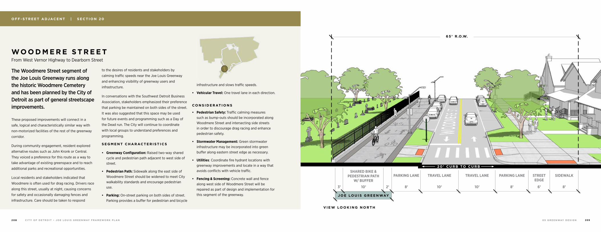
0 5 G R E E N WAY D E S I G NC I T Y O F D E T R O I T • J O E LO U I S G R E E N WAY F R A M E WO R K P L A N2 0 8 2 0 9
O F F - S T R E E T A DJ AC E N T | S E C T I O N 2 0
WO O D M E R E S T R E E T From West Vernor Highway to Dearborn Street
The Woodmere Street segment of the Joe Louis Greenway runs along the historic Woodmere Cemetery and has been planned by the City of Detroit as part of general streetscape improvements.
These proposed improvements will connect in a
safe, logical and characteristically similar way with
non-motorized facilities of the rest of the greenway
corridor.
During community engagement, resident explored
alternative routes such as John Kronk or Central.
They voiced a preference for this route as a way to
take advantage of existing greenspace and to reach
additional parks and recreational opportunities.
Local residents and stakeholders indicated that
Woodmere is often used for drag racing. Drivers race
along this street, usually at night, causing concerns
for safety and occasionally damaging fences and
infrastructure. Care should be taken to respond
to the desires of residents and stakeholders by
calming traffic speeds near the Joe Louis Greenway
and enhancing visibility of greenway users and
infrastructure.
In conversations with the Southwest Detroit Business
Association, stakeholders emphasized their preference
that parking be maintained on both sides of the street.
It was also suggested that this space may be used
for future events and programming such as a Day of
the Dead run. The City will continue to coordinate
with local groups to understand preferences and
programming.
S E G M E N T C H A R AC T E R I S T I C S
• Greenway Configuration: Raised two-way shared cycle and pedestrian path adjacent to west side of street.
• Pedestrian Path: Sidewalk along the east side of Woodmere Street should be widened to meet City walkability standards and encourage pedestrian use.
• Parking: On-street parking on both sides of street. Parking provides a buffer for pedestrian and bicycle
infrastructure and slows traffic speeds.
• Vehicular Travel: One travel lane in each direction.
C O N S I D E R AT I O N S
• Pedestrian Safety: Traffic calming measures such as bump-outs should be incorporated along Woodmere Street and intersecting side streets in order to discourage drag racing and enhance pedestrian safety.
• Stormwater Management: Green stormwater infrastructure may be incorporated into green buffer along eastern street edge as necessary.
• Utilities: Coordinate fire hydrant locations with greenway improvements and locate in a way that avoids conflicts with vehicle traffic.
• Fencing & Screening: Concrete wall and fence along west side of Woodmere Street will be repaired as part of design and implementation for this segment of the greenway. J O E LO U I S G R E E N WAY
SHARED BIKE & PEDESTRIAN PATH
W/ BUFFERSIDEWALKSTREET
EDGEPARKING LANE PARKING LANETRAVEL LANE TRAVEL LANE
6’10’ 8’2’3’ 8’10’ 10’ 8’
6 5 ’ R.O.W.
V I E W LO O K I N G N O R T H
2 0 ’ C U R B TO C U R B
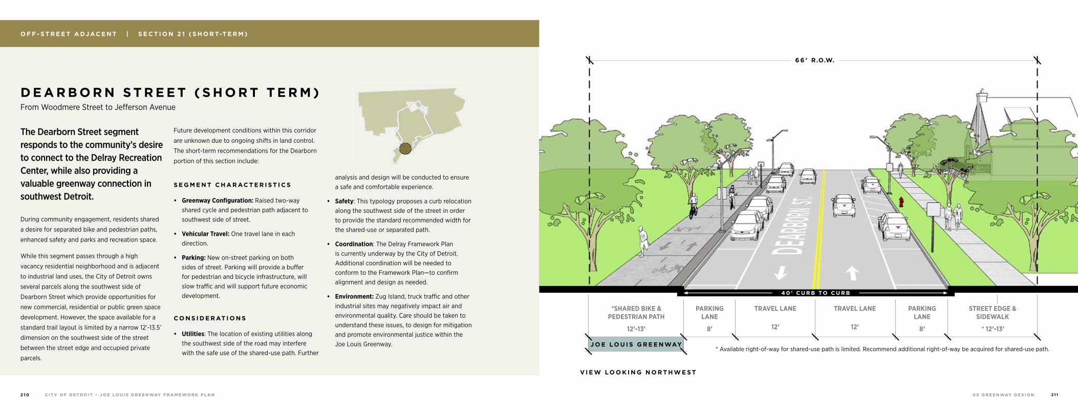
0 5 G R E E N WAY D E S I G NC I T Y O F D E T R O I T • J O E LO U I S G R E E N WAY F R A M E WO R K P L A N2 1 0 2 1 1
O F F - S T R E E T A DJ AC E N T | S E C T I O N 2 1 ( S H O R T-T E R M )
The Dearborn Street segment responds to the community’s desire to connect to the Delray Recreation Center, while also providing a valuable greenway connection in southwest Detroit.
During community engagement, residents shared
a desire for separated bike and pedestrian paths,
enhanced safety and parks and recreation space.
While this segment passes through a high
vacancy residential neighborhood and is adjacent
to industrial land uses, the City of Detroit owns
several parcels along the southwest side of
Dearborn Street which provide opportunities for
new commercial, residential or public green space
development. However, the space available for a
standard trail layout is limited by a narrow 12’-13.5’
dimension on the southwest side of the street
between the street edge and occupied private
parcels.
Future development conditions within this corridor
are unknown due to ongoing shifts in land control.
The short-term recommendations for the Dearborn
portion of this section include:
S E G M E N T C H A R AC T E R I S T I C S
• Greenway Configuration: Raised two-way shared cycle and pedestrian path adjacent to southwest side of street.
• Vehicular Travel: One travel lane in each direction.
• Parking: New on-street parking on both sides of street. Parking will provide a buffer for pedestrian and bicycle infrastructure, will slow traffic and will support future economic development.
C O N S I D E R AT I O N S
• Utilities: The location of existing utilities along the southwest side of the road may interfere with the safe use of the shared-use path. Further
analysis and design will be conducted to ensure a safe and comfortable experience.
• Safety: This typology proposes a curb relocation along the southwest side of the street in order to provide the standard recommended width for the shared-use or separated path.
• Coordination: The Delray Framework Plan is currently underway by the City of Detroit. Additional coordination will be needed to conform to the Framework Plan—to confirm alignment and design as needed.
• Environment: Zug Island, truck traffic and other industrial sites may negatively impact air and environmental quality. Care should be taken to understand these issues, to design for mitigation and promote environmental justice within the Joe Louis Greenway.
D E A R B O R N S T R E E T ( S H O R T T E R M ) From Woodmere Street to Jefferson Avenue
J O E LO U I S G R E E N WAY
STREET EDGE & SIDEWALK
*SHARED BIKE & PEDESTRIAN PATH
PARKING LANE
PARKING LANE
TRAVEL LANE TRAVEL LANE
12’-13’ * 12’-13’8’ 8’12’ 12’
6 6 ’ R.O.W.
* Available right-of-way for shared-use path is limited. Recommend additional right-of-way be acquired for shared-use path.
4 0 ’ C U R B TO C U R B
V I E W LO O K I N G N O R T H W E S T
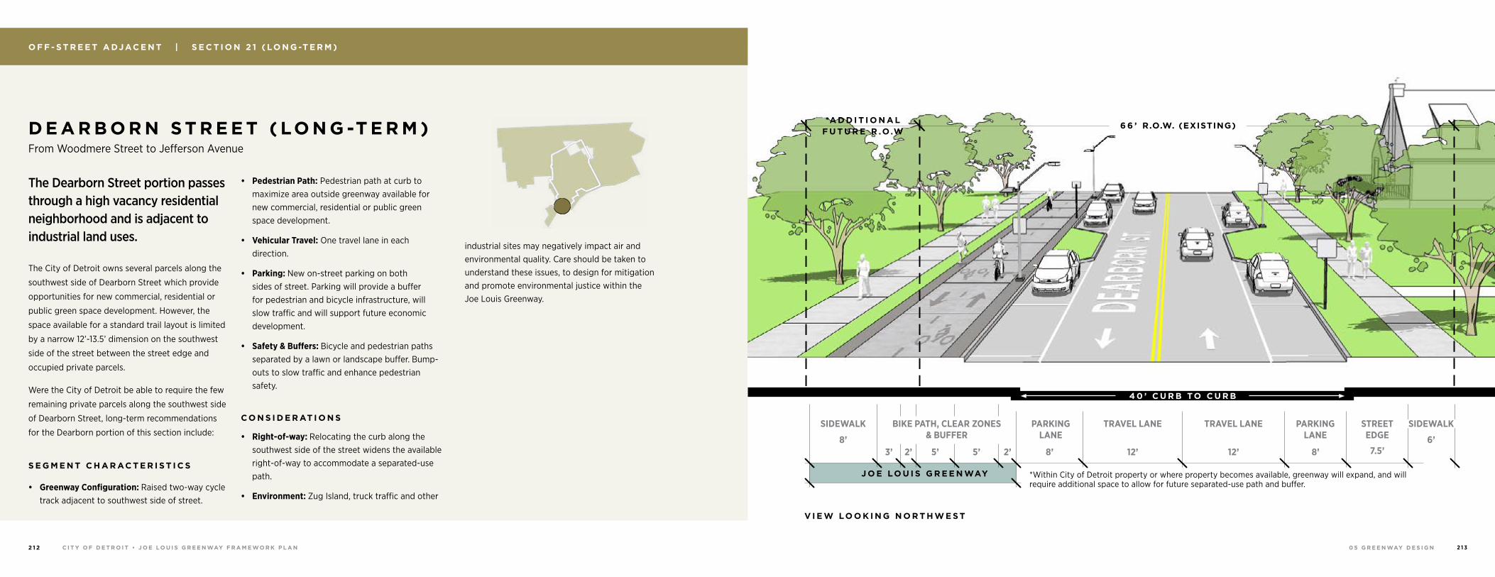
0 5 G R E E N WAY D E S I G NC I T Y O F D E T R O I T • J O E LO U I S G R E E N WAY F R A M E WO R K P L A N2 1 2 2 1 3
O F F - S T R E E T A DJ AC E N T | S E C T I O N 2 1 ( LO N G -T E R M )
D E A R B O R N S T R E E T ( LO N G -T E R M ) From Woodmere Street to Jefferson Avenue
J O E LO U I S G R E E N WAY
SIDEWALKSTREET EDGE
BIKE PATH, CLEAR ZONES & BUFFER
*A D D I T I O N A L F U T U R E R .O.W
SIDEWALK PARKING LANE
PARKING LANE
TRAVEL LANE TRAVEL LANE
7.5’5’ 5’3’ 2’ 2’ 8’8’ 12’ 12’6’8’
6 6 ’ R.O.W. (EXISTING)
V I E W LO O K I N G N O R T H W E S T
*Within City of Detroit property or where property becomes available, greenway will expand, and will require additional space to allow for future separated-use path and buffer.
The Dearborn Street portion passes through a high vacancy residential neighborhood and is adjacent to industrial land uses.
The City of Detroit owns several parcels along the
southwest side of Dearborn Street which provide
opportunities for new commercial, residential or
public green space development. However, the
space available for a standard trail layout is limited
by a narrow 12’-13.5’ dimension on the southwest
side of the street between the street edge and
occupied private parcels.
Were the City of Detroit be able to require the few
remaining private parcels along the southwest side
of Dearborn Street, long-term recommendations
for the Dearborn portion of this section include:
S E G M E N T C H A R AC T E R I S T I C S
• Greenway Configuration: Raised two-way cycle track adjacent to southwest side of street.
• Pedestrian Path: Pedestrian path at curb to maximize area outside greenway available for new commercial, residential or public green space development.
• Vehicular Travel: One travel lane in each direction.
• Parking: New on-street parking on both sides of street. Parking will provide a buffer for pedestrian and bicycle infrastructure, will slow traffic and will support future economic development.
• Safety & Buffers: Bicycle and pedestrian paths separated by a lawn or landscape buffer. Bump-outs to slow traffic and enhance pedestrian safety.
C O N S I D E R AT I O N S
• Right-of-way: Relocating the curb along the southwest side of the street widens the available right-of-way to accommodate a separated-use path.
• Environment: Zug Island, truck traffic and other
industrial sites may negatively impact air and environmental quality. Care should be taken to understand these issues, to design for mitigation and promote environmental justice within the Joe Louis Greenway.
4 0 ’ C U R B TO C U R B
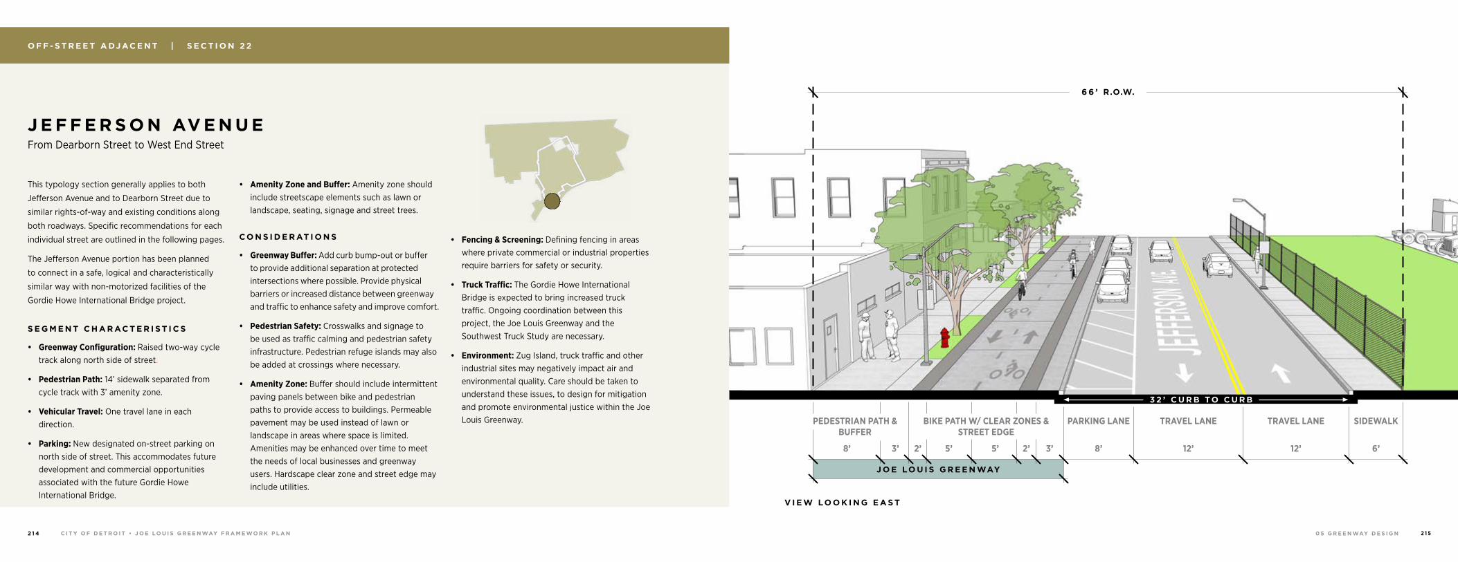
0 5 G R E E N WAY D E S I G NC I T Y O F D E T R O I T • J O E LO U I S G R E E N WAY F R A M E WO R K P L A N2 1 4 2 1 5
O F F - S T R E E T A DJ AC E N T | S E C T I O N 2 2
This typology section generally applies to both
Jefferson Avenue and to Dearborn Street due to
similar rights-of-way and existing conditions along
both roadways. Specific recommendations for each
individual street are outlined in the following pages.
The Jefferson Avenue portion has been planned
to connect in a safe, logical and characteristically
similar way with non-motorized facilities of the
Gordie Howe International Bridge project.
S E G M E N T C H A R AC T E R I S T I C S
• Greenway Configuration: Raised two-way cycle track along north side of street.
• Pedestrian Path: 14’ sidewalk separated from cycle track with 3’ amenity zone.
• Vehicular Travel: One travel lane in each direction.
• Parking: New designated on-street parking on north side of street. This accommodates future development and commercial opportunities associated with the future Gordie Howe International Bridge.
• Amenity Zone and Buffer: Amenity zone should include streetscape elements such as lawn or landscape, seating, signage and street trees.
C O N S I D E R AT I O N S
• Greenway Buffer: Add curb bump-out or buffer to provide additional separation at protected intersections where possible. Provide physical barriers or increased distance between greenway and traffic to enhance safety and improve comfort.
• Pedestrian Safety: Crosswalks and signage to be used as traffic calming and pedestrian safety infrastructure. Pedestrian refuge islands may also be added at crossings where necessary.
• Amenity Zone: Buffer should include intermittent paving panels between bike and pedestrian paths to provide access to buildings. Permeable pavement may be used instead of lawn or landscape in areas where space is limited. Amenities may be enhanced over time to meet the needs of local businesses and greenway users. Hardscape clear zone and street edge may include utilities.
• Fencing & Screening: Defining fencing in areas where private commercial or industrial properties require barriers for safety or security.
• Truck Traffic: The Gordie Howe International Bridge is expected to bring increased truck traffic. Ongoing coordination between this project, the Joe Louis Greenway and the Southwest Truck Study are necessary.
• Environment: Zug Island, truck traffic and other industrial sites may negatively impact air and environmental quality. Care should be taken to understand these issues, to design for mitigation and promote environmental justice within the Joe Louis Greenway.
J E F F E R S O N AV E N U E From Dearborn Street to West End Street
J O E LO U I S G R E E N WAY
SIDEWALKBIKE PATH W/ CLEAR ZONES & STREET EDGE
PEDESTRIAN PATH & BUFFER
PARKING LANE TRAVEL LANE TRAVEL LANE
2’5’5’2’3’8’ 3’ 8’ 12’ 12’ 6’
6 6 ’ R.O.W.
V I E W LO O K I N G E A S T
3 2 ’ C U R B TO C U R B
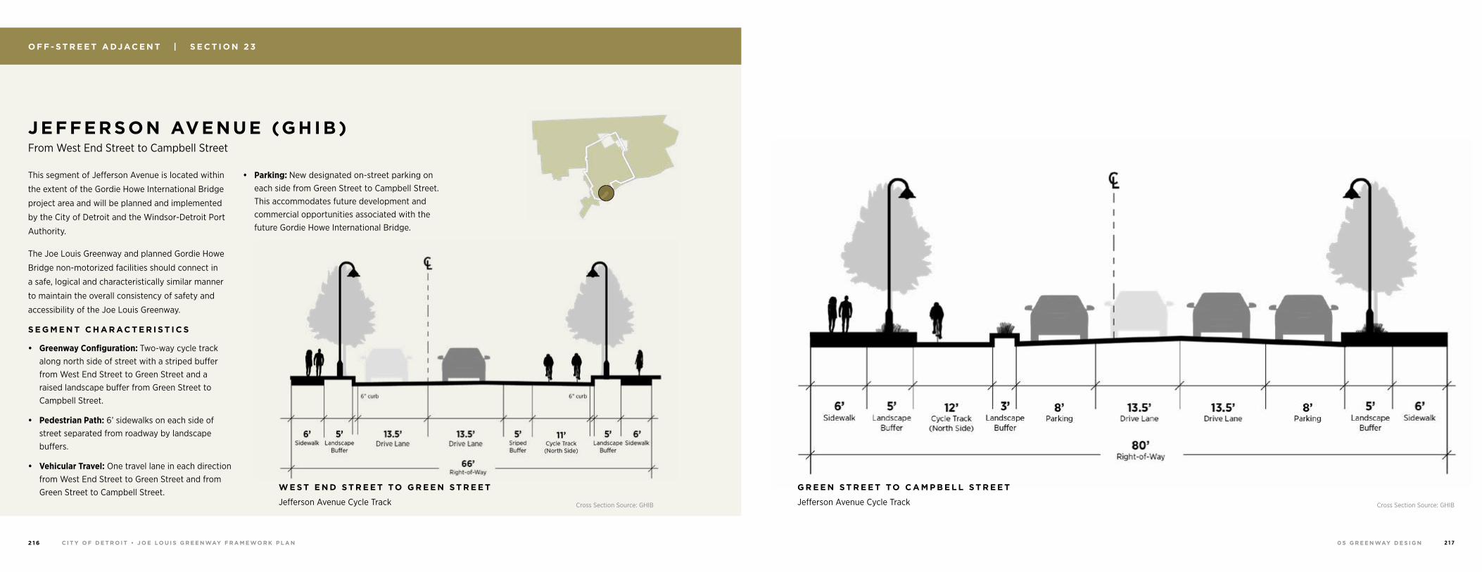
0 5 G R E E N WAY D E S I G NC I T Y O F D E T R O I T • J O E LO U I S G R E E N WAY F R A M E WO R K P L A N2 1 6 2 1 7
J E F FERSON AVENUE (GHIB) From West End Street to Campbell Street
O F F - S T R E E T A DJ AC E N T | S E C T I O N 2 3
G R E E N S T R E E T TO C A M P B E L L S T R E E T
Jefferson Avenue Cycle Track
This segment of Jefferson Avenue is located within
the extent of the Gordie Howe International Bridge
project area and will be planned and implemented
by the City of Detroit and the Windsor-Detroit Port
Authority.
The Joe Louis Greenway and planned Gordie Howe
Bridge non-motorized facilities should connect in
a safe, logical and characteristically similar manner
to maintain the overall consistency of safety and
accessibility of the Joe Louis Greenway.
S E G M E N T C H A R AC T E R I S T I C S
• Greenway Configuration: Two-way cycle track along north side of street with a striped buffer from West End Street to Green Street and a raised landscape buffer from Green Street to Campbell Street.
• Pedestrian Path: 6’ sidewalks on each side of street separated from roadway by landscape buffers.
• Vehicular Travel: One travel lane in each direction from West End Street to Green Street and from Green Street to Campbell Street.
• Parking: New designated on-street parking on each side from Green Street to Campbell Street. This accommodates future development and commercial opportunities associated with the future Gordie Howe International Bridge.
W E S T E N D S T R E E T TO G R E E N S T R E E T
Jefferson Avenue Cycle Track Cross Section Source: GHIBCross Section Source: GHIB
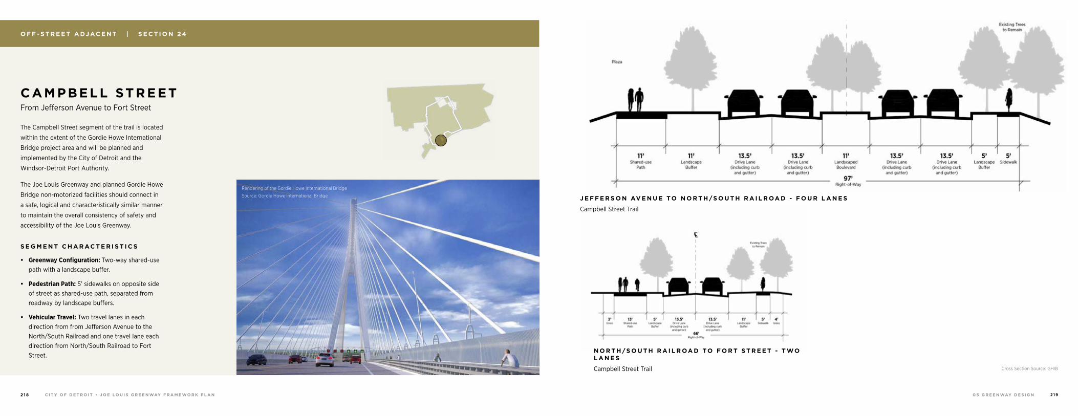
0 5 G R E E N WAY D E S I G NC I T Y O F D E T R O I T • J O E LO U I S G R E E N WAY F R A M E WO R K P L A N2 1 8 2 1 9
J E F F E R S O N AV E N U E TO N O R T H /S O U T H R A I L R OA D - F O U R L A N E S
Campbell Street Trail
C AM PBELL STREET From Jefferson Avenue to Fort Street
O F F - S T R E E T A DJ AC E N T | S E C T I O N 2 4
N O R T H /S O U T H R A I L R OA D TO F O R T S T R E E T - T WO L A N E S
Campbell Street Trail
The Campbell Street segment of the trail is located
within the extent of the Gordie Howe International
Bridge project area and will be planned and
implemented by the City of Detroit and the
Windsor-Detroit Port Authority.
The Joe Louis Greenway and planned Gordie Howe
Bridge non-motorized facilities should connect in
a safe, logical and characteristically similar manner
to maintain the overall consistency of safety and
accessibility of the Joe Louis Greenway.
S E G M E N T C H A R AC T E R I S T I C S
• Greenway Configuration: Two-way shared-use path with a landscape buffer.
• Pedestrian Path: 5’ sidewalks on opposite side of street as shared-use path, separated from roadway by landscape buffers.
• Vehicular Travel: Two travel lanes in each direction from from Jefferson Avenue to the North/South Railroad and one travel lane each direction from North/South Railroad to Fort Street.
Cross Section Source: GHIB
Rendering of the Gordie Howe International Bridge
Source: Gordie Howe International Bridge
0 5 G R E E N WAY D E S I G NC I T Y O F D E T R O I T • J O E LO U I S G R E E N WAY F R A M E WO R K P L A N2 2 0 2 2 1
O N - S T R E E T G R E E N WAY | S E C T I O N 2 5
The future completion of the Gordie Howe International Bridge is anticipated to bring new commercial opportunities and amenities to Fort Street. These destinations will help support the greenway by attracting local, regional and international greenway users.
While the benefits the Gordie Howe Bridge will
support the greenway in many ways, it will also
bring increased volumes of vehicular and truck
traffic. This section of the Joe Louis Greenway will
ensure the needs and safety of all traffic types
through streetscape design and the development of
supporting amenities.
S E G M E N T C H A R AC T E R I S T I C S
• Greenway Configuration: On-street protected bike lanes with physical buffer such as planter between bicycle and vehicular traffic.
• Pedestrian Path: 14’ sidewalk and amenity zone with streetscape elements such as seating, signage and street trees. Amenity zone to be enhanced over time.
• Safety Infrastructure: Center landscape and pedestrian refuge islands, crosswalks and signage as traffic calming and pedestrian safety infrastructure.
• Vehicular Travel: One travel lane in each direction with center turn lane.
• Parking: Maintain parking on both sides of street.
C O N S I D E R AT I O N S
• Coordination: Fort Street is under MDOT’s jurisdiction. The design of the Fort segment will meet both MDOT and City of Detroit standards and requirements. The detailed engineering and design will be jointly coordinated between MDOT and the City of Detroit.
F O R T S T R E E T From Campbell Street to West Grand Boulevard
J O E LO U I S G R E E N WAYJ O E LO U I S G R E E N WAY
V I E W LO O K I N G E A S T
1 0 0 ’ R.O.W.
BIKE LANE & BUFFER
BIKE LANE & BUFFER
PARKING LANE
TRAVEL LANE
CENTER TURN LANE
TRAVEL LANE
PARKING LANE
SIDEWALK & STREET EDGE
SIDEWALK & STREET EDGE
14’ 14’6’ 6’4.5’ 4.5’8’ 12’ 11’ 12’ 8’
7 2 ’ C U R B TO C U R B
0 5 G R E E N WAY D E S I G NC I T Y O F D E T R O I T • J O E LO U I S G R E E N WAY F R A M E WO R K P L A N2 2 2 2 2 3
The tree-lined W. Grand Boulevard will connect neighborhoods with the Detroit Riverfront.
This wide right-of-way provides ample space for
vehicles and greenway users, connecting Vernor
Highway to the north and Riverside Park to the
south.
The West Grand Boulevard route was selected
in favor of an alternate route on Clark Avenue
based on community feedback. Through a number
of meetings and events, including Clark Park
Community Meeting, Living Arts Festival, Corktown
Block Party, Springdale Woodmere Block Club
Potluck, Celebración de la Independencia de
México and one-on-one conversations, residents
shared their wishes and concerns for this segment.
Through these conversations, it was determined
that, while a spur connection to Clark Park may
be desirable, concerns about traffic and parking
along Clark Avenue make West Grand Boulevard a
1 In 1877, Bela Hubbard lobbied for the creation of the wide tree-lined boulevard
preferred option. It will be important to continue
to engage community groups and residents
throughout design and implementation to ensure
that the greenway meets their needs and desires.
S E G M E N T C H A R AC T E R I S T I C S
• Greenway Configuration: Wide green median with vehicular travel adjacent. Parking along travel lane as needed and as space allows. Striped Buffer and one-way bike lanes outside of parking lanes.
• Vehicular Travel: Between Bagley Street and Fort Street, there is one vehicular travel lane in each direction. Between Fort Street and Riverside Park, there are two vehicular travel lanes in each direction.
• Parking: Parking will be maintained on both sides of the W. Grand River Boulevard right-of-way.
C O N S I D E R AT I O N S
• Coordination: Hubbard Farms and Hubbard Richard neighborhoods will be closely consulted on the final design.
• Trees: Existing trees should be maintained as much as possible to preserve the character of West Grand Boulevard and provide shade and comfort to greenway users.
• Greenway Configuration: The boulevard was initially considered as a possible location for a shared use path. The typology was altered due to the following: 1) Complicated street geometrics at train tracks south of Fort Street and at the I-75 crossings, 2) Numerous comments from residents in Hubbard Farms and Hubbard Richard neighborhoods advocating for preservation of the tree-lined street and 3) Respect for the historic character of the street.1
W E S T G R A N D B O U L E VA R D From Riverside Park to Bagley Street
O N - S T R E E T G R E E N WAY | S E C T I O N 2 6
J O E LO U I S G R E E N WAY
V I E W LO O K I N G N O R T H
TRAVEL LANE
PARKING SIDEWALKBIKE LANE & BUFFER
8’5’5’8’12’
3 8 ’ C O R R I D O R
30’ CURB TO CURB
0 5 G R E E N WAY D E S I G NC I T Y O F D E T R O I T • J O E LO U I S G R E E N WAY F R A M E WO R K P L A N2 2 4 2 2 5
The Shared Street typology allows cyclists and vehicles to travel together along the street.
This segment is located along a residential streetscape
on Bagley Street between West Grand Boulevard and
24th Street. This typology is recommended in dense
residential locations and to builds on the exisiting
segment implemented between 24th Street and 21st
Street.
Design interventions must be considered for balancing
both vehicular and bicycle traffic. Additionally, features
of the existing street—such as mature street trees
and landscaped areas at the street edge—should be
maintained, and proposed improvements should be
coordinated with existing conditions.
S E G M E N T C H A R AC T E R I S T I C S
• Greenway Configuration: Bikes share roadway with vehicular traffic.
• Pedestrian Path: 8’ minimum sidewalks behind curb
for pedestrian use.
• Vehicular Travel: The car is an invited guest in narrow drive lanes. Bump-outs at the entrance of Bagley from cross-streets restrict traffic speed and increase pedestrian and cyclist safety.
• Parking: Residential parking is maintained on both sides of street with bump-outs, signage and crosswalks to improve pedestrian safety
C O N S I D E R AT I O N S
• Residential Impact: Disturbance to local residences is an important consideration for this segment of greenway. The limited number of residential driveways along this short connection minimizes conflict with adjacent properties. Coordination with residents along Bagley will continue as this project
moves forward.
• Driveways: Any existing driveways may remain in operation. New driveways and curb cuts will not be introduced. This will limit potential conflicts between bicycle, pedestrian and vehicular traffic.
• Visual Identity: Super graphic pavement markings
or change in materials may be used to clearly delineate the shared street.
• Coordination: The segment from 24th Street and
21st Street has already been completed under the direction of the City of Detroit Department of Public Works. This work and newly proposed improvements should be coordinated with City departments and existing infrastructure. Additionally, work should align with Strategic Neighborhood Fund Neighborhood Plan recommendations.
• Design & Implementation: This segment has limited right-of-way space and may require additional improvements or modifications to meet travel requirements. Detailed street geometrics and turning movements will be developed as part of next phase of construction documents and implementation, and engagement with local residents will continue.
• Parking: Parking areas will be delineated by curb extensions. This design increases pedestrian safety by narrowing street crossings, while also preventing vehicles from driving in the parking lane.
N E I G H B O R H O O D G R E E N WAY | S E C T I O N 2 7
J O E LO U I S G R E E N WAY
SIDEWALK SIDEWALKSHARED STREET (VEHICLE & BIKE TRAFFIC)8’ 8’
5’ 5’8’ 8’18’
V I E W LO O K I N G E A S T
1 8 ’ C U R B TO C U R B
PARKING LANES & BUMP-OUTS
PARKING LANES & BUMP-OUTS
STREET EDGE
STREET EDGE
6 0 ’ R.O.W.
B AG L E Y S T R E E T ( W E S T S E G M E N T ) From West Grand Boulevard to 24th Street
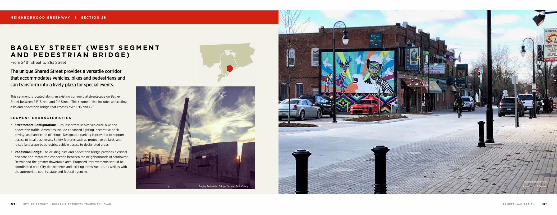
0 5 G R E E N WAY D E S I G NC I T Y O F D E T R O I T • J O E LO U I S G R E E N WAY F R A M E WO R K P L A N2 2 6 2 2 7
N E I G H B O R H O O D G R E E N WAY | S E C T I O N 2 8
The unique Shared Street provides a versatile corridor that accommodates vehicles, bikes and pedestrians and can transform into a lively plaza for special events.
This segment is located along an existing commercial streetscape on Bagley
Street between 24th Street and 21st Street. This segment also includes an existing
bike and pedestrian bridge that crosses over I-96 and I-75.
S E G M E N T C H A R AC T E R I S T I C S
• Streetscapre Configuration: Curb-less street serves vehicular, bike and pedestrian traffic. Amenities include enhanced lighting, decorative brick paving, and landscape plantings. Designated parking is provided to support access to local businesses. Safety features such as protective bollards and raised landscape beds restrict vehicle access to designated areas.
• Pedestrian Bridge: The existing bike and pedestrian bridge provides a critical and safe non-motorized connection between the neighborhoods of southwest Detroit and the greater downtown area. Proposed improvements should be coordinated with City departments and existing infrastructure, as well as with the appropriate county, state and federal agencies.
B AG L E Y S T R E E T ( W E S T S E G M E N T A N D P E D E S T R I A N B R I D G E ) From 24th Street to 21st Street
Bagley Shared Street
Source: City of Detroit.Bagley Pedestrian Bridge. Source: SmithGroup
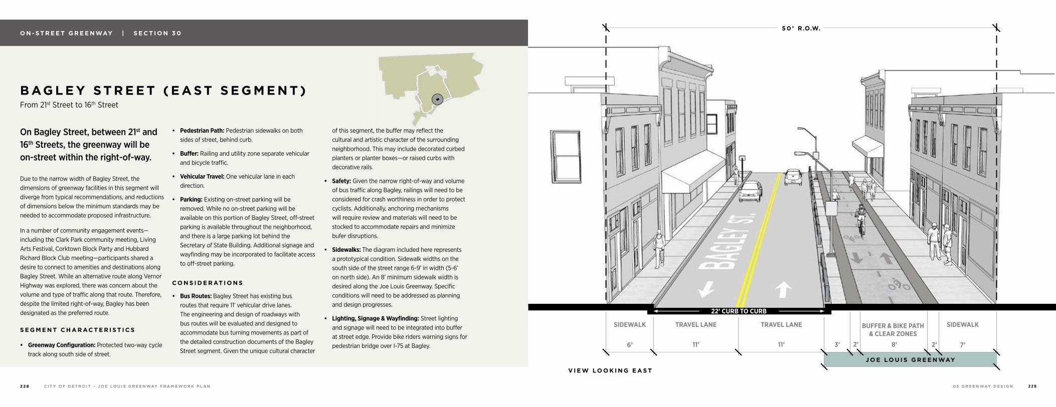
0 5 G R E E N WAY D E S I G NC I T Y O F D E T R O I T • J O E LO U I S G R E E N WAY F R A M E WO R K P L A N2 2 8 2 2 9
O N - S T R E E T G R E E N WAY | S E C T I O N 3 0
V I E W LO O K I N G E A S T
J O E LO U I S G R E E N WAY
5 0 ’ R.O.W.
SIDEWALK SIDEWALKTRAVEL LANE TRAVEL LANE BUFFER & BIKE PATH & CLEAR ZONES
11’ 11’ 3’ 8’ 2’2’6’ 7’
22’ CURB TO CURB
On Bagley Street, between 21st and 16th Streets, the greenway will be on-street within the right-of-way.
Due to the narrow width of Bagley Street, the dimensions of greenway facilities in this segment will diverge from typical recommendations, and reductions of dimensions below the minimum standards may be needed to accommodate proposed infrastructure.
In a number of community engagement events—including the Clark Park community meeting, Living Arts Festival, Corktown Block Party and Hubbard Richard Block Club meeting—participants shared a desire to connect to amenities and destinations along Bagley Street. While an alternative route along Vernor Highway was explored, there was concern about the volume and type of traffic along that route. Therefore, despite the limited right-of-way, Bagley has been designated as the preferred route. S E G M E N T C H A R AC T E R I S T I C S
• Greenway Configuration: Protected two-way cycle track along south side of street.
• Pedestrian Path: Pedestrian sidewalks on both sides of street, behind curb.
• Buffer: Railing and utility zone separate vehicular and bicycle traffic.
• Vehicular Travel: One vehicular lane in each direction.
• Parking: Existing on-street parking will be removed. While no on-street parking will be available on this portion of Bagley Street, off-street parking is available throughout the neighborhood, and there is a large parking lot behind the Secretary of State Building. Additional signage and wayfinding may be incorporated to facilitate access to off-street parking.
C O N S I D E R AT I O N S
• Bus Routes: Bagley Street has existing bus routes that require 11’ vehicular drive lanes. The engineering and design of roadways with bus routes will be evaluated and designed to accommodate bus turning movements as part of the detailed construction documents of the Bagley Street segment. Given the unique cultural character
of this segment, the buffer may reflect the cultural and artistic character of the surrounding neighborhood. This may include decorated curbed planters or planter boxes—or raised curbs with decorative rails.
• Safety: Given the narrow right-of-way and volume of bus traffic along Bagley, railings will need to be considered for crash worthiness in order to protect cyclists. Additionally, anchoring mechanisms will require review and materials will need to be stocked to accommodate repairs and minimize bufer disruptions.
• Sidewalks: The diagram included here represents a prototypical condition. Sidewalk widths on the south side of the street range 6-9’ in width (5-6’ on north side). An 8’ minimum sidewalk width is desired along the Joe Louis Greenway. Specific conditions will need to be addressed as planning and design progresses.
• Lighting, Signage & Wayfinding: Street lighting and signage will need to be integrated into buffer at street edge. Provide bike riders warning signs for pedestrian bridge over I-75 at Bagley.
B AG L E Y S T R E E T ( E A S T S E G M E N T ) From 21st Street to 16th Street
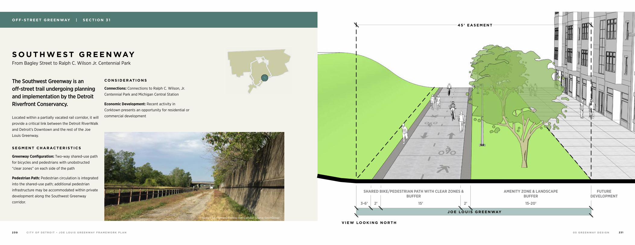
0 5 G R E E N WAY D E S I G NC I T Y O F D E T R O I T • J O E LO U I S G R E E N WAY F R A M E WO R K P L A N2 3 0 2 3 1
The Southwest Greenway is an off-street trail undergoing planning and implementation by the Detroit Riverfront Conservancy.
Located within a partially vacated rail corridor, it will
provide a critical link between the Detroit RiverWalk
and Detroit’s Downtown and the rest of the Joe
Louis Greenway.
S E G M E N T C H A R AC T E R I S T I C S
Greenway Configuration: Two-way shared-use path
for bicycles and pedestrians with unobstructed
“clear zones” on each side of the path
Pedestrian Path: Pedestrian circulation is integrated
into the shared-use path; additional pedestrian
infrastructure may be accommodated within private
development along the Southwest Greenway
corridor.
C O N S I D E R AT I O N S
Connections: Connections to Ralph C. Wilson, Jr.
Centennial Park and Michigan Central Station
Economic Development: Recent activity in
Corktown presents an opportunity for residential or
commercial development
S O U T H W E S T G R E E N WAY From Bagley Street to Ralph C. Wilson Jr. Centennial Park
O F F - S T R E E T G R E E N WAY | S E C T I O N 3 1
SHARED BIKE/PEDESTRIAN PATH WITH CLEAR ZONES & BUFFER
FUTURE DEVELOPMENT
AMENITY ZONE & LANDSCAPE BUFFER
15’ 15-20’2’3-6’ 2’
4 5 ’ E A S E M E N T
V I E W LO O K I N G N O R T H
J O E LO U I S G R E E N WAY
Vacated Southwest Greenway Rail Corridor. Source: SmithGroup
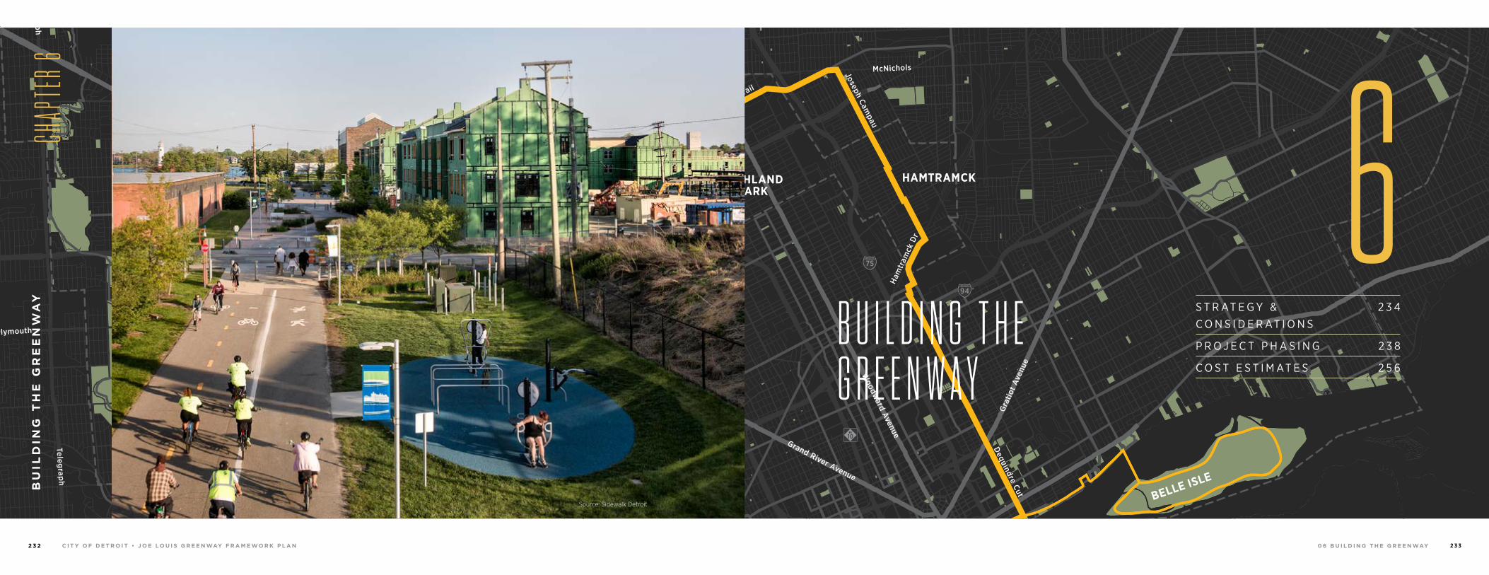
0 6 B U I L D I N G T H E G R E E N WAYC I T Y O F D E T R O I T • J O E LO U I S G R E E N WAY F R A M E WO R K P L A N2 3 2 2 3 3
94
94
94
94
75
75
75
10
10
HIGHLANDPARK
DETROIT
DEARBORN
Michigan Avenue
Telegrap
h
Telegrap
h
Plymouth
Warren Avenue
Bagley
Je�erson Avenue
Dearborn
Detroit Riverwalk
Dequindre Cut
Lonyo
Dix
Woodm
ere
Campbell
W. G
rand
8 Mile
Fort
Fort
Woodw
ard Avenue
Woodw
ard
Gra
tiot
Aven
ue
Grand River Avenue
Davison
Joseph Campau
Ham
tram
ck D
r
Conrail
Conrail
Oakm
an
McNichols
Live
rnoi
s
GORDIE HOWEBRIDGE
HAMTRAMCK
BELLE ISLE
WINDSOR
B U I L D I N G T H E G R E E N W A Y
BU
ILD
ING
TH
E G
RE
EN
WA
Y
CHAP
TER 6
6Source: Sidewalk Detroit
S T R AT E G Y & C O N S I D E R AT I O N S
2 3 4
P R O J E C T P H A S I N G 2 3 8
C O S T E S T I M AT E S 2 5 6
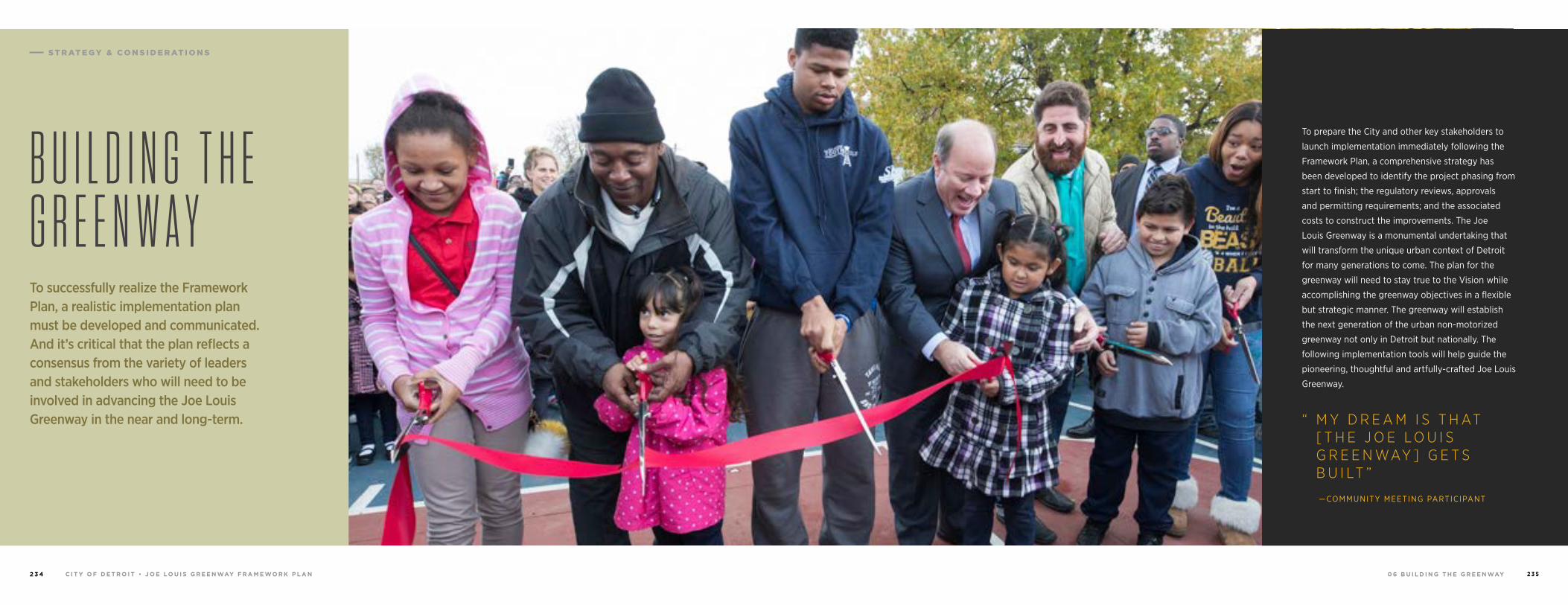
0 6 B U I L D I N G T H E G R E E N WAYC I T Y O F D E T R O I T • J O E LO U I S G R E E N WAY F R A M E WO R K P L A N2 3 4 2 3 5
To successfully realize the Framework Plan, a realistic implementation plan must be developed and communicated. And it’s critical that the plan reflects a consensus from the variety of leaders and stakeholders who will need to be involved in advancing the Joe Louis Greenway in the near and long-term.
B U I L D I N G T H E G R E E N W A Y
—COMMUNITY MEETING PARTICIPANT
To prepare the City and other key stakeholders to
launch implementation immediately following the
Framework Plan, a comprehensive strategy has
been developed to identify the project phasing from
start to finish; the regulatory reviews, approvals
and permitting requirements; and the associated
costs to construct the improvements. The Joe
Louis Greenway is a monumental undertaking that
will transform the unique urban context of Detroit
for many generations to come. The plan for the
greenway will need to stay true to the Vision while
accomplishing the greenway objectives in a flexible
but strategic manner. The greenway will establish
the next generation of the urban non-motorized
greenway not only in Detroit but nationally. The
following implementation tools will help guide the
pioneering, thoughtful and artfully-crafted Joe Louis
Greenway.
“ M Y D R E A M I S T H AT [ T H E J O E L O U I S G R E E N WAY ] G E T S B U I LT ”
S T R AT E G Y & C O N S I D E R AT I O N S
0 6 B U I L D I N G T H E G R E E N WAYC I T Y O F D E T R O I T • J O E LO U I S G R E E N WAY F R A M E WO R K P L A N2 3 6 2 3 7
Impact to the Community
The importance and impact of a particular segment to the adjacent
neighborhoods and community can increase the priority of implementation.
Providing a catalyst for business development, job generation, access to key
services and other related improvements can generate significant benefits to
the community.
Property Ownership
Securing the spatial requirements for the corridor is a vital step. The City
owns or has partnerships in place for much of the route, however, dedicated
widths within the public right-of-way and/or property acquisition or
easements are required throughout the greenway. Finalizing agreements will
take an unpredictable amount time and funding, which may impact the ability
to construct each segment.
Governance Structure
Confirmation and/or development of the governance structure for the
greenway is necessary to progress into implementation in a timely fashion and
to ensure future success of the greenway.
Site Conditions
Collecting and analyzing data on existing site conditions, such as
topography, utilities, soils and vegetation are important drivers to the
design and implementation schedule, costs and ability to implement
the greenway. Of critical importance is developing an approved
environmental remediation plan for contaminated sites.
Access and Destinations
Each phase requires clear beginning and end points that are
welcoming, convenient to access and provide a sense of security.
This will ensure the access points are attractive destinations to drive
demand to use the greenway.
Construction Costs and Funding
The availability of funding and funding cycles (City fiscal years and
grants) influence the capacity, timing and extent of design and
construction. Cost opinions for the level of improvements should be
developed as part of the design process. Costs for planning, design,
project management and maintenance need to be incorporated as well.
Connections to Existing Non-motorized Infrastructure and Transit
Expanding upon and connecting to existing non-motorized
infrastructure and other transit modes increases the value and
importance of a greenway segment.
Regulatory Approval and Permitting
The regulatory controls, permitting and approval process at the federal,
state and local levels will impact the design/pre-construction schedule
as well as construction cost. Refer to the “Permitting and Approvals”
section below.
Partnerships
The development of new partnerships as well as leveraging existing
partnerships with the community, property/business owners, regulatory
agencies/organizations, foundations, advocates and others influence
the timing, desire and ability for construction.
Schedule and Timeline
The development of a coordinated and strategic schedule that accounts
for design and planning requirements, funding cycles and construction
seasons is key to a successful and timely implementation process.
D E V E LO P I N G T H E P H A S I N G S T R AT E GY
To implement the Framework
Plan, it will be necessary to
develop and communicate of a
realistic strategy centered around
consensus from the community,
City of Detroit leadership,
departmental review and
approvals and partnerships.
The City received valuable
input from each entity in the
development of the Framework
Plan and they will continue their
engagement as they advance
the design and implementation
of each phase. There are a
number of factors the City
is considering as they make
decisions regarding phasing of
design and implementation. Some
of the critical considerations
are listed here. While they are
not necessarily listed in order
of priority, “Impact to the
Community” has been identified
as the single most important
component driving project
phasing.
S T R AT E G Y & C O N S I D E R AT I O N S
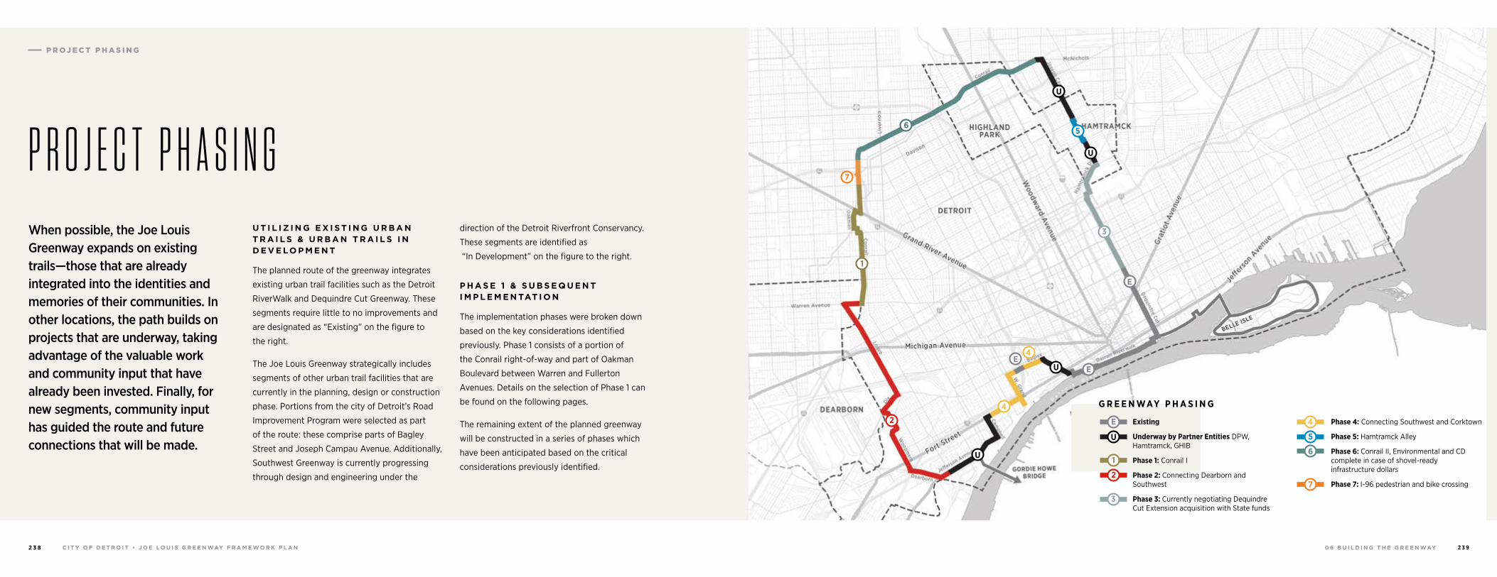
0 6 B U I L D I N G T H E G R E E N WAYC I T Y O F D E T R O I T • J O E LO U I S G R E E N WAY F R A M E WO R K P L A N2 3 8 2 3 9
U T I L I Z I N G E X I S T I N G U R B A N T R A I L S & U R B A N T R A I L S I N D E V E LO P M E N T
The planned route of the greenway integrates
existing urban trail facilities such as the Detroit
RiverWalk and Dequindre Cut Greenway. These
segments require little to no improvements and
are designated as “Existing” on the figure to
the right.
The Joe Louis Greenway strategically includes
segments of other urban trail facilities that are
currently in the planning, design or construction
phase. Portions from the city of Detroit’s Road
Improvement Program were selected as part
of the route: these comprise parts of Bagley
Street and Joseph Campau Avenue. Additionally,
Southwest Greenway is currently progressing
through design and engineering under the
direction of the Detroit Riverfront Conservancy.
These segments are identified as
“In Development” on the figure to the right.
P H A S E 1 & S U B S E Q U E N T I M P L E M E N TAT I O N
The implementation phases were broken down
based on the key considerations identified
previously. Phase 1 consists of a portion of
the Conrail right-of-way and part of Oakman
Boulevard between Warren and Fullerton
Avenues. Details on the selection of Phase 1 can
be found on the following pages.
The remaining extent of the planned greenway
will be constructed in a series of phases which
have been anticipated based on the critical
considerations previously identified.
When possible, the Joe Louis Greenway expands on existing trails—those that are already integrated into the identities and memories of their communities. In other locations, the path builds on projects that are underway, taking advantage of the valuable work and community input that have already been invested. Finally, for new segments, community input has guided the route and future connections that will be made.
P R O J E C T P H A S I N G
Existing
Underway by Partner Entities DPW, Hamtramck, GHIB
Phase 1: Conrail I
Phase 2: Connecting Dearborn and Southwest
Phase 3: Currently negotiating Dequindre Cut Extension acquisition with State funds
Phase 4: Connecting Southwest and Corktown
Phase 5: Hamtramck Alley
Phase 6: Conrail II, Environmental and CD complete in case of shovel-ready infrastructure dollars
Phase 7: I-96 pedestrian and bike crossing
G R E E N WAY P H A S I N G
U
1
2
3
4
5
6
7
E
6
7
3
EE
E
U
U
U
U
4
4
5
1
2
P R O J E C T P H A S I N G
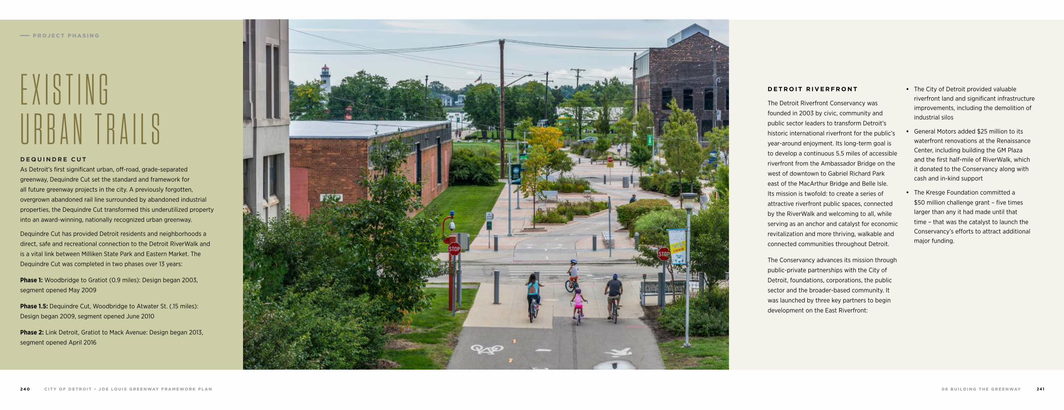
0 6 B U I L D I N G T H E G R E E N WAYC I T Y O F D E T R O I T • J O E LO U I S G R E E N WAY F R A M E WO R K P L A N2 4 0 2 4 1
E X I S T I N G U R B A N T R A I L SD E Q U I N D R E C U T
As Detroit’s first significant urban, off-road, grade-separated
greenway, Dequindre Cut set the standard and framework for
all future greenway projects in the city. A previously forgotten,
overgrown abandoned rail line surrounded by abandoned industrial
properties, the Dequindre Cut transformed this underutilized property
into an award-winning, nationally recognized urban greenway.
Dequindre Cut has provided Detroit residents and neighborhoods a
direct, safe and recreational connection to the Detroit RiverWalk and
is a vital link between Milliken State Park and Eastern Market. The
Dequindre Cut was completed in two phases over 13 years:
Phase 1: Woodbridge to Gratiot (0.9 miles): Design began 2003,
segment opened May 2009
Phase 1.5: Dequindre Cut, Woodbridge to Atwater St. (.15 miles):
Design began 2009, segment opened June 2010
Phase 2: Link Detroit, Gratiot to Mack Avenue: Design began 2013,
segment opened April 2016
D E T R O I T R I V E R F R O N T
The Detroit Riverfront Conservancy was
founded in 2003 by civic, community and
public sector leaders to transform Detroit’s
historic international riverfront for the public’s
year-around enjoyment. Its long-term goal is
to develop a continuous 5.5 miles of accessible
riverfront from the Ambassador Bridge on the
west of downtown to Gabriel Richard Park
east of the MacArthur Bridge and Belle Isle.
Its mission is twofold: to create a series of
attractive riverfront public spaces, connected
by the RiverWalk and welcoming to all, while
serving as an anchor and catalyst for economic
revitalization and more thriving, walkable and
connected communities throughout Detroit.
The Conservancy advances its mission through
public-private partnerships with the City of
Detroit, foundations, corporations, the public
sector and the broader-based community. It
was launched by three key partners to begin
development on the East Riverfront:
• The City of Detroit provided valuable riverfront land and significant infrastructure improvements, including the demolition of industrial silos
• General Motors added $25 million to its waterfront renovations at the Renaissance Center, including building the GM Plaza and the first half-mile of RiverWalk, which it donated to the Conservancy along with cash and in-kind support
• The Kresge Foundation committed a
$50 million challenge grant – five times larger than any it had made until that
time – that was the catalyst to launch the Conservancy’s efforts to attract additional major funding.
P R O J E C T P H A S I N G
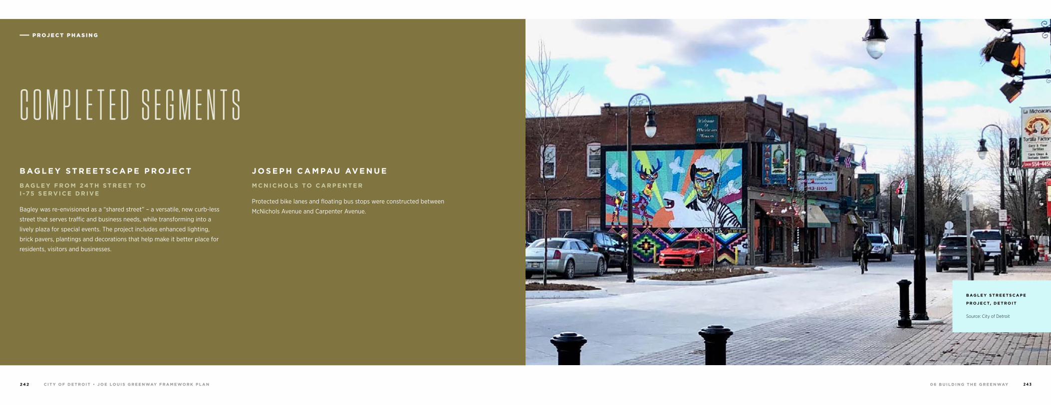
0 6 B U I L D I N G T H E G R E E N WAYC I T Y O F D E T R O I T • J O E LO U I S G R E E N WAY F R A M E WO R K P L A N2 4 2 2 4 3
B AG L E Y S T R E E T S C A P E P R OJ E C T
B AG L E Y F R O M 2 4 T H S T R E E T TO I -7 5 S E R V I C E D R I V E
Bagley was re-envisioned as a “shared street” – a versatile, new curb-less
street that serves traffic and business needs, while transforming into a
lively plaza for special events. The project includes enhanced lighting,
brick pavers, plantings and decorations that help make it better place for
residents, visitors and businesses.
J O S E P H C A M PAU AV E N U E
M C N I C H O L S TO C A R P E N T E R
Protected bike lanes and floating bus stops were constructed between
McNichols Avenue and Carpenter Avenue.
C O M P L E T E D S E G M E N T S
B AG L E Y S T R E E T S C A P E
P R OJ E C T, D E T R O I T
Source: City of Detroit
P R O J E C T P H A S I N G P R O J E C T P H A S I N G
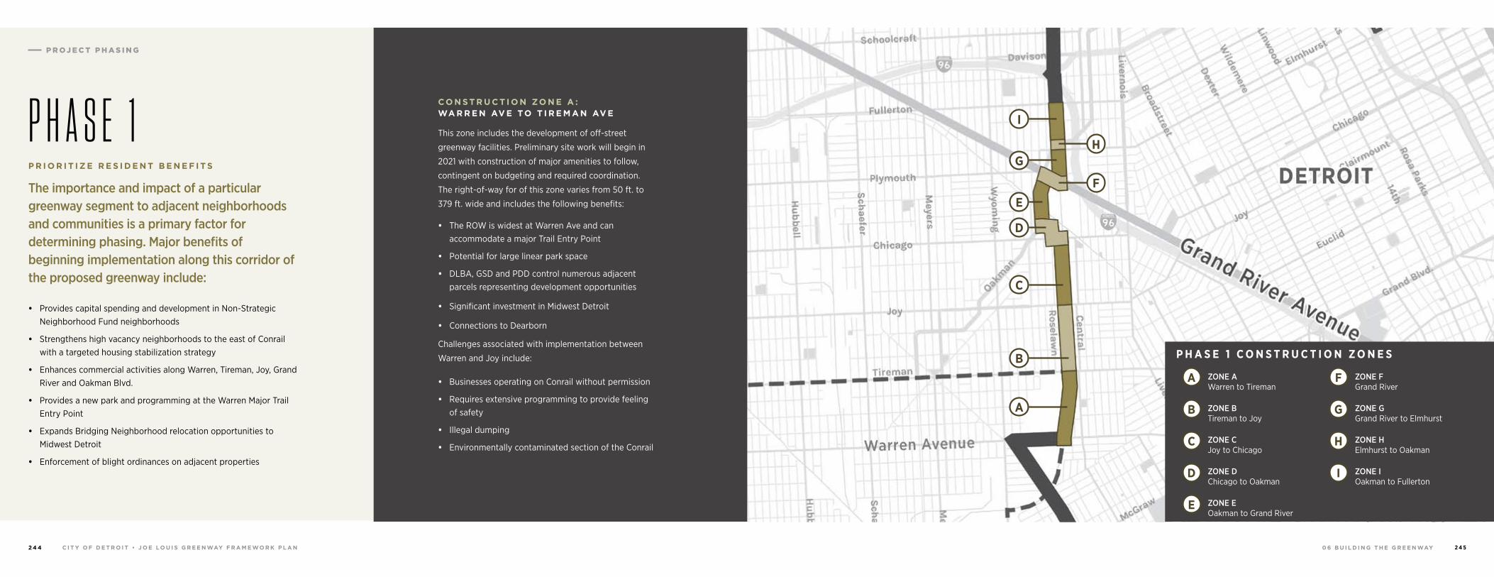
0 6 B U I L D I N G T H E G R E E N WAYC I T Y O F D E T R O I T • J O E LO U I S G R E E N WAY F R A M E WO R K P L A N2 4 4 2 4 5
P H A S E 1P R I O R I T I Z E R E S I D E N T B E N E F I T S
The importance and impact of a particular greenway segment to adjacent neighborhoods and communities is a primary factor for determining phasing. Major benefits of beginning implementation along this corridor of the proposed greenway include:
• Provides capital spending and development in Non-Strategic Neighborhood Fund neighborhoods
• Strengthens high vacancy neighborhoods to the east of Conrail with a targeted housing stabilization strategy
• Enhances commercial activities along Warren, Tireman, Joy, Grand River and Oakman Blvd.
• Provides a new park and programming at the Warren Major Trail Entry Point
• Expands Bridging Neighborhood relocation opportunities to Midwest Detroit
• Enforcement of blight ordinances on adjacent properties
I
H
F
G
E
D
C
BZONE A Warren to Tireman
ZONE B Tireman to Joy
ZONE C Joy to Chicago
ZONE D Chicago to Oakman
ZONE E Oakman to Grand River
ZONE F Grand River
ZONE G Grand River to Elmhurst
ZONE H Elmhurst to Oakman
ZONE I Oakman to Fullerton
A
A F
B G
D I
C H
E
P H A S E 1 C O N S T R U C T I O N Z O N E S
C O N S T R U C T I O N ZO N E A : WA R R E N AV E TO T I R E M A N AV E
This zone includes the development of off-street
greenway facilities. Preliminary site work will begin in
2021 with construction of major amenities to follow,
contingent on budgeting and required coordination.
The right-of-way for of this zone varies from 50 ft. to
379 ft. wide and includes the following benefits:
• The ROW is widest at Warren Ave and can accommodate a major Trail Entry Point
• Potential for large linear park space
• DLBA, GSD and PDD control numerous adjacent parcels representing development opportunities
• Significant investment in Midwest Detroit
• Connections to Dearborn
Challenges associated with implementation between
Warren and Joy include:
• Businesses operating on Conrail without permission
• Requires extensive programming to provide feeling of safety
• Illegal dumping
• Environmentally contaminated section of the Conrail
P R O J E C T P H A S I N G
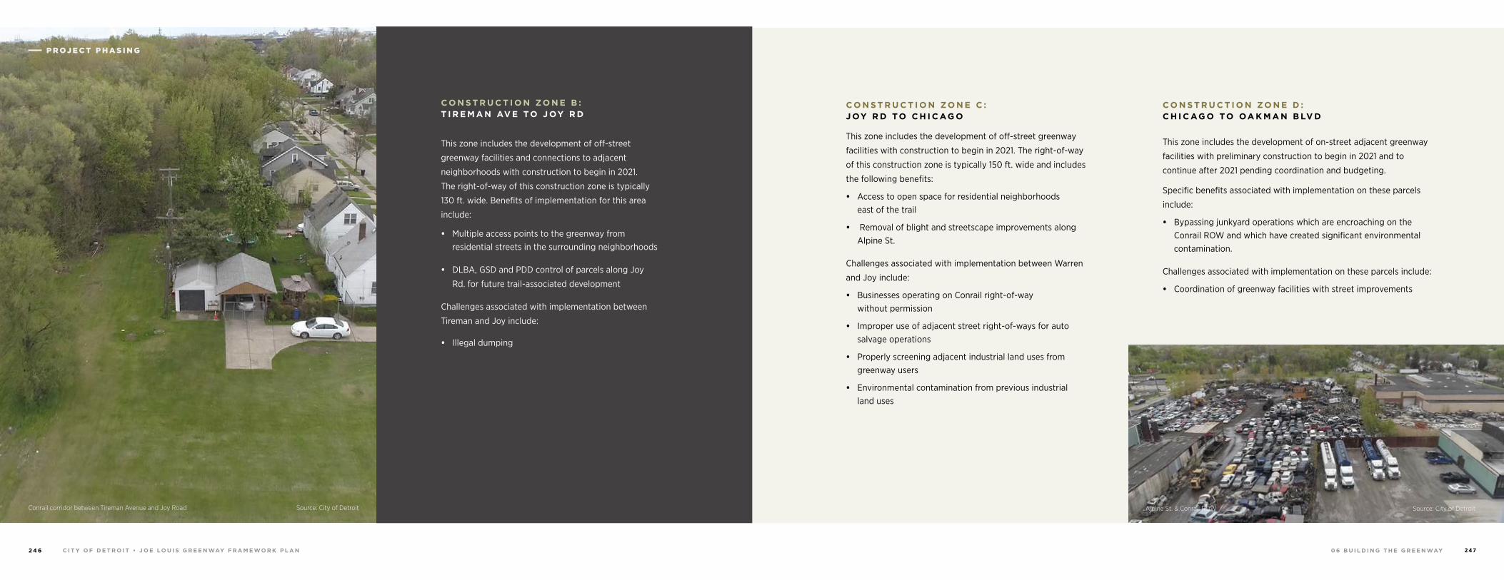
0 6 B U I L D I N G T H E G R E E N WAYC I T Y O F D E T R O I T • J O E LO U I S G R E E N WAY F R A M E WO R K P L A N2 4 6 2 4 7
C O N S T R U C T I O N ZO N E B : T I R E M A N AV E TO J OY R D
This zone includes the development of off-street
greenway facilities and connections to adjacent
neighborhoods with construction to begin in 2021.
The right-of-way of this construction zone is typically
130 ft. wide. Benefits of implementation for this area
include:
• Multiple access points to the greenway from residential streets in the surrounding neighborhoods
• DLBA, GSD and PDD control of parcels along Joy
Rd. for future trail-associated development
Challenges associated with implementation between
Tireman and Joy include:
• Illegal dumping
Alpine St. & Conrail ROW Source: City of Detroit
C O N S T R U C T I O N ZO N E C : J OY R D TO C H I C AG O
This zone includes the development of off-street greenway
facilities with construction to begin in 2021. The right-of-way
of this construction zone is typically 150 ft. wide and includes
the following benefits:
• Access to open space for residential neighborhoods east of the trail
• Removal of blight and streetscape improvements along Alpine St.
Challenges associated with implementation between Warren
and Joy include:
• Businesses operating on Conrail right-of-way without permission
• Improper use of adjacent street right-of-ways for auto salvage operations
• Properly screening adjacent industrial land uses from greenway users
• Environmental contamination from previous industrial land uses
C O N S T R U C T I O N ZO N E D : C H I C AG O TO OA K M A N B LV D
This zone includes the development of on-street adjacent greenway
facilities with preliminary construction to begin in 2021 and to
continue after 2021 pending coordination and budgeting.
Specific benefits associated with implementation on these parcels
include:
• Bypassing junkyard operations which are encroaching on the Conrail ROW and which have created significant environmental contamination.
Challenges associated with implementation on these parcels include:
• Coordination of greenway facilities with street improvements
Conrail corridor between Tireman Avenue and Joy Road Source: City of Detroit
P R O J E C T P H A S I N G P R O J E C T P H A S I N G
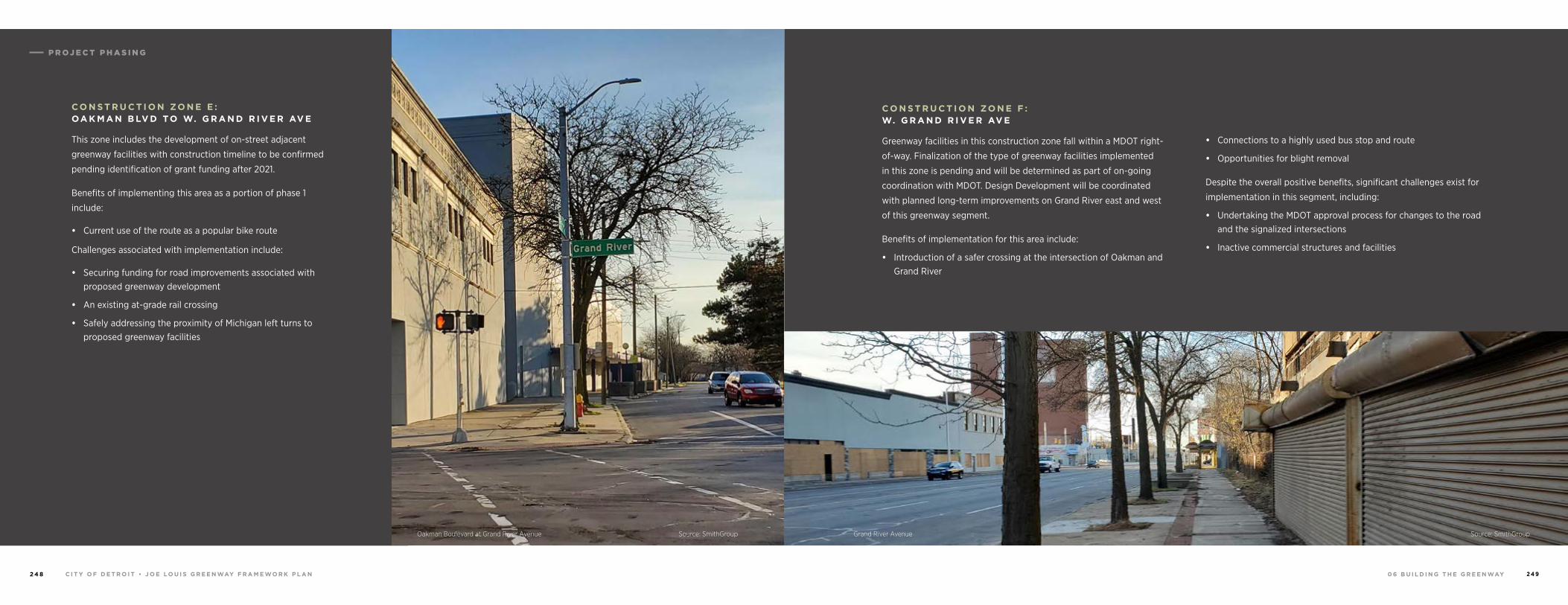
0 6 B U I L D I N G T H E G R E E N WAYC I T Y O F D E T R O I T • J O E LO U I S G R E E N WAY F R A M E WO R K P L A N2 4 8 2 4 9
C O N S T R U C T I O N ZO N E E : OA K M A N B LV D TO W. G R A N D R I V E R AV E
This zone includes the development of on-street adjacent
greenway facilities with construction timeline to be confirmed
pending identification of grant funding after 2021.
Benefits of implementing this area as a portion of phase 1
include:
• Current use of the route as a popular bike route
Challenges associated with implementation include:
• Securing funding for road improvements associated with proposed greenway development
• An existing at-grade rail crossing
• Safely addressing the proximity of Michigan left turns to proposed greenway facilities
C O N S T R U C T I O N ZO N E F : W. G R A N D R I V E R AV E
Greenway facilities in this construction zone fall within a MDOT right-
of-way. Finalization of the type of greenway facilities implemented
in this zone is pending and will be determined as part of on-going
coordination with MDOT. Design Development will be coordinated
with planned long-term improvements on Grand River east and west
of this greenway segment.
Benefits of implementation for this area include:
• Introduction of a safer crossing at the intersection of Oakman and Grand River
• Connections to a highly used bus stop and route
• Opportunities for blight removal
Despite the overall positive benefits, significant challenges exist for
implementation in this segment, including:
• Undertaking the MDOT approval process for changes to the road and the signalized intersections
• Inactive commercial structures and facilities
Grand River Avenue Source: SmithGroupOakman Boulevard at Grand River Avenue Source: SmithGroup
P R O J E C T P H A S I N G
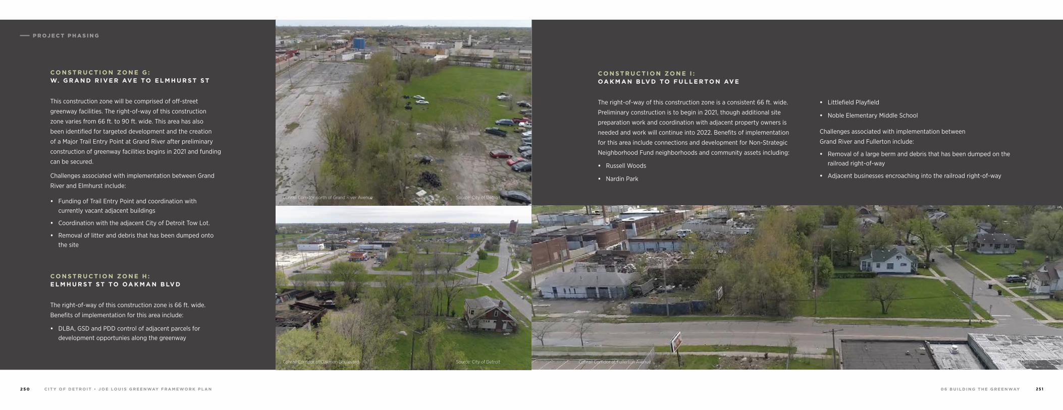
0 6 B U I L D I N G T H E G R E E N WAYC I T Y O F D E T R O I T • J O E LO U I S G R E E N WAY F R A M E WO R K P L A N2 5 0 2 5 1
C O N S T R U C T I O N ZO N E G : W. G R A N D R I V E R AV E TO E L M H U R S T S T
This construction zone will be comprised of off-street
greenway facilities. The right-of-way of this construction
zone varies from 66 ft. to 90 ft. wide. This area has also
been identified for targeted development and the creation
of a Major Trail Entry Point at Grand River after preliminary
construction of greenway facilities begins in 2021 and funding
can be secured.
Challenges associated with implementation between Grand
River and Elmhurst include:
• Funding of Trail Entry Point and coordination with currently vacant adjacent buildings
• Coordination with the adjacent City of Detroit Tow Lot.
• Removal of litter and debris that has been dumped onto the site
C O N S T R U C T I O N ZO N E H : E L M H U R S T S T TO OA K M A N B LV D
The right-of-way of this construction zone is 66 ft. wide.
Benefits of implementation for this area include:
• DLBA, GSD and PDD control of adjacent parcels for development opportunies along the greenway
C O N S T R U C T I O N ZO N E I : OA K M A N B LV D TO F U L L E R TO N AV E
The right-of-way of this construction zone is a consistent 66 ft. wide.
Preliminary construction is to begin in 2021, though additional site
preparation work and coordination with adjacent property owners is
needed and work will continue into 2022. Benefits of implementation
for this area include connections and development for Non-Strategic
Neighborhood Fund neighborhoods and community assets including:
• Russell Woods
• Nardin Park
• Littlefield Playfield
• Noble Elementary Middle School
Challenges associated with implementation between
Grand River and Fullerton include:
• Removal of a large berm and debris that has been dumped on the railroad right-of-way
• Adjacent businesses encroaching into the railroad right-of-way
Conrail Corridor at Fullerton Avenue Source: City of DetroitConrail Corridor at Oakman Boulevard Source: City of Detroit
Conrail Corridor north of Grand River Avenue Source: City of Detroit
P R O J E C T P H A S I N G
0 6 B U I L D I N G T H E G R E E N WAYC I T Y O F D E T R O I T • J O E LO U I S G R E E N WAY F R A M E WO R K P L A N2 5 2 2 5 3
P L A N N I N G , F U N D I N G & I M P L E M E N TAT I O N
In addition to Phase 1, five subsequent primary phases,
Phases 2 to 6, with numerous sub-phases, are outlined
here. This list of future phases of the Joe Louis Greenway
has been composed given the best possible current
understanding of potential sequencing, but is subject
to change as new information regarding funding, site
conditions and permitting becomes available.
Additionally, several phasing segments fall into a To Be
Determined category. These future phases require further
coordination beyond the contingencies on information
listed for Phases 2 to 6.
F U T U R E P H A S E S
P H A S E 2
D E Q U I N D R E C U T E X T E N S I O N
M AC K AV E N U E TO M I LWA U K E E S T R E E T
(RR ROW plus Wetherbee Street to Hamtramck Drive
Submit MDNR Acquisition Grant Spring 2020
Land Purchase Spring/Summer 2022
Submit MDNR Development Grant Spring 2023
Design Summer/Winter 2023
Construction 2025
H A M T R A M C K D R I V E
J O S E P H C A M PA U TO W E T H E R B E E
Coordinate with Construction of
Phase 4G Dequindre Cut Extension
P H A S E 3
I N T E R S E C T I O N O F D E A R B O R N S T R E E T & W. J E F F E R S O N AV E N U E
Design, Funding and Construction Part of Phase 4 of the Gordie Howe
International Bridge
Construction to start in Winter of 2022
Anticipated completion Winter 2023
D E A R B O R N S T R E E T
W. J E F F E R S O N TO WO O D M E R E Coordinate with Phase 4 of Gordie Howe International Bridge
Complete by Winter 2023
WO O D M E R E S T R E E T
D E A R B O R N S T R E E T TO V E R N O R H I G H WAY Patton Park Planning Funded by MDNR Planning Grant
Construction Dependent on Coordination with Iron Belle Construction Grants
PAT TO N & R O M A N OW S K I PA R K S
MDNR Development Grant 2021
Construction 2023
WA R R E N AV E N U E
LO N YO S T R E E T TO C O N R A I L R OW Coordination with City of Dearborn Ongoing
LO N YO S T R E E T
D I X AV E N U E TO S T. J O H N AV E N U E Design 2020
Construction 2023
A R N O L D AV E N U E TO R A D C L I F F E S T R E E T Design 2022
Construction 2023
R A D C L I F F E S T R E E T TO WA R R E N AV E N U E Coordination with City of Dearborn Ongoing
Design 2022
Construction 2023
P R O J E C T P H A S I N G
0 6 B U I L D I N G T H E G R E E N WAYC I T Y O F D E T R O I T • J O E LO U I S G R E E N WAY F R A M E WO R K P L A N2 5 4 2 5 5
P H A S E 4
J O S E P H C A M PAU A L L E Y
C A N I F F TO H O L B R O O K Pending Fundraising
Schedule TBD
P H A S E 5
C O N R A I L R OW
F U L L E R TO N AV E N U E TO B R I D G E Conrail ROW between bridge spans,
I-96/Davison connector bridge span and Conrail ROW bridge to Davison
Construction 2026
W. DAV I S O N TO L I V E R N O I S AV E N U E Interval Property Acquisition 2022 Design 2023 Construction 2024
L I V E R N O I S AV E N U E TO WO O DWA R D AV E N U E Include Woodward Access Point
Design 2024
Construction 2025
WO O DWA R D AV E N U E TO M C N I C H O L S R OA D Include I-75 Rail Crossing & Parklet North of McNichols
Design 2024
Constructed 2025
C O N R A I L R OW
F U L L E R TO N AV E N U E TO B R I D G E I-96 Bridge Span
P H A S E 6
P H A S E 7
P H A S E 3 B : C A M P B E L L S T R E E T &
W. J E F F E R S O N AV E N U E
F O R T S T R E E T TO W E S T E N D S T R E E T Confirm where shared-use path ends
Design, Funding and Construction part of GHIB
Constructed as part of Phase 4 of the GHIB to start in Winter of
2022 and complete by Winter 2023
W. J E F F E R S O N AV E N U E
W E S T E N D S T R E E T TO D E A R B O R N
I N T E R S E C T I O N Schedule TBD
P H A S E 2 B : J O S E P H C A M PAU AV E N U E
DAV I S O N F R E E WAY TO C A N I F F AV E N U E Design by Detroit Traffic Engineering Division 2020
Construction 2021
H O L B R O O K AV E N U E TO H A M T R A M C K D R I V E MDOT TAP Grant and Design 2020
Construction 2021
U N D E R WAY BY PA R T N E R E N T I T I E S
W. G R A N D B O U L E VA R D
V E R N O R H I G H WAY TO R I V E R S I D E PA R K
Design 2021
Construction 2022
W. F O R T S T R E E T
W. G R A N D B O U L E VA R D TO C A M P B E L L
DPW & MDOT to confirm schedule
B AG L E Y S T R E E T S O U T H W E S T G R E E N WAY TO I -7 5 P E D E S T R I A N B R I D G E
Resurfacing and Pavement Markings 2021
2 4 T H S T R E E T TO W. G R A N D B O U L E VA R D
Neighborhood Greenway
S O U T H W E S T G R E E N WAY J E F F E R S O N AV E N U E TO B AG L E Y AV E N U E ( R R R OW )
As part of the Joe Louis Greenway, the Southwest Greenway creates a non-motorized connection from the Detroit Riverfront’s Ralph C Wilson Jr. Centennial Park to the Corktown Neighborhood, in Southwest Detroit.
Phase I of Southwest connects Jefferson Avenue with Bagley Street, running
alongside the existing DRTP Rail line, creating an opportunity to link the
greenway with the industrial roots of the City of Detroit. Overhead canopies,
gateway signage and other elements have been designed to help strengthen
the relationship between the rail and the greenway.
P R O J E C T P H A S I N G
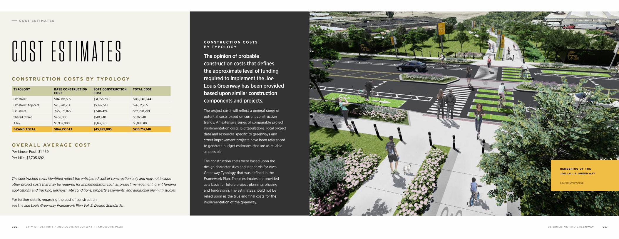
0 6 B U I L D I N G T H E G R E E N WAYC I T Y O F D E T R O I T • J O E LO U I S G R E E N WAY F R A M E WO R K P L A N2 5 6 2 5 7
The construction costs identified reflect the anticipated cost of construction only and may not include
other project costs that may be required for implementation such as project management, grant funding
applications and tracking, unknown site conditions, property easements, and additional planning studies.
For further details regarding the cost of construction,
see the Joe Louis Greenway Framework Plan Vol. 2: Design Standards.
TYPOLOGY BASE CONSTRUCTION COST
SOFT CONSTRUCTION COST
TOTAL COST
Off-street $114,383,555 $31,556,789 $145,940,344
Off-street Adjacent $20,370,713 $5,742,542 $26,113,255
On-street $25,573,875 $7,416,424 $32,990,299
Shared Street $486,000 $140,940 $626,940
Alley $3,939,000 $1,142,310 $5,081,310
GRAND TOTAL $164,753,143 $45,999,005 $210,752,148
OV E R A L L AV E R AG E C O S T Per Linear Foot: $1,459
Per Mile: $7,705,692
C O N S T R U C T I O N C O S T S BY T Y P O LO GY
C O S T E S T I M A T E S
R E N D E R I N G O F T H E
J O E LO U I S G R E E N WAY
Source: SmithGroup
C O N S T R U C T I O N C O S T S BY T Y P O LO GY
The opinion of probable construction costs that defines the approximate level of funding required to implement the Joe Louis Greenway has been provided based upon similar construction components and projects.
The project costs will reflect a general range of
potential costs based on current construction
trends. An extensive series of comparable project
implementation costs, bid tabulations, local project
data and resources specific to greenways and
street improvement projects have been referenced
to generate budget estimates that are as reliable
as possible.
The construction costs were based upon the
design characteristics and standards for each
Greenway Typology that was defined in the
Framework Plan. These estimates are provided
as a basis for future project planning, phasing
and fundraising. The estimates should not be
relied upon as the true and final costs for the
implementation of the greenway.
C O S T E S T I M AT E S
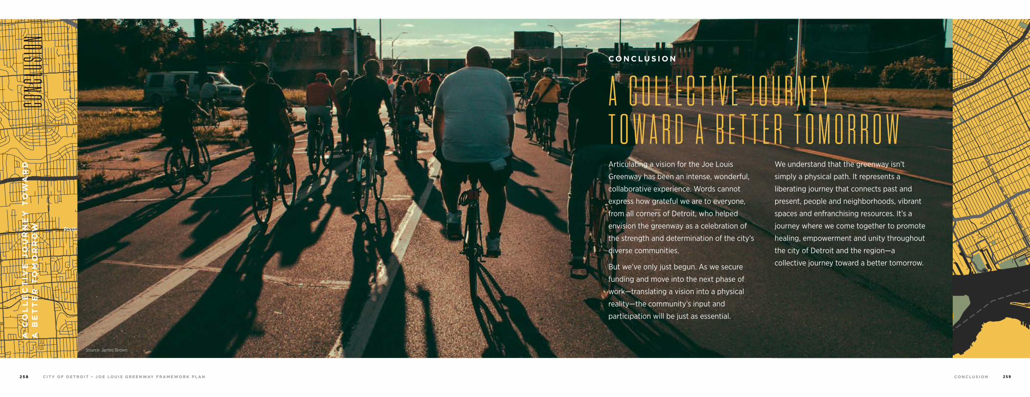
C I T Y O F D E T R O I T • J O E LO U I S G R E E N WAY F R A M E WO R K P L A N2 5 8 C O N C L U S I O N 2 5 9
94
94
94
94
75
75
75
10
10
HIGHLANDPARK
DETROIT
DEARBORN
Michigan Avenue
Telegrap
h
Telegrap
h
Plymouth
Warren Avenue
Bagley
Je�erson Avenue
Dearborn
Detroit Riverwalk
Dequindre Cut
Lonyo
Dix
Woodm
ere
Campbell
W. G
rand
8 Mile
FortFo
rt
Woodw
ard Avenue
Woodw
ard
Gra
tiot
Aven
ue
Grand River Avenue
Davison
Joseph Campau
Ham
tram
ck D
r
Conrail
Conrail
Oakm
an
McNichols
Live
rnoi
s
GORDIE HOWEBRIDGE
HAMTRAMCK
BELLE ISLE
WINDSOR
A C
OL
LE
CT
IVE
JO
UR
NE
Y T
OW
AR
D
A B
ET
TE
R T
OM
OR
RO
WCO
NCLU
SION
Source: Sidewalk DetroitSource: James Brown
A C O L L E C T I V E J O U R N E Y T O W A R D A B E T T E R T O M O R R O WArticulating a vision for the Joe Louis
Greenway has been an intense, wonderful,
collaborative experience. Words cannot
express how grateful we are to everyone,
from all corners of Detroit, who helped
envision the greenway as a celebration of
the strength and determination of the city’s
diverse communities.
But we’ve only just begun. As we secure
funding and move into the next phase of
work—translating a vision into a physical
reality—the community’s input and
participation will be just as essential.
We understand that the greenway isn’t
simply a physical path. It represents a
liberating journey that connects past and
present, people and neighborhoods, vibrant
spaces and enfranchising resources. It’s a
journey where we come together to promote
healing, empowerment and unity throughout
the city of Detroit and the region—a
collective journey toward a better tomorrow.
C O N C L U S I O N
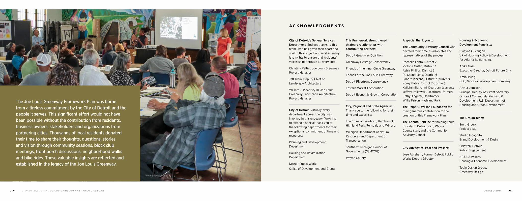
C I T Y O F D E T R O I T • J O E LO U I S G R E E N WAY F R A M E WO R K P L A N2 6 0 C O N C L U S I O N 2 6 1
AC K N OW L E D G M E N T S
City of Detroit’s General Services Department: Endless thanks to this team, who has given their heart and soul to this project and worked many late nights to ensure that residents’ voices shine through at every step:
Christina Peltier, Joe Louis Greenway Project Manager
Jeff Klein, Deputy Chief of Landscape Architecture
William J. McCarley III, Joe Louis Greenway Landscape Architecture Project Manager
City of Detroit: Virtually every department across the city was involved in this endeavor. We’d like to extend a special thank you to the following departments for their exceptional commitment of time and resources:
Planning and Development Department
Housing and Revitalization Department
Detroit Public Works
Office of Development and Grants
This Framework strengthened strategic relationships with contributing partners:
Detroit Greenway Coalition
Greenway Heritage Conservancy
Friends of the Inner Circle Greenway
Friends of the Joe Louis Greenway
Detroit Riverfront Conservancy
Eastern Market Corporation
Detroit Economic Growth Corporation
City, Regional and State Agencies: Thank you to the following for their time and expertise:
The Cities of Dearborn, Hamtramck, Highland Park, Ferndale and Windsor
Michigan Department of Natural Resources and Department of Transportation
Southeast Michigan Council of Governments (SEMCOG)
Wayne County
A special thank you to:
The Community Advisory Council who devoted their time as advocates and representatives of the process.
Rochelle Lento, District 2 Victoria Griffin, District 3 Ashia Phillips, District 5 Ru Shann Long, District 6 Sandra Pickens, District 7 (current) Korey Batey, District 7 (former) Kaileigh Bianchini, Dearborn (current) Jeffrey Polkowski, Dearborn (former) Kathy Angerer, Hamtramck Willie Faison, Highland Park
The Ralph C. Wilson Foundation for their generous contribution to the creation of this Framework Plan.
The Atlanta BeltLine for holding tours for City of Detroit staff, Wayne County staff, and the Community Advisory Council.
City Advocates, Past and Present:
Jose Abraham, Former Detroit Public Works Deputy Director
Housing & Economic Development Panelists:
Dwayne C. Vaughn, VP of Housing Policy & Development for Atlanta BeltLine, Inc.
Anika Goss, Executive Director, Detroit Future City
Amin Irving, CEO, Ginosko Development Company
Arthur Jemison, Principal Deputy Assistant Secretary, Office of Community Planning & Development, U.S. Department of Housing and Urban Development
The Design Team:
SmithGroup, Project Lead
Studio Incognita, Brand Development & Design
Sidewalk Detroit, Public Engagement
HR&A Advisors, Housing & Economic Development
Toole Design Group, Greenway Design
The Joe Louis Greenway Framework Plan was borne from a tireless commitment by the City of Detroit and the people it serves. This significant effort would not have been possible without the contribution from residents, business owners, stakeholders and organizations from partnering cities. Thousands of local residents donated their time to share their thoughts, questions, stories and vision through community sessions, block club meetings, front porch discussions, neighborhood walks and bike rides. These valuable insights are reflected and established in the legacy of the Joe Louis Greenway.
Photo: Sidewalk Detroit
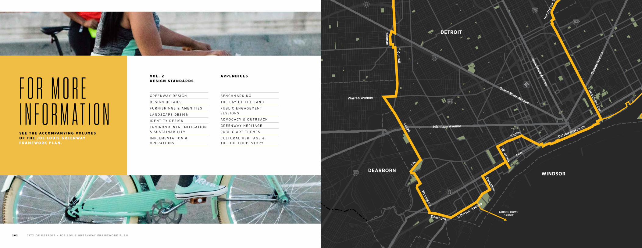
C I T Y O F D E T R O I T • J O E LO U I S G R E E N WAY F R A M E WO R K P L A N2 6 2 C O N C L U S I O N 2 6 3
Photo: James Brown
V O L . 2 D E S I G N S TA N D A R D S
G R E E N WAY D E S I G N
D E S I G N D E TA I L S
F U R N I S H I N G S & A M E N I T I E S
L A N D S C A P E D E S I G N
I D E N T I T Y D E S I G N
E N V I R O N M E N TA L M I T I G AT I O N & S U S TA I N A B I L I T Y
I M P L E M E N TAT I O N & O P E R AT I O N S
A P P E N D I C E S
B E N C H M A R K I N G
T H E L AY O F T H E L A N D
P U B L I C E N G A G E M E N T S E S S I O N S
A D V O C A C Y & O U T R E A C H
G R E E N WAY H E R I TA G E
P U B L I C A R T T H E M E S
C U LT U R A L H E R I TA G E & T H E J O E L O U I S S T O R Y
F O R M O R E I N F O R M A T I O N S E E T H E A C C O M PA N Y I N G V O L U M E S O F T H E J O E L O U I S G R E E N WAY F R A M E W O R K P L A N .
94
94
94
94
75
75
75
10
10
HIGHLANDPARK
DETROIT
DEARBORN
Michigan Avenue
Telegrap
h
Telegrap
h
Plymouth
Warren Avenue
Bagley
Je�erson Avenue
Dearborn
Detroit Riverwalk
Dequindre Cut
Lonyo
Dix
Woodm
ere
Campbell
W. G
rand
8 Mile
Fort
Fort
Woodw
ard Avenue
Woodw
ard
Gra
tiot
Aven
ue
Grand River Avenue
Davison
Joseph Campau
Ham
tram
ck D
r
Conrail
Conrail
Oakm
an
McNichols
Live
rnoi
s
GORDIE HOWEBRIDGE
HAMTRAMCK
BELLE ISLE
WINDSOR

C I T Y O F D E T R O I T • J O E LO U I S G R E E N WAY F R A M E WO R K P L A N2 6 4
T H E J O E LO U I S G R E E N WAY I S A P R OJ E C T M A N AG E D BY T H E C I T Y O F D E T R O I T ’ S G E N E R A L S E R V I C E S D E PA R T M E N T.
T H I S F R A M E WO R K P L A N WA S M A D E P O S S I B L E BY F U N D I N G F R O M T H E R A L P H C . W I L S O N J R . F O U N DAT I O N .
Related Documents