Jan Kolar & Jan Kolar Charles‘ University Prague, CR Aalborg University, Denmark

Jan Kolar & Jan Kolar Charles‘ University Prague, CR Aalborg University, Denmark.
Jan 02, 2016
Welcome message from author
This document is posted to help you gain knowledge. Please leave a comment to let me know what you think about it! Share it to your friends and learn new things together.
Transcript

Jan Kolar & Jan KolarCharles‘ University Prague, CRAalborg University, Denmark
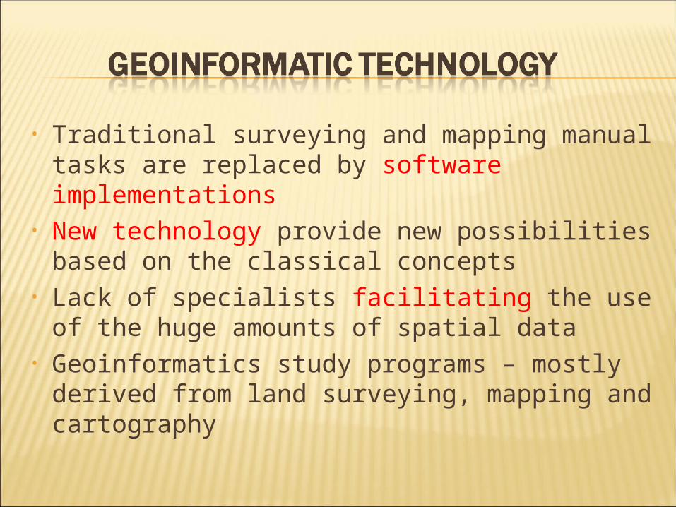
• Traditional surveying and mapping manual tasks are replaced by software implementations
• New technology provide new possibilities based on the classical concepts
• Lack of specialists facilitating the use of the huge amounts of spatial data
• Geoinformatics study programs – mostly derived from land surveying, mapping and cartography

Geoinformation technology professionals
In MS programmes: not only users of technologies to run applications, but developers both technologies and applications
Project-oriented approach to geomatics education

ACTIVITY DESCRIPTION
1. Applications development
2. Data acquisition3. Data analysis
and interpretation
4. Data management
5. Visualization
1. Identify and develop tools and instruments to satisfy user needs
2. Collect geospatial and related data
3. Process data to get information for decision-making
4. Catalogue, archive, retrieve, and distribute geospatial data
5. Render data and information into visual geospatial representations.

Two major problems creating „vicious circle“: – lack of true specialists in spatial data systems
with overall understanding of GIS technology• specialists understanding the new solutions are
bound with commercial companies– difficulty to provide students with the ability to
study the technologies with as little limitations as possible• teachers are not able to address concepts of
software implementations production of users of the commercial systems rather than new specialists
How to escape the circle ?

Should be used with care in teaching of basic GI concepts as it tends to operate and interact with closed
software products through different kinds of buttons and text fields
hide internals of the solution inclining them to be considered unimportant or even disturbing

Should be preferred against GUI at university level programs in geoinformatics play a vital role in informatics required for four from all five activities how to read and navigate through an code and
use it in order to get the desired spatial information
A one mean: research software platform GRIFINOR Used in new MS courses in geoinformatics at
Aalborg University and at Charles‘ University in Prague
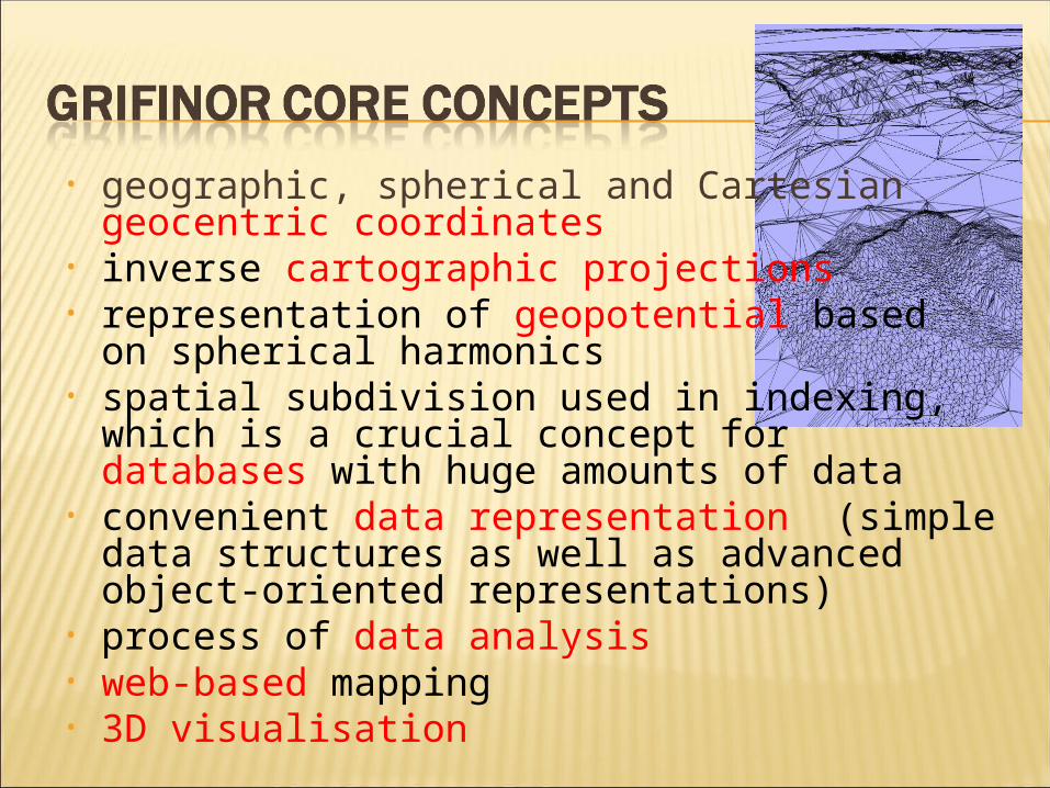
• geographic, spherical and Cartesian geocentric coordinates
• inverse cartographic projections• representation of geopotential based
on spherical harmonics • spatial subdivision used in indexing, which is
a crucial concept for databases with huge amounts of data
• convenient data representation (simple data structures as well as advanced object-oriented representations)
• process of data analysis• web-based mapping• 3D visualisation

• System of a “real” virtual reality • Generalization of the task of providing
geoinformation resulting in a geometric model of the reality, instantly visualized in an interactive geo-referenced 3D scene
• Linkage of the 3D model with – data stored in databases– analytical functions – resources available on the Web
• Interoperability: supports the most used data representations and processing functions
• Open source 3D virtual globe platform


• GRIFINOR is provided over the Internet in form of source code in Java language
• With use of integrated development environment (Eclipse IDE), the source code can be explained and demonstrated visually
• Individual components are hierarchically organized

Examples of potential themes:
1. Coordination systems: Georeferencing initiative available on the web Improvement of the topo surface representation More map projections to drape image on the
surface
2. Application oriented data analysis3. Visualisation
Rendering of video and sound data in 3D scene Influence of rendering parameters (e.g. lighting,
color) Multi-resolution representation of lines Path definition for motion through the 3D scene

can be used freely by anybody interested
under Lesser General Public License universities have a duty to use such kind
of software for three reasons direct students on the path to self reliance
and NOT to end as a qualified user of icons higher quality of education can be cheaper

Everybody is invited to try GRIFINOR and point out its weaknesses and drawbacks
for education in practice at www.grifinor.net
THANK YOU FOR YOUR ATTENTION!
Related Documents
![Josef Prošek [Jan Řezáč (ed.), Oldřich Hlavsa (graphic design)] : «Paříž v Paříži», Prague, Mladá fr](https://static.cupdf.com/doc/110x72/57906ce41a28ab68748d8951/josef-prosek-jan-rezac-ed-oldrich-hlavsa-graphic-design-pariz.jpg)