Powered by TCPDF (www.tcpdf.org)

Welcome message from author
This document is posted to help you gain knowledge. Please leave a comment to let me know what you think about it! Share it to your friends and learn new things together.
Transcript
Powered by TCPDF (www.tcpdf.org)
SGS
Typewritten text
Vol. 2 No. 4 Year 2017
SGS
Typewritten text
ISSN 2455-2798
INDIAN JOURNAL
OF
Archaeology Vol. 2 No. 4 Year 2017
(Peer reviewed e-journal)
INDIAN JOURNAL OF ARCHAEOLOGY Vol.2, No. 4 Year 2017
(Peer reviewed e-journal)
Chief Editor
Vijay Kumar
Editors
Dr. M.K. Pundhir
Dr. Rakesh Srivastava
:: Published by ::
National Trust for Promotion of Knowledge
Lucknow
Year : 2017
Vol. 2, No. 4
Date of Publication: 15-10-2017
ISSN : 2455-2797
© National Trust for Promotion of Knowledge.
Disclaimer: The Editors are not responsible for the opinions expressed by the contributors.
Address : C-2460, Indra Nagar, Lucknow
Price: N/A
Publisher: National Trust for Promotion of Knowledge.
E-mail: [email protected], [email protected] Web: www.ijarch.org
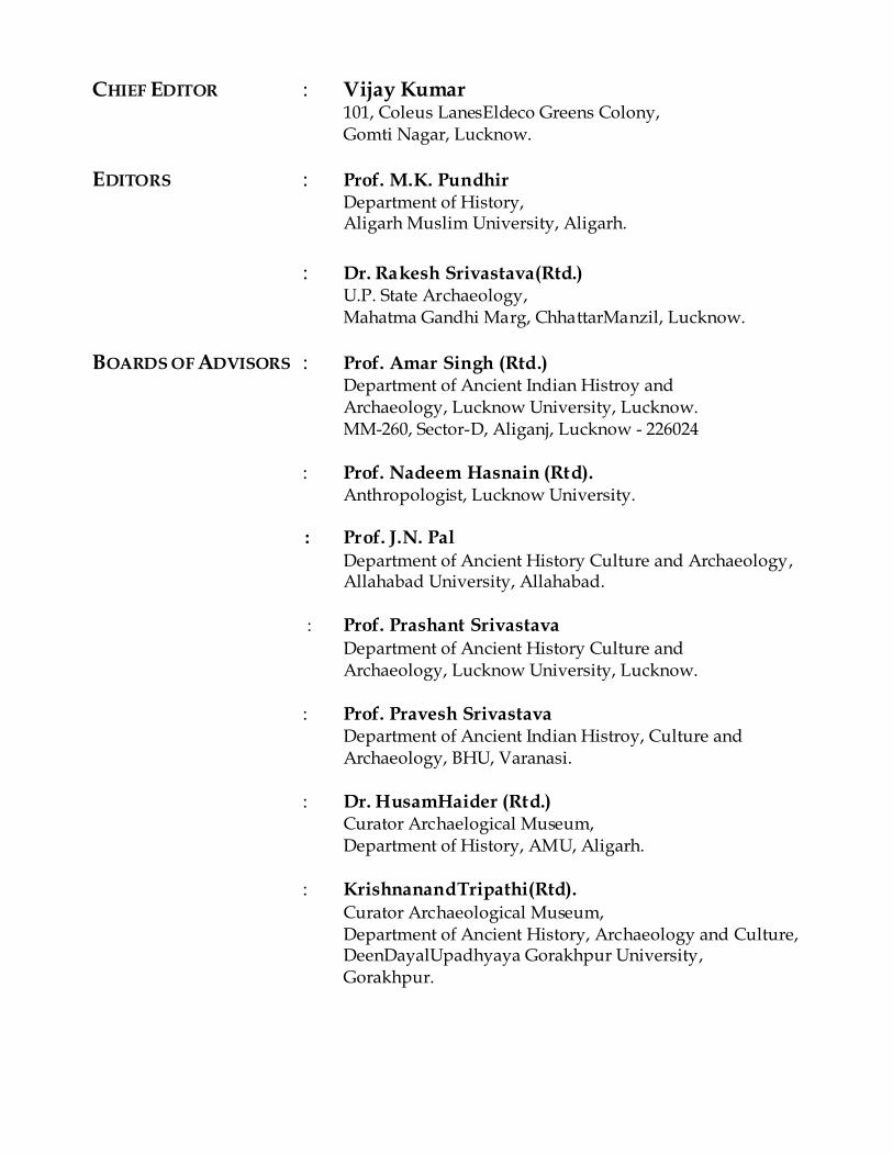
CHIEF EDITOR : Vijay Kumar 101, Coleus LanesEldeco Greens Colony, Gomti Nagar, Lucknow.
EDITORS : Prof. M.K. Pundhir Department of History, Aligarh Muslim University, Aligarh.
: Dr. Rakesh Srivastava(Rtd.) U.P. State Archaeology, Mahatma Gandhi Marg, ChhattarManzil, Lucknow.
BOARDS OF ADVISORS : Prof. Amar Singh (Rtd.) Department of Ancient Indian Histroy and Archaeology, Lucknow University, Lucknow. MM-260, Sector-D, Aliganj, Lucknow - 226024
: Prof. Nadeem Hasnain (Rtd). Anthropologist, Lucknow University.
: Prof. J.N. Pal Department of Ancient History Culture and Archaeology, Allahabad University, Allahabad. : Prof. Prashant Srivastava Department of Ancient History Culture and Archaeology, Lucknow University, Lucknow.
: Prof. Pravesh Srivastava Department of Ancient Indian Histroy, Culture and Archaeology, BHU, Varanasi.
: Dr. HusamHaider (Rtd.) Curator Archaelogical Museum, Department of History, AMU, Aligarh.
: KrishnanandTripathi(Rtd). Curator Archaeological Museum,
Department of Ancient History, Archaeology and Culture, DeenDayalUpadhyaya Gorakhpur University, Gorakhpur.
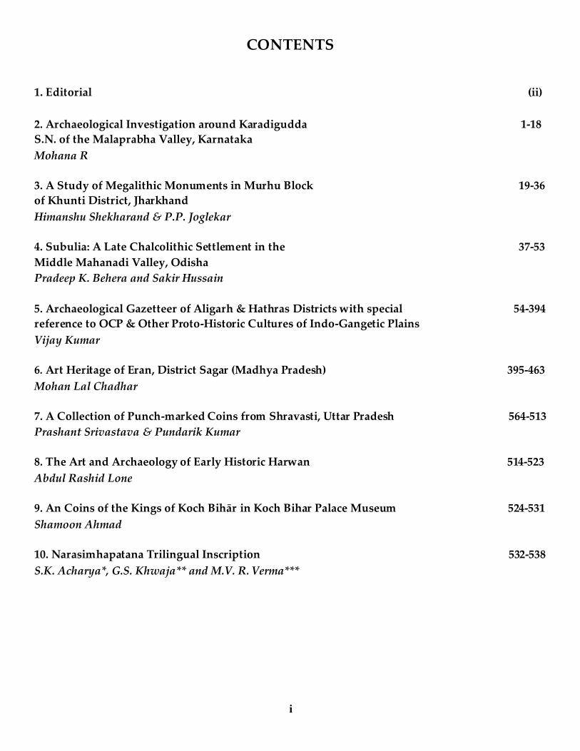
CONTENTS
1. Editorial (ii)
2. Archaeological Investigation around Karadigudda 1-18
S.N. of the Malaprabha Valley, Karnataka
Mohana R
3. A Study of Megalithic Monuments in Murhu Block 19-36
of Khunti District, Jharkhand
Himanshu Shekharand & P.P. Joglekar
4. Subulia: A Late Chalcolithic Settlement in the 37-53
Middle Mahanadi Valley, Odisha
Pradeep K. Behera and Sakir Hussain
5. Archaeological Gazetteer of Aligarh & Hathras Districts with special 54-394
reference to OCP & Other Proto-Historic Cultures of Indo-Gangetic Plains
Vijay Kumar
6. Art Heritage of Eran, District Sagar (Madhya Pradesh) 395-463
Mohan Lal Chadhar
7. A Collection of Punch-marked Coins from Shravasti, Uttar Pradesh 564-513
Prashant Srivastava & Pundarik Kumar
8. The Art and Archaeology of Early Historic Harwan 514-523
Abdul Rashid Lone
9. An Coins of the Kings of Koch Bihār in Koch Bihar Palace Museum 524-531
Shamoon Ahmad
10. Narasimhapatana Trilingual Inscription 532-538
S.K. Acharya*, G.S. Khwaja** and M.V. R. Verma***
i
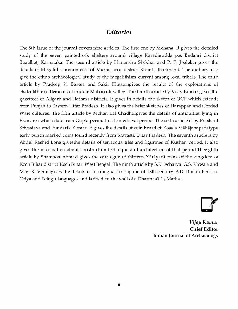
Editorial
The 8th issue of the journal covers nine articles. The first one by Mohana. R gives the detailed
study of the seven paintedrock shelters around village Karadigudda p.s. Badami district
Bagalkot, Karnataka. The second article by Himanshu Shekhar and P. P. Joglekar gives the
details of Megaliths monuments of Murhu area district Khunti, Jharkhand. The authors also
give the ethno-archaeological study of the megalithism current among local tribals. The third
article by Pradeep K. Behera and Sakir Hussaingives the results of the explorations of
chalcolithic settlements of middle Mahanadi valley. The fourth article by Vijay Kumar gives the
gazetteer of Aligarh and Hathras districts. It gives in details the sketch of OCP which extends
from Punjab to Eastern Uttar Pradesh. It also gives the brief sketches of Harappan and Corded
Ware cultures. The fifth article by Mohan Lal Chadhargives the details of antiquities lying in
Eran area which date from Gupta period to late medieval period. The sixth article is by Prashant
Srivastava and Pundarik Kumar. It gives the details of coin hoard of Kośala Māhājanapadatype
early punch marked coins found recently from Sravasti, Uttar Pradesh. The seventh article is by
Abdul Rashid Lone givesthe details of terracotta tiles and figurines of Kushan period. It also
gives the information about construction technique and architecture of that period.Theeighth
article by Shamoon Ahmad gives the catalogue of thirteen Nārāyanī coins of the kingdom of
Koch Bihar district Koch Bihar, West Bengal. The ninth article by S.K. Acharya, G.S. Khwaja and
M.V. R. Vermagives the details of a trilingual inscription of 18th century A.D. It is in Persian,
Oriya and Telugu languages and is fixed on the wall of a Dharmaśālā / Matha.
Vijay Kumar
Chief Editor Indian Journal of Archaeology
ii
Indian Journal of Archaeology
1 | P a g e w w w . i j a r c h . o r g
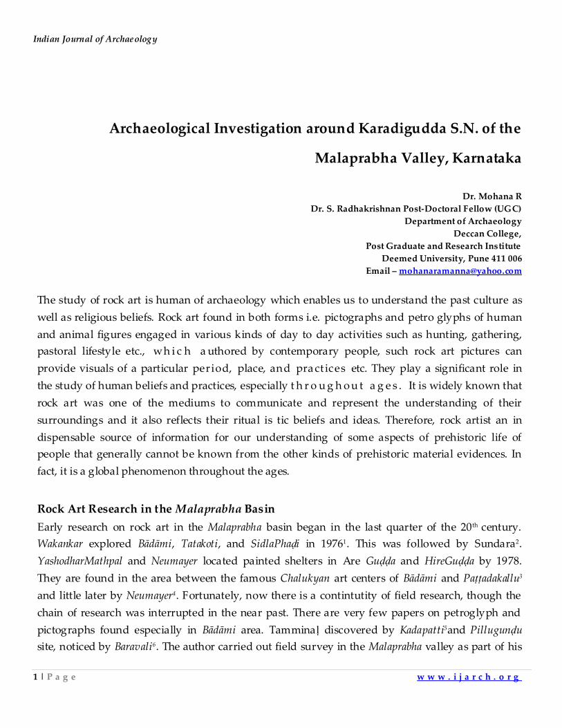
Archaeological Investigation around Karadigudda S.N. of the
Malaprabha Valley, Karnataka
Dr. Mohana R
Dr. S. Radhakrishnan Post-Doctoral Fellow (UGC)
Department of Archaeology
Deccan College,
Post Graduate and Research Institute
Deemed University, Pune 411 006
Email – [email protected]
The study of rock art is human of archaeology which enables us to understand the past culture as
well as religious beliefs. Rock art found in both forms i.e. pictographs and petro glyphs of human
and animal figures engaged in various kinds of day to day activities such as hunting, gathering,
pastoral lifestyle etc., wh i c h a uthored by contemporary people, such rock art pictures can
provide visuals of a particular period, place, and pract ices etc. They play a significant role in
the study of human beliefs and practices, especially t h r o u g h o u t a g e s . It is widely known that
rock art was one of the mediums to communicate and represent the understanding of their
surroundings and it also reflects their ritual is tic beliefs and ideas. Therefore, rock artist an in
dispensable source of information for our understanding of some aspects of prehistoric life of
people that generally cannot be known from the other kinds of prehistoric material evidences. In
fact, it is a global phenomenon throughout the ages.
Rock Art Research in the Malaprabha Basin
Early research on rock art in the Malaprabha basin began in the last quarter of the 20th century.
Wakankar explored Bādāmi, Tatakoti, and SidlaPhaḍi in 19761. This was followed by Sundara2.
YashodharMathpal and Neumayer located painted shelters in Are Guḍḍa and HireGuḍḍa by 1978.
They are found in the area between the famous Chalukyan art centers of Bādāmi and Paṭṭadakallu3
and little later by Neumayer4. Fortunately, now there is a contintutity of field research, though the
chain of research was interrupted in the near past. There are very few papers on petroglyph and
pictographs found especially in Bādāmi area. Tamminaḷ discovered by Kadapatti5and Pillugunḍu
site, noticed by Baravali6. The author carried out field survey in the Malaprabha valley as part of his
Archaeological Investigation around Karadigudda S.N. of the Malaprabha Valley, Karnataka
2 | P a g e w w w . i j a r c h . o r g
doctoral programe during 2011-2015. The intensive and systematically comprehensive field work
has resulted in the discovery of 90 localities in 35 rock art sites7.
Karadigudda S.N.
Karadigudda S.N. located 13 km to the west of Badami. Three sites have been noticed in and around
the village i.e. Pillugundu, Ramdevrugunḍu, and TayyavvanaPhadi.
Pillugundu
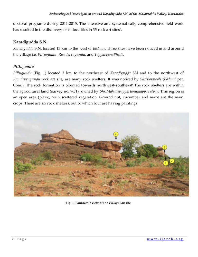
Pillugunḍu (Fig. 1) located 3 km to the northeast of Karaḍiguḍḍa SN and to the northwest of
Ramdevrugunḍu rock art site, are many rock shelters. It was noticed by ShriBarawali (Badami per.
Com.). The rock formation is oriented towards northwest-southeast8.The rock shelters are within
the agricultural land (survey no. 96/1), owned by ShriMahadevappaHanumappaTalvar. This region is
an open area (plain), with scattered vegetation. Ground nut, cucumber and maze are the main
crops. There are six rock shelters, out of which four are having paintings.
Fig. 1. Panoramic view of the Pillugunḍu site
Indian Journal of Archaeology
3 | P a g e w w w . i j a r c h . o r g
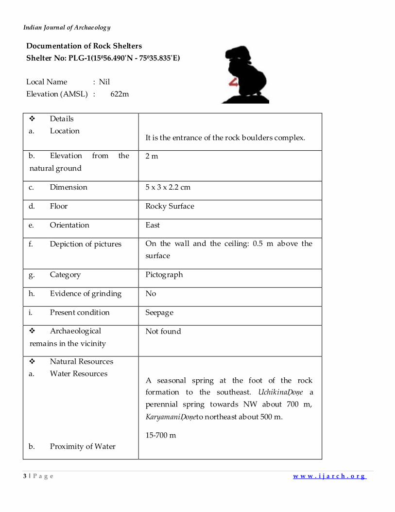
Documentation of Rock Shelters
Shelter No: PLG-1(15⁰56.490ʹN - 75⁰35.835ʹE)
Local Name : Nil
Elevation (AMSL) : 622m
Details
a. Location
It is the entrance of the rock boulders complex.
b. Elevation from the
natural ground
2 m
c. Dimension 5 x 3 x 2.2 cm
d. Floor Rocky Surface
e. Orientation East
f. Depiction of pictures On the wall and the ceiling: 0.5 m above the
surface
g. Category Pictograph
h. Evidence of grinding No
i. Present condition Seepage
Archaeological
remains in the vicinity
Not found
Natural Resources
a. Water Resources
b. Proximity of Water
A seasonal spring at the foot of the rock
formation to the southeast. UchikinaḌoṇe a
perennial spring towards NW about 700 m,
KaryamaniḌoṇeto northeast about 500 m.
15-700 m
Archaeological Investigation around Karadigudda S.N. of the Malaprabha Valley, Karnataka
4 | P a g e w w w . i j a r c h . o r g
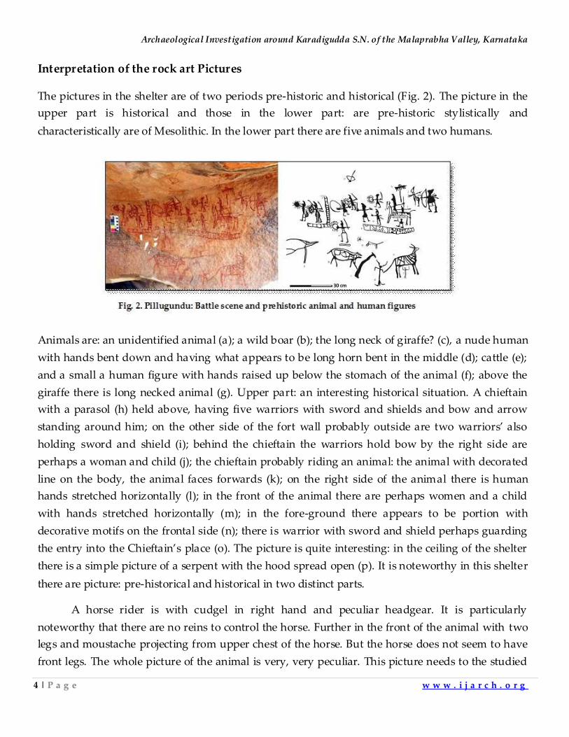
Interpretation of the rock art Pictures
The pictures in the shelter are of two periods pre-historic and historical (Fig. 2). The picture in the
upper part is historical and those in the lower part: are pre-historic stylistically and
characteristically are of Mesolithic. In the lower part there are five animals and two humans.
Animals are: an unidentified animal (a); a wild boar (b); the long neck of giraffe? (c), a nude human
with hands bent down and having what appears to be long horn bent in the middle (d); cattle (e);
and a small a human figure with hands raised up below the stomach of the animal (f); above the
giraffe there is long necked animal (g). Upper part: an interesting historical situation. A chieftain
with a parasol (h) held above, having five warriors with sword and shields and bow and arrow
standing around him; on the other side of the fort wall probably outside are two warriors’ also
holding sword and shield (i); behind the chieftain the warriors hold bow by the right side are
perhaps a woman and child (j); the chieftain probably riding an animal: the animal with decorated
line on the body, the animal faces forwards (k); on the right side of the animal there is human
hands stretched horizontally (l); in the front of the animal there are perhaps women and a child
with hands stretched horizontally (m); in the fore-ground there appears to be portion with
decorative motifs on the frontal side (n); there is warrior with sword and shield perhaps guarding
the entry into the Chieftain’s place (o). The picture is quite interesting: in the ceiling of the shelter
there is a simple picture of a serpent with the hood spread open (p). It is noteworthy in this shelter
there are picture: pre-historical and historical in two distinct parts.
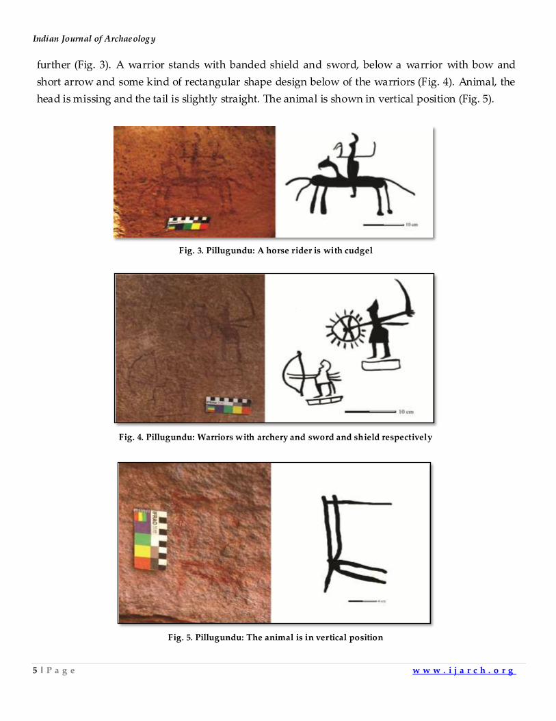
A horse rider is with cudgel in right hand and peculiar headgear. It is particularly
noteworthy that there are no reins to control the horse. Further in the front of the animal with two
legs and moustache projecting from upper chest of the horse. But the horse does not seem to have
front legs. The whole picture of the animal is very, very peculiar. This picture needs to the studied
Indian Journal of Archaeology
5 | P a g e w w w . i j a r c h . o r g
further (Fig. 3). A warrior stands with banded shield and sword, below a warrior with bow and
short arrow and some kind of rectangular shape design below of the warriors (Fig. 4). Animal, the
head is missing and the tail is slightly straight. The animal is shown in vertical position (Fig. 5).
Fig. 3. Pillugundu: A horse rider is with cudgel
Fig. 4. Pillugundu: Warriors with archery and sword and shield respectively
Fig. 5. Pillugundu: The animal is in vertical position
Archaeological Investigation around Karadigudda S.N. of the Malaprabha Valley, Karnataka
6 | P a g e w w w . i j a r c h . o r g
Shelter No: PLG 2 (15⁰56.494ʹN - 75⁰35.829ʹE)
Local Name : Nil
Elevation (AMSL) : 623m
Details
a. Location
The shelter is formed by a huge boulder which
is resting to the west of PLG-1.
b. Elevation from the
natural ground
2 m
c. Dimension 4.5 x 2.3 x 1.6 m
d. Floor Rocky Surface
e. Orientation Northeast
f. Depiction of pictures On the wall: 0.6 m above the surface
g. Category Pictograph
h. Evidence of grinding No
i. Present condition High Seepage
Natural Resources
a. Water Resources
b. Proximity of Water
A seasonal spring at foot of rock formation to
the southeast. UchikinaḌoṇe (perennial spring)
towards northwest about 700 m,
KaryamaniḌoṇeto northeast 500 m.
15-500 m
Indian Journal of Archaeology
7 | P a g e w w w . i j a r c h . o r g
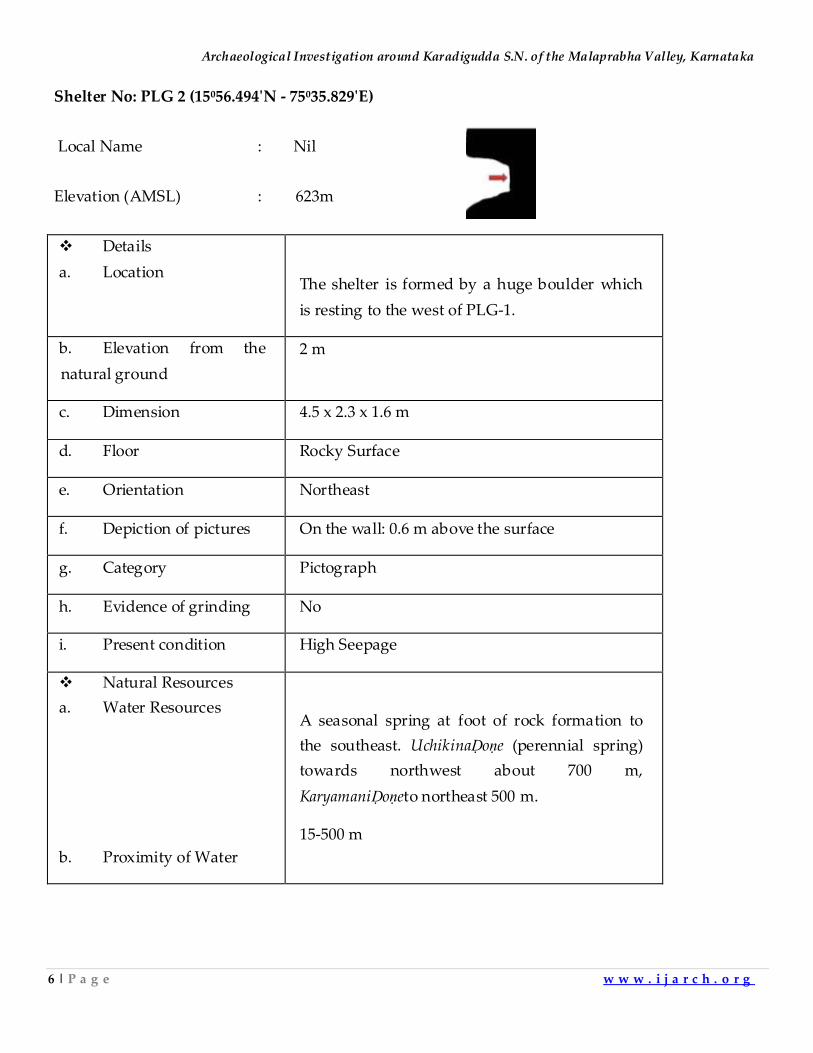
An abstract human figure is of ‘X’ type and a Hanuman deity (?); probably picture done by some
villager (Fig. 6). An animal with short tail and frontal legs and the head are missing (Fig. 7). A deer
raised head upwards and stripes on the body (Fig. 8).
Fig. 6. Pillugundu: Human and deity
Fig. 7. An animal with short tail
Fig. 8. A deer in linear
Archaeological Investigation around Karadigudda S.N. of the Malaprabha Valley, Karnataka
8 | P a g e w w w . i j a r c h . o r g
Shelter No: PLG-3(15⁰56.496ʹN - 75⁰35.820ʹE)
Local Name : Nil
Elevation (AMSL) : 622 m
Details
a. Location
To the left of PLG-2 about 10 m away.
b. Elevation from the
natural ground
1.2 m
c. Dimension 3 x 5 x 2 m
d. Floor Rocky Surface
e. Orientation West
f. Depiction of pictures On the wall and the ceiling: 0.7 m above the
surface.
g. Category Pictograph
h. Evidence of grinding No
i. Present condition High Seepage
Natural Resources
a. Water Resources
b. Proximity of Water
A seasonal spring at foot of rock formation to
the southeast.
15 m.
Indian Journal of Archaeology
9 | P a g e w w w . i j a r c h . o r g
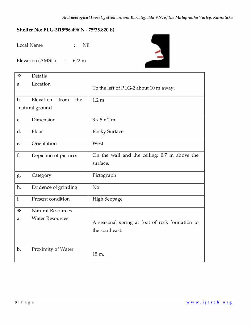
Three human figures are in different style and probably an animal show in lines (Fig. 9). A dog
raised head upward with ears and warped tail (Fig. 10). Probably an antelope is with short horns
(Fig. 11).
Fig. 9:Pillugundu: Human figures and probably an animal
Fig. 10. Pillugundu: Probably a dog.
Fig. 11. Pillugundu: An antelope
Archaeological Investigation around Karadigudda S.N. of the Malaprabha Valley, Karnataka
10 | P a g e w w w . i j a r c h . o r g
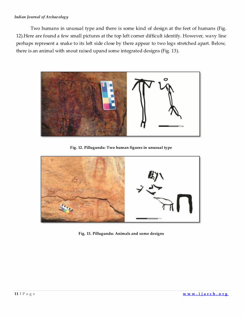
Shelter No: PLG-4(15⁰56.490ʹN - 75⁰35.835ʹE)
Local Name : Paḍiyammaphaḍi
Elevation (AMSL) : 625m
Details
a. Location
120 m north of PLG-1. This shelter is
dedicated to the local deity known as
Paḍiyamma. Around the goddess some
designs are depicted by local people.
b. Elevation from the
natural ground
3.2 m
c. Dimension 3 x 2.8 x 1.6 m
d. Floor Rocky Surface
e. Orientation East
f. Depiction of pictures On the wall: 3.5 m above the surface
g. Category Pictograph
h. Evidence of
grinding
No
i. Present condition Damaged by Natural factors
Natural Resources
a. Water Resources
b. Proximity of Water
A seasonal spring at foot of rock
formation to the southeast.
UchikinaḌoṇe towards northwest
about 700 m, KaryamaniḌoṇeto the
northeast 500 m away.
15-500 m
Indian Journal of Archaeology
11 | P a g e w w w . i j a r c h . o r g
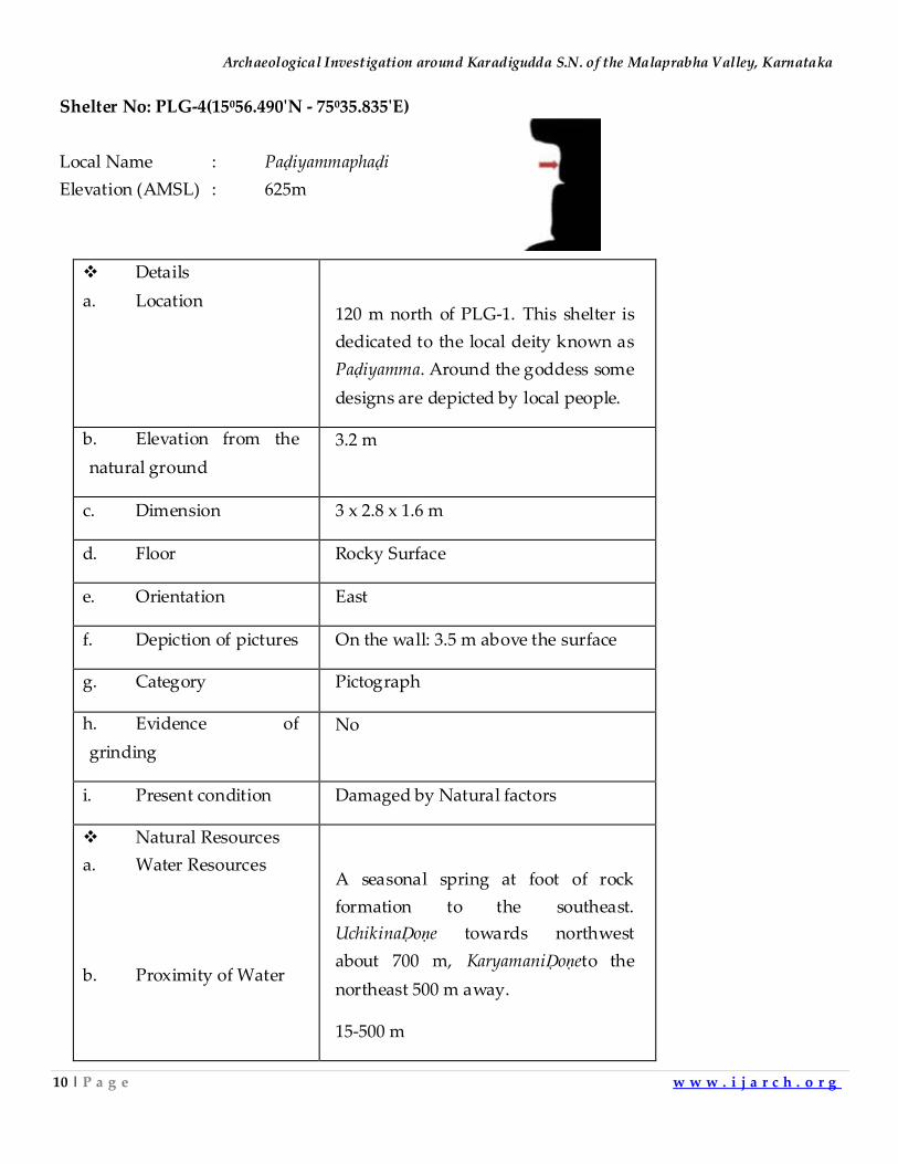
Two humans in unusual type and there is some kind of design at the feet of humans (Fig.
12).Here are found a few small pictures at the top left corner difficult identify. However, wavy line
perhaps represent a snake to its left side close by there appear to two legs stretched apart. Below,
there is an animal with snout raised upand some integrated designs (Fig. 13).
Fig. 12. Pillugundu: Two human figures in unusual type
Fig. 13. Pillugundu: Animals and some designs
Archaeological Investigation around Karadigudda S.N. of the Malaprabha Valley, Karnataka
12 | P a g e w w w . i j a r c h . o r g
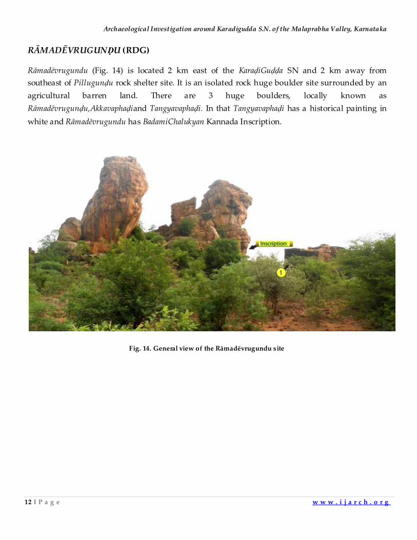
RĀMADĒVRUGUNḌU (RDG)
Rāmadēvrugundu (Fig. 14) is located 2 km east of the KaraḍiGuḍḍa SN and 2 km away from
southeast of Pillugunḍu rock shelter site. It is an isolated rock huge boulder site surrounded by an
agricultural barren land. There are 3 huge boulders, locally known as
Rāmadēvrugunḍu,Akkavaphaḍiand Tangyavaphaḍi. In that Tangyavaphaḍi has a historical painting in
white and Rāmadēvrugundu has BadamiChalukyan Kannada Inscription.
Fig. 14. General view of the Rāmadēvrugundu site
Indian Journal of Archaeology
13 | P a g e w w w . i j a r c h . o r g
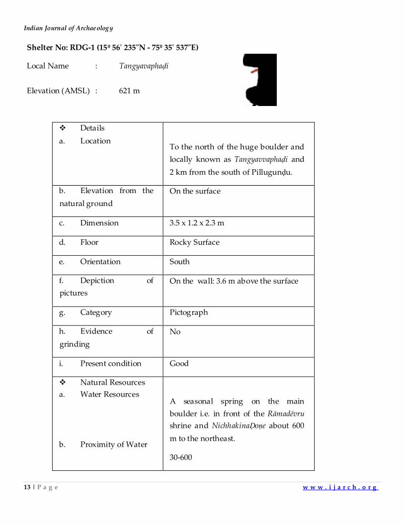
Shelter No: RDG-1 (15⁰ 56ʹ 235"N - 75⁰ 35ʹ 537"E)
Local Name : Tangyavaphaḍi
Elevation (AMSL) : 621 m
Details
a. Location
To the north of the huge boulder and
locally known as Tangyavvaphaḍi and
2 km from the south of Pillugunḍu.
b. Elevation from the
natural ground
On the surface
c. Dimension 3.5 x 1.2 x 2.3 m
d. Floor Rocky Surface
e. Orientation South
f. Depiction of
pictures
On the wall: 3.6 m above the surface
g. Category Pictograph
h. Evidence of
grinding
No
i. Present condition Good
Natural Resources
a. Water Resources
b. Proximity of Water
A seasonal spring on the main
boulder i.e. in front of the Rāmadēvru
shrine and NichhakinaḌoṇe about 600
m to the northeast.
30-600
Archaeological Investigation around Karadigudda S.N. of the Malaprabha Valley, Karnataka
14 | P a g e w w w . i j a r c h . o r g
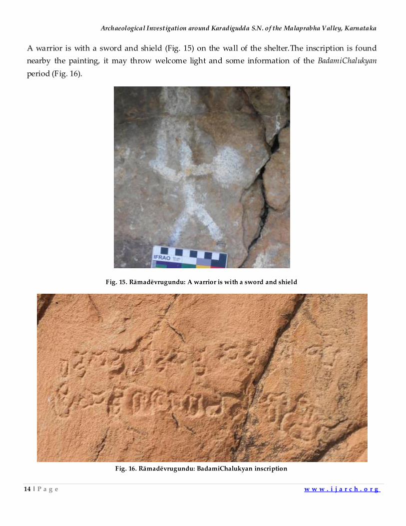
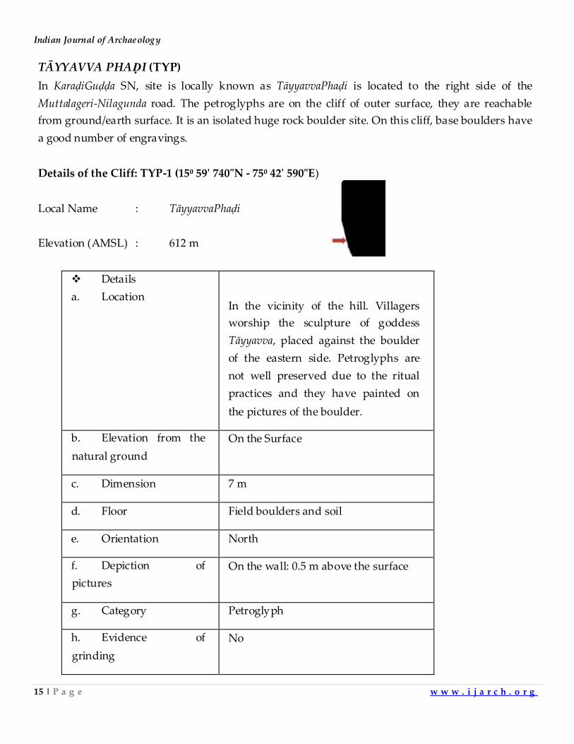
A warrior is with a sword and shield (Fig. 15) on the wall of the shelter.The inscription is found
nearby the painting, it may throw welcome light and some information of the BadamiChalukyan
period (Fig. 16).
Fig. 15. Rāmadēvrugundu: A warrior is with a sword and shield
Fig. 16. Rāmadēvrugundu: BadamiChalukyan inscription
Indian Journal of Archaeology
15 | P a g e w w w . i j a r c h . o r g
TĀYYAVVA PHAḌI (TYP)
In KaraḍiGuḍḍa SN, site is locally known as TāyyavvaPhaḍi is located to the right side of the
Muttalageri-Nilagunda road. The petroglyphs are on the cliff of outer surface, they are reachable
from ground/earth surface. It is an isolated huge rock boulder site. On this cliff, base boulders have
a good number of engravings.
Details of the Cliff: TYP-1 (15⁰ 59ʹ 740"N - 75⁰ 42ʹ 590"E)
Local Name : TāyyavvaPhaḍi
Elevation (AMSL) : 612 m
Details
a. Location
In the vicinity of the hill. Villagers
worship the sculpture of goddess
Tāyyavva, placed against the boulder
of the eastern side. Petroglyphs are
not well preserved due to the ritual
practices and they have painted on
the pictures of the boulder.
b. Elevation from the
natural ground
On the Surface
c. Dimension 7 m
d. Floor Field boulders and soil
e. Orientation North
f. Depiction of
pictures
On the wall: 0.5 m above the surface
g. Category Petroglyph
h. Evidence of
grinding
No
Archaeological Investigation around Karadigudda S.N. of the Malaprabha Valley, Karnataka
16 | P a g e w w w . i j a r c h . o r g
i. Present condition Lime wash on the wall
Natural Resources
a. Water Resources
b. Proximity of Water
HuligaviḌoṇe (a seasonal spring).
150 m to NE.
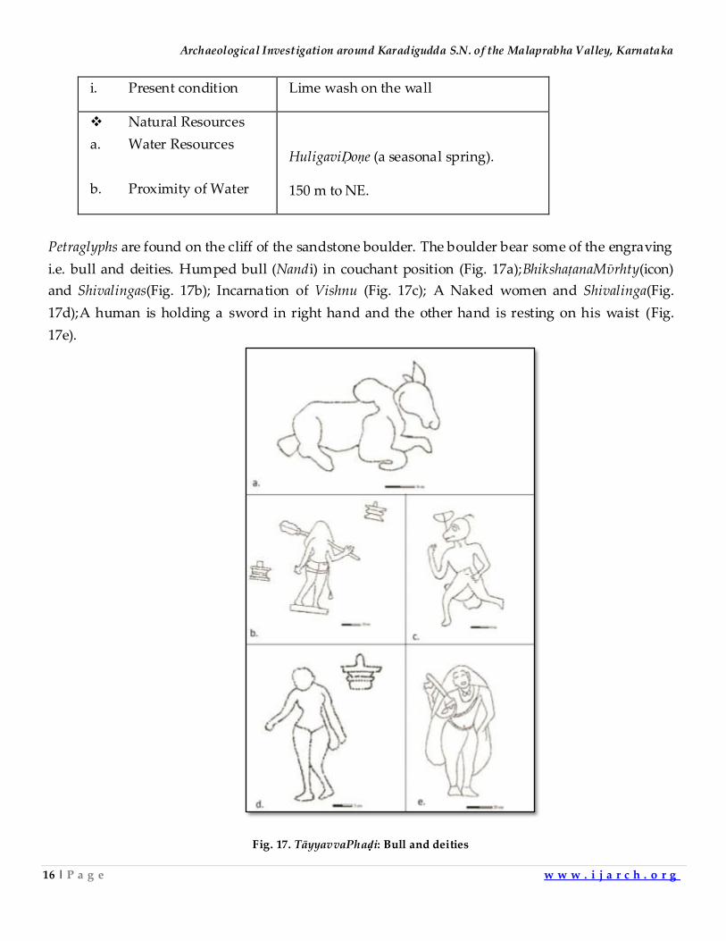
Petraglyphs are found on the cliff of the sandstone boulder. The boulder bear some of the engraving
i.e. bull and deities. Humped bull (Nandi) in couchant position (Fig. 17a);BhikshaṭanaMῡrhty(icon)
and Shivalingas(Fig. 17b); Incarnation of Vishnu (Fig. 17c); A Naked women and Shivalinga(Fig.
17d);A human is holding a sword in right hand and the other hand is resting on his waist (Fig.
17e).
Fig. 17. TāyyavvaPhaḍi: Bull and deities
Indian Journal of Archaeology
17 | P a g e w w w . i j a r c h . o r g
Discussion
The author has carried out field survey in the Malaprabha basin, Northern Karnataka. The art
reveals the past human at least goes back to late Pleistocene. Among the sites, Karadigudda S.N. is
one of the significant rock art zone of this region. The author has done comprehensive or detailed
documentation of the sites. Arrow marks of cross-section of the shelters are indicating where rock
paintings executed. Another important features i.e. all line drawings to accurate scale, done on
computer application.
Acknowledgement
I benefited from the advice of Profs. A. Sundara and Sushama G. Deo. My heartfelt thanks to Shri
Barawali and Shri.MahadevappaHanumappaTalvar because he was providing local accommodation
and permit to work on the site. I also thank Mr. D. Vinay Kumar and Mr. D.T. Shankar for field
assistance. I express my deep gratitude to Shri. IstalingaSirsi (VishwachetanaShraddha, Badami), who
provided accommodation during field survey.
References:
1. Wakankar, V.S. 1973. Rock Paintings of India. Ph.D. Dissertation. Pune: Deccan College, Post Graduate and
Research Institute; Wakankar, V.S. and R.R.R. Brooks 1976. Stone Age Painting in India. U.S.A: Yale-
Cambridge University. 2. Sundara, A. 1978. Vishista Varna Chithrakaleya Aagara : Badami (In Kannada) Chalukya Sri, Sri Pulakeshi
Vidhyavardhaka Samsthe, Badami ; Sundara, A. 1984. Some Select Rock-Paintings from North Karnataka. In:
Chakravarty. K. K (Ed.). 1984. Rock Art of India, Paintitings and Engraving. pp. 137-148. Director, Archaeology
and Museumes, Madhya Pradesh, Bhopal and Arnold-Heinemann Publishers Pvt. Ltd. New Delhi ;
Sundara, A. 1994. Karnatak: Pragitihaasa Kalada kale (Prehistoric Art in Karnataka), A Monogrpah. Bangalore,
Karnataka Lalita Kala Academy ; Sundara, A. 2006 . Karnataka Rock Art: Some Distinctive Aspects. Purakala
16, pp. 35-50. 3. Mathpal. Y. and E. Nuemayer. 1981. Mesolithic Rock Paintings, District Bijapur. Indian Archaeology: A Review
1978-79: 96.
4. Numayer, E. 1983. Prehistoric Indian Rock Paintings. Delhi: Oxford University Press ; Nuemayer, E. 1993.
Lines on Stone: The Prehistoric Rock Art of India. New Delhi: Manohar Publishers and Distributors ;
Nuemayer, E. 2010. Rock Art of India. Oxford & New Delhi: Oxford University Press.
5. Kadapatti, M.N. and S.V. Padigar. 2013. Rock Art at RanganathaGudda near Tamminal: A Preliminary
Study. Purakala 23, pp. 63-68.
6. Mohana, R. 2013. Newly Discovered Rock Art Sites in North Karnataka, India. In: Anura Manatunga and
Chamindi Dilkushi Senaratne Wettewe (Eds.), Asian Art, Culture and Heritage.International Association for
Asian Heritage, Centre for Asian Studies, University of Kelaniya, Sri Lanka, pp. 191-198.
Archaeological Investigation around Karadigudda S.N. of the Malaprabha Valley, Karnataka
18 | P a g e w w w . i j a r c h . o r g
7. Mohana, R. 2013. Opcit. pp. 191-98; Mohana, R. 2014. Mullur,
ChinchkhandiMattuEshwarappanaKolladaShilayugaSamskrutiyaOnduPutatattvikaAdhyana (In Kannada),
ItihasaDarshana 29: 10-12; Mohana, R. 2015. Reading Rock Art: Interpreting Temporal and Geographic Variability
in the Lower Malaprabha Basin, Karnataka . Ph.D. Dissertation.Pune: Deccan College, Post Graduate and
Research Institute ; Mohana, R. 2017. A Multidisciplinary Approach to the Study of Rock Art: A Case Study
of Karnataka, In: B.L. Malla and Dwipen Benzbaruah (Eds.) Cultural Ecology: Prehistory and Ethno-
archaeological context of Indian Rock Art, pp. 143-158, Published by Indira Gandhi National Centre for the
Arts, New Delhi andAryan Books International. 8. Mohana, R. 2013. Opcit. pp. 191-98.
Indian Journal of Archaeology
19 | P a g e w w w . i j a r c h . o r g
A Study of Megalithic Monuments in Murhu Block of Khunti District,
Jharkhand
Himanshu Shekharand & P.P. Joglekar
Department of A.I.H.C. and Archaeology
Deccan College, Pune 411006
E-mail: [email protected]
Introduction
Megalithic monuments are recently reported from different parts of Jharkhand, discovered by
several freelance explorers and researchers1. Apart from the ancient sites, there is a rich living
tradition of megalithism among different tribal communities, such as, the Mundas, Oraons, Birhors,
Bhumij and Hos. It is mostly related to cult of death and megaliths are raised either as bone
repositories, grave tombs or memorials. Since last two years, the first author is conducting
explorations in Ranchi and Khunti District, looking at the tribal people from ethno-archaeological
perspective2. The region is known as the land of Mundas, a community who still raises megalithic
monuments to pay respect to the deceased member of their family.This paper is an attempt to
study the megalithic culture of Jharkhand on micro-regional level in one of the six blocks of Khunti
district.
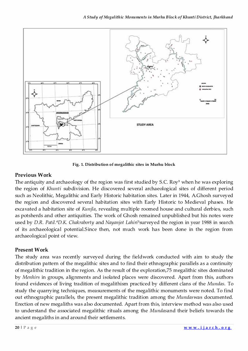
Study Area The area selected for the present work is Murhu block. It is one of the six blocks or talukasof the
Khunti district. It is surrounded by other blocksof the district; Khunti, Torpa and Arrki blocks from
north, west and east, respectively (Fig. 1). The border in South touches the boundary of Bandgaon
block of District WestSinghbhum. The landscapehas fertile plains in western part, and dense forests
and hilly areas in the east. The eastern and southern regionhas heavydry tropicalforests of Saal
(Shorearobusta), Mahua (Bassialatifolia), Karam (Adina cardifolia), Sisum (Dalbergiasissoo), etc.
Geomorphologically, the landform is represented by granite outcrops and hills. The entire region
is watered by River Tajnaand Banoi with their tributaries; Phulbu, Palol, Phuljhar.
A Study of Megalithic Monuments in Murhu Block of Khunti District, Jharkhand
20 | P a g e w w w . i j a r c h . o r g
Fig. 1. Distribution of megalithic sites in Murhu block
Previous Work
The antiquity and archaeology of the region was first studied by S.C. Roy3 when he was exploring
the region of Khunti subdivision. He discovered several archaeological sites of different period
such as Neolithic, Megalithic and Early Historic habitation sites. Later in 1944, A.Ghosh surveyed
the region and discovered several habitation sites with Early Historic to Medieval phases. He
excavated a habitation site of Kunjla, revealing multiple roomed house and cultural derbies, such
as potsherds and other antiquities. The work of Ghosh remained unpublished but his notes were
used by D.R. Patil.4D.K. Chakraborty and Nayanjot Lahiri5surveyed the region in year 1988 in search
of its archaeological potential.Since then, not much work has been done in the region from
archaeological point of view.
Present Work
The study area was recently surveyed during the fieldwork conducted with aim to study the
distribution pattern of the megalithic sites and to find their ethnographic parallels as a continuity
of megalithic tradition in the region. As the result of the exploration,75 megalithic sites dominated
by Menhirs in groups, alignments and isolated places were discovered. Apart from this, authors
found evidences of living tradition of megalithism practiced by different clans of the Mundas. To
study the quarrying techniques, measurements of the megalithic monuments were noted. To find
out ethnographic parallels, the present megalithic tradition among the Mundaswas documented.
Erection of new megaliths was also documented. Apart from this, interview method was also used
to understand the associated megalithic rituals among the Mundasand their beliefs towards the
ancient megaliths in and around their settlements.
Indian Journal of Archaeology
21 | P a g e w w w . i j a r c h . o r g
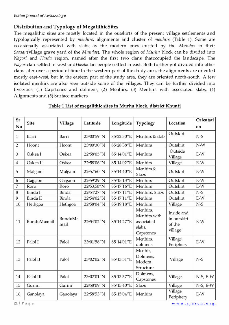
Distribution and Typology of MegalithicSites
The megalithic sites are mostly located in the outskirts of the present village settlements and
typologically represented by menhirs, alignments and cluster of menhirs (Table 1). Some are
occasionally associated with slabs as the modern ones erected by the Mundas in their
Saasan(village grave yard of the Mundas). The whole region of Murhu block can be divided into
Nagori and Hasda region, named after the first two clans thatoccupied the landscape. The
Nagoriclan settled in west andHasdaclan people settled in east. Both further got divided into other
clans later over a period of time.In the western part of the study area, the alignments are oriented
mostly east-west, but in the eastern part of the study area, they are oriented north-south. A few
isolated menhirs are also seen outside some of the villages. They can be further divided into
fivetypes: (1) Capstones and dolmens, (2) Menhirs, (3) Menhirs with associated slabs, (4)
Alignments and (5) Surface markers.
Table 1 List of megalithic sites in Murhu block, district Khunti
Sr
No Site Village Latitude Longitude Typology Location
Orientati
on
1 Barri Barri 23o00’59”N 85o22’30”E Menhirs & slab Outskirt
N-S
2 Hoont Hoont 23o00’30”N 85o28’38”E Menhirs Outskirt N-W
3 Oskea I Oskea 22o58’05”N 85o14’01”E Menhirs Outside
Village E-W
4 Oskea II Oskea 22o58’06”N 85o14’02”E Menhirs Village E-W
5 Malgam Malgam 22o57’60”N 85o14’40”E Menhirs & Slabs
Outskirt E-W
6 Gajgaon Gajgaon 22o59’29”N 85o15’13”E Menhirs Outskirt E-W
7 Roro Roro 22o53;50”N 85o17’16”E Menhirs Outskirt E-W
8 Binda I Binda 22o54’27”N 85o17’11”E Menhirs, Slabs Outskirt N-S
9 Binda II Binda 22o54’02”N 85o17’11”E Menhirs Outskirt E-W
10 Hethgoa Hethgoa 22o58’04”N 85o19’18”E Menhirs Village N-S
11 BunduMamail BunduMamail
22o54’02”N 85o14’27”E
Menhirs,
Menhirs with
associated slabs,
Capstones
Inside and
in outskirt of the
village
E-W
12 Palol I Palol 23o01’58”N 85o14’01”E Menhirs, dolmens
Village Periphery
E-W
13 Palol II Palol 23o02’02”N 85o13’51”E
Menhir,
Dolmens, Modern
Structure
Village N-S
14 Palol III Palol 23o02’01”N 85o13’57”E Dolmens, Capstones
Village N-S, E-W
15 Gurmi Gurmi 22o58’09”N 85o15’40”E Slabs Village N-S, E-W
16 Ganolaya Ganolaya 22o58’53”N 85o15’04”E Menhirs Village
Periphery E-W
A Study of Megalithic Monuments in Murhu Block of Khunti District, Jharkhand
22 | P a g e w w w . i j a r c h . o r g
17 Kota Kota 22o54’26”N 85o19’57”E Brocken
menhirs Village
18 Charid Charid 23o00’45”N 85o17’07”E
Menhir,
capstone,
Menhir with
slabs
Village E-W
19 Pokla Pokla 23o01’19”N 85o17’11”E Menhirs and
Capstones Village E-W
20 Hassa Hassa 22o59’29”N 85o16’08”E Menhirs Village E-W
21 Tumbakel Tumbakel 22o57’13”N 85o17’14”E Menhirs Village E-W
22 Siankel Siankel 22o55’39”N 85o16’07”E Menhirs,
Capstone
Village
Periphery E-W
23 Tengariya Tengariya 22o56’05”N 85o17’30”E
Menhirs, Capstones,
Surface
markers
Village N-S
24 Burju I Burju 22o59’40”N 85o19’58”E Menhirs Village E-W
25 Burju II Burju 22o59’38”N 85o19’42”E Alignment Outside
village E-W
26 Burju III Burju 22o59’15”N 85o19’41”E Menhirs Outskirt E-W
27 Sirka I Sirka 22o58’02”N 85o22’48”E Menhirs, Capstones
Village N-S, E-W
28 Sirka II Sirka 22o58’00”N 85o22’59”E Menhirs Outskirt E-W
29 Balo I Balo 22o57’09”N 85o13’30”E Capstones Village N-S, E-W
30 Balo II Balo 22o57’06”N 85o13’30”E Alignments Village N-S
31 Balo III Balo 22o57’06”N 85o13’24”E Alignments Village
Periphery N-S
32 Gangira Gangira 22o57’41”N 85o13’18”E Menhirs,
Capstones Village N-S
33 Toner I Toner 22o57’32”N 85o13’15”E Menhirs Village Periphery
N-S, E-W
34 Toner II Toner 22o57’34”N 85o13’24”E Menhirs Village E-W
35 Biramkel I Biramkel 22o59’51”N 85o11’49”E Menhirs Village N-S
36 Biramkel II Biramkel 23o00’25”N 85o11’56”E Surface
Markers Outskirt
Unidenti
fied
37 Hesel Hesel 23o30’11”N 85o14’16”E Menhirs Outskirt Unidenti
fied
38 Gulu Gulu 22o52’46”N 85o15’59”E Menhir with
slabs Village N-S
39 Kolmda Kolmda 22o56’18”N 85o15’46”E Menhirs Village N-S, E-W
40 Limda Limda 22o53’15”N 85o16’60”E Menhirs Outskirt E-W
41 Panchghag Panchgha
g 22o56’48”N 85o15’39”E Menhir Outskirt E-W
42 Koyongsar Koyongsar
22o52’08”N 85o14’24”E Menhir Outskirt N-S
43 Sanrigaon Sanrigaon 23o53’42”N 85o18’30”E Menhirs,
Capstones Village E-W
Indian Journal of Archaeology
23 | P a g e w w w . i j a r c h . o r g
44 Chichigara Chichigar
a 22o57’56”N 85o21’13”E Menhir Village N-S
45 Goratoli Goratoli 22o58’41”N 85o17’26”E Menhir Outskirt N-S
46 Jiuri Jiuri 22o59’54”N 85o23’37”E Menhirs,
Capstones
Village
Periphery N-S
47 Kuda Kuda 22o59’47”N 85o23’37”E Menhir Outskirt E-W
48 Namsili Namsili 22o58’49”N 85o24’10”E Menhirs Outskirt E-W
49 Mailadih Mailadih 22o58’12”N 85o22’29”E Menhir with
slab village N-S
50 Barutoli Barutoli 23o00’52”N 85o20’09”E Capstones Village N-S, E-W
51 Digri Digri 23o03’27”N 85o21’54”E Menhirs Outskirt E-W
52 Ulidih Ulidih 23o01’59”N 85o21’19”E Menhir Outskirt N-S
53 Jikilata Jikilata 23o01’56”N 85o21’37”E Menhir Village N-S
54 Kudahatu Kudahatu 23o05’01”N 85o23’26”E Menhirs,
Capstones Village N-S, E-W
55 Mailburu Mailburu 23o02’17”N 85o22’01”E Capstones Village N-S, E-W
56 Baruhatu Baruhatu 22o55’04”N 85o21’18”E Menhirs Village N-S, E-W
57 Chendagutu Chendagu
tu 22o55’60”N 85o19’58”E
Alignments,
Menhirs,
Menhirs with
slabs
Village
Periphery N-S, E-W
58 Jenwopiri Jenwopiri 22o54’34”N 85o22’51”E
Menhirs, Small
cairn circle
with double menhirs
Outskirt N-S, E-W
59 Keora Keora 22o54’54”N 85o22’41”E Menhir Village N-S
60 Kulipiri Kulipiri 22o54’49”N 85o20’02”E Alignment Village
periphery N-S
61 Serwada Serwada 22o55’40”N 85o19’23”E Menhirs Outskirt E-W
62 Maliad Maliyad 22o57’03”N 85o18’02”E
Menhir,
Capstones,
Dolmens, Menhir with
slab
Outskirt N-S, E-W
63 Murud Murud 22o56’01”N 85o20’17”E Dolmen,
Menhirs
Village and
Outskirt E-W, N-S
64 Barde Barde 22o57’21”N 85o16’40”E Menhir Village
Periphery E-W
65 Dudri Dudri 22o57’49”N 85o16’51”E Menhir Village Periphery
W-E
66 Chamratoli Chamratol
i 22o58’50”N 85o16’35”E Menhir Outskirt N-S
67 Bahmni Bahmni 22o57’05”N 85o14’37”E Capstone Village E-W
68 Bishunpur Bishunpur 22o58’44”N 85o12’44”E Menhirs Village E-W
69 Meral Meral 23o01’18”N 85o15’24”E Menhirs with
slabs Village E-W
A Study of Megalithic Monuments in Murhu Block of Khunti District, Jharkhand
24 | P a g e w w w . i j a r c h . o r g
70 Jate Jate 22o55’17”N 85o16’01”E Menhirs with
slabs
Outside
village E-W
71 Kumhardih Kumhardi
h 22o51’45”N 85o13’54”E Menhirs Village N-S
72 Marangtoli Marangtoli
22o58’28”N 85o18’09”E Menhir Outskirt N-S
73 Otangora Otangora 23o00’15”N 85o22’25”E Menhir Outskirt N-S
74 Tontopiri Tontopiri 23o01’06”N 85o23’25”E Dolmen Outskirt N-S
75 Darla Darla 22o59’40”N 85o12’29”E Menhirs Village E-W
Capstones and dolmens
Capstones and dolmens are known as Saasandiri in Mundari terminology.Theseare used as clan-
cists where ritual of secondary burial of bones is performed. They are found either inside village
graveyards of the Mundas or isolated places near the village. They are closely related to the
ancestral Munda community and mostly found in context of modern slabs and dolmens. Their
shapes are rectangular or roughly circular; with varied sizes in length, breadth and thickness.
Some of the capstones have cup marks in bilinear or irregular pattern over the surface. Dolmens
have four or more vertical stones on the edges and sometimes boulders are also used to support
the capstone and they acts as an orthostat. In some regions, they also have cupules comparatively
bigger than those found on capstones and sometimes the depth goes up to more than 20 cm.
Menhirs
Menhirs are known as Bid-diri or Biridiri in Mundari language. These are found in and around the
village or away from the settlement area. These are mostly found in clusters or in isolation. These
are either oriented towards east-west or north-south in clusters or are seen standing alone. These
can be found inside the village as a memorialof a person of some sort of higher status in society or
away from the settlements, believed to be erected for the person who died due to unnatural cause.
Menhirs with Associated Slabs
This type is closer to present-day structures erected by the Mundasand seems to be a later addition
to the previously mentioned typology. Such types are found inside village, on outskirts of the
village and even inside dense forests. There are various legends regarding these structureslocated
away from village settlements. These are erected in memory of person whodied due to snake bite,
murdered or by killed by a tiger. The person who dies in such conditions is thought to turn into
mua or baghaiyabonga who haunts and hurts the living people. The Mundas cremate or bury such
victims on outskirts of the village to avoid the mis-happenings. Such structures were found in the
jungle and outskirts of BunduMamail village.
Alignments
This type is represented by menhirs standing in east-west alignment and in some places
havenorth-south orientation. They are always found either at the entrance of villages or away
Indian Journal of Archaeology
25 | P a g e w w w . i j a r c h . o r g
from the settlement area in or around the crop fields. Many of such sites were discovered in and
around the villages, such as Balo, Burju and Hassa.
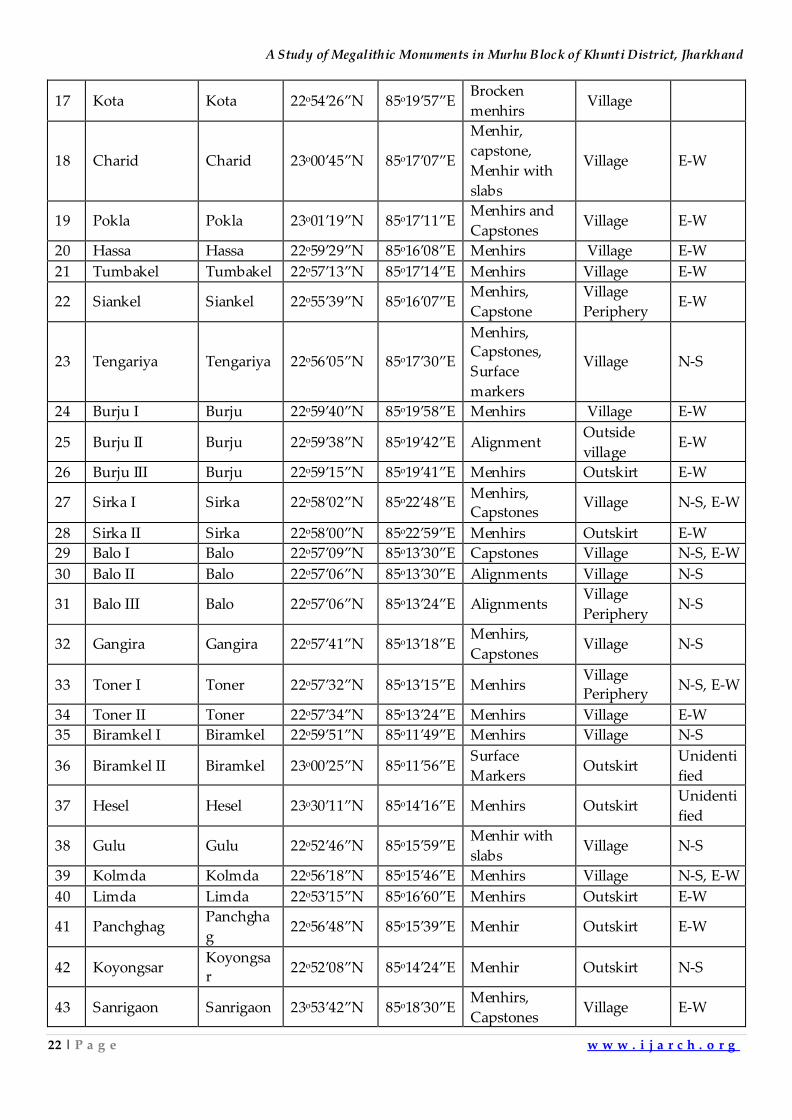
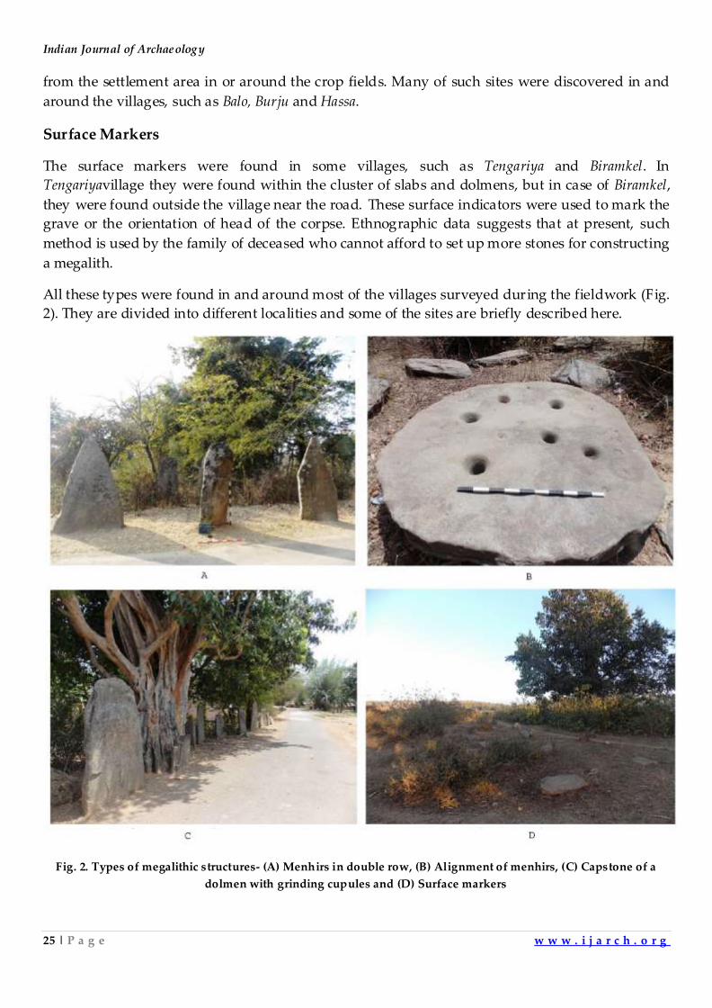
Surface Markers
The surface markers were found in some villages, such as Tengariya and Biramkel. In
Tengariyavillage they were found within the cluster of slabs and dolmens, but in case of Biramkel,
they were found outside the village near the road. These surface indicators were used to mark the
grave or the orientation of head of the corpse. Ethnographic data suggests that at present, such
method is used by the family of deceased who cannot afford to set up more stones for constructing
a megalith.
All these types were found in and around most of the villages surveyed during the fieldwork (Fig.
2). They are divided into different localities and some of the sites are briefly described here.
Fig. 2. Types of megalithic structures- (A) Menhirs in double row, (B) Alignment of menhirs, (C) Capstone of a
dolmen with grinding cupules and (D) Surface markers
A Study of Megalithic Monuments in Murhu Block of Khunti District, Jharkhand
26 | P a g e w w w . i j a r c h . o r g
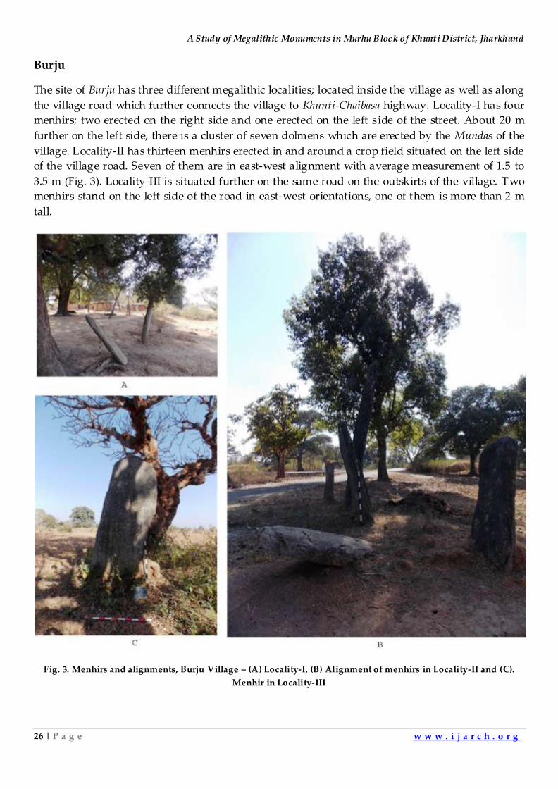
Burju
The site of Burju has three different megalithic localities; located inside the village as well as along
the village road which further connects the village to Khunti-Chaibasa highway. Locality-I has four
menhirs; two erected on the right side and one erected on the left side of the street. About 20 m
further on the left side, there is a cluster of seven dolmens which are erected by the Mundas of the
village. Locality-II has thirteen menhirs erected in and around a crop field situated on the left side
of the village road. Seven of them are in east-west alignment with average measurement of 1.5 to
3.5 m (Fig. 3). Locality-III is situated further on the same road on the outskirts of the village. Two
menhirs stand on the left side of the road in east-west orientations, one of them is more than 2 m
tall.
Fig. 3. Menhirs and alignments, Burju Village – (A) Locality-I, (B) Alignment of menhirs in Locality-II and (C).
Menhir in Locality-III
Indian Journal of Archaeology
27 | P a g e w w w . i j a r c h . o r g
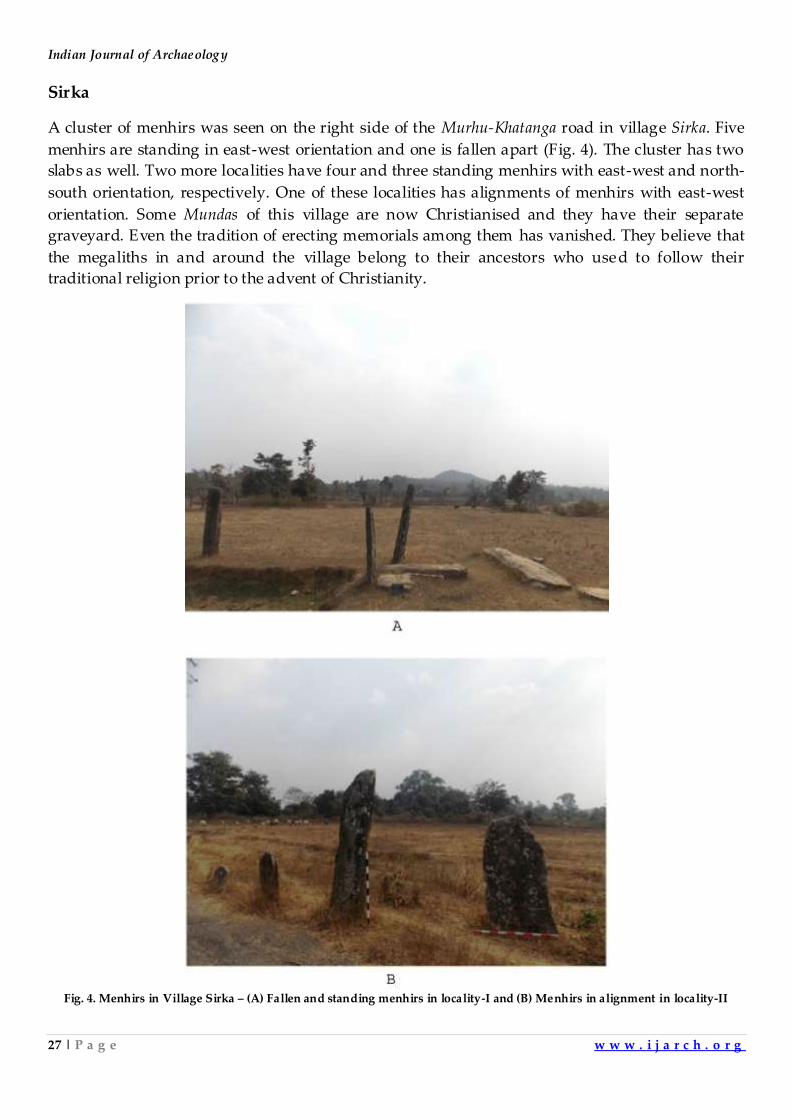
Sirka
A cluster of menhirs was seen on the right side of the Murhu-Khatanga road in village Sirka. Five
menhirs are standing in east-west orientation and one is fallen apart (Fig. 4). The cluster has two
slabs as well. Two more localities have four and three standing menhirs with east-west and north-
south orientation, respectively. One of these localities has alignments of menhirs with east-west
orientation. Some Mundas of this village are now Christianised and they have their separate
graveyard. Even the tradition of erecting memorials among them has vanished. They believe that
the megaliths in and around the village belong to their ancestors who used to follow their
traditional religion prior to the advent of Christianity.
Fig. 4. Menhirs in Village Sirka – (A) Fallen and standing menhirs in locality-I and (B) Menhirs in alignment in locality-II
A Study of Megalithic Monuments in Murhu Block of Khunti District, Jharkhand
28 | P a g e w w w . i j a r c h . o r g
Digri
The site is located on the outskirts of Digri village,where a series of menhirs were seen on both
sides of the road. One of the menhir is 2.8 m high and is made of granite.The villagers do not
know anything regarding the authorship or antiquity of these megaliths.
Hethgoa
Two menhirs were found inside Hethgoa village. But on the outskirt of the village there are six
menhirs (in two rows) in east-west orientation resembling the shape of an avenue.
Barri
A cluster of eight menhirs and a slab is located in a densely vegetated outer periphery of Barri
village on the right side of Khunti-Arrki road. The menhirs are east-west oriented. Apart from
menhirs, there was found a megalithic slab as well, oriented north- south.
Hassa
On the Murhu-Gajgaon road, eight menhirs are located on the outskirt as well as in the village,
located on both sides of a village road. No associated cultural material was found. However, these
monuments cannot be associated with the living megalithic tradition because the Mundas of this
village have their separate place for sepulchral and non-sepulchral monuments. Probably these
menhirs are related to their ancestors who were the first settlers of this village.
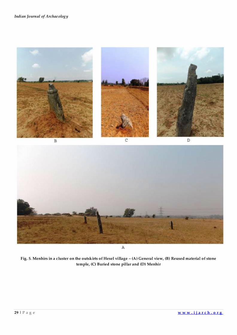
Hesel
On the outskirt ofHesel village, on the left side of Hesel-Palol road, 10 menhirs were found scattered
in a crop field. A granite outcrop was seen adjacent to the site which shows quarry marks on
surface, and perhaps stones were quarried for two menhirs of this site. Interestingly, other eight
menhirs are made by reused material of pillars of stone temples still retaining the amalakasover
them (Fig. 5). They are well-carved and could be a part of a now completely modernized stone
temple. The site yielded red-ware sherds and iron slag from the surface.
Indian Journal of Archaeology
29 | P a g e w w w . i j a r c h . o r g
Fig. 5. Menhirs in a cluster on the outskirts of Hesel village – (A) General view, (B) Reused material of stone
temple, (C) Buried stone pillar and (D) Menhir
A Study of Megalithic Monuments in Murhu Block of Khunti District, Jharkhand
30 | P a g e w w w . i j a r c h . o r g
Binda
This village is divided into two halves -Baratoli and Binda, located on both the sides of Murhu-
Bandgaon road. On the right side of the road four menhirs, two of them facing south and other two
facing west are seen erected in east-west alignment. The largest one is 2.4 m tall and the smallest
one measured around 30 cm. On the left side of the road, where the main village is located, 6
menhirs were found oriented in east-west direction. Hundred metres further to the entrance of the
village, huge menhirs were found inside the village Saasan, showing the continuation of
megalithic tradition of the Mundas. Most of the menhirs were anointed with turmeric, mustard oil
and paste of rice mixed with rice. This indicates that the traditional Diri-Chappi ceremony has been
recently performed. This is an annual function of worshipping and cleaning the megalithic
structures by the Munda tribe in the region.
Gajgaon
Further on the Murhu-Bandgaonmenhirs were found inside the village Gajgaon as well as on its
outskirt. There is an Early Historic site at Gajgaon located on the right bank of Phulbu River (a
tributary of Banoi River). Many menhirs were observed during the survey which are not a part of
living tradition, since the modern graveyard and memorials of the villagers are located elsewhere
in the village.
Kulipiri
Another site of menhirs (14) in an alignmentis located on the left side of a village road. These
menhirs facing west are north-south oriented. During the interview with the villagers, no
historical information or the authorship of these structures could be obtained. Some of the
menhirs are under the serious threat of vandalism and many people write their names on them.
Oskea
A series of menhirs, both modern and ancient ones were found inside villageOskea. The menhirs
are aligned in east-westdirection facing north. No cultural material was recovered from the older
menhirs due to undisturbed condition of the site.
Malgam
The site is divided into two parts. The northern end of the site hasmenhirs facing north and
standing in east-west direction. In total, 44 menhirs were seen erected in double row. Although
most of the menhirs are ancient, some are modern representing the living megalithic tradition. In
the other part of the site a cluster of slabs was found. One of the slabs has writing over it in
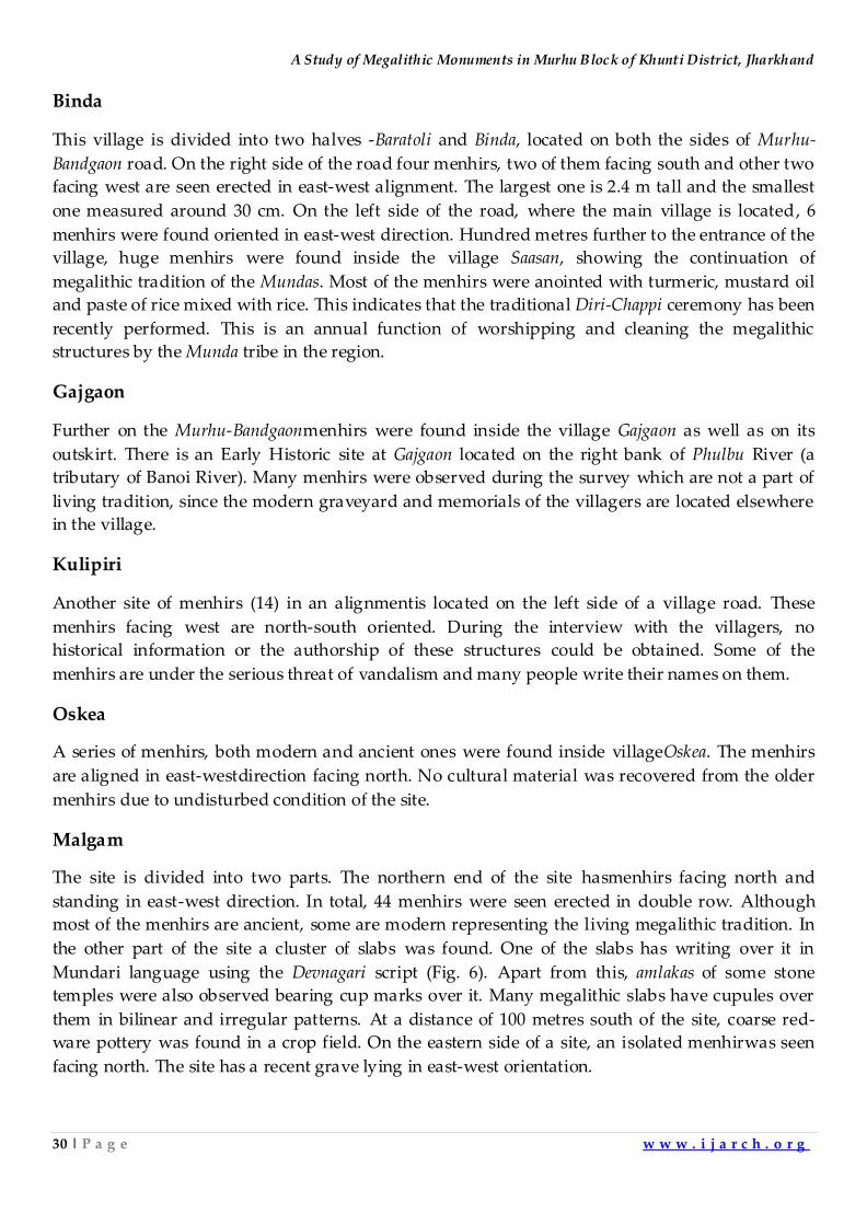
Mundari language using the Devnagari script (Fig. 6). Apart from this, amlakas of some stone
temples were also observed bearing cup marks over it. Many megalithic slabs have cupules over
them in bilinear and irregular patterns. At a distance of 100 metres south of the site, coarse red-
ware pottery was found in a crop field. On the eastern side of a site, an isolated menhirwas seen
facing north. The site has a recent grave lying in east-west orientation.
Indian Journal of Archaeology
31 | P a g e w w w . i j a r c h . o r g
Fig. 6. Alignment of menhirs and an inscribed slab in Malgam – (A) Alignment of menhirs, (B) Inscribed slab, (C)
Capstone with cup marks
A Study of Megalithic Monuments in Murhu Block of Khunti District, Jharkhand
32 | P a g e w w w . i j a r c h . o r g
Jiuri
The site is located on the left bank of Tajna River on the outskirts of Jiuri village. It can be divided
into two localities. Locality-I is in a crop field where evidence of black slipped ware, red ware and
black painted red ware was found. Another locality is near the entrance of the village where a
group of 5 menhirs and slabs on both side of the village road were seen. Inside the village, there is
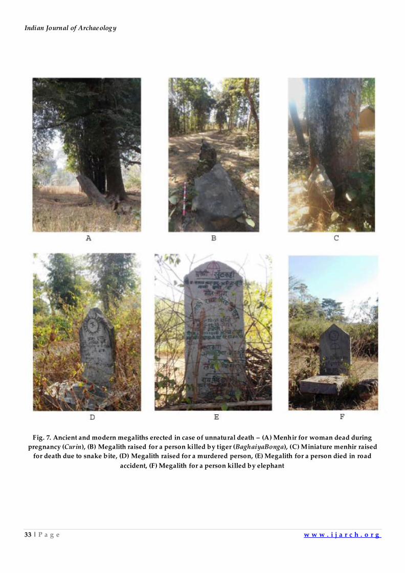
a menhir standing separately from the village Saasan, known as ChuriBonga. This menhiris erected
for the women who die during pregnancy. According to Mundari belief, such women turn into
Churin(witch) and can harm members of the family.6
BunduMamail
The megalithic site is located in a dense part of Saranda Jungle. Three types of megalithic
monuments were seen here - menhirs, menhirs with associated slab and dolmens. Another
interesting aspect is the presence of Baghaiyabonga (memorial for a person killed by a tiger and
turned into a vicious spirit) and a small menhir erected in the memory of a person who died due
to snake bite. In recent times, some modern megalithic structures were also erected by the Mundas
for the victims of elephant and murder.
TheLivingTradition
Almost all the surveyed villages have ethnographic parallels of ancient megaliths discovered and
they provide an insight about some sort of relation between both; the ancient structures and the
modern ones. Many menhirs were found in isolation, away from the present village and its Saasan
indicating that they were erected for persons who met unnatural deaths. Even the modern
tradition also follows the same distribution pattern and evidence of recent megaliths erected for
the people dead in unnatural circumstances (Fig. 7) were found in some of the villages,
e.g.BunduMamail, Jiuri, Bartola, Salga and Dodla. These megaliths are periodically worshipped by
the villagers by sacrificing fowls to avoid calamities and other evils to the villagers.
Indian Journal of Archaeology
33 | P a g e w w w . i j a r c h . o r g
Fig. 7. Ancient and modern megaliths erected in case of unnatural death – (A) Menhir for woman dead during
pregnancy (Curin), (B) Megalith raised for a person killed by tiger (BaghaiyaBonga), (C) Miniature menhir raised
for death due to snake bite, (D) Megalith raised for a murdered person, (E) Megalith for a person died in road
accident, (F) Megalith for a person killed by elephant
A Study of Megalithic Monuments in Murhu Block of Khunti District, Jharkhand
34 | P a g e w w w . i j a r c h . o r g
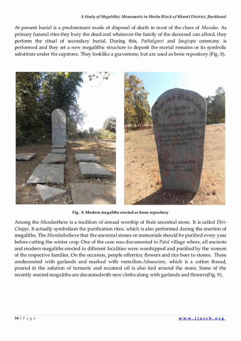
At present burial is a predominant mode of disposal of death in most of the clans of Mundas. As
primary funeral rites they bury the dead and whenever the family of the deceased can afford, they
perform the ritual of secondary burial. During this, Pathalgarri and Jangtopa ceremony is
performed and they set a new megalithic structure to deposit the mortal remains or its symbolic
substitute under the capstone. They looklike a gravestone, but are used as bone repository (Fig. 8).
Fig. 8. Modern megaliths erected as bone repository
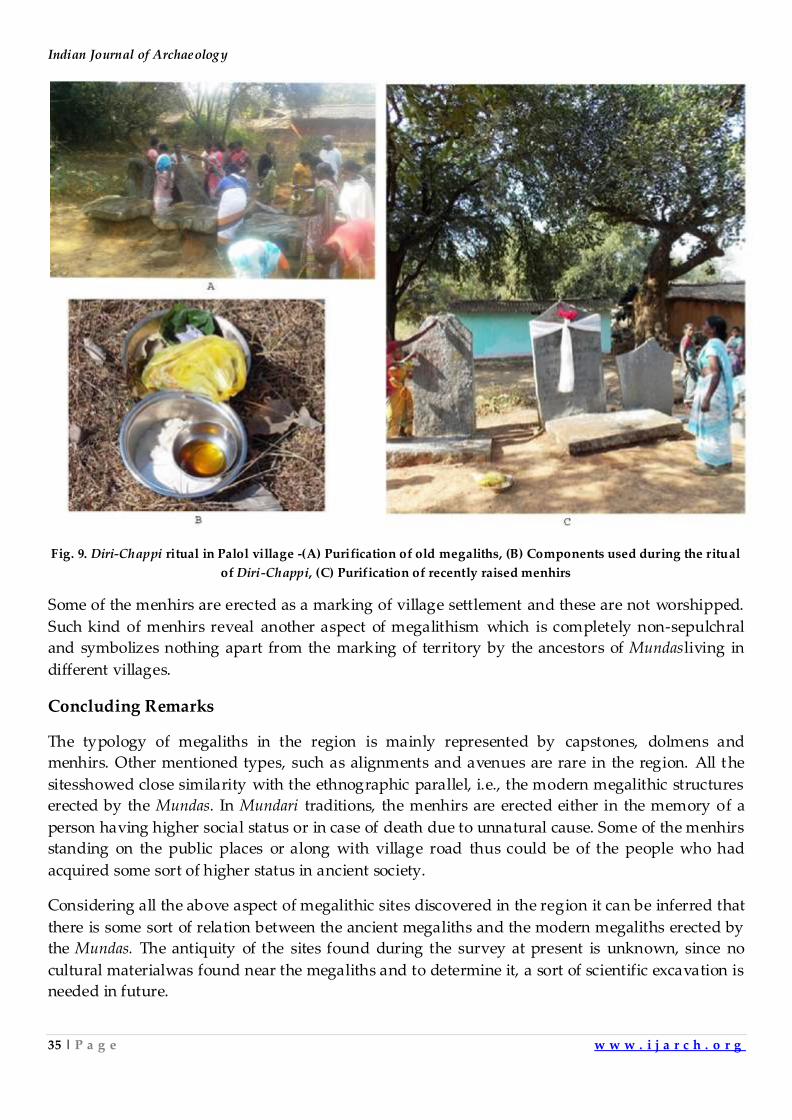
Among the Mundasthere is a tradition of annual worship of their ancestral stone. It is called Diri-
Chappi. It actually symbolizes the purification rites, which is also performed during the erection of
megaliths. The Mundasbelieve that the ancestral stones or memorials should be purified every year
before cutting the winter crop. One of the case was documented in Palol village where, all ancients
and modern megaliths erected in different localities were worshipped and purified by the women
of the respective families. On the occasion, people offerrice; flowers and rice beer to stones. These
aredecorated with garlands and marked with vermilion.Adoasutam, which is a cotton thread,
poured in the solution of turmeric and mustard oil is also tied around the stone. Some of the
recently erected megaliths are decoratedwith new cloths along with garlands and flowers(Fig. 9).
Indian Journal of Archaeology
35 | P a g e w w w . i j a r c h . o r g
Fig. 9. Diri-Chappi ritual in Palol village -(A) Purification of old megaliths, (B) Components used during the ritual
of Diri-Chappi, (C) Purification of recently raised menhirs
Some of the menhirs are erected as a marking of village settlement and these are not worshipped.
Such kind of menhirs reveal another aspect of megalithism which is completely non-sepulchral
and symbolizes nothing apart from the marking of territory by the ancestors of Mundasliving in
different villages.
Concluding Remarks
The typology of megaliths in the region is mainly represented by capstones, dolmens and
menhirs. Other mentioned types, such as alignments and avenues are rare in the region. All the
sitesshowed close similarity with the ethnographic parallel, i.e., the modern megalithic structures
erected by the Mundas. In Mundari traditions, the menhirs are erected either in the memory of a
person having higher social status or in case of death due to unnatural cause. Some of the menhirs
standing on the public places or along with village road thus could be of the people who had
acquired some sort of higher status in ancient society.
Considering all the above aspect of megalithic sites discovered in the region it can be inferred that
there is some sort of relation between the ancient megaliths and the modern megaliths erected by
the Mundas. The antiquity of the sites found during the survey at present is unknown, since no
cultural materialwas found near the megaliths and to determine it, a sort of scientific excavation is
needed in future.
A Study of Megalithic Monuments in Murhu Block of Khunti District, Jharkhand
36 | P a g e w w w . i j a r c h . o r g
References
1. Das, S. 2014. Unknown Civ ilization of Preh istoric India, New Delhi: Kaveri Books.
2. Shekhar, H. and P.P. Joglekar 2015. “Preliminary Report of the Exploration in Ranchi and Khunti Districts,
Jharkhand”, Heritage 3: 255-269; Shekhar, H. and P.P. Joglekar 2016. “Recent Exploration (2016) in Ranchi and
Khunti District, Jharkhand”, Heritage 4, pp. 261-278.
3. Roy, S.C. 1915. “A Note on Some Remains of the Ancient Asuras in the Ranchi District”, Journal of the Bihar
and Orissa Research Society I: 229- 253; Roy S.C. 1916a. “Notes on Some Prehistoric Stone Implements Found in
the Ranchi District”, Journal of the Bihar and Orissa Research Society II: 61- 77; Roy, S.C. 1916b. “A Find of
Ancient Bronze Articles in the Ranchi District”, Journal of the Bihar and Orissa Research Society II: 485- 487; Roy,
S.C. 1920. “Distribution and Nature of Asur Sites in Chota Nagpur”, Journal of the Bihar and Orissa Research
Society VI, pp. 393- 433.
4. Patil, D.R. 1963. Antiquarian Remains of Bihar, K.P. Jayaswal Research Institute, Patna.
5. Chakrabarti, D.K. and N. Lahiri 1988. “A Preliminary Report on the Archaeology of the Ranchi District with a
Note on the Asura Sites”, Man and Environment XII, pp.29-53.
6. Topno, M. 1955. “Funeral Rites of the Mundas of Ranchi Plateau”, Anthropos 50, pp. 715- 734.
Indian Journal of Archaeology
37 | P a g e w w w . i j a r c h . o r g
Subulia: A Late Chalcolithic Settlement in the Middle Mahanadi
Valley, Odisha.
Pradeep K. Behera and Sakir Hussain
P.G. Department of History, Sambalpur University, Odisha
Introduction
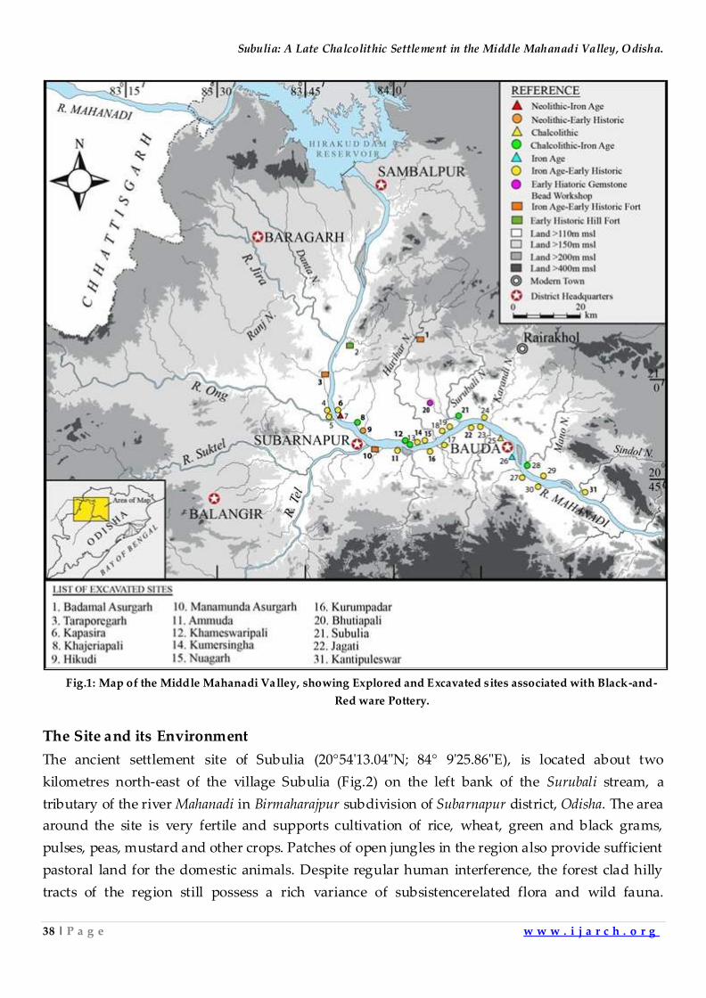
Until the excavation of Golbai Sasan1in Khurda district by the Archaeological Survey of India,
evidence for the existence of early farming communities in the state of Odisha was not known.
Since then, several Chalcolithic habitation sites were reported from different parts of Odisha and a
few of them were also excavated viz., Khameswaripali2, Kurumpadar3, Khajeriapali4 in the middle
Mahanadi valley region;Banga of Harirajapur5in the Coastal Plains and Deltihuda6 at Talagarh village
in the lower Mahanadi region. The Chalcolithic culture of the Middle Mahanadi Valley
distinguishes itself from the Coastal Plains of Odisha with regard to presence and absence of
white painted Black-and-Red ware potteries, respectively. Archaeological investigations
conducted in the Middle Mahanadi Valley during last two decades havebrought to light evidence
for continuous human habitations from the Neolithic throug h Chalcolithic to Iron Age and Early
Historic phase7.
The excavations at Khameswaripali8 revealed extensive remains of a Chalcolithic phase associated
with white-painted Black-and-Red ware potteries, bone tools, etc., and continued to survive as a
rural settlement till the advent of Iron Age. The Chalcolithic level of this site has been dated
between 3520 ± 60 BCE and 1065 ± 66 BCE9. Subsequent explorations carried out in the Middle
Mahanadi Valley revealed few more sites associated with white-painted Black-and-Red Ware
potteries and other associated cultural features (Fig.1).One of such sites, Subulia, was
investigatedto ascertain the stratigraphic context of the white-painted Black-and-Red Wareand
associated materials, and to understand the extension of Chalcolithic settlements represented in
the Middle Mahanadi Valley. The present paper proposes to give a brief outline on the
investigation conducted at the site of Subulia.
Subulia: A Late Chalcolithic Settlement in the Middle Mahanadi Valley, Odisha.
38 | P a g e w w w . i j a r c h . o r g
Fig.1: Map of the Middle Mahanadi Valley, showing Explored and Excavated sites associated with Black-and-
Red ware Pottery.
The Site and its Environment
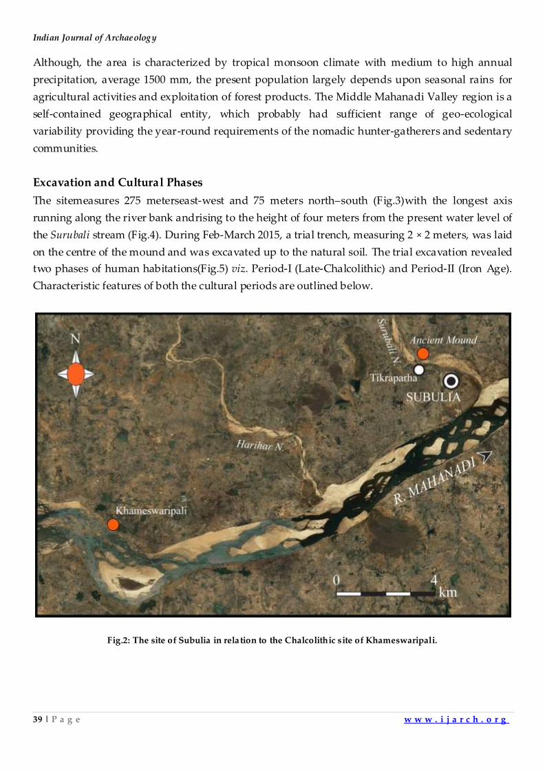
The ancient settlement site of Subulia (20°54'13.04"N; 84° 9'25.86"E), is located about two
kilometres north-east of the village Subulia (Fig.2) on the left bank of the Surubali stream, a
tributary of the river Mahanadi in Birmaharajpur subdivision of Subarnapur district, Odisha. The area
around the site is very fertile and supports cultivation of rice, wheat, green and black grams,
pulses, peas, mustard and other crops. Patches of open jungles in the region also provide sufficient
pastoral land for the domestic animals. Despite regular human interference, the forest clad hilly
tracts of the region still possess a rich variance of subsistencerelated flora and wild fauna.
Indian Journal of Archaeology
39 | P a g e w w w . i j a r c h . o r g
Although, the area is characterized by tropical monsoon climate with medium to high annual
precipitation, average 1500 mm, the present population largely depends upon seasonal rains for
agricultural activities and exploitation of forest products. The Middle Mahanadi Valley region is a
self-contained geographical entity, which probably had sufficient range of geo-ecological
variability providing the year-round requirements of the nomadic hunter-gatherers and sedentary
communities.
Excavation and Cultural Phases
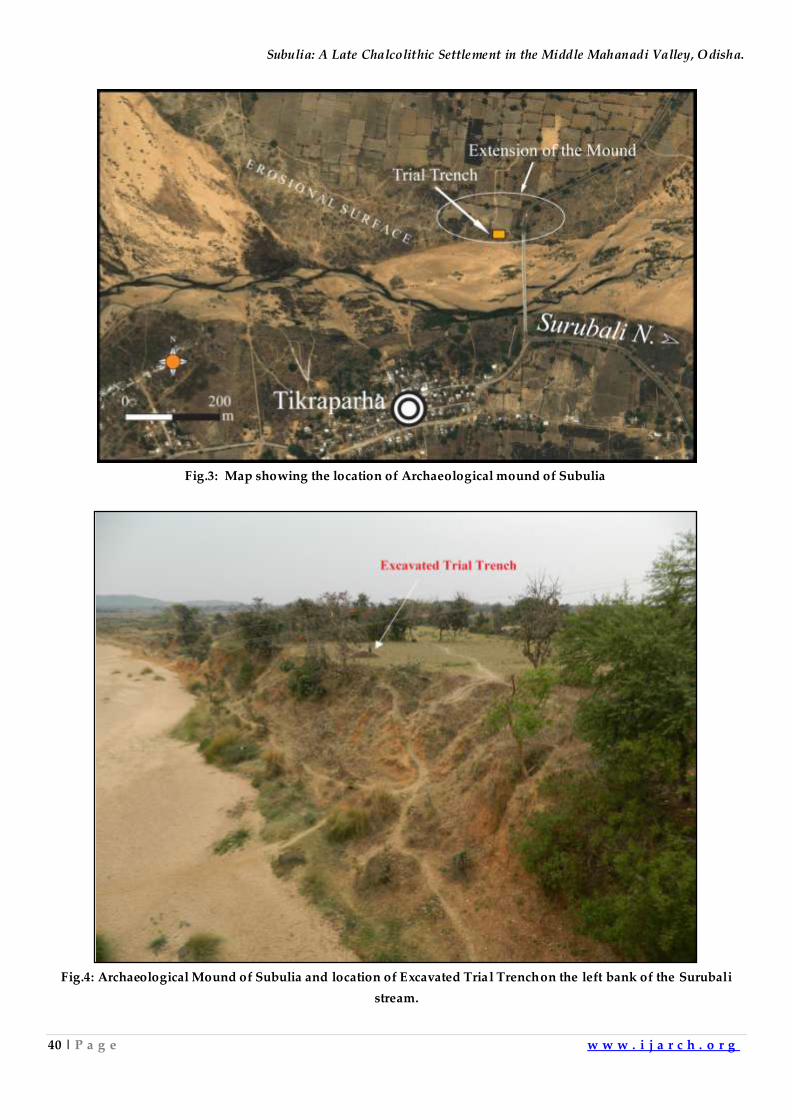
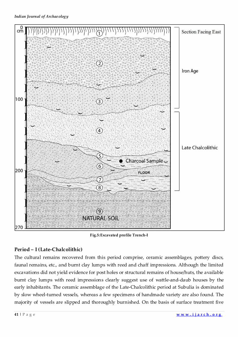
The sitemeasures 275 meterseast-west and 75 meters north–south (Fig.3)with the longest axis
running along the river bank andrising to the height of four meters from the present water level of
the Surubali stream (Fig.4). During Feb-March 2015, a trial trench, measuring 2 × 2 meters, was laid
on the centre of the mound and was excavated up to the natural soil. The trial excavation revealed
two phases of human habitations(Fig.5) viz. Period-I (Late-Chalcolithic) and Period-II (Iron Age).
Characteristic features of both the cultural periods are outlined below.
Fig.2: The site of Subulia in relation to the Chalcolithic site of Khameswaripali.
Subulia: A Late Chalcolithic Settlement in the Middle Mahanadi Valley, Odisha.
40 | P a g e w w w . i j a r c h . o r g
Fig.3: Map showing the location of Archaeological mound of Subulia
Fig.4: Archaeological Mound of Subulia and location of Excavated Trial Trenchon the left bank of the Surubali
stream.
Indian Journal of Archaeology
41 | P a g e w w w . i j a r c h . o r g
Fig.5:Excavated profile Trench-I
Period – I (Late-Chalcolithic)
The cultural remains recovered from this period comprise, ceramic assemblages, pottery discs,
faunal remains, etc., and burnt clay lumps with reed and chaff impressions. Although the limited
excavations did not yield evidence for post holes or structural remains of house/huts, the available
burnt clay lumps with reed impressions clearly suggest use of wattle-and-daub houses by the
early inhabitants. The ceramic assemblage of the Late-Chalcolithic period at Subulia is dominated
by slow wheel-turned vessels, whereas a few specimens of handmade variety are also found. The
majority of vessels are slipped and thoroughly burnished. On the basis of surface treatment five
Subulia: A Late Chalcolithic Settlement in the Middle Mahanadi Valley, Odisha.
42 | P a g e w w w . i j a r c h . o r g
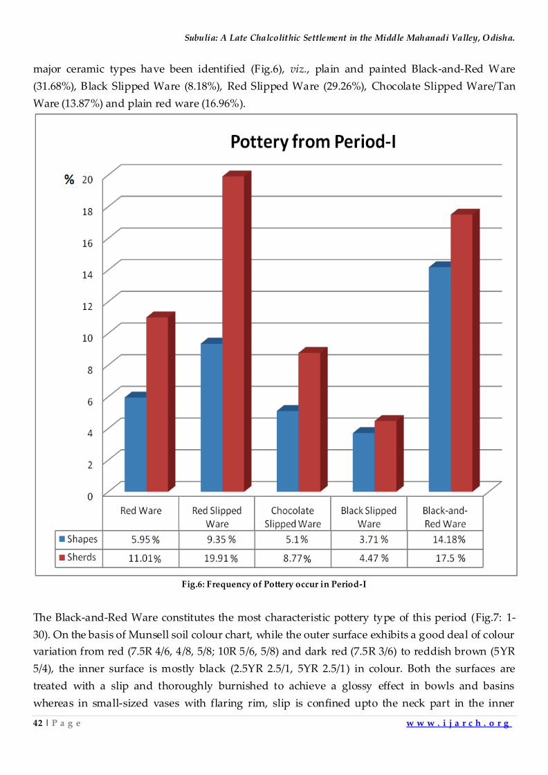
major ceramic types have been identified (Fig.6), viz., plain and painted Black-and-Red Ware
(31.68%), Black Slipped Ware (8.18%), Red Slipped Ware (29.26%), Chocolate Slipped Ware/Tan
Ware (13.87%) and plain red ware (16.96%).
Fig.6: Frequency of Pottery occur in Period-I
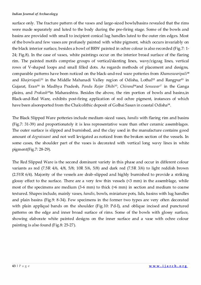
The Black-and-Red Ware constitutes the most characteristic pottery type of this period (Fig.7: 1-
30). On the basis of Munsell soil colour chart, while the outer surface exhibits a good deal of colour
variation from red (7.5R 4/6, 4/8, 5/8; 10R 5/6, 5/8) and dark red (7.5R 3/6) to reddish brown (5YR
5/4), the inner surface is mostly black (2.5YR 2.5/1, 5YR 2.5/1) in colour. Both the surfaces are
treated with a slip and thoroughly burnished to achieve a glossy effect in bowls and basins
whereas in small-sized vases with flaring rim, slip is confined upto the neck part in the inner
Indian Journal of Archaeology
43 | P a g e w w w . i j a r c h . o r g
surface only. The fracture pattern of the vases and large-sized bowls/basins revealed that the rims
were made separately and luted to the body during the pre-firing stage. Some of the bowls and
basins are provided with small to incipient conical lug handles luted to the outer rim edges. Most
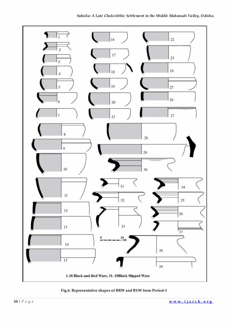
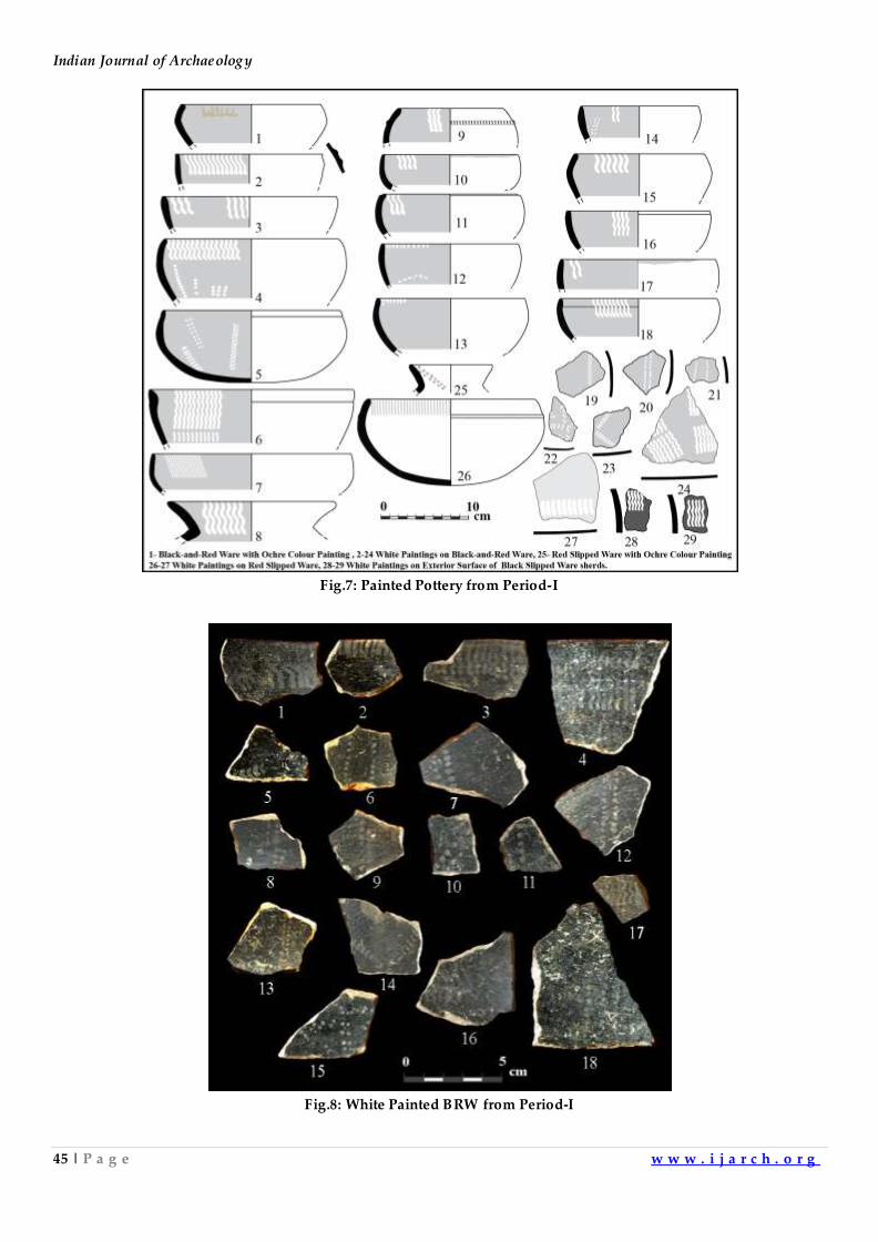
of the bowls and few vases are profusely painted with white pigment, which occurs invariably on
the black interior surface, besides a bowl of BRW painted in ochre colour is also recorded (Fig.7: 1-
24; Fig.8). In the case of vases, white paintings occur on the interior broad surface of the flaring
rim. The painted motifs comprise groups of vertical/slanting lines, wavy/zigzag lines, vertical
rows of V-shaped loops and small filled dots. As regards methods of placement and designs,
comparable patterns have been noticed on the black-and-red ware potteries from Khameswaripali10
and Khajeriapali11 in the Middle Mahanadi Valley region of Odisha, Lothal12 and Rangpur13 in
Gujarat, Eran14 in Madhya Pradesh, Pandu Rajar Dhibi15, Chirand16and Senuwar17 in the Ganga
plains, and Prakash18in Maharashtra. Besides the above, the rim portion of bowls and basins,in
Black-and-Red Ware, exhibits post-firing application of red ochre pigment, instances of which
have been alsoreported from the Chalcolithic deposit of Golbai Sasan in coastal Odisha19.
The Black Slipped Ware potteries include medium-sized vases, handis with flaring rim and basins
(Fig.7: 31-39) and proportionately it is less representative ware than other ceramic assemblages.
The outer surface is slipped and burnished, and the clay used in the manufacture contains good
amount of degraissant and not well levigated as noticed from the broken section of the vessels. In
some cases, the shoulder part of the vases is decorated with vertical long wavy lines in white
pigment(Fig.7: 28-29).
The Red Slipped Ware is the second dominant variety in this phase and occur in different colour
variants as red (7.5R 4/6, 4/8, 5/8; 10R 5/6, 5/8) and dark red (7.5R 3/6) to light reddish brown
(2.5YR 6/4). Majority of the vessels are drab-slipped and highly burnished to provide a striking
glossy effect to the surface. There are a very few thin vessels (<3 mm) in the assemblage, while
most of the specimens are medium (3-6 mm) to thick (>6 mm) in section and medium to coarse
textured. Shapes include, mainly vases, handis, bowls, miniature pots, lids, basins with lug handles
and plain basins (Fig.9: 8-34). Few specimens in the former two types are very often decorated
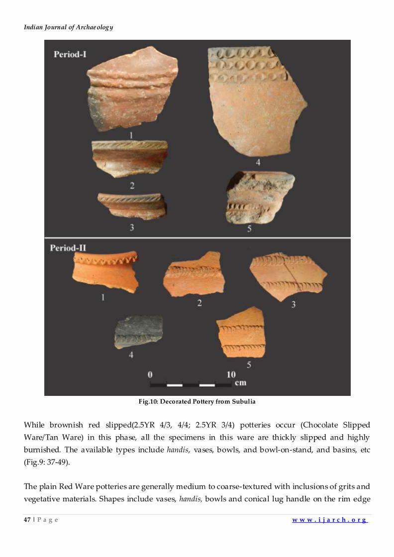
with plain appliqué bands on the shoulder (Fig.10: Pd-I), and oblique incised and punctured
patterns on the edge and inner broad surface of rims. Some of the bowls with glossy surface,
showing elaborate white painted designs on the inner surface and a vase with ochre colour
painting is also found (Fig.8: 25-27).
Subulia: A Late Chalcolithic Settlement in the Middle Mahanadi Valley, Odisha.
44 | P a g e w w w . i j a r c h . o r g
Fig.6: Representative shapes of BRW and BSW from Period-I
Indian Journal of Archaeology
45 | P a g e w w w . i j a r c h . o r g
Fig.7: Painted Pottery from Period-I
Fig.8: White Painted BRW from Period-I
Subulia: A Late Chalcolithic Settlement in the Middle Mahanadi Valley, Odisha.
46 | P a g e w w w . i j a r c h . o r g
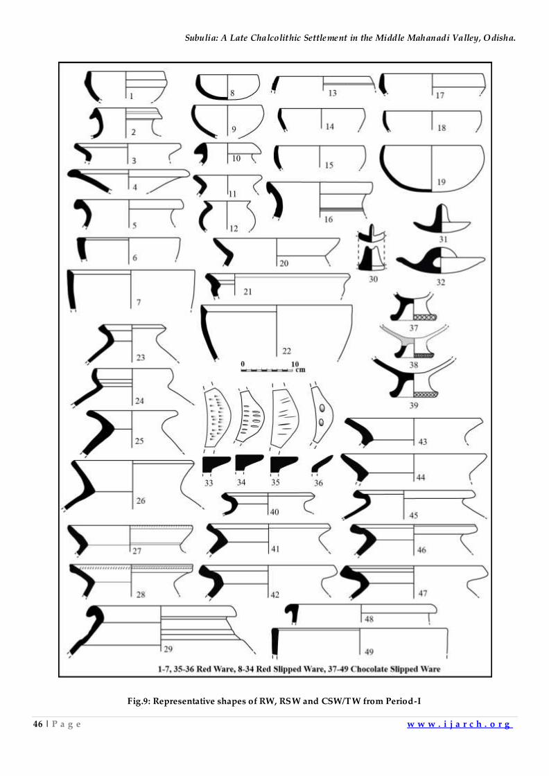
Fig.9: Representative shapes of RW, RSW and CSW/TW from Period-I
Indian Journal of Archaeology
47 | P a g e w w w . i j a r c h . o r g
Fig.10: Decorated Pottery from Subulia
While brownish red slipped(2.5YR 4/3, 4/4; 2.5YR 3/4) potteries occur (Chocolate Slipped
Ware/Tan Ware) in this phase, all the specimens in this ware are thickly slipped and highly
burnished. The available types include handis, vases, bowls, and bowl-on-stand, and basins, etc
(Fig.9: 37-49).
The plain Red Ware potteries are generally medium to coarse-textured with inclusions of grits and
vegetative materials. Shapes include vases, handis, bowls and conical lug handle on the rim edge
Subulia: A Late Chalcolithic Settlement in the Middle Mahanadi Valley, Odisha.
48 | P a g e w w w . i j a r c h . o r g
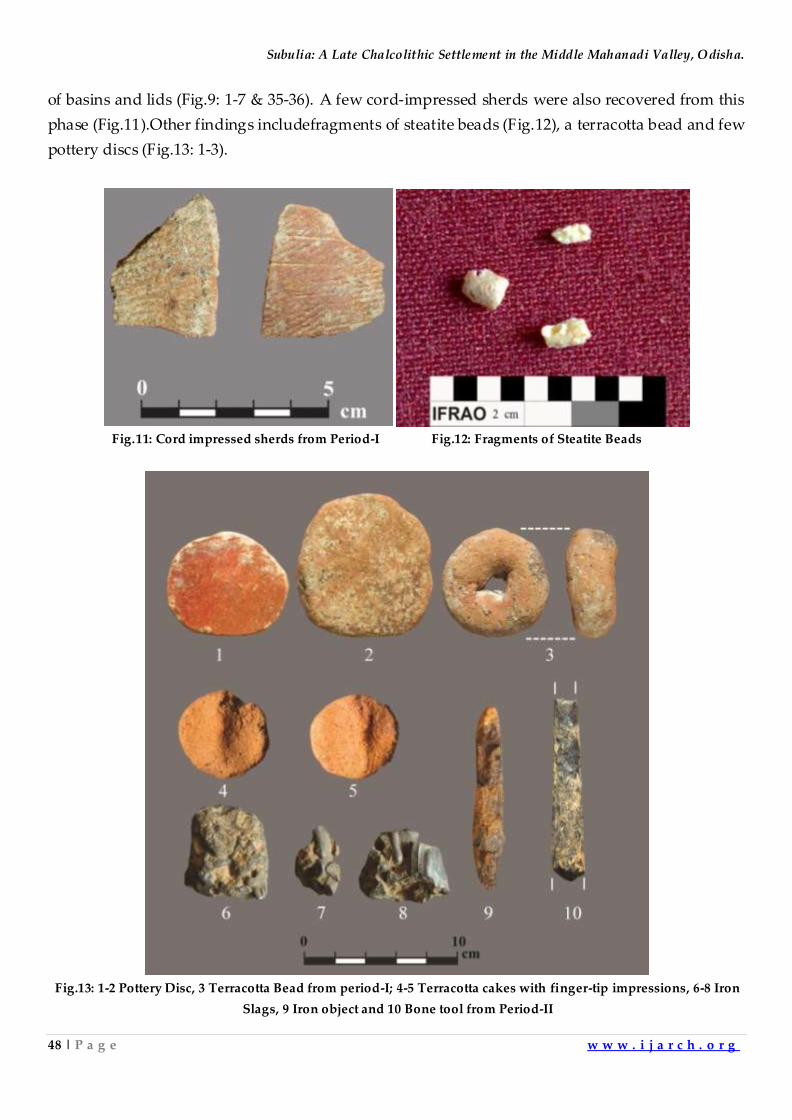
of basins and lids (Fig.9: 1-7 & 35-36). A few cord-impressed sherds were also recovered from this
phase (Fig.11).Other findings includefragments of steatite beads (Fig.12), a terracotta bead and few
pottery discs (Fig.13: 1-3).
Fig.11: Cord impressed sherds from Period-I Fig.12: Fragments of Steatite Beads
Fig.13: 1-2 Pottery Disc, 3 Terracotta Bead from period-I; 4-5 Terracotta cakes with finger-tip impressions, 6-8 Iron
Slags, 9 Iron object and 10 Bone tool from Period-II
Indian Journal of Archaeology
49 | P a g e w w w . i j a r c h . o r g
Period-II (Iron Age)
Without any marked of Habitational hiatus, it seems the early settlement at Subulia developed
into the next phase of habitationi.e. Iron Age.
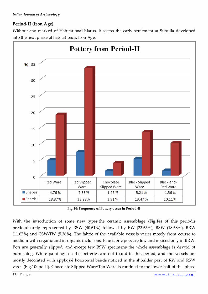
Fig.14: Frequency of Pottery occur in Period-II
With the introduction of some new types,the ceramic assemblage (Fig.14) of this periodis
predominantly represented by RSW (40.61%) followed by RW (23.63%), BSW (18.68%), BRW
(11.67%) and CSW/TW (5.36%). The fabric of the available vessels varies mostly from course to
medium with organic and in-organic inclusions. Fine fabric pots are few and noticed only in BRW.
Pots are generally slipped, and except few RSW specimens the whole assemblage is devoid of
burnishing. White paintings on the potteries are not found in this period, and the vessels are
mostly decorated with appliqué horizontal bands noticed in the shoulder part of RW and RSW
vases (Fig.10: pd-II). Chocolate Slipped Ware/Tan Ware is confined to the lower half of this phase
Subulia: A Late Chalcolithic Settlement in the Middle Mahanadi Valley, Odisha.
50 | P a g e w w w . i j a r c h . o r g
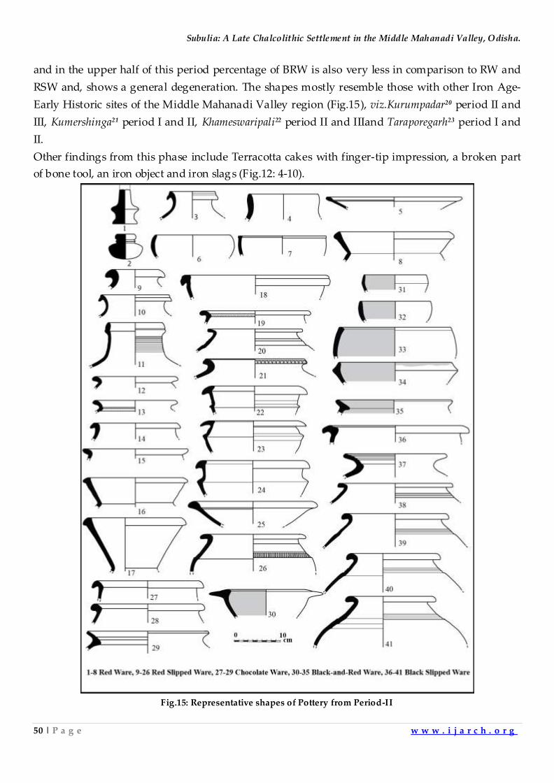
and in the upper half of this period percentage of BRW is also very less in comparison to RW and
RSW and, shows a general degeneration. The shapes mostly resemble those with other Iron Age-
Early Historic sites of the Middle Mahanadi Valley region (Fig.15), viz.Kurumpadar20 period II and
III, Kumershinga21 period I and II, Khameswaripali22 period II and IIIand Taraporegarh23 period I and
II.
Other findings from this phase include Terracotta cakes with finger-tip impression, a broken part
of bone tool, an iron object and iron slags (Fig.12: 4-10).
Fig.15: Representative shapes of Pottery from Period-II
Indian Journal of Archaeology
51 | P a g e w w w . i j a r c h . o r g
Subsistence Economy
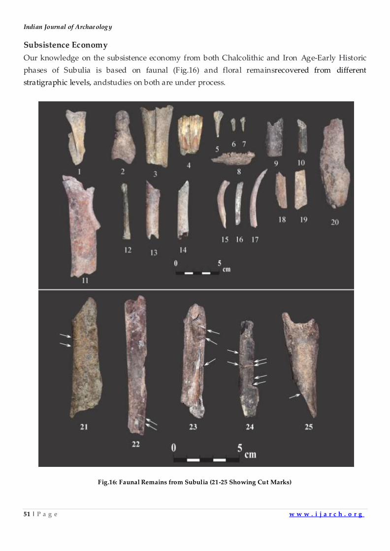
Our knowledge on the subsistence economy from both Chalcolithic and Iron Age-Early Historic
phases of Subulia is based on faunal (Fig.16) and floral remainsrecovered from different
stratigraphic levels, andstudies on both are under process.
Fig.16: Faunal Remains from Subulia (21-25 Showing Cut Marks)
Subulia: A Late Chalcolithic Settlement in the Middle Mahanadi Valley, Odisha.
52 | P a g e w w w . i j a r c h . o r g
Concluding Remarks
The present investigation though limited in nature, fulfilled the main objectives for which it was
undertaken. The noteworthy contribution of this trial excavation at Subulia is the discovery of a
Chalcolithic cultural phase in the Middle Mahanadi Valley in continuation of the excavation of
Khameswaripali. In terms of technology and other aspects, the ceramic industries and other
concomitants of thecultural featuresfrom Period-I of Subulia share many common characteristic
features with that ofKhameswaripali and other excavated Chalcolithic sites of northern, western and
central India. Significantly,a radiocarbon date of 2630 ± 100 BC(BS-3849) was obtained from
themiddlelevelof the Chalcolithic phase of Subulia. The present investigation at Subulia clearly
indicates that the Chalcolithic culture in the region gradually developed into the subsequent Iron
Age phase without any evidence for major habitation gap.Like Khameswaripali, the excavations at
Subulia also revealed that the site continued to survive as a rural settlement till the advent of the
Iron Age and beyond.
Acknowledgements
The First author is thankful to the Archaeological Survey of India for giving permission to
investigate the Middle Mahanadi Valley and to SambalpurUniversity for financial assistance. The
authors are thankful to PanchuPradhanof Kamira village for his kind support and help during the
trial excavation.
References
1. Sinha, B.K. 1993. Excavations at Golbai Sasan , District Puri, Orissa, Puratattva 23, pp. 48-50; Sinha, B.K. 2000.
‘Golbai: A Protohistoric site on the coast of Orissa ’. Archaeology of Orissa.Eds. Basa, K.K. and Mohanty, P.Delhi:
Pratibha Prakashan, pp. 322-48.
2. Behera, P.K. 2000-01. Excavations at Khameswaripali - A Protohistoric Settlement in the Middle Mahanadi
Valley, Odisha: A Preliminary Report, Pragdhara11, pp. 13-34.
3. Behera, P.K. 2006. ‘Investigations into the Mesolithic and Post-Mesolithic settlements in the middle Mahanadi
valley, Odisha’.Art and Archaeology of Odisha: Recent Perspectives . Ed. PradhanS. Delhi: Aryan International,
p. 51.
4. Ibid, pp.39-41.
5. Basa, K.K, Sahoo, D. and Kar, M. 2014. Archaeological Excavation at Banga of Harirajpur, Dist Puri, Coastal
Orissa: A Preliminary Report, The Tribal Tribune6(2): 62-67.
6. Acharya et al. 2017. Preliminary Report on the Excavation (2014-2015) at Deltihuda, Odisha,Man and
EnvironmentXLII(1): 90-99.
7. Behera, P.K. 2002-03. Excavations at Kumersingha and Kurumpadar - the Iron Age Settlements in the Middle
Mahanadi Valley, Odisha: Results of the First Season's Work, Pragdhara 13, pp. 87-103; Behera, P.K. and
Chattopadhyay, P.K. 2012. ‘Iron Age – Early historic period in Eastern India. A study in material culture and
technology: evidence from the site of Badmal-Asurgarh, District Sambalpur, Odisha, India ’.The World of Iron.
Eds.Humphris, J. and Rehren, T. London: Arche type publications Ltd pp. 125-34.; Behera, P.K. 2013. ‘New Light
on the Neolithic and Chalcolithic Evidences from the Middle Mahanadi Valley, Orissa ’. Neolithic Chalcolithic
Cultures of Eastern India.Ed.in Dikshit, K.N. New Delhi: The Indian Archaeological Society, pp. 184-208.
Indian Journal of Archaeology
53 | P a g e w w w . i j a r c h . o r g
8. Behera, P.K. 2000-01, Op.Cit.
9. Behera, P.K. et al. 2007. Radiocarbon dates from the middle Mahanadi valley, Odisha,Man and
EnvironmentXXXII(2), pp. 41-46.
10. Behera, P.K. 2000-01, Op.Cit.
11. Behera, P.K. 2006, Op.Cit.
12. Rao, S.R. 1961. Ceramics of the Indus Valley in Gujarat, Marg, Vol. XIV (3), p.21.
13. Rao, S.R. 1963. Excavation at Rangpur and Other explorations in Gujarat, Ancient India, 18 & 19, pp. 61, 107 &
128.
14. Singh, U.V. 1967. Further Excavation at Eran, Journal of Madhya Pradesh Itihas Parishad, 5, p. 21.
15. Banerjee, T. 1992. Chalcolithic Painted Pottery of Pandu Rajar Dhibi, Pratna Samiksha , Vol.1, pp.77-78.
16. Verma, B.S. 1969. Black-and-Red Ware in Bihar, in B.P. Sinha(ed.) Potteries in Ancient India, pp.102-111, Patna
17. Singh, H.N. 1982. History and Archaeology of Black and Red Ware, Sandeep Prakshan, New Delhi; Srivastava,
K.M. 1980. Community Movements in Protohistoric India , Agam Kala Prakasha, New Delhi.
18. Thapar, B.K. 1987. Prakash 1955: A Chalcolithic site in the Tapti Valley, Ancient India, 20 & 21, pp. 5-167.
19. B.K. 2000. Op. Cit.
20. Behera, P.K. 2002-03, Op.Cit.
21. Ibid.
22. Behera, P.K. 2000-01, Op.Cit.
23. Behera, P.K., Hussain, S.and Badam, G.L. 2015. Taraporegarh: An Iron Age-Early Historic Circular Fort in the
Middle Mahanadi Valley, Odisha, Puratattva, 45, pp. 178-196.
Indian Journal of Archaeology
54 | P a g e w w w . i j a r c h . o r g
Archaeological Gazetteer of
Aligarh & Hathras Districts
with special reference to OCP
& Other Proto-Historic Cultures
of Indo-Gangetic Plains
By:
Vijay Kumar
Archaeological Gazetteer of Aligarh & Hathras Districts
55 | P a g e w w w . i j a r c h . o r g
CONTENTS
CHAPTER PAGE
Abbreviations 57
1. Introduction 58-70
1.1 Geography 59-61
1.2 Geology 61
1.3 Flora 61
1.4 Fauna 62
1.5 Climate 62-63
1.6 Archaeology and History 63-68
1.7 People 68
1.8 Agriculture 69-70
2. Methodology 71-259
3. Explorations in District Aligarh 260-329
3.1 Akrabad 260-264
3.2 Atrauli 264-268
3.3 Barla 268-272
3.4 Chandaus 272-274
3.5 Dadon 275-278
3.6 Gabhana 278-280
3.7 Gangiri 280-283
3.8 Gandhi park 284
3.9 Gonda 284-289
3.10 Harduaganj 289-293
Indian Journal of Archaeology
56 | P a g e w w w . i j a r c h . o r g
3.11 Iglas 294-299
3.12 Jawan 299-304
3.13 Khair 304-308
3.14 Kotwali Bannadevi 308-311
3.15 Kwarsi 311-312
3.16 Lodha 312-315
3.17 Madrak 315-317
3.18 Palimukimpur 317-319
3.19 Pisawa 319-322
3.20 Tappal 322-326
3.21 Vijaygarh 327-329
4. Explorations in District Hathras 330-377
4.1 Chandapa 330-331
4.2 Hasayan 331-334
4.3 Hathras Junction 334-337
4.4 Hathras Gate 337-338
4.5 Mursan 339-343
4.6 Sadabad 343-347
4.7 Sahpau 347-350
4.8 Sasni 350-354
4.9 Sikandra Rao 354-360
5. Acknowledgement 377-378
6. References 378-394
Archaeological Gazetteer of Aligarh & Hathras Districts
57 | P a g e w w w . i j a r c h . o r g
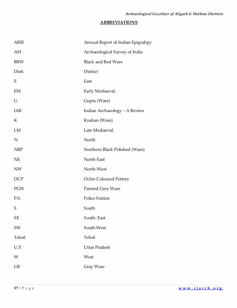
ABBREVIATIONS
ARIE Annual Report of Indian Epigrahpy
ASI Archaeological Survey of India
BRW Black and Red Ware
Distt. District
E East
EM Early Mediaeval.
G Gupta (Ware)
IAR Indian Archaeology – A Review
K Kushan (Ware)
LM Late Mediaeval.
N North
NBP Northern Black Polished (Ware)
NE North-East
NW North-West
OCP Ochre Coloured Pottery
PGW Painted Grey Ware
P.S. Police Station
S South
SE South- East
SW South-West
Tehsil Tehsil
U.P. Uttar Pradesh
W West
GR Gray Ware
Indian Journal of Archaeology
58 | P a g e w w w . i j a r c h . o r g
CHAPTER-1
INTRODUCTION
General
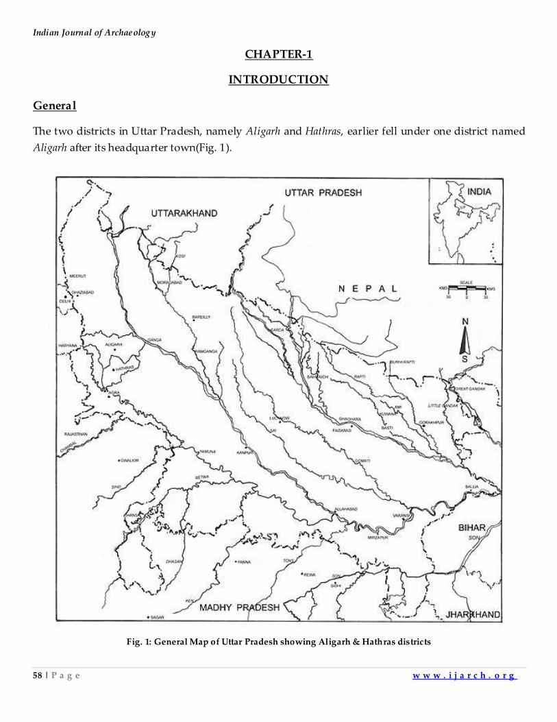
The two districts in Uttar Pradesh, namely Aligarh and Hathras, earlier fell under one district named
Aligarh after its headquarter town(Fig. 1).
Fig. 1: General Map of Uttar Pradesh showing Aligarh & Hathras districts
Archaeological Gazetteer of Aligarh & Hathras Districts
59 | P a g e w w w . i j a r c h . o r g
The district received its name from the celebrated fort of Aligarh originally built in 1524 A.D. by
Muhammad Khan, the Governor of Koil under the Lodis. It was rebuilt in 1717 A.D. by Sabit Khan
during the reign of Farrukhsiyar and Muhammad Shah and its name was changed to Sabitgarh. In
1757 A.D. it was captured by the Jats and was named Ramgarh. It received its present appellation of
Aligarh in the time of Afrasiyab Khan who succeeded Safdar Jang, the Nawab Vazir of Awadh in
1782 A.D. as Amir-ul-Umara. The town of Hathras attained importance with the rise of Jat power. It
was a place of considerable size in 1817 A.D. when Daya Ram was ejected by the British from this
place.The importance of Hathras as a trade centre increased with the building of the railway line.
The District of Aligarh was divided in 1998 A.D. The new district of Aligarh lies between 270
34' N and 280 1' N latitude and 770 29' E and 780 37'E Longitude. The area of the district is 5498sq. kms.
and its population is 43.2376Lakh. There are 5 Tehsils in the district namely Atrauli, Gabhana, Iglas,
Khair and Kol. There are 21 Police Stations in this district; namely Akrabad, Atrauli, Barla, Chandaus,
Dadon, Gabhana, Gangiri, Gandhi Park, Gonda, Harduaganj, Iglas, Jawan, Khair, Kotwali Banna
Devi, Kwarsi, Lodha, Madrak, Pali Mukimpur, Pisawa, Tappal and Vijaygarh. The district of Hathras
lies between 270 51'N and 270 51' N latitude and 770 32'E and 780 52'E longitude. The area of the district
is 1800sq. kms.and the population is 13.36Lakh. There are 3 tehsils in the district namely Hathras,
Sadabad and Sikandra Rao.There are 9 Police Stations in the district namely Chandpa, Hasayan,
Hathras Gate, Hathras Junction, Mursan, Sadabad, Sahpau, Sasni and Sikandra Rao.
Geography
The two districts lying in upper Ganga-Yamuna Doab are plains of remarkable fertility.
The slope is gently from North to South and South-East. The surface is varied by several depressions,
formed by the river valleys and natural drainage lines, while the elevations consist merely of slight
ridges of sand. The most prominent of these ridges are found in Tehsil Khair (Distt. Aligarh). The
second may be seen along the right bank of the Karwan and the third, which is more interrupted and
less defined than the others, lies some kilometers east. These ridges run through the upper portion of
Tehsil Iglas (distt. Aligarh) and two of them enter Tehsil Mursan (distt. Hathras). At some places they
throw off transverse spurs which reduce gradually into the level surface of the plain s. To the West of
Aligarh there are two parallel lines of high sandy ground running North and South.
The configuration of the ground in both the districts is similar to that of the Doab in
general. From the Ganga khadarthe level rises sharply to the high sandy upland which is flanked by
the old high bank of the Ganga. From the high bank the level descends inland gradually to a
depression drained by the rivers Nim and the Chhoiya, beyond which it again rises to the bank of the
Kali Nadi. Along the right bank of the Kali is a sandy belt, rising from the low and narrow khadar of
Indian Journal of Archaeology
60 | P a g e w w w . i j a r c h . o r g
that stream and this is followed by a fertile belt of loam soil, which gradually sinks into the broad
central depression. The latter traverses the entire district in a South-Easterly direction roughly
parallel to the course of the Ganga. Entering the North of Tehsil Aligarh it passes through the Tehsil
Sikandra Rao (dist. Hathras) occupying practically all but the South-Western corner of the Tehsil and
eventually passing into the Etah district. This tract is characterized by clay soil, imperfect natural
drainage and numerous lakes in which the surface water collects without getting any adequate outlet.
In consequence of the resultant saturation the tract is marred by frequent stretches of barren usar and
the vast tracts ofreh. Beyond this depression the surface rises once more into level plains of lighter
but richer soil, assuming a sandy character in the western parts of the two district. In the western
parts of the district Aligarh the general characteristics of the doab are maintained, loam alternating
with clay in the depression and the lighter ground on the banks of the few drainage channels, till
finally there comes the high cliff of the Yamuna, from where the level drops to the khadar of that river.
The western part of the Hathras district presents somewhat remarkable fea tures.Tehsil Iglas, (distt.
Aligarh) and part of tehsil Hathras (distt. Hathras) contain a sandy tract of very homogeneous type
with practically no depressions while the only variations in the general level are those formed by the
minute valley of Karwan. The greatest height of the ground surface is about 195m. abovemean sea
level at Chandaus (distt. Aligarh) and Tappal in the western part of the Aligarh district, dropping to
189.58 m at Somna. In the district Hathras, the height is 175.56m.at Hathras dropping to 175.95 m at
Hasayan.
The two districts are not traversed by any major river, the river Yamuna merely forms
the western boundaries of Aligarh and Hathras, while Ganga touches the eastern boundary of
Aligarh district. The other streams that run through the districts are the Kali and the Isan, the
tributaries of the Ganga, the Nim, a tributary of the Kali and the Rind, Sengar Karawan and Patwaha,
tributaries of the Yamuna.
The river Ganga touches Aligarh district in the east forming the boundary between this
district and Budaun. In former days the river was constantly changing its course within the broad
flood plains. From Sankra (distt. Aligarh) an abandoned channel known as Burhiganga flows through
the khadar between the present stream and the high bank. Kali Nadi is the only tributary to pass
through both the districts. It rises in district Muzaffarnagar and enters the district of Aligarh on the
northern border. It then flows south-east and forming the western and southern boundaries of tehsil
Atrauli (distt. Aligarh) and tehsil Sikandra Rao (distt. Hathras), it then passes into the district Etah.
The river Nim rises in the district Bulandshahar, Uttar Pradesh. It enters tehsil Atrauli (distt. Aligarh)
at Chakhathal, flows through the eastern part of this tehsil and joins Ganga. The river Isan originates
in several shallow depressions to the east of Sikandra Rao (distt. Hathras). It then flows into district
Etah. The river Yamuna touches the district Aligarh in north-west. It separates this district from
Archaeological Gazetteer of Aligarh & Hathras Districts
61 | P a g e w w w . i j a r c h . o r g
Gurgaon district in the state of Haryana. The river Rind rises from the depression lying south of
Nanau (distt. Aligarh). It has adversely affected the fertility of the adjoining land with the result that
there is hardly a village near the river which is free from reh. It flows through Sikandra Rao and
passes off into the Etah district. The river Sengar rises from the depression near Lehtoi (distt. Aligarh)
and passes into Hathras district. It leaves the district near Nurpur and enters Etah distr ict. The central
portion of tehsils Aligarh (distt. Aligarh ) and Hathras (distt. Hathras) are drained by Ganda nala.
The river Karwan rises in the districtBulandshahar, Uttar Pradesh and flowing in the western parts of
the districts of Aligarh and Hathras, it passes off into the district Mathura. The river Patwaha
originates in Meerut. It runs through Khair (distt. Aligarh) before joining the river Yamuna in the
district Mathura.
There are broad tracts of low lands especially in tehsil Kol (distt. Aligarh) and tehsil
Sikandra Rao (distt. Hathras). The number of lakes increases as we move from north to south. The
important lakes in tehsil Kol are Gursikaran, Ikri and Adhawan. In the pargana Akrabad district
Aligarh, the lakes are at Ladhwa, Sahadi and Gopi, in tehsil Sikandra Rao (distt. Hathras)a
depression liessouth and east of Sikandra Rao. Important lakes of Hathras are lakes of Bakayan,
Nagla Sheikha and Jao. There are, however, a few other lakes in different parts of the district such as
at Bhisi and Mauchirail. There are several depressions to the south east of Atrauli (distt. Aligarh) and
one near Dadon (distt. Aligarh.)
Geology
The plains of both the districts are made of Gangetic alluvium of early quarternary to
recent age. The alluvium consists of clays, silts sands and kankar. Alluvium here is a few hundred
metres in thickness. The only minerals found in the district arekankar, reh and clay.
Flora
Till 1803A.D., large parts of the two districts were covered by thickdhak forests. Since
then most of the forest land has been claimed for agricultural purposes. A few patches of dhak (Butea
monosperma) are to be seen in Atrauli (distt. Aligarh), Aligarh and Sikandra Rao (distt. Hathras). The
flood plains of Ganga and Yamunacontains tamarisk forests along the banks. Both the districts had
about 1769 hectares of forested land in 1976-77. The natural vegetation of this area includes trees like
faras (Tamarixtroupii),pilua (Salvadora oleoedes), chheonkar (Prosopis spicigera),Reonj(Acacia
leucophloea), and babul (Acacia nilotica), and shrubs namely kairi (Dichrostachys cinere), chapat
(Grewia flavescens),karil (Capparis Decidua), hins(Capparis Zeylanica), bansi (Crotolaria spp.) and
grasses like dab (Desmostachya bipinnata) and Munj (Erianthus Munja). The plantations of more
valuable species likesisham (Dalbergia sissoo), jamun (Syzygium Cumini), siris (Albizia lebbeck), kanji
(Pongamia Pinnata) and babul (Acacia Nilotica) have been grown along the canal banks etc.
Indian Journal of Archaeology
62 | P a g e w w w . i j a r c h . o r g
Fauna
The number and variety of the birds and animals in the districts is limited. Among the
large animals the most common species is the Nilgai or blue bull (Bosdelophus trage camelus). The
Indian black buck (Antelope cervicapra) is also found in the districts in a very small number. The
wild boar (Susscrofa) is found in khadar tract of the districts in small numbers. The hyena (Hyena
Hyena)is also found in small numbers. The jackal (Canis auresindicus) Indian fox (Vulpus
bengalensis) keeps to the open country. The chinkara or Indian gazelle (Gazelle gazelle) isalso found
in the ravine tract. The monkey(Macaca mulatta) langur (Presbytis entellus), the common mongoose
(Herpestes edwardsi), the hare and the porcupine are found in all parts of the districts.
Owing to the sparseness of the natural vegetation the birds are scarce.The birds found
are the common pea fowl (Pavo cristatus), the grey partridge (Francolinus Pondicerisnus), the black
partridge (Francolinus francolinus), the painted partridgte (Francolinus pictus), the quail (Coturnix
coturnix), the jungle bush quail (Prediculla asiatica), the common sand grouse (Plerocles exustus),
thering dove (Streptopelia chinensis), the green pigeon(Trero phoenicoptera), the blue rock pigeon
(Columba livia) and the comb duck (Serkidiornis malanola).
The majority of the snakes found in the district are non poisonous. Poisonous snakes are
krait (Bangarus caeruleus) and cobra (Naja-naja). The most important reptile is goh (Varanus monitor).
The chief species of fishes found arerohu (Labeo Rohita),katla (Catla catla), kalbasu
(Lebeo calabasu) and siland (Silundia gangetica).
Climate
Hot summer, pleasant winter and general dryness except during the monsoon season
are the characteristic features of the climatic condition of the two districts. The cold season from
about the middle of November to early March is followed by the hot season which lasts till about the
middle of June. These districts experience the south-west monsoon from the middle of June to about
the third week of September whereas the period that follows, i.e., from the last week of September to
the middle of November, is what may be termed as the post-monsoon season.
The average annual or the normal rainfall in the district is 647.3 mm. The rainfall
increases from 717.3 mm at Atrauli to 574.5 mm at Iglas (distt. Aligarh). About 87 percent of the
annual rainfall is received during the south-west monsoon months from June to September, July and
August being the two months of heaviest rainfall. The variations in the rainfall from year to year are
quite large. However, this is an account of the normal rainfall and the possibility of large variations is
not precluded.
Archaeological Gazetteer of Aligarh & Hathras Districts
63 | P a g e w w w . i j a r c h . o r g
January is generally the coldest month with mean daily maximum temperature
occasionally dropping down to almost freezing point. May is the hottest month with mean daily
maximum temperature at 41.30C and the mean daily minimum at 26.50C. In the summer season dust
laden scorching westerly winds often blow and the district comes under the grip of intense heat.
Temperature sometimes reaches over 450C in the day. With the onset of the monsoon in the district by
about June the day temperature decreases appreciably. The highest maximum temperature recorded
at Aligarh was 46.30C on June 17th, 1958 A.D. and the lowest minimum temperature was 0.6 0C on
January 16th, 1933 AD.
Except during the south-west monsoon season when the humidity is high, the air is
generally dry over the district. The atmosphere throughout the district is generally dry except during
the south-west monsoon season when the humidity is high. The driest part of the year is the summer
season with relative humidity less than 25 percent in the afternoon.
In the monsoon season the sky is often heavily clouded and overcast on some days.
During the rest of the year the sky is mostly clear or sparsely clouded. However, for short spells of a
day or two during the cold season, in association with passing western disturbances, the sky becomes
cloudy.
Winds are generally light with a slight increase in force during the summer and early
part of the monsoon season. During the period from October to April the wind blows mostly from the
north and west. South easterly winds appear in May. During the monsoons winds are predominantly
from the south-east.
Archaeology and History
The first proto historic material culture of Aligarh and Hathras is represented by OCP,
indentified first in the lowest levels as Hastinapur1 in 1951. Since then many OCP sites have been
identified in Ganga Yamuna doab including Bahadrabad,2 Ambkheri,3Atranji Khera,4 Saipai5and Lal
Quila.6The excavations at Lal Quila and Atranji Khera revealed well preserved pottery having all the
characteristics of a well developed industry. It was wheel turned, well burnt, decorated with incised
designs, graffiti marks and paintings with black pigment over a smooth red slipped surface, showing
a high degree of sophistication.7People ate flesh of cattle and cereals like barley, wheat, rice, gram and
green pea. They were engaged in the occupations of graziers, hunters, agriculturists, potters, bon e
workers, stone carvers, basket and rope makers, coppersmiths etc. They lived in circular wattle and
daub huts. The OCP coppersmiths were experts at making copper axes, harpoons, chisels, celts and
anthropomorphic Figures. The important OCP pottery are bowls, basins, dishes, vases, storage jars,
lids and dishes on stand. The diagnostic shapes of vases are flanged and flaring lips.8 The bowls and
basins are mostly featureless, carinated below the rim and nail headed rims. The above described
Indian Journal of Archaeology
64 | P a g e w w w . i j a r c h . o r g
OCP shapes are found in the Upper Ganga valley south of Bulandshahar, Uttar Pradesh and to the
east of the river Ganga. In the Upper Ganga-Yamuna doab north of Bulandshahar, Uttar Pradesh at
some sites, OCP is found mixed with typical mature Harappan shapes and other antiquities. This
admixture is found upto Alamgirpur.9The pottery found in Aligarh and Hathras is pure OCP type.
The OCP culture is succeeded by BRW culture.10Some red ware shapes of BRW phase are
continuation of OCP phase. A few new shapes in red ware are also introduced. The diagnostic
potteries of BRW phase, as the name suggests, is black and red ware and black slipped ware. It is
deluxe pottery. It indicates the introduction of new techniques of applying a slip, burnishing and the
firing which gave to the pottery its characteristic colour. A few painted designs have been found on
this pottery. This phase has yielded hand made bricks, stone cores and flakes of agate and
chalcedony.11 This phase is followed by PGW. The PGW shapes are by and large similar to those from
BRW phase although a few new shapes are also introduced. Introduction of a new firing technique
and painted designs has led to the emergence of diagnostic PGW pottery. The PGW people
domesticated cows, buffalos, goats, sheep, pigs and dogs.Their diet included beef, venison, mutton
and pork. However, bivalve, fishes, river turtle, varnus and fowls were also consumed. They hunted
wild animals such as stag, nilgai and leopard.12The frequency of iron objects increases in this phase.
The people lived in wattle and daub structures. They also had rammed mud walls and thatched
roofs. The floor was compact earth rammed with small pieces of bricks and burnt clay lumps. The
people also made kuchcha wells. The other antiquities from this phase are terracotta, humped bull and
pig Figurines games, man pieces, net sinkers, discs and beads. The beads of semiprecious stones and
glass have been found. The bone arrow heads and styli are reported from this phase. The iron objects
found are arrow heads, spear heads, shafts, gongs and other iron tools. The western parts of the two
districts were under Surasena and eastern part of the two districts came under Panchala. According
to legend the township of Aligarh was named after Kol, an Asur king. He was killed by Balram of the
Mahabharata fame. The Hindu legends make the two districtspart of the kingdom of Pandavas.
Balram is credited with founding Harduaganj in district Aligarh.
During NBP phase the district was well settled. A large number of the diagnostic pot
sherds of NBP were found from many sites. This phase which succeeded the PGW has produced
Buddhist remains in considerable number from Balai Qila situated in the city.13 The Buddhist remains
have been reported also from Gohana Khera in and Lakhnu both lyingin district Hathras.About the
middle of the fourth century B.C. this region was annexed to the Nanda empire of Magadh. After the
overthrow of the Nandas this district became a part of the Mauryan empire. After the Mauryas it
passed over to the Shungas who lost control over this part after the invasion of Demetrius and his
lieutenant, Menander. During the second century B.C., a powerful and independent dynasty of Indo
Greeks and Indo Parthians seems to have come to power at Mathura and held sway over the two
Archaeological Gazetteer of Aligarh & Hathras Districts
65 | P a g e w w w . i j a r c h . o r g
districts. The Parthians were overthrown by the Kushanas in the last quarter of the first century A.D.
Mathura being the second capital of Kushanas, the two districts were again governed from Mathura.
After the decline of the Kushanas the Naga kings occupied Mathura and held sway over
the two districts. They ruled independently till they were ousted from power by the Gupta emperor
Samudragupta about the middle of the fourth century A.D. Thereafter the districtremained a part of
the Gupta empire till the beginning of the sixth century. By 512 A.D. the Hunas under the leadership
of Tormana overran north India upto Eran in the Sagar district and the area came under the
Hunas.Tormana was succeeded by Mihirkula.The king Yashodharman of Malwa rose to power and
freed in 532-33 A.D. the land from the scourge of the Huna chief Mihirkula.During the six century
A.D. this area seems to have been under the domination of the Maukharis of Kannauj who first ruled
as feudatories of the Guptas and later, in the second half of the century, as independent kings. In the
first half of the seventh century it formed part of the empire of Harshvardhan (606-647 A.D.) after
whose demise for about half a century, anarchy and confusion reigned in northern India. Order was
once again restored by king Yashovarman of Kannauj. About the middle of the eighth century
Tomars came into power at Delhi and extended their sway over this part. During the ninth and tenth
centuries the greater part of northern India was under the empire of the Gurjara Pratiharas of
Kannauj. In the latter half of the tenth century their power declined and Tomars became independent.
In the third quarter of that century Chauhans defeated the Tomarchief Salavahan. In this confusion
Dor Rajputs became powerful in this region. In 1018 A.D. Mahmud of Ghazni attacked Dor Rajputs
and captured Baran. The region was held by Har Datt at that time. Meos and Mewatis over ran this
part of doab. After this the Dor Rajputs called Bargujar for their assistance. The Dors still held this
region when Qutub-ud-din Aibak invaded it.On his way back to Ghazni after defeating Jaichandra of
Kannauj, Muhammad Ghori made a brief halt at Kol and confirmed Kutub-ud-din in the vice regency
of his Indian possessions.
This region remained in possession of Iltutamish. Balban visited this region in 1245 and 1249
AD. to chastise and suppress the rebellious Meos at Jalali. In 1253 AD, it is said, Balban created the
great Minar of Koil. Balban succeeded Nasir-uddin Mahmud as the king. When Jalalud-din Firuz
Khalji ascended the throne of Delhi in1290 AD Malik Kiki was holding the charge of Koil. The
Mongols invaded this region and captured Koil before making an attack on Delhi.In1342A.D.Ibn
Battuta passed through Koil on his way to China.Firuz Tughlaq, the successor of Mohammad Bin
Tughlaq, conferred this area to one Hisam ul-mulk Hisamuddin in 1376-77 AD. This area remained
under confusion till the accession of Bahlol Lodi in 1451 AD. During the early years of Ibrahim Lodi,
the governorship of Koil was given to Mohammad Khan, who in 1525 AD built the fort of
Mohammadgarh.
Indian Journal of Archaeology
66 | P a g e w w w . i j a r c h . o r g
In 1526 AD.Babur overthrew Ibrahim Lodi at Panipat. This area then came under the
possession of Babur. After Humayun’s escape this area went into the hands of Sher Shah Suri. From
Suris, it was again taken by Humayun. When he wrested power from the Suris, the region came
under his rule. During Akbar's reign Koil became the capital of a Sirkar, which formed part of the
province of Agra. Under the strong and stable rule of Akbar’s successor, the history of the area
remained uneventful. In the reign of Aurangzeb the Jats of Tappal and Jewar first rose to power and
prominence. They increased their possessions in the troubled days which followed the death of
Aurangzeb.
During the reign of Farrukhsiyar and Muhammad Shah, Koil remained under Sabit
Khan. He was a great builder. He named Koil as Sabit Garh after his own name. After his death, the
Marathas and Jats commenced their incursions. In 1754 AD. Surajmal took the fort of Sabitgarh from
Mughals and renamed it Ramgarh. In 1759-60 A.D. Surajmal took possession of Akrabad. After the
invasion of Ahmad Shah Abdali in the year 1756-57 AD. Surajmal controlled this portion of Doab. In
1773A.D. Najaf Khan assumed the control and changed the name of the fort to Aligarh. After his
death this area again was the scene of conflict between different contenders. His successor Afrasiyab
Khan enjoyed a very brief tenure. After him Mahadji Sindhia assumed control of this area. After a
brief spell Rohillas were expelled from Aligarh and Sindhia's French commandant De Boigne
assumed the charge of this tract.
After Mahadji Sindhia’s death his nephew Daulat Rao took over. In Aligarh De Boigne
was succeeded by Perron. He resided in Aligarh for seven years from 1796 A.D. to 1803A.D. On
29thAugust 1803 A.D.Lord Lake advanced towards Aligarh. Engagement between the British and
Maratha forces ensued. Maratha forces were forced to disperse and Perron surrendered to the British
after this. Maratha leader Holkar tried to stir people of Aligarh but the British forced the rebel leader
Dunde Khan and Nahar Ali from Aligarh.14The peace was broken only by passing of Pindari Chief
Amir Khan through this area and the revolt of Dayaram of Hathras.15
The history of Aligarh during the first war of independence in 1857 A.D. is full of
incidents. At that time Watson was the Collector of the district. The 9 th Indian Infantry broke out in
open revolt on 20th May 1857 AD. after Narayana, a Brahmin was executed for inciting infantry men.
The British remained in the districts only. They engaged in sporadic skirmishes with hostile rebels.
After the British troops were recalled to Agra, Watson shifted to the deserted factory at Madrak. He
was in touch with Captain Burlton at Sasni and Captain Alexander at Hathras. Watson retreated to
Agra after forces of Hathras and Sasni revolted. He died there of cholera. After this Muhammad
Ghaus Khan of Sikandara Rao proclaimed himself Subedar of the emperor of Delhi. Colonel Farquhar
cleared all the positions from the district.The month of March 1858 saw the gradual restoration of
Archaeological Gazetteer of Aligarh & Hathras Districts
67 | P a g e w w w . i j a r c h . o r g
British rule. Then commenced an year of most violent repressions. The supporters of British
Government during the war of independence were generously rewarded.
Thereafter for another 50 years the district remained peaceful. The chief events wer e the
settlement of the land revenue, construction of roads and railway lines, introduction of English
education, reorganization of the administration, establishment of post offices, hospitals, English
Schools and canal system. Towards the close of 19th century the activities of Arya Samaj started in a
limited area.
The 20th century saw the expansion of nationalism in the country.During the partition of
Bengal the district was in turmoil. The Swadeshi movement struck deep roots in the district. The
Rowlatt Act followed by the Jallianwala Bagh massacre in Punjab, stirred up a fresh wave of
nationalism in the country.
The beginning of 1920 AD saw the establishment of the Congress Committee in the
district and during the same year the Non Co-operation Movement started by Mahatma Gandhi also
spread here. Mahatma Gandhi who visited Aligarh on August 5, 1921 AD, was taken to the city in a
procession. A campaign was launched in the district for using indigenous goods especially Khadi.
This continued till Gandhiji called off the movement after the Chauri Chaura incident in Gorakhpur.
For few years the district remained quiet. On January 29 th, 1926 AD Lala Lajpat Rai
visited Aligarh and was given a reception at the Railway station. The United Provinces political
conference at Aligarh was opened on November 28th, 1927 AD under the Presidentship of Pundit
Govind Ballabh Pant. In 1928 AD, the slump in the political activities and decadence in public life
were suddenly roused by the announcement of the appointment of Simon Commission. A complete
hartal was observed in the two districts.
Mahatma Gandhi made a hurricane tour of the whole of northern India in order to
procure support for the newly launched Civil Disobedience Movement. Between November 3 rd and
November 9th, 1929 AD he visited different places in the two districts. In 1930 AD, Civil Disobedience
Movement was started in Aligarh. There was a slight let-up in the activities due to the Gandhi-Irwin
Pact. The Civil Disobedience Movement continued till May 1934 AD, when Mahatma Gandhi
withdrew it.
The people of the district participated in the elections for the provincial legislative
assembly in 1937 AD. In the course of the election campaign Sarojini Naidu addressed a meeting on
January 21, 1937 AD. at Aligarh. The Congress candidates were returned with overwhelming support
to the provincial assembly.
Indian Journal of Archaeology
68 | P a g e w w w . i j a r c h . o r g
During the Second World War (1939-45 AD) the local landlords were called upon to
help the government in recruiting programme and other war efforts. Jawaharlal Nehru and Subhash
Chandra Bose visited the district during the month of January 1939 AD.
The Aligarh political conference was held on April 30 th and May 1st, 1940AD under the
presidentship of Acharya Narendra Deo. The speakers asserted that the British Government was
exploiting India to fund the war. The resolution was passed condemning the war as imperialistic. In
1941 AD.the movement for individual Satyagraha was launched, particularly against the war fund.
On August 8, 1942 AD, the Congress launched Quit India Movement. The Congress
leaders were arrested.People participated in the movement.The Congress leaders were released in
1946 AD and in the general elections for the Provincial legislature the Congress again gained
majority. With the end of the World War II and particularly after the victory of Labour Party in the
elections in Britian the independence of India became an immediate issue.
On August 15th, 1947 AD the country was liberated from alien rule. On hearing the
news of the assassination of Gandhiji on January 30th, 1948 AD the whole district went into mourning.
With the enactment and adoption of the constitution of India on January26th, 1950 AD, India became
a sovereign democratic republic.
People
In 1971about two dozen languages were spoken in the two districts. Hindi speaking
people formed the largest group with an average of 92.7 percent representation. Urdu was spoken by
about 7.03 percent people, while Punjabi, Bengali, Sindhi and other languages were in use amongst
the rest of the people. The common tongue of the people is the Braj Bhasha, a dialect of western
Hindi. The Devnagari script is used for Hindi, Persian for Urdu and Gurumukhi for Punjabi. In the
Indian system of book keeping followed by Marwari businessmen, Muria is still in vogue.
The Hindus constitute 87.14 percent of the population of both the districts. The
important castes in both the districts in decreasing order of their strength are Chamars, Brahmins,
Jats, Rajputs, Banias, Lodhas, Gadariyas Koris, Kahars, Bhangi, Ahir, Barhais, Nais, Kachhis, Khatiks,
Kumbhars, Gosains, Dhobi, Kayasthas, Malis, Dhunias, Aherias and Gujars.
According to the 1971 AD census about 12.39 percent of the people of the district were
Muslims.The majority of the Muslims belong to the Sunni sect though there are some Shias also. The
important castes among Muslims in decreasing order are Sheikhs, Pathans, Rajpur, Telis, Bhistis,
Qassabs, Mewatis, Saiyyids, Lohars, Gujars, Julahas, Bhangis, Ghosis, Faqirs, Manihars, Dhobis and
Mughals. The number of Shias is very small and this sect is almost confined to Jalali (distt.
Aligarh).The district has very small number of Sikhs, Jains, Christians and Budhists.
Archaeological Gazetteer of Aligarh & Hathras Districts
69 | P a g e w w w . i j a r c h . o r g
Agriculture
The net cultivable areas in 1976-77 AD in both districts was 3,89,051 hectares. As usual
in the doab the agriculture years are divided into three kinds of harvests, known by the traditional
names of Kharif, Rabi and Jaid. The last is of little significance in this area. It mainly consists of
cucumbers, summer vegetables, watermelons,Kakri, Khira, spices, tobacco, legumes and low-grade
cereals, chiefly grown in the khadars and along the sandy banks of the river. The kharif crops are sown
in June-July and reaped in September-October after the cessation of the rains, usually well before the
preparation of the fields for rabi sowings which begin in October-November and are harvested in
March-April-May and maize were the main crops of the harvest till the close of the last century. Area
under jowar has since then shrunk, yielding place to paddy and maize. The main kharif cereals in the
area are bajra, maize and paddy. Among the pulses in this area are wheat, barley, grain pea, arhar and
masur.
Large number of the remains of indigo factories are found in the two districts. The circular
indigo vats are the relics of the earlier period. The indigo vats of square plan were made during the
British period. Under the administration of De Boigne, several planters settled in the district,
including Mr. Jourdan at Khair, Mr. Orr at Mendu, Mr. J. Thornton at Koil and Machua, Mr.
Longcroft at Koil and Jalali, and Messrs. Robertson and Steward at Maloi and Allahdadpur. After the
British occupation Mr. Orr went to Lakhwa and Mr. Stewart was succeeded at Allahdadpur by Mr.
Hashman, while of the others Mr. Jourdan died at Aligarh, as also did Mr. Thornton in 1848 AD.
Several new factories were started after the conquest. Mr. R. Carruthera built Sasni from the ruins of
the fort; Chotwa was built in 1806 AD by Mr. G. Mercer; Barla, the property of Mr. Tandy, dates from
about the same time and in 1817 DM. Mr. J. Blunt set up a factory at Hathras. In Maratha days trade
had been much hampered by the internal toll, but their abolition by the British led to a rapid
extension of cultivation, and this was subsequently encouraged by the introduction of a system under
which the tehsildars entered into contracts with the planters for the supply of the land, the farmer
receiving the advances made by the planter to the tenants and supplying them to meet the
landRevenue demands.They moreover managed the cultivation, and were rewarded with the
presents both from the factories and from the Government. In 1830 AD, however, the failure of the
Calcutta houses led to the general ruin of the planters and in 1834 AD many valuable estates and
enormous outstanding debts were sold by auction for very inadequate prices. The purchasers were
chiefly pleaders and money lenders, who in the course of time were hard pressed for the debts they
had purchased, and in this manner acquired many villages at auction sales conducted under their
own decrees. The trade in indigo began to revive about 1862 AD but the district never recovered from
the losses incurred by the withdrawal of the European planters. The area under cultivation never
equaled that of the years previous to 1830. Nevertheless by 1870 there were 29,013 acres under
Indian Journal of Archaeology
70 | P a g e w w w . i j a r c h . o r g
indigo, and the districts were literally studded with factories, the number in 1873 AD being 171,
mainly in the tehsil Sikandra Rao in district Hathras and tehsil Kol in district Aligarh. The area
continued to increase with great rapidity, reaching its maximum in 1884-85, when no less than 65,584
acres were under this crop. A gradual decline then became apparent, the average for the ten years
ending with 1892-93 AD being 40,387 acres, but the lost ground was to some extent recovered in the
next five years the average was 43,000 acres, so that indigo was still to be included among the more
valuable products of the district. The influence of the market was affected by the competition of the
artificial dye introduced in Europe.The area under indigo cultivation decreased rapidly. Owing to the
settlement operation the returns filed to represent the actual area for any single year till 1904-05 AD.
when the cultivation was found to have dropped to the paltry Figure of 4,750 acres, while the average
for the next three years was no more than 2,218. The crop had altogether vanished from tehsil
Hathras and tehsil Iglas in district Aligarh. As late as 1901 AD there were 146 factories. By 1909 AD.
most of the buildings of indigo factories and vats could be seen abandoned and moldering into ruins.
At present indigo is not cultivated in the district.
Archaeological Gazetteer of Aligarh & Hathras Districts
71 | P a g e w w w . i j a r c h . o r g
CHAPTER – 2
METHODOLOGY
Aim and Scope of the Survey
The village to village survey of the two districts Aligarh and Hathras was undertaken
with a view to identifyunexploredsites belonging to different periods and obtaining a complete
picture of the settlement pattern in this region. It is needless to point out that a few sites of an area
don'tgive an idea about the settlement density. It is onlythrough an intensive survey that the relevant
data regarding the changing settlement scenario can be obtained. Moreover such a survey will
provide clues to discern the basic culture of the area as well as the impact of other regional cultures of
neighbouring areas and vice versa. Hence the importance of archaeological survey, which has been
conducted under the following sub-heads.
Data from surface archaeology
We obtain the following data from surface archaeology –
a) Area of the site
b) Elevation of the site
c) Structural remains obtained from the site
d) Antiquities such as ceramics, terracotta pieces, terracotta beads, broken sculpture pieces,
bricks, coins, beads of semi precious stones, bones, stone cores, flakes, etc.
e) Legends related to the history of that village or region.
It may be pointed out that until and unless a site is a single culture site, it is difficult to work out the
size of the settlements during different cultural phases there. On the basis of the data obtained from
the survey I will reconstruct the process which finally led to the emergence of different cultures in
this part of Upper Ganga Valley. This analysis can be made broad-based by including different
elements of any archaeological culture, e.g. architecture, settlement plans, art pieces, economies,
technologies, ornaments etc. Pottery constitutes the major part of antiquities discovered from such
archaeological surveys, naturally this reconstruction will be primarily based upon the analyticalstudy
of ceramics and other antiquites obtained from the surface archaeology.
The archaeological culture
Any human society can be more fully described by a large number of parameters. Even
the most extensive excavations provide very limited indirect information. An archaeologist has to
Indian Journal of Archaeology
72 | P a g e w w w . i j a r c h . o r g
work with this meager information only. The surface archaeology provides very little data as
compared to excavation. But the material obtained froma large number of sites after intensive surface
exploration can provide an excellent working model about the settlement pattern, regional variations
in the settelment pattern, the change in population and the direction from where the changes have
come.Of course these conclusions are to be validated by further researches.
Selection of type site for comparison of antiquities
During the survey the most important task was to select the type-sites for the
comparison of antiquities obtained from surface archaeology. The type-sites selected were Atranji
Khera, Lal Qila, Hastinapur and Ahichchhatra. The excavated material from AtranjiKhera and Lal
Qila keptin Archaeology Section of the Department of History at AMU, Aligarh was also consulted
foridentifying the antiquities. The above sites were chosen for comparison because they are the
nearest sites falling in the same geoclimatic and cultural zone as the area under survey. These are the
only sites where large-scale excavations had been done. These type-sites fall in the Kuru-Pandchal
region. These two regionswere closelyrelated political units during the historical period.
When examining the antiquities of a region, particularly potteries, we observe that the
region has a few typical pottery shapes, which continue to be used for a long period with slight
modifications in shapes, colour, decorative motifs, firing techniques, treatment of surface and fabric
etc. Similar pottery indicates that the archaeological cultures of the two regions were similar during
ancient period.The potter learnt his art from his father. He followed traditional designs.It is proved
by various excavationsthat changes in pottery shapestook place at a very slow rate.
Taking the cue from the Yajmani system prevalent in Indian villages, it can be surmised
that during ancient period also the consumption of the potter’s wares was ensured by the exchange
network in the village or at most two three surrounding villages and he was getting grains and
supplies sufficient to meet his requirements in return for his produce. He continued using the same
potters’ wheel, colours, shapeand firing technique despite a lot of changes taking place in
neighbouring regions with distinct cultures around him. The reasons for continuation of the same
pottery by the conservative community of potters who learnt their craft from their fathers was as
following:
(i) Their was a stratified tribal society. This can be presumed because in India, even the tribal
societies, which are not organized according to classical varnasharamdharma-caste model, show clear-
cut stratification among different tribes. In such social systems local community of potters continued
practicing their craft with out changing it.(ii) There was no competition from other tribes to become
potters and they continued with their own specialized work. Only very great socio-economic and
political changes triggered the process of change in shape, colour etc. in potteries.
Archaeological Gazetteer of Aligarh & Hathras Districts
73 | P a g e w w w . i j a r c h . o r g
The introduction of new shapes, colours, firing techniques paintings or a new type of
potter’s wheel should be examined closely while studying potteries of different cultures, because it
gives some idea of thepolitical, social or economic factors responsible for the changes observed in
ceramics. This will help in theidentification of the historicalsocio-economic process, which resulted
into the observed changes in the archaeologicalassemblage. These conclusions can be tested and
improved upon by further archaeological work.
Diagnostic Pottery-The beginning: In the Indian context during ancient period, it has been
observed that the potters of different regions stuck to the pottery shapes that weretypical to the
region of concern. These shapes, decorations, colours etc. remained in vogue for very long periods.
This might have been due to the conservative attitude of the potters in particular and other category
of artisans in general who saw no need for innovation, especially when it comes to introducing new
shapes etc. Moreover it is also noteworthy that these potters formed part of a stratified tribal society,
which was governed by the division of function and hereditary character of professions with little
social mobility.The specialization of function and skill are the inevitable concomitants of such a
society.Two types of changes were taking place in the potteries of an area -- one was local
innovations, and the second was changes brought about by external influence. The local innovations
involved slight modification in already existing shapes. They imply changes in the shape, colour,
decorative motifs, firing techniques, potter’s wheel and fabric brought about by the changes in the
likings or desire of local population. It has been observed that such modifications took place on a
limited scale. On the other hand, certain potteries point unmistabkably to the changes in different
features ofthe ceramics as a result ofoutside influence, when the indigenous culture came into contact
with other cultures. The local innovations were marked by slight modification of the diagnostic
shapes with no external influence. On the other hand the changes brought about by external influence
were those in which the pottery shapes, colour, decorative motifs were borrowed from other distrinct
cultural zones, may be a neighbouring oneor one belonging to a far off area. The shape of lips/rims,
neck, body, base, surface finish, colour, painting motifs, texture and fabric define the pottery shapes.
The potteries of different regions differ in these respects. To conclude we can say that every regional
pottery shape bears the signature of the area in which it was produced.This aspect will be discussed
in detail in the following pages.
The antecedents of M.H. pottery can be traced to Kot Dijian tradition. Hakra ware and
the ceramics of Ravi phase antedate the Kot Dijian ware. The local Neolithic tradition which is the
precursor of M.H. tradition is not known as yet.From the repertory of the pottery shapesof the M.H.
period,it appears that Kot Dijian traditions in greater degree and the Amri tradition in smaller degree
inspired the diagnostic pottery of Indus valley. In Upper Ganga valley OCP and its local variations
are the only chalcolithic ceramic traditions with its antiquity going back to second half of the 4th
Indian Journal of Archaeology
74 | P a g e w w w . i j a r c h . o r g
millennium B.C.Broadly speaking, it is allied to the chalcolithic traditions of Rajasthan, Punjab,
Haryana, Madhya Pradesh and Gujarat, of coursewith some regional variations. So OCP has been
taken as the diagnostic tradition of Upper Ganga valley.The OCP has affinity neither with the Kot
Dijian pottery nor with the Neolithic pottery of the middle Ganga valley. All of sudden we find it,
during the chalcolithic period, spread over a very large area. It has allied pottery traditions as
indicated earlier, they also cover an equally large area of western and central india. The Chalcolithic
potteries of middle Ganga valley appear to be the derivative of the localNeolithic pottery tradition as
revealed by excavations at Koldihawa, Lahuradeva,Jhushi,Tokwa and Hetapatti. Because of this
cultural continuity and availability of a large number of pottery shapes,and coherent information
about antiquities of different periods for the purpose of comparative study, I have taken Neolithic
Koldihawa as the starting point of eastern tradition for my analysis. Before I indulge in comparison of
ceramic traditions of different regions for finding out the factors responsible for changes observed in
the different regions I should examine an important question: From where have the shapes of
Neolithic and chalcolithic potteries come? We suddenly find that during Neolithic period distrinct
shapes of potteries emerge from nowhere.Before thisduring aceramicNeolithic phase, some people
used stone wares, baskets and woodenpottery. It can be surmised that the shapes visible during later
period in terracotta have been copied from wooden, stone and wicker work prototypes. One example
of this is dish on stand. This shape is awkward for the medium of terracotta but perfectly suited for
wooden medium. Terracotta dish on stand is prone to break once it overturns, there is no such
problem for wooden ones. It appears that in the early Neolithic phase people used wooden dish on
stand. They started making it in terracotta during chalcolithic phase when it suddenly appears across
the globe in cultural assemblages of different regions.Its disappearance during later chalcolithic
phase can be ascribed to its fragile design. The ethnoarchaeological example of this phenomenon is
present even today.Such wooden dishes on stand along with other wooden vessels are still being
made and used by Naga tribes living in North Eastern part of India. What is the impact of the
interaction ofcultures which are very distant from the culture under observation?The answer to this
question is also to be attempted. We will try to find out what is the scopeand magnitude of the
change when distant cultures interact? It can be done byexamining the cultural assemblages
ofhistorical period.The observation of historical period can be used to interpret the changes during
pre and protohistoric periods.
To sum up there are three important diagnostic pottery traditions in the Indo-Gangetic
plains during protohistoric period, namely-
i) Indus Valley Tradition,
ii) Northern & Western Indian Tradition (which includes Northern
Rajasthan,Haryana,Punjaband the land between the rivers Satluj-Yamuna).
Archaeological Gazetteer of Aligarh & Hathras Districts
75 | P a g e w w w . i j a r c h . o r g
iii) Eastern Indian Tradition.
In the succeeding discussions, the colour of the pottery will be indicated by abbreviations within
brackets after the description of the shape thoughout the book.
Indus Valley pottery: Before the advent of the M.H. phase we find potteries ofAmri and Kot Diji
traditions in Sindh and Punjab respectively.Before these two, Hakra Ware tradition existed in
Bahawalpur area.The first two traditions fall in the time bracket of 3200-2600 B.C.16and the latter one
covers the time bracket of 3800-3200 B.C..17It is noteworthy that the area covered by the Hakra ware
which is the earlier tradition is small but that of the potteries of the other two traditions is
comparatively large. Only during M.H. phase(2500-2000 B.C.) the ceramics from Indus Valley appear
in the Upper Ganga valley. The ceramics of M.H. phase in fact evolved out of the potteries of Kot Diji
and Amri phases as will be shown in the following discussion.
i. Kot Diji Potteries
Vases of this phase show very short rims and necks. This trait is continued in MH phase also as is
evident from the followingfigures. The vases (RW) show sharpened (Fig. 2. A),18featureless (Fig. 2.
B),19out turned and flattened (Fig. 2. C),20beaked (Fig. 2. D),21(RW) flanged (Fig. 2. E,22Fig. 2.
F23),outcurved(Fig. 2. G24), everted (Fig. 2. H) 25 and ledged (Fig. 2. I)26rims.
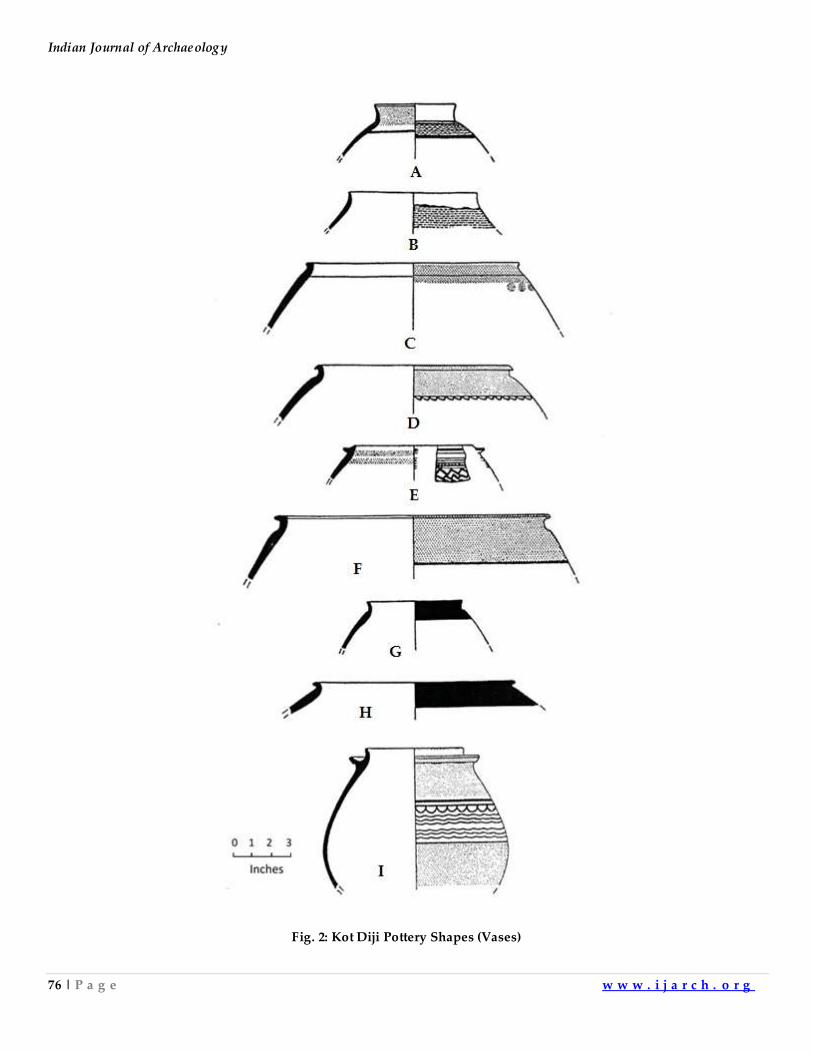
Indian Journal of Archaeology
76 | P a g e w w w . i j a r c h . o r g
Fig. 2: Kot Diji Pottery Shapes (Vases)
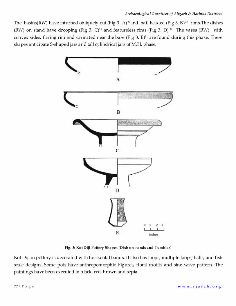
Archaeological Gazetteer of Aligarh & Hathras Districts
77 | P a g e w w w . i j a r c h . o r g
The basins(RW) have inturned obliquely cut (Fig 3. A) 27and nail headed (Fig 3. B) 28 rims.The dishes
(RW) on stand have drooping (Fig 3. C)29 and featureless rims (Fig 3. D).30 The vases (RW) with
convex sides, flaring rim and carinated near the base (Fig 3. E)31 are found during this phase. These
shapes anticipate S-shaped jars and tall cylindrical jars of M.H. phase.
Fig. 3: Kot Diji Pottery Shapes (Dish on stands and Tumbler)
Kot Dijian pottery is decorated with horizontal bands. It also has loops, multiple loops, balls, and fish
scale designs. Some pots have anthropomorphic Figures, floral motifs and sine wave pattern. The
paintings have been executed in black, red, brown and sepia.
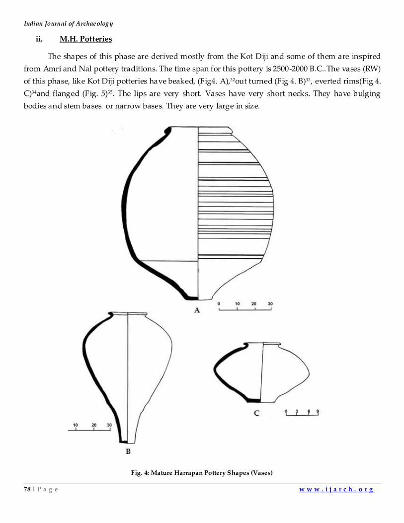
Indian Journal of Archaeology
78 | P a g e w w w . i j a r c h . o r g
ii. M.H. Potteries
The shapes of this phase are derived mostly from the Kot Diji and some of them are inspired
from Amri and Nal pottery traditions. The time span for this pottery is 2500-2000 B.C..The vases (RW)
of this phase, like Kot Diji potteries have beaked, (Fig4. A),32out turned (Fig 4. B)33, everted rims(Fig 4.
C)34and flanged (Fig. 5)35. The lips are very short. Vases have very short necks. They have bulging
bodies and stem bases or narrow bases. They are very large in size.
Fig. 4: Mature Harrapan Pottery Shapes (Vases)
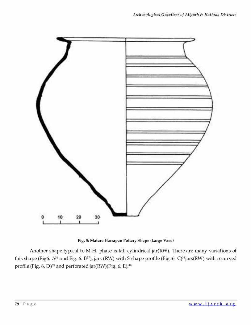
Archaeological Gazetteer of Aligarh & Hathras Districts
79 | P a g e w w w . i j a r c h . o r g
Fig. 5: Mature Harrapan Pottery Shape (Large Vase)
Another shape typical to M.H. phase is tall cylindrical jar(RW). There are many variations of
this shape (Fig6. A36 and Fig. 6. B37), jars (RW) with S shape profile (Fig. 6. C)38jars(RW) with recurved
profile (Fig. 6. D)39 and perforated jar(RW)(Fig. 6. E).40
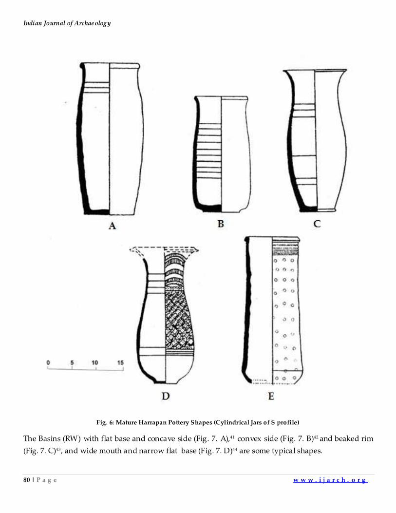
Indian Journal of Archaeology
80 | P a g e w w w . i j a r c h . o r g
Fig. 6: Mature Harrapan Pottery Shapes (Cylindrical Jars of S profile)
The Basins (RW) with flat base and concave side (Fig. 7. A),41 convex side (Fig. 7. B)42 and beaked rim
(Fig. 7. C)43, and wide mouth and narrow flat base (Fig. 7. D)44 are some typical shapes.
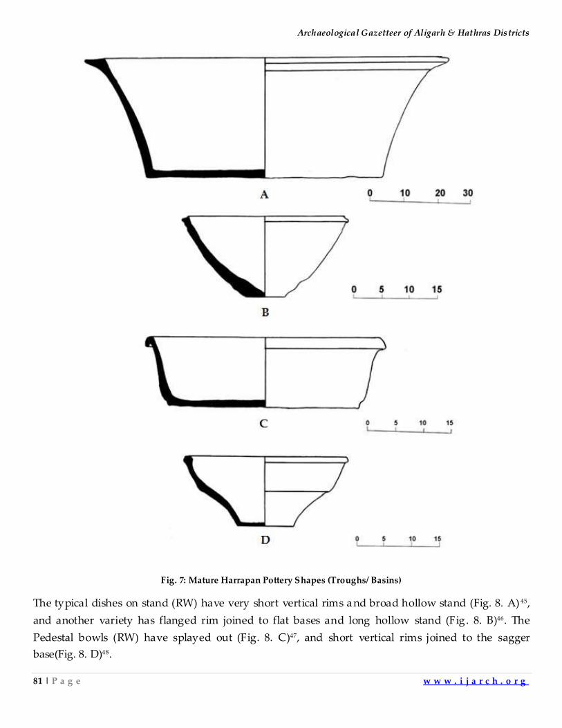
Archaeological Gazetteer of Aligarh & Hathras Districts
81 | P a g e w w w . i j a r c h . o r g
Fig. 7: Mature Harrapan Pottery Shapes (Troughs/ Basins)
The typical dishes on stand (RW) have very short vertical rims and broad hollow stand (Fig. 8. A) 45,
and another variety has flanged rim joined to flat bases and long hollow stand (Fig. 8. B)46. The
Pedestal bowls (RW) have splayed out (Fig. 8. C)47, and short vertical rims joined to the sagger
base(Fig. 8. D)48.
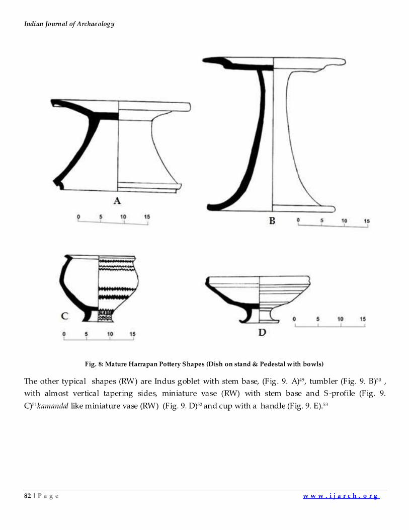
Indian Journal of Archaeology
82 | P a g e w w w . i j a r c h . o r g
Fig. 8: Mature Harrapan Pottery Shapes (Dish on stand & Pedestal with bowls)
The other typical shapes (RW) are Indus goblet with stem base, (Fig. 9. A)49, tumbler (Fig. 9. B)50 ,
with almost vertical tapering sides, miniature vase (RW) with stem base and S-profile (Fig. 9.
C)51kamandal like miniature vase (RW) (Fig. 9. D)52 and cup with a handle (Fig. 9. E).53
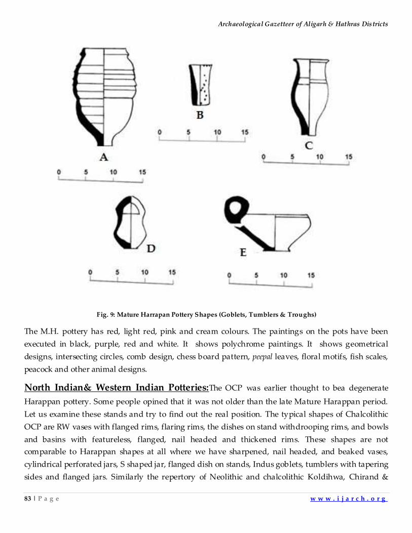
Archaeological Gazetteer of Aligarh & Hathras Districts
83 | P a g e w w w . i j a r c h . o r g
Fig. 9: Mature Harrapan Pottery Shapes (Goblets, Tumblers & Troughs)
The M.H. pottery has red, light red, pink and cream colours. The paintings on the pots have been
executed in black, purple, red and white. It shows polychrome paintings. It shows geometrical
designs, intersecting circles, comb design, chess board pattern, peepal leaves, floral motifs, fish scales,
peacock and other animal designs.
North Indian& Western Indian Potteries:The OCP was earlier thought to bea degenerate
Harappan pottery. Some people opined that it was not older than the late Mature Harappan period.
Let us examine these stands and try to find out the real position. The typical shapes of Chalcolithic
OCP are RW vases with flanged rims, flaring rims, the dishes on stand withdrooping rims, and bowls
and basins with featureless, flanged, nail headed and thickened rims. These shapes are not
comparable to Harappan shapes at all where we have sharpened, nail headed, and beaked vases,
cylindrical perforated jars, S shaped jar, flanged dish on stands, Indus goblets, tumblers with tapering
sides and flanged jars. Similarly the repertory of Neolithic and chalcolithic Koldihwa, Chirand &
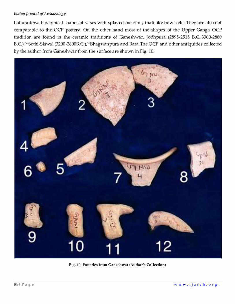
Indian Journal of Archaeology
84 | P a g e w w w . i j a r c h . o r g
Lahuradewa has typical shapes of vases with splayed out rims, thali like bowls etc. They are also not
comparable to the OCP pottery. On the other hand most of the shapes of the Upper Ganga OCP
tradition are found in the ceramic traditions of Ganeshwar, Jodhpura (2895-2515 B.C.,3360-2880
B.C.),54 Sothi-Siswal (3200-2600B.C.),55Bhagwanpura and Bara.The OCP and other antiquities collected
by the author from Ganeshwar from the surface are shown in Fig. 10.
Fig. 10: Potteries from Ganeshwar (Author’s Collection)
Archaeological Gazetteer of Aligarh & Hathras Districts
85 | P a g e w w w . i j a r c h . o r g
The typical OCP shapes and other antiquities can be seen in it.They are all red ware pot sherds.One
can see piece of flaring vase(Fig. 10.1), pottery pieces on which rustication has been done usingslurry
mixed with quartzite granules (Fig. 10.2 & 10.3),appliqué design on apot shard(Fig. 10.4), piece of
basin with out-turned rim(Fig. 10.5),a quartzite core(Fig. 10.6),piece of out-turned vase(Fig. 10.7),
piece of featureless basin(Fig. 10.8), pieces of strap handles of basins(Fig. 10.9)(Fig. 10.10) (Fig. 10.11)
and piece of flaring and flanged vase(Fig. 10.12).The pottery pieces shown here are the diagnostic
shapes of OCP. The pottery of Kalibangan and Balathal covering protostoric period has generic
similarities with OCP. It appears that the pottery of southern Rajasthan has mostly the same shapes
as OCP. There are only a few shapes which although appear to have generic similarly with OCP but
show a littledivergence. In the absence of the dates for Neolithic period in this area it has been
assumedthatUpper Ganga valley had no Neolithic Culture and it was colonized by mature
Harappans during the later phase of their ascendancy. As such this part of northern India combined
with the land between Yamuna and Sutlej which covers roughly the modern states of Haryana,
Punjab and Northern Rajasthan lies midway between high rainfall area of mid Ganga Valley and dry
Indus Valley plains. Both these regions had human habitation in early period. Had the middle area
been a cultural blank, then one of these two regional cultures would have filled the void before the
onset of Harappan empire .According to this school of thought Upper Ganga valley should have
remained without any identifiable archaeological culture till the beginning of MH.It appears in the
light of the dates of Jhinjhana(TL date 2650 B.C.), Lal Quila, (TL date 2030 B.C.), AtranjikheraTL date
2680B.C.),56Hulas (six calibrated carbon dates 3318B.C.,3231B.C.,3181B.C.,3159B.C.,3139B.C.,
2468B.C.)57and Bhagwanpura[TL dates for early phase 4868(± - ±12% ) BP,4141(±12% - ±15%) BP,
5460(± - ±15%) BP,4696(±3% - ±17%) BP], 58that some of the sites of the so-called degenerate phase
predate the M.H., some of them run contemporary to it and some survive them. This is the reason
why Alamgirpur and other sites in the northern portion of Upper Ganga Valley show the OCP
antiquities mixed with a few Harappan shapes anda few pottery pieces inscribed with Harappan
script.This entire area yields copper hoards, the main weapons among them being barbed harpoons
and copper celts. The only difference between the weapons of Upper Ganga valley and the area west
of it is the designs of harpoons and celts. But these weapons are altogether different from the ones
associated with Mature Harappan phase and those found in Middle Ganga Valley area. The Pre
Harappan period of OCP can be safely placed between 3200-2500B.C. and is the same as Sothi-Siswal
phase. Till now the early dates of Kalibangan,(Carbon dates of early phase 5566 B.C., 5289B.C.,
5600B.C., 5224 B.C.)59Bagor(carbon dates of early phases 4560-4405B.C.,5365-4965B.C.,3395-3160
B.C.)60 and Balathal(carbon date of early phase 4540-4340 B.C.)61on one hand reach later sixth
Millenium and mid-5th Millenium. Theaceramic Neolithic of Mid Ganga Valley on the other hand
reaches nineth millennium B.C.At present no date for Neolithic phaseof Upper Ganga valley is
available.The potteries found in Upper Ganga valley from the earliest period are the same as those
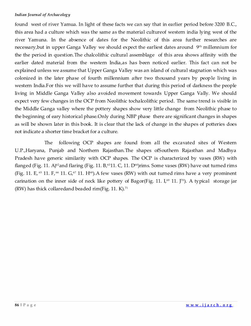
Indian Journal of Archaeology
86 | P a g e w w w . i j a r c h . o r g
found west of river Yamua. In light of these facts we can say that in earlier period before 3200 B.C.,
this area had a culture which was the same as the material cultureof western india lying west of the
river Yamuna. In the absence of dates for the Neolithic of this area further researches are
necessary,but in upper Ganga Valley we should expect the earliest dates around 9th millennium for
the the period in question.The chalcolithic cultural assemblage of this area shows affinity with the
earlier dated material from the western India,as has been noticed earlier. This fact can not be
explained unless we assume that Upper Ganga Valley was an island of cultural stagnation which was
colonized in the later phase of fourth millennium after two thousand years by people living in
western India.For this we will have to assume further that during this period of darkness the people
living in Middle Ganga Valley also avoided movement towards Upper Ganga Vally. We should
expect very few changes in the OCP from Neolithic tochalcolithic period. The same trend is visible in
the Middle Ganga valley where the pottery shapes show very little change from Neolithic phase to
the beginning of eary historical phase.Only during NBP phase there are significant changes in shapes
as will be shown later in this book. It is clear that the lack of change in the shapes of potteries does
not indicate a shorter time bracket for a culture.
The following OCP shapes are found from all the excavated sites of Western
U.P.,Haryana, Punjab and Northern Rajasthan.The shapes ofSouthern Rajasthan and Madhya
Pradesh have generic similarity with OCP shapes. The OCP is characterized by vases (RW) with
flanged (Fig. 11. A)62and flaring (Fig. 11. B,6311. C, 11. D64)rims. Some vases (RW) have out turned rims
(Fig. 11. E, 65 11. F, 66 11. G,67 11. H68).A few vases (RW) with out turned rims have a very prominent
carination on the inner side of neck like pottery of Bagor(Fig. 11. I,69 11. J70). A typical storage jar
(RW) has thick collaredand beaded rim(Fig. 11. K).71
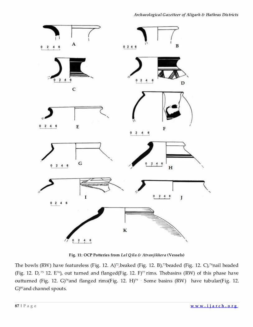
Archaeological Gazetteer of Aligarh & Hathras Districts
87 | P a g e w w w . i j a r c h . o r g
Fig. 11: OCP Potteries from Lal Qila & Atranjikhera (Vessels)
The bowls (RW) have featureless (Fig. 12. A)72,beaked (Fig. 12. B),73beaded (Fig. 12. C),74nail headed
(Fig. 12. D, 75 12. E76), out turned and flanged(Fig. 12. F)77 rims. Thebasins (RW) of this phase have
outturned (Fig. 12. G)78and flanged rims(Fig. 12. H)79 . Some basins (RW) have tubular(Fig. 12.
G)80and channel spouts.
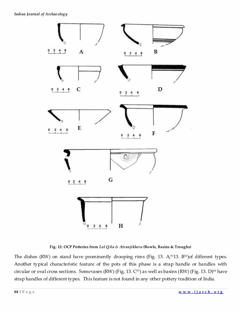
Indian Journal of Archaeology
88 | P a g e w w w . i j a r c h . o r g
Fig. 12: OCP Potteries from Lal Qila & Atranjikhera (Bowls, Basins & Troughs)
The dishes (RW) on stand have prominently drooping rims (Fig. 13. A,8113. B82)of different types.
Another typical characteristic feature of the pots of this phase is a strap handle or handles with
circular or oval cross sections. Somevases (RW) (Fig. 13. C83) as well as basins (RW) (Fig. 13. D)84 have
strap handles of different types. This feature is not found in any other pottery tradition of India.
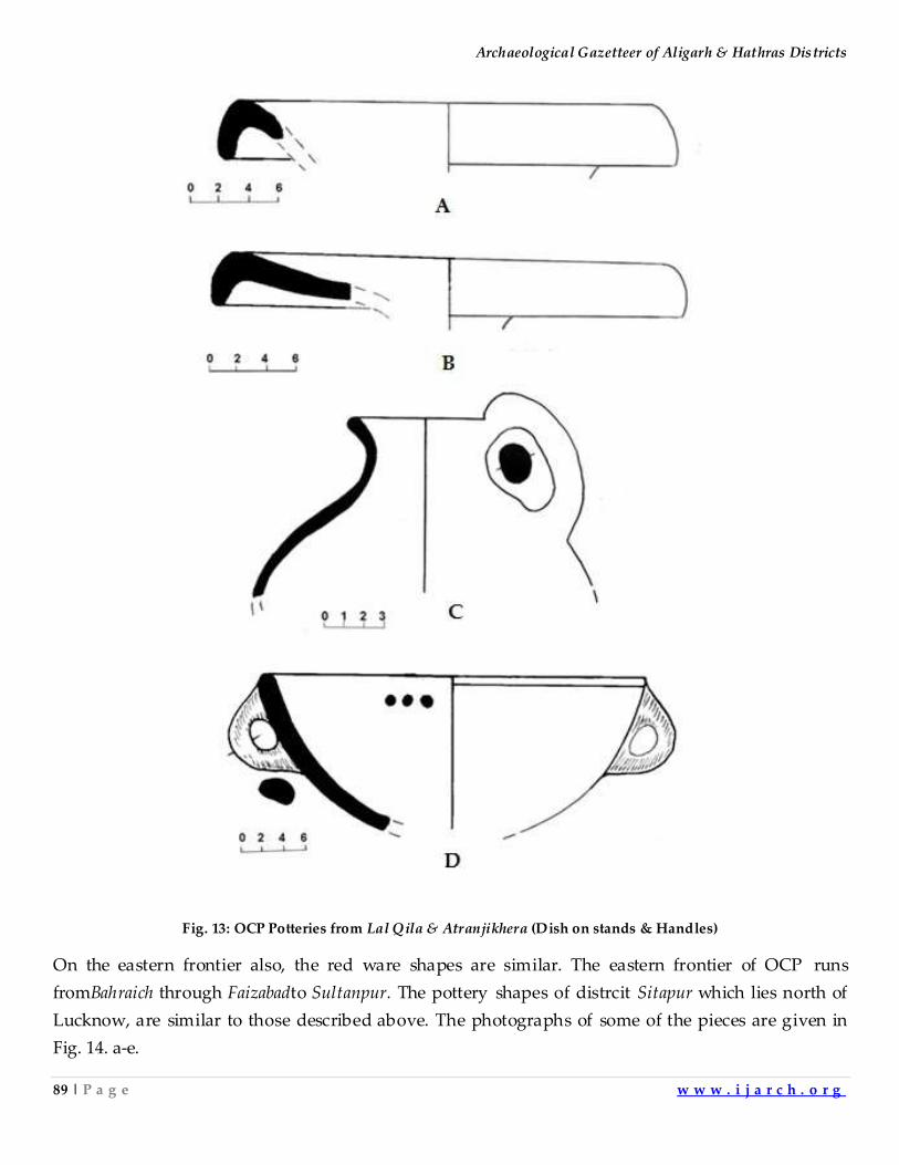
Archaeological Gazetteer of Aligarh & Hathras Districts
89 | P a g e w w w . i j a r c h . o r g
Fig. 13: OCP Potteries from Lal Qila & Atranjikhera (Dish on stands & Handles)
On the eastern frontier also, the red ware shapes are similar. The eastern frontier of OCP runs
fromBahraich through Faizabadto Sultanpur. The pottery shapes of distrcit Sitapur which lies north of
Lucknow, are similar to those described above. The photographs of some of the pieces are given in
Fig. 14. a-e.
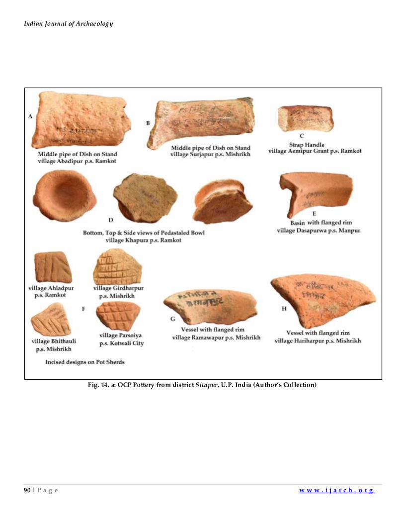
Indian Journal of Archaeology
90 | P a g e w w w . i j a r c h . o r g
Fig. 14. a: OCP Pottery from district Sitapur, U.P. India (Author’s Collection)
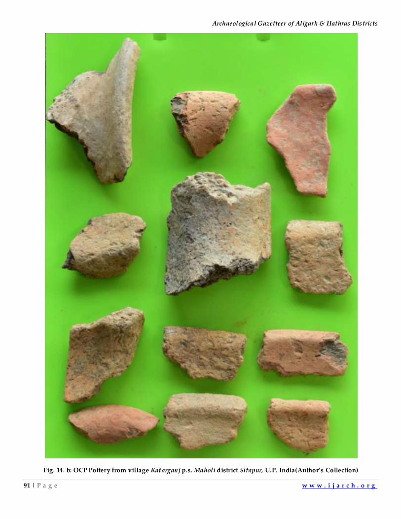
Archaeological Gazetteer of Aligarh & Hathras Districts
91 | P a g e w w w . i j a r c h . o r g
Fig. 14. b: OCP Pottery from village Katarganj p.s. Maholi district Sitapur, U.P. India(Author’s Collection)
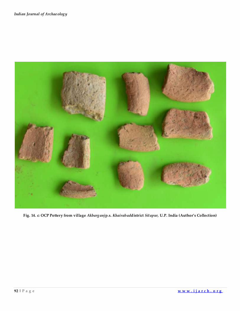
Indian Journal of Archaeology
92 | P a g e w w w . i j a r c h . o r g
Fig. 14. c: OCP Pottery from village Akbarganjp.s. Khairabaddistrict Sitapur, U.P. India (Author’s Collection)
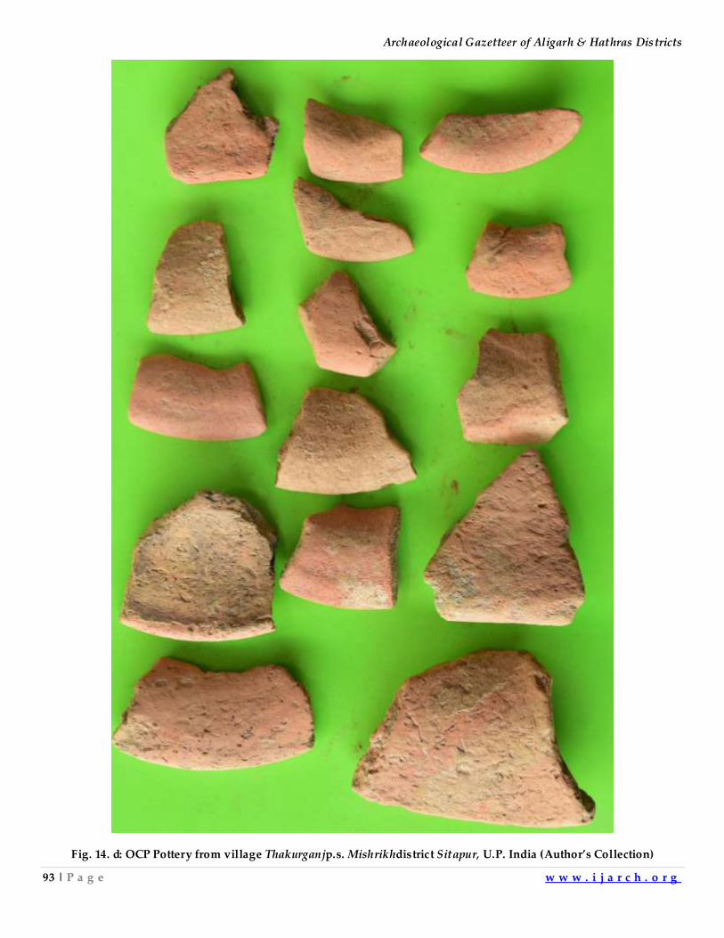
Archaeological Gazetteer of Aligarh & Hathras Districts
93 | P a g e w w w . i j a r c h . o r g
Fig. 14. d: OCP Pottery from village Thakurganjp.s. Mishrikhdistrict Sitapur, U.P. India (Author’s Collection)
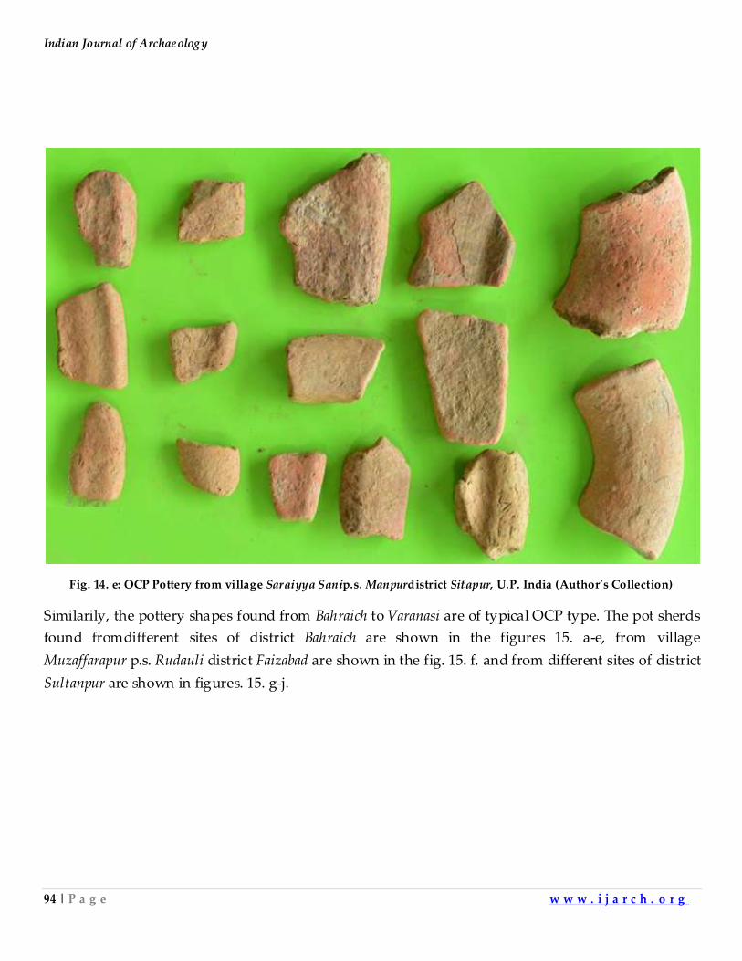
Indian Journal of Archaeology
94 | P a g e w w w . i j a r c h . o r g
Fig. 14. e: OCP Pottery from village Saraiyya Sanip.s. Manpurdistrict Sitapur, U.P. India (Author’s Collection)
Similarily, the pottery shapes found from Bahraich to Varanasi are of typical OCP type. The pot sherds
found fromdifferent sites of district Bahraich are shown in the figures 15. a-e, from village
Muzaffarapur p.s. Rudauli district Faizabad are shown in the fig. 15. f. and from different sites of district
Sultanpur are shown in figures. 15. g-j.
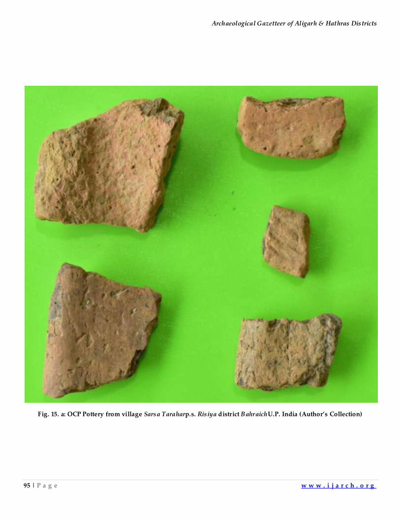
Archaeological Gazetteer of Aligarh & Hathras Districts
95 | P a g e w w w . i j a r c h . o r g
Fig. 15. a: OCP Pottery from village Sarsa Taraharp.s. Risiya district BahraichU.P. India (Author’s Collection)
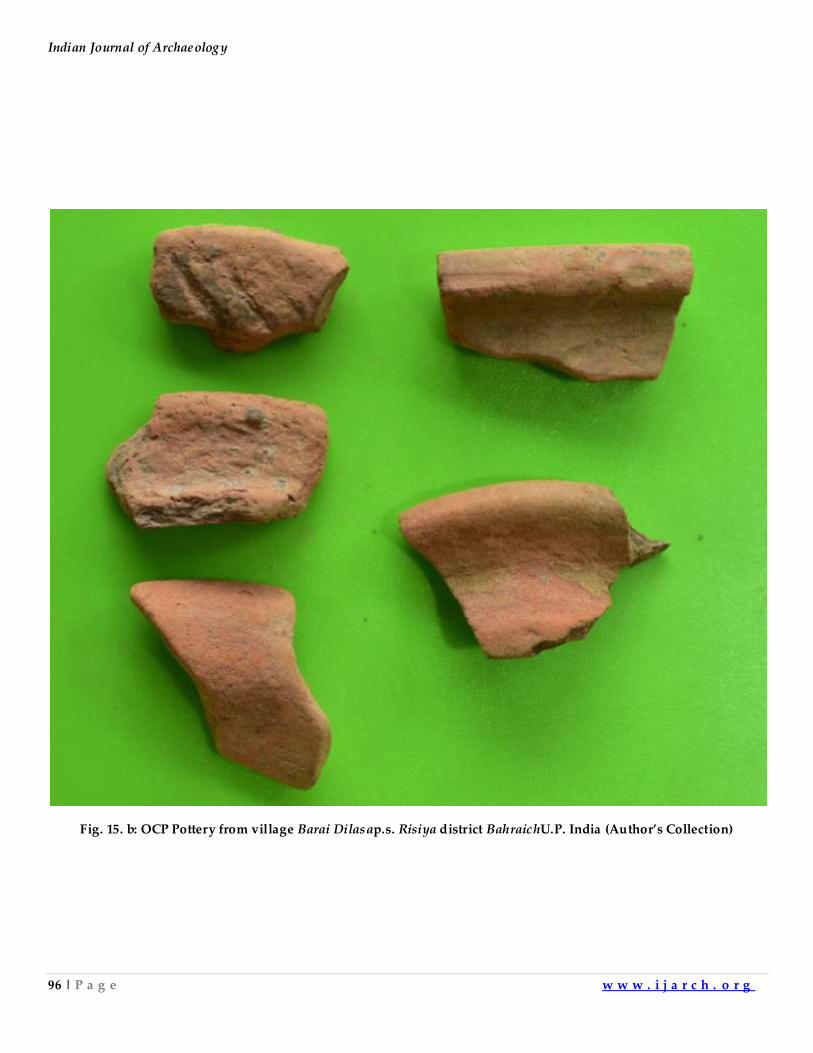
Indian Journal of Archaeology
96 | P a g e w w w . i j a r c h . o r g
Fig. 15. b: OCP Pottery from village Barai Dilasap.s. Risiya district BahraichU.P. India (Author’s Collection)
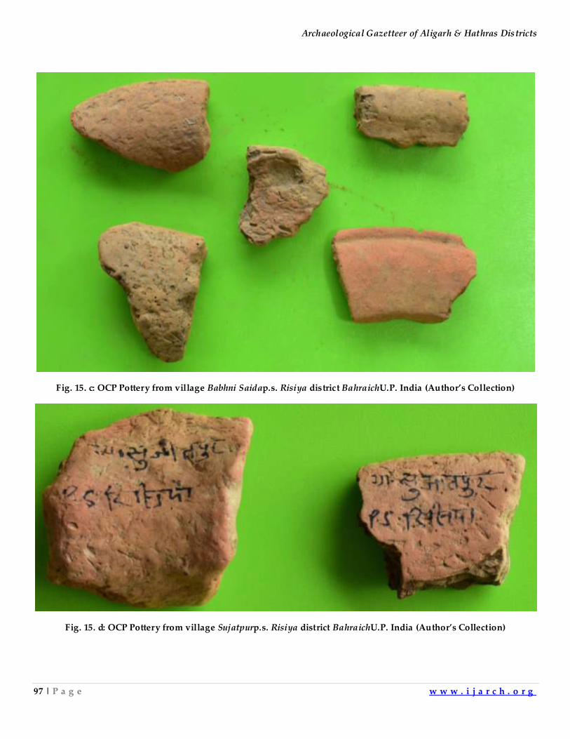
Archaeological Gazetteer of Aligarh & Hathras Districts
97 | P a g e w w w . i j a r c h . o r g
Fig. 15. c: OCP Pottery from village Babhni Saidap.s. Risiya district BahraichU.P. India (Author’s Collection)
Fig. 15. d: OCP Pottery from village Sujatpurp.s. Risiya district BahraichU.P. India (Author’s Collection)
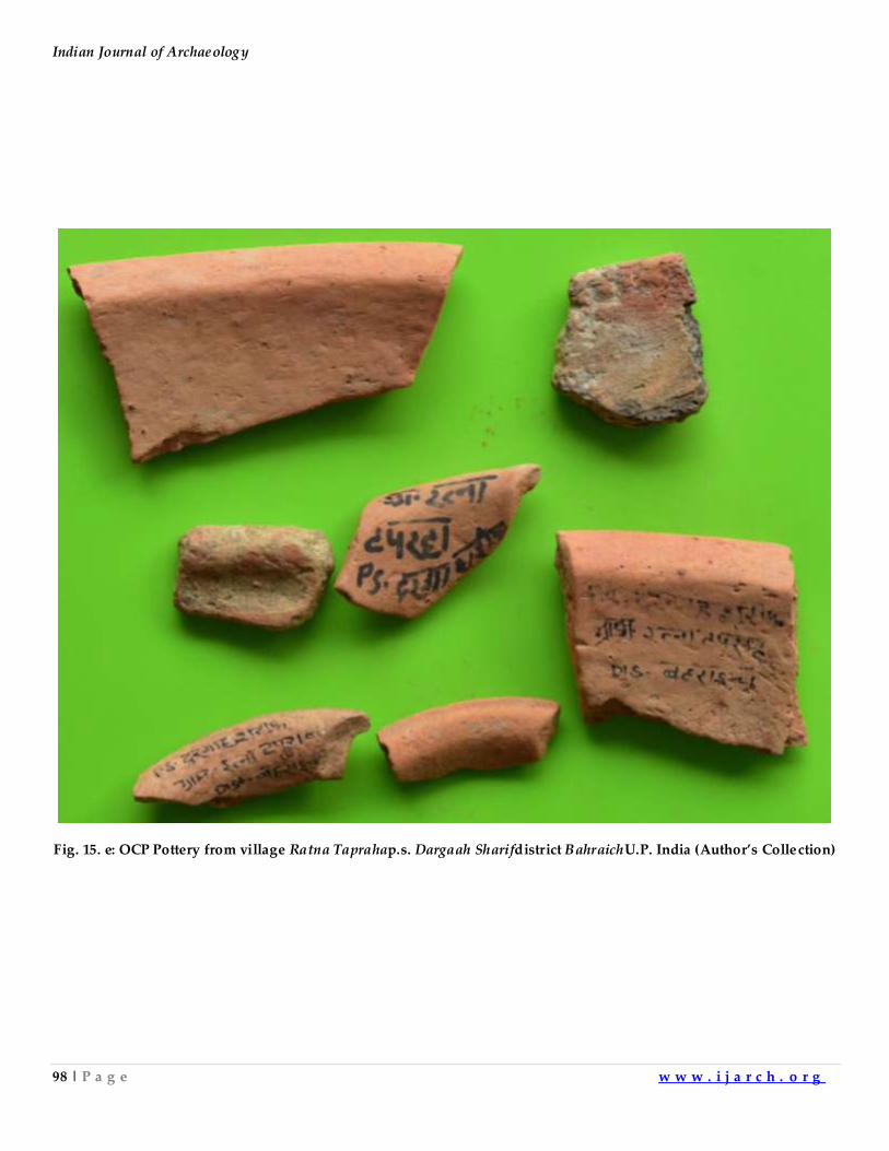
Indian Journal of Archaeology
98 | P a g e w w w . i j a r c h . o r g
Fig. 15. e: OCP Pottery from village Ratna Taprahap.s. Dargaah Sharifdistrict BahraichU.P. India (Author’s Collection)
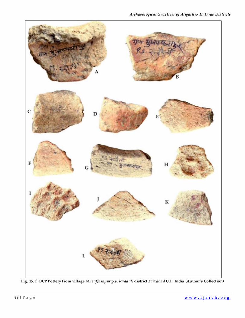
Archaeological Gazetteer of Aligarh & Hathras Districts
99 | P a g e w w w . i j a r c h . o r g
Fig. 15. f: OCP Pottery from village Muzaffarapur p.s. Rudauli district Faizabad U.P. India (Author’s Collection)
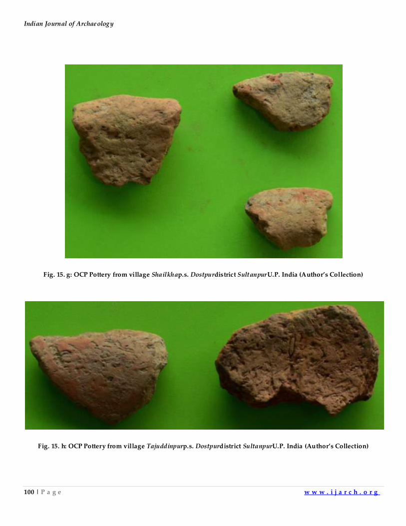
Indian Journal of Archaeology
100 | P a g e w w w . i j a r c h . o r g
Fig. 15. g: OCP Pottery from village Shailkhap.s. Dostpurdistrict SultanpurU.P. India (Author’s Collection)
Fig. 15. h: OCP Pottery from village Tajuddinpurp.s. Dostpurdistrict SultanpurU.P. India (Author’s Collection)
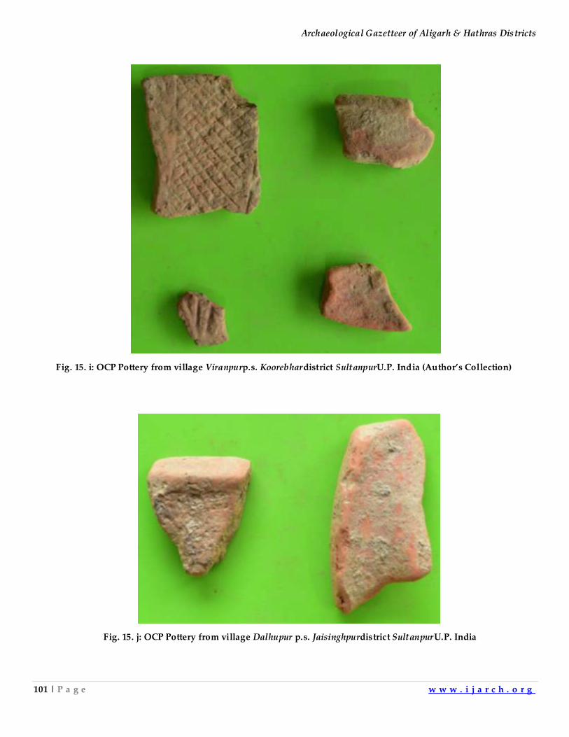
Archaeological Gazetteer of Aligarh & Hathras Districts
101 | P a g e w w w . i j a r c h . o r g
Fig. 15. j: OCP Pottery from village Dalhupur p.s. Jaisinghpurdistrict SultanpurU.P. India
Fig. 15. i: OCP Pottery from village Viranpurp.s. Koorebhardistrict SultanpurU.P. India (Author’s Collection)
Indian Journal of Archaeology
102 | P a g e w w w . i j a r c h . o r g
Auhtor has examined the OCP shapes from Bara to Faizabad. The OCP pottery in the west is well-fired
having coarse and medium fabric. Some of the OCP pieces from Baroodkhera district Aligarh and
Asuakhera district Firozabad were highly burnished. The burnishing was comparable to the NBP
pottery. At both the sites, most of the pottery pieces had powdery surface. The OCP from Lal Qila
district Bulandshahar, Uttar Pradeshwas well fired and its surface doesn’t give Ochrous powder when
rubbed. The OCP of Atranjikhera is again has Ochrous powdery surface. The OCP of Punjab, Haryana
and Ganga-Yamuna doabin many places is well fired. The OCP of Sitapur, Barabanki and Faizabad is
again coarse and its surface is powdery. At some sites, one can find OCP of medium and fine fabric
also. Some pieces show a red slip, much worn out and black horizontal bands. The decorative designs
vary from west to east but the incised designs are common in the same area. The OCP found at
Hastinapur was named Ochre Color Pottery because of its powdery surface which left ochrous
powder on your fingers when rubbed but later on the evidence of Baroodkhera, Lal Qila &Asuakhera
and the sites of Haryana, North Rajasthan and Punjab showed that some of the OCP is hard baked and
burnished also. Since the name first given to this type of pottery is OCP, therefore, we will continue
to name it as OCP for historical reasons. At some places, one may find OCP which doesn’t fit the
description given to it at the first find spot.
OCP, the Proto-historic culture of Northen and Western India:There has been a long
debate about OCP being a degenerate Harappan pottery. To settle this issue, the shapes which have
been identified as belonging to OCP tradition have been compared from Bara district Rupnagar,
Punajb to Muzaffarapur district Faizabad. In addition to shapes, the incised decorations and paintings
have also been compared. The pottery also shows applique decorations. In addition to this, the pots
were rusticated in different styles. The rustication at Ganeshwar shows mixing of slurry with quartz
nodules where as the rustication at Muzaffarapur shows application of mud and making of broad
crator like shapes in this slurry. The rustication at Asuakhera was done by application of mud slurry
mixed with pulverized pottery pieces. The rustication at Bhagwanpura showed the application of
slurry and making of wavy lines with fingers. It appears that local potters were using different types
of rustications in different regions. The comparison shows that the pottery shapes are common from
Bara in Punjab to Faizabadin eastern Uttar Pradesh. The incised decorations are found in the whole
area with some regional variations. The paintings change from east to west. Let us move on to
comparing the other abundantly found antiquity namely copper hoard. The copper hoard weapons
have also been compared. These also show similarity from west to east with largest concentration of
copper hoard finds in OCP area. The following list of copper hoard sites is shown on the map of
India85 (Fig. 16). It also shows the OCP area which has the maximum concentration of copper hoard
sites. The list of the copper sites is namely: 1. Aguibani, 2. Ahar, 3. Akhuldoba, 4. Amroha, 5. Andhari, 6.
Bagor, 7. Bahadarabad, 8. Baharia, 9. Balpur, 10. Bamanghati, 11. Bandua, 12. Bargaon, 13. Bardangua, 14.
Archaeological Gazetteer of Aligarh & Hathras Districts
103 | P a g e w w w . i j a r c h . o r g
Bareilly, 15. Barrajpur, 16. Bartola, 17. Bhagada, 18. Bhaktabundh, 19. Bhiwani, 20. Bisauli, 21. Bithur, 22.
Brahmagiri, 23. Chandoli, 24. Chansar, 25. Chatla, 26. Chirand, 27. Dadari, 28. Daimabad, 29. Dargama, 30.
Debakia, 31. Deoti, 32. Dhaka, 33. Dimiria, 34. Ekalsimgha, 35. Elana, 36. Eran, 37. Etawah, 38. Fathgarh, 39.
Gandhauli, 40. Ganeshwar, 41. Ghangharia, 42. Hallur, 43. Hami, 44. Hansi, 45. Hardi, 46. Harra Chowra
Darh, 47. Inamgaon, 48. Indilapur, 49. Jabalpur, 50. Jajmo, 51. Jamboni, 52. Jokha, 53. Jorwe, 54. Kallur, 55.
Kamalpur, 56. Kamdara, 57. Kankasa, 58. Karharbari, 59. Katmandu valley, 60. Kayatha, 61. Kesli, 62. Kesna,
63. Khera Manpur, 64. Kindhaulia, 65. Kiratpur, 66. Kosam, 67. Kota, 68. Kulgara, 69. Kulhade-ka-Johade, 70.
Kurada, 71. Kushaya, 72. Lal Qila, 73. Langnaj, 74. Lothal, 75. Ludurapada, 76. Madnapur, 77. Mahisadal, 78.
Mahuadanr, 79. Mainpuri, 80. Mallah, 81. Maski, 82. Mathura, 83. Mitathal, 84. Moongalaar Tea Estate, 86.
Nagar, 87. Nakrahiya, 88. Nandlalpura, 89. Nankom, 90. Narnaod, 91. Narsimhapur, 92. Nasirpur, 93.
Navdatoli, 94. Nevasa, 95. Niorai, 96. Pandu Rajar Dhibi, 97. Pariar, 98. Parihati, 99. Pauli, 100. Perua, 101.
Piklihal, 102. Pind, 103. Pondi, 104. Prakash, 105. Rajpur Parsu, 106. Ramapuram, 107. Ramjipura,
108.Rangpur, 109. Resgavaon, 110. Rewari, 111. Sabania, 112. Saguni, 113. Saipai Lichchwai, 114. Sanchan
Kot, 115. Sandhay, 116. Sanghol, 117. Sankarjang, 118. Sarthauli, 119. Sastevadi, 120. Shahabad, 121.
Shavinipatti, 122. Sheorajpur, 123. Somnath, 124. Sonpur, 125. Tamajuri, 126. Taradih, 127. Tekkalakota, 128.
Terdal, 129. Viratgarh.
Indian Journal of Archaeology
104 | P a g e w w w . i j a r c h . o r g
Fig. 16:Map showing OCP area, Harappan & Corded Ware Cultures with copper hoard find sites
Harappan Culture
Corded Ware
Culture
Archaeological Gazetteer of Aligarh & Hathras Districts
105 | P a g e w w w . i j a r c h . o r g
The copper hoard objects have been found outside this area starting from Nepal &Bankot district
Pithoragarh, Uttrakhand to Shavinipatti district Shivgangai, Tamilnadu&Lothal district Ahmedabad,
Gujarat to Perua district West Medinipur, West Bengal. It appears that these objects were taken either
by people migrating from OCP area or imported by the inhabitants of peripheral regionslying in
different parts of the country.The gangetic plains don’t have copper. It was imported from peripheral
regions. It appears that the some varities of copper artefacts were made and exported by the
peripheral people to the OCP people. To complete the sketch of the OCP culture, the burial practices
of OCP people from Sanauli district Baghpat,U.P. have been discussed. The material found from
excavations in western U.P. shows potsherds with Harappan script. It indicates that between 2500
B.C. and 2000 B.C., the people of Indus valley and Upper Ganga valley were using common script.
Around 600 B.C. during early historical period, we find different dialects of Indo-aryan languages
been used from Bengal to Afghanistan and from Northern India to Northern Deccan. The Buddhist
literature and earlier literature like the four Vedas, later Vedic texts don’t show any major change in
the language. The Jain traditional literature which was compiled later on but appears to be of the
earliest origin gives a continuous account of different Tirthankaras and Kings. The four traditions give
slightly different versions of the same story. For example, Buddhist literature mentions Ikśvāku as the
ancestor of Buddha. The descendants of Ikśvāku also appears in many Jataka stories. Vedic and later
Vedic literature mentions him as a great king. Jains also claim him as ancestor of Rishabha, the first
Tirthankara. It can be surmised from these evidences that the lingua-francaof North, Western and
Central India didn’t change. The western OCP people used Harappan script but as far as
archaeological evidence goes eastern people didn’t use it, but the language used by the people living
in this area was same. The material culture of the whole OCP zone was almost the same. Their
weapons can be seen all over India. They imported copper from Himalayan zone, Rajshthan, Central
India and Eastern India. They also imported readymadeHarappans vessels, weapons and other
artefacts made of copper as is evident from the recent find of a hoard of copper objects from
Harinagar, Mubarakpur, Bijnor, U.P.86.
Comparative pottery shapes found in Northern and Western India:Following is the
comparison of typical OCP pottery shapes from Bara district Rupnagar, Punjab to Muzaffarapur district
Faizabad, U.P. The vessels, bowls, basins, dish on stands, handles, incised designs, graffiti marks and
paintings on pots from different areas have been compared. The Red ware of OCP tradition are
decorated with black coloured horizontal bands, parallel vertical lines, loops, sine wave, checked
pattern, comb pattern and floral motifs. The red ware is often decorated with incised designs. Some
pots have got combed and rusticated designs. A few have got appliqué designs as well as post firing
graffiti marks. A large number of pots have rusticated lower portions. There are a few pots having
grey colour also.
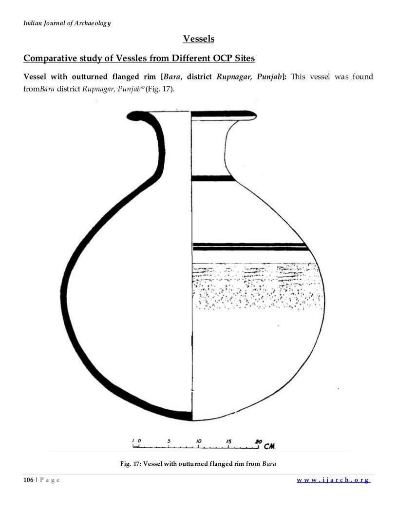
Indian Journal of Archaeology
106 | P a g e w w w . i j a r c h . o r g
Vessels
Comparative study of Vessles from Different OCP Sites
Vessel with outturned flanged rim [Bara, district Rupnagar, Punjab]: This vessel was found
fromBara district Rupnagar, Punjab87(Fig. 17).
Fig. 17: Vessel with outturned flanged rim from Bara
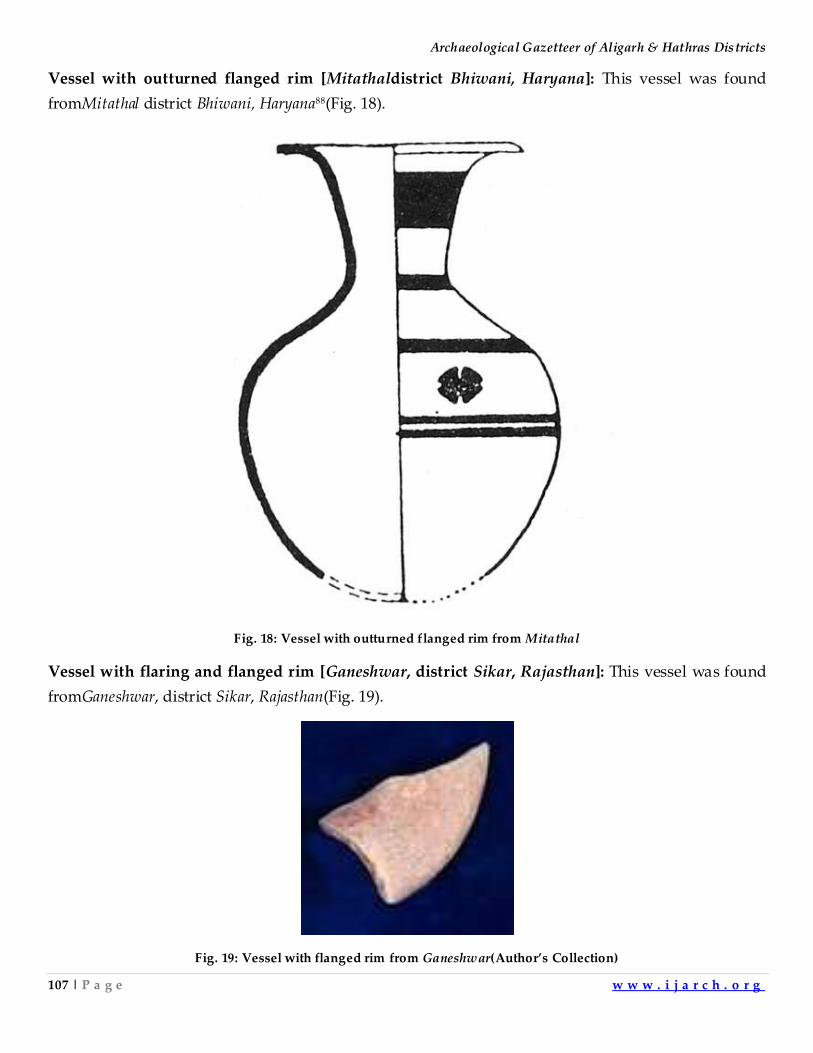
Archaeological Gazetteer of Aligarh & Hathras Districts
107 | P a g e w w w . i j a r c h . o r g
Vessel with outturned flanged rim [Mitathaldistrict Bhiwani, Haryana]: This vessel was found
fromMitathal district Bhiwani, Haryana88(Fig. 18).
Fig. 18: Vessel with outturned flanged rim from Mitathal
Vessel with flaring and flanged rim [Ganeshwar, district Sikar, Rajasthan]: This vessel was found
fromGaneshwar, district Sikar, Rajasthan(Fig. 19).
Fig. 19: Vessel with flanged rim from Ganeshwar(Author’s Collection)
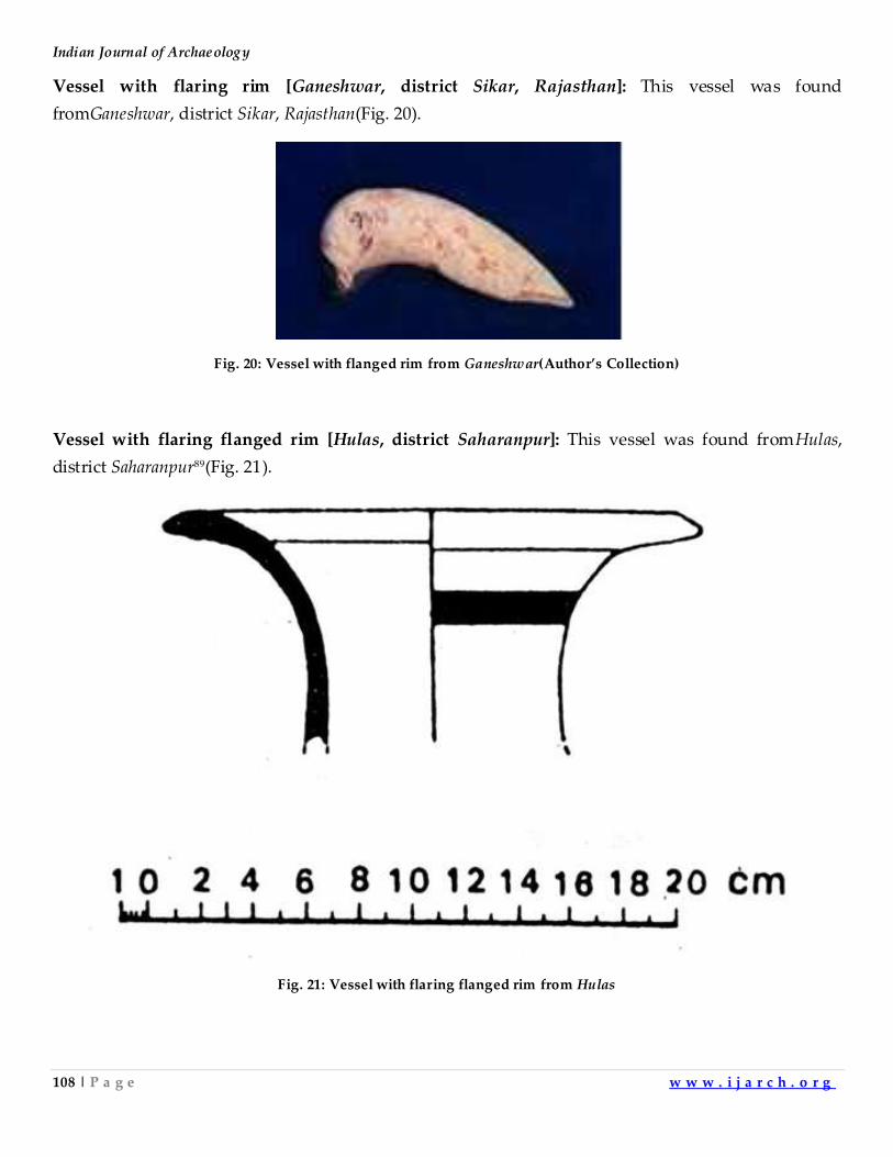
Indian Journal of Archaeology
108 | P a g e w w w . i j a r c h . o r g
Vessel with flaring rim [Ganeshwar, district Sikar, Rajasthan]: This vessel was found
fromGaneshwar, district Sikar, Rajasthan(Fig. 20).
Fig. 20: Vessel with flanged rim from Ganeshwar(Author’s Collection)
Vessel with flaring flanged rim [Hulas, district Saharanpur]: This vessel was found fromHulas,
district Saharanpur89(Fig. 21).
Fig. 21: Vessel with flaring flanged rim from Hulas
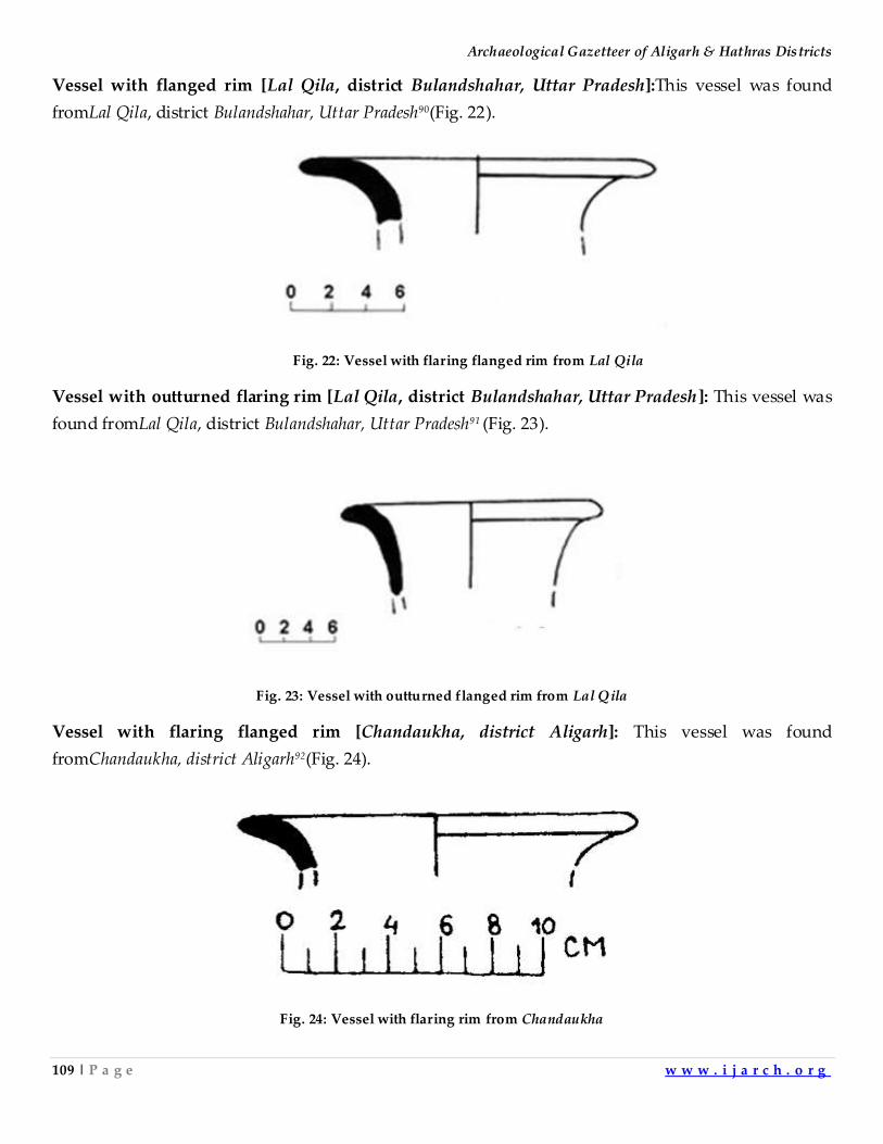
Archaeological Gazetteer of Aligarh & Hathras Districts
109 | P a g e w w w . i j a r c h . o r g
Vessel with flanged rim [Lal Qila, district Bulandshahar, Uttar Pradesh]:This vessel was found
fromLal Qila, district Bulandshahar, Uttar Pradesh90(Fig. 22).
Fig. 22: Vessel with flaring flanged rim from Lal Qila
Vessel with outturned flaring rim [Lal Qila, district Bulandshahar, Uttar Pradesh]: This vessel was
found fromLal Qila, district Bulandshahar, Uttar Pradesh91 (Fig. 23).
Fig. 23: Vessel with outturned flanged rim from Lal Qila
Vessel with flaring flanged rim [Chandaukha, district Aligarh]: This vessel was found
fromChandaukha, district Aligarh92(Fig. 24).
Fig. 24: Vessel with flaring rim from Chandaukha
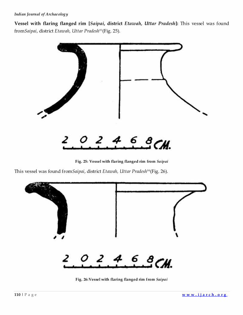
Indian Journal of Archaeology
110 | P a g e w w w . i j a r c h . o r g
Vessel with flaring flanged rim [Saipai, district Etawah, Uttar Pradesh]: This vessel was found
fromSaipai, district Etawah, Uttar Pradesh93(Fig. 25).
Fig. 25: Vessel with flaring flanged rim from Saipai
This vessel was found fromSaipai, district Etawah, Uttar Pradesh94(Fig. 26).
Fig. 26:Vessel with flaring flanged rim from Saipai
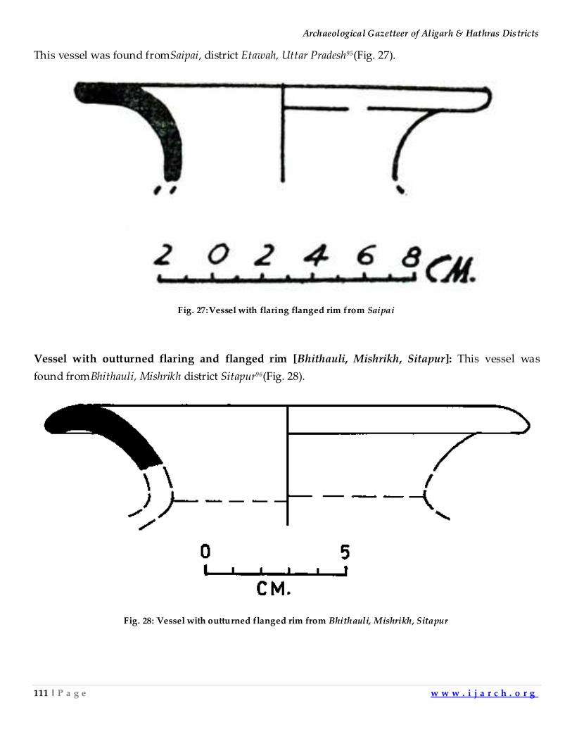
Archaeological Gazetteer of Aligarh & Hathras Districts
111 | P a g e w w w . i j a r c h . o r g
This vessel was found fromSaipai, district Etawah, Uttar Pradesh95(Fig. 27).
Fig. 27:Vessel with flaring flanged rim from Saipai
Vessel with outturned flaring and flanged rim [Bhithauli, Mishrikh, Sitapur]: This vessel was
found fromBhithauli, Mishrikh district Sitapur96(Fig. 28).
Fig. 28: Vessel with outturned flanged rim from Bhithauli, Mishrikh, Sitapur
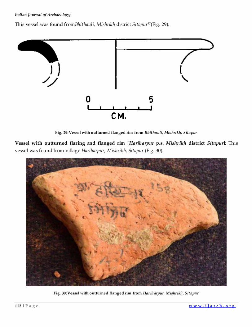
Indian Journal of Archaeology
112 | P a g e w w w . i j a r c h . o r g
This vessel was found fromBhithauli, Mishrikh district Sitapur97(Fig. 29).
Fig. 29:Vessel with outturned flanged rim from Bhithauli, Mishrikh, Sitapur
Vessel with outturned flaring and flanged rim [Hariharpur p.s. Mishrikh district Sitapur]: This
vessel was found from village Hariharpur, Mishrikh, Sitapur (Fig. 30).
Fig. 30:Vessel with outturned flanged rim from Hariharpur, Mishrikh, Sitapur
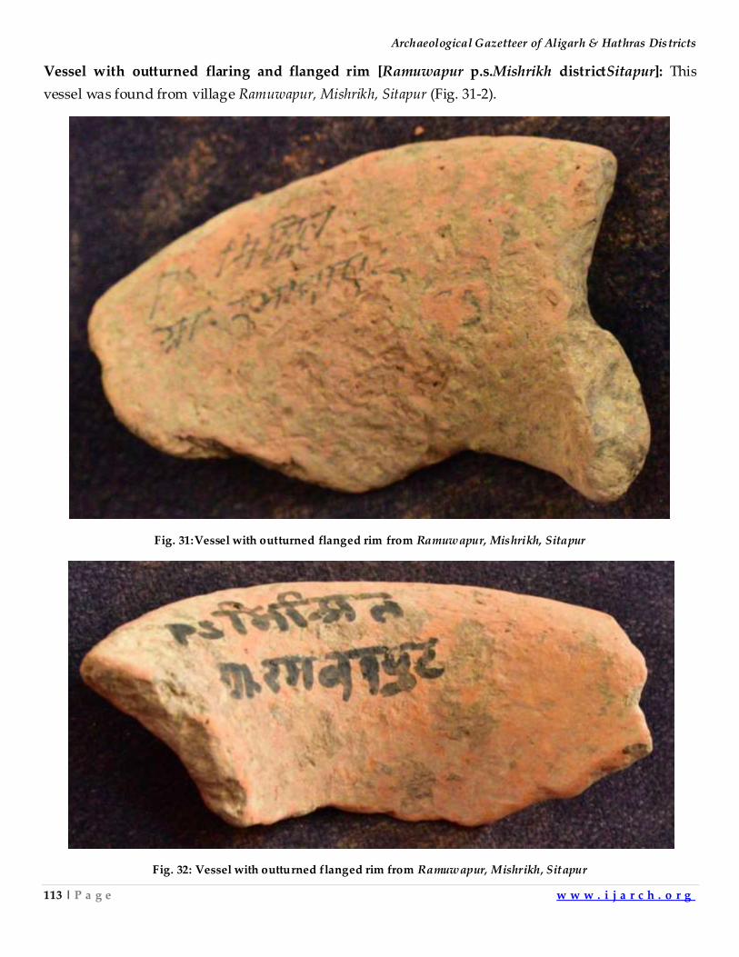
Archaeological Gazetteer of Aligarh & Hathras Districts
113 | P a g e w w w . i j a r c h . o r g
Vessel with outturned flaring and flanged rim [Ramuwapur p.s.Mishrikh districtSitapur]: This
vessel was found from village Ramuwapur, Mishrikh, Sitapur (Fig. 31-2).
Fig. 31:Vessel with outturned flanged rim from Ramuwapur, Mishrikh, Sitapur
Fig. 32: Vessel with outturned flanged rim from Ramuwapur, Mishrikh, Sitapur
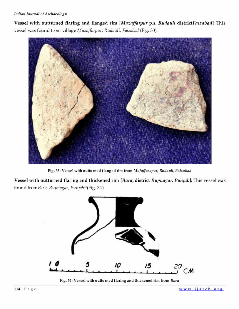
Indian Journal of Archaeology
114 | P a g e w w w . i j a r c h . o r g
Vessel with outturned flaring and flanged rim [Muzaffarpur p.s. Rudauli districtFaizabad]: This
vessel was found from village Muzaffarpur, Rudauli, Faizabad (Fig. 33).
Fig. 33: Vessel with outturned flanged rim from Mujaffarapur, Rudauli, Faizabad
Vessel with outturned flaring and thickened rim [Bara, district Rupnagar, Punjab]: This vessel was
found fromBara, Rupnagar, Punjab98(Fig. 34).
Fig. 34: Vessel with outturned flaring and thickened rim from Bara
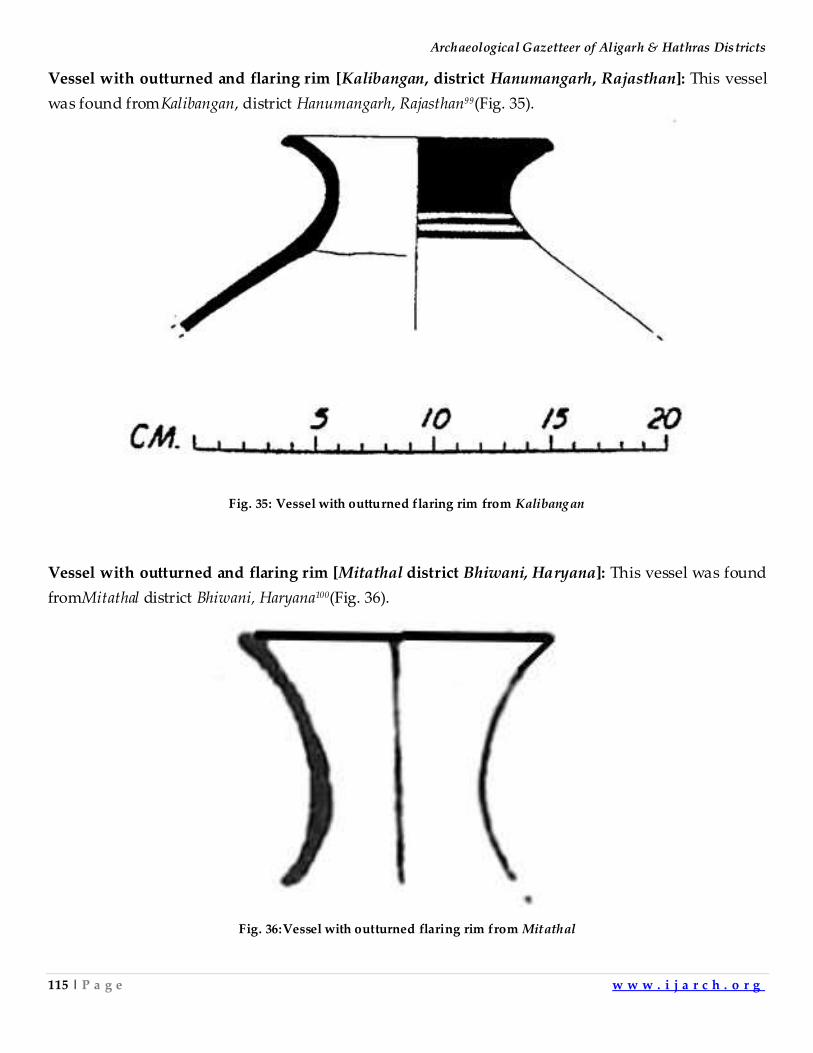
Archaeological Gazetteer of Aligarh & Hathras Districts
115 | P a g e w w w . i j a r c h . o r g
Vessel with outturned and flaring rim [Kalibangan, district Hanumangarh, Rajasthan]: This vessel
was found fromKalibangan, district Hanumangarh, Rajasthan99(Fig. 35).
Fig. 35: Vessel with outturned flaring rim from Kalibangan
Vessel with outturned and flaring rim [Mitathal district Bhiwani, Haryana]: This vessel was found
fromMitathal district Bhiwani, Haryana100(Fig. 36).
Fig. 36:Vessel with outturned flaring rim from Mitathal
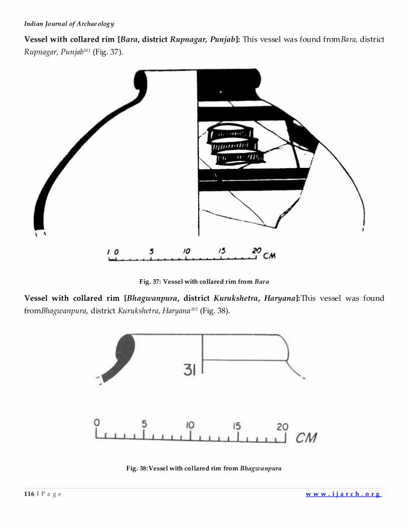
Indian Journal of Archaeology
116 | P a g e w w w . i j a r c h . o r g
Vessel with collared rim [Bara, district Rupnagar, Punjab]: This vessel was found fromBara, district
Rupnagar, Punjab101 (Fig. 37).
Fig. 37: Vessel with collared rim from Bara
Vessel with collared rim [Bhagwanpura, district Kurukshetra, Haryana]:This vessel was found
fromBhagwanpura, district Kurukshetra, Haryana102 (Fig. 38).
Fig. 38:Vessel with collared rim from Bhagwanpura
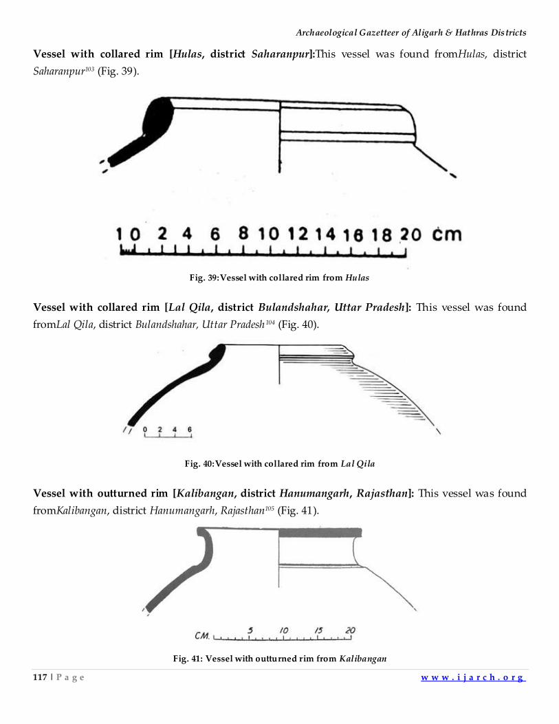
Archaeological Gazetteer of Aligarh & Hathras Districts
117 | P a g e w w w . i j a r c h . o r g
Vessel with collared rim [Hulas, district Saharanpur]:This vessel was found fromHulas, district
Saharanpur103 (Fig. 39).
Fig. 39:Vessel with collared rim from Hulas
Vessel with collared rim [Lal Qila, district Bulandshahar, Uttar Pradesh]: This vessel was found
fromLal Qila, district Bulandshahar, Uttar Pradesh104 (Fig. 40).
Fig. 40:Vessel with collared rim from Lal Qila
Vessel with outturned rim [Kalibangan, district Hanumangarh, Rajasthan]: This vessel was found
fromKalibangan, district Hanumangarh, Rajasthan105 (Fig. 41).
Fig. 41: Vessel with outturned rim from Kalibangan
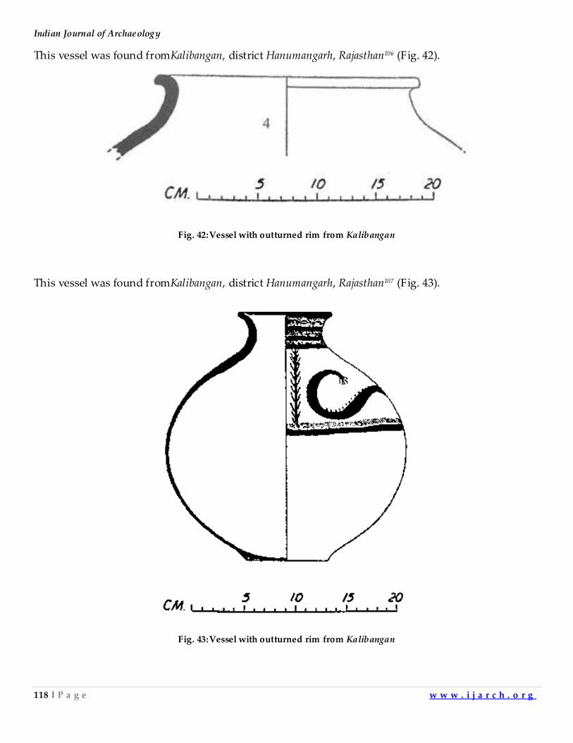
Indian Journal of Archaeology
118 | P a g e w w w . i j a r c h . o r g
This vessel was found fromKalibangan, district Hanumangarh, Rajasthan106 (Fig. 42).
Fig. 42:Vessel with outturned rim from Kalibangan
This vessel was found fromKalibangan, district Hanumangarh, Rajasthan107 (Fig. 43).
Fig. 43:Vessel with outturned rim from Kalibangan
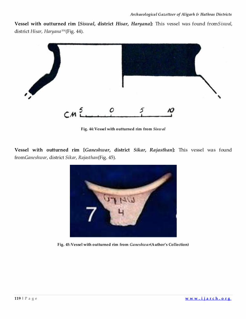
Archaeological Gazetteer of Aligarh & Hathras Districts
119 | P a g e w w w . i j a r c h . o r g
Vessel with outturned rim [Siswal, district Hisar, Haryana]: This vessel was found fromSiswal,
district Hisar, Haryana108(Fig. 44).
Fig. 44:Vessel with outturned rim from Siswal
Vessel with outturned rim [Ganeshwar, district Sikar, Rajasthan]: This vessel was found
fromGaneshwar, district Sikar, Rajasthan(Fig. 45).
Fig. 45:Vessel with outturned rim from Ganeshwar(Author’s Collection)
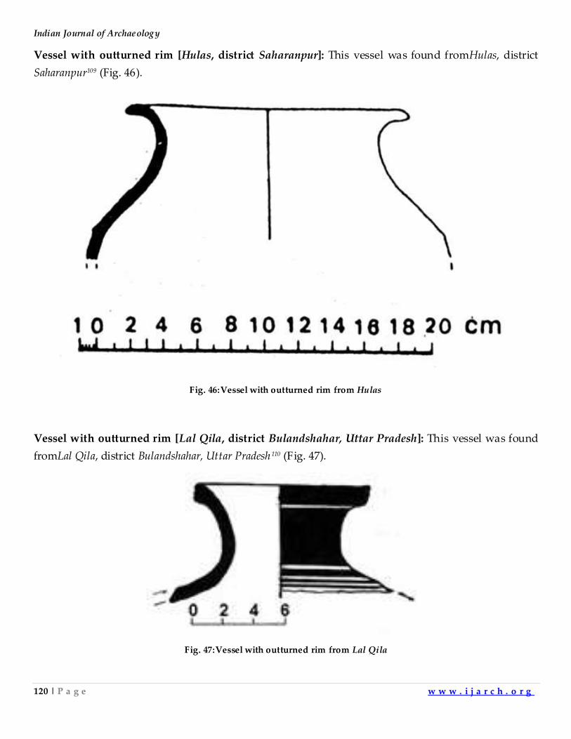
Indian Journal of Archaeology
120 | P a g e w w w . i j a r c h . o r g
Vessel with outturned rim [Hulas, district Saharanpur]: This vessel was found fromHulas, district
Saharanpur109 (Fig. 46).
Fig. 46:Vessel with outturned rim from Hulas
Vessel with outturned rim [Lal Qila, district Bulandshahar, Uttar Pradesh]: This vessel was found
fromLal Qila, district Bulandshahar, Uttar Pradesh110 (Fig. 47).
Fig. 47:Vessel with outturned rim from Lal Qila
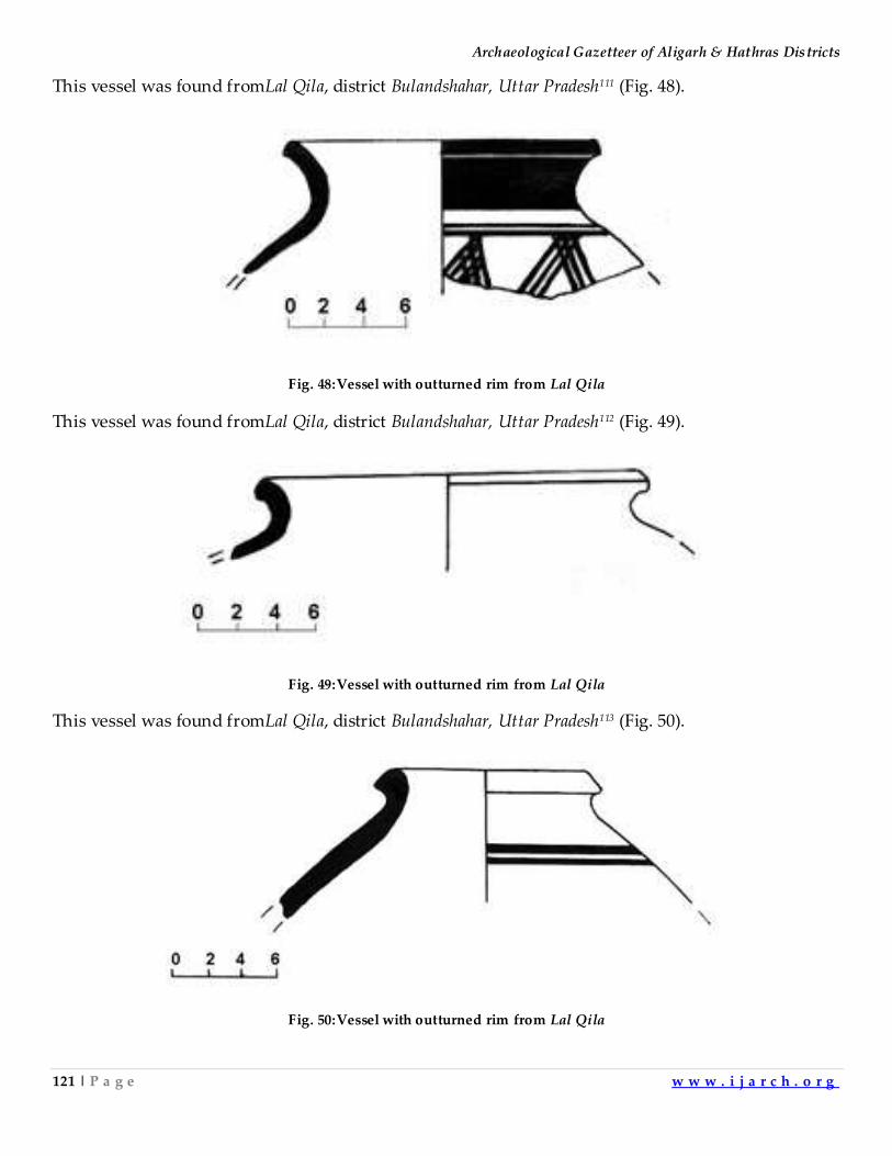
Archaeological Gazetteer of Aligarh & Hathras Districts
121 | P a g e w w w . i j a r c h . o r g
This vessel was found fromLal Qila, district Bulandshahar, Uttar Pradesh111 (Fig. 48).
Fig. 48:Vessel with outturned rim from Lal Qila
This vessel was found fromLal Qila, district Bulandshahar, Uttar Pradesh112 (Fig. 49).
Fig. 49:Vessel with outturned rim from Lal Qila
This vessel was found fromLal Qila, district Bulandshahar, Uttar Pradesh113 (Fig. 50).
Fig. 50:Vessel with outturned rim from Lal Qila
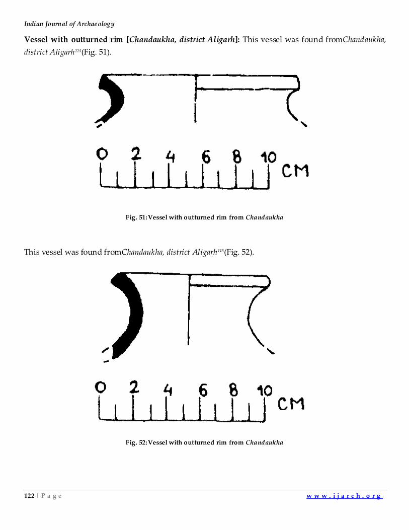
Indian Journal of Archaeology
122 | P a g e w w w . i j a r c h . o r g
Vessel with outturned rim [Chandaukha, district Aligarh]: This vessel was found fromChandaukha,
district Aligarh114(Fig. 51).
Fig. 51:Vessel with outturned rim from Chandaukha
This vessel was found fromChandaukha, district Aligarh115(Fig. 52).
Fig. 52:Vessel with outturned rim from Chandaukha
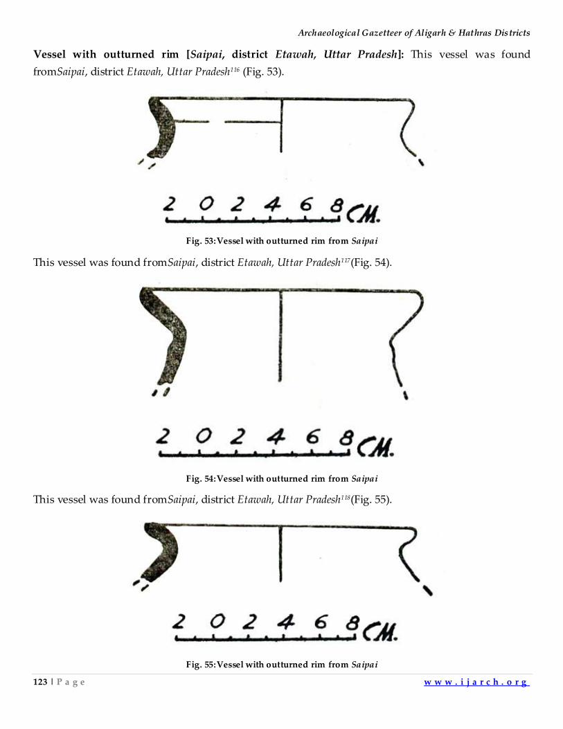
Archaeological Gazetteer of Aligarh & Hathras Districts
123 | P a g e w w w . i j a r c h . o r g
Vessel with outturned rim [Saipai, district Etawah, Uttar Pradesh]: This vessel was found
fromSaipai, district Etawah, Uttar Pradesh116 (Fig. 53).
Fig. 53:Vessel with outturned rim from Saipai
This vessel was found fromSaipai, district Etawah, Uttar Pradesh117(Fig. 54).
Fig. 54:Vessel with outturned rim from Saipai
This vessel was found fromSaipai, district Etawah, Uttar Pradesh118(Fig. 55).
Fig. 55:Vessel with outturned rim from Saipai
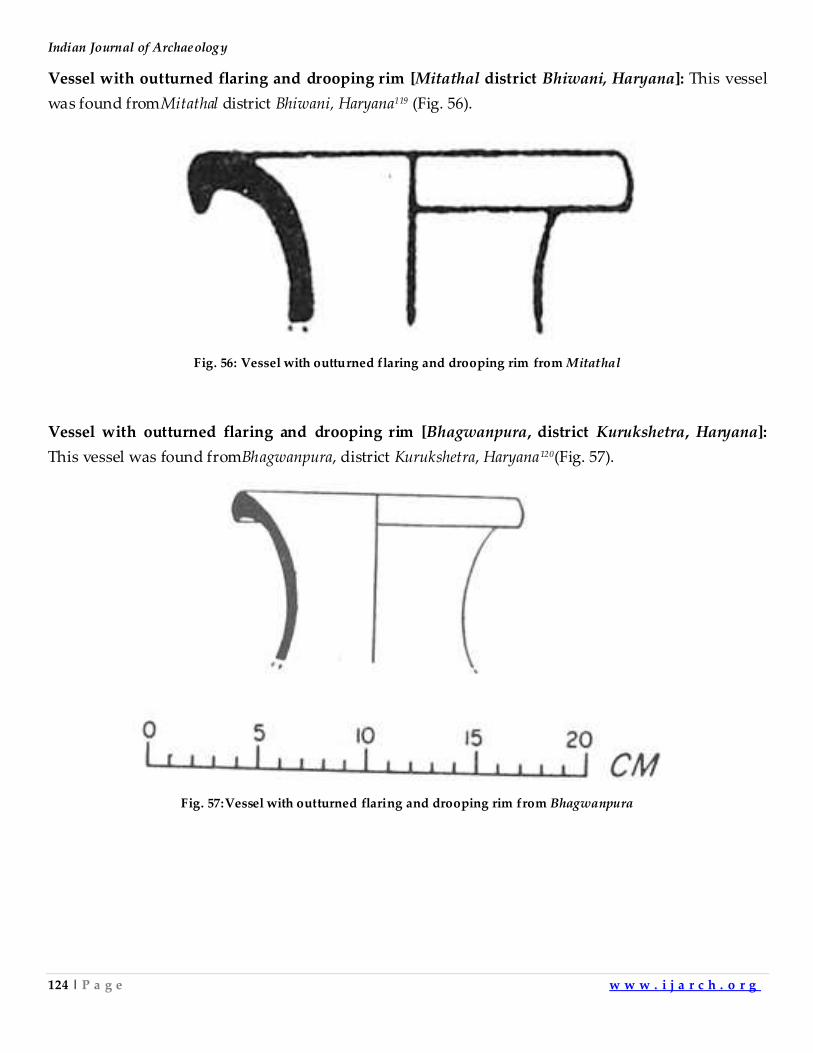
Indian Journal of Archaeology
124 | P a g e w w w . i j a r c h . o r g
Vessel with outturned flaring and drooping rim [Mitathal district Bhiwani, Haryana]: This vessel
was found fromMitathal district Bhiwani, Haryana119 (Fig. 56).
Fig. 56: Vessel with outturned flaring and drooping rim from Mitathal
Vessel with outturned flaring and drooping rim [Bhagwanpura, district Kurukshetra, Haryana]:
This vessel was found fromBhagwanpura, district Kurukshetra, Haryana120(Fig. 57).
Fig. 57:Vessel with outturned flaring and drooping rim from Bhagwanpura
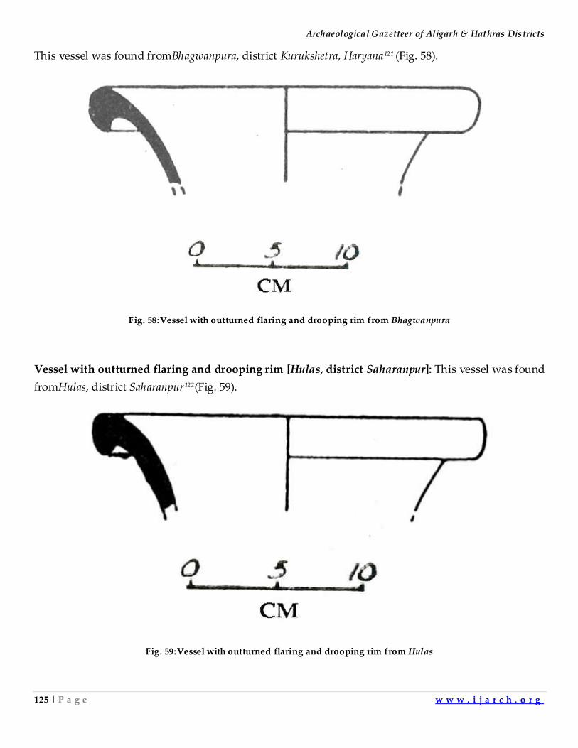
Archaeological Gazetteer of Aligarh & Hathras Districts
125 | P a g e w w w . i j a r c h . o r g
This vessel was found fromBhagwanpura, district Kurukshetra, Haryana121 (Fig. 58).
Fig. 58:Vessel with outturned flaring and drooping rim from Bhagwanpura
Vessel with outturned flaring and drooping rim [Hulas, district Saharanpur]: This vessel was found
fromHulas, district Saharanpur122(Fig. 59).
Fig. 59:Vessel with outturned flaring and drooping rim from Hulas
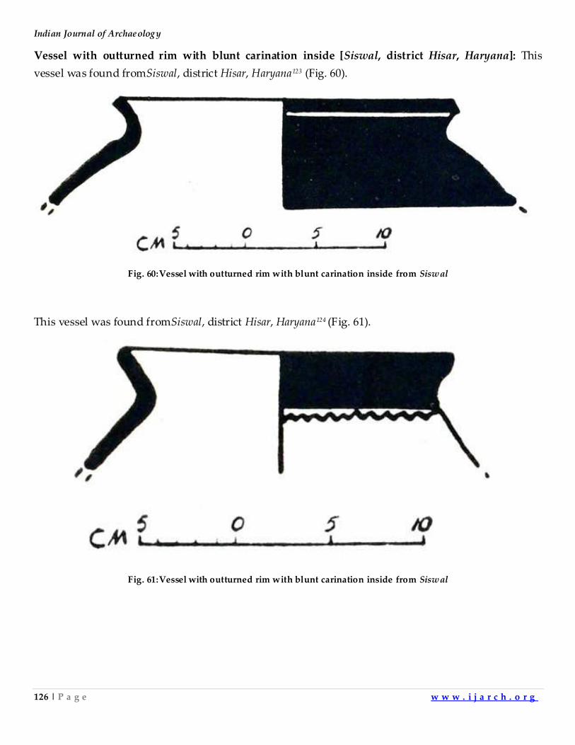
Indian Journal of Archaeology
126 | P a g e w w w . i j a r c h . o r g
Vessel with outturned rim with blunt carination inside [Siswal, district Hisar, Haryana]: This
vessel was found fromSiswal, district Hisar, Haryana123 (Fig. 60).
Fig. 60:Vessel with outturned rim with blunt carination inside from Siswal
This vessel was found fromSiswal, district Hisar, Haryana124 (Fig. 61).
Fig. 61:Vessel with outturned rim with blunt carination inside from Siswal
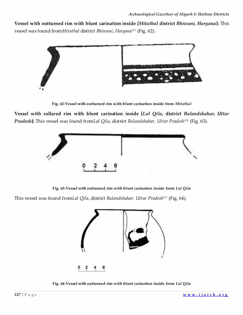
Archaeological Gazetteer of Aligarh & Hathras Districts
127 | P a g e w w w . i j a r c h . o r g
Vessel with outturned rim with blunt carination inside [Mitathal district Bhiwani, Haryana]: This
vessel was found fromMitathal district Bhiwani, Haryana125 (Fig. 62).
Fig. 62:Vessel with outturned rim with blunt carination inside from Mitathal
Vessel with collared rim with blunt carination inside [Lal Qila, district Bulandshahar, Uttar
Pradesh]: This vessel was found fromLal Qila, district Bulandshahar, Uttar Pradesh126 (Fig. 63).
Fig. 63:Vessel with outturned rim with blunt carination inside from Lal Qila
This vessel was found fromLal Qila, district Bulandshahar, Uttar Pradesh127 (Fig. 64).
Fig. 64:Vessel with outturned rim with blunt carination inside from Lal Qila
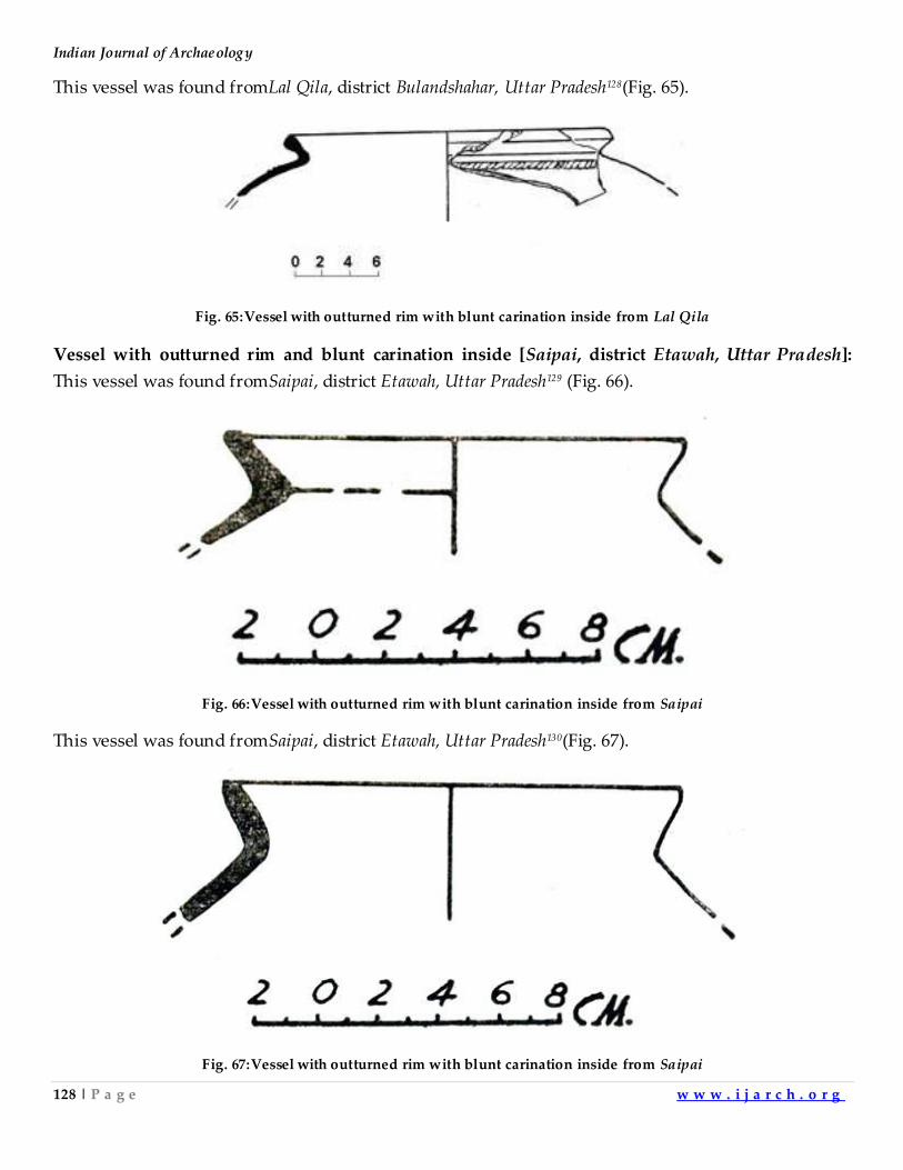
Indian Journal of Archaeology
128 | P a g e w w w . i j a r c h . o r g
This vessel was found fromLal Qila, district Bulandshahar, Uttar Pradesh128(Fig. 65).
Fig. 65:Vessel with outturned rim with blunt carination inside from Lal Qila
Vessel with outturned rim and blunt carination inside [Saipai, district Etawah, Uttar Pradesh]:
This vessel was found fromSaipai, district Etawah, Uttar Pradesh129 (Fig. 66).
Fig. 66:Vessel with outturned rim with blunt carination inside from Saipai
This vessel was found fromSaipai, district Etawah, Uttar Pradesh130(Fig. 67).
Fig. 67:Vessel with outturned rim with blunt carination inside from Saipai
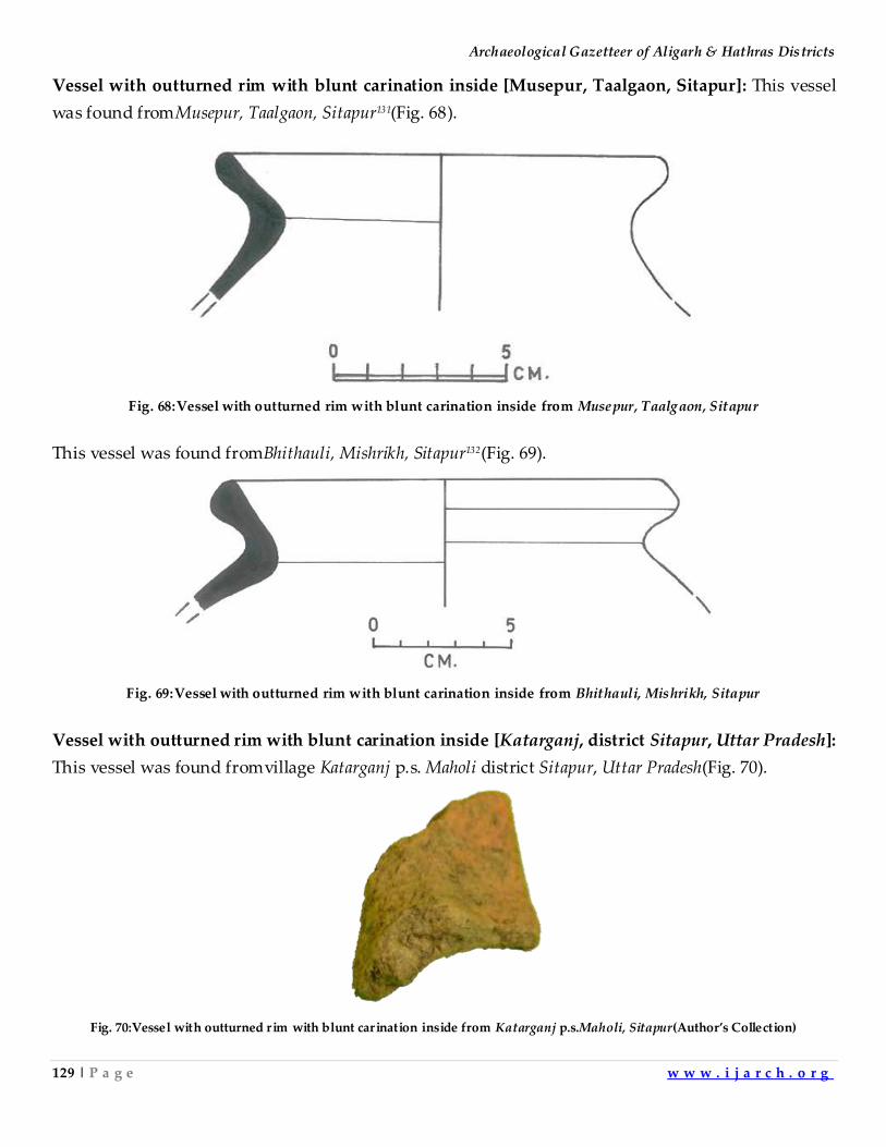
Archaeological Gazetteer of Aligarh & Hathras Districts
129 | P a g e w w w . i j a r c h . o r g
Vessel with outturned rim with blunt carination inside [Musepur, Taalgaon, Sitapur]: This vessel
was found fromMusepur, Taalgaon, Sitapur131(Fig. 68).
Fig. 68:Vessel with outturned rim with blunt carination inside from Musepur, Taalgaon, Sitapur
This vessel was found fromBhithauli, Mishrikh, Sitapur132(Fig. 69).
Fig. 69:Vessel with outturned rim with blunt carination inside from Bhithauli, Mishrikh, Sitapur
Vessel with outturned rim with blunt carination inside [Katarganj, district Sitapur, Uttar Pradesh]:
This vessel was found fromvillage Katarganj p.s. Maholi district Sitapur, Uttar Pradesh(Fig. 70).
Fig. 70:Vessel with outturned r im with blunt carination inside from Katarganj p.s.Maholi, Sitapur(Author’s Collection)
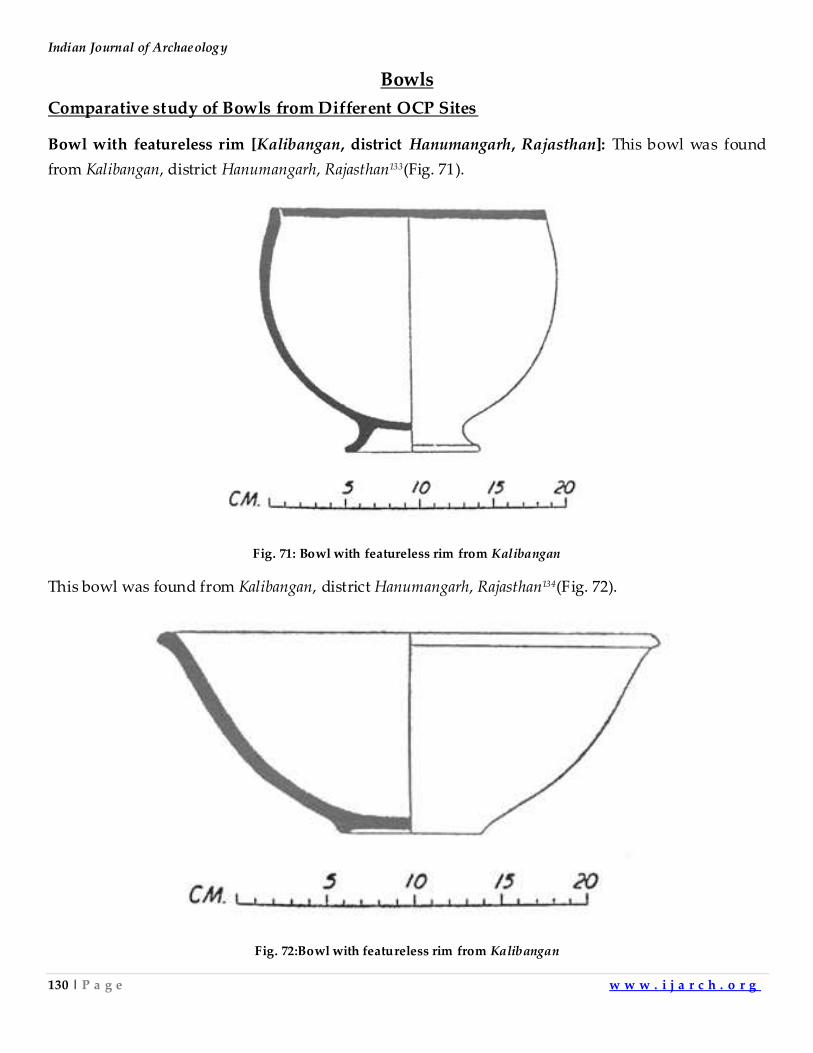
Indian Journal of Archaeology
130 | P a g e w w w . i j a r c h . o r g
Bowls
Comparative study of Bowls from Different OCP Sites
Bowl with featureless rim [Kalibangan, district Hanumangarh, Rajasthan]: This bowl was found
from Kalibangan, district Hanumangarh, Rajasthan133(Fig. 71).
Fig. 71: Bowl with featureless rim from Kalibangan
This bowl was found from Kalibangan, district Hanumangarh, Rajasthan134(Fig. 72).
Fig. 72:Bowl with featureless rim from Kalibangan
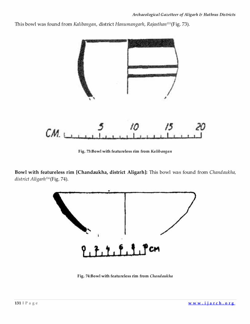
Archaeological Gazetteer of Aligarh & Hathras Districts
131 | P a g e w w w . i j a r c h . o r g
This bowl was found from Kalibangan, district Hanumangarh, Rajasthan135(Fig. 73).
Fig. 73:Bowl with featureless rim from Kalibangan
Bowl with featureless rim [Chandaukha, district Aligarh]: This bowl was found from Chandaukha,
district Aligarh136(Fig. 74).
Fig. 74:Bowl with featureless rim from Chandaukha
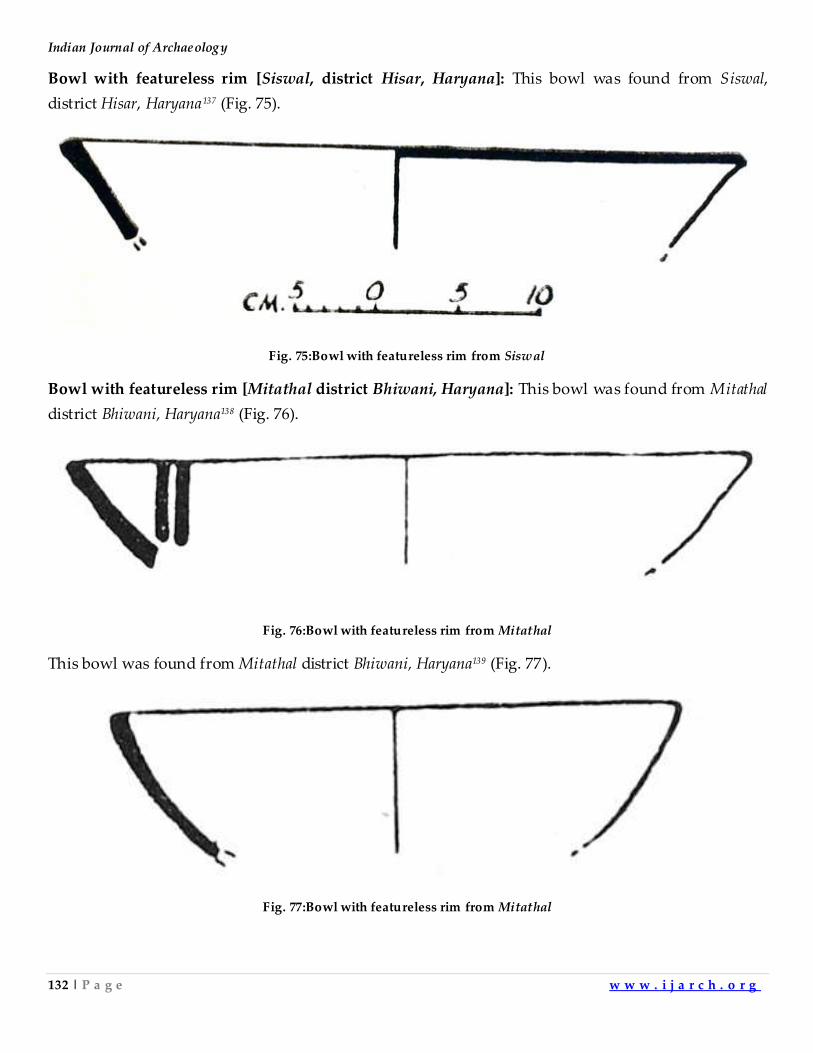
Indian Journal of Archaeology
132 | P a g e w w w . i j a r c h . o r g
Bowl with featureless rim [Siswal, district Hisar, Haryana]: This bowl was found from Siswal,
district Hisar, Haryana137 (Fig. 75).
Fig. 75:Bowl with featureless rim from Siswal
Bowl with featureless rim [Mitathal district Bhiwani, Haryana]: This bowl was found from Mitathal
district Bhiwani, Haryana138 (Fig. 76).
Fig. 76:Bowl with featureless rim from Mitathal
This bowl was found from Mitathal district Bhiwani, Haryana139 (Fig. 77).
Fig. 77:Bowl with featureless rim from Mitathal
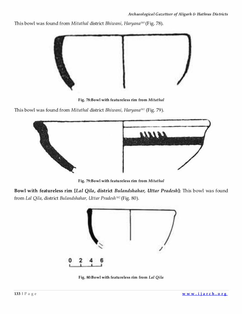
Archaeological Gazetteer of Aligarh & Hathras Districts
133 | P a g e w w w . i j a r c h . o r g
This bowl was found from Mitathal district Bhiwani, Haryana140 (Fig. 78).
Fig. 78:Bowl with featureless rim from Mitathal
This bowl was found from Mitathal district Bhiwani, Haryana141 (Fig. 79).
Fig. 79:Bowl with featureless rim from Mitathal
Bowl with featureless rim [Lal Qila, district Bulandshahar, Uttar Pradesh]: This bowl was found
from Lal Qila, district Bulandshahar, Uttar Pradesh142 (Fig. 80).
Fig. 80:Bowl with featureless rim from Lal Qila
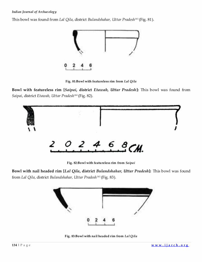
Indian Journal of Archaeology
134 | P a g e w w w . i j a r c h . o r g
This bowl was found from Lal Qila, district Bulandshahar, Uttar Pradesh143 (Fig. 81).
Fig. 81:Bowl with featureless rim from Lal Qila
Bowl with featureless rim [Saipai, district Etawah, Uttar Pradesh]: This bowl was found from
Saipai, district Etawah, Uttar Pradesh144 (Fig. 82).
Fig. 82:Bowl with featureless rim from Saipai
Bowl with nail headed rim [Lal Qila, district Bulandshahar, Uttar Pradesh]: This bowl was found
from Lal Qila, district Bulandshahar, Uttar Pradesh145 (Fig. 83).
Fig. 83:Bowl with nail headed rim from Lal Qila
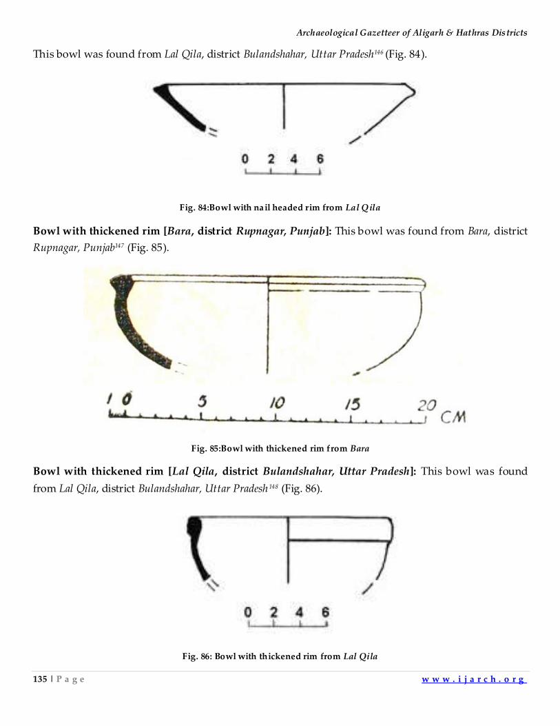
Archaeological Gazetteer of Aligarh & Hathras Districts
135 | P a g e w w w . i j a r c h . o r g
This bowl was found from Lal Qila, district Bulandshahar, Uttar Pradesh146 (Fig. 84).
Fig. 84:Bowl with nail headed rim from Lal Qila
Bowl with thickened rim [Bara, district Rupnagar, Punjab]: This bowl was found from Bara, district
Rupnagar, Punjab147 (Fig. 85).
Fig. 85:Bowl with thickened rim from Bara
Bowl with thickened rim [Lal Qila, district Bulandshahar, Uttar Pradesh]: This bowl was found
from Lal Qila, district Bulandshahar, Uttar Pradesh148 (Fig. 86).
Fig. 86: Bowl with thickened rim from Lal Qila
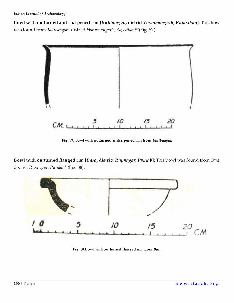
Indian Journal of Archaeology
136 | P a g e w w w . i j a r c h . o r g
Bowl with outturned and sharpened rim [Kalibangan, district Hanumangarh, Rajasthan]: This bowl
was found from Kalibangan, district Hanumangarh, Rajasthan149(Fig. 87).
Fig. 87: Bowl with outturned & sharpened rim from Kalibangan
Bowl with outturned flanged rim [Bara, district Rupnagar, Punjab]: This bowl was found from Bara,
district Rupnagar, Punjab150(Fig. 88).
Fig. 88:Bowl with outturned flanged rim from Bara
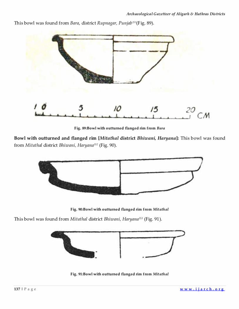
Archaeological Gazetteer of Aligarh & Hathras Districts
137 | P a g e w w w . i j a r c h . o r g
This bowl was found from Bara, district Rupnagar, Punjab151(Fig. 89).
Fig. 89:Bowl with outturned flanged rim from Bara
Bowl with outturned and flanged rim [Mitathal district Bhiwani, Haryana]: This bowl was found
from Mitathal district Bhiwani, Haryana152 (Fig. 90).
Fig. 90:Bowl with outturned flanged rim from Mitathal
This bowl was found from Mitathal district Bhiwani, Haryana153 (Fig. 91).
Fig. 91:Bowl with outturned flanged rim from Mitathal
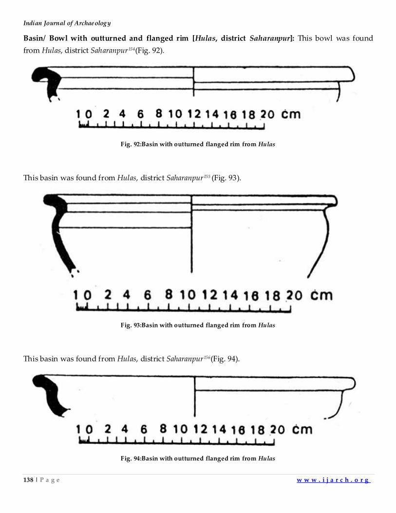
Indian Journal of Archaeology
138 | P a g e w w w . i j a r c h . o r g
Basin/ Bowl with outturned and flanged rim [Hulas, district Saharanpur]: This bowl was found
from Hulas, district Saharanpur154(Fig. 92).
Fig. 92:Basin with outturned flanged rim from Hulas
This basin was found from Hulas, district Saharanpur155 (Fig. 93).
Fig. 93:Basin with outturned flanged rim from Hulas
This basin was found from Hulas, district Saharanpur156(Fig. 94).
Fig. 94:Basin with outturned flanged rim from Hulas
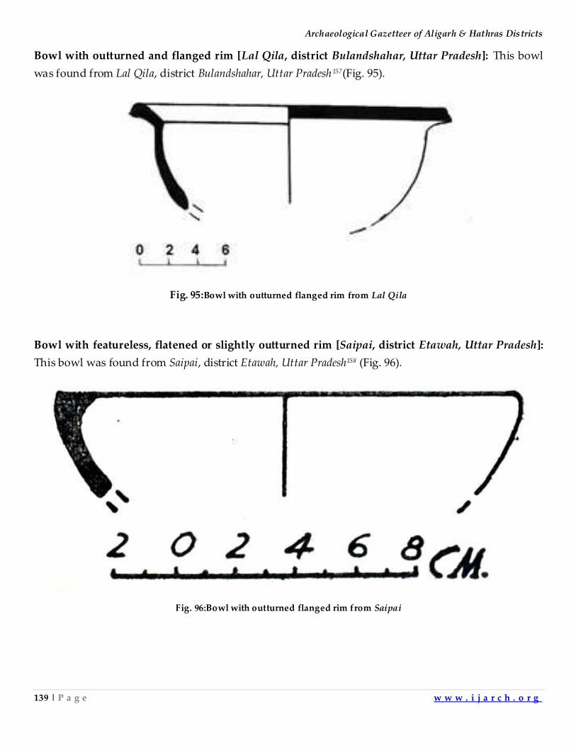
Archaeological Gazetteer of Aligarh & Hathras Districts
139 | P a g e w w w . i j a r c h . o r g
Bowl with outturned and flanged rim [Lal Qila, district Bulandshahar, Uttar Pradesh]: This bowl
was found from Lal Qila, district Bulandshahar, Uttar Pradesh157(Fig. 95).
Fig. 95:Bowl with outturned flanged rim from Lal Qila
Bowl with featureless, flatened or slightly outturned rim [Saipai, district Etawah, Uttar Pradesh]:
This bowl was found from Saipai, district Etawah, Uttar Pradesh158 (Fig. 96).
Fig. 96:Bowl with outturned flanged rim from Saipai
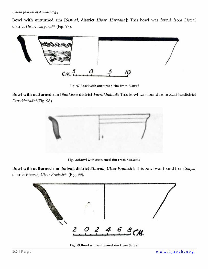
Indian Journal of Archaeology
140 | P a g e w w w . i j a r c h . o r g
Bowl with outturned rim [Siswal, district Hisar, Haryana]: This bowl was found from Siswal,
district Hisar, Haryana159 (Fig. 97).
Fig. 97:Bowl with outturned rim from Siswal
Bowl with outturned rim [Sankissa district Farrukhabad]: This bowl was found from Sankissadistrict
Farrukhabad160 (Fig. 98).
Fig. 98:Bowl with outturned rim from Sankissa
Bowl with outturned rim [Saipai, district Etawah, Uttar Pradesh]: This bowl was found from Saipai,
district Etawah, Uttar Pradesh161 (Fig. 99).
Fig. 99:Bowl with outturned rim from Saipai
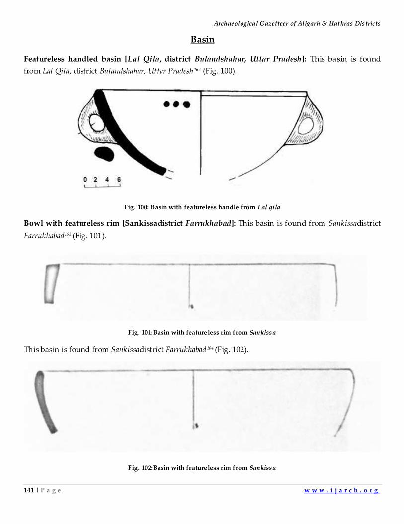
Archaeological Gazetteer of Aligarh & Hathras Districts
141 | P a g e w w w . i j a r c h . o r g
Basin
Featureless handled basin [Lal Qila, district Bulandshahar, Uttar Pradesh]: This basin is found
from Lal Qila, district Bulandshahar, Uttar Pradesh162 (Fig. 100).
Fig. 100: Basin with featureless handle from Lal qila
Bowl with featureless rim [Sankissadistrict Farrukhabad]: This basin is found from Sankissadistrict
Farrukhabad163 (Fig. 101).
Fig. 101:Basin with featureless rim from Sankissa
This basin is found from Sankissadistrict Farrukhabad164 (Fig. 102).
Fig. 102:Basin with featureless rim from Sankissa
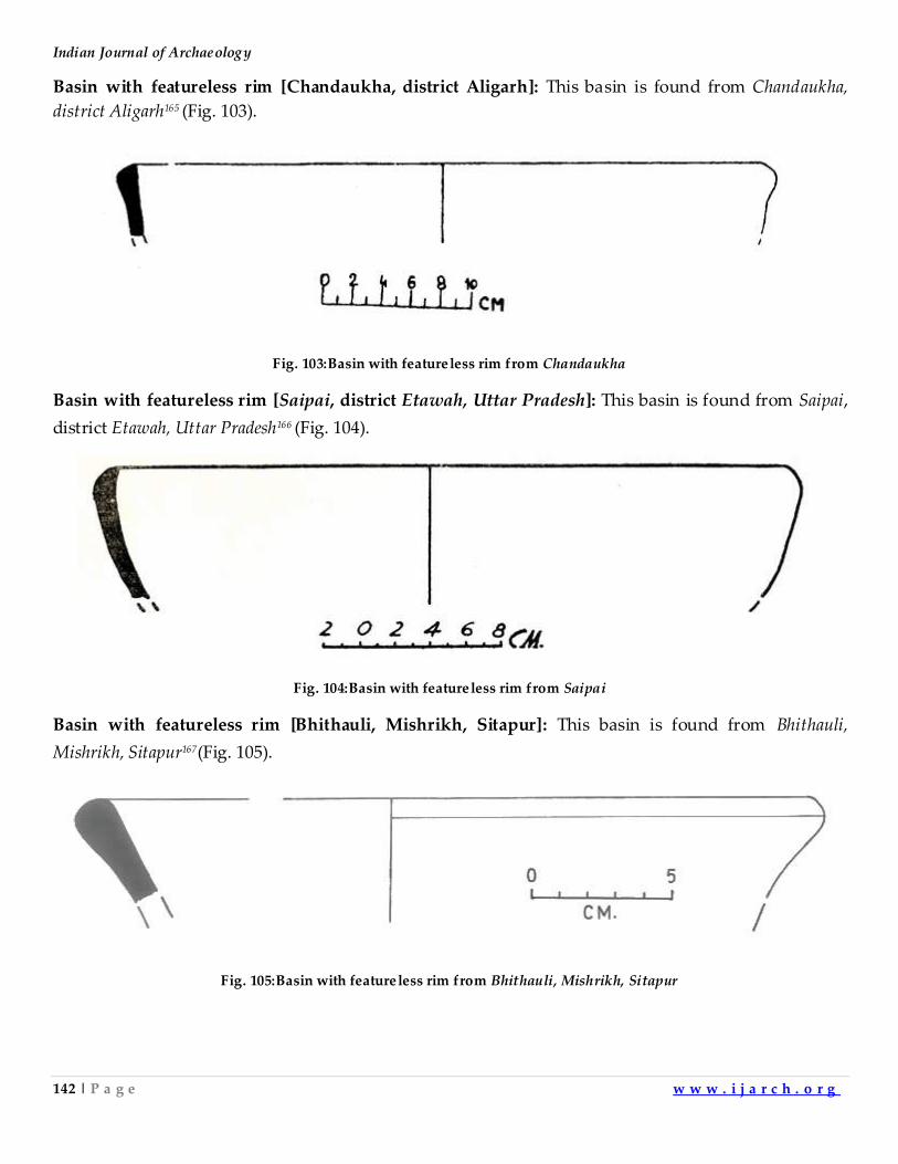
Indian Journal of Archaeology
142 | P a g e w w w . i j a r c h . o r g
Basin with featureless rim [Chandaukha, district Aligarh]: This basin is found from Chandaukha,
district Aligarh165 (Fig. 103).
Fig. 103:Basin with featureless rim from Chandaukha
Basin with featureless rim [Saipai, district Etawah, Uttar Pradesh]: This basin is found from Saipai,
district Etawah, Uttar Pradesh166 (Fig. 104).
Fig. 104:Basin with featureless rim from Saipai
Basin with featureless rim [Bhithauli, Mishrikh, Sitapur]: This basin is found from Bhithauli,
Mishrikh, Sitapur167(Fig. 105).
Fig. 105:Basin with featureless rim from Bhithauli, Mishrikh, Sitapur
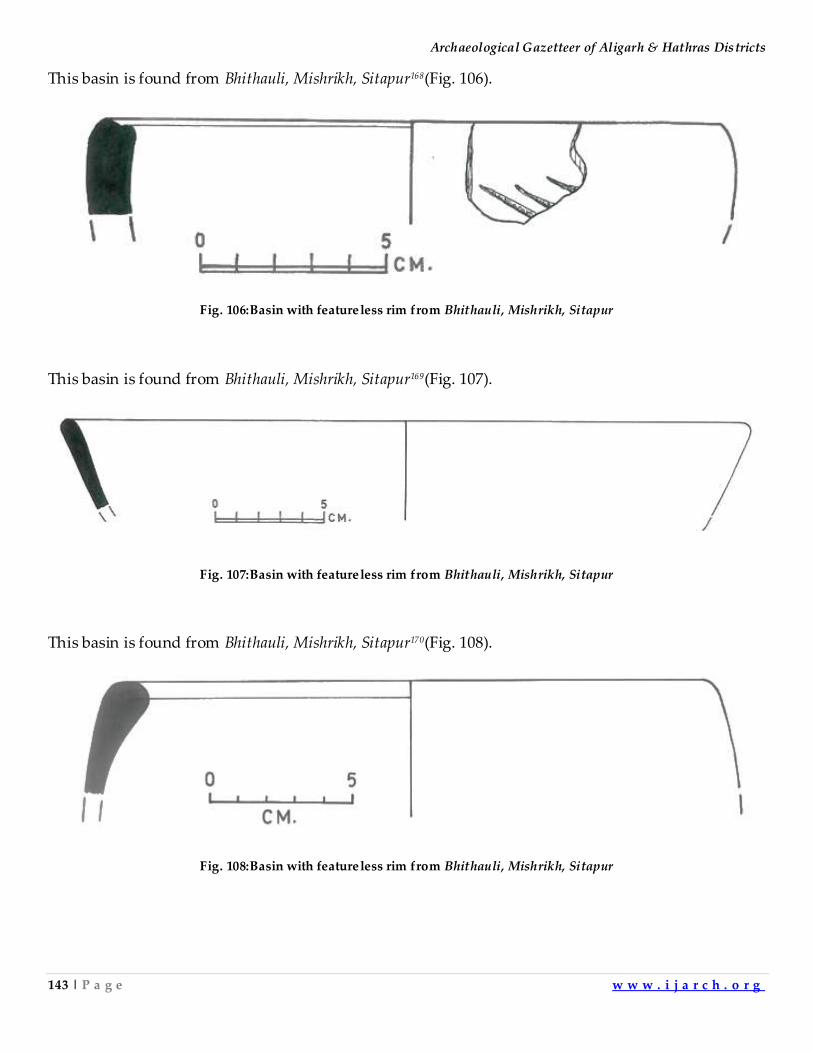
Archaeological Gazetteer of Aligarh & Hathras Districts
143 | P a g e w w w . i j a r c h . o r g
This basin is found from Bhithauli, Mishrikh, Sitapur168(Fig. 106).
Fig. 106:Basin with featureless rim from Bhithauli, Mishrikh, Sitapur
This basin is found from Bhithauli, Mishrikh, Sitapur169(Fig. 107).
Fig. 107:Basin with featureless rim from Bhithauli, Mishrikh, Sitapur
This basin is found from Bhithauli, Mishrikh, Sitapur170(Fig. 108).
Fig. 108:Basin with featureless rim from Bhithauli, Mishrikh, Sitapur
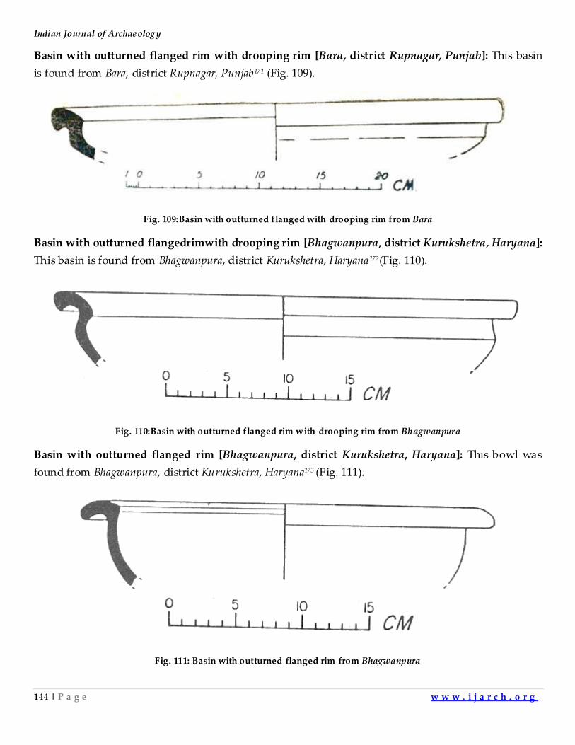
Indian Journal of Archaeology
144 | P a g e w w w . i j a r c h . o r g
Basin with outturned flanged rim with drooping rim [Bara, district Rupnagar, Punjab]: This basin
is found from Bara, district Rupnagar, Punjab171 (Fig. 109).
Fig. 109:Basin with outturned flanged with drooping rim from Bara
Basin with outturned flangedrimwith drooping rim [Bhagwanpura, district Kurukshetra, Haryana]:
This basin is found from Bhagwanpura, district Kurukshetra, Haryana172(Fig. 110).
Fig. 110:Basin with outturned flanged rim with drooping rim from Bhagwanpura
Basin with outturned flanged rim [Bhagwanpura, district Kurukshetra, Haryana]: This bowl was
found from Bhagwanpura, district Kurukshetra, Haryana173 (Fig. 111).
Fig. 111: Basin with outturned flanged rim from Bhagwanpura
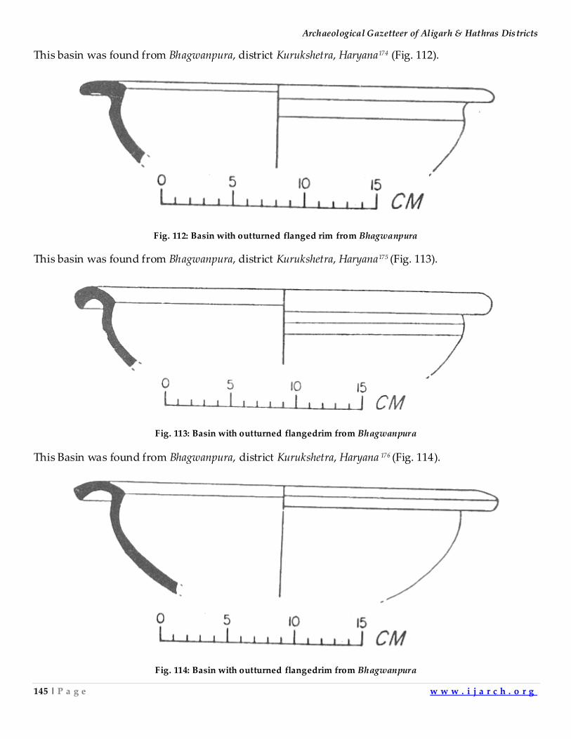
Archaeological Gazetteer of Aligarh & Hathras Districts
145 | P a g e w w w . i j a r c h . o r g
This basin was found from Bhagwanpura, district Kurukshetra, Haryana174 (Fig. 112).
Fig. 112: Basin with outturned flanged rim from Bhagwanpura
This basin was found from Bhagwanpura, district Kurukshetra, Haryana175 (Fig. 113).
Fig. 113: Basin with outturned flangedrim from Bhagwanpura
This Basin was found from Bhagwanpura, district Kurukshetra, Haryana 176 (Fig. 114).
Fig. 114: Basin with outturned flangedrim from Bhagwanpura
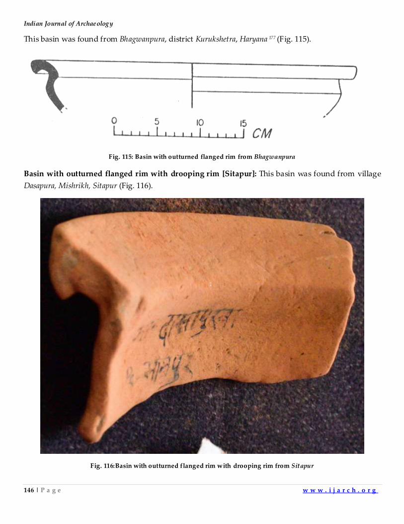
Indian Journal of Archaeology
146 | P a g e w w w . i j a r c h . o r g
This basin was found from Bhagwanpura, district Kurukshetra, Haryana 177 (Fig. 115).
Fig. 115: Basin with outturned flanged rim from Bhagwanpura
Basin with outturned flanged rim with drooping rim [Sitapur]: This basin was found from village
Dasapura, Mishrikh, Sitapur (Fig. 116).
Fig. 116:Basin with outturned flanged rim with drooping rim from Sitapur
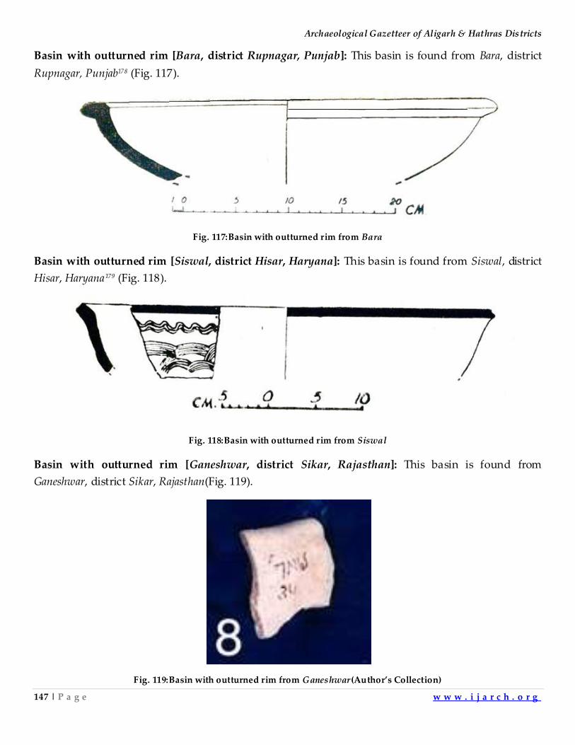
Archaeological Gazetteer of Aligarh & Hathras Districts
147 | P a g e w w w . i j a r c h . o r g
Basin with outturned rim [Bara, district Rupnagar, Punjab]: This basin is found from Bara, district
Rupnagar, Punjab178 (Fig. 117).
Fig. 117:Basin with outturned rim from Bara
Basin with outturned rim [Siswal, district Hisar, Haryana]: This basin is found from Siswal, district
Hisar, Haryana179 (Fig. 118).
Fig. 118:Basin with outturned rim from Siswal
Basin with outturned rim [Ganeshwar, district Sikar, Rajasthan]: This basin is found from
Ganeshwar, district Sikar, Rajasthan(Fig. 119).
Fig. 119:Basin with outturned rim from Ganeshwar(Author’s Collection)
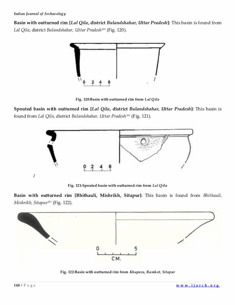
Indian Journal of Archaeology
148 | P a g e w w w . i j a r c h . o r g
Basin with outturned rim [Lal Qila, district Bulandshahar, Uttar Pradesh]: This basin is found from
Lal Qila, district Bulandshahar, Uttar Pradesh180 (Fig. 120).
Fig. 120:Basin with outturned rim from Lal Qila
Spouted basin with outturned rim [Lal Qila, district Bulandshahar, Uttar Pradesh]: This basin is
found from Lal Qila, district Bulandshahar, Uttar Pradesh181 (Fig. 121).
/
Fig. 121:Spouted basin with outturned rim from Lal Qila
Basin with outturned rim [Bhithauli, Mishrikh, Sitapur]: This basin is found from Bhithauli,
Mishrikh, Sitapur182 (Fig. 122).
Fig. 122:Basin with outturned rim from Khapura, Ramkot, Sitapur
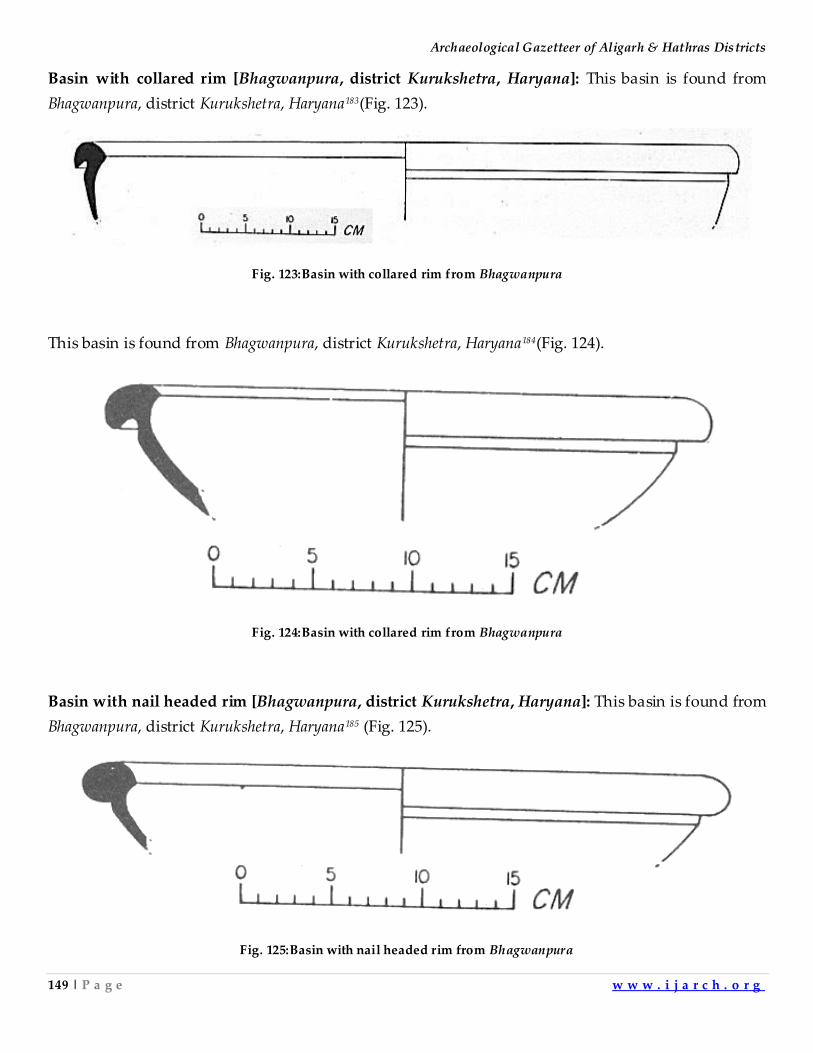
Archaeological Gazetteer of Aligarh & Hathras Districts
149 | P a g e w w w . i j a r c h . o r g
Basin with collared rim [Bhagwanpura, district Kurukshetra, Haryana]: This basin is found from
Bhagwanpura, district Kurukshetra, Haryana183(Fig. 123).
Fig. 123:Basin with collared rim from Bhagwanpura
This basin is found from Bhagwanpura, district Kurukshetra, Haryana184(Fig. 124).
Fig. 124:Basin with collared rim from Bhagwanpura
Basin with nail headed rim [Bhagwanpura, district Kurukshetra, Haryana]: This basin is found from
Bhagwanpura, district Kurukshetra, Haryana185 (Fig. 125).
Fig. 125:Basin with nail headed rim from Bhagwanpura
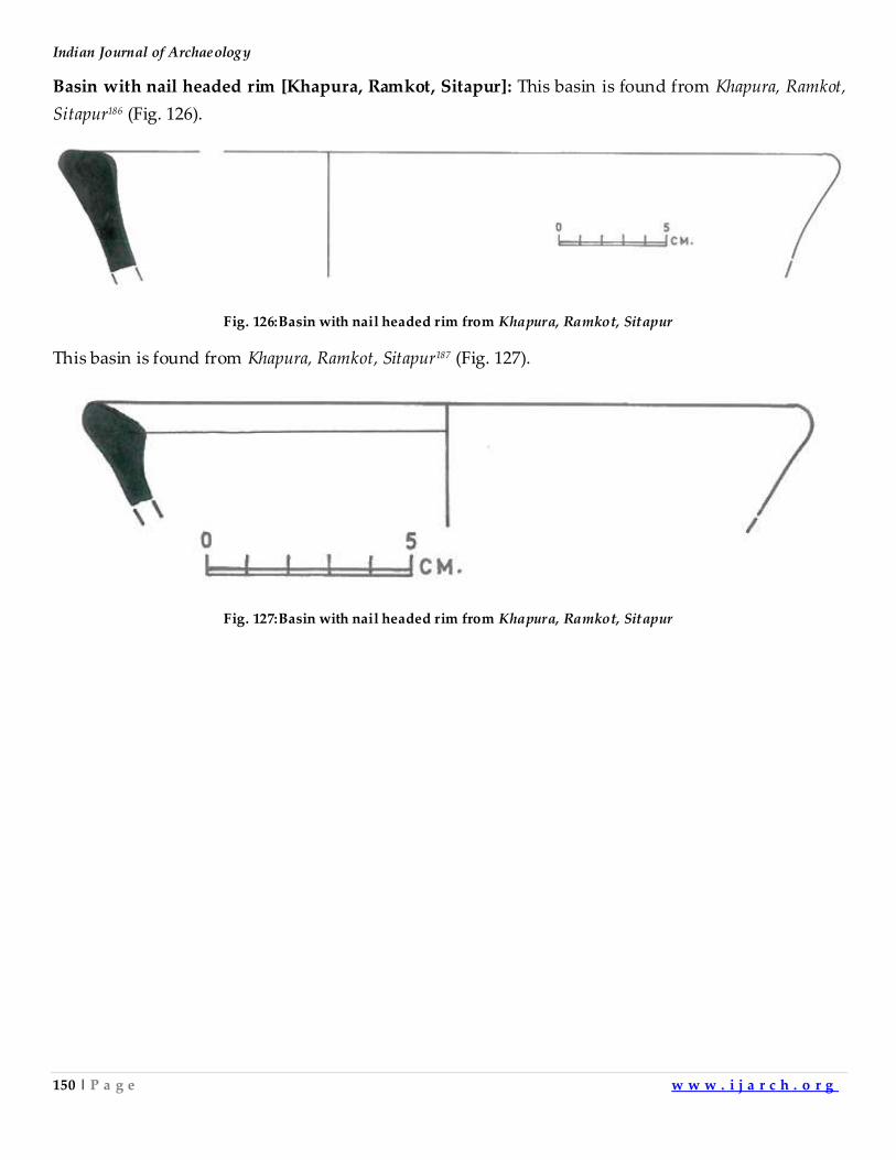
Indian Journal of Archaeology
150 | P a g e w w w . i j a r c h . o r g
Basin with nail headed rim [Khapura, Ramkot, Sitapur]: This basin is found from Khapura, Ramkot,
Sitapur186 (Fig. 126).
Fig. 126:Basin with nail headed rim from Khapura, Ramkot, Sitapur
This basin is found from Khapura, Ramkot, Sitapur187 (Fig. 127).
Fig. 127:Basin with nail headed rim from Khapura, Ramkot, Sitapur
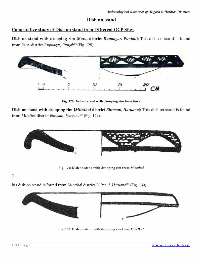
Archaeological Gazetteer of Aligarh & Hathras Districts
151 | P a g e w w w . i j a r c h . o r g
Dish on stand
Comparative study of Dish on stand from Different OCP Sites
Dish on stand with drooping rim [Bara, district Rupnagar, Punjab]: This dish on stand is found
from Bara, district Rupnagar, Punjab188(Fig. 128).
Fig. 128:Dish on stand with drooping rim from Bara
Dish on stand with drooping rim [Mitathal district Bhiwani, Haryana]: This dish on stand is found
from Mitathal district Bhiwani, Haryana189 (Fig. 129).
Fig. 129: Dish on stand with drooping rim from Mitathal
T
his dish on stand is found from Mitathal district Bhiwani, Haryana190 (Fig. 130).
Fig. 130: Dish on stand with drooping rim from Mitathal
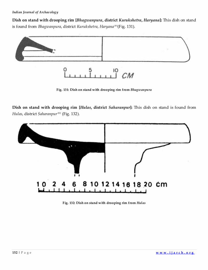
Indian Journal of Archaeology
152 | P a g e w w w . i j a r c h . o r g
Dish on stand with drooping rim [Bhagwanpura, district Kurukshetra, Haryana]: This dish on stand
is found from Bhagwanpura, district Kurukshetra, Haryana191(Fig. 131).
Fig. 131: Dish on stand with drooping rim from Bhagwanpura
Dish on stand with drooping rim [Hulas, district Saharanpur]: This dish on stand is found from
Hulas, district Saharanpur192 (Fig. 132).
Fig. 132: Dish on stand with drooping rim from Hulas
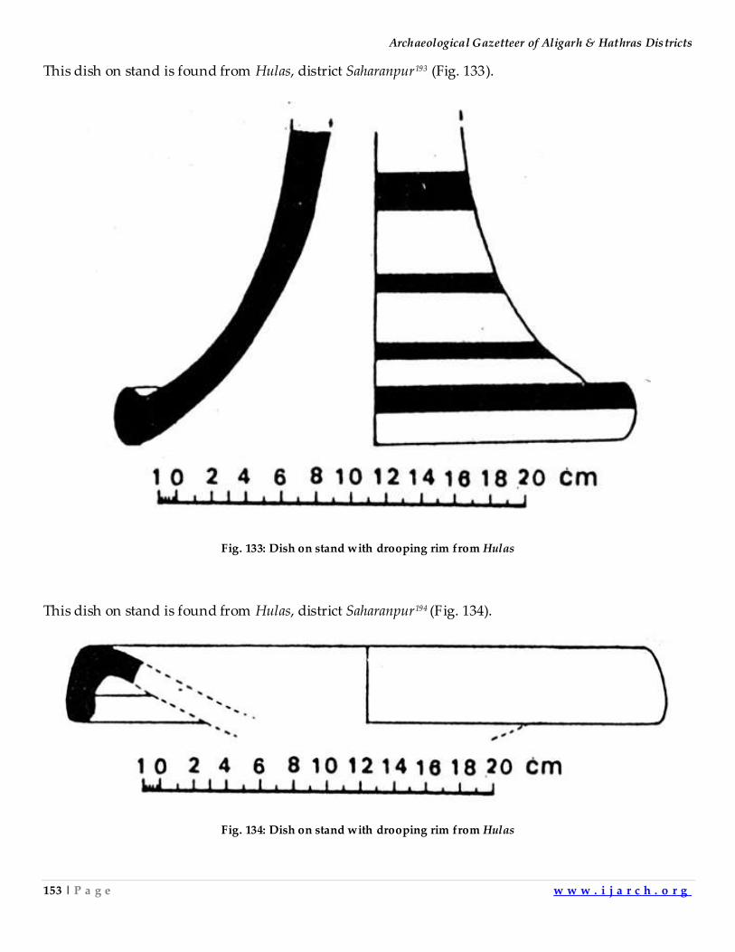
Archaeological Gazetteer of Aligarh & Hathras Districts
153 | P a g e w w w . i j a r c h . o r g
This dish on stand is found from Hulas, district Saharanpur193 (Fig. 133).
Fig. 133: Dish on stand with drooping rim from Hulas
This dish on stand is found from Hulas, district Saharanpur194 (Fig. 134).
Fig. 134: Dish on stand with drooping rim from Hulas
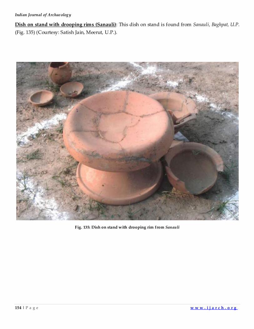
Indian Journal of Archaeology
154 | P a g e w w w . i j a r c h . o r g
Dish on stand with drooping rims (Sanauli): This dish on stand is found from Sanauli, Baghpat, U.P.
(Fig. 135) (Courtesy: Satish Jain, Meerut, U.P.).
Fig. 135: Dish on stand with drooping rim from Sanauli
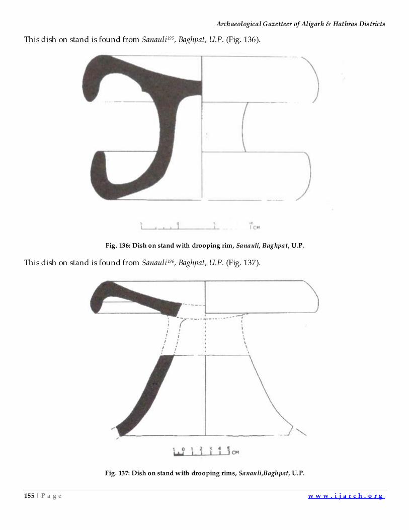
Archaeological Gazetteer of Aligarh & Hathras Districts
155 | P a g e w w w . i j a r c h . o r g
This dish on stand is found from Sanauli195, Baghpat, U.P. (Fig. 136).
Fig. 136: Dish on stand with drooping rim, Sanauli, Baghpat, U.P.
This dish on stand is found from Sanauli196, Baghpat, U.P. (Fig. 137).
Fig. 137: Dish on stand with drooping rims, Sanauli,Baghpat, U.P.
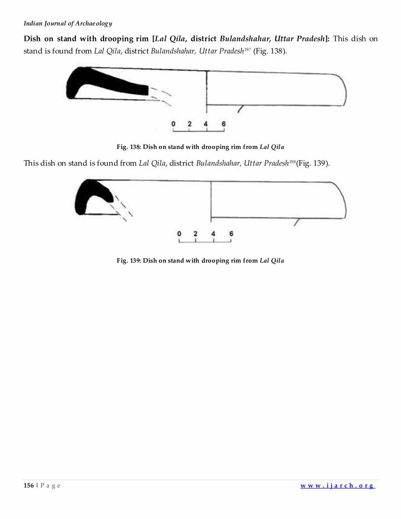
Indian Journal of Archaeology
156 | P a g e w w w . i j a r c h . o r g
Dish on stand with drooping rim [Lal Qila, district Bulandshahar, Uttar Pradesh]: This dish on
stand is found from Lal Qila, district Bulandshahar, Uttar Pradesh197 (Fig. 138).
Fig. 138: Dish on stand with drooping rim from Lal Qila
This dish on stand is found from Lal Qila, district Bulandshahar, Uttar Pradesh198(Fig. 139).
Fig. 139: Dish on stand with drooping rim from Lal Qila
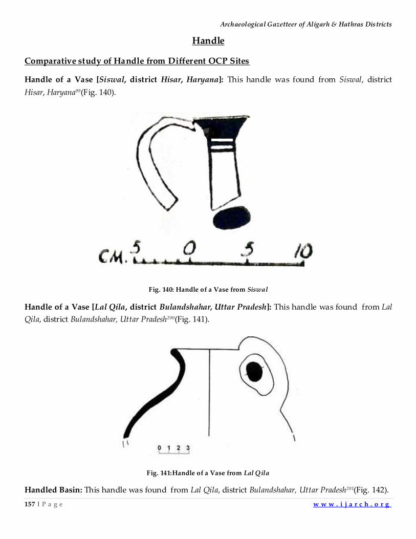
Archaeological Gazetteer of Aligarh & Hathras Districts
157 | P a g e w w w . i j a r c h . o r g
Handle
Comparative study of Handle from Different OCP Sites
Handle of a Vase [Siswal, district Hisar, Haryana]: This handle was found from Siswal, district
Hisar, Haryana99(Fig. 140).
Fig. 140: Handle of a Vase from Siswal
Handle of a Vase [Lal Qila, district Bulandshahar, Uttar Pradesh]: This handle was found from Lal
Qila, district Bulandshahar, Uttar Pradesh200(Fig. 141).
Fig. 141:Handle of a Vase from Lal Qila
Handled Basin: This handle was found from Lal Qila, district Bulandshahar, Uttar Pradesh201(Fig. 142).
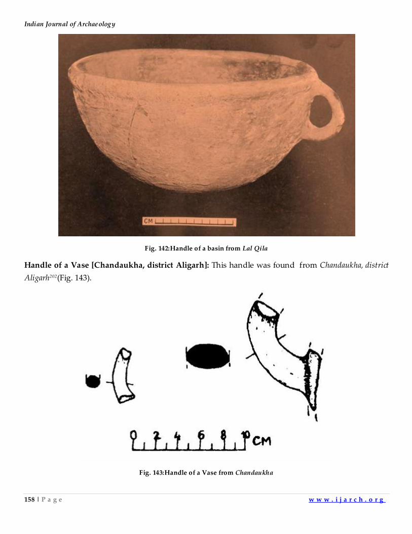
Indian Journal of Archaeology
158 | P a g e w w w . i j a r c h . o r g
Fig. 142:Handle of a basin from Lal Qila
Handle of a Vase [Chandaukha, district Aligarh]: This handle was found from Chandaukha, district
Aligarh202(Fig. 143).
Fig. 143:Handle of a Vase from Chandaukha
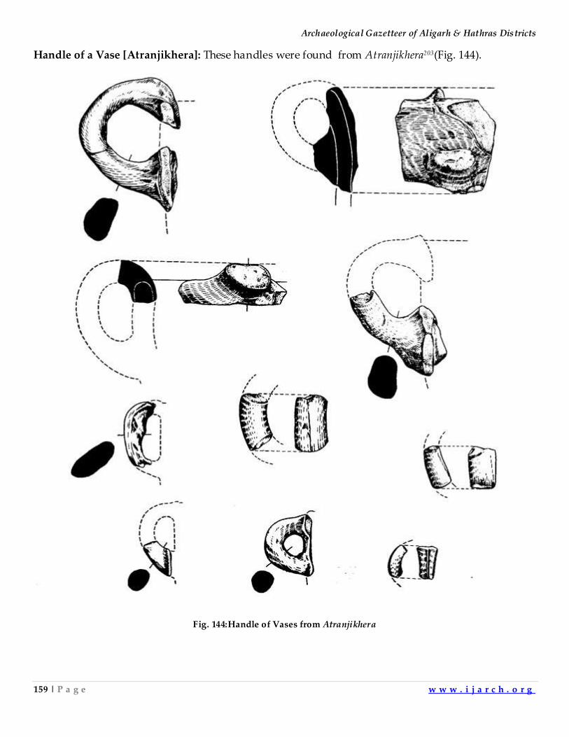
Archaeological Gazetteer of Aligarh & Hathras Districts
159 | P a g e w w w . i j a r c h . o r g
Handle of a Vase [Atranjikhera]: These handles were found from Atranjikhera203(Fig. 144).
Fig. 144:Handle of Vases from Atranjikhera
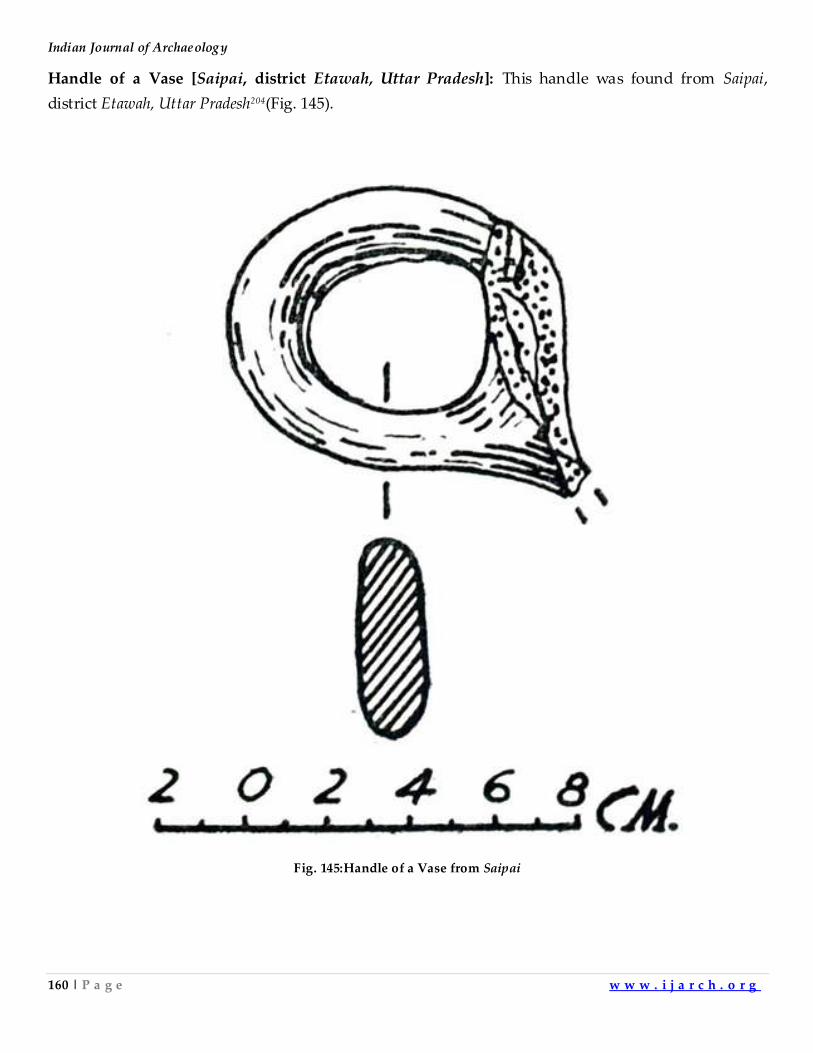
Indian Journal of Archaeology
160 | P a g e w w w . i j a r c h . o r g
Handle of a Vase [Saipai, district Etawah, Uttar Pradesh]: This handle was found from Saipai,
district Etawah, Uttar Pradesh204(Fig. 145).
Fig. 145:Handle of a Vase from Saipai
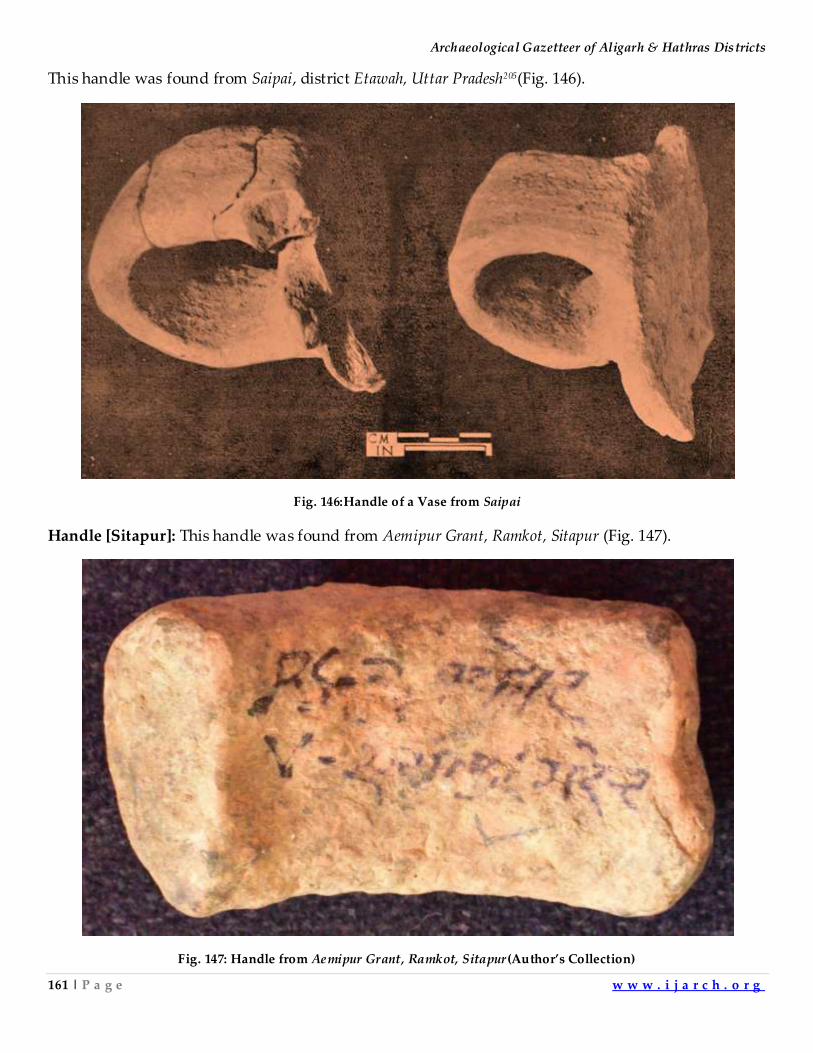
Archaeological Gazetteer of Aligarh & Hathras Districts
161 | P a g e w w w . i j a r c h . o r g
This handle was found from Saipai, district Etawah, Uttar Pradesh205(Fig. 146).
Fig. 146:Handle of a Vase from Saipai
Handle [Sitapur]: This handle was found from Aemipur Grant, Ramkot, Sitapur (Fig. 147).
Fig. 147: Handle from Aemipur Grant, Ramkot, Sitapur (Author’s Collection)
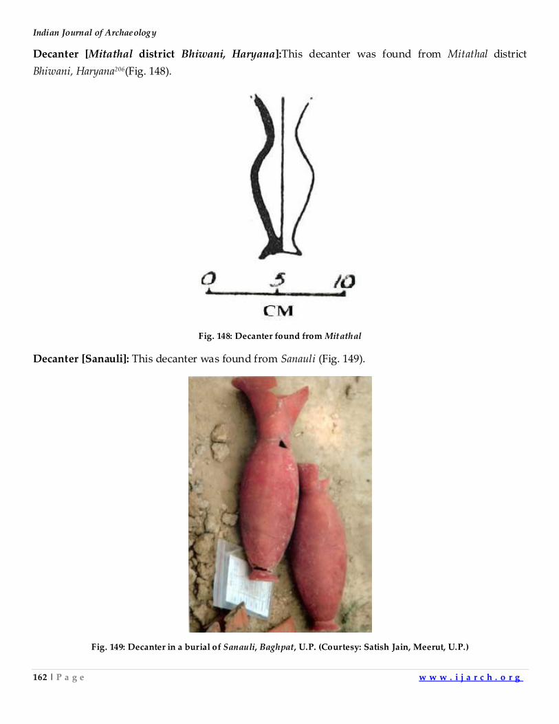
Indian Journal of Archaeology
162 | P a g e w w w . i j a r c h . o r g
Decanter [Mitathal district Bhiwani, Haryana]:This decanter was found from Mitathal district
Bhiwani, Haryana206(Fig. 148).
Fig. 148: Decanter found from Mitathal
Decanter [Sanauli]: This decanter was found from Sanauli (Fig. 149).
Fig. 149: Decanter in a burial of Sanauli, Baghpat, U.P. (Courtesy: Satish Jain, Meerut, U.P.)
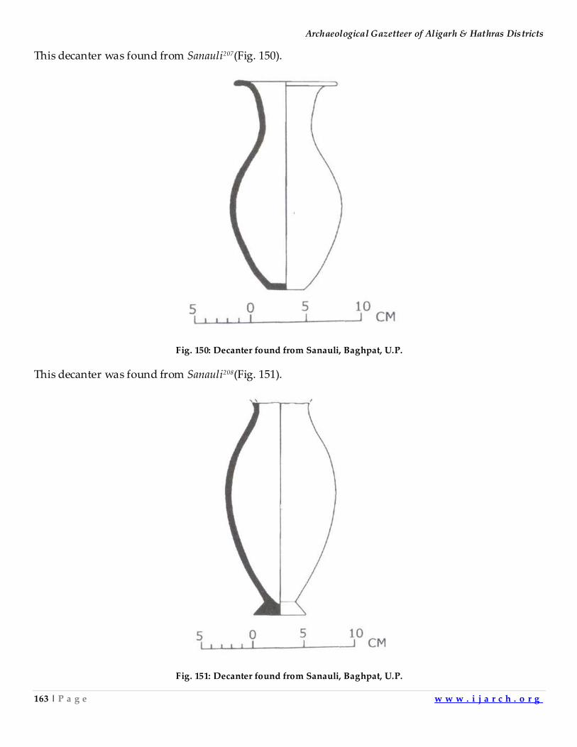
Archaeological Gazetteer of Aligarh & Hathras Districts
163 | P a g e w w w . i j a r c h . o r g
This decanter was found from Sanauli207(Fig. 150).
Fig. 150: Decanter found from Sanauli, Baghpat, U.P.
This decanter was found from Sanauli208(Fig. 151).
Fig. 151: Decanter found from Sanauli, Baghpat, U.P.
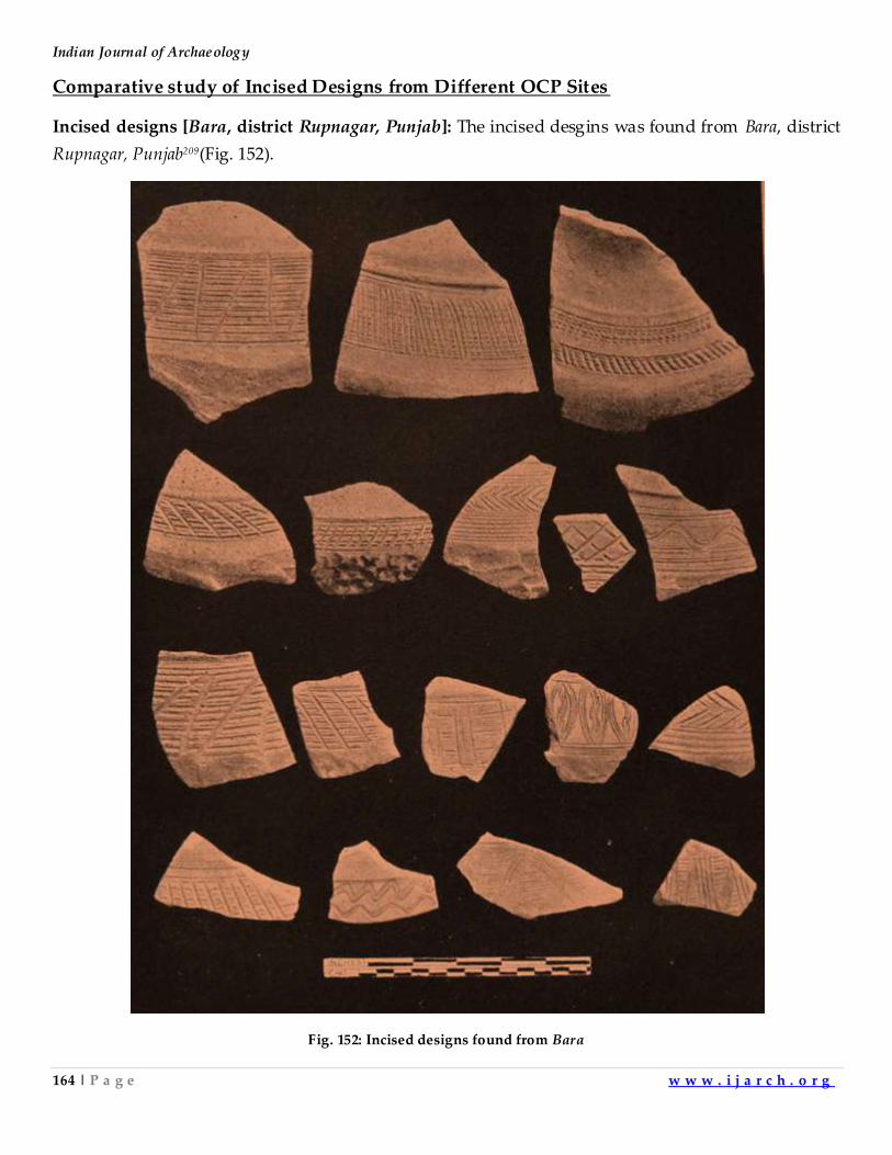
Indian Journal of Archaeology
164 | P a g e w w w . i j a r c h . o r g
Comparative study of Incised Designs from Different OCP Sites
Incised designs [Bara, district Rupnagar, Punjab]: The incised desgins was found from Bara, district
Rupnagar, Punjab209(Fig. 152).
Fig. 152: Incised designs found from Bara
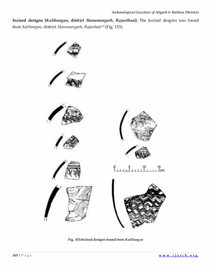
Archaeological Gazetteer of Aligarh & Hathras Districts
165 | P a g e w w w . i j a r c h . o r g
Incised designs [Kalibangan, district Hanumangarh, Rajasthan]: The incised desgins was found
from Kalibangan, district Hanumangarh, Rajasthan210 (Fig. 153).
Fig. 153:Incised designs found from Kalibangan
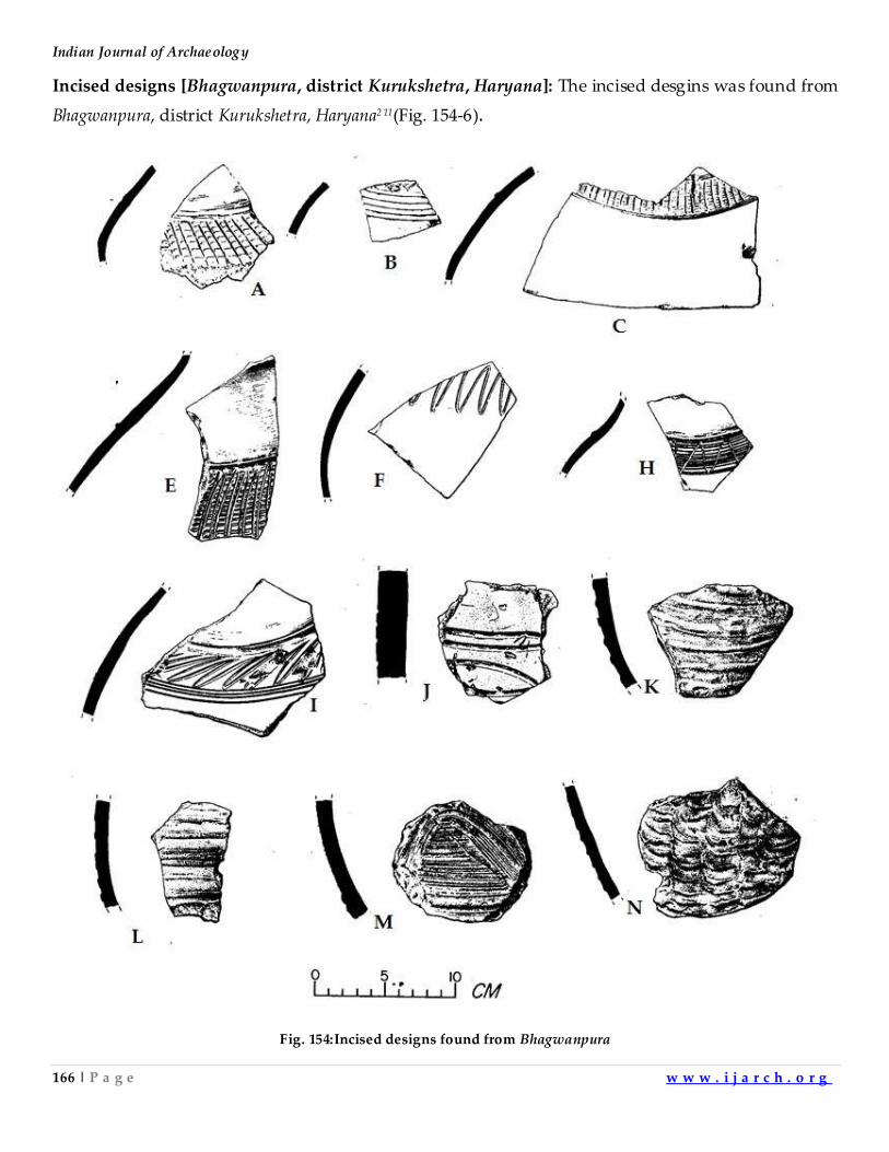
Indian Journal of Archaeology
166 | P a g e w w w . i j a r c h . o r g
Incised designs [Bhagwanpura, district Kurukshetra, Haryana]: The incised desgins was found from
Bhagwanpura, district Kurukshetra, Haryana2 11(Fig. 154-6).
Fig. 154:Incised designs found from Bhagwanpura
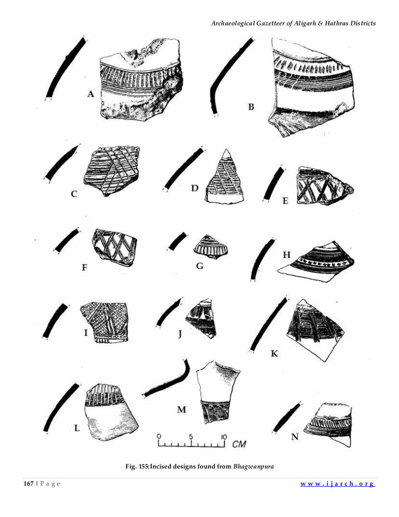
Archaeological Gazetteer of Aligarh & Hathras Districts
167 | P a g e w w w . i j a r c h . o r g
Fig. 155:Incised designs found from Bhagwanpura
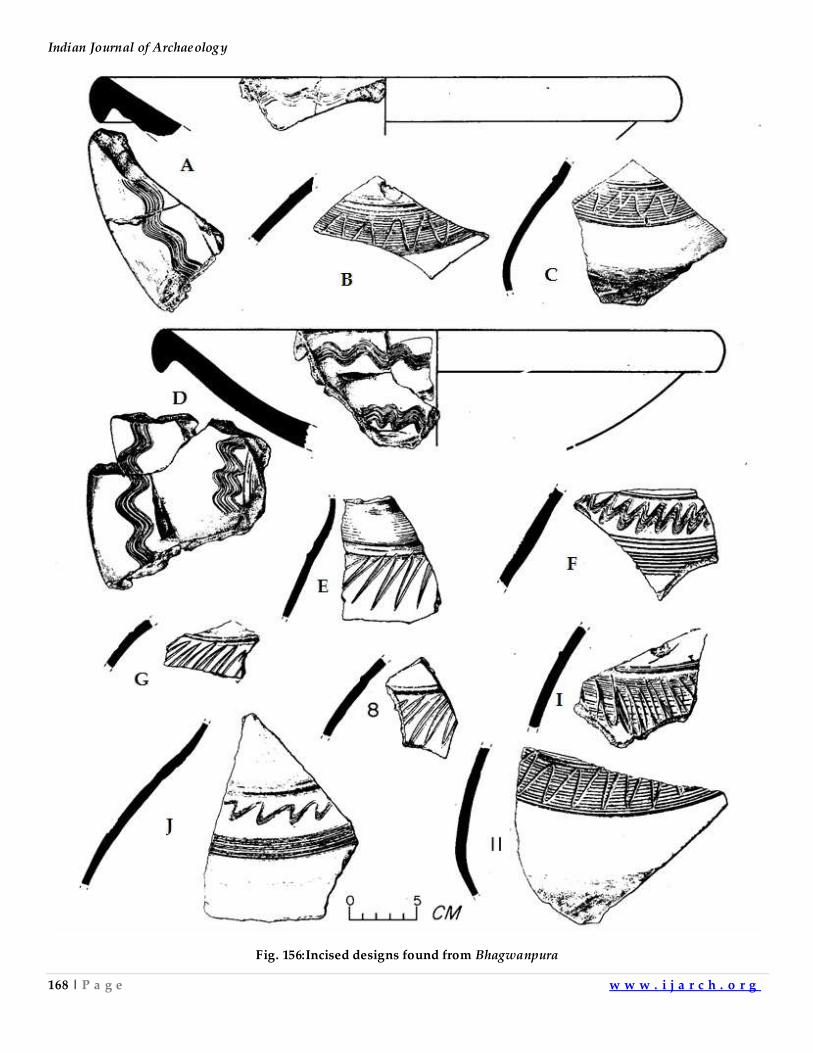
Indian Journal of Archaeology
168 | P a g e w w w . i j a r c h . o r g
Fig. 156:Incised designs found from Bhagwanpura
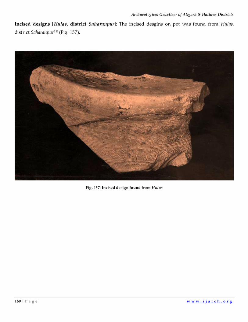
Archaeological Gazetteer of Aligarh & Hathras Districts
169 | P a g e w w w . i j a r c h . o r g
Incised designs [Hulas, district Saharanpur]: The incised desgins on pot was found from Hulas,
district Saharanpur2 12 (Fig. 157).
Fig. 157: Incised design found from Hulas
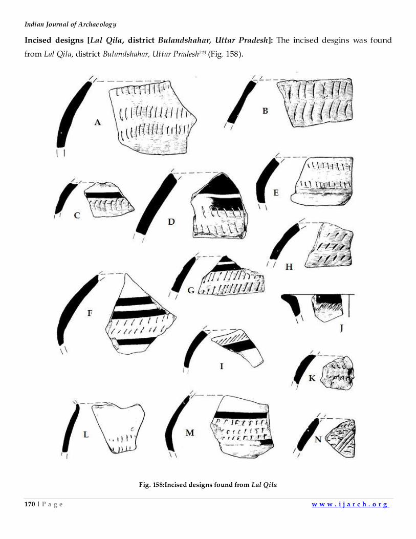
Indian Journal of Archaeology
170 | P a g e w w w . i j a r c h . o r g
Incised designs [Lal Qila, district Bulandshahar, Uttar Pradesh]: The incised desgins was found
from Lal Qila, district Bulandshahar, Uttar Pradesh213 (Fig. 158).
Fig. 158:Incised designs found from Lal Qila
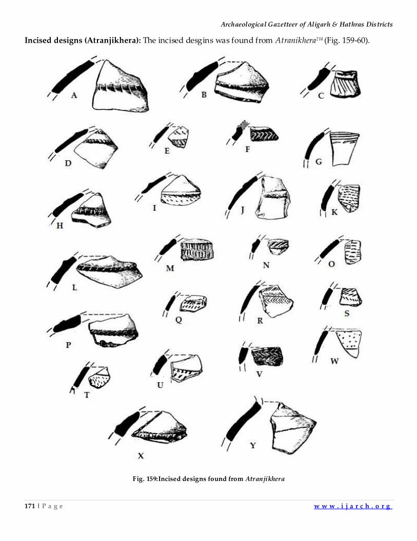
Archaeological Gazetteer of Aligarh & Hathras Districts
171 | P a g e w w w . i j a r c h . o r g
Incised designs (Atranjikhera): The incised desgins was found from Atranikhera214 (Fig. 159-60).
Fig. 159:Incised designs found from Atranjikhera
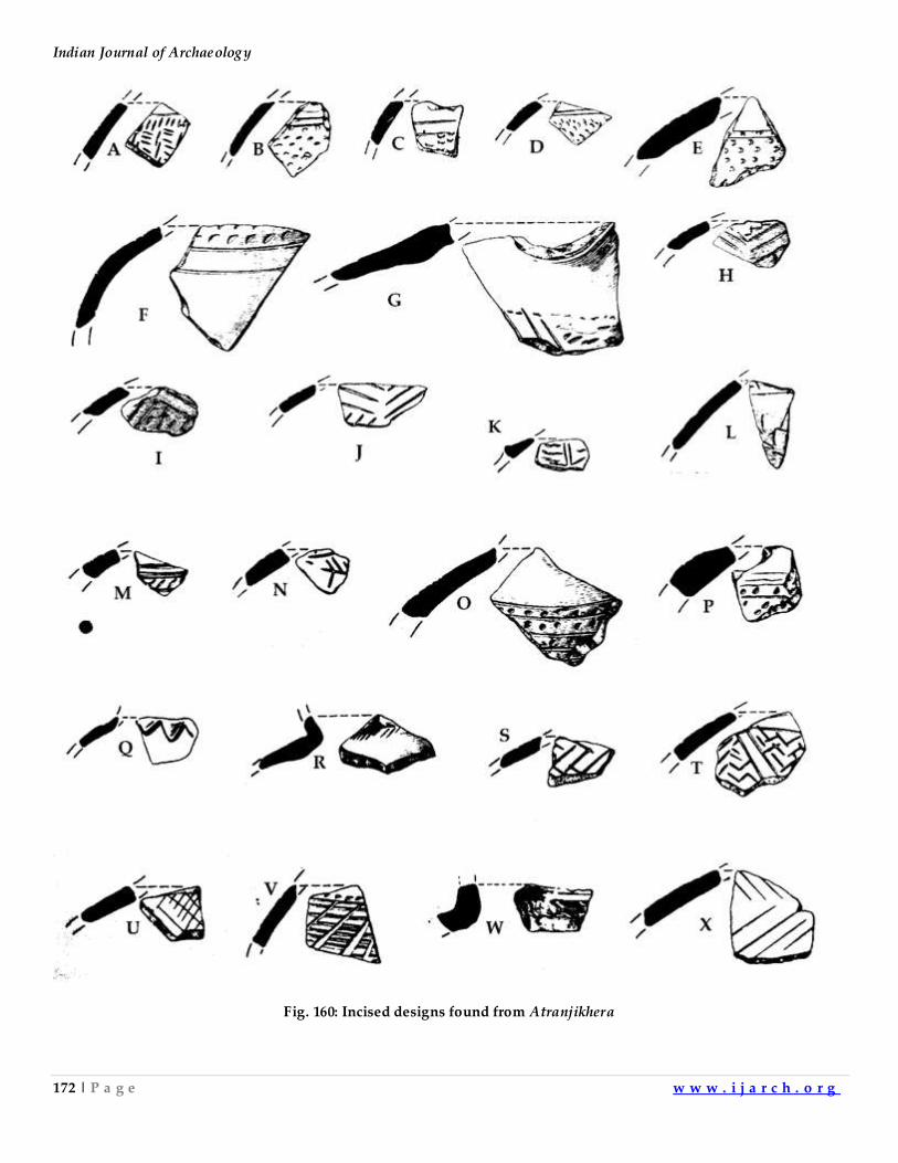
Indian Journal of Archaeology
172 | P a g e w w w . i j a r c h . o r g
Fig. 160: Incised designs found from Atranjikhera
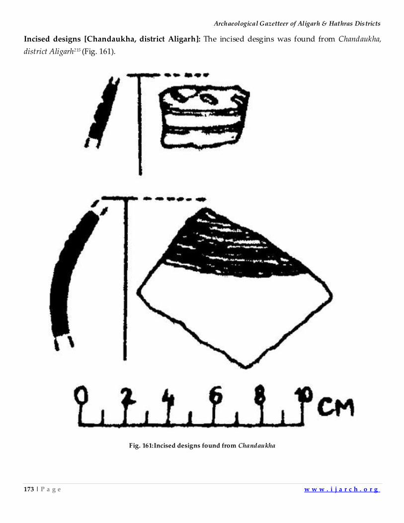
Archaeological Gazetteer of Aligarh & Hathras Districts
173 | P a g e w w w . i j a r c h . o r g
Incised designs [Chandaukha, district Aligarh]: The incised desgins was found from Chandaukha,
district Aligarh215 (Fig. 161).
Fig. 161:Incised designs found from Chandaukha
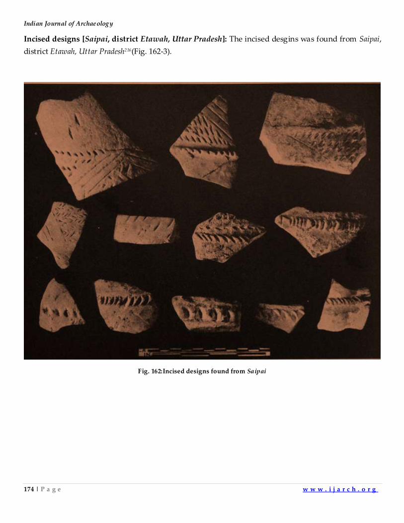
Indian Journal of Archaeology
174 | P a g e w w w . i j a r c h . o r g
Incised designs [Saipai, district Etawah, Uttar Pradesh]: The incised desgins was found from Saipai,
district Etawah, Uttar Pradesh216(Fig. 162-3).
Fig. 162:Incised designs found from Saipai
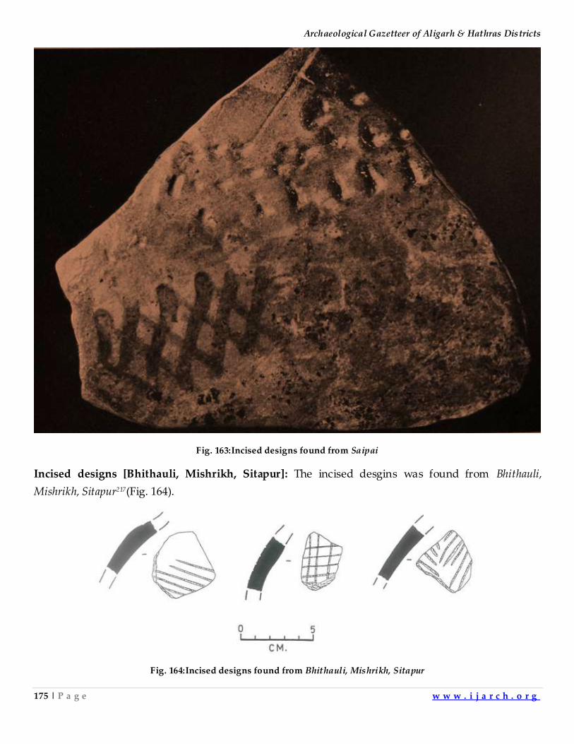
Archaeological Gazetteer of Aligarh & Hathras Districts
175 | P a g e w w w . i j a r c h . o r g
Fig. 163:Incised designs found from Saipai
Incised designs [Bhithauli, Mishrikh, Sitapur]: The incised desgins was found from Bhithauli,
Mishrikh, Sitapur217(Fig. 164).
Fig. 164:Incised designs found from Bhithauli, Mishrikh, Sitapur
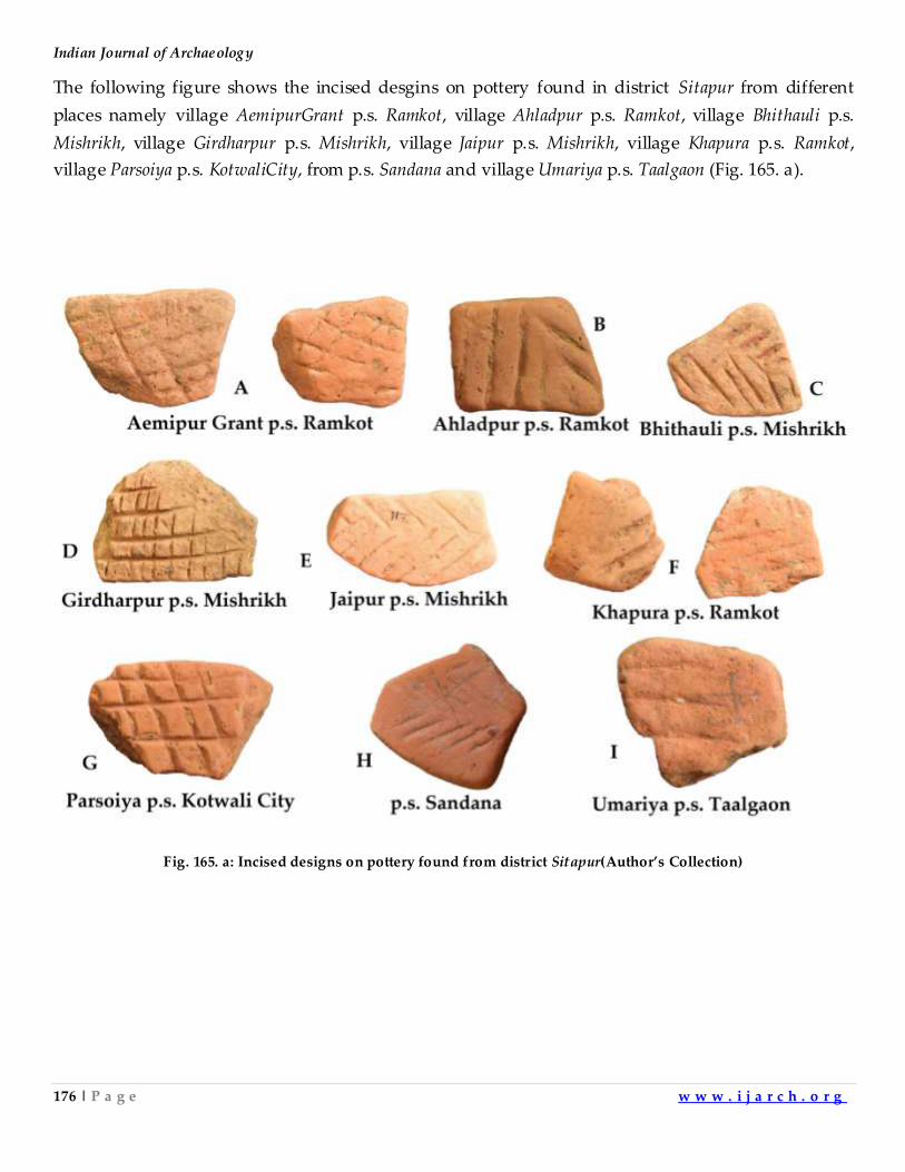
Indian Journal of Archaeology
176 | P a g e w w w . i j a r c h . o r g
The following figure shows the incised desgins on pottery found in district Sitapur from different
places namely village AemipurGrant p.s. Ramkot, village Ahladpur p.s. Ramkot, village Bhithauli p.s.
Mishrikh, village Girdharpur p.s. Mishrikh, village Jaipur p.s. Mishrikh, village Khapura p.s. Ramkot,
village Parsoiya p.s. KotwaliCity, from p.s. Sandana and village Umariya p.s. Taalgaon (Fig. 165. a).
Fig. 165. a: Incised designs on pottery found from district Sitapur(Author’s Collection)
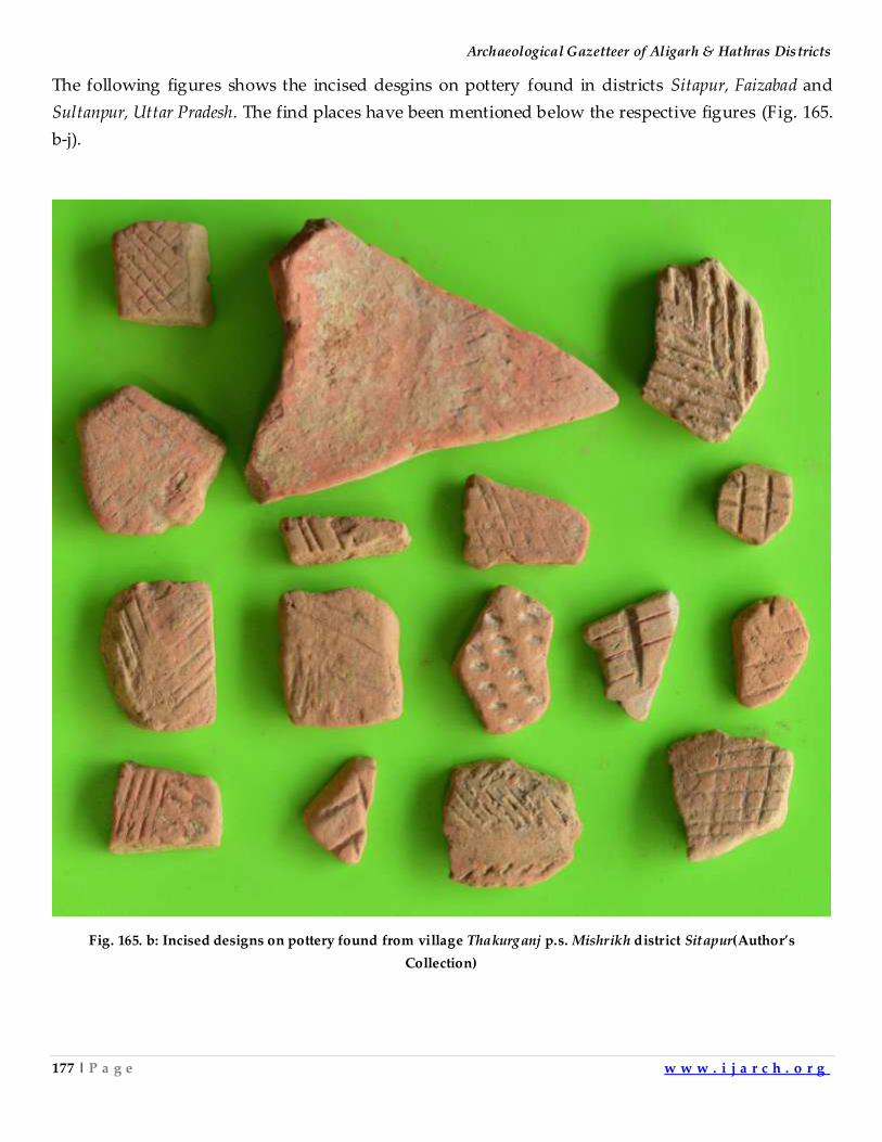
Archaeological Gazetteer of Aligarh & Hathras Districts
177 | P a g e w w w . i j a r c h . o r g
The following figures shows the incised desgins on pottery found in districts Sitapur, Faizabad and
Sultanpur, Uttar Pradesh. The find places have been mentioned below the respective figures (Fig. 165.
b-j).
Fig. 165. b: Incised designs on pottery found from village Thakurganj p.s. Mishrikh district Sitapur(Author’s
Collection)
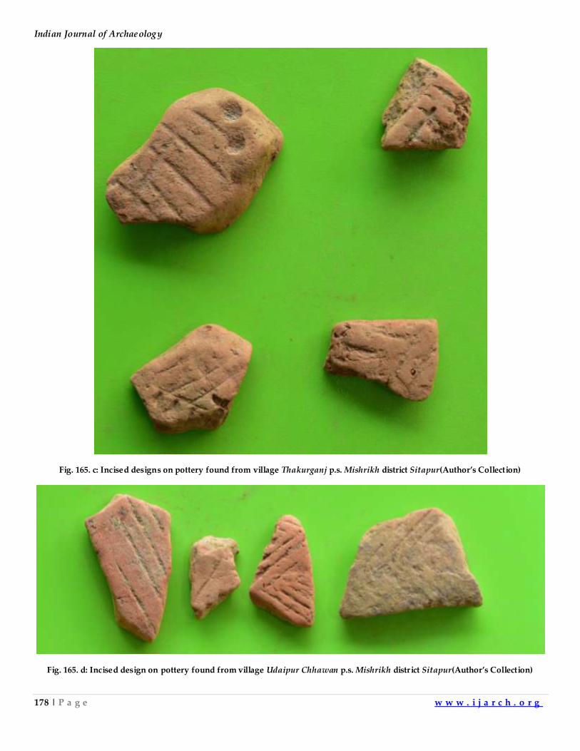
Indian Journal of Archaeology
178 | P a g e w w w . i j a r c h . o r g
Fig. 165. c: Incised designs on pottery found from village Thakurganj p.s. Mishrikh district Sitapur(Author’s Collection)
Fig. 165. d: Incised design on pottery found from village Udaipur Chhawan p.s. Mishrikh distr ict Sitapur(Author’s Collection)
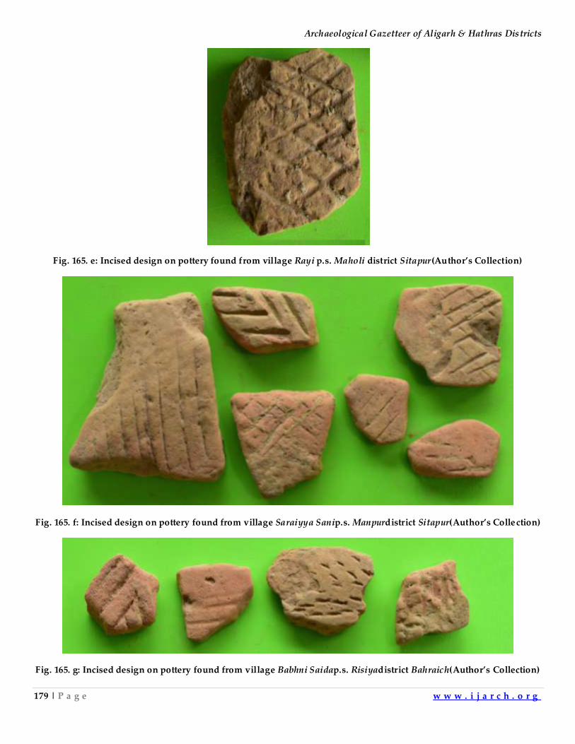
Archaeological Gazetteer of Aligarh & Hathras Districts
179 | P a g e w w w . i j a r c h . o r g
Fig. 165. e: Incised design on pottery found from village Rayi p.s. Maholi district Sitapur(Author’s Collection)
Fig. 165. f: Incised design on pottery found from village Saraiyya Sanip.s. Manpurdistrict Sitapur(Author’s Collection)
Fig. 165. g: Incised design on pottery found from village Babhni Saidap.s. Risiyadistrict Bahraich(Author’s Collection)
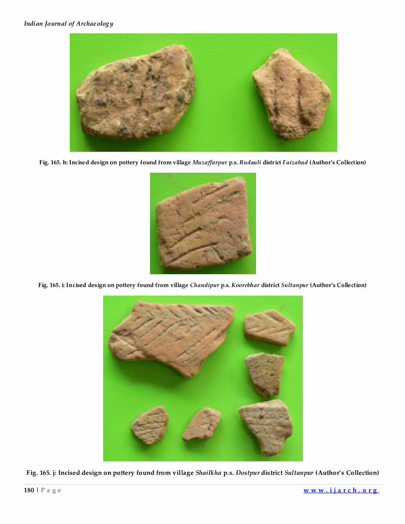
Indian Journal of Archaeology
180 | P a g e w w w . i j a r c h . o r g
Fig. 165. h: Incised design on pottery found from village Muzaffarpur p.s. Rudauli distr ict Faizabad (Author’s Collection)
Fig. 165. i: Incised design on pottery found from village Chandipur p.s. Koorebhar district Sultanpur (Author’s Collection)
Fig. 165. j: Incised design on pottery found from village Shailkha p.s. Dostpur district Sultanpur (Author’s Collection)
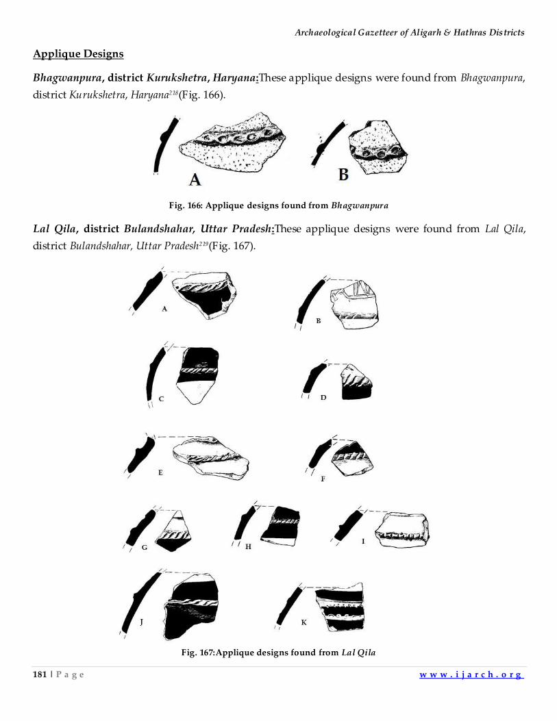
Archaeological Gazetteer of Aligarh & Hathras Districts
181 | P a g e w w w . i j a r c h . o r g
Applique Designs
Bhagwanpura, district Kurukshetra, Haryana:These applique designs were found from Bhagwanpura,
district Kurukshetra, Haryana218(Fig. 166).
Fig. 166: Applique designs found from Bhagwanpura
Lal Qila, district Bulandshahar, Uttar Pradesh:These applique designs were found from Lal Qila,
district Bulandshahar, Uttar Pradesh219(Fig. 167).
Fig. 167:Applique designs found from Lal Qila
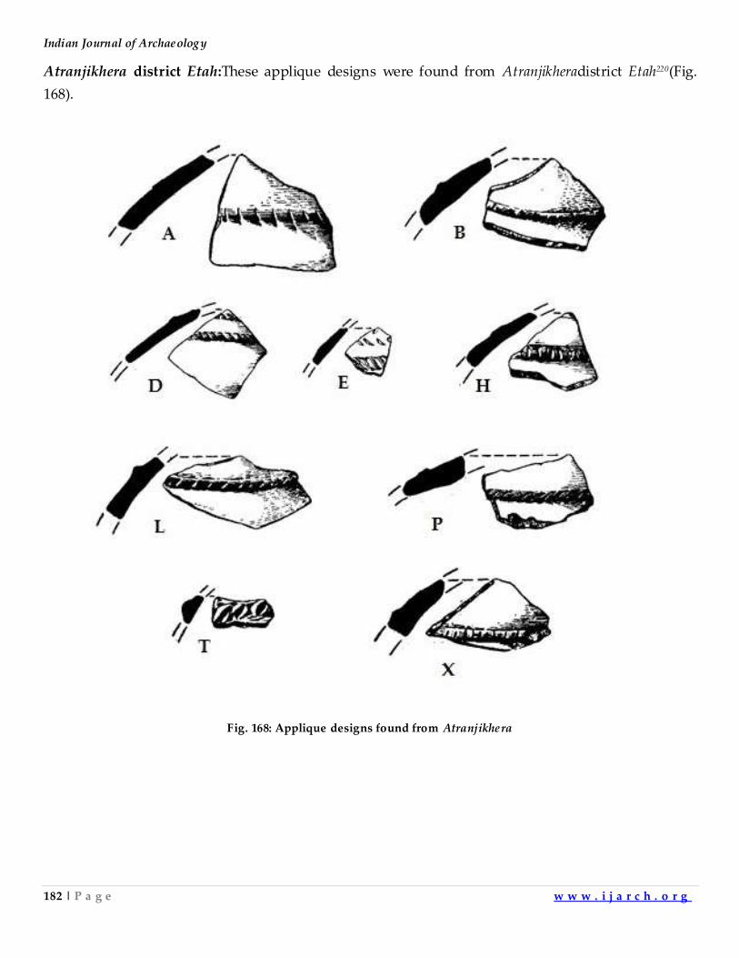
Indian Journal of Archaeology
182 | P a g e w w w . i j a r c h . o r g
Atranjikhera district Etah:These applique designs were found from Atranjikheradistrict Etah220(Fig.
168).
Fig. 168: Applique designs found from Atranjikhera
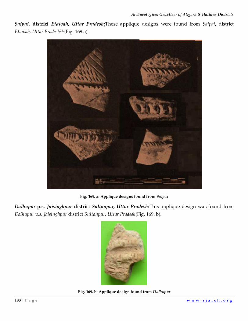
Archaeological Gazetteer of Aligarh & Hathras Districts
183 | P a g e w w w . i j a r c h . o r g
Saipai, district Etawah, Uttar Pradesh:These applique designs were found from Saipai, district
Etawah, Uttar Pradesh221(Fig. 169.a).
Fig. 169. a: Applique designs found from Saipai
Dalhupur p.s. Jaisinghpur district Sultanpur, Uttar Pradesh:This applique design was found from
Dalhupur p.s. Jaisinghpur district Sultanpur, Uttar Pradesh(Fig. 169. b).
Fig. 169. b: Applique design found from Dalhupur
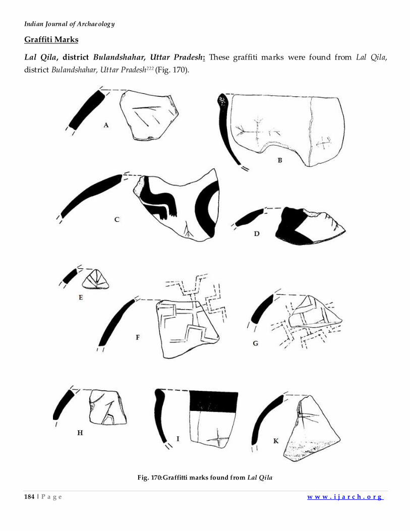
Indian Journal of Archaeology
184 | P a g e w w w . i j a r c h . o r g
Graffiti Marks
Lal Qila, district Bulandshahar, Uttar Pradesh: These graffiti marks were found from Lal Qila,
district Bulandshahar, Uttar Pradesh222 (Fig. 170).
Fig. 170:Graffitti marks found from Lal Qila
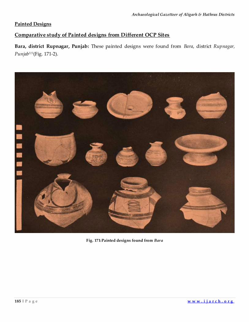
Archaeological Gazetteer of Aligarh & Hathras Districts
185 | P a g e w w w . i j a r c h . o r g
Painted Designs
Comparative study of Painted designs from Different OCP Sites
Bara, district Rupnagar, Punjab: These painted designs were found from Bara, district Rupnagar,
Punjab223(Fig. 171-2).
Fig. 171:Painted designs found from Bara
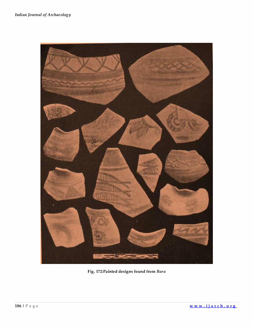
Indian Journal of Archaeology
186 | P a g e w w w . i j a r c h . o r g
Fig. 172:Painted designs found from Bara
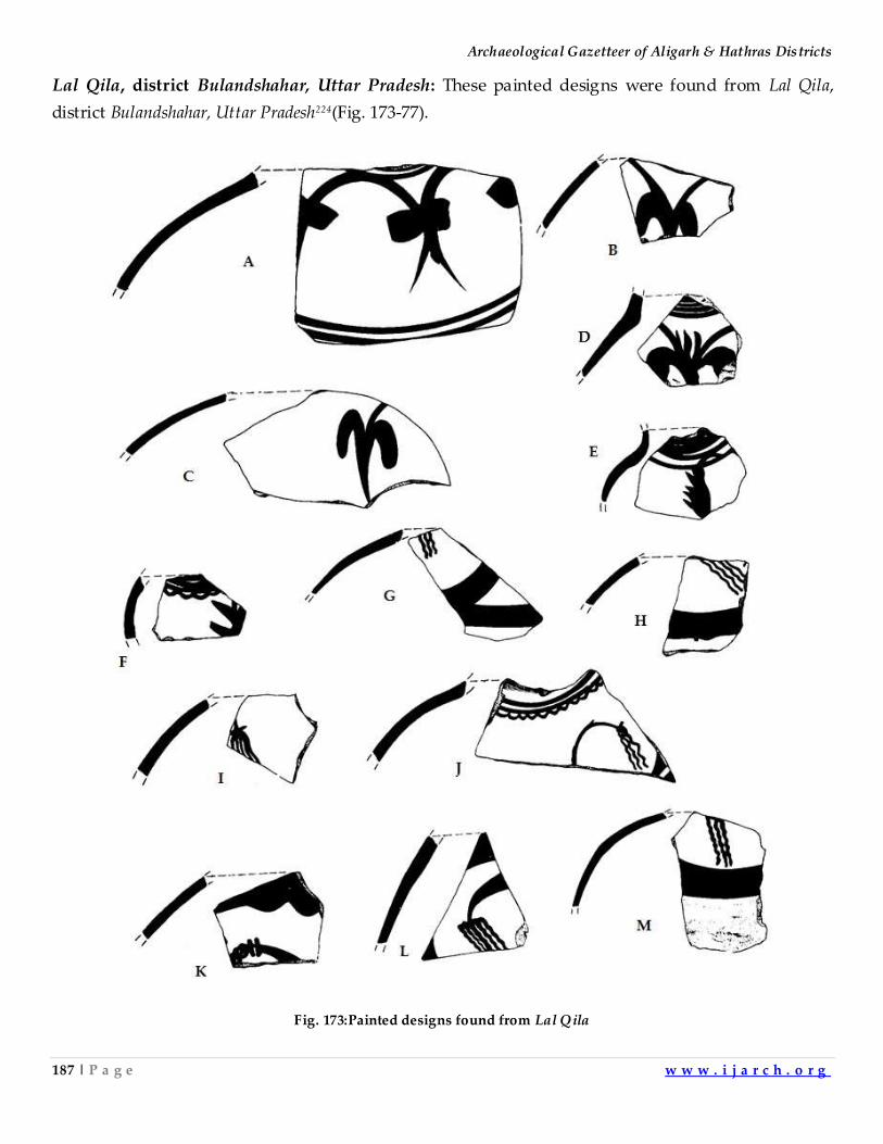
Archaeological Gazetteer of Aligarh & Hathras Districts
187 | P a g e w w w . i j a r c h . o r g
Lal Qila, district Bulandshahar, Uttar Pradesh: These painted designs were found from Lal Qila,
district Bulandshahar, Uttar Pradesh224(Fig. 173-77).
Fig. 173:Painted designs found from Lal Qila
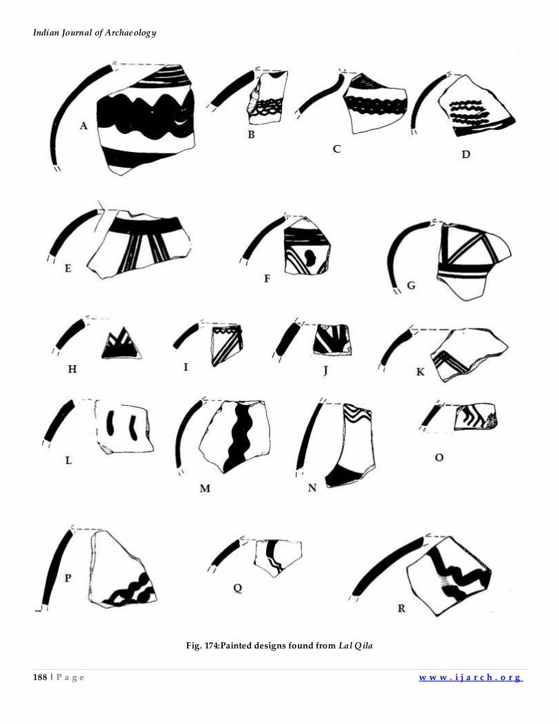
Indian Journal of Archaeology
188 | P a g e w w w . i j a r c h . o r g
Fig. 174:Painted designs found from Lal Qila
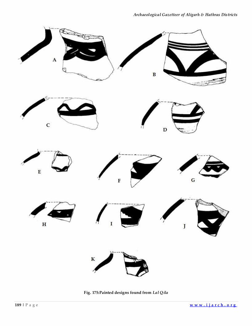
Archaeological Gazetteer of Aligarh & Hathras Districts
189 | P a g e w w w . i j a r c h . o r g
Fig. 175:Painted designs found from Lal Qila
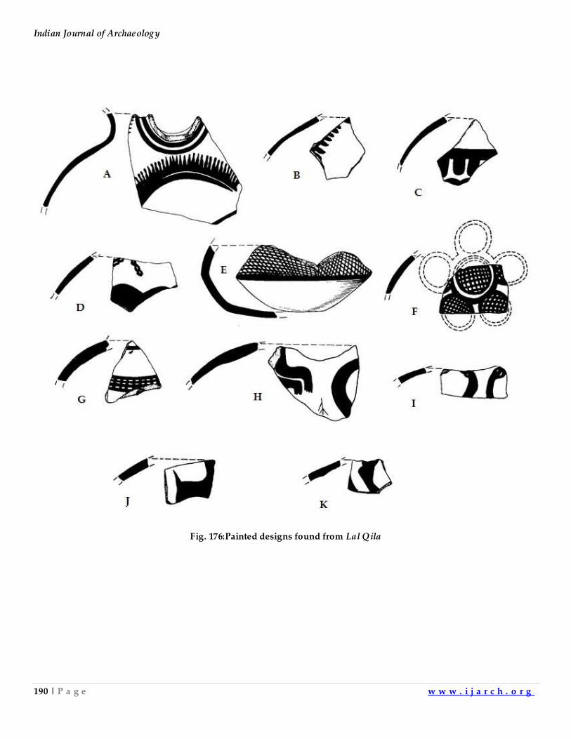
Indian Journal of Archaeology
190 | P a g e w w w . i j a r c h . o r g
Fig. 176:Painted designs found from Lal Qila
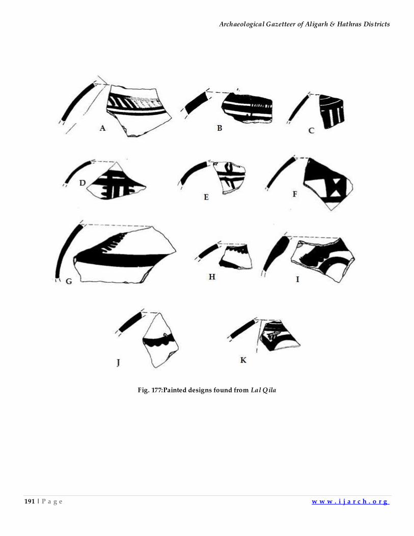
Archaeological Gazetteer of Aligarh & Hathras Districts
191 | P a g e w w w . i j a r c h . o r g
Fig. 177:Painted designs found from Lal Qila
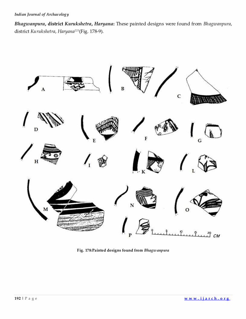
Indian Journal of Archaeology
192 | P a g e w w w . i j a r c h . o r g
Bhagwanpura, district Kurukshetra, Haryana: These painted designs were found from Bhagwanpura,
district Kurukshetra, Haryana225(Fig. 178-9).
Fig. 178:Painted designs found from Bhagwanpura
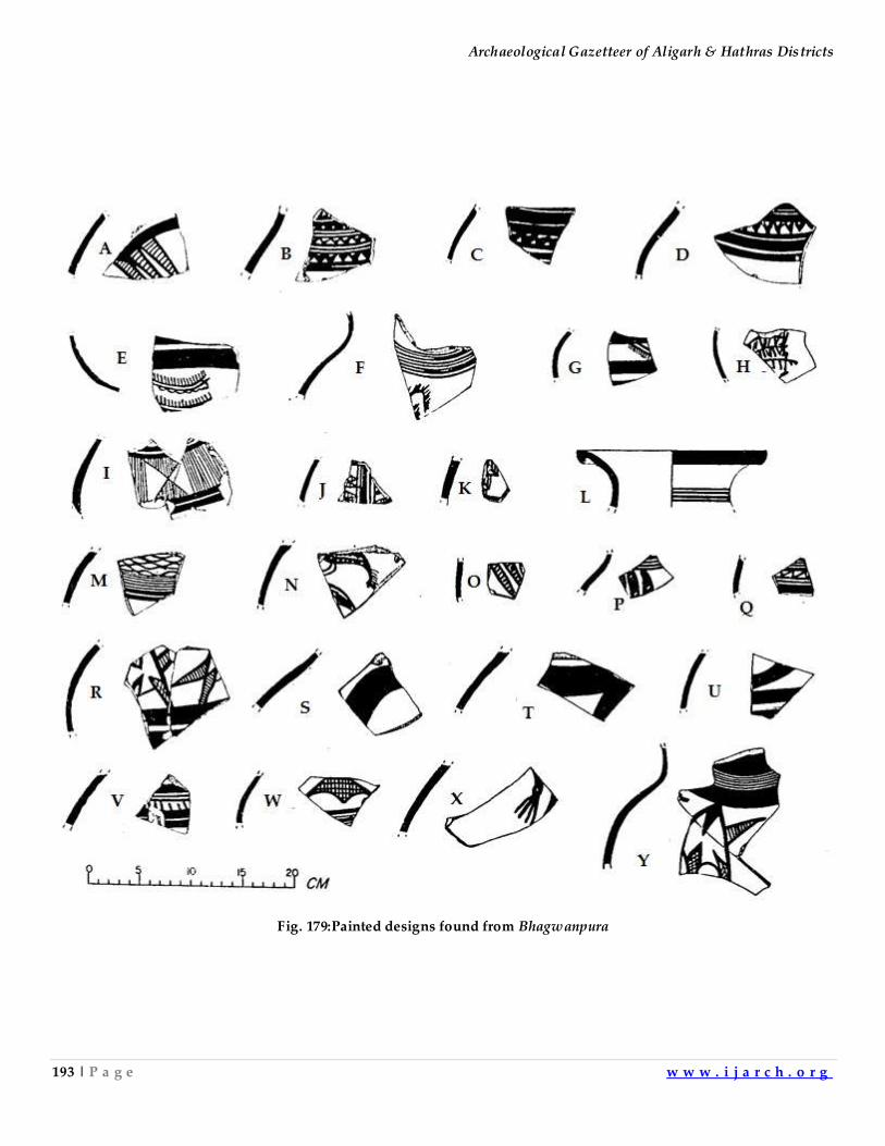
Archaeological Gazetteer of Aligarh & Hathras Districts
193 | P a g e w w w . i j a r c h . o r g
Fig. 179:Painted designs found from Bhagwanpura
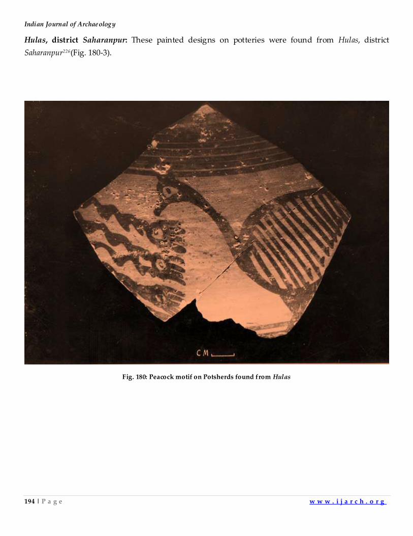
Indian Journal of Archaeology
194 | P a g e w w w . i j a r c h . o r g
Hulas, district Saharanpur: These painted designs on potteries were found from Hulas, district
Saharanpur226(Fig. 180-3).
Fig. 180: Peacock motif on Potsherds found from Hulas
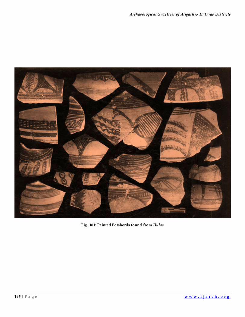
Archaeological Gazetteer of Aligarh & Hathras Districts
195 | P a g e w w w . i j a r c h . o r g
Fig. 181: Painted Potsherds found from Hulas
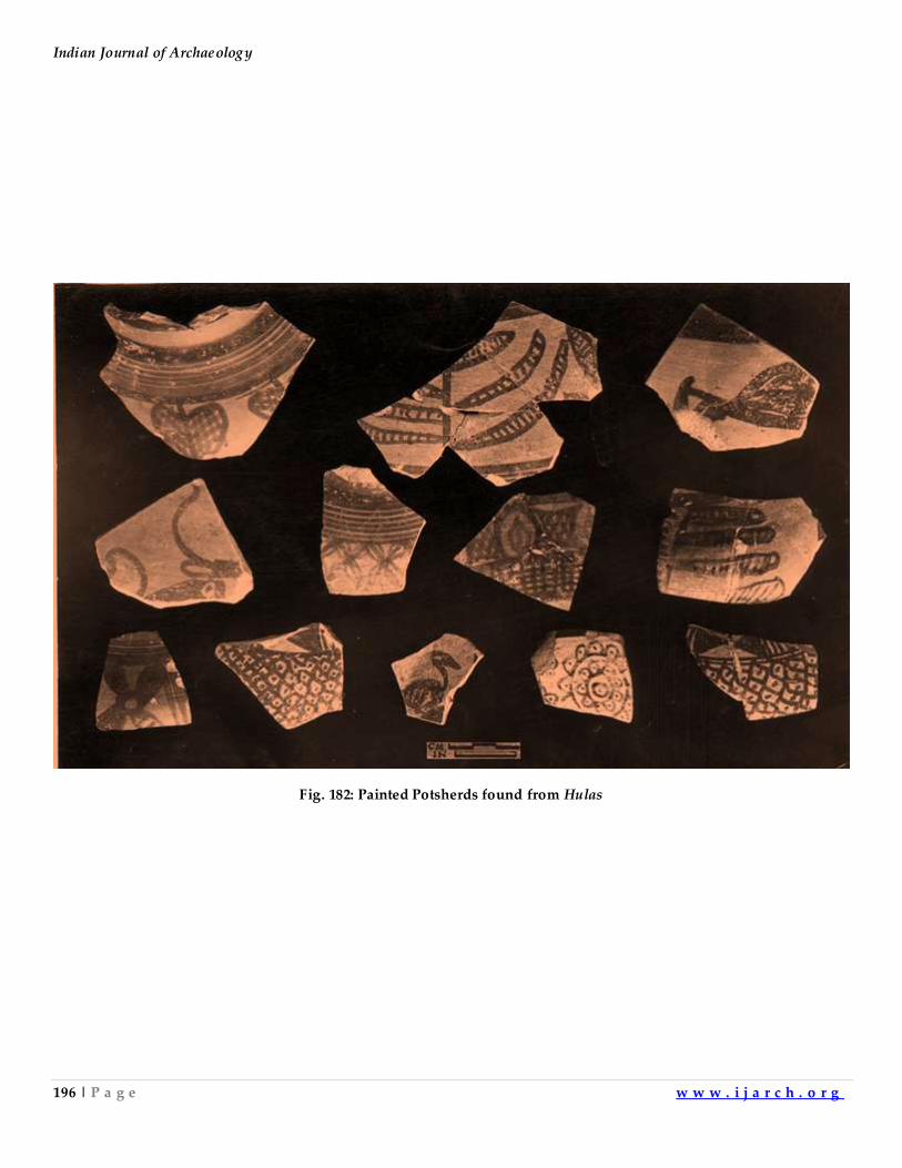
Indian Journal of Archaeology
196 | P a g e w w w . i j a r c h . o r g
Fig. 182: Painted Potsherds found from Hulas
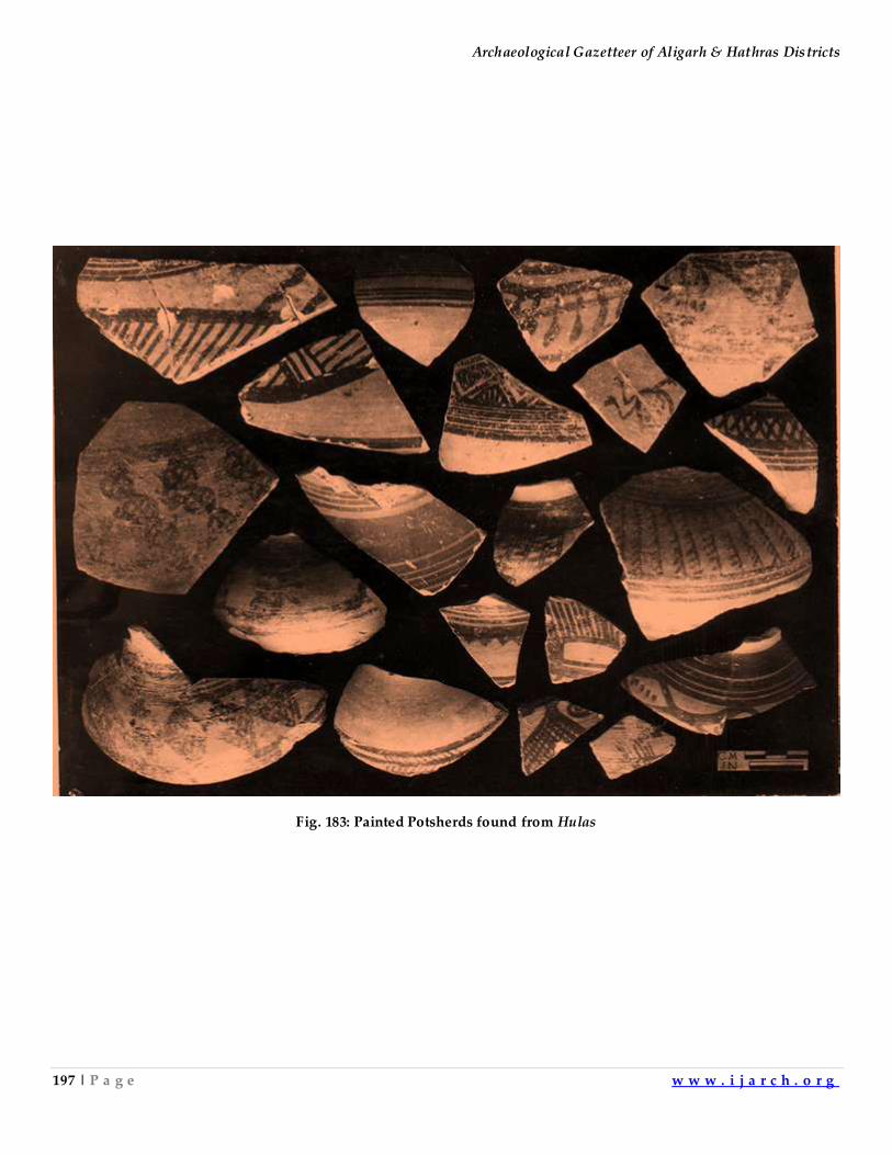
Archaeological Gazetteer of Aligarh & Hathras Districts
197 | P a g e w w w . i j a r c h . o r g
Fig. 183: Painted Potsherds found from Hulas
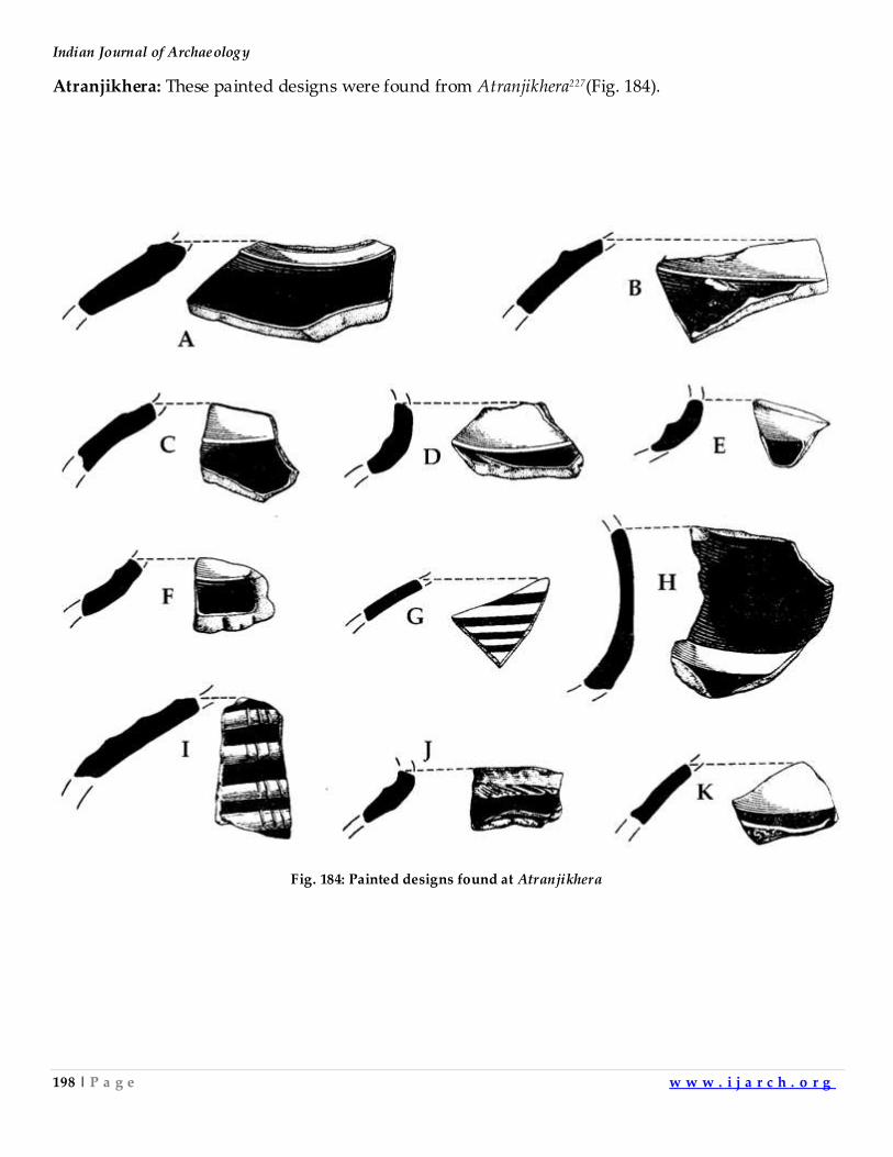
Indian Journal of Archaeology
198 | P a g e w w w . i j a r c h . o r g
Atranjikhera: These painted designs were found from Atranjikhera227(Fig. 184).
Fig. 184: Painted designs found at Atranjikhera
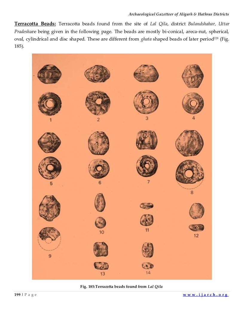
Archaeological Gazetteer of Aligarh & Hathras Districts
199 | P a g e w w w . i j a r c h . o r g
Terracotta Beads: Terracotta beads found from the site of Lal Qila, district Bulandshahar, Uttar
Pradeshare being given in the following page. The beads are mostly bi-conical, areca-nut, spherical,
oval, cylindrical and disc shaped. These are different from ghata shaped beads of later period228 (Fig.
185).
Fig. 185:Terracotta beads found from Lal Qila
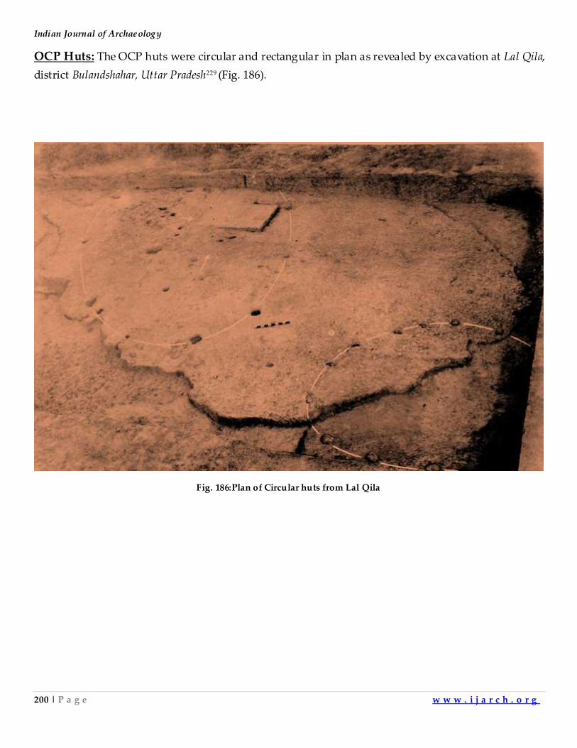
Indian Journal of Archaeology
200 | P a g e w w w . i j a r c h . o r g
OCP Huts: The OCP huts were circular and rectangular in plan as revealed by excavation at Lal Qila,
district Bulandshahar, Uttar Pradesh229 (Fig. 186).
Fig. 186:Plan of Circular huts from Lal Qila
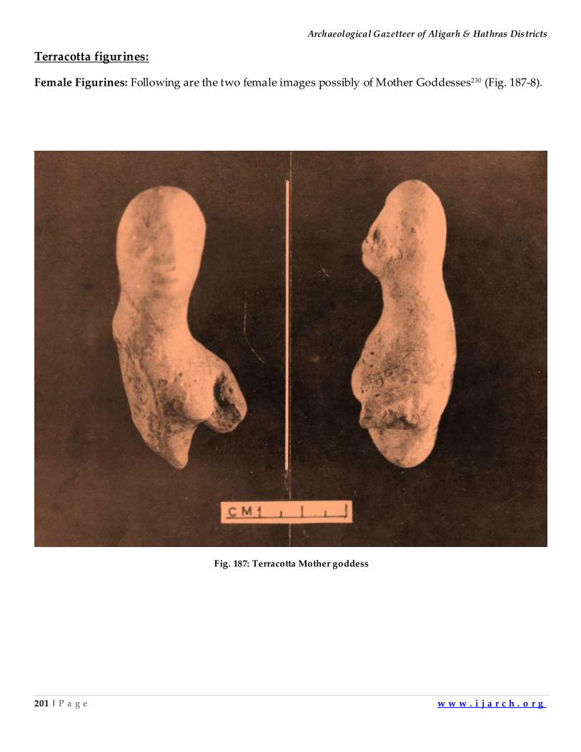
Archaeological Gazetteer of Aligarh & Hathras Districts
201 | P a g e w w w . i j a r c h . o r g
Terracotta figurines:
Female Figurines: Following are the two female images possibly of Mother Goddesses230 (Fig. 187-8).
Fig. 187: Terracotta Mother goddess
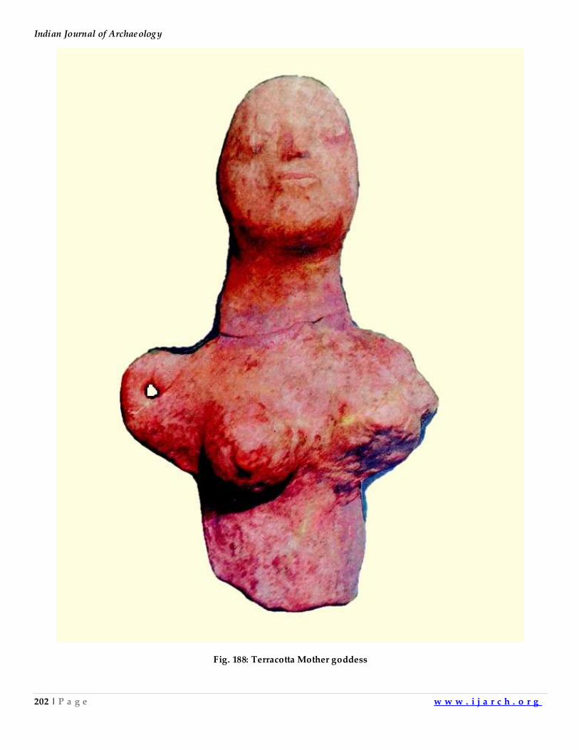
Indian Journal of Archaeology
202 | P a g e w w w . i j a r c h . o r g
Fig. 188: Terracotta Mother goddess
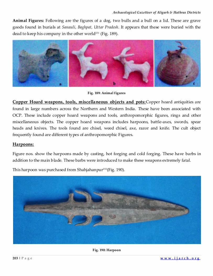
Archaeological Gazetteer of Aligarh & Hathras Districts
203 | P a g e w w w . i j a r c h . o r g
Animal Figures: Following are the figures of a dog, two bulls and a bull on a lid. These are grave
goods found in burials at Sanauli, Baghpat, Uttar Pradesh. It appears that these were buried with the
dead to keep his company in the other world231 (Fig. 189).
Fig. 189: Animal figures
Copper Hoard weapons, tools, miscellaneous objects and pots:Copper hoard antiquities are
found in large numbers across the Northern and Western India. These have been associated with
OCP. These include copper hoard weapons and tools, anthropomorphic figures, rings and other
miscellaneous objects. The copper hoard weapons includes harpoons, battle-axes, swords, spear
heads and knives. The tools found are chisel, weed chisel, axe, razor and knife. The cult object
frequently found are different types of anthropomorphic Figures.
Harpoons:
Figure nos. show the harpoons made by casting, hot forging and cold forging. These have barbs in
addition to the main blade. These barbs were introduced to make these weapons extremely fatal.
This harpoon was purchased from Shahjahanpur232(Fig. 190).
Fig. 190: Harpoon
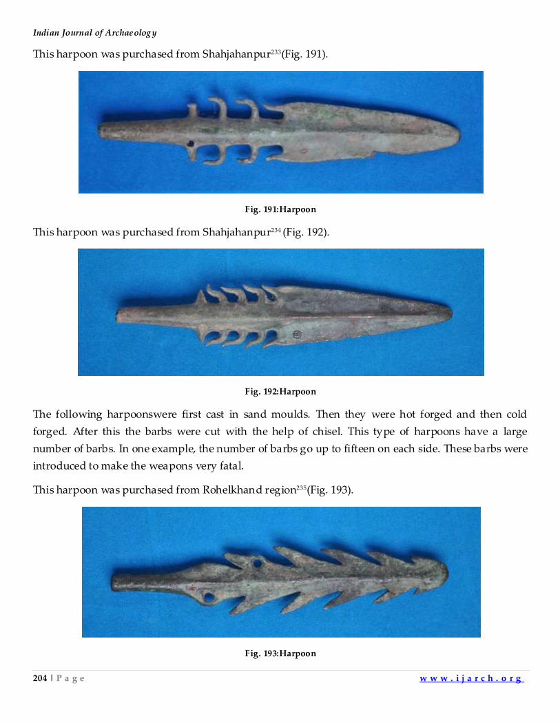
Indian Journal of Archaeology
204 | P a g e w w w . i j a r c h . o r g
This harpoon was purchased from Shahjahanpur233(Fig. 191).
Fig. 191:Harpoon
This harpoon was purchased from Shahjahanpur234 (Fig. 192).
Fig. 192:Harpoon
The following harpoonswere first cast in sand moulds. Then they were hot forged and then cold
forged. After this the barbs were cut with the help of chisel. This type of harpoons have a large
number of barbs. In one example, the number of barbs go up to fifteen on each side. These barbs were
introduced to make the weapons very fatal.
This harpoon was purchased from Rohelkhand region235(Fig. 193).
Fig. 193:Harpoon
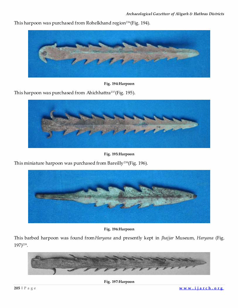
Archaeological Gazetteer of Aligarh & Hathras Districts
205 | P a g e w w w . i j a r c h . o r g
This harpoon was purchased from Rohelkhand region236(Fig. 194).
Fig. 194:Harpoon
This harpoon was purchased from Ahichhattra237(Fig. 195).
Fig. 195:Harpoon
This miniature harpoon was purchased from Bareilly238(Fig. 196).
Fig. 196:Harpoon
This barbed harpoon was found fromHaryana and presently kept in Jhajjar Museum, Haryana (Fig.
197)239.
Fig. 197:Harpoon
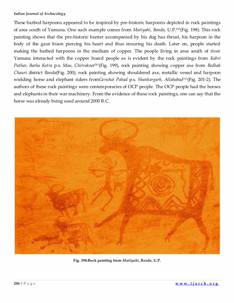
Indian Journal of Archaeology
206 | P a g e w w w . i j a r c h . o r g
These barbed harpoons appeared to be inspired by pre-historic harpoons depicted in rock paintings
of area south of Yamuna. One such example comes from Matiyahi, Banda, U.P.240(Fig. 198). This rock
painting shows that the pre-historic hunter accompanied by his dog has thrust, his harpoon in the
body of the gaur bison piercing his heart and thus ensuring his death. Later on, people started
making the barbed harpoons in the medium of copper. The people living in area south of river
Yamuna interacted with the copper hoard people as is evident by the rock paintings from Kabri
Pathar, Barha Kotra p.s. Mau, Chitrakoot241(Fig. 199), rock painting showing copper axe from Bedhak
Chauri district Banda(Fig. 200), rock painting showing shouldered axe, metallic vessel and harpoon
wielding horse and elephant riders fromGeruhai Pahad p.s. Shankargarh, Allahabad242(Fig. 201-2). The
authors of these rock paintings were contemporaries of OCP people. The OCP people had the horses
and elephants in their war machinery. From the evidence of these rock paintings, one can say that the
horse was already being used around 2000 B.C.
Fig. 198:Rock painting from Matiyahi, Banda, U.P.
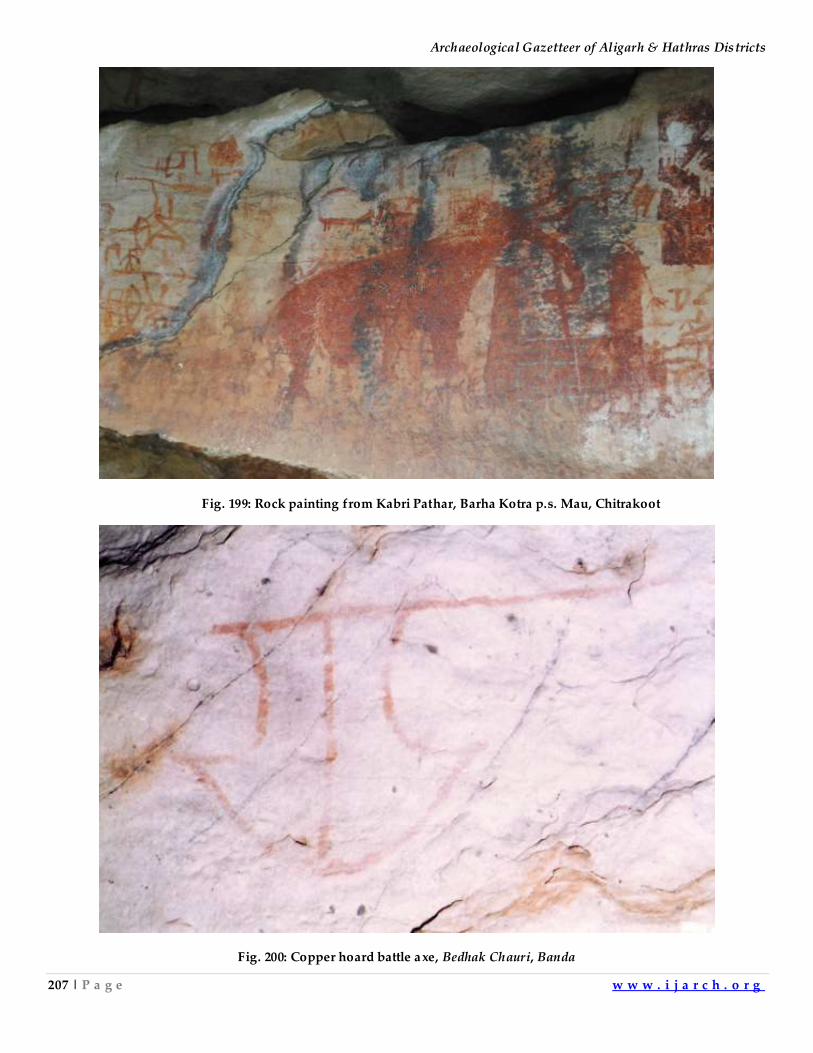
Archaeological Gazetteer of Aligarh & Hathras Districts
207 | P a g e w w w . i j a r c h . o r g
Fig. 199: Rock painting from Kabri Pathar, Barha Kotra p.s. Mau, Chitrakoot
Fig. 200: Copper hoard battle axe, Bedhak Chauri, Banda
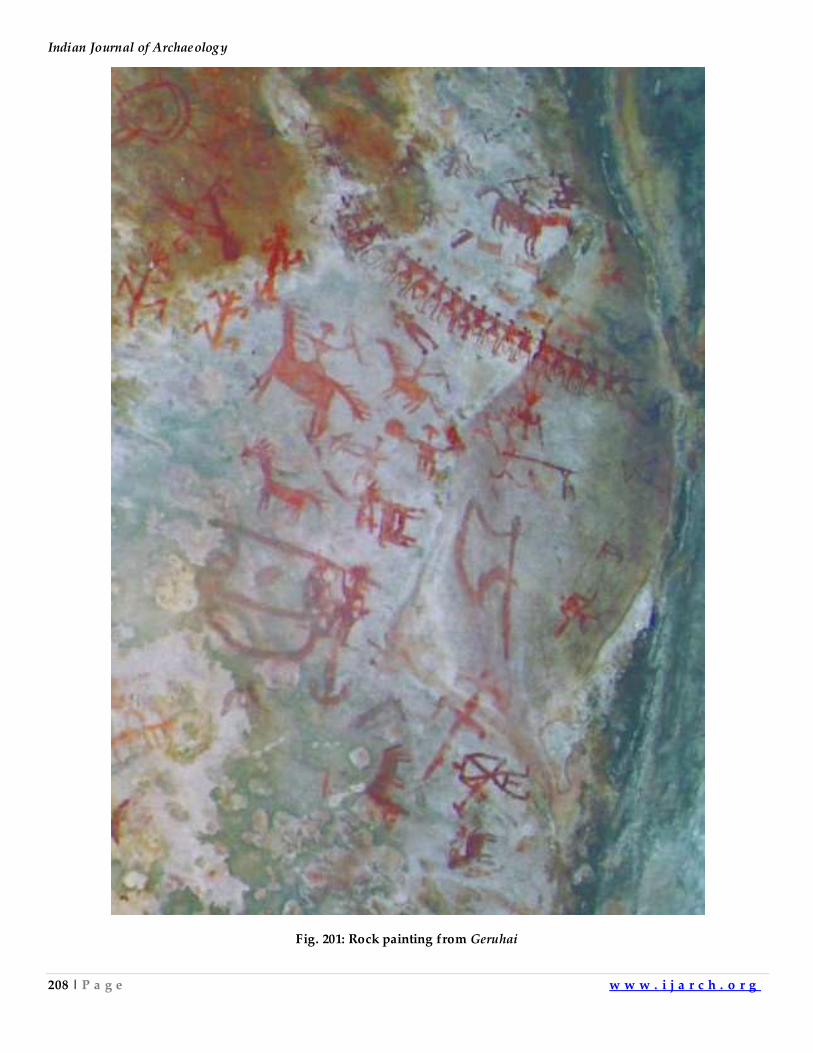
Indian Journal of Archaeology
208 | P a g e w w w . i j a r c h . o r g
Fig. 201: Rock painting from Geruhai
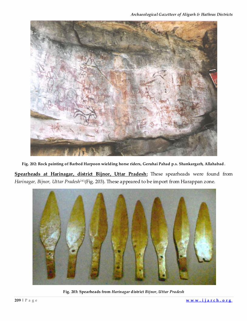
Archaeological Gazetteer of Aligarh & Hathras Districts
209 | P a g e w w w . i j a r c h . o r g
Fig. 202: Rock painting of Barbed Harpoon wielding horse riders, Geruhai Pahad p.s. Shankargarh, Allahabad .
Spearheads at Harinagar, district Bijnor, Uttar Pradesh: These spearheads were found from
Harinagar, Bijnor, Uttar Pradesh243(Fig. 203). These appeared to be import from Harappan zone.
Fig. 203: Spearheads from Harinagar district Bijnor, Uttar Pradesh
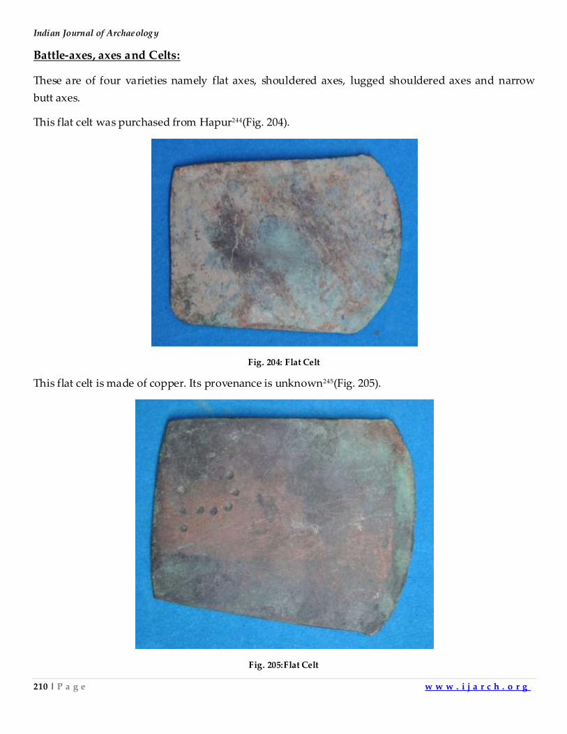
Indian Journal of Archaeology
210 | P a g e w w w . i j a r c h . o r g
Battle-axes, axes and Celts:
These are of four varieties namely flat axes, shouldered axes, lugged shouldered axes and narrow
butt axes.
This flat celt was purchased from Hapur244(Fig. 204).
Fig. 204: Flat Celt
This flat celt is made of copper. Its provenance is unknown245(Fig. 205).
Fig. 205:Flat Celt
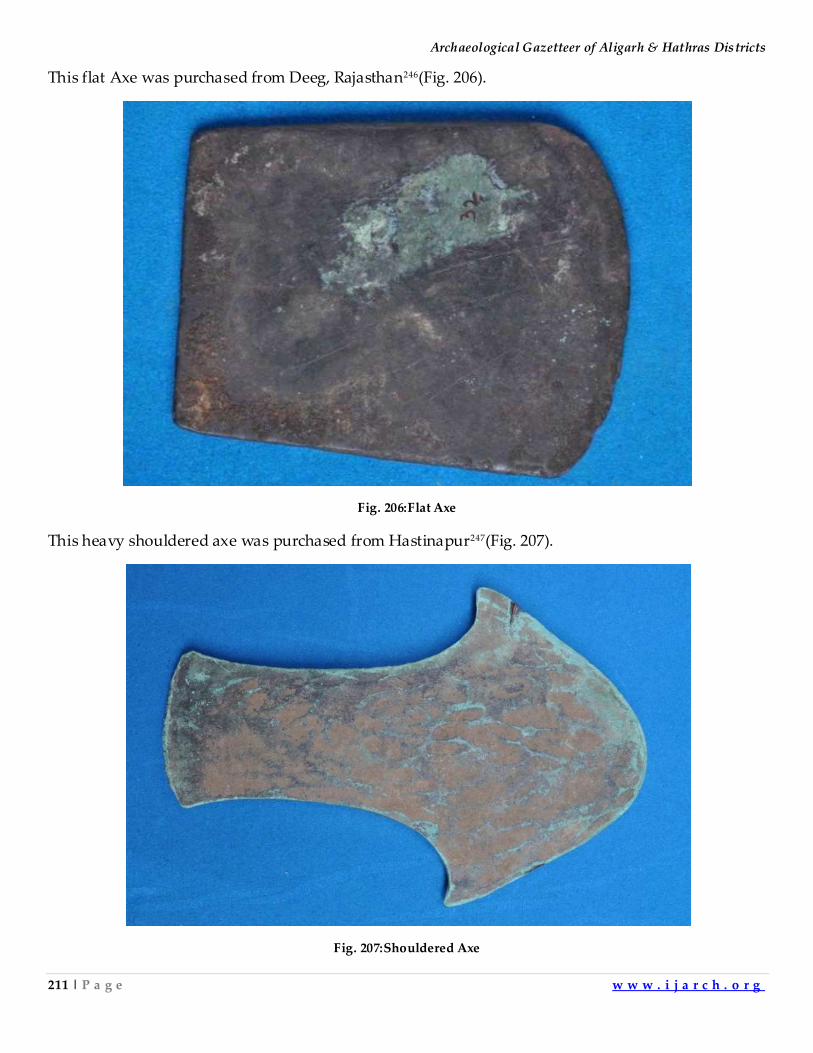
Archaeological Gazetteer of Aligarh & Hathras Districts
211 | P a g e w w w . i j a r c h . o r g
This flat Axe was purchased from Deeg, Rajasthan246(Fig. 206).
Fig. 206:Flat Axe
This heavy shouldered axe was purchased from Hastinapur247(Fig. 207).
Fig. 207:Shouldered Axe
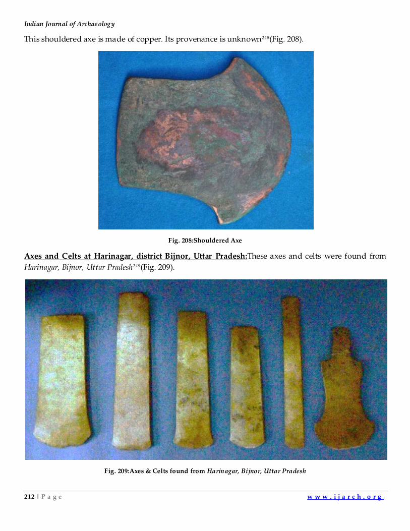
Indian Journal of Archaeology
212 | P a g e w w w . i j a r c h . o r g
This shouldered axe is made of copper. Its provenance is unknown248(Fig. 208).
Fig. 208:Shouldered Axe
Axes and Celts at Harinagar, district Bijnor, Uttar Pradesh:These axes and celts were found from
Harinagar, Bijnor, Uttar Pradesh249(Fig. 209).
Fig. 209:Axes & Celts found from Harinagar, Bijnor, Uttar Pradesh
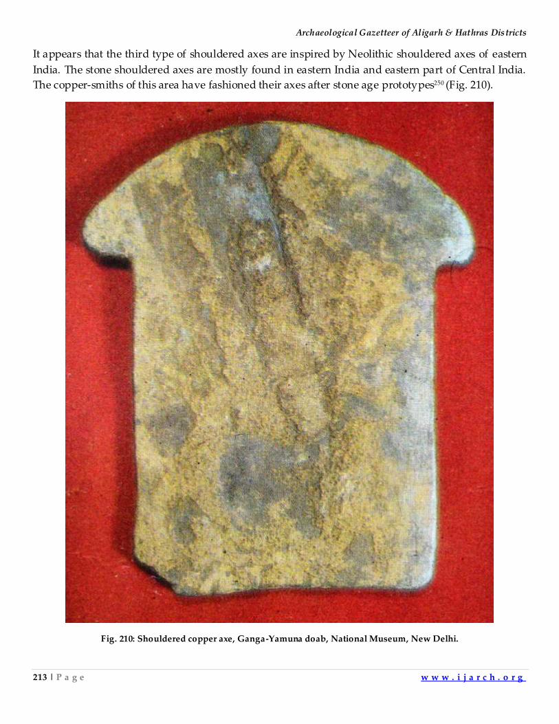
Archaeological Gazetteer of Aligarh & Hathras Districts
213 | P a g e w w w . i j a r c h . o r g
It appears that the third type of shouldered axes are inspired by Neolithic shouldered axes of eastern
India. The stone shouldered axes are mostly found in eastern India and eastern part of Central India.
The copper-smiths of this area have fashioned their axes after stone age prototypes250 (Fig. 210).
Fig. 210: Shouldered copper axe, Ganga-Yamuna doab, National Museum, New Delhi.
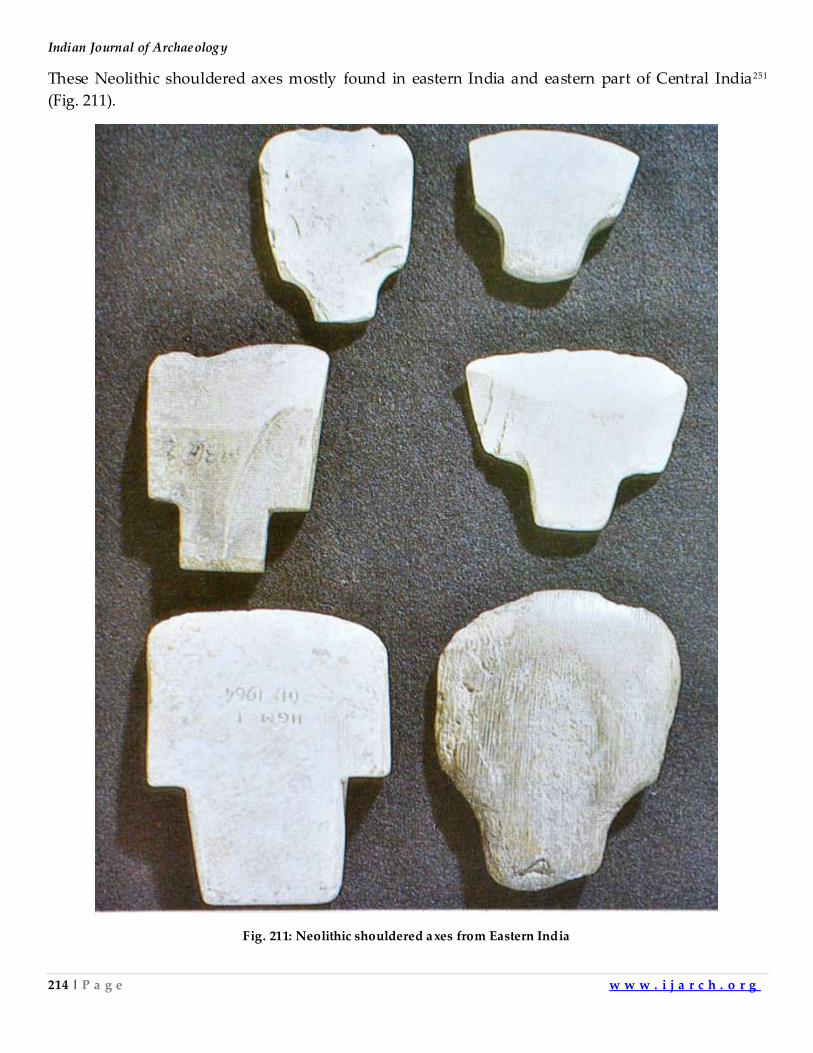
Indian Journal of Archaeology
214 | P a g e w w w . i j a r c h . o r g
These Neolithic shouldered axes mostly found in eastern India and eastern part of Central India251
(Fig. 211).
Fig. 211: Neolithic shouldered axes from Eastern India
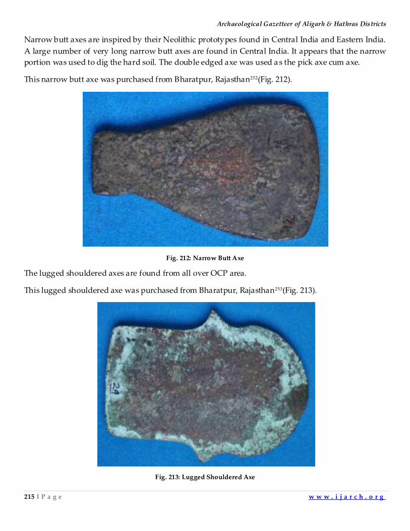
Archaeological Gazetteer of Aligarh & Hathras Districts
215 | P a g e w w w . i j a r c h . o r g
Narrow butt axes are inspired by their Neolithic prototypes found in Central India and Eastern India.
A large number of very long narrow butt axes are found in Central India. It appears that the narrow
portion was used to dig the hard soil. The double edged axe was used a s the pick axe cum axe.
This narrow butt axe was purchased from Bharatpur, Rajasthan252(Fig. 212).
Fig. 212: Narrow Butt Axe
The lugged shouldered axes are found from all over OCP area.
This lugged shouldered axe was purchased from Bharatpur, Rajasthan253(Fig. 213).
Fig. 213: Lugged Shouldered Axe
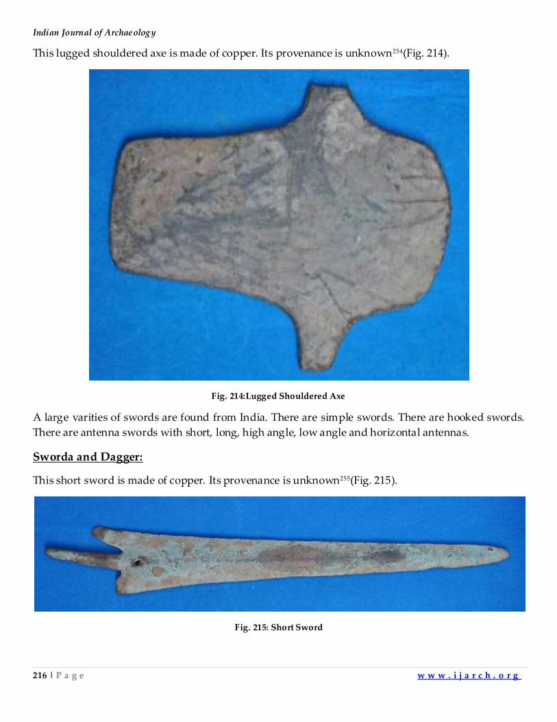
Indian Journal of Archaeology
216 | P a g e w w w . i j a r c h . o r g
This lugged shouldered axe is made of copper. Its provenance is unknown254(Fig. 214).
Fig. 214:Lugged Shouldered Axe
A large varities of swords are found from India. There are simple swords. There are hooked swords.
There are antenna swords with short, long, high angle, low angle and horizontal antennas.
Sworda and Dagger:
This short sword is made of copper. Its provenance is unknown255(Fig. 215).
Fig. 215: Short Sword
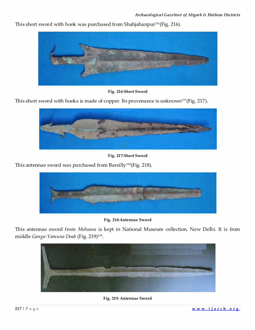
Archaeological Gazetteer of Aligarh & Hathras Districts
217 | P a g e w w w . i j a r c h . o r g
This short sword with hook was purchased from Shahjahanpur256(Fig. 216).
Fig. 216:Short Sword
This short sword with hooks is made of copper. Its provenance is unknown257(Fig. 217).
Fig. 217:Short Sword
This antennae sword was purchased from Bareilly258(Fig. 218).
Fig. 218:Antennae Sword
This antennae sword from Mehsana is kept in National Museum collection, New Delhi. It is from
middle Ganga-Yamuna Doab (Fig. 219)259.
Fig. 219: Antennae Sword
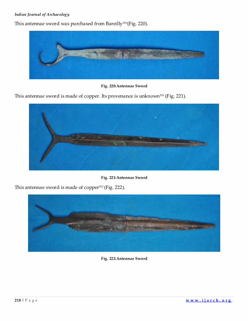
Indian Journal of Archaeology
218 | P a g e w w w . i j a r c h . o r g
This antennae sword was purchased from Bareilly260(Fig. 220).
Fig. 220:Antennae Sword
This antennae sword is made of copper. Its provenance is unknown261 (Fig. 221).
Fig. 221:Antennae Sword
This antennae sword is made of copper262 (Fig. 222).
Fig. 222:Antennae Sword
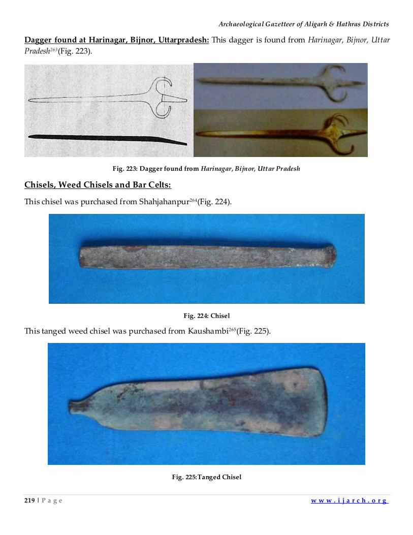
Archaeological Gazetteer of Aligarh & Hathras Districts
219 | P a g e w w w . i j a r c h . o r g
Dagger found at Harinagar, Bijnor, Uttarpradesh: This dagger is found from Harinagar, Bijnor, Uttar
Pradesh263(Fig. 223).
Fig. 223: Dagger found from Harinagar, Bijnor, Uttar Pradesh
Chisels, Weed Chisels and Bar Celts:
This chisel was purchased from Shahjahanpur264(Fig. 224).
Fig. 224: Chisel
This tanged weed chisel was purchased from Kaushambi265(Fig. 225).
Fig. 225:Tanged Chisel
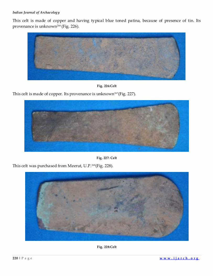
Indian Journal of Archaeology
220 | P a g e w w w . i j a r c h . o r g
This celt is made of copper and having typical blue toned patina, because of presence of tin. Its
provenance is unknown266 (Fig. 226).
Fig. 226:Celt
This celt is made of copper. Its provenance is unknown267(Fig. 227).
Fig. 227: Celt
This celt was purchased from Meerut, U.P.268(Fig. 228).
Fig. 228:Celt
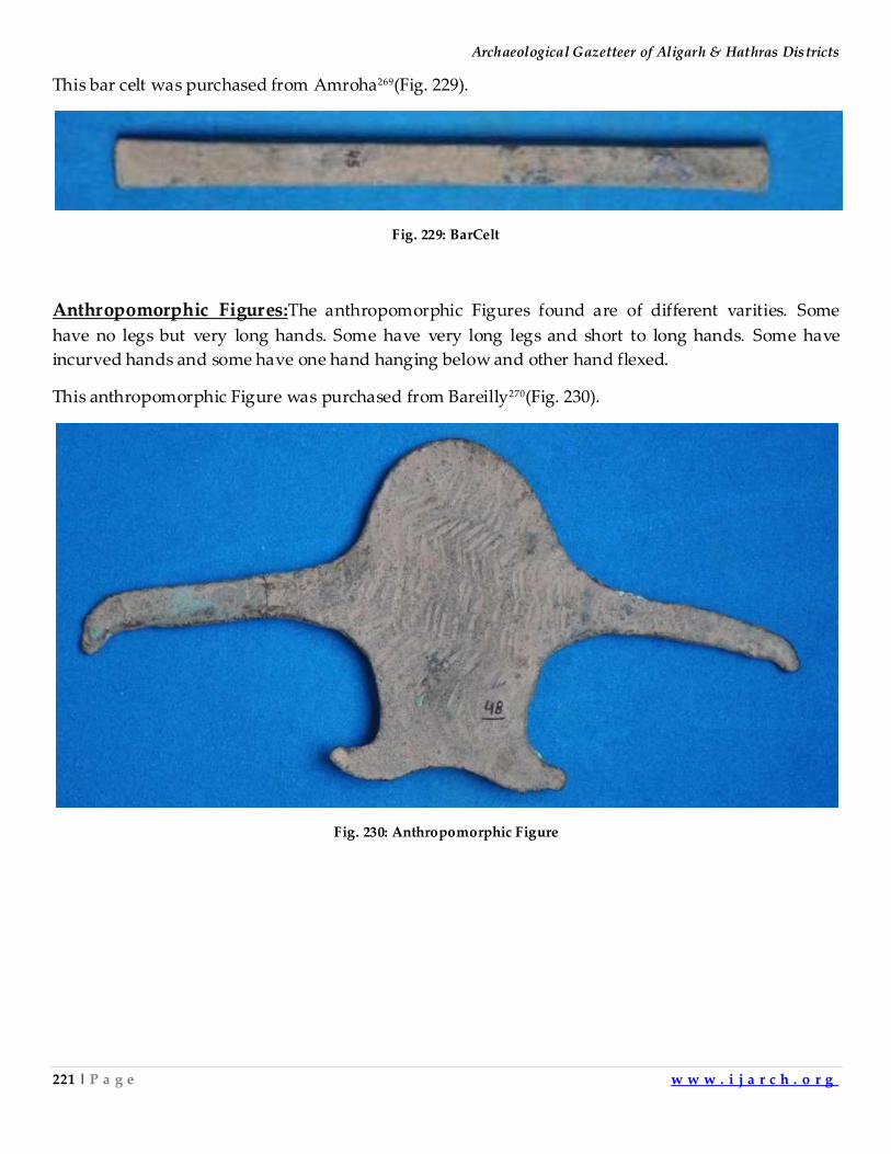
Archaeological Gazetteer of Aligarh & Hathras Districts
221 | P a g e w w w . i j a r c h . o r g
This bar celt was purchased from Amroha269(Fig. 229).
Fig. 229: BarCelt
Anthropomorphic Figures:The anthropomorphic Figures found are of different varities. Some
have no legs but very long hands. Some have very long legs and short to long hands. Some have
incurved hands and some have one hand hanging below and other hand flexed.
This anthropomorphic Figure was purchased from Bareilly270(Fig. 230).
Fig. 230: Anthropomorphic Figure
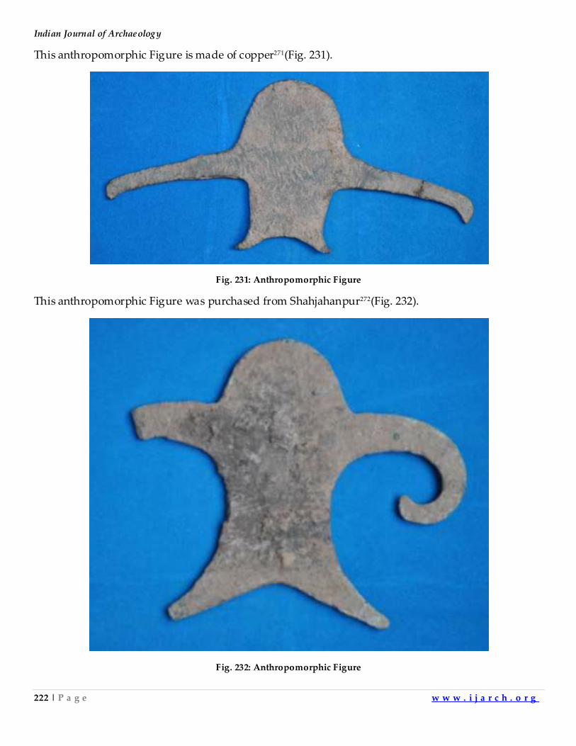
Indian Journal of Archaeology
222 | P a g e w w w . i j a r c h . o r g
This anthropomorphic Figure is made of copper271(Fig. 231).
Fig. 231: Anthropomorphic Figure
This anthropomorphic Figure was purchased from Shahjahanpur272(Fig. 232).
Fig. 232: Anthropomorphic Figure
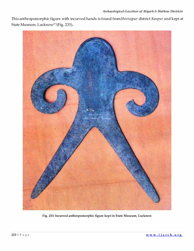
Archaeological Gazetteer of Aligarh & Hathras Districts
223 | P a g e w w w . i j a r c h . o r g
This anthropomorphic figure with incurved hands is found fromShivrajpur district Kanpur and kept at
State Museum, Lucknow273(Fig. 233).
Fig. 233: Incurved anthropomorphic figure kept in State Museum, Lucknow
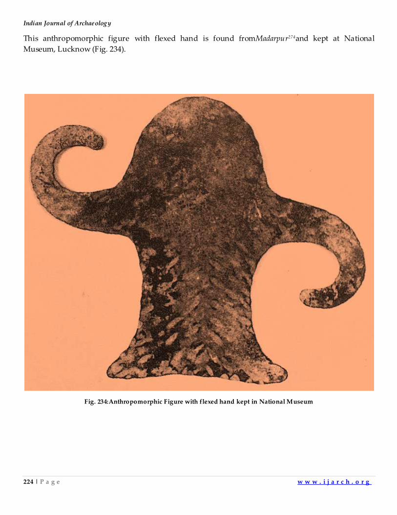
Indian Journal of Archaeology
224 | P a g e w w w . i j a r c h . o r g
This anthropomorphic figure with flexed hand is found fromMadarpur274and kept at National
Museum, Lucknow (Fig. 234).
Fig. 234:Anthropomorphic Figure with flexed hand kept in National Museum
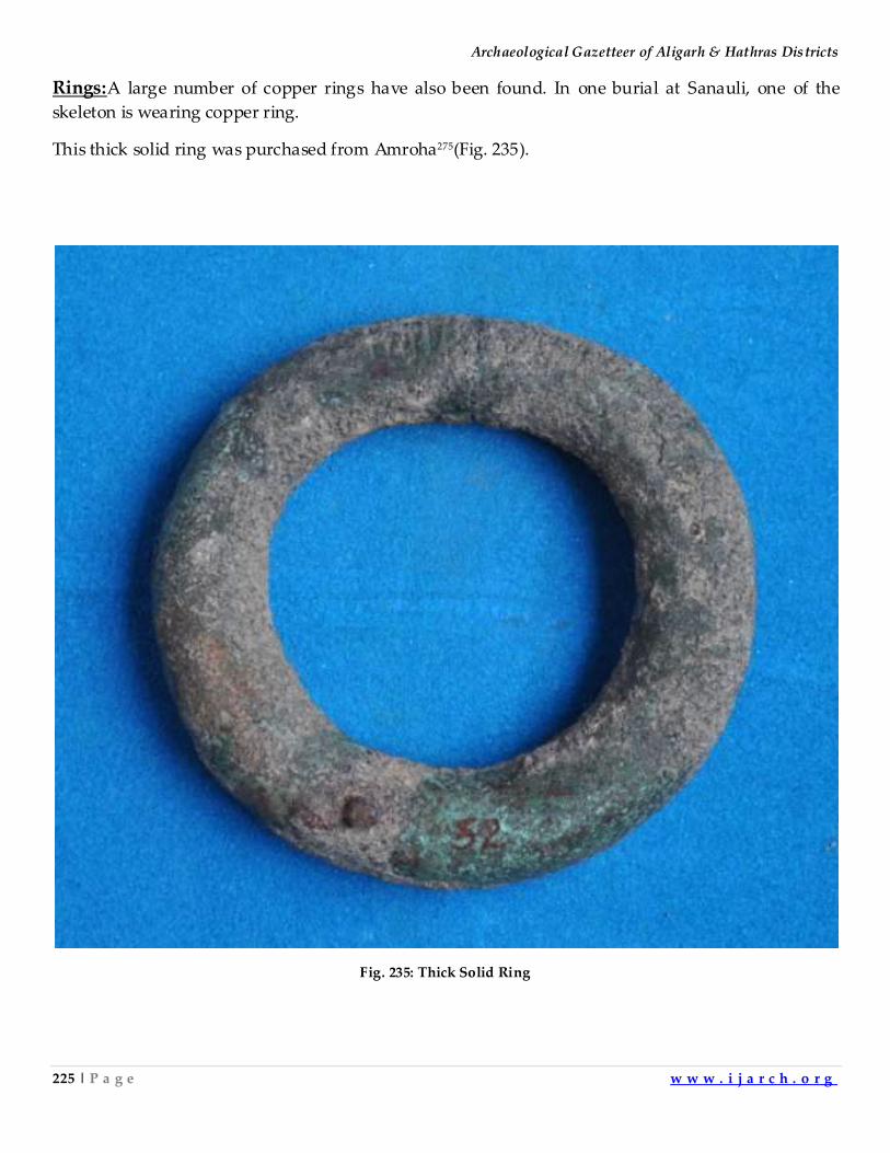
Archaeological Gazetteer of Aligarh & Hathras Districts
225 | P a g e w w w . i j a r c h . o r g
Rings:A large number of copper rings have also been found. In one burial at Sanauli, one of the
skeleton is wearing copper ring.
This thick solid ring was purchased from Amroha275(Fig. 235).
Fig. 235: Thick Solid Ring
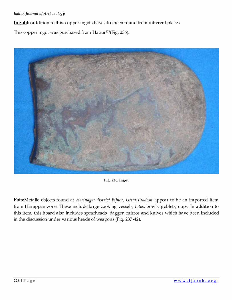
Indian Journal of Archaeology
226 | P a g e w w w . i j a r c h . o r g
Ingot:In addition to this, copper ingots have also been found from different places.
This copper ingot was purchased from Hapur276(Fig. 236).
Fig. 236: Ingot
Pots:Metalic objects found at Harinagar district Bijnor, Uttar Pradesh appear to be an imported item
from Harappan zone. These include large cooking vessels, lotas, bowls, goblets, cups. In addition to
this item, this hoard also includes spearheads, dagger, mirror and knives which have been included
in the discussion under various heads of weapons (Fig. 237-42).
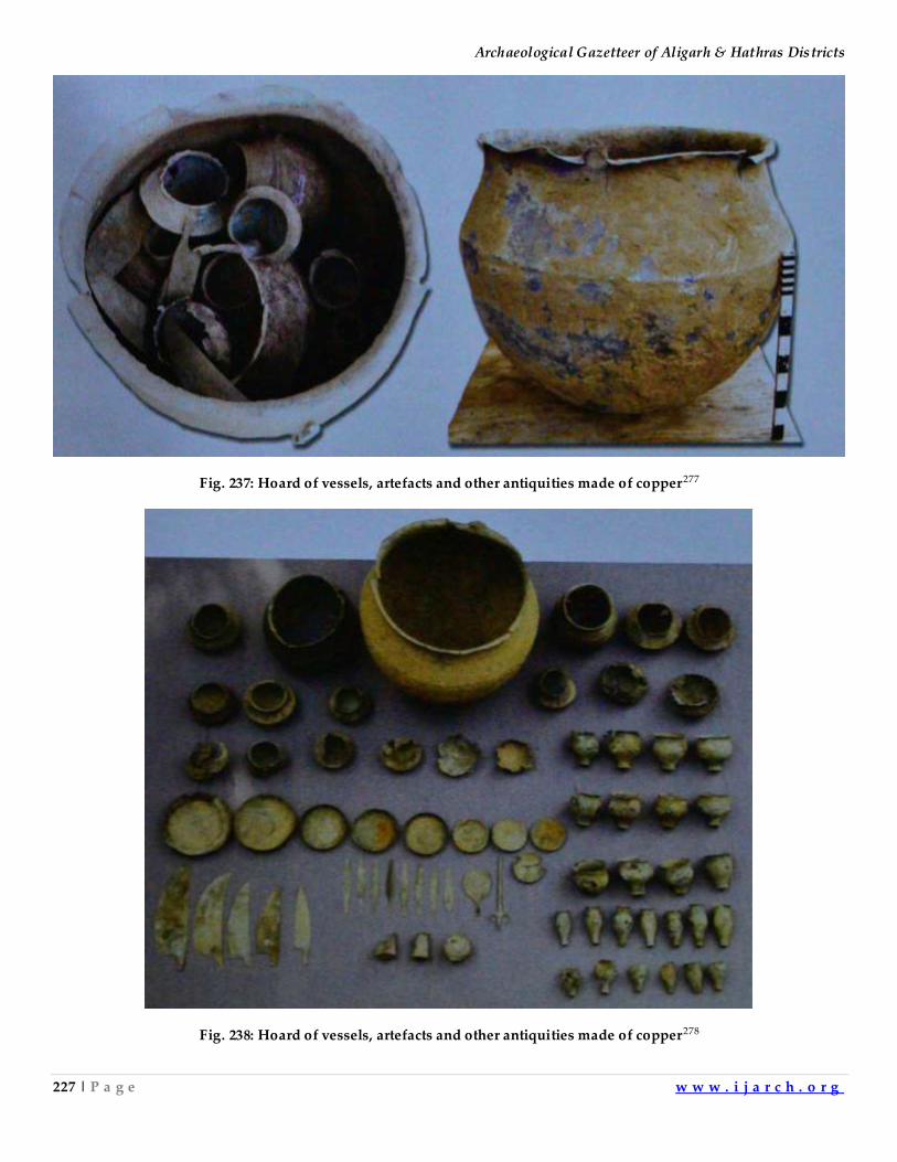
Archaeological Gazetteer of Aligarh & Hathras Districts
227 | P a g e w w w . i j a r c h . o r g
Fig. 237: Hoard of vessels, artefacts and other antiquities made of copper277
Fig. 238: Hoard of vessels, artefacts and other antiquities made of copper278
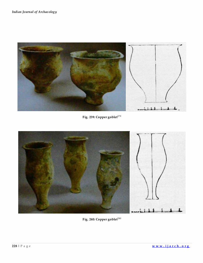
Indian Journal of Archaeology
228 | P a g e w w w . i j a r c h . o r g
Fig. 239: Copper goblet279
Fig. 240: Copper goblet280
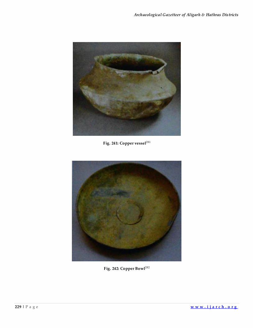
Archaeological Gazetteer of Aligarh & Hathras Districts
229 | P a g e w w w . i j a r c h . o r g
Fig. 241: Copper vessel281
Fig. 242: Copper Bowl282
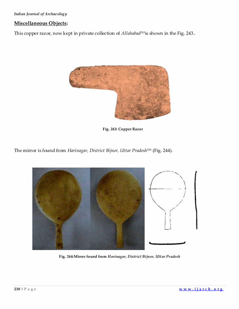
Indian Journal of Archaeology
230 | P a g e w w w . i j a r c h . o r g
Miscellaneous Objects:
This copper razor, now kept in private collection of Allahabad283is shown in the Fig. 243..
The mirror is found from Harinagar, District Bijnor, Uttar Pradesh284 (Fig. 244).
Fig. 244:Mirror found from Harinagar, District Bijnor, Uttar Pradesh
Fig. 243: Copper Razor
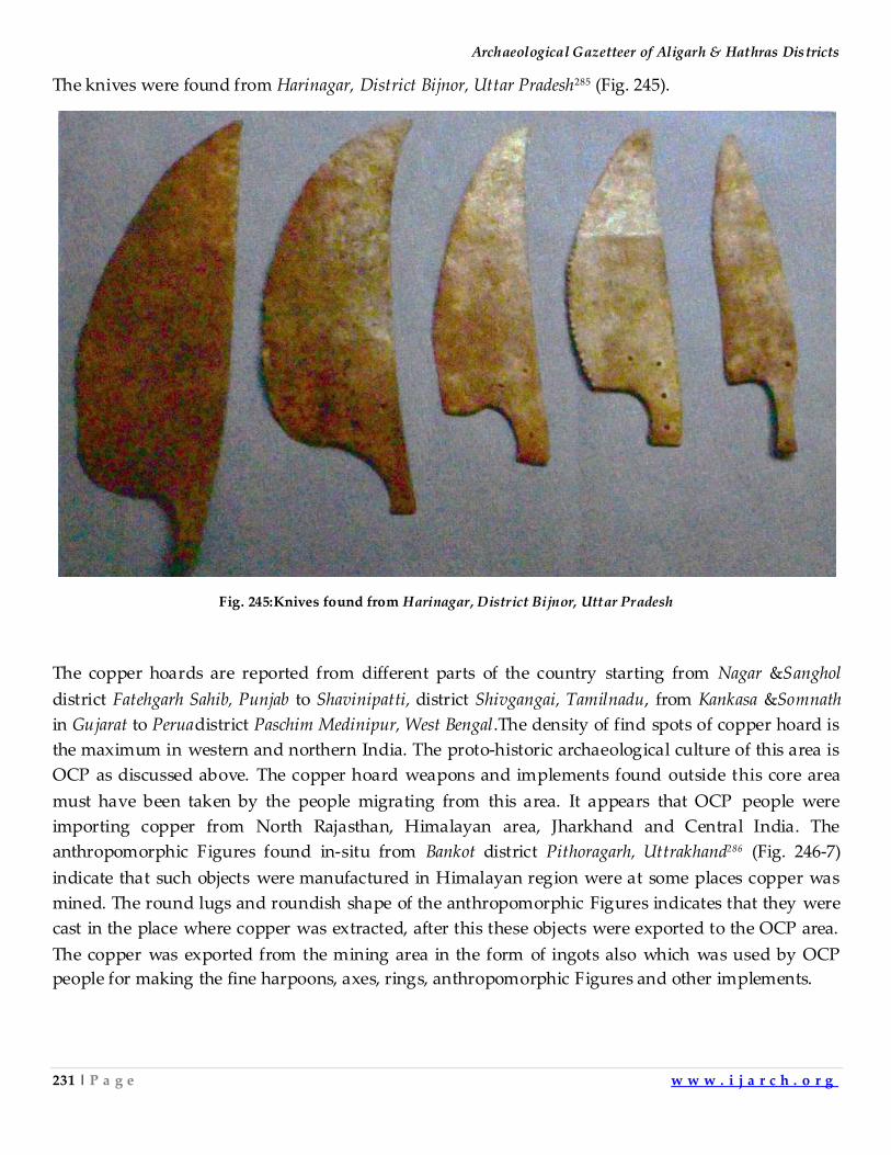
Archaeological Gazetteer of Aligarh & Hathras Districts
231 | P a g e w w w . i j a r c h . o r g
The knives were found from Harinagar, District Bijnor, Uttar Pradesh285 (Fig. 245).
Fig. 245:Knives found from Harinagar, District Bijnor, Uttar Pradesh
The copper hoards are reported from different parts of the country starting from Nagar &Sanghol
district Fatehgarh Sahib, Punjab to Shavinipatti, district Shivgangai, Tamilnadu, from Kankasa &Somnath
in Gujarat to Peruadistrict Paschim Medinipur, West Bengal.The density of find spots of copper hoard is
the maximum in western and northern India. The proto-historic archaeological culture of this area is
OCP as discussed above. The copper hoard weapons and implements found outside this core area
must have been taken by the people migrating from this area. It appears that OCP people were
importing copper from North Rajasthan, Himalayan area, Jharkhand and Central India. The
anthropomorphic Figures found in-situ from Bankot district Pithoragarh, Uttrakhand286 (Fig. 246-7)
indicate that such objects were manufactured in Himalayan region were at some places copper was
mined. The round lugs and roundish shape of the anthropomorphic Figures indicates that they were
cast in the place where copper was extracted, after this these objects were exported to the OCP area.
The copper was exported from the mining area in the form of ingots also which was used by OCP
people for making the fine harpoons, axes, rings, anthropomorphic Figures and other implements.
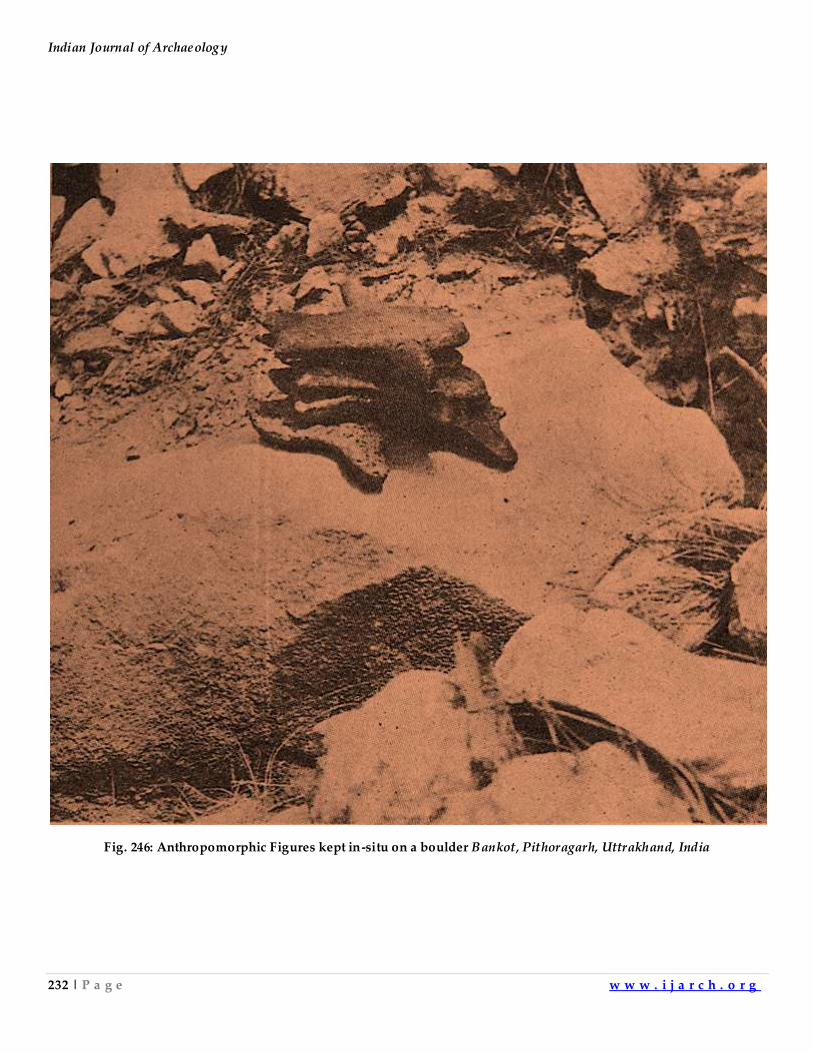
Indian Journal of Archaeology
232 | P a g e w w w . i j a r c h . o r g
Fig. 246: Anthropomorphic Figures kept in-situ on a boulder Bankot, Pithoragarh, Uttrakhand, India
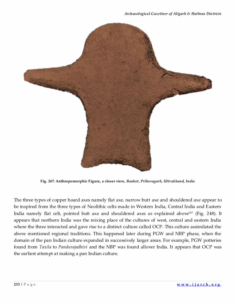
Archaeological Gazetteer of Aligarh & Hathras Districts
233 | P a g e w w w . i j a r c h . o r g
Fig. 247: Anthropomorphic Figure, a closer view, Bankot, Pithoragarh, Uttrakhand, India
The three types of copper hoard axes namely flat axe, narrow butt axe and shouldered axe appear to
be inspired from the three types of Neolithic celts made in Western India, Central India and Eastern
India namely flat celt, pointed butt axe and shouldered axes as explained above287 (Fig. 248). It
appears that northern India was the mixing place of the cultures of west, central and eastern India
where the three interacted and gave rise to a distinct culture called OCP. This culture assimilated the
above mentioned regional traditions. This happened later during PGW and NBP phase, when the
domain of the pan Indian culture expanded in successively larger areas. For example, PGW potteries
found from Taxila to Pandurajadhivi and the NBP was found allover India. It appears that OCP was
the earliest attempt at making a pan Indian culture.

Indian Journal of Archaeology
234 | P a g e w w w . i j a r c h . o r g
Fig. 248: Map showing the area of occurance of Pointed butt, Shouldered & Flat Neolithic celts
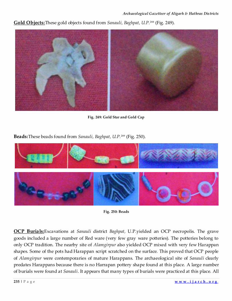
Archaeological Gazetteer of Aligarh & Hathras Districts
235 | P a g e w w w . i j a r c h . o r g
Gold Objects:These gold objects found from Sanauli, Baghpat, U.P.288 (Fig. 249).
Fig. 249: Gold Star and Gold Cap
Beads:These beads found from Sanauli, Baghpat, U.P.289 (Fig. 250).
Fig. 250: Beads
OCP Burials:Excavations at Sanauli district Baghpat, U.P.yielded an OCP necropolis. The grave
goods included a large number of Red ware (very few gray ware potteries). The potteries belong to
only OCP tradition. The nearby site of Alamgirpur also yielded OCP mixed with very few Harappan
shapes. Some of the pots had Harappan script scratched on the surface. This proved that OCP people
of Alamgirpur were contemporaries of mature Harappans. The archaeological site of Sanauli clearly
predates Harappans because there is no Harrapan pottery shape found at this place. A large number
of burials were found at Sanauli. It appears that many types of burials were practiced at this place. All
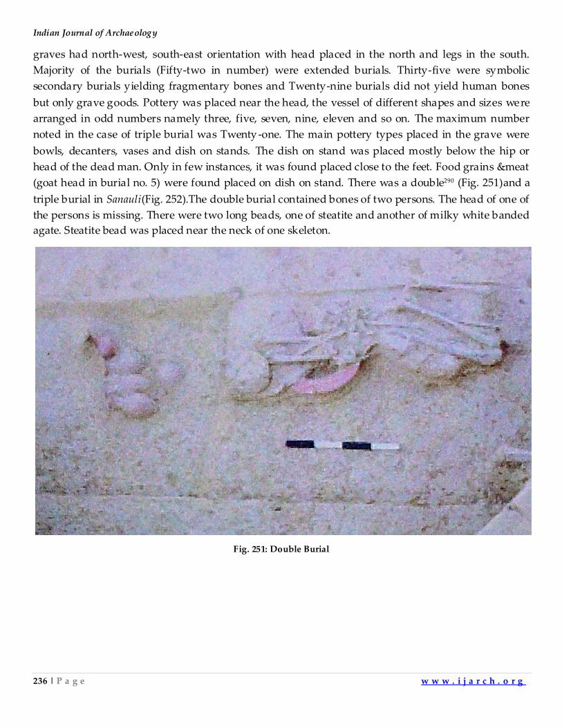
Indian Journal of Archaeology
236 | P a g e w w w . i j a r c h . o r g
graves had north-west, south-east orientation with head placed in the north and legs in the south.
Majority of the burials (Fifty-two in number) were extended burials. Thirty-five were symbolic
secondary burials yielding fragmentary bones and Twenty-nine burials did not yield human bones
but only grave goods. Pottery was placed near the head, the vessel of different shapes and sizes were
arranged in odd numbers namely three, five, seven, nine, eleven and so on. The maximum number
noted in the case of triple burial was Twenty-one. The main pottery types placed in the grave were
bowls, decanters, vases and dish on stands. The dish on stand was placed mostly below the hip or
head of the dead man. Only in few instances, it was found placed close to the feet. Food grains &meat
(goat head in burial no. 5) were found placed on dish on stand. There was a double290 (Fig. 251)and a
triple burial in Sanauli(Fig. 252).The double burial contained bones of two persons. The head of one of
the persons is missing. There were two long beads, one of steatite and another of milky white banded
agate. Steatite bead was placed near the neck of one skeleton.
Fig. 251: Double Burial
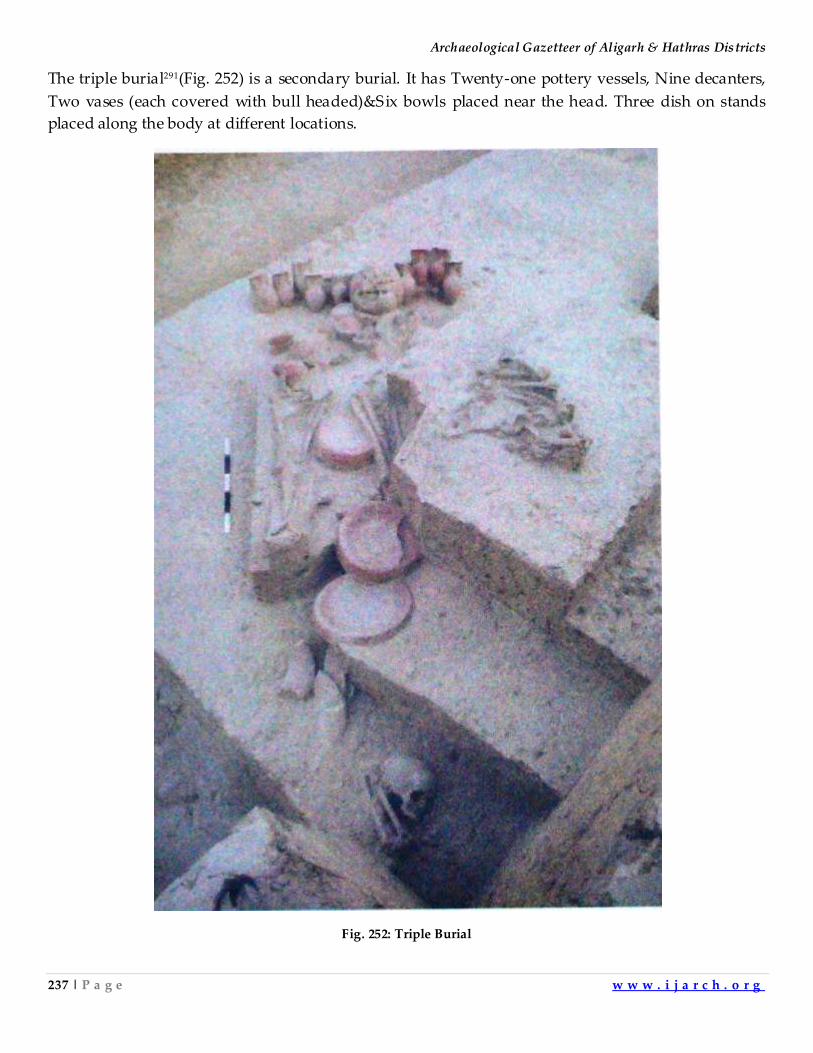
Archaeological Gazetteer of Aligarh & Hathras Districts
237 | P a g e w w w . i j a r c h . o r g
The triple burial291(Fig. 252) is a secondary burial. It has Twenty-one pottery vessels, Nine decanters,
Two vases (each covered with bull headed)&Six bowls placed near the head. Three dish on stands
placed along the body at different locations.
Fig. 252: Triple Burial
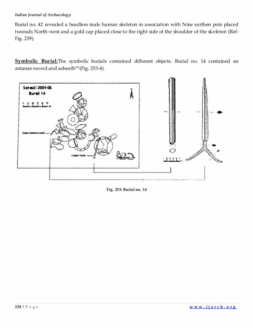
Indian Journal of Archaeology
238 | P a g e w w w . i j a r c h . o r g
Burial no. 42 revealed a headless male human skeleton in association with Nine earthen pots placed
tworads North-west and a gold cap placed close to the right side of the shoulder of the skeleton (Ref-
Fig. 239).
Symbolic Burial:The symbolic burials contained different objects. Burial no. 14 contained an
antanae sword and asheath292(Fig. 253-4).
Fig. 253: Burial no. 14
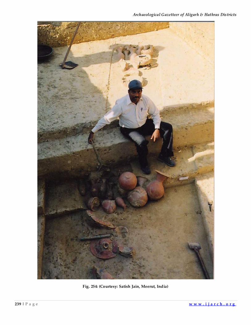
Archaeological Gazetteer of Aligarh & Hathras Districts
239 | P a g e w w w . i j a r c h . o r g
Fig. 254: (Courtesy: Satish Jain, Meerut, India)
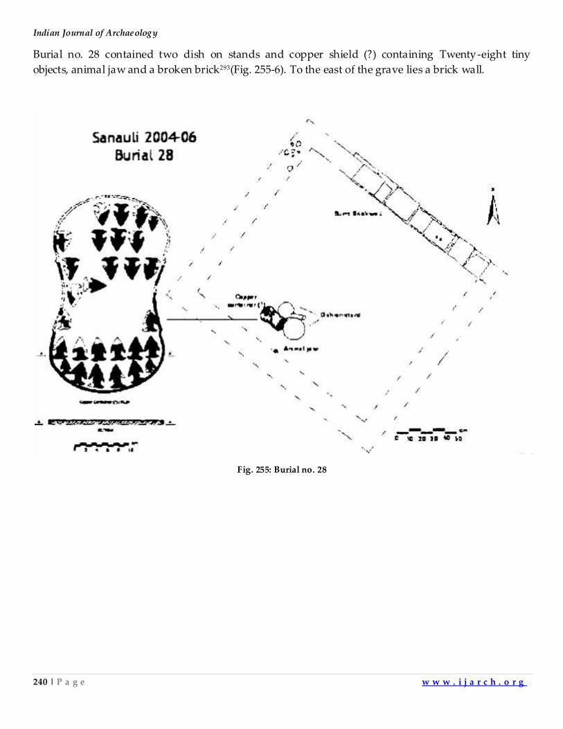
Indian Journal of Archaeology
240 | P a g e w w w . i j a r c h . o r g
Burial no. 28 contained two dish on stands and copper shield (?) containing Twenty-eight tiny
objects, animal jaw and a broken brick293(Fig. 255-6). To the east of the grave lies a brick wall.
Fig. 255: Burial no. 28
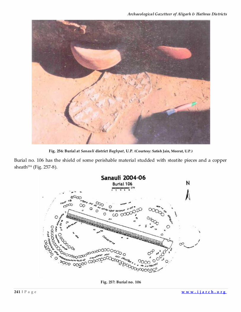
Archaeological Gazetteer of Aligarh & Hathras Districts
241 | P a g e w w w . i j a r c h . o r g
Fig. 256: Burial at Sanauli district Baghpat, U.P. (Courtesy: Satish Jain, Meerut, U.P.)
Burial no. 106 has the shield of some perishable material studded with steatite pieces and a copper
sheath294 (Fig. 257-8).
Fig. 257: Burial no. 106
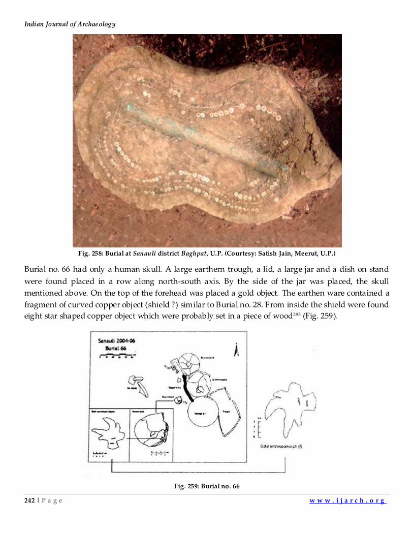
Indian Journal of Archaeology
242 | P a g e w w w . i j a r c h . o r g
Fig. 258: Burial at Sanauli district Baghpat, U.P. (Courtesy: Satish Jain, Meerut, U.P.)
Burial no. 66 had only a human skull. A large earthern trough, a lid, a large jar and a dish on stand
were found placed in a row along north-south axis. By the side of the jar was placed, the skull
mentioned above. On the top of the forehead was placed a gold object. The earthen ware contained a
fragment of curved copper object (shield ?) similar to Burial no. 28. From inside the shield were found
eight star shaped copper object which were probably set in a piece of wood295 (Fig. 259).
Fig. 259: Burial no. 66
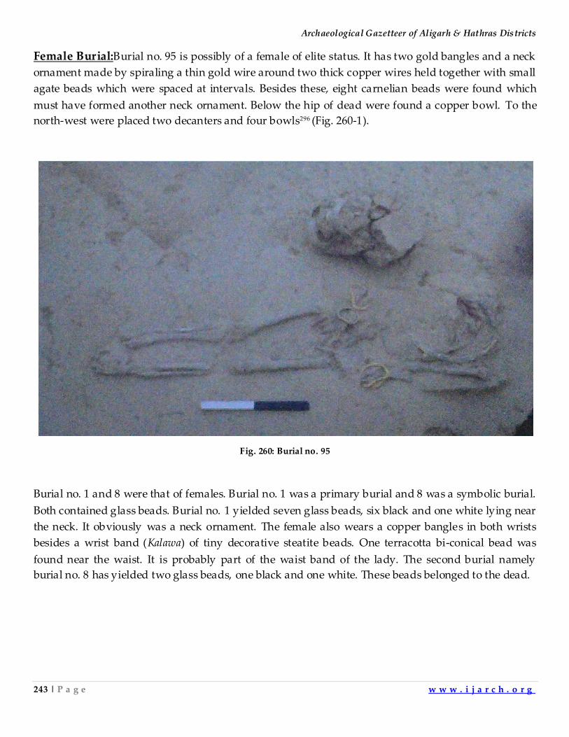
Archaeological Gazetteer of Aligarh & Hathras Districts
243 | P a g e w w w . i j a r c h . o r g
Female Burial:Burial no. 95 is possibly of a female of elite status. It has two gold bangles and a neck
ornament made by spiraling a thin gold wire around two thick copper wires held together with small
agate beads which were spaced at intervals. Besides these, eight carnelian beads were found which
must have formed another neck ornament. Below the hip of dead were found a copper bowl. To the
north-west were placed two decanters and four bowls296 (Fig. 260-1).
Fig. 260: Burial no. 95
Burial no. 1 and 8 were that of females. Burial no. 1 was a primary burial and 8 was a symbolic burial.
Both contained glass beads. Burial no. 1 yielded seven glass beads, six black and one white lying near
the neck. It obviously was a neck ornament. The female also wears a copper bangles in both wrists
besides a wrist band (Kalawa) of tiny decorative steatite beads. One terracotta bi-conical bead was
found near the waist. It is probably part of the waist band of the lady. The second burial namely
burial no. 8 has yielded two glass beads, one black and one white. These beads belonged to the dead.
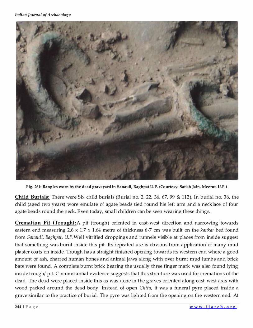
Indian Journal of Archaeology
244 | P a g e w w w . i j a r c h . o r g
Fig. 261: Bangles worn by the dead graveyard in Sanauli, Baghpat U.P. (Courtesy: Satish Jain, Meerut, U.P.)
Child Burials: There were Six child burials (Burial no. 2, 22, 36, 67, 99 & 112). In burial no. 36, the
child (aged two years) wore emulate of agate beads tied round his left arm and a necklace of four
agate beads round the neck. Even today, small children can be seen wearing these things.
Cremation Pit (Trough):A pit (trough) oriented in east-west direction and narrowing towards
eastern end measuring 2.6 x 1.7 x 1.64 metre of thickness 6-7 cm was built on the kankar bed found
from Sanauli, Baghpat, U.P.Well vitrified droppings and runnels visible at places from inside suggest
that something was burnt inside this pit. Its repeated use is obvious from application of many mud
plaster coats on inside. Trough has a straight finished opening towards its western end where a good
amount of ash, charred human bones and animal jaws along with over burnt mud lumbs and brick
bats were found. A complete burnt brick bearing the usually three finger mark was also found lying
inside trough/ pit. Circumstantial evidence suggests that this strcuture was used for cremations of the
dead. The dead were placed inside this as was done in the graves oriented along east-west axis with
wood packed around the dead body. Instead of open Chita, it was a funeral pyre placed inside a
grave similar to the practice of burial. The pyre was lighted from the opening on the western end. At
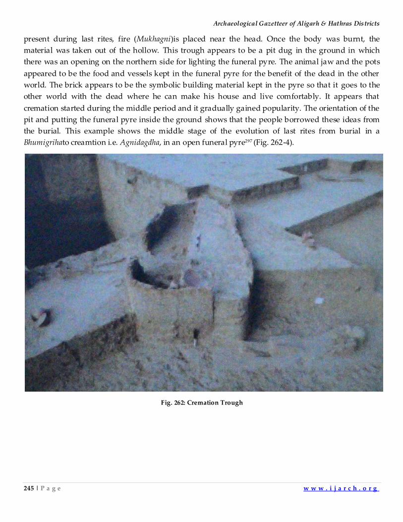
Archaeological Gazetteer of Aligarh & Hathras Districts
245 | P a g e w w w . i j a r c h . o r g
present during last rites, fire (Mukhagni)is placed near the head. Once the body was burnt, the
material was taken out of the hollow. This trough appears to be a pit dug in the ground in which
there was an opening on the northern side for lighting the funeral pyre. The animal jaw and the pots
appeared to be the food and vessels kept in the funeral pyre for the benefit of the dead in the other
world. The brick appears to be the symbolic building material kept in the pyre so that it goes to the
other world with the dead where he can make his house and live comfortably. It appears that
cremation started during the middle period and it gradually gained popularity. The orientation of the
pit and putting the funeral pyre inside the ground shows that the people borrowed these ideas from
the burial. This example shows the middle stage of the evolution of last rites from burial in a
Bhumigrihato creamtion i.e. Agnidagdha, in an open funeral pyre297 (Fig. 262-4).
Fig. 262: Cremation Trough
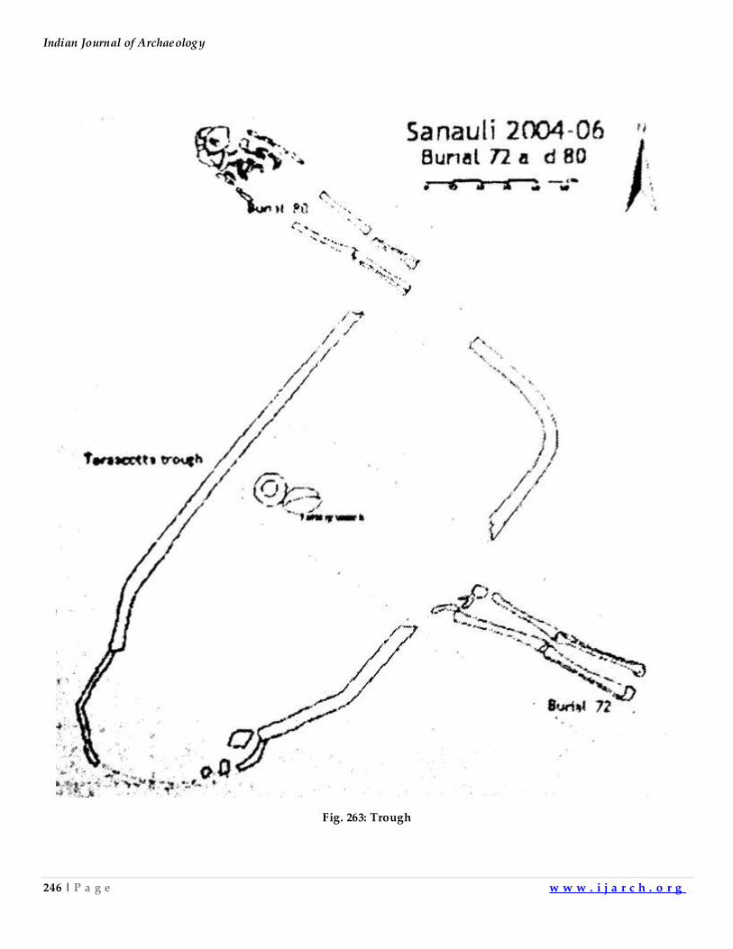
Indian Journal of Archaeology
246 | P a g e w w w . i j a r c h . o r g
Fig. 263: Trough
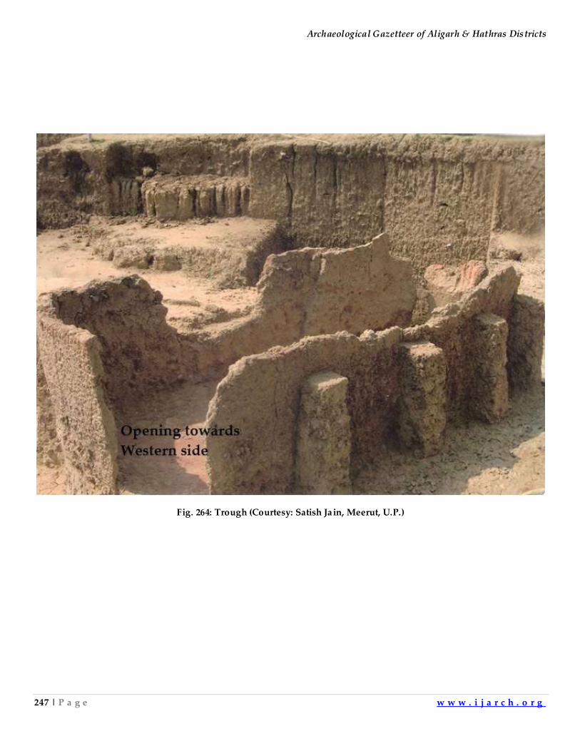
Archaeological Gazetteer of Aligarh & Hathras Districts
247 | P a g e w w w . i j a r c h . o r g
Fig. 264: Trough (Courtesy: Satish Jain, Meerut, U.P.)
Indian Journal of Archaeology
248 | P a g e w w w . i j a r c h . o r g
Eastern Indian Pottery: The Eastern India has been explored by many scholars. The Neolithic
pottery was reported first from Koldihwa. Chirand and Lahuradewa excavations have also given
evidence of Neolithic phase. The three sites have also given the evidence about Chalcolithic phase.
Since the inter-relations between different phases of the three sites are not clear, therefore, the
potteries from all the three sites are being given separately in the following phases.
Neolithic pottery of Koldihwa:The beginning of Koldihwa Neolithic(5440±240 B.C., 4530±185 B.C.,
6470±210 B.C.)298was placed in the seventh millenium B.C. Later, this date was further extended to
eighth millennium B.C.after excavations atJhunsi(carbon dates7477B.C.,5837 B.C.,6196
B.C.)299Tokwa(6591 B.C.,5976 B.C., 4797 B.C.)300and Lahuradeva(8436 B.C., 8518 B.C., 8992 B.C.,4220
B.C., 4196 B.C., 4161 B.C., 5298 B.C., 6442-6376 B.C.(AMS)301.Andthe beginning of agriculture was
assigned to 10th millenium B.C.The lithic assemblage of the Mesolithic site of Sarai Nahar Rai was
almost identical to that of the phase II B of Chopni Mando.It was characterized as Late Mesolithic for
which one date was 8365±110 B.C. Another date of 8080 ± 115 B.C. came from Mahagara302. It was the
date of the aceramic Neolithic phase, which was probably wronglylabeled as Late Mesolithic,
because we again get dates of early 9th millenium in Lahuradeva for the aceramic period when the
agricultural activities started in Middle Ganga valley.It appears that the Neolithic cultures of Middle
Ganga valley evolved from local Mesolithic cultures303. We have taken the material found from
Koldihwa, Lahuradewaand Chirand for illustrating the diagnostic pottery tradition of Middle Ganga
Valley because these are the best documented siteswhich has yielded a large number of pottery
shapes for every phase.
The earliest phase at Koldihwa yieldedvases (RW) having corded designs,large splayed-out
rim directly carinated to the spherical body without a neck (Fig. 265.A304, 265.B305, 265.C306). The
splayed out rims were straight, concave or convex. Some vases (RW) have out turned rims also.(Fig.
265.D)307The rims of this pottery tradition are prominently splayed out. The rims of corded red ware
bowls are featureless(Fig. 265.E,308265.F309) sharpened,(Fig. 265.G)310outturned,splayed out, flanged
and everted(Fig. 265.H)311.Basins (RW) of this phase have similar rims. These have channel and
tubular spouts (Fig. 265.I312, 265.J313). Some of the bowls and vases of this tradition also show tubular
spouts. This is a characteristic feature of the phase.Neolithic red ware is mostly decorated with
corded designs.The corded designs were created by pressing a flat piece of wood, around which a
thin cord made of grasses was wounded,on leather hard surface of the freshly turned pot.This
exercise was done for decorating the pot and increasing the effective surface area.The increased
surface area would have facilitated the heating process,making the cooking process more fuel
efficient.This utilitarian practice of making the corded designs lead to the stylized white parallel lines
on BRW of chalcolithic period.
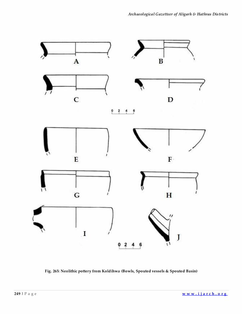
Archaeological Gazetteer of Aligarh & Hathras Districts
249 | P a g e w w w . i j a r c h . o r g
Fig. 265: Neolithic pottery from Koldihwa (Bowls, Spouted vessels & Spouted Basin)
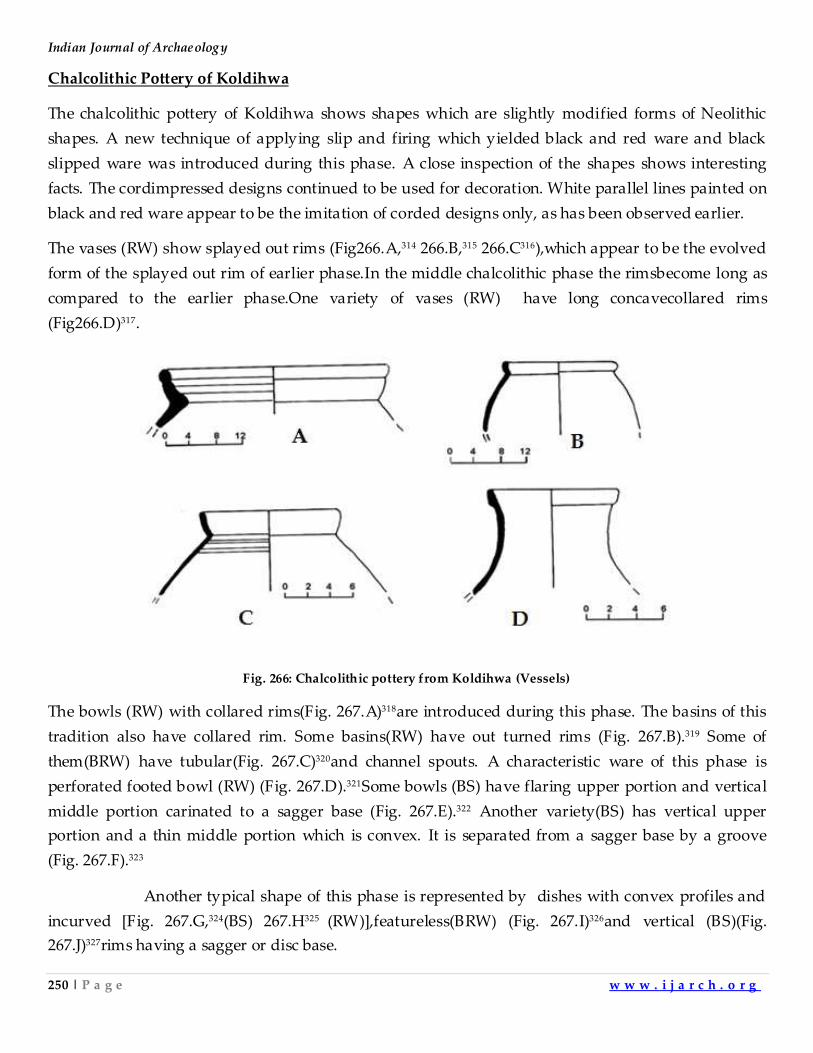
Indian Journal of Archaeology
250 | P a g e w w w . i j a r c h . o r g
Chalcolithic Pottery of Koldihwa
The chalcolithic pottery of Koldihwa shows shapes which are slightly modified forms of Neolithic
shapes. A new technique of applying slip and firing which yielded black and red ware and black
slipped ware was introduced during this phase. A close inspection of the shapes shows interesting
facts. The cordimpressed designs continued to be used for decoration. White parallel lines painted on
black and red ware appear to be the imitation of corded designs only, as has been observed earlier.
The vases (RW) show splayed out rims (Fig266.A,314 266.B,315 266.C316),which appear to be the evolved
form of the splayed out rim of earlier phase.In the middle chalcolithic phase the rimsbecome long as
compared to the earlier phase.One variety of vases (RW) have long concavecollared rims
(Fig266.D)317.
Fig. 266: Chalcolithic pottery from Koldihwa (Vessels)
The bowls (RW) with collared rims(Fig. 267.A)318are introduced during this phase. The basins of this
tradition also have collared rim. Some basins(RW) have out turned rims (Fig. 267.B).319 Some of
them(BRW) have tubular(Fig. 267.C)320and channel spouts. A characteristic ware of this phase is
perforated footed bowl (RW) (Fig. 267.D).321Some bowls (BS) have flaring upper portion and vertical
middle portion carinated to a sagger base (Fig. 267.E).322 Another variety(BS) has vertical upper
portion and a thin middle portion which is convex. It is separated from a sagger base by a groove
(Fig. 267.F).323
Another typical shape of this phase is represented by dishes with convex profiles and
incurved [Fig. 267.G,324(BS) 267.H325 (RW)],featureless(BRW) (Fig. 267.I)326and vertical (BS)(Fig.
267.J)327rims having a sagger or disc base.
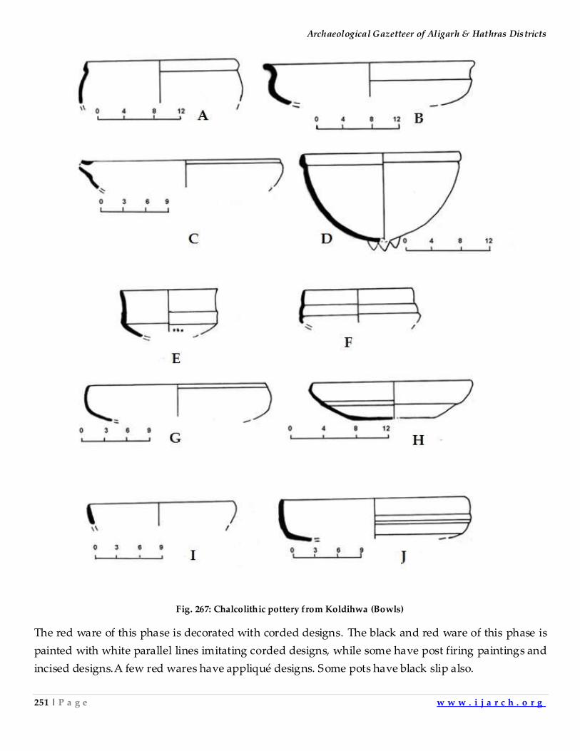
Archaeological Gazetteer of Aligarh & Hathras Districts
251 | P a g e w w w . i j a r c h . o r g
Fig. 267: Chalcolithic pottery from Koldihwa (Bowls)
The red ware of this phase is decorated with corded designs. The black and red ware of this phase is
painted with white parallel lines imitating corded designs, while some have post firing paintings and
incised designs.A few red wares have appliqué designs. Some pots have black slip also.
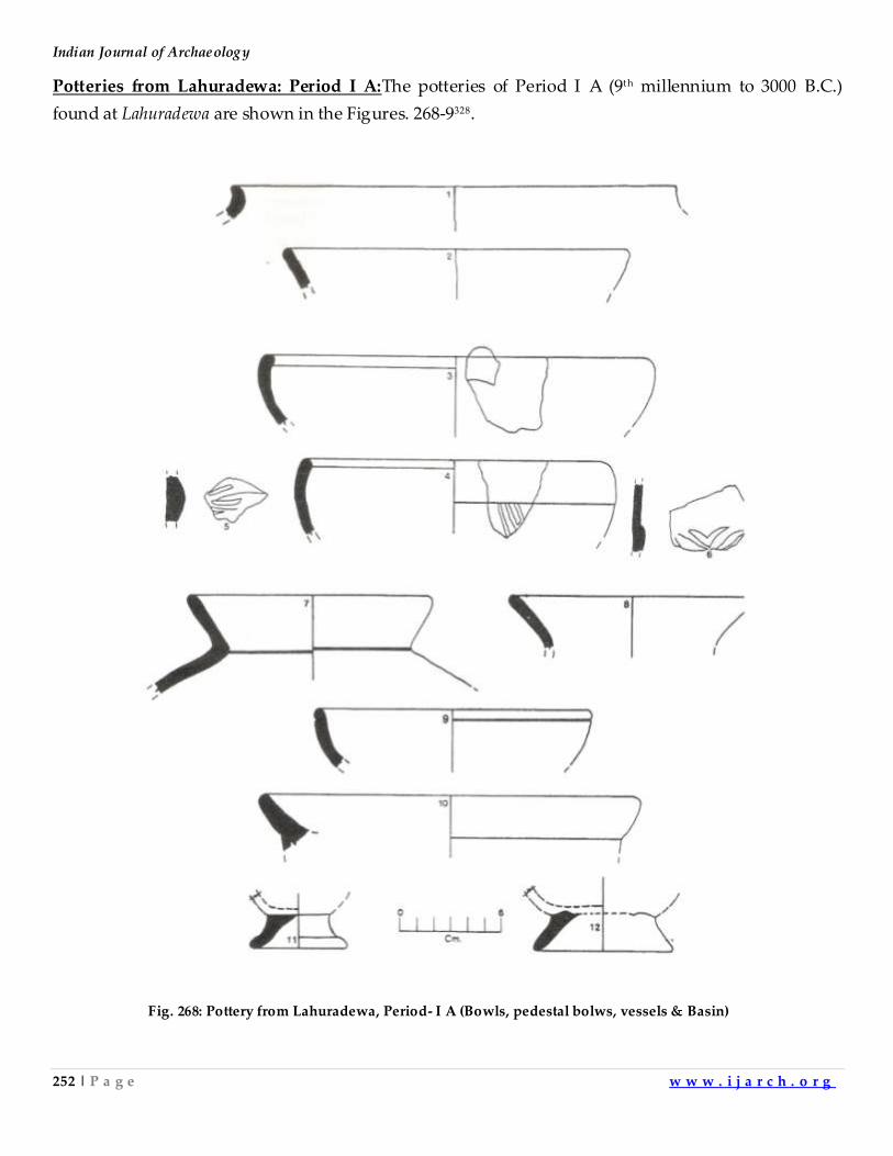
Indian Journal of Archaeology
252 | P a g e w w w . i j a r c h . o r g
Potteries from Lahuradewa: Period I A:The potteries of Period I A (9th millennium to 3000 B.C.)
found at Lahuradewa are shown in the Figures. 268-9328.
Fig. 268: Pottery from Lahuradewa, Period- I A (Bowls, pedestal bolws, vessels & Basin)
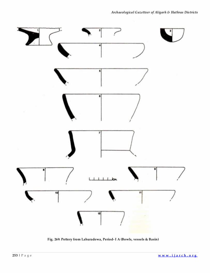
Archaeological Gazetteer of Aligarh & Hathras Districts
253 | P a g e w w w . i j a r c h . o r g
Fig. 269: Pottery from Lahuradewa, Period- I A (Bowls, vessels & Basin)
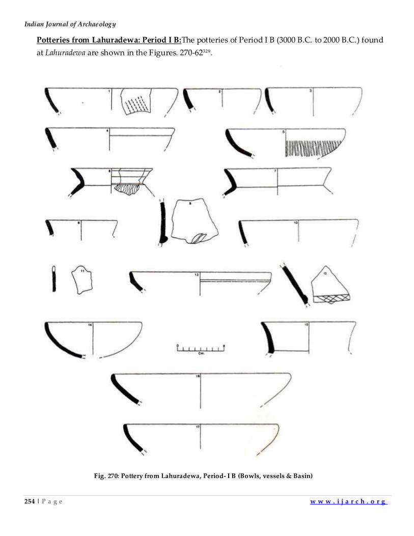
Indian Journal of Archaeology
254 | P a g e w w w . i j a r c h . o r g
Potteries from Lahuradewa: Period I B:The potteries of Period I B (3000 B.C. to 2000 B.C.) found
at Lahuradewa are shown in the Figures. 270-62329.
Fig. 270: Pottery from Lahuradewa, Period- I B (Bowls, vessels & Basin)
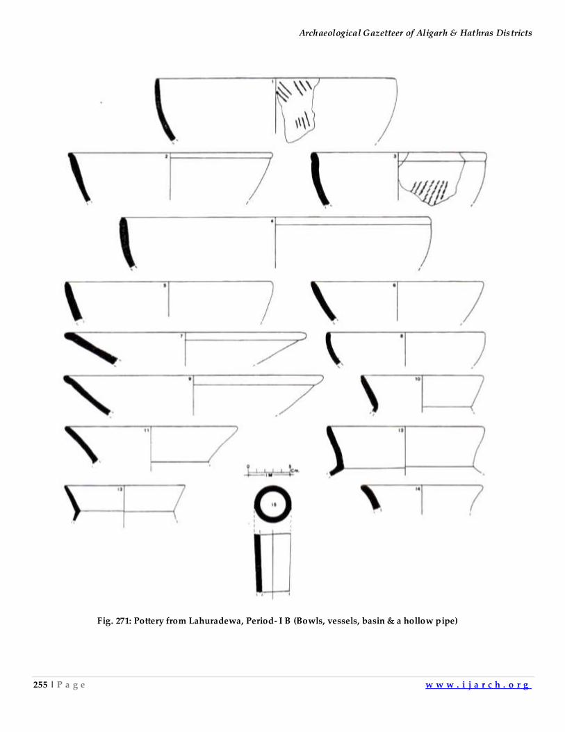
Archaeological Gazetteer of Aligarh & Hathras Districts
255 | P a g e w w w . i j a r c h . o r g
Fig. 271: Pottery from Lahuradewa, Period- I B (Bowls, vessels, basin & a hollow pipe)
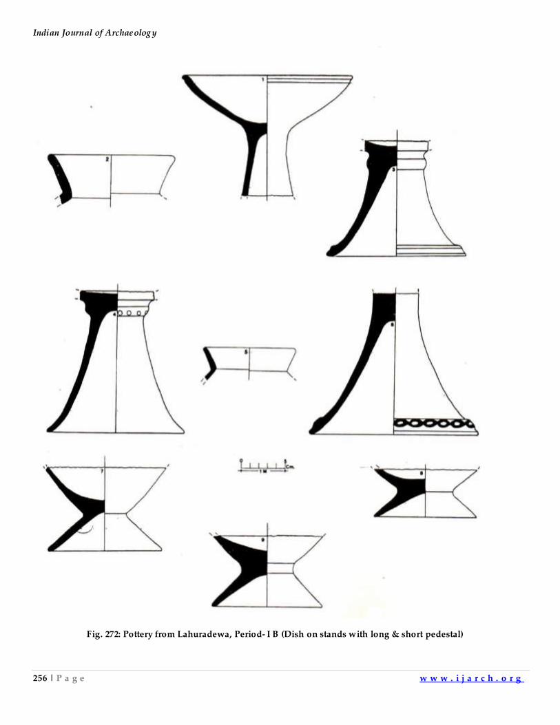
Indian Journal of Archaeology
256 | P a g e w w w . i j a r c h . o r g
Fig. 272: Pottery from Lahuradewa, Period- I B (Dish on stands with long & short pedestal)
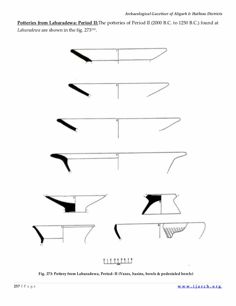
Archaeological Gazetteer of Aligarh & Hathras Districts
257 | P a g e w w w . i j a r c h . o r g
Potteries from Lahuradewa: Period II:The potteries of Period II (2000 B.C. to 1250 B.C.) found at
Lahuradewa are shown in the fig. 273330.
Fig. 273: Pottery from Lahuradewa, Period- II (Vases, basins, bowls & pedestaled bowls)
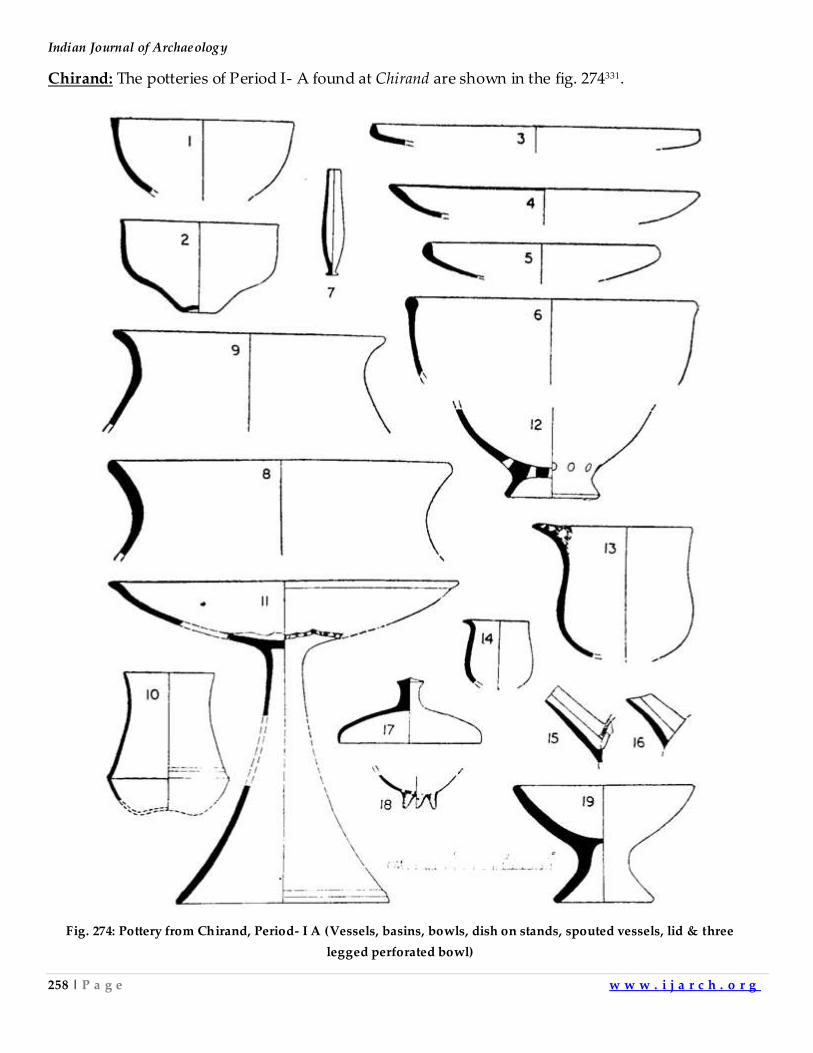
Indian Journal of Archaeology
258 | P a g e w w w . i j a r c h . o r g
Chirand: The potteries of Period I- A found at Chirand are shown in the fig. 274331.
Fig. 274: Pottery from Chirand, Period- I A (Vessels, basins, bowls, dish on stands, spouted vessels, lid & three
legged perforated bowl)
Archaeological Gazetteer of Aligarh & Hathras Districts
259 | P a g e w w w . i j a r c h . o r g
After Neolithic
Early Iron Age Potteries are inspired by Corded ware tradition of Eastern India. When we compare
shapes, colour, firing technique etc. the later diagnostic potteries of protohistoric period, namely
BRW and PGW appear as derivatives of these traditions. After innovative changes, inspired by
external influence or introduced by local potters, the ceramic of an earlier phase gave rise to the
typical shapes of later phase but it carried the signature of the regional ceramic tradition which is
the source of this change. Later on the new variety itself becomes diagnostic pottery influencing the
potters of the local culture or those belonging to neighbouring cultures (This process is described in
Chapter-5 in details). The diagnostic potteries typical to NBP, K, G, EM and LM are discussed in the
same chapter. It describes the external influence on, or local innovation in, ceramics of different
periods. The historical events leading to these ceramic traditions can be traced easily. They have
been related at appropriate places. The introduction of new ideology or the coming of new people
is indeed matched by introduction of new shapes, colour, firing technique and decorative design in
the potteries of corresponding phase.
Indian Journal of Archaeology
260 | P a g e w w w . i j a r c h . o r g
CHAPTER-3
DISTRICT ALIGARH
Following is the police station wise gazetteer of district Aligarh, Uttar Pradesh.
P.S.- AKRABAD
1. The village Adhaun, tehsil Kol, lat. 27050'N and long. 78010'E, lies 12.5 kms NW of PS. The
village is located on the mound. The site lies to the W of the river Sengar. The area of the
mound is about 1.5 acres. It is about 10 ft. high. It is under cultivation. The village has a
mosque and an old Shiva temple. The ceramic industries found are OCP, NBP, K, G and LM.
The site has yielded late medieval glass and glazed ware.
2. The town Akrabad, tehsil Kol, lat. 27048'N and long. 78017'E, is located on the mound. Area
of the mound is about 20 acres. It is about 1.5 ft. high. It is partly inhabited and partly under
cultivation.Ain-a-Akbari lists it among the Mahals of Sarkar Koil with Pundir Rajputs as
Zamindars.332Peter Mundi passed through Akrabad in December 1631 A.D.333Thakur Mangal
Singh and Mehtab Singh were hanged here by British during the uprising of 1857. The
village was recaptured by Colonel Great Head on 6 th October 1857.334The mound marks the
site of the fort. The village possesses five mosques and one Shiva temple. The town possesses
remains of semi-circular medieval indigo vats and saltpetre works. The ceramic industries
found are PGW, BS and LM. The site of the fort lying NW of the village yielded K, G, LM
and LM glazed ware.335
3. The village Amamadapur, tehsil Kol, lat. 27045'N and long. 78022'E, lies 10 kms SE of the P.S.
The site lies to the S of a lake. The area of the mound is about 3 acres. It is about 10 ft. high.
The remains of an indigo factory lie to the E of the village. The ceramic industries found are
OCP, PGW, NBP, K, G and LM.
4. The village Bamnoi, tehsil Kol, lat. 27047'N and long. 78022'E, lies 8 kms E of the P.S. It marks
the site of a deserted village called Kulinjara Khera and lies 2 kms to the NE of the village.
The area of the mound is about 20 acres. It is about 10 ft. high. The remains of an indigo
factory with 13 vats lie to the NE of the village. The ceramic industries found are NBP, K, G
and LM.
5. The village Bhopal Garhi, tehsil Kol, lat. 27045'N and long. 78020'E lies at the distance of 8
kmsSE of P.S. It lies on the mound itself. The area of the mound is about 1 acre. It is about 5
ft. high. The ceramic industries found are OCP, NBP, K and LM. The pieces of stone
sculptures are found on the mound.
Archaeological Gazetteer of Aligarh & Hathras Districts
261 | P a g e w w w . i j a r c h . o r g
6. The village Dabha, tehsil Kol, lat. 27048'N and long. 78020'E, lies 5 kms E of the P.S. The
village is located on the mound itself. It lies to the NE of a lake. The area of the mound is
about 4 acres. It is about 8 ft. high. The mound marks the site of a garhi. The remains of an
indigo factory lie to the E of the village. The ceramic industries found are OCP, G and LM.
7. The village Dabhi, tehsil Kol, lat. 27048'N and long. 78019'E, lies 4.5 kms E of the P.S. A lake
lies S.E. of the village. The area of the mound is about 4 acres. It is about 7 ft. high. It is
under cultivation. The ceramic industry found is OCP.
8. The village Dinauli, tehsil Kol,lat. 27047'N and long. 78016E, lies 4 km S of the P.S. The
mound is located in the eastern part of the village. Area of the mound is about 5 acres. It is
about 8 ft. high. The mound is under cultivation. An annual fair is held in the village on Ram
Navmi in the month of Chaitra. The ceramic industries found are K, EM and LM.
9. The village Gopi, tehsil Kol,lat. 27045'N and long. 78019E, lies 7 kms SE of the P.S. The village
is settled on the mound itself. Area of the mound is about 8 acres. It is about 20 ft. high.
Remains of saltpetre works lie W of the village. The village is named after Gopis (related to
Krishna legend) who settled here.336 The remains of a garhi lie in the middle of the village.The
remains of 8 indigo vats lie SE of the village. The ceramic industries found are K and LM.337
10. The village Gudamai, tehsil Kot,lat. 27044'N and long. 78018'E, lies 8.5 kms SE of the P.S. The
village is located on the mound itself. It lies to the E of the river Arind. Area of the mound is
about 1 acre. It is about 3 ft. high. The remains of an indigo factory lie S of the village. The
ceramic industries found are NBP and LM.
11. The village Haidar Nagar, tehsil Kol, Lat. 27048'N and long. 78015E, lies 3.0 kms W of the P.S.
The mound is located to the S of the village. The area of the mound is about 3 acres. It is
about 4 ft. high. It is under cultivation. A lake about 2 Kms. long lies to the SE of the village.
The ceramic industries found are OCP, BRW, PGW, NBP, K, G and LM.
12. The village Jirauli Heera Singh, tehsil Kol, lat. 27050'N and long. 78018'E, lies 3.5 kms NE of
the P.S. The village is located on the mound itself. The area of the mound is about 6 acres. It
is about 10 ft. high. Remains of saltpetre works are found in the village. Remains of a garhi
belonging to Raja of Gabhana lie in the middle of the village. The ceramic industries found
are K and LM.338
13. The village Kanakpur,tehsil Kol, lat. 27044'N and long. 78017'E, lies 8.0 kms S of the P.S. The
village is located on the mound itself.It lies to the W of the river Arind. The area of the
mound is about 20 acres. It is about 30 ft. high.Here the fairs are held twice in a year at Holi
and Shivteras.The village was in possession of Muslims before Rajputs. Remains of saltpetre
Indian Journal of Archaeology
262 | P a g e w w w . i j a r c h . o r g
works lie N of the village. Remains of a garhi lie in the middle of the village. Four bastions of
the garhi are intact and old bridge made of Kakai bricks lies across the river Arind. The
ceramic industries found are K and LM.
14. The village Kauriaganj, tehsil Kol, lat. 27052'N and long. 78019'E, lies 7.0 kms NE of the P.S.
The village is located on the mound itself. The area of the mound is about 4 acres. It is about
8 ft. high. It is said that the town owes its origin to one of the Amils of the Awadh
Government.339Yaqut Khan Bahadur, an official of Nawab Muhammad Khan Bangash
founded the market of Kauriaganj340 B.K. Sinha reported OCP, BRW, BS, GR and PGW from
this site.341 The ceramic industries found are OCP, BRW, BS, PGW, NBP, K. EM and LM.342
15. The village Khera Narayan Singh, tehsil Kol, lat. 27044'N and long. 78014'E, lies 4.5 kms W of
the P.S. The mound lies to the W of the village. Part of the mound lies in the village Balu
Khera. The mound is also known as Khera Bajhera. The area of the mound is 20 acres. It is
about 12 ft. high. It is under cultivation. An annual fair is held on Shivratri in the village. LM
Wahal reported PGW and NBP at this site.343Remains of a late medieval Kali temple made of
Kankar blocks are found SW of the mound. A few pieces of sculptures are also found on the
mound.344The ceramic industries found are OCP, BRW, GR, K, G, EM and LM.
16. The village Mirzapur @ Nagla Mirza, tehsil Kol, lat. 27044'N and long. 78019'E, lies 7.0 kms SE
of the P.S. The mound lies to the E of the village. Area of the mound is about 4 acres. It is
about 6 ft. high. It is under cultivation.The ceramic industries found are G, EM and LM.
17. The village Nagaria, tehsil Kol, lat. 27051'N and long. 78020 E, lies 7.5 kms NE of the P.S. The
mound lies E of the village. The area of the mound is about 2 acres. It is about 5 ft. high. It is
under cultivation. Remains of an indigo factorylie W of the village. R.C. Gaur reported
medieval ware from the site.345The ceramic industries found are OCP, BS, NBP, G and LM.
18. The village Nanau, tehsil Kol, lat. 27049'N and long. 78015'E, lies 3 kms N-W of the P.S. The
village is located on the mound itself. The mound is called Upar Kot. Area of the mound is
about 2 acres. It is about 15 ft high. Sheikh Ghuran's family members settled here during the
reign of Humayun and Akbar.346The village has an old mosque made of Kakai bricks. An
inscription records the construction of the building in 1778. The language used is Persian
and the script used isNastaliq.347 The ceramic industries found are NBP, G and LM.348
19. The village Pilkhana, tehsil Kol, lat. 27049'N and long. 78015'E, lies 4 kms to the NW of the
P.S. The mound lies to the NE of the village.The areaof the mound is about 2 acres. It is
about 5 ft. high. It is under cultivation. Sheikh Ghuran reportedly maintained here the
establishment of elephants for Mughal Emperor Babar. A dilapidated building is called
Archaeological Gazetteer of Aligarh & Hathras Districts
263 | P a g e w w w . i j a r c h . o r g
Philkhana349. Remains of saltpetre works are found in the village. Remains of Kachcha fort of
Dayaram of Hathras lies S of the Village.350 A temple made of Kakai bricks lies S of the village.
An old mosque in the village is supposed to have been built in one day. The remains of 15
indigo vats lie NW of the village. The inscription in Jama Masjid records the construction of
mosque during the reign ofBabar (1528-29 A.D.). It is in Persian script and Naskh
characters.351 The mosque has a verybeautifullycarved doorway.352Another inscription in a
domed well records the construction of the well by Sheikh Mahmud, son of Sheikh Ghuran
in the reign of Humayun (1533 A.D.). It is in Persian script and Naskh characters.353The
ceramic industries found are NBP, K, LM and LM Glazed Ware.354
20. The village Rajipur, tehsil Kol, lat. 27048'N and long. 78014'E, lies 4 kms W of the P.S. The
village is located on one portion of the mound. The area of the mound is about 1 acre. It is
about 3 ft. high. It is partly under cultivation. The ceramic industry found is LM.
21. The village Shahgarh, tehsil Kol, lat. 27052'N and long. 78020'E, lies 6.5 kms NE of the P.S. The
mound I lies 1 Km to the E of the village and the mound II lies to the W of the village. The
area of the mound I is about 6 acres. It is about 12 ft. high. The area of the mound II is about
1 acre and it is about 4 ft. high. Both of them are under cultivation. Peter Mundi came to
Shahgarh tocollect saltpetre in December 1631-Jan. 1632.355The village was founded by
Pundir Rajputs356There are stones of 101 Satis of Brahmin caste. Their husbandswere killed
by Pundir Rajputs. The village has remains of an old Garhi. One bastion is still remaining.
Remains of four indigo vats are also found in the village. Indo-scythian coins were reported
from the mound.357Indo Scythian coins of Kaniska and Huvishka and some coins of Pathans
and Mughal dynasties were also reported.358A terracotta goddess with her head missing was
found from the mound.359R.C. Gaur reported PGW, BS, Shung Kushan and Medieval ware
from the site.360The ceramic industries found on mound I are K and LM. The ceramic
industries found on mound II are OCP, BRW, GR, NBP, K, G and LM361.
22. The village Saikha,tehsil Kol, lat. 27051'N and long. 78.014'E, lies 7.5 kms NW of the P.S. The
village is located on the mound itself. Area of the mound is about 5acres. It is about 12 ft.
high. There is a lake on the western side of the village. The ceramic industries found are
OCP, GR, NBP, K. EM and LM.362
23. The village Sohawali, tehsil Kol, lat. 27047'N and long. 78015'E, lies 4 kms To the SW of the
P.S. The mound lies to the N of the village. The area of the mound is about 20 acres. It is
about 50 ft. high. Remains of the fort of Raja Madho Singh lie on the mound. Remains of six
indigo vats lie to the S of the village. The ceramic industries found are G and LM.
Indian Journal of Archaeology
264 | P a g e w w w . i j a r c h . o r g
24. The village Ukauli@ Kulwasi, tehsil Kol, lat. 27050'N and long. 78015', lies 4.5 kms NW of the
P.S. The mound lies NE of the village. Area of the mound is about 3 acres.It is about 2 ft.
high. It is under cultivation. The mound possesses an old well made of kankar blocks. The
ceramic industry found is LM.
PS – ATRAULI
25. The village Alampur, tehsil Atrauli, lat. 2805'N and long. 78014'E, lies 7.0 kms NW of the P.S.
The mound lies to the S of the village. Area of the mound is about 4 acres. It is about 1 ft.
high. It is under cultivation. The ceramic industries found are OCP, K, G and LM.
26. The village Akapur Narauna, tehsil Atrauli, lat 2800'N and long. 78018'E, lies 7 kms SE of the
P.S. The mound lies N of the village. It lies on the southern bank of the river Kali. Area of the
mound is about 2 acres. It is about 10 ft. high. It is under cultivation. The ceramic industries
found are NBP, K and LM.
27. The town Atrauli, tehsil Atrauli, lat. 2803'N and long. 78018'E, lies NW of the P.S. The mound
lies to the N of the village. Area of the mound is about 5 acres and it is about 20 ft. high. At
present the mound is being used as pasture land. Atrauli got it’s name from the name of
Uttar Kunwar, a local Rajput Chief.Mubarak Shah camped here while Fighting Sultan of
Jaunpur in 1426 A.D. Maratha Amil lived in the garhi of Gosains.363Three Vaish Rajput
brothers Himmant Singh, Dilip Singh, Kashi Singh were Zamindars of Atrauli. The first and
third brother had one son each, named Sher Singh and Najab Singh. Najab Singh later
converted to Islam and his name became Najab Khan. They gave names to the two mohallas
Sher Singh Patti and Najab Khan Patti. The town has mazars of Kale Khan, Vilayat Khan and
Dada Saheb. There is a garhi made of Kakai bricks in Patti Sher Singh. It is ascribed to
Gosains. There is an old Idgahmade of Kakai bricks in the town. An old Dharamshala made of
Kakai bricks lies to the east of the town364.The ceramic industries found are G and LM365.
28. The village Barhauli, tehsil Atrauli, lat 2801'N and long 78016'E, lies 5 Kms. NW of the P.S.
The mound lies W of the village. The area of the mound is about 3 acres. It is about 2 ft. high.
It is under cultivation. Remains of saltpetre works are found in the village. The ceramic
industries found are OCP, G and LM.
29. The village Basai, tehsil Atrauli, lat. 2804'N and long. 78015'E, lies 4.5 kms NW of the P.S. The
mound is 0.5 kmto the S of the village. It lies on the northern bank of the river Kali. The
areaof the mound is about 10 acres. It is about 1 ft. high. It is under cultivation. The village
was founded by Nawab Afsad Ali. The ceramic industries found are OCP, PGW, NBP, K and
LM.
Archaeological Gazetteer of Aligarh & Hathras Districts
265 | P a g e w w w . i j a r c h . o r g
30. The village Chandauli Buzurg, tehsil Atrauli, lat. 27059'N and long. 78013'E, lie 8 kms SW of
the P.S. The mound lies 2 kms E of the village. The area of the mound is about 2 acres. It is
about 3 ft. high. It is under cultivation. Remains of an indigo factory with 8vats lie N of the
village.The ceramic industry found is OCP.
31. The village Chandauli Sujanpur, tehsil Atrauli, lat. 27058'Nand long.78014'E, 15, lies 6.5 kms
SW of the P.S. The mound lies S of the village. Area of the mound is about 5 acres. It is about
6 ft. high. It is under cultivation. Remains of an indigo factory with 8 vats lie to the N of the
village. The ceramic industries found are GR, NBP, K. G and LM.
32. The village Dadar, tehsil Atrauli, lat. 2804'N and long. 78026'E, lies 15 kms E of the P.S. The
mound lies NE of the village. The area of the mound is about 30 acres. It is about 15 ft. high.
It is under cultivation. Remains of indigo vats lie E of the village. The ceramic industries
found are NBP, EM and LM.
33. The village Ganiyawali, tehsil Atrauli, lat. 2803'N and long. 78016'E, lies 3 kms NW of the P.S.
The mound lies to the N of the village. The area of themound is about 3 acres. It is about 4 ft.
high. Mound is a waste land. A long time ago a woman had committed Satiin the village.
Legend has it that she left behind a curse that Brahmin females of the villagewould become
widows in larger numbers. The ceramic industries found are G and LM366.
34. The village Gaon Khera, tehsil Atrauli, lat. 2803'N and long. 78016'E, lies 3 kms NW of the P.S.
The mound lies W of the village.The area of the mound is about 20 acres. It is about 20 ft.
high. It is partly inhabited. A large portion of the mound is under cultivation. The ceramic
industry found is LM367.
35. The village Harishchandapur, tehsil Atrauli, lat. 2804'N and long. 78019'E, lies 5.5 kms NE of
the P.S. The mound lies to the N of the village. It lies on the E bank of the river Chhoiya. The
area of the mound is bout 1.5 acre. It is about 1 ft. high. The ceramic industries found are
OCP, GR, NBP, G and LM.
36. The village Jakhaira, tehsil Atrauli, lat. 2803'N and long.78016', lies to the NW of the P.S. The
village is located on the mound itself.The area of the mound is about 15 acres. It is about 3 ft.
high.The ceramic industries found are K, G and LM368.
37. The village Kakethal, tehsil Atrauli, lat. 2805'N and long. 78019'E, lies 6 kms to the NE of the
P.S. The mound lies to the E of the village. The area of the mound is about 12 acres. It is
about 3 ft. high. It is under cultivation. The ceramic industries found are EM and LM.
Indian Journal of Archaeology
266 | P a g e w w w . i j a r c h . o r g
38. The village Kazimabad, tehsil Atrauli, lat. 2805'N and long. 78015E, lies 7 kms to the NW of
the P.S. The village is located on the mound itself. The mound marks the site of the garhi of
Nawab Kazim Beg. It has an old mosque made of kakai bricks. The ceramic industry found is
LM.
39. The village Khanpur, tehsil Atrauli, lat. 2804'N and long. 78021'E, lies 7 kms to the NE of the
P.S. A mound named Sidaura Khera lies SW of the village, on the northern bank of the river
Chhoiya. The area of the mound is about 1 acre. It is about 3 ft. high. The ceramic industries
found are GR, NBP and LM.
40. The village Kheria Bahadurpur, tehsil Atrauli, lat. 2806'N and long. 78020'E, lies 9 kms NE of
the P.S. The mound lies to theN of the village. The area of the mound is about 2 acres. It is
about 6 ft. high. The ceramic industries found are EM and LM.
41. The village Lohgarh, tehsil Atrauli, lat. 2805'N and long. 78022'E, lies 9 kms NE of the P.S.
The village is located on the mound itself. The area of the mound is about 2 acres. It is about
6 ft. high. It is partly under cultivation. The remains of an indigo factory are found in the
village. The ceramic industries found are NBP, K, G and LM.
42. The village Marhauli, tehsil Atrauli, lat. 2801'N and long. 78016'E, lies 3 kms SW of the P.S.
The mound lies SW of the village. The area of the mound is about 2 acres. It is about 3 ft.
high. It is under cultivation. The village marks the site of the garhi of Nawab Ashraf Ali
Khan. The ceramic industries found are NBP, K, G and LM.
43. The village Mir Garhi, tehsil Atrauli, lat. 2801'N and long. 78015', lies 4 kms E of the P.S. The
mound lies W of the village, on the eastern bank of river Kali. The area of the mound is about
6 acres. It is about 6 ft. high. It is under cultivation. Remains of Mian Ki Garhi lie in the
middle of the village. The ceramic industries found are NBP, K and LM.
44. The village Nahal, tehsil Atrauli, lat. 2803'N and long. 78021'E, lies 7 kms NE of the P.S. The
village is located on the mound itself. It lies on the northern bank of Poya Nala. Area of the
mound is about 1 acre. It is about 5 ft. high. It is under cultivation. The village marks the site
of garhi of Azimulla Khan. The ceramic industry found is LM.
45. The village Nagla Harzi, tehsil Atrauli, lat. 2807'N and long. 7804'E, lies 11 kms NE of the
P.S.The mound lies N of the village.The area of the mound is about 2 acres.It is about 6 ft.
high.It is under cultivation.The ceramic industries found are G and LM.
Archaeological Gazetteer of Aligarh & Hathras Districts
267 | P a g e w w w . i j a r c h . o r g
46. The village Northa, tehsil Atrauli, lat. 2807'N and long. 7804'E, lies 4 kms NE of the P.S.The
village is located on the mound itself.The area of the mound is about 4 acres.It is about 5 ft.
high.The ceramic industries found are NBP, K and LM.
47. The village Paindra, tehsil Atrauli, lat. 27059'N and long. 78019'E, lies 6 kms SE of the P.S.The
mound lies to the N of the village.The area of the mound is about 0.5 acre.It is about 1 ft.
high.It is under cultivation.The ceramic industries found are G and LM.
48. The village Raipur Muzabta, tehsil Atrauli, lat. 28011'N and long. 7803'E, lies to the P.S.The
mound lies S of the village on the bank of the river Kali.The area of the mound is about 6
acres.It is about 3 ft. high.It is under cultivation.The village was named after Rai Bhats who
were the founders of the village.Later on it wentto Gosains and Vaishyas respectively.The
village has a Samadhi of Harigiri Gosain.The ceramic industries found are OCP, GR, K and
LM.
49. The village Rajgaon, tehsil Atrauli, lat. 27059'N and long. 78021'E, lies 8 kms SE of the
P.S.Mound I lies to the W of the village.Mound II lies to the N of the village. The area of the
mound I is about 10 acres.It is about 2 ft. high.The area of the mound II is about 1 acre.It is
about 3 ft. high.Both the mounds are under cultivation.The ceramic industry found on the
mound I is LM and Kushan bricks are found on the mound II.
50. The village Sahnaul, tehsil Atrauli, lat. 2805'N and long. 78016'E, lies 6.5 kms NW of the P.S.
The mound called Mian Ki Garhi, lies N of the village. The area of the mound is about 0.5
acre.It is about 2 ft. high.It is under cultivation.The village has an old mosque made of kakai
brick.The ceramic industries found are EM, LM and LM glazed ware.
51. The village Simthala, tehsil Atrauli, lat. 2806'N and long. 78016'E, lies 9 kms NW of the
P.S.The village is located on the mound I itself.The mound II lies 0.5 km S of the village.The
area of the mound I is about 3 acres. It is about 6 ft. high.Area of the mound II is about 10
acres.It is about 3 ft. high. Mound I is inhabited and mound II is under cultivation.The
ceramic industry found on the mound I is K.The ceramic industries found on mound II is
OCP.
52. The village Tehra, tehsil Atrauli, lat. 2800'N and long. 78016'E, lies 5 kms SW of the P.S.The
mound called Joharpur@Taragarh is situated 1.5 Kms. to the NW of the village.Area of the
mound is about 70 acres.It is about 14 ft. high.It is under cultivation.The ceramic industries
found are NBP, K and G369.
Indian Journal of Archaeology
268 | P a g e w w w . i j a r c h . o r g
53. The village Tehra, tehsil Atrauli, lat. 2800'N and long. 78016'E, lies 5 kmsSW of the P.S.The
village is located on the mound itself.The area of the mound is about 5 acres.It is about 8 ft.
high.The mound marks the site of a garhi of Nawab Bhikanpur.The remains of an indigo
factory with 14 square vats lie on the mound.The village has an old mosque. The ceramic
industries found are GR, K, G and LM370.
54. The village Vaimbirpur, tehsil Atrauli, lat. 2806'N and long. 78017'E, lies 9 kms NW of the
P.S.Western part of the village is located on the mound itself.The area of the mound is about
5 acres.It is about 12 ft. high.The mound marks the site of the garhi of Gosains.The ceramic
industry found is LM.
55. The village Vidhipur, tehsil Atrauli, lat. 2805'N and long.78017'E, lies 6 kms N of the P.S.The
mound lies 1 Km. N of the village.The area of the mound is about 1 acre.It is about 3 ft.
high.The mound is under cultivation. The ceramic industry found is LM.
P.S. BARLA
58. The village Alampur Rani, tehsil Atrauli, lat. 27056'N and long. 78017'E, lies 5 kms NW of the
P.S.The mound lies to the N of the village.The area of the mound is about 1 acre.It is about 10
ft. high.It is under cultivation.The ceramic industries found are OCP, PGW, GR, NBP, K, G
and LM.
59. The village Allahdadpur, tehsil Atrauli, lat. 27052'N and long. 78020'E, lies 4 kms S of the P.S.
The mound lies W of the village.It lies on the northern bank of the river Kali. The area of the
mound is about 20 acres.It is about 5 ft. high.It is under cultivation.The ceramic industries
found are K, G, LM and LM glazed ware.
60. The village Arani, tehsil Atrauli, lat. 27055'N and long. 78021'E, lies 3.5 kms NE of the P.S.The
mound lies E of the village.The area of the mound is about 2 acres.It is about 3 ft. high.It is
under cultivation.The ceramic industry found is LM.
61. The village Azadpur, tehsil Atrauli, lat. 27052'N and long. 78017'E, lies 5.5 kms SW of the
P.S.The mound lies to the W of the village on the eastern bank of river Kali.The area of the
mound is about 40 acres.It is about 20 ft. high.A part of the mound is inhabited and rest of it
is under cultivation.The village was founded by one Raja Ajay Pal Singh and was named
Ajay Nagar.It was called Ajeet Khera when it was deserted.The ceramic industries found are
OCP, BS, PGW, GR, NBP, K and LM371.
Archaeological Gazetteer of Aligarh & Hathras Districts
269 | P a g e w w w . i j a r c h . o r g
62. The village Bahadurpur, tehsil Atrauli, lat. 27059'N and long. 78020'E, lies 8 kms N of the
P.S.The mound lies N of the village.The area of the mound is about 1 acre.It is about 3 ft.
high.It is under cultivation.The mound marks the site of a deserted village Rahchoi.The
ceramic industries found are EM and LM.
63. The village Barla, tehsil Atrauli, lat. 27055'N and long. 78020'E, lies 0.5 km to the N of the
P.S.The mound lies 1 Km N of the village. The area of the mound is about 4 acres.It is about
10 ft. high.The original name of the village was Balnu garhi. It was founded by Balram Singh,
the king of Etah.It passed to the jats of Bharatpur.From Jats it went to the Marathas.They
gave it to Gosains of Chharra.Gosains were ejected by Pathans, who came with the army of
Ahmad Shah Durrani372.Remains of an indigofactory lie to the N of the village.It was the
collection point for all local indigo factories.The village possesses an old mosque.The grave
of Mary Borrowes, an infant, is reported from the village.373 The ceramic industries found are
K, G and LM.374
64. The village Bhamori Buzurg, tehsil Atrauli, lat. 27055'N and long. 78026'E, lies 11 kms E of the
village on the western side of river Nim.The area of the mound is about 40 acres.It is about 5
ft. high. The ceramic industries found are OCP, PGW, NBP, K, G and LM.
65. The town Chharra, tehsil Atrauli, lat. 27056'N and long. 78024'E, lies 8 kms NE of the P.S.The
mound lies to the NW of the village on the eastern bank of the river Chhoiya.The area of the
mound is about 6 acres.It is about 20 ft. high. A part of the site belongs to the village of
Dhansari.In earlier days, Dhansari was held by Ghori Pathans. In the later times the Fort
came in the possession of Jats. From them it passed on to Gosains and from Gosains, it
passed to Sherwanis375.The village has remains of an indigo factory. The mound marks the
site of a fort, made of Kachchibricks. In mohalla Qila a fort was built from kankar blocks.On
the top of it, another structure made of kakai bricks was erected376.The ceramic industries
found are GR, G and LM377.
66. The village Dataoli, tehsil Atrauli, lat. 27055'N and long. 78019'E, lies 2 kms S of the P.S.The
mound lies W of the village on the northern bank of kali river.The area of the mound is about
3 acres.It is about 6 ft. high.It is inhabited.Balban chastised the rebels of Dataoli in 1244
A.D.378Taluqa Dataoili was held by Mir Khan during the reign of Akbar.It was the head
quarter of a taluqa own by Shervani Pathans379.The saltpeter was manufactured in the
village.The mound marks the site of two garhis.The village has one old mosque made of kakai
bricks.The ceramic industries found are NBP, G and LM380.
Indian Journal of Archaeology
270 | P a g e w w w . i j a r c h . o r g
67. The village Daheli, tehsil Atrauli, lat. 27056'N and long. 78022'E, lies 6kms NE of the P.S.The
mound lies N of the village on the western bank of the river Chhoiya.The area of the mound
is about 2 acres.It is about 3 ft. high.It is under cultivation.The ceramic industries found are G
and LM.
68. The village Dhansari, tehsil Atrauli, lat. 27055'N and long. 78025'E, lies 9 kms E of the
P.S.Village is inhabited on the mound itself.The mound lies to the E of the river Chhoiya.The
area of the mound is about 10 acres.It is about 10 ft. high. The ceramic industries found are
OCP, BS, PGW, K and LM381.
69. The village Kalyanpur Rani, tehsil Atrauli, lat. 27058'N and long. 78015'E, lies 9 kms NW of
the P.S.The mound Pahar khera lies to the S of the village.The area of the mound is about 1
acre.It is about 4 ft. high.It is under cultivation.The ceramic industry found is OCP.
70. The village Khairabad, tehsil Atrauli, lat. 27058'N and long. 78017'E, lies 7 kms NW of the
P.S.The village is located on the mound itself.The area of the mound is 2 acres.It is about 6 ft.
high.The ceramic industries found are K, G and LM.
71. The village Khargupura, tehsil Atrauli, lat. 27053'N and long. 78019'E, lies 3.5 kms S of the
P.S.The mound lies 2 Kms. W of the village.It lies on the northern bank of the river Kali.Area
of the mound is about 6acres.It is about 5 ft. high.It is under cultivation.The ceramic
industries found are K, G and LM.
72. The village Khulawali@Habibganj, tehsil Atrauli, lat. 27055'N and long. 78026'E, lies 11 kms
NE of the P.S.The village is located on the mound itself.It lies to the E of the river N im.Area
of the mound is about 10 acres.It is about 8 ft. high.It is inhabited.The village has agarhi.It's
foundation is of kankar blocks, the walls are made of kakai bricks.It is called Nawab Habib
Khan’s garhi.The village itself named after Nawab Habib Khan.The ceramic industries found
are GR, EM and LM.
73. The village Nagla Mangupur, tehsil Atrauli, lat. 27055'N and long. 78018'E, lies 3 kms NW of
the P.S.The mound lies 2 Kms. NW of the village.Area of the mound is bout 9 acres.It is
about 12 ft. high.It is under cultivation.The ceramic industries found areNBP, K, EM and LM.
74. The village Nosha, tehsil Atrauli, lat. 27049'N and long. 78018'E, lies 2.5 kms SW of the
P.S.The village is located on the mound itself.The area of the mound is about 4 acres.It is
about 8 ft. high.The village marks the site of a garhi.The Pathans settled here after 1857.A
mosque is ascribed to them.The ceramic industries found are G and LM382.
Archaeological Gazetteer of Aligarh & Hathras Districts
271 | P a g e w w w . i j a r c h . o r g
75. The village Paharipur, tehsil Atrauli, lat. 27053'N and long. 78017'E, lies 4 kms SW of the
P.S.The mound lies E of the village.It lies E of the river Kali.The area of the mound is about 1
acre.It is about 3 ft. high.It is under cultivation.The ceramic industries found are G and LM383.
76. The village Parora, tehsil Atrauli, lat. 27053'N and long. 78021'E, lies 4 kms SE of the
P.S.Mound I is located W of the village.Mound II is located E of the village.Both the mounds
lie on the southern bank of the river Kali.The area of the mound I is about 40 acres.It is about
12 ft. high.It is under cultivation.The area of the mound II is about 4 acres.It is about 6 ft.
high.The ceramic industries found on both the mounds are G and LM.
77. The village Phusawali, tehsil Atrauli, lat. 27053'N and long. 78021'E, lies 4 kms SE of the
P.S.The village is located on the mound itself.It lies NW of the river Kali.The area of the
mound is about 4 acres.It is about 10 ft. high.Remains of a garhi lie in the middle of the
village. The ceramic industries found are G and LM384.
78. The village Piploi, tehsil Atrauli, lat. 27053'N and long. 78017'E, lies 3.5 kms NW of the
P.S.The mound lies W of the village.The area of the mound is about 20 acres.It is about 8 ft.
high.It is under cultivation.The village has a Shiva temple made of Kakai bricks.The ceramic
industries found are NBP, K and LM385.
79. The village Sihaoli Khera, tehsil Atrauli, lat. 27055'N and long. 78022'E, lies 4.5 kms N of the
P.S.The village is located on the mound I itself.The mound II lies 1 km S of the village.The
area of the mound I is about 1 acre.It is about 5 ft. high. The area of themound II is about 10
acres.It is about 8 ft. high.Mound II is under cultivation.Mound II marks the site of a
garhi.The ceramic industry found on mound I is LM.The ceramic industries found on mound
II are NBP, K and EM.
80. The village Sirsa, tehsil Atrauli, lat. 27058'N and long. 78028'E, lies 9 kms NE of the P.S.The
village is located on the mound itself.It lies W of the river Chhoiya.The area of the mound is
about 20 acres.It is about 12 ft. high.The remains of a garhi lie W of the village.The ceramic
industries found are NBP, K and LM386.
81. The village Sunhara, tehsil Atrauli, lat. 27059'N and long. 78017'E, lies 4 kms W of the P.S.The
mound lies S of the village, on the eastern bank of the river Kali.The area of the mound is
about 4 acres.It is about 6 ft. high.It is under cultivation.Remains of an indigo factory with 6
vats, lie S of the village.The ceramic industries found are OCP, BRW, BS, GR, K, G and LM387.
82. The village Sunpair@Edalpur, tehsil Atrauli, lat. 27057'N and long. 78025'E, lies 10 kms NE of
the P.S.The mound lies E of the village.Part of the village is located on the mound on the
Indian Journal of Archaeology
272 | P a g e w w w . i j a r c h . o r g
western side of the river Nim.The area of the mound is about 10 acres.It is about 3 ft. high.It
is under cultivation.The mound marks the location of the deserted village Edalpur.It has
now been renamed as Sunpair.The ceramic industries found are PGW, K, G and LM.
83. The village Tikari, tehsil Atrauli, lat. 27056'N and long. 78018'E, lies 3.5 kms NW of the
P.S.The village is located on the mound itself. The area of the mound is about 4 acres.It is
about 12 ft. high.The ceramic industries found are G and LM388.
84. The village Tikta, tehsil Atrauli, lat. 27054'N and long. 78021'E, lies 2.0 kms E of the P.S.The
mound lies 2 Kms. W of the village.Area of the mound is about 2 acres.It is about 1 ft. high.It
is under cultivation.The ceramic industries found are NBP, G and LM.
P.S. CHANDAUS
85. The village Anjana, tehsil Gabhana, lat. 2802'N and long. 77051'E, lies 5 kms S of the P.S.The
village is perched on the mound itself.The river Karwan flows on the E side of the
village.The area of the mound is about 5 acres.It is about 8 ft. high.Remains of saltpetre work
lie N of the village.The ceramic industry found is LM.
86. The village Baghiana, tehsil Gabhana, lat. 2807'N and long. 77051'E, lies 4.5 kms to the N of
the P.S.Thewestern part of the village lies on the mound.The river Karwan flows on the W
side of the village.The area of the mound is about 1 acre.It is about 5 ft. high.It is partly
inhabited and partly under cultivation.Remains of saltpetre work are found in the
village.Two coins of British period have beenrecovered.The ceramic industries foudnd are K
and LM.
87. The village Bhojpur, tehsil Gabhana, lat. 2808'N and long. 77052'E, lies 4.5 kms N of the P.S.A
deserted village Biharipur lies E of the village.The area of the mound is about 2 acres.It is
about 3 ft. high.It is inhabited. Raja Bhoj and his queen once came here and camped in the
village along with his cows giving the name Bhojpur to this village and Gaiyanpur to
another nearby village. Bhabhutgiri ashram lies near Bhoj tal.The deserted village Biharipur
was situated near the tal.A fair is held here annually on Dussehra.The ceramic industry
found is LM.
88. The village Chandaus, tehsil Gabhana, lat. 2805'N and long.77051`'E, lies 0.5 km S of the
P.S.Mound I lies S of the village. It is called Idgah Mound.Mound II lies to the W of the
village on the bank of the river Karwan.Mound IIIlies inside the village on the eastern side of
Archaeological Gazetteer of Aligarh & Hathras Districts
273 | P a g e w w w . i j a r c h . o r g
the river Karwan.The area of themound I is about 10 acres.It is about 20 ft. high.It is under
cultivation.It is partly inhabited.The area of the Mound II is about 4 acres.It is about 5 ft.
high.The area of the Mound III is about 2 acres.It is about 8 ft. high.Mound II marks the site
of a fort founded by Chauhans389.Remains of a Sarai also lie nearby.Mound III marks the site
of Hemu’s fort.The mound II is traditionally said to be named after Chand who was one of
the two demons Chand and Mund, killed by the Goddess.The village received it ’s name from
the demon Chand.A memorial dedicated to Sati lies S of the village.There is a boundary-
pillar E of the village built by the British.The village has one Jama Masjid and one
Idgah.Sultan Firoz Shah Tuglaq, while returning from Lakhnauti to Delhi encamped at
Chandaus on Aug. 1354390.It was one of the Mahals of Sarkar Kol during the reign of
Akbar391.The ceramic industries found on the Mound I are GR, G and LM392. The ceramic
industry found on the mound II and III is LM.
89. The village Deori Chandpur, tehsil Gabhana lat. 2805'N and long. 77056'E, lies 7.5 kms E of
the P.S. The mound lies SE of the Village. The area of the mound is about 3 acres.It is about 3
ft. high.It is under cultivation.Remains of indigovats lie in the village.The ceramic industry
found is LM.The bricks of Kushan period are found on the mound.
90. The village Gaiyanpur, tehsil Ghabhana, lat. 2807'N and long.77052'E, lies 4 kms N of the
P.S.The village is located on the mound itself.The area of the mound is about 3 acres.It is
about 5 ft. high. The village is named after cows.The ceramic industry found is K.
91. The village Hinsail, the. Gabhana, lat. 2802'N and long. 77054'E, lies 6 kms SE of the P.S.The
mound lies SW of the village.Thearea of the mound is about 6 acres.It is about 8ft. high.It is
partly inhabited and partly under cultivation.The village was settled after cutting hins,
therefore it was named Hinsail. Haridas Baba is specially worshipped by the villagers.The
ceramic industries found are NBP and LM.The bricks ofMauryan period are also recovered
from the mound.
92. The village Jarara, tehsil Gabhana, lat. 2806'N and long. 77051'E, lies 3.5 kms N of
theP.S.Themound lies 0.5 km. to the W of the village.The area of the mound is about 2
acres.It is about 4 ft. high.It is under cultivation.The ceramic industries found are K, G and
LM.
93. The village Nawabpur, tehsil Gabhana, lat. 2804'N and long. 77053'E, lies 4.5 kms SE of the
P.S.The mound liesSW of the village.The area of the mound is about 5 acres.It is about 10 ft.
high.It is under cultivation.Remains of an indigo factory with 3 vats lie to the S of village.The
ceramic industries found are EM and LM.A coin of Akbar was found on the mound.
Indian Journal of Archaeology
274 | P a g e w w w . i j a r c h . o r g
94. The village Ogipur, tehsil Gabhana, lat. 2805'N and long. 77053'E, lies 3 kms E of the P.S.The
mound lies to 1 Kms. SE of the village.The area of the mound is about 1 acre.It is about 3 ft.
high.It is partly under cultivation and partly inhabited.The ceramic industries found are G
and LM393.
95. The village Rampur Shahpur, tehsil Gabhna, lat. 2803'N and long. 77052'E, lies 3.5 kms S of
the P.S.The mound lies 1 Km. to the NE of the village.The river Karwan flows W of the
village. The area of the mound is about 5 acres.It is about 11 ft. high.It is under
cultivation.Remains of saltpetre work lie NE of the village.The ceramic industries found are
NBP and LM.
96. The village Sarwa Nagla, tehsil Gabhana, lat. 2803'N and long. 77054'E, lies 5.0 kms SE of the
P.S.The mound lies SW of the village.The area of the mound is about 25 acres.It is about 6 ft.
high.It is under cultivation.A satisthan lies N of the village.A snake deity is specially
worshipped in the village.The ceramic industries found are OCP, BR, PGW, NBP, K and LM.
97. The village Sudeshpur, tehsil Gabhana, lat. 2802'N and long. 77050'E, lies 5.5 kms NW of the
P.S.The mound lies W of the village on the eastern side of the river Karwan.Th e area of the
mound is about 5 acres.It is about 10 ft. high.It is under cultivation.Formerly, the name of the
village was Alinagar.Remains of an old mosque and one Idgah, both made of kakai bricks are
found in the village.The ceramic industry found is LM.
98. The village Tikri, tehsil Gabhana, lat. 2808'N and long. 7706'E, lies 6 kms N of the P.S.The
mound lies W of the village on the northern side of a lake.The area of the mound is about 4
acres.It is about 10 ft. high.It is under cultivation.Remains of saltpetre workswith 2 vats are
found in the village.The ceramic industry found is LM.
99. The village Umri, tehsil Gabhana, lat. 2802'N and long. 77048'E, lies 9.5 kms SW of the P.S.The
mound lies in the middle of the village.A large lake lies N of the village.The area of the
mound is about 2 acres.It is about 18 ft. high.The villagers get Mundan of their children done
near the temple of Chandragiri Baba.An old Maha Laxmi temple lies in the middle of the
village.An inscription in Maha Laxmi temple reads ‚from this village 13 men went to the
Great War 1914-1918 AD.Of them 4 gave up their lives.‛The ceramic industries found are K
and LM394.
Archaeological Gazetteer of Aligarh & Hathras Districts
275 | P a g e w w w . i j a r c h . o r g
P.S. DADON
100.The village Alampur Fatehpur, tehsil Atrauli, lat. 27059'N and long. 78030'E, lies 6.5 kms NE
of theP.S.A mound named Fatehpur lies W of the village.The area of the mound is about 4
acres.It is about 5 ft. high.It is under cultivation.The ceramic industries found are K and LM.
101.The village Ajwani Ther, tehsil Atrauli, lat. 27059'N and long. 78033'E, lies 10 kms NE of the
P.S.The mound lies W of the village.The area of the mound is about 15 acres.It is about 10 ft.
high.It is under cultivation.The ceramic industry found is LM.
102.The village Ata, tehsil Atrauli, lat. 27056'N and long. 78027'E, lies 1.5 kms S of the P.S.The
mound lies S of the village. It’sarea is about 4 acres.It is about 3 ft. high.It is under
cultivation.The ceramic industries found are BS, PGW and K395.
103.The village Aundha Khera, tehsil Atrauli, lat. 27057'N and long. 78029'E, lies 2.5 kms NE of
the P.S.The area of the mound is about 15 acres.It is about 5 ft. high.It is under
cultivation.The ceramic industries found are OCP, GR, G and LM.396
104.The village Bhamori Khurd, tehsil Atrauli, lat. 27058'N and long. 78030'E, lies 4.5 kms NE of
the P.S.The village is located on the mound itself.The area of the mound is about 4 acres.It is
about 10 ft. high.The ceramic industries found are PGW, BS, G and LM.397
105.The village Bhikanpur, tehsil Atrauli, lat. 27056'N and long. 78012'E, lies 3.5 kms of the
P.S.Both the mounds lie to the N of the village.One mound is called Qila Bhikanpur and the
other is called Garhi Muzammil Khan.The mound lies on the eastern bank of the
riverNim.The area of the mound I is about 8 acres.It is about 30 ft. high.It is lying waste.The
area of the Mound II is about 3 acres.It is about 4 ft. high.It is inhabited.The remains of the
palace of Nawab Baz Khan lie inside the fort.The village was named after Nawab
Bhikan.There are remains of 8 bastions at the site of the fort.A deep moat runs around the
fort.There are three old mosques in the village.One is in the fort, second in Garhi Muzammil
Khan and the third is in Zafar Manzil palace.Remains of an indigo factory with 10 vats lie E
of the village.Nawab Baz Khan got the bridge across the river Nim constructed during the
British period. Umar Khan Sherwani of Jalali became Wazir of Sikandar Lodi.One of his
family member, Shiyaat Khan became a Sipahsalar of the Emperor Shah Jahan.In 1803 A.D.,
when Lord Lake defeated Sindhia's force at Aligarh, Baz Khan,then head of the Bhikanpur
family threw in his lot with the British Government and acquired farman of many
villages.During 1857 A.D. Hazi Muhammad Daud Khan remained loyal to the British
Government and was rewarded in return.Muhammad Muzammil Ullah Khan of this line
Indian Journal of Archaeology
276 | P a g e w w w . i j a r c h . o r g
was elected Trustee of the AngloMuhammadan Oriental College,Aligarh in 1889 AD. He was
elected Secretary in 1915 A.D.398 The ceramic industries found are PGW, K and LM.
106.The village Dadon, tehsil Atrauli, lat. 27057'N and long. 78028'E, lies 0.5 km N of the P.S.The
mound lies 1 Km. NW of the village on the southern side of a lake.The area of the mound is
about 8 acres.It is about 15 ft. high.Remains of saltpetre work are found N of the village.The
village got it's name from Dawood Khan, the Nawab of Dadon.Remains of an indigo factory
with 6 vats lie 1 Km. S of the village.Remains of a garhi of Afzal Mian lie in the midst of the
village.It is made of kakai bricks.Remains of an indigo factory with 6 vats are found in the
village.Kothi of Muzammil Khan made of kakai bricks lies 1 Km. to the S of the village.It was
built during British period.The ceramic industries found are OCP, BRW, GR, NBP,K, EM and
LM.399
107.The village Dari Alwalpur, tehsil Atrauli, lat. 2705'N and long. 78030'E, lies 4.5 kms E of the
P.S. The village is located on the mound itself.The area of the mound is about 2 acres.It is
about 5 ft. high.The ceramic industries found are G and LM.
108.The village Hardoi, tehsil Atrauli, lat. 2801'N and long. 78029'E, lies 6.5 kms N of the P.S.The
mound lies 2 kms E of the village on the western side of a lake.The area of mound is about 6
acres.It is about 6 ft. high.The village marks the site of thegarhi of Nawab Habib
Khan.Remains of an indigo factory lie W of the village.The ceramic industries found on the
mound are NBP, K and LM.
109.The village Jirauli, tehsil Atrauli, lat. 27056'N and long. 78033'E, lies 8 kms SE of the P.S.The
mound lies S of the village.The area of the mound is about 1 acre.It is about 12 ft.
high.Remains of an indigo factory with 15 vats lie to the S of the village.The ceramic
industriesfound are NBP, K, EM and LM.
110.The village Kanka, tehsil Atrauli, lat. 27058'N and long. 78034'E, lies 10 kms NE of the P.S.The
mound lies N of the village.The area of the mound is about 3 acres.It is about 8 ft. high.It is
under cultivation.Lower Ganga Canal cuts through the mound.The ceramic industry found
is LM.
111.The village Kaser, tehsil Atrauli, lat. 27050'N and long. 78031'E, lies 6.5 kms SE of the P.S.The
mound lies W of the village.It lies to the S-E of a large lake.The area of the mound is about 6
acres.It is about 6 ft. high.It is under cultivation.The ceramic industries found are OCP, GR, K
and LM.400
Archaeological Gazetteer of Aligarh & Hathras Districts
277 | P a g e w w w . i j a r c h . o r g
112.The village Nagla Jahar, tehsilAtrauli, lat. 28010'N and long. 78029'E, lies 5.5 kms NE of the
P.S.The mound lies NE of the village.The area of the mound is about 3 acres.It is about 6 ft.
high.It is under cultivation.The ceramic industry found is LM.
113.The village Nah, tehsil Atrauli,lat. 27059'N and long. 78032'E, lies 7 kms NE of the P.S.The
mound lies SW of the village. The area of the mound is about 30 acres.It is about 20 ft. high.It
is under cultivation. Remains of a fort lie on the mound.Remains of four bastions are
found.An old mosque lies inside the fort.The ceramic industries found are PGW, BS, NBP, K
and LM.401
114.The village Ninamai, tehsil Atrauli, lat. 27056'N and long. 78030'E, lies 3.5 kms to the SE of
the P.S.A mound named Aujipur Khera lies to the W of the village.The area of the mound is
about 4 acres.It is about 4 ft. high.It is under cultivation.The ceramic industries found are K,
G and LM.
115.The village Rajmau, tehsil Atrauli, lat. 27055'N and long. 78030'E, lies 5.5 kms SE of the
P.S.The mound lies N of the village.The area of the mound is about 5 acres.It is about 3 ft.
high.It is partly inhabited and partly under cultivation.Remains of an indigo factory with 32
vats lies in the village.The ceramic industries found are G and LM.
116.The village Sankra, tehsil Atrauli, lat. 2803'N and long. 78032'E, lies 12 kms NE of the P.S.The
mound lies on the northern and western side of the old village.It lies on the western bank of
the river Ganga.The area of the mound is about 10 acres.It is about 60 ft. high.It is partly
inhabited and partly under cultivation.The village was foundedby Raja Ahada of Ahir
caste402 R.C. Gaur reported antiquities of PGW, NBP, K, G and late Medieval period.403 Pieces
of terracotta and sculpture are recovered from the mound.404A broken bust of a male deity
made of red sand stone of 2nd or 1stB.C. was recovered from the mound.405 A terracotta lion of
kushan period was recovered from the mound.406 The ceramic industries found are OCP,
BRW, PGW, NBP, K, G and LM.407
117.The village Shahjahanpur Baijna, tehsil Atrauli, lat. 27055'N and long. 78029'E, lies 4.5 kms to
the S of the P.S.The mound Bahjoi Khera lies N of the village.It lies SE of a lake.The area of
the mound is about 3 acres.It is about 8 ft. high.It is under cultivation.Raja of Baijna offended
Shankar Singh, the king of [email protected] Singh invaded Baijna and
massacred the local army.After the debacle, this village was deserted.The ceramic industries
found are K and LM.
Indian Journal of Archaeology
278 | P a g e w w w . i j a r c h . o r g
118.The village Sikandarpur, tehsil Atrauli, lat. 27058'N and long. 78035'E, lies 11 kms E of the
P.S.The mound lies W of the village.The areaof the mound is about 1 acre. It is about 10 ft.
high.It is inhabited.The ceramic industries found are K, G and LM.408
119.The village Sikri, tehsil Atrauli, lat. 2802'N and long. 78032'E, lies 12 kms NE of the P.S.The
mound lies E of the village on the western bank of the river Ganga.The area of the mound is
about 1 acre.It is about 3 ft. high.It is under cultivation.The ceramic industries found are BS,
NBP and K.409
P.S. GABHANA
120. The village Arjunpur, tehsil Gabhana, lat. 2804'N and long. 77059'E, lies 3 kms NE of the
P.S.The mound lies 0.5 km SE of the village.The village is located on the northern side of a
large lake.The area of the mound is about 6 acres.It is about 7 ft. high.It is under
cultivation.The ceramic industry found is OCP.
121.The village Bhamrola, tehsil Gabhana, lat. 27059'N and long. 77055'E, lies 9 kms SW of the
P.S.The mound lies S of the village.The area of the mound is about 2 acres.It is about 3 ft.
high.It is under cultivation.The ceramic industries found are EM and LM.
122.The village Bhankri, tehsil Gabhana, lat. 27058'N and long. 7801'E, lies 11 kms SE of the
P.S.The mound lies S of the village.A large lake liesSE of the village.The area of the mound is
about 2 acres.It is about 5 ft. high.It is under cultivation.The mound is known as Burhi
Bhankri mound.The ceramic industries found are BS, GR, K and LM.410
123.The village Birpura,tehsil Gabhana, lat. 2802'N and long. 77055'E, lies 5.5 kms SWof the
P.S.The village is located on the mound itself.The area of a mound is about 3 acres.It is about
7 ft. high.Remains of a medieval indigo factory lie S of the village.This village marks the site
of a garhi of Kunwar Moradhwaj Singh.The ceramic industries found are G and LM.
124.The village Chilauti, tehsil Gabhana, lat. 2802'N and long. 77056'E, lies 4 kms SW of the
P.S.The mound lies E of the village.The area of the mound is about 2 acres.It is about 5 ft.
high.It is under cultivation.The ceramic industry found is LM.
125.The village Gabhana, tehsil Gabhana, lat. 2803'N and long. 77058'E, lies near P.S.The village
lies on the mound itself.The area of the mound is about 4 acres.It is about 20 ft. high.The
present day fort was founded by Laxmi Rai Singh in 1919.The fort was built at the site of an
earlier mud fort.Remains of indigo vats lie E of the village.The ceramic industries found are
K, BS, GR and LM.411
Archaeological Gazetteer of Aligarh & Hathras Districts
279 | P a g e w w w . i j a r c h . o r g
126.The village Ghaurant, tehsil Gabhana, lat. 2801'N and long. 77055'E, lies 6.5 kms SW of
theP.S.The mound lies SW of the village.The area of the mound is about 8 acres.It is aout 5 ft.
high.It is mostly inhabited and partly under cultivation.The ceramic industry found is LM.
127.The village Gwalra, tehsil Gabhana lat. 2802'N and long. 7800'E, lies 4kms SE of the P.S.The
mound lies 2 kms W of the village.A lake lies to the western side of the village.The area of
the mound is about 10 acres.It is about 45 ft. high.It is under cultivation.The ceramic
industries found are G, LM and LM glazed ware.
128.The village Hasanpur, tehsil Gabhana, lat. 2801'N and long. 7705'E, lies 3.5 kms SW of the
P.S.The mound lies 1 km S of the village.The area of the mound is about 10 acres.It is about 9
ft. high.It is under cultivation.Previously the name of this village was Hasangarh Khera.The
ceramic industries found are G and EM.
129.The village Jakhauta, tehsil Gabhana, lat. 2802'N and long. 77056'E, lies 5.5 kms SW of the
village.The mound lies S of the village.Area of the mound is about 2 acres.It is about 3 ft.
high.It is under cultivation.The ceramic industries found are OCP, GR, K and LM.412
130.The village Kalwa, tehsil Gabhana, lat. 27059'N and long. 7801'E, lies 8.0 kms SE of the
P.S.The village is located on the mound itself.A large lake lies NW of the village.The area of
the mound is about 3 acres.It is about 10 ft. high.It is under cultivation.The village has
remains of 2 indigo factories.The village has 2 temples ofBaldev and Devi respectively, made
of kankar blocks.A coin of Akbar (1556-1605 A.D.) has been recovered from the mound.The
ceramic industries found are NBP and LM.413
131.The village Madaula, tehsil Gabhana, 2805'N and long. 77058'E,lies 4 kms NW of the. P.S.The
mound lies 2 kms NE of the village.The area of the mound is about 8 acres.It is about 30 ft.
high.It is under cultivation.Remains of 14 indigo vats, seven of them circular, are found to
the S of the village.The ceramic industries found are NBP and LM.
132.The village Maharajpur, tehsil Gabhana, lat. 2802'N and long. 77056'E, lies 4.2 kms SW of the
P.S.Mohalla Garhi is located on the mound itself.The area of the mound is about 2 acres.It is
about 15 ft. high.Remains of garhi are found on the mound.A chhatri made ofbuff colour sand
stone lies N of the village.The ceramic industries found are G and LM.
133.The village Mahrawal, tehsil Gabhana, lat. 27057'N and long. 7801'E, lies 15 kms SE of the
P.S.The village is located on the mound itself.A lake lies N of the village.The mound is about
10 acres.It is about 20 ft. high.The village Mahrawal and Ilyaspur were founded by two
Indian Journal of Archaeology
280 | P a g e w w w . i j a r c h . o r g
brothers – Mahrawal and Ilyas.There is a Samadhi of Sati of Lodhi Rajpur caste about 200
years old. The cermic indstries found are OCP and LM
134.The village Moraina, tehsil Gabhana, lat. 2804'N and long. 77059'E, lies 2 kms NE of the
P.S.The mound lies E of the village.A large lake lies N of the village. The area of the mound is
about 6 acres.It is about 8 ft. high.It is under cultivation.The ceramic industries found are K
and EM.
135.The village Nagaria Palasallu, tehsil Gabhana, lat. 2800'N and long. 77059'E, lies2 kms SE of
the P.S.The mound lies 0.5 km N of the village.The area of the mound is about 2 acres.It is
about 4 ft. high.It is under cultivation.The ceramic industries found are OCP, G and LM.
136.The village Ogar, tehsil Gabhana, lat. 2803'N and long. 77059'E, lies 2.5 kmsto the SE of the
P.S.Mound I is located 0.5 km SW of the village.The village is inhabited on the mound II
itself.A large lake lies to the N of the village.The area of the mound I is about 30 acres.It is
about 20 ft. high.It is under cultivation.The area of the mound II is about 2 acres.It is about 5
ft. high.Mound II is the site of a garhi.It was formerly held by Gaurayas Rajputs.Remains of 5
indigo vats lie to the N of the village.Mound I yielded 10 coins of Huvishka and 3 coins of
Kanishka.The ceramic industries found on the mound I are OCP, BRW, PGW, NBP, K, G, EM
and LM.The ceramic industries found on the mound II are EM and LM.
137. The village Perai, tehsil Gabhana, lat. 2801'N and long.77058', lies 4.5 kms E of the P.S.The
mound lies 1.5 kms S of the village.The area of the mound is about 8 acres.It is about 6 ft.
high.It is under cultivation.Remains of a fortress and thestructures made ofkakai bricks are
found in the middle of the village.The ceramic industries found are EM and LM.
138.The village Somna, tehsil Gabhana, lat. 2804'N and long.77056'E, lies 3.5 kms NW of the
P.S.The mound lies W of the village.Low lying land lies to the NE of the village.The area of
the mound is about 1 acre.It is about 3 ft. high.It is under cultivation.Somna was previously
under the possession of Chauhans.414The Marathas conferred it toJairam Singh Jadon.The
village has two temples dedicated to Shiva and Banke Bihari respectively, made of kakai
bricks.The ceramic industries found are GR, K and LM.415
P.S. GANGIRI
139.The village Barhanu, tehsil Atrauli, lat. 27048'N and long.78025'E, lies 7.5 kms SW of the
P.S.The mound lies W of the village.The area of the mound is about 2 acres.It is about 3 ft.
high.It is under cultivation.The ceramic industries found are K,G,EM and LM.
Archaeological Gazetteer of Aligarh & Hathras Districts
281 | P a g e w w w . i j a r c h . o r g
140.The village Bilona, tehsil Atrauli, lat. 27052'N and long.78029' E, lies 4 kms NE of the P.S.A
mound named Hingota lies to the W of the village.It lies E of the river Nim.The area of the
mound is about 12 acres.It is about 10 ft. high.The kachchi garhi of Firoz Khan and Asif Khan
lie N of the village.Remains of an indigo factory with 10 square shaped vats lie S of the
village.The ceramic industries found are OCP, BRW, BS, G and LM.416
141.The village Burhagaon, tehsil Attrauli, lat. 27053'N and long.78027'E, lies 3 kms N of the
P.S.The mound lies to the NW of the village.It lies on the north eastern bank of the river
Nim.The area of the mound is about 3 acres.It is about 30 ft. high.It is under cultivation.The
village possesses remains of two indigo factories having 5 and 4 square shaped vats
respectively.The mound marks the site of garhi of Mulla.The ceramic industries found are
EM and LM.
142.The village Chitkura, tehsil Atrauli lat. 27053'N and long.78030'E, lies 6 kms NE of the
P.S.The village is located on the mound I itself.The mound II lies 0.5 km S of the village.It lies
W of a large lake.The area of the mound is about 2 acres.It is about 2 ft. high.It is under
cultivation.The village was named after Chitra Singh.Themound I marks the site of a grahi.
The ceramic industry found on mound I is LM.The ceramic industries found on mound II are
OCP, K and LM.
143.The village Chitrasi, tehsil Atrauli, lat. 27053'N and long.78030'E, lies 6 kms NE of the P.S.The
mound lies W of the village.A large lake lies to the N of the village.The area of the mound is
about 1 acre.It is about 2 ft. high.It is under cultivation. The ceramic industries found isLM.417
144.The village Gangiri, tehsil Atrauli, lat. 27051'N and long.78028'E, lies 1.5 kms SE of the
P.S.The mound lies E of the village between the rivers Nim and Kali.The area of the mound
is about 1 acre.It is about 5 ft. high.It is under cultivation.Gangir was one of the Mahals of
Sarkar Kol with Afghans and Rajputs as Zamindars.418Gangiri got it's name from the than of
Gangi Mata.The village possesses tomb of Sayyid Khwaja Muhammad Sinai @ Makhdum
Sahib of Gangiri.He came here during the time of Humayun and died in 1547 A.D. It was
among the well known tomb of Sarkar Kol.419The ceramic industries found are LM and LM
glazed ware.420
145.The village Guretha Sultanpur, tehsil Atrauli, lat. 27050'N and long.78026'E, lies 3 kms W of
the P.S.The mound lies W of the village on the southern side of the river Kali.The area of the
mound is about 2 acres.It is about 30 ft. high.It is under cultivation.Remains of a garhi are
found on the northern side of the village.Remains of 10 vats of an indigo factory lie N of the
village.The ceramic industries found are OCP, BRW, BS, GR, NBP, K, G, EM and LM.
Indian Journal of Archaeology
282 | P a g e w w w . i j a r c h . o r g
146.The village Hidramai, tehsil Atrauli, lat. 27051'N and long.78025'E, lies 3.5 kms W of the
P.S.The mound lies W of the village. The village lies W of the river Kali.The area of the
mound is about 1 acre.It is about 3 ft. high.It is under cultivation.Formerly, the village was
known by the name of Barbad Shahar.The ceramic industries found are OCP, NBP, G and
LM.
147.The village Jujathal, tehsil Atrauli, lat. 27053'N and long.78024'E, lies 6 kms NW of the
P.S.The mound lies N of the village.It lies on thenorthern bank of the river Kali.The area of
the mound is about 6 acres.It is about 5 ft. high.It is mostly inhabited and partly under
cultivation.The ceramic industries found are OCP, GR, NBP, K, G and LM.
148.The village Kanobi, tehsil Atrauli, lat. 27050'N and long.78030'E, lies5.5 kms to the SE of the
P.S.The mound lies S of the village.It lies E of the river Nim.The area of the mound is about 4
acres.It is about 25 ft. high.It is partly inhabited and partly under cultivation.The mound
marks the location of the garhi of Gosains.Remains of an indigo factory lie N of the village.A
monument dedicated to officers and men of 6th Dragoon Guards and 9th Lancers, who were
killed in action on 14th December, 1857, during the First War of Independence, lies in the
Khadar of the river Nim421The ceramic industries found are OCP, NBP, G, EM and LM.422
149.The village Kutubpur Amarpur, tehsil Atrauli, lat. 27052'N and long.78022'E, lies 8 kms W of
the P.S. The village is located on the mound itself.It lies S of the river Kali.The area of the
mound is about 2 acres.It is about 10 ft. high.The mound marks the site of a garhi.Remains of
an indigo factory lie W of the village.The ceramic industries found are K, G and LM.
150.The village Malsi, tehsil Atrauli, lat. 27051'N and long.78029'E, lies 3.5 kms E of the P.S.The
mound lies 0.5 km to the W of the village, to the E of the river Nim.The area of the mound is
about 3 acres.It is about 10 ft. high.It is under cultivation.There are remains of a bridge on the
river Nim, built during British period.The ceramic industries found are K and LM.423
151.The village Maupura, tehsil Atrauli, lat. 27055'N and long.7808'E, lies 6.5 kms N of the
P.S.The mound lies 1 km SE of the village.The area of the mound is about 15 acres.It is about
7 ft. high.It is under cultivation.The ceramic industries found are K and LM.
152.The village Mirgola, tehsil Atrauli, lat. 27050'N and long.78029'E, lies 4.5 kms SE of the
P.S.The mound lies NE of the village on the western bank of the river Nim.The area of the
mound is about 15 acres.It is about 50 ft. high.It is under cultivation.The ceramic industries
found are OCP, BRW, PGW, NBP and K.
Archaeological Gazetteer of Aligarh & Hathras Districts
283 | P a g e w w w . i j a r c h . o r g
153.The village Murha Nauzarpur, tehsil Atrauli, lat. 27048'N and long.78027'E, lies 6 kms S of
the P.S.The mound lies N of the village.It lies to the SW of the river Kali.The area of the
mound is about 8 acres.It is about 10 ft. high.It is under cultivation.The village is named after
the temple of Murha Wali Mata situated on the mound. The ceramic industries found are
OCP, GR, G, EM and LM.
154.The village Nagla Chandar, tehsil Atrauli, lat. 27051'N and long.78026'E, lies 2 kms SW of the
P.S.The mound lies 2 kms N of the village.The village lies NE of the river Kali.The area of the
mound is about 10 acres.It is about 5 ft. high.It is under cultivation.The ceramic industries
found are NBP, K and LM.
155.The village Nagla Duhara, tehsil Atrauli, lat. 27051'N and long.78030'E, lies 5.5 kms SE of the
P.S.The mound lies 2 kms SW of the village.It lies NE of the river Kali.The area of the mound
is about 2 acres.It is about 5 ft. high.It is under cultivation.The ceramic industries found are
OCP, GR, NBP, K, G and LM.
156.The village Nagla Himachal, tehsil Atrauli, lat. 27053'N and long.7808'E, lies 3 kms NE of the
P.S.A mound named Bilawal lies 0.5 km S of the village across the river Nim on its southern
bank.One Mahakaleshwar Baba, a cowherdcame here from Atranjikhera.There was a Fight
between Baba and Mughal Army.He was killed in thebattle.The village Bilawal was
destroyed and the people from this village settled in Gangiri Burha gaon and Nagla
Himachal.The ceramic industries found are EM and LM.
157.The village Nirja Khas, tehsil Atrauli, lat. 27051'N and long.78025', lies 4 kms SW of the
P.S.The mound lies SW of the village. It lies to the south of the river Kali.The area of the
mound is about 2 acres.It is about 2 ft. high.It is inhabited.The ceramic industries found are K
and G.
158.The village Naugawan, tehsil Atrauli, lat. 27053'N and long.78028'E, lies 4.0 kms NE of the
P.S.The village is located on the mound itself.The area of the mound is about 2 acres.It is
about 6 ft. high.The mound marks the site of a garhi.The ceramic industries found are G and
LM.
159. The village Sujawalpur, tehsil Atrauli, lat. 27048'N and long.78026'E, lies 6 kms S of the
P.S.The mound lies 1 km W of the village.The area of the mound is about 4 acres.It is about 3
ft. high.It is under cultivation.Remains of an indigo factory with 10 vats lie W of the
village.The ceramic industries found are OCP, G and LM..
Indian Journal of Archaeology
284 | P a g e w w w . i j a r c h . o r g
P.S. GANDHI PARK
160.The village Bauner, tehsil Kol, lat. 27051'N and long.7808'E, lies 5.5 kms SE of the P.S.The
village is located on the mound I itself.The area of the mound is about 3 acres.It is about 7 ft.
high.The ceramic industries found are GR, NBP and K.424
161.The village Sindhauli, tehsil Kol, lat. 27052'N and long.7807'E,lies 2.5 kms SE of the P.S.The
village is located on the mound I itself. The mound II lies 1.5 kms E of the village.The area of
the moundI is about 10 acres.It is about 8 ft. high.The area of the mound II is about 6 acres.It
is about 5 ft. high.It is under cultivation. The ceramic industries found on mound I are OCP,
K and G.The ceramic industry found on mound II is LM.
P.S. GONDA
162.The village Ajahri, tehsil Iglas, lat. 27048'N and long.77053'E, lies 2.5 kms S of the P.S.The
mound lies S of the village.The area of the mound is about 20 acres.It is about 20 ft. high.It is
under cultivation.The ceramic industries found are OCP, BS, GR, K, G and LM.
163.The village Ahlad, tehsil Iglas, lat. 27046'N and long.77053'E, lies 7.5 kms E of the P.S.The
mound lies W of the village.The village lies W of the river Karwan.The area of the mound is
about 1 acre.It is about 3 ft. high.It is partly inhabited and partly under cultivation.The
ceramic industries found are G and LM.
164.The village Aturra, tehsil Iglas, lat. 27047'N and long.77053'E, lies 6.5 kms S of the P.S.The
mound lies S of the village.It lies on the northern bank of river Karwan.The area of the
mound is about 1 acre.It is about 4 ft. high.It is under cultivation.The ceramic industry found
is LM.
165.The village Baroni, tehsil Iglas, lat. 27054'N and long.77051'E, lies 9 kms NW of the P.S.The
mound lies 1 km N of the village.The river Karwan flows E of the village.The area ofthe
mound is about 1 acre. It is about 3 ft. high.It is under cultivation. The Jats of the village have
migrated from village Mirpur.The ceramic industries found are K and LM.
166.The village Bamia Khera, tehsil Iglas, lat. 27050'N and long.77050'E, lies 4 kms W of the
P.S.The mound lies 2 kms E of the village. The area of the mound isabout 1 acre.It is about 7
ft. high.The village has a large population of Brahmans, therefore it was named Bamia
khera.The ceramic industries found are G and LM.
Archaeological Gazetteer of Aligarh & Hathras Districts
285 | P a g e w w w . i j a r c h . o r g
167.The village Bhamraula, tehsil Iglas, lat. 27049'N and long.77059'E, lies 9.5 kms E of the
P.S.The mound lies NW of the village.The area of the mound is about 1 acre.It is about 1 ft.
high.It is under cultivation.The village was possessed by Jadon Rajputs.They gave it to their
priest.The ceramic industries found are OCP, G and LM.
168. The village Bhaudera, tehsil Iglas, lat. 27047'N and long.77050'E, lies 6.5 kms SW of the
P.S.The village is located on the mound itself.A large lake lies E of the village.The area of the
mound is about 1 acre.It is about 6 ft. high.The ceramic industry found is LM.
169. The village Bhawia Nagla, tehsil Iglas, lat. 27048'N and long.77056'E, lies 5.5 kms SE of the
P.S.The mound lies N of the village.The area of the mound is about 1 acre.It is about 3 ft.
high.It is under cultivation.The ceramic industryfound is LM.
170.The village Bisauli, tehsil Iglas, lat. 27050'N and long.77054', lies 2.0 kms E of the P.S.The
mound lies 0.5 km NE of the village.The area of the mound is about 2 acres. It is about 2 ft.
high.It is under cultivation.The ceramic industries found are OCP, K, G and LM.
171.The village Bithna, tehsil Iglas, lat. 27049'N and long.7800'E, lies 11.5 kms SE of the P.S.The
mound lies E of the village.The area of the mound is about 2 acres. Itis about 1 ft. high.It is
under cultivation.The ceramic industry found is LM.
172.The village Chamar, tehsil Iglas, lat. 27046'N and long.77054'E, lies 8.5 kms S of the P.S.The
village is located on the mound itself.It lies on the western side of the river Karwan.The area
of the mound is about 4 acres.It is about 10 ft. high.It is under cultivation.Freedom Fighter
Ganga Singh, who belonged to this village, along with his companion was hanged in
1902.Remains of an indigo factory with many vats lie in the village.The ceramic industries
found are GR, K and LM.425
173.The village Chhoti-Ballabh, tehsil Iglas, lat. 27049'N and long.77049'E, lies 6 kms W of the
P.S.Mound I marks the site of the village itself.Mound II lies to the NW of the village.It is
called Naraina Khera.A large lake lies W of the village.Once Suraj Mal from Karoli came here
and dispossessed Kahars, who originally owned this village. Sand stone sculptures are found
in the village.The ceramic industries found on the mound I and mound II are G and LM.
174.The village Chuharpur Kinwasa, tehsil Iglas, lat. 27051'N and long.77051'E, lies 4 kms NW of
the P.S.The village is located on the mound I itself. The mound II lies S of the village.The
mound III lies W of the village.The area of the mound I is about 4 acres.It is about 6 ft. high.It
is inhabited.The area of the mound II is about 1 acre.It is about 3 ft. high.It is under
cultivation.The area of the mound III is about 0.5 acre.It is about 3 ft. high.It isalso under
Indian Journal of Archaeology
286 | P a g e w w w . i j a r c h . o r g
cultivation.The ceramic industries found on mound I are OCP, NBP, K and LM.The ceramic
industry found on mound II and mound III is LM.
175.The village Dahora, tehsil Iglas, lat. 27051'N and long.77049'E, lies 8 kms NW of the P.S.The
village is located on the mound itself.A large lake lies E of the village.The area of the mound
is about 1 acre.It is about 3 ft. high.The Sati than lies to the E of the village.The ceramic
industries found are K and LM.
176.The village Dhantoli, the. Iglas, lat. 27050'N and long.77052'E, lies 1.5 kms W of the P.S.The
mound lies W of the village.It lies on the western bank of the river Karwan.The area of the
mound is about 1 acre.It is about 8 ft. high.It is under cultivation.The ceramic industries
found are G and LM.
177.The village Gahlou, tehsil Iglas, lat. 27047'N and long.77055'E, lies 6.0 kms SE of the P.S.The
area of the mound is about 6 acres.It is about 5 ft. high.It is partly inhabited and partly under
cultivation.Baba Amani Singh, who fought against the British during 1857 War of
Independence, was caught and hanged later on, hailed from this village. A statue has been
erected in the village in his name. The ceramic industries found are GR, K, G and LM.
178.The village Gurj Nagalia, tehsil Iglas, lat. 27048'N and long.77051'E, lies 4.5 kms SW of the
P.S. The mound lies E of the village.A large lake lies NE of the village.The area of the mound
is about 2 acres.It is about 5 ft. high.It is under cultivation.There was a gurj (bastion) on the
site of the village.That is how the village got its name.The ceramic industries found are OCP
and LM.
179.The village Hamauti, tehsil Iglas, lat. 27052'N and long.77052'E, lies 4.5 kms NW of the
P.S.The mound lies NW of the village.The river Karwan lies E of the village.The area of the
mound is about 4 acres.It is about 15 ft. high.It is under cultivation.The ceramic industries
found are GR, K, G and LM.
180.The village Hasangarh, tehsil Iglas, lat. 27048'N and long.77053'E, 4 kms S of the P.S.The
mound lies W of the village.The village lies W of the river Karwan.The area of the mound is
about 2 acres.It is about 5 ft. high.It is under cultivation.From Muslims this place passed on
to the Jats.426 The ceramic industries found are K and LM.427
181.The village Jangli Nagla, tehsil Iglas, lat. 27047'N and long.77054'E, lies 6.5 kms SE of the
P.S.The mound called Khera Sattargarh lies N of the village.The area of the mound is about 2
acres.It is about 6 ft. high.It is under cultivation.The ceramic industries found are NBP and K.
Archaeological Gazetteer of Aligarh & Hathras Districts
287 | P a g e w w w . i j a r c h . o r g
182.The village Kaithwari, tehsil Iglas, lat. 27050'N and long.7800'E, lies 11 kms E of the P.S.The
village is located on the mound itself.The area of the mound is about 4 acres.It is about 7 ft.
high.The village was named after Kayastha Zamindar of the village.The ceramic industry
found is LM.
183.The village Kalua Beloth, tehsil Iglas, lat. 27046'N and long.77053'E, lies 7 kms S of the
P.S.The mound lies 2 kms S of the village.The river lies E of the village.The area of the
mound is about 8 acres.It is about 5 ft. high.It is under cultivation.The ceramic industries
found are G and LM.
184.The village Kanetpur, tehsil Iglas, lat. 27045'N and long.77053'E, lies 8.5 kms S of the P.S.The
village lies on the mound itself.It lies W of the river Karwan. The area of the mound is about
3 acres.It is about 15 ft. high.The ceramic industries found are G and LM.
185.The village Karahla Bagri, tehsil Iglas, lat. 27049'N and long.77057'E, lies 6 kms SE of the
P.S.The village is inhabited on the mound itself.The area of the mound is about 2 acres.It is
about 10 ft. high.Remains of 3 indigo factories with 2 vats each lie to the E of the village.The
ceramic industries found are G, EM and LM.
186.The village Mati, tehsil Iglas, lat. 27052'N and long.77054'E, lies 4.5 kms NE of the P.S.Mound
I lies S of the village and it is called Raja Khera.Mound II lies to the SE of the village and it is
called Agar Khera.The area of the mound I is about 1 acre.It is about 15 ft. high.The area of
the mound II is about 0.5 acre.It is about 20 ft. high.Both the mounds are under
cultivation.Remains of saltpetre works lie on the Agar Khera.East of the village lies a sati than
of a Jat lady.The villagehas a haveli of Jats.It is called garhi.It was built during British
period.The ceramic industries found on the Mound I are K,G, EM and LM.428The ceramic
industries found on the mound II are G and LM.
187. The village Nagla Balram, tehsil Iglas, lat. 27046'N and long.77053'E, lies 6 kms S of the
P.S.The mound lies S of the village.The village lies on the eastern bank of the river
Karwan.The area of the mound is about 4 acres.It is about 10 ft. high.It is under
cultivation.The village has remains of a garhi.The ceramic industryfounds is LM.
188.The village Nagla Madho @ Kannu, tehsil Iglas, lat. 27049'N and long.77053'E,lies 1.5 kms S of
the P.S.The mound lies 2 kms SW of the village.The area of the mound is about 10 acres. It is
about 10 ft. high.It is under cultivation.The village got its name from the name of Kisan
Singh.The ceramic industries found are K, G and LM.
Indian Journal of Archaeology
288 | P a g e w w w . i j a r c h . o r g
189.The village Nayabas, tehsil Iglas, lat. 27051'N and long.77052'E, lies 2 kms NW of theP.S.The
village lies on the mound itself.The village lies on the eastern bank of the river Karwan.The
area of the mound is about 2 acres.It is about 10 ft. high.The name of the village formerly was
Ektajpur.The ceramic industries found are G and LM.
190.The village Nehra, tehsil Iglas, lat. 27049'N and long.77052'E, lies 2.5 kms SW of the
P.S.Shyamit Khera lies 0.5 km to the W of the village.The river Karwan flows to the W of the
village.The area of the mound is about 8 acres.It is about 5 ft. high.It is under cultivation.The
ceramic industries found are K, G and LM.
191.The village Pachawari, tehsil Iglas, lat. 27048'N and long.77050'E, lies 5 kms SW of the P.S.The
village is located on the mound itself.The area of the mound is about 5 acres.It is about 4 ft.
high.The pieces of sand stone sculpture are foundscattered on the mound.The ceramic
industries found are OCP, NBP, K, G and LM.
192.The village Paindapur, tehsil Iglas, lat. 27048'N and long.77052'E, lies 4 kms SW of the
P.S.Mound I called Shankar Khera, lies 1 km to the W of the village.Mound II called Dewta
Khera, lies 1 km to the E of the village.A large lake lies S of the village.The river Karwan lies
to the E of the village.The area of the mound I is about 4 acres.It is about 20 ft. high.The area
of the mound II is about 8 acres.It is about 3 ft. high.Both the mounds are under
cultivation.Remains of an indigo factory lie E of the village.The ceramic industries found on
themound I are K,G and LM.The ceramic industries found on the mound II are NBP, K and
LM.
193.The village Pinjri Nagri Khera, tehsil Iglas, lat. 27051'N and long.77057'E, lies 7.5 kms NE of
the P.S.A mound known as Nagri Khera lies E of the village.The area of the mound is about 1
acre.It is about 15 ft. high. The ceramic industries found are BS, GR, K, G and LM.429
194.The village Sigtari, tehsil Iglas, lat. 27029'N and long.77053'E, lies near P.S.The mound lies to
the S of the village on the eastern side of the river Karwan.The area of the mound is about 3
acres.It is about 6 ft. high.It is partly inhabited and partly under cultivation.The village was
named Siktari Govardhan after a Baba named Govardhan.The ceramic industry found is LM.
195.The village Talesara, tehsil Iglas, lat. 27051'N and long.77052'E, lies 4 kms NW of the P.S.The
mound lies 1 km W of the village.The river Karwan flows on the western and southern side
of the village.The area of the mound is about 3 acres.It is about 5 ft. high.It is under
cultivation. Remains of a garhi made of kakai bricks lie S of the village.The ceramic industries
found are OCP, K and LM.
Archaeological Gazetteer of Aligarh & Hathras Districts
289 | P a g e w w w . i j a r c h . o r g
196.The village Tarapur@Rudayan, tehsil Iglas, lat. 27051'N and long.77053'E, lies 1.5 kms N of
the P.S.The mound which lies W of the village, is called Nawal Garhi Mound.The area of the
mound is about 6 acres.It is about 10 ft. high.It is partly inhabited and partly under
cultivation.The ceramic industries found are K, G and LM.
197.The village Uttampur, tehsil Iglas, lat. 27049'N and long.77051'E, lies 4.0 kms W of the P.S.The
mound lies 1 km S of the village.The area of the mound is about 3 acres.It is about 6 ft. high.It
is under cultivation.Remains of a mud fort lie in the middle of the village.Remains of an
indigo factory with 10 vats lie in the village.The ceramic industries found are BRW, G and
LM.
P.S. HARDUAGANJ
198.The Village Alahdadpur, tehsil Kol, lat. 27051'N and long.78011'E, lies 10 kms S of the P.S.The
mound lies 1 km to the N of the village.It lies to the E of the river Sengar.The area of the
mound is about 2 acres.It is about 5 ft. high.It is under cultivation.This village was founded
by inhabitants of the village Pipri.TheHanuman temple of the village is made of kakai
bricks.The ceramic industries found are G and LM.430
199.The village Azmabad Machua, tehsil Kol, lat. 27056'N and long.78012'E, lies 4 kms SE of the
P.S.The eastern part of the village is located on the mound itself.The area of the mound is
about 3 acres.It is about 3 ft. high.Remains of saltpetre works are found in the
village.Remains of an indigo factory with 10 vats lie in the village.The ceramic industries
found are OCP, NBP, K, G and LM.
200.The village Bahrampur, tehsil Kol, lat. 27054'N and long.78015'E, lies 11 kms SE of the P.S.It
liesE of the village.The area of the mound is about 2 acres.It is about 6 ft. high.Remains of an
indigo vat lie N of the village.It has an old mosque.The ceramic industryfound is LM.
201.The village Barautha, tehsil Kol, lat. 27058'N and long.78010'E, lies 2 kms NE of the P.S.The
village is located on the mound itself.The area of the mound is about 2 acres.It is about 10 ft.
high.Remains of a mud garhi lie in the middle of the village.It is ascribed to Jats.Remains of
an indigo factory with 4 vats lie to the village.The ceramic industries found are EM and LM.
202.The village Bairamgarhi, tehsil Kol, lat. 27056'N and long.7809'E, lies 1.5 kms W of the P.S.The
mound lies 1 km E of the village.The area of the mound is about 6 acres.It is about 2 ft.
high.It is under cultivation.The village was named after Nawab Bairam Khan. The ceramic
industries found are OCP, G and LM.
Indian Journal of Archaeology
290 | P a g e w w w . i j a r c h . o r g
203.The village Bhataula, tehsil Kol, lat. 27053'N and long.78014'E, lies 9.0 kms SE of the P.S.The
village is located on the mound itself.The area of the mound is about 2 acres.It is about 10 ft.
high.The ceramic industries found are K, G and EM.
204.The village Bhawan Khera, tehsil Kol, lat. 27052'N and long.78012'E, lies 10 kms SE of the
P.S.The mound lies S of the village.The village lies SW of the lake Shekha. The area of the
mound is about5 acres.It is about 3 ft. high.It is under cultivation.The ceramic industries
found are OCP and LM.
205.The village Bhutpura, tehsil Kol, lat. 2800'N and long.78010'E, lies 5.5 kms N of the P.S.The
mound lies 2 kms NW of the village.The area of the mound is about 1 acre.It is about 1 ft.
high.It is under cultivation.The ceramic industryfound is OCP.
206.The village Biswanpur Silla, tehsil Kol, lat. 27055'N and long.78016'E, lies 10 kms to the E of
the P.S.The mound lies 1 km SE of the village.It lies W of the river Kali.The area of the
mound is about 8 acres.It is about 20 ft. high.It is under cultivation.Remains of indigo vats
with 10 tanks lie E of the village.There is a garhi made of kakai bricks in the midst of the
village.The ceramic industries found are G and LM.
207.The village Burhansi, tehsil Kol, lat. 27055'N and long.78012'E, lies 6 kms SE of The P.S.The
mound lies NW of the village.The area of the mound is about 4 acres.It is about 6 ft. high.The
village possesses two mosques made of kakai bricks, one is in the middle of the village and
the other is to the S of the village.It has remains of a medieval indigo factory with 24 vats and
one big circular tank.The ceramic industry found is LM.
208.The village Changeri, tehsil Kol, lat. 27053'N and long.78013'E, lies 9.5 kms SE of the PS.The
area of the mound is about 6 acres.It is about 25 ft. high.It is under cultivation.Remains of an
indigo factory with 5 vats lie N of the village.The ceramic industries found are OCP, NBP, K
and G.
209.The village Gursikaran, tehsil Kol, lat. 27054'N and long.78010'E, lies 5.5 kms S of the P.S.The
mound lies 1 km SW of the village.The village is settled on one part of this mound.It lies to
the E of the river Sengar.The area of the mound is about 4 acres.It is about 4 ft. high.It is
partly inhabited and partly under cultivation.Remains of medieval indigo factorywith
circular tanks lie E of the village.The ceramic industries found areG and LM.
210.The village Hardua, tehsil Kol, lat. 27056'N and long.78010'E, lies 1.5 kms S of the P.S.The
village is settled on the mound itself.The area of the mound is about 10 acres.It is about 15 ft.
high.It was founded by Baldeo.Baldeo came to kill Kolasur on the invitation of local
Archaeological Gazetteer of Aligarh & Hathras Districts
291 | P a g e w w w . i j a r c h . o r g
people.He washed his bloody plough in the village pond named Jamunatal lying N of the
village on his way to Ganges.He was going there for undergoing penace for killing of the
demon.The village was formerly held by Chauhans.Remains of two indigo factories, with 10
tanks each, lie in the village.The ceramic industries found are OCP, BRW, GR, PGW, NBP, K
and LM431.
211.The village Harduaganj, tehsil Kol, lat. 27057'N and long.78010'E, lies near P.S.The mound
lies S of the village.The area of the mound is about 1 acre.It is about 6 ft. high.It is partly
inhabited and partly under cultivation.It has been mentioned in Chahar Gulshan as one of
the halting places on Delhi-Ramghat Road.Harduaganj market was founded by Sabit
Khan.The tank there is said to have been excavated by Chiman, the leader the Ahir
followers of the founder.After the Muslim invasion the village and the neighbourhood was
occupied by Chauhans from Delhi.432The Kali temple of Hardua was founded by Prithivi Raj
Chauhan.It also has an old Shiva temple known as Kaleshwar temple.Harduaganj has 52
indigo vats.Complete remainsof only 4 are found at present time.Remains of saltpetre works
lie S of the village.One old pajaya lies S of the mound.It is surrounded by deep ditch.The
ceramic industries found are LM and glazed ware.
212.212.The village Ibrahimabad, tehsil Kol, lat. 27055'N and long.78010'E, lies 4 kms S of the
P.S.The village is located on the mound itself.It lies E of the river Sengar.The area of the
mound is about 1 acre.It is about 5 ft. high.The ceramic industry found is LM.
213.The village Imlani, the. Kol, lat. 27054'N and long.78012'E, lies 6.5 kms SE of the P.S.The
mound lies 0.5 km W of the village.The area of the mound is about 1 acre.It is about 3 ft.
high.The ceramic industryfound is LM.
214.The village Jalali, tehsil Kol, lat. 27052'N and long.78015'E,lies SE of the P.S.Mound I known
as Karbala Khera lies to the SW of the town.Mound II known as Garhilies to the NE of the
village.Mound III known as Sayyid Khera lies N of thetown at the bank of the river Kali.The
village lies to the SE of the river Kali.The area of the mound I is about 10 acres. It is about 15
ft. high.It is under cultivation.The area of the mound II is about 5 acres.It is 10 ft. high.It is
inhabited.The area of the mound III is about 3 acres.It is about 7 ft. high.It is inhabited.It is
under cultivation.It's earlier name was Nilauti.It got its present name from the name of
Jalauddin Khilji.433Remains of a Jama Masjid and an Imambara lie in the middle of the
mound I in the town.Remains of an old garhi made of kakai bricks lie on mound II.Now it is
the site of Haveli ofSayyids built of kakai bricks.Mound III is the site of the mazar ofAli
Sayyid.1.5 kms NE of the town across the river Kali lies Khushakpir.It appears to be a
corruption of Kaushik-i-Firoz, the place where Sultan Sikandar Lodi was crowned in the
Indian Journal of Archaeology
292 | P a g e w w w . i j a r c h . o r g
palace of Firoz Shah Tuglak.434An inscription in Jama Masjid located on mound I records the
construction of the mosque by Balban (1266-67 A.D.). It is in Persian script and Naskh
style.435Jalali was founded about 700 years ago by Pathans near the ruins of an ancient Hindu
town called Nilauti.436The largest mosque in Jalali is built of brick.The mosque has two
domes. It has two minarets in the front and two smaller minarets in the back.There is an
Imambara in Jalali.The third one is a modern mosque in the town.437An inscribed slab fixed
in the southern bay of the Jalali mosque in Persian language and Nashtaliq script, records the
repair of the mosque by Bin Nasr attached with Qasim Beg.438In the reign of Akbar (1556
A.D.) an epitaph at the grave of Sheik Daud near Daud chowk marks the shrine of Sheik
Daud in 1582.It is in Persian language and Naskh script.An epigraphical tablet belonging to
the Jami Masjid of Jalali being fixed on the left side of the central arch records the repair of
the mosque by Sabit Khan, under the supervision of Nasir and the mason Mohammad Ali in
1724-25 A.D. during the reign of Muhamamad Shah.439It is in Persian language and Nashtaliq
script.An epitaph on the grave near the Chhoti Karbala records the death of Bulaqi Begum,
the daughter of Asla Khan of Peshwar in 1790-91.440 It is in Persian language and Nashtaliq
script.Balban led a compaign against local Rajas in 1244 A.D.441Jalali was one of the Mahals of
Sarkar Kol during Akbar's reign.442The ceramic industries found on mound I are K, G, EM
and LM.The ceramic industries found on the mound II are LM and LM glazed ware.The
ceramic industries found on mound III are OCP, PGW, NBP and LM.
215.The village Khitakari, tehsil Kol, lat. 27053'N and long.78014'E, lies 10 kms SE of the
P.S.Mound lies S of the village.The area of the mound is about 6 acres. It is about 10 ft.
high.One coin of Islam Shah (1545-1582 A.D.) and one coin of Jiwaji Rao Shindewere found
from the mound.The ceramic industries found are OCP, K, G and EM.
216.The village Lohara, tehsil Kol, lat. 27059'N and long.78009'E, lies 4.5 kms N of the P.S.The
mound lies NE of the village.The area of the mound is about 6 acres.It is about 10 ft. high.It is
under cultivation.Remains of a well made of Kushan bricks lie in the village.Stone sculpture
pieces are recovered from the mound.Remains of an indigo vat lie E of the village.The
ceramic industry found is LM.
217.The village Mai, tehsil Kol, lat. 2805'N and long.78012'E, lies 7 kms SE of the P.S.The mound
lies 2 kms E of the village.A lake lies SE of the village.The area of the mound is about 1 acre.It
is about 3 ft. high.It is under cultivation.The ceramic industries found are OCP, K, G and LM.
218.The village Morthal, tehsil Kol, lat. 27057'N and long.7809'E, lies 1 km to the N of the P.S.The
village lies on the mound itself.The area of the mound is about 10 acres.It is about 15 ft.
high.The village was named after peacocks found in abundance in the surrounding
Archaeological Gazetteer of Aligarh & Hathras Districts
293 | P a g e w w w . i j a r c h . o r g
areas.Remains of Kachchi garhi of Sindhia lie in the village.Remains of an old mosque made of
kakai bricks lie in the village.Remains of two indigo vats lie in the village.A fragment of a
corner stone of a decorated pillar showing a female head below (c. 9 th-10th cent. A.D.) made of
buff sand stone was found on the mound.443The ceramic industries found are PGW, NBP, K
and LM.444
219.The village Nasrauli, tehsil Kol, lat. 27059'N and long.78011'E, lies 5 kms NE of the P.S.The
mound known as Burhi Narauli lies 2 kms NW of the village.It lies W of the river Kali.The
area of the mound is about 2 acres.It is about 3 ft. high.The ceramic industries found are OCP
and LM.
220.The village Nayabas Garhi, tehsil Kol, lat. 27056'N and long.78010'E, lies 1 km S of the P.S.The
mound I known as Fatehgarhi lies 2 kms N of the village.The Garhi mound II lies W of the
village.The area of the Fatehgarhi mound is about 2 acres.It is about 4 ft. high.It is under
cultivation.The area of the garhi mound is about 2 acres.It is about 5 ft. high.It is under
cultivation.Remains of an indigo factory with 14 vats lie SE of the village.The ceramic
industry found on the mound I is LM.The ceramic industries found on mound II are LM and
LM glazed ware.
221. The village Nidhaula, tehsil Kol, lat. 27054'N and long.78012'E, lies 7 kms SE of the P.S.The
village is located on the mound itself.The area of the mound is about 15 acres.It is about 20 ft.
high.The village was earlierinhabited by Kalars.The ceramic industries found are GR, K and
LM.
222.The village Sapehra Bhanpur, tehsil Kol, lat. 27052'N and long.7807'E, lies 3.5 kms W of the
P.S.The mound lies 2 kms N of the village.The area of the mound is about 10 acres.It is about
3 ft. high.It is under cultivation.The ceramic industries found are EM and LM.
223.The village Ukhlana, tehsil Kol, lat. 27059'N and long.78010'E, lies 4.0 kms NE of the P.S.The
village is located on the mound itself.The village lies W of the river Kali.The area of the
mound is about 1 acre.It is about 5 ft. high.Remains of saltpetre works lie S of the
village.Remains of two indigo factories lie E of the village.Remains of one indigo factory lie
in the middle of the village.It was in the possession of Handerson, a French man, during
Maratha rule. The indigo manufactured in 52 factories was collected and exported from
here.Now, it is in the possession of Seth Om Prakash.The ceramic industry found is LM.445
Indian Journal of Archaeology
294 | P a g e w w w . i j a r c h . o r g
P.S. IGLAS
224.The village Barha Kalan, tehsil Iglas, lat. 27038'N and long.77038'E, lies 8 kms SE of the P.S.
The mound lies S of the village.The area of the mound is bout 2 acres.It is about 10 ft. high.It
is under cultivation.The ceramic industries found are NBP, K, G and LM.
225.The village Barha Khurd, tehsil Iglas, lat. 27038'N and long.77058'E, lies 9 kms SEof the
P.S.The mound lies S of the village.It lies on the northern bank of the river Karwan.The area
of the mound is about 1 acre.It is about 3 ft. high.It is under cultivation.The ceramic
industries found are OCP, K, G and LM.
226.The village Beswan, tehsil Iglas, lat. 27029'N and long.78053'E, lies 9.5 kms SW of the P.S.The
mound lies 0.5 km W of the village.The area of the mound is about 3 acres.It is about 30 ft.
high.It is under cultivation.The fort located on the mound was founded by Raja
Dharnidhar.446Remains of a palace ofking Dharnidhar are found inside the fort.His
descendent Radha Ramadhwaj Prasad Singh is living in it.The sacrificial pit of Vishwamitra
is found near the Dharnidharpond.The village got it ’s name from the famous sage
Vishwamitra.Remains of saltpetre works lie N of the fort.There is an old temple dedicated
toBaldeo in the village.Dharnidhar tank is made of stone and Kushan bricks.It has been
repaired using kakai bricks.Remains of two Jain temples lie in the middle of thevillage.The
ceramic industries found are GR, K, EM and LM.447
227.The village Bhilpur, tehsil Iglas, lat. 27043'N and long.77056'E,lies 2 kms NW of the P.S.The
mound lies 0.5 km N of the village.It lies on the eastern bank of the river Karwan.The area of
the mound is about 5 acres.It is about 5 ft. high.It is under cultivation.The ceramic industries
found are OCP, NBP, K and LM.
228.The village Bhora Gorwa, tehsil Iglas, lat. 27047'N and long.77058'E, lies 8 kms NE of the
P.S.The mound lies 0.5 km to the S of the village.The area of the mound is about 6 acres.It is
about 2 ft. high.It is under cultivation.The remains of an indigo factory lie N of the
village.The village marks the old settlement of Goraya Rajputs.The ceramic industries found
are OCP, NBP, K, G and LM.
229.The village Byohara, tehsil Iglas, lat. 27043'N and long.77058'E, lies 3 kms E of the P.S.The
village is located on the mound itself.The area of the mound is about 4 acres.It is about 10 ft.
high.The ceramic industries found are OCP, G and LM.
230. The village Chandfari, tehsil Iglas, lat. 27047'N and long.7800'E, lies 10 kms to the NE of the
P.S.The Hans Nagla mound lies E of the village.The area of the mound is about 3 acres.It is
Archaeological Gazetteer of Aligarh & Hathras Districts
295 | P a g e w w w . i j a r c h . o r g
about 3 ft. high.It is under cultivation.Remains of a garhi lie in the village.The ceramic
industries found are K, G and LM.
231.The village Dhukni ka Mazra, tehsil Iglas, lat. 27039'N and long.77055'E, lies 8.5 kms SE of the
P.S.The mound lies E of the village.The area of the mound is about 1 acre.It is about 3 ft.
high.It is under cultivation.The village has an old temple made of kakai bricks.The ceramic
industries found is LM.
232.The village Garhi Dhannu, tehsil Iglas, lat. 27039'N and long.77054'E, lies 8.5 kms SW of the
P.S.The mound lies 0.5 km to the N of the village.The area of the mound is about 5 acres.It is
about 6 ft. high.It is under cultivation.The ceramic industries found are G and LM.448
233.The village Gorai, tehsil Iglas, lat. 27042'N and long.77050'E, lies 9.5 kms W of the P.S.The
village is located on the mound itself.The area of the mound is about 15 acres.It is about 25 ft.
high.It is mostly inhabited but partly under cultivation.Once Jawahar Singh, the Jat king of
Bharatpur, walked down to the Ganges for taking a dip.He took rest in Gorai.He got a chhatri
constructed here.He got many wells dug in the village.Gorai got its name from Gokul, the
son of the king of Kursan.Gorai was formerly possessed by Kalwars, who were driven away
by the Jats.The mound has remains of a fort built by Jats.449The ceramic industries found are
K, G, EM and LM.450
234.The village Gursena, tehsil Iglas, lat. 27046'N and long.77057'E, lies 7 kms N of the P.S. The
mound lies 1.5 km E of the village. The area of the mound is about 1 acre. It is about 3 ft.
high. The ceramic industries found are OCP, G and LM.
235.The village Hastpur, tehsil Iglas, lat. 27047'N and long.77059'E, lies 9.5 kms NE of the P.S.The
mound lies 1 km E of the village.The area ofthe moundis about 1 acre.It is about 2 ft. high.It
is under cultivation.Remains of an indigo factory lie N of the village.The ceramic industries
found are OCP, G and LM.
236.The town Iglas, tehsil Iglas, lat. 27043'N and long.77056'E, lies near the P.S.The mohalla Qila
marks the location of the mound.The area of the mound is about 5 acres.It is about 10 ft.
high.It is under cultivation.This town got its name from the Persian word Ijlas, meaning the
court.There was a court in this village during the British period.The mound has remains of a
fort.There are remains of a sarai near Sarai masjid.The village has one old Shiva temple.The
ceramic industries found are G and LM.451
Indian Journal of Archaeology
296 | P a g e w w w . i j a r c h . o r g
237.The village Jahrauli, tehsil Iglas, lat. 27039'N and long.77053'E, lies 8.5 kms SW of the
village.The mound lies N of the village. Its area is about 1 acre. It is 4 ft. high. The ceramic
industries found are NBP, K and LM.
238.The village Jatwara, tehsil Iglas, lat. 27042'N and long.77052'E, lies 6 kms W tothe P.S.The
three mounds lie N of the village.They are geographically contiguous.Largest one is known
as Basakpura.The village is named after its new founder, who was a Jat of Naulakha
gotra.The village now marked by the mound was in the possession of Kalwars.The ceramic
industries found are NBP, K and LM.
239.The village Kajroth, tehsil Iglas, lat. 27042'N and long.71057'E, lies 3 kms SE of the P.S.The
mound lies 0.5 km N of the village on the northern bank of river Karwan.The area of the
mound is about 8 acres.It is about 3 ft. high.It is under cultivation.The village has an old
temple and a mosque, made of kakai bricks.The ceramic industries found are K and LM.452
240.The village Kaimawali, tehsil Iglas, lat. 27043'N and long.77054'E, lies 4.5 kms NW of the
P.S.The mound lies NW of the village.The area of the mound is about 0.5 acre.It is about 2 ft.
high.It is inhabited.The ceramic industry found is LM.
241.The village Kalinjari, tehsil Iglas, lat. 27040'N and long.77052'E, lies 9 kms SW of the P.S.The
mound lies 1 km N of the village.The area ofthe mound is about 20 acres.It is about 20 ft.
high.It is under cultivation.The ceramic industries found are OCP, K and LM.453
242.The village Kamauria, tehsil Iglas, lat. 27039'N and long.77056'E, lies 6 kms S of the P.S.The
mound lies W of the village.It lies on the western bank of the river Karwan.The area of the
mound is about 1 acre.It is about 7 ft. high. It is under cultivation.The ceramic industries
found are BS, PGW, NBP, K, G and LM.
243.The village Kanchiroli, tehsil Iglas, lat. 27045'N and long.77056'E, lies 4.5 kms N of the
P.S.The village is located on the mound itself.Remains of an indigo factory with 6 vats lie N
of the village.The ceramic industries found are K and LM.
244.The village Kanka, tehsil Iglas, lat. 27045'N and long.77059'E, lies E of the P.S.The village
marks the site of the mound.The area of the mound is about 8 acres.It is about 35 ft.
high.There was an idol of the goddess Chamar on the mound.It is offered kankar pebbles by
the devotees.Once a king, who was passing from the village with his retinue, did not offer
kankars.The idol miraculously stopped his army. This place got its name from the practice of
offering kankars. Thakurs and Baniyas who have migrated from this village come back here
for worship.Sayyid Baghesh of the village hadmigrated from Mursan.Remains of saltpetre
Archaeological Gazetteer of Aligarh & Hathras Districts
297 | P a g e w w w . i j a r c h . o r g
works lie E of the village.Remains of an indigo vat with 6 tanks lie NE of the village.The
ceramic industries found are GR, NBP, K, G, EM and LM.
245.The village Kapura Khera, tehsil Iglas, lat. 27037'N and long.77055'E, lies 10 kms SW of the
P.S.The mound lies W of the village.The area of the mound is about 1 acre.It is about 3 ft.
high.It is inhabited.The ceramic industry found is LM.
246.The village Karas, tehsil Iglas, lat. 27039'N and long.77058'E, lies 6.5 kms SE of the P.S. The
village lies on the mound. Its area is about 2 acres. It is 3 ft. high. Remains of saltpetre works
lie in the village.The ceramic industries found are NBP, K, G, EM and LM.
247.The village Khurd Kheria, tehsil Iglas, lat. 27041'N and long.77055'E.The mound lies W of the
village.The area of the mound is about 5 acres.It is about 20 ft. high.It is under
cultivation.The ceramic industry found is LM.
248.The village Mahua, tehsil Iglas, lat. 27048'N and long.7800'E, .The village marks the site of a
mound.It extends beyond the western boundary of the inhabited part of the village.The area
of the mound is about 5 acres.It is about 12 ft. high.The ceramic industries found are BS, GR,
K, G and LM.454
249.The village Malik, tehsil Iglas, lat. 27039'N and long.77055'E, lies 8 kms SW of the P.S.The
mound lies W of the village.The areaof the mound is about 2 acres.It is about 6 ft. high.It is
under cultivation.Remains of an indigo vat lie W of the village.The ceramic industry found is
LM.
250.The village Makrol, tehsil Iglas, lat. 27037'N and long.77054'E, lies 10.5 kms SW of the P.S.The
mound lies 0.5 km E of the village.The area of the mound is about 3 acres.It is about 4 ft.
high.It is under cultivation.The remains of an indigo factory with 6 vats lie N of the
village.The ceramic industries found are OCP, G and LM.
251.The village Mohreni, tehsil Iglas, lat. 27051'N and long.7800'E, lies 7.5 kms NE of the P.S.The
area of the mound is about 3 acres.It is about 30 ft. high.It is partly under cultivation and
partly inhabited.The ceramic industries found are K and LM.
252.The village Nagla Parta, tehsil Iglas, lat. 27042'N and long.77054'E, lies 3 kms to the W of the
P.S.The mound lies N of the village.The area of the mound is about 1 acre.It is about 2 ft.
high.It is under cultivation.The village was named after Pratap Singh.The ceramic industries
found are OCP, NBP, K, G and LM.
Indian Journal of Archaeology
298 | P a g e w w w . i j a r c h . o r g
253.The village Paharipur, tehsil Iglas, lat. 27041'N and long.77058'E,lies 5 kms SE of the P.S.The
mound lies 1 km S of the village.The area of the mound is about 1 acre.It is about 3 ft. high.It
is under cultivation.The mound was the favourite halting place ofBanjaras.The ceramic
industries found are NBP, G and LM.455
254.The village Satni, tehsil Iglas, lat. 27036'N and long.77052'E, lies 13 kms SW of the P.S.The
village is located on the mound itself.The area of the mound is about 3 acres.It is about 5 ft.
high.Remains of an indigo factory lie to the E of the village.The ceramic industries found are
NBP and LM.
255.The village Shahpur Thathoi, tehsil Iglas, lat. 27044'N and long.77053'E, lies 5.5 kms NW of
the P.S.The mound lies 1.0 km W of the village.The area of the mound is about 1 acre.It is
about 2 ft. high.It is under cultivation.The ceramic industries found are OCP, NBP, G and
LM.
256.The village Shyamgarhi, tehsil Iglas, lat. 27042'N and long.77050'E, lies 11 kms SW of the
P.S.The village is located on the mound itself.The area of the mound is about 4 acres.It is
about 10 ft. high.It is inhabited.The remains of saltpetre works lie in the midst of the
village.The ceramic industries found are EM and LM.
257.The village Simthari, tehsil Iglas, lat. 27040'N and long.77056'E, lies 4.5 kms S of the P.S.The
mound lies W of the village.It is situated on the eastern bank of the river Yamuna.The area of
the mound is about 1 acre.It is about 10 ft. high.It is inhabited.The remains of saltpetre works
are found in the village.The ceramic industries found are EM and LM.
258.The village Sitapur, tehsil Iglas, lat. 27043'N and long.77057'E, lies 2 kms SE of the P.S.The
southern part of the village marks the location of the mound.The area of the mound is about
1 acre.It is about 5 ft. high.It is inhabited.The village was named after an old woman named
Sita.The ceramic industry found is LM.
259.The village Subhash Mai, tehsil Iglas, lat. 27038'N and long.77056'E,lies 8.5 kms S of th
P.S.The mound lies 0.5 km N of the village.The area of the mound is about 15 acres.It is about
7 ft. high.It is under cultivation.The ceramic industries found are NBP, K and LM.
260.The village Suraja Kalan, tehsil Iglas, lat. 27038'N and long.77059'E,lies 9.5 kms SE of the
P.S.The area of the mound is about 4 acres.It is about 10 ft. high.It is under cultivation.The
ceramic industry found is LM.
Archaeological Gazetteer of Aligarh & Hathras Districts
299 | P a g e w w w . i j a r c h . o r g
261.The village Syora, tehsil Iglas, lat. 27038'N and long.77053'E, lies 10.5 kms SW of the P.S.The
mound lies W of the village.The area of the mound is about 2 acres.It is about 3 ft. high.It is
under cultivation.Remains of an old Shiva temple lie near Kalan Chowki.The ceramic
industries found are NBP, K and G.
262.The village Syora Khurd, tehsil Iglas, lat. 27045'N and long.77059'E, lies 6 kms NE of the
P.S.The village is settled on the mound itself.The area of the mound is about 1 acre.It is about
15 ft. high.It is partly under cultivation.The ceramic industry found is LM.
263.The village Touchhigarh, tehsil Iglas, lat. 27041'N and long.77058'E, lies 7.5 kms SE of the P.S.
The village marks the site of a mound.The area of the mound is about 20 acres.It is about 15
ft. high.A fort was founded by Yaduvanshi king Tochhpal at the site of the mound.It was
taken away from his descendents by Porach Rajputs.456After them it went into the hands of
Muslims, Marathas, Jats and the British, respectively.There is an old masjid in the
fort.Remains of an indigo vat lie to the W of the village.Saltpetre was manufactured in the
village till 1970.The ceramic industries found are GR, NBP, K and LM.457Mauryan and
Kushan brick structures are also exposed on the ground.
P.S. JAWAN
264.The village Ahak, tehsil Gabhana, lat. 2801'N and long.78011'E, lies 7.5 kms E of the P.S.
Mound I lies in the eastern and central part of the village. Mound II lies in the western
portion of the village.The area of the mound I is about 10 acres.It is about 3 ft. high.It ispartly
inhabited and partly cultivated.The area of the mound II is about 2 acres.It is about 10 ft.
high.It is inhabited.The mound II marks the site of a garhi made of kakai bricks. Remains of a
brick kiln are found on Mound I.The ceramic industries found on the mound I are NBP, K, G
and LM.The ceramic industries found on mound II are G and LM.
265.The village Aureha, tehsil Gabhana, lat. 2803'N and long.7806'E, lies 2.5 kms N of the P.S.The
mound lies W of the village.The area of the mound is about 20 acres.It is about 15 ft. high.It is
under cultivation.Remains of a saltpetre works lie E of the village.The ceramic industries
found are OCP, BS, GR, NBP, K and LM.
266.The village Bahadurpur Kota, tehsil Gabhana, lat. 2802'N and long.7803'E, lies 8 kms W of the
P.S.The mound lies S of the village.The area of the mound is about 10 acres.It is about 15 ft.
high.It is under cultivation.The remains of an indigo vat lie on the mounditself.The ceramic
industries found are NBP, K and LM.
Indian Journal of Archaeology
300 | P a g e w w w . i j a r c h . o r g
267.The village Barauli, tehsil Gabhana, lat. 2805'N and long.7803'E, lies 9 kms NW of the P.S.The
village is located on the mound itself.The area of the mound is about 6 acres.It is about 10 ft.
high.Remains of saltpetre works was found in the village.Remains of an indigo factory are
found in the village.Ancestors of Bargujars of Barauli first settled in thisareain the days of
Prithvi Raj Chauhan.Later on they came to Barauli.458The ceramic industries found are K, G
and LM.
268.The village Bhawayan, tehsil Gabhana, lat. 2801'N and long.78014'E, lies 11.5 kms E of the
P.S.The mound lies E of the village.It lies on the western bank of the river Kali.The area of the
mound is about 2 acres.It is about 15 ft. high.It is under cultivation.The ceramic industries
found are NBP and LM.
269.The village Birpur @ Chhabil garhi, tehsil Gabhana, lat. 2804'N and long.78010'E,lies 6 kms
NE of the P.S.The mound I lies 2 kms N of the village.The mound II lies S of the village and it
is called as Chhabil garhi mound. The area of the mound I is about 15 acres.It is about 5 ft.
high.It is under cultivation.The area of the mound II is about 2 acres.It is about 10 ft. high.It is
under cultivation.The village was named after Vir Singh.The remains of an indigo factory
with 10 vats lie W of the village.The ceramic industries found on the mound I are K and LM.
The ceramic industries found on mound II are NBP, K and LM.
270. The village Chaupur, tehsil Gabhana, lat. 2800'N and long.7809'E, lies SE of the P.S.The
mound lies to the E of the village.The area of the mound is about 10 acres.It is about 10 ft.
high.It is under cultivation.Formerly this village was owned by Chauhans.They were
dispossessed by Muslims.The ceramic industries found are BS, PGW, NBP, K and LM.
271.The village Chandaukha, tehsil Gabhana, lat. 27059'N and long.7806'E, lies 5 kms SW of the
P.S.The mound lies NW of the village.The area of the mound is about 2 acres.It is about 3 ft.
high.It is under cultivation,.The ceramic industries found are OCP and PGW.
272.The village Chhalesar, tehsil Gabhana, lat. 2802'N and long.78013'E, lies 10 kms E of the
P.S.The mound lies N of the village.The area of the mound is about 20 acres. It is about 3 ft.
high.It is under cultivation.The remains of the fort of Thakur Lakhan Singh lie W of the
village.The ceramic industries found are OCP, GR, NBP, K and LM.
273.The village Chherat, tehsil Gabhana, lat. 27058'N and long.7806'E , lies 8 kms S of the P.S.The
mound lies in the eastern part of the village.The area of the mound is about 1 acre.It is about
5 ft. high.It is inhabited.Peter Mundi passed through this village.459The ceramic industries
found are K and LM.
Archaeological Gazetteer of Aligarh & Hathras Districts
301 | P a g e w w w . i j a r c h . o r g
274.The village Dabthala, tehsil Gbhana, lat. 2804'N and long.7806'E, lies 4 kms N of the P.S.The
mound lies NE of the village.The area of the mound is about 2 acres.It is about 1 ft. high.It is
under cultivation.The ceramic industry found is LM.460
275.The village Daopur, tehsil Gabhana, lat. 2807'N and long.7802'E, lies 12.0 kms NW of the
P.S.The village is located on the mound itself.A lake lies SE of the village.The area of the
mound is about 1 acre.It is about 5 ft. high.Saltpetre was manufactured in the
village.Remains of an indigo factory with 10 vats lie in the village.The village has remains of
a garhi made of kankar blocks and kakai bricks. The ceramic industries found are G and LM.
276.The village Dhenkura, tehsil Gabhana, lat. 2803'N and long.78014'E,lies 12 kms E of the
P.S.The mound lies 1.5 kms N of the village.It lies S of the river Kali. The area of the mound
is 2 acres. It is about 3 ft. high. The ceramic industries found are OCP, BRW, PGW, NBP, K
and LM.
277.The village Faridpur, tehsil Gabhana, lat. 2805'N and long.7805'E, lies 6.5 kms N of the
P.S.The village is situated on the mound itself.The area of the mound is about 2 acres.It is
about 3 ft. high.Remains of saltpetre works lie in the village.The village was founded by the
Raja of village Bajgarhi.The ceramic industries found are NBP, K, G and LM.
278.The village Godha, tehsil Gabhana, lat. 2803'N and long.78011'E, lies 6.0 kms NE of the
P.S.The mound I lies in the eastern part of the village.The mound II lies in the middle of the
village.The area of the mound I is about 4 acres.It is about 10 ft. high.The area of the mound
II is about 2 acres.It is about 10 ft. high.Both the mounds are inhabited.Mound II marks the
site of a mud fort.Remains of an indigo factory with 8 vats lie to the W of the village.The
ceramic industries found on the mound I are NBP, G and LM.The ceramic industries found
on the mound II are G and LM.
279.The village Ismailpur, tehsil Gabhana, lat. 2802'N and long.78014'E, lies 11.0 kms E of the
P.S.The village is located on the mound itself.It lies on the western bank of the river Kali.The
area of the mound is about 2 acres.It is about 7 ft. high.It is partly inhabited and partly under
cultivation.Remains of an indigo factory of Medieval Periodwith 8 vats lie in the middle of
the village.The ceramic industries found are NBP, K and LM.
280.The village Jawan Bara, tehsil Gabhana, lat. 2802'N and long.7807'E, lies near the P.S.The
village is situated on the mound itself.The area of the mound is about 2 acres.It is about 10 ft.
high.Remains of an old Shiva temple and one Ganga temple made of kakai bricks lie in the
Indian Journal of Archaeology
302 | P a g e w w w . i j a r c h . o r g
village.Remains of an indigo vat with 10 tanks lie in the eastern part of the village.The
ceramic industries found are K and LM.461
281.The village Jawan Chhota, tehsil Gabhana, lat. 2801'N and long.7808'E, lies 1 km S of the
P.S.The village lies on one part of the mound, the remaining part extends beyond northern
boundaries of the village.It has now come under the boundaries of Kasimpur Power
House.The area of the mound is about 30 acres.It is about 10 ft. high.It is inhabited.Remains
of an indigo vat lie inside present day Kasimpur Power House.Remains of Gaharwal brick
temple lie S of the village.Stone sculpture pieces are lying aroundon this mound.The ceramic
industries found are K, G, EM and LM.
282.The village Kalyanpur, tehsil Gabhana, lat. 2805'N and long.78012'E, lies 11 kms NE of the
P.S.The village is located on the mound itself.It lies on the western side of the river Kali.The
area ofthe mound is about 2 acres.It is about 12 ft. high.The mound marks the site of a mud
fort.Remains of two indigo factories with 5 vats lie to the SE of the village.The ceramic
industries found are K and LM.
283.The village Kasthi, tehsil Gabhana, lat. 2800'N and long.7805'E, lies 4.5 kms SW of the P.S.The
mound lies W of the village.The area of the mound is about 4 acres.It is about 7 ft. high.It is
under cultivation.The remains of an indigo factory lie N of the village.The ceramic industries
found are NBP, K and LM.
284. The village Khera Buzurg, tehsil Gabhana, lat. 2801'N and long.78011'E, lies 7 kms SE of the
P.S.The village is located on the mound itself.It lies on the western bank of the river Kali.The
area of the mound is about 4 acres.It is about 2 ft. high.It is partly inhabited and partly under
cultivation.The ceramic industries found are OCP, BS, PGW NBP and LM.462
285.The village Khera Khurd, tehsil Gabhana, lat. 2806'N and long.7305'E, lies 8.5 kms N of the
P.S.The village is settled on the mound itself.The area of the mound is about 25 acres.It is
about 10 ft. high.It is partly inhabited and partly under cultivation. There is a Pucca Talab
(pond) in the village.Remains of an old temple lie NW of the village.The ceramic industries
found are K, EM and LM.463
286. The village Kota Bahadurpur, tehsil Gabhana, lat. 2802'N and long.7802'E, lies 7 kms S of the
P.S. The mound lies0.5kms E of the village. Its area is 3 acres. It is 5 ft. high. The ceramic
industries found are GR, K, G and LM.464
Archaeological Gazetteer of Aligarh & Hathras Districts
303 | P a g e w w w . i j a r c h . o r g
287.The village Mewan @ Mau, tehsil Gabhana, lat. 2805'N and long.78011'E, lies 9 kms NE of the
P.S.The village is located on the mound itself.The area of the mound is about 1 acre.It is
about 3 ft. high.The ceramic industry found is LM.
288.The village Nagola, tehsil Gabhana, lat. 2800'N and long.7802'E, lies 2 kms S of the P.S.The
village is located on the mound itself.The area of the mound is about 0.5 acres.It is about 3 ft.
high.Remains of a garhi with bastions lie in the middle of the village.Remains of indigo vats
with 10 tanks lie E of the village.The ceramic industries found are K and LM.465
289.The village Parki, tehsil Ganhana, lat. 2802'N and long.78010'E, lies 6 kms N of the P.S.The
mound lies S of the village.The area of the mound is about 20 acres.It is about 8 ft. high.It is
under cultivation.The ceramic industries found are NBP, K, and LM.
290.The village Pohna, tehsil Gabhana, lat. 2801'N and long.7804'E, lies 5 kms SW of the P.S.The
village is located on the mound itself.The area of the mound is about 0.5 acres.It is about 5 ft.
high.It is under cultivation.Remains of anindigo factory with 5 vats lie W of the village.The
ceramic industry found is LM.
291.The village Satha, tehsil Gabhana, lat. 27051'N and long.7808'E, lies 5 kms SE of the P.S.The
village is located on the mound itself.The area of the mound is about 4 acres.It is about 9 ft.
high.It is inhabited.The British imposed collective fine on this village in 1942.Remains of an
indigo vat with 10 tanks lie E of the village.The ceramic industries found are K, G and LM466.
292.The village Shikargarhi, tehsil Gbhana, lat. 2803'N and long.78012'E, lies 9 kms NE of the
P.S.The mound lies N of the village.The area of the mound is about 8 acres.It is about 8 ft.
high.It is under cultivation.Remains of an indigo factory with 7 vats lie S of the village.The
ceramic industries found are OCP, NBP, K, G and LM.
293.The village Siya Khas, tehsil Gabhana, lat. 27058'N and long.7804'E, lies 8 kms SW of the
P.S.The village is located on the mound itself.The area of the mound is about 1 acre.It is
about 3 ft. high.It is inhabited.The ceramic industries found are EM and LM.
294.The village Sumera, tehsil Gabhana, lat. 2802'N and long.7806'E, lie 2 kms NW of the P.S.The
village is located on the mound I called Qila Mound itself. Mound II lies NW of the
village.The area of mound I is about 4 acres.It is about 12 ft. high.The area of the mound II is
about 5 acres.It is about 3 ft. high.It is under cultivation.Remains of an indigo factory lie in
the village.The ceramic industries found on mound I are K and LM.The ceramic industry
found on mound II is LM.467
Indian Journal of Archaeology
304 | P a g e w w w . i j a r c h . o r g
295.The village Somna, tehsil Gabhana, lat. 2803'N and long.7804'E, lies 5 kms NW of the P.S.The
mound lies W of the village.The area of the mound is about 9 acres.It is about 8 ft. high.It is
under cultivation.The village is named after its founder Thakur Sumer Singh. The ceramic
industries found are EM, LM and LM Glazed ware.
296.The village Sunamai, tehsil Gabhana, lat. 2802'N and long.78010'E, lies 4.5 kms E of the
P.S.The village is located on the mound itself.The area of the mound is about 8 acres.It is
about 4 ft. high.Remains of an indigo factory with 4 vats lie to the W of the village.The
ceramic industries found are G, EM and LM.
297.The village Talib Nagar, tehsil Gabhana, lat. 2800'N and long.78010'E, lies 4 kms SE of the
P.S.The mound lies W of the village.The area of the mound is about 20acres.It is about 3 ft.
high. It is under cultivation.Remains of the two indigo factories lie N and W of the village
respectively.The ceramic industries found are NBP, K and LM.
298.The village Talepur, tehsil Gabhana, lat. 2805'N and long.7807'E, lies 7 kms N of the P.S.The
village is located on the mound itself.The area of the mound is about 1 acre.It is about 6 ft.
high.The ceramic industries found are NBP and K.
299.The village Taqipur, tehsil Gabhana,lat. 2804'N and long.78011'E, lies 8 kms NE of the P.S.The
mound lies S of the village.The area of the mound is about 1 acre.It is about 10 ft. high.It is
inhabited.Remains of a kachhi garhi of Bibi Janatul nisha lie on the mound.The ceramic
industries found are NBP and LM.
300.The village Tejpur, tehsil Gabhana, lat. 2803'N and long.7808'E, lies 3 kms NE of the P.S.The
village is perched on the mound itself.It extends beyond eastern and western flanks of the
village.The area of the mound is about 6 acres.It is about 6 ft. high.It is partly inhabited and
partly under cultivation.A mohalla of the village called Garoi, was founded by some person
from Karwans.Thakurs have migrated from Manpur Taki.Remains of a garhi lie in the Garhi
mohalla.The ceramic industry found is LM.
P.S. KHAIR
301.The village Aichna, tehsil Khair, lat. 27058'N and long.77052'E, lies 4 kms NE of the P.S.The
mound lies W of the village.The area of the mound is about 4 acres. It is about 3 ft. high.It is
partly inhabited and partly under cultivation. The ceramic industries found are K and LM.468
302.The village Arni, tehsil Khair, lat. 27052'N and long.77050'E, lies 9 kms S of the P.S.The
mound lies in the middle of the village.The area of the mound is about 3 acres.It is about 10
Archaeological Gazetteer of Aligarh & Hathras Districts
305 | P a g e w w w . i j a r c h . o r g
ft. high.It is inhabited.The mound marks the site of an old fortress.The ceramic industry
found is LM.
303.The village Barola, tehsil Khair, lat. 27055'N and long.77050'E, lies 3 kms S of the P.S.The
mound lies NE of the village.It lies on the western bank of the river Karwan.The area of the
mound is about 6 acres.It is about 6 ft. high.It is under cultivation.The ceramic industry
found is LM.
304.The village Bhagat Garhi, tehsil Khair, lat. 27052'N and long.77049'E, lies 10 kms SW of the
P.S.The village is inhabited on the mound itself.The areaof the mound is about 2 acres.It is
about 10 ft. high.Remains of a garhilie in the village.The ceramic industries found are G and
LM.
305.The village Bhanera, tehsil Khair, lat. 27054'N and long.77051' E, lies 5 kms S of the P.S.The
mound lies E of the village.It lies on the western side of the river Karwan.The area of the
mound is about 15 acres.It is about 3 ft. high.It is under cultivation.The ceramic industries
found are G and LM.
306.The village Bharari, tehsil Khair, lat. 27052'N and long.77048'E, lies 9.5 kms SW of the P.S.The
mound lies N of the village.The area of the mound is about 5 acres.It is about 18 ft. high.It is
inhabited.Remains of a garhi lie in the village.The ceramic industry found is LM.
307.The village Edalpur, tehsil Khair, lat. 27053'N and long.77047'E, lies 9 kms SW of the P.S.The
mound lies 0.5 km N of the village. The area of the mound is about15 acres.It is about 30 ft.
high.It is under cultivation.Remains of saltpetre works lie N of the village.Remains of a
Vishnu temple made of kakai bricks lie in the village.On the mound there is an old Shiva
temple.The ceramic industries found are NBP, G, EM and LM.
308.The village Gomat, tehsil Khair, lat. 27057'N and long.77048'E, lies 5 kms W of the P.S.The
mound known as Khilawar Khera lies NE of the village.The area of the mound is about 5
acres.It is about 6 ft. high.It is under cultivation.Remains of saltpetre work s are found in the
village.It was run by Gaurayas in the old days.A sati than and on pucca tank lie S of the
village.Remains of seven old wells are found inthe village.Remains of 30 indigo vats lie in the
village.The ceramic industries found are OCP, K, EM and LM.469
309.The village Gondauli, tehsil Khair, lat. 27055'N and long.77052'E, lies 4.5 kms SE of the
P.S.The mound lies S of the village.The area of the mound is about 8 acres. It is about 3 ft.
high.It is under cultivation.Remains of a mud fortress lie in the middle of the village.The
ceramic industries found are G and EM.
Indian Journal of Archaeology
306 | P a g e w w w . i j a r c h . o r g
310.The village Janhera, tehsil Khair, lat. 27054'N and long.77053'E, lies 6 kms SE of the P.S.The
mound lies SW of the village.The northern half of the mound is occupied by the houses.The
area of the mound is about 4 acres.It is about 5 ft. high.It is partly inhabited and partly under
cultivation.The ceramic industries found are GR, K, EM and LM.470Kushan bricks are strewn
on the ground.
311.The village Jharana, tehsil Khair, lat. 27058'N and long.77042'E, lies 14.5 kms W of the P.S.The
village is located on the mound itself.Part of it extends beyond southern limit of the
mound.The area of the mound is about 15 acres.It is about 11 ft. high.Jats ejected Biloches
from the village.Jats came from Imrhi, in Haryana.The southern mound outside the limits of
the village was known as Malik Jarana.An old well made of kankar block lies in the
village.Remains of the salpetre works lie N of the village.The ceramic industries found are K,
G and LM.471 Complete Kushan bricks and brick bats are also found on the mound.
312.The village Jarara, tehsil Khair, lat. 27058'N and long.77054'E, lies 5.5 kms NE of the P.S.The
mound lies 1 km W of the village.The area of the mound is about 1 acre.It is about 6 ft. high.It
is under cultivation.The ceramic industries found are OCP, K and LM.472
313.The village Kiratpur, tehsil Khair, lat. 2800'N and long.77051'E, lies 6 kms N of the P.S.The
mound lies 0.5 km W of the village.Half of the mound falls in the village Mau. The village
lies on the eastern bank of the river Karwan.The area of the mound is about 12 acres.It is
about 8 ft. high.It is partly inhabited and partly under cultivation.The village is named after
some Kirat Singh.Remains of an old temple made of kakai bricks lie N of the village.The
ceramic industries found are K, G and LM.
314.The town Khair, tehsil Khair, lat. 27057'N and long.77051'E, lies near the P.S.The mound lies
N of the village andW of the river Karwan.The area of the mound is about 12 acres.It is about
15 ft. high.It is partly inhabited and partly under cultivation.Khair was previously under
Chauhans.A person took it away from Rao Pirthi Singh.He gave it to Dunde Khan.Rao
Bhopal Singh took hold of it during 1857 A.D.Watson caught him and then hanged him
along with his associates on 1 June 1857.473Formerly it was known as Chhoti Kashi.Old tehsil
is located on the mound.The ceramic industries found are OCP, K and LM.474
315.The village Khera, tehsil Khair, lat. 27058'N and long.77046'E, lies 8.5 kms NW of the P.S.The
mound lies 1.5 kms SW of the village.Half of the mound lies in the village Shivalakhurd.The
area of the mound is about 12 acres.It is about 4 ft. high.Remains of an indigo vat lie in the
village.The ceramic industries found are K, EM and LM.475
Archaeological Gazetteer of Aligarh & Hathras Districts
307 | P a g e w w w . i j a r c h . o r g
316.The village Kheria Jhallu, tehsil Khair, lat. 27057'N and long.77056'E, lies 8 kms E of the
P.S.The mound lies W of the village.The area of the mound is about 0.5 acre.It is about 3 ft.
high.It is inhabited.Remains of a garhi lie on the mound.The ceramic industries found are G
and EM.
317.The village Khera Satu, tehsil Khair, lat. 27053'N and long.77048'E, lies 8.0 kms SW of the
P.S.The village is inhabited on the mound itself.The area of the mound is about 20 acres.It is
about 20 ft. high.The ceramic industries found are GR, G and LM.
318.The village Kunjgarhi, tehsil Khair, lat. 27058'N and long.77045'E, lies 10.5 kms W of the
P.S.The mound lies E of the village.The area of the mound is about 15 acres.It is about 10 ft.
high.It is under cultivation.The ceramic industries found are G and EM.
319.The village Lachhman Garhi, tehsil Khair, lat. 27058'N and long.77051'E, lies 2.5 kms N of the
P.S.The village is inhabited on the mound itself.It lies on the eastern side of the river
Karwan.The area of the mound is about 15 acres.It is about 20 ft. high.Remains of a garhi lie
on the mound.The ceramic industries found are BS, PGW, NBP K, G and LM.
320.The village Lohlari, tehsil Khair, lat. 27058'N and long.77044'E, lies 12 kms NW of the P.S.The
mound lies 1 km SW of the village.The new village Fatehpur lies over the remains of the
deserted village of Lohlari.The area of the mound is about 15 acres.It is about 20 ft. high.It is
mostly under cultivation.Remains oftwo indigo vats with 14tanks each are found in the
village.The ceramic industry found is LM.
321.The village Pipalgaon @ Tarora, tehsil Khair, lat. 27057'N and long.77054'E, lies 5.5 kms E of
the P.S.The mound lies 1 km N of the village.The area of the mound is about 2 acres.It is
about 4 ft. high.It is under cultivation.The ceramic industries found are OCP, GR, NBP, K, G
and LM.476
322.The village Raipurtehsil Khair, lat. 27057'N and long.77050'E, lies 1 km N of the P.S.The
mound lies N of the village.It lies on the southern bank of the river Karwan.The area of the
mound is about 3 acres.It is about 3 ft. high.It is under cultivation.The ceramic industries
found are K, G and LM.
323.The village Shivala Kalan, tehsil Khair, lat. 27057'N and long.77046'E, lies 8.5 kms S of the
P.S.The mound lies S of the village.The area of the mound is about 4 acres.It is about 20 ft.
high.It is partly inhabited and partly under cultivation.Remains of 10 indigo vats lie E of the
village.The ceramic industries found are BRW, BS, GR, NBP, K and LM.477
Indian Journal of Archaeology
308 | P a g e w w w . i j a r c h . o r g
324.The village Sofa, tehsil Khair, lat. 27059'N and long.77046'E, lies 9.5 kms NW of the P.S.The
village is located on the mound I itself.Mound II lies 1 km to the W of the village.The mound
III lies 5 kms to the N of the village.It is near the Sofa Canal.The area of the mound I is about
15 acres.It is about 15 ft. high.The area of the mound II is about 7 acres.It is about 3 ft. high.It
is under cultivation.The area of the mound III is about 4 acres.It is about 2 ft. high.It is under
cultivation. The ceramic industries found on themound I are GR, K, G and LM.478The ceramic
industries found on the mound II are GR, NBP and K.The ceramic industryfound on mound
III is LM.
325.The village Udaipur, tehsil Khair, lat. 2800N and long.77054E, lies 7.5 kms NE of the P.S.The
mound lies N of the village.The area of the mound is about 2 acres. The remains of ring
wellsare found onthe mound.The ceramic industries found are NBP and K.
326.The village Udaigarhi, tehsil Khair, lat. 27058'N and long.77052'E, lies 3 kms N of the P.S.The
mound lies 2 kms S of the village.The area of the mound is about 20 acres.It is about 3 ft.
high.It is under cultivation.The ceramic industries found are G and LM.
327.The village Usram, tehsil Khair, lat. 27053'N and long.77051'E, lies 6 kms S of the P.S.The
mound lies W of the village on the eastern bank of the river Karwan.The area of the mound
is 2 acres.It is 2 ft. highThe ceramic industries found on the mound are K and LM.479
328.The village Utwara, tehsil Khair, lat. 27058'N and long.77054'E, lies 6 kms NE of the P.S.The
village lies on the mound itself.The mound extends northward beyond the village limits.The
area of the mound is about 5 acres.It is about 2 ft. high.It is inhabited.The ceramic industries
found are OCP, NBP, K, G and LM.480
P.S. KOTWALI BANNADEVI
329.The Mohalla Upar Kot, tehsil Kol, lat. 27053'N and long.78004'E, is settled on the mound
itself.Thearea of the mound is about 50 acres.It is about 60 ft. high.BarchhiBahadur @ Shah
Jamal lies buried near the Railway Station.He was a chief in Muslim Army. The demolition
of Koil Minar in 1862 yielded various sculpture pieces.Images and door jombas were
collected from the ruinsrepresenting Andhakasur Vadha Murti and Monolithic sculpture
piece depicting a Jain Tirtahanka.481The stone slab fixed in the wall of the house of Mr.
Amruddin of Mohalla AtashBazar has an inscription in Persian language and Sulus script.It
states that an auspicious abode was constructed during the fief ship of Khwaja Jahan
Nizamul Mulk Kamaluddin Junaidi in the reign of Iltutmish (1207-1231 A.D.).It is now lying
in Maulana Azad Library, A.M.U., Aligarh.482Another stone slab recovered from dismantled
Archaeological Gazetteer of Aligarh & Hathras Districts
309 | P a g e w w w . i j a r c h . o r g
Koil Minaret, has an inscription in Arabic inNaskh style.It records the construction of a
building by Balban during the reign of Nasiruddin Mahmud (1255 A.D.).483An inscription in
Kali Masjid in mohalla Bani Israel records the construction of a mosque in A.H. 930 during
Ibrahim Lodi's period (1523-29 A.D.).It is now untraceable.484An inscription recovered from
the fortification wall of Koil fort in Persian script and Naskh characters records the
construction of fortification under the supervision of Mittha and Sahab during the reign of
Ibrahim Lodi.485 The inscription is at present in the Indian Museum, Calcultta.The head stone
of the grave of Sheiki Ghuran in the premises of the shrine of Shah Jamal records his demise
in 1536.It is in Persian language and Naskhscript. Inscription on a slab built up in the
southern compound wall of the shrine of Shah Jamal records the construction of a mosque
byZainul Abidin son of Karimuddin, during the reign ofSher Shah Suri in 1542 A.D.A
fragmentary inscription in the custody of Shamshi brothers, who recovered it from the
compound of Sheikh Daud's grave is in the Persian language and Nastaliq script.It records
that a mosque was renovated by the orderof Bahram Khan, son of Abdur Rahim Suri during
the reign of Islam Shah (1550-51 A.D.).A fragmentary inscription in the custody of Shamshi
brothers originally recovered from the compound of Sheikh Daud's tomb is in Persian
language and Nastaliq script.It records the construction of building by the efforts of Sayyed
Muhammad Gesu (1562-63 A.D.)486.An inscription of Dulah Khan's mosque in Aligarh city
records the construction of a mosque and a tombby Dulah Khan, son of Darya Khan in (1700-
01 A.D.).It is in Persian language and Nastaliq script .An inscription in the Minar Wala Kuan
in the SE corner of the Jami Mosque records the construction of a well by Hafiz Mohammad
Afzal (1703-04 A.D.) during the reign of Aurangzeb. An inscription in Takia Mardan Shah
Mosque, records construction of a mosque by Miyan Shah in 1715 A.D.It is in Persian
language and Nastaliq script.Inscription in the tomb of Shah Allah Baksh near Moti Maszid
records it's construction by Sabit Khan in 1717 during the reign of Farrukh Siyar.An
inscription on a grave near Shah Jamals' tomb records the demise of Mir Abdullah of Delhi in
1722-23.An inscription in Sarai Kaaba mosque, Aligarh city, records the construction of a
mosque by Shahdil Hazi Qassab in 1676-77 A.D. during the reign of Aurangzeb.It is in
Persian language and Nastaliq script . An inscription in Jami Mosque Aligarh city records it's
construction and that ofa well by Sabit Khan in 1724-28 A.D., during the reign of
Muhammad Shah.The language is Persian and the script is Nastaliq. A grave in the shrine of
Shah Jamal records the death ofoneAqa Muhammad, son of Aqua Amin in 1774-75 A.D.,
during the reign of Muhammad Shah. A grave in the shrine of Shah Jamal records the death
of Sayyid Mubarak Ali Khan in 1784 A.D.An inscription of Idgah of Aligarh city records that
the Idgarh, which was built by Akhtiyar Khan Miswani, was further decorated by Sardar
Khan Miswani in 1796-97.Bafala Cemetary near Railway crossing contains an inscription in
Indian Journal of Archaeology
310 | P a g e w w w . i j a r c h . o r g
English, Urdu and Hindi on the monument erected in the memory of the officers of H.M's.
76th Regiment of Foot who died in the assault on Aligarh fort and in the Battle of Laswarry
against Scindia's army, under the command of General Lake on 4th September, 1803 A.D. and
on Ist November 1803 A.D. respectively.This inscription was put up near the second gate of
the Aligarh fort in 1892 AD.One monument in the Dispensary compound records the demise
of J. Hammlin on 8th July 1828 AD.It is in French language. An inscription in Sahib Bagh in
University Campus records the date of completion of the garden of General Perron's
residence in 1802 A.D.An epithet on a grave in the Anglican Christian Cemetary, Aligarh on
Jail Road records the death of John Turton, who had also lost his life in the assault of Aligarh
fort in 1803 A.D.Near the ruins of the old fort of Bala Qila and SE of the Jami masjid is a
smaller and some what ornate masjid, attributed also to Sabit Khan and known as Moti
Masjid. Close to the Moti Masjid stands the dargah of Shah Allah Baksh.From the inscription
it appears that it have been built by Sabit Khan alias Jafar Beg in 1717 A.D.Dargah of Shah
Jamal, Shams-al-Arigin was built in A.H. 919, as stated in an inscription on the wall of the
inner compound, opposite theentrance door.The tomb of Muhammad Gesu Khan is
undoubtedly the most beautiful of the mortuary buildings around the town, close behind it
is an Idgah.Memorial to the officers and men of Major Montgomery's columm, who died
Fighting Indian patriots in 1857 A.D. lies near Sarsol on Aligarh-Delhi Road. On the high
ground of Upar Kot @ Bala Qila stood formerly the great minar of Wazir Giyas-un-din
Balban. On the site of the principal HinduTemple, to commemorate thereduction of the town
in the reign of Sultan Nasir-un-din Mahmud.It was pulled down with the sanction of Mr.
Edmonstone, Lientenant Governor, in 1862 AD to make room for improvement around the
Jami masjid.According to it's inscription in Tughra Characters, preserved in the Aligarh
Institute, it was erected in 1254 A.D.It consisted of a round tower on a square base,
apparently divided by external cornices into twostages.At the time of demolition, the first
stage and part of the second remained.The base was of block kankars and the second stage of
burnt bricks.To the north a doorway opened on a spiral stair case made of block kankar which
originally led to the top of the column.The stair was lighted by several apertures and opened
on the balcony of the first stage.The lower stage was 54 feet high and what remained of the
second stage was 20 feet.The external circumference at the base was 80 feet and the walls
here were six feet, diminishing at the top of the first stage to 4.5 feet.At the point,where the
kankar stair caseterminated, there was an ornamental Hindu pillar laid across the stairway
and above this several beam of wood.Near the Old Race Course is the tomb of Pir Bahadur,
who is said tohave been killed in the capture of Kol. Sabit Khan's tomb is in his own garden.
The temple of Achaleshwar on the edge of Achal tank was at first an unpretentious building,
but was greatly enlarged and enriched by Jats.A propylon gate of massive dimension, locally
Archaeological Gazetteer of Aligarh & Hathras Districts
311 | P a g e w w w . i j a r c h . o r g
known as Diamond Gate, stands, in Kukar Khera @ Aurangabad Muhalla of the city. It is a
representative of Mughal architectural style.Sabit Khan constructed a tank situated near the
present day Nishat Talkies.It was linked with the JamiMasjid through an underground
channel.487 The ceramic industries found are EM and LM.
330.The village Elampur Garhia, tehsil Kol, lat. 27054'N and long.7802'E, lies 4 kms NW of the
P.S.The mound lies W of the village.The area of the mound is about 1 acre.It is about 5 feet
high.It is inhabited.It is partly under cultivation.The ceramic industries found are K and LM.
P.S. KWARSI
331.The village Bhartua, tehsil Kol, lat. 27048'N and long.7809'E, lies 12 kms SE of the P.S.The
village is located on the mound itself, on the western bank of the river Sengar.The area of the
mound is about 12 acres. It is about 15 ft. high.It is under cultivation.The ceramic industries
found are PGW, GR, NBP, K, G and LM.
332.The village Chilkaura, tehsil Kol, lat. 27055'N and long.7806'E, lies 2 kms N of the P.S.The
mound known as Banjarakhera lies S of the village.The area of the mound is about 3 acres.It
is about 8 ft. high.It is under cultivation.The ceramic industry found is LM.
333.The village Devi Ka Nagla, tehsil Kol,lat. 27052'N and long.78006'E, lies 2.5 kms S of the
P.S.The mound lies W of the village.The area of the mound is about 1 acre.It is about 5 ft.
high.It is partly under cultivation and partly inhabited.It was named after aman called Devi
Yadav.It has an old Idgah.An inscription in the well near the Pir Bahadur's tomb records the
restoration of the well by Mirza Kallu Beg the darogah in 1795-96 A.D. during the reign of
Shah Alam II.It is in Persian language and Nashtaliq script488.The ceramic industries found
are K and LM.
334.The village Devseni, tehsil Kol, lat. 27056'N and long.7807'E, lies 2.5 kms N of the P.S.The
village is located on the mound itself.The area of the mound is about 12 acres.It is about 15 ft.
high.Remains of an indigo vat lie in the village.The ceramic industries found are K and LM.
335.The village Gardrana, tehsil Kol, lat. 27052'N and long.7805'E, lies 5 kms SW of the P.S.The
mound lies 1 km W of the village.The area of the mound is about 1 acre.It is about 3 ft.
high.Remains of an old Garhi made of kakai bricks lie in the middle of the village. Remains of
indigo vats lie in the village.The ceramic industries found are OCP, BS and LM.
336.The village Hajipur Fatehpur @ Daudkhan, tehsil Kol, lat. 27050'N and long.7806'E, lies 8
kmsS of the P.S. KheraDaud Khan is the site of the mound located to the N of the village.The
Indian Journal of Archaeology
312 | P a g e w w w . i j a r c h . o r g
area of the mound is about 10 acres.It is about 10 ft. high.It is under cultivation.Kushan brick
structures were found during exploration on the mound.The ceramic industries found are G,
EM and LM.
337. The village Ikri, tehsil Kol, lat. 27052'N and long.78010'E, lies 6.5 kms SE of the P.S.A part of
the mound lies W of the village and Burhi Ikri Mound lies to the N of the village. It lies on
the eastern bank of the river Sengar.The area of the mound is about 5 acres.It is about 15 ft.
high.It is under cultivation.Remains of a medieval indigo vat with circular tanks lie to the
SW of the village.Remains of a garhi are found near the mound.Remains of saltpetre works
lie in the village.The ceramic industries found are PGW, NBP, K and LM.
338.The village Mahuwa Khera, tehsil Kol, lat. 27053'N and long.7808'E, lies 3.5 kms SE of the
P.S.Mound I lies in the middle of the village.It extends outside the village in the NE
direction.Mound II lies 0.5 km to the N of the village.The area of the mound I is about 2
acres.It is about 5 ft. high. It is partly inhabited and partly under cultivation.The area of the
mound II is about 2 acres.It is about 3 ft. high.It is under cultivation.The ceramic industry
found on both the mounds is LM.
339.The village Nagla Paukhani, tehsil Kol, lat. 27051'N and long.7807'E, lies 7 kms S of the
P.S.The mound lies 2 kms S of the village. The area of the mound is about 4 acres.It is about 4
ft. high.It is under cultivation.The ceramic industries found are OCP, NBP and K.
340.The village Nijabatpur Borna, tehsil Kol, lat. 27052'N and long.7808'E, lies 4.5 kms to the SE of
the P.S.The mound lies 2 kms S of the village.The area of the mound is about 3 acres.It is
about 1 ft. high.It is under cultivation.Remains of two indigo factories, each having 6 vats lie
to the north and south of the village.The ceramic industries found are NBP, G and LM.
341.The village Sukhrawali, tehsil Kol, lat. 27054'N and long.7808'E, lies 2 kms E of the P.S.
Manihar Khera lies 2 kms NE of the village.Village itself is located on the mound.A low lying
land lies between Manihar Khera and the village.The area of the mound is about 10 acres.It is
about 8 ft. high.The area of the village mound is about 16 acres. A coin of Sikandar Lodi was
found from the village mound itself.The ceramic industries found are OCP, GR, K and LM.
P.S. LODHA
342.The village Akrawat, tehsil Kol, lat. 27056'N and long. 77058'E, lies 4 kms. NW of the P.S.The
village is located on the mound itself.A lake lies W of the village.The area of the mound is
about 1 acre; It is about 15 ft. high.The village is named after oneAkar Singh.The ceramic
industries found are G and LM.
Archaeological Gazetteer of Aligarh & Hathras Districts
313 | P a g e w w w . i j a r c h . o r g
343.The village Asnehata Jahangirabad, tehsil Kol, lat. 27050'N and long. 7801'E, lies 7.5 kms SE
of the P.S.The mound lies S of the village. Itsarea is about 1 acre and the height is 5 ft. The
ceramic industries found are K, G and EM.
344.The village Barhaula Hazi, tehsil Kol, lat. 27052'N and long. 77058'E, lies 3.5 kms S of the
P.S.The mound lies W of the village.The area of the mound is about 3 acres.It is about 12 ft.
high. It is inhabited.The ceramic industries found are G and LM.
345.The village Badon, tehsil Kol, lat. 27053'N and long. 77057'E, lies 4 kms SW of the P.S.The
mound lies S of the village.One old well lies NE of the Village.The area of the mound is
about 6 acres.It is about 5 ft. high.It is under cultivation.Remains of sa ltpetre works lie S of
the village.The ceramic industries found are OCP, BRW, BS, PGW, NBP, K and LM.
346.The village Baroth Chhajjumal, tehsil Kol, lat. 27058'N and long. 77059'E, lies 6.5 kms N of the
P.S.The mound lies E of village.The area of the mound is about 1 acre.It is about 4 ft. high.It
is mostly inhabited but partly under cultivation.The ceramic industryfound is K.
347.The village BaraGaon, tehsil Kol, lat. 27051'N and long. 77059'E, lies 5 kms S of the P.S.The
mound called Gadhera Khera lies to the W of the village.Remains of indigo vats lie in the
middle of the village.The ceramic industries found are K and LM.
348.The village Bijauna, tehsil Kol, lat. 27056'N and long. 77058'E, lies 3.5 kms N of the P.S.The
mound lies 1 km E of the village.The area of the mound is about 0.5 acre.It is about 3 ft.
High.It is under cultivation.The village is named after one Vijay Pal.The ceramic industry
found is LM.
349.The village Chaumohan, tehsil Kol, lat. 2800'N and long. 77059'E, lies 10.5 kms N of the
P.S.The mound lies S of the village.The area of the mound is about 2 acres. It is about 5 ft.
high.It is under cultivation.The ceramic industryfound is LM.
350.The village Gobindpur Phagoi, tehsil Kol, lat. 27051'N and long. 7800'E, lies 5.5 kms S of the
P.S.The mound called Gobindpur Khera lies E of the village.The area of the mound is about 2
acres.It is about 5 ft. high.It is uder cultivation.The village has 6 old kankar wells.The bricks of
Mauryan period are found on the mound.The ceramic industry found is LM.
351.The village Haibatpur Phagoi @ Sadalpur, tehsil Kol, lat. 2705'N and long. 7705'E, lies 6.5 km
SE of the P.S.The mound lies 2 kms E of the village.The area of the mound is about 4 acres.It
is about 5 ft. high.It is under cultivation.The ceramic industries found are K and LM.
Indian Journal of Archaeology
314 | P a g e w w w . i j a r c h . o r g
352.The village Hardaspur, tehsil Kol, lat. 2704'N and long. 78001'E, lies 4 kms E of the P.S.The
mound lies 1 km W of the village.The area of the mound is about 5 acres.It is about 4 ft.
high.It is under cultivation.The village got its name from Haridas, a musician.An old kankar
well was found on the mound.The ceramic industries found are BRW, K, G and LM.489
353.The village Harnauti, tehsil Kol, lat. 27057'N and long. 77059'E, lies 4.5 kms N of the village.
The mound lies N of the village. The area of the mound is about 1 acre.It is about 5 ft. high.It
is under cultivation.The ceramic industry found is LM.
354.The village Hayatpur Bajhera, tehsil Kol, lat. 27058'N and long. 77059'E, lies 6.5 kms NE of the
P.S.The village is located on the mound itself.The area of the mound is about 3 acres.It is
about 10 ft. high.Remains of a kachchi garhi lie in the village.It's four bastions are still
surviving.The ceramic industries found are OCP, NBP and LM.
355.The village Inayatpur Bajhera, tehsil Kol, lat. 27050'N and long. 7801'E, lies 9.5 kms SE of the
P.S.The mound lies SW of the P.S.The area of the mound is about 4 acres.It is about 3 ft.
high.It is under cultivation.It is partly inhabited.The ceramic industries found are OCP, NBP
and K.
356.The village Kadauli, tehsil Kol, lat. 27059'N and long. 77058'E, lies 9.5 kms N of the P.S.The
village is located on the mound itself.The area of the mound is about 1 acre.It is about 10 ft.
high.Remains of a garhi made of kakai bricks lie in the middle of the village.The ceramic
industry found is LM.
357.The village Keshavpur Jofri, tehsil Kol, lat. 27058'N and long. 7800'E, lies 3.5 kms SW of the
P.S.The mound lies NE of the village.The area of the mound is about 20 acres.It is about 8 ft.
high.It is under cultivation.The mound possesses one old well made of kankar blocks.The
ceramic industries found are K and LM.
358.The village Kora Rustampur, tehsil Kol, lat. 27059'N and long. 77059'E, lies 8 kms N of the
P.S.The village is located on the mound itself.Area of the mound is about 4 acres.It is about 8
ft. high.Remains of a garhi lie in the middle of the village.Remains of two temples made of
kakai bricks are found in the village.The ceramic indusries found are K, G and LM.
359.The village Lodha, tehsil Kol, lat. 27054'N and long. 77059'E, lies 5 kms W of the P.S.The
village is located on the mound itself. The area of the mound is about 7 acres.It is about 8 ft.
high.Remains of an old Shiva Temple made of Kakai bricks lie W of the village.Remains of
indigo vats are also found on the mound.The ceramic industries found are GR, K and
LM.490Kushan bricks are also recovered from the mound.
Archaeological Gazetteer of Aligarh & Hathras Districts
315 | P a g e w w w . i j a r c h . o r g
360.The village Mir Ki Nagaria, tehsil Kol, lat. 27052'N and long. 7800'E, lies 4 kms SE of the
P.S.The mound lies 2 kms SW of the village.The mound has one old well made of kankar
blocks.The ceramic industries found are OCP, NBP, K and LM.
361.The village Nandpur Pala, tehsil Kol, lat. 27057'N and long. 77058'E, lies 4.5 kms N of the
P.S.The mound I lies S of the village.Mound II known as Daulatpur Chilawati lies N of the
village.The area of the mound I is about 0.5 acre.It is about 2 ft. high.The area of the mound II
is about 2 acres.It is about 5 acres.Both the mounds are under cultivation.Remains of 10
indigo vats lie near the mound.The ceramic industry found on mound I is NBP and the
ceramic industries found on mound II are K and LM.
362.The village Nimana Kiratpur, tehsil Kol, lat. 27054'N and long. 77056'E, lies 4.5 kms W of the
P.S. The mound lies 2 kms SW of the village.The area of the mound is about 3 acres.It is
about 12 ft. high.It is under cultivation.The ceramic industries found are GR, NBP and K.
363.The village Parsehra, tehsil Kol, lat. 27054'N and long. 77057'E, lies 3 kms W of the P.S.
Rampur Khera lies 1 km S of the village.The area of the mound is about 3 acres.It is about 15
ft. high.It is under cultivation.Tomars of this village came from Naunehra.This village is
named after one Parashuram Brahmin.Remains of two wells made of kakai bricks lie in the
village.The ceramic industries found are GR, NBP, G, EM and LM.
364.The village Rait, tehsil Kol, lat. 27058'N and long. 77057'E, lies 7.5 kms NW ofthe P.S.The
village is inhabited on the mound itself.The area of the mound is about 10 acres.It is about 50
ft. high. This village was possessed by Rathors.They had migrated from Jodhpur about 500
years ago.Remains of saltpetre works are found on the mound.Remains of 20 old wells made
of kankar lie in the village.Remains of indigo vats also lie in the village.The ceramic industries
found are NBP, K and LM491.
P.S. MANDRAK
365.The village Agorna, tehsil Kol, lat. 27044'N and long. 7800'E, lies 7.5 kms SW of the P.S.The
mound lies N of the village.The area of the mound is about 1 acre.It is about 6 ft. high.It is
under cultivation.The remains of three wells made of Kushan bricks lie in the village.The
ceramic industries found are K and LM.492
366.The village Ajitpur Asna, tehsil Kol, lat. 27050'N and long. 7803'E, lies 6 kms NW of the
P.S.The village is located on the mound itself.It lies on the eastern part of the mound.The
area of the mound is about 6 acres.It is about 3 ft. high.It is partly inhabited and partly under
Indian Journal of Archaeology
316 | P a g e w w w . i j a r c h . o r g
cultivation.Remains of an indigo factory lie W of the village.The village marks the site of a
garhi.The ceramic industries found are K and LM.
367.The village Bidirka, tehsil Kol, lat. 27046'N and long. 7803'E, lies 6 kms SW of the P.S.The
mound lies W of the village.The area of the mound is about 5 acres.It is about 10 ft. high.One
coin of Sikandar Lodi, one coin of Akbar and one coin of Jahangir from Agra Mint have been
found from the mound.The ceramic industries found are OCP, K, G, EM and LM.
368.The village Baroth, tehsil Kol, lat. 27048'N and long. 7802'E, lies 7 kms W of the P.S.The
village is located on the mound itself.The area of the mound is about 4 acres.It is about 10 ft.
high.It is under cultivation.The ceramic industries found are OCP, K and LM.493
369.The village Bijera, tehsil Kol, lat. 27045'N and long. 7801'E, lies 9.5 kms SW of the P.S.The
mound I lies N of the village.The mound II, called Kana Khera, lies NW of the village.The
area of the mound I is about 1 acres.It is about 9 ft. high.It is under cultivation.The area of the
mound II is about 1 acres.It is about 6 ft. high.It is inhabited.The ceramic industries found on
themound I and mound II are OCP, GR, PGW, NBP, K and LM.
370.The village Esi, tehsil Kol, lat. 27048'N and long. 7803'E, lies 5 kms W of the P.S.The mound
lies E of the village.The area ofthe mound is about 6 acres.It is about 10 ft. high.It is partly
inhabited and partly under cultivation.Graves of Meos are found S of the village.They were
expelled by Baba Jagbhan Singh, a Thakur from Chandrafari.Remains of saltpetre works are
found in the village.Remains of four old wells made of kankar lie in the village.The ceramic
industries found are K and LM.
371.The village Ghasipur, tehsil Kol, lat. 27049'N and long. 7806'E, lies 2 kms N of the P.S.Khera
of Brahmans lies W of the village.The area of the mound is about 2 acres.It is about 20 ft.
high.It is inhabited.The ceramic industries found are K and LM.494
372.The village Haibatpur, tehsil Kot, lat. 27046'N and long. 78011'E, lies 7.5 kms SW of the P.S.
The mound lies SE of the village.It’s area is 1 acre. It is about 4 ft high.The ceramic
industriesfound are K and LM.
373.The village Jaroth, tehsil Kol, lat. 27048'N and long. 7801'E, lies 8 kms W of the P.S.The
mound lies E of the village.The area of the mound is about 3 acres.It is about 10 ft. high.It is
under cultivation.The ceramic industries found are G and LM.
Archaeological Gazetteer of Aligarh & Hathras Districts
317 | P a g e w w w . i j a r c h . o r g
374.The village Kheria Khwaja Burha, tehsil Kol, lat. 27051'N and long. 7803'E, lies 6.5 kms NE of
the P.S.The mound lies 0.5 km W of the village.The area of the mound is about 6 acres.It is
about 4 ft. high.It is under cultivation.The ceramic industries found are K and LM.495
375.The village Madrak, tehsil Kol, lat. 27048'N and long. 7805'E, lies near P.S.The mound is
located in the middle of the village and marks the site of Madrak Fort.The area of the mound
is about 8 acres.It is about 50 ft. high.It is inhabited.The fort remained the head quarter of
Watson, the District Magistrate of Aligarh, during 1857-58 A.D.496 Khursheed Ali made his
garhi here after the war of 1857 A.D.It is made of kakai bricks.This fort is erroneously ascribed
to karia of Mandu, of Alha Khand fame.Head of a lady made of brown buff sand stone
(period 9th-10th cent. A.D.)was found from the mound.497Remains of two indigo vats having 8
and 10 tanks respectively lie in the village.Four bastions of the fort are intact. Remains of a
temple made of kakai bricks lies in the village.R.C. Gaur reported Grey Ware from the
site.498The ceramic industries found are NBP, EM and LM.499
376.The village Pariawali, tehsil Kol, lat. 27051'N and long. 7805'E, lies 5.5 kms N of the P.S.The
village is located on the mound itself.The area of the mound is about 5 acres.It is about 15 ft.
high.The ceramic industries found are EM and LM.
377.The village Paril, tehsil Kol, lat. 27045'N and long. 7802'E, lies 8.5 kms SW of the P.S.The
village is located on the mound itself.The area of the mound is about 4 acres.It is about 10 ft.
high.The ceramic industries found are NBP, K, G and LM.
378.The village Singhar, tehsil Kol, lat. 27046'N and long. 7803'E, lies 4.5 kms SW of the P.S.The
village is located on the mound itself.The area of the mound is about 10 acres.It is about 20 ft.
high.The ceramic industries found are PGW, NBP, K, G, LM and LM Glazed ware.500
379.The village Susayat, tehsil Kol, lat. 27045'N and long. 7805'E, lies 5.5 kms SW of the
P.S.Northern part of the village lies on the mound itself.The area of the mound is about 6
acres.It is about 15 ft. high.The village was settled by a Solanki Rajput, who was passing by
the mound on his way to Ganga.The kakai bricks are found on the mound.The ceramic
industries found are K and LM.
P.S. PALI MUKIMPUR
380.The village Bahona Kotra, tehsil Atrauli, lat. 2802'N and long. 78026'E, lies 6.5 kms NE of the
P.S.The village is located on the mound itself.The area of the mound is about 2 acres.It is
about 10 ft. high.The village marks the site of a garhi.The ceramic industries found are NBP
and K.
Indian Journal of Archaeology
318 | P a g e w w w . i j a r c h . o r g
381.The village Bhamsoi, tehsil Atrauli, lat. 2802'N and long. 78026'E, lies 5 kms NE of the P.S.The
mound lies 0.5 km W of the village.It lies on the western bank of the river Nim.The area of
the mound is about 2 acres. It is about 1 ft. high.It is under cultivation.The saltpetr e was
manufactured in the village.The village marks the site of a garhi.The ceramic industries
found are K and LM.
382.The village Bijauli, tehsil Atrauli, lat. 27059'N and long. 78024'E, lies 4 kms SE of the P.S.The
mound lies 0.8km E of the village.Its area is about 9 acres.It’s 6ft.high.Its being cultivated at
present. The ceramic industries found are OCP, K, G, EM and LM.
383.The village Dudhma Garhi, tehsil Atrauli, lat. 2801'N and long. 78026'E, lies 5 kms NE of the
P.S.The village is located on the mound itself.It lies on the western bank of the river Nim.The
area of the mound is about 1 acre.It is about 10 ft. high.It is under cultivation.The ceramic
industries found are OCP, GR, NBP, K and EM.
384.The village Harnot, tehsil Atrauli, lat. 2803'N and long. 78029'E, lies 11 kms NE of the P.S.The
mound I lies 0.5 km W of the village.The area of the mound I is about 10 acres.It is about 5 ft.
high.The area of the mound II is about 10 acres.It is about 4 ft. high.The ceramic industries
found on the Mound I are NBP, K, G, EM and LM.The ceramic industries found on the
Mound II are NBP, K and LM.
385.The village Kheria Dhaukal, tehsil Atrauli, lat. 2801'N and long. 78020'E, lies 3.5 kms SW of
the P.S.The mound lies NE of the village.It lies on the southern bank of the river Chhoiya.The
area of the mound is about 6 acres.It is about 5 ft. high.It is under cultivation.The village was
named after a person called Dhaukala Brahmin.The ceramic industry found is LM.
386.The village Khera Khizarpur, tehsil Atrauli, lat. 2805'N and long. 78011'E, lies 9 kms NE of
the P.S.The mound lies N of the village.The area of the mound is about 1 acre.It is about 3 ft.
high.It is under cultivation.The ceramic industry found is LM.
387.The village, Mandpur, tehsil Atrauli, lat. 2801'N and long. 78027'E, lies 7.5 kms E of the
P.S.The mound lies to the S of the village.The area of the mound is about 15 acres.It is about 6
ft. high.It is under cultivation.The mound marks the site of Motogarh.The village has an old
Shiva temple.Carved kankar blocks are lying in the temple of Bhiria Baba.The ceramic
industries found are K and LM.
388.The village Nagla Chatarpur, tehsil Atrauli, lat. 2806'N and long. 78027'E, lies 4.5 kms.The
village is located on the mound itself.It is located on the northern bank of the river Nim.The
area of the mound is about 20 acres.It is about 20 ft. high.It is mostly inhabited and small part
Archaeological Gazetteer of Aligarh & Hathras Districts
319 | P a g e w w w . i j a r c h . o r g
is under cultivation.The village got it's name from its founder Chhattar Singh Yadav.The
ceramic industries found are GR, NBP, K, G and LM.
389.The village Palimukimpur, tehsil Atrauli, lat. 2801'N and long. 78022'E, lies near the P.S.The
western part of the village lies on the mound.The area of the mound is about 2 acres.It is
about 6 ft. high.It is inhabited.The mound marks the site of a garhi.The ceramic industries
found are OCP, K and LM.
390.The village Pipri, tehsil Atrauli, lat. 2802'N and long. 7809'E, lies 3.5 kms NE of the P.S.The
mound lies N of the village.The area of the mound is about 1 acre.It is about 15 ft. high.It is
lying waste.The village got its name fromPipal Nath Baba, a Gosain.The village possesses a
temple of Lord shiva, made of kakai bricks.The ceramic industry found is LM.
391.The village Qasimpur Nagri, tehsil Atrauli, lat. 2803'N and long. 78024'E, lies 5 kms NE of the
P.S.The mound lies N of the village.The area of the mound is about 10 acres.It is about 5 ft.
high.It is under cultivation.The ceramic industries found are K, G and LM.
392.The village Rampur Gosain, tehsil Atrauli, lat. 2802'N and long. 78022'E, lies 3.5 kms NE of
the P.S.The mound lies 0.5 km W of the village.The area of the mound is about 2 acres.It is
about 3 ft. high.It is under cultivation.The ceramic industries found are G and LM.501
393.The village Rumamai, tehsil Atrauli, lat. 27058'N and long. 78025'E, lies 6 kms SE of the
P.S.The mound lies E of the village.The area of the mound is about 1 acre.It is about 3 ft.
high.It is under cultivation.The temple of Alopi Devi is located on the mound itself.The
ceramic industry found is LM.
394.The village Safipur, tehsil Atrauli, lat. 27058'N and long. 78025'E, lies 4.5 kms S of the P.S.The
mound lies N of the village.It lies on the northern bank of the river Chhoiya.The area of the
mound is about 2 acres.It is about 1 ft. high.It is under cultivation.The ceram ic industries
found are OCP and G.
395.The village Tarenchi, tehsil Atrauli, lat. 2800'N and long. 78023'E, lies 2.5 kms S of the P.S.The
mound liesW of the village. Its area is 0.5 acre.It is 15 ft high. The ceramic industry found is
K.502
P.S. PISAWA
396.The village Andhaus, tehsil Khair, lat. 2804'N and long. 77046'E, lies 4.5 kms S of the P.S.The
mound lies N of the village.The area of the mound is about 4 acres. It is about 30 ft. high.It is
Indian Journal of Archaeology
320 | P a g e w w w . i j a r c h . o r g
partly inhabited and partlycultivated.The remains of afort, ascribed to king Karinga of Alha
Khand fame,are found on the mound.There is an Ekmukhi Shivlinga near the highest point of
the mound, in its northern portion.Remains of indigo vats lie S of the mound.A well made of
Kushan bricks is found near the new temple located in the southern part of the mound.The
ceramic industries found are NBP, G and LM.503
397.The village Balanpur, tehsil Khair, lat. 2803'N and long. 77044'E, lies 8.5 kms. SW of the
P.S.The mound I known an Nahchalgarhi Khera lies 0.5 km E of the village.The mound II
known as Gamahi Khera lies N of the village.The area of the mound I is about 30 acres.It is
about 10 ft. high.The area of the mound II is about 12 acres. It is about 7 ft. high.Both the
mounds are under cultivation.This town is named after Balram Singh Chauhan, who came
here from Neemsar in Vikram Samvat 1208.The Jats have migrated from Mashela (district
Mathura) and Muslims from Jewar.According to old traditions the old village which was
located at the site of Gamhi Khera was in possession of Brahmins.The ceramic industries
found on mound I are K, G andLM.On the mound II a few of Kushan bricks are found.
398.The village Basera, tehsil Khair, lat. 2806'N and long. 77041'E, lies 7.5 kms SW of the P.S.The
mound lies W of the village.The area of the mound is about 1 acre. It is about 3 ft. high.It is
under cultivation.The ceramic industries found are BS, GR andG.504
399.The village Bhojaka, tehsil Khair, lat. 2805'N and long. 77044'E, lies 3.5 kms SW of the P.S.The
village is located on the mound itself.The area of the mound is about 1 acre.It is about 6 ft.
high.Remains of a garhi lie in the middle of the village.The ceramic industries found are G,
EM and LM.
400.The village Dewa Hamidpur, tehsil Khair, lat. 2803'N and long. 77047'E, lies 6 kms S of the
P.S.The mound called Khera Hamidpur lies 0.5 km NE of the village.The area of the mound
is about 6 acres.It is about 7 ft. high. It is under cultivation.Remains of four indigo vats lie in
the village.An old well made of kakai bricks is found on the mound.The ceramic industries
found are GR, NBP, K and LM.505
401.The village Jalokhri, tehsil Khair, lat. 2808'N and long. 77046'E, lies 2 kms N of the P.S.The
mound lies 0.5 km E of the village.The area of the mound is about 20 acres.It is about 10 ft.
high.It is under cultivation.Remains of a garhi lie in the middle of the village.The ceramic
industries found are OCP, PGW and NBP.The pieces of kakai bricks are found strewn on the
mound.
Archaeological Gazetteer of Aligarh & Hathras Districts
321 | P a g e w w w . i j a r c h . o r g
402.The village Kara, tehsil Khair, lat. 2805'N and long. 77043'E, lies 5 kms SW of the P.S. the
western part of the village is located on the mound itself.The area of the mound is about 5
acres. It is about 15 ft. high.Remains of an indigo factory with 10 vats lie S of the village.The
ceramic industries found are G and LM.
403.The village Mahgaura, tehsil Khair, lat. 2804'N and long. 77047'E, lies 4.5 kms SE of the
P.S.The mound called Futra lies 1.5 km N of the village.The area of the mound is about 4
acres.It is about 10 ft. high.It is under cultivation.Remains of 3 indigo vats lie S of the
village.The ceramic industry found is LM.
404.The village Marha Habibpur, tehsil Khair, lat. 2805'N and long. 77046'E, lies 2.5 kms S of the
P.S.The mound lies 1 km N of the village.The area of the mound is about 24 acres.It is about
10 ft. high.Remains of a fort lie in the middle of the village.The ceramic industries found are
G and LM.
405.The village Mirpur Dhaura, tehsil Khair, lat. 2804'N and long. 77045'E, lies 4.5 kms SW of the
P.S.The mound called Dhaura Khera lies 1 km S of the village.The area of the mound is about
8 acres.It is about 5 ft. high.It is under cultivation.The ceramic industries found are OCP, K,
G and LM.
406.The village Nagla Bijania, tehsil Khair, lat. 2804'N and long. 77045'E, lies 8 kms SW of the
P.S.The mound I lies 1 km W of the village.The village Nagla Bijania is located on the mound
II itself.The area of the mound II is about 10 acres.It is about 8 ft. high.It is inhabited.Remains
of an old well made of kankar blocks lie in the middle of the village.The ceramic industries
found on the mound I are G and LM.The ceramic industries found on mound II are BRW,
GR, K, G and LM.
407.The village Pisawa, tehsil Khair, lat. 2806'N and long. 77046'E, lies near the P.S.The village is
located on the mound itself.The area of the mound is about 4 acres.It is about 10 ft. high.A
dilapidated fort lying in the middle of the village, was once owned by Meos.Mukhram Singh
Tomar Jat got the possession of the fort later on.At present his descendent Mahendra Singh is
living in the village.Remains of an indigo factory lie NE of the village.The ceramic industries
found are PGW, NBP, K, G and LM.506
408.The village Raipur, tehsil Khair, lat. 2804'N and long. 77045'E, lies 5 kms SW of the P.S.The
village is located on the mound itself.The area of the mound is about 5 acres.It is about 5 ft.
high.The ceramic industries found are BRW, G and LM.
Indian Journal of Archaeology
322 | P a g e w w w . i j a r c h . o r g
409.The village Rakrana, tehsil Khair, lat. 2808'N and long. 77045'E, lies 4 kms N of the
P.S.Western part of the village is located on the mound.The mound extends to Kheria Har
lying NW of the village.The area of the mound is about 5 acres.It is about 10 ft. high.It is
partly under cultivation and partly inhabited.The ceramic industries found are PGW, NBP,
K, G and LM.
410.The village Shadipur, tehsil Khair, lat. 2804'N and long. 77043'E, lies 6 kms SW of the P.S.The
mound lies NW of the village.The area of the mound is about 2 acres.It is about 1 ft. high.It is
inhabited.The remains of a garhi lie in the middle of the village.The remains of an indigo
factory with 10 vats lie E of the village.The ceramic industries found are EM and LM.
411.The village Sherpur, tehsil Khair, lat. 2806'N and long. 77045'E, lies 17 kms to the W of the
P.S.The mound lies NE of the village.The area of the mound is about 1 acre.It is about 2 ft.
high.It is under cultivation.The remains of 4 indigo vats lie in the village. R.C.Gaur reported
NBP from the site.507 The ceramic industry found is LM.
P.S. TAPPAL
412.The village Adanpur, tehsil Khair, lat. 2803'N and long. 77032'E, lies 5 kms W ofthe P.S.The
mound lies 1 km N of the village.Half of the mound lies in the neighbouring village
Gharbara.The area of the mound is about 2 acres.It is about 3 ft. high.It is under
cultivation.The ceramic industry found is LM.
413.The village Bajauta, tehsil Khair, lat. 2804'N and long. 77038'E, lies 6kms NE of the P.S.The
mound lies 1.5 kms to the SW of the village.The area of the mound is about 5 acres.It is about
3 ft. high.It is under cultivation.The ceramic industries found are NBP, K, G and LM.508
414.The village Bajhera Bharatpur, tehsil Khair, lat. 2800'N and long. 77042'E, lies 12 kms SE of
the P.S.The village is located on the mound itself.The area of the mound is about 10 acres.It is
about 10 ft. high.Brahmins came from district Saharanpur and Dhimars and Muslims came
from Bharatpur (Rajasthan) to this place.It was first reported by Cunningham.509R.C.Gaur
reported PGW and BS from the mound.510 The ceramic industries found are BS, PGW, K, G
and LM.511
415.The village Bazidpur, tehsil Khair, lat. 27059'N and long. 77038'E, lies 8.5 kms SE of the
P.S.The mound called Phagona Khera lies 1 km W of the village.The area of the mound is
about 2 acres. It is about 6 ft. high.It is under cultivation.The Jats of the village have migrated
from Paigam (Mathura district).Remains of an old Shiva temple lie W of the village.The
ceramic industries found are NBP and EM.
Archaeological Gazetteer of Aligarh & Hathras Districts
323 | P a g e w w w . i j a r c h . o r g
416.The village Bichpuri, tehsil Khair, lat. 2801'N and long. 77042'E, lies 12.5 kms NE of the
P.S.The mound lies 0.5 km W of the village.The area of the mound is about 4 acres.It is about
10 ft. high.It is under cultivation.The mound is knownas Khera Kirori.The ceramic industries
found are NBP,K and LM.
417.The village Dewaka, tehsil Khair, lat. 27058'N and long. 77038'E, lies 9.5 kms SE of the P.S.The
mound lies 1 km W of the village.The area of the mound is about 1 acre.It is about 5 ft. high.It
is under cultivation.The ceramic industries found are K and LM.
418.The village Faujuaka, tehsil Khair, lat. 27058'N and long. 78038'E, lies 9 kms SE of the P.S.The
mound lies 2 kms SW of the P.S.The area of the mound is about 3 acres.It is about 3 ft. high.It
is under cultivation.The ceramic industries found are K and LM.
419.The village Garhi Surajmal @ Harji Garhi, tehsil Khair, lat. 2803'N and long. 77037'E, lies 4
kms NE of the P.S.The mound lies 0.2 km NW of the village.Khera extends to the boundary
of village Khandeha.The area of the mound is about 20 acres.It is about 10 ft. high.It is under
cultivation.Harji and Surajmal were two brothers.Harji had no issue.The village got it's two
names from these brothers.The mound is called Gauroli after Gaur Rajputs.The remains of a
fort lie in the village.The ceramic industries found are OCP, PGW, K and LM.512 The Kushan
bricks are found strewn on the mound.
420.The village Gharbara, tehsil Khair, lat. 2804'N and long. 77031'E, lies 7 kms NW of the P.S.A
deserted village Dolipur is located 1.5 kms E of the village.Low lying land lies N and S of the
village.The area of the mound is about 1 acre.It is about 2 ft. high.The fort, whose remains are
found on the mound is ascribed to some Begum.The ceramic industry found is LM.513
421.The village Hetalpur, tehsil Khair, lat. 2800'N and long. 77037'E, lies 7 kms SE of the P.S.The
mound I, called Dima Khera, lies NE of the village.The mound II, called Teliya Khera, lies to
the E of the village.The area of the mound I is about 4 acres.It is about 3 ft. high.The area of
the mound II is about 4 acres.It is about 3 ft. high.Both the mounds are under cultivation.The
ceramic industries found are NBP, G and LM.
422.The village Jartaoli, tehsil Khair, lat. 2800'N and long. 77040'E, lies 9 kms SE of the P.S.The
mound lies W of the village.The area of the mond is 3 acres.The mound is about 5 ft. high.It
is under cultivation.Sayyid Mubarkshah is reported to have subjugated Jartauli on his way to
Atrauli in 1427 A.D.514Umar Khan, son of Sikandar Khan Sur, Governor of Kol, was reported
to have been killed by the rebel Zamindars of Jartauli in 1427 A.D.515There is an inscription in
Indian Journal of Archaeology
324 | P a g e w w w . i j a r c h . o r g
the village which reads ‚From village 47 men went to the Great War 1914-1919 A.D.Of them
3 gave their lives‛.The ceramic industries found are K and LM.516
423.The village Jattari, tehsil Khair, lat. 2802'N and long. 77040'E, lies 7.5 kms SE of the
P.S.Northern part of the village is located on the mound itself.The area of the mound is about
5 acres.It is about 3 ft. high.Paliwals and Rewaris of this village migrated from Rajasthan to
this place during Mohammed Ghori's invasion.Jattari is so named because of large Jat
population in the village.During 1857, local inhabitants who were conducting meeting at
Five Biswa Chaupal, were killed by English men.Kali Pokhar is said to have become red
because of their blood.The ceramic industries found are BS and K.517
424.The village Khera Kishan, tehsil Khair, lat. 2805'N and long. 77039'E, lies 8 kms to the NE of
the P.S.The village is located on the mound itself.The ceramic industries found are G and
LM.518
425.The village Khera Khurd, tehsil Khair, lat. 27058'N and long. 77039'E, lies 11 kms SE of the
P.S.The village is inhabited on the mound itself.The area of the mound is about 12 acres.It is
about 6 ft. high.The ceramic industry found is LM.
426.The village Lalpur @ Raiyyatpur, tehsil Khair, lat. 2802'N and long. 77032'E, lies 5 kms W of
the P.S.The mound lies SW of the village.The village lies E of the river Yamuna.The area of
the mound is about 1 acre.It is about 8 ft. high.It is under cultivation.The ceramic industry
found is LM.
427.The village Mandak, tehsil Khair, lat. 2800'N and long. 77039'E, lies 8.5 kms SE of the P.S.The
mound lies W of the village.The area of the mound is about 8 acres.It is about 2 ft. high.It is
under cultivation.This village was founded by the inhabitants of village Jartauli.Remains of a
bigha garhi lie to the W of the village.The ceramic industry is LM.
428.The village Malab Khurd, tehsil Khair, lat. 27058'N and long. 77034'E, lies 9 kms S of the
P.S.The mound lies SE of the village.The village lies on the eastern bank of river Yamuna.The
area of the mound is about 50 acres.It is about 50 ft. high.It is under cultivation.The ceramic
industries found are NBP, K, G, EM and LM.
429.The village Manpur, tehsil Khair, lat. 2806'N and long. 77038'E, lies 7 kms NE of the P.S.The
mound called Bijaytha Khera, lies 1.5 kms SE of the village.The area of the mound is about 1
acre.It is about 6 ft. high.It is under cultivation.The mound is ascribed to Chauhans. The
ceramic industries found are NBP and G.
Archaeological Gazetteer of Aligarh & Hathras Districts
325 | P a g e w w w . i j a r c h . o r g
430.The village Nagar Khurd, tehsil Khair, lat. 2803'N and long. 77039'E, lies 6.5 kms E of the
P.S.The mound lies 0.5 km N of the village.The area of the mound is about 5 acres.It is 6 feet
high. The ceramic industries found are K and LM.Kushan bricks are also found on the
mound.
431.The village Pakhaunda, tehsil Khair, lat. 27055'N and long. 77034'E, lies 13.5 kms S of the
P.S.The mound lies S of the village.It lies on the eastern bank of river Yamuna.The area of the
mound is about 50 acres.It is about 50 ft. high.It is under cultivation and partly
inhabited.According to local traditions the remains of the fort are ascribed to a Muslim
king.The antiquities recovered from the mound are terracotta beads and a stone sling
ball.Coins arefound on the mound in the rainy season.The ceramic industries found are
PGW, NBP, K and LM.
432.The village Pipri, tehsil Khair, lat. 2805'N and long. 77030'E, lies 8 kms NW of the P.S.Khera
Fazilpur lies SW of the village on thebank of river Yamuna.The area of the mound is about 3
acres.It is under cultivation. It is named ‘Pipri' because large number of Pipal trees are found
in the village.The ceramic industries found are G and EM.
433.The village Raghav Garhi, tehsil Khair, lat. 27057'N and long. 77041'E, lies 15 kms SE of the
P.S.The mound lies 2 kms E of the village.The area of the mound is about 3 acres.It is about 2
ft. high.It is under cultivation.The remains of a garhi lie in the middle of the village .It was
formerly in possession of Tara Singh.The village was named after one Raghav Singh.The
ceramic industry found is LM.
434.The village Ratangarhi, tehsil Khair, lat. 27056'N and long. 77034'E, lies 11 kms S of the
P.S.The mound lies 0.5 km W of the village on the bank of river Yamuna.The area of the
mound is about 4 acres.It is about 5 ft. high.It is under cultivation.This village is named after
it's founder Pt. Ratan Lal.The ceramic industries found are OCP, G and EM.
435.The village Salpur, tehsil Khair, lat. 27057'N and long. 77041'E, lies 14 kms SE of the P.S.The
mound lies E of the village.The area of the mound is about 1 acre.It is about 2 ft. high.It is
under cultivation.Remains of a garhi lie in the middle of the village. Remains of an indigo
factory lie 1 km E of the village.The ceramic industries found are OCP, K and LM.The
ceramic industries found on the garhi mound inside the village are EM and LM.
436.The village Syarol, tehsil Khair, lat. 2805'N and long. 77035'E, lies 3.5 kms N of the P.S.The
village is inhabited on the mound itself.Low lying land lies S of the village.The area of the
Indian Journal of Archaeology
326 | P a g e w w w . i j a r c h . o r g
mound is about 8 acres.It is about 12 ft. high.It is inhabited.The ceramic industries found are
PGW, NBP, G and EM.
437.The town Tappal, tehsil Khair, lat. 2803'N and long. 77035'E, lies near the P.S. The mound I
known as Khera Kot, lies SW of the village near Dehar Nala.The mound II lies N of the
village.Karbala and building of Thana are located on it. Khariq Nala and Dehar Nala l ie W of
the village.The area of the mound I is about 25 acres. It is about 50 ft. high.The area of the
mound II is about 25 acres. It is about 7 ft. high.Both the mounds are inhabited.Thana Tappal
is the site of Begum Samru's fort.519 An old fort was located on mound I.It is said to have been
built some 800 year ago520According to local traditions the spirit of Makhdum Shah, whose
tomb is located west of Khera Kot, got annoyed withwashermen, when they were washing
clothes at the bank of the river Yamuna.He caused the river to shift Westward in
anger.Western corner of mound II is occupied by the Karbala.Grave of Captain Thomas
Smith lies near the Police Station. He commanded Begum Samru's troops at Tappal in 1816
A.D.521Sayyid Mubarak Shah marched towards Atrauli crossing Yamuna near Tappal to
check the movement of Sultan Shah Sharqi.522 Tappal was a Mahal of Sarkar Kol in 1595 AD
with the Chauhan Rajputs recorded as it's Zamindars.523The ceramic industries found on
Khera Kot are PGW524, NBP, K, G, EM, LM and LM Glazed ware. The ceramic industries
found on Karbala and Thana mound are K and LM.525
438.The village Utwara, tehsil Khair, lat. 27058'N and long. 77035'E, lies 8.5 kms S of the P.S.The
mound lies W of the village. The Kunda Nala and Palar Jhil lie N of the village.The area of
the mound is about 60 acres.It is about 22 ft. high.It is under cultivation.The ceramic
industries found on the mound are OCP, PGW, NBP, K, G and LM.526
439.The village Vargigarhi@Baghra Garhi, tehsil Khair, lat. 27057'N and long. 77041'E, lies 14.5
kms SE of the P.S.The mound lies E of the village.The area of the mound is about 4 acres.It is
about 2 ft. high.It is under cultivation.Remains of a garhi lie in the middle of the village.The
ceramic industries found are OCP, K, G and EM.
440.The village Waina, tehsil Khair, lat. 2806'N and long. 77036'E, lies 6.5 kms NE of the P.S.The
mound I lies N of the village.The mound II lies 1.5 kms NE of the village.The area of the
mound I is about 2 acres.It is about 5 ft. high. It is inhabited.The area of the mound II is about
0.5 acre.It is about 10 ft. high.It is under cultivation.There lies a masonry wall on the mound
I.The ceramic industries found on the mound I are EM and LMThe ceramic industries found
on mound II are PGW, K, G, EM and LM.527
Archaeological Gazetteer of Aligarh & Hathras Districts
327 | P a g e w w w . i j a r c h . o r g
P.S.VIJAYGARH
441.The village Barhad, tehsil Kol, lat. 27042'N and long. 78012'E, lies 3 kms SW of the P.S.The
mound I lies E of the village.The mound II known as Vibhamai Khera, lies W of the
village.The village lies E of the river Sengar and a large lake.The area of the mound I is about
4 acres.It is about 5 ft. high.The area of the mound II is about 6 acres.It is about 10 ft. high.It is
under cultivation.A Tuglaq coin from Delhi Mint was found on themound.One Sindhia coin
from Gwalior Mint, one coin of Shah Alam Badshah (1759-1788 A.D.) and 4 quarter Anna
coins of East India Company were found on the mound.The ceramic industries found on
mound I are OCP, BRW, BS, PGW, NBP, K, G and LM.528 The ceramic industry found on
themound II is LM.
442.The village Bhankri Aibasi, tehsil Kol, lat. 27048'N and long. 78011'E, lies 9 kms NW of the
P.S.The mound known as Nuner Khera, lies E of the village.The area of the mound is about 1
acre.It is about 8 ft. high.It is under cultivation. A broken idol of Maha Vishnu was found
from the mound.The ceramic industries found are NBP, K and LM.529
443.The village Bijalpur, tehsil Kol, lat. 27044'N and long. 78015'E, lies 3 kms NE of the P.S.The
village is located on the mound I and the mound II lies 2 kms S of the village.The area of the
mound I is about 2 acres.It is about 10 ft. high.It is inhabited.The area of the mound II is
about 12 acres.It is about 3 ft. high.It is under cultivation.The village marks the site of an old
fort which was in the possession of queen Tika Kunwar.The ceramic industries found on the
mound I are OCP, NBP, G and LM.The ceramic industries found on the mound II are NBP,
K, G and LM.
444.The village Chandiya, tehsil Kol, lat. 27042'N and long. 78011'E, lies 5 kms W of the P.S.The
mound lies 2 kms N of the village.It lies on western bank of the river Sengar.The area of the
mound is about 5 acres.It is about 3 ft. high.It is under cultivationThe ceramic industries
found are NBP, K, G and LM.
445.The village Heerapur, tehsil Kol, lat. 27040'N and long. 78010'E, lies 8.5 kms SW of the
P.S.The mound lies 0.5 km W of the village.It lies on the western bank of river Sengar.It’s
area is about 0.5 acre.It is about 2 ft. high.It is under cultivation.The ceramic industry found
is LM.
446. The village Khanwar, tehsil Kol, lat. 27047'N and long. 78012'E, lies 7.5 kms NW of the
P.S.The mound lies S of the village.The area of the mound is about 10 acres.It is about 8 ft.
Indian Journal of Archaeology
328 | P a g e w w w . i j a r c h . o r g
high.It is under cultivation.The remains of two indigo vats lie W of the mound.The ceramic
industries found are K, G and LM.
447.The village Komri, tehsil Kol, lat. 27044'N and long. 78010'E, lies 7 kms W of the P.S.The
mound lies S of the village.The area of the mound is about 15 acres.It is about 12 ft. high.It is
partly under cultivation and partly inhabited.R.C. Gaur reported PGW from this place.530 The
ceramic industries found are OCP, BS, GR, NBP, K and LM.531
448.The village Manakpur, tehsil Kol, lat. 27044'N and long. 78014'E, lies 5 kms N of the village.A
large lake lies SE of the village.The area of the mound is about 2 acres.It is about 4 ft. high.It
is under cultivation.Remains of an indigo factory lie W of the village.The ceramic industries
found are BRW, GR, NBP, K, G and LM.
449.The village Parauri, tehsil Kol, lat. 27046'N and long. 78010'E, lies 7 kms NW of the P.S.The
village is located on the mound itself.It lies E of the river Sengar. Low lying land lies S of the
village.The area of the mound is about 4 acres.It is about 12 ft. high.It is inhabited.The
ceramic industries found are NBP, K, G and LM.
450.The village Sahbazpur, tehsil Kol, lat. 27047'N and long. 7809'E, lies 10 kms NW of the
P.S.The village is located on the mound itself.The village lies W of the river Sengar.The area
of the mound is about 1 acre.It is about 13 ft. high.It is under cultivation.The village was
named after Shahbaz Khan.His grave lies in the middle of the village.The ceramic industry
found is LM.
451.The village Thiramai, tehsil Kol, lat. 27044'N and long. 78012'E, lies 3.5 kms W of the P.S.The
village is located on the mound itself. It lies on the eastern bank of the river Sengar.The area
of the mound is about 4 acres.It is about 4 ft. high.Remains of an indigo vat with 10 tanks lie
N of the village.The ceramic industries found are G, EM and LM.532
452.The village Vijaigarh, tehsil Kol. lat. 27043'N and long. 78013'E, lies near the P.S.The mound I
called Lehra Khera lies 1 km E of the village. The mound II,the site of Vijaigarh fort, lies 1 km
to N of the village.The area of Lehra Khera is about 3 acres. It is about 4 ft. high.It is under
cultivation.The area of the Vijaigarh fort is about 40 acres. It is about 40 ft. high.It is
inhabited.A lake lies N of the village.The fort was founded by Vijai Singh Pundir in 1700
A.D.The British took it from Bhagwant Singh, the king of Mursan in 1803 A.D. Colonel
Gardon was killed here in a battle in 1803.Earlier the name of the village was Gambhira, the
fort was later named Vijai Garh(Nevill, H.R).533The monument to Colonel Gordon lies inside
the fort. Graves of men killed in the assault on the fort are to be seen in the low ground near
Archaeological Gazetteer of Aligarh & Hathras Districts
329 | P a g e w w w . i j a r c h . o r g
the fort.534Remains of an old Shiva temple made of kakai bricks lies W of the fort.The temple
of Gambhir Devi lies E of the fort.The village possesses a temple, an old Mosque and an old
Church.Remains of indigo vats lie in the village. The stone sculpture pieces are found on the
mound I.A bust of Dhanvantari or Varuna of the period (6th-7th Cent. A.D.) in buff sand stone
was rocovered from the mound.535R.C. Gaur reported crude PGW, BS and Medieval ware.536
The ceramic industries found on mound I are EM and LM.The ceramic industries found on
mound II are BRW, BS, GR, K, NBP,G and LM.537
Indian Journal of Archaeology
330 | P a g e w w w . i j a r c h . o r g
CHAPTER – 4
DISTRICT – HATHRAS
Following is the police station wise gazetteer of the district Hathras, Uttar Pradesh.
P. S. CHANDAPA
1. The village Arjunpur, tehsil Hathras, lat. 27031'N and long. 7802'E, lies 3.5 kms SW of the
P.S.The mound lies 0.5 km N of the village.The area of the mound is about 1 acre.It is about 3
ft. high.It is under cultivation.The ceramic industries found are G, EM and LM.
2. The village Bisana, tehsil Hathras, lat. 27030'N and long. 7803'E, lies 4 kms S of the P.S.The
village is inhabited on the mound itself.The area of the mound is about 20 acres.It is about 15
ft. high.The ceramic industry found is K.
3. The village Chandapa, tehsil Hathras, lat. 27032'N and long. 7803'E, lies 0.5 kms W of the
P.S.The mound lies 0.5 km SE of the village.The area of the mound is about 4 acres.It is about
3 ft. high.It is under cultivation.Remains of saltpetre works are found in the village.The
ceramic industries found are G and LM.
4. The village Jhingura, tehsil Hathras, lat. 27031'N and long. 7805'E, lies 4.5 kms SE of the
P.S.The mound lies S of the village.The area of the mound is about 4 acres.It is about 3 ft.
high.It is under cultivation.Remains of an indigo factory lie SW of the village.The ceramic
industries found are EM and LM.
5. The village Kachhpura, tehsil Hathras, lat. 27029'N and long. 7803'E, lies 6 kms S of the P.S.
The moundliesW of the village. The area of the mound is 2 acres. It is about 4 ft. high. The
ceramic industry found is LM.
6. The village Kachhwa Ki Garhi, tehsil Hathras, lat. 27031'N and long. 7804'E, lies 2.5 kms SE of
the P.S.The mound lies W of the village.The area of the mound is about 15 acres.It is about 7
ft. high. It is under cultivation.The ceramic industries found are EM and LM.
7. The village Kapura, tehsil Hathras, lat. 27035'N and long. 7802'E, lies 6 kms NW of the P.S.The
mound lies NE of the village.The area of the mound is about 3 acres. It is about 5 ft. high.It is
under cultivation.The ceramic industry found is LM.
Archaeological Gazetteer of Aligarh & Hathras Districts
331 | P a g e w w w . i j a r c h . o r g
8. The village Mahmudpur Brahman, tehsil Hathras, lat. 27031'N and long. 7802'E, lies 1.5 kms
SW of the P.S.The village is located on the mound itself.The area of the mound is about 4
acres.It is about 6 ft. high.The ceramic industries found are G and LM.
9. The village Parsauli, tehsil Hathras, lat. 27032'N and long. 7804'E, lies 1.5 kms E of the P.S.The
village is located on the mound itself.The area of the mound is about 0.5 acre.It is about 3 ft.
high.Remains of a mud fort of Sisodias lie in the middle of the village.The ceramic industries
found are EM and LM.
10. The village Rohai, tehsil Hathras, lat. 27032'N and long. 7801'E, lies 3 kms NW of the P.S.The
village is inhabited on the mound itself.The area of the mound is about 1.5 acres.It is about 6
ft. high.Remains of saltpetre works are found in the village.The remains of two indigo
factories with 16 and 8 vats respectively are found in the village.The ceramic industries
found are GR and G.538
11. The village Shahzadpur, tehsil Hathras, lat. 27033'N and long. 7805'E, lies 5 kms NE of the
P.S.The village is inhabited on the mound itself.The area of the mound is about 5 acres.It is
about 5 ft. high.The ceramic industries found are GR, K and LM.539
12. The village Tarfara, tehsil Hathras, lat. 27035'N and long. 7804'E, lies 6 kms N of the P.S.The
mound lies 0.5 km E of the village.The area of the mound is about 10 acres.It is about 20 ft.
high.It is under cultivation.The ceramic industries found are OCP, GR, NBP, K and LM.
P.S. HASAYAN
13. The village Bhagraya, tehsil Sikandrarao, lat. 27036'N and long. 78012'E, lies 7 kms W of the
P.S.The mound lies S of the village.It lies on the eastern bank of the river Sengar.The area of
the mound is about 3 acres.It is about 2 ft. high.It is under cultivation.The ceramic industries
found are OCP, G and LM.
14. The village Bakani, tehsil Sikandrarao, lat. 27037'N and long. 78018'E, lies 3.5 kms E of the
P.S.The village is located on the mound itself.A large lake lies N and W of the Village.The
area of the mound is about 25 acres.It is about 20 ft. high.Remains of saltpetre works anda
fort lie in the village.The remains of an indigo factory lie N of the village.The ceramic
industries found are OCP, GR, NBP, K, G and LM.540
15. The village Band Abdulhaipur, tehsil Sikandrarao, lat. 27035'N and long. 78015'E, lies 4 kms
SW of the P.S.The village is inhabited on the mound itself. The area of the mound is about 8
Indian Journal of Archaeology
332 | P a g e w w w . i j a r c h . o r g
acres.It is about 30 ft. high.Remains of two indigo factories lies in the village.The ceramic
industry found is LM.
16. The village Barwana, tehsil Sikandrarao, lat. 27032'N and long. 78016'E, lies 8 kms S of the
P.S.The mound lies E of the village.The area ofthe mound is about 5 acres.It is about 4 ft.
high.The mound marks the site ofthe ruins of a fort which is said to had been built, about a
hundred years ago, by Harsukh, the brother of Daya Ram of Hathras. After Harsukh was
killed, the village was restored to Jadon Rajputs.The remains of an indigo factory, lie E of the
village.The ceramic industries found are G and EM.
17. The village Dhubai, tehsil Sikandrarao, lat. 27039'N and long. 78018'E, lies 4.5 kms N of the
P.S.The mound lies E of the village.The area of the mound is about 6 acres.It is about 5 ft.
high.It is inhabited.In this village Mardana Ali Beg was killed in the Fight against the British
in 1857.Remains of saltpetre works lie in the village.Remains of a kachchi garhi lie in the
middle of the village.It was destroyed after 1857.Murethi, a deserted village, lies 1 km W of
the village.The ceramic industries found on the mound are G and LM.
18. The village Gopalpur, tehsil Sikandrarao, lat. 27038'N and long. 78015'E, lies 3 kms NW of the
P.S.The village is located on the mound itself.A large lake lies N of the village.The area of the
mound is about 2 acres.It is about 5 ft. high.The village was named after Gopal Jadon.The
ceramic industry found is LM.
19. The village Gwarao, tehsil Sikandrarao, lat. 27032'N and long. 78014'E, lies 9 kms SW of the
P.S.On the eastern side of the village lies aPajaya mound.It lies on the eastern bank of the
river Sengar.The area of the mound is about 1 acre.It is about 5 ft. high.It is under
cultivation.The ceramic industry found is LM.
20. The village Hasayan Fort, tehsil Sikandrarao, lat. 27037'N and long. 78016'E, lies 0.5 km E of
the P.S.The mound I known as the fort of Raja Narayan Singh lies N of the village.At present
only the remains of the fort are found.The mound II lies S of the village.A large lake lies NE
of the village.The area of the mound I is about 8 acres.It is about 15 ft. high.It is inhabited.The
area of the mound II is about 3 acres. It is about 14 ft. high.It is under cultivation.Raja Ratan
Singh, the head of the Porach Rajputs,was expelled from Mendu and Hathras by Jats.Later
on he was given in 1770 A.D. certain villages in Jagir and the revenue engagements for the
Hasayan Taluqua.In 1763 AD, engagements had been taken from the old Jadon zamindars,
and other proprietors by the Amil of Jalesar. Ratan Singh died in 1787 AD and was
succeeded by his son Mitra Sen.He was deprived of the Taluqua, which was first given to an
Afghan named Kotal Khan, then to Bapujee Sindhia and subsequently to French
Archaeological Gazetteer of Aligarh & Hathras Districts
333 | P a g e w w w . i j a r c h . o r g
Commandars De Boigne and Perron.When country came into the hands of British, the
engagement was given to Mitra Sen.541Remains of saltpetre works lie in the village.The
remains of an indigo factory with 8 vats lie E of the village.The ceramic industries found on
the mound I are OCP, GR, NBP, K, G and LM.The ceramic industries found on the mound II
are LM and LM Glazed ware.542
21. The village Heta Raghunathpur, tehsil Sikandrarao, lat. 27036'N and long. 78013'E, lies 6 kms
SW of the P.S. The mound lies W of the village.The area of the mound is about 10 acres.It is
about 30 ft. high. It is mostly under cultivation, only a part of it is inhabited.The remains of
saltpetre works lie in the village.Remains of an old Shiva temple lie N of the village.The
ceramic industries found are K and LM.
22. The village Jau Inayatpur, tehsil Sikandrarao, lat. 27040'N and long. 78017'E, lies 6.5 kms N of
the P.S.The village is inhabited on the mound itself.The area of the mound is about 40 acres.It
is about 35 ft. high.The remains of an indigo factory lie near Susamai, a hamlet of the
village.The ceramic industries found are PGW, NBP, K and LM.
23. The village Kararmai, tehsil Sikandrarao, lat. 27038'N and long. 78019'E, lies 5 kms NW of the
P.S.The mound lies W of the village.The area of the mound is about 5 acres.It is about 6 ft.
high.It is inhabited.The village was earlier inhabited by Kirar Thakurs.It has got its name
from them.The ceramic industries found are G and LM.
24. The village Katai, tehsil Sikandrarao, lat. 27037'N and long. 78020'E, lies 7 kms E of the
P.S.The mound lies W of the village.The village is inhabited on a part of the mound.The area
of the mound is about 2 acres.It is about 10 ft. high.The ceramic industries found are G and
LM.543
25. The village Mahewa, tehsil Sikandrarao, lat. 27035'N and long. 78017'E, lies 4.5 kms SE of the
P.S.The mound lies S of the village.The area of the mound is about 6 acres.It is about 10 ft.
high.It is under cultivation.The ceramic industries found are GR, NBP, K and LM.
26. The village Maho, tehsil Sikandrarao, lat. 27034'N and long. 78013'E, lies 7.5 kms SW of the
P.S.The area of the mound is about 100 acres.It is about 60 ft. high.It is under
cultivation.TheFigurine of a lady in terracotta was found from the mound.544A female head
with striking style of coiffure has been reported from here.545The ceramic industries found
are PGW, NBP, K and LM.546
27. The village Nagla Bari, tehsil Sikandrarao, lat. 27039'N and long. 78020'E, lies 8 kms NE of the
P.S.The mound lies S of the village.It lies on the western bank of the river Arind.The area of
Indian Journal of Archaeology
334 | P a g e w w w . i j a r c h . o r g
the mound is about 1 acre.It is about 3 ft. high.It is under cultivation. The ceramic industries
found are OCP, NBP, K, Gand LM.
28. The village Nagla Mian, tehsil Sikandrarao, lat. 27039'N and long. 78019'E, lies 7 kms NE of
the P.S.The mound lies 0.5 km S of the village.A large lake lies S of the village and N of the
mound.The area of the mound is about 4 acres.It is about 8 ft. high.It is under cultivation.The
ceramic industries found are G and LM.
29. The village Nagaria Patti Deori, tehsil Sikandrarao, lat. 27039'N and long. 78020'E, lies 7.5 kms
NE of the P.S.The mound lies N of the village.The area of the mound is about 1 acre.It is
about 4 ft. high.The remains of a fort lie on the mound.The remains of an indigo factory lie W
of the village.The ceramic industry found is LM.
30. The village Nagla Sarai, tehsil Sikandrarao, lat. 27037'N and long. 78021'E, lies 8 kms E of the
P.S.The mound lies W of the river Arind.The area of the mound is about 2 acres.It is about 5
ft. high.It is under cultivation.The ceramic industry found is K.547
31. The village Shabazapur, tehsil Sikandrarao, lat. 27044'N and long. 78018'E, lies 6 kms SE of the
P.S.The mound lies E of the village.Its area is about 1 acre.It is about 5 ft. high.The remains of
an indigo factory with 5 vats lie on it.The ceramic industry found is LM.
32. The village Shankarpur, tehsil Sikandrarao, lat. 27037'N and long. 78019'E, lies 4 kms E of the
P.S.The mound lies 1 km S of the village.The area of the mound is about 2 acres.It is about 15
ft. high. It is under cultivation.The ceramic industries found are NBP, K and LM.548
33. The village Sachawali Sahani, tehsil Sikandrarao, lat. 27040'N and long. 78015'E, lies 7 kms N
of the P.S.The village is located on the mound itself.The area of the mound is about 2 acres.It
is about 10 ft. high.The ceramic industry found is LM.
P. S. HATHRAS JUNCTION
34. The village Aihan, tehsil Hathras, lat. 27031'N and long. 78011'E, lies 13 kms S of the P.S.The
village is located on the mound itself.The low lying land located W of the village gets water
logged during the monsoon season.The area of the mound is about 4 acres.It is about 12 ft.
high.The remains of saltpetre works lie in the village.The ceramic industries found are G and
LM.
35. The village Ajitpur, tehsil Hathras, lat. 27038'N and long. 7807'E, lies 2.5 kms NE of the
P.S.The mound lies 2.5 kms W of the P.S.The mound lies E of the village.The area of the
Archaeological Gazetteer of Aligarh & Hathras Districts
335 | P a g e w w w . i j a r c h . o r g
mound is about 1 acre.It is about 10 ft. high.It is under cultivation.The ceramic industry
found is LM.
36. The village Baihta, tehsil Hathras, lat. 27039'N and long. 78014'E, lies 8.5 kms NE of the
P.S.The mound lies 0.5 km W of the village.The area of the mound is about 2 acres.It is about
4 ft. high.It is under cultivation.The remains of an indigo factory are found in the village.The
remains of an old Shiva temple made of kakai bricks lie W of the village.The ceramic
industries found are G and EM.
37. The village Bhogaon, tehsil Hathras, lat. 27036'N and long. 78010'E, lies 4 kms SE of the
P.S.The village is located on the mound itself.The area of the mound is about 5 acres.It is
about 10 ft. high.The ceramic industries found are G andLM.
38. The village Khera Chaturbhuj, tehsil Hathras, lat. 27035'N and long. 78010'E, lies 6.5 kms S of
the P.S.The mound lies N of the village.It lies on the western bank of the river Sengar. The
area of the mound is about 20 acres.It is about 50 ft. high.It is under cultivation.The ceramic
industries found are OCP, GR, NBP, K, G and LM.549
39. The village Chhattarpur, tehsil Hathras, lat. 27038'N and long. 78012'E, lies 5 kms E of the
P.S.The mound lies E of the village.The area of the mound is about 1 acre.It is about 2 ft.
high.It is under cultivation.The ceramic industries found are G and LM.
40. The village Chhaunk, tehsil Hathras, lat. 27041'N and long. 78013'E, lies 8.5 kms NE of the
P.S.The village is located on the mound itself.A lake lies N of the village.The area of the
mound is about 1 acre.It is about 5 ft. high.It is under cultivation.Remains of an indigo
factory lie in the village.The ceramic industries found are K and G.
41. The village Chintapur, tehsil Hathras, lat. 27033'N and long. 78011'E, lies 10 kms S of the
P.S.The mound lies 2 kms S of the village.It lies W of the river Sengar.The area of the mound
is about 3 acres.It is about 3 ft. high.It is under cultivation.The ceramic industr ies found are
OCP, G, EM and LM.
42. The village Jahangirpur, tehsil Hathras, lat. 27038'N and long. 78012'E, lies 5.5 kms E of the
P.S.The mound lies 2 kms E of the village.It lies on the western bank of the river Sengar.The
area of the mound is about 1 acre.It is about 10 ft. high.It is under cultivation.Remains of an
indigo factory lie NW of the village.The ceramic industries found are G and LM.
43. The village Kelora, tehsil Hathras, lat. 27038'N and long. 78010'E, lies 2.5 kms E of the P.S.The
village is located on the mound itself.The area of the mound is about 4 acres.It is about 18 ft.
Indian Journal of Archaeology
336 | P a g e w w w . i j a r c h . o r g
high.Remains of an indigo factory lies N of the village.The ceramic industries found are G
and LM.550
44. The village Ladpur, tehsil Hathras, lat. 27034'N and long. 7807'E, lies 7 kms SW of the P.S.The
village is located on the mound itself.The area of the mound is about 5 acres.I t is about 15 ft.
high.It is under cultivation.The ceramic industries found are K and G.
45. The village Lakhnu, tehsil Hathras, lat. 27033'N and long. 7808'E, lies 9.5 kms S of the P.S.The
mound lies SW of the village.The area of the mound is about 0.5 acre.It is inhabited. Buff
coloured sand stonepieces of sculpture were recovered from a mound. Probably a Buddhist
stupa lies 0.5 km W of the town.551The village itself is located on the mound.The old town is
located on a square shaped artificial elevation, surrounded by hard clay walls, with round
clay bastions at the corners.The second, lesser elevated, square straight, sided enclosure also
surrounded by high clay walls but without any bastion, contains palatial residence of the
Zamindar.552Remains of saltpetre works lie in the village.Remains of an indigo factory lie in
the village.The Chhatri of Raja Man Singh lies SE of the village.The standing Bodhisattva life-
size image, dated 113 A.D., was reported from the site.553Fragmentary pedestal with some
letters belonging to the Kushan period was reported from this site.554A head of Sun of the
period 9-10 century A.D.made of buff sand stone wasfound on the mound.555The head of a
Scythian wearing conical high cap in buff sand stone, of the period 9-10 th century A.D. was
reported from the mound.556 Fragment of a buff sand stone sculpture depicting parents of a
Tirthankar, of the period 9-10 th century A.D.,was found from themound.557A head of Parvati
of the period 9th-10th century has been found from the mound.558R.C. Gaur reported NBP
from the site.559The ceramic industries found are K, G and LM.560
46. The village Mendu, tehsil Hathras, lat. 27037'N and long. 7807'E, lies 3.5 kms SW of the
P.S.The mound lies E of the village.The areaof the mound is about 3 acres.It is about 50 ft.
high.It is inhabited.Raja Aniruddha Singh, the son of Amar Singh, a Porach Rajput, ruled
Mendu during Aurangzeb's time.561Mendu was in the possession of Jiwa Ram, the cousin of
Raja Daya Ram of Hathras,after the fall of the latter in 1817 A.D.562 The graves of Mrs.
Clarissa Sophia Louisa Westroys and Miss Eliza Westroys who died on 21 May 1827 A.D.
and 7 June 1827 A.D. respectively existed N of the village.563 They have been levelled
now.Remains of two indigo factories lie in the village.The ceramic industries found are G
and LM.564
47. The village Pabloi, tehsil Hathras, lat. 28037'N and long. 7809'E, lies 2 kms S of the P.S.The
mound known as Mandan Garhi lies 1 km N of the village.The area of the mound is about 5
acres.It is about 6 ft. high.The ceramic industries found are G and LM.565
Archaeological Gazetteer of Aligarh & Hathras Districts
337 | P a g e w w w . i j a r c h . o r g
48. The village Parsara, tehsil Hathras, lat. 27033'N and long. 7806'E, lies 10 kms SW of the
P.S.The village is located on the mound itself.The area of the mound is about 5 acres.It is
about 25 ft. high.The village was named after it's founder Parashu Ram.The remains of the
garhi of Parshuram lie in the village.The ceramic industries found are GR, K, G and LM.566
49. The village Punnair, tehsil Hathras, lat. 27036'N and long. 78012'E, lies 5.5 kms SE of the
P.S.The village is inhabited on the mound itself.It lies on the northern bank of the river
Sengar.The area of the mound is about 16 acres.It is about 50 ft. high.The remains of saltpetre
works are found in the village.The remains of two old Shiva temples made of kakai bricks lie
in the middle of the village.Remains of an indigo factory with 16 vats lie N of the village.One
Kanishka coin has been recovered from the mound.The ceramic industries found are NBP, K,
G and LM.567
50. The village Rajpur, tehsil Hathras, lat. 27036'N and long. 7808'E, lies 3.5 kms S of the P.S.The
mound lies S of the village.The area of the mound is about 5 acres.It is about 25 ft. high. It is
under cultivation.The ceramic industries found are GR, K, G and LM.
51. The village Salimpur, tehsil Hathras, lat. 27039'N and long. 78013'E, lies 7 kms E of the P.S.The
mound lies 1 km E of the village.It lies E of the river Sengar.The area of the mound is about 5
acres.It is about 3 ft. high.It is under cultivation.Remains of an old mosque made of kakai
bricks are found in the village.The remains of an indigo factory lie in the village.The ceramic
industries found are OCP, K, G and LM.
52. The village Suratpur,tehsil Hathras, lat. 27036'N and long. 7807'E, lies 4.5 kms SW of the
P.S.The mound lies 2 kms E of the village.The area of the mound is about 3 acres.It is about 5
ft. high.The remains of an indigo factory are found in the village.The ceramic industries
found are G and LM.
53. The village Thulai, tehsil Hathras, lat. 27039'N and long. 78011'E, lies 5 kms NE of the P.S.The
mound known as Manai Khera lies S of the village.It lies on the western bank of the river
Sengar.The area of the mound is about 2 acres.It is about 8 ft. high.It is under cultivation.The
ceramic industries found are OCP, NBP, K, G, EM and LM.
P.S. HATHRAS GATE/KOTWALI
55. The village Dhatra Kalan, tehsil Hathras, lat. 27037'N and long. 7800'E, lies 6 kms NW of the
P.S.The village is inhabited on the mound itself.The area of the mound is about 4 acres.It is
about 10 ft. high.Remains of an indigo factory lie S of the village.The ceramic industries
found are G and LM.568
Indian Journal of Archaeology
338 | P a g e w w w . i j a r c h . o r g
56. The town Mohalla Hathras Qila, tehsil Hathras, lat. 27036'N and long. 7804'E, lies near the
P.S.The mound lies S of the town.The British defeated Dayaram and took Hathras from him
in 1817.569 The town is named after Hathrasi Devi, whose temple is situated near the
fort.Remains of saltpetre works are found in the city.There is an old temple dedicated to
Lord Baldeo in the fort.The remains of an indigo factory lie in the city.The mud fort has 40
m.wide moat around it's periphery and 4 corner bastions.570The ceramic industries found are
G and LM.571
57. The village Jogia, tehsil Hathras, lat. 27037'N and long. 7802'E, lies 2 kms NW of the P.S.The
village is inhabited on the mound itself.The area of the mound is 2 acres. It is about 3 ft.
high.The village was founded by a Jogi, an inhabitant of the village Ramanpur.Therefore, it
was named Jogia.The ceramic industries found are G and LM.
58. The village Kindoli, tehsil Hathras, lat. 27038'N and long. 7804'E, lies 3 kms N of the P.S.The
village is located on the mound itself.The area of the mound is about 2 acres.It is about 4 ft.
high.The ceramic industries found are G and LM.
59. The village Sangrala, tehsil Hathras, lat. 27038'N and long. 7801'E,lies 6 kms NW of the
P.S.The mound I lies 1 km E of the village.The mound II, known as Nagla Aam lies 0.5 km W
of the village.The area of the mound I is about 10 acres.It is about 8 ft. high.The area of the
mound II is about 5 acres.It is about 7 ft. high.The ceramic industries foundfrom the mound I
are G and LM.The ceramic industries found from the mound II are OCP, G and LM.
60. The village Sokhna, tehsil Hathras, lat. 27037'N and long. 7805'E, lies 2 kms E of the P.S.The
village is located on the mound itself.The area of the mound is about 2 acres.It is about 20 ft.
high.Remains of saltpetre works lie in the village.The remains of an indigo factory lie S of the
village.The ceramic industries found are NBP, K, G and LM.
61. The village Tamna garhi, tehsil Hathras, lat. 27037'N and long. 7803'E, lies 1.5 kms N of the
P.S.The mound lies E of the village.The area of the mound is about 6 acres.It is about 2 ft.
high.It is under cultivation.The village was named after Thakur Taman Singh.The ceramic
industries found are OCP, GR, EM and LM.
62. The village Tuksan, tehsil Hathras, lat. 27038'N and long. 7800'E, lies 5 kms NW of the P.S.The
mound lies SE of the village.The area of the mound is about 3 acres.It is about 18 ft. high.It is
under cultivation.The mud fort located on the mound, was built by the Jats. The ceramic
industries found are GR, NBP and K.
Archaeological Gazetteer of Aligarh & Hathras Districts
339 | P a g e w w w . i j a r c h . o r g
P.S. MURSAN
63. The village Amarpur, tehsil Hathras, lat. 27034'N and long. 77058'E, lies 2.5 kms SE of the
P.S.The mound lies 2 km S of the village.It lies on the western bank of the river Karwan. The
area of the mound is about 1 acre.It is about 2 ft. high.It is under cultivation.The remains of
an indigo factory lies W of the village.Remains of a barahdari lie W of the village.It was
constructed by Raja Daulat Prasad of Mursan.One pucca talab lies W of the village.The
ceramic industries found are G and LM.
64. The village Bairisala, tehsil Hathras, lat. 27032'N and long. 77058'E, lies 6 kms SE of the
P.S.The mound lies N of the village.The area of the mound is about 7 acres.It is about 3 ft.
high.It is under cultivation.The ceramic industries found are G and LM.
65. The village Bamnai, tehsil Hathras, lat. 27031'N and long. 77059'E, lies 8 kms SE of the P.S.The
mound lies NE of the village.The area of the mound is about 10 acres.It is about 10 ft. high.It
is under cultivation.The ceramic industries found are G and LM.572
66. The village Bamoli, tehsil Hathras, lat. 27031'N and long. 7800'E, lies 9 kms SE of the P.S.The
mound lies 1 km N of the village.The area of the mound is about 2 acres. It is about 3 ft.
high.It is under cultivation.The ceramic industries found are G and LM.
67. The village Barmai, tehsil Hathras, lat. 27036'N and long. 77059'E, lies 5 kms NE of the P.S.The
village is inhabited on the mound itself.The area of the mound is about 2 acres.It is about 15
ft. high.The ceramic industries found are G and LM.573
68. The village Chhotua, tehsil Hathras, lat. 27035'N and long. 77055'E, lies 3 kms NW of the
P.S.The village is located on the mound itself.The area of the mound is about 2 acres.It is
about 2 ft. high.The remains of the palace of Raja Baldeo Singh of Mursan, made of kakai
bricks lie in the village.Remains of an indigo factory lie N of the village.The ceramic industry
found is LM.
69. The village Darshana near Bardwar, tehsil Hathras, lat. 27033'N and long. 77056'E, lies 3 kms
S of the P.S.The village is located on the mound itself.The village lies on the western bank of
the river Karwan.The area of the mound is about 2 acres.It is about 3 ft. high.The ceramic
industries found are G and LM.
70. The village Darshana, near Katheria, tehsil Hathras, lat. 27035'N and long. 77059'E, lies 3.5
kms E of the P.S.The mound lies NW of the village.The village lies on the eastern bank of the
river Karwan.The area of the mound is about 5 acres.It is about 2 ft. high.It is under
Indian Journal of Archaeology
340 | P a g e w w w . i j a r c h . o r g
cultivation.The remains of an indigo factory with 8 vats lie E of the village.The village has a
Shiva temple made of kakai bricks.The ceramic industry found is LM.
71. The village Dayalpur, tehsil Hathras, lat. 27034'N and long. 77057'E, lies 1.5 kms E of the
P.S.The village is located on the mound itself.It lies on the western bank of river Karwan. The
area of the mound is about 1 acre.It is about 6 ft. high.The ceramic industry found is LM.
72. The village Garab Garhi, tehsil Hathras, lat. 27034'N and long. 7800'E, lies 5 kms E of the
P.S.The mound lies W of the village.The area of the mound is about 8 acres.It is about 7 ft.
high.It is partly under cultivation and partly inhabited.The village is named after Baba
Garab.The ceramic industries found are EM and LM.
73. The village Gobrari, tehsil Hathras, lat. 27031'N and long. 77055'E, lies 6.5 kms SW of the
P.S.The mound lies W of the village.The area of the mound is about 1 acre.It is about 15 ft.
high.It is under cultivation.The mound marks the site of a garhi.The ceramic industries found
are G and LM.
74. The village Jatoi, tehsil Hathras, lat. 27033'N and long. 77054'E, lies 5 kms SW of the P.S.The
westrern part of the village is located on the mound.The area of the mound is about 4 acres.It
is about 12 ft. high.The mound marks the site of a garhi.The remains of an indigo factory with
4 vats lie W of the village. The ceramic industries found are G and LM.
75. The village Jawar, tehsil Hathras, lat. 27036'N and long. 77055'E, lies 4 kms NW of the P.S.The
village is inhabited on the mound itself.The area of the mound is about 8 acres.It is about 15
ft. high.The remains of a garhi lie in the middle of the village. The remains of an indigo
factory lie in the village.The head of a male Figure with moustache and hairs bound by
garland, belonging to the Kushan period was found.574A fragmentary head with spiral hairs
andbroken chin was also reported from the mound.575 The head of a broken idol of 11-12
century A.D. with a fillet, fastening the hair above the forehead, ey es slanting towards the
ridge of the nose was reported from the mound.576The head of a broken idol (11-12 century
A.D.) with heavy hair supported on the head was reported from the mound.577 A head (11-12
century A.D.) with a high conical mukut and a small vertical mark on the forehead was
reported from the site.578 The ceramic industries found are K, G and LM.
76. The village Kapura Khera, tehsil Hathras, lat. 27038'N and long. 77055'E, lies 6.5 kms NW of
the P.S.The mound lies S of the village.The area of the mound is about 2 acres.It is about 2 ft.
high.It is under cultivation.The ceramic industries found are K and LM.
Archaeological Gazetteer of Aligarh & Hathras Districts
341 | P a g e w w w . i j a r c h . o r g
77. The village Karil, tehsil Hathras, lat. 27032'N and long. 77054'E, lies 6.0 kms SW of the P.S.The
village is located on the mound itself.The area of the mound is about 2 acres.It is about 5 ft.
high. The stone sculpture pieces of Kushan period were found from the mound.The ceramic
industries found are GR, NBP, K, G and LM.
78. The village Katheria, tehsil Hathras, lat. 27035'N and long. 77058'E, lies 3.5 kms NE of the
P.S.The mound lies 2 kms NE of the village.It lies on the eastern bank of the river Karwan.
The area of the mound is about 10 acres.It is about 5 ft. high.It is under cultivation.The
remains of a medieval indigo factory lie in the village.The ceramic industries found are K, G
and LM.
79. The village Kota Khas, tehsil Hathras, lat. 27034'N and long. 7800'E, lies 6 kms N of the
village.It lies on the eastern bank of the river Karwan.The area of the mound is about 20
acres.It is about 10 ft. high.It is under cultivation.The remains of saltpetre works are found on
the mound.The village marks the site of an ancient mud fort.The village has an old Durga
temple made of kakai bricks.The ceramic industries found are K and LM.579
80. The village Loheta Kalan, tehsil Hathras, lat. 27029'N and long. 77059'E, lies 10 kms SE of the
P.S.The mound lies NW of the village.The area of the mound is about 4 acres.It is about 15 ft.
high.It is partly under cultivation and partly inhabited.An old Shiva temple made of kakai
bricks lie N of the village.The ceramic industries found are GR, NBP, K, G and LM.580
81. The village Mahamauni, tehsil Hathras, lat. 27033'N and long. 79059'E, lies 6 kms SE of the
P.S.The mound lies 0.5 km N of the village.The area of the mound is about 3 acres. It is about
3 ft. high.It is under cultivation.The ceramic industries found are G and LM.
82. The village Mangtai, tehsil Hathras, lat. 27033'N and long. 77058'E, lies 3.5 kms SE of the
P.S.The mound lies N of the village.It lies on the eastern bank of the river Karwan.The area of
the mound is about 3 acres. It is about 10 ft. high.It is under cultivation.The ceramic
industries found are OCP, NBP and LM.
83. The village Manipur, tehsil Hathras, lat. 27037'N and long. 77058'E, lies 5.5 kms NE of the
P.S.The mound lies 1 km S of the village.The area of the mound is about 1 acre.It is about 3 ft.
high.It is under cultivation.The village was named after one Maniram, who founded this
village about 200 years back.The ceramic industries found are G and LM.
84. The village Nagla Bhankri, tehsil Hathras,lat. 27033'N and long. 78001'E,lies 8 kms SE of the
P.S.The mound lies 2 kms W of the village.The area of the mound is about 6 acres.It is about
5 ft. high.It is under cultivation.Torso of Maha Vishnu in alto relievo was found here.The
Indian Journal of Archaeology
342 | P a g e w w w . i j a r c h . o r g
central face of the idol is human, while the right and left are respectively those of a lion and
boar.581 The ceramic industries found are K and LM.582
85. The village Narayanpur,tehsil Hathras, lat. 27036'N and long. 77054'E, lies 4.5 kms NW of the
P.S.The mound lies W of the village Jawar.The area of the mound is about 6 acres. It is about
8 ft. high.It is under cultivation.The ceramic industries found are K and LM.
86. The village Padu, tehsil Hathras, lat. 27033'N and long. 7800'E, lies 6 kms SE of the P.S.The
village is located on the mound itself.The area of the mound is about 2 acres.It is about 10 ft.
high.The village was named after a hermit named Padam.The remains of the fort ofRaja of
Mursan lie in the village.The village possesses a Shiva temple made of kakai bricks.The
ceramic industries found are NBP, K and LM.
87. The village Pataini, tehsil Hathras, lat. 27032'N and long. 77057'E, lies 5.5 kms S of the P.S.The
mound lies W of the village.It lies on the western bank of the river Karwan.The area of the
mound is about 40 acres.It is about 100 ft. high.It is under cultivation. The remains of
saltpetre works are found in the village.The ceramic industries found are OCP, BRW, PGW,
NBP, K, G, EM, LM and LM Glazed ware.
88. The village Patta Khas, tehsil Hathras, lat. 27033'N and long. 77058'E, lies 3.5 kms SE of the
P.S.The village is located on the mound itself.The area of the mound is about 50 acres.It is
about 3 ft. high.It is partly under cultivation and partly inhabited.The remains of an indigo
factory lie in the village.The ceramic industries found are NBP, K and LM.
89. The village Phunskara, tehsil Hathras, lat. 27035'N and long. 77056'E, lies 1 km NW of the
P.S.The mound lies W of the village.The area of the mound is about 2 acres.It is about 10 ft.
high.It is under cultivation.The ceramic industries found are NBP, K, G and LM.
90. The town Qila Mursan, tehsil Hathras, lat. 27035'N and long. 77057'E, lies 0.5 km N of the
P.S.The mound lies SE of the town.It lies on the south eastern bank of the river Karwan.The
area of the mound is about 20 acres.It is about 30 feet high.It is partly inhabited and partly
under cultivation.Mirza Najaf Khan a noble of the Mughal court besieged its' fort and
compelled the Jat Raja Bhup Singh tosurrender in 1776 AD.The village got its name from
Murasur, who was killed by Lord Krishna.A soldier of fortune named Makhan, a Tenwa Jat,
came from Rajputana to this area and obtained possession of Tappa Jawar.He also married a
woman of Khokhar sub division.His great grandson Nand Ram obtained the revenue
management of Jawar and Tochigarh from Aurangzeb.Jai Singh was the son of Nand
Ram.Daya Ram of Hathras descended from him.Kushal Singh the grandson of Nand Ram
Archaeological Gazetteer of Aligarh & Hathras Districts
343 | P a g e w w w . i j a r c h . o r g
and the son of Zulkaran Singh obtained the possession of some taluquas from Saadat
Khan.His successor and son Puhup Singh increased his estate but in 1757 AD, was expelled
from Mursan by Surajmal of Bharatpur.His son Bhagwant Singhincurred the displeasure of
British Government and his estate was taken.Tikam Singh, the son of Bhagwant Singh
helped the British in 1857 and was awarded the title of Raja Bahadur.583Remains ofsalpetre
works are found inside the fort.The mound marks the site of the fort of Raja Puhup
Singh.Two kothis known by the name of Vijay Garh and Kamra Bagh lie E of the village.Two
temples known as Mohni temple and Radha Krishna temple lie in the middle of the
village.Remains of three indigo factories lie in the village.The ceramic industries found are
PGW, NBP, G and LM.584
91. The village Raik, tehsil Hathras, lat. 27036'N and long. 77056'E, lies 3.5 kms N of the P.S.The
mound lies 2 kms NE of the village.It lies W of the river Karwan.The area of the mound is
about 2 acres.It is about 15 ft. high.It is under cultivation.The ceramic industries found are
NBP, K, G and LM.585
92. The village Ratman garhi, tehsil Hathras, lat. 27033'N and long. 77059'E, lies 5 kms SE of the
P.S.The mound lies NW of the village.The area of the mound is about 1 acre.It is about 10 ft.
high.It is under cultivation.The ceramic industries found are NBP, K and G.586
93. The village Soran, tehsil Hathras, lat. 27033'N and long. 7800'E, lies 6.5 kms SE of the P.S.The
mound lies W of the village.The area of the mound is about 5 acres.It is about 8 ft. high.It is
under cultivation.There are remains of an old Shiva temple on the mound.The ceramic
industries found are G and LM.
94. The village Tajpur Haveli, tehsil Hathras, lat. 27035'N and long. 77057'E, lies 1 km N of the
P.S.The mound lies 4 kms NE of the village.It lies on the western bank of the river Karwan.
The area of the mound is about 15 acres.It is about 6 ft. high.It is under cultivation.The
village was named after Taj Baba.The ceramic industries found are OCP, NBP, K, G and LM.
95. The village Turi, tehsil Hathras,lat. 27037'N and long. 77057'E, lies 4.5 kms N of the P.S.The
mound lies W of the village.It lies on the western bank of the river Karwan.The area of the
mound is about 4 acres.It is about 10 ft. high.It is inhabited.The old name of the village is
Turgarh.The ceramic industry found is LM.
P.S. SADABAD
96. The village Badhar, tehsil Sadabad,lat. 27028'N and long. 7803'E, lies 3.5 kms N of the P.S.The
village is located on the mound itself.The area of the mound is about 5 acres.It is about 5 ft.
Indian Journal of Archaeology
344 | P a g e w w w . i j a r c h . o r g
high.Zamindar of Bisana gave ‘Dan' on the day of “Barhar‛, on the occasion of the marriage
of his servant's daughter.Therefore the village was named Barhar.The remains of an indigo
factory lie W of the village.A dharamshala made of kakai bricks lies W of the village.The
ceramic industries found are GR, NBP, G and LM.
97. The village Baghaina, tehsil Sadabad,lat. 27020'N and long. 7800'E, lies 13 kms SW of the
P.S.The mound lies 2 kms N of the village.The area of the mound is about01 acre.It is 1 ft.
high.It is under cultivation.The ceramic industry found is G.
98. The village Bahadurpur Bhup, tehsil Sadabad, lat. 27029'N and long. 7801'E, lies 6.5 kms NW
of the P.S.The mound lies 0.5 km S of the village.The area of the mound is about 1 acre.It is
about 5 ft. high.It is under cultivation. The ceramic industry found is LM.
99. The village Baros, tehsil Sadabad, lat. 27020'N and long. 7801'E, lies 11 kms S of the P.S.The
mound lies S of the village.The area of the mound is about 15 acres.It is about 15 ft. high.It is
partly under cultivation and partly inhabited. The remains of an indigo factory lie in the
village.The ceramic industries found are NBP, K and LM.
100.The village Bedai, tehsil Sadabad,lat. 27023'N and long. 7803'E, lies 5.5 kms S of the P.S.The
village is located on the mound itself. It lies on the western bank of the river Karwan.The
area of the mound is about 2 acres.It is about 5 ft. high.The ceramic industries found are G
and LM.
101.The village Chhawa Ki Nagaria, tehsil Sadabad,lat. 27023'N and long. 7800'E, lies 8 kms SW
of the P.S.The village is located on the mound itself.The area of the mound is about 2 acres.It
is about 4 ft. high.The remains of an indigo factory lie S of the village.The ceramic industries
found are GR, NBP and G.
102.The village Ghatampur, tehsil Sadabad,lat. 27028'N and long. 77057'E, lies 9.5 kms W of the
P.S.The village lies on the mound itself.The area of the mound is about 2 acres.It is about 8 ft.
high.The ceramic industries found are OCP and LM.
103.The village Gigla, tehsil Sadabad, lat. 27022'N and long. 77002'E, lies 7.5 kms S of the P.S.The
mound lies W of the village.The area of the mound is about 10 acres.It is about 8 ft. high. It is
under cultivation. The ceramic industries found are G and LM.
104.The village Jaintai, tehsil Sadabad, lat. 27025'N and long. 7804'E, lies 4 kms SE of the P.S.The
village is located on the mound itself.It lies on the western bank of the river Karwan. The
Archaeological Gazetteer of Aligarh & Hathras Districts
345 | P a g e w w w . i j a r c h . o r g
area of the mound is about 4 acres.It is about 6 ft. high.The ceramic industries found are
NBP, GR, K, G and LM.
105.The village Jarau, tehsil Sadabad, lat. 27021'N and long. 78004'E, lies 9.5 kms S of the P.S.The
mound I lies E of the Village.The mound II lies W of the village.The area of the mound I is
about 2 acres.It is about 20 ft. high.The area of the mound II is about 2 acres.It is about 10 ft.
high.Both the mounds are under cultivation.The Chauhans defeated Kalars who were the
earlier inhabitants of this village.The remains of saltpetre works are found in the village.The
two mounds mark the site of two kachchi garhis, ascribed to Chauhans.The ceramic industries
found are K, G and LM.
106.The village Jhagrar, tehsil Sadabad, lat. 27027'N and long. 77059'E, lies 8 kms W of the P.S.The
mound lies E of the village.The area of the mound is about 1 acre.It is about 10 ft. high.It is
under cultivation.The mound marks the site of a garhi.The ceramic industry found is LM.
107.The village Kupa Kalan, tehsil Sadabad, lat. 27026'N and long. 7803'E, lies 2 kms SE of the
P.S.The mound I lies W of the village. It lies on the southern bank of the rive Karwan.The
area of the mound I is about 10 acres. It is about 5 ft. high.It is under cultivation.Remains of
saltpetre works lie in the village.Remains of a mud fort lie N of the Mazra Jhunna a hamlet of
the village.It is ascribed to the king of Jawahar Garh.It has got 5 bastions.It is spread over 5
acres.The remains of two indigo factories with 72 and 12 vats respectively lie N of themazra
Jhunna.The ceramic industry found on the mound I is G.The ceramic industries found in the
remains of mud fort of Jhunna Mazra are K, G and LM.
108.The village Kursanda, tehsil Sadabad, lat. 27024'N and long. 7801'E, lies 5 kms SW of the
P.S.The village is located on the mound itself.The area of the mound is about 5 acres.It is
about 15 ft. high.The remains of saltpetre works are found in the village.The ceramic
industries found are GR, K, G and LM.
109.The village Mandor, tehsil Sadabad, lat. 27018'N and long. 77058'E, lies 19.5 kms SW of the
P.S.The mound I known as Devi Khera lies 1 km W of the village.The mound II lies 0.5 km to
the N of the village.The village lies on the eastern bank of the river Yamuna. The area of the
mound is about 14 acres.It is about 100 ft. high.The area of the mound II is about 10 acres.It is
about 50 ft. high.Both the mounds are under cultivation.The ceramic industries found on
mound I are OCP, BRW, PGW, NBP, K, G and LM.The ceramic industry found on t he
mound II is G.
Indian Journal of Archaeology
346 | P a g e w w w . i j a r c h . o r g
110.The village Marhani, tehsil Sadabad, lat. 27027'N and long. 7800'E, lies 3.5 kms W of the
P.S.The mound I lies E of the village.The mound II known as Udaipur Khera lies 0.5 km NE
of the village.The area of the mound I is about 6 acres.It is about 8 ft. high.The area of the
mound II is about 4 acres.It is about 4 ft. high.Both the mounds are under cultivation.The
ceramic industry found on both the mounds is LM.
111.The village Mindhaoli, tehsil Sadabad, lat. 27019'N and long. 77056'E, lies 17 kms SW of the
P.S.The mound I known as Chhatagarh Khera lies 2 kms S of the village.The mound II
known as Burhe Mahadeo Khera, lies 2.5 kms SE of the village.The village lies on the
northern bank of the river Yamuna.The area of the mound I is about 8 acres.It is about 15 ft.
high.The area of the mound II is about 100 acres.It is about 50 ft. high.Both the mounds are
under cultivation.The ceramic industries found on both the mounds are G and LM.
112.The village Nagla Dhani, tehsil Sadabad, lat. 2706'N and long. 77059'E, lies 8 kms W of the
P.S.The mound lies SE of the village.The area of the mound is about 1 acre. It is about 5 ft.
high.It is under cultivation.The ceramic industries found are NBP, K and G.
113.The village Nasirpur, tehsil Sadabad, lat. 27021'N and long. 7801'E, lies 10.5 kms SW of the
P.S.The mound lies W of the village.The area of the mound is about 5 acres.It is about 3 ft.
high.It is under cultivation.The ceramic industries found are G and LM.
114.The village Naugawan, tehsil Sadabad, lat. 27024'N and long. 77059'E, lies 6 kms W of the
P.S.The village is inhabited on the mound itself.The area of the mound is about 3 acres.It is
about 5 ft. high.The ceramic industry found is LM.
115.The village Naupura, tehsil Sadabad, lat. 27021'N and long. 77059'E, lies 12 kms SW of the
P.S.The village is located on the mound itself.The area of the mound is about 2 acres.It is
about 5 ft. high.The ceramic industry found is LM.
116.The village Pusaini, tehsil Sadabad, lat. 27025'N and long. 7801'E, lies 3.5 kms SW of the
P.S.The village is inhabited on the mound itself.The area of the mound is about 5 acres.It is
about 8 ft. high.The ceramic industry found is LM.
117.The town Sadabad, tehsil Sadabad, lat. 27026'N and long. 78002'E, lies near the P.S.The town
is inhabited on the mound itself.It lies on the south-western bank of the river Karwan.The
area ofthe mound is about 10 acres.It is about 8 ft. high.The town got its name from Sadullah,
a Wazir, during Muslim rule.Sadabad was captured by Ahmadshah Abdali, when he
invaded India587.The town possesses two temples namely Shiv temple and Raj Rajeshwar
temple.They are made of kakai bricks.It also has Khajwar wali Mazar made of kakai bricks.The
Archaeological Gazetteer of Aligarh & Hathras Districts
347 | P a g e w w w . i j a r c h . o r g
remains of three indigo factories with 30 vats are found in the town.The ceramic industry
found is LM.
118.The village Saroth, tehsil Sadabad, lat. 27027'N and long. 7800'E, lies 11 kms SW of the
P.S.The village is located on the mound itself.The area of the mound is about 4 acres. It is
about 8 ft. high.The ceramic industry found is LM.
119.The village Sherpur, tehsil Sadabad, lat. 27027'N and long. 7803'E, lies 1.5 kms N of the
P.S.The mound known as Jakha Khera lies 2 kms W of the village.It lies on the northern bank
of the river Karwan. The area of the mound is about 7 acres.It is about 6 ft. high.It is under
cultivation.The ceramic industries found are NBP, K, G and LM.
120.The village Tajpur, tehsil Sadabad, lat. 27023'N and long. 77058'E, lies 10 kms SW of the
P.S.The mound lies 2 kms E of the village.The area of the mound is about 23 acres.It is about
4 ft. high.It is under cultivation.The ceramic industries found are G and LM.
P.S. SAHPAU
121.The village Arti, tehsil Sadabad, lat. 27029'N and long. 7807'E, lies 6 kms N of the P.S.The
mound lies S of the village.The area of the mound is about 8 acres.It is about 20 ft. high.It is
under cultivation.Remains of saltpetre works are found in the village.Previously, this village
possessed a lot of temples.It had a large population of Gosains.They used to perform puja
here.Baba Samadpuri changed the name of the village from Artapur to Arti.The ceramic
industries found are BS, PGW, NBP, K and LM.
122.The village Bhukrada, tehsil Sadabad, lat. 27030'N and long. 7809'E, lies 6 kms N of the
P.S.The mound lies N of the village.The area of the mound is about 1 acre.It is about 15 ft.
high.It is under cultivation.Remains of an indigo factory lie in the village.Theremains of
saltpetre works are also found in the village.The ceramic industries found are GR, NBP and
LM.
123.The village Chandwara, tehsil Sadabad, lat. 27030'N and long. 78010'E,lies 7 kms to the NE of
the P.S.The mound lies W of the village.The area of the mound is about 2 acres.It is about 20
ft. high.It is inhabited.The village was named after one Chand Khan.The mound marks the
site of a mud fort.It was constructed during the period of one Hari Singh.An old Shiva
temple lies W of the village.Remains of an indigo factory lie in the village.The ceramic
industry found is LM.
Indian Journal of Archaeology
348 | P a g e w w w . i j a r c h . o r g
124.The village Chora, tehsil Sadabad, lat. 27027'N and long. 7807'E, lies 3 kms NW of the P.S.The
village is located on the western part of the mound.The area of the mound is about 1 acre.It is
about 10 ft. high.It is partly inhabited and partly under cultivation.The remains of saltpetre
works are found in the village.The ceramic industries found are PGW, G and LM.
125.The village Dohai, tehsil Sadabad, lat. 27028'N and long. 78010'E, lies 6 kms NE of the P.S.The
mound lies W of the village.Remains of saltpetre works lie in the village. The area of the
mound is 2 acres. It is 3ft high.The ceramic industries found are K, G and LM.
126.The village Isaunda, tehsil Sadabad, lat. 27028'N and long. 78010'E, lies 6 kms N of the
P.S.The mound lies S of the village.The area of the mound is about 3 acres.It is about 8 ft.
high.It is inhabited. Earlier the saltpetre was manufactured in the village.The ceramic
industries found are GR, G and LM.
127.The village Karaia, tehsil Sadabad, lat. 27025'N and long. 7805'E, lies 5 kms SW of the P.S.The
mound lies 0.5 km W of the village.The area of the mound is about 3 acres.It is about 3 ft.
high.It is under cultivation.The ceramic industries found are OCP, NBP, K and LM.
128.The village Kheria, tehsil Sadabad, lat. 27025'N and long. 7805'E, lies 5 kms N of the P.S.The
mound lies W of the village.The area of the mound is about 5 acres.It is about 2 ft. high.It is
under cultivation.The ceramic industries found are G and LM.
129.The village Kukar Gawan, tehsil Sadabad, lat. 27028'N and long. 7808'E, lies 3 kms N of the
P.S.The village is located on the mound itself.According to the popular belief Lakha Banjara
raised a memorial over the remains of his dog on this mound.The locals started worshiping it
as Kukar Dev.The village was named after this faithful canine.The remains of an indigo
factory and saltpetre works are found in the village.The ceramic industries found are NBP
and G.
130. The village Marha Pihura, tehsil Sadabad, lat. 27026'N and long. 7807'E, lies 3 kms W of the
P.S.The mound lies 1.5 kms W of the village.The area of the mound is about 2 acres.It is
about 4 ft. high.It is under cultivation.The village got its name from one Prithvi Singh Jat.The
remains of the saltpetre works lie in the village.The ceramic industries found are NBP, K, G
and LM.
131.The village Nagla Kali, tehsil Sadabad, lat. 27025'N and long. 7805'E, lies 5 kms SW of the
P.S.The mound I lies N of Patti Shakti @ Saurai, a hamlet of the village.The mound II lies S
ofPatti Shakti @ Saurai.The village lies N of the river Karwan.The area of the mound I is
about 10 acres.It is about 6 ft. high.The area of the mound II is about 1 acre. It is about 3 ft.
Archaeological Gazetteer of Aligarh & Hathras Districts
349 | P a g e w w w . i j a r c h . o r g
high.Both the mounds are under cultivation.The ceramic industry found on the mound I is
LM. The ceramic industry found on mound II is OCP.
132.The village Pihura, tehsil Sadabad, lat. 27026'N and long. 7807'E, lies 2 kms W of the P.S.The
mound lies 0.5 km S of the village. The area of the mound is about 8 acres.It is about 5 ft.
high.It is under cultivation.The ceramic industries found are G, EM and LM.
133.The village Rajnagar, tehsil Sadabad, lat. 27029'N and long. 7806'E, lies 7 kms NW of the
P.S.The village is located on the mound itself.The area of the mound is about 2 acres.It is
about 7 ft. high.The ceramic industry found is LM.
134.The village Rasgawan, tehsil Sadabad, lat. 27030'N and long. 7809'E, lies 5.5 km NE of the
P.S.The village is located on the mound itself.The area of the mound is about 5 acres.It is
about 12 ft. high.The name of the village was Rishigram.Later on, it was changed to
Rasgawan.The village has a shrine of Talab Devata in the form of a small platform.The block
kankar idol kept inopen on the it was stolen.The village also has a temple dedicated to
Hanuman.This idol is also made of block kankar.The remains of an indigo factory and
saltpetre works are found in the village.The ceramic industries found are NBP, K and LM.
135.The village Rudayan, tehsil Sadabad, lat. 27045'N and long. 78019'E, lies 15 kms N of the
P.S.The village is located on the mound itself.The area of the mound is about 2 acres.It is
about 5 ft. high.The ceramic industries found are G and LM.
136.The village Sahpau, tehsil Sadabad, lat. 27027'N and long. 7808'E, lies near the P.S.The area of
the mound I is about 3 acres.It is about 15 ft. high.It is inhabited.The area of the mound II is
about 0.5 acre.It is about 8 ft. high.It is under cultivation.Remains of saltpetre works lie in the
village.The remains of an indigo factorywith 16vats lie to the E of the village.The ceramic
industries found on the mound I are G and LM.The ceramic industry found on the mound II
is LM.
137.The village Sultanpur, tehsil Sadabad, lat. 27025 v 'N and long. 7809'E, lies 2.5 kms S of the
P.S.The mound lies W of the village.The area of the mound is about 2 acres.It is about 2 ft.
high.It is under cultivation. The ceramic industry found is LM.
138.The village Tamsi, tehsil Sadabad, lat. 27025'N and long. 7806'E, lies 3 kms SW of the P.S.The
village is located on the mound itself.The area of the mound is about 10 acres. It is about 8 ft.
high.It is partly inhabited and partly under cultivation.The ceramic industries found are GR,
NBP and LM.
Indian Journal of Archaeology
350 | P a g e w w w . i j a r c h . o r g
139.The village Tharaura, tehsil Sadabad, lat. 27025'N and long. 7807'E, lies 2 kms S of the P.S.The
village is located on the mound itself.The area of the mound is about 2 acres.It is about 12 ft.
high.The ceramic industry found is LM.
140.The village Uhai, tehsil Sadabad, lat. 27028'N and long. 7805'E, lies 5 kms W of the P.S.The
village is inhabited on the mound itself.Remains of saltpetre works are found in the
village.The ceramic industries found are G and LM.
P.S. SASNI
141.The village Bandhnu, tehsil Hathras, lat. 27043'N and long. 7808'E, lies 5.5 kms E of the
P.S.The mound known as Shikohabad mound lies W of the village.The area of the mound is
about 1 acre.It is about 5 ft. high.It is under cultivation and partly inhabited.The remains of
an indigo factory with 8 vats lie E of the village.The ceramic industries found are K, G and
LM.
142.The village Basgoi, tehsil Hathras, lat. 27042'N and long. 7801'E, lies 6.5 kms W of the P.S.The
mound lies S of the village.The area of the mound is about 7 acres.It is about 2 ft. high.It is
partly under cultivation and partly inhabited.The village marks the site of a garhi.The
ceramic industries found are G and LM.
143.The village Bara Khurd, tehsil Hathras, lat. 27043'N and long. 78011'E, lies 10kms NE of the
P.S.The mound lies 0.5 kms N of the village. The area of the mound is about 1 acre.It is about
3 ft. high.It is under cultivation.The ceramic industries found are G and LM.
144.The village Chhota Garauna, tehsil Hathras, lat. 27042'N and long. 7803'E, lies 2.5 kms S of
the P.S.The mound lies W of the village.The area of the mound is about 5 acres.It is about 25
ft. high.It is under cultivation.The village got its name from one Babu Vaish, who died
Fighting in the village and later on he was cremated here only.Remains of a kachchi garhi of
Baghels lie W of the village.The ceramic industries found are NBP and LM.
145.The village Dariapur, tehsil Hathras, lat. 27039'N and long. 7808'E, lies 8 kms SE of the
P.S.The village is inhabited on the mound itself.The area of the mound is about 1 acre.It is
about 5 ft. high.The village possesses a Shiva temple, a Balram temple and a Bhairon
templesmade of kakai bricks.The remains of two indigo factories lie N and E of the village
respectively.It also has an old mosque and an Idgah made of kakai bricks.The ceramic
industries found are G and LM.
Archaeological Gazetteer of Aligarh & Hathras Districts
351 | P a g e w w w . i j a r c h . o r g
146.The village Darkaula @ Nagla Kans, tehsil Hathras, lat. 27040'N and long. 7805'E, liesS of the
P.S.The mound lies W of the village.The area of the mound is about 7 acres.It is about 6 ft.
high.It is under cultivation.The ceramic industries found are K and LM.
147.The village Ferozpur Khera, tehsil Hathras, lat. 27044'N and long. 7806'E, lies 3.5 kms N of
the P.S.The mound lies 0.5 km E of the village.The area of the mound is about 8 acres.It is
about 20 ft. high.It is under cultivation.The remains of saltpetre works are found in the
village.The ceramic industries found are PGW, NBP and LM.
148.The village Gohana Khera, tehsil Hathras, lat. 27014'N and long. 7807'E, lies N of the P.S.The
mound lies SW of the village. The area of the mound is about 15 acres.It is about 15 ft. high.It
is under cultivation.Remains of saltpetre works are found in the village. The ceramic
industries found are GR, G and LM.588
149.The village Jalalpur, tehsil Hathras, lat. 27043'N and long. 7808'E, lies 5 kms NE of the P.S.The
villege lies 0.5 km N of the village.The area of the mound is about 1 acre and height is 5 ft.
The ceramic industries found are OCP, NBP and LM.
150.The village Janwasi, tehsil Hathras, lat. 27043'N and long. 7808'E, lies 6.0 kms NE of the
P.S.The village lies on the mound itself. Its inhabited. The ceramic industries found are BS,
GR and K.589
151.The village Jaraya, tehsil Hathras, lat. 27043'N and long. 7805'E, lies 1 km N of the P.S.The
northern part of the village is located on the mound.The area of the mound is about 1 acre.It
is about 5 ft. high.The ceramic industry found is K.590
152.The village Jirauli, tehsil Hathras, lat. 27044'N and long. 7801'E,lies SW of the P.S.the mound
lies 0.5 km W of the village.The area of the mound is about 4 acres.It is about 8 ft. high.It is
under cultivation.There are remains of akachchi garhi of Goraye Thakurs in the village.They
were dispossessed of the garhi by Jats of village Jafrar (distt. Mathura).The ceramic industries
found are G and LM.
153.The village Kheria, tehsil Hathras, lat. 27041'N and long. 7809'E, lies 6 kms SE of theP.S.The
village is inhabited on the mound itself. Its area is about 10 acres.It is about 10 ft. high. The
ceramic industry found is LM.
154.The village Khorna, tehsil Hathras, lat. 2709'N and long. 7806'E, lies S of the P.S.The mound
lies E of the village.The area of the mound is 1 acre.It is about 5 ft. high.The ceramic
industries found are NBP and G.591
Indian Journal of Archaeology
352 | P a g e w w w . i j a r c h . o r g
155.The village Loharra, tehsil Hathras, lat. 27043'N and long. 7804'E, lies SW of the P.S.The
mound lies SE of the village.The village Sadhupara was inhabited on the mound itself.The
area of the mound is about 3 acres.It is about 2 ft. high.It is under cultivation.The ceramic
industries found are G and LM.592
156.The village Lutsan, tehsil Hathras, lat. 27040'N and long. 7804'E,lies 5.5 kms SE of the P.S.The
village is located on the mound itself.The area of the mound is about 2 acres.It is about 8 ft.
high. The ceramic industries found are NBP, K and LM.
157.The village Moharia, tehsil Hathras, lat. 27043'N and long. 7802'E, lies 6 kms SW of the
P.S.The village is located on the mound itself.The area of the mound is about 10 acres.It is
about 40 ft. high.It is inhabited.The village was named after one Mohar Singh, who migrated
from Bagat Nagaria and settled here.The ceramic industries found are PGW, NBP and G.
158.The village Nojalpur, tehsil Hathras, lat. 27045'N and long. 7807'E, lies 6.5 kms NE of the
P.S.The mound lies W of the village.The area of the mound is 3 acres.It is 5 ft. high.The
ceramic industries found are G and LM.
159.The village Pharauli, tehsil Hathras, lat. 27039'N and long. 7808'E,lies 8 kms SE of the P.S.The
mound lies 0.5 km N of the village.The area of the mound is about 3 acres.It is about 1 ft.
high.It is under cultivation.The ceramic industries found are NBP, K and LM.
160.The village Rahna, tehsil Hathras, lat. 27039'N and long. 7803'E, lies 7 kms E of the P.S. The
village is inhabited on the mound itself.The area of the mound is about 5 acres.It is about 10
ft. high.It is under cultivation.The ceramic industries found are G and LM.
161.The village Rudain, tehsil Hathras, lat. 27044'N and long. 7805'E, lies 2.5 kms NW of the
P.S.The village is inhabited on the mound itself.The area of the mound is about 1 acre.It is
about 10 ft. high.The two brothers, whose name were Rudra Singh and Padam Singh, lived
in this village.The village got its name from Rudra Singh.The village marks the site of a
garhi.The remains of an indigo factory with circular vats of Medieval period are found in the
village.The ceramic industry found is LM.593
162.The village Ruheri, tehsil Hathras,lat. 27039N and long. 7804'E, lies S of the P.S.The mound
lies W of the village.The area of the mound is about 5 acres. It is about 10 ft. high.It is under
cultivation.The remains of an indigo factory are found in the village.The ceramic industries
found are PGW, NBP, K and LM.594
Archaeological Gazetteer of Aligarh & Hathras Districts
353 | P a g e w w w . i j a r c h . o r g
163.The village Samamai, tehsil Hathras, lat. 27043'N and long. 7805'E, lies 2 kms NE of the
P.S.The western part of the village is located on the mound itself.The mound marks the site
of a garhi.The ceramic industries found are G and LM.
164.The village Sankarpur, tehsil Hathras, lat. 27040'N and long. 7809'E, lies 8 kms SE of the
P.S.The mound lies 1 km W of the village.The area of the mound is about 5 acres.It is about
12 ft. high.It is under cultivation.The ceramic industries found are OCP, PGW, NBP, K, G
and LM.
165.The village Sasni, tehsil Hathras, lat. 27043'N and long. 7806'E, lies 1km E of the P.S.The
mound lies 0.5 km E of the village.The area of the mound is about 40 acres.It is about 25 ft.
high.It is inhabited. According to one tradition Sasni was founded by Sheopa l Singh, a
Solanki Rajput Chief in 1154 A.D.Mul Raj and Chamunda Rai were the ancestors of Sheopal
Singh, who migrated from Patan (Gujrat), first settled at Khurja and then at Sasni.595The
ceramic industries found are OCP,NBP, K, G EM and LM.
166.The village Satpia, tehsil Hathras, lat. 27041'N and long. 7803'E, lies 3.5 kms SW of the
P.S.The mound lies 0.5 km N of the village.The area of the mound is about 15 acres.It is about
3 ft. high.It is under cultivation.Remains of saltpetre works are found in the village.The
ceramic industries found are OCP, GR and LM.
167.The village Sikur, tehsil Hathras, lat. 27045'N and long. 7809'E, lies 7.5 kms NE of the P.S.The
village is located on the mound itself.The area of the mound is about 0.5 acre.It is about 5 ft.
high.The ceramic industries found are NBP and K.
168.The village Sumrat garhi, tehsil Hathras, lat. 27040'N and long. 7803'E, lies 5 kms SW of the
P.S.The village is located on the mound itself.The area of the mound is about 2 acres.It is
about 8 ft. high.The ceramic industries found are G and LM.
169.The village Tatarpur, tehsil Hathras, lat. 27045'N and long. 7807'E,lies 5.5 kms NE of the
P.S.The mound lies NE of the village.The area of the mound is about 1 acre.It is about 10 ft.
high.It is under cultivation.The ceramic industry found is LM.
170.The village Uswan, tehsil Hathras, lat. 27042'N and long. 7809'E, lies 6.5 kms E of the P.S.The
mound lies to the N of the village.The area of the mound is about 1 acre.It is about 5 ft.
high.It is under cultivation.The remains of saltpetre works are found in the village.The
ceramic industries found are NBP, K and LM.
Indian Journal of Archaeology
354 | P a g e w w w . i j a r c h . o r g
171.The village Utra, tehsil Hathras, lat. 27044'N and long. 7809'E, lies 7 kms NE of the P.S.The
village is located on the mound itself.The area of the mound is about 4 acres.It is about 10 ft.
high.The ceramic industries found are G and LM.
P.S. SIKANDRARAO
172.The village Agsauli, tehsil Sikandrarao, lat. 27044'N and long. 78029'E, lies E of the P.S.The
village is settled on the mound itself.The area of the mound is about 2 acres.It is about 15 ft.
high.It is under cultivation.The remains of saltpetre works are found in the village.The
remains of two temples, both dedicated to Radha Krishna and made of kakai bricks are also
found in the village.The remains of an indigo factory lieS of the village.The ceramic
industries found are K and G596.
173.The village Amausi, tehsil Sikandrarao, lat. 27042'N and long. 78020'E, lies 4.5 kms NW of the
P.S. The mound lies .5 km E of the village.The area of the the mound is 3 acres. It is 4 ft.
high.The remains of an indigo factory lie E of the village.The ceramic industry found is K.597
174.The village Amritpur, tehsil Sikandrarao, lat. 27039'N and long. 78027'E, lies7.5 kms SE of the
P.S.The mound lies W of the village.The area of the mound is about 6 acres.It is about 5 ft.
high.It is under cultivation.The ceramic industries found are NBP and LM.
175.The village Arnoth, tehsil Sikandrarao, lat. 27043'N and long. 78021'E, lies 5 kms NW of the
P.S.The mound lies to the SW of the village.The area of the mound is about 2 acres.It is about
2 ft. high.It is under cultivation.The remains of an indigo factory with 4 vats lie W of the
village.The ceramic industries found are OCP, K, G and LM.
176.The village Bargaon, tehsil Sikandrarao, lat. 27042'N and long. 78027'E, lies 6.5 kms E of the
P.S.The village is located on the mound itself.The area of the mound is about 3 acres.It is
about 15 ft. high.It is inhabited.The mound marks the site of a fort.The ceramic industries
found are OCP, GR and LM.
177.The village Bastar Khas, tehsil Sikandrarao, lat. 27044'N and long. 78026'E, lies 6 kms NE of
the P.S.The village is located on the mound itself.The ceramic industries found are OCP,
BRW, BS, GR, NBP, EM and LM.
178.The village Bilar, tehsil Sikandrarao, lat. 27044'N and long. 71021'E, lies 6 kms NW of the
P.S.The mound lies S of the P.S.The area of the mound is about 4 acres. It is about 15 ft.
high.It is under cultivation.The remains of an indigo factory lie S of the village.The ceramic
industries found are G and LM.
Archaeological Gazetteer of Aligarh & Hathras Districts
355 | P a g e w w w . i j a r c h . o r g
179.The village Bhisi Mirzapur, tehsil Sikandrarao, lat. 27038'N and long. 78029'E, lies E of the
P.S.The mound lies S of the village.The area of the mound is about 145 acres.It is about 45 ft.
high.It is partly inhabited and partly under cultivation.A Radha Krishna temple made of
kankar blocks lie N of the village.The village has got Samadhis of two ascetics. The ceramic
industries found are NBP, K, G and LM.
180.The village Dandeshwari, the. Sikandrarao, lat. 27047'N and long. 78027'E, lies 12 kms NE of
the P.S.The village is located on the mound itself.The remains of two indigo factories lie E
and W of the village respectively.The ceramic industries found are NBP, K and LM.
181.The village Dewar Panakhar, tehsil Sikandrarao, lat. 27044'N and long. 78022'E, lies 4.5 kms
NW of the P.S.The mound lies SE of the village.The area of the mound is about 2 acres.It is
about 10 ft. high.It is under cultivation.The ceramic industry found is G.
182.The village Ginauli, tehsil Sikandrarao, lat. 27042'N and long. 78020'E, lies 6 kms of the
P.S.The mound lies S of the village.The area of the mound is 1 acre.It is about 5 ft. high.It is
under cultivation.The village Kishanpur was inhabited on the mound but was deserted later
on.The remains of saltpetre works are found in the village.The ceramic industries found are
GR, G and LM.
183.The village Iqbalpur, tehsil Sikandrarao, lat. 27040'N and long. 78023'E, lies 2 kms S of the
P.S.The village is located on the mound I while mound II known as Majhara Khera lies 0.5
km N of the village.The area of the mound I is about 2 acres.It is about 10 ft. high.It is
inhabited.The area of the mound II is about 2 acres.It is about 5 ft. high.It is under
cultivation.The area of the mound III is about 15 acres.It is about 5 ft. high.It is under
cultivation.The remains of saltpetre works are found in the village.The remains of an indigo
factory with 10 vats lie S of the village.The ceramic industry found on the Mound I is
LM..The cramic industries found on Mound II and III are G and LM.
184.The village Jansoi, tehsil Sikandrarao, lat. 27036'N and long. 78027'E, lies SE of the P.S.The
mound lies S of the village.The area of the mound is about 1 acre.It is about 5 ft. high.It is
under cultivation.The ceramic industries found are K, G, EM and LM.
185.The village Jarara, tehsil Sikandrarao, lat. 27039'N and long. 78030'E, lies 12 kms SE of the
P.S.The mound lies N of the village.The area of the mound is about 1 acre.It is about 3 ft.
high.The ceramic industries found are NBP, K, G and LM.
186.The village Kachaura, tehsil Sikandrarao, lat. 27041'N and long. 78029'E, lies 8 kms E of the
P.S.The mound lies to the NE of the village.The area of the mound is about 10 acres.It is
Indian Journal of Archaeology
356 | P a g e w w w . i j a r c h . o r g
about 50 ft. high.It is under cultivation.Lord Lake had defeated Har Kishan Singh of Beswan
and took this fort from him.The remains of a fort lie on the mound.It has got mud walls with
6 bastions.Remains of saltpetre works are found in the village.The ceramic industries found
are GR, NBP, K, G and LM.598
187.The village Kapasia, tehsil Sikandrarao, lat. 27046'N and long. 78024'E, lies 8.5 kms N of the
P.S.The western part of the village lies on the mound. The mound marks the site of the garhi
of Thakur Sujan Singh.The remains of an indigo factory with 14 vats lie W of the village.The
ceramic industries found are OCP, NBP, K and LM.
188.The village Khera Sultanpur, tehsil Sikandrarao, lat. 27043'N and long. 78018'E, lies 8 kms
NW of the P.S.The mound lies 0.5 km SW of the village.The area of the mound is about 2
acres.It is about 5 ft. high.It is under cultivation.The ceramic industries found are OCP, NBP,
G and LM.
189.The village Kheria Kalana, tehsil Sikandrarao, lat. 27040'N and long. 78022'E, lies 3 kms SW of
the P.S.The southern part of the village is located on the mound.The area of the mound is
about 5 acres.It is about 12 ft. high.It is partly inhabited and partly under cultivation.The
ceramic industries found are G and LM.
190.The village Lashkarganj, tehsil Sikandrarao, lat. 27041'N and long. 78022'E, lies 2 kms W of
the P.S.The mound lies W of the village.The area of the mound is about 1 acre. It is about 15
ft. high.It is under cultivation.The village was named after one Lashkar Khan.The mound
marks the site of the garhi of Lashkar Khan.The ceramic industry found is LM.
191.The village Mahmudpura, tehsil Sikandrarao, lat. 27045'N and long. 78029'E, lies 11 kms NE
of the P.S.The village is located on the mound itself.The area of the mound is about 1 acre.It
is about 6 ft. high.It is inhabited.The remains of an indigo factory are found in the village.The
ceramic industry found is LM.
192.The village Malara, tehsil Sikandrarao, lat. 27042'N and long. 78018'E, lies 8 kms W of
theP.S.The mound lies N of the village.The area of the mound is about 15 acres.It is about 6
ft. high.It is under cultivation.The ceramic industries found are G and LM.
193.The village Maucharayal, tehsil Sikandrarao, lat. 27047'N and long. 78023'E, lies 9.5 kms N of
the P.S.The mound lies N of the village.The area of the mound is about 0.5 acre. It is about 4
ft. high.It is under cultivation.The remains of an indigo factory lie N of the village.The
ceramic industries found are PGW and K.599
Archaeological Gazetteer of Aligarh & Hathras Districts
357 | P a g e w w w . i j a r c h . o r g
194.The village Nagla Bihari, a hamlet of Purdil Nagar, tehsil Sikandrarao, lat. 27039'N and long.
78022'E, lies 5 kms S of the P.S.The village is located on the mound itself.The area of the
mound is about 1 acre.It is about 3 ft. high. The ceramic industries found are G and LM.
195.The village Nagla Bitori Bahadur, tehsil Sikandrarao, lat. 27042'N and long. 78017'E, lies 10.5
kms NW of the P.S.The mound lies W of the village.The area of the mound is about 20
acres.It is about 8 ft. high.It is under cultivation.The ceramic industry found is LM.
196.The village Nagla Jalal, tehsil Sikandrarao, lat. 27042'N and long. 78024'E, lies 2 kms NE of
the P.S. The mound lies S of the village.The area of the mound is 1 acre. It is about 6 ft. high.It
is under cultivation.The mound marks the site of Nagla Gujar and Nagla Sati, the two
deserted villages.The ceramic industry found is LM.
197.The village Nagla Kaushal, hamlet of Pipargawan, tehsil Sikandrarao, lat. 27040'N and long.
78028'E, lies 9 kms SE of the P.S. The mound lies W of the village. The area of themound
isabout 1acre. It is about 2 ft. high.It is under cultivation.The village was named after its
founder Thakur Kushal Singh.The eastern part of the village marks the site of a garhi.The
ceramic industry found is LM.
198.The village Nagla Mani, tehsil Sikandrarao, lat. 27037'N and long. 78027'E, lies 10 kms SE of
the P.S.The mound lies 1 km E of the village known as Dohgawan.The area of the mound is
about 10 acres.It is about 20 ft. high.It is under cultivation.The remains of an indigo factory
with 10 vats are found S of the village.The ceramic industries found are GR, NBP, K and LM.
199.The village Nagla Tahar, tehsil Sikandrarao, lat. 27045'N and long. 78022'E, lies 6 kms N of
the P.S.The village is located on the mound. The area of the mound is about 3 acres. It is
about 6 ft. high.The ceramic industries found are G and LM.
200.The village Nakatpura, tehsil Sikandrarao, lat. 27046'N and long. 78025'E, lies 9 kms N of the
P.S.The mound lies N of the village. The area of the mound is 2 acres. It is 3 ft high. The
ceramic industry found is LM.
201.The village Nawali, tehsil Sikandrarao, lat. 27045'N and long. 78025'E, lies 4 kms NE of the
P.S.The mound lies S of the village.The area of the mound is about 2 acres.It is about 6 ft.
high.It is under cultivation.The mound marks the site of a deserted village named
Lalpur.The remains of a dharamshala made of British bricks lie 12 km E of the village.The
ceramic industries found are K, G and LM.
Indian Journal of Archaeology
358 | P a g e w w w . i j a r c h . o r g
202.The village Northa, tehsil Sikandrarao, lat. 27043'N and long. 78027'E, lies 6.5 kms E of the
P.S.The village is located on the mound itself.The area of the mound is about 1 acre.It is
about 8 ft. high.The ceramic industries found are G and LM.
203.The village Pachau, tehsil Sikandrarao, lat. 27045'N and long. 78027'E, lies 10 kms NE of the
P.S.The village is located on the mound itself.The area of the mound is about 8 acres.It is
about 20 ft. high.The remains of an indigo factory are found in the village.The ceramic
industries found are G and LM.
204.The village Panchayata, tehsil Sikandrarao, lat. 27047'N and long. 78029'E, lies 13 kms NE of
the P.S.The mound lies 1 km W of the village. The area of the mound is 0.5acre. It is 2 ft.
high.The remains of an indigo factory with 10 tanks lieN of the village. The ceramic industry
found is LM.
205.The village Phulrai Mughal Garhi, tehsil Sikandrarao, lat. 27040'N and long. 78025'E, lies 3.5
kms SE of the P.S.The mound lies 1 km W of the village. The area of the mound is 5 acres. It
is 1 ft high.The ceramic industry found is K.
206.The village Pipar Gawan, tehsil Sikandrarao, lat. 27040'N and long. 78028'E, lies 9 kms E of
the P.S.The village is inhabited on the mound itself.It lies on the western bank of the river
Ishan.The area of the mound is about 10 acres.It is about 10 ft. high.The two Rajputs named
Heera Singh and Kushal Singh of village Bikrampur, defeated the earlier Muslim
occupantsof the village.It was previously called Khatua.They changed the name to
Pipargawan. One of the hamlet was named Nagla Kushal after Thakur Kushal Singh.The
ceramic industries found are K, G and LM.
207.The village Pipari, tehsil Sikandrarao, lat. 27036'N and long. 78025'E, lies 11 kms of the
P.S.The mound lies S of the village.The Khera marks the location of the village of
Mohmmadpur.The ceramic industries found are NBP, K, G and LM.
208.The village Pora, tehsil Sikandrarao, lat. 27037'N and long. 78024'E, lies 7.5 kms of the P.S.The
village is inhabited on the mound I.The mound II lies 0.5 km N of the village.The area of the
mound I is about 20 acres.It is about 20 ft. high.It is inhabited.The area of the mound II is
about 2 acres.It is about 4 ft. high.It is under cultivation. Sayyid Ibrahim lost one Pora
(flange) of his finger in a battle here.This gave the site its' name.His tomb is situated in the
village.600Remains of saltpetre works are found in the village.Remains of an indigo factory lie
W of the village.The ceramic industries found are OCP, PGW, NBP, K, G, LM and Glazed
ware.
Archaeological Gazetteer of Aligarh & Hathras Districts
359 | P a g e w w w . i j a r c h . o r g
209.The village Purdilpur, tehsil Sikandrarao, lat. 27039'N and long. 78022'E, lies 4 kms of the
P.S.The mound I lies 1 km W of the village.The mound II lies in the southern part of the
village. The area of the mound I is about 30 acres.It is about 5 ft. high.It is under
cultivation.The area of the mound II is about 15 acres.It is about 10 ft. high.It is inhabited.The
village was named after its Pathan Governor Purdil Khan.601The Mohalla Garh marks the site
of a fort.The remains of two large indigo factories lie Sand W of the village respectively.The
ceramic industries found on the mound I are OCP, PGW, NBP, LM.The ceramic industries
found on the mound II are K and LM.
210.The village Sarai, tehsil Sikandrarao, lat. 27043'N and long. 78022'E,lies 4 kms NW of the
P.S.The mound lies 0.5 km W of the village.The area of the mound is about 1 acre.It is about 3
ft. high. It is under cultivation.The remains of an indigo factory lie E of the village.The
ceramic industries found are G, EM and LM.
211.The village Shahadatpur, tehsil Sikandrarao, lat. 27044'N and long. 78024'E, lies 4.5 kms N of
the P.S.The mound lies S of the village.The area of the mound is about 4 acres.It is about 6 ft.
high.It is under cultivation.The mound marks the location of the deserted village Ethola.The
ceramic industries found are G, EM and LM.
212.The village Sihori, tehsil Sikandrarao, lat. 27037'N and long. 78023'E, lies 8 kms S of the
P.S.The village is settled on the mound itself.The areaof the mound is about 12 acres.It is
about 5 ft. high.Remains of an indigo factory with 16 tanks are found in the village.The
ceramic industry found is G.
213.The town Sikandrarao, tehsil Sikandrarao, lat. 27042'N and long. 78024'E, lies near the
P.S.The village is situated on the mound itself.The area of the mound is about 30 acres.It is
about 15 ft. high.The place got it 's name from the name of Sikandar Lodi.It passed on to Rao
Khan as Jagir.Therefore, its name was modified to Sikandrarao.One Shahdil Khan got a
mosque constructed during the reign of Akbar. Gaus Khan Pathan conquered this place in
1857 A.D.He was opposed by Kundan Singh of the village Nai.602Remains of the fort ascribed
to Raja Ramdeo lie in the middle of the town.Remains of the Garhi of Sabdal Khan also lies
inside the village.The village has an old step well made of kakai bricks.The remains of an
indigo factory lie south of the village.An old bridge lies N of the village.Remains of saltpetre
works are found in the village.The ceramic industries found are GR, NBP and K.
214.The village Sultanpur, tehsil Sikandrarao, lat. 27036'N and long. 78023'E.It is settled on the
northern bank of the river Arind.The area of the mound is about 2 acres.It is about 6 ft.
high.It is under cultivation.The ceramic industries found are K and LM.603
Indian Journal of Archaeology
360 | P a g e w w w . i j a r c h . o r g
215.The village Tikari Buzurg, tehsil Sikandrarao, lat. 27046'N and long. 78026'E, lies 9 kms NE of
the P.S.The mound lies NW of the village.The area of the mound is about 8 acres. It is about
10 ft. high.It is partly under cultivation and partly inhabited. The rema ins of an indigofactory
with 11tankslie N of the village.The ceramic industries found are K, G and LM.604
216.The village Tikri Khurd, tehsil Sikandrarao, lat. 27044'N and long. 78023'E, lies 5 kms N of the
P.S. The mound lies NW of the village.The area of the mound is about 6 acres.It is about 10 ft.
high.It is under cultivation.Remains of an indigo factory with 8 tanks are found in the
village.The ceramic industries found are K, G and LM.
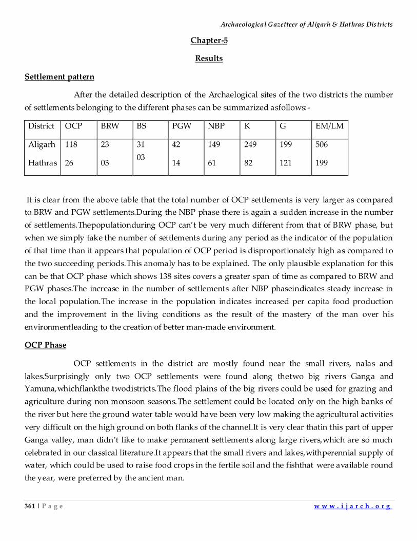
Archaeological Gazetteer of Aligarh & Hathras Districts
361 | P a g e w w w . i j a r c h . o r g
Chapter-5
Results
Settlement pattern
After the detailed description of the Archaelogical sites of the two districts the number
of settlements belonging to the different phases can be summarized asfollows:-
District OCP BRW BS PGW NBP K G EM/LM
Aligarh
Hathras
118
26
23
03
31
03
42
14
149
61
249
82
199
121
506
199
It is clear from the above table that the total number of OCP settlements is very larger as compared
to BRW and PGW settlements.During the NBP phase there is again a sudden increase in the number
of settlements.Thepopulationduring OCP can’t be very much different from that of BRW phase, but
when we simply take the number of settlements during any period as the indicator of the population
of that time than it appears that population of OCP period is disproportionately high as compared to
the two succeeding periods.This anomaly has to be explained. The only plausible explanation for this
can be that OCP phase which shows 138 sites covers a greater span of time as compared to BRW and
PGW phases.The increase in the number of settlements after NBP phaseindicates steady increase in
the local population.The increase in the population indicates increased per capita food production
and the improvement in the living conditions as the result of the mastery of the man over his
environmentleading to the creation of better man-made environment.
OCP Phase
OCP settlements in the district are mostly found near the small rivers, nalas and
lakes.Surprisingly only two OCP settlements were found along thetwo big rivers Ganga and
Yamuna,whichflankthe twodistricts.The flood plains of the big rivers could be used for grazing and
agriculture during non monsoon seasons.The settlement could be located only on the high banks of
the river but here the ground water table would have been very low making the agricultural activities
very difficult on the high ground on both flanks of the channel.It is very clear thatin this part of upper
Ganga valley, man didn’t like to make permanent settlements along large rivers,which are so much
celebrated in our classical literature.It appears that the small rivers and lakes,withperennial supply of
water, which could be used to raise food crops in the fertile soil and the fishthat were available round
the year, were preferred by the ancient man.
Indian Journal of Archaeology
362 | P a g e w w w . i j a r c h . o r g
When I conducted the survey in the flood-prone district of Maharajganj, there too a
large number of settlements were found along the small rivers and lakes.In that region theaverage
size of the village was small.In contrast to this in the neighbouring districts of Haryana we find very
large Harappan settlements.This difference in the size of the settlementswasthe result of difference in
the socio-economicand geoclimatic conditions of the area.The neighbouring areas withHarappan
influence reveal that people collectively agreed upon having planned cities and towns with houses of
uniform architecture.The areas under the influence of Harappan culture show the evidence of long
distance large scale trade, organized social life and the sociopolitical institutions for deciding and
enforcing ideas and policies for common good.The general affluence, planned general cities and
public utilities in the Harappan cities indicate that those societies worked for the good of common
man and the changes envisaged bythe social/political leadership were easily accepted by the common
man.They could do away with their old settlements and plan a new city at its site.This trait was
described by Wheeler as Harappan Nihilism. Harappans had very large settlements probably
supported by trade and other commercial activities.It appears that their life was not organized on the
lines of classical Yajmani system which promoted small self-sufficient villages with optimum need
for long distance trade except for a few luxury items. Here everything could be obtained by barter
and the efforts of the local artisans and craftmen were directed towards meeting the demands of the
local population only.
As we move west from Indus Valley, M.H. culture gives way to other regional
cultures.The typical M.H. culturecharacterized by elements like typicalIndus potteries, seals, sealings,
script, town planning gives way toother localcultures.It is clear thatwhen we move east and south
fromthe land between Satluj and Yamuna and upper Ganga-Yamuna doab, which wasunder the
influence of M.H. culture, as is clearly shown bythe admixture of M.H. pottery with typical OCP
shapes, we find these typical M.H.traitscompletelyabsent. As we move towards north from M.H.
region toNPakistanwe find a culture which is a locally evolvedform of Saraikhola Neolithic and
Burzahom cultures. Similarly,North Rajasthan is occupied by OCP people of Ganeshwar and
Jodhpura. Further down in southern Rajasthan there is a culture similar to the OCP and represented
by the sites of Balathal and Ahar.The Neolithic predecessor of OCP will be coeval with the similar
traditions ofMiddle Ganga Valley and that of Indus valley(with types sites kili Gul Mohammad and
Mehar Garh, whose startingwill reach the antiquity of 9th-10th millennium B.C.The different stages
of chalcolithic traditions in this area will be comparable with the chalolithic traditions of the area
lying to the east and west.The evidence for the Mesolithic beginnings of OCP should alsobe searched
in therocky areasofRajasthan where the changes in the ground surfaces are very less over the period
in question, as compared totheIndo-Gangeticalluvial plains.The place oforigin ofM.H. urbanism is
only Indus valley. It doesn't appear to be inspired from some other culture outside Indus Valley. It is
neither inspiredfrom the Central Asian cultures nor theUpper Ganga Valley, Middle Ganga Valley
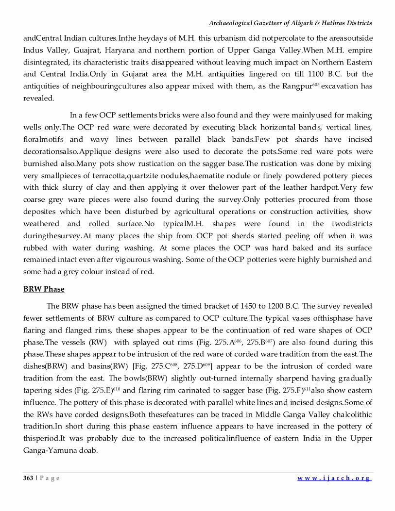
Archaeological Gazetteer of Aligarh & Hathras Districts
363 | P a g e w w w . i j a r c h . o r g
andCentral Indian cultures.Inthe heydays of M.H. this urbanism did notpercolate to the areasoutside
Indus Valley, Guajrat, Haryana and northern portion of Upper Ganga Valley.When M.H. empire
disintegrated, its characteristic traits disappeared without leaving much impact on Northern Eastern
and Central India.Only in Gujarat area the M.H. antiquities lingered on till 1100 B.C. but the
antiquities of neighbouringcultures also appear mixed with them, as the Rangpur605 excavation has
revealed.
In a few OCP settlements bricks were also found and they were mainlyused for making
wells only.The OCP red ware were decorated by executing black horizontal bands, vertical lines,
floralmotifs and wavy lines between parallel black bands.Few pot shards have incised
decorationsalso.Applique designs were also used to decorate the pots.Some red ware pots were
burnished also.Many pots show rustication on the sagger base.The rustication was done by mixing
very smallpieces of terracotta,quartzite nodules,haematite nodule or finely powdered pottery pieces
with thick slurry of clay and then applying it over thelower part of the leather hardpot.Very few
coarse grey ware pieces were also found during the survey.Only potteries procured from those
deposites which have been disturbed by agricultural operations or construction activities, show
weathered and rolled surface.No typicalM.H. shapes were found in the twodistricts
duringthesurvey.At many places the ship from OCP pot sherds started peeling off when it was
rubbed with water during washing. At some places the OCP was hard baked and its surface
remained intact even after vigourous washing. Some of the OCP potteries were highly burnished and
some had a grey colour instead of red.
BRW Phase
The BRW phase has been assigned the timed bracket of 1450 to 1200 B.C. The survey revealed
fewer settlements of BRW culture as compared to OCP culture.The typical vases ofthisphase have
flaring and flanged rims, these shapes appear to be the continuation of red ware shapes of OCP
phase.The vessels (RW) with splayed out rims (Fig. 275.A606, 275.B607) are also found during this
phase.These shapes appear to be intrusion of the red ware of corded ware tradition from the east.The
dishes(BRW) and basins(RW) [Fig. 275.C608, 275.D609] appear to be the intrusion of corded ware
tradition from the east. The bowls(BRW) slightly out-turned internally sharpend having gradually
tapering sides (Fig. 275.E)610 and flaring rim carinated to sagger base (Fig. 275.F)611also show eastern
influence. The pottery of this phase is decorated with parallel white lines and incised designs.Some of
the RWs have corded designs.Both thesefeatures can be traced in Middle Ganga Valley chalcolithic
tradition.In short during this phase eastern influence appears to have increased in the pottery of
thisperiod.It was probably due to the increased politicalinfluence of eastern India in the Upper
Ganga-Yamuna doab.
Indian Journal of Archaeology
364 | P a g e w w w . i j a r c h . o r g
Fig. 275: BRW Pottery shapes
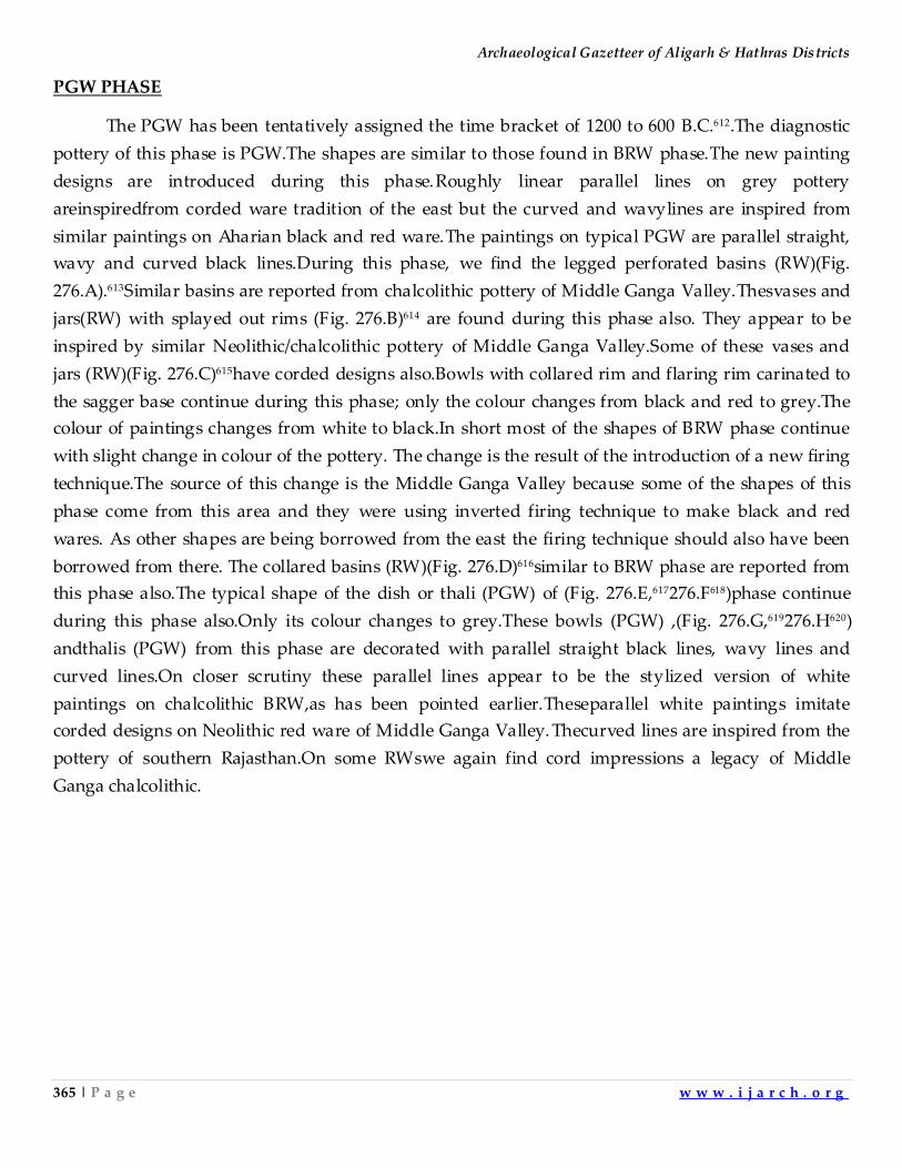
Archaeological Gazetteer of Aligarh & Hathras Districts
365 | P a g e w w w . i j a r c h . o r g
PGW PHASE
The PGW has been tentatively assigned the time bracket of 1200 to 600 B.C.612.The diagnostic
pottery of this phase is PGW.The shapes are similar to those found in BRW phase.The new painting
designs are introduced during this phase.Roughly linear parallel lines on grey pottery
areinspiredfrom corded ware tradition of the east but the curved and wavylines are inspired from
similar paintings on Aharian black and red ware.The paintings on typical PGW are parallel straight,
wavy and curved black lines.During this phase, we find the legged perforated basins (RW)(Fig.
276.A).613Similar basins are reported from chalcolithic pottery of Middle Ganga Valley.Thesvases and
jars(RW) with splayed out rims (Fig. 276.B)614 are found during this phase also. They appear to be
inspired by similar Neolithic/chalcolithic pottery of Middle Ganga Valley.Some of these vases and
jars (RW)(Fig. 276.C)615have corded designs also.Bowls with collared rim and flaring rim carinated to
the sagger base continue during this phase; only the colour changes from black and red to grey.The
colour of paintings changes from white to black.In short most of the shapes of BRW phase continue
with slight change in colour of the pottery. The change is the result of the introduction of a new firing
technique.The source of this change is the Middle Ganga Valley because some of the shapes of this
phase come from this area and they were using inverted firing technique to make black and red
wares. As other shapes are being borrowed from the east the firing technique should also have been
borrowed from there. The collared basins (RW)(Fig. 276.D)616similar to BRW phase are reported from
this phase also.The typical shape of the dish or thali (PGW) of (Fig. 276.E,617276.F618)phase continue
during this phase also.Only its colour changes to grey.These bowls (PGW) ,(Fig. 276.G,619276.H620)
andthalis (PGW) from this phase are decorated with parallel straight black lines, wavy lines and
curved lines.On closer scrutiny these parallel lines appear to be the stylized version of white
paintings on chalcolithic BRW,as has been pointed earlier.Theseparallel white paintings imitate
corded designs on Neolithic red ware of Middle Ganga Valley. Thecurved lines are inspired from the
pottery of southern Rajasthan.On some RWswe again find cord impressions a legacy of Middle
Ganga chalcolithic.
Indian Journal of Archaeology
366 | P a g e w w w . i j a r c h . o r g
Fig. 276: PGW Pottery shapes
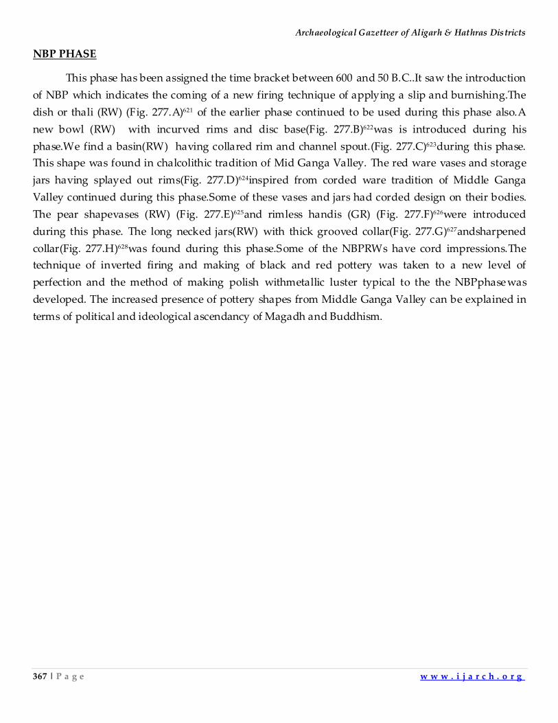
Archaeological Gazetteer of Aligarh & Hathras Districts
367 | P a g e w w w . i j a r c h . o r g
NBP PHASE
This phase has been assigned the time bracket between 600 and 50 B.C..It saw the introduction
of NBP which indicates the coming of a new firing technique of applying a slip and burnishing.The
dish or thali (RW) (Fig. 277.A)621 of the earlier phase continued to be used during this phase also.A
new bowl (RW) with incurved rims and disc base(Fig. 277.B)622was is introduced during his
phase.We find a basin(RW) having collared rim and channel spout.(Fig. 277.C)623during this phase.
This shape was found in chalcolithic tradition of Mid Ganga Valley. The red ware vases and storage
jars having splayed out rims(Fig. 277.D)624inspired from corded ware tradition of Middle Ganga
Valley continued during this phase.Some of these vases and jars had corded design on their bodies.
The pear shapevases (RW) (Fig. 277.E)625and rimless handis (GR) (Fig. 277.F)626were introduced
during this phase. The long necked jars(RW) with thick grooved collar(Fig. 277.G)627andsharpened
collar(Fig. 277.H)628was found during this phase.Some of the NBPRWs have cord impressions.The
technique of inverted firing and making of black and red pottery was taken to a new level of
perfection and the method of making polish withmetallic luster typical to the the NBPphasewas
developed. The increased presence of pottery shapes from Middle Ganga Valley can be explained in
terms of political and ideological ascendancy of Magadh and Buddhism.
Indian Journal of Archaeology
368 | P a g e w w w . i j a r c h . o r g
Fig. 277: NBW Pottery shapes
Archaeological Gazetteer of Aligarh & Hathras Districts
369 | P a g e w w w . i j a r c h . o r g
Kushan Period.
This phase has been assigned the time bracket between300 B.C. and 0 A.D.During this
period bricks were used atverylarge scale.The Kushan sites yield very large number of Kushan
coins.It seems that coins were being used as medium of exchange in a big way.The establishment of
Kushan empire facilitated large scale trade and commerce.Many of the NBP shapes in red ware
continue during this period.The typical Shung and Kushan terracotta is found from Kushan sites.
The coming of new people from Central Asia is indicated by the introduction of surahi
like long necked vases, ink-pot lids, sprinklers and bottle-shaped vases.The NBP bowl with incurved
rim and flat base is modified into a bowl with vertical rim tapering sides and flat disc base.Other
typical red ware shapes are out turned and raised rim and nail headed, internally ledged rim with
globular body.
Typical shapes of this period are RW bowl with vertical rims and sides tapering to a flat
thickenedbase (Fig. 278.A),629lid (RW) with externally vertically out flashed rim, internally grooved
and having a flattish,thickened base with a knob on inner side (Fig. 278.B),630a lid(RW) with a
thickened pointed rim and inkpot like central cavity(Fig. 278.C),631bottle necked sprinkler (RW) with a
flangedrim top and a conical knobbed opening (Fig. 278.D),632 bottle (RW) with extermally thickened
and obliquely cut rim and a short vertical neck, a grooved shoulder and mouth, grooved cylindered
body and a flat base (Fig. 278.E),633miniature vase (RW) with an out turned rim, a ledged shoulder
and a round body(Fig. 278.F),634vase (RW) with raised rim, grooves at the neck and a globular body
(Fig. 278.G),635vase(RW) of with or out-turned pointed nail-headed rim and a roughlyvertical neck
(Fig. 278.H),636vase (RW) with drooping rim,ledged internally (Fig. 278.I),637 vase (RW) with an out
turned externally thickened and grooved rim and a concave neck(Fig. 278.J).638
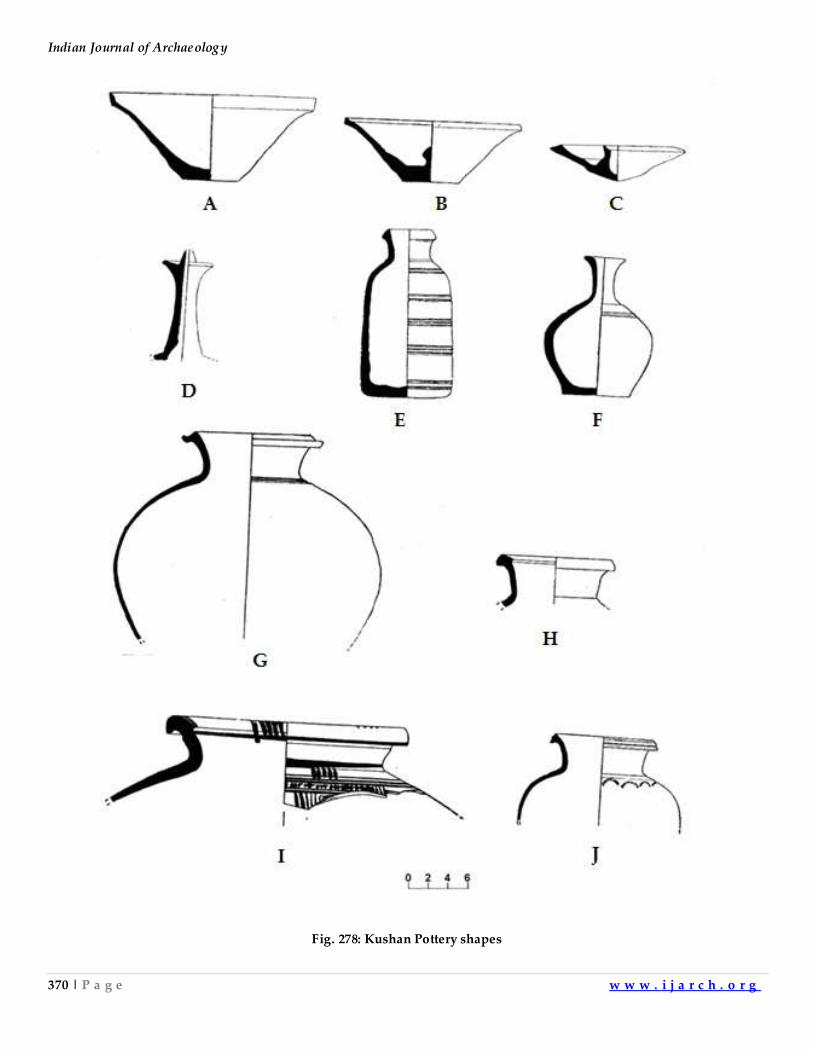
Indian Journal of Archaeology
370 | P a g e w w w . i j a r c h . o r g
Fig. 278: Kushan Pottery shapes
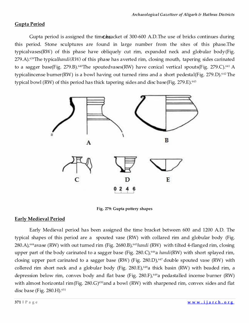
Archaeological Gazetteer of Aligarh & Hathras Districts
371 | P a g e w w w . i j a r c h . o r g
Gupta Period
Gupta period is assigned the time bracket of 300-600 A.D.The use of bricks continues during
this period. Stone sculptures are found in large number from the sites of this phase.The
typicalvases(RW) of this phase have obliquely cut rim, expanded neck and globular body(Fig.
279.A).639The typicalhandi(RW) of this phase has averted rim, closing mouth, tapering sides carinated
to a sagger base(Fig. 279.B).640The spoutedvases(RW) have conical vertical spouts(Fig. 279.C).641 A
typicalincense burner(RW) is a bowl having out turned rims and a short pedestal(Fig. 279.D).6 42 The
typical bowl (RW) of this period has thick tapering sides and disc base(Fig. 279.E).643
Fig. 279: Gupta pottery shapes
Early Medieval Period
Early Medieval period has been assigned the time bracket between 600 and 1200 A.D. The
typical shapes of this period are a spouted vase (RW) with collared rim and globular body (Fig.
280.A),644avase (RW) with out turned rim (Fig. 2680.B),645handi (RW) with tilted 4-flanged rim, closing
upper part of the body carinated to a sagger base (Fig. 280.C),646a handi(RW) with short splayed rim,
closing upper part carinated to a sagger base (RW) (Fig. 280.D),647 double spouted vase (RW) with
collered rim short neck and a globular body (Fig. 280.E),648a thick basin (RW) with beaded rim, a
depression below rim, convex body and flat base (Fig. 280.F),649a pedastalled incense burner (RW)
with almost horizontal rim(Fig. 280.G)650and a bowl (RW) with sharpened rim, convex sides and flat
disc base (Fig. 280.H).651
Cms.
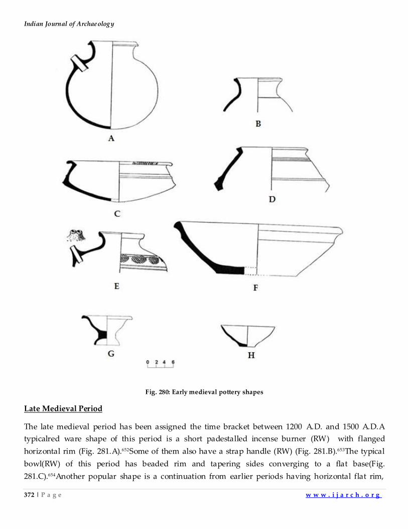
Indian Journal of Archaeology
372 | P a g e w w w . i j a r c h . o r g
Fig. 280: Early medieval pottery shapes
Late Medieval Period
The late medieval period has been assigned the time bracket between 1200 A.D. and 1500 A.D.A
typicalred ware shape of this period is a short padestalled incense burner (RW) with flanged
horizontal rim (Fig. 281.A).652Some of them also have a strap handle (RW) (Fig. 281.B).653The typical
bowl(RW) of this period has beaded rim and tapering sides converging to a flat base(Fig.
281.C).654Another popular shape is a continuation from earlier periods having horizontal flat rim,
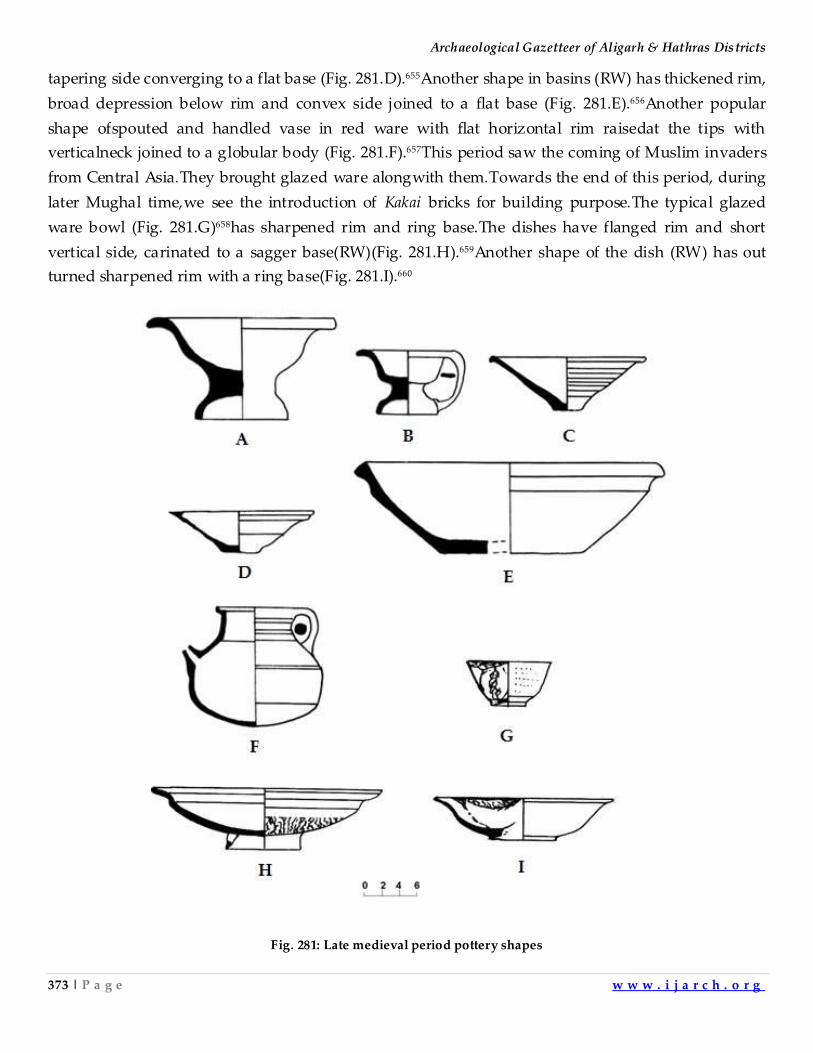
Archaeological Gazetteer of Aligarh & Hathras Districts
373 | P a g e w w w . i j a r c h . o r g
tapering side converging to a flat base (Fig. 281.D).655Another shape in basins (RW) has thickened rim,
broad depression below rim and convex side joined to a flat base (Fig. 281.E).656Another popular
shape ofspouted and handled vase in red ware with flat horizontal rim raisedat the tips with
verticalneck joined to a globular body (Fig. 281.F).657This period saw the coming of Muslim invaders
from Central Asia.They brought glazed ware alongwith them.Towards the end of this period, during
later Mughal time,we see the introduction of Kakai bricks for building purpose.The typical glazed
ware bowl (Fig. 281.G)658has sharpened rim and ring base.The dishes have flanged rim and short
vertical side, carinated to a sagger base(RW)(Fig. 281.H).659Another shape of the dish (RW) has out
turned sharpened rim with a ring base(Fig. 281.I).660
Fig. 281: Late medieval period pottery shapes
Indian Journal of Archaeology
374 | P a g e w w w . i j a r c h . o r g
CHAPTER – 6
CONCLUSION
The intensive archaeological survey of Aligarh and Hathras districts has led to the
following conclusions . Some of the OCP sherds found inthis area are well fired and well
turned,some of them are highly burnished. Most of the potshards have lost the red slip and
blackpainted designs or tend to lose it when they come in contact withwater. It is not the ochrous,
rolled and weathered pottery having powdery surface.Such features are observed only when the site
is disturbed by digging or agricultural operations.It is not mixed with M.H. potteries.This tradition
shows absolutely no influence of any other diagnostic tradition.The settlement pattern during
different phases can be summarized as follows. The population ofthis part of Indo-Gangetic plainwas
quitelarge as the total number of OCP sites suggests.There were a large number of settlementsof
small sizein contrast to the very large Harappan cities havingsettlements withaverage area larger
than OCP settlements.This pattern continues duringlate chalcolithic and early Iron Age.This trend
can be seen even now. Regions in Western India and Western UP have largevillages.There are big
cities and larger towns also in this area, where all the castes live in different mohallas of the
samevillage.In contrast to this situation the Middle Ganga Valleyand areas lying further east, have
villages which are again divided into smaller units called purwas and tolas,exclusively inhabited by
different castes,located at some distance from each other.There are very few large cities, as compared
to Western India, andafewvery small towns.This observation is supported by Panini,who says that
the terms gram and nagar were used indiscriminately in the Vahika country(Western India)whereas
the distinction between them in Eastern India was much more sharp.661It appears that geographical
and social factors decided the settlement pattern of any area.The urban revolution, acoording to the
definition given by Gordon Childe, doesn’t appear infull force in the area beyond the area of
influence of M.H. culture, according tothe data available till now.The workmanship of copper hoard
weaponsis at par with Harappan weapons,metallic vesselsandother artefacts.No complete cities have
been excavated in upper and Middle Ganga Valley therefore we don’t have data regarding the their
planning,the monumentals tructures,temples,workshops,magazines and granaries.The bricks were
being used in varying numbers in the whole of OCP area.The evidence regarding uniform weights
and measures is not available till now.662 The script was being used only in thewestern part of OCP
zone.Thesurplus production and its sharingbydifferent sections of the society vary from east to
west.The west under the influence of Harappans shows large surplus shared by many people as
reflected by planned towns,brick built houses.The people living in the eastern part of the zone lived
mostly in small wattle and daub huts. Here the economic structure was built on low per capita
productivity model where the wealth was concentrated in very few hands.There was limited long
distance trade.The transmission of ideaswas taking place asthe introduction of new crops can be seen
Archaeological Gazetteer of Aligarh & Hathras Districts
375 | P a g e w w w . i j a r c h . o r g
across the Gangetic Plain at different points of time.The people living herewere not divided by
formidable barriers so the interaction would have been frequent.It appears that the people living here
sharedthemajority of the cultural elements.But the western people enjoyed greater material
prosperity as compared to their eastern brethren.The westerners could completely do away with their
old traditions and their leaders strived for the betterment of the whole city as is clear from their new
planned cities raised over the debris of older cities,sewerage system,brickhouses having similar
design,granaries,religious buildings and tanks made of bricks and meant for ritual bath.It appears
that they hada materialistic outlook, could work for their common welfare and reach consensus in
matters related to their material well being.The easternOCP people could perfect the technology to
fabricate their formidable harpoons and battle axes, couldcome togetherand successfully turn the tide
of Harappan Empire but probably could not make cooperative efforts for improving the lot of the
commonman.They could not devise ways of increasing their per capita productivity and sharing of
wealth among larger number of population.Barring a few exceptions,as we move towards east, the
thickness of the deposit also decreases.In the west the mounds looklike small hills whereas in the east
the deposits are very thin. Only the chalcolithic siteshavingHarappaninfluence have thicker deposit
in Upper Ganga Valley.Rest of the areaagain has very small deposits.The difference is because of the
architecture and the building material used in different areas. In the drier Western India the walls of
the houses were built of mud and brickswhereasin larger portion of the Upper Ganga Valley and the
wet Eastern India,the huts were made of wattle and daub.Onlyduring and after Maurya and Kushan
periodswesee large and high mounds in western U.P. and eastern India. Duringthe OCP phase
people preferred settling near the perennial sources of water e.g.alongsmall rivers, nalasand
lakes.Only two OCP settlements were found along big rivers. The area of OCP settlements is very
small.Infact very large settlements comparable to Harappan sites are not found in this zone.The total
number of settlements is very large during this period.During BRW and BS phase the total number of
settlements is small.Again the settlements are mostly found away from large rivers,they are
locatedalong nalas and lakesas was the trend during OCP phase.The size of the settlements is small
during this phase also. They located the settlementsalong nalas and lakes during this phase also.The
reason for the choice is the the dependance of the ancient men on natural perrenial sources ofwater
for daily domestic use,agricultural operations and watering animals. During NBP phase thenumber
of settlements suddenly increases, it becomes more than that during OCP phase.Itkeeps on increasing
during thesubsequentperiods namely K, G, EM/LM.After NBP phase the man started settling on sites
away from the natural sources of water like small rivers, nalas and lakes.This shift may be because of
improved agricultural techniques, better management of water resources for agriculture,and the
development of man made water sources like wells etc.
In this area we find absolutely no Harappan antiquities.In contrast to this we find a
large number of sites in Ganga-Yamuna doab north of district Bulandshahar, Uttar Pradesh, where in
Indian Journal of Archaeology
376 | P a g e w w w . i j a r c h . o r g
association with OCP, typical mature Harappan antiquities like seals, sealings, Harappan script,
terracotta cakes, long chart blades, large scale use of bricks, alongwith diagnostic M.H. pottery are
found.It indicates the M.H. pottery spread and mixed with OCP in later phase in upper Ganga-
Yamuna doab and Haryana-Punjab area.OCP is not the degenerate mature Harappan pottery
popularly believed.It is an independent ceramic tradition different from M.H. pottery and eastern
chalcolithic and Neolithicceramic traditions.In Aligarh area it appears that potters never took to
making M.H. pottery but continued with the earlier OCP shapes. The large number of OCP
settlements as compared to small number of BS/BRW settlements indicates that OCP phase continued
for a very large period, before it was replaced by BRW tradition. At the point of OCP-BRW transition,
just before it and just after it, the human population in this area would have been almost the
same.The number of settlements is a sure indicator of the population.When we examine the number
of settlements during the OCP and BRW phase it appears that during earlier OCP phase the
population was very high as compared to BRW.It can not be true.This paradox can be resolved when
we make a hypothesies that the number of OCP sites reflects the number of human habitation
developed during a longer time span as compared to short time span ascribed toBRW phase.In fact
OCP should be given longer span of time during which it continued.The typical Neolithic phase for
Upper Ganga Valley has not been identified till now.Had it been a cultural blank, the people from
corded ware Neolithic tradition or the people fromthe Indus Valleywould have filled it up in earlier
times.The early dates fo KalibanganBagor and Balathal traditionsindicatethat it had an earlier
beginning, much before Ganeshwar, Jodhpura, Bhagwarpura andJhinjhana.It would be coeval with
the Neolithic traditions of the east and the west thusits beginning will be reaching 9thmillennium
B.C..The identification ofNeolithic phase from which OCP evolved needs furtherresearches.Its
Mesolithic beginnings should also be searched as noted earlier. After shortBRW/BSphase we find
large number NBP settlements.This again indicates a long NBP phase with increase in the
population.This increase in population was the result of improved agricultural production.In this
area during NBP phase the number of settlementsis high, as has been noted earlier.Long before this
phase we find the area well settled even during OCP and BRW/BS phases.This area was well settled
even before M.H. influence spread to the upper part of Ganga-Yamuna doab. This is evident from
thefact that in Upper GangaValley there are some sites which show admixture of M.H. antiquities
with OCP antiquities, but a large number of sites shown no mixing.Purely OCP sites with no M.H.
antiquities have been labelled as degenerate Harappan sites or OCP sites according to the fancy of the
explorers.When OCP shows datesearlier than M.H. pottery there is no ground to call it M.H.Had the
sitesbeen degenerate Harappan we will certainlyfindHarappan antiquities on sites located in
thesouthernpartsofUpper Ganga Valley.This is not corroborated by archaeologicalfindings.Harappan
antiquities are shown mixed with OCP antiquities in Northern part of Upper Ganga Valley, Haryana
and Punjab at few sites only. In lowerpart of Upper Ganga Valley this phenomenon is not
Archaeological Gazetteer of Aligarh & Hathras Districts
377 | P a g e w w w . i j a r c h . o r g
observed.The sites namely Siswal I, Mitathal, Kalibangan, Ganeshwar, Jodhpura andHulas gave
dates which are much earlier as compared to thetime span of M.H. phase (2500-2000 B.C.) .
The first prehistoric ceramic culture to be identify in this region is OCP.OCP in this area
is replaced by BRW and BS ware.The latter ceramic tradition is inspired from corded ware tradition
of the Middle Ganga Valley.This observed change in antiquities can be explained in terms of the
increased socio-political influence of the Middle Ganga Valley in the Upper Ganga Valley region.The
PGW is locally evolved from the ceramic traditions of BRW from the east and Aharian black and red
ware.It is not a pottery introduced from outside by foreign invaders as was presumed earlier.The
evolution ofPGW in upper Ganga valley and its spread over a large part of the sub-continent can be
explained by increased socio-political influence of Upper Ganga Valley in India.The area of influence
of this culture can be taken roughlyas the area of the spread of PGW.After this NBP ware was
introduced here. Between 7th century B.C. and 4thcentury B.C. we witness rise of Buddhism in the
Middle Ganga Valley. Subsequentlyit spread over a large part of South Asia.In the same period we
see rise of the empires of Nandas and Mauryas in the Middle Ganga Valley. The ideological
ascendancy and political dominance probably caused thespread of NBP ceramic tradition of the
Middle Ganga Valley to thegreater part of South Asia.After NBP the historical events and the factors
responsible for the changes observed inantiquities of this area are well known to be repeated. The
changes in ceramics reflect the known political events.
ACKNOWLEDGEMENTS
I am deeply indebted to a large number of persons who helped me in carrying out this survey
and bringing out the article. The long discussion I had with Late Prof. R.C. Gaur always inspired me
during the course of the exploration work. Prof. M.D.N. Shahi and Late Prof. S.P. Gupta, Department
of History at A.M.U. Aligarh, provided constant encouragement in my work. Prof. S.P. Gupta
especially made available to me the facilities in the Department of History at A.M.U. The credit for
helping me in converting the raw archaeological data into some recognizable form goes to the
enthusiasm and continuous guidance of Sri Husam Haider, Curator, Archaeological Museum,
A.M.U. who helped me in putting together the jigsaw puzzle of analyzing and identifying the
antiquities obtained from the survey. The staff members of the Archaeology Section, Department of
History, A.M.U., extended their invaluable help during this work. Discussions with Prof. M.K.S.
Pundir of Department of History, A.M.U. helped me a lot during the work. The task could not have
been completed without the help of Platoon Commander Sri Vijay Singh and the team of enthusiastic
youngmen of 38th Bn. P.A.C. Aligarh. I am thankful to Sri Mahmud-ur-rahman, then V.C. A.M.U.
Aligarh who accepted the explored material and allowed the same to be kept in the Archaeology
Section of A.M.U.’s Department of History. Sri Jitendra Singh Naulakha, research scholar,
Department of Ancient History, Culture and Archaeology, University of Allahabad, extended
Indian Journal of Archaeology
378 | P a g e w w w . i j a r c h . o r g
valuable cooperation during the preparation of this manuscript. Last but not the least there are still a
large number of people who helped me in this work and whose names I am not able to mention here.
I am really grateful to all of them.
References
1. Lal, B. B. 1971-72. Proceedings of the Seminar on OCP and NBP. ‘E d. Sharma, Y. D., Purātattva No. 5. 1971-72,
Bulletin of the Indian Archaeological Society’. Indian Archaeological Society c/o National Museum,
Janpath, New Delhi-11. pp. 46-49.
2. Ibid. pp. 39-42.
3. Ghosh, A. 1963-64. Indian Archaeology 1963-64- A Review . Archaeological Survey of India, New Delhi. pp.
56-7.
4. Gaur, R.C. 1983. Excavations at Atranjikhera. Motilal Banarsidass Indological Publishers, Delhi. p. 10 .
5. Lal, B.B. 1971-72. A note on the excavations at Saipai,‘E d. Sharma, Y. D., Purātattva No. 5. 1971-72, Bulletin of
the Indian Archaeological Society’. Indian Archaeological Society c/o National Museum, Janpath, New
Delhi-11pp. 46-49.
6. Gaur, R.C. 1995. Excavations at Lal Qila, Jaipur, Publication Scheme, pp. 2-3.
7. Ibid. p. 18.
8. Ibid. pp. 19-20.
9. Sharma, Y.D. 1959. ‚Brief Report of Excavation at Alamgirpur. District Meerut‛, Indian Archaeology, 1958-
59- A Rev iew. pp. 50-55
10. Gaur, R.C. Opcit. 1983. pp. 11-20.
11. Ibid. pp. 212-13.
12. Ibid. pp. 459-71.
13. Fuhrer, A. 1969. The Monumental antiquities and the Inscriptions in the North Western Prov inces and Oudh ,
Varanasi, Indological Book House, p. 1.
14. Neville, H.R.1909. Aligarh, a District Gazetteer, Allahabad, Superintendent, Government Press, United
Provinces, pp. 172-75.
15. Ibid. pp. 178-79.
16. Possehl, Gregory. L. 2003. The Indus Civil ization a Contemporary Perspective, New Delhi, Vistar Publications,
p. 40.
17. Ibid. p. 34
18. Pakistan Archaeology, 1965, Part 2, Karachi, The Department of Archaeology Ministry of Education
government of Pakistan, p. 56.
19. Ibid. p. 60.
20. Ibid, p. 56.
21. Ibid. p. 54.
22. Ibid. p. 52.
23. Ibid. p. 56.
24. Ibid. p. 60.
25. Ibid. p. 60.
26. Ibid. p. 54.
27. Ibid. p. 62.
28. Ibid. p. 62.
Archaeological Gazetteer of Aligarh & Hathras Districts
379 | P a g e w w w . i j a r c h . o r g
29. Ibid. p. 56.
30. Ibid. p. 76.
31. Ibid. p. 67.
32. Mackay, E.J.H. 1938. Further excavationat Mohenjo-Daro, Vol.-I, New Delhi, The Manager of Publication, p.
237 and Mackay, E.J.H. 1937. Further excavation atMohenjo-Daro, Vol.-II New Delhi, The Manager of
Publication, plate-LVII.
33. Ibid.
34. Ibid. Plate-LVI.
35. Mackay, E.J.H. 1938. Opcit, Vol. I, p. 235 and Vol. II, Plate-LVI.
36. Mackay, E.J.H. 1938. Opcit, Vol. I, p. 237 and Vol. II, Plate-LVII.
37. Mackay, E.J.H. 1938. Opcit, Vol. I, p. 235 and Vol. II, Plate-LIII.
38. Mackay, E.J.H. 1938. Opcit, Vol. I, p. 230 and Vol. II, Plate-LII.
39. Mackay, E.J.H. 1938. Opcit, Vol. I, p. 238 and Vol. II, Plate-LVIII.
40. Mackay, E.J.H. 1938. Opcit, Vol. I, p. 245 and Vol. II, Plate-LXII.
41. Mackay, E.J.H. 1938. Opcit, Vol. I, p. 246 and Vol. II, Plate-LXIII.
42. Mackay, E.J.H. 1938. Opcit, Vol. I, p. 236 and Vol. II, Plate-LVI.
43. Mackay, E.J.H. 1938. Opcit. Vol. I, p. 244 and Vol. II, Plate-LXI.
44. Ibid.
45. Mackay, E.J.H. 1938. Opcit, Vol. I, p. 239 and Vol. II, Plate-LX.
46. Ibid.
47. Mackay, E.J.H. 1938. Opcit, Vol. I, p. 241 and Vol. II, Plate-LX.
48. Mackay, E.J.H. 1938. Opcit, Vol. I, p. 244 and Vol. II, Plate-LXI.
49. Mackay, E.J.H. 1938. Opcit, Vol. I, p. 240 and Vol. II, Plate-LX.
50. Mackay, E.J.H. 1938. Opcit, Vol. I, p. 245 and Vol. II, Plate-LXII.
51. Mackay, E.J.H. 1938. Opcit, Vol. I, p. 235 and Vol. II, Plate-LVI.
52. Mackay, E.J.H. 1938. Opcit, Vol. I, p. 245 and Vol. II, Plate-LXII.
53. Ibid.
54. Robert, W. Ehrich.1992, Chronologies Old World Archaeology, Vol. III, Chicago. p. 462.
55. Possehl, Gregory. L. Opcit, 2003, p. 40.
56. Gaur, R.C. Opcit. 1983. p. 21.
57. Lal, B.B. 1997, The Earliest civ ilization of South Asia , New Delhi, Aryan Books International, pp. 246-7.
58. Joshi, J. p. 1993, Excavations at Bhagwanpura 1975-1976 and Other Explorations and Excavations 1975-81 In
Haryana, Jammu And Kashmir And Punjab, New Delhi, Archaeological Survey of India, pp. 201-2.
59. Lal, B.B. Josh, J.P, Thapar, B.K. & Bala, Madhu. 2003. Excavations at Kalibangan. The Early Harappans (1960-
69). The Director General Archaeological Survey of India Janpath, New Delhi. p. 25.
60. Robert, W. Ehrich. 1992, Chronologies Old World Archaeology, Vol. III, Chicago, pp. 461-462.
61. Mishra, V. N. 2005. Radio Carbon Chronology of Balathal District Udaipur Rajasthan . ‘Man and Environment
XXX (I)’. 2005. p. 56-58.
62. Gaur, R.C. 1995. Excavations at Lal Qila. Jaipur Publication Scheme, p. 99.
63. Ibid.
64. Ibid, p. 94 & p. 104
65. Ibid. p. 90.
66. Ibid. p. 94.
Indian Journal of Archaeology
380 | P a g e w w w . i j a r c h . o r g
67. Ibid. p. 90.
68. Ibid. p. 82.
69. Ibid. p. 90.
70. Ibid. p. 85.
71. Ibid. p. 82.
72. Ibid. p. 33.
73. Ibid. p. 13.
74. Ibid. p. 14.
75. Ibid. p. 33.
76. Ibid.
77. Ibid. p. 42.
78. Ibid. p. 67.
79. Ibid. p. 67.
80. Ibid. p. 67.
81. Ibid. p. 78.
82. Ibid. p. 78.
83. Ibid. p. 117.
84. Ibid. p. 70.
85. Yule, P. 2001. The Copper Hoards of the Indian Subcontinent: Preliminaries for an Interpretation. 2001. pp. 5-6.
86. Vikram, B. & Arakhita Pradhan. 2017. Impl ications of a Recent Hoard of Copper Objects f rom Harinagar, District
Bijnor, Uttar Pradesh. ‘Purātattva-Journal of the Indian Archaeological Society, No. 47, 2017’. -India
Archaeological Society, New Delhi. pp. 77-9.
87. Lal, B. B. Opcit. 1971-72. p. 90.
88. Lal, B.B. 1997. The Earliest Civil ization of South Asia. Aryan Book International, New Delhi, p. 266.
89. Ibid, p. 149.
90. Gaur, R.C. 1995, Excavations at Lal Qila, Jaipur, Publication Scheme, p. 99.
91. Ibid, p. 99.
92. Ramjit & Mohd. Abid. 2000-01. Chandaukha- An OCP Site in Al igarh District. 'E d. Dikshit, K. N. & K. S.
Ramachandran, Purātattva No. 31. 2000-01, Bulletin of the Indian Archaeological Society’, Indian
Archaeological Society c/o National Museum, Janpath, New Delhi-11, p. 160.
93. Lal, B. B. Opcit. 1971-72. p. 101.
94. Ibid, p. 101.
95. Ibid, p. 101.
96. Kumar, V. 2016. The Archaeological Gazetteer of District Sitapur (Part-1), Indian Journal of Archaeology
(www.ijarch.org), Vol. 1, April-2016, pp. 232-233.
97. Ibid.
98. Lal, B. B. Opcit. 1971-72. p. 91.
99. Lal, B.B., Et. al.Opcit. 2003. pp. 116-17.
100. Lal, B.B. Opcit. 1997, p. 266.
101. Lal, B. B. Opcit. 1971-72. p. 92.
102. Joshi. J. p. Et. al. Opcit, 1993. p. 58.
103. Lal, B.B. Opcit. 1997, p. 149.
104. Gaur, R.C. Opcit. 1995, p. 82.
Archaeological Gazetteer of Aligarh & Hathras Districts
381 | P a g e w w w . i j a r c h . o r g
105. Lal, B.B., Et. al.Opcit. 2003. pp. 106-10.
106. Ibid.
107. Ibid.
108. Lal, B. B. Opcit. 1971-72. p. 99.
109. Lal, B.B. Opcit. 1997. p. 149.
110. Gaur, R.C. Opcit. 1995, p. 94 & 104.
111. Ibid, p. 94 & 104.
112. Ibid, p. 90.
113. Ibid, p. 82.
114. Ramjit & Mohd. Abid. Opcit. 2000-01, p. 160.
115. Ibid, p. 160.
116. Lal, B. B. Opcit. 1971-72, p. 101.
117. Ibid, p. 101.
118. Ibid, p. 101.
119. Lal, B.B. Opcit. 1997. p. 266.
120. Joshi. J. p. Et. al. Opcit. 1993. p. 58.
121. Ibid. p. 64.
122. Lal, B.B. Opcit. 1997. p. 149.
123. Lal, B. B. Opcit. 1971-72, p. 99.
124. Ibid.
125. Lal, B.B. Opcit. 1997. p. 266.
126. Gaur, R.C. Opcit. 1995. p. 85.
127. Ibid, p. 94.
128. Ibid, p. 90.
129. Lal, B. B. Opcit. 1971-72, p. 101.
130. Ibid.
131. Kumar, V. 2016. Opcit, pp. 318-322.
132. Ibid, pp. 232-233.
133. Lal, B.B., Et. al. Opcit. p. 104.
134. Ibid.
135. Ibid, p. 144.
136. Ramjit & Mohd. Abid. Opcit. 2000-01, p. 161.
137. Lal, B. B. Opcit. 1971-72, p. 99.
138. Lal, B.B. Opcit. 1997. p. 266.
139. Ibid.
140. Ibid.
141. Ibid, p. 266.
142. Gaur, R.C. Opcit. 1995, p. 33.
143. Ibid, p. 14.
144. Lal, B. B. Opcit. 1971-72. p. 101.
145. Gaur, R.C. Opcit. 1995, p. 33.
146. Ibid, p. 33.
147. Lal, B. B. Opcit. 1971-72. p. 91.
Indian Journal of Archaeology
382 | P a g e w w w . i j a r c h . o r g
148. Gaur, R.C. Opcit. 1995, p. 14.
149. Lal, B.B. Et. al. Opcit. p. 104.
150. Lal, B. B. Opcit. 1971-72, p. 91.
151. Ibid.
152. Lal, B.B. Opcit. 1997. p. 266.
153. Ibid, p. 266.
154. Ibid, p. 149.
155. Ibid, p. 149.
156. Ibid, p. 149.
157. Gaur, R.C. Opcit. 1995, p. 42.
158. Lal, B. B. Opcit. 1971-72. p. 101.
159. Ibid, p. 99.
160. Purātattva: Journal of the Indian Archaeological Society, No. 44, 2014 . Indian Archaeological Society c/o
National Museum, Janpath, New Delhi-11.
161. Lal, B. B. Opcit. 1971-72. p. 101.
162. Gaur, R.C. Opcit. 1995, p. 70.
163. Purātattva: Journal of the Indian Archaeological Society, No. 44, 2014. Indian Archaeological Society c/o
National Museum, Janpath, New Delhi-11.
164. Ibid.
165. Ramjit & Mohd. Abid. Opcit. 2000-01. p. 160.
166. Lal, B. B. Opcit. 1971-72, p. 101.
167. Kumar, V. Opcit.2016, pp. 232-233.
168. Ibid, pp. 271-273.
169. Ibid, pp. 271-273.
170. Ibid, pp. 232-233.
171. Lal, B. B. Opcit. 1971-72. p. 90.
172. Joshi. J. p., Et. al. Opcit. p. 58.
173. Joshi. J. p., Et. al. Opcit. p. 50.
174. Ibid. p. 50.
175. Ibid. p. 50.
176. Ibid. p. 50.
177. Ibid. p. 50.
178. Lal, B. B. Opcit. 1971-72. p. 90.
179. Ibid, p. 99.
180. Gaur, R.C. Opcit. 1995, p. 67.
181. Ibid, p. 67.
182. Kumar, V. Opcit. 2016, pp. 232-233.
183. Joshi. J. p., Et. al. Opcit. p. 56.
184. Ibid, p. 50.
185. Ibid.
186. Kumar, V. Opcit.2016, pp. 271-273.
187. Ibid.
188. Lal, B. B. Opcit. 1971-72. p. 90.
Archaeological Gazetteer of Aligarh & Hathras Districts
383 | P a g e w w w . i j a r c h . o r g
189. Lal, B.B. Opcit. 1997. p. 266.
190. Ibid, p. 266.
191. Joshi. J. p., Et. al. Opcit. 1993. p. 54.
192. Lal, B.B. Opcit. 1997. p. 149.
193. Ibid.
194. Ibid.
195. Sharma, D. V., K. C. Nauriyal, V. N. Prabhakar & Vishnukant. 2003-04. Sanauli: A Late Harrapan Site in the
Yamuna-Hindon Doab. ’Purātattva: Journal of the Indian Archaeological Society, No. 34, 2003 -04’.Indian
Archaeological Society c/o National Museum, Janpath, New Delhi-11, p. 34.
196. Ibid.
197. Gaur, R.C. Opcit.1995, p. 78.
198. Ibid.
199. Lal, B. B. Opcit. 1971-72. p. 99.
200. Gaur, R.C. Opcit. 1995, p. 117.
201. Ibid.
202. Ramjit & Mohd. Abid. Opcit. 2000-01. p. 160.
203. Gaur, R. C. 1983. Excavations at Atranj ikhera, Early Civil ization of the Upper Ganga Basin. Delhi Universit
Press, Delhi, India. 1983. p. 60.
204. Lal, B. B. Opcit. 1971-72. p. 101.
205. Ibid, p. 103.
206. Lal, B.B. Opcit. 1997. p. 266.
207. Ramjit & Mohd. Abid. Opcit. 2000-01, p. 34.
208. Ibid.
209. Ghosh, A. 1954-55. Indian Archaeology- A Review, 1954-55. Archaeological Survey of India, New Delhi. Pl.
XI. B.
210. Lal, B.B., Et. al. Opcit. 2003. p. 212.
211. Joshi. J. p. Et. al. Opcit. 1993. p. 58.
212. Dikshit, K. N. 1978-83. Excavations at Hulas (From Harappan times to Early Medieval). Archaeological Survey
of India, New Delhi. 1978-83. Pl. V.
213. Gaur, R.C. Opcit. 1995. p. 94 & 104.
214. Gaur, R. C. Opcit. 1983. p. 62-4.
215. Ramjit & Mohd. Abid. Opcit. 2000-01, p. 160.
216. Lal, B. B. Opcit. 1971-72, Pl. LII.
217. Kumar, V. Opcit. 2016, pp. 232-233.
218. Joshi. J. p. Et. al. Opcit. 1993. p. 58.
219. Gaur, R.C. Opcit.1995, Fig. 44.
220. Gaur, R. C. Opcit. 1983. p. 62-4.
221. Lal, B. B. Opcit. 1971-72, Pl. LII.
222. Gaur, R.C. Opcit. 1995, Fig. 44.
223. Ghosh, A. Opcit. 1954-55. Pl. X.
224. Gaur, R.C. Opcit. 1995, Fig. 45-9.
225. Joshi. J. p. Et. al. Opcit. 1993. Fig. 23-4.
226. Dikshit, K. N. Opcit. 1978-83. Pl. I-IV.
Indian Journal of Archaeology
384 | P a g e w w w . i j a r c h . o r g
227. Gaur, R. C. Opcit. 1983. p. 62-4.
228. Gaur, R.C. Opcit. 1995, p. 94 & 104.
229. Ibid, Pl. VIII. B.
230. Ibid, p. 117.
231. Sharma, D. V., K. C. Nauriyal & V. N. Prabhakar. 2005-06. Excavations at Sanaul i, 2005-06: A Harrapan
Necropolis in the Upper Ganga-Yamuna Doab. ‘Ed. Dixit, K. N. Purātattva: Bulletin of the Indian
Archaeological Society, No. 36, 2005-06’. Indian Archaeological Society c/o National Museum, Janpath,
New Delhi-11. Pl. 18.
232. Jain. A. 2016. Copper Hoard Antiquities in Shahjad Rai Research Institute, Ed’s. Kumar, Vijay Et. al. Indian
Journal of Archaeology (www.ijarch.org)’, Vol. 1, January-2016, p. 31.
233. Ibid, p. 29.
234. Ibid, p. 31.
235. Ibid, p. 33.
236. Ibid, p. 33.
237. Ibid, p. 34.
238. Ibid, p. 35.
239. Sharma, D. P. 2002. Newly Discovered Copper Hoard, Weapons of South Asia (C. 2800-1500 B.C.), Bhartiya Kala
Prakashan, Delhi. p. 12.
240. Kumar, V. Opcit. 2016, p. 49.
241. Ibid, p. 50.
242. Ibid, p. 50.
243. Vikram, B. & Arakhita Pradhan. Opcit. 2017. Pl. 7.
244. Jain. S. 2016. Copper Hoard Antiquities in Shahjad Rai Research Institute, Ed’s. Kumar, Vijay Et. al. Indian
Journal of Archaeology (www.ijarch.org)’, Vol. 1, January-2016, p. 4.
245. Ibid, p. 6.
246. Ibid, p. 40.
247. Ibid, p. 2.
248. Ibid, p. 25.
249. Vikram, B. & Arakhita Pradhan. Opcit. 2017. Pl. 8.
250. Sharma, D. P. Opcit. 2002. p. 197.
251. Ibid. p. 199.
252. Jain. A. Opcit. 2016, p. 45.
253. Ibid, p. 38.
254. Ibid, p. 8.
255. Ibid, p. 15.
256. Ibid, p. 29.
257. Ibid, p. 16.
258. Ibid, p. 35.
259. Sharma, D. P. Opcit. 2002. PL. LXXII.
260. Jain. A. Opcit. 2016, p. 35.
261. Jain. S. Opcit. 2016, p. 24.
262. Ibid, p. 24.
263. Vikram, B. & Arakhita Pradhan. Opcit. 2017. p. 79 & Pl. 10.
Archaeological Gazetteer of Aligarh & Hathras Districts
385 | P a g e w w w . i j a r c h . o r g
264. Jain. A. Opcit. 2016, p. 32.
265. Ibid, p. 42.
266. Jain. S. Opcit. 2016, p. 12.
267. Ibid, p. 12.
268. Jain. A. Opcit. 2016. Copper Hoard Antiquities in Shahjad Rai Research Institute, Ed’s. Kumar, Vijay Et. al.
Indian Journal of Archaeology (www.ijarch.org)’, Vol. 1, January-2016, p. 40.
269. Ibid, p. 46.
270. Ibid, p. 47.
271. Jain. S. Opcit. 2016, p. 20.
272. Jain. A. Opcit. 2016, p. 49.
273. Sharma, D. P. Opcit. 2002. Pl. LIII.
274. Ibid.
275. Jain. A. Opcit. 2016, p. 49.
276. Jain. S. Opcit. 2016, p. 3.
277. Vikram, B. & Arakhita Pradhan. Opcit. 2017. Pl’s. 1 a & b.
278. Ibid, Pl. 2.
279. Ibid. Pl. 6 & p. 77.
280. Ibid. Pl. 5 & p. 77.
281. Ibid. Pl. 3.
282. Ibid. Pl. 4.
283. Sharma, D. P. Opcit. 2002. p. 95.
284. Vikram, B. & Arakhita Pradhan. Opcit. 2017. Pl. 11 & p. 79.
285. Ibid. Pl. 9.
286. Sharma, D. P. Opcit. 2002. p. 7.
287. Krishnaswami, V. D. 1962. Neolith ic Pattern of India. ‘Anceint India- Bulletin of Archaeological Survey of
India, No. 16, 1960’. The Director General of Archaeological in India, New Delhi. Pl. XXXV.
288. Sharma, D. V. Et. al. Opcit. 2005-06. Pl. 12.
289. Ibid. Pl. 16 & Pl. 22 [a, b, c, d].
290. Ibid, Pl. 4.
291. Ibid, Pl. 6.
292. Ibid, pp. 167-179.
293. Ibid, pp. 167-179.
294. Ibid, pp. 167-179.
295. Ibid, pp. 167-179.
296. Ibid. Pl. 13.
297. Ibid, Pl. 8.
298. Sharma, G.R, Mishra, V.D, Mandal D, Mishra B.B, Pal, J.N. 1980, Beginning of Agriculture, Allahabad,
Avinash Prakashan, p. 27.
299. Pal, J.N. 2008. ‚The Early Farming Culture of the Middle Ganga Plain with special reference to the
Excavations at Jhusi and Hetapatti‛, Pragdhara No-18, Lucknow,UP State Archaeology Department, p. 277.
300. Ibid.
301. Tewari Rakesh, Srivastava R.K, Saraswat K.S., Singh I.B, Singh K.K. 2008, ‚Early Farming at Lahuradewa‛
Pragdhara No-18, Lucknow, UP State Archaeology Department, pp. 350-58.
Indian Journal of Archaeology
386 | P a g e w w w . i j a r c h . o r g
302. Sharma G.R, Mishra V.D, Mandal. D, Mishra B.B, and Pal J.N. 1980, ‚From Hunting and food gathering to
domestication of plants and animal‛, Beginning of Agriculture-Vol. IV, Allahabad, Abinash Prakashan
samanta Shibir, 110, South Malaka, pp. 3-72.
303. Tewari Rakesh, Et. al. Opcit. 2008. p. 358.
304. Pal, J.N. Archaeology of Southern Uttar Pradesh Ceramic Industries of Northern Vindhyas , First Edition, 1986,
Allahabad, Swabha Prakashan, p. 97.
305. Ibid.
306. Ibid.
307. Ibid.
308. Pal, J.N. Opcit. 1986, p. 95.
309. Ibid.
310. Ibid.
311. Ibid.
312. Ibid. p. 97.
313. Ibid.
314. Ibid p. 128.
315. Ibid, p. 136.
316. Ibid, p. 128.
317. Ibid, p. 135.
318. Ibid.
319. Ibid, p. 136.
320. Ibid, p. 138.
321. Ibid, p. 135.
322. Ibid, p. 140.
323. Ibid.
324. Ibid, p. 139.
325. Ibid, p. 135.
326. Ibid, p. 138.
327. Ibid, p. 139.
328. Pragdhara, Vol. 13. Journal of the U. p. State Archaeology Department, 2002-03. Pl. 05; Pragdhara, Vol. 16.
Journal of the U. p. State Archaeology Department, 2005-06. Pl. 4, Pl. 7-8; Pragdhara. Vo. 13, p. 42; Pragdhara.
Vo. 16, p. 43.
329. Pragdhara, Vol. 16. Journal of the U. p. State Archaeology Department, 2005-06. Pl.9 & Pl. 12-17; Pragdhara.
Vo. 13, p. 45; Pragdhara. Vol. 16, p. 45 & 47.
330. Pragdhara, Vol. 13. Journal of the U. p. State Archaeology Department, 2002-03. Pl. 07-11 & Pl. 14-26;
Pragdhara. Vol. 13, p. 48.
331. Ghosh, A. 1963-64. Indian Archaeology- A Rev iew, 1963-64. Archaeological Survey of India, New Delhi, 1967.
332. Fazal, Abul. 1876-77, A'in-i-Akbari, E d., Blockman, Asiatic Society of Bengal, Calcutta, pp. 446-47.
333. Mundy. Peter, 1914, Travels, Vol. II, Travels in Asia, 1630-34,ed, Sir RC, Temple, Hakluyt Society,2nd Series,
XXXV, London, p. 72.
334. Neville, Opcit, p. 196.
335. Siddiqi, J.M. 1981. Aligarh District, A Historical Survey, New Delhi, Munshiram Manoharlal Publishers
Private Ltd, p. 45)
Archaeological Gazetteer of Aligarh & Hathras Districts
387 | P a g e w w w . i j a r c h . o r g
336. Neville, H.R. Opcit. 1909. p. 238
337. Siddiqi, J. M, Opcit. 1981.
338. Ibid, p. 46
339. Neville, H.R. Opcit. 1909. p. 226.
340. Siddiqi, J. M, Opcit. 1981. p. 107.
341. Ghosh, A. 1965-66. Indian Archaeology 1965-66-A Review, Archaeological Survey of India, New Delhi, p. 84.
342. Siddiqi, J. M, Opcit. 1981. p. 46.
343. Ghosh, A. 1962-63. Indian Archaeology 1962-63-A Review, Archaeological Survey of India, New Delhi, p. 70
344. Cunningham, A.1972, Archaeological Survey of India, Report, Vol. I, Varanasi, Indological Book House,
Reprint, pp. 7-9.
345. Ghosh, A. 1966-67. Indian Archaeology 1966-67-A Review, Archaeological Survey of India, New Delhi, p. 33.
346. Kolvi, Raje Muhammad. Akbar-ul-Jamal or an eighteenth century local history of Kol , MS, Aligarh, Habibganj
collection, 22/35, ff.174.ff.
347. Siddiqi, J. M, Opcit. 1981. pp. 266-67.
348. Ibid. p. 46.
349. Ibid. p. 202.
350. Neville, H.R. Opcit. 1909. p. 282-83.
351. Epigraphia Indica, Arabic and Persian supplement, 1965, New Delhi, Archaeological Survey of India, pp. 63-95.
352. Fuhrer, R.A. 1875, The Monumental Antiquities And Inscriptions in the North-Western Provinces and Oudh,
Delhi, Indological Book House, p. 3.
353. Journal of Indian History, Trivandrum University of Travancore, Vol. XI, Part I, 1932, p. 191.
354. Siddiqi, J. M, Opcit. 1981. p. 46.
355. Mundy, Peter. 1914, Travels, Vol. I, Travels in Asia, 1630-34 Ed, Sir R.C, Temple, Hakluyt Society, 2nd
Series, XXXV, London, pp. 76-77.
356. Cunningham, A. Opcit. 1972 pp. 10-11.
357. Fuhrer, R.A. Opcit. 1875, p. 1.
358. Cunningham, A. Opcit. 1972. pp. 10-11.
359. Gaur, R.C. 1988, Selected Art Pieces of Aligarh ArchaeologyMuseum, Jaipur, Publication Scheme, p. 35.
360. Ghosh, A. 1966-67. Indian Archaeology 1966-67-A Review, Archaeological Survey of India, New Delhi, p. 33.
361. Siddiqi, J. M, Opcit. 1981. p. 46.
362. Ibid. p. 45.
363. Neville, H.R. Opcit. 1909. pp. 213-214.
364. Siddiqi, J. M, Opcit. 1981. pp. 198-99.
365. Ibid. p. 41.
366. Ibid.
367. Ibid.
368. Ibid.
369. Ibid. p. 42.
370. Ibid.
371. Ibid. p. 41.
372. Neville, H.R. Opcit. 1909. pp. 224-225.
373. Blunt, E.A.H, 1911, List of Inscriptions on Christion Tombs and Tablets of historical Interest in the United
Prov inces of Agra and Oudh, Allahabad, p. 25.
Indian Journal of Archaeology
388 | P a g e w w w . i j a r c h . o r g
374. Siddiqi, J. M, Opcit. 1981. p. 41.
375. Neville, H.R. Opcit. 1909. P. 232.
376. Ibid.
377. Siddiqi, J. M, Opcit. 1981. p. 41.
378. Ibid. p. 194.
379. Neville, H.R. Opcit. 1909. p. 235.
380. Siddiqi, J. M, Opcit. 1981.p. 41.
381. Ibid.
382. Ibid.
383. Ibid.
384. Ibid.
385. Ibid.
386. Siddiqi, J. M, Opcit. 1981. p. 42.
387. Ibid.
388. Ibid.
389. Neville, H.R. Opcit. 1909. p. 231.
390. Siddiqi, J. M, Opcit. 1981. p. 196.
391. Fazal, Abul. Opcit. 1876-77.
392. Siddiqi, J. M, Opcit. 1981. p. 44.
393. Ibid.
394. Ibid.
395. Siddiqi, J. M, Opcit. 1981. p. 41.
396. Ibid.
397. Ibid.
398. Manual of Titles, United Provinces of Agra and Oudh , 1932, Allahabad, p. 28.
399. Siddiqi, J. M, Opcit. 1981. p. 41.
400. Ibid.
401. Ibid.
402. Cunningham, A. Opcit. 1972. p. 15.
403. Ghosh, A. 1960-61. Indian Archaeology 1960-61-A Review, Archaeological Survey of India, New Delhi, pp.
32-33.
404. Cunningham, Archaeological Survey, Vol. XII, p. 22.
405. Ibid.
406. Cunningham, Archaeological Survey, Vol. XII, p. 21-22.
407. Siddiqi, J. M, Opcit. 1981. p. 42.
408. Ibid.
409. Ibid.
410. Ibid.
411. Siddiqi, J. M, Opcit. 1981. p. 44.
412. Ibid.
413. Ghosh, A. 1960-61. Indian Archaeology 1960-61-A Review, Archaeological Survey of India, New Delhi, p. 31.
414. Neville, H.R. Opcit. 1909. p. 299.
415. Siddiqi, J. M, Opcit. 1981. p. 44.
Archaeological Gazetteer of Aligarh & Hathras Districts
389 | P a g e w w w . i j a r c h . o r g
416. Ibid. p. 41.
417. Ibid.
418. Fazal, Abul. Opcit. 1876-77.
419. Siddiqi, J. M, Opcit. 1981. p. 203.
420. Ibid. p. 41.
421. Blunt. E.A.H. Opcit. 1911. pp. 24-25.
422. Siddiqi, J. M, Opcit. 1981. p. 41.
423. Ibid.
424. Siddiqi, J. M, Opcit. 1981. p. 45.
425. Ibid. p. 43.
426. Neville, H.R. Opcit. 1909. p. 240.
427. Siddiqi, J. M, Opcit. 1981. p. 43.
428. Ibid.
429. Ibid. p. 45.
430. Ibid.
431. Ibid.
432. Neville, H.R. Opcit. 1909. p. 241.
433. Ibid. pp. 261-62.
434. Siddiqi, J. M, Opcit. 1981. p. 200.
435. Ibid. p. 284.
436. Fuhrer, R.A. Opcit. 1975.p. 1.
437. Cunningham, A. Opcit. 1972. pp. 13-15.
438. Neville, H.R. Opcit. 1909. pp. 261-62.
439. Siddiqi, J. M, Opcit. 1981. p. 286.
440. Ibid. p. 288.
441. Ibid. p. 195.
442. Fazal, Abul. Opcit. 1876-77.
443. Gaur, R.C. Opcit. 1988, p. 18 & p. 125.
444. Siddiqi, J. M, Opcit. 1981. p. 45.
445. Ibid.
446. Neville, H.R. Opcit. 1909. pp. 225-26.
447. Siddiqi, J. M, Opcit. 1981. p. 43.
448. Ibid.
449. Neville, H.R. Opcit. 1909. p. 238.
450. Siddiqi, J. M, Opcit. 1981. p. 43.
451. Ibid.
452. Ibid.
453. Ibid.
454. Ibid.
455. Siddiqi, J. M, Opcit. 1981. p. 46.
456. Neville, H.R. Opcit. 1909. pp. 301-302.
457. Siddiqi, J. M, Opcit. 1981. p. 43.
458. Manuals of Titles, United Provinces of Agra and Oudh , p. 29.
Indian Journal of Archaeology
390 | P a g e w w w . i j a r c h . o r g
459. Mundy, Peter, Travels, Vol . I, Travels in Asia , 1630-34, p. 74.
460. Siddiqi, J. M, Opcit. 1981. p. 45.
461. Ibid.
462. Ibid.
463. Ibid.
464. Siddiqi, J. M, Opcit. 1981. p. 43.
465. Ibid. p. 45.
466. Ibid.
467. Ibid.
468. Ibid. p. 44.
469. Ibid.
470. Ibid.
471. Ibid.
472. Ibid.
473. Neville, H.R. Opcit. 1909. pp. 267-268.
474. Siddiqi, J. M, Opcit. 1981. p. 44.
475. Ibid.
476. Ibid.
477. Ibid.
478. Ibid.
479. Ibid.
480. Ibid.
481. Fuhrer, R.A. Opcit. 1975. p. 1.
482. Siddiqi, J. M, Opcit. 1981. p. 281.
483. Ibid. p. 282.
484. Fuhrer, R.A. Opcit. 1975. p. 2.
485. Siddiqi, J. M, Opcit. 1981. p. 283.
486. Ibid. p. 284.
487. Ibid. p. 280-289.
488. Ibid. p. 269-71.
489. Ibid. p. 45.
490. Ibid.
491. Ibid. p. 44.
492. Ibid. p. 43.
493. Ibid.
494. Ibid. p. 45.
495. Ibid.
496. Neville, H.R. Opcit. 1909. p. 277.
497. Gaur, R.C. Opcit. 1988, p. 19.
498. Ghosh, A. 1962-63. Indian Archaeology 1962-63-A Review, Archaeological Survey of India, New Delhi, p. 31.
499. Siddiqi, J. M, Opcit. 1981. p. 45.
500. Ibid.
501. Ibid. p. 42.
Archaeological Gazetteer of Aligarh & Hathras Districts
391 | P a g e w w w . i j a r c h . o r g
502. Ibid.
503. Ghosh, A. 1962-63. Indian Archaeology 1962-63-A Review, Archaeological Survey of India, New Delhi, p. 31.
504. Siddiqi, J. M, Opcit. 1981. p. 44.
505. Ibid.
506. Ibid. p. 43.
507. Ghosh, A. 1962-63. Indian Archaeology 1962-63-A Review, Archaeological Survey of India, New Delhi, p. 31.
508. Ibid. p. 44.
509. Cunningham, Archaeological Survey Vol. XII, p. 2.
510. Ghosh, A. 1962-63. Indian Archaeology 1962-63-A Review, Archaeological Survey of India, New Delhi, p. 31.
511. Siddiqi, J. M, Opcit. 1981. p. 44.
512. Ibid.
513. Ibid.
514. Sirhindi, Yahia Bin Ahmad Bin Abdullah,2010, The Tarikh-I-Mubarak Shahi, Delhi, Low Price Publications,
pp. 214-15.
515. Siddiqi, J. M, Opcit. 1981. pp. 199-200.
516. Ibid. p. 44.
517. Ibid.
518. Ibid.
519. Neville, H.R. Opcit. 1909. p. 299.
520. Ibid. p. 299.
521. Blunt, E. A. H Opcit. 1911, p. 23.
522. Sirhindi, Yahia Bin Ahmad Bin Abdullah. Opcit.2010. pp. 214-15.
523. Fazal, Abul. Opcit. 1876-77, Vol. II, pp. 446-447.
524. Ghosh, A. 1962-63. Indian Archaeology 1962-63-A Review, Archaeological Survey of India, New Delhi, p. 31.
525. Siddiqi, J. M, Opcit. 1981. p. 44.
526. Ibid.
527. Ibid. p. 45.
528. Ibid.
529. Ibid. p. 42.
530. Ghosh, A. 1966-67. Indian Archaeology 1966-67-A Review, Archaeological Survey of India, New Delhi, p. 33.
531. Siddiqi, J. M, Opcit. 1981. p. 42.
532. Ibid. p. 46.
533. Neville, H.R. Opcit. 1909. p. 227.
534. Ibid.
535. Gaur, R.C. Opcit. 1988, p. 14.
536. Ghosh, A. 1966-67. Indian Archaeology 1966-67-A Review, Archaeological Survey of India, New Delhi, p. 33.
537. Siddiqi, J. M, Opcit. 1981. p. 46.
538. Ibid. p. 43.
539. Ibid.
540. Ibid. p. 45.
541. Neville, H.R. Opcit. 1909. pp. 242-248.
542. Siddiqi, J. M, Opcit. 1981. p. 45.
543. Ibid. p. 46.
Indian Journal of Archaeology
392 | P a g e w w w . i j a r c h . o r g
544. Gaur, R.C. Opcit. 1988, p. 31.
545. Siddiqi, J. M, Opcit. 1981. p. 32.
546. Ibid. p. 42.
547. Ibid. p. 46.
548. Ibid.
549. Ibid. p. 42.
550. Ibid.
551. Cunningham, Archaeological Survey, Vol. XII, p. 1.
552. Cunningham, Archaeological Survey, op. cit.
553. Vogel, J. p. H., Catalogue of the Archaeological Museum at Mathura , Allahabad, 1910, p. 62.
554. Ibid.
555. Gaur, R.C. Opcit. 1988, p. 16.
556. Ibid. p. 17.
557. Ibid. p. 20.
558. Ibid. p. 18.
559. Ghosh, A. 1962-63. Indian Archaeology 1962-63-A Review, Archaeological Survey of India, New Delhi, p. 31.
560. Siddiqi, J. M, Opcit. 1981. p. 42.
561. Ibid. p. 207.
562. Neville, H.R. Opcit. 1909. p. 278.
563. Blunt, E. A. H. Opcit. 1911, p. 24.
564. Siddiqi, J. M, Opcit. 1981. p. 42.
565. Ibid. p. 43.
566. Ibid.
567. Ibid.
568. Ibid. p. 42.
569. Neville, H.R. Opcit. 1909. p. 245.
570. Fuhrer, R.A. Opcit. 1975. p. 2.
571. Ghosh, A. 1966-67. Indian Archaeology 1966-67-A Review, Archaeological Survey of India, New Delhi, p. 33.
572. Siddiqi, J. M, Opcit. 1981. p. 42.
573. Ibid.
574. Agrawal, V.S. 1950, Mathura Museum Catalogue. The Journal of the Uttar-Pradesh Historical Society, XXIII,
Lucknow, (Acc. No 205) p. 106.
575. Ibid. p. 106.
576. Ibid. p. 119.
577. Ibid. p. 100.
578. Ibid. p. 117.
579. Siddiqi, J. M, Opcit. 1981. p. 42.
580. Ibid.
581. Agrawal, V.S. Opcit. 1945. pp. 98-100.
582. Siddiqi, J. M, Opcit. 1981. p. 42.
583. Manuals of Titles, United Provinces of Agra and Oudh , pp. 24-26.
584. Siddiqi, J. M, Opcit. 1981. p. 42.
585. Ibid. p. 43.
Archaeological Gazetteer of Aligarh & Hathras Districts
393 | P a g e w w w . i j a r c h . o r g
586. Ibid. 1981.
587. Ibid. pp. 114-115.
588. Ibid. p. 42.
589. Ibid.
590. Ibid.
591. Ibid.
592. Ibid. p. 45.
593. Ibid. p. 43.
594. Ibid.
595. Ibid. p. 213.
596. Ibid. p. 45.
597. Ibid.
598. Ibid. p. 46.
599. Ibid.
600. Neville, H.R. Opcit. 1909. p. 284.
601. Ibid. p. 285.
602. Ibid. pp. 288-89.
603. Siddiqi, J. M, Opcit. 1981. p. 46.
604. Ibid.
605. Ghosh. A. 1962-63. Ancient India, Bulletin of the Archaeological Survey of India, No. 18 and 19, 1962-63. The
Director General of Archaeology in India, New Delhi. pp. 4-207.
606. Gaur, Excavation at Atranjikhera, p. 108.
607. Ibid.
608. Ibid. p. 98.
609. Ibid. p. 102.
610. Ibid. p. 86.
611. Ibid. p. 84.
612. Ibid. p. 21.
613. Ibid. p. 108. & p. 175.
614. Ibid. p. 184.
615. Ibid.
616. Ibid, p. 170.
617. Ibid. p. 162.
618. Ibid.
619. Ibid. p. 157.
620. Ibid.
621. Ibid. p. 274.
622. Ibid.
623. Ibid. p. 313.
624. Ibid. p. 318.
625. Ibid. p. 328.
626. Ibid. p. 342.
627. Ibid. p. 324.
Indian Journal of Archaeology
394 | P a g e w w w . i j a r c h . o r g
628. Ibid. p. 328.
629. Ghosh. A. 1954-55. Ancient India, Bulletin of the Archaeological Survey of India, No. 10 and 11, 1954-55. The
Director General of Archaeology in India, New Delhi, p. 64.
630. Ibid.
631. Ibid.
632. Ibid.
633. Ibid.
634. Ibid.
635. Ibid. p. 67.
636. Ibid.
637. Ibid. p. 68.
638. Ibid. p. 69.
639. Ibid. p. 48.
640. Ibid. p. 47.
641. Ibid. p. 48.
642. Ibid. p. 47.
643. Ibid.
644. Ibid. p. 51.
645. Ibid.
646. Ibid.
647. Ibid.
648. Ibid.
649. Ibid.
650. Ibid.
651. Ibid.
652. Ibid.
653. Ibid. p. 79.
654. Ibid. p. 77.
655. Ibid.
656. Ibid. p. 51.
657. Ibid. p. 79.
658. Ibid. p. 72.
659. Ibid.
660. Ibid. p. 75.
661. Agarwal, V.S. 1953, India as Known to Panini, Lucknow, University of Lucknow, p. 63.
662. Child, V.G. 1950, What Happened In History, Middlesex, Penguin Books, pp. 89-112.
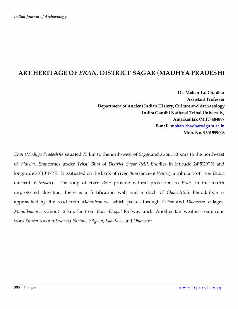
Indian Journal of Archaeology
395 | P a g e w w w . i j a r c h . o r g
ART HERITAGE OF ERAN, DISTRICT SAGAR (MADHYA PRADESH)
Dr. Mohan Lal Chadhar
Assistant Professor
Department of Ancient Indian History, Culture and Archaeology
Indira Gandhi National Tribal University,
Amarkantak (M.P.) 484887
E-mail: [email protected]
Mob. No. 9301599008
Eran (Madhya Pradesh)is situated 75 km to thenorth-west of Sagar,and about 80 kms to the north-east
of Vidisha. Erancomes under Tehsil Bina of District Sagar (MP).Eranlies in latitude 2405’29’’N and
longitude 78010’17’’E. It issituated on the bank of river Bina (ancient Venva), a tributary of river Betwa
(ancient Vetravati). The loop of river Bina provide natural protection to Eran. In the fourth
unprotected direction, there is a fortification wall and a ditch of Chalcolithic Period.1Eran is
approached by the road from Mandibamora, which passes through Gohar and Dhansara villages.
Mandibamora is about 12 km. far from Bina -Bhopal Railway track. Another fair weather route runs
from Khurai town toEranvia Nirtala, Silgaon, Lahatwas and Dhansara.
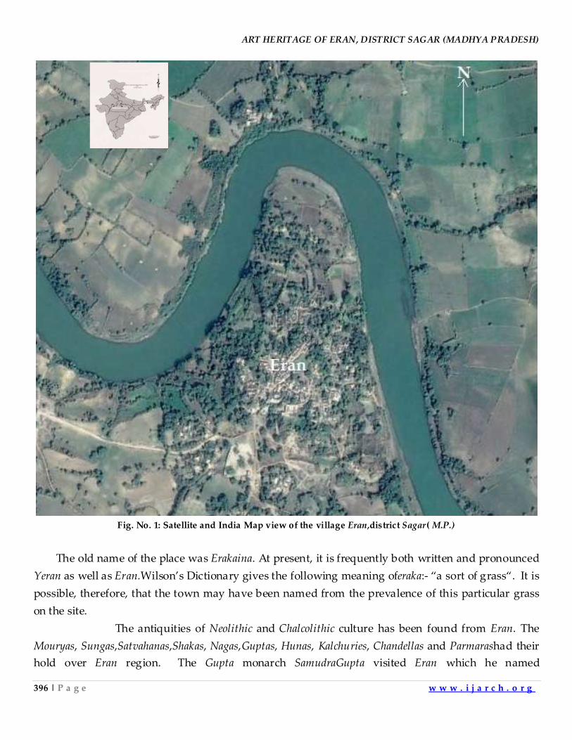
ART HERITAGE OF ERAN, DISTRICT SAGAR (MADHYA PRADESH)
396 | P a g e w w w . i j a r c h . o r g
Fig. No. 1: Satellite and India Map view of the village Eran,district Sagar( M.P.)
The old name of the place was Erakaina. At present, it is frequently both written and pronounced
Yeran as well as Eran.Wilson’s Dictionary gives the following meaning oferaka:- ‚a sort of grass‚. It is
possible, therefore, that the town may have been named from the prevalence of this particular grass
on the site.
The antiquities of Neolithic and Chalcolithic culture has been found from Eran. The
Mouryas, Sungas,Satvahanas,Shakas, Nagas,Guptas, Hunas, Kalchuries, Chandellas and Parmarashad their
hold over Eran region. The Gupta monarch SamudraGupta visited Eran which he named
Indian Journal of Archaeology
397 | P a g e w w w . i j a r c h . o r g
as'SwabhogNagar'.2A group of temples is situated on the south bank of Bina River, just half a km to
the west of the village. In this group,Vishnutemple, Varahatemple, Narsinghtemple, Garudapillar and
other ruined temples are of architectural importance. The various inscriptions have been found from
Eran. These inscriptions are of Budha, Gupta, Saka ruler,Sridharverma, HunaRuler Tormana
,SamudraGupta and GoprajSati Pillar. Several Sati Pillars have been found from Eran. One of the
earliest Sati Pillars of India has been foundhere. This was discovered by General Alexander
Cunningham in 1874-1875 AD. This inscription shows that in Gupta Era 191 (510 A.D.) Gopraj, a
warrior of GuptaRuler BhanuGupta came to Eran and lost his life in a great war. His wife
committedSation her husband's funeralpyre. In addition to this, various Sati Pillars ranging from
Early Medieval Period to Modern Period have been noticed in Eran. Among these, some Pillars have
been obliterated, while about 10 Pillar inscriptions are still in good condition.3
Fig. No.02 Site Map,Eran, General View
This siteclaims to have produced the largest number of stone inscriptions of the Gupta period in
India. So far as the architectural and sculptural art of the Gupta period is concerned, we have some
outstanding examples preserved at Eran. The remains of the simple structure of the Vishnu temple,
originally built during the region of Chandragupta II, can still be seen in-situ. The roof of this temple,
having an interior lotus-decoration, has been found near the Eranvillage. Several pillars bearing
foliage bell and kritimukha motifs, Hathi Darvajaand the huge Dwaja-stambhasurmounted
ART HERITAGE OF ERAN, DISTRICT SAGAR (MADHYA PRADESH)
398 | P a g e w w w . i j a r c h . o r g
byGarudastanding in front of the main temple, are the typical relics of the Gupta age. Similarly the
main statue of Nrisimha, Gajalakshmi, Shesasayi Vishnu, etc., eloquently speaks of the artistic
achievements of the age. A series of panels depicting the scenes from Krishna’s early life can also be
seen here. Eranholds a unique place in Central India. The cultural history of the EranBattisi region is
evidentfrom the great number of archaeological sites, temples and sculptures, as well as inscriptions
and other findings of archaeological importance from pre-historic times well into the late medieval
period. The importance of the Eranis underlined by prehistoric settlements and its importance
increased duringMaurya, Sunga and Satvahana periods. Its importance further increased under the
Gupta rulers and their heirs, the Parmara, Gurjar-Pratihara and Chandella dynasties. Excavations at Eran
and nearby sites have brought to light material attesting to the prevalence of a Chalcolithic culture
contemporaneous to Harappan civilization in major parts of Central India.
This town is referred as Erakina or Erakanya in epigraphs and coins and seems to have held an
important position in ancient periods. Eran was located on an ancient route connecting Pataliputra
with Mathura passing through Vidisha. The earliest main route joined Kausambi (Allahabad) to the
south-eastern sea coast via Bharhut, Amarkantak, Sarabhapur (Malhar) and the Dandakaranya forest. The
other main route from Kausambi went in south-western direction passing through Bharhut, Airikina
(Eran), Vidisha, Ujjain, Mahishmati(Maheswar) to Bhragukachchha (Bharoch) on Arabian Sea coast. This
prime location helped the town to acquire a commendable position in those times.Eranwas annexed
to GuptaEmpire by SamudraGupta. Before this annexation,Airikina was the capital of eastern Malwa for
a long time. Tumain inscription mentions GhatotkachaGupta as a governor of Airikina appointed
byKumarGupta I. It would have acted as a buffer state between the Huns and the Guptas when Huns
started extending their kingdom towards east hence marking it as the easternmost boundary for the
Huns.Alexander Cunningham visited Eranin 1874-75 and reported its antiquities. He found many
punch-marked, die-struck and cast coins during his excavations4. The die-struck coins bear various
symbols such as an elephant, horse, river with fishes, and trees with railings, Indradhwaja and the so
called Ujjain symbol. Few die-struck coins were inscribed in Brhami characters of second century BCE
and give the name of the city as Erakana. Few coins have legend Rano Dhamapalasa(of king
Dharmapala). On the basis of paleography, this king can be assigned to the end of third century BCE
or the start of second century BCE. The punch-marked coins found here are assigned to period
between 600 BCE to second century CE. A legend in Maurya Brahmi characters on few coins reads
Rano Indagutasa(of king IndraGupta).5
Indian Journal of Archaeology
399 | P a g e w w w . i j a r c h . o r g
Fig. No.03: EranExcavation Site Plan Map and General view of EranExcavation
Gupta Period is called the ‚Golden age of India‛ or the ‚Classical Age of India‛ partially due to the
unprecedented activities and development in the arts, architecture, sculpture, painting and literature.
Most of the temples built in the Gupta era were carved with representation of gods mainlyAvataras of
Vishnu. The most important temple-remainsof Eranare ofGupta period. During the Gupta period the
characteristic elements of the Indian temple emerged and the present forms began to be used as an
integral part of the general architectural scheme. The stone carving from the temples at Deogarh and
those from the temples of Udayagiri andEranare excellent specimens of sculptural art. The temple and other remains at Eranare of considerable antiquity as they date from the
times of SamudraGupta and BudhaGupta, whose inscriptions were set up there. But the coins which are
found on the site show that the city must have existed for several centuries before the time of the
Guptas. As these are of some interest, the author will give an account of some of the more remarkable
specimens before proceeding to describe the architectural remains. The principal antiquities at
Eranare situated in a group on the south bank of theriver Bina, just half a mile to the west of the
town.6
ART HERITAGE OF ERAN, DISTRICT SAGAR (MADHYA PRADESH)
400 | P a g e w w w . i j a r c h . o r g
Varaha Temple remains:- Among the temples the most remarkable is that dedicated to the
VarahaAvatara, or Boar Incarnation of godVishnu. The earliest versions of the Varaha legend are found
in the Taittiriya Aranyaka and the Shatapatha Brahmana. They narrate that the universe was filled with
the primordial waters. The earth was the size of a hand and was trapped in it. The godPrajapati (the
creator-godBrahma) in the form of a boar (Varaha) plunges into the waters and brought the earth out.
He also married the earth thereafter. The Shatapatha Brahmana calls the boar as Emusha. The epic
Ramayana and the Vishnu Purana - considered sometimes as the oldest of the Puranic scriptures - are
the first to associate Varahawith Vishnu. Various Puranic sculptures including Agni Purana, Bhagavata
Purana, Devi Bhagavata Purana,Padma Purana,Varaha Purana,Vayu Purana and Vishnu Purana narrate the
same legend of Varaha with some variations (Fig. No. 3).
Fig. No.03:Vishnu and VarahaGupta Temple remains found From Eran, 5thcentury A.D., Sandstone
In Vishnu Purana,Varaha represents Yajna (sacrifice), as the eternal upholder of the earth. His
feet represent the Vedas (scriptures). His tusks represent sacrificial stakes. His teeth are offerings. His
mouth is the altar with tongue as sacrificial fire. The hair on his head denotes the sacrificial grass. The
eyes represent the day and the night. His coarse hair represents sexual prowess. The snout represents
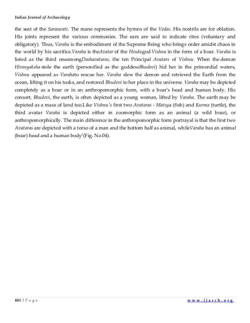
Indian Journal of Archaeology
401 | P a g e w w w . i j a r c h . o r g
the seat of the Saraswati. The mane represents the hymns of the Vedas. His nostrils are for oblation.
His joints represent the various ceremonies. The ears are said to indicate rites (voluntary and
obligatory). Thus, Varaha is the embodiment of the Supreme Being who brings order amidst chaos in
the world by his sacrifice.Varaha is theAvatar of the Hindugod Vishnu in the form of a boar. Varaha is
listed as the third oneamongDashavataras, the ten Principal Avatars of Vishnu. When the demon
Hiranyaksha stole the earth (personified as the goddessBhudevi) hid her in the primordial waters,
Vishnu appeared as Varahato rescue her. Varaha slew the demon and retrieved the Earth from the
ocean, lifting it on his tusks, and restored Bhudevi to her place in the universe. Varaha may be depicted
completely as a boar or in an anthropomorphic form, with a boar's head and human body. His
consort, Bhudevi, the earth, is often depicted as a young woman, lifted by Varaha. The earth may be
depicted as a mass of land too.Like Vishnu's first two Avataras - Matsya (fish) and Kurma (turtle), the
third avatar Varaha is depicted either in zoomorphic form as an animal (a wild boar), or
anthropomorphically. The main difference in the anthropomorphic form portrayal is that the first two
Avataras are depicted with a torso of a man and the bottom half as animal, whileVaraha has an animal
(boar) head and a human body7(Fig. No.04).
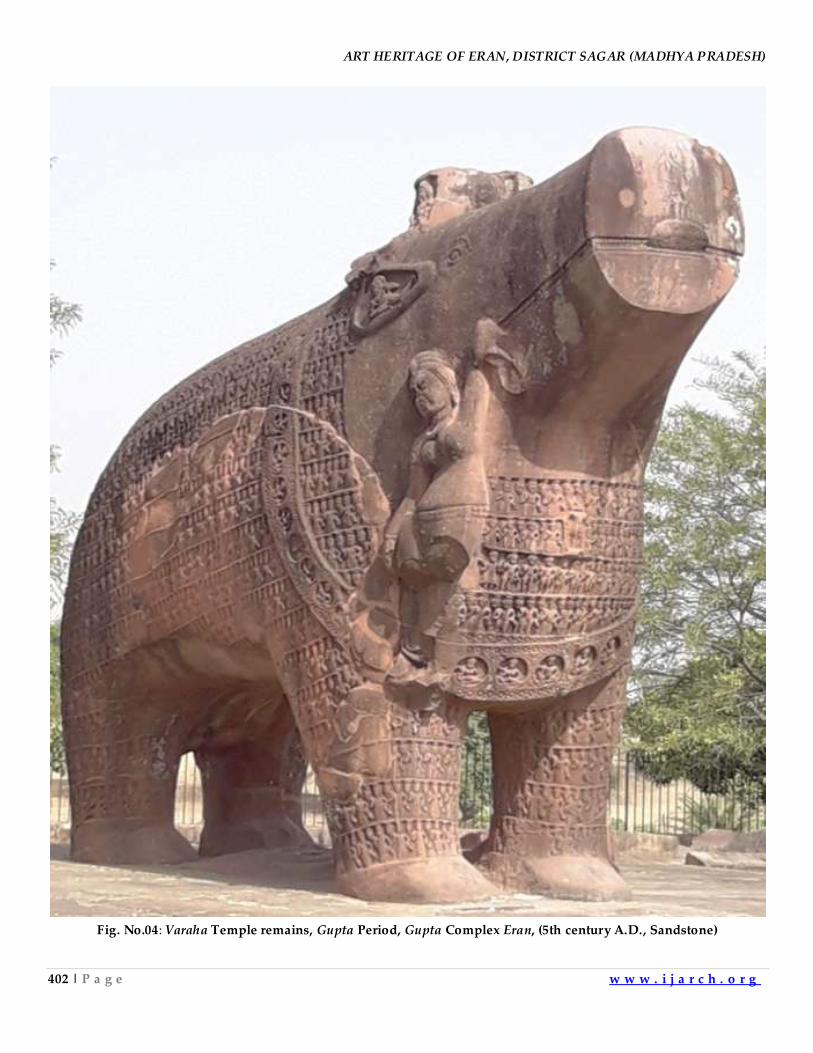
ART HERITAGE OF ERAN, DISTRICT SAGAR (MADHYA PRADESH)
402 | P a g e w w w . i j a r c h . o r g
Fig. No.04: Varaha Temple remains, Gupta Period, Gupta Complex Eran, (5th century A.D., Sandstone)
Indian Journal of Archaeology
403 | P a g e w w w . i j a r c h . o r g
Varahatemple was erected by Dhanya Vishnu, youngest of the two brothers.This Varaha is probably the
most remarkable feature of this temple. It is about 14 feet long, 5 feet broad and 11 feet high. It was
setup by Dhanya Vishnu, same person who is mentioned in the inscription of the pillar above, in the
reign of a Huna king, Toramana. ThisVaraha would have been under a roofed enclosure whose walls
have been fallen now. Cunningham gives the dimension of the temple from the ruins of walls and
pillars. He tells that the temple would have been 42.5 feet in length and 20.5 feet in breadth. Pillars
supporting a mandapa, which were found lying in front of this Varahaplatform, were 10 feet in height
as told by Cunningham. The pillars were square at top and bottom with an octagonal shaft in
between. Both square parts were adorned with vase of plenty or purna-kalsa which is a typical Gupta
element. Whole body of the Varaha is covered with miniature sculptures of various gods and sages.
Bhu-devi is shown hanging to his tusk. There are many similar Varahastatues found at many placesin
Madhya Pradesh like Khajurao, Vidisha, Bilhari. The Varah image was made for the first time at Eran
only.
Though, once this statue would have been inside a small temple, however now its stands
under open sky. TheVaraha statue at Eranis the most ancient specimen of its kind. Varaha in its
zoomorphic form is known as Yajna Varaha representing the yajna.This Varaha image making it the
biggest such statue in India. The Varaha faces west and is ornamented with 1185 figures of sages,
arranged in twelve rows, carved all over his body including legs, neck, forehead and t hroat.
Let us have a look on various figures found on this Varaha. A figure of Bhudevi is shown
hanging from the right tusk of Varaha. A female figure, her hands on her waist, is standing in
sambhanga posture on the snout of the Varaha, identified as Sarasvati while Becker17 identified her
asVac, goddess of speech. I would be going with Sarasvati as we find the Sarasvati images on the
snouts of the Varahas at Khajuraho, Vidisha, JabalpurandEran. In the ears are found Vidhyadharas. A
garland of twenty-eight circles is shown around the neck of the Varaha. A male and a female figure is
present inside the twenty-seven circles, four rows of male figures are shown across the throat and
chest area. There are total of ninety-six figures, except the one, all are two-armed sages holding a
water pot in one hand. Between the first and the second row, from top, in middle is an image of
Vishnu, who is shown standing on a lotus. The third row on the chest shows seven male figures, the
leftmost holding two lotus in his hand and wearing a tunic while the rest holding a water vessel.
Rahu and Ketu are excluded here as the early texts mention only the seven planets. The tunic Surya is
shown wearing suggests the foreign influence as also attested by the fact that the statue was installed
during the rule of king Toramana.
On the shoulders of the Varaha is a stump like protrusion which has fourniches on its four
sides. The following deities have been identified in the 4 niches: Vasudeva on the west, Shiva on the
south, Brahma on the north and Vishnu on the east. Twelve rows of figures are carved along the body
ART HERITAGE OF ERAN, DISTRICT SAGAR (MADHYA PRADESH)
404 | P a g e w w w . i j a r c h . o r g
of the Varaha. All the twelve rows have figures of two-armed sages, holding water vessel in one hand
and Abhaya-Mudra or Vismaya-Mudra in the other hand. Legs and tail of the Varaha are also decorated
with rows of sages, six rows in forelegs and three rows in hind legs.8
Narasimha Templeremains– The Narasimha temple consists of a single room 13 feet in length by 9
feet in breadth, with a portico in front is supported on four pillars at EranGupta complex. Narasimhais
an Avatar of the HindugodVishnu, who is regarded as the Supreme god in Vaishnavism and a popular
deity in the broader Hinduism. The avatar of Narasimha is described in early epics and
iconography.Narasimha is often visualised as having a human torso and lower body, with a lion face
and claws. This image is widely worshipped in deity form by a significant number of Vaisnava
groups. Vishnu assumed this form on top of HimvatMountain (Harivamsa). He is known primarily as
the 'Great Protector' who specifically defends and protects his devotees in times of need. Vishnu is
believed to have taken the Avatar to destroy the demon king Hiranyakashipu.
There are references to Narasimha in a variety of Puranas, with 17 different versions of the main
narrative. The Valmiki Ramayana, Harivamśa Purana, Vishnu Purana, Bhagavata Purana, Agni Purana,
Brahmanda Purana, Vayu Purana, Brahma Purana Vishnudharmottara Purana,Kūrma Purana, Matsya
Purana, Padma Purana, Śiva Purana, Linga Purana and Skanda Purana.
Erantemple was probably only consisted of a sanctum andMandapa, former 13 feet long and about 9
feet wide. The Mandapa was supported on four pillars with wider inter-column distance as seen in
other Gupta temples like atMandi Bamora,Sanchi, Tigowa and Devgarh. None of the pillars have
survived except their slot cut in the plinth.A damaged statue of Narasimha has been kept on the
plinth. It is 7.5 feet high. At present, this statute is in two pieces, feet and body.The iconography is
interesting as such this is a Kevala-Narasimha image, shown standing but not in action. The mouth
wide open shows an amiable appearance rather than theraudra aspect as witnessed in other
icons9(Fig. No.05).
Indian Journal of Archaeology
405 | P a g e w w w . i j a r c h . o r g
Fig. No.05:Narasimha Templeremains, Gupta Period, Gupta complex Eran, (5th century A.D., Sandstone)
Vishnu Temple–Vishnu temple is most complete temple in Gupta temple complex of Eran with the
intact doorway. This oblong temple has a size of 32.5 feet x 13.5 feet. The interior dimensions are 18
feet x 6 feet as observed by Cunningham. Two Mandapa pillars, 13.5 feet high, are still standing with
their corresponding pilasters, however walls between these have not survived. An image of
Vishnu(5th century A.D.), 13.5 feet high, is placed inside the sanctum. This is the best preserved temple
at the site. Though its roof is fallen however its sanctum doorway is intact with its decoration. The
sanctum doorway has river goddesses, Ganga and Yamuna, at the door jambs. Usually these river
ART HERITAGE OF ERAN, DISTRICT SAGAR (MADHYA PRADESH)
406 | P a g e w w w . i j a r c h . o r g
goddessesare found in the upper part of the door jambs, in the Gupta period temples. Prof. K.D.
Bajpai,Prof. U.V. Singh and Prof V.D. Jhaseems to agree that the sanctum doorway and the front
Mandapa was installed during the Early Gupta period (8thcentury AD).10Dvarpalas are present at the
pilasters on either side of the door(Fig. No.06).
Fig. No.06: Door of the temple in Guptatemple complex, Eran, (8th century A.D., Sandstone)
Garuda Pillar of Gupta period (484 A.D.):-The Garuda is a large mythical bird-like creature, or
humanoid birdthat appears in both Hindu and Buddhist mythology. Garuda is the mount(vahana) of
the Lord Vishnu. Garuda is the Hindu name for the constellation Aquila. It appears that mythical
Garuda is inspired from the Serpent Eagle, which is found abundantly in whole of India in the forests.
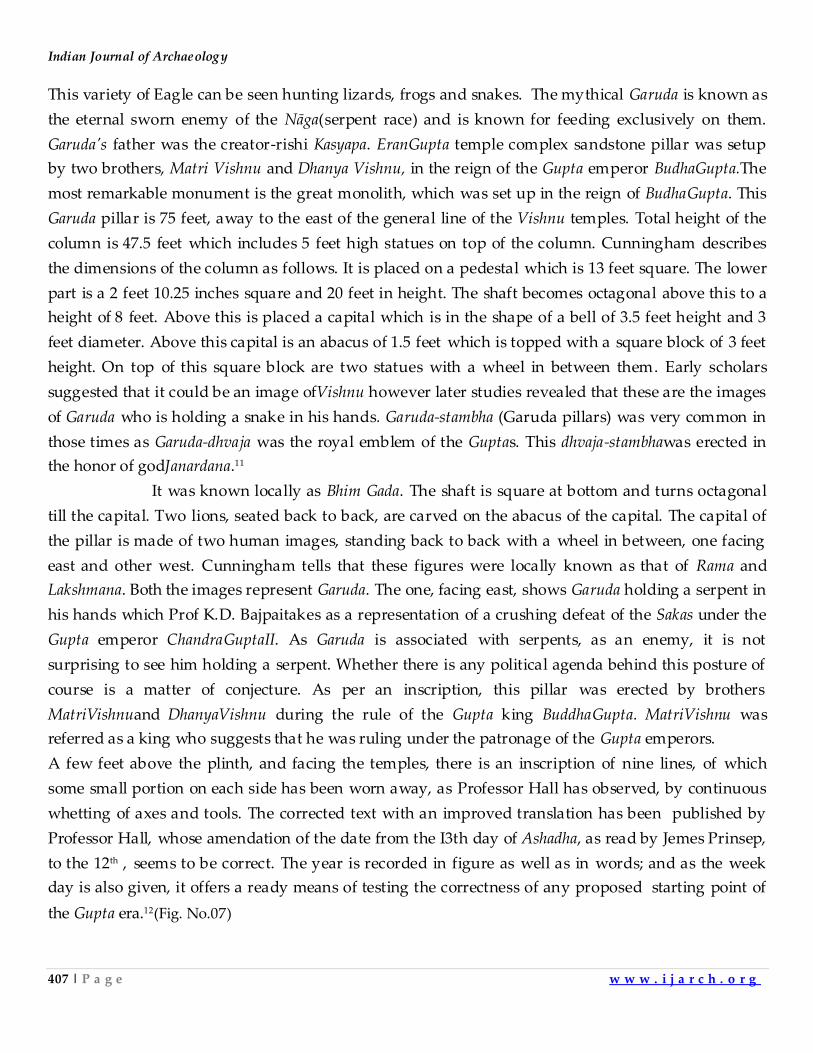
Indian Journal of Archaeology
407 | P a g e w w w . i j a r c h . o r g
This variety of Eagle can be seen hunting lizards, frogs and snakes. The mythical Garuda is known as
the eternal sworn enemy of the Nāga(serpent race) and is known for feeding exclusively on them.
Garuda's father was the creator-rishi Kasyapa. EranGupta temple complex sandstone pillar was setup
by two brothers, Matri Vishnu and Dhanya Vishnu, in the reign of the Gupta emperor BudhaGupta.The
most remarkable monument is the great monolith, which was set up in the reign of BudhaGupta. This
Garuda pillar is 75 feet, away to the east of the general line of the Vishnu temples. Total height of the
column is 47.5 feet which includes 5 feet high statues on top of the column. Cunningham describes
the dimensions of the column as follows. It is placed on a pedestal which is 13 feet square. The lower
part is a 2 feet 10.25 inches square and 20 feet in height. The shaft becomes octagonal above this to a
height of 8 feet. Above this is placed a capital which is in the shape of a bell of 3.5 feet height and 3
feet diameter. Above this capital is an abacus of 1.5 feet which is topped with a square block of 3 feet
height. On top of this square block are two statues with a wheel in between them. Early scholars
suggested that it could be an image ofVishnu however later studies revealed that these are the images
of Garuda who is holding a snake in his hands. Garuda-stambha (Garuda pillars) was very common in
those times as Garuda-dhvaja was the royal emblem of the Guptas. This dhvaja-stambhawas erected in
the honor of godJanardana.11
It was known locally as Bhim Gada. The shaft is square at bottom and turns octagonal
till the capital. Two lions, seated back to back, are carved on the abacus of the capital. The capital of
the pillar is made of two human images, standing back to back with a wheel in between, one facing
east and other west. Cunningham tells that these figures were locally known as that of Rama and
Lakshmana. Both the images represent Garuda. The one, facing east, shows Garuda holding a serpent in
his hands which Prof K.D. Bajpaitakes as a representation of a crushing defeat of the Sakas under the
Gupta emperor ChandraGuptaII. As Garuda is associated with serpents, as an enemy, it is not
surprising to see him holding a serpent. Whether there is any political agenda behind this posture of
course is a matter of conjecture. As per an inscription, this pillar was erected by brothers
MatriVishnuand DhanyaVishnu during the rule of the Gupta king BuddhaGupta. MatriVishnu was
referred as a king who suggests that he was ruling under the patronage of the Gupta emperors.
A few feet above the plinth, and facing the temples, there is an inscription of nine lines, of which
some small portion on each side has been worn away, as Professor Hall has observed, by continuous
whetting of axes and tools. The corrected text with an improved translation has been published by
Professor Hall, whose amendation of the date from the I3th day of Ashadha, as read by Jemes Prinsep,
to the 12th , seems to be correct. The year is recorded in figure as well as in words; and as the week
day is also given, it offers a ready means of testing the correctness of any proposed starting point of
the Gupta era.12(Fig. No.07)

ART HERITAGE OF ERAN, DISTRICT SAGAR (MADHYA PRADESH)
408 | P a g e w w w . i j a r c h . o r g
Fig. No.07: Garuda pillar (Gupta Period,(5thcentury AD, Sandstone))Gupta complex, Eran.
NriVaraha:- In the cult of Vaishnavism,Varaha, the Boar, had been identified asthe creator and
Prajapati the ‘Lord of Creatures’. It later became established as an incarnation of Vishnu.The earliest
reference to theVaraha as Emusa is found in the Rigveda (VIII,77,10) while the Atharvaveda informs us
that the Earth opens herself to the wild boar (XII,I,48). In the VishnuPurana it is said that at the
Indian Journal of Archaeology
409 | P a g e w w w . i j a r c h . o r g
beginning of the eon (kalpa),Brahma created the living beings. When the earth submerged under the
ocean, Brahma entered it as a boar and delivered the earth. In the Bhagvata Purana(2,7,1) it is
mentioned that with a view to create the universe, the Lord of Sacrifice became desirous of lifting up
the earth, which had sunk into the lower regions, and assumed the form of a boar. Here the act of
lifting the earth is already attributed to Vishnu. The Agni Purana informs that Hiranyaksha, a demon
(asura), vanquished the gods and took possession of their heavenly capital. The gods went toVishnu,
who assumed the form of a boar to help them and slew the demon Hiranyaksha.
The Varaha has two major iconographic form, i.e. the semi-human form (Nri Varaha) with a
human body and a boar’s head and another entirely zoomorphic form. According to the iconographic
text, NriVaraha has four arms, two of whichshould hold the conch shell (sankha) and the disc (Cakra),
the third hand rests on the leg and the fourth one remains at the waist. The right leg should be
slightly bent and made to rest upon the bejeweled hood of the serpent Adishesha, who should be
sculpted in the company of his wife. The boar’s face should be tilted slightly upwards. According to
the Vishnudharmottara, the Earth goddess Bhudevi is carried on the left elbow of the deity or is seated
on the god’s bent right leg as related by the Vaikhanas-agama, her own legs hanging down. The
Shilparatna mentions Bhudevi being carried byVaraha on the tusk. The goddess should carry a blue
lotus (Nilotpala) in one of her hands and watch her Lord with admiration and wonder. Varaha’s one
foot should rest upon the serpent Adisesha and the other on a tortoise.13
The earlier figure of Varaha in relief comes from Mathura and belongs to the Kusana period. In the
Gupta age, the cult of the Avtaras became widespread and among these Varaha gained much
popularity. In the Central part of India, the beginning of the 4thcenturyAD saw the rise of the new
power, the Gupta dynasty. SamudraGupta(335-375a.d.),the illustrious son of the Gupta emperor
ChandraGupta I, brought the region of Eran (Ancient Erakanya)into his empire. SamudraGuptahimself
visited Eranmany times, accompanied by his wife, son and grandsons. In one of his inscriptions, Eran
is called ‚pleasure city‛ (Svabhognagara). During his regime, SamudraGupta’s eldest son RamaGupta
was administrator ofEran, a strategic center of the Gupta domain. After SamudraGupta’s death, Rama
Gupta surrendered to the Sakas. RamaGupta’s younger brother, ChandraGupta II (380-414 A.D. ) killed
the Saka king and completely uprooted the Sakas from Central India. The depiction of the Boar
incarnation delivering the Earth, which became very popular with Gupta artists, most probably refers
to this great victory of ChandraGuptaII. The cult and iconographic representation of Varaharemained
very popular in the Central India, from the 5th to the 13th century A.D. a great number of Varaha
images, both in the semi- human and the zoomorphic forms are found in this area.
The Most ImportantNri Varaha statue now preserved in the Harising Gour Archaeological Museum
might have been originallyerected in one of the twin sanctuaries between the Visnu and Narsimha
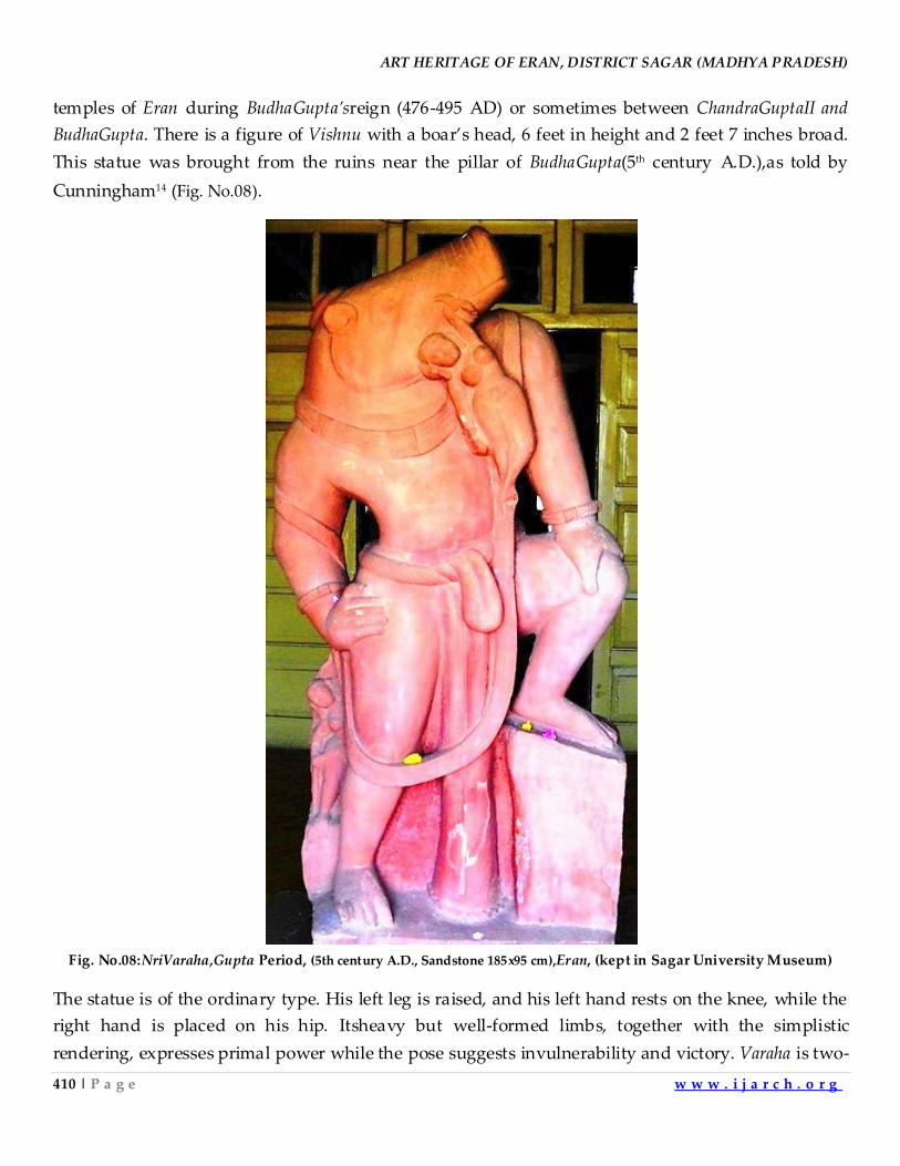
ART HERITAGE OF ERAN, DISTRICT SAGAR (MADHYA PRADESH)
410 | P a g e w w w . i j a r c h . o r g
temples of Eran during BudhaGupta’sreign (476-495 AD) or sometimes between ChandraGuptaII and
BudhaGupta. There is a figure of Vishnu with a boar’s head, 6 feet in height and 2 feet 7 inches broad.
This statue was brought from the ruins near the pillar of BudhaGupta(5th century A.D.),as told by
Cunningham14 (Fig. No.08).
Fig. No.08:NriVaraha,Gupta Period, (5th century A.D., Sandstone 185x95 cm),Eran, (kept in Sagar University Museum)
The statue is of the ordinary type. His left leg is raised, and his left hand rests on the knee, while the
right hand is placed on his hip. Itsheavy but well-formed limbs, together with the simplistic
rendering, expresses primal power while the pose suggests invulnerability and victory. Varaha is two-
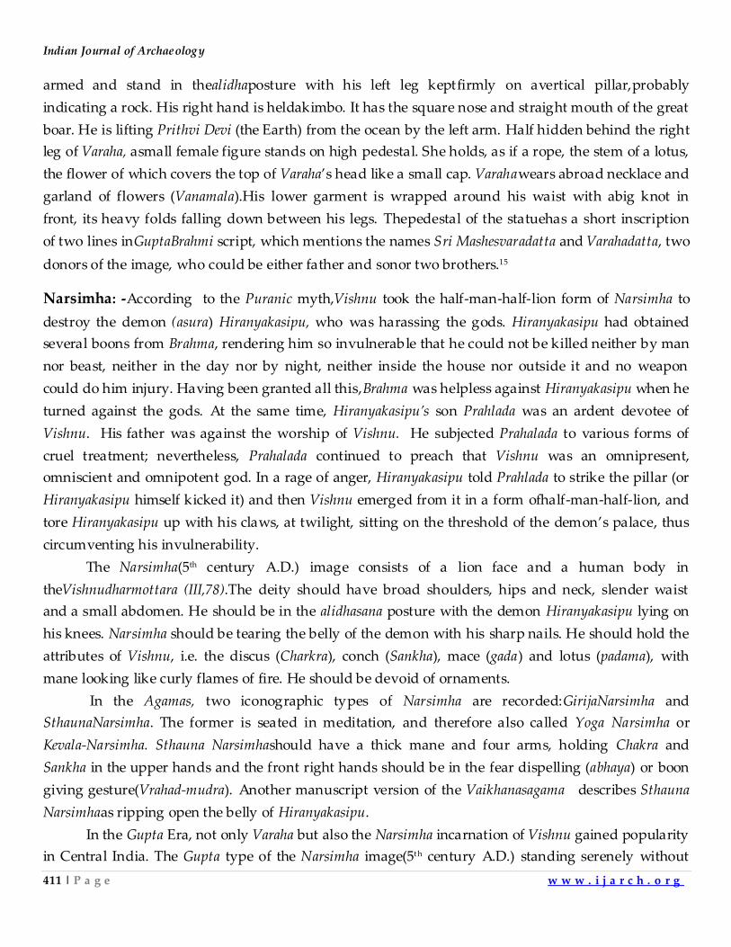
Indian Journal of Archaeology
411 | P a g e w w w . i j a r c h . o r g
armed and stand in thealidhaposture with his left leg keptfirmly on avertical pillar,probably
indicating a rock. His right hand is heldakimbo. It has the square nose and straight mouth of the great
boar. He is lifting Prithvi Devi (the Earth) from the ocean by the left arm. Half hidden behind the right
leg of Varaha, asmall female figure stands on high pedestal. She holds, as if a rope, the stem of a lotus,
the flower of which covers the top of Varaha’s head like a small cap. Varahawears abroad necklace and
garland of flowers (Vanamala).His lower garment is wrapped around his waist with abig knot in
front, its heavy folds falling down between his legs. Thepedestal of the statuehas a short inscription
of two lines inGuptaBrahmi script, which mentions the names Sri Mashesvaradatta and Varahadatta, two
donors of the image, who could be either father and sonor two brothers.15
Narsimha: -According to the Puranic myth,Vishnu took the half-man-half-lion form of Narsimha to
destroy the demon (asura) Hiranyakasipu, who was harassing the gods. Hiranyakasipu had obtained
several boons from Brahma, rendering him so invulnerable that he could not be killed neither by man
nor beast, neither in the day nor by night, neither inside the house nor outside it and no weapon
could do him injury. Having been granted all this,Brahma was helpless against Hiranyakasipu when he
turned against the gods. At the same time, Hiranyakasipu’s son Prahlada was an ardent devotee of
Vishnu. His father was against the worship of Vishnu. He subjected Prahalada to various forms of
cruel treatment; nevertheless, Prahalada continued to preach that Vishnu was an omnipresent,
omniscient and omnipotent god. In a rage of anger, Hiranyakasipu told Prahlada to strike the pillar (or
Hiranyakasipu himself kicked it) and then Vishnu emerged from it in a form ofhalf-man-half-lion, and
tore Hiranyakasipu up with his claws, at twilight, sitting on the threshold of the demon’s palace, thus
circumventing his invulnerability.
The Narsimha(5th century A.D.) image consists of a lion face and a human body in
theVishnudharmottara (III,78).The deity should have broad shoulders, hips and neck, slender waist
and a small abdomen. He should be in the alidhasana posture with the demon Hiranyakasipu lying on
his knees. Narsimha should be tearing the belly of the demon with his sharp nails. He should hold the
attributes of Vishnu, i.e. the discus (Charkra), conch (Sankha), mace (gada) and lotus (padama), with
mane looking like curly flames of fire. He should be devoid of ornaments.
In the Agamas, two iconographic types of Narsimha are recorded:GirijaNarsimha and
SthaunaNarsimha. The former is seated in meditation, and therefore also called Yoga Narsimha or
Kevala-Narsimha. Sthauna Narsimhashould have a thick mane and four arms, holding Chakra and
Sankha in the upper hands and the front right hands should be in the fear dispelling (abhaya) or boon
giving gesture(Vrahad-mudra). Another manuscript version of the Vaikhanasagama describes Sthauna
Narsimhaas ripping open the belly of Hiranyakasipu.
In the Gupta Era, not only Varaha but also the Narsimha incarnation of Vishnu gained popularity
in Central India. The Gupta type of the Narsimha image(5th century A.D.) standing serenely without
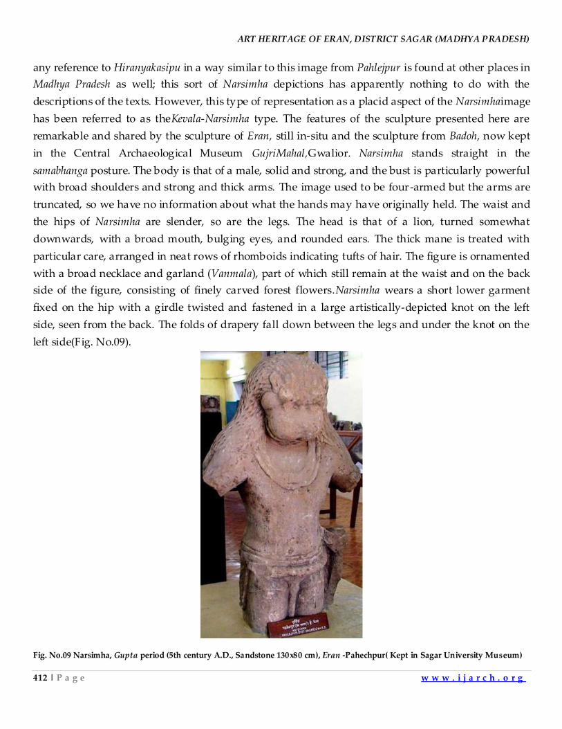
ART HERITAGE OF ERAN, DISTRICT SAGAR (MADHYA PRADESH)
412 | P a g e w w w . i j a r c h . o r g
any reference to Hiranyakasipu in a way similar to this image from Pahlejpur is found at other places in
Madhya Pradesh as well; this sort of Narsimha depictions has apparently nothing to do with the
descriptions of the texts. However, this type of representation as a placid aspect of the Narsimhaimage
has been referred to as theKevala-Narsimha type. The features of the sculpture presented here are
remarkable and shared by the sculpture of Eran, still in-situ and the sculpture from Badoh, now kept
in the Central Archaeological Museum GujriMahal,Gwalior. Narsimha stands straight in the
samabhanga posture. The body is that of a male, solid and strong, and the bust is particularly powerful
with broad shoulders and strong and thick arms. The image used to be four-armed but the arms are
truncated, so we have no information about what the hands may have originally held. The waist and
the hips of Narsimha are slender, so are the legs. The head is that of a lion, turned somewhat
downwards, with a broad mouth, bulging eyes, and rounded ears. The thick mane is treated with
particular care, arranged in neat rows of rhomboids indicating tufts of hair. The figure is ornamented
with a broad necklace and garland (Vanmala), part of which still remain at the waist and on the back
side of the figure, consisting of finely carved forest flowers.Narsimha wears a short lower garment
fixed on the hip with a girdle twisted and fastened in a large artistically-depicted knot on the left
side, seen from the back. The folds of drapery fall down between the legs and under the knot on the
left side(Fig. No.09).
Fig. No.09 Narsimha, Gupta period (5th century A.D., Sandstone 130x80 cm), Eran -Pahechpur( Kept in Sagar University Museum)
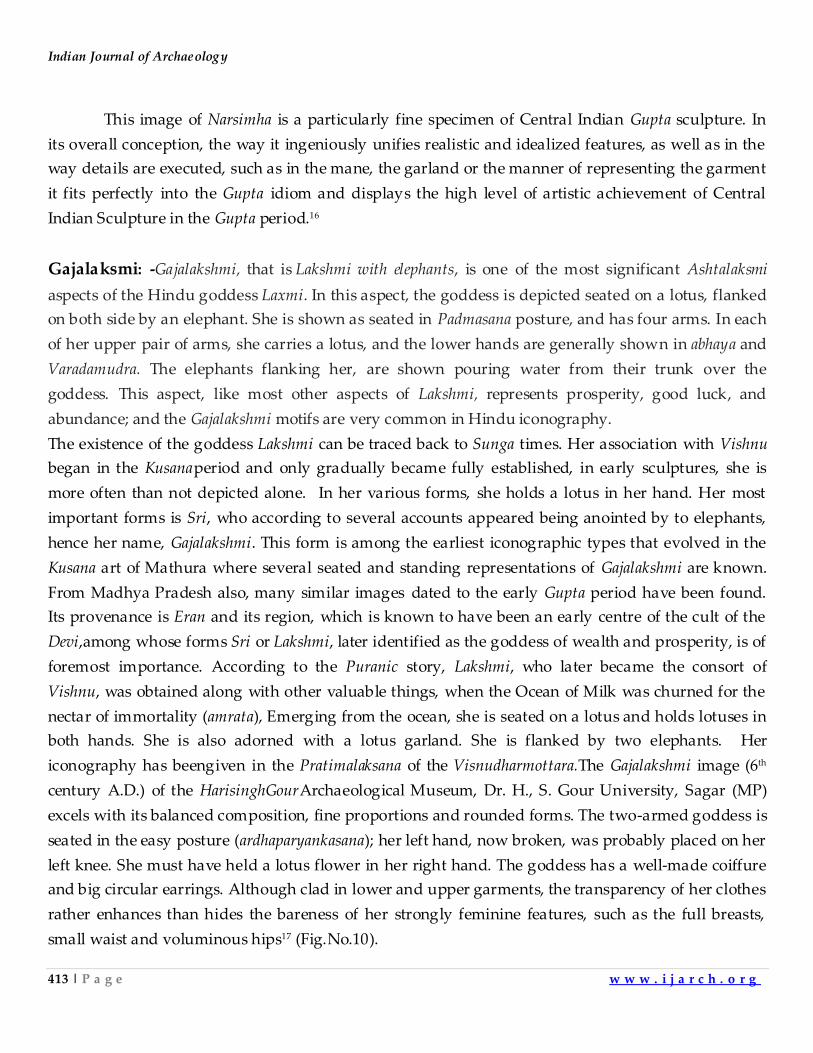
Indian Journal of Archaeology
413 | P a g e w w w . i j a r c h . o r g
This image of Narsimha is a particularly fine specimen of Central Indian Gupta sculpture. In
its overall conception, the way it ingeniously unifies realistic and idealized features, as well as in the
way details are executed, such as in the mane, the garland or the manner of representing the garment
it fits perfectly into the Gupta idiom and displays the high level of artistic achievement of Central
Indian Sculpture in the Gupta period.16
Gajalaksmi: -Gajalakshmi, that is Lakshmi with elephants, is one of the most significant Ashtalaksmi
aspects of the Hindu goddess Laxmi. In this aspect, the goddess is depicted seated on a lotus, flanked
on both side by an elephant. She is shown as seated in Padmasana posture, and has four arms. In each
of her upper pair of arms, she carries a lotus, and the lower hands are generally shown in abhaya and
Varadamudra. The elephants flanking her, are shown pouring water from their trunk over the
goddess. This aspect, like most other aspects of Lakshmi, represents prosperity, good luck, and
abundance; and the Gajalakshmi motifs are very common in Hindu iconography.
The existence of the goddess Lakshmi can be traced back to Sunga times. Her association with Vishnu
began in the Kusanaperiod and only gradually became fully established, in early sculptures, she is
more often than not depicted alone. In her various forms, she holds a lotus in her hand. Her most
important forms is Sri, who according to several accounts appeared being anointed by to elephants,
hence her name, Gajalakshmi. This form is among the earliest iconographic types that evolved in the
Kusana art of Mathura where several seated and standing representations of Gajalakshmi are known.
From Madhya Pradesh also, many similar images dated to the early Gupta period have been found.
Its provenance is Eran and its region, which is known to have been an early centre of the cult of the
Devi,among whose forms Sri or Lakshmi, later identified as the goddess of wealth and prosperity, is of
foremost importance. According to the Puranic story, Lakshmi, who later became the consort of
Vishnu, was obtained along with other valuable things, when the Ocean of Milk was churned for the
nectar of immortality (amrata), Emerging from the ocean, she is seated on a lotus and holds lotuses in
both hands. She is also adorned with a lotus garland. She is flanked by two elephants. Her
iconography has beengiven in the Pratimalaksana of the Visnudharmottara.The Gajalakshmi image (6th
century A.D.) of the HarisinghGourArchaeological Museum, Dr. H., S. Gour University, Sagar (MP)
excels with its balanced composition, fine proportions and rounded forms. The two-armed goddess is
seated in the easy posture (ardhaparyankasana); her left hand, now broken, was probably placed on her
left knee. She must have held a lotus flower in her right hand. The goddess has a well-made coiffure
and big circular earrings. Although clad in lower and upper garments, the transparency of her clothes
rather enhances than hides the bareness of her strongly feminine features, such as the full breasts,
small waist and voluminous hips17 (Fig.No.10).
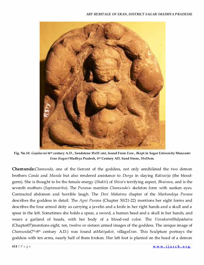
ART HERITAGE OF ERAN, DISTRICT SAGAR (MADHYA PRADESH)
414 | P a g e w w w . i j a r c h . o r g
Fig. No.10. Gajalaxmi (6th century A.D., Sandstone 35x35 cm), found From Eran , (Kept in Sagar University Museum)
Eran (Sagar) Madhya Pradesh, 4 th Century AD, Sand Stone, 35x35cm.
Chamunda:Chamunda, one of the fiercest of the goddess, not only annihilated the two demon
brothers Canda and Munda but also rendered assistance to Durga in slaying Raktavija (the blood-
germ). She is thought to be the female energy (Shakti) of Shiva’s terrifying aspect, Bhairava, and is the
seventh mothers (Saptamatrka). The Puranas mention Chamunda’s skeleton form with sunken eyes.
Contracted abdomen and horrible laugh. The Devi Mahatma chapter of the Markandeya Purana
describes the goddess in detail. The Agni Purana (Chapter 50/21-22) mentions her eight forms and
describes the four armed deity as carrying a javelin and a knife in her right hands and a skull and a
spear in the left. Sometimes she holds a spear, a sword, a human head and a skull in her hands, and
wears a garland of heads, with her body of a blood-red color. The VisvakarmShilpashatra
(Chapter07)mentions eight, ten, twelve or sixteen armed images of the goddess. The unique image of
Chamunda(7th-8th century A.D.) was found atMatiyakot, villageEran. This Sculpture portrays the
goddess with ten arms, nearly half of them broken. Her left foot is planted on the head of a demon
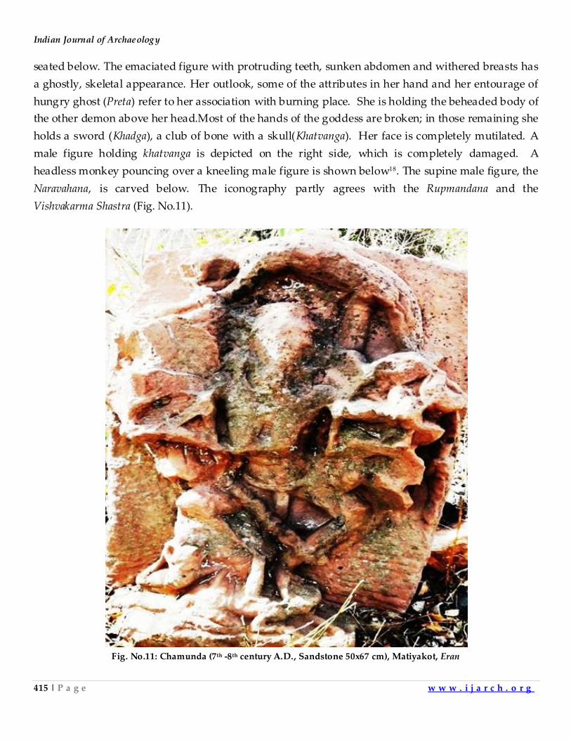
Indian Journal of Archaeology
415 | P a g e w w w . i j a r c h . o r g
seated below. The emaciated figure with protruding teeth, sunken abdomen and withered breasts has
a ghostly, skeletal appearance. Her outlook, some of the attributes in her hand and her entourage of
hungry ghost (Preta) refer to her association with burning place. She is holding the beheaded body of
the other demon above her head.Most of the hands of the goddess are broken; in those remaining she
holds a sword (Khadga), a club of bone with a skull(Khatvanga). Her face is completely mutilated. A
male figure holding khatvanga is depicted on the right side, which is completely damaged. A
headless monkey pouncing over a kneeling male figure is shown below18. The supine male figure, the
Naravahana, is carved below. The iconography partly agrees with the Rupmandana and the
Vishvakarma Shastra (Fig. No.11).
Fig. No.11: Chamunda (7th -8th century A.D., Sandstone 50x67 cm), Matiyakot, Eran
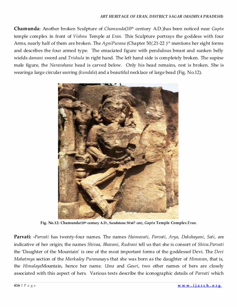
ART HERITAGE OF ERAN, DISTRICT SAGAR (MADHYA PRADESH)
416 | P a g e w w w . i j a r c h . o r g
Chamunda: Another broken Sculpture of Chamunda(10th century A.D.)has been noticed near Gupta
temple complex in front of Vishnu Temple at Eran. This Sculpture portrays the goddess with four
Arms, nearly half of them are broken. The AgniPurana (Chapter 50/,21-22 )19 mentions her eight forms
and describes the four armed type. The emaciated figure with pendulous breast and sunken belly
wields damani sword and Trishula in right hand. The left hand side is completely broken. The supine
male figure, the Naravahana head is carved below. Only his head remains, rest is broken. She is
wearinga large circular earring (kundala) and a beautiful necklace of large bead (Fig. No.12).
Fig. No.12: Chamunda(10th century A.D., Sandstone 50x67 cm), Gupta Temple Complex Eran.
Parvati: -Parvati has twenty-four names. The names Haimavati, Parvati, Arya, Dakshayani, Sati, are
indicative of her origin; the names Shivaa, Bhavani, Rudrani tell us that she is consort of Shiva.Parvati
the ‘Daughter of the Mountain’ is one of the most important forms of the goddessof Devi. The Devi
Mahatmya section of the Markadey Puranasays that she was born as the daughter of Himavan, that is,
the HimalayaMountain, hence her name. Uma and Gauri, two other names of hers are closely
associated with this aspect of hers. Various texts describe the iconographic details of Parvati which
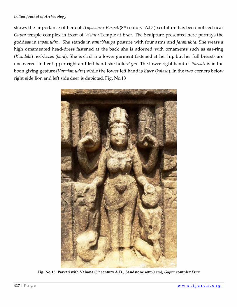
Indian Journal of Archaeology
417 | P a g e w w w . i j a r c h . o r g
shows the importance of her cult.Tapaswini Parvati(8th century A.D.) sculpture has been noticed near
Gupta temple complex in front of Vishnu Temple at Eran. The Sculpture presented here portrays the
goddess in tapamudra. She stands in samabhanga posture with four arms and Jatamukta. She wears a
high ornamented head-dress fastened at the back she is adorned with ornaments such as ear-ring
(Kundala) necklaces (hara). She is clad in a lower garment fastened at her hip but her full breasts are
uncovered. In her Upper right and left hand she holdsAgni. The lower right hand of Parvati is in the
boon giving gesture (Varadamudra) while the lower left hand is Ewer (kalash). In the two corners below
right side lion and left side deer is depicted. Fig. No.13
Fig. No.13: Parvati with Vahana (8th century A.D., Sandstone 40x60 cm), Gupta complex Eran
ART HERITAGE OF ERAN, DISTRICT SAGAR (MADHYA PRADESH)
418 | P a g e w w w . i j a r c h . o r g
Brahma: Brahma is one of the important gods of the Hindu pantheon. Brahman is the cause of
creation. Brahma is the creator that is called Svayambhu (Self-born).In the beginning, he was the
Hiranya-garbha. He is called Pitamaha (the Great Father). He is called Kamlasana since he sits on the
lotus which springs from the navel of Vishnu. Brahmasculpture is depicted with four faces and four
arms. Each face of his points to a cardinal direction. His hands hold no weapons, rather symbols of
knowledge and creation. In one hand he holds the sacred texts of Vedas, in second he
holds mala (rosary beads) symbolizing time, in third he holds a ladle symbolizing the instrument of
feeding sacrificial fire, and in fourth a utensil with water symbolizing the means where all creation
emanates from. His four mouths are credited with creating the four Vedas. He sits on lotus, with his
vehicle (Vahana) Hansanearby.Manasara-Shilpashastra recommends that the statue should have four
faces and four arms.Two of his hands should be in refuge granting and gift-giving mudra, while he
should be shown with kundika (water pot), akshamala (rosary), a small and a large sruk-sruva.
ABrahma(Medieval period) sculpture has been noticed inGupta temple complex in front of
Vishnutemple door at Eran. The sculpture depictssitting posture (Padmasana) with two arms and four
Faced. His hair are arranged, he wears large ornamental ear-rings. The right hand of Brahmaholds
Akshamalawhile the left hand has Ewer (Kamandala20)(Fig. No.14).
Fig. No.14:Image of Brahma (Medieval period, Sandstone 39x53 cm), Gupta complex Eran
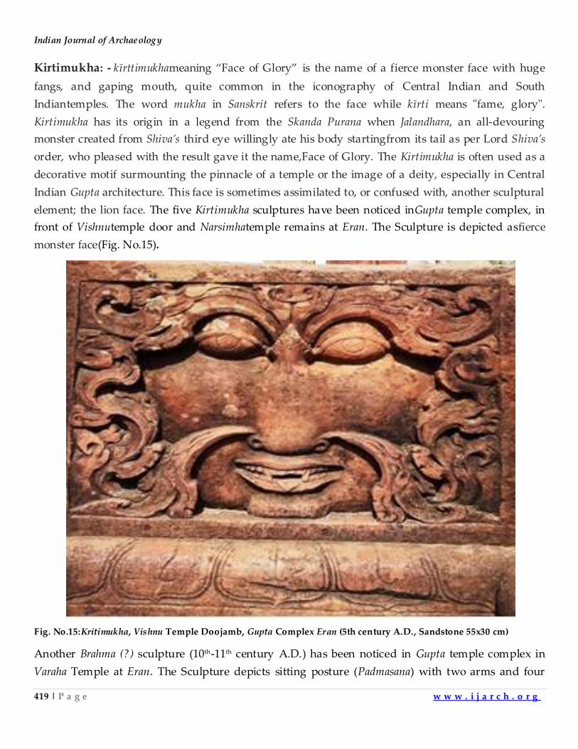
Indian Journal of Archaeology
419 | P a g e w w w . i j a r c h . o r g
Kirtimukha: - kīrttimukhameaning ‚Face of Glory‛ is the name of a fierce monster face with huge
fangs, and gaping mouth, quite common in the iconography of Central Indian and South
Indiantemples. The word mukha in Sanskrit refers to the face while kīrti means "fame, glory".
Kirtimukha has its origin in a legend from the Skanda Purana when Jalandhara, an all-devouring
monster created from Shiva’s third eye willingly ate his body startingfrom its tail as per Lord Shiva’s
order, who pleased with the result gave it the name,Face of Glory. The Kirtimukha is often used as a
decorative motif surmounting the pinnacle of a temple or the image of a deity, especially in Central
Indian Gupta architecture. This face is sometimes assimilated to, or confused with, another sculptural
element; the lion face. The five Kirtimukha sculptures have been noticed inGupta temple complex, in
front of Vishnutemple door and Narsimhatemple remains at Eran. The Sculpture is depicted asfierce
monster face(Fig. No.15).
Fig. No.15:Kritimukha, Vishnu Temple Doojamb, Gupta Complex Eran (5th century A.D., Sandstone 55x30 cm)
Another Brahma (?) sculpture (10th-11th century A.D.) has been noticed in Gupta temple complex in
Varaha Temple at Eran. The Sculpture depicts sitting posture (Padmasana) with two arms and four
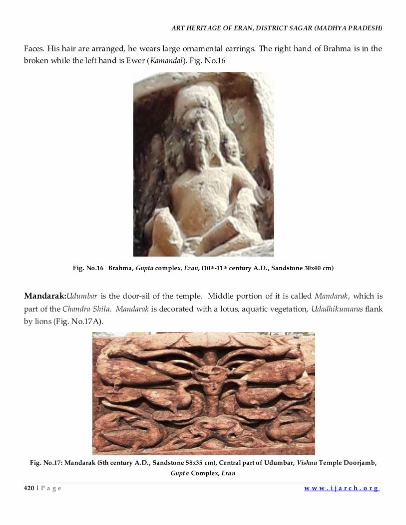
ART HERITAGE OF ERAN, DISTRICT SAGAR (MADHYA PRADESH)
420 | P a g e w w w . i j a r c h . o r g
Faces. His hair are arranged, he wears large ornamental earrings. The right hand of Brahma is in the
broken while the left hand is Ewer (Kamandal). Fig. No.16
Fig. No.16 Brahma, Gupta complex, Eran, (10th-11th century A.D., Sandstone 30x40 cm)
Mandarak:Udumbar is the door-sil of the temple. Middle portion of it is called Mandarak, which is
part of the Chandra Shila. Mandarak is decorated with a lotus, aquatic vegetation, Udadhikumaras flank
by lions (Fig. No.17A).
Fig. No.17: Mandarak (5th century A.D., Sandstone 58x35 cm), Central part of Udumbar, Vishnu Temple Doorjamb,
Gupta Complex, Eran
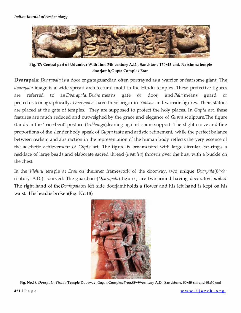
Indian Journal of Archaeology
421 | P a g e w w w . i j a r c h . o r g
Fig. 17: Central part of Udumbar With lion (5th century A.D., Sandstone 170x45 cm), Narsimha temple
doorjamb,Gupta Complex Eran
Dvarapala: Dvarapala is a door or gate guardian often portrayed as a warrior or fearsome giant. The
dvarapala image is a wide spread architectural motif in the Hindu temples. These protective figures
are referred to as Dvarapala. Dvara means gate or door, and Pala means guard or
protector.Iconographically, Dvarapalas have their origin in Yaksha and warrior figures. Their statues
are placed at the gate of temples. They are supposed to protect the holy places. In Gupta art, these
features are much reduced and outweighed by the grace and elegance of Gupta sculpture.The figure
stands in the ‘trice-bent’ posture (tribhanga),leaning against some support. The slight curve and fine
proportions of the slender body speak of Gupta taste and artistic refinement, while the perfect balance
between realism and abstraction in the representation of the human body reflects the very essence of
the aesthetic achievement of Gupta art. The figure is ornamented with large circular ear-rings, a
necklace of large beads and elaborate sacred thread (upavita) thrown over the bust with a buckle on
the chest.
In the Vishnu temple at Eran,on theinner framework of the doorway, two unique Dvarpala(8th-9th
century A.D.) iscarved. The guardian (Dvarapala) figures; are two-armed having decorative mukut.
The right hand of theDvarapalaon left side doorjambholds a flower and his left hand is kept on his
waist. His head is broken(Fig. No.18)
Fig. No.18: Dvarpala, Vishnu Temple Doorway, Gupta Complex Eran,(8th-9 thcentury A.D., Sandstone, 80x40 cm and 90x50 cm)
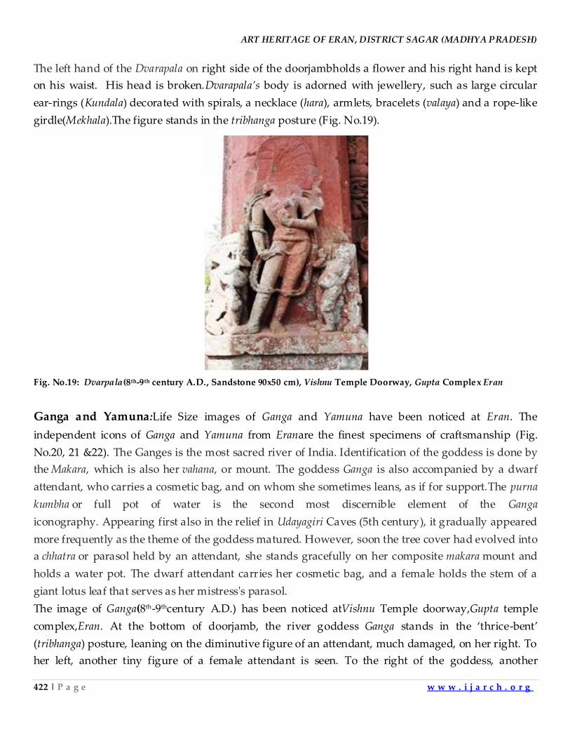
ART HERITAGE OF ERAN, DISTRICT SAGAR (MADHYA PRADESH)
422 | P a g e w w w . i j a r c h . o r g
The left hand of the Dvarapala on right side of the doorjambholds a flower and his right hand is kept
on his waist. His head is broken.Dvarapala’s body is adorned with jewellery, such as large circular
ear-rings (Kundala) decorated with spirals, a necklace (hara), armlets, bracelets (valaya) and a rope-like
girdle(Mekhala).The figure stands in the tribhanga posture (Fig. No.19).
Fig. No.19: Dvarpala(8th-9th century A.D., Sandstone 90x50 cm), Vishnu Temple Doorway, Gupta Complex Eran
Ganga and Yamuna:Life Size images of Ganga and Yamuna have been noticed at Eran. The
independent icons of Ganga and Yamuna from Eranare the finest specimens of craftsmanship (Fig.
No.20, 21 &22). The Ganges is the most sacred river of India. Identification of the goddess is done by
the Makara, which is also her vahana, or mount. The goddess Ganga is also accompanied by a dwarf
attendant, who carries a cosmetic bag, and on whom she sometimes leans, as if for support.The purna
kumbha or full pot of water is the second most discernible element of the Ganga
iconography. Appearing first also in the relief in Udayagiri Caves (5th century), it gradually appeared
more frequently as the theme of the goddess matured. However, soon the tree cover had evolved into
a chhatra or parasol held by an attendant, she stands gracefully on her composite makara mount and
holds a water pot. The dwarf attendant carries her cosmetic bag, and a female holds the stem of a
giant lotus leaf that serves as her mistress's parasol.
The image of Ganga(8th-9thcentury A.D.) has been noticed atVishnu Temple doorway,Gupta temple
complex,Eran. At the bottom of doorjamb, the river goddess Ganga stands in the ‘thrice-bent’
(tribhanga) posture, leaning on the diminutive figure of an attendant, much damaged, on her right. To
her left, another tiny figure of a female attendant is seen. To the right of the goddess, another
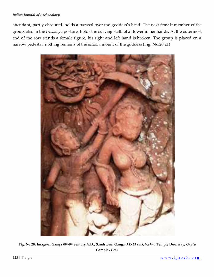
Indian Journal of Archaeology
423 | P a g e w w w . i j a r c h . o r g
attendant, partly obscured, holds a parasol over the goddess’s head. The next female member of the
group, also in the tribhanga posture, holds the curving stalk of a flower in her hands. At the outermost
end of the row stands a female figure, his right and left hand is broken. The group is placed on a
narrow pedestal; nothing remains of the makara mount of the goddess (Fig. No.20,21)
Fig. No.20: Image of Ganga (8th-9th century A.D., Sandstone, Ganga (78X55 cm), Vishnu Temple Doorway, Gupta
Complex Eran
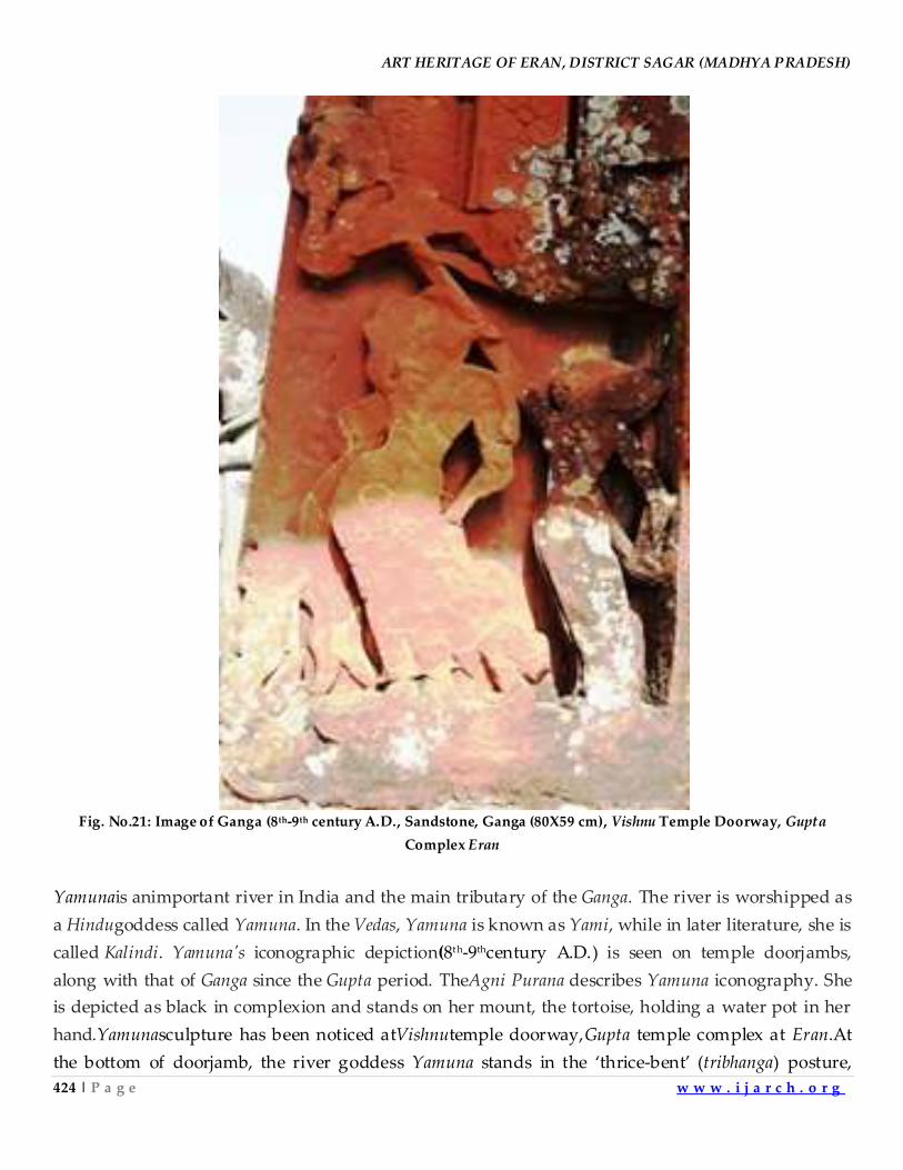
ART HERITAGE OF ERAN, DISTRICT SAGAR (MADHYA PRADESH)
424 | P a g e w w w . i j a r c h . o r g
Fig. No.21: Image of Ganga (8th-9th century A.D., Sandstone, Ganga (80X59 cm), Vishnu Temple Doorway, Gupta
Complex Eran
Yamunais animportant river in India and the main tributary of the Ganga. The river is worshipped as
a Hindugoddess called Yamuna. In the Vedas, Yamuna is known as Yami, while in later literature, she is
called Kalindi. Yamuna's iconographic depiction(8th-9thcentury A.D.) is seen on temple doorjambs,
along with that of Ganga since the Gupta period. TheAgni Purana describes Yamuna iconography. She
is depicted as black in complexion and stands on her mount, the tortoise, holding a water pot in her
hand.Yamunasculpture has been noticed atVishnutemple doorway,Gupta temple complex at Eran.At
the bottom of doorjamb, the river goddess Yamuna stands in the ‘thrice-bent’ (tribhanga) posture,
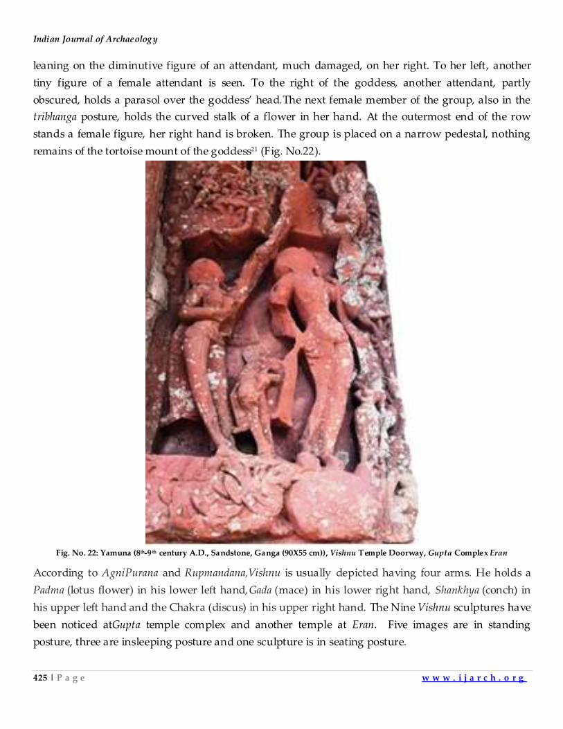
Indian Journal of Archaeology
425 | P a g e w w w . i j a r c h . o r g
leaning on the diminutive figure of an attendant, much damaged, on her right. To her left, another
tiny figure of a female attendant is seen. To the right of the goddess, another attendant, partly
obscured, holds a parasol over the goddess’ head.The next female member of the group, also in the
tribhanga posture, holds the curved stalk of a flower in her hand. At the outermost end of the row
stands a female figure, her right hand is broken. The group is placed on a narrow pedestal, nothing
remains of the tortoise mount of the goddess21 (Fig. No.22).
Fig. No. 22: Yamuna (8th-9 th century A.D., Sandstone, Ganga (90X55 cm)), Vishnu Temple Doorway, Gupta Complex Eran
According to AgniPurana and Rupmandana,Vishnu is usually depicted having four arms. He holds a
Padma (lotus flower) in his lower left hand,Gada (mace) in his lower right hand, Shankhya (conch) in
his upper left hand and the Chakra (discus) in his upper right hand. The Nine Vishnu sculptures have
been noticed atGupta temple complex and another temple at Eran. Five images are in standing
posture, three are insleeping posture and one sculpture is in seating posture.
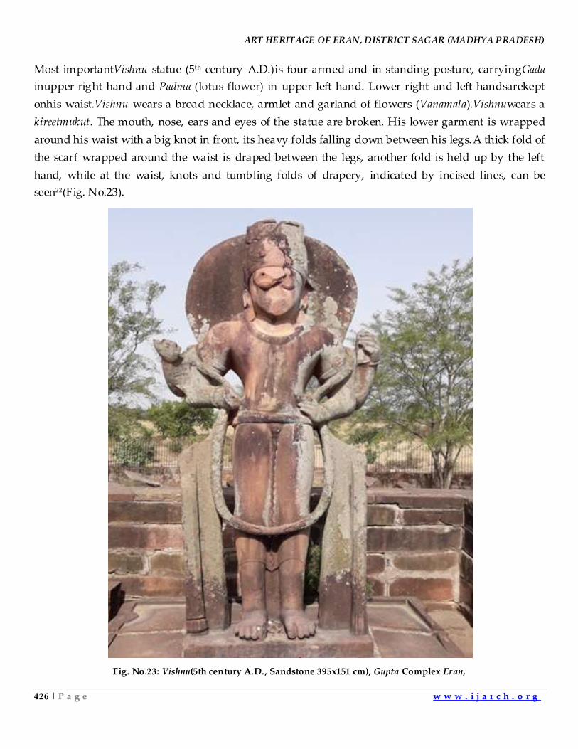
ART HERITAGE OF ERAN, DISTRICT SAGAR (MADHYA PRADESH)
426 | P a g e w w w . i j a r c h . o r g
Most importantVishnu statue (5th century A.D.)is four-armed and in standing posture, carryingGada
inupper right hand and Padma (lotus flower) in upper left hand. Lower right and left handsarekept
onhis waist.Vishnu wears a broad necklace, armlet and garland of flowers (Vanamala).Vishnuwears a
kireetmukut. The mouth, nose, ears and eyes of the statue are broken. His lower garment is wrapped
around his waist with a big knot in front, its heavy folds falling down between his legs.A thick fold of
the scarf wrapped around the waist is draped between the legs, another fold is held up by the left
hand, while at the waist, knots and tumbling folds of drapery, indicated by incised lines, can be
seen22(Fig. No.23).
Fig. No.23: Vishnu(5th century A.D., Sandstone 395x151 cm), Gupta Complex Eran,
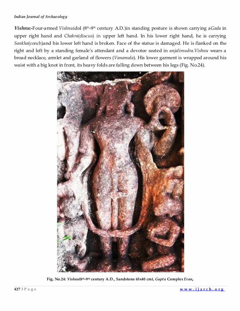
Indian Journal of Archaeology
427 | P a g e w w w . i j a r c h . o r g
Vishnu:-Four-armed Vishnuidol (8th-9th century A.D.)in standing posture is shown carrying aGada in
upper right hand and Chakra(discus) in upper left hand. In his lower right hand, he is carrying
Sankha(conch)and his lower left hand is broken. Face of the statue is damaged. He is flanked on the
right and left by a standing female’s attendant and a devotee seated in anjalimudra.Vishnu wears a
broad necklace, armlet and garland of flowers (Vanamala). His lower garment is wrapped around his
waist with a big knot in front, its heavy folds are falling down between his legs (Fig. No.24).
Fig. No.24: Vishnu(8th-9th century A.D., Sandstone 65x40 cm), Gupta Complex Eran,
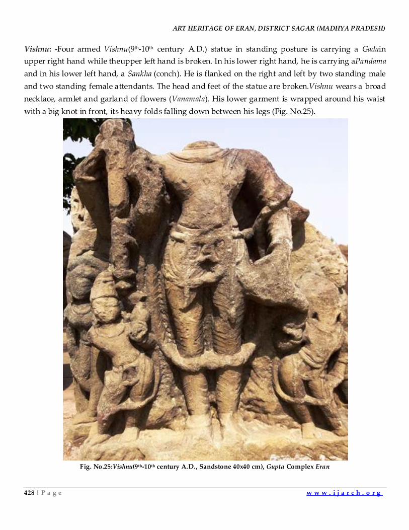
ART HERITAGE OF ERAN, DISTRICT SAGAR (MADHYA PRADESH)
428 | P a g e w w w . i j a r c h . o r g
Vishnu: -Four armed Vishnu(9th-10th century A.D.) statue in standing posture is carrying a Gadain
upper right hand while theupper left hand is broken. In his lower right hand, he is carrying aPandama
and in his lower left hand, a Sankha (conch). He is flanked on the right and left by two standing male
and two standing female attendants. The head and feet of the statue are broken.Vishnu wears a broad
necklace, armlet and garland of flowers (Vanamala). His lower garment is wrapped around his waist
with a big knot in front, its heavy folds falling down between his legs (Fig. No.25).
Fig. No.25:Vishnu(9th-10th century A.D., Sandstone 40x40 cm), Gupta Complex Eran
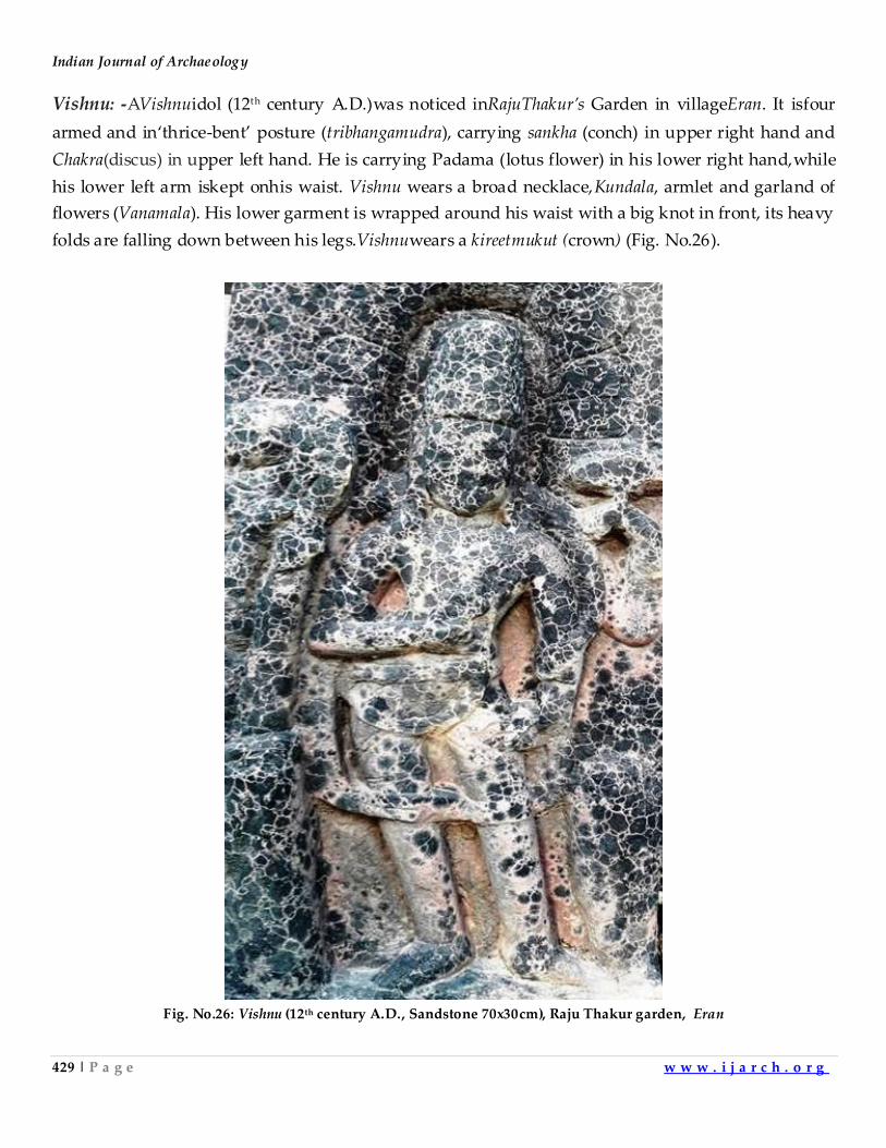
Indian Journal of Archaeology
429 | P a g e w w w . i j a r c h . o r g
Vishnu: -AVishnuidol (12th century A.D.)was noticed inRajuThakur’s Garden in villageEran. It isfour
armed and in‘thrice-bent’ posture (tribhangamudra), carrying sankha (conch) in upper right hand and
Chakra(discus) in upper left hand. He is carrying Padama (lotus flower) in his lower right hand,while
his lower left arm iskept onhis waist. Vishnu wears a broad necklace,Kundala, armlet and garland of
flowers (Vanamala). His lower garment is wrapped around his waist with a big knot in front, its heavy
folds are falling down between his legs.Vishnuwears a kireetmukut (crown) (Fig. No.26).
Fig. No.26: Vishnu (12th century A.D., Sandstone 70x30cm), Raju Thakur garden, Eran
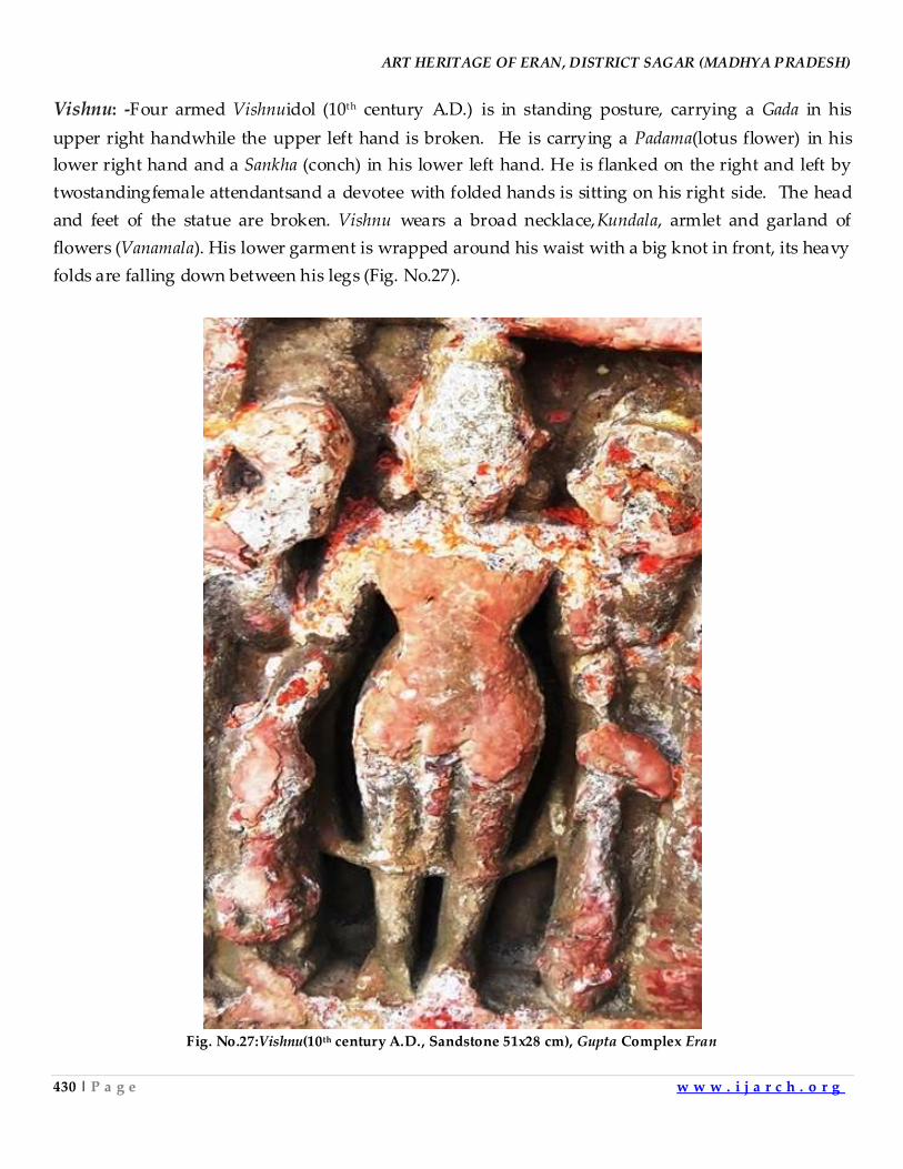
ART HERITAGE OF ERAN, DISTRICT SAGAR (MADHYA PRADESH)
430 | P a g e w w w . i j a r c h . o r g
Vishnu: -Four armed Vishnuidol (10th century A.D.) is in standing posture, carrying a Gada in his
upper right handwhile the upper left hand is broken. He is carrying a Padama(lotus flower) in his
lower right hand and a Sankha (conch) in his lower left hand. He is flanked on the right and left by
twostandingfemale attendantsand a devotee with folded hands is sitting on his right side. The head
and feet of the statue are broken. Vishnu wears a broad necklace,Kundala, armlet and garland of
flowers (Vanamala). His lower garment is wrapped around his waist with a big knot in front, its heavy
folds are falling down between his legs (Fig. No.27).
Fig. No.27:Vishnu(10th century A.D., Sandstone 51x28 cm), Gupta Complex Eran
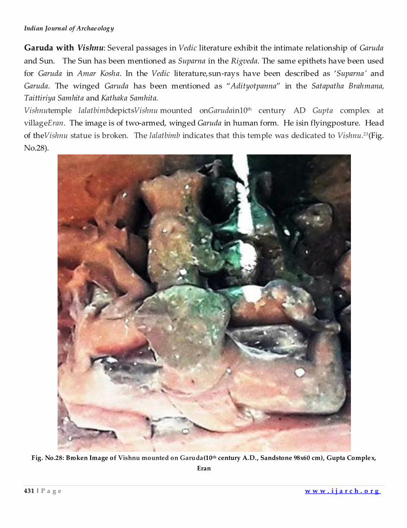
Indian Journal of Archaeology
431 | P a g e w w w . i j a r c h . o r g
Garuda with Vishnu: Several passages in Vedic literature exhibit the intimate relationship of Garuda
and Sun. The Sun has been mentioned as Suparna in the Rigveda. The same epithets have been used
for Garuda in Amar Kosha. In the Vedic literature,sun-rays have been described as ‘Suparna’ and
Garuda. The winged Garuda has been mentioned as ‚Adityotpanna‛ in the Satapatha Brahmana,
Taittiriya Samhita and Kathaka Samhita.
Vishnutemple lalatbimbdepictsVishnu mounted onGarudain10th century AD Gupta complex at
villageEran. The image is of two-armed, winged Garuda in human form. He isin flyingposture. Head
of theVishnu statue is broken. The lalatbimb indicates that this temple was dedicated to Vishnu.23(Fig.
No.28).
Fig. No.28: Broken Image of Vishnu mounted on Garuda(10th century A.D., Sandstone 98x60 cm), Gupta Complex,
Eran
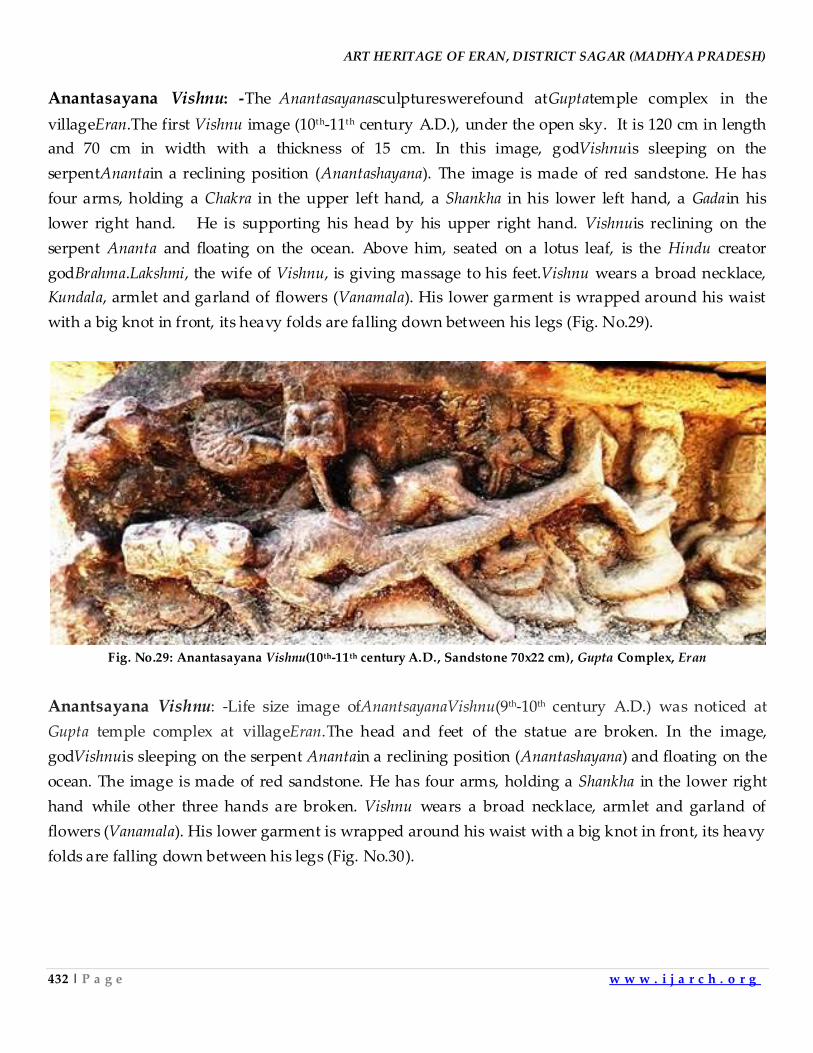
ART HERITAGE OF ERAN, DISTRICT SAGAR (MADHYA PRADESH)
432 | P a g e w w w . i j a r c h . o r g
Anantasayana Vishnu: -The Anantasayanasculptureswerefound atGuptatemple complex in the
villageEran.The first Vishnu image (10th-11th century A.D.), under the open sky. It is 120 cm in length
and 70 cm in width with a thickness of 15 cm. In this image, godVishnuis sleeping on the
serpentAnantain a reclining position (Anantashayana). The image is made of red sandstone. He has
four arms, holding a Chakra in the upper left hand, a Shankha in his lower left hand, a Gadain his
lower right hand. He is supporting his head by his upper right hand. Vishnuis reclining on the
serpent Ananta and floating on the ocean. Above him, seated on a lotus leaf, is the Hindu creator
godBrahma.Lakshmi, the wife of Vishnu, is giving massage to his feet.Vishnu wears a broad necklace,
Kundala, armlet and garland of flowers (Vanamala). His lower garment is wrapped around his waist
with a big knot in front, its heavy folds are falling down between his legs (Fig. No.29).
Fig. No.29: Anantasayana Vishnu(10th-11th century A.D., Sandstone 70x22 cm), Gupta Complex, Eran
Anantsayana Vishnu: -Life size image ofAnantsayanaVishnu(9th-10th century A.D.) was noticed at
Gupta temple complex at villageEran.The head and feet of the statue are broken. In the image,
godVishnuis sleeping on the serpent Anantain a reclining position (Anantashayana) and floating on the
ocean. The image is made of red sandstone. He has four arms, holding a Shankha in the lower right
hand while other three hands are broken. Vishnu wears a broad necklace, armlet and garland of
flowers (Vanamala). His lower garment is wrapped around his waist with a big knot in front, its heavy
folds are falling down between his legs (Fig. No.30).
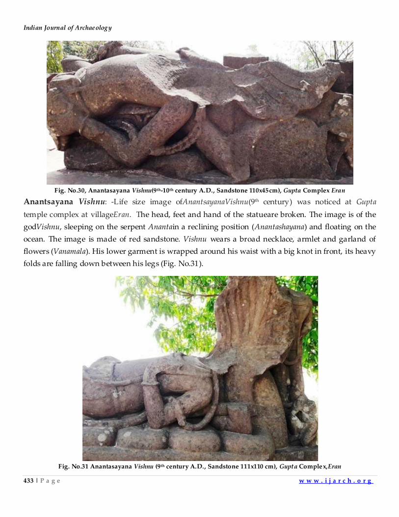
Indian Journal of Archaeology
433 | P a g e w w w . i j a r c h . o r g
Fig. No.30, Anantasayana Vishnu(9th-10th century A.D., Sandstone 110x45cm), Gupta Complex Eran
Anantsayana Vishnu: -Life size image ofAnantsayanaVishnu(9th century) was noticed at Gupta
temple complex at villageEran. The head, feet and hand of the statueare broken. The image is of the
godVishnu, sleeping on the serpent Anantain a reclining position (Anantashayana) and floating on the
ocean. The image is made of red sandstone. Vishnu wears a broad necklace, armlet and garland of
flowers (Vanamala). His lower garment is wrapped around his waist with a big knot in front, its heavy
folds are falling down between his legs (Fig. No.31).
Fig. No.31 Anantasayana Vishnu (9th century A.D., Sandstone 111x110 cm), Gupta Complex,Eran
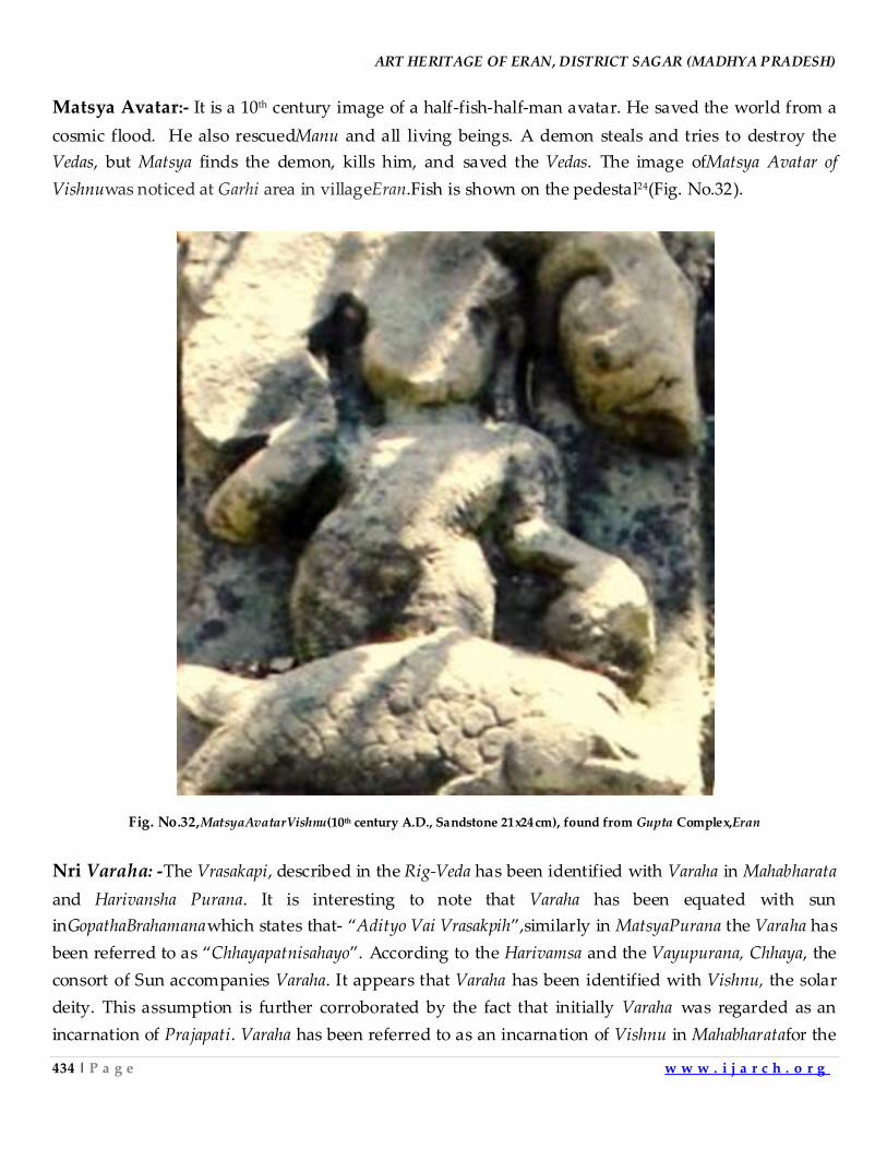
ART HERITAGE OF ERAN, DISTRICT SAGAR (MADHYA PRADESH)
434 | P a g e w w w . i j a r c h . o r g
Matsya Avatar:- It is a 10th century image of a half-fish-half-man avatar. He saved the world from a
cosmic flood. He also rescuedManu and all living beings. A demon steals and tries to destroy the
Vedas, but Matsya finds the demon, kills him, and saved the Vedas. The image ofMatsya Avatar of
Vishnuwas noticed at Garhi area in villageEran.Fish is shown on the pedestal24(Fig. No.32).
Fig. No.32,MatsyaAvatarVishnu(10th century A.D., Sandstone 21x24cm), found from Gupta Complex,Eran
Nri Varaha: -The Vrasakapi, described in the Rig-Veda has been identified with Varaha in Mahabharata
and Harivansha Purana. It is interesting to note that Varaha has been equated with sun
inGopathaBrahamanawhich states that- ‚Adityo Vai Vrasakpih‛,similarly in MatsyaPurana the Varaha has
been referred to as ‚Chhayapatnisahayo‛. According to the Harivamsa and the Vayupurana, Chhaya, the
consort of Sun accompanies Varaha. It appears that Varaha has been identified with Vishnu, the solar
deity. This assumption is further corroborated by the fact that initially Varaha was regarded as an
incarnation of Prajapati. Varaha has been referred to as an incarnation of Vishnu in Mahabharatafor the
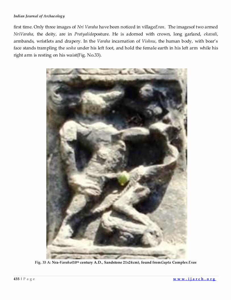
Indian Journal of Archaeology
435 | P a g e w w w . i j a r c h . o r g
first time. Only three images of Nri Varaha have been noticed in villageEran. The imagesof two armed
NriVaraha, the deity, are in Pratyalidaposture. He is adorned with crown, long garland, ekavali,
armbands, wristlets and drapery. In the Varaha incarnation of Vishnu, the human body, with boar’s
face stands trampling the sesha under his left foot, and hold the female earth in his left arm while his
right arm is resting on his waist(Fig. No.33).
Fig. 33 A: Nra-Varaha(10th century A.D., Sandstone 21x24cm), found fromGupta Complex Eran
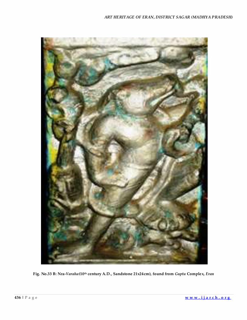
ART HERITAGE OF ERAN, DISTRICT SAGAR (MADHYA PRADESH)
436 | P a g e w w w . i j a r c h . o r g
Fig. No.33 B: Nra-Varaha(10th century A.D., Sandstone 21x24cm), found from Gupta Complex, Eran
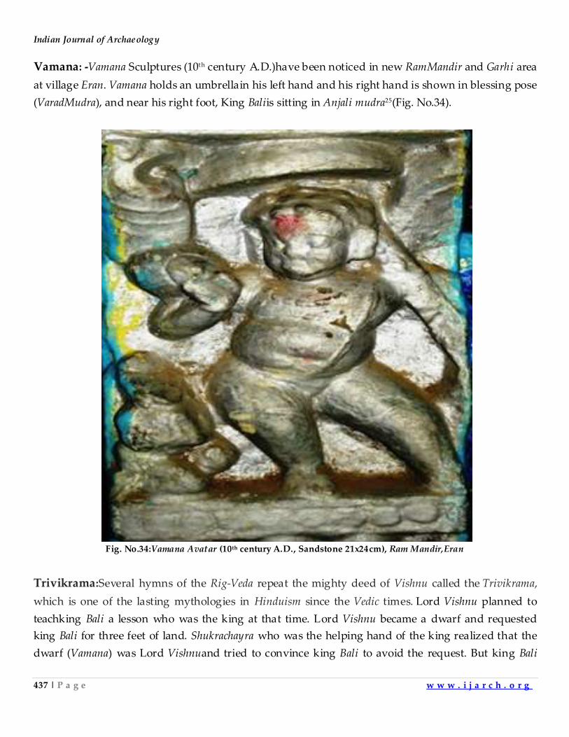
Indian Journal of Archaeology
437 | P a g e w w w . i j a r c h . o r g
Vamana: -Vamana Sculptures (10th century A.D.)have been noticed in new RamMandir and Garhi area
at village Eran. Vamana holds an umbrellain his left hand and his right hand is shown in blessing pose
(VaradMudra), and near his right foot, King Baliis sitting in Anjali mudra25(Fig. No.34).
Fig. No.34:Vamana Avatar (10th century A.D., Sandstone 21x24cm), Ram Mandir,Eran
Trivikrama:Several hymns of the Rig-Veda repeat the mighty deed of Vishnu called the Trivikrama,
which is one of the lasting mythologies in Hinduism since the Vedic times. Lord Vishnu planned to
teachking Bali a lesson who was the king at that time. Lord Vishnu became a dwarf and requested
king Bali for three feet of land. Shukrachayra who was the helping hand of the king realized that the
dwarf (Vamana) was Lord Vishnuand tried to convince king Bali to avoid the request. But king Bali
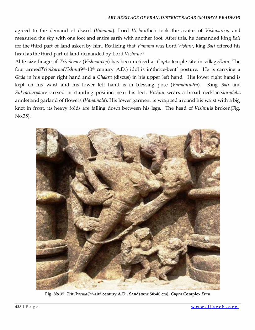
ART HERITAGE OF ERAN, DISTRICT SAGAR (MADHYA PRADESH)
438 | P a g e w w w . i j a r c h . o r g
agreed to the demand of dwarf (Vamana). Lord Vishnuthen took the avatar of Vishwaroop and
measured the sky with one foot and entire earth with another foot. After this, he demanded king Bali
for the third part of land asked by him. Realizing that Vamana was Lord Vishnu, king Bali offered his
head as the third part of land demanded by Lord Vishnu.26
Alife size Image of Trivikama (Vishwaroop) has been noticed at Gupta temple site in villageEran. The
four armedTrivikarmaVishnu(9th-10th century A.D.) idol is in‘thrice-bent’ posture. He is carrying a
Gada in his upper right hand and a Chakra (discus) in his upper left hand. His lower right hand is
kept on his waist and his lower left hand is in blessing pose (Varadmudra). King Bali and
Sukracharyaare carved in standing position near his feet. Vishnu wears a broad necklace,kundala,
armlet and garland of flowers (Vanamala). His lower garment is wrapped around his waist with a big
knot in front, its heavy folds are falling down between his legs. The head of Vishnuis broken(Fig.
No.35).
Fig. No.35: Trivikarma(9th-10th century A.D., Sandstone 50x40 cm), Gupta Complex Eran
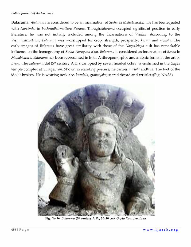
Indian Journal of Archaeology
439 | P a g e w w w . i j a r c h . o r g
Balarama: -Balarama is considered to be an incarnation of Sesha in Mahabharata. He has beenequated
with Narsimha in Vishnudharmottara Purana. ThoughBalarama occupied significant position in early
literature, he was not initially included among the incarnations of Vishnu. According to the
Visnudharmottara, Balarama was worshipped for crop, strength, prosperity, karma and moksha. The
early images of Balarama have great similarity with those of the Nagas.Naga cult has remarkable
influence on the iconography of Sesha-Narayana also. Balarama is considered as incarnation of Sesha in
Mahabharata. Balarama has been represented in both Anthropomorphic and anionic forms in the art of
Eran. The Balaramaidol (5th century A.D.), canopied by seven hooded cobra, is enshrined in the Gupta
temple complex at villageEran. Shown in standing posture, he carries musala andhala. The foot of the
idol is broken. He is wearing necklace, kundala, graiveyaka, sacred thread and wristlets(Fig. No.36).
Fig. No.36: Balarama (5th century A.D., 30x40 cm), Gupta Complex Eran
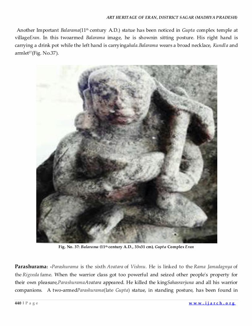
ART HERITAGE OF ERAN, DISTRICT SAGAR (MADHYA PRADESH)
440 | P a g e w w w . i j a r c h . o r g
Another Important Balarama(11th century A.D.) statue has been noticed in Gupta complex temple at
villageEran. In this twoarmed Balarama image, he is shownin sitting posture. His right hand is
carrying a drink pot while the left hand is carryingahala.Balarama wears a broad necklace, Kundla and
armlet27(Fig. No.37).
Fig. No. 37: Balarama (11th century A.D., 33x31 cm), Gupta Complex Eran
Parashurama: -Parashurama is the sixth Avatara of Vishnu. He is linked to the Rama Jamadagnya of
the Rigveda fame. When the warrior class got too powerful and seized other people's property for
their own pleasure,ParashuramaAvatara appeared. He killed the kingSahasrarjuna and all his warrior
companions. A two-armedParashurama(late Gupta) statue, in standing posture, has been found in
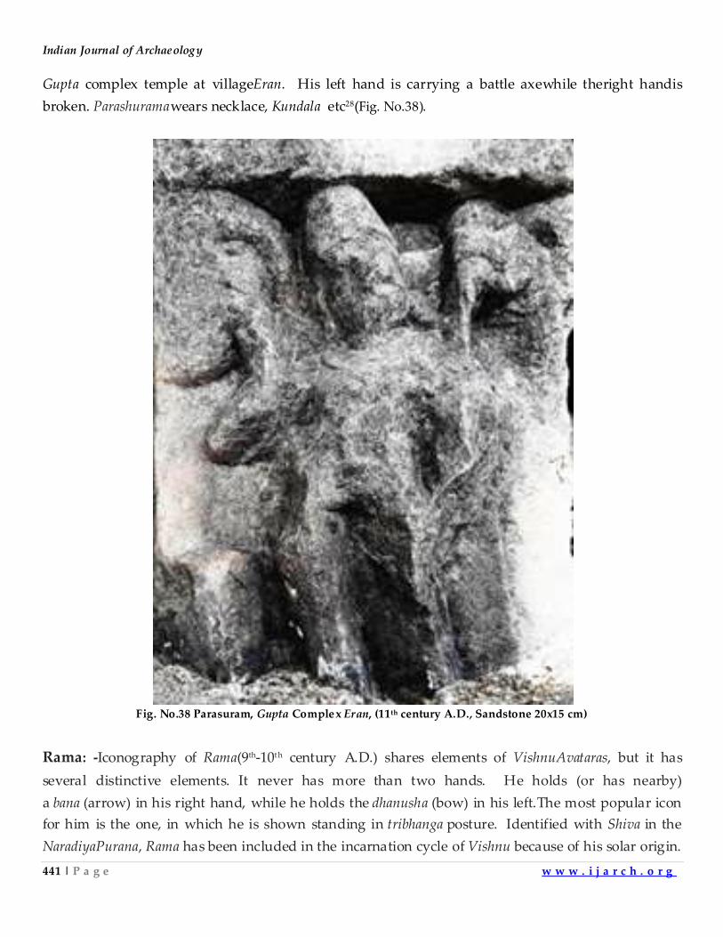
Indian Journal of Archaeology
441 | P a g e w w w . i j a r c h . o r g
Gupta complex temple at villageEran. His left hand is carrying a battle axewhile theright handis
broken. Parashuramawears necklace, Kundala etc28(Fig. No.38).
Fig. No.38 Parasuram, Gupta Complex Eran, (11th century A.D., Sandstone 20x15 cm)
Rama: -Iconography of Rama(9th-10th century A.D.) shares elements of VishnuAvataras, but it has
several distinctive elements. It never has more than two hands. He holds (or has nearby)
a bana (arrow) in his right hand, while he holds the dhanusha (bow) in his left.The most popular icon
for him is the one, in which he is shown standing in tribhanga posture. Identified with Shiva in the
NaradiyaPurana, Rama has been included in the incarnation cycle of Vishnu because of his solar origin.
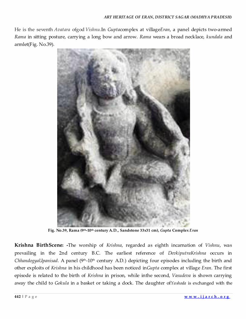
ART HERITAGE OF ERAN, DISTRICT SAGAR (MADHYA PRADESH)
442 | P a g e w w w . i j a r c h . o r g
He is the seventh Avatara ofgod Vishnu.In Guptacomplex at villageEran, a panel depicts two-armed
Rama in sitting posture, carrying a long bow and arrow. Rama wears a broad necklace, kundala and
armlet(Fig. No.39).
Fig. No.39, Rama (9th-10th century A.D., Sandstone 33x31 cm), Gupta Complex Eran
Krishna BirthScene: -The worship of Krishna, regarded as eighth incarnation of Vishnu, was
prevailing in the 2nd century B.C. The earliest reference of DevkiputraKrishna occurs in
ChhandogyaUpanisad. A panel (9th-10th century A.D.) depicting four episodes including the birth and
other exploits of Krishna in his childhood has been noticed inGupta complex at village Eran. The first
episode is related to the birth of Krishna in prison, while inthe second, Vasudeva is shown carrying
away the child to Gokula in a basket or taking a dock. The daughter ofYashoda is exchanged with the
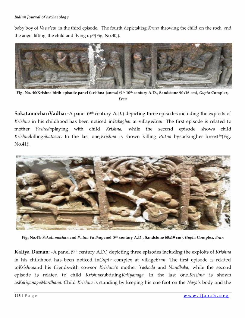
Indian Journal of Archaeology
443 | P a g e w w w . i j a r c h . o r g
baby boy of Vasudeva in the third episode. The fourth depictsking Kansa throwing the child on the rock, and
the angel lifting the child and flying up29(Fig. No.40,).
Fig. No. 40:Krishna birth episode panel (krishna janma) (9th-10th century A.D., Sandstone 90x16 cm), Gupta Complex,
Eran
SakatamochanVadha: -A panel (9th century A.D.) depicting three episodes including the exploits of
Krishna in his childhood has been noticed inBabaghat at villageEran. The first episode is related to
mother Yashodaplaying with child Krishna, while the second episode shows child
KrishnakillingSkatasur. In the last one,Krishna is shown killing Putna bysuckingher breast30(Fig.
No.41).
Fig. No.41: Sakatamochan and Putna Vadhapanel (9th century A.D., Sandstone 60x19 cm), Gupta Complex, Eran
Kaliya Daman: -A panel (9th century A.D.) depicting three episodes including the exploits of Krishna
in his childhood has been noticed inGupta complex at villageEran. The first episode is related
toKrishnaand his friendswith cowsor Krishna’s mother Yashoda and Nandbaba, while the second
episode is related to child KrishnasubduingKaliyanaga. In the last one,Krishna is shown
asKaliyanagaMardhana. Child Krishna is standing by keeping his one foot on the Naga’s body and the
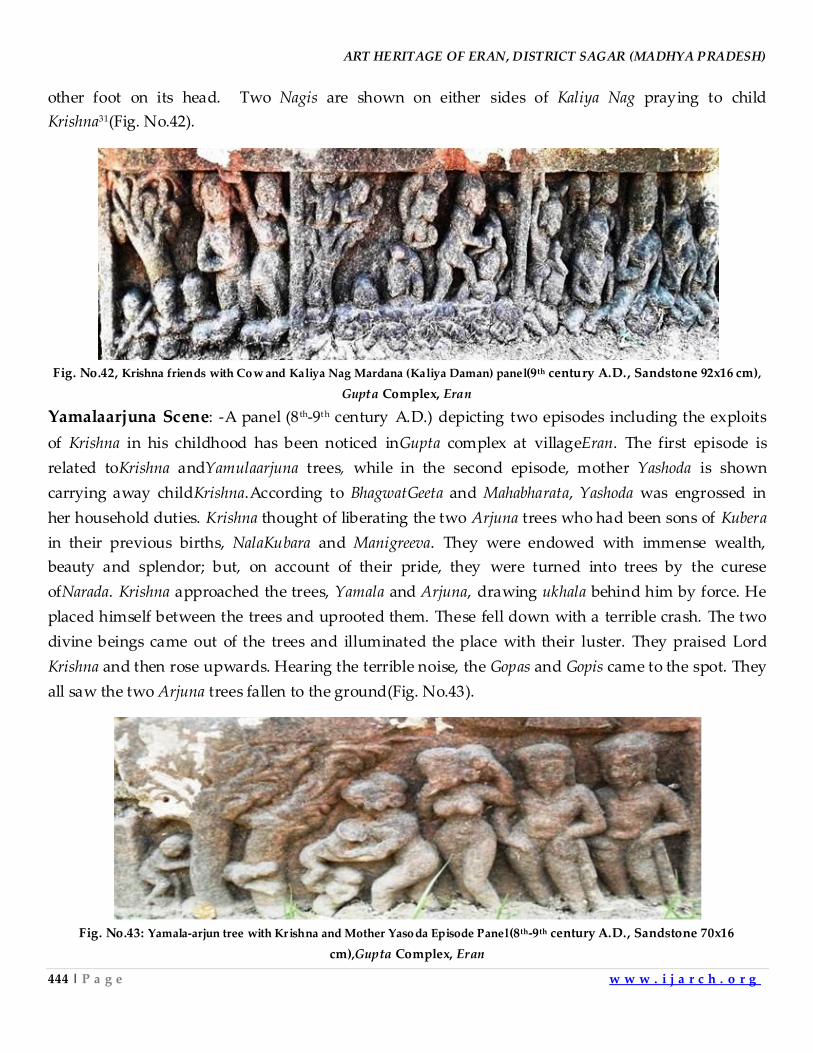
ART HERITAGE OF ERAN, DISTRICT SAGAR (MADHYA PRADESH)
444 | P a g e w w w . i j a r c h . o r g
other foot on its head. Two Nagis are shown on either sides of Kaliya Nag praying to child
Krishna31(Fig. No.42).
Fig. No.42, Krishna friends with Cow and Kaliya Nag Mardana (Kaliya Daman) panel(9th century A.D., Sandstone 92x16 cm),
Gupta Complex, Eran
Yamalaarjuna Scene: -A panel (8 th-9th century A.D.) depicting two episodes including the exploits
of Krishna in his childhood has been noticed inGupta complex at villageEran. The first episode is
related toKrishna andYamulaarjuna trees, while in the second episode, mother Yashoda is shown
carrying away childKrishna.According to BhagwatGeeta and Mahabharata, Yashoda was engrossed in
her household duties. Krishna thought of liberating the two Arjuna trees who had been sons of Kubera
in their previous births, NalaKubara and Manigreeva. They were endowed with immense wealth,
beauty and splendor; but, on account of their pride, they were turned into trees by the curese
ofNarada. Krishna approached the trees, Yamala and Arjuna, drawing ukhala behind him by force. He
placed himself between the trees and uprooted them. These fell down with a terrible crash. The two
divine beings came out of the trees and illuminated the place with their luster. They praised Lord
Krishna and then rose upwards. Hearing the terrible noise, the Gopas and Gopis came to the spot. They
all saw the two Arjuna trees fallen to the ground(Fig. No.43).
Fig. No.43: Yamala-arjun tree with Krishna and Mother Yasoda Episode Panel(8th-9th century A.D., Sandstone 70x16
cm),Gupta Complex, Eran
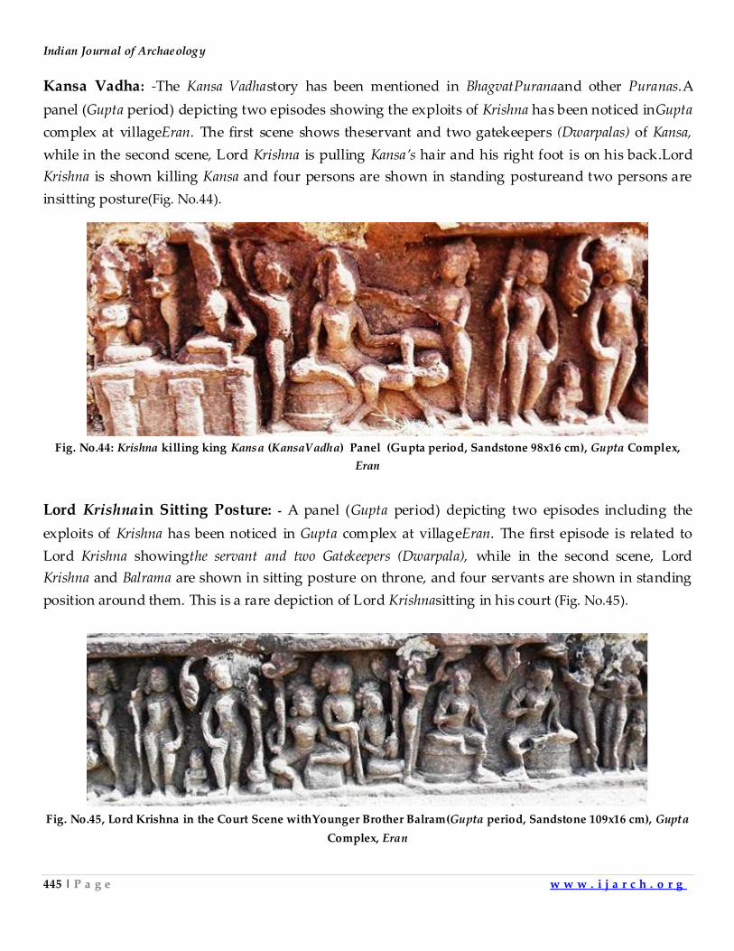
Indian Journal of Archaeology
445 | P a g e w w w . i j a r c h . o r g
Kansa Vadha: -The Kansa Vadhastory has been mentioned in BhagvatPuranaand other Puranas.A
panel (Gupta period) depicting two episodes showing the exploits of Krishna has been noticed inGupta
complex at villageEran. The first scene shows theservant and two gatekeepers (Dwarpalas) of Kansa,
while in the second scene, Lord Krishna is pulling Kansa’s hair and his right foot is on his back.Lord
Krishna is shown killing Kansa and four persons are shown in standing postureand two persons are
insitting posture(Fig. No.44).
Fig. No.44: Krishna killing king Kansa (KansaVadha) Panel (Gupta period, Sandstone 98x16 cm), Gupta Complex,
Eran
Lord Krishnain Sitting Posture: - A panel (Gupta period) depicting two episodes including the
exploits of Krishna has been noticed in Gupta complex at villageEran. The first episode is related to
Lord Krishna showingthe servant and two Gatekeepers (Dwarpala), while in the second scene, Lord
Krishna and Balrama are shown in sitting posture on throne, and four servants are shown in standing
position around them. This is a rare depiction of Lord Krishnasitting in his court (Fig. No.45).
Fig. No.45, Lord Krishna in the Court Scene withYounger Brother Balram(Gupta period, Sandstone 109x16 cm), Gupta
Complex, Eran
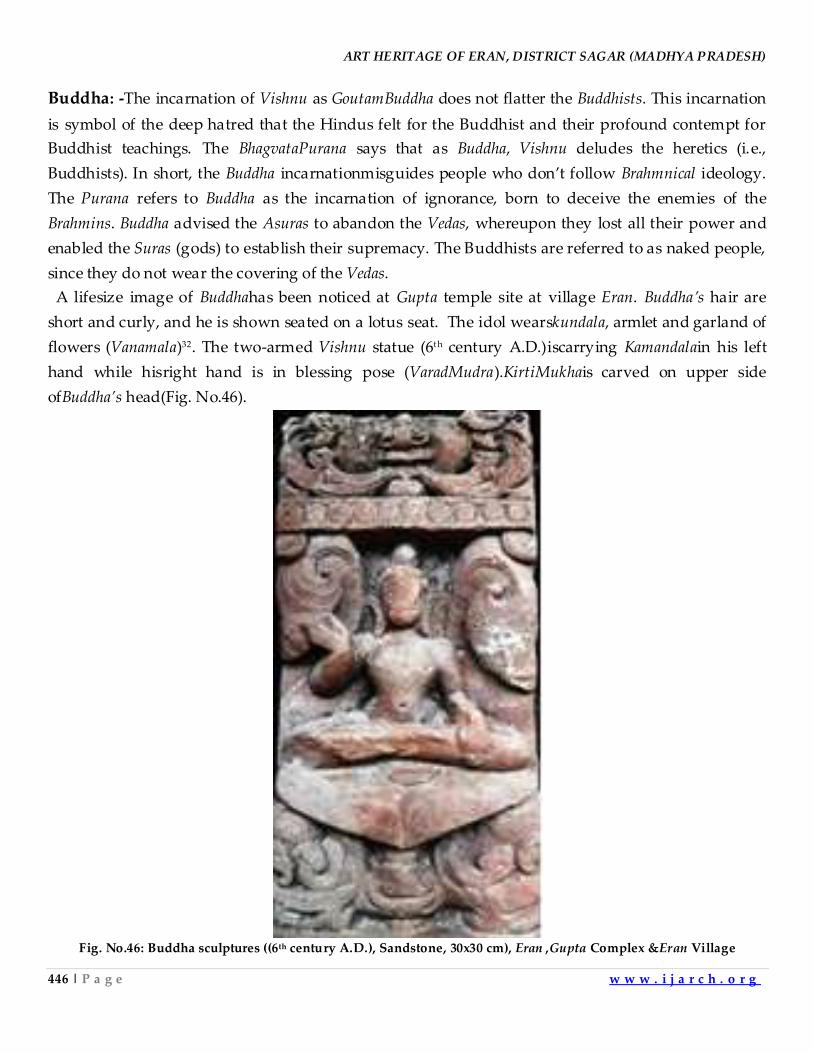
ART HERITAGE OF ERAN, DISTRICT SAGAR (MADHYA PRADESH)
446 | P a g e w w w . i j a r c h . o r g
Buddha: -The incarnation of Vishnu as GoutamBuddha does not flatter the Buddhists. This incarnation
is symbol of the deep hatred that the Hindus felt for the Buddhist and their profound contempt for
Buddhist teachings. The BhagvataPurana says that as Buddha, Vishnu deludes the heretics (i.e.,
Buddhists). In short, the Buddha incarnationmisguides people who don’t follow Brahmnical ideology.
The Purana refers to Buddha as the incarnation of ignorance, born to deceive the enemies of the
Brahmins. Buddha advised the Asuras to abandon the Vedas, whereupon they lost all their power and
enabled the Suras (gods) to establish their supremacy. The Buddhists are referred to as naked people,
since they do not wear the covering of the Vedas.
A lifesize image of Buddhahas been noticed at Gupta temple site at village Eran. Buddha’s hair are
short and curly, and he is shown seated on a lotus seat. The idol wearskundala, armlet and garland of
flowers (Vanamala)32. The two-armed Vishnu statue (6th century A.D.)iscarrying Kamandalain his left
hand while hisright hand is in blessing pose (VaradMudra).KirtiMukhais carved on upper side
ofBuddha’s head(Fig. No.46).
Fig. No.46: Buddha sculptures ((6th century A.D.), Sandstone, 30x30 cm), Eran ,Gupta Complex &Eran Village
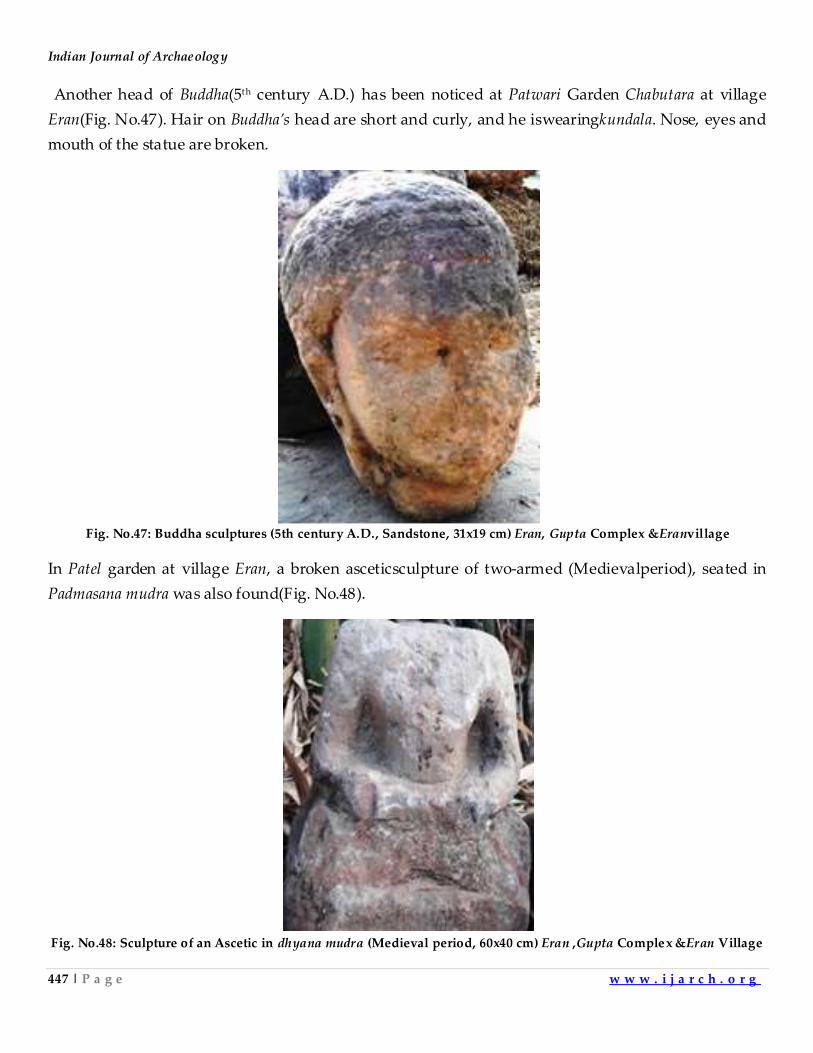
Indian Journal of Archaeology
447 | P a g e w w w . i j a r c h . o r g
Another head of Buddha(5th century A.D.) has been noticed at Patwari Garden Chabutara at village
Eran(Fig. No.47). Hair on Buddha’s head are short and curly, and he iswearingkundala. Nose, eyes and
mouth of the statue are broken.
Fig. No.47: Buddha sculptures (5th century A.D., Sandstone, 31x19 cm) Eran, Gupta Complex &Eranvillage
In Patel garden at village Eran, a broken asceticsculpture of two-armed (Medievalperiod), seated in
Padmasana mudra was also found(Fig. No.48).
Fig. No.48: Sculpture of an Ascetic in dhyana mudra (Medieval period, 60x40 cm) Eran ,Gupta Complex &Eran Village
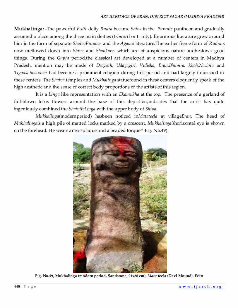
ART HERITAGE OF ERAN, DISTRICT SAGAR (MADHYA PRADESH)
448 | P a g e w w w . i j a r c h . o r g
Mukhalinga: -The powerful Vedic deity Rudra became Shiva in the Puranic pantheon and gradually
assumed a place among the three main deities (trimurti or trinity). Enormous literature grew around
him in the form of separate ShaivaPuranas and the Agama literature.The earlier fierce form of Rudrais
now mellowed down into Shiva and Shankara, which are of auspicious nature andbestows good
things. During the Gupta period,the classical art developed at a number of centers in Madhya
Pradesh, mention may be made of Deogarh, Udayagiri, Vidisha, Eran,Bhumra, Khoh,Nachna and
Tigowa.Shaivism had become a prominent religion during this period and had largely flourished in
these centers. The Shaiva temples and Mukhalinga statuefound in these centers eloquently speak of the
high aesthetic and the sense of correct body proportions of the artists of this region.
It is a Linga like representation with an Ekamukha at the top. The presence of a garland of
full-blown lotus flowers around the base of this depiction,indicates that the artist has quite
ingeniously combined the ShaiviteLinga with the upper body of Shiva.
Mukhalinga(modernperiod) hasbeen noticed inMatateela at villageEran. The head of
Mukhalingais a high pile of matted locks,marked by a crescent. Mukhalinga’shorizontal eye is shown
on the forehead. He wears anear-plaque and a beaded torque33 (Fig. No.49).
Fig. No.49, Mukhalinga (modern period, Sandstone, 91x28 cm), Mata teela (Devi Mound), Eran
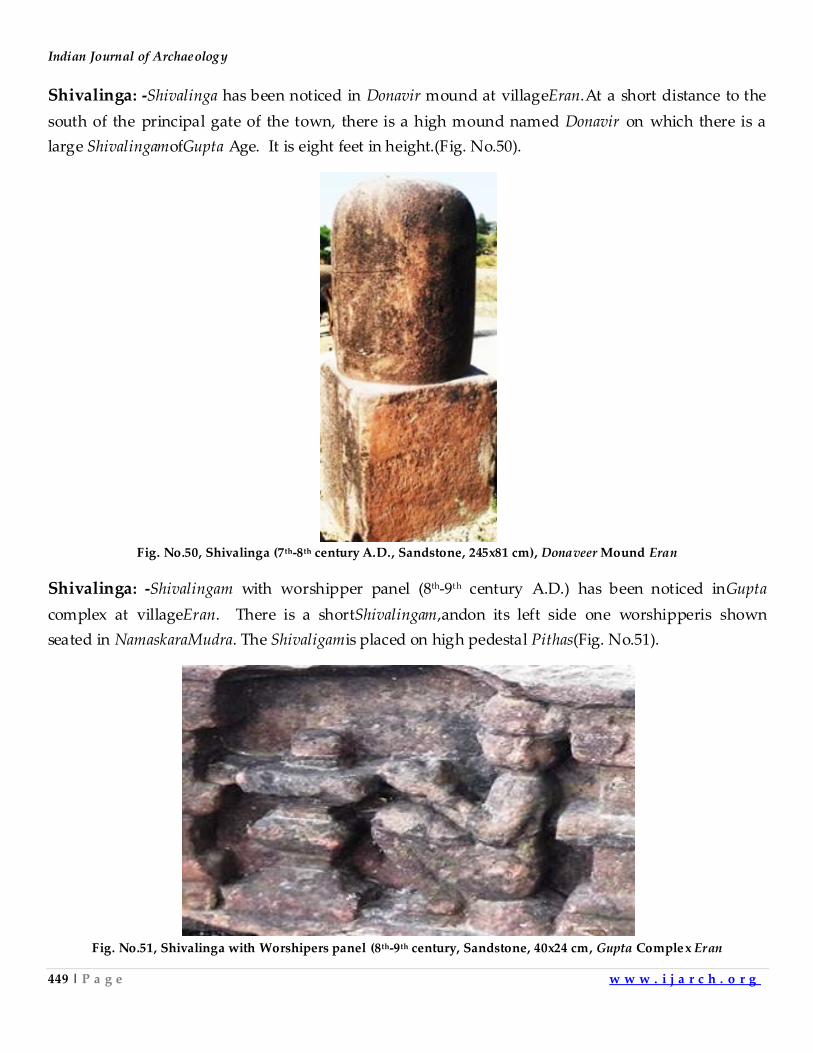
Indian Journal of Archaeology
449 | P a g e w w w . i j a r c h . o r g
Shivalinga: -Shivalinga has been noticed in Donavir mound at villageEran.At a short distance to the
south of the principal gate of the town, there is a high mound named Donavir on which there is a
large ShivalingamofGupta Age. It is eight feet in height.(Fig. No.50).
Fig. No.50, Shivalinga (7th-8th century A.D., Sandstone, 245x81 cm), Donaveer Mound Eran
Shivalinga: -Shivalingam with worshipper panel (8th-9th century A.D.) has been noticed inGupta
complex at villageEran. There is a shortShivalingam,andon its left side one worshipperis shown
seated in NamaskaraMudra. The Shivaligamis placed on high pedestal Pithas(Fig. No.51).
Fig. No.51, Shivalinga with Worshipers panel (8th-9th century, Sandstone, 40x24 cm, Gupta Complex Eran
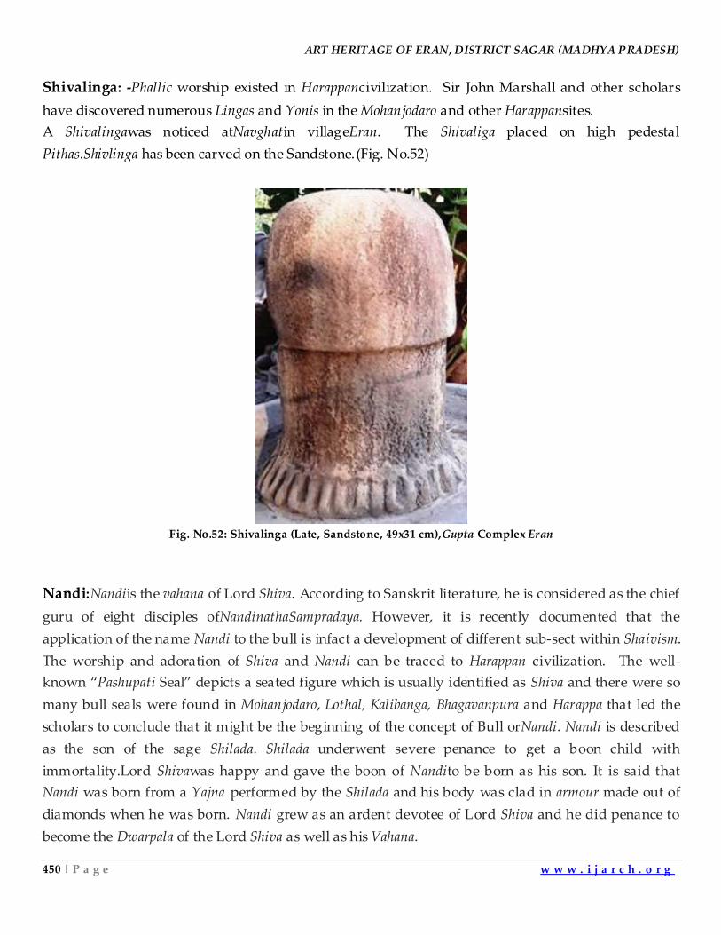
ART HERITAGE OF ERAN, DISTRICT SAGAR (MADHYA PRADESH)
450 | P a g e w w w . i j a r c h . o r g
Shivalinga: -Phallic worship existed in Harappancivilization. Sir John Marshall and other scholars
have discovered numerous Lingas and Yonis in the Mohanjodaro and other Harappansites.
A Shivalingawas noticed atNavghatin villageEran. The Shivaliga placed on high pedestal
Pithas.Shivlinga has been carved on the Sandstone.(Fig. No.52)
Fig. No.52: Shivalinga (Late, Sandstone, 49x31 cm),Gupta Complex Eran
Nandi:Nandiis the vahana of Lord Shiva. According to Sanskrit literature, he is considered as the chief
guru of eight disciples ofNandinathaSampradaya. However, it is recently documented that the
application of the name Nandi to the bull is infact a development of different sub-sect within Shaivism.
The worship and adoration of Shiva and Nandi can be traced to Harappan civilization. The well-
known ‚Pashupati Seal‛ depicts a seated figure which is usually identified as Shiva and there were so
many bull seals were found in Mohanjodaro, Lothal, Kalibanga, Bhagavanpura and Harappa that led the
scholars to conclude that it might be the beginning of the concept of Bull orNandi. Nandi is described
as the son of the sage Shilada. Shilada underwent severe penance to get a boon child with
immortality.Lord Shivawas happy and gave the boon of Nandito be born as his son. It is said that
Nandi was born from a Yajna performed by the Shilada and his body was clad in armour made out of
diamonds when he was born. Nandi grew as an ardent devotee of Lord Shiva and he did penance to
become the Dwarpala of the Lord Shiva as well as his Vahana.
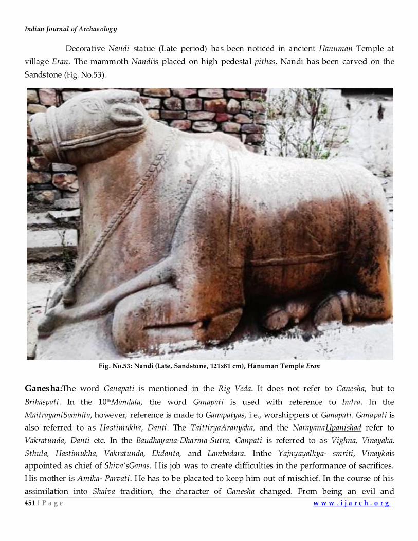
Indian Journal of Archaeology
451 | P a g e w w w . i j a r c h . o r g
Decorative Nandi statue (Late period) has been noticed in ancient Hanuman Temple at
village Eran. The mammoth Nandiis placed on high pedestal pithas. Nandi has been carved on the
Sandstone (Fig. No.53).
Fig. No.53: Nandi (Late, Sandstone, 121x81 cm), Hanuman Temple Eran
Ganesha:The word Ganapati is mentioned in the Rig Veda. It does not refer to Ganesha, but to
Brihaspati. In the 10thMandala, the word Ganapati is used with reference to Indra. In the
MaitrayaniSamhita, however, reference is made to Ganapatyas, i.e., worshippers of Ganapati. Ganapati is
also referred to as Hastimukha, Danti. The TaittiryaAranyaka, and the NarayanaUpanishad refer to
Vakratunda, Danti etc. In the Baudhayana-Dharma-Sutra, Ganpati is referred to as Vighna, Vinayaka,
Sthula, Hastimukha, Vakratunda, Ekdanta, and Lambodara. Inthe Yajnyayalkya- smriti, Vinaykais
appointed as chief of Shiva’sGanas. His job was to create difficulties in the performance of sacrifices.
His mother is Amika- Parvati. He has to be placated to keep him out of mischief. In the course of his
assimilation into Shaiva tradition, the character of Ganesha changed. From being an evil and
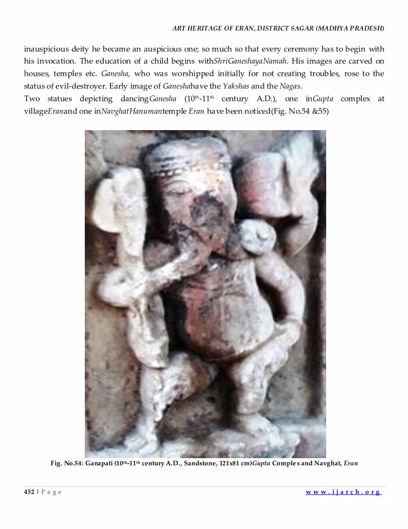
ART HERITAGE OF ERAN, DISTRICT SAGAR (MADHYA PRADESH)
452 | P a g e w w w . i j a r c h . o r g
inauspicious deity he became an auspicious one; so much so that every ceremony has to begin with
his invocation. The education of a child begins withShriGaneshayaNamah. His images are carved on
houses, temples etc. Ganesha, who was worshipped initially for not creating troubles, rose to the
status of evil-destroyer. Early image of Ganeshahave the Yakshas and the Nagas.
Two statues depicting dancingGanesha (10th-11th century A.D.), one inGupta complex at
villageEranand one inNavghatHanumantemple Eran have been noticed(Fig. No.54 &55)
Fig. No.54: Ganapati (10th-11th century A.D., Sandstone, 121x81 cm)Gupta Complex and Navghat, Eran
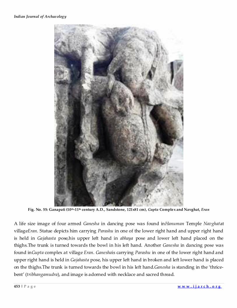
Indian Journal of Archaeology
453 | P a g e w w w . i j a r c h . o r g
Fig. No. 55: Ganapati (10th-11th century A.D., Sandstone, 121x81 cm), Gupta Complex and Navghat, Eran
A life size image of four armed Ganesha in dancing pose was found inHanuman Temple Navghatat
villageEran. Statue depicts him carrying Parashu in one of the lower right hand and upper right hand
is held in Gajahasta pose,his upper left hand in abhaya pose and lower left hand placed on the
thighs.The trunk is turned towards the bowl in his left hand. Another Ganesha in dancing pose was
found inGupta complex at village Eran. Ganeshais carrying Parashu in one of the lower right hand and
upper right hand is held in Gajahasta pose, his upper left hand in broken and left lower hand is placed
on the thighs.The trunk is turned towards the bowl in his left hand.Ganesha is standing in the ‘thrice-
bent’ (tribhangamudra), and image is adorned with necklace and sacred thread.
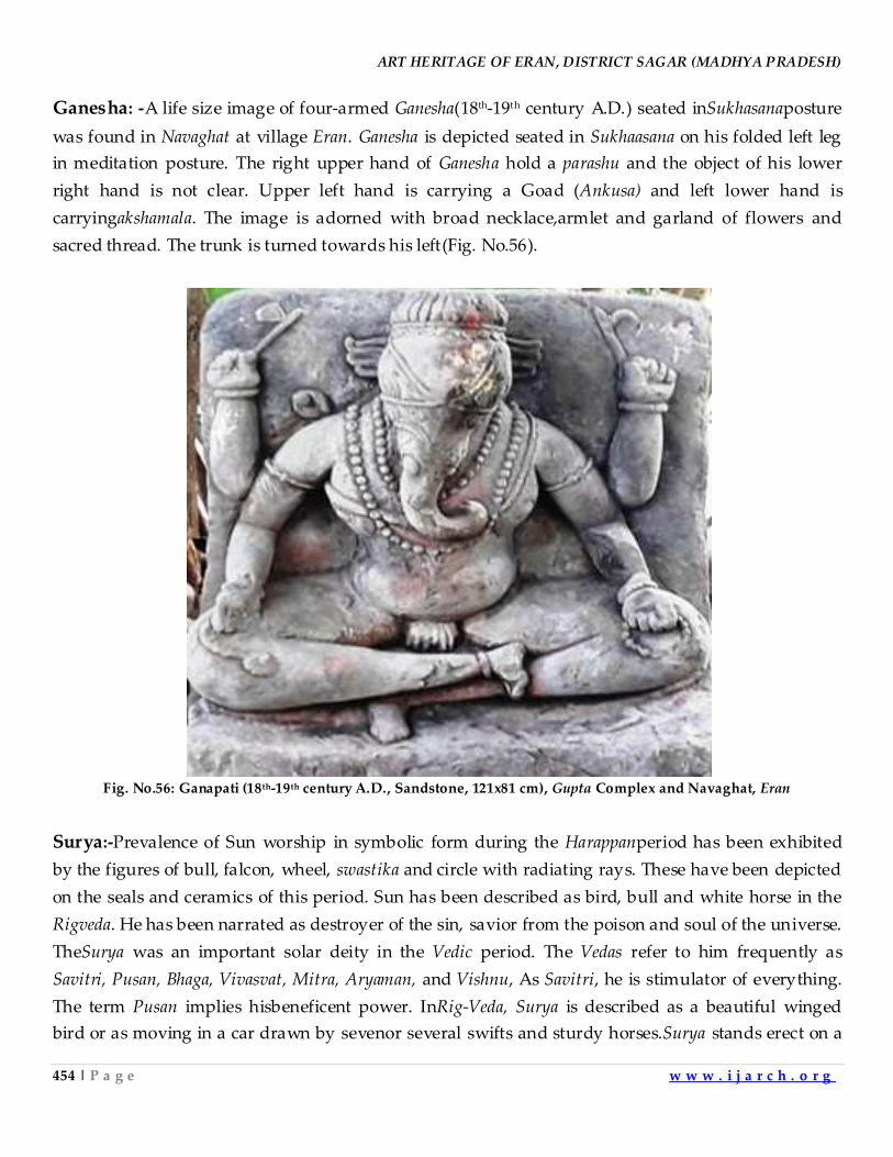
ART HERITAGE OF ERAN, DISTRICT SAGAR (MADHYA PRADESH)
454 | P a g e w w w . i j a r c h . o r g
Ganesha: -A life size image of four-armed Ganesha(18th-19th century A.D.) seated inSukhasanaposture
was found in Navaghat at village Eran. Ganesha is depicted seated in Sukhaasana on his folded left leg
in meditation posture. The right upper hand of Ganesha hold a parashu and the object of his lower
right hand is not clear. Upper left hand is carrying a Goad (Ankusa) and left lower hand is
carryingakshamala. The image is adorned with broad necklace,armlet and garland of flowers and
sacred thread. The trunk is turned towards his left(Fig. No.56).
Fig. No.56: Ganapati (18th-19th century A.D., Sandstone, 121x81 cm), Gupta Complex and Navaghat, Eran
Surya:-Prevalence of Sun worship in symbolic form during the Harappanperiod has been exhibited
by the figures of bull, falcon, wheel, swastika and circle with radiating rays. These have been depicted
on the seals and ceramics of this period. Sun has been described as bird, bull and white horse in the
Rigveda. He has been narrated as destroyer of the sin, savior from the poison and soul of the universe.
TheSurya was an important solar deity in the Vedic period. The Vedas refer to him frequently as
Savitri, Pusan, Bhaga, Vivasvat, Mitra, Aryaman, and Vishnu, As Savitri, he is stimulator of everything.
The term Pusan implies hisbeneficent power. InRig-Veda, Surya is described as a beautiful winged
bird or as moving in a car drawn by sevenor several swifts and sturdy horses.Surya stands erect on a
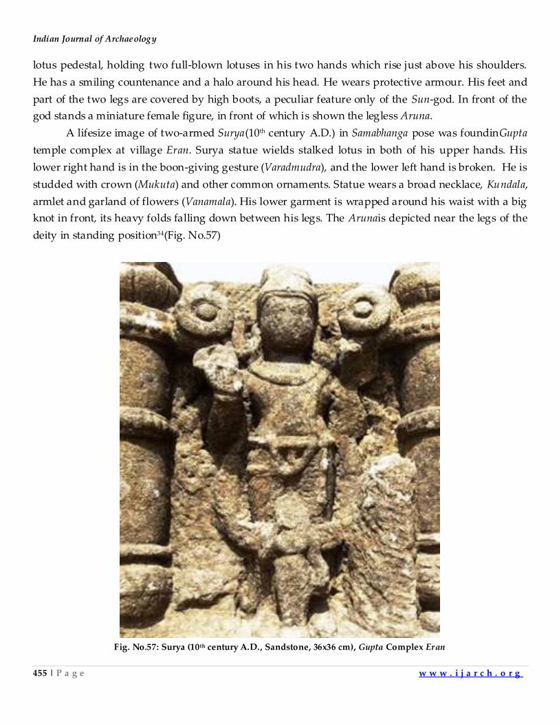
Indian Journal of Archaeology
455 | P a g e w w w . i j a r c h . o r g
lotus pedestal, holding two full-blown lotuses in his two hands which rise just above his shoulders.
He has a smiling countenance and a halo around his head. He wears protective armour. His feet and
part of the two legs are covered by high boots, a peculiar feature only of the Sun-god. In front of the
god stands a miniature female figure, in front of which is shown the legless Aruna.
A lifesize image of two-armed Surya(10th century A.D.) in Samabhanga pose was foundinGupta
temple complex at village Eran. Surya statue wields stalked lotus in both of his upper hands. His
lower right hand is in the boon-giving gesture (Varadmudra), and the lower left hand is broken. He is
studded with crown (Mukuta) and other common ornaments. Statue wears a broad necklace, Kundala,
armlet and garland of flowers (Vanamala). His lower garment is wrapped around his waist with a big
knot in front, its heavy folds falling down between his legs. The Arunais depicted near the legs of the
deity in standing position34(Fig. No.57)
Fig. No.57: Surya (10th century A.D., Sandstone, 36x36 cm), Gupta Complex Eran
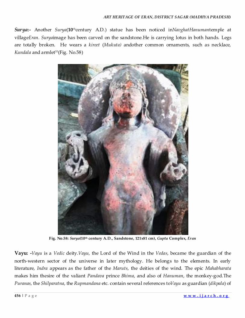
ART HERITAGE OF ERAN, DISTRICT SAGAR (MADHYA PRADESH)
456 | P a g e w w w . i j a r c h . o r g
Surya:- Another Surya(10thcentury A.D.) statue has been noticed inNavghatHanumantemple at
villageEran. Suryaimage has been carved on the sandstone.He is carrying lotus in both hands. Legs
are totally broken. He wears a kireet (Mukuta) andother common ornaments, such as necklace,
Kundala and armlet35(Fig. No.58)
Fig. No.58: Surya(10th century A.D., Sandstone, 121x81 cm), Gupta Complex, Eran
Vayu: -Vayu is a Vedic deity.Vayu, the Lord of the Wind in the Vedas, became the guardian of the
north-western sector of the universe in later mythology. He belongs to the elements. In early
literature, Indra appears as the father of the Maruts, the deities of the wind. The epic Mahabharata
makes him thesire of the valiant Pandava prince Bhima, and also of Hanuman, the monkey-god.The
Puranas, the Shilparatna, the Rupmandana etc. contain several references toVayu as guardian (dikpala) of
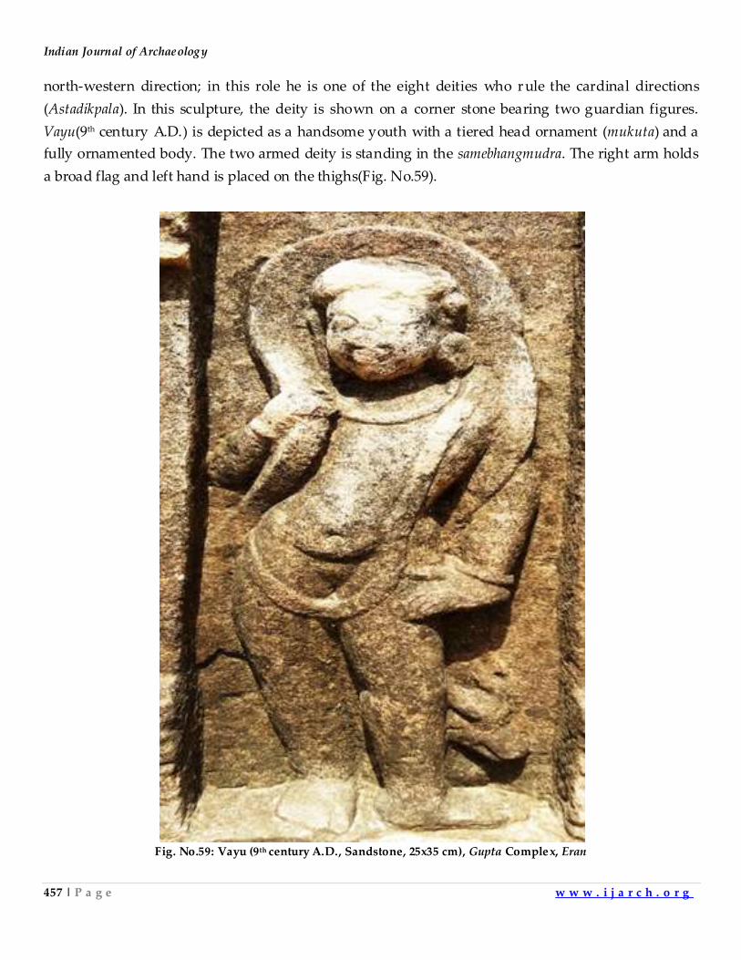
Indian Journal of Archaeology
457 | P a g e w w w . i j a r c h . o r g
north-western direction; in this role he is one of the eight deities who r ule the cardinal directions
(Astadikpala). In this sculpture, the deity is shown on a corner stone bearing two guardian figures.
Vayu(9th century A.D.) is depicted as a handsome youth with a tiered head ornament (mukuta) and a
fully ornamented body. The two armed deity is standing in the samebhangmudra. The right arm holds
a broad flag and left hand is placed on the thighs(Fig. No.59).
Fig. No.59: Vayu (9th century A.D., Sandstone, 25x35 cm), Gupta Complex, Eran
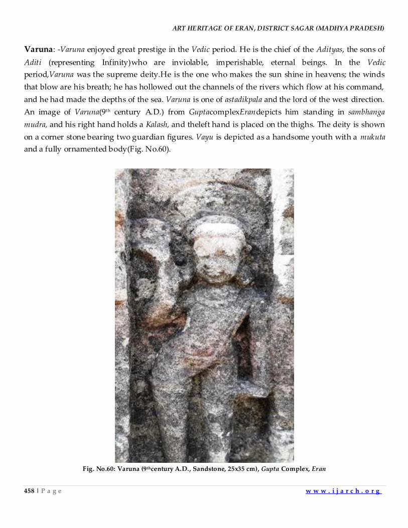
ART HERITAGE OF ERAN, DISTRICT SAGAR (MADHYA PRADESH)
458 | P a g e w w w . i j a r c h . o r g
Varuna: -Varuna enjoyed great prestige in the Vedic period. He is the chief of the Adityas, the sons of
Aditi (representing Infinity)who are inviolable, imperishable, eternal beings. In the Vedic
period,Varuna was the supreme deity.He is the one who makes the sun shine in heavens; the winds
that blow are his breath; he has hollowed out the channels of the rivers which flow at his command,
and he had made the depths of the sea. Varuna is one of astadikpala and the lord of the west direction.
An image of Varuna(9th century A.D.) from GuptacomplexErandepicts him standing in sambhanga
mudra, and his right hand holds a Kalash, and theleft hand is placed on the thighs. The deity is shown
on a corner stone bearing two guardian figures. Vayu is depicted as a handsome youth with a mukuta
and a fully ornamented body(Fig. No.60).
Fig. No.60: Varuna (9thcentury A.D., Sandstone, 25x35 cm), Gupta Complex, Eran
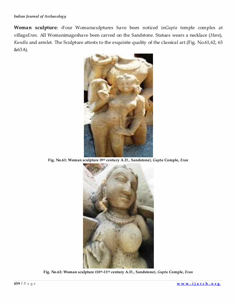
Indian Journal of Archaeology
459 | P a g e w w w . i j a r c h . o r g
Woman sculpture: -Four Womansculptures have been noticed inGupta temple complex at
villageEran. All Womanimageshave been carved on the Sandstone. Statues wears a necklace (Hara),
Kundla and armlet. The Sculpture attests to the exquisite quality of the classical art.(Fig. No.61,62, 63
&63A).
Fig. No.61: Woman sculpture (9th century A.D., Sandstone), Gupta Comple, Eran
Fig. No.62: Woman sculpture (10th-11th century A.D., Sandstone), Gupta Comple, Eran
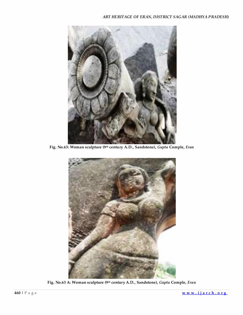
ART HERITAGE OF ERAN, DISTRICT SAGAR (MADHYA PRADESH)
460 | P a g e w w w . i j a r c h . o r g
Fig. No.63: Woman sculpture (9th century A.D., Sandstone), Gupta Comple, Eran
Fig. No.63 A: Woman sculpture (9th century A.D., Sandstone), Gupta Comple, Eran
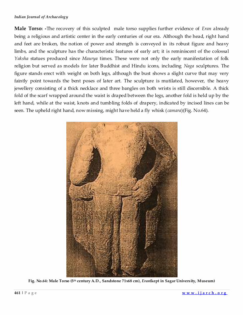
Indian Journal of Archaeology
461 | P a g e w w w . i j a r c h . o r g
Male Torso: -The recovery of this sculpted male torso supplies further evidence of Eran already
being a religious and artistic center in the early centuries of our era. Although the head, right hand
and feet are broken, the notion of power and strength is conveyed in its robust figure and heavy
limbs, and the sculpture has the characteristic features of early art; it is reminiscent of the colossal
Yaksha statues produced since Maurya times. These were not only the early manifestation of folk
religion but served as models for later Buddhist and Hindu icons, including Naga sculptures. The
figure stands erect with weight on both legs, although the bust shows a slight curve that may very
faintly point towards the bent poses of later art. The sculpture is mutilated, however, the heavy
jewellery consisting of a thick necklace and three bangles on both wrists is still discernible. A thick
fold of the scarf wrapped around the waist is draped between the legs, another fold is held up by the
left hand, while at the waist, knots and tumbling folds of drapery, indicated by incised lines can be
seen. The upheld right hand, now missing, might have held a fly whisk (camara)(Fig. No.64).
Fig. No.64: Male Torso (5th century A.D., Sandstone 71x68 cm), Eran(kept in Sagar University, Museum)
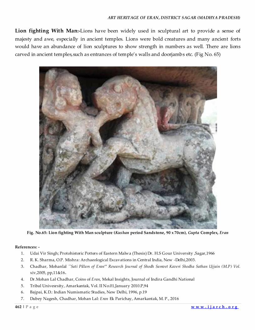
ART HERITAGE OF ERAN, DISTRICT SAGAR (MADHYA PRADESH)
462 | P a g e w w w . i j a r c h . o r g
Lion fighting With Man:-Lions have been widely used in sculptural art to provide a sense of
majesty and awe, especially in ancient temples. Lions were bold creatures and many ancient forts
would have an abundance of lion sculptures to show strength in numbers as well. There are lions
carved in ancient temples,such as entrances of temple’s walls and doorjambs etc. (Fig No. 65)
Fig. No.65: Lion fighting With Man sculpture (Kushan period Sandstone, 90 x 70cm), Gupta Complex, Eran
References: -
1. Udai Vir Singh; Protohistoric Potters of Eastern Malwa (Thesis) Dr. H.S Gour University ,Sagar,1966
2. R. K. Sharma, O.P. Mishra: Archaeological Excavations in Central India, New -Delhi,2003.
3. Chadhar, Mohanlal ''Sati Pillars of Eran’’ Research Journal of Shodh Samvet Kaveri Shodha Sathan Ujjain (M.P) Vol.
xiv,2005, pp,11&16.
4. Dr.Mohan Lal Chadhar, Coins of Eran, Mekal Insights, Journal of Indira Gandhi National
5. Tribal Univesrsity, Amarkantak, Vol. II No.01,January 2010.P,94
6. Bajpai, K.D.: Indian Numismatic Studies, New Delhi, 1996, p.19
7. Dubey Nagesh, Chadhar, Mohan Lal: Eran Ek Parichay, Amarkantak, M. P., 2016
Indian Journal of Archaeology
463 | P a g e w w w . i j a r c h . o r g
8. Dubey, Nagesh: Eran Ki kala ,Sagar, 1997, P. 175.
9. Alexander Cunningham: Report. Tours in Bundelkhand and Malwa, Varanasi, 1966,P.89.
10. Bajpai, K.D.: Sagar through the ages, Sagar, 1954
11. Jha, V.D.: Recent excavation at Eran, Archaeological studies, Varanasi,1986,p.101
12. Fleet. J.F: Corpus Inscriptionum Indicarum, 3, Clcutta, 1988.
13. Dubey, Nagesh:Eran ki Kala,Sagar (M.P.) 1998
14. Bajpai, K.D.: Sagar through the ages, Sagar, 1954
15. Chadhar, Mohan Lal:Eran Ki Tamrapashan Sasnkriti: Ek addyanan,Sagar,2009,
16. Bajpai S.k., and Renne, Zsuzsanna r: Catalogue of The Collection of the, Harisingh Gour Archaeological Museum
of Sagar University, New Delhi, 2012
17. Bajpai S.k., and Renne, Zsuzsanna r: Catalogue of The Collection of the, Harisingh Gour Archaeological Museum
of Sagar University, New Delhi, 201
18. Chadhar, Mohan Lal: Eran Ek. Sanskrit, Dharohar, New Delhi, 2016
19. Gopinath Rao, T.A., Iconography of Hindu Iconography, 1985,1914, Vol, I and II
20. 19.Agni Puran 15/21-22
21. Chadhar, Mohan Lal:Art, Architecture and Archaeology of India. New Delhi, 2017
22. Dubey Nagesh, Chadhar, Mohan Lal: Eran Ek Parichay, Amarkantak, M. P., 2016
23. Chadhar, Mohan Lal: Eran Ek. Sanskrit, Dharohar, New Delhi, 2016
24. Dubey, Nagesh:Eran ki Kala,Sagar (M.P.) 1998
25. Chadhar, Mohan Lal: Eran Ek. Sanskrit, Dharohar, New Delhi, 2016
26. Dubey Nagesh, Chadhar, Mohan Lal: Eran Ek Parichay, Amarkantak, M. P., 2016
27. Dubey, Nagesh:Eran ki Kala,Sagar (M.P.) 1998
28. Chadhar, Mohanlal, History of Eran, ADROITIC, An International Refereed Quarterly
29. Research Journal (Multi- disciplinary) New Delhi Vol.-01,No-03,2014,pp, 59-63
30. 28.Chadhar, Mohanlal, Yug, Yugeen Eran: Ek vishleshan, Research Journal of Directorate
31. of Culture and Archaeology, Govt. of Chhattisgarh,Vol.No.06, 2013, pp-1-10,
32. Chadhar, Mohanlal: Archaeology of Central India. New Delhi, 2017
33. Chadhar, Mohanlal, Eran ki Guptakaleen Kala Mai MahaBharatkaleen Kathanak, Editor Prof. V.D. Jha,
Department of Ancient Indian History, Culture and Archaeology, Dr. H.S. Gour University, Sagar (M.P), Saroj
Prakashan Sagar (M.P.) 2006,pp, 191-193,
34. Chadhar, Mohanlal, MahaBharat Kaleen ViratNagar ur Eran,''ANUSILANA'' Research Journal of Indian cultural,
Social & Philosophical Stream, Department of Philosophy, BHU,Varanasi (U.P) 2010 pp. 167 -170,
35. Chadhar, Mohan Lal: Eran Ek. Sanskrit, Dharohar, New Delhi, 2016
36. Chadhar, Mohanlal, Eran ke Murtishilp mai Shivling, Research Journal of Shodh Samvet Kaveri Shodha Sathan Ujjain
(M.P) Vol. XV, 2007pp,13-17
37. Chadhar, Mohan Lal: Eran Ek. Sanskrit, Dharohar, New Delhi, 2016
38. Chadhar, Mohanlal, Eran Ki kala mai godadeva Pratimay v Manglik akano ka Vishleshan , Research
Deliberation,(An International Refereed Research Journal for Humanities and Social Science) Swami Narayan
Guru Research Foundation, Gwaliar (M.P.) Vol.-II,No-01, 2016,pp, 108-125
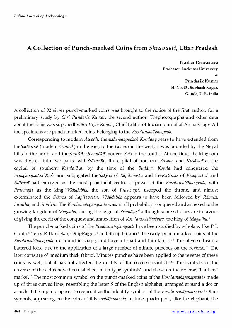
Indian Journal of Archaeology
464 | P a g e w w w . i j a r c h . o r g
A Collection of Punch-marked Coins from Shravasti, Uttar Pradesh
Prashant Srivastava
Professor, Lucknow University
&
Pundarik Kumar
H. No. 85, Subhash Nagar,
Gonda, U.P., India
A collection of 92 silver punch-marked coins was brought to the notice of the first author, for a
preliminary study by Shri Pundarik Kumar, the second author. Thephotographs and other data
about the coins was suppliedbyShri Vijay Kumar, Chief Editor of Indian Journal of Archaeology.All
the specimens are punch-marked coins, belonging to the Kosalamah¹janapada.
Corresponding to modern Awadh, themah¹janapadaof Kosalaappears to have extended from
theSad¹nîra¹ (modern Gandak) in the east, to the Gomati in the west; it was bounded by the Nepal
hills in the north, and theSarpik¹orSyandik¹(modern Sai) in the south.1 At one time, the kingdom
was divided into two parts, withŒr¹vastîas the capital of northern Kosala, and Kuœ¹vatî as the
capital of southern Kosala.But, by the time of the Buddha, Kosala had conquered the
mah¹janapadaofK¹œî, and subjugated theŒ¹kyas of Kapilavastu and theK¹l¹mas of Kesaputta,2 and
Œr¹vastî had emerged as the most prominent centre of power of the Kosalamah¹janapada, with
Prasenajit as the king.3Viðûðabha, the son of Prasenajit, usurped the throne, and almost
exterminated the Œ¹kyas of Kapilavastu. Viðûðabha appears to have been followed by R¹òaka,
Suratha, and Sumitra. The Kosalamah¹janapada was, in all probability, conquered and annexed to the
growing kingdom of Magadha, during the reign of Œiœun¹ga,4 although some scholars are in favour
of giving the credit of the conquest and annexation of Kosala to Aj¹taœatru, the king of Magadha.5
The punch-marked coins of the Kosalamah¹janapada have been studied by scholars, like P L
Gupta,6 Terry R Hardekar,7DilipRajgor,8 and Shinji Hirano.9 The early punch-marked coins of the
Kosalamah¹janapada are round in shape, and have a broad and thin fabric. 10 The obverse bears a
battered look, due to the application of a large number of minute punches on the reverse. 11 The
later coins are of ‘medium thick fabric’. Minutes punches have been applied to the reverse of these
coins as well, but it has not affected the quality of the obverse symbols. 12 The symbols on the
obverse of the coins have been labelled ‘main type symbols’, and those on the reverse, ‘bankers’
marks’.13 The most common symbol on the punch-marked coins of the Kosalamah¹janapada is made
up of three curved lines, resembling the letter S of the English alphabet, arranged around a dot or
a circle. P L Gupta proposes to regard it as the ‘identity symbol’ of the Kosalamah¹janapada.14 Other
symbols, appearing on the coins of this mah¹janapada, include quadrupeds, like the elephant, the
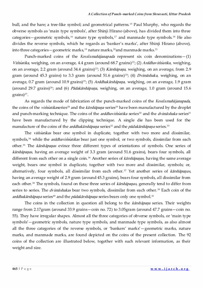
A Collection of Punch-marked Coins from Shravasti, Uttar Pradesh
465 | P a g e w w w . i j a r c h . o r g
bull, and the hare; a tree-like symbol; and geometrical patterns. 15 Paul Murphy, who regards the
obverse symbols as ‘main type symbols’, after Shinji Hirano (above), has divided them into three
categories—geometric symbols,16 nature type symbols,17 and manmade type symbols.18 He also
divides the reverse symbols, which he regards as ‘banker’s marks’, after Shinji Hirano (above),
into three categories—geometric marks,19 nature marks,20and manmade marks.21
Punch-marked coins of the Kosalamah¹janapada represent six coin denominations—(1)
Viôœatika, weighing, on an average, 4.4 gram (around 68.7 grains) 22; (2) Arddhaviôœatika, weighing,
on an average, 2.2 gram (around 34.4 grains)23; (3) K¹rsh¹paòa, weighing, on an average, from 2.9
gram (around 45.3 grains) to 3.3 gram (around 51.6 grains) 24; (4) Dvim¹shaka, weighing, on an
average, 0.7 gram (around 10.9 grains)25; (5) Arddhak¹rsh¹paòa, weighing, on an average, 1.9 gram
(around 29.7 grains)26; and (6) P¹dak¹rsh¹paòa, weighing, on an average, 1.0 gram (around 15.6
grains)27.
As regards the mode of fabrication of the punch-marked coins of the Kosalamah¹janapada,
the coins of the viôœatikaseries28 and the k¹rsh¹paòa series29 have been manufactured by the droplet
and punch-marking technique. The coins of the arddhaviôœatika series30 and the dvim¹shaka series31
have been manufactured by the clipping technique. A single die has been used for the
manufacture of the coins of the arddhak¹rsh¹paòa series32 and the p¹dak¹rsh¹paòa series.33
The viôœatikas bear one symbol in duplicate, together with two more and dissimilar,
symbols,34 while the arddhaviôœatikas bear just one symbol, or two symbols, dissimilar from each
other.35 The k¹rsh¹paòas evince three different types of orientations of symbols. One series of
k¹rsh¹paòas, having an average weight of 3.3 gram (around 51.6 grains), bears four symbols, all
different from each other on a single coin. 36 Another series of k¹rsh¹paòas, having the same average
weight, bears one symbol in duplicate, together with two more and dissimilar, symbols; or,
alternatively, four symbols, all dissimilar from each other. 37 Yet another series of k¹rsh¹paòas,
having an average weight of 2.9 gram (around 45.3 grains), bears four symbols, all dissimilar from
each other.38 The symbols, found on these three series of k¹rsh¹paòas, generally tend to differ from
series to series. The dvim¹shakas bear two symbols, dissimilar from each other. 39 Each coin of the
arddhak¹rsh¹paòa series40 and the p¹dak¹rsh¹paòa series bears only one symbol.41
The coins in the collection in question all belong to the k¹rsh¹paòa series. Their weights
range from 2.17gram (around 33.9 grains—coin no. 72) to 3.05gram (around 47.7 grains—coin no.
55). They have irregular shapes. Almost all the three categories of obverse symbols, or ‘main type
symbols’—geometric symbols, nature type symbols, and manmade type symbols, as also almost
all the three categories of the reverse symbols, or ‘bankers’ marks’—geometric marks, nature
marks, and manmade marks, are found depicted on the coins of the present collection. The 92
coins of the collection are illustrated below, together with such relevant information, as their
weight and size.
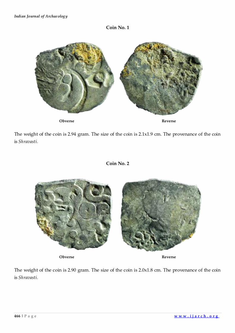
Indian Journal of Archaeology
466 | P a g e w w w . i j a r c h . o r g
Coin No. 1
Obverse Reverse
The weight of the coin is 2.94 gram. The size of the coin is 2.1x1.9 cm. The provenance of the coin
is Shravasti.
Coin No. 2
Obverse Reverse
The weight of the coin is 2.90 gram. The size of the coin is 2.0x1.8 cm. The provenance of the coin
is Shravasti.
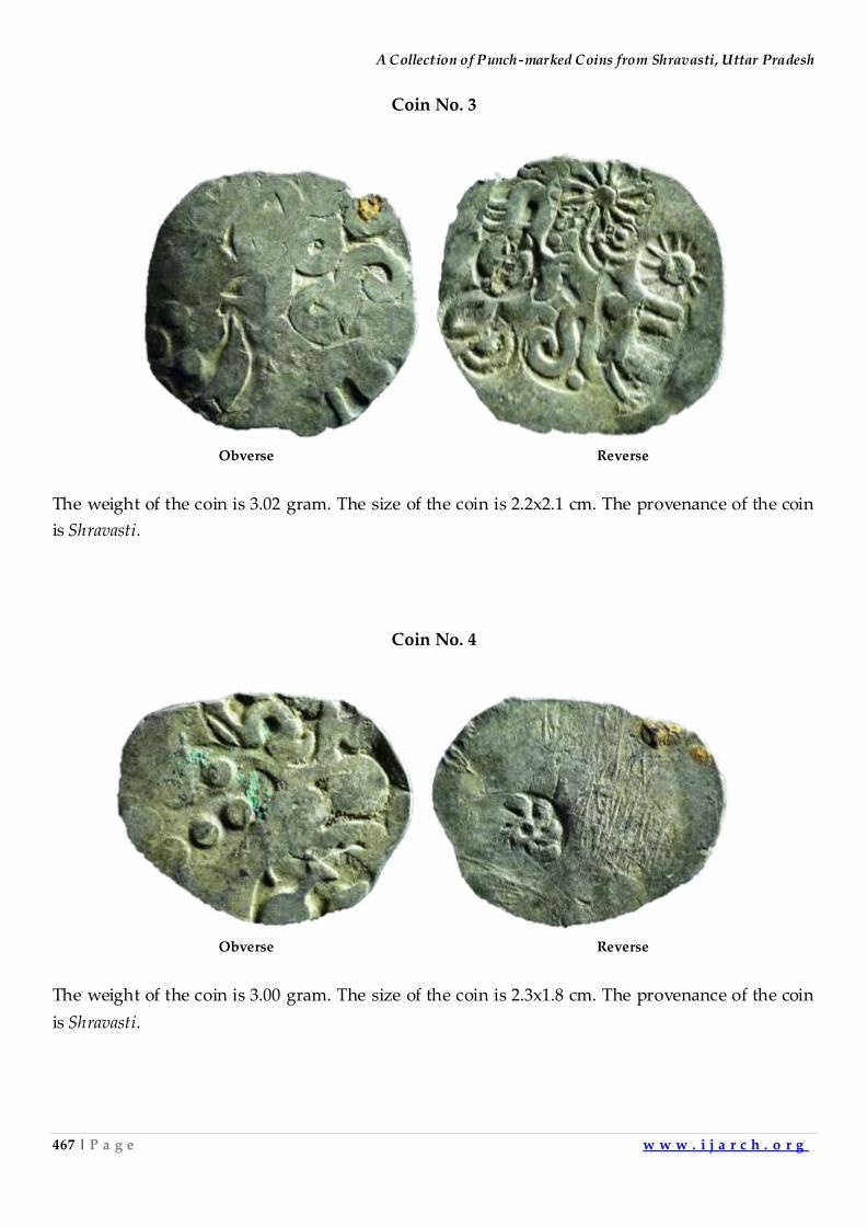
A Collection of Punch-marked Coins from Shravasti, Uttar Pradesh
467 | P a g e w w w . i j a r c h . o r g
Coin No. 3
Obverse Reverse
The weight of the coin is 3.02 gram. The size of the coin is 2.2x2.1 cm. The provenance of the coin
is Shravasti.
Coin No. 4
Obverse Reverse
The weight of the coin is 3.00 gram. The size of the coin is 2.3x1.8 cm. The provenance of the coin
is Shravasti.
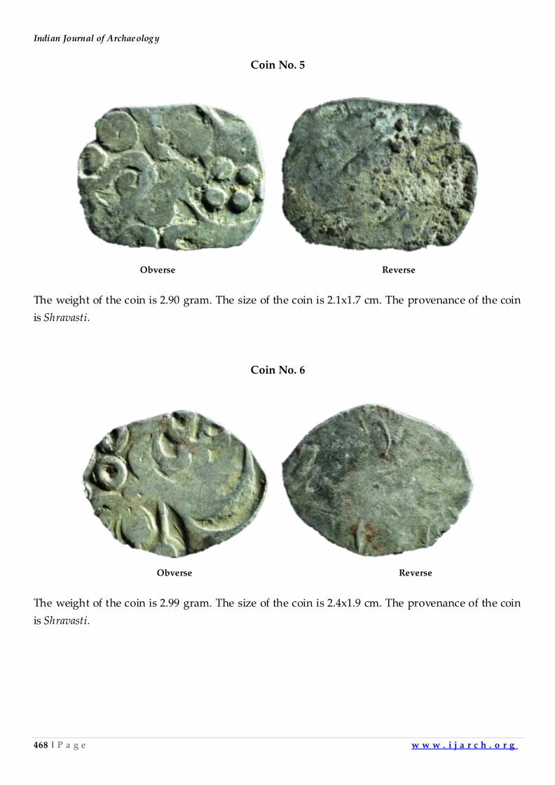
Indian Journal of Archaeology
468 | P a g e w w w . i j a r c h . o r g
Coin No. 5
Obverse Reverse
The weight of the coin is 2.90 gram. The size of the coin is 2.1x1.7 cm. The provenance of the coin
is Shravasti.
Coin No. 6
Obverse Reverse
The weight of the coin is 2.99 gram. The size of the coin is 2.4x1.9 cm. The provenance of the coin
is Shravasti.
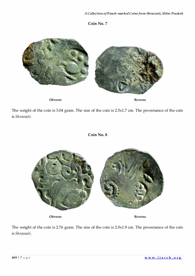
A Collection of Punch-marked Coins from Shravasti, Uttar Pradesh
469 | P a g e w w w . i j a r c h . o r g
Coin No. 7
Obverse Reverse
The weight of the coin is 3.04 gram. The size of the coin is 2.5x1.7 cm. The provenance of the coin
is Shravasti.
Coin No. 8
Obverse Reverse
The weight of the coin is 2.76 gram. The size of the coin is 2.0x1.9 cm. The provenance of the coin
is Shravasti.
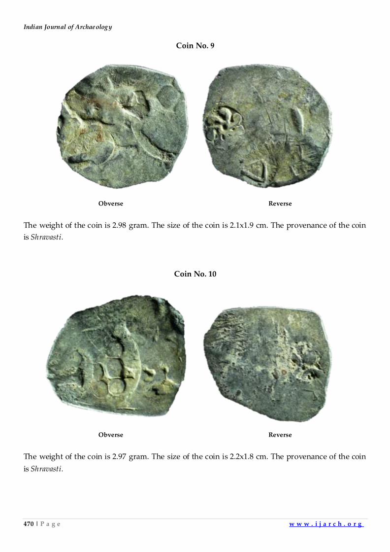
Indian Journal of Archaeology
470 | P a g e w w w . i j a r c h . o r g
Coin No. 9
Obverse Reverse
The weight of the coin is 2.98 gram. The size of the coin is 2.1x1.9 cm. The provenance of the coin
is Shravasti.
Coin No. 10
Obverse Reverse
The weight of the coin is 2.97 gram. The size of the coin is 2.2x1.8 cm. The provenance of the coin
is Shravasti.
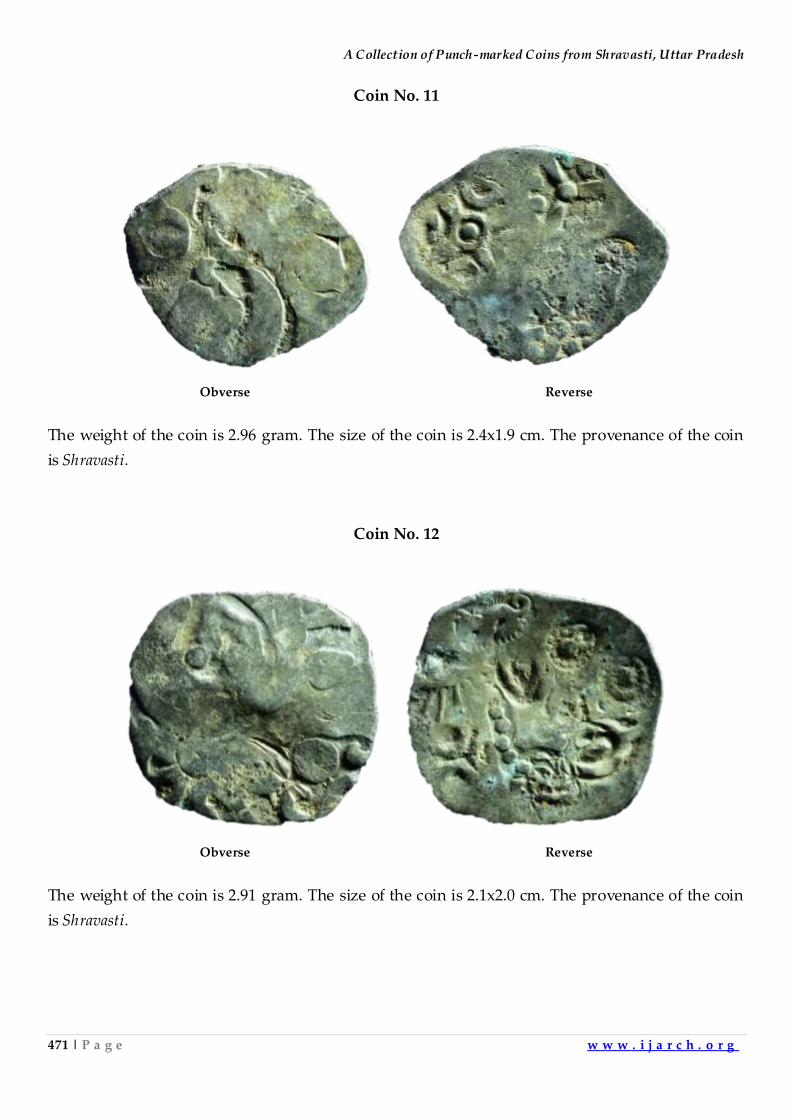
A Collection of Punch-marked Coins from Shravasti, Uttar Pradesh
471 | P a g e w w w . i j a r c h . o r g
Coin No. 11
Obverse Reverse
The weight of the coin is 2.96 gram. The size of the coin is 2.4x1.9 cm. The provenance of the coin
is Shravasti.
Coin No. 12
Obverse Reverse
The weight of the coin is 2.91 gram. The size of the coin is 2.1x2.0 cm. The provenance of the coin
is Shravasti.
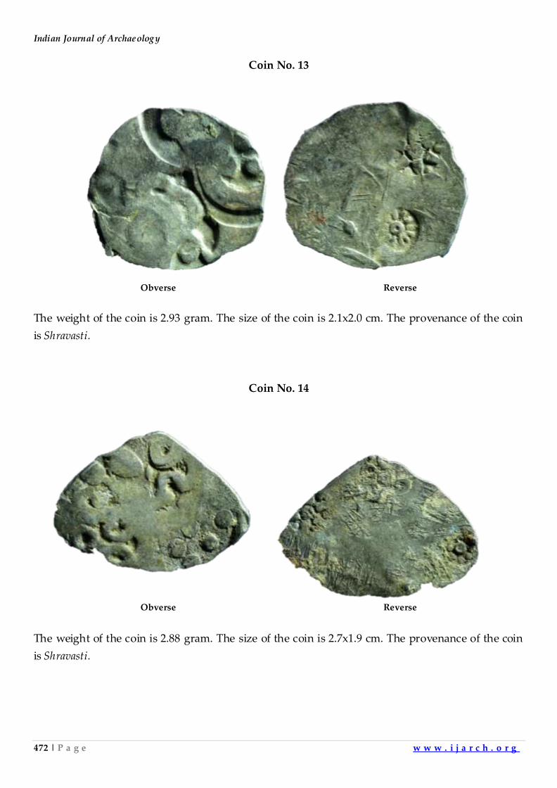
Indian Journal of Archaeology
472 | P a g e w w w . i j a r c h . o r g
Coin No. 13
Obverse Reverse
The weight of the coin is 2.93 gram. The size of the coin is 2.1x2.0 cm. The provenance of the coin
is Shravasti.
Coin No. 14
Obverse Reverse
The weight of the coin is 2.88 gram. The size of the coin is 2.7x1.9 cm. The provenance of the coin
is Shravasti.
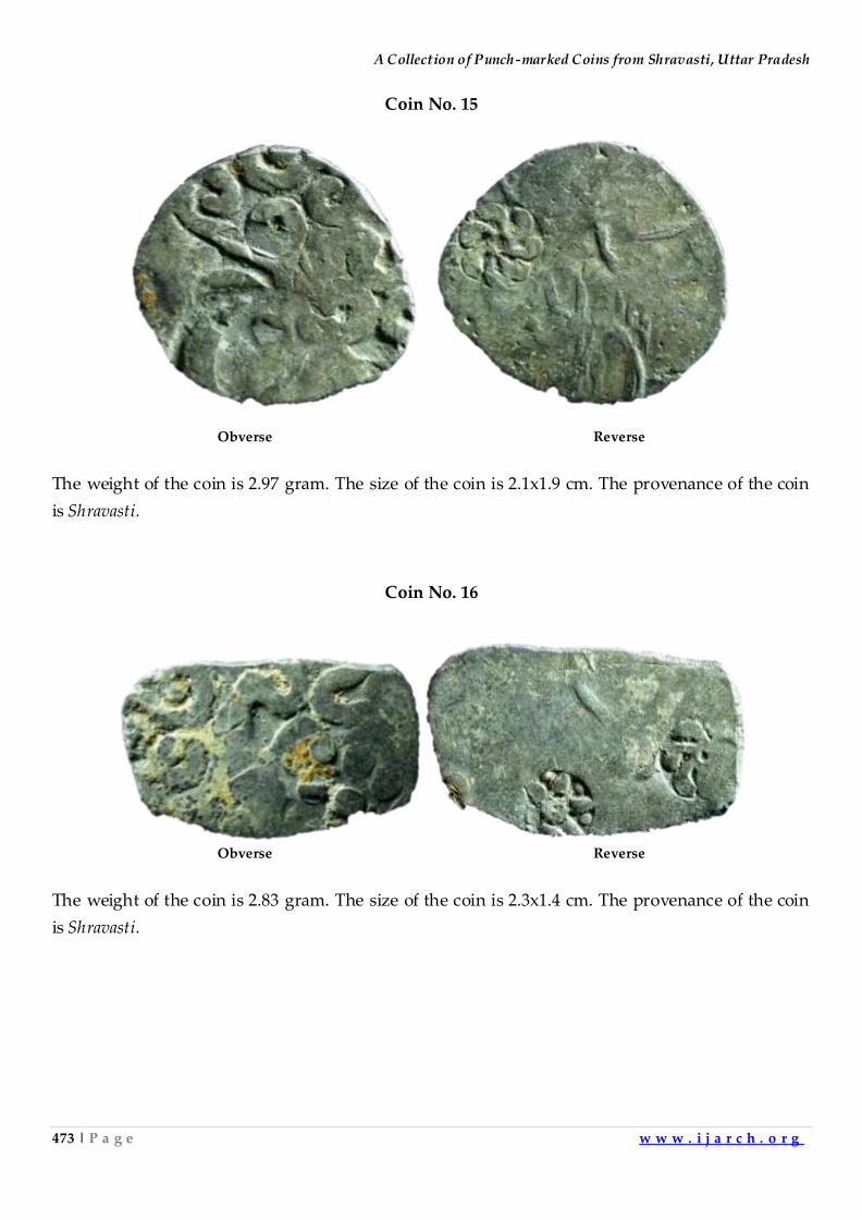
A Collection of Punch-marked Coins from Shravasti, Uttar Pradesh
473 | P a g e w w w . i j a r c h . o r g
Coin No. 15
Obverse Reverse
The weight of the coin is 2.97 gram. The size of the coin is 2.1x1.9 cm. The provenance of the coin
is Shravasti.
Coin No. 16
Obverse Reverse
The weight of the coin is 2.83 gram. The size of the coin is 2.3x1.4 cm. The provenance of the coin
is Shravasti.
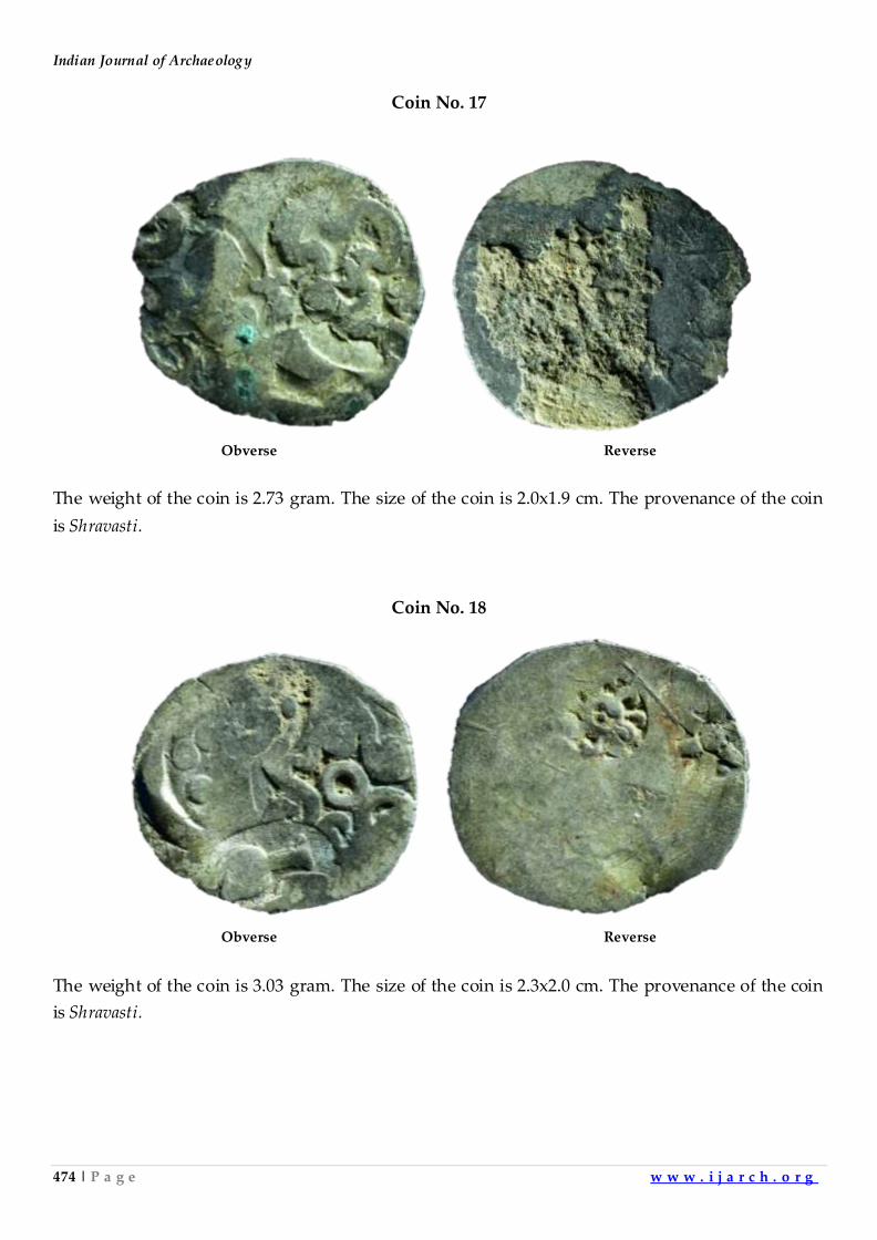
Indian Journal of Archaeology
474 | P a g e w w w . i j a r c h . o r g
Coin No. 17
Obverse Reverse
The weight of the coin is 2.73 gram. The size of the coin is 2.0x1.9 cm. The provenance of the coin
is Shravasti.
Coin No. 18
Obverse Reverse
The weight of the coin is 3.03 gram. The size of the coin is 2.3x2.0 cm. The provenance of the coin
is Shravasti.
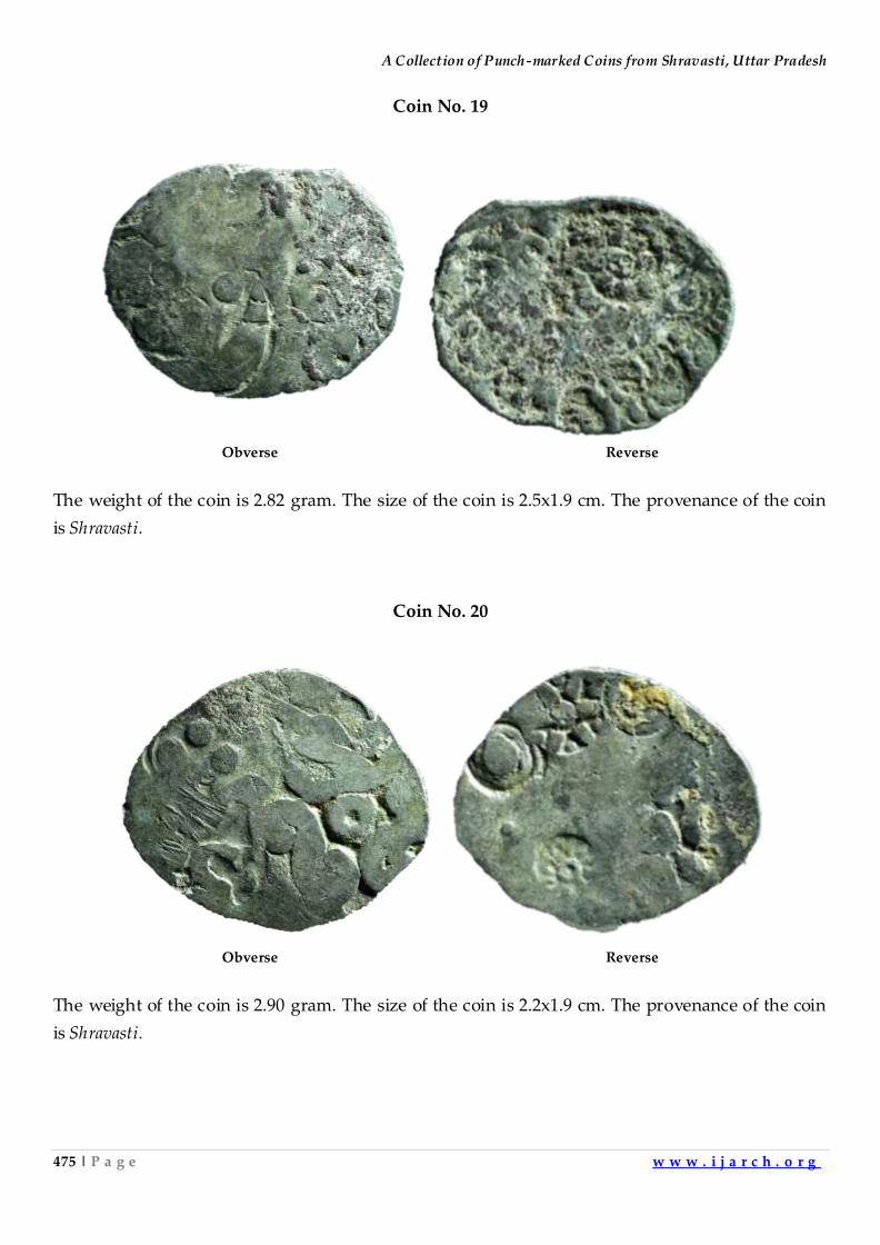
A Collection of Punch-marked Coins from Shravasti, Uttar Pradesh
475 | P a g e w w w . i j a r c h . o r g
Coin No. 19
Obverse Reverse
The weight of the coin is 2.82 gram. The size of the coin is 2.5x1.9 cm. The provenance of the coin
is Shravasti.
Coin No. 20
Obverse Reverse
The weight of the coin is 2.90 gram. The size of the coin is 2.2x1.9 cm. The provenance of the coin
is Shravasti.
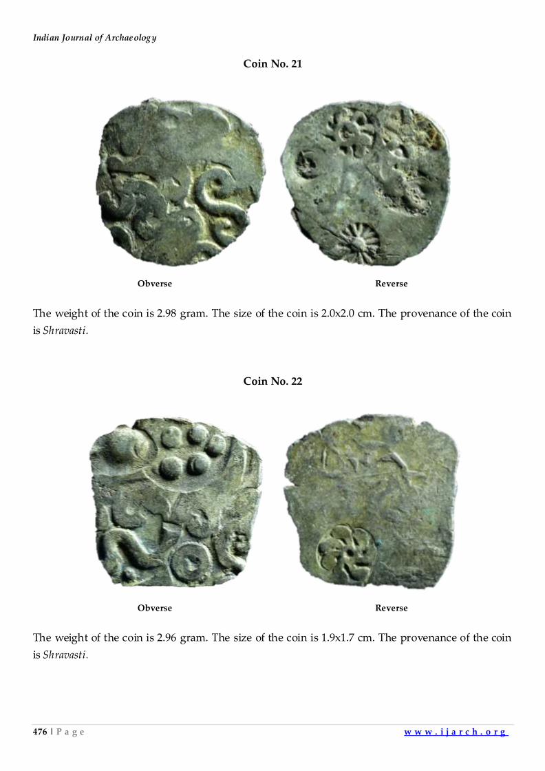
Indian Journal of Archaeology
476 | P a g e w w w . i j a r c h . o r g
Coin No. 21
Obverse Reverse
The weight of the coin is 2.98 gram. The size of the coin is 2.0x2.0 cm. The provenance of the coin
is Shravasti.
Coin No. 22
Obverse Reverse
The weight of the coin is 2.96 gram. The size of the coin is 1.9x1.7 cm. The provenance of the coin
is Shravasti.
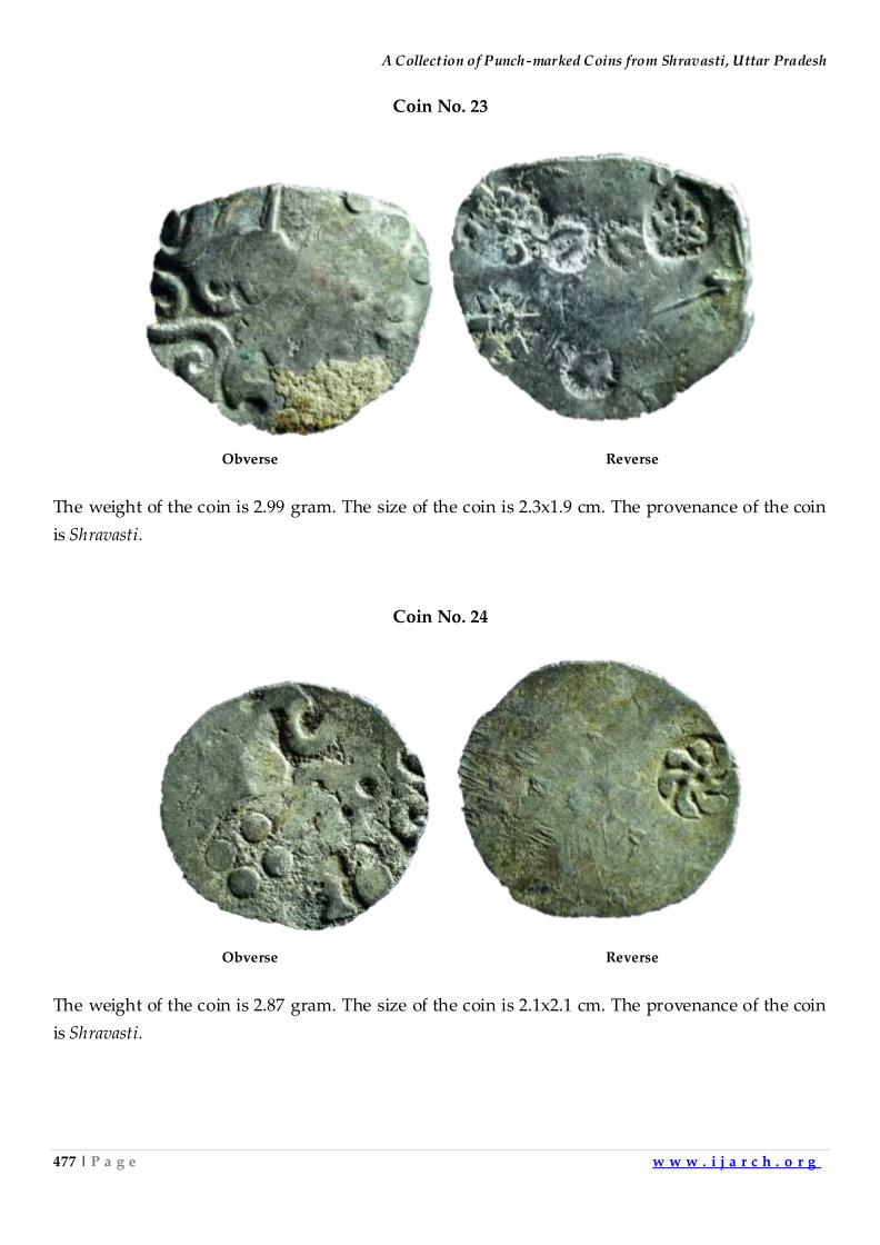
A Collection of Punch-marked Coins from Shravasti, Uttar Pradesh
477 | P a g e w w w . i j a r c h . o r g
Coin No. 23
Obverse Reverse
The weight of the coin is 2.99 gram. The size of the coin is 2.3x1.9 cm. The provenance of the coin
is Shravasti.
Coin No. 24
Obverse Reverse
The weight of the coin is 2.87 gram. The size of the coin is 2.1x2.1 cm. The provenance of the coin
is Shravasti.
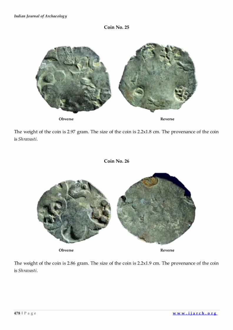
Indian Journal of Archaeology
478 | P a g e w w w . i j a r c h . o r g
Coin No. 25
Obverse Reverse
The weight of the coin is 2.97 gram. The size of the coin is 2.2x1.8 cm. The provenance of the coin
is Shravasti.
Coin No. 26
Obverse Reverse
The weight of the coin is 2.86 gram. The size of the coin is 2.2x1.9 cm. The provenance of the coin
is Shravasti.
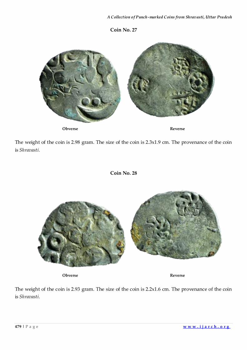
A Collection of Punch-marked Coins from Shravasti, Uttar Pradesh
479 | P a g e w w w . i j a r c h . o r g
Coin No. 27
Obverse Reverse
The weight of the coin is 2.98 gram. The size of the coin is 2.3x1.9 cm. The provenance of the coin
is Shravasti.
Coin No. 28
Obverse Reverse
The weight of the coin is 2.93 gram. The size of the coin is 2.2x1.6 cm. The provenance of the coin
is Shravasti.
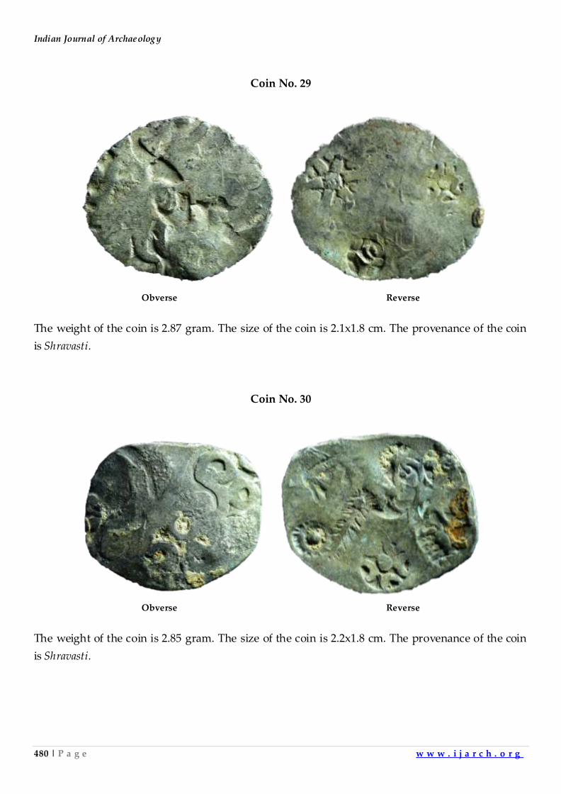
Indian Journal of Archaeology
480 | P a g e w w w . i j a r c h . o r g
Coin No. 29
Obverse Reverse
The weight of the coin is 2.87 gram. The size of the coin is 2.1x1.8 cm. The provenance of the coin
is Shravasti.
Coin No. 30
Obverse Reverse
The weight of the coin is 2.85 gram. The size of the coin is 2.2x1.8 cm. The provenance of the coin
is Shravasti.
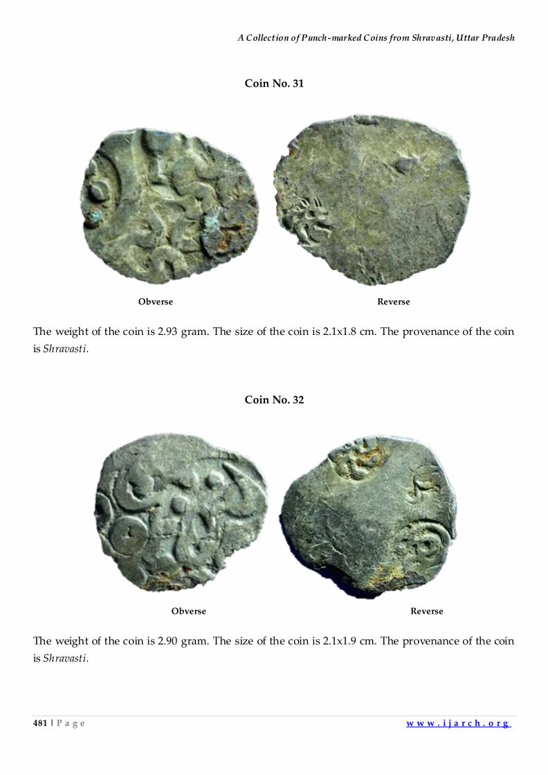
A Collection of Punch-marked Coins from Shravasti, Uttar Pradesh
481 | P a g e w w w . i j a r c h . o r g
Coin No. 31
Obverse Reverse
The weight of the coin is 2.93 gram. The size of the coin is 2.1x1.8 cm. The provenance of the coin
is Shravasti.
Coin No. 32
Obverse Reverse
The weight of the coin is 2.90 gram. The size of the coin is 2.1x1.9 cm. The provenance of the coin
is Shravasti.
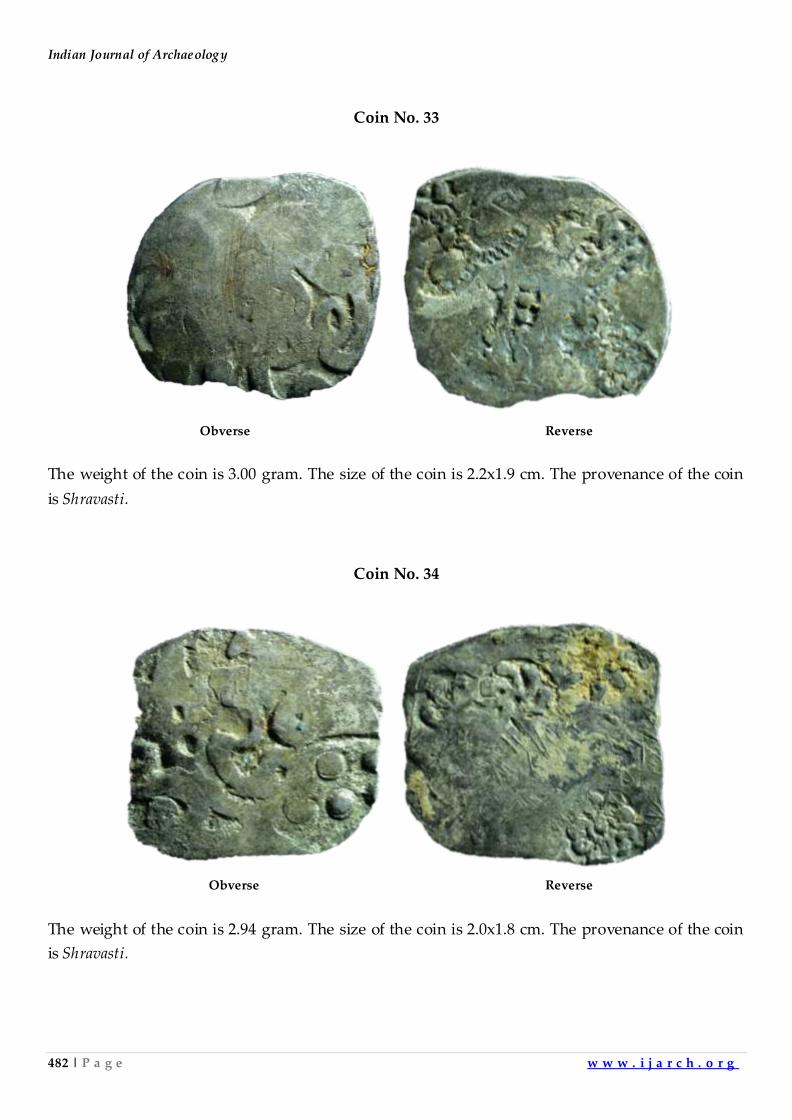
Indian Journal of Archaeology
482 | P a g e w w w . i j a r c h . o r g
Coin No. 33
Obverse Reverse
The weight of the coin is 3.00 gram. The size of the coin is 2.2x1.9 cm. The provenance of the coin
is Shravasti.
Coin No. 34
Obverse Reverse
The weight of the coin is 2.94 gram. The size of the coin is 2.0x1.8 cm. The provenance of the coin
is Shravasti.
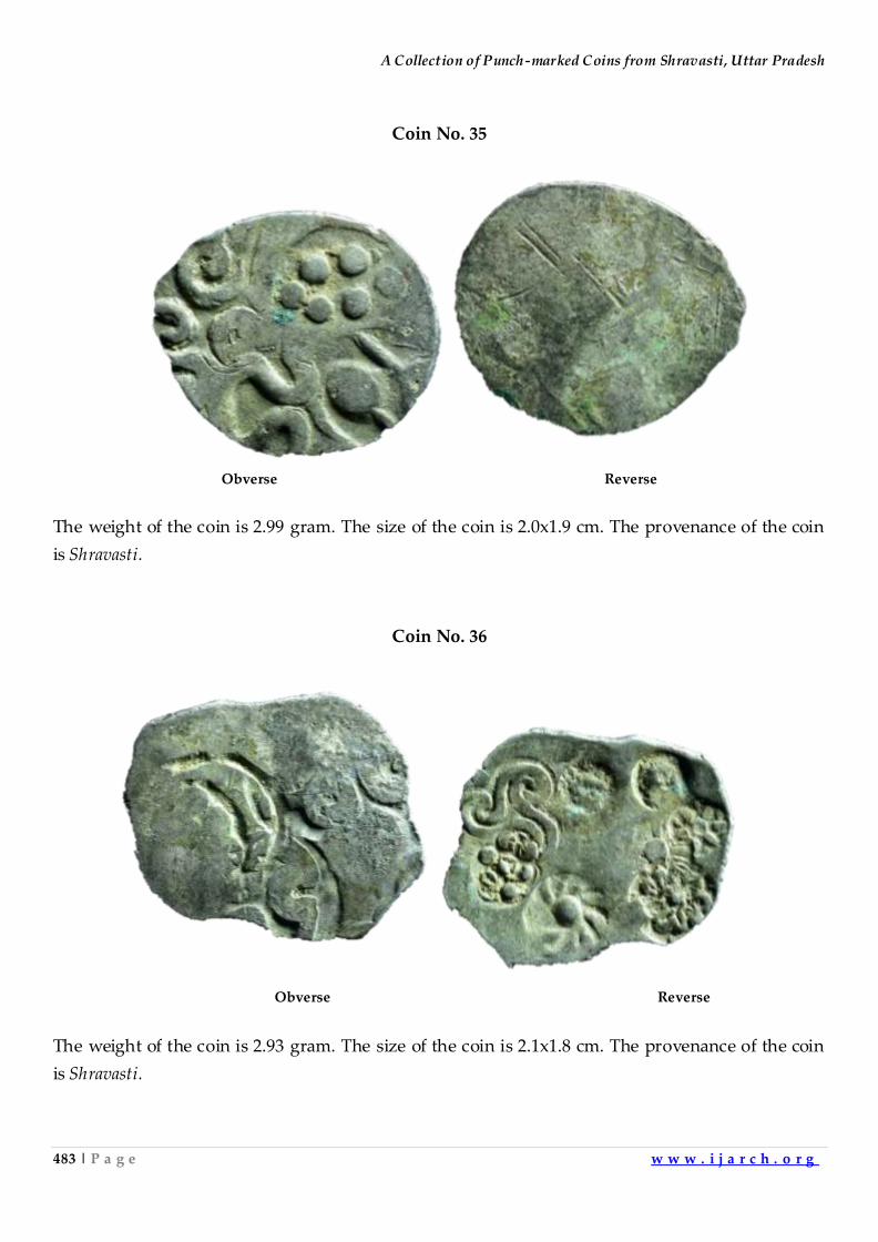
A Collection of Punch-marked Coins from Shravasti, Uttar Pradesh
483 | P a g e w w w . i j a r c h . o r g
Coin No. 35
Obverse Reverse
The weight of the coin is 2.99 gram. The size of the coin is 2.0x1.9 cm. The provenance of the coin
is Shravasti.
Coin No. 36
Obverse Reverse
The weight of the coin is 2.93 gram. The size of the coin is 2.1x1.8 cm. The provenance of the coin
is Shravasti.
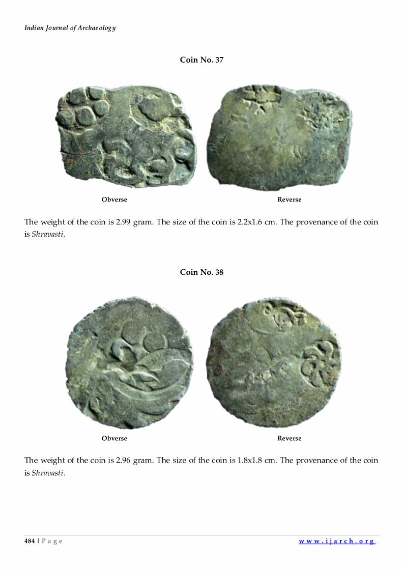
Indian Journal of Archaeology
484 | P a g e w w w . i j a r c h . o r g
Coin No. 37
Obverse Reverse
The weight of the coin is 2.99 gram. The size of the coin is 2.2x1.6 cm. The provenance of the coin
is Shravasti.
Coin No. 38
Obverse Reverse
The weight of the coin is 2.96 gram. The size of the coin is 1.8x1.8 cm. The provenance of the coin
is Shravasti.
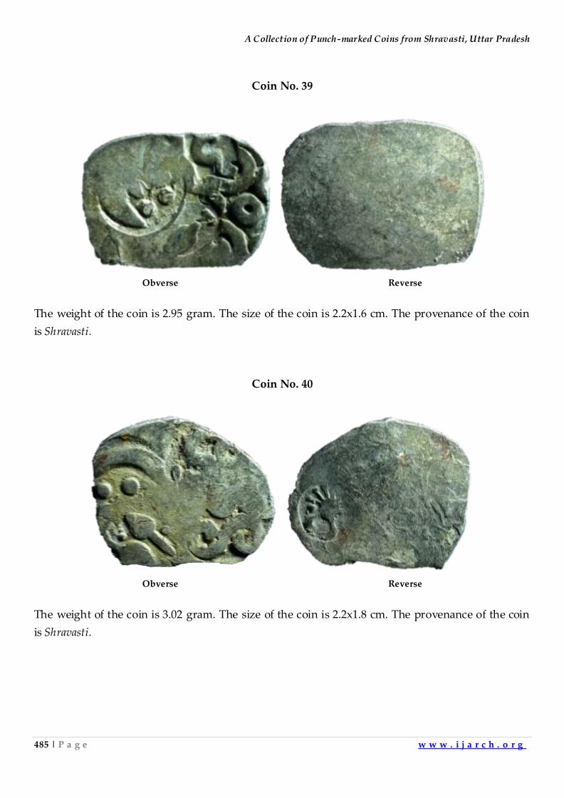
A Collection of Punch-marked Coins from Shravasti, Uttar Pradesh
485 | P a g e w w w . i j a r c h . o r g
Coin No. 39
Obverse Reverse
The weight of the coin is 2.95 gram. The size of the coin is 2.2x1.6 cm. The provenance of the coin
is Shravasti.
Coin No. 40
Obverse Reverse
The weight of the coin is 3.02 gram. The size of the coin is 2.2x1.8 cm. The provenance of the coin
is Shravasti.
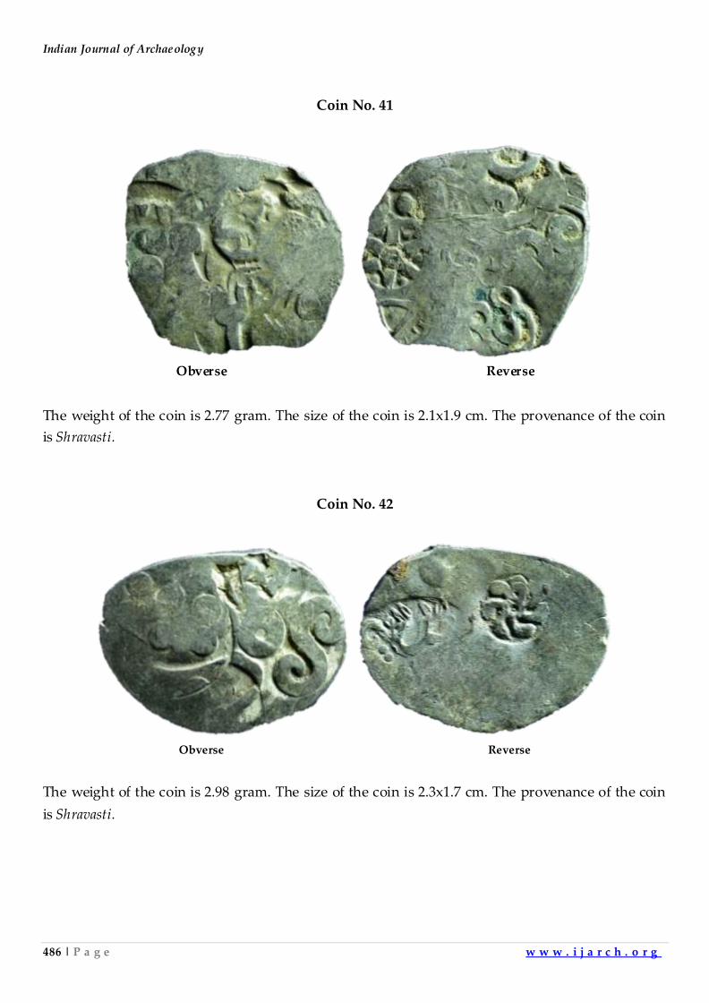
Indian Journal of Archaeology
486 | P a g e w w w . i j a r c h . o r g
Coin No. 41
Obverse Reverse
The weight of the coin is 2.77 gram. The size of the coin is 2.1x1.9 cm. The provenance of the coin
is Shravasti.
Coin No. 42
Obverse Reverse
The weight of the coin is 2.98 gram. The size of the coin is 2.3x1.7 cm. The provenance of the coin
is Shravasti.
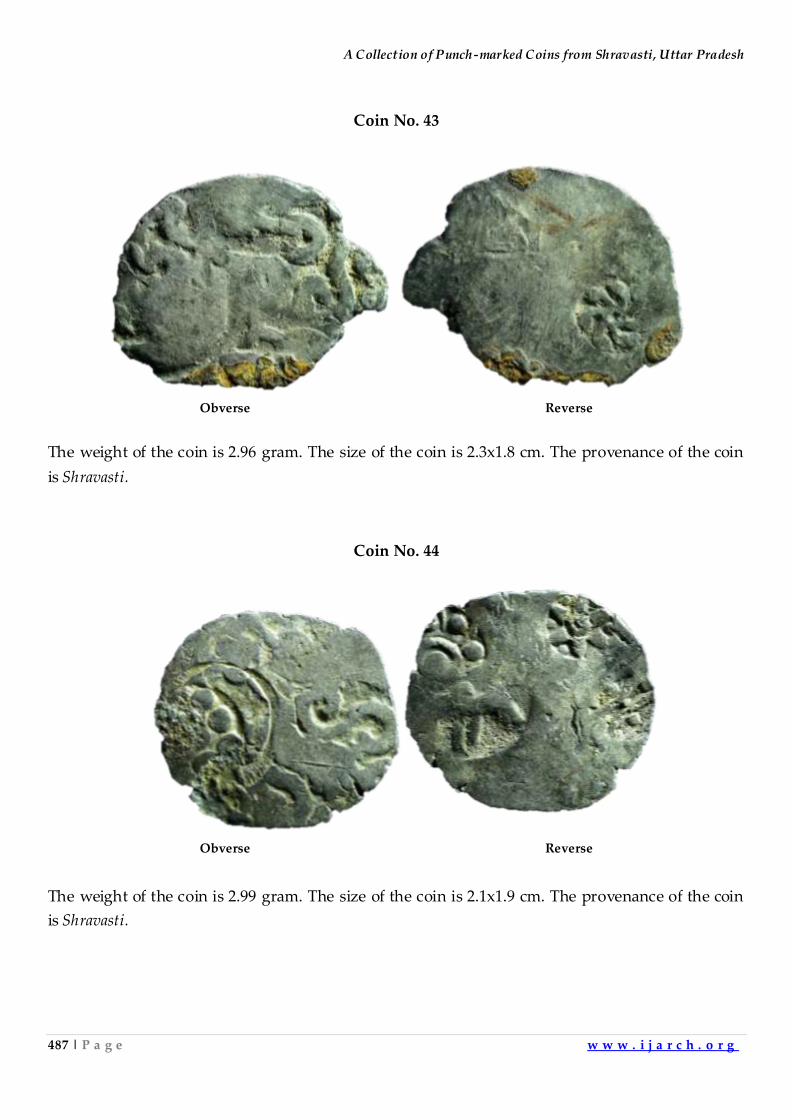
A Collection of Punch-marked Coins from Shravasti, Uttar Pradesh
487 | P a g e w w w . i j a r c h . o r g
Coin No. 43
Obverse Reverse
The weight of the coin is 2.96 gram. The size of the coin is 2.3x1.8 cm. The provenance of the coin
is Shravasti.
Coin No. 44
Obverse Reverse
The weight of the coin is 2.99 gram. The size of the coin is 2.1x1.9 cm. The provenance of the coin
is Shravasti.
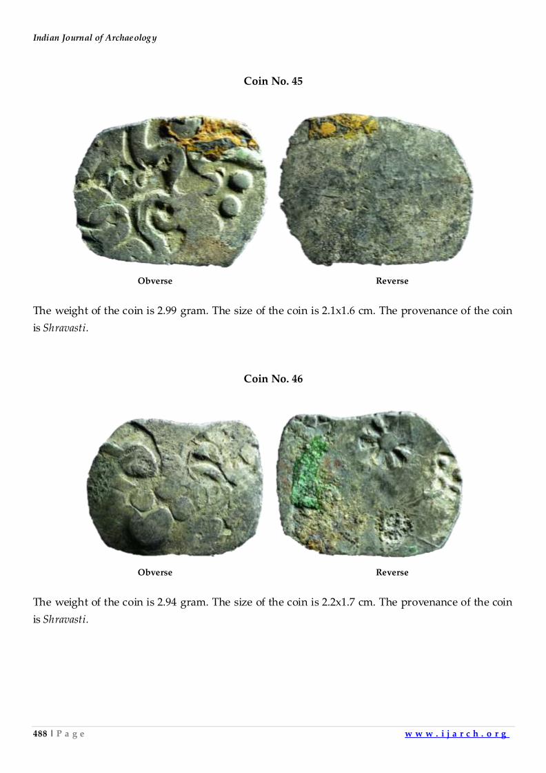
Indian Journal of Archaeology
488 | P a g e w w w . i j a r c h . o r g
Coin No. 45
Obverse Reverse
The weight of the coin is 2.99 gram. The size of the coin is 2.1x1.6 cm. The provenance of the coin
is Shravasti.
Coin No. 46
Obverse Reverse
The weight of the coin is 2.94 gram. The size of the coin is 2.2x1.7 cm. The provenance of the coin
is Shravasti.
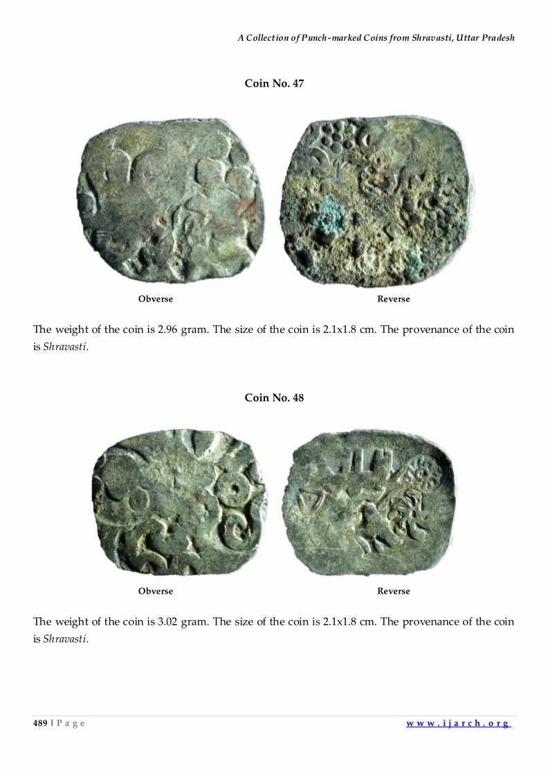
A Collection of Punch-marked Coins from Shravasti, Uttar Pradesh
489 | P a g e w w w . i j a r c h . o r g
Coin No. 47
Obverse Reverse
The weight of the coin is 2.96 gram. The size of the coin is 2.1x1.8 cm. The provenance of the coin
is Shravasti.
Coin No. 48
Obverse Reverse
The weight of the coin is 3.02 gram. The size of the coin is 2.1x1.8 cm. The provenance of the coin
is Shravasti.
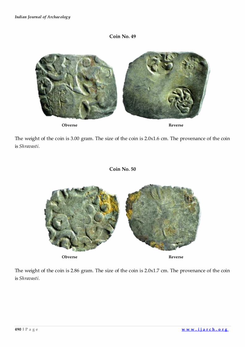
Indian Journal of Archaeology
490 | P a g e w w w . i j a r c h . o r g
Coin No. 49
Obverse Reverse
The weight of the coin is 3.00 gram. The size of the coin is 2.0x1.6 cm. The provenance of the coin
is Shravasti.
Coin No. 50
Obverse Reverse
The weight of the coin is 2.86 gram. The size of the coin is 2.0x1.7 cm. The provenance of the coin
is Shravasti.
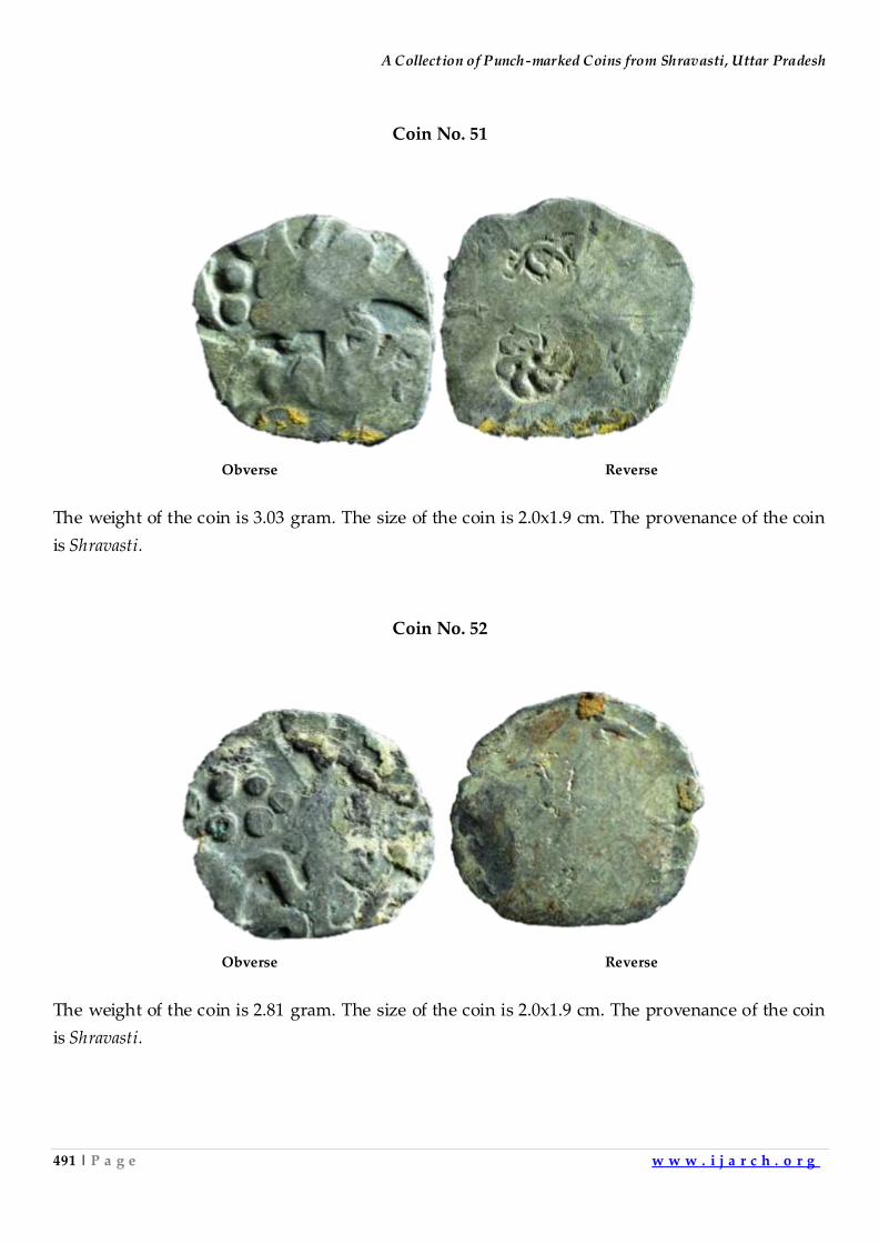
A Collection of Punch-marked Coins from Shravasti, Uttar Pradesh
491 | P a g e w w w . i j a r c h . o r g
Coin No. 51
Obverse Reverse
The weight of the coin is 3.03 gram. The size of the coin is 2.0x1.9 cm. The provenance of the coin
is Shravasti.
Coin No. 52
Obverse Reverse
The weight of the coin is 2.81 gram. The size of the coin is 2.0x1.9 cm. The provenance of the coin
is Shravasti.
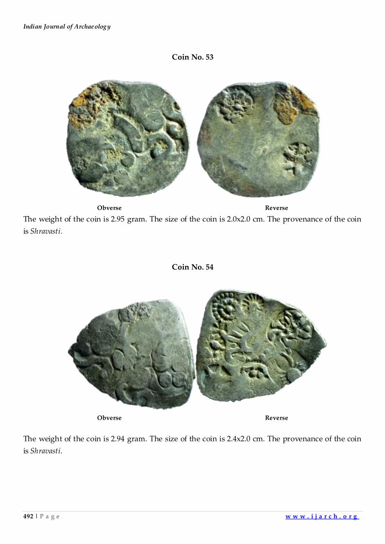
Indian Journal of Archaeology
492 | P a g e w w w . i j a r c h . o r g
Coin No. 53
Obverse Reverse
The weight of the coin is 2.95 gram. The size of the coin is 2.0x2.0 cm. The provenance of the coin
is Shravasti.
Coin No. 54
Obverse Reverse
The weight of the coin is 2.94 gram. The size of the coin is 2.4x2.0 cm. The provenance of the coin
is Shravasti.
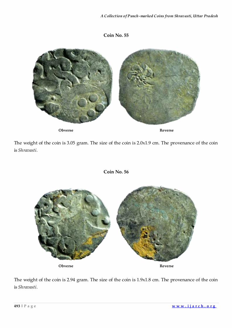
A Collection of Punch-marked Coins from Shravasti, Uttar Pradesh
493 | P a g e w w w . i j a r c h . o r g
Coin No. 55
Obverse Reverse
The weight of the coin is 3.05 gram. The size of the coin is 2.0x1.9 cm. The provenance of the coin
is Shravasti.
Coin No. 56
Obverse Reverse
The weight of the coin is 2.94 gram. The size of the coin is 1.9x1.8 cm. The provenance of the coin
is Shravasti.
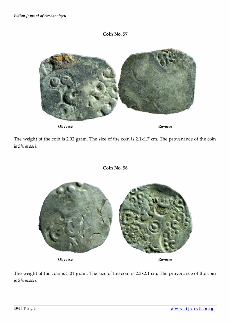
Indian Journal of Archaeology
494 | P a g e w w w . i j a r c h . o r g
Coin No. 57
Obverse Reverse
The weight of the coin is 2.92 gram. The size of the coin is 2.1x1.7 cm. The provenance of the coin
is Shravasti.
Coin No. 58
Obverse Reverse
The weight of the coin is 3.01 gram. The size of the coin is 2.3x2.1 cm. The provenance of the coin
is Shravasti.
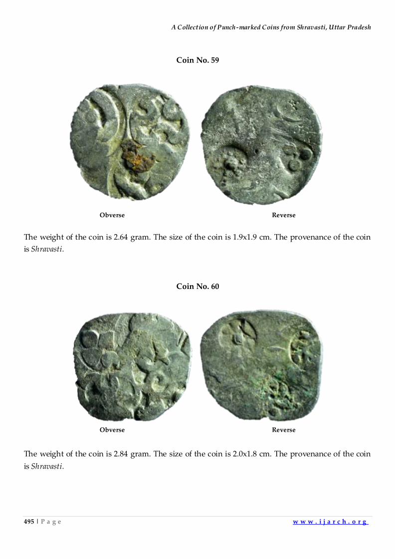
A Collection of Punch-marked Coins from Shravasti, Uttar Pradesh
495 | P a g e w w w . i j a r c h . o r g
Coin No. 59
Obverse Reverse
The weight of the coin is 2.64 gram. The size of the coin is 1.9x1.9 cm. The provenance of the coin
is Shravasti.
Coin No. 60
Obverse Reverse
The weight of the coin is 2.84 gram. The size of the coin is 2.0x1.8 cm. The provenance of the coin
is Shravasti.
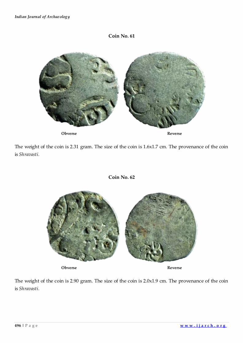
Indian Journal of Archaeology
496 | P a g e w w w . i j a r c h . o r g
Coin No. 61
Obverse Reverse
The weight of the coin is 2.31 gram. The size of the coin is 1.6x1.7 cm. The provenance of the coin
is Shravasti.
Coin No. 62
Obverse Reverse
The weight of the coin is 2.90 gram. The size of the coin is 2.0x1.9 cm. The provenance of the coin
is Shravasti.
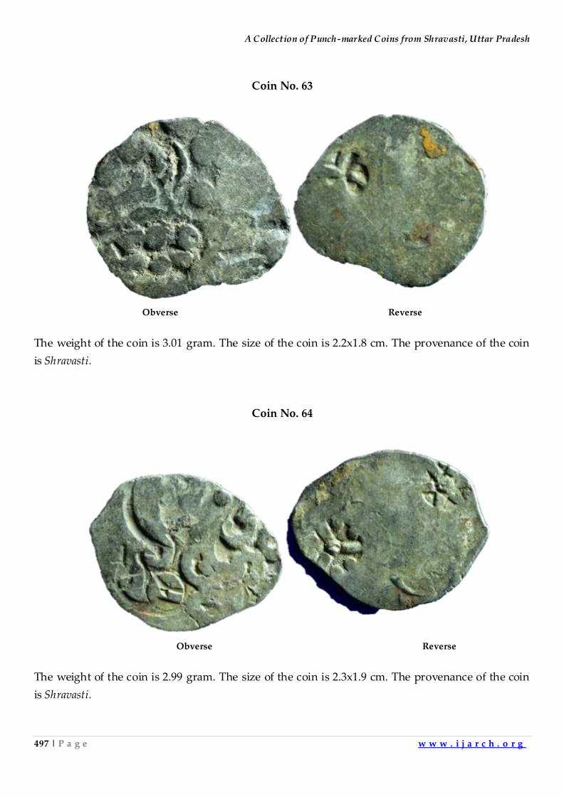
A Collection of Punch-marked Coins from Shravasti, Uttar Pradesh
497 | P a g e w w w . i j a r c h . o r g
Coin No. 63
Obverse Reverse
The weight of the coin is 3.01 gram. The size of the coin is 2.2x1.8 cm. The provenance of the coin
is Shravasti.
Coin No. 64
Obverse Reverse
The weight of the coin is 2.99 gram. The size of the coin is 2.3x1.9 cm. The provenance of the coin
is Shravasti.
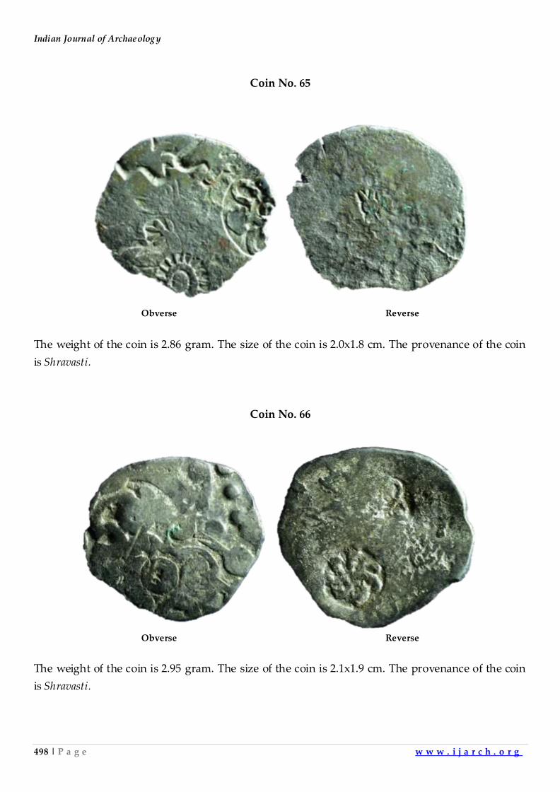
Indian Journal of Archaeology
498 | P a g e w w w . i j a r c h . o r g
Coin No. 65
Obverse Reverse
The weight of the coin is 2.86 gram. The size of the coin is 2.0x1.8 cm. The provenance of the coin
is Shravasti.
Coin No. 66
Obverse Reverse
The weight of the coin is 2.95 gram. The size of the coin is 2.1x1.9 cm. The provenance of the coin
is Shravasti.
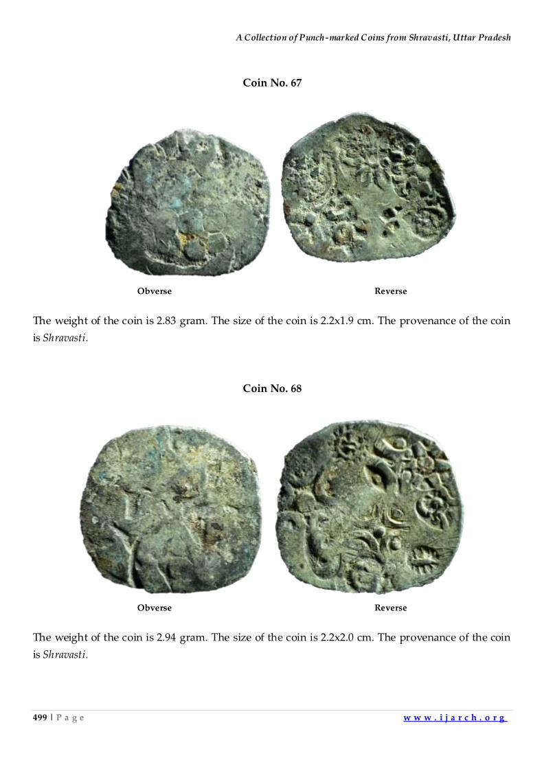
A Collection of Punch-marked Coins from Shravasti, Uttar Pradesh
499 | P a g e w w w . i j a r c h . o r g
Coin No. 67
Obverse Reverse
The weight of the coin is 2.83 gram. The size of the coin is 2.2x1.9 cm. The provenance of the coin
is Shravasti.
Coin No. 68
Obverse Reverse
The weight of the coin is 2.94 gram. The size of the coin is 2.2x2.0 cm. The provenance of the coin
is Shravasti.
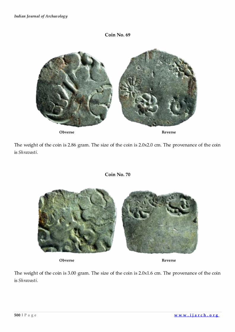
Indian Journal of Archaeology
500 | P a g e w w w . i j a r c h . o r g
Coin No. 69
Obverse Reverse
The weight of the coin is 2.86 gram. The size of the coin is 2.0x2.0 cm. The provenance of the coin
is Shravasti.
Coin No. 70
Obverse Reverse
The weight of the coin is 3.00 gram. The size of the coin is 2.0x1.6 cm. The provenance of the coin
is Shravasti.
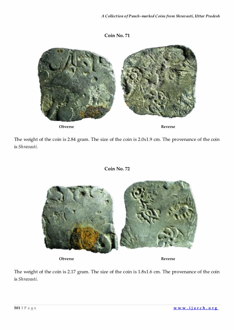
A Collection of Punch-marked Coins from Shravasti, Uttar Pradesh
501 | P a g e w w w . i j a r c h . o r g
Coin No. 71
Obverse Reverse
The weight of the coin is 2.84 gram. The size of the coin is 2.0x1.9 cm. The provenance of the coin
is Shravasti.
Coin No. 72
Obverse Reverse
The weight of the coin is 2.17 gram. The size of the coin is 1.8x1.6 cm. The provenance of the coin
is Shravasti.
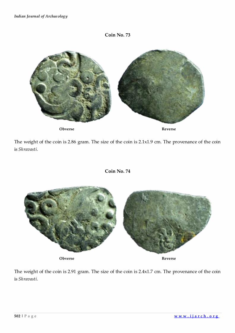
Indian Journal of Archaeology
502 | P a g e w w w . i j a r c h . o r g
Coin No. 73
Obverse Reverse
The weight of the coin is 2.86 gram. The size of the coin is 2.1x1.9 cm. The provenance of the coin
is Shravasti.
Coin No. 74
Obverse Reverse
The weight of the coin is 2.91 gram. The size of the coin is 2.4x1.7 cm. The provenance of the coin
is Shravasti.
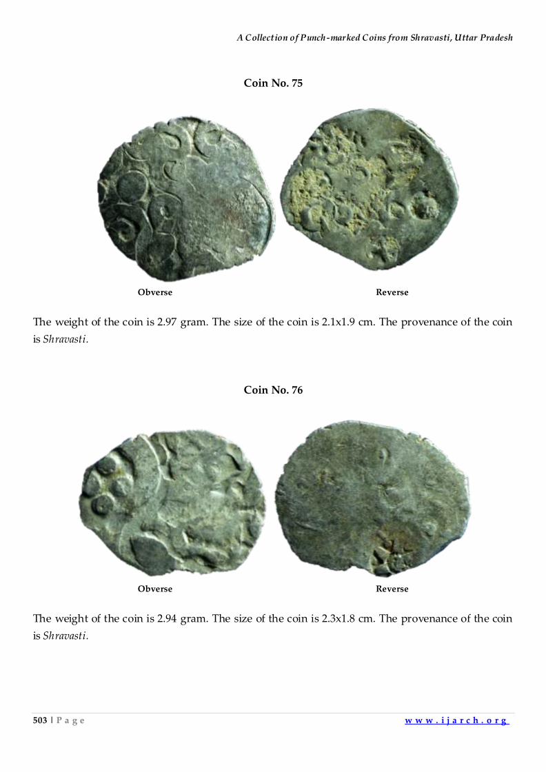
A Collection of Punch-marked Coins from Shravasti, Uttar Pradesh
503 | P a g e w w w . i j a r c h . o r g
Coin No. 75
Obverse Reverse
The weight of the coin is 2.97 gram. The size of the coin is 2.1x1.9 cm. The provenance of the coin
is Shravasti.
Coin No. 76
Obverse Reverse
The weight of the coin is 2.94 gram. The size of the coin is 2.3x1.8 cm. The provenance of the coin
is Shravasti.
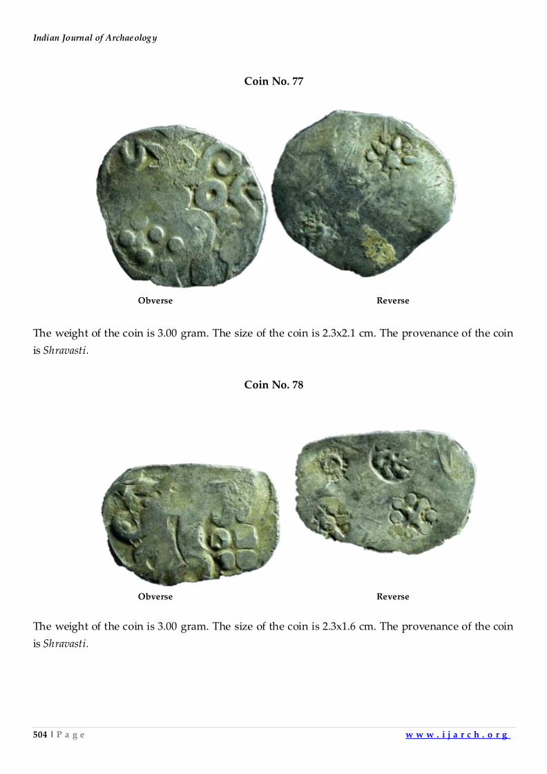
Indian Journal of Archaeology
504 | P a g e w w w . i j a r c h . o r g
Coin No. 77
Obverse Reverse
The weight of the coin is 3.00 gram. The size of the coin is 2.3x2.1 cm. The provenance of the coin
is Shravasti.
Coin No. 78
Obverse Reverse
The weight of the coin is 3.00 gram. The size of the coin is 2.3x1.6 cm. The provenance of the coin
is Shravasti.
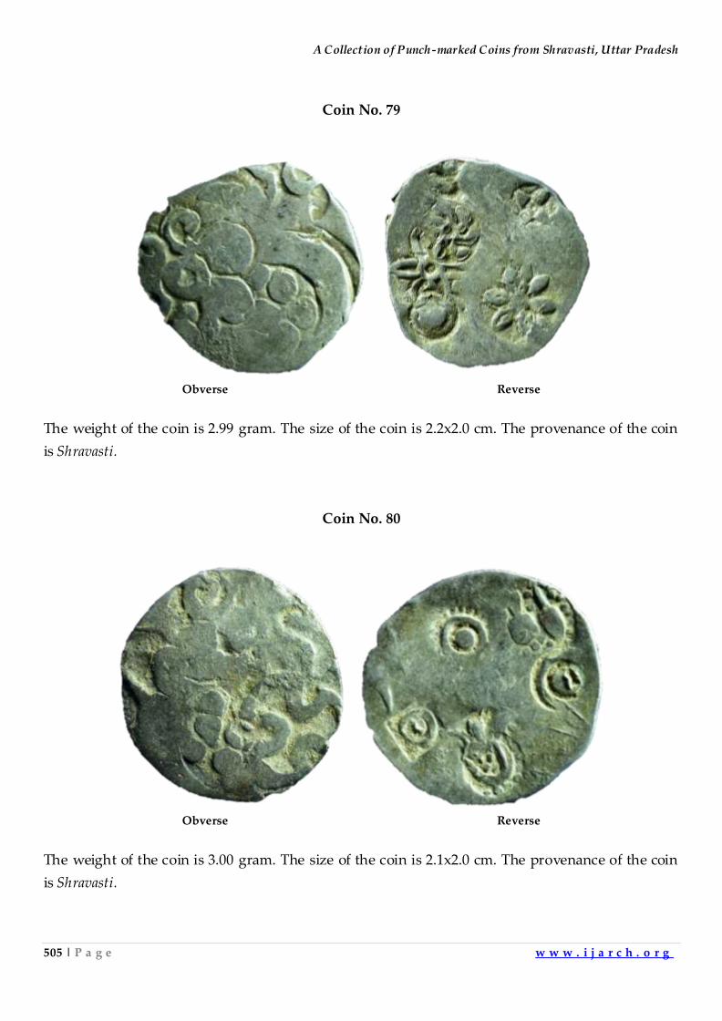
A Collection of Punch-marked Coins from Shravasti, Uttar Pradesh
505 | P a g e w w w . i j a r c h . o r g
Coin No. 79
Obverse Reverse
The weight of the coin is 2.99 gram. The size of the coin is 2.2x2.0 cm. The provenance of the coin
is Shravasti.
Coin No. 80
Obverse Reverse
The weight of the coin is 3.00 gram. The size of the coin is 2.1x2.0 cm. The provenance of the coin
is Shravasti.
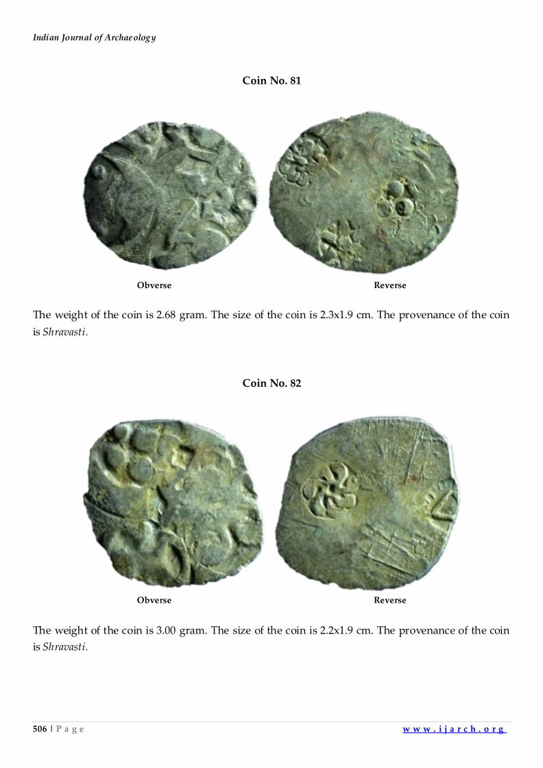
Indian Journal of Archaeology
506 | P a g e w w w . i j a r c h . o r g
Coin No. 81
Obverse Reverse
The weight of the coin is 2.68 gram. The size of the coin is 2.3x1.9 cm. The provenance of the coin
is Shravasti.
Coin No. 82
Obverse Reverse
The weight of the coin is 3.00 gram. The size of the coin is 2.2x1.9 cm. The provenance of the coin
is Shravasti.
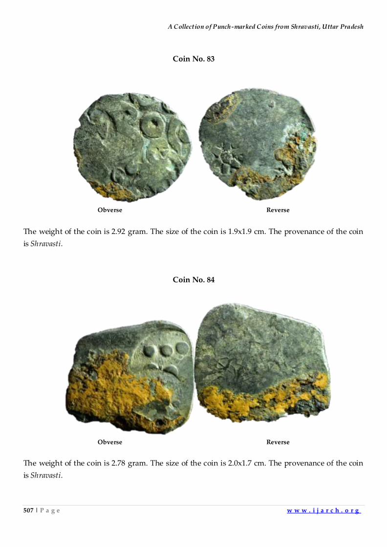
A Collection of Punch-marked Coins from Shravasti, Uttar Pradesh
507 | P a g e w w w . i j a r c h . o r g
Coin No. 83
Obverse Reverse
The weight of the coin is 2.92 gram. The size of the coin is 1.9x1.9 cm. The provenance of the coin
is Shravasti.
Coin No. 84
Obverse Reverse
The weight of the coin is 2.78 gram. The size of the coin is 2.0x1.7 cm. The provenance of the coin
is Shravasti.
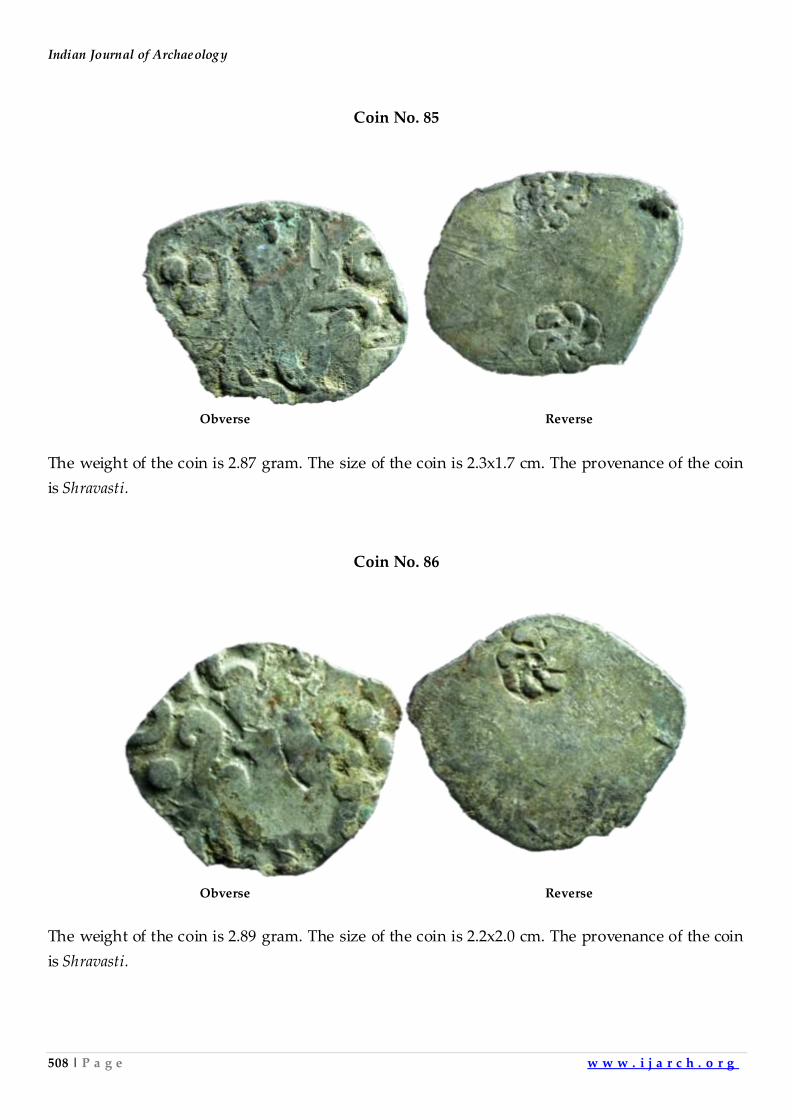
Indian Journal of Archaeology
508 | P a g e w w w . i j a r c h . o r g
Coin No. 85
Obverse Reverse
The weight of the coin is 2.87 gram. The size of the coin is 2.3x1.7 cm. The provenance of the coin
is Shravasti.
Coin No. 86
Obverse Reverse
The weight of the coin is 2.89 gram. The size of the coin is 2.2x2.0 cm. The provenance of the coin
is Shravasti.
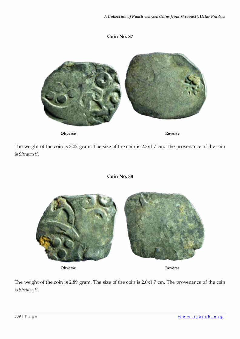
A Collection of Punch-marked Coins from Shravasti, Uttar Pradesh
509 | P a g e w w w . i j a r c h . o r g
Coin No. 87
Obverse Reverse
The weight of the coin is 3.02 gram. The size of the coin is 2.2x1.7 cm. The provenance of the coin
is Shravasti.
Coin No. 88
Obverse Reverse
The weight of the coin is 2.89 gram. The size of the coin is 2.0x1.7 cm. The provenance of the coin
is Shravasti.
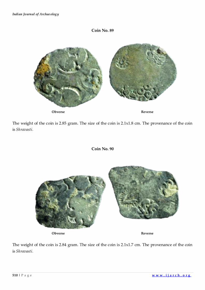
Indian Journal of Archaeology
510 | P a g e w w w . i j a r c h . o r g
Coin No. 89
Obverse Reverse
The weight of the coin is 2.85 gram. The size of the coin is 2.1x1.8 cm. The provenance of the coin
is Shravasti.
Coin No. 90
Obverse Reverse
The weight of the coin is 2.84 gram. The size of the coin is 2.1x1.7 cm. The provenance of the coin
is Shravasti.
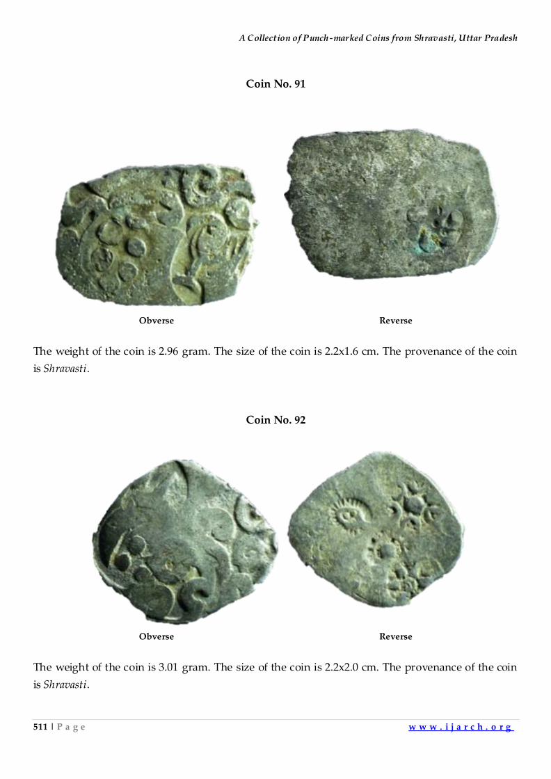
A Collection of Punch-marked Coins from Shravasti, Uttar Pradesh
511 | P a g e w w w . i j a r c h . o r g
Coin No. 91
Obverse Reverse
The weight of the coin is 2.96 gram. The size of the coin is 2.2x1.6 cm. The provenance of the coin
is Shravasti.
Coin No. 92
Obverse Reverse
The weight of the coin is 3.01 gram. The size of the coin is 2.2x2.0 cm. The provenance of the coin
is Shravasti.
Indian Journal of Archaeology
512 | P a g e w w w . i j a r c h . o r g
References:
1 B C Law, North India in the Sixth Century BC, Chapter I, in R C Majumdar, A D Pusalker, and A K Majumdar (ed),
The Age of Imperial Unity (The History and Culture of the Indian People 2), (reprint, Bombay. 1980), pp. 1 -17, on p.
4; H C Raychaudhuri, Political History of Ancient India, from the Accession of Parîkshita to the Extinction of the
Gupta Dynasty, (7 th ed, Calcutta. 1972), p. 99. 2 B C Law, North India in the Sixth Century BC, Chapter I, in R C Majumdar, A D Pusalker, an d A K Majumdar (ed),
The Age of Imperial Unity (The History and Culture of the Indian People 2), (reprint, Bombay. 1980), pp. 1 -17, on p.
4; also Shinji Hirano, The Ghaghara-Gandak River Region (c 600-300 BC) : Archaic Silver Punchmarked Coinage , (Nashik
: Indian Institute of Research in Numismatic Studies, 2007), p. 12. 3 B C Law, North India in the Sixth Century BC, Chapter I, in R C Majumdar, A D Pusalker, and A K Majumdar (ed),
The Age of Imperial Unity (The History and Culture of the Indian People 2), (reprint, Bombay. 1980), pp. 1-17, on p.
4. 4RadhaKumudMookerji, Rise of the Magadhan Imperialism, Chapter II, in R C Majumdar, A D Pusalker, and A K
Majumdar (ed), The Age of Imperial Unity (The History and Culture of the Indian People 2), (reprint, Bomb ay :
BharatiyaVidyaBhavan. 1980), pp. 18-38, on p. 30. 5DilipRajgor, Punch-marked Coins of Early Historic India , (California :Reesha Books International. 2001), p. 151. 6P L Gupta, The Punch-marked Coins of Ancient India, (unpublished PhD thesis); available in the library of the Indian
Institute of Research in Numismatic Studies, Anjaneri, Nashik. 7Terry R Hardekar, Punch-marked Coinage of Kosala—Towards a Classification, in D W MacDowall, Savita Sharma,
and Sanjay Garg (ed), Indian Numismatics, Art, History and Culture—Essays in Honour of Dr P L Gupta, (Delhi : Agam
Kala Prakashan. 1992), pp. 3-11. 8DilipRajgor, 2001. Opcit. 9Shinji Hirano, The Ghaghara-Gandak River Reg ion (c 600-300 BC) : Archaic Silver Punchmarked Coinage, (Nashik : Indian
Institute of Research in Numismatic Studies. 2007). 10 S R Goyal, The Coinage of Ancient India, (Jodhpur :KusumanjaliPrakashan. 1995), p. 89. 11P L Gupta, Coins, (reprint, New Delhi : National Book Trust. 2004), p. 16. 12P L Gupta, Coins, (reprint, New Delhi : National Book Trust. 2004), p. 16. 13Shinji Hirano, The Ghaghara-Gandak River Reg ion (c 600-300 BC) : Archaic Silver Punchmarked Coinage , (Nashik : Indian
Institute of Research in Numismatic Studies. 2007), p. 29. 14P L Gupta, Coins, (reprint, New Delhi : National Book Trust. 2004), p. 16. 15P L Gupta, Coins, (reprint, New Delhi : National Book Trust. 2004), p. 16. 16 Paul Murphy, Symbols Table, Appendix 1, in Shinji Hirano, The Ghaghara-Gandak River Reg ion (c 600-300 BC) :
Archaic Silver Punchmarked Coinage, (Nashik : Indian Institute of Research in Numismatic Studies. 2007), pp. 116-
146, on pp. 117-133. 17 Paul Murphy, Symbols Table, Appendix 1, in Shinji Hirano, The Ghaghara-Gandak River Reg ion (c 600-300 BC) :
Archaic Silver Punchmarked Coinage, (Nashik : Indian Institute of Research in Numismatic Studies. 2007), pp. 116-
146, on pp. 134-144. 18 Paul Murphy, Symbols Table, Appendix 1, in Shinji Hirano, The Ghaghara-Gandak River Reg ion (c 600-300 BC) :
Archaic Silver Punchmarked Coinage, (Nashik : Indian Institute of Research in Numismatic Studies. 2007), pp. 116-
146, on pp. 145-146. 19 Paul Murphy, Table of Bankers’ Marks, Appendix 2, in Shinji Hirano, The Ghaghara-Gandak River Region (c 600-300
BC) : Archaic Silver Punchmarked Coinage, (Nashik : Indian Institute of Research in Numismatic Studies. 2007), pp.
147-158, on pp. 148-154. 20 Paul Murphy, Table of Bankers’ Marks, Appendix 2, in Shinji Hirano, The Ghaghara-Gandak River Region (c 600-300
BC) : Archaic Silver Punchmarked Coinage, (Nashik : Indian Institute of Research in Numismatic Studies. 2007), pp.
147-158, on pp. 155-157. 21 Paul Murphy, Table of Bankers’ Marks, Appendix 2, in Shinji Hirano, The Ghaghara-Gandak River Region (c 600-300
BC) : Archaic Silver Punchmarked Coinage, (Nashik : Indian Institute of Research in Numismatic Studies. 2007), pp.
147-158, on p. 158. 22DilipRajgor. 2001. Opcit., pp. 152-153. 23Ibid, p. 153. 24Ibid, pp. 154-162.
A Collection of Punch-marked Coins from Shravasti, Uttar Pradesh
513 | P a g e w w w . i j a r c h . o r g
25Ibid, p. 154. 26Ibid, p. 163. 27Ibid, p. 163. 28Ibid, pp. 152-153. 29Ibid, pp. 154, 155-162. 30Ibid, p. 153. 31Ibid, p. 154. 32Ibid, p. 163. 33Ibid, p. 163. 34Ibid, pp. 152-153. 35Ibid, p. 153. 36Ibid, p. 154. 37Ibid, pp. 155-158. 38Ibid, pp. 159-162. 39Ibid, p. 154. 40Ibid, p. 163. 41Ibid, p. 163.
Indian Journal of Archaeology
514 | P a g e w w w . i j a r c h . o r g
The Art and Archaeology of Early Historic Harwan
Dr Abdul Rashid Lone
Assistant Professor
Department of History
University of Kashmir
I
The Rajatarangini of Kalhana is replete with the repeated references about the flourishing of the
Buddhist faith in the Valley during the time of three Turushka kings i.e., Hushka, Jushka and
Kanishka. These three rulers were identified with the historical personalities of Huvishka, Vasiska
and Kaniska of the Kushana dynasty. In this connection the Rajatarangini refers to Nagarjuna as a
Bodhisattva residing at Sadarhadvana during this period.1The place Sadarhadvana ‘grove of the six
saints’ mentioned by Kalhana is identified by M.A. Stein with the modern village Harwan (34 ̊ 09′
N 74 ̊ 54′ E) situated about one and a half mile to the north-west of the gardens of Shalimar near
Srinagar. Stein’s identification of Sadarhadvana with modern Harwan is based upon the earlier
interpretations (by other scholars) of Kalhana’s work, which placed it near the Shalimar gardens,
as well as Stein’s own awareness of artifacts being found near Harwan village as the Srinagar
waterworks were being constructed. 2 However, Gulshan Majid is not ready to accept this view of
Stein. He says, ‚Stein is not right in ascribing ‘sadardvana’ of the Rajatarangini to
Harwana.‛3Sadarhadvana is mentioned only twice in the Rajatarangini and is otherwise unknown
to other texts that mention Kashmir. Surprisingly, even the famous Chinese travellers, Hieun
T’sang (7th century CE) and O’kong (8th century CE) do not mention this place, although both of
them stayed in Kashmir for a considerable time and visited Buddhist sites besides studying
Buddhist literature in the Valley. One may also mention that Kanishka, according to some scholars,
held the fourth Buddhist council here during second century C.E. 4 Sufi instead states that
Kanishka held ‘third Buddhist council at Khandalvan vihar near Harwan.’ 5 However, there is a
debate about the exact location of the place where the council was held, with Kond (Kulgam) and
Buddhabal in Knalwan, Kashmir6 also having been mentioned as possible locations. To date, we
lack the exact location of this place.
The archaeological ruins at Harwan were first accidently discovered in 1895, in the course
of construction of the conduit which carries drinking water to Srinagar. 7 This chance discovery did
not attract much attention till Hiranand Shastri identified the location of the Buddhist site in what
was then a forested area. Shastri explored the site in 1919 and found some brick tiles stamped with
images.8 However, the first systematic excavations at the site were conducted by R.C. Kak in 1920-
21 and in subsequent years (for plan of excavations see Fig.1). Systematic excavations were again
carried on at the site by L. K. Srinivasan of the Frontier Circle of the Survey, assisted by Shali in
1973.
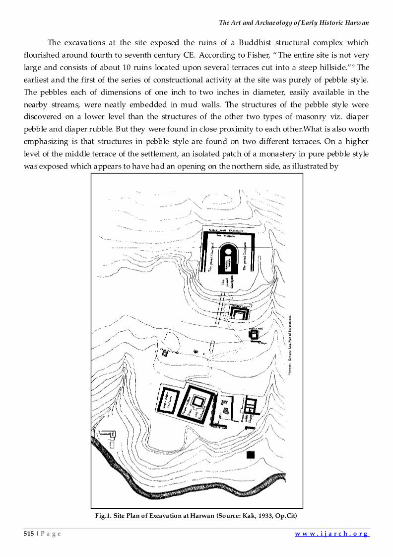
The Art and Archaeology of Early Historic Harwan
515 | P a g e w w w . i j a r c h . o r g
The excavations at the site exposed the ruins of a Buddhist structural complex which
flourished around fourth to seventh century CE. According to Fisher, ‚ The entire site is not very
large and consists of about 10 ruins located upon several terraces cut into a steep hillside.‛ 9 The
earliest and the first of the series of constructional activity at the site was purely of pebble style.
The pebbles each of dimensions of one inch to two inches in diameter, easily available in the
nearby streams, were neatly embedded in mud walls. The structures of the pebble style were
discovered on a lower level than the structures of the other two types of masonry viz. diaper
pebble and diaper rubble. But they were found in close proximity to each other.What is also worth
emphasizing is that structures in pebble style are found on two different terraces. On a higher
level of the middle terrace of the settlement, an isolated patch of a monastery in pure pebble style
was exposed which appears to have had an opening on the northern side, as illustrated by
Fig.1. Site Plan of Excavation at Harwan (Source: Kak, 1933, Op.Cit)
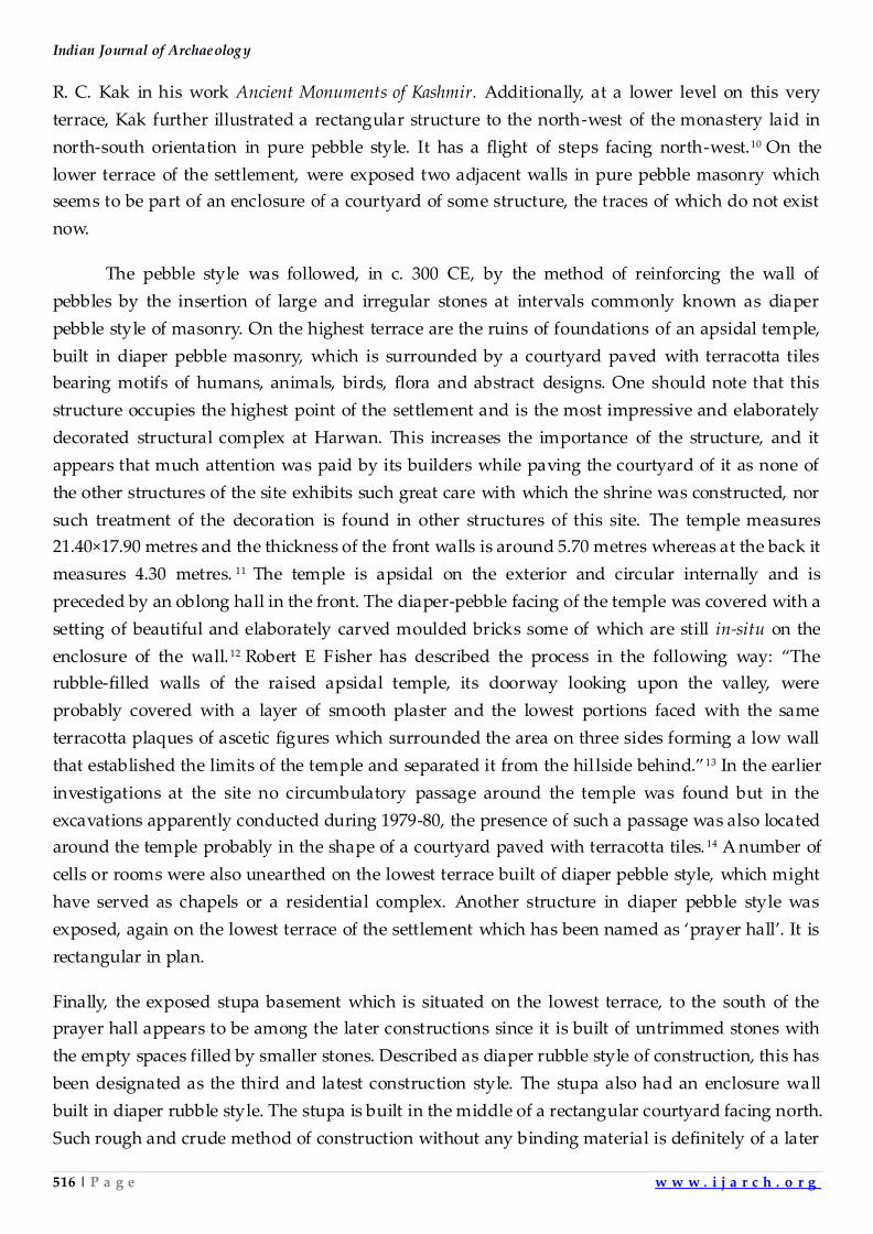
Indian Journal of Archaeology
516 | P a g e w w w . i j a r c h . o r g
R. C. Kak in his work Ancient Monuments of Kashmir. Additionally, at a lower level on this very
terrace, Kak further illustrated a rectangular structure to the north-west of the monastery laid in
north-south orientation in pure pebble style. It has a flight of steps facing north-west.10 On the
lower terrace of the settlement, were exposed two adjacent walls in pure pebble masonry which
seems to be part of an enclosure of a courtyard of some structure, the traces of which do not exist
now.
The pebble style was followed, in c. 300 CE, by the method of reinforcing the wall of
pebbles by the insertion of large and irregular stones at intervals commonly known as diaper
pebble style of masonry. On the highest terrace are the ruins of foundations of an apsidal temple,
built in diaper pebble masonry, which is surrounded by a courtyard paved with terracotta tiles
bearing motifs of humans, animals, birds, flora and abstract designs. One should note that this
structure occupies the highest point of the settlement and is the most impressive and elaborately
decorated structural complex at Harwan. This increases the importance of the structure, and it
appears that much attention was paid by its builders while paving the courtyard of it as none of
the other structures of the site exhibits such great care with which the shrine was constructed, nor
such treatment of the decoration is found in other structures of this site. The temple measures
21.40×17.90 metres and the thickness of the front walls is around 5.70 metres whereas at the back it
measures 4.30 metres. 11 The temple is apsidal on the exterior and circular internally and is
preceded by an oblong hall in the front. The diaper-pebble facing of the temple was covered with a
setting of beautiful and elaborately carved moulded bricks some of which are still in-situ on the
enclosure of the wall. 12 Robert E Fisher has described the process in the following way: ‚The
rubble-filled walls of the raised apsidal temple, its doorway looking upon the valley, were
probably covered with a layer of smooth plaster and the lowest portions faced with the same
terracotta plaques of ascetic figures which surrounded the area on three sides forming a low wall
that established the limits of the temple and separated it from the hil lside behind.‛13 In the earlier
investigations at the site no circumbulatory passage around the temple was found but in the
excavations apparently conducted during 1979-80, the presence of such a passage was also located
around the temple probably in the shape of a courtyard paved with terracotta tiles. 14 A number of
cells or rooms were also unearthed on the lowest terrace built of diaper pebble style, which might
have served as chapels or a residential complex. Another structure in diaper pebble style was
exposed, again on the lowest terrace of the settlement which has been named as ‘prayer hall’. It is
rectangular in plan.
Finally, the exposed stupa basement which is situated on the lowest terrace, to the south of the
prayer hall appears to be among the later constructions since it is built of untrimmed stones with
the empty spaces filled by smaller stones. Described as diaper rubble style of construction, this has
been designated as the third and latest construction style. The stupa also had an enclosure wall
built in diaper rubble style. The stupa is built in the middle of a rectangular courtyard facing north.
Such rough and crude method of construction without any binding material is definitely of a later
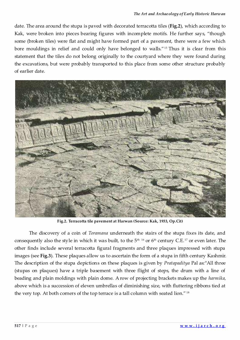
The Art and Archaeology of Early Historic Harwan
517 | P a g e w w w . i j a r c h . o r g
date. The area around the stupa is paved with decorated terracotta tiles (Fig.2), which according to
Kak, were broken into pieces bearing figures with incomplete motifs. He further says, ‚though
some (broken tiles) were flat and might have formed part of a pavement, there were a few which
bore mouldings in relief and could only have belonged to walls.‛ 15 Thus it is clear from this
statement that the tiles do not belong originally to the courtyard where they were found during
the excavations, but were probably transported to this place from some other structure probably
of earlier date.
Fig.2. Terracotta tile pavement at Harwan (Source: Kak, 1933, Op.Cit)
The discovery of a coin of Toramana underneath the stairs of the stupa fixes its date, and
consequently also the style in which it was built, to the 5 th 16 or 6th century C.E.17 or even later. The
other finds include several terracotta figural fragments and three plaques impressed with stupa
images (see Fig.3). These plaques allow us to ascertain the form of a stupa in fifth century Kashmir.
The description of the stupa depictions on these plaques is given by Pratapaditya Pal as:‚All three
(stupas on plaques) have a triple basement with three flight of steps, the drum with a line of
beading and plain moldings with plain dome. A row of projecting brackets makes up the harmika,
above which is a succession of eleven umbrellas of diminishing size, with fluttering ribbons tied at
the very top. At both corners of the top terrace is a tall column with seated lion.‛ 18
Indian Journal of Archaeology
518 | P a g e w w w . i j a r c h . o r g
Fig.3. Terracotta plaque depicting stupas, at Harwan (Source: Kak, 1933, Op.Cit.)
The excavations at Harwan were resumed, in 1973 by L. K. Srinivasan of the Frontier Circle of
the Survey assisted by S. L. Shali, both on the outer and inner sides of the structure, particularly
towards the north-western and north-eastern corners. The excavation revealed ‚that the outer face
of the northern side wall above the ground level, commencing from the north-eastern corner, is
not in conformity with the outer face of the same wall below the ground, inasmuch as the former
is leaning out of plumb by about 40 cm, indicating that there has been a later reconstruction or
restoration without any relation to the alignment of the structure underground. This observation
is further confirmed by the fact that the internal and external faces of the wa ll underground show
diaper-pebble construction; the wall above ground level has dry rubble construction on the inner
face only. The northern wall below the ground level has no gap for the entrance, but the wall
above the ground has an entrance. A small cell, measuring 2.30 x 1.20 m, has been exposed within
the enclosure on the north-western corner.‛19 Thus it is clear from the excavations that here arrived
a group of people, different to the locals, who vandalized the earlier diaper pebble constructions
of the site and built their own buildings in a different style viz. the diaper rubble masonry. Further,
the layer of ash and charcoal found in between these two foundation walls, built of different styles
of construction, is witness to the burning of the earlier settlement of Kushanas by some intruders,
probably Hunas, who entered the valley around the end of sixth century CE and were responsible
for the destruction of the Buddhist monuments in Kashmir in general and Indian subcontinent in
particular. Thus the Buddhist settlement at Harwan was in continuous occupation for centuries
before its complete neglect in later centuries of Muslim rule in the Valley. Thus excavations yielded
important evidence of constructional techniques, artistic remains and other cultural material
which are of Buddhist attribution.
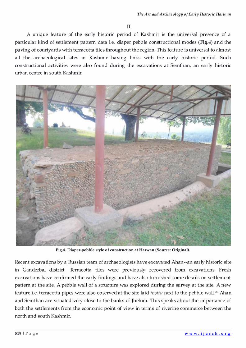
The Art and Archaeology of Early Historic Harwan
519 | P a g e w w w . i j a r c h . o r g
II
A unique feature of the early historic period of Kashmir is the universal presence of a
particular kind of settlement pattern data i.e. diaper pebble constructional modes (Fig.4) and the
paving of courtyards with terracotta tiles throughout the region. This feature is universal to almost
all the archaeological sites in Kashmir having links with the early historic period. Such
constructional activities were also found during the excavations at Semthan, an early historic
urban centre in south Kashmir.
Fig.4. Diaper-pebble style of construction at Harwan (Source: Original).
Recent excavations by a Russian team of archaeologists have excavated Ahan--an early historic site
in Ganderbal district. Terracotta tiles were previously recovered from excavations. Fresh
excavations have confirmed the early findings and have also furnished some details on settlement
pattern at the site. A pebble wall of a structure was explored during the survey at the site. A new
feature i.e. terracotta pipes were also observed at the site laid insitu next to the pebble wall. 20 Ahan
and Semthan are situated very close to the banks of Jhelum. This speaks about the importance of
both the settlements from the economic point of view in terms of riverine commerce between the
north and south Kashmir.
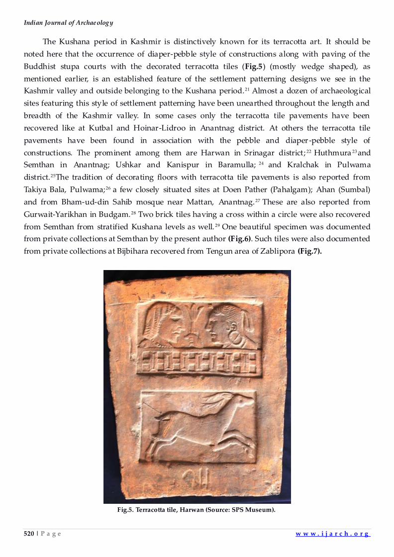
Indian Journal of Archaeology
520 | P a g e w w w . i j a r c h . o r g
The Kushana period in Kashmir is distinctively known for its terracotta art. It should be
noted here that the occurrence of diaper-pebble style of constructions along with paving of the
Buddhist stupa courts with the decorated terracotta tiles (Fig.5) (mostly wedge shaped), as
mentioned earlier, is an established feature of the settlement patterning designs we see in the
Kashmir valley and outside belonging to the Kushana period.21 Almost a dozen of archaeological
sites featuring this style of settlement patterning have been unearthed throughout the length and
breadth of the Kashmir valley. In some cases only the terracotta tile pavements have been
recovered like at Kutbal and Hoinar-Lidroo in Anantnag district. At others the terracotta tile
pavements have been found in association with the pebble and diaper -pebble style of
constructions. The prominent among them are Harwan in Srinagar district; 22 Huthmura 23and
Semthan in Anantnag; Ushkar and Kanispur in Baramulla; 24 and Kralchak in Pulwama
district.25The tradition of decorating floors with terracotta tile pavements is also reported from
Takiya Bala, Pulwama;26 a few closely situated sites at Doen Pather (Pahalgam); Ahan (Sumbal)
and from Bham-ud-din Sahib mosque near Mattan, Anantnag. 27 These are also reported from
Gurwait-Yarikhan in Budgam.28 Two brick tiles having a cross within a circle were also recovered
from Semthan from stratified Kushana levels as well. 29 One beautiful specimen was documented
from private collections at Semthan by the present author (Fig.6). Such tiles were also documented
from private collections at Bijbihara recovered from Tengun area of Zablipora (Fig.7).
Fig.5. Terracotta tile, Harwan (Source: SPS Museum).
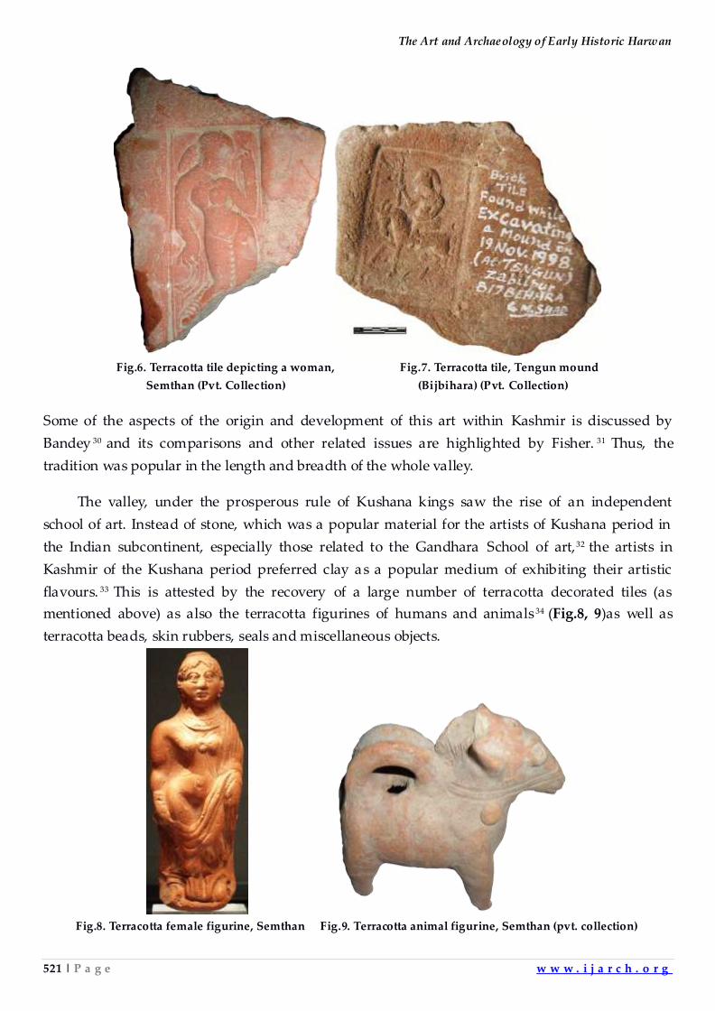
The Art and Archaeology of Early Historic Harwan
521 | P a g e w w w . i j a r c h . o r g
Fig.6. Terracotta tile depicting a woman, Fig.7. Terracotta tile, Tengun mound
Semthan (Pvt. Collection) (Bijbihara) (Pvt. Collection)
Some of the aspects of the origin and development of this art within Kashmir is discussed by
Bandey 30 and its comparisons and other related issues are highlighted by Fisher. 31 Thus, the
tradition was popular in the length and breadth of the whole valley.
The valley, under the prosperous rule of Kushana kings saw the rise of an independent
school of art. Instead of stone, which was a popular material for the artists of Kushana period in
the Indian subcontinent, especially those related to the Gandhara School of art,32 the artists in
Kashmir of the Kushana period preferred clay as a popular medium of exhibiting their artistic
flavours. 33 This is attested by the recovery of a large number of terracotta decorated tiles (as
mentioned above) as also the terracotta figurines of humans and animals 34 (Fig.8, 9)as well as
terracotta beads, skin rubbers, seals and miscellaneous objects.
Fig.8. Terracotta female figurine, Semthan Fig.9. Terracotta animal figurine, Semthan (pvt. collection)
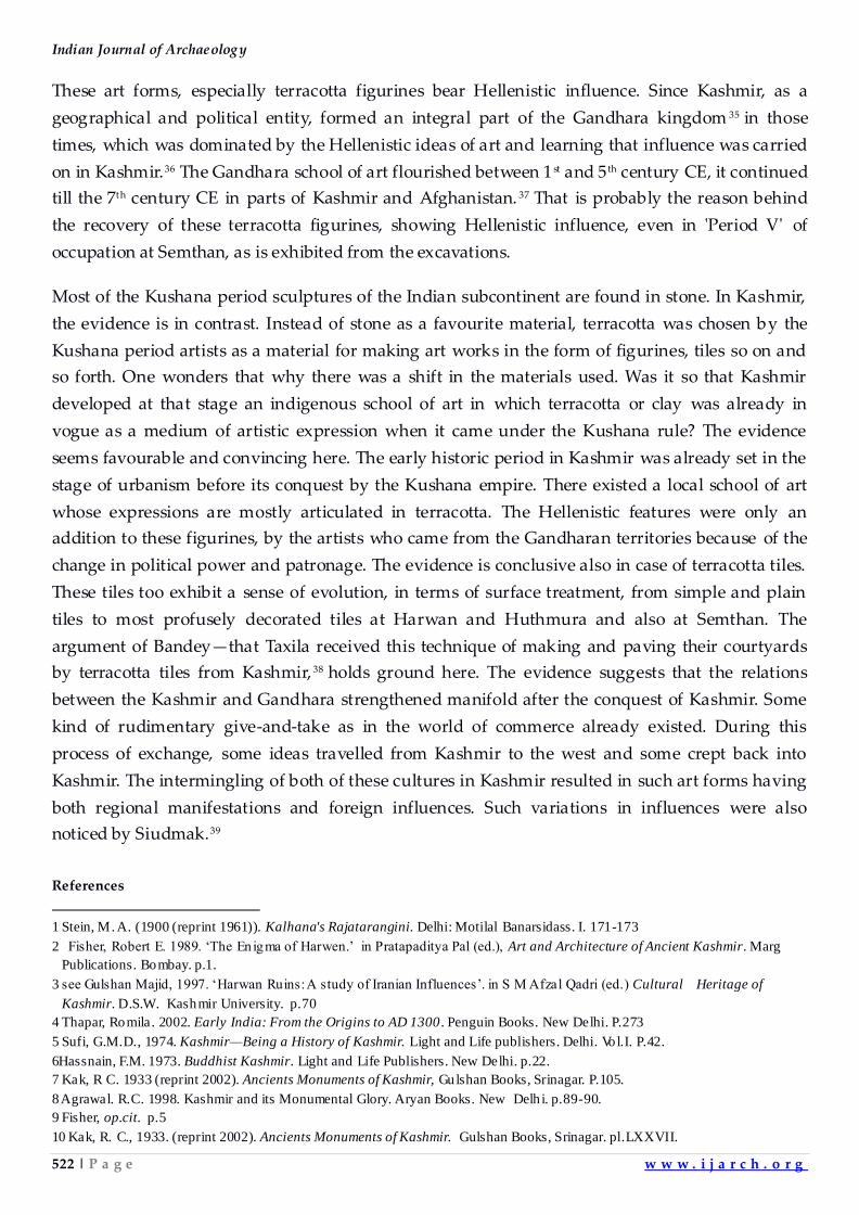
Indian Journal of Archaeology
522 | P a g e w w w . i j a r c h . o r g
These art forms, especially terracotta figurines bear Hellenistic influence. Since Kashmir, as a
geographical and political entity, formed an integral part of the Gandhara kingdom 35 in those
times, which was dominated by the Hellenistic ideas of art and learning that influence was carried
on in Kashmir.36 The Gandhara school of art flourished between 1 st and 5 th century CE, it continued
till the 7th century CE in parts of Kashmir and Afghanistan. 37 That is probably the reason behind
the recovery of these terracotta figurines, showing Hellenistic influence, even in 'Period V' of
occupation at Semthan, as is exhibited from the excavations.
Most of the Kushana period sculptures of the Indian subcontinent are found in stone. In Kashmir,
the evidence is in contrast. Instead of stone as a favourite material, terracotta was chosen by the
Kushana period artists as a material for making art works in the form of figurines, tiles so on and
so forth. One wonders that why there was a shift in the materials used. Was it so that Kashmir
developed at that stage an indigenous school of art in which terracotta or clay was already in
vogue as a medium of artistic expression when it came under the Kushana rule? The evidence
seems favourable and convincing here. The early historic period in Kashmir was already set in the
stage of urbanism before its conquest by the Kushana empire. There existed a local school of art
whose expressions are mostly articulated in terracotta. The Hellenistic features were only an
addition to these figurines, by the artists who came from the Gandharan territories because of the
change in political power and patronage. The evidence is conclusive also in case of terracotta tiles.
These tiles too exhibit a sense of evolution, in terms of surface treatment, from simple and plain
tiles to most profusely decorated tiles at Harwan and Huthmura and also at Semthan. The
argument of Bandey—that Taxila received this technique of making and paving their courtyards
by terracotta tiles from Kashmir, 38 holds ground here. The evidence suggests that the relations
between the Kashmir and Gandhara strengthened manifold after the conquest of Kashmir. Some
kind of rudimentary give-and-take as in the world of commerce already existed. During this
process of exchange, some ideas travelled from Kashmir to the west and some crept back into
Kashmir. The intermingling of both of these cultures in Kashmir resulted in such art forms having
both regional manifestations and foreign influences. Such variations in influences were also
noticed by Siudmak.39
References
1 Stein, M. A. (1900 (reprint 1961)). Kalhana's Rajatarangini. Delhi: Motilal Banarsidass. I. 171-173
2 Fisher, Robert E. 1989. „The Enigma of Harwen.‟ in Pratapaditya Pal (ed.), Art and Architecture of Ancient Kashmir. Marg
Publications. Bombay. p.1.
3 see Gulshan Majid, 1997. „Harwan Ruins: A study of Iranian Influences‟. in S M Afzal Qadri (ed.) Cultural Heritage of
Kashmir. D.S.W. Kashmir University. p.70
4 Thapar, Romila. 2002. Early India: From the Origins to AD 1300 . Penguin Books. New Delhi. P.273
5 Sufi, G.M.D., 1974. Kashmir—Being a History of Kashmir. Light and Life publishers. Delhi. Vol.I. P.42.
6Hassnain, F.M. 1973. Buddhist Kashmir. Light and Life Publishers. New Delhi. p.22.
7 Kak, R C. 1933 (reprint 2002). Ancients Monuments of Kashmir, Gulshan Books, Srinagar. P.105.
8 Agrawal. R.C. 1998. Kashmir and its Monumental Glory. Aryan Books. New Delh i. p.89-90.
9 Fisher, op.cit. p.5
10 Kak, R. C., 1933. (reprint 2002). Ancients Monuments of Kashmir. Gulshan Books, Srinagar. pl.LXXVII.
The Art and Archaeology of Early Historic Harwan
523 | P a g e w w w . i j a r c h . o r g
11 Agrawal. R.C. 1998. op.cit. p.90.
12 Kak, R C. Ancient Monuments of Kashmir, Rupam, V.24, pp.86-87.
13 Fisher, op.cit. p.7.
14 Shali, S.L. 2001. Settlement Pattern in Relation to Climatic Changes in Kashmir. Om Pub. New Delhi. p.144.
15 Kak, R C. Op. Cit., 1933. p.106.
16Ibid.
17 Kak, R.C. 1925. Ancient and Medieval Architecture of Kashmir. in RUPAM. Vol.24. P.87
18 Pal, Pratapaditya. 2008. The Arts o f Kashmir. Asia Society and Museum. New York. P.55. 19
Indian Archaeology- A Review, 1973-74, pp.15-16. 20
The present author was also participant of the excavation team. 21
Gaur, Ganga Singh. Semthan Excavation : A Step towards bridging the gap between the Neolithic and the Kushan Period in
Kashmir. Vol. 1, in Archaeology and History; Essays in memory of shri A Ghosh., ed ited by B D Chattopadhyaya and B M Pande.
Delh i: Agam Kala Prakshan., 1987, p. 331. 22
Kak, R C. Op. Cit., 1933. 105-111. 23
Pal, Pratapaditya. The Arts of Kashmir. New York: Asia Society and Museum, 2008, 55. 24
Bandey, Aijaz A. Early Terracotta Art of Kashmir. Srinagar: Centre of Central Asian Studies, University of Kashmir, 1992, 2;
and Mani, B R. “Excavations at Kanispora: 1998-99.” Edited by Rakesh Tiwari. Pragdhara 10 (2000), 1-2. 25
Shali 2001, Op.Cit.,146-173. 26
Thapar, B K, ed. Indian Archaeology 1977-78 A Review. New Delh i: Archaeological Survey of India, 1980, 23-24 27
Bhan, J L. “Tile -A Vital Link.” In Central Asia and Western Himalayas--A Forgotten Link , edited by G M Buth, 43-50.
Jodhpur: Scientific Publishers, 1986, 47.
28 The findings of this site were reported in a local daily The Tribune, Jammu, April 30, 1999. A passing reference to this
discovery is also mentioned by Iqbal Ahmad (2011:161). 29
Gaur, 1987, Op. Cit., P.331 30
Bandey, A A.1992, Op. Cit. 31
Fisher, Robert E. “The Enigma of Harwen.” In Art and Architecture of Ancient Kashmir, edited by Pratapaditya Pal. Bombay:
Marg Publications, 1989, 1-16. 32
Singh, Upinder. A History of Ancient and Early Medieval India. Delhi: Pearson, 2008, 462. 33
Bandey, Aijaz Ahmad. “Silk Route Manifestations in Kashmir Art.” In Silk Route and Eurasia: Peace and Cooperation , edited
by Aijaz Ahmad Bandey. Srinagar: Centre of Central Asian Studies, University of Kashmir, 2011, 152. 34
Gaur, G S. Terracotta art of Kashmir. Vol. II, in Puraratna : Emerging Trends in Archaeology, Art, Anthropology, Conservation
and History, edited by C Margabhandu, A K Sharma and R S Bisht. Delh i: Agam Kala Prakshan, 2002, Pp. 368-372. 35
Singh, 2008, Op. Cit., 264. 36
Bandey, 2011, Op. Cit., 152 37
Singh, 2008, Op. Cit., 426. 38
Bandey. 1992, op. Cit., 9. 39
Siudmak, J. (2013). The Hindu-Buddhist Sculpture of Ancient Kashmir and its Influences. Leiden: BRILL. Pp. 32-57.
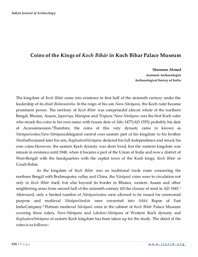
Indian Journal of Archaeology
524 | P a g e w w w . i j a r c h . o r g
Coins of the Kings of Koch Bihār in Koch Bihar Palace Museum
Shamoon Ahmad
Assistant Archaeologist
Archaeological Survey of India
The kingdom of Koch Bihār came into existence in first half of the sixteenth century under the
leadership of its chief Bishwasimha. In the reign of his son Nara-Nārāyana, the Koch ruler became
prominent power. The territory of Koch Bihār was comprisedof almost whole of the northern
Bengāl, Bhutan, Assam, Jayantiya, Manipur and Tripura.1Nara-Nārāyana was the first Koch ruler
who struck the coins in his own name with frozen date of Śāke 1477(AD 1555) probably his date
of Accessionession.2Therefore, the coins of this very dynasty came to known as
Nārāyanîcoins.Nara-Nārāyanadelegated control over eastern part of his kingdom to his brother
Shukladhwajaand later his son, RaghudevaNārāyana declared his full independence and struck his
own coins.However, the eastern Koch dynasty was short lived, but the western kingdom was
remain in existence until 1948, when it became a part of the Union of India and now a district of
West-Bengāl with the headquarters with the capital town of the Koch kings, Koch Bihār or
Cooch Behār.
As the kingdom of Koch Bihār was on traditional trade route connecting the
northern Bengāl with Brahmaputra valley and China, the Nārāyanî coins were in circulation not
only in Koch Bihār itself, but also beyond its border in Bhutan, western Assam and other
neighboring areas from second half of the sixteenth century till the closure of mint in AD 1845.3
Afterward, only a limited number of Nārāyanîcoins were allowed to be issued for ceremonial
purpose and medieval Nārāyanîtankās were converted into Sikkā Rupee of East
IndiaCompany.4Thirteen medieval Nārāyanî coins in the cabinet of Koch Bihār Palace Museum
covering three rulers, Nara-Nārāyana and Lakshmi-Nārāyana of Western Koch dynasty and
RaghudevaNārāyana of eastern Koch kingdom has been taken up for the study. The detail of the
coins is as follows:-
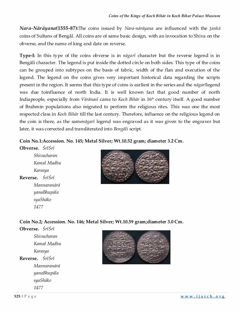
Coins of the Kings of Koch Bihār in Koch Bihar Palace Museum
525 | P a g e w w w . i j a r c h . o r g
Nara-Nārāyana(1555-87):The coins issued by Nara-nārāyana are influenced with the ţankā
coins of Sultans of Bengāl. All coins are of same basic design, with an invocation to Shiva on the
obverse, and the name of king and date on reverse.
Type-I: In this type of the coins obverse is in nāgarî character but the reverse legend is in
Bengāli character. The legend is put inside the dotted circle on both sides. This type of the coins
can be grouped into subtypes on the basis of fabric, width of the flan and execution of the
legend. The legend on the coins gives very important historical data regarding the scripts
present in the region. It seems that this type of coins is earliest in the series and the nāgarîlegend
was due toinfluence of north India. It is well known fact that good number of north
Indiapeople, especially from Vārānasî came to Koch Bihār in 16th century itself. A good number
of Brahmin populations also migrated to perform the religious rites. This was one the most
respected class in Koch Bihār till the last century. Therefore, influence on the religious legend on
the coin is there, as the samenāgarî legend was engraved as it was given to the engraver but
later, it was corrected and transliterated into Bengāli script.
Coin No.1:Accession. No. 145; Metal Silver; Wt.10.52 gram; diameter 3.2 Cm.
Obverse. ŚrîŚrî
Shivacharan
Kamal Madhu
Karasya
Reverse. ŚrîŚrî
Mannaranārā
yanaBhupāla
syaShāke
1477
Coin No.2; Accession. No. 146; Metal Silver; Wt.10.59 gram;diameter 3.0 Cm.
Obverse. ŚrîŚrî
Shivacharan
Kamal Madhu
Karasya
Reverse. ŚrîŚrî
Mannaranārā
yanaBhupāla
syaShāke
1477
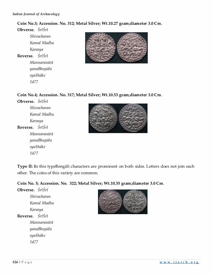
Indian Journal of Archaeology
526 | P a g e w w w . i j a r c h . o r g
Coin No.3; Accession. No. 312; Metal Silver; Wt.10.27 gram;diameter 3.0 Cm.
Obverse. ŚrîŚrî
Shivacharan
Kamal Madhu
Karasya
Reverse. ŚrîŚrî
Mannaranārā
yanaBhupāla
syaShāke
1477
Coin No.4; Accession. No. 317; Metal Silver; Wt.10.53 gram;diameter 3.0 Cm.
Obverse. ŚrîŚrî
Shivacharan
Kamal Madhu
Karasya
Reverse. ŚrîŚrî
Mannaranārā
yanaBhupāla
syaShāke
1477
Type II: In this typeBengāli characters are prominent on both sides. Letters does not join each
other. The coins of this variety are common.
Coin No. 5; Accession. No. 322; Metal Silver; Wt.10.35 gram;diameter 3.0 Cm.
Obverse. ŚrîŚrî
Shivacharan
Kamal Madhu
Karasya
Reverse. ŚrîŚrî
Mannaranārā
yanaBhupāla
syaShāke
1477
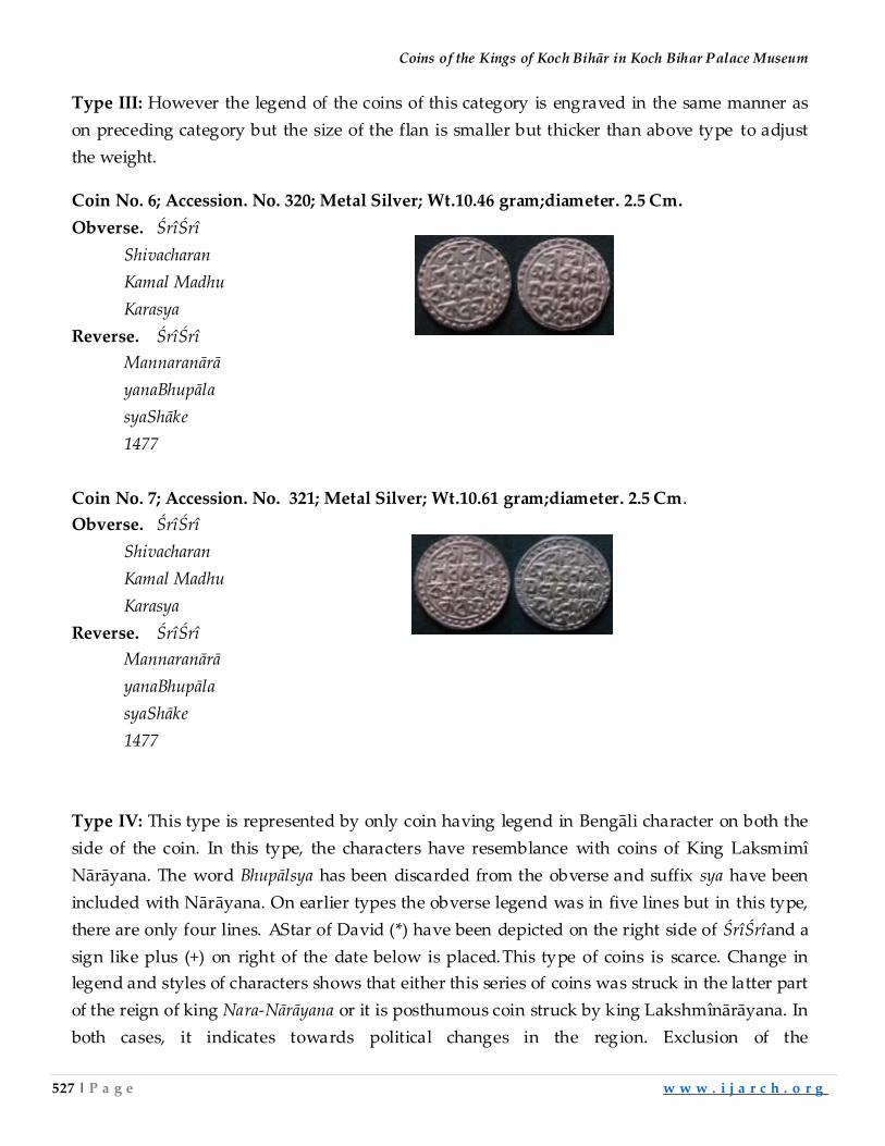
Coins of the Kings of Koch Bihār in Koch Bihar Palace Museum
527 | P a g e w w w . i j a r c h . o r g
Type III: However the legend of the coins of this category is engraved in the same manner as
on preceding category but the size of the flan is smaller but thicker than above type to adjust
the weight.
Coin No. 6; Accession. No. 320; Metal Silver; Wt.10.46 gram;diameter. 2.5 Cm.
Obverse. ŚrîŚrî
Shivacharan
Kamal Madhu
Karasya
Reverse. ŚrîŚrî
Mannaranārā
yanaBhupāla
syaShāke
1477
Coin No. 7; Accession. No. 321; Metal Silver; Wt.10.61 gram;diameter. 2.5 Cm.
Obverse. ŚrîŚrî
Shivacharan
Kamal Madhu
Karasya
Reverse. ŚrîŚrî
Mannaranārā
yanaBhupāla
syaShāke
1477
Type IV: This type is represented by only coin having legend in Bengāli character on both the
side of the coin. In this type, the characters have resemblance with coins of King Laksmimî
Nārāyana. The word Bhupālsya has been discarded from the obverse and suffix sya have been
included with Nārāyana. On earlier types the obverse legend was in five lines but in this type,
there are only four lines. AStar of David (*) have been depicted on the right side of ŚrîŚrîand a
sign like plus (+) on right of the date below is placed.This type of coins is scarce. Change in
legend and styles of characters shows that either this series of coins was struck in the latter part
of the reign of king Nara-Nārāyana or it is posthumous coin struck by king Lakshmînārāyana. In
both cases, it indicates towards political changes in the region. Exclusion of the
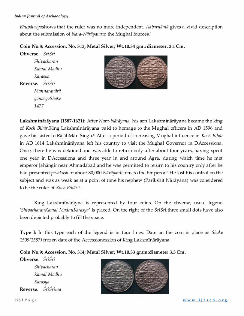
Indian Journal of Archaeology
528 | P a g e w w w . i j a r c h . o r g
Bhupālasyashows that the ruler was no more independent. Akbarnāmā gives a vivid description
about the submission of Nara-Nārāyanato the Mughal fources.5
Coin No.8; Accession. No. 313; Metal Silver; Wt.10.34 gm.; diameter. 3.1 Cm.
Obverse. ŚrîŚrî
Shivacharan
Kamal Madhu
Karasya
Reverse. ŚrîŚrî
Mannaranārā
yanasyaShāke
1477
Lakshmînārāyana (1587-1621): After Nara-Nārāyana, his son Lakshmînārāyana became the king
of Koch Bihār.King Lakshmînārāyana paid to homage to the Mughal officers in AD 1596 and
gave his sister to RājāhMān Singh.6 After a period of increasing Mughal influence in Koch Bihār
in AD 1614 Lakshmînārāyana left his country to visit the Mughal Governor in DAccessiona.
Once, there he was detained and was able to return only after about four years, having spent
one year in DAccessiona and three year in and around Agra, during which time he met
emperor Jahāngîr near Ahmadabad and he was permitted to return to his country only after he
had presented peshkash of about 80,000 Nārāyanîcoins to the Emperor.7 He lost his control on the
subject and was as weak as at a point of time his nephew (Parîkshit Nārāyana) was considered
to be the ruler of Koch Bihār.8
King Lakshmînārāyna is represented by four coins. On the obverse, usual legend
‘ShivacharanKamal MadhuKarasya’ is placed. On the right of the ŚrîŚrî,three small dots have also
been depicted probably to fill the space.
Type I: In this type each of the legend is in four lines. Date on the coin is place as Shāke
1509(1587) frozen date of the Accessionession of King Laksmînārāyana.
Coin No.9; Accession. No. 314; Metal Silver; Wt.10.33 gram;diameter 3.3 Cm.
Obverse. ŚrîŚrî
Shivacharan
Kamal Madhu
Karasya
Reverse. ŚrîŚrîma
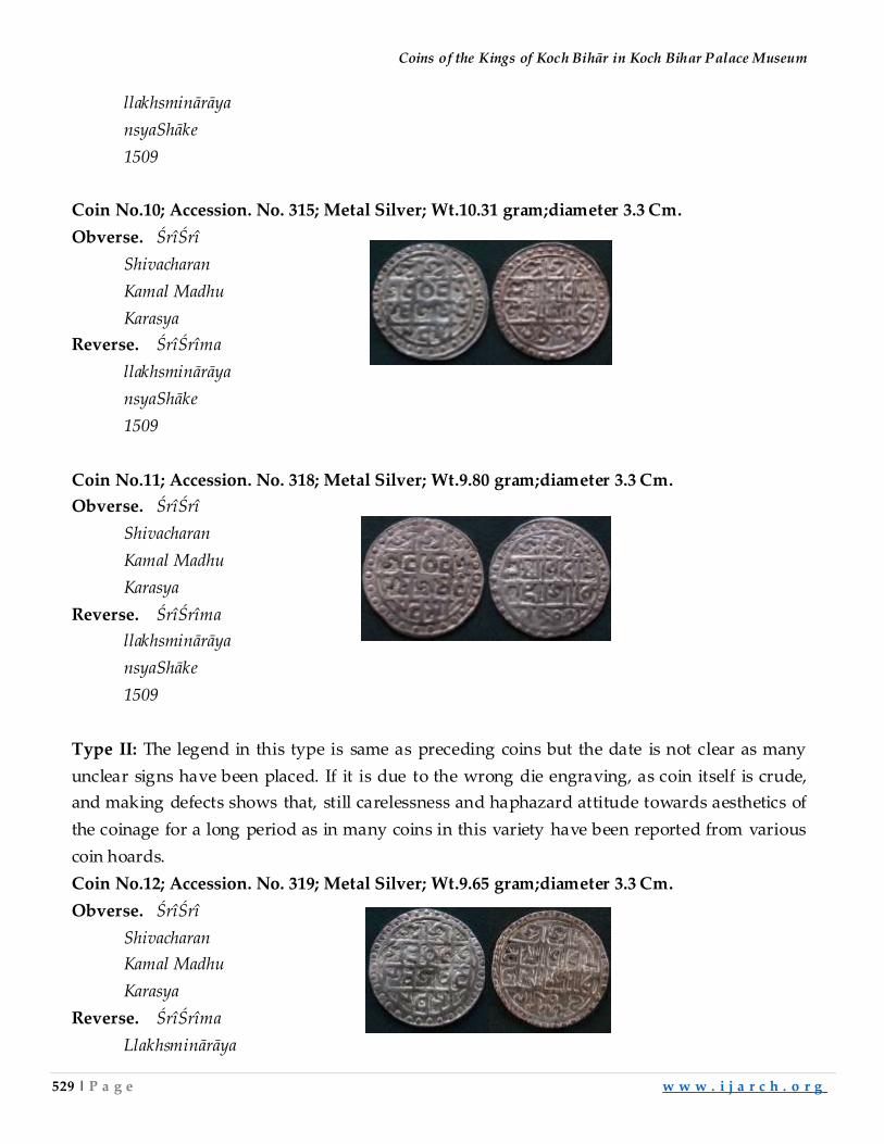
Coins of the Kings of Koch Bihār in Koch Bihar Palace Museum
529 | P a g e w w w . i j a r c h . o r g
llakhsminārāya
nsyaShāke
1509
Coin No.10; Accession. No. 315; Metal Silver; Wt.10.31 gram;diameter 3.3 Cm.
Obverse. ŚrîŚrî
Shivacharan
Kamal Madhu
Karasya
Reverse. ŚrîŚrîma
llakhsminārāya
nsyaShāke
1509
Coin No.11; Accession. No. 318; Metal Silver; Wt.9.80 gram;diameter 3.3 Cm.
Obverse. ŚrîŚrî
Shivacharan
Kamal Madhu
Karasya
Reverse. ŚrîŚrîma
llakhsminārāya
nsyaShāke
1509
Type II: The legend in this type is same as preceding coins but the date is not clear as many
unclear signs have been placed. If it is due to the wrong die engraving, as coin itself is crude,
and making defects shows that, still carelessness and haphazard attitude towards aesthetics of
the coinage for a long period as in many coins in this variety have been reported from various
coin hoards.
Coin No.12; Accession. No. 319; Metal Silver; Wt.9.65 gram;diameter 3.3 Cm.
Obverse. ŚrîŚrî
Shivacharan
Kamal Madhu
Karasya
Reverse. ŚrîŚrîma
Llakhsminārāya
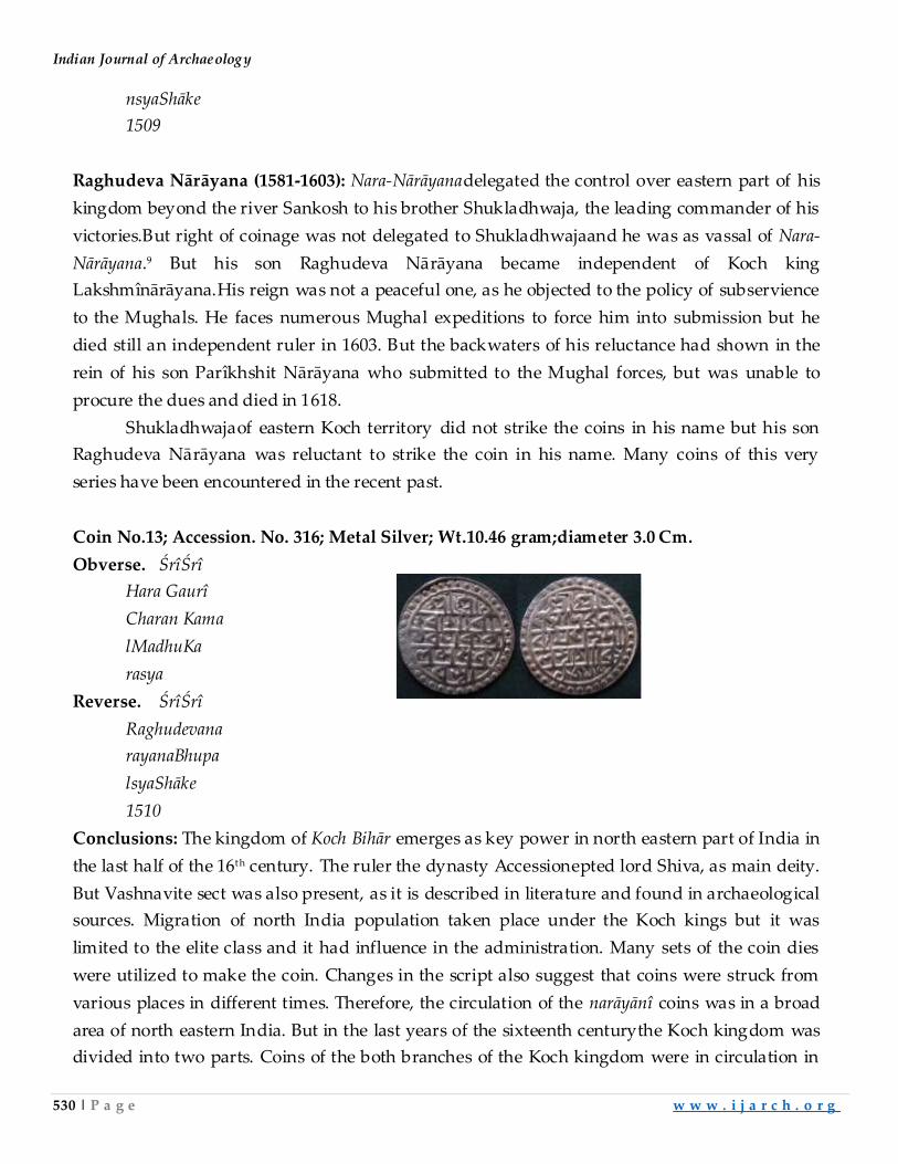
Indian Journal of Archaeology
530 | P a g e w w w . i j a r c h . o r g
nsyaShāke
1509
Raghudeva Nārāyana (1581-1603): Nara-Nārāyanadelegated the control over eastern part of his
kingdom beyond the river Sankosh to his brother Shukladhwaja, the leading commander of his
victories.But right of coinage was not delegated to Shukladhwajaand he was as vassal of Nara-
Nārāyana.9 But his son Raghudeva Nārāyana became independent of Koch king
Lakshmînārāyana.His reign was not a peaceful one, as he objected to the policy of subservience
to the Mughals. He faces numerous Mughal expeditions to force him into submission but he
died still an independent ruler in 1603. But the backwaters of his reluctance had shown in the
rein of his son Parîkhshit Nārāyana who submitted to the Mughal forces, but was unable to
procure the dues and died in 1618.
Shukladhwajaof eastern Koch territory did not strike the coins in his name but his son
Raghudeva Nārāyana was reluctant to strike the coin in his name. Many coins of this very
series have been encountered in the recent past.
Coin No.13; Accession. No. 316; Metal Silver; Wt.10.46 gram;diameter 3.0 Cm.
Obverse. ŚrîŚrî
Hara Gaurî
Charan Kama
lMadhuKa
rasya
Reverse. ŚrîŚrî
Raghudevana
rayanaBhupa
lsyaShāke
1510
Conclusions: The kingdom of Koch Bihār emerges as key power in north eastern part of India in
the last half of the 16th century. The ruler the dynasty Accessionepted lord Shiva, as main deity.
But Vashnavite sect was also present, as it is described in literature and found in archaeological
sources. Migration of north India population taken place under the Koch kings but it was
limited to the elite class and it had influence in the administration. Many sets of the coin dies
were utilized to make the coin. Changes in the script also suggest that coins were struck from
various places in different times. Therefore, the circulation of the narāyānî coins was in a broad
area of north eastern India. But in the last years of the sixteenth centurythe Koch kingdom was
divided into two parts. Coins of the both branches of the Koch kingdom were in circulation in
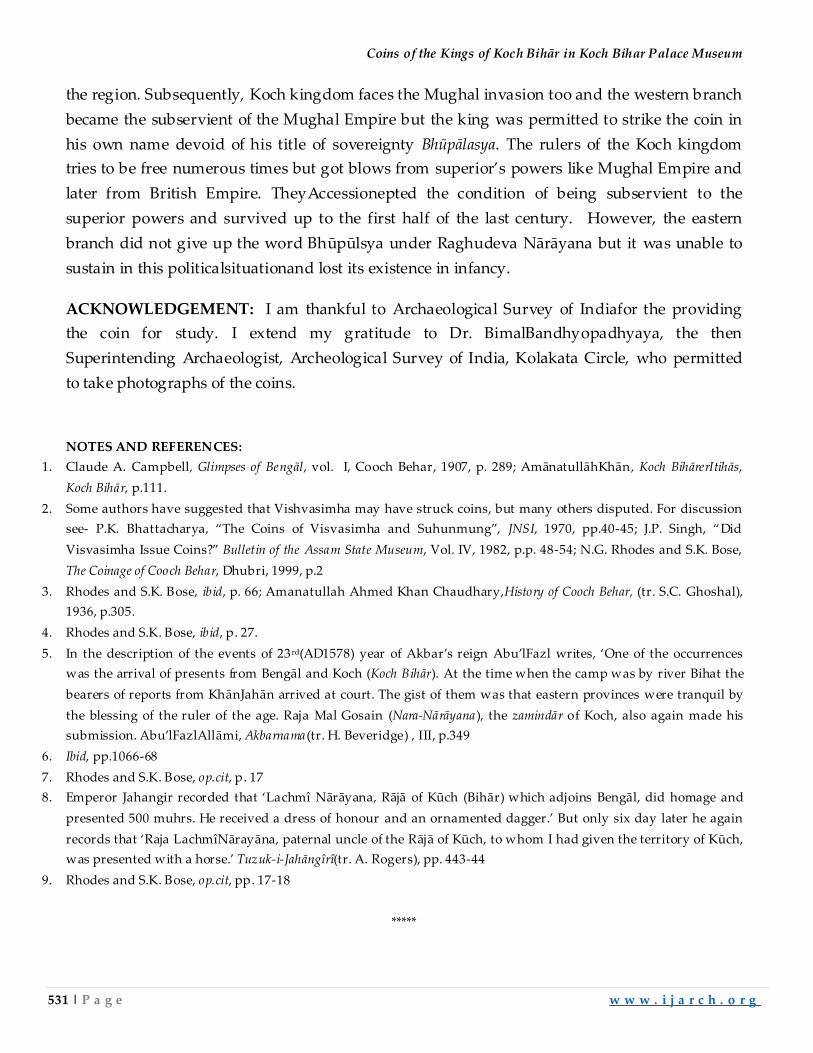
Coins of the Kings of Koch Bihār in Koch Bihar Palace Museum
531 | P a g e w w w . i j a r c h . o r g
the region. Subsequently, Koch kingdom faces the Mughal invasion too and the western branch
became the subservient of the Mughal Empire but the king was permitted to strike the coin in
his own name devoid of his title of sovereignty Bhūpālasya. The rulers of the Koch kingdom
tries to be free numerous times but got blows from superior’s powers like Mughal Empire and
later from British Empire. TheyAccessionepted the condition of being subservient to the
superior powers and survived up to the first half of the last century. However, the eastern
branch did not give up the word Bhūpūlsya under Raghudeva Nārāyana but it was unable to
sustain in this politicalsituationand lost its existence in infancy.
ACKNOWLEDGEMENT: I am thankful to Archaeological Survey of Indiafor the providing
the coin for study. I extend my gratitude to Dr. BimalBandhyopadhyaya, the then
Superintending Archaeologist, Archeological Survey of India, Kolakata Circle, who permitted
to take photographs of the coins.
NOTES AND REFERENCES:
1. Claude A. Campbell, Glimpses of Bengāl, vol. I, Cooch Behar, 1907, p. 289; AmānatullāhKhān , Koch BihārerItihās,
Koch Bihār, p.111.
2. Some authors have suggested that Vishvasimha may have struck coins, but many others disputed. For discussion
see- P.K. Bhattacharya, ‚The Coins of Visvasimha and Suhunmung‛, JNSI, 1970, pp.40-45; J.P. Singh, ‚Did
Visvasimha Issue Coins?‛ Bulletin of the Assam State Museum, Vol. IV, 1982, p.p. 48-54; N.G. Rhodes and S.K. Bose,
The Coinage of Cooch Behar, Dhubri, 1999, p.2
3. Rhodes and S.K. Bose, ibid, p. 66; Amanatullah Ahmed Khan Chaudhary,History of Cooch Behar, (tr. S.C. Ghoshal),
1936, p.305.
4. Rhodes and S.K. Bose, ibid, p. 27.
5. In the description of the events of 23 rd(AD1578) year of Akbar’s reign Abu’lFazl writes, ‘One of the occurrences
was the arrival of presents from Bengāl and Koch (Koch Bihār). At the time when the camp was by river Bihat the
bearers of reports from KhānJahān arrived at court. The gist of them was that eastern provinces were tranquil by
the blessing of the ruler of the age. Raja Mal Gosain (Nara-Nārāyana ), the zamindār of Koch, also again made his
submission. Abu’lFazlAllāmi, Akbarnama (tr. H. Beveridge) , III, p.349
6. Ibid, pp.1066-68
7. Rhodes and S.K. Bose, op.cit, p. 17
8. Emperor Jahangir recorded that ‘Lachmî Nārāyana, Rājā of Kūch (Bihār) which adjoins Bengāl, did homage and
presented 500 muhrs. He received a dress of honour and an ornamented dagger.’ But only six day later he again
records that ‘Raja LachmîNārayāna, paternal uncle of the Rājā of Kūch, to whom I had given the territory of Kūch,
was presented with a horse.’ Tuzuk-i-Jahāngîrî(tr. A. Rogers), pp. 443-44
9. Rhodes and S.K. Bose, op.cit, pp. 17-18
*****
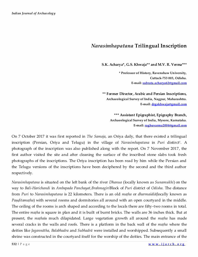
Indian Journal of Archaeology
532 | P a g e w w w . i j a r c h . o r g
Narasimhapatana Trilingual Inscription
S.K. Acharya*, G.S. Khwaja** and M.V. R. Verma***
* Professor of History, Ravenshaw University,
Cuttack-753 003, Odisha.
E-mail: [email protected]
** Former Director, Arabic and Persian Inscriptions,
Archaeological Survey of India, Nagpur, Maharashtra.
E-mail: [email protected]
*** Assistant Epigraphist, Epigraphy Branch,
Archaeological Survey of India, Mysore, Karnataka.
E-mail: [email protected]
On 7 October 2017 it was first reported in The Samaja, an Oriya daily, that there existed a trilingual
inscription (Persian, Oriya and Telugu) in the village of Narasimhapatana in Puri distirct1. A
photograph of the inscription was also published along with the report. On 7 November 2017, the
first author visited the site and after cleaning the surface of the inscribed stone slabs took fresh
photographs of the inscriptions. The Oriya inscription has been read by him while the Persian and
the Telugu versions of the inscriptions have been deciphered by the second and the third author
respectively.
Narasimhapatana is situated on the left bank of the river Dhanua (locally known as Sunamukhi) on the
way to Bali-Harichandi in Ambapada Panchayat,BrahmagiriBlock of Puri district of Odisha. The distance
from Puri to Narasimhapatana is 22 kilometers. There is an old maṭha or dharmaśālā(locally known as
Paṇḍitamaṭha) with several rooms and dormitories all around with an open courtyard in the middle.
The ceiling of the rooms is arch shaped and according to the locals there are fifty-two rooms in total.
The entire maṭha is square in plan and it is built of burnt bricks. The walls are 36 inches thick. But at
present, the maṭhais much dilapidated. Large vegetation growth all around the maṭha has made
several cracks in the walls and roofs. There is a platform in the back wall of the maṭha where the
deities like Jagannātha, Balabhadra and Subhadrā were installed and worshipped. Subsequently a small
shrine was constructed in the courtyard itself for the worship of the deities. The main entrance of the
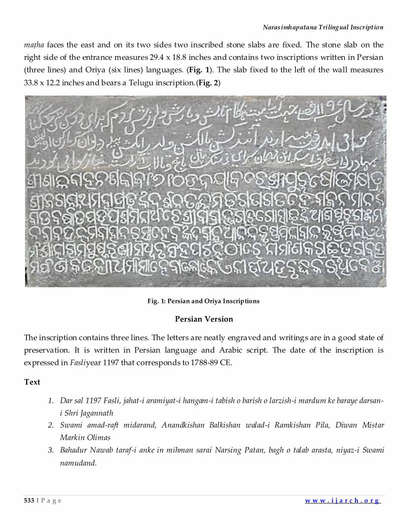
Narasimhapatana Trilingual Inscription
533 | P a g e w w w . i j a r c h . o r g
maṭha faces the east and on its two sides two inscribed stone slabs are fixed. The stone slab on the
right side of the entrance measures 29.4 x 18.8 inches and contains two inscriptions written in Persian
(three lines) and Oriya (six lines) languages. (Fig. 1). The slab fixed to the left of the wall measures
33.8 x 12.2 inches and bears a Telugu inscription.(Fig. 2)
Fig. 1: Persian and Oriya Inscriptions
Persian Version
The inscription contains three lines. The letters are neatly engraved and writings are in a good state of
preservation. It is written in Persian language and Arabic script. The date of the inscription is
expressed in Fasliyear 1197 that corresponds to 1788-89 CE.
Text
1. Dar sal 1197 Fasli, jahat-i aramiyat-i hangam-i tabish o barish o larzish-i mardum ke baraye darsan-
i Shri Jagannath
2. Swami amad-raft midarand, Anandkishan Balkishan walad-i Ramkishan Pila, Diwan Mistar
Markin Olimas
3. Bahadur Nawab taraf-i anke in mihman sarai Narsing Patan, bagh o talab arasta, niyaz-i Swami
namudand.
Indian Journal of Archaeology
534 | P a g e w w w . i j a r c h . o r g
Translation
1. In the year 1197 Fasli (1788-89 A.D.) to relieve people of heat, rain and other botherations,
who come for the pilgrimage of Shri Jagannath
2. Swami, Anandkishan Balkishan son(s) of Ramkishan Pila, Diwan of Mistar Markin Olimas
3. Nawab, constructed this inn on his behest at Narasingpatan (and also) garden and tank, as an
offering to the Swami (i.e. Jagannath)
Oriya Version
The inscription contains six lines. It is in a good state of preservation. It is written in Oriya language
and script. There are a few Perso-Arabic loan words in the inscription modified after Oriya
pronunciation, e.g. nabāba for nawab, bahādara for bahadur, and dibāna for diwan. The word pilā/pillā (l.
30) is a Telugu word used in this inscription. The words āśiṣvaruṁ (l. 3) and tharem (l. 5) are peculiar
to the Oriya of the 18th century. The last letter of the inscription is unintelligible. The letter bā after
darśana ta in line 2 is written below the line. The date of the inscription is ŚālivāhanaŚaka era 1710
which may correspond to 1788 CE. The word udayābdare after the date could be interpreted as at the
beginning of the Śaka era 1710.
Text
1. śrī śālivāhana śakābda 1710 udayābdare śrī puruṣottama kṣatra
2. śrī jaganātha mahāprabhuṅka darśana ta(he)bā nnimitta gatāgata hebājana mānaṅka
3. bāta-barṣ-ātapa upaśamanārthare śrībā brahmacāri gosāiṅka āśiṣvaruṁ gañjāma
4. nabāba ulvama bahādara sāhebaṅka dibāna ānandakrishna pilā bālakrishna pillā e dha-
5. rmaśāl-ārama-puṣkaraṇīmadhva nṛisiṁhapāṭaṇāṭhāreṁ nirmāṇa karāi bhagabatsa-
6. marpaṇa kale ||dharmātma hebā loke e kīrtti abhibṛiddhi karithibe _
Translation
(The inscription was written) at the commencement of the Śālivāhana Śaka year 1710. Ānandakrishna
and Bālakrishna, the sons of the Dewan of UlvamaBahādur, the Nawāb of Gañjām, constructed a
dharmaśālā or a transit house, a garden and a tank in the village of Nṛisiṁhapāṭaṇā for relieving the
pain of the people (travelling the distance) in winter, rainy and summer (seasons) for a darśan of the
Lord Jagannāth in Puruṣottama-kṣetra (and) dedicated them to the Lord.. This act of charity was made
with the blessings of ŚrīBāla Brahmacāri Gosāin (the Almighty). The pious people would increase the
prosperity of this act of charity.
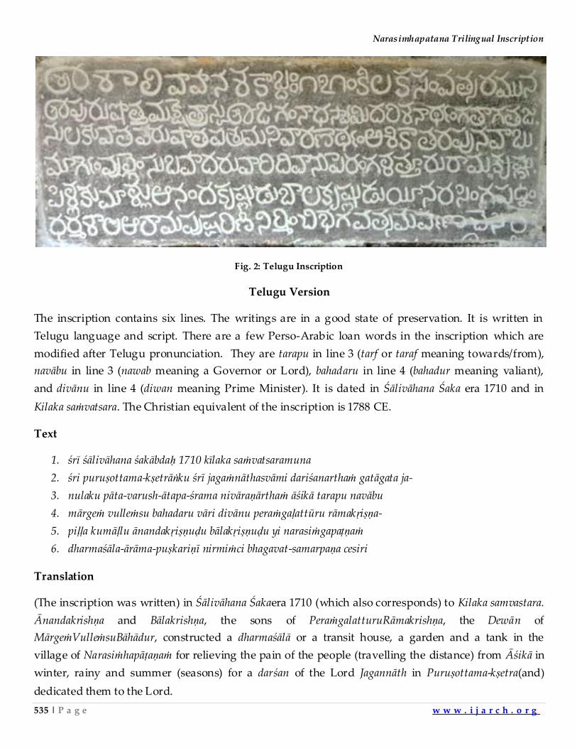
Narasimhapatana Trilingual Inscription
535 | P a g e w w w . i j a r c h . o r g
Fig. 2: Telugu Inscription
Telugu Version
The inscription contains six lines. The writings are in a good state of preservation. It is written in
Telugu language and script. There are a few Perso-Arabic loan words in the inscription which are
modified after Telugu pronunciation. They are tarapu in line 3 (tarf or taraf meaning towards/from),
navābu in line 3 (nawab meaning a Governor or Lord), bahadaru in line 4 (bahadur meaning valiant),
and divānu in line 4 (diwan meaning Prime Minister). It is dated in Śālivāhana Śaka era 1710 and in
Kilaka saṁvatsara. The Christian equivalent of the inscription is 1788 CE.
Text
1. śrī śālivāhana śakābdaḥ 1710 kīlaka saṁvatsaramuna
2. śri puruṣottama-kṣetrāṅku śrī jagaṁnāthasvāmi dariśanarthaṁ gatāgata ja-
3. nulaku pāta-varush-ātapa-śrama nivāraṇārthaṁ āśikā tarapu navābu
4. mārgeṁ vulleṁsu bahadaru vāri divānu peraṁgaḷattūru rāmakṛiṣṇa-
5. piḷḷa kumāḷlu ānandakṛiṣṇuḍu bālakṛiṣṇuḍu yi narasiṁgapaṭṇaṁ
6. dharmaśāla-ārāma-puṣkariṇī nirmiṁci bhagavat-samarpaṇa cesiri
Translation
(The inscription was written) in Śālivāhana Śakaera 1710 (which also corresponds) to Kilaka samvastara.
Ānandakrishṇa and Bālakrishṇa, the sons of PeraṁgalatturuRāmakrishṇa, the Dewān of
MārgeṁVulleṁsuBāhādur, constructed a dharmaśālā or a transit house, a garden and a tank in the
village of Narasiṁhapāṭaṇaṁ for relieving the pain of the people (travelling the distance) from Āśikā in
winter, rainy and summer (seasons) for a darśan of the Lord Jagannāth in Puruṣottama-kṣetra(and)
dedicated them to the Lord.
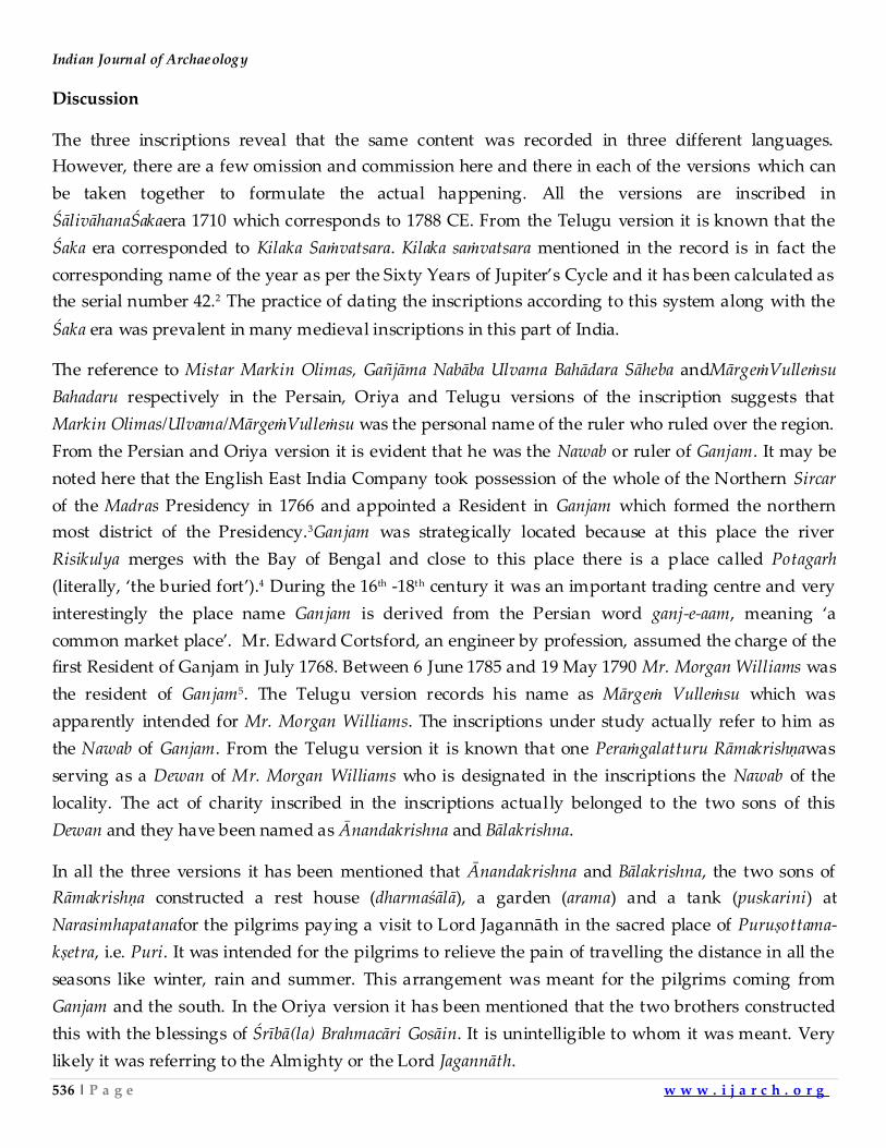
Indian Journal of Archaeology
536 | P a g e w w w . i j a r c h . o r g
Discussion
The three inscriptions reveal that the same content was recorded in three different languages.
However, there are a few omission and commission here and there in each of the versions which can
be taken together to formulate the actual happening. All the versions are inscribed in
ŚālivāhanaŚakaera 1710 which corresponds to 1788 CE. From the Telugu version it is known that the
Śaka era corresponded to Kilaka Saṁvatsara. Kilaka saṁvatsara mentioned in the record is in fact the
corresponding name of the year as per the Sixty Years of Jupiter’s Cycle and it has been calculated as
the serial number 42.2 The practice of dating the inscriptions according to this system along with the
Śaka era was prevalent in many medieval inscriptions in this part of India.
The reference to Mistar Markin Olimas, Gañjāma Nabāba Ulvama Bahādara Sāheba andMārgeṁVulleṁsu
Bahadaru respectively in the Persain, Oriya and Telugu versions of the inscription suggests that
Markin Olimas/Ulvama/MārgeṁVulleṁsu was the personal name of the ruler who ruled over the region.
From the Persian and Oriya version it is evident that he was the Nawab or ruler of Ganjam. It may be
noted here that the English East India Company took possession of the whole of the Northern Sircar
of the Madras Presidency in 1766 and appointed a Resident in Ganjam which formed the northern
most district of the Presidency.3Ganjam was strategically located because at this place the river
Risikulya merges with the Bay of Bengal and close to this place there is a place called Potagarh
(literally, ‘the buried fort’).4 During the 16th -18th century it was an important trading centre and very
interestingly the place name Ganjam is derived from the Persian word ganj-e-aam, meaning ‘a
common market place’. Mr. Edward Cortsford, an engineer by profession, assumed the charge of the
first Resident of Ganjam in July 1768. Between 6 June 1785 and 19 May 1790 Mr. Morgan Williams was
the resident of Ganjam5. The Telugu version records his name as Mārgeṁ Vulleṁsu which was
apparently intended for Mr. Morgan Williams. The inscriptions under study actually refer to him as
the Nawab of Ganjam. From the Telugu version it is known that one Peraṁgalatturu Rāmakrishṇawas
serving as a Dewan of Mr. Morgan Williams who is designated in the inscriptions the Nawab of the
locality. The act of charity inscribed in the inscriptions actually belonged to the two sons of this
Dewan and they have been named as Ānandakrishna and Bālakrishna.
In all the three versions it has been mentioned that Ānandakrishna and Bālakrishna, the two sons of
Rāmakrishṇa constructed a rest house (dharmaśālā), a garden (arama) and a tank (puskarini) at
Narasimhapatanafor the pilgrims paying a visit to Lord Jagannāth in the sacred place of Puruṣottama-
kṣetra, i.e. Puri. It was intended for the pilgrims to relieve the pain of travelling the distance in all the
seasons like winter, rain and summer. This arrangement was meant for the pilgrims coming from
Ganjam and the south. In the Oriya version it has been mentioned that the two brothers constructed
this with the blessings of Śrībā(la) Brahmacāri Gosāin. It is unintelligible to whom it was meant. Very
likely it was referring to the Almighty or the Lord Jagannāth.
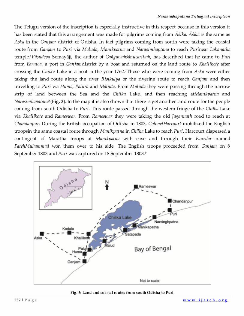
Narasimhapatana Trilingual Inscription
537 | P a g e w w w . i j a r c h . o r g
The Telugu version of the inscription is especially instructive in this respect because in this version it
has been stated that this arrangement was made for pilgrims coming from Āśikā. Āśikā is the same as
Aska in the Ganjam district of Odisha. In fact pilgrims coming from south were taking the coastal
route from Ganjam to Puri via Maluda, Manikpatna and Narasimhaptana to reach Purinear Lokanātha
temple.6Vāsudeva Somayāji, the author of Gaṅgavaṁśānucaritaṁ, has described that he came to Puri
from Baruwa, a port in Ganjamdistrict by a boat and returned on the land route to Khallikote after
crossing the Chilka Lake in a boat in the year 1762.7Those who were coming from Aska were either
taking the land route along the river Risikulya or the riverine route to reach Ganjam and then
travelling to Puri via Huma, Palura and Maluda. From Maluda they were passing through the narrow
strip of land between the Sea and the Chilka Lake, and then reaching atManikpatna and
Narasimhapatana8(Fig. 3). In the map it is also shown that there is yet another land route for the people
coming from south Odisha to Puri. This route passed through the western fringe of the Chilka Lake
via Khallikote and Rameswar. From Rameswar they were taking the old Jagannath road to reach at
Chandanpur. During the British occupation of Odisha in 1803, ColonelHarcourt mobilized the English
troopsin the same coastal route through Manikpatna in Chilka Lake to reach Puri. Harcourt dispersed a
contingent of Maratha troops at Manikpatna with ease and through their Fauzdar named
FatehMuhammad won them over to his side. The English troops proceeded from Ganjam on 8
September 1803 and Puri was captured on 18 September 1803.9
Fig. 3: Land and coastal routes from south Odisha to Puri
Indian Journal of Archaeology
538 | P a g e w w w . i j a r c h . o r g
Thus, the route from Ganjam to Puri was well known to the people of the locality and it was not only
used by the pilgrims coming to the Puruṣottama-kṣetraor Puri and the invaders for troop mobilization
but also by the traders to carry the merchandise. The dharmaśālās constructed on the way further
providing temporary transit houses or resting places for all of them. The dharmaśālā constructed at
Narasimhapatana was one such example which was originally meant for the pilgrims but might have
subsequently used by the traders and troops. The tank which was dug at the time of the construction
of the dharmaśālāis still found about one hundred meters to the east of the dharmaśālā. The dense forest
cover of the sal trees at the back of the dharmaśālā could be the ārāma or garden mentioned in the
inscriptions. It is also evident that the resting place together with the tank and garden were
constructed in the year 1788 and hence they are a mute witness to the flow of pilgrim to Puri from the
south for nearly two hundred and thirty years.
Acknowledgements: We are grateful to Sri Rudra Prasad Behera, Assistant Curator, Odisha State
Archaeology, Bhuvaneswar, India for preparing the map.
Notes and References:
1. The Samaja, Bhubaneswar edition, 7 October 2017, p. 12.
2. Sircar, D.C., 1965. Indian Epigraphy, Motilal Banarsidass, Delhi, pp. 267-69.
3. Maltby Thomas James, 1882. The Ganjam District Manual, Lawrence Asylum Press, Madras, pp. 146-48.
4. A ruined fort with a moat is now found in Potagarh. This star shaped fort overlooking the sea was designed by
Edward Cortsford in 1768 and it was completed in 1769. There is a cemetery near this historical fort which is lying
in a dilapidated condition. It contains the graveyard of mainly the British captains and majors who died fighting
in different resistance movements lunched by the locals. Thus, in the 18th century Ganjam emerged as an
important port on the Gingelly coast and it had brisk costal shipping between Ganjam and Madras. For details see
Das Mohapatra, L., 2010. Commerce in Orissa, 1600-1800, Prafulla, Jagatsinghpur, pp. 146-49.
5. Maltby, op. cit., pp. 147-48.
6. Pradhan, D., P. Mohanty and J. Mishra, 2000. ‚Manikpatna: An Ancient and Medieval Port on the Coast of
Orissa‛, in K.K. Basa and P. Mohanty (eds.), Archaeology of Orissa, vol. II, Pratibha Prakashan, Delhi, pp. 473-
94.Limited archaeological excavations at Manikpatna, about 45 kms south of Puri, were conducted in 1989-90 and
1992-93. The antiquities revealed that it was a famous port town in early and medieval Odisha. Even under the
colonial rule it remained as a trading centre and was ruled by a Jagirdar up to the 19th century.
7. Patnaik, S.K., June 2014. ‚Puri: A Study of Early Trade and Pilgrim Routes‛, Odisha Rev iew, pp. 103-109. ‚The
existing temple of Lord Jagannath was known to international sailing community as an important landmark
while moving in the Bay of Bengal. Sailing directions and ship logs mention about exact location of the temple
from distant sea (20 kms from sea. Kempthorn (1679 AD) has given the exact course of coastal navigation in folios
136-68 which mention that ‘from Maneclaptam to Jauggernaut course is East -North East and distance is 20 miles.‛
(p. 107). ‚The traffic from south to Cuttack passed along the eastern shore of the Chilika lake, between it and the
sea, to Puri and thence followed exactly the line of the present great Jagannath road.‛ (p. 107).
8. Mohapatra, G.N., 1983. Jagannatha in History and Relig ious Traditions of Orissa, Punthi Pustak, Calcutta, pp. 228-30.
9. B.C. Ray, Foundations of British Orissa, New Students Store, Cuttack, 1960, pp. 19-26.
Related Documents