ISR roadmap in the COOPEUS project ISR roadmap in the COOPEUS project Anders Tjulin, EISCAT Scientific Association [email protected]

Welcome message from author
This document is posted to help you gain knowledge. Please leave a comment to let me know what you think about it! Share it to your friends and learn new things together.
Transcript

ISR roadmap in the COOPEUS projectISR roadmap in the COOPEUS project
Anders Tjulin, EISCAT Scientific [email protected]
2015-03-10 ISR Roadmap 2
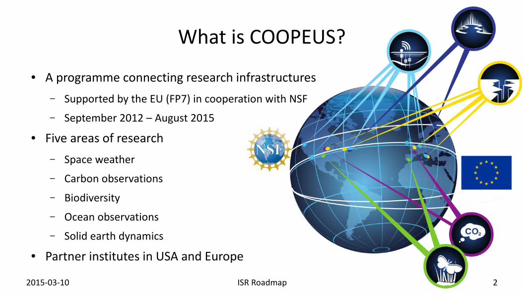
What is COOPEUS?
● A programme connecting research infrastructures– Supported by the EU (FP7) in cooperation with NSF– September 2012 – August 2015
● Five areas of research– Space weather– Carbon observations– Biodiversity– Ocean observations– Solid earth dynamics
● Partner institutes in USA and Europe

2015-03-10 ISR Roadmap 3
COOPEUS structure
● Analytical phase– Commonalities and gaps connected to data and information
collection and sharing within the communities in Europe and across the Atlantic are identified
● Intermediate synthesis phase– Collect the results– Identify case studies
● Domain specific user scenarios● Event specific user scenarios
● Study phase– Case studies carried out
● Final synthesis phase– Define roadmap for future cooperation

2015-03-10 ISR Roadmap 4
COOPEUS Task 2.5● Task 2.5: Construction of joint atmospheric radar roadmap
– In this task, we will develop a common approach to facility scheduling and operating procedures, which will optimize the co-ordination of EU and US facilities at an observational level, in order to ensure best value return from the entire observing network.
– We will also develop a common understanding of the priorities for future facility developments and upgrades.
– The output will be a joint roadmap for ISR observations including recommendations for how a common scheduling and operational philosophy can be implemented and a list of prioritized future tasks to improve the co-ordination of existing facilities and the interoperability of their data.
– In this way, we will map out a co-ordinated approach for the international community, extending beyond the lifetime of the project.
● Work in progress!– The roadmap will be finalised next month.

2015-03-10 ISR Roadmap 5
Why do we need ISR observations?
● ISR technique is one of the most powerful methods for detailed measurements of the ionosphere– Electron density– Electron and ion temperatures– Bulk flow
● Observing connection between Sun and Earth– Solar-terrestrial physics– Space weather
2015-03-10 ISR Roadmap 6
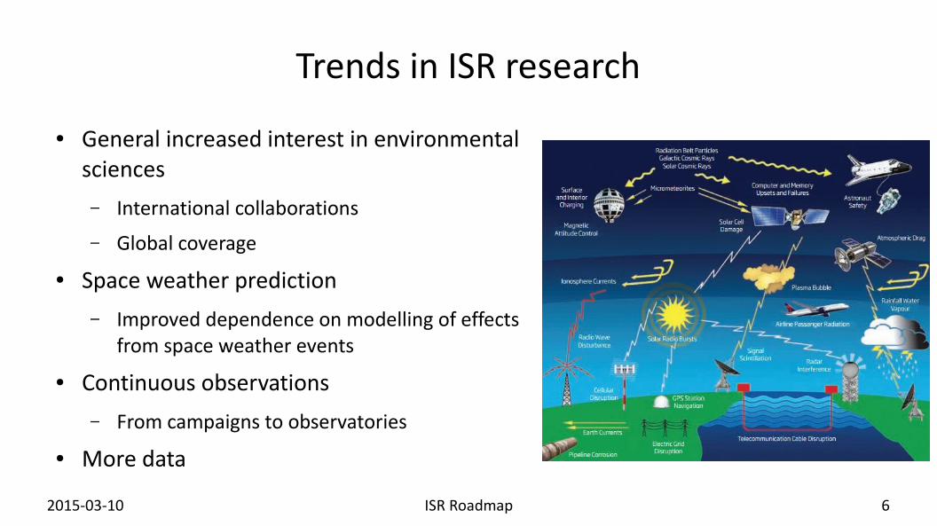
Trends in ISR research
● General increased interest in environmental sciences– International collaborations– Global coverage
● Space weather prediction– Improved dependence on modelling of effects
from space weather events● Continuous observations
– From campaigns to observatories● More data
2015-03-10 ISR Roadmap 7
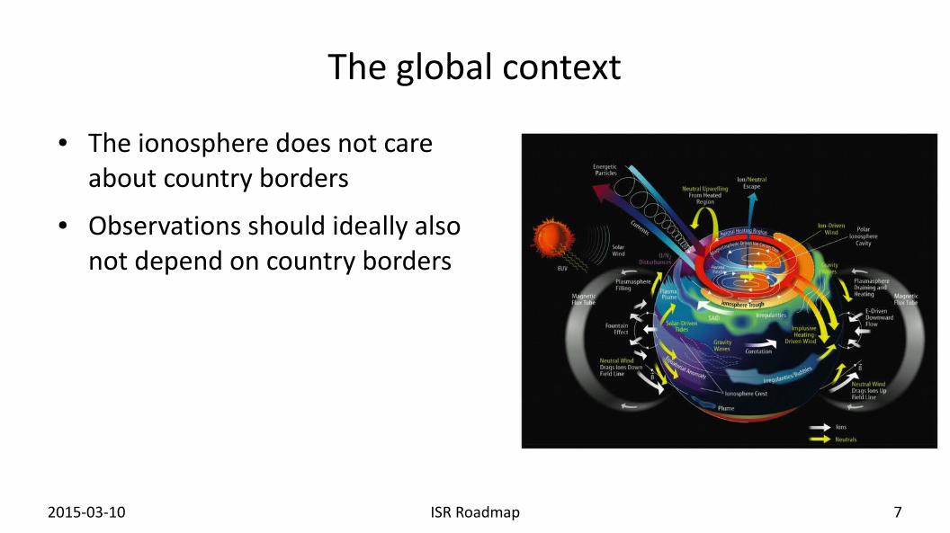
The global context
● The ionosphere does not care about country borders
● Observations should ideally also not depend on country borders

2015-03-10 ISR Roadmap 8
ISR systems in the world
● There are about a dozen ISR systems in the world
● COOPEUS involves EISCAT and the US systems

2015-03-10 ISR Roadmap 9
EISCAT UHF
● Owner: EISCAT Scientific Association● Operator: EISCAT Scientific
Association● Location: Tromsø, Norway● First operation: 1981● Antenna type: 32 m steerable
parabolic dish● Centre transmit frequency: 929 MHz● Peak power: 2 MW

2015-03-10 ISR Roadmap 10
EISCAT VHF
● Owner: EISCAT Scientific Association● Operator: EISCAT Scientific Association● Location: Tromsø, Norway; Kiruna, Sweden
(receiver); Sodankylä, Finland (receiver)● First operation: 1985● Antenna type: Four 30×40 m steerable
parabolic cylinders (Tromsø); 32 m steerable parabolic dish (Kiruna and Sodankylä)
● Centre transmit frequency: 223.7 MHz● Peak power: 1.6 MW
2015-03-10 ISR Roadmap 11
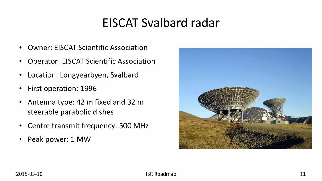
EISCAT Svalbard radar
● Owner: EISCAT Scientific Association● Operator: EISCAT Scientific Association● Location: Longyearbyen, Svalbard● First operation: 1996● Antenna type: 42 m fixed and 32 m
steerable parabolic dishes ● Centre transmit frequency: 500 MHz● Peak power: 1 MW
2015-03-10 ISR Roadmap 12
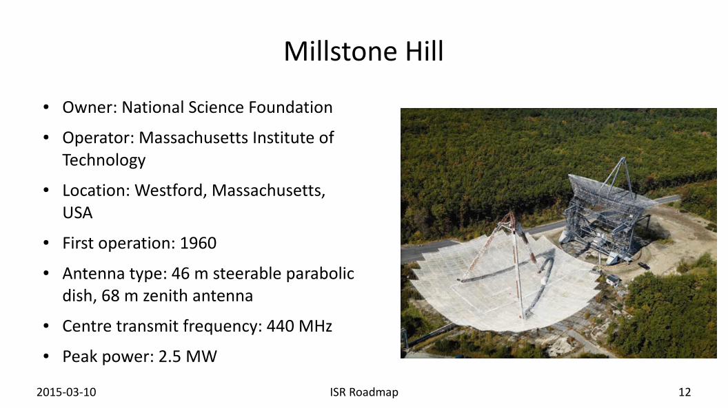
Millstone Hill
● Owner: National Science Foundation● Operator: Massachusetts Institute of
Technology● Location: Westford, Massachusetts,
USA● First operation: 1960● Antenna type: 46 m steerable parabolic
dish, 68 m zenith antenna● Centre transmit frequency: 440 MHz● Peak power: 2.5 MW

2015-03-10 ISR Roadmap 13
Jicamarca Radio Observatory
● Owner: National Science Foundation
● Operator: Cornell University● Location: Lima, Peru● First operation: 1961● Antenna type: Crossed-dipole
phased array● Centre transmit frequency: 50 MHz● Peak power: 4.5 MW

2015-03-10 ISR Roadmap 14
Arecibo Observatory
● Owner: National Science Foundation
● Operator: SRI International● Location: Arecibo, Puerto Rico● First operation: 1963● Antenna type: 305 m fixed dish● Centre transmit frequency:
430 MHz● Peak power: 2.5 MW

2015-03-10 ISR Roadmap 15
Sondrestrom
● Owner: National Science Foundation● Operator: SRI International● Location: Kangerlussuaq, Greenland● First operation: 1983● Antenna type: 32 m steerable
parabolic dish● Centre transmit frequency:
1290 MHz● Peak power: 3 MW
2015-03-10 ISR Roadmap 16
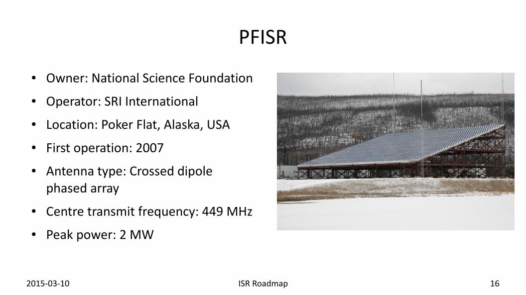
PFISR
● Owner: National Science Foundation● Operator: SRI International● Location: Poker Flat, Alaska, USA● First operation: 2007● Antenna type: Crossed dipole
phased array● Centre transmit frequency: 449 MHz● Peak power: 2 MW

2015-03-10 ISR Roadmap 17
RISR
● Owner: National Science Foundation (RISR-N), University of Calgary (RISR-C)
● Operator: SRI International● Location: Resolute Bay, Nunavut, Canada● First operation: 2009 (RISR-N), 2011
(RISR-C)● Antenna type: Crossed dipole phased
array● Centre transmit frequency: 449 MHz● Peak power: 2×2 MW

2015-03-10 ISR Roadmap 18
EISCAT_3D
● Owner: EISCAT Scientific Association● Operator: EISCAT Scientific Association● Location: Five sites in northern
Scandinavia● First operation: Around 2020● Antenna type: Crossed dipole phased
array (one on each site)● Centre transmit frequency: 233 MHz● Peak power: 10 MW
2015-03-10 ISR Roadmap 19
The need for a roadmap
● Large variations in equipment and organisation– Harmonisation needed for efficient collaboration
● More data intensive– Common strategy for data formats and access– To be in-line with capabilities and standards set by e-infrastructure providers
● EISCAT_3D to be constructed “soon”– Defining system for the future– Ready for future standards

2015-03-10 ISR Roadmap 20
Areas for collaborative efforts
● Definition of data levels● Data format● Access● Standard operations● Non-standard operations● Training and education● Outreach

2015-03-10 ISR Roadmap 21
Data levels
● Data levels used in ISRs were identified earlier in the COOPEUS project.
● Level 1: Lowest accessible level of digital sampled and filtered data– System-specific– Not normally stored
● Level 2: Correlated data products– Data exchange– Long-term storage
● Level 3: Physical parameters– Most requested from users
● (Level 4: Graphical visualisations and published articles)
Receiver
RF signal voltageV(t)
Correlated productsV(t)V*(t+T)
Plasma parametersn, Te, Ti, ...
Correlator Fitter

2015-03-10 ISR Roadmap 22
Data format
● Level 1– Traditionally no standards have been needed– Storing these data requires standards– HDF5 used at AMISR and Millstone Hill a starting point
● Level 2– This is where the largest harmonisation effort is needed– HDF5 starting point
● Level 3– Standard data container used by the Madrigal database– Should be upgraded to handle EISCAT_3D data
Common Features of Correlated ISR Data Formats
System metadata
Antenna – specified for TX and RX systems separately:
Site reference coordinates
Number of beams
For each beam:
Beam shape
Beam pointing
Beam pointing coordinate system
For each feed polarisation:
Feed bandpass shape
Feed amplitude and phase calibration
Transmitter:
TX frequency time history
Modulation envelope time history:
Amplitude
Phase
Peak power
Average power
Receiver:
Number of channels
For each channel:
Association of that channel with antenna beam / feed / polarisation, or with sampled TX channel
Receiver centre RF frequency
Receiver final frequency (=0 for baseband data)
Receiver effective impulse response / bandpass shape (amplitude and phase)
Receiver timing:
RF blank interval, if present
Attenuation time history
Noise calibration diode injection system parameters (if present):
Timing of noise calibration pulse injection
Absolute noise calibration pulse power
Receiver amplitude and phase calibration
Receiver noise temperature
Correlated product data
Number of lag profiles
For each lag profile:
Associated receiver channels (different if cross-correlation, same if auto-correlation)
Associated transmitted modulation
Radar ambiguity function: delay × lag × range
Time average interval
Start offset from leading edge of TX pulse
Range sampling vector
Lag sampling vector
Lag product matrix (range × lag)
Lag product variance matrix (range × lag)
DC offset as a function of range

2015-03-10 ISR Roadmap 23
Access
● Access to data– Madrigal exists now for level 3 data
● Other data portals could also be offered
– Data available through requests– Technical solutions under discussion in several projects
● Access to facilities– Technical aspects– Access rights

2015-03-10 ISR Roadmap 24
Standard operations
● All facilities have a set of standard modes● Increased value if these could be combined for global view of
ionosphere● Continuous, or near continuous, operation of great value to study
trends through long data series– Such operations only possible from a limited number of ISR facilities– Financing the high operation costs is a big problem

2015-03-10 ISR Roadmap 25
Non-standard operations
● The incoherent scatter radar world days are coordinated observations by the ISRs of the world– About 20 per year– Scheduled well in advance– Coordinated through the Incoherent Scatter Working Group of URSI– Data available as soon as possible
● Protocols for unplanned coordinated observations are needed– For example following large space weather events

2015-03-10 ISR Roadmap 26
Training and education
● ISR operation is a small community● Training of engineers should be coordinated
– Not automatic – projects for this have to be defined● Education of users should be coordinated
– International ISR courses are organised regularly

2015-03-10 ISR Roadmap 27
Outreach
● The ISR community should have a common voice– Limited to commonalities
● Protection of radio frequencies● Stressing the importance of continuous observations
● Projects to streamline the coordination should be identified

2015-03-10 ISR Roadmap 28
Recommendations for management
● Make sure that the data format for the long term storage of level 2 data is following agreed standards.● Make sure that the level 3 data produced are fit to be used in common data portals by connecting
sufficient amount of meta-data.● Open for possibilities to implement a common scheduling and operational philosophy.● Continue the incoherent scatter world days planning as it is done now.● Make sure that protocols exist for event-driven observations, where one facility/organisation can
suggest operation of other facilities/organisations.● Make efforts to expand the user community through high visibility and education activities.● Identify projects for training and exchange of radar operating engineers.● Continue the incoherent scatter radar summer schools.● Identify projects for coordinating outreach efforts.
2015-03-10 ISR Roadmap 29
Recommendations for facilities
● Aim for using harmonised level 1 data format for the internal data processing.
● Ensure that standard operating modes are defined for producing long-term continuous data sets that can be used to observe ionospheric changes over time.
● Open for activities involving exchange of engineers for training purposes.

2015-03-10 ISR Roadmap 30
Communication channels
● Identify channels to discuss the needed harmonisation actions– URSI ISWG meets every three years possible starting point
● The COOPEUS project has shown us– where coordination can be made– how difficult the practicalities regarding the coordination are

2015-03-10 ISR Roadmap 31
For discussion
● Does this make sense?● This text comes from the side of the operators
– What does the facility user say?– What does the e-infrastructure provider say?
Related Documents