IPCC National Greenhouse Gas Inventory Programme INTERGOVERNMENTAL PANEL ON CLIMATE CHANGE Task Force on Inventories IPCC Guidelines and REDD IPCC Guidelines and REDD Monitoring and Verification Monitoring and Verification Nalin Srivastava IPCC National Greenhouse Gas Inventories Program Expert Consultation on National Forest Monitoring and Assessment (NFMA): Meeting Evolving Needs , 26-28 November Rome

Welcome message from author
This document is posted to help you gain knowledge. Please leave a comment to let me know what you think about it! Share it to your friends and learn new things together.
Transcript

IPC
C N
ati
on
al
Gre
en
ho
us
e G
as
In
ve
nto
ry P
rog
ram
me
INTERGOVERNMENTAL PANEL ON CLIMATE CHANGETask Force on
Inventories
IPCC Guidelines and REDD IPCC Guidelines and REDD
Monitoring and VerificationMonitoring and Verification
Nalin SrivastavaIPCC National Greenhouse Gas Inventories Program
Expert Consultation on National Forest Monitoring and Assessment(NFMA): Meeting Evolving Needs
, 26-28 November
Rome

INT
ER
GO
VE
RN
ME
NT
AL P
AN
EL O
N C
LIM
AT
E C
HA
NG
ET
ask F
orc
e o
n
Inven
tori
es
OutlineOutline
• Introduction
• Elements of a future REDD regime
• IPCC methodologies for estimation of emissions from land use and land use change
• Application of IPCC methodology to REDD
• Monitoring requirements for REDD
• Estimation of uncertainties and verification
• Next steps
• Conclusion

INT
ER
GO
VE
RN
ME
NT
AL P
AN
EL O
N C
LIM
AT
E C
HA
NG
ET
ask F
orc
e o
n
Inven
tori
es
REDD: a bit of historyREDD: a bit of history
� ‘Reducing Emissions from Deforestation in Developing Countries’ (REDD) was first discussed at COP11 at the request of PNG and Costa Rica that launched a 2 year process of discussions leading up to COP13 to deal with relevant scientific, technical and methodological issues as well as policy approaches and positive incentives
• COP13 charted a future roadmap for REDD discussions by its decision 2/CP.13
• Parties have exchanged views, shared information and had discussions on REDD issues in SB & AWG meetings and several workshops organized by the UNFCCC

INT
ER
GO
VE
RN
ME
NT
AL P
AN
EL O
N C
LIM
AT
E C
HA
NG
ET
ask F
orc
e o
n
Inven
tori
es
Why REDD?Why REDD?
Forestry and
land use change
accounts for
nearly 20%
(5.6 GtCO2e/yr)
of global
emissions
Source: IPCC AR4, 2007

INT
ER
GO
VE
RN
ME
NT
AL P
AN
EL O
N C
LIM
AT
E C
HA
NG
ET
ask F
orc
e o
n
Inven
tori
es
Tropical deforestationTropical deforestation
• Global gross and net deforestation are 13 and 7.3 million hectares per year respectively, mainly in the tropical countries (FRA 2005)
• Main hotspots of deforestation are in the tropics in South America, Africa and Asia
• Tropical deforestation also causes loss of biodiversity and livelihoods

INT
ER
GO
VE
RN
ME
NT
AL P
AN
EL O
N C
LIM
AT
E C
HA
NG
ET
ask F
orc
e o
n
Inven
tori
es
Tropical deforestation(2)Tropical deforestation(2)
Deforestation
hot-spot
Deforestation
hot-spot
Deforestation
hot-spot
Source: FRA 2005

IPC
C N
ati
on
al
Gre
en
ho
us
e G
as
In
ve
nto
ry P
rog
ram
me
INTERGOVERNMENTAL PANEL ON CLIMATE CHANGETask Force on
Inventories
Elements of a future REDD regimeElements of a future REDD regime

INT
ER
GO
VE
RN
ME
NT
AL P
AN
EL O
N C
LIM
AT
E C
HA
NG
ET
ask F
orc
e o
n
Inven
tori
es
The concept of REDDThe concept of REDD
Time
Em
iss
ion
sReference Emission
Level (REL)
Actual emissions
Amount of Emissions Reductions
INT
ER
GO
VE
RN
ME
NT
AL P
AN
EL O
N C
LIM
AT
E C
HA
NG
ET
ask F
orc
e o
n
Inven
tori
es
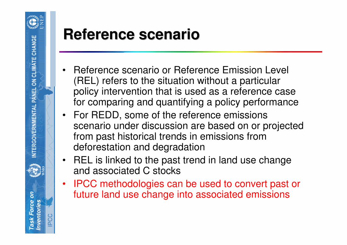
Reference scenarioReference scenario
• Reference scenario or Reference Emission Level (REL) refers to the situation without a particular policy intervention that is used as a reference case for comparing and quantifying a policy performance
• For REDD, some of the reference emissions scenario under discussion are based on or projected from past historical trends in emissions from deforestation and degradation
• REL is linked to the past trend in land use change and associated C stocks
• IPCC methodologies can be used to convert past or future land use change into associated emissions

IPC
C N
ati
on
al
Gre
en
ho
us
e G
as
In
ve
nto
ry P
rog
ram
me
INTERGOVERNMENTAL PANEL ON CLIMATE CHANGETask Force on
Inventories
IPCC Methodologies for Estimation of IPCC Methodologies for Estimation of
Emissions from Land Use and Land Emissions from Land Use and Land
Use ChangeUse Change
INT
ER
GO
VE
RN
ME
NT
AL P
AN
EL O
N C
LIM
AT
E C
HA
NG
ET
ask F
orc
e o
n
Inven
tori
es
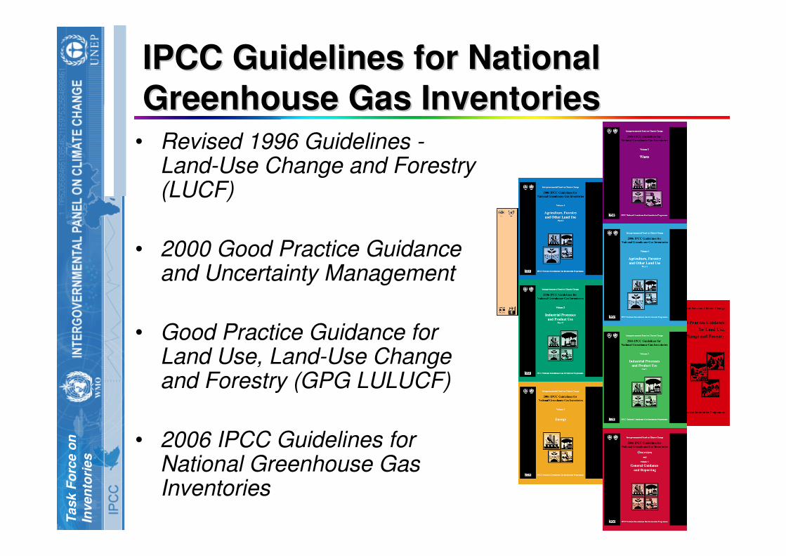
IPCC Guidelines for National IPCC Guidelines for National
Greenhouse Gas InventoriesGreenhouse Gas Inventories• Revised 1996 Guidelines -
Land-Use Change and Forestry (LUCF)
• 2000 Good Practice Guidance and Uncertainty Management
• Good Practice Guidance for Land Use, Land-Use Change and Forestry (GPG LULUCF)
• 2006 IPCC Guidelines for National Greenhouse Gas Inventories

INT
ER
GO
VE
RN
ME
NT
AL P
AN
EL O
N C
LIM
AT
E C
HA
NG
ET
ask F
orc
e o
n
Inven
tori
es
Evolution on IPCC Guidelines on Evolution on IPCC Guidelines on
Agriculture and LandAgriculture and Land--useuse
• 1996 Guidelines– Agriculture and Land Use and Change and Forestry
(LUCF) separate sectors
– Focus on the most important activities resulting in GHG emissions/removals
– Implicit assumption about estimating emissions and removals only over lands subject to human intervention
• GPG2000 & GPG-LULUCF– Specifically address good practice and uncertainty
management in national GHG inventory development
– GPG extended good practice to agriculture LUCF only (it was addressed later due to ongoing negotiations)
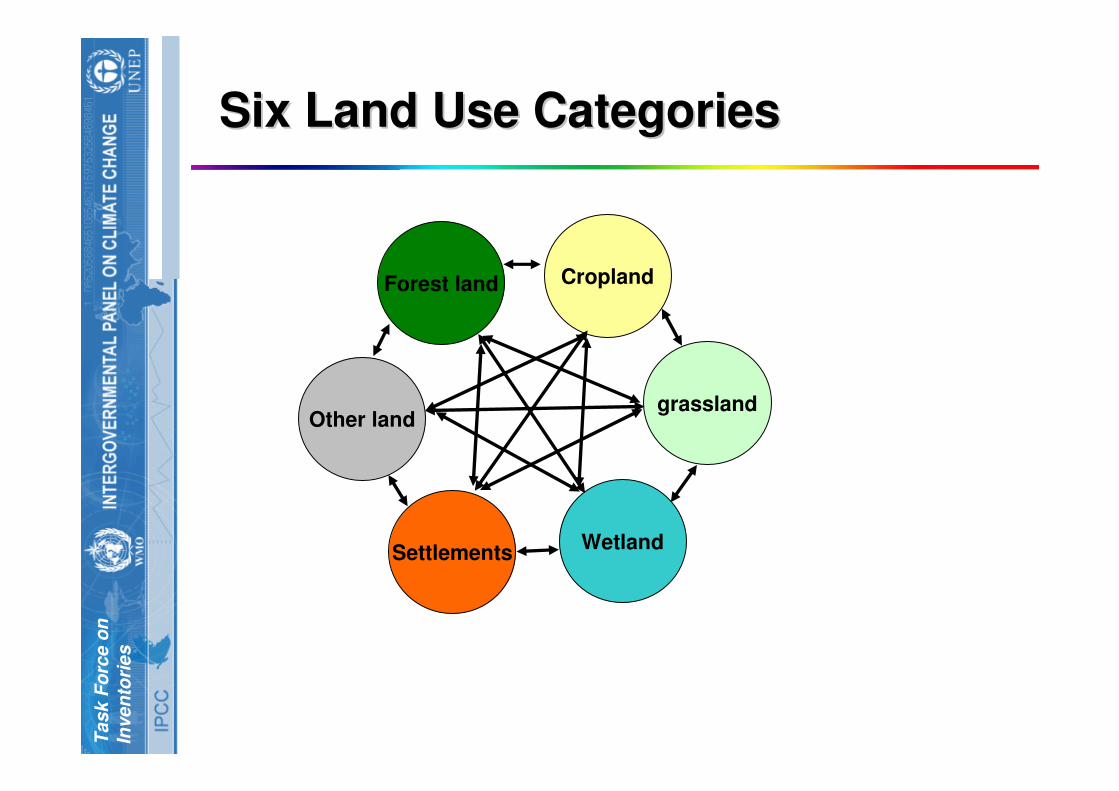
– GPG-LULUCF re-organized all emissions and removals from land use activities into six broad land-use categories
INT
ER
GO
VE
RN
ME
NT
AL P
AN
EL O
N C
LIM
AT
E C
HA
NG
ET
ask F
orc
e o
n
Inven
tori
es
Evolution on IPCC Guidelines on Evolution on IPCC Guidelines on
Agriculture and LandAgriculture and Land--use (2)use (2)
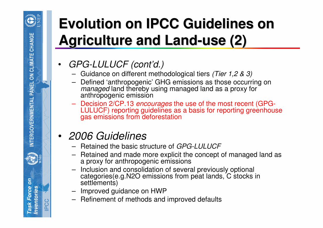
• GPG-LULUCF (cont’d.)– Guidance on different methodological tiers (Tier 1,2 & 3)
– Defined ‘anthropogenic’ GHG emissions as those occurring on managed land thereby using managed land as a proxy for anthropogenic emission
– Decision 2/CP.13 encourages the use of the most recent (GPG-LULUCF) reporting guidelines as a basis for reporting greenhousegas emissions from deforestation
• 2006 Guidelines– Retained the basic structure of GPG-LULUCF
– Retained and made more explicit the concept of managed land as a proxy for anthropogenic emissions
– Inclusion and consolidation of several previously optional categories(e.g.N2O emissions from peat lands, C stocks in settlements)
– Improved guidance on HWP
– Refinement of methods and improved defaults
INT
ER
GO
VE
RN
ME
NT
AL P
AN
EL O
N C
LIM
AT
E C
HA
NG
ET
ask F
orc
e o
n
Inven
tori
es
Six Land Use CategoriesSix Land Use Categories
Other land
Forest land
SettlementsWetland
Cropland
grassland

INT
ER
GO
VE
RN
ME
NT
AL P
AN
EL O
N C
LIM
AT
E C
HA
NG
ET
ask F
orc
e o
n
Inven
tori
es
Emissions and removals from a Emissions and removals from a
land use categoryland use category
Land remaining in the
same land use category
Land changed to the land use category
from other land use categories
Total emissions
from a land use category
Emissions from a land use category are reported
under the final land use category
INT
ER
GO
VE
RN
ME
NT
AL P
AN
EL O
N C
LIM
AT
E C
HA
NG
ET
ask F
orc
e o
n
Inven
tori
es
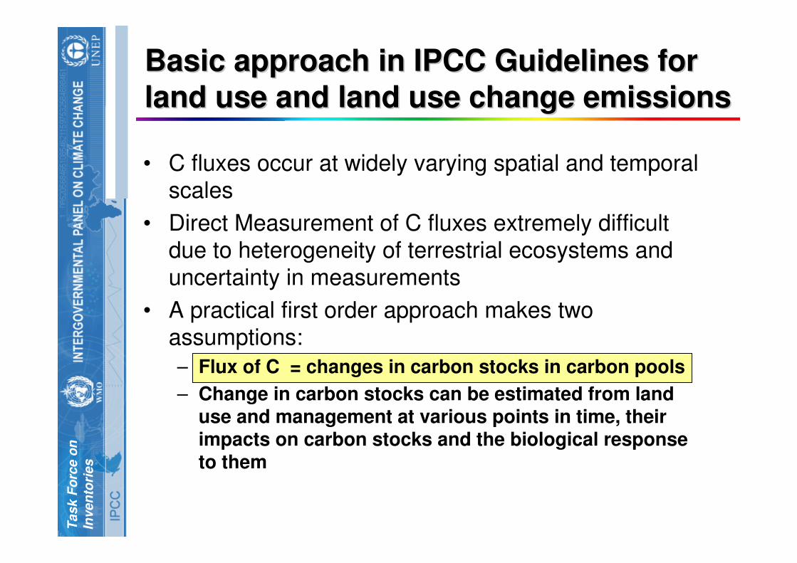
Basic approach in IPCC Guidelines for Basic approach in IPCC Guidelines for
land use and land use change emissionsland use and land use change emissions
• C fluxes occur at widely varying spatial and temporal scales
• Direct Measurement of C fluxes extremely difficult due to heterogeneity of terrestrial ecosystems and
uncertainty in measurements
• A practical first order approach makes two assumptions:
– Flux of C = changes in carbon stocks in carbon pools
– Change in carbon stocks can be estimated from land use and management at various points in time, their impacts on carbon stocks and the biological response to them

INT
ER
GO
VE
RN
ME
NT
AL P
AN
EL O
N C
LIM
AT
E C
HA
NG
ET
ask F
orc
e o
n
Inven
tori
es
Estimating Carbon Stock ChangesEstimating Carbon Stock Changes
Carbon
Stock in
year 1
Carbon
Stock in
Year 2
Difference between carbon stocks
gives emission/removal
Land Use
type
Emission/removal from sum
losses and gains
C uptake
through Growth
HarvestDisturbances
1 2
(a) Stock change method (b) Gain loss method

INT
ER
GO
VE
RN
ME
NT
AL P
AN
EL O
N C
LIM
AT
E C
HA
NG
ET
ask F
orc
e o
n
Inven
tori
es
C Pools in different land use C Pools in different land use
categoriescategoriesMost important
for REDD
Countries can choose to account for HWP
pool

INT
ER
GO
VE
RN
ME
NT
AL P
AN
EL O
N C
LIM
AT
E C
HA
NG
ET
ask F
orc
e o
n
Inven
tori
es
How does the Carbon add up?How does the Carbon add up?
Annual carbon stock changes for a stratum of a land
use category:
Annual C stock changes for a land use category:
∆CLUi = ∆CAB + ∆CBB + ∆CDW + ∆CLI + ∆CSO + ∆CHWP
∆CLU = Σ ∆CLU i
Annual carbon stock changes from all land use categories:
∆CAFOLU= ∆CFL + ∆CCL + ∆CGL + ∆CWL + ∆CSL + ∆COL

INT
ER
GO
VE
RN
ME
NT
AL P
AN
EL O
N C
LIM
AT
E C
HA
NG
ET
ask F
orc
e o
n
Inven
tori
es
Three methodological TiersThree methodological Tiers
• IPCC Guidelines provide three methodological tiers varying in complexity to be chosen on the basis of national circumstances
• Tier1 : – Simple first order approach– spatially coarse default data based on globally available data
– large uncertainties
– methods involving several simplifying assumptions.
– default values of the parameters from the IPCC guidelines
• Tier 2: – A more accurate approach– country or region specific values for the general defaults
– more disaggregated activity data – relatively smaller uncertainties
• Tier 3: – Higher order methods– detailed modeling and/or inventory measurement systems – data at a greater resolution
– lower uncertainties than the previous two methods
• Higher Tier methods (Tier 2&3)are required for key source categories, source or sink categories that contribute substantially to the overall national inventory level, trend or uncertainty
• Higher tier methods will likely be used for REDD estimates especially for significant pools
INT
ER
GO
VE
RN
ME
NT
AL P
AN
EL O
N C
LIM
AT
E C
HA
NG
ET
ask F
orc
e o
n
Inven
tori
es
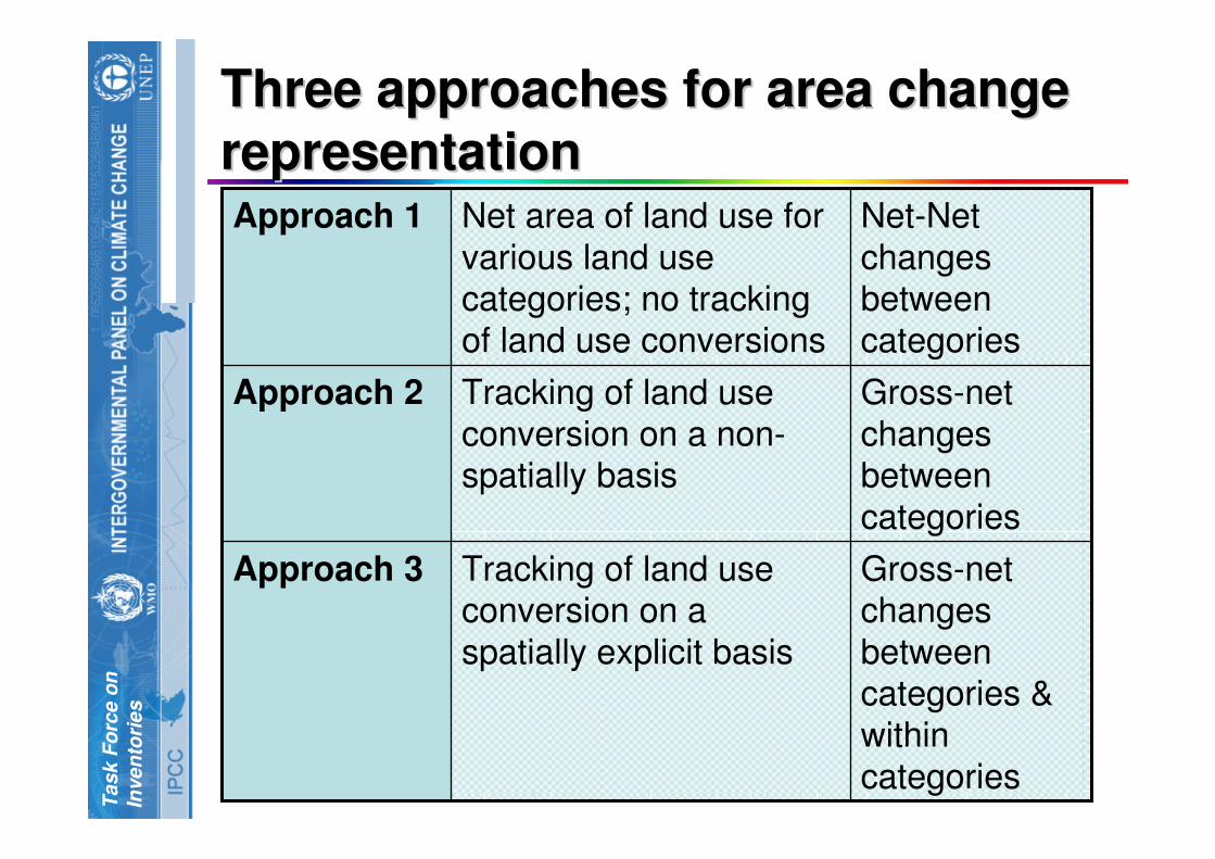
Three approaches for area change Three approaches for area change
representationrepresentation
Gross-net changes
between categories &
within
categories
Tracking of land use conversion on a
spatially explicit basis
Approach 3
Gross-net
changes between
categories
Tracking of land use
conversion on a non-spatially basis
Approach 2
Net-Net
changes between
categories
Net area of land use for
various land use categories; no tracking
of land use conversions
Approach 1
IPC
C N
ati
on
al
Gre
en
ho
us
e G
as
In
ve
nto
ry P
rog
ram
me
INTERGOVERNMENTAL PANEL ON CLIMATE CHANGETask Force on
Inventories
Application of IPCC Methodology to Application of IPCC Methodology to
REDDREDD

INT
ER
GO
VE
RN
ME
NT
AL P
AN
EL O
N C
LIM
AT
E C
HA
NG
ET
ask F
orc
e o
n
Inven
tori
es
Emission Estimation from Emission Estimation from
deforestation and degradationdeforestation and degradation
Forest land remaining Forest land
Forest land changed to
other land use (CL, GL,WL, SL,OL)
REDD
Degradation
Deforestation
IPCC methodologies can be used for estimating both

INT
ER
GO
VE
RN
ME
NT
AL P
AN
EL O
N C
LIM
AT
E C
HA
NG
ET
ask F
orc
e o
n
Inven
tori
es
DeforestationDeforestation
• Generally defined as long term human induced conversion of forest land to non-forest land use
• Under UNFCCC, Decision 11/CP.7 defined deforestation as, “…the direct, human-induced conversion of forested land to non-forested land.”
• Depends on the thresholds used to define forest land
• Under the Kyoto Protocol (KP), Parties can choose a specific threshold value from the following range of minimum area, tree height and crown cover to define their forests (Decision 16/CMP.1):
– Minimum forest area: 0.05 to 1 ha
– Potential to reach a minimum height at maturity in situ of 2-5 m
– Minimum tree crown cover (or equivalent stocking level): 10 to 30 %

INT
ER
GO
VE
RN
ME
NT
AL P
AN
EL O
N C
LIM
AT
E C
HA
NG
ET
ask F
orc
e o
n
Inven
tori
es
DegradationDegradation
• Generally defined as a long term decrease in canopy cover, carbon stock or other forest values of a forest not qualifying as deforestation
• There are many definitions of degradation
• IPCC Special Report on Definitions and Methodological Options to Inventory Emissions from Direct Human-Induced Degradation of Forests and Devegetation of Other Vegetation Types, 2003 gave the following framework definition for KP:“A direct, human-induced, long-term loss (persisting for X years or more) or at least Y% of forest carbon stocks [and forest values] since time T and not qualifying as deforestation” while not agreeing to any of the 5 criteria.
• However, the thresholds for carbon stock loss, minimum area affected and time period need to be clearly defined to operationalize any such definition

INT
ER
GO
VE
RN
ME
NT
AL P
AN
EL O
N C
LIM
AT
E C
HA
NG
ET
ask F
orc
e o
n
Inven
tori
es
Two elements of REDD monitoring Two elements of REDD monitoring
and verificationand verification
REDD M&V
Monitoring of area change for
deforestation and degradation
(Activity Data)
Estimation of associated
carbon stocks
(Emission Factors)
AD EFX = Emissions

IPC
C N
ati
on
al
Gre
en
ho
us
e G
as
In
ve
nto
ry P
rog
ram
me
INTERGOVERNMENTAL PANEL ON CLIMATE CHANGETask Force on
Inventories
Monitoring Requirements for REDDMonitoring Requirements for REDD

INT
ER
GO
VE
RN
ME
NT
AL P
AN
EL O
N C
LIM
AT
E C
HA
NG
ET
ask F
orc
e o
n
Inven
tori
es
Monitoring of area changesMonitoring of area changes
• REDD requires systematic long-term monitoring of forests and other land use for assessing and comparing the historical and future rates of deforestation and degradation
• Important issues that need to be considered for a monitoring system to be applicable to REDD:– Time series availability of data(1990, 2000, 2005)– Resolution
• Suitable for national forest definition based on UNFCCC definition of forest
– Consistency– Robustness– Comprehensiveness (wall-to-wall/sampling)– Cost-effectiveness

INT
ER
GO
VE
RN
ME
NT
AL P
AN
EL O
N C
LIM
AT
E C
HA
NG
ET
ask F
orc
e o
n
Inven
tori
es
Monitoring of area changes (2)Monitoring of area changes (2)
• The most feasible approach is a hybrid system of
remote sensing supported by ground-based observations (field inventories)
• REDD would require assessment of area changes
using at least approach 2 or 3
Source: GOFC-GOLD REDD Source book
• Primary RS tool
Hotspot monitoring
• Validation

INT
ER
GO
VE
RN
ME
NT
AL P
AN
EL O
N C
LIM
AT
E C
HA
NG
ET
ask F
orc
e o
n
Inven
tori
es
Monitoring of area changes (3)Monitoring of area changes (3)
• Monitoring of degradation is more difficult than deforestation and depends on the individual drivers of degradation (selective logging, fuel-wood removal, fires etc.)
• Monitoring can be done either by detecting gaps in canopy cover (difficult unless severely degraded) or other proxies such as roads or log landings (‘hot spot’ detection)
• ‘Hot spots’ can be detected by coarse resolution sensors followed by analysis with mid or high resolution
Source: GOFC-GOLD REDD Sourcebook

INT
ER
GO
VE
RN
ME
NT
AL P
AN
EL O
N C
LIM
AT
E C
HA
NG
ET
ask F
orc
e o
n
Inven
tori
es
Estimation of carbon stocksEstimation of carbon stocks
• Carbon stocks in different pools in forest vary by:
– Forest type (coniferous, broadleaf etc.)
– Climate (temperate, tropical, boreal…)
– Elevation
– Soil type
– Age
– Degree of disturbance (primary, secondary, logged…)
• Stratification of forests is necessary to capture the differences on C stocks in different pools
INT
ER
GO
VE
RN
ME
NT
AL P
AN
EL O
N C
LIM
AT
E C
HA
NG
ET
ask F
orc
e o
n
Inven
tori
es
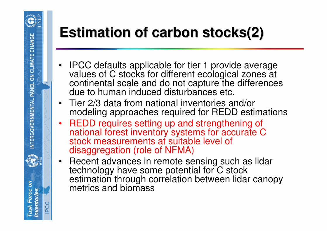
Estimation of carbon stocks(2)Estimation of carbon stocks(2)
• IPCC defaults applicable for tier 1 provide average values of C stocks for different ecological zones at continental scale and do not capture the differences due to human induced disturbances etc.
• Tier 2/3 data from national inventories and/or modeling approaches required for REDD estimations
• REDD requires setting up and strengthening of national forest inventory systems for accurate C stock measurements at suitable level of disaggregation (role of NFMA)
• Recent advances in remote sensing such as lidar technology have some potential for C stock estimation through correlation between lidar canopy metrics and biomass
IPC
C N
ati
on
al
Gre
en
ho
us
e G
as
In
ve
nto
ry P
rog
ram
me
INTERGOVERNMENTAL PANEL ON CLIMATE CHANGETask Force on
Inventories
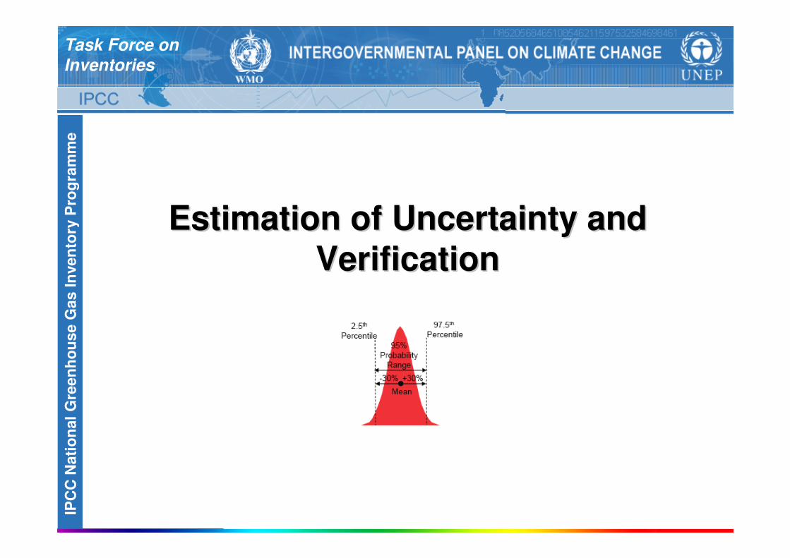
Estimation of Uncertainty and Estimation of Uncertainty and
VerificationVerification
INT
ER
GO
VE
RN
ME
NT
AL P
AN
EL O
N C
LIM
AT
E C
HA
NG
ET
ask F
orc
e o
n
Inven
tori
es
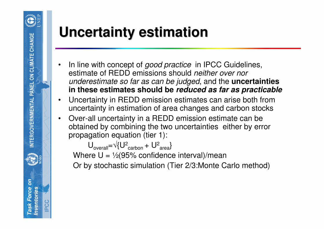
Uncertainty estimationUncertainty estimation
• In line with concept of good practice in IPCC Guidelines, estimate of REDD emissions should neither over nor underestimate so far as can be judged, and the uncertainties in these estimates should be reduced as far as practicable
• Uncertainty in REDD emission estimates can arise both from uncertainty in estimation of area changes and carbon stocks
• Over-all uncertainty in a REDD emission estimate can be obtained by combining the two uncertainties either by error propagation equation (tier 1):
Uoverall=√{U2carbon + U2
area}
Where U = ½(95% confidence interval)/mean
Or by stochastic simulation (Tier 2/3:Monte Carlo method)

INT
ER
GO
VE
RN
ME
NT
AL P
AN
EL O
N C
LIM
AT
E C
HA
NG
ET
ask F
orc
e o
n
Inven
tori
es
Sources of uncertaintySources of uncertainty
• Sources of error in land use change estimation are quality of remotely sensed data, image processing & interpretation errors, error due to technical issues such as interoperability of different sensors and different thematic standards and error due to lack of reference data for calibration etc.
• Sources of error in the estimation of carbon stocks are wrong stratification, improper sampling design, sampling and measurement errors
INT
ER
GO
VE
RN
ME
NT
AL P
AN
EL O
N C
LIM
AT
E C
HA
NG
ET
ask F
orc
e o
n
Inven
tori
es
VerificationVerification
• A robust system of accuracy assessment
and of area changes and carbon stocks is
essential for REDD
• It should include validation by samples of
independent and higher quality data sets
and ground-truthing
• An international review process similar to the
Annex I NIRs and CDM should be set up
building up on experiences with these
INT
ER
GO
VE
RN
ME
NT
AL P
AN
EL O
N C
LIM
AT
E C
HA
NG
ET
ask F
orc
e o
n
Inven
tori
es
Next StepsNext Steps
A comprehensive program of readiness activities for REDD needs to be initiated consisting of
– national capacity building
– ensuring access to high quality remote sensing data
– setting up of robust national monitoring systems
– development of emission factors/stock change factors specific to local conditions
– Demonstration projects to gather experience
– robust verification system for accuracy assessment and quantification of uncertainties

INT
ER
GO
VE
RN
ME
NT
AL P
AN
EL O
N C
LIM
AT
E C
HA
NG
ET
ask F
orc
e o
n
Inven
tori
es
ConclusionConclusion
• REDD requires estimation of actual emission reductions from a reference emission level
• IPCC methodologies can be applied to the estimation of REDD emission
• Data requirements for REDD are the area of land use change and the associated C stocks
• Remote sensing along with ground based systems can potentially provide the required data at suitable resolutions
• REDD requires a robust system of estimating and reporting uncertainties and verification
• A comprehensive program of readiness activities needs to be initiated

IPC
C N
ati
on
al
Gre
en
ho
us
e G
as
In
ve
nto
ry P
rog
ram
me
INTERGOVERNMENTAL PANEL ON CLIMATE CHANGETask Force on
Inventories
Thank YouThank You
Related Documents