André van der Westhuysen, Brian Mckenna, Kelly Knee, Joannes Westerink, Juan Gonzalez, Jane Smith, Jamie Rhome, Cristina Forbes, Julio Morell, Aurelio Mercado, Reniel Calzada, Volker Roeber, Dongming Yang, Hugh Cobb, Carlos Anselmi, Ernesto Rodriguez (and thanks to Luis Aponte) IOOS Coastal and Ocean Modeling Testbed for Puerto Rico and Virgin Islands: Year 3 Progress 1/27 SURA IOOS All-Hands Meeting, Washington DC, April 25-26 , 2016

Welcome message from author
This document is posted to help you gain knowledge. Please leave a comment to let me know what you think about it! Share it to your friends and learn new things together.
Transcript
André van der Westhuysen, Brian Mckenna, Kelly Knee, Joannes Westerink,
Juan Gonzalez, Jane Smith, Jamie Rhome, Cristina Forbes,
Julio Morell, Aurelio Mercado, Reniel Calzada, Volker Roeber, Dongming Yang,
Hugh Cobb, Carlos Anselmi, Ernesto Rodriguez (and thanks to Luis Aponte)
IOOS Coastal and Ocean Modeling Testbedfor Puerto Rico and Virgin Islands:
Year 3 Progress
1/27SURA IOOS All-Hands Meeting, Washington DC, April 25-26 , 2016
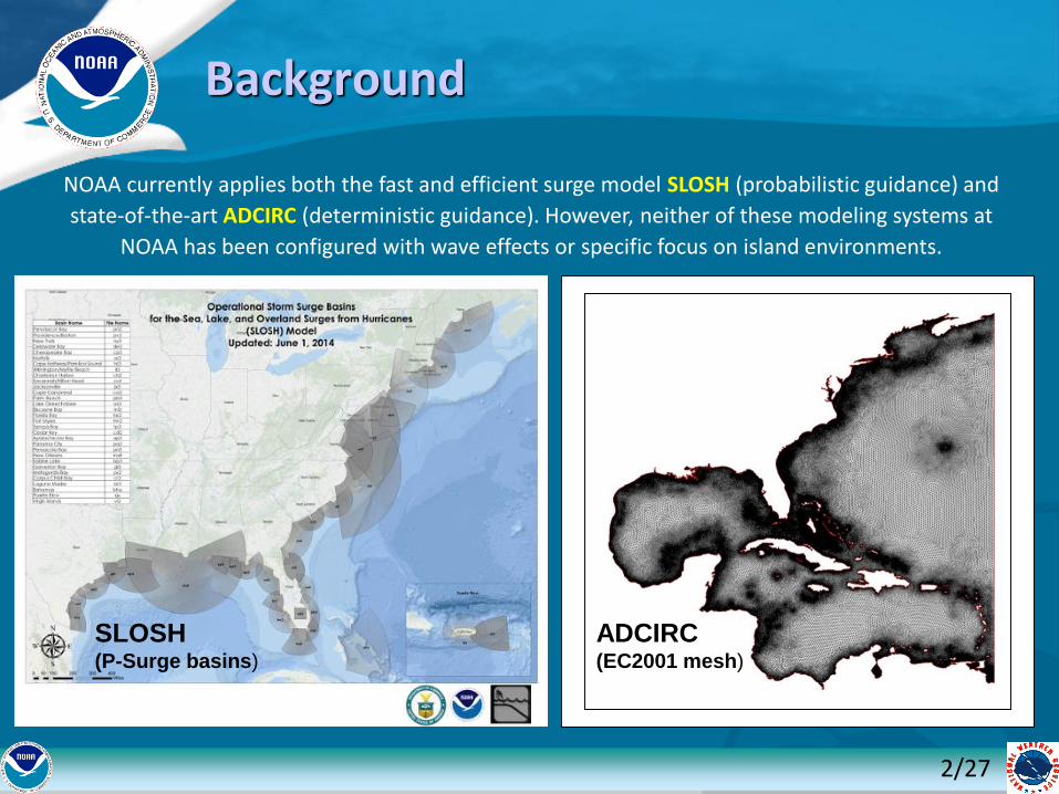
NOAA currently applies both the fast and efficient surge model SLOSH (probabilistic guidance) and
state-of-the-art ADCIRC (deterministic guidance). However, neither of these modeling systems at
NOAA has been configured with wave effects or specific focus on island environments.
Background
2/27
ADCIRC (EC2001 mesh)
SLOSH (P-Surge basins)
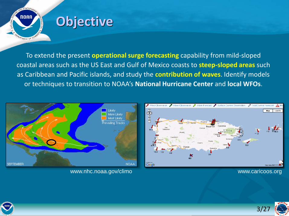
To extend the present operational surge forecasting capability from mild-sloped
coastal areas such as the US East and Gulf of Mexico coasts to steep-sloped areas such
as Caribbean and Pacific islands, and study the contribution of waves. Identify models
or techniques to transition to NOAA’s National Hurricane Center and local WFOs.
www.nhc.noaa.gov/climo
Objective
www.caricoos.org
3/27
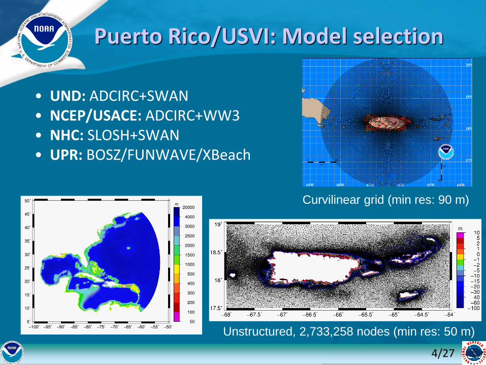
Puerto Rico/USVI: Model selection
• UND: ADCIRC+SWAN• NCEP/USACE: ADCIRC+WW3• NHC: SLOSH+SWAN• UPR: BOSZ/FUNWAVE/XBeach
4/27
Unstructured, 2,733,258 nodes (min res: 50 m)
Curvilinear grid (min res: 90 m)
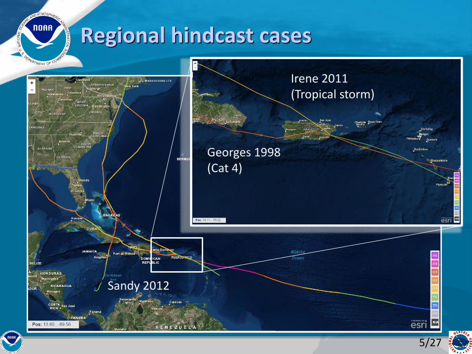
Regional hindcast cases
Sandy 2012
5/27
Irene 2011(Tropical storm)
Georges 1998(Cat 4)
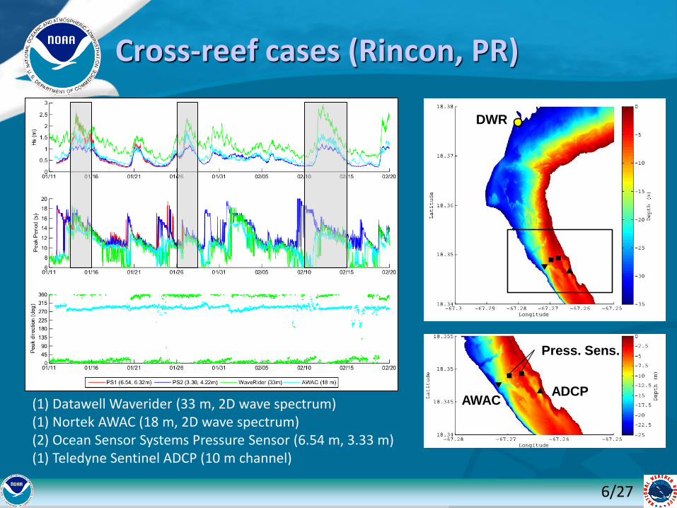
Cross-reef cases (Rincon, PR)
(1) Datawell Waverider (33 m, 2D wave spectrum)(1) Nortek AWAC (18 m, 2D wave spectrum)(2) Ocean Sensor Systems Pressure Sensor (6.54 m, 3.33 m)(1) Teledyne Sentinel ADCP (10 m channel)
DWR
AWACADCP
Press. Sens.
6/27

Input/Validation Data Collection
• Atmospheric input – Parametric vortex models, CFSR, WRF model simulations
• Bathymetry - 1/3-1 arc-sec NOAA Tsunami Inundation DEMs, NOAA benthic map classifications
• Observations - CO-OPS tidal data, NDBC buoys, CariCOOS stations (>2011), WeatherFlow winds
7/27
Credit: L. Aponte
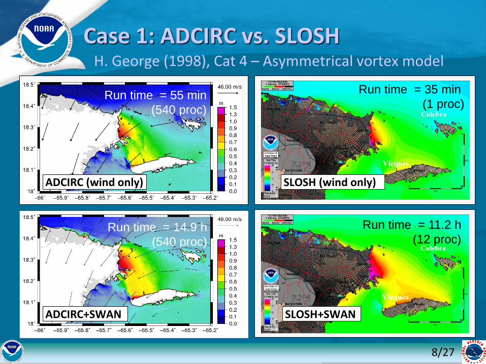
Case 1: ADCIRC vs. SLOSHH. George (1998), Cat 4 – Asymmetrical vortex model
ADCIRC (wind only)
ADCIRC+SWAN
SLOSH (wind only)
SLOSH+SWAN
Run time = 11.2 h
(12 proc)
Run time = 35 min
(1 proc)
Run time = 14.9 h
(540 proc)
Run time = 55 min
(540 proc)
8/27
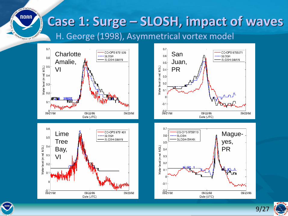
Case 1: Surge – SLOSH, impact of wavesH. George (1998), Asymmetrical vortex model
Charlotte
Amalie,
VI
Lime
Tree
Bay,
VI
San
Juan,
PR
Mague-
yes,
PR
9/27
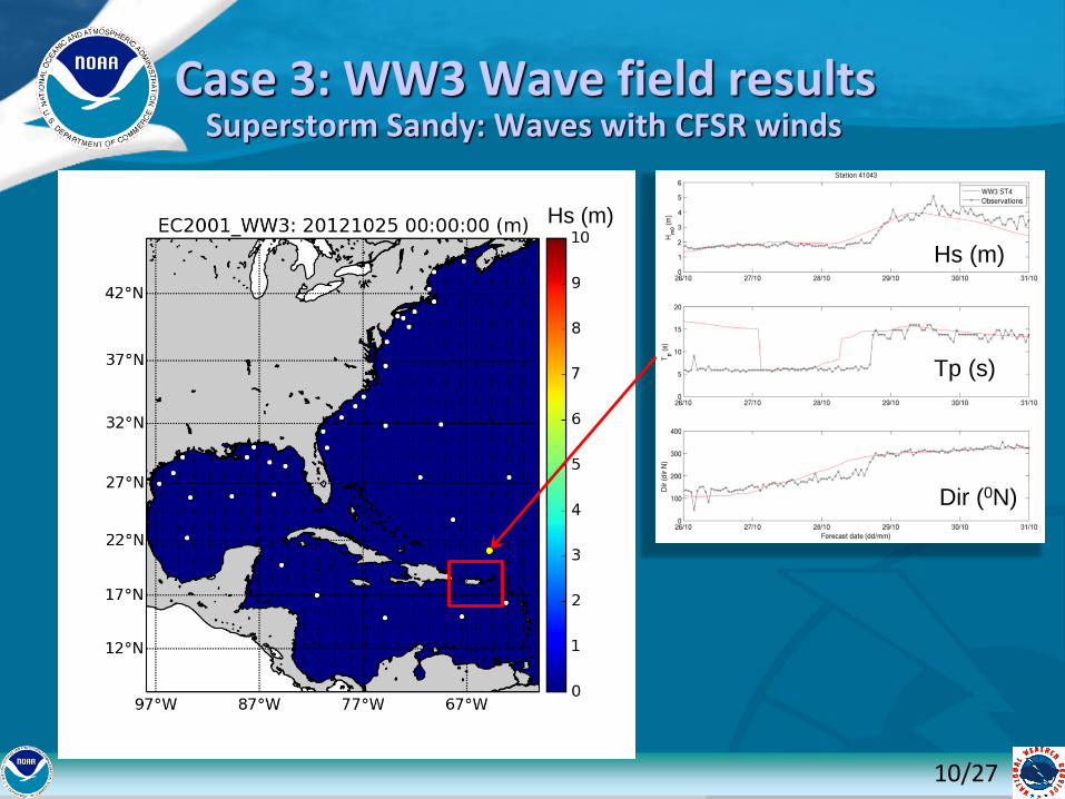
Superstorm Sandy: Waves with CFSR winds
Hs (m)
Tp (s)
Dir (0N)
Hs (m)
Case 3: WW3 Wave field results
10/27
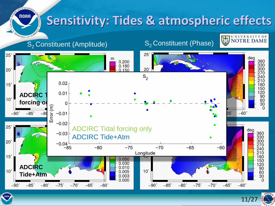
Sensitivity: Tides & atmospheric effects
S2 Constituent (Amplitude) S2 Constituent (Phase)
ADCIRC Tidal
forcing only
ADCIRC
Tide+Atm
ADCIRC Tidal forcing only
ADCIRC Tide+Atm
11/27
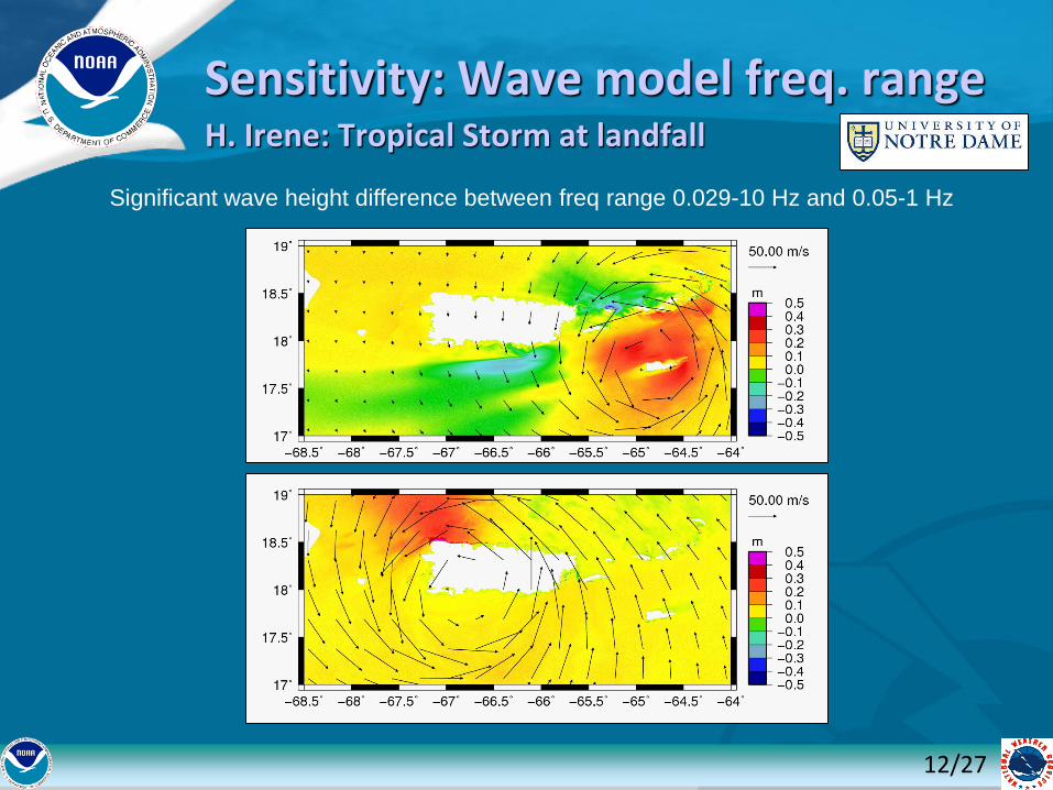
H. Irene: Tropical Storm at landfall
12/27
Significant wave height difference between freq range 0.029-10 Hz and 0.05-1 Hz
Sensitivity: Wave model freq. range
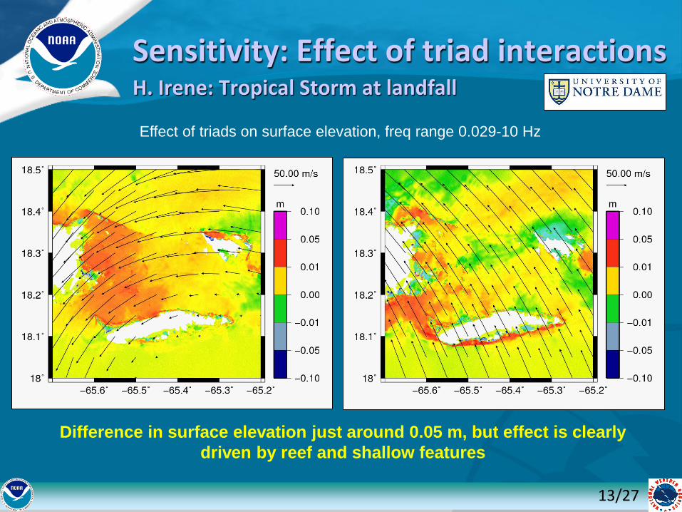
Sensitivity: Effect of triad interactionsH. Irene: Tropical Storm at landfall
13/27
Effect of triads on surface elevation, freq range 0.029-10 Hz
Difference in surface elevation just around 0.05 m, but effect is clearly
driven by reef and shallow features
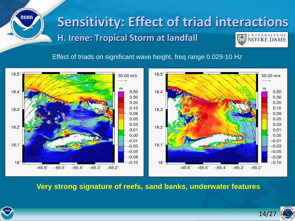
Sensitivity: Effect of triad interactionsH. Irene: Tropical Storm at landfall
14/27
Effect of triads on significant wave height, freq range 0.029-10 Hz
Very strong signature of reefs, sand banks, underwater features

Effect of Atmospheric Forcing on Barotropic Currents
15/27
• Atmospheric forcing is a necessary condition for generation of East-West currents
• Horizontal tidal gradient is not sufficient to generate observed currents
Red:Observed, Blue:ADCIRC Tide+Atm,
Black: ADCIRC Tide
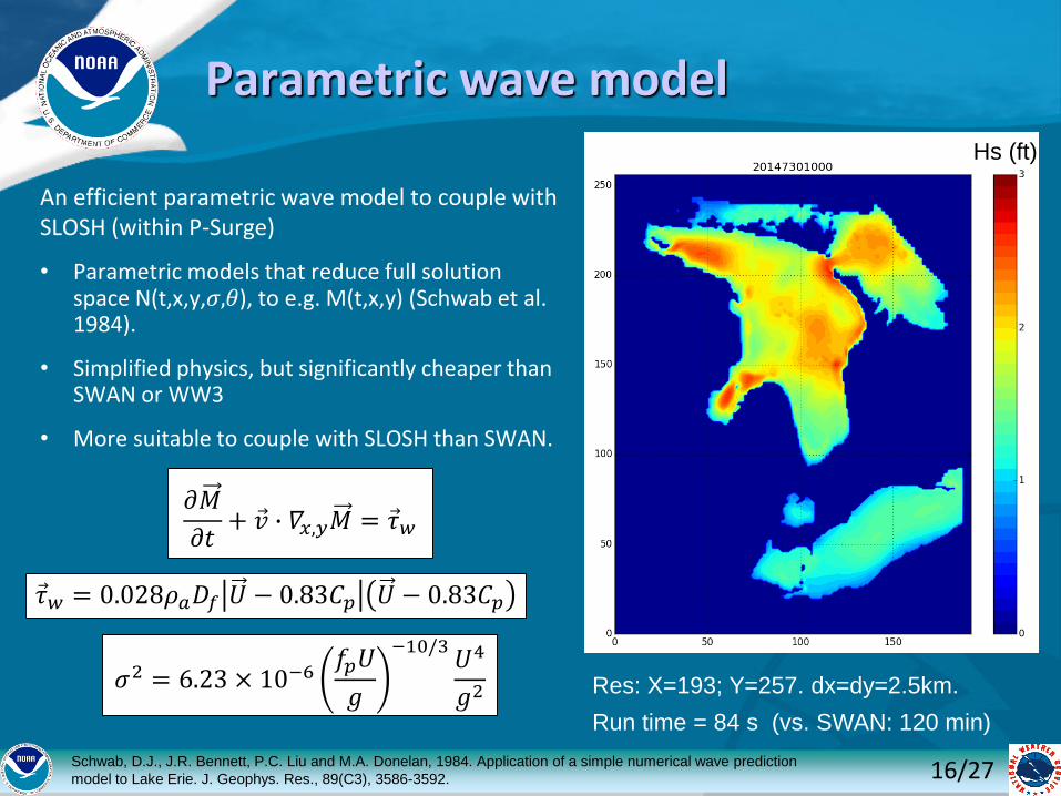
An efficient parametric wave model to couple with SLOSH (within P-Surge)
• Parametric models that reduce full solution space N(t,x,y,𝜎,𝜃), to e.g. M(t,x,y) (Schwab et al. 1984).
• Simplified physics, but significantly cheaper than SWAN or WW3
• More suitable to couple with SLOSH than SWAN.
Schwab, D.J., J.R. Bennett, P.C. Liu and M.A. Donelan, 1984. Application of a simple numerical wave prediction
model to Lake Erie. J. Geophys. Res., 89(C3), 3586-3592.
𝜕𝑀
𝜕𝑡+ Ԧ𝑣 ∙ 𝛻𝑥,𝑦𝑀 = Ԧ𝜏𝑤
Ԧ𝜏𝑤 = 0.028𝜌𝑎𝐷𝑓 𝑈 − 0.83𝐶𝑝 𝑈 − 0.83𝐶𝑝
𝜎2 = 6.23 × 10⁻⁶𝑓𝑝𝑈
𝑔
−10/3𝑈4
𝑔2
Parametric wave model
16/27
Hs (ft)
Res: X=193; Y=257. dx=dy=2.5km.
Run time = 84 s (vs. SWAN: 120 min)
Schwab, D.J., J.R. Bennett, P.C. Liu and M.A. Donelan, 1984. Application of a simple numerical wave prediction
model to Lake Erie. J. Geophys. Res., 89(C3), 3586-3592.
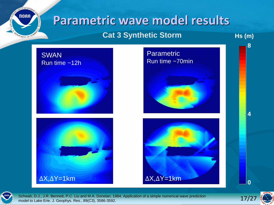
Parametric wave model results
17/27
Cat 3 Synthetic Storm
8
4
0ΔX,∆Y=1km
SWANRun time ~12h
ParametricRun time ~70min
ΔX,∆Y=1km
Hs (m)
18/27
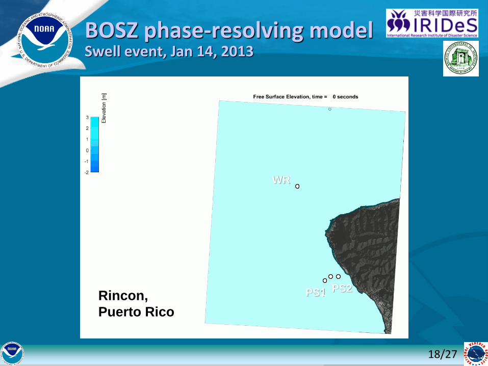
BOSZ phase-resolving modelSwell event, Jan 14, 2013
Rincon,
Puerto Rico
PS1 PS2
WR
19/27
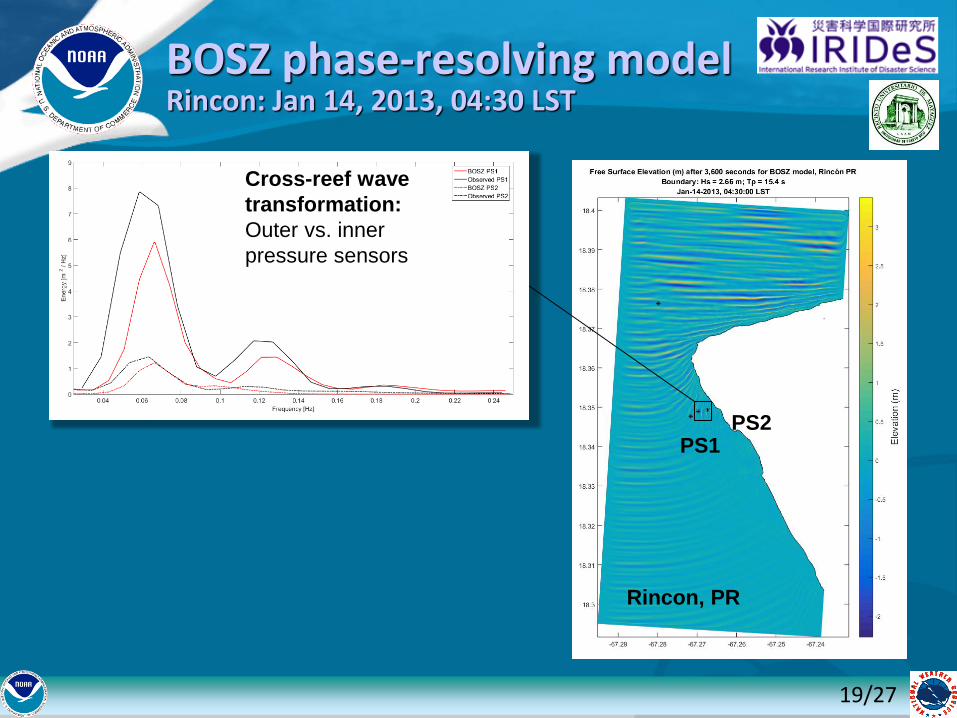
BOSZ phase-resolving modelRincon: Jan 14, 2013, 04:30 LST
Cross-reef wave
transformation:
Outer vs. inner
pressure sensors
Rincon, PR
PS1PS2
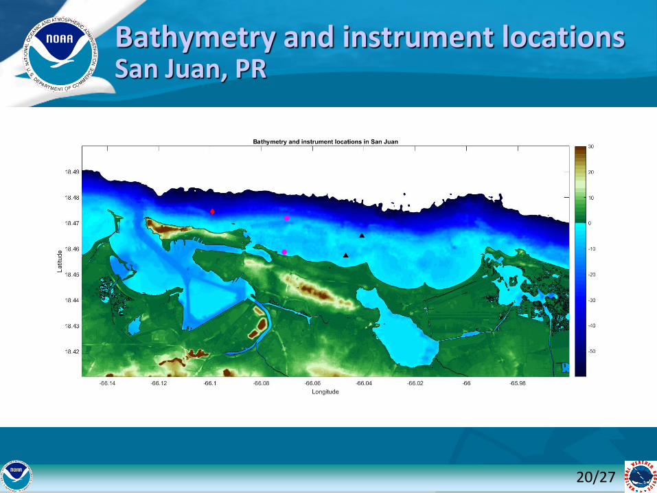
Bathymetry and instrument locations San Juan, PR
20/27
21/27
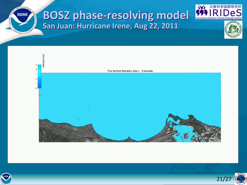
BOSZ phase-resolving modelSan Juan: Hurricane Irene, Aug 22, 2011
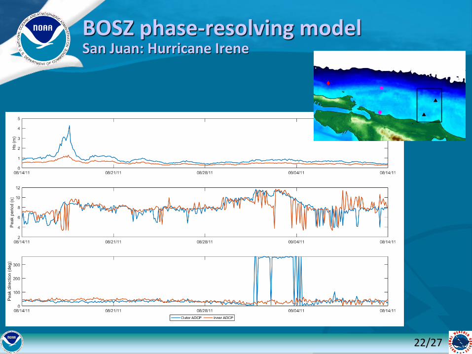
BOSZ phase-resolving modelSan Juan: Hurricane Irene
22/27
23/27
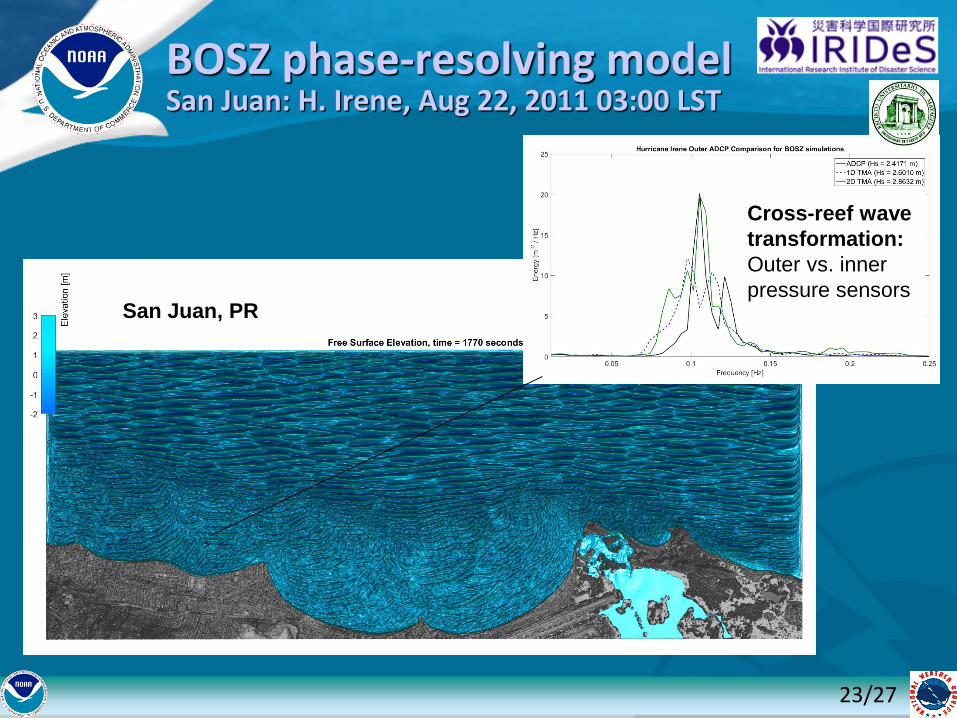
BOSZ phase-resolving modelSan Juan: H. Irene, Aug 22, 2011 03:00 LST
Cross-reef wave
transformation:
Outer vs. inner
pressure sensorsSan Juan, PR
24/27
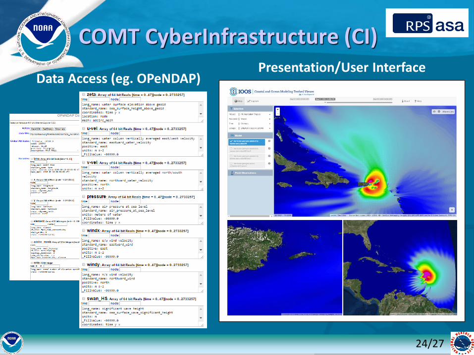
Data Access (eg. OPeNDAP)Presentation/User Interface
COMT CyberInfrastructure (CI)
25/27
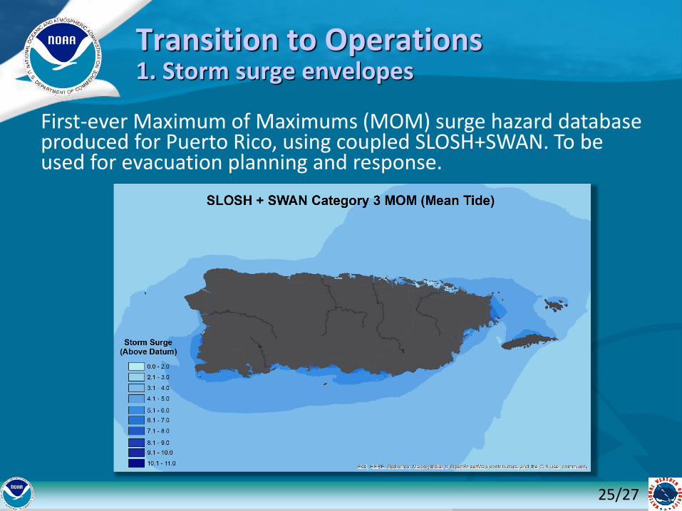
Transition to Operations1. Storm surge envelopes
First-ever Maximum of Maximums (MOM) surge hazard database produced for Puerto Rico, using coupled SLOSH+SWAN. To be used for evacuation planning and response.
26/27
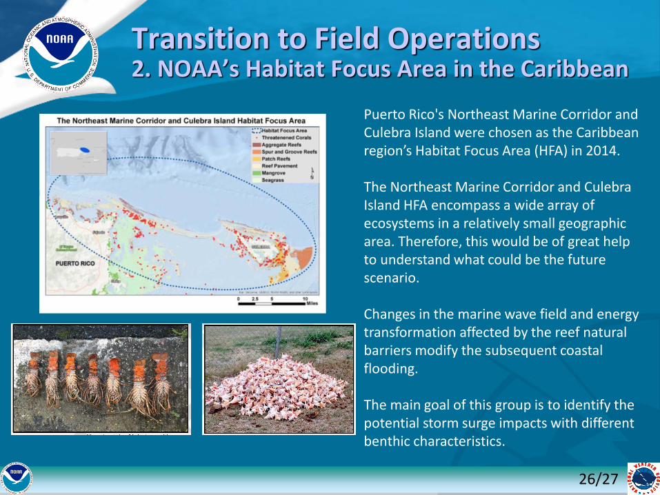
Transition to Field Operations2. NOAA’s Habitat Focus Area in the Caribbean
Puerto Rico's Northeast Marine Corridor and Culebra Island were chosen as the Caribbean region’s Habitat Focus Area (HFA) in 2014.
The Northeast Marine Corridor and Culebra Island HFA encompass a wide array of ecosystems in a relatively small geographic area. Therefore, this would be of great help to understand what could be the future scenario.
Changes in the marine wave field and energy transformation affected by the reef natural barriers modify the subsequent coastal flooding.
The main goal of this group is to identify the potential storm surge impacts with different benthic characteristics.
27/27
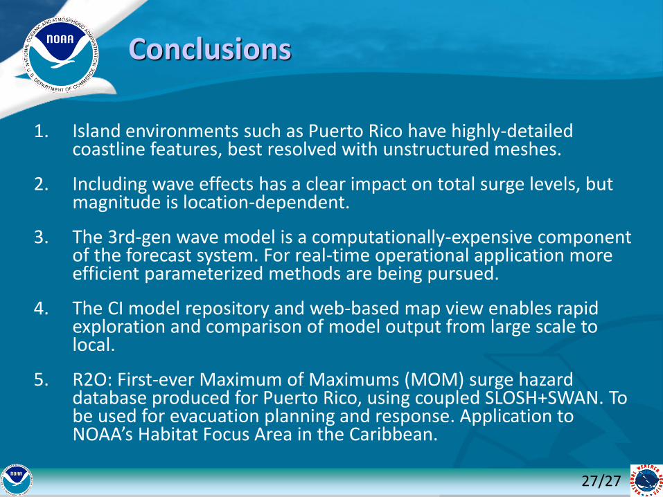
Conclusions
1. Island environments such as Puerto Rico have highly-detailed coastline features, best resolved with unstructured meshes.
2. Including wave effects has a clear impact on total surge levels, but magnitude is location-dependent.
3. The 3rd-gen wave model is a computationally-expensive component of the forecast system. For real-time operational application more efficient parameterized methods are being pursued.
4. The CI model repository and web-based map view enables rapid exploration and comparison of model output from large scale to local.
5. R2O: First-ever Maximum of Maximums (MOM) surge hazard database produced for Puerto Rico, using coupled SLOSH+SWAN. To be used for evacuation planning and response. Application to NOAA’s Habitat Focus Area in the Caribbean.
Related Documents