For Official Use Only INVENTORY SURVEY ( Non - forest lirea ) OF KARNAL DISTRICT ( HARYANA STATE) INVENTORY RESULTS FOREST SURVEY OF INDIA NORTHERN ZONE SHIMLA-1 1995

Welcome message from author
This document is posted to help you gain knowledge. Please leave a comment to let me know what you think about it! Share it to your friends and learn new things together.
Transcript
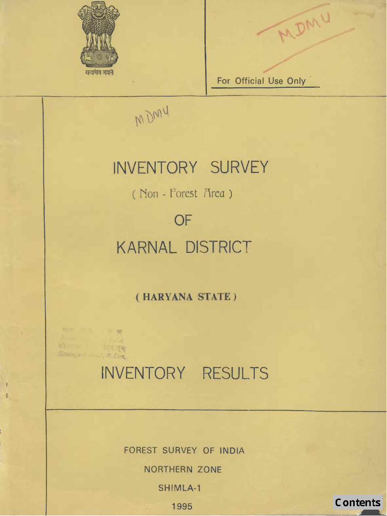
For Official Use Only
INVENTORY SURVEY ( Non - forest lirea )
OF
KARNAL DISTRICT
( HARYANA STATE)
INVENTORY RESULTS
FOREST SURVEY OF INDIA
NORTHERN ZONE
SHIMLA-1
1995

PREFACE
Forest Survey of India, for, the first time, took up inventory surveys in the rural areas with the primary objective of assessing the distribution of trees and their Growing Stock in the rural areas and to have an overview of the various social forestry schemes implemented by the State Forest Departments, The inventory survey was carried out according to stratified random sampling mathodology. One of the important points in this sUIvey was to categorise various types of trees in a village, The categories were farm forestry, roadside plantations, village woodlot. block plantations, canals. railway Jines. ponds and rest. This report pertaining to the district Kamal. Haryana is the first attempt made by the Northern Zone. Shimla. It presents the results of inventory oC trees outside the traditional forest areas.
The geographical alea of the Kamal District is 3121 Sq. Km. The ~urvey was carried out during 1992-93 in the rural areas of the district covering an area of 3691.61 Sq. Km,
Out of the total species inventoried, twenty species on the basis of their predomJ· nance and commercial importance have been presented separately. Other species have been kept together as miscellaneous.
The total number of trees in the district have been assessed to be 46.411akh Le. 12.S7 trees/ha. and the corresponding voluree has been assessed 10 be 1.86 lakh cubic melers i.e. 2.126 cum/ha Acacia nilotica (Babul) and Eucalyptus spp. (Safeda) were found to be the main species with 16.47 Jakh trees (35.43,,) and 12,06 lakh trees (25.95/) respectively.
It is hoped that this report will De used, not only by the State Forest Department of Haryana but also by others.
The inventory survey was carried out by the staff of Northern Zone of Forest Survey of India and the data was also processed by them. The work of the field staff and officers who were associated in carrying out the inventory survey, data processing and writing of this report, is appreciated.
Sd/· (Dr. S.N. Rai) Director, Forest Survey of India Dehradun.

ACKNOWLEDGEMENTS
The State of HaryaM is situated in the North-West part of India. It has extreme climate which is very cold in wint9r and very hot during summer. Besides this in many villages proper drinking water facility is al30 not easily available. The starr of the Northern Zone were engaged in can-ying out the inventory survey of non· forest areas of Haryana with the co-operation of State forest Departmsnt's offic~rs and staff. The Panchayat Pardbans and members and also the villagers have been very kind to extend. their co-operation in making OUT field work smooth and easy. The Deputy Commissioner and other staff of the Revenue Deparunent of the district were very helpful and co·operative. I acknowledge with thanks [or the co-operation and help extended by all concerned as mentioned above.
I am spe,~ifically grat~ful to Shri? S. Malik, IFS, the Principal Chief Conservator of forests of HaIyana ror directing the officers and staff of his department to extend Cull c:>-operation to our field starr. I am also thankful to Shri D. R. Ramesh Singh IrS, Conservator of Forests (HO) and Divisional Forest Officers (territorial) Karnal and Ambala (OJ; providing 'U$ the requited data and iQformatiollS, Shri G. K. Ahuja, IfS, Divisional Forest Officer, Social Forestry, Panipat and Ra.nge Officers (territorial) and other field staff have also been very co-operative in extending all possible faci]i1ies.
I acknowledge with thanks, on behalf of Forest Survey oi India (Northern Zone), 10 all the concerned as mentioned above but for their kind co-operation a.nd help extended to this organigation it would not have been so easy to bring out this report successfully.
Sal-(Manjit Singh. IFS)
Joint Director

Summary
ChapLer 1
1.1 Introduction
1.2 Description of the District
1..3 Location
1.4 Physical Features
1.5 Climate
1.6 Rain
1,7 Temperature
1.8 Frmt, Fog ami Hailstorms etc.
1.9 Socio-Economic conditions
1.10 Uses
Chapter" 2
2.1 Design amI Methodology of Non-forest
Inventory Survey
2.2 Definition of Non-Forest area
CONTENTS
2.3 Sampling Design and Method of Selection of Sample Villages
2.4 field Methodology
Chapter 3
3.1 Processing of the Data
3.2 Area computation
Volume table
Chapter 4
Table NO.1
Table No.2
Stand and Stock tables
LIST OF TABLES
Tutal number of stems specieswise and dia-c1asswise (All categories combined)
Total number of stems categorywise and dia-c1asswise (All species combined)
Page
2
2
2
2-3
4
4
4
4
4
5
10
10
10-11
11-12
13
13-14
15
16-18
19
20

Table No.3 Totaillumher of stems specieswise and calc8<>rywise (All dia-classes combined) 21
Table No.4 DistribuLion of tolal volume (in CUM.) by species and in dia-classes (AU: c8tcgo~ics combined) 22
Table No.5 Distribution of total vulume (in CUM.) specieswise ano ca1egorywise (All dia-classes combined) 23
Table No.6 Distribution of lo[al volume (in CUM.) calegorywise and dia-c1asswisc (All species combined) 24
MAPS
I. StaLe map of Haryana
2. Location map of Districl Karnal (Haryan~) 6
3. Normal Monthly and Annual Rainfall (Haryana) 7
4. Normal Monthly and Annual Temperature (Haryana) 8
5. Type of Soils and Geology, District KarnaJ (Haryana) 9
APPENDICES
Appendix·I List of the villages selected for pilot survey in Haryana State 25
Appendix· II Districlwise number of villages selected for Inventory Survey in Haryana Slate 26
Appendix-Ill List of species found in Sample Villages in Karnal District 27·]J3
Appendix-IV List of the villages surveyed in Karnal District 29
Appendix-V Definitions of c".tegorics 30
4.Dpcndix-VI Field Forms Jl-JS

SUMMARY
1. To assess the availability of forest resources for production of timber,
fuelwood and raw material for paper pulp, packing cases, essential oils and matchwood etc, in areas outside the traditional Reserved Forests and tnose forest
areas which could not be covered while undertaking the regular Inventory Survey of Haryana Slate. The Inventory Survey has been carried out in the Karnal district
of Haryana durirtg 1992-93.
2. As pct 1981 Census Kamal district had a total of 634 villages, having a lotal area or~697.61 Sq. Km., {Jut or which 18 villages were randomly selected and surveyed.
3. In the entire rural area of Karnal district 4().47 lakh trees (12.57
lrees/he-clare) have bee.n esi imaleu. The. analysis shows that maximum number of
the estimated trees are in 10-20 ems. dia-c1ass i.e. 31.241akh trees (67.23%) and
minimum in 40 ems. and above dia·class i.e. 1.l7lakh trees (2.52%).
4. The specleswise distribution of total number of estimated trees shows
that Acacia 1ll1vlica (Sahul) has the largest representation i.e. 16.47 lakh trees
(35.43%) followed by Eucalypnts spp. 12.06lakh (25.95%), Populus spp. 3.60 lakh
(7.74%), MOnls spp. 2.46 lakh (5.29%), Da/bcrgia sissoo (Shisham) 2.39 lakh
(5.14%), MOIIEJIfcra illdica 2.10 lakh (4.5.3%), frosopis ju/ijlora 1.561akh (3,35%), Melia azeduracll LUlakh (2.67% ),Azadiracllfa indica 1.0& lakn (2.32%},8yxygiUIH l'umini O.lJ2lakh (1.99%) and Ficus spp. 0.56 lakh (1.20%).
5. The distribulion of lolal numncr of (rees categorywise anti Jia-c1asswise
~hows that the ·reprc~cntati(ln of tree~ is maximum in the Calegory·l - FARM
FORESTRY i.e. 23.01 lakh trees (49.52%) and minimum in the Category-Ill -VILLAGE WOODLOTS i.c. l..S0 lakh (3.23%).
6, III the entire rural a(ea of Kamal Ji~trict total estimated volume of all species and dia-c1asses combined comes to be 7.R6 lakh cubic meters and
volumc/hcctar~ is 2.126 Cum.
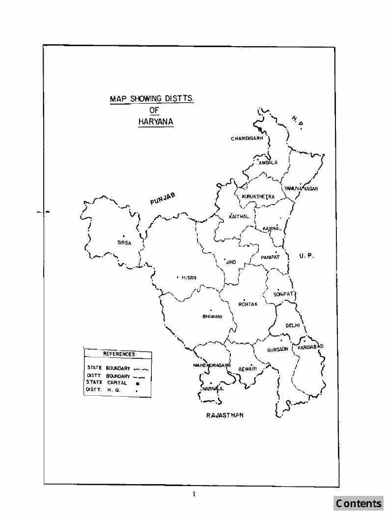
MAP SHOWING DI5TT5.
It£FERENC£S
OF HARYANA
-
ST~TE 80~O.l.RY _._
DlSTT 8~OARY __
STATE CAPITAL • OISTT_ H. Q_
1

CHAPTER I
1.1 Introduction
Tu assess th~ availability of for.cst resources for production of limber, fuelwood and raw malcrial for paper
pu~p, packing cases, essential oils, match wood etc. in area~ out~ide the Iraditional Reserved Forest 3reas and lhose forest areas which could nO[ be covered while undertaking the regular Inventory Survey of Haryana State.
1.2 Description 01' the District
The di~lrict of Kamal is a part of the Eastern Haryana plain. ·It is named afLer the lawn of Karnal which according to Ihe legends ows ils name Lo Raja Karna who although an elder hrother of Pandavas - born 10 Kunli of
God Sun before her marriage, was a very dose associate of DuryoJhana and fought for him in the greal Mahabharata
war. The lown Slanus on the high bluff of River Yamuna which once flowcl.l in its immediale vicinity. The tract in which iL is silutaled is doLtcd with ancient ~iles and almost every village and sLream is connected with the legends of
Ihe Great Epic.
1 J Location
The di~lrid lies between 29 0 09 ' 50 ., ano 29 0 59' North lalituJes and 760 31' 15" and Tf 12' 45" East
Inngil udcs, On it[> N(lrth and N(lr[h· WesL is the di5lricl of Kurukshctra. To ilS we,',l is Jind Districl. Sonipal districL
lies on ils south. The Yamuna river makes the ea~tern boundaries of the district and across Ihe river are the districts of Saharanpur, MUlaffarnagar and Merrut of UlLar Pradesh. The area of the di.'llrict is 3,721 Sq. Km. having a population of 1,322,82() as per 19Sj Cenus.
1.4 Physical Features
Soils, geology and topography
The dislrict on the whule is divided into the following three sub-micro regions on the basis of soils and topography:-
(,,) Assal1dh l'lain
The region extends over Assandh Ichsikx(;cpt three villages Peont (11), Bansa (12) and Rer Kalan (19), three villages of Karnallehsil Viz. Gunana (304), Nisang (305) and Gondar (306) and I few villages in [he western part of Panipal tehsiL From rc lief poi nt of view, maxim urn height of the regi on is 243 metres above m.s.l. near village Gunana (304) in Karnal Teh5il while Ihe minimum h~igh[ is 2J5 metres ncar village Rattak (32) in Assandh Tehsil. The region
is entirely a North· East to Soulh-West. It is predominantly agricultural. A few patches of wasteland and scrub are
seen in certain villages.
The old alluvium of 'N~rJak' h;),~ low fertililY as compan.;J to the 'Bhangar' alluvium on a~count of K<lllkar
formaliori in the ((IImer. The soil orthe region is loam (Nardak). Soil asdassilicd byNBSS and LUP (reAR), Nagpur, the region has Aqucpts . Ochrepts type of soil. AqucplS means Brown soils (Hydromorphic), Ochrepts means shallow black, brown and alluvial soils of thl! northern region.
With regard 10 communicatiuns and transportalion f acilit ies, the region is seen covered wit h all types of metalled roads. Assandh is Ihe main lown from where roads arc radiating to all towns. Northern railways (Broad gauge) Jind to Panipat (Branch linc) passes through the region.
(b)Karnal.Bhangar
The region spreads over the major portion of Karnal and Panipat lehsil and also three villages viz. PennI (11), Bansa (12) and Rerkalan (19) of A~~andh tchsil. II covers lhe central part of the district in North-South direction.
2

The regio~ makes its boundaries with Assandh plain and Kuruluhetra dislrict in West and Norlh, Yamuna Khadar in the East and Sonipal distri<;t in the South.
From rdid point of view: the maximum hejgh! of the rcgjon is 254 mel res above m.s.l ncar vilJa!.JC Nilokheri (rural) 65) and minimum he ight is 237 metres near village Malakpur (400). Both t~e heights arc lying in Kamal tchsiL Bhangar area comprises the higher ground than the· recent nood plain. Scrubby and bushy type orvegelaLion are seen scauered over the region.
A few patches of land are unJer swamps over the region, cultivated land is extensive besides some patches of scrubs. Weslern Yamuna canal (main branch) along with ilS dislributaries is the main source to facilitale canal irrigation.
The soil of lhe region is loam (Bhangar). The soil found here is comr3ct and sliff duc to addition of sill. It is less granular. Soils as classified by the NBSS and LUP (leAR). Nagpur found in the region are Ochrepts - Orthcnls and AqucplS - Ochrepls types of soils.
Ochrepls - Shallow black, brown and aUuvial soils of the nort hern region.
Orlhenls - RccenjJ), formed sojJs
AqueplS - Brown SQils (Hydromorphic)
With regard 10 means of communication and transportation facilities. all types of roads and two Broad gauge railway lines pass through the region. National Highway No.1 (NH 1) also passes through the region on which well developed lowns of Panipal, Gharaunda, Kamal, Ttaori and Nilokheri are located.
(c)Yamuna l(}Jadar
The region extends over the eastern parls of the Karnal and Panipattehsils of the district. It runs along (he Yamuna river in the eastern parI of the di.~trict from NQrlh to South "5 a linear tra!;k, The region makes its boundaries with Karnal Bhangar in the Wesl, Kurukshelra dislricc in the North, State of VClar Pradesh in Ihe Ease and Sonipa( district in the South.
From relief point of view, the maximum height of the region is 257 melers above m.s.! near village Hanauri (16l) in Karnaltehsil while the minimum height is 225 meters near village Bodhwal Majri (125) in thl!' Panipat tehsil. The region is built and drained by tbe Yamuna river. So i, contains various interlocked canals of streams, rivulcls, ponds and swamps. The nood plain is low lying. It is highly undulating in topography and swamy in places.
The region consists of alluvial soils. The soil found in (he region is sill y loam (Khadar). Khadar of Karnal is throughoul inferior being eithcr the lightest sand or stiffest clay. The region is under cultivalion extept a few patches which are covered with bushes. Soils as classified by the NBSS and LUP (leAR) Nagpur, the region has AquenlsAuvcots !)'pes of soils.
A'Iuc:nts - ~ecently formed Hyuromorphic alluvial soils
f]uvenls· Alluvial soils (Recent alluvium)
Wilh regard to Illeans of communication and transportation facilities, the region is nOI much developed due to lhe riverian action. Mainly aillhe roads are interlinked with each olher by 'Kuchcha' roads or footpalhs. lndri and Samala.kha (owns are deveJoiping in (he northern and soulhern parts o(the region respectively.
3

1.5 Climate
The Kamal di51 riel lies in lhe Easl ern Haryana plain which has G angelic I ype, sub-tropical continent al monsoon climate.
1.6 Rain
Monsoons bring rain frolll July 10 September, From October .0 June fhe Weal her is generally dry except a few showers from western cyclones. Wilhin the district also rainfall varies. The northern pari of the district gelS more
rainfaU [nan the W\.Ilhern part due to i.ts proximity 10 lne mountains. Rainfa.1l in the dislrict varies from 650 mm in tne south - western part to above 900 mm in north - easlern part of Ihe dislrict. The climale in Ihe distriCI is allributed 10 shorl wet months and long spells of dry months or weeks. Humidity is very high during the rainy sea~on and very low during dry summer monlhs.
1.7 Tempfrature
Due (0 ils distance from [he sea lhere is great difference hetween the temperatures of day a.nd night a!=. well as during wimer and summer. The Maximum daily temperalure during 5ummer rcaches as high as 4SoC in May - Junc.
Hot dry winds blow during the day due il5 proximitY.lo the semi - arid areas of Haryana and Ra.ia~lhan- DUring the winler the Millintum temperature falls below ~C during December. January. .
1.8 Fro~l, Fog lind lIailslQrms ete.-
Ground frost also occurs when I he re is snowfall in H. P. and U. P. hills. Foggy weather also prevails during the
months of January. February. Occasional spcll~ of hailstorms also take place during February 10 ApriL During May-June dust storms also OCCUr in the district. .
1.9 StKio-Economic C on"ilioRS
The economy (If the: district is primarily agricultural. At the lime of 1981 Census, about 59% of the lotal main workers were cultivators and agricultural labours. lIS industrial base has remained mainly agro-bascd. The large and medium scale units are engaged in manufacturing of fertilizers, sugar, reclifieo spirit. country liquor, dehydraled
vegetables, steel pipes and tubes, card hoard ctc. There are many small scale units also in K<l.rnal di5lricl. These unils manufacture metal products, food products, col(on textiles, chemicals and chemical products, rubher, plaslic,
petroleum and coal producLs. lextile, leather and fur products, paper and paper products cte. Panipal is known as the
home of qualily handloom prodUCIS which have become popular in fordgn countries also.
(rrigallon in the districl is moslly done hy lubcwellc: .. There is a good network of canals. Underground waler
level is comparatively high. Qut of Ihe tolal area 86.63% is cultivable (lnd oul of which 82,84% is irrigaled. A.mong
the food grains. mo~t1y wheal ami rice are grown. Sugarcane and sunllower (oil ~ccds) are also grown in considerable
areas. As per 1971 Census u{ \ivC-Mocks 1 here are about 7,10,000 animals which includes cali Its, buHaloes. horses anti ponies, donkeys, sheep, goats, eamels and pigs etc.
The people of Baryana are h1lrdworking and enterprising. The rer capita incoIlle of Haryana is second after Punjab among Ihe slales of the counlry, Wheat and rice are the main food. Milk consumption is about 500 gms. per person which is quile high as compared lO the National avergc of about 137 gills.
Out ortolal populalion of the district 74% is rUfal population. Oul oflhc lolal population 36.17% are lilrat~s. Litracy percenlage among lhe male and female population is 47.27 and 24.49 respeclively. Litri.lCY percentage among the Rural and Urban population is 29.74% and 56.60% respeclively. Oul of the 10lal population only 31 % are workers while 69% arc non-wor.kers.
4

1.10 Uses
The trees provide mainly timber, fue~ fodder, fruilS and shade. Timber is obtained mainly from Do/bergia
s;ssoo,Eucol)prus spp., Melia azedarocll, Syzygium cumini, Morns alba, M{II&gi/era indica, Azadirachlo indica, Albizia spp. elc. Smalllimbcr is obtained mainly from A cacia niiofica,Acacia spp., Prosopis cineraria, Tamarix articulata etc. Alllhe above men1 ioned trees provi~e fuel woolf also. Trees like Prosopis juliflora, Acacia nilolica, Acacia torlilis, Albizia spp., Morns l1/ba, Prosopis cineraria also provide fodder in the form of leaves or pods. MofUJ alba provides wood for manufacturing hockey Slicks and other sports goods. Poplars provide matchwood and Euclyptus paper pulpw()()J. Fruits are obtained Crom Zizyphus spp. and Syzygium cumin;. Kalha is extracted frol]lAcacia catechu. Neem oil is obtained fromAzadirachla indica,
It has been seen that with the ban on felling of green lrees in Himachal Pradesh, packing cases [o{ apple and other fruils/vegetables are supplied from Haryana which are construcled from Eucalyptus wood. Eucalyptus is also \.Istd for making cheap furnilure and also as a fuel.
5

I. 0'
,," .,'
,I, "
location Map Of OI.H. Karnal
(HARVANA)
cE Gfl'lD -j-" ,,~ 1II1ftda'1 0, "nc r \ 1O~r*J" TIlIil
'_"'1OI'I1IlII ... ..,._,
Slat. "'~l' ' ................ _4 ~-e,. Lon. WI", 5 •• ~ ..
(l,_ dq"".\
["'''''' Sin"," lat. VollDI. _ •• 5000 IU ....
I'0Il0101''''' 1If1 ... "(iii
.. Q
--.. , :uz ..--~ -0:'"
~
. , ..
.... ~ ()
.. 0
. ,
G
,f.
. , .
~
"1
tJJ
Q
<I[
t:.
Il.
,. - ..
J - ..
" II'

• 11
, I
.. 2
NORMAL MONTHLY Af\[) ANNUAL
RAINFALL (HARYANA ) ..
8O.IIlMf STAn: _._,_
8~ ~'T!tICT - - - -
.,
v
~
A'PINUAL RAINFALL It MIt
1100
1000
900
.(0
700
800
IlOO
.. 00
3GO
I(,. 10' 0 10 2.0 !O 40 50 =---------~
10 ~ 0 10 2D 30.., ..
1
7
CHANDIUJIH
•
"
31
• 2.

8 •
D
o
•
NORMAL MONTHLY AND ANNUAL
T_EMPERATURE (HARYANA)
BO\IIbftY STATE _. __
p u
.,
ANNUAL n .... IN l
It. 10 I Q 10 ZO JO 040 10
.dWiltbY 10 !I 0 D :!O 50 1111 ••
8
- 'I
w
D
•
T

1lIO.10 0 ,0
I I J
o 10 111111
TYPE OF SOlLS a GEOLOGY
DISTT, KARNAL (HARYANA)
SOILS
f Ii \
\
I: : : IOeHIEPf!.oItrHENnl1t.1 . .... J
I
I
II.... ,0 0
I eEOLOI'
10 0 10 ~., ••
~ AlWlIlUII
9

CHAPTER 2
2.1 Design and Methodology 01' Non-Jt'ore~f Invt'ntory Sunrey
Districl Census Books of Census Survey 1981 were used as hasis of Inventory of Non-Forest Area. A list of
vilbges in the Ji~lrid was prcparcJ amI caeh village was given a serial number.
2.2 Definition of non-Forest Area
For the purpose of this survey
(l)Alltho~c areaf> were taken which were outside the traditional Reserved Forest Areas.
2.Alllhosc areas which salisfied the following conditions were also excluded:
(a)AIl places within the Municipality, Corporation, Cantonment Board or a nOlified area CommiLtee etc.
(b)AlI other places which salisifed Ihe following; criteria :.
(i)A minimum populution of 5,000;
(ii)At leas! 75% of the male working population engaged in non-agriculLural persuits and
(iii)A dcmity of populalion of allea,r,t 400 per Sq. Km. (1,000 per Sq. mile).
In addition 10 all municipal arCa~/CanlOnmCnl Board. four villages namely (1) Bahiyal in Ambala district, (2) Smalakha in Karnal dislrict, (3) Gurgaon (rural) .. no (4) Jharsa in Gurgaon dislrict satisfying lhe above crileria had
been Lreated as Census lowns (non-municipal) in 1981 Census. Panchkula Urban Eslate in Ambala dislrict had also
heen Irealeu as a lown. The FaridabaJ Complex AdminiSlration consisting of Faridahad, Faridabad Township and
Ballabgarh LOwnS of 1971 ano some surrounding villages in Faridaba~ district had been treated as towns.
2.3 Sampling Design and Method of Selection of Sample Villages.
The invcnwry survey was underlaken in the rural area (non-fores( area only) of the state. The design followed in the fielJ invento_lY was random sampling with I he villages as sampling unils. A list of villages of Karnal district was prepared according 10 1981 Census and each village was given a serial number.
Firstly, the number of sample villages 10 be surveyed in the slate was uccidetl by taking a pilot survey such that
Ihe results of the survey at SLale level would be at the precision kvcl of + 10% a~ 95% probability level.
For carrying out pilol survey. 2to 3 villages were taken from each di~trict of Haryana SLate. Total 31 villages
were selected f('lf rilot survey in Haryana Slale. A lis! of the villages seleclcd for pilot survey is gi;en in Appendix - I.
The villages :.ckclcd for pilol survey were laken up one by one for carrying out complete enumeration of all (he trees of 10 ems. unJ above diameter al B.Ht(OB). Each or these selected villages, wilh ils area and boundaries as
per Ihl: revenue records, was treated as a sampling unit.
After completing the pilot survey the data Was processed [or obtaining number of lrees/Ha. in each village for calculation of sample size by using Ihe formula
Where C.\J. I
X lOU and x
/I =
10

N=tota! no. of villages ~n the Stale,
For large N, it will be equal to
~(2XC.V.)! n ~ 10
The method used was ralio method cf eShm3tion. the sample size obtained from pilot survey was 219 vmages.
The,e 219 villlJ91 lV~ra i.i3trlblte i 'Jvar ill the districts prop:>rtional to the rural area of tb.e ·district. A Jist of number of. vilhges sele~ted for 6.3.ch, district 1S g~ven in the 'Appendix-II.
These randomly selected vIllages in.each distrIct were taken up one by or.e for carqing our
complete enUm9rdtion ()f all the traes of 10 cm'l. and above diameter. Each or these randomly. selected villages. with. ils area and b()unddries as par the revenue records, waa treated a.s a sampling UDlt
a 4 Field Methodology
The field data is collecled by a Crew, consisting of one Junior Technical Assistant (Crew. Leader), a Deputy Ringer, two Fieldsman, Khalasi and unskilled Idbourers engaged Joca'lly whereever necessary for showing Ihe l?oundary of the Village as well as helping in the survey work.
Each Crew Leader IS provlded wlth a list of villages to be tackled alongwilh a set of 1: 50,000
scale maps wuh locatIon of vUlagas duly markeJ, The Crow Leader is required to [ind the nearest convenient route so that they Cdn l~ach the village wIth mimmum traverse by jeep or on foot. After reaching the village the next job is to determine the bourrdal y of the village. ror this purpose, the maps of the ~evenue DepaItment are rererred and in addition the help of village le'lsl authorities are obtained. The unit of sampling is the whole of sample villagE7. To begin the ddta collection it is neceascuy to seleellhe starting/reference point preferrubly centre of the village. Tbis reference point/centre is n Jt necessarily to be the centre of the area. The datails of the location of the reference point/centre and its description are recorded ill the village description fDlm. This is very important to enabJe the checking crew to reach this point and commence checking.
After fiy.ing th~ starting'reference point, the enumeration work 1S started from the reference point by dividing the entire vHlage into suitable sized angular quqdranl.s with the belp of com~ass in !i1uch a way thaI enumeration within each angular quadrant could be completed in one working day. The size of each angular quadrant is dedided by the Crew Leader accordingly, Enumera1ion
of trees/bamboo is cOll1menced from tile line m~rkmg due North from the cJnnejreference point and iS'proceeded in clockwise direction (i.e, Norrh to Ea.st).
This procedure is irnpoHdnt to avoid duplicltionjommission of trees when the enumeration work is colltinued on the next day. Further. all the enumerated trees are suitably marked \\iith chalk to achieve this obje~th'e. The inform3.tions regarding number of angular qudrams, the size of each anguldr quadrant and numbar of treas enumerated m 8 iC~ quadrant are recorded in the precscribed Field forms given below;
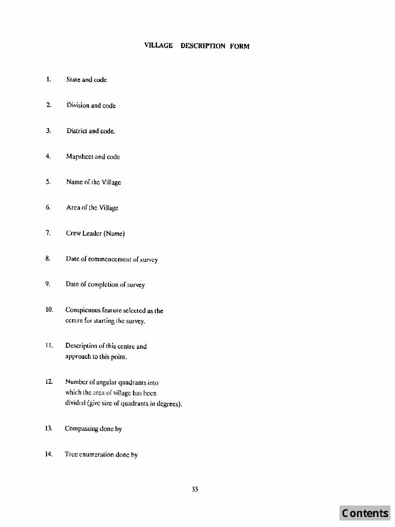
(1) Village Desc:ription Form
(2) Village Tre~ Enumeration Form
(3) District Tree Form
Samples of the above field COIms may be seen in the Apendix.-Vl. The field forms are briefly discribed below:
(1) Village Description Form
The information regarding the conspicuous features of the point selected as the Centre (or
1 J

starting the enumeration, number of angular, Size of each angular quadrant and number of trees enumerated in each quadrant are recorded in this form.
(2) Village Tree Enumeration Form
In this form the data of all trees of 10 ems, and above diarr.eter at breast height over bark [DBH (OB)] in a sarr.pled village are recorded. The dead trees having utility less tban 70% and all trees of less than 10 ems. diameter are ignored.
(3) District Tree Form
This form has to be filled in for each sampled village selected in the district. While carrying out the survey, i,e. enumeration. and :measurement of trees, the category of
each tree-indicating the type of plantation it belongs to is also recorded in the colUmns of Village Tree Enumeration Form. The definitions used 'for this classification are as under:
Farm Forestry:
Road side Plantation: Village Woodlot; Blook Plantation:
Ponds:
Railway Lines:
Canals;
Rest:
Trees along tbe farm bunds and in small patches up to 0 bha ;in area.
For trees planted along the road side. Naturally growing trees on community/private land. Patches covering an area of more than 0.1 he. and not falling in any of the above.
For trees planted in and around water ponds.
For trees plante:! along)he railway lines.
Trees planted along the canals.
Trees not falling in any of the above categories.
12

CHAPTER 3
Data Processing
3.1 Proces!>ing of the Data
A ftcr com ph:t ion of licld work, I he field forms of the villages surveyed were consolidated and checked for any
inconsistencies and Cooing mistakes, if any. Forms for each village were then processed manually and information
was filled in tbe tables. The species found in sample villages of Kamal dimict during sllrvey are given in Appendix. III. Since many ~Jf the ~pecies in the region were having a very :>mall number of trees, they were clubbed together under Miscellaneous species. Twenty main species were selected for calculating the number of stems on the basis of their
numerical occurrance, commercial importance and regional importance. Two tree species which were not imponant
for estimaion of volume were notlaKen up for calculation of volume. After manual processing of the data the tabulated
data Wa.'i then tram;ferred to the dala files in Ihe Personal Computer (PC) using suitable softwarcs. The data files were then processed for making various tables in desired formals required to be incorporated in the Report
3.1 Area CotnlllJlaliofl
Rural area of the district was calculatetl by aJding up the areas of the villages given in the Census Book of 1981
of I hal tli~1 riel.
3.3 Collection of fellctl tree L1ula has been di:;continucd by lones, for developing volume equations. The volume f ~CI ors have bee n ill Jl .. incU from the Logging Divisions and Tc:rrilOrial Forest D ivisiollS or the State Forest Department of Haryana.
3.4 The volume factors used for different Iree species have been given in Ihe volume I able atlheel'td oflhis chapter.
Estimation Protcdure.
The estimation procedUre i~ given below
Let
Xi :: area of the ilh village
Yi = volulTle/no. of trees for the ilh village
'1 = no. (If sample villages in the dislrieUslale N '" total no. of villages in I he distriel/s(at e
n
x = L XliII "" average area per village in the sample
N
X = L x/N :: aVerage area per village in the population (Distriet/Slate).
n
ji = L Yif " = average volume/no. of trees in the sample
13

N
Y . = L Y/f'/ .:;: ave rage volume/no. of trees in the population (DistriclfStalc)
N
A = L Xi = total area of all villages in the population (District/SIal e)
Then the mean volume/no. of trees per unit area for the population (District/S!ale) is given by
The estimate of R is the sample ratio
n
R'""kLl "" Y n X
2: XI
The estimale of total volume/no. of trees in the population (District/SLale) is given by
'" Axji '" T = _ = AxR .(
Estimated variance of R is given by
When N is large, Lhen
V(R) ;;;; N-~ x_1_ [i i - 2R"i YiXI +R! xr] Nllr (n-I)
V(R)
Esti l1alcd variance of f is given by
A r r;:;;;:: ) £ 5.£. of R "!j VCR) and SE.%=~ x 100
. R
S.E. oJ f.. elP(t, arid'.SE.%="S:, )(, 100 :';"'\1' T
14

Volume Table - spccieswise and dia-classwise
S.No. Name of Sp«ie~ IO-ZO ZO-JO 30-40 40+
1. Acacia cafechu 0.10 0.21 0.5] 1.13
2. Acacia nilo{ica 0.06 0.14 0.57 1.13
3. Acacia spp. 0.06 0.14 0.57 1.13
4. Acacia torti/is 0.06 0.14 0.57 1.13
5. Afbjzio spp. 0.06 0.14 0.57 1.13
6. Azaditacll/u indica 0.06 0.14 0.57 1.13
7. Dalbe,zia sissoo 0.06 0.14 0.57 1)3
8. Eucalyptus spp. 0.10 OA1 0.95 1.71
9. Ficlls spp. 0.06 0.14 0.57 1.13
to. MUlIgiJera indica 0.06 0.14 0.57 1.13
11. Melia azedarac1, 0.06 0,14 0.57 1.13
12. Monls spp. 0.06 0.14 0,57 1.13
13. Popllfll.~ spp. 0.07 0.35 0.73 1.26
14. Prosopis cineraria 0.06 0.14 0.57 1.13
15. Prosopis juli/lorQ 0.06 0.]4 0.57 1.13
16. Psit/ium guyava 0.06 0.14 0.57 1.13
17. Salvadora spp. 0.06 0.14 0.57 1.13
18. Syzygillm cumin; 0.06 0.14 0.51 1.13
19. Tomarix anicufata 0.06 0.14 0.57 1.13
20. ZizyplJlls spp. 0.06 0.14 0.57 1.13
21. Misc. spp. 0.06 0.14 0.57 1.13
15

CHAPTER 4
Stand and Stock tables
As per 1981 Ccn~us Karnal district has a Lotal of 634 villages having an area of 3,69)761 hectares (3)697.61 Sq. Km.). Out of these, 18 villages were randomly selecLed and surveyed (see Appendix. IV). The data collected (for
trees having 10 em. and above diameter) from these 18 villages has been ~latistically analysed for variability in respect of tree stock and tree volume parameters and "treeslhectare" and "volume/hectarert. The analysis shows the estimate
of 12,57 treeslhcctare and corresponding volume of2.126 Cum./hectare for the entire Karnal district.
The uisLribution of (otal stems and stcms/ha. as well as total volume and volume/ha. have been estimated and are inclm.led as Table Nos. 1 lo 6.
In the entire rural area of Kacnal dist riel 46.47Iakh trees have been estimated and the Jimibution thereof is discussed below:
l.Thc distributionof total number of estimated trees, dia- c1asswise and speeieswise (all categories combined), i~ given in table no. 1. The analysis shows thaL maximum number of the estimated trees are in 10-20 ems. dia-c1ass i.e.
31.24lakh trees (67.23%) followed by 11.23 lakh Lrees (24.16%) in 20-30 ems. dia- class, 2.831akh trees (6.08%) in 30-40 ems. dia-c1ass and 1.17lakh trees (2.52%) in 40 ems. and above dia·c1ass.
The ~pecicswise distributiofl of Lotal number of trees in the disLrict has heen eSLimated by ratio estimalation method. It shows that in the rural area of Kamal district Acacia nilotica (Balml) has the largest represenLation i.e. 16.4 71ak h trees (35.43%) followed by Eucalyptus spp. 12. 061akh (25.95%), Populus sPP, 3.60 lakh (7,74 % ) ,Moros spp. 2.46lakh (5.29%), Dalbcrgia sissoo (Shisham) 2.39 lakh (5.14 %), MOllgijera indica 2,10 lakh. (4.53%), Prosopis juliflora 1.561akh (3.35%), .~lclia azeldaracll 1.24lakh (2,67%), Azadir(]cll(a indic(] 1.08 lakh (2.32%), 5yzygium cumin;i 0.92 lakh (1.99%) am! Ficus spp. O.561akh (1.20%). The tepre:;cntation of the re5l of the 5pecie5 i5 )e55 than 1 % each.
2.The distrihuLion of tota.l number of trees estimated, caLegorywise and dia-classwise (all species combined), is given in table no. 2. It shows lhat the representation of trees is highest in the Category-J - Farm Forestry (49.52%)
followed by Category-IV - Block Plantations (17.88%), Category-VII - Canals (15.08%), Category-II - Roadside Plantations (12.98%) and CaLegory-Ill- Village W(ll.)dlols (3.23%) elc.
Analysis of the eaLegorywise distribution of toLal number of eMimalcd trees reveals thaL farm Forestry has an
estimated 23.01lakh trees followed by 8.31lakh lrees in Block Plantations, 7.011akh trees in Canal side Plantations, 6.03 lakh lrees in R(1aLlsidc Plamations and 1.50 lakh (rees in the Village Woodlots.
The di~tlibUlion or slems per heclafe is the largest in dia·class 10-20 ems. i.e. 8,45 followed by 3.04 in 20·30
cms., 0.76 in 30-40 (.'ms. and 0.32 in 40 cms. and above Jia-c1ass.
3.The di~trihuLion of tOlal number of trees eSLimated, &pecieswise cnlcgorywise (all dia-classes combined), has also been presented in table no. 3. The specieswise percenLage and categorywise pcercentage of the estimated trees has already been mentiuned in para I and 2 above.
The analysis shows lhatthe specieswise total number of cstimaled trees (in order of decreasing numbers) in the various prcscribed categories are as under;
Cat~ory I- Fattn Forestry
As per the estimate, this category has a total number of 23.01 lakh trees which is the highesllolal of all the cat cgorics. I t is mainly com prised of Eucalyptlls spp. 7 .07Iakh,Acacia lIilotica 3.91 III kh, Morns spp. 2.33Iakh, Da/bergia SiSSOD 2.04Iakh, Ml1llgifera il/dica 1.57lakh, Melia oU'ddrach l.18lakh, PopIIlus spp. 1_10 iakh, A;adirachta indica 1.01
16

lakb, Syiygium c:umini 0.87 Iakh, FrosopiJ juliflora 0.S8 lall aDd Ficus spp~ 0.38 c lakh. the representation of the remaining s~cies are very negligible.
Category II - Roadside Plaolations
As per the estimation, there are 6.031akh trees in allihis category. It is mainly represented by Acacia nilolica 3.75Iakh, Euc(Jlyprns spp. 1.69 lakh, Prosopis juliflora Q.35Iakh, and Da/lJergia sissoo 0.15Iakh. The representation of the remaining species is very low and hCllce not presented here.
Category III - Village Woodlots
In Ihis category the tOlal number of trees, asper the estimation. is 1.50 lath and is comprised mainly by Zizyphus spp. 0.34 lakh, Acacia nilorica 0.27 Iakh, and Ficus spp. 0.16 lakh. The remaining species have a poor representation.
Category IV - Block Plantations
In Ihis category the total number oflrees bave been estimated to be 8.31Iakh. It is mainly represented byAcacia nilo/ica 3.31lakh, Populus spp. 2.491akh, Eucalyptus spp. 1.571akh, Mangifr.ra indica 0.53 Jakh, and Prosopis juliflora 0.14 Jakh. The remaining species are not being mentioned due their low represenLalion.
Category V - Ponds
As per the eslimate all the species have a very poor representation in Ihis category.
C'-legory VI - Railway Lines
The tolal number of trees in ~ category, as per the estimation, are 0.59Iakh. The predominant species are Eucalyptus spp. 0.35 lakh and Acacia nilOlica O.23lakh. Other species are ncglible in number.
Caltgory VII - Canals
As per the estimate this category has 7.011akb trees in all. IL is represented mainly byAcacia nilolica 4.98Iakh, Euca~'Ptus spp. 1.37 lakh. Prosopis jUliflora 0.44 lalc.h and Da/bergio sissoo 0.13 lakh.
Analysis of Volume (Stock)
In the entire rural area of Kamal district tOLal volume of all species and dia-classes combined, as per the estimation, comes to be 7.8fJ lakh'cubic meters and the distribution thereof is discussed below:
1. An assessment of dia-classwise and specieswise distribution (all categories combined) o( volume is given in table no. 4. It shows that the total estimated volume of trees of all species belonging to [he dia-class 20-30 ems. is 2.51 Jakh cubic meters (31.97%) which incidently is the highest of a1l the dia-classes. It is followed by 1()'20 ems. dia-class ha";og Volume of 2.23lakh cubic meters (28.36%), 30-40 ems. dia·class 1.761akh cubic meters (22.33%) and 40 ems. and above dia-c1ass having yolume o£O.79lakh cubic meters (17.34%).
It also shows thallhe total volume per hectare contributed by trees of all species of all dia-c1asses combined is 2.126 cum. The volume per hectare for different dia-c1asses (in decreasing order) are as below:
20-30 ems. dia·c1ass (0.680 cum.), 10-20 ems. dia·class (0.603 cum.), 30-40 ems. dia-class (0.475 cum.) and 40 ems. and above dia·class (0.369 cum.).
It may also be seen from the table No.4 thal the tolal volume contributed by each species, for combined dia-classes, and the percentage thereof (in decreasing order) are as below:
Eucalyptus sp p. 2.48lakh cubic mel ers (31.61 % ),Acacia nilotica 2.24lakh cubic meters (28.S3!rPalbergia sissoo O.561akh cubic meters (7.13%), Populus spp. 0.495lakh cubic meters (6.30%), ManEi-fera il1dica O.494lakh cubic meters (6.28%), Moms spp. O.331akb cubic meters (4.14%), Azadirachta indica O.25lakh cubic meters (3.23%), Ficus spp. O.23lakh cubic meters (2.91%), S>wum cumini O.15lakh cubic meters (1.91%).
17

2. The dislribulion of tolal eSlimated volume, calcgorywise and dia-c1asswise (all spp. combined), is given in table no. 6. II shows thai the lo'lal volume of all the categories in the dia- class 2O-JO ems. is 2.51lakh cubic meters
(31.97%) which is the highest of all the dia-classes. It is followed by 10-20 em. dia- class havjng a [olal volume of 2.23 lakh cubic meters (28.36%),30-40 em. dia-da~~ having l.76lakh cubic meters (22,33%) .md 40 cfI'Is. and above dia-das having l.36lakh cubic meters (17,34%).
Il also show!> 'that' ealegory-I (~Il dia-classes combined) has the highest volume of 4.06 lakh cubic meters
(51.68%) followed by category-VII having 1.271akh cllbic melers (16.21 %), category· II having 1.14lakh cubic meters,
category-IV having 0.90 lakh cubic meters (1l,4(l%). CaleiQry·lll having 0.38 lakh cubic meters (4.81%)'and category-yr which has only 0.10 lakh cubic meters (1.30%). Category-V has (he lowest v~lume which is negligible.
3. The dislribulion of lotal volume (estimaled),'spccieswise and. carcgorywise (all dia-c1asses cQmbined), is given in table No.5. IL can be inferred thal the catcgorywise lotal volume, when all species are combined, are as below (in order of decreasing volume):
Ca[egory-I 4.061akh cubic meters (51.68%), category-VII 1.271akh cubio melers (16.21%), calegory-II 1.14
lakh cubic meters (14.52 %)~ category· IV 0.90 lakh cubic meters (11.46%), category-II I 0 .38lakh cubic meters (4.81 %) and category·VI 0,10 lakh cubic meters (1.30%). Calegory-V has a very negligible volume.
Il can also be seen Lhat the disLribmion of specieswise total volume, when all categories are combined, are as under (in order of decreasing volume);
Eucalyptus spp. 2.48lakh cubic meters (3J.61%), Acacia nilotica 2.241akh cubic meters (2S.53%), Dalbergia sissoo 0.56lakh cubic meters (7.13%), Populus spp. 0.4951akh cubic melers (6.30%), Mangifera indica 0.4941akh cubic melers (6.28%), Mon IS spp. 0,33 l;J.kh cubic meters (4,14%), Azadirachta indica 0.25 lakh cubic meters (3.23%), Ficus spp. 0.23lakh cubic meters (2.9 J%), Syzygil.lm cunlinii 0.151akh cllbic meters (1.91 %), Prosopis juliflora O.141akh cubic meters (1.74%) and Melia azedarach O.11lakh cubic melers (1.44%). The contribution of olher species are very poor.
18

Table No.1
Total Number or slems specieswlse Bnd dla-classwtse
(All categories combined)
Rural area of KARNAL DISTT, ; 3697.61 Sq. km
S.No. Name or Species 10-20 20·30 3040 40+ Total %agt
1. Acacia catechu 0 0 0 0 0 0.00
2. Acocia niJolica 1043900 455728 121655 252391 1646522 35.43
3. Acacia 5pp. 4202 624 170 28 5024 0.11
4. Acocia lortilis 0 0 0 0 0 0,00
5. Albitia spp. 5137 2384 851 483 8855 0.19
6. Azadirachta indica .6('1)27 24359 12606 9880 10m2 2.32
7. DaltJergia sissoo 12622.5 61411 32053 19136 238825 5.14
8. Eucalyptus spp. 880454 282828 36169 6416 1205867 15.95
9. Ficus spp. 21706 11527 6217 14450 55900 1.20
10. Mallgi/era indica 113307 55077 22314 ·19590 210288 4.53
11, Melia azedarach 99084 21122 2952 682 123840 2.67
12. Morus 5pp. 112985 52494 14451 5793 245723 5.29
13. Populus spp. 277804 77989 3577 170 359540 7.74
14. Prosopis cineraria 57 28 57 57 199 0.00
15. Prosopis julif10ra 131107 20214 3605 795 155721 335
16, Psidiu11I guyU'llC1 0 0 0 0 0 0.00
17 .. Salvadora spp. 256 341 426 539 1562 ° ,OJ
18. Syzygiunz cumini 61097 19988 7'139 3946 92270 1.99
19. 'famorix arliculata 880 284 28 56 1248 0.03
20. Zizypllus 5pp. 30264 8147 1420 567 40398 0.87
21. Misc, spp, 92695 28364 16751 9483 147293 3.17
Tolal 3124087 1122909 282541 117310 4646847 100
%age 67.23 24.16 6.08 2.52 100
19

Tablr No~
Total number or stems categorywise and dia-classwise
(All species combined)
Rural area of KARNAL DISTRICf : 3697.61 Sq.Km.
S.NQ. Category 10·20 20·30 30-40 40+ Tolal o/rage
1562682 528380 141156 68933 2301151 49.52
2. II 370414 168414 46333 17859 603020 12.98
3, m 16600 39265 19616 1%21 150102 3.23
4, IV 688360 125713 13856 3122 ~1051 17.88
5, V 1419 426 57 28 1930 0.04
6. VI 40172 17631 880 198 58881 1.27
7, VII 3S444O 243080 60643 12549 700712 15.08
Total 31%4087 1122909 282541 117310 4646847 100.00
o/c.age 67.23 24.16 6.08 2.52 100
Stemsfha. 8.45 3.04 0.76 0.32 12.57
20

Tllble No.3
Total number of stems spedeoose and CBtegorywise
(All dia-(:Iasses combined)
Rural area of KARNAL DISTRICf : 3697.61 Sq. Km.
C II I t g 0 r its
S.No. Name or SpcdC's H III IV V VI vtl Tolal %age
1. Acocia cafechu 0 0 0 0 0 0 0 0 0.00
2. Acacia nilofica 390628 374815 26602 331235 1647 2.';308 498287 ]646522 35.43
3. A~acia spp. 2924 28 993 0 0 0 1079 5024 0.11
4. Acacia tOrTi/is 0 0 0 0 0 0 0 0 0.00
5. Albizia spp. 6643 7(1) 1050 227 0 28 198 8855 0.19
6. Azadirachla indica 101099 1221 1136 2612 0 0 1704 107772 '2.32
7. Dalbergia sissQO 203618 14991 3095 4004 0 28 13089 238825 5.14
8. Euc(llyp (Us spp. 707'142 168953 0 157284 28 3500 137297 1205867 25.95
9. Ficus spp. 37731 1051 15643 795 0 28 652 55900 1.20
10. Mangi/era indica 157142 198 0 52721 0 0 227 210288 4.53
11. Melia audarach 118446 539 2953 1788 0 0 114 123840 2.67
12. Morns spp. 233116 994 6786 3350 0 0 1477 245723 5.29
13. Populus spp 110014 341 57 248986 0 0 14~ 359540 7.74
14. Prosopis cineraria 0 57 142 0 0 0 0 199 0.00
15. Prosopis Juliflora 58229 34523 5423 13627 170 113 43636 155721 3.35
16. Psidium guyava 0 0 0 0 0 0 0 0 0.00
17. Salvadora spp. 0 0 1562 (' 0 0 0 1562 0.03
18. Syzygium cumin; 87387 483 1107 31~1 0 0 142 92270 1.99
19. T4I7Iari:c articulata 738 85 425 0 0 0 0 1248 0.03
20. Zizyphus spp. 2413 255 34409 2839 0 0 482 40398 0.87
21. Misc.s,Pp. 83781 3m 48719 8432 85 313 2186 147293 3.17
Total 2301151 603020 150102 &31051 1930 58831 700712 4646847 100
lfdlgt 49.52 12.98 3.23 17.88 0.04 1.27 15.08 100
21

Table No.4
Distribution of tolal volume (in cum.) - .specieswise and dia-classwise
(All categories combined)
Rural area of KARNAL DISTRICf : 3697.61 Sq. Km.
S.No. Name of Species 10·20 20·30 30-40 40+ Tolal %age VolJha. -1. Acacia catech.u a 0
v 0 0 0 0.00 O.OOU
2. Acacia nilolico 626:1J 63802 6934J 28521 224299 28.53 0.607
3. Acacia spp. 253 88 97 32 470 0.06 0.001 4. Acacia torti/is 0 0 0 0 0 0.00 O.coo 5. Albizia ~pp. 309 334 485 545 1673 0.21 0.005 6. AzadiTochla indica 3656 3411 7186 11163 25416 3.23 0.069 7. Dalbergia sissoo 7573 8598 18270 21624 56065 7.13 0.152 8. Eucalyptus spp. 85580 117375 34505 10996 248456 31.61 0.672
9. Ficus spp. 1423 1615 3543 16329 .22910 2.91 0.062 10. Mangi!era indica 6798 7711 12718 22136 49363 6.28 0.133
11. Melia azedaroch 5944 2958 1682 770 11354 1.44 0.031
12 M91US.Spp. 10379 7J50 8236 6547 32512 4.14 0.088 13. Populus ~rp, 19446 27218 2619 213 494')6 6.30 0.l3~
14. Prosopis cinerrzrig 3 4 32 64 101 0.01 (l.oon 15, Prosopis juliflora 7866 283i 2054 898 13649 1.74 0.037
16. Psidium guyavo 0 0 0 0 {) 0.00 0.000 17. Sqlv__adoTa spp. 15 48 243 609 915 0.12 O.{)O2
18. Syzygium Cumin; 3667 2798 4125 4458 15048 1.91 O.04l 19. Tamflrix alficuiota 53 40 16 64 173 0.02 0.000
20 Zizyp~w spp.· ,1816 1141 809 641 4407 0.56 0.012
21. Misc. spp. 5563 3970 9547 10717 29797 3.79 0,081
Tolal 222977 251292 175510 136327 786106 100 2.126
o/oage 28..36 31.97 22.33 17.34 100
VolJha. 0.603 0.680 0.475 0.369 2.126
22

S.No. Name of Specit's
1. Acacia cafechu
2. Acacia lIi/oriea
3. Acacia spp
4. Acacia torti/is
S. Albhia spp.
6. AZl1dimcl,ta i"dica
7. Da/bergia sissoo
8. Eucalyptus "pp.
9. FiclIS sPP'
10. MOllgifero indica
II. Melia audarach
12. Moms spp.
13. Populus spp.
14. PTOsopis cineran'a
15. ProSQpiS jUliflora
16. Psidium gllyOl'O
17. SalJ'odora spp.
18. Syzygium cllmil1i
19. Talllarix aT1iw/(1r(J
20. Zizyphus spp.
21. Misc. spp.
Tolal
o/CJDge
Table No.5
Distribution of total volumf' (in cum.) - specieswise and calegorywise
(AU dia-classes combined)
Rural area ofKARNAL DISTRICT: 3697.61 Sq. Km.
II
o 0
54258 53438
198 2
o 0
12<)2 202
23218 753
43188 8695
140063 44673
13959 206
42396 148
10746 39
30505 233
17900 24
o 3
4368 4364
o 0
o 0
14084 149
97 5
240 18
9785 1167
406297 114119
51.68 14.52
Cutegoril's
III IV
o 0
4165 29536
107 0
o 0
145 18
313 874
1213 548
o 17412
8130 335
o 6757
379 124
896 400
4 31558
100 0
388 929
o 0
915 0
387 360
70 (J
3807 2TI
16778 929
37797 90057
4.81 11,46
v o
185
o o o o o
12
o o o o o o
10
o o o o o
JO
217
O.ro
VI Total
o o o 1886 8083! 224299
o 163 470
000
2 14 1673
o 258 25416
32 2388 56064
8070 38227 2484.C'7
32 247 22909
o 63 49364
o 67 11355
o 477 32511
o 10 49496
o 0 103
21 3569 13649
o 0 0
o 0 915
o 69 15049
o 0 172
o 66 4408
179 948 29796
I022Z 127397 786106
1.30 16.21 100
%age
0.00
28.53
0.06
0.00
0.21
3.23
7.13
31.61
2.91
6.28
1.44
4.14
6.30
0.D1
1.74
0.00
0.12
1.91
0.02
0.56
3.79
100

Table No.6
Dislribution of total volume (in cum.) - calt'goeywise and dia-classwise
(All species combined)
Rural area of KARNAL DISTRICT 3697.61 Sq. Km:
S.No. Category 10-l0 20-30 30-40 40+ Total o/,.,agc
1. I 113963 125122 88371 78841 406297 51.68
2. 11 26476 34925 29819 22899 114119 14.52
3. m 4597 5499 11180 16521 37797 4.81
4. IV 48919 29494 8097 3547 90057 11.46
5. V 85 68 32 32 217 0.03
6. VI 3207 6060 730 225 10222 1.30
7. VII 25730 50124 37281 14262 127397 16.21
Total 222977 251292 175510 136327 786106 100
"oage Z8.36 JI.97 ZZ.J3 17.34 100
24

Appendix -I
List or the villages lIflrckd ror Pilot Survey in Haryan3 SLate.
S.No. Name or the vi II age Art'il(Ha.)
1. Golapur 123.00
2. Dhaurala 511.11
3. Mobammedpur 1731.00
4. Bhaloo 583.00
5. Dobhi 2896.00
6. Khandakheri 2324.00
7. Baidwala 1416.38
8. Kuranganwali 1479.00
9. Siwara 1126.00
](). D. Dusna 248.00
11. Lalheri 267.09
12. B. Tauru 184.94
13. Haliaki 480.00
14. Nathusari 1741.00
15. Dondkalan 2353.00
16. Gorakhpur 4370.00
17. Daghana 1479.51
18. K. Lakasingh 140.00
19. Shohdapur 316.05
20. Nandgaon 825.14
21. Gurauthi 1720.00
22. Kharkhara 979.00
23. Mammon Majra 199.51
24. Sulhcra 572.00
25. Bhandari 677.00
26. Saundhad 2753.00
27. Dachaur 2728.00
28. Dighal 2211.00
29. Kahnaur 2762.00
30. Shamputa 1017.00
31. Phadani 208.00
Total 40·UO.73
25

AppendjJlt - II
Districtwise number of the villages seier ted
ror Inventory Suney in IIsl1'ana State
S.No. Name of the Total No.of No. of villages District villages in Selected for
the District survey
1. Ambala 1306 39
2. Bhiwani 428 2J
3. Faridabad 505 11
4. Gurgaon 72J 14
5. Hisar 510 :'13
6. lino 354 16
7. Kurukshelra 743 20
8. Kamal 634 18
9. Mohindcrgarh 743 16
10. Rohlak 458 19
11. Sirsa 323 21
12. Sonipal 348 11
Total 7073 .241
26

S.No.
I.
1.
2.
3.
4.
S.
6.
7.
8.
9.
10.
11.
12.
13.
14,
15.
16,
17.
18.
19,
20.
21.
22.
23.
24.
25.
'ltJ.
27.
28,
29.
Appendix. III
Lis[ of sl~cies round in Sample villages in Karnal District.
Holanical name . .I..
Acacia nilOlica
Acocia spp.
Aegle marmelos
Albilia lebbek
Albizia procera
Albizia spp.
Arlocarpus he/erophy/lus
Azadirochta '-ndi(.(l
Baulrillia spp.
Bombax ceiba
Butea monospen1lQ
Castana elliplica
Cassia fistula
Cirms spp,
Cordia spp.
Cratqael'a unilocillaris
Dalbergia sissoo
De/olfix regia
Emblica officinalis
Eryr/tnllo slIberosa
Eucalyptus spp.
FiC/l,f bellgalellsis
Ficus recemoso
Ficus religiosa
Ficus spp.
Flacortnia i1Jdica
Gardinia resjnifera
Grevillca robl4sla
Hn'ea brasiliensis
27
Common name
3 .
Babul, Kikar, Bawar, Bawal
Bel, Belpara, BiI,.Billii
Kala siris, Kalbage, Koko, Siris, Bhander, Sarsaoda
Saeed siris/siras~ Karha, Karhar, Karhai
Hiharu,'Morai, M()g, SuoJi, KUBis
PlavulThannas, Phannas Kalhal
Neern, Nimoo, Nibbaro, Vepa
Kachnar, Papri, Jhingora
Sernal, Sayar, Semer, Shimola
PaJas, Dhak, PaJasin, Kakhar
Chillarnera, Dhola, Gilchi,Umbh
Amallas, Bahra, Bhawa, Sonari
Nimbu, Lemon
Lassora, Bairula, BOTala
Barna, Barun, Gundi
Sissoo, Shi5ham, Tahli
Gulmohar, Golmohan, Krishnachura
AmJa, Aonla, Amlaki, Nellimara
Dhaul. Gararu, Mander, Pangra
Nilgiri. Safeda
Bargal, Bad, Fig •
Gular, Allhi, AI[i,Rumdi,
Pipal, Pipli, Papada, Pripari
Anjar, Akhar, Buuita
Kakai, Kangu
Damkul'uda, Karinga, Papada
Silver oak
Rubber lree

S.No. Botanical name Common name
1. 2. 3.
30. Holoprelia blfegri!o[ia Abal, Chiclbil, Kaneji
31. JOllesia asoca Ashoka
32. MadIll/co IOfijolia Mohwa. Mohudo, Ia.ppa
11 Mangifera illdica Am, Amb, Ambo, Maw, Moru
34. Melia Qzedarach Bijain, Baknia, Bctain, Bakain
35. MitraE:)'I1Q parvi/olia rhalldu, Mundi, Kaiz. Batlaganum
36. Mon'nga spp, Sajna, SQhjna, Sanjna., Sa.Ljna
37. MOnls spp, TUI, Kimu, ShahlOol
38. PhOl!nix sylvestris Khjur, Belha
39. Po/yo/rhea spp. Chami kohori
40. POpII/Ul' spp. Banpipal, G~d~pipal~ Pahari Pipal
41. Prow pis cineraria Jand, Janl
42. Prosopis juliflora JuliOora
43. Prnnus spp. Aru, Aria, Gon\, Khurmani
44. Psidiul1l gllyava Amrud
45. SallY/dora spp. Jal,lhal
46. Spondias pilllloto Ambra, Amra, A'mar, Amria
47. 5taeoSpCnlIIIIII suaveo/ells Podol, Pader, Khodsillg
48. Syzygilllll ellll1i/l;i Jamun, Jamoon, Jamak
49. Syzygillll1 spp.
SQ. TQI11 arindH s indica lmE, Amli, Ambli, Chinch
St. TCJl/lorix artiCll/ato france, Farash
52. Tee/olio grOIldi.~ Sagwan,Sagun, Teak,Thcku
53. Tennil1alio arjullo Arujun, Kahuwa, Sadadoe
54. Tcnnillalia cllebl/la Harar, Har, Harra, Karaka
55. TOOIIQ ciliata Tun, Toon, Mathagiri, Ve<.[i
56, Zizyplms mauri/jolla Ber, Bcri
57. Zizypllus ~pp. Ber, Beli.
28

Appendix. IV
List or the villages Surveyed in Kamal District.
S.No. Nameoflhe Name of Area Map Shffl ... mage • Tehsil (Ha) No .
1. Dachaur Assandh 2728 53 CIlO
2. Bhandari Panipat 677 53 e/1S ], Shohdapur Panipal 316 53 ell5 4, KUlail Karnal 1763 53 GI2
5. Rindal Karnal 402 53 Gil
6. Harlari Panipal 517 53 ellS
7, Kalsaura Karnal 1370 53 GIl
H. l3ir Naraina Karnal 275 53 C/13
9. Garhi Bhalaur Panipat 345 53 C/3
10. Dhami Heri Karnal 147 53 G/l
11. Makhala Kamal 206 53 Gil
12. Nayan Panipa[ 882 53 ell 5
13. Nargina Kamal 960 53 013
14. Naryana Panipal 1134 53 ell 5
15. Anchala Kamal 364 53 C/14
16. Garhi Chhaju Panipal 499 53 G/3
17. Simla Molana Panipat 215 53 C/15
18. Gangar Karnal 224 53 C/13
29

Code No.
1.
2.
3.
4.
5.
6.
7.
S.
AplJeddix - V
l)dinilton~ of Cat\!gories
Category
Farm fore!itry
Roadside plantation.
Village woodlot
Block Plantation.
ponds.
Railway lines
Canals
Res\
l>efinition
Trees along the rarm bunds and in small patches upto 0.1 ha. in area.
Trees planted along the roadside.
Nat urally growing (rees on priva!e/communi(y land.
Blo('k plantation having an area of more (han 0.1 ha. and nOl falling in any of the above categories.
Trees planted in ~nd arOUdd water ponds.
Trees planted along the railway lines..
Trees planted along the canals.
Tree~ not falling in any of the above categories.

APPENDIX-VI
FIELD FORMS

->-~UlWUJ O-...JO O""Il..,5 !=J::~ ~
~O~= u >
.-l <: R p.
~ ~
0 .... Ll.5 ;I;O t.:..l 1:1.. Q..o--~~~:s~ ;;; c CI) ..... = ~ o<~-_' :.:.l...J=> u ;.....
~~ I:I..~
.....
~_. 1'1
~ CI);;
--v:: I-tal (.:l ~ ~ . ;S «~1fl~t""' ...:l ...J 0 @~.
1" 1'1
;;: <~:s~ ~ J;
til i-oO.,J -'-" o - c
..;! !- > c.. - zl-oG
-
< _u
v:: tI.~1flii: Z ~~t.:ll/;
..... ....
- ~~jo ~ z ~ tIJ
0 -:t
~ >:-
~ Z .... ..;U
-
~ tl.t3~ ... 00 ~ oG ~ o~_
,
Z z ~ _, .....
~ >~ ;;. I-
0 r b
~ 0
"J Q
~ c ....
-
~ ! 10
~ -E-C
t1'j -Q <I( ~ .... ... z .3 <- It)
c u ~ s:: ~
-5 tfl - z ~ ::3 t> >- ~ 0 « if ... ~ "'I
a .,J
~ = ... ~ c ;a til ... c Q N
~ z J: 0 1:1..
...
i ;.; 0 ..., z -a ~o
z
a u!= 1 ~
III 0<- cl: ,_J~
ILl ~:s ...
Il.
.. ... dJ II.} i:l ~ <II ., ~ ~ ~ ~ u u .... ... u u '-._ 0 0 <U
~ S "'S
C/) Z
-
~ <I( Ilf' Ii; r-
w I-03
! .:so ,_JO >,0
... 3-
g ~ 2'. ! 52
13
UJZ & cO [;]1=
..... 0
~~ ~ ~:s
....
~
Q L--
0 ;G Q:l
n
0 .!
... I
I
...
~~ ~ LLI f-o
Il.~ f'I') <
0
I I -32
VILLAGE DESCRIPTION i"ORM
L Stale and code
2. Division and CQde
3. District and code.
4. Mapshcci anti code
5. Name or the Village
6. Area of the Village
7. Crew Leader (Name)
8. Date of commenccment of survey
9. Date of complclion of survey
10. Conspicuous feature selected as the
centre fur Marling the survey.
11. Description ()f this centre and
approach to thi:; point.
12. Number of angular quaurants into
which the area of village has heen
lIiviJnl (give size of quadrants in degrees).
13. Compassing done by
14. Tree enumeration done by
33

15. Height measurements taken by
16. B.T. and and other measuremenls taken by
17. Quadranl·wise summary of el1umcralion
QUADRANT NO. OATE OF SURVEY
Dated:
Diagram etc. of "iIlage
34
-TOTAL NO. Of TREES
Signature of Crew Leader

t-----+--I--
trV
,.. E rrZ
~ I
o N
..... o
35
Related Documents