de 2009 GeoSUR Program and geoservices in the Web Introduction to the SIGs and spatial data August 27 th and 28 th , 2009

Welcome message from author
This document is posted to help you gain knowledge. Please leave a comment to let me know what you think about it! Share it to your friends and learn new things together.
Transcript

27 y 28 Agosto de 2009 GeoSUR Program and geoservices in the Web
Introduction to the SIGs and spatial data
August 27th and 28th, 2009

27 y 28 Agosto de 2009 GeoSUR Program and geoservices in the Web
Contents
SIG
SIGs BackgroundConcepts
SATELLITE IMAGES
METADATA
IDES
ConceptsBenefits
August 27th and 28th, 2009
27 y 28 Agosto de 2009 GeoSUR Program and geoservices in the Web
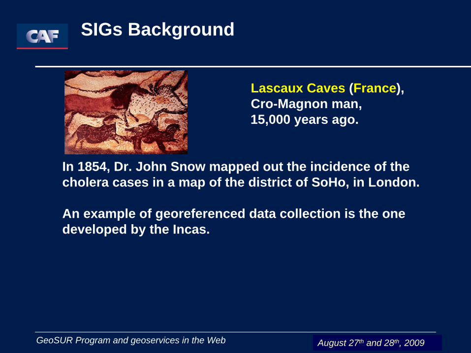
Lascaux Caves (France), Cro-Magnon man, 15,000 years ago.
In 1854, Dr. John Snow mapped out the incidence of the cholera cases in a map of the district of SoHo, in London.
An example of georeferenced data collection is the one developed by the Incas.
SIGs Background
August 27th and 28th, 2009

27 y 28 Agosto de 2009 GeoSUR Program and geoservices in the Web
SIGs Background The Inca Empire
Vision of territory familiarization
August 27th and 28th, 2009
27 y 28 Agosto de 2009 GeoSUR Program and geoservices in the Web
SIGs Background
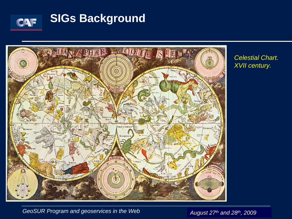
Celestial Chart.XVII century.
August 27th and 28th, 2009
27 y 28 Agosto de 2009 GeoSUR Program and geoservices in the Web
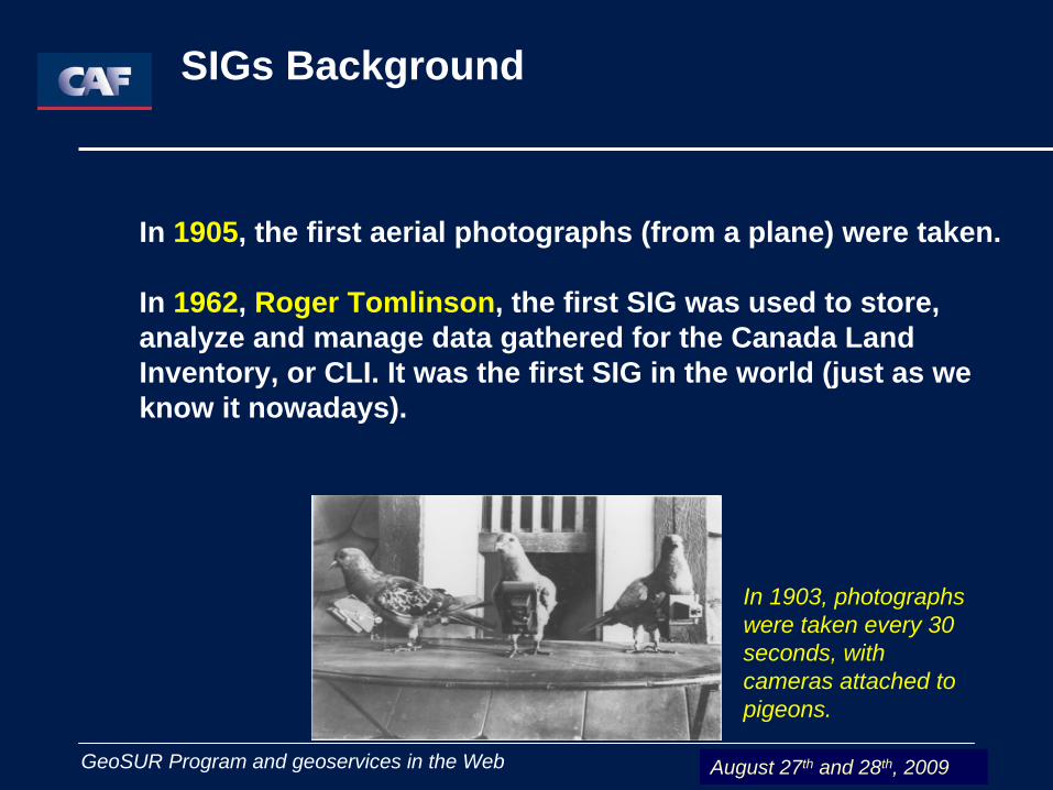
In 1905, the first aerial photographs (from a plane) were taken.
In 1962, Roger Tomlinson, the first SIG was used to store, analyze and manage data gathered for the Canada Land Inventory, or CLI. It was the first SIG in the world (just as we know it nowadays).
In 1903, photographs were taken every 30 seconds, with cameras attached to pigeons.
SIGs Background
August 27th and 28th, 2009

27 y 28 Agosto de 2009 GeoSUR Program and geoservices in the Web
The Geographic Information Systems (SIGs)
are a “powerful set of tools used to gather, store, recover at will, transform and deploy spatial data from the real world for certain purposes” (Borrough, 1986)
It involves:
Geographic Information System – SIG, in Spanish
Organization
Technological ResourcesHuman Resources
August 27th and 28th, 2009

27 y 28 Agosto de 2009 GeoSUR Program and geoservices in the Web
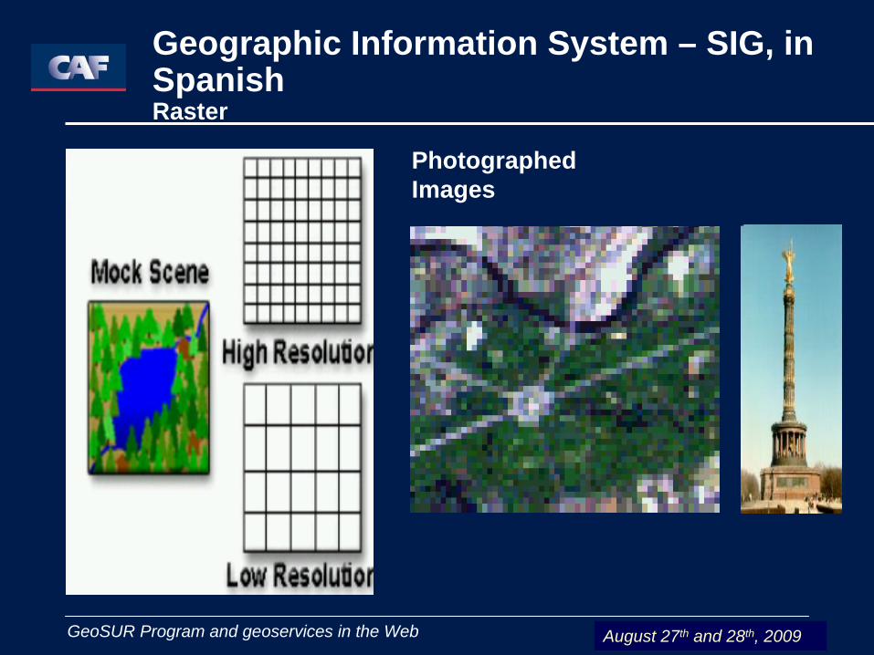
Raster
It is a very simple data structure. A raster data type is, essentially, any type of digital image represented in meshes.
The pixel is the least information unit in an image. A combination of these pixels will create an image.
Geographic Information System – SIG, in Spanish
August 27th and 28th, 2009
27 y 28 Agosto de 2009 GeoSUR Program and geoservices in the Web
Geographic Information System – SIG, in SpanishRaster
PhotographedImages
August 27th and 28th, 2009

27 y 28 Agosto de 2009 GeoSUR Program and geoservices in the Web
It is based on the vectorial representation of the spatial component of the geographic data. It represents the objectives through the coordinates of the points or vertexes that delimitate them.
Types of topological dimensions
•Punctual (topological dimension: 0) •Lineal (topological dimension: 1)•The polygons (topological dimension: 2)
Geographic Information System – SIG, in Spanish Vector
August 27th and 28th, 2009
27 y 28 Agosto de 2009 GeoSUR Program and geoservices in the Web
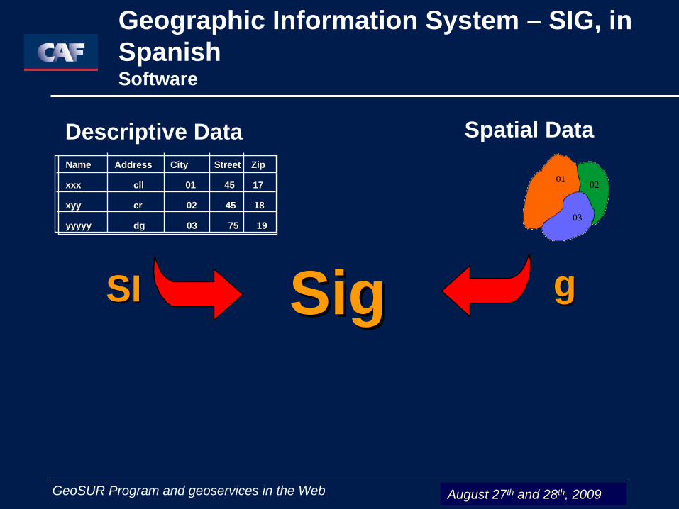
SigSig
Spatial Data
gg
Descriptive Data
SISI
Name Address City Street Zip Name Address City Street Zip
xxx xxx cllcll 01 45 1701 45 17
xyyxyy crcr 02 45 1802 45 18
yyyyyyyyyy dg 03 75 19 dg 03 75 19
01 02
03
Geographic Information System – SIG, in Spanish Software
August 27th and 28th, 2009
27 y 28 Agosto de 2009 GeoSUR Program and geoservices in the Web
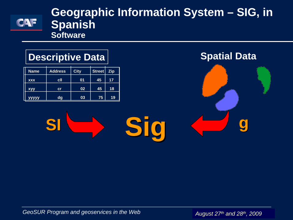
Spatial Data
gg
Descriptive Data
SISI
Name Address City Street Zip Name Address City Street Zip
xxx xxx cllcll 01 45 1701 45 17
xyyxyy crcr 02 45 1802 45 18
yyyyyyyyyy dg 03 75 19 dg 03 75 19
SigSig
Geographic Information System – SIG, in Spanish Software
August 27th and 28th, 2009
27 y 28 Agosto de 2009 GeoSUR Program and geoservices in the Web
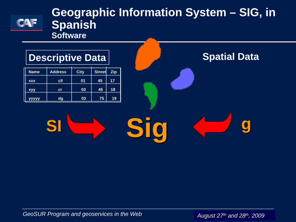
Spatial Data
gg
Descriptive Data
SISI
Name Address City Street Zip Name Address City Street Zip
xxx xxx cllcll 01 45 1701 45 17
xyyxyy crcr 02 45 1802 45 18
yyyyyyyyyy dg 03 75 19 dg 03 75 19
SigSig
Geographic Information System – SIG, in Spanish Software
August 27th and 28th, 2009
27 y 28 Agosto de 2009 GeoSUR Program and geoservices in the Web
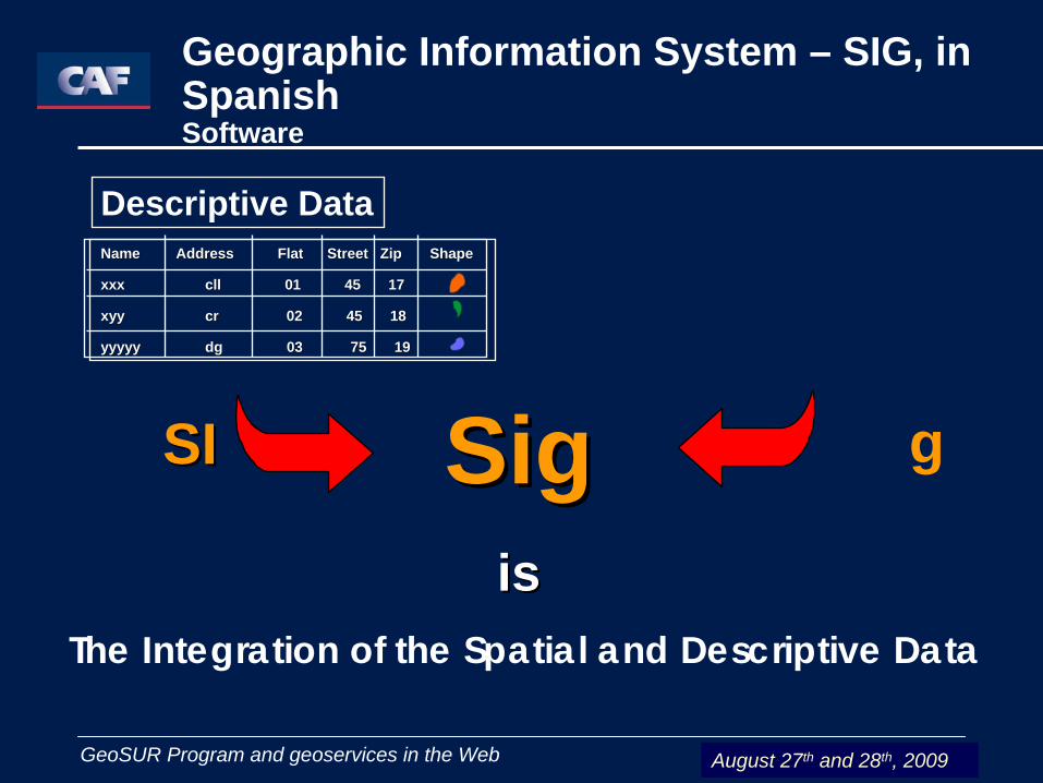
g
Descriptive Data
SISI
Name Address Flat Street Zip Name Address Flat Street Zip ShapeShape
xxx xxx cllcll 01 45 1701 45 17
xyyxyy crcr 02 45 1802 45 18
yyyyyyyyyy dg 03 75 19 dg 03 75 19
SigSigisis
The Integration of the Spatial and Descriptive Data
Geographic Information System – SIG, in Spanish Software
August 27th and 28th, 2009
27 y 28 Agosto de 2009 GeoSUR Program and geoservices in the Web
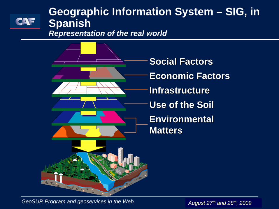
Social FactorsSocial FactorsEconomic FactorsEconomic FactorsInfrastructureInfrastructureUse of the SoilUse of the SoilEnvironmental Environmental MattersMatters
Geographic Information System – SIG, in Spanish Representation of the real world
August 27th and 28th, 2009
27 y 28 Agosto de 2009 GeoSUR Program and geoservices in the Web
Geographic Information System – SIG, in Spanish Representation of the real world
August 27th and 28th, 2009
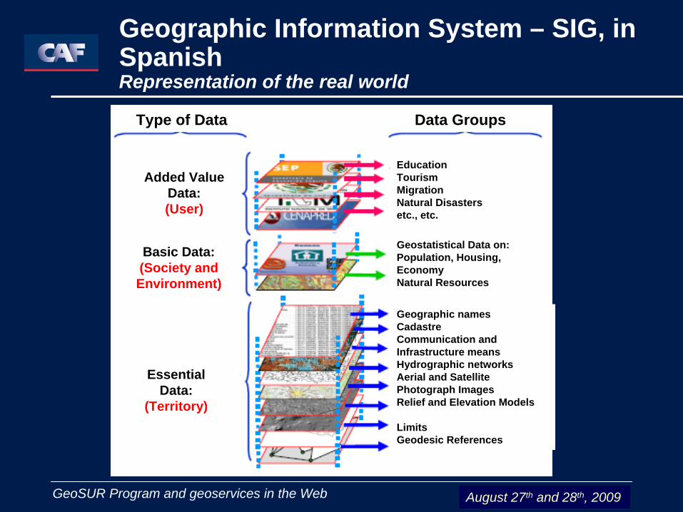
Type of Data Data Groups
Added Value Data:(User)
Basic Data:(Society and Environment)
EssentialData:
(Territory)
EducationTourismMigrationNatural Disastersetc., etc.
Geostatistical Data on: Population, Housing, EconomyNatural Resources
Geographic namesCadastreCommunication and Infrastructure meansHydrographic networksAerial and Satellite Photograph ImagesRelief and Elevation Models
LimitsGeodesic References
27 y 28 Agosto de 2009 GeoSUR Program and geoservices in the Web
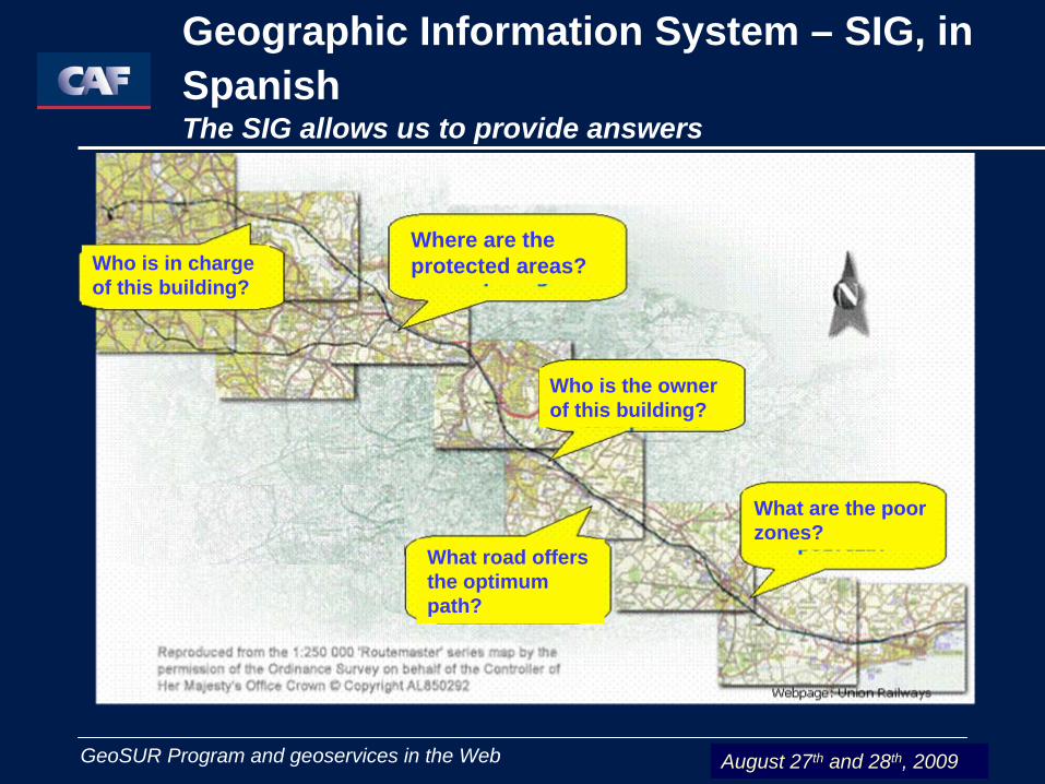
Geographic Information System – SIG, in Spanish The SIG allows us to provide answers
August 27th and 28th, 2009
Who is in charge of this building?
Where are the protected areas?
Who is the owner of this building?
What road offers the optimum path?
What are the poor zones?
27 y 28 Agosto de 2009 GeoSUR Program and geoservices in the Web
Geographic Information Everyday Use
The main matters that a SIG can solve are as follows:
Localization: to ask about the characteristics of a given place
Status: fulfillment or not fulfillment of conditions related to the system
Trend: comparison among temporal or spatial situations with any different characteristic
Roads: estimation of optimum roads between two or more points
Models: creation of models from simulated phenomena or acting
August 27th and 28th, 2009
27 y 28 Agosto de 2009 GeoSUR Program and geoservices in the Web
- The decision-making process depends, mainly, on the quality, precision and up-to-date nature of this spatial information.
- The Geographic Information Systems have become, over the last 25 years, in one of the most important tools for researchers, analysts and planners.
- The SIG Geographic Information Systems cannot exist by themselves. They are the result of the interaction among the parts of a system.
Geographic Information
August 27th and 28th, 2009
27 y 28 Agosto de 2009 GeoSUR Program and geoservices on the Web
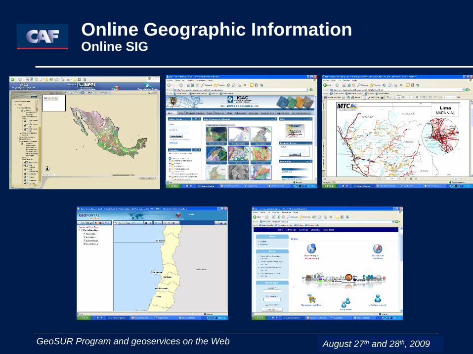
Online Geographic InformationOnline SIG
August 27th and 28th, 2009

27 y 28 Agosto de 2009 GeoSUR Program and geoservices on the Web
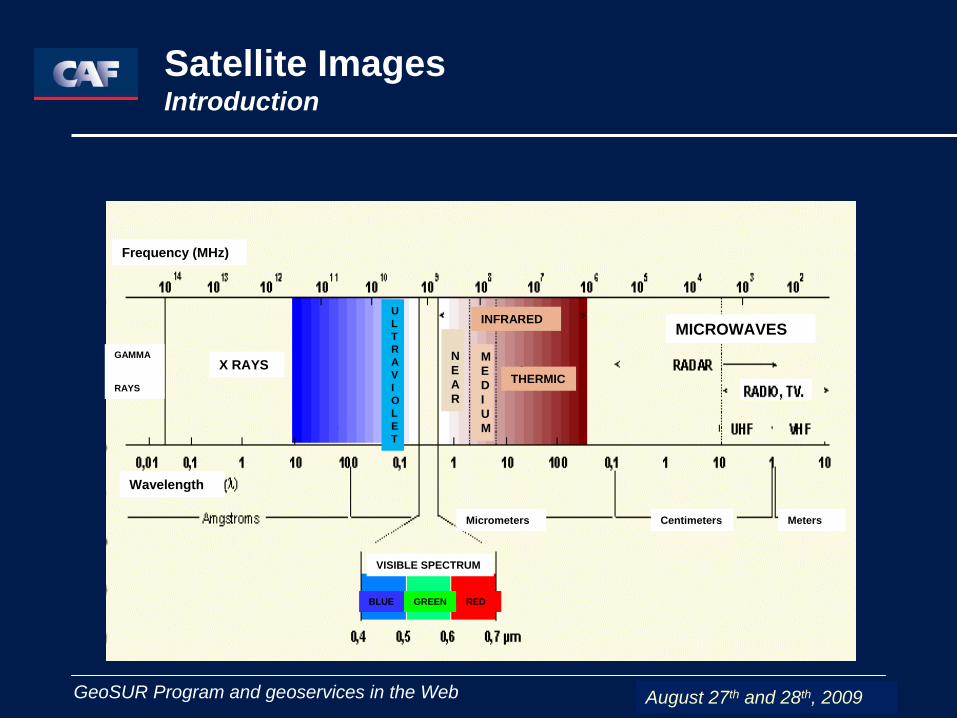
Satellite Images Introduction
August 27th and 28th, 2009
TELEDETECTION SYSTEMEnergy Source
AtmosphereSensor System
Reception System
Land Cover
End User
VISUAL ANALYSIS
DIGITAL ANALYSIS
27 y 28 Agosto de 2009 GeoSUR Program and geoservices in the Web
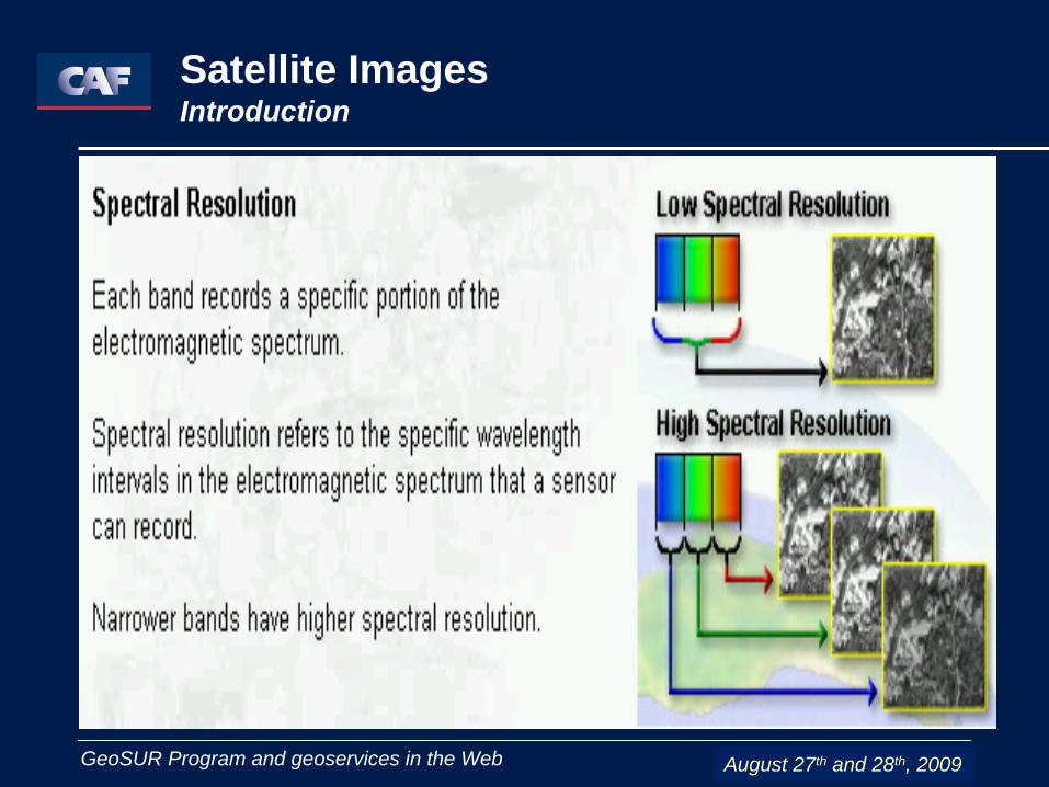
Satellite Images Introduction
August 27th and 28th, 2009
Frequency (MHz)
GAMMA
RAYS
X RAYS
Wavelength
MICROWAVES
MetersCentimetersMicrometers
U L T R A V I O L E T
N E A R
M E D I U M
THERMIC
INFRARED
VISIBLE SPECTRUM
BLUE GREEN RED
27 y 28 Agosto de 2009 GeoSUR Program and geoservices in the Web
Satellite Images Introduction
August 27th and 28th, 2009
27 y 28 Agosto de 2009 GeoSUR Program and geoservices in the Web
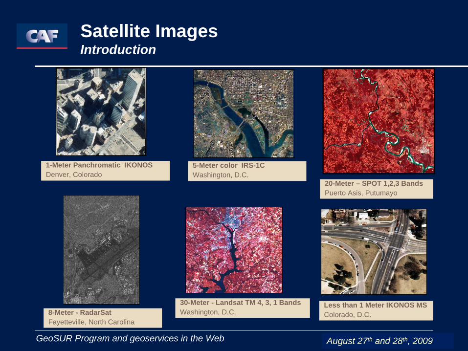
5-Meter color IRS-1CWashington, D.C.
30-Meter - Landsat TM 4, 3, 1 BandsWashington, D.C.8-Meter - RadarSat
Fayetteville, North Carolina
1-Meter Panchromatic IKONOSDenver, Colorado
20-Meter – SPOT 1,2,3 BandsPuerto Asis, Putumayo
Less than 1 Meter IKONOS MSColorado, D.C.
Satellite Images Introduction
August 27th and 28th, 2009

27 y 28 Agosto de 2009 GeoSUR Program and geoservices in the Web
Satellite Images Introduction
August 27th and 28th, 2009
NEAR IR MEDIUM IR FAR IR
- ATMOSPHERIC DISPERSION- BETTER PENETRATION IN CLEAR WATER
-PENETRATION IN CLEAR WATER- DISCRIMINATION BETWEEN CLEAR AND MURKY WATER- DETECTION OF OIL SPILLS- REFLECTANCE PEAK FOR VEGETATION FOR VISIBLE RANGE
ABSORPTION OF CHLOROPHILA BY VEGETATIONLIMITED WATER PENETRATIONDETECTION OF ILL OR DEAD VEGETATIONDISCRIMINATION OF FOLIAGE COLOR
-STRESS IN VEGETATION-BIOMASS STUDY- DISCRIMINATION BETWEEN CONIFERS AND BROADLEAF TRESS
DETECTION OF OIL SPILLSMOISTURE CONTENT IN SOILS AND VEGETATIONLIMITED CLOUD PENETRATIONDISCRIMINATION BETWEEN TYPES OF VEGETATION
EMISSION OF HEAT, GAS AND SMOKE DUE TO SMOG AND FIRESSMOG PENETRATIONREFLECTED / EMITTED DIURNAL HEAT
THERMAL ANALYSISDENSITY OF SOME VEGETAL COVERSDISCRIMINATION AMONG TYPES OF COVERDIURNAL THERMAL AND SEASONAL INERTIA
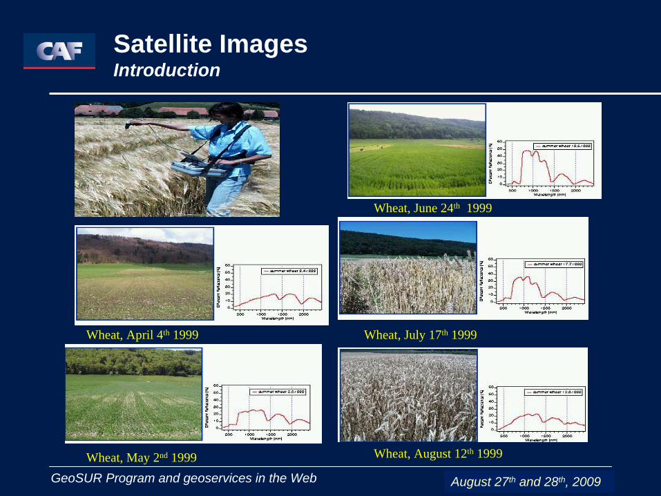
27 y 28 Agosto de 2009 GeoSUR Program and geoservices in the WebWheat, May 2nd 1999
Wheat, April 4th 1999
Wheat, June 24th 1999
Wheat, July 17th 1999
Wheat, August 12th 1999
Satellite Images Introduction
August 27th and 28th, 2009
27 y 28 Agosto de 2009 GeoSUR Program and geoservices in the Web
Satellite Images Introduction
August 27th and 28th, 2009

27 y 28 Agosto de 2009 GeoSUR Program and geoservices in the Web
How do we get information for a SIG?
•Information gathered directly in situ,•Remote sensors (remote perception)•Published information (thematic mapping)•Censuses, surveys, interviews
Main producers:•Military Organizations•National offices•Remote perception companies and “satellite” agencies•Universities and research centers•Studies on natural resources: Geology, Hydrology, Geography and Edaphology; Ecology; Meteorology and Climatology; Oceanography
August 27th and 28th, 2009

27 y 28 Agosto de 2009 GeoSUR Program and geoservices in the Web
Uses
1. - Agriculture2. - Archeology3. - Epidemiology and health4. - Forestry5. - Emergency services6. - Sailing7. - Market studies8. - Real estate9. - Local / regional planning10. - Airports, docks, roads and railway networks11. - Social studies12. - Tourism13. - Public services
August 27th and 28th, 2009
27 y 28 Agosto de 2009 GeoSUR Program and geoservices in the Web
•Socio-economics statistical information•Statistical information on resources: Vegetal cover and use of the soil at various levels•Information on studies•Cadastre•Environmental studies, Hydrography, Meteorology, Infrastructure, Mining•Analysis and forecasting studies•Information on public services (gas, electricity, water) and their location•Characterization: types of soils, water, atmosphere, biological processes, disaster risks in a wide range of spatial and temporal resolution
Uses
August 27th and 28th, 2009
27 y 28 Agosto de 2009 GeoSUR Program and geoservices in the Web
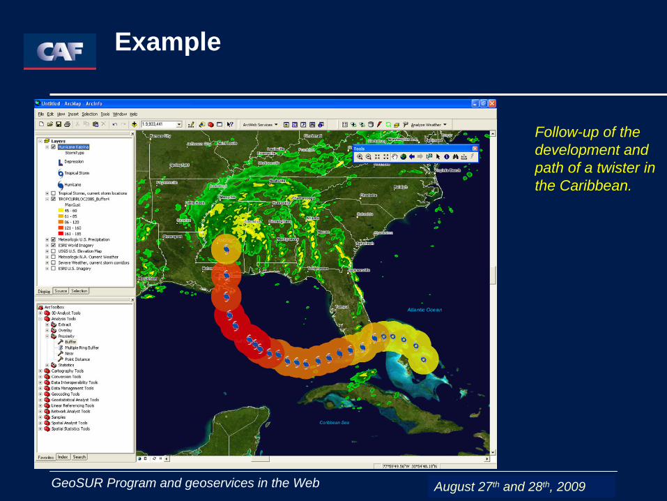
Example
Follow-up of the development and path of a twister in the Caribbean.
August 27th and 28th, 2009
27 y 28 Agosto de 2009 GeoSUR Program and geoservices in the Web
• Organized group of descriptors that allow to identify a data set
• It comes from the Greek root: Meta (change)– Record of the changes that the data has presented
• General or detailed information (structured and organized ) of a data set that allows to consult, assess, compare, access and / or use the information
Geographic Metadata
August 27th and 28th, 2009
27 y 28 Agosto de 2009 GeoSUR Program and geoservices in the Web
Geographic metadata are useful to locate the information and get to know data of the information that we need.
We can know who produces the data, his / her standards and projection system, where to get the information from, how to ask for it, how much it costs, how to contact the person that produces or distributes it.
It brings the information closer and in a fast way.
Geographic Metadata
August 27th and 28th, 2009
27 y 28 Agosto de 2009 GeoSUR Program and geoservices in the Web
Geographic Metadata
August 27th and 28th, 2009

27 y 28 Agosto de 2009 GeoSUR Program and geoservices in the Web
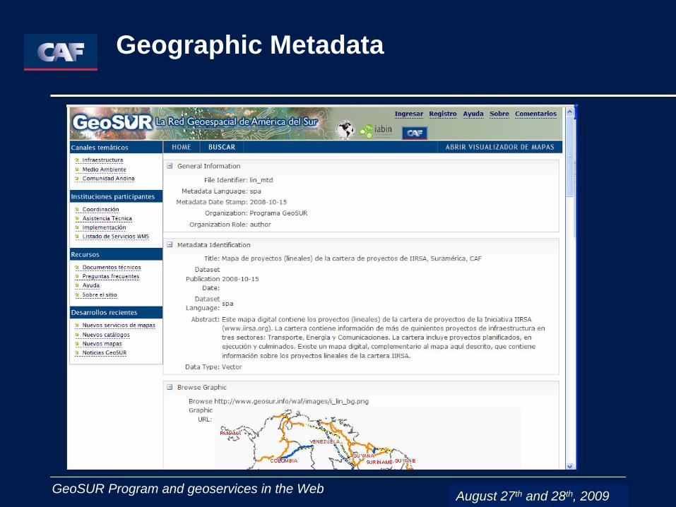
Geographic Metadata
August 27th and 28th, 2009

27 y 28 Agosto de 2009 GeoSUR Program and geoservices in the Web
Geographic Metadata
August 27th and 28th, 2009
27 y 28 Agosto de 2009 GeoSUR Program and geoservices in the Web
Spatial Data Infrastructure (Infraestructura de datos espaciales - IDE, in Spanish)
IDE is a set of strategies
Policies (political framework - rules)Organizations Standards (access to services and data)Data (essential data)TechnologiesCapacities (capacity building)
August 27th and 28th, 2009
27 y 28 Agosto de 2009 GeoSUR Program and geoservices in the Web
Spatial Data Infrastructure (Infraestructura de datos espaciales - IDE, in Spanish)
A computer system composed of a set of resources (catalogues, servers, program, data, applications, web pages,…) aimed at managing geographic information (maps, orthophotographs, satellite images, toponyms,…) available in the Internet, which fulfill a set of interoperability conditions (rules, specifications, protocols, interfaces,…) that allow a user, by means of a simple browser, to use and combine them according to his / her needs. IDEE
August 27th and 28th, 2009
27 y 28 Agosto de 2009 GeoSUR Program and geoservices in the Web
IDEs Benefits
The IDEs provide assistance to the national government by supporting the planning activities related to the use of the territory, the State decentralization and the citizens’ participation (transparency).
Geographic information for legislative and political development will be available.
They will materialize the objectives stated in the National Information Policy by making it easier for citizens to have access to the information (socialization of the information)
August 27th and 28th, 2009
27 y 28 Agosto de 2009 GeoSUR Program and geoservices in the Web
IDEs Benefits
Economic and social development:
The IDE is essential to support an objective decision- making process and also for a sound policy regarding land management
The spatialization of the information allows to relate the activities among themselves, as well as to estimate distances and make decisions within a complex and inter-related context.
The nations are favored in terms of knowledge, prosperity and development and they will also be able to project themselves, in a competitive way, at an international level.
August 27th and 28th, 2009

27 y 28 Agosto de 2009 GeoSUR Program and geoservices in the Web
The IDE
Supports the political decision-making process (decision-making)Contributes to the development of the countriesIncludes procedures, technologies and guidelinesContributes to the institutional integration (standardization, interoperability)Contributes to the knowledge of the territoryFosters transparency
IDEs Benefits
August 27th and 28th, 2009

27 y 28 Agosto de 2009 GeoSUR Program and geoservices in the Web
IDEs Latin America
August 27th and 28th, 2009
27 y 28 Agosto de 2009 GeoSUR Program and geoservices in the Web
Thanks!
¡Gracias!
Obrigado!
August 27th and 28th, 2009
Related Documents