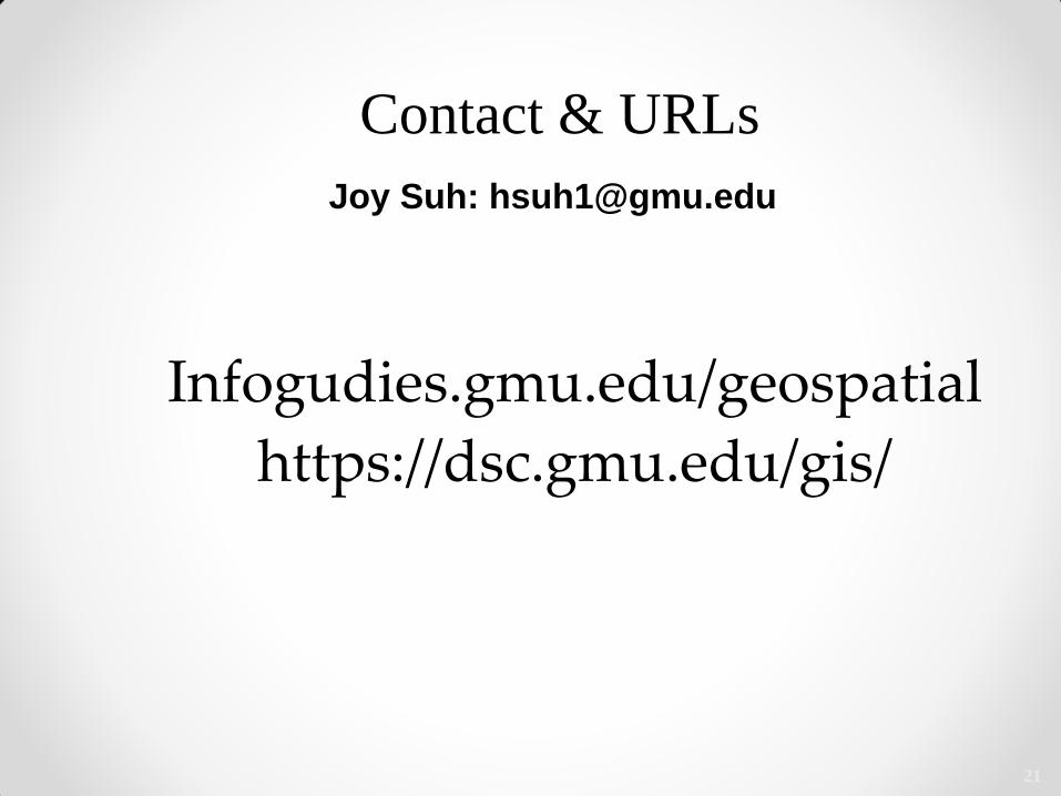
Introduction to GIS and ArcGIS Online Joy Suh Geospatial Resources Librarian ([email protected]) Fall 2020

Welcome message from author
This document is posted to help you gain knowledge. Please leave a comment to let me know what you think about it! Share it to your friends and learn new things together.
Transcript

Introduction to GIS and ArcGIS Online
Joy Suh Geospatial Resources Librarian
Fall 2020
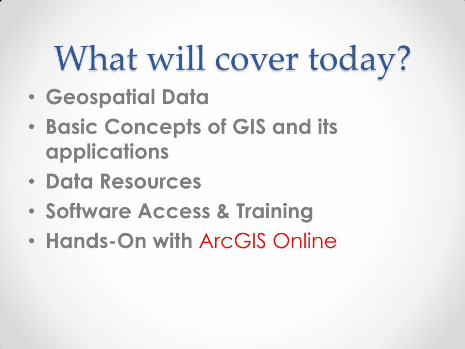
What will cover today? • Geospatial Data
• Basic Concepts of GIS and its
applications
• Data Resources
• Software Access & Training
• Hands-On with ArcGIS Online
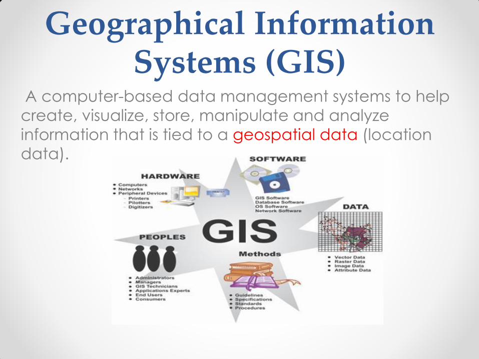
Geographical Information Systems (GIS)
A computer-based data management systems to help
create, visualize, store, manipulate and analyze
information that is tied to a geospatial data (location
data).

Geospatial Data
• “Information that identifies the location of
geographic features and characteristics of natural
or man-made objects on the earth”
So called “geographically reference data” or
longitude and latitude (XY), or spatial data
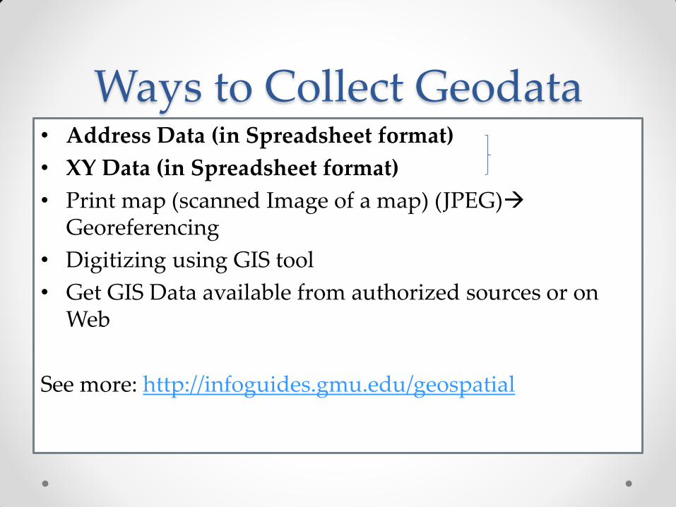
Ways to Collect Geodata • Address Data (in Spreadsheet format)
• XY Data (in Spreadsheet format)
• Print map (scanned Image of a map) (JPEG) Georeferencing
• Digitizing using GIS tool
• Get GIS Data available from authorized sources or on Web
See more: http://infoguides.gmu.edu/geospatial
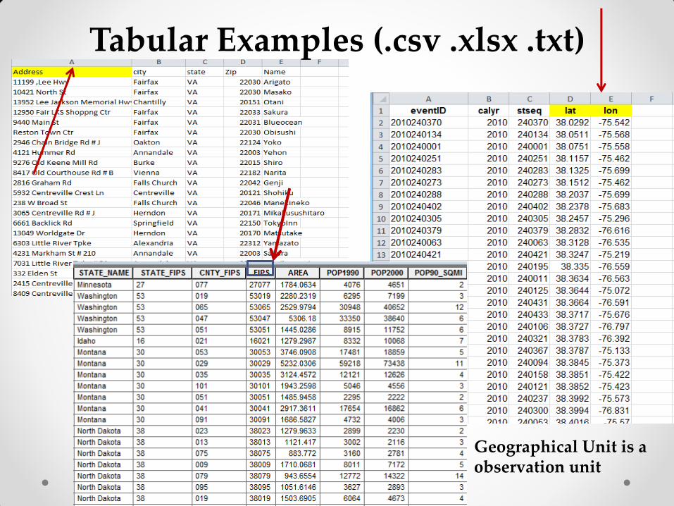
Tabular Examples (.csv .xlsx .txt)
Geographical Unit is a observation unit
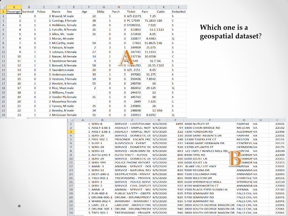
Which one is a geospatial dataset?

Two Types of Geospatial Data
Vector Data Raster Data
• Represent “Real Word
View” based on:
Point, Line and Polygon
• Data format: Shape file
(.shp)—Zip format
• Example: US Census
Tiger files
• Represent “Real World View” based on: Grid (Pixel)
• Data format: Digital Image File
(. geoTiff, tiff, jpg, etc)
• Example: USGS Digital
Elevation (DEM or DOQQ) & NGA’s Satellite Images, NOAA
“Feature Based Data”

Geospatial Data & Types • Point, Lines, Polygons, Grids—Typology data type
Vector Data (.shp) Raster Data (.geotiff)
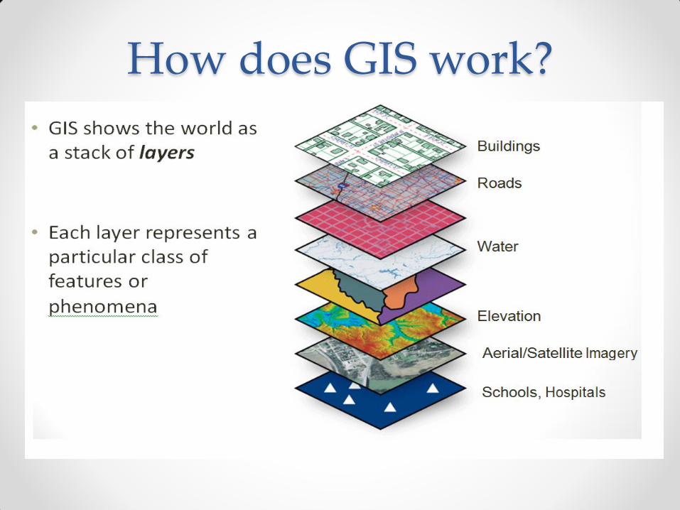
How does GIS work?
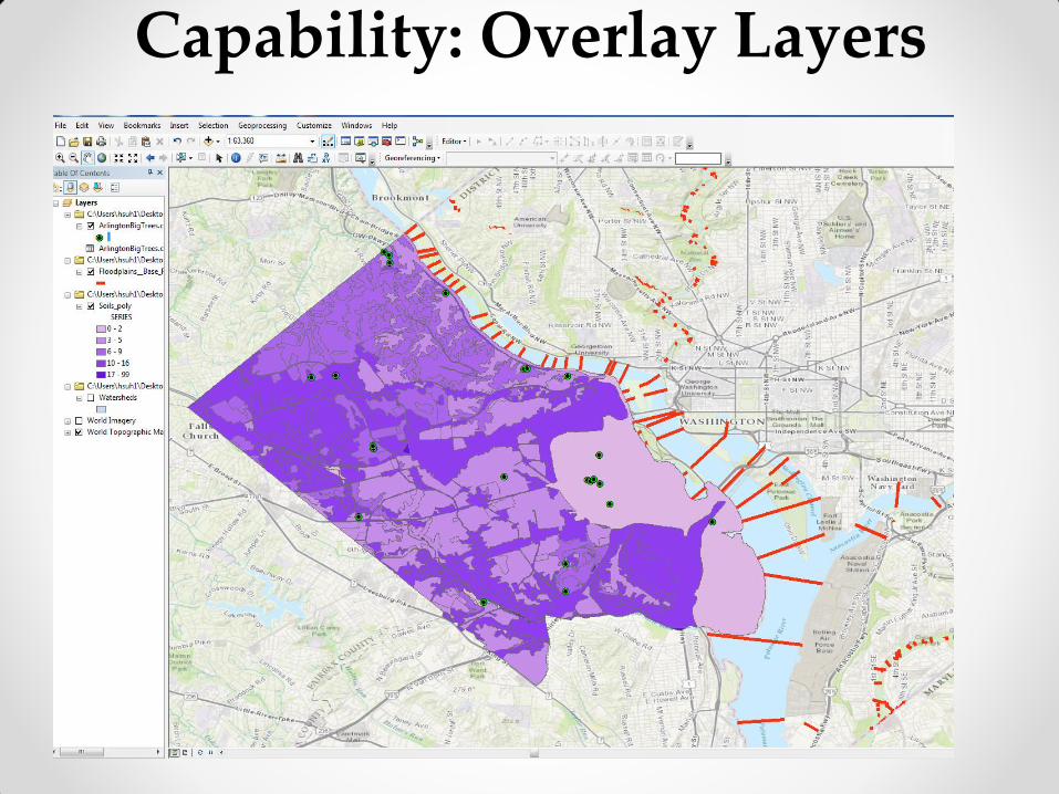
Capability: Overlay Layers
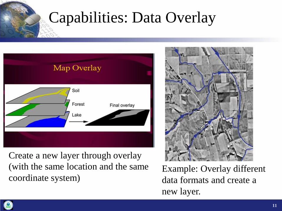
Capabilities: Data Overlay
Create a new layer through overlay (with the same location and the same
coordinate system)
Example: Overlay different data formats and create a new layer.
11
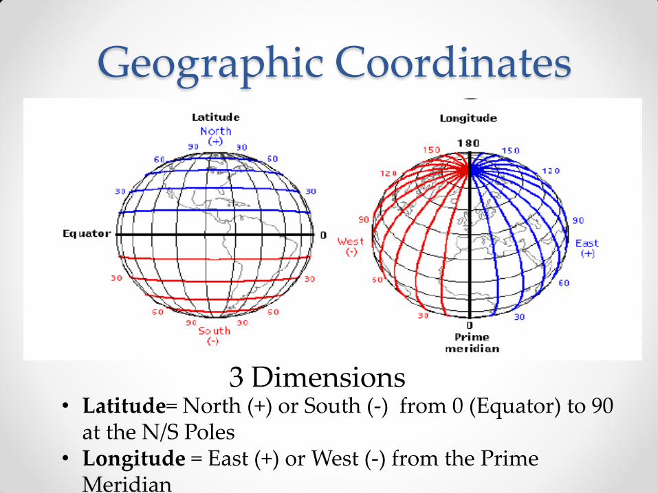
Geographic Coordinates
• Latitude= North (+) or South (-) from 0 (Equator) to 90 at the N/S Poles
• Longitude = East (+) or West (-) from the Prime Meridian
3 Dimensions

Geographic Coordinates
X
Fairfax, VA Lat(Y)= 38.8505 Long(X)= -71.3032
Units= Degrees, Minutes, Second or Decimal Degrees.
• can convert between the two
2 Dimensions
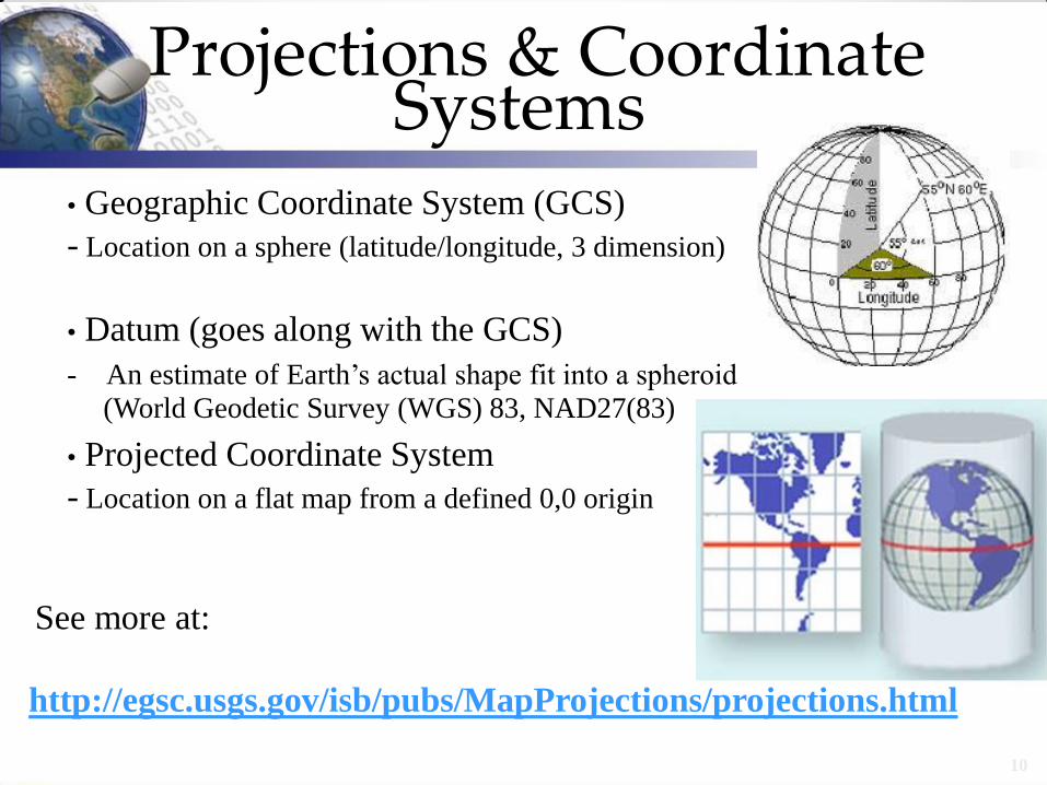
Projections & Coordinate Systems
• Geographic Coordinate System (GCS) - Location on a sphere (latitude/longitude, 3 dimension)
• Datum (goes along with the GCS) - An estimate of Earth’s actual shape fit into a spheroid
(World Geodetic Survey (WGS) 83, NAD27(83)
• Projected Coordinate System - Location on a flat map from a defined 0,0 origin
See more at:
http://egsc.usgs.gov/isb/pubs/MapProjections/projections.html
10
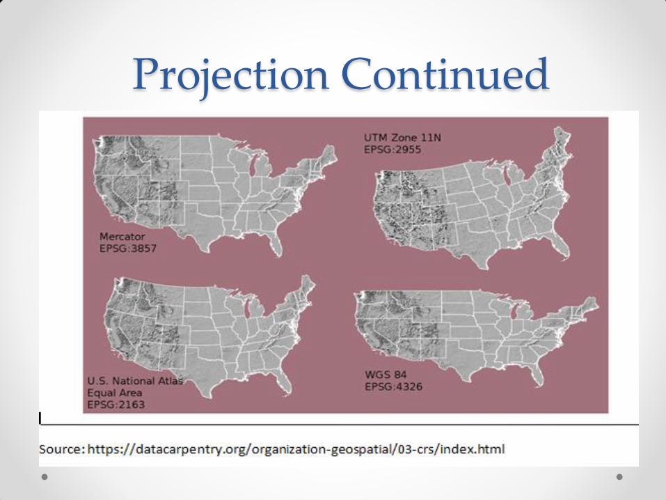
Projection Continued

Data Alignment in GIS
Define a Coordinate and Use the same coordinate for Data Alignment (source: http://pro.arcgis.com/en/pro-app/tool-reference/editing/align-features.htm)
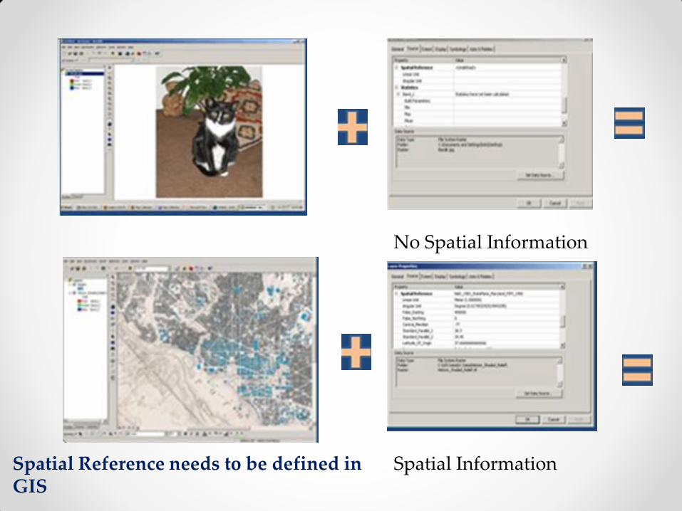
No Spatial Information
Spatial Information Spatial Reference needs to be defined in GIS

Benefits (Principles) of GIS • Visualize and interpret patterns and spatial
relationships
• Analyze spatial information and trend (Spatial
Analysis, Spatial Statistics, Network Analysis,
Space_Time Analysis, etc)
• Ask interactive spatial questions
• Predict future impact and create models
• Develop effective solutions
• Display and communicate spatial information
1


1
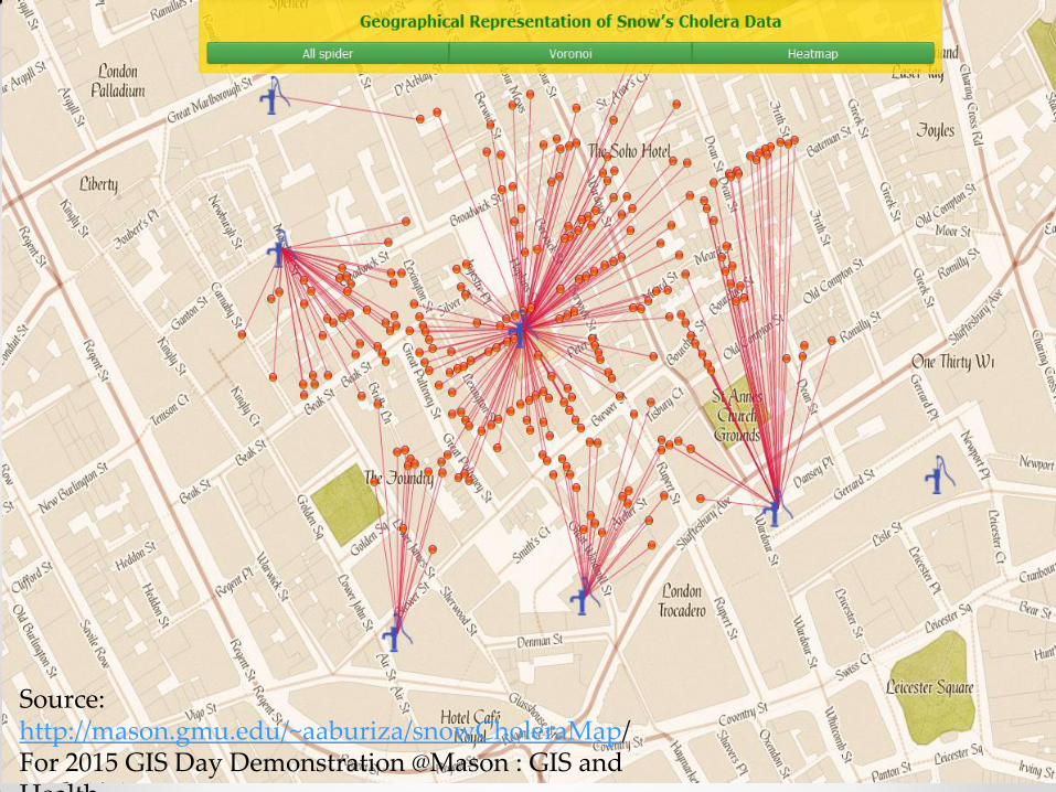
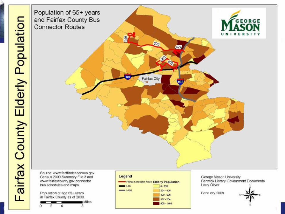
Source: http://mason.gmu.edu/~aaburiza/snowCholeraMap/ For 2015 GIS Day Demonstration @Mason : GIS and Health
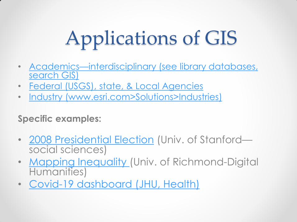
Applications of GIS
• Academics—interdisciplinary (see library databases, search GIS)
• Federal (USGS), state, & Local Agencies
• Industry (www.esri.com>Solutions>Industries)
Specific examples:
• 2008 Presidential Election (Univ. of Stanford—social sciences)
• Mapping Inequality (Univ. of Richmond-Digital Humanities)
• Covid-19 dashboard (JHU, Health)

Finding Geospatial Data
Library Infoguides—Geospatial Data & GIS
http://infoguides.gmu.edu/geospatial/data
• Data.gov (US Federal Agency Data) • ArcGIS Hub (Organizations and US local
governments) • DIVA (Global) • Natural Earth (Global) • Geodata@Mason
19
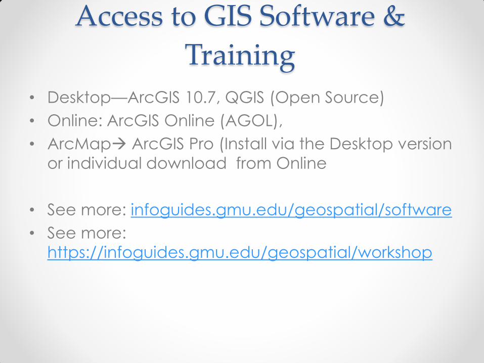
Access to GIS Software &
Training
• Desktop—ArcGIS 10.7, QGIS (Open Source)
• Online: ArcGIS Online (AGOL),
• ArcMap ArcGIS Pro (Install via the Desktop version
or individual download from Online
• See more: infoguides.gmu.edu/geospatial/software
• See more:
https://infoguides.gmu.edu/geospatial/workshop
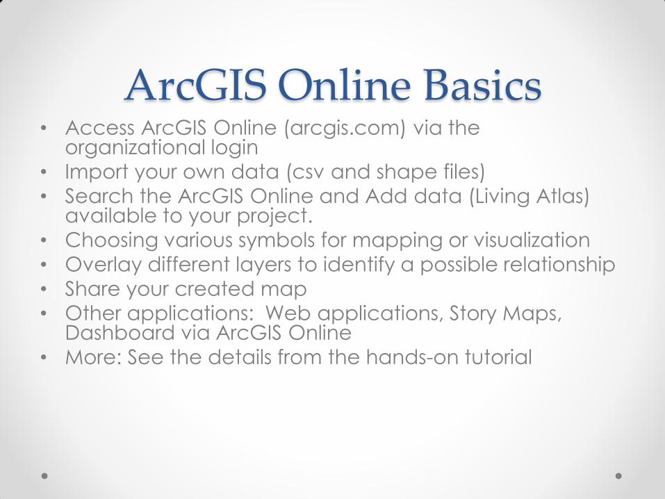
ArcGIS Online Basics • Access ArcGIS Online (arcgis.com) via the
organizational login
• Import your own data (csv and shape files)
• Search the ArcGIS Online and Add data (Living Atlas) available to your project.
• Choosing various symbols for mapping or visualization
• Overlay different layers to identify a possible relationship
• Share your created map
• Other applications: Web applications, Story Maps, Dashboard via ArcGIS Online
• More: See the details from the hands-on tutorial
Related Documents