Introduction to geographical data and GIS Carol Blackwood UK Data Service EDINA UK Data Service Census Support census geography course University of Edinburgh 6th June 2013

Welcome message from author
This document is posted to help you gain knowledge. Please leave a comment to let me know what you think about it! Share it to your friends and learn new things together.
Transcript
Introduction to geographical data and
GIS
Carol BlackwoodUK Data ServiceEDINA
UK Data Service Census Support census geography courseUniversity of Edinburgh6th June 2013
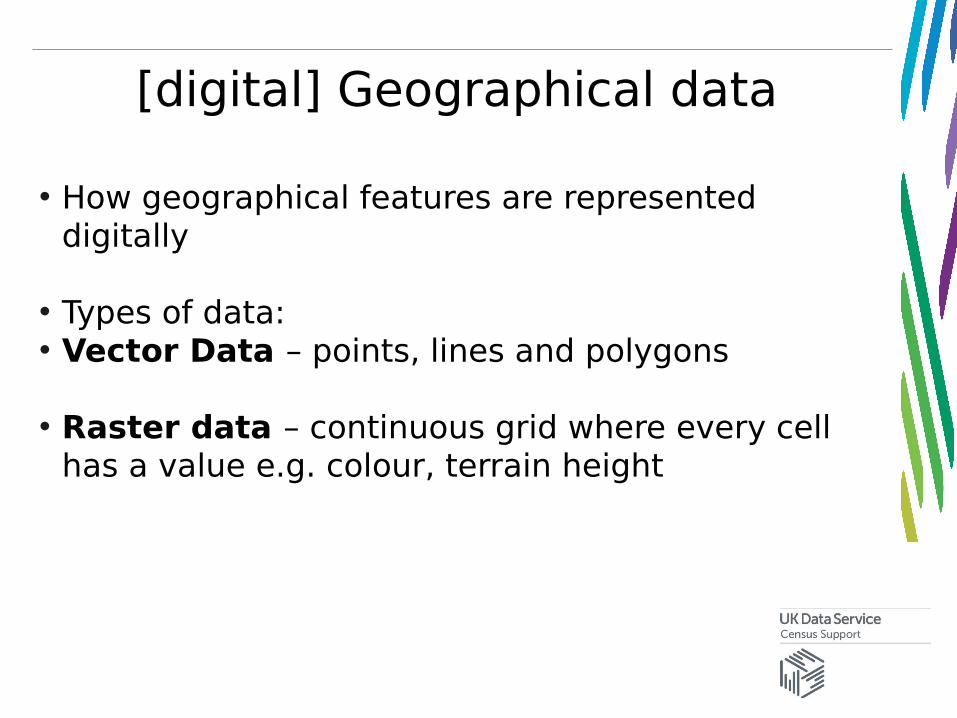
[digital] Geographical data
• How geographical features are represented digitally
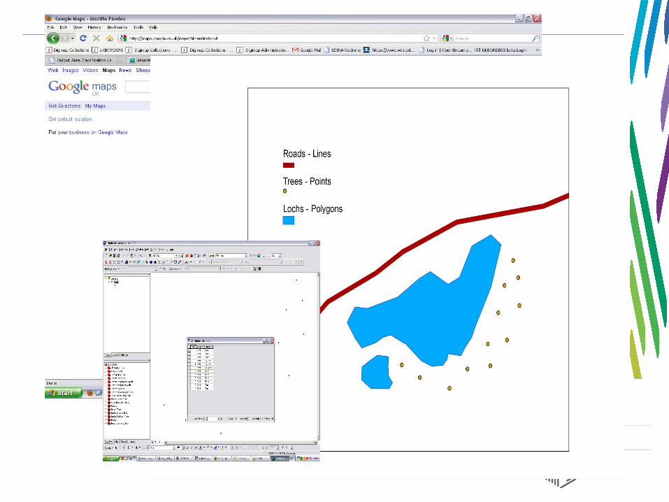
• Types of data:• Vector Data – points, lines and polygons
• Raster data – continuous grid where every cell has a value e.g. colour, terrain height
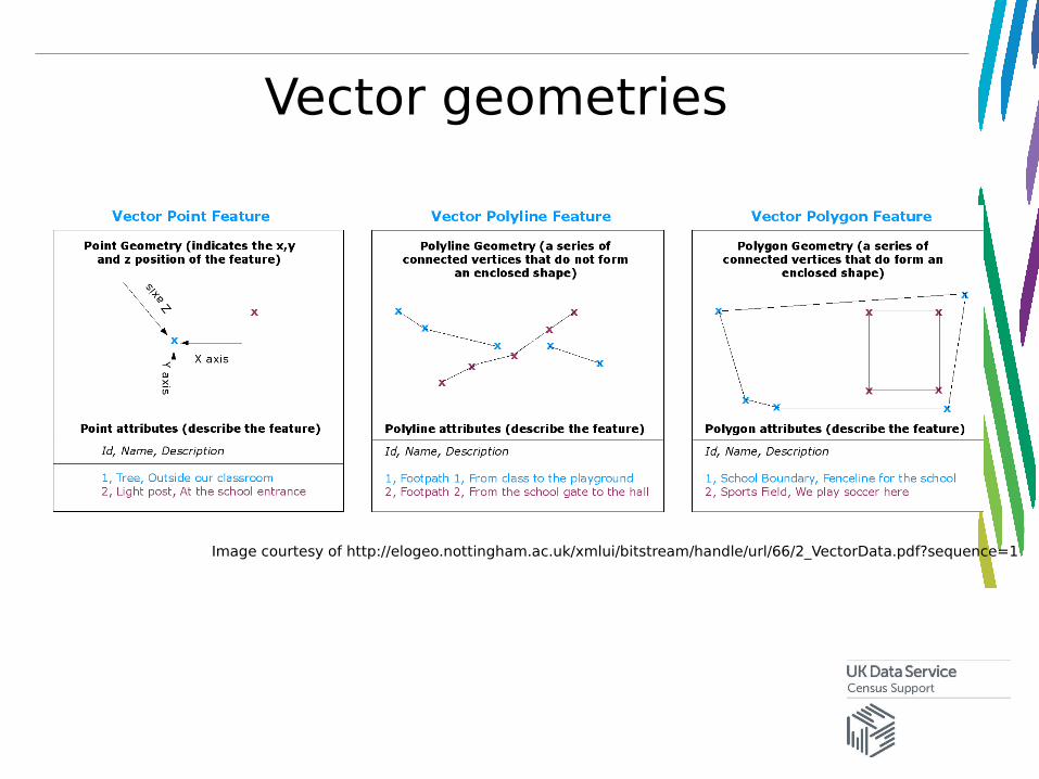
Vector geometries
Image courtesy of http://elogeo.nottingham.ac.uk/xmlui/bitstream/handle/url/66/2_VectorData.pdf?sequence=1
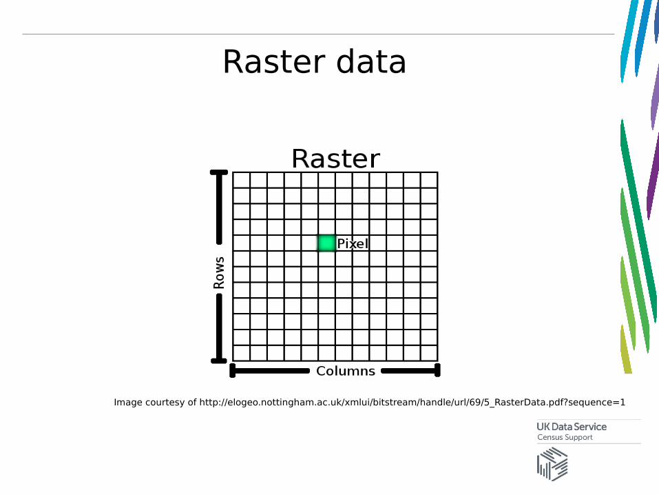
Raster data
Image courtesy of http://elogeo.nottingham.ac.uk/xmlui/bitstream/handle/url/69/5_RasterData.pdf?sequence=1
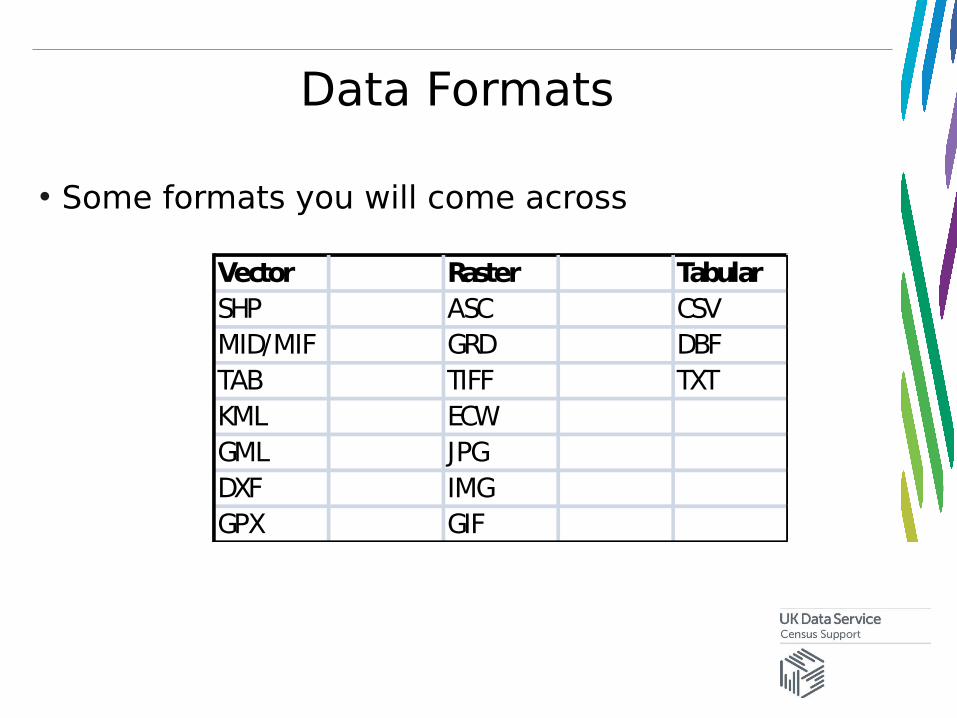
Data Formats
• Some formats you will come across
Vector Raster TabularSHP ASC CSVMID/MIF GRD DBFTAB TIFF TXTKML ECWGML JPGDXF IMGGPX GIF
GIS – Geographical Information Systems
• We use GIS applications to handle spatial data
• Computer-based information systems to aid solving spatial problems and decision making
• “a system for capturing, storing, checking, integrating, manipulating analysing and displaying data which are spatially referenced to the Earth” (DOE 1987)
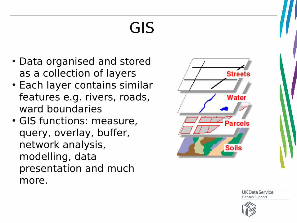
GIS
• Data organised and stored as a collection of layers
• Each layer contains similar features e.g. rivers, roads, ward boundaries
• GIS functions: measure, query, overlay, buffer, network analysis, modelling, data presentation and much more.
GIS – common desktop software
• Commercial• ArcGIS • MapInfo
• Open Source• Quantum GIS• GRASS• gvSIG• uDig
ArcGIS
• Made by ESRI• Most popular GIS system used commercially and in
academia• Lots of support available • Can be complicated to get to grips with as lots
tools and options• Available through Eduserv CHEST or by
Educational Licence
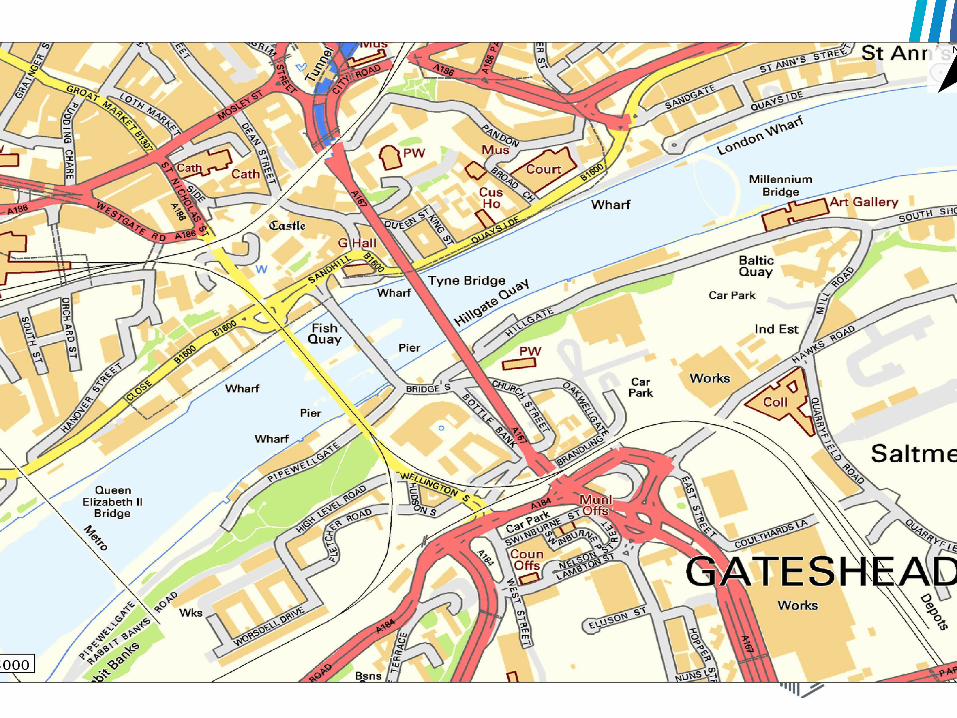
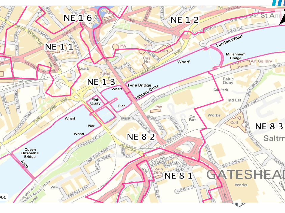
Mapping with GIS
• Core function of any GIS is creating and displaying maps

District outlines
DIGITAL BOUNDARY DATA
Census Aggregate Statisticse.g. Population by district of SW England
=
Map displaying population of SW England
Spatial Analysis
• GIS functions that are carried out to extract new and additional meaning from GIS data
• Types of analysis varies with subject area, but use common GIS functions
• e.g. town planners assessing the impact of a new shopping centre
• e.g. social scientists looking at the relationship between deprivation and access to amenities
• e.g. ecologists evaluating the impact of a new windfarm on wildlife
Spatial Analysis – common functions
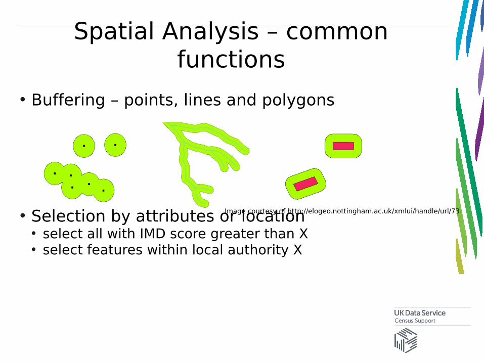
• Buffering – points, lines and polygons
• Selection by attributes or location• select all with IMD score greater than X• select features within local authority X
Image courtesy of http://elogeo.nottingham.ac.uk/xmlui/handle/url/73
Spatial Analysis – common functions
• Measurements • How many KM between point X and point Y• What is the area of these parcels of land?
• Interpolation• Use rainfall values from weather stations to create an
average rainfall surface
Practical Exercise A
• Practice adding different datasets into ArcMap
• Amend layer symbology
• Select vector map features
Related Documents