Integrating archaeological excavation diaries with GIS and 2D/3D data in the CIDOC-CRM framework. Achille Felicetti VAST-LAB, PIN, Università degli Studi di Firenze, Italy (3D-COFORM Project) Franco Niccolucci STARC, The Cyprus Institute, Cyprus (3D-COFORM Project)

Welcome message from author
This document is posted to help you gain knowledge. Please leave a comment to let me know what you think about it! Share it to your friends and learn new things together.
Transcript

Integrating archaeological excavation diaries with GIS and 2D/3D data in the
CIDOC-CRM framework.
Achille FelicettiVAST-LAB, PIN, Università degli Studi di Firenze, Italy(3D-COFORM Project)
Franco NiccolucciSTARC, The Cyprus Institute, Cyprus(3D-COFORM Project)

Ancient sources and archaeological documentation that was nborn (or conceived) as digitalPreserve the source integrity, making no changes, extraction or summarization in the original tex
Provide efficiency in retrieval, using tools with good performancin searchingGuarantee semantic interoperability,
Support encoding by non-technical users availing of user-friendinterfaces

Why don't you usestructured schema? I don't know where to
my hints and comm
Database theory requires standardized forms for archaeological ocumentationtructured forms are "not comfortable" for Archaeologists
Hints and comments? Use of the "Note" fieldshe most interesting information remains unusable

chaeologists: preservation of semantic richnessRDBMS systems fields are "atomic" by definition
ote" fields overloaded with the most interesting informationich could not find a suitable collocation elsewhere
of information destined to be lost forever ...
DBMS STRUCTURE

• Flexibility is required
• RDF: more respectful of the richness of information
• Semantic Web Technologie(based on RDF)
• Ontologies (CIDOC-CRM)
• Interoperability as a primagoal
Tool for Flexible Data EncodingDesigned to build integrated semantic archives using the annoparadigm
ing metadata: put a ptual layer on top of iginal (digital)
ment ...

notation: piece of semantic information attached to a documentrtion of it to create a semantic description of its meaning in a formy lations: correspondences between documents or pieces of textsscribed by annotations.
Annotation created using•Entities of the CIDOC-CRontology
Relations•CIDOC-CRM propertiesused for relations betweenannotations


GRASS
No integration of GIS data with non-geographic data
Archaeological excavation data

GRASS
enSourceQuantum GIS
ML: XML-based grammar for the modeling, exchange, and storage oographic information
coding of geo-spatial data as text documents which are both man- and machine-readable
ta Aggregation: RDF+GML

AnnoMADAnnoMADGMLGML
• Plugin for QuantumGISExporting geographic information concerning Features andusing GML
• Making geographic informavailable in a CIDOC-CRframework
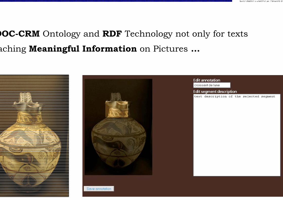
DOC-CRM Ontology and RDF Technology not only for texts
aching Meaningful Information on Pictures ...

• ... and on 3D Models (3D-COFORM Project)

CIDOC-CRMCIDOC-CRM
Semantic DSemantic DB
nnotated texts Annotated 3D models
Annotated Im
Geographic


The Hala Sultan-Tekke Archaeological SiteLate Bronze Age (1600–1050 BC) harbour town in south–east Cypr
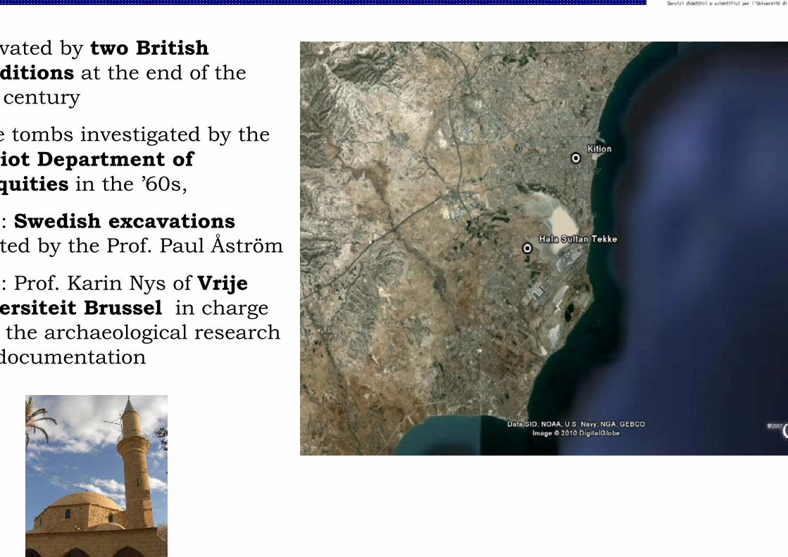
vated by two British ditions at the end of the century
e tombs investigated by theriot Department of quities in the ’60s,
: Swedish excavationsted by the Prof. Paul Åström
: Prof. Karin Nys of Vrijeersiteit Brussel in charge the archaeological research documentation
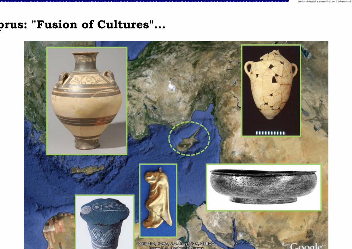
prus: "Fusion of Cultures"...


nd in 1981 in Building C in a le wall (Event)
nology: LC IIIA:1 (Time Span)
FGb 476 (Place)
stration number N 1587 (ID)


OC-CRM to "write the story" excavation to exhibition

• Joint documentation project between MARI (Mediterranean Archaeology Research Institute), VUB Vrije Universiteit Brussel) and STARC (Cyprus Institute)
• Partially supported by the European Project 3D-COFORM:✓Encoding of textual information concerning 3D models
✓Multilingual Support + Thesauri
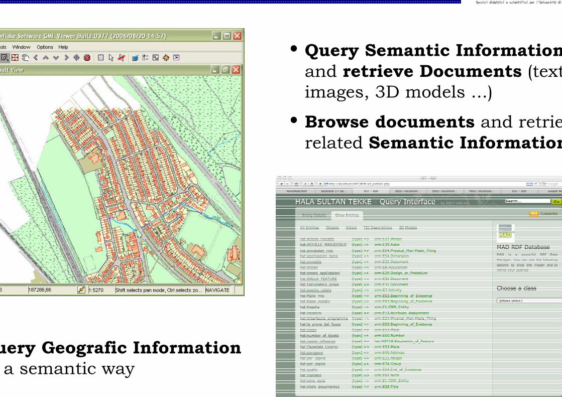
• Query Semantic Informationand retrieve Documents (textimages, 3D models ...)
• Browse documents and retrierelated Semantic Information
uery Geografic Information a semantic way

mi-automatic (recursive) annotation mechanism
d a wiki structure to the annotation tool to take advantage from laboration of many annotators
ease AnnoMAD as a general purpose tool for every kind of
haeological documentation

Related Documents