U.S. Department of the Interior U.S. Geological Survey Integrated Landscape Monitoring Great Basin Pilot February 6, 2007

Welcome message from author
This document is posted to help you gain knowledge. Please leave a comment to let me know what you think about it! Share it to your friends and learn new things together.
Transcript

U.S. Department of the InteriorU.S. Geological Survey
Integrated Landscape MonitoringGreat Basin PilotFebruary 6, 2007
2
GBILM Goals• Develop interdisciplinary team
• Initiated as new work
• Test concepts and develop tools to.... − Reconcile site-specific actions/events with landscape-scale
processes and functions
− Analyze monitoring data to understand change at multiple scales
− Develop predictive capability for landscape change
− Develop or refine monitoring strategies
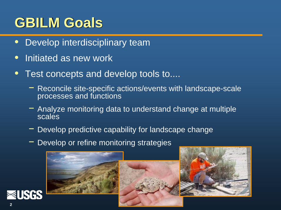
3
• Over 111 million acres
• 78% public lands
• Five western states
• N-S Mountain ranges
• Varied altitudinal changes
• Water drains inland
Blue boundary – GB boundaryOrange boundary – GB with 50 m buffer
The Great Basin
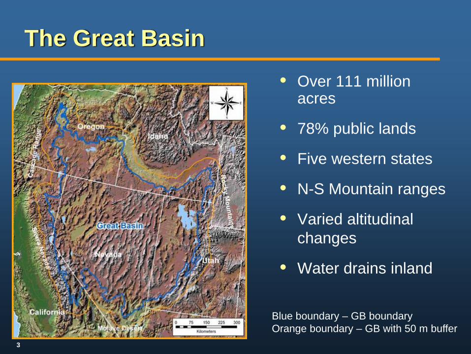
4
• Varied and extreme climate
• Topography creates elevation gradients
• Incised by rare but critical riparian areas
• Uniquely adapted plants and animals
• 73% of endemic plants – imperiled
• Species of concern (e.g., sage-grouse, pygmy rabbit, Brewer’s sparrow, Virgin River chub)
• 54% of remaining sagebrush
The Great Basin - Ecology
5
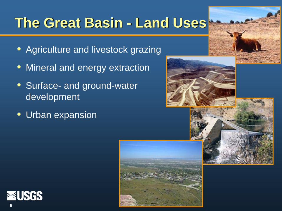
• Agriculture and livestock grazing
• Mineral and energy extraction
• Surface- and ground-water development
• Urban expansion
The Great Basin - Land Uses

6
Current Fire Cycle
• Fire cycle:
- Historic: 70-100 yrs
- Current: 7-10yrs
• Relationship of invasive species and fire cycle
• Over 25% of basin burned in last decade
7
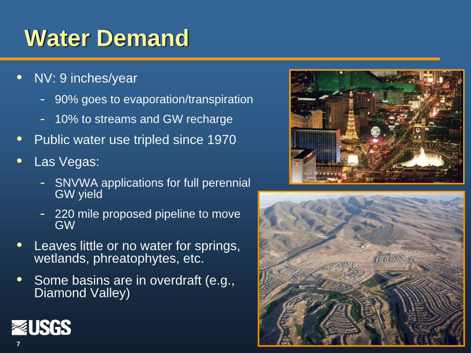
Water Demand• NV: 9 inches/year
- 90% goes to evaporation/transpiration
- 10% to streams and GW recharge
• Public water use tripled since 1970
• Las Vegas:- SNVWA applications for full perennial
GW yield
- 220 mile proposed pipeline to move GW
• Leaves little or no water for springs, wetlands, phreatophytes, etc.
• Some basins are in overdraft (e.g., Diamond Valley)
8
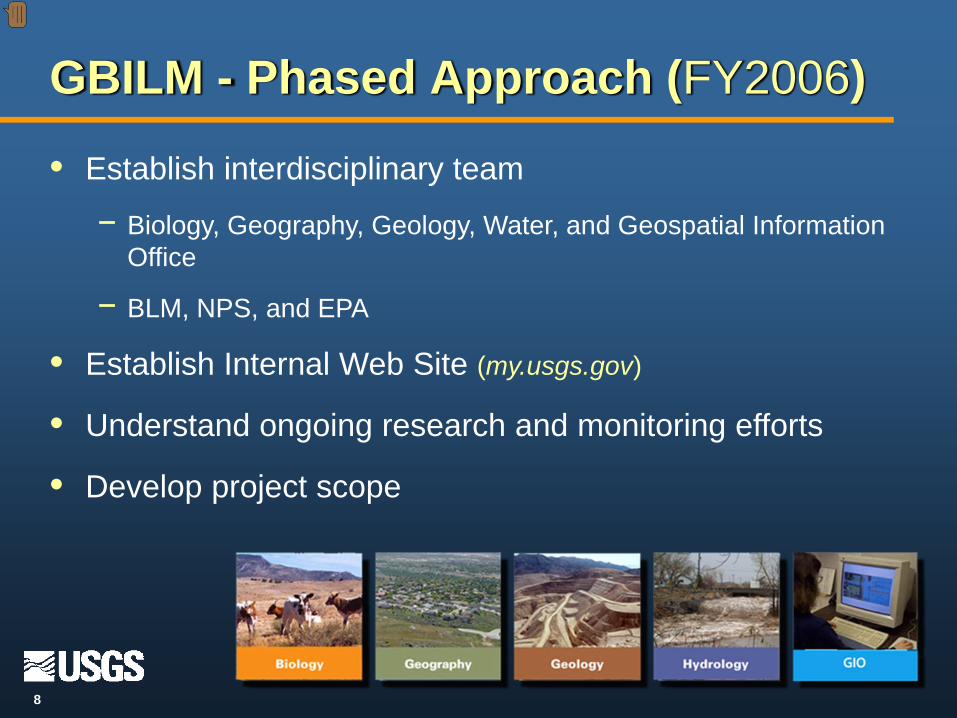
• Establish interdisciplinary team
− Biology, Geography, Geology, Water, and Geospatial Information Office
− BLM, NPS, and EPA
• Establish Internal Web Site (my.usgs.gov)
• Understand ongoing research and monitoring efforts
• Develop project scope
GBILM - Phased Approach (FY2006)
Presenter
Presentation Notes

9
Phased Approach (FY2006-07)
• Develop conceptual models
• Identify and prioritize ecosystem drivers
• Develop and prioritize management questions
• Develop pilot projects to address management questions
• Identify data gaps
• Conduct stakeholder outreach

10
• Describes key ecological components and relationship between them
• Used for planning, communicating, and prioritizing
• GBILM Models:− Characterize landscape function
− Identify ecological processes
− Develop/prioritize management issues
− Inform monitoring strategy development
− Identify gaps in understanding of ecosystem function
Conceptual Models: Tools for Understanding

11
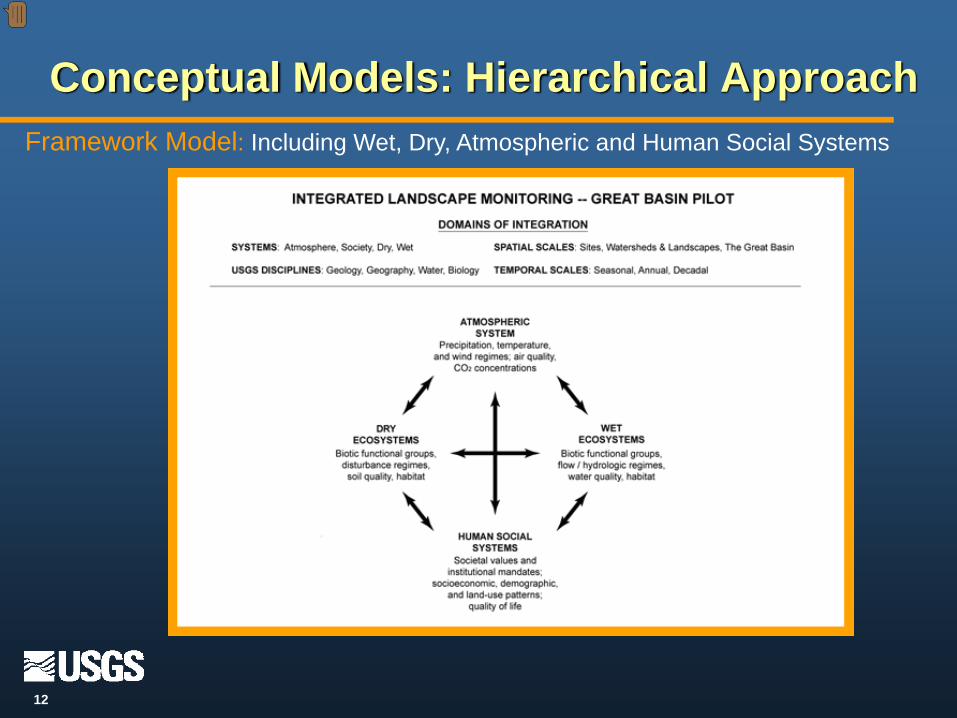
Framework Model: Wet, Dry, Atmospheric, Human Social Systems
System Models
WetDryAtmospheric Human Social Systems
Control Models
Sagebrush Steppe Salt Desert Steppe Pinyon-Juniper Alpine Coniferous
Stressor Models
Conceptual Models: Hierarchical Approach
Fire/grazing interactions
12
Framework Model: Including Wet, Dry, Atmospheric and Human Social Systems
Conceptual Models: Hierarchical Approach
Presenter
Presentation Notes

13
Systems Model: Dry System
Conceptual Models: Hierarchical Approach
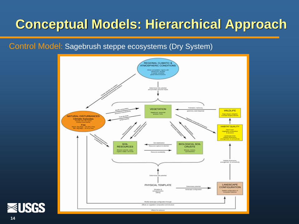
14
Control Model: Sagebrush steppe ecosystems (Dry System)
Conceptual Models: Hierarchical Approach

15
Stressor Model: Fire and Grazing Interactions
Conceptual Models: Hierarchical Approach
16
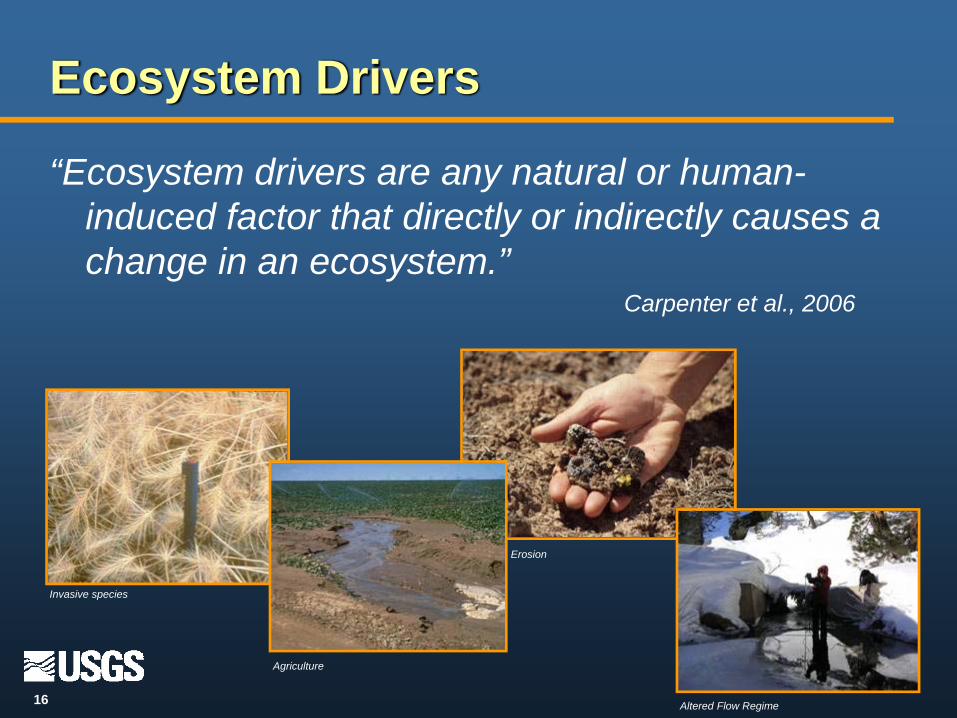
“Ecosystem drivers are any natural or human-induced factor that directly or indirectly causes a change in an ecosystem.”
Carpenter et al., 2006
Ecosystem Drivers
Invasive species
Agriculture
Altered Flow Regime
Erosion
17
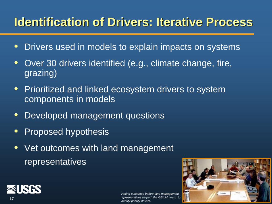
Identification of Drivers: Iterative Process
• Drivers used in models to explain impacts on systems
• Over 30 drivers identified (e.g., climate change, fire, grazing)
• Prioritized and linked ecosystem drivers to system components in models
• Developed management questions
• Proposed hypothesis
• Vet outcomes with land management representatives
Vetting outcomes before land management representatives helped the GBILM team to identify priority drivers.

18
• Water Extraction*
• Flow Regime
• Livestock Grazing
• Invasive Exotics
• Climate Change & Variability
Drivers of Change: Wet System

19
• Fire Regime
• Invasives-Fire Interaction*
• Livestock Grazing
• Land Treatments*
• Climate Change & Variability
• Motor Vehicle Use
Drivers of Change: Dry System
20
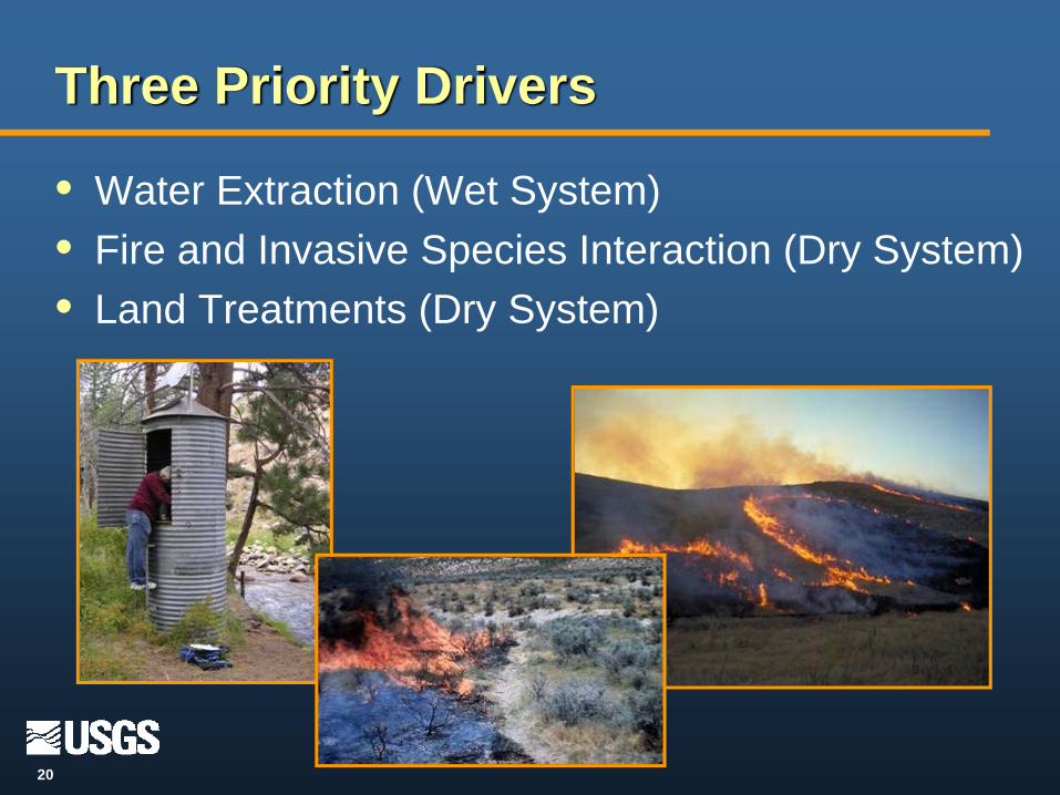
• Water Extraction (Wet System)• Fire and Invasive Species Interaction (Dry System)• Land Treatments (Dry System)
Three Priority Drivers

21
Management Questions
• Why develop management questions?
- Foundation for landscape monitoring program
- Reflect real-life needs of our management partners
- Bring focus and relevance to our work
- Provide basis for evaluating interactions among management actions, other environmental factors, and landscape change
• Develop example projects to test our approach

22
Our 4-Step Approach
• Develop questions• Data mining and evaluation• Data analysis to assess status and trends, and
predict change• Management application of results

23
Example 1: Water Extraction ProjectTitle: Potential Phreatophytic Land Cover in the Great Basin and Relationship to Groundwater Withdrawals
Key Management Questions: • How will increased water extraction impact phreatophytes?• Can phreatophytic communities serve as an indicator of impacted groundwater systems?• How will water extraction impact these phreatophytic communities?
Approach• Collect data layers for geomorphology, vegetation, elevation, and hydrology.• Develop and run spatial analysis model.• Conduct analyses to detect temporal changes in water level within ground-water systems.
Expected Products:• Map of potential phreatophytic land cover of Great Basin• Map(s) of change in Great Basin’s ground-water levels• Manuscript describing use of phreatophytic communities as indicators of
change in ground-water levels to identify areas at risk
24
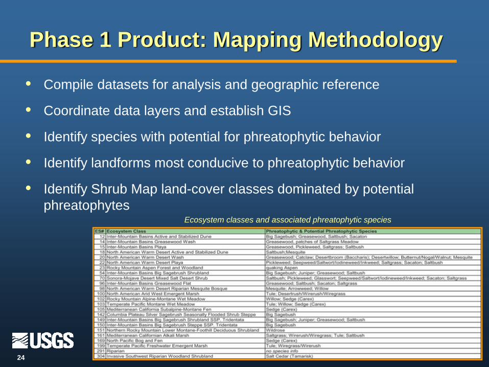
Phase 1 Product: Mapping Methodology
• Compile datasets for analysis and geographic reference
• Coordinate data layers and establish GIS
• Identify species with potential for phreatophytic behavior
• Identify landforms most conducive to phreatophytic behavior
• Identify Shrub Map land-cover classes dominated by potential phreatophytes
Ecosystem classes and associated phreatophytic species
25
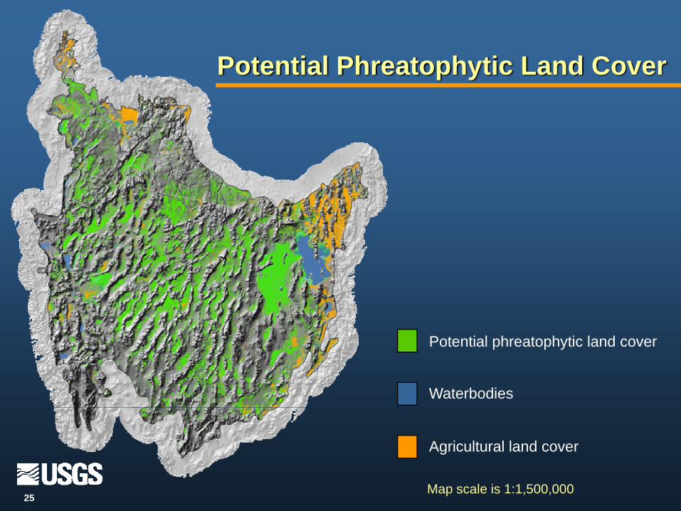
Potential Phreatophytic Land Cover
Potential phreatophytic land cover
Waterbodies
Agricultural land cover
Map scale is 1:1,500,000

26
Title: Fire Regimes in the Great Basin: Spatio-temporal Correlates and Future Scenarios
Key Management Questions:• How should land managers prioritize efforts to manage fire regimes with the goal of retaining and
restoring desired plant communities in the Great Basin?
Approach• Describe spatial and temporal patterns of fire by producing maps and graphing fire distributions
over time. • Evaluate hypotheses on how invasives alter fire regimes.• Develop monitoring tools to assess changes in fire regimes and vegetation conditions.
Expected Products:• Maps/spatial data• Trends and threats assessment for altered fire regimes• Land management recommendations • Manuscripts
Example 2: Fire and Invasive Species

27
Title: Assessment of Land Treatments to Understand Vegetation and Wildlife Habitat Trajectories in the Great Basin
Key Management Questions:• Are different land treatments moving vegetation communities toward desired conditions and how are
they influencing vegetation and wildlife habitats?• How and where can land managers use land treatments for multiple objectives, including maintaining
and restoring habitat and associated wildlife?
Approach:• Acquire existing data on treatments from 1950 to present.• Develop predictive models on effects of treatments on wildlife habitats.• Refine models and provide information on vegetation trends.
Expected Products:• Database with spatial data linked to treatment information• Maps of land treatments across the Great Basin• Manuscripts on monitoring approaches and effects of land
treatments on sage-brush habitat connectivity
Example 3: Land Treatments
28
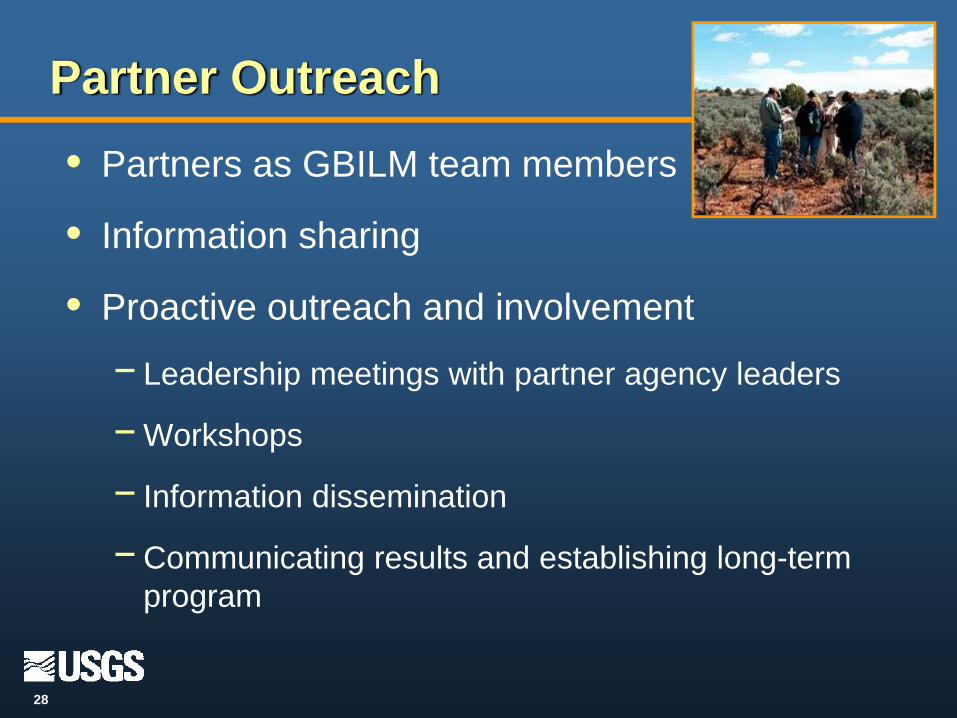
Partner Outreach• Partners as GBILM team members
• Information sharing
• Proactive outreach and involvement
− Leadership meetings with partner agency leaders
−Workshops
− Information dissemination
−Communicating results and establishing long-term program
29
Project Schedule: Phase 1 (FY 2006)
Focus• Develop pilot project strategy
- Organize interdisciplinary team
− Invite DOI agency representation
− Identify agency monitoring needs
− Develop conceptual models
− Identify and prioritize drivers
− Develop Pilot focus on existing data
Products• Create internal website
• Develop fact sheet
• Poster
30
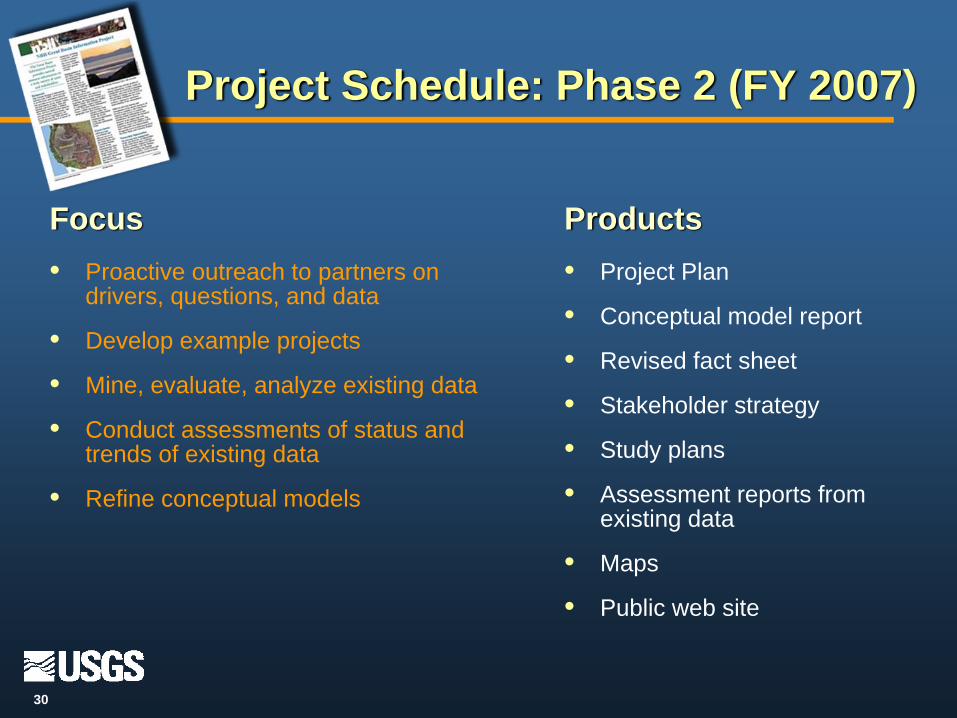
Project Schedule: Phase 2 (FY 2007)
Focus• Proactive outreach to partners on
drivers, questions, and data
• Develop example projects
• Mine, evaluate, analyze existing data
• Conduct assessments of status and trends of existing data
• Refine conceptual models
Products• Project Plan
• Conceptual model report
• Revised fact sheet
• Stakeholder strategy
• Study plans
• Assessment reports from existing data
• Maps
• Public web site

31
Funding and In-kind Commitments from USGS Disciplines*• Biology
- FY06 $75,000 new allocation, plus substantial in-kind$100,000 Ecosystem mapping
- FY07 $75,000 new allocation, plus substantial in-kind• Geography
- FY06 $75,000 in-kind from Geographic Analysis Monitoring Program$10,000 charged to Biology allocation
- FY07 $75,000 in-kind from Geographic Analysis Monitoring Program• Geology
- FY06 $25,000 in-kind; $20,000 charged to Biology allocation- FY07 ?
• Geospatial Information Office (GIO)- FY06 $4,688 in-kind from CTM & Geospatial Program Office
$16,000 in-kind from Enterprise Information Program- FY07 ?
• Water- FY06 $20,000 new allocation, plus in-kind- FY07 $20,000 new allocation, plus in-kind
*Most of the support to GBILM has been as in-kind commitment of salary time

32
Project Schedule: Phase 3 (FY 2008)
Focus• Conduct assessments of status and
trends of existing data
• Predictions of landscape change based on historic trends and environmental factors
• Initiate development of monitoring approaches
• Explore and pursue other management questions
Products• Assessment reports from
existing data
• Report of predictions for selected drivers
• Analytical tools for managers
• Study plans for additional management questions
• Research proposals to fill identified data gaps

33
Project Schedule: Phase 4 (FY 2009-?)
Focus• Develop and test monitoring
methods, protocols and sampling designs
• Finalize monitoring and implement long-term landscape monitoring
• Expand to other drivers and management questions
Products• Monitoring methods, protocols,
sampling designs
• New data sets on web
• Published, coordinated monitoring plans and protocols
• Assessment reports on additional management questions
• Analytical tools for managers to analyze management scenarios and set priorities
34
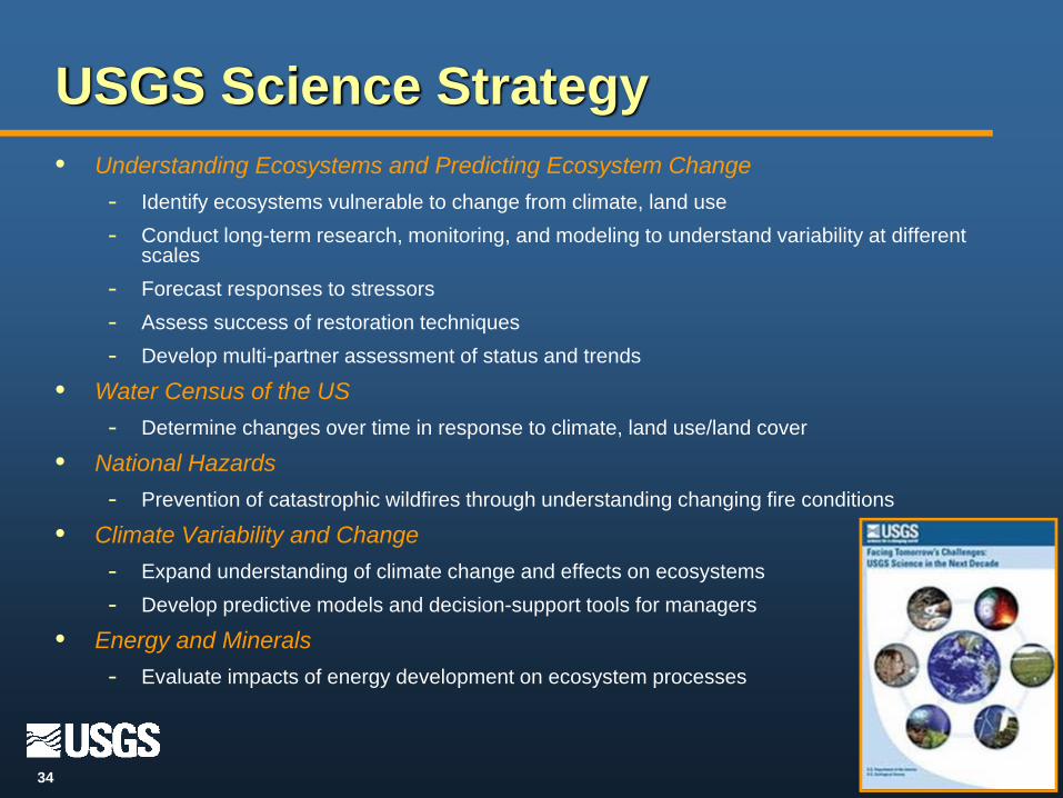
USGS Science Strategy• Understanding Ecosystems and Predicting Ecosystem Change
- Identify ecosystems vulnerable to change from climate, land use- Conduct long-term research, monitoring, and modeling to understand variability at different
scales- Forecast responses to stressors- Assess success of restoration techniques- Develop multi-partner assessment of status and trends
• Water Census of the US- Determine changes over time in response to climate, land use/land cover
• National Hazards- Prevention of catastrophic wildfires through understanding changing fire conditions
• Climate Variability and Change- Expand understanding of climate change and effects on ecosystems- Develop predictive models and decision-support tools for managers
• Energy and Minerals- Evaluate impacts of energy development on ecosystem processes

35
Long-term Value: Pilot to Program
• Build understanding of ecosystem processes
• Identifies change in a highly variable and complex region
• Inform management issues and practices at landscape scales
• Develop long-term monitoring strategies
• Ultimately, provide a predictive capability of landscape change
Krissy Bush

36
Related Documents