1 Institute of Marine Research CRUISE REPORT R/V H. Mosby - cruise No. 2009615 M/S Øyfisk – cruise No. 2009813 10 th - 20 th June 2009 Coral survey off Northern Norway Authors: Tina Kutti and Jan Helge Fosså Image grabbed from HD video taken with Campod during cruise 2009615 Benthic habitats and Shellfish Research Group Institute of Marine Research PO Box 1870 Nordnes N-5817 Bergen Norway Tel: + 47 55 235833 Fax: + 47 55 236830

Welcome message from author
This document is posted to help you gain knowledge. Please leave a comment to let me know what you think about it! Share it to your friends and learn new things together.
Transcript

1
Institute of Marine Research
CRUISE REPORT
R/V H. Mosby - cruise No. 2009615
M/S Øyfisk – cruise No. 2009813
10th
- 20th
June 2009
Coral survey off Northern Norway
Authors: Tina Kutti and Jan Helge Fosså
Image grabbed from HD video taken with Campod during cruise 2009615
Benthic habitats and Shellfish Research Group
Institute of Marine Research
PO Box 1870 Nordnes
N-5817 Bergen
Norway
Tel: + 47 55 235833
Fax: + 47 55 236830
2
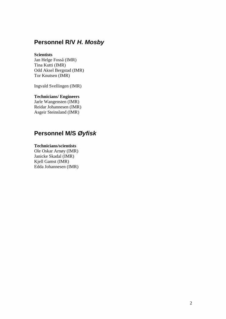
Personnel R/V H. Mosby
Scientists
Jan Helge Fosså (IMR)
Tina Kutti (IMR)
Odd Aksel Bergstad (IMR)
Tor Knutsen (IMR)
Ingvald Svellingen (IMR)
Technicians/ Engineers
Jarle Wangensten (IMR)
Reidar Johannesen (IMR)
Asgeir Steinsland (IMR)
Personnel M/S Øyfisk
Technicians/scientists
Ole Oskar Arnøy (IMR)
Janicke Skadal (IMR)
Kjell Gamst (IMR)
Edda Johannesen (IMR)

3
Contents
Page
Itinerary 3
Summary 4
Objectives and background 4
Mapping of fish in coral habitats 4
Acoustic abundance estimations 4
Visual observations 5
Long line fishing 6
Survey maps and figures 7
Appendix: Table 1 11
Table 2 13
Table 3 14
ITINERARY
R/V H. Mosby
Departed Kristiansund 10.06.2009
Arrived Bodø 20.06.2009
M/S Øyfisk
Departed Myre (Øksnes) 14.06.2009
Arrived Myre (Øksnes) 20.06.2009

4
SUMMARY
The Traena Deep coral reef field was the main target area of the cruises carried out
with R/V H. Mosby and M/S Øyfisk from 10th
to 20th
June 2009. Small (100*30*10
m) Lophelia reefs are widespread in the Traena Deep with about 1500 reefs in a 200
km2 large area. The cruises set out to investigate fish and zooplankton abundance and
the species composition of fish in blocks with high and low density of small coral
reefs and in adjacent control areas without Lophelia reefs using underwater video
observations, trawling and long line fishing. Fish and zooplankton abundance was
also investigated in relation to large scale topography in the Traena Deep and at the
Røst Reef using acoustic techniques (Figure 1). The weather was in general good with
temperatures between 5 and 12oC the in air and 8 and 11
oC at the sea surface. There
was a strong breeze most of the time with longer periods of gentle and moderate
breeze on the 17th
, 18th
and 19th
of June. All fish sampling was carried out
successfully. Unfortunately the zooplankton sampling gear did not function properly
so no quantitative information on zooplankton could be obtained. At a 1-km scale
there seemed to be no evidence of a relation between the distribution of fish and
specific benthic habitats at this time of the year.
OBJECTIVES AND BACKGROUND
The overall objective was to study the distribution of fish and plankton in relation to
the occurrence of Lophelia cold-water coral reefs and the general topography.
Acoustic transects, underwater video observations and long-line fishing was carried
out to see if certain fish species were more abundant in cold-water coral habitats than
in other structurally complex habitats. To see if the association with particular habitats
increases the fitness of individual fish length, weight, age and maturity stage of
individual fish caught in high coral density, low coral density and no coral areas
during the long line fishing was determined. Stomach content analysis will be used to
get an overview of the main food sources of the different species caught and whether
that differs in the three different habitat types. Stomach fullness measures will be
derived to give an indication of food availability in different habitats.
MAPPING OF FISH IN CORAL HABITATS
Research cruise number 2009615 with R/V H. Mosby was undertaken between 10th
and 20th
of June 2009. Research cruise number 2009813 with M/S Øyfisk was
undertaken between 14th
and 20th
of June 2009. The depth in the investigated CWC
habitats is 200-400 m.
Acoustic abundance estimations
Acoustic abundance estimations of fish and zooplankton were carried out in a 500
km2 large area surrounding the Traena Deep, in a 570 km
2 large area covering the
Røst Reef and the continental shelf break north of the Røst Reef and at two transects
crossing the Røst Bank. The acoustic data were collected using the Simrad ER60
5
scientific echosounder at a cruising speed of 10 knots. Abundance estimations of fish
were generated for the 38 kHz data (Figure 2). Three other operating frequencies were
used during the survey (18, 120 and 200 kHz) for trace recognition purposes.
Echograms were scrutinized using Large Scale Survey System-software. The
allocation of area backscattering strengths to species was made by comparison of the
appearance of the echo recordings to trawl catches and video recordings.
The acoustics showed that zooplankton were evenly distributed in the surveyed areas
and could not be related to any large-scale topographic features (Figure 2A). At Røst
the highest numbers of fish in the 10 m zone closest to the sea-bed were registered in
the shallow areas north of the reef rather than on the reef proper (Figure 2F).
Mesopelagic fish and large pelagic schooling stocks (blue whiting and Atlantic
herring) were encountered at the shelf break (Figure 2B-D and Figure 3). In the Træna
area the highest densities of fish close to the sea-bed were found in the shallower bank
areas north of the coral field. The strongest echo-signals from fish in the Træna Deep
were recorded in the middle of the water column at depths between 250 and 330 m.
Towed underwater video transects and two bottom-trawl hauls confirmed the presence
of a large number of medium sized (40-45 cm) saithe. In this area there seemed to be
no relationship between the distribution of the large commercial fish stocks (i.e.
saithe, blue whiting, and herring) and cold-water corals.
Visual observations
The underwater video footage was taken using the video rig Campod. The Campod is
a light weight, three-legged platform equipped with 2 video cameras, hard disk
recording, lights (2x400w HMI), depth sensor, altimeter, laser scaling and transponder
for positioning. The rig was towed at a speed of 1 knot and was kept 3 meters above
the sea-bed. The camera was mounted in a slightly forward looking angle to increase
the field view and the chance of observing fish. The towed video camera was
deployed 25 times resulting in a total of 23 hours with high definition video records
(Figure 4). The Campod was very well suited to collect video material of fish. The
towed gear runs rather quietly above the bottom and does not seem to scare the fish.
Due to the constant speed and forward motion the only fish that could follow the
camera over larger distances was saithe. The camera is easy to deploy and haul and is
relatively easy to run along pre determined transects as long as the weather conditions
are ok. On the 17th
of June weather conditions were excellent and 9 towed video
transect of 2 km each (i.e. 60 minutes) were shot during 18 hours. This means that
only 1 hour was spend on launching, hauling and moving between each transect at this
site where water depth was around 300 m. The quality of the shots was good.
A priori six experimental units (geographic plots á 2 x 2 km) had been selected on the
basis of multi-beam bathymetric maps. During the survey it was found that the a
priori determined control areas were actually sponge grounds and new control areas,
located east of the Træna Deep, were added. Video transects for fish abundance
estimations were equally distributed in two blocks with high density of coral reefs,
two blocks with low density of coral reefs and two blocks with high density of sponge
cover (sponge ground). Four control transects were taken in a habitat of flat surface
sediment without significant cover of erect species.

6
Sixteen, two km long, video transects collected in the experimental plots were
analyzed on-board. The most commonly observed fish along the transects were saithe
(Pollachius virens), Norway haddock (Sebastas viviparus), Norway pout (Trisopterus
esmarkii), tusk (Brosme brosme), blue whiting (Micromesistius poutassou) and rabbit
fish (Chimaera monstrosa). No statistically significant differences in abundance or
species composition was observed in areas with high or low density of coral reefs,
sponge grounds or sedimentary seabed without three dimensional habitat forming
species (i.e. control areas). Norway redfish is usually abundant on the reefs but at this
site we found that it was also abundant in low coral and no coral habitats. Very week
tendency that tusk prefer coral habitat was observed.
Signs of fishing activity was recorded. During the 23 hours of video observations
trawl tracks were observed four times, five lines and two pieces of rope were observed
lying on the sea-bed. In addition undefined rubbish was observed three times.
Long line fishing
A priori six experimental units (geographic plots á 2 x 2 km) had been selected on the
basis of multi-beam bathymetric maps. This included two plots with high density of
coral reefs, two plots with low density of coral reef and two plots without any
Lophelia reefs (however the area contained high densities of large sponges). For the
experimental fishing, four fleets of long line were set across each plot. Setting
direction was parallel with the main current direction at the site and perpendicular to
the depth contour. Starting position for the first line was selected randomly from 0 to
1000 m away from the western up-current side of the plot. The second line was set
900 m away from the first one to avoid that one line would “steal” fish from the other.
Fishing was carried out two times in each block, the second time with a new randomly
selected starting position.
The fishing was carried out by the coastal long-liner M/V Øyfisk. During a 5 day
period a total of 22 fleets of long-line were set, each containing approximately 1280
hooks. The hooks were baited with squid. Soak time was approximately 4 hours.
Fishing was performed with no consideration to what time of the day the lines were
set since in June there is light 24 h a day. Catch was registered per 250 m sub-section
of the line (160 hooks). All fish was identified, weighed and length determined and
analyzed for sex and degree of maturity. Stomachs were collected whenever possible.
From each subsection of the line otoliths were collected for age determination for a
maximum of 10 individuals per fish species. By-catch of sponges and corals were
registered.
The long-line fishing was carried out successfully despite rather heavy swell in the
area the first days of the cruise. Of 24 planned line transect 22 were actually set
(Figure 5). A total of 1083 fish, of which 931 were tusk, were caught in the Træna
coral reefs field (Table 3). 14 different species were caught. By-catch of coral and
sponges in the line fishery were almost non-existent.
The overall mean CPUE of Tusk ([kg/hook] x 1000) in the Træna Deep was 72. There
was a tendency of higher CPUE in high density reef areas as compared to low density
reef areas and no coral areas (99, 72 and 46 respectively). From 2004 to 2008 a CPUE
of 90 has been estimated from the ICES area IIa (i.e. the Norwegian Sea).

7
The CPUE in the Træna Deep was slightly lower than that registered from coral areas
in mid-Norway by Husebø et al. (2002) i.e. 60 ([ind./hook] x 1000) in coral habitats
and 40 in non coral habitats. In the Træna Deep 48 ([ind./hook] x 1000) were
registered in high density coral habitats, while 37 were registered in low coral density
habitats and 24 in no coral habitats. No statistically significant difference in tusk
abundance was found in high, low or non coral habitats. A trend of higher mean
length in areas with high density of coral reefs was, however, observed.
SURVEY MAPS AND FIGURES
Figure 1. Study areas during cruise 2009615 in June 2009 with RV H. Mosby.
Røst Reef
Træna Deep
Røst Bank

8
Figure 2. Area backscattering strength (NASC) was averaged over 0.5 nautical miles
and integrated from the bottom to the surface for (A) Zooplankton, (B) Mesopelagic
fish (i.e. Maurolicus muelleri), (C) Blue whiting (Micromesistius poutassou) and (D) Atlantic herring (Clupea harengus). For Saithe (Pollachius virens) NASC was
integrated from 10 m above the bottom to the surface in (E) and integrated from the
seabed to 10 m above the bottom in (F).

9
Røst Reef
Fish larvae, krill, copepods
Mesopelagic fish, krill
Herring
Saithe
Blue whiting, krill, shrimpsSaithe
Figure 3. Echogram of a transect across the Røst Reef and identified scatters.
Figure 4. Red lines show the positions of the towed video transects.

10
Figure 5. Red lines show the positions of the long-lines set in the Træna Deep.

11
APPENDIX Table 1. Narrative of cruise with all sampling stations and tracks. Geographic positions are given as decimal degrees. For tracks only starting position is given.
Location Date Activity Time Duration Station Latitude Longitude Depth
10.06.2009 Left Kristiansund harbour 16:00 11.06.2009 in transit 12.06.2009 Call in Bodø port to leave equipment 19:00 Træna Deep 12.06.2009 Arrived in the Træna-Deep study area 15:32 12.06.2009 Fisheries acoustics 16:55 00:50:24 in experimental plots 66.9840 10.7960 273 12.06.2009 Bottom trawl 19:02 00:23:00 119 66.9412 10.8530 292 12.06.2009 Fisheries acoustics 20:26 12:32:54 Træna Deep 66.9380 10.8370 308 13.06.2009 Campod-video 10:37 01:34:02 HL2-1500 66.8792 11.2101 305 13.06.2009 Campod-video 13:08 01:10:35 Hl2-600 66.8872 11.2097 299 13.06.2009 Campod-video 15:02 00:24:29 HL2-ex 66.8829 11.1747 300 13.06.2009 Campod-video 16:21 01:08:47 NL2-1800 66.9279 11.3249 277 13.06.2009 Campod-video 18:02 01:06:50 NL2-1000 66.9349 11.3265 283 13.06.2009 Fisheries acoustics 20:34 02:55:04 in experimental plots 66.9270 11.2810 306 14.06.2009 Fisheries acoustics 03:44 00:56:24 in experimental plots 66.9610 11.0830 305 14.06.2009 Fisheries acoustics 06:17 02:52:26 in experimental plots 66.9810 10.8740 272 14.06.2009 Krill trawl 11:05 00:48:35 120 66.8713 11.1279 - 14.06.2009 CTD 11:53 00:43:03 420 66.8810 11.1965 302 14.06.2009 CTD 12:36 00:43:04 421 66.9375 11.3018 300 14.06.2009 CTD 13:19 00:41:48 422 66.9345 11.1593 401 14.06.2009 CTD 14:01
00:40:05 423 66.9692 66.1075 305
14.06.2009 Mocness-plankton 16:05 02:10:05 na* - - - 14.06.2009 Campod-video 19:16 00:47:22 HL5-1 66.9772 11.0731 290 14.06.2009 Campod-video 20:38 01:00:28 HL5-2 66.9660 11.1264 310 14.06.2009 Campod-video 22:26 00:44:08 HL5-3 66.9590 11.1173 333 15.06.2009 Bottom trawl 07:18 00:20:00 121 66.9708 10.9563 273 Røst Bank 15.06.2009 Fisheries acoustics 08:23 38:07:47 from træna to røst -17.06.2009 Røst Reef 16.06.2009 Krill trawl 12:56 01:11:00 122 67.3915 9.0594 -

12
Location Date Activity Time Duration Station Latitude Longitude Depth 16.06.2009 CTD 17:01 00:51:13 424 67.4372 10.1828 498 16.06.2009 Mocness 15:17 05:25:00 424-426* 67.2360 9.0353 - Træna Deep 17.06.2009 Campod-video 6:33 0:50:39 LL2-1 66.9446 10.9052 309 17.06.2009 Campod-video 7:48 1:04:39 LL2-200 66.9571 10.9022 294 17.06.2009 Campod-video 9:53 1:02:34 LL1-1 66.9630 11.0148 289 17.06.2009 Campod-video 11:27 1:06:12 LL1-2 66.9700 11.0156 287 17.06.2009 Campod-video 13:29 1:03:30 NL1-1 66.9758 10.8740 276 17.06.2009 Campod-video 14:56 1:05:30 NL1-2 66.9652 10.8713 286 17.06.2009 Campod-video 17:01 0:45:46 25mintrålhal 66.9304 10.8656 308 17.06.2009 Campod-video 19:10 0:59:13 HL5-4 66.9656 11.1299 319 17.06.2009 Campod-video 20:48 1:07:41 HL5-5 66.9750 11.0859 292 18.06.2009 Mocness-plankton 01:04 0:49:00 425* 66.5771 11.0457 - 18.06.2009 Krill trawl 03:02 0:43:00 123 66.9719 11.1119 - 18.06.2009 Krill trawl 06:38 0:49:00 124 66.9689 10.8810 - 18.06.2009 Krill trawl 08:58 0:49:00 125 66.9306 10.9913 - 18.06.2009 Krill trawl 13:09 0:47:00 126 66.9379 11.1541 - 18.06.2009 Campod-video 15:21 1:04:46 HL2-4 66.8841 11.1626 302 18.06.2009 Campod-video 16:53 1:04:00 HL2-5 66.8792 11.1655 312 18.06.2009 Campod-video 19:14 1:01:26 Explore 1 66.9359 11.4222 284 18.06.2009 Campod-video 21:02 1:03:02 Explore 2 66.9836 11.5309 271 18.06.2009 Fisheries acoustics 22:15 7:33:28 east of study area 66.9760 11.5620 274 19.06.2009 Campod-video 6:44 1:02:05 Explore 3 66.9559 11.6241 293 19.06.2009 Campod-video 8:37 0:56:13 Explore 4 66.9777 11.7987 307 19.06.2009 Campod-video 9:40 0:12:32 Sponge 66.9897 11.8291 292 19.06.2009 Campod-video 12:20 1:10:49 Sponge2 66.9665 10.9366 282 19.06.2009 Campod-video 14:03 1:10:25 Coral 66.9513 10.9945 304 19.06.2009 Left the study area 19:00 20.06.2009 Arrived in Bodø. End of cruise. 03:00
* The mocness zooplankton sampling gear did not function properly and no samples of small zooplankton (i.e. copepods) were obtained on the cruise.

13
Table 2. Long line fishing with M/S Øyfisk. Geographic start and stop positions of each line is given as decimal degrees.
Time of fishing (UTM) Depth (m) Position of long-line Date Line no. Setting Hauling start stop Start Stop
15.06.09 HL1-1 07:10 11:10 166 312 66.9789 N 11.1083 E 66.9806 N 11.0597 E 15.06.09 HL1-2 10:41 14:41 315 297 66.9672 N 11.1083 E 66.9691 N 11.0598 E 15.06.09 NL2-1 15:39 19:39 299 319 66.9377 N 11.3311 E 66.9395 N 11.3151 E 16.06.09 NL2-2 04:07 08:07 291 316 66.9352 N 11.3283 E 66.9369 N 11.2901 E 16.06.09 HL2-1 06:45 10:45 312 316 66.8894 N 11.2186 E 66.8857 N 11.1743 E 16.06.09 HL2-2 10:30 14:30 323 327 66.8869 N 11.2189 E 66.9707 N 11.1734 E 16.06.09 NL1-1 14:34 18:34 288 290 66.9806 N 10.8777 E 66.9806 N 10.8294 E 17.06.09 NL1-2 04:04 08:04 299 295 66.9670 N 10.8758 E 66.9673 N 10.8328 E 17.06.09 HL1-3 06:36 10:36 299 - 66.9820 N 11.1078 E 66.9845 N 11.0627 E 17.06.09 HL1-4 10:32 14:32 320 301 66.9690 N 11.1090 E 66.9707 N 11.0659 E 17.06.09 NL2-3 13:35 17:35 312 340 66.9496 N 11.3323 E 66.9515 N 11.2831 E 17.06.09 NL2-4 16:52 20:52 289 303 66.9362 N 11.3311 E 66.9377 N 11.2858 E 18.06.09 HL2-3 04:01 08:01 312 323 66.8932 N 11.2205 E 66.8944 N 11.1751 E 18.06.09 HL2-4 07:00 12:45 305 305 66.8876 N 11.2166 E 66.8921 N 11.1950 E 18.06.09 NL1-3 10:46 16:40 273 271 66.9871 N 10.8749 E 66.9869 N 10.8262 E 18.06.09 NL1-4 15:15 20:38 290 297 66.9739 N 10.8739 E 66.9739 N 10.8310 E 18.06.09 LL1-1 15:52 22:20 316 312 66.9513 N 10.9106 E 66.9516 N 10.8655 E 19.06.09 LL1-2 00:23 04:40 309 308 66.9496 N 10.9060 E 66.9495 N 10.8630 E 19.06.09 LL2-1 01:32 06:32 282 282 66.9789 N 11.0273 E 66.9806 N 10.9699 E 19.06.09 LL2-2 04:02 09:02 301 295 66.9769 N 11.0200 E 66.9767 N 10.9721 E 19.06.09 LL1-3 06:26 11:26 294 293 66.9582 N 10.9093 E 66.9598 N 10.8668 E 19.06.09 LL1-4 09:04 14:04 - - 66.9562 N 10.9117 E 66.9576 N 10.8658 E

14
Table 3. Catches of fish in each long line set in the Træna Deep.
Species
HL1
-1
HL1
-2
HL1
-3
HL1
-4
HL2
-1
HL2
-2
HL2
-3
HL2
-4
NL1
-1
NL1
-2
NL1
-3
NL1
-4
NL2
-1
NL2
-2
NL2
-3
NL2
-4
LL1-1
LL1-2
LL1-3
LL1-4
LL2-1
Brosme Tusk Brosme brosme 51 84 27 51 51 75 6 56 57 28 20 62 21 18 20 19 61 51 40 49 37 Gråsteinbit Wolf fish Anarhichas lupus 2 2 1 2 1 1 1 Havmus Rabbit fish Chimaera monstrosa 7 3 2 2 2 1 3 2 3 Hyse Haddock Melanogrammus
aeglefinus 3 1 1 9 1 1 2 1 1
Hågjel Blackmouth catshark Galeus melastomus 2 1 2 6 2 3 2 2 1 2 2 2 3 1 Lange Ling Molva molva 1 1 1 1 1 1 1 Rundskate Round ray Rajella fyllae 2 2 Svarthå Velvet belly lantern shark Etmopterus spinax 1 3 1 4 2 2 7 2 2 5 Vanlig uer Ocean perch Sebastes marinus 1 1 1 1 Trollkrabbe Northern stone cab Lithodes maja 1 5 3 3 2 1 1 2 Torsk Cod Gadus morhua 1 Sei Saithe Pollachius virens 1 Flekksteinbit Northern wolffish Anarhichus denticulatus 1 Kloskate Thorny skate Amblyraja radiata 1 total 62 93 33 61 64 86 18 59 61 33 29 64 29 26 30 25 68 64 42 51 38 count 4 6 5 5 6 8 6 3 3 4 2 3 6 5 4 5 6 6 3 3 2

15
Related Documents