“Making places more walkable, legible & liveable” IMAP Action 2.2 THE DEVELOPMENT OF INNER MELBOURNE WAYFINDING SIGNAGE Stage 1 – Part 1 – Main Report December 2007 Dr John Grant J.A.Grant & Associates ................................................................................www.jagrant.com.au Bruce Herbes Visualvoice ............................................................................................www.visualvoice.com.au

Welcome message from author
This document is posted to help you gain knowledge. Please leave a comment to let me know what you think about it! Share it to your friends and learn new things together.
Transcript

“Making places more walkable, legible & liveable”
IMAP Action 2.2 THE DEVELOPMENT OF
INNER MELBOURNE WAYFINDING SIGNAGE
Stage 1 – Part 1 – Main Report
December 2007
Dr John GrantJ.A.Grant & Associates ................................................................................www.jagrant.com.au
Bruce HerbesVisualvoice ............................................................................................www.visualvoice.com.au

INNER MELBOURNE WAYFINDING SIGNAGE STAGE 1
1
PART 1 – MAIN REPORT – TABLE OF CONTENTS
EXECUTIVE SUMMARY.........................................................................................2
1. INTRODUCTION ...........................................................................................5
2. RESEARCH AND DEVELOPMENT PROCESS. ..........................................8
Signage strategies......................................................................................................................................8
Conclusions ..............................................................................................................................................11
3. THE AUDIT OF THE PROPOSED DEMONSTRATION PROJECT AREA 20
4. THE DEMONSTRATION PROJECT SIGNAGE PLAN...............................22
4.1 Signage within the area between Federation Square and Swan Street. ..................................26
4.2 Swan Street Precinct signage .....................................................................................................28
4.3 Church Street Precinct signage ..................................................................................................31
4.4 Chapel Street Precinct signage...................................................................................................33
4.5 Signage within the area between Chapel St and Fawkner Park . .............................................38
4.6 Fawkner Park Signage ................................................................................................................42
4.7 Signage between Fawkner Park and the Yarra River................................................................43
4.8 Signage between the Yarra River and the CBD.........................................................................44
4.9 Signage between the CBD and Bridge Road .............................................................................45
4.10 Signage within Bridge Road Precinct ........................................................................................46
4.11 Signage between Bridge Road and Swan Street – via Lennox................................................48
4.12 Signage between Bridge Road and Swan Street – via Coppin Street .....................................49
4.13 Train Station signage..................................................................................................................51
5. IMPLEMENTATION.....................................................................................52
5.1 Developing the Regional “Walking Framework – or Web”.........................................................52
5.2 Developing the signage ...............................................................................................................53
6. EVALUATION..............................................................................................56
7. CONCLUDING COMMENTS.......................................................................57

INNER MELBOURNE WAYFINDING SIGNAGE STAGE 1
2
EXECUTIVE SUMMARY.
Inner Melbourne Action Plan, Action 2.2 seeks to introduce a consistent pedestrianwayfinding signage system across the Inner Melbourne (IMAP) Region to show that theRegion and its constituent “precincts” are accessible throughout by walking, cycling andpublic transport.
The IMAP Region contains up to 35 recognisable precincts. These are linked together byan excellent system of public transport routes (train, tram and bus) which are signed by theMetlink signage system, and illustrated on public transport, TravelSmart and other maps.The region also contains a comprehensive cycling and shared-path network and this too issupported by a comprehensive signage system and illustrated on maps. It is also possibleto walk within and between the many Precincts on a series of good quality walking routes.
However, one of the acknowledged weaknesses of the Region is the fragmented andvariable signage system for pedestrians and the fact that many inter-precinct walkingroutes are not signed for pedestrians. The illustration of the availability of these goodwalking routes is a new and important element in the proposed integrated signage system.
This project is designed to show people that there is a comprehensive and integrated“web” of sustainable transport links throughout the Region and they can easily travel withinand between the IMAP Region s precincts by whichever mode or mix of modes they wish –on foot, by bicycle or by public transport.
The IMAP Action 2.2 Project Management Team commissioned a Stage 1 project for thisAction. The aims of the Stage 1 project are to:
1. Identify a hierarchy of signs that provide both regional and local wayfindinginformation in a consistent format across the Region;
2. Identify the regional and local pedestrian and public transport route system;3. Identify regional and local signage locations; and4. Develop a detailed signage plan, based on the research undertaken for 1-3 above,
for a “demonstration project” within the Region, showing where each type of signshould be located within the demonstration project area.
The signage required for this project will need to be a “map-based family of signs” focusedon illustrating the major origins and destinations within the Precincts and the ways thatpeople can make their journeys between places in sustainable ways within the Region.They include the footpath/shared path system, road crossings, the public transport system(stations and stops), major destinations and a range of amenities. All of these will need tobe illustrated on the family of maps to be designed for the Region.
(Stages 2 and 3 of the Action are the implementation of the Demonstration Project signageplan and the roll-out of the signage system across the whole IMAP Region)
The research for the completion of this project was divided into two complementarystreams – the WHAT and the WHERE streams.
The WHAT stream examined signage issues – and reviewed good practice in pedestrianwayfinding in urban areas, including the content and information that is required fordifferent sign types, and the nature and extent of existing wayfinding signage in the IMAPRegion. The audit of existing signage within the IMAP Region shows that it contains a widevariety of signage, but much of it is of limited value in terms of wayfinding and it is not ofgood practice standards.
Research into good practice wayfinding signage shows that the optimum signage systemis based on a hierarchy of signs, consisting of a “family of signs” containing “heads-upmaps” and more traditional directional and route marker signs. Heads-up maps are basedon the principle of “where you are is what you see”. A unique sign family has beendeveloped for the IMAP Region based on good practice – a hierarchy of four regional,local and route signs for the Region that will provide the appropriate levels of information inthe locations where that information is needed.

INNER MELBOURNE WAYFINDING SIGNAGE STAGE 1
3
The WHERE stream examined location issues. Using all available patronage/boardingdata and maps of the public transport, shared path and walking systems, the researchshowed that the Region can broadly be divided into a hierarchy of four types of locations.These consist of locations such as major public transport stops and other significantdecision points within the many IMAP Region precincts and on the regional shared pathand walking routes that link them.
The integration of the hierarchy of four sign types (developed through the WHAT streamof research) with the hierarchy of four location types (developed through the WHEREstream of research) leads to the Signage Plan for a Demonstration Project. Each sign typeis allocated to its appropriate location type within the Demonstration Project area andwithin the precincts covered by the Project. Once a visitor enters a precinct, informationabout that precinct should be available for the whole precinct.
The implementation of all of the signage needed within the Demonstration Project areaand its constituent Precincts is needed to “test” the principles and the practice of thesignage system.
The Demonstration Project is focused on Richmond and South Yarra and covers fouractivity centres precincts, three recreation/park precincts and a number of the walking linksthat can be used to move between the contiguous precincts. See Diagram 1 p.4
The Signage Plan identifies the appropriate signage (from the signage family) that needsto be installed at every one of the 45 locations/decision points to encourage and enablepeople to use active transport modes. It specifies the sign type, its content, exact site andorientation at each location.
Research In the UK (See: “Legible London - A Wayfinding Study” - March 2006) showedthat between 60-80% of people were likely to make more walk trips when they had accessto good quality map-based information, illustrating the safe walking routes, walk-timeestimates and the range of destinations that could be easily reached on foot. As a resultTransport for London will be rolling out a new wayfinding system covering the “CongestionCharge Zone” (CCZ) in time for the London Olympics – estimated to cost $100m over 5years. The London CCZ is approximately half the size (in km2) of the IMAP Region.
Introducing good practice pedestrian and public transport wayfinding in the IMAP Region,which is consistent across municipal boundaries, will make a major contribution toimproving sustainable accessibility and active transport choice throughout the innersuburbs of Melbourne.
The information graphic on the following page aims to communicate the vision for thebroader project and specifically the demonstration project, which is described in detailed inchapter 4.
DIAGRAM 1. Demonstration Project Vision

*All walking & cycling links will appear on the relevant precinct maps. Links marked with asterisks are to be signed as part of the demonstration project. Refer to the Main Report for more detail.
Precinct to be signed for the demonstration project – refer to the Main Report for detailed information including the sign family types & associated hierarchies.
Train stations where new signage may be added – to be reviewed.
Map/diagram is schematicNot all transport links & precincts are shown
Information graphic by visualvoice.com.au
Indicative illustration of walking link directional sign
Indicative illustration of a map-based signIndicative Localised Regional Map – showing connectivity options to and from adjoining precinctsIndicative Precinct Map – showing ‘you are here’ reference and walking time contour
Precinct SignageNew easy to understand map-based signage:Precinct Full Area Maps (PFAM) will be installed in each precinct of the demonstration project area providing detailed information for pedestrians. Content will include key destinations, pedestrian infrastructure, public amenities and connectivity by public transport, walking & cycling routes. In-addition a Localised Regional Map (LRM) on the opposite side of the sign will show adjoining precincts with walking/cycling links between precincts.
The precinct signage will be complemented by supplimentary information at train stations. Consistent in design, new wall mounted map posters will be installed at selected stations. For arriving travellers, a PFAM will provide local information & orientation. For outward-bound travellers, a Regional Full Area Map (RFAM) will highlight public transport connectivity with IMAP precincts and parks & gardens.
Links SignageNew directional & route marker signs:Signed pedestrian links are intended to support short walking trips between precincts. The links are through streets audited for good walking amenity and directness. The routes also appear on the precinct maps, raising awareness of closeness of adjoining precincts and the associated walking times.
Prototype System
Legend
Way�nding signage for Inner Melbourne
Content & Signage Examples
Demonstration Project Area
The precincts and destinations of the IMAP Region are linked by an integrated web of train, tram and bus routes and stops, complemented by a web of shared paths and walking links. It is possible to ‘go anywhere from anywhere’ using a variety of sustainable modes throughout the Region. The vision is to convey information about the ‘web of links’ through the development of a user-friendly integrated signage system, enabling people to explore and enjoy the Region by choosing the most appropriate, sustainable, travel options. This requires the use of a map-based family of signs, complemented by directional and other route-marking signs and placing them at the appropriate decision points.
A pedestrian way�nding project connecting people and places via sustainabletransport modes — public transport, walking & cycling

INNER MELBOURNE WAYFINDING SIGNAGE STAGE 1
5
1. INTRODUCTION
The Inner Melbourne Action Plan (IMAP) is a collaborative project between the Cities ofMelbourne, Port Phillip, Stonnington (west of Kooyong Road) and Yarra and VicUrban,and was adopted in December 2005. IMAP responds to the directions of Melbourne 2030– the State Government s blueprint for managing sustainable growth and change acrossmetropolitan Melbourne.
The IMAP Region is the primary domestic, regional and international tourist destination inVictoria, as well as the home to over 310,000 people, and this will grow as more peoplemove into the area. The Department of Planning and Community Development (formerlyDSE) has estimated that the resident population is expected to grow by 100,000 over theperiod to 2021(See DPCD website “know your area”)
The Region has a large number of “origins” (public transport step-off points and car parks)and a vast array of destinations (such as sporting, cultural, shopping, community andrecreation facilities) of different types within 35 recognisable activity centre and open-space precincts. It is well served by all modes of public transport and generally provides agood quality walking environment.
MAP 1. THE PRECINCTS OF THE IMAP REGION INCLUDING POTENTIAL “WALKINGFRAMEWORK” LINKS

INNER MELBOURNE WAYFINDING SIGNAGE STAGE 1
6
For those who know the area well, there are good pedestrian linkages within and betweenthe contiguous precincts, and therefore movement on foot within each precinct and fromone precinct to another can be a relatively seamless and interesting transition process.
MAP 2. MOST OF THE PRECINCTS ARE WITHIN A SHORT WALKOF THEIR NEIGHBOURS
However, similar to many other cities, one of the weaknesses of the IMAP region is theexisting wayfinding signage and information provision. The quantity and quality of signageand information varies from precinct to precinct, as do the styles of information boards andother signage.
IMAP Action 2.2 seeks to introduce a consistent pedestrian oriented signage systemacross the Region to effectively link all transport routes so that the Region is recognised asbeing accessible throughout by walking, cycling and public transport. The public transportsystem already allows people to access all precincts. Once in a precinct people can beinformed of the ease of access, by a variety of modes, to nearby precincts. A newemphasis of the signage system will be on the “walking web” of links that enable people towalk between precincts.
The strengthening of these links has important benefits for regional tourism, transport andactivity centres, and is a key priority to ensure the achievement of a well-connectedtransport and recreational environment and a sustainable future.

INNER MELBOURNE WAYFINDING SIGNAGE STAGE 1
7
The vision for the IMAP Region is to create a signage system that will make it legible andthus accessible to visitors and residents, and further stimulate the use of the whole Regionby pedestrians and users of other sustainable transport modes.
This Stage 1 Report seeks to identify and recommend the locations for a hierarchy ofsigns (from a consistent and related “family” of signs) that will lead people to and throughthe network of routes linking origins to destinations within and between the precincts withinthe IMAP Region.
The Report is structured to result in the production of a demonstration project – anexample of an “integrated wayfinding signage strategy” that recommends both the types ofsigns that need to be installed, and the locations where they need to be installed along thedemonstration project route.
(Further stages will involve the implementation and assessment of the demonstrationproject, followed by the roll-out of the approved signage system across the IMAP Region)
The demonstration project was selected in consultation with the Project Committee toprovide an example of urban “wayfinding” within a variety of local environments, across anumber of precincts and within three of the four participant municipalities. Agreement hasalso been reached with Metlink to ensure that the new signage system complements theinvestment already made on signage for public transport in the Region.
The case study demonstration project examines the signage needs within an area thatcovers the activity centre precincts of Bridge Road, Swan Street, Church Street, andChapel Street, three recreation precincts (the Sports & Entertainment, Fawkner Park andBotanical Gardens precincts) and the walking and other transport links between them.
This demonstration project provides a comprehensive exposure to the range of issueslikely to be encountered elsewhere throughout the IMAP Region – including signage withinbusy Activity Centres/precincts and at public transport nodes, along the regionalwalking/cycling links between the precincts, and through residential and open-spaceareas.
An audit of the demonstration area highlighted that there is existing wayfinding signage insome areas, especially in the City of Melbourne, but that most areas are a relatively blankcanvas in this respect.
The audit also showed that the promotion of walking within the IMAP Region throughimproved signage will need to be accompanied by some improvements to walkinginfrastructure – including attention to the quality of footpaths, pram ramps, road crossingsand other issues that provide pedestrians, public transport users and cyclists with a qualityenvironment.
However, before proceeding to detail the signage plan for the demonstration project it isnecessary to outline the research and development process conducted to reach thatstage.

INNER MELBOURNE WAYFINDING SIGNAGE STAGE 1
8
2. RESEARCH AND DEVELOPMENT PROCESS.
2.1. Identifying WHAT signage needs to be installed within the IMAPRegion.
2.1a. Good practice in pedestrian wayfinding within urban areas
Introduction.
Pedestrian wayfinding is about enabling people to navigate (on foot, or using bicycles)through public and private space and maximising their experience by explaining theenvironment ahead. If the wayfinding system has made the environment “legible” and ithas enhanced the visitors experience and made their trip safe and easy, then it has beensuccessful.
Many cities and urban areas have become fast-paced, complex & divided. In the pastbuildings and spaces could be far more easily identified. Today buildings can changenames, functions and identities quickly. Cities have sprawled and become a series ofspecialised areas and precincts each with unique characteristics. Wayfinding signageplays a critical role in tying together an increasing number of specialised places orprecincts in a coherent way.
In addition policy makers have recognised the importance of walkability for transport andplanning policy. Melbourne 2030 depends, in part on making Melbourne more walkable.Wayfinding systems will play an important part in the implementation of change which isboth needed and wanted.
A recent publication (Legible London - A Wayfinding Study - March 2006) made thefollowing statement:
“It s clear many journeys are walkable – but how many people could be persuaded towalk, merely through better information? A study by Research Business International(2002) found that 66% of travellers said they would consider walking instead, after beingshown a walking map. (Among tourists it s as high as 80%, and even among city wisecommuters the figure was 60%.)
These findings are supported by a MORI study for the London Borough of Islington, whichreported in 2005 that 49% of respondents had seen and used map-based signs, and ofthese 83% were satisfied that the signs had helped them find their way. Maps had assisted66% with their journey, with 47% saying that the maps had encouraged them to walk.Only 5% said that they did not find them useful. What this suggests is that an integratedsignage and information strategy to support the needs of walkers can be expected todeliver substantial dividends.”
Although this applied to research in London, there is no reason why similar results couldnot be expected in Melbourne.
Signage strategies
A planned and cohesive “Signage Strategy” for pedestrians usually reduces the number ofsigns used. This minimises maintenance costs, clutter, obstruction and visual blight. Asignage strategy should be based on locating signs at decision points on the pedestriannetwork, specifically at:
• Trip origins, that is, where people join the pedestrian network such as transportinterchanges, stops and car parks;
• Pedestrian trip destinations - once the visit has been made to that location, it willbecome a trip origin either to another destination or back to the original origin (e.g.the public transport stop). Examples include tourist attractions, community facilities,sporting venues and retail areas;
• Locations where there is possible ambiguity in the route, including major junctionsand open areas; and,
• Locations along routes where the pedestrian may be uncertain that they havechosen the correct direction and confirmation is required.

INNER MELBOURNE WAYFINDING SIGNAGE STAGE 1
9
A pedestrian encountering one type of sign is likely to seek signs of a similar style at otherpoints on their journey. Consequently, a good practice signage strategy should, if possible,employ a coherent family or similar types of signs, sign-face designs & colours. Mountingheights should be consistent. This approach also assists in minimising installation,maintenance and replacement costs.
The strategy should include signage to all major destinations to which a pedestrian mightwish to walk. Once a destination appears on a sign, it must continue to be signed at everysubsequent decision point until the destination is reached. Selecting destinations can becontentious, and so a systematic approach is strongly recommended.
Types of signs
A good practice signage system aims to make a complex subject simple for the user. Arange of sign types, such as those listed below, can provide the right information at theright place, taking into account the complexity of the environment. Choice of the mostappropriate mix of sign types for any given area will depend on the outcomes of a signagestrategy.
Information panel signs (These are upright monoliths )
The Bristol system pioneered the development of panels that contained “Heads-up” maps.Research shows that map-based signage is superior to all other types of wayfindingsignage for pedestrians.
The use of Heads-up based maps (where themaps identify the area “in front of” the viewer”)is an intuitive system. “Where you are is whatyou see” is a key principle of the mappingsystem and is considered to be a majorimprovement over the more traditional systemof providing “directional arrows” pointing tonamed locations, on information panels.Heads-up maps are also superior to thosemaps which always have north at the top,regardless of the location of the map and theviewer.
Bristol Information Panel sign with: city-widereference map (showing the viewer s locationwithin the city); the current site name; thedetailed heads-up map (showing the areaimmediately in front of the viewer); &,directional signs.
The City of Bendigo has implemented asignage system based on the Bristol model. Inthis system there are two types of panel maps.In “prime” locations, such as the exit from the
rail station and the pedestrian mall in the town centre a number of “Full Area Maps” havebeen installed. These are heads-up style maps but show the full extent of the BendigoCBD.
The viewer s location is marked by a You are here icon, and what is physically in front ofthe viewer is always above that icon on the map.
These Full Area Maps (FAMs) are supplemented by a series of smaller Information Panel(IP) maps which only show the area of the CBD immediately in front of each panel, asviewed by pedestrians.

INNER MELBOURNE WAYFINDING SIGNAGE STAGE 1
10
The Bendigo sign family; Full Area Map sign – approx 1 meter wide (left), InformationPanel sign (centre) with Directional Sign, and Independent Directional Sign (right)
The Information Panel Maps (IPs) can have Directional Signs attached to them, pointing toimportant “off-panel” destinations. The IPs are located at important decision points andorigins which do not require the larger-scale FAMs.
The Full Area Maps are created first in order to produce the Information Panel Maps. Onceproduced, the Full Area Maps can be further utilised to produce hand held guide maps ofan area.
Directional signs
These are thin, finger post signs bearing the name of the major trip destinations andpointing in the direction in which to walk to reach it.
• Fingers pointing to different destinations can be clustered together on one signpost• Additional destinations can easily be added• Provides positive directions• Intuitive for users• Can be seen over 360 degrees• Confirmatory signs can be of identical type.
Directional signs are useful supplements to the Full Area and Information Panel Maps, andare inexpensive and easy to install on a more regular basis.
Trail marker signs
While this system does not provide the comprehensive guidance of a map, it is very easyto use and provides the walker with frequent reassurance that s/he is on the right track.
The advantage of the trail system is that it is relatively cheap, it has a consistent,recognisable 'look', and it is easy to maintain.
Content
The information that is appropriate for each type of sign varies from location to location.
Each sign type needs to be classified according to its function (or multiple functions).There is likely to be a hierarchy of signs from within the total sign family to suit thehierarchy of locations within an area to be signed.

INNER MELBOURNE WAYFINDING SIGNAGE STAGE 1
11
The most important arrival points, for example, require information to aid understanding ofthe total signage area, as well as dispersal and orientation to the surrounding “precinct” orpart of the City and will thus need to contain more “layers of information”
Decision points call for local area knowledge.
En-route signs are required to support wayfinding from that location to the indicateddestination. Primary destinations need to be found from all appropriate arrival or entrypoints.
Pedestrian mapping system content
The following infrastructure, facilities & amenities should be included on pedestrian maps:
Primary information DescriptionPedestrian zones: Footpaths & kerbs clearly show safe pedestrian accessStreets, lanes, alleys: Labeled & numbered for easy identificationPedestrian crossings: Safe pedestrian crossing locationsPictorial icons: Visual representation of major attractions and landmark
buildingsBuilding footprints: Significant buildings identified for referenceThrough routes: Pedestrian access through retail centresPublic transport: Tram, tram stops with wheelchair access, train stations, andtaxi ranks. Major bus interchanges & bus stopsPublic facilities: Toilets, including wheelchair accessible toilets
Post offices & Information centresWalking routes: With walking time from sign location
Conclusions
From the viewpoint of pedestrians – including local residents, visitors or commuters - it isnecessary to implement a coherent signage system. This is expected to lead to greaterwalking activity.
Good practice wayfinding systems represent excellent value in relation to the othercategories of improvements that can be undertaken to improve walkability.
The review of London s wayfinding system concluded with the following comments:
“The case for coherent signs is far stronger than using separate sign systems in eachborough. If we devise new strategies borough-by-borough, without achieving a commonsystem, then our customers (Londoners and visitors alike) will derive little benefit. In otherwords, reducing the 32 signage systems to 10 would be an improvement but would stillcreate confusion and do little to encourage people to walk significantly more.
The end game is to create a unified system that provides pedestrians with a set ofmeasures that helps them to walk with ease and confidence. Providing this kind ofsupport signals that London cares about the people who choose this city as a place to live,work or visit (and is an) important milestone for London s continued success as a worldclass place for people and business .
The same comments apply to the IMAP Region. The IMAP Region and its constituentCouncils (and other bodies responsible for signage) need to adopt a “world best practice”pedestrian wayfinding system.
The full version of “Good Practice in Pedestrian Wayfinding within Urban Areas” isincluded in the “Part 2” Report (Appendix 2.1) See: Part 2 p2.
2.1b. Audit of existing signage in the IMAP Region.
The purpose of the signage audit was to identify the types of signs and quality of theexisting pedestrian wayfinding signage systems or families within the IMAP Region

INNER MELBOURNE WAYFINDING SIGNAGE STAGE 1
12
The audit of pedestrian wayfinding signs within the IMAP Region identified:
• Approximately ten different types of map-based signs, of a variety of differentstyles. Some were of the heads-up” type but most were not. The content, graphicstyle and scales varied widely and there was no consistency between the manysign types. Two examples are:
City of Melbourne Secondary Hub Docklands Visitor Map

INNER MELBOURNE WAYFINDING SIGNAGE STAGE 1
13
• Six different types of directional signs based on panels. Two examples are:
Docklands directional sign City of Melbourne Parks sign
• Four different types of directional signs on poles or bins.• Four different types of trail or destination arrival signs• At least two different styles of hand-held maps
Based on the audit within each Council in the IMAP Region we identified the following;
1. Metlink has a “Signage Manual”. All Stations in all Council areas are signed byMetlink. This is a directional pointer system on panels. However, one of the majorweaknesses of the Metlink system is that it only signs to other Metlink assets – such asbuses and trams, (including information on distance in meters).
2. The Cities of Yarra and Stonnington are in the process of developing their ownsignage manuals. The draft Yarra manual calls for pedestrian directional signage to be anextension of the Metlink system.
3. The City of Port Phillip has no signage manual. It has adopted a hybrid version ofthe Bristol wayfinding system in Clarendon Street, South Melbourne, but elsewhere thereis limited wayfinding assistance.
4. The City of Melbourne has a signage manual which identifies a “family” of signs.However, the family consists of both map-based and directional pointer panels, as well asdirectional signs.
Most of the map-based panels (including the “Hubs”) are found within the CBD. The CBDalso contains trail marking, (the Golden Mile) as well as a mix of directional finger pointersigns.
Outside of the CBD the parks are signed by a mix of directional sign panels,“diagrammatic” map panels, as well as finger-pointer signs. The maps were recentlyupdated with “heads-up” style maps.
The situation in the City of Melbourne is further complicated by the signage systems forDocklands and Federation Square.
The Docklands/Telstra Dome wayfinding signs consist of two different sizes of directionalpointer panels, different coloured finger-pointer signs, as well as some 2D non heads-upmap signs and Docklands development signs with 3D maps where the development isviewed from somewhere over the Bolte Bridge.Federation Square signage is a mix of panel maps of the Square area, at a very smallscale, as well as other wayfinding information.
5. Many areas within the IMAP Region have “TravelSmart” maps available for them.However, the ability of people to access to these maps, or any of the other “walking map”resources produced by individual Councils, is limited. There appears to be no consistencyin their distribution and where or how people access them.

INNER MELBOURNE WAYFINDING SIGNAGE STAGE 1
14
Overall there is a wide range of wayfinding styles and types of signs within the IMAPRegion. The density of signage declines rapidly from the CBD.
(For the full version of the Audit see Part 2 – Appendices, Appendix 2.2. p. 23)
2.1c. The proposed sign family for the IMAP Region.
The requirements for the signage family for the IMAP Region are that:
1. It should be of “good practice” (as identified in 2.1a above and in Appendix 2.1) andinclude heads-up, map-based signs.
2. It should be consistent across the Region3. It should provide guidance on wayfinding at a variety of levels – at the regional,
precinct, and local levels, and along individual routes between the precincts.
Given the above requirements, a “family” of four signs has been identified. Sign levels 1and 2 are heads-up, map-based signs, and levels 3 and 4 are directional and route markersigns. See Fig 1.
FIGURE 1. THE PROPOSED SIGN FAMILY FOR THE IMAP REGION
The map-based signs consist of:
MB 1a. A Regional Full Area Map.
This is a map of the whole IMAP Region outlining the locations of all the precincts, thepublic transport system and the walking and shared path framework. Its purpose is toillustrate the proximity of the many precincts in the Region and the ease of travel betweenthem using sustainable and active transport modes.
MB 1b. A Precinct Full Area Map.

INNER MELBOURNE WAYFINDING SIGNAGE STAGE 1
15
This is a map of a complete precinct (the one where the viewer is located) and shows thefull range of destinations within the precinct, travel options within the precinct, walk-timeestimates and other pedestrian-focused information.
The general guiding principle is that these two maps will usually be on either side of adouble sided panel and located at major entry points to each precinct.
MB 2a. A “Localised” Regional Map.
This is a map of the “local” precincts – the one that the viewer is in together with thecontiguous precincts. Its purpose is to illustrate the proximity of other precincts and toencourage exploration of the broader local area. It will contain the same type ofinformation as the Regional Full Area Map.
MB 2b. A “Localised” Precinct Map.
This is a map of the part of the precinct close to the site of the sign – within 4-8 minuteswalk, providing detail of the attractions, destinations, travel options and walk-timeestimates.
The general guiding principle is that these two maps will usually be on either side of adouble sided panel and located at secondary entry points to each precinct
Many of the shopping strip precincts are long and narrow. The form or shape of theprecinct map-based signs within linear precincts could be designed to suit thischaracteristic. The benefit is that the sign shape will allow the map to cover a linearprecinct without showing an extended area of lesser interest.
The non map-based signs consist of:
Levels 3 signs – Independent Directional Signs (IDS).
These are pointer signs and will be located at decision points where directionalguidance is needed. They can be used at the intersections of different routes to indicatethe direction and approximate walk times to nearby precincts/destinations.
In order to emphasise the proximity and connectivity of the IMAP Area it is recommendedthat these signs indicate the walk time from a precinct to both the adjacent precinct andthe one beyond that. This is designed to show it is possible to walk to a number ofprecincts from any one starting point.

INNER MELBOURNE WAYFINDING SIGNAGE STAGE 1
16
Level 4 signs – Route Markers (RM).
These are to be used on long stretches of routes as “reminders” that people are on theright path, to advise pedestrians of turns along routes or of minor deviations to encouragesafe pedestrian road crossing.
This relatively small “family” of signs can cater for all of the needs for signage in the IMAPRegion, and that each level of signage can be used at the appropriate type of location.
It has been agreed that all references to public transport services on the new maps will beconsistent with existing Metlink icons and colours.
2.2 Identifying WHERE the different elements of the signage family need tobe installed
2.2a. Introduction.
Signage needs to be installed at pedestrian, cyclist and public transport user “decisionpoints”. Most of research in this part of the study was directed at identifying the activetransport network and the most important decision points on that network.
TABLE 1. IMAP REGION VALIDATION DATA AND CONNECTIVITY OF THE PUBLICTRANSPORT SYSTEM
Aggregate daily entry validations & connectivity at IMAP Region railway stations*Council Train Station Weekly Yearly Connectivity
Melbourne Flinders Street 592,564 30,813,347 ■ ▲
Melbourne Melbourne Central 362,587 18,854,527 ■ ▲
Melbourne Parliament 258,205 13,426,642 ■ ▲
Melbourne Southern Cross 166,627 8,664,623 ■ ▲
Melbourne Flagstaff 147,431 7,666,415 ■ ▲
Stonnington South Yarra 53,395 2,776,538 ■ ▲
Yarra Richmond 52,944 2,753,102 ■ ▲
Port Phillip Balaclava 19,297 1,003,446 ■
Yarra Clifton Hill 18,696 972,184 ■ ▲
Stonnington Windsor 16,775 872,294 ■
Melbourne Newmarket 14,958 777,804 ■
Stonnington Prahran 14,900 774,822 ■
Stonnington Armadale 11,430 594,340 ■ ▲
Melbourne Kensington 10,436 542,691 ▲
Yarra Burnley 9,887 514,110 ■
Stonnington Hawksburn 9,333 485,312
Stonnington Toorak 8,604 447,416 ■ ▲
Melbourne North Melbourne 8,311 432,164 ▲
Yarra East Richmond 7,198 374,273 ■
Stonnington Kooyong 6,558 341,007 ■
Melbourne Jolimont 6,411 333,383 ■
Yarra Victoria Park 4,810 250,114 ▲
Yarra Collingwood 4,387 228,135 ▲
Yarra North Richmond 4,127 214,628 ■ ▲
Yarra West Richmond 3,528 183,461 ▲

INNER MELBOURNE WAYFINDING SIGNAGE STAGE 1
17
Melbourne Royal Park 3,267 169,889 ■
Stonnington Heyington 2,929 152,329
Melbourne South Kensington 2,263 117,675
Yarra Rushall 1,894 98,496 ▲
1,823,753 94,835,169
*Data supplied by DOI (excludes VLINE data)
■ Trams connect with trains ▲ Buses connect with trains
Grey = TrainsconnectingWith buses & trams
The validation data and connectivity analysis enabled the identification of the majordecision points on the public transport system – the primary and secondary train, tram andbus stops. These are illustrated on Map 3.
MAP 3. PRIMARY AND SECONDARY PUBLIC TRANSPORT STOPSIN THE IMAP REGION.

INNER MELBOURNE WAYFINDING SIGNAGE STAGE 1
18
Map 4 covers the Demonstration Project area and adds the further levels of detail of thepotential “walking framework” and shared path and cycle path routes, and their majorintersections. This serves to identify the main decision point locations in the area – Level1 & 2 Train Stations, Level 1 & 2 tram intersections and stops, Level 1 & 2 Bus Stops, aswell as the major decision points along the non-motorised routes. (The “location gradingsystem” is detailed in Part 2, Appendix 2.3. p. 46.)
Signage needs to be focused at these decision points – the beginning, the end, and atplaces along the route where people need information (such as intersections, deviations orother places where there may be “ambiguity”).
MAP 4. THE HIERARCHY OF MAJOR DECISION POINTS WITHINTHE DEMONSTRATION ROUTE AREA
The integration of the analysis of where signs are needed within the IMAP Region, with theproposed best practice signage family is achieved through using simple “guiding

INNER MELBOURNE WAYFINDING SIGNAGE STAGE 1
19
principles” to identify which signs should go where. These guiding principles wereidentified above (see pp.15-16)

INNER MELBOURNE WAYFINDING SIGNAGE STAGE 1
20
3. THE AUDIT OF THE PROPOSED DEMONSTRATION PROJECT AREA
An audit of the area was undertaken on foot for the full extent of the Demonstration Projectarea, including all of the precincts within the area and their regional walking/shared pathlinks.
The audit recognised the fact that people may want to travel in any direction along thewalk, cycle or public transport routes within the study area, for longer or shorter distances,by a number of modes.
A signage planning schedule was developed to assist in assessing the need for signage ateach decision point, and in assigning content and recording site-specific information suchas tram stop numbers, the proximity to existing lighting etc. This schedule also includes aphotograph of the view from each side of the potential sign location (including any existingsignage). The information recorded assists in the signage strategy planning process andprovides a valuable implementation and future reference tool.
It is recommended future IMAP signage be planned and recorded in the same or similarformat. The schedule essentially provides a database of any existing signs, their content,location and photographic references etc. as well as the required information for siteswhere new signage is likely to be required.
Audit Outcomes.
The detailed audit of the demonstration project area identified the optimum locations forthe different members of the sign family. At the same time it also served to identify thepractical difficulties, on the ground, of strictly adhering to the general sign locationprinciples identified in the research process.
The audit of the demonstration project area thus played a valuable role in highlighting theneed for flexibility in the implementation process. It is anticipated that further consultationwith each council will assist to identify the precise final location of each sign.
In principle the sign placement approach aims to place Level 1 and 2 signs as close aspossible to important public transport stops, stations and precinct entry points inorder to inform public transport users who are either embarking or disembarking fromtrams or trains. Sites with high visibility (open space) are preferable. However the signsthemselves should not create barriers or exacerbate congestion or clutter.
Level 3 and 4 signs should be located at all decision points without addingunnecessarily to the amount of street furniture.
In practice it was found that it was difficult to adhere to the basic sign-placement guidelinesat all locations, and that flexibility in sign-placement and sign-design will be required.
The audit of this area also shows that ALL other areas will need to be audited in detail toidentify the exact sites for all signs, and whether some aspects of sign-design will need tobe modified to suit particular sites.
Based on the detailed audit of the demonstration project area a number of generic issuesare identified at locations which are likely to be found throughout the IMAP Region. Wehave identified potential solutions to these issues. They are:
1. Where there is ample existing wayfinding signage, especially in the City ofMelbourne, it is generally recommended that new signage structures are notinstalled. Most of the City of Melbourne signage lacks the regional/precinctcomponent and thus we recommend that new signage to adjacent precincts isadded to the existing signs, in the same format as the existing signs.
2. Where Level 1 or 2 signs are needed outside rail stations or at intersections of tramroutes, but there is insufficient space for a new sign from the proposed sign familyin the optimal location, a number of potential optional solutions can be developed.

INNER MELBOURNE WAYFINDING SIGNAGE STAGE 1
21
Option 1 is to install an Independent Directional Sign at the optimal site, pointing tothe appropriate member of the sign family, located on a suitable site, as close aspossible to the optimal site.
Option 2 is to modify the size or shape of the appropriate member of the sign familyso that it is possible to locate it at the optimal site. In some cases where precinctsare “long and thin” (strip shopping centres) the Level 2 Local Regional Maps/LocalPrecinct Maps (LRM/LPM) signs could be modified to suit the shape of the precinctand be mounted on existing structures, such as street light or tram line poles (withpermission of the owners).
Option 3 is to provide additional wayfinding signage within the station confines,subject to Metlink approval and the availability of suitable sites.
3. Where numbers of Level 3 & 4 signs are needed to help people navigate throughresidential areas and it would be inappropriate to install new poles, we recommendthat new signage be installed on existing poles, as far as is practicable.
The audit also highlighted two additional broad issues.
A. Given the nature of the IMAP Region – with fully developed public transport andfootpath networks and a well developed off road walk/cycle/shared path network –people have numerous options for travelling within and between the precincts.
This project is designed to provide a signage system that encourages people to useparticular designated routes. It is, therefore, necessary to ensure that the promotedroutes are “fit for purpose” and provide a safe and usable walking environment.
During the audit of the demonstration project area there were some places in needof improvement to bring it to an acceptable standard. Examples included unevenfootpaths, missing pram ramps and vegetation over footpaths
B. The demonstration project area is one of many that will eventually cover the totalIMAP Region and lead to the signage of a “contiguous web” of walk, cycle andpublic transport routes. Many routes will intersect. This demonstration project audithas identified some of the potential intersections between routes in the southernpart of the IMAP Region, and where the IDS (Level 3) signs may need to besupplemented at some stage in the future, when additional routes are signed.

INNER MELBOURNE WAYFINDING SIGNAGE STAGE 1
22
4. THE DEMONSTRATION PROJECT SIGNAGE PLAN
The Signage Plan details which particular types of signs are recommended for installationat every location (decision point) within the Demonstration Project area. We have takeninto account the existing signage, any constraints on installing new signage at eachlocation and all other factors that may affect the basic principles of installing a theappropriate sign family member from the hierarchy of signs at the hierarchy of locations.The preliminary walking framework (See: Inner Melbourne Action Plan – Map 3) and theauditing process determined regional link locations.
MAP 5. The Demonstration Project Signage Locations (refer next page).

s1 E1
s2 E2
s3 E3s35 E4
s36 E5
s35 E4
s4 RM1 s5 IDS1
s40 IDS8
s40 IDS8 s40 RM8
s42 IDS9 s43 IDS10
s41 RM10 s44 RM11
s45 IDS11
s14 IDS2
s15 MB7
s16 MB8s17 MB9
s18 MB10s19 MB11
s20 MB12
s21 MB13
s22 MB14
s23 IDS3s24 RM4
s25 RM5
s26 RM6
s27 RM7
s28 IDS4
s29 RM8
s30 RM9
s31 IDS5
s32 IDS6
s33 IDS7
s6 MB1
s37 MB16
s37 MB16
s38 MB17
s39 MB18
s7 MB2
s8 MB3 s9 MB4
s10 MB5s34 MB15
s12 MB5
s11 RM2
s13 RM3
Existing signs New map-based signs New IndependentDirectional signs
New RouteMarker signs
Precinct Signage Links Signage
Demonstration Project Signage Locations
Sign Family
Sign number
Sign type & number

INNER MELBOURNE WAYFINDING SIGNAGE STAGE 1
24
The IMAP Sign Family Illustration shows the indicative sign/content designs. There arefour basic sign types:
1. Level 1 Map-based signs covering the whole IMAP Region (the Regional Full Area Map - RFAM) and the whole Precinct (the Precinct Full Area map - PFAM);
2. Level 2 Map-based signs covering the local Precincts (Local Regional Map - LRM) and the area local to the sign (the Local Precinct Map - LPM);
3. Independent Directional Signs (IDS); and.4. Route Marker Signs (RM).
At each location there is a coding system identifying the site number, the sign type and thesign number.
There are 45 sites recommended for new or modified signage:
(a) Five sites where existing signs need to be updated – within the City of Melbourne;(b) Twelve sites where Level 1 Map-based signs need to be installed;(c) One site where a mix of Level 1 and Level 2 Map-based signs needs to be installed;(d) Five sites where Level 2 Map-based signs need to be installed;(e) Eleven sites where Level 3 Independent Directional Signs need to be installed; and,(f) Eleven sites where Level 4 Route Marker signs need to be installed.
Each of these sites is shown on Map 5.
For every site we have provided a “schedule” which shows:
1. The Site reference number;2. For most sites there is also a photograph of the site with either the existing signage
shown, or a photomontage of the recommended new signage;3. A brief site description;4. Comments on any existing signage;5. The type of recommended new signage needed for people travelling in both
directions along the demonstration route (we have called these the clockwise andanti-clockwise directions);
6. Comments on the content of each sign in both directions;7. Comments on the siting of the sign;8. An assessment of whether additional signage may be needed in the future (e.g.
whether this site may need more directional pointers when additional intersectingroutes are identified); and.
9. Any general comments about the site, implementation issues, etc.
The 45 Schedules for the recommended sign sites are attached below. They providesufficient information to enable work to commence on the implementation (Stage 2) of thisIMAP Action.
Note all maps and signs illustrated throughout the report are indicative only and finalcolours, fonts, arrows, DDA compliance, finishes etc will be determined during Stage 2 inconsultation with the committee. In addition the new signage system must be integratedwith the existing public transport and cycling signage throughout the region.
The list of sites, by sign type, are summarised in Table 2.

INNER MELBOURNE WAYFINDING SIGNAGE STAGE 1
25
Table 2 – Summary schedule of Signs – Most signs are double-sided.
Municipality SITE NO. EXISTING
MBL1 OR MBL2 IDS RM
Melbourne 1 E1Melbourne 2 E2Melbourne 3 E3Melbourne 4 RM1Melbourne 5 IDS1Yarra 6 MB1Yarra 7 MB2Yarra 8 MB3Yarra 9 MB4Yarra 10 MB5Yarra 11 RM2Yarra 12 MB6Yarra 13 RM3Stonnington 14 IDS2Stonnington 15 MB7Stonnington 16 MB8Stonnington 17 MB9Stonnington 18 MB10Stonnington 19 MB11Stonnington 20 MB12Stonnington 21 MB13Stonnington 22 MB14Stonnington 23 IDS3Stonnington 24 RM4Stonnington 25 RM5Stonnington 26 RM6Stonnington 27 RM7Stonnington 28 IDS4Stonnington 29 RM8Melbourne 30 RM9Melbourne 31 IDS5Melbourne 32 IDS6Melbourne 33 IDS7Melbourne 34 MB15Melbourne 35 E4Melbourne 36 E5Yarra 37 MB16Yarra 38 MB17Yarra 39 MB18Yarra 40 IDS8Yarra 41 RM10Yarra 42 IDS9Yarra 43 IDS10Yarra 44 RM11Yarra 45 IDS11
Totals 5 18 11 11

INNER MELBOURNE WAYFINDING SIGNAGE STAGE 1
26
4.1 Signage within the area between Federation Square and Swan Street.
Site & Sign RefNo.MELBOURNE
S1 E1
Site description On the corner of Swanston St, (outside Federation Square) and at thestart of Princes walk along the Yarra River.
Existing signage The existing signs are CoM Directional–post & Directional–free standingsigns. The signage points to the Sports & Entertainment precinctdestinations, but no regional signage is present.Clockwise: Use existingNew signageAnti-clockwise: Use existing
Type of signage Addition to existing signage in existing formatClockwise: Directions and walk times to “Sports & EntertainmentPrecinct X mins” and “Royal Botanic Gardens Y mins”
Content
Anti-clockwise: None. Existing signage satisfactory.Location See illustrationPotential futuresignage
Not likely to be needed.
Comments Final content and signs to be modified should be negotiated with CoM.Practicalities and cost associated with modifying the existing signs canto be identified at the implementation phase.
Site &Sign Ref No.MELBOURNE
S2 E2
Site description The signalised pedestrian crossing over Batman Avenue is the preferredcrossing point for connecting to Olympic Blvd on foot or bicycle fromBirrarung Marr.
Existing signage The existing sign is a CoM Directional–free standing.Clockwise: Use existingNew signageAnti-clockwise: Use existing
Type of signage Addition to existing signage in existing formatClockwise: Directions and walk times to “Swan Street X mins” and“Chapel Street Y mins”
Content
Anti-clockwise: None. Existing content satisfactory.Location See illustrationPotential futuresignage
Not likely to be needed
Comments

INNER MELBOURNE WAYFINDING SIGNAGE STAGE 1
27
Site &Sign Ref No.MELBOURNE
S3 E3
Site description On the pedestrian route into the Sports & Entertainment precinct nearthe intersection of Batman Ave & Olympic Blvd/Swan St.
Existing signage CoM Secondary Information Hub signClockwise: Use existingNew signageAnti-clockwise: Use existing
Type of signage Addition to existing signage in existing format & replacementClockwise: The current maps should be modified to include referencesto the adjacent Swan St & Chapel St precincts together with theassociated walking times.
Content
Anti-clockwise: Replace Melways map with RFAMLocation See illustrationPotential futuresignage
Not likely to be needed
Comments This sign is easy to update due to the design type. The current contentprovides good information about the Sports & Entertainment precinct.
Site &Sign Ref No.MELBOURNE
S4 RM1
indicativeSite description On Olympic Blvd, Swan St precinct is not obviously visible in the
distance, route confirmation is recommended.Existing signage None
Clockwise: Level 4, west sideNew signageAnti-clockwise: None
Type of signage 1 RMClockwise: “Swan Street X mins”ContentAnti-clockwise: None. The Sports facilities can be seen ahead.
Location Halfway between Batman Ave & Punt Rd. Install on west side of anexisting pole face.
Potential futuresignage
Not likely to be needed
Comments
INNER MELBOURNE WAYFINDING SIGNAGE STAGE 1
28
Site &Sign Ref No.MELBOURNE
S5 IDS1
indicative sign type
Site description At the intersection of Olympic Blvd & Punt Rd. This is a busy &congested intersection with limited pedestrian signage. Swan Stprecinct, while very close by, is obscured by the rail bridge over SwanSt, route confirmation is recommended.
Existing signage NoneClockwise: Level 3, east side pointing along Swan StNew signageAnti-clockwise: Level 3, west side pointing along Olympic Blvd
Type of signage IDS Level 3Clockwise: “Swan Street X mins” and “Chapel Street Y mins”ContentAnti-clockwise: “Sports & Entertainment Precinct X mins” and “CityCentre Y mins”
Location Install on an existing pole on the north west corner of the intersectionPotential futuresignage
Yes-TBD
Comments
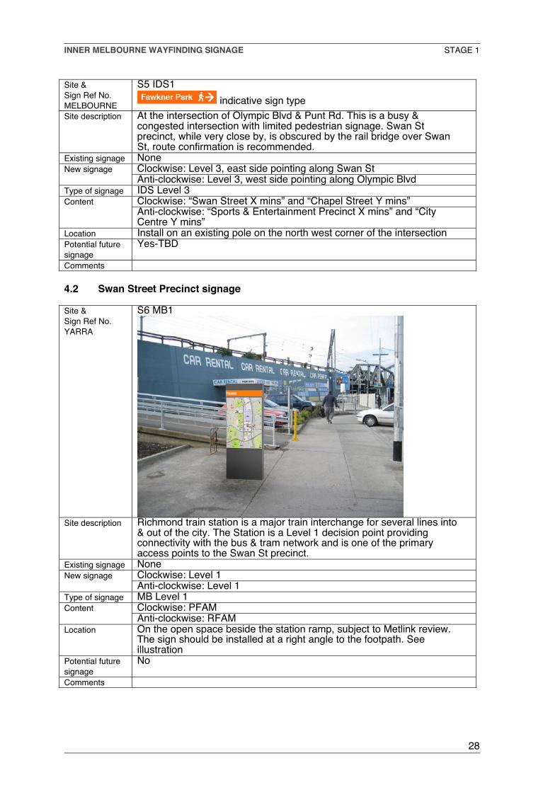
4.2 Swan Street Precinct signage
Site &Sign Ref No.YARRA
S6 MB1
Site description Richmond train station is a major train interchange for several lines into& out of the city. The Station is a Level 1 decision point providingconnectivity with the bus & tram network and is one of the primaryaccess points to the Swan St precinct.
Existing signage NoneClockwise: Level 1New signageAnti-clockwise: Level 1
Type of signage MB Level 1Clockwise: PFAMContentAnti-clockwise: RFAM
Location On the open space beside the station ramp, subject to Metlink review.The sign should be installed at a right angle to the footpath. Seeillustration
Potential futuresignage
No
Comments

INNER MELBOURNE WAYFINDING SIGNAGE STAGE 1
29
Site &Sign Ref No.YARRA
S7 MB2
indicative – double sided signSite description Tram stop 10 on Swan St is the first stop within the Swan St precinct for
people arriving via tram (70) from the Sports & Entertainment precinct &CBD. This is a secondary Level 2 entry point.
Existing signage NoneClockwise: Level 2New signageAnti-clockwise: Level 2
Type of signage MB Level 2Clockwise: LPMContentAnti-clockwise: LRM
Location The final location is to be determined when the sign structure designsare known; this may be an ideal location for a pole mounted sign.
Potential futuresignage
Yes-TBD
Comments
Site &Sign Ref No.YARRA
S8 MB3
Site description At the intersection of Swan St & Church St and East Richmond station.This is a junction of 3 tram routes (70,78,79) and 1 train route and is aLevel 1 decision point. It is the mid point of the Swan St core retail stripand the primary entry point from the east. This location is also a set offpoint, by foot, tram or cycle to the adjacent Sports & Entertainmentprecinct and Bridge Rd & Chapel St precincts & Burnley Gardens.
Existing signage NoneClockwise: Level 1New signageAnti-clockwise: Level 1
Type of signage MB Level 1Clockwise: RFAMContentAnti-clockwise: PFAM
Location On the SW corner of the intersection on Swan St. The final location is tobe determined when the sign structure designs are known.
Potential futuresignage
Yes-TBD
Comments East Richmond station is considered a secondary Level 2 entry pointbecause 60% of express trains do not stop there.

INNER MELBOURNE WAYFINDING SIGNAGE STAGE 1
30
Site &Sign Ref No.YARRA
S9 MB4
Site description At the intersection of Swan St & Burnley St. The Burnley station islocated behind Swan St and Tram 70 runs along Swan Street. Thelocation is a Level 2 decision point using the grading principles – due tothe low patronage at Burnley station. However Level 1 signage isrecommended to ensure the extent of information provided is adequate.The location is the eastern end of the Swan Street precinct and isconsidered a secondary entry point. It is a set off point, by foot, tram orcycle to the adjacent Bridge Road precinct & Burnley Gardens.
Existing signage NoneClockwise: Level 1New signageAnti-clockwise: Level 1
Type of signage MB Level 1Clockwise: RFAMContentAnti-clockwise: PFAM
Location On the SE corner of the intersection on Swan St. The final location is tobe determined when the sign structure designs are known.
Potential futuresignage
Not likely to be needed
Comments

INNER MELBOURNE WAYFINDING SIGNAGE STAGE 1
31
4.3 Church Street Precinct signage
Site &Sign Ref No.YARRA
S10 MB5
indicative – double sided signSite description On Church Street across the Street from the Bryant & May buildingExisting signage None
Clockwise: Level 1New signageAnti-clockwise: Level 1
Type of signage MB Level 1Clockwise: RFAMContentAnti-clockwise: PFAM
Location The final location is to be determined when the sign structure designsare known. Preferred location is at the tram stop entering the precinctfrom the North.
Potential futuresignage
Not likely to be needed
Comments The location requires the Level 1 signage be provided in a small formfactor (sign structure).
Site &Sign Ref No.YARRA
S11 RM2
indicativeSite description Church St is a direct walking & cycling route between Chapel St & Swan
St precincts. Route confirmation is recommended mid point on route.Existing signage None
Clockwise: Level 4, north sideNew signageAnti-clockwise: Level 4, south side
Type of signage 2 RMs Level 4Clockwise: “Chapel Street X mins”ContentAnti-clockwise: “Swan Street Y mins” See illustration
Location Install on each side of an existing pole.Potential futuresignage
Not likely to be needed
Comments

INNER MELBOURNE WAYFINDING SIGNAGE STAGE 1
32
Site &Sign Ref No.YARRA
S12 MB6
Site description On Church StreetExisting signage None
Clockwise: Level 1New signageAnti-clockwise: Level 1
Type of signage MB Level 1Clockwise: RFAMContentAnti-clockwise: PFAM
Location The final location is to be determined when the sign structure designsare known. The preferred location is at the tram stop entering theprecinct from the south.
Potential futuresignage
Not likely to be needed
Comments The location requires the Level 1 signage be provided in a small formfactor (sign structure).
Site &Sign Ref No.YARRA
S13 RM3
indicativeSite description Church St is a direct walking & cycling route between Chapel St & Swan
St precincts. Route confirmation is recommended on each side of theChurch St bridge.
Existing signage NoneClockwise: Level 4, north sideNew signageAnti-clockwise: Level 4, south side
Type of signage 2 RMs Level 4Clockwise: “Chapel Street X mins”ContentAnti-clockwise: “Swan Street Y mins” See illustration
Location Install on each side of an existing pole.Potential futuresignage
Not likely to be needed
Comments

INNER MELBOURNE WAYFINDING SIGNAGE STAGE 1
33
Site &Sign Ref No.STONNINGTON
S14 IDS2
Indicative sign type
Site description At the intersection of Church St & Alexandra Ave route confirmation isrecommended.
Existing signage NoneClockwise: Level 3, south side pointing along Chapel StNew signageAnti-clockwise: Level 3, north side pointing along Church St
Type of signage IDS Level 3Clockwise: “Chapel Street X mins,”ContentAnti-clockwise: “Swan Street X mins, Bridge Road Y mins”.
Location Install on an existing pole on the north east side of the intersectionPotential futuresignage
Yes. IMAP destinations which could be added are Botanic Gardens,Fawkner Park, Como Park, Como House, and Toorak Village
Comments
4.4 Chapel Street Precinct signage
Site &Sign Ref No.STONNINGTON
S15 MB7
indicative – double sided signSite description The intersection of Chapel St and Toorak Rd is a major entry point to the
Chapel St precinct. It is the junction of 3 tram routes (8,78,79) and is aLevel 1 decision point. The South Yarra train station is a short walk fromhere – also a Level 1 decision point. This location is a set off point, byfoot, cycle or tram to the adjacent Toorak Village & Swan St precincts.
Existing signage NoneClockwise: Level 1New signageAnti-clockwise: Level 1
Type of signage MB Level 1Clockwise: PFAMContentAnti-clockwise: RFAM
Location The sign should be installed at a right angle to the footpath on the southeast corner (outside the NAB Bank on Chapel St)
Potential futuresignage
Yes
Comments Consideration of the use of IDS signs in addition to the map based signrecommended on this intersection should be discussed

INNER MELBOURNE WAYFINDING SIGNAGE STAGE 1
34
Site &Sign Ref No.STONNINGTON
S16 MB8
Site description The intersection of Chapel St & Commercial Rd is a major entry point tothe Chapel St precinct. It is the junction of 3 tram routes (72,78,79) andis a Level 1 decision point. The Prahran Market is a short walk fromhere, which is a major destination. This location is also a set off point, byfoot, cycle or tram to the adjacent Alfred Medical & Research Precinct.
Existing signage NoneClockwise: Level 1New signageAnti-clockwise: Level 1
Type of signage MB Level 1Clockwise: RFAMContentAnti-clockwise: PFAM
Location The sign should be installed at a right angle to the footpath on the northwest corner of the intersection.
Potential futuresignage
Yes
Comments
Site &Sign Ref No.STONNINGTON
S17 MB9
indicative – double sided signSite description Tram stop 30 is the first stop on Commercial Rd within the Chapel St
precinct for people arriving via tram (72) from the St Kilda Rd & the CBD.This is a secondary Level 2 entry point.
Existing signage NoneClockwise: Level 2New signageAnti-clockwise: Level 2
Type of signage MB Level 2Clockwise: LRM (east side)ContentAnti-clockwise: LPM (west side)
Location The sign should be installed at a right angle to the footpath near the tramstop outside the Prahran Market building. The final location is to bedetermined when the sign structure designs are known.
Potential futuresignage
Yes
Comments

INNER MELBOURNE WAYFINDING SIGNAGE STAGE 1
35
Site &Sign Ref No.STONNINGTON
S18 MB10
Site description Prahran Town Hall on the corner of Chapel St & Greville St is a Level 1decision point and is central point within the Chapel St precinct. GrevilleSt shopping area is accessible from here. This location is also a set offpoint, by foot or cycle to the adjacent Alfred Medical & ResearchPrecinct and Prahran train station.
Existing signage NoneClockwise: Level 1New signageAnti-clockwise: Level 1
Type of signage New MB sign installedClockwise: RFAMContentAnti-clockwise: PFAM
Location The sign should be installed at a right angle to the footpath on the westside of Chapel St in front of the Town Hall
Potential futuresignage
Yes
Comments
Site &Sign Ref No.STONNINGTON
S19 MB11
Site description Prahran train station is secondary Level 2 entry point to the Chapel StPrecinct. The station is a direct set off point, by foot or cycle to PrahranMarket, Chapel St and the Alfred Medical & Research precinct.
Existing signage NoneClockwise: Level 2 east sideNew signageAnti-clockwise: Level 2 west side
Type of signage MB level 2Clockwise: RFAMContentAnti-clockwise: PFAM
Location The sign should be installed at a right angle to the footpath on the southside of Greville St. The final location is to be determined when the signstructure designs are known.
Potential futuresignage
Yes
Comments
INNER MELBOURNE WAYFINDING SIGNAGE STAGE 1
36
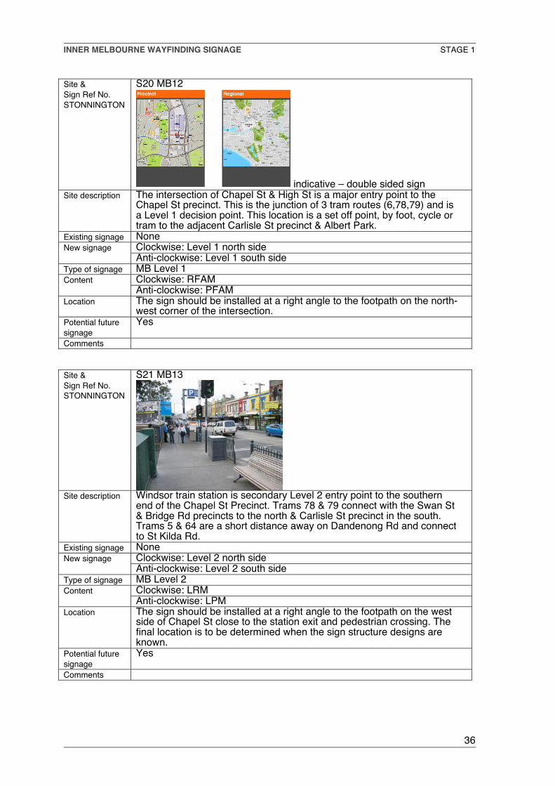
Site &Sign Ref No.STONNINGTON
S20 MB12
indicative – double sided signSite description The intersection of Chapel St & High St is a major entry point to the
Chapel St precinct. This is the junction of 3 tram routes (6,78,79) and isa Level 1 decision point. This location is a set off point, by foot, cycle ortram to the adjacent Carlisle St precinct & Albert Park.
Existing signage NoneClockwise: Level 1 north sideNew signageAnti-clockwise: Level 1 south side
Type of signage MB Level 1Clockwise: RFAMContentAnti-clockwise: PFAM
Location The sign should be installed at a right angle to the footpath on the north-west corner of the intersection.
Potential futuresignage
Yes
Comments
Site &Sign Ref No.STONNINGTON
S21 MB13
Site description Windsor train station is secondary Level 2 entry point to the southernend of the Chapel St Precinct. Trams 78 & 79 connect with the Swan St& Bridge Rd precincts to the north & Carlisle St precinct in the south.Trams 5 & 64 are a short distance away on Dandenong Rd and connectto St Kilda Rd.
Existing signage NoneClockwise: Level 2 north sideNew signageAnti-clockwise: Level 2 south side
Type of signage MB Level 2Clockwise: LRMContentAnti-clockwise: LPM
Location The sign should be installed at a right angle to the footpath on the westside of Chapel St close to the station exit and pedestrian crossing. Thefinal location is to be determined when the sign structure designs areknown.
Potential futuresignage
Yes
Comments

INNER MELBOURNE WAYFINDING SIGNAGE STAGE 1
37
Site &Sign Ref No.STONNINGTON
S22 MB14
Site description South Yarra station is a Level 1 decision point and is a major entry pointto the Chapel St precinct. Tram 8 runs along Toorak Rd connecting toToorak Village in the east & Fawkner Park & Botanic Gardens in thewest. There is insufficient space for a new sign from the proposed signfamily in the optimal location outside South Yarra station. The abovelocation has wider foot path and is located centrally along Toorak Rd.
Existing signage NoneClockwise: Level 1 west sideNew signageAnti-clockwise: Level 1 east side
Type of signage MB Level 1Clockwise: RFAMContentAnti-clockwise: PFAM
Location The sign should be installed at a right angle to the footpath on the northside of Chapel St at the intersection of Darling St - outside the ANZBank. See illustration
Potential futuresignage
Yes
Comments An IDS “information map” pointing west along Toorak Rd could beconsidered outside South Yarra Station.

INNER MELBOURNE WAYFINDING SIGNAGE STAGE 1
38
4.5 Signage within the area between Chapel St and Fawkner Park .
Site &Sign Ref No.STONNINGTON
S23 IDS3
Site description Grosvenor St is a residential street off Chapel St. It provides access tothe mid block bridge across the Sandringham train line. It is the onlybridge between Toorak Rd & Commercial Rd.
Existing signage NoneClockwise: Level 3, south side pointing along Grosvenor StNew signageAnti-clockwise: None. Double sided IDS
Type of signage 2, IDS Level 3Clockwise: “Fawkner Park X mins” and “Botanic Gardens Y mins”ContentAnti-clockwise: As above
Location At the intersection of Church St & Grosvenor St and on both sides ofChapel St. Install on existing poles.
Potential futuresignage
Not likely to be needed.
Comments Grosvenor St has some walkability issues – vegetation, uneven footpath

INNER MELBOURNE WAYFINDING SIGNAGE STAGE 1
39
Site &Sign Ref No.STONNINGTON
S24 RM4
indicativeSite description The intersection of Phoenix St and Grosvenor St presents the need for
route confirmation.Existing signage None
Clockwise: Level 4, pointing up & along Grosvenor StNew signageAnti-clockwise: As above
Type of signage 2, RM Level 4Clockwise: Route direction arrowContentAnti-clockwise: as above
Location The intersection of Phoenix St and Grosvenor St install on oppositesides of an existing pole face.
Potential futuresignage
Not likely to be needed
Comments
Site &Sign Ref No.STONNINGTON
S25 RM5
indicativeSite description The corner intersection of Balmoral St and Grosvenor St presents the
need for anti-clockwise route confirmation.Existing signage None
Clockwise: NoneNew signageAnti-clockwise: Level 3
Type of signage 1, RM level 4Clockwise: NoneContentAnti-clockwise: “Chapel St X mins”
Location The intersection of Balmoral St and Grosvenor St. install on an existingpole
Potential futuresignage
Not likely to be needed
Comments

INNER MELBOURNE WAYFINDING SIGNAGE STAGE 1
40
Site &Sign Ref No.STONNINGTON
S26 RM6
indicativeSite description The corner intersection of Balmoral St and Argo St presents the need for
route confirmation.Existing signage None
Clockwise: Level 4, pointing west along Argo StNew signageAnti-clockwise: Level 4, pointing north along Balmoral St
Type of signage 2, RM level 4Clockwise: Route direction arrowContentAnti-clockwise: As above
Location The intersection of Balmoral St and Argo St. Install 2 RM at right anglesto each other on an existing pole on the east side of Balmoral St
Potential futuresignage
Not likely to be needed
Comments
Site &Sign Ref No.STONNINGTON
S27 RM7
indicativeSite description The corner intersection of Balmoral St and Osborne St presents the need
for route confirmation.Existing signage None
Clockwise: Level 4, facing north along Osborne StNew signageAnti-clockwise: Level 4, facing east along Argo St
Type of signage 2, RM Level 4Clockwise: “Fawkner Park X mins”Content
Anti-clockwise: Route direction arrowLocation The intersection of Balmoral St and Argo St. Install on an existing pole
face on the south west corner. See illustration.Potential futuresignage
Not likely to be needed
Comments
INNER MELBOURNE WAYFINDING SIGNAGE STAGE 1
41
Site &Sign Ref No.STONNINGTON
S28 IDS4
indicative sign type
Site description The intersection of Osborne St and Fawkner St presents the need forroute confirmation.
Existing signage NoneClockwise: Level 3, west side pointing along Fawkner StNew signageAnti-clockwise: Level 3, south side pointing along Osborne St
Type of signage 2, IDS Level 3Clockwise: “Fawkner Park X mins” and “Botanic Gardens Y mins”ContentAnti-clockwise: “Chapel St X mins”
Location Install on the existing pole on the north-east corner of the intersection.Potential futuresignage
Not likely to be needed.
Comments
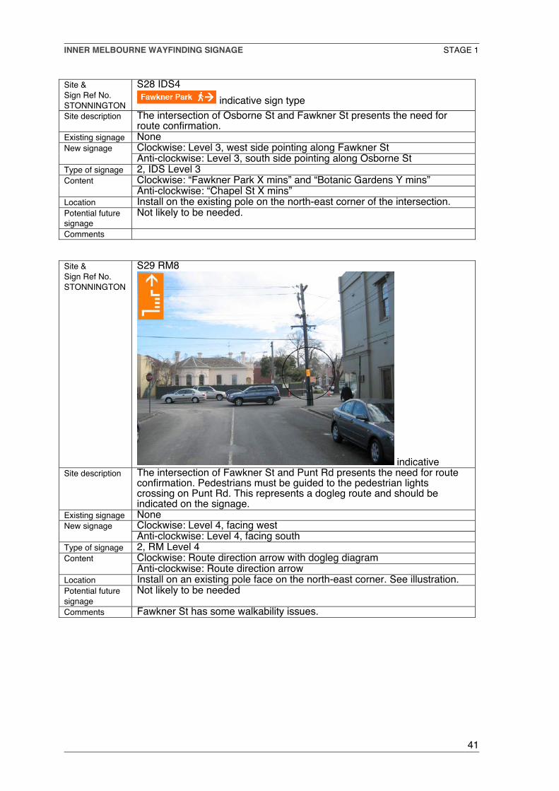
Site &Sign Ref No.STONNINGTON
S29 RM8
indicativeSite description The intersection of Fawkner St and Punt Rd presents the need for route
confirmation. Pedestrians must be guided to the pedestrian lightscrossing on Punt Rd. This represents a dogleg route and should beindicated on the signage.
Existing signage NoneClockwise: Level 4, facing westNew signageAnti-clockwise: Level 4, facing south
Type of signage 2, RM Level 4Clockwise: Route direction arrow with dogleg diagramContentAnti-clockwise: Route direction arrow
Location Install on an existing pole face on the north-east corner. See illustration.Potential futuresignage
Not likely to be needed
Comments Fawkner St has some walkability issues.

INNER MELBOURNE WAYFINDING SIGNAGE STAGE 1
42
Site &Sign Ref No.MELBOURNE
S30 RM9
indicativeSite description The intersection of Punt Rd and Pasley St presents the need for route
confirmation. Pedestrians traveling anti-clockwise must be guided to thepedestrian lights crossing on Punt Rd. This represents a dogleg routeand should be indicated on the signage.
Existing signage NoneClockwise: NoneNew signageAnti-clockwise: Level 4, facing south
Type of signage 1, RM level 4Clockwise: NoneContentAnti-clockwise: Direction arrow with dogleg diagram
Location Install on the existing pole face on the north west corner of Pasley St atthe intersection of Punt Rd,
Potential futuresignage
Not likely to be needed
Comments
4.6 Fawkner Park Signage
Site &Sign Ref No.MELBOURNE
S31 IDS5
indicativeSite description Pasley St runs into Fawkner Park. The clockwise route across Fawkner
Park exits Fawkner Park at the intersection of Toorak Rd and Park St.The anti-clockwise route exits the Park to Pasley St.
Existing signage Arrival at Fawkner Park is confirmed by Parks & Recreation signage.The sign content is limited to the park boundaries. No regional signageis present.Clockwise: Level 3, north-west pointing along the park path to Park St.See illustration
New signage
Anti-clockwise: Level 3, south-east pointing to Pasley StType of signage IDS Level 3
Clockwise: “Botanic Gardens X mins” and “Yarra River Y mins”ContentAnti-clockwise: “Chapel St X mins”
Location To be installed close to the existing signage on the route.Potential futuresignage
Yes-TBD
Comments

INNER MELBOURNE WAYFINDING SIGNAGE STAGE 1
43
4.7 Signage between Fawkner Park and the Yarra River.
Site &Sign Ref No.MELBOURNE
S32 IDS6
indicative sign type
Site description Fawkner Park, Toorak Rd and Park St intersectionExisting signage Arrival at Fawkner Park is confirmed by Parks & Recreation signage.
The sign content is limited to the park boundaries. No regional signageis present.Clockwise: Level 3, north pointing along Park St.New signageAnti-clockwise: Level 3, south east, pointing along the park path toPasley St
Type of signage 2, IDS Level 3Clockwise: “Botanic Gardens X mins” and “Yarra River Y mins”ContentAnti-clockwise: “Chapel St X mins”
Location To be installed on an existing pole on the south side of Toorak Rdopposite Park St.
Potential futuresignage
Yes-TBD
Comments
Site &Sign Ref No.MELBOURNE
S33 IDS7
indicativeSite description Park St and Domain Rd intersection. The route follows the path through
the corner park outside the boundary of the Botanic Gardens toAnderson St
Existing signage The Botanic Gardens entrance gate D can be seen from this point andarrival is confirmed by Parks & Recreation signage. The sign content islimited to the park boundaries. No regional signage is present.Clockwise: Level 3, north-east pointing along the park path to AndersonSt.
New signage
Anti-clockwise: Level 3, south pointing along Park StType of signage IDS Level 3
Clockwise: “Yarra River X mins” and “Sports & Entertainment Precinct Ymins”
Content
Anti-clockwise: “Fawkner Park X mins” and “Chapel St Y mins”Location To be installed on an existing pole on the north side of Domain Rd at the
pedestrian lights crossing.Potential futuresignage
Yes-TBD
Comments

INNER MELBOURNE WAYFINDING SIGNAGE STAGE 1
44
4.8 Signage between the Yarra River and the CBD.
Site &Sign Ref No.MELBOURNE
S34 MB15
Site description The intersection of Anderson St & Alexandra Avenue is a major decisionpoint for walking & cycling in the area. The shared path along the YarraRiver is the Capital City Trail, one of the major off road cycling routes inthe south-east. Morell Bridge is an important pedestrian crossing pointover the Yarra River to many IMAP destinations.
Existing signage NoneClockwise: Level 1 south sideNew signageAnti-clockwise: Level 2 north side
Type of signage MB Level 1Clockwise: RFAMContentAnti-clockwise: LRM
Location The sign should be installed at a right angle to the Bridge on the openspace, at the Alexandra Avenue end of the Bridge.
Potential futuresignage
No
Comments
Site &Sign Ref No.MELBOURNE
S35 E4
Site description The shared path along the Yarra River (Capital City Trail)Existing signage CoM Secondary Information Hub sign
Clockwise: Use existingNew signageAnti-clockwise: Use existing
Type of signage Addition to existing signage in existing format & replacementClockwise: Replace Melways map with RFAMContentAnti-clockwise: The current maps should be modified to includereferences to the adjacent Swan St & Chapel St precincts together withthe associated walking times.
Location See illustrationPotential futuresignage
Not likely to be needed
Comments This sign is easy to update due to the design type.
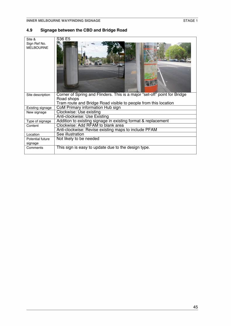
INNER MELBOURNE WAYFINDING SIGNAGE STAGE 1
45
4.9 Signage between the CBD and Bridge Road
Site &Sign Ref No.MELBOURNE
S36 E5
Site description Corner of Spring and Flinders. This is a major “set-off” point for BridgeRoad shopsTram route and Bridge Road visible to people from this location
Existing signage CoM Primary information Hub signClockwise: Use existingNew signageAnti-clockwise: Use Existing
Type of signage Addition to existing signage in existing format & replacementClockwise: Add RFAM to blank areaContentAnti-clockwise: Revise existing maps to include PFAM
Location See illustrationPotential futuresignage
Not likely to be needed
Comments This sign is easy to update due to the design type.

INNER MELBOURNE WAYFINDING SIGNAGE STAGE 1
46
4.10 Signage within Bridge Road Precinct
Site &Sign Ref No.YARRA
S37 MB 16
Site description At the “western entry” to Bridge Road & Cnr. of Hoddle Street. This is
accessed by Tram and Bus routes and people walking into the Centrefrom the CBD
Existing signage None, apart from area identification/street branding signage.Clockwise: Level 1 signNew signageAnti-clockwise: Level 1 sign
Type of signage MB Level 1Clockwise: looking east into the street - PFAMContentAnti-clockwise: when exiting Street - RFAM
Location See illustrationPotential futuresignage
Not likely to be needed
Comments Sign to be installed at right angles to footpath close to the streetbranding sign.
Site &Sign Ref No.YARRA
S38 MB17
Site description At the Junction of Bridge Road and Church Street on the footpath at thejunction of 2 tram routes.
Existing signage NoneClockwise: Level 1New signageAnti-clockwise: Level 1
Type of signage MB1Clockwise: facing east PFAMContentAnti-clockwise: Facing west RFAM
Location See illustration – on the footpath, but located where it is not anobstruction.
Potential futuresignage
Not likely to be needed
Comments

INNER MELBOURNE WAYFINDING SIGNAGE STAGE 1
47
Site &Sign Ref No.YARRA
S39 MB 18
Site description At the junction of Bridge Road and Burnley Street. While this is not the
1st entry point at the eastern end of Bridge Road, the alternative site, atBridge/Westbank Terrace would be inappropriate, as it has limited retailat that location.
Existing signage NoneClockwise: Level 1New signageAnti-clockwise: Level 1
Type of signage MB1Clockwise: PFAMContentAnti-clockwise: RFAM
Location See illustrationPotential futuresignage
Not likely to be needed
Comments

INNER MELBOURNE WAYFINDING SIGNAGE STAGE 1
48
4.11 Signage between Bridge Road and Swan Street – via Lennox
Site &Sign Ref No.YARRA
S40 IDS 8
Site description Existing street name sign hidden behind traffic lights. Suggest relocationof street sign pole to west side of lights at lower level and installation ofIDS to “Swan St. Precinct 10mins” (pointing south) and possibly “VictoriaSt. Precinct 10 mins (pointing north)
Existing signage Poor street name signageClockwise: IDSNew signageAnti-clockwise:IDS
Type of signageClockwise: (point south) to Swan StContentAnti-clockwise: (point north) to Victoria St.
Location See illustrationPotential futuresignage
Not likely to be needed
Comments This sign is easy to relocate and update.
Site &Sign Ref No.YARRA
S41 RM 10
Site description Corner of Lennox Street and Rowena Parade.Existing signage Street name sign
Clockwise: RM pointing south (to Swan St.)New signageAnti-clockwise: RM pointing north (to Bridge St.)
Type of signage RMClockwise: RMContentAnti-clockwise: RM
Location See illustration – on either side of pole housing street name signPotential futuresignage
Possible future location of IDS pointing west to Sports andEntertainment Precinct and CBD. This route to CBD could be part of the“walking web”
Comments Street name sign could be placed lower on existing pole to make it morevisible to pedestrians

INNER MELBOURNE WAYFINDING SIGNAGE STAGE 1
49
Site &Sign Ref No.YARRA
S42 IDS9
Site description Junction of Swan St. and Lennox St. Existing street name sign on lightpole (not straight).
Existing signage Street name signClockwise: North IDSNew signageAnti-clockwise: None
Type of signage IDSClockwise: “Bridge Rd Precinct 10 mins”ContentAnti-clockwise: None.
Location See illustrationPotential futuresignage
Possibly add IDS to “Sports and Ent. Precinct. 15mins via Rowena Pde.”
Comments .
4.12 Signage between Bridge Road and Swan Street – via Coppin Street
Site &Sign Ref No.YARRA
S43 IDS 10
Site description Junction of Swan Street and Coppin Street. Existing pole on Coppin St.can be used to hold IDS to Bridge Rd.
Existing signage LimitedClockwise: IDSNew signageAnti-clockwise: none
Type of signage IDSClockwise: North to bridge Rd.ContentAnti-clockwise: None
Location See illustrationPotential futuresignage
Not likely to be needed
Comments

INNER MELBOURNE WAYFINDING SIGNAGE STAGE 1
50
Site &Sign Ref No.YARRA
S44 RM 11
Site description Junction of Coppin St. with Wall St.Existing signage None
Clockwise: North RMNew signageAnti-clockwise: South RM
Type of signage RMClockwise: RMContentAnti-clockwise: RM
Location See illustration. The existing light pole can be used to site the RM signsPotential futuresignage
Not likely to be needed
Comments .
Site &Sign Ref No.YARRA
S45 IDS 11
Site description Junction of Bridge Rd. with Coppin St.Existing signage Some street name signage
Clockwise: Pointing south IDSNew signageAnti-clockwise: None
Type of signage IDSClockwise: IDS “Swan St. Precinct 10mins”ContentAnti-clockwise:
Location See illustrationPotential futuresignage
Not likely to be needed
Comments .

INNER MELBOURNE WAYFINDING SIGNAGE STAGE 1
51
4.13 Train Station signage
In addition to the signage above, consideration should be given to the installation ofPrecinct Full Area Maps (PFAM) & Localised Regional Maps (LRM) at some train stations.
If implemented, this will make information available to travelers who are exiting stations ina direction where they are unlikely to encounter the proposed street signage. The signsshould be wall mounted and located in the path of the main exit from platforms or the mainstation exits. It is preferable that these map-based signs be located in areas offeringshelter where possible.
The additional cost will be minimal and primarily for printing & the installation of suitablewall mounted display units. Consultation with Metlink will be required for the co-coordinated placement of signs. The potential stations for the case study area areRichmond, Richmond East, Burnley, South Yarra, Prahran and Windsor.

INNER MELBOURNE WAYFINDING SIGNAGE STAGE 1
52
5. IMPLEMENTATION
5.1 Developing the Regional “Walking Framework – or Web”.
One basic and major component of the Signage Plan is the Regional Full Area Map(RFAM) of the whole IMAP Region. This is an essential component of the Level 1 signs,and is the basis for the production of all of the Localised Regional Maps on Level 2 signs.
It is already possible to show the existence of the network of train routes (and stations),tram routes (and stops), bus routes (and stops) and the shared path network on theRFAM.
Map 3 within the IMAP report (See: Inner Melbourne Action Plan – Adopted Dec. 2005. p49.) provides an indication of what the regional “Walking Framework” could look like in thelonger-term – a web of inter- and cross-precinct walking routes that provide residents andtourists with well-signed and quality pedestrian routes enabling them to explore all or partof the total IMAP Region - on foot.
However, with the exception of the walking links audited as part of the DemonstrationProject it will be difficult to show the other inter-precinct walking links (the WalkingFramework) in the balance of the IMAP Region. None of these have been audited and few(if any) are “signed” to enable and encourage people to walk between the adjacentprecincts.
Until these routes have been identified and audited in detail it is not possible to producethe RFAM which contains the full walking framework options for travelling around andwithin the IMAP Region. Any initial RFAM produced without the full walking frameworkwould need to be regularly updated and replaced with new maps that included any newelements of the walking framework that were recently brought on stream.
We therefore recommend that work is undertaken, in the short-term, to enable a basic“Walking Framework” to be agreed and used on the RFAM.
It is a fundamental principle that we should not actively encourage people to walk (e.g. byproviding pedestrian-focused signage) where it is not safe to do so and where thepedestrian environment is not fit for purpose. As a result it would be necessary to conductan audit of each of the potential back street, inter-precinct walking links between precinctsto assess whether there were any significant problems (from the pedestrian perspective)and to identify signage needs.
We have identified at least 22 additional walking framework routes that should be audited(in addition to those that have already been audited for the Demonstration Project). The listof these routes follows. This list will be finalised within Stage 2 of the Project, inconjunction with the Project Committee and individual Council representatives.
Each audit would confirm the suitability of the route from a pedestrian perspective andidentify the basic Independent Directional and Route Marker Signs needed along eachroute.

INNER MELBOURNE WAYFINDING SIGNAGE STAGE 1
53
Proposed walking framework routes to be audited
Precinct-to-Precinct (+ 1)...... Route description and Comments.All to be decided in consultation withCommittee, Council Reps and as result ofAudits
1.Docklands to Bay Street (+ StationPier/Foreshore)2.Docklands to South Melbourne – ClarendonStreet (+ Albert Park)3.South Melbourne to Bay (+ Foreshore)4. Albert Park (south) to St Kilda Foreshore5. Albert Park (NE Corner) to Fawkner Park (+Chapel Street or Botanic Gardens)6. Albert Park (SE Corner) to Chapel Street (+Toorak Road/Village or Balaclava/Carlisle Street)7. Balaclava to Acland Street8. Balaclava to Chapel Street9. Acland to Fitzroy Street10. Fitzroy to Chapel Street11. Chapel Street to Toorak Village12. Chapel Street south to Albert Park13. Swan Street to Bridge Road (+ Victoria Street)14. Bridge Road to Sports Precinct (and CBD)15. Victoria Street to Fitzroy Gardens (and CBD)16. Victoria Street to Smith Street17. Smith Street to Brunswick street18. Brunswick Street to Lygon Street19. University to CBD20. University to Docklands21 Victoria Street to Yarra Bend Park22 Yarra Bend Park to Smith Street
Others to be decided in Stage 2
5.2 Developing the signage
Step 1. Data confirmation
The project commences with the gathering of all relevant information available about thearea to be mapped and signed. Each of the four councils has begun to identify the precisecontent that will appear on the maps and signs. The schedule lists the correct namingconvention for precincts and attractions for the entire IMAP Region. The document mustbe completed and approved prior to commencing step 2 (below).
Step 2. Creation of Wayfinding Master Elements
The design of the signage system requires the development of the individual elements thatcome together to communicate the aim – wayfinding. The elements include icon family,color palette, typography and the development of consistent methods to present ahierarchy of information for public transport & precincts etc. The production processrequires a planned strategy to facilitate variations and future updates. The digital mastermap files must be organised with content hierarchies to accommodate this need. The signstructure(s) and sizes must be identified prior to commencing the design of the mastermaps.
Regional Maps

INNER MELBOURNE WAYFINDING SIGNAGE STAGE 1
54
The RFAM is generic to the project and is focused on highlighting the regional precincts,the major attractions within precincts and how to get to them via public transport & sharedpaths. In addition the regional walking framework is to be shown, however this first needsto be identified before the RFAM can be commenced, as previously discussed.
The Local Regional Map (LRM) is derived from the RFAM. It can be developedprogressively because it is used to provide information in specific areas. For example theDemonstration Route LRMs will require the south-east area of the RFAM map to be fullydeveloped. As the IMAP signage expands to other areas the LRMs for other parts of theregion can be progressively completed.
Precinct Maps
The precinct maps needed for the case study are the Swan Street, Church Street &Chapel Street PFAMs. These are pedestrian focused maps derived from sources such asCouncil supplied GIS maps, aerial photography and information gathered in the walkabilityaudit. Accurate illustrations of key landmarks which are recommended to be incorporatedinto the precinct maps are produced from photographs and publications. The LPMs arederived from the relevant PFAMs and are rotated to suit their respective locations withinthe streetscape.
The completed maps are then inserted into the appropriate MB Level 1 & 2 sign templates.
Map-based sign templates
Sign layout templates are designed to integrate wayfinding identity, sign titles, maps,stakeholder logos and optionally precinct branding & historical references. The fullyassembled sign templates enable a sign manufacturer to print the complete sign for eachsite.
IDS & RM signage
The IDS & RM signage is documented using the Master Wayfinding Elements. Thegeneric signage designs are specified (font, letter size, icon placement, colours etc).Unique street or path conditions will require custom design solutions for some RMs, referto S29 RM8 & S30 RM9. An installation guide needs to be developed specifically for theRoute Markers to simplify the number of ways they can be installed.
In addition to the new maps & signs, a small number of existing signs need to be updated.
Step 3. Virtual prototype
Prior to rolling out the case study signage, a virtual prototype is recommended. This cantake the form of printed examples of each type of sign. The prototypes should be printed atfull size and be mounted on boards for display. This will enable an effective review andopportunity for extended consultation with stakeholders.
Step 4. Signage manufacturing and installation
Manufacturing of the sign structures and graphics is undertaken from the signageinformation package. The sign structures and graphics may be sourced from differingsuppliers and is dependant on the final sign structure design, materials and graphicapplication methods. Map-based signs can be designed in 3 principal ways;
(a) cabinet style signs with printed graphics displayed inside;(b) digital print graphics adhered to metal panel signs which are sealed; and,(c) baked enamel metal panel signs.
Each method has associated advantages and disadvantages as well as differing costs andmaintenance requirements. In addition the specific needs of the Map-based content willrequire a sign structure design that is flexible enough to accommodate a range of sizes &shapes. These design issues are to be resolved in Stage 2 of the project.

INNER MELBOURNE WAYFINDING SIGNAGE STAGE 1
55
The IDS & RM signs can be economically produced with vinyl graphics on pre-finishedmetal panels. The pole structures for these signs should be integrated with the design ofthe sign structure family.

INNER MELBOURNE WAYFINDING SIGNAGE STAGE 1
56
6. EVALUATION
Evaluation of the proposed signage Strategy could be undertaken in a number of ways.
It will be necessary to conduct both pre-installation and post-installation surveys of thesame kind, so that the results can be compared. These surveys could be expected toinclude counts (such as pedestrian counts at selected locations, both before and after theinstallation) and interviews (such as intercept interviews to ask people about what they do,where they go, what they notice, how they find their way around, etc - also both before andafter the installation).
There are thus two major options for the evaluation of the new signage.
Option 1 – Conduct “before” and “after” interviews.
a. Interview people at proposed signage locations before any signage is installed.
1. Seek background information – age, gender, home postcode, reason for walking,
2. Seek comments on existing signage – if any - and importance of lack of wayfindingand the impact this has on their “exploration” of the IMAP Region and the localprecincts.
b. Interview people at signage locations after the signage is installed.
1. Seek background information – age, gender, home postcode, reason for walking,
2. Seek comments on new signage and the impact this has had on their active-transport “exploration” of the IMAP Region and the local precincts.
Option 2 – Conduct “before” and “after” pedestrian counts.
• Count people using the routes that are scheduled to be signed, especially alongthe regional links, before signage is installed.
• Count people using the signed routes after signage is installed.
The details of the numbers and locations of interview and count points are to bedetermined in discussion with the Project Committee, within the context of the availablebudget.
At this stage we have estimated the cost will be in the order of $10,000 for each of options1 and 2 above.
Following completion of the initial design of the map-based and other signs it may beappropriate to conduct a small number of focus groups to gauge public reaction to the formand content of the new signage system. The cost of these focus group meetings could bein the order of $5,000.
Decisions on the evaluation and assessment methods should be considered within Stage2 of the project.

INNER MELBOURNE WAYFINDING SIGNAGE STAGE 1
57
7. CONCLUDING COMMENTS.
Information from “Transport For London” (http://www.tfl.gov.uk/) shows that $100m isestimated to be needed to be spent on wayfinding signage throughout the CongestionCharging Zone (the CCZ) of Central London in the 5 years to the 2012 Olympics ($20m/a).The CCZ is approximately half the size of the IMAP Region. A further $315m has beenallocated to pedestrian improvements throughout London over the next three financialyears ($105m/a).
The estimated cost of implementing a comprehensive signage system in the IMAP Regionis significantly lower than in inner London.
Related Documents


