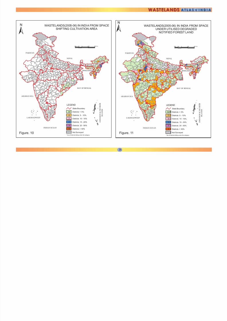
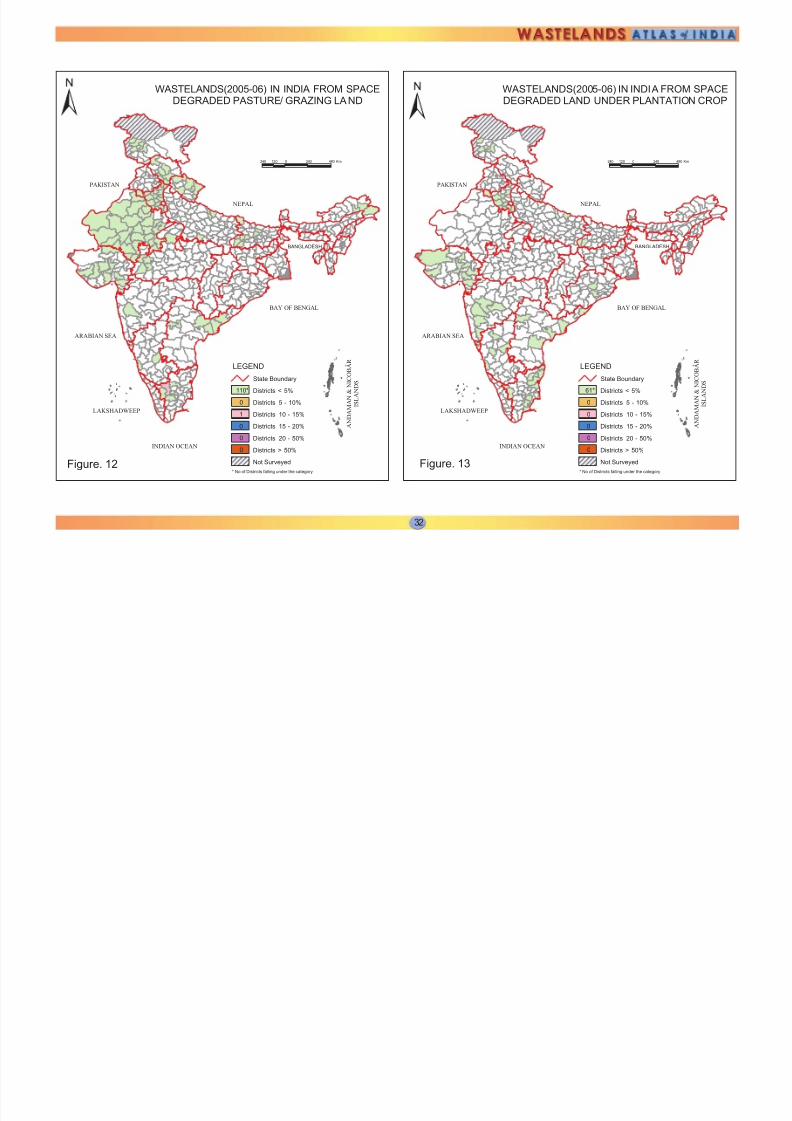
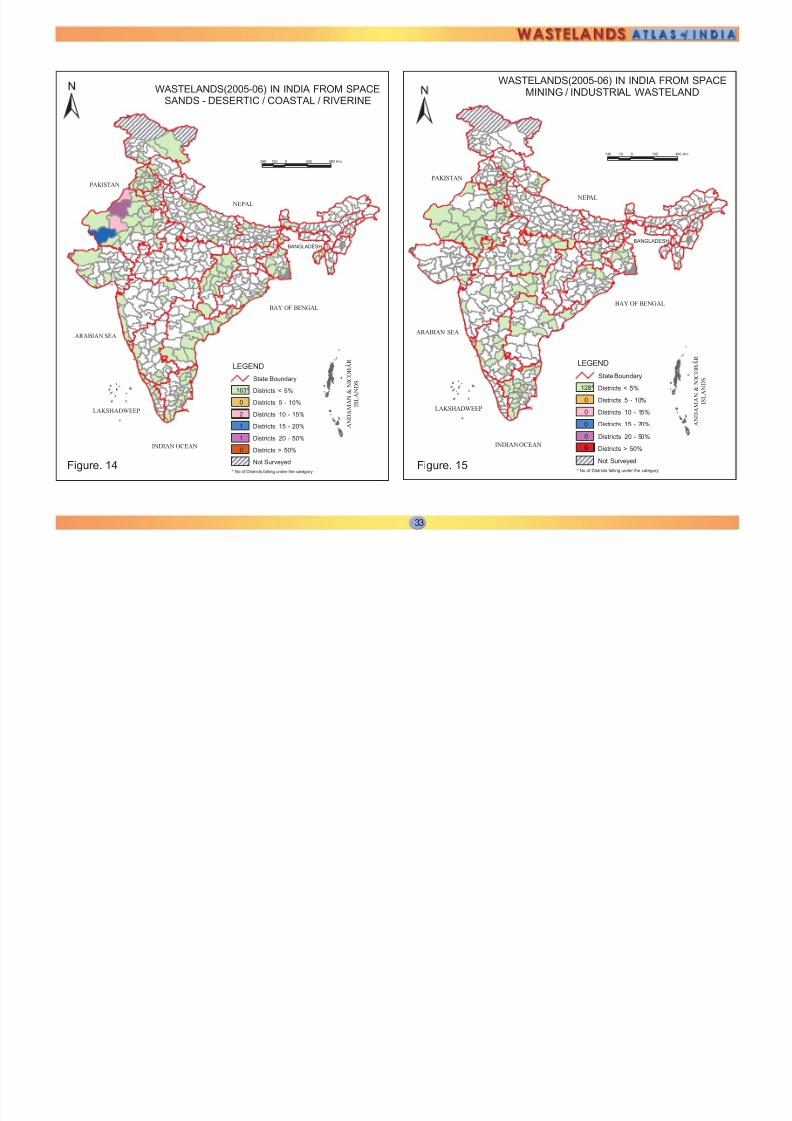
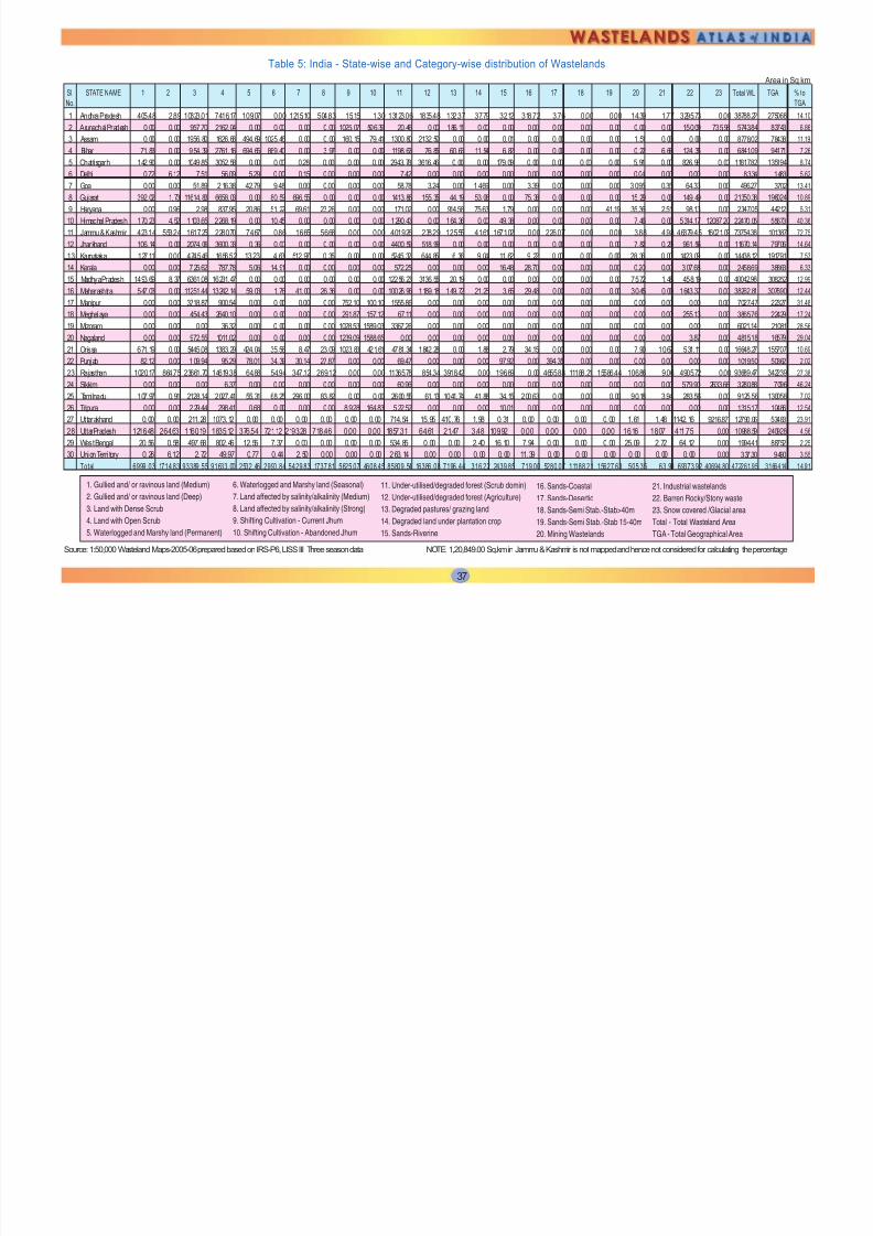
2 5 WASTELAND MAP INDIA 2005-06 Based on 3 season data of IRS P6 LISS III (2005-06) & Limited ground checks Coordinated by: Land Use Division, LRG, RS & GIS - AA National Remote Sensing Centre, ISRO Dept. of Space, Govt of India, Balanagar, Hyderabad - 500625 NEP AL PAKISTAN LAKSHADWEEP INDIAN OCEAN A N D A M A N & N I C O B A R I S L A N D S ARABIAN SEA BAY OF BENGAL BANGLADESH LEGEND Under-utilised Deg Notif Forest - Scrub Dom Under- utilised Deg Notif Forest - Agriculture Degraded Pastures/ grazing land Land Affected by Salinity/ Alkalinity - Str ong Gullied/ Ravine land-Medium ravine Gullied/Ravine land-Deep/ very deep ravine Scrubland - Land with dense scrub Scrubland - Land with open scrub Sands - Desert sand Sands - Coastal sand Sands - Riverine Sands - Semi-stabi to stab (>40m) dune Snow cover and/ or glacial area Non Wasteland Area Waterlogged and marshy land - Permanent Waterlogged and marshy land - Seasonal Land Affected by Salinity/ Alkalinity - Moderate Degraded Land under Plantation Crop Sands-Semi-stab to stab mod high(15-40m) dune Mining Wastelands Industrial Wastelands Barren rocky area Shifting cultivation - Current jhum Shifting cultivation - Abandoned jhum Figure. 1

Welcome message from author
This document is posted to help you gain knowledge. Please leave a comment to let me know what you think about it! Share it to your friends and learn new things together.
Transcript

7/27/2019 India Wasteland Distribution
http://slidepdf.com/reader/full/india-wasteland-distribution 1/16

7/27/2019 India Wasteland Distribution
http://slidepdf.com/reader/full/india-wasteland-distribution 2/16

7/27/2019 India Wasteland Distribution
http://slidepdf.com/reader/full/india-wasteland-distribution 3/16

7/27/2019 India Wasteland Distribution
http://slidepdf.com/reader/full/india-wasteland-distribution 4/16

7/27/2019 India Wasteland Distribution
http://slidepdf.com/reader/full/india-wasteland-distribution 5/16

7/27/2019 India Wasteland Distribution
http://slidepdf.com/reader/full/india-wasteland-distribution 6/16
7/27/2019 India Wasteland Distribution
http://slidepdf.com/reader/full/india-wasteland-distribution 7/16
7/27/2019 India Wasteland Distribution
http://slidepdf.com/reader/full/india-wasteland-distribution 8/16
7/27/2019 India Wasteland Distribution
http://slidepdf.com/reader/full/india-wasteland-distribution 9/16

7/27/2019 India Wasteland Distribution
http://slidepdf.com/reader/full/india-wasteland-distribution 10/16

7/27/2019 India Wasteland Distribution
http://slidepdf.com/reader/full/india-wasteland-distribution 11/16

7/27/2019 India Wasteland Distribution
http://slidepdf.com/reader/full/india-wasteland-distribution 12/16
7/27/2019 India Wasteland Distribution
http://slidepdf.com/reader/full/india-wasteland-distribution 13/16

7/27/2019 India Wasteland Distribution
http://slidepdf.com/reader/full/india-wasteland-distribution 14/16

7/27/2019 India Wasteland Distribution
http://slidepdf.com/reader/full/india-wasteland-distribution 15/16

7/27/2019 India Wasteland Distribution
http://slidepdf.com/reader/full/india-wasteland-distribution 16/16
Related Documents