India – Size, Location, Neighbours and Political Map - Features

Welcome message from author
This document is posted to help you gain knowledge. Please leave a comment to let me know what you think about it! Share it to your friends and learn new things together.
Transcript
India – Size, Location, Neighboursand Political Map - Features


• India, the 7th largest country in the world, spread over an area 32,87,263 sq km.
• The country has about 2.4 percent of the global land area.
• India measures 3,214 km from north to south and 2,933 km from east to west.
• It has a land frontier of 15,200 km and a coastline of 7,516.6 km.


Coastline - Length
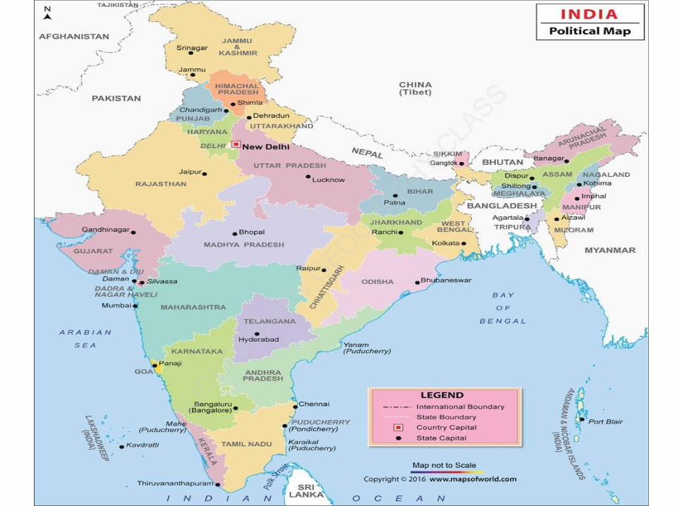
• Length of coastline of India including the coastlines of Andaman and Nicobar Islands in the Bay of Bengal and Lakshadweep Islands in the Arabian Sea is 7516.6 km.
• Coastline of Indian mainland is surrounded by Arabian Sea in the west, Bay of Bengal in the east, and Indian Ocean in the south.

Landlocked states


Northeastern states


Barren Island


Related Documents