1 Improving Coalition Interoperability through Networking Military/Civil Air Traffic Control Systems Tom Thomas, Lead Systems Engineer The MITRE Corporation, Bedford, MA 001-781-377-9075, [email protected] 14 September 2004 Approved for Public Release; Distribution Unlimited; Case 04-0774 ©2004-The MITRE Corporation. All Rights Reserved.

Welcome message from author
This document is posted to help you gain knowledge. Please leave a comment to let me know what you think about it! Share it to your friends and learn new things together.
Transcript
1
Improving Coalition Interoperability through
Networking Military/Civil Air Traffic Control Systems
Tom Thomas, Lead Systems EngineerThe MITRE Corporation, Bedford, MA001-781-377-9075, [email protected]
14 September 2004
Approved for Public Release; Distribution Unlimited; Case 04-0774©2004-The MITRE Corporation. All Rights Reserved.
2
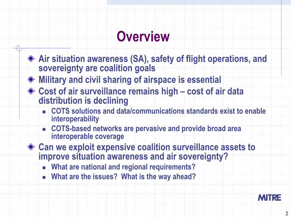
OverviewAir situation awareness (SA), safety of flight operations, and sovereignty are coalition goalsMilitary and civil sharing of airspace is essentialCost of air surveillance remains high – cost of air data distribution is declining
COTS solutions and data/communications standards exist to enableinteroperabilityCOTS-based networks are pervasive and provide broad area interoperable coverage
Can we exploit expensive coalition surveillance assets to improve situation awareness and air sovereignty?
What are national and regional requirements?What are the issues? What is the way ahead?
3
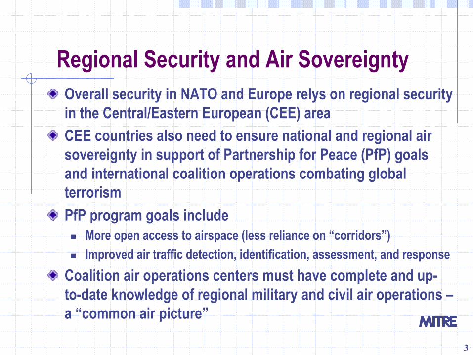
Regional Security and Air SovereigntyOverall security in NATO and Europe relys on regional security in the Central/Eastern European (CEE) areaCEE countries also need to ensure national and regional air sovereignty in support of Partnership for Peace (PfP) goals and international coalition operations combating global terrorismPfP program goals include
More open access to airspace (less reliance on “corridors”)Improved air traffic detection, identification, assessment, and response
Coalition air operations centers must have complete and up-to-date knowledge of regional military and civil air operations –a “common air picture”
4
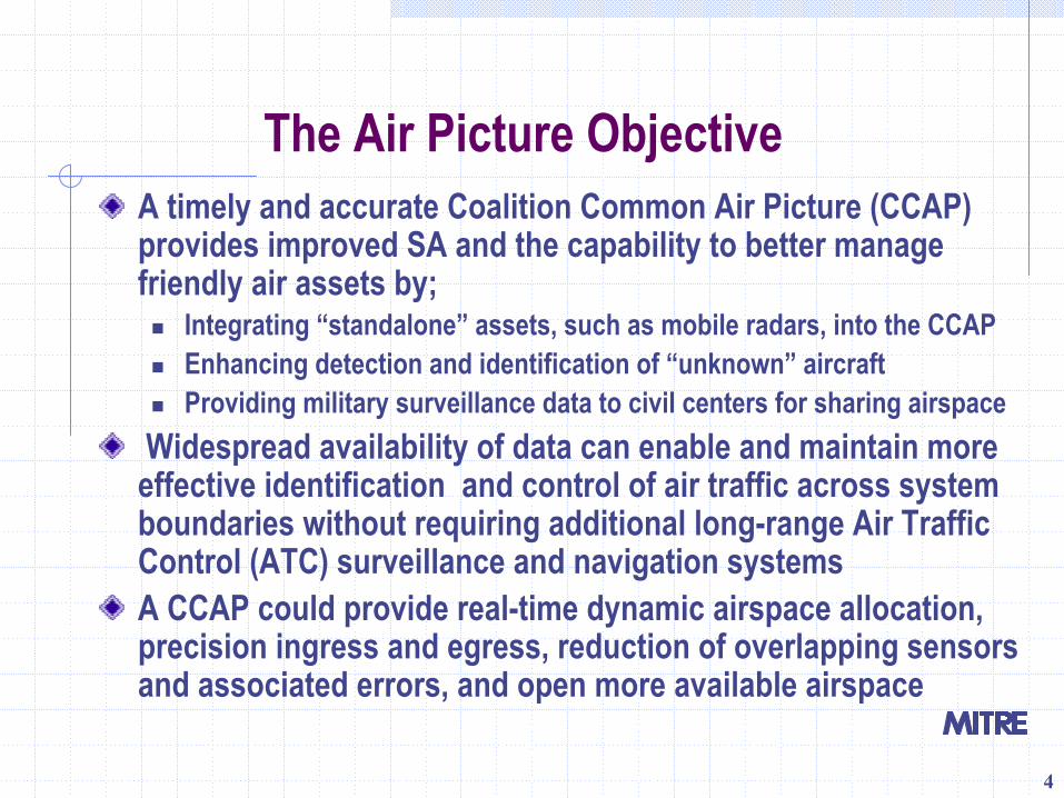
The Air Picture ObjectiveA timely and accurate Coalition Common Air Picture (CCAP) provides improved SA and the capability to better manage friendly air assets by;
Integrating “standalone” assets, such as mobile radars, into the CCAPEnhancing detection and identification of “unknown” aircraft Providing military surveillance data to civil centers for sharing airspace
Widespread availability of data can enable and maintain more effective identification and control of air traffic across system boundaries without requiring additional long-range Air Traffic Control (ATC) surveillance and navigation systems A CCAP could provide real-time dynamic airspace allocation, precision ingress and egress, reduction of overlapping sensors and associated errors, and open more available airspace
5
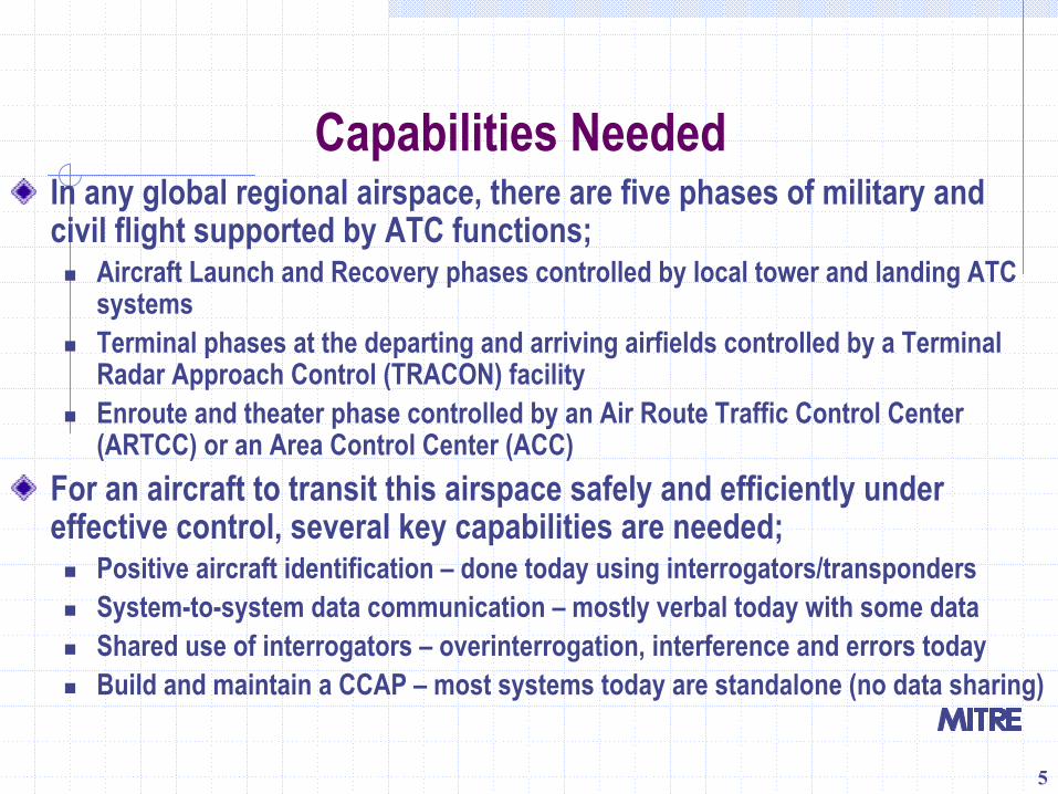
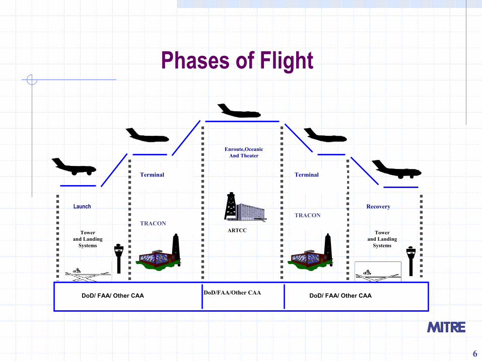
Capabilities NeededIn any global regional airspace, there are five phases of military and civil flight supported by ATC functions;
Aircraft Launch and Recovery phases controlled by local tower and landing ATCsystemsTerminal phases at the departing and arriving airfields controlled by a Terminal Radar Approach Control (TRACON) facilityEnroute and theater phase controlled by an Air Route Traffic Control Center (ARTCC) or an Area Control Center (ACC)
For an aircraft to transit this airspace safely and efficiently under effective control, several key capabilities are needed;
Positive aircraft identification – done today using interrogators/transpondersSystem-to-system data communication – mostly verbal today with some dataShared use of interrogators – overinterrogation, interference and errors todayBuild and maintain a CCAP – most systems today are standalone (no data sharing)
6
Phases of Flight
Towerand Landing
Systems
Towerand Landing
Systems
Enroute,OceanicAnd Theater
ARTCC
DoD/ FAA/ Other CAA DoD/ FAA/ Other CAA
Launch Recovery
TRACONTRACON
DoD/FAA/Other CAA
Terminal Terminal
7
ChallengesCoalition partner ATC capability vary significantlyObsolete ATC system designs, proprietary designs and data formats, and doctrine limit data distribution and interoperability National approaches to ATC improvement may not provide for common air picturesNational ATC implementations may not be common, interoperable, or meet NATO standardsFunding sources may be limited for national radar data networks or cross-border exchangesTraditions or historical events may limit free exchange of information between coalition partners
8
TrendsCoalitions must be more dynamic and adaptable, be established rapidly, employ interoperable standards, and minimize system/personnel assets needed. Coalition assets may also be widely distributed within a region or beyond.Many CEE countries are replacing legacy ATC systems with ones that offer standardized, digital intranet capabilities. Internet Protocol (IP)-based nets provide the means to distribute ATC data beyond system boundaries.Navaids and Regional Airspace Initiative studies conducted by US DoD in several PfP countries have resulted in regional radar data sharing systems such as BALTNET.
9
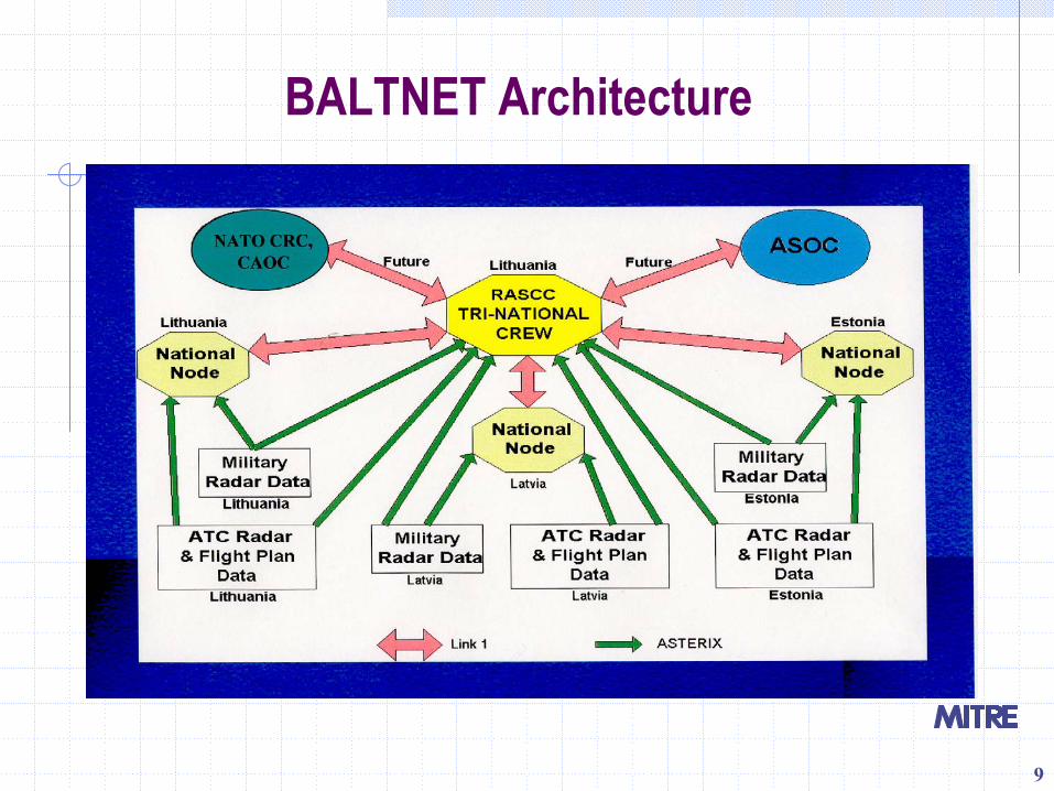
BALTNET Architecture
10
BALTNET SummaryBALTNET is a peacetime data/communications network infrastructure of radar sensors in 3 participating nations, national nodes and a regional airspace surveillance coordination center.BALTNET is now integrated into the NATO CRC and CAOCarchitectures for operations in times of crisis.Although BALTNET is a highly capable system, there are some limitations;
Not designed for dynamic environmentsComplexity limits wide deploymentDefense budget restrictions and priorities in many CEE countries limit acquisition of systems like ASOCs and BALTNET
A simpler, less expensive option is proposed as “the way ahead”.
11
The Way AheadImplement the equivalent of civil aviation’s “launch to recovery” airspace coverage;
Provide better prediction, planning and execution of C2 and ATC for military aircraftShare military surveillance data and ATC coordination with civil aviation facilities
Leverage technologies and standards provided by some COTS systems.Explore low cost ways to expand system data distribution.Look for innovative, non-proprietary solutions to interface challenges such as legacy analog systems and non-standard or obsolete data formats.
12
Data and Data FormatsOften there is information common to all systems, e.g., position, Mode-A (identity) and Mode-C (altitude)All Purpose Structured Eurocontrol Surveillance Information Exchange (ASTERIX)
Formatting of the surveillance-related data exchanged between sensors and processing systems, and between surveillance data processing systems
Allows a meaningful transfer of information between two application entities using a mutually agreed representation of the data to be exchanged.
Continuously refined and extended, is being adopted as a de factoworld-wide surveillance data standard For more info: http://www.eurocontrol.int/asterix/
13
CCAP Architectures
A high-level notional architecture is proposed which;Is conceptual in nature and uses a hypothetical 3-country regionIs further broken down into conceptual national airfield, national center, and partial CAOC sub-architectures Does not address national, regional or CAOC CCAP detailed requirements
National military or civil airfields are connected to national centers, national centers are interconnected, and one or more national centers are connected to a regional CAOC
Via landlines, microwave links, or mobile satellite communicationsNational ATC centers could also be connected to the network
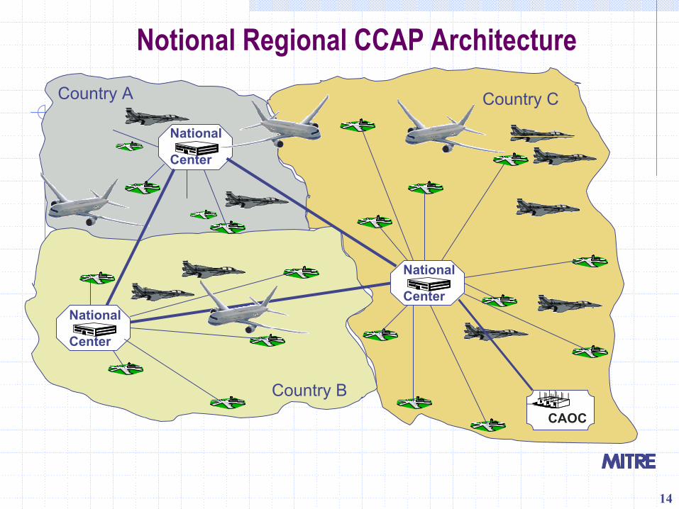
14
Notional Regional CCAP ArchitectureCountry A
Country B
Country C
Country BCAOC
National
Center
National
Center
National
Center
15
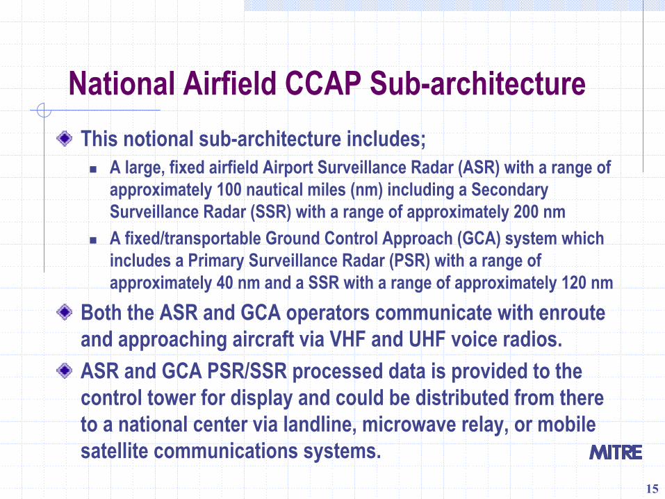
National Airfield CCAP Sub-architectureThis notional sub-architecture includes;
A large, fixed airfield Airport Surveillance Radar (ASR) with a range of approximately 100 nautical miles (nm) including a Secondary Surveillance Radar (SSR) with a range of approximately 200 nmA fixed/transportable Ground Control Approach (GCA) system which includes a Primary Surveillance Radar (PSR) with a range of approximately 40 nm and a SSR with a range of approximately 120 nm
Both the ASR and GCA operators communicate with enrouteand approaching aircraft via VHF and UHF voice radios.ASR and GCA PSR/SSR processed data is provided to the control tower for display and could be distributed from there to a national center via landline, microwave relay, or mobile satellite communications systems.
16
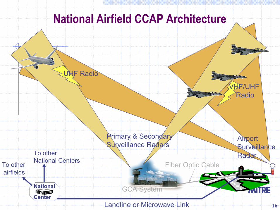
National Airfield CCAP Architecture
Fiber Optic Cable
UHF Radio
VHF/UHF Radio
Primary & Secondary Surveillance Radars
GCA System
Airport Surveillance Radar
National
CenterLandline or Microwave Link
To other National CentersTo other
airfields
17
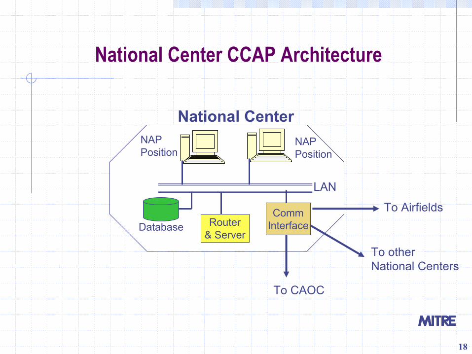
National Center CCAP Sub-architecture
Could be set up as part of an existing ASOC, or in any secure location with access to communicationsNational Air Picture (NAP) workstations get ATC data from a database, router/server, and communications interface via a local area network (LAN) NAP workstations could also get data from (and share their data with) other country National Centers, ASOCs, or a CAOCNAP workstation operators would review, annotate and filter data before sending it to other recipients
18
National Center CCAP Architecture
National Center
To Airfields
NAPPosition
NAPPosition
CommInterface
To otherNational Centers
To CAOC
Database Router& Server
LAN
19
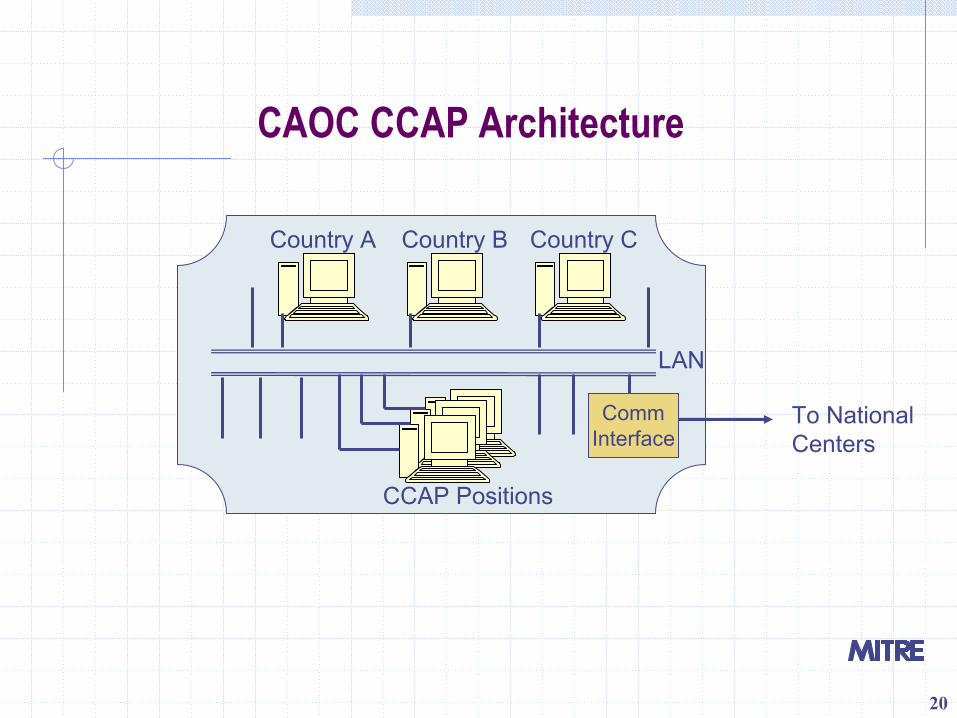
Partial CAOC CCAP Sub-architectureThis architecture is highly notional and would only involve a portion of a CAOC.National Centers and/or ASOCs could provide ATC data to a CAOC to become part of the Common Air Picture (CAP).National workstations could be set up for each member country, connected to a common LAN;
National operators could review, annotate and filter data beforesending it to other national workstations or to the CAOC CAP – data “push” National operators could “pull” data from the CAP
A communications interface would also have to be provided to support receipt of regional information and to translate formats, if needed.
20
CAOC CCAP Architecture
LAN
Country A Country B Country C
CCAP Positions
CommInterface
To NationalCenters
21
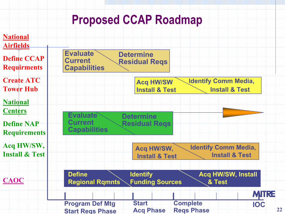
RoadmapCCAP support requires a set of essential national capabilities determined by a definition of requirements and achieved through system acquisition.Three architectural elements have identified for implementation; a national airfield, a national center, and a portion of a CAOC. The proposed roadmap consists of basic phases needed:
To initiate the requirements definition processTo acquire, install and test the necessary sensor systems and communications network components
The following roadmap chart details the steps and milestones needed to implement the architectures
22
Proposed CCAP RoadmapNational Airfields
Define CCAPRequirments
Create ATCTower Hub
National Centers
Define NAP Requirements
Acq HW/SW, Install & Test
CAOC
IOCProgram Def MtgStart Reqs Phase
DefineRegional Rqmnts
IdentifyFunding Sources
Acq HW/SW, Install & Test
Acq HW/SW,Install & Test
Identify Comm Media,Install & Test
Evaluate Current Capabilities
Evaluate Current Capabilities
DetermineResidual Reqs
DetermineResidual Reqs
Identify Comm Media, Install & Test
Acq HW/SWInstall & Test
StartAcq Phase
CompleteReqs Phase
23
Recommendations
Establish a multinational working group to:Determine key air picture requirementsDetermine essential national capabilities to meet requirements
Obtain funding for an architectural research and design tradeoff effortDevelop a detailed architectureDevelop an associated system and component acquisition roadmapWork with coalition partners to develop Letter of Request (LOR) documents (statements of national requirements) if Foreign Military Sales (FMS) initiative
Related Documents