Improved Water Resources Monitoring System/ Integrated Water Resources Management at regional level in Lebanon The project Figure 1: Testing distribution uniformity in drip irrigation system INFORMED DECISIONS TRANSFERRED TO END-USERS TO IMPROVE CAPACITY FOR ENHANCED CROP WATER PRODUCTIVITY ©FAO/Eva Pek In many areas of the world, including the Near East and North Africa (NENA) region and Lebanon, sustainable and reliable delivery of water for irrigation and municipal use has become increasingly complex. This issue also extends to affect the protection of the ecosystems from water pollution. Particularly, if the overall demand is outstripping supply, the delivery of water is often less about engineering, although it is still required. The issue is more often related to the governance of the resources to manage and protect them from pollution and over-abstraction, resolve conflicts over water, and ensure rights to water are respected. It is also about understanding water flow pathways in complex river basin systems. This is where water monitoring and accounting can play a crucial role to help water management institutions in managing complexity in light of the challenges facing the water sector. In this context, the Food and Agriculture Organization of the United Nations, in collaboration with the North Lebanon Water Establishment (NLWE), which represents the Ministry of Water and Energy, is implementing the GCP/LEB/029/SWI project ‘ Improved Water Resources Monitoring System/Integrated Water Resources Management at regional level in Lebanon’, funded by the Swiss Government. The main objective of the project is to strengthen Lebanon’s water institutions improving their performance at regional level, thereby helping them to address the sector challenges for sustainable use of water resources. In particular, Output (5) of the project ‘Informed decisions transferred to end-users to improve capacity for enhanced crop water productivity’ , aims at empowering farmers, agriculture-related organizations, professionals and decision-makers to improve the productivity and resource-use efficiency of agriculture, through the: • selection of 15 farms for pilot study, taking into account the current situation of the major cultivated crops, irrigation regimes and other relevant agronomic practices. • direct collaboration with farmers to diagnose and benchmark the current agricultural productivity levels at plot level (15 plots). • evaluation of potential and attainable yields through the FAO AquaCrop model to assess yield response to water by combining data from the water accounting tool and monitoring, with on-plot observations. • application of potential improvement resulting from the evaluation and the conducted training programmes on the use of AquaCrop to enable farmers making informed decisions for crop water productivity.

Welcome message from author
This document is posted to help you gain knowledge. Please leave a comment to let me know what you think about it! Share it to your friends and learn new things together.
Transcript

Improved Water Resources Monitoring System/Integrated Water Resources Management at regional level in Lebanon
The project
Land and Water Division – Natural Resources and Sustainable ProductionEmail: [email protected], Italy
Figure 1: Testing distribution uniformity in drip irrigation system
INFORMED DECISIONS TRANSFERRED TO END-USERS TO IMPROVE CAPACITY FOR ENHANCED CROP WATER PRODUCTIVITY
©FAO
/Eva
Pek
In many areas of the world, including the Near East and North Africa (NENA) region and Lebanon, sustainable and reliable delivery of water for irrigation and municipal use has become increasingly complex. This issue also extends to affect the protection of the ecosystems from water pollution. Particularly, if the overall demand is outstripping supply, the delivery of water is often less about engineering, although it is still required. The issue is more often related to the governance of the resources to manage and protect them from pollution and over-abstraction, resolve conflicts over water, and ensure rights to water are respected. It is also about understanding water flow pathways in complex river basin systems. This is where water monitoring and accounting can play a crucial role to help water management institutions in managing complexity in light of the challenges facing the water sector. In this context, the Food and Agriculture Organization of the United Nations, in collaboration with the North Lebanon Water Establishment (NLWE), which represents the Ministry of Water and Energy, is implementing the GCP/LEB/029/SWI project ‘Improved Water Resources Monitoring System/Integrated Water Resources Management at regional level in Lebanon’, funded by the Swiss Government. The main objective of the project is to strengthen Lebanon’s water institutions improving their performance at regional level, thereby helping them to address the sector challenges for sustainable use of water resources. In particular, Output (5) of the project ‘Informed decisions transferred to end-users to improve capacity for enhanced crop water productivity’, aims at empowering farmers, agriculture-related organizations, professionals and decision-makers to improve the productivity and resource-use efficiency of agriculture, through the:
• selection of 15 farms for pilot study, taking into account the current situation of the major cultivated crops, irrigation regimes and other relevant agronomic practices.
• direct collaboration with farmers to diagnose and benchmark the current agricultural productivity levels at plot level (15 plots).
• evaluation of potential and attainable yields through the FAO AquaCrop model to assess yield response to water by combining data from the water accounting tool and monitoring, with on-plot observations.
• application of potential improvement resulting from the evaluation and the conducted training programmes on the use of AquaCrop to enable farmers making informed decisions for crop water productivity.
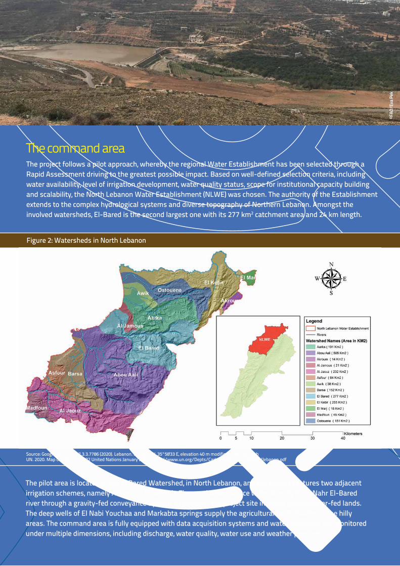
The project follows a pilot approach, whereby the regional Water Establishment has been selected through a Rapid Assessment driving to the greatest possible impact. Based on well-defined selection criteria, including water availability, level of irrigation development, water quality status, scope for institutional capacity building and scalability, the North Lebanon Water Establishment (NLWE) was chosen. The authority of the Establishment extends to the complex hydrological systems and diverse topography of Northern Lebanon. Amongst the involved watersheds, El-Bared is the second largest one with its 277 km2 catchment area and 24 km length.
The command area
The pilot area is located in the El Bared Watershed, in North Lebanon, and the project captures two adjacent irrigation schemes, namely Akkar and El-Minieh. These schemes source water directly from Nahr El-Bared river through a gravity-fed conveyance system. In addition, the project site includes groundwater-fed lands. The deep wells of El Nabi Youchaa and Markabta springs supply the agricultural lands located in the hilly areas. The command area is fully equipped with data acquisition systems and water resources are monitored under multiple dimensions, including discharge, water quality, water use and weather parameters.
PHOTO
Figure 2: Watersheds in North Lebanon
Source: Google Earth Pro v7.3.3.7786 (2020). Lebanon. 34°29'30 N, 35°58'33 E, elevation 40 m modified to comply with UN. 2020. Map of Lebanon, 4282 United Nations January 2010. https://www.un.org/Depts/Cartographic/map/profile/lebanon.pdf
Figure 1: Testing distribution uniformity in drip irrigation system
©FAO
/Eva
Pek

Source: Google Earth Pro v7.3.3.7786 (2020). Lebanon. 34°29'30 N, 35°58'33 E, elevation 40 m modified to comply with UN. 2020. Map of Lebanon, 4282 United Nations January 2010. https://www.un.org/Depts/Cartographic/map/profile/lebanon.pdf
Figure 3: El Bared Watershed
North-Lebanon, notably Akkar, has an enormous agricultural potential and agriculture substantially contributes to the livelihood. However, agriculture in Akkar is under immense pressure due to increasing food demand, rapidly growing population, competition over resources, environmental degradation and climate change impacts. The capacity of productive assets is already stretched and the agricultural production requires new approaches to increase productivity with limited resources.
The year 2020The COVID-19 shattered the world in 2020. The devastating consequences spanned across sectors and hit the hardest the most vulnerable people. The pandemic severely affected the health sector, disrupted food markets and significantly hampered production. Eventually, it caused a considerable economic setback, increased the poverty rate over the world and jeopardized food security. However, COVID-19 was not the only root cause of escalating crises in Lebanon. The recession that started in early 2019 caused social shock waves and reached its peak in 2020, when the national currency sank to a record low. Similar to other sectors, agriculture was severely affected due to the low purchasing power of the pound in Lebanon. As production inputs are almost entirely imported, farmers could not afford to buy the essential inputs. Amid hardships and challenges, Lebanon’s capital was rocked by the deadly blast at the main port, bringing the country to the edge of humanitarian emergency. The explosion tore through Beirut and destroyed the grain silos storing over 100 thousand tons of food stocks. The impacts of the blast on civilians and the economy were devastating and the country may require years to offset the effects. As increasingly higher proportions of people turn into poverty and the food insecurity is on the rise, the role of agriculture in mitigation cannot be overlooked. The project, therefore, goes the extra mile to increase agricultural productivity and eventually contribute to post-crisis recovery.
Source: Google Earth Pro v7.3.3.7786 (2020). Lebanon. 34°29'30 N, 35°58'33 E, elevation 40 m modified to comply with UN. 2020. Map of Lebanon, 4282 United Nations January 2010. https://www.un.org/Depts/Cartographic/map/profile/lebanon.pdf
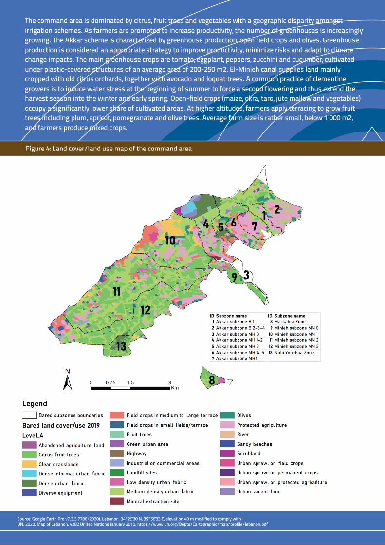
The command area is dominated by citrus, fruit trees and vegetables with a geographic disparity amongst irrigation schemes. As farmers are prompted to increase productivity, the number of greenhouses is increasingly growing. The Akkar scheme is characterized by greenhouse production, open field crops and olives. Greenhouse production is considered an appropriate strategy to improve productivity, minimize risks and adapt to climate change impacts. The main greenhouse crops are tomato, eggplant, peppers, zucchini and cucumber, cultivated under plastic-covered structures of an average area of 200-250 m2. El-Minieh canal supplies land mainly cropped with old citrus orchards, together with avocado and loquat trees. A common practice of clementine growers is to induce water stress at the beginning of summer to force a second flowering and thus extend the harvest season into the winter and early spring. Open-field crops (maize, okra, taro, jute mallow and vegetables) occupy a significantly lower share of cultivated areas. At higher altitudes, farmers apply terracing to grow fruit trees including plum, apricot, pomegranate and olive trees. Average farm size is rather small, below 1 000 m2, and farmers produce mixed crops.
Figure 4: Land cover/land use map of the command area
PHOTO
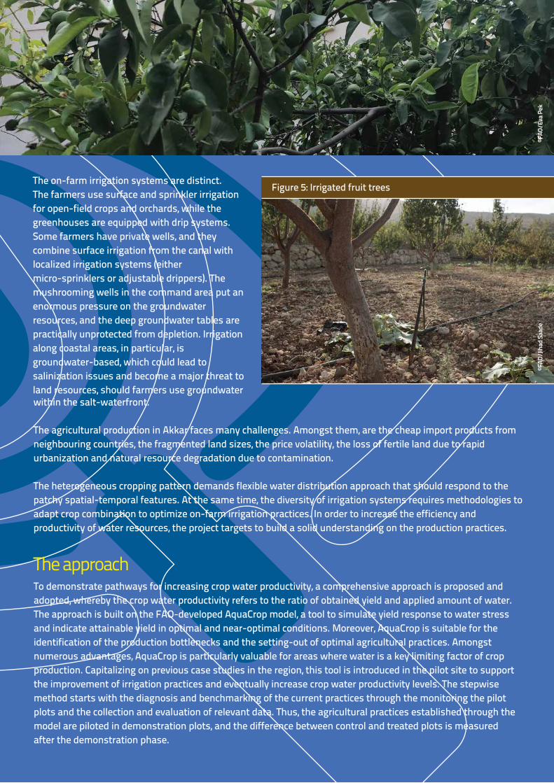
The on-farm irrigation systems are distinct. The farmers use surface and sprinkler irrigation for open-field crops and orchards, while the greenhouses are equipped with drip systems. Some farmers have private wells, and they combine surface irrigation from the canal with localized irrigation systems (either micro-sprinklers or adjustable drippers). The mushrooming wells in the command area put an enormous pressure on the groundwater resources, and the deep groundwater tables are practically unprotected from depletion. Irrigation along coastal areas, in particular, is groundwater-based, which could lead to salinization issues and become a major threat to land resources, should farmers use groundwater
Figure 5: Irrigated fruit trees
within the salt-waterfront.
The agricultural production in Akkar faces many challenges. Amongst them, are the cheap import products from neighbouring countries, the fragmented land sizes, the price volatility, the loss of fertile land due to rapid urbanization and natural resource degradation due to contamination.
The heterogeneous cropping pattern demands flexible water distribution approach that should respond to the patchy spatial-temporal features. At the same time, the diversity of irrigation systems requires methodologies to adapt crop combination to optimize on-farm irrigation practices. In order to increase the efficiency and productivity of water resources, the project targets to build a solid understanding on the production practices.
To demonstrate pathways for increasing crop water productivity, a comprehensive approach is proposed and adopted, whereby the crop water productivity refers to the ratio of obtained yield and applied amount of water. The approach is built on the FAO-developed AquaCrop model, a tool to simulate yield response to water stress and indicate attainable yield in optimal and near-optimal conditions. Moreover, AquaCrop is suitable for the identification of the production bottlenecks and the setting-out of optimal agricultural practices. Amongst numerous advantages, AquaCrop is particularly valuable for areas where water is a key limiting factor of crop production. Capitalizing on previous case studies in the region, this tool is introduced in the pilot site to support the improvement of irrigation practices and eventually increase crop water productivity levels. The stepwise method starts with the diagnosis and benchmarking of the current practices through the monitoring the pilot plots and the collection and evaluation of relevant data. Thus, the agricultural practices established through the model are piloted in demonstration plots, and the difference between control and treated plots is measured after the demonstration phase.
The approach ©F
AO/E
va P
ek©F
AO/J
ihad
Saad
e
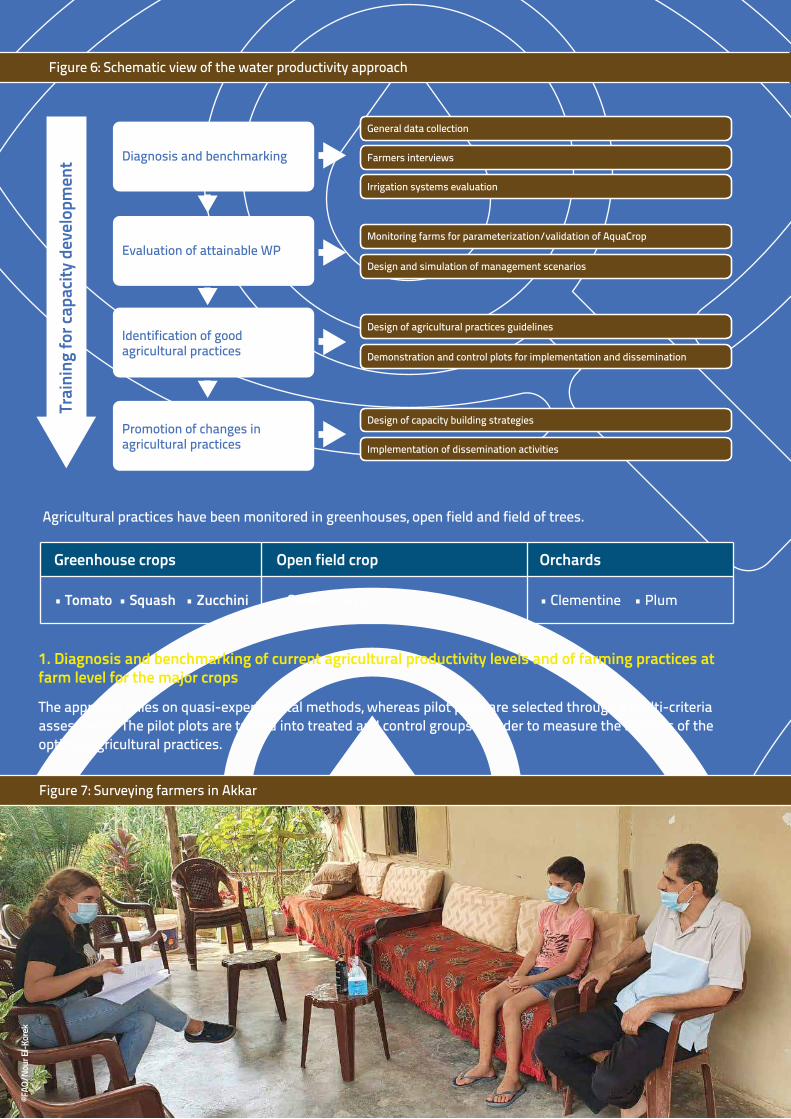
Figure 6: Schematic view of the water productivity approach
1. Diagnosis and benchmarking of current agricultural productivity levels and of farming practices at farm level for the major crops
The approach relies on quasi-experimental methods, whereas pilot plots are selected through a multi-criteria assessment. The pilot plots are turned into treated and control groups in order to measure the impacts of the optimal agricultural practices.
Agricultural practices have been monitored in greenhouses, open field and field of trees.
Figure 7: Surveying farmers in Akkar
Greenhouse crops
• Tomato • Squash • Zucchini
Open field crop
• Sweet maize
Orchards
• Clementine • Plum
General data collection
Farmers interviews
Irrigation systems evaluation
Diagnosis and benchmarking
Monitoring farms for parameterization/validation of AquaCrop
Design and simulation of management scenarios
Design of agricultural practices guidelines
Evaluation of attainable WP
Demonstration and control plots for implementation and dissemination
Design of capacity building strategies
Implementation of dissemination activities
Identification of good agricultural practices
Promotion of changes in agricultural practices
Trai
ning
for c
apac
ity d
evel
opm
ent
©FAO
/Nou
r El-K
orek
During the diagnostic phase of the agricultural productivity levels and the identification of the limiting causes, a systematic data collection was conducted for the following purposes:
• obtain an overview of the main characteristics of the area;
• identify and engage key stakeholders, and assess the availability of quantitative data; and
• adapt and validate the methodological approach to the specific conditions of the irrigation scheme, starting with the procedure for the selection of the pilot plots.
Beyond the involved pilot farms, a structured survey was crafted to obtain mass information about agricultural practices. The target group of the survey involved all farmers in the command area. Detailed information about the water resources, cropping system and irrigation management were collected and analysed.
2. Evaluation of potential and attainable yields with AquaCrop - field calibration of the FAO AquaCrop simulation model
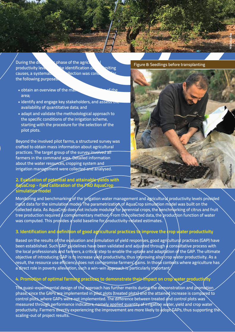
Figure 8: Seedlings before transplanting
Monitoring and benchmarking of the irrigation water management and agricultural productivity levels provided input data for the simulation model. The parametrization of AquaCrop simulation model was built on the collected data. As AquaCrop does not include modules for perennial crops, the benchmarking of citrus and fruit tree production required a complementary method. From the collected data, the production function of water was computed. This provides a solid baseline for productivity-related estimates.
3. Identification and definition of good agricultural practices to improve the crop water productivity
Based on the results of the evaluation and simulation of yield responses, good agricultural practices (GAP) have been established. Such GAP guidelines have been validated and adjusted through a consultative process with the local professionals and farmers, a critical step to enable the uptake and adaptation of the GAP. The ultimate objective of introducing GAP is to increase yield productivity, thus improving also crop water productivity. As a result, the resource use efficiency does not compromise farmers’ gains. In those contexts where agriculture has a direct role in poverty alleviation, such a win-win approach is particularly important.
4. Promotion of optimal farming practices to demonstrate their impact on crop water productivity
The quasi-experimental design of the approach has further merits during the demonstration and promotion phase, since the GAPs are implemented in pilot plots (treated plots) and the attained increase is compared to control plots, where GAPs were not implemented. The difference between treated and control plots was measured through performance indicators, namely applied quantity of irrigation water, yield and crop water productivity. Farmers directly experiencing the improvement are more likely to adopt GAPs, thus supporting the scaling-out of project results.
©FAO
/Eva
Pek
©FAO
/Eva
Pek
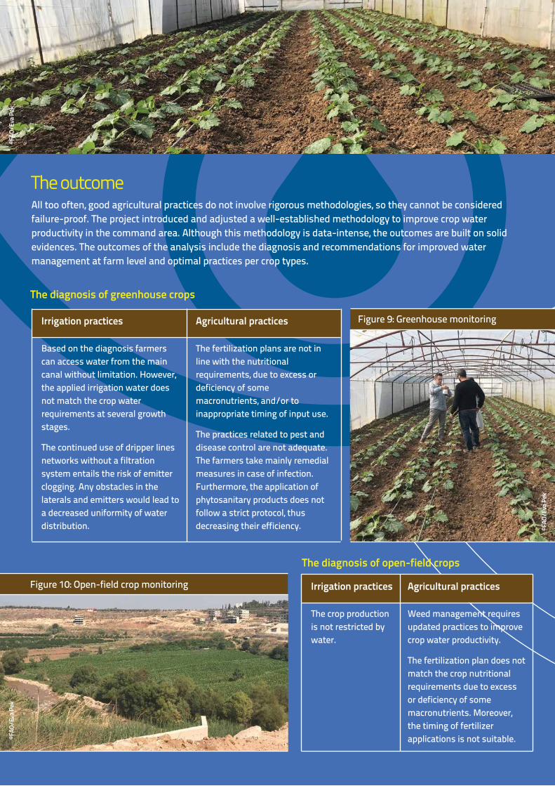
Figure 9: Greenhouse monitoring
Figure 10: Open-field crop monitoring
The diagnosis of open-field crops
Irrigation practices
The crop production is not restricted by water.
Agricultural practices
Weed management requires updated practices to improve crop water productivity.
The fertilization plan does not match the crop nutritional requirements due to excess or deficiency of some macronutrients. Moreover, the timing of fertilizer applications is not suitable.
Irrigation practices
Based on the diagnosis farmers can access water from the main canal without limitation. However, the applied irrigation water does not match the crop water requirements at several growth stages.
The continued use of dripper lines networks without a filtration system entails the risk of emitter clogging. Any obstacles in the laterals and emitters would lead to a decreased uniformity of water distribution.
Agricultural practices
The fertilization plans are not in line with the nutritional requirements, due to excess or deficiency of some macronutrients, and/or to inappropriate timing of input use.
The practices related to pest and disease control are not adequate. The farmers take mainly remedial measures in case of infection. Furthermore, the application of phytosanitary products does not follow a strict protocol, thus decreasing their efficiency.
The diagnosis of greenhouse crops
All too often, good agricultural practices do not involve rigorous methodologies, so they cannot be considered failure-proof. The project introduced and adjusted a well-established methodology to improve crop water productivity in the command area. Although this methodology is data-intense, the outcomes are built on solid evidences. The outcomes of the analysis include the diagnosis and recommendations for improved water management at farm level and optimal practices per crop types.
The outcome
©FAO
/Eva
Pek
©FAO
/Eva
Pek
©FAO
/Eva
Pek
Crop water productivity can be improved by higher attained yield or reduced water use. The Good Agricultural Practices (GAPs) include a combination of irrigation and agriculture-related practices to maximize the production and optimize the resource use. The GAPs are also complemented with a manual on pest and disease management to help farmers identifying the potential infection. As optimal practices combine agricultural with irrigation practices, the recommendations capture the major domains of improvement measures.
Recommendations on greenhouse production
• Optimal irrigation schedules are established for each crop, taking into account the collected climatic data outside and inside the greenhouses, the results of soil analysis and the crop development phases, while at the same time considering the application efficiency coefficient of irrigation. The analysis revealed that farmers heavily over-irrigate tomato crops by over 60 percent. In case of zucchini, farmers produced 17 ton per hectare by applying 310 mm irrigation water. The experiment of GAPs achieved 33 ton per hectare yield with 235 mm applied irrigation water. As a result, the crop water productivity increased from 5.3 kg/m3 to 14.1 kg/m3, reaching a remarkable 250 percent increase.
• Nutrient requirements are computed from the measured nutrient concentration in the plants and the soil nutrient levels. Based on the calculated nutrient requirements, the appropriate fertilization plan is designed taking into account the development of the crop. The experiment results showed that zucchini farmers can reduce the nitrogen fertilizer amount by 64 percent without yield loss.
Figure 9: Greenhouse monitoring
Figure 11: Citrus orchard monitoring
The diagnosis of open-field crops
Irrigation practices
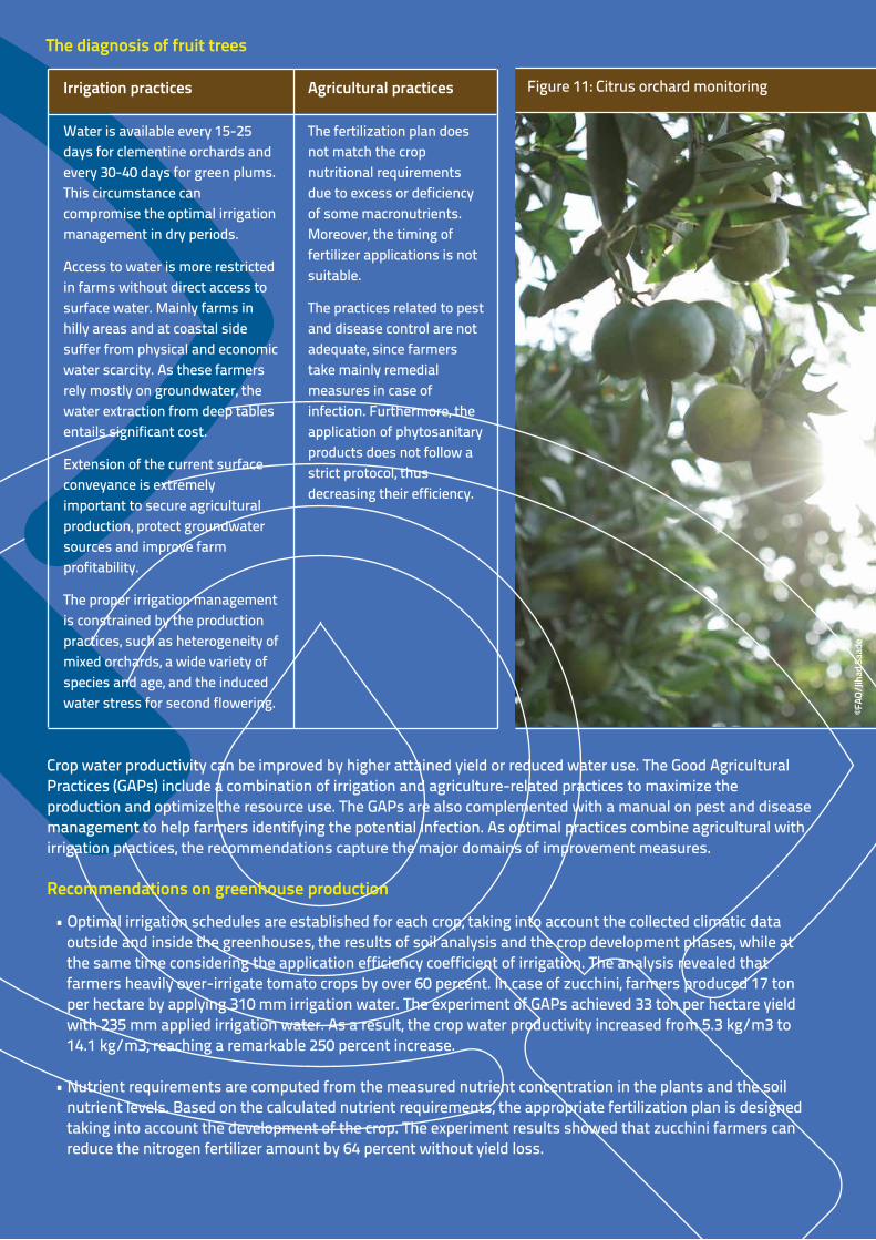
Water is available every 15-25 days for clementine orchards and every 30-40 days for green plums. This circumstance can compromise the optimal irrigation management in dry periods.
Access to water is more restricted in farms without direct access to surface water. Mainly farms in hilly areas and at coastal side suffer from physical and economic water scarcity. As these farmers rely mostly on groundwater, the water extraction from deep tables entails significant cost.
Extension of the current surface conveyance is extremely important to secure agricultural production, protect groundwater sources and improve farm profitability.
The proper irrigation management is constrained by the production practices, such as heterogeneity of mixed orchards, a wide variety of species and age, and the induced water stress for second flowering.
Agricultural practices
The fertilization plan does not match the crop nutritional requirements due to excess or deficiency of some macronutrients. Moreover, the timing of fertilizer applications is not suitable.
The practices related to pest and disease control are not adequate, since farmers take mainly remedial measures in case of infection. Furthermore, the application of phytosanitary products does not follow a strict protocol, thus decreasing their efficiency.
The diagnosis of fruit trees
©FAO
/Jih
ad Sa
ade
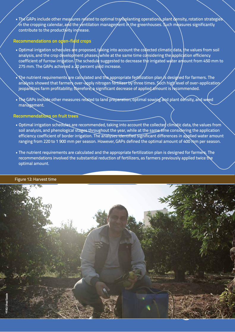
Figure 12: Harvest time
• The GAPs include other measures related to optimal transplanting operations, plant density, rotation strategies in the cropping calendar, and the ventilation management in the greenhouses. Such measures significantly contribute to the productivity increase.
Recommendations on open-field crops
• Optimal irrigation schedules are proposed, taking into account the collected climatic data, the values from soil analysis, and the crop development phases, while at the same time considering the application efficiency coefficient of furrow irrigation. The schedule suggested to decrease the irrigated water amount from 450 mm to 275 mm. The GAPs achieved a 20 percent yield increase.
• The nutrient requirements are calculated and the appropriate fertilization plan is designed for farmers. The analysis showed that farmers over-apply nitrogen fertilizer by three times. Such high level of over-application jeopardizes farm profitability; therefore, a significant decrease of applied amount is recommended.
• The GAPs include other measures related to land preparation, optimal sowing and plant density, and weed management.
Recommendations on fruit trees
• Optimal irrigation schedules are recommended, taking into account the collected climatic data, the values from soil analysis, and phenological stages throughout the year, while at the same time considering the application efficiency coefficient of border irrigation. The analyses identified significant differences in applied water amount ranging from 220 to 1 900 mm per season. However, GAPs defined the optimal amount of 400 mm per season.
• The nutrient requirements are calculated and the appropriate fertilization plan is designed for farmers. The recommendations involved the substantial reduction of fertilizers, as farmers previously applied twice the optimal amount.
©FAO
/Jih
ad Sa
ade
©FAO
/Eva
Pek
The project drew lessons from the design and implementation of the crop water productivity approach. Such lessons can be categorized under three domains: productivity of agriculture, water productivity and smallholders’ livelihood.
The lessons learned - best practices
Productivity of agriculture
Maximizing the obtained yield is the main target of farmers in optimal case. However, the farmers in the command area must also keep pace with the prices of import products.
In order to reduce production cost, the agricultural practices, and in particular the input purchase, must be optimized.
Fertilizers and pesticides take a substantial share of production costs; therefore, their application requires a cautious protocol.
Good agricultural practices must be built on a rigorous methodology that combines scientific approaches and on-ground experiences.
A production level lower than the potential has adverse impacts on multiple aspects such as farmers’ income and natural resources’ sustainability.
Water Productivity
Water productivity can be improved by enhanced yield production and decreased water application. However, water productivity measures compromising yield productivity are less desirable in smallholders’ contexts.
The application of maximum available water does not necessarily increase water productivity. Farmers should define the optimal level of applied water amount.
Measuring merely the crop water requirement does not provide an adequate picture of the water productivity, as applied water amount is not necessarily equal to crop water requirement.
Not only the bulk amount of applied water is a decisive factor, but the frequency and the timing of the application should be considered. In order to enable good agriculture practices, flexible water service is required.
Smallholder livelihood
Monitoring of agricultural practices has a substantial role in natural resource planning and management.
The pre-existing vulnerabilities of farmers, such as climate change, natural resource constraints, and/or low profitability, emphasize the importance of improving agricultural production.
Amid current challenges, the role and importance of agriculture in livelihoods’ development is amplified.
Farmers face not only production but also economic constraints. However, the current practices are not adequate enough to exploit the potential profitability of farming.
Farmers in relatively small command areas have extremely diverse access to water resources.
Farmers in hilly lands and coastal areas are more exposed to economic water scarcity.Good agricultural practices must take into due account both productivity and profitability-related measures.

FAO LebanonEmail: [email protected], Lebanon
Food and Agriculture Organization of the United Nations
Land and Water Division – Natural Resources and Sustainable ProductionEmail: [email protected], Italy
For further information, please contact:
Figure 13: Consultation with farmers
With the financial support of With the technicial support of
The boundaries and names shown and the designations used on these maps do not imply the expression of any opinion whatsoever on the part of FAO concerning the legal status of any country, territory, city or area or of its authorities, or concerning the delimitation of its frontiers and boundaries. Dashed lines on maps represent approximate border lines for which there may not yet be full agreement.
© F
AO
, 202
1
CB
4240
EN
/1/0
4.21
Some rights reserved. This work is available under a CC BY-NC-SA 3.0 IGO licence
Lessons-learnt related to production practices and water productivity are critical to maintain the achieved results. Training of professional staff is key to reach long-term sustainability of established monitoring system and maintain gains.
The long-term vision of the project anticipates the scaling-up of implemented and demonstrated practices both within the boundaries of the NLWE, and beyond, extending them to other establishments. Dissemination is a built-on complex strategy with multiple publication outlets to reach wide audiences. The scaling-up is phased into three successive steps:©F
AO/N
our E
l-Kor
ek
Piloting
Learning
Scaling-up
• Select pilot sites based on multicriteria• Design and implement novel approaches• Draw lessons from implementation
• Train professional staff on traditional and non-traditional methods• Extend the training to potential stakeholders at national level
• Demonstrate results and assess replicability • Implement the developed approach
Related Documents


