Humboldt Bay Vertical Reference System Working Group (HumBayVert) Humboldt Bay Initiative Meeting: June-24- 2014 Cascadia GeoSciences, Northern Hydrology, HSU Geology, U of O Geology, & HBI members p://hbv.cascadiageo.org

Humboldt Bay Vertical Reference System Working Group ( HumBayVert )
Dec 30, 2015
Humboldt Bay Vertical Reference System Working Group ( HumBayVert ) Humboldt Bay Initiative Meeting: June-24-2014. http://hbv.cascadiageo.org. Cascadia GeoSciences, Northern Hydrology, HSU Geology, U of O Geology, & HBI members. Background Partnerships Issues Goal - PowerPoint PPT Presentation
Welcome message from author
This document is posted to help you gain knowledge. Please leave a comment to let me know what you think about it! Share it to your friends and learn new things together.
Transcript

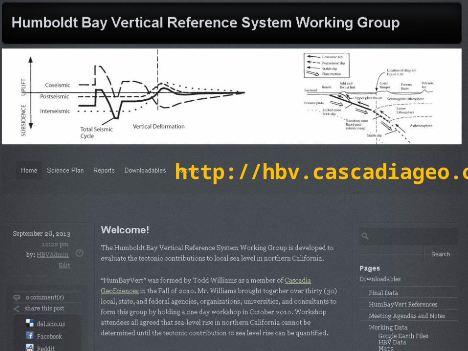
Humboldt Bay Vertical Reference System Working Group (HumBayVert)
Humboldt Bay Initiative Meeting: June-24-2014
Cascadia GeoSciences, Northern Hydrology, HSU Geology, U of O Geology, & HBI members
http://hbv.cascadiageo.org
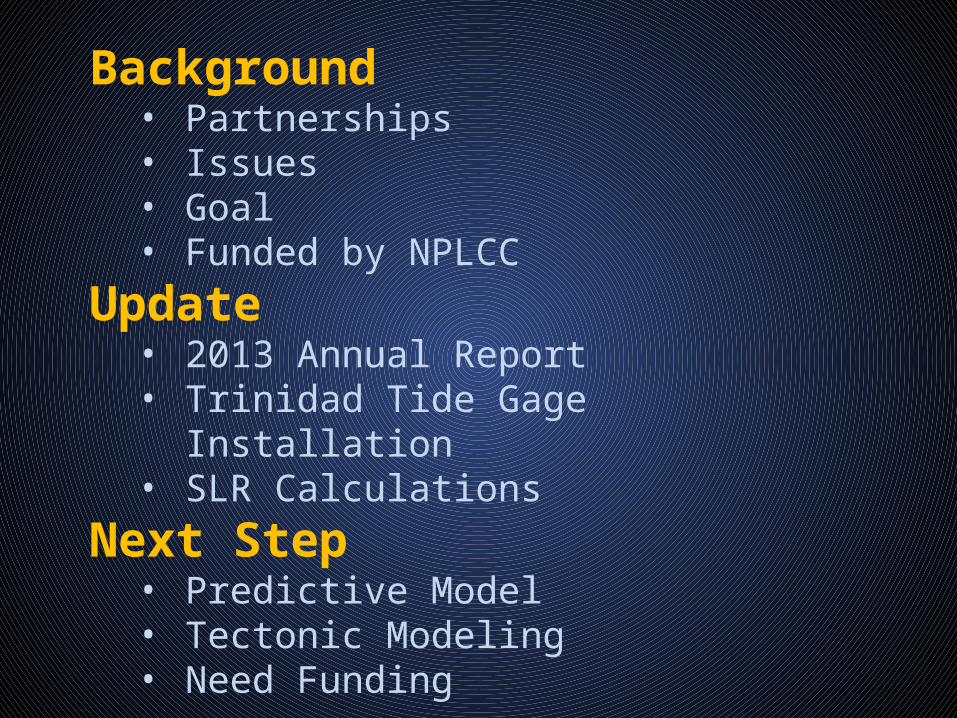
Background• Partnerships• Issues• Goal• Funded by NPLCC
Update• 2013 Annual Report• Trinidad Tide Gage Installation• SLR Calculations
Next Step• Predictive Model• Tectonic Modeling• Need Funding
http://hbv.cascadiageo.org

PartnershipsCascadia GeoSciencesHumboldt Bay Initiative
“Our vision is a vibrant, thriving, and resilient Humboldt Bay Ecosystem that supports the well-being of our human and natural communities.”North Pacific Landscape Conservation CooperativeDept. of Interior Climate Change Adaptation Program

Issue: tectonics controls Local Sea Level
Accurate measurement of local land elevation in the Humboldt Bay area
Priority issue identified by USACE, Coastal Commission, NOAA NGS & others
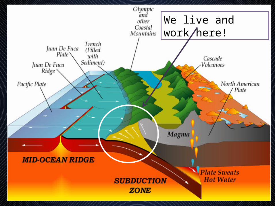
We live and work here!
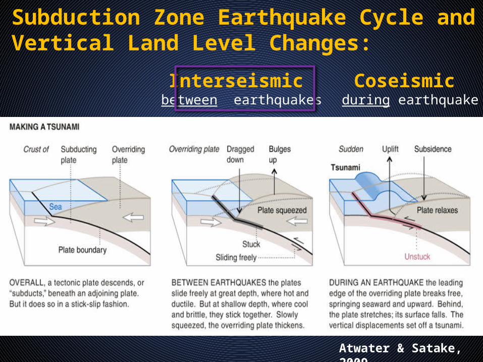
Atwater & Satake, 2009
Interseismic between earthquakes
Coseismic during earthquake
Subduction Zone Earthquake Cycle and Vertical Land Level Changes:


Eustatic SeaLevel Rise
(ESLR)
TideGauges
Leveling & GPS
Compare Rates & Test Observations
Compare to tide gageobservations
Compare to GPS and land level surveys
Compare to long term ESLR

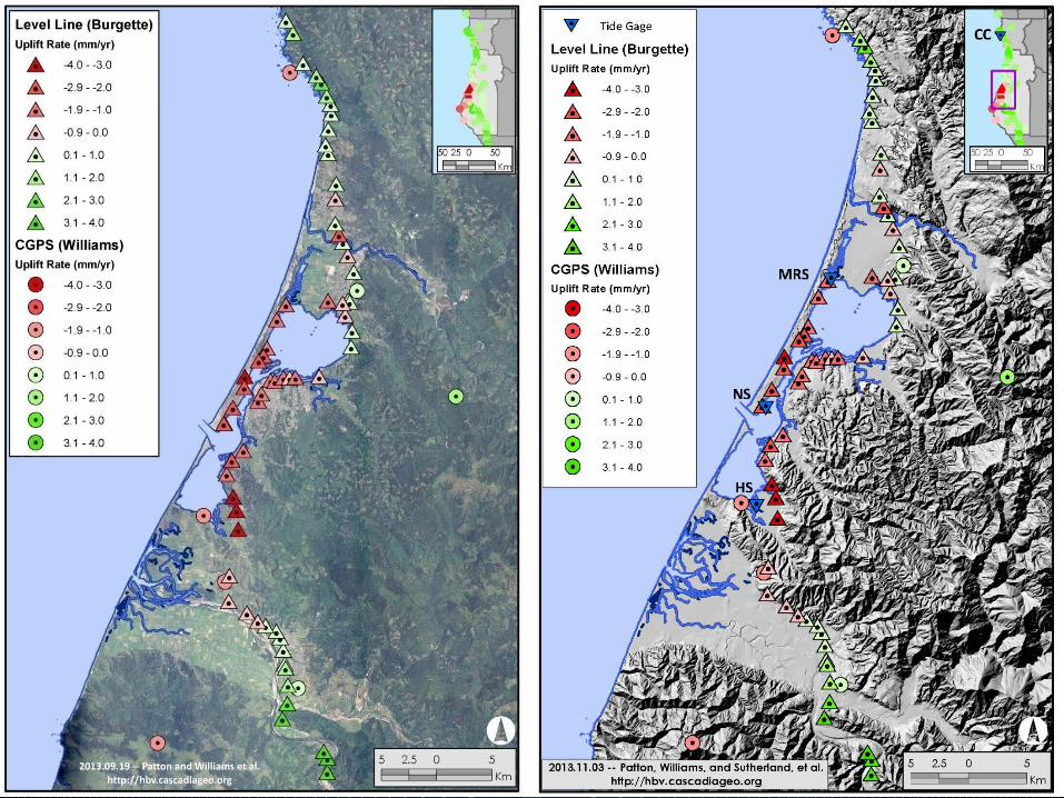
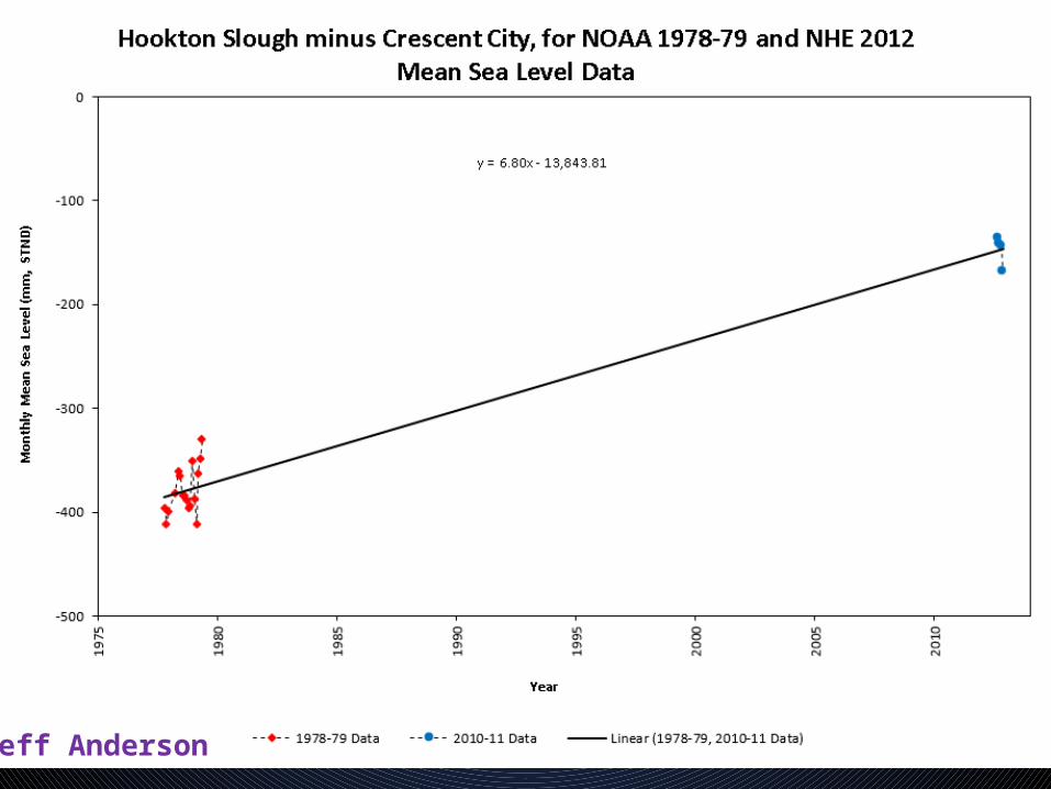
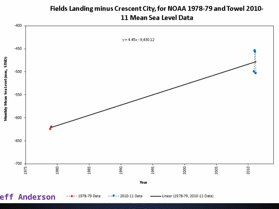
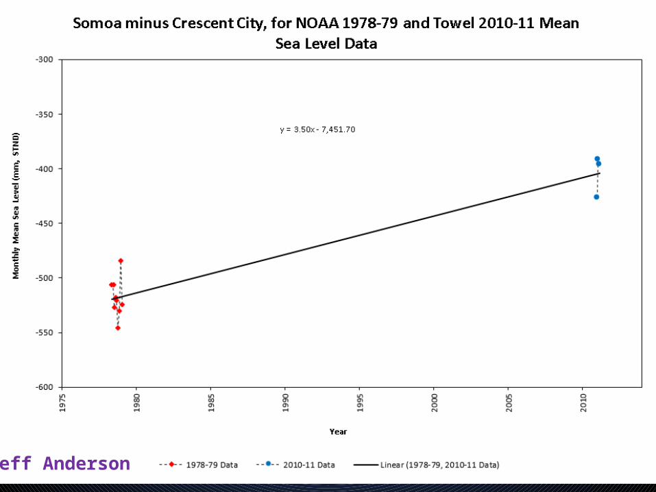
Historic Temporary Tide Gage LocationsHumboldt Bay 1977-1980
Mad River Slough
North Spit
Hookton Slough
Samoa
Fields Landing
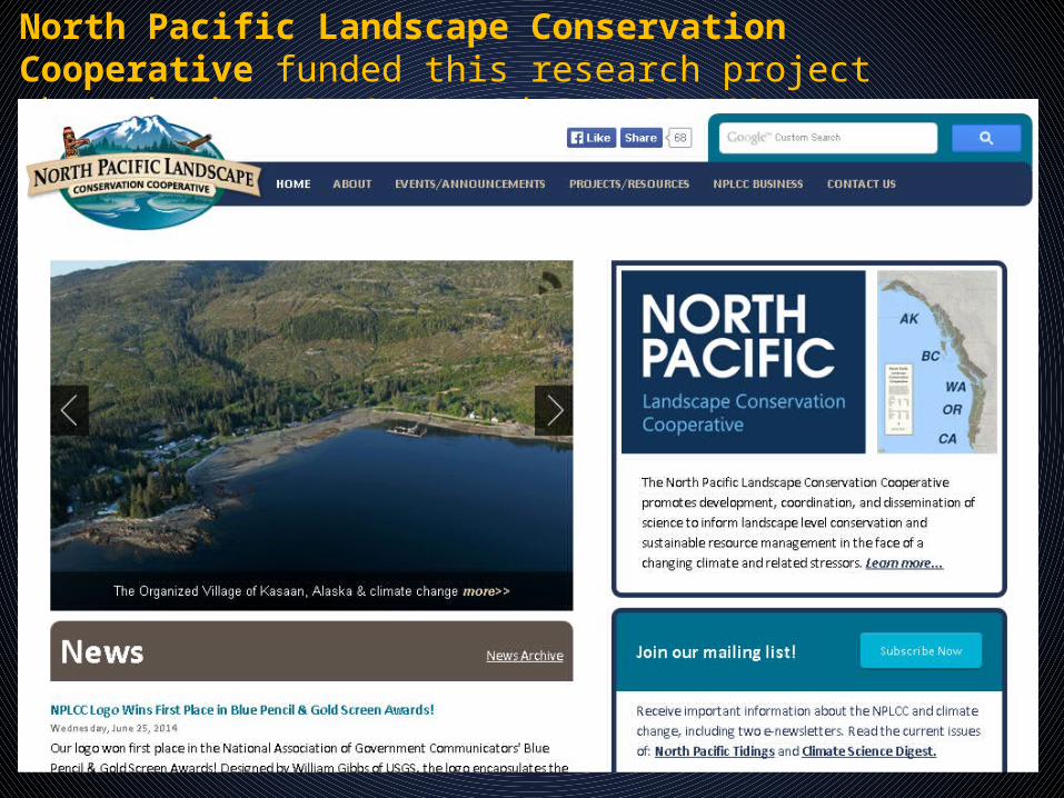
North Pacific Landscape Conservation Cooperative funded this research project through the USFWS, Award F11AC01092
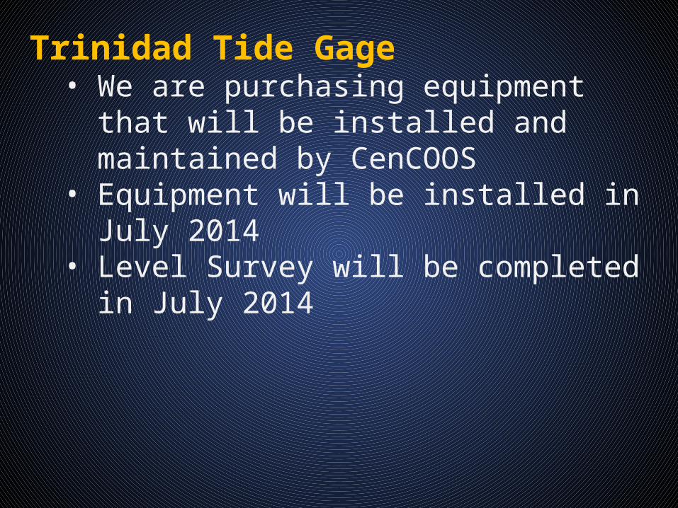
Trinidad Tide Gage• We are purchasing equipment that will be
installed and maintained by CenCOOS• Equipment will be installed in July 2014• Level Survey will be completed in July 2014
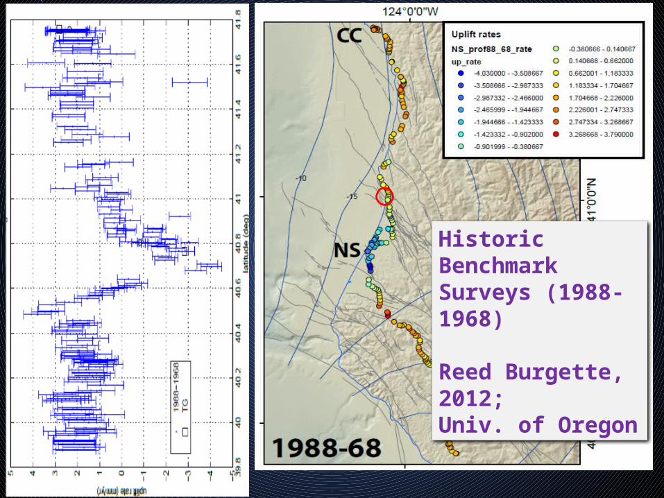
Historic Benchmark Surveys (1988-1968)
Reed Burgette, 2012;Univ. of Oregon
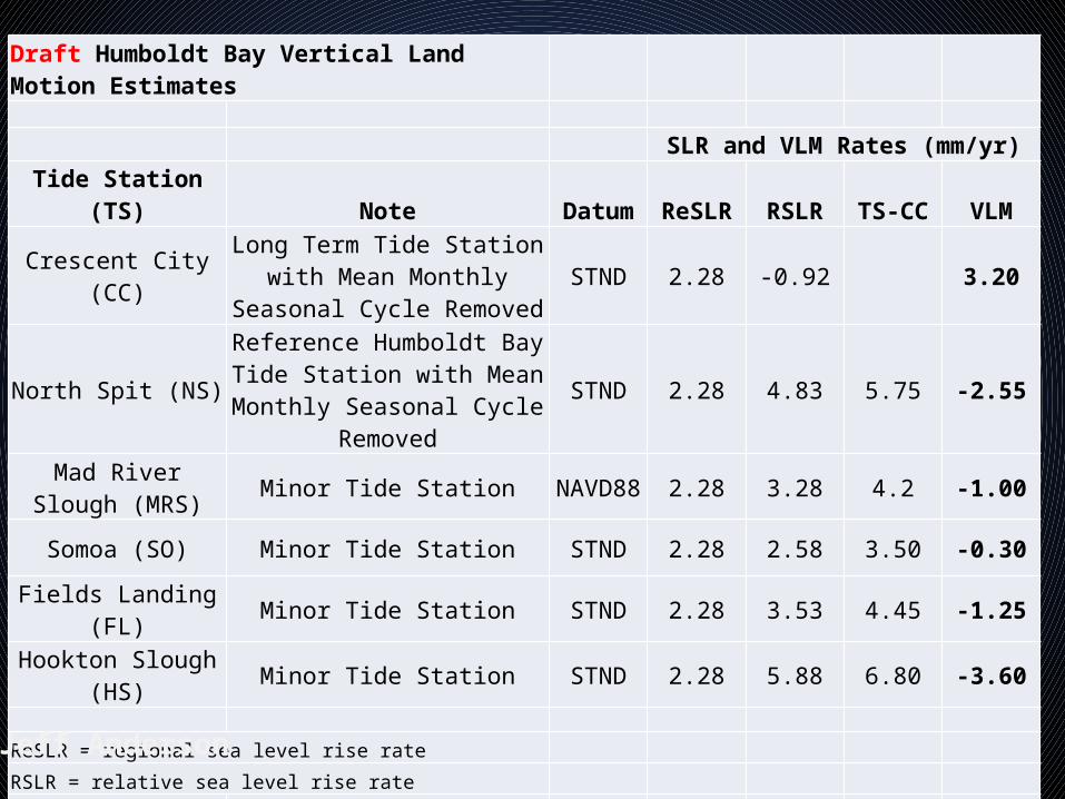
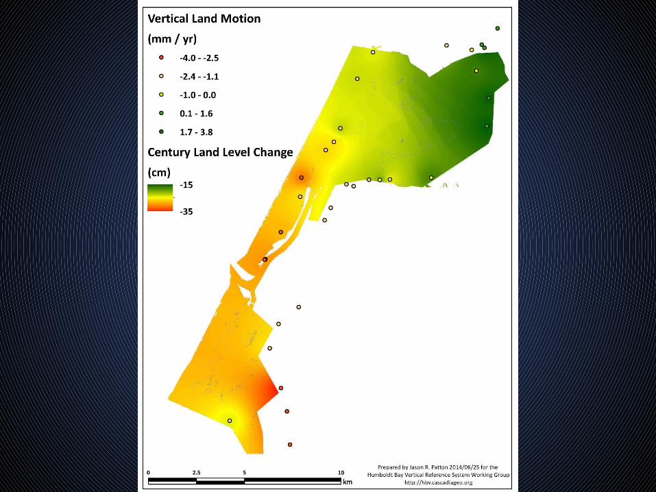
Draft Humboldt Bay Vertical Land Motion Estimates
SLR and VLM Rates (mm/yr)Tide Station (TS) Note Datum ReSLR RSLR TS-CC VLM
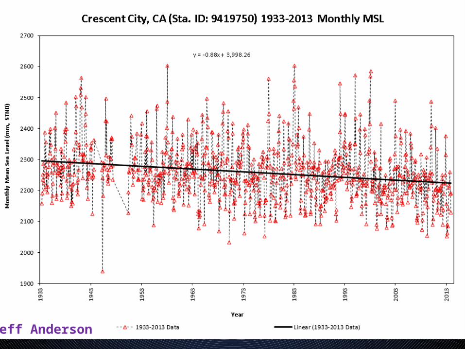
Crescent City (CC)Long Term Tide Station with
Mean Monthly Seasonal Cycle Removed
STND 2.28 -0.92 3.20
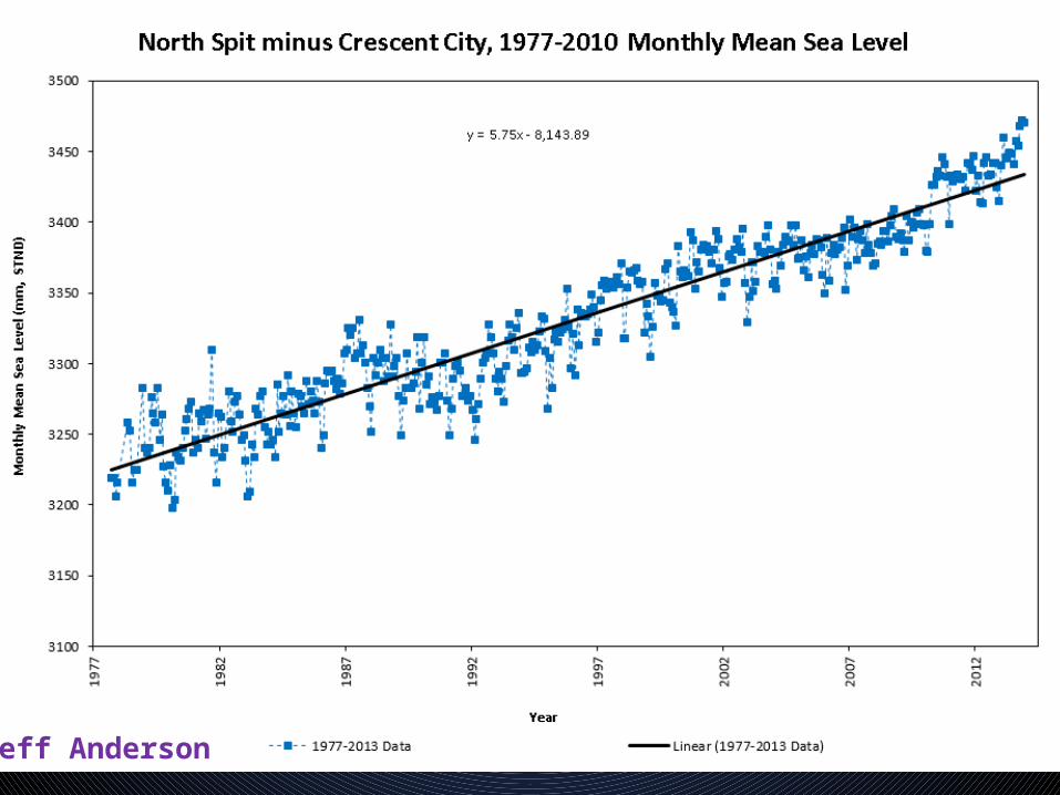
North Spit (NS)Reference Humboldt Bay Tide Station with Mean Monthly
Seasonal Cycle RemovedSTND 2.28 4.83 5.75 -2.55
Mad River Slough (MRS) Minor Tide Station NAVD88 2.28 3.28 4.2 -1.00
Somoa (SO) Minor Tide Station STND 2.28 2.58 3.50 -0.30
Fields Landing (FL) Minor Tide Station STND 2.28 3.53 4.45 -1.25
Hookton Slough (HS) Minor Tide Station STND 2.28 5.88 6.80 -3.60
ReSLR = regional sea level rise rate
RSLR = relative sea level rise rate
SLR = sea level rise rateVLM = vertical land motion
Jeff Anderson
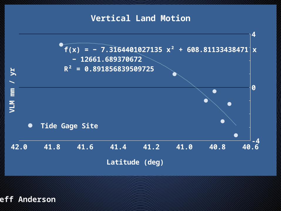
40.640.841.041.241.441.641.842.0-4
0
4
R² = 0.882233203842251
Vertical Land Motion
Tide Gage SitePolynomial (Tide Gage Site)
Latitude (deg)
VLM
mm
/ y
r
40.640.841.041.241.441.641.842.0-4
0
4
f(x) = − 7.31644010271352 x² + 608.811334384709 x − 12661.6893706718R² = 0.891856839509725
Vertical Land Motion
Tide Gage SitePolynomial (Tide Gage Site)
Latitude (deg)
VLM
mm
/ y
r
Jeff Anderson

Next Step• Tectonic Modeling• Fit tectonic model to tide gage and BM data• Prepare Predictive Model• Project Proposal is Written (but not funded yet)

Kriging IDW

Mission and Goals• Determine historic land and sea level trends • Map local sea level change across region• Complete historic analysis of tide and level data in PNW• Model geologic processes controlling uplift/subsidence• Compare historic trends to prehistoric geologic record• Data dissemination for regional workers
Methods• Re-occupy historic tide gage locations• Install regional tide gage stations• Collect and analyze historic GPS & level data WRT mean sea
level• Model Cascadia subduction zone with new data• Partnerships & collaboration

END
Jeff Anderson

Jeff Anderson
Jeff Anderson

Jeff Anderson
Jeff Anderson
Jeff Anderson
Jeff Anderson

Related Documents