High Plains (Weather Information News Data) 2015 Severe Weather Season Continued on page 5 A Message from the Meteorologist-in-Charge I NSIDE T HIS I SSUE 1 2015 Severe Weather Season 2 Common Weather Myths 6 Winter Snowfall – Summer Rain 10 CoCoRaHS Corner 11 Cooperative Observer News 12 Weather Ready Nation 13 We Need Your Help 14 NOAA Weather Radio 16 StormReady 17 Climate Corner By Scott A. Mentzer We are well into spring, so severe weather is right around the corner. In fact, we’ve already experienced severe weather on April 2, 2015, when storms produced wind gusts in excess of 100 mph across Greeley and Wallace Counties in Kansas and a brief tornado in Cheyenne County, Colorado. These winds produced considerable damage and an impressive dust storm. April 2, 2015 Dust Storm near Horace, Kansas Photo by Mark Rine April 15, 2015 Volume 9 Issue 1 Photo Courtesy of Julie Samuelson

Welcome message from author
This document is posted to help you gain knowledge. Please leave a comment to let me know what you think about it! Share it to your friends and learn new things together.
Transcript

High Plains
(Weather Information News Data)
2015 Severe Weather Season
Continued on page 5
A Message from the Meteorologist-in-Charge
I N S I D E T H I S I S S U E
1 2015 Severe Weather Season
2 Common Weather Myths
6 Winter Snowfall – Summer Rain
10 CoCoRaHS Corner
11 Cooperative Observer News
12 Weather Ready Nation
13 We Need Your Help
14 NOAA Weather Radio
16 StormReady
17 Climate Corner
By Scott A. Mentzer
We are well into spring, so severe weather is right around the corner.
In fact, we’ve already experienced severe weather on April 2, 2015,
when storms produced wind gusts in excess of 100 mph across
Greeley and Wallace Counties in Kansas and a brief tornado in
Cheyenne County, Colorado. These winds produced considerable
damage and an impressive dust storm.
April 2, 2015 Dust Storm near Horace, Kansas
Photo by Mark Rine
April 15, 2015 Volume 9 Issue 1
Photo Courtesy of
Julie Samuelson
Page 2 High Plains WIND
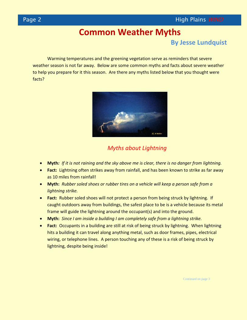
Common Weather Myths By Jesse Lundquist
Warming temperatures and the greening vegetation serve as reminders that severe
weather season is not far away. Below are some common myths and facts about severe weather
to help you prepare for it this season. Are there any myths listed below that you thought were
facts?
Myths about Lightning
Myth: If it is not raining and the sky above me is clear, there is no danger from lightning. Fact: Lightning often strikes away from rainfall, and has been known to strike as far away
as 10 miles from rainfall!
Myth: Rubber soled shoes or rubber tires on a vehicle will keep a person safe from a
lightning strike.
Fact: Rubber soled shoes will not protect a person from being struck by lightning. If
caught outdoors away from buildings, the safest place to be is a vehicle because its metal
frame will guide the lightning around the occupant(s) and into the ground.
Myth: Since I am inside a building I am completely safe from a lightning strike.
Fact: Occupants in a building are still at risk of being struck by lightning. When lightning
hits a building it can travel along anything metal, such as door frames, pipes, electrical
wiring, or telephone lines. A person touching any of these is a risk of being struck by
lightning, despite being inside!
Continued on page 3

High Plains WIND Page 3
Continued from page 2
6/11/10 tornadoes near Hoxie
Myths about Tornadoes
Myth: The safest place to take shelter from a tornado while on the road is under an
overpass.
Fact: If a person needs to take shelter from a tornado while driving, the safest place to be
is below ground level such as a ditch. This will better shield the person from debris thrown
by the tornado. Taking shelter under an overpass is very dangerous because the winds will
be funneled through the underpass, causing them to speed up. Also, there is no
protection under an overpass from debris picked up by the tornado.
Myth: Opening windows in a building ahead of an approaching tornado will keep the
building from exploding due to the intense low pressure of the tornado.
Fact: Opening windows ahead of a tornado to equalize pressure will not protect a home.
Buildings are damaged or destroyed by the violent winds and other debris in the tornado.
A much better use of the short time before a tornado strikes is to take shelter in a central
room in the lowest level or basement of the building.
Myth: Tornadoes always move from west to east or southwest to northeast.
Fact: While tornadoes generally move from west east or southwest to northeast, they can
change direction and speed very quickly.
Continued on page 4

Page 4 High Plains WIND
Continued from page 3
Myths about Flooding
Myth: Flooding only occurs in streams and rivers. Fact: Flooding can occur anywhere water is channeled from a large area into a much
smaller area. Flooding can also occur in urban areas where no streams or rivers are
present. Myth: If water is running over a road it is still safe to drive through because the road does
not appear to be damaged from the flood waters. Fact: Flood waters can easily hide deep holes in the road.
During Flooding
After Flooding

High Plains WIND Page 5 Continued from page 1
April 2, 2015 Dust Storm near Cheyenne Wells, Colorado Photo by Kit Carson Sheriff’s Office
This storm is a reminder about the power of spring and summer weather across the
United States. The nation experiences 26,000 severe thunderstorms, 1,300 tornadoes,
and 5,000 floods each year. This high impact weather also kills 500 people and
produces around 15 billion dollars in damage.
The National Weather Service and its partners are building a Weather Ready Nation.
This means that communities and individuals are ready for severe weather,
responsive to warnings and other weather information, and resilient if storms impact
your area. Now is the time to review severe weather plans to prepare for this year’s
storms.
Further information about becoming Weather Ready is found elsewhere in this
newsletter or at:
http://www.nws.noaa.gov/com/weatherreadynation/
Safety rules for severe thunderstorms, tornadoes, and lightning are found at:
http://www.nws.noaa.gov/om/severeweather/index.shtml

Page 6 High Plains WIND
Winter Snowfall and Predicting Summer Weather
By Mike Kochasic
An intriguing forecast question asks, “Does the amount of snowfall we received over the
winter indicate how much rainfall we will receive during the spring and summer?” Access to
climate data will help to determine if precipitation during the two seasons are correlated.
For this quick study, 30 years of data (1981-2010) were analyzed for the snowfall in the
winter season (October through April) and the rainfall in the spring and summer season (April
through October) for the city of Goodland, KS. Figure 1 shows 30 years of winter season snowfall
(blue) compared to the summer rainfall received (red). The average snow for the same winter
period (peach) and the average rainfall for the same summer period (green) are also shown. When
a below (or above) average snowfall was recorded for the winter, 16 out of 30 years (53%) also had
a below (or above) average rainfall recorded for the summer. However, 14 years within the 30
years examined (47%) did not show the same correlation of above or below normal precipitation.
Based on the years between 1981 and 2010, it does not appear that the amount of snowfall received
during the winter months had a strong correlation on how much rainfall was received during the
summer.
Figure 1. The amount of snow for the winter season (October to April) and the amount of rain for the summer season
(April to October) between 1981 and 2010 for the city of Goodland. Continued on page 7
High Plains WIND Page 7
Continued from page 6
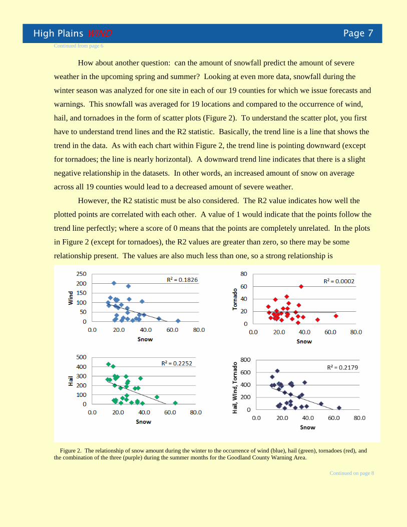
How about another question: can the amount of snowfall predict the amount of severe
weather in the upcoming spring and summer? Looking at even more data, snowfall during the
winter season was analyzed for one site in each of our 19 counties for which we issue forecasts and
warnings. This snowfall was averaged for 19 locations and compared to the occurrence of wind,
hail, and tornadoes in the form of scatter plots (Figure 2). To understand the scatter plot, you first
have to understand trend lines and the R2 statistic. Basically, the trend line is a line that shows the
trend in the data. As with each chart within Figure 2, the trend line is pointing downward (except
for tornadoes; the line is nearly horizontal). A downward trend line indicates that there is a slight
negative relationship in the datasets. In other words, an increased amount of snow on average
across all 19 counties would lead to a decreased amount of severe weather.
However, the R2 statistic must be also considered. The R2 value indicates how well the
plotted points are correlated with each other. A value of 1 would indicate that the points follow the
trend line perfectly; where a score of 0 means that the points are completely unrelated. In the plots
in Figure 2 (except for tornadoes), the R2 values are greater than zero, so there may be some
relationship present. The values are also much less than one, so a strong relationship is
Figure 2. The relationship of snow amount during the winter to the occurrence of wind (blue), hail (green), tornadoes (red), and
the combination of the three (purple) during the summer months for the Goodland County Warning Area.
Continued on page 8
Page 8 High Plains WIND Continued from page 7
absent. In the case of tornadoes (red), a near zero relationship indicates that snow does not have
any noticeable relationship with the amount of tornadoes that occur in the following summer
season.
Unfortunately, the amount of snowfall received during the winter months is not a great predictor of
what kind of weather is on the horizon for the summer. This may be a good thing being that
Goodland has only received 22.7 inches of snow (as of this writing) for the winter season, which is
about 7 inches below normal. Based on the scatter plots in Figure 2, this past winter’s snow could
lead to a wide range of rainfall outcomes and severe weather possibilities for this upcoming
summer. It does appear that during years where snowfall was above average, severe weather
seemed to decline. Will we have higher amounts of severe weather across the area? Will we see
below average rainfall this spring and summer? Time will tell, and we will find out soon enough.
.
Check out our website for more information or catch up with us on Facebook or Twitter
High Plains WIND Page 9
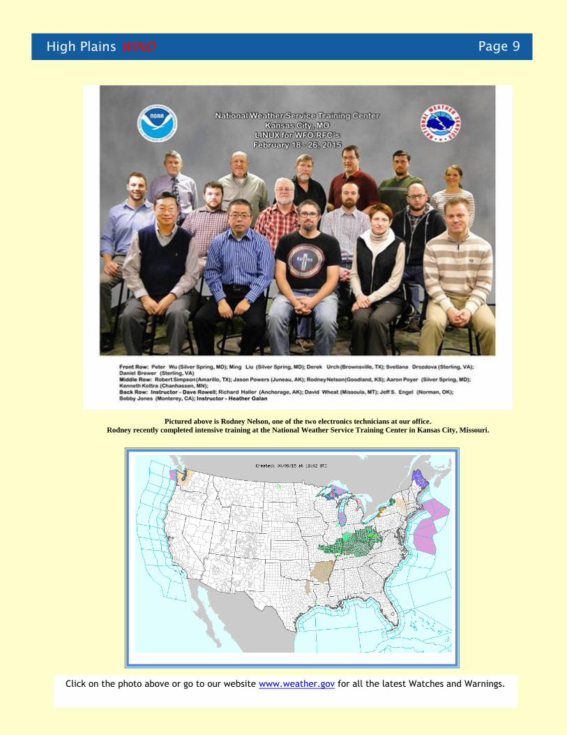
Pictured above is Rodney Nelson, one of the two electronics technicians at our office.
Rodney recently completed intensive training at the National Weather Service Training Center in Kansas City, Missouri.
Click on the photo above or go to our website www.weather.gov for all the latest Watches and Warnings.

Page 10 High Plains WIND
CoCoRaHS Corner
By David Thede
The CoCoRaHS program recently received a grant that will provide nearly all 5th grade students in Yuma County with a CoCoRaHS rain gauge. So far, approximately 35 new observers have joined the CoCoRaHS program from Yuma county and more are likely. Welcome to our new observers. These observers will be added to the approximately 150 additional observers in far eastern Colorado, northwest Kansas and extreme southwest Nebraska. If you are interested in participating in the CoCoRaHS program and can reliably report precipitation data whether it’s daily when some or none fell or just on days when precipitation fell, we would be interested in having you join us.
http://www.cocorahs.org/
Interested volunteers should contact the Northwest Kansas/East Central Colorado and Southwest Nebraska CoCoRaHS Coordinator, David Thede of the National Weather Service in Goodland. He can be reached at (785) 899-7119 or at [email protected].
Our office recently welcomed two new staff members. Jessica Hill and Timothy Lynch both began work in our office in March. They both bring valuable skills that are a welcome addition to our staff of weather professionals!
High Plains WIND Page 11
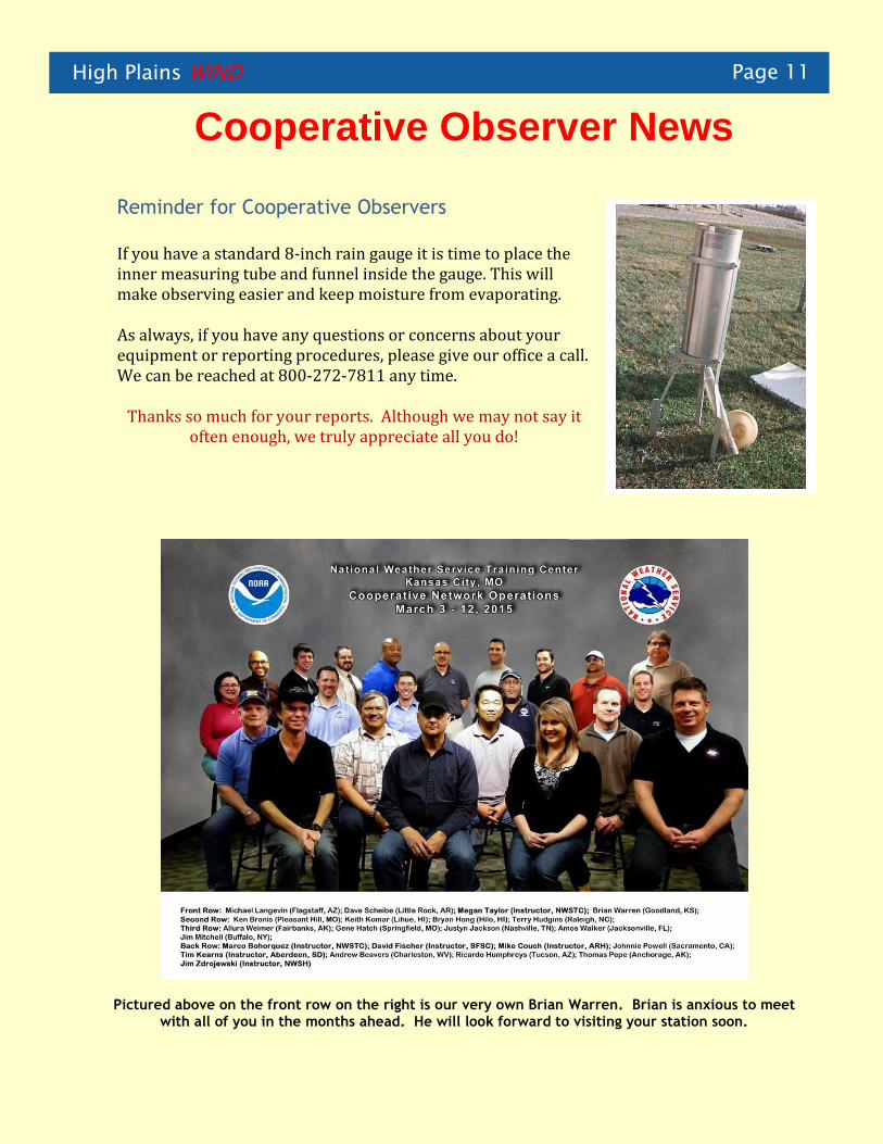
Cooperative Observer News
Reminder for Cooperative Observers If you have a standard 8‐inch rain gauge it is time to place the inner measuring tube and funnel inside the gauge. This will make observing easier and keep moisture from evaporating. As always, if you have any questions or concerns about your equipment or reporting procedures, please give our office a call. We can be reached at 800-272-7811 any time.
Thanks so much for your reports. Although we may not say it often enough, we truly appreciate all you do!
Pictured above on the front row on the right is our very own Brian Warren. Brian is anxious to meet with all of you in the months ahead. He will look forward to visiting your station soon.
Page 12 High Plains WIND
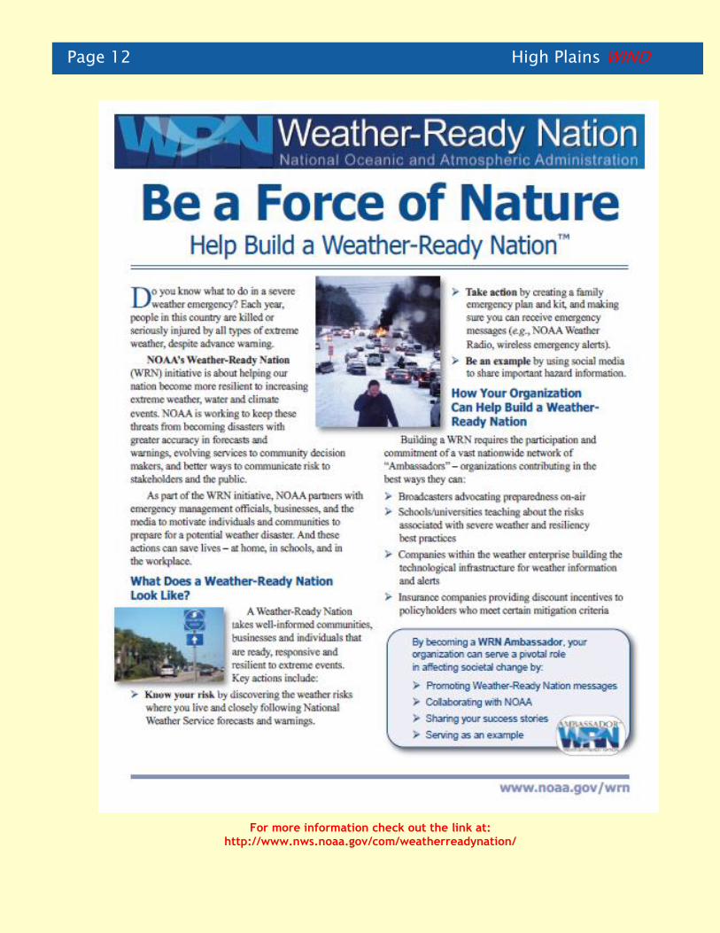
For more information check out the link at: http://www.nws.noaa.gov/com/weatherreadynation/
High Plains WIND Page 13
We Need Your Help! By Jesse Lundquist
With severe weather season approaching, it’s time for us to ask for your help with
reporting severe weather. Our radar can’t tell us what is reaching the ground, which
is why your weather reports are so important! By letting us know what the weather is
doing at your location, you are helping us protect lives and property. Below is a list
of what we are looking for:
Your location from the nearest town and the location of the
report (if different).
The size of the largest hailstone in relation to a coin (or
common athletic balls if bigger).
Wind gusts of 60+ MPH.
Rotating wall clouds, funnel clouds, tornadoes.
Rainfall amounts of 1”+ per hour.
Any areas where there is 6”+ of water over the road or damage
from flooding.
Damage and injuries from the storm.
Low visibility (< ¼ mile) from blowing dirt.
Start time, end time, and duration of any of the above events.
Even though weather reports are very important to us, your safety is
top priority. If the weather is too dangerous for you to go outside,
please wait until the storm passes. Delayed reports are just as
important to us. Your weather reports can also be sent to us by
phone or through social media. With your help we can keep the
public better informed when the weather becomes hazardous. Thank
you in advance for your help this severe weather
season.
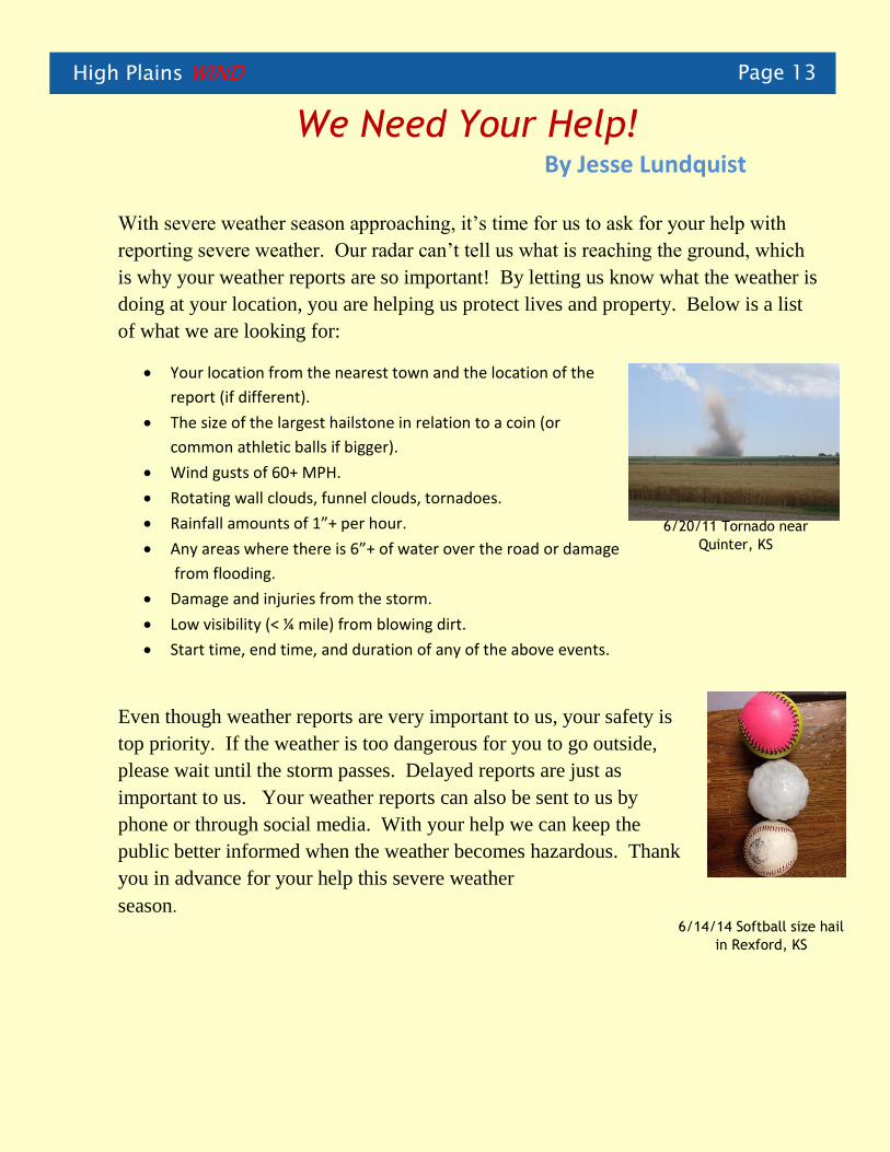
6/14/14 Softball size hail
in Rexford, KS
6/20/11 Tornado near
Quinter, KS

Page 14 High Plains WIND
NOAA Weather Radio Transmitter Upgraded
By Scott Mentzer
Through the efforts of Yuma County Emergency Manager Roger Brown and the
National Weather Service, NOAA Weather Radio transmitter WXM-87 in Wray,
Colorado, was upgraded to 300 watts on February 10, 2015. The transmitter was
previously running 100 watts. The signal produced by the transmitter now covers
most of western Yuma County, and signal improvement was also noted as far
southeast as Saint Francis, Kansas.
After acquiring funding through the
Department of Homeland Security,
Mr. Brown spent many years
working with the transmitter
manufacturer to secure the updated
equipment. His determined efforts
made certain that the citizens of
Yuma County, Colorado; western
Dundy County, Nebraska; and parts
of Cheyenne County, Kansas,
received better NOAA Weather
Radio coverage.
Continued on page 15
NOAA Weather Radio Transmitter in Wray, Colorado

High Plains WIND Page 15
Continued from page 14
Technicians Ron Kilgore and Grady Bonsall finalizing the transmitter installation
Interesting Reading
Often we receive interesting information from other agencies and universities.
Here are a couple articles that you might enjoy.
One was on “playa lakes” and how they impact the environment in our area. Learn more at:
http://www.kgs.ku.edu/Publications/PIC/pic30.html
The second was on the effect of drought and other stresses on the winter wheat crop. Check it out at:
http://cropwatch.unl.edu/2015-wheat-winterkill
Page 16 High Plains WIND
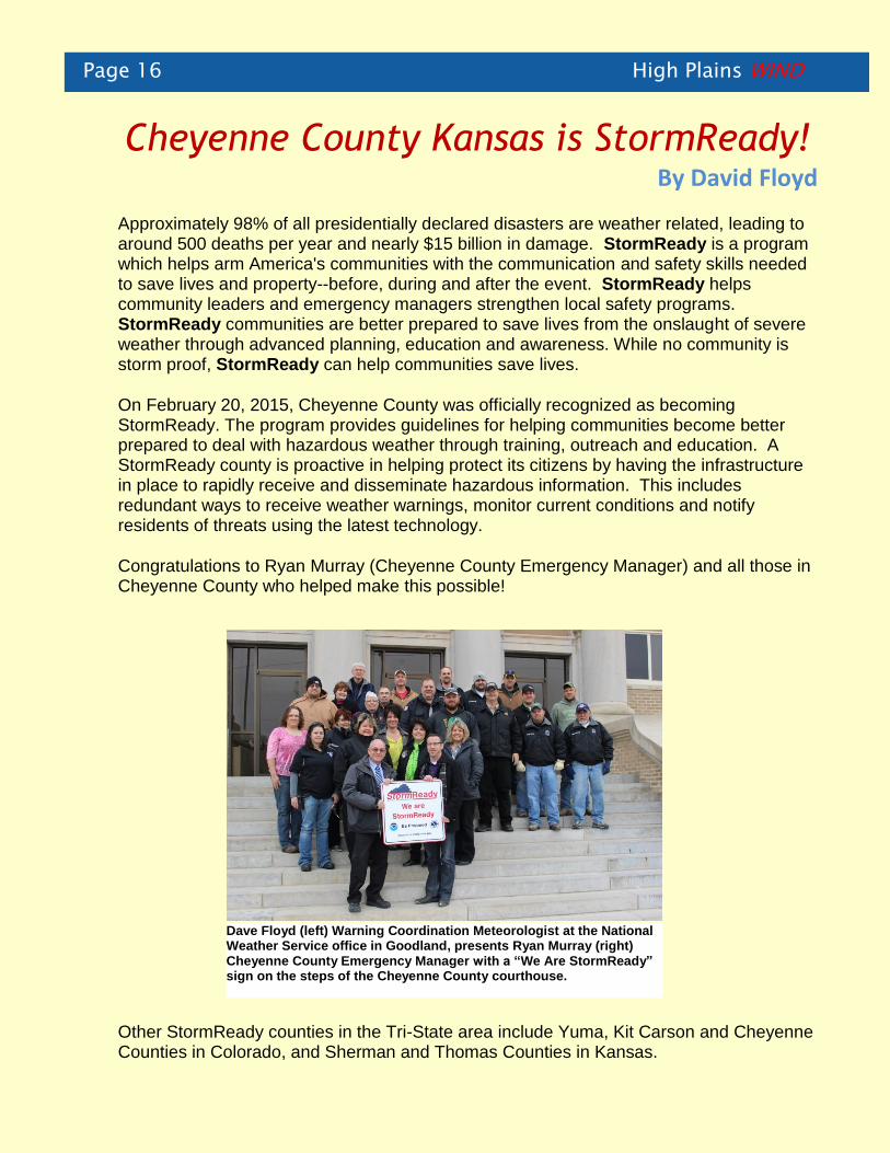
Cheyenne County Kansas is StormReady!
By David Floyd
Approximately 98% of all presidentially declared disasters are weather related, leading to around 500 deaths per year and nearly $15 billion in damage. StormReady is a program which helps arm America's communities with the communication and safety skills needed to save lives and property--before, during and after the event. StormReady helps community leaders and emergency managers strengthen local safety programs. StormReady communities are better prepared to save lives from the onslaught of severe weather through advanced planning, education and awareness. While no community is storm proof, StormReady can help communities save lives.
On February 20, 2015, Cheyenne County was officially recognized as becoming StormReady. The program provides guidelines for helping communities become better prepared to deal with hazardous weather through training, outreach and education. A StormReady county is proactive in helping protect its citizens by having the infrastructure in place to rapidly receive and disseminate hazardous information. This includes redundant ways to receive weather warnings, monitor current conditions and notify residents of threats using the latest technology.
Congratulations to Ryan Murray (Cheyenne County Emergency Manager) and all those in Cheyenne County who helped make this possible!
Other StormReady counties in the Tri-State area include Yuma, Kit Carson and Cheyenne Counties in Colorado, and Sherman and Thomas Counties in Kansas.
Dave Floyd (left) Warning Coordination Meteorologist at the National Weather Service office in Goodland, presents Ryan Murray (right) Cheyenne County Emergency Manager with a “We Are StormReady” sign on the steps of the Cheyenne County courthouse.

High Plains WIND Page 17
Climate Corner
Current Weather Information for Our Area Latest Extended Outlooks
Precipitation Outlook (April - June 2015) Temperature Outlook (April - June 2015)
Current Drought Monitor Drought Outlook
Need more information? Check out the Climate Prediction Center website at: http://www.cpc.ncep.noaa.gov/
Site Year-to-Date Precipitation* Departure from Normal
Burlington 1.75 -.32
Goodland 1.81 -.67
Hill City .71 -2.59
McCook .78 -2.44
*As of April 12, 2015

Page 18 High Plains WIND
National Weather Service 920 Armory Road Goodland, KS 67735
Phone: 785-899-7119
Fax: 785-899-3501
E-mail: [email protected]
Website: http://www.weather.gov/gld
Facebook: http://www.facebook.com/nwsgoodland
Twitter: https://twitter.com/NWSGoodland
The National Weather Service provides
weather, hydrologic, and climate forecasts and
warnings for the United States, its territories,
adjacent waters and ocean areas, for the
protection of life and property and the
enhancement of the national economy. NWS
data and products form a
national information database and
infrastructure which can be used by other
governmental agencies, the private sector, the
public, and the global community. It is
accomplished by providing warnings and
forecasts of hazardous weather, including
thunderstorms, flooding, hurricanes,
tornadoes, winter weather, tsunamis, and
climate events. The NWS is the
sole United States OFFICIAL voice for issuing
warnings during life-threatening weather
situations.
Please don’t forget, if you
have pictures or video to
share of any severe weather
events that take place this
year, please contact
With your permission, your
pictures and video will
provide information and
training materials for future
storm spotters and
meteorologists!
Related Documents