Groundwater in Fractured Rock Aquifers Well Location, Yield, and Sustainability Water Education Foundation Briefing Water Year 2016: San Joaquin Valley Groundwater Conditions John Kirk, PG, CEG, CHG Engineering Geologist Division of Integrated Regional Water Management South Central Region Office

Welcome message from author
This document is posted to help you gain knowledge. Please leave a comment to let me know what you think about it! Share it to your friends and learn new things together.
Transcript
Groundwater in Fractured Rock Aquifers Well Location, Yield, and Sustainability
Water Education Foundation Briefing Water Year 2016: San Joaquin Valley
Groundwater Conditions John Kirk, PG, CEG, CHG Engineering Geologist Division of Integrated Regional Water Management South Central Region Office
Burning Questions
• What is a fractured rock aquifer?
• How does it differ from an alluvial aquifer?
• How much water is stored in fractures?
• What are typical well yields?
• Is pumping sustainable?
• What about groundwater quality?

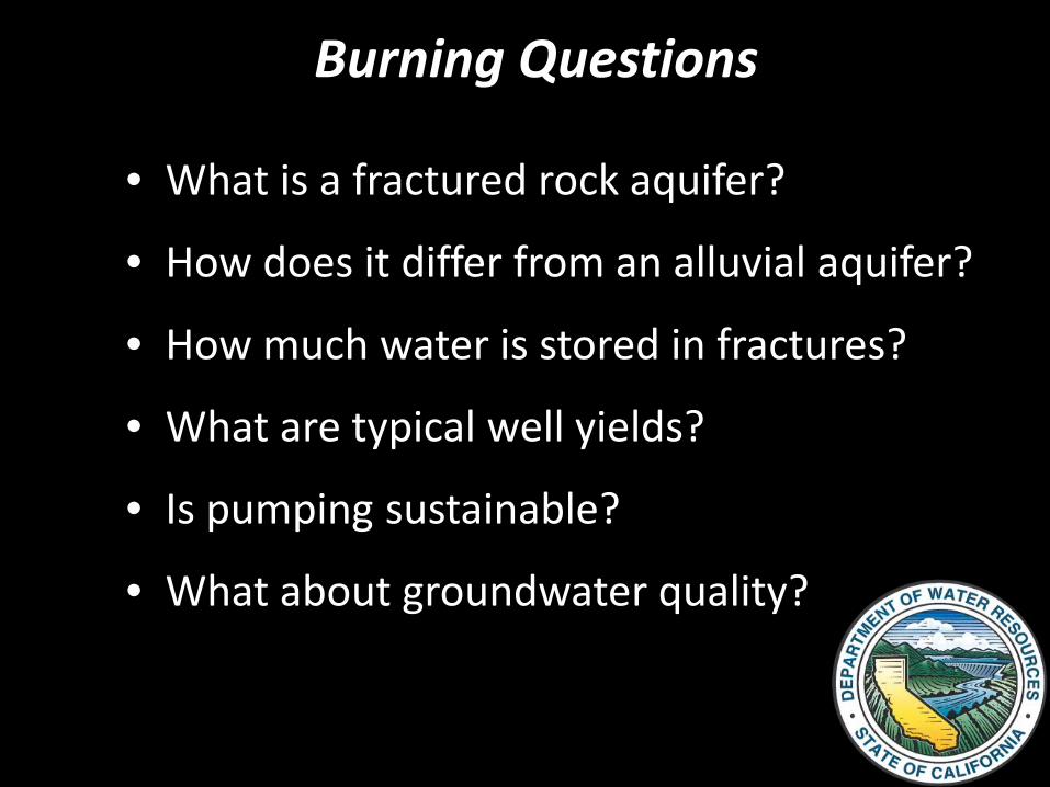
What is a Fractured Rock Aquifer?
There are two main types of aquifers: alluvial and fractured rock. The primary distinction:
• An alluvial aquifer stores and
transports water through sediment pores
• A *fractured rock aquifer has limited storage capability and transports water along planar breaks.
*aka bedrock, crystalline rock, hard rock, basement.
(Water Bearing Fractured Rock)
(Alluvial Aquifer)

USGS
Porosity Primary Porosity
Secondary Porosity
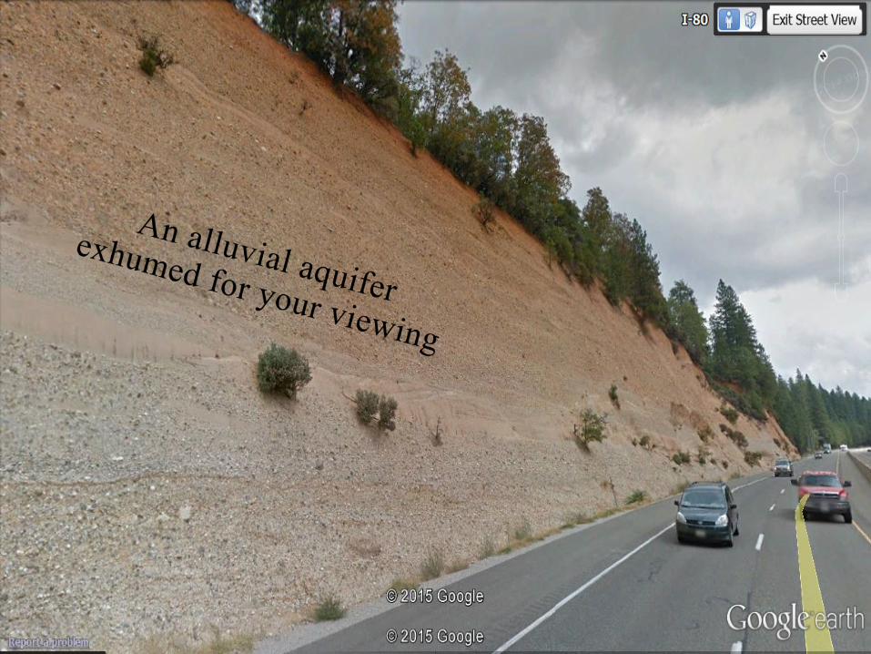
Alluvial Aquifers
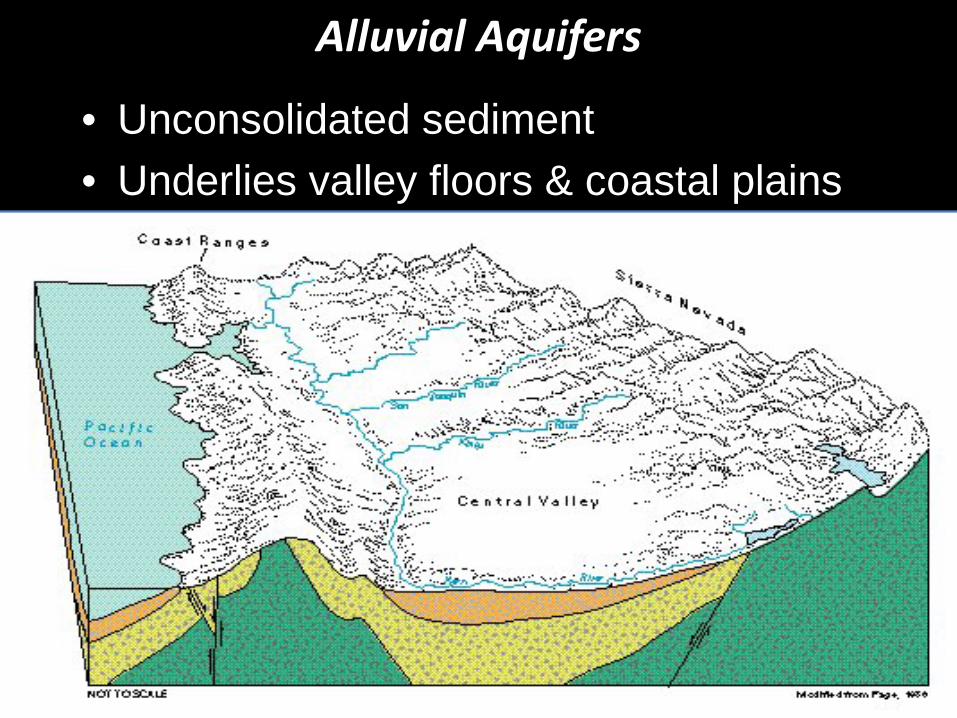
• Unconsolidated sediment • Underlies valley floors & coastal plains

515 alluvial basins/subbasins
Source: DWR’s Bulletin 118, update 2003
Alluvial aquifers – Fractured rock need not apply
California’s Groundwater Basins
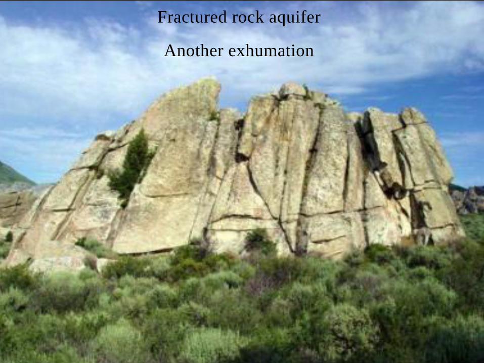
Fractured rock aquifer
Another exhumation
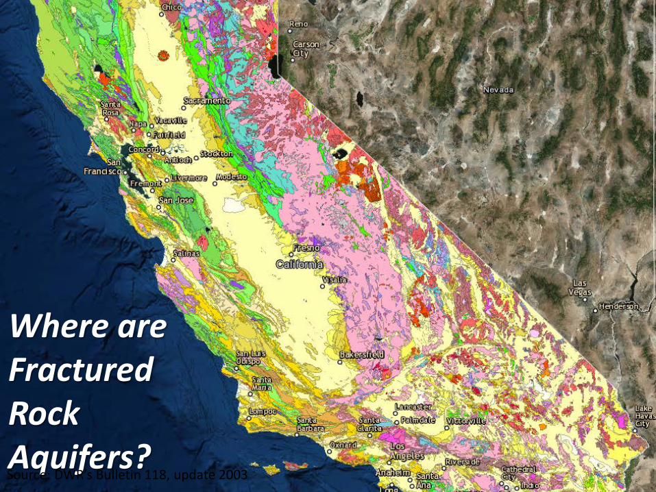
Where are Fractured Rock Aquifers? Source: DWR’s Bulletin 118, update 2003
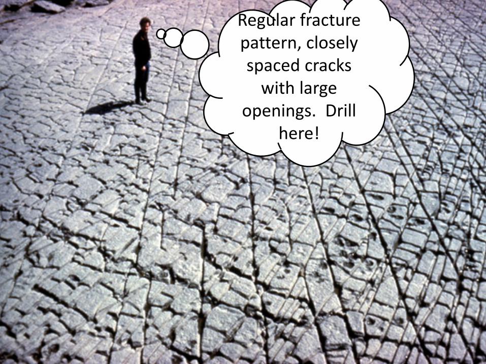
Regular fracture pattern, closely spaced cracks
with large openings. Drill
here!
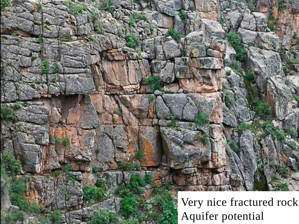
Very nice fractured rock Aquifer potential

Solid, unbroken granite. Almost no chance for a well.
Not All Rock is Fractured and Water Bearing Imagine this covered with soil with no clues as to where to drill.

Hints to an aquifer’s location.
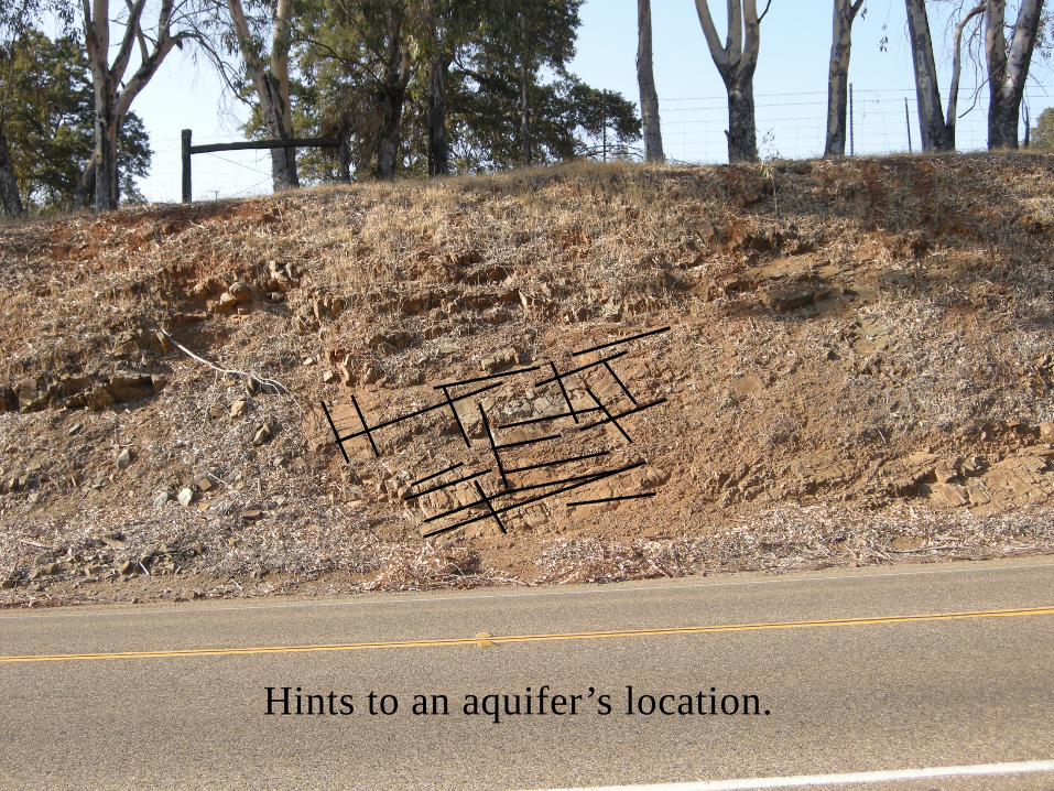
Hints to an aquifer’s location.
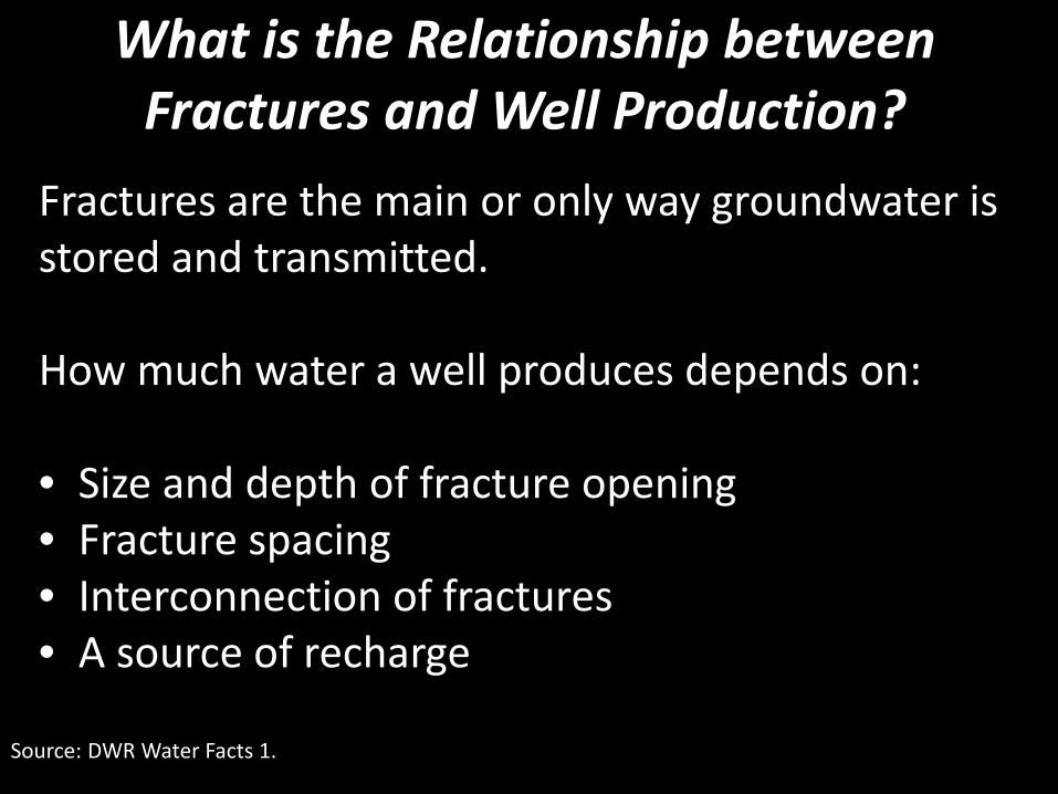
What is the Relationship between Fractures and Well Production?
Source: DWR Water Facts 1.
Fractures are the main or only way groundwater is stored and transmitted. How much water a well produces depends on: • Size and depth of fracture opening • Fracture spacing • Interconnection of fractures • A source of recharge
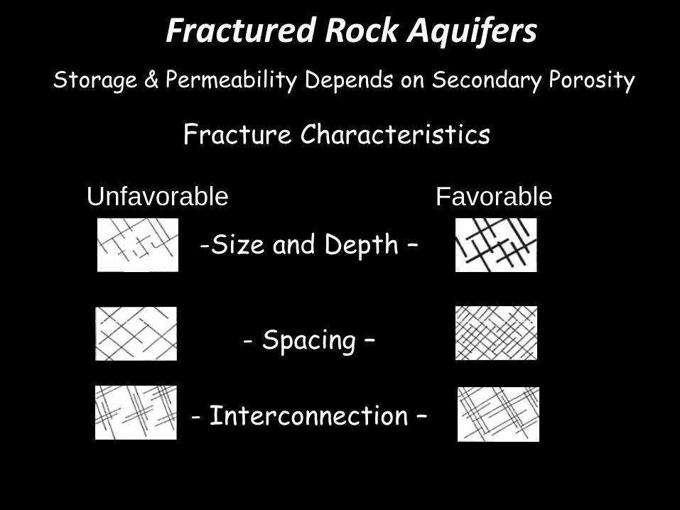
Fractured Rock Aquifers Storage & Permeability Depends on Secondary Porosity
Fracture Characteristics
-Size and Depth –
- Spacing –
- Interconnection –
Favorable Unfavorable

• unconsolidated alluvial sediment with a porosity of 15%-50% contains:
1.4 to 3.7 gallons of water
• impermeable rock with a fracture 1 mm in width
contains:
0.03 gallons of water
How Much Water is Stored in Fractures? 1 cubic foot of:
Source: DWR Water Facts 1.
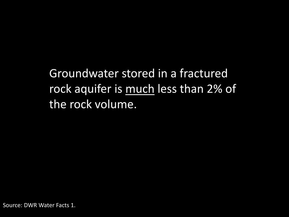
Groundwater stored in a fractured rock aquifer is much less than 2% of the rock volume.

Well Yield
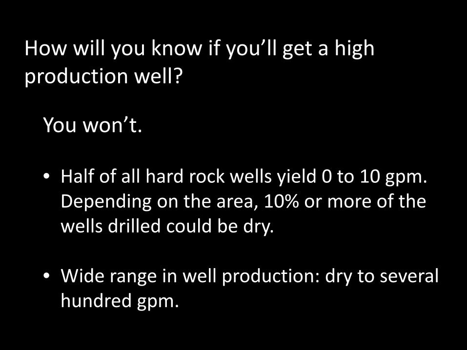
How will you know if you’ll get a high production well?
You won’t. • Half of all hard rock wells yield 0 to 10 gpm.
Depending on the area, 10% or more of the wells drilled could be dry.
• Wide range in well production: dry to several hundred gpm.

Well Yields in Fractured Rock Aquifers
Source: USGS Prof. Paper 1660, “Factors Related to Well Yield in the Fractured-Bedrock Aquifer of New Hampshire.
Gentle slopes Swales or valley bottoms
W/in 100 feet of lineament Near surface water
Fractures on major trends Large drainage area
Commercial well
Steep slopes Hilltops No lineaments No surface water No fracture trend Small drainages Shallow, private well
Higher Yields Lower Yields
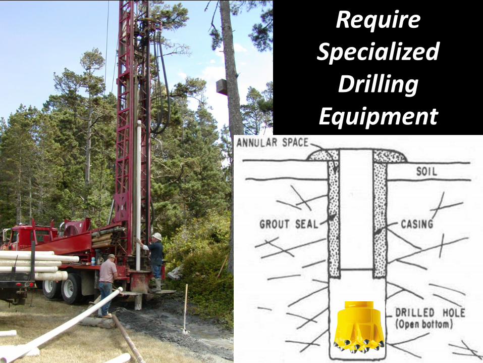
Require Specialized
Drilling Equipment
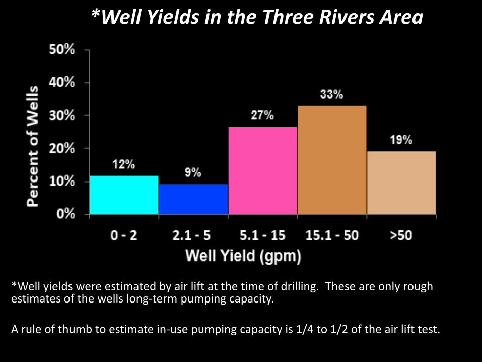
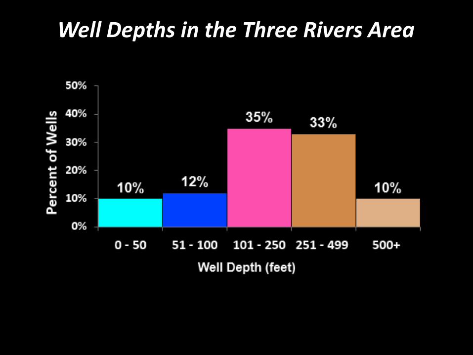
*Well yields were estimated by air lift at the time of drilling. These are only rough estimates of the wells long-term pumping capacity. A rule of thumb to estimate in-use pumping capacity is 1/4 to 1/2 of the air lift test.
*Well Yields in the Three Rivers Area
Dry Wells There is no requirement to report a dry well and little is known about their occurrence. Anecdotal information comes from visits to DWR by worried homeowners with dry wells. There have been areas where individual homesites and/or groups of homes have dry wells with failed repeated attempts to re-drill. Shallow wells or wells with only shallow fractures dry up first.

DRY WELLS REPORTED TO
TULARE COUNTY
How Deep Should I Drill?
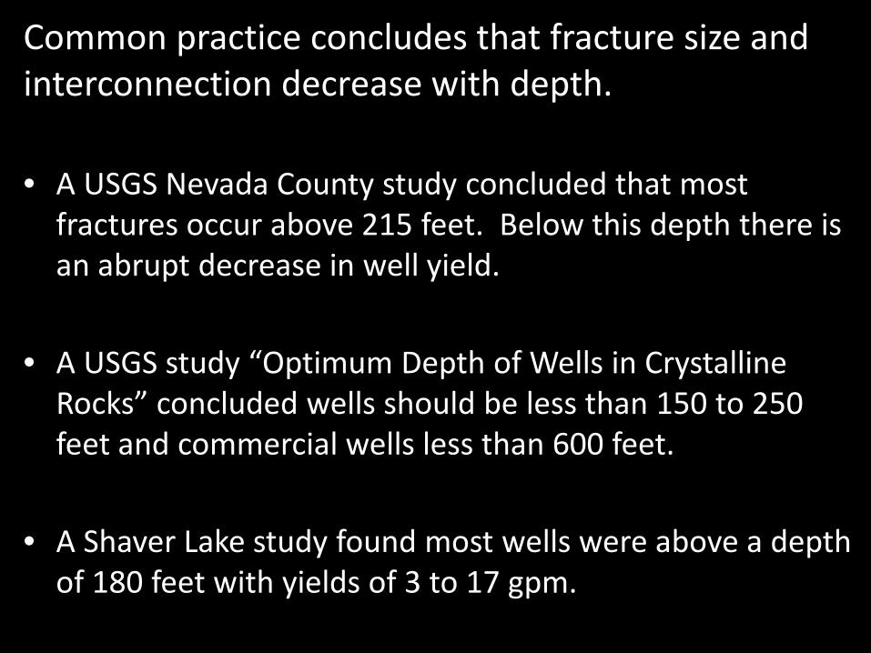
Common practice concludes that fracture size and interconnection decrease with depth.
• A USGS Nevada County study concluded that most
fractures occur above 215 feet. Below this depth there is an abrupt decrease in well yield.
• A USGS study “Optimum Depth of Wells in Crystalline Rocks” concluded wells should be less than 150 to 250 feet and commercial wells less than 600 feet.
• A Shaver Lake study found most wells were above a depth of 180 feet with yields of 3 to 17 gpm.
Well Depths in the Three Rivers Area

On the Other Hand Deep fractures may provide higher yielding wells. Examples:
• Fishcamp resort development with 5 wells 1,000 feet deep all producing 50 to more than 100 gpm
• Millerton Lake land development where a single fracture at 970 produced >100 gpm.
• Coarsegold residential development with higher yields.
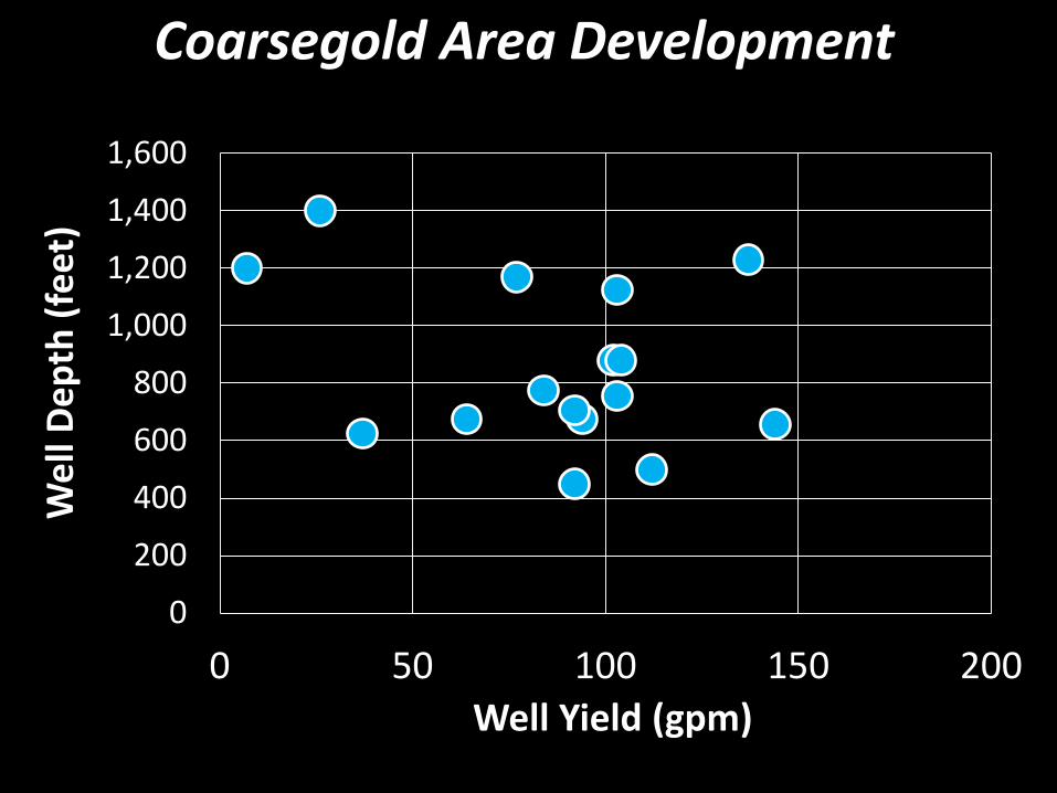
Coarsegold Area Development
0
200
400
600
800
1,000
1,200
1,400
1,600
0 50 100 150 200
Wel
l Dep
th (f
eet)
Well Yield (gpm)
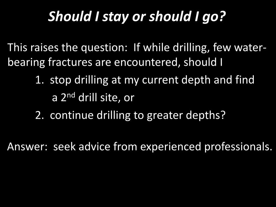
Should I stay or should I go?
This raises the question: If while drilling, few water-bearing fractures are encountered, should I 1. stop drilling at my current depth and find a 2nd drill site, or 2. continue drilling to greater depths?
Answer: seek advice from experienced professionals.
How Much Water Do I Need from My Well?

WATER DEMAND FOR AN INDIVIDUAL HOUSEHOLD
Annual Water Use
• US EPA estimate: 300 gallons/day.
• 2011 California single-family estimate: 360 gallons/day.
• Foothill community near Coarsegold: 310 gallons/day – average
(from water meters so includes all water use).
• County building/health departments commonly require more for minimum well capacity.
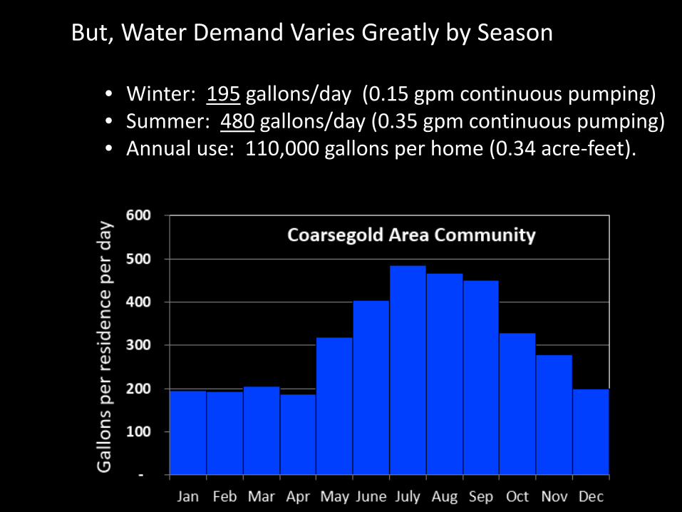
But, Water Demand Varies Greatly by Season
• Winter: 195 gallons/day (0.15 gpm continuous pumping) • Summer: 480 gallons/day (0.35 gpm continuous pumping) • Annual use: 110,000 gallons per home (0.34 acre-feet).

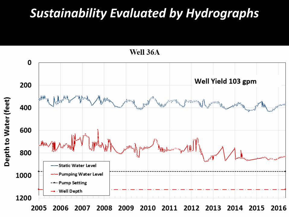
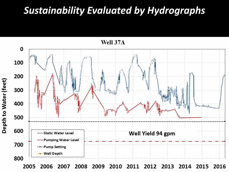
How Sustainable is Pumping?

Two Methods Used
• Water balance (Three Rivers area)
• Groundwater hydrographs (Coarsegold area)
Water Balance Example from Three Rivers
Kaweah River Watershed
Where are Fractured Rock Aquifers?
Source: DWR’s Bulletin 118, update 2003
Kaweah River Watershed Study Area
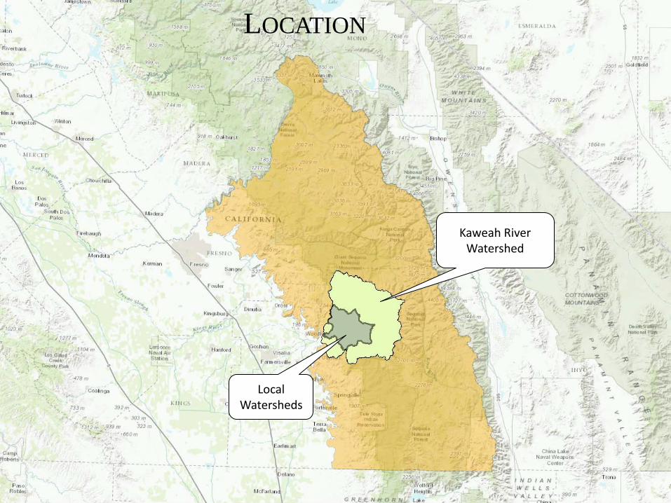
LOCATION
Kaweah River Watershed
Local Watersheds
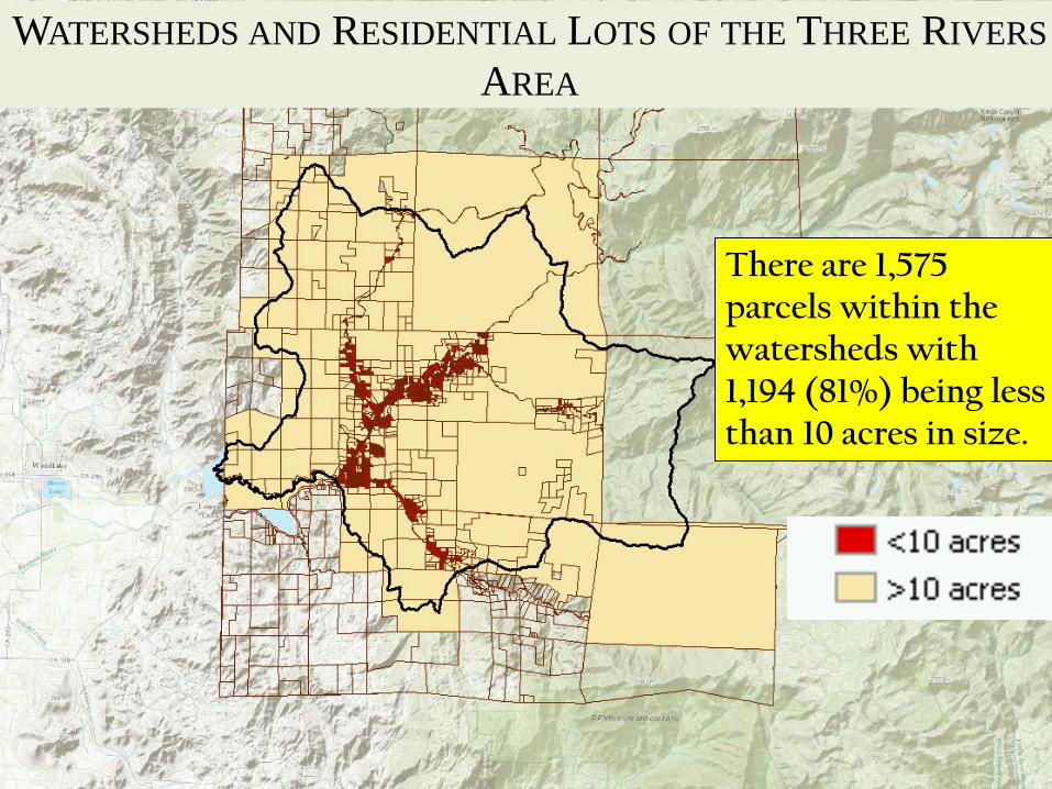
There are 1,575 parcels within the watersheds with 1,194 (81%) being less than 10 acres in size.
WATERSHEDS AND RESIDENTIAL LOTS OF THE THREE RIVERS AREA
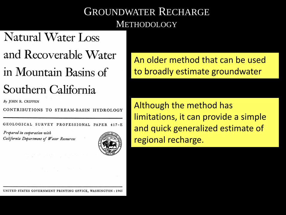
GROUNDWATER RECHARGE METHODOLOGY
An older method that can be used to broadly estimate groundwater recharge.
Although the method has limitations, it can provide a simple and quick generalized estimate of regional recharge.
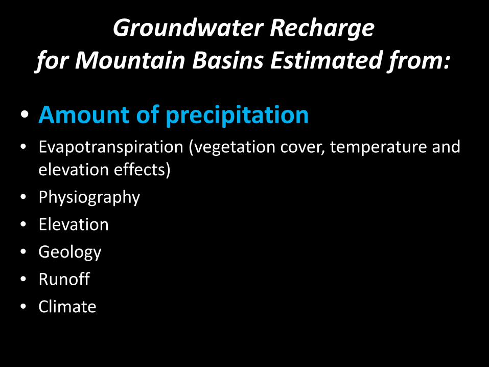
Groundwater Recharge for Mountain Basins Estimated from:
• Amount of precipitation • Evapotranspiration (vegetation cover, temperature and
elevation effects) • Physiography • Elevation • Geology • Runoff • Climate
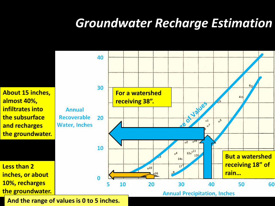
For a watershed receiving 38”.
About 15 inches, almost 40%, infiltrates into the subsurface and recharges the groundwater.
Less than 2 inches, or about 10%, recharges the groundwater.
But a watershed receiving 18” of rain…
And the range of values is 0 to 5 inches.
Groundwater Recharge Estimation
Is Water Use and Water Supply in Balance?
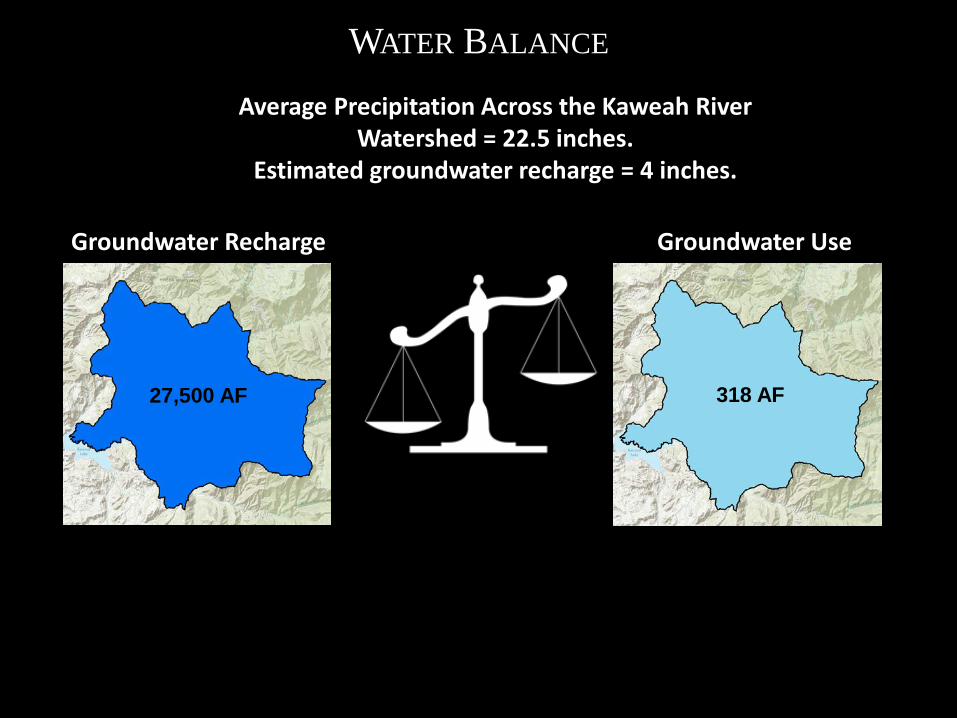
WATER BALANCE
Groundwater Recharge Groundwater Use
27,500 AF 318 AF
Average Precipitation Across the Kaweah River Watershed = 22.5 inches.
Estimated groundwater recharge = 4 inches.
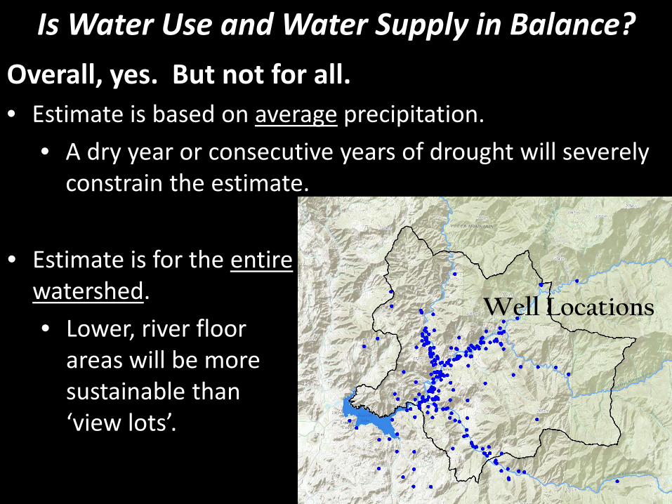
Overall, yes. But not for all. • Estimate is based on average precipitation.
• A dry year or consecutive years of drought will severely constrain the estimate.
Is Water Use and Water Supply in Balance?
Well Locations
• Estimate is for the entire watershed. • Lower, river floor
areas will be more sustainable than ‘view lots’.
Example from Coarsegold Area
Sustainability Estimated from Groundwater Hydrographs
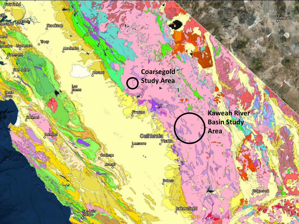
Where are Fractured Rock Aquifers?
Source: DWR’s Bulletin 118, update 2003
Kaweah River Basin Study Area
Coarsegold Study Area

Example from Coarsegold Area
Fresno
Madera Millerton Lake

Precipitation
Sustainability Evaluated by Hydrographs
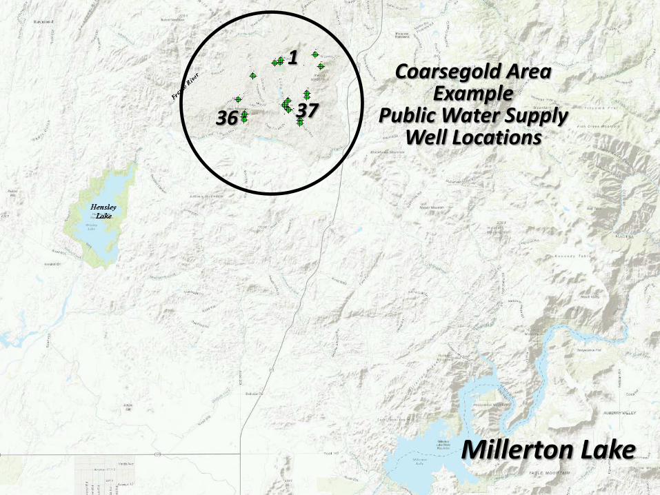
Millerton Lake
1
37 36
Coarsegold Area Example
Public Water Supply Well Locations

Sustainability Evaluated by Hydrographs
Sustainability Evaluated by Hydrographs
Sustainability Evaluated by Hydrographs
What About Groundwater Quality?

Typically very good quality with low mineral content in a properly constructed well. • Common problem constituents:
• Silica • Iron and manganese
• Some areas contain naturally occurring radioactive
materials: uranium, radon, and gross alpha.
• Some areas contain naturally occurring saline water, H2S and/or thermal groundwater commonly associated with the Foothills Lineament.
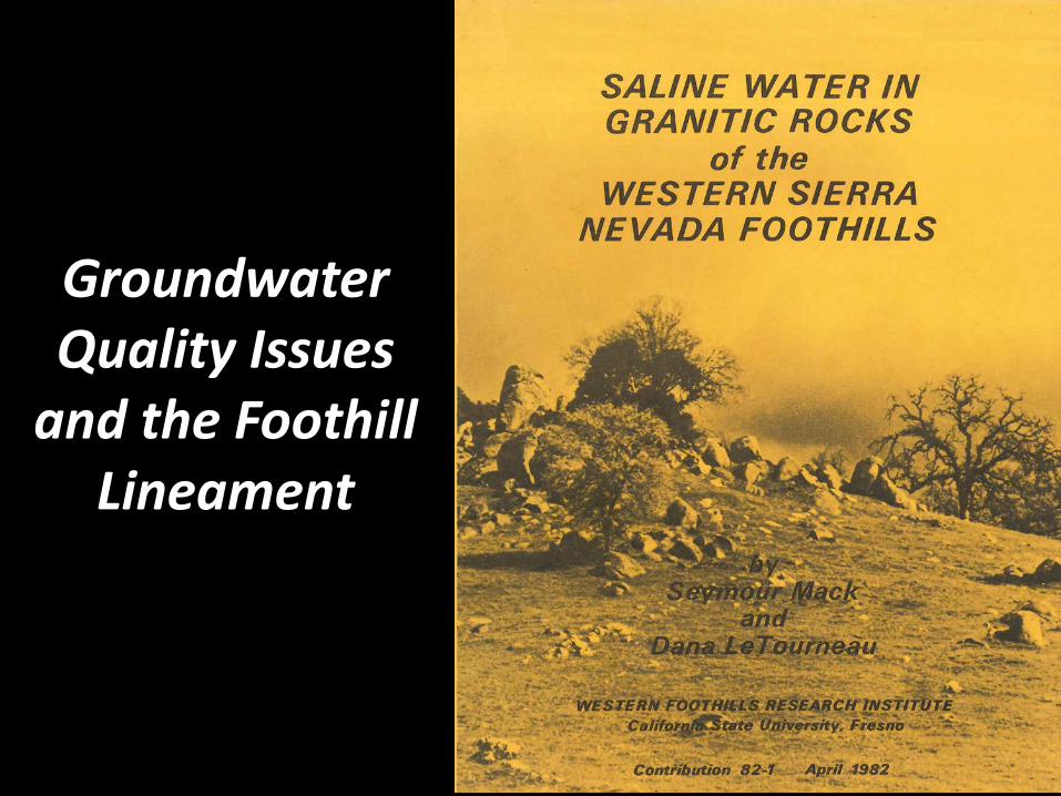
Groundwater Quality Issues
and the Foothill Lineament
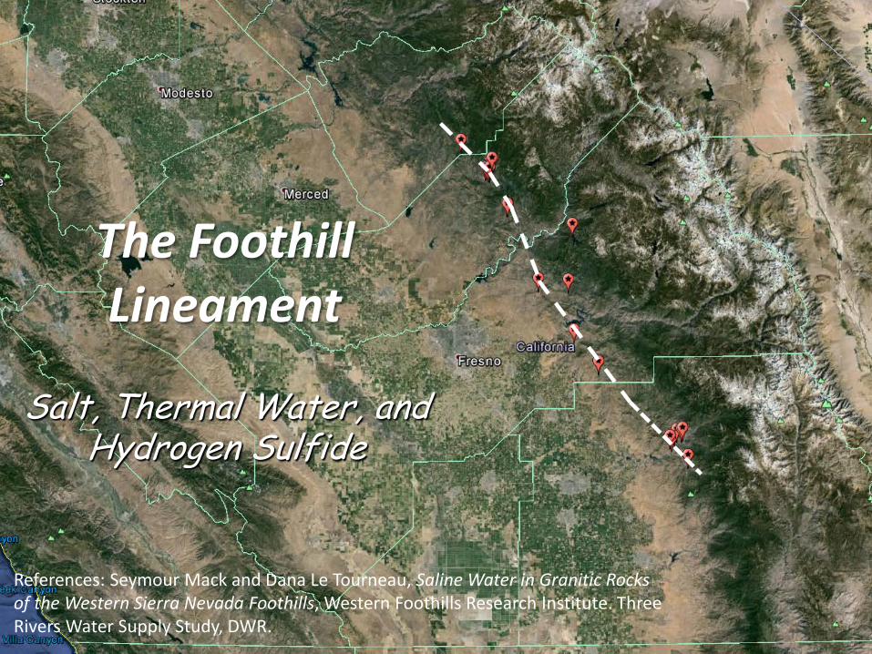
The Foothill Lineament
Salt, Thermal Water, and Hydrogen Sulfide
References: Seymour Mack and Dana Le Tourneau, Saline Water in Granitic Rocks of the Western Sierra Nevada Foothills, Western Foothills Research Institute. Three Rivers Water Supply Study, DWR.
Burning Questions
• What is a fractured rock aquifer?
• How does it differ from an alluvial aquifer?
• How much water is stored in fractures?
• What are typical well yields?
• Is pumping sustainable?
• What about groundwater quality?
Questions?
John Kirk, PG, CEG, CHG Engineering Geologist Division of Integrated Regional Water Management South Central Region Office
Credit: Despair.com
Related Documents