Great Britain Historical GIS Project: A Vision of Britain though Time What are Places? Humphrey Southall (University of Portsmouth/ Great Britain Historical GIS)

Great Britain Historical GIS Project: A Vision of Britain though Time What are Places? Humphrey Southall (University of Portsmouth/ Great Britain Historical.
Dec 19, 2015
Welcome message from author
This document is posted to help you gain knowledge. Please leave a comment to let me know what you think about it! Share it to your friends and learn new things together.
Transcript
Great Britain Historical GIS Project:A Vision of Britain though Time
What are Places?
Humphrey Southall(University of Portsmouth/
Great Britain Historical GIS)

Great Britain Historical GIS Project:A Vision of Britain though Time
What kinds of geographical entity?
• Traditional GIS very focused on landscape features• But interpretation of historical texts is about units and places
30th November 2011 2
Gazetteer Type
Landscape Features
Administrative Units
Places
Typed Yes Yes No
Visible Yes No No
Defined by Existence in landscape
Legal establishment as corporate bodies
Shared perception; mention in texts and discourse – “social tagging”
Defined as (mostly) points legally defined polygons
(mostly) fuzzy polygons

Great Britain Historical GIS Project:A Vision of Britain though Time
Selectedplaces near here
30th November 2011 3
DOME
HOMESun inthe Sands
The Valley
Royal Standard
Greenwich

Great Britain Historical GIS Project:A Vision of Britain though Time
The Sun in the Sands
30th November 2011 4
Great Britain Historical GIS Project:A Vision of Britain though Time
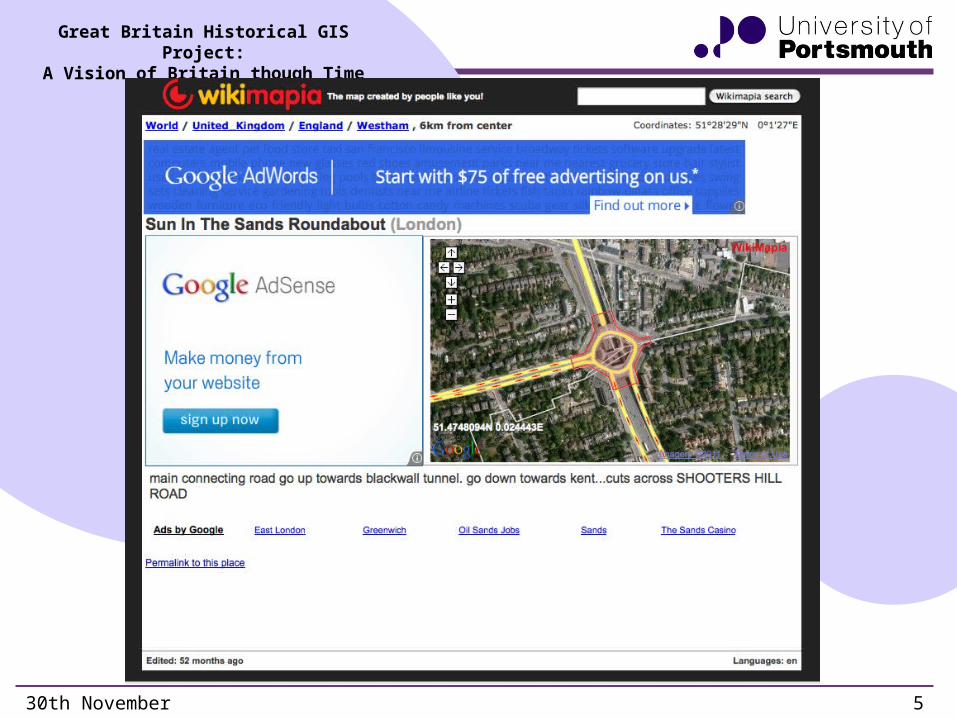
Sun in the Sands Rotary
30th November 2011 5
Great Britain Historical GIS Project:A Vision of Britain though Time
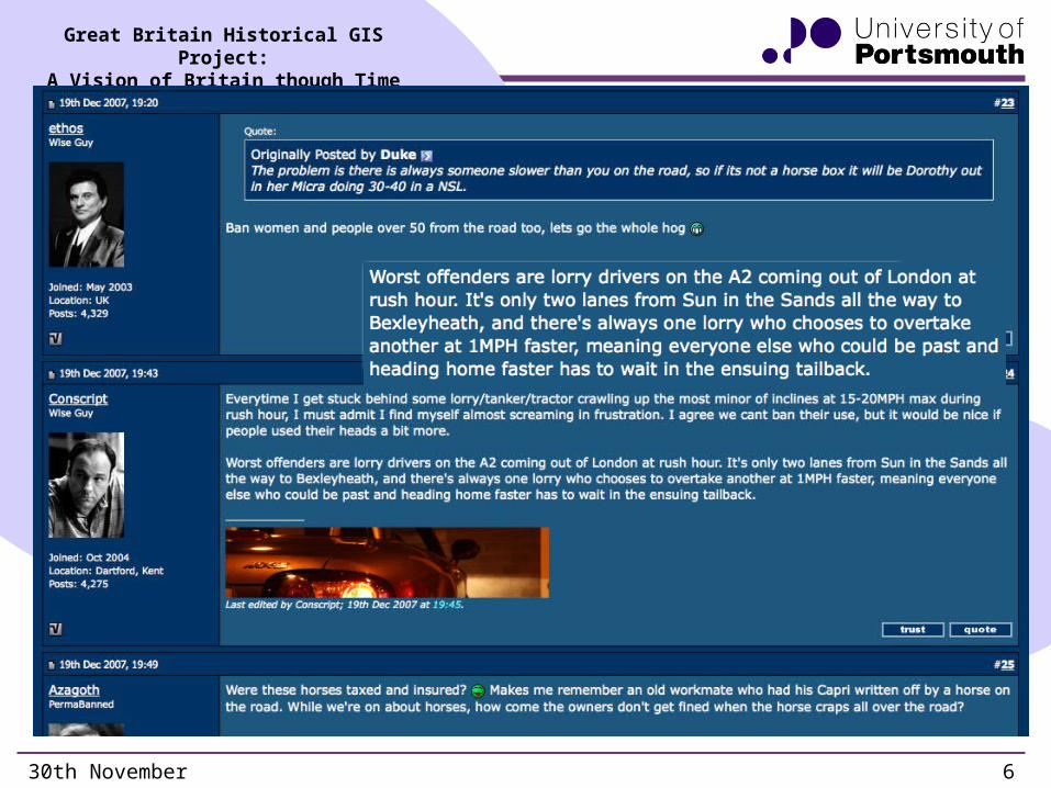
Sun in the Sands as a place
30th November 2011 6
Great Britain Historical GIS Project:A Vision of Britain though Time
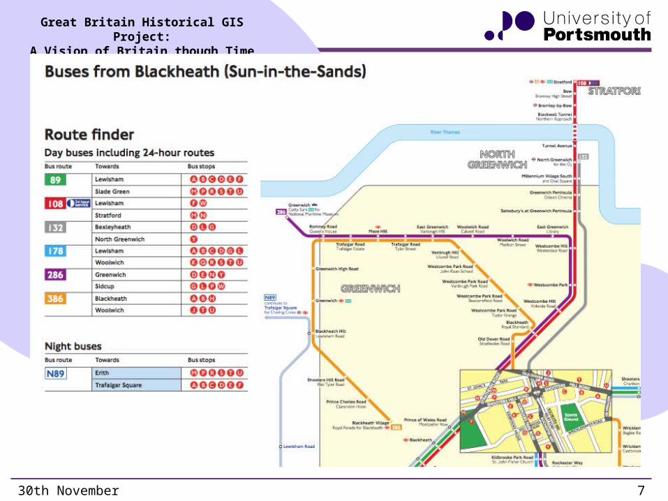
Sun in Sands bus map
30th November 2011 7
Great Britain Historical GIS Project:A Vision of Britain though Time
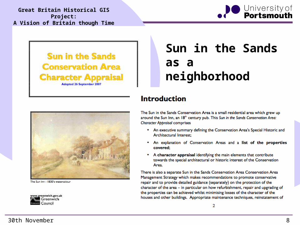
Sun in the Sands as a neighborhood
30th November 2011 8
Great Britain Historical GIS Project:A Vision of Britain though Time
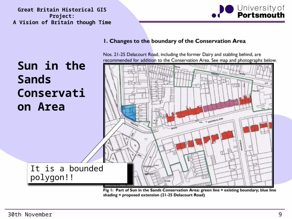
Sun in the Sands Conservation Area
30th November 2011 9
It is a bounded polygon!!
Great Britain Historical GIS Project:A Vision of Britain though Time
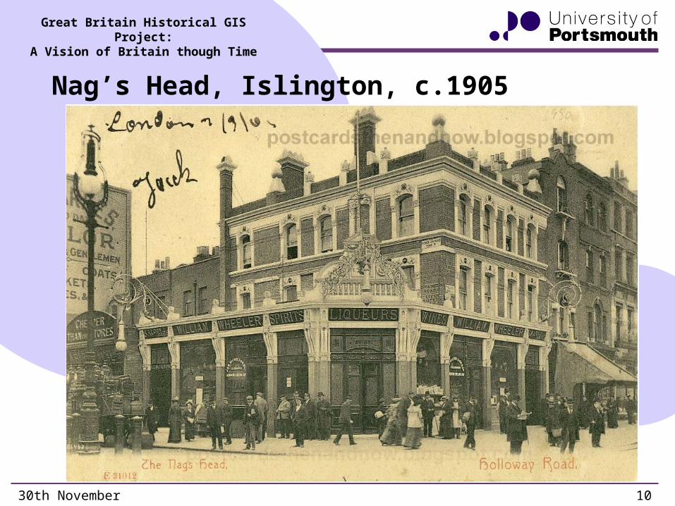
Nag’s Head, Islington, c.1905
30th November 2011 10
Great Britain Historical GIS Project:A Vision of Britain though Time
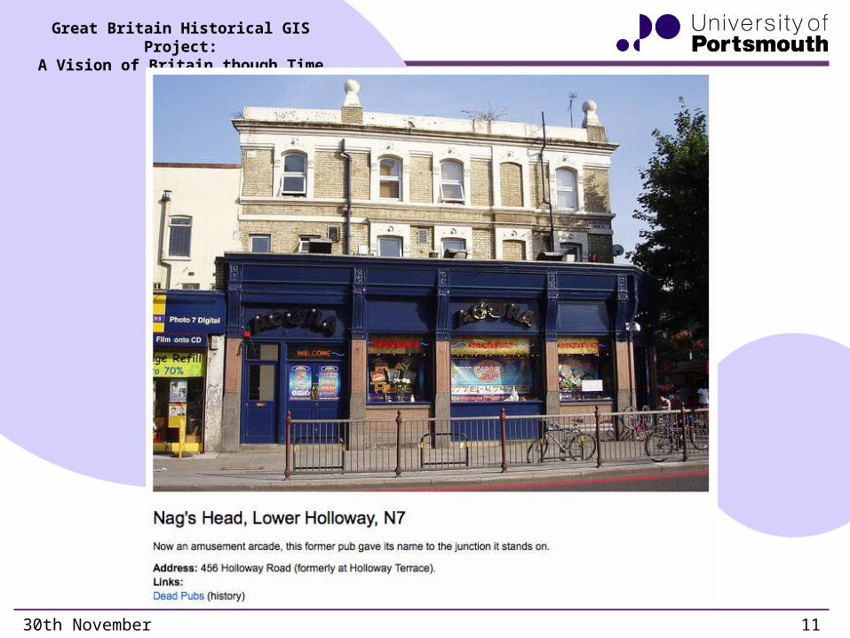
Nag’s Head today
30th November 2011 11

Great Britain Historical GIS Project:A Vision of Britain though Time
Nag’s Head in Wikipedia
30th November 2011 12

Great Britain Historical GIS Project:A Vision of Britain though Time
Nag’s Head Town Center
30th November 2011 13
It is a bounded polygon!!
Great Britain Historical GIS Project:A Vision of Britain though Time
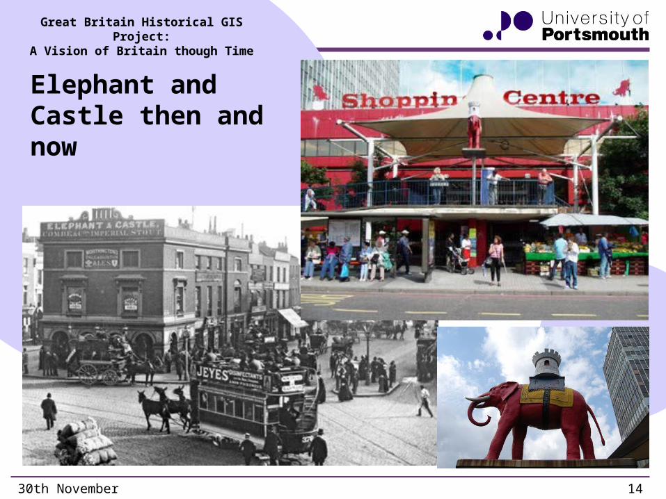
Elephant and Castle then and now
30th November 2011 14
Great Britain Historical GIS Project:A Vision of Britain though Time
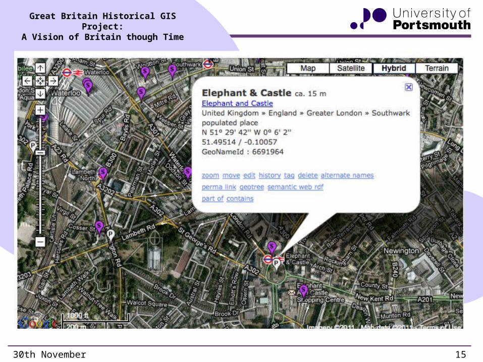
Elephant and Castle is definitely a place
30th November 2011 15

Great Britain Historical GIS Project:A Vision of Britain though Time
England’s most deprived areas
30th November 2011 16
• NB units are SOAs, so blame Dave Martin
Great Britain Historical GIS Project:A Vision of Britain though Time
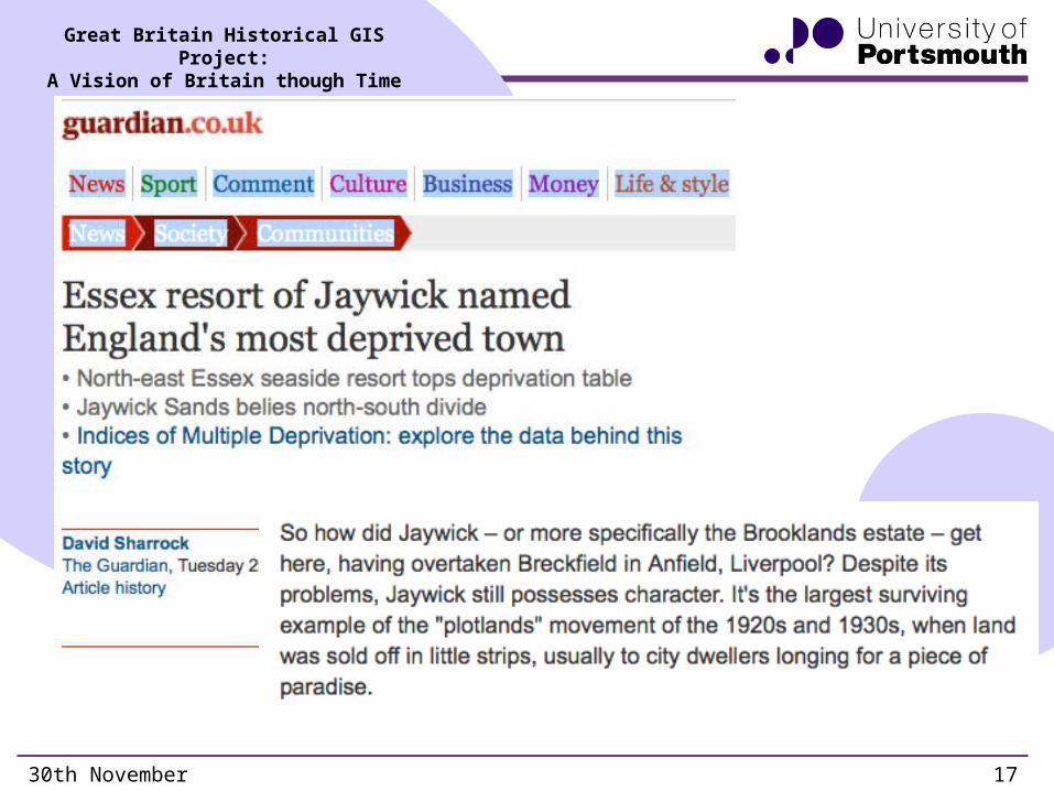
Jaywick versus Breckfield
30th November 2011 17

Great Britain Historical GIS Project:A Vision of Britain though Time
Breckfield? No such place
30th November 2011 18
Great Britain Historical GIS Project:A Vision of Britain though Time
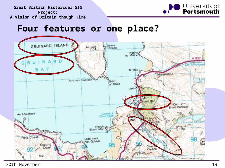
Four features or one place?
30th November 2011 19
Great Britain Historical GIS Project:A Vision of Britain though Time
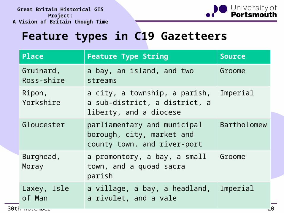
Feature types in C19 Gazetteers
30th November 2011 20
Place Feature Type String Source
Gruinard, Ross-shire
a bay, an island, and two streams Groome
Ripon, Yorkshire a city, a township, a parish, a sub-district, a district, a liberty, and a diocese
Imperial
Gloucester parliamentary and municipal borough, city, market and county town, and river-port
Bartholomew
Burghead, Moray a promontory, a bay, a small town, and a quoad sacra parish
Groome
Laxey, Isle of Man a village, a bay, a headland, a rivulet, and a vale
Imperial

Great Britain Historical GIS Project:A Vision of Britain though Time
What kinds of geographical entity?
• Crowd-sourced extraction of names from geo-referenced historical maps are the obvious basis for rapid construction of large historical gazetteers
30th November 2011 21
Gazetteer Type
Landscape Features
Administ-rative Units
Places Nameson Maps
Typed Yes Yes No ?
Visible Yes No No On the map
Defined by Existencein land-scape
Law Shared perception,discourse
Nameson maps!
Defined as (mostly) points
legally defined
polygons
(mostly) fuzzy
polygons
(Offset)points
Related Documents