GRAV-D Project GRAV-D Project A Height Mod. Project A Height Mod. Project Fairbanks, Alaska September 9, 2009 September 9, 2009 Mark C. Eckl (Presenter – Chief, Observation and Analysis Mark C. Eckl (Presenter – Chief, Observation and Analysis Division) Division) Dr. Dru Smith (Chief Geodesist) Dr. Dru Smith (Chief Geodesist) Dr. Vicki Childers (GRAV-D Project Manager) Dr. Vicki Childers (GRAV-D Project Manager) Dr. Dan Roman (GRAV-D Principal Investigator) Dr. Dan Roman (GRAV-D Principal Investigator) Slide 1

GRAV-D Project A Height Mod. Project September 9, 2009 Fairbanks, Alaska September 9, 2009 Mark C. Eckl (Presenter – Chief, Observation and Analysis Division)
Dec 26, 2015
Welcome message from author
This document is posted to help you gain knowledge. Please leave a comment to let me know what you think about it! Share it to your friends and learn new things together.
Transcript
GRAV-D ProjectGRAV-D ProjectA Height Mod. ProjectA Height Mod. Project
Fairbanks, AlaskaSeptember 9, 2009September 9, 2009
Mark C. Eckl (Presenter – Chief, Observation and Analysis Division)Mark C. Eckl (Presenter – Chief, Observation and Analysis Division)Dr. Dru Smith (Chief Geodesist)Dr. Dru Smith (Chief Geodesist)Dr. Vicki Childers (GRAV-D Project Manager)Dr. Vicki Childers (GRAV-D Project Manager)Dr. Dan Roman (GRAV-D Principal Investigator)Dr. Dan Roman (GRAV-D Principal Investigator)
Slide 1
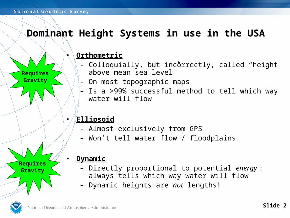
Dominant Height Systems in use in the USA
• Orthometric– Colloquially, but incorrectly, called “height above
mean sea level”– On most topographic maps– Is a >99% successful method to tell which way water
will flow
• Ellipsoid– Almost exclusively from GPS– Won’t tell water flow / floodplains
• Dynamic– Directly proportional to potential energy : always tells
which way water will flow– Dynamic heights are not lengths!
RequiresGravity
RequiresGravity
Slide 2

Orthometric Height (H)• The distance along the plumb line from the geoid
up to the point of interest
H
Earth’sSurface
The Geoid
NAVD 88 reference level
H (NAVD 88)
Errors in NAVD 88 : ~50 cm average, 100 cm CONUS tilt, 1-2 meters average in Alaska NO tracking Slide 3

The only “technical slide”…
Hmm..I wonder if my yard will flood next time we have a hurricane…
…well, to know if I’m in a floodplain, I guess
my “height above sea level” is needed…
…wait a minute…height “above sea level”???There’s no “sea” below me!!
…oh yeah…NGS taught me that the correct term is “orthometric
height”…
…which is the height above “the geoid”…which is a global gravity surface related to sea level…
???????????????? …except it extends underneath land
masses, unlike “sea level”!
Orthometric Height
The Geoid
Slide 4
So…how do I figure my orthometric
height…
I know that “leveling” is
one way…sort of…
…but that means finding a “benchmark”…and walking
with a survey crew for miles and miles…and even then, I’ll only get an NAVD
88 height…
…which has decimeter to meter errors at this time…
The Geoid
NAVD 88 reference level
NAVD 88 Height
Errors in NAVD 88 : ~50 cm ave, 100 cm CONUS tilt, 1-2 meters ave in Alaska NO tracking
Orthometric Height
Slide 5
The Geoid
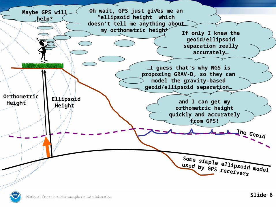
Maybe GPS will help?
Oh wait, GPS just gives me an “ellipsoid height” which
doesn’t tell me anything about my orthometric height.
Orthometric Height
Ellipsoid Height
Some simple ellipsoid modelused by GPS receivers
If only I knew the geoid/ellipsoid
separation really accurately…
…I guess that’s why NGS is proposing GRAV-D, so they can
model the gravity-based geoid/ellipsoid separation…
and I can get my orthometric height
quickly and accurately from GPS!
Slide 6
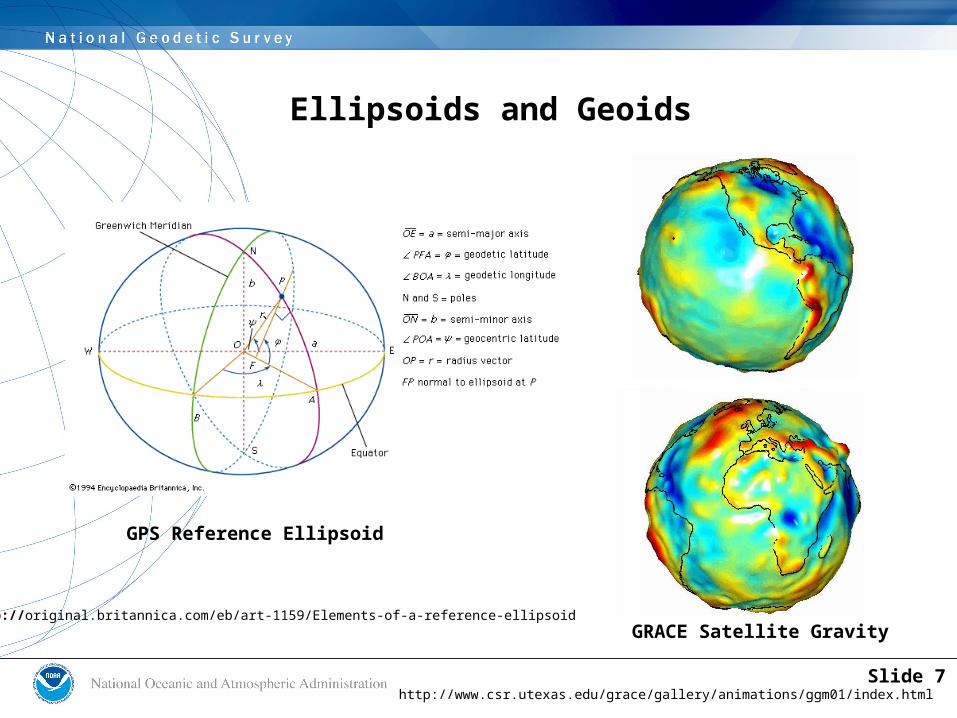
Ellipsoids and Geoids
http://www.csr.utexas.edu/grace/gallery/animations/ggm01/index.html
http://original.britannica.com/eb/art-1159/Elements-of-a-reference-ellipsoidGRACE Satellite Gravity
GPS Reference Ellipsoid
Slide 7

Vertical Datum – History(Orthometric Heights)
• 1807 – 1996– Defined and Accessed – Leveling/Passive Marks– NAVD 88: 600,000+ Marks
• NGS detects hundreds moved/destroyed every year• How many go undetected?
– Post-Glacial-Rebound, Subsidence, Tectonics, Frost-Heave – lots of motion out there!
Slide 8
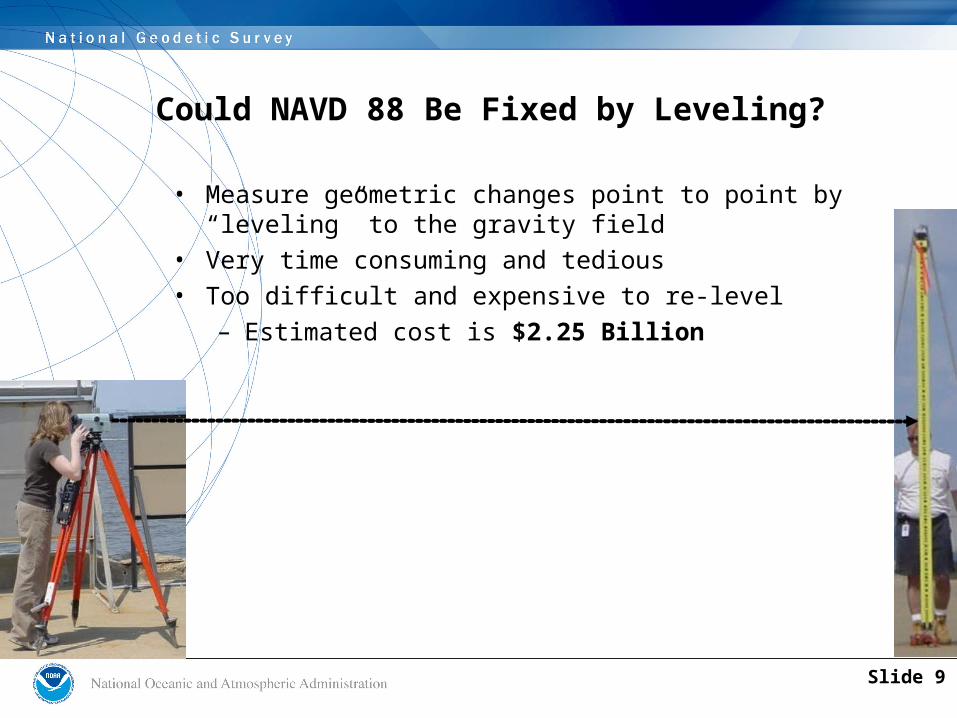
Could NAVD 88 Be Fixed by Leveling?
• Measure geometric changes point to point by “leveling” to the gravity field
• Very time consuming and tedious• Too difficult and expensive to re-level
– Estimated cost is $2.25 Billion
Slide 9
• Gravity is used to generate a geoid height model, which is essentially a transformation tool for heights
• This model should be as accurate as GPS (2 cm; ~1 in)
• Develops a consistent model for the entire nation that meets all needs
• NGS cannot fulfill their mission without modernizing the vertical datum component of the NSRS
GRAV-DGravity for the Redefinition of the
American Vertical Datum
Slide 10
• Official NGS policy as of Nov 14, 2007– $38.5M over 10 years
• Airborne Gravity Snapshot of entire US and its holdings
• Absolute Gravity Tracking of regions of rapid change
• Re-define the Vertical Datum of the USA in 10 years
Q: What is GRAV-D?
A: A Plan (released Dec 2007)
Slide 11
• National Scale has 2 parts:– High Resolution Snapshot
• Most of the costs arises here• Most efficient means is an airborne survey• Spans land and water• Helps validate existing 2 million surface data
– Low Resolution Movie• Detects and models long term trends• Example: Glacial Isostatic Adjustment• An ongoing effort that will continue indefinitely
• Local/Regional Scale has 1 part:– High Resolution Movie– Accounts for such things as Louisiana subsidence– In collaboration with state/local/university partners
Scope of Work
Slide 12
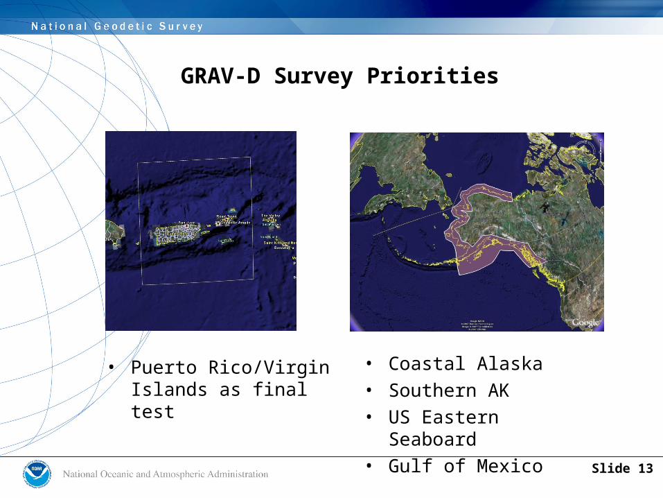
GRAV-D Survey Priorities
• Puerto Rico/Virgin Islands as final test
• Coastal Alaska• Southern AK• US Eastern Seaboard• Gulf of Mexico
Slide 13
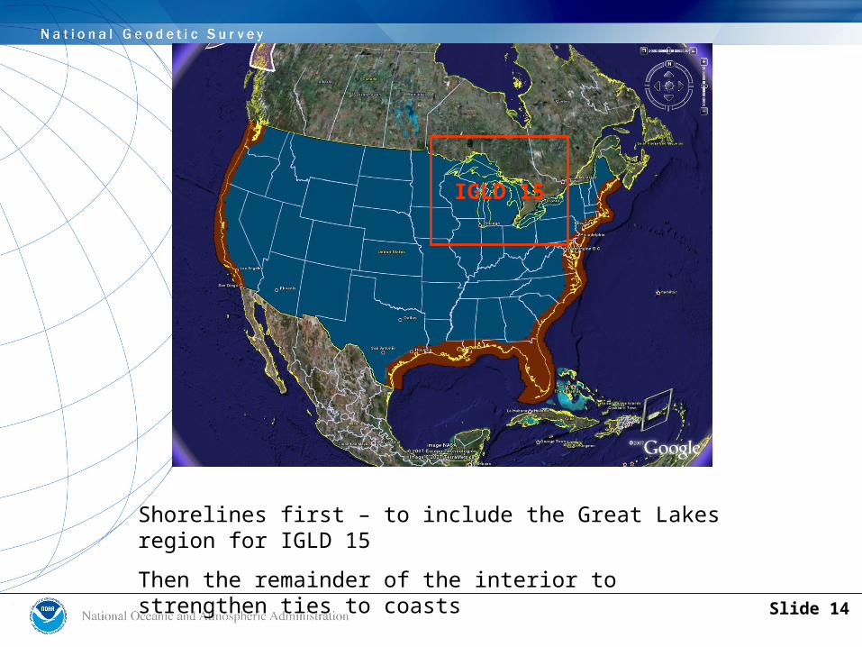
Shorelines first – to include the Great Lakes region for IGLD 15
Then the remainder of the interior to strengthen ties to coasts
IGLD 15
Slide 14
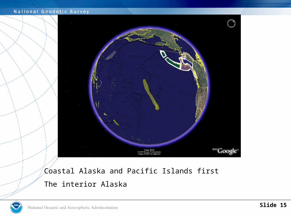
Coastal Alaska and Pacific Islands first
The interior Alaska
Slide 15
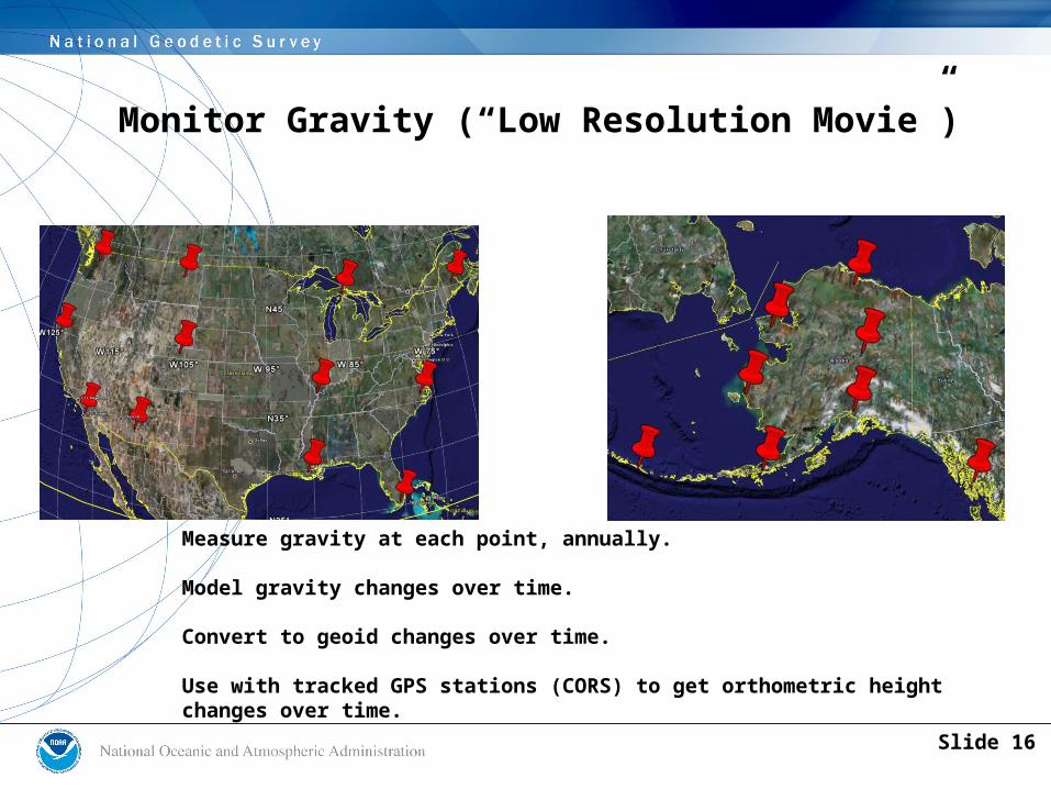
Monitor Gravity (“Low Resolution Movie”)
Measure gravity at each point, annually.
Model gravity changes over time.
Convert to geoid changes over time.
Use with tracked GPS stations (CORS) to get orthometric heightchanges over time.
Slide 16
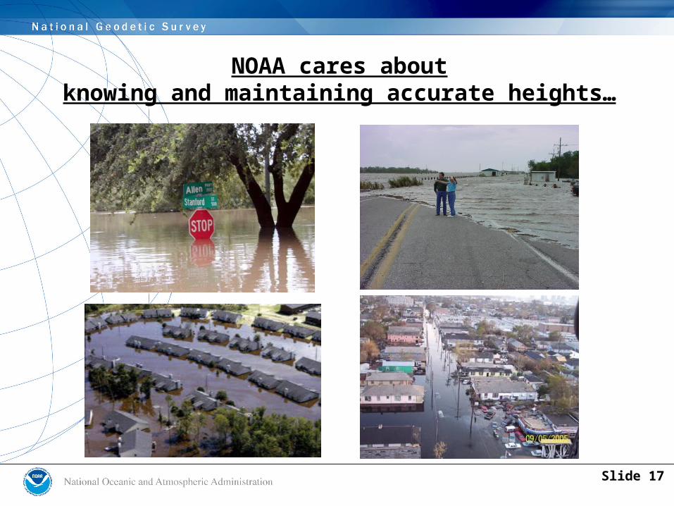
NOAA cares aboutknowing and maintaining accurate heights…
Slide 17

Fast, Accurate Orthometric Heights
• GPS already gives fast accurate ellipsoid heights
• Combining GPS with the GRAV-D model ....
• ... results in fast, accurate orthometric heights (H = h - N)
• Which is what everyone wants
Slide 18
Why NOAA Needs Accurate “Heights”
• We need accurate “orthometric” heights, or those that are based upon the gravity field– Gravity controls which way water flows
• GPS receivers give accurate heights but based upon a different reference frame– We must develop a model to transform from
GPS heights to orthometric heights• We need to establish “what is zero” with respect to
both land and nautical charts– No other way to predict flooding extent
Slide 19
GRAV-D is the most ambitious project within the National Height Mod Program
• National Height Modernization needs to repair and maintain NAVD 88 while transitioning (via GRAV-D) to a new vertical datum in 10 years
• All National Height Mod funds (internal or grants) should support access to accurate heights, in general, but:– With emphasis on NAVD 88 today– With emphasis on the new vertical datum in 5 years
Slide 20
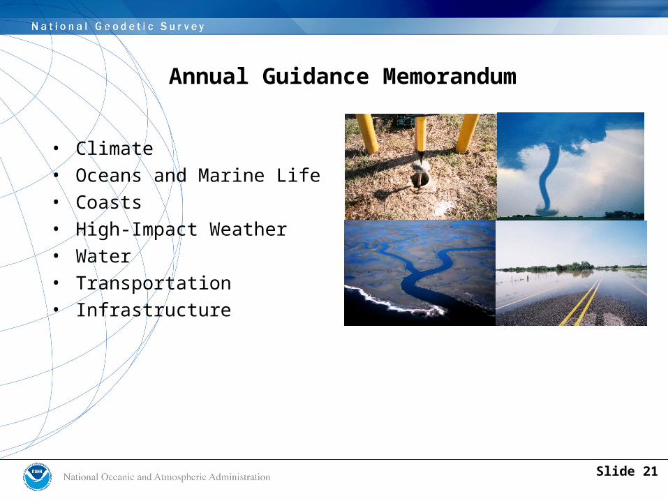
• Climate• Oceans and Marine Life• Coasts• High-Impact Weather• Water• Transportation• Infrastructure
Annual Guidance Memorandum
Slide 21
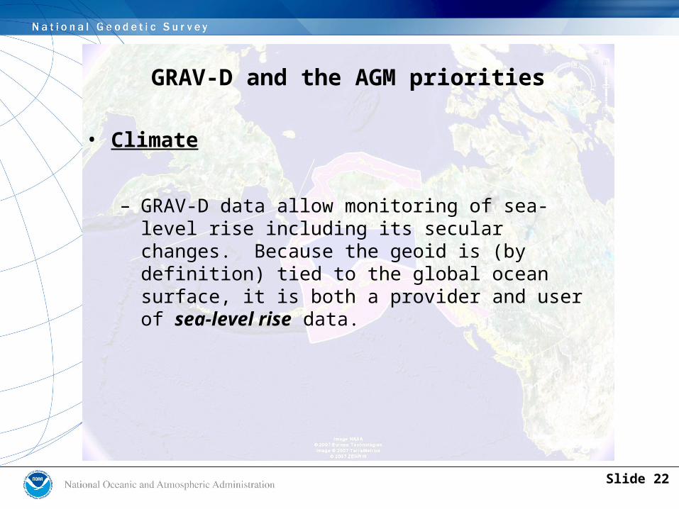
GRAV-D and the AGM priorities
• Climate
– GRAV-D data allow monitoring of sea-level rise including its secular changes. Because the geoid is (by definition) tied to the global ocean surface, it is both a provider and user of sea-level rise data.
Slide 22
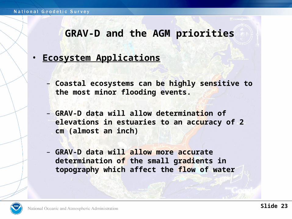
GRAV-D and the AGM priorities
• Ecosystem Applications
– Coastal ecosystems can be highly sensitive to the most minor flooding events.
– GRAV-D data will allow determination of elevations in estuaries to an accuracy of 2 cm (almost an inch)
– GRAV-D data will allow more accurate determination of the small gradients in topography which affect the flow of water
Slide 23

GRAV-D and the AGM priorities
• Coasts– Almost no gravity measurements exist near shore
• Thus heights are poorly modeled at the coast,
• and coastal heights are some of the least accurate
– Building resilience to coastal flooding hazards depends on knowing heights accurately
– Subsidence occurs at the coast
• GRAV-D monitors the geoid, so subsidence is accounted for in GPS-determined heights!
– GRAV-D data allow for coastal heights to be determined accurately and for changes like subsidence to be tracked over time
Slide 24

GRAV-D and the AGM priorities
• High Impact Weather
– Many high impact weather events coincide with a flooding event
• GRAV-D data allow for accurate evacuation routes to be mapped
• GRAV-D data allow for accurate determination of floodplains
Slide 25
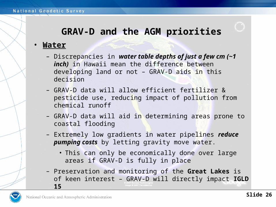
GRAV-D and the AGM priorities• Water
– Discrepancies in water table depths of just a few cm (~1 inch) in Hawaii mean the difference between developing land or not – GRAV-D aids in this decision
– GRAV-D data will allow efficient fertilizer & pesticide use, reducing impact of pollution from chemical runoff
– GRAV-D data will aid in determining areas prone to coastal flooding
– Extremely low gradients in water pipelines reduce pumping costs by letting gravity move water.
• This can only be economically done over large areas if GRAV-D is fully in place
– Preservation and monitoring of the Great Lakes is of keen interest – GRAV-D will directly impact IGLD 15
Slide 26

GRAV-D and the AGM priorities
• Transportation
– GRAV-D’s impact on IGLD 15 also affects shipping and dredging in the Great Lakes
– GRAV-D allows for height differences between airports to be determined to 2 cm (~ 1 inch) over vast areas, including Alaska
• Accounting for this means greater air safety
– Roads can be constructed which are less prone to flooding, by accurately knowing their heights.
• If the roads are evacuation routes, then building them above flood levels will ensure safety during storm events
Slide 27
GRAV-D and the AGM priorities
• Infrastructure
– NOAA is mandated (OMB Circular No. A-16) with providing the geodetic control portion of the National Spatial Data Infrastructure
– GRAV-D will assist in monitoring levee subsidence…
– GRAV-D will help counties will save thousands of dollars in establishing geospatial frameworks…
– GRAV-D will reduce errors in FEMA floodplain insurance maps…
– By providing a vertical datum that is accurate and accessible to all USA territories, GRAV-D provides one of the most crucial pieces of infrastructure at very low cost.
Slide 28
Conclusions
• GRAV-D will reduce the errors that exist today that limit monitoring capabilities
• GRAV-D will provide a consistent vertical model for all U.S. regions
• GRAV-D will allow for monitoring of height at the 2 cm level nationwide
• NOAA will be the lead, but can’t do it alone
Slide 29
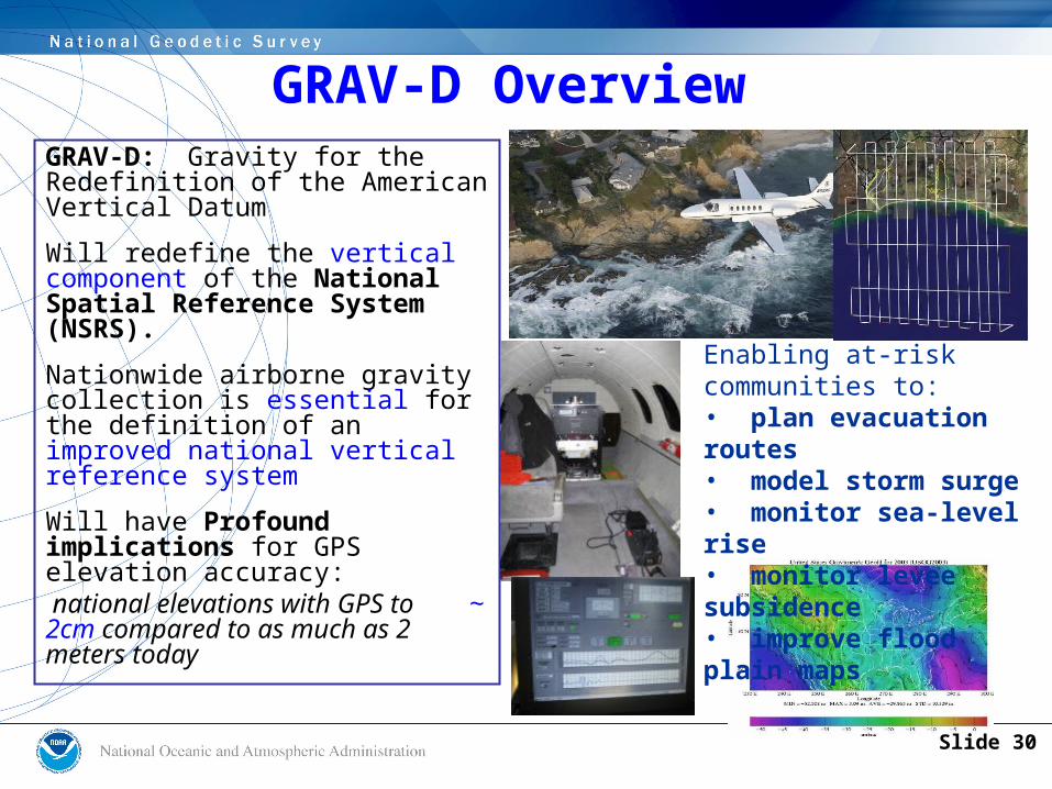
GRAV-D: Gravity for the Redefinition of the American Vertical Datum
Will redefine the vertical component of the National Spatial Reference System (NSRS).
Nationwide airborne gravity collection is essential for the definition of an improved national vertical reference system
Will have Profound implications for GPS elevation accuracy: national elevations with GPS to ~ 2cm compared to as much as 2 meters today
Enabling at-risk communities to:• plan evacuation routes• model storm surge• monitor sea-level rise• monitor levee subsidence• improve flood plain maps
GRAV-D Overview
Slide 30
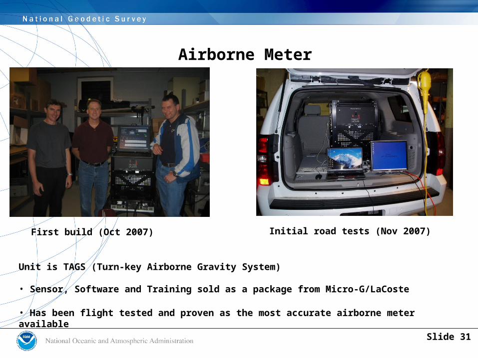
Airborne Meter
First build (Oct 2007) Initial road tests (Nov 2007)
Unit is TAGS (Turn-key Airborne Gravity System)
• Sensor, Software and Training sold as a package from Micro-G/LaCoste
• Has been flight tested and proven as the most accurate airborne meter available
Slide 31

• The first, middle and last point of GRAV-D:
Gravity and Heights are inseparably connected
• Or (to borrow from a common bumper sticker):– No gravity, no height– Know gravity, know height
Q: What is GRAV-D?
A: Gravity to determine heights accurately
Slide 32
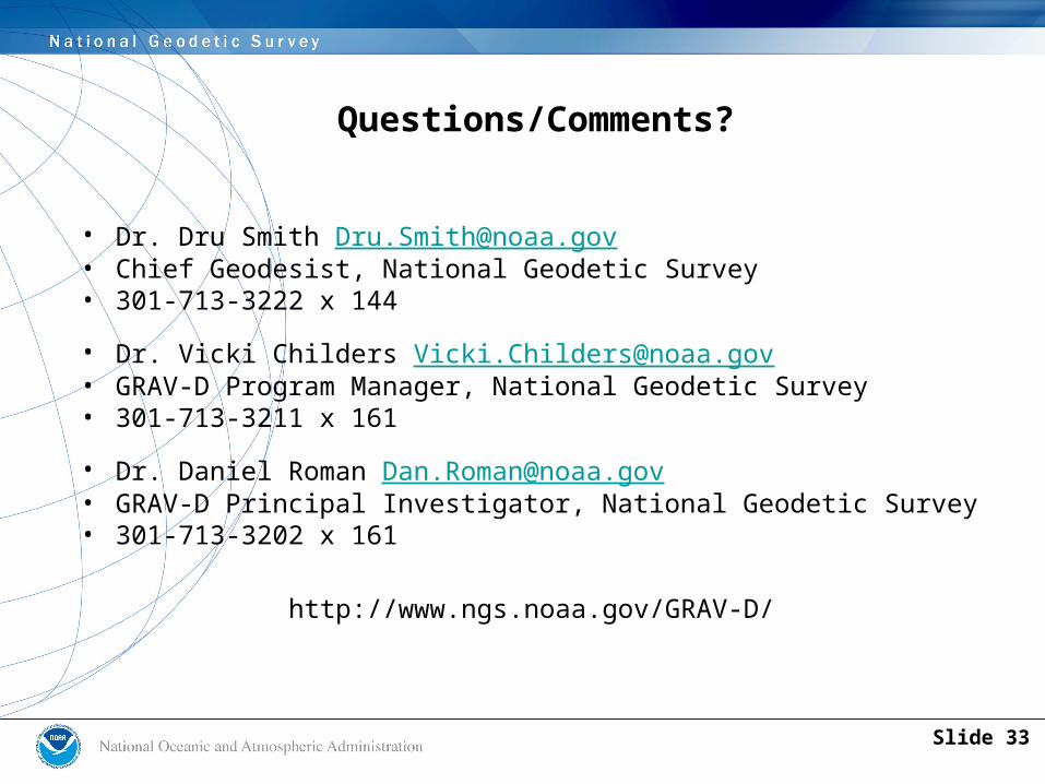
Questions/Comments?
• Dr. Dru Smith [email protected] • Chief Geodesist, National Geodetic Survey• 301-713-3222 x 144
• Dr. Vicki Childers [email protected] • GRAV-D Program Manager, National Geodetic Survey• 301-713-3211 x 161
• Dr. Daniel Roman [email protected] • GRAV-D Principal Investigator, National Geodetic Survey• 301-713-3202 x 161
http://www.ngs.noaa.gov/GRAV-D/
Slide 33
Related Documents


