Grade 5 Social Studies Unit: 08 Lesson: 01 Suggested Duration: 10 days Grade 05 Social Studies Unit 08 Exemplar Lesson 01: Westward Expansion Grade 05 Social Studies Unit 08 Exemplar Lesson 01: Westward Expansion This lesson is one approach to teaching the State Standards associated with this unit. Districts are encouraged to customize this lesson by supplementing with district-approved resources, materials, and activities to best meet the needs of learners. The duration for this lesson is only a recommendation, and districts may modify the time frame to meet students’ needs. To better understand how your district may be implementing CSCOPE lessons, please contact your child’s teacher. (For your convenience, please find linked the TEA Commissioner’s List of State Board of Education Approved Instructional Resources and Midcycle State Adopted Instructional Materials.) Lesson Synopsis Students learn about the political, economic, and geographic regional differences that led to conflict in the United States through map sketches, primary sources, problem-solving and points of view. TEKS The Texas Essential Knowledge and Skills (TEKS) listed below are the standards adopted by the State Board of Education, which are required by Texas law. Any standard that has a strike-through (e.g. sample phrase ) indicates that portion of the standard is taught in a previous or subsequent unit. The TEKS are available on the Texas Education Agency website at http://www.tea.state.tx.us/index2.aspx? id=6148. 5.4 History. The student understands political, economic, and social changes that occurred in the United States during the 19th century. The student is expected to: 5.4A Describe the causes and effects of the War of 1812. 5.4B Identify and explain how changes resulting from the Industrial Revolution led to conflict among sections of the United States. 5.4C Identify reasons people moved west. 5.4D Identify significant events and concepts associated with U.S. territorial expansion, including the Louisiana Purchase, the expedition of Lewis and Clark, and Manifest Destiny. 5.4F Explain how industry and the mechanization of agriculture changed the American way of life. 5.6 Geography. The student uses geographic tools to collect, analyze, and interpret data. The student is expected to: 5.6A Apply geographic tools, including grid systems, legends, symbols, scales, and compass roses, to construct and interpret maps. 5.6B Translate geographic data into a variety of formats such as raw data to graphs and maps. 5.7 Geography. The student understands the concept of regions in the United States. The student is expected to: 5.7A Describe a variety of regions in the United States such as political, population, and economic regions that result from patterns of human activity. 5.7B Describe a variety of regions in the United States such as landform, climate, and vegetation regions that result from physical characteristics such as the Great Plains, Rocky Mountains, and Coastal Plains. 5.7C Locate on a map important political features such as the ten largest urban areas in the United States, the 50 states and their capitals, and regions such as the Northeast, the Midwest, and the Southwest. 5.7D Locate on a map important physical features such as the Rocky Mountains, Mississippi River, and Great Plains. 5.9 Geography. The student understands how people adapt to and modify their environment. The student is expected to: 5.9A Describe how and why people have adapted to and modified their environment in the United States, past and present, such as the use of human resources to meet basic needs. 5.9B Analyze the positive and negative consequences of human modification of the environment in the United States, past and present. 5.13 Economics. The student understands patterns of work and economic activities in the United States. The Last Updated 05/02/13 Print Date 06/26/2013 Printed By Karen Johnson, MIDLAND ISD page 1 of 41

Welcome message from author
This document is posted to help you gain knowledge. Please leave a comment to let me know what you think about it! Share it to your friends and learn new things together.
Transcript

Grade 5
Social Studies
Unit: 08
Lesson: 01
Suggested Duration: 10 days
Grade 05 Social Studies Unit 08 Exemplar Lesson 01: Westward ExpansionGrade 05 Social Studies Unit 08 Exemplar Lesson 01: Westward Expansion
This lesson is one approach to teaching the State Standards associated with this unit. Districts are encouraged to customize this lesson
by supplementing with district-approved resources, materials, and activities to best meet the needs of learners. The duration for this
lesson is only a recommendation, and districts may modify the time frame to meet students’ needs. To better understand how your districtmay be implementing CSCOPE lessons, please contact your child’s teacher. (For your convenience, please find linked the TEACommissioner’s List of State Board of Education Approved Instructional Resources and Midcycle State Adopted Instructional Materials.)
Lesson Synopsis
Students learn about the political, economic, and geographic regional differences that led to conflict in the United States through map
sketches, primary sources, problem-solving and points of view.
TEKS
The Texas Essential Knowledge and Skills (TEKS) listed below are the standards adopted by the State Board of Education, which are
required by Texas law. Any standard that has a strike-through (e.g. sample phrase) indicates that portion of the standard is taught in a
previous or subsequent unit. The TEKS are available on the Texas Education Agency website at http://www.tea.state.tx.us/index2.aspx?
id=6148.
5.4 History. The student understands political, economic, and social changes that occurred in the United
States during the 19th century. The student is expected to:
5.4A Describe the causes and effects of the War of 1812.
5.4B Identify and explain how changes resulting from the Industrial Revolution led to conflict among
sections of the United States.
5.4C Identify reasons people moved west.
5.4D Identify significant events and concepts associated with U.S. territorial expansion, including the
Louisiana Purchase, the expedition of Lewis and Clark, and Manifest Destiny.
5.4F Explain how industry and the mechanization of agriculture changed the American way of life.
5.6 Geography. The student uses geographic tools to collect, analyze, and interpret data. The student is
expected to:
5.6A Apply geographic tools, including grid systems, legends, symbols, scales, and compass roses, to
construct and interpret maps.
5.6B Translate geographic data into a variety of formats such as raw data to graphs and maps.
5.7 Geography. The student understands the concept of regions in the United States. The student is expected
to:
5.7A Describe a variety of regions in the United States such as political, population, and economic regions
that result from patterns of human activity.
5.7B Describe a variety of regions in the United States such as landform, climate, and vegetation regions
that result from physical characteristics such as the Great Plains, Rocky Mountains, and Coastal Plains.
5.7C Locate on a map important political features such as the ten largest urban areas in the United States,
the 50 states and their capitals, and regions such as the Northeast, the Midwest, and the Southwest.
5.7D Locate on a map important physical features such as the Rocky Mountains, Mississippi River, and
Great Plains.
5.9 Geography. The student understands how people adapt to and modify their environment. The student is
expected to:
5.9A Describe how and why people have adapted to and modified their environment in the United States,
past and present, such as the use of human resources to meet basic needs.
5.9B Analyze the positive and negative consequences of human modification of the environment in the
United States, past and present.
5.13 Economics. The student understands patterns of work and economic activities in the United States. The
Last Updated 05/02/13
Print Date 06/26/2013 Printed By Karen Johnson, MIDLAND ISDpage 1 of 41

student is expected to:
5.13A Compare how people in different parts of the United States earn a living, past and present.
5.13B Identify and explain how geographic factors have influenced the location of economic activities in the
United States.
5.21 Culture. The student understands the relationship between the arts and the times during which they were
created. The student is expected to:
5.21A Identify significant examples of art, music, and literature from various periods in U.S. history such as the painting American
Progress, "Yankee Doodle," and "Paul Revere's Ride".
Social Studies Skills TEKS
5.24 Social studies skills. The student applies critical-thinking skills to organize and use information acquired
from a variety of valid sources, including electronic technology. The student is expected to:
5.24C Organize and interpret information in outlines, reports, databases, and visuals, including graphs,
charts, timelines, and maps.
5.25 Social studies skills. The student communicates in written, oral, and visual forms. The student is expected
to:
5.25D Create written and visual material such as journal entries, reports, graphic organizers, outlines, and
bibliographies.
5.25E Use standard grammar, spelling, sentence structure, and punctuation.
5.26 Social studies skills. The student uses problem-solving and decision-making skills, working independently
and with others, in a variety of settings. The student is expected to:
5.26A Use a problem-solving process to identify a problem, gather information, list and consider options,
consider advantages and disadvantages, choose and implement a solution, and evaluate the
effectiveness of the solution.
GETTING READY FOR INSTRUCTION
Performance Indicators
Grade 05 Social Studies Unit 08 PI 01
Design a board game based on the settlement of the West. Include geographic factors; regions, states, and territories; economic opportunities; political
challenges; and interactions with Native American groups.
Standard(s): 5.4B , 5.7B , 5.13B , 5.25A , 5.26A
ELPS ELPS.c.1C , ELPS.c.1E
Key Understandings
Political, economic, social and geographic factors motivate people to migrate.
— How did the changes resulting from the Industrial Revolution lead to conflict among sections of the United States?— What significant events and concepts are associated with U.S. westward expansion?— How did industry and the mechanization of agriculture change the American way of life?— How and why have people adapted to and modified their environment in the United States, past and present?— How have geographic factors influenced the location of economic activities in the United States?— What are examples of art, music, and literature from various periods in U.S. history?
Vocabulary of Instruction
Manifest destiny
tariff
region
revolution
territorial expansion
Materials
access to computer/internet and library
butcher paper or chart paper
Grade 5
Social Studies
Unit: 08
Lesson: 01
Suggested Duration: 10 days
Last Updated 05/02/13
Print Date 06/26/2013 Printed By Karen Johnson, MIDLAND ISDpage 2 of 41

colored pencils
current rainfall map
large map of the United States
map of the United States with geographic regions, landforms, climate, vegetation, significant cities, parks, neighboring countries,
etc.
Markers
Paper (unlined) (1 sheet per student)
pencils
population map
Scissors
Small ball or bean bag
Attachments
All attachments associated with this lesson are referenced in the body of the lesson. Due to considerations for grading or student
assessment, attachments that are connected with Performance Indicators or serve as answer keys are available in the district site and
are not accessible on the public website.
Teacher Resource: Manifest Destiny (1 for projection)
Handout: Political, Economic, Geographic and Social Reasons for Migrating West (1 per student)
Teacher Resource: Political, Economic, Geographic and Social Reasons for Migrating West KEY
Handout: PEGS Chart (1 per student)
Teacher Resource: Regions of the United States Map (1 for projection, optional)
Handout: Regions and Characteristics Chart (1 per student)
Handout: The First Industrial Revolution (1 per student)
Handout: The Industrial Revolution: Causes and Effects (1 per student)
Handout: Steps in the Problem Solving Process (1 per group)
Handout: Farming Gets a Boost (1 per student)
Handout: Learning Station Questions (1 per student)
Handout: Learning Station 1 - Andrew Jackson The Hero (3 per folder)
Handout: Learning Station 2 - Compare Contrast the Inaugurations (3 per folder)
Handout: Learning Station 3 - Greedy for Gold (3 per folder)
Handout: Learning Station 4 - Spoils System (3 per folder)
Handout: Learning Station 5 - Cartoon President Jackson (3 per folder)
Handout: The Point of View of the North (1 per student)
Handout: The Point of View of the South (1 per student)
Handout: The Point of View of the West (1 per student)
Teacher Resource: Songs From the North
Teacher Resource: Songs From the South
Teacher Resource: Songs From the West
Handout: Research on American Indian Conflict (1 per group)
Resources
Advance Preparation
1. Become familiar with content and procedures for the lesson.
2. Refer to the Instructional Focus Document for specific content to include in the lesson.
3. Preview materials and websites according to district guidelines.
4. Prepare materials and handouts as necessary
5. Select appropriate sections of the textbook and other classroom materials that support the learning for this lesson.
6. Locate and download a line map of the United States of America, write the regions on it from lesson 3 and make one copy for each
student.
Grade 5
Social Studies
Unit: 08
Lesson: 01
Suggested Duration: 10 days
Last Updated 05/02/13
Print Date 06/26/2013 Printed By Karen Johnson, MIDLAND ISDpage 3 of 41

Background Information
Westward expansion affected the political, economic, and physical aspects of the United States as the American spirit and concept of Manifest Destiny
encouraged many to seek new opportunities in newly acquired territories. Along with the rapid growth, old and new issues about the spread of slavery and
sectionalism divided the country on many fronts. These issues would cause a divide that eventually led to a conflict that tore the country apart. With the
acquisition of the Louisiana Purchase and the end of the War of 1812, worldwide politics changed. Britain and France were no longer at war, the Americans
had defeated the British at New Orleans, and there seemed to be no limits on America’s destiny.
GETTING READY FOR INSTRUCTION
Teachers are encouraged to supplement and substitute resources, materials, and activities to meet the needs of learners. These lessons
are one approach to teaching the TEKS/Specificity as well as addressing the Performance Indicators associated with each unit. District
personnel may create original lessons using the Content Creator in the Tools Tab. All originally authored lessons can be saved in the “MyCSCOPE” Tab within the “My Content” area.
INSTRUCTIONAL PROCEDURES
Instructional Procedures
ENGAGE – Analyzing a painting
Notes for Teacher
NOTE: 1 Day = 50 minutes
Suggested Day 1 – 15 minutes
1. Project a copy of the painting “American Progress” by John Gast from theTeacher Resource: Manifest Destiny (1 for projection)
2. Students observe the painting and write two to three inference statements.
3. Use a large map of the United States to demonstrate and explain that
Americans wanted the land from the Atlantic to the Pacific oceans.
4. Read the information found on the Teacher Resource: Manifest Destiny
orally to students.
5. Facilitate a discussion about westward expansion using a T chart to
categorize possible benefits and challenges.
Materials:
large map of the United States
Attachments:
Teacher Resource: Manifest Destiny (1 for
projection)
Purpose:
Students are introduced to the idea of
westward expansion.
TEKS: 5.4C; 5.4D; 5.21A; 5.24C
EXPLORE – Migration Suggested Day 1 (continued) – 15 minutes
1. Organize students into groups of 4.
2. Distribute to each group the Handout: Political, Economic, Geographic
and Social Reasons for Migrating West (1 per student)
3. Discuss the “Push Pull” factors of migration.
“Push” factors focus on the more negative elements of life where peoplecurrently live. For example, industrialization in the east led to
overcrowding in the cities and fewer jobs once the Civil War veterans
returned home. This “pushed” people in the east to head west for moreroom and more economic opportunities.
“Pull” factors focus on elements of life in another place that areappealing. For example, the availability of cheap land lured people from
the eastern cities to go west.
4. Discuss settlement patterns by comparing today’s rainfall map and apopulation map to demonstrate that people are most likely to live by a water
source or transportation routes such as highways and airports.
5. Continue the student discussion by asking questions such as:
What significant events and concepts are associated with U.S.
westward expansion?
Materials:
current rainfall map
population map
Attachments:
Handout: Political, Economic, Geographic
and Social Reasons for Migrating West (1
per student)
Teacher Resource: Political, Economic,
Geographic and Social Reasons for
Migrating West KEY
TEKS: 5.4C; 5.4D; 5.24C
Instructional Note:
Provide students with an explanation about
push and pull factors.
Provide students with an explanation about
settlement patterns.
Grade 5
Social Studies
Unit: 08
Lesson: 01
Suggested Duration: 10 days
Last Updated 05/02/13
Print Date 06/26/2013 Printed By Karen Johnson, MIDLAND ISDpage 4 of 41

6. In their groups, students write a list of reasons for migration and decide if
they are push or pull factors.
7. Guide students with probing questions about why people were migrating west:
economic opportunities (land, gold) or the adventure of living in the new
territories, or to get away from debt or problems where they live now, or
because they believed in manifest destiny. Did they have roads and highways
to follow?
8. Script reasons on the board.
9. Students complete the Handout: Political, Economic, Geographic and
Social Reasons for Migrating West (1 per student).
10. The teacher may evaluate or provide feedback to student responses using
the Teacher Resource: Political, Economic, Geographic and Social
Reasons for Migrating West KEY
EXPLAIN – Political, Economic, Geographic and Social Factors Suggested Day 1 (continued) – 20 minutes
1. Distribute the Handout: PEGS Chart (1 per student)
2. In groups of four, students categorize reasons for migrating as political,
economic, geographic, or social and proceed to fill out the Handout: PEGS
Chart accordingly.
3. Students discuss answers with group members and make changes and
additions to their chart if necessary.
Attachments:
Handout: PEGS Chart (1 per student)
TEKS: 5.4C; 5.4D; 5.24C
EXPLORE – Identify, Locate, Sketch and Label Suggested Day 2 – 35 minutes
1. Using a map of the United States that has a grid system, a legend, symbols,
and a compass rose, students locate the following geographic regions on the
map:
Appalachian Mountains
Rocky Mountains
Cascades
Great Plains
Coastal Plains
Mississippi River Valley
Mississippi River
Hudson River
Columbia River
Potomac River
Missouri River
The Great Lakes
2. Using a large map of the United States, grid systems, legends, symbols, and
a compass rose, have students identify the following on the map:
Washington, D.C.
Names of states
State capitals
5 National parks
Neighboring countries and boundaries
3. Using a large map of the United States, grid systems, legends, symbols, and
compass rose, have students identify the following population regions on the
map:
10 largest cities
Metropolitan areas
Rural regions
4. After students locate and identify the regions, places, and physical features
Materials:
map of the United States with geographic
regions, landforms, climate, vegetation,
significant cities, parks, neighboring countries,
etc.
colored pencils
pencils
butcher paper or chart paper
TEKS: 5.6A; 5.7A; 5.7B; 5.7C; 5.7D; 5.24C
Grade 5
Social Studies
Unit: 08
Lesson: 01
Suggested Duration: 10 days
Last Updated 05/02/13
Print Date 06/26/2013 Printed By Karen Johnson, MIDLAND ISDpage 5 of 41

from numbers 1, 2, and 3, students sketch a map of the United States on
butcher paper or chart paper and label the regions, places and physical
features listed above.
EXPLAIN – Summarize Suggested Day 2 (continued) – 15 minutes
1. Students create a bar graph using information from a map and other
resources illustrating the 10 largest cities in the U.S. based on their
population.
2. Students write two to three sentences that summarize the many features of
the U.S.
Purpose:
Students translate geographic data into a
graph.
TEKS: 5.6B; 5.24C
Instructional Note:
Summaries may be written as a homework
assignment if there is insufficient time to
complete the assignment.
Maps may be sketched as a group activity
instead of individual students.
EXPLORE – Regions of the United States Suggested Day 3 – 20 minutes
1. Divide the class into 9 groups.
2. Assign each group a different census designated region of the United States.
Regions:
Pacific
Mountain
West North Central
West South Central
East North Central
East South Central
South Atlantic
Middle Atlantic
New England
3. Show the Teacher Resource: Regions of the United States Map (1 for
projection, optional) and point out the regions.
4. Student groups research their assigned region using maps, textbooks, and
district-approved websites to discover the following:
Climate
Vegetation
Economic activities
Recreation
Living standards
Rivers, roads, landforms
Landmarks and places of interest
5. Students record their information on graphic organizer poster using chart
paper or butcher paper. Students record notes and add quick illustrations for
each category.
Materials:
Chart paper or butcher paper
Markers
Attachments:
Teacher Resource: Regions of the United
States Map (1 for projection, optional)
Purpose:
Students learn about the regions of the U.S.
TEKS: 5.6A; 5.7A, 5.7B, 5.7C, 5.7D; 5.24C
Instructional Note:
Students may use the graphic organizer below
to display their discoveries, or they may create
a graphic organizer on their own.
EXPLAIN – Regions of the United States Suggested Day 3 (continued) – 25 minutes
1. Teacher provides students with a copy of a line map of the United States with
the regions already marked on it.
2. Each group presents their graphic organizer poster to the class.
3. Before the presentation, students point out the region on the map of the
United States.
4. While each group presents their assigned region, the class takes notes about
Materials:
U.S. map with regions
Attachments:
Handout: Regions and Characteristics
Chart (1 per student)
Grade 5
Social Studies
Unit: 08
Lesson: 01
Suggested Duration: 10 days
Last Updated 05/02/13
Print Date 06/26/2013 Printed By Karen Johnson, MIDLAND ISDpage 6 of 41

each region by writing the information being presented on the Handout:
Regions and Characteristics Chart (1 per student).
5. Display completed graphic organizer posters on a bulletin board.
TEKS: 5.6A; 5.7A; 5.7B; 5.7C; 5.7D; 5.24C
Instructional Note:
Drawing pictures of the region onto the
Regions and Characteristics chart helps
students to remember details.
ELABORATE – Exit Card Suggested Day 3 (continued) – 5 minutes
1. When presentations are completed, ask students what they remember about
the War of 1812 from the previous unit.
2. Ask students to “turn and talk” to a neighbor to discuss which areas of themap were most affected by this war.
3. Students write an “Exit Card” stating one or two predictions about the areasthat will likely encounter conflict during the next era (1820-1850) especially
with the American Indian tribes.
TEKS: 5.4A; 5.24C
EXPLORE – Industrial Revolution Suggested Day 4 – 25 minutes
1. Assign each student a partner.
2. Distribute the following:
Handout: The First Industrial Revolution (1 per student)
Handout: The Industrial Revolution: Causes and Effects (1 per
student)
3. Students “buddy read” read the handout: The First Industrial Revolution
(1 per student).
4. Pairs work collaboratively to complete the Handout: The Industrial
Revolution: Causes and Effects (1 per student) noting three inventions
and both the positive and negative effects of that invention.
5. Ask:
How did the changes resulting from the Industrial Revolution lead
to conflict among sections of the United States?
Attachments:
Handout: The First Industrial Revolution(1
per student)
Handout: The Industrial Revolution:
Causes and Effects (1 per student)
Purpose:
Students learn about the industrial revolution.
TEKS: 5.4B, 5.4D, 5.4F
Instructional Note:
When students “buddy read,” they partner withanother student, and using a quiet voice, take
turns reading to each other.
The teacher may provide books about the
Industrial Revolution for students to read.
EXPLAIN – Toss a Question X 3 Suggested Day 4 (continued) – 10 minutes
1. Arrange students in a circle for Toss a Question X 3.
Round One:
1. Toss the ball to a student and then ask a question. (See questions
below).
2. The first student catches the ball and says, “I think the answer hassomething to do with ____________” and then tosses the ball toanother student in the circle. This student sits down.
3. The second student catches the ball and repeats what student # 1 said
and ADDS one more idea: “I think the answer has something to do with_____________________ and __________________.” Then he
tosses the ball to a 3rd student. This student sits down.
4. The 3rd student must answer the question fully and then toss the ball
back to the teacher. If the student does not know the answer, he may
toss the ball back to the teacher and say, “I would like to hear from ourteacher on this issue.” This student sits down.
5. Teacher clarifies/verifies responses.
Round Two: Repeat step #1 – 5 above for each question below, ensuringthat all students are included in the ball toss.
Materials:
Small ball or bean bag
TEKS: 5.4B; 5.4D; 5.4F; 5.24C; 5.25D
Instructional Note:
Model for students what “tossing” a ball lookslike (soft, underhanded toss). Ensure that all
students are included in the ball toss and that
no one is left out. Once students answer a
question, they sit down, and students can no
longer throw to them. However, to ensure
everyone continues to be engaged, the
TEACHER may throw the ball to someone
sitting down, so everyone is still eligible to
answer a question.
Many of the answers to the “Toss A Question”questions may be found in the specificity on
the IFD.
Grade 5
Social Studies
Unit: 08
Lesson: 01
Suggested Duration: 10 days
Last Updated 05/02/13
Print Date 06/26/2013 Printed By Karen Johnson, MIDLAND ISDpage 7 of 41

2. Toss a Question – Questions:
What political, economic, geographic, or social reasons motivated
people to move west?
How did the Industrial Revolution lead to people moving west?
How did the Industrial Revolution lead to conflict between the
north and the south?
How did inventions like the cotton gin and other mechanical
advances in agriculture change the American way of life?
What did the Louisiana Purchase have to do with people wanting
to move west?
What is Manifest Destiny?
What can you tell me about main places people settled as they
moved west?
How does the geography of an area affect if people settle there or
not?
How do regions of the U.S. differ from one another?
What political, economic, geographic, or social reasons motivated
people to move west?
ELABORATE – Problem-Solve Suggested Day 4 (continued) – 15 minutes
1. Using the Handout: Steps in the Problem Solving Process (1 per group),
students brainstorm, in groups of four, possible solutions to the problems the
Industrial Revolution created.
Attachments:
Handout: Steps in the Problem Solving
Process (1 per group)
TEKS: 5.26A
EXPLORE – Innovations and Inventions Suggested Day 5 – 25 minutes
1. Ask students to think of machines we have today that make a difficult task
much easier. (Suggestions might include the car, dishwasher, vacuum
cleaner, tractor, etc.)
Ask: Did people have these machines in the early 1800s?
2. Students read the Handout: Farming Gets a Boost (1 per student) and
discuss what they learned.
3. Start a class list of the innovations and inventions of the time.
Attachments:
Handout: Farming Gets a Boost (1 per
student)
TEKS: 5.4B; 5.4D; 5.4F; 5.24C
EXPLAIN – Innovations and Inventions Suggested Day 5 (continued) – 25 minutes
1. Organize students into groups of 3 or 4.
2. Using the list of inventions created in the previous Explore activity, assign
each group one invention.
3. Groups draw a picture of the invention and write an explanation of the value
of the invention, as well as any negative effect the invention may have had.
4. Students create a class museum about the Industrial Revolution.
TEKS: 5.4B; 5.4D; 5.4F; 5.24C
Instructional Note:
Inventions studied: cotton gin, canals, steam
engine, railroads, steel plow, mechanical
reaper and others as added by the teacher.
EXPLORE/ EXPLAIN – Learning Stations – Indian Removal Act Suggested Day 6 – 50 minutes
1. Distribute the Handout: Learning Station Questions (1 per student)
2. Divide students into 5 groups.
3. Set up 5 Learning Stations around the classroom.
4. Each Learning Station should have a folder, with the appropriate materials:
Attachments:
Handout: Learning Station Questions (1 per
student)
Handout: Learning Station 1 - Andrew
Jackson The Hero (3 per folder)
Grade 5
Social Studies
Unit: 08
Lesson: 01
Suggested Duration: 10 days
Last Updated 05/02/13
Print Date 06/26/2013 Printed By Karen Johnson, MIDLAND ISDpage 8 of 41

Handout: Learning Station 1 - Andrew Jackson The Hero (3 per
folder)
Handout: Learning Station 2 - Compare Contrast the Inaugurations
(3 per folder)
Handout: Learning Station 3 - Greedy for Gold (3 per folder)
Handout: Learning Station 4 - Spoils System (3 per folder)
Handout: Learning Station 5 - Cartoon President Jackson (3 per
folder)
5. Send each group to a Learning Station.
6. Explain that group members will share the materials in the folder, read the
content and study the pictures.
7. Students answer the reflection questions on the Handout: Learning Station
Questions.
8. The teacher will have a signal to indicate when groups should rotate to the
next station.
9. After each group has explored each station, groups collaborate to answer the
final Summary questions on the Handout: Learning Station Questions.
10. At the end of the class, the teacher moves students back to the big ideas
associated with westward expansion and the removal of the Indians.
Ask:
How did westward expansion, the gold rush, and the Industrial
Revolution impact the American Indians?
Handout: Learning Station 2 - Compare
Contrast the Inaugurations (3 per folder)
Handout: Learning Station 3 - Greedy for
Gold (3 per folder)
Handout: Learning Station 4 - Spoils
System (3 per folder)
Handout: Learning Station 5 - Cartoon
President Jackson (3 per
folder)
TEKS: 5.4B, 5.4C; 5.7A; 5.9A; 5.21A; 5.24C; 5.25D
Instructional Note:
The teacher should facilitate the Learning
Stations, answering questions, clarifying
expectations, and keeping students on task.
EXPLORE/EXPLAIN – North, South, West Jig Saw Suggested Day 7 – 20 minutes
1. Initiate a discussion about “regional loyalty” with students. (Choose relevanttopics that students might relate to.)
2. Students number off 1-2-3.
1’s: Distribute the Handout: Point of View of the North (1 per group
member)
2’s: Distribute the Handout: Point of View of the South (1 per group
member)
3’s: Distribute the Handout: Point of View of the West (1 per group
member)
3. Students read their assigned handouts and summarize each the passage by
collaborating with their group to write down the 5 major points of the passage.
4. The teacher mixes students so that a 1 – 2 – 3 form a group.
5. The 1’s teach the 2 and 3 in the group about the North, noting the 5 big ideasor major points.
6. The 2’s teach the 1 and 3 in the group about the south, noting the 5 bigideas or major points.
7. The 3’s teach the 1 and 2 in the group about the West, noting the 5 big ideasor major points.
Attachments:
Handout: Point of View of the North (1 per
student)
Handout: Point of View of the South (1 per
student)
Handout: Point of View of the West (1 per
student)
TEKS: 5.4B; 5.4C; 5.4F; 5.7A; 5.9A; 5.13A; 5.13B; 5.24C
Instructional Note:
Graphic organizer folded and cut. One space
for each geographic region.
ELABORATE – Point of View Suggested Day 7 (continued) – 20 minutes
1. Students create a folded graphic organizer to capture the information in the
activity in the previous Explore/Explain.
Distribute a sheet of unlined paper to each student
Materials:
Paper (unlined) (1 sheet per student)
Scissors
Grade 5
Social Studies
Unit: 08
Lesson: 01
Suggested Duration: 10 days
Last Updated 05/02/13
Print Date 06/26/2013 Printed By Karen Johnson, MIDLAND ISDpage 9 of 41

Students fold the paper in half (hamburger style)
Students make 2 cuts on the top half of the paper (see illustration).
On the 3 front flaps that have been created, label each with one of the
regions: North, South, and West
On the inside flap, students write the 5 big ideas they learned for each
region, writing within the appropriate “columns.”
2. Students write a summary of their work explaining how regional loyalty
(sectionalism) created tension between the North, South, and West.
TEKS: 5.4B, 5.4C, 5.4F; 5.7A; 5.9A; 5.13A, 5.13B; 5.24C
ELABORATE – Modifications to a region Suggested Day 7 (continued) – 10 minutes
1. Students discuss and summarize the effects of geographic modifications in
each geographic area (North, South, and West) and the effects of those
modifications on those same areas of the United States today.
2. Students decide if there could have been better ways, or adaptations instead
of modifications to the land that would have caused less damage.
TEKS: 5.4B, 5.4C, 5.4F; 5.7A; 5.9A; 5.13A, 5.13B
EXPLORE – Music and Inspiration Suggested Day 8 – 35 minutes
1. Discuss how people strengthen their regional loyalty, or strengthen their
spirits and find courage with music. Examples may include school songs,
national anthem, songs during time of war, etc.
2. Display or project the Teacher Resource: Songs From the North
Read the words of the song and ask the following discussion questions:
How does this song reflect the North?
What is the purpose of this song?
3. Display or project the Teacher Resource: Songs From the South
Read the words of the song and ask the following discussion questions:
How does this song reflect the South?
What is the purpose of this song?
4. Display or project the Teacher Resource: Songs From the West
Read the words of the song and ask the following discussion questions:
How does this song reflect the West?
What is the purpose of this song?
Attachments:
Teacher Resource: Songs From the North
Teacher Resource: Songs From the South
Teacher Resource: Songs From the West
TEKS: 5.4B; 5.21A
Instructional Note:
Teachers may choose to sing the songs to the
students or play a recording of the song as
they students follow along with the words.
EXPLAIN/ELABORATE – Summary Suggested Day 8 (continued) – 15 minutes
1. Students write a paragraph to explain the regional importance of music.
2. Students participate in a pair-share activity by sharing their summary with a
partner.
TEKS: 5.4B; 5.21A
EXPLORE – Conflict Suggested Day 9 – 35 minutes
1. Organize students into groups of 4.
2. Groups choose a conflict situation with one particular American Indian tribe
and another group in the West during the mid1800’s (Examples: farmers,ranchers, soldiers.)
3. Research the problem and the outcomes on the Internet using district-
approved websites and other resources from the library.
Materials:
access to computer/internet and library
TEKS: 5.4C; 5.9B; 5.24C
Instructional Note:
Include in the discussion concerns that were
important to American Indian tribes such as:
Not owning or enclosing land
Using up natural resources (bison,
trees, clean air and water)
Bringing in species not native to the
land (strange plants and animals,
tumbleweeds)
Grade 5
Social Studies
Unit: 08
Lesson: 01
Suggested Duration: 10 days
Last Updated 05/02/13
Print Date 06/26/2013 Printed By Karen Johnson, MIDLAND ISDpage 10 of 41

EXPLAIN/ELABORATE – Problem Solve Suggested Day 9 (continued) – 15 minutes
1. Using the Handout: Steps in the Problem Solving Process (1 per group),
groups work to find a creative solution to the conflict.
2. Groups complete the Handout: Research on American Indian Conflicts (1
per group).
3. Students discuss, as a class, what other solutions to conflicts might have
been more supportive of the American Indian point of view.
4. Students answer on an exit card: What problems introduced then are still
creating problems today?
Attachments:
Handout: Steps in the Problem Solving
Process (1 per group)
Handout: Research on American Indian
Conflicts (1 per group)
TEKS: 5.4C; 5.9B; 5.24C
EVALUATE Suggested Day 10 – 50 minutes
Grade 05 Social Studies Unit 08 PI 01
Design a board game based on the settlement of the West. Include geographic factors;
regions, states, and territories; economic opportunities; political challenges; and
interactions with Native American groups.
Standard(s): 5.4B , 5.7B , 5.13B , 5.25A , 5.26A
ELPS ELPS.c.1C , ELPS.c.1E
Grade 5
Social Studies
Unit: 08
Lesson: 01
Suggested Duration: 10 days
Last Updated 05/02/13
Print Date 06/26/2013 Printed By Karen Johnson, MIDLAND ISDpage 11 of 41

Grade 5 Social Studies
Unit: 08 Lesson: 01
©2012, TESCCC 05/02/13 page 1 of 2
Manifest Destiny
Have students observe the painting American Progress by John Gast.
Possible/optional questions for discussion may include:
Who is the lady?
What is she holding?
Who does she represent?
Look for forms of transportation.
How about people, what are they doing, or planning to do?
What waterways and landforms are shown?
Why is one side of the painting light, and one side dark?
– American Progress, by John Gast, 1872
Image credit: Gast, J. (Artist). (1872). American Progress [Web Photo]. Retrieved from http://commons.wikimedia.org/wiki/File:American_progress.JPG
Grade 5 Social Studies
Unit: 08 Lesson: 01
©2012, TESCCC 05/02/13 page 2 of 2
Possible interpretation:
The painting expresses a powerful historical idea about the meaning of America’s westward expansion. A figure of a woman floats westward, bathed in light. She wears the “star of an empire” on her forehead and carries in her right hand a school book of education. She is “Columbia,” a figure often used at the time to represent the United States. In her left hand, slender trails of telegraph wire promise to bring more information to the west. Behind her are the great cities of the Atlantic and the light, before her is stormy darkness and the unknown of the Pacific coast. Fleeing from all that she brings are American Indians and all the animals such as bison, bears and mustangs. They are afraid of what she is bringing. The painting illustrates the bias that Americans had their own way of doing things. At the time, American expansion took over lands, sometimes without asking. Additionally, little regard was given to the culture and traditions of those encountered. The individual Indians flee on foot preceding the tall ships, the covered wagons, the overland stage and the three railroad lines. The Pony Express and the telegraph lines are the technology of communication. The groups of human figures, read from left to right, convey much the same idea. American Indian tribes preceded explorers and prospectors, who in turn come before the farmers and settlers. The idea of progress coming from the East to the West, and the notion that the frontier would be developed by sequential waves of people was deeply rooted in American thought.
Manifest Destiny: as a concept was spoken of early on by Andrew Jackson. He was from Tennessee and was famous for his brave fighting during the War of 1812 in the Battle of New Orleans. Nicknamed “Old Hickory”, he became the 7th President in 1829. He spoke about “extending the area of freedom” which meant claiming for the United States more of the lands west toward the Pacific Ocean. His idea demonstrated Americans’ budding sense of self-identity and expansionism. Citizens were beginning to think of the United States as deserving of more land for places to help spread liberty and justice to more people.
In 1845, a journalist named John O’Sullivan wrote an essay urging the United States to annex the Republic of Texas because it was “our manifest destiny to overspread the continent…for the free development of our yearly multiplying millions.” O’Sullivan used the term in the New York Morning News arguing that the United States had the right to claim “the whole of Oregon…by the right of our manifest destiny…which Providence has given us for the great experiment of liberty…”

Grade 5 Social Studies
Unit: 08 Lesson: 01
©2012, TESCCC 10/23/12 page 1 of 1
Political, Economic, Geographic and Social Reasons for
Migrating West
Push Factors for Migration West
Political, Economic, Geographic or Social?
Pull Factors for Migration West

Grade 5 Social Studies
Unit: 08 Lesson: 01
©2012, TESCCC 10/23/12 page 1 of 1
Political, Economic, Geographic and Social Reasons for
Migrating West KEY
Push Factors for Migration West
Political, Economic, Geographic or Social?
Pull Factors for Migration West
Lack of job E G Exploring new territory
Lack of land E E Owning land
Trouble at home S P Belief in Manifest Destiny

Grade 5 Social Studies
Unit: 08 Lesson: 01
©2012, TESCCC 4/24/12 page 1 of 1
PEGS Chart
Political Economic Geographic Social
Political is government: it
can be elections, or conflict and war, or treaties and
alliances, territories, rights, or the lack of rights of the
people who live there, voting, or not voting, taking care of the common good
Economic is what we value and how we pay for things
we need: Money, time, work or
employment, cost, taxes, banking, trade, business,
industry, educational level, inventions, standard of
living
Geographic is where in the world people live: what the land is like there physically and what natural benefits or
limitations does that land provide?
Social is what people do together:
language, dress, foods, religion, beliefs, health, recreation, art, music,
literature, rules and laws that govern behavior
What political, economic, geographic, and social reasons did people have for moving west?
Microsoft. (Designer). (2010). Clip art [Web Graphic]. Retrieved from http://office.microsoft.com/en-us/images/
Grade 5 Social Studies
Unit: 08 Lesson: 01
©2012, TESCCC 04/24/13 page 1 of 1
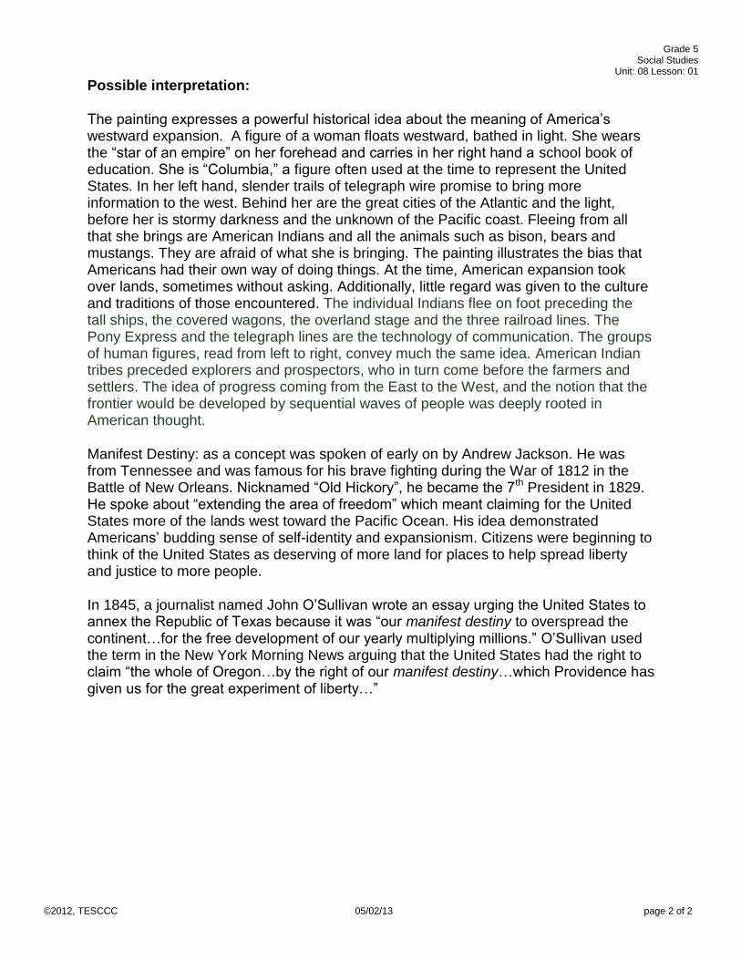
Regions of the United States Map
U.S. Census Bureau. (Producer). (2004, October 28). US Census geographical region map [Web Map]. Retrieved from
http://en.wikipedia.org/wiki/File:US_Census_geographical_region_map.png
Grade 5 Social Studies
Unit: 08 Lesson: 01
©2012, TESCCC 04/19/13 page 1 of 1
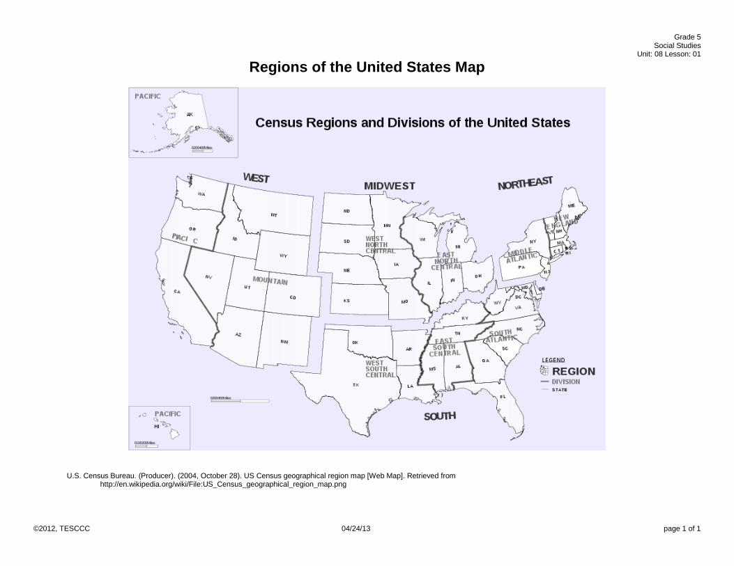
Regions and Characteristics Chart
Regions: Characteristics: Pacific
Landforms: Landmarks: Climate:
Mountain
Landforms: Landmarks: Climate:
West North Central
Landforms: Landmarks: Climate:
West South Central
Landforms: Landmarks: Climate:
East North Central
Landforms: Landmarks: Climate:
East South Central
Landforms: Landmarks: Climate:
South Atlantic
Landforms: Landmarks: Climate:
Middle Atlantic
Landforms: Landmarks: Climate:
New England
Landforms: Landmarks: Climate:

Grade 5 Social Studies
Unit: 08 Lesson: 01
©2012, TESCCC 4/24/12 page 1 of 2
The First Industrial Revolution
Do you remember the American Revolution? What is a revolution? A revolution is a movement
that causes things to change substantially. The American Revolution changed a lot about the
United States, its government, economics, and lifestyle. The Industrial Revolution changed the
way people lived and worked. It began in Great Britain, in the early 1800s and it quickly spread
to the United States.
In the early days of the colonies, if you wanted something like a chair or a dress, one person
made it very carefully for you, or perhaps you made it for yourself. Things were produced one at
a time, so they were expensive and rare. Most people were lucky to have one of something, like
one pair of pants and one shirt, or one pair of shoes. The Industrial Revolution changed this!
The Industrial Revolution was about inventions, innovations, creative ideas, and ways machines
could help people get more done and produce goods more quickly. Now people could easily
have more than one of something!
Once a good idea gets started, it is hard to stop. Eli Whitney visited Savannah, Georgia, in the
southern states and heard how hard it was for people to get the little seeds out of cotton fibers.
One person working all day could only take seeds out of one pound of cotton. He quickly
invented a little machine to help do this work. His invention, the cotton gin, would help one
person clean 50 pounds of cotton a day! Now things really changed! If a farmer could grow
more cotton, it could be “ginned” more quickly, thus making the farmer wealthy! While the cotton
gin moved farming forward and made ginning more efficient, it inadvertently encouraged an
expansion of slave labor to work those additional crops. Now the growers needed more workers
to plow, plant, and harvest the cotton. In the South, those workers were often enslaved people.
That means the plantation owner claimed to “own” the person and not pay for their labor.
In the meantime, in the northern states there was another invention. Samuel Slater designed a
factory beside the Blackstone River in Rhode Island. Slater used the waterpower of the river to
turn his machines to spin cotton into thread and then weave it into cloth. People no longer had
to spin thread by hand and weave it into cloth by hand! Once again, this made the production of
cloth much more efficient. More and more factories sprang up turning raw cotton into thread and
weaving it into cloth. Now the South more places to sell their cotton – to the North! While this
new invention was wonderful in many ways, there was a downside as well. To meet the high
demand for factory workers, the owners often employed poorly paid women and children,
making them work long hours in unsafe conditions. Many children were not going to school and
learning how to read but were working long hours in a factory to help their family earn money for
food. People worked so hard in the factories that many got sick or hurt from the unsafe
conditions.
Once the idea of machines began, it was hard to stop. Eli Whitney next invented a way to make
muskets with interchangeable parts. In the old days when one person made one gun, if the
gun broke on the battlefield, it would take days or even weeks to fix it. Now the guns were being
made by machines and had interchangeable parts so they could be produced and repaired
quickly.

Grade 5 Social Studies
Unit: 08 Lesson: 01
©2012, TESCCC 4/24/12 page 2 of 2
Another part of the Industrial Revolution focused on transportation. Again, one thing led to
another. First people were planning ways to improve roads. They didn’t like the dirt and mud
roads when it rained. The wheels of their wagons and feet of their horses would bog down and
stop. They tried making roads out of rocks, boards, logs, and finally little rocks with tar. Those
were much better, but then someone thought of using the waterways or rivers and boats for
transporting people to and from places. They decided to dig canals to the places they wanted to
take the boats. One group of people decided to dig a huge, long canal from the Hudson River in
New York to Lake Erie. That was approximately 350 miles of digging one deep canal, but they
got it done. The completion of the Erie Canal was so exciting, and it made trading goods much
easier and less expensive. Instead of costing $100 to ship a ton of grain from Albany to New
York, it only cost $8 dollars. (Remember, this was before the invention of railroads or cars.) It
was the only way to travel except by horse, or horse and wagon. Now people could ride on
canal boats and move westward to Indiana, Michigan and Wisconsin. Of course, the people who
lived in the west were able to travel easily back to the east to New York City on the Erie Canal,
and they did, bringing their money to spend. That was when New York City became such a
successful, booming city. Better transportation brought about urbanization, or a move toward
living in the cities for jobs and opportunities.
One other invention came along that helped transportation was the steam engine. Robert Fulton
built on previous ideas and finally figured out a design. The steam engine was built to power
ships up and down the rivers and canals. Steam ships would be able to travel faster than the
canal boats. Next, the invention of the steam engine made it possible to build a large system of
railroads. People could lay a track and power an engine on that track with steam. It worked, and
eventually, the newly invented steam engines could go 30 miles an hour up and down the
tracks. Rail lines popped up everywhere. Many inventors made it a goal to make the steam
engine safer and faster.. Occasionally the powerful engines would blow up, injuring or killing
those nearby.
Safety regulations did not exist during the Industrial Revolution. People could get injured by the
machines and inventions. This created a need for reform in the work place. There needed to be
rules for safety, for the amount of hours someone could work, for the age limit of workers, and
for safety equipment to protect the workers and the people who rode the ships and the trains.
The Industrial Revolution was a very exciting time with many new possibilities, but it also
brought hard lessons. The country would have to meet the challenge of being fair to workers,
including those who were in slavery, as well as to consumers, so that people could be assured
of their basic rights as Americans and their rights to safety. A change in the regional make-up of
our nation occurred because of the Industrial Revolution. The North became a center for
manufacturing and trade, and the South became the center for agriculture. Regional differences
including slavery were beginning to divide the nation.

Grade 5 Social Studies
Unit: 08 Lesson: 01
©2012, TESCCC 10/23/12 page 1 of 1
The Industrial Revolution: Causes and Effects
Choose three inventions from the Industrial Revolution and list both its positive effects and negative effects
Positive Effects Invention Negative Effects

Grade 5 Social Studies
Unit: 08 Lesson: 01
©2012, TESCCC 10/23/12 page 1 of 1
Steps in the Problem Solving Process
1. Identify
the problem
2. Gather
Information
3. List and consider options
4. Consider advantages and
disadvantages
5. Choose and implement a
solution
6. Evaluate the effectiveness
of the solution

Grade 5 Social Studies
Unit: 08 Lesson: 01
©2012, TESCCC 4/24/13 page 1 of 2
Farming Gets a Boost
Think of a time when you were supposed to perform a difficult task by yourself.
Maybe you have to make the bed, or sweep the garage, or clean up a big mess,
or fix something that was broken. By yourself the task seemed too hard, but if
you had some help the task would be easier. What if there was an invention or a
machine that would help you complete the task? What if there was a machine
that would make the bed, or clean up the mess? In the early days of America, the
farmers who moved west did not have help. The work was hard and had to be
done by hand. There were no machines to help.
After the Louisiana Purchase was announced, it was difficult to keep farmers and
their families who lived in the eastern United States from moving west into the
Northwest Territory and the Great Plains. Where American Indian tribes and
bison had once freely roamed, now people were moving into that area to find a
plot of land, plow a field to plant crops, build a home, and settle down with their
families. Farmers were so happy to find mile after mile of rich soil with not so
many stones and trees as in the east. The West was perfect for farming-- except
the soil was hard and tough to plow.
Farming was hard, hard work. Most of the labor in those days had to be done by
hand, even plowing. The soil was so hard it broke the wooden plows! Planting
and harvesting was by hand, not machines. The farmers who were lucky had
oxen or a mule to help pull the plow. However, when they harvested grain, the
animals could not help. To cut grain people used a sickle or a scythe. Harvesting
was slow, hard, long work. To the relief of the farmers, there were soon two
important inventions. The first was the invention of the steel plow by John Deere.
The steel plow could break the soil without getting stuck in it, helping the farmer
plow and plant more easily.
Steel Plow John Deere
Image credits: Illinois State Museum. (Photographer). The John Deere Steel Plow [Web Photo]. Retrieved from http://www.museum.state.il.us/exhibits/agriculture/htmls/technology/horse-drawn/tech_horse-drawn_deere_plow.html (2013). John Deere [Web Drawing]. Retrieved from http://www.deere.com/en_IN/index.html

Grade 5 Social Studies
Unit: 08 Lesson: 01
©2012, TESCCC 4/24/13 page 2 of 2
The second invention was the mechanical reaper which was invented by Cyrus
McCormick. The mechanical reaper could reap as much grain as 5 or 6 men
could reap by hand in a day. Mr. McCormick built a factory in Chicago and
manufactured 500 reapers ready by harvest in 1848.
Mechanical Reaper Cyrus McCormick
With the steel plow and the mechanical reaper, farmers could produce more
crops, feed more people and even make a little money. During this time, farming
became mechanized with machines and mechanical equipment that was
invented to help the farmer produce more crops.
Both John Deere and Cyrus McCormick began farming equipment companies
that still exist to help farmers all over the world today. They were entrepreneurs
and capitalists who followed their inventive ideas all the way through to
production and sales in the free market system. They were right that their ideas
would help farmers, and with modernization of the equipment today their
companies, John Deere and International Harvester, are still helping farmers
produce crops.
Image credits (1845). McCormick Reaper, 1845 [Web Drawing]. Retrieved from http://en.wikipedia.org/wiki/File:McCormick_Reaper,_1845.jpg (2011). Cyrus Hall McCormick at National Portrait Gallery[Web Photo]. Retrieved from http://en.wikipedia.org/wiki/File:Cyrus_Hall_McCormick_at_National_Portrait_Gallery_IMG_4390.JPG

Grade 5 Social Studies
Unit: 08 Lesson: 01
©2012, TESCCC 4/24/13 page 1 of 3
Learning Station Questions
Learning Station #1: Andrew Jackson – the Hero Study the painting of Jackson as Leader and War Hero in the War of 1812. Jackson fought bravely and showed great leadership ability especially in the Battle of New Orleans in 1814. From what you know about Andrew Jackson as a leader and from the picture, what do you predict his leadership ability and character will be in his future?
Study the Presidential Campaign poster for Andrew Jackson. Describe what his supporters felt were his
strengths:
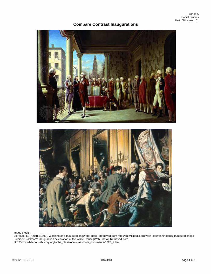
Learning Station #2: Compare-Contrast Inaugurations
Study and compare the two pictures of President Washington’s and President Jackson’s inaugurations.
President George Washington President Andrew Jackson Strengths: Weaknesses: Political point of view:
Strengths: Weaknesses: Political point of view:

Grade 5 Social Studies
Unit: 08 Lesson: 01
©2012, TESCCC 4/24/13 page 2 of 3
Learning Station #3: Greedy for Gold Read the information at this station about American’s Gold Rush.
What was the Indian Removal Act?
How did the Cherokee feel about being forced off their land?
How did President Jackson react to the plea from the Cherokee to stay on their land?
What is your response to the picture of the “The Trail of Tears?”
Learning Station #4: The Spoils System Read the information at this station about the Spoils System. What is the difference between the “merit system” and the “spoils system?”
Learning Station #5: Cartoon President Jackson Study the cartoon of Andrew Jackson.
Look carefully at the cartoon and explain what opinion the cartoonist expressed about Andrew Jackson.
Merit System Spoils System
Which system do you think is best? Why?
What does the cartoon mean?

Grade 5 Social Studies
Unit: 08 Lesson: 01
©2012, TESCCC 4/24/13 page 3 of 3
Summary Questions:
Work with your group to answer the following Learning Station Summary questions:
1. What was the people’s opinion of General Jackson as a soldier?
2. How did the discovery of gold in Georgia affect the Cherokee Nation?
3. The Cherokee Nation responded to the 1830 Indian Removal Act by…
4. How did the United States Supreme Court rule in regard to the Cherokee issue?
5. What was President Jackson’s response to the Cherokee’s plea and the Supreme Court decision?
6. What eventually happened to the Cherokee?
7. How did the cartoonist view Jackson?
8. What contribution did these events make to the development of democracy?

Grade 5 Social Studies
Unit: 08 Lesson: 01
©2012, TESCCC 4/24/13 page 1 of 2
President Andrew Jackson Who Was “Old Hickory” Really?
Keeping in mind point of view, study each of the primary document visuals.
Image credit: Moran, E. (Artist). (1910). The Battle of New Orleans [Web Photo]. Retrieved
from http://en.wikipedia.org/wiki/File:Battle_of_New_Orleans.jpg

Grade 5 Social Studies
Unit: 08 Lesson: 01
©2012, TESCCC 4/24/13 page 2 of 2
Keller, M. (Composer). (2007). Andrew jackson campaign poster. [Print Graphic]. Retrieved
from http://graphics8.nytimes.com/images/2007/11/18/books/siegel-190.jpg
Grade 5 Social Studies
Unit: 08 Lesson: 01
©2012, TESCCC 04/24/13 page 1 of 1
Compare Contrast Inaugurations
Image credit: Elorriage, R. (Artist). (1899). Washington's Inauguration [Web Photo]. Retrieved from http://en.wikipedia.org/wiki/File:Washington's_Inauguration.jpg President Jackson's inauguration celebration at the White House [Web Photo]. Retrieved from http://www.whitehousehistory.org/whha_classroom/classroom_documents-1828_a.html
Grade 5 Social Studies
Unit: 08 Lesson: 01
©2012, TESCCC 4/24/13 page 1 of 2
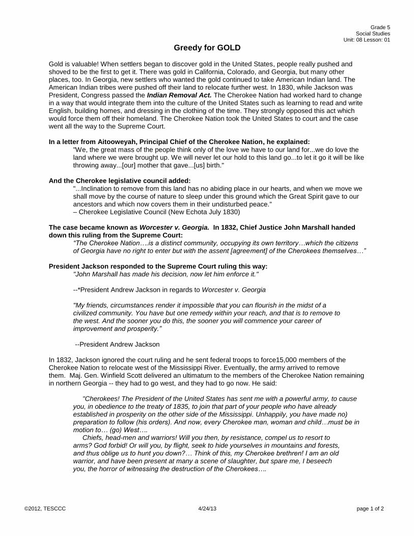
Greedy for GOLD
Gold is valuable! When settlers began to discover gold in the United States, people really pushed and shoved to be the first to get it. There was gold in California, Colorado, and Georgia, but many other places, too. In Georgia, new settlers who wanted the gold continued to take American Indian land. The American Indian tribes were pushed off their land to relocate further west. In 1830, while Jackson was President, Congress passed the Indian Removal Act. The Cherokee Nation had worked hard to change in a way that would integrate them into the culture of the United States such as learning to read and write English, building homes, and dressing in the clothing of the time. They strongly opposed this act which would force them off their homeland. The Cherokee Nation took the United States to court and the case went all the way to the Supreme Court. In a letter from Aitooweyah, Principal Chief of the Cherokee Nation, he explained:
"We, the great mass of the people think only of the love we have to our land for...we do love the land where we were brought up. We will never let our hold to this land go...to let it go it will be like throwing away...[our] mother that gave...[us] birth."
And the Cherokee legislative council added: "...Inclination to remove from this land has no abiding place in our hearts, and when we move we shall move by the course of nature to sleep under this ground which the Great Spirit gave to our ancestors and which now covers them in their undisturbed peace." – Cherokee Legislative Council (New Echota July 1830)
The case became known as Worcester v. Georgia. In 1832, Chief Justice John Marshall handed down this ruling from the Supreme Court:
“The Cherokee Nation….is a distinct community, occupying its own territory…which the citizens of Georgia have no right to enter but with the assent [agreement] of the Cherokees themselves…”
President Jackson responded to the Supreme Court ruling this way:
"John Marshall has made his decision, now let him enforce it." --*President Andrew Jackson in regards to Worcester v. Georgia "My friends, circumstances render it impossible that you can flourish in the midst of a civilized community. You have but one remedy within your reach, and that is to remove to the west. And the sooner you do this, the sooner you will commence your career of improvement and prosperity.” --President Andrew Jackson
In 1832, Jackson ignored the court ruling and he sent federal troops to force15,000 members of the Cherokee Nation to relocate west of the Mississippi River. Eventually, the army arrived to remove them. Maj. Gen. Winfield Scott delivered an ultimatum to the members of the Cherokee Nation remaining in northern Georgia -- they had to go west, and they had to go now. He said:
"Cherokees! The President of the United States has sent me with a powerful army, to cause you, in obedience to the treaty of 1835, to join that part of your people who have already established in prosperity on the other side of the Mississippi. Unhappily, you have made no) preparation to follow (his orders). And now, every Cherokee man, woman and child…must be in motion to… (go) West…. Chiefs, head-men and warriors! Will you then, by resistance, compel us to resort to arms? God forbid! Or will you, by flight, seek to hide yourselves in mountains and forests, and thus oblige us to hunt you down?… Think of this, my Cherokee brethren! I am an old warrior, and have been present at many a scene of slaughter, but spare me, I beseech you, the horror of witnessing the destruction of the Cherokees….

Grade 5 Social Studies
Unit: 08 Lesson: 01
©2012, TESCCC 4/24/13 page 2 of 2
Do not… wait for the close approach of the troops; but make … preparations (to leave)….You will find food for all and clothing…and.… at your ease and in comfort be transported to your new homes, according to the terms of the treaty. This is the address of a warrior to warriors. May his entreaties be kindly received and may the God of both prosper the Americans and Cherokees and preserve them long in peace and friendship with each other!”
The Cherokees were driven from their homes, forced into internment camps, and then moved to a strange land. They walked and rode horses and wagons to the camps and finally on to Indian Territory in Oklahoma. The Cherokees named the trail, “The Trail Where They Cried,” in their language, nu na hi du na tlo hi lu i. History calls it “The Trail of Tears.”
Excerpt Sources: Woodward, G. (1963). The cherokees. (pp. 202-203). Norman, OK: University of Oklahoma Press. Retrieved from http://books.google.com/books?id=r4mKohpSJ2kC&printsec=frontcover Youngs, J. (2001). American realities: From first settlements to the civil war. (p. 171). Longman. Retrieved from http://books.google.com/books?id=7QrNS6RmKmkC&q=isbn:0321070941&dq=isbn:0321070941&hl=en&sa=X&ei=TjJ4UbmjKqfi2gXEzoHwAw&ved=0CDIQ6AEwAA PBS. (1832). Worcester v. georgia. Retrieved from http://www.pbs.org/weta/thewest/resources/archives/two/worcestr.htm *This is likely a spurious quote, though based on a letter Jackson wrote. See They Never Said It: A Book of Fake Quotes, Misquotes, and Misleading Attributions by Paul Boller, p. 53. PBS. (n.d.). Trail of tears. Retrieved from http://www.pbs.org/weta/thewest/program/episodes/two/trailtears.htm (1994). E. Cashin (Ed.), A Wilderness Still The Cradle of Nature: Frontier Georgia (pp. 137-138). Savannah, GA: Beehive Press. Image source: The Trail of Tears [Web Photo]. Retrieved from http://www.pbs.org/wgbh/aia/part4/4h1567b.html

Grade 5 Social Studies
Unit: 08 Lesson: 01
©2012, TESCCC 04/04/13 page 1 of 1
To the Victor Belong the Spoils The Spoils System
Andrew Jackson began the practice of giving government jobs to voters and supporters as a reward for working toward his victory in the race for president. The other ways of doing business is the merit system which awards offices or jobs based on merit or deserving the reward because of hard work and not political activity.
Nast, T. (Artist). (1877). In memoriam‐‐our civil service as it was. [Print Drawing]. Retrieved from http://upload.wikimedia.org/wikipedia/commons/4/43/In_memorium‐‐our_civil_service_as_it_was.JPG

Grade 5 Social Studies
Unit: 08 Lesson: 01
©2012, TESCCC 04/24/13 page 1 of 1
President Andrew Jackson
(1832). King Andrew the First [Web Photo]. Retrieved from
http://www.archives.gov/exhibits/treasures_of_congress/Images/page_9/30a.html

Grade 5 Social Studies
Unit: 08 Lesson: 01
©2012, TESCCC 05/02/13 page 1 of 1
The Lowell Mills
The Point of View of the North
Life in the north was a picture of busy factories and smoke stacks, coal mines, more people
moving to the cities for jobs, new railroads, new canals, improved transportation, and a life that
was becoming hustle and bustle. The factories were mass producing goods, making them
more affordable. It was colder in the north and family farms struggled while factories grew. The
oldest schools in the nation were founded in the region and new schools and colleges were
continually opening. Northern economics were good and money flowed for the successful
entrepreneurs and inventors. In the North, many of the new modes of transportation were
introduced. Railroads and canals began to crisscross Northern states. The shipping industry
took advantage of the many harbors and transformed small coastal towns into large cities.
Northern factories needed more cotton, tobacco and other raw materials from the Southern
farms to give their factories plenty to produce. To ensure plenty of raw materials, Northern
states proposed taxes, or tariffs, on any raw materials sold to foreign countries. The idea of
tariffs made the Southern planters angry because from their point of view it was controlling
where they could sell their crops.
From the point of view of the Northern factory and mine workers, life was still a struggle. More
than half of the workers were women and children. They had to work long hours with no
breaks. There was a lack of safety in work places, and workers were not paid good wages.
Still, many people in the North were critical of the continuing practice of slavery in the South.
Many Northerners were called abolitionists, which meant they were working to abolish
slavery.
Image credit: Gleason's Pictorial Drawing-Room Companion. (Artist). (1852). View of the Boott Cotton Mills, at Lowell, Mass. [Web Photo].
Retrieved from http://www.loc.gov/pictures/resource/cph.3a06274/

Grade 5 Social Studies
Unit: 08 Lesson: 01
©2012, TESCCC 05/02/13 page 1 of 1
The Point of View of the South
The Southern Plantation System
Life in the Southern states moved at a slower pace than other regions. The heat and humidity
of the region made for a difficult life. Far fewer education opportunities were available across
the vast agricultural and plantation lands that spread across Southern states.
The warm and humid climate, fertile soil, and wide rivers of the South contributed to the
creation of large cotton and tobacco fields. A Southern agricultural system called plantations
developed. Large plantations had a wealthy landowner who usually hired an over-seer to
manage and supervise workers in the fields. Because of the need for many people to work
the land, the South used a system of slavery to force enslaved people into the hot fields. The
invention of the cotton gin made it easier to remove the tiny dark seeds from cotton. This sped
up cotton production in the South and led to even more enslaved people working fields. Some
small farmers, however, did the work themselves, helped one another, or hired workers.
Southern states grew increasingly concerned about the role of the national government in
their day-to-day lives. Some landowners worried that the national government would end
slavery while believing their local and state governments would continue to allow it.
Additionally, many plantation owners strongly disagreed with tariffs on the raw materials they
were producing. They were concerned the national government and Northern states were
interfering too much in their lives.
The demand for more and more cotton, tobacco, and even sugar caused the farmers to plow
more Southern lands. Even though the soil was becoming depleted from growing cotton and
tobacco, plantations had become extremely successful shipping cotton to Great Britain. In
addition, many people had successful small businesses such as fishing the coastal waters.
Image credit: Walker, W. A. (Artist). (1881). Cotton plantation on the mississippi. [Print Graphic]. Retrieved from http://www.definitivecivilwar.com/art/600/0000007254c.jpg

Grade 5 Social Studies
Unit: 08 Lesson: 01
©2012, TESCCC 04/24/13 page 1 of 1
Point of View of the West
In 1840 only about 4% of Americans lived in the western territories. But brave trailblazers and pioneers were moving west into untamed territories in greater numbers in the later 1800s. Newly completed canals, roads, and railroads helped to push territorial expansion. Free land was a pull factor, too. Settlers could usually get about 160 acres for free if they farmed it 5 years, or they could pay $1.25 an acre. Over time, people found that the western or plains area was excellent for farming wheat and grazing cattle. The new steel plow, the mechanical reaper, and other new farm equipment helped the small farmer manage large fields and grow more crops. The farmers grew vegetables, wheat, hay, corn, apples, and other fruits. Besides farming, there were people moving west who were miners, railroad workers, ranchers or small business owners. People prospecting for gold and silver in the “gold rush” usually came first. Next, railroads were being built to connect to new towns and workers arrived to build the tracks. The national government wanted a railroad that went across the entire continent, from the East to the West, called the transcontinental railroad. It would make travel across the Great Plains easier. The railroads helped people in the West by shipping to them badly needed farm supplies, coal, home goods and other materials. In turn, the railroad shipped the farmers’ products to the Eastern cities. The growing population of urban cities led to a greater demand for grain. Another business, cattle ranching, had been conducted for years by earlier Spanish settlers in the West and newly-arriving settlers were adopting the practice as well. As the high demand for beef developed in the East, ranching grew. Eastern markets paid ten times the price of cattle as in the West. One major difficulty of settling the western territories were the boundaries. High mountain ranges (the Appalachians, the Rockies, and the Cascades), deep and wide rivers like the Mississippi, and hot, dusty deserts created hardships that cost many settlers their possessions or even their life. Westward expansion also resulted in conflict with American Indian tribes. Despite the many uncertainties, many people remained resilient and successfully settled in the West. The U.S. military, the buffalo hunters, and the settlers began to deplete the bison population on the plains. Several American Indian tribes depended on bison for clothing, food, housing, fuel, medicine, and tools and they believed no one “owned” land. The settlers moving onto tribal lands, the destruction of bison herd by hunters, and new cattle drives increased tensions and led to conflict among new arrivals and American Indian tribes.
Image credit: (2006). Sailing to california for the california gold rush. (2006). [Print Graphic]. Retrieved from http://upload.wikimedia.org/wikipedia/commons/0/0d/California_Clipper_500.jpg

Grade 5 Social Studies
Unit: 08 Lesson: 01
©2012, TESCCC 04/24/13 page 1 of 1
Songs from the North
The Erie Canal Song, also known as Fifteen Miles on the Erie Canal
Verse #1 I've got a mule Her name is Sal, Fifteen years on the Erie Canal. She's a good old worker And a good old pal, Fifteen years on the Erie Canal. We've hauled some barges in our day Filled with lumber, coal and hay And ev'ry inch of the way I know From Albany to Buffalo. Chorus: Low Bridge, everybody down, For its Low Bridge, We're coming to a town! You can always tell your neighbor, You can always tell your pal, If you've ever navigated On the Erie Canal. Low Bridge, ev'rybody down, For it's Low Bridge, We're coming to a town! You can always tell your neighbor, You can always tell your pal, If you've ever navigated On the Erie Canal.
Verse #2 We better get along On our way, old gal, Fifteen miles on the Erie Canal. Cause you bet your life I'd never part with Sal, Fifteen miles on the Erie Canal. Git up there, mule, here comes a lock, We'll make Rome 'bout six o'clock. One more trip and back we'll go Right back home to Buffalo.
Lyrics courtesy of Allen, T. (Composer). (1905). Fifteen Miles on the Erie Canal [Song]. Retrieved from www.eriecanalsong.com

Grade 5 Social Studies
Unit: 08 Lesson: 01
©2012, TESCCC 10/23/12 page 1 of 1
Songs from the South
Image courtesy of (1873). The Jubilee Singers Songbook [Web Photo]. Retrieved from http://en.wikipedia.org/wiki/File:SwingLowSweetChariot1873.jpg

Grade 5 Social Studies
Unit: 08 Lesson: 01
©2012, TESCCC 4/25/13 page 1 of 1
Songs from the West
Home on the Range
Verse 1: Oh, give me a home where the buffalo roam Where the deer and the antelope play Where seldom is heard a discouraging word And the skies are not cloudy all day Chorus: Home, home on the range Where the deer and the antelope play Where seldom is heard a discouraging word And the skies are not cloudy all day There are several versions of the song and several more verses as well. Lyrics courtesy of: Higley, B., & Kelley, D. (2008). Home on the range. In L. Rotegard & L. Meikle (Eds.), Cowboy Poetry and Songbookdoi:www.nps.gov/grko/historyculture/upload/songbook.pdf

Grade 5 Social Studies
Unit: 08 Lesson: 01
©2012, TESCCC 10/23/12 page 1 of 1
Research on American Indian Conflicts
Tribe: Conflict with:
Point of View/Problem: Outcome: Possible Solution: Outcomes:
Point of View/Problem: Outcome: Possible Solution: Outcomes:
Summary:
Related Documents