GPS/WAAS Program Update Baska GNSS Conference 07 May 2018 Baska, Krk Island, Croatia

Welcome message from author
This document is posted to help you gain knowledge. Please leave a comment to let me know what you think about it! Share it to your friends and learn new things together.
Transcript

GPS/WAAS Program Update
Baska GNSS Conference
07 May 2018
Baska, Krk Island, Croatia

U.S. National Space Policy
• Provide civil GPS services, free of direct user charges– Available on a continuous, worldwide basis
– Maintain constellation consistent with published performance standards and interface specifications
– Foreign PNT services may be used to augment and strengthen the resiliency of GPS
• Encourage global compatibility and interoperability with GPS
• Promote transparency in civil service provision
• Enable market access to industry
• Support international activities to detect and increase resiliency to harmful interference
Space-Based PNT Guideline: Maintain leadership in the service, provision, and use of GNSS
2

GPS Status
3
Satellite Block Quantity Average Age Oldest
GPS IIA 1 24.4 24.4
GPS IIR 11 16.2 20.7
GPS IIR-M 7 10.7 12.5
GPS IIF 12 4.2 7.8
Constellation 31 10.6 24.4
34 Satellites / 31 Set Healthy
Baseline Constellation: 24 Satellites
AS OF 3 APR 18
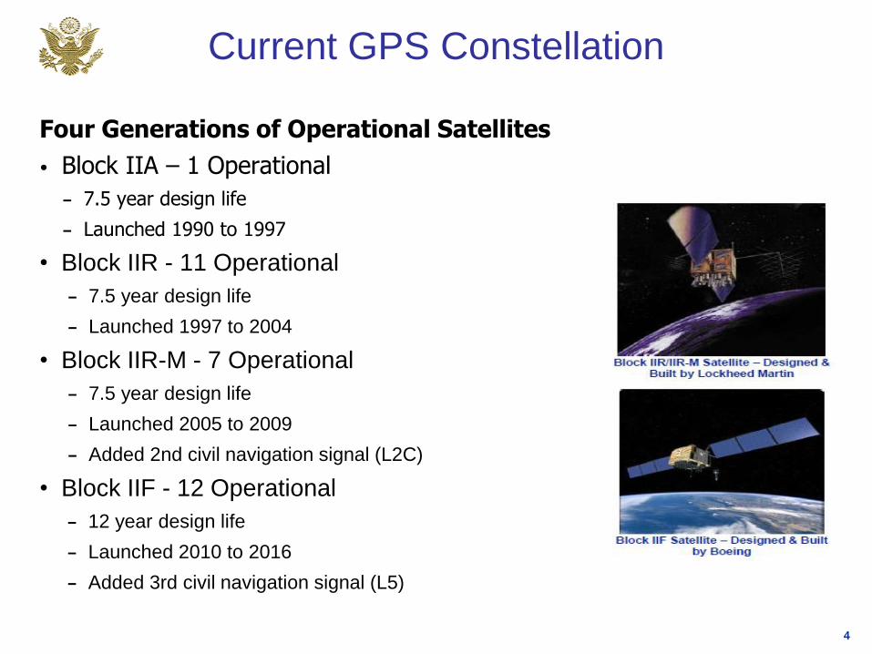
Current GPS Constellation
Four Generations of Operational Satellites
• Block IIA – 1 Operational
– 7.5 year design life
– Launched 1990 to 1997
• Block IIR - 11 Operational
– 7.5 year design life
– Launched 1997 to 2004
• Block IIR-M - 7 Operational
– 7.5 year design life
– Launched 2005 to 2009
– Added 2nd civil navigation signal (L2C)
• Block IIF - 12 Operational
– 12 year design life
– Launched 2010 to 2016
– Added 3rd civil navigation signal (L5)
4
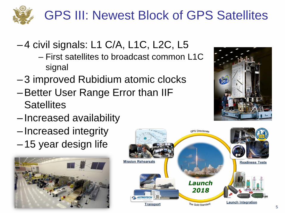
GPS III: Newest Block of GPS Satellites
–4 civil signals: L1 C/A, L1C, L2C, L5– First satellites to broadcast common L1C
signal
–3 improved Rubidium atomic clocks
–Better User Range Error than IIF
Satellites
– Increased availability
– Increased integrity
–15 year design life
5

GPS Ground Segment
• Current Operational Control Segment (OCS)
– Flying GPS constellation using Architecture Evolution Plan (AEP) and Launch and Early Orbit, Anomaly, and Disposal Operations (LADO) software capabilities
– Increasing Cyber security enhancements
• Next Generation Operational Control System (OCX)
– Modernized command and control system - replaces legacy system and adds modern features
– Worldwide, 24 hr/day, all weather, position, velocity and time source for military & civilian users
– Modern civil signal monitoring and improved PNT performance
– Robust cyber security infrastructure
– New capabilities including civil signal performance monitoring capability
Monitor Station
Ground Antenna
6
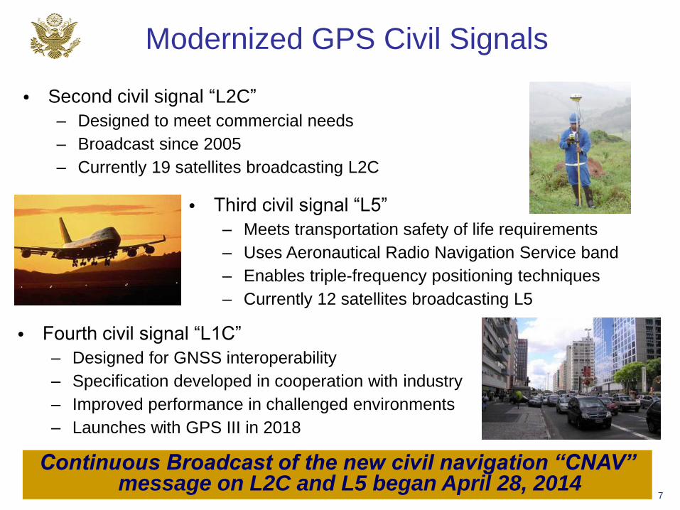
Modernized GPS Civil Signals
7
• Second civil signal “L2C”
– Designed to meet commercial needs
– Broadcast since 2005
– Currently 19 satellites broadcasting L2C
• Third civil signal “L5”
– Meets transportation safety of life requirements
– Uses Aeronautical Radio Navigation Service band
– Enables triple-frequency positioning techniques
– Currently 12 satellites broadcasting L5
• Fourth civil signal “L1C”
– Designed for GNSS interoperability
– Specification developed in cooperation with industry
– Improved performance in challenged environments
– Launches with GPS III in 2018
Continuous Broadcast of the new civil navigation “CNAV” message on L2C and L5 began April 28, 2014

GPS SIS Performance Scoreboard
5

• 2013-2016 performance reports now available on gps.gov
• 2017 performance report in coordination
• These reports measure GPS performance against GPS SPS PS commitments
• Reports generated by Applied Research Laboratories at the University of Texas at Austin
GPS Performance Report Cards
9
Performance Standard Metric 2013 2014 2015 2016
SIS Accuracy URE Accuracy
UTCOE Accuracy N/A N/A
SIS Integrity Instantaneous URE Integrity
Instantaneous UTCOE
IntegrityN/A N/A
SIS ContinuityUnscheduled Failure
Interruptions
Status and Problem
ReportingN/A
SIS Availability Per-Slot Availability
Constellation Availability
Operational Satellite Counts
Position/Time
StandardsPDOP Availability
Position Service Availability
Position Accuracy
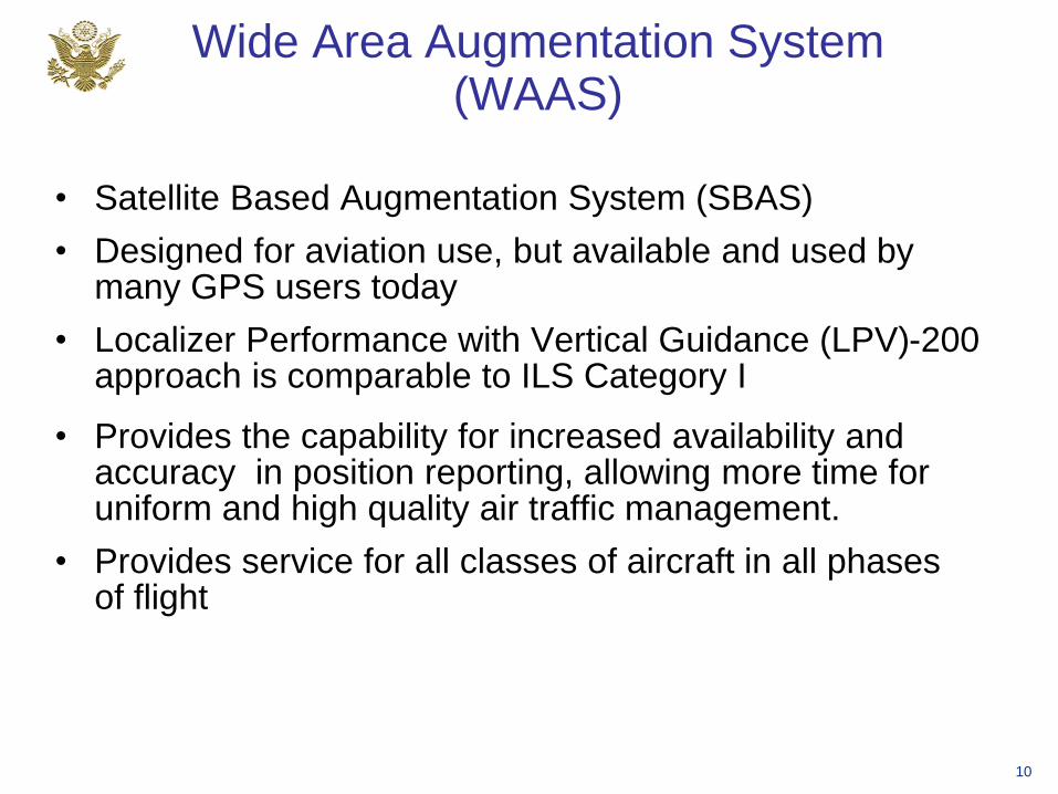
Wide Area Augmentation System (WAAS)
• Satellite Based Augmentation System (SBAS)
• Designed for aviation use, but available and used by many GPS users today
• Localizer Performance with Vertical Guidance (LPV)-200 approach is comparable to ILS Category I
10
• Provides the capability for increased availability and accuracy in position reporting, allowing more time for uniform and high quality air traffic management.
• Provides service for all classes of aircraft in all phases of flight

WAAS Architecture
38 Reference Stations
3 Master Stations
6 Ground Earth Stations
3 Geostationary Satellite Links
2 Operational Control Centers
11

Current WAAS PerformanceLPV
LPV - 200
RNP 0.3
More detailed information available at http://www.nstb.tc.faa.gov/reports/waaspan62.pdf
12

WAAS Dual Frequency Service
• WAAS has implemented system changes to enable a L1/L5 user
– Upgraded reference station receivers to receive L5
– Upgraded communication network to handle additional data (Dec 2017)
– New safety computer with improved processor performance (Sep 2019)
• Minimum Operational Performance Standards (MOPS) and
Standards And Recommended Practices (SARPS) requirements
development is underway
• Significant additional work needed to implement a dual frequency
WAAS Service
– Preparing for FAA investment decision in 2019
• Have also installed non-operational test receivers at 6 WAAS
reference sites to record Galileo data
– Currently being collected for research purposes only
13

Benefits of Dual Frequency Operations
• Dual frequency L1/L5 service improves availability and continuity
L1 L1, L5
14Simulation

U.S. Objectives in Working with Other GNSS Service Providers
• Ensure compatibility ― ability of U.S. and non-U.S. space-based PNT services to be used separately or together without interfering with each individual service or signal
– Radio frequency compatibility
– Spectral separation between M-code and other signals
• Achieve interoperability – ability of civil U.S. and non-U.S. space-based PNT services to be used together to provide the user better capabilities than would be achieved by relying solely on one service or signal
• Promote fair competition in the global marketplace
Pursue through Bilateral andMultilateral Cooperation
15

Bilateral GNSS Cooperation
• Europe: GPS-Galileo Cooperation Agreement signed 2004– Working Group on Next Generation GPS/Galileo Civil Services
meets twice per year – most recent meeting April 2018
– Working Group on Trade & Civil Applications meets as needed
– PRS access negotiations are under way
• China: Most recent civil GNSS Plenary – June 2015
– Sub-group on compatibility and interoperability met June 2017 in Los Angeles – Joint Statement on Cooperation in November 2017
– GNSS discussed at U.S.-China Civil Space Dialogue – Nov 2017
• Japan: Civil Space Dialogue hosted by U.S. – May 2017– Technical Working discusses compatibility between GPS & QZSS
• India: Civil Space Joint Working Group Meeting in Washington – October 2017
– ITU compatibility coordination completed16

GNSS: A Global Navigation Satellite System of Systems
• Global Constellations
– GPS (24+3)
– GLONASS (24+)
– GALILEO (24+3)
– BDS/BEIDOU (27+3 IGSO + 5 GEO)
• Regional Constellations
– QZSS (4+3)
– IRNSS/NAVIC (7)
• Satellite-Based Augmentations
– WAAS (3)
– MSAS (2)
– EGNOS (3)
– GAGAN (3)
– SDCM (3)
– BDSBAS (3)
– KASS (2)17

International Committee on Global Navigation Satellite Systems (ICG)
• Emerged from 3rd UN Conference on the Exploration and Peaceful Uses of Outer Space July 1999
– Promote the use of GNSS and its integration into infrastructures, particularly in developing countries
– Encourage compatibility and interoperability among global and regional systems
• Members include:
– GNSS Providers: (U.S., EU, Russia, China, India, Japan)
– Other Member States of the United Nations
– International organizations/associations
http://www.unoosa.org/oosa/en/ourwork/icg/icg.html18

Past ICG Meetings
• ICG-1: UN Vienna, Austria – November 2006
• ICG-2: Bangalore, India – September 2007
• ICG-3: Pasadena, CA, USA – December 2008
• ICG-4: St Petersburg, Russia – September 2009
• ICG-5: Turin, Italy – October 2010
• ICG-6: Tokyo, Japan – September 2011
• ICG-7: Beijing, China – November 2012
• ICG-8: Dubai, UAE – November 2013
• ICG-9: Prague, Czech Republic – November 2014
• ICG-10: Boulder, CO, USA – November 2015
• ICG-11: Sochi, Russia – November 2016
• ICG-12: Japan – December 2017
ICG Meetings
Future Meetings
• ICG-13: China – 2018
• ICG-14: India – 2019
• ICG-15: UN Vienna, Austria - 2020
19

• More than 200 participants
Representatives from 20 countries/organizations
Representation from 5 GNSS Providers
• Agenda included:
Meeting of the Providers’ Forum
System Provider Updates
Applications and Experts Session
Meeting of all four Working Groups
12th Meeting of the International Committee on GNSS (ICG-12)
20

GNSS Interference and Spectrum Protection: A Multilateral Effort
• Core Area of Focus of the International Committee on GNSS (ICG)
- Primarily discussed within the Working Group on Systems, Signals and
Services (WG-S)
- Subgroup on Compatibility and Spectrum Protection established in 2010
- Task Force on Interference Detection and Mitigation (IDM) established in
2013
- Six IDM Workshops have been held since 2012 – organized by the ICG
• Recent and Near Future Activities in the ICG
- Three Seminars on Spectrum Protection (2015-2018)
- Presentation to the UN Committee on the Peaceful Uses of Outer Space
(COPUOS) Science and Technical Subcommittee on the importance of
GNSS Spectrum Protection and IDM (February 2017)
21
7th IDM Workshop: 08 May 2018 as part of Baska GNSS Conference – All are welcome to participate!

Other Significant Accomplishments from ICG-12
• International Multi-GNSS monitoring (IGMA)
– Recommendation for ICG workshop in 2018, to discuss the multi-GNSS monitoring trial
project established in 2016 between the ICG and IGS
• Performance Standards
– Recommendation for ICG workshop in 2018, focused on promoting common
terminology and definitions in individual GNSS Open Service Signal Specifications by
creating a template for providers to use to publish their performance standards
• Interoperability – Timing
− Recommendation for 2nd ICG expert level workshop to be held in 2018 to further discuss
GNSS system time offsets among the systems
• Space Service Volume
− Completion of booklet on space service volume by GNSS Providers – published in 2018
− Continued outreach effort on benefits of an interoperable space service volume
• Orbital Debris Mitigation
− Discussion and exchange of information on debris mitigation plans by GNSS providers22
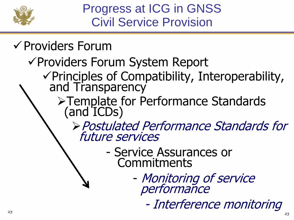
Progress at ICG in GNSS Civil Service Provision
Providers Forum
Providers Forum System ReportPrinciples of Compatibility, Interoperability, and TransparencyTemplate for Performance Standards (and ICDs)Postulated Performance Standards for future services
- Service Assurances or Commitments
- Monitoring of serviceperformance- Interference monitoring
2323

For Additional Information…
www.gps.gov 24
Related Documents