Google Earth Google Earth Research Page Google Earth Group Member Introduction Page Table of Contents Introduction History of Google Earth How Google Earth Relates to other Applications Real World Application Educational Value How Google Earth is used Internationally Lesson Plans References I. Introduction Google Earth is a virtual globe program that uses satellite images and aerial photography to show in detail every aspect of the earth's surface. In addition, the program offers the same for planet Mars and the moon. With all of its capabilities, Google Earth has countless uses in business, personal, or educational settings. Below you will find a detailed description of the program's functions as well as an abundance of information regarding the use of Google Earth within the classroom. II. History of Google Earth A quick timeline of Google Earth: 2004, October: Google acquires Keyhole, which is a digital mapping company. This will later become Google Earth. 2005, June: Google Earth is unveiled; “a satellite imagery-based mapping service combining 3D buildings and terrain with mapping capabilities and Google search.” 2005, September: Google Earth is used in helping locate victims in the recent tragedy of Hurricane Katrina. 2006, September: Added into the ‘featured content’ is UN Environmental Program, Discovery Networks, the Jane Goodall Institute, and the National Park Service. 2007, June: Google Earth Outreach is added to help non-profit organizations promote their cause. 2008, April: Street View is introduced, along with 12 new languages. 2008, May: Google Earth helps in Sichuan earthquake in China to help with the recovery 2008, October: introduced into iPhone and iPod touch which also allows for photos, Wikipedia articles about the location, and ability to view 3D terrain with the tilt of the device. 2009, February: Ocean is introduced allowing a look at the ocean floors in 3D 2009, July: Moon in Google Earth is launched on the 40 th anniversary of the first moon landing accompanied by lunar imagery, Apollo landing site information, panoramic imaging, and narrated tours. 2009, October: BuildingMaker is introduced which allows people to create buildings using aerial photos and 3D shapes. 2010, April: new hominid fossil discovery is found with the help of Google Earth at the Cradle of Humankind World Heritage Site in South Africa. 2010, May: Deepwater Horizon oil spill in the Gulf of Mexico and Google Earth was used in researching the spill’s spread. (1)

Welcome message from author
This document is posted to help you gain knowledge. Please leave a comment to let me know what you think about it! Share it to your friends and learn new things together.
Transcript
Google EarthGoogle Earth Research Page
Google Earth Group Member Introduction Page
Table of Contents
IntroductionHistory of Google EarthHow Google Earth Relates to other ApplicationsReal World ApplicationEducational ValueHow Google Earth is used InternationallyLesson PlansReferences
I. Introduction
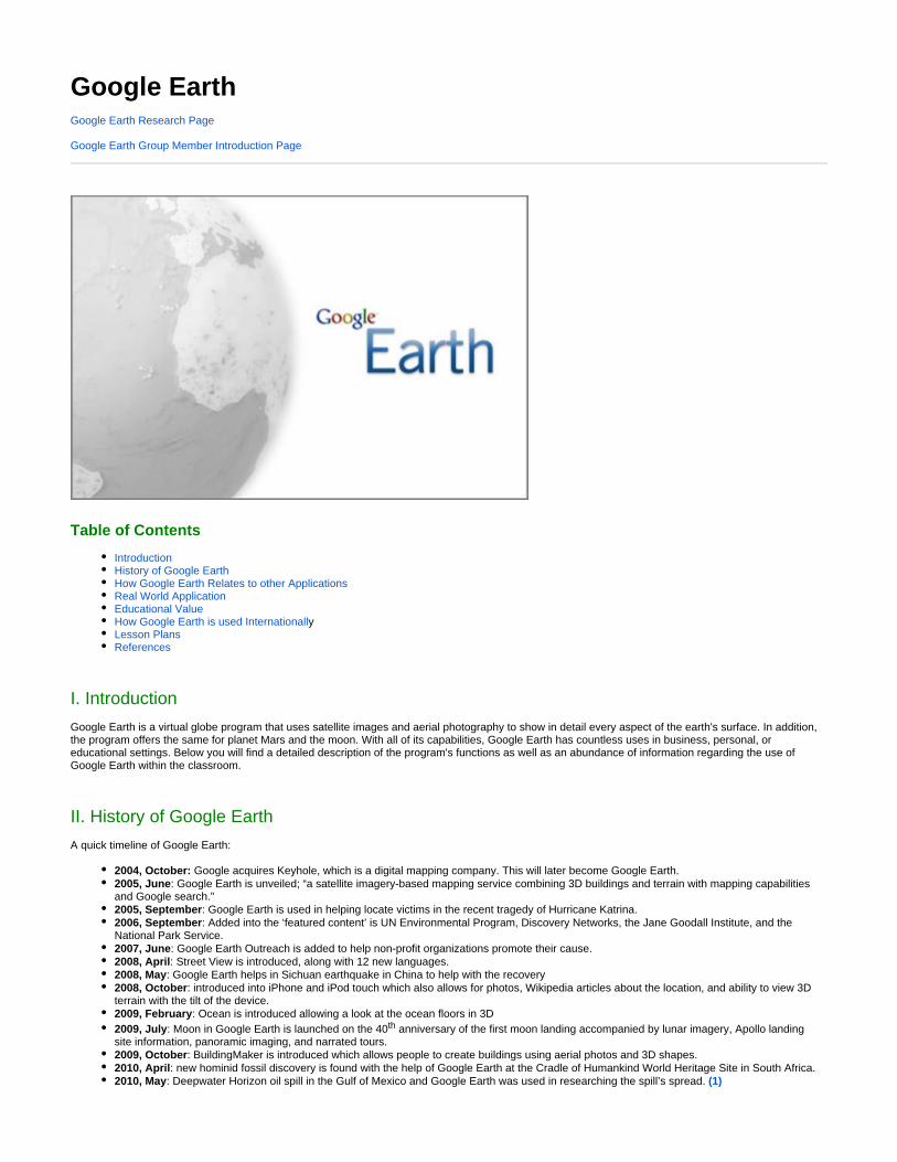
Google Earth is a virtual globe program that uses satellite images and aerial photography to show in detail every aspect of the earth's surface. In addition, the program offers the same for planet Mars and the moon. With all of its capabilities, Google Earth has countless uses in business, personal, or educational settings. Below you will find a detailed description of the program's functions as well as an abundance of information regarding the use of Google Earth within the classroom.
II. History of Google Earth
A quick timeline of Google Earth:
2004, October: Google acquires Keyhole, which is a digital mapping company. This will later become Google Earth.2005, June: Google Earth is unveiled; “a satellite imagery-based mapping service combining 3D buildings and terrain with mapping capabilities and Google search.”2005, September: Google Earth is used in helping locate victims in the recent tragedy of Hurricane Katrina.2006, September: Added into the ‘featured content’ is UN Environmental Program, Discovery Networks, the Jane Goodall Institute, and the National Park Service.2007, June: Google Earth Outreach is added to help non-profit organizations promote their cause.2008, April: Street View is introduced, along with 12 new languages.2008, May: Google Earth helps in Sichuan earthquake in China to help with the recovery2008, October: introduced into iPhone and iPod touch which also allows for photos, Wikipedia articles about the location, and ability to view 3D terrain with the tilt of the device.2009, February: Ocean is introduced allowing a look at the ocean floors in 3D2009, July: Moon in Google Earth is launched on the 40th anniversary of the first moon landing accompanied by lunar imagery, Apollo landing site information, panoramic imaging, and narrated tours.2009, October: BuildingMaker is introduced which allows people to create buildings using aerial photos and 3D shapes.2010, April: new hominid fossil discovery is found with the help of Google Earth at the Cradle of Humankind World Heritage Site in South Africa.2010, May: Deepwater Horizon oil spill in the Gulf of Mexico and Google Earth was used in researching the spill’s spread. (1)

All of the following information can be found in Mark Aubin's article . In 1996 from Mark Aubin, who at the time Google Librarian Central - Article 04/2006worked for Silicon Graphics (SGI), and a team with an idea to show new texturing abilities in computer graphic to it’s maximum advantage. A demo was formed to view the Earth as a whole from outer space and zoom into Europe. From there it would go to Lake Geneva, then looking at the Matterhorn in the Swiss Alps. The demo would lead to Nintendo N64 and zoom in on a chip inside the device. It would then end zooming out to a view of the Earth from outerspace. This demo was called “Space-to-your-Face”. The demo had success after it’s showings. By 2004, technology had made it possible to view high-resolutions imagery fluidly on a standard PC anywhere through the internet. Audin’s departure from SGI to keyhole where he helped launch the first digital globe product to stream high-quality 3D imaging over the internet. Keyhole was bought by Google in late 2004 which allowed for more access for people.
There are many ways in which Google Earth acquires its images. They include the following: airplane, satellite, hot air balloons, and occasionally model airplanes. Traditionally, a gyroscopic, stabilized camera is attached to the bottom of an airplane and is flown at elevations between 15,000 and 30,000 feet. The pictures taken allow for a 40% overlap, the overlap allows for the elimination of distortions caused by the various elevations of Earth’s surface. The images are then scanned using scanners capable of 1800 DPI (dots per inch) or 14 microns, which are then edited. Layers of information are then added. Updating is done as quickly as possible given the processing time. Changes involving street names, state or county boundaries, schools, and parks are updated more quickly to add to the affectiveness of Google Earth. This is done by the providing of information from the following: commercial providers, local government agencies, public domain collections, private individuals, national and even international governments. (2)
III. How Google Earth Relates to other Applications
Web Page Free Application Registration Type of Site
Google Earth Yes No Virtual Globe
Google Maps Yes Optional Web Mapping
Yahoo! Maps Yes No Web Mapping
OpenStreetMap Yes Optional Collaborative Mapping
NASA World Wind Yes Optional Virtual Globe
Marble Yes Optional Virtual Globe
Earth Browser Yes Optional Virtual Globe
MapQuest Yes No Web Mapping
Bing Maps Yes No Web Mapping
Google Earth is a satellite-based imagery mapping product that allows viewers to travel anywhere in the world from mountaintops to the ocean’s bottom. Although, you can see from the chart above Google Earth has several similar applications. Here is a brief description of each:
Google Maps is a very well known mapping product that allows users to view the world in several ways, but has fewer global screening options when compared to the Google Earth application. Users can view road maps, route planners by foot, car, or public transportation, and it can act as a business locator for various countries. (3)
Yahoo! Maps presents users with materials for tracking down certain streets, maps, driving recommendations, traffic circumstances, satellite sights, etc. This mapping application is considered to be one of the strongest substitutes for Google Earth. (3)

Wikipedia has inspired the application, , by showing data that includes editable street maps. Users are able to edit any location and OpenStreetMapgeographical data throughout anywhere in the world. The maps from this application are created using data from convenient GPS equipment, airborne photography, and user revisions. (3)
The development of has allowed users to have access to any place on Earth by zooming in from satellite altitude. NASA created this NASA World Windapplication to allow its users to be able to view specific planets and the moon. NASA World Wind uses atmospheric photography, GIS data, USGS satellite images, and topographic maps. (3)
Marble is a virtual globe that enables users to discover more about our planet Earth by examining landmarks and places of interest. With this specific application you can position filters over the globe, which include a street map, satellite view, temperature maps, Earth at nighttime, and topographic maps. According to Nick Mead Marble has “clearly been designed more with educators and classrooms in mind than Google Earth.” (3) (4)
Earth Browser is an earth representation that permits users to inspect and effortlessly navigate 3-D maps along with weather circumstances and predictions for places all over the world. Earth Browser concentrates on visualizing information like hurricanes, volcanoes, earthquakes, and much more. This application has demonstrated to be a tremendous guide for students and educators for envisioning the earth and space. (3)
MapQuest is a frequently used mapping service that allows users to create maps and driving instructions, confirm up to date traffic, highway conditions, and helps track down businesses. MapQuest is also deemed to be one of the top alternatives to Google Earth. (3)
Bing Maps is a web-mapping product that features road maps, satellite imagery, aerial photographs, 3-D maps, and much more. (3)
Each of the above applications have their advantages and disadvantages, but when it comes to exploring the Earth, Google Earth should be your top choice. There are various features that make Google Earth incredibly unique. According to Mickey from Digital Earth Blog these are the 10 best features in Google Earth since its release :(5)
Photo OverlaysImproved TerrainTime AnimationsNew LayersSpaceNavigator SupportFlight SimulatorSky ModeFlash Support3-D TexturesImagery
And some other key features... (6)
3D structures in major cities in the United States3D terrain displaying valleys, canyons, and mountains worldwideOrganized Google Local search to discover local information such as schools, hotels, parks, restaurants, and transportationQuick, dynamic explorationVideo playback of driving instructionsRotate, tilt, and activate 3D scenery and structures for a different viewpoint on a locationSimple creation and sharing of explanations among users
"Google Earth utilizes broadband streaming technology and 3D graphics, much like a videogame, enabling users to interactively explore the world-- either their own neighborhood or the far corners of the globe," said John Hanke, general manager, Keyhole, Google Inc. "With many ways to access geographic information, Google provides a very rich local search experience for users worldwide.” (6)
Now here is helpful Google Earth video. It details some of the useful features of Google Earth!
IV. Real World Application
Google Earth is used in the real world many ways. It is often used by a business as an initial way to see a plot of land before they decide to purchase it. This is the easiest thing to do with Google Earth all that you need to do is open Google Earth and type in the address of what you want to see. There are downloadable programs that will also give you the dimensions of that piece of land so you can start planning your uses for it.
NOAA uses Google Earth to map storms across the country. This data is then combined with past data to predict when and where the storm will be in different places. This is very useful for tracking hurricanes coming out of Africa so that they can get early warnings out to people who are in the possible path of the hurricane. (7)
Google Earth has been used in the past by Law Enforcement to catch people who grow marijuana out in the wilderness. They take GPS coordinates from the criminal and then they plug them into Google Earth. From there they can get directions and figure out what type of terrain they will have to deal with. They can then take helicopters or trucks out to the crop and bring it in for evidence.
Tax authorities in some places have used Google Earth to find people who are adding additions to their house but have not been paying taxes on the additional square footage that has been added to the house. They take the photos off of Google Earth and compare them to records of what the house should be and have assessed additional taxes where applicable. This has been brought up as a potential abuse of the system but nobody has successfully brought a case against the IRS for these cases.
Police in Ohio have used Google Earth to plot where all fatal accidents or those involving alcohol have occured so that people can look online and see where it is most dangerous to drive at what time of day Including when and where the most drunk drivers are caught. This has been looked at by the some groups as a base to be used to show where sex offenders live.(8)

V. Educational Value
Google Earth, similar to a wiki page, can be adapted by the public to suit a variety of educational needs. Its greatest educational value lies in the ability to create and utilize custom Google Earth Files which can be shared via the internet. These KMZ or KML files, can be used to highlight or feature specifically chosen data relevant to certain parts of the Google Earth globe. For instance, an educator could create informative data points indicating the climatic history or average temperatures of various points on the virtual globe and save his/her data as a KMZ or KML file using the Google Earth application. This saved file can either be transferred manually by the educator or shared over the internet so that students may access the file from the classroom or their home computers. When opened, the file launches the Google Earth application and students can access and view the specific data attached to the virtual globe by their teacher.
In customizing these files, teachers have the ability to embed other media such as photos or videos at certain points on the globe. For example, Noel Jenkins, an educator in England utilized Google Earth to teach the novel . The assignment involved students looking at various points from Northern Lightsthe setting of the novel, and with photos of the illustrated setting strategically placed within the file, students were able to compare and contrast the author's idea with the earth's actual terrain. After doing so, students decided on real world locations for a movie version of the book to be filmed.(9)
Google Earth can also be utilized by educators to expose students to various geographic locations that they would otherwise be unable to see. Many teachers take advantage of "virtual field trips" with Google Earth as a motivational tool. The program allows for easier, more detailed views of specific locations than individual photos or videos alone ever could. These virtual field trips are safer and more cost effective than traditional outings and can be utilized in virtually any subject. Step by step instructions and field trip ideas can be found here: http://www.google.com/librariancenter/articles/0604_02.html
Many features of Google Earth go beyond the globe's current topographical appearance as well. For example, by using the historical imagery within the program, teachers can easily access images of any given location from any date as far back as 1935. In addition, Google Earth enables users to look at the sky, moon, and Mars in the same manner as they can Earth.
Teachers wishing to adopt Google Earth as a regularly-used educational tool for their lessons can continuously learn and explore the capabilities of the Google Earth application under the guidance of the Google Earth monthly newsletter. This newsletter, called the “Sightseer Newsletter”, provides information about “the latest Google Earth news and highlights, tips, user stories and placemark links” and would most likely enhance an educator’s relationship with and understanding of their chosen educational tool. Increased awareness of Google Earth’s contents and capabilities would allow a teacher to most effectively implement Google Earth within his/her lessons. To submit to the Sightseer Newsletter, follow this link: http://www.google.com/earth/connect/newsletter.html
VI. How Google Earth is used Internationally
Natural disasters occur all over the world. Some examples of these are flooding, hurricanes, typhoons, earthquakes and many more. It is rare to be able to see the causes and effects of a natural disaster, except for what is shown on television. With Google Earth, natural disasters can be observed by anyone. The technology allows us as students to have a bird’s eye view with high resolution of what the causes of a natural disaster are. It is also very important in being used to map out and investigate the effects of the natural disaster.

Below is a list from a website of many natural disasters and how Google Earth is used:
Wild Fires – observe and track wild fires all over the world. Can help study the spread.Volcano Eruptions – able to investigate how lava flows and affects the vegetation around the area.Earthquakes – help discover the impact on heavily populated areas and urban centers.Tornadoes – help view the damage caused to property, people and all other things.Major Floods – observe flooded area and help manage drainage.Tsunamis – obsererve areas before and after, and analyze the damage done.Droughts – help observe the effects on vegetation and land, and observe water flow.Blizzards – observe and study the effects of a blizzard on the surrounding area. (10)
In 2005, the United Nations Environmental Programme (UNEP) released an atlas of satellite images of environmental hot-spots around the world. This atlas helped to identify global environmental issues the need to be addressed. With these satellite images, slow developing issues, such as water shortage, forest loss, ecosystem degradation, biodiversity loss, invasive species, and climate change can be seen. UNEP partnered with Google, and in 2006 when Google Earth was created, this atlas was available on the Google Earth website. This made the Atlas available to a global audience of over 200 million people. With Google Earth, the images from the atlas can be seen up close in color and in 3D. These images illustrate the changes in these hot spots for over the past thirty years. With this technology, it makes these slow developing problems comprehendible and meaningful. This will allow the public, and policy makers in our government aware, and able to take meaningful action to keeping our planet healthy.
“These satellite pictures are a wake-up call to all of us to look at the sometimes devastating changes we are wreaking on our planet. Through spectacular imagery, Google Earth and UNEP offer a new way of visualizing the dangers facing our planet today. By tapping into the global Google community, we are able to reach out to millions of people who can mobilize and make a difference. “
- Achim Steiner, Executive Director, UNEP (11)
Palestinian militants have been using Google Earth to target Israeli military forces for rocket fire. One specific group is known as al-Aqsa. This group is associated with the Fatah political party. They are only one of many groups firing these crude rockets in to military bases and high traffic areas. Even though the rockets are poorly constructed and do not work well, with the help of Google Earth to locate targets, over a dozen people have been killed in the last year, and many more injured.
In a video, the group’s commander in Gaza Khaled Jaabari a.k.a Abu Walid said, “ We obtain the details from Google Earth and we check them against our maps of the city centre and sensitive areas.”
Google was asked about the use of Google Earth to locate potential targets it said it was “aware of potential problems,” but did not comment any further on that specific case. About the general use of Google Earth to locate targets for attacks, Google said "We have paid close attention to concerns that Google Earth creates new security risks. "The imagery visible on Google Earth and Google Maps is not unique: commercial high-resolution satellite and aerial imagery of every country in the world is widely available from numerous sources. Indeed, anyone who flies above or drives by a piece of property can obtain similar information." (12)
VII. Lesson Plans
Elementary Level Lesson Plans:
Here is a sample lesson plan designed for elementary level teachers that utilizes Google Earth to teach students (specifically, in grades ) K-5about one location they would want to visit in their lifetime. They will need to research information about the physical characteristics of the region, environment, and any major tourist sights. Elementary Level Lesson Plan (docx) Elementary Level Lesson Plan (pdf)
Here is a sample lesson plan designed for elementary level teachers that utilizes Google Earth to teach students (specifically, in grades ) K-5weather. They will need to research information about the physical characteristics of the region, environment, and weather. Elementary Level
Lesson Plan (docx) Elementary Level Lesson Plan (pdf) Here is a sample lesson plan designed for elementary level teachers that utilizes Google Earth to teach students (specifically, in grades ) K-5about one location they would want to visit in their lifetime. Especially discussing the geographical features. Elementary Level Lesson Plan
(docx) Elementary Level Lesson Plan (pdf)
Secondary Level Lesson Plans:
Here is a sample lesson plan designed for secondary level teachers that utilizes Google Earth to teach students (specifically, in grades 6-12) This lesson plan is STEM-based, focusing on science specifically Plate Tectonics. Secondary STEM Lesson Plan (docx) Secondary STEM Lesson Plan (pdf)
Here is a sample lesson plan designed for secondary level teachers that utilizes Google Earth to teach students (specifically, in grades ) 9-12about famous landmarks and monuments of the world. Secondary Lesson Plan (docx) Secondary Lesson Plan (pdf) Here is a sample lesson plan designed for secondary level teachers that utilizes Google Earth to teach students (specifically, in grades ) 9-10about Ancient Rome's civilization and rise to power. Secondary Lesson Plan (pdf) Secondary Lesson Plan (docx)
Post-Secondary Level Lesson Plans:
Here is a sample lesson plan designed for post-secondary level educators that utilizes Google Earth to teach students about a particularly interesting subject that requires the completion of mathematical operations. (STEM-based) STEM Lesson Plan (docx) STEM Lesson Plan (pdf)
Here is a sample lesson plan designed for post-secondary level educators that utilizes Google Earth to teach students about the different dialects of the Spanish language. Spanish Dialects (docx) Spanish Dialects (pdf)
Here is a sample lesson plan designed for post-secondary level educators that utilizes Google Earth to teach students about the relationship between the watersheds, soil types, and erosion near their school. Watersheds and Erosion (docx) Watersheds and Erosion (pdf)
VIII. References
|http://www.1. "Google Milestones - Google Corporate Information." Google. 2010. Web. 07 Nov. 2010. <[http://www.google.com/corporate/milestones.htmlgoogle.com/corporate/milestones.html]>.
2. Aubin, By Mark. "Google Librarian Central - Article 04/2006 - 1." . Web. 05 Nov. 2010. <Google [http://www.google.com/librariancenter/articles/0604_01.|http://www.google.com/librariancenter/articles/0604_01.html]>. html
3. Nicholas. "Programs Like Google Earth." Find Health, Education, Science & TechnologyArticles, Reviews, How-To and Tech Tips At Bright Hub. Web. 01 Nov. 2010. <[http://www.brighthub.com/internet/google/articles/61335.aspx|http://www.brighthub.com/internet/google/articles/61335.aspx]>.
4. Mead, Nick. "An Interesting Alternative to Google Earth." Marble - Download. Web. 03 Nov. 2010. <[http://marble.en.softonic.com/|http://marble.en.softonic.com/]>.
5. Mickey. "10 Best New Features in Google Earth since Its Release." Digital Earth Blog ---Keeping up with the Various Digital Earths including Google Earth, Google Maps, Virtual Earth and Others. Web. 01 Nov. 2010. <[http://www.digitalearthblog.com/200710/10-best-new-features-in-google-earth-since-its-release/|http://www.digitalearthblog.com/200710/10-best-new-features-in-google-earth-since-its-release/]>.
6. Greene, Nick. "Google Earth Key Features - Experience Google Earth." Google Earth Offers New Local Search Experience. Web. 01 Nov. 2010. <[http://space.about.com/od/software/a/googleearth_2.htm|http://space.about.com/od/software/a/googleearth_2.htm]>.
7. http://www.gearthblog.com/blog/archives/2006/05/near_realtime_s.html
8. [http://news.cnet.com/How-law-enforcement-uses-Google-Earth/2100-1025_3-6208034.html
9. "Juicy Geography: Literary Geography with Google Earth." . N.p., n.d. Web. 2 Nov. 2010. <Juicy Geography [http://www.juicygeography.co.uk|http://www.juicygeography.co.uk/northernlights]>/northernlights
10. Wetzel, David R. "Natural Disasters and Investigating the Causes: Using Google Earth to Investigate Reasons and Outcomes of Disasters." Suite101.. 19 Aug. 2008. Web. 07 Nov. 2010. com: Online Magazine and Writers' Network http://www.suite101.com/content/natural-disaster-investigating-cause-and-
effect-a65148

11. Singh, Ashbindu, Michelle L. Anthony, and Bruce Pengra. "Google Earth Outreach." . Web. 07 Nov. 2010. <Google Earth http://earth.google.com> /outreach/cs_unep.html
12. Chassay, Clancy, and Bobbie Johnson. "Google Earth Used to Target Israel | World News | The Guardian." Latest News, Comment and Reviews from . 25 Oct. 2007. Web. 03 Nov. 2010. .the Guardian | Guardian.co.uk http://www.guardian.co.uk/technology/2007/oct/25/google.israel
Related Documents