Global Navigation Satellite Systems State of Affairs Huibert-Jan Lekkerkerk Plymouth, January 12, 2011

Welcome message from author
This document is posted to help you gain knowledge. Please leave a comment to let me know what you think about it! Share it to your friends and learn new things together.
Transcript
Global Navigation Satellite Systems
State of Affairs
Huibert-Jan Lekkerkerk
Plymouth, January 12, 2011
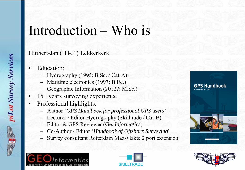
Introduction – Who isHuibert-Jan (“H-J”) Lekkerkerk
• Education: – Hydrography (1995: B.Sc. / Cat-A);– Maritime electronics (1997: B.Ee.) – Geographic Information (2012?: M.Sc.)
• 15+ years surveying experience• Professional highlights:
– Author ‘GPS Handbook for professional GPS users’– Lecturer / Editor Hydrography (Skilltrade / Cat-B)– Editor & GPS Reviewer (GeoInformatics)– Co-Author / Editor ‘Handbook of Offshore Surveying’– Survey consultant Rotterdam Maasvlakte 2 port extension
Contents
• What is Global Navigation Satellite Systems?• Which systems exist?
– GNSS– Augmentation systems
• What are the developments?• What are the ‘challenges’?
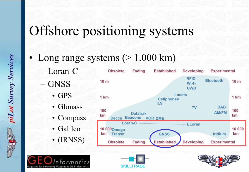
Offshore positioning systems
• Long range systems (> 1.000 km)– Loran-C– GNSS
• GPS• Glonass• Compass• Galileo• (IRNSS)
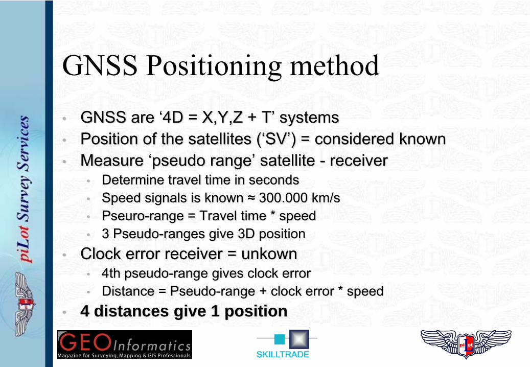
GNSS Positioning method• GNSS are ‘4D = X,Y,Z + T’ systems• Position of the satellites (‘SV’) = considered known• Measure ‘pseudo range’ satellite - receiver
• Determine travel time in seconds• Speed signals is known ≈ 300.000 km/s• Pseuro-range = Travel time * speed• 3 Pseudo-ranges give 3D position
• Clock error receiver = unkown• 4th pseudo-range gives clock error• Distance = Pseudo-range + clock error * speed
• 4 distances give 1 position
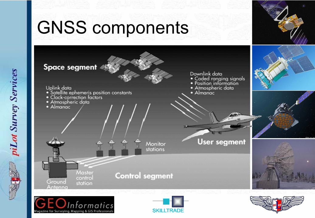
GNSS components
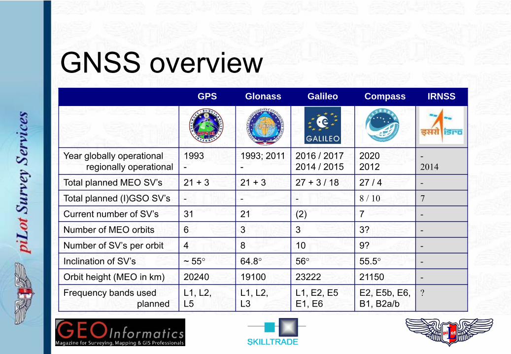
GNSS overviewGPS Glonass Galileo Compass IRNSS
Year globally operationalregionally operational
1993-
1993; 2011-
2016 / 20172014 / 2015
20202012
-2014
Total planned MEO SV’s 21 + 3 21 + 3 27 + 3 / 18 27 / 4 -
Total planned (I)GSO SV’s - - - 8 / 10 7
Current number of SV’s 31 21 (2) 7 -
Number of MEO orbits 6 3 3 3? -
Number of SV’s per orbit 4 8 10 9? -
Inclination of SV’s ~ 55° 64.8° 56° 55.5° -
Orbit height (MEO in km) 20240 19100 23222 21150 -
Frequency bands usedplanned
L1, L2, L5
L1, L2, L3
L1, E2, E5E1, E6
E2, E5b, E6, B1, B2a/b
?
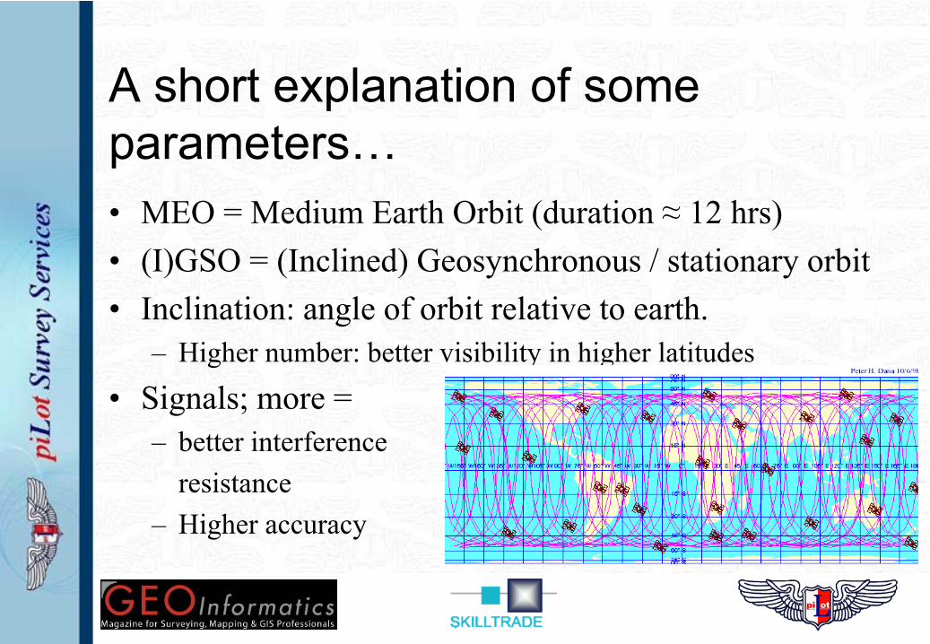
A short explanation of some parameters…• MEO = Medium Earth Orbit (duration ≈ 12 hrs)• (I)GSO = (Inclined) Geosynchronous / stationary orbit• Inclination: angle of orbit relative to earth.
– Higher number: better visibility in higher latitudes
• Signals; more = – better interference
resistance– Higher accuracy
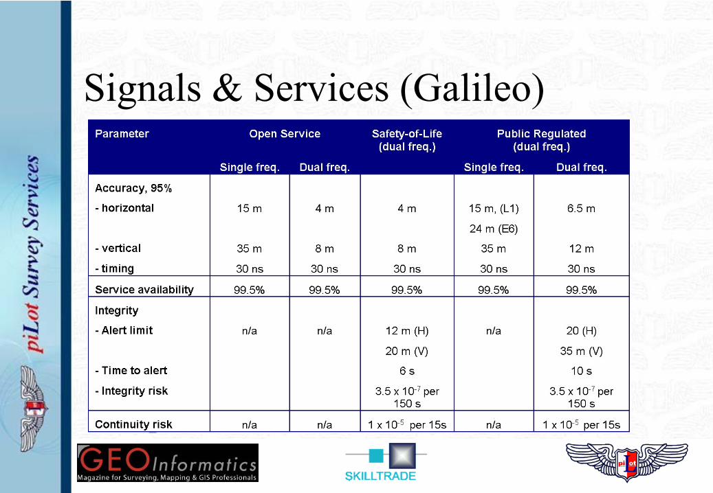
Signals & Services (Galileo)
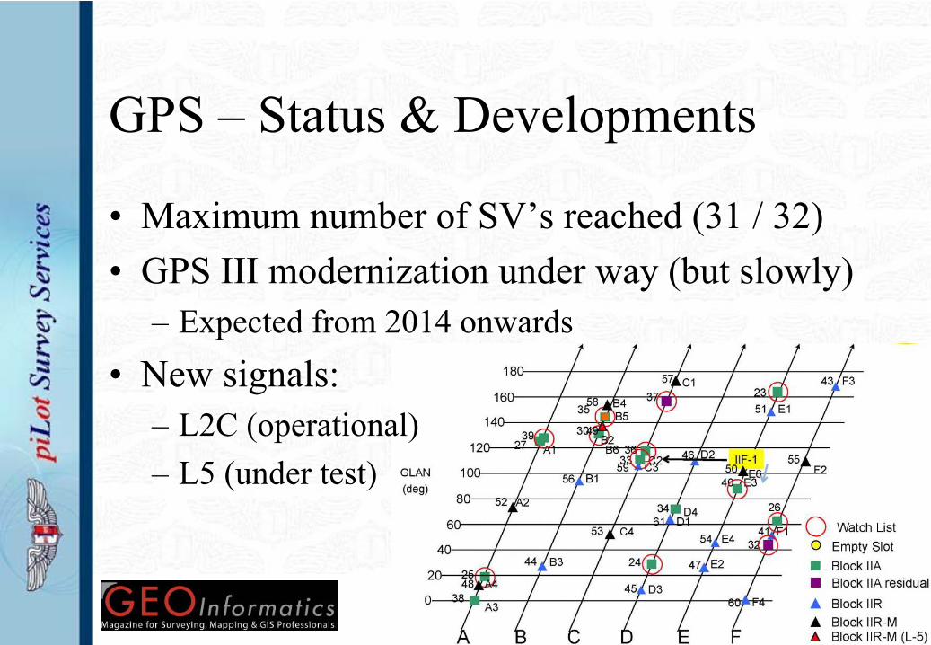
GPS – Status & Developments
• Maximum number of SV’s reached (31 / 32)• GPS III modernization under way (but slowly)
– Expected from 2014 onwards• New signals:
– L2C (operational)– L5 (under test)
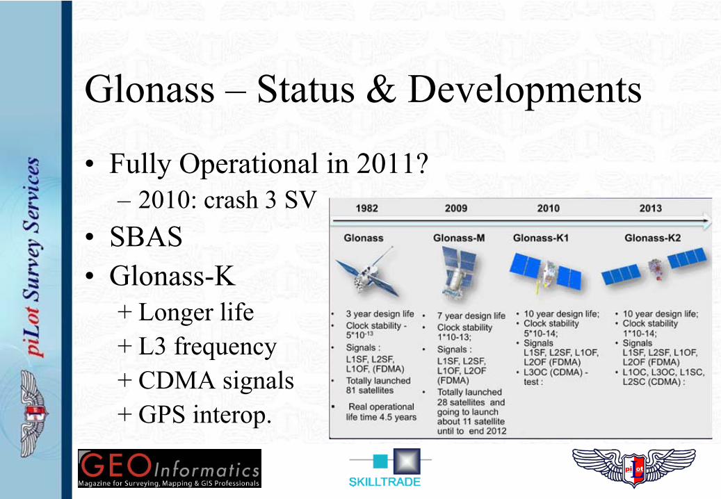
Glonass – Status & Developments
• Fully Operational in 2011?– 2010: crash 3 SV
• SBAS• Glonass-K
+ Longer life+ L3 frequency+ CDMA signals+ GPS interop.
Galileo – Status & Developments
• Untill 2014 / 2015– First 4 SV’s under construction– After ‘In Orbit Validation’ of first 4; next 14– Control segment is under construction– Budget overruns (again…) are rumoured
• After 2015– ? -> no budget reserved / available yet– 18 SV’s only give 90% coverage– SoL & PRS need 24 SV’s or more
Compass – Status & Developments
• Little information comes out of China…– No interface control document (promised 6 – 2010)– No interaction / discussion with other GNSS
• Rapid / serious development:– 5 satellites launched in 2011– 7 more planned for 2012!
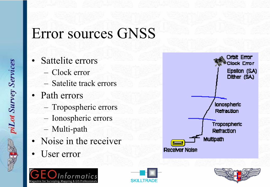
Error sources GNSS
• Sattelite errors– Clock error– Satelite track errors
• Path errors– Tropospheric errors– Ionospheric errors– Multi-path
• Noise in the receiver• User error
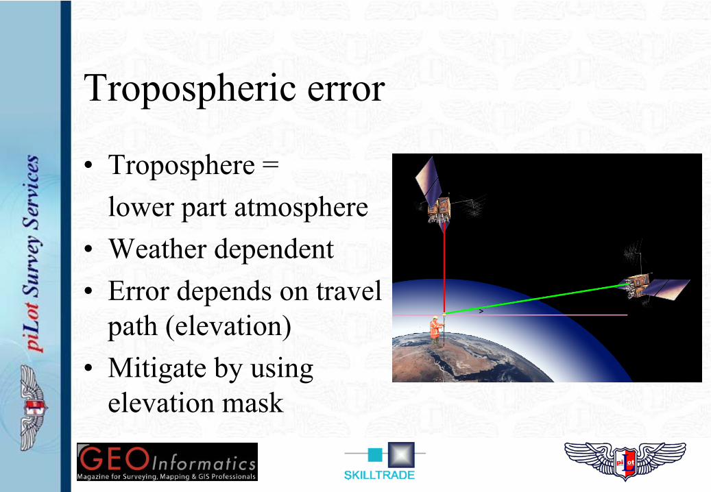
Tropospheric error
• Troposphere = lower part atmosphere
• Weather dependent• Error depends on travel
path (elevation)• Mitigate by using
elevation mask
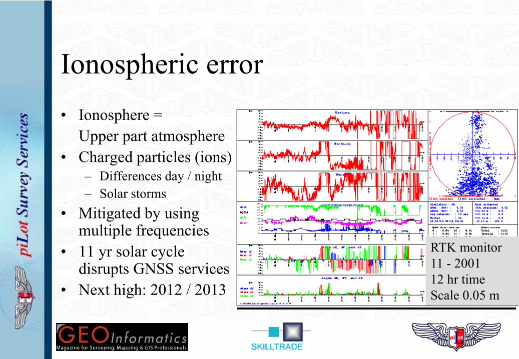
Ionospheric error• Ionosphere =
Upper part atmosphere• Charged particles (ions)
– Differences day / night– Solar storms
• Mitigated by using multiple frequencies
• 11 yr solar cycle disrupts GNSS services
• Next high: 2012 / 2013
RTK monitor11 - 200112 hr timeScale 0.05 m
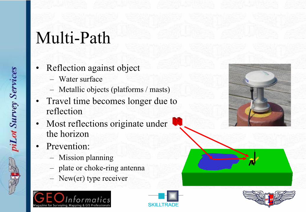
Multi-Path• Reflection against object
– Water surface– Metallic objects (platforms / masts)
• Travel time becomes longer due to reflection
• Most reflections originate under the horizon
• Prevention:– Mission planning– plate or choke-ring antenna– New(er) type receiver
Differential GNSS
– Uses earthbound correction stations (base)– Correction for most GNSS errors
• Exception: user error & multi-path.– Various types of dGNSS systems
• Code phase dGNSS• Carrier phase dGNSS• Precise Point Positioning (PPP)
– Free to air & Commercial (Veripos & Fugro)
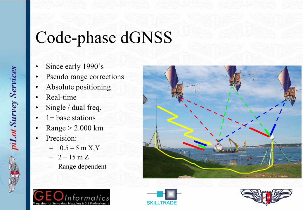
Code-phase dGNSS• Since early 1990’s• Pseudo range corrections• Absolute positioning• Real-time• Single / dual freq.• 1+ base stations• Range > 2.000 km• Precision:
– 0.5 – 5 m X,Y– 2 – 15 m Z– Range dependent
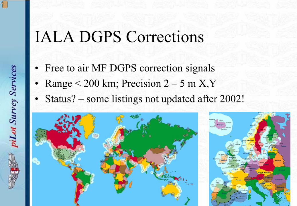
IALA DGPS Corrections
• Free to air MF DGPS correction signals• Range < 200 km; Precision 2 – 5 m X,Y• Status? – some listings not updated after 2002!
Presenter
Presentation Notes
IALA signals are usually transmitted from known navigation stations (lighthouses!) as the name suggests! IALA = International Association of Lighthouse Authorities The IALA beacon list is not up to date. The beacons are meant for ships navigation assistance. Therefore these beacon information details or beacon performance quality may not be in accordance with hydrographic survey standards. Always check the beacon station performance on location before using a new station!!. Station data messages are explained in the RTCM recommended Standards publication.*) EUROFIX **) Eurofix DGPS is available through the Loran-C transmitter on the Island of Sylt. The DGPS information is “added” to the basic Loran-C signal. But this is the differential as acquired at the location on Sylt. The coverage is limited to the range of the Loran-C system. The augmentation of the position fix is good for marine navigation purposes but of limited use for hydrographic operations. *) see: http://www.iala-aism.org/publications/radio navigation services/ **) see http://www.pn.ewi.tudelft.nl/education/et4-022/notes/h11.pdf
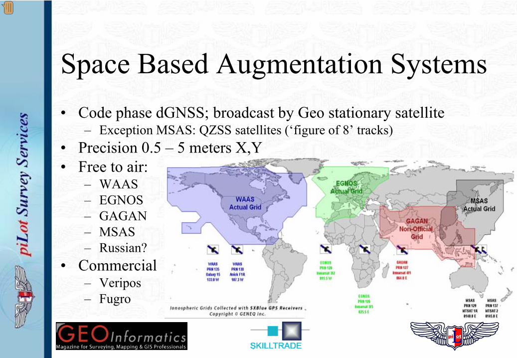
Space Based Augmentation Systems• Code phase dGNSS; broadcast by Geo stationary satellite
– Exception MSAS: QZSS satellites (‘figure of 8’ tracks)• Precision 0.5 – 5 meters X,Y• Free to air:
– WAAS– EGNOS– GAGAN– MSAS– Russian?
• Commercial– Veripos– Fugro
Presenter
Presentation Notes
SBAS: Satellite Based Augmention System This is basically a differential signal that can be received via a satellite. System sources are: WAAS : North and Middle Americas (GPS) via PRN1 EGNOS : Europe (GPS & Galileo) MSAS : Japan en Asia(GPS) GAGAN : India (operational may 2011 GPS) (subscription required ) Omnistar: Worldwide (GPS & Glonass) WAAS has been for a longer time but one of the transponders is out (2010). EGNOS is now working fine . We see the same accuracies as can be expected from IALA beacons in Europe. GAGAN has suffered a failed launch from the second satellite and is probably delayed. These augmentation signals are valid for the areas they cover and were designed for. Of course you can pick up the diff signal far outside of these areas as your receiver can still pick up the signal from the Geostationary satellite(s), these corrections should not be used. Also realize that your receiver will use the differential information from the satellites that you receive. This means if you would receive EGNOS outside the European footprint then the present visible satellites will only match a couple from the ones in the EGNOS signal resulting in a low number of satellites message (e.g. 3 or 4 only) Some receivers (Trimble) have a provision that the area where the corrections are used is limited by the receiver. To enable SBAS, make sure you choose the Auto-Enable setting. When the receiver is using SBAS corrections you will find a differential station ID in the range 120~138 in the GGA message from the receiver. Whereas IALA station ID range in the 400rd or the 800rd.
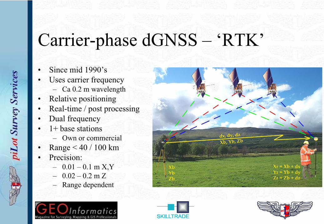
Carrier-phase dGNSS – ‘RTK’• Since mid 1990’s• Uses carrier frequency
– Ca 0.2 m wavelength• Relative positioning• Real-time / post processing• Dual frequency• 1+ base stations
– Own or commercial• Range < 40 / 100 km• Precision:
– 0.01 – 0.1 m X,Y– 0.02 – 0.2 m Z– Range dependent
Precise Point Positioning - PPP• Since early / mid 2000’s• Uses carrier frequency in on-board receiver• Absolute positioning• ‘Near’ real-time / post processing• No base station needed but…
– Needs high accuracy SV parameters (from shore station / post processing)• Range < 2000 km• Time to first (accurate) fix: > 20 minutes• Precision:
– Decimetre level X,Y,Z
Developments in SBAS
• WAAS / EGNOS are fully operational and certified– Egnos only in 2009 certified
• Other free to air systems in ‘build-up’ phase– MSAS: first satellite launched 2010– GAGAN: Satellites under construction
• Commercial systems fully operational– Code phase & PPP dGNSS services:
• Veripos: dGPS & dGlonass• Fugro Starfix / Omnistar: dGPS
Perceived benefits of multiple GNSS
• More satellites on the horizon– Offshore usually > 8 SV’s from GPS alone; little benefit…– Shielding of one GNSS is shielding of all GNSS; little benefit…
• Glonass adds better coverage (> 55°)– Benefits geometry / visibility for operations in the Arctic / Antarctic
• More signals (>2) from single GNSS (e.g. GPS III update)– Provides better ionospheric corrections– Faster carrier phase & PPP calculations
• Glonass is benefit as well as GPS modernization..
“Challenges of multiple GNSS”
• Radiofrequency spectrum• Reference frames
– Time synchronization (GNSS time-frames)– Geodetic parameters (GNSS position-frames)– Geoid – ellipsoid separation
• Vulnerability of GNSS
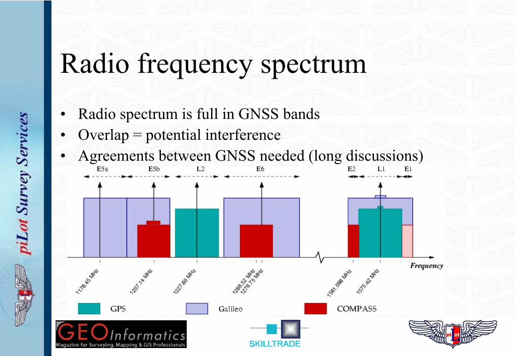
Radio frequency spectrum• Radio spectrum is full in GNSS bands• Overlap = potential interference• Agreements between GNSS needed (long discussions)
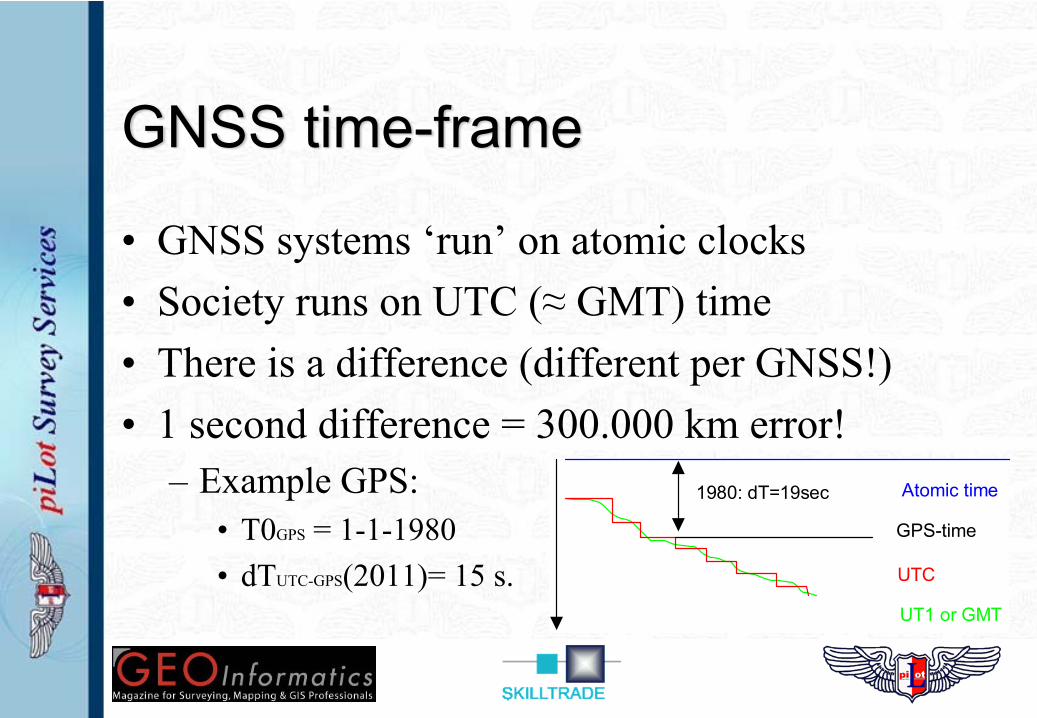
GNSS time-frame
• GNSS systems ‘run’ on atomic clocks• Society runs on UTC (≈ GMT) time• There is a difference (different per GNSS!)• 1 second difference = 300.000 km error!
– Example GPS:• T0GPS = 1-1-1980• dTUTC-GPS(2011)= 15 s.
Atomic time
UT1 or GMT
UTC
1980: dT=19sec
GPS-time
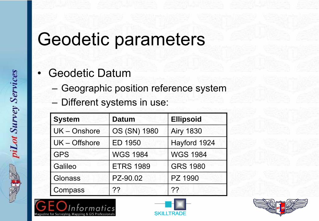
Geodetic parameters
• Geodetic Datum– Geographic position reference system– Different systems in use:System Datum EllipsoidUK – Onshore OS (SN) 1980 Airy 1830UK – Offshore ED 1950 Hayford 1924GPS WGS 1984 WGS 1984Galileo ETRS 1989 GRS 1980Glonass PZ-90.02 PZ 1990Compass ?? ??
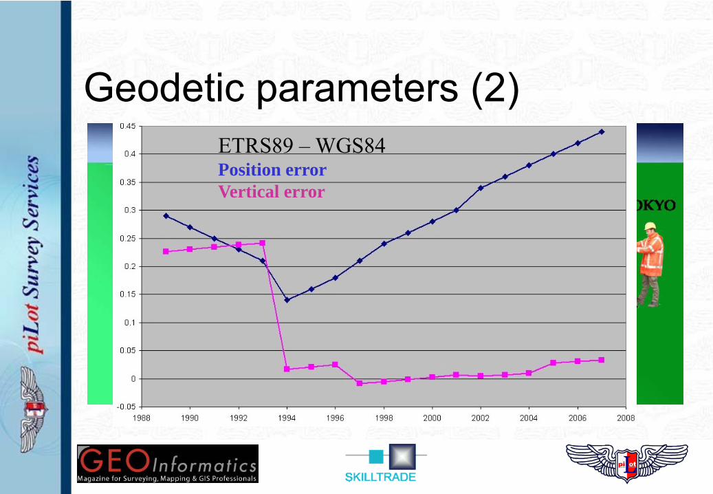
Geodetic parameters (2)– Different geodetic datums -> different positions– Difference between cm’s to 100’s of meters– Needs correction in software / receiver!
• Datum transformation parameters• Receiver / software output in single datum!• Combining datums is ‘tricky business’
ETRS89 – WGS84Position errorVertical error
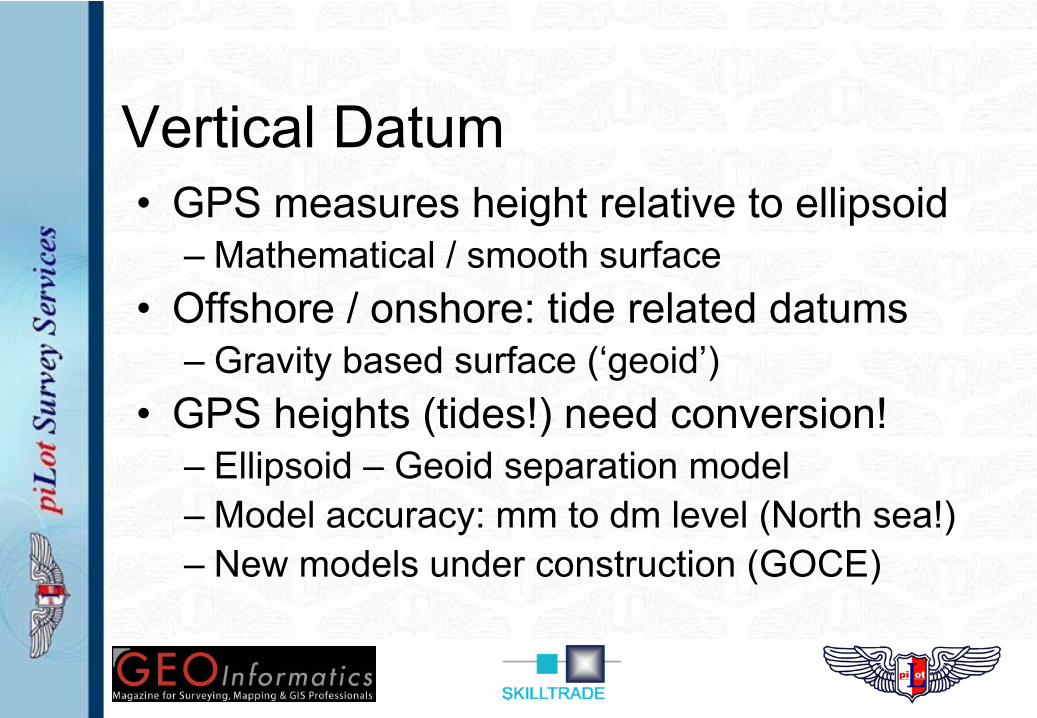
Vertical Datum• GPS measures height relative to ellipsoid
– Mathematical / smooth surface• Offshore / onshore: tide related datums
– Gravity based surface (‘geoid’)• GPS heights (tides!) need conversion!
– Ellipsoid – Geoid separation model– Model accuracy: mm to dm level (North sea!)– New models under construction (GOCE)
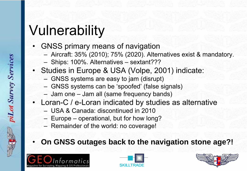
Vulnerability• GNSS primary means of navigation
– Aircraft: 35% (2010); 75% (2020). Alternatives exist & mandatory.– Ships: 100%. Alternatives – sextant???
• Studies in Europe & USA (Volpe, 2001) indicate:– GNSS systems are easy to jam (disrupt)– GNSS systems can be ‘spoofed’ (false signals)– Jam one – Jam all (same frequency bands)
• Loran-C / e-Loran indicated by studies as alternative– USA & Canada: discontinued in 2010– Europe – operational, but for how long?– Remainder of the world: no coverage!
• On GNSS outages back to the navigation stone age?!
Summary• Multiple GNSS under development• All GNSS are similar in operation & use• Multiple error sources influence precision• dGNSS ‘upgrades’ precision and reliability• GPS modernization & Glonass are benefits
– Other GNSS are ‘political statements’• Some challenges to be solved
• Do we need back-up systems?

Related Documents


