1 Laboratory for Atmospheres, Goddard Space Flight Center, Greenbelt, MD 1 Hughes STX Corporation, Greenbelt, MD 2 Software Corporation of America 3 Global Distribution of UV-Absorbing Aerosols From Nimbus-7/TOMS Data J.R. Herman , P.K. Bhartia , O.Torres , C. Hsu , C. Seftor , E. Celarier 1 1 2 2 2 3 Abstract Global distributions of UV-absorbing aerosols are obtained using measured differences between the 340 nm and 380 nm radiances from the Nimbus-7 Total Ozone Mapping Spectrometer (TOMS) for the years 1979 to 1993. Time series are shown for major sources of biomass burning and desert dust giving the frequency of occurrence and areal coverage over land and oceans. Minor sources of UV-absorbing aerosols in the atmosphere are also discussed (volcanic ash and oil fires). Relative values of year-to-year variability of UV-absorbing aerosol amounts are shown for major aerosol source regions (1. Central South America (Brazil) near 10 S o latitude, 2. Africa near 0 to 20 S and 0 to 10 N latitude, 3. Saharan Desert and sub-Saharan o o o o region (Sahel), Arabian Peninsula, and the northern border region of India, 4. agricultural burning in Indonesia, Eastern China and Indochina, and near the mouth of the Amazon River, and 5. coal burning and dust in northeastern China. The first 3 of these dominate the injection of UV- absorbing aerosols into the atmosphere each year and cover areas far outside of their source regions from advection of UV-absorbing particulates by atmospheric wind systems. During the peak months, smoke and dust from these sources, are transported at altitudes above 1 km with an optical depth of at least 0.1, can cover about 10% of the Earth’s surface. Boundary layer absorbing aerosols are not readily seen by TOMS because the small amount of underlying Rayleigh scattering leads to a small signal. Significant portions of the observed dust originates from agricultural regions frequently within arid areas, such as in the Sahel region of Africa especially from the dry lake-bed near Lake Chad (13.5 N, 14 E), and intermittently dry drainage o o areas and streams. In addition to drought cycle effects, this suggests there may be an anthropogenic component to the amount of dust injected into the atmosphere each year.

Welcome message from author
This document is posted to help you gain knowledge. Please leave a comment to let me know what you think about it! Share it to your friends and learn new things together.
Transcript
1
Laboratory for Atmospheres, Goddard Space Flight Center, Greenbelt, MD1
Hughes STX Corporation, Greenbelt, MD2
Software Corporation of America3
Global Distribution of UV-Absorbing Aerosols From Nimbus-7/TOMS Data
J.R. Herman , P.K. Bhartia , O.Torres , C. Hsu , C. Seftor , E. Celarier1 1 2 2 2 3
Abstract Global distributions of UV-absorbing aerosols are obtained using measured
differences between the 340 nm and 380 nm radiances from the Nimbus-7 Total Ozone Mapping
Spectrometer (TOMS) for the years 1979 to 1993. Time series are shown for major sources of
biomass burning and desert dust giving the frequency of occurrence and areal coverage over land
and oceans. Minor sources of UV-absorbing aerosols in the atmosphere are also discussed
(volcanic ash and oil fires). Relative values of year-to-year variability of UV-absorbing aerosol
amounts are shown for major aerosol source regions (1. Central South America (Brazil) near 10 So
latitude, 2. Africa near 0 to 20 S and 0 to 10 N latitude, 3. Saharan Desert and sub-Saharano o o o
region (Sahel), Arabian Peninsula, and the northern border region of India, 4. agricultural burning
in Indonesia, Eastern China and Indochina, and near the mouth of the Amazon River, and 5. coal
burning and dust in northeastern China. The first 3 of these dominate the injection of UV-
absorbing aerosols into the atmosphere each year and cover areas far outside of their source
regions from advection of UV-absorbing particulates by atmospheric wind systems. During the
peak months, smoke and dust from these sources, are transported at altitudes above 1 km with an
optical depth of at least 0.1, can cover about 10% of the Earth’s surface. Boundary layer
absorbing aerosols are not readily seen by TOMS because the small amount of underlying
Rayleigh scattering leads to a small signal. Significant portions of the observed dust originates
from agricultural regions frequently within arid areas, such as in the Sahel region of Africa
especially from the dry lake-bed near Lake Chad (13.5 N, 14 E), and intermittently dry drainageo o
areas and streams. In addition to drought cycle effects, this suggests there may be an
anthropogenic component to the amount of dust injected into the atmosphere each year.

2
Detection of absorbing aerosols and calculation of optical depths are affected by the presence of
large-scale and sub-pixel clouds in the TOMS field of view.
3
Introduction The presence of UV-absorbing aerosols in the atmosphere affects both the
radiation balance [Haywood and Shine, 1995, Ardanuy et al., 1992] and the amount of UV-flux
reaching the ground. The atmospheric loading of UV-absorbing aerosols is the sum of several
large annually cyclic sources of aerosols distributed over large areas by tropospheric wind
circulation. Observations of UV-absorbing aerosols at sites remote from the sources also show a
distinct cyclic pattern [Bodhaine, 1995] driven by atmospheric transport from one or more of
these sources. Smoke plumes, desert dust, and volcanic ash have been observed from satellite
data in the visible and IR channels of AVHRR (Advanced Very High Resolution Radiometer) and
GOES (Geostationary Operational Environmental Satellite System) [Matson and Holben, 1987;
Holben et al., 1991; Robinson, 1991; Kaufman et al., 1992; Prins and Menzel, 1992; Wen et al.,
1994, Husar et al., this issue]. For the most part, the AVHRR observations are limited to being
over water because of requirements for low, non-variable surface reflectivity that is not met over
land.
In this paper we present results from a new technique for detecting UV-absorbing aerosols
in the atmosphere from the spectral contrast (ratio of 340 nm to 380 nm radiances, I /I )340 380
between the 340 nm and 380 nm channels of the Total Ozone Mapping Spectrometer (TOMS)
that flew on the Nimbus-7 satellite from Nov.,1978 to May 1993 (McPeters et al., 1996).
Although the results are restricted in this paper to UV-absorbing aerosols, such as smoke, desert
dust, and volcanic ash, clouds and non-absorbing aerosols are also detected in the TOMS spectral
contrast data. In addition, the UV spectral contrast method does not suffer from the limitation of
the visible-wavelength techniques, since the UV surface reflectivity is low and nearly constant
over both land and water.
The next section provides background information on TOMS, including the concept of
residue that is central to the detection of aerosols from TOMS. Thi
s is followed by a brief summary of the radiative transfer calculations that relates reflectivity
4
residues observed by TOMS to aerosols parameters. Later sections present highlights of the
aerosols signals detected in the multi-year TOMS data set on daily to long-term time scales.
Background The Nimbus-7/TOMS (Heath et al., 1975) measured the amount of backscattered
UV radiance in six 1 nm wide wavelength bands (313, 318, 331, 340, 360 and 380 nm). During
its unprecedented 14.5 year lifetime, TOMS took measurements almost every single day, over
most of the Earth’s surface (except regions in polar night). The data were taken in a series of
scans, perpendicular to the TOMS near-polar orbit (13.8 sun-synchronous orbits per day with
near-noon equator crossing time). Each side-scan, consisting of 35 samples, covered an angular
range of ±51 about the nadir. The scan rate and angular swath were designed to provideo
contiguous coverage of the entire globe. The second non sun-synchronous TOMS instrument
operated on the Russian Meteor-3 satellite from August 1991 to December 1994 (Herman, and
Larko, 1995). A modified version of the previous two instruments, EP/TOMS, was launched on
July 2, 1996 aboard NASA's Earth-Probe (EP) satellite into a sun-synchronous low-altitude orbit
designed for better detection of absorbing aerosols. During August 1996, ADEOS/TOMS was
launched in a higher orbit with spatial resolution similar to Nimbus-7/TOMS. Additional flights of
TOMS or TOMS-like instruments are planned over the next decade.
Meteor-3/TOMS was in operation from August 1991 to December 1994, but its orbit
precesses from the sunrise terminator to the sunset terminator every 106 days. When the orbit of
Meteor-3/TOMS is close to the near-noon orbit of Nimbus-7/TOMS, the data quality is
comparable both in ozone amount and aerosol detection. Because of the precessing orbit of
Meteor-3/TOMS, this study considers only the sun-synchronous Nimbus-7/TOMS data.
The TOMS instrument was designed to provide accurate global estimates of total column
ozone, and can detect SO (Kreuger et al., 1995), estimate surface ultraviolet amounts (Herman et2
al., 1996), and detect H SO stratospheric aerosols (Torres et al., 1995) The inversion method2 4 .
for obtaining ozone amounts relies on accurate separation of the wavelength dependence of
backscattered radiation due to ozone absorption from that due to atmospheric scattering. The
5
three longest wavelength bands (340 nm, 360 nm, and 380 nm) of TOMS were provided to test
different models of the atmosphere in reproducing the observed wavelength dependence of the
backscattered radiation. Since gaseous absorption at these wavelengths is weak, the backscattered
radiation is primarily controlled by molecular (Rayleigh) scattering, surface reflection, and (Mie)
scattering from aerosols and clouds.
Early results from satellite measurements showed that an atmospheric model proposed by
Dave (1978), the Lambert Equivalent Reflectivity (LER) model, reproduced the wavelength
dependence of the observed radiation in a large variety of observing conditions . In Dave’s LER
model, the atmosphere consists of Rayleigh scatterers bounded by a Lambertian surface whose
reflectivity, R, is estimated from the measured radiances (Bhartia et al., 1993). For a pure
Rayleigh atmosphere, R is an approximation of the value of the bi-directional reflectivity
distribution function (BRDF) of the surface at a given measurement geometry (Dave, 1965). The
difference between R and the BRDF is caused by the mixing of reflecting angles due to molecular
scattering. Since this mixing depends on the strength of the wavelength dependent molecular
scattering, R also becomes wavelength dependent in the presence of highly non-Lambertian
surfaces, e.g. sea-glint and snow/ice. Data containing sea-glint were edited out of this analysis
using the measurement geometry to determine its occurrence. The high reflectivity effects of
snow/ice were minimized by restricting the analysis to between the latitudes of ±60 . o
In presence of clouds and aerosols, R is greater than the BRDF of the surface, except
when significant amounts of highly UV-absorbing aerosols are present. Analysis of TOMS data
shows that Mie scattering can also make R spectrally dependent. The effect is most pronounced
for UV-absorbing aerosols, which causes R to increase with wavelength [Hsu et al., 1996]. Non-
absorbing aerosols/clouds, under certain conditions, can cause R to decrease with wavelength
(R < R ). Non-absorbing aerosols produce effects similar (though not necessarily identical) to380 340
thin clouds, so that residues for such aerosols are close to zero. Second order effects related to
the fact that aerosol size distribution is different from those of clouds can produce small positive
6
and negative residues. A modification to the ozone retrieval algorithm (McPeters et al., 1996)
was implemented that used the wavelength dependence of R to reject data that is highly
contaminated by dust or smoke in the field of view and to correct moderately contaminated data.
The Level-2 TOMS data sets available from Goddard Space Flight Center Distributed
Active Archive Center (GSFC/DAAC), Greenbelt, Maryland contain N-value residues at the
wavelength 8=340 nm defined as,
)N = -100 log [(I ) / (I ) ] (1)8 10 340 meas 340 calc
Since R is determined by requiring (I ) = (I ) , )N can be expressed in terms of the380 meas 380 calc 8
radiance contrast, I /I .340 380
)N = -100 log [ (I /I ) - (I /I ) ] (2)8 10 340 380 meas 340 380 calc
where, I is the measured backscattered radiance at a given wavelength, and I is the radiancemeas calc
calculated at that wavelength using a modified version of Dave's LER model (McPeters et
al.,1996). The model is constructed to give nearly zero residue at all TOMS wavelengths in
presence of clouds by reproducing an average observed spectral contrast for clouds. As shown
later, this formulation produces good separation between the presence of absorbing aerosols and
clouds, and so can be used for aerosol imaging and quantitative calculations of optical depth and
single scattering albedo.
Detection of Aerosols in UV In principle, there are two independent methods for
detecting aerosols and clouds from the backscattered ultraviolet (BUV) radiance measurements in
the 340-380 nm range, the single channel and multi-channel spectral contrast methods. A modified
form of the spectral contrast method, the residue method, is used for TOMS.
7
The most direct method, similar to the one used by instruments operating in the visible,
such as the AVHRR, is to estimate aerosols/cloud scattering optical thickness from the increase in
the BUV radiation from its background value at a single wavelength. The principle advantage of
UV over visible wavelengths is that the UV reflectivity of the Earth's surface (not covered with
snow/ice) is typically very small (Eck et al., 1987), therefore clouds and aerosols can be detected
over both land and ocean. This method was used to develop a multi-year cloud climatology by
combining TOMS data with the Temperature and Humidity Infrared Radiometer (THIR)
instrument on the Nimbus-7 satellite (Stowe et al., 1985). Compared to the visible, the BUV
radiances are more sensitive to absorbing aerosols because absorption not only attenuates aerosol
scattering but also molecular scattering from the atmosphere in and below the aerosol layer. For
TOMS, the principal difficulty in detecting aerosols using this method is the large field-of-view of
the TOMS instrument (50x50 km at nadir, 150 x 250 km at extreme off-nadir), which almost
always contains sub-pixel clouds. The sub-pixel cloud problem can be minimized by using more
than one wavelength channel.
An alternate technique can be used to detect clouds and aerosols by looking at the spectral
contrast of two UV channels (we used 340 nm and 380 nm, since the 360 nm channel includes a
strong Raman scattering component [Joiner et al., 1995]). In a clear molecular atmosphere with
low surface reflectivities, the8 wavelength dependence of molecular scattering produces up to -4
50% difference in the BUV radiances between 340 and 380 nm. Since aerosols and clouds
typically add a radiance component that is weakly wavelength dependent, they reduce the I /I340 380
spectral contrast. By monitoring the reduction in the spectral contrast one can detect the
presence of Mie scatterers. However, this method suffers from the same cloud/aerosol
discrimination problem as before, for they both reduce spectral contrast.
Key to the TOMS aerosol detection technique is the realization that by combining two
independent pieces of information, viz., the I /I spectral contrast and the change in340 380
backscattered 380 nm radiance, one can detect the presence of absorbing and non-absorbing
particulates embedded in a Rayleigh scattering atmosphere with the effects of clouds on spectral
8
contrast removed by using the LER model. Radiative transfer calculations show that for a fixed
change in 380 nm radiance, the I /I spectral contrast depends strongly on the absorption340 380
optical thickness of the Mie scatterers, given by J(1-T ), where J is the total optical thickness ando
T is the single-scattering albedo. The spectral contrast for a fixed 380 nm radiance is largest foro
non-absorbing aerosols/clouds, and decreases with increasing absorption. UV-absorbing aerosols
produce smaller contrast than predicted from the LER model, and hence produce positive
residues. Non-absorbing aerosols produce greater contrast and negative residues. One of the
unique strengths of this technique is that since clouds produce nearly zero residue, the presence of
sub-pixel clouds does not affect the detection of aerosols. However, the amount of aerosols
detected would be reduced because of obscuration of the aerosol layer by clouds.
Figure 1 and Table 1 summarize some of the results of detailed Mie scattering calculations
that we have performed to understand the aerosol information in the TOMS radiances (taken from
a paper in preparation, Torres et al., 1996). The figure shows the contours of the 340 nm N-value
residue )N , for aerosols of total optical thickness J = 1, as a function of single-scattering340
albedo and aerosol altitude. From radiative transfer calculations (also see Table 1), )N values340
scale approximately linearly with optical thickness. Dependence on other aerosol parameters,
e.g., size distribution, mean particle size, real part of the refractive index, is smaller than that for
optical depth and altitude. For strongly UV-absorbing aerosols, )N has a strong altitude340
dependence arising from the effects of aerosol absorption on molecular scattering originating
below the aerosol layer. While this interaction is essential for the aerosol detection method to
work, it also means that UV-absorbing aerosols in the boundary layer near the ground cannot
readily be detected by this method because the signal is weak relative to the apparent noise from
the ground. At altitudes of about 1 km, absorbing aerosols become easily detectable from the
background signal. At middle latitudes the aerosols can be detected since most of the aerosol
transport is in the free troposphere at 3 km to 5 km altitude or higher (e.g., volcanic ash).

9
Table 1
N-Value Residue, )N , for Absorbing Aerosols340
Nadir View and Overhead Sun
Particle )N Absorb. )N Height )N Optical )N
Size (µ) Index (k) (km) depth (J)
340 340 340 340
0.1 2.06 0.02 0.71 1.4 0.94 0.1 0.54
0.2 3.03 0.04 2.06 2.9 2.06 0.5 1.32
0.8 5.07 0.06 2.97 5.8 4.18 1.0 2.06
k = 0.04, J = 1 r = 0.1, J = 1 k = 0.04, J = 1 r = 0.1, k=0.04380
h = 2.9 km h = 2.9 km r = 0.1 h = 2.9 km
eff 380 380
eff
eff
The range of appropriate single scattering albedos used in Figure 1 is calculated from
refractive indices obtained from Patterson and McMahon [1984] (smoke refractive index),
Patterson et al. [1977] (desert dust refractive index), and Patterson [1981] and Patterson and
Pollard [1983] (volcanic ash refractive index). Similarly the parameters for the lognormal particle
size distribution were taken from, Westphal and Toon (1991), Westphal et al., 1989 and
D'Almeida (1987) for smoke and dust, respectively.
It is important to note that the results shown in Figure 1 are calculated for "gray" aerosols,
i.e., with refractive indices that are wavelength independent. This means that aerosol radiance
residues )N are not caused by differences in optical properties of the aerosols at 340 nm and340
380 nm wavelengths, but are the result of interaction between the aerosol scattering and the
strongly wavelength dependent Rayleigh scattering.
In the subsequent sections we present maps of UV-absorbing aerosols. There are basically
two kinds of absorbing aerosols present in these maps: desert dust and smoke. The radiance
residues resulting from both these types of aerosols are roughly comparable on the TOMS global
maps. However, the estimated absorption optical depths can be different since TOMS residues are
a measure of the product of the absorption optical thickness and single scattering co-albedo, and
10
are less sensitive to the non-absorbing component of the aerosol extinction. Since dust particle
plumes tend to have a larger mean radius than smoke particle plumes, their single scattering
albedos are larger and optical depths smaller for the same value of the residue. Negative residues
are omitted in this study so that non-absorbing aerosols (e.g., sulfate aerosols) are not shown.
Except for Figures 2 and 3, all of the map pixels have a lower limit of +1 N-value residue unit to
be considered to contain absorbing aerosol. Below +0.5 N-value units of residue, the observation
may contain a ground signal, non-absorbing aerosol signal, or noise.
Daily Aerosol Measurements Examples for 9 successive days (September 2 - 10, 1987) of
UV-absorbing aerosols distributed over the entire globe are given in Figure 2. The results,
expressed in positive 340 nm residues (defined in Equations 1 and 2), show biomass burning in
southern Africa in the latitude range 1 S to 20 S, South America near 10 S (Brazil), and Northo o o
America (California-Oregon border near 42 N 124 W) as well as a dust storm originating nearo o
15 N latitude in North Africa in the Sahel and transported over the Atlantic Ocean, the Arabiano
Peninsula, and northern India. The biomass burning in South America and southern Africa show
the effect of lower tropospheric wind transport on smoke plumes. Depending on the point of
origin in southern Africa, the smoke plumes are carried either westward over the Atlantic or
eastward over the Indian Ocean. On most days of the year, desert dust blows westward off of the
Saharan Desert and Sahel region over the Atlantic Ocean (on many days reaching Cuba and
Florida and can cover the Caribbean basin and southeastern U.S.). An interesting feature is visible
on September 8, 9, and 10, where the dust flows northward from Africa over the Atlantic west of
Spain. On other days (not shown), dust from Africa is seen over Spain and the Mediterranean. In
North America, Figure 2 shows smoke from 2 fires originating in the western U.S., with smoke
from one carried northeastward and the other westward over the Pacific Ocean. The northeast
plume turns around in a few days and flows westward over the Pacific Ocean.
A second example is given in Figure 3 showing the short-lived (less than 10 days) injection
of volcanic ash and SO into the troposphere after the eruption of Mt. St. Helens in Washington2
State on May 17, 18, 19 and 20, 1980. On the day before the eruption, May 17, 1980, the area

11
near Mt. St. Helens is clear of UV-absorbing aerosol while the smoke over Canada is just west of
the position for May 18, 1980. On May 18, the ash cloud and Canadian smoke
are clearly visible (both drifting eastward) and clouds of westward drifting dust over Florida
(originating in Africa) and over Texas moving northward and westward. The absorbing aerosol
features over New Mexico, Arizona, Nevada, and California on May 19 and 20 appear to be
associated with the dust cloud over Mexico and Texas on May 18 and 19. Examination of the 380
nm reflectivity data shows that there was no significant cloudiness from the western coast of
Mexico to the Atlantic Ocean east of Florida on May 18, 19, and 20 that might obscure the dust
plume observations. May 17 had clouds off of northwestern Florida and Louisiana, but not near
Texas or eastern Florida. The 380 nm reflectivity showed that May 17 had significant cloud cover
over the central U.S. and May 18 over the eastern U.S. that does not appear in the residue
images. It should be noted that Mexico has small sources of dust that appear to be located near
the New Mexico border in Chihuahua (31 N 106.9 W) and in Coahuila (26.3 N 103.1 W). Theo o o o
existence of dust plumes on these days has not been validated by other independent data.
On May 18, volcanic SO is not visible in the gridded TOMS data used in Figure 3, but is2
visible in the original higher resolution, 50 km x 50 km, scan-data because only a small amount of
SO has formed in the first few hours before the TOMS observation. On the following day, May2
19, the SO cloud (contour lines) is clearly visible near the lower latitude ash cloud. Part of the2
original ash cloud split off and followed a more northern trajectory. This is the result of wind
shear at different altitudes similar to that estimated by trajectory analysis for the El Chichon
eruption [Seftor et al., 1996] or for the South American biomass burning [Hsu et al., 1996]. The
northeastern trajectory of the ash cloud was at about 2 to 3 km altitude, while the southeastern
ash cloud and SO were carried by winds at about 8 - 12 km altitude [Chung et al., 1981]. On2
May 20, the volcanic ash continues south-eastward accompanied by the SO cloud while the2
northern ash cloud moves almost due east.
The UV-absorbing aerosol feature over Texas and Mexico on the May 18 and 19 is
probably only dust as there is no known large-scale fire in that region. There are frequently
12
occurring source regions in Mexico for absorbing aerosols, two of which are located at 26.5 No
103 W in a mountain region and at 31 N 107 W , a dry lake bed just south of El Paso. Motion ofo o o
the Texas/Mexico aerosol feature is consistent with the winds in the area. Similar features are
seen in other years over Mexico, Texas, and the U.S. southwest.
The accuracy of the TOMS calibration is sufficient for detection of UV-absorbing aerosols
from the entire 1979 to 1993 data record as well as the Meteor-3/TOMS data record (1991 to
1994). For Nimbus-7/TOMS, there may be a small instrumental drift in the N-value residue data
starting in 1990 related to problems in the synchronization of the chopper motor with the photon
counting electronics. The error is too small to affect ozone trend calculations. In this paper,
aerosol trends will be examined only during the most stable period of TOMS operation and
calibration, from 1984 - 1989. Outside of this period, )N from UV-absorbing aerosols can340
easily be detected and its relative strength observed. However, the variation between different
years (1979 - 1983 and 1990 - 1993) contains instrumental components that may affect the
detection of small trends in UV-absorbing aerosol amounts. Except for South American biomass
burning, trends in aerosol amounts appear to be much smaller than the interannual variability, and
so are not statistically significant.
Occurrence of UV-absorbing Aerosols The largest sources of UV-absorbing aerosols in the
atmosphere are from biomass burning and wind-borne desert dust from events that last a week or
longer. Since most biomass burning is from deforestation or agricultural practices, the events
have a frequency of occurrence that is tied to the dry seasons in each region. In the case of
biomass burning in agricultural regions (e.g., South America, Africa, China, Indonesia), the start
and duration of the burning is controlled by local crop requirements. Many of these fires are
reset daily during the dry season and die down during the night. The largest contributor to
atmospheric smoke outside of dry-season burning originates in the large consumption of coal in
northeastern China beginning in winter and continuing into early spring. The smaller and shorter
duration events are “natural events” frequently caused by lightning that occur during the driest
months (for example, in Canada and the U.S., see Figures 2 and 3). The majority of desert dust

13
originates at the latitude of the Sahara and Sahel region (near 10 N - 28 N ) and in a belto o
stretching from the western coast of Africa to central Asia (Arabian Peninsula, Northern India,
Tarim Basin and Takla Maken Desert, 40 N 80 E, in China). During the summer months, dust iso o
observed daily for periods of a week to several months. Smaller dust and smoke events originate
at other locations (e.g., dust in southern Australia and smoke and dust in the western U.S.).
Figure 4 shows the number of days that the UV-absorbing aerosols were observed with
)N > 1 in the TOMS data between the latitudes of ±50 during the months of July, August,340o
and September, 1987 and 1988. The scale is chosen so that only major sources show in the figure
(a minimum of 10 days out of 90 days). The most prominent feature is caused by the desert dust
storms coming off the Saharan and Sahel regions and reaching across the Atlantic over the
Caribbean and on some days into the Gulf of Mexico. The dust is observed over large areas of the
Atlantic Ocean for more than 45 days out of 90. During these 3 months in 1987, dust was
observed every day over portions of the Sahara and Sahel region and the Arabian Peninsula. A
smaller region of desert dust is from the Thar Desert in India and Pakistan. Smaller features are
observable within the main dust cloud that are associated with well defined geographic features.
One of the most prominent of these is a large dry lake bed in the Sahel region of Africa near Lake
Chad (13.5 N, 14 E). Another is the clearly defined shape of the mountainous region forming theo o
northern border of India with dust visible just to its south (see Figure 5) for most of May 1984.
Further south, there is a strong biomass burning signal centered in Angola on the west
coast of southern Africa that is transported over the Atlantic Ocean at the same time biomass
burning smoke occurs from a source of shorter duration in Brazil, Uruguay, Paraguay, and
Argentina. There are smoke traces that can be seen on many days coming off the coast of Peru
over the Pacific Ocean and off the coast of Argentina over the Atlantic Ocean following
persistent wind trajectories in the lower troposphere [Hsu et al., 1996]. A similar observation
applies to the smoke traces originating in Zambia and Zimbabwe and observed off the east coast
of southern Africa over the Indian Ocean (see Figure 2).
14
Small sources of dust are identifiable in magnified images of Figures 5 and 6. The monthly
maps show a dust source in the coastal regions of Oman centered on 18.7 N, 56.4 E that persistso o
throughout the year and extends southward into Yemen. A similarly persistent dust source occurs
further to the north in Saudi Arabia and Qatar near the Persian Gulf. Both of these sources reach
maximum intensity in June and July and begin to subside in August. At their maximum, they cover
most of the Arabian Peninsula. A weak intermittent dust source occurs during some years (e.g.,
1988) near the Aral Sea (an inland salt sea ) in Uzbekistan and Kazakstan possibly arising from
the dry area that was part of its sea-bed. The Aral-Sea dust was seen mainly in February and
again in September. A small dust source appears in Australia from December to April from Lake
Eyre (28 S 137.2 W) (a salt lake) that is often dry during the summer. o o
As suggested by Prospero (private communication) many dust sources in the TOMS
images can be associated with dry lake beds or intermittently dry rivers where the soil is
frequently disturbed for agricultural purposes during the wet season and then becomes airborne
during the dry season. For example, areas of agricultural activity appear to be associated with
some of the dust activity in the Sahel region especially near Lake Chad. It does not appear that
agricultural activity is associated with the weak dust source dust near Lake Eyre in Australia. The
weak Aral Sea dust source may be related to its shrinking area from diversion of water for
irrigation. In addition to the drought cycle, there may be an anthropogenic component for the
largest dust sources (e.g., the Sahel) and certainly for the biomass-burning smoke sources (e.g.,
western Africa). Many sandy desert areas contain particulates that are larger than the dry-lake
bed soils and so do not remain airborne for long periods or become transported over large
distances. In addition, sandy particles that are not lifted out of the boundary layer would not be
visible to TOMS as an absorbing aerosol embedded in a Rayleigh atmosphere.
Time Series Each of the major sources of atmospheric UV-absorbing aerosols observed by
TOMS is linked to a natural or anthropogenic cause and has an annual cycle. The major sources
are desert dust originating in a latitude band 20 N ±15 (e.g., African Saharan Desert and Sahelo o
region, Arabian Peninsula, Indian Thar Desert and northern border region), biomass burning (e.g.,
15
equatorial central South America, Equatorial western Africa, western midlatitude Africa,
southeastern China and Indochina), and possible mixture of coal smoke and dust (e.g., northern
China). Smaller sources observed by TOMS are dust from the Tarim Basin and Takla Maken
Desert (40 N 80 E in western China), dust from central Australia (Lake Eyre region), etc., o o
biomass burning in Canada, Indonesia, etc., volcanic eruptions (Mt. Pinatubo, Philippines, 1991;
El Chichon, Mexico, 1982; Mt. St. Helens, United States, 1980; etc.), and single occurrence
events (e.g., Kuwait oil fire). Except for the largest volcanic eruptions, all of the other sources of
UV-absorbing aerosols inject most of the particulates into the lower atmosphere between 0 km
and 15 km with the majority of the dust below 10 km. Smoke is typically at lower altitudes, 4 km
or below, desert dust is at low altitudes near its source, but can rise in regions of upward
convection, and is observed at low altitudes (1 km to 4 km) as the dust crosses the Atlantic Ocean
[Prospero and Carlson, 1972; Carlson and Prospero, 1972]. In all cases, the injected UV-
absorbing aerosols follow the regional prevailing winds and cover areas much bigger than their
sources.
Figures 5 and 6 show monthly UV-absorbing aerosol occurrence graphs (number of days
in a month during the years 1984 and 1988) for events lasting at least 5 days per month (dpm) for
each 1 x 1.25 pixel on the world map. The main features occur annually with the minimumo o
amount of global UV-absorbing aerosol during October to November and the maximum amount
during June to July. Starting in November there is a small amount of biomass burning in
equatorial western Africa and only a small amount of desert dust from the Sahel region. As can
be seen in Figures 5 and 6, the equatorial western Africa biomass burning increases during
December and January. Also from December to April there is coal burning activity in northern
China that may be mixed with dust and transported eastward over the Pacific Ocean and the
southern portions of Japan. Unlike volcanic eruptions (see Figure 3), there was insufficient SO2
associated with the coal burning in China to be observed by TOMS. During March and April
there is additional smoke from southeastern China and Indochina caused by agricultural burning
prior to the spring planting. During January, February, and March there is agricultural burning in
western equatorial Africa intermixed with some desert dust. In some years (e.g., 1988, see Figure
16
6 , March) dust blows northward over the ocean towards Spain for 5 dpm to 15 dpm. Smoke
appears in South America for 5 dpm to 15 dpm during August and September with a small
additional amount of burning in October in the region around the mouth of the Amazon river due
to agricultural activities (Setzer and Pereira, 1991).
Starting in March and April the desert dust appears in northern India just south of the
Himalayan mountains on the border with China. In April and May (see Figures 5 and 6), the 30
dpm spatial distribution of dust follows the shape of the mountain chain. For 5 dpm to 10 dpm,
dust appears over most of India and spreads over the Bay of Bengal and into the Arabian Sea.
Starting in March, 30 dpm dust appears over the eastern portion of the Arabian Peninsula and 20
dpm - 25 dpm dust appears over portions of the Sahara and Sahel. During the following few
months, the amount of dust increases and extends across the Atlantic Ocean to Florida and Cuba.
After July, the amount of dust diminishes rapidly each month until the minimum in October and
November.
Both the time series and the occurrence maps show a clear increase in the amount and
duration of the South American biomass burning for the period since the beginning of TOMS data
in 1978. For central South America, TOMS data indicate that the peak months for smoke are
during the middle of the dry season in August and September. The TOMS observations should be
a good measure of biomass burning since they are obtained near local noontime which is within
the daily peak period for burning (11:30 to 14:30) while 3 to 6 hours later the activity could be 2
to 20 times less [Prins and Menzel, 1994]. The area observed by TOMS to be covered with
smoke has increased from about 1 million km in 1984 to over 6 million km by 1988 (see Figure2 2
7) with no further systematic increase to the end of the TOMS data record in 1993. Similarly, the
number of days per month smoke was observed grew from 5 dpm to 15 dpm in 1984 to 10 dpm
to 25 dpm by 1988. A similar observation was made from the GOES visible-infrared spin-scan
radiometer where the estimated amount of burning nearly doubled from 1983 to 1991 [Prins and
Menzel, 1994].
17
There is a similar occurrence of biomass burning for Africa in July, August, and
September at the same latitudes (Cros et al. 1991). Unlike the South American burning, African
burning centered at 13 S shows no systematic increase on top of the annual variability (see Figureo
8). For example, there was a sharp drop in observed biomass burning smoke in 1989 caused by
an exceptionally wet year (short dry season). The magnitude of the decrease is larger than the
interannual error estimates for the data after 1988.
The persistent features shown in Figures 5 and 6 are the major contributors to the
atmospheric burden of UV-absorbing aerosols in contrast to the more transient features shown in
Figures 2 and 3. With minor variations, these features occur every year with fluctuations in
strength and area that are small fractions about their mean values. The mean and standard
deviation for each 1 x 1.25 pixel have been computed for each monthly map for the 5 years 1984o o
to 1989. During the peak months for biomass burning and desert dust the standard deviation is 1
dpm in the densest regions of UV-absorbing aerosols ( 25 dpm to 30 dpm) and about 5 dpm in the
regions where the occurrence is 10 dpm to 15 dpm. An exception is in central South America
where the annual increase in biomass burning leads to a standard deviation of 4 dpm to 8 dpm
within the region of maximum observed smoke. The largest variability is associated with changes
in the amount of rainfall.
Figures 7 - 10 show time series of the daily N-value residue, )N , for different locations340
associated with the major sources of UV-absorbing aerosols. In each case a daily average value
of )N is obtained within a latitude by longitude box constructed to contain data from the340
indicated event over both land and ocean. These figures show that the UV-absorbing aerosol
signal stands out clearly from the signal at other times of the year that do not have significant
amounts of absorbing aerosols. The conversion of given values of )N into optical depth for340
different types of events cannot be directly compared because of the strong dependence on
particle size, refractive index, and aerosol-cloud height. For example, the larger particles typical
of desert dust have a larger )N than the smaller particles typical of smoke for the same optical340
18
depth (see Table 1 for the relationship between aerosol particle size r , absorption index k,eff
aerosol cloud height h, and optical depth J ).380
The amount of biomass burning in South America shows an increase in amount and area
covered over the years represented in Figure 7. In subsequent years (1990 to 1992), the amount
remains near the 1988 levels with some interannual variability. As mentioned earlier, TOMS had
minor calibration problems after 1990, so that the relative values of )N may not be accurate at340
the 0.1% level. South America is the only example of long-term increase over the years covered
by TOMS data (1979 to 1992). As can be seen from the middle and upper panels there is a
strong seasonal component with burning starting in July and dying out in October. A similar
pattern is repeated for the much smaller Amazon River basin region, but with indication of smaller
amounts of burning during other months.
The western African biomass burning in a latitude by longitude box, 0 to 35 S, 10 E -o o o
40 E, starts with the dry season in June and continues until September (see Figure 8). Theo
secondary peak occurring each year during January is from biomass burning occurring slightly
north of the equator (0 - 10 N, 15 W - 20 E) and transported southward by the prevailing winds. o o o o
The secondary mid-year peaks north of the equator are caused by the southward transport of
desert dust originating in the Sahara and Sahel. The January biomass burning peaks are not
significantly contaminated with desert dust as this period is close to the minimum amount of
African dust in the atmosphere (see Figure 9). There is no apparent trend shown in the amount of
biomass burning (Figure 8) or in the area covered by the smoke.
The main source of atmospheric desert dust originates from a band stretching from near
the west coast of Africa to India approximately in the 10 N - 28 N latitude band (see Figures 5o o
and 6). Dust blows for most of the year except for the months of December and January. The
maximum amount of dust occurs during the May - June period in both amount and area covered.
The dust covers far more area than smoke from biomass burning (peaking at 35 x 10 km6 2
19
compared to 3 x 10 km for African smoke and 4 x 10 km for South American smoke), with6 2 6 2
the dust extending across the Atlantic Ocean, Cuba, and Florida.
A major source of UV-absorbing aerosols over China occurs in the northeast during
January to May (see Figure 10) that could include smoke from coal burning when it is lifted above
the low level inversion layer during the spring. In the spring there are vigorous frontal passages at
times corresponding to the spring peak in )N that mix aerosols to higher altitudes and generate340
dust clouds (Husar et al., 1996; Prospero, private communication). The resulting dust and
smoke blows eastward over Japan and Korea. Both the magnitude of )N and area covered by340
dust and coal smoke are smaller than )N from biomass burning smoke occurring during March340
and April in southeastern China and Indochina.
The total area of the Earth’s surface covered by UV-absorbing aerosols observed by
TOMS over the course of a year, with a minimum observable optical depth of at least 0.1, is
about 53 million km with small variations between years (covering approximately 10% of the2
Earth’s surface). The area covered during each month is shown in Figure 11. The maximum area
covered at one time (mostly dust) is about 42±5 million km with a maximum during 1987 of 502
million km . Most of these absorbing aerosols are observed at altitudes above 2 km where they2
are transported over large distances by the prevailing winds. Absorbing aerosols contained in the
boundary layer are not seen by TOMS and are not included in the above estimate of areal cover.
Conclusion Global observations of the major sources of atmospheric UV-absorbing aerosols
from biomass burning and desert dust show that a significant portion of the Earth’s surface is
affected for at least 11 months of the year with reduced amounts during the other month. The
minimum UV-absorbing aerosol content occurs in late October to November and the maximum
during June and July for most years. The area covered amounts to about 53 million km over land2
plus ocean during a year with about 42±5 million km covered at the same time during June and2
July (see Figure 11). During the months of maximum smoke and dust, UV-absorbing aerosols
with an optical depth of at least 0.1 cover about 10% of the Earth’s surface. Detection of
20
absorbing aerosols and calculation of optical depths is limited by the presence of large-scale and
sub-pixel clouds in the TOMS field of view.
The accuracy of the entire 14.5 years of TOMS reflectivity data currently does not permit
long-term trends of UV-absorbing aerosols to be determined with confidence outside of the 1984
to 1989 time period. During the period from 1984 to 1989, only the central South American
region showed a clear increase in the rate of production of UV-absorbing aerosols. In other
major production regions, there are single years of increased aerosol production but no apparent
trends. There is significant year-to-year variability of UV-absorbing aerosol amounts and area
covered from major aerosol source regions (1. Central South America near 10 S latitude, 2.o
Africa near 0 - 20 S and 0 to 10 N latitude, 3. Saharan Desert and Sahel region, Arabiano o o o
Peninsula, and northern India near 25 N latitude, 4. agricultural burning in Indonesia, southeasterno
China and Indochina, and near the mouth of the Amazon River, and 5. dust and coal burning in
northeastern China). Unlike the sources for desert dust, biomass burning regions show much
larger variability than average whenever there is an exceptionally wet year. The first 3 of the
major aerosol source regions dominate the injection of UV-absorbing aerosols into the
atmosphere each year and cover areas far outside of their source regions. Some of the sources of
dust seen in the TOMS images appear to be associated with intermittently dry rivers, lake beds, or
low lying drainage areas (Prospero, private communication). Since many of these are also
regions of intensive agriculture (particularly the Sahel near Lake Chad), there may be an
anthropogenic component in the amount of dust injected into the atmosphere each year in addition
to that caused by the drought cycle.
Other sources of UV-absorbing aerosol production are observed in the TOMS data from
1979 to 1993. Most prominent among these are volcanic eruptions (El Chichon, Mt. St. Helens,
Mt. Pinatubo, etc.), U.S. and Canadian forest and brush fires, and smaller desert dust injections
(Tarim Basin and Takla Maken Desert in western China, Lake Eyre in central Australia, and in the
U.S. southwest). The smallest sources observed by TOMS are one-time events that persist for 1
day to a few months (e.g., Kuwait oil fire, Yellowstone Park fire, 1980 dust cloud over southern
21
Texas, Russian Siberian fire, etc.). Sources arising from urban and industrial emissions are not of
sufficient amount or cover enough area to be routinely seen in the TOMS reflectivity data. The
50 km x 50 km (100 km x 100 km side-scan average) nadir-view spatial resolution of Nimbus-
7/TOMS is not sufficient to see UV-absorbing aerosols over cities. UV-absorbing aerosols are
occasionally seen over the Atlantic Ocean near the southeastern coast of the U.S. Some of these
have been traced to their source in the African dust regions using TOMS data.
22
References
Ardanuy. P.E., L. Kyle, and D. Hoyt, Global relationships among the earth’s radiation budget,
cloudiness, volcanic aerosols, and surface temperatures, J. of Climate, 5, 1120-1139,
1992.
Bhartia, P.K., J. Herman, R.D. McPeters, and O. Torres, Effect of Mount Pinatubo aerosols on
total ozone measurements from backscatter ultraviolet (BUV) experiments, J. Geophys.
Res., 98, 18,547-18,554, 1993.
Bodhaine, B.A., Aerosol absorption measurements at Barrow, Mauna Loa, and the south pole, J.
Geophys. Res., 100, 8967-8975, 1995.
Carlson, T.N. and J.M. Prospero, The large scale movement of Saharan air outbreaks over the
equatorial North Atlantic, J. Appl. Meterol., 11, 283, 1972.
Cros, B., D. Nganga, R.A. Delmas, and J. Fontan, Tropospheric ozone and biomass burning in
intertropical africa, The MIT Press, Cambridge, Massachusetts, 1991.
Chung, Y.S., A. Gallant, F. Fanaki, and M. Millan, On the observations of Mouth St. Helens
volcanic emissions, Atmosphere-Ocean, 19, 172-178, 1981.
D'Almeida G.A., On the variability of desert aerosol radiative characteristics, J. Geophys. Res.,
92, 3017-3026, 1987.
Dave, J.V. Multiple scattering in a non-homogeneous, Rayleigh atmosphere, J. Atmos. Sci., 22,
273-279, 1965.
Dave, J.V., Effect of aerosols on the estimation of total ozone in an atmospheric column from the
measurement of its ultraviolet radiance, J. Atmos. Sci., 35, 899-911, 1978.
Eck, T.F., P.K. Bhartia, P.H. Hwang, and L.L. Stowe, Reflectivity of the earth's surface and
clouds in ultraviolet from satellite observations, J. Geophys. Res.,92, 4287-4296, 1987.
Haywood, J.M., and K.P. Shine, The Effect of Anthropogenic Sulfate and Soot Aerosol On The
Clear Sky Planetary Radiation Budget, Geophy. Res. Lett., 22, 603-606, 1995.
Heath, D.F., A.J. Krueger, H.R. Roeder, and B.D. Henderson, The solar backscatter ultraviolet
and total ozone mapping spectrometer (SBUV/TOMS) for Nimbus G, Opt. Eng., 14,
323-331, 1975.
23
Herman, J.R., and D. Larko, Low ozone amounts during 1992-1993 from Nimbus-7 and Meteor-
3 total ozone mapping spectrometer, J. Geophys. Res., 99, 3483-3496, 1995.
Herman,J.R., P.K. Bhartia, J.Ziemke, Z.Ahmad, and D. Larko, UV-B increases (1979-1992) from
decreases on total ozone, Geophys. Res. Lett., 23, 2117-2120,1996.
Holben, B., T.F. Eck, and R.S. Fraser, Temporal and spatial variability of aerosol optical depth in
the Sahel region in relation to vegetation remote sensing, Int. J. Remote Sensing, 12,
1147-1163, 1991.
Hsu, N.C., J.R. Herman, P.K.Bhartia, C.J. Seftor, O.Torres, A.M. Thompson, J.F.Gleason,
T.F.Eck, and B.N. Holben, Detection of biomass burning smoke from TOMS
measurements, Geophys. Res. Lett, 23, 745-748, 1996
Husar, R.B., L.L. Stowe, and J.M. Prospero, Satellite sensing of tropospheric aerosols over the
oceans with AVHRR, J. Geophys. Res., this issue.
Joiner,J.,P.K. Bhartia, R.P.Cebula, E.Hilsenrath, R.McPeters, and H.Park, Rotational raman
scattering (Ring effect) in satellite backscatter ultraviolet measurements, Applied Optics,
34, 4513-4525, 1995.
Kaufman, Y. J., et al., Biomass Burning Airborne and Spaceborne Experiment in the Amazon
(BASE-A), J. Geophys. Res., 97, 14,581-14,599, 1992.
Krueger, A.J., L.S. Walter, P.K. Bhartia, C.C. Schnetzler, N.A. Krotkov, I. Sprod, and G.J.S.
Bluth, Volcanic sulfur dioxide measurements from the total ozone mapping spectrometer
instruments, J. Geophys. Res. 100, 14,057-14,076, 1995.
Matson, M., and B. Holben, Satellite Detection of Tropical Burning in Brazil, Int. J. Remote
Sensing, 8, 509-516, 1987.
McPeters R.D., et al., Nimbus-7 total ozone mapping spectrometer (TOMS) data products users
guide, NASA Reference Publication 1384, 1996.
Patterson E.M., D.A. Gillette and B.H. Stockton, Complex index of refraction between 300 and
700 nm for Saharan aerosols, J. Geophys. Res., 82, 3153-3160, 1977
Patterson, E.M., Measurements of the imaginary part of the refractive index between 300 and 700
nm for Mt. St. Helens ash, Science 211, 836-838, 1981
24
Patterson E.M. and C.O. Pollard, Optical properties of the ash from El Chichon volcano,
Geophys. Res. Lett., 10, 317-320, 1983.
Patterson E.M. and C.K. McMahon, Absorption Characteristics of forest fire particulate matter,
Atmospheric Environment, 18, 2541-2551, 1984
Prospero, J.M. and T.N.Carlson, Vertical and areal distribution of Saharan dust over the western
equatorial north Atlantic Ocean, J. Geophys. Res., 27, 5255-5265, 1972.
Prins, E.M., and W.P. Menzel, Geostationary satellite detection of biomass burning in South
America, Int. J. Remote Sensing, 13, 2783-2799, 1992.
Prins, E.M., and W.P. Menzel, Trends in South American biomass burning detected with the
GOES visible infrared spin scan radiometer atmospheric sounder from 1983 to 1991, J.
Geophys. Res. 99, 16719 - 16735, 1994.
Robinson, Problems in Global Fire Evaluation: Is Remote Sensing the Solution, Global Biomass
Burning: Atmospheric, Climatic and Biospheric Implication, The MIT Press, Cambridge,
Massachusetts, 1991.
Seftor, C. J., N.C. Hsu, J.R. Herman, P.K. Bhartia, O. Torres, W.I. Rose, D.J. Schneider, and N.
Krotkov. Detection of Volcanic Ash Clouds from Nimbus-7/TOMS Reflectivity Data,
submitted to J. Geophys. Res., 1996
Setzer, A.W., and M.C. Pereira, Amazon Biomass burnings in 1987 and their tropospheric
emissions, Ambio, 20, 19-20, 1991.
Stowe, L.L., C.G. Wellemeyer, T.F. Eck, H.Y.M. Yeh, P.H. Hwang, H.L. Kyle, P. Pellegrino,
P.K. Bhartia, and C.S. Long, Nimbus-7 global cloud climatology. Part I: Algorithm and
validation, J. Clim.,1, 447, 1985.
Torres, O., J.R. Herman, P.K.Bhartia, and Z. Ahmad, Properties of the Mt. Pinatubo aerosols as
derived from Nimbus-7 total ozone mapping spectrometer measurements, J.Geophys.
Res., 100, 14043-14055, 1995
Wen, S. and W.I. Rose, Retrieval of sizes and total masses of particles in volcanic clouds using
AVHRR bands 4 and 5, J. Geophys. Res. 99, 5421-5431 (1994).
25
Westphal, D.L., O.B. Toon, and W.R. McKie, Atmospheric Effects of a Canadian Forest Fire
Smoke Plume, IRS'88: Current Problems in Atmospheric Radiation, A Deepak Publishing,
Hampton, Virginia, 1989.
Westphal D. L. and O.B. Toon, Simulations of microphysical, radiative and dynamical processes
in a continental-scale forest fire smoke plume, J. Geophys. Res., 96, 22379-22400, 1991.
26
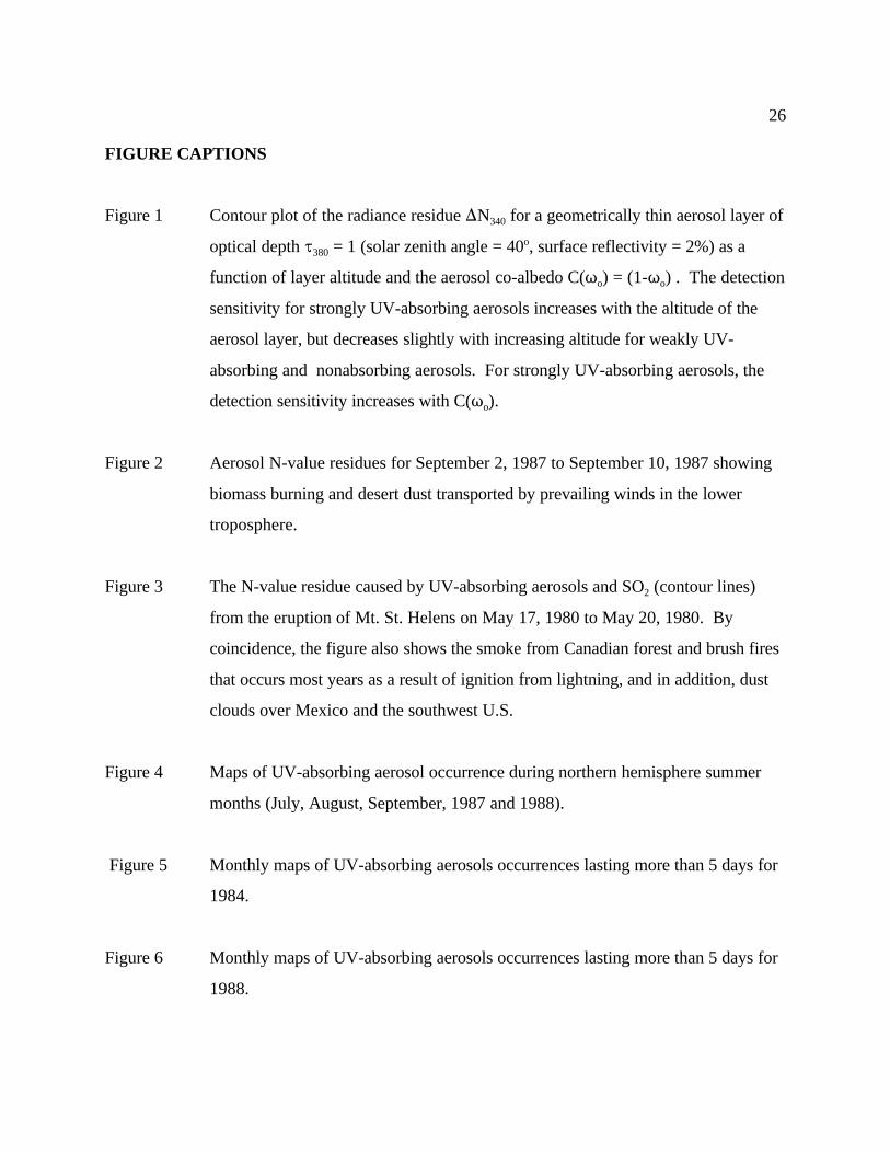
FIGURE CAPTIONS
Figure 1 Contour plot of the radiance residue )N for a geometrically thin aerosol layer of340
optical depth J = 1 (solar zenith angle = 40 , surface reflectivity = 2%) as a380o
function of layer altitude and the aerosol co-albedo C(T ) = (1-T ) . The detectiono o
sensitivity for strongly UV-absorbing aerosols increases with the altitude of the
aerosol layer, but decreases slightly with increasing altitude for weakly UV-
absorbing and nonabsorbing aerosols. For strongly UV-absorbing aerosols, the
detection sensitivity increases with C(T ). o
Figure 2 Aerosol N-value residues for September 2, 1987 to September 10, 1987 showing
biomass burning and desert dust transported by prevailing winds in the lower
troposphere.
Figure 3 The N-value residue caused by UV-absorbing aerosols and SO (contour lines)2
from the eruption of Mt. St. Helens on May 17, 1980 to May 20, 1980. By
coincidence, the figure also shows the smoke from Canadian forest and brush fires
that occurs most years as a result of ignition from lightning, and in addition, dust
clouds over Mexico and the southwest U.S.
Figure 4 Maps of UV-absorbing aerosol occurrence during northern hemisphere summer
months (July, August, September, 1987 and 1988).
Figure 5 Monthly maps of UV-absorbing aerosols occurrences lasting more than 5 days for
1984.
Figure 6 Monthly maps of UV-absorbing aerosols occurrences lasting more than 5 days for
1988.
27
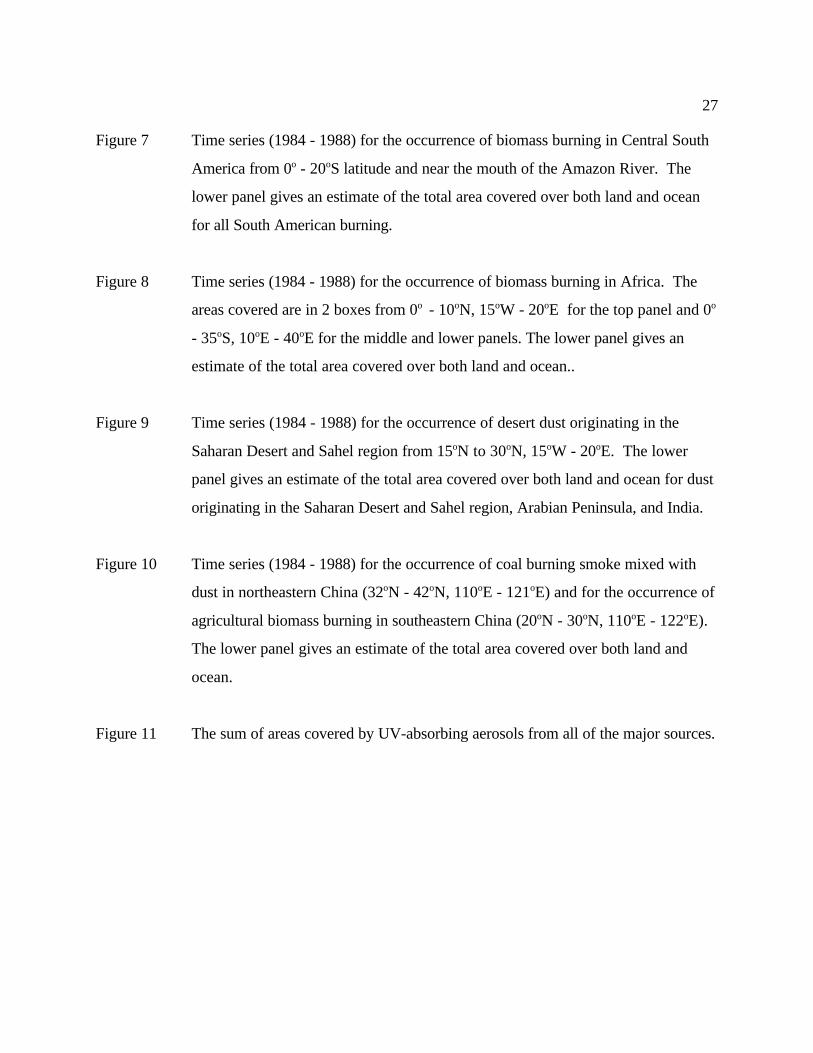
Figure 7 Time series (1984 - 1988) for the occurrence of biomass burning in Central South
America from 0 - 20 S latitude and near the mouth of the Amazon River. Theo o
lower panel gives an estimate of the total area covered over both land and ocean
for all South American burning.
Figure 8 Time series (1984 - 1988) for the occurrence of biomass burning in Africa. The
areas covered are in 2 boxes from 0 - 10 N, 15 W - 20 E for the top panel and 0o o o o o
- 35 S, 10 E - 40 E for the middle and lower panels. The lower panel gives ano o o
estimate of the total area covered over both land and ocean..
Figure 9 Time series (1984 - 1988) for the occurrence of desert dust originating in the
Saharan Desert and Sahel region from 15 N to 30 N, 15 W - 20 E. The lowero o o o
panel gives an estimate of the total area covered over both land and ocean for dust
originating in the Saharan Desert and Sahel region, Arabian Peninsula, and India.
Figure 10 Time series (1984 - 1988) for the occurrence of coal burning smoke mixed with
dust in northeastern China (32 N - 42 N, 110 E - 121 E) and for the occurrence ofo o o o
agricultural biomass burning in southeastern China (20 N - 30 N, 110 E - 122 E). o o o o
The lower panel gives an estimate of the total area covered over both land and
ocean.
Figure 11 The sum of areas covered by UV-absorbing aerosols from all of the major sources.
Related Documents