See discussions, stats, and author profiles for this publication at: https://www.researchgate.net/publication/320845912 GlidePath: Eco-Friendly Automated Approach and Departure at Signalized Intersections Article · November 2017 DOI: 10.1109/TIV.2017.2767289 CITATIONS 27 READS 281 5 authors, including: Some of the authors of this publication are also working on these related projects: TNC Mobility Modeling and Analysis View project End-to-end Vision based Driving Assistant Systems using Deep Learning View project Guoyuan Wu University of California, Riverside 139 PUBLICATIONS 1,129 CITATIONS SEE PROFILE Matthew J. Barth University of California, Riverside 408 PUBLICATIONS 7,391 CITATIONS SEE PROFILE Kanok Boriboonsomsin University of California, Riverside 146 PUBLICATIONS 2,724 CITATIONS SEE PROFILE All content following this page was uploaded by Guoyuan Wu on 06 November 2017. The user has requested enhancement of the downloaded file.

Welcome message from author
This document is posted to help you gain knowledge. Please leave a comment to let me know what you think about it! Share it to your friends and learn new things together.
Transcript

See discussions, stats, and author profiles for this publication at: https://www.researchgate.net/publication/320845912
GlidePath: Eco-Friendly Automated Approach and Departure at Signalized
Intersections
Article · November 2017
DOI: 10.1109/TIV.2017.2767289
CITATIONS
27READS
281
5 authors, including:
Some of the authors of this publication are also working on these related projects:
TNC Mobility Modeling and Analysis View project
End-to-end Vision based Driving Assistant Systems using Deep Learning View project
Guoyuan Wu
University of California, Riverside
139 PUBLICATIONS 1,129 CITATIONS
SEE PROFILE
Matthew J. Barth
University of California, Riverside
408 PUBLICATIONS 7,391 CITATIONS
SEE PROFILE
Kanok Boriboonsomsin
University of California, Riverside
146 PUBLICATIONS 2,724 CITATIONS
SEE PROFILE
All content following this page was uploaded by Guoyuan Wu on 06 November 2017.
The user has requested enhancement of the downloaded file.
1
Abstract — Recently there has been significant research
on environment-focused Connected Vehicle (CV)
applications that involve determining optimal speed profiles
for vehicles traveling through signalized intersections and
conveying this information to drivers via driver-vehicle
interfaces (DVI’s). However, findings from previous studies
indicate that drivers may not be able to precisely follow the
recommended speed profiles, resulting in degraded
effectiveness of the applications. Moreover, the DVI could
be distracting, which may compromise safety. As an
alternative, partial automation can play an important role in
ensuring that the benefits of these CV applications are fully
realized. In this study, a partially automated vehicle system
with an eco-approach and departure feature (called the
GlidePath Prototype), which can receive dedicated short
range communication (DSRC) message sets from the
intersection and automatically follow recommended speed
profiles, was developed, demonstrated, and evaluated. The
results revealed that compared to manually following the
recommended speed profiles, the GlidePath Prototype
reduced fuel consumption by 17% on average. In some
cases, the fuel savings are greater than 40% while the travel
time is shortened by up to 64%. Furthermore, the system
potentially improved the driving comfort since it would
smooth out the speed profiles.
Index Terms — Eco-approach/departure, connected and
automated vehicle (CAV), intelligent transportation systems.
I. INTRODUCTION
ith increasing public awareness of the need to reduce
carbon emissions and rapid advances in information and
communication technology, a significant amount of
research has been conducted to develop energy/environment-
focused Connected Vehicle (CV) applications. The European
Union has initiated a series of programs and projects, such as
eCoMove [1] and Compass4D [2], in which traffic information
can be shared in real-time among all road users and
infrastructure to encourage more efficient and sustainable
operations of the entire transportation system. Another good
example is the U.S. Department of Transportation’s AERIS
(Applications for the Environment: Real-Time Information
Synthesis) program [3], which aims to develop a variety of CV
applications that are specifically designed to reduce the
environmental footprint of surface transportation.
Among the CV applications developed under the AERIS
program, the Eco-Approach and Departure at Signalized
Intersections (EAD) application has shown great promise in
terms of reducing fuel consumption and pollutant emissions [4].
Like other CV applications that involve determining optimal
speed profiles for vehicles traveling within an urban
transportation network (e.g., [5-9]), the EAD application
utilizes signal phase and timing (SPaT) information from the
upcoming traffic signal to determine a recommended speed
profile that minimizes vehicle energy consumption and
pollutant emissions when approaching to and departing from a
signalized intersection. The recommended speed profile is then
conveyed to the driver through driver-vehicle interfaces
(DVI’s). However, the driver may not be able to precisely
follow the recommended speed profile [11], resulting in
degraded effectiveness of the application. Furthermore, these
DVIs could be distracting, which may compromise safety.
In this respect, partial vehicle automation, even at Level 1
(function-specific automation) or Level 2 (combined function
automation) [10], can play an important role in better following
the recommended speed profiles, thereby ensuring that the
benefits of the EAD application are fully realized. In [11], a
numerical simulation study was conducted to quantify the
supplementary benefits from partial vehicle automation. As a
continuation of research in [11], a partially automated version
of the EAD application, called GlidePath Prototype, has been
developed, demonstrated, and evaluated in this study. The
GlidePath Prototype system is the first of its kind, integrating
state-of-the-art connected vehicle and automated vehicle
control technologies.
The remainder of this paper is organized as follows: Section
II presents background information on vehicle movement at
signalized intersections and the associated energy consumption.
The core algorithm of the GlidePath Prototype system—vehicle
trajectory planning—is then elaborated in Section III. Next,
detailed description of the GlidePath experiment as well as data
collection efforts are presented in Section IV, followed by
comparative analyses of the collected data (for both manual and
partially automated driving) and discussion of the results in
Section V. Lastly, Section VI concludes this paper along with
further discussion on future work.
Osman D. Altan, Member, IEEE, Guoyuan Wu*, Senior Member, IEEE, Matthew J. Barth, Fellow,
IEEE, Kanok Boriboonsomsin, Member, IEEE, and John A. Stark
GlidePath: Eco-Friendly Automated Approach
and Departure at Signalized Intersections
W
Manuscript received in June 2016. This work was supported by the Federal Highway Administration (FHWA).
O. D. Altan is with Turner Fairbank Highway Research Center, Federal
Highway Administration, US Dept. of Transportation, McLean, VA 22101. (e-mail: [email protected]).
G. Wu, corresponding author, is with the College of Engineering -
Center for Environmental Research and Technology, University of California, Riverside, CA 92507, USA (e-mail: [email protected]).
M. J. Barth is with the College of Engineering - Center for
Environmental Research and Technology, Electrical & Computer Engineering Department, University of California, Riverside, CA 92507,
USA (e-mail: [email protected]).
K. Boriboonsomsin is with the College of Engineering - Center for Environmental Research and Technology, University of California,
Riverside, CA 92507, USA (e-mail: [email protected]).
J. A. Stark is with Leidos, Inc., 11251 Roger Bacon Drive, Reston, VA 20190, USA (e-mail: [email protected])

2
II. BACKGROUND
A. Vehicle Movements at Isolated Intersections
For signalized arterials, consider the scenario of a single
traffic light as shown in Figure 1. In this figure, velocity
trajectories of four different vehicles confronted with the traffic
light at different signal phases and timings are shown by the
green, blue, red, and yellow lines. Note that all these trajectories
have the same initial and final velocities, and the same traveled
distance (e.g., within the dedicated short range communication
(DSRC) range). More specifically, the scenario can be divided
into the following four cases:
Scenario 1 (“cruise”): The vehicle cruises through the
intersection with constant speed (green line);
Scenario 2 (“speed-up”): The vehicle speeds up to pass
the intersection and then gets back to the initial speed
after the intersection (blue line);
Scenario 3 (“coast-down with a full stop”): The
vehicle slows down and stops at the intersection (red
line);
Scenario 4 (“coast-down without a full stop” or
“glide”): The vehicle slows down and passes the
intersection with a mid-range speed, and then speeds
up to its initial speed (yellow line).
Figure 1. Illustration of different scenarios for a vehicle approaching a
signalized intersection.
Even though all these vehicles cover the same distance with
the identical initial and final velocities, the associated fuel
consumption and emissions may vary greatly. Generally
speaking, Scenario 3 likely uses the most amount of fuel as the
vehicle has to decelerate to a full stop, idle for a certain period,
and then accelerate from stop to the final velocity. However,
fuel consumption of Scenario 1 may be comparable to that of
Scenario 2 and/or Scenario 4, depending on detailed maneuvers
(e.g., acceleration rate, top speed, duration) under each driving
modes (i.e., acceleration, cruise, and deceleration) during the
trips.
Therefore, as a vehicle travels down a signalized corridor, it
would likely be better to speed up or slowdown a moderate
amount in advance if maintaining current speed will not allow
itself to pass through the intersection within the green phase. As
the vehicle approaches a signal, its velocity can be dynamically
adjusted to minimize fuel consumption and emissions. This is
the basic idea behind the vehicle trajectory planning algorithm
proposed in [11] and deployed in this study.
B. Eco-Driving along Urban Arterial
Over the years, a variety of eco-driving strategies have been
developed to improve the energy efficiency for traveling along
signalized intersections in the urban area [5- 9, 11, 12]. For
example, Ozatay et al. proposed eco-driving algorithms with
analytical and/or numerical solutions that can minimize the fuel
consumption for vehicles passing through signalized corridors
[22, 23]. He et al. considered the queue effect at signalized
intersections when planning the vehicle trajectory for fuel
efficient driving [24]. A recent study by Jin et al. took the
“bottom-up” approach, i.e., selecting the best powertrain
operation state at each time step while satisfying the exogenous
constraints (e.g., preceding vehicle movement, traffic signal
control), and formulated the problem into a mixed integer linear
program in order to obtain the vehicle dynamics that minimize
the fuel consumption for urban driving [25]. In addition, results
from the numerical simulation study show that the “bottom-up”
approach outperformed some existing algorithms in terms of
energy savings. Some other studies focus on the development
or evaluation eco-driving strategies from the perspective of
traffic flows [26]. Besides the research on traditional fossil
fueled vehicles, more and more studies have been focused on
the development of eco-driving strategies for alternative fueled
vehicles, such as hybrid electric vehicles, battery electric
vehicles. They applied various optimization strategies,
including Dynamic Programming [27] and Pontryagin's
Minimum Principle [28], to obtaining the most energy efficient
speed profiles in consideration of some unique features (e.g.,
regenerative braking).
However, most of these strategies (especially from the
partially automated perspective) were only tested in the
simulation environment (i.e., using vehicle simulators, driving
simulators or microscopic traffic simulators). And some of
them could be too computationally demanding to be deployed
in the field. In this study, our proposed vehicle trajectory
planning algorithm was validated in a real world system.
C. Comprehensive Modal Emissions Model (CMEM)
In this study, the Comprehensive Modal Emissions Model
(CMEM) [13] is used to accurately assess the fuel consumption
and emissions of each run of the experiment ground vehicle
(XGV). CMEM is a microscopic emissions model that is
capable of predicting second-by-second fuel consumption and
tailpipe emissions of carbon dioxide (CO2), carbon monoxide
(CO), hydrocarbons (HC), and nitrogen oxides (NOx) based on
different modal operations from an in-use vehicle fleet. In the
modeling approach of CMEM, the entire fuel consumption and
emissions process is broken down into components that
correspond to physical phenomena associated with vehicle
operation and emissions production, as represented by the
following key equations:
𝑃𝑡𝑟 = max {𝑀 ∙ 𝑣 ∙ (𝑎 + 𝑔 ∙ sin𝜃) + (𝑀 ∙ 𝑔 ∙ 𝐶𝑟 +𝜌
2∙ 𝑣2 ∙ 𝐴 ∙
𝐶𝑎) ∙ 𝑣, 0} (1)
𝑃𝑒𝑛𝑔 = 𝑃𝑡𝑟 𝜂𝑡𝑓⁄ + 𝑃𝑎𝑐𝑐 (2)
𝐹𝑢𝑒𝑙𝑟𝑎𝑡𝑒 ≈ 𝜙 ∙ (𝑘 ∙ 𝑁 ∙ 𝐷 +𝑃𝑒𝑛𝑔
𝜂𝑒𝑛𝑔) ∙
1
44 (3)
𝐸𝑚𝑖𝑠𝑠𝑖𝑜𝑛𝑠𝑡𝑎𝑖𝑙𝑝𝑖𝑝𝑒 = 𝐹𝑢𝑒𝑙𝑟𝑎𝑡𝑒 ∙𝑔𝑒𝑚𝑖𝑠𝑠𝑖𝑜𝑛𝑠
𝑔𝑓𝑢𝑒𝑙∙ 𝐶𝑃𝐹 (4)
Scenario 1
Scenario 2
Scenario 3Scenario 4
Speed
Distance
Accelerating Cruising
Communication Region
Intersection
of Interest
Cruising
Vinitial Vfinal

3
where 𝑃𝑡𝑟 is the tractive power (kW); 𝑀 is the vehicle mass
(kg); 𝑣 is the vehicle velocity (m/s); 𝑎 is the vehicle
acceleration (m/s2); 𝑔 is the gravitational constant (i.e.,
9.81m/s2); 𝜃 is the road grade angle (in fraction); 𝐶𝑟 is the
rolling resistance coefficient; 𝜌 is the mass density of air (i.e.,
1.225 kg/m3, depending on temperature and altitude); 𝐴 is the
vehicle cross sectional area (m2); 𝐶𝑎 is the aerodynamic drag
coefficient; 𝑃𝑒𝑛𝑔 is the engine power (kW); 𝜂𝑡𝑓 is the combined
efficiency of the transmission and final drive; 𝑃𝑎𝑐𝑐 is the power
demand (kW) associated with the operation of accessories,
such as air conditioning, power steering and brakes, and other
electrical loads; 𝜙 is the fuel/air equivalence ratio; 44 (kJ/g) is
the lower heating value of a typical gasoline; 𝑘 is the engine
friction factor, representing the fuel energy used at zero power
output to overcome engine friction per engine revolution and
unit of engine displacement); 𝑁 is the engine speed (revolutions
per second); 𝐷 is the engine displacement (litre); 𝜂𝑒𝑛𝑔 is the
indicated engine efficiency; (𝑔𝑒𝑚𝑖𝑠𝑠𝑖𝑜𝑛𝑠 𝑔𝑓𝑢𝑒𝑙⁄ ) is the engine-
out emissions per unit of fuel consumed; and 𝐶𝑃𝐹 is the
catalyst pass fraction, which is defined as the ratio of tailpipe to
engine-out emissions. CPF usually is primarily a function of
fuel/air ratio and engine-out emissions.
Each component of CMEM is modeled as an analytical
representation consisting of various parameters that are
characteristic of the process. These parameters vary according
to vehicle type, engine, emission control technology, and level
of deterioration. Some of them are available from the public
resources or specifications (e.g., engine displacement), while
others are measured or calibrated in the dedicated facilities [13].
CMEM has been developed primarily for microscale
transportation models that typically produce second-by-second
vehicle trajectories (location, velocity, and acceleration). These
vehicle trajectories can be applied directly to the model,
resulting in both individual and aggregate energy/emissions
estimates.
III. VEHICLE TRAJECTORY PLANNING ALGORITHM AND ITS
COMPONENTS
At the core of the GlidePath Prototype system, Vehicle
Trajectory Planning Algorithm (VTPA) is responsible for
generating the reference speed trajectory as the input to the
longitudinal controller.
A. Vehicle Trajectory Planning Algorithm (VTPA)
Figure 2 depicts the system diagram of the vehicle trajectory
planning algorithm (VTPA), where external inputs include:
Vehicle’s current states, such as location (i.e., latitude,
longitude and altitude) received from the PinPointTM
system [20] and instantaneous velocity obtained from the
vehicle CAN Bus interface. It turns out the PinPointTM
system can provide quite precise location information (up
to the centimeter level) of the test vehicle in this study;
Message sets received from the DSRC device, which
include SPaT and MAP (also referred to as geometric
intersection description or GID) messages; and
System constraints and parameters, such as maximum
acceleration and deceleration, maximum jerk (i.e.,
derivative of acceleration), and roadway speed limit.
The output is the target velocity. A further insight into the
VTPA system shows there are five sub-systems:
1) MAP Parser: by following SAE J2735 protocol [21], this
sub-system can decode the MAP messages broadcasted by
the road-side equipment (RSE) and extract the
characteristics of key nodes at/around the intersection, such
as latitudes, longitudes and elevations along each approach
and departure lane;
2) Map Matcher: based on the vehicle’s current location,
stop-bar location, and locations of those key nodes in-
between, this sub-system can compute the lane ID and the
vehicle’s distance to the stop-bar or distance-to-arrival
(DTA) at each time step;
3) SPaT Parser: Also by following SAE J2735 protocol, this
sub-system can decode the SPaT messages broadcasted by
the RSE and extract the current signal status (i.e.,
green/yellow/red and solid/arrow) applicable to the current
lane as well as the range (the minimum and maximum) of
count-down to the end of current status;
4) Green Window Estimator: this sub-system aims at
estimating available green windows for the subject vehicle
according to the vehicle’s desired movement, SPaT and
signal controller’s type (e.g., fixed-time or traffic-
responsive) and settings. For a fixed-time signal controller,
it is quite easy and robust to estimate green windows due
to its simple control logic. But for a traffic-response signal
controller, more advanced statistical techniques need to be
employed to obtain relatively more reliable estimation of
green windows, depending on the degree of actuation [14].
5) Decision Maker: this sub-system takes into account the
holistic information, including system constraints (e.g.,
maximum acceleration/deceleration, roadway speed limit,),
to identify the scenario (see Section II. B) where the subject
vehicle faces and determines the appropriate target speed
profile. As shown in Figure 3, this sub-system consists of
two components: 1) Scenario Identifier; and 2) Trajectory
Generator.
Figure 2. Sub-systems of VTPA.
SPaT Parser
GreenWindow
EstimatorDecision Maker (12)
(6)
(10)
Vehicle Trajectory Planning Algorithm
(1) Current Velocity (10 Hz)(2) SPaT (10 Hz)(3) MAP (10 Hz)(4) Current Location (10 Hz)(5) Geometry of Intersection Area(6) Signal Status
(11)
(7)
MAPParser
Map Matcher
(5)
(2)
(9)
(7) Count-down Information(8) Lane-level Route information(9) Distance to Arrival or DTA (10 Hz)(10) Available Green Window (Set)(11) System Constraints (e.g., amax, jerkmax, v
limit)(12) Target Velocity (10 Hz)
Vehicle CAN Bus
DSRC Modem
PinPoint System
(3)
Longitudinal Controller
(8)

4
Figure 3. Diagram of the decision maker sub-system.
B. Scenario Identifier
As shown in Figure 4, the Scenario Identifier component is
to identify into which scenario the target vehicle trajectory
should be categorized, based on some key parameters (such as
speed, SPaT, distance to stop bar and other system constraints)
at current time. For example, if the subject vehicle can cruise at
the current velocity and pass the intersection at green, then the
trajectory is categorized into Scenario 1 (cruise), and the cruise
time to arrival, 𝑡𝑐𝑟, is given as
𝑡𝑐𝑟 = 𝑑0 𝑣𝑐⁄ (5)
where 𝑑0 is the route distance to the stop-bar and 𝑣𝑐 is the
instantaneous speed at current time instant, 𝑡0. In addition, the
available green window, 𝛤, can be written as follows:
𝛤 = {[𝑡0, 𝑔𝑒
𝑐𝑢𝑟𝑟)⋃[𝑔𝑠𝑛𝑒𝑥𝑡 , 𝑔𝑒
𝑛𝑒𝑥𝑡), 𝑖𝑓 "𝐺𝑟𝑒𝑒𝑛" 𝑎𝑡 𝑡0[𝑔𝑠𝑛𝑒𝑥𝑡 , 𝑔𝑒
𝑛𝑒𝑥𝑡), 𝑖𝑓 "𝑌𝑒𝑙𝑙𝑜𝑤" 𝑜𝑟 "𝑅𝑒𝑑" 𝑎𝑡 𝑡0 (6)
where 𝑔𝑒𝑐𝑢𝑟𝑟 denotes the end of current green window
associated with the vehicle’s movement; 𝑔𝑠𝑛𝑒𝑥𝑡 and 𝑔𝑒
𝑛𝑒𝑥𝑡
represent the start and end of next green window, respectively.
Generally speaking, 𝛤 should be the set of all subsequent green
windows after 𝑡0. But within the limited communication range
of DSRC (300 meters, nominally), the time window up to the
end of next green should be practically long enough to tackle
with most situations. For some extreme situations, e.g., over-
saturated traffic conditions, the green windows after the next
cycle can be included in 𝛤 (in theory), but it is very likely that
the vehicle has to stop due to the long queue effect.
If Scenario 1 is not guaranteed, then the earliest time to
arrival, 𝑡𝑒(< 𝑡𝑐𝑟), will be calculated to determine whether the
trajectory satisfies the condition of Scenario 2, i.e., speed-up
(without violating the speed limit) to pass through the signal
without any stop. The calculation of 𝑡𝑒 largely depends on the
proposed trajectory model, a piecewise trigonometric-linear
function, which will be elaborated in the following section.
If it is determined that the subject vehicle will not be able to
pass the intersection by moderate acceleration, then the vehicle
has to decelerate to a full stop (Scenario 3) or to glide in an
environmentally friendly manner (Scenario 4), depending on
the latest time to arrival without any stop, 𝑡𝑙(> 𝑡𝑐𝑟). Again, the
calculation of 𝑡𝑙 is model-dependent.
Figure 4. Diagram of scenario identifier.
C. Trajectory Generator
This component is to determine the actual time-to-arrival,
𝑡𝑎𝑟𝑟 (for Scenario 3, it is the time instant to leave from the stop-
bar), and the target vehicle trajectory for each scenario. As
mentioned in Section 2, the proposed control logic for the target
velocity tries to minimize the vehicle’s acceleration/
deceleration before the intersection, so that the vehicle can pass
the intersection with the target speed that is closest to its initial
speed (assuming it is the free-flow speed). Therefore, after
passing the intersection, the vehicle can get back to its initial
speed with minimal fuel usage. As suggested in previous
literature [15, 16], there are numerous ways to accelerate or
decelerate from one speed to another, such as the constant
acceleration and deceleration rates, linear acceleration and
deceleration rates, and constant power rates. The family of
piecewise trigonometric-linear functions is selected as the
target velocity profiles (for both approach and departure
portions), due to its mathematical tractability and smoothness
[17].
The basic idea for our generated trajectory is: the acceleration
and deceleration are designed to achieve the desired cruise
speed in the shortest amount of time, while ensuring the driving
comfort by limiting the jerk. In order to avoid unnecessary
idling, the vehicle tries to reach the intersection during the green
phase of the signal.
vc
vh
Time
Speed
tm t10 tarr
d0
where 𝑡𝑚 = 𝜋 (2𝑚)⁄ ; 𝑡1 = 𝑡𝑚 + 𝜋 (2𝑛)⁄ ; 𝑡𝑎𝑟𝑟 = 𝑑0 𝑣ℎ⁄ . Figure 5 (a). Acceleration profile of the piecewise trigonometric-linear
function.
ScenarioIdentifier
TrajectoryGenerator
Sc. 1 (green)
Sc. 2 (blue)
Sc. 3 (red)
Sc. 4 (yellow)
Current velocity
Green window
Distance to arrival
Target velocity
System constraints
𝑡𝑐𝑟 Yes
“Scenario 1”
No
Yes“Scenario 2” 𝑡𝑒, 𝑡𝑐𝑟
Yes“Scenario 3”
“Scenario 4”
No
No
𝑡𝑐𝑟, 𝑡𝑙 =
Trajectory Generator

5
vc
vh
Time
Speed
tm t10 tarr
d0
where 𝑡𝑚 = 𝜋 (2𝑚)⁄ ; 𝑡1 = 𝑡𝑚 + 𝜋 (2𝑛)⁄ ; 𝑡𝑎𝑟𝑟 = 𝑑0 𝑣ℎ⁄ . Figure 5 (b). Deceleration profile of the piecewise trigonometric-linear
function. For Scenario 1, since the vehicle is able to cruise through the
intersection, the time-to-arrival, 𝑡𝑎𝑟𝑟 = 𝑡𝑐𝑟 , and the target
velocity, 𝑣𝑡 , is simply the current velocity (at 𝑡 = 0, without
loss of generality), 𝑣𝑐. For Scenario 2, the approach portion takes the similar shape
of acceleration profile in Figure 5 (a). To reach back to 𝑣𝑐 after
passing the signal, the departure portion is the mirror symmetry
of the approach one for simplicity. More specifically, without
compromising the travel time, the time-to-arrival is given as
𝑡𝑎𝑟𝑟 = min min{[𝑡𝑒, 𝑡𝑐𝑟] 𝛤} (7)
The target velocity, 𝑣𝑡 = 𝑓(𝑡|𝑣𝑐 , 𝑣ℎ), where
𝑓(𝑡|𝑣𝑐 , 𝑣ℎ) =
{
𝑣ℎ − 𝑣𝑑 ∙ cos (𝑚𝑡) 𝑡 [0,
𝜋
2𝑚)
𝑣ℎ − 𝑣𝑑 ∙𝑚
𝑛∙ cos [𝑛 ∙ (𝑡 +
𝜋
𝑛− 𝑡1)] 𝑡 [
𝜋
2𝑚, 𝑡1)
𝑣ℎ + 𝑣𝑑 ∙𝑚
𝑛𝑡 [𝑡1,
𝑑0
𝑣ℎ)
𝑣ℎ − 𝑣𝑑 ∙𝑚
𝑛∙ cos [𝑛 ∙ (𝑡 +
3𝜋
2𝑛− 𝑡2)] 𝑡 [
𝑑0
𝑣ℎ, 𝑡2)
𝑣ℎ − 𝑣𝑑 ∙ cos [𝑚 ∙ (𝑡 − 𝑡3)] 𝑡 [𝑡2, 𝑡3)
𝑣𝑐 𝑡 [𝑡3, +∞)
(8)
and 𝑛 (>0) is chosen as the maximum that satisfies:
{
|𝑛 ∙ 𝑣𝑑| ≤ 𝑎𝑚𝑎𝑥|𝑛 ∙ 𝑣𝑑| ≤ 𝑑𝑚𝑎𝑥
|𝑛2 ∙ 𝑣𝑑| ≤ 𝑗𝑒𝑟𝑘𝑚𝑎𝑥
𝑛 ≥ (𝜋
2− 1) ∙
𝑣ℎ
𝑑0
(9)
and,
𝑚 =
−𝜋
2𝑛−√(
𝜋
2𝑛)2−4𝑛2∙[(
𝜋
2−1)−
𝑑0𝑣ℎ∙𝑛]
2[(𝜋
2−1)−
𝑑0𝑣ℎ∙𝑛]
(10)
where 𝑣ℎ = 𝑑0 𝑡𝑎𝑟𝑟⁄ , representing the target average speed
given target arrival time, 𝑡𝑎𝑟𝑟; 𝑣𝑑 = 𝑣ℎ − 𝑣𝑐 , representing the
difference between current speed and target average speed;
𝑡1 = 𝜋 2𝑚⁄ + 𝜋 (2𝑛)⁄ ; 𝑡2 = 𝑑0 𝑣ℎ⁄ + 𝜋 (2𝑛)⁄ ; 𝑡3 = 𝑑0 𝑣ℎ⁄ +𝜋 (2𝑚)⁄ + 𝜋 (2𝑛)⁄ ; 𝑎𝑚𝑎𝑥 and 𝑑𝑚𝑎𝑥 are the maximum
acceleration and deceleration, respectively; |𝑗𝑒𝑟𝑘𝑚𝑎𝑥| = 10
m/s3 is the maximum jerk whose value was chosen as
recommended in [18]; The parameters 𝑚 and 𝑛 define the
family of trigonometric functions, whose values control the rate
of change in acceleration and deceleration profiles. In addition,
the parameters 𝑚 and 𝑛 are coupled in order to guarantee the
smoothness of entire speed profile (especially at those break
points) and the area under the curve being the distance to the
stop-bar, 𝑑0.
According to the Equation Set (8), the earliest time-to-
arrival, 𝑡𝑒, can be calculated as
𝑡𝑒 =𝑑0−𝑣𝑐∙
𝜋
2𝑝
𝑣𝑙𝑖𝑚𝑖𝑡+
𝜋
2𝑝 (11)
and
𝑝 = min {2∙𝑎𝑚𝑎𝑥
𝑣𝑙𝑖𝑚𝑖𝑡−𝑣𝑐, √
2∙𝑗𝑒𝑟𝑘𝑚𝑎𝑥
𝑣𝑙𝑖𝑚𝑖𝑡−𝑣𝑐} (12)
where, 𝑣𝑙𝑖𝑚𝑖𝑡 represents the upper limit (hard constraint) of the
target velocity due to the subject vehicle’s ability or roadway
enforcement.
As aforementioned, to determine if the speed profile belongs
to Scenario 3 or Scenario 4, the latest time-to-arrival without
any stop, 𝑡𝑙, can be calculated as
𝑡𝑙 =𝑑0−𝑣𝑐∙
𝜋
2𝑞
𝑣𝑐𝑜𝑎𝑠𝑡+
𝜋
2𝑞 (13)
and
𝑞 = min {2∙𝑎𝑚𝑎𝑥
𝑣𝑐−𝑣𝑐𝑜𝑎𝑠𝑡 , √
2∙𝑗𝑒𝑟𝑘𝑚𝑎𝑥
𝑣𝑐−𝑣𝑐𝑜𝑎𝑠𝑡} (14)
where 𝑣𝑐𝑜𝑎𝑠𝑡 denotes the coasting speed (e.g., 8 mph) which is
a user-defined parameters based on driving comfort.
For Scenario 3, since the vehicle needs to have a full stop at
the stop-bar, the time-to-arrival is not equal to the time to leave
from the stop-bar, or 𝑡𝑎𝑟𝑟 < 𝑔𝑠𝑛𝑒𝑥𝑡 and the target velocity, 𝑣𝑡 =
𝑔(𝑡|𝑣𝑐 , 𝑣ℎ), where
𝑔(𝑡|𝑣𝑐 , 𝑣ℎ) =
{
𝑣ℎ − 𝑣𝑑 ∙ cos (𝑚𝑡) 𝑡 [0,
𝜋
2𝑚)
𝑣ℎ − 𝑣𝑑 ∙𝑚
𝑛∙ cos [𝑛 ∙ (𝑡 +
𝜋
𝑛− 𝑡1)] 𝑡 [
𝜋
2𝑚, 𝑡1)
𝑣ℎ + 𝑣𝑑 ∙𝑚
𝑛𝑡 [𝑡1, 𝑔𝑠
𝑛𝑒𝑥𝑡)
𝑣ℎ − 𝑣𝑑 ∙𝑚
𝑛∙ cos [𝑛 ∙ (𝑡 +
3𝜋
2𝑛− 𝑡4)] 𝑡 [𝑔𝑠
𝑛𝑒𝑥𝑡 , 𝑡4)
𝑣ℎ − 𝑣𝑑 ∙ cos [𝑚 ∙ (𝑡 − 𝑡5)] 𝑡 [𝑡4, 𝑡5)
𝑣𝑐 𝑡 [𝑡5, +∞)
(15)
and,
𝑛 = 𝑚 =𝑣ℎ
𝑑0∙ 𝜋 (16)
where 𝑡4 = 𝑔𝑠𝑛𝑒𝑥𝑡 + 𝜋 (2𝑛)⁄ ; 𝑡5 = 𝑡4 + 𝜋 (2𝑚)⁄ and 𝑣ℎ =
𝑣𝑐 2⁄ ; Due to Equation (16), Equation Set (15) can be further
simplified as
{
𝑣𝑐 2⁄ + 𝑣𝑐 2⁄ ∙ cos (𝑚𝑡) 𝑡 [0, 𝑡𝑎𝑟𝑟)
0 𝑡 [𝑡𝑎𝑟𝑟 , 𝑔𝑠𝑛𝑒𝑥𝑡)
𝑣𝑐 2⁄ + 𝑣𝑐 2⁄ ∙ cos [𝑚 ∙ (𝑡 − 𝑡5)] 𝑡 [𝑔𝑠𝑛𝑒𝑥𝑡 , 𝑡5)
𝑣𝑐 𝑡 [𝑡5, +∞)
(16’)
For Scenario 4, the time-to-arrival is given as
𝑡𝑎𝑟𝑟 = min min{[𝑡𝑐𝑟 , 𝑡𝑙] 𝛤} (17)
And the target velocity, 𝑣𝑡 = ℎ(𝑡|𝑣𝑐 , 𝑣ℎ) shares the same
format of 𝑓(𝑡|𝑣𝑐 , 𝑣ℎ), but 𝑣𝑑 < 0. Figure 6 summarizes how to
determine the time-to-arrival, 𝑡𝑎𝑟𝑟, the average speed, 𝑣ℎ, and
the target speed, 𝑣𝑡, for each of the four scenarios.

6
Figure 6. Diagram of trajectory generator.
IV. GLIDEPATH TESTBED AND DATA COLLECTION
In this section, the GlidePath testbed and field experiment for
data collection will be described in detail. Figure 7 illustrates
all sub-systems of the GlidePath testbed, including GlidePath
Prototype (i.e., experiment ground vehicle or XGV) and
relevant roadside infrastructure.
Figure 7. Sub-systems of GlidePath testbed.
A. GlidePath Prototype
The GlidePath prototype is a 2010 Ford Escape Hybrid
outfitted by TORC® Robotics with ByWire XGV System,
enabling full-range longitudinal speed control (see Figure 8).
Other key components or functionalities integrated into the test
vehicle include: 1) DSRC on-board equipment (OBE); 2)
advanced positioning system; 3) driver-vehicle interface; 4)
emergency stop and manual override; and 5) data logging.
The GlidePath Prototype and its subsystems can be
controlled by several input mechanisms that, in combination,
serve as transitions between the vehicle states which are
depicted in Figure 9.
B. Test Site
The field test was conducted at the Turner-Fairbank Highway
Research Center (TFHRC) in McLean, Virginia using the
Saxton Lab Intelligent Intersection, which offered a sheltered
traffic environment where the automated prototype was able to
be tested with minimal safety risk and without disrupting live
traffic operations.
Figure 8. XGV setup and driver-vehicle interface (DVI).
Figure 9. GlidePath prototype system state transition diagram.
Figure 10 provides an overview of the field test site,
specifying starting point where the vehicle will begin test runs
from a stop and travel westbound towards the intersection and
relevant roadside infrastructure (including an Econolite 2070
controller, Windows PC to encode SPaT and MAP messages,
and Arada Locomate DSRC Roadside Unit). The test zone
covers a range from 190 meters to the east of the intersection to
116 meters to the west, which allows a maximum traveling
speed of up to 30 mph. The traffic signal controller was set up
for fixed timed signal plan: 27-seconds green, 3-seconds
yellow, followed by 30-seconds of red, which has removed
excess all red clearance timings and all loop detector triggers
from actuating the signal.
Figure 10. Field study site in Turner Fairbank Highway Research Center in
McLean, VA.
𝑣ℎ = 𝑣𝑐
Set 𝑡𝑎𝑟𝑟 = 𝑡𝑐𝑟
Set 𝑡𝑎𝑟𝑟 = min
𝑣ℎ = 𝑑0 𝑡𝑎𝑟𝑟⁄
𝑣𝑡 = 𝑓 𝑣𝑐 , 𝑣ℎ
Set 𝑡𝑎𝑟𝑟 = 𝑔𝑠𝑛𝑒𝑥𝑡
𝑣ℎ = 𝑣𝑐 2⁄𝑣𝑡 = 𝑔 𝑣𝑐 , 𝑣ℎ
Set 𝑡𝑎𝑟𝑟 = min 𝑣𝑡 = ℎ 𝑣𝑐 , 𝑣ℎ
𝑣ℎ = 𝑑0 𝑡𝑎𝑟𝑟⁄
𝑣𝑡 = 𝑣𝑐
Scenario Identifier
State Description0 1
2 3
5 4
Ignition Off
Park
Automated
EcoDriveIdle
Manual
Ignition ON and Activation Key ‘1’
Ignition OFF and Activation Key ‘0’
Shift from P to DShift from D to P
Shif
t fr
om
P t
o N
Shif
t fr
om
N t
o P
DV
I “G
o”
Full
Sto
p a
t R
ed
Brake or Emergency Button Press
Shif
t fr
om
N t
o D
Shift from N to D
Full Stop, Shift from D to N
6Idle with Brake
DVI “EcoDrive Off” or Experiment Ends
Emer
gen
cy B
utt
on
R
elea
se
Shif
t fr
om
N t
o D
No. Name Automated Control
0 Ignition off Disabled
1 Park Disabled
2 Manual Disabled
3 Automated Enabled
4 EcoDrive Actively Engaged
5 Idle Disabled
6 Idle with brake
Disabled
Region Exit
(-116m)
Region Entry
(+190m)Test Intersection
Vehicle
Stat-up
Location
Travel Direction

7
C. Data Collection
The field experiment was designed to be comprehensive in
that the test vehicle will approach the intersection at different
times throughout the entire signal cycle (i.e., every 5 seconds in
the 60-second cycle). Furthermore, the vehicle approached the
intersection at different driving speeds (i.e., operating speeds),
ranging from 20 mph to 25 mph. The limitations of the TFHRC
facility roadway prevent use of higher operating speeds. The
vehicle fuel economy and CO2 emissions were then calculated
by applying the CMEM model to the logged trajectories, and
compared between the following stages:
Stage I: “manual-uninformed” driving. At this stage, a
driver approached and traveled through the intersection in
a normal fashion without guidance or automation, stopping
as needed without any automated vehicle control. Data
collected at this stage establish a baseline that can be used
as a point of comparison for the Stage II and III
experiments.
Stage II: “manual-DVI-assisted” driving. At this stage, a
driver was provided an enhanced dashboard which
presented a speed range band overlaid onto a speedometer
for the driver to follow as guidance on how to approach and
depart the intersection in an environmentally friendly
manner while obeying the traffic signal (see Figure 11).
This stage does not involve any automated vehicle control
but the advisory speed trajectories were generated using
VTPA described previously. In addition, the recommended
speed profile can be re-calculated throughout the route if
the subject cannot follow the recommendation well enough
(i.e., the accumulative following error reaches some user-
defined threshold). Such mechanism may trigger the
change from one scenario to another en-route.
Stage III: “(partially) automated” driving. At this stage,
the developed GlidePath prototype system was responsible
for longitudinal control of the vehicle allowing it to speed
up or slow down while the driver steered for lateral control
and monitored the application on the DVI (shown in Figure
12). At this stage, the vehicle automatically controlled the
brake and throttle based on the output of the Vehicle
Trajectory Planning Algorithm (VTPA), which calculated
an eco-friendly velocity profile according to the DSRC
message sets and distance to the stop-bar. Figure 13
presents an example of the actual speed vs. reference speed
(i.e., the controlled input) to show the tracking
performance of the longitudinal controller. System
parameters were adjusted to accommodate the tracking
errors and delay.
For the Stage I and Stage II experiments, four drivers who
had no previous exposure to the Eco-Approach and Departure
concept were recruited to conduct test runs. For the Stage III
experiments, the test vehicle was operated by a trained driver to
maintain safety as a top priority. Because the GlidePath
prototype system can automatically control the longitudinal
motion of the vehicle, it is not necessary for novice drivers to
operate the vehicle during the “(partially) automated” driving
stage.
Figure 11. Graphic interface for “manual-DVI-assisted” driving.
Figure 12. Graphic interface for “(partially) automated” driving.
Figure 13. Example of actual speed vs. reference speed in the field test (when the operating speed is 20 mph and the entry time in phase is 27 seconds after
the green on-set).
In order to cover every possible driving scenario (as
mentioned in Section II), a field study matrix (i.e., Table 1) that
varies the vehicle’s operating speed and signal timing start with
respect to the overall cycle of the traffic signal, was developed
for each driver at each stage. This test matrix consists of the
operating speed along the vertical axis, and the delay in the
signal cycle across the horizontal access as well as the expected
current phase of the traffic signal. In this matrix, there are a
SPaT Operating speed level
“Scenario”
Data collection control
“EcoDrive” switch
Vehicle location indicator
0
5
10
15
20
25
1
17
33
49
65
81
97
113
129
145
161
177
193
209
225
241
257
273
289
305
321
337
353
369
385
401
417
433
449
465
481
497
513
529
545
561
577
593
Sp
eed
(m
ph
)
Time (0.1 Second)
Reference Speed Actual Speed
Approaching
Phase
Departure
Phase
Start-up
Phase

8
total of 12 (intervals) × 2 (speed levels) = 24 test cells. For the
experiments, the drivers had to drive through the intersection at
least once in order to fill out the field study matrix for each cell.
Therefore, a total of 24 (test cells) × 2 (manual stages) × 4
(drivers) + 24 (test cells) × 1 (automated stage) = 216 test runs
were conducted. For each data run, key data elements were
logged at 10Hz and post-processed to determine energy
consumption and other performance measures.
V. RESULTS AND ANALYSES
Due to the applicability of the CMEM model, results in this
Section are based on the second-by-second trajectories
aggregated from higher resolution (e.g., 10 Hz) data.
Comparative studies between different stages have been
conducted on a test cell basis and on a scenario basis,
respectively. Both environmental sustainability and mobility
will be evaluated here.
A. Test Cell-Based Comparison
As aforementioned, field study matrices have been created to
facilitate the presentation of test results. Since there are multiple
drivers involved in the data collection for Stage I and Stage II,
aggregated statistics (e.g., mean, standard deviation, and
median) are calculated for comparison. As noted in [19],
median is more robust than mean. Therefore, the following
evaluation will focus on the medians of performance measures.
Fuel Consumption and Emissions
Table 1 summarizes results on fuel consumption per distance
for different stages at different operating speeds, based on the
estimation from CMEM. As shown in the table, Stage III
(“automated” driving) outperforms (on average) either Stage I
(“manual-uninformed” driving) or Stage II (“manual-DVI-
assisted” driving) in terms of fuel consumption at different
operating speeds. Stage II performs (on average) better than
Stage I when operating speed is 25 mph but there is trivial
difference between them in the case of 20 mph. To gain further
insight, each cell is colored based on scenario (i.e., “cruise”,
“speed-up”, “coast-down with stop”, and “glide”) into which
the test run sample is categorized. It can be observed that:
Scenario 2 (“speed-up”) occurred for Stage III but neither
for Stage I (no information on when the phase will change)
nor Stage II. The reason is that the “median” driver at Stage
II could not closely follow the speed advice at the
beginning, therefore the recalculation mechanism triggered
the change in scenario from 2 to 3 (“coast-down with
stop”).
Scenario 3 never occurred for Stage III under the settings
in this study. But with shorter approach portion, longer red
phase and higher coasting speed, “automated” driving may
still have to experience a full-stop scenario.
Further investigation on cells of “Green 7” (at 20 mph of
operating speed) reveals that, the “median” driver at Stage
I barely passed through the intersection at yellow (labeled
as Scenario I) while the “median” driver at Stage II failed
to follow the recommendation well enough and missed the
“speed-up and pass” opportunity even with DVI-assistance
(scenario changed from 2 to 3 en-route).
Table 1. Median of Normalized (by distance) Fuel Consumption (across All Drivers) for Each Test Cell (gram/mile)
Speed
(mph)
Phase Green Red Avg.
TIPa 2 7 12 17 22 27 2 7 12 17 22 27
20
Ib 58.1 60.9 143.1 135.7 126.7 126.2 126.5 111.6 57.9 56.6 60.2 61.1 93.7
IIc 63.8 111.1 137.3 128.0 116.4 122.0 122.8 80.8 61.5 57.0 60.9 60.3 93.5
IIId 54.5 56.1 92.4 107.8 101.6 92.8 80.9 59.8 56.8 51.8 51.4 53.6 71.6
25
I 62.1 55.3 159.6 157.2 153.8 146.2 141.1 136.5 109.1 58.2 60.3 59.5 108.2
II 54.7 58.7 144.5 148.5 140.1 138.7 139.2 130.9 71.3 55.3 53.8 55.2 99.2
III 48.4 50.0 97.2 142.1 134.4 132.1 130.3 97.5 75.3 49.3 49.1 46.7 87.7 a Time-In-Phase when the test vehicle entered the region (i.e., 190 meters to the stop-bar); b Stage I: “manual-uninformed” driving; c Stage II: “manual-DVI-assisted” driving; d Stage III: “automated” driving. For this stage, there is only one run in each cell.
Scenario 1 Scenario 2 Scenario 3 Scenario 4
Table 2. Median of Trip Time (across All Drivers) for Each Test Cell (second)
Speed
(mph)
Phase Green Red Avg.
TIP 2 7 12 17 22 27 2 7 12 17 22 27
20
I 32.5 32.5 62.5 57.0 52.0 47.5 42.0 37.0 33.0 32.5 33.0 33.5 41.3
II 34.5 49.0 62.0 58.0 52.5 47.5 43.0 35.5 34.5 34.5 33.5 34.5 43.3
III 35.0 33.0 27.0 60.0 57.0 50.0 46.0 39.0 35.0 35.0 35.0 36.0 40.7
25
I 27.0 27.5 59.5 56.0 50.0 46.5 41.0 36.0 30.0 27.5 27.0 27.0 37.9
II 27.0 27.5 60.5 56.0 51.0 46.5 42.0 36.5 28.5 28.0 28.0 27.0 38.2
III 28.0 28.0 22.0 59.0 56.0 50.0 46.0 38.0 33.0 28.0 28.0 28.0 37.0
To better evaluate the improvement in fuel economy for the
GlidePath Prototype system, relative changes (from one stage
to another) are calculated and shown in Figure 14 (a) and Figure
14 (b). As can be seen from the figures, Stage III can, on
average, save about 18% – 20% fuel (but varying from 2% to
46%), compared to Stage I at different operating speed. The

9
performance of Stage II significantly varies with operating
speed. For example, Stage II consumed 8% less fuel than Stage
I at 25 mph, but it required 4% more fuel consumption at 20
mph.
Figure 14 (a) and Figure 14 (b) also present the standard
deviation of relative improvement on fuel consumption per
distance across all drivers between stages. It can be observed
from the figures that compared to Stage II, the “automated”
driving performs much more robustly. In other words, the
“automatic” driving can provide much higher fuel savings over
Stage I but with much less variations. For example, as the
operating speed changes from 20 mph to 25 mph, the standard
deviation of relative fuel reductions (on average) provided by
Stage II driving (over Stage I driving) vary from 15.2% to
18.5%, while the standard deviation range due to the
introduction of Stage III is only between 6.3% and 9.0%. In
addition, Stage I is (on average) less variant than Stage II, which
may result from the more disturbing driving behaviors caused
by the DVI assistance. Another interesting find is that the
standard deviation of relative improvement in fuel consumption
is usually high for those scenario boundary cells (e.g., “Green
12” cells for 25 mph in Table 1), due to the fact that the
situations in these cells are very sensitive to the driver’s
behavior (e.g., reaction time, capability to follow the driving
guidance).
Figure 14 (a). Relative change (%) between stages (and standard deviation) in median of normalized fuel consumption across all drivers (operating speed is
20 mph).
Figure 14 (b). Relative change (%) between stages (and standard deviation) in
median of normalized fuel consumption across all drivers (operating speed is
25 mph).
Mobility
Besides the fuel consumption and pollutant emissions,
mobility performance (in terms of trip time) are also compared
across different stages at different operating speeds. As shown
in Table 2, the average trip time of Stage III (“automated”
driving) is slightly less than that of the “median” driver at Stage
I (“manual-uninformed” driving), while the “median” driver at
Stage II (“manual-DVI-assisted” driving) performed the worst,
i.e., the average trip time is the longest. A test cell-based
comparison on Table 2 may reveal that most of the mobility
benefits of Stage III result from the cells (i.e., the blue cells)
where “speed-up and pass” scenarios occurred, compared to the
“full-stop” scenarios of “manual” driving.
B. Scenario-Based Comparison
Most drastic changes in performance measures for the same
stage occur at boundary cells between different scenarios. In
addition, the majority of benefits (in terms of environmental
sustainability and mobility) of Stage III lie in those cells whose
scenarios are different from “manual” driving. A comparison
between scenarios (i.e., aggregation of associated cells in Table
1 and Table 2) of related stages may provide more in-depth
understanding on the performance of both “automated” and
“manual” driving.
Table 3 and Table 4 summarize the results for fuel
consumption and trip time on a scenario basis (column-wise
combination), where cells that experienced the associated
scenarios are aggregated and relative changes (%) are then
calculated. As can be observed from Table 1 and Table 2, for
example, in cell “Green 12” at the operating speed of 25 mph,
the “automated” driving is experiencing Scenario 2 while the
“median” driver at Stage I and Stage II is experiencing Scenario
3. The improvements in fuel economy and trip time for the
“automated” driving can be as high as 40% and 64%,
respectively. This will contribute to the values (35.5% and
40.2%) in Table 3 where the Stage row is “III vs. I” or “III vs.
II” while the column is “2 vs. 3” in Scenario (at 20 mph). If
“automated” driving is experiencing Scenario 4 while “manual”
driving is experiencing Scenario 3 (e.g., the cells from “Green
17” to “Red 2” at different operating speeds), then reduction in
fuel consumption may range from 9% to 29% (depending on
both stage and operating speed). It is noted that there are some
increases in trip time. The hypothesis is that the departure
trajectories in Stage III are much smoother (i.e., less aggressive
acceleration and stable under automated control) than Stage I or
II, even though the starting speeds of Stage III are a bit higher
than those of Stage I or II when leaving the intersection at the
start of green with compromise of mobility. The smoother
acceleration profile for departure contributes to the increase in
trip time for “automated” driving stage.
Table 3. Relative Improvement (%) between Stages with Respect to Median
of Normalized Fuel Consumption (Scenario-Based)
Speed
(mph) Stage
Scenario
1 vs 1 2 vs 1 2 vs 3 3 vs 1 3 vs 3 4 vs 3 4 vs 4
20
II vs I -3.3 / / -82.4 4.8 27.6 /
III vs I 8.8 7.9 35.5 / / 29.3 /
III vs II 11.7 / 40.2 / / 21.7 26.0
25
II vs I 5.9 / / / 5.9 / 34.7
III vs I 17.5 / 39.1 / / 13.4 31.0
III vs II 12.3 / 32.8 / / 8.7 -5.6
-200.0
-150.0
-100.0
-50.0
0.0
50.0
100.0
G2 G7 G12 G17 G22 G27 R2 R7 R12 R17 R22 R27
Rel
ativ
e C
hang
e (%
) b
etw
een
Sta
ges
in M
edia
n of
Norm
aliz
ed
Fue
l C
ons
umpti
on
(20 m
ph)
Stage II vs. I Stage III vs. I Stage III vs. II
-100
-80
-60
-40
-20
0
20
40
60
80
100
120
G2 G7 G12 G17 G22 G27 R2 R7 R12 R17 R22 R27
Rel
ativ
e C
hang
e (%
) b
etw
een
Sta
ges
in M
edia
n of
Norm
aliz
ed
Fue
l C
ons
umpti
on
(25 m
ph)
Stage II vs. I Stage III vs. I Stage III vs. II

10
Table 4. Relative Improvement (%) between Stages with Respect to Median
of Trip Time (Scenario-Based)
Speed
(mph) Stage
Scenario
1 vs 1 2 vs 1 2 vs 3 3 vs 1 3 vs 3 4 vs 3 4 vs 4
20
II vs I -4.3 / / -50.8 -0.8 4.1 /
III vs I -7.0 -1.5 56.8 / / -7.0 /
III vs II -2.6 / 45.9 / / -6.0 -9.9
25
II vs I -1.1 / / / -1.2 / 5.0
III vs I -2.9 / 63.0 / / -8.5 -10.0
III vs II -1.8 / 63.6 / / -7.3 -15.8
VI. CONCLUSIONS AND FUTURE WORK
In this study, the GlidePath Prototype system was developed
and its performance was evaluated through extensive field
experiments and comparisons with manual driving (both
“uninformed” and “DVI-assisted”). By integrating connected
vehicle technology with vehicle automation, the GlidePath
Prototype system has exhibited great potential in reducing the
vehicle’s fuel consumption when traveling through the
signalized intersection. The results show fuel savings of around
17% on average, with actual savings depending on the
operating speed, the status of SPaT when engaging the system,
and the availability of driving assistance. In contrast, use of
DVI alone (Stage II) improved fuel economy over uninformed
driving (Stage I) by only 5% on average, with a wide range of
responses (18% standard deviation). Different drivers
responded to the DVI differently, giving a wide range of fuel
economy results. Through the use of automated longitudinal
control, Stage III fuel economy results were much more
consistent. When the “speed-up” scenarios are applicable, the
GlidePath Prototype system (Stage III) is able to significantly
improve mobility in addition to fuel efficiency. However, in
other scenarios (especially the “glide” scenarios), the trip times
of GlidePath Prototype system may be longer, because of the
smoother trajectories (compared to manual driving with and
without assistance) were deployed during the departure. It
should be noted that in our testing, the vehicle could only
reliably receive SPaT messages from the DSRC-equipped
intersection within 190m (upstream) due to the blockage by
trees and vertical curve effects of the testbed. Higher benefits
may be expected, if the GlidePath Prototype system can start to
take effect at a further distance (e.g., 300m which is a nominal
DSRC range) upstream from the signalized intersection.
The comparative analysis results also indicate that there are
still research gaps in the area of driver-vehicle interface design.
Although the core algorithm (i.e., eco-friendly vehicle
trajectory planning) is the same as in the GlidePath Prototype
system, the performance of “DVI-assisted” driving is not as
good as anticipated (especially at the operating speed of 20
mph). A more user-friendly design of DVI should be developed
to how and when information should be disseminated to the
driver. In addition, further improvement in the GlidePath
Prototype system should be performed to guarantee its
effectiveness in a variety of real-world situations (e.g.,
operation in mixed traffic under actuated signal control).
Besides, the integration of cooperative maneuvers among
multiple connected vehicles (e.g., platooning via vehicle-to-
vehicle communication) with different automation levels
capabilities may result in some compound benefits. Another
interesting research topic would be to develop an automated
Eco-Approach and Departure system for a signalized corridor
(e.g., multiple instrumented intersections with actuated signal
timing) using long-range communication technologies such as
the cellular network. From the perspective of near-term
deployment, the validation of the proposed system (combined
with preceding vehicle detection from e.g., a front radar, as
shown in [14]) in a mixed traffic environment (with both
connected and non-connected vehicles) should be an immediate
next step.
ACKNOWLEDGMENT
This research was supported by the Federal Highway
Administration (FHWA) and was performed with Leidos Inc..
The authors thank the staff at the TFHRC for facilitating the
field experiments. The authors also thank Dr. Qiu Jin for her
contribution in data cleaning and Dr. George Scora for his
constructive comments.
REFERENCES
[1] European Commission (EC), “eCoMove – Cooperative Mobility Systems
and Services for Energy Efficiency,” http://www.ecomove-project.eu/. [2] European Union (EU), “Compass4D – One Step Closer to C-ITS
Deployment in Cities,” http://www.compass4d.eu/.
[3] U.S. Department of Transportation (USDOT), “Applications for the Environment: Real-Time Information Synthesis (AERIS),”
http://www.its.dot.gov/aeris/.
[4] U.S. Department of Transportation (USDOT), “AERIS Concept of
Operations and Modeling Workshop,” Washington D. C., March 26 – 27,
2013
[5] B. Asadi, and A. Vahidi. “Predictive Cruise Control: Utilizing Upcoming Traffic Signal Information for Improving Fuel Economy and Reducing
Trip Time”, IEEE Transactions on Control Systems Technology,
19(3):707–714, 2011 [6] G. De Nunzio, C. Canudas De Wit, P. Moulin, and D. Di Domenico, “Eco-
Driving in Urban Traffic Networks using Traffic Signal Information,”
The 52nd IEEE Conference on Decision and Control, Florence, Italy, Dec. 2013.
[7] M. Seredynski, B. Dorronsoro, and D. Khadraoui, “Comparison of Green
Light Optimal Speed Advisory (GLOSA) Approaches,” The 16th IEEE Conference on Intelligent Transportation Systems (ITSC), 2013, pp.
2187–2192 [8] R. Kamalanathsharma, and H. Rakha, “Agent-Based Simulation of Eco-
Speed Controlled Vehicles at Signalized Intersections,” Transportation
Research Record, No. 2427, 2014, pp. 1 – 12 [9] Z. Chen, Y. Zhang, J. Lv, and Y. Zou, “Model for Optimization of Eco-
driving at Signalized Intersections,” Transportation Research Record, No.
2427, 2014, pp. 54 – 62 [10] National Highway Traffic Safety Administration (NHTSA). Preliminary
Statement of Policy Concerning Automated Vehicles.
http://www.nhtsa.gov/staticfiles/rulemaking/pdf/Automated_Vehicles_Policy.pdf.
[11] G. Wu, K. Boriboonsomsin, H. Xia, and M. Barth, “Supplementary
Benefits from Partial Vehicle Automation in an Eco-Approach and Departure Application at Signalized Intersections,” Transportation
Research Record, No. 2424, 2014, pp. 66 – 75
[12] H. Yang, H. Rakha, M. V. Ala, “Eco-Cooperative Adaptive Cruise Control at Signalized Intersections Considering Queue Effects”, IEEE
Transactions on Intelligent Transportation Systems, 2016, DOI:
10.1109/TITS.2016.2613740 [13] M. Barth, F. An, T. Younglove, G. Scora, C. Levine, M. Ross, and T.
Wenzel, “The Development of a Comprehensive Modal Emissions
Model”, NCHRP Web-Only Document 122, Contractor’s final report for
11
NCHRP Project 25-11, National Cooperative Highway Research Program, April 2000, 307 p.
[14] P. Hao, G. Wu, K. Boriboonsomsin, and M. Barth, “Developing a
Framework for Eco-Approach and Departure Application for Actuated Signal Control”, 2015 IEEE Intelligent Vehicles Symposium, pp. 796 –
801
[15] S. Mandava, K. Boriboonsomsin, and M. Barth, “Arterial Velocity Planning based on Traffic Signal Information under Light Traffic
Conditions,” The 12th IEEE Conference on Intelligent Transportation
Systems, 2009, pp. 1 – 6 [16] H. Rakha, and R. Kamalanathsharma, “Eco-driving at Signalized
Intersections Using V2I Communication,” The 14th IEEE Conference on
Intelligent Transportation systems, 2011, pp. 341–346. [17] M. Barth, S. Mandava, K. Boriboonsomsin, and H. Xia, "Dynamic ECO-
driving for arterial corridors," 2011 IEEE Forum on Integrated and
Sustainable Transportation System (FISTS), pp.182-188 [18] K. S. Yi and J. T. Chung, “Nonlinear Brake Control for Vehicle CW/CA
Systems,” IEEE/ASME Transactions on Mechatronics, Vol. 6, No. 1,
2001, pp. 17-25 [19] P. J. Huber, “Robust Statistics,” Wiley, 1981
[20] TORC Robotics, http://torcrobotics.com/pinpoint/
[21] SAE International, “Dedicated Short Range Communications (DSRC) Message Set Dictionary”, http://standards.sae.org/j2735_201603/
[22] Ozatay et al. “Analytical Solution to the Minimum Fuel Consumption
Optimization Problem with the Existence of a Traffic Light.” ASME 2012 5th Annual Dynamic Systems and Control Conference joint with the JSME
2012 11th Motion and Vibration Conference. American Society of Mechanical Engineers, 2012.
[23] Ozatay et al. “Analytical and numerical solutions for energy minimization
of road vehicles with the existence of multiple traffic lights.” 52nd IEEE Conference on Decision and Control. IEEE, 2013.
[24] X. He, H. Liu, X. Liu, “Optimal Vehicle Speed Trajectory on a Signalized
Arterial with Consideration of Queue”, Transportation Research Part C: Emerging Technology, Vol. 61, pp. 106-120, Dec. 2015.
[25] Q. Jin, G. Wu, K. Boriboonsomsin, and M. Barth. “Power-Based Optimal
Longitudinal Control for a Connected Eco-Driving System”. IEEE Transactions on Intelligent Transportation Systems, Vol. 17, No. 10,
2016, pp. 2900 – 2910
[26] A. Garcia-Castro, A. Monzon, C. Valdes and M. Romana, “Modeling
Different Penetration Rates of Eco-Driving in Urban Areas: Impacts on
Traffic Flow and Emissions”, International Journal of Sustainable
Transportation, Vol. 11, No. 4, 2017, pp. 282 – 294 [27] M. Miyatake, M. Kuriyama and Y. Takeda, “Theoretical Study on Eco-
driving Technique for an Electric Vehicle Considering Traffic
Signals,” Power Electronics and Drive Systems (PEDS), 2011 IEEE Ninth International Conference on, Singapore, 2011, pp. 733-738.
[28] J. Hu et al., “Integrated Optimal Eco-driving on Rolling Terrain for
Hybrid Electric Vehicle with Vehicle-infrastructure Communication”, Transportation Research Part C: Emerging Technology, Vol. 68, pp. 228-
244, July. 2016
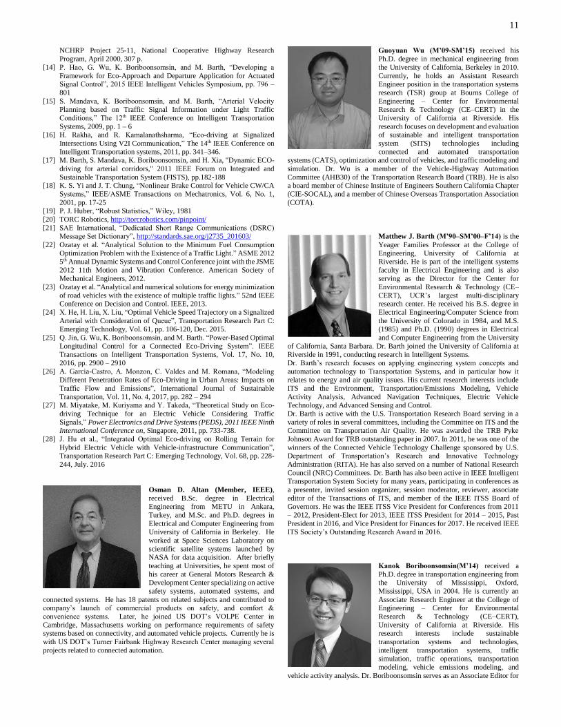
Osman D. Altan (Member, IEEE),
received B.Sc. degree in Electrical Engineering from METU in Ankara,
Turkey, and M.Sc. and Ph.D. degrees in
Electrical and Computer Engineering from University of California in Berkeley. He
worked at Space Sciences Laboratory on
scientific satellite systems launched by NASA for data acquisition. After briefly
teaching at Universities, he spent most of
his career at General Motors Research & Development Center specializing on active
safety systems, automated systems, and
connected systems. He has 18 patents on related subjects and contributed to company’s launch of commercial products on safety, and comfort &
convenience systems. Later, he joined US DOT’s VOLPE Center in
Cambridge, Massachusetts working on performance requirements of safety systems based on connectivity, and automated vehicle projects. Currently he is
with US DOT’s Turner Fairbank Highway Research Center managing several
projects related to connected automation.
Guoyuan Wu (M’09-SM’15) received his Ph.D. degree in mechanical engineering from
the University of California, Berkeley in 2010.
Currently, he holds an Assistant Research Engineer position in the transportation systems
research (TSR) group at Bourns College of
Engineering – Center for Environmental Research & Technology (CE–CERT) in the
University of California at Riverside. His
research focuses on development and evaluation of sustainable and intelligent transportation
system (SITS) technologies including
connected and automated transportation systems (CATS), optimization and control of vehicles, and traffic modeling and
simulation. Dr. Wu is a member of the Vehicle-Highway Automation
Committee (AHB30) of the Transportation Research Board (TRB). He is also a board member of Chinese Institute of Engineers Southern California Chapter
(CIE-SOCAL), and a member of Chinese Overseas Transportation Association
(COTA).
Matthew J. Barth (M’90–SM’00–F’14) is the
Yeager Families Professor at the College of
Engineering, University of California at Riverside. He is part of the intelligent systems
faculty in Electrical Engineering and is also serving as the Director for the Center for
Environmental Research & Technology (CE–
CERT), UCR’s largest multi-disciplinary research center. He received his B.S. degree in
Electrical Engineering/Computer Science from
the University of Colorado in 1984, and M.S. (1985) and Ph.D. (1990) degrees in Electrical
and Computer Engineering from the University
of California, Santa Barbara. Dr. Barth joined the University of California at Riverside in 1991, conducting research in Intelligent Systems.
Dr. Barth’s research focuses on applying engineering system concepts and
automation technology to Transportation Systems, and in particular how it
relates to energy and air quality issues. His current research interests include
ITS and the Environment, Transportation/Emissions Modeling, Vehicle
Activity Analysis, Advanced Navigation Techniques, Electric Vehicle Technology, and Advanced Sensing and Control.
Dr. Barth is active with the U.S. Transportation Research Board serving in a
variety of roles in several committees, including the Committee on ITS and the Committee on Transportation Air Quality. He was awarded the TRB Pyke
Johnson Award for TRB outstanding paper in 2007. In 2011, he was one of the
winners of the Connected Vehicle Technology Challenge sponsored by U.S. Department of Transportation’s Research and Innovative Technology
Administration (RITA). He has also served on a number of National Research
Council (NRC) Committees. Dr. Barth has also been active in IEEE Intelligent Transportation System Society for many years, participating in conferences as
a presenter, invited session organizer, session moderator, reviewer, associate
editor of the Transactions of ITS, and member of the IEEE ITSS Board of Governors. He was the IEEE ITSS Vice President for Conferences from 2011
– 2012, President-Elect for 2013, IEEE ITSS President for 2014 – 2015, Past
President in 2016, and Vice President for Finances for 2017. He received IEEE ITS Society’s Outstanding Research Award in 2016.
Kanok Boriboonsomsin(M’14) received a
Ph.D. degree in transportation engineering from the University of Mississippi, Oxford,
Mississippi, USA in 2004. He is currently an
Associate Research Engineer at the College of Engineering – Center for Environmental
Research & Technology (CE–CERT),
University of California at Riverside. His research interests include sustainable
transportation systems and technologies,
intelligent transportation systems, traffic simulation, traffic operations, transportation
modeling, vehicle emissions modeling, and
vehicle activity analysis. Dr. Boriboonsomsin serves as an Associate Editor for

12
the IEEE Intelligent Transportation Systems Magazine. He is a member of the Transportation and Air Quality Standing Committee of Transportation
Research Board, Institute of Transportation Engineers, and the Intelligent
Transportation Society of America.
John A. Stark is a Chief Software Engineer
at Leidos (formerly SAIC), where he has been employed for 20 years. He has been
working under contract to the FHWA on
various connected and automated vehicle research and development projects since
2014. Prior to that he worked on
development and maintenance of various military systems. Prior to employment with
SAIC he worked for 11 years at McDonnell
Douglas Aerospace in software and mechanical engineering capacities. He
received a BS in Aeronautical Engineering
in 1982 and an MS in Mechanical Engineering in 1984, both from Purdue University, and was a licensed Professional Engineer for 15 years.
View publication statsView publication stats
Related Documents


