Geographical Information System (GIS) Presented By - SUMEET KUMAR PATTANAIK

Welcome message from author
This document is posted to help you gain knowledge. Please leave a comment to let me know what you think about it! Share it to your friends and learn new things together.
Transcript

Geographical Information System (GIS)
Presented By-SUMEET KUMAR PATTANAIK

Objective
What Is GIS? Principle Of GIS. Function Of GIS. Components Of GIS. Type Of GIS. Advantages Of GIS. Applications Of GIS.

“GIS is a computer system capable of assembling, storing, manipulating, and displaying geographically referenced information, i.e. data identified according to their locations.”“A GIS is an organized collection of computer hardware, software, geographic data, and personnel to efficiently capture, store, update, manipulate, analyze, and display all forms of geographically referenced information.”
What is gis ?

Principle:Data Capture
Data sources are mainly obtained from manual digitization and scanning of aerial photographs, paper maps, and existing digital data sets.
Database Management and Updatedata security, data integrity, and data storage and retrieval, and data maintenance abilities
Geographic AnalysisThe collected information is analyzed and interpreted qualitatively and quantitatively.
Preparing ResultOne of the most exciting aspects of GIS technology is the variety of different ways in which the information can be presented.

Functions:Data Capture
The input of data into a GIS can be achieved through many different methods of gathering. For example, aerial photography, scanning, digitizing, GPS or global positioning system is just a few of the ways a GIS user could obtain data.
Data StorageSome data is stored such as a map in a drawer, while others, such as digital data, can be as a hardcopy, stored on CD or on your hard drive.
Data ManipulationThe digital geographical data can be edited, this allows for many attribute to be added, edited, or deleted to the specification of the project.
Query And AnalysisGIS was used widely in decision making process for the new commission districts. We use population data to help establish an equal representation of population to area for each district.
VisualizationThis represents the ability to display your data, your maps, and information.

Data Types :•Vector•Points•Lines•Polygons
•Raster•Cell•Pixels•Elements
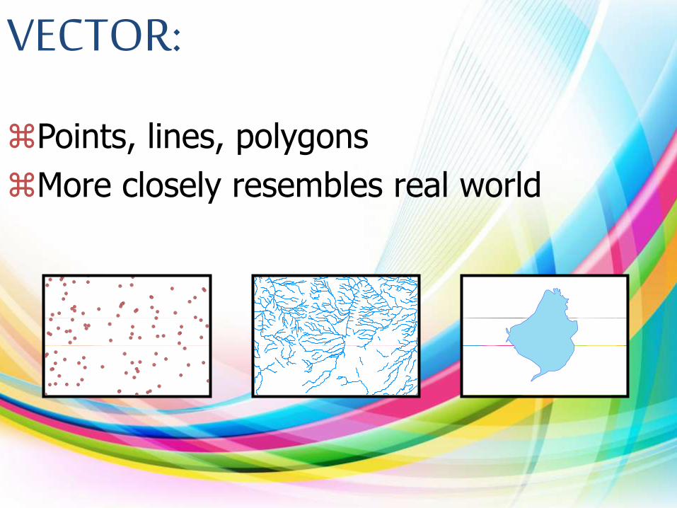
VECTOR:
Points, lines, polygons
More closely resembles real world

Raster•Areas broken into ‘pixels’ or cells•Each cell contains data•Good at representing dense data
•land cover•elevation
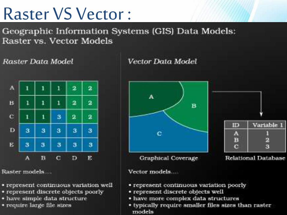
Raster VS Vector :
Advantages (Vector)
•Good Representation of data.•Use small File Size.•Accurate map output.
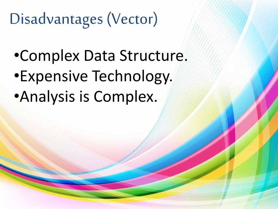
Disadvantages (Vector)
•Complex Data Structure.•Expensive Technology.•Analysis is Complex.
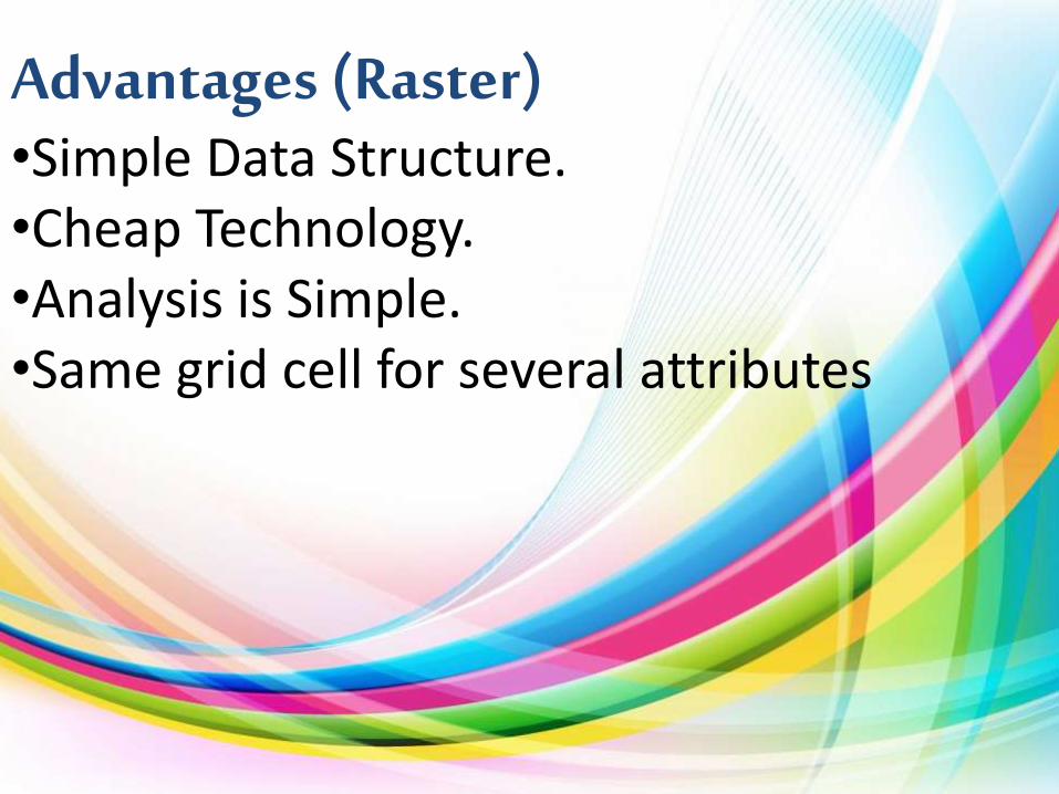
Advantages (Raster)•Simple Data Structure.•Cheap Technology.•Analysis is Simple.•Same grid cell for several attributes

Disadvantages (Raster)
•Large Data Volume.•Inefficient use of computer storage.•Difficult network analysis.•Less accurate or attractive maps.•Loss of information when using large cells.

Advantages of GIS•GIS allows us to view, understand, and visualize data in many ways that reveal relationships, patterns, and trends in the form of maps, globes, reports, and charts.•A GIS helps you answer questions and solve problems by looking at your data in a way that is quickly understood and easily shared.•GIS give the accurate Data.•Better Predictions and Analysis.

Disadvantages of GIS•Excessive damage in case of internal fault. Long outage periods asRepair of damaged part at site may be difficult.•Expensive software.•Integration with traditional map is difficult.

Conclusion•GIS has provided to be a really useful application, its evolution with the changing times has been totally progressive.• With the changes in the latest hardware’s and the software’s GIS will be used for the best of its purposes.

Related Documents