ISO/TC211 Workshop, Stockholm May 30 th 2017 GIS (Geopspatial) /BIM INTEROPERABILITY Erling Onstein, NTNU/geomatics [email protected]

GIS (Geopspatial) /BIM INTEROPERABILITY · GIS (Geopspatial) /BIM INTEROPERABILITY Erling Onstein, NTNU/geomatics [email protected]. 2 Parts 1. Mapping between GIS (General Feature
Feb 17, 2019
Welcome message from author
This document is posted to help you gain knowledge. Please leave a comment to let me know what you think about it! Share it to your friends and learn new things together.
Transcript

ISO/TC211 Workshop, Stockholm May 30th 2017
GIS (Geopspatial) /BIMINTEROPERABILITY
Erling Onstein, NTNU/geomatics

2
Parts1. Mapping between GIS (General Feature Model) and IFC
metamodel, both directions
2. Linking between GIS and BIM. The relationship between feature types in GIS and logical coupling of elements in IFC.
3. Transformation between GIS and BIM coordinates. GIS has a scale factor in their projections, which may give deviations when it comes to high precision data). Focus on user requirements and solutions

3
Start-up comments• Used term: GIS (geomatics) / BIM interoperability
Narrower view:• GIS ( geomatics):
– The ISO/TC211-way of structuring geospatial information– Using UML and information exchange using GML
• BIM– The ISO/TC59 SG13-way, using IFC / IFD / IDM

4
(3b) Mapping between GIS (General Feature Model) and IFC metamodel, both directionsContent• ISO19109 General Feature Model (GFM)• IFC Metamodel (?)• Comparison• Mapping challenges
5
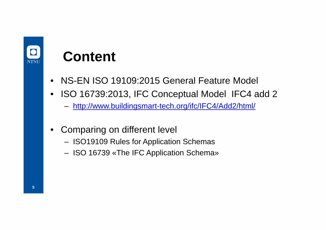
Content• NS-EN ISO 19109:2015 General Feature Model• ISO 16739:2013, IFC Conceptual Model IFC4 add 2
– http://www.buildingsmart-tech.org/ifc/IFC4/Add2/html/
• Comparing on different level– ISO19109 Rules for Application Schemas– ISO 16739 «The IFC Application Schema»
6
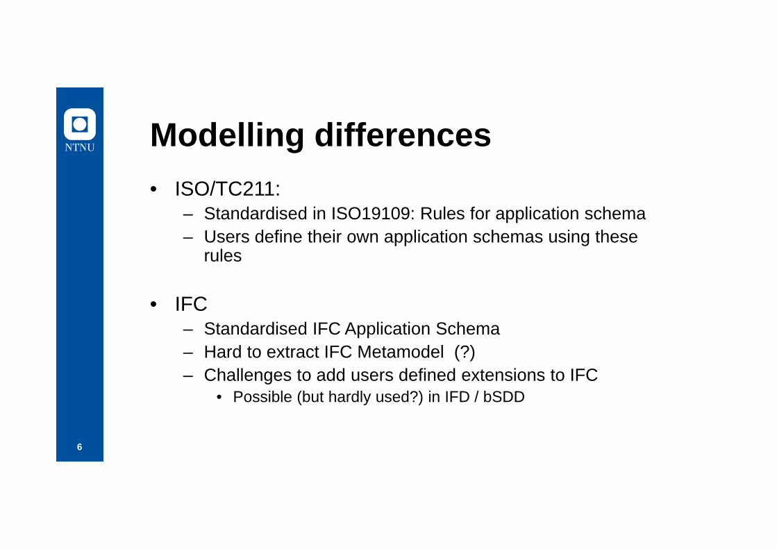
Modelling differences• ISO/TC211:
– Standardised in ISO19109: Rules for application schema– Users define their own application schemas using these
rules
• IFC– Standardised IFC Application Schema– Hard to extract IFC Metamodel (?)– Challenges to add users defined extensions to IFC
• Possible (but hardly used?) in IFD / bSDD

7
Interoperability goal• Representation of selected parts from a geospatial
dataset in an IFC file– Possible use cases: One dataset for all information
needed in a building permit application (the building and its neighbourhood)
• Representation of selected parts from an IFC dataset in a geospatial dataset– Possible use case: Indoor walkway in shopping centres,
hospitals, airports, railway stations, bus stations

8
Interoperability goals (cont…)• Full roundtrip?
– The full content of a geospatial dataset can be represented in a IFC file
– The full content of an IFC dataset can be represented in a geospatial dataset
• SW handling both GIS and BIM data– Standardization needed?
• Probable solutions:– Full roundtrip not needed, no use cases (?)– One-directional, partial solutions will be needed

9
General Feature Model(GFM)

10
GFM Attribute types
11
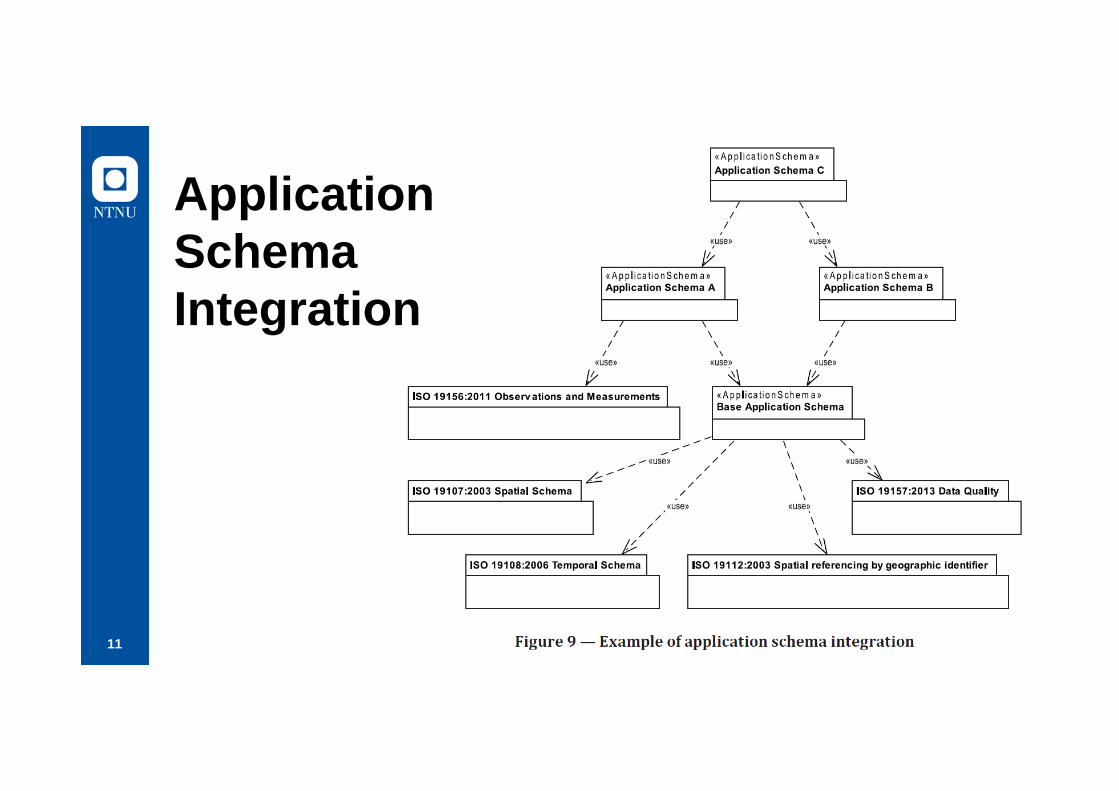
Application Schema Integration
12
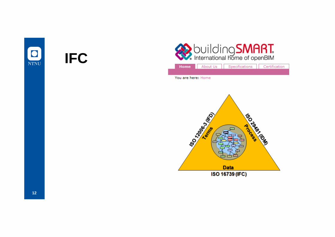
IFC
13
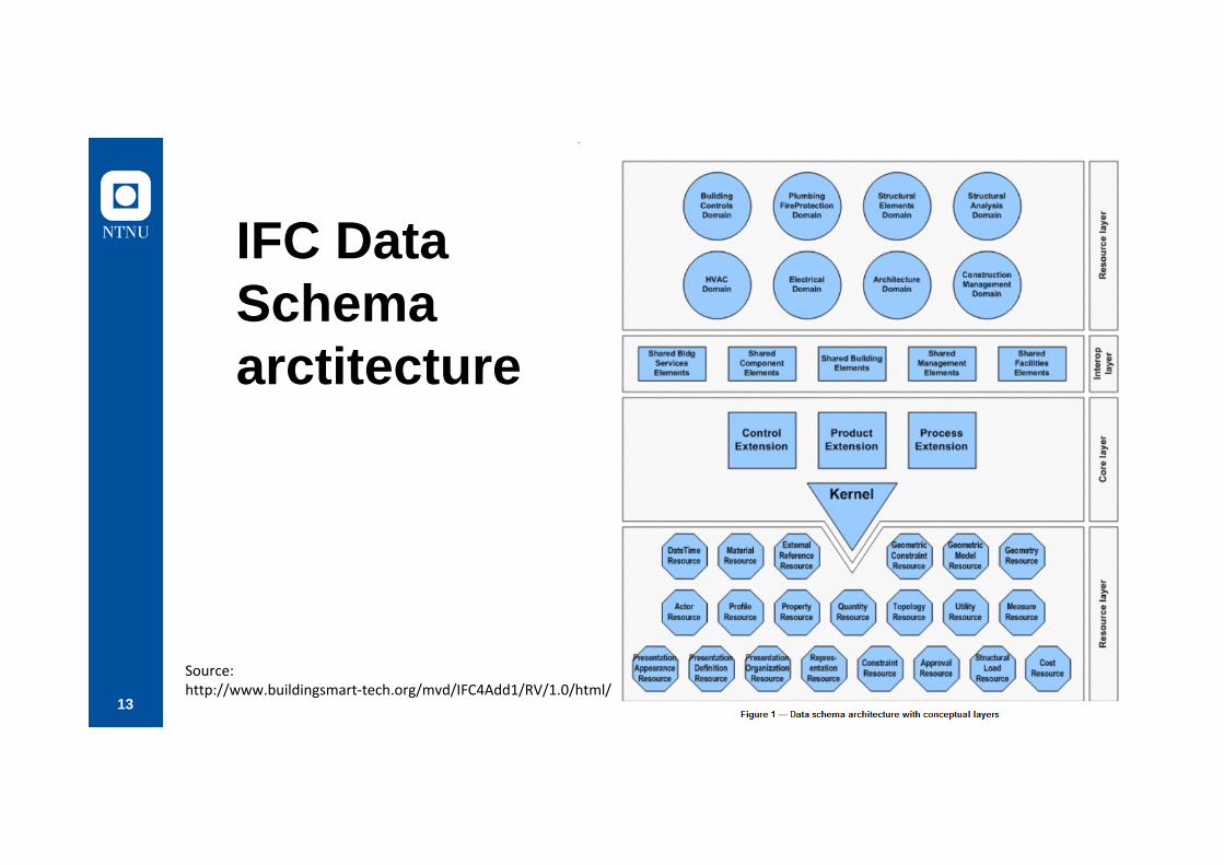
IFC Data Schemaarctitecture
Source: http://www.buildingsmart-tech.org/mvd/IFC4Add1/RV/1.0/html/
14
Identified challenges• Terminology• Modelling languages: UML vs EXPRESS• Associations• Objects and properties• Objects and TypeObjectsFor part 3d (later today):• Spatial Structure Elements• Classifications• Use of the «new» GIS FeatureTypes in IFC4For part 4 (later today)• Location / Global reference systems

TerminologyGFM/UML
• Feature types• Datatypes• Codelists
• UML Classes– Stereotypes– Attributes– Associations
IFC/Express• Root/Object definition/
Object/ Product/Element
• EXPRESS – Types («basic types», codelists/enums)– Entities
• Attributes– Property sets– Quantity sets
NB! UML/Class Attribute = EXPRESS/Entity Attribute

16
IFC Root• EXPRESS G• UML Class

17
EXPRESS example
18
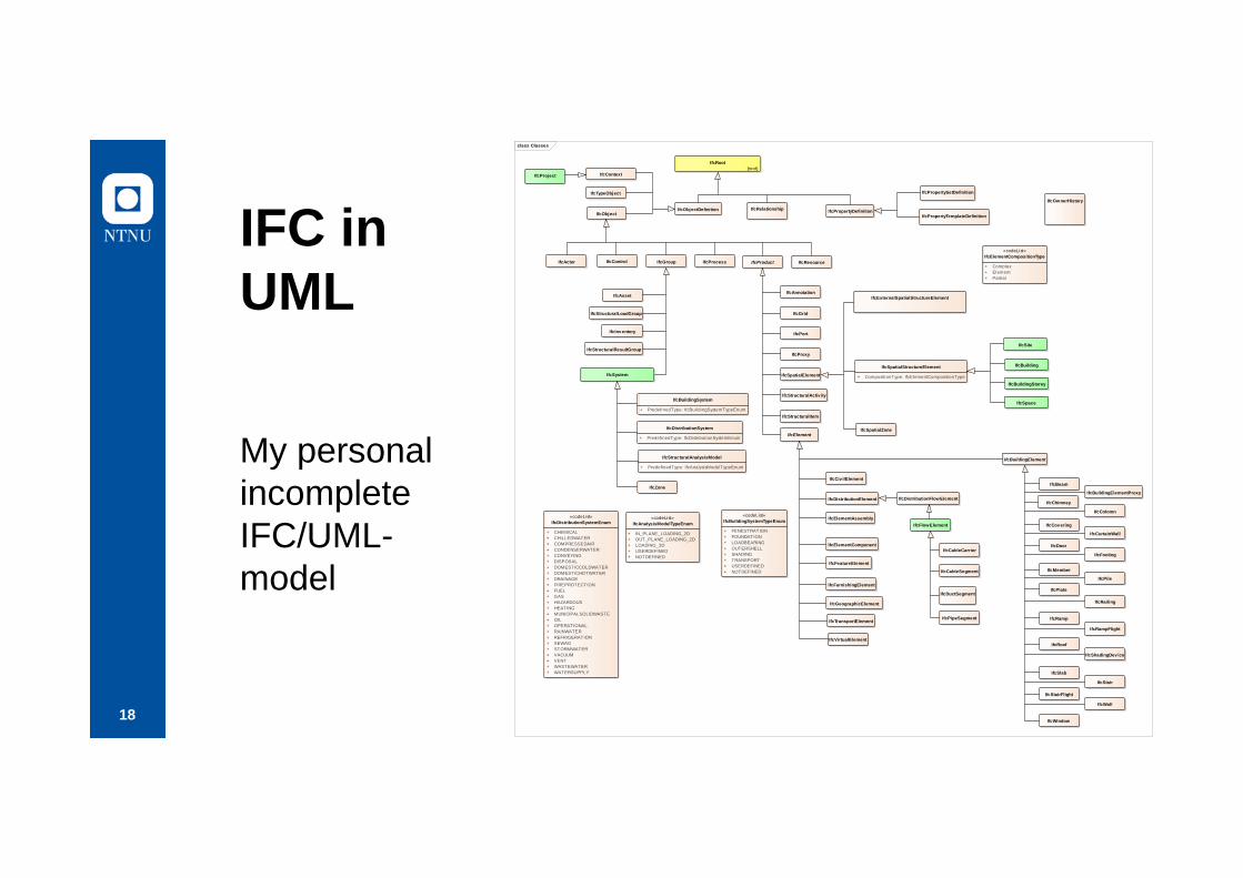
IFC in UML
My personal incomplete IFC/UML-model
class Classes
IfcRoot{root}
IfcObjectDefinitionIfcObject
IfcActor IfcControl IfcGroup IfcProcess IfcProduct IfcResource
IfcAsset
IfcStructuralLoadGroup
IfcSystem
IfcInventory
IfcStructuralResultGroup
IfcElement
IfcBuildingElement
IfcCiv ilElement
IfcDistributionElement
IfcElementAssembly
IfcElementComponent
IfcFeatureElement
IfcFurnishingElement
IfcGeographicElement
IfcTransportElement
IfcVirtualElement
IfcAnnotation
IfcGrid
IfcPort
IfcProxy
IfcSpatialElement
IfcStructuralActiv ity
IfcStructuralItem
IfcExternalSpatialStructureElement
IfcSpatialStructureElement
+ CompositionType: IfcElementCompositionType
IfcSpatialZone
IfcBuilding
IfcBuildingStorey
IfcSite
IfcSpaceIfcBuildingSystem
+ PredefinedType: IfcBuildingSystemTypeEnum
IfcDistributionSystem
+ PredefinedType: IfcDistributionSystemEnum
IfcStructuralAnalysisModel
+ PredefinedType: IfcAnalysisModelTypeEnum
IfcZone
IfcDistributionFlowElement
IfcFlowElement
IfcCableCarrier
IfcCableSegment
IfcDuctSegment
IfcPipeSegment
IfcPropertyDefinitionIfcRelationship
IfcContext
IfcTypeObject
IfcBeam
IfcBuildingElementProxy
IfcChimney
IfcColomn
IfcCovering
IfcCurtainWall
IfcDoor
IfcFooting
IfcMember
IfcPile
IfcPlate
IfcRailing
IfcRamp
IfcRampFlight
IfcRoof
IfcShadingDev ice
IfcSlab
IfcStair
IfcStairFlight
IfcWall
IfcWindow
«codeList»IfcDistributionSystemEnum
+ CHEMICAL+ CHILLEDWATER+ COMPRESSEDAIR+ CONDENSERWATER+ CONVEYING+ DISPOSAL+ DOMESTICCOLDWATER+ DOMESTICHOTWATER+ DRAINAGE+ FIREPROTECTION+ FUEL+ GAS+ HAZARDOUS+ HEATING+ MUNICIPALSOLIDWASTE+ OIL+ OPERATIONAL+ RAINWATER+ REFRIGERATION+ SEWAG+ STORMWATER+ VACUUM+ VENT+ WASTEWATER+ WATERSUPPLY
IfcProject
«codeList»IfcAnalysisModelTypeEnum
+ IN_PLANE_LOADING_2D+ OUT_PLANE_LOADING_2D+ LOADING_3D+ USERDEFINED+ NOTDEFINED
«codeList»IfcBuildingSystemTypeEnum
+ FENESTRATION+ FOUNDATION+ LOADBEARING+ OUTERSHELL+ SHADING+ TRANSPORT+ USERDEFINED+ NOTDEFINED
IfcOwnerHistory
«codeList»IfcElementCompositionType
+ Complex+ Element+ Partial
IfcPropertySetDefinition
IfcPropertyTemplateDefinition

19
Associations / Relationships
class RelDefines
IfcRelationshipIfcRelDefines
IfcRelDefinesByObject
IfcRelDefinesByProperties
IfcRelDefinesByTemplate
IfcRelDefinesByType
IFC
GFM
20
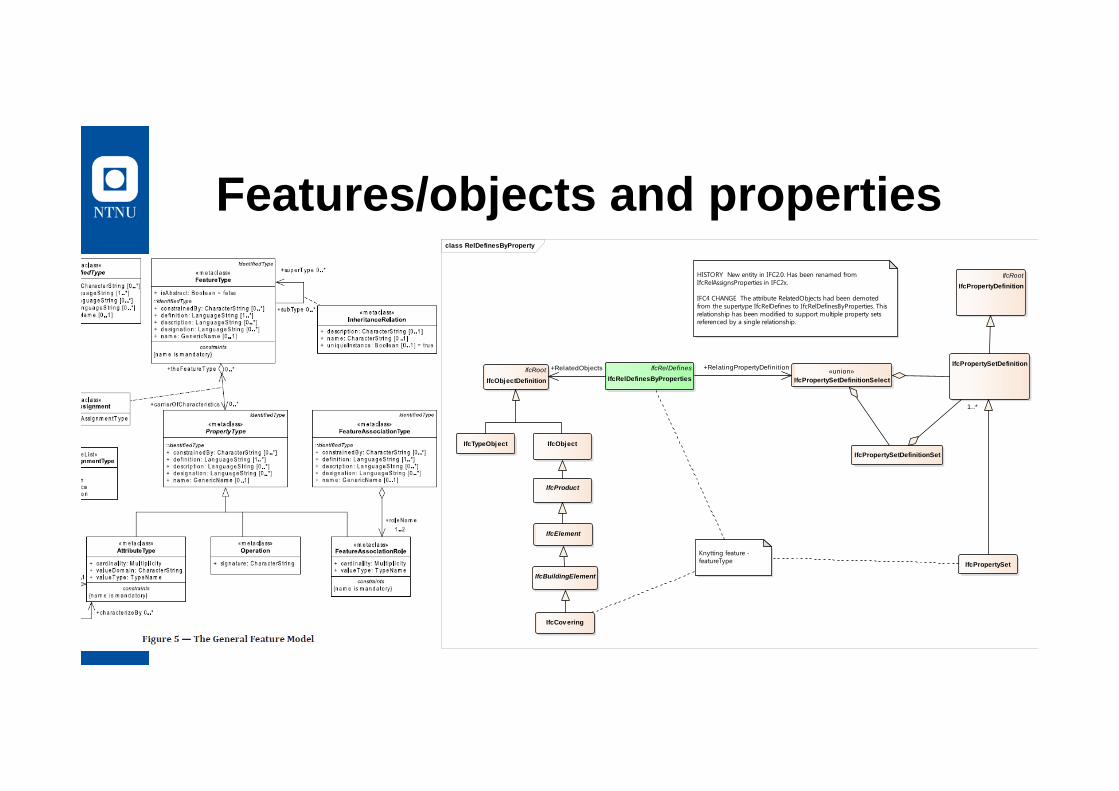
Features/objects and propertiesclass RelDefinesByProperty
IfcObject
IfcProduct
IfcElement
IfcBuildingElement
IfcCovering
Knytting feature - featureType
IfcRelDefinesIfcRelDefinesByProperties
IfcRootIfcObjectDefinition
IfcPropertySetDefinition
IfcRootIfcPropertyDefinition
«union»IfcPropertySetDefinitionSelect
HISTORY New entity in IFC2.0. Has been renamed from IfcRelAssignsProperties in IFC2x.
IFC4 CHANGE The attribute RelatedObjects had been demoted from the supertype IfcRelDefines to IfcRelDefinesByProperties. This relationship has been modified to support multiple property sets referenced by a single relationship.
IfcPropertySetDefinitionSet
IfcPropertySet
IfcTypeObject
+RelatingPropertyDefinition
1..*
+RelatedObjects
21

22
Objects and TypeObjects
TypeObjects not used in GFM

23
Differences• IFC/TypeObjects do not exist in GFM
– Solution needed if IFC data using this option is to be represented in a geospatial dataset
• Looser connection between features/elements and properties in IFC than in GFM.– Solution needed for all interoperability
24
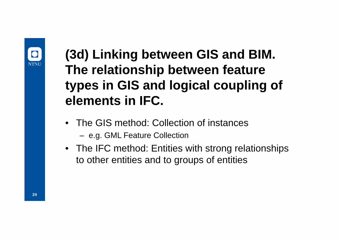
(3d) Linking between GIS and BIM. The relationship between feature types in GIS and logical coupling of elements in IFC. • The GIS method: Collection of instances
– e.g. GML Feature Collection
• The IFC method: Entities with strong relationships to other entities and to groups of entities

25
Content• Spatial Structure Elements• Classifications• Use of the «new» GIS FeatureTypes in IFC4• Needed harmonisation
26
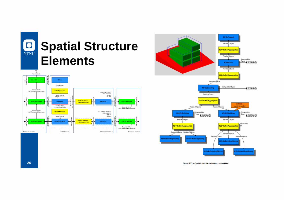
Spatial StructureElements
27
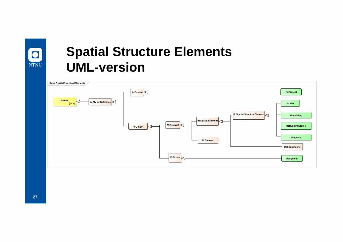
Spatial Structure ElementsUML-version
class SpatialStructureElements
IfcBuilding
IfcBuildingStorey
IfcSpace
IfcProject
IfcSystem
IfcSpatialZone
IfcSpatialStructureElement
IfcSpatialElement
IfcGroup
IfcProductIfcObject
IfcContext
IfcObjectDefinitionIfcRoot
{root} IfcSite
IfcElement

28
IFC Group and IfcSystemclass FileStructure
IfcSpace
IfcSiteIfcProject IfcBuildingStoreyIfcSpatialZone
IfcSpatialStructureElement
IfcExternalSpatialStructure Element
IfcSpatialElement
IfcGroup
IfcProduct
IfcObject
IfcSystem
IfcObjectDefinition
IfcContext
IfcRoot{root}
IfcZone
IfcBuilding

29
On use of IfcSystem• IfcSystem important for simulations
– Capacity in distribution systems– Structural Analysis models
• Doubtful if there are any GIS Usecases for this?– Possible: Indoor transport system e.g. in hospitals and
shopping centres

30
IfcClassificationAn IfcClassification is used for the arrangement of objects into a class or category according to a common purpose or their possession of common characteristics. A classification in the sense of IfcClassification is taxonomy, or taxonomic scheme, arranged in a hierarchical structure. A category of objects relates to other categories in a generalization-specialization relationship. Therefore the classification items in an classification are organized in a tree structure.
The IfcClassification identifies the classification system or source to which a classification reference refers to. Each classification reference may reference an instance of IfcClassification. A classification system declared may be either formally published, or it may be a locally defined method of classifiying information.
NOTE Examples for such formally published classifications are Omniclass, Uniclass, Masterformat, or DIN277.

31
Example of Norwegian Classifications

32
Classificationsclass Classification
IfcClassification
+ Source: IfcLabel [0..1]+ Edition: IfcLabel [0..1]+ EditionDate: IfcDate [0..1]+ Name: IfcLabel+ Description: IfcText [0..1]+ Location: IfcLabel+ ReferenceTokens: IfcIdentifier [0..*]
IfcExternalInformation{root}
IfcDocumentInformation IfcLibraryInformationIfcClassificationReference
+ ReferencedSource: IfCClassificationReferenceSelect+ Description: IfcText+ Sort: IfcIdentifier
IfcExternalReference{root}
+ Location: IfcURIReference+ Identifier: IfcIdentifier+ name: IfcLabel
«select»IfcClassificationReferenceSelect
IfcRelAssociatesClassification
+ RelatingClassification: IfcClassificationSelect::IfcRelAssociates+ RelatedObjects: IfcDefinitionSelect::IfcRoot+ GlobalId: IfcGloballyUniqueId+ OwnerHistory: IfcOwnerHistory [0..1]+ Name: IfcLabel [0..1]+ Description: IfcText [0..1]
Relationship::IfcRelAssociates
+ RelatedObjects: IfcDefinitionSelect
«select»IfcDefinitionSelect
IfcObjectDefinition IfcPropertyDefinition
«select»IfcClassificationSelect
Relationship::IfcRelationship
IfcRoot{root}
+ GlobalId: IfcGloballyUniqueId+ OwnerHistory: IfcOwnerHistory [0..1]+ Name: IfcLabel [0..1]+ Description: IfcText [0..1]
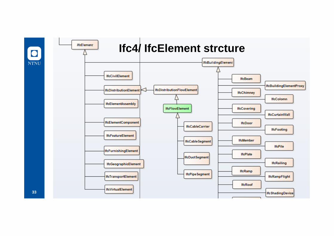
33
Ifc4/ IfcElement strcture

34
IFC4 Elements for «GIS FeatureTypes»?• IfcGeographicElement:
– An IfcGeographicElement is a generalization of all elements within a geographical landscape. It includes occurrences of typical geographical elements, often referred to as features, such as trees or terrain. Common type information behind several occurrences of IfcGeographicElement is provided by the IfcGeographicElementType.
• IfcCivilElement– An IfcCivilElement is a generalization of all elements within a civil engineering
works. It includes in particular all occurrences of typical linear construction works, such as road segments, bridge segments, pavements, etc.
– Depending on the context of the construction project, included building work, • such as buildings or factories, are represented as a collection of IfcBuildingElement's,
distribution systems, • such as piping or drainage, are represented as a collection of IfcDistributionElement's,
and • other geographic elements, such as trees, light posts, traffic signs etc. are represented
as IfcGeographicElement's.
What about the properties/attributes?
35
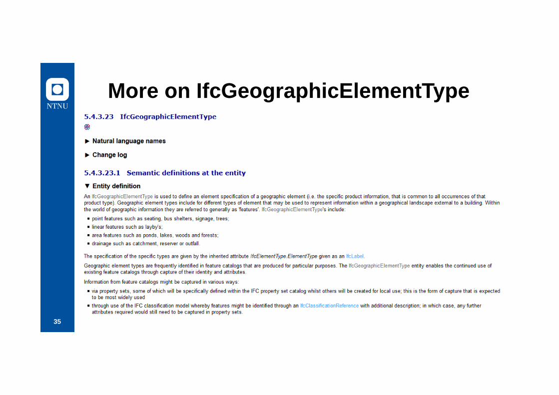
More on IfcGeographicElementType

36
Connection IFC/Classification – GFM/Application Schema
37
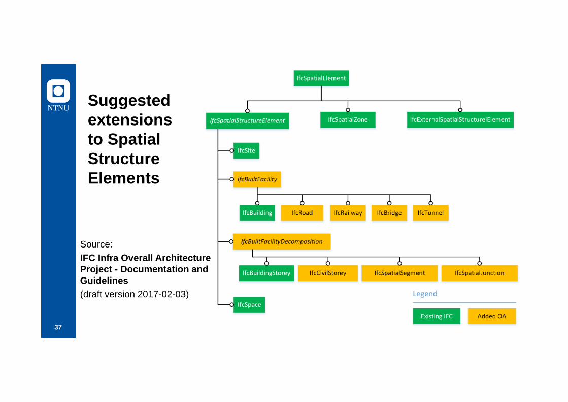
Suggested extensionsto Spatial StructureElements
Source: IFC Infra Overall Architecture Project - Documentation and Guidelines (draft version 2017-02-03)
38
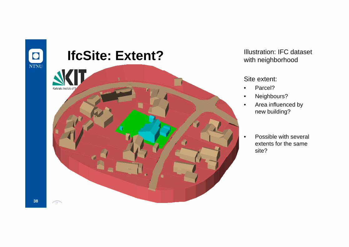
IfcSite: Extent? Illustration: IFC datasetwith neighborhood
Site extent:• Parcel?• Neighbours?• Area influenced by
new building?
• Possible with severalextents for the same site?

39
Standardisation challenges• Dataset cannot be transferred back and forth between
IFC and GFM without overcoming severe challenges– Probably no use cases with need for this (?)
To be solved:• Differences in connections between features and
properties• Representation of GFM User Application schemas in
IFC– Using IFC/Classification seems reasonable, unclear how

40
(4) Transformation between GIS and BIM coordinates.
GIS has a scale factor in their projections, which may give deviations when it comes to high precision data). Focus on user requirements and solutions
Content:• Geomatics and the challenge of flattening the earth surface• IFC and Cartesian coordinate systems• Challenges and possible solutions
41
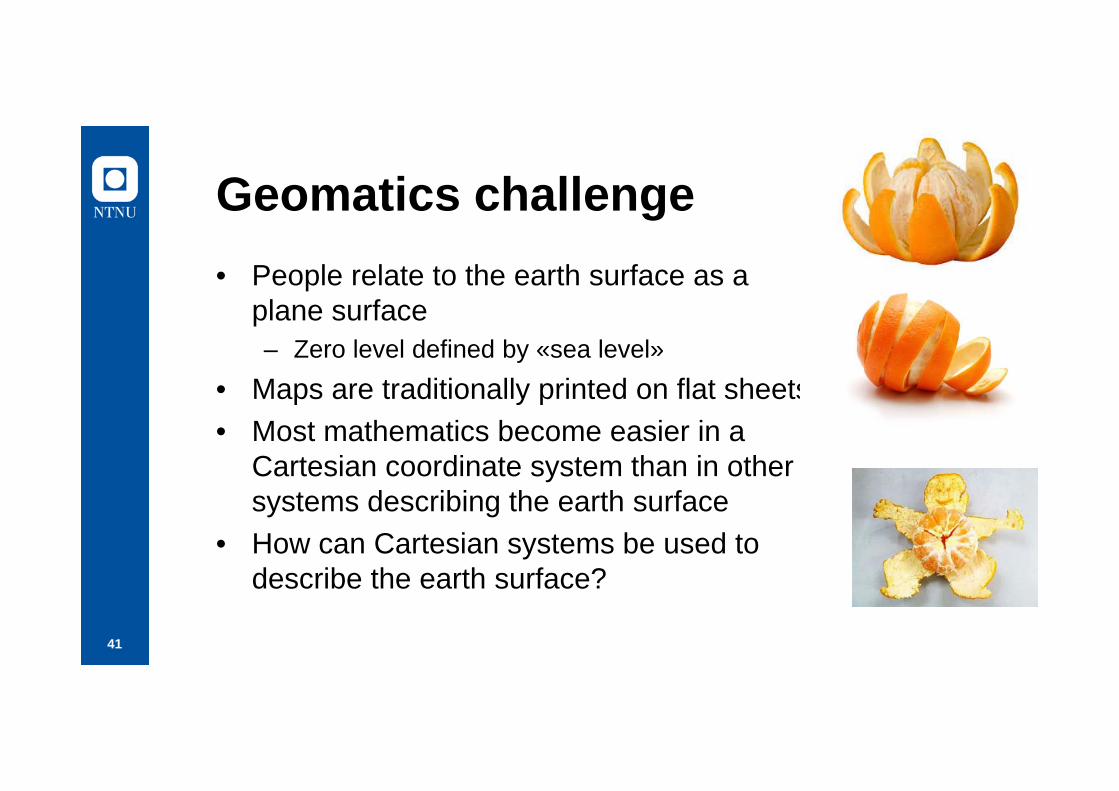
Geomatics challenge• People relate to the earth surface as a
plane surface– Zero level defined by «sea level»
• Maps are traditionally printed on flat sheets• Most mathematics become easier in a
Cartesian coordinate system than in other systems describing the earth surface
• How can Cartesian systems be used to describe the earth surface?
42
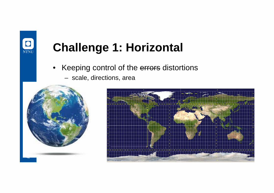
Challenge 1: Horizontal• Keeping control of the errors distortions
– scale, directions, area
43
Scale distortion• UTM (Universal)
– Acceptable with 400ppm distortion, equals 4cm pr 100m– Not acceptable for building and construction
• Local coordinate systems with less distortion– Norway: NTM– Max 11 ppm, equals 1,1mm pr 100m– Cost:
• not only 3 UTM zones for Norway, but 25 NTM zones
44
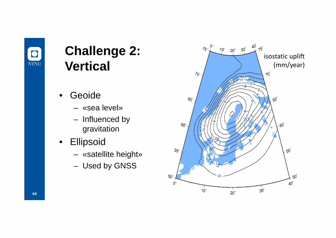
Challenge 2: Vertical
• Geoide– «sea level»– Influenced by
gravitation
• Ellipsoid– «satellite height»– Used by GNSS
isostatic uplift(mm/year)

45
ISO 19111:2007
Geographic information –Spatial referencing by coordinates

46
Datums and coordinate reference systems
Source: ISO 19111:2007
47
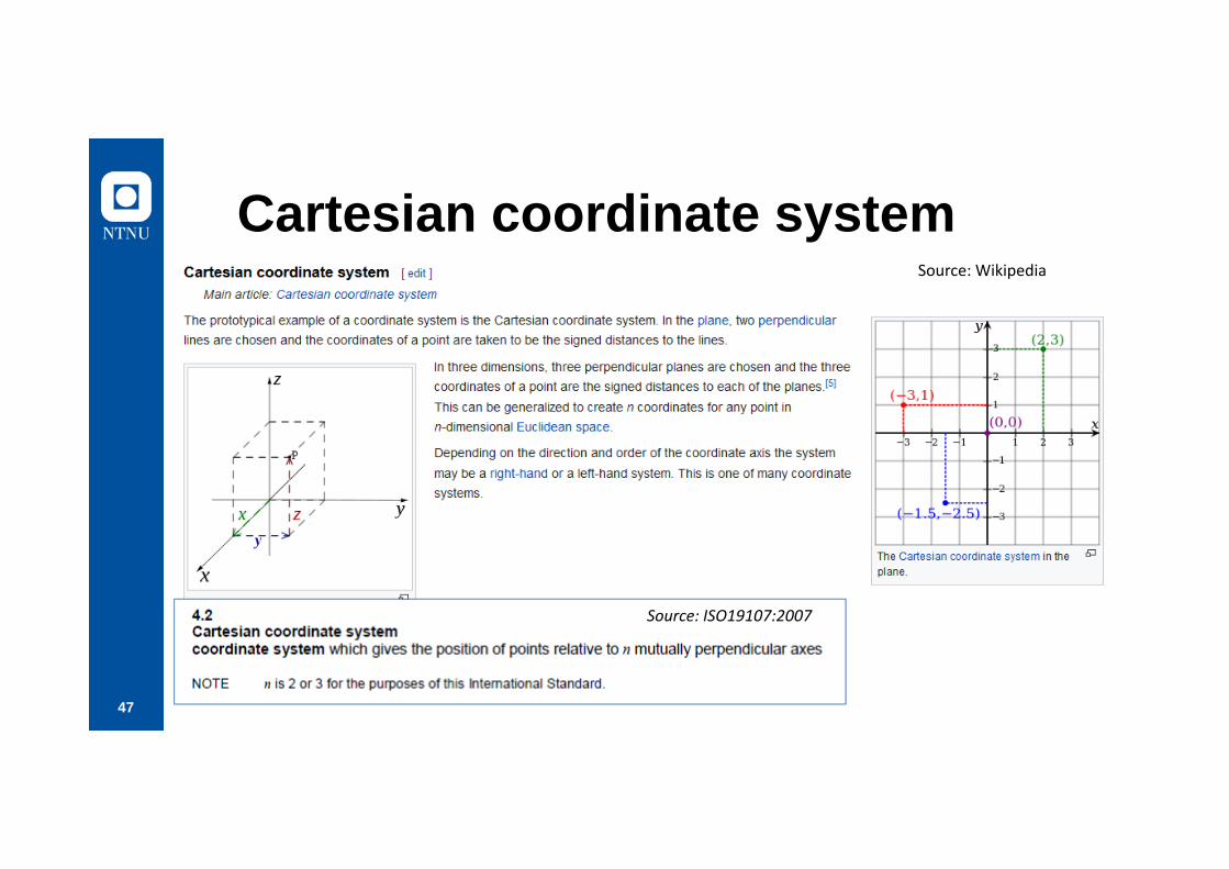
Cartesian coordinate systemSource: Wikipedia
Source: ISO19107:2007
48
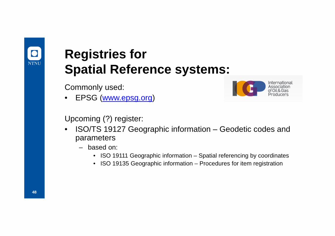
Registries for Spatial Reference systems:Commonly used:• EPSG (www.epsg.org)
Upcoming (?) register:• ISO/TS 19127 Geographic information – Geodetic codes and
parameters– based on:
• ISO 19111 Geographic information – Spatial referencing by coordinates • ISO 19135 Geographic information – Procedures for item registration
49
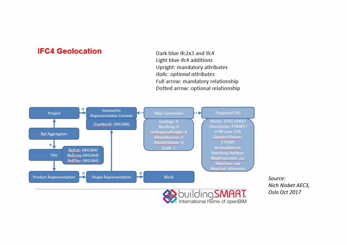
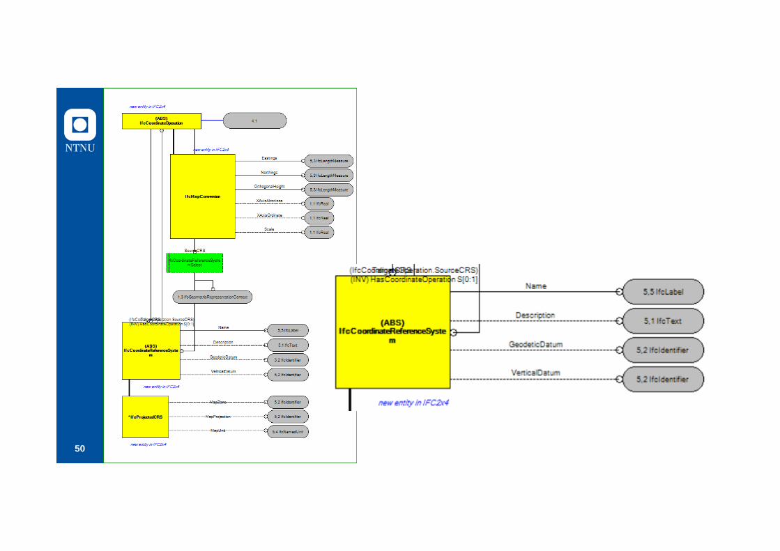
IFC and Coordinatereference systems
Source: Nich Nisbet AEC3, Oslo Oct 2017
50

51

52

53
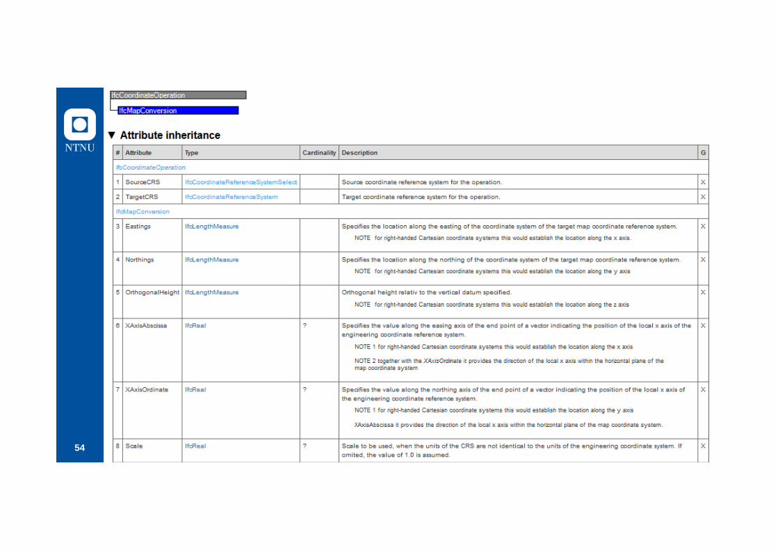
54

55
Location
class GFM
FeatureType
PropertyType
AttributeType
SpatialAttributeType LocationAttributeType
Geometry Topology Gazetteer

56
Use of coordinates in IFCDescription of «The world coordinatesystem» common for the whole IFC file
57
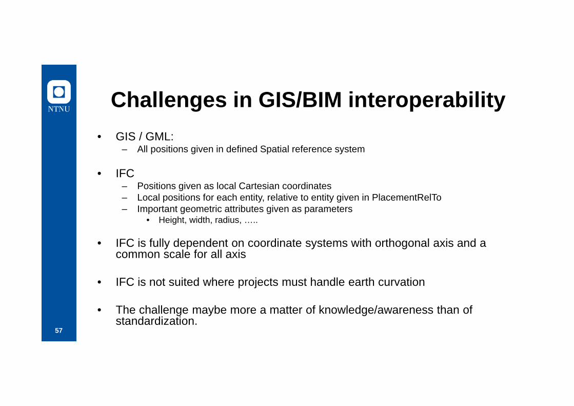
Challenges in GIS/BIM interoperability• GIS / GML:
– All positions given in defined Spatial reference system
• IFC– Positions given as local Cartesian coordinates– Local positions for each entity, relative to entity given in PlacementRelTo– Important geometric attributes given as parameters
• Height, width, radius, …..
• IFC is fully dependent on coordinate systems with orthogonal axis and a common scale for all axis
• IFC is not suited where projects must handle earth curvation
• The challenge maybe more a matter of knowledge/awareness than of standardization.
Related Documents