The Magazine of the National Intelligence Community Experience Enhancer Justin Poole Director Xperience Directorate NGA Army Geospatial Enterprise O Marine Corps Intelligence O Mobile Apps Susan White O NGA Procurement O Terrain Analysis October/November 2015 Volume 13, Issue 7 www.GIF-kmi.com

Welcome message from author
This document is posted to help you gain knowledge. Please leave a comment to let me know what you think about it! Share it to your friends and learn new things together.
Transcript

The Magazine of the National Intelligence Community
Experience Enhancer
Justin PooleDirectorXperience DirectorateNGA
Army Geospatial Enterprise O Marine Corps Intelligence O Mobile AppsSusan White O NGA Procurement O Terrain Analysis
October/November 2015 Volume 13, Issue 7
www.GIF-kmi.com
www.ballaerospace.com
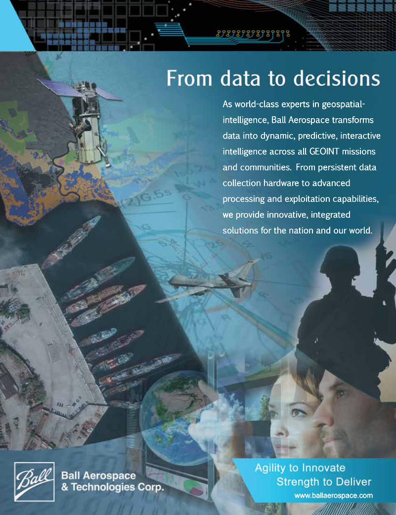
As world-class experts in geospatial-
intelligence, Ball Aerospace transforms
data into dynamic, predictive, interactive
intelligence across all GEOINT missions
and communities. From persistent data
collection hardware to advanced
processing and exploitation capabilities,
wewe provide innovative, integrated
solutions for the nation and our world.
Cover / Q&AFeatures
Justin PooleDirector
Xperience DirectorateNational Geospatial-Intelligence
Agency
16
Departments Industry Interview2 editor’s PersPective3 Program notes5 PeoPle14 industry raster27 resource center
matthew mcnabbCo-founder and CEOFirst Mile GEO
October/November 2015Volume 13, Issue 7INTELLIGENCE & GEOSPATIAL FORUM
12intelligence marineIn a recent interview, Major General Michael S. Groen, director of intelligence for the Marine Corps, offered this perspective: “At its heart, the Marine Corps ISR Enterprise is an enterprise of people, not things. I want an enterprise of intelligence professionals certified in their craft and following a pathway of continuous training and application.”
21streamlining nga ProcurementSusan Gordon, deputy director of NGA, recently announced a new initiative aimed at developing a streamlined and more efficient acquisition system. Her open letter to the workforce is reprinted here.
24army builds geosPatial FoundationImagine the confusion in a tactical operations center where Army systems attempt to provide a common operating picture using maps with different sources, currency, accuracy and scales. An integrated system of technologies, standards and processes, however, will deliver standard and shareable information.By Dan Visione
26coherence strategistIn her recently re-created post as chief of staff of the Defense Intelligence Agency, Suzanne White has focused on what she calls “strategic coherence”: coalescing efforts in strategy, policy, resources, communications and performance management across all agency functions.
28
“NGA is a major producer and consumer of geospatial
information, but geospatial
information and location-based
data are no longer just the domain of the geospatial experts. GEOINT
Services will empower all of our customers—from
soldiers at the tip of the spear to intelligence analysts inside the Beltway—to leverage
the intelligence and contextual
power of GEOINT content.”
— Justin Poole
100% Dedicated to the Mission of the U.S. Intelligence Community
Now in our 13TH year!
7data caPture drives mobile aPPsMobile devices today are equipped not only with GPS, but also cameras and other sensors that can collect data that can be geo-referenced by the device’s on-board capabilities.By Peter BuxBaum
236drone analyticsMany defense and intelligence situations present big data scenarios these days. It has come to the point where it is no longer necessary to speak of big data problems, at least to the extent that the building blocks of solutions—distributed computing, cloud infrastructures and storage strategies—are in hand and well-known.By Peter BuxBaum
leveraging commercial PersistenceNGA has announced a commercial GEOINT strategy that outlines the agency’s plans to deliver commercial geospatial intelligence products.
At the recent Kalaris Intelligence Conference sponsored by the National Geospatial-Intelligence Agency and the Center for Security Studies at Georgetown University, Marine Corps Lieutenant General Vincent Stewart, director of the Defense Intelligence Agency (DIA), was asked about a recent controversy involving alleged pressure from above on intelligence analysts to provide more optimistic findings.
Citing an ongoing investigation by the Department of Defense Inspector General, Stewart declined to discuss specifics, although he did take the occasion to blast media coverage of developments.
What really grabbed my attention, however, were Stewart’s insights into and defense of the intelligence analysis process.
“We’ve got professionals in the business, who take it very seriously, and try to provide objective, unvarnished truth about what they see as they look at a host of information—some credible and some suspect,” he said. “They debate what they think is going on as they put the pieces together. You hope that it will be crystal clear and have 57 different sources. But most of the time it is completely unclear. So you have a debate within analytic circles about what you have and what it really means.
“There’s a lot of judgment involved, and what really disturbs me as this plays out in the news is that we are putting names out there and impacting people’s careers without understanding that the process is not clean and scientific, and they are doing every thing in their power to provide the unvarnished truth,” Stewart continued.
“Debate and different views go on everyday. When my analysts brief me on a topic, I question everything they present. That questioning could be interpreted that I am trying to get them to change their views. But the reality is that it is a dialectic—we’re debating issues that are not as clear as one plus one. If we discover that someone has changed the assessment, we’ll learn from that and strengthen our rigor,” he said.
“This isn’t new to DIA, but it is what the IC does. We hope we’re learning and doing things better every time,” Stewart concluded.
Harrison DonnellyeDitor
EDITOR’S PERSPECTIVE
The Magazine of the National Intelligence Community
editorialManaging EditorHarrison Donnelly [email protected]
Copy EditorsJonathan magin [email protected]
CorrespondentsPeter A. Buxbaum • Cheryl Gerber William Murray • Karen E. Thuermer
art & designAds & Materials ManagerJittima saiwongnuan [email protected]
Senior Graphic Designerscott morris [email protected]
advertisingAssociate Publisherscott Parker [email protected]
Kmi media groupChief Executive OfficerJack Kerrigan [email protected]
Publisher and Chief Financial OfficerConstance Kerrigan [email protected]
Editor-In-ChiefJeff McKaughan [email protected]
ControllerGigi Castro [email protected]
Trade Show CoordinatorHolly Foster [email protected]
operations, circulation & ProductionOperations AdministratorBob Lesser [email protected]
Circulation & Marketing AdministratorDuane ebanks [email protected]
subscription information
Intelligence & Geospatial Forum
issn 2150-9468is published eight times a year by KMI Media Group.
all rights reserved. reproduction without permission is strictly forbidden. © Copyright 2015.
Intelligence & Geospatial Forum is free to qualified members of the u.s. military, employees of the u.s. gov-ernment and non-u.s. foreign service based in the u.s.
All others: $75 per year.Foreign: $159 per year.
corporate officesKMI Media Group
15800 Crabbs Branch Way, Suite 300Rockville, MD 20855-2604 USA
Telephone: (301) 670-5700Fax: (301) 670-5701
Web: www.GIF-kmi.com
Intelligence & Geospatial Forum
Volume 13, Issue 7 • Oct./Nov. 2015
Senior Airman Jose pulls a set of chalks while escorting an RQ-4 Global Hawk back to a hangar during ground operations at an undisclosed location in Southwest Asia September 18, 2015. [Photo courtesy of U.S. Air Force/by Tech. Sgt. Christopher Boitz]
www.GIF-kmi.com IGF 1 3 .7 | 3
PROGRAM NOTES Compiled by KMI Media Group staff
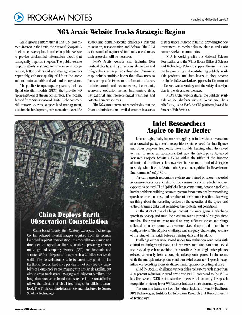
China-based Twenty-First Century Aerospace Technology Co. has released in-orbit images acquired from its recently launched TripleSat Constellation. The constellation, comprising three identical optical satellites, is capable of providing 1-meter native ground sampling distance (GSD) panchromatic and 4-meter GSD multispectral images with a 24-kilometer swath width. The constellation is able to target any point on the Earth’s surface at least once per day. It not only has the capa-bility of along-track stereo imaging with any single satellite, but also to cross-track stereo imaging with adjacent satellites. The large data storage on board each satellite in the constellation allows the selection of cloud-free images for efficient down-load. The TripleSat Constellation was manufactured by Surrey Satellite Technology.
NGA Arctic Website Tracks Strategic RegionAmid growing international and U.S. govern-
ment interest in the Arctic, the National Geospatial-Intelligence Agency has launched a public website to provide unclassified information about that strategically important region. The public website supports efforts to strengthen international coop-eration, better understand and manage resources responsibly, enhance quality of life in the Arctic and maintain valuable and vulnerable ecosystems.
The public site, nga.maps.arcgis.com, includes digital elevation models (DEM) that provide 3-D representations of the Arctic’s surface. The models, derived from NGA-sponsored DigitalGlobe commer-cial imagery sources, support land management, sustainable development, safe recreation, scientific
studies and domain-specific challenges inherent to aviation, transportation and defense. The DEM is the standard against which landscape changes such as erosion will be measured.
NGA’s Arctic website also includes NGA nautical charts, sailing directions, shape files and infographics. A large, downloadable Pan-Arctic map includes multiple layers that allow users to focus on specific issues and information. Layers include search and rescue zones, ice extents, economic exclusion zones, bathymetric data, navigational and meteorological warnings and potential energy sources.
The NGA announcement came the day that the Obama administration unveiled another in a series
of steps under its Arctic initiative, providing for new investments to combat climate change and assist remote Alaskan communities.
NGA is working with the National Science Foundation and the White House Office of Science and Technology Policy to support the Arctic initia-tive by producing and contributing publicly avail-able products and data layers as they become available. NGA’s work also supports the Department of Defense Arctic Strategy and the safety of naviga-tion in the air and on the seas.
NGA’s Arctic website shares the publicly avail-able online platform with its Nepal and Ebola relief sites, using Esri’s ArcGIS platform, hosted by Amazon Web Services.
Like an aging baby boomer struggling to follow the conversation at a crowded party, speech recognition systems used for intelligence and other purposes frequently have trouble hearing what they need to hear in noisy environments. But now the Intelligence Advanced Research Projects Activity (IARPA) within the Office of the Director of National Intelligence has awarded four teams a total of $110,000 to study what it calls “Automatic Speech recognition in Reverberant Environments” (ASpIRE).
Typically, speech recognition systems are trained on speech recorded in environments very similar to the environments in which they are expected to be used. The ASpIRE challenge contestants, however, tackled a harder problem: building accurate systems for automatically transcribing speech recorded in noisy and reverberant environments without knowing anything about the recording devices or the acoustics of the space, and without training data that resembled the contest’s test conditions.
At the start of the challenge, contestants were given a telephone speech to develop and train their systems over a period of roughly three months. Their systems were tested on very different speech recordings collected in noisy rooms with various sizes, shapes and microphone configurations. The ASpIRE challenge was uniquely challenging because of this kind of mismatch between training data and test data.
Challenge entries were scored under two evaluation conditions with equivalent background noise and reverberation. One condition tested accuracy of speech recognition on recordings from single microphones selected arbitrarily from among six microphones placed in the room, while the multiple microphone condition tested accuracy of speech recog-nition on recordings from six different microphones recording at once.
All of the ASpIRE challenge winners delivered systems with more than a 50-percent reduction in word error rate (WER) compared to the IARPA baseline system. WER is the standard measure of accuracy for speech recognition systems; lower WER scores indicate more accurate systems.
The winning teams are from the Johns Hopkins University, Raytheon BBN Technologies, Institute for Infocomm Research and Brno University of Technology.
China Deploys Earth Observation Constellation
Intel Researchers Aspire to Hear Better

www.GIF-kmi.com4 | IGF 1 3 .7
PROGRAM NOTES
Lockheed Martin has unveiled a new capability that will allow users to detect and counter emerging threats from unmanned aerial systems. The solution, Icarus, was designed to operate defensively in various threat environments.
“The U.S. government is seeing an increase in the use of commercially available UAS platforms for surveillance and weapon-ization,” said Deon Viergutz, vice president of cyber solutions for Lockheed Martin. “What Lockheed Martin has developed in Icarus is a system that can detect, recognize and coun-teract these systems with pinpoint accuracy.”
Lockheed Martin’s counter-UAS system has been field-tested and demonstrated to several domestic and international customers over the past year. Those tests demonstrated the ability of Icarus to identify and intercept commercially available UASs.
The development of the Icarus software system draws on Lockheed Martin’s history of innovations in electronic warfare, cyber-security and countermeasures associated with sophisticated threats. It was developed through Lockheed Martin internal investment and combines advanced cyber and cyber-elec-tromagnetic activity experience with sensor technology and non-kinetic techniques.
Leidos, a national security, health and engineering solutions company, and Boundless, a provider of open-source geospatial software and services, have entered into a strategic relationship to collabo-rate on cybersecurity and geospa-tial solutions. Leidos and Boundless will collaborate on joint business development efforts to market and identify opportunities.
Boundless will provide Leidos with open-source geospatial soft-ware development and expertise in support of integration efforts addressing U.S. government secu-rity and intelligence initiatives, as well as support for geospatial
systems running on the OpenGeo Suite, including GeoServer, PostGIS, OpenLayers and QGIS. Leidos will align the open-source OpenGeo Suite to its strategic initiatives to update expensive, complicated proprietary systems with cost-effective, extensible and open-source solutions.
The agreement will allow Leidos to leverage Boundless’ open-source channels to optimize DigitalEdge, a platform that integrates ETL (extract, transform and load), real-time processing and big data stores into a high-performance analytic system.
“The strategic relationship with Boundless represents an extension
of our commitment to developing open-source-based solutions for our customers,” said Leidos Group President, Sam Gordy. “This collab-oration solidifies our position as a leading-edge, open-architecture technology and systems integrator, and is consistent with our open-source strategy for both contributing to and developing solutions around open-source software.”
Michael Leiter, Leidos executive vice president of business develop-ment and strategy, commented, “The Leidos-Boundless strategic relation-ship exemplifies our commitment to partnerships with cutting-edge technology companies—especially
those who are committed to using open-source technology—across national security, health and engi-neering. Partnering to combine our technical talents and customer rela-tionships, along with Leidos’ 40+ years of experiences in these fields, is a win-win for our companies and our customers.”
“Boundless commends Leidos for recognizing both the power and value that open-source software brings to the U.S. government and our fellow citizens,” added Ann Johnson, Boundless chief executive officer. “We’re very pleased to partner with Leidos to identify and support geospatial initiatives together.”
Northrop Grumman has unveiled structural changes aimed at better aligning its business with the evolving needs of the company’s customers and enhancing inno-vation across the company. The changes include the streamlining of business sectors from four to three. Two new sectors will be created by merging elements of the company’s current Electronic Systems, Information Systems and Technical Services sectors.
As a part of this change, Northrop Grumman also announced the appoint-ment of a chief operating officer. These actions will be effective at the beginning of 2016. Gloria Flach will become chief oper-ating officer. She is currently corporate vice president and president of the Electronic Systems sector.
A new Mission Systems sector will be composed of the company’s existing Electronic Systems sector and the busi-nesses from the current Information Systems sector focused on the development of new capabilities for military and intel-ligence customers around the globe. Kathy Warden, currently corporate vice president
and president of Information Systems, will be corporate vice president and president of Mission Systems.
The services portfolio in the Information Systems sector will combine with the Technical Services sector to form the new Technology Services sector. Chris Jones, currently corporate vice president and president, Technical Services, will lead the new sector.
The military and civil space hard-ware business in Azusa, Calif., currently reporting to Electronic Systems, will move to the Aerospace Systems sector, while the electronic attack business currently in Aerospace Systems will move to the Mission Systems sector. Tom Vice will continue to lead the Aerospace Systems sector.
“These changes align more closely with the evolving missions of our customers in the global security markets we serve,” said Wes Bush, chairman, CEO and president, Northrop Grumman. “I am pleased that we have strong leadership in place and I look forward to working with them to continue to deliver top performance for our share-holders, customers and employees.”
Northrop Grumman Streamlines Business Sectors
System Counters UAS Threats
Alliance to Offer Open-Source-Based Solutions

www.GIF-kmi.com IGF 1 3 .7 | 5
Compiled by KMI Media Group staff
(Editor’s Note: Under Secretary of Defense for Intelligence Marcel Lettre recently addressed the Kalaris Intelligence Conference, sponsored by the National Geospatial-Intelligence Agency and the Center for Security Studies at Georgetown University. Following are edited excerpts from Lettre’s remarks to the one-day event, whose theme was “Succeeding in the Open.”)
I want to talk about the military dimension of succeeding in the open, and particularly how being open to innovation is critical to the success of the military and of the defense intel-ligence enterprise. We’re here demanding innovation, all with the intent of ensuring that intelligence is as relevant to our national security today as it was for George Washington, who said, “There is nothing more neces-sary than good intelligence to frustrate a designing enemy, and nothing requires greater pains to obtain.”
At the Department of Defense today, we are wrestling with the same issue—ensuring that intelligence and other capabilities are as relevant to protecting the nation now and in the future as they have been in the past. Secretary of Defense Ash Carter and Deputy Secretary of Defense Robert Work are leading this charge with strategic vision.
Secretary Carter made three commitments when he took office that he continues with today: first, to the troops and their families; second, to the president to give him our best efforts to provide solutions to today’s geostrategic challenges; and third, a commitment to the future and to staying ahead of a changing world and of our competition, and to apply the best technology to defend our nation.
At its core, Secretary Carter’s vision is about strength through openness to ideas. That’s what succeeding in the open means to DoD. It’s about accepting new ideas, innovation and investment, diversity of talent and advanced strategy.
The Pentagon mostly doesn’t build things, but has to partner with industry, academia and other government agencies to be successful. As a result, we are reinvigorating relationships between DoD and industry and academia.
But we also have to remember that technology is not an end in itself. People are the critical enablers for our success, so we have to keep looking outside as well as inside for great talent. So we’re making more permeable the walls that separate government from scientists and technologists in new sectors.
For example, we’re enabling the military services to develop lateral-entry programs that allow mid-career moves both into and out of DoD for specialty skills that we need more of, such as data scientists.
The openness being sought by DoD extends to the Defense Intelligence Enterprise (DIE) as well. Eight of the 17 IC orga-nizations create a global defense intelligence enterprise with an aggregate budget of about $18 billion, and a government workforce of 110,000.
Three priorities drive our work in the DIE: integration, operational impact and future capability development. Openness to innovation is a key dimension for each of these.
Integration is about extending openness within the DIE. We’re doing this by changing the way we collaborate. One example of this is the work underway to transform business practices and systems. We do this to truly knit ourselves into a
community. In IT, for example, we’re moving to a secure IC cloud, the Intelligence Community Information Technology Environment, and something similar on the Pentagon side, the Joint Information Environment. These will empower collabora-tion with a core backbone.
Another example of how we’re achieving openness within is through joint duty for intelligence officers. This leads to a future intelligence workforce that is skilled in multiple intelligence disciplines and cross-functional capabilities to handle the speed and scope of the hyper-connected, data-focused world.
The second area where openness matters is in defense intelligence operations. Successfully supporting military operations within defense intelligence requires openness to new solutions. For example, innovative thinking spurred the devel-opment of the Air Force’s remotely piloted aircraft capability two decades ago. Succeeding operationally has also required innovation to handle sheer volume of data quickly and getting valuable insights to the warfighter. The Distributed Common Ground System is a great example of this.
The third area where openness matters is in developing future intelli-gence capabilities, where we’re focused on driving innovation in five key areas: expanding global intelligence coverage; countering anti-access area denial capa-bilities; countering terrorism and proliferation; cyber-defense; and countering insider threats.
The IC for years has reached out to places like Silicon Valley through In-Q-Tel, for example. This year, DoD has added to those investments to pursue military needs, and established the Defense Innovation Unit-Experimental.
In my own office, we are sponsoring the Cyber Investment Fund, whose purpose is to enhance DoD intelligence capabilities. The fund provides seed money to defense intelligence organizations seeking to develop or enhance emerging cyberspace capabilities. In the coming months, we’ll be looking at topics such as network mapping, social media, visualization and machine-speed analytics.
Colonel (promotable) Gary W. Johnston has been assigned as deputy commander, Army Intelligence and Security Command, Fort Belvoir, Va.
Navy Rear Admiral Elizabeth L. Train has been nominated for
appointment to the rank of vice admiral and for assignment as deputy chief of naval operations for information dominance, N2/N6, Office of the Chief of Naval Operations/director of Naval Intelligence. Train is currently serving as director, National
Maritime Intelligence Integration Office/commander, Office of Naval Intelligence.
Northrop Grumman has appointed Kenneth Robinson as vice president, operations, for the ISR division within the company’s
Information Systems sector. Robinson previously served as director of national and military systems operations for the ISR division, where he was responsible for the delivery of mission-critical solutions for customers in the intel-ligence community and Air Force.
PEOPLE Compiled by KMI Media Group staff
Marcel Lettre
Lettre Seeks Success in the Open
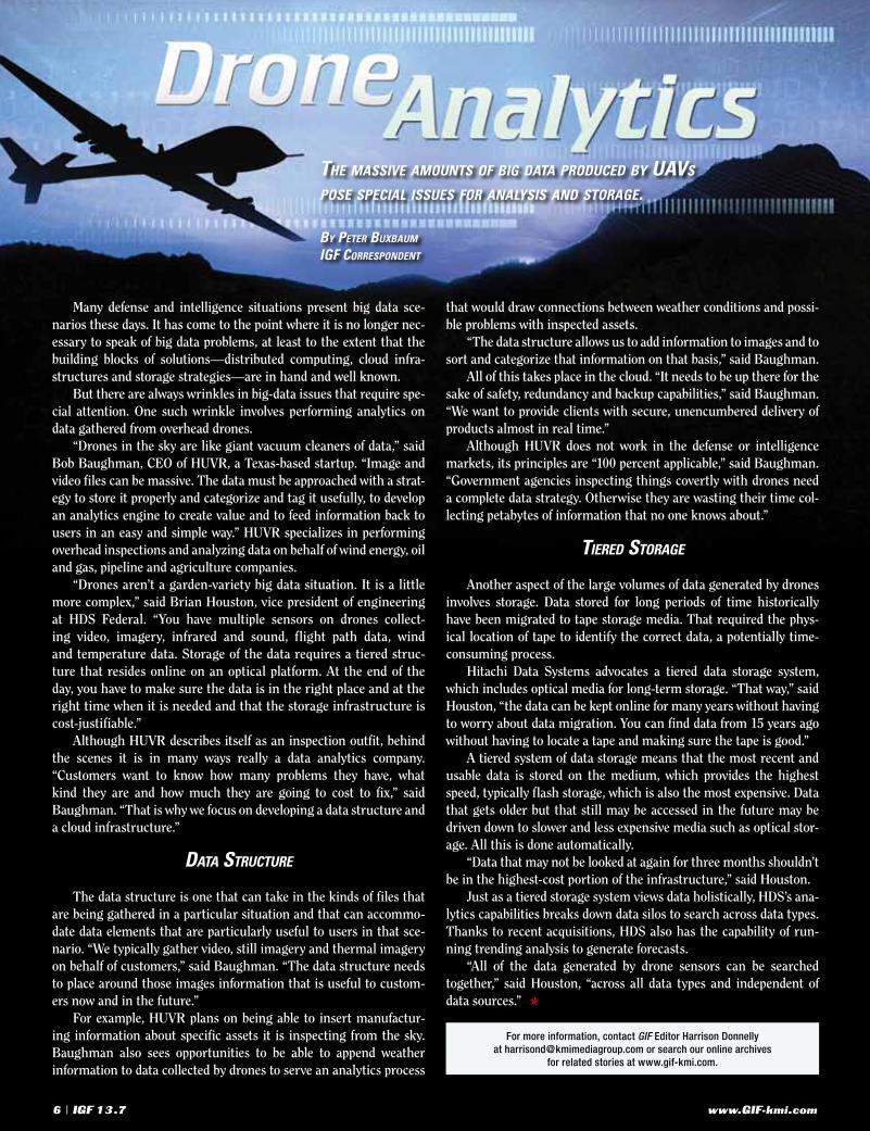
The massive amounTs of big daTa produced by uavs pose special issues for analysis and sTorage.
by peTer buxbaum
igf correspondenT
Many defense and intelligence situations present big data sce-narios these days. It has come to the point where it is no longer nec-essary to speak of big data problems, at least to the extent that the building blocks of solutions—distributed computing, cloud infra-structures and storage strategies—are in hand and well known.
But there are always wrinkles in big-data issues that require spe-cial attention. One such wrinkle involves performing analytics on data gathered from overhead drones.
“Drones in the sky are like giant vacuum cleaners of data,” said Bob Baughman, CEO of HUVR, a Texas-based startup. “Image and video files can be massive. The data must be approached with a strat-egy to store it properly and categorize and tag it usefully, to develop an analytics engine to create value and to feed information back to users in an easy and simple way.” HUVR specializes in performing overhead inspections and analyzing data on behalf of wind energy, oil and gas, pipeline and agriculture companies.
“Drones aren’t a garden-variety big data situation. It is a little more complex,” said Brian Houston, vice president of engineering at HDS Federal. “You have multiple sensors on drones collect-ing video, imagery, infrared and sound, flight path data, wind and temperature data. Storage of the data requires a tiered struc-ture that resides online on an optical platform. At the end of the day, you have to make sure the data is in the right place and at the right time when it is needed and that the storage infrastructure is cost-justifiable.”
Although HUVR describes itself as an inspection outfit, behind the scenes it is in many ways really a data analytics company. “Customers want to know how many problems they have, what kind they are and how much they are going to cost to fix,” said Baughman. “That is why we focus on developing a data structure and a cloud infrastructure.”
daTa sTrucTure
The data structure is one that can take in the kinds of files that are being gathered in a particular situation and that can accommo-date data elements that are particularly useful to users in that sce-nario. “We typically gather video, still imagery and thermal imagery on behalf of customers,” said Baughman. “The data structure needs to place around those images information that is useful to custom-ers now and in the future.”
For example, HUVR plans on being able to insert manufactur-ing information about specific assets it is inspecting from the sky. Baughman also sees opportunities to be able to append weather information to data collected by drones to serve an analytics process
that would draw connections between weather conditions and possi-ble problems with inspected assets.
“The data structure allows us to add information to images and to sort and categorize that information on that basis,” said Baughman.
All of this takes place in the cloud. “It needs to be up there for the sake of safety, redundancy and backup capabilities,” said Baughman. “We want to provide clients with secure, unencumbered delivery of products almost in real time.”
Although HUVR does not work in the defense or intelligence markets, its principles are “100 percent applicable,” said Baughman. “Government agencies inspecting things covertly with drones need a complete data strategy. Otherwise they are wasting their time col-lecting petabytes of information that no one knows about.”
Tiered sTorage
Another aspect of the large volumes of data generated by drones involves storage. Data stored for long periods of time historically have been migrated to tape storage media. That required the phys-ical location of tape to identify the correct data, a potentially time-consuming process.
Hitachi Data Systems advocates a tiered data storage system, which includes optical media for long-term storage. “That way,” said Houston, “the data can be kept online for many years without having to worry about data migration. You can find data from 15 years ago without having to locate a tape and making sure the tape is good.”
A tiered system of data storage means that the most recent and usable data is stored on the medium, which provides the highest speed, typically flash storage, which is also the most expensive. Data that gets older but that still may be accessed in the future may be driven down to slower and less expensive media such as optical stor-age. All this is done automatically.
“Data that may not be looked at again for three months shouldn’t be in the highest-cost portion of the infrastructure,” said Houston.
Just as a tiered storage system views data holistically, HDS’s ana-lytics capabilities breaks down data silos to search across data types. Thanks to recent acquisitions, HDS also has the capability of run-ning trending analysis to generate forecasts.
“All of the data generated by drone sensors can be searched together,” said Houston, “across all data types and independent of data sources.” O
For more information, contact GIF Editor Harrison Donnelly at [email protected] or search our online archives
for related stories at www.gif-kmi.com.
www.GIF-kmi.com6 | IGF 1 3 .7

IGF 1 3 .7 | 7 www.GIF-kmi.com
Mobile devices today are equipped not only with GPS, but also cameras and other sensors that collect data that can be geo-refer-enced by the device’s on-board capabilities. These facts have not gone unnoticed in the military and intelligence communities as they attempt to harness the power and ubiquity of these devices and apps to create a two-way highway of data, information and intelligence between headquarters and the field.
The increasing use of mobile devices means that more indi-viduals are walking around with geospatially equipped sensors capable of geotagging data through connections with GPS satel-lites. Software developers have been developing commercial mobile geo-spatially enabled apps for several years, and some of these are now being adapted to the military and intelligence space. Developers are also producing apps specifically for government and military purposes.
“The consumer space seems to have driven the mobile apps mar-ket, and the enterprise space is playing catchup,” said A.J. Clark,
president of Thermopylae Sciences + Technology. “The military and intelligence side can take advantage of what is already out there and understand some of the lessons learned. On the other hand, the government space is moving at a much slower pace than the consumer space.”
“There are many different uses for mobile apps in the defense and intelligence arenas,” said Ben Conklin, lead for defense solu-tions at Esri. “Warfighters already carry mobile devices in the field, and many of the available apps are already taking off. Field data collection is one area where mobile apps are being used
heavily, as are apps that provide simple interactive maps, crowd-source reporting and situational awareness and display.”
There are two classes of appli-cations that can be deployed on mobile devices, noted Rob Mott, vice president for geospatial solu-tions at Intergraph Government Solutions. Native apps are those that have been developed specifi-cally for mobile platforms using the
developers creaTe a Two-way highway of daTa, informaTion and inTelligence beTween
headquarTers and The field.
by peTer buxbaum
igf correspondenT
Rob MottA.J. Clark
Data Capture Drives Mobile
Apps

www.GIF-kmi.com8 | IGF 1 3 .7
iOS (Apple) or Android operating systems. The second category con-tains mobile apps that were not built for a specific operating system, but are accessible by any devices capable of running a Web browser.
Native mobile apps are arguably better at exploiting the on-board resources of a given device, while browser-accessible apps are com-patible with a broader array of platforms. They are not limited to the two main mobile operating systems, and can be used on devices run-ning other operating systems, such as Windows.
“From a user perspective, the difference in some cases is negli-gible or even unrecognizable,” said Mott. “Both user interfaces have data input mechanisms with buttons, sliders and other widgets built into the app. The real difference comes more in the architecture that plays out behind the scenes. Native mobile apps can take better advantage of some the device’s on-board resources, such as acceler-ometers, cameras, microphones and GPS.”
developmenT frameworks
Credit for the ease by which geospatial mobile apps can be devel-oped and deployed on devices goes to development frameworks that companies have created to facilitate that process. In many cases, apps can be generated without programming or coding by end-users who themselves have little or no background in writing soft-ware. The apps can be composed for specific tasks and missions and later discarded.
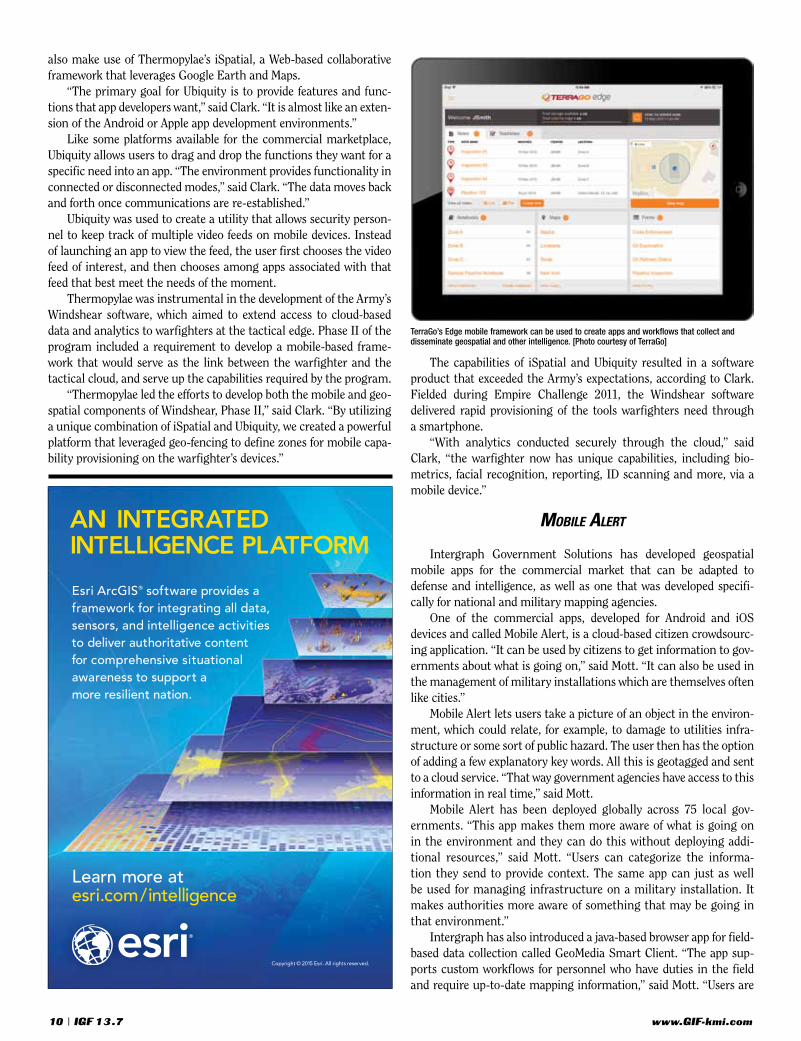
TerraGo’s contribution to the mobile geospatial apps space has been to create a framework called Edge, which can be used to cre-ate apps and workflows that collect and disseminate geospatial and other intelligence regardless of the specific handheld devices in the procession of end-users.
“This is all done through a Web platform, server and database,” said David Basil, head of product devel-opment at TerraGo. “Once information gets deployed to folks in the field, they can use various platforms and mobile devices, including iOS and Android devices, or any other kind of device with a Web browser. Edge is device-independent, so that users in the field can receive information from folks at the operations cen-ter while in the field collecting or updating informa-tion provided to them.”
One challenge in developing Edge was to make sure it was flexible enough to be applied to different scenarios without customization or coding. “The second challenge was making sure that it was device-independent,” said Basil. “It can be used with any device in the field that has a browser. There is no need to buy a specific proprietary device.”
The apps developed with TerraGo’s Edge framework collect data in the form of photos, videos, audio files and text notes. The devices’ GPS capabilities accurately tag locations associated with the data, all of which are sent back to operations centers for immediate action.
“The data can be ad-hoc data or structured, form-based data,” said Basil. “The information collected is immediately synched to headquarters or operations centers in real time. The data is geo-tagged, so the result is the capability to create real-time actionable intelligence that is geospatially aware.”
Personnel assigned to ops centers can collaborate with those in the field by creating and assigning tasks and missions based on the information received from the field. “Folks in the field can also collaborate with each other without going through headquarters,”
said Basil. “Edge can also operate offline in situations of poor or non-existent communications connections. The data collected is synched up later when communications are reestablished.”
The Edge framework is itself natively geospatial. “It ties directly into the enterprise’s geospatial information system of record,” said Basil, “and can access all exiting geographical information, appli-cations, features, and attributes. Edge uses all that as the basis to perform field data collection. All that information is provided to Edge and Edge uses geospatial information to update existing geographical information.”
TerraGo developed Edge in response to customers who worked with GeoPDF, which was originally developed by TerraGo. “GeoPDFs are geospatial information packages that are easily deployed to users working in the field,” said Basil. “Our customers were asking two main things of us. They needed to have an enterprise database server so that information could be stored in a server instead of on a doc-ument that was floating around. And they needed to support any device in the field, anything with a browser.”
Edge is capable of being adapted to wide variety of missions and scenarios. “It allows users to build their own apps and workflows without coding,” said Basil. “Users can build their own forms, tasks and projects and because the framework is so flexible.”
naTive apps
“For the military and intelligence communities, Esri has a lot of out-of-the-box apps,” said Conklin. “But the community also needs custom and focused apps and specific workflows that need to be accommodated.”
Esri supports the military and intelligence community with a product called AppStudio, which provides a frame-work for building native mobile apps. “We already have a Web app builder if users want to deploy them in browsers,” said Conklin. “AppStudio takes this to the next level by building native apps that run on devices that can also work offline, which is also a big community requirement.”
AppStudio allows developers and users to build mobile apps that extend the webGIS platform, which is Esri’s cloud-based version of its popular GIS soft-ware. “AppStudio leverages the tools of webGIS such as content management, data management, and user
identity,” said Conklin. “AppStudio consumes content from the plat-form. It’s all about how far you can take webGIS.”
Since AppStudio is new, not many new apps have been posted that utilize that platform. One Esri app that has been developed with App Studio is called Field Notes-Earth.
“Field Notes-Earth was built in conjunction with an Esri proj-ect called Living Atlas, which gives users information about natural and social environments. Data inform users about their physical and demographic surroundings and things like how global warming and climate change are effecting where they are. This is a good exam-ple of a focused app that was built to interact on a mobile device,” Conklin noted.
Thermopylae has also taken a framework approach to the mobile apps challenge with a platform called Ubiquity. The idea behind Ubiquity was to identify the commonalities that comprise 95 per-cent of all apps so that developers don’t have to go back to the draw-ing board to design each element for each new app. Mobile apps can
David Basil
Tackle two of national mapping agencies’ most challenging problems, map currency and cost of production, with Cartographic Web Services (CWS).
CWS is a proven solution for the rapid production of cartographic products that leverages over 30 years of Intergraph research and development into the automation of the cartographic production process. CWS is currently producing series-based maps at the national mapping agency level for both military and humanitarian missions.
Rapid Map Production with
Cartographic Web Services
Learn more on our solutions for the U.S. Federal Government: www.intergraphgovsolutions.com
Contact us:[email protected]
1.703.264.5600
Average Performance Time with CWS
15 minute x 15 minute 1:50,000 scale map 11 minutesfrom source compiled at 1:50,000
30 minute x 30 minute 1:100,000 scale map 16 minutesfrom source compiled at 1:50,000
Intergraph Ad Fall 2015- CWS.indd 1 10/13/2015 4:50:07 PM
www.GIF-kmi.com10 | IGF 1 3 .7
also make use of Thermopylae’s iSpatial, a Web-based collaborative framework that leverages Google Earth and Maps.
“The primary goal for Ubiquity is to provide features and func-tions that app developers want,” said Clark. “It is almost like an exten-sion of the Android or Apple app development environments.”
Like some platforms available for the commercial marketplace, Ubiquity allows users to drag and drop the functions they want for a specific need into an app. “The environment provides functionality in connected or disconnected modes,” said Clark. “The data moves back and forth once communications are re-established.”
Ubiquity was used to create a utility that allows security person-nel to keep track of multiple video feeds on mobile devices. Instead of launching an app to view the feed, the user first chooses the video feed of interest, and then chooses among apps associated with that feed that best meet the needs of the moment.
Thermopylae was instrumental in the development of the Army’s Windshear software, which aimed to extend access to cloud-based data and analytics to warfighters at the tactical edge. Phase II of the program included a requirement to develop a mobile-based frame-work that would serve as the link between the warfighter and the tactical cloud, and serve up the capabilities required by the program.
“Thermopylae led the efforts to develop both the mobile and geo-spatial components of Windshear, Phase II,” said Clark. “By utilizing a unique combination of iSpatial and Ubiquity, we created a powerful platform that leveraged geo-fencing to define zones for mobile capa-bility provisioning on the warfighter’s devices.”
The capabilities of iSpatial and Ubiquity resulted in a software product that exceeded the Army’s expectations, according to Clark. Fielded during Empire Challenge 2011, the Windshear software delivered rapid provisioning of the tools warfighters need through a smartphone.
“With analytics conducted securely through the cloud,” said Clark, “the warfighter now has unique capabilities, including bio-metrics, facial recognition, reporting, ID scanning and more, via a mobile device.”
mobile alerT
Intergraph Government Solutions has developed geospatial mobile apps for the commercial market that can be adapted to defense and intelligence, as well as one that was developed specifi-cally for national and military mapping agencies.
One of the commercial apps, developed for Android and iOS devices and called Mobile Alert, is a cloud-based citizen crowdsourc-ing application. “It can be used by citizens to get information to gov-ernments about what is going on,” said Mott. “It can also be used in the management of military installations which are themselves often like cities.”
Mobile Alert lets users take a picture of an object in the environ-ment, which could relate, for example, to damage to utilities infra-structure or some sort of public hazard. The user then has the option of adding a few explanatory key words. All this is geotagged and sent to a cloud service. “That way government agencies have access to this information in real time,” said Mott.
Mobile Alert has been deployed globally across 75 local gov-ernments. “This app makes them more aware of what is going on in the environment and they can do this without deploying addi-tional resources,” said Mott. “Users can categorize the informa-tion they send to provide context. The same app can just as well be used for managing infrastructure on a military installation. It makes authorities more aware of something that may be going in that environment.”
Intergraph has also introduced a java-based browser app for field-based data collection called GeoMedia Smart Client. “The app sup-ports custom workflows for personnel who have duties in the field and require up-to-date mapping information,” said Mott. “Users are
TerraGo’s Edge mobile framework can be used to create apps and workflows that collect and disseminate geospatial and other intelligence. [Photo courtesy of TerraGo]
Copyright © 2015 Esri. All rights reserved.
AN INTEGRATED INTELLIGENCE PLATFORM
Learn more atesri.com/intelligence
Esri ArcGIS® software provides a framework for integrating all data, sensors, and intelligence activities to deliver authoritative contentfor comprehensive situational awareness to support amore resilient nation.
www.GIF-kmi.com IGF 1 3 .7 | 11
PHENOMENOLOGY • SENSORS • INTELLIGENCE APPLICATIONS
FIRST-OF-ITS-KIND
Remote Sensing Textbook
NOW AVAILABLE
All textbook proceeds will be donated to the Ken Miller Scholarship for Advanced Remote Sensing Applications. Scholarship Program
www.riversideresearch.org/textbookORDER HERE
“This book benchmarks the state of understanding so our next generation of engineers and scientists can innovate and advance intelligence tradecraft.”—Jeffrey K. Harris, Former Director of the National Reconnaissance Office
“This text should be part of every GEOINT professional’s library and will readily serve as a superb basic or applied remote sensing reference.”—Keith J. Masback, CEO, United States Geospatial Intelligence Foundation
“This book is an excellent reference for anyone working in the Intelligence Community.”—Hon. Jim Longley, Jr., Executive Director, Advanced Technical Intelligence Association
able to add details to the enterprise database from the web inter-face. It is meant to be a very lightweight low-impact app requiring minimal training built for workflows that require data entry from the field.”
The app incorporates data entry forms and allows interactive maps to be used. The data, which can include imagery, detailed map-ping information, and non-graphic metadata, is captured on the device and automatically synchronized on the database. GeoMedia Smart Client can also work in disconnected mode.
carTographic services
Intergraph Government Solutions’ Cartographic Web Services, meanwhile, was built specifically for the government market. The app was developed for national and military mapping agencies based on requirements published by the National Geospatial-Intelligence Agency.
“Cartographic Web Services allows field-based users, such as warfighters getting ready to enter an area of concern, to access up-to-date digital maps and other geospatial information to perform tasks like convoy routing,” said Mott. “The app gives them linkage through a portal to Department of Defense intelligence sources to create and perform those kinds of tasks on the fly.”
Geospatial data is constantly being updated, so that a map pro-duced a few weeks or a few days before an operation may be out of date. “Cartographic Web Services allows the user, perhaps a
captain in a tactical vehicle, to define his needs and generate the necessary map he needs to conduct his mission in minutes,” said Mott. “Previously, this type of product was possible only with desk-top software. The end product is a Geospatial PDF which is sent to the mobile device so that operations can also be conducted in disconnected mode.”
Intergraph’s parent company, Hexagon Geospatial, will soon be unveiling an environment that will allow the quick assembly and deployment of geospatial mobile apps from reusable components. The new cloud-based architecture called Smart M.App will support mobile workflows for users with little or no programing.
“Smart M.App will take advantage of many of the world-class geospatial processes available now so that they can be harvested and reassembled as needed by the user,” said Mott. “Capabilities will include interactive maps and will afford users the flexibility to access information in a number of ways and to analyze and report on that information. It will allow smart maps to be developed and deployed very quickly with the capability of performing many complex geo-spatial processes like change detection and other analyses that only desktop applications could handle in the past.” O
For more information, contact IGF Editor Harrison Donnelly at [email protected] or search our online archives
for related stories at www.gif-kmi.com.

www.GIF-kmi.com12 | IGF 1 3 .7
How does Marine Corps Intelligence need to evolve to respond to the “new normal” of changing threats?
Those things we called “new normal” just a few years ago have become our enduring “normal.” That means tremen-dous changes in technology, but also in the way people live their lives, understand themselves and interact with each other. While the information age brings great promise for better lives for many global citizens, it also disrupts existing political and economic orders. One consequence we see is autocracies challenged by new forms of political expression and identity politics. That’s fundamentally a good thing, but the old order will not go without a fight. The resultant instability around the world is inevitable and unfortunate. That creates direct threats to our homeland and to our citizens, allies and interests around the world.
An expeditionary force that can swiftly respond to crisis and protect our citizens, allies and interests plays a key role in our security. It’s why the nation has a Marine Corps. The impli-cations for our required intelligence capability are enormous. Our intelligence effort has to be “always on,” monitoring and understanding crisis as it develops, not responding to it after the fact. Intelligence needs to encompass the “human domain” of our operating areas, allowing the force to be effective with-out resorting to firepower. Our intelligence needs to be much better integrated into the joint and IC environments. Finally, our
intelligence effort has to be much more agile, persistent and responsive if Marines are to outthink their enemies as well as outfight them.
How would you define your vision of the Marine Corps ISR Enterprise in 2020?
Our intelligence enterprise must change if we are to suc-ceed in the information age. An information-age intelligence effort is as much about the methodologies for creating knowl-edge in the minds of decision makers as it is about technol-ogy. For example, the smartphone is a brilliant invention. Yet, the development of a data architecture, mobile apps, frame-works for social interaction and Web commerce has changed the ways people live. We need the right systems and the right tools. But we also need the right people who can understand the implications of technology on warfighting, with a vision for how we lead the impacts on the intelligence business.
At its heart, the Marine Corps ISR Enterprise is an enter-prise of people, not things. I want an enterprise of intelligence professionals certified in their craft and following a pathway of continuous training and application. Intelligence is fundamen-tally about utilization, so we also need intelligence Marines that understand warfighting and decision making at least as much as they understand their intelligence tradecraft. Those talented folks are going to need a modernized data and information
major general michael s. groen
direcTor of inTelligence
u.s. marine corps
ouTThinking and ouTfighTing The adversary
A 1986 graduate of Calvin College, Major General Michael S. Groen served as a junior officer with Marine Air Group (MAG)-39 in Camp Pendleton, MAG-36 in Okinawa and with the 31st Marine Expeditionary Unit. His early experience included deployments to Central America and across the Western Pacific.
Groen graduated from the Naval Postgraduate School with Master of Science degrees in electrical engineer-ing and applied physics, which led to an assignment as a signals intelligence and electronic warfare develop-ment and acquisition program officer at Marine Corps Systems Command. He attended the Marine Air-Ground Task Force Intelligence Officer course and was a distin-guished graduate of the Marine Corps Command and Staff College.
In 2000, Groen reported for duty with the 1st Marine Division as the deputy G-2. During Operation Iraqi Freedom, he participated in combat operations as the division’s intelligence planner. Groen was further des-ignated as the G-2 for Task Force Tripoli, operating in north-central Iraq. He returned to Iraq with the 1st Marine
Division as the division G-2, where he was a principal in the redesign of Marine Intelligence with a refocus on improving support to regimental and battalion-level oper-ations through the creation of the Tactical Fusion Center.
In 2004, Groen was reassigned to U.S. European Command, where he served as the chief of intelligence planning for Europe and Africa. There, he planned intel-ligence operations in the Balkans, Northern Iraq, Central Africa and the Trans-Sahara region. He was instrumen-tal in transitioning intelligence processes into the newly formed Joint Intelligence Operations Center.
In 2006, Groen assumed command of 3d Radio Battalion, Marine Corps Base Hawaii. During this time, the battalion conducted its first deployment to the Southern Philippines in support of Operation Enduring Freedom-Philippines and continued its support to the 31st MEU. In 2012, he became the director of the Marine Corps Strategic Initiatives Group, directly supporting the com-mandant and senior leadership for institutional and oper-ational issues of strategic importance. He was reassigned as the director of Marine Corps Intelligence in June 2013.
Intelligence Marine

www.GIF-kmi.com IGF 1 3 .7 | 13
environment to work in. We will need sensors that automati-cally feed a local knowledge environment in crisis areas; data architectures that extend to the tactical edge; visualization and display tools that are intuitive and relevant; and seamless con-nectivity to the Joint ISR effort. It has to be a real-time intelli-gence enterprise rather than one that centers around a daily update or periodic intelligence estimate.
What impact will the USMC’s renewed focus on expeditionary operations for the future have on the intelligence mission?
Great question. For the Marine Corps, it really is “back to the future” with a globally deployed expeditionary capability. Even during the darkest days of Iraq and Afghanistan, Marine expeditionary units were deployed around the world, ready to project American power in crisis. This has long been our “main thing.” Our modern Marine units now have incredible opera-tional reach via the MV-22 tilt-rotor, amazing tactical fire sup-port from the AH-1Z and UH-1Y and deep strike with the F-35 JSF. All of those are sea-based, able to operate from interna-tional waters just 12 nautical miles off any coast. These sys-tems complement a well-equipped and globally experienced Marine ground combat element. This dream team needs an intelligence capability to match. Without it, the force will strug-gle with being in the right place at the right time with the right situational awareness.
Frankly, I think we are significantly underinvested in this area. With the right situational awareness in the expedition-ary mission sets of the “new normal,” this force could gener-ate a tempo and responsiveness that would be unmatched. It would not only understand conventional targeting, but would also understand the human domain and its impact on mis-sion success or failure. This shapes the intelligence enterprise we want to build. It leverages “always on” garrison capabilities to create a baseline knowledge environment. It extends that knowledge environment to forces at sea through seamless inte-gration of intelligence with the Navy into a singular knowledge environment across the naval force. It leverages joint collection resources of the Army and Air Force through participation in Joint PED. It interacts with the broader IC throughout as both a consumer and producer. The proximity to crisis and real-time, on-the-ground observation by crisis response forces often pro-vides key insights to the IC when time is short, the Joint ISR footprint has not yet been established and strategic decisions must be made quickly.
What advancements in intelligence and geospatial technology do you see as offering the greatest benefits to your capabilities, and to the IC as a whole?
I am enormously excited about the technological develop-ments in the geospatial intelligence field and believe we are just getting started with knowledge-building tools that ride on the geospatial foundation. More than any other discipline, geo-spatial intelligence is foundational to battlefield understanding. I think GEOINT will show the way for us in the management of large datasets. GEOINT creates opportunity for additional lay-ers that enrich understanding. It is a natural frame of reference
for understanding populations and individuals in the places they live and fight. While our “older” commanders intuitively reach for flat maps or charts, a new generation of consumers is comfortable with a more dynamic presentation of battlefield information. I think the opportunities in the integration of new data types, automated product generation and intuitive visual-ization/display are the most compelling. An advanced GEOINT capability provides continuous rather than episodic awareness.
As a community, we also need to think more about the uti-lization of GEOINT. Many of our most important consumers are not sitting behind a desk in a comfortable office. How do we portray threats and opportunities for these commanders at the tactical edge? Imagine a 22-year-old platoon commander with 24 even younger Marines tasked with clearing a block in a dense urban slum. How do we move past overhead imagery to provide those young Americans with the best spatial under-standing possible? Our job is not finished until we can do that effectively and repeatedly.
What are your current biggest challenges as the USMC director of intelligence?
The standard answer would be “resources,” and that is cer-tainly true. In a frugal force like the Marine Corps, it is doubly so. Underlying that answer, however, is the challenge of driving cultural change. For an industrial-age force with firepower dom-inance, intelligence is sometimes perceived to be a useful, but not strictly necessary, commodity. That is the world most of the joint force came from, and intellectually some still linger there. The information age potentially renders many of our historic advantages obsolete. First, many of our opponents will be able to bring advanced technology to the battlefield, their learning much accelerated because of our example. Second, there has to be a newfound awareness in the operating forces and intel-ligence community that the human and information environ-ments are the keys to mission success in this age. That means we have to understand ourselves and our threats much better than we used to, and do it much faster.
The force that will win tomorrow’s battles will be the one that can prepare better, react faster and win decisively in every domain. That takes a robust investment in intelligence capa-bilities for the force. It also takes an intelligence effort that is focused on more than military systems and geopolitics. It will require real-time understanding of communities and the sources of their instabilities, motivations and vulnerabilities. It will require integrated and prioritized information warfare capa-bilities. It will require new methods for training sustainment and talent management. Achieving all of these is premised on a cultural change that recognizes their importance. We have the luxury of understanding that we live in a period of rapid change. We have the responsibility to posture the generations that follow us for success. We have the challenge of turning the ship in this direction. Thank you so much for the opportu-nity to talk to you. This is a very important dialogue for all of us in this business. O
For more information, contact IGF Editor Harrison Donnelly at [email protected] or search our online archives
for related stories at www.gif-kmi.com.

www.GIF-kmi.com14 | IGF 1 3 .7
INDUSTRY RASTER
DigitalGlobe has announced an expansion of its partnership with Orbital Insight, a geospatial analysis company that tracks socioeconomic trends at global, regional and hyper-local scales. Within DigitalGlobe’s Geospatial Big-Data platform, Orbital Insight’s machine-vision engineers, artificial-intelligence experts and data scientists now have access to 400 terabytes of high-resolution imagery, an increase of nearly 80 times the data available for analysis under the previous partnership agreement. Orbital Insight’s customers will now be able to understand near real-time global economic trends
with even greater precision and scale. This fall, Orbital Insight expects to release several new data analytics prod-ucts, including worldwide monitoring of crude oil storage inventories and monitoring construction rates across the major cities in China, which are powered by DigitalGlobe’s image library and Geospatial Big-Data platform. DigitalGlobe’s cloud-based Geospatial
Big-Data platform supports a new ecosystem in which partners, such as Orbital Insight, leverage their expertise to create new customer solutions without the substantial costs of owning and operating IT infrastructure.
Northrop Grumman and the Navy have demonstrated endurance capabilities with the MQ-8C Fire Scout unmanned helicopter. On a range out to 150 nautical miles flight from Naval Base Ventura County, Point Mugu, Calif., the MQ-8C Fire Scout achieved 11 hours with more than an hour of fuel in reserve. The long-range, long-endurance flight was part of a series of capa-bility based tests used by the Navy to validate their concept of operations and previously tested perfor-mance parameters. This is a new flight record set for the MQ-8 Fire Scout, a system designed to provide persistent reconnaissance, situational awareness and precision targeting support for ground, air and sea forces.
MotionDSP has announced a beta program for its real-time enterprise computer vision software, Ikena X, to enhance video footage and imagery taken by drones and other cameras. This type of software is essential in high-stakes situations, saving lives, time and money by helping organizations find answers from video quickly. Built on the same military-proven technology as MotionDSP’s Ikena ISR software, this powerful commercial product allows people to see details in video that they
may otherwise miss due to factors outside of their control. MotionDSP has also partnered with Aeryon Labs, a manufac-turer of small, unmanned aerial systems (sUAS), to optimize Ikena X for the Aeryon SkyRanger sUAS. Operationally deployed in more than 30 countries worldwide, Aeryon sUAS provides aerial image and data gathering in a range of military, public safety and commercial applications.
Austin Dillman;[email protected]
Intergraph is working to reduce storage and power requirements with its new Green GIS initiative in Europe, which offers a more energy-efficient and therefore climate-friendly IT process. With the patented Enhanced Compressed Wavelet (ECW) data compression format, in combination with the new version of the ERDAS Apollo application, Intergraph and its Hexagon Geospatial software offer a solution package that drastically reduces the volume of raster data and point clouds. This minimizes demands on storage capacity and the associated operating and cooling power requirements. ERDAS Apollo also minimizes the demand for servers, computing power and data transfer rates. The ECW data compression format patented by Intergraph is capable of reducing raster data by up to 95 percent. Lower data volumes mean considerably lower server capacities and reduced power consumption. Intergraph is also pursuing Green GIS further with its new version of ERDAS Apollo, with efficient data cataloguing and an innovative data transfer technology reducing the necessary bandwidth when transmitting data.
Matthias Alisch;[email protected]
Geospatial Big-Data Targets Global Economic Trends
Data Compression Format Cuts Storage and Energy Costs
Computer Vision Software Enhances Drone Imagery
Unmanned Helicopter
Demonstrates ISR Endurance

www.GIF-kmi.com IGF 1 3 .7 | 15
Contract Supports IC Information SharingSierra Nevada Corp. has been awarded a $9.5
million cost-plus-fixed-fee completion contract for enterprise engine software and hardware prototype system. The contractor will provide design and develop the technology and operational prototypes to satisfy goals of the under secretary of defense for intelligence for optimizing information sharing within the intelligence community, and to enable
decision making while maximizing IC capabili-ties to discover, access, retain, store, share and exploit information. This will be accomplished by designing, developing, testing and evaluating technology for an enterprise engine, using model driven development methods and techniques that enable agile software adaptation to situational awareness and decision making. Additionally, there
will be development and demonstration of proto-type adaptations to support National Geospatial-Intelligence Agency and service-oriented tasks in the areas of mission analysis, agile mission processing and mission knowledge-based situ-ational assessments. Lastly, information assurance and cybersecurity methods and techniques will be tailored for prototype adaptations.
2d3 Sensing, a COTS technology provider specializing in the improve-ment, processing, exploitation and dissemination of motion imagery and metadata, has introduced a 3-D modeling capability as part of the latest release of its enterprise full-motion video (FMV) PED software suite that extracts information from imagery captured by airborne surveillance systems. 2d3 Sensing’s suite of motion imagery software provides the capa-bilities operators and analysts need to effectively process and manage FMV for tactical ISR operations—from enhancing and improving image quality to extracting and sharing GEOINT data. This latest capability leverages the company’s long history in the field of computer vision to accomplish 3-D scene reconstruction based on a video sequence or a set of still images. The modeling tool can generate a 3-D reconstruction from uncalibrated sensors within minutes. Users can then leverage these models to facilitate tactical planning by providing better target understanding and situational aware-ness. 2d3 Sensing is part of Insitu, a wholly owned Boeing subsidiary.
Jennifer Beloy;[email protected]
Lockheed Martin has completed a successful test of the performance and reliability of INFIRNO, a high-definition 15-inch sensor system that provides precision targeting and ISR capability across ground, air and maritime platforms. The test demonstrated INFIRNO’s ability to identify and laser-designate items of interest at extended ranges for maximum weapon effectiveness. The system also captured high-definition infrared and color video in extreme temperatures under harsh environmental conditions.
INFIRNO features multiple high-definition optical sensors in a highly stabilized 15-inch turret. Nine plug-and-play components allow the sensor to be reconfigured to meet rapid changes in evolving technology and mission requirements. This modular innovation allows operators to affordably maintain and upgrade the system, keeping critical mission capability readily available to the warfighter.
John Kent;[email protected]
Teledyne Brown Engineering (TBE) has selected Orbit Logic’s Collection Planning and Analysis Workstation (CPAW) and Order Logic software for its Multi-User System for Earth Sensing (MUSES) ground system. Order Logic will be used for imagery order management with CPAW as the planning engine.
MUSES, an Earth-observation platform being devel-oped by TBE, will be externally located on the International Space Station (ISS) and is capable of hosting four instru-ments simultaneously. As part of collaboration with the German Aerospace Center (DLR), the first instrument to be hosted aboard MUSES will be the DLR Earth Sensing Imaging Spectrometer (DESIS). Working in the wavelength range from visible through the near infrared, this spectral imaging instrument will enable the precise data acquisi-tion of images of Earth’s surface. The MUSES platform is planned for launch to the ISS in 2016, followed by the DESIS in early 2017. Order Logic will provide Web-based management and tracking of imaging requests. Order Logic allows TBE and other users to create, edit and track the status of imagery orders; visualize planned imaging operations; and access feasibility tools that enhance under-standing of when new images of specific targets are likely to be available.
Ella Herz;[email protected]
Test Completed on High-Definition Sensor System
Tracking Software Picked for Sensing
Ground Station
3-D Modeling Capability Added to Video System
Compiled by KMI Media Group staff

www.GIF-kmi.com16 | IGF 1 3 .7
As director of NGA’s Xperience Directorate, Justin Poole is responsible for enhancing the user’s experience through online, on-demand GEOINT services that provide access to content, exper-tise and applications. He is also dual-hatted as the customer service portfolio manager.
Poole returned to NGA from his second joint duty assignment as the associate deputy director IMINT, National Reconnaissance Office. In this capacity, he was responsible for assisting the IMINT director in establishing the organizational strategic direction, man-aging the day-to-day operations, and strengthening mission partner relationships. Prior to this position, Poole served as the deputy pro-gram manager for the National System of Geospatial Intelligence (NSG). In this capacity, he supported the director, acquisition, in the oversight, guidance and advocacy for capability integration into the broader NSG as well as the NSG program manager in policy formu-lation, execution, analysis and reporting against established NSG cost, schedule and performance baselines.
In his first joint duty assignment, Poole served as the dep-uty director for mission management, National Counterterrorism Center. In that capacity, he was responsible for overseeing all national intelligence related to the counterterrorism (CT) mission. He was responsible for developing the CT intelligence plan that served as the CT strategic plan for the IC, and the CT analytic pro-duction strategy, which drove analysis for the CT community. He also chaired the CT Advisory Group, the most senior CT body sup-porting the CT mission manager.
In 1991, Poole came to Defense Mapping Agency, one of prede-cessor organizations of NGA, where he has since held a variety of positions. In 2006, he concurrently served as business executive (BX) for the Analysis and Production Directorate and deputy direc-tor, Joint Planning Office, ensuring a comprehensive and integrated directorate program. He was also the directorate’s resource manager and provided strategic guidance and oversight of the BX staff offices and agency NGA support teams. In 2004, he served as the NGA chief architect and as the deputy director, enterprise architecture and engineering and the enterprise operating framework program manager, Office of Strategic Transformation, NGA. He ensured that agency investments aligned architecturally, and executed the agency’s transformational objectives. In 2002, Poole served as a member of the National System for Geospatial Intelligence, Enterprise Transformation Integrated Product Team, which kicked off the agency’s transformational journey. He started his career
as a cartographer and geospatial analyst, and received his Senior Executive Service appointment in 2002.
Poole received a Bachelor of Science degree in geography, with a specialization in cartography, from the University of Maryland, College Park, in 1990.
Q: As director of the Xperience Directorate, you lead the NGA’s GEOINT Services initiative. How would you describe the overall mission and strategy of the initiative?
A: I think it’s important to first answer what GEOINT Services is. It’s quite simple: GEOINT Services is NGA’s initiative to leverage the technology opportunities of the cloud to improve our custom-ers’ ability to find, get, use and share geospatial information. NGA is a major producer and consumer of geospatial information, but geo-spatial information and location-based data are no longer just the domain of the geospatial experts. GEOINT Services will empower all of our customers—from soldiers at the tip of the spear to intelli-gence analysts inside the Beltway—to leverage the intelligence and contextual power of GEOINT content.
But there is more to GEOINT Services than the science behind the capability. At NGA, we are also building a customer-centric cul-ture that tailors access to geospatial services our customers’ needs. We will provide GEOINT Services to provision NSG, Allied System
Justin PooleDirector
Xperience DirectorateNational Geospatial-Intelligence
Agency
Experience EnhancerLeveraging the Cloud to Improve Customer Access
Q&AQ&A

www.GIF-kmi.com IGF 1 3 .7 | 17
for Geospatial Intelligence (ASG) and IC GEOINT content that will also encourage content contributions from those who may not be members of the NSG, ASG or IC. We want to use our continuous study of customer expectations to inform how we convey the knowledge they need, when they need it, via accessible technology. In other words, we want to give them the best experience possible.
Q: What services are and will be included in GEOINT Services, and how will the platform for delivering them work?
A: At its core, NGA’s vision is to provide an environment that centralizes the user experience of working with geo-spatial information to make it easier to discover desired products. We’ll be deploying common geospatial ser-vices—that is, geospatial data and imagery, along with tools, analytics and applications—that truly enable a three-tiered service delivery system from self-service to one-on-one support. We’re starting with the basics by reg-istering all of NGA’s data and making it discoverable and deliverable as Web services. To this, we’re adding some basic built-in capabili-ties that allow folks to work with the data right there in the browser. And we’re making NGA’s geospatial services accessible via an API so users can bring this data into their own application tools and production environments.
Now here’s the exciting news: We are not only making it easier to find information, but also the new capabilities we are building into our service delivery system will empower our customers and part-ners to effectively share their data, tools and applications, in this environment, with all the other geospatial data users.
We’re also getting better at how we invest in and provide what I call “best of breed” capabilities and data to our customers, which means we’ll be monitoring and measuring the services we provide, and will be able respond to customer demands more efficiently. One way we’re pulling this all together is by leveraging commercial cloud technology and a Web-services architecture that transforms our business model from Blockbuster to Netflix. And we’re not just doing this in the top-secret environment. We will deploy a consistent set of geospatial services on a World Wide Web cloud, secure unclassified cloud and classified IC Information Technology Environment (IC ITE) cloud. We want to begin and end with standards and open-first principles. And we know that the services we provide must be top of the line, or the users won’t come. So GEOINT Services is building scalable, responsive, high-performance, standards-based services at the start. This will allow us to plug and play new data and capabil-ities more efficiently and effectively, and will avoid locking us into obsolete technology.
Q: What technology issues and challenges have you faced as you develop the initiative?
A: I am well aware that as technology becomes more widely avail-able, the spectrum of geospatial providers and consumers out-side of NGA’s walls continues to expand rapidly, which challenges us to explore how to better serve our customers. With the massive growth of location-based data on the Internet, the “darkening skies” of the commercial satellite world, and increased opportunities for persistence outside of our traditional classified environment, an
increasing amount—perhaps the majority—of GEOINT will be col-lected, synthesized and analyzed “upstream” of classified domains.
This fundamentally requires a multi-domain approach to GEOINT Services. As such, the development and deployment of the GEOINT Services environment will begin in the open domain and transition to higher security domains. This not only serves as a forc-ing function for embracing the intelligence opportunities of open-source data, but also opens up system development opportunities to non-traditional vendors, who may provide more agile, relevant and innovative solutions.
One example of embracing innovative opportunities to put unclassified products into the hands of customers more quickly is our new Innovative GEOINT Application Provider Program (IGAPP) initiative. IGAPP is an evolutionary NGA program that employs a business model that efficiently and effectively connects government customer needs with non-traditional application vendors to provide users with new tools and ways to access data. The goal of IGAPP is to provide customers with better, richer solutions to problems with a geospatial component.
We are also working with the NSG, ASG, IC and international partners to change how we do business. With these partners, we are developing how GEOINT Services will shape the policy, gover-nance and processes that harmonize the collection, management and sharing of geospatial and GEOINT content. The goal is to max-imize discoverability, usability and interoperability to share content across all security domains.
Q: What is your schedule for rolling out GEOINT Services?
A: While the implementation will occur over the next two years, it is definitely not a “light switch on, light switch off” program.
I’ve been working with the development team of experts for GEOINT Services for about nine months to roll-out capabilities and products. For example, beginning in November 2014, NGA created a consolidated Intelligence Community Geographic Information Systems Portal, or IC GIS Portal, as part of GEOINT Services. I would say this was the first big step in the creation of the GEOINT Services construct, as this portal provides a centralized location for finding and sharing IC geospatial data.
GEOINT Services is NGA’s initiative to leverage the technology opportunities of the cloud. [Image courtesy of NGA]
www.GIF-kmi.com18 | IGF 1 3 .7
Building upon this progress, in the past year we started imple-menting Enterprise Content Services on the IC GIS portal, mak-ing NGA authoritative content accessible as services by customers. As we continue this development, GEOINT Services will provide the customer unprecedented access to geospatial data that was previously behind firewalls and unavailable to consumers in lower security domains.
Instead of analysts having to comb through countless data-bases, only to have to search again and again, we will have a geo-spatial ecosystem available that broadens access and availability of data from the lower security domains for utilization by analysts in their classified analytical environments. What does this mean for the customer? Quite simply, they will be able to find, get and use geospatial data much more efficiently and effectively, and they will be able to enrich and augment existing geospatial knowledge with their own data. We will support this through enterprise services, which are capabilities that we provide for all in the NSG to use free of charge, and commodity services, which are capabilities that partners provide to or connect into GEOINT Services to expand the capability stack.
Early in calendar year 2016, GEOINT Services will provide cus-tomers on-demand geospatial software and applications via the cloud. We also plan to deploy a crowdsourcing capability, cur-rently in pilot mode, where analysts across the IC can contrib-ute to geospatial foundation data. This major step will allow subject-matter experts across the IC to contribute to and enrich our foundation GEOINT content. The lessons learned from the crowd-sourcing data will be paramount to ensuring that through-out 2016 and beyond, the GEOINT Services environment will be prominent on classified and World Wide Web domains. These les-sons will help us meet the goal of creating a user-defined GEOINT Services environment that is never stagnant, but rather exists as an iterative ecosystem of solutions exceeding the expectations of our customers.
Q: How will the initiative change NGA’s relationship with IC customers, and what benefits can those customers expect?
A: GEOINT Services is fundamentally aimed at transforming how the IC builds, deploys and leverages geospatial capabilities and con-tent within and across the IC, NSG and ASG. As GEOINT Services rolls out, customers will see a more consistent, transparent and interoperable geospatial data and application architecture within the cloud. This starts with making sure all the content our custom-ers need from NGA can be discovered and accessed in a high-per-formance manner. This means less duplication of geospatial data across our agencies and immense opportunities for intelligence integration. The increased access to our data will truly push the boundaries of integrating GEOINT with signal intelligence, human intelligence, measurement and signature intelligence and open-source intelligence, and will result in deeper analysis and more meaningful conveyance for IC customers.
Q: How will GEOINT Services change the culture at NGA?
A: By dissolving geospatial data and application silos, GEOINT Services represents a fundamental shift in how NGA does busi-ness as a service provider, geospatial data provider and intelligence provider for the IC and NSG/ASG. As a service provider, NGA will
provide a platform to enable the exchange and enrichment of geo-spatial content and services in a secure and open IT architecture. As a geospatial data provider, NGA will implement a strategy to allow all content to be discoverable, accessible and integrate-able. In its role as intelligence provider, NGA will equally leverage and bene-fit from discoverability and on-demand access to content and ana-lytics, and the analytic opportunities presented by an IC geospatial data ecosystem.
GEOINT Services is part of the changing dynamic within NGA to become more customer-centric, where we are focused on antici-pating the customer’s needs and exceeding the customer’s expecta-tions. We perform this by measuring our consequence—the impact to the customer’s mission that NGA products or services enable. NGA’s objective is to enable positive customer consequences by pro-viding products and services that are so persuasive that customers apply them at their decision points.
Q: What role will mobile services play in the new system, and how would you assess your progress in encouraging development of mobile apps?
A: Mobile is definitely a central delivery mechanism for GEOINT Services. While NGA is behind the curve on mobile due to our secu-rity environment, we have a lot of customers that rely on mobile on a daily basis. We realize this and are ensuring that the content we provide supports mobile platforms, along with disadvantaged and disconnected users. The GEOINT App Store is the centerpiece of our progressive movement that is strengthening the mobile apps pres-ence at NGA. The app store is allowing the agency to achieve its goal of providing online, on-demand GEOINT. Customers have been able to access apps and analysis tools on classified networks and World Wide Web platforms. As stated above, GEOINT Services will be pro-viding the ability for users who are intermittently connected or on the web, to have ease of access to data, services and GEOINT prod-ucts. Going a step further, users will also have the ability to upload data from lower to higher security domains for enrichment by ana-lysts and developers. For example, a first responder or warfighter can upload real-time data and information from a mobile device for analysts to enhance a higher domain product. This is a real, visceral environment that we are creating in GEOINT Services.
Q: NGA was active in providing open data during the 2014 Ebola crisis. What did you learn from that effort about providing Web-based services?
A: The rapid outbreak of Ebola in Western Africa was an acute pub-lic health emergency that could have easily turned into a much larger and more devastating international crisis if ignored. NGA was the first intelligence agency to employ GEOINT Services to allow open access to relevant, unclassified products, via the NGA Ebola Support webpage, which has been used by a growing number of countries—107 at last count. By increasing transparency of avail-able geospatial data and analysis, NGA strengthened its partnership with non-government organizations, international health organiza-tions and other countries.
This model of employing GEOINT Services was replicated for other special GEOINT-supported events and topics, such as the 2015 Nepal earthquake and monitoring Arctic issues in support of President Obama’s visit to Alaska. What we learned from this

www.GIF-kmi.com IGF 1 3 .7 | 19
experience is that we could provide meaningful geospatial data to first responders and humanitarian aid partners, expediting their response time. That in turn facilitated the Nepalese government’s data-based decision making, and ultimately saved lives. That’s a huge, positive impact to the global community.
Q: What are some other aspects of your role as NGA’s expert in customer service?
A: I’m honored to lead a team and to coordinate with partners work-ing to influence and change the way we do business at NGA for the better. The days of simply pushing out content to our customers or making maps on demand are no longer good enough. NGA has always been at the cutting edge of what it does, so it’s no surprise that we are leading the IC in an effort to focus on customers—or rather, the community of users we serve. Our vision at NGA is to “know the earth … show the way … understand the world.” How we deliver this vision is what keeps us on the cutting edge.
As director of NGA’s Xperience Directorate, I’ve made it a mis-sion to understand customer needs and demand signals, and we now have a Business Intelligence office dedicated to compiling and analyzing NGA customers’ preferences and behaviors. Business intelligence is enabling NGA to gain quantitative customer insights that will allow for a tailored experience that enhances discover-ability and data-driven decision-making. Business intelligence is fundamental for understanding customer activity and driving con-tinuous improvement for how we do business at NGA. The architec-tural framework we are building at NGA to manage GEOINT better is not just about maintaining our niche, but also about managing big data for the benefit of our customers and our nation’s overarch-ing security objectives.
Q: Can you provide an example of how GEOINT Services can benefit a customer?
A: Our goal is to provide a platform to exchange and enrich geo-spatial content and services in a secure and open IT architecture so best-of-breed geospatial capabilities and content are available for any GEOINT producer or consumer, on any network—all powered by GEOINT Services. There are many examples in the classified domain, but let me share an unclassified example. In the aftermath of the earthquake that struck Nepal, NGA established a publicly fac-ing webpage to provide timely earthquake data services and damage assessments to first responders and humanitarian organizers. The website contains search and rescue atlases covering Kathmandu and six other areas of Nepal with overlays of imagery and data to assist rescuers and relief planners.
We also added our numerous Nepal products and web ser-vices to crowdsourcing sites such as Asia Pacific Area Network and ReliefWeb, via Amazon web service. The ReliefWeb database is one of the leading sources for global crisis and disaster information. This database is made up of more than 550,000 pieces of humanitarian products, and receives approximately one million visits monthly by humanitarian assistance agencies from across the globe.
NGA also shared its Nepal damage assessment Web services on the Humanitarian Data Exchange (HDX), which enables the human-itarian community to find relevant data across a wide variety of con-tributing organizations, and has been broadly used for the Nepal Earthquake response. As a contributing member of HDX, NGA joins
148 participating organizations, including the United Nations, non-governmental organizations and foreign government businesses. As a result of NGA’s support to the Nepal effort, NGA added 7,682 new named geographic features to the GEONames database and updated 1,152 features in Nepal. NGA continues to add and update features on a daily basis as the effort continues.
In the future, the GEOINT Services user-defined cloud envi-ronment will provision the ability to readily share information between all domains without having to implement an archaic sys-tem utilizing legacy technology of emails, websites and discon-nected networks. The information and data provided during the Nepal earthquake response, for example, would have been avail-able through mobile devices and workstations where real-time data is uploaded, enriched by analysts, downloaded and publicly releas-able in a timeframe across hours instead of days. As you can see, we are in the process of personifying our customer-centric mind-set, by anticipating the needs of our customers instead of merely responding to the needs of our customers … and all powered by GEOINT Services.
Q: Is there anything else you would like to add?
A: I think it’s also important to highlight that GEOINT Services will have solutions to share with the IC. First, we will be working with major geospatial COTS software providers to streamline enter-prise license agreements (ELAs) across the IC. By centralizing these
Defense Strategies Institute presents 3rd Annual:
Big Data for Intelligence Symposium Nov. 17-18, 2015, Alexandria, VA
Harnessing the Power of Big Data for The Intelligence Community
Featured Keynote Speakers:
Cathy Johnston, Director for ICITE and Digital Transformation, DIA
Douglas McGovern, CIO and Director of IT Services, NGA
REGISTER TODAY Military and Government Attend Free! Call us at : 201-918-3477
bigdatasymposium.dsigroup.org

www.GIF-kmi.com20 | IGF 1 3 .7
Getting Smart with Business IntelligenceNGA works to better align what customers need to resource allocation and value.
By Sara Barker
The National Geospatial-Intelligence Agency wants to know what matters to its customers, partners and employ-ees. Specifically, NGA wants to know which of their prod-ucts and services these consumers find useful. Why? The agency is renewing its focus on delivering value to customers
“Gaining a better understanding of what our customers value will enable us to better inform the effectiveness of our operations,” said Barry E. Schuler, the director of the agen-cy’s Xperience directorate’s Business Intelligence office.
According to Schuler, NGA is transforming how it does business by better aligning what customers need to resource allocation and value by tying program and perfor-mance to customer impact.
NGA Deputy Director Sue Gordon has stated that NGA must get smarter about what it can do to bring real value to customers. “And while we don’t like to focus on the neg-ative, the truth of the matter is that if we don’t start hold-ing ourselves accountable by measuring our part in our customers’ success, agency programs risk falling victim to the budgetary ax,” said Gordon. This is where the value of business intelligence (BI) comes in.
NGA applies BI—which includes processes and tech-nologies that transform large volumes of raw data into meaningful information—to understand and analyze national security issues. The same types of BI processes and technologies are helping NGA’s BI office gather insights to make smarter business decisions.
“We’re doing this, not only by gathering data and add-ing it up, but through identifying meaningful linkages and trends within and across data sets,” Krut said. “And that can provide the agency insights into the products and ser-vices customers value most.”
According to Krut, BI can provide these insights at every level of the agency. For example, the Customer Compass webpage on the Globe—NGA’s secure Web presence—allows agency analysts to see first-hand how many customers are accessing the online products they author. The Customer Compass, a BI dashboard, provides instant feedback to analysts on their work.
These metrics can reveal more than simply whether the customer is clicking on a product. Using the Customer Compass, analysts can also determine if the path to reach
a GEOINT product requires too many clicks. That user behavior data are a direct reflection of what the customer values and can inform decisions from what GEOINT prod-ucts the agency should focus on, down to where to feature the products on the Globe.
BI is also poised to start informing decisions at the corporate level, according to Todd Sweet, deputy direc-tor of NGA’s Xperience directorate’s Knowledge Curation office. Sweet wants to explore how well NGA’s GEOINT Stories, a key feature of the Globe, aligned to customer need. GEOINT Stories—five stories on trending and impor-tant GEOINT topics that appear on the Globe homep-age daily—are curated from multiple resources across various directorates.
“Using the Customer Compass, I can show the value of GEOINT Stories are evidenced not only by the num-ber of customers clicking on theme, but more impor-tantly, whether or not these stories are driving customers to explore the specific links to the NGA GEOINT products referenced in the stories,” said Sweet.
Armed with customer behavior insights from reports and dashboards like the Customer Compass, decision makers can take steps to correct any misalignment between NGA resource allocation/capability investment and value to customers.
Behind the decision-informing power of BI is an intricate world of data engineering and processing that includes “big data” technologies. The agency is at the cusp of real-izing the benefit of these technologies. Once in place, they will enable NGA data scientists to shift their focus from simply capturing and managing data to actively drawing insights from it for decision makers on a regular basis.
“BI can be a game-changer for organizations that seek to build effective customer relationships and improve stra-tegic decision making,” said Christy Monaco, Xperience directorate deputy director. “As NGA evolves into a cus-tomer-centric enterprise with a keen emphasis on deliv-ering consequence, data-driven decision making is a business imperative.”
Sara Barger is with Xperience Communications. This article is from the Summer 2015 edition of Pathfinder, the magazine of NGA.
ELAs, NGA will broker licenses across the community so that other agencies won’t have to negotiate their own. This effort will enable the community to realize much larger cost savings through econo-mies of scale.
Second, GEOINT Services will provide unique commodity ser-vices where IC partners can expose applications they have built with the rest of the IC community within the geospatial environ-ment. This capability is not yet fully implemented today, but it’s on our roadmap.
Finally, for my analyst colleagues, our roadmap also includes cloud-based GEOINT big data analytics. This will allow IC analysts to create and invoke their own unique analytic models and algo-rithms against the wealth of geospatially referenced information in the GEOINT Services environment. We plan to combine this with tailorable alert services so that users can subscribe to information alerts about change detection, new data, and model and algorithm outputs. All of these services will be customizable for the user’s intent and purpose. O

IGF 1 3 .7 | 21 www.GIF-kmi.com
A few months ago, I began a dialogue with you about improving the agency’s acquisition system. I called upon everyone involved in NGA’s acquisition system to challenge the status quo, leverage best practices, develop tools and guidance that empha-size flexibilities in the FAR and DFAR, and drive outcomes and accountability to allow people to do their best work. Increased communications, a result of that “call to arms,” has begun to pay dividends both internally and externally. Notably, I’ve received feedback suggesting that our recent procurements more closely align with our vision and demonstrate improvements in our business practices. That is truly wonderful news and I thank you for your efforts and focus.
To further demonstrate my commitment to acquisition reform, I assembled a subset of NGA’s most senior leaders—those involved in day-to-day acquisition decisions—and charged us with identify-ing barriers to making our acquisition efforts faster, clearer, leaner and better, and to establish a clear action plan to remove those bar-riers. I am pleased to share the results of those discussions and my decisions.
elevaTing The componenT acquisiTion execuTive (cae)
In a recent report, the inspector general found that the current organizational structure, notably the placement of the CAE within
the Chief Information Officer/Technology director-ate, increases the risk for ineffective or inefficient management of the agency’s acquisition activities. To reduce that risk, I direct that the CAE and deputy CAE positions be structurally aligned to the director of plans and programs (DP) and directly responsible to me in my role as the head of agency/acquisition.
This change comports with the best practices of other defense and intelligence agencies, acknowl-edges the importance of the acquisition function to NGA’s overall mission, and provides a clear structure for establishing and implementing a coherent, agen-
cywide acquisition strategy. This change is effective immediately.
sTrengThening porTfolio managemenT wiTh acquisiTion experTise
At the offsite, there was unanimous agreement that verti-cal and horizontal gaps exist between portfolio managers, execut-ing key components and their assigned program managers, and the CAE. The agency’s portfolio managers find it difficult to stay abreast of all acquisition matters and the CAE’s influence and con-trol over agency acquisitions is sub-optimized. To close those gaps, and consistent with a program executive office construct found in other DoD components, I have directed that capability program managers (CPM) be established and assigned to each portfolio
depuTy direcTor calls for Tuning acquisiTion sysTem To deliver mission resulTs.
(Editor’s Note: Susan Gordon, deputy director of NGA, recently announced a new initiative aimed at developing a streamlined and more efficient acquisition system. Following is her open letter to the workforce.)
Streamlining NGA Procurement
Susan Gordon

www.GIF-kmi.com22 | IGF 1 3 .7
management team. This small group of acquisition experts will serve as points of consolidation and translation, and provide a com-mon structure for management and oversight of cross-portfolio and cross-capability dependencies. As a result, and through improved understanding of the health and status of the agency’s acquisition efforts, portfolio managers will be positioned to make informed decisions and respond early when problems arise. Assignment of the CPMs to the portfolio teams will be completed no later than November 15, 2015.
enabling and communicaTing Timely decisions
Mission does not wait and must always come first. Putting mis-sion first, we must eliminate the repeated coordination cycles that have become endemic in NGA’s current acquisition governance structure and bring clarity to our decision structures and respon-sibilities. Therefore, effective immediately, NGA’s acquisition gover-nance structure will be as follows:
Mission integration board (MIB) and portfolio integration board (PIB). These existing governance boards are central to the effective management of the end-to-end acquisition system. The MIB is the primary governance body responsible for validating mis-sion needs. Moving forward, we will utilize the MIB as the princi-pal venue to initiate senior-level discussions on new acquisitions, contract renewals or proposed terminations to determine strategic alignment. If a requirement is approved by the MIB, the MIB chair will assign responsibility to a portfolio manager for development of a business case.
The business case describes the value proposition, customer seg-ments, impact to current architecture, costs including dollars and positions and measures of success. Once completed, this business case will be handed off to the PIB for approval or disapproval within current budgetary constraints. The PIB will also present the oppor-tunity costs of this investment to the enterprise. If approved, the requisite KC directors will then be tasked to execute.
NSG acquisition review board (NARB). The NARB is respon-sible for approving program strategies early in the acquisition cycle (six to nine months before initiating individual acquisitions). The focus on programs marks a substantial change from how the NARB has been managed in the recent past where, for the most part, spe-cific contract actions were the focus. In addition, the dollar thresh-olds for approval are raised, pushing decision making downward as follows:
Program Value Chair
Greater than $100 million
DD/NGA
Greater than $30 million but less than
$100 millionCAE
A formal NARB review is not required for programs less than $30 million.
Contract review board (CRB). The CRB is responsible for approving the release of requests for proposal (or other procure-ment instruments) and for ensuring the resultant contracts or agreements are structured to effectively meet the goals contained
in the program strategy approved by the NARB and in compliance with all relevant acquisition regulations.
Program Value Chair
Greater than $100 million
Senior procurement executive or designee
Greater than $30 million but less than
$100 millionGroup Chief/OCS
Less than $30 million
OCS Division Chief
Acquisition working group. The acquisition working group (renamed from the Acquisition Governance Council-Integration Subcommittee) will continue to meet weekly to support program managers and contracting officers and track progress of programs from mission validation through capability delivery, acting quickly to identify and resolve bottlenecks as they occur.
The structure described above provides the foundation for implementation of an end-to-end acquisition governance struc-ture with known and predictable control gates, documentation and handoffs between decision makers, offering a repeatable process for effective management and oversight. The revised governance struc-ture will be codified in new governance charters and implementing policy documents no later than December 31, 2015.
measuring success
The culmination of these governance changes provides a struc-tured and repeatable approach to validating and managing NGA’s acquisition efforts. However, we are mindful that the success of this approach must be a healthy balance between mission flexibility and fiscal and performance accountability. We cannot let the gover-nance process become an obstacle to either objective.
I am confident these changes will bear great fruit and move us smartly toward achieving a faster, clearer, leaner and better end-to-end acquisition system. One of the goals from the offsite was to create an environment that empowers our program managers, pro-viding them a cohesive decision structure and a better understand-ing of their authorities and responsibilities, specifically areas where they have the authority to exercise discretion. It is important that we assess whether the changes described above have the intended impact. I’ve tasked the DP to craft appropriate measures and look forward to sharing them with in the coming months.
With these changes in hand, I ask that you and the senior lead-ership team continue to identify tangible, process-oriented activi-ties that are derived from policy but could be eliminated or, at least, altered to deliver timely solutions to mission needs. With your energy, ideas and commitment to the mission and the organiza-tional framework presented above, I have great confidence that, between us, we have the power to transform NGA’s acquisition sys-tem. Let’s get to it. O
For more information, contact GIF Editor Harrison Donnelly at [email protected] or search our online archives
for related stories at www.gif-kmi.com.

(Editor’s Note: The National Geospatial-Intelligence Agency has announced a com-mercial GEOINT strategy that outlines the agency’s plans to deliver commercial geo-spatial intelligence products and services to customers by leveraging greater persistence from its traditional and emerging GEOINT providers. Following is an edited version of the chapter titled “The End Game: Greater Customer Consequence.”)
cusTomer objecTive 1:
Enable our intelligence customers to make informed decisions in operationally relevant timelines by supplying increasingly diverse imagery, intelligence products, and services.
Traditionally, the NGA workforce exploited raw imagery data such as pixels by perform-ing analytic processes to extract informa-tion, supply context and provide consequence through the production of intelligence report-ing and foundation GEOINT products. Today, rapidly emerging commercial providers are building significant capability to distill raw data for themselves from multiple sources into first-order imagery analytics.
The commercial GEOINT strategy cap-italizes on this rapidly growing, commer-cially available capability, so that the NGA workforce can focus on creating coherence from chaos, by developing tradecraft that can “detect patterns of activity, interpret behav-iors, create insight and understanding from the tsunami of data, and enable decision advantage for our customers.”
This strategy enables a workforce and work role transformation by establishing an enduring NGA engagement with commer-cial GEOINT providers. This will ensure that we quickly identify and validate the most mission-relevant industry capabilities, readily adapt to their use and forge resilient industry partnerships. Doing so delivers the following outcomes:
• NGA analysts will continuously evolve and apply models of our national security problems and apply deep contextual analytics to massive collections of geo-referenced observations that we obtain from a multitude of traditional, open and commercial sources.
• The NGA workforce will maintain and continuously evolve their expertise and tradecraft to apply exquisite NTM capabilities against the hardest intelligence problems.
• NGA and its IC GEOINT partners will achieve an allocation of requirements between NTM and commercial capabilities that maintains an appropriate balance of those sources.
• NGA will work collaboratively across industry to encourage a common set of standards, protocols and formats that facilitates the ingest of imagery/products from multiple commercial providers. We will maintain insight into emerging commercial capabilities using an institutionalized, but agile, assessment framework that addresses utility and integration issues proactively.
The NGA Image Quality and Utility assess-ment team will employ agile, flexible and effi-cient procedures to certify that commercial imagery and products are sufficiently “fit for purpose.” NGA will be able to respond to and integrate new products that address our cus-tomer needs rather than having to be compli-ant with rigorous government specifications.
In those instances where security risks are acceptable, NGA will establish direct access to commercial providers’ storage and processing environments, enabling our ana-lysts to interact with data at its storage source (data at rest), reducing the storage and pro-cessing burden on the NSG and ASG archi-tectures. For those commercial capabilities that do not flow directly through our archi-tecture, NGA will provide governance for internal users and guidance for direct cus-tomer interaction.
cusTomer objecTive 2:
Minimize uncertainty, reduce loss of life and improve mission success for our tactical customers by providing timely and relevant commercial imagery, information and knowl-edge—provided where they need it, in a form they can readily consume.
This strategy ensures that NGA pro-vides responsive services to our custom-ers by working outside the bounds of the traditional TCPED cycle. For our tactical customers, this will include provisioning
commercial imagery, image-derived ana-lytics and context-based products through non-government internet-based services, commercial relay or direct downlink. As global space-based commercial communica-tions networks evolve, for example, small sat-ellite-based Internet constellations, NGA will seek opportunities to capitalize on emerg-ing high-bandwidth service to traditionally disadvantaged locations to deliver an even broader complement of Foundation GEOINT and intelligence products.
Implementing these responsive GEOINT services ensures the following outcomes:
• Warfighters, first responders and humanitarian aid providers consider NGA’s provision of timely and relevant unclassified GEOINT indispensable to their missions.
• NGA will increase its impact as a force multiplier to these many customers, especially those who need shareable and up-to-date imagery.
• Our customers in harm’s way will have unparalleled situational awareness that is enabled by NGA’s continuous efforts to improve delivery of the best GEOINT available.
cusTomer objecTive 3:
Improve awareness, insight, and under-standing for our many foundation GEOINT customers by supplying increasingly persis-tent and diverse commercial data streams, foundation products and services that enable Map of the World’s feature-rich GEOINT on-demand, as well as other vec-tors of foundation GEOINT.
Emerging commercial GEOINT capa-bilities include diverse phenomenologies, rapid revisit imagery collection and higher-order downstream GEOINT products and services. NGA will leverage opportunities these commercial capabilities provide to continuously improve capability, cost and efficiency of foundation GEOINT production and provisioning. O
nga sTraTegy for working wiTh indusTry seeks benefiTs from TradiTional and emerging geoinT providers.Leveraging Commercial Persistence
For more information, contact GIF Editor Harrison Donnelly at harrisond@kmimediagroup.
com or search our online archives for related stories at www.gif-kmi.com.
IGF 1 3 .7 | 23 www.GIF-kmi.com
www.GIF-kmi.com24 | IGF 1 3 .7
Imagine the confusion in a tactical operations center where Army systems attempt to provide a common operating picture (COP) using maps with different sources, currency, accuracy and scales. Consider also the frustration of soldiers attempting to display a “common” overlay on each of those systems when each sys-tem displays the symbols differently or per-haps is not able to display the overlay at all. Then imagine the wasted effort of soldiers collecting the same feature on the ground many times and recording the information in different ways.
Unfortunately, this isn’t imagination, but the reality that exists in our Army sys-tems today. Fortunately, however, the Army Geospatial Enterprise (AGE) is address-ing these issues as we advance geospatial interoperability among Army programs.
The AGE is an integrated system of tech-nologies, standards, data, organizations and processes that delivers a Standard and Shareable Geospatial Foundation (SSGF) at all echelons. This ensures that all Army programs can discover, exploit and visual-ize content-managed maps, imagery, ter-rain feature data and elevation data to truly enable a COP.
The AGE addresses stovepipe systems or “cylinders of excellence” that proliferate incompatible geospatial data formats, stan-dards, schema/models, viewers and data management processes, and are ineffec-tive during unit relief in place/transfer of authority. The AGE will ensure that the Army has the required geospatial prod-ucts and training for exercises, pre-deploy-ment and system development. Ultimately, the AGE connects Army systems and users to the National System for Geospatial-Intelligence (NSG) and Allied System for Geospatial-Intelligence (ASG).
Three major components have been critical to the success of implementing the AGE: governance process, framework and geospatial domain expertise.
The Geospatial-Enterprise Governance Board (GGB) provides the governance and oversight necessary to oversee the develop-ment of the net-enabled AGE. It is co-chaired by the chief of engineers and the Army G-2 (deputy chief of staff of the Army for intelli-gence), with members from the deputy chiefs of staff, G-1, G-3/5/7, G-4, chief information officer/G6 and G-8, Office of the Assistant Secretary of the Army for Acquisition, Logistics and Technology (ASA(ALT), Army Training and Doctrine Command, Army Intelligence Center of Excellence, Army Intelligence and Security Command, Army Special Operations Command, National Geospatial-Intelligence Agency and Marine Corps. It meets semi-annually and has been a significant forcing function moving Army geospatial issues forward and educating Army senior leaders on the complexity of the AGE implementation.
The AGE framework is being imple-mented as the geospatial component of the Army Common Operating Environment (COE), an approved set of computing tech-nologies and standards that enables secure and interoperable applications to be rap-idly developed and executed across a variety of computing environments (CE): mobile/handheld, mounted, command post, data center/cloud/generating force, sensor and real-time/safety critical/embedded. Through the COE, we have been able to provide consistent geospatial requirements across the acquisition community and through the COE cross-cutting capabilities (CCCs), ensuring that the SSGF and common over-lay will be implemented across all CEs.
The Army Geospatial Center (AGC) pro-vides the geospatial domain expertise to ASA (ALT) and is responsible for the geo-spatial component of the COE, leading all geospatially-related CCCs. AGC provides geo-spatial systems engineering, data model-ing and standards development, architecture support, experimentation and certification support, technology assessments and trade
studies, and advise CE leads/project manag-ers on industry trends.
inTeroperabiliTy assessmenT
There have been major strides in moving the AGE forward over the last 12 months, including the successful completion of criti-cal milestones related to the GGB. One of the key efforts was an initial assessment of Army programs against the geospatial standards recommended for Army system geospatial interoperability.
The GGB leadership wanted the answers to some critical questions, such as: What is the current state? How bad is it? How did we get here? If the geospatial component of the COE dictated a certain set of open standards to enable a SSGF across all systems, where do the Army programs stand right now?
Our initial assessment focused on the CIO/G6 core interoperability list of 12 sys-tems, plus Nett Warrior and TiGR. This rep-resented a cross-section of systems from different program executive offices and CEs. The assessment focused on SSGF data formats and Web services, the use of the Ground-Warfighter Data Model, data load-ing/data updates/data management and use of authoritative data sets.
As expected, the findings weren’t encour-aging. The initial assessment indicated that there was no Army SSGF content manager, systems were unable to share SSGF con-tent and field support representatives were required to load the SSGF content.
As we worked to understand “how we got here,” there were five different catego-ries of issues:
Doctrine/Guidance: Until 2014, there was no specific regulatory guidance addressing the AGE. AR 115-11, Geospatial Information and Services, updated in October 2014, cod-ified the roles and responsibilities for Army geospatial governance and development of the AGE. Also, we started addressing the issue of a content-managed SSGF and
by dan visione
Army Builds
an inTegraTed sysTem of Technologies, sTandards and processes will deliver sTandard and shareable informaTion.
GeospatialFoundation

IGF 1 3 .7 | 25 www.GIF-kmi.com
determined the need for an overarching Army GEOINT concept of operations.
Requirements: Until 2012, the Distributed Common Ground System-Army (DCGS-A) did not have a requirement to provide the geospatial foundation to Mission Command. As we are building out the geospatial enter-prise, we see DCGS-A as the hub, providing a content-managed SSGF. Mission Command, conversely, did not have documented require-ments to pull the geospatial foundation from DCGS-A. These requirements are being addressed through the DCGS-A Increment 2 Information System (IS) Capability Development Document (CDD) and the COE IS CDD.
Standards: We are addressing three spe-cific standards issues. First, we saw a gap in the open standards that address Army requirements, specifically in the area of moving information to the disconnected, intermittent and low-bandwidth environ-ment. This gap is addressed by the Open Geospatial Consortium’s GeoPackage, jointly developed by AGC and the Engineer Research and Development Center (ERDC), which was approved in 2014.
Second, while Army programs were beginning to see the value in open geospa-tial standards, their adoption and imple-mentation was inconsistent across the Army. As mentioned previously, this is being addressed through the geospatial compo-nent of the COE.
Finally, implementation guidance and associated profiles were lacking for each standard. Even if programs implemented the correct standard, that didn’t guarantee geospatial interoperability. Using AGC’s AGE node, we showed senior leaders five differ-ent Army programs that implemented the Keyhold Markup Language (KML) standard (Version 2.2) but were unable to display the same geospatial overlay consistently. This became the poster child for geospatial “un-interoperability” and drove home the mes-sage that standards alone are not sufficient.
We need profiles and implementation guidance for each standard, and we need to ensure that programs have implemented the standards correctly through early and repeated assessments. We are working to address this with the development of work-ing profiles for KML and Geopackage and by evaluating NSG profiles for Open Geospatial Consortium web services.
Testing: As Army programs have gone through Army Interoperability Certification (AIC) testing, there have been no robust
geospatial threads to address geospatial interoperability. There also hasn’t been any specific requirement for AGE certification. To address these issues, we updated the AIC threads related to foundation GEOINT, are working with ASA (ALT) for more effec-tive use of “phased testing” for geospatial interoperability certification and ensured that AR 115-11 documents the requirement for AGE certification.
Training: We have also seen deficien-cies in geospatial training/expertise within the program of records (POR). As the PORs were implementing geospatial technology, they didn’t always understand nuances and complexities of geospatial systems. There is a significant difference in the expertise of a geospatial engineer and a systems engi-neer. We have seen Army programs that hire companies without geospatial domain expertise and end up implementing the technology incorrectly. AGC’s support to ASA(ALT) and the COE with this domain expertise has been critical to overcoming this challenge.
Many issues can be attributed to the lack of a requirement for a system-of-sys-tems approach to ensure geospatial founda-tion interoperability.
geoinT conop
The geospatial interoperability assess-ment briefings to the GGB in May 2015 brought three important issues to the fore-front. The first was SSGF content manage-ment for the Army. As we work to frame the roles, responsibilities and interdepen-dencies, we need to develop an overarching Army GEOINT CONOP.
The second is the way ahead for geo-spatial interoperability and system certifi-cation. As discussed earlier, we are working to ensure that test threads represent the correct geospatial standards defined in the COE. We are working with ASA(ALT) to have AGE certification as a criteria for com-pletion of COE-phased testing. Finally, we are ensuring there is GEOINT functional manager standards alignment with NGA.
The third issue was the importance and future of the AGE node. The node was initially established with center-directed research funds from ERDC Director Jeffery P. Holland, and ran jointly with the ERDC. It is an instantiation of the COE that incor-porates a combination of real hardware and virtual machines to replicate computing environments.
The AGE node provides an environment to:
• Evaluate/validate proposed geospatial architectures, current and emerging standards /standards implementations, and proposed tactics, techniques and procedures, as well as conduct technology assessments in support of the AGE and COE.
• Experiment, integrate and engineer research and development efforts to ensure interoperability within the COE, thus providing risk-mitigation for technology transfer.
• Collaborate with industry and academia to enhance GIS technology.
• Support geospatial system interoperability assessment and certification.
For the longest time, many have believed that implementing geospatial technology and systems was easy. How hard could it be? It’s just a map! As we have worked show the deficiencies of the current capabilities, the complexity of geospatial systems, and the value of the AGE, we’ve gained tremendous momentum with Army senior leaders and Army programs.
Critical elements that enable the AGE are moving forward, including the COE, AGE system certification, GEOINT CONOP, standard profiles and implementation guid-ance and the AGE node. Senior leaders understand that geospatial capabilities cut across all war-fighting functions and are critical to mission success. O
Dan Visone
Dan Visone is chief of the AGC’s Geospatial Acquisition and Support Directorate.
For more information, contact GIF Editor Harrison Donnelly at harrisond@kmimediagroup.
com or search our online archives for related stories at www.gif-kmi.com.
www.GIF-kmi.com26 | IGF 1 3 .7
Suzanne White became the chief of staff for the Defense Intelligence Agency in August 2014. She is the third ranking offi-cer in the agency’s command element. Prior to this appointment, White was DIA’s chief financial officer and the principal adviser to the DIA director on intelligence community financial and acqui-sition matters. Prior to that, she served as director of the military intelligence program for the under secretary of defense for intelli-gence. White has a Bachelor of Arts from Johns Hopkins University, and a Master of Arts from the Fletcher School of Law and Diplomacy at Tufts University.
Q: What is your primary focus as chief of staff of DIA?
A: DIA abolished the chief of staff position several years ago. Its re-creation last year came on the heels of some significant reorganiza-tion within the agency. So my focus could not simply be carrying on the functions of my predecessors. Instead, I’ve chosen to emphasize what I’m calling “strategic coherence”: coalescing our efforts in strat-egy, policy, resources, communications and performance manage-ment across all functions of DIA. An enterprise this large, complex and geographically dispersed requires constant and dedicated atten-tion to ensure strategic coherence.
Q: How would you define the agency’s strategy for achieving its mission in the context of budget uncertainties and resource restric-tions in the next few years?
A: DIA currently has 87 missions assigned to it. This list has grown significantly over the last two decades, and continues to grow. Our challenge is in identifying which among these missions are truly DIA’s to own and excel in, and which are the ones only DIA can deliver on. Budget constraints over the last few years have under-scored the need for us to do this, so that we no longer are doing these 87 things at 80 percent, but instead doing some smaller number at 100 percent. We are revisiting our core, our reason for being—to pro-vide intelligence on foreign militaries—and choosing to focus first and foremost on activities that support that fundamental mission.
Q: DIA has emphasized the need to find ways to encourage inno-vation in technology in recent years. How would you assess the success of efforts such as NeedipeDIA to achieve that, and do you anticipate new programs in this area? Similarly, how do both DIA and industry need to change to achieve more effective partnerships?
A: Recognizing the value of these partnerships has never been our challenge. Identifying how to create and exercise these partnerships within the bounds of the acquisition and financial regulations of the Department of Defense has been the issue. How can we identify a partner who can address our requirements, fund them and have in hand a capability within just a few weeks or months instead of up to a year or more? That is our ideal scenario, but one that we achieve only rarely. We have increased our interactions with potential partners,
and tried to share more with them about our plans for the future. But when it comes time to advertising for and in most cases compet-ing for an actual product or service, the “drag” of process takes over, to include the almost inevitable protest period. For the time being, DIA itself cannot change much in the process, but we can ensure we are doing as much as possible to communicate our needs and wants to industry so that we find the right partners quickly. For industry, working to truly understand our needs first, and proposing relevant, timely and affordable solutions second, is essential—as is using the protest process only selectively and when absolutely necessary.
Q: What else are you doing to improve the technology acquisition process? Where do DIA’s efforts to obtain audit readiness stand now, and how will that affect the agency more broadly?
A: We are completing our first year with an external audit partner, and have learned a lot about our processes and systems, to include where we need to improve as we head into our first official audit this coming year. The key benefit to DIA of going through this audit is the improvement of our own internal processes, controls and business discipline. We are much tighter now than we have ever been when it comes to operations in HR, finance, property and contracting, which in many cases means being more efficient and cost-effective. DIA has renewed its focus on the business side of intelligence as a result of the audit, which will only strengthen our mission activities.
Q: What are some of the other initiatives and programs underway at DIA that you would like readers to know about?
A: We’ve been aggressively “going green” at DIA headquarters, replac-ing thousands of already energy-efficient light bulbs with ones that are even more so. We’re also saving water by replacing older lavatory fixtures with ones that use much less per flush. Our latest initiative in this vein is installing about 2,500 solar panels on our roof in an effort to reduce the amount of electricity we use from the grid. That not only reduces demand on the power company, but also will help us avoid some energy costs and make DIA even greener.
Q: Is there anything else you would like to add?
A: DIA’s history going back to 1961 is varied and awe-inspiring. Our understanding of foreign military capabilities and intentions has transcended the decades and the changing threats our nation has faced. The battlefields may change, the technology may advance, but our employees have expertise that has been and remains critical to DoD as it defends our nation. DIA is here to help the United States deter conflict, but when necessary, DIA is here to ensure that our military will decisively prevail in conflict. O
Coherence Strategist
For more information, contact IGF Editor Harrison Donnelly at [email protected] or search our online archives
for related stories at www.gif-kmi.com.
coalescing sTraTegy, policy, resources and managemenT
Suzanne WhiteChief of Staff/Defense Intelligence Agency

www.GIF-kmi.com IGF 1 3 .7 | 27
Special Section:•GISTechnology Who’s Who in
U.S. Cyber Command
NEXTISSUE
Insertion Order Deadline: January 22, 2016 • Ad Material Deadline: January 29, 2016
To Advertise, Contact: Scott P. Parker, Associate PublisherPhone: 301.670.5700 x 135 Email: [email protected]
Cover and In-Depth Interview with
Adm. michAel S. RogeRSDirectorNSA, USCYBERCOM
•ICITEInnovation •Multi-INT •DataCompression
•LiDAR
Features:
Compiled by KMI Media Group staffIGF RESOURCE CENTER
Advertisers indexAirbus ..................................................................................................C4www.geo-airbusds.com/fresh-perspectiveBall Aerospace & Technologies .............................................................C2www.ballaerospace.comDSI/Big Data for Intelligence Symposium ............................................19http://bigdatasymposium.dsigroup.org
Esri......................................................................................................10www.esri.com/intelligenceIntergraph.............................................................................................9www.intergraphgovsolutions.comRiverside Research ..............................................................................11www.riversideresearch.org/textbook
CAlendArJanuary 18-20, 2016Defence Geospatial Intelligence ConferenceLondon, U.K.http://dgi.wbresearch.com
February 24-26, 2016Esri Federal GIS ConferenceWashington, D.C.www.esri.com
April 11-14, 2016Space SymposiumColorado Springs, Colo.www.spacesymposium.org
February 2016Volume 14, issue 1
www.GIF-kmi.com28 | IGF 1 3 .7
INDUSTRY INTERVIEW Intelligence & Geospatial Forum
Matthew McNabbCo-founder and CEO
First Mile GEO
Q: Please tell readers a little bit about yourself and the founding of First Mile Geo.
A: For about a decade I ran field research teams in conflict zones, and would go out to meet militants, kidnappers and local government officials in some of the places of highest concern to national security, like the tribal areas of Pakistan or Libya. I then spent four years as a principal with a strategic consulting firm that works with senior policymakers and corporations aim-ing to craft more intelligent, data-driven strategies for managing risk and address-ing conflict. I kept finding serious gaps between that which was known locally and what was discussed in Washington, D.C. Now we’re linking the two.
We set up First Mile Geo on the belief that analytics should be smarter, easier, faster and available to anyone. Most orga-nizations we work with have one entire suite of tools they use to collect data, such as paper, smartphones and physical sen-sors. Then they pass the results to a map team using a GIS product—not to men-tion translations, data visualizations and dashboarding, translations, statistics and presentation. It’s time-consuming and expensive, and more often than not, oper-ators don’t even bother trying to become data-driven because it’s too complicated. It’s crazy. So we’re solving it.
Q: What are you working on now?
A: Imagine if you could drop a pin any-where in the world, place a bid, and task a local to collect geolocated data for you in any language, anywhere, on-demand. What if you could then aggregate 1,000 of those datasets into real-time maps and dashboards that compare the data locals collected for you with everything else known about those locations? We’re launching such a service, which we call Insights On Demand.
We are bringing the same on-demand economy increasingly found in civilian life to your day job. Imagine what that means
for empowering anyone to be an ana-lyst. You can see a trend happening in the news and get geolocated “ground-truth-ing” with photographic evidence in hours or days, quickly and cheaply, and then roll it up into comparative analytics on the fly. Now, we’re working on machine, learn-ing to more intelligently identify relation-ships in the data you collect and other data known about the same geographies.
Q: What are some of the challenges you have faced as a tech startup?
A: We’ve been lucky. We are only a year and a half old, and after spending our share of time eating ramen and skipping birthdays, we now have a pretty sophisti-cated product and have been gaining con-siderable traction in a very short period of time. Some of our users are beginning to think of us as the “democratized Palantir” that’s making serious analytics available across the enterprise. We are completely bootstrapped, and are just now kicking off our first capital raising.
Q: Where do you deliver value to the defense and intelligence communities, and where do you see the company moving in the future to support it?
A: Our work with the Department of Defense, in particular with special oper-ations, has focused on linking data to serious actionability so that ground units, TSOCs and partners can be on the same page, in real time, through usable
analytics. We aim to become the platform that links these things in a single, easy-to-use interface.
We’re also very impressed with leadership at the National Geospatial-Intelligence Agency for recognizing the strategic importance of quantitative met-rics, machine learning and open source. The future of GEOINT isn’t just pixels. We believe we can have a major role to play in helping realize a future where imagery and data are accessible, persistent, action-able and intelligent for operators across the government, with lower latency, higher efficiency and more accountability than ever before possible.
Q: What unique benefits does your com-pany provide its customers in compari-son with other companies working with analytics?
A: First, we start with how data is gen-erated. Much of the analytics market is downstream: It assumes you’re dealing with high-fidelity, consistent data that can be crunched by analysts to deliver insight. More often than not, especially for operators, this assumption is false. Data is often messy, chaotic, poorly geo-located or in many cases completely miss-ing. Poor data in means poor insights out.
Second, we architect for the cloud. We leverage modern APIs the same way your Gmail or Dropbox accounts do, which offers us the ability to centralize and sim-plify what a user has to do in order to get data into our system, push data out or even trigger events based upon “if this, then that scenarios.” It also means we can think about analytics, machine learning and related innovations in a modular way so our users don’t get tied down with ven-dor lock-in.
Third, design matters. Our application is beautiful, fast and always improving. What Apple did for consumer tech, we’d like to do for enterprise and government tech. Making something people want to use is an important driver for driving data-driven behavior. O

Who’s Who SponsorshipsDetailed Organization Profiles
Command Profile SponsorshipsQ&A with Top-Level Command Leaders
Product ProfilesHighlight Your Product in the Military Niche Market
Business ProfilesCustom Materials for Custom Audiences
Industry Event ReportsDesigned Specifically for Your Industry-Focused Event
Resource GuidesProgram Management Updates; Contracts Guides; Products and Services Catalogs; Reference Guides
Posters/Poster SponsorshipsAgency Timelines; Command/Organization Anniversary Timelines; Message Posters
CDs/DVDsStrategically Position Your Promotional CDs or DVDs with a Tip in Disc Carrier
KMI Media Group offersADDITIONAL PRODUCTS and
SERVICE OPPORTUNITIES
For further information or rates contact: Scott Parker at [email protected]

Airbus Defense and Space has a constellation of optical and radar satellites that can cover any point on Earth at least twice a day. Whether it’s charting the safest route through the deep canyons, or navigating expertly in the dark, it is vital to have the most relevant and current information at hand. Having timely satellite imagery and geo-intelligence will bring fresh intel to your plan when it matters most.
www.geo-airbusds.com/fresh-perspective
Intelligence
is a matter of perspective
Intelligence
is a matter of perspective
Related Documents