Geospatial & Statistical Information for Planning & Risk Management Paul Bartel Science & Data SERVIR WA Addis Ababa 22 November 2017

Welcome message from author
This document is posted to help you gain knowledge. Please leave a comment to let me know what you think about it! Share it to your friends and learn new things together.
Transcript
Geospatial & Statistical Information forPlanning & Risk
ManagementPaul BartelScience & Data SERVIR WA
Addis Ababa22 November 2017

What is SERVIR?
Goal: Improve environmental management and resilience to climate change
Objective: Strengthen capacity of government decision-makers and other key stakeholders to integrate Earth observation information and geospatial technologies into development decision-making
Approach: Leverage agency (NASA & USAID) strengths for impact
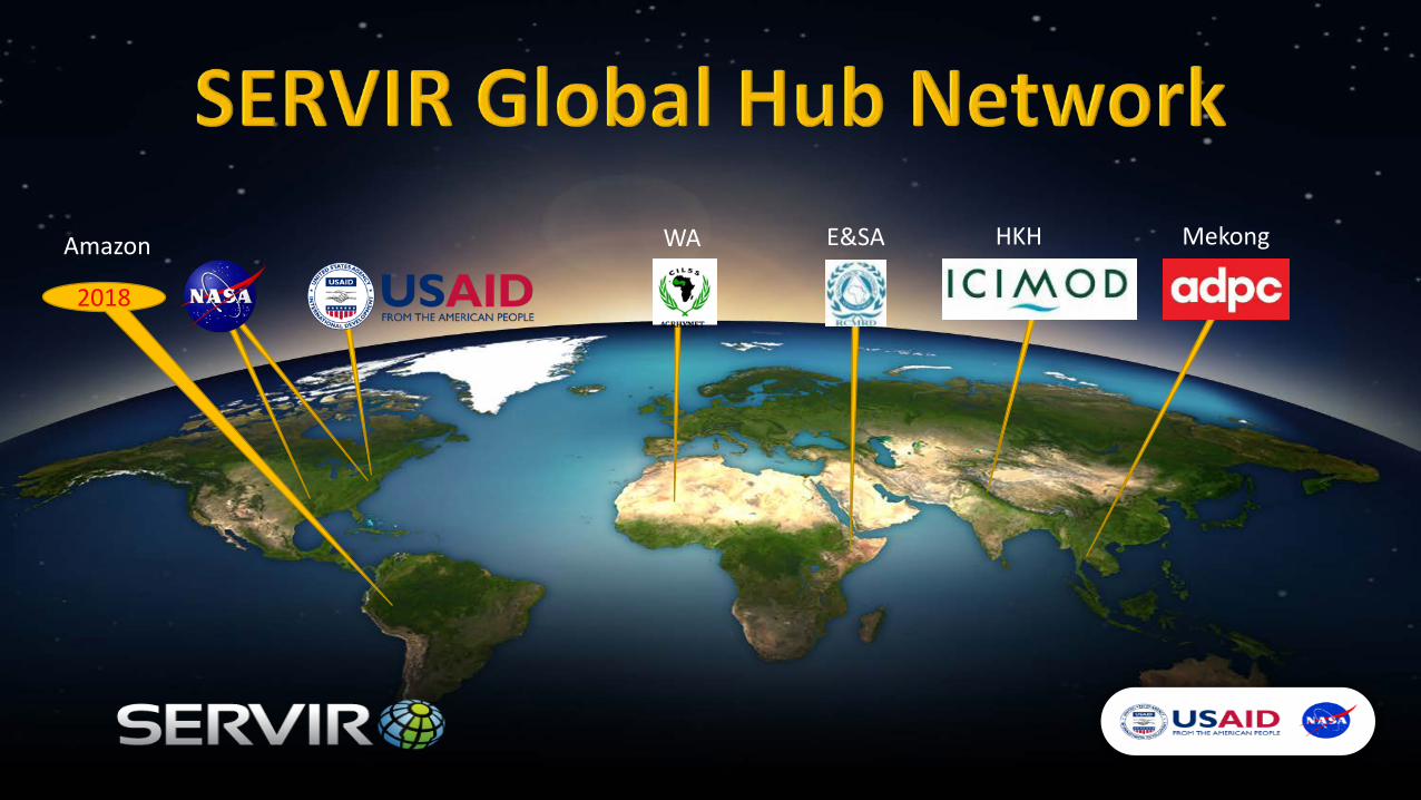
2018
Amazon WA E&SA HKH Mekong
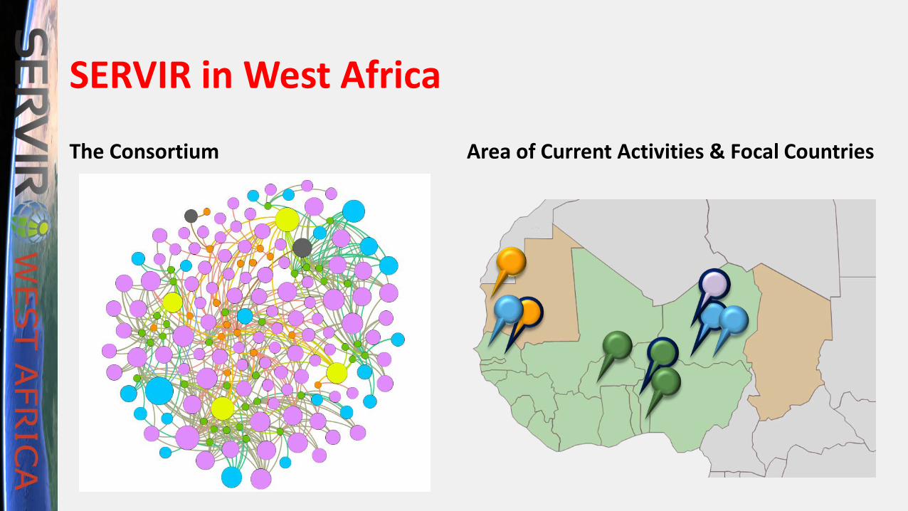
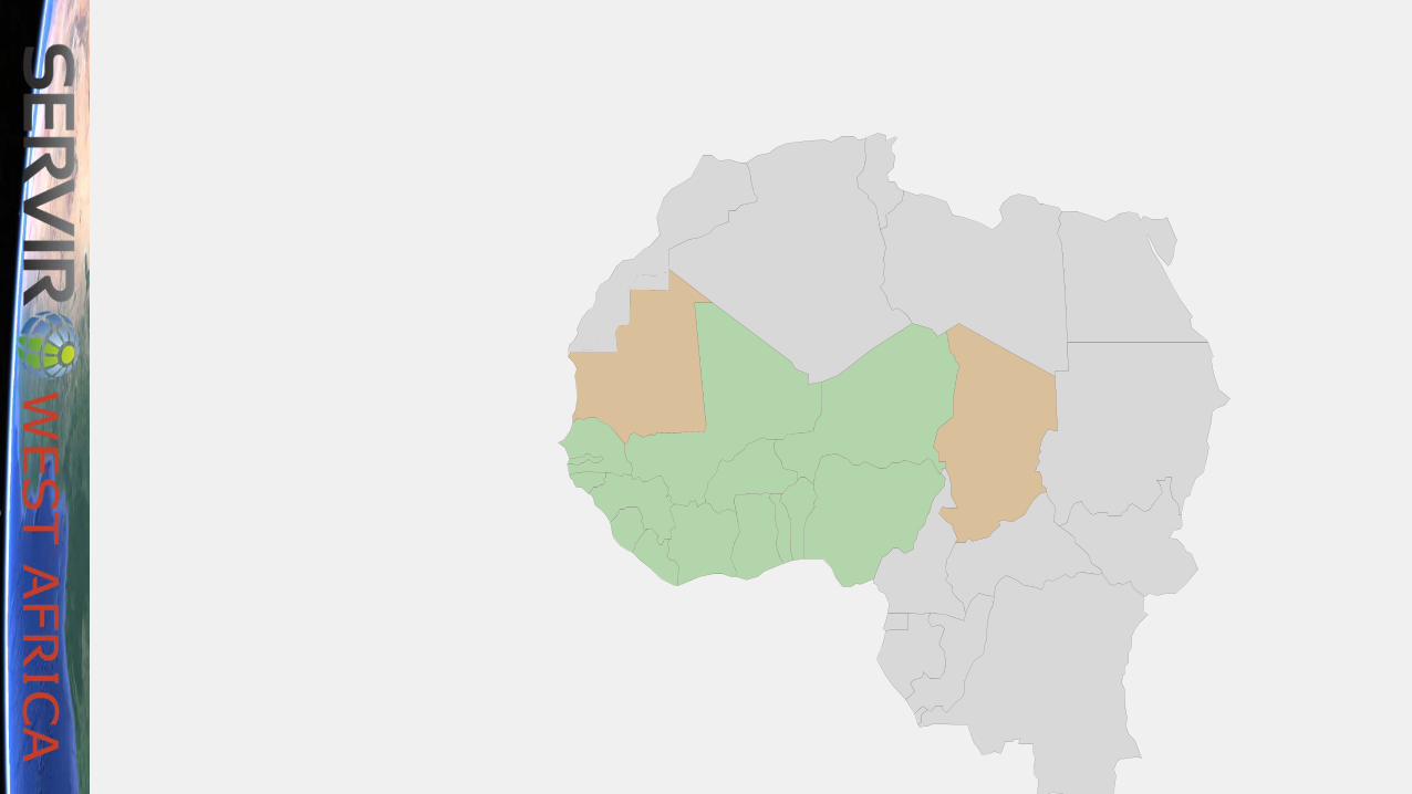
SERVIR in West Africa
The Consortium
CILSS/AGRHYMETCOORDINATION
CERSGISGhana
CSE Senegal
ACMADAfrica Reg.
ICRISATSemi-Arid
AFRIGIST8 WA
Countries
Area of Current Activities & Focal Countries
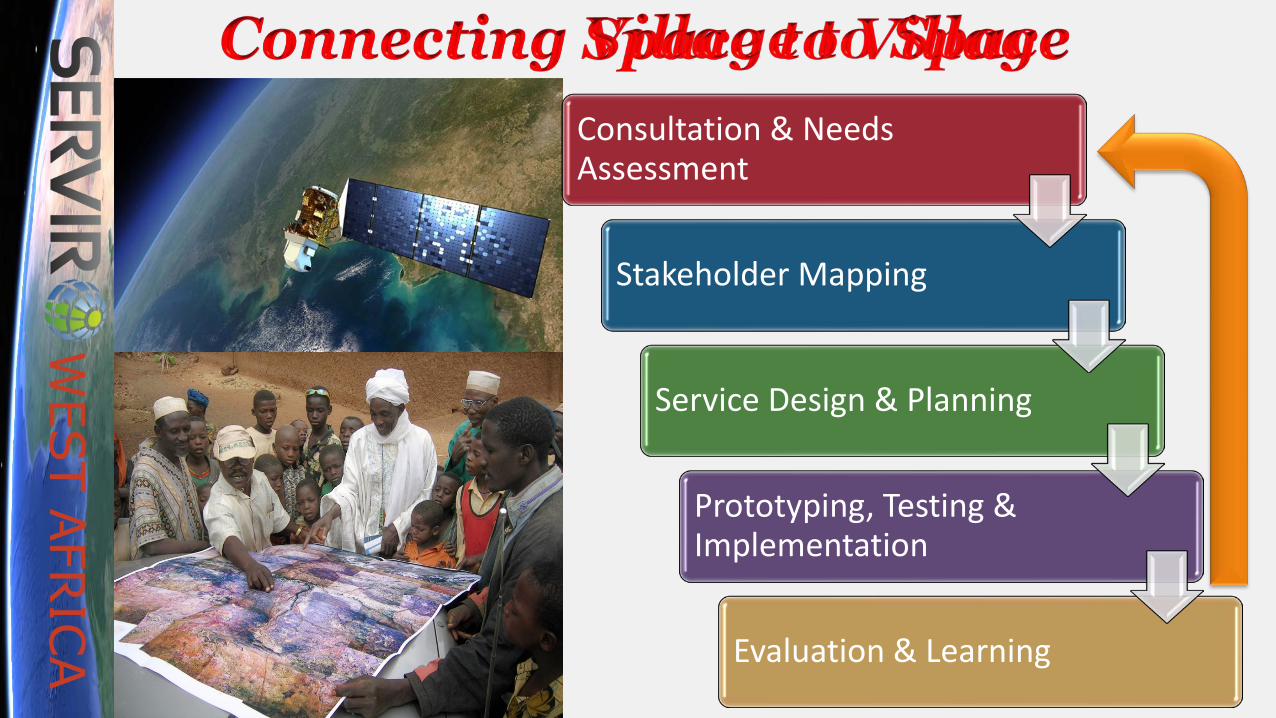
Consultation & Needs Assessment
Stakeholder Mapping
Service Design & Planning
Prototyping, Testing & Implementation
Evaluation & Learning

SERVIR Service Areas
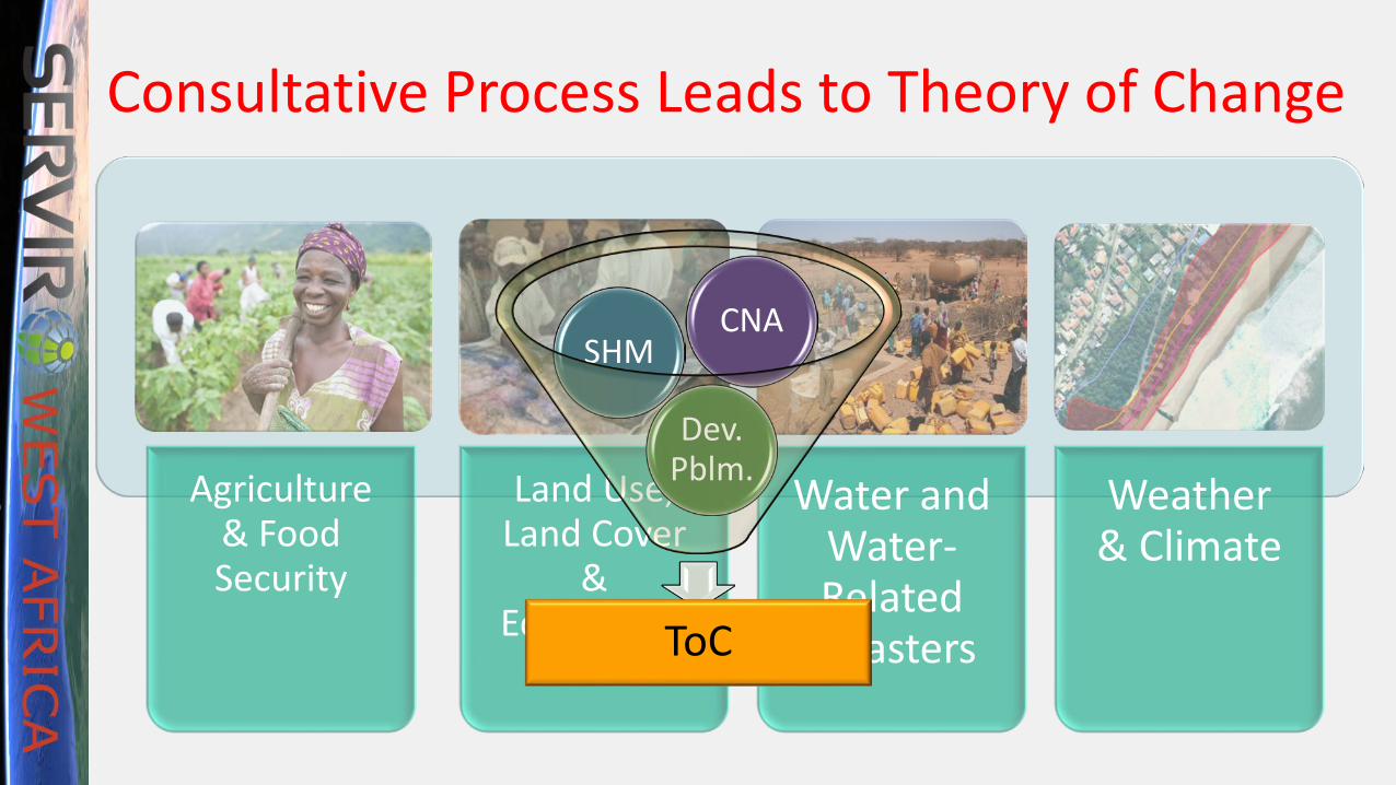
Agriculture & Food Security
Land Use, Land Cover
& Ecosystems
Water and Water-Related
Disasters
Weather& Climate
Agriculture & Food Security
Land Use, Land Cover
& Ecosystems
Water and Water-Related
Disasters
Weather& Climate
Consultative Process Leads to Theory of Change
ToC
Dev. Pblm.
SHMCNA

ToC
Dev. Pblm.
SHMCNA
Data
Product
Tool
Platform
Training
Service Package BENEFICIARIES
Service Components
DataProductToolPlatformTraining
From Service Areas to Service Packages
Service Delivery
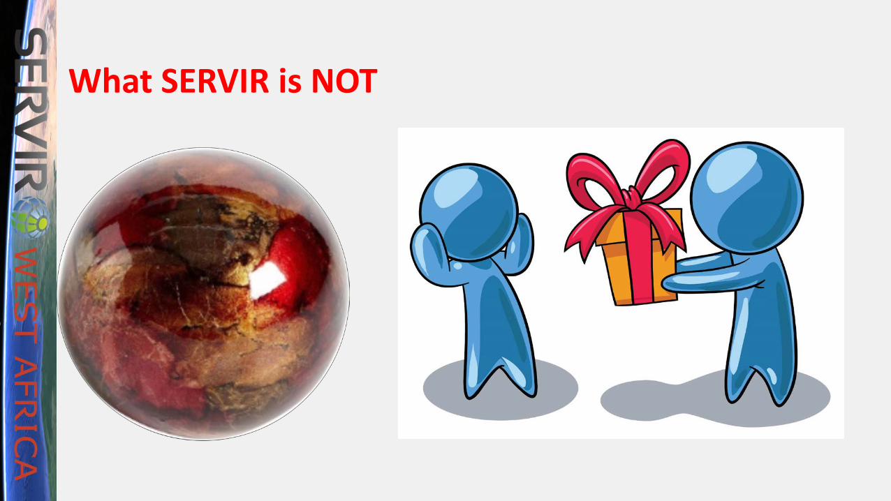
What SERVIR is NOT

Data & Data StandardsWorkshop
Ongoing Regional Dialogue
Consortium Understands
Guidelines
Consortium Data
Catalogue Developed
SERVIR WA Establishes
Data Standards
Consortium Data Sharing Agreements
Data Guidelines Applied to
Services
SERVIR WA Data Platform
Deployed
DMDD for SERVIR WA
Data Platform
Data Platform Requirements
& Specifications
AWARENESS AND ACCESS TO INFORMATION IMPROVED Regionally and Nationally
Metadata Standards Applied by
Consortium Members
Regional Actors
Engaged
Data Catalogue Questionnaireto Consortium
Prototype Designed &
Tested
• Establish means of open access to data and tools for decision-making
• Promote free and open data access amongst partners
• Agree standards and formats for data
• Comply with USAID & US Government free data access regulations
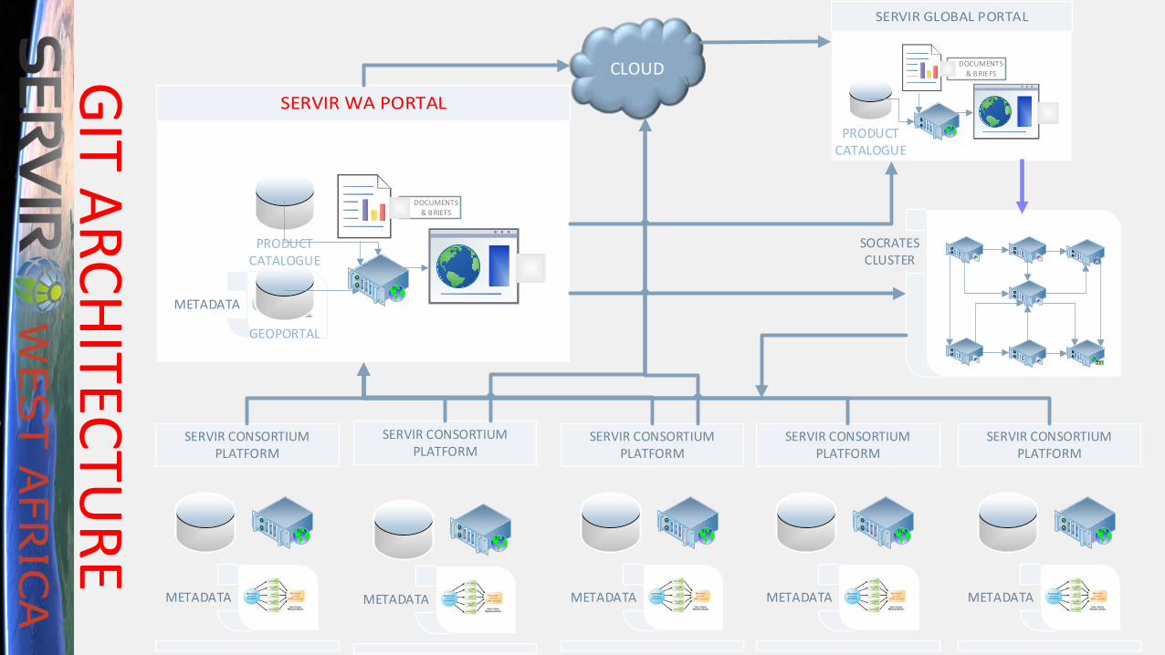
SERVIR CONSORTIUM PLATFORM
SERVIR CONSORTIUM PLATFORM
SERVIR CONSORTIUM PLATFORM
SERVIR CONSORTIUM PLATFORM
SERVIR CONSORTIUM PLATFORM
SOCRATESCLUSTER
CLOUD
METADATA METADATA METADATA METADATA METADATA
DOCUMENTS& B RIEFS
PRODUCT CATALOGUE
METADATA
GEOPORTAL
DOCUMENTS& B RIEFS
PRODUCT CATALOGUE
GIT ARCHITECTURE
Relevance to the West African Region
SERVIR WA Approach:• Bottom Up Generation and Sharing
of Data• Explicit Agreements Amongst
Partners• Demand-Driven Service Selection• Co-Development of Services and
Data• Federated System of Data Holdings• Redundancy in Architecture• Attention to Bandwidth
The West African Region• SERVIR GIT requirements form a
microcosm of the Region• SERVIR WA Partners are
technical champions for GSDI• Need to identify Policy
Champions
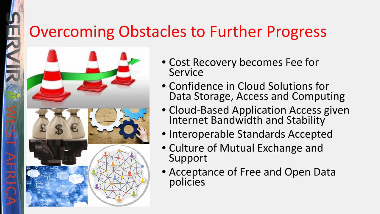
Overcoming Obstacles to Further Progress
• Cost Recovery becomes Fee for Service
• Confidence in Cloud Solutions for Data Storage, Access and Computing
• Cloud-Based Application Access given Internet Bandwidth and Stability
• Interoperable Standards Accepted• Culture of Mutual Exchange and
Support• Acceptance of Free and Open Data
policies
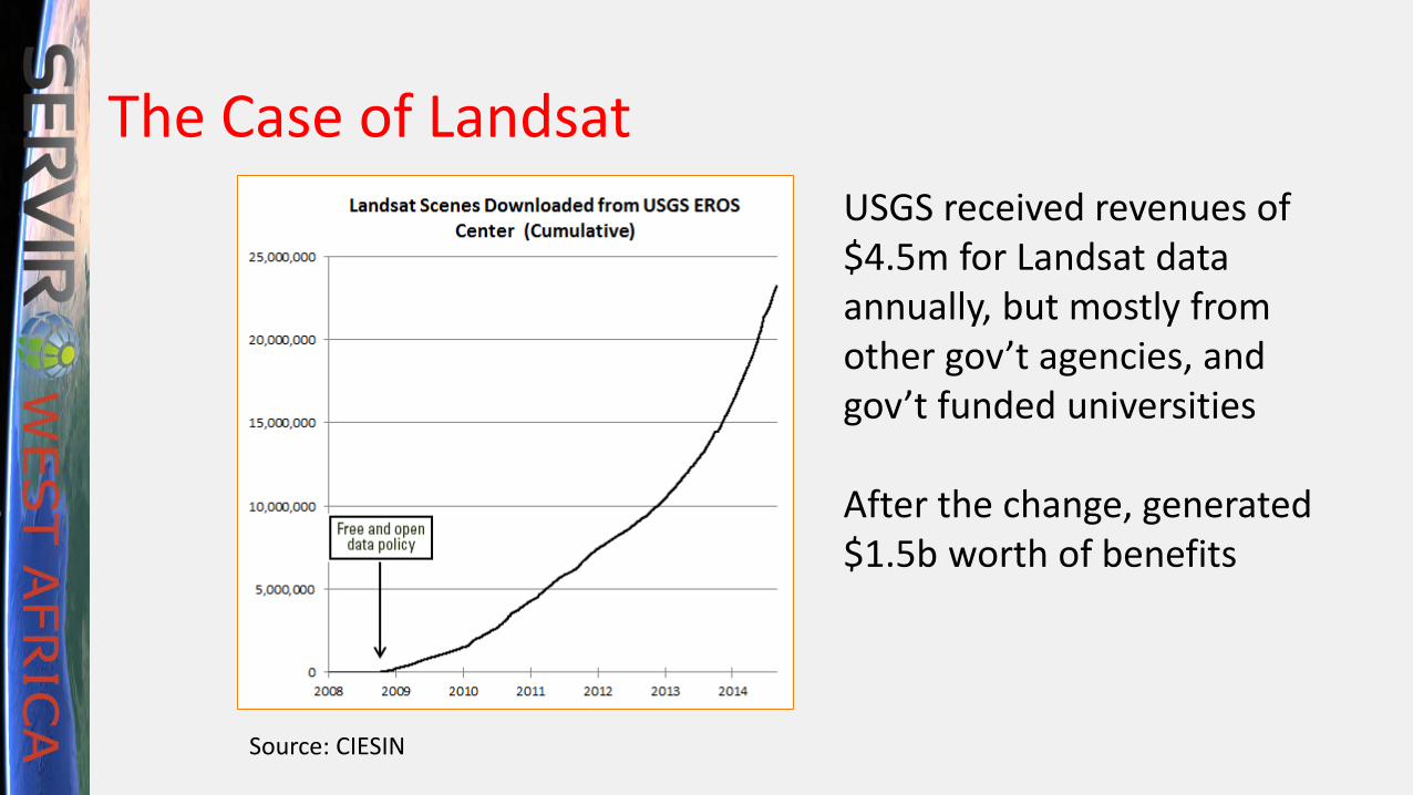
The Case of LandsatUSGS received revenues of $4.5m for Landsat data annually, but mostly from other gov’t agencies, and gov’t funded universities
After the change, generated $1.5b worth of benefits
Source: CIESIN
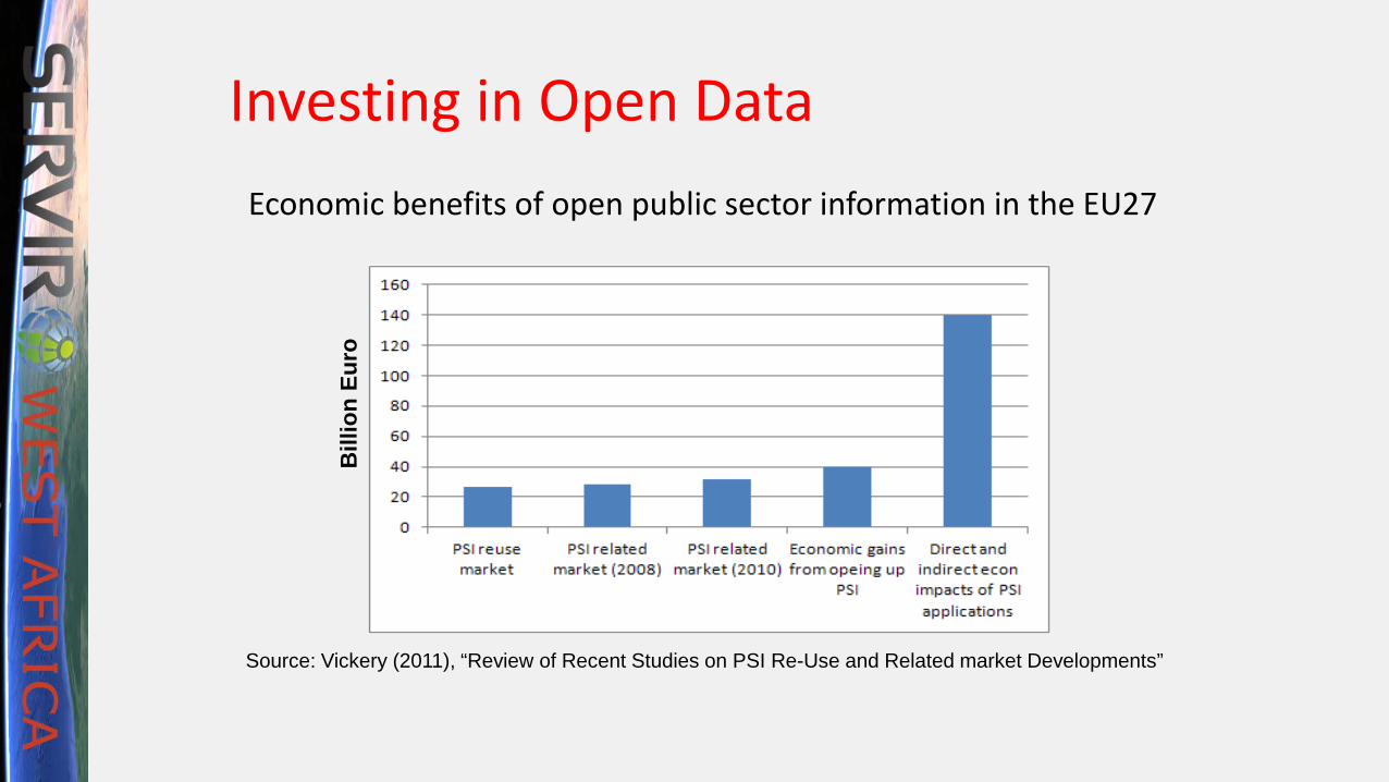
Investing in Open DataEconomic benefits of open public sector information in the EU27
Bill
ion
Euro
Source: Vickery (2011), “Review of Recent Studies on PSI Re-Use and Related market Developments”

Active GSDI Efforts in West AfricaIssues:• Funding• National Policies• Regional ChampionsOpportunities to Build Upon:• UNECA Efforts• UMOA Roadmap• SERVIR Regional Data
Workshop• Africa GIS 2017 &UN-GGIM• AfriGEOSS 2018 Sources: UNECA, National Reports

Find Champions
Engage ECOWAS
Define Objectives & Timeline
Create Vision & Architecture
ACT! Adapt to National Structures
Roadmap for Regional GSDI Progress

Trends to Capture• New technologies• NewMedia• Cloud solutions• Cloud-based
Application Access• New Sensors and
Citizen Science

THANK YOU

Related Documents