Geospatial Metadata Overview WV AGP GIS Conference, 9 -12 June 2008 Presented by: Eric Hopkins, GIS Analyst [email protected] West Virginia GIS Technical Center (WVGISTC) Department of Geology and Geography West Virginia University Morgantown, WV 26506

Geospatial Metadata Overview WV AGP GIS Conference, 9 -12 June 2008 Presented by: Eric Hopkins, GIS Analyst [email protected] West Virginia GIS Technical.
Dec 25, 2015
Welcome message from author
This document is posted to help you gain knowledge. Please leave a comment to let me know what you think about it! Share it to your friends and learn new things together.
Transcript
Geospatial Metadata OverviewWV AGP GIS Conference, 9 -12 June 2008
Presented by:
Eric Hopkins, GIS Analyst
West Virginia GIS Technical Center (WVGISTC)
Department of Geology and Geography
West Virginia University
Morgantown, WV 26506

Geospatial Metadata Overview: Outline
Objectives
Metadata concepts
Why use metadata?
The Content Standard for Digital Geospatial Metadata (CSDGM)
ISO metadata
Approaches to creating metadata
Templates
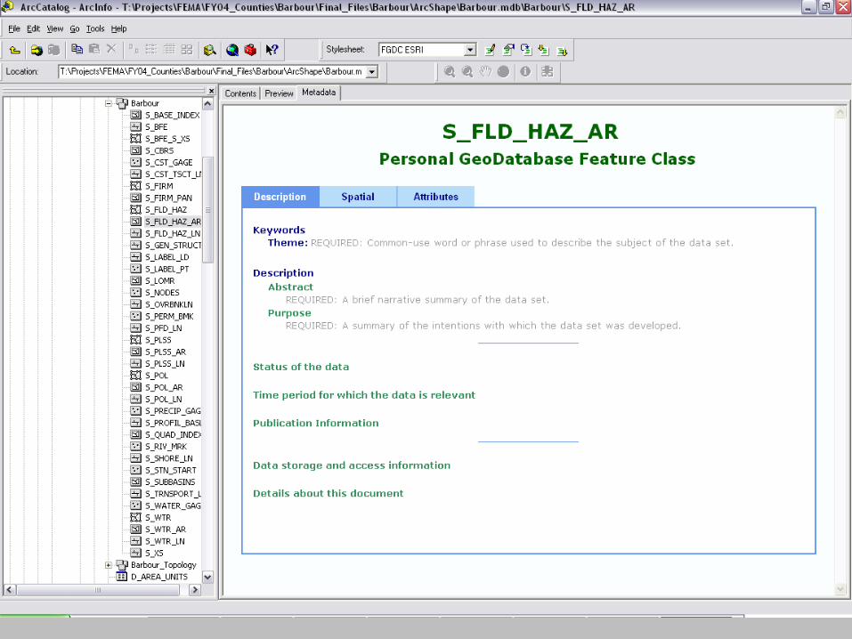
ArcCatalog forms
Text editing
Requirement for data submission
Tools for editing and parsing metadata for CSDGM compliance
Metadata Parser (mp)
TKME
XML editors
Applying knowledge and tools to your data sets
Links to online metadata resources

Geospatial Metadata Overview: Outline
ObjectivesMetadata concepts
Why use metadata
The Content Standard for Digital Geospatial Metadata (CSDGM)
ISO Metadata
Approaches to creating metadata
Templates
ArcCatalog forms
Text editing
Requirement for data submission
Tools for editing and parsing metadata for CSDGM compliance
Metadata Parser (mp)
TKME
XML editors
Applying knowledge and tools to your data sets
Links to online metadata resources
Objectives for this workshop
Enable attendees to:
- read and comprehend formal metadata.
- understand the purpose and value of metadata.
- discriminate between minimal and quality metadata.
- locate and access online resources.
- begin exploring methods that work best for you.
- build, validate, publish geospatial metadata

Geospatial Metadata Overview: Outline
Objectives
Metadata conceptsWhy use metadata
The Content Standard for Digital Geospatial Metadata (CSDGM)
ISO metadata
Approaches to creating metadata
Templates
ArcCatalog forms
Text editing
Requirement for data submission
Tools for editing and parsing metadata for CSDGM compliance
Metadata Parser (mp)
TKME
XML editors
Applying knowledge and tools to your data sets
Links to online metadata resources
Let’s Make Metadata
Describe yourself using this format:
Title (name)
Theme Keywords (work, play, life)
Supplemental Information (unique characteristic)
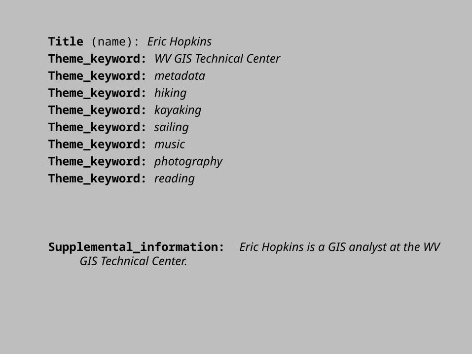
Title (name): Eric Hopkins
Theme_keyword: WV GIS Technical Center
Theme_keyword: metadata
Theme_keyword: hiking
Theme_keyword: kayaking
Theme_keyword: sailing
Theme_keyword: music
Theme_keyword: photography
Theme_keyword: reading
Supplemental_information: Eric Hopkins is a GIS analyst at the WV GIS Technical Center.

What is geospatial metadata?
From Metadata in Plain Language, USGS, 2007http://geology.usgs.gov/tools/metadata//tools/doc/ctc/
WHAT does the data set describe?WHO produced the data set?WHY was the data set created?HOW was the data set created?HOW reliable are the data (caveats)?HOW can I get a copy of the data set?WHO wrote the metadata?
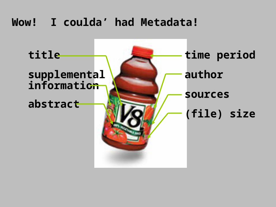
title
supplemental information
abstract
time period
author
sources
(file) size
Wow! I coulda’ had Metadata!
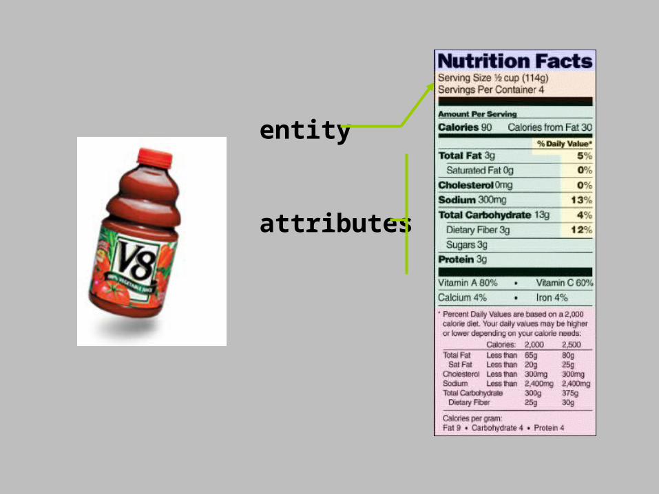
entity
attributes

Introduction to Geospatial Metadata: Workshop Outline
Objectives for this workshop
Metadata concepts
Why use metadataThe Content Standard for Digital Geospatial Metadata (CSDGM)
ISO metadata
Approaches to creating metadata
Templates
ArcCatalog forms
Text editing
Requirement for data submission
Tools for editing and parsing metadata for CSDGM compliance
Metadata Parser (mp)
TKME
XML editors
Applying knowledge and tools to your data sets
Links to online metadata resources

Why use metadata?
Data developers and distributers use metadata to
- avoid duplication of effort.
- reduce labor and time costs.
- share information, internally and externally.
- publicize their work.
- protect their investment through personnel changes.
- limit their liability.

Why use metadata?
Data consumers use metadata to
- better understand the data set that they have acquired.
- focus on data elements key to their efforts.
- discover data inside and outside of their organization.
- access geospatial data via web mapping services

The changing paradigm of geospatial data production and distribution
Centralized Distributed
A data set may be produced, stored and maintained by a single organization.
Local or regional organizations produce and store data that is accessible via services operated under national standards.
Introduction to Geospatial Metadata: Workshop Outline
Objectives for this workshopMetadata conceptsWhy use metadata?
The Content Standard for Digital Geospatial Metadata (CSDGM)
ISO metadataApproaches to creating metadata
TemplatesArcCatalog formsText editingRequirement for data submission
Tools for editing and parsing metadata for CSDGM complianceMetadata Parser (mp)TKMEXML editors
Applying knowledge and tools to your data setsLinks to online metadata resources

Acronyms
FGDC: Federal Geographic Data Committee
CSDGM: Content Standard for Digital Geospatial Data
NSDI: National Spatial Data Infrastructure
ISO: International Standards Organization
GOS: Geospatial One-Stop
See the links included at the end of this document for more information.


Introduction to Geospatial Metadata: Workshop Outline
Objectives for this workshop
Metadata concepts
Why use metadata?
The Content Standard for Digital Geospatial Metadata (CSDGM)
ISO metadata
Approaches to creating metadata
TemplatesArcCatalog forms
Text editing
Requirement for data submission
Tools for editing and parsing metadata for CSDGM compliance
Metadata Parser (mp)
TKME
XML editors
Applying knowledge and tools to your data sets
Links to online metadata resources
Introduction to Geospatial Metadata: Workshop Outline
Objectives for this workshopMetadata conceptsWhy use metadata?The Content Standard for Digital Geospatial Metadata (CSDGM)ISO metadata
Approaches to creating metadataTemplates
ArcCatalog formsText editingRequirement for data submission
Tools for editing and parsing metadata for CSDGM complianceMetadata Parser (mp)TKMEXML editors
Applying knowledge and tools to your data setsLinks to online metadata resources

Introduction to Geospatial Metadata: Workshop Outline
Objectives for this workshopMetadata conceptsWhy use metadata?The Content Standard for Digital Geospatial Metadata (CSDGM)ISO metadata
Approaches to creating metadataTemplates
ArcCatalog forms
Text editingRequirement for data submission
Tools for editing and parsing metadata for CSDGM complianceMetadata Parser (mp)TKMEXML editors
Applying knowledge and tools to your data setsLinks to online metadata resources
Introduction to Geospatial Metadata: Workshop Outline
Objectives for this workshopMetadata conceptsWhy use metadata?The Content Standard for Digital Geospatial Metadata (CSDGM)ISO metadataApproaches to creating metadata
TemplatesArcCatalog formsText editingRequirement for data submission
Tools for editing and parsing FGDC metadata
Metadata Parser (mp)TKMEXML editors
Applying knowledge and tools to your data setsLinks to online metadata resources

Introduction to Geospatial Metadata: Workshop Outline
Objectives for this workshopMetadata conceptsWhy use metadata?The Content Standard for Digital Geospatial Metadata (CSDGM)ISO metadataApproaches to creating metadata
TemplatesArcCatalog formsText editingRequirement for data submission
Tools for editing and parsing FGDC metadata Metadata Parser (mp)TKME
XML editorsApplying knowledge and tools to your data setsLinks to online metadata resources
Introduction to Geospatial Metadata: Workshop Outline
Objectives for this workshopMetadata conceptsWhy use metadata?The Content Standard for Digital Geospatial Metadata (CSDGM)ISO metadataApproaches to creating metadata
TemplatesArcCatalog formsText editingRequirement for data submission
Tools for editing and parsing FGDC metadata Metadata Parser (mp)TKMEXML editors
Applying knowledge and tools to your data setsLinks to online metadata resources

Introduction to Geospatial Metadata: Workshop Outline
Objectives for this workshopMetadata conceptsWhy use metadata?The Content Standard for Digital Geospatial Metadata (CSDGM)ISO metadataApproaches to creating metadata
TemplatesArcCatalog formsText editingRequirement for data submission
Tools for editing and parsing FGDC metadata Metadata Parser (mp)TKMEXML editors
Applying knowledge and tools to your data sets
Links to online metadata resources

Links to on-line metadata resources
Federal Geographic Data Committee (FGDC)http://fgdc.gov/
Metadata Workbook (FGDC “Green Book”)http://fgdc.gov/metadata/meta_workbook.html
Content Standard for Digital Geospatial Metadatahttp://fgdc.gov/metadata/contstan.html (overview, links to documents)
National Spatial Data Infrastructure (NSDI)http://www.fgdc.gov/nsdi/nsdi.html
Wisconsin ‘Metadata Primer’http://www.geography.wisc.edu/sco/wisclinc/metatool/
Geospatial One-Stophttp://www.geodata.gov/gos
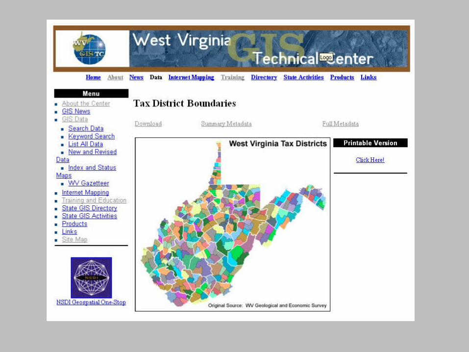
West Virginia GIS Technical Centerhttp://wvgis.wvu.edu/
Related Documents