19/11/2018 1 CyberGIS Center for Advanced Digital and Spatial Studies Geospatial Discovery and Innovation in the Era of CyberGIS and Machine Intelligence Shaowen Wang Department of Geography and Geographic Information Science (Primary) CyberGIS Center for Advanced Digital and Spatial Studies CyberInfrastructure and Geospatial Information Laboratory Department of Computer Science Department of Urban and Regional Planning School of Information Sciences University of Illinois at Urbana-Champaign United Nations World Geospatial Information Congress Deqing, Zhejiang, China November 19, 2018 CyberGIS Center for Advanced Digital and Spatial Studies GIS • Systems • Science • Services • Society • Synthesis • Geo and spatial are special Image source: http://www.oxera.com/Oxera/media/Oxera/download s/reports/What-is-the-economic-impact-of-Geo- services_1.pdf 2

Welcome message from author
This document is posted to help you gain knowledge. Please leave a comment to let me know what you think about it! Share it to your friends and learn new things together.
Transcript

19/11/2018
1
CyberGIS Center for Advanced Digital and Spatial Studies
Geospatial Discovery and Innovation in the Era of CyberGIS and Machine Intelligence
Shaowen Wang
Department of Geography and Geographic Information Science (Primary)CyberGIS Center for Advanced Digital and Spatial Studies
CyberInfrastructure and Geospatial Information LaboratoryDepartment of Computer Science
Department of Urban and Regional PlanningSchool of Information Sciences
University of Illinois at Urbana-Champaign
United Nations World Geospatial Information CongressDeqing, Zhejiang, China
November 19, 2018
CyberGIS Center for Advanced Digital and Spatial Studies
GIS
• Systems
• Science
• Services
• Society
• Synthesis
• Geo and spatial are special
Image source: http://www.oxera.com/Oxera/media/Oxera/downloads/reports/What-is-the-economic-impact-of-Geo-services_1.pdf 2

19/11/2018
2
CyberGIS Center for Advanced Digital and Spatial Studies
Image courtesy of Dandong Yin @ UIUC’s CyberGIS Center
3
CyberGIS Center for Advanced Digital and Spatial Studies
UrbanFlow for Mapping Urban Dynamics
• Soliman, A., Soltani, K., Yin, J., Padmanabhan, A., and Wang, S. (2017) “Social Sensing of Urban Land Use Based on
Analysis of Twitter Users' Mobility Patterns”. PLOS ONE, DOI: 10.1371/journal.pone.0181657
• Soltani, K., Soliman, A., Padmanabhan, A., and Wang, S. “UrbanFlow: Large-scale Framework to Integrate Social Media
and Authoritative Landuse Maps”. In: Proceedings of the 2016 Annual Conference on Extreme Science and Engineering
Discovery Environment (XSEDE'16), Miami, Florida, USA, July 17 – 21, 2016 4

19/11/2018
3
CyberGIS Center for Advanced Digital and Spatial Studies
� Heterogeneous
• Syntactic
• Semantic
� Dynamic
• Spatial and temporal
• E.g. social media
� Massive
• Produced by individuals
• Accessible to individuals
� Large-scale
• Global coverage
� Fine granularity
• Individual-level
• High-resolution
� Distributed access
• Interoperability
• Privacy
• Security
Geospatial Big DataVolume, Velocity, Variety, Variability, Veracity, Value, etc.
5
CyberGIS Center for Advanced Digital and Spatial Studies
6
19/11/2018
4
CyberGIS Center for Advanced Digital and Spatial Studies
7
CyberGIS Center for Advanced Digital and Spatial Studies
Outline
• Applications and Science Drivers
• Science and Technology Frontiers
• Social Dimensions
8
19/11/2018
5
CyberGIS Center for Advanced Digital and Spatial Studies
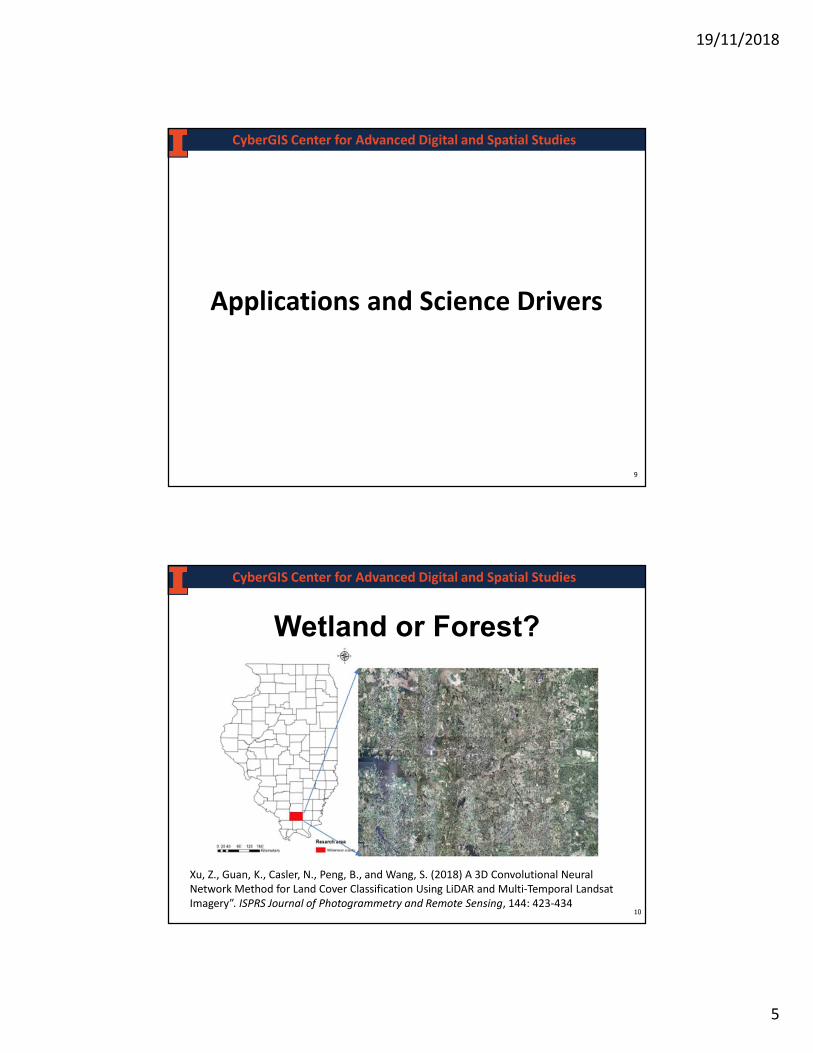
Applications and Science Drivers
9
CyberGIS Center for Advanced Digital and Spatial Studies
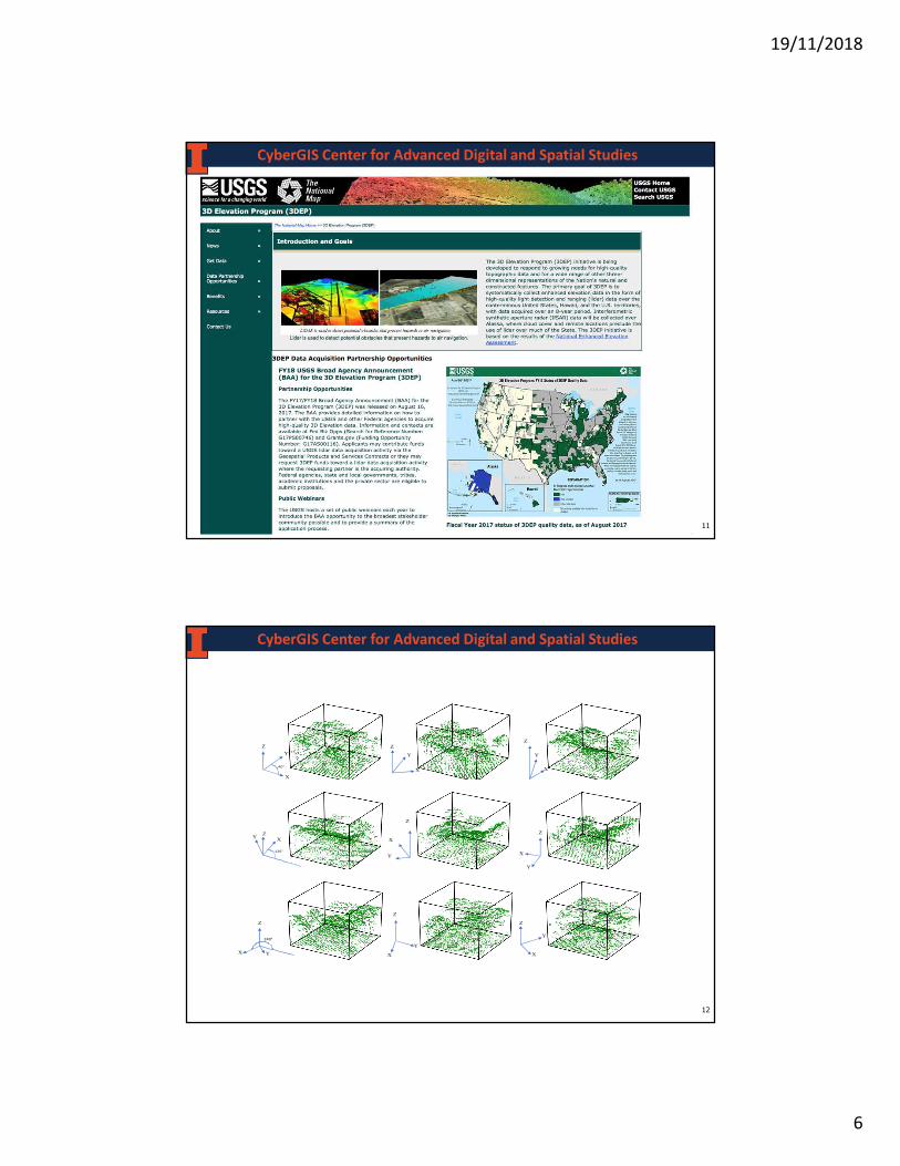
Wetland or Forest?
10
Xu, Z., Guan, K., Casler, N., Peng, B., and Wang, S. (2018) A 3D Convolutional Neural
Network Method for Land Cover Classification Using LiDAR and Multi-Temporal Landsat
Imagery”. ISPRS Journal of Photogrammetry and Remote Sensing, 144: 423-434
19/11/2018
6
CyberGIS Center for Advanced Digital and Spatial Studies
11
CyberGIS Center for Advanced Digital and Spatial Studies
12
X
Y
Z
XY
Z
X
Y
Z
X
Y
Z
120°
X
Y
Z
X
Y
Z
X Y
Z
240°
X
Y
Z
X
Y
Z
40°

19/11/2018
7
CyberGIS Center for Advanced Digital and Spatial Studies
13
CyberGIS Center for Advanced Digital and Spatial Studies
National Land Cover Database 2011
(NLCD 2011)
14

19/11/2018
8
CyberGIS Center for Advanced Digital and Spatial Studies
Computation and Data Challenges
• Data preprocessing– 400+ CPU hours
• LiDAR denoising• LiDAR data buffering and separation (heavy I/O)• Data aggregation (voxelization)
• Feature extraction process– 30 GPU hours with fixed parameters
• 500 maximum epochs training with batch size of 256 (learningrate 0.001, momentum 0.9)
• Classification process– Without training data enlargement
• Two-level grid search• Five-fold cross validation• 20,000 parameter combinations take 20 CPU hours
– With training data enlargement• 9 times more than training without rotation
15
CyberGIS Center for Advanced Digital and Spatial Studies
16
19/11/2018
9
CyberGIS Center for Advanced Digital and Spatial Studies
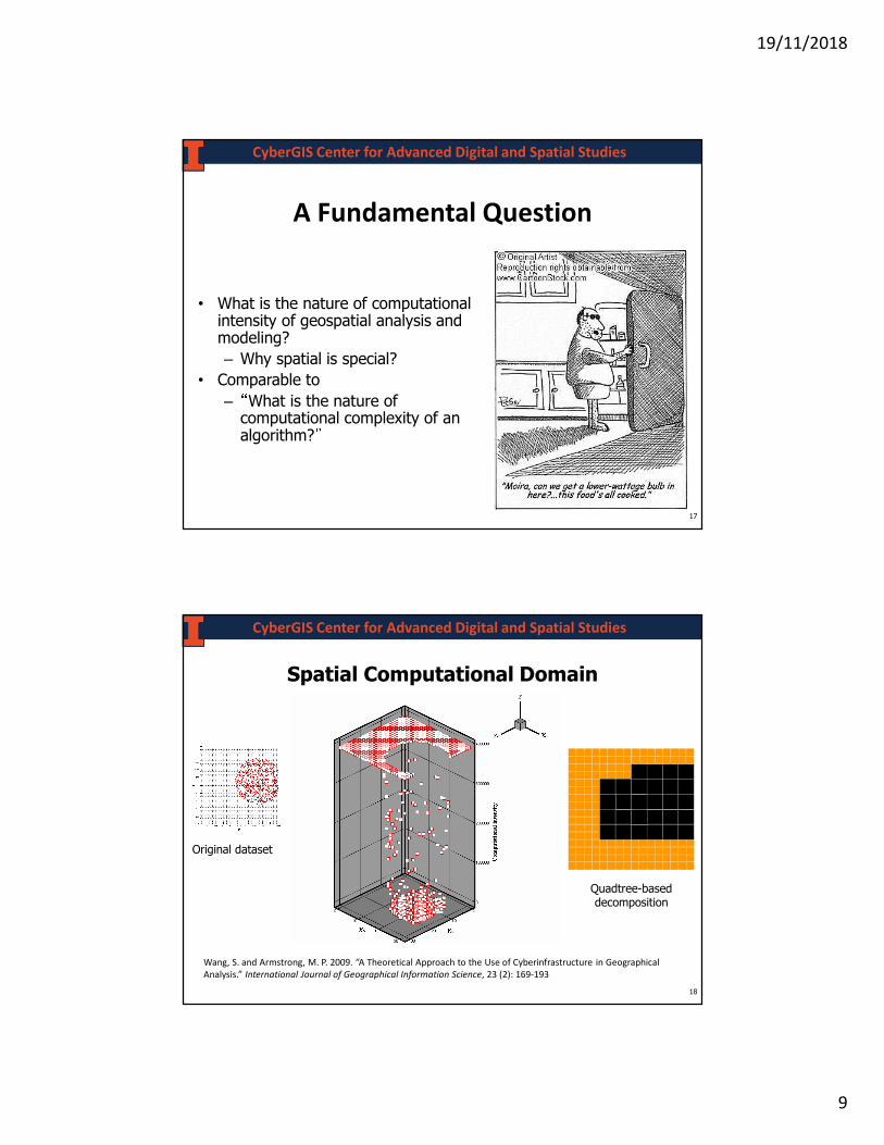
A Fundamental Question
• What is the nature of computational intensity of geospatial analysis and modeling?
– Why spatial is special?
• Comparable to
– �What is the nature of computational complexity of an algorithm?�
17
CyberGIS Center for Advanced Digital and Spatial Studies
Spatial Computational Domain
Original dataset
Quadtree-based decomposition
Wang, S. and Armstrong, M. P. 2009. “A Theoretical Approach to the Use of Cyberinfrastructure in Geographical
Analysis.” International Journal of Geographical Information Science, 23 (2): 169-193
18

19/11/2018
10
CyberGIS Center for Advanced Digital and Spatial Studies
Divide and Conquer
1, 10, 0 2, 4
4, 2 5, 3
11, 13
14, 14 15, 15
3, 5
6, 6 7, 7
8, 8 9, 9 10, 12
12, 10 13, 11
1, 10, 0 2, 4
4, 2 5, 3
11, 13
14, 14 15, 15
3, 5
6, 6 7, 7
8, 8 9, 9 10, 12
12, 10 13, 11
1, 10, 0 2, 4
4, 2 5, 3
11, 13
14, 14 15, 15
3, 5
6, 6 7, 7
8, 8 9, 9 10, 12
12, 10 13, 11
1, 10, 0 2, 4
4, 2 5, 3
11, 13
14, 14 15, 15
3, 5
6, 6 7, 7
8, 8 9, 9 10, 12
12, 10 13, 11
Small Capacity Large Capacity Medium Capacity19
CyberGIS Center for Advanced Digital and Spatial Studies
Science and Technology Frontiers
20
19/11/2018
11
CyberGIS Center for Advanced Digital and Spatial Studies
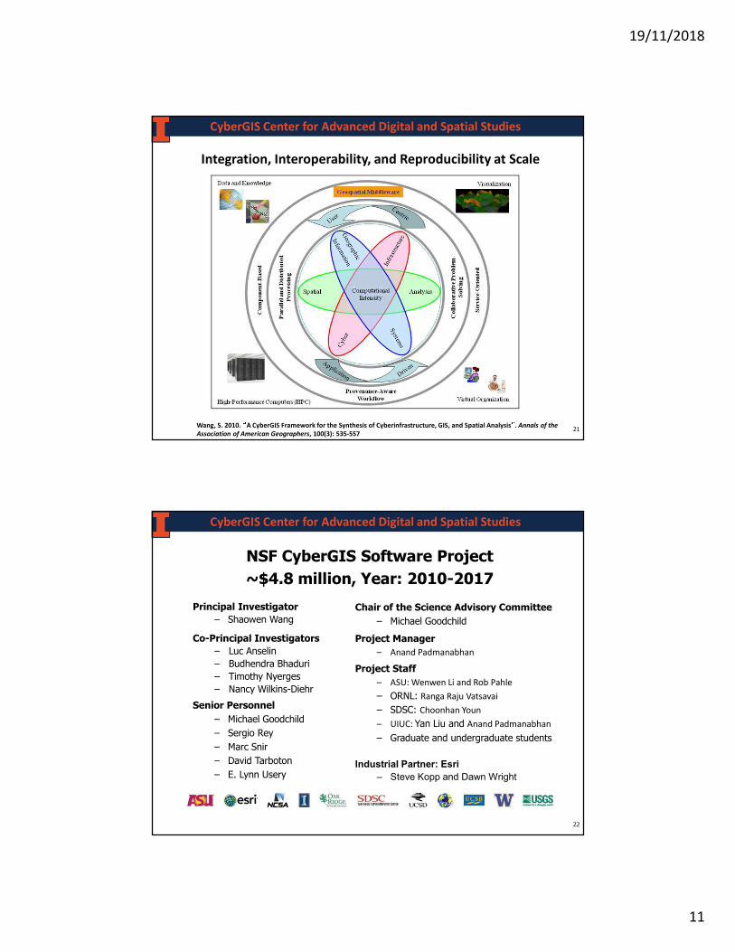
Integration, Interoperability, and Reproducibility at Scale
Wang, S. 2010. �A CyberGIS Framework for the Synthesis of Cyberinfrastructure, GIS, and Spatial Analysis�. Annals of the
Association of American Geographers, 100(3): 535-55721
CyberGIS Center for Advanced Digital and Spatial Studies
NSF CyberGIS Software Project
~$4.8 million, Year: 2010-2017
Principal Investigator
– Shaowen Wang
Project Staff
– ASU: Wenwen Li and Rob Pahle
– ORNL: Ranga Raju Vatsavai
– SDSC: Choonhan Youn
– UIUC: Yan Liu and Anand Padmanabhan
– Graduate and undergraduate students
Industrial Partner: Esri
– Steve Kopp and Dawn Wright
Co-Principal Investigators
– Luc Anselin
– Budhendra Bhaduri
– Timothy Nyerges
– Nancy Wilkins-Diehr
Senior Personnel
– Michael Goodchild
– Sergio Rey
– Marc Snir
– David Tarboton
– E. Lynn Usery
Project Manager
– Anand Padmanabhan
Chair of the Science Advisory Committee
– Michael Goodchild
22

19/11/2018
12
CyberGIS Center for Advanced Digital and Spatial Studies
Virtual
R O G E R
www.xsede.org
Geospatial Discovery and Innovation
CyberGIS
Toolkit
CyberGIS Gateway
GISolve
Middleware
http://cybergis.illinois.edu 23
CyberGIS Center for Advanced Digital and Spatial Studies
Wang, S., Liu, Y., and Padmanabhan, A. 2016. “Open CyberGIS Software for Geospatial Research and
Education in the Big Data Era”. SoftwareX, 5: 1-524

19/11/2018
13
CyberGIS Center for Advanced Digital and Spatial Studies
CyberGIS Supercomputer – ROGER
(Resourcing Open Geospatial Education and Research)
• 5+ petabytes of raw disk storage with high input/output (I/O) bandwidth
• Solid-state drives for applications demanding high data-access performance
• Advanced graphics processing units for exploiting massive parallelism in geospatial data and computing
• Interactive visualization supported with a high-speed network and dynamically provisioned cloud computing resource
NSF MRI: Acquisition of a National CyberGIS Facility for Computing- and Data-Intensive Geospatial Research and Education
25
CyberGIS Center for Advanced Digital and Spatial Studies

19/11/2018
14
CyberGIS Center for Advanced Digital and Spatial Studies
Geospatial Data Science
Geospatial
Sciences &
Technologies
Big
Data &
CyberGIS
27
CyberGIS Center for Advanced Digital and Spatial Studies
Social Dimensions
28

19/11/2018
15
CyberGIS Center for Advanced Digital and Spatial Studies
Collaborative Problem Solving and Decision Making
Hu, H., Lin, T., Liu, Y.Y., Wang, S., Rodriguez, L. (2015) “CyberGIS-BioScope: A Cyberinfrastructure-based
Spatial Decision-Making Environment for Biomass-to-Biofuel Supply Chain Optimization”. Concurrency and
Computation: Practice and Experience, 27(16): 4437–4450 29
CyberGIS Center for Advanced Digital and Spatial Studies
Rodriguez, Ouyang, and Wang (2018)30

19/11/2018
16
CyberGIS Center for Advanced Digital and Spatial Studies
Vision
Inte
gra
tio
n a
nd
Syn
the
sis
Science & Technology
Extreme-Scale
Computing, NSF
XSEDE, ROGER, etc.
Spatial Computational
Theories & Methods
CyberGIS
Geospatial Data Science
Advanced Computing &
Cyberinfrastructure
Computation- & Data-Intensive
Applications and Sciences
31
Earth & Environment,
Emergency
Management, Food +
Energy + Water Nexus,
Sustainability, etc.
CyberGIS Center for Advanced Digital and Spatial Studies
Conceptualizing a National
Geospatial Software Institute (GSI)
http://gsi.cigi.Illinois.edu
Revolutionize discovery and innovation
across many fields through synergistically
advancing cyberGIS and geospatial inspired
computing and data sciences
32
19/11/2018
17
CyberGIS Center for Advanced Digital and Spatial Studies
Acknowledgments� Federal Agencies
� Department of Energy’s Office of Science
� National Aeronautics and Space Administration
� National Science Foundation
– ACI-1047916
– ACI-1443080
– ACI-1429699
– ACI-1551492
– OAC-1743184
– BCS-0846655
– EAR-1239603
– ICER-1833225
– IIS-1354329
– XSEDE
� US Department of Agriculture (USDA)
� US Geological Survey (USGS)
� Industry
� Environmental Systems Research Institute (Esri)
� Nvidia
33
CyberGIS Center for Advanced Digital and Spatial Studies
34

19/11/2018
18
CyberGIS Center for Advanced Digital and Spatial Studies
谢谢 - Thanks!
• Comments / Questions?
• Email: [email protected]
35
Related Documents