Welcome message from author
This document is posted to help you gain knowledge. Please leave a comment to let me know what you think about it! Share it to your friends and learn new things together.
Transcript


GEOLOGY
OFNEWYORK
THEUNIVERSITYOFTHESTATEOFNEWYORK
RegentsofTheUniversity
CarlT.Hayden,Chancellor,A.B.,J.D ElmiraDianeO’Neill,McGivern,ViceChancellor,B.S.N.,M.A.,PhD StatenIsland
J.EdwardMeyer,B.A.,LL.B ChappaquaAdelaideL.Sanford,B.A.,M.A.,PhD Hollis
SaulB.Cohen,B.A.,M.A.,PhD NewRochelle
JamesC.Dawson,A.A.,B.A.,M.S.,PhD PeruRobertM.Bennett,B.A.,M.S Tonawanda
RobertM.Johnson,B.S.,J.D LloydHarbor
AnthonyS.Bottar,B.A.,J.D SyracuseMerrylH.Tisch,B.A.,M.A NewYorkHaroldO.Levy,B.S.,M.A.(Oxon),J.D NewYorkEnaL.Farley,B.A.,M.A.,PhD BrockportGeraldineChapey,B.A.,M.A.,Ed.D BelleHarborRicardoE.Oquendo,B.A.,J.D BronxEleanorP.Bartlett,B.A.,M.A AlbanyArnoldB.Gardner,B.A.,LL.B Buffalo
PresidentofTheUniversityandCommissionerofEducationRichardP.Mills
ChiefOperatingOfficerRichardH.Cate
DeputyCommissionerforCulturalEducationCaroleF.Huxley
AssistantCommissionerfortheNewYorkStateMuseumCliffordA.Siegfried
StateGeologistandChiefScientist,GeologicalSurveyRobertH.FakundinyTheStateEducationDepartmentdoesnotdiscriminateonthebasisof
age,color,religion,creed,disability,maritalstatus,veteranstatus,nationalorigin,race,gender,geneticpredispositionorcarrierstatus,orsexualorientationinitseducationalprograms,servicesandactivities.Portionsofthispublicationcanbemadeavailableinavarietyofformats,includingBraille,largeprintoraudiotape,uponrequest.InquiresconcerningthispolicyofnondiscriminationshouldbedirectedtotheDepartment’sOfficeforDiversity,Ethics,andAccess,Room152,EducationBuilding,Albany,NY12234.
GEOLOGYOFNEWYORKASimplifiedAccount
Y.W.Isachsen,E.Landing,J.M.Lauber,L.V.Rickard,andW.B.Rogers,editors
SecondEdition
NewYorkStateMuseumEducationalLeaflet28
NewYorkStateMuseum/GeologicalSurveyTheStateEducationDepartment
TheUniversityoftheStateofNewYorkAlbany,NY12230
2000

Copyright©2000TheNewYorkStateEducationDepartment
Publishedin2000by:TheNewYorkStateGeologicalSurveyNewYorkStateMuseumCulturalEducationCenterAlbany,NewYork12230(518)474-5816Webaddress:http://www.nysm.nysed.gov/geology.html
Requestsforadditionalcopiesofthispublicationmaybemadebycontacting:
PublicationSalesNewYorkStateMuseumCulturalEducationCenterAlbany,NewYork12230(518)449-1404Webaddress:http://www.nysm.nysed.gov/publications.html
ISSN:0735-4401ISBN:1-55557-162-X

CoverPhotograph:ThePotsdamFormation,AusableChasm,ClintonandEssexCounties,NewYork,
NewYorkStateGeologicalSurvey
CONTENTS
LISTOFILLUSTRATIONS
LISTOFTABLES
ACKNOWLEDGEMENTS
FOREWORD
PREFACETOSECONDEDITION
PARTI:BACKGROUNDChapter1:FirstThingsFirst:IntroductionChapter2:ClocksintheRocks:MeasuringGeologicTime
SummaryIntroductionTheRelativeTimeScaleDevelopingaQuantitativeTimeScaleRadiometricDatingReviewQuestionsandExercises
Chapter3:ContinentsAdrift:ThePlateTectonicHistoryofNewYorkState
SummaryIntroductionFormationofNewYork’sOldestRocksRiftingandOpeningoftheIapetusOceanTheTaconianOrogeny:IslandArcCollisionTheAcadianOrogeny:IndirectEffectsTheAlleghanianOrogeny:TheFinalCollisionRiftingandOpeningoftheAtlanticOceanReviewQuestionsandExercises
PARTII:BEDROCKGEOLOGYChapter4:NewMountainsfromOldRocks:AdirondackMountains
SummaryIntroductionTheBigPictureAdirondackRocksandTheirMetamorphismMetasedimentaryandMetavolcanicRocksMetaplutonicRocksGraniticgneissMetanorthositeOlivinemetagabbroDeformationofAdirondackRocksDuctileDeformationBrittleDeformationHowAdirondackDeformationHappenedSummaryoftheGeologicHistoryReviewQuestionsandExercises
Chapter5:Collision!HudsonHighlandsandManhattanProngSummaryIntroductionHudsonHighlandsManhattanProngGeologicHistoryofSoutheasternNewYorkReviewQuestionsandExercises
Chapter6:AViewfromtheHudson:Hudson-MohawkLowlandsandTaconicMountains
SummaryDescriptionofHudson-MohawkLowlandsandTaconicMountainsBeforetheTaconianOrogeny:CambrianandLowerOrdovicianRocksContinentalShelfDepositsTaconicSequenceFossilsintheCambriantoMiddleOrdovicianRocksNewYorkintheEarlyandMiddleCambrian

NewYorkintheLateCambrianNewYorkintheEarlyOrdovicianTheKnoxUnconformityDuringtheTaconianOrogeny:MiddleandUpperOrdovicianRocksAftertheTaconianOrogeny:SilurianRocksReviewQuestionsandExercises
Chapter7:Sand,Salt,and“Scorpions”:NorthernLowlandsandTugHillPlateau
SummaryIntroductionTheRockPackagesTheStoryintheRocksRocksofPackageOne:LateProterozoicthroughEarlyOrdovicianTimeTheSedimentaryRecordInterpretationsRocksofPackageTwo:MiddlethroughLateOrdovicianTimeTheSedimentaryRecordInterpretationsSummaryoftheHistoryRocksofPackageThree:SilurianTimeTheSedimentaryRecordInterpretationsTheNorthernLowlandsFossilRecord:Cambrian,Ordovician,andSilurianReviewQuestionsandExercises
Chapter8:OldestForestsandDeepSeas:ErieLowlandsandAlleghenyPlateau
SummaryDescriptionofErieLowlandsandAlleghenyPlateauRockoftheAlleghenyPlateauEarlyDevonianHistoryMiddleDevonianHistoryLateDevonianHistory
DevonianPlantsandAnimalsLatePaleozoicHistoryReviewQuestionsandExercisesDeformationof“Undeformed”Rocks:StructuresintheAlleghenyPlateauRockBehaviorWhentheCrustIsSqueezedorStretchedLayer-ParallelShortening:TheWayRocksCanDeformwithoutFoldingDeformedFossilsRockCleavageandPencilCleavageSpacedCleavageBlindThrustingDrapeFoldsAlleghanianJointsClarendon-LindenFaultZoneReleaseJointsLate-FormedUnloadingJoints
Chapter9:DinosaurCountry:NewarkLowlandsSummaryIntroductionRocksoftheNewarkLowlandsStructureoftheRocksWhatWastheEnvironmentLike?ReviewQuestionsandExercises
Chapter10:AttheBeach:AtlanticCoastalPlainandContinentalShelfSummaryIntroductionRocksoftheAtlanticCoastalPlainGeologicHistoryReviewQuestionsandExercises
PARTIII:SURFICIALGEOLOGYChapter11:TheMissingRecord:TheTertiaryPeriod
Summary
IntroductionCarvingtheLandscapeTertiaryRock--MissingontheMainlandReconstructingtheTertiaryClimateTertiaryWeatheringandErosionTertiaryRiverSystemsReviewQuestionsandExercises
Chapter12:TheBigChill:ThePleistoceneEpochSummaryIntroductionHowDidtheIceAgeBegin?TheAdvanceGlacialErosionandtheLandformsItCreatedGlacialDepositionandtheLandformsItCreatedTheRetreatPleistoceneLifeReviewQuestionsandExercises
Chapter13:IceSculpting:GlacialFeaturesofNewYorkStateSummaryIntroductionAdirondackMountainsReviewQuestionsandExercisesHudson-MohawkLowlandsReviewQuestionsandExercisesSt.Lawrence-ChamplainLowlandsReviewQuestionsandExercisesErieandOntarioLowlandsReviewQuestionsandExercisesTugHillPlateauReviewQuestionsandExercisesAppalachianPlateausAlleghenyPlateauCatskillMountainsReviewQuestionsandExercises
NewEnglandProvinceReviewQuestionsandExercisesNewarkLowlandsReviewQuestionsandExercisesAtlanticCoastalPlain(LongIsland)ReviewQuestionsandExercises
Chapter14:Yesterday,Today,andTomorrow:HoloceneEpochSummaryIntroductionHoloceneClimatesHoloceneLakesandRiversSeaLevelintheHoloceneTheHoloceneLandscapes-StillChangingReviewQuestionsandExercises
PARTIV:GEOLOGYANDPEOPLEChapter15:MoneyfromRocks:MineralResources
SummaryIntroductionNonmetalsCarbonateRockClayEmeryGarnetGraniteGypsumHalite(CommonSalt)Ilmenite(TitaniumOre)PeatSandandGravelSandstoneSlateSoilTalc

WollastoniteMetalsIronDepositsLead,Silver,andZincMineralFuels:OilandNaturalGasHistoryofOilinNewYorkStateOil-BearingRocksinNewYorkHistoryofNaturalGasinNewYorkStateNaturalGas-BearingRocksinNewYorkReviewQuestionsandExercises
Chapter16:Water,WaterEverywhere:HydrogeologySummarySurfaceWaterGroundwaterTheGrowingDemandforWaterDealingwithEnvironmentalProblemsReviewQuestionsandExercises
Chapter17:Earthquake!What,Where,When,WhySummarySeismicWavesEarthquakesLocatingtheSourceofanEarthquakeTheSizeofanEarthquakeEarthquakesinNewYorkStateEarthquakeHazardinNewYorkStateReviewQuestionsandExercises
Chapter18:ToBuildorNottoBuild:EngineeringGeologySummaryWhatIsEngineeringGeology?GeologicConditionsinNewYorkStateSpecificProblemsHistoryofEngineeringGeologyinNewYorkStateCurrentProblemsforEngineeringGeologyReviewQuestionsandExercises
OH,BYTHEWAY…APPENDIXFigureA.1.Twodrawings:thepositionofEarth’scontinents40millionyearsago;andthepresentpositionofthecontinentsFigureA.2.PhysiographicdiagramofthecontinentalUnitedStatesFigureA.3.DrawingsofsometypicalPaleozoicfossilsfoundinNewYorkFigureA.4.Aseriesof61blockdiagramsthatsummarizestheplate-tectonicgeologichistoryofeasternNorthAmericaFigureA.5.SimplifiedmapoffaultsandfracturesinthebedrockofNewYorkTableA.1.ListofmapsofNewYorkStateavailablefromtheNewYorkStateGeologicalSurveyTableA.2.ConversionofmetricunitstotheEnglishsystemequivalents
SAYWHAT?GLOSSARYOFTECHNICALTERMS
SUBJECTINDEX
ILLUSTRATIONSFigure1.1:
RegionsofNewYorkStateusedindiscussingbedrockgeologyglacialfeatures
Figure2.1: GeologichistoryofNewYorkataglance
Figure3.1: Generalstructureofouterpartoftheearth
Figure3.2: Mapshowinghowlithosphereisbrokenintoplates
Figure3.3: Thethreetypesofplatemargins
Figure3.4: Twostagesofrifting
Figure3.5: Threetypesofconvergentmargins
Figure3.6:
Blockdiagramshowingsubductionbeneathprotohyphen;NorthAmerica
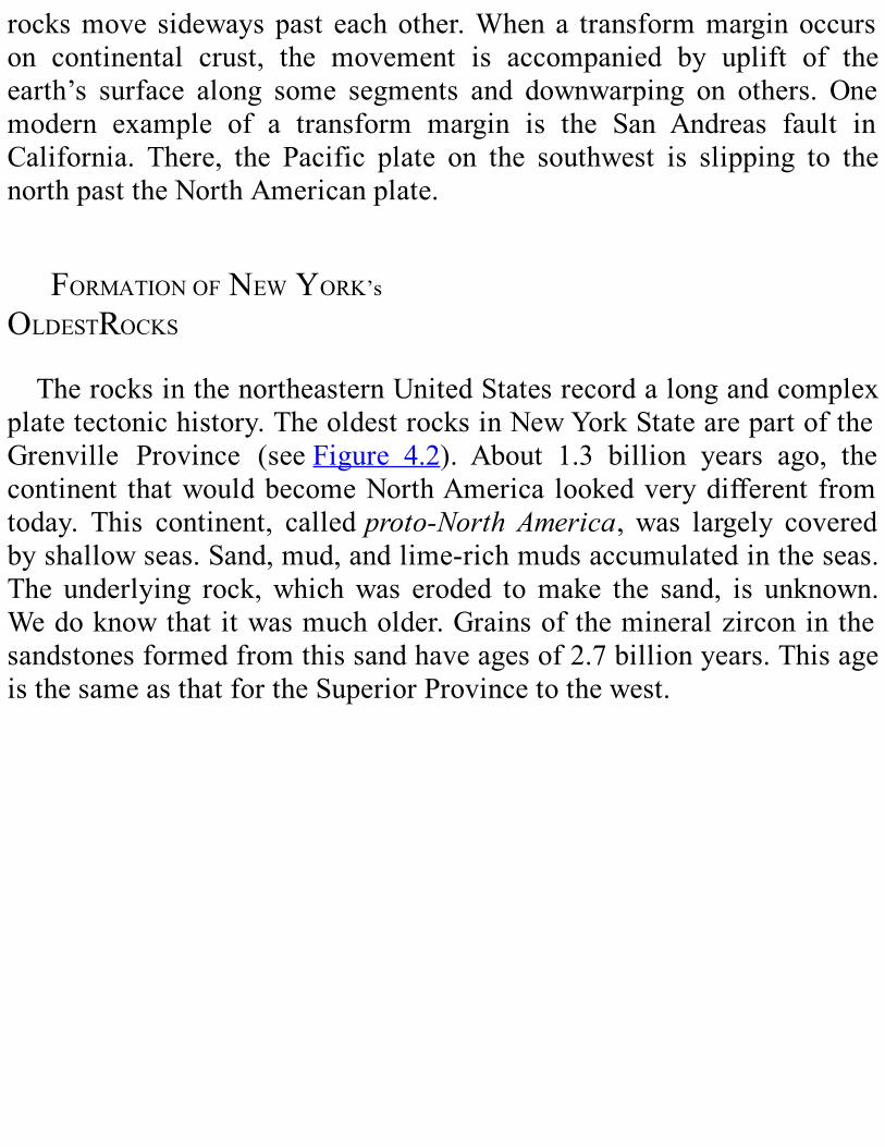
Figure3.7: BlockdiagramshowingresultsoftheGrenvilleOrogeny
Figure3.8: BlockdiagramshowingtheriftingoftheGrenvillesupercontinent
Figure3.9:
BlockdiagramshowingtheTaconicIslandarcapproachingprotohyphen;NorthAmerica
Figure3.10:
Blockdiagramshowingcollisionbetweentheislandarcandprotohyphen;NorthAmerica
Figure3.11:
BlockdiagramshowingthesmallcontinentofAvalonapproachingprotohyphen;NorthAmerica
Figure3.12: BlockdiagramshowingthemountainsbuiltbyAcadianOrogeny
Figure Blockdiagramshowingprotohyphen;NorthAmericaand
3.13: protohyphen;AfricacollidingalongatransformmarginFigure3.14: BlockdiagramshowingtheriftingofthesupercontinentPangea
Figure4.1:
PhysiographicdiagramshowingcircularshapeoftheAdirondackregion
Figure4.2: MapoftheGrenvilleProvinceineasternNorthAmerica
Figure4.3: SatelliteimageoftheAdirondackregion
Figure4.4:
a)PhotoofalongstraightvalleyintheAdirondacksb)AerialviewofMt.ColdenintheHighPeaksregion
Figure4.5:
a)MapshowingradialdrainagepatternwithintheAdirondackdomeb)SimplifiedmapofAdirondackbedrock
Figure4.6: Photoofamigmatiteoutcrop
Figure4.7:
a)Photoofaquartziteexposureb)Closeupphotoofquartzite
Figure4.8:
a)PhotoofanAdirondackmetanorthositeb)Photoofstronglydeformedmetanorthosite
Figure4.9:
a)Sideviewofoverturnedfossilstromatolitesfoundinmarbleb)Bottomviewofoverturnedfossilstromatolitesc)ModernstromatolitesatShark’sBay,Australia
Figure4.10:
a)Photoofacoronainthinsectionb)Photoofcoronasinthinsection
Figure4.11:
a)GoreMountaingarnetssurroundedbyhornblenderimsb)CloseupoflargegarnetcrystalfromtheBartonMine
Figure4.12:
Photoscomparingundeformedlimestonebeds(A)andseverelydeformedmarble(B)
Figure4.13:
PhotoofcomplexlyfoldedrocklayersinthenorthwestAdirondacks
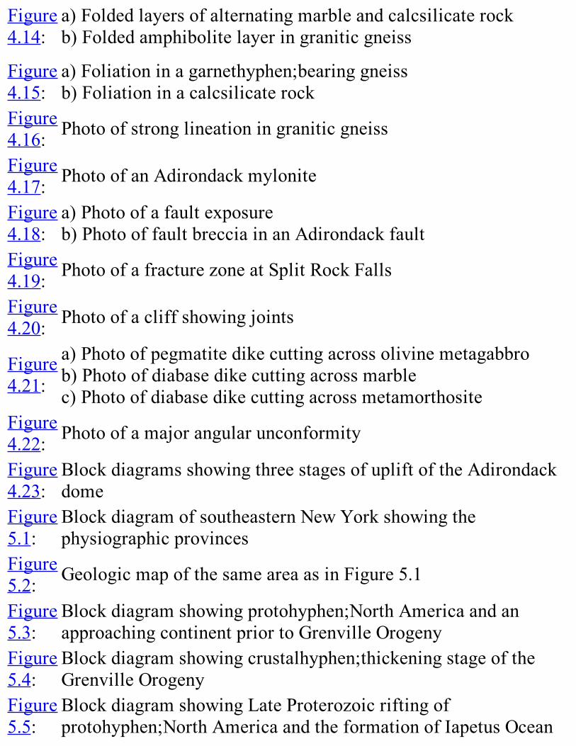
Figure4.14:
a)Foldedlayersofalternatingmarbleandcalcsilicaterockb)Foldedamphibolitelayeringraniticgneiss
Figure4.15:
a)Foliationinagarnethyphen;bearinggneissb)Foliationinacalcsilicaterock
Figure4.16: Photoofstronglineationingraniticgneiss
Figure4.17: PhotoofanAdirondackmylonite
Figure4.18:
a)Photoofafaultexposureb)PhotooffaultbrecciainanAdirondackfault
Figure4.19: PhotoofafracturezoneatSplitRockFalls
Figure4.20: Photoofacliffshowingjoints
Figure4.21:
a)Photoofpegmatitedikecuttingacrossolivinemetagabbrob)Photoofdiabasedikecuttingacrossmarblec)Photoofdiabasedikecuttingacrossmetamorthosite
Figure4.22: Photoofamajorangularunconformity
Figure4.23:
BlockdiagramsshowingthreestagesofupliftoftheAdirondackdome
Figure5.1:
BlockdiagramofsoutheasternNewYorkshowingthephysiographicprovinces
Figure5.2: GeologicmapofthesameareaasinFigure5.1
Figure5.3:
Blockdiagramshowingprotohyphen;NorthAmericaandanapproachingcontinentpriortoGrenvilleOrogeny
Figure5.4:
Blockdiagramshowingcrustalhyphen;thickeningstageoftheGrenvilleOrogeny
Figure5.5:
BlockdiagramshowingLateProterozoicriftingofprotohyphen;NorthAmericaandtheformationofIapetusOcean

Figure5.6:
BlockdiagramoftheinitialstagesofclosingtheIapetusOcean
Figure5.7: BlockdiagramshowingtheMiddleOrdovicianTaconianOrogeny
Figure5.8: BlockdiagramshowingtheEarlyDevonianAcadianOrogeny
Figure5.9:
BlockdiagramshowingthebeginningoftheAlleghanianOrogeny
Figure5.10: BlockdiagramshowingtheJurassicriftingofPangea
Figure6.1:
ChartsummarizingtheCambrianandOrdovicianrockformationfoundintheHudsonhyphen;MohawkLowlandsandTaconicMountains
Figure6.2: PhotooflimestoneconglomerateintheTaconicSequence
Figure6.3:
PhotoofUpperCambrianHoytLimestonewithundulatorystromatolites
Figure6.4:
a)PhotoofsideviewofadomalstromatoliteintheHoytLimestonewestofSaratogaSpringsb)Photooftopviewofdomalstromatolitefromthesamelocality
Figure6.5: Photoof“HerkimerDiamond”
Figure6.6: PhotooftheKnoxUnconformity
Figure6.7: PhotoofpillowlavaatStark’sKnob
Figure6.8: Photoofbrachiopods
Figure6.9: PhotoofchevronfoldsintheLowerCambrianEverettSchist
Figure
6.10: PhotooftheTaconicunconformity
Figure7.1: Blockdiagramshowingcrosshyphen;bedding
Figure7.2: PhotoofPotsdamFormationexposedinAusableChasm
Figure7.3:
a)BlockdiagramshowingriftingoftheGrenvillesupercontinentb)BlockdiagramshowingwideningofIapetusOceanc)DiagramshowingtheprobableappearanceofNewYorkStateinthelateProterozoic
Figure7.4:
a)BlockdiagramshowinginitialsubductionofIapetusOceanbeneaththeTaconicislandarcb)Mapshowingshorezoneadvancementovereasternprotohyphen;NorthAmericac)Mapshowingfartheradvancementofshorezoned)BlockdiagramshowingcontinuedsubductionoftheIapetusOceanfloore)Mapshowingcontinuedadvancementoftheshorezoneoverprotohyphen;NorthAmericaf)BlockdiagramshowingcontinuedsubductionandclosingofwesternIapetusOceang)Mapshowingtheemergenceofprotohyphen;NorthAmericaassealeveldropsh)Mapshowingfurthersealeveldrop
Figure7.5:
PhotooflimestoneoftheDayPointFormation,displayingcrosshyphen;bedding
Figure7.6: Photoofgastropodfossils
Figure7.7: Diagramofatrilobite
Figure7.8: Photoofatrilobite
PaleogeographyduringMiddleOrdoviciantime

Figure7.9:
a)Mapofcontinentresubmergedbyriseinsealevelb)MapofBlackRiverGroupdepositionc)MapofmostofNewYorkStatesubmergedd)Blockdiagramshowingcollisionofislandarcandprotohyphen;NorthAmericae)MapofdepositionoftheSnakeHillFormationandUticaShalef)MapofdepositionoftheQuassaicandSchenectadyFormations
Figure7.10:
PaleogeographyduringLateOrdoviciantimesa)MapshowingLateOrdovicianpaleographyb)Blockdiagramshowingrenewedsubductionunderenlargedprotohyphen;NorthAmericac)MapshowingQueenstonDelta
Figure7.11: PhotoofmudcracksintheRondoutFormation
Figure7.12: Photoofbrachiopods
Figure7.13: Photoofchaincoral
Figure7.14:
Drawingoftheeurypterid,”EurypterusRemipes,”theofficialNewYorkStatefossil
Figure8.1:
MapoftheLower,Middle,andUpperDevonianrockunitsinNewYorkState
Figure8.2:
MapofthenorthernpartoftheAppalachianBasinduringMiddleandLateDevoniantime
Figure8.3: PhotooftheHelderbergEscarpment
Figure8.4: BlockdiagramoftheHelderbergEscarpment
Figure8.5:
DiagramrelatingdepositionalenvironmentstothedifferentfaciesoftheHelderberggroup
FigureDiagrammaticcrosssectionoftheLowerDevonianformationswesttoeastacrosscentralNewYork,andnorthtosouthalongthe
8.6: CatskillMountainfront
Figure8.7:
PhotoofaroadcutdisplayingtheKalkbergandNewScotlandformations
Figure8.8: PhotooftheLowerDevonianCoeymansFormation
Figure8.9:
PhotooftheKnoxboroCoralReef,intheLowerDevonianCoeymansFormation
Figure8.10:
a)Photodisplayinglarge,sphericalstromatoporoidsintheManliusFormationb)PhotodisplayingsmallirregularstromatoporoidsintheManliusFormation
Figure8.11:
FossilsofTentaculitesgyracanthus(Eaton)intheThacherMemberoftheLowerDevonianManliusFormation
Figure8.12: Photooffeedingburrowsofthemarineworm,Zoophycus
Figure8.13:
PhotooftheMoorehouseMemberoftheMiddleDevonianOnondagaLimestone
Figure8.14: Mapofexisting“CatskillDelta”deposits
Figure8.15:
Diagramofthedepositionalenvironmentsandfaciesofthe“CatskillDelta
Figure8.16:
DiagrammaticcrosssectionoftheCatskillDeltaeasthyphen;westacrossNewYorkState
Figure8.17:
PhotooftheTwilightParkConglomerate,anexampleofthe“Pocono”faciesoftheUpperDevonian
Figure8.18: Photoofthecrinoid,Melocrinuspaucidactylus(Hall)
Figure8.19: Photoofthefossilstarfish,Devonastereucharis(Hall)
Figure8.20: Diagramsummarizingthehistoryoftheevolutionoffish

Figure8.21:
a)Photoofafossilstumpofthetree,Eospermatopteris131b)Drawingofwhatthetreeprobablylookedlike
Figure8.22:
GeneralizeddiagramshowingsomeofthewaysinwhichrockontheAlleghenyPlateauandtheadjacentValleyandRidgeProvincedeformedwhenthecrustwascompressedduringtheAlleghanianOrogeny
Figure8.23:
PhotoofthebeddingplaneofaDevoniansiltstonedisplayingdeformedcrinoidsandbrachiopods
Figure8.24:
Photoofmicroscopicenlargementofathinrocksliceofadeformedcrinoid
Figure8.25: PhotoofaDevonianshaledisplayingpencilcleavage
Figure8.26: PhotoshowingspacedcleavageintheOnondagaLimestone
Figure8.27: Photoofjointscuttingasiltstone
Figure9.1:
TopographicmapshowingtheescarpmentformedwheretheRamapoMountainsoftheHudsonHighlandsbordertheNewarkLowlands
Figure9.2: GeologicmapoftheNewarkBasin
Figure9.3:
CrosssectionshowingthegeneralrelationshipsofrockunitsintheNewarkGroup
Figure9.4:
PhotoshowingverticalcolumnsalongthefaceofthePalisadesthatformedwhenthediabasesillshrankduringcooling
Figure9.5: Generalizedcrosshyphen;sectionoftheNewarkBasin
Figure9.6:
DiagramshowingotherMesozoicbasinsofeasternNorthAmericasimilartotheNewarkBasin
Figure9.7:
a)Photooffootprintsofthe3hyphen;toeddinosaur,Coelophysisb)Drawingshowingwhatthisdinosaurprobablylookedlike

Figure9.8:
DrawingoftheNewarklowlandsenvironmentasitmayhaveappeared180millionyearsago
Figure10.1:
MapofeasternNorthAmericashowingtheCoastalPlainandthecontinentalshelf
Figure10.2:
Mapoftheseahyphen;floorofftheAtlanticcoastofNorthAmerica
Figure10.3: DiagrammaticcrosssectionoftheBaltimoreCanyonTrough
Figure11.1:
a)MapshowingahypotheticalreconstructionofNewYorkStateriversduringtheTertiaryb)Mapofmodernposthyphen;glacialrivers
Figure12.1:
MapshowinghowglacialicecoveredmostoftheNorthernhemisphereduringthePleistoceneEpoch
Figure12.2:
Blockdiagramshowingacrosshyphen;sectionofanicehyphen;sheet
Figure12.3:
DiagramshowingpartoftheLaurentideIceSheetthatcoveredalmostallofNewYorkState
Figure12.4:
MapshowingthelocationofmorainedepositsinNewYorkStateandsurroundingareas,aswellasdirectionalfeaturessuchasdrumlinsandstriations
Figure12.5:
Photoofgarnetgneisssculptured,scoured,andpolishedbyglacialice
Figure12.6:
GlacialstriationsontheLarabeeMemberoftheMiddleOrdovicianGlensFallsLimestone
Figure12.7:
Diagramshowingvarioustypesoflandformsandglacialdepositsleftbycontinentalglaciers
Figure12.8:
Photoofa2hyphen;metererraticboulderontopofPotsdamSandstone
Figure12.9:
“Beforeandafter”diagramsshowingthereshapingofarivervalleybyglacialiceflowa)“before”showsthevhyphen;shapedvalleycutbyariver
b)“after”showssamevalleyreshapedbyglaciationFigure12.10:
TaughannockFallsinTompkinsCounty,anexampleofahangingvalley
Figure12.11:
a)Preglacialtopographyofaroundedmountainousregionb)Topographyofmountainssharpenedduringglaciationc)Regionalpictureafterglaciation
Figure12.12:
Photoshowingtwobowlhyphen;shapedcirquesonthesummitofWhitefaceMountain
Figure12.13:
Photodisplayingwellsortedlayersofglacialdepositsleftbyglacialmeltwater
Figure12.14: Photoofadrumlin
Figure12.15:
TopographicmapofaportionofthePalmyraquadrangleshowingdrumlins
Figure12.16:
PhysiographicdiagramofcentralNewYorkStateshowingthelargedrumlinfieldsthatextendalmostthefullwidthoftheOntarioLowlands
Figure12.17: PhotoofaneskerinRensselaerCounty
Figure12.18: PhotoofakameinGreeneCounty
Figure12.19: PhotoofakamedeltaalongtheeastsideoftheChenangoRiver
Figure12.20: Diagramdisplayinghowakettlelakeforms
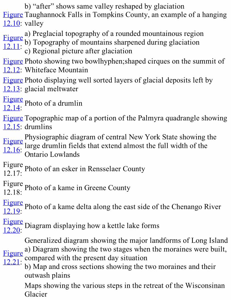
Figure12.21:
GeneralizeddiagramshowingthemajorlandformsofLongIslanda)Diagramshowingthetwostageswhenthemoraineswerebuilt,comparedwiththepresentdaysituationb)MapandcrosssectionsshowingthetwomorainesandtheiroutwashplainsMapsshowingthevariousstepsintheretreatoftheWisconsinanGlacier

Figure12.22:
a)showsmaximumreachoftheglacierabout21,750yearsagob)showsthereachoftheglacier14,000yearsagoc)showsthereachoftheglacierabout12,000to13,800yearsagod)undatedstageofretreate)showsthereachoftheglacierbetween11,000hyphen;13,000yearsagof)undatedstageofretreatg)showswhatNewYorkStatewaslike11,000yearsago
Figure12.23:
MapshowingtheglaciallakesofthePleistocenethatformedfrommeltwaterastheicesheetmeltednorthward
Figure12.24: PhotoofagiantpotholeonMossIslandintheMohawkRiver
Figure12.25:
PhotoofagroovecarvedbyaglacierinlimestoneinthePlattsburgharea
Figure12.26:
PhotoshowingashinglebeachthatmarkstheshorelineoftheformerChamplainSea
Figure12.27: PhotoofmastodontexhibitattheNewYorkStateMuseum
Figure12.28:
DrawingsofsomeoftheextinctmammalsthatlivedinNewYorkStateduringthePleistoceneEpochhyphen;183
Figure13.1:
AerialimageshowingtwolongeskersinthenorthernAdirondacks
Figure13.2: BlockdiagramdisplayingthebedrockoftheNiagaraFallsarea
Figure14.1:
AerialviewofWhitefaceMountainshowingscarsleftbycontemporarylandslides
Figure15.1:
Mapofthemineralresources(otherthanoilandnaturalgas)ofNewYorkState
Figure15.2:
MapshowingmetaldepositsinProterozoicrocksofthenortheasternUnitedStates
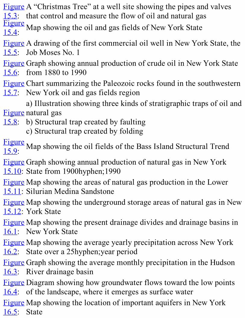
Figure15.3:
A“ChristmasTree”atawellsiteshowingthepipesandvalvesthatcontrolandmeasuretheflowofoilandnaturalgas
Figure15.4: MapshowingtheoilandgasfieldsofNewYorkState
Figure15.5:
AdrawingofthefirstcommercialoilwellinNewYorkState,theJobMosesNo.1
Figure15.6:
GraphshowingannualproductionofcrudeoilinNewYorkStatefrom1880to1990
Figure15.7:
ChartsummarizingthePaleozoicrocksfoundinthesouthwesternNewYorkoilandgasfieldsregion
Figure15.8:
a)Illustrationshowingthreekindsofstratigraphictrapsofoilandnaturalgasb)Structuraltrapcreatedbyfaultingc)Structuraltrapcreatedbyfolding
Figure15.9: MapshowingtheoilfieldsoftheBassIslandStructuralTrend
Figure15.10:
GraphshowingannualproductionofnaturalgasinNewYorkStatefrom1900hyphen;1990
Figure15.11:
MapshowingtheareasofnaturalgasproductionintheLowerSilurianMedinaSandstone
Figure15.12:
MapshowingtheundergroundstorageareasofnaturalgasinNewYorkState
Figure16.1:
MapshowingthepresentdrainagedividesanddrainagebasinsinNewYorkState
Figure16.2:
MapshowingtheaverageyearlyprecipitationacrossNewYorkStateovera25hyphen;yearperiod
Figure16.3:
GraphshowingtheaveragemonthlyprecipitationintheHudsonRiverdrainagebasin
Figure16.4:
Diagramshowinghowgroundwaterflowstowardthelowpointsofthelandscape,whereitemergesassurfacewater
Figure16.5:
MapshowingthelocationofimportantaquifersinNewYorkState
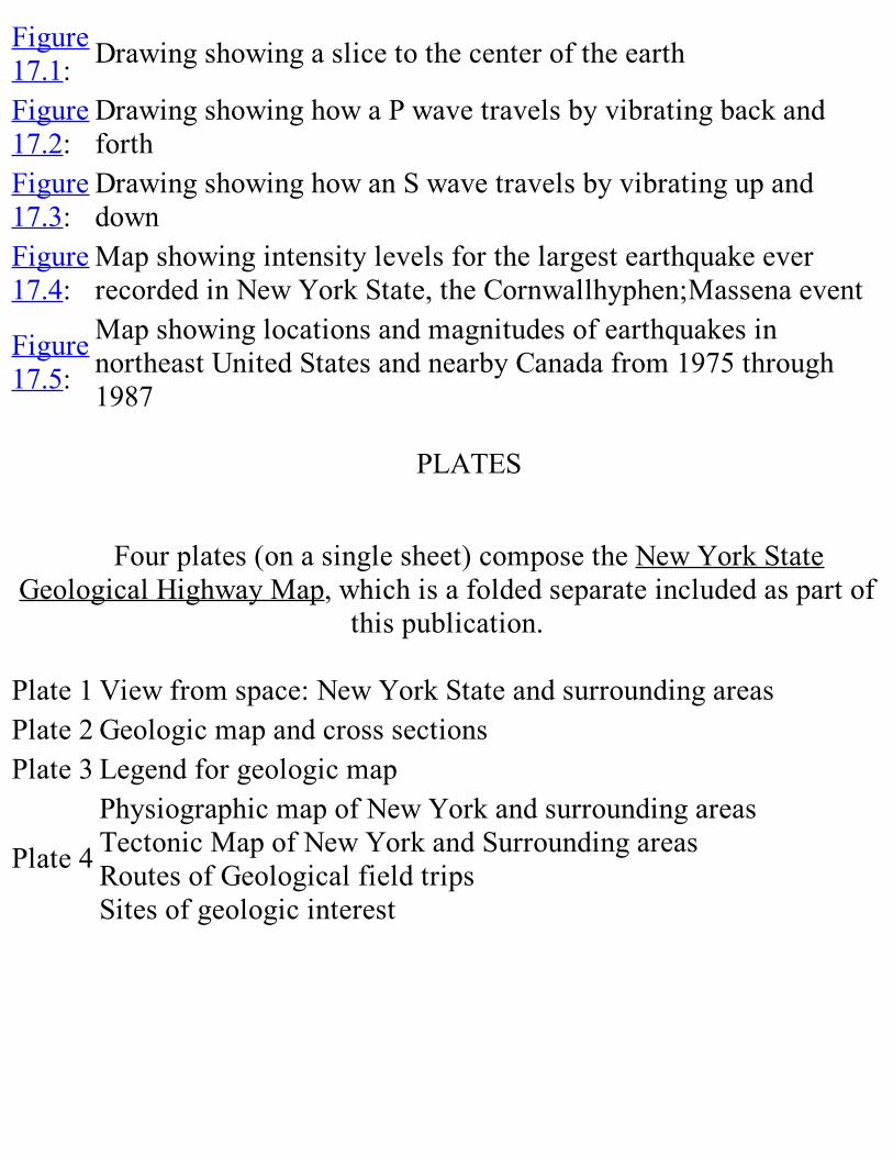
Figure17.1: Drawingshowingaslicetothecenteroftheearth
Figure17.2:
DrawingshowinghowaPwavetravelsbyvibratingbackandforth
Figure17.3:
DrawingshowinghowanSwavetravelsbyvibratingupanddown
Figure17.4:
MapshowingintensitylevelsforthelargestearthquakeeverrecordedinNewYorkState,theCornwallhyphen;Massenaevent
Figure17.5:
MapshowinglocationsandmagnitudesofearthquakesinnortheastUnitedStatesandnearbyCanadafrom1975through1987
PLATES
Fourplates(onasinglesheet)composetheNewYorkStateGeologicalHighwayMap,whichisafoldedseparateincludedaspartof
thispublication.Plate1 Viewfromspace:NewYorkStateandsurroundingareasPlate2 GeologicmapandcrosssectionsPlate3 Legendforgeologicmap
Plate4
PhysiographicmapofNewYorkandsurroundingareasTectonicMapofNewYorkandSurroundingareasRoutesofGeologicalfieldtripsSitesofgeologicinterest

TABLESTable6.1
LowerCambrian-LowerOrdovicianCarbonateorShelfSequence
Table6.2 LowerCambrian-MiddleOrdovicianTaconicSequence
Table6.3
UpperCambrian-LowestOrdovicianCarbonateorShelfSequence
Table6.4 Lower-MiddleOrdovicianCarbonateorShelfSequence
Table6.5
MiddleandUpperOrdovicianClasticShelftoDeepWaterSequence
Table6.6 SilurianFormations
Table7.1 RocksofPackageOne:Ontario-LowlandsandTugHillPlateau
Table7.2 RocksofPackageOne:St.LawrenceandChamplainLowlands
Table7.3 RocksofPackageTwo:OntarioLowlandsandTugHillPlateau
Table7.4 RocksofPackageTwo:St.LawrenceandChamplainLowlands
Table7.5 RocksofPackageThree:MedinaGroup
Table7.6 RocksofPackageThree:ClintonGroup
Table7.7 RocksofPackageThree:UpperSilurian
Table8.1 RocksofHelderbergGroup
Table RocksofTristatesGroup

8.2Table8.3 RocksoftheOnondagaFormation
Table8.4 MiddleDevonianShales,Sandstones,andConglomerates
Table8.5 TullyLimestonedescription
Table8.6 RocksoftheUpperDevonian
Table8.7
ThicknesscomparisonsoftheGenesee,Sonyea,WestFalls,andCanadawaygroupsatLakeErieandintheCatskillMountains
Table17.1
Thenumberofearthquakesperyearoccurringatdifferentscalesofmagnitude
Table17.2
ComparisonofModifiedMercalliintensityandRichtermagnitudescales
Table17.3
ListofNewYorkStates’largestearthquakesfrom1737through1989
ACKNOWLEDGMENTS
Thescientificpublicationsofagreatnumberofgeologistsprovidedthebasisforthisbook.AmongthemareDonaldW.Fisher,YngvarW.Isachsen,andLawrenceV.Rickard,whohaveinrecentdecadessynthesizedmuchofthegeologicinformationandprovidednewinsightsforitsinterpretation.
Theeditorsalsowishtoacknowledgetheeffortsofanumberofcolleagues.TimothyMockandRichardNyahayprovidedgeologicassistance.BarbaraTewksburyhelpedtoeditChapters4and7,andshecreatedthe61blockdiagramsthatdepicttheplate-tectonichistoryofeasternNorthAmerica.ThesearedistributedinthetextandassembledasFigureA.4intheAppendix.CraigChumbleyprovidedtechnicalreviewforChapter11.RobertAllershelpedwiththechaptersonglaciation.EvaGemmillprovidededitorialassistance.RobertH.Fakundinyofferedmanyhelpfulsuggestionsonimprovingthemanuscriptandfigures.DonnaJornovandPatriciaThelaprovidedsplendidclericalsupport.JohnB.Skibaprovideduswithhisexpertadviceandassistancewithgraphicpresentation.RachelGarrison,RobertaWilson,andMikeStoreydraftedmanyofthefigures.MostofthephotographscomefromfilesoftheNewYorkStateGeologicalSurvey;manyoftheseweretakenbyDonaldW.Fisherduringhistenurehere.AfewcamefromcolleaguesoutsideoftheSurvey.
NationalScienceFoundationGrantNo.MDR-8651656providedsubstantialsupportforthisproject.
EssentialtotheProductionoftheSecondEdition,werethediligentandpersistenteffortsofJohnB.Skiba,who,amongmanyotherthings,reassembledtheillustrationsandpagesoftheoriginaledition.

FOREWORD
TheNewYorkStateGeologicalSurveywasfoundedin1836andisthelongestcontinuouslyoperatinggeologicalsurveyintheworldafterthenationalsurveysofFranceandGreatBritain.In1986,oursesquicentennialyear,thisbookandtheaccompanyingNewYorkStateGeologicalHighwayMapwereconceivedasespeciallyworthyprojectstocelebrateour150thbirthday.
ThefirstGeologyofNewYorkwaspublishedbytheSurveyin1966.AttheendoftheForeword,westatedthatthepublicationwasonlyaprogressreportandthat“atanytime,anewbreakthroughinknowledgecouldnecessitateadifferenttranslationoftherecordwrittenintherocks.”Therevolutionarynewconceptofplatetectonics(summarizedinChapter3)cameshortlyafterward,andinsucceedingyearswehavegainedanunderstandingofthegeologicalhistoryoftheStateandsurroundingareasintermsofplatetectonictheory.
Thankstothistheory,wecannowspeakofpastcontinentscollidingtoformsupercontinents;ofsuturezonesalongthelinesofcollision,somewithfragmentsofoceaniccrustthattestifytoclosedoceanbasins;piecesofproto-AfricastucktoNorthAmerica;andriftzoneswheresupercontinentsbrokeapart.NewYorkStatehasbeenthesiteofmountainsashighastheHimalayas,wideseas,riftsasspectacularastheEastAfricanRiftsystem,seasaswarmastheCaribbean,andclimatesascoldasGreenland.EvidenceforthesedramaticeventsisrecordedintherocksofNewYorkandcanbeobservedbyaninterestedstudent.
ThegeologicalhistoryofNewYorkStateislongandcomplex.Inthetextofthispublication,wehaveattemptedeithertominimizetheuseofscientifictermsortodefinethemwheretheyareintroduced.Tofurtherhelpcomprehension,aglossaryhasbeenincluded.Wehavemadeanefforttokeepthelanguageclearandreadable,althoughmanyoftheideaspresentedarebothunfamiliarandcomplex.Wesuggestthatteachersreviewthesectionsthatarerelevanttotheirclassesanddecide

whichpartstoassignorinterpretfortheirstudents.Asanaturallaboratorythatiseasilyaccessibletoalarge
population,thediversegeologyinNewYorkisperhapswithoutpeerinNorthAmerica.TheStatecontainspartsofseveralmajorgeologicprovinces:theCanadianShield,theTaconicthrustbelt,theAlleghanianfoldandthrustbelt,theAlleghenyPlateau,aMesozoicriftbasin,themarinecoastalplain,andthemoderncontinentalshelf,continentalslope,andcontinentalrise.Thevarietiesofrocksandstructuralstyleineachoftheseprovincesprovidesawealthofinstructivematerial,andcomparisonsamongthevariousprovinceschallengescientificthoughtatalllevels.
WeviewthesepublicationsaspartoftherenewednationalefforttoimprovescientificliteracyinAmerica.Wehopethattheywillpiquestudents’curiosityaboutnaturalphenomena,helpearthscienceteachersprepareamoreinterestingcoursebygivingtheminsightsintothelocalgeology,provideaccurateandappropriatematerialfortrainingearthscienceteachers,andgivethepublicawindowintothegeologythatbeginsintheirbackyards.
Welcome,then,tothegeologyofNewYork.TheNiagaraRivercascadingoverathickledgeofSiluriandolostoneattheAmericanFalls;theAdirondacks’HighPeakscutoutoffeldspar-rich“moon-likerock”;thePalisadesoftheHudson--arampartofMesozoicbasaltpillars;andLongIsland--agiant“sandpile”dumpedatthefrontofameltingPleistocenecontinentalglacier.EachofNewYork’smagnificentscenicfeatures,indeedourentirelandscape,derivesitsshapefromthecompositionandstructureofthegeologicmaterialsbeneathitandfromthegeologicprocessesthathaveacteduponit.ThehistoryofhumansettlementinNewYorkfromtheearliestIndianstopresent-dayEmpireStatershasbeengreatlyinfluencedbythegeologyoftheState.
MorethanabillionyearsofgeologichistoryarerecordedintherocksofNewYorkState.Thisrecordtellsofrepeatedsubmergencesbeneathshallowseas,ofmountain-building,ofvolcanoes,dinosaurs,andwoolymammoths,oflushtropicalforestsandfrigidcontinentalglaciers.AsgeologistscontinuetostudyexposuresofrockandsedimentinNew
York,thathistorybecomesrefined--newchaptersareaddedanddetailsrevealed--yetthebasicsagaremainsrelativelyintact.Wemustunderstandthegeologicrecordifweexpecttounderstandourplanet,protectourselvesfromgeologichazardssuchasearthquakesandfloods,andfindanddevelopourmineralresources.
RobertH.FakundinyStateGeologist
1991
PREFACETOSECONDEDITION
Thesecondedition is,essentially,a reprintof thefirstedition.Thefewmodificationsinclude:
•changesinsomeoftheagedatesintheLowerandMiddlePaleozoicperiodsandepochsinFigure2.1andFigure8.20
•achangeintheageoftheLowerPotsdamSandstoneontable7.2
•additiontosomeofthefossilcontentsandthicknessesinthestratigraphictablesinchapters6-8
•cosmeticchangesinthetablesthroughoutthebook•alistofillustrations,alistoftablesandasubjectindexhave
beenadded•Thecoverisnew

PartI
Background
CHAPTER1
FIRSTTHINGSFIRST
Introduction1
Thesurfaceoftheearthisasculpturethatisneverfinished.Yearafter
year, century after century, the rind of rocks enveloping the globecontinues to change. Even the “everlasting hills” are temporary; wind,water,andicewill,intime,erodetheveryhighestmountainsdowntosealevel.Someof theforces thatshiftandrearrange theearth’scrustareswift
anddramatic.Rocksonthesideofamountainbreakfreeandcascadetothevalleyfloor.Withoutwarning,avolcanoeruptsalongthewestcoastofNorthAmericaor in theSouthPacific; farmsandvillagesnestledatthe foot of themountain are left buried beneath a blanket of lava.OffIceland,anewvolcanic islandrisesfromtheoceanfloor.AllofAlaskashudders in earthquake shock as the rocks yield at last to stresses thatbuiltupforcenturies.Modern examples of geologic change are all around the edge of the
PacificOcean—thenorthward shiftofwesternCalifornia along theSanAndreasfault;theAleutianIslandvolcanoesofAlaska;theriseofcoastalmountain ranges inNorth, Central, and SouthAmerica; earthquakes ofthePacificcoastofAsia; thevolcanic islandsofJapan, thePhilippines,theEast Indies,NewGuinea, andNewZealand. In all these places,wefind one or more of the geologic processes that happen duringmountainbuilding: periodic earthquakes, erupting volcanoes, anddeformationofrocksdeepunderground.Lessdramaticchangesoccurintheearth’scrustaswell.Inthe10,000
years since the ice sheetsof thePleistoceneEpochmelted, the crust ofnorthern North America, relieved of that enormous weight, has risensteadily. In Montreal, Canada, the ocean deposited beach sands withmarineshellsandwhalebones immediatelyafter the icesheets’ retreat.Those beaches are now 165m above sea level onMount Royal in theheartofMontreal.Thus, the“solid” rockof theearth’scrustcanbesquasheddownand
laterspringback,likebreaddough.Today the crust is relatively stable in New York State, It has not
alwaysbeen thatway!Rocks thatwere formedas flat layers inshallowseasnow liewellabovesea levelandare tipped, folded,andcontorted.Even the highestmountains inNewYorkState contain rocks thatweredepositedinaquietsea.TherocksofNewYorkcontainevidencethatourState has had a long and complex geologic history. There have beenrepeated floodings by the sea, at least four major cycles ofmountainbuilding, and multiple advances of thick glacial ice. In someareas, the rocks even tell us of nearby ancient volcanoes, long sinceerodedaway.This book comes with a companion publication,New York State
GeologicalHighwayMap,whichsupplementsit.Themapsheetisprintedon plastic instead of paper for durability. Together, these twopublicationsareforpeoplewhoareinterestedinthegroundtheystandon—bothintheirownbackyardsandthroughouttheState.Whatisthelandmadeof?Wheredid it come from?Howdid itget theway it is today?What lies beneath? How old is it? What is its geologic future? WhatexplainsthediversityoflandformsintheState?Theoutlineofthetextcanbeseeninthetableofcontents.Byusingit,
you can jump directly to any area of particular interest. However, weadvise at least apreliminaryglance atPlates1 and4of theGeologicalHighway Mapand Chapter 3 of this book, to provide a regionalbackground.Ifyouwouldliketofindoutaboutthegeologyofaparticulararea,the
map inFigure 1.1, which shows regions of the State, will be useful.Chapters4through10coverbedrockgeologybyregion.Glacialfeatures

arecoveredbyregioninChapter13.
FIGURE1.1.Regionsofnewyorkstaleusedindiscussingbedrockgeology(inchapters4
through10)andglacialfeatures(inchapter13)
CHAPTER2
CLOCKSINTHEROCKS
MeasuringGeologicTime1
SUMMARYGeologic history takes in a vast amount of time, close to 4.6 billion
years. The relative time scale, which is based mainly on observationsaboutrocksandthefossilstheycontain,putsgeologiceventsinhistoricalorder.Thediscoveryofradioactivityandthedevelopmentofradiometricdatinggaveus the first reliableway tocreateaquantitative timescale.Thisscaleassignsages, inyearsbefore thepresent, to theevents in therelativetimescale.
INRODUCTIONInordertounderstandgeology,wehavetounderstandthevastscaleof
geologictime.Theearthasweknowitistheproductof4.6billionyearsof changes.These changes are usually very slow, but occasionally theymayberapidorevencatastrophic,likeanearthquake,volcaniceruption,orlandslide.Through geologic time, continent-size pieces of the earth’s crust
collide, break apart, andgrind sidewayspast eachother.Mountains arebuilt and eroded. Sediments are deposited, compacted, and turned intorock.Thatrockmayinturnbedeformedbystressormetamorphosedbyheatandpressure.Moltenrockrisesfromtheearth’sinterior,cools,andformsigneousrock.Mostoftheseprocessesaresoslowthatthechanges
theyproduceduringonehumanlifetimecanscarcelybenoticed.Infact,theamountoftimeinvolvedissoimmensethatit’sextremelydifficulttoimagine.Here’sonewaytothinkaboutit.Supposetheentirehistoryoftheearthwerecompressedintooneyear.
MostoftheyearwouldbetakenupbythePrecambrian,thatlongagethatstarted4.6billionyearsagowiththeoriginoftheearth.LifebeganinthePrecambrian; the oldest known fossil-bearing rockswere formed about3.5billionyears ago (aboutMarch28of our imaginarygeologicyear).Westillknowrelativelylittleabouttheearliestlife-forms,becausemostof themwere very small or soft-bodied and were seldom preserved asfossils. In addition,mostof theveryold rockshave eitherbeen erodedawayordeformedandmetamorphosedenoughtodestroyanyfossilsthatmightoncehavebeenpresent.TheCambrianPeriod,whenmarineanimalswitheasilyfossilizedhard
parts(suchasshellsorbones)firstbecameabundant,wouldstartlateonNovember 18.The dinosaurswould appear onDecember 13 andwouldsurvivefor13days,todisappearlateonDecember26.Thefirsthumanswouldn’tshowupuntilshortlyafter8PMonDecember31.Allofwrittenhumanhistorywould fit in the last42secondsofNewYear’sEve.Theaverage lifetimeofa late20thcenturyAmericanwouldoccupy the lasthalfsecondbeforemidnight.Yet despite humanity’s late appearance on the scene, we have been
able to piece together a picture of the earth’s history. That history issummarizedinthegeologictimescale(Figure2.1).Thistimescalewasconstructedintwostages.Firstcameourstudyofrocksandthesequenceoffossilsanddeductionsaboutwhatchangeshadhappenedandinwhatorder.Theresultinglistofeventsisarelativetimescale.Then,earlyinthiscentury,radioactive“clocks”wererecognized thatcouldbeused tocalculate the number of years between events. This process made itpossibletocreateaquantitativetimescale.
THERELATIVETIMESCALE

Relativegeologictime referstotheorderinwhichthingshappened—whicheventsareolderandwhichareyounger.Muchoftheevidenceforrelative geologic time is based on simple, commonsense observations.Forexample, inundisturbedsedimentary layersor lavaflows, therocksat thebottomof the stackwereobviouslydepositedbefore theyoungerrocksabove.Thisprinciple isknownassuperposition. Similarly,wherelayered rocks have been partly worn away by erosion and new onesdepositedontheerodedsurface,thewornlayersareolder.Wheremoltenrockhasrisenfrombelowandcutacrosslayersintherocksalreadythere,weeasily see that theonce-molten rock isyounger.Bycombiningsuchobservationswecanconstructarelativetimescaleforanygivenarea.

Figure2.1 This figure includes the geologic time scale. In the lsft-hand of the chart, the
columnsheaded“EON,”“ERA,”“PERIOD,”and“EPOCH”makeupthereativetimescale.Thetwocolmnsheaded“Millionsofyearsago”convertittothequantitativetimescale.Therestofthefiguresummarizedimportantevents in thegeologichistoryof theworldandofNewYorkSlate.(Thewordsusedinthecolumn“TectonicEventsAffectingNortheastNorthAmerica”areexplainedinChapter3.Thetermtransformcollisionreferstoacollisionthattakesplacealongatransformmargin.)logic history of theworld and ofNewYork Slate. (Thewords used in thecolumn“TectonicEventsAffectingNortheastNorthAmerica”areexplainedinChapter3.Thetermtransformcollisionreferstoacollisionthattakesplacealongatransformmargin.)But how do we determine the relative ages of events in one area
compared with those in another? Fossils in sedimentary rocks give usvaluableclues!
Geologists in the late 18th and early 19th centuries studiedsedimentary rocks whose relative ages were known from simpleobservationslikesuperposition.Theyobservedthatmanyfossilsinolderrocks were never found in younger rocks; such species had becomeextinctwith the passage of time. These geologists also found that newfossilspeciesappearedinyoungerrocks.Theynoticedthatfossilsintheolderrockswereveryunlikemodern,livingorganisms;fossilsinyoungerrocks became progressively more like living plants and animals. Theyobservedthatthesechangeswereinthesameorderinrocksallovertheworld.Thisfactledtotheconclusionthatfossilsprovidedtimemarkers.In other words, by observing what fossils are present, geologists wereable tocorrelate,ormatchup,sedimentaryrocksof thesameage,evenwhenthoserockswerefarapart.Thesemethodstelluswhichrocksarethesameage,whichareolder,
andwhichareyounger.Whenweknowtheagesofrocksrelativetoeachother,wecanconstructarelativetimescale.Butthesemethodsdon’ttellushowlongagotherockswereformed.Tofindthisinformation,weneedamethodformeasuringgeologictimeinyearsormillionsofyears.Thismethodwillbediscussedinthenextsection.The relative timescaleweuse today is the resultof information that
hasbeencollectedfortwocenturiesthroughouttheworld.Itisaresultofdirect observations on fossils and rocks and is continually being testedand refined. The Phanerozoic Eon (Figure 2.1) is that part of earth’shistory thatbeganwith theCambrianPeriod,whenanimalswith shells,bones,orotherhardpartsfirstappeared.Animalswithouthardpartsareveryrarelypreservedasfossils.Becausewehavemorefossils fromthePhanerozoicEonthanfromearlier(Precambrian)time,weunderstanditshistory in far greater detail. It has been subdivided into eras, periods,epochs, and smaller time divisions on the basis of fossils (Figure 2.1).Thisdetailedtimescale,however,coversonlythelastone-eighthofthehistoryoftheearth.It has been more difficult to subdivide the earlier seven-eighths of
geologic time, in part because of the scarcity of fossils.Radiometricdating,amethoddevelopedduringthe1930sandwidelyusedsinceabout
1950,hasprovedtobeveryusefulinstudiesoftheseolderPrecambrianrocks.IthasalsohelpedrefinethePhanerozoictimescaleanddeterminejusthowlongagotheevents in thatrelativetimescale tookplace.Thismethodprovidesthebasisforaquantitativetimescale.
DEVELOPINGAQUANTITATIVETIMESCALEIt has long been clear that the processes that shaped the earth must
have taken an immense amount of time. It has been more difficult,though,tofigureoutjusthowmuchtimeandtoexpressitinyears.Early geologists tried to figure out how fast erosion happened,
sedimentsweredeposited,anddissolvedsaltsaccumulatedintheoceans.Theycomparedthoseestimateswiththeresultsweseetodaytofigureouthow long it would take to produce such results. However, the rates ofmostgeologicprocessesarebothvariableandverydifficulttomeasure.Therefore,theanswersthatgeologistsgotwiththesemethodsusuallydidnot agree with each other. Obviously, another approach was needed inorder to figureout the agesof rocks and todate the events ingeologichistory.
RADIOMETRICDATINGThe discovery of radioactivity led to an accurate method for
determining ages. All atoms have a nucleus that containsprotons—positively charged particles. Each atom of a specific chemical elementhas a fixed number of protons. (For example, atoms of carbon alwayshave6protons,andatomsofoxygenalwayshave8protons.)The nucleus of an atom also usually containsneutrons— uncharged
particles. Each chemical element consists of one or moreisotopes.Allatoms of a specific isotope have both a fixed number of protons and afixednumberofneutrons.(Forexample,theisotopecarbon-12contains6protonsand6neutrons.The isotopecarbon-14contains6protonsand8

neutrons.Bothisotopesaretheelementcarbon.)Some chemical elements have naturally occurring isotopes that are
radioactive.(Forexample,potassiumanduraniumbothhaveradioactiveisotopes.) Radioactive isotopes are unstable: that is, atoms of aradioactiveisotope(theparent)changeintoatomsofanotherisotope(thedaughter) by giving off particles, energy, or both. This change, calledradioactive decay, occurs at a constant rate that we can accuratelymeasureinthelaboratory.Smallamountsofseveraldifferentradioactiveparentisotopesexistin
all rocks, along with the daughter isotopes produced by their decay.Modern laboratoriescanmeasureaccurately theamountsofbothparentand daughter isotopes in a rock ormineral sample. Sincewe know therate of radioactive decay and can measure the amounts of parent anddaughterinarock,wecancalculatehowlongagothatrockwasformed—howlongagotheradioactive“clock”startedticking.Thismethodiscalledradiometricdating.Itcangiveusveryaccurate
agesforsomerocksandminerals.Ingeneral,itworksbestwithigneousrocks and minerals that have not been metamorphosed. The heat andpressurerequiredformetamorphismcan“reset”theradiometricclockina rock.Therefore, radiometricdatingof ameta-morphic rockmaygivethetimewhenmetamorphismoccurred,notthetimewhentherockfirstformed. Sedimentary rocks can only rarely be dated by radiometricmethods.Radiometricdatinghasgivenusagesfortheeras,periods,andepochs
of the Phanerozoic relative time scale. It is also providing uswith theinformation that is needed to construct a detailed time scale for thePrecambrian. Both are summarized inFigure2.1. The left-hand part ofthefigure,withoutthecolumnsofnumbersgivingages,isarelativetimescale.Addingthenumbersconvertsittoaquantitativetimescale.
REVIEWQUESTIONSANDEXERCISESDefinethefollowingtermsastheyareusedinthischapter:
relativetimescalequantitativetimescalesuperpositioncorrelatetimemarkerisotoperadioactivityparentdaughterradiometricdating
What methods were used to put together the relative time scale? Thequantitativetimescale?Becausegeologic timeisso long, thegeologic timeline infigure2.1 isnotdrawntoscale.Onalongstripofpaper,redrawthetimelinetoscale.
CHAPTER3
CONTINENTSADRIFT
ThePlateTectonicHistoryofNewYorkState1
SUMMARYThemovementoftectonicplatesontheearthcontrolsthedistribution
ofrocksandlifeontheplanet.Byapplyingthetheoryofplatetectonicsto ancient rocks, geologists have deciphered much of New York’sgeologic history. The State’s oldest rocks were deposited about 1.3billion years ago in shallow seas. They were deformed andmetamorphosedintheGrenvilleOrogeny,acontinent-continentcollisionthatoccurred1.1to1.0billionyearsagoandproducedahighmountainrangeandplateau.Over thenext400millionyears,erosionreduced themountains and plateau to flat lands. During this time, all the earth’scontinents became joined into one supercontinent. Then, about 660millionyearsago,thesupercontinentbegantobreakapartandsplitalongtheeastcoastofproto-NorthAmerica.Newoceaniccrustformedinthewideningriftabout600to560millionyearsago.Theriftgrewinto theIapetusOcean.Averylongvolcanicislandarcformedintheoceanabout550 million years ago, and volcanic activity lasted until about 450millionyearsago.At this time, theislandarccollidedwithproto-NorthAmerica.Thecollision—theTaconianOrogeny—builtamountainrangethatextendedfromNewfoundlandtoAlabama.Themountainserodedasthey rose, and rivers flowing down the western slopes carried thesediments into a shallow inland sea. Then, the remaining part of theIapetus Ocean closed; the ensuing collision was theAcadian Orogeny.
Thisorogenybuilthighmountainsandalargeplateaualongtheeasternpart of the continent, but it had few direct effects in NewYork State.However, sediments eroded from the mountains formed the huge“CatskillDelta,”whichpartially filled in theshallowsea.About330 to250millionyearsago,proto-Africaslidpastproto-NorthAmericaalonga transformmargin. This collision, theAlleghanian Orogeny, built theAppalachian Mountains. As the mountains began to erode, sedimentsweredumpedintotheshallowseaandeventuallyforceditfartothesouthandwest.Asa resultof theseandmanyotherorogenies,all theearth’scontinental crust was again joined in a supercontinent called Pangea.Pangeahasbeenbreakingapart in aworldwide riftingevent thatbegan220million years ago.AfterAfrica separated fromNorthAmerica, therift widened into the Atlantic Ocean. Today, the east coast of NorthAmericaistectonicallyquiet.
INTRODUCTIONThe theory ofplate tectonics has been called the “glue” that holds
geologytogetherbecauseitrelatesallsubdisciplinesofgeologytoeachother. Plate tectonic theory explains the mechanisms that move anddeformtheearth’scrust.Thismovementandtheinteractionoftheplatescontrol the type and distribution of sedimentary deposits, the type anddistribution of volcanic and other igneous activity, the location andintensity of earth quakes, and indeed the very evolution of life on thisplanet.Theoutermostshelloftheearth,calledthelithosphereiscomposedof
rigid crust with an underlying layer of rigid mantle. The lithospherefloats on a soft, flowing shell of the mantle called theasthenosphere(Figure3.1).The lithosphere isbrokenatpresent intoabout eight largeand several smaller fragments, orplates (Figure 3.2), which resemblebroken shell fragments on a hard-boiled egg. A plate may containcontinentalcrust,whichisthick(normallyabout35km)andofrelativelylowdensity;oceaniccrust,whichisthin(about10km)andofrelatively
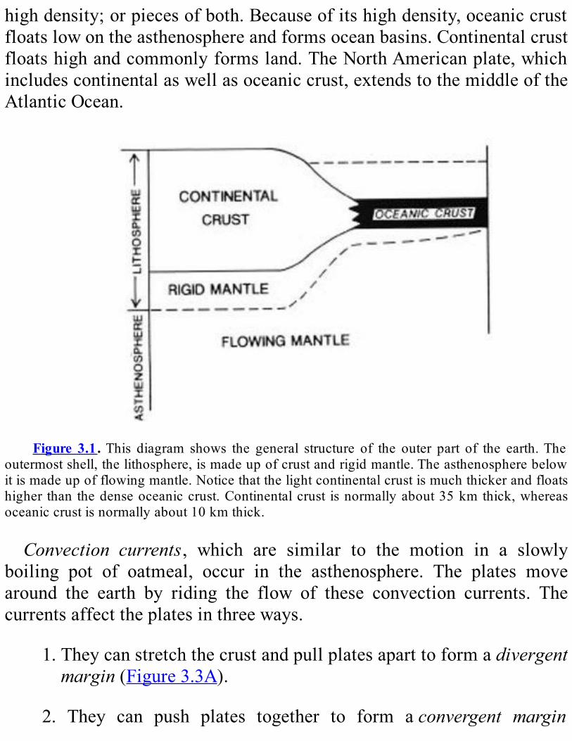
highdensity;orpiecesofboth.Becauseofitshighdensity,oceaniccrustfloatslowontheasthenosphereandformsoceanbasins.Continentalcrustfloatshighandcommonlyformsland.TheNorthAmericanplate,whichincludescontinentalaswellasoceaniccrust,extendstothemiddleoftheAtlanticOcean.
Figure 3.1.This diagram shows the general structure of the outer part of the earth.The
outermostshell,thelithosphere,ismadeupofcrustandrigidmantle.Theasthenospherebelowitismadeupofflowingmantle.Noticethatthelightcontinentalcrustismuchthickerandfloatshigher than thedenseoceaniccrust.Continentalcrust isnormallyabout35kmthick,whereasoceaniccrustisnormallyabout10kmthick.
Convection currents, which are similar to the motion in a slowlyboiling pot of oatmeal, occur in the asthenosphere. The plates movearound the earth by riding the flow of these convection currents. Thecurrentsaffecttheplatesinthreeways.
1.Theycanstretchthecrustandpullplatesaparttoformadivergentmargin(Figure3.3A).
2. They can push plates together to form aconvergent margin
(Figure3.3B).
3.Theycancauseplatestogrindsidewayspasteachothertoformatransformmargin(Figure3.3C).
A divergent margin usually begins as a splitting or rifting ofcontinentalcrust.Moltenrockfromthemantleandlowercrustseepsuptofillthegapsandformsvolcanoes.Ithardenstheretoformdensenewrock calledbasalt. If rifting continues, the basalt will become newoceaniccrust(Figure3.4).Mostdivergentmarginsareunder theoceansandaremarkedbyamid-oceanicridge.Therearethreetypesofconvergentmargins,dependinguponthetype
ofcrustinvolved(Figure3.5):1.ocean-oceancollisions,2.ocean-continentcollisions,and3.continent-continentcollisions.In an ocean-ocean collision, oceanic crust on one plate is driven
beneath oceanic crust on another plate (Figure 3.5A). The down-goingplatesinksintotheasthenosphereandisconsumed.Thissinkingprocess,calledsubduction,createsavolcanicislandarc,whichappearsasachainofvolcanicislandsontheoverridingplate.TwomodernexamplesaretheCaribbeanIslandsandthePhilippines.In an ocean-continent collision, continental crust overrides oceanic
crust(Figure3.5B).Thesubductionprocessformsamagmaticarc,whichappears as amountain chainon the edgeof the continent.Twomodernexamples are the Cascade Mountains along the west coast of NorthAmericaandtheAndesMountainsinSouthAmerica.Continent-continent collision events build mountains and are called
orogenies.Inacontinent-continentcollision,onecontinentmayoverrideanother (Figure 3.5C). However, continental crust is very light andbuoyant; itdoesnotsinkeasily.Instead,thecrustcommonlypilesup—something like an auto collision. The result is a wide area of uplift,highlydeformedrocks,andgreatlythickenedcrust.AmodernexampleistheHimalayanMountainsandTibetanPlateau.Mosttransformmarginsoccuronoceaniccrust.Attransformmargins,
rocksmove sidewayspast eachother.Whena transformmarginoccurson continental crust, the movement is accompanied by uplift of theearth’s surface along some segments and downwarping on others. Onemodern example of a transform margin is the San Andreas fault inCalifornia. There, the Pacific plate on the southwest is slipping to thenorthpasttheNorthAmericanplate.
FORMATIONOFNEWYORK’s
OLDESTROCKSTherocksinthenortheasternUnitedStatesrecordalongandcomplex
platetectonichistory.TheoldestrocksinNewYorkStatearepartoftheGrenville Province (seeFigure 4.2). About 1.3 billion years ago, thecontinent thatwouldbecomeNorthAmerica lookedverydifferent fromtoday. This continent, calledproto-North America, was largely coveredbyshallowseas.Sand,mud,andlime-richmudsaccumulatedintheseas.The underlying rock,whichwas eroded tomake the sand, is unknown.Wedoknowthatitwasmucholder.Grainsofthemineralzirconinthesandstonesformedfromthissandhaveagesof2.7billionyears.ThisageisthesameasthatfortheSuperiorProvincetothewest.

Figure 3.2. A simplified map showing how the lithosphere is broken into plates. The
arrows indicate the relative movements between plates. The Juan De Fuca plate is movingtowardNorthAmerica.

Figure3.3.The three typesofplatemargins: (A)divergent; (B)convergent; (C)transform.
Theblackarrowsshowthemotionofconvectionintheasthenosphere.
Figure3.4.Twostagesofrifting. In(A), theplatehasbeguntoseparateandariftvalley
has formed. In (B), the rift has widened and become a new ocean basin between two newcontinents.Noticethemidoceanicridgeinthebasin.

Figure3.5.Thethreetypesofconvergentmargins:(A)ocean-oceancollision;(B)ocean-
continent collision; (C) continent-continent collision. Notice that as the plates converge, theoceaniclithosphereisbentdownwardandisconsumedintheasthenosphere.
Figure3.6.Blockdiagramshowingsubductionbeneathproto-NorthAmericabetween1.2
and 1.1 billion years ago. Notice the volcanoes in the magmatic arc and the rift beginningbehind it. (Compare withFigure 3.1 to recognize continental and oceanic crust and theboundariesofthecrust,lithosphere,andasthenosphere.)
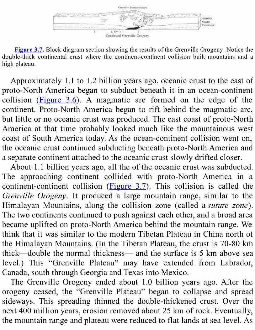
Figure3.7.BlockdiagramsectionshowingtheresultsoftheGrenvilleOrogeny.Noticethe
double-thick continental crust where the continent-continent collision built mountains and ahighplateau.
Approximately1.1to1.2billionyearsago,oceaniccrusttotheeastofproto-NorthAmerica began to subduct beneath it in an ocean-continentcollision (Figure 3.6). A magmatic arc formed on the edge of thecontinent. Proto-NorthAmerica began to rift behind themagmatic arc,butlittleornooceaniccrustwasproduced.Theeastcoastofproto-NorthAmerica at that time probably lookedmuch like themountainouswestcoastofSouthAmericatoday.Astheocean-continentcollisionwenton,theoceaniccrustcontinuedsubductingbeneathproto-NorthAmericaandaseparatecontinentattachedtotheoceaniccrustslowlydriftedcloser.About1.1billionyearsago,alltheoftheoceaniccrustwassubducted.
The approaching continent collided with proto-North America in acontinent-continent collision (Figure 3.7). This collision is called theGrenvilleOrogeny . It produced a large mountain range, similar to theHimalayan Mountains, along the collision zone (called asuture zone).Thetwocontinentscontinuedtopushagainsteachother,andabroadareabecameupliftedonproto-NorthAmericabehindthemountainrange.WethinkthatitwassimilartothemodernTibetanPlateauinChinanorthoftheHimalayanMountains.(IntheTibetanPlateau,thecrustis70-80kmthick—doublethenormalthickness—andthesurfaceis5kmabovesealevel.) This “Grenville Plateau” may have extended from Labrador,Canada,souththroughGeorgiaandTexasintoMexico.The Grenville Orogeny ended about 1.0 billion years ago.After the
orogeny ceased, the “Grenville Plateau” began to collapse and spreadsideways. This spreading thinned the double-thickened crust. Over thenext400millionyears,erosionremovedabout25kmofrock.Eventually,themountainrangeandplateauwerereducedtoflatlandsatsealevel.As
rockwas removed, themountains and plateau remained relatively highbecausethebuoyantcontinentalcrustreboundedduringerosion.TherocksoftheGrenvilleProvinceformthebasementforallofNew
York State (seeFigure 4.2). This basement is buried by younger rocksovermostoftheState.However,ithasbeenre-exposedatthesurfaceintheAdirondackMountainsandtheHudsonHighlands(seeChapters4and5).
RIFTINGANDOPENINGOFTHE
IAPETUSOCEANDuring the 400 million years of erosion in proto-North America,
numerous orogenies occurred throughout the rest of the world. Eachorogenyaddedanothercontinent toagrowingGrenville supercontinent.Attheendofthistime,alllandwasjoinedintoonehugecontinent.Whenallthecontinentalcrustisononesideoftheearth,however,thesituationisunstable.TheGrenvillesupercontinentthereforebegantosplitapartinaworldwideriftingevent.About660millionyearsago,alargedivergentmargin developed along the east coast of proto-North America,approximately along the earlierGrenville suture zone (Figure3.8). Riftbasinsbegantoopen,andverycoarsesedimentsweredepositedinhugealluvial fans along their steepwalls.Approximately600 to560millionyearsago,during theLateProterozoic, largeamountsofdensevolcanicrock seeped up into the rift. This basaltic rock eventually became newoceaniccrustbetweenproto-NorthAmericaandtherestoftheGrenvillesupercontinenttotheeast.Asthebasincontinuedtowiden,anewoceancalledIapetuswithamidoceanicridgewasformed.
Figure3.8. Block diagram showing the rifting of theGrenville supercontinent along the

eastcoastofproto-NorthAmerica.
Figure 3.9. Block diagram showing the Taconic island arc approaching proto-North
AmericaasthewesternpartoftheIapetusOceancloses.
Theeasternedgeoftheproto-NorthAmericancontinentwasnolongertheedgeofaplate.Rather,ithadbecomeapassivemarginwithinaplate,similar to theAtlanticcoastofNorthAmerica today.Although tectonicactivity continued at the divergentmargin in themiddle of the IapetusOcean, the margin of the continent was tectonically quiet; it had noearthquakes or volcanoes. Beach sands and shelly material weredepositedduringtheCambrianandmostoftheOrdovicianPeriods,untilabout460millionyearsago.Awidecontinentalshelfcoveredwiththesesedimentarydepositsformedalongtheeastcoast.MarinelifeflourishedintheseaandisrecordedinthemanyfossilsintherocksofthatageinNewYork.ThesesedimentaryrocksoriginallycoveredmostoftheState.
THETACONIANOROGENY:ISLANDARCCOLLISIONStarting about 550 million years ago, a large volcanic island arc
developedwithintheIapetusOcean(Figure3.9).The islandarcwas theresult of an ocean-ocean collision; oceanic crust of the proto-NorthAmerican platewas subducted beneath a plate to the east. The arcwasvery long and extended fromNewfoundland toAlabama. The volcanicactivity lasted from 550 to 450 million years ago, but it occurred atdifferenttimesatdifferentplacesalongthearc.The island arc eventually collided with the proto-North American
continent.ThiscollisioniscalledtheTaconianOrogeny(Figure3.10).Atthebeginningof thecollision, theeasternedgeofproto-NorthAmericawasbentupwardinthewestanddownwardintheeast.Theupliftonthe

westarchedandfracturedtheedgeofthecontinent,raisingthecarbonaterocks of the continental shelf above sea level and exposing them toerosion. East of the uplift, the edge of the continental crust was bentdownward.Asthatedgeapproachedthesubductionzone,itsankbeneaththe sea. A deep marine trough formed as the shelf approached thesubductionzone.Siltymudand impure sandof lateMiddleOrdovicianageweredepositedontopofthecontinentalshelfcarbonaterocksinthetrough.As the collision proceeded, the rocks in the trough were pushed
westward over the rocks of the shelf. This stack of rock was, in turn,pushedwestwardoverothershelfrocksonhugethrustfaults.Theserocksnow make up the Taconic Mountains in eastern New York State andwesternNew England.At the suture between the island arc and proto-NorthAmerica, pieces of Iapetus Ocean crust are preserved. The bestexampleinNewYorkistheStatenIslandserpentinite(seePlate2oftheGeologicalHighwayMap).
Figure3.10.Blockdiagramshowingthecollisionbetweentheislandarcandproto-North
America.This collision is theTaconianOrogeny. Sediments eroded from themountains builttheQueenstonDeltainwesternNewYork.
Figure 3.11 . Block diagram showing the small continent ofAvalon approaching proto-
NorthAmericaastheeasternhalfoftheIapetusOceancloses.
Themountainsformed450millionyearsagobytheTaconianOrogenyextendedfromNewfoundlandtoAlabama.Thesemountains—ashighas

theHimalayas—wererapidlyerodedduring theorogenyandespeciallyafter it. Huge rivers flowed down the western slopes of the ancestralTaconicMountains, depositing coarse sand and gravel in a shallow seathat covered the middle of proto-North America. The river depositsformedtheenormousQueenstonDelta.
THEACADIANOROGENY:INDIRECTEFFECTSAfter the western part of the Iapetus Ocean closed, the crust of the
eastern Iapetus Ocean began subducting beneath the proto-NorthAmerican continent in an ocean-continent collision (Figure 3.11). Wethink that subduction was most intense under present-day Greenland,southeasternCanada, andnorthernmostNewEngland.Theeast coastofproto-NorthAmericalookedsimilartotheAndesMountainstoday,withelevationsbecominggraduallylowertothesouth.WhensubductionhadconsumedalltheIapetusOceancrust,anintense
continent-continentcollisionensued(Figure3.12).Themostintensepartof the collisionwas between proto-Scandinavia and northeastern proto-NorthAmerica(easternGreenland);itlastedfromapproximately410to380millionyearsago.AnotherpartofthecollisionisrecordedinGreatBritainand Irelandand involved southeasternCanadaandpartsofNewEngland. The southernmost part of the collision is called theAcadianOrogeny,itresultedwhenasmallcontinentcalledAvalonwasattachedtoproto-North America. Part of this continent can be found today ineasternmostNewEngland.
Figure3.12.Block diagram showing themountains built by theAcadianOrogeny— the
collisionbetweenAvalonandproto-NorthAmerica.Sedimentserodedfromthemountainsbuiltthe“CatskillDelta”tothewestofthemountains.
The collision built high mountains along the eastern part of thecontinent.Italsogreatlythickenedthecrustofproto-NorthAmericaandformed a large plateau. This “Acadian Plateau” was similar to today’sTibetanPlateauinChina.ItextendedtotheGreenMountainsofVermontandpossiblyas far southasConnecticut.Therewas littleuplift inNewYork. The only direct effects of the initial collision are some smalligneousrockbodiesinthesoutheasternpartoftheState.AlthoughtheAcadianOrogenyhadfewdirecteffectsonNewYork,the
erosionof theAcadianMountains andplateauwasvery important.Theshallow Devonian sea on the interior of the proto-North Americancontinent teemed with life. Much shelly debris accumulated, andlimestonesweredepositedbeforetheorogeny.AstheAcadianMountainsrose,largeriverscourseddowntheirwesternslopes,spreadingsandandgravel across the region where the limestones had accumulated. Therivers deposited the huge “Catskill Delta,” which partially filled theshallow sea. These deposits now make up the Catskill Mountains insoutheasternNewYork.
THEALLEGHANIANOROGENY:THEFINALCOLLISIONThe last orogeny recorded in the Appalachians, theAlleghanian
Orogeny, lasted from about 330 to 250 million years ago. In theAlleghanianOrogeny, proto-Africawas attached to eastern proto-NorthAmerica.TheorogenyproducedtheAppalachianMountainswestillseetoday.ThemountainchainextendsfromAlabamatoNew-foundland.Once,geologiststhoughtthatproto-Africacollidedhead-onwithproto-
NorthAmericainahugecontinent-continentcollision.Theythoughtthatthis collision followed the subduction of anAtlantic-sized ocean basinunderproto-NorthAmerica.AftercarefulstudyoftheAlleghanianfaultsalong easternNorthAmerica, however,we now think that proto-Africaprobably slid southward past proto-North America along a transformmargin. Therewas little, if any, subduction involved (Figure 3.13).Asproto-Africaslidsouthward,itrotatedclockwise,pushingwestwardinto

thesouthernpartofproto-NorthAmerica.Thiswestwardpushproducedlarge faults. There was more movement along the faults towards thesouth.Therefore,theAppalachianMountainswereupliftedhigherinthesouththaninthenorth.OnlyportionsofNewYorkStateweredeformed.Ashallowseaextendedacrossthecentralpartofproto-NorthAmerica
aftertheendoftheAcadianOrogeny.Thisshallowseahadhugeswampsaround its edges justbefore theAlleghanianOrogeny.Theuplift of theAlleghanianMountains again resulted in extensive erosion.Huge riversfloweddowntheirwesternslopesanddumpedlargeamountsofsandandgravel into theshallowsea.Theswampswerefilled in,and theshallowseawasforcedtothefarsouthandwestoftheUnitedStates.Theeasternpartoftheproto-NorthAmericancontinentwasonceagainnearlyalldryland.
RIFTINGANDTHEOPENINGOFTHEATLANTICOCEANTheTaconian,Acadian,andAlleghanianOrogenieswerethreeofmany
orogeniesthattookplacearoundtheearthduringthepaleozoic.Eachofthese orogenies sutured continents to each collision took place, therewere fewer remainingseparatecontinentsaround theearth.Finally,onesupercontinent had formed (just as the Grenville supercontinent hadformed 650 milion years earlier). Having all the continetal massconcentrated in one supercontinent again caused instability in theasthenosphere.Pangeabrokeapartinaworldwideriftingeventthatbegan220million years ago. Continentsmoved apart very quickly (up to 18cm/year). Some of the largest volcanic eruptions in the earth’s historycoveredlargeareasofthecrustwithlava.
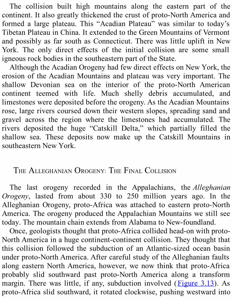
Figure 3.13. Block diagram showing proto-North America and proto-Africa colliding

along a transform margin. This collision, the Alleghanian Orogeny, built the AppalachianMountains.
Adivergentmargindevelopedalong theAppalachianMountains,andAfrica began to rift from North America (Figure 3.14). The rift firstdeveloped on continental crust. The rifting created long, steep-sidedvalleys.Riversdepositedhugealluvialfansofcoarsesandandgravelonthemarginsoftheseriftvalleys;lakesfilledthecentralpartsofvalleys.Eastern North America looked very much like the Basin and RidgeProvince of the western United States today. As rifting continued,volcanoes erupted and covered the sedimentswith lava. Finally, in thecentral portionof the rift, newoceanic crust began to form.This eventwasthebirthoftheAtlanticOcean.TheAtlanticcontinuedtoopenoverthenext160millionyearsandbecameafull-sizedoceanbasin.Theeastcoast of NorthAmerica developed into a passive margin with a widecontinental shelf—thesituationwehave today.Sedimentseroded fromthecontinentovermillionsofyearsbuilttheshelf.Some of the sediments deposited during the early part of the rifting
filledtheNewarkBasin,whichunderliesmostofRocklandCounty,NewYork,andextendsintoNewJersey.Thevolcanicrocks,suchasthelavaflownearLadentown,formedduringtherifting.ThePalisadesSill,whichformscliffson thewest sideof theHudsonRivernearNewYorkCity,wasalargemassofmoltenrockthatcooledandhardenedunderground.The sediments deposited since the passivemargin formed are found intheAtlanticCoastalPlain.Theyincludetoday’sbeaches.TheeastcoastofNorthAmericaistectonicallyquiettoday.However,
judging by past experience, it is only a matter of time before activetectonismbeginsagain.
REVIEWQUESTIONSANDEXERCISESWhyisthetheoryofplatetectonicsimportantingeology?
Whatarethetwokindsofcrust?Howaretheydifferent?

Why do plates move? Describe the different ways in which theyinteract?
How old are the oldest rocks in New York State? Where are theyfound?
Put the following events in chronological order, and describe whathappenedineach:AcadianOrogenyAlleghanianOrogenyerosionofGrenvillePlateauformationof“CatskillDelta”formationofGrenvillesupercontinentformationofPangeaformationofQueenstonDeltaformationofvolcanicislandarcinIapetusOceanGrenvilleOrogenyopeningofAtlanticOceanopeningofIapetusOceanshallowinlandseaforcedfartosouthandwestofproto-NorthAmericancontinentTaconianOrogeny
Identifythefollowing.Explainwhenandhowtheywereformed:basementrocksofNewYorkStatetherocksofthemodernTaconicMountainstheStatenIslandserpentinitetherocksoftheCatskillMountainstheAppalachianMountainstherocksoftheNewarkBasinthePalisadesSillthesedimentsoftheAtlanticCoastalPlain
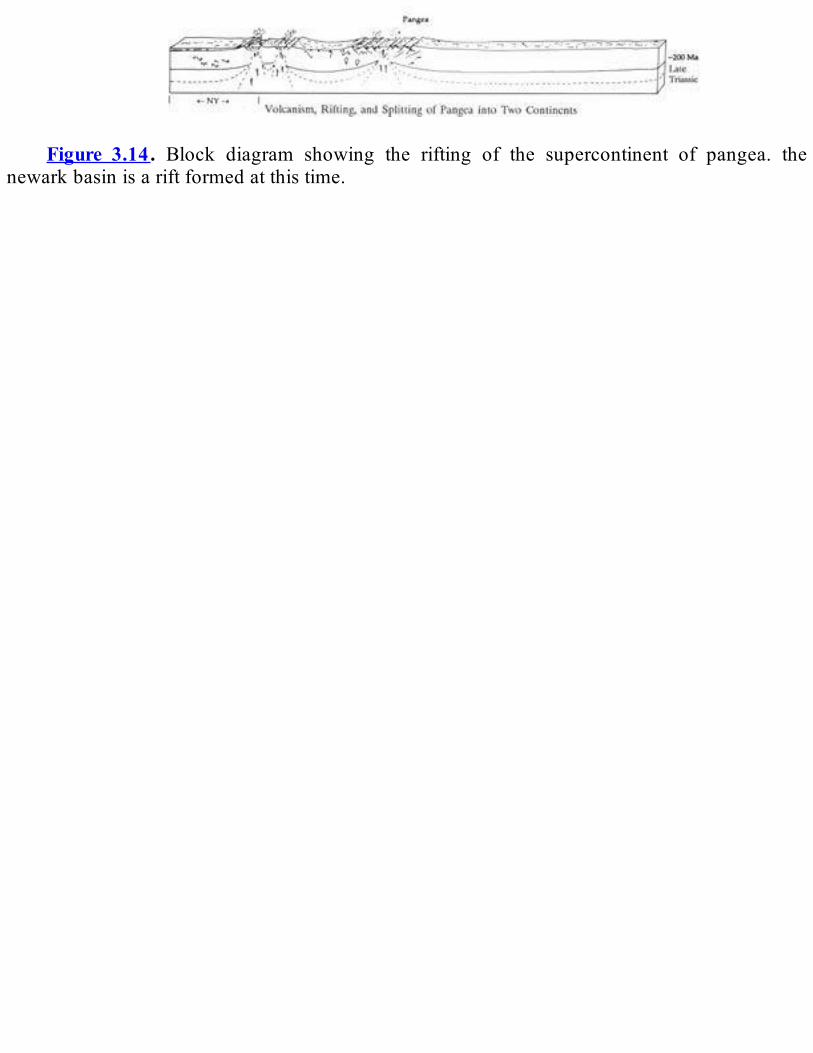
Figure 3.14. Block diagram showing the rifting of the supercontinent of pangea. the
newarkbasinisariftformedatthistime.
PartII
BedrockGeology
Chapter4
NEWMOUNTAINS
FROMOLDROCKS
AdirondackMountains1
SUMMARYTheAdirondackMountainsmakeupacircularregionthatispartofthe
GrenvilleProvince,alargebeltofbasementrock.Theregionisdividedinto the Central Highlands and the Northwest Lowlands, which areseparatedbytheCarthage-ColtonMyloniteZone.Itwasoncecoveredbythe same layers of sedimentary rock that now surround it, but recentuplift and erosion have exposed the basement. Seen from space, theregion has several prominent features: long, straight valleys; gentlycurvedridgesandvalleys;andaradialdrainagepattern.The rocks of the Adirondacks, almost without exception, are
metamorphic. They have been subjected to high temperatures andpressuresatdepthsofupto30kmintheearth’scrust.Mostoftherocksin the Northwest Lowlands are metasedimentary or metavolcanic and

haveacomplexhistory.Mostof the rocks in theCentralHighlandsaremetaplutonic;graniticgneissisthemostcommon.Metanorthositeformsseveral large bodies in theCentralHighlands; the largestmakes up theHighPeaksarea.OlivinemetagabbrobodiesarescatteredthroughouttheeasternandsoutheasternAdirondacks.TheAdirondackrockshavebeenbothseverelyfoldedandshearedby
ductile deformation and shattered by brittle deformation. Ductiledeformationhasproducedverycomplicatedfoldsofallsizesthroughouttheregion.Ductileshearingcreatedintenselydeformedmylonites,whicharefoundthroughouttheregionbutaremostabundantinthesoutheasternAdirondacks and in theCarthage-ColtonMylonite Zone. Long, straightvalleys that run north-northeast mark the most prominent examples ofbrittle deformation.These valleys are the results of accelerated erosionalongmajorfaultsandfracturezones.Inaddition,mostAdirondackrockshaveanabundanceofjoints.TheAdirondackdeformationhappenedwhenthe crust of the region was severely compressed during the GrenvilleOrogeny.AlmostallAdirondackrocksareMiddleProterozoicinage.Theoldest
metasedimentary rockswere deposited in shallow seas beginning about1.3 billion /ears ago. Metavolcanic rocks of the same age show thatvolcanoeswere active at that time. SomeAdirondackmetasedimentaryrockscontaingrainserodedfromamucholder land-mass.Mostof themetaplutonic rocks, including themetan- arthosite, granitic gneiss, andolivinemetagabbro bodies in theCentralHighlands,were formed frommagmasthatwereintrudedabout1.15to1.1billionyearsago.Alltheserockswerethenburiedasmuchas30kmbelowthesurface
during the Grenville Orogeny. The crust was severely deformed andthickened, and the rocks at depth were intensely metamorphosed.Deformation and metamorphism peaked between 1.1 and 1.05 billionyearsago.Overthenextseveralhundredmillionyears,erosionstrippedawaymorethan25kmofrock,andmajorfaultswereformed.Theregionwas then covered by shallow seas, in which sediments accumulatedthrough the Cambrian and Ordovician Periods. Sediment accumulationprobably continued into the Pennsylvanian Period. Most of these
sedimentaryrockshavebeenremovedbyerosion,buttracescanbefoundin grabens. From theMiddleOrdovician into theTertiary Period, therewasnosignificant tectonicactivityintheAdirondackregion.SometimeintheTertiary,theAdirondackdomebegantorise,possiblybecauseofahotspotnearthebaseofthecrust.Erosionthencarvedtheregionintotheseparatemountainrangesweseetoday.
INTRODUCTIONTheAdirondackMountainsareyoung,but theseyoungmountainsare
made from old rocks. How do we explain this seeming contradiction?First,wetrytoanswermanyotherquestions.WhatkindsofrocksdowefindintheAdirondacks?Underwhatconditionsweretheyformed?Howold are they? How have they been deformed? The answers to thesequestionsgiveuscluestothegeologichistoryoftheAdirondacks.
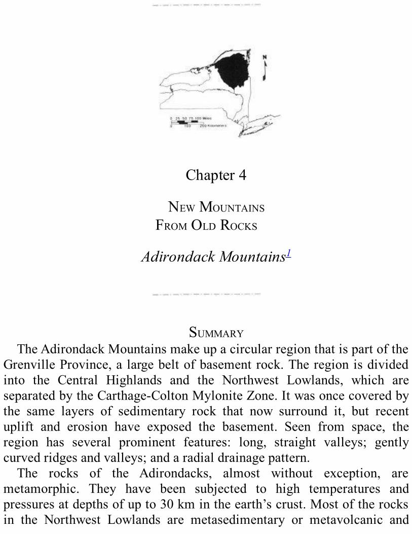
THEBIGPICTURETheAdirondackMountainsmake up a roughly circular region about
200 km in diameter in northern NewYork State (see Figure 1.1). Theregion is divided into two subregions, the Central Highlands and theNorthwest Lowlands. They are separated by theCarthage-ColtonMyloniteZone,anarrowbeltofintenselydeformedrocks(Figure4.1;seealso Plate 2 of theGeological Highway Map, on which the Carthage-ColtonMyloniteZoneislabeledCCMZ).ThemetamorphicbedrockintheHighlandsresistserosionwell.Itwas
lefttoweringovertherestofthecountrysidewhenthesedimentaryrocksthatoncecovereditwerewornaway.ThehighestelevationsarefoundintheHighPeaksareaof theCentralHighlands; there,numeroussummitsriseabove1200m.Thehighestpeak,MountMarcy,ismorethan1600mhigh. Elevations fall off rapidly north and east of the High Peaks andmoregraduallytothesouthandwest.
The Adirondack region is part of a much larger area called theGrenvilleProvince(Figure4.2).TheGrenvilleProvinceisabroadbeltofmostlymetamorphicrockofMiddleProterozoicage;itextendsalongthewestern side of theAppalachianMountains from Labrador to Mexico.Around the Adirondacks and south of the region, this belt is almostentirelycoveredbyyoungersedimentaryrocks.TheAdirondack region was once flat and was covered by the same
sedimentary layers that now surround it (see Plate 2). However, inrelatively recent geologic time, the Adirondack region was uplifted,formingadome.Duringuplift, erosion removed the sedimentary layersfromtheregion.Thiserosioneventuallycreateda“window”throughthesedimentaryrocksthatpermitsustoseethemucholderbasementrocks2beneath. TheAdirondack basement extends into Canada at the surfacealong a narrow zone called theFrontenacArch (Figure 4.2). The Fron-tenacArchcrossestheSt.LawrenceRiverattheThousandIslands.Seenfromspace,theAdirondackHighlandslookcrackedandwrinkled
(Figure4.3).Wecanseethreeprominenttypesoffeaturesonthesatelliteimage:
1. Long, straight valleys that run north-northeast are the mostprominent. Throughout the Adirondacks, these valleys containstreams and lakes (Figure 4.1). Many of the largerAdirondacklakes,suchasLakeGeorge,SchroonLake,IndianLake,andLongLake, follow this north-northeast trend.Figure 4.4A shows oneexample. In theHighPeaks region, thesevalleysdivide theareainto a number of long, straightmountain ranges (Figure 4.4B).Theselong,straightvalleyshaveformedalongfaultsandfracturezoneswherethebrokenrocksarelessresistanttoerosion.
2. Gently curved ridges and valleys. These ridges and valleys areusually more subtle than the deep, fault-related ones. They aremost prominent in the central and southernAdirondacks, wheretheymake an east-west arc. They follow the layering in foldedrocks. Harder, more erosion-resistant rocks (such as granitic
gneiss)formtheridges,whilesofterlayers(likemarble)formthevalleys.
3.Radialdrainagepattern3. Streamsand rivers ingeneral flowoutfrom the central and northeastern parts of theAdirondack dometowarditsedge.Wecanseethispatternmostclearlyintheouterparts of the dome; elsewhere, the rivers tend to follow thedominant north-northeast valleys.Figure 4.5 shows this radialdrainage pattern in some detail and compares it to structures intheunderlyingbedrock.
ADIRONDACKROCKSANDTHEIRMETAMORPHISMAlmost all of the rocks in the Adirondack region are metamorphic
rocks. Three general types are present.Metasedimentary rocks, as thename suggests, were formed by metamorphism of sedimentary rocks.Metavol- canic rocks are metamorphosed lavas and volcanic ash.Metaplutonicrockswereformedbymetamorphismofigneousrocksthatcooled and crystallized frommagma (molten rock) deep in the earth’scrust.ThemoreimportantkindsareshownonPlate3.Eachkindofrockis made up of a specific collection of minerals, called amineralassemblage. Before describing the main rock types that make up theAdirondacks,itwillbeusefultodiscusstheconditionsunderwhichtheyweremetamorphosed.

Figure 4.1. This physiographic diagram shows the circular shape of the Adirondack
region.The heavy lines outline the the Northwest Lowlands, the Central Highlands, and theCarthage-ColtonMyloniteZone thatseparates them.Bodiesofwaterareshown inblack.Thisfigureshowsthesameareaasthesatellitephoto(Figure4.3).

Figure 4.2. This map shows how far the Grenville Province extends in eastern North
America.TheserockswereallmetamorphosedduringtheGrenvilleOrogenyapproximately1.1billion years ago. Slanted lines showwhereGrenville rocks appear at the surface.The cross-hatchpatternshowslocationsofGrenvillerocksthatweredeformedagainduringtheTaconian,Acadian, and/orAlleghanian Orogenies.The dot pattern indicates where Grenville rocks areburiedbeneathyoungerrocks.
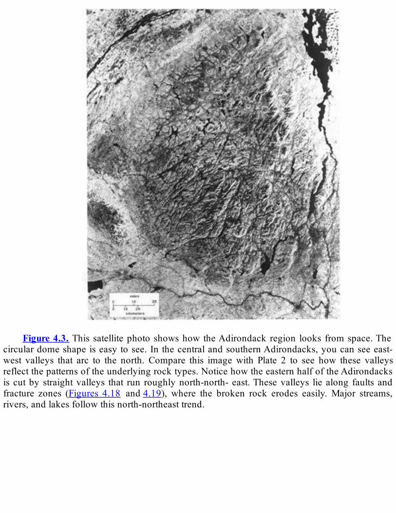
Figure4.3. Thissatellitephotoshowshow theAdirondack region looks fromspace.The
circulardomeshapeiseasytosee.InthecentralandsouthernAdirondacks,youcanseeeast-west valleys that arc to the north. Compare this imagewith Plate 2 to see how these valleysreflectthepatternsoftheunderlyingrocktypes.NoticehowtheeasternhalfoftheAdirondacksis cutby straightvalleys that run roughlynorth-north- east.Thesevalleys lie along faults andfracture zones (Figures 4.18 and4.19), where the broken rock erodes easily.Major streams,rivers,andlakesfollowthisnorth-northeasttrend.

Figure 4.4. (A) This photo looks south-southwest along a long, straight valley in the
Adirondacks.Theentirevalleyis115kmlong.Youcanseeabout30kmofthatlengthinthispicture. The lake in the valley is the longest lake in the centralAdirondacks, appropriatelynamedLongLake. (B)This aerial viewofMt.Colden in theHighPeaks, looking southwest,shows how the area is divided into long, narrowmountain ranges by valleys that run north-northeast.Thebedrockhere ismetanorthosite.Thevalleysare formedbyerosionalong faultsandfracturezones.Rock becomes metamorphosed when it is subjected to elevated
pressures and temperatures. In a continent-con- tinent collision,mountain-buildingforcesburyrockmanykilometersbeneaththeearth’ssurface. The weight of the overlying rock subjects the buried rock toenormous pressures. The internal heat of the earth gradually heats theburiedrocktoextremelyhightemperatures.Under theseconditions, the
mineralsintheburiedrockreactchemicallywitheachothertoformnewmineralassemblages.The original composition of the rock, together with the temperature
and pressure to which it is subjected, determines what kind ofmetamorphicrockwillform.Itisdifficulttoreconstructwhatconditionswere like during metamorphism in theAdirondacks because metamor-phismtakesplacedeepbelowthesurfaceoftheearth.However,wecanuse laboratory experiments to estimate the pressures and temperaturesthatproducedtherocksweseeatthesurfacetoday.Onelaboratoryapproachis todetermineboththemineralassemblage
found in a rock, and the chemical composition of that rock and itsminerals.Artificial“rocks”ofthesamecompositionarethenexposedtovarioustemperaturesandpressuresinlaboratoryapparatus.Ifthemineralassemblage produced by the experiment at a certain temperature andpressure matches that in the natural rock, we conclude that the rockformedunderroughlythesameconditions.Anotherapproachistostudythewayinwhichthepropertiesofmineralschangewithtemperatureandpressure,andthenusethisinformationtocalculatetheconditionsunderwhich a rock with a certain mineral assemblage was formed. Suchexperiments (the actual procedures aremuchmore complicated!) allowustodetermineapproximatelywhatthetemperaturesandpressureswereduringthemetamorphism.When we compare Adirondack rocks with experimental results, we
conclude that rocks in theCentralHighlandswere formed under ratherextremeconditions—attemperaturesof750-800°Candatpressures7000to 8000 times the pressure of air at sea level. These pressures areequivalent to thoseatdepthsof25to30kmbelowtheearth’ssurface.4Conditions affecting the rocks of theNorthwest Lowlandswere a littleless extreme. Temperatures were about 600-750°C, and burial depthswereabout20-25km.Whenwe learnhowdeeply theywereburied,werealize that the rocks we now walk on in the Adirondacks once laybeneathnearlyafullthicknessofcontinentalcrust.ToreconstructthegeologichistoryoftheAdirondackregion,weneed

tofigureoutwhattherockswerelikebeforetheyweremetamorphosed.Thefirstquestionis:Weretheysedimentaryorigneous?Forsomerocksweneedonlylookatthemineralmakeup.Forexample,weknowthatthemetamorphic rock quartzite (Figure 4.7) must have originally been aquartzsandstone,becausebothrocktypesaremadealmostentirelyofthemineral quartz and there are no igneous rocks of that composition.Similarly, metanorthosite has the same mineral composition (chieflyplagioclasefeldspar)astheigneousrockanorthosite,whichisunlikeanyknownsedimentaryrocks.Certainsedimentaryorigneousfeaturesintheoriginalrockmayhavesurvivedmetamorphism.Thesefeaturesarealsoclues to what the rock was before metamorphism; some examples areshapesofmineralgrainsor thepresenceof sedimentarybedding.Somemet- anorthosites (Figure 4.8A) and metagabbros have mineral grainshapes that show the original rock crystallized frommagma. For otherAdirondackrocks,thenatureoftheoriginalrockismuchlessclear.Wedo not yet know, for instance, whether some granitic gneisses aremetaplutonic,metavolcanic,ormetasedimentary.
Figure4.5.(A)MapshowingtheradialdrainagepatternwithintheAdirondackdome.B)
Simplified map ofAdirondack bedrock. (See Plate 2 for detailed bedrock map.)The curvedlines represent boundaries between strong rocks that resist erosion well and weaker rocks.Notice that the stream pattern ignores the bedrock pattern. This fact suggests that themetamorphicrockoftheAdirondackswasuncoveredrelativelyrecently.Thestreamshavenotyethad timetofind theweakerrockandcarvevalleys there.Areasmarkedwithstraight linesrepresentdifferenttypesofPaleozoicrock.Theseyoungerrocksoncecoveredtheentireregionbut were removed from the Adirondack dome by erosion. This erosion exposed the oldermetamorphicrockbeneath.

MetasedimentaryandMetavolcanicRocksMetasedimentary and metavolcanic rocks make up well over 80
percentoftheexposedbedrockintheNorthwestLowlands.Theyarelessabundant in theCentralHighlands,wheremost of the rocks exposed atthesurfacearemetaplutonic.Theyincludebothmarbles(metamorphosedlimestones)andquartzite,aswellasvariouskindsofgneissesthataretheendproductsofmetamorphismofshalesandsandstones.What was the environment like when the original sedimentary and
volcanicrockswereformed?Anexcitingdiscoveryinrecentyearsgivesussomehelp in findingananswer. In theearly1980s, fossilsofdome-like, laminated structures calledstromatolites were discovered in theAdirondacks. They were found in marbles near Bal- mat (Figure 4.9).This find was very surprising, because the rock containing thestromatolites had been metamorphosed and deformed. Usually, intensedeformationandrecrystallizationdestroyanyfossils thatarepresent.Infact, stromatolites are the only fossils ever found in the metamorphicrocks of the Adirondacks. Both ancient and modern stromatolites areformedbycyanobacteria(blue-greenalgae)thatliveinshallow,well-litwater. We conclude from the presence of stromatolites inAdirondackmarbles that these rocks were originally deposited in shallow marinewaters.5
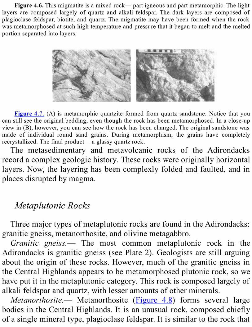
Figure4.6.Thismigmatiteisamixedrock—partigneousandpartmetamorphic.Thelightlayers are composed largely of quartz and alkali feldspar.The dark layers are composed ofplagioclase feldspar,biotite,andquartz.Themigmatitemayhavebeen formedwhen the rockwasmetamorphosedatsuchhightemperatureandpressurethatitbegantomeltandthemeltedportionseparatedintolayers.
Figure4.7. (A) ismetamorphic quartzite formed from quartz sandstone.Notice that you
canstillseetheoriginalbedding,eventhoughtherockhasbeenmetamorphosed.Inaclose-upviewin(B),however,youcanseehowtherockhasbeenchanged.Theoriginalsandstonewasmade of individual round sand grains. During metamorphism, the grains have completelyrecrystallized.Thefinalproduct—aglassyquartzrock.The metasedimentary and metavolcanic rocks of the Adirondacks
recordacomplexgeologichistory.Theserockswereoriginallyhorizontallayers.Now,thelayeringhasbeencomplexlyfoldedandfaulted,andinplacesdisruptedbymagma.
MetaplutonicRocksThreemajortypesofmetaplutonicrocksarefoundintheAdirondacks:
graniticgneiss,metanorthosite,andolivinemetagabbro.Granitic gneiss.— The most common metaplutonic rock in the
Adirondacks isgraniticgneiss(seePlate2).Geologistsarestillarguingabouttheoriginoftheserocks.However,muchofthegraniticgneissintheCentralHighlandsappearstobemetamorphosedplutonicrock,sowehaveputitinthemetaplutoniccategory.Thisrockiscomposedlargelyofalkalifeldsparandquartz,withlesseramountsofotherminerals.Metanorthosite.— Metanorthosite (Figure 4.8) forms several large
bodiesintheCentralHighlands.Itisanunusualrock,composedchieflyofasinglemineraltype,plagioclasefeldspar.Itissimilartotherockthat
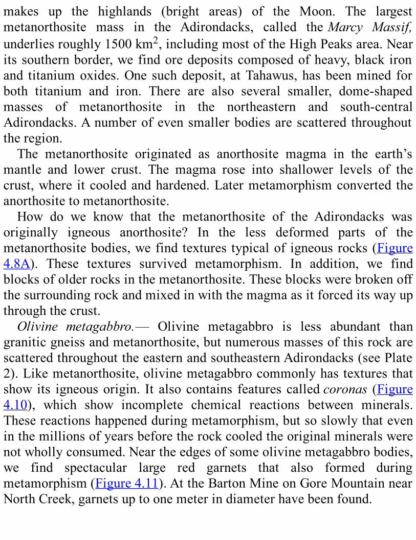
makes up the highlands (bright areas) of the Moon. The largestmetanorthosite mass in the Adirondacks, called theMarcy Massif,underliesroughly1500km2,includingmostoftheHighPeaksarea.Nearitssouthernborder,wefindoredepositscomposedofheavy,black ironand titaniumoxides.One suchdeposit, atTahawus,hasbeenmined forboth titanium and iron. There are also several smaller, dome-shapedmasses of metanorthosite in the northeastern and south-centralAdirondacks.Anumberofevensmallerbodiesarescattered throughouttheregion.The metanorthosite originated as anorthosite magma in the earth’s
mantle and lower crust. The magma rose into shallower levels of thecrust,where itcooledandhardened.Latermetamorphismconverted theanorthositetometanorthosite.How do we know that the metanorthosite of the Adirondacks was
originally igneous anorthosite? In the less deformed parts of themetanorthositebodies,wefindtexturestypicalof igneousrocks(Figure4.8A). These textures survived metamorphism. In addition, we findblocksofolderrocksinthemetanorthosite.Theseblockswerebrokenoffthesurroundingrockandmixedinwiththemagmaasitforceditswayupthroughthecrust.Olivine metagabbro.— Olivine metagabbro is less abundant than
graniticgneissandmetanorthosite,butnumerousmassesofthisrockarescatteredthroughouttheeasternandsoutheasternAdirondacks(seePlate2).Likemetanorthosite,olivinemetagabbrocommonlyhastexturesthatshow its igneousorigin. It alsocontains featurescalledcoronas (Figure4.10), which show incomplete chemical reactions between minerals.Thesereactionshappenedduringmetamorphism,butsoslowlythateveninthemillionsofyearsbeforetherockcooledtheoriginalmineralswerenotwhollyconsumed.Neartheedgesofsomeolivinemetagabbrobodies,we find spectacular large red garnets that also formed duringmetamorphism(Figure4.11).AttheBartonMineonGoreMountainnearNorthCreek,garnetsuptoonemeterindiameterhavebeenfound.

Figure4.8.ThesetwophotosshowAdirondackmetanorthosite.Themetanorthositein(A)
containslargecrystalsofplagioclase(mediumgray),fine-grainedplagioclase(white),andgreenpyroxene(darkgray). (Theruler is15cmlong.)(B)showsstronglydeformedmetanorthosite.The layering iscalledfoliation(Figure4.15).Thelargecrystalintheleftpartofthephotoisagarnet.
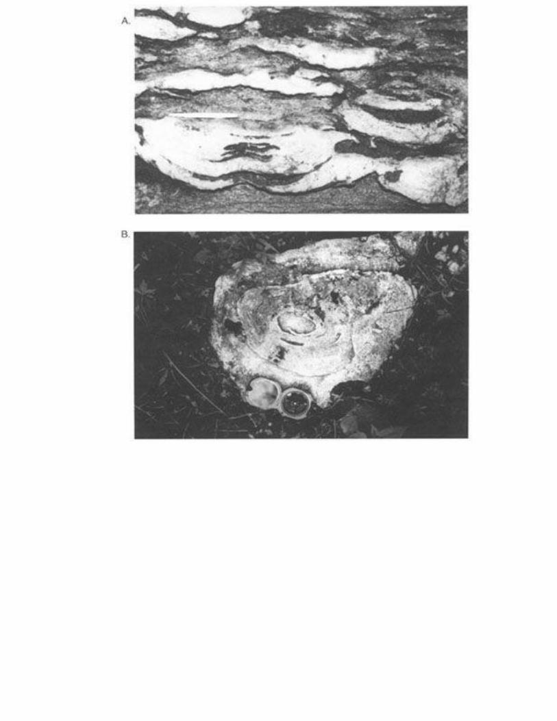
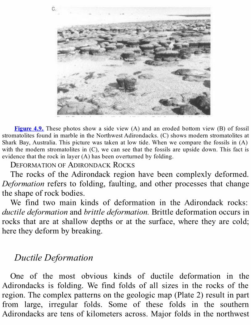
Figure4.9. Thesephotos showa sideview (A) and an erodedbottomview (B)of fossil
stromatolitesfoundinmarbleintheNorthwestAdirondacks.(C)showsmodernstromatolitesatSharkBay,Australia.Thispicturewas takenat low tide.Whenwecompare the fossils in (A)with themodern stromatolites in (C),wecan see that the fossils areupsidedown.This fact isevidencethattherockinlayer(A)hasbeenoverturnedbyfolding.DEFORMATIONOFADIRONDACKROCKSThe rocks of theAdirondack region have been complexly deformed.
Deformation refers to folding, faulting, andotherprocesses that changetheshapeofrockbodies.We find two main kinds of deformation in the Adirondack rocks:
ductiledeformationandbrittledeformation.Brittledeformationoccursinrocks that are at shallowdepths or at the surface,where they are cold;heretheydeformbybreaking.
DuctileDeformationOne of the most obvious kinds of ductile deformation in the
Adirondacks is folding. We find folds of all sizes in the rocks of theregion.Thecomplexpatternsonthegeologicmap(Plate2)resultinpartfrom large, irregular folds. Some of these folds in the southernAdirondacksare tensofkilometersacross.Majorfolds in thenorthwest

Adirondacks generally run northeast. Those in the southern half of theAdirondacksmakeaneast-westarc.Wealsoseefoldsinindividualrockexposures(Figures4.12,4.13,and
4.14).We find folded rocks throughout theAdirondacks; someof themappear tohavebeenfoldedseveral times.Clearly,greatgeologic forceswere needed to make such folds. In the folded rocks, we often find alayer-like arrangement of minerals calledfoliation (Figure 4.15) andparallel streaksofminerals calledlineation (Figure4.16).Foliationandlineation give us clues about the directions inwhich the folding forcesacted.Rocksathightemperaturesdeepwithinthecrustmayalsodeformby
ductileshear. Ductileshearhappenswhenoneblockof rockslidespastanother;therockbetweentheblocksdeformsandstretcheslikechewinggum or hot plastic, rather than breaking to form a fault as it would atlower temperatures. This movement creates aductile shear zone— arelativelynarrow, intenselydeformedareabetween the twoblocks.Therock in such ductile shear zones is greatly stretched and flattened andcommonlyshowsstrongfoliationandlineation.

Figure4.10. These twophotographsareofpaper-thin rockslicesasseenunderaspecial
microscopeusedbygeologists.Thephotosshowringsofminerals(calledcoronas)thatformedwhen the rocks were metamorphosed at very high temperatures and pressures. In (A), theoriginalminerals in the rockswereolivineandplagioclase feldspar.Theseminerals reacted toformthenewmetamorphicmineralsthatmakeupthecoronas:pyroxene,paleplagioclase,andredgarnet(blackinphoto).Plagioclaseoutsidethecoronalooksdarkbecauseit isfullof tinygrainsof themineral spinel.These same reactions canbe reproduced in the laboratory, but itrequiresatemperatureofupto800°Candpressuresequivalentto25-30kmofoverlyingcrust.Coronaslikethesecanbeseenwiththeunaidedeyeinmostexposuresofolivinemetagabbro.(SeePlate2forplaceswhereolivinemetagabbroappearsatthesurface.)(B)showsanothertypeof corona that forms in olivine metagabbros. Here, the two core crystals of ilmenite (black)reactedwithplagioclase feldspar to formcoronasofhornblende,biotite (blackmica), and redgarnet(whiteinphoto).
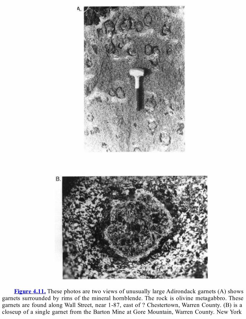
Figure4.11.ThesephotosaretwoviewsofunusuallylargeAdirondackgarnets(A)shows
garnetssurroundedbyrimsof themineralhornblende.The rock isolivinemetagabbro.ThesegarnetsarefoundalongWallStreet,near1-87,eastof?Chestertown,WarrenCounty.(B)isacloseupofasinglegarnetfromtheBartonMineatGoreMountain,WarrenCounty.NewYork
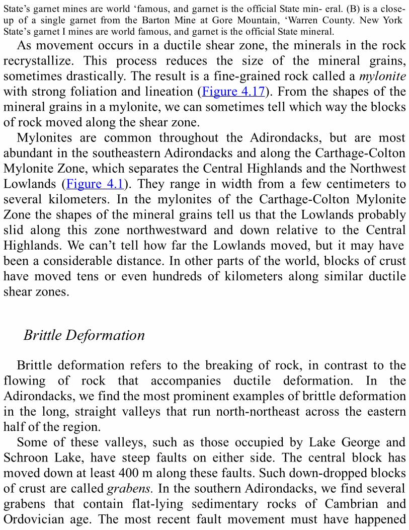
State’sgarnetminesareworld‘famous,andgarnetistheofficialStatemin-eral.(B)isaclose-up of a single garnet from the Barton Mine at Gore Mountain, ‘Warren County. NewYorkState’sgarnetIminesareworldfamous,andgarnetistheofficialStatemineral.Asmovementoccursinaductileshearzone, themineralsintherock
recrystallize. This process reduces the size of the mineral grains,sometimesdrastically.Theresultisafine-grainedrockcalledamylonitewithstrongfoliationandlineation(Figure4.17).Fromtheshapesof themineralgrainsinamylonite,wecansometimestellwhichwaytheblocksofrockmovedalongtheshearzone.Mylonites are common throughout the Adirondacks, but are most
abundantinthesoutheasternAdirondacksandalongtheCarthage-ColtonMyloniteZone,whichseparatestheCentralHighlandsandtheNorthwestLowlands (Figure 4.1). They range inwidth from a few centimeters toseveral kilometers. In the mylonites of the Carthage-Colton MyloniteZonetheshapesofthemineralgrainstellusthattheLowlandsprobablyslid along this zone northwestward and down relative to the CentralHighlands.Wecan’t tellhowfar theLowlandsmoved,but itmayhavebeenaconsiderabledistance.Inotherpartsoftheworld,blocksofcrusthavemoved tens or even hundreds of kilometers along similar ductileshearzones.
BrittleDeformationBrittle deformation refers to the breaking of rock, in contrast to the
flowing of rock that accompanies ductile deformation. In theAdirondacks,wefindthemostprominentexamplesofbrittledeformationin the long, straight valleys that run north-northeast across the easternhalfoftheregion.Some of these valleys, such as those occupied by Lake George and
Schroon Lake, have steep faults on either side. The central block hasmoveddownatleast400malongthesefaults.Suchdown-droppedblocksofcrustarecalledgrabens.InthesouthernAdirondacks,wefindseveralgrabens that contain flat-lying sedimentary rocks of Cambrian andOrdovician age. The most recent fault movement must have happened

afterdepositionoftheCambrianandOrdovicianrockscutbythefaults—that is, sometimeafterMiddleOrdovician time.We think that someofthese faults originally formed in the Late Pro- terozoic and werereactivatedinMiddleOrdoviciantime.Wecanseesmallfaultsinmanyoutcrops in the Adirondacks (Figure 4.18A). Some faults containshatteredrocksknownasfaultbreccias(Figure4.18B).Otherstraightvalleysaretheresultoferosionalongzonesofintensely
brokenrockcalledfracturezones(Figure4.19).Valleysformalongsuchzonesbecausethebrokenrockerodesmorerapidlythanthesurroundingrock. Fracture zones differ from faults: the blocks on opposite sides ofthezonehavenotmovedrelativetoeachother,but therockhassimplyshattered in place. In addition to the faults and fracture zones that runnorth-northeast, we find many others that run east-northeast, east, andsoutheast.Joints, another type of brittle deformation, are found in every
Adirondack rock exposure (Figure 4.20). These breaks look like neatslicesthroughtherock.Ajointisdifferentfromafaultbecausetherehasnotbeenanymovementalongajoint.
HowAdirondackDeformationHappenedWhat caused the deformation of the Adirondack rocks? Immense
tectonicforcescompressedtheentireregionnowknownastheGrenvilleProvince(Figure4.2).This compression,or squeezing,of the crustwasaccompaniedbyfoldingoftherocklayers.Asthecrustwassqueezed,itthickened and shortened in the same way that a cube of soft caramelcandyshortensandthickenswhenyoupushonitssides.Inadditiontothefolding,largeblocksofcrustmovedalongductileshearzonesandwerestackedoneon topof theother.As thecrust thickened, the lowerpartswere buried deeper beneath the surface. There, they were subjected tohigh pressures created by the weight of the overlying rock. Thesepressures, along with heat rising from the mantle and additional heatfromintrusionsofmagma,thoroughlymetamorphosedtherocks.
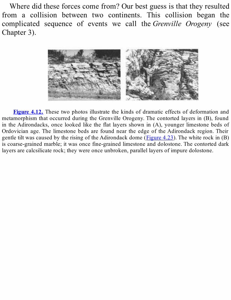
Wheredidtheseforcescomefrom?Ourbestguessisthattheyresultedfrom a collision between two continents. This collision began thecomplicated sequence of events we call theGrenville Orogeny (seeChapter3).
Figure4.12. These twophotos illustrate thekindsofdramaticeffectsofdeformationand
metamorphismthatoccurredduringtheGrenvilleOrogeny.Thecontortedlayersin(B),foundin theAdirondacks,once looked like the flat layers shown in (A),younger limestonebedsofOrdovician age.The limestonebeds are foundnear the edgeof theAdirondack region.TheirgentletiltwascausedbytherisingoftheAdirondackdome(Figure4.23).Thewhiterockin(B)iscoarse-grainedmarble;itwasoncefine-grainedlimestoneanddolostone.Thecontorteddarklayersarecalcsilicaterock;theywereonceunbroken,parallellayersofimpuredolostone.
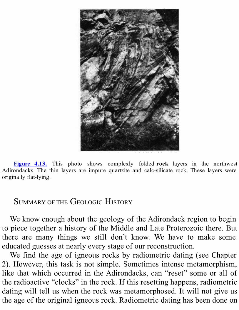
Figure 4.13. This photo shows complexly foldedrock layers in the northwest
Adirondacks. The thin layers are impure quartzite and calc-silicate rock. These layers wereoriginallyflat-lying.
SUMMARYOFTHEGEOLOGICHISTORYWeknowenoughaboutthegeologyoftheAdirondackregiontobegin
topiecetogetherahistoryoftheMiddleandLateProterozoicthere.Butthere are many things we still don’t know. We have to make someeducatedguessesatnearlyeverystageofourreconstruction.We find the ageof igneous rocksby radiometricdating (seeChapter
2).However, this task isnotsimple.Sometimes intensemetamorphism,like thatwhichoccurred in theAdirondacks, can“reset” someor all oftheradioactive“clocks”intherock.Ifthisresettinghappens,radiometricdatingwilltelluswhentherockwasmetamorphosed.Itwillnotgiveustheageoftheoriginaligneousrock.Radiometricdatinghasbeendoneon

manyAdirondackrocks,butwehavetobeverycarefulininterpretingtheresults.WehavefoundthatalmostallrocksintheAdirondacksareofMiddle
Proterozoic age.Radiometricdatingof themetavolcanic rocks suggeststhattheoldestonesmaybeasmuchas1.3billionyearsold.Wethinkthemetasedimentaryrocksweredepositedassedimentaryrocksbeginningataboutthesametime.6The original sedimentary rocks of the Adirondack basement—
sandstone,limestone,dolostone,andshale—wereprobablydepositedinashallow inland sea.Although theywere depositedmost likely nomorethan1.3billionyearsago,somecontaingrainsofthemineralzirconthatareabout2.7billionyearsold.Thisfact tellsus that thesediments thatformed these rocks were eroded from a much older landmass. Thislandmass was probably the Superior Province, located to the west andnorthoftheGrenvilleProvince(seePhysiographicandTectonicMapsonPlate4).Metavolcanic rocks thatoccurwith themetasedimentaryrocksindicatethatvolcanoeswerepresentintheregionatthattime.Most of the metaplutonic rocks of the Adirondack Highlands are
probably between 1.15 and 1.1 billion years old. Shortly before theGrenville Orogeny, large volumes of magmamay have risen from themantle into the crust. Heat from the magma partially melted thesurroundingcrust,producingmoltenrockofdifferentcompositions.Thevariouskindsofmoltenrock,suchasanorthositeandgranite, tended torisethroughthecrustbecausetheywerelessdensethanthesurroundingrocks.Somecontinuedtoriseevenaftertheypartlycooledandsolidified,eventually forming balloon-like domes or spreading out as thick sheetswithinthecrust.AtsomepointduringtheMiddleProterozoic,therockswenowfindat
thesurface in theAdirondackregionwereasmuchas30kmbelow thesurface. Remember that some of these rocks began their existence assedimentaryrocksatthesurface,whichmeansthattheymusthavebeenpushed down that far. For them to be buried so deeply, the continentalcrustintheregionhadtobenearlytwiceasthickasnormalcontinental
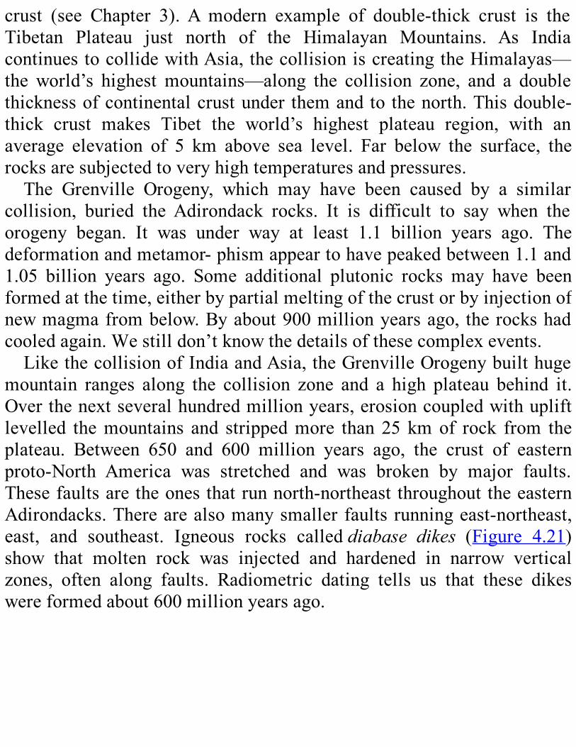
crust (see Chapter 3).A modern example of double-thick crust is theTibetan Plateau just north of the Himalayan Mountains. As IndiacontinuestocollidewithAsia,thecollisioniscreatingtheHimalayas—theworld’s highestmountains—along the collision zone, and a doublethicknessofcontinentalcrustunder themandto thenorth.Thisdouble-thick crust makes Tibet the world’s highest plateau region, with anaverage elevation of 5 km above sea level. Far below the surface, therocksaresubjectedtoveryhightemperaturesandpressures.The Grenville Orogeny, which may have been caused by a similar
collision, buried theAdirondack rocks. It is difficult to say when theorogeny began. It was under way at least 1.1 billion years ago. Thedeformationandmetamor-phismappeartohavepeakedbetween1.1and1.05 billion years ago. Some additional plutonic rocks may have beenformedatthetime,eitherbypartialmeltingofthecrustorbyinjectionofnewmagmafrombelow.Byabout900millionyearsago, therockshadcooledagain.Westilldon’tknowthedetailsofthesecomplexevents.LikethecollisionofIndiaandAsia,theGrenvilleOrogenybuilthuge
mountain ranges along the collision zone and a high plateau behind it.Overthenextseveralhundredmillionyears,erosioncoupledwithupliftlevelled themountains and strippedmore than 25 kmof rock from theplateau. Between 650 and 600 million years ago, the crust of easternproto-North America was stretched and was broken by major faults.Thesefaultsaretheonesthatrunnorth-northeastthroughouttheeasternAdirondacks.Therearealsomanysmallerfaultsrunningeast-northeast,east, and southeast. Igneous rocks calleddiabase dikes (Figure 4.21)show that molten rock was injected and hardened in narrow verticalzones, often along faults. Radiometric dating tells us that these dikeswereformedabout600millionyearsago.

Figure 4.14. These photos show dramatic folding in Adirondack rocks. The severely
crumpled rocks in (A)arealternating layersofmarble (light)andcalcsilicate rock (dark).Therockin(B)isgraniticgneiss(light)withalayerofamphibolite(dark).BeginningintheLateCambrian,theAdirondackregionwasgradually
submerged beneath shallow seas. Sandstones with trilobite fossils (seeFigureA.3)weredepositedovermuchoftheregion.Thecontactbetweenthese younger rocks and the underlying basement is visible in severalplacesneartheouteredgeofthepresentAdirondackdome(Figure4.22).Sediments continued to accumulate across much of the eastern UnitedStates(withsomeinterruptions)throughthePennsylvanianPeriod,butnorocksyoungerthanMiddleOrdovicianremaininnortheasternNewYork.Later erosion in theAdirondack region stripped off nearly all of the
Paleozoicsedimentaryrocks.However,therearestilltracesofCambrian
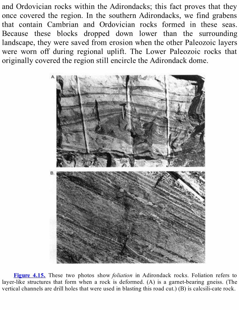
andOrdovician rockswithin theAdirondacks; this factproves that theyonce covered the region. In the southernAdirondacks,we find grabensthat contain Cambrian and Ordovician rocks formed in these seas.Because these blocks dropped down lower than the surroundinglandscape,theyweresavedfromerosionwhentheotherPaleozoiclayerswere worn off during regional uplift. The Lower Paleozoic rocks thatoriginallycoveredtheregionstillencircletheAdirondackdome.
Figure 4.15. These two photos showfoliation inAdirondack rocks. Foliation refers to
layer-like structures that formwhen a rock is deformed. (A) is a garnet-bearing gneiss. (Theverticalchannelsaredrillholesthatwereusedinblastingthisroadcut.)(B)iscalcsili-caterock.
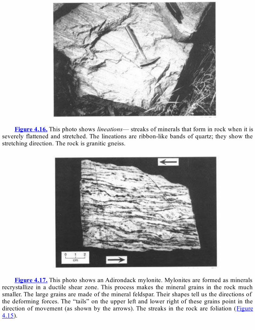
Figure4.16.Thisphotoshowslineations—streaksofmineralsthatforminrockwhenitis
severely flattenedandstretched.The lineationsare ribbon-likebandsofquartz; theyshowthestretchingdirection.Therockisgraniticgneiss.
Figure4.17.ThisphotoshowsanAdirondackmylonite.Mylonitesareformedasminerals
recrystallize in a ductile shear zone.This processmakes themineral grains in the rockmuchsmaller.Thelargegrainsaremadeofthemineralfeldspar.Theirshapestellusthedirectionsofthedeformingforces.The“tails”on theupper leftand lowerrightof thesegrainspoint in thedirectionofmovement (as shownby thearrows).Thestreaks in the rockare foliation (Figure4.15).

Figure4.18.(A)showsasmallfaultintheAdirondacks.(B)showsbrecciainanotherfault
in theAdirondacks.Large, angular fragmentsofgneiss areenclosed in finergrained, crushedandshatteredrockofthefaultzone.From the Middle Ordovician into the Tertiary Period, there is no
evidenceofanytectonicactivityintheAdirondacks,despitethreemoremountain-building events that affected New England and southeastern
New York (see Chapter 3). The region that is now the AdirondackMountains was flat, just like the rest of the region west of theAppalachianMountains.InJurassicorCretaceoustime,somesmalldikesintrudedintheeasternAdirondacksandVermont.SometimeintheTertiaryPeriod,theAdirondacksbegantorise(Figure
4.23).Why?Our best guess is that a hot spot formed under the regionnearthebaseofthecrust.Thishotspotheatedthesurroundingmaterialat depth, causing it to expand. This expansion raised the crust above,causingthepresentdome-shapeduplift(Figure4.23).Intheearly1980s,remeasurementof theelevationsofoldsurveyors’benchmarksshowedthat theAdirondacksmay be rising at the astonishing (to a geologist!)rateof2to3mmperyear.Themountainsaregrowingabout30timesasfast as erosion is wearing them away. We suspect, however, that thepresent rapid uplift is a temporary spurt, and the average rate may bemuchless.After theAdirondack dome began to rise, stream erosion (andmuch
later glacial erosion) started wearing away the softer rocks and thefractured zones.Eventually, erosion carved the region into the separatemountain rangeswe see today.Glacial ice entered the region about 1.6millionyearsago;thatepisodeisdiscussedinChapter12.
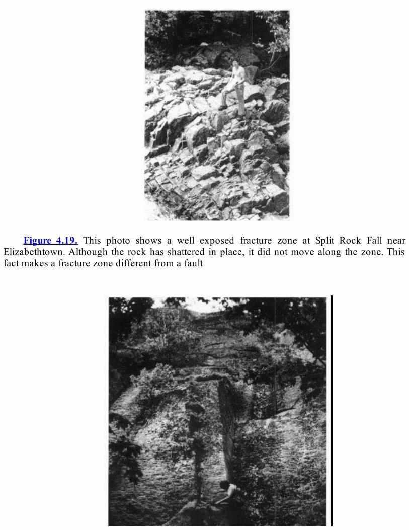
Figure 4.19. This photo shows a well exposed fracture zone at Split Rock Fall near
Elizabethtown.Although the rockhasshattered inplace, itdidnotmovealong thezone.Thisfactmakesafracturezonedifferentfromafault
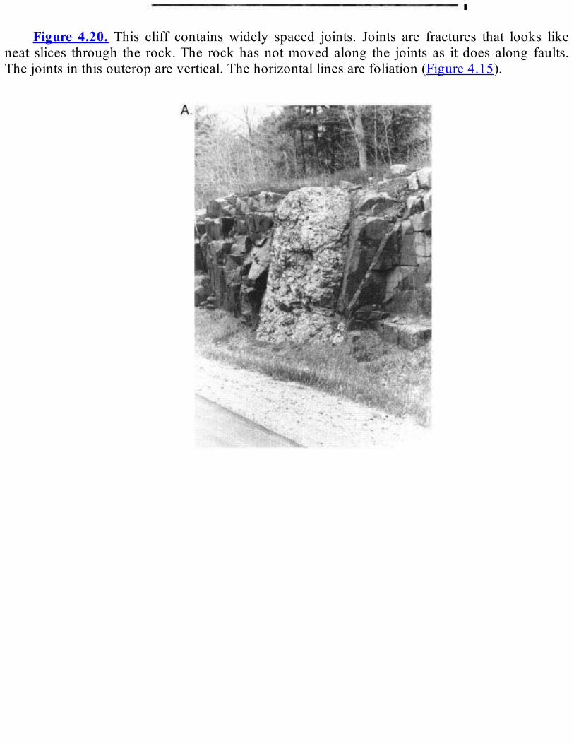
Figure 4.20. This cliff contains widely spaced joints. Joints are fractures that looks like
neat slices through the rock.The rockhasnotmoved along the joints as it does along faults.Thejointsinthisoutcroparevertical.Thehorizontallinesarefoliation(Figure4.15).

Figure4.21.ThesethreephotosshowdikesintheAdirondackregion.Thesedikesformed
whenmagmawaspushedupfrombelowandhardened.Thedikein(A)ismadeofpegmatite,avery coarse-grained igneous rock, cutting across olivine metagabbro.The dike in (B) is theigneous rockdiabase cutting acrossmarble.The cracks in the dike formedwhen themagmahardenedandshrank.Thedikein(C)isdiabasecuttingacrossmetanorthosite.
REVIEWQUESTIONSANDEXERCISES
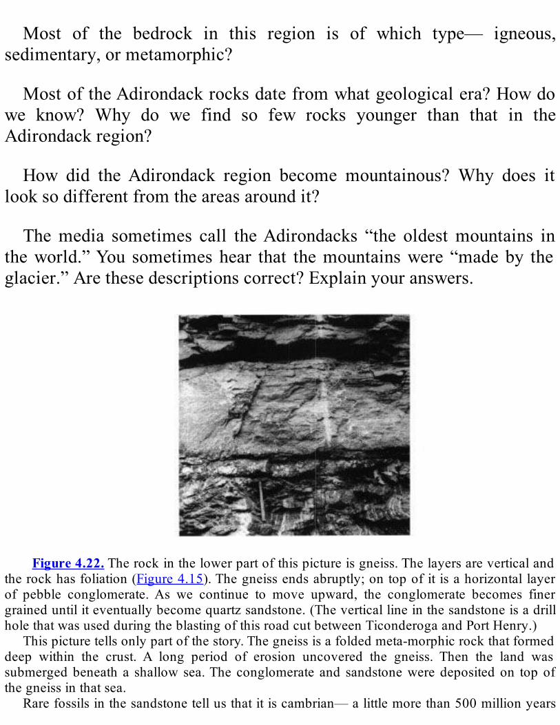
Most of the bedrock in this region is of which type— igneous,
sedimentary,ormetamorphic?
MostoftheAdirondackrocksdatefromwhatgeologicalera?Howdowe know? Why do we find so few rocks younger than that in theAdirondackregion?
How did theAdirondack region become mountainous? Why does itlooksodifferentfromtheareasaroundit?
Themedia sometimes call theAdirondacks “the oldestmountains intheworld.”You sometimeshear that themountainswere “madeby theglacier.”Arethesedescriptionscorrect?Explainyouranswers.
Figure4.22.Therockinthelowerpartofthispictureisgneiss.Thelayersareverticaland
therockhasfoliation(Figure4.15).Thegneissendsabruptly;ontopofit isahorizontallayerof pebble conglomerate.As we continue to move upward, the conglomerate becomes finergraineduntiliteventuallybecomequartzsandstone.(TheverticallineinthesandstoneisadrillholethatwasusedduringtheblastingofthisroadcutbetweenTiconderogaandPortHenry.)
Thispicturetellsonlypartofthestory.Thegneissisafoldedmeta-morphicrockthatformeddeep within the crust. A long period of erosion uncovered the gneiss. Then the land wassubmergedbeneath a shallowsea.Theconglomerate and sandstoneweredepositedon topofthegneissinthatsea.
Rarefossilsinthesandstonetellusthatitiscambrian—alittlemorethan500millionyears

old.Radiometricdatingtellsusthat thegneissisat least1.1billionyearsold.Thatmeansthatalmost600millionyearsofgeologichistoryarelostinthetimegapbetweenthetworockunits.Thesurfacethatseparatesthemandrepresentsthetimegapiscalledanunconformity.
Figure4.23.Thesedrawingsshowthreestages in theupliftof theAdirondackdome. (A)
represents thesituation10-20millionyearsago.The region is flat,with layersof sedimentaryrockcovering thecontorted,metamorphosedbasement rock. In(B),uplifthascreatedadomeshape. Running water, in a radial pattern, begins to wear away the sedimentary layers. (C),representingthepresent,showsthebasementrockexposed,surroundedbyerodedsedimentaryrock.The escarpment of sedimentary rocks is grossly exaggerated to illustrate the concept ofupturnedsedimentaryrockssurroundingthedome.

Chapter5
COLLISION!
HudsonHighlandsandManhattanProng1
SummaryTherocksofsoutheasternNewYorkStatehaveacomplex1.3billion-
yearhistory.ThatpartoftheStateisdividedintofourgeologicregions:theHudsonHighlands, theManhattanProng, theNewarkBasin,andtheCoastalPlain.Thischaptercoversthefirsttworegions.Themetamorphicrocksof theHudsonHighlandsformthemountains
ofsoutheasternNewYork.TheHudsonHighlandsaredividedintothreemajorareasthatareseparatedbyancientfaults.Thebedrock,whichistheoldestinthatpartoftheState,formscomplexpatterns.Theserocksweredepositedassedimentaryandvolcanicrocks1.3billionyearsago.Duringthe Grenville Orogeny, the rocks in the eastern and central areas weremetamorphosedintogneiss,andlimestoneinthewesternareabecamethe

FranklinMarble.ThefaultsandfoldsintheHudsonHighlandsdeterminethepositionsofridgesandvalleys.TheManhattanPronghasa lessruggedlandscapeofrollinghillsand
valleys.Gneiss,schist,andquartziteformthehills,whilemarblemakesup the valleys. The rocks of the Manhattan Prong were deformed andmetamorphosedduringtheTaconianOrogeny.Theearlygeologichistoryofsoutheasternnewyorkisprobablysimilar
to thatof theadirondack region.About1.3billionyearsago, sedimentsandvolcanicmaterialweredeposited in a shallowsea in easternproto-NorthAmerica.Thegrenvilleorogeny,causedbyacontinentalcollisionabout 1.1 billionyears ago, greatly compressed and thickened the crustandmetamorphosed the rocks there. It built amassivemountain rangeandahighplateaubehind it.By600millionyearsago, theplateauhadbeenerodedtoaflatplainanditsancientroots—therocksofthehudsonhighlands—exposed.Faultsandvolcanoesformedintheregionwhenthegrenville supercontinent broke up. From the beginning of the cambrianthrough theMiddleOrdovician, sedimentswere deposited in a shallowsea that flooded theeasternhalfofproto-NorthAmerica. In themiddleOrdovician,anislandarcadvancedtowardtheedgeofthecontinent,androcks of the accretionary prism and a fewpieces of oceanic crustweretrapped between the island arc and the continent. This collision, about450 million years ago, caused the Taconian Orogeny, which built amountain range and deformed and metamorphosed the rocks ofsoutheastern New york. The acadian orogeny, about 380 million yearsago,andthealleghanianorogeny,about325-250millionyearsago,againdeformedandmetamorphosedtherocksoftheregion.About200millionyears ago, theAtlantic ocean began to open.At about the same time,movement on theRamapo Fault caused formation of a basin, inwhichweredepositedsedimentserodedfromtheHudsonHighlands.Today,thatareaistheNewarkBasin,NewYork’s“dinosaurcountry.”thesamefaultmovement caused magma to squeeze up from below and form thePalisadesSill.
IntroductionTherocksinsoutheasternNewYorkStateformedthroughaseriesof
complex geologic processes. These processes began about 1.3 billionyearsagoandcontinuetoday.Overthislongperiodoftime,southeasternNewYorkhasbeenthemostgeologicallyactivepartoftheState.TherocksatthesurfaceinsoutheasternNewYorkarehighlycomplex.
In them we find evidence for at least three, and possibly four, majormountain chains over the 1.3 billion-year history. Majororogenies,caused by continent-continent collisions, formed these mountains.Erosion by water, wind, and ice eventually wore away each mountainchain toa lowplain.Atpresent,only the rocks that formed in thedeeproots of themountains remain. These rocks are the ones that wemuststudytounravelthegeologichistoryofthiscomplexarea.SoutheasternNewYorkcontainsfourdistinctgeologicregions( Figure
5.1).
1. The Hudson Highlands. This area consists of low mountains(including the Ramapo Mountains). They are composed ofmetamorphicrocksofMiddleProterozoicage.
2.TheManhattanProng(NewYorkCity-WestchesterCountyarea).This rolling lowland area is composed ofmetamorphic rocks ofEarlyPaleozoicage.
3.TheNewarkBasin(RocklandCountyandpartofStat-enIsland).The rocks here are Triassic-Jurassic sedimentary and igneousrocks.
4. The Coastal Plain and Long Island. Mesozoic and Cenozoicsedimentaryrocksunderliethisarea.
WewillbelookingattheHudsonHighlandsandtheManhattanProngin this chapter (seeFigure 1.1). The other two areas are discussed inChapters9and10.

HudsonHighlandsThe Hudson Highlands region is narrow, elevated, and composed of
metamorphicrocks.TheareacrossesthesoutheasternportionoftheStateinanortheastdirectionacrossOrange,Rockland,Putnam,Dutchess,andWestchesterCounties (Figure5.2; see also all Plates of theGeologicalHighwayMap).TheHudsonHighlandsarepartofthegeologicprovincecalled theReading Prong, which extends from Pennsylvania toConnecticut.TheReadingProngiscomposedofmetamorphicrocksthatwere formed during the Proterozoic and deformed during theGrenvilleOrogeny.Many of these rocks are rich in urani um, and they thereforeproducehigh levelsof theradioactivegas radon.Thepresenceof radonhasattractedpublicitytotheprovince.
Figure 5.1. Block diagram of southeastern NewYork showing the four physiographic
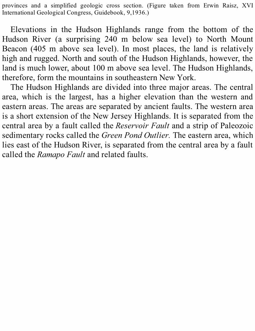
provinces and a simplified geologic cross section. (Figure taken from Erwin Raisz, XVIInternationalGeologicalCongress,Guidebook,9,1936.)
Elevations in the Hudson Highlands range from the bottom of theHudson River (a surprising 240 m below sea level) to North MountBeacon (405m above sea level). Inmost places, the land is relativelyhighandrugged.NorthandsouthoftheHudsonHighlands,however,thelandismuchlower,about100mabovesealevel.TheHudsonHighlands,therefore,formthemountainsinsoutheasternNewYork.TheHudsonHighlandsaredividedintothreemajorareas.Thecentral
area, which is the largest, has a higher elevation than the western andeasternareas.Theareasareseparatedbyancientfaults.ThewesternareaisashortextensionoftheNewJerseyHighlands.ItisseparatedfromthecentralareabyafaultcalledtheReservoirFaultandastripofPaleozoicsedimentaryrockscalledtheGreenPondOutlier.Theeasternarea,whichlieseastoftheHudsonRiver,isseparatedfromthecentralareabyafaultcalledtheRamapoFaultandrelatedfaults.
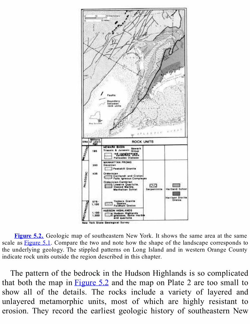
Figure5.2. GeologicmapofsoutheasternNewYork. Itshows thesameareaat thesame
scale asFigure5.1.Comparethetwoandnotehowtheshapeofthelandscapecorrespondstothe underlying geology.The stippled patterns onLong Island and inwesternOrangeCountyindicaterockunitsoutsidetheregiondescribedinthischapter.
ThepatternofthebedrockintheHudsonHighlandsissocomplicatedthatboth themap inFigure5.2andthemaponPlate2are toosmall toshow all of the details. The rocks include a variety of layered andunlayered metamorphic units, most of which are highly resistant toerosion. They record the earliest geologic history of southeastern New
York.Therocksinthecentralandeasternareaswereoriginallydepositedin
ashallowseaabout1.3billionyearsago.Theystartedoutassandstones,shales, and shaly limestones, as well as volcanic rocks. During theGrenville Orogeny, these rocks weremetamorphosed into gneiss. Theycontain large deposits ofmagnetite, a kind of iron ore. These depositsweremined for iron in the 18th and 19th centuries. Uraniumwas alsominedfromtheserocksinseveralareas.The rocks in the western area started out as thick limestones,
sandstones, and volcanic rocks. During the Grenville Orogeny, thesedimentary rocks were metamorphosed. The limestone became theFranklin Marble.Magma (molten rock) was later intruded into themarble.Themagmaaddedheat andnewchemical elements, allowingawidevarietyofmineralstoforminthemarble.InnorthernNewJersey,this marble belt now contains more mineral varieties than almost anyotherareaintheworld.TheHudsonHighlands containsmany faults.Faults also separate the
HudsonHighlands from theothergeologicprovinces. Inaddition, somefoldsintherockarelargeenoughtoshowuponthegeologicmap(Plate2).Thefaultsandfoldsaregenerallyparalleltoeachother.Comparethemaps inFigure5.1 andFigure5.2,which are at the same scale.Noticehow the faults and folds have determined the positions of ridges andvalleys.
ManhattanProngTheManhattanPronghasalandscapeofrollinghillsandvalleys.The
greatestelevationisabout100mabovesealevel.Theshapeoftheland’ssurface iscloselycontrolledbytheunderlyingbedrock(compareFigure5.1andFigure5.2).Muchofthebedrock,however,iscoveredbyAtlanticCoastal Plain deposits.Metamorphic rocks that are resistant to erosionmakeupthehills.TheyincludetheFordhamGneiss,theYonkersGneiss,the Manhattan Schist, and locally, the Lowerre Quartzite. The Inwood
Marble, which overlies the Lowerre Quartzite, makes up the valleysbecause it is easily erodible.TheHudson,Harlem, andEastRivers andthe major north-south valleys in northern Westchester County are allunderlainbyInwoodMarble.The rocks of the Manhattan Prong were tightly folded and
metamorphosed primarily during the TaconianOrogeny (see Chapter 3and the Tectonic Map on Plate 4). This orogeny occurred about 450million years ago. The folds are oriented north-south and are long andnarrow.Minorfaultsproducedearthquakesintheareamanytimesduringgeologichistory.Someofthesefaultsarestillactivetoday.
GeologicHistoryofSoutheasternNewYorkTheearliestgeologichistoryofsoutheasternNewYorkisrecordedby
therocksintheHudsonHighlands.Itisverydifficulttoreconstructthishistorybecausetherockshavebeendeformedandmetamorphosedbyatleast three orogenies.Another major problem is that we can see onlyfragmentsofanancientlandmassthatwasoncehuge.Theresthasbeenremovedbyerosion.However,theearlyhistoryoftheHudsonHighlandswas probably similar to that of theAdirondack region (seeChapter 4).BothregionsaremadeupofMiddleProterozoic-agerocks,andtheyareconnected underground beneath a thick cover of younger, Paleozoicsedimentaryrocks(seeFigure4.2).Bycombiningthegeologicevidencefrombothoftheseareas,wecanbettersolvethiscomplexpuzzle.About1.3billionyearsago,muchorallof theeasternedgeofproto-
NorthAmerica2wasashallowsea.Sedimentswerecarriedintothisseafromanolderlandmass,whichwasformedabout2.7billionyearsago.Atthe same time, volcanic material was also deposited, perhaps from anearbyvolcanicislandarcormagmaticarc(Figure5.3).Overtheyears,thesedimentspiledupuntiltheywerethousandsofmetersthick.Then,adrifting continent collided with proto-North America. This collisionsqueezed the crust together, causing themountain-buildingevent calledtheGrenvilleOrogeny(Figure5.4).
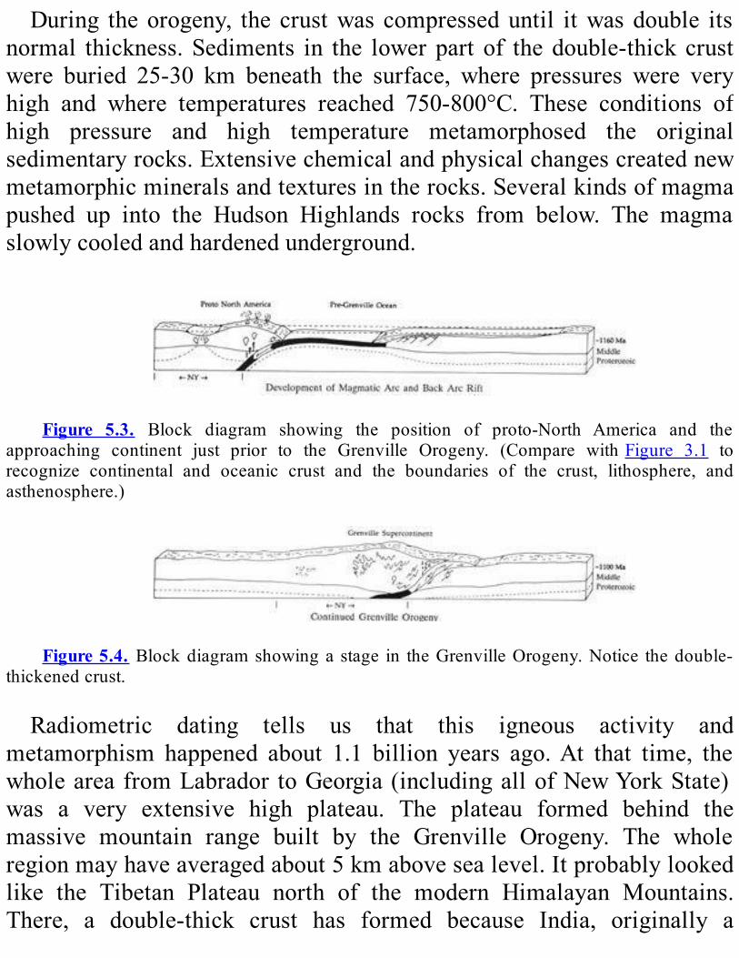
During theorogeny, the crustwas compresseduntil itwasdouble itsnormal thickness.Sediments in the lowerpart of thedouble-thick crustwere buried 25-30 km beneath the surface, where pressures were veryhigh and where temperatures reached 750-800°C. These conditions ofhigh pressure and high temperature metamorphosed the originalsedimentaryrocks.Extensivechemicalandphysicalchangescreatednewmetamorphicmineralsandtexturesintherocks.Severalkindsofmagmapushed up into the Hudson Highlands rocks from below. The magmaslowlycooledandhardenedunderground.
Figure 5.3. Block diagram showing the position of proto-North America and the
approaching continent just prior to the Grenville Orogeny. (Compare withFigure 3.1 torecognize continental and oceanic crust and the boundaries of the crust, lithosphere, andasthenosphere.)
Figure5.4. Blockdiagramshowingastage in theGrenvilleOrogeny.Notice thedouble-
thickenedcrust.
Radiometric dating tells us that this igneous activity andmetamorphism happened about 1.1 billion years ago.At that time, thewholeareafromLabrador toGeorgia(includingallofNewYorkState)was a very extensive high plateau. The plateau formed behind themassive mountain range built by the Grenville Orogeny. The wholeregionmayhaveaveragedabout5kmabovesealevel.Itprobablylookedlike the Tibetan Plateau north of the modern Himalayan Mountains.There, a double-thick crust has formed because India, originally a

separatecontinent,isnowbeingpushedintosouthernAsia.Thiscollisionbeganabout40millionyearsagoandcontinuestoday.As thisancient“GrenvillePlateau” formed, itbegan toerode.As the
crust was “unloaded” by this erosion of rock material, the landrebounded. This process of erosion, rebound, erosion, etc., eventuallyresultedintheremovalofsome25-30kmofrock.By600millionyearsago,theonce-highmountainsandplateauhadbeenwornawaytoalow,flatplain.Theoriginaldeeprootsoftheplateauwerethenexposedatthesurface.TheserootsaretherockswefindtodayintheHudsonHighlands.TheoldestrockintheManhattanProngistheFord-hamGneiss,arock
ofvariablecomposition.TheyoungerYonkersGneisswasoriginallyanigneous rock that either hardenedunderground frommagmaor reachedthe surface as a volcanic ash or lava flow. TheHudsonHighlands andManhattanProngunderwentriftingduringthelatestProterozoicwiththebreakupoftheGrenvillesupercontinent(Figure5.5).Basalticvolcanismand normal faulting occurred as a result of this rifting. Themountainswerefurtherreducedduringthisevent.ApproximatelyatthebeginningoftheCambrianPeriod,ashallowsea
gradually flooded most of the eastern half of proto-NorthAmerica. Itadvanced from east to west across the continent. In southeastern NewYorkduring theEarlyCambrian,sandcollected in lowareas.Thissandand themucholdergneisswerecoveredbycarbonate sedimentsduringthe Early Cambrian through Early Ordovician (Figure 5.6). Thesecarbonate sedimentswere latermetamorphosedandbecame the InwoodMarble.Afteranintervaloferosion,athinunitoflimymudandamuchthickerunitofsiltymudwere laiddownduring theMiddleOrdovician.The rocks formed from thesemudswere latermetamorphosed into theWalloomsacSchist.DuringtheMiddleOrdovician,avolcanicislandarcmovedtowardthe
east coastofproto-NorthAmerica (seeChapter3).As it approached, itscrapedupsedimentaryrocksthathadbeendepositedintheoceanofftheproto-NorthAmericancoast.Theserockspileduptothewest,alongtheadvancingedgeoftheislandarc(Figure5.7)(Apilethatincludesfolded,faulted,andmetamorphosedoceanicrocksformedinthiswayiscalledan
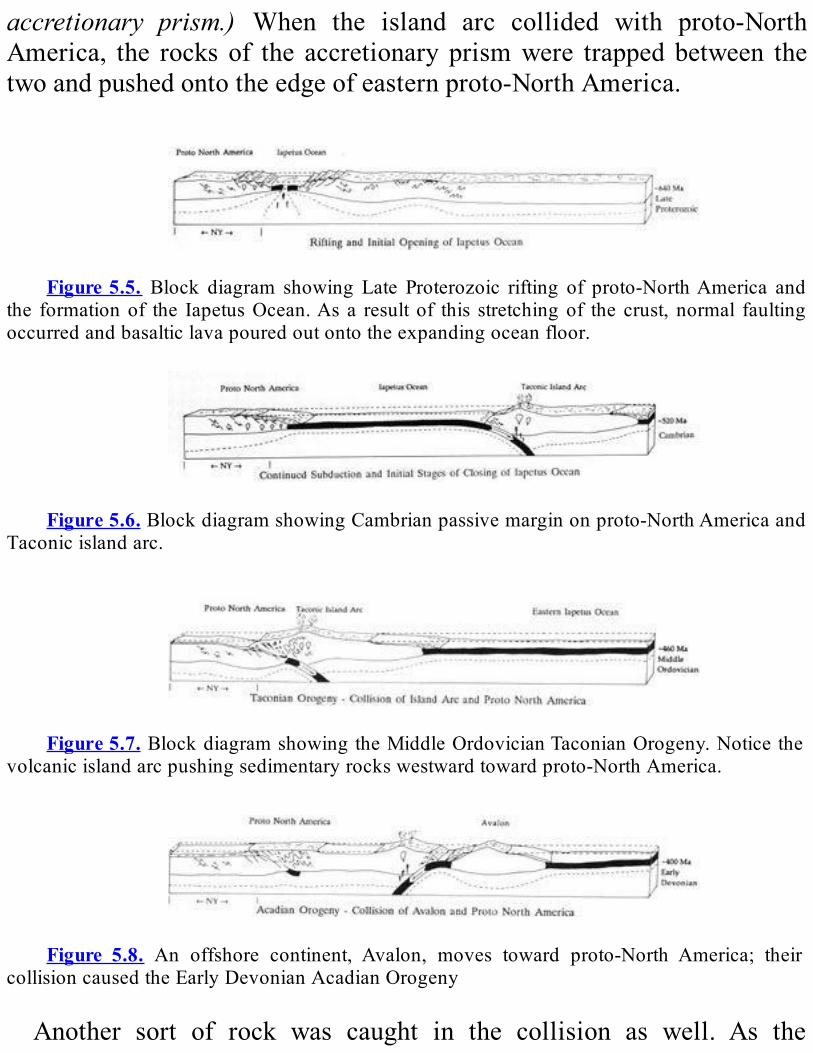
accretionary prism.) When the island arc collided with proto-NorthAmerica, the rocks of the accretionary prismwere trapped between thetwoandpushedontotheedgeofeasternproto-NorthAmerica.
Figure5.5. Block diagram showing Late Proterozoic rifting of proto-NorthAmerica and
the formationof the IapetusOcean.As a result of this stretchingof the crust, normal faultingoccurredandbasalticlavapouredoutontotheexpandingoceanfloor.
Figure5.6.BlockdiagramshowingCambrianpassivemarginonproto-NorthAmericaand
Taconicislandarc.
Figure5.7.BlockdiagramshowingtheMiddleOrdovicianTaconianOrogeny.Noticethe
volcanicislandarcpushingsedimentaryrockswestwardtowardproto-NorthAmerica.
Figure 5.8. An offshore continent, Avalon, moves toward proto-North America; their
collisioncausedtheEarlyDevonianAcadianOrogeny
Another sort of rock was caught in the collision as well. As the

volcanic island arc moved toward proto- North America, most of theoceaniccrustbetweenthemsliddownunderthearc.However,afewpodsofoceaniccrustwerebroughtupalongthecollisionzone.Thelargestofthesemasses forms the backboneofStaten Island, the highest point ontheAtlanticcoastsouthofMaine.The collision of the island arcwith proto-NorthAmerica caused the
Taconian Orogeny. This mountain-building event created the ancientTaconic Mountains and deformed and metamorphosed the rocks ofsoutheastern New York. It occurred about 450 million years ago andadded to theproto-NorthAmerican continent (see theTectonicMaponPlate4).AttheendoftheTaconianOrogeny,moltenrockwaspushedupfrom
below along the southern border of the Hudson Highlands east of theHudsonRiver.Themagmahardenedtoformdarkgraytoblackigneousrocks. These rocks have unfamiliar names like pyroxen- ite, gabbro,diorite,andperiodotite;theyformtheCortlandComplex.Theheatfromthe molten rock metamorphosed parts of the surrounding ManhattanSchistintoemerydeposits.Eventually, the ancientTaconicMountainswereworn down to a flat
plain. This plain was gradually submerged by an advancing sea. Thicksequences of Silurian and early Devonian sedimentary rocks weredeposited. Then, about 380 million years ago, the Acadian Orogenyoccurred(Figure5.8).ThisorogenybeganwhenacontinentcalledAvalon(whichincludedeasternCanadaandeasternNewEngland)collidedwithproto-NorthAmerica.Still later,near theendof thePaleozoic(325-250millionyearsago),proto-Africacollidedwithproto-NorthAmericaalonga transformmargin (Figure 5.9). This collision caused theAlleghanianOrogeny.Manyothercontinentalcollisionstookplacearoundtheworldas well. Eventually, these continental collision assembled many smallcontinentsintoasupercontinentcalledPangea.All of these events deformed and metamorphosed the rocks of
southeasternNewYork.Fromlookingatthoserockstoday,itisdifficulttofigureoutexactlywhichfaults,folds,andmetamorphismwerecausedbywhichevent.

ThenextmajoreventinthegeologichistoryofsoutheasternNewYorkhappened about 200 million years ago. After so many episodes ofcollisionandcompression,Pangeabegantobestretched.Thisstretchingcausedittobreakapart(Figure5.10).ThisriftingeventmarkedthebirthoftheAtlanticOcean.Afterthebreak,partofproto-Africa,aswellastheearlier Taconian island arc, remained attached toNorthAmerica. TheynowformpartofeasternNewEngland.TheAtlanticOceancontinuestowidentodayatthislatitudeatapproximately2.5cmperyear.Ataboutthesametime,newmovementoccurredalongtheoldRamapo
Fault.Anareasoutheastofthefaultwasdroppeddownsome1500-2400mtoformabasininTriassic-Jurassictime(about200millionyearsago).TheNewarkBasinisoneofseveralbasinsalongtheeastcoastofNorthAmerica(seeFigure9.6).Asthebasinformed,itbecamefilledwithlakeand river sediments that were transported mainly from the adjacentHudson Highlands. These sediments became the present redconglomerates,sandstones,andshalesofRocklandCounty.Theserocksare the “dinosaur country” inNewYork andNew Jersey. Thus far, theonlydinosaurfossilsdiscoveredinNewYorkarefootprintsofthemeat-eatingbipedaldinosaurCoelophysis.
Figure5.9.BlockdiagramfortheLateMississippianpartofAlleghanianOrogeny.Notice
the arrows that showhorizontal, ortransform,movement of blocks of crust.TheAlleghanianOrogeny,whichwas the collisionofproto-NorthAmerica andproto-Africa along a transformmargin,wasoneofmanyorogeniesthatoccurredaroundtheworld.Together, thesecollisionsformedthesupercontinentPangea.

Figure 5.10. Block diagram showing the Jurassic rifting of Pangea to form the North
AmericanandAfricancontinents.
The faulting that formed the Newark Basin also tapped magma atdepth. The molten rock squeezed in between the sandstone layers andsolidifiedasasheet,orsill,ofblackdiabase120-300mthick.Theeast-facingerodededgeofthisslabcreatesthemajesticcliffsofthePalisades(seeFigure 9.4). This escarpment extends along the west shore of theHudsonRiver fromNewYorkHarbor tonorthofNyack.Fromthere, itcurveswestwardtowardtheHudsonHighlands.Asthemagmacooled,itshrank andbroke alongvertical fractures to produce five- or six- sidedcolumns.Thecolumnslooksomethingliketheverticallogsusedtobuilda fort, so the escarpment was named “Palisades.” (Apalisade is a logfence built for defense.) InNew Jersey, lava flows reached the surfaceduring the Triassic Period. They now form the Watchung Mountains.AdditionalinformationontheNewarkBasinappearsinChapter9.
Review,Questions,AndExercisesMostofthebedrockintheHudsonHighlandsiswhichtype—igneous,
sedimentary, or metamorphic? Which type is found in the ManhattanProng?Howoldaretheserocks?
Howhas thebedrock in this regionaffected the shapeof themodernlandscape?Giveseveralexamples.
Why is it hard to figure out the exact history of the rocks in thisregion?Givethreereasons.
What is special about the rocks that form the backbone of StatenIsland?

AtwhatrateistheAtlanticOceanopeningtoday?Extra credit question: If Columbus were to make his voyage from
Spain to North America today, instead of in 1492, how much fartherwouldhehavetotravel?
WhenandhowwasthePalisadesSillformed?
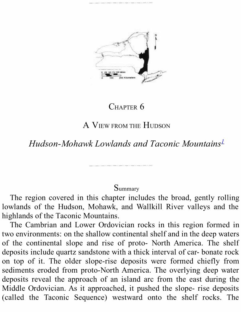
CHAPTER6
AVIEWFROMTHEHUDSON
Hudson-MohawkLowlandsandTaconicMountains1
SummaryThe region covered in this chapter includes the broad, gently rolling
lowlands of the Hudson, Mohawk, and Wallkill River valleys and thehighlandsoftheTaconicMountains.The Cambrian and Lower Ordovician rocks in this region formed in
twoenvironments:ontheshallowcontinentalshelfandinthedeepwatersof the continental slope and rise of proto- North America. The shelfdepositsincludequartzsandstonewithathickintervalofcar-bonaterockon top of it. The older slope-rise deposits were formed chiefly fromsediments eroded fromproto-NorthAmerica.The overlying deepwaterdeposits reveal the approach of an island arc from the east during theMiddleOrdovician.As it approached, it pushed the slope- risedeposits(called the Taconic Sequence) westward onto the shelf rocks. The
Taconic Sequence includes fossils of Early and Middle Cambriancreatures that lived on the shelf edge and in slope-rise environments.Thesefossilsarefoundcommonlyinchunksofrockthatformedontheshelf and upper slope and tumbled down to the lower slope andcontinentalrise;there,theybecamepartsoflimestoneconglomerates.TheUpper Cambrian rocks record the advance of a sea that flooded
large portions of New York State. They include the spectacularsandstones of Ausable Chasm and the fossil stromatolite reefs of thePetrifiedGardens.Onedolostoneunitformedinashallow,verysaltyseacontainsthequartzcrystalsknownas“HerkimerDiamonds.”The Lower Ordovician rocks are distinguished from those of the
Cambrian by the fossils they contain. These thick carbonate deposits,formedintheshallow,warmwateroftheshelf, includemanyfossilsofshelledanimals.Theslope-risedepositsoftheTaconicSequencecontaindifferent fossils: a few bottom- dwellers together with floaters andswimmers. At the end of the Early Ordovician, the sea became veryshallowontheshelfandeventuallyretreatedcompletelyandexposedtherockstoerosion.TheresultinggapinthegeologicrecordisrepresentedbytheKnoxUnconformity.LaterintheMiddleOrdovician,theseaadvancedagain,floodingmost
of the eastern half of proto-North America. Sediments piled up in atrough in front of the advancing island arc; the island arc pushed therocks of the Taconic Sequence into the younger trough deposits. TheMiddle Ordovician rocks on the shelf contain ash blown from thevolcanoesoftheislandarc.Lifeflourishedintheseas.During theLateOrdovician, the collision between the island arc and
the continent— the Taconian Orogeny— built a high mountain rangealongtheeasternseaboard.Manylargefaultsformedinthisregion,androck layers of today’s Taconic Mountains were folded andmetamorphosed. The sea retreated again during the latest part of theOrdovician, possibly because an ice age in the southern hemispherecausedsealeveltodroparoundtheworld.Theshawangunkconglomerate,whichformsmountainsinsoutheastern
newyork,wasdepositedduringthesilurian.Ontopoftheconglomerate

areredandgreenshaleandsandstonedepositedbystreams.Stillyoungerdepositsofashallow,highlysaltylatesilurianseaarelargelyconcealedalongthewestfaceoftheShawangunkmountains.TheyoungestSilurianrocks contain fossils and were probably deposited in a sea with morenormalmarinesaltiness.Ontopofthemisanotherunconformity.
DESCRIPTIONOFHUDSON-MOHAWKLOWLANDSANDTACONIC
MOUNTAINSThelowlandsof theHudson,Mohawk,andWallkillRivervalleysare
broad and gently rolling. These broad valleys are surrounded bymountains (see the Physiographic Map on Plate 4 of theGeologicalHighwayMap). TheAdirondacks lie to the north, theCatskills and theShawangunks to the west, the Taconic Mountains and the HudsonHighlandstotheeast.TheHelderbergEscarpmentisthesouthborderoftheMohawkValley.The bedrock of the Hudson-Mohawk Lowlands is shale, siltstone,
sandstone, and limestone anddolostone.Muchof this rockwas formedduring the Middle and Late Ordovician Period.2 Most of them arerelativelysoftsedimentaryrocksandeasilyeroded.Thus,theyarewornaway to lowplainswhileareaswithharder rocksare left toweringoverthem.The highlands surrounding this region are allmade of rocks that are
much more resistant to erosion. The Adirondacks and the HudsonHighlands aremainlymetamorphic rock. The Shawagunks aremade ofthehardsandstonesandconglomeratesoftheShawagunkFormationandthe Helderberg Escarpment largely of carbonate rocks. The TaconicMountainsarelargelymetamorphosedshaleandsandstone.In this chapter, we treat the TaconicMountains as part of the same
region as the Hudson-Mohawk Lowlands. These hills run in a narrowstrip along New York’s border with Vermont, Massachusetts, andConnecticut(seeFigure1.1).TheridgesandvalleysintheTaconicMountainsgenerallyrunnorth-
south. This arrangement is the result of a collision between a volcanic
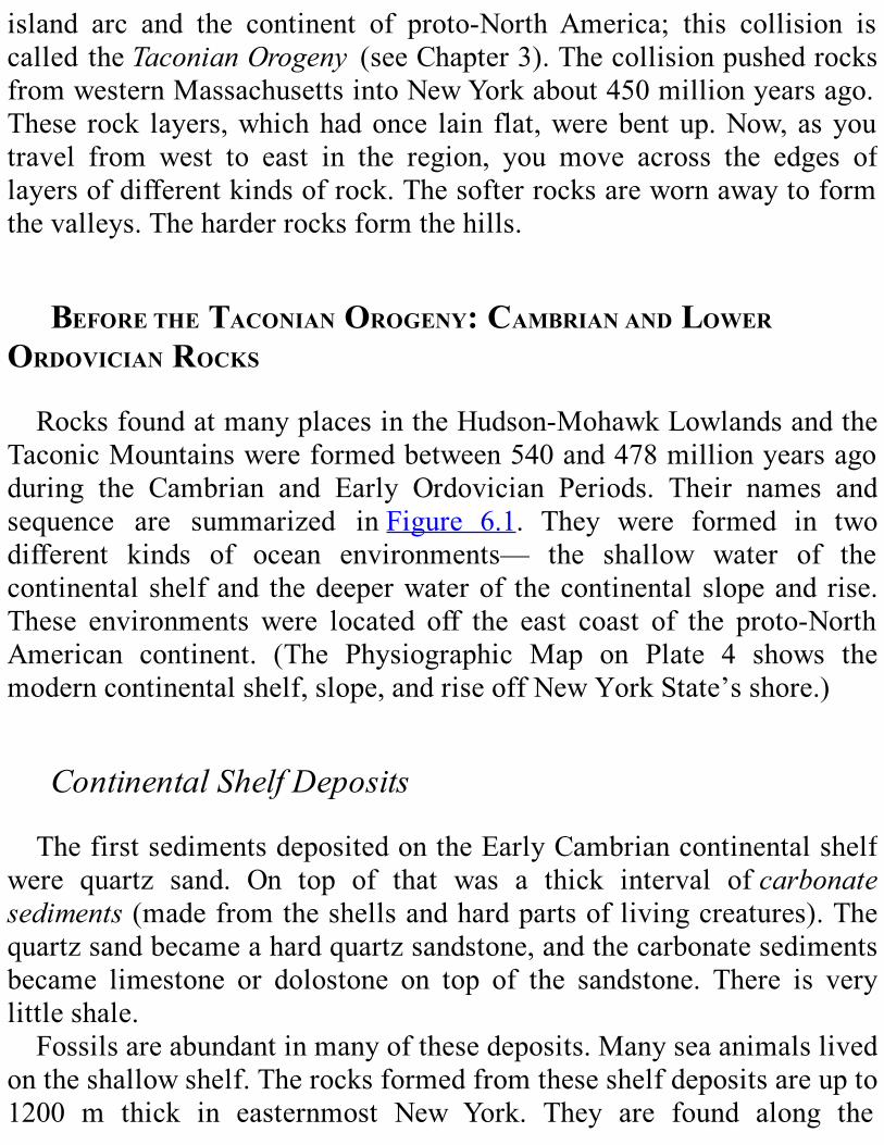
island arc and the continent of proto-North America; this collision iscalled theTaconianOrogeny (seeChapter3).ThecollisionpushedrocksfromwesternMassachusettsintoNewYorkabout450millionyearsago.These rock layers,whichhadonce lain flat,werebentup.Now,asyoutravel from west to east in the region, you move across the edges oflayersofdifferentkindsofrock.Thesofterrocksarewornawaytoformthevalleys.Theharderrocksformthehills.
BEFORETHETACONIANOROGENY:CAMBRIANANDLOWER
ORDOVICIANROCKSRocksfoundatmanyplacesintheHudson-MohawkLowlandsandthe
TaconicMountainswereformedbetween540and478millionyearsagoduring the Cambrian and Early Ordovician Periods. Their names andsequence are summarized inFigure 6.1. They were formed in twodifferent kinds of ocean environments— the shallow water of thecontinental shelfand thedeeperwaterof thecontinental slopeand rise.These environments were located off the east coast of the proto-NorthAmerican continent. (The Physiographic Map on Plate 4 shows themoderncontinentalshelf,slope,andriseoffNewYorkState’sshore.)
ContinentalShelfDepositsThefirstsedimentsdepositedontheEarlyCambriancontinentalshelf
were quartz sand. On top of that was a thick interval ofcarbonatesediments(madefromtheshellsandhardpartsoflivingcreatures).Thequartzsandbecameahardquartzsandstone,andthecarbonatesedimentsbecame limestone or dolostone on top of the sandstone. There is verylittleshale.Fossilsareabundantinmanyofthesedeposits.Manyseaanimalslived
ontheshallowshelf.Therocksformedfromtheseshelfdepositsareupto1200 m thick in easternmost New York. They are found along the
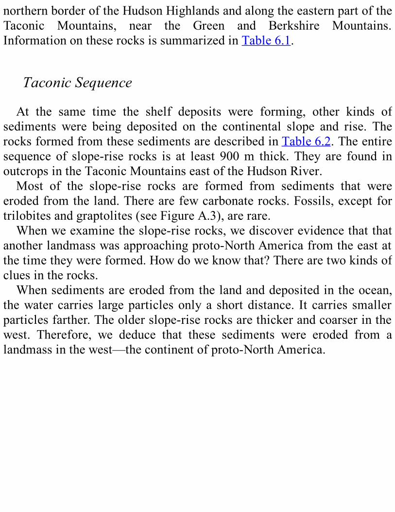
northernborderoftheHudsonHighlandsandalongtheeasternpartoftheTaconic Mountains, near the Green and Berkshire Mountains.InformationontheserocksissummarizedinTable6.1.
TaconicSequenceAt the same time the shelf deposits were forming, other kinds of
sediments were being deposited on the continental slope and rise. TherocksformedfromthesesedimentsaredescribedinTable6.2.Theentiresequence of slope-rise rocks is at least 900m thick.They are found inoutcropsintheTaconicMountainseastoftheHudsonRiver.Most of the slope-rise rocks are formed from sediments that were
erodedfromtheland.Therearefewcarbonaterocks.Fossils,exceptfortrilobitesandgraptolites(seeFigureA.3),arerare.Whenweexaminetheslope-riserocks,wediscoverevidencethatthat
anotherlandmasswasapproachingproto-NorthAmericafromtheeastatthetimetheywereformed.Howdoweknowthat?Therearetwokindsofcluesintherocks.Whensedimentsareerodedfromthelandanddepositedintheocean,
thewatercarries largeparticlesonlya shortdistance. It carries smallerparticlesfarther.Theolderslope-riserocksarethickerandcoarserinthewest. Therefore, we deduce that these sediments were eroded from alandmassinthewest—thecontinentofproto-NorthAmerica.

Figure6.1.ThischartsummarizestheCambrianandOrdovicianrockformationsfoundin
theHudson-MohawkLowlandsandTaconicMountains.ComparethisfigurewithPlate3toseehowtheseformationsfitintothegeologyoftheStateasawhole.Abbreviationsaretranslatedasfollows:Am=Amsterdam; Bk=Bushkill Shale; Bv=Balmville; FC=Fort Cassin; Low=Lowville;M=Martinsburg; Or=Orwell; PA=Pen Argyl; PI=Providence Island; Q=Quassaic;Rb=RamseyburgMember;Sch=Sch-enectady;Ticon=Ticonderoga;W=Walloomsac.Younger,MiddleOrdoviciansedimentsweredepositedontopofthese
rocks.Theseyoungerrocksarethickerandcoarserintheeast.Thus,weknowthattheywereerodedfromalandmassapproachingfromtheeastatthattime.
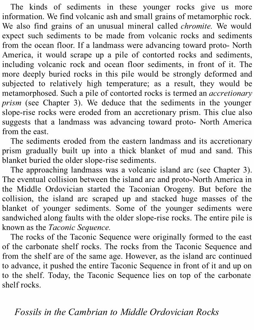
The kinds of sediments in these younger rocks give us moreinformation.Wefindvolcanicashandsmallgrainsofmetamorphicrock.We also find grains of an unusual mineral calledchromite.We wouldexpect such sediments to be made from volcanic rocks and sedimentsfromtheoceanfloor.Ifalandmasswereadvancingtowardproto-NorthAmerica, it would scrape up a pile of contorted rocks and sediments,including volcanic rock and ocean floor sediments, in front of it. Themore deeply buried rocks in this pile would be strongly deformed andsubjected to relatively high temperature; as a result, they would bemetamorphosed.Suchapileofcontortedrocksistermedanaccretionaryprism (see Chapter 3). We deduce that the sediments in the youngerslope-riserockswereerodedfromanaccretionaryprism.Thiscluealsosuggests that a landmass was advancing toward proto- NorthAmericafromtheeast.Thesedimentseroded from theeastern landmassand its accretionary
prism gradually built up into a thick blanket of mud and sand. Thisblanketburiedtheolderslope-risesediments.Theapproaching landmasswasavolcanic islandarc (seeChapter3).
Theeventualcollisionbetweentheislandarcandproto-NorthAmericainthe Middle Ordovician started the Taconian Orogeny. But before thecollision, the island arc scraped up and stacked huge masses of theblanket of younger sediments. Some of the younger sediments weresandwichedalongfaultswiththeolderslope-riserocks.TheentirepileisknownastheTaconicSequence.TherocksoftheTaconicSequencewereoriginallyformedtotheeast
of the carbonate shelf rocks.The rocks from theTaconicSequenceandfromtheshelfareofthesameage.However,astheislandarccontinuedtoadvance,itpushedtheentireTaconicSequenceinfrontofitanduponto the shelf. Today, the Taconic Sequence lies on top of the carbonateshelfrocks.
FossilsintheCambriantoMiddleOrdovicianRocks
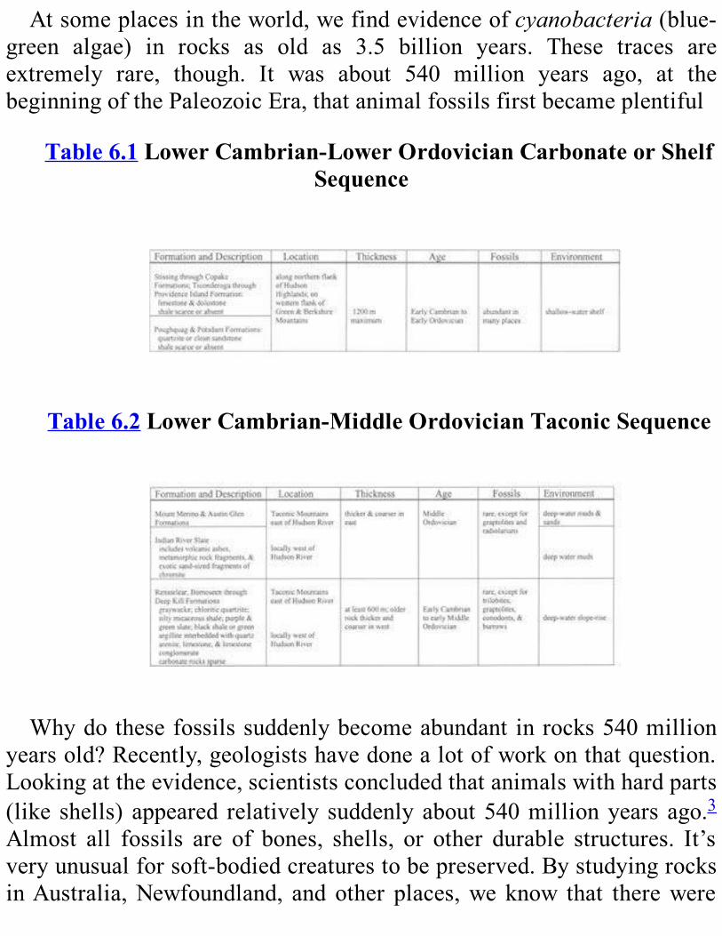
Atsomeplacesintheworld,wefindevidenceofcyanobacteria(blue-green algae) in rocks as old as 3.5 billion years. These traces areextremely rare, though. It was about 540 million years ago, at thebeginningofthePaleozoicEra,thatanimalfossilsfirstbecameplentiful
Table6.1LowerCambrian-LowerOrdovicianCarbonateorShelfSequence
Table6.2LowerCambrian-MiddleOrdovicianTaconicSequence
Whydothesefossilssuddenlybecomeabundant inrocks540millionyearsold?Recently,geologistshavedonealotofworkonthatquestion.Lookingattheevidence,scientistsconcludedthatanimalswithhardparts(like shells) appeared relatively suddenlyabout540millionyears ago.3Almost all fossils are of bones, shells, or other durable structures. It’sveryunusualforsoft-bodiedcreaturestobepreserved.BystudyingrocksinAustralia,Newfoundland, and other places,we know that therewere
relativelylargeseacreaturesfromabout650toabout540millionyearsago, but they had no hard parts. The only traces they left wereimpressionsinafewsedimentaryrocks.Fossils help geologists set up a relative time scale (see Chapter 2).
Plants and animals appear, evolve, and become extinct. By tracing thedevelopmentofdifferentspecies,wecanputrocksinorderfromoldertoyounger.Wheremajor changes occur in the fossils, we break the timeline intoeons,eras,periods,andsmallersubdivisions.Forexample, theappearanceofanimalswithhardpartsabout540millionyearsagoisthedividinglinebetweentheProterozoicandPhanerozoicEons.Inthesameway, the extinctionof thedinosaurs andmanyother species66millionyears ago is the dividing line between theMesozoic and the CenozoicEras.Fossils have helped us reconstruct the geologic history of the
PhanerozoicEoninsomedetail.However,becauseolderrockshaveveryfewfossils in them, it ismuchmoredifficult topuzzleout thedetailedhistoryoftheearth’sdevelopmentatthattime.NewYorkintheEarlyandMiddleCambrian.—InNewYork,thebest
known fossils from the Early Cambrian are in the Taconic Sequence.Many of these fossils are strange creatureswith no living descendants.Therefore,wecan’talwaystellwheretheyfitinrelationtootheranimals.OnesuchcuriousfossilisHyolithellus.Thisextinctcreaturelivedonthesea bottom in Early Cambrian seas around the world. There weredifferentkindsofHyolithellus.Theymayberelatedtomodern-daytube-buildingworms.The most numerous inhabitants of the Early Cambrian seas were
trilobites (seeFigureA.3).Theywereearlyarthropods.4Two importantgroupsoftrilobitesweretheolenellidsand theagnostids.Theolenellidswerespike-tailedcreatureswithmanybodysegments;someadultswererelatively large (0.5m).The agnostidswere small trilobiteswithheadsand tails that were almost alike; one group of agnostids lacked eyes.Olenellid trilobites lived on the sea bottom. Some scientists think thatagnostidswereswimmers.
Alsopresent intheEarlyCambrianseasweresmallsponges,sponge-like creatures calledarchaeocyathans that built reefs, brachiopods (seeFigureA.3),andvariouskindsofworms.MiddleCambrianrocksarenotwellknowninancientshelfdepositsin
NewYork.Anearlierinterpretationisthattheywereneverdepositedinthisregion,ortheymayhavebeenerodedaway.However,itispossiblethat there areMiddle Cambrian rocks in this area of the State, butwehaven’t found fossils in these rocks that would allow us to determinetheirage.ManyMiddleCambriantrilobites,brachiopods,andconodonts5havealsobeenfoundintheTaconicSequenceinColumbiaCounty.These Early and Middle Cambrian animals became fossils in the
sedimentary rocks at the margin of the continental shelf. These rockswereformedintheshallowwaterwheretheanimalslived,died,andwereburied.However,mostof these fossils arenot found in theundisturbedshelfrocksbutarefoundinrocksthatweredepostedontheupperslope.Many of these rocks from the upper continental slope broke off and
tumbled farther down the slope into deeper water. There, pieces oflimestoneandquartzsandstonefromtheupperslopegotmixedupwiththe sediments on the lower slope and rise. This mixture eventuallybecameaconglomerate.Limestoneconglomeratesof this typearefoundintheTaconicSequence(Figure6.2).Theycontainsmanyof thefossilsofCambriananimalsfoundintheState.Inaddition,oceancurrentscarriedmanyshelfCambriananimals into
deeper water after they died. There, they were buried outside of theirnaturalhabitats.ThesedisplacedEarlyandMiddleCambrianfossilsareveryimportant
intheTaconicSequence.TheTaconicSequenceistheonlyplaceinNewYork State that we find abundant fossils of animals that lived on thecontinental shelf and upper slope at this time. Thus, they give usinformationabouttheCambrianthatwecan’tgetanywhereelse.NewYorkintheLateCambrian.—UpperCambrianrocks,ontheother
hand,arequitecommoninNewYorkState.(Theyaredescribedin Table6.3.)DuringtheLateCambrian,theseafloodedextensiveareasofproto-
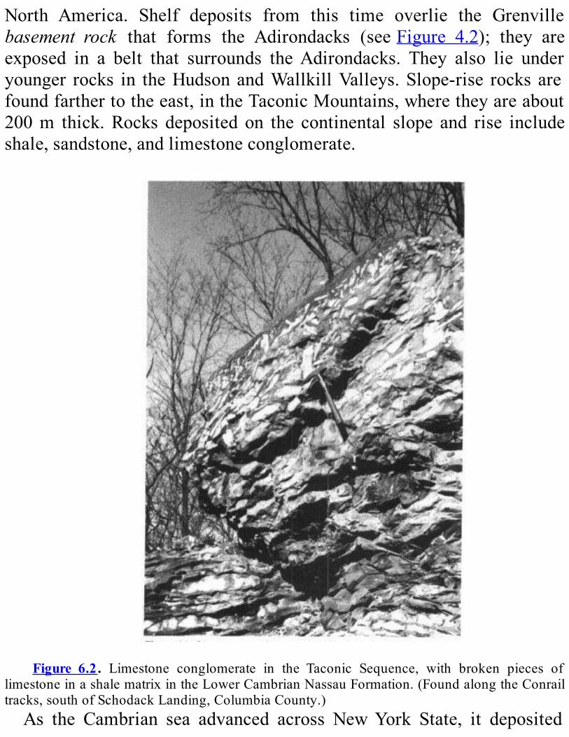
North America. Shelf deposits from this time overlie the Grenvillebasement rock that forms the Adirondacks (seeFigure 4.2); they areexposed in a belt that surrounds theAdirondacks. They also lie underyounger rocks in theHudsonandWallkillValleys.Slope-rise rocksarefoundfarthertotheeast,intheTaconicMountains,wheretheyareabout200m thick.Rocks deposited on the continental slope and rise includeshale,sandstone,andlimestoneconglomerate.
Figure 6.2. Limestone conglomerate in the Taconic Sequence, with broken pieces of
limestoneinashalematrixintheLowerCambrianNassauFormation.(FoundalongtheConrailtracks,southofSchodackLanding,ColumbiaCounty.)As the Cambrian sea advanced across NewYork State, it deposited

ripple-marked, nearshorequartz sandstones.Thesedeposits areyoungerand thinner in thewest,older and thicker in the east.This arrangementshowsusthattheseaadvancedfromeasttowest.Ultimately, the sandy deposits buried the ancientAdirondack region.
(Sincethen,almostallthesandstonehasbeenerodedaway.)Wecanseethis 140-meter-thick interval of sandstone best inAusableChasm.ThisspectacularsiteisintheChamplainValleynortheastoftheAdirondacks(seeFigure7.2).Thelayersofbeachandnearshoresandalternatedwithlayersofmud
farther offshore. In other areas, colonies of algae calledstromatolitesgrewinshallowwaters(seeFigureA.3).Limysedimentsweredepositedinthesewaters;thesesedimentslaterbecamelimestoneanddolostone.We can see fossil stromatolite reefs at the Petrified Gardens, four
mileswestofSaratogaSprings(Figure6.3).Thesedome-likefossilsaremade of wavy circular layers of calcium carbonate (Figure 6.4). Fromtimetotimetheirgrowthwasslowedorstoppedbysandthatwaswashedinto the water. Snails and a variety of trilobites lived between thestromatolites.Where the water was not as clear, sandy or silty mud accumulated.
Thismudwas rich in themineraldolomite. In thesameplaces,wefindminerals likehalite (commonsalt) and the sedimentary rockchert. Thedolomite,halite,andchertarecommonlyfoundtogetherindepositsfromwarm,shallow,verysaltyseas.OnedolostoneunitdepositedundertheseconditionsiscalledtheLittle
Falls Dolostone. Cavities in this unit contain exquisite quartz crystalscalled“HerkimerDiamonds” (Figure 6.5). These crystals formed fromgroundwater that was rich in silica.Anthraxolite, a black substancesimilar to hard asphalt, also is common in cavities in the Little FallsDolostone; it is evidence that petroleum was present in thesegroundwaters.New York in the Early Ordovician.—The environments of the Late
Cambrian continued on into theEarlyOrdovician.How canwe tell thedifference between the Cambrian and Ordovician rocks, then? Werecognize the youngerOrdovician rocks because they contain fossils of
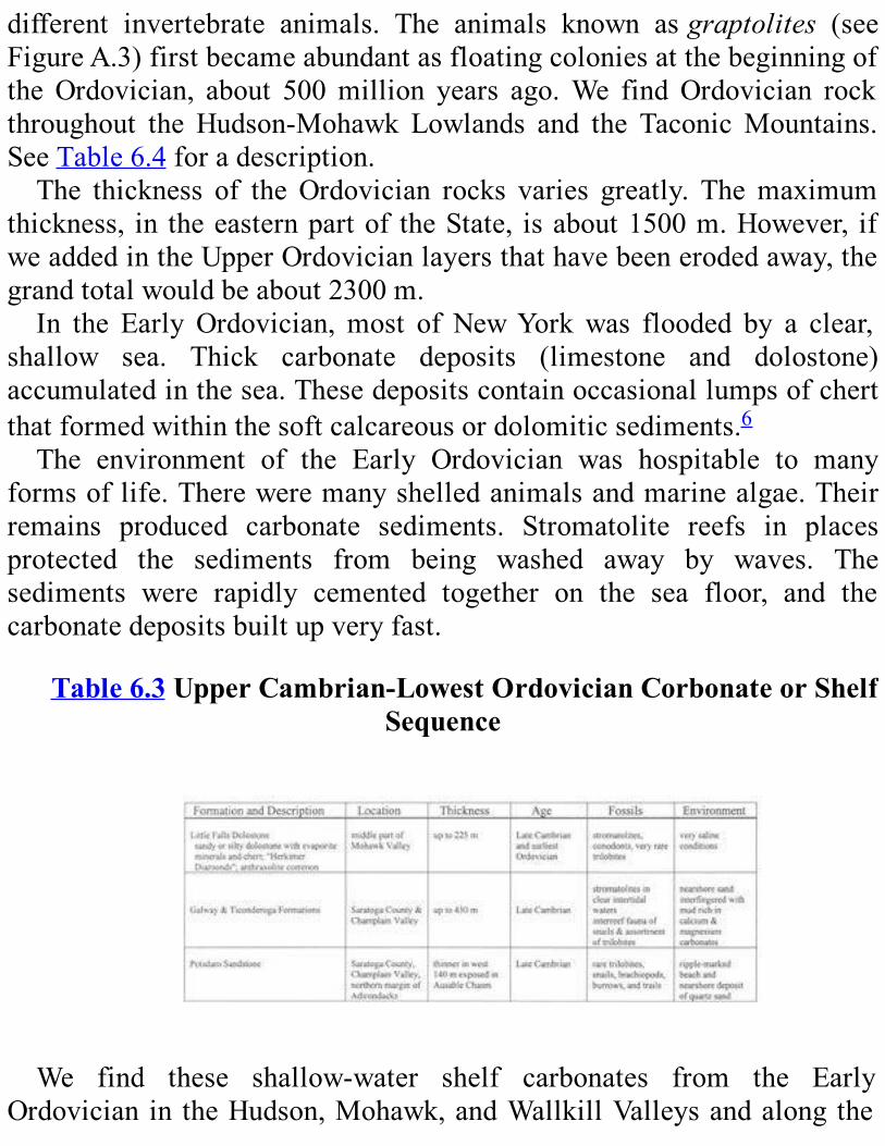
different invertebrate animals. The animals known asgraptolites (seeFigureA.3)firstbecameabundantasfloatingcoloniesatthebeginningoftheOrdovician, about 500million years ago.We findOrdovician rockthroughout the Hudson-Mohawk Lowlands and the TaconicMountains.SeeTable6.4foradescription.The thickness of theOrdovician rocks varies greatly. Themaximum
thickness, in theeasternpartof theState, isabout1500m.However, ifweaddedintheUpperOrdovicianlayersthathavebeenerodedaway,thegrandtotalwouldbeabout2300m.In the EarlyOrdovician,most of NewYorkwas flooded by a clear,
shallow sea. Thick carbonate deposits (limestone and dolostone)accumulatedinthesea.Thesedepositscontainoccasionallumpsofchertthatformedwithinthesoftcalcareousordolomiticsediments.6The environment of the Early Ordovician was hospitable to many
formsoflife.Thereweremanyshelledanimalsandmarinealgae.Theirremains produced carbonate sediments. Stromatolite reefs in placesprotected the sediments from being washed away by waves. Thesediments were rapidly cemented together on the sea floor, and thecarbonatedepositsbuiltupveryfast.
Table6.3UpperCambrian-LowestOrdovicianCorbonateorShelfSequence
We find these shallow-water shelf carbonates from the EarlyOrdovician in theHudson,Mohawk,andWallkillValleysandalongthe

western border of the Green and Berkshire Mountains. They are morethan300mthick.Wefindmanyfossilsinthesedeposits.Theytellusthatthedominant
species at the time may have been snails and squid-like animals withshellscallednautiloidcephalopods(seeFigureA.3).Insomeplacesthereweremanytrilobites,aswell.However,therewerenotasmanydifferentkindshereastherewereinotherplacesinNorthAmerica.
Figure 6.3. A slab of Upper Cambrian Hoyt Limestone with undulatory stromatolites.
(FoundatthePetrifiedGardens,westofSaratogaSprings,SaratogaCounty.)Insuchagentleenvironment,wewouldhaveexpectedtofindagreater
varietyofanimalsthanhasbeenfound.Itmaybethatthesaltinessofthewaterwastoohighortoovariable.In the Taconic Sequence, we find very different animals. There are
very few bottom-dwellers like snails and trilobites. There were soft-bodiedworm-likeanimals.Wefindtracesoftheirburrowsintherocks.Therewere,however,morefloatingandswimminganimals.Colonies
of graptolites (see Figure A.3) built lightweight skeletons of organicmaterials.TheyprobablyfloatednearthesurfaceinthedeepwaterduringtheEarlyOrdovician.Aftertheydied,thecoloniessankandaccumulatedin the muds of the Taconic Sequence. Their remains were carbonizedlater, when the rocks were buried deeply and heated.We find distinct

blackimpressionsofgraptolitesinshalesoftheTaconicSequence.The fossils of conodonts are also found in Lower Ordovician rocks.
These fossils arephosphatic,7 toothlike structures found in shallowanddeepseasfromtheCambrianthroughtheTriassic.ThosefromtheEarlyOrdovician are up to severalmillimeters in size.Those in the shallow-water shelf carbonate rocks are completely different from those in thedeep-water Taconic Sequence. This fact indicates that each kind ofconodont animal was specialized and lived in only one kind ofenvironment.

Figure6.4.Side(A)andtop(B)viewsofdomalstromatoliteintheHoytLimestonewestof
SaratogaSprings,SaratogaCountry.The seas of NewYork became very shallow at the end of the Early
Ordovician.Howdoweknow?We look at the fossils.Rocks from thistimecontainonlyafewfossilsofanimals.Theanimalswhosefossilswedofind—ostra-codes(smallbean-shapedcrustaceans8),certaintypesofconodonts, and snails— can all survive in water where the saltiness ishighandvaries,asinshallowseas.Wealsofindrockscalledevaporites

thatformasshallow,saltywaterevaporates.TheKnoxUnconformity.—It took approximately 30million years to
deposit the Lower Ordovician rocks in NewYork. They are separatedfrom younger Middle Ordovician rocks by a widespread erosionalsurface. This surface was created when the carbonate shelf rocks wereexposedtoerosion.Becauseofthiserosion,partofthegeologicrecordismissing(Figure6.6).Thiskindoferosional surface,which representsagapinthegeologicrecord,iscalledanunconformity.Thisoneisknownas theKnoxUnconformity. It isoneofthebiggestunconformitiesfoundin rocks from the Early Paleozoic. The events that produced the KnoxUnconformity took a long time in the early part of the MiddleOrdovician.TherocksfromthelastpartoftheEarlyOrdovicianandthefirstpart
of theMiddleOrdovician aremissing at theKnoxUnconformity. Thisfact tells us that the sea continued toget shalloweruntil it disappearedcompletely from the region.Thesedimentswereexposed to theairanderoded.Nonewsedimentsweredepositeduntil theareawasunderwateragain.

Figure 6.5. An example of a “HerkimerDiamond,” a quartz crystal found in theUpper
CambrianLittleFallsDolostone,HerkimerCounty.
Table6.4Lower-MiddleOrdovicianCarbonateorShelfSequence

What caused the sea to retreat? We don’t know for sure. But thisunconformity is found in rocks around the world. Therefore, we knowthatwhatever caused this event happenedworldwide. For some reason,sealeveldroppedaroundtheworld.
Figure6.6.TheKnoxUnconformity(atthelowerendofthehammer)betweentheLower
Ordovician Chuctanunda Creek Dolostone Member of the Tribes Hill Formation and theoverlyingMiddleOrdovicianGlens Falls Limestone. (Found on thewest side of CanajoharieCreekinthevillageofCanajoharie,MontgomeryCounty.)
DURINGTHETACONIANOROGENY:MIDDLEANDUPPERORDOVICIAN
ROCKSAfter theKnoxUnconformitywas formed, sea level rose again.This
rise happened 475million years ago in theMiddleOrdovician.At thistime,seascoveredallofNewYorkandmostoftheeasternhalfofproto-NorthAmerica.The oldest rocks deposited in these seas were limestones. We find
themtodayintheChamplainValleyandintheupperMohawkandBlackRivervalleys.(TheyarediscussedinChapter7.)However,wedon’tfindthemintheHudson,lowerMohawk,orWallkillvalleys.Iftheyeverweredepositedinthisregion,theywerelaterwornawayalmostcompletelyby
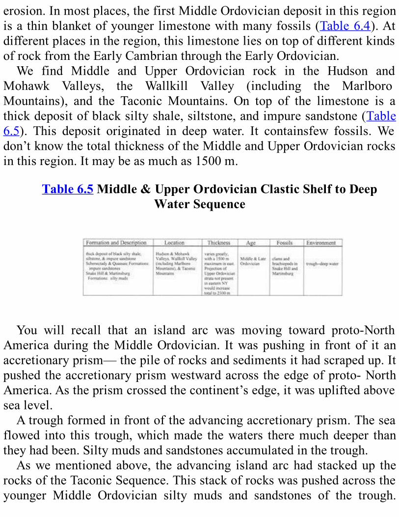
erosion.Inmostplaces,thefirstMiddleOrdoviciandepositinthisregionisathinblanketofyoungerlimestonewithmanyfossils(Table6.4).Atdifferentplacesintheregion,thislimestoneliesontopofdifferentkindsofrockfromtheEarlyCambrianthroughtheEarlyOrdovician.We find Middle and Upper Ordovician rock in the Hudson and
Mohawk Valleys, the Wallkill Valley (including the MarlboroMountains), and the Taconic Mountains. On top of the limestone is athickdepositofblacksiltyshale,siltstone,andimpuresandstone(Table6.5). This deposit originated in deep water. It containsfew fossils.Wedon’tknowthetotalthicknessoftheMiddleandUpperOrdovicianrocksinthisregion.Itmaybeasmuchas1500m.
Table6.5Middle&UpperOrdovicianClasticShelftoDeepWaterSequence
You will recall that an island arc was moving toward proto-NorthAmericaduring theMiddleOrdovician. Itwaspushing in frontof it anaccretionaryprism—thepileofrocksandsedimentsithadscrapedup.Itpushedtheaccretionaryprismwestwardacrosstheedgeofproto-NorthAmerica.Astheprismcrossedthecontinent’sedge,itwasupliftedabovesealevel.Atroughformedinfrontoftheadvancingaccretionaryprism.Thesea
flowed into this trough,whichmade thewaters theremuchdeeper thantheyhadbeen.Siltymudsandsandstonesaccumulatedinthetrough.Aswementionedabove, the advancing islandarchad stackedup the
rocksoftheTaconicSequence.Thisstackofrockswaspushedacrosstheyounger Middle Ordovician silty muds and sandstones of the trough.
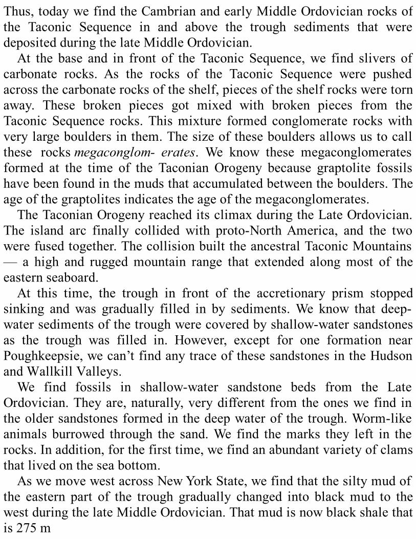
Thus,todaywefindtheCambrianandearlyMiddleOrdovicianrocksofthe Taconic Sequence in and above the trough sediments that weredepositedduringthelateMiddleOrdovician.At the base and in front of theTaconic Sequence,we find slivers of
carbonate rocks. As the rocks of the Taconic Sequence were pushedacrossthecarbonaterocksoftheshelf,piecesoftheshelfrocksweretornaway. These broken pieces got mixed with broken pieces from theTaconicSequence rocks.Thismixture formed conglomerate rockswithverylargebouldersinthem.Thesizeofthesebouldersallowsustocallthese rocksmegaconglom- erates. We know these megaconglomeratesformed at the time of the Taconian Orogeny because graptolite fossilshavebeenfoundinthemudsthataccumulatedbetweentheboulders.Theageofthegraptolitesindicatestheageofthemegaconglomerates.TheTaconianOrogenyreacheditsclimaxduringtheLateOrdovician.
The island arc finally collided with proto-NorthAmerica, and the twowerefusedtogether.ThecollisionbuilttheancestralTaconicMountains— a high and ruggedmountain range that extended alongmost of theeasternseaboard.At this time, the trough in front of the accretionary prism stopped
sinking andwas gradually filled in by sediments.We know that deep-watersedimentsofthetroughwerecoveredbyshallow-watersandstonesas the trough was filled in. However, except for one formation nearPoughkeepsie,wecan’tfindanytraceofthesesandstonesintheHudsonandWallkillValleys.We find fossils in shallow-water sandstone beds from the Late
Ordovician.Theyare,naturally,verydifferentfromtheoneswefind intheoldersandstonesformedinthedeepwaterofthetrough.Worm-likeanimals burrowed through the sand.We find themarks they left in therocks.Inaddition,forthefirsttime,wefindanabundantvarietyofclamsthatlivedontheseabottom.AswemovewestacrossNewYorkState,wefindthatthesiltymudof
the eastern part of the trough gradually changed into blackmud to thewestduringthelateMiddleOrdovician.Thatmudisnowblackshalethatis275m
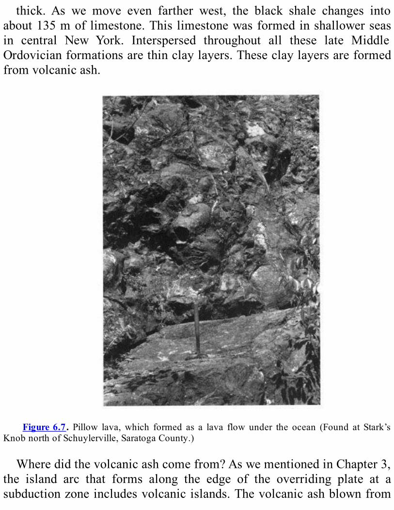
thick. As we move even farther west, the black shale changes intoabout135moflimestone.Thislimestonewasformedinshallowerseasin central New York. Interspersed throughout all these late MiddleOrdovicianformationsarethinclaylayers.Theseclaylayersareformedfromvolcanicash.
Figure6.7. Pillow lava,which formed as a lava flow under the ocean (Found at Stark’s
KnobnorthofSchuylerville,SaratogaCounty.)
Wheredidthevolcanicashcomefrom?AswementionedinChapter3,the island arc that forms along the edge of the overriding plate at asubductionzoneincludesvolcanicislands.Thevolcanicashblownfrom
thevolcanoesduringeruptionswastransportedbythewind.Theselayersofclayshowushowclosethisvolcanicislandarcwasatthattime.We’vediscussedthesedimentaryrocksformedinNewYorkduringthe
TaconianOrogeny.Inaddition,someigneousrockswereformedin thisregionatthesametime.NorthofSchuylervilleatStark’sKnob,wecanseetheremainsofanunderwaterlavaflow(Figure6.7).Life flourished in the lateMiddle Ordovician sea: included bottom-
dwellers, swimmers, and floaters. 1 chiopods (see Figure A.3), forexample, multiplied very rapidly. In fact, some rock layers arecompletely cove by just one species (Figure 6.8). The highlymobile tibitesalsowereabundant.Gardensofanimalscalledsealiliesorcrinoids(seeFigureA.3)coveredlargeareasofseabottom.Theseabottomwasalso the home of coi bryozoans (see Figure A.3), and carnivorousgastropods.9In very shallow waters, ostracodes became one of most important
animalgroups(seeFigureA.3).Inaddition,graptolitesreachedthepeakoftheirabundancecingthelateMiddleOrdovician.Theyareverycomrintheblackshalesfromthistime.At the time of the Taconian Orogeny, the Adirond region was
apparentlyunderwater.Howdowekr that?Theorientationoffossils insomelimestones,shalesletsusdeducethedirectionthatseacumflowed.The direction of ripple marks also give us a c For the currents to bemoving in this direction, Adirondack region must have been almostcompleunderwater.We also find local areas of sedimentary rocks from Cambrian and
OrdovicianintheAdirondacks.Sitheserocksmusthavebeendepositedinanocean,tshowthattheregionwasunderwateratthattime.FrequentearthquakesprobablyshookNewYorkSduringtheTaconian
Orogeny. In easternNewYork, crustwasbrokenby long fractures.WefindsimilarfturestodayinunstableregionslikeCaliforniaandJapan.FaultsarecommoninthenorthernHudsonandeernMohawkValleys
andin theeasternandsouthAdirondacks.The largest faults tend torunnorthslightlyeastofnorth.Smallerfaultstendtoruneast.

Insomeplaces,thefaultsbroketheearth’ssurfaceiraisedandloweredblocks.Theblockswereeitdroppeddown(calledgrabens)orpushedup(calledhorsts).WefindahorstandgrabenlandscapeinMohawkValley.TheMohawk River flows east aci these blocks.Where it moves fromhigher to loblocks, theriverhascutdeep,narrownotches,calledwatergaps, in theraisedblock.SomeexamplesarewatergapsatLittleFalls,Hoffmans, and The Noses (between Canajoharie and Fonda). In otherplaces, groundwater seeps up through these faults. One example is themineralspringsatSaratogaSprings.The Taconic Mountains have many large faults forr during the
Paleozoic Era. These faults run toward the north. Some run fromWashingtonCountyallthewaydowntotheHundsonHighlandsandareover160kmlong.
Figure6.8.ThebrachiopodSowerbyella intheMiddleOrdovicianGlensFallsLimestone.
(FromthenorthsideofN.Y.Rte.67,0.6kmeastofMannyCorners,MontgomeryCounty.)
IntheTaconicMountains,therocklayershavebeenfoldeduplikeanaccordionorapaperfan.Thesefoldsarepackedsotightlytogetherthatthelayersoneithersideofeachfoldarenearlyparallel.Thelayersontheeastsideofthefoldshavebeencompletelyturnedover.Aswemoveeast
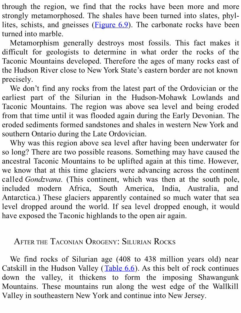
through the region, we find that the rocks have been more and morestronglymetamorphosed.Theshaleshavebeen turned into slates,phyl-lites, schists, and gneisses (Figure6.9). The carbonate rocks have beenturnedintomarble.Metamorphism generally destroys most fossils. This fact makes it
difficult for geologists to determine in what order the rocks of theTaconicMountainsdeveloped.ThereforetheagesofmanyrockseastoftheHudsonRiverclosetoNewYorkState’seasternborderarenotknownprecisely.Wedon’tfindanyrocksfromthelatestpartof theOrdovicianor the
earliest part of the Silurian in the Hudson-Mohawk Lowlands andTaconic Mountains. The region was above sea level and being erodedfromthattimeuntilitwasfloodedagainduringtheEarlyDevonian.TheerodedsedimentsformedsandstonesandshalesinwesternNewYorkandsouthernOntarioduringtheLateOrdovician.Whywasthisregionabovesealevelafterhavingbeenunderwaterfor
solong?Therearetwopossiblereasons.SomethingmayhavecausedtheancestralTaconicMountains tobeupliftedagainat this time.However,we know that at this time glacierswere advancing across the continentcalledGondzvana. (This continent, which was then at the south pole,included modern Africa, South America, India, Australia, andAntarctica.)Theseglaciersapparentlycontainedsomuchwater thatsealevel dropped around the world. If sea level dropped enough, it wouldhaveexposedtheTaconichighlandstotheopenairagain.
AFTERTHETACONIANOROGENY:SILURIANROCKSWe find rocks of Silurian age (408 to 438 million years old) near
CatskillintheHudsonValley(Table6.6).Asthisbeltofrockcontinuesdown the valley, it thickens to form the imposing ShawangunkMountains. These mountains run along the west edge of the WallkillValleyinsoutheasternNewYorkandcontinueintoNewJersey.

Figure6.9.Chevronfolds in theLowerCambrianEverettSchist. (FoundalongN.Y.Rte.
55,eastoftheTaconicParkway,easternDutchessCounty.)MostoftheSilurianrocksinNewYorkStateliealmostflat.Theydip
towardthesouthatlessthan1°.InsoutheasternNewYork,however,theydip much more steeply— up to 60°— to the northwest.During theSilurian,sedimentserodedfromlandtotheeastpiledupinsoutheasternNewYork. The final resultwas about 300m ofwhite sand and quartzpebbles. This deposit became the Shawangunk Formation. It is highlyresistant to erosion and can be seen today on the east face of the

Shawangunk Mountains. Excellent quartz crystals, zinc, and leadmineralshavebeencollectedfromtheShawangunkFormation.OntopoftheShawangunkFormationisalayerofredandgreenshale
and sandstone. These rocks were deposited in marine nearshoreenvironmentsandonlandbymeanderingstreams.During the Late Silurian, southeastern New York lay beneath a
shallow,highlysaltysea.Muddycarbonatesedimentsandmudrichinthemineral gypsum were deposited in this sea. These deposits are todaylargelyconcealedalongthewestfaceoftheShawangunkMountains.TheyoungestSilurianrocksinthisareaseemtohavebeenformedina
seawithmorenormalsaltiness.Theyarelimestonesanddolostonesthatcontainfossils.Thesefossilsshowthattheenvironmentwashospitabletoanimals.AlongtheHelderbergEscarpmentsouthofAlbany,theserockslieon topoffoldedanderodedMiddleOrdovician layers(Figure6.10).The surface between them is another unconformity, called theTaconicUnconformity.Rocksfromthe timebetweentheMiddleOrdovicianandtheLateSilurianaremissinginthisarea.
Table6.6SilurianFormations
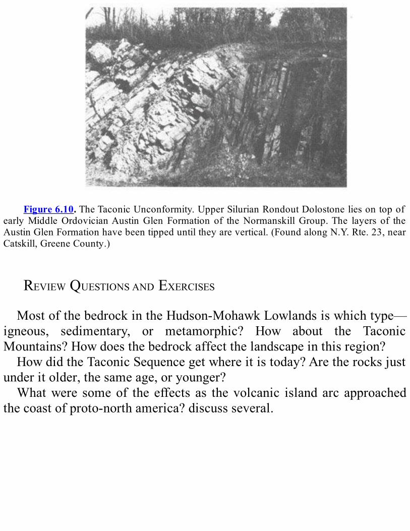
Figure6.10.TheTaconicUnconformity.UpperSilurianRondoutDolostoneliesontopof
earlyMiddleOrdovicianAustinGlen Formation of theNormanskillGroup.The layers of theAustinGlenFormationhavebeentippeduntiltheyarevertical.(FoundalongN.Y.Rte.23,nearCatskill,GreeneCounty.)
REVIEWQUESTIONSANDEXERCISESMostofthebedrockintheHudson-MohawkLowlandsiswhichtype—
igneous, sedimentary, or metamorphic? How about the TaconicMountains?Howdoesthebedrockaffectthelandscapeinthisregion?HowdidtheTaconicSequencegetwhereitistoday?Aretherocksjust
underitolder,thesameage,oryounger?Whatwere someof the effects as thevolcanic islandarc approached
thecoastofproto-northamerica?discussseveral.
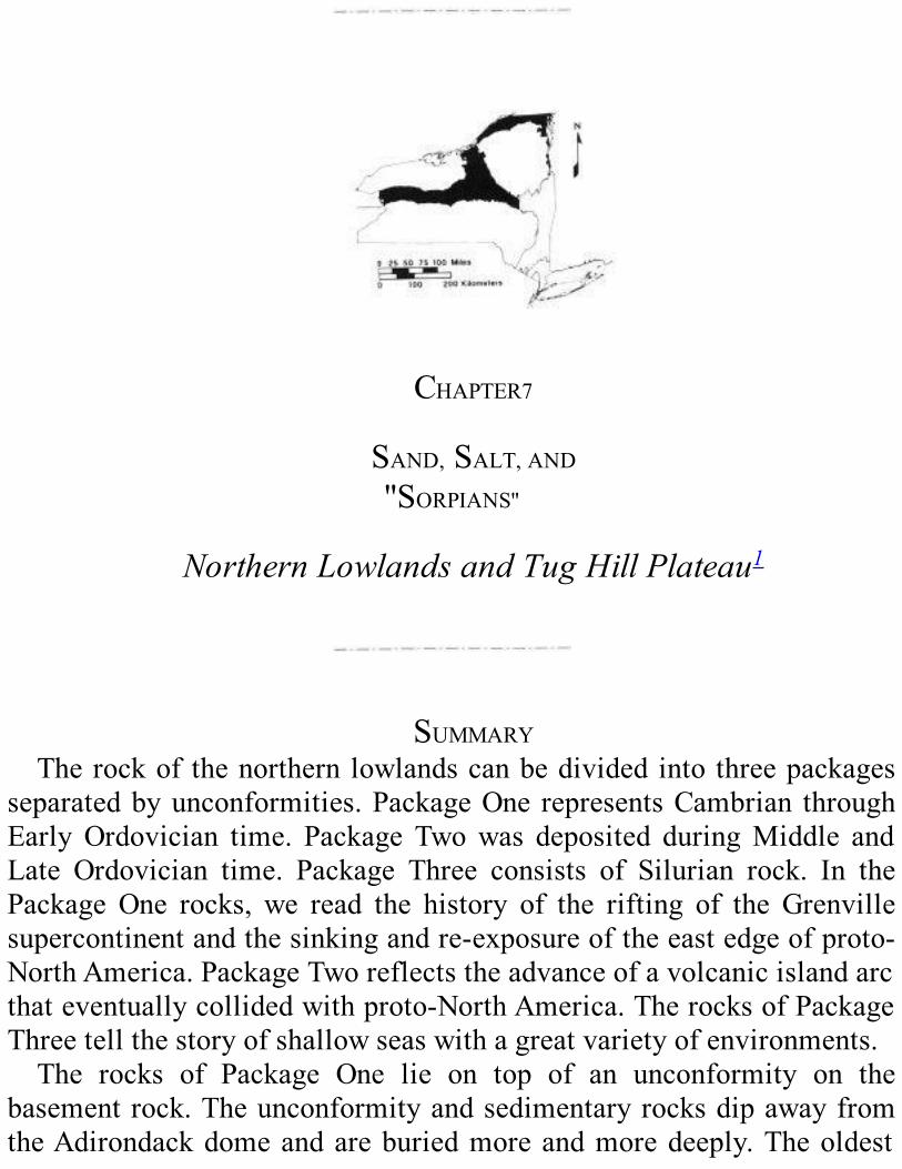
CHAPTER7
SAND,SALT,AND"SORPIANS"
NorthernLowlandsandTugHillPlateau1
SUMMARYTherockof thenorthern lowlandscanbedividedinto threepackages
separatedbyunconformities.PackageOne representsCambrian throughEarlyOrdovician time. Package Twowas deposited duringMiddle andLate Ordovician time. Package Three consists of Silurian rock. In thePackage One rocks, we read the history of the rifting of the Grenvillesupercontinentandthesinkingandre-exposureoftheeastedgeofproto-NorthAmerica.PackageTworeflectstheadvanceofavolcanicislandarcthateventuallycollidedwithproto-NorthAmerica.TherocksofPackageThreetellthestoryofshallowseaswithagreatvarietyofenvironments.The rocks of Package One lie on top of an unconformity on the
basementrock.TheunconformityandsedimentaryrocksdipawayfromtheAdirondackdomeandareburiedmoreandmoredeeply.Theoldest
rocks in Package One, the lower and middle parts of the PotsdamFormation,were possibly deposited duringEarly andMiddleCambriantime; they occur in patches. Above them, the sandstone of the upperPotsdam Formation, deposited in Late Cambrian time, is much morewidespread.ThesequenceabovethePotsdamisdominatedbydolostoneandlimestoneandwasdepositedinashallowseaduringLateCambrianandEarlyOrdoviciantime;someofthedolostonesformedinaverysaltysea. These rocks once covered the Adirondack region but were laterremovedby erosion.At the endof theEarlyOrdovician,muchofNewYorkStatewasabovesealevel.ErosioncreatedthegapintherockrecordrepresentedbytheKnoxUnconformity.The history we read in the rocks of Package One starts with the
breakup of the Grenville supercontinent. Sediments were deposited inpatches in rift valleysand low-lyingareas.As the riftwidened into theIapetus Ocean, the shore advanced westward across the northernlowlands,leavingadepositofbeachsand.Astheshorelinecontinuedtomovewest, the continental shelf of proto-NorthAmericawidened, andlimestonesanddolostonesweredepositedabovethesand.At theendoftheEarlyOrdovician,aworldwidedropinsealevelexposedtheserockstoerosion.The rocks of PackageTwo recordMiddle andLateOrdovician time.
The oldest rocks in this package are limestones of the Chazy Group,foundonlyinlimitedareas.TheChazylimestonescontainahostofnewcreatures,includingbryozoans,stromatoporoids,andthefirsttruecorals.An unconformity separates the Chazy Group from the overlying BlackRiverGroup,whichwasdepositedacrossmuchofNewYorkState.ThelimestonesoftheBlackRiverGroupcontainarecordofabundantlifeandweredepositedinavarietyoftropicalenvironments.Thissequencealsoincludes layersof bentonite formed fromvolcanic ashblown in fromalandmassoffshore.Above thebentonite layers is theTrentonGroup, inwhich thick layers of limestone alternatewith thin layers of shale; thesediments in the shale were eroded from a landmass to the east. Thealternatinglimestoneandshalemayhaveoriginatedwhenlayersoffossilhashwerecolonizedbyorganismsthatwerelatersmotheredbyalayerof
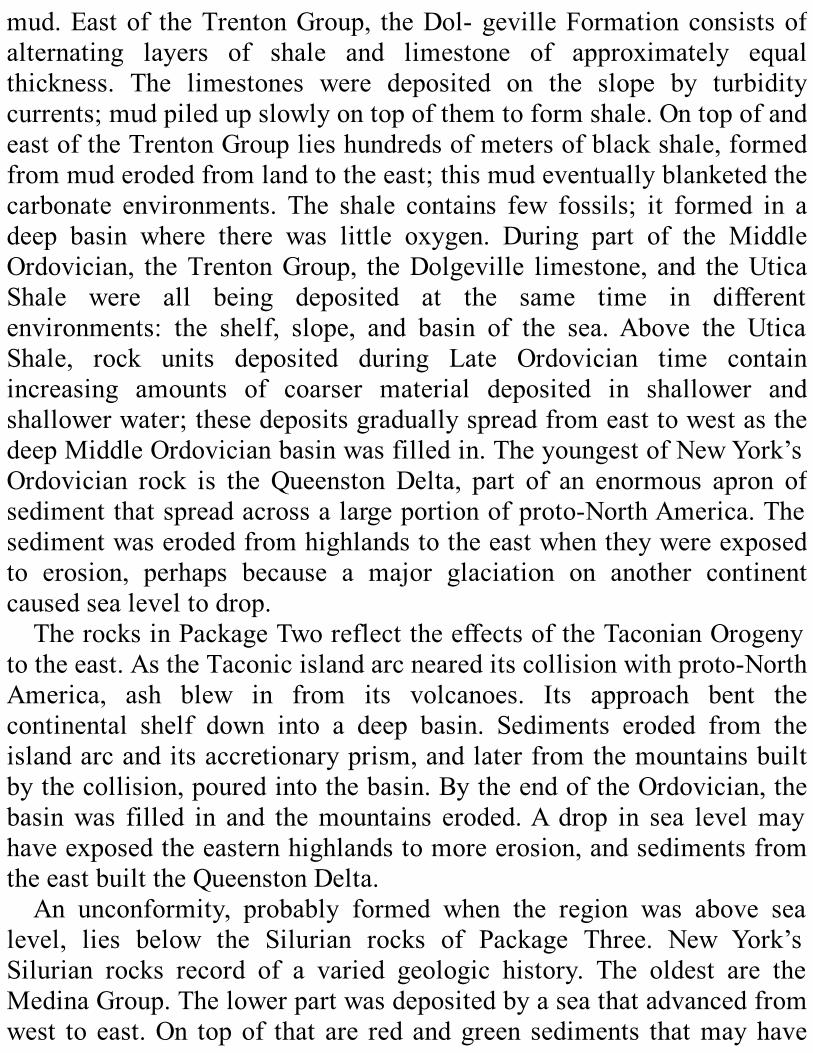
mud.Eastof theTrentonGroup, theDol-gevilleFormationconsistsofalternating layers of shale and limestone of approximately equalthickness. The limestones were deposited on the slope by turbiditycurrents;mudpiledupslowlyontopofthemtoformshale.OntopofandeastoftheTrentonGrouplieshundredsofmetersofblackshale,formedfrommuderodedfromlandtotheeast;thismudeventuallyblanketedthecarbonate environments. The shale contains few fossils; it formed in adeep basin where there was little oxygen. During part of the MiddleOrdovician, theTrentonGroup, theDolgeville limestone, and theUticaShale were all being deposited at the same time in differentenvironments: the shelf, slope, and basin of the sea. Above the UticaShale, rock units deposited during Late Ordovician time containincreasing amounts of coarser material deposited in shallower andshallowerwater;thesedepositsgraduallyspreadfromeasttowestasthedeepMiddleOrdovicianbasinwasfilledin.TheyoungestofNewYork’sOrdovician rock is the QueenstonDelta, part of an enormous apron ofsedimentthatspreadacrossalargeportionofproto-NorthAmerica.Thesedimentwaserodedfromhighlandstotheeastwhentheywereexposedto erosion, perhaps because a major glaciation on another continentcausedsealeveltodrop.TherocksinPackageTworeflecttheeffectsoftheTaconianOrogeny
totheeast.AstheTaconicislandarcneareditscollisionwithproto-NorthAmerica, ash blew in from its volcanoes. Its approach bent thecontinental shelf down into a deep basin. Sediments eroded from theislandarcanditsaccretionaryprism,andlaterfromthemountainsbuiltbythecollision,pouredintothebasin.BytheendoftheOrdovician,thebasinwas filled in and themountains eroded.A drop in sea levelmayhaveexposedtheeasternhighlandstomoreerosion,andsedimentsfromtheeastbuilttheQueenstonDelta.An unconformity, probably formed when the region was above sea
level, lies below the Silurian rocks of Package Three. New York’sSilurian rocks record of a varied geologic history. The oldest are theMedinaGroup.Thelowerpartwasdepositedbyaseathatadvancedfromwest to east.On topof that are redandgreen sediments thatmayhave

beenpartofadelta,andabovethata layerofwhitequartzsand.Abovethe Medina Group, the Clinton Group represents a wide variety ofenvironments.TheoldestClintonunitisconglomeratethatwasdepositedasabeach.Abovesomemajorunconformitiesarelimestonesthatcontainhematite.TheenvironmentsrepresentedbythelowerpartoftheClintonGroup teemed with life. There are fewer fossils in the middle Clintonrocks.IntheupperClintonGroupisalayerofblackshalethatformedinalifelessdeep-waterenvironmentwithlittleoxygen.Thelimestoneunitabovetheshaleformedinshallowseasthatweremorehospitabletolife.Ontopofthat,theRochesterShalecontainsmorefossilsthananyotherSilurianformationinNewYork.TheanimalsfoundinthelowerClintonGroup reach their peak of abundance and diversity here. East of theRochester Shale is a sandstone unit formed in shallow water and onbeaches.AbovetheRochesterShaleinwesternNewYorkisathinlayerof limestone that was lifeless for unknown reasons. Above that, thelimestonesofthelowerLockportGroupformedinwarm,clear,shallowseasthatsustainedavarietyofanimals.FossilsarerarehigherupintheLockport.TherocksoftheLock-portGroupareseenatNiagaraFallsandat theNiagaraGorge,where the rocks are the reference section for theEarlySilurianineasternNorthAmerica.AbovetheLockportGroup,wefindSilurianrocksthatcontainclayandsilt,probablydepositedbylow-energywavesandcurrentsduringtheLateSilurian.AbovetheLockportGroup is theSalinaGroup,mostofwhichwasdeposited in theshallowwatersofaverysaltysea.Itincludeslayersofshaleanddolostonewithvery few fossils alternating with layers of rock salt. The highly saltySilurian seas had inhabitants that could tolerate the conditions, amongthemthescorpion-likeeurypterids,butmostSilurianfossilsarefoundinrock units that formed inmore normal seawater. Late in the Silurian,watercirculationimproveddramaticallyandanimalsthrived.AttheveryendoftheSilurian,though,anotherinhospitableenvironmentappeared;itisrepresentedbydolo-stonesdepositedacrossmuchoftheState.ShallowseascoveredthenorthernlowlandsformuchofSiluriantime.
Early in the period, a sea advanced eastward, then shrank westward.Severalmillionyearslatertheseaadvancedagain.Towardtheendofthe

Silurian,poorcirculationproducedlarge,verysaltypoolsandtidalflats.Throughout theSilurian, the regionwasgeologicallyquiet; theadvanceand retreat of the seamay have been related tomovements of tectonicplates.Invertebrates dominate the fossil record of the early paleozoic,
althoughfish—thefirstvertebrates—hadbecomerelativelyabundantbytheendofthesilurian.evolutiontookimportantstepsduringthistime.alarge variety of invertebrates competed for food and survival in thesilurianseas,andair-breathingarthropodscolonized the landin the latesilurian.landplantshadalsoappearedbytheendofthesilurian.
INTRODUCTIONThis chapter covers the bedrock of the St. Lawrence- Champlain
Lowlands, the Ontario Lowlands, and the Tug Hill Plateau (seeFigure1.1).For convenience,we refer to the two lowlands regions together asthenorthernlowlands.In this chapter, we are concerned with sedimentary rock units of
Cambrian, Ordovician, and Silurian age. These units are shown on thegeologicmap(Plate2oftheGeologicalHighwayMap)byyellow,blues,browntopaleorange,andshadesofreddishpurpletopink.Thesecolorsalsoappearonthelegend(Plate3)inthelowerpartsofColumns1,2,3,7, and 8. Plate 2 shows the areas in the State where these rock unitsappearattheearth’ssurface;Plate3showstheminreferencetogeologictime,withtheoldestatthebottom.Plate3 isdrawnso thatall rockof the sameage isatonehorizontal
level. Notice the pale yellow areas of the legend between some of therockunits.Thisyellowrepresentsperiodsofgeologictimenotrecordedbyrockinthatregion.Forexample,intheFingerLakesregion(Column2onPlate3),theoldestsedimentaryrockunit(showninbluewithbluestripes) includes a number of limestone units of the Black River andTrenton Groups. This sequence of rock was deposited during MiddleOrdoviciantime.NorockispresentinthatareafromtheCambrianand
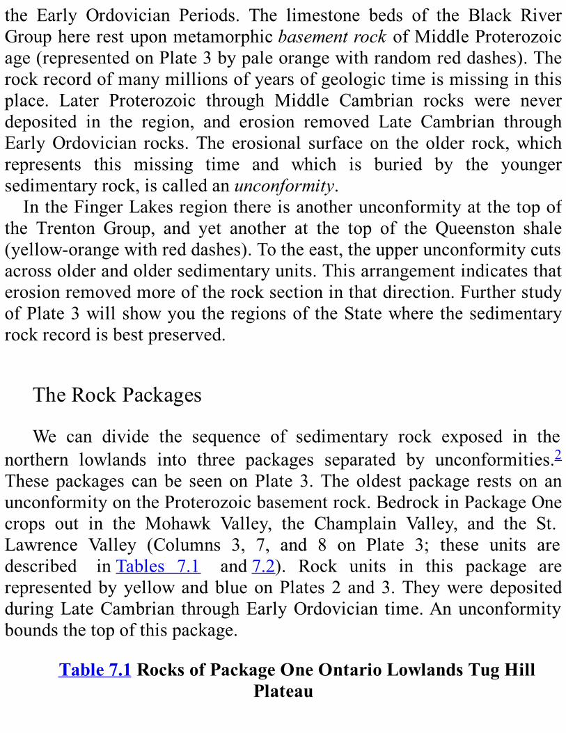
the Early Ordovician Periods. The limestone beds of the Black RiverGrouphererestuponmetamorphicbasementrockofMiddleProterozoicage(representedonPlate3bypaleorangewithrandomreddashes).Therockrecordofmanymillionsofyearsofgeologictimeismissinginthisplace. Later Proterozoic through Middle Cambrian rocks were neverdeposited in the region, and erosion removed Late Cambrian throughEarlyOrdovician rocks.The erosional surface on the older rock,whichrepresents this missing time and which is buried by the youngersedimentaryrock,iscalledanunconformity.IntheFingerLakesregionthereisanotherunconformityatthetopof
the Trenton Group, and yet another at the top of the Queenston shale(yellow-orangewithreddashes).Totheeast,theupperunconformitycutsacrossolderandoldersedimentaryunits.Thisarrangementindicatesthaterosionremovedmoreoftherocksectioninthatdirection.FurtherstudyofPlate3willshowyoutheregionsoftheStatewherethesedimentaryrockrecordisbestpreserved.
TheRockPackages
We can divide the sequence of sedimentary rock exposed in thenorthern lowlands into three packages separated by unconformities.2Thesepackages canbe seenonPlate 3.Theoldest package rests on anunconformityontheProterozoicbasementrock.BedrockinPackageOnecrops out in the Mohawk Valley, the Champlain Valley, and the St.Lawrence Valley (Columns 3, 7, and 8 on Plate 3; these units aredescribed inTables 7.1 and7.2). Rock units in this package arerepresentedbyyellowandblueonPlates2 and3.TheyweredepositedduringLateCambrian throughEarlyOrdovician time.Anunconformityboundsthetopofthispackage.
Table7.1RocksofPackageOneOntarioLowlandsTugHillPlateau
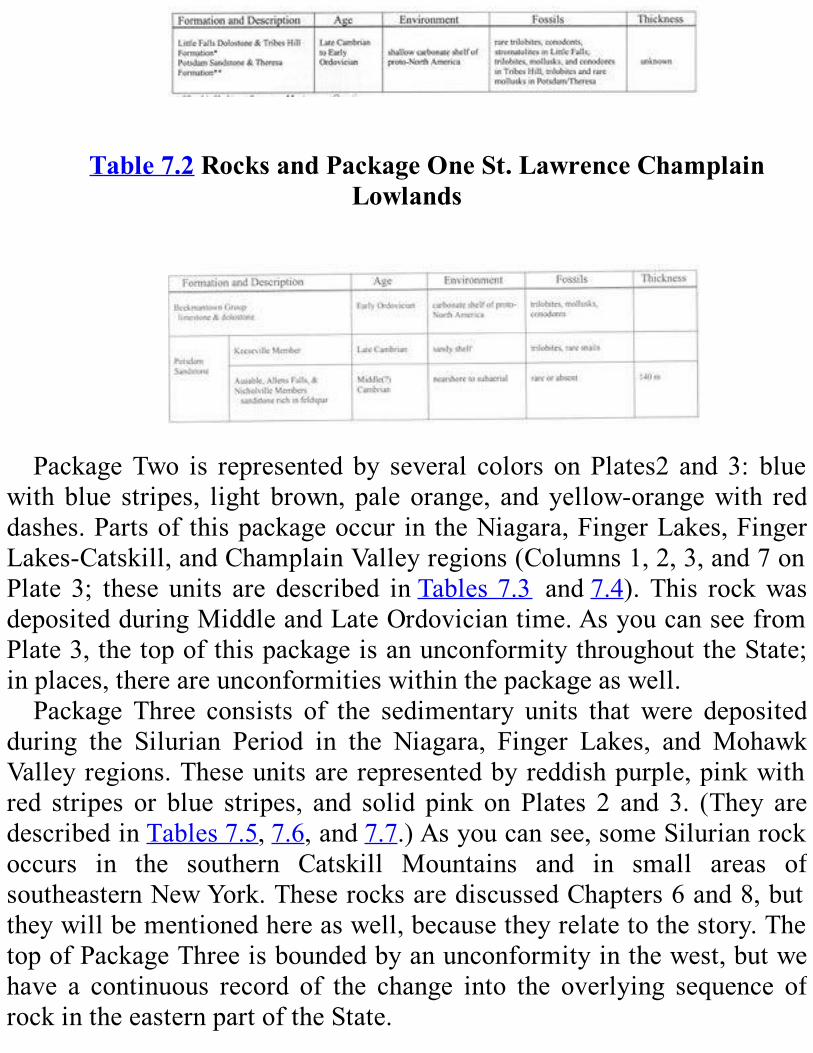
Table7.2RocksandPackageOneSt.LawrenceChamplainLowlands
PackageTwo is represented by several colors onPlates2 and 3: blue
with blue stripes, light brown, pale orange, and yellow-orangewith reddashes.Partsof thispackageoccur in theNiagara,FingerLakes,FingerLakes-Catskill,andChamplainValleyregions(Columns1,2,3,and7onPlate 3; these units are described inTables7.3 and7.4).This rockwasdepositedduringMiddleandLateOrdoviciantime.AsyoucanseefromPlate3,thetopofthispackageisanunconformitythroughouttheState;inplaces,thereareunconformitieswithinthepackageaswell.Package Three consists of the sedimentary units that were deposited
during the Silurian Period in the Niagara, Finger Lakes, and MohawkValleyregions.Theseunitsarerepresentedbyreddishpurple,pinkwithred stripes or blue stripes, and solid pink on Plates 2 and 3. (They aredescribedinTables7.5,7.6,and7.7.)Asyoucansee,someSilurianrockoccurs in the southern Catskill Mountains and in small areas ofsoutheasternNewYork.TheserocksarediscussedChapters6and8,buttheywillbementionedhereaswell,becausetheyrelatetothestory.ThetopofPackageThreeisboundedbyanunconformityinthewest,butwehave a continuous record of the change into the overlying sequence ofrockintheeasternpartoftheState.

TheStoryintheRocksWe can decipher remarkable events in the geologic history from the
sedimentaryrockinthesethreepackages.(SeeChapter3forasummaryofthegeologichistoryofNewYorkState.)PackageOnetellsusthatthesupercontinent Grenville split up in Late Proterozoic time.An ancientocean,theIapetus,formedbetweenthepieces.Theancientcontinentofproto-NorthAmericaformedoneshoreofthis
ocean. The eastern edge of proto-NorthAmerica gradually submergedintotheseaduringCambrianandEarlyOrdoviciantime.Itthenemergedfromtheseaandwasexposedtoerosion.ThestoryofthePackageTworocksstartswithourpartofproto-North
Americaasashallowmarineshelf.ThewesternpartoftheIapetusOceanbegan to close as an offshore volcanic island arc moved toward acollisionwith proto-NorthAmerica.As the island arcwas pushed ontoproto-NorthAmerica,theeasternpartoftheshelfwasdepressedtoforma deep basin where dark mud collected. This collision marked thebeginning of the Taconian Orogeny, which formed a range of highmountains east of the basin. Debris eroded from these mountainseventuallyfilledinthebasinandextendedwestwardovertheentireshelf.This sandy debris eventually built above sea level in easternmost NewYorkState.After a periodof erosion, the rockofPackageThree records another
advanceof the sea.This time the shore zonemoved fromwest to east.The sea remained shallow and even withdrew in the middle of theSilurian. Highlands existed to the east; debris eroded from thesehighlands was carried westward. The area was again submerged andremained so throughout theLateSilurian.Toward the endof this time,water circulation with open water to the south became restricted.Evaporation concentrated the sea water into a strong brine thatprecipitated the mineralshalite (rock salt) andgypsum in widespreadlayers.The rockunits inPackageThree and their fossils record agreatvarietyofenvironmentswithinashallowsea.Theseenvironmentsrangedfrom nearlyperfect for shallow marine animals to completely
inhospitable. You can guess that fossil collecting in these rocks goesfromgoodtobad,dependingontherocktype.
Table7.3RocksofPackageTwoOntarioLowlands&TugHillPlateau
*FoundonsouthshoreofLakeOntario.
Howcanwe construct thehistoryoutlined above?Wemust seekoutclues in the rockwith a practiced eye and determination. The geologicmap(Plate2),thelegend(Plate3),andTables7.1through7.7summarizefactsmanygenerationsofgeologistshavelearnedfromstudyingtherockinthefieldandthelaboratory.We’llusethesefactsasthebasisforourstory.
ROCKSOFPACKAGEONELATE:PROTEROZOICTHROUGHEARLY
ORDOVICIANTIME
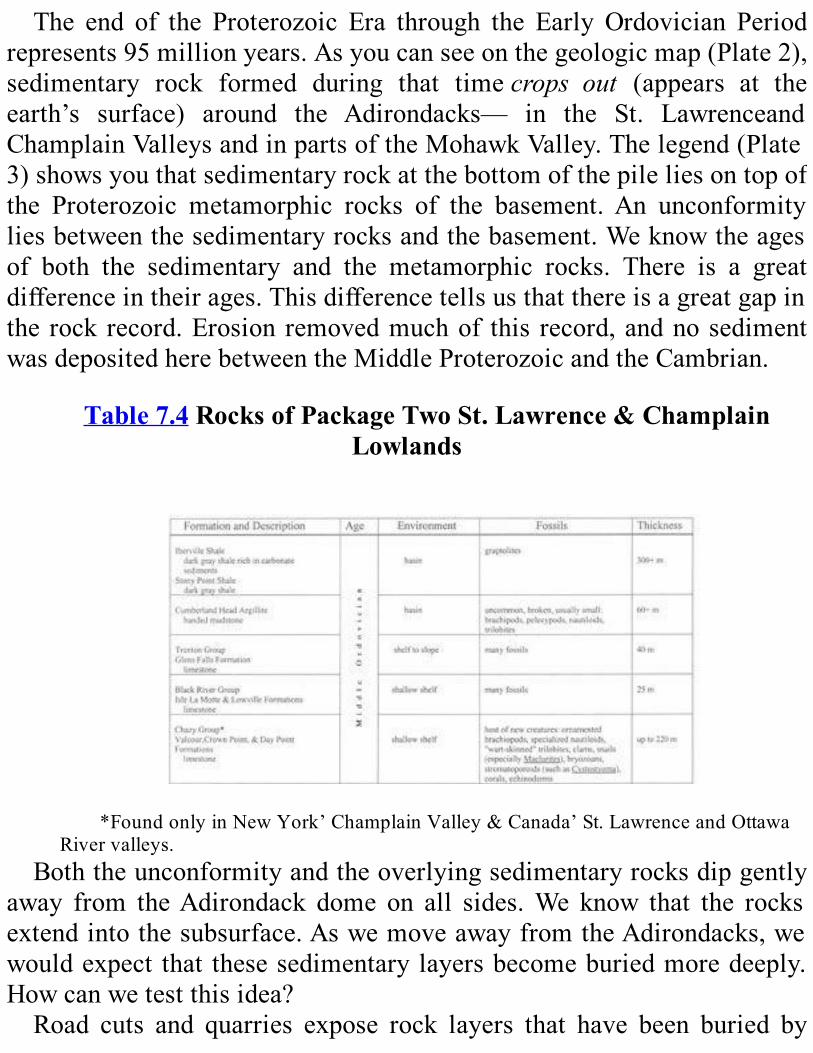
The end of the Proterozoic Era through the Early Ordovician Periodrepresents95millionyears.Asyoucanseeonthegeologicmap(Plate2),sedimentary rock formed during that timecrops out (appears at theearth’s surface) around the Adirondacks— in the St. LawrenceandChamplainValleysandinpartsoftheMohawkValley.Thelegend(Plate3)showsyouthatsedimentaryrockatthebottomofthepileliesontopofthe Proterozoic metamorphic rocks of the basement.An unconformityliesbetweenthesedimentaryrocksandthebasement.Weknowtheagesof both the sedimentary and the metamorphic rocks. There is a greatdifferenceintheirages.Thisdifferencetellsusthatthereisagreatgapinthe rock record.Erosion removedmuchof this record,andnosedimentwasdepositedherebetweentheMiddleProterozoicandtheCambrian.
Table7.4RocksofPackageTwoSt.Lawrence&ChamplainLowlands
*FoundonlyinNewYork’ChamplainValley&Canada’St.LawrenceandOttawa
Rivervalleys.Boththeunconformityandtheoverlyingsedimentaryrocksdipgently
away from theAdirondack dome on all sides.We know that the rocksextendintothesubsurface.AswemoveawayfromtheAdirondacks,wewouldexpect that thesesedimentarylayersbecomeburiedmoredeeply.Howcanwetestthisidea?Road cuts and quarries expose rock layers that have been buried by

youngerones.Suchexposuresgiveusvaluablegeologicclues,but theydon’textendfarbelowthesurface.Deepholesdrilledinthesearchforoiland natural gas give usmore information. Samples of rock taken fromtheseholestellusthedepthtobasementrockandthekindofsedimentaryrocksthatlieaboveit.Bymatchingthisinformationtotherockexposedin outcrops, we have developed a three-dimensional picture of thegeology.Thecrosssectionsbelowthegeologicmap(Plate2)showthiskindofsubsurfaceinformation.Fromdrillholes,forexample,weknowthat the unconformity on top of the basement rock dips graduallydownward tothe southwest from theAdirondacks.At the Pennsylvaniaborder in south central NewYork, this unconformity is nearly 3.6 kmbelowsealevel.
Table7.5RocksofPackageTwoSt.Lawrence&ChamplainLowlands
*ThissandstonemergeswithOneidaConglomerateinOneidaCounty.
TheSedimentaryRecordThelegend(Plate3)indicatesthattheoldestsedimentaryrocksinthe
northern lowlands are in the St. Lawrence Valley area; they weredeposited during the Early Cambrian (lowest part of the yellow inColumn8;theyaredescribedinTable7.2).Wearenotcertainthisageis

accurate,becausenofossilsarefoundinthesebeds.Thesedepositsformthe lowestpartof thePotsdamFormation; theyconsistofpoorlysortedconglomerate and sandstone. The conglomerate contains boulders andcobbles of metamorphic rock; these pieces are fragments of theProterozoicbasement.DepositsofthissortoccurasscatteredpatchesthatliebetweentheProterozoicbasementandoverlyingwidespreadlayersofwell sorted sandstone. One of these patches of material lies against avertical surface of basement rock; this arrangement suggests that thematerialformedatthebaseofanoldseacliff.Thelegend(Plate3)showsthemiddlepartofthePotsdamFormation
to be a deposit of Middle Cambrian time. This age is also uncertainbecause of the lack of fossils. This unit is more widespread, is bettersorted, and has more distinct layering than the one at the base of thePotsdam. It contains some pebble conglomerate and abundant feldspargrainsanddisplayslarge-scalecross-bedding—inclinedlayerswithinasedimentarylayer(Figure7.1).Thearrangementof itsbeddingsuggeststhat it was deposited bybraided streams—streams that divide into anumberofsmallerchannelsthatlaterreunite.Inplaces,someofthisrockmaycontainwindblownsandaswell.TheupperpartofthePotsdamFormation(describedinTables7.1and
7.2)wasdepositedduringLateCambrian time.Weknow this age fromthefossiltrilobitesintherock.Thesefossilsandotherstellustherockisamarinedeposit—depositedon theseafloor inseawater.Thispartofthe Potsdam Formation is much more widespread than the older partsbeneath;therefore,muchofitliesdirectlyonthebasementrock.Pebblyconglomeratelayersarecommonneartheunconformity.Beddinginthisupper Potsdam is uniform and well defined, although cross-bedding iscommonwithinindividualbeds.Thesandgrainsarenearlyallquartz,incontrast to the feldspar-rich sandstone below. We can see spectacularexposures of the upper Potsdam Formation inAusable Chasm (Figure7.2)andatthefallsoftheChateaugayRiverinFranklinCounty.
Table7.6RocksofPackageThreeClintonGroup
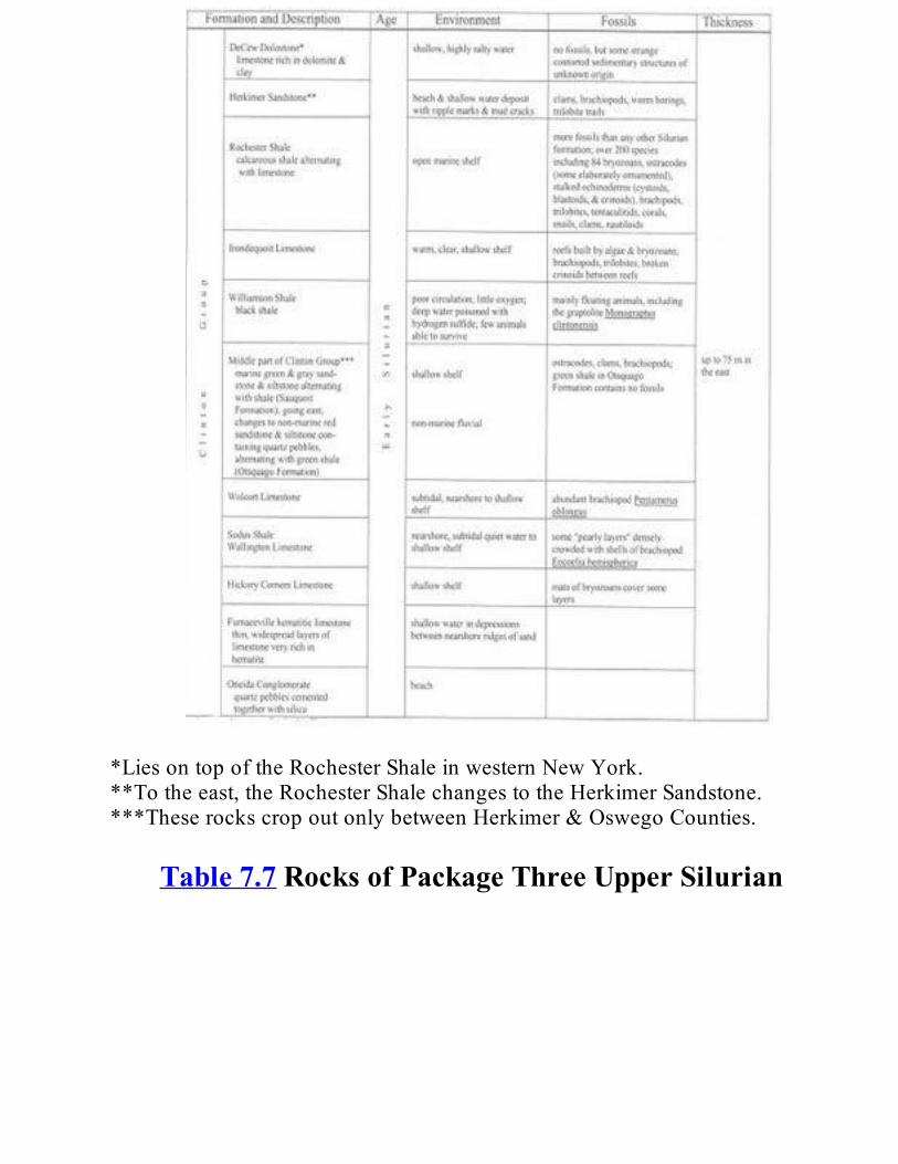
*LiesontopoftheRochesterShaleinwesternNewYork.**Totheeast,theRochesterShalechangestotheHerkimerSandstone.***TheserockscropoutonlybetweenHerkimer&OswegoCounties.
Table7.7RocksofPackageThreeUpperSilurian
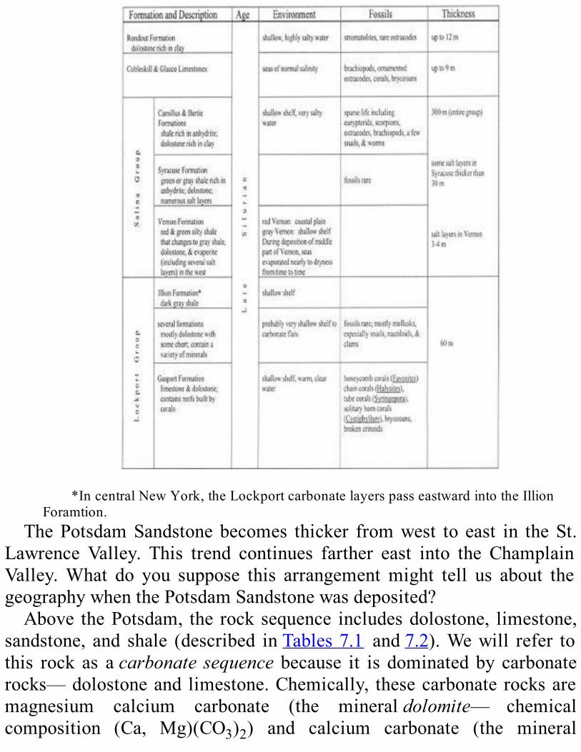
*IncentralNewYork,theLockportcarbonatelayerspasseastwardintotheIllion
Foramtion.ThePotsdamSandstonebecomes thicker fromwest to east in theSt.
Lawrence Valley. This trend continues farther east into the ChamplainValley.What do you suppose this arrangementmight tell us about thegeographywhenthePotsdamSandstonewasdeposited?Above thePotsdam, the rocksequence includesdolostone, limestone,
sandstone, and shale (described inTables7.1 and7.2).Wewill refer tothis rock as acarbonatesequence because it isdominatedbycarbonaterocks—dolostoneand limestone.Chemically, thesecarbonate rocksaremagnesium calcium carbonate (the mineraldolomite— chemicalcomposition (Ca, Mg)(CO3)2) and calcium carbonate (the mineral

calcite—chemical composition CaCO3). The fossils and sedimentarystructures3intheselayersindicatethattheyweredepositedinashallowseaduringLateCambrianandEarlyOrdoviciantime.Asyoucanseeonthegeologicmap(Plate2)andlegend(Plate3),thissequence(showninblue)cropsout in the samegeneral areaas thePotsdam,but it ismoreextensive,especiallysouthandeastoftheAdirondacks.Informationfromdrill holes tells us that layers of this carbonate sequence extend in thesubsurface beneath the Ontario Lowlands and continue beneath theAppalachianPlateaus (seeFigure1.1). Indeed,rockof this typeandageoccurovermuchofeasternNorthAmerica.LikethePotsdamFormation,thiscarbonatesequencebecomesthickerfromwesttoeastalongtheSt.Lawrence Valley. This thickening trend continues across eastern NewYorkintowesternNewEnglandandgivesusmorecluestothegeographyofthetime.
Figure 7.1.This simplified diagram shows two layers with cross-bed- ding sandwiched
betweenhorizontallylayeredunitsofsedimentaryrock.Someof thedolostonesappear tohaveformed inasea thatwasvery
salty.Onesuchformation, theLittleFallsDolostone,containsexquisitequartz crystals. These crystals are called “Herkimer Diamonds” (seeFigure6.5).They formed in holes that developed in the dolostone longafterthesedimentsbecamerock.The carbonate sequence does not cover theAdirondack region now.
However, from the thickness of this sequence around the edge of theAdirondacks,wededucethatitoncecoveredmostofthatregion.Wedofind scatteredoutcropsof thesecarbonate rocks indown-dropped faultblockswithintheAdirondacks.TheseoutcropssupplystrongevidencetosupporttheconclusionthattheyoncecoveredtheAdirondackregion.By combining many careful studies, we have learned that the New
YorkregionwasabovesealevelandexposedtoerosionattheendoftheEarly Ordovician. The legend (Plate 3) shows this conclusion in theseveralregionswhererockofthisagecropsout.(TheTaconicRegionisanexception.Howarewegoingtoexplainthisdifference?SeeChapter6forsomehelp.)ByexaminingPlate3,wecanspeculateaboutsomelocaldetailsofthehistoryofthiserosion.Forexample,thecarbonatesequenceismissinginthewesternpartoftheMohawkValleyregionbutispresentin the east. Maybe this sequence was never deposited in the west, ormaybeitwasthinnerthereandsoerodedcompletelyaway,ormaybethewestern area was exposed to erosion for a longer time. Erosion waswidespread in eastern proto- North America at the end of the EarlyOrdovician and created a gap in the rock record. We call theunconformitythatresultedtheKnoxUnconformity.Asyoucanseeonthelegend (Plate 3), the time gap represented by this unconformity variesconsiderablyfromplacetoplace.
InterpretationsWhathistorycanwewriteaboutLateProterozoic,Cambrian,andEarly
OrdoviciantimefromtherecordintherocksofPackageOne?The poorly sorted conglomerate in the lowest part of the Potsdam
Formationoccurs inpatches; inplaces, itwasdepositedagainsta steeprock face.Thesecharacteristicscouldmean that itwasdepositedat thefootofacliff.Thisarrangementfitswiththeinterpretationthatthecrustin this region was stretched and broken in the Late Proterozoic. Riftvalleys developed in it.Theymust have lookedmuch like today’sEastAfrican andRioGrande Rifts. Sediments piled up at the base of steep

slopesinthoseearlyriftbasins,justastheydoinmodernones.ThisriftingwaspartofthebreakupoftheGrenvillesupercontinent.As
the rift widened, it was flooded with sea water to become the IapetusOcean.Proto-NorthAmerica layon thewest sideof the IapetusOcean.The rock of the northern lowlands was generally exposed and eroded.Streamsdepositedsandandgravelinlow-lyingareas.Remnantsofthesedeposits remain as the Ausable Member of the Potsdam Sandstone.Figure7.3summarizestheseevents.The fossils and bedding of the upper part of the Potsdam sandstone
indicatethattheshorezoneoftheIapetusOceanhadadvancedacrosstheedge of proto-NorthAmerica to the northern lowlands during the LateCambrian. The advance of the shore zone deposited a blanketof beachsandinitswake.ThissandlayontopoftheerodedProterozoicbasementrockandthescatteredremnantsofsedimentsthatfilledriftbasins.

Figure 7.2. The Potsdam Formation exposed in Ausable Chasm, Clinton and Essex
Counties.
Figure7.3.RiftingoftheGrenvillesupercontinent.(A)Astretchingeventthinsandsplits
theGrenvillecrust.Riftbasinsdevelopinthestretchedcrust.Amainriftwidensandfloodswithseawater to form the IapetusOcean. Some rift basins remain above sea level; some near theedgesof themain riftbecomesubmerged.Debriseroded fromthe riftmargins isdeposited inthe basins. (Compare withFigure 3.1 to recognize continental and oceanic crust and theboundariesofthecrust,lithosphere,andasthenosphere.)
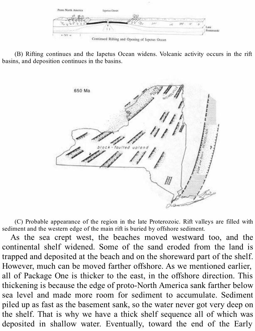
(B) Rifting continues and the Iapetus Ocean widens.Volcanic activity occurs in the rift
basins,anddepositioncontinuesinthebasins.
(C) Probable appearance of the region in the late Proterozoic.Rift valleys are filledwith
sedimentandthewesternedgeofthemainriftisburiedbyoffshoresediment.As the sea crept west, the beaches moved westward too, and the
continental shelf widened. Some of the sand eroded from the land istrappedanddepositedatthebeachandontheshorewardpartoftheshelf.However,muchcanbemovedfartheroffshore.Aswementionedearlier,allofPackageOne is thicker to theeast, in theoffshoredirection.Thisthickeningisbecausetheedgeofproto-NorthAmericasankfartherbelowsea level and made more room for sediment to accumulate. Sedimentpiledupasfastasthebasementsank,sothewaternevergotverydeeponthe shelf.That iswhywehave a thick shelf sequence all ofwhichwasdeposited in shallow water. Eventually, toward the end of the Early

Ordovician, eastern proto-North America was submerged as a greatcontinentalshelfdominatedbycarbonatesediment.TheregionmayhaveresembledthemodernGrandBahamasBanksortheFloridaKeys,exceptthat there was no vegetation growing on land. The end of EarlyOrdoviciantimeismarkedinourrockrecordbytheKnoxUnconformity.Apparently sea level droppedworldwide at this time and left the broadcontinental shelves exposed. Erosion then did its work.Figure 7.4summarizesthishistorygraphically.

Figure 7.4. Deposition of the sedimentary rock of Package One during the Cambrian
throughEarlyOrdovician.(A)SubductionhasbegunintheIapetusOcean;thewesternpartoftheoceanisclosing,andavolcanicislandarcbuildsabovethesubductionzone.Acontinentalshelf,slope,andrisedevelopontheeasternedgeofproto-NorthAmerica.
(B)Theshorezonebeginstoadvanceovereasternprotp-NorthAmerica.Sandisdeposited
intheshoreZonecarbonatesedimentfartheroffshore.
ROCKSOFPACKAGETWO:MIDLETHROUGHLATEORDOVICIANTIMETheMiddleandLateOrdovicianrockrecordinthenorthernlowlands
is most nearly complete in the Finger Lakes-Mohawk Valley region(Columns2and3onPlate3).Theunitsinthispackageareshownonthegeologic map and legend (Plates 2 and 3) by light blue with diagonal

stripes, lightbrown,paleorange,andyellow-orangewith reddashes. Inthe eastern Mohawk Valley and southern Catskill region, there is areddish-brownmapunitofthisageaswell.TheserocksaredescribedinTable7.3.The largestareaofbedrockof thispackage liessouthwestofthe Adirondacks and extends along the south shore of Lake Ontario.Patches of the lower two map units in the package crop out in theChamplainValley(seeTable7.4fordescription).Thelowestmapunit(blue,stripeddiagonally)hasseveralsedimentary
formations.We find limestones at thebottomof thepile.Higher, thereareshalelayersalternatingwithlayersofcarbonaterock.Thenexthighermapunit(palebrown)includesawidespreadthicklayerofdarkshaleorshale and siltstone at the bottom. In theMohawkValley andwest, theamount of coarser grained material gradually increased through time;siltstoneandsandstonebecomemoreabundantupward in thisunit.Thethird map unit (pale orange) in Package Two contains layers of wellsorted sandstone and of shale.This unit forms the caprock4 of theTugHillPlateaueastofLakeOntario.Thetopmostmapunitinthispackage(yellow-orangewithreddashes)isshaleandsiltstone.Itcropsoutsouthof Lake Ontario. In contrast to the rock layers below it, which weredeposited on the sea floor, this topmost unit was deposited above sealevelinariverdeltasystem.

(C)Theshorezoneadvancesfartherontoproto-NorthAmerica.Alayerofsandisleftinits
wake.Thesanddepositsisprogressivelycoveredbycarbonatesedimentoffshore.
(D)ThewesternpartoftheIapetusOceannarrowsastheislandareapproachesproto-North
America.Sediments cover the widening continental shelf and extend to the ocean floor ascontinentalslopeandrisedeposits.
TheSedimentaryRecordThe oldest rocks in Package Two in the northern lowlands are
limestonesoftheChazyGroup(seeColumn7onPlate3andTable7.4).TheyweredepositedintheearlypartoftheMiddleOrdovicianandoccuronly in the Champlain Valley of New York and in the northern St.LawrenceValleyofCanada(Figure7.5).Why is the Chazy Group found in so few places? There are two
possible explanations.TheChazy seamayhave extended only onto theeastern margin of proto-North America, so the limestone was formed

onlyinrestrictedareas.Orthislimestonemayoriginallyhavebeenmorewidespreadbutwaserodedawaylater.
(E)Theshorezonecontinuestoadvanceovereasternproto-NorthAmerica.Sandstonesof
thePotsdamFormation thatwenow see inoutcrop are deposited.Sediments offshore thickenandkeepthecontinentalshelfwatersfairlyshallow.
(F)The islandarcnears the edgeof the continental crust andcontinental risedepositsof
proto-NorthAmerica.Regardless of its extent, the Chazy sea supported a host of new
creatures: new kinds of brachiopods, specialized nautiloids,5 trilobites,and clams (see FigureA.3). Snailswere common, especially the large,tightly coiled form calledMaclurites (Figure 7.6). The first bryozoansappeared andbecame important reef-builders (seeFigureA.3).Anothernew arrival, thestromatoporoids, a group of sponges that resemble
colonial corals, built moundlike reefs. During this time, the first truecoralsappearedaswell.TheoldestknowncoralreefintheworldisfoundonIsleLaMotteinLakeChamplain.Echinoderms(primarilycystoids)6werecommoninareasaroundthereefs.An unconformity separates the Chazy Group from younger Middle
Ordovician limestone units (see Column 7 on Plate 3). Later in theMiddleOrdovician,carbonatesedimentsweredepositedacrossmuchofNewYorkState.Thisdeposition resulted in the formationof theBlackRiverGroup (Column 2 on Plate 3;Tables7.3 and7.4) and theOrwellandIsleLaMottelimestones(Column7ofPlate3;Table7.4).Muchofthismaterialwas fine-grained carbonate— alimemud. It contains verylittleclayandsiltderivedfromtheland.Limemudisformedwhenshellsand other hard parts of animals and plants disintegrate after death.Feeding by predators and the action of waves and currents help thisprocessalong.Black River Group limestones contain many fossils, burrows of
invertebrateanimals, and sedimentary structures.These featuresare thecluestothevariousenvironmentsinwhichsedimentwasdeposited.Mudcracksandabundantverticalburrowssuggestmudflatsthatwereexposedto the open air at low tide. Colonies ofTetradium coral, on the otherhand,indicateanenvironmentthatwascontinuouslyunderwater.Bedsoffossil hash— broken and worn pieces of shell— tell us that life wasabundantinthisseaandthattherewereoccasionalstorms.(Stormwavesstir up the bottom sediment and separate the coarser material— fossilhash—fromthefinerlimemud.)

(G)Sealeveldrops,andeasternproto-NorthAmericabeginstoemergefromthesea.Among the fossils found in these limestones are bra- chiopods and
pelmatozoans7,clamsandostracodes(seeFigureA.3),andseveralkindsoftrilobites(Figures7.7and7.8).Studies of the earth’s paleogeography8 conclude that our part of
easternproto-NorthAmericawas20degreessouthof theequator in theMiddle Ordovician. This information suggests that the sea water waswarm.The deposition of limestone and the kinds of fossil animals andtheirabundanceintherockrecordsupportthisideaofatropicalclimate.Anunusualfeatureofthissequenceofrockisthepresenceofbentonite
in thin layers.Bentonite is a kind of rock that is altered fromvolcanicash. It is made ofmontmoril- lonite— a type of clay that expandsremarkably when wet. The trained eye can spot very thin layers ofbentoniteinanoutcropbecausetheyweatherwithadistinctive“popcorn”texture. We have no evidence of volcanoes in eastern proto-NorthAmericaat this time, sowheredid thisbentonitecome from?VolcanicashfellinourquietMiddleOrdovicianseaafterbeingblowninfromanoffshoreislandarc,tobediscussedlater.
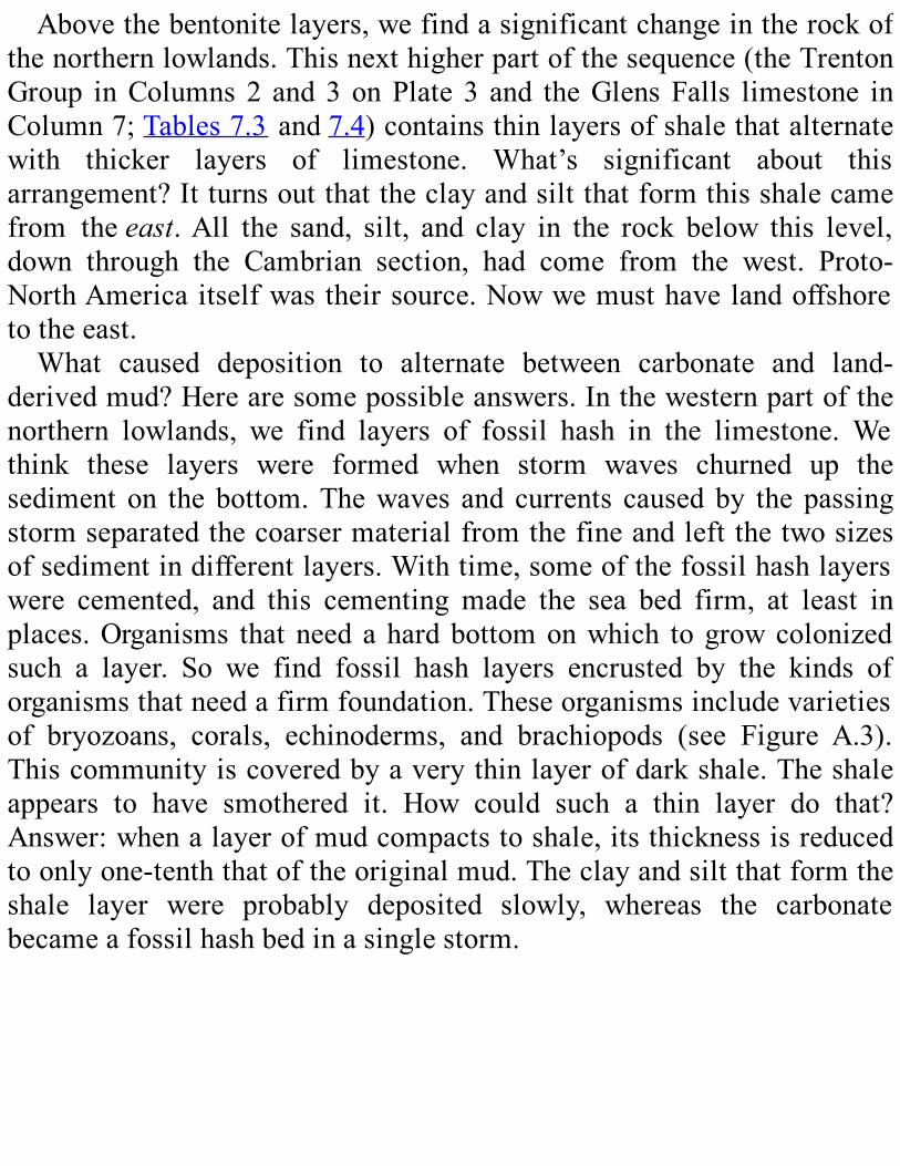
Abovethebentonitelayers,wefindasignificantchangeintherockofthenorthernlowlands.Thisnexthigherpartofthesequence(theTrentonGroup inColumns2 and3onPlate 3 and theGlensFalls limestone inColumn7;Tables7.3and7.4)containsthinlayersofshalethatalternatewith thicker layers of limestone. What’s significant about thisarrangement?Itturnsoutthattheclayandsiltthatformthisshalecamefrom theeast.All the sand, silt, and clay in the rock below this level,down through the Cambrian section, had come from the west. Proto-NorthAmericaitselfwastheirsource.Nowwemusthavelandoffshoretotheeast.What caused deposition to alternate between carbonate and land-
derivedmud?Herearesomepossibleanswers.Inthewesternpartofthenorthern lowlands, we find layers of fossil hash in the limestone. Wethink these layers were formed when storm waves churned up thesediment on the bottom.Thewaves and currents causedby the passingstormseparatedthecoarsermaterialfromthefineandleftthetwosizesofsedimentindifferentlayers.Withtime,someofthefossilhashlayerswere cemented, and this cementing made the sea bed firm, at least inplaces.Organisms thatneedahardbottomonwhich togrowcolonizedsuch a layer. So we find fossil hash layers encrusted by the kinds oforganismsthatneedafirmfoundation.Theseorganismsincludevarietiesof bryozoans, corals, echinoderms, and brachiopods (see Figure A.3).Thiscommunityiscoveredbyaverythinlayerofdarkshale.Theshaleappears to have smothered it. How could such a thin layer do that?Answer:whenalayerofmudcompactstoshale,itsthicknessisreducedtoonlyone-tenththatoftheoriginalmud.Theclayandsiltthatformtheshale layer were probably deposited slowly, whereas the carbonatebecameafossilhashbedinasinglestorm.
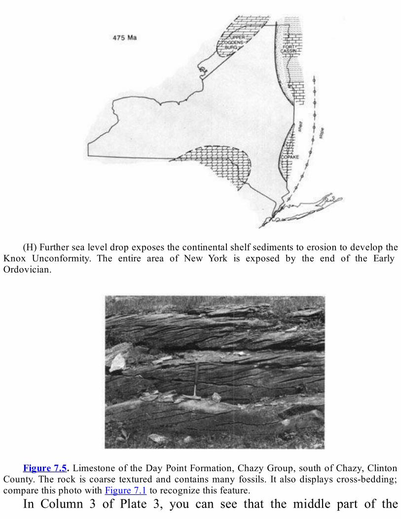
(H)Furthersealeveldropexposesthecontinentalshelfsedimentstoerosiontodevelopthe
Knox Unconformity. The entire area of New York is exposed by the end of the EarlyOrdovician.
Figure7.5.LimestoneoftheDayPointFormation,ChazyGroup,southofChazy,Clinton
County.Therock iscoarse texturedandcontainsmanyfossils. Italsodisplayscross-bedding;comparethisphotowithFigure7.1torecognizethisfeature.
In Column 3 of Plate 3, you can see that the middle part of the
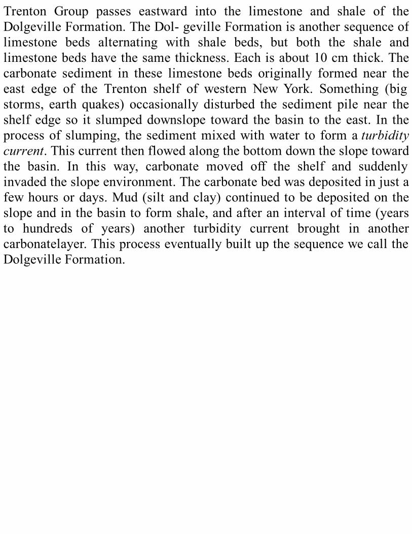
Trenton Group passes eastward into the limestone and shale of theDolgevilleFormation.TheDol-gevilleFormationisanothersequenceoflimestone beds alternating with shale beds, but both the shale andlimestonebedshavethesamethickness.Eachisabout10cmthick.Thecarbonate sediment in these limestone beds originally formed near theeast edge of the Trenton shelf of western NewYork. Something (bigstorms, earth quakes) occasionally disturbed the sediment pile near theshelfedgeso it slumpeddownslope toward thebasin to theeast. In theprocessofslumping, thesedimentmixedwithwater to formaturbiditycurrent.Thiscurrentthenflowedalongthebottomdowntheslopetowardthe basin. In this way, carbonate moved off the shelf and suddenlyinvadedtheslopeenvironment.Thecarbonatebedwasdepositedinjustafewhoursordays.Mud(siltandclay)continuedtobedepositedontheslopeandinthebasintoformshale,andafteranintervaloftime(yearsto hundreds of years) another turbidity current brought in anothercarbonatelayer.ThisprocesseventuallybuiltupthesequencewecalltheDolgevilleFormation.
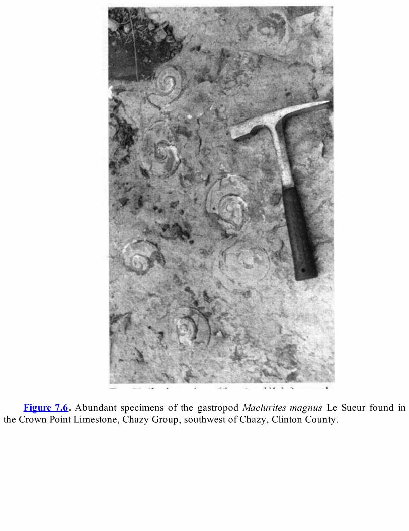
Figure7.6.Abundant specimens of the gastropodMacluritesmagnus Le Sueur found in
theCrownPointLimestone,ChazyGroup,southwestofChazy,ClintonCounty.

Figure 7.7. The trilobiteCryptolithus tesselatus (Green), common inMiddle Ordovician
limestonesandshales.
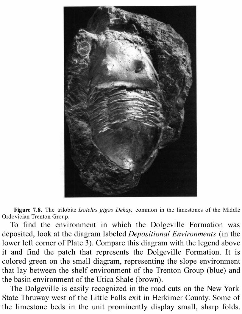
Figure 7.8. The trilobiteIsotelus gigasDekay, common in the limestones of theMiddle
OrdovicianTrentonGroup.To find the environment in which the Dolgeville Formation was
deposited,lookatthediagramlabeledDepositionalEnvironments(inthelowerleftcornerofPlate3).Comparethisdiagramwiththelegendaboveit and find the patch that represents the Dolgeville Formation. It iscoloredgreenonthesmalldiagram,representingtheslopeenvironmentthat laybetweentheshelfenvironmentof theTrentonGroup(blue)andthebasinenvironmentoftheUticaShale(brown).TheDolgevilleiseasilyrecognizedintheroadcutsontheNewYork
StateThruwaywestoftheLittleFallsexitinHerkimerCounty.Someofthe limestone beds in the unit prominently display small, sharp folds.

Theseroadcutsalsodisplaytheblackshale(theUticaShale)thatliesontopofandeastoftheDolgeville.Thedifferentkindsof limestone found in thenorthern lowlandseach
reflectadifferentenvironmentofdeposition.Avarietyofenvironmentsexisted on the shallow shelf; water depth was a major control overenvironment. Tidal flats, quiet lagoons, turbulent shallows churned bywavesandcurrents,thedeeperandquieteroutershelfwherethebottomwasdisturbedonlybythebiggeststorms,andtheyetdeeperwateroftheslopeareallrecordedintheselimestoneunits.Hundreds of meters of black shale lie on top of the sequence of
alternating limestone and shale. This shale (called the Utica Shale,described inTable7.3)was formed frommud eroded from land to theeast; this mud gradually spread westward, until all of the carbonateenvironmentswereblanketed.Wheredidallthismudcomefrom?We’llcomebacktothatquestionlater.Thekindsoffossilsinthelimestonesequencearedifferentfromthose
inthethickshalesequence.Thesetwosequencesrecordenvironmentssodifferent that they contained entirely different animals. Brachiopods,corals, bryozoans, and trilobites (see Figure A.3) are common in thelimestone sequence, but they are largelymissing in theoverlying shalesequence. Instead, we find only scattered remains of graptolites andtrilobitesofadifferentkind(seeFigureA.3).Allofthefossilswefindintheshalesequenceareofswimmingorfloatingorganismsratherthanthebottomdwellerssocommoninthelimestone.Whatcausedthisdramaticchange?The shale is dark colored because it has a lot of finely dispersed
organicmatterandpyrite(ironsulfide—chemicalcompositionFeS2) init.Thepresenceofthesematerialstellsusthattherewaslittleoxygenatthe ocean bottom. The environmentwas poisoned by hydrogen sulfide.Nothing could live there.When creatures died in thewater above, theysettledtothepoisonousbottom.Theretheyremained,becausetherewerenoscavengerstoeatthemandnooxygentopromotedecay.Aswemovefromwesttoeastalongarocklayerofthesameage,we
pass from limestone, to interlayered limestone and shale, to shale. (OnPlate3,followahorizontaltimelinefromtheTrentonGroupthroughtheDolgevillelimestoneandshaleintotheUticaShale.)Ifwedo,wecanseethatall threeenvironmentsexistedat thesame time indifferentplaces.Howdoweknow?SomespeciesofgraptolitesoccurinboththeTrentonGroupandtheUticaShale.Thesefossilspermitustoconcludethattheserockbodiesarethesameage.Most of our rock record forLateOrdovician time is inwesternNew
York.AcomplicatedsuiteofrockunitsofthisageoccursintheMohawkValleyandwest(seeColumns1,2,and3onPlate3andTable7.3).Theshalebasinbegantoreceiveincreasingamountsofcoarsermaterial—siltandsand—intheMiddleOrdovician.Throughtime,thiscoarsermaterialgraduallyspreadfromeasttowest.AcarefulstudyofPlate3willshowyou this arrangement. Look first to Column 3. Toward the end of theMiddle Ordovician, sand and conglomerate were deposited to the east(Quassaic);sand,silt,andmudwestward(Schenectady);andmudinthebasinfartherwest(Utica).(TheQuassaicandSchenectadyarerockunitsthat lieeastof thenorthernlowlands,but theywereformedat thesametimebyrelatedprocesses.)TheformationsoftheLorraineGroupappearhigher in theMohawkValley sequence.Upward andwestward throughthis group, the sediment gradually becomes coarser— from shale andsiltstone (Frankfort), to siltstone and shale (Whetstone Gulf), tosandstone, siltstone, and shale (Pulaski), to sandstonewithminor shale(Oswego).Thislastunitisthecoarsestgrainedofthegroup.Itismadeupof clean (mud-free) sandstone beds separated by thin shale. Thesandstonehasthecharacteristicsofnearshoreandbeachdeposits.These features of the rock record suggest that the deep Middle
Ordovicianbasinwasfilledinslowlyfromeasttowest.Thefossilsintheformations of the Lorraine Group support this conclusion— upwardthrough the rock sequence the life forms are from progressivelyshallowerwater.Byreferringtothegeologicmapandlegend(Plates2and3),youcan
seethattheyoungestOrdovicianrockinNewYorkcropsoutontheTugHill Plateau and west along the shore of Lake Ontario. This unit, the

QueenstonShale(describedinTable7.3),hasadistinctivereddishcolor.It is largely shale, but it contains beds of siltstone and sandstone. TheQueenston Shale has the features of an enormous delta that spreadwestward across the State.We call this delta theQueenstonDelta. Theeasternpartoftheoutcropbeltappearstohavebeendepositedabovesealevel.Thewesternpartcontainsa fewmarine fossils.TheQueenston iseasilyeroded,andgoodexposuresare scarce.However, theunit iswellexposed low in the cliffs of the Niagara Gorge from the Whirlpooldownstream to the villages of Lewiston and Queenston and in theGenesee River Gorge at Rochester. Its reddish color makes it easilyrecognizableintheseoutcrops.TheQueenstonDeltainNewYorkispartofahugeapronofsediment
that spreadwest to themid-continent and as far south asVirginia.Thesedimentwaserodedfromhighlandsthat layjusteastofNewYorkandextended southward. Where did all this sediment come from?Traditionally, geologists have concluded a renewed uplift of themountains built by theTaconianOrogeny provided a source for all thesediment. A new idea suggests that sea level dropped in the LateOrdovician.Suchadropwouldpermitadeltatobuildrapidlyacrossthenewlyexposedseafloor.Perhapssomeofitssedimentwaserodedfromearliermarinedeposits.Whatbroughtaboutthisnewinterpretation?RecentworkinAfricaand
SouthAmericaindicatesthatdepositsweremadetherebycontinentalicesheets during the Late Ordovician. Such huge ice sheets store a lot ofwaterasiceandsnow.Wheredoesallthatwatercomefrom?Becausetheoceanscontain99percentoftheearth’swater,theymustbetheprimarysource for thewater in continental ice sheets.The level of ourmodernoceans would rise over 100 meters if the ice sheets that now coverAntarctica andGreenlandwere tomelt completely. Conversely, if newcontinental ice sheets formed, sea levelwould dropworldwide. Such adropinsealevelasaresultofamajorglaciationmayhaveinfluencedtheformationoftheQueenstonDeltabackintheLateOrdovician.
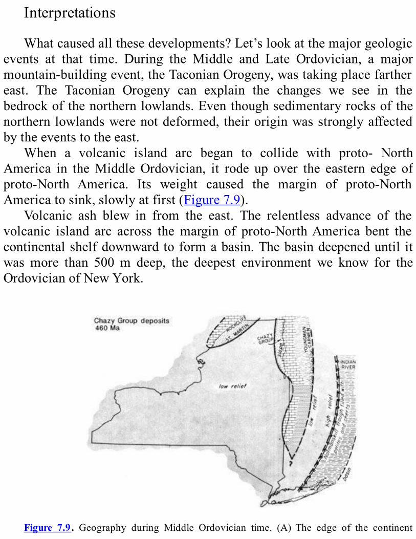
Interpretations
Whatcausedallthesedevelopments?Let’slookatthemajorgeologicevents at that time. During the Middle and Late Ordovician, a majormountain-buildingevent,theTaconianOrogeny,wastakingplacefarthereast. The Taconian Orogeny can explain the changes we see in thebedrockofthenorthernlowlands.Eventhoughsedimentaryrocksofthenorthernlowlandswerenotdeformed, theiroriginwasstronglyaffectedbytheeventstotheeast.
When a volcanic island arc began to collide with proto- NorthAmerica in theMiddleOrdovician, it rode up over the eastern edge ofproto-North America. Its weight caused the margin of proto-NorthAmericatosink,slowlyatfirst(Figure7.9).
Volcanic ash blew in from the east. The relentless advance of thevolcanic island arc across themargin of proto-NorthAmerica bent thecontinentalshelfdownwardtoformabasin.Thebasindeepeneduntil itwasmore than 500m deep, the deepest environment we know for theOrdovicianofNewYork.
Figure 7.9. Geography during Middle Ordovician time. (A) The edge of the continent
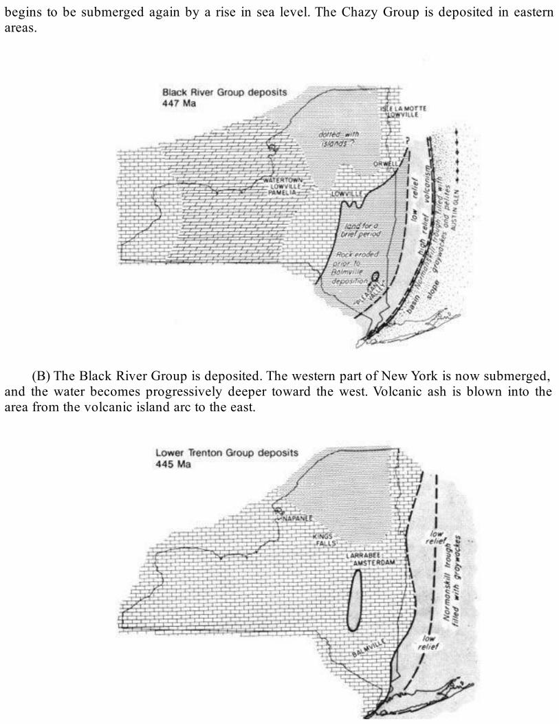
begins tobesubmergedagainbya rise insea level.TheChazyGroup isdeposited ineasternareas.
(B)TheBlackRiverGroupisdeposited.ThewesternpartofNewYorkisnowsubmerged,
and thewater becomes progressively deeper toward thewest.Volcanic ash is blown into theareafromthevolcanicislandarctotheeast.
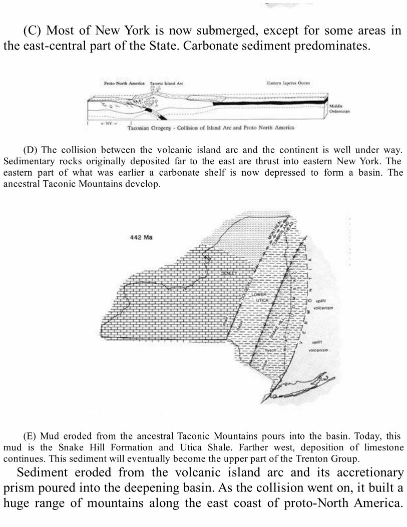
(C)MostofNewYork isnowsubmerged, except for someareas in
theeast-centralpartoftheState.Carbonatesedimentpredominates.
(D)The collision between the volcanic island arc and the continent is well under way.
Sedimentary rocks originally deposited far to the east are thrust into eastern NewYork.Theeastern part of what was earlier a carbonate shelf is now depressed to form a basin. TheancestralTaconicMountainsdevelop.
(E)Mud eroded from the ancestralTaconicMountains pours into the basin.Today, this
mud is the Snake Hill Formation and Utica Shale. Farther west, deposition of limestonecontinues.ThissedimentwilleventuallybecometheupperpartoftheTrentonGroup.Sediment eroded from the volcanic island arc and its accretionary
prismpouredintothedeepeningbasin.Asthecollisionwenton,itbuiltahuge range of mountains along the east coast of proto-NorthAmerica.

Sediment eroded from these ancestral TaconicMountains continued topour into thedeepbasin.Water circulationwaspoor in thedeepbasin,and there was not enough oxygen to support much life. The muddepositedherewasblackfromorganicmatterthatraineddownfromthesurface water and from fine-grained pyrite that grew within the mud.Carbonatesedimentcontinuedtobedepositedontheshallowshelftothewest.Eventually,thisshelfbecamebasin.TowardtheendofOrdovician,themountainshadbeenlargelyeroded
awayandthebasinwasfilled.Butthen,sedimentsonceagainpouredintothe area from the east to form the Queenston Delta. Where did thesesedimentscomefrom?The land to the east may have been uplifted again, and this uplift
increased the speed of erosion. But there is another possibility. Majorglaciers in the southern continent ofGondwana (modernAfrica, SouthAmerica, India,Australia, andAntarctica)may have locked up enoughwatertomakesealeveldroparoundtheworld.AdropinsealevelwouldhaveexposedtheeasternpartofNewYorktoerosion.ThismaterialmayhavebeenreworkedtoformtheQueenstonDelta.

(F)Thefillingofthebasincontinues,andcoarsermaterialaccumulatesinitseasternpart.
ThesecoarserdepositsareknownastheQuassaicandSchenectadyFormations.In any case, the sediments from the east piled upuntil they filled in
thisdeepbasin.
SummaryoftheHistoryThe rock record of the Middle and Late Ordovician tells a more
complicatedhistorythanthatoftheEarlyOrdovician.Themajoreventsare summarized in Figures 7.9 and 7.10.After the Middle Ordovicianbegan, the eastern part of the continent began to sink below sea levelagain. The formations of the Chazy Group are the earliest records wehaveofthissinking.(SeeColumn7onPlate3andcompareittotheothercolumns.)Through the first half ofMiddleOrdovician time, the recordsuggeststhatdepositionwasspottyineasternNewYork.IntheMohawkValley regionandwest,however, carbonate sediment accumulatedonashallowshelftotheendofmiddleOrdoviciantime(seeColumns2and3onPlate3).ThissedimentbecamethelimestoneformationsoftheBlackRiverandTrentonGroups.VolcanicashlayersintheChazyand
Black River Groups provide evidence that a volcanic island arc wasoffshore.AbouthalfwaythroughtheMiddleOrdovician,theeasternpartof the region was bent downward to become a basin. This basin wasgraduallyfilledwiththesedimentoftheSnakeHillandUticaformations.As timepassed into theLateOrdovician, thebasinexpandedwestward.The Trenton carbonate shelf sank, and the basin developed above it.Eventually, sediment filled the basin to sea level and above. This lasteventisrecordedintherockoftheQueenstonFormation.Study the geologic map and legend (Plates 2 and 3) and the
DepositionalEnvironments diagram in the lower left corner of Plate 3.With these events in mind, find the Middle and Upper Ordovicianformations on the diagram. This diagram shows the environments inwhichsedimentsweredepositedacross theState (in thoseplaceswhere

wehavearecord).Forexample,findtheTrentonGrouponthediagram.EastofitisasmallgreenpatchthatrepresentstheDolgevilleFormation.DrawahorizontallinethroughtheTrentonandDolgevilleandeastwardacross the diagram.This line passes through depositional environmentsthatexistedsidebyside.Thisprocedureletsyouvisualizethegeographyofthattime;then,youcanfollowthechangesingeographythroughtime.
Figure 7.10. Geography during LateOrdovician time. (A) Sediment has been filling the
basin.Itseasternpartisfilledtosealevelorabove.MudandsandaredepositedontheshelfinwesternNewYork (PulaskiFormation).As the sediment fills thebasin to sea level, the shorezonemovesfromeasttowest,leavingalayerofsand(OswegoFormation)
(B) The ancestral Taconic Mountains continue to supply mud and sand. This material
accumulates above sea level andbuilds an apronof poorly sorted fine-grained sediment overthe shore zone deposits. This apron is the Queenston Formation, which is the youngestOrdovicianunitinNewYork.
ROCKSOFPACKAGETHREE:SILURIANTIMETherewasagreatchangeinanimallifebetweentheOrdovicianandthe
Silurian.ManyanimalsthatthrivedintheOrdovicianbecameextinct.Therearefewplacesintheworldwithacontinuousrockrecordfrom
theOrdovicianintotheSilurian.NewYorkStateisnoexception.Silurianrocks lie on top of Ordovician shale, and there is an unconformitybetweenthem.Insomeplaces,rocksformedfromanEarlySiluriandeltalie on top of rocks formed from the LateOrdovicianQueenstonDelta.Theylookverymuchalike,andit’shard torecognize theunconformitybetweenthetwo.SilurianrocksinthenorthernlowlandsareexposedonlyintheOntario
Lowlands(Columns1,2,and3onPlate3; theyaredescribed inTables7.5,7.6,and7.7).TheyruninawidebandthatextendseastfromNiagaraFalls.Thisbandnarrowsdown tonothing east ofCanajo-harie.To thesouth they slope gently beneath the great mass of Devonian rocksexposedontheAlleghenyPlateau(seeFigure1.1).DevonianlayersrestontopofSilurianrockseverywhereinNewYork
State except inAlbany andGreeneCounties and at places inColumbiaCounty.There, theDevonian layers rest onMiddleOrdovicianor olderrocks.UndergroundinsouthcentralNewYork, theSilurianrocksreachtheir maximum thickness— 610 m. They are the thinnest LowerPaleozoicrocksfoundinNewYorkState.
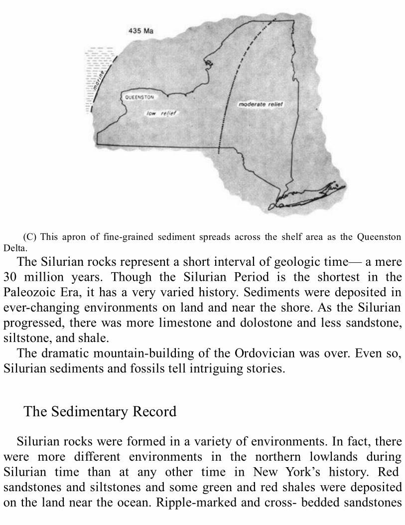
(C)This apron of fine-grained sediment spreads across the shelf area as the Queenston
Delta.TheSilurianrocksrepresentashortintervalofgeologictime—amere
30 million years. Though the Silurian Period is the shortest in thePaleozoicEra, ithasaveryvariedhistory.Sedimentsweredepositedinever-changingenvironmentson landandnear theshore.As theSilurianprogressed, therewasmore limestoneanddolostoneandlesssandstone,siltstone,andshale.Thedramaticmountain-buildingoftheOrdovicianwasover.Evenso,
Siluriansedimentsandfossilstellintriguingstories.
TheSedimentaryRecordSilurianrockswereformedinavarietyofenvironments.Infact,there
were more different environments in the northern lowlands duringSilurian time than at any other time in New York’s history. Redsandstonesandsiltstonesandsomegreenandredshalesweredepositedonthelandneartheocean.Ripple-markedandcross-beddedsandstones
and conglomerates were formed on the beach. They also formed justoffshoreinshallowwaterwherethesedimentsweredisturbedbywaves.Silts andmudswithmud cracks andmarks left by burrowing creaturesaccumulated on the flats betweenhigh and low tide.Limestones, fossilhashes, lime mudstones, and shales accumulated in the sea below lowtide.Aswementioned above, there is no rock record from the end of the
OrdovicianthroughtheearliestpartoftheSilurianinmostoftheworld.We think that this unconformitywas formed because these regions layabovesealevel.TheoldestofNewYork’sSilurianrocksmakeuptheMedinaGroup.
Theserockunitsare representedbyreddishpurpleon thegeologicmap(Plate2)andColumns1and2ofthelegend(Plate3);theyaredescribedinTable7.5. Early in the Silurian, an inland sea spread a thin layer ofcleanwhitequartz sandacross thewesternpartof theState (WhirlpoolSandstone).Thesandwasdepositedasdunesandbeachesontheshoreoftheseabywindandwater.Theseaadvancedfromwesttoeast.Itfinallyreached as far east as Medina. There are beautiful exposures of thesesandstonesinNiagaraGorge.Thewhitesandwaslatercoveredbyalayerofmud(PowerGlenFormation).Stilllater,themudwascoveredbyred,green,andmottledsandstone,siltstone,andshale(GrimsbyFormation).TheredandgreensedimentsoftheGrimsbyFormationmayhavebeen
partofadelta.Therearemanycluesthattheyweredepositedinshallow,turbulent water. The rocks contain ripple marks, cross-bedding, mudcracks(Figure7.11),andconglomerate.Therearealsofossilsofcommonbeach-dwellinganimals—clams, snails,andworms.Above theGrimsbyFormation,arelativelyuniformlayerofwhitequartzsandwasdeposited.Thissand(nowsandstoneoftheThoroldandKodakFormations)extendsfromHamilton,Ontario,toOneidaCounty.We know little about life in these Early Silurian seas. The most
commonanimalswereworm-like creatures thatdughorizontalburrowsand a smooth brachiopod calledLingula.Wehavealso found fossilsofclams,snails,ostra-codes,andanoccasionalnautiloid(seeFigureA.3).Above theMedinaGroup isabeachdepositofquartzpebbles,which

havebeencementedintoconglomerate.ThisconglomerateshowsusthatthebeachoftheshallowSilurianseawasbeginningtoadvanceeastwardagain.ThisconglomerateistheoldestlayerintheClintonGroup,akeyrock
intervalthatcontainsawidevarietyofenvironments.Infact,geologistshave had to divide the Clinton Group into 26 separate rock units. TherocksrepresenttimeoftheEarlySilurian.TheyarerepresentedbypinkwithredstripesonPlates2and3;theyaredescribedinTable7.6.SomeoftheunitsintheClintonGrouphaveaspectacularnumberand
variety of fossils. They probably formed in warm, clear, shallow seas.Otherunitshaveonlyafewfossils.Oneblackshaleunitappearstohavebeendeposited in a foul, almost lifeless settingwith little oxygen.Oneshale unit withmany fossils lies underneath a limestone layerwith nofossils.Wefindthinbutwidespreadlayersoflimestoneontopofsomemajor
unconformities in the Clinton Group. These limestone layers areespeciallynoteworthy.Theycontainmany fossils aswell ashematite, akindofredironore.Thehematiteprobablyformedindepressionsontheshallowseafloor.
Anotherkindofironore,calledsiderite,formedinslightlydeeperwater.Both types of ore are important to us in our study of Paleozoic rocks.Wheresea level felland thewaterbecameshallower,wefindhematite.Wheresealevelwasraisedandthewaterbecamedeeper,wefindsiderite.Thus,thesetwodifferentkindsofironoreserveasmarkersthathelpusfigureoutwhentheseasadvancedandretreated.

Figure7.11 .Thesediment-filledmudcracks in this rock indicate that itwasdeposited in
very shallowwater andwas exposed from time to time anddried in theopen air. (RosendaleDolostoneMemberoftheRondoutFormation,nearKingston,UlsterCounty.)Hematiteironorehasbeenusedsincetheendofthe1700s.Itwasfirst
mined tomake iron, thenused for redpaintpigment.Thesedepositsofironoresupportedthesteeltownsofthepast,suchasTroyandBuffalo,before huge ore deposits were discovered in Minnesota. They extendsouth through theAppalachianBasin toAlabama.There, theyaremuch
thicker and are stillmined for ironore. (Formore information, see thesectiononmetalsinChapter15.)SedimentsintheClintonGroupwereerodedfromasourceintheeast.
Howdoweknow?Watercancarrylargeparticlesonlyashortdistance.Thesmallertheparticle,thefartheritcanbecarried.Thus,sedimentsaregenerally coarsest and thickest close to their source.TheClinton rocksarecoarsestandthickestintheeast.Fossilsgiveusanotherclue.Aswemove from west to east the fossils change from deeper water animals(brachiopodsandbryozoans;seeFigureA.3)toshallowerwateranimals(clams).Evenfarthereast,wefindbeachdepositswithfewfossils.TheenvironmentsinthelowerpartoftheClintonGroupteemedwith
life. The tops of some shale layers are so crowded with brokenbrachiopodshells that theyarecalled“pearly layers.” Inone limestone,another kind of brachiopod is as crowded as oysters in moderncommercialoysterbeds(Figure7.12).Matsofbryozoanscover the topsofotherlimestonelayers.ThemiddlepartoftheClintonGroupcontainsfewerfossilswithless
variety. These rocks are found only in the eastern part of the northernlowlands,betweenHerkimerandOswegoCounties.Theymayneverhavebeendeposited fartherwest. It isalsopossible that theyweredepositedthereandhavesincebeenerodedaway.In central NewYork, themiddle Clinton Group rocks include green
and gray sandstone and siltstone that formed in the sea. These rocksalternate with layers of shale. Farther east, we find red sandstone andsiltstonewith quartz pebbles. They formed close to shore and alternatewith layers of green shale. The most numerous fossils are ostracodes,clams,andbrachiopods(seeFigureA.3).IntheupperpartoftheClintonGroup,wefindalayerofblackshale.
Poor circulation produced an environment that had little oxygen. Itcontainedagreatdealofironandwaspoisonedbyhydrogensulfide.Fewanimals could survive in this foul setting. Bottom-crawlers avoided it.Swimmers ventured into it only rarely, and then probably by accident.Certain floatinganimals,on theotherhand, lived in themorenormallyoxygenated surfacewaters.When they died, they settled into the black
oozeonthebottom.Thus,onlyafewfossilsarefoundinthisshale.However,thefossilswedofindthereareveryimportant.Aparticular
kindofgraptolite(seeFigureA.3)isfoundbothhereandintheSilurianrocksofEurope.Usingthegraptolitefossils,wecanmatchupthisshalewithEuropeanlayersofthesameage.Thisshalewasformedfromalayerofblackmudthataccumulatedin
deep water. The sedimentary layers below it formed before the waterdeepened. The layers above it were formed as the water again becameshallower.This inhospitable environment ended as abruptly as it had begun.A
layeroflimestoneliesontopoftheshale.Itformedinshallowseasthatwere warm and clear. There were small reefs built by algae andbryozoans. Abundant brachiopods and trilobites occurred with them.Masses of broken crinoids piled upbetween the reefs (seeFigureA.3).Theareahadreturnedtomorenormalconditions.On top of that limestone is a layer called the Rochester Shale. It is
madeofalternatinglayersoflimestoneandcalcareous9shale.ItcontainsmorefossilsthananyotherSilurianformation.Infact,ofalltherocksinNew York State, only two Middle Devonian units contain a greaternumberandvarietyoffossils.ThetypesofanimalsthatappearinthelowerClintonGroupreachtheir
peakofdiversityandabundance in theRochesterShale.Thereareover200species,including84speciesofbryozoans.Wefindmanyostracodes,some of them elaborately ornamented. There were hosts of stalkedechinoderms10— cystoids, blastoids, and crinoids— and even largernumbersofbrachiopods.Althoughtrilobiteswereonthedeclinethroughthe Silurian, the surviving families were still important. Thetentaculitids, a group of tiny, cone-shaped, ringed shells, becameimportant. Corals, snails, clams, and nautiloids, though less abundant,alsocontinuedtoevolveandwereabundant.(SeeFigureA.3fordrawingsofmanyofthesetypesofanimals.)AswemoveeastalongtheoutcropoftheRochesterShale,itgradually
changes into a sandstone unit (Herkimer Sandstone). This sandstone
contains ripplemarks andmud cracks. Itwas formed in shallowwaterandonbeaches.Init,wefindfossilsofclamsandbrachiopodsaswellasthetrailsleftbywormsandtrilobites(seeFigureA.3).Thesefossilsaretypicalofshorelinedeposits.In western New York, a thin layer of limestone lies on top of the
RochesterShale.Itlacksfossils.Itdoes,however,containsomeareasofcontorted sediments. We don’t know what caused these areas. It ispossiblethattheywerecausedbylivingthings.Thereisanextremecontrastbetweenthisapparentlylifelesslimestone
and the fertileRochester Shale.This contrast is puzzling.Whydid lifedisappear in this area? Did the sea became much more salty? Did thetemperaturechangedrastically?Eitherorbothofthesethingsmayhavehappened.Wedon’tknow.
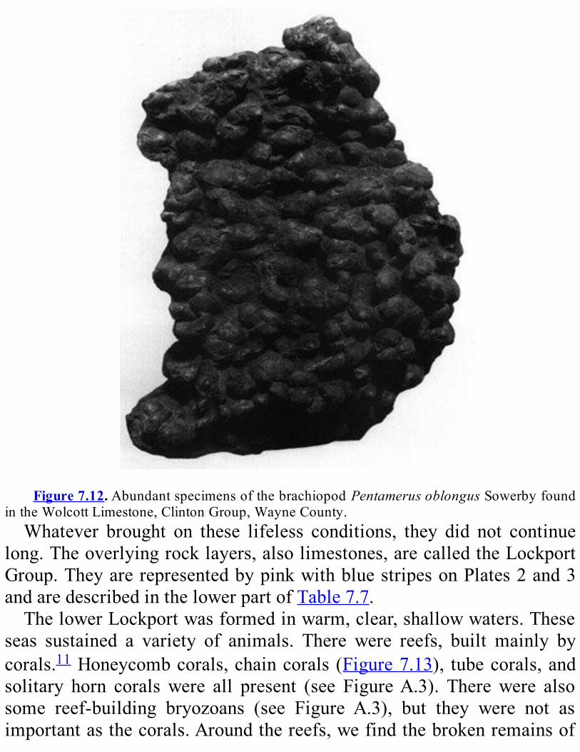
Figure7.12.AbundantspecimensofthebrachiopodPentamerusoblongusSowerbyfound
intheWolcottLimestone,ClintonGroup,WayneCounty.Whatever brought on these lifeless conditions, they did not continue
long.Theoverlyingrocklayers,alsolimestones,arecalledtheLockportGroup.TheyarerepresentedbypinkwithbluestripesonPlates2and3andaredescribedinthelowerpartofTable7.7.ThelowerLockportwasformedinwarm,clear,shallowwaters.These
seas sustained a variety of animals. There were reefs, built mainly bycorals.11Honeycombcorals,chaincorals(Figure7.13), tubecorals,andsolitary horn corals were all present (see FigureA.3). Therewere alsosome reef-building bryozoans (see Figure A.3), but they were not asimportantasthecorals.Aroundthereefs,wefindthebrokenremainsof

many crinoids. These crinoid fragments were scattered there by wavesthatpoundedtheancientreefs.Fossils are rare higher up in the Lockport. Either living conditions
were unfavorable., or the fossils were destroyed after the rocks wereformed.The few thatwe do find aremostlymollusks12. Snails are themostcommon.Wealsofindnautiloids(seeFigureA.3)andclams.Thousands of people gaze at the Lockport Group each day as they
admireNiagaraFallsand theNiagaraGorge.This toughcarbonate rockforms the Niagara Escarpment. The cliff faces north and extends eastfrom Hamilton, Ontario, to Medina. We can see the Lockport Group,especiallythelowerpart,foralmostthisentiredistance.Bothaboveandbelowtheearth’ssurface,theLockportGroupisconsistentlyabout60mthick.TherocksintheNiagaraGorgearethereferencesection fortheEarly
Silurian in eastern North America. This term means that the NiagaraGorgerocksserveasastandardforEarlySiluriantime.ScientiststrytomatchupEarlySilurianrocksfromotherareaswithunitsofthesameagein theNiagaraGorge.Thisprocedureallowsus to tellwhere they fit inthehistoryoftheperiod.TheLockportGroup is a goldmine tomineral collectors.The corals
had cavities between them, which became open spaces in the rock.Minerals like quartz, cal- cite, gypsum, dolomite, sphalerite, galena,pyrite,andfluoriteformedinmanyoftheseopenspaces.Noneofthesemineralsiscommerciallyimportant;therockisusedwidelyforcrushedstone.AftertheLockportGroupwasdeposited,therewasachangeinthekind
ofsedimentsthatformtheSilurianrocks.EarlierintheSilurian,mostofthesedimentserodedfromthelandwerequartzsand.Lateron,however,sandbecomesscarce.Instead,wefindfinersediments,likesiltandclay.Whydidthischangeoccur?

Figure7.13.ThechaincoralCystihalysites.(FoundintheGlascolimestoneMemberofthe
RoundoutFormationnearKingston,UlsterCounty.)Maybe there was a change in the landmass being eroded. If erosion
completely removed a quartz sand layer, new sediments would comefromthe layersunderneath. If theunderlying layersweremadeofclay-richsediments(shaleandsiltstone),wewouldseefinersedimentsbeingdeposited.That is one possibility. However, there is another, more likely
explanation. The energy of waves and currents in the water helpsdetermine what kind of sediments are deposited. Higher energy wavesandcurrentscancarryfinesediments,likesiltandclay,alongdistance.Therefore, coarser sediments, like sand, settle out quickly and aredeposited near the source.On the other hand, even fine sedimentswillsettleout in lowenergy environments. In theseplaces,we find silt andclaydepositedaswell.Wethinkthattherockinthenorthernlowlandsregionrepresentslow
energy water conditions in the Late Silurian. Thus, finer grainedsediments were deposited in the region. There is another fact thatsupports this idea. Much more sediment piled up during Late Siluriantimethanintheearlierpartoftheperiod.Thissituationiswhatwewould
expectfromlowerenergyconditions.Themarinewaterwoulddepositallofthesedimentsitwastransporting,notjustthecoarserones.Thus,theyformedthickerdeposits.AbovetheLockportGroupisathicksequenceofdolo-stones,shales,
andevaporites13called theSalinaGroup.It is representedbysolidpinkonPlates2and3andisdescribedinthemiddlepartofTable7.7.Theserockswere probably deposited in very shallowwater, on tidal flats, orjustabovehightide.TheSalinaGroupdatesfromtheLateSilurian.IneastcentralNewYork,thelowerpartoftheSalinaGroupcontains
redandgreensiltyshale.Aswemovewestward, itgradually turns intogray shale, dolostone, andevaporites.The red shalewasdepositednearthe seashore. The gray shale accumulated in a shallow sea. There areseveralunitsofrocksalt(halite,anevaporite)asmuchas3or4mthick.InthemiddlepartoftheSalinaGroup,wefindgrayorgreenshaleand
dolostone with very few fossils. Layers of halite as thick as 30 malternatewithlayersofdolostoneandshale.Saltfromthisformationhasbeenusedforhundreds,perhapsthousands,ofyears.NativeAmericansfirstdiscoveredsaltspringswherewaterranthrough
thesaltlayers.Bythe1800s,athrivingsaltindustrywasvitaltothelocaleconomy.ThemineatRetsofisstilloneofthelargestproducersofrocksaltintheworld.Other evaporite minerals are also mined. In western NewYork, the
mineralgypsumisextractedfromlayersofanhydritethatalternatewithlayers of Silurian shale.(Anhydrite, chemical composition CaS04, is amineralthatturnsintogypsumwhenitisexposedtowater.)Thesalt layers in these rockscouldnothave formed in theopensea.
The sea contains enough water to keep the salt dissolved. Circulationmusthavebeenrestricted.Perhapsamajorbarriercutoneareaofffromthe rest of the sea.Thewater left behindwould start to evaporate.Thepoolwould become saltier and saltier. Eventually, enoughwaterwouldevaporateandrocksaltandgypsumwouldbedeposited.Even in very salty water, like today’s Great Salt Lake or Dead Sea,
someanimallifeenduresandthrives.ThehighlysaltySilurianseasalso

hadinhabitants.Theseinhabitantsincludedtheeurypterids,oneofwhichisnow theNewYorkState fossil ( Figure7.14). SomeNewYork rockscontain many well-preserved eurypterids. These extinct scorpion-likeanimalsgrewtolengthsof2.5m.Someothercreatureswerealsoabletoenduretheverysaltyseas.They
included species of scorpions, ostra- codes, brachiopods, a few snails,smallclams,andworms(seeFigureA.3).However,mostoftheanimalsfromthistimelivedinnormalseawater.
Theirfossilsappearonlyinafewrocklayersformedwhenthesaltinesswasless.Whenenoughfreshwaterflowedintothesea,thesaltinesswentdownandtheseanimalsthrived.Whenwaterevaporatedfasterthanseawaterofnormalsalinityflowed
in, the seabecameconcentratedandhighly salty.Depositsof rock salt,shale,anddolostonecontinuedtoforminhighlysaltyseasnearlytotheendoftheSilurianPeriod.Late inSilurian time,watercirculation improveddramatically.These
new conditionswere recorded in the rocks described in the top part ofTable7.7.Alandbarrierinthesoutheasthadworndownenoughtoletinmuch more normal sea water. Brachiopods, corals, bryozoans, andornamentedostracodesmultiplied (seeFigureA.3).Their remainspiledupaslimemudsandreefcarbonates.InverylatestSilurianandearliestDevoniantime,anotherinhospitable
environment appeared. Dolostones, rich in clay but containing fewfossils,weredepositedovermuchofNewYork.
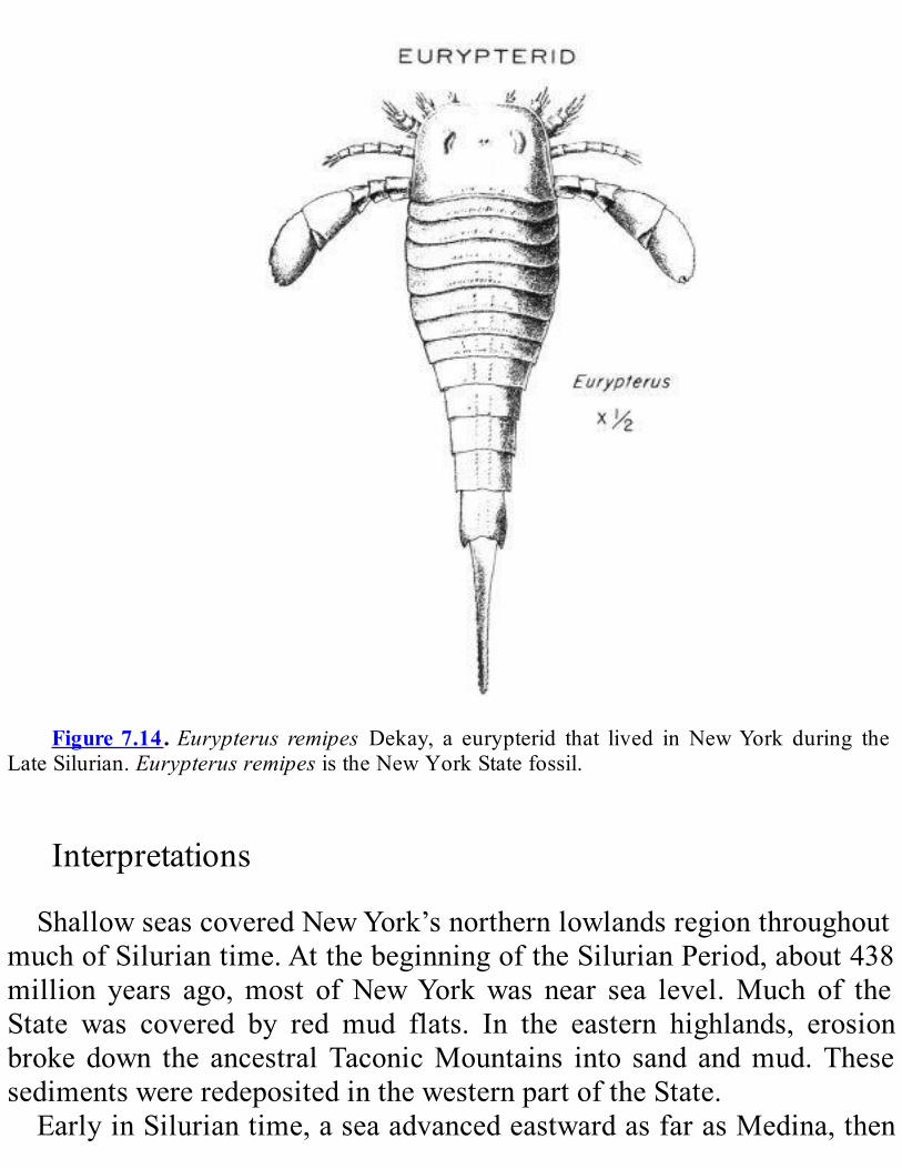
Figure7.14.Eurypterus remipes Dekay, a eurypterid that lived inNewYork during the
LateSilurian.EurypterusremipesistheNewYorkStatefossil.
InterpretationsShallowseascoveredNewYork’snorthernlowlandsregionthroughout
muchofSiluriantime.AtthebeginningoftheSilurianPeriod,about438million years ago,most ofNewYorkwas near sea level.Much of theState was covered by red mud flats. In the eastern highlands, erosionbrokedown the ancestralTaconicMountains into sand andmud.ThesesedimentswereredepositedinthewesternpartoftheState.EarlyinSiluriantime,aseaadvancedeastwardasfarasMedina,then
shrankwestward again until it lay past the border of theState. Severalmillionyearslater,theseaoncemoremovedeastward,thistimeasfarasOneidaandUtica.Sands,silts,andmudsaccumulatedondeltas,beaches,and tidal flats early in Silurian time. As the water deepened, thesesediments eventually gave way to carbonates— limestones anddolostones.Near the end of Silurian time, poor circulation and evaporation
produced large,very saltypools and tidal flats.Eurypterids thrivedandlayersofsaltaccumulated.WhatgeologiceventswerehappeningduringtheSilurianPeriod?The Taconian Orogeny was over by the beginning of the Silurian
Period.Theislandarcwassecurelyweldedtoproto-NorthAmerica.Theancestral Taconic Mountains had been quite thoroughly eroded. Sometectonic activity continued far to the east ofNewYork, along theplateboundary.NewYork State itself was a quiet sea basin, much like the shallow
oceanthatliesbetweenAustraliaandNewGuineatoday.WhatcausedtheseatomovebackandforththroughoutSiluriantime?
We don’t know for certain. The shorelinewas bent very gently up anddown.Thisbendingmayhavebeenrelatedtothemovementsofplatestotheeast.
THENORTHERNLOWLANDSFOSSILRECORD:CAMBRIAN,ORDOVICIAN,
ANDSILURIANInvertebrate organisms dominated the seas in the Cambrian,
Ordovician, and Silurian Periods. Fish—the first vertebrates—hadappeared in the Late Cambrian. By the end of the Silurian, they hadbecomerelativelyabundant.InLower Paleozoic rocks,we find fossils ofmanymarine creatures.
There were brachiopods, clams, worms, snails, trilobites, corals,bryozoans, nautiloids, graptolites, echinoderms, tentaculitids, andostracodes(seeFigureA.3).

The evolution of life took many important steps in the Cambrian,Ordovician,andSilurianPeriods.Manyofthesestepsarereflectedintherocksofthenorthernlowlands.Here,wewillmentiononlyafewofthemostimportantdiscoveriesbasedonthatrockrecord.DuringtheMiddleOrdovician,ahostofnewcreaturesappearedinthe
seas.A new invertebrate group, the bryozoans,was important. Sowerethe coral-like sponges known as stromatoporoids. True corals alsoappearedinthisperiod.TheoldestknowncoralreefintheworldisfoundinLakeChamplain.One Silurian shale contains more than 200 different species—a
remarkablevariety.OtherSilurianrockscontainhostsofostracodesandstalked echinoderms and even larger numbers of brachiopods. In theSilurian,trilobiteswereonthedecline,butstill important.Tentaculitidswere common in Silurian communities. Corals, snails, clams, andnautiloidsevolvedandwerediverseandabundantintheshallowwaters.Thislargevarietyofinvertebrateslivedintheseasandcompetedforfoodandsurvival.Withsuchintensecompetition,itishardlysurprisingthatlifebeganto
moveintoadifferentenvironmentatthistime.Air-breathingarthropods(insects,spiders,etc.)begantoevolve.They
eventuallycolonizedthelandintheLateSilurian.UpperSilurianrocksareofparticularinteresttopaleontologists.They
tell the story of a great evolutionary advance—the development of thefish.In theSilurian,anumberofmoremodernkindsoffishdeveloped.Forexample,armor-skinnedfish(orplacoderms)arefoundinrocksfromtheLateSilurian.TheycontinuedtothriveintotheDevonian.Infact,theDevonianissometimescalled“TheAgeofFishes.”NewYork’s EarlyDevonian fossils are very different from the Late
Silurianfossils.Animallifechangedsignificantlyoverashortperiodoftime. These changes happened at least partly because animals wereadaptingtochangesintheenvironment.LandplantshadappearedbytheendoftheSilurian;theirrecordmay
extendasfarbackastheLateOrdovician.
REVIEWQUESTIONSANDEXERCISESMost of the bedrock in this region is which type— igneous,
sedimentary,ormetamorphic?
The bedrock in this region can be divided up into three “packages.”What separates these packages? What kinds of environments do theyrepresent?Whatwashappeningingeologichistoryatthosetimes?Howdidthoseeventsaffecttheenvironmentsinwhichtherockswereformed?
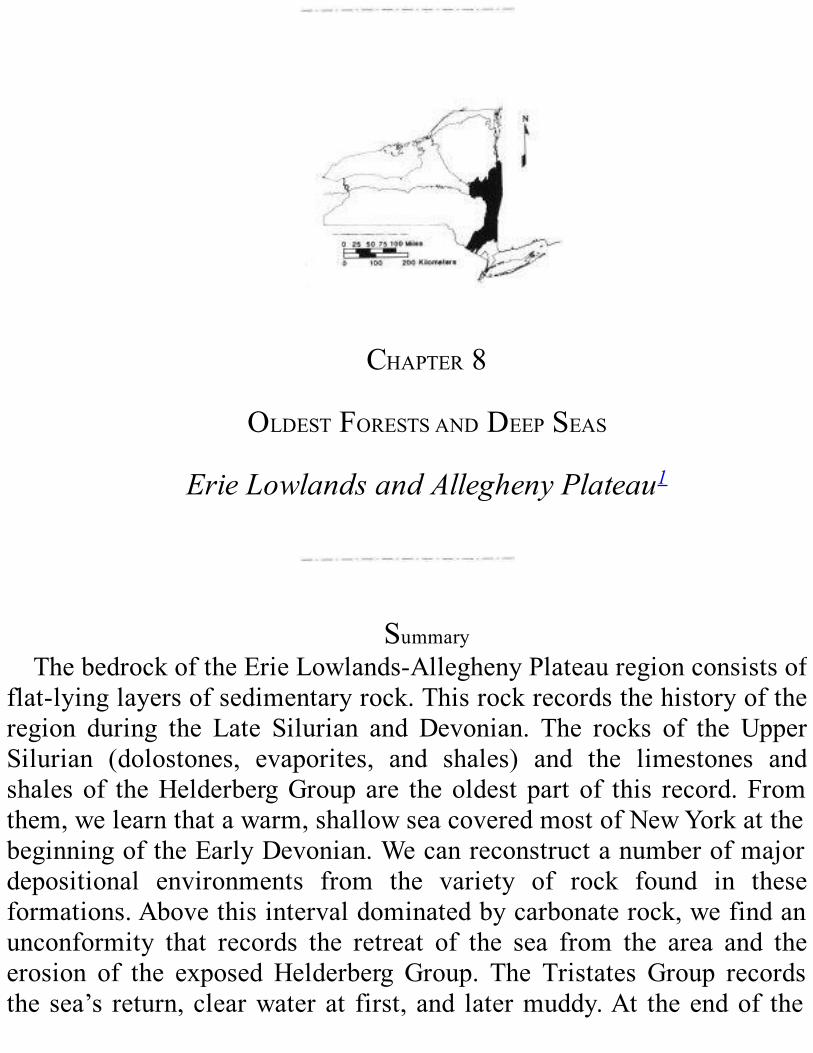
CHAPTER8
OLDESTFORESTSANDDEEPSEAS
ErieLowlandsandAlleghenyPlateau1
SummaryThebedrockoftheErieLowlands-AlleghenyPlateauregionconsistsof
flat-lyinglayersofsedimentaryrock.Thisrockrecordsthehistoryoftheregion during the Late Silurian and Devonian. The rocks of the UpperSilurian (dolostones, evaporites, and shales) and the limestones andshalesof theHelderbergGroupare theoldest part of this record.Fromthem,welearnthatawarm,shallowseacoveredmostofNewYorkatthebeginningoftheEarlyDevonian.Wecanreconstructanumberofmajordepositional environments from the variety of rock found in theseformations.Abovethisintervaldominatedbycarbonaterock,wefindanunconformity that records the retreat of the sea from the area and theerosion of the exposedHelderberg Group. The Tristates Group recordsthesea’s return,clearwaterat first, and latermuddy.At theendof the
EarlyDevonian,erosionremovedalmostalloftheTristatesGroupfromwestern NewYork. The Onondaga Limestone, which forms the lowerMiddleDevonian, tells us of awidespread shallow seawith coral reefsand a great variety of bottom-dwelling animals. The Tioga ash bedswithin the upper Onondaga are clues to volcanic eruptions far to thesoutheast.Theashesareasignthatanepisodeofmountain-buildingwasbeginning. The nextMiddle Devonian rocks are those of the HamiltonGroup.These rocks record amassive influxofmudand sand thatwereerodedfromanewmountainrangetotheeastduringtheearlypartoftheAcadianOrogeny.TheTullyLimestoneabovetheHamiltonGroupmarksapauseinthisgreatinfluxofsediment.Anunconformityinthemiddleofthe Tully emphasizes this pause. The Late Devonian began with arenewedinfluxofmud,sand,andgravelfromtheeast,whichcontinueduntil theendof theperiod.This influxwas the resultof thecontinuingAcadianOrogeny.Within theGenesee,Sonyea,WestFalls,Canadaway,Conneaut,andConawangoGroups,wefindanumberofmajorvarietiesof rock that record different depositional environments. These settingsrange from the piedmont in the east to the floor of the sea basin inwestern New York. Their distribution shows how the shoreline andrelated environments advanced haltingly across the State as a hugesedimentaryapron.Thisapron,calledthe“CatskillDelta”complex,grewwestwardandcrowdedtheseaoutoftheregion.
DESCRIPTIONOFTHEERIELOWLANDSANDALLEGHENYPLATEAUTheErie Lowlands is the low, flat area southeast of LakeErie. (See
Figure 1.1 and the Physiographic Map on Plate 4 of theGeologicalHighwayMap.)Tothesouth,thelandrisesgentlyfromlakelevel(175mabove sea level) to the Portage Escarpment (300 to 460 m above sealevel).Sandstonelayersformthisescarpment,orcliff,becausetheyresisterosionbetter than the layersaboveandbelowthem.Theescarpment isthe boundary between the lowlands and the Allegheny Plateau to thesouth.
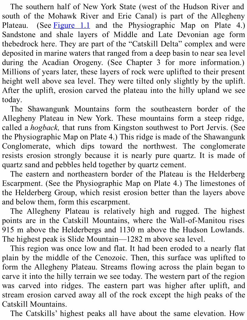
The southern half ofNewYorkState (west of theHudsonRiver andsouth of the Mohawk River and Erie Canal) is part of the AlleghenyPlateau. (SeeFigure 1.1 and the Physiographic Map on Plate 4.)Sandstone and shale layers of Middle and Late Devonian age formthebedrockhere.Theyarepartofthe“CatskillDelta”complexandweredepositedinmarinewatersthatrangedfromadeepbasintonearsealevelduring the Acadian Orogeny. (See Chapter 3 for more information.)Millionsofyearslater,theselayersofrockwereupliftedtotheirpresentheightwellabovesealevel.Theyweretiltedonlyslightlybytheuplift.After theuplift, erosioncarved theplateau into thehillyuplandweseetoday.The Shawangunk Mountains form the southeastern border of the
Allegheny Plateau in NewYork. These mountains form a steep ridge,calledahogback,thatrunsfromKingstonsouthwesttoPortJervis.(SeethePhysiographicMaponPlate4.)ThisridgeismadeoftheShawangunkConglomerate, which dips toward the northwest. The conglomerateresists erosion strongly because it is nearly pure quartz. It is made ofquartzsandandpebblesheldtogetherbyquartzcement.The eastern and northeastern border of the Plateau is theHelderberg
Escarpment.(SeethePhysiographicMaponPlate4.)ThelimestonesoftheHelderbergGroup,which resist erosionbetter than the layers aboveandbelowthem,formthisescarpment.The Allegheny Plateau is relatively high and rugged. The highest
points are in the Catskill Mountains, where theWall-of-Manitou rises915mabove theHelderbergsand1130mabove theHudsonLowlands.ThehighestpeakisSlideMountain—1282mabovesealevel.Thisregionwasoncelowandflat.Ithadbeenerodedtoanearlyflat
plainby themiddle of theCenozoic.Then, this surfacewasuplifted toform theAllegheny Plateau. Streams flowing across the plain began tocarveitintothehillyterrainweseetoday.Thewesternpartoftheregionwas carved into ridges. The eastern part was higher after uplift, andstreamerosioncarvedawayallof therockexcept thehighpeaksof theCatskillMountains.TheCatskills’ highest peaks all have about the same elevation.How
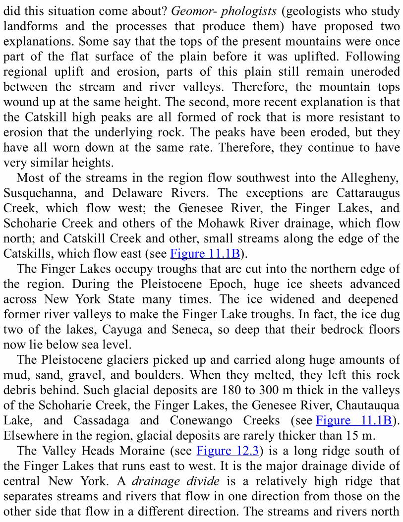
didthissituationcomeabout?Geomor-phologists(geologistswhostudylandforms and the processes that produce them) have proposed twoexplanations.Somesaythatthetopsofthepresentmountainswereoncepart of the flat surface of the plain before it was uplifted. Followingregional uplift and erosion, parts of this plain still remain unerodedbetween the stream and river valleys. Therefore, the mountain topswoundupatthesameheight.Thesecond,morerecentexplanationisthattheCatskill high peaks are all formed of rock that ismore resistant toerosion that the underlying rock.Thepeaks havebeen eroded, but theyhave allworn down at the same rate. Therefore, they continue to haveverysimilarheights.Mostof thestreams in the region flowsouthwest into theAllegheny,
Susquehanna, and Delaware Rivers. The exceptions are CattaraugusCreek, which flow west; the Genesee River, the Finger Lakes, andSchoharieCreek andothers of theMohawkRiver drainage,which flownorth;andCatskillCreekandother,smallstreamsalongtheedgeoftheCatskills,whichfloweast(seeFigure11.1B).TheFingerLakesoccupytroughsthatarecutintothenorthernedgeof
the region. During the Pleistocene Epoch, huge ice sheets advancedacross New York State many times. The ice widened and deepenedformerrivervalleystomaketheFingerLaketroughs.Infact,theicedugtwo of the lakes,Cayuga andSeneca, so deep that their bedrock floorsnowliebelowsealevel.ThePleistoceneglacierspickedupandcarriedalonghugeamountsof
mud, sand, gravel, and boulders.When theymelted, they left this rockdebrisbehind.Suchglacialdepositsare180to300mthickinthevalleysoftheSchoharieCreek,theFingerLakes,theGeneseeRiver,ChautauquaLake, and Cassadaga and Conewango Creeks (seeFigure 11.1B).Elsewhereintheregion,glacialdepositsarerarelythickerthan15m.TheValleyHeadsMoraine (seeFigure12.3) is a long ridge southof
theFingerLakesthatrunseasttowest.Itisthemajordrainagedivideofcentral New York. A drainage divide is a relatively high ridge thatseparatesstreamsandriversthatflowinonedirectionfromthoseontheothersidethatflowinadifferentdirection.Thestreamsandriversnorth
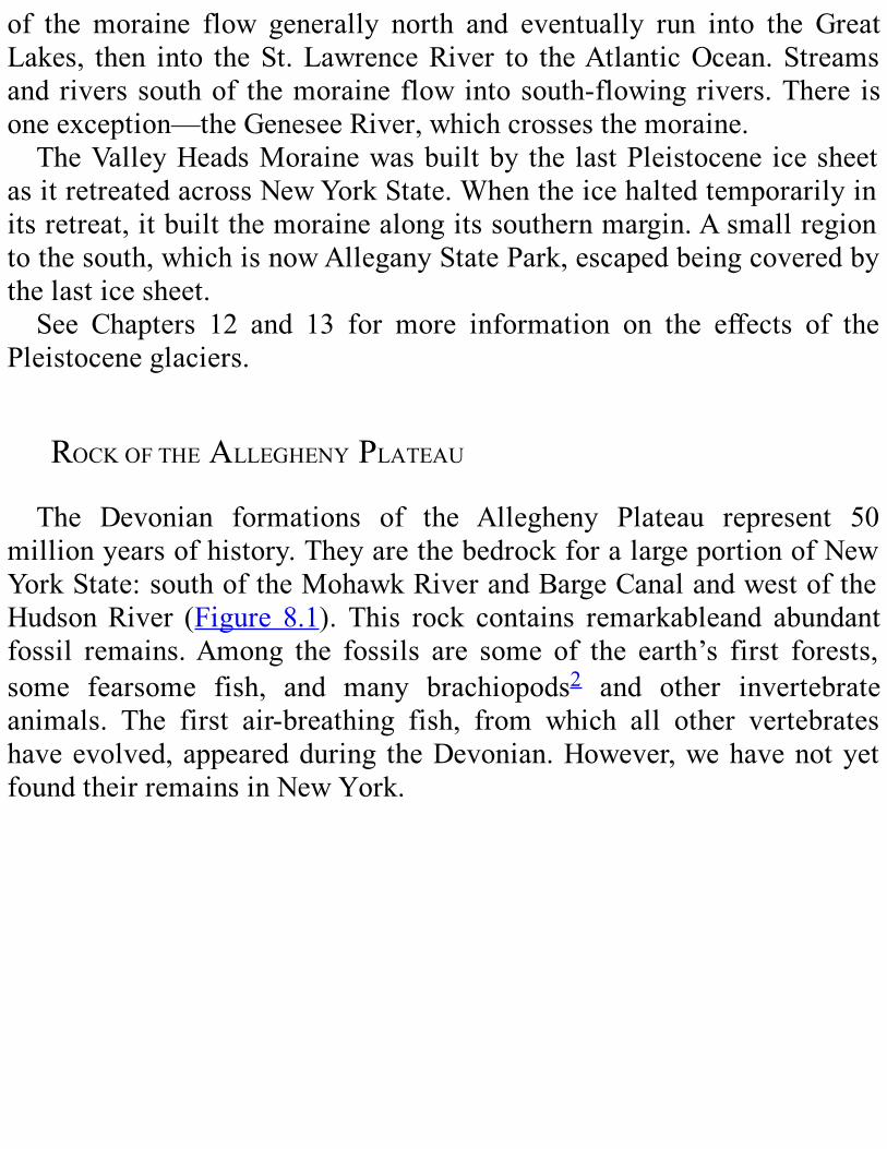
of the moraine flow generally north and eventually run into the GreatLakes, then into theSt.LawrenceRiver to theAtlanticOcean.Streamsandriverssouthof themoraineflowintosouth-flowingrivers.There isoneexception—theGeneseeRiver,whichcrossesthemoraine.TheValleyHeadsMorainewasbuiltby the lastPleistocene icesheet
asitretreatedacrossNewYorkState.Whentheicehaltedtemporarilyinitsretreat,itbuiltthemorainealongitssouthernmargin.Asmallregiontothesouth,whichisnowAlleganyStatePark,escapedbeingcoveredbythelasticesheet.See Chapters 12 and 13 for more information on the effects of the
Pleistoceneglaciers.
ROCKOFTHEALLEGHENYPLATEAUThe Devonian formations of the Allegheny Plateau represent 50
millionyearsofhistory.TheyarethebedrockforalargeportionofNewYorkState:southoftheMohawkRiverandBargeCanalandwestoftheHudsonRiver (Figure 8.1). This rock contains remarkableand abundantfossil remains.Among the fossils are some of the earth’s first forests,some fearsome fish, and many brachiopods2 and other invertebrateanimals. The first air-breathing fish, from which all other vertebrateshaveevolved,appearedduring theDevonian.However,wehavenotyetfoundtheirremainsinNewYork.
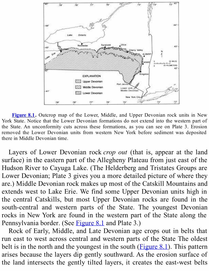
Figure8.1.Outcropmap of theLower,Middle, andUpperDevonian rock units inNew
YorkState.Notice that theLowerDevonianformationsdonotextend into thewesternpartofthe State.An unconformity cuts across these formations, as you can see on Plate 3. Erosionremoved the Lower Devonian units from western NewYork before sediment was depositedthereinMiddleDevoniantime.
Layers of Lower Devonian rockcrop out (that is, appear at the landsurface)intheeasternpartoftheAlleghenyPlateaufromjusteastoftheHudsonRivertoCayugaLake.(TheHelderbergandTristatesGroupsareLowerDevonian;Plate3givesyouamoredetailedpictureofwheretheyare.)MiddleDevonianrockmakesupmostoftheCatskillMountainsandextendswest toLakeErie.WefindsomeUpperDevonianunitshigh inthe central Catskills, but most Upper Devonian rocks are found in thesouth-central and western parts of the State. The youngest Devonianrocks inNewYorkare found in thewesternpartof theState along thePennsylvaniaborder.(SeeFigure8.1andPlate3.)RockofEarly,Middle,andLateDevonianagecropsout inbelts that
runeast towestacrosscentralandwesternpartsof theStateTheoldestbeltisinthenorthandtheyoungestinthesouth(Figure8.1).Thispatternarisesbecausethelayersdipgentlysouthward.Astheerosionsurfaceofthe land intersects thegently tilted layers, it creates the east-west belts
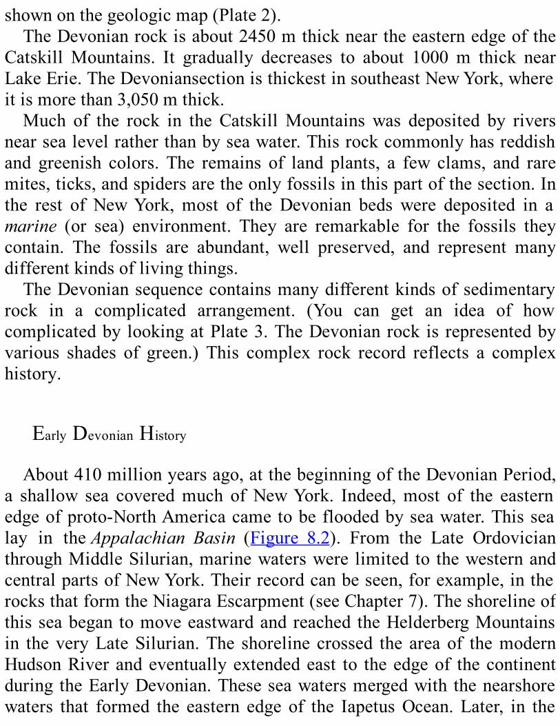
shownonthegeologicmap(Plate2).TheDevonianrockisabout2450mthickneartheeasternedgeofthe
Catskill Mountains. It gradually decreases to about 1000 m thick nearLakeErie.TheDevoniansectionisthickestinsoutheastNewYork,whereitismorethan3,050mthick.Much of the rock in the CatskillMountainswas deposited by rivers
nearsealevelratherthanbyseawater.Thisrockcommonlyhasreddishand greenish colors. The remains of land plants, a few clams, and raremites,ticks,andspidersaretheonlyfossilsinthispartofthesection.Inthe rest of NewYork, most of the Devonian beds were deposited in amarine (or sea) environment. They are remarkable for the fossils theycontain. The fossils are abundant, well preserved, and represent manydifferentkindsoflivingthings.TheDevoniansequencecontainsmanydifferentkindsofsedimentary
rock in a complicated arrangement. (You can get an idea of howcomplicatedby lookingatPlate3.TheDevonianrockis representedbyvarious shades of green.) This complex rock record reflects a complexhistory.
EarlyDevonianHistoryAbout410millionyearsago,atthebeginningoftheDevonianPeriod,
a shallow sea coveredmuch ofNewYork. Indeed,most of the easternedgeofproto-NorthAmericacametobefloodedbyseawater.Thissealay in theAppalachian Basin (Figure 8.2). From the Late OrdovicianthroughMiddleSilurian,marinewaterswere limited to thewesternandcentralpartsofNewYork.Theirrecordcanbeseen,forexample,intherocksthatformtheNiagaraEscarpment(seeChapter7).Theshorelineofthisseabegan tomoveeastwardandreached theHelderbergMountainsin theveryLateSilurian.The shoreline crossed the areaof themodernHudsonRiverandeventuallyextendedeast to theedgeof thecontinentduringtheEarlyDevonian.Theseseawatersmergedwith thenearshorewaters that formed the eastern edge of the IapetusOcean.Later, in the
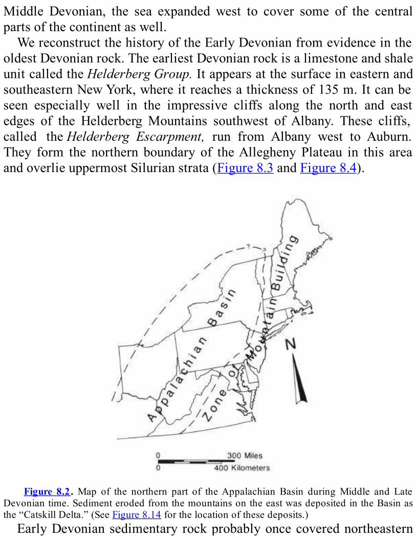
Middle Devonian, the sea expanded west to cover some of the centralpartsofthecontinentaswell.WereconstructthehistoryoftheEarlyDevonianfromevidenceinthe
oldestDevonianrock.TheearliestDevonianrockisalimestoneandshaleunitcalledtheHelderbergGroup.ItappearsatthesurfaceineasternandsoutheasternNewYork,whereitreachesathicknessof135m.Itcanbeseen especially well in the impressive cliffs along the north and eastedges of the HelderbergMountains southwest ofAlbany. These cliffs,called theHelderberg Escarpment, run from Albany west to Auburn.They form the northern boundary of theAlleghenyPlateau in this areaandoverlieuppermostSilurianstrata(Figure8.3andFigure8.4).
Figure 8.2.Map of the northern part of theAppalachian Basin duringMiddle and Late
Devoniantime.SedimenterodedfromthemountainsontheeastwasdepositedintheBasinasthe“CatskillDelta.”(SeeFigure8.14forthelocationofthesedeposits.)EarlyDevoniansedimentaryrockprobablyoncecoverednortheastern

NewYork,buterosionhasremoveditfromthisregion.EarlyDevonianrockoccursatgreatdepthsinsouthernNewYorkState,whereitisburiedbyyoungerdeposits.TheHelderbergGroup includesmany typesof limestones.Theywere
deposited inashallowseasurroundedbya low, flat landscape.Howdoweknowwhat the landscapewas like?Highlands tend toerodequicklyandproducelargeamountsofmud,sand,andgravel.Wedon’tfindmuchof this kind of sediment in theHelderberg limestones, sowe concludethat therewere nohighlands nearby. In otherwords, the landscapewaslowandflat.TheseaintheAppalachianBasinbegantodeepenintheLateSilurian;
as a result, its eastern shoreline moved farther east, and its westernshorelinemovedfartherwest.Thismovementoftheshorelinescontinuedin the EarlyDevonian.As the sea very slowly spread over the land, itdepositedthecalcareoussediments3 that laterbecamean importantpartoftheHelderbergGroup.
Figure 8.3. The Helderberg Escarpment in John BoydThacher State Park, southwest of
AlbanyinAlbanyCountry.LowerDevonianlimestonesoftheHelderbergGroupformthecliff.TheylieontopofMiddleOrdovicianshalesandsandstonesoftheSchenectadyFormation.

Figure 8.4. This block diagram of the Helderberg Escarpment shows the relationship
betweenthebedrockunitsandthelandsurface.Theescarpmentexistsbecausethelimestoneofthe Manlius and Coeymans Formations (part of the Helderberg Group) is more resistant toerosionthanthesandstoneandshaleoftheunderlyingSchenectadyFormation.LocatetheplaceonPlate3wheretheHelderbergGroupliesdirectlyontopoftheSchenectadyFormation.Thereisalargegapintherockrecordinthisarea.
Howdoweknowthattheseawasdeepeninganditsshorelinesmovingas the Helderberg Group was formed? The answer to that questionrequiresalongexplanation.Each of the different types of limestone in the Helderberg Group
formedinitsownenvironment.Figure8.5showstheenvironmentswheretheselimestonelayersweredepositedandhowtheywerearranged.Howdoweknowabouttheseenvironments?Welookforcertaincluesintherocklayers.Differenttypesofsedimentsaredepositedatthesametimeinawide
varietyofseaenvironments.Forexample,fine limy4mudssettleout inthedeep,quietwaterfarfromshore;somebeachesareformedofshellsalongtheseashore.Windandwavesworkthesedimentalongtheshoreintoavarietyofdeposits.Howdoweknowaboutall thesedifferences?Westudyhowsedimentsaredepositedinmodernseas.Thelayersformedindifferentenvironmentsvaryinanumberofways.
Theymay have different colors. Theymay be coarser or finer grained.They may be made of sediment eroded from the land (mud, sand, orgravel),orsedimentformedinthesea(commonlycalciumcarbonate),ora mixture of both. The layers may be thick or thin. Thesedimentarystructures(featuresformedasthesedimentwasdeposited,suchaswaveor current ripples and cross-bedding (seeFigure 7.1)) are different indifferentenvironments.Whenwestudythedepositsindifferentmodernenvironments and compare them with layers of sedimentary rock, weoftenfindstrikingsimilarities.Whenalayerofrocklookslikeamodernlayerofsediment, thesimilaritycanbeusedasevidencethatbothweredeposited in similar environments. Therefore, we can deduce what theenvironmentwaslikefromtheappearanceofarocklayer.
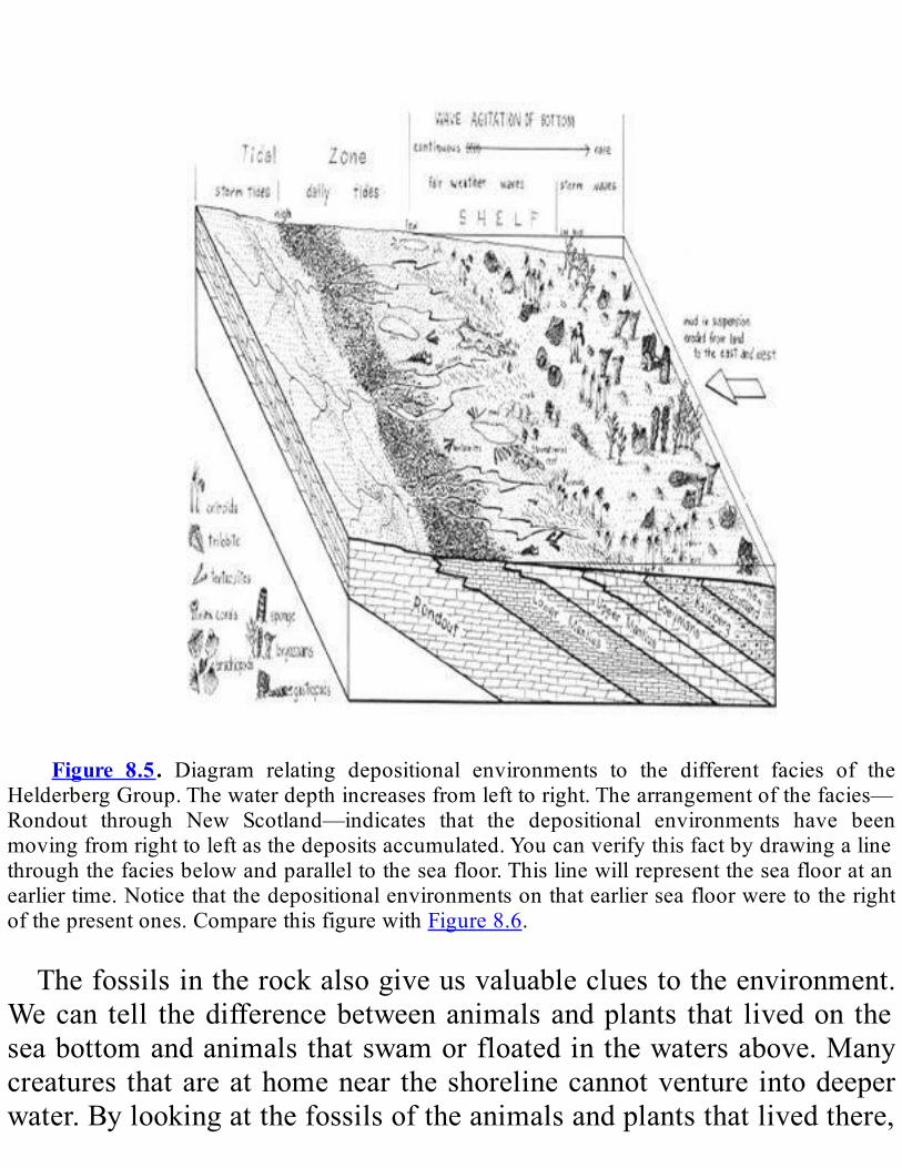
Figure 8.5. Diagram relating depositional environments to the different facies of the
HelderbergGroup.Thewaterdepthincreasesfromlefttoright.Thearrangementofthefacies—Rondout through New Scotland—indicates that the depositional environments have beenmovingfromrighttoleftasthedepositsaccumulated.Youcanverifythisfactbydrawingalinethroughthefaciesbelowandparalleltotheseafloor.Thislinewillrepresenttheseaflooratanearliertime.Noticethatthedepositionalenvironmentsonthatearlierseafloorweretotherightofthepresentones.ComparethisfigurewithFigure8.6.
Thefossilsintherockalsogiveusvaluablecluestotheenvironment.Wecan tell thedifferencebetweenanimalsandplants that livedon theseabottomandanimalsthatswamorfloatedinthewatersabove.Manycreatures thatareathomenear theshorelinecannotventure intodeeperwater.Bylookingatthefossilsoftheanimalsandplantsthatlivedthere,
wefindoutmoreaboutwhatconditionswerelike.5Taken together, all the features of a sedimentary deposit—the
sediment, sedimentary structures, and fossils—give it a distinctivecharacterorappearance—calleditsfades.Eachfaciesreflectsaparticulardepositionalenvironment (that is, an environment inwhich sediment isdeposited).Eachenvironmenthasaparticularwaterdepth,sedimentsize,and other distinctive characteristics. Each environment is home to adistinctcommunityofplantsandanimals.Youcanthinkofafaciesasthecombinationoffeaturesthatidentifies
theenvironmentof adeposit. In a similarway, a combinationof facialfeatures letsus recognizeaperson’s face.Justascloselyrelatedpeoplecanbe similar in appearance, closely related environments canproducedepositswithsimilarfacies.Nowwecomebacktothequestionofhowweknowthattheshorelines
moved and the sea deepened as the Helderberg Group was beingdeposited.Ingeneral,hereishowwefigureditout.Welookatasinglefacies.Wenoticethatinyoungerlayersitisfarthereastandwestthaninthe older layers. This arrangement tells us that the shorelines weregradually creeping eastward andwestward over time. Then,we look attherockatoneplace.Wenoticethatthefaciesreflectshallowerwaterintheolderrockanddeeperwaterintheyoungerrock.This arrangement tells us that the sea was gradually getting deeper
through time. Because the rock of the HelderbergGroup records a seathatwasgrowingdeeperandshorelinesthatwerecreepingeastwardandwestward,weknowthatitwasdepositedinanexpandingsea.Nowlet’slookattherockinabitmoredetail.TheHelderbergGroup
isa seriesof seven limestone-rich formations.6 In these formations,wefind five major facies; each is named for the formation where it firstoccurs:LowerManlius,UpperManlius,Coeymans,Kalkberg, andNewScotland (Figure 8.5 and8.6). The facies are listed inTable 8.1. Theenvironmentrepresentedbyeachfaciesisdescribedinthelastcolumnofthetable.Noticehowthewatergetsdeeperastimegoesby.7Theearliestfacies shown were deposited near the shore, just above high tide or
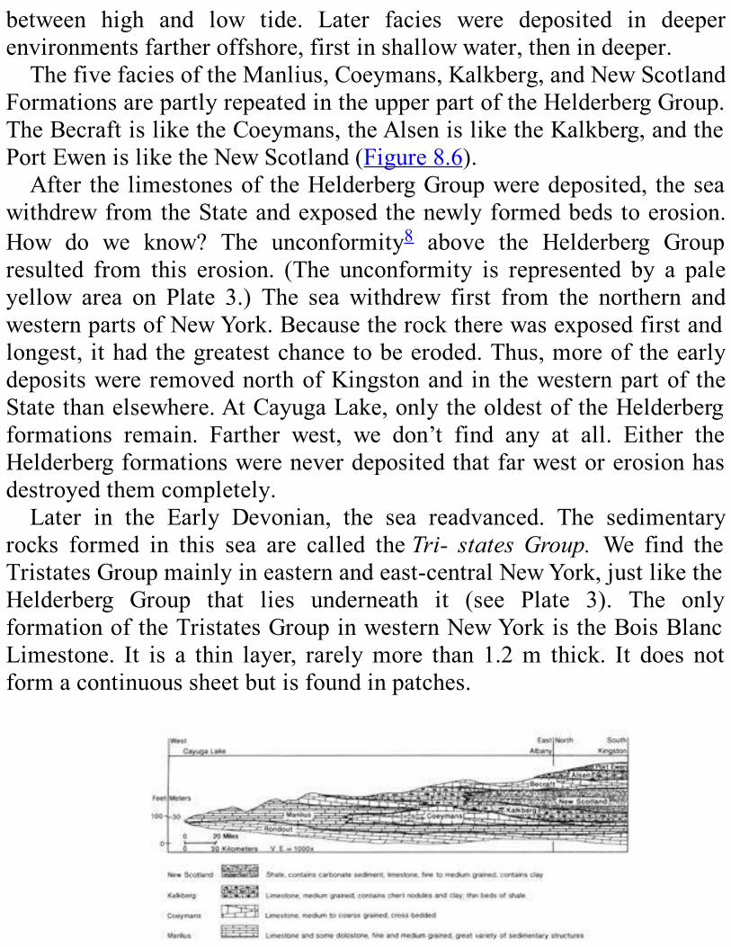
between high and low tide. Later facies were deposited in deeperenvironmentsfartheroffshore,firstinshallowwater,thenindeeper.ThefivefaciesoftheManlius,Coeymans,Kalkberg,andNewScotland
FormationsarepartlyrepeatedintheupperpartoftheHelderbergGroup.TheBecraftisliketheCoeymans,theAlsenisliketheKalkberg,andthePortEwenisliketheNewScotland(Figure8.6).After the limestonesof theHelderbergGroupweredeposited, thesea
withdrewfromtheStateandexposedthenewlyformedbedstoerosion.How do we know? The unconformity8 above the Helderberg Groupresulted from this erosion. (The unconformity is represented by a paleyellow area on Plate 3.) The sea withdrew first from the northern andwesternpartsofNewYork.Becausetherocktherewasexposedfirstandlongest, ithadthegreatestchancetobeeroded.Thus,moreoftheearlydepositswereremovednorthofKingstonand in thewesternpartof theStatethanelsewhere.AtCayugaLake,onlytheoldestoftheHelderbergformations remain. Farther west, we don’t find any at all. Either theHelderbergformationswereneverdepositedthatfarwestorerosionhasdestroyedthemcompletely.Later in the Early Devonian, the sea readvanced. The sedimentary
rocks formed in this sea are called theTri- statesGroup. We find theTristatesGroupmainlyineasternandeast-centralNewYork,justliketheHelderberg Group that lies underneath it (see Plate 3). The onlyformationoftheTristatesGroupinwesternNewYorkistheBoisBlancLimestone. It is a thin layer, rarelymore than 1.2m thick. It does notformacontinuoussheetbutisfoundinpatches.

Figure8.6.DiagrammaticcrosssectionofLowerDevonian formationsalong theoutcrop
belt,westtoeastacrosscentralNewYorkState,andnorthtosouthalongtheCatskillMountainfront. The arrangement of the formations shows that the depositional environments of theformations moved as the deposits accumulated. Compare withFigure 8.5. Notice that theCoeymansandBecraftFormationsaremadeupof thesamekindof rock.Whatdoes this factsuggest about their depositional environments?The Kalkberg andAlsen Formations and theNewScotland andPortEwenFormations are paired in the sameway.Notice that the verticalscaleofthiscrosssectionismuchlargerthanthehorizontalscale.Theverticalexaggerationisabout 1000 times.We have to exaggerate the vertical dimension in drawings like this one inordertoshowdetailsbecausethethicknessofsedimentaryformationsissmallcomparedtotheirwidthandlength.(Note:Adiagrammaticcrosssectionisacrosssectionthatisdrawntoexplainorillustrateapoint,ratherthantopresentarealisticpictureoftheappearanceofthesubject.)
IneasternNewYork,theTristatesGroupis100mthickatCatskillandbecomes thicker to the south (225 m at Port Jervis). Except insoutheastern NewYork, there are unconformities above and below theTristatesGroup.Table 8.2 contains a description of the formations of the Tristates
Group.Someof theseformationsstronglyresemblesomeformations inthe Helderberg Group. These similarities are indicated in the faciescolumnonthetable.ThePortJervisFormationatthebaseofthegroupisfoundonlynear
Port Jervis. The rock of this formation is similar to that of the NewScotlandFormationoftheHelderbergGroup.AbovethePortJervisistheGlenerie limestone. To thewest, theGlenerie becomesmore andmoresandy until it gradually becomes a sandstone. This sandstone unit iscalledtheOriskanySandstone.The Oriskany lies upon the eroded surface of the Helderberg Group
(see Plate 3). Remember that the sea withdrew after depositing theHelderberglimestonesandexposedthemtoerosion.Thefartherwestwego,thelongertherockwasexposed.Thus,aswemovewest,theOriskanyliesontopofolderandolderlayersoftheHelderbergGroup.The Oriskany Sandstone is found below the surface in south-central
NewYork State.Although it does not appear at the surface, it is wellknowninthisareabecauseitproduceslargequantitiesofnaturalgas.The
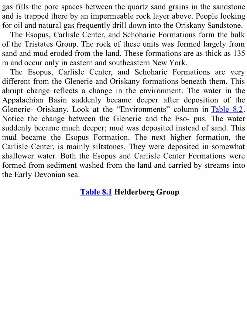
gasfillstheporespacesbetweenthequartzsandgrainsinthesandstoneandistrappedtherebyanimpermeablerocklayerabove.PeoplelookingforoilandnaturalgasfrequentlydrilldownintotheOriskanySandstone.TheEsopus,CarlisleCenter,andSchoharieFormationsformthebulk
oftheTristatesGroup.Therockoftheseunitswasformedlargelyfromsandandmuderodedfromtheland.Theseformationsareasthickas135mandoccuronlyineasternandsoutheasternNewYork.The Esopus, Carlisle Center, and Schoharie Formations are very
differentfromtheGlenerieandOriskanyformationsbeneaththem.Thisabrupt change reflects a change in the environment. The water in theAppalachian Basin suddenly became deeper after deposition of theGlenerie- Oriskany. Look at the “Environments” column inTable 8.2.Notice the change between the Glenerie and the Eso- pus. The watersuddenlybecamemuchdeeper;mudwasdepositedinsteadofsand.Thismud became the Esopus Formation. The next higher formation, theCarlisleCenter, ismainly siltstones. Theywere deposited in somewhatshallowerwater. Both the Esopus andCarlisle Center FormationswereformedfromsedimentwashedfromthelandandcarriedbystreamsintotheEarlyDevoniansea.
Table8.1HelderbergGroup

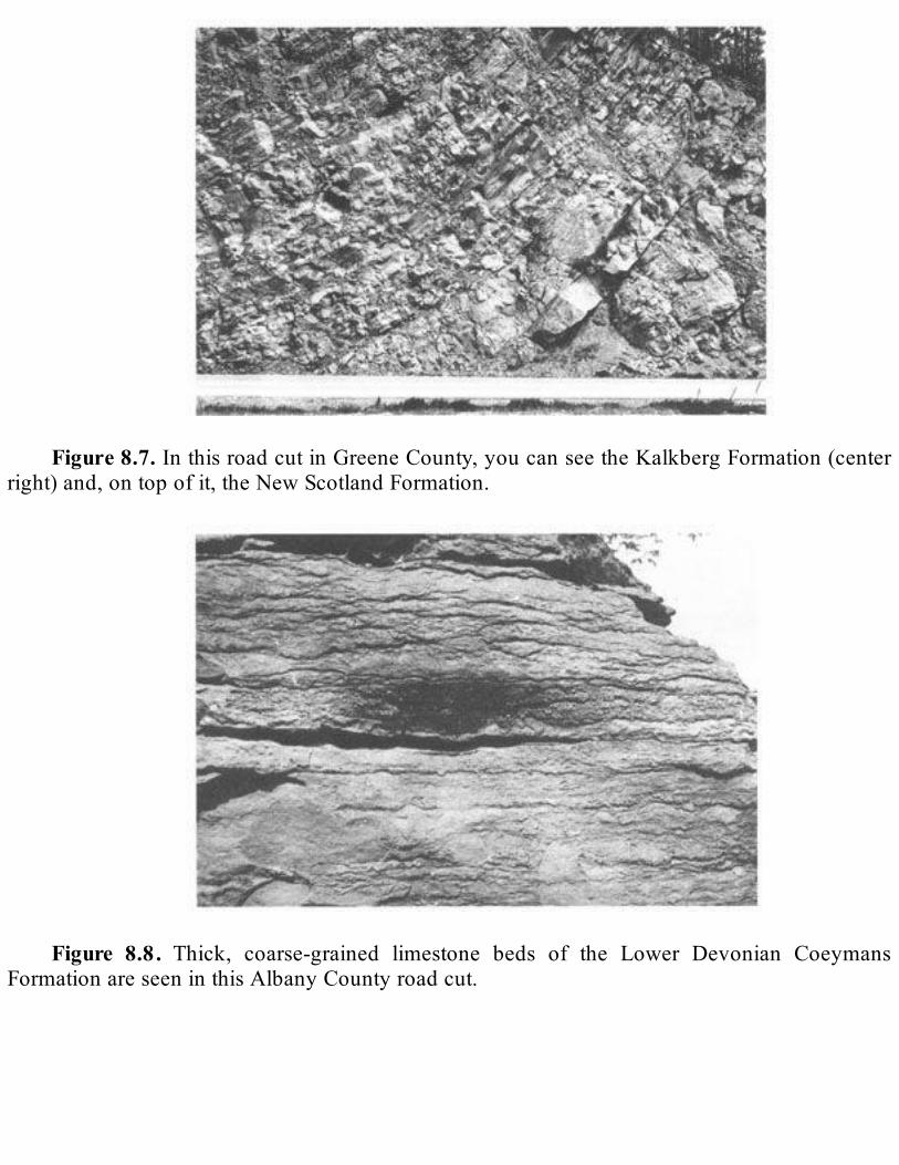
Figure8.7.InthisroadcutinGreeneCounty,youcanseetheKalkbergFormation(center
right)and,ontopofit,theNewScotlandFormation.
Figure 8.8. Thick, coarse-grained limestone beds of the Lower Devonian Coeymans
FormationareseeninthisAlbanyCountyroadcut.

Figure 8.9.This coral reef, called the Knoxboro reef, is found in the Lower Devonian
Coeymans Formation in a field in Oneida County. Because it contains abundant fossil shelldebris,therockhasacoarsetextureandlacksdistinctlayers.
Unlike the Oriskany Sandstone, the Esopus and Carlisle CenterFormationscontainfewfossilsofanimalswithshellsorotherhardparts.TheseabottomwassosoftandthewaterwassomuddywhiletheEsopusand Carlisle Center were being deposited that few animals with heavyshells could live.We find only one common indication of life in thatenvironment. It is atrace fossil9calledZoophycus that looks like theoutlineofarooster’stailonthesurfacesofrockunits.Itwasmadebyawormlikeanimalthatmovedthroughthesedimentinlong,curvedarcsasitatemud(Figure8.12).TheSchoharieFormationisafine- tomedium-grainedsandstonethat
containssomelimymaterial.Italsocontainsabundantbodyfossilsinitsuppermost layer. The Schoharie is similar to the Carlisle SpringsFormation.However,thesedimentsarecoarsergrainedandseemtohavebeen deposited in shallower water. As the water grew shallower,brachiopods, cephalopods, and clams (see FigureA.3) appeared on theseafloor.Theyarepreservedasfossilsinthetopoftheformation.

MiddleDevonianHistoryAt the end of theEarlyDevonian, the inland sea of theAppalachian
Basincontinuedtobecomeshallowerandshrink.Eventually,itwithdrewtemporarily from most of NewYork State; as it went, it exposed theSchoharieFormationtoerosion.InthewesternpartoftheState,muchoftheEarlyDevonianrecordwasdestroyed.Onlypatchesremain(seePlate3).
Figure 8.10.These two photos show stromatoporoids in theManlius Formation. In (A),
youcansee large,sphericalstromato-poroidsfoundinHerkimerCounty. In(B),youcanseesmall, irregular stromatoporoids in the layers indicated by the brackets. Found in AlbanyCounty.
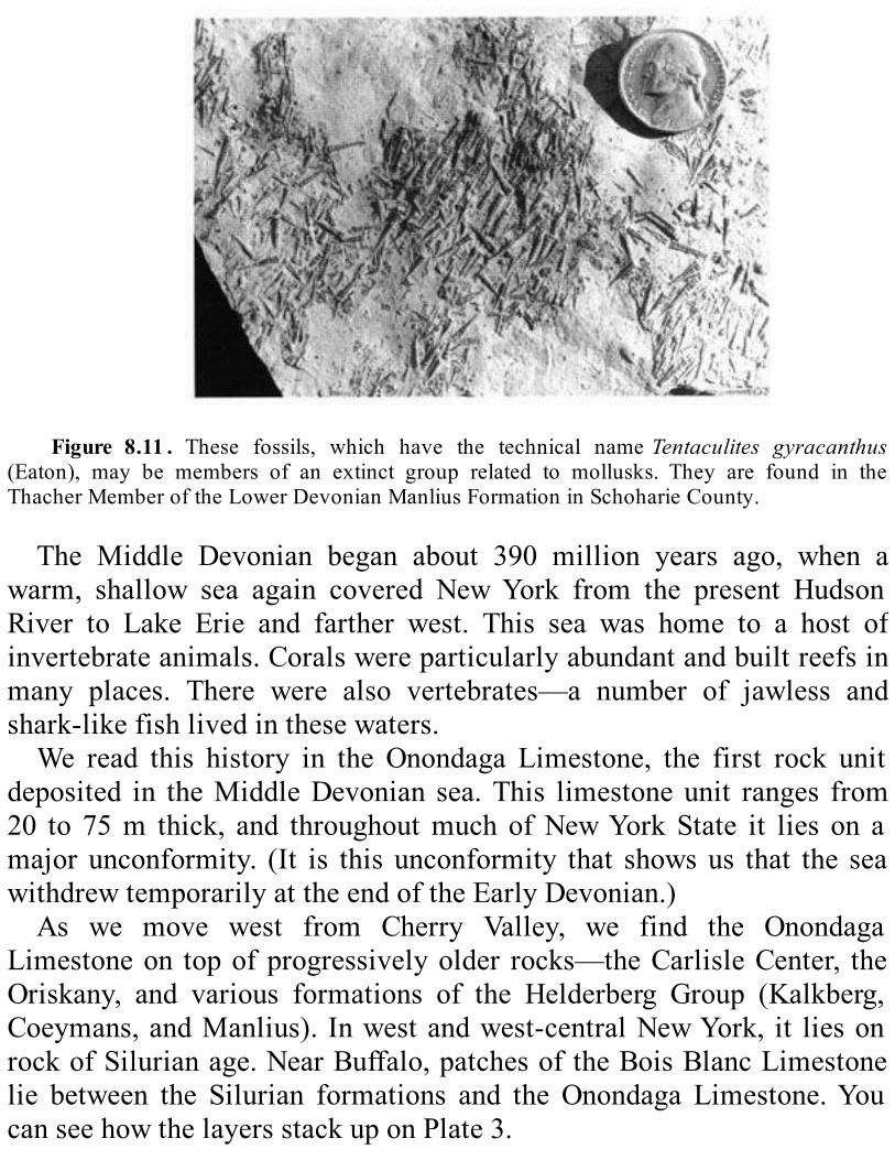
Figure 8.11 . These fossils, which have the technical nameTentaculites gyracanthus
(Eaton), may be members of an extinct group related to mollusks. They are found in theThacherMemberoftheLowerDevonianManliusFormationinSchoharieCounty.
The Middle Devonian began about 390 million years ago, when awarm, shallow sea again covered NewYork from the present HudsonRiver to Lake Erie and farther west. This sea was home to a host ofinvertebrateanimals.Coralswereparticularlyabundantandbuiltreefsinmany places. There were also vertebrates—a number of jawless andshark-likefishlivedinthesewaters.We read this history in the Onondaga Limestone, the first rock unit
deposited in theMiddleDevonian sea.This limestoneunit ranges from20 to 75m thick, and throughoutmuch ofNewYorkState it lies on amajorunconformity. (It is this unconformity that showsus that the seawithdrewtemporarilyattheendoftheEarlyDevonian.)As we move west from Cherry Valley, we find the Onondaga
Limestoneon topofprogressivelyolder rocks—theCarlisleCenter, theOriskany, and various formations of the Helderberg Group (Kalkberg,Coeymans,andManlius). Inwestandwest-centralNewYork, it liesonrockofSilurianage.NearBuffalo,patchesoftheBoisBlancLimestonelie between the Silurian formations and the Onondaga Limestone.YoucanseehowthelayersstackuponPlate3.
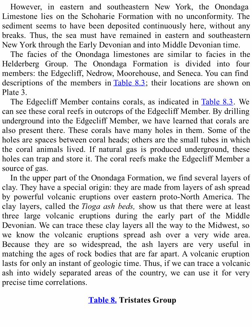
However, in eastern and southeastern New York, the OnondagaLimestone lies on the Schoharie Formationwith no unconformity. Thesediment seems to have been deposited continuously here,without anybreaks. Thus, the sea must have remained in eastern and southeasternNewYorkthroughtheEarlyDevonianandintoMiddleDevoniantime.The facies of the Onondaga limestones are similar to facies in the
Helderberg Group. The Onondaga Formation is divided into fourmembers:theEdgecliff,Nedrow,Moorehouse,andSeneca.Youcanfinddescriptions of themembers inTable8.3; their locations are shown onPlate3.TheEdgecliffMember contains corals, as indicated inTable8.3.We
canseethesecoralreefsinoutcropsoftheEdgecliffMember.BydrillingundergroundintotheEdgecliffMember,wehavelearnedthatcoralsarealso present there.These corals havemanyholes in them.Someof theholesarespacesbetweencoralheads;othersarethesmalltubesinwhichthe coral animals lived. If natural gas is produced underground, theseholescantrapandstoreit.ThecoralreefsmaketheEdgecliffMemberasourceofgas.IntheupperpartoftheOnondagaFormation,wefindseverallayersof
clay.Theyhaveaspecialorigin:theyaremadefromlayersofashspreadby powerful volcanic eruptions over eastern proto-NorthAmerica. Theclay layers, called theTiogaashbeds, showus that therewere at leastthree large volcanic eruptions during the early part of the MiddleDevonian.WecantracetheseclaylayersallthewaytotheMidwest,sowe know the volcanic eruptions spread ash over a very wide area.Because they are so widespread, the ash layers are very useful inmatchingtheagesofrockbodies thatarefarapart.Avolcaniceruptionlastsforonlyaninstantofgeologictime.Thus,ifwecantraceavolcanicash into widely separated areas of the country, we can use it for veryprecisetimecorrelations.
Table8.TristatesGroup

*TheOriskanyliestothewestofthePortJervis,notontopofit.**FoundonlynearPortJervis,NY.
The Onondaga Limestone was the last thick, widespread deposit oflimestone in the Devonian of New York. It is relatively resistant toerosioncomparedtotherockaboveandbelowit,soitcommonlystandsabove the rest of the landscape as an escarpment that runs east towestacross the State. It is quarried extensively in New York, mainly forcrushedstone,whichisusedinconcreteandforotherpurposes.AnabruptchangeinenvironmentstoppeddepositionoftheOnondaga
Limestone. Sometime in the early part of the Middle Devonian, thecontinentofAvaloncollidedwithproto-NorthAmerica(seeChapter3).This collision caused a great new mountain-building event called theAcadian Orogeny. Mountains started to rise in New England and theCanadian Maritime Provinces. As the collision went on, it causedfaulting, folding, metamorphism, and igneous intrusions.10 In the areawheretheOnondagaLimestonewasbeingdeposited,theorogenycausedanabruptdeepeningofthewater.Thisdeepeningbroughtaboutadrasticchangeintheenvironmentoftheseafloorand,hence,anabruptchangeinthekindofsedimentdepositedthere.

Figure 8.12.The surface of this layer in the LowerDevonianCarlisle Center Formation
showsfeedingburrowsofamarinewormcalledZoophycus. ItwasfoundnearCherryValley,OtsegoCounty.
Table8.3OnondagaFormation
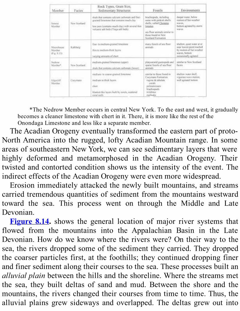
*TheNedrowMemberoccursincentralNewYork.Totheeastandwest,itgradually
becomesacleanerlimestonewithchertinit.There,itismoreliketherestoftheOnondagaLimestoneandlesslikeaseparatemember.
TheAcadianOrogenyeventuallytransformedtheeasternpartofproto-NorthAmerica into the rugged, loftyAcadianMountain range. In someareasofsoutheasternNewYork,wecanseesedimentarylayersthatwerehighly deformed and metamorphosed in the Acadian Orogeny. Theirtwistedandcontortedconditionshowsustheintensityoftheevent.TheindirecteffectsoftheAcadianOrogenywereevenmorewidespread.Erosionimmediatelyattackedthenewlybuiltmountains,andstreams
carriedtremendousquantitiesofsedimentfromthemountainswestwardtoward the sea. This process went on through the Middle and LateDevonian.Figure 8.14. shows the general location of major river systems that
flowed from the mountains into the Appalachian Basin in the LateDevonian.Howdoweknowwheretheriverswere?Ontheirwayto thesea,theriversdroppedsomeofthesedimenttheycarried.Theydroppedthecoarserparticlesfirst,at thefoothills; theycontinueddroppingfinerandfinersedimentalongtheircoursestothesea.Theseprocessesbuiltanalluvialplainbetweenthehillsandtheshoreline.Wherethestreamsmetthe sea, they built deltas of sand andmud. Between the shore and themountains,theriverschangedtheircoursesfromtimetotime.Thus,thealluvial plains grew sideways and overlapped.The deltas grewout into
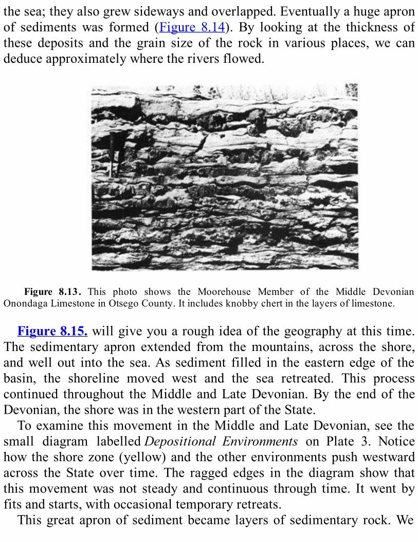
thesea;theyalsogrewsidewaysandoverlapped.Eventuallyahugeapronof sedimentswas formed (Figure 8.14). By looking at the thickness ofthese deposits and the grain size of the rock in various places,we candeduceapproximatelywheretheriversflowed.
Figure 8.13. This photo shows the Moorehouse Member of the Middle Devonian
OnondagaLimestoneinOtsegoCounty.Itincludesknobbychertinthelayersoflimestone.
Figure8.15.willgiveyouaroughideaofthegeographyatthistime.The sedimentary apron extended from themountains, across the shore,andwell out into the sea.As sediment filled in the eastern edgeof thebasin, the shoreline moved west and the sea retreated. This processcontinued throughout theMiddle andLateDevonian.By the endof theDevonian,theshorewasinthewesternpartoftheState.Toexamine thismovement in theMiddleandLateDevonian,see the
small diagram labelledDepositional Environments on Plate 3. Noticehowtheshorezone(yellow)and theotherenvironmentspushwestwardacross the State over time. The ragged edges in the diagram show thatthismovementwasnot steady and continuous through time. Itwent byfitsandstarts,withoccasionaltemporaryretreats.Thisgreatapronofsedimentbecame layersof sedimentary rock.We
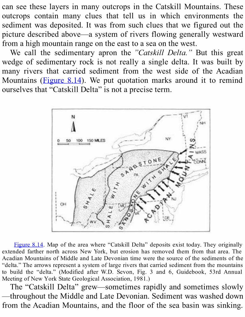
can see these layers inmanyoutcrops in theCatskillMountains.Theseoutcrops contain many clues that tell us in which environments thesedimentwasdeposited. Itwas fromsuchclues thatwe figuredout thepicturedescribedabove—asystemofriversflowinggenerallywestwardfromahighmountainrangeontheeasttoaseaonthewest.We call the sedimentary apron the”Catskill Delta.” But this great
wedge of sedimentary rock is not really a single delta. It was built bymany rivers that carried sediment from the west side of the AcadianMountains (Figure 8.14).We put quotation marks around it to remindourselvesthat“CatskillDelta”isnotapreciseterm.
Figure8.14.Mapof theareawhere“CatskillDelta”deposits exist today.Theyoriginally
extended farther north across NewYork, but erosion has removed them from that area.TheAcadianMountainsofMiddleandLateDevoniantimewerethesourceofthesedimentsofthe“delta.”Thearrowsrepresentasystemoflargeriversthatcarriedsedimentfromthemountainsto build the “delta.” (Modified after W.D. Sevon, Fig. 3 and 6, Guidebook, 53rd AnnualMeetingofNewYorkStateGeologicalAssociation,1981.)The“CatskillDelta”grew—sometimesrapidlyandsometimesslowly
—throughouttheMiddleandLateDevonian.SedimentwaswasheddownfromtheAcadianMountains,andtheflooroftheseabasinwassinking.
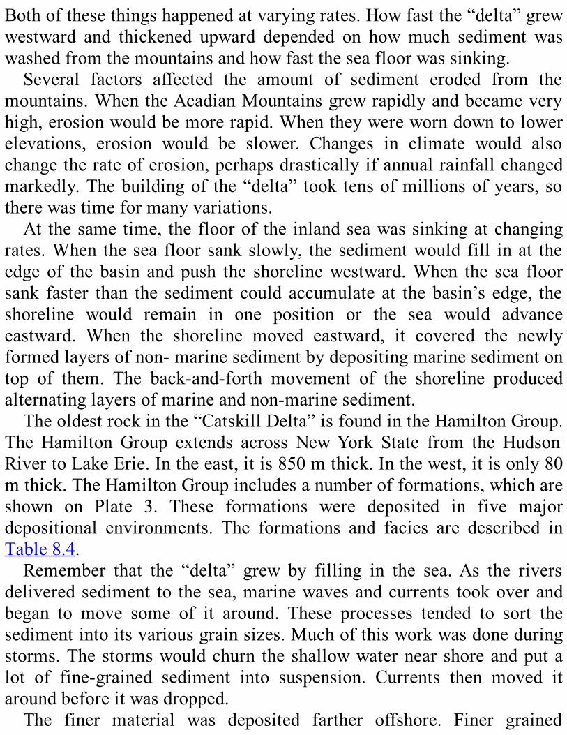
Bothofthesethingshappenedatvaryingrates.Howfastthe“delta”grewwestward and thickened upward depended on howmuch sediment waswashedfromthemountainsandhowfasttheseafloorwassinking.Several factors affected the amount of sediment eroded from the
mountains.WhentheAcadianMountainsgrewrapidlyandbecameveryhigh,erosionwouldbemorerapid.Whentheywereworndowntolowerelevations, erosion would be slower. Changes in climate would alsochangetherateoferosion,perhapsdrasticallyifannualrainfallchangedmarkedly.Thebuildingof the“delta” took tensofmillionsofyears,sotherewastimeformanyvariations.At thesametime, thefloorof the inlandseawassinkingatchanging
rates.When thesea floor sankslowly, thesedimentwould fill inat theedge of the basin andpush the shorelinewestward.When the sea floorsank faster than the sediment couldaccumulate at thebasin’s edge, theshoreline would remain in one position or the sea would advanceeastward. When the shoreline moved eastward, it covered the newlyformedlayersofnon-marinesedimentbydepositingmarinesedimentontop of them. The back-and-forth movement of the shoreline producedalternatinglayersofmarineandnon-marinesediment.Theoldestrockinthe“CatskillDelta”isfoundintheHamiltonGroup.
The Hamilton Group extends across NewYork State from the HudsonRivertoLakeErie.Intheeast,itis850mthick.Inthewest,itisonly80mthick.TheHamiltonGroupincludesanumberofformations,whichareshown on Plate 3. These formations were deposited in five majordepositional environments. The formations and facies are described inTable8.4.Remember that the “delta” grew by filling in the sea.As the rivers
deliveredsediment to thesea,marinewavesandcurrents tookoverandbegan to move some of it around. These processes tended to sort thesedimentintoitsvariousgrainsizes.Muchofthisworkwasdoneduringstorms.Thestormswouldchurn theshallowwaternearshoreandputalot of fine-grained sediment into suspension. Currents then moved itaroundbeforeitwasdropped.The finer material was deposited farther offshore. Finer grained
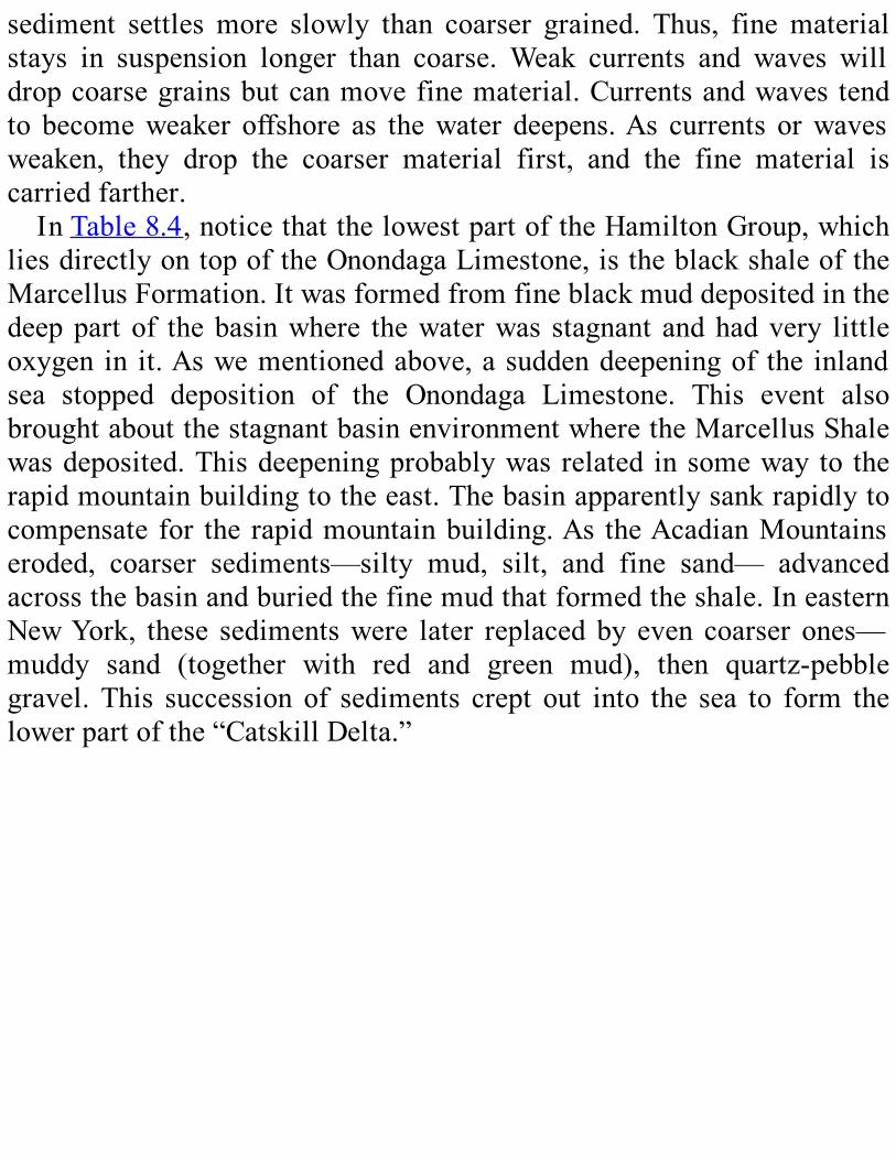
sediment settles more slowly than coarser grained. Thus, fine materialstays in suspension longer than coarse. Weak currents and waves willdropcoarsegrainsbutcanmovefinematerial.Currentsandwavestendto becomeweaker offshore as thewater deepens.As currents orwavesweaken, they drop the coarser material first, and the fine material iscarriedfarther.InTable8.4,noticethatthelowestpartoftheHamiltonGroup,which
liesdirectlyontopoftheOnondagaLimestone,istheblackshaleoftheMarcellusFormation.Itwasformedfromfineblackmuddepositedinthedeeppart of thebasinwhere thewaterwas stagnant andhadvery littleoxygen in it.Aswementionedabove,asuddendeepeningof the inlandsea stopped deposition of the Onondaga Limestone. This event alsobroughtaboutthestagnantbasinenvironmentwheretheMarcellusShalewasdeposited.Thisdeepeningprobablywasrelated insomeway to therapidmountainbuildingtotheeast.Thebasinapparentlysankrapidlytocompensate for the rapidmountainbuilding.As theAcadianMountainseroded, coarser sediments—silty mud, silt, and fine sand— advancedacrossthebasinandburiedthefinemudthatformedtheshale.IneasternNewYork, these sedimentswere later replaced by even coarser ones—muddy sand (together with red and green mud), then quartz-pebblegravel. This succession of sediments crept out into the sea to form thelowerpartofthe“CatskillDelta.”
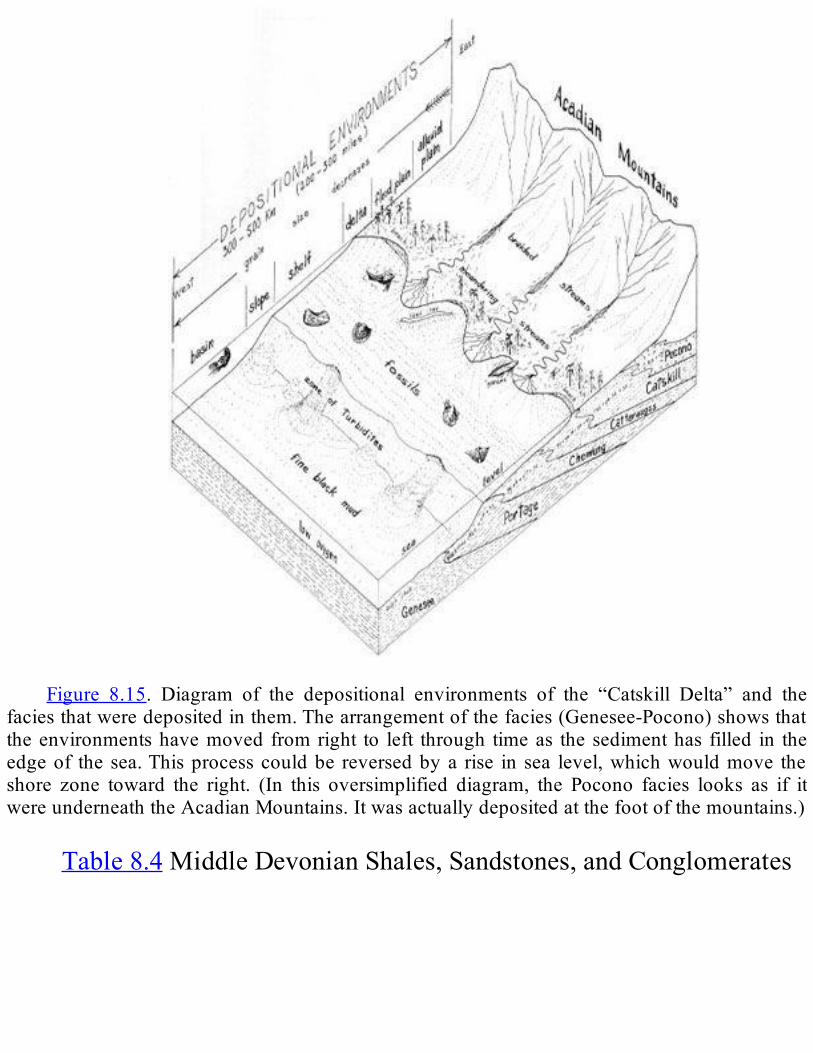
Figure 8.15. Diagram of the depositional environments of the “Catskill Delta” and the
faciesthatweredepositedinthem.Thearrangementofthefacies(Genesee-Pocono)showsthattheenvironmentshavemoved fromright to left through timeas thesedimenthas filled in theedgeof the sea.Thisprocesscouldbe reversedbya rise in sea level,whichwouldmove theshore zone toward the right. (In this oversimplified diagram, the Pocono facies looks as if itwereunderneaththeAcadianMountains.Itwasactuallydepositedatthefootofthemountains.)
Table8.4MiddleDevonianShales,Sandstones,andConglomerates

*FoundinsoutheasternNewYork.**FoundonlyineasternNewYouk.
From time to time, the sediment supply was interrupted. At thosetimes, the “delta” would stop growing, and the sea water became lessmuddyfora time.Thisenvironmentpermittedorganisms thatproducedcalciumcarbonatetothrive.Theirremainsaccumulatedontheseaflooraslayersofcalcareoussediment.AndindeedintheHamiltonGroup,wefindseveralthinbutwidespreadlimestonelayers.Weusetheselimestonebeds as markers to separate the Hamilton Group into the formationsshownonPlate3.AsyoucanseeinTable8.4, these limestonescontainmuch clay, sowe know thatmud (clay)was beingwashed in from the
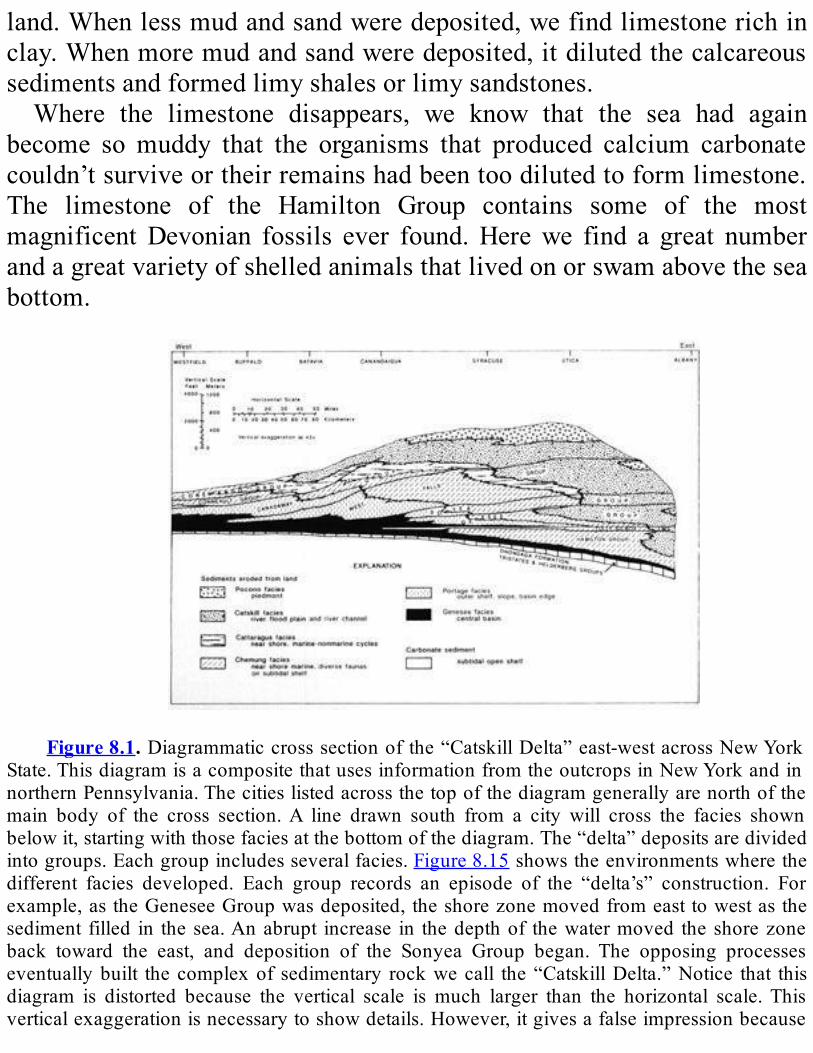
land.Whenlessmudandsandweredeposited,wefindlimestonerichinclay.Whenmoremudandsandweredeposited,itdilutedthecalcareoussedimentsandformedlimyshalesorlimysandstones.Where the limestone disappears, we know that the sea had again
become somuddy that the organisms that produced calcium carbonatecouldn’tsurviveortheirremainshadbeentoodilutedtoformlimestone.The limestone of the Hamilton Group contains some of the mostmagnificentDevonian fossils ever found.Herewe find a great numberandagreatvarietyofshelledanimalsthatlivedonorswamabovetheseabottom.
Figure8.1.Diagrammaticcrosssectionofthe“CatskillDelta”east-westacrossNewYork
State.ThisdiagramisacompositethatusesinformationfromtheoutcropsinNewYorkandinnorthernPennsylvania.Thecitieslistedacrossthetopofthediagramgenerallyarenorthofthemain body of the cross section.A line drawn south from a city will cross the facies shownbelowit,startingwiththosefaciesatthebottomofthediagram.The“delta”depositsaredividedintogroups.Eachgroupincludesseveralfacies.Figure8.15showstheenvironmentswherethedifferent facies developed. Each group records an episode of the “delta’s” construction. Forexample,astheGeneseeGroupwasdeposited,theshorezonemovedfromeasttowestasthesediment filled in thesea.Anabrupt increase in thedepthof thewatermoved theshorezoneback toward the east, and deposition of the Sonyea Group began. The opposing processeseventuallybuilt thecomplexof sedimentary rockwecall the“CatskillDelta.”Notice that thisdiagram is distorted because the vertical scale is much larger than the horizontal scale.Thisverticalexaggerationisnecessarytoshowdetails.However,itgivesafalseimpressionbecause
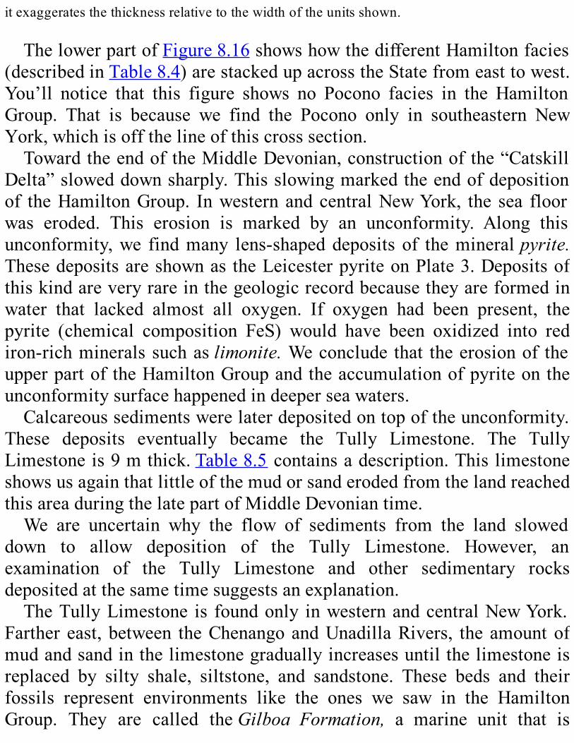
itexaggeratesthethicknessrelativetothewidthoftheunitsshown.
ThelowerpartofFigure8.16showshowthedifferentHamiltonfacies(describedinTable8.4)arestackedupacrosstheStatefromeasttowest.You’ll notice that this figure shows no Pocono facies in the HamiltonGroup. That is because we find the Pocono only in southeastern NewYork,whichisoffthelineofthiscrosssection.TowardtheendoftheMiddleDevonian,constructionofthe“Catskill
Delta”sloweddownsharply.Thisslowingmarkedtheendofdepositionof theHamiltonGroup. InwesternandcentralNewYork, the sea floorwas eroded. This erosion is marked by an unconformity. Along thisunconformity,we findmany lens-shapeddepositsof themineralpyrite.ThesedepositsareshownastheLeicesterpyriteonPlate3.Depositsofthiskindareveryrareinthegeologicrecordbecausetheyareformedinwater that lacked almost all oxygen. If oxygen had been present, thepyrite (chemical composition FeS) would have been oxidized into rediron-richmineralssuchaslimonite.Weconcludethat theerosionof theupperpartoftheHamiltonGroupandtheaccumulationofpyriteontheunconformitysurfacehappenedindeeperseawaters.Calcareoussedimentswerelaterdepositedontopoftheunconformity.
These deposits eventually became the Tully Limestone. The TullyLimestoneis9mthick.Table8.5containsadescription.ThislimestoneshowsusagainthatlittleofthemudorsanderodedfromthelandreachedthisareaduringthelatepartofMiddleDevoniantime.We are uncertain why the flow of sediments from the land slowed
down to allow deposition of the Tully Limestone. However, anexamination of the Tully Limestone and other sedimentary rocksdepositedatthesametimesuggestsanexplanation.TheTullyLimestone is foundonly inwesternandcentralNewYork.
Farther east,between theChenangoandUnadillaRivers, theamountofmudandsandinthelimestonegraduallyincreasesuntilthelimestoneisreplaced by silty shale, siltstone, and sandstone. These beds and theirfossils represent environments like the ones we saw in the HamiltonGroup. They are called theGilboa Formation, a marine unit that is

underlainandoverlainbysandstoneslaiddowninfreshwaterorontheland.Headingeast fromtheSchoharieValley, theGilboaFormation, inturn, gradually changes into a non-marine facies—beds that weredepositedabovesealevel.Thus,wecanseethaterosionofthelanddidn’tstopinthelateMiddleDevonian,althoughshorelinesmovedfarthereastduringdepositionof theTullyandGilboa formations.EnoughsedimentwaswashedfromthemountainstotheeasternpartofNewYorkStatetocontinue building the sedimentary apron. However, the shoreline hadmoved farther east during this interval, and most of the land-derivedsediments were deposited farther east in the flooded river mouths andflooded surface of the delta. This situation meant that calcareoussediments, such as the Tully Limestone, could be deposited fartheroffshore.
LATEDEVONIANHISTORYTheLateDevonianlastedfromabout375to360millionyearsago.The
major part of the “Catskill Delta” was built during this time (Figure8.16).ThestructureoftheLateDevonianpartofthe“delta”issimilartothatoftheMiddleDevonianHamiltonGroup.Thecoarsestsedimentisinthe east, closest to themountains that supplied it.Aswemove fartherwest,thesedimentbecomesprogressivelyfiner.
Table8.5TullyLimestone
*TheTullyisseparatedintotwopartsbyanunconformity-theUpperTullyandthe
LowerTully.Bothpartsrepresentsimilarenvironments.

Whensedimentisdeposited,thewaternearshorebecomesshallower.Waterdepthcontrolstheenvironment,soalltheenvironmentsshiftinaseaward direction, following their appropriate water depth. Eventually,thesedimentreplacestheseawaterandbuildstheareaabovesealevel.Ifweselectarockunitinthe“CatskillDelta”andfollowitfromeast
to west, we see the facies change from non-marine to shallow marinewatertodeepwater.Thechangefromnon-marine(rivers)tomarine(sea)isamajoroneforplantsandanimals,becausethechemistryofseawaterisverydifferentfromthatoffreshwater.Thischangeinfaciesshowsusthevariousenvironmentsthatexistedatthesametime.Aswemovefromlower(older) layers tohigher(younger) layers,we
seethefacieschangeaswell.Forexample, theymaychangefromdeepwater to shallow water to non-marine. These changes show us thatdifferentenvironmentsexistedinaparticularplaceovertime.Theyshowusthehistoryofthegrowthofthe“delta.”The major facies of the Late Devonian and the environments they
representaredescribedinTable8.6.Figure8.15showsthegeographyforthe Late Devonian from the basin floor across the shore zone to themountainfront.Thisdiagramrelatestheenvironmentwhereeachofthefaciesdevelopedtothelandscapeandwaterdepth.Figure8.16 is an east-west cross section of the “CatskillDelta” that
showshowthefaciesaredistributed.Noticehowthenon-marinefacies—Cattaraugus, Catskill, and Pocono—move westward over the marinefacies throughout the Middle and Late Devonian. This was a slow,creeping, halting movement. Frequently the sea would temporarilydeepen and bring the shoreline and marine environments back east.Marinefaciesthencouldbedepositedontopofearliernon-marinefacies.Aswesawearlier,anumberoffactors interact tomaketheshoreline
moveback and forth: change in sediment supply from the land; rise orfall in sea level; change in the rate of sea floor sinking. Waves andcurrents might become stronger or weaker, depending on variations ingeography,andmovethesedimentsaroundindifferentways.Wecanseetheeffectsofall thesefactors in theoverlapping, irregularshapeof thefacies.

IntheUpperDevonianpartofthe“CatskillDelta,”nearlyalltherockwasmadefromsedimentdepositedonlandorinfreshwater.Geologistshavedividedthisgreatmassofsedimentarylayersintosixgroups.Fromoldest(bottom)toyoungest(top),theyare:Genesee,Sonyea,WestFalls,Canadaway, Conneaut, and Conewango (Figure 8.16 and Plate 3). Thethreeoldestgroups(Genesee,Sonyea,andWestFalls)extendcompletelyacrosstheState.TheyoungeronesarefoundonlyinthewesternpartoftheState.EithertheywereneverdepositedintheCatskills,ortheywerelaterwornawaybyerosion.AsyoucanseeonPlate2,thevariousgroupscrop out in the Catskills, the Finger Lakes region, the Genesee Rivervalley,andalongtheshoreofLakeErie.We’ll describe the lower four groups (Genesee, Sonyea,West Falls,
and Canadaway) together because they have similar histories. Theyillustratethewaythe“CatskillDelta”developed.AllaremuchthickerintheeasternpartoftheState(Table8.7).The enormous size of the “Catskill Delta,” both in thickness and in
area,givesusalargeproblem.Howcanwetellwhether,forexample,areddishsandstoneintheeasternpartwasdepositedatthesametimeasablack clay shale in thewestern part?The fossil content is not likely tohelpbecause the twounits represent entirelydifferent environments. Inotherwords,weprobablywon’tfindthesamekindoffossilinbothunits—thetwoenvironmentswerehometotwodifferentsetsofcreatures.One approach to the problem is to carefully examine closely spaced
outcrops all the way across the State. Many different geologists havestudiedpartsofthe“delta”inthiswaythroughtheyears.However,theirconclusionsaboutithavenotalwaysfittogether.One feature of the “delta” that has helped sort out the parts of the
puzzlearelayersofblackshalethatcrosstheStateinthemarinefacies.Blackshaleofthistypeisdepositedinthedeeperpartsofamarinebasin.Onlyfinemudreachesthearea.Commonly,thedeeperwaterinthebasinalsohada low levelofoxygen.Lowoxygenallowsorganicmatter (thetissuesoflivingthings)toaccumulateinthesedimentinsteadofbreakingdownintosimplercompounds. Inaddition,grainsandnodulesofpyrite(or“fool’sgold,”chemicalcompositionFeS)growindarkshalesofthis

type.Organicmatterisoneofthecomponentsthatmakestheshaleblack.The other component is pyrite; interestingly, large pyrite grains aregolden in color, but very fine-grained pyrite is black in color. Whencirculationofthebottomwaterisbetter,theoxygencontentincreasesandthe shale deposited has a lighter color—gray to greenish—becauseorganicmatterandpyritecontentarelow.ThereisarelativelyuniformsequenceofUpperDevonianshaleinthe
westernpartoftheState;thus,weknowthatadeeperbasinenvironmentpersisted in thisarea.Tonguesofblackshaleextendeastwardfromthismain body.A number of black shale tongues lie right on top of other,shallower marine facies in more eastern sites. The upward change toblackshaleissuddenattheseeasternsites.Therefore,webelievethatthedeeperbasinenvironmentexpandedrapidly.Depositionoftheblackshaletonguewouldbegineverywhereintheexpandedbasinatalmostthesametime. If these conclusions are correct, then the base of a black shaletongueisanapproximate“timeline.”Inotherwords,eventsrecordedinthe rock at different places just above this time line happened atapproximatelythesamemomentingeologicaltime.
Table8.6RocksoftheUpperDevonian

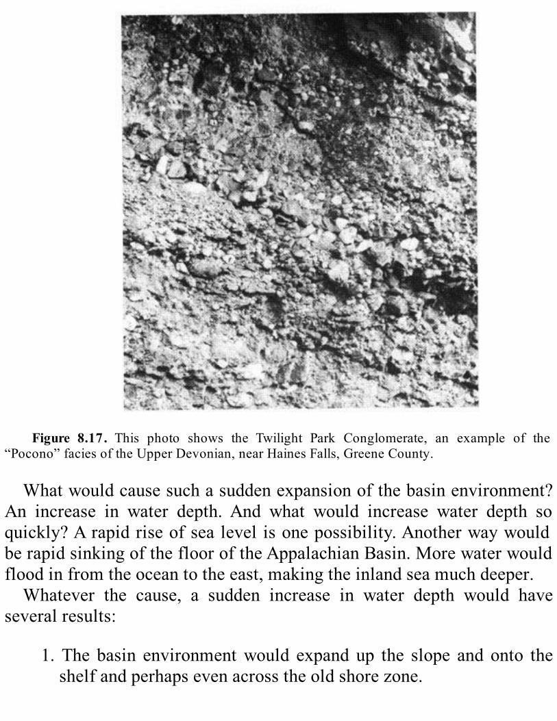
Figure 8.17. This photo shows the Twilight Park Conglomerate, an example of the
“Pocono”faciesoftheUpperDevonian,nearHainesFalls,GreeneCounty.
Whatwouldcausesuchasuddenexpansionofthebasinenvironment?An increase in water depth. And what would increase water depth soquickly?Arapidriseofsealevelisonepossibility.AnotherwaywouldberapidsinkingoftheflooroftheAppalachianBasin.Morewaterwouldfloodinfromtheoceantotheeast,makingtheinlandseamuchdeeper.Whatever the cause, a sudden increase in water depth would have
severalresults:
1.The basin environmentwould expand up the slope and onto theshelfandperhapsevenacrosstheoldshorezone.
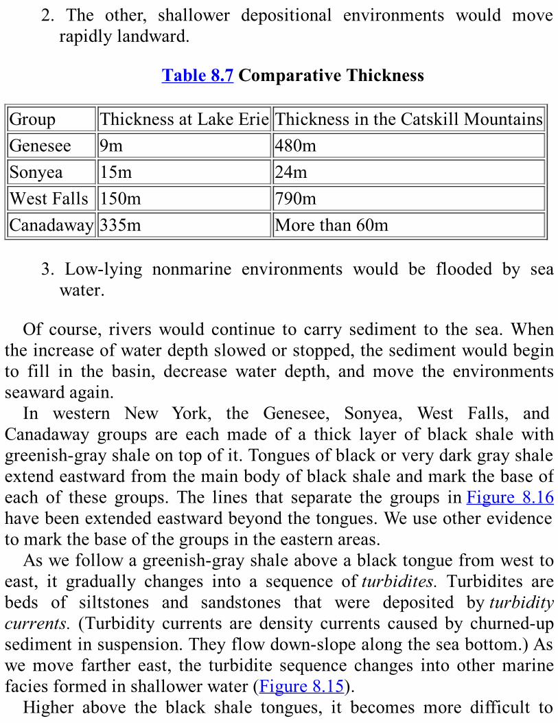
2. The other, shallower depositional environments would moverapidlylandward.
Table8.7ComparativeThicknessGroup ThicknessatLakeErie ThicknessintheCatskillMountainsGenesee 9m 480mSonyea 15m 24mWestFalls 150m 790mCanadaway 335m Morethan60m
3. Low-lying nonmarine environments would be flooded by seawater.
Of course, riverswould continue to carry sediment to the sea.Whentheincreaseofwaterdepthslowedorstopped,thesedimentwouldbeginto fill in the basin, decrease water depth, and move the environmentsseawardagain.In western New York, the Genesee, Sonyea, West Falls, and
Canadaway groups are each made of a thick layer of black shale withgreenish-grayshaleontopofit.Tonguesofblackorverydarkgrayshaleextendeastwardfromthemainbodyofblackshaleandmarkthebaseofeach of these groups. The lines that separate the groups inFigure 8.16havebeenextendedeastwardbeyondthetongues.Weuseotherevidencetomarkthebaseofthegroupsintheeasternareas.Aswefollowagreenish-grayshaleaboveablacktonguefromwestto
east, it gradually changes into a sequence ofturbidites. Turbidites arebeds of siltstones and sandstones that were deposited byturbiditycurrents. (Turbidity currents are density currents caused by churned-upsedimentinsuspension.Theyflowdown-slopealongtheseabottom.)Aswemove farther east, the turbidite sequence changes into othermarinefaciesformedinshallowerwater(Figure8.15).Higher above the black shale tongues, it becomes more difficult to

match up the upper parts of the groups. (Remember that each groupbecomesmuch thickerandchanges facies to theeast,but it records thesame period of geologic time.)However, there are thin layers of blackshaleintheupperportionofsomegroups.Someoftheselayerscontinueacross the turbidites and help us match up layers from one place toanother.Deposition of each of these four groups began with an eastward
advanceof the shoreline.As the sea spread east, thewaterdeepened intheeast.Asaresult, theblackshaledepositedinthedeepwatersof thebasincametobedepositedfarthereast.Thisblackshalewasdepositedontopofolderdeposits thatweremadeinshallowerwater.Thesedepositshadbeenformedearlierontheshelfandontheslopebetweentheshelfand the basin.After the sea ceased expanding, deposition again beganfilling in the edge of the sea and laid down shallowerwater sedimentsontothe“delta.”The“delta”thengrewuntilitreachedthenewsealevel,andshallower
faciescreptacrosstheshelftowardtheslopethatleddowntothebasin.Whentheshoreapproachedtheedgeoftheshelf,sedimentspiledupnearthe top of the slope and became unstable. Slumps and storm waveschurned them up, put them into suspension, and formed turbiditycurrents.Eventually, turbidity currents flowing down the slope into the basin
becamefrequentenoughtoformtheturbiditesequencementionedabove(Figure8.15).Insomeofthefourgroups,though,theshorezonedidnotreachthetopoftheslopebeforethesealevelroseagain.Inthosegroups,wedonotfindtheturbidites.The thickblackshaleat thebaseof theCanadawayGroup represents
thelastmajoradvanceoftheseaintheLateDevonian.The two groups at the top of the “Catskill Delta” complex are the
Conneaut and theConewango.These last twogroupswere deposited inwater thatcontinuedtogetshallower.Bytheendof theDevonian,non-marinefaciesextendedalmostcompletelyacrossNewYorkState.Thus,weknowthatthe“delta”hadfinallygrownlargeenoughtopushtheseaalmost entirely out of the State. However, themarine facies were still
foundinthewest.The Conneaut and Connewango Groups together are 335 m thick in
westernNewYork.Theyaremadeofgrayshale,siltstone,mudstone,andfine sandstone. They contain a moderate variety of fossil shells frommarineanimals.TherearelayersofconglomerateatseverallevelsintheConewango. One is especially easy to see at Panama Rock City inChautauquaCounty. InwesternmostNewYork, these two groups formtheChemungfacies.Towardtheeast,therockgraduallychangesfaciestotheredandgreenCatskillfaciesinsouthernCattaraugusCounty.Table 8.6 tells us that much of the Chemung facies, all of the
Cattaraugus facies,andmuchof theCatskill faciesweredepositednearsealevel,eitherslightlyaboveorslightlybelow.Withthisfactinmind,studyFigure 8.16 and notice that these facies are hundreds of metersthick in theeast-centralpartof the“delta.”Noticealso thedepositionalenvironments generally moved slowly west through time. Whatconclusionscanwedraw?Thearrangementofthefaciessuggeststhatformillionsofyearsthebasinfloorsankataboutthesamerateassedimentwasdelivered.Then,inthelaterpartoftheLateDevonian,thebasinwasfilledfasterthanitsfloorsank.This apparent balance between sediment supply and sediment sink is
intriguing. It suggests some cause and effect between the pulses ofmountain-buildingandthesinkingofthebasinfloor.Indeed,somerecentstudies conclude that it was sinking of the basin floor that caused thesuddenincreases inwaterdepth in theAppalachianBasin.Thissinking,inturn,causedthetonguesofblackshaletoextendeastwardfarfromthecentral basin. The great influx of sediment that buried the black shaletonguestiesthiseventtoapulseofmountain-building.
DEVONIANPLANTSANDANIMALSThere aremany fossils in NewYork’s Devonian rock. These fossils
showagreatvarietyoflivingthings.Thisabundanceisremarkablewhenwerememberhowunusualitisforananimalorplanttobepreservedasa

fossil.Onlyafewoftheplantsandanimalslivingataparticulartimeareever
preservedasfossils.Itrequiresalongstringofcoincidencesforanyoneorganismtobepreserved.Infact,somekindsoflivingthingsmayneverbepreservedatall.Theymaybetoosoftorunsuitableinsomeotherway.Iftheywereneverfossilized,wewillneverknowthattheyexisted.NewYork’sDevonianrockcontainsagreatvarietyandabundanceof
well-preservedfossils.Clearly,thelandandtheseawereswarmingwithlife,andtheconditionsforburialandpreservationofplantsandanimalsweregood.Animallifehadbecomemuchmorevariedsincetheearlierpartsofthe
Paleozoic. Corals were extremely plentiful and often large. Broad“carpets”madeofbryozoansandcrinoidscovered the sea floor (Figure8.18). There were over 700 species of brachiopods (see Figure A.3).(Brachiopods had their greatest variety in the Devonian.)Pelecypods(clams)multipliedonthemuddyandsandyseabottoms(Figure8.19)anddevelopedavarietyoftypes.The appearance of a new group of cephalopods— called the
ammonoids—was even more noteworthy. (Figure 8.15 shows anammonoid swimming in the deep water in the left-hand part of thedrawing.)Aseriesofdistinctiveammonoidspeciesevolvedthroughtime,and we have an unusually good fossil record of Middle and UpperDevonian ammonoids in New York. Therefore, we have been able todeterminewhenanewspeciesdeveloped.ThisknowledgehelpsusfigureoutwhichDevonian rocks throughout theworld are the same age—bymatchingupthesequenceofammonoidsspeciesfromdifferentareas.Conodonts, an extinct group of swimming animals known from tiny
tooth-like fossils, also had their greatest variety in the Late Devonian.Rapid evolution and extinction producedmany geologically short-livedspeciesthathadworldwidedistribution.Becausemanyoftheindividualconodontspeciesweregeologicallyshort-lived,andwecanusetheirfirstoccurrenceandhowlongtheysurvivedindifferentregions tomatchuprock units of the same age. Because some conodonts had worldwidedistribution, they allow us to match up layers from widely separated
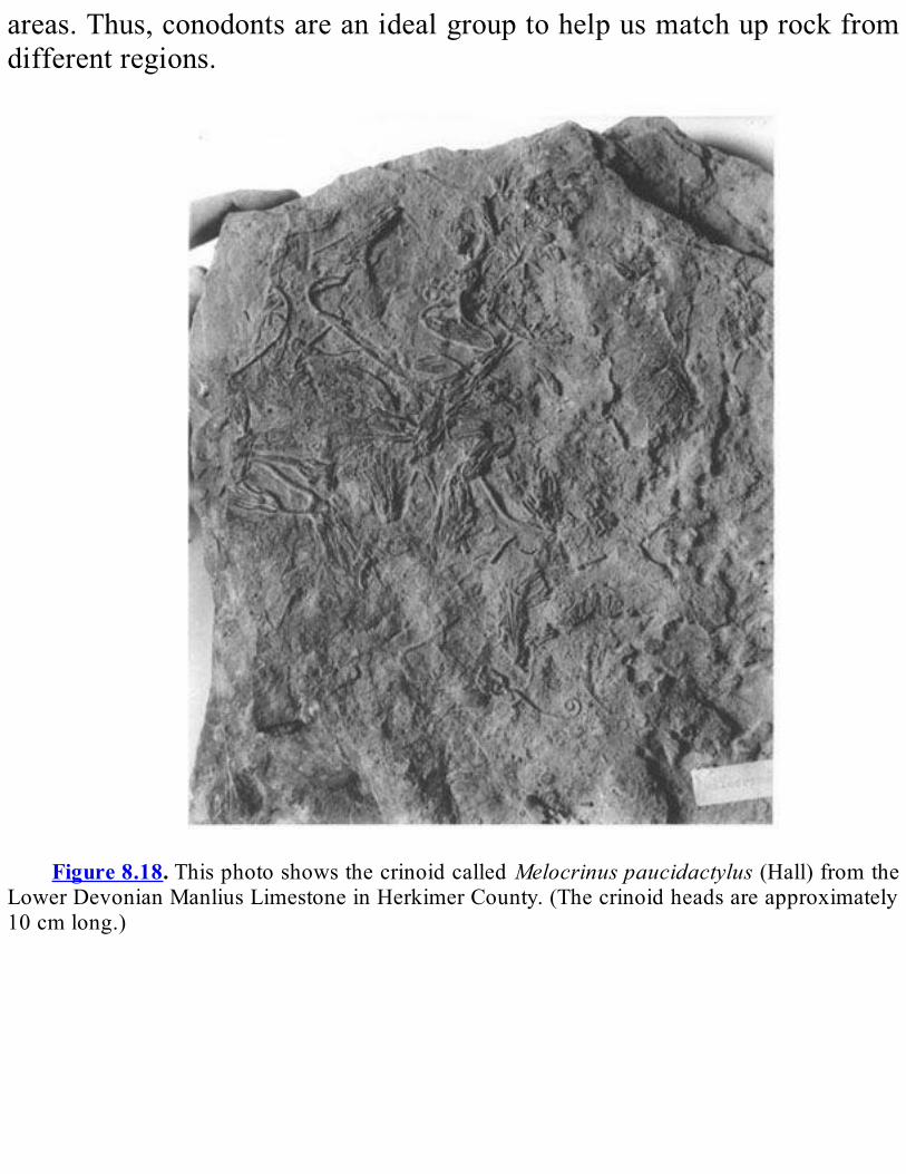
areas.Thus,conodontsareanidealgrouptohelpusmatchuprockfromdifferentregions.
Figure8.18.ThisphotoshowsthecrinoidcalledMelocrinuspaucidactylus(Hall)fromthe
LowerDevonianManliusLimestoneinHerkimerCounty.(Thecrinoidheadsareapproximately10cmlong.)
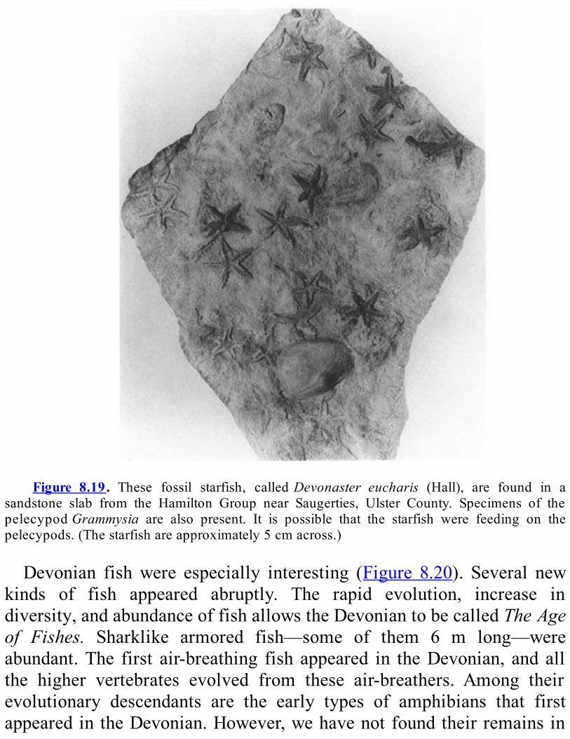
Figure 8.19. These fossil starfish, calledDevonaster eucharis (Hall), are found in a
sandstone slab from the Hamilton Group near Saugerties, Ulster County. Specimens of thepelecypodGrammysia are also present. It is possible that the starfish were feeding on thepelecypods.(Thestarfishareapproximately5cmacross.)
Devonian fishwere especially interesting (Figure 8.20). Several newkinds of fish appeared abruptly. The rapid evolution, increase indiversity,andabundanceoffishallowstheDevoniantobecalledTheAgeof Fishes. Sharklike armored fish—some of them 6 m long—wereabundant.The first air-breathing fish appeared in theDevonian, andallthe higher vertebrates evolved from these air-breathers. Among theirevolutionary descendants are the early types of amphibians that firstappearedintheDevonian.However,wehavenotfoundtheirremainsin
NewYork.Plantlifealsobecamemuchmorevaried.Forthefirsttime,low-lying
landareaswerecoveredbyplants.Manyoftheplantswereshrub-likeormosses.However, in someplaces, forests of tree-likeplants developed.The remains of three of the oldest known forests are preserved in theMiddle Devonian shale and sandstone near Gilboa, NewYork ( Figure8.21). These primitive tree ferns once lived on a swampy shore. Theirstumps, upright and rooted in the position that they grew, werediscoveredduringexcavationforthedamatGilboaReservoir.These trees were the forerunners of a great variety of plants, which
would make up large swampy forests during the Mississippian andPennsylvanian Periods. The remains of these later forests eventuallybecamethePennsylvaniancoalbedsoftheAppalachianBasin.Theforeststhatappearedonthe“CatskillDelta”changedthelow-lying
areasofeasternNewYorkintoajungle.Thelandscapemayhavelookedlike themodern forests that growalong some low-lying coasts close totheequator.Spiders, centipedes, and mites lived in these forests. Their fossil
remains were discovered recently in Middle Devonian rock near theGilboaReservoir atBlenheim, SchoharieCounty. Primitive insects andamphibianshavebeenfoundelsewhereinrockfromtheLateDevonian.Theyprobably lived in the forestson theyoungerpartsof the“CatskillDelta.”Thesoundofwind in the treesand insectcalls firstappeared inNewYorkonthe“CatskillDelta.”
LATEPALEOZOICHISTORYTheAllegheny Plateau contains the only Late Paleozoic sedimentary
rock in New York State. It is possible that rocks of Mississippian,Pennsylvanian, andPermian ageonce covered a largepart of theState.However,onlyscatteredpatchesofMississippianandPennsylvanianrocknowremainalongthewesternpartoftheNewYork-Pennsylvaniaborder.Theselayersarebetween245and360millionyearsold.
Early Mississippian rock in New York is similar to the Devoniansandstonesandshalesthatliebeneaththem,andLateDevonianandEarlyMississippianrockscanbedistinguishedonlybydifferencesinthefossilspecies in the rocks. There is no obvious change in facies between theDevonianandMississippian rocks.This fact tellsus that thesea in thisregionprobablylastedfromtheLateDevonianintothebeginningoftheMississippian. There is no rock in New York from later in theMississippianPeriod.The only Early Pennsylvanian rock in New York State is a quartz
pebbleconglomerate.Thereareveryfewfossils in it.This formation isour only clue that a sea existed in New York during that time. Theconglomerate,which iswellexposedatOleanRockCity, lieson topofEarlyMississippianandLateDevonianrock.RockfromthetimebetweentheEarlyMississippianandtheEarlyPennsylvanianismissinghere.There is no Permian rock found in New York State. The closest
exposures of Permian rock lie to the southwest, in Ohio andPennsylvania.During the Late Paleozoic, plant and animal life in theAppalachian
Basin changed significantly. Some invertebrates, such as the nautiloidsand the crinoids, hadmany fewer varieties than before. The end of thePermianismarkedbyamajorextinctionevent.Amongthemajorgroupsof marine animals, the tabulate and horn corals, graptolites, somebryozoans, cystoids, eurypterids, and trilobites (seeFigureA.3)becameextinctatthistime.Thebiggestgeologiceventineasternproto-NorthAmericaintheLate
Paleozoic was the Alleghanian Orogeny in the Appalachian mountainbelt.ThisorogenyfromtheCanadianMaritimeprovincessouththroughNewYorktoTexasresultedfromthecollisionofproto-NorthAmericaandproto-Africaalongatransformmargin.ThecollisionwaspartoftheformationofthesupercontinentofPangea.(Formoredetail,seeChapter3.) This great mountain-building event deformed and uplifted theAppalachianBasin.ThedeformationduringtheAlleghanianOrogenywasgreatest in thesouthernandcentralpartsof thebasin,whereahighandruggedmountainrangeformed.
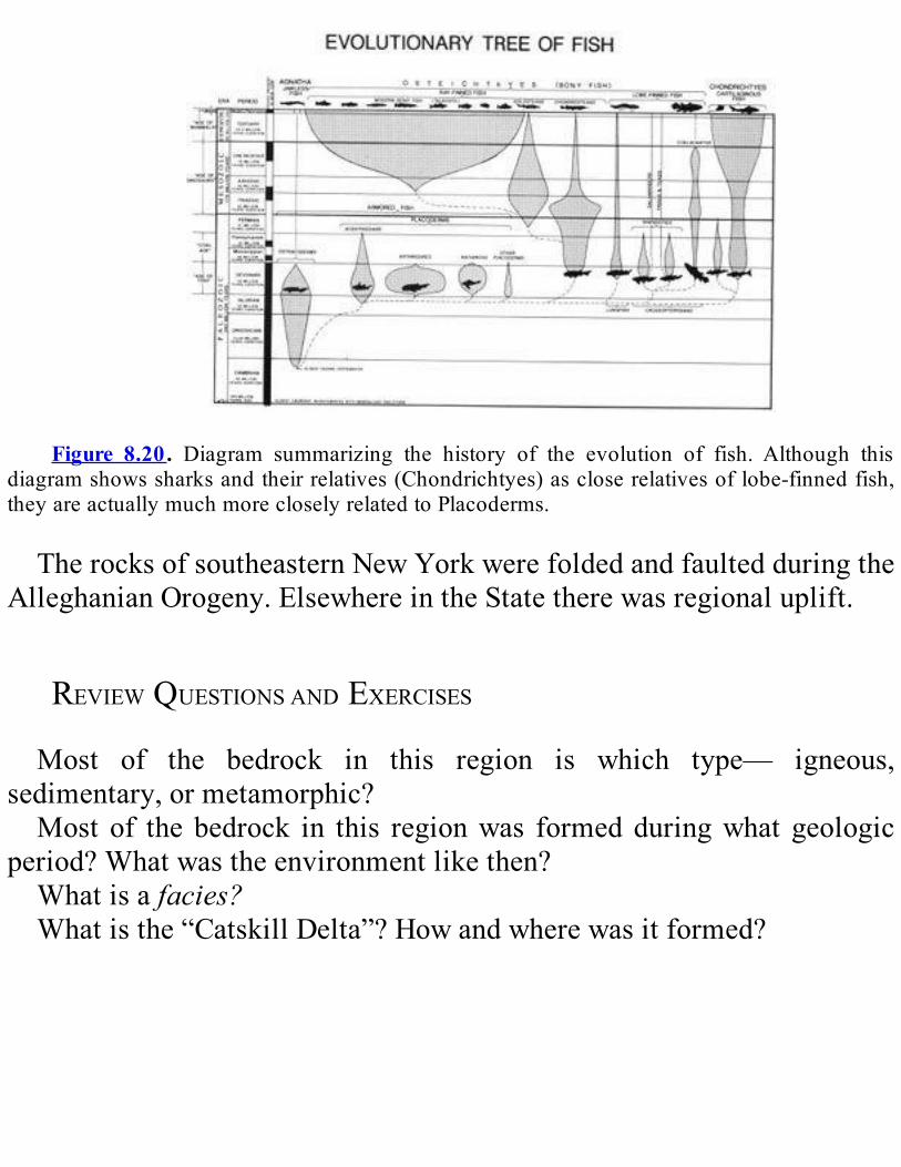
Figure 8.20. Diagram summarizing the history of the evolution of fish. Although this
diagramshowssharksandtheirrelatives(Chondrichtyes)ascloserelativesoflobe-finnedfish,theyareactuallymuchmorecloselyrelatedtoPlacoderms.
TherocksofsoutheasternNewYorkwerefoldedandfaultedduringtheAlleghanianOrogeny.ElsewhereintheStatetherewasregionaluplift.
REVIEWQUESTIONSANDEXERCISESMost of the bedrock in this region is which type— igneous,
sedimentary,ormetamorphic?Most of the bedrock in this regionwas formedduringwhat geologic
period?Whatwastheenvironmentlikethen?Whatisafacies?Whatisthe“CatskillDelta”?Howandwherewasitformed?


Figure8.21.These two pictures show theMiddleDevonian fossil treeEospermatopteris.
Thesestumps,discoverednearGilboa,SchoharieCounty,arefoundinoneoftheworld’soldestknownforest. (A) isafossilstumpofEospermatopteris. It isapproximately1mhigh.(B)isadrawingofwhatthelivingtreeprobablylookedlike(publishedbyW.Goldringin1924).Thetreewouldhavebeenabout8mhigh.
Editor’s note: The following supplement toChapter 8 is for studentswhoareinterestedinadiscussionofthesubtlestructuresintherocksoftheAlleghenyPlateau.Itservesasacasestudyofthekindofinformationwecangetfromcloseandcarefulexaminationofoutcrops.AreviewtheTectonicMaponPlate4of theGeologicalHighwayMapand theplatetectonichistoryofNewYorkinChapter3mayhelpyouunderstandthisdiscussion.Also,theGlossarywillprovidedefinitionsofmanyunfamiliarterms.
DEFORMATIONOF“UNDEFORMED”ROCKS:STRUCTURESINTHE
ALLEGHENYPLATEAUAdapted from text furnished by Professor Terry Engelder,
PennsylvaniaStateUniversityThe structure of rocks in the Allegheny Plateau looks deceptively
simple—nothing but nearly horizontal sedimentary rock layers: “layer-cakegeology.”Folds like thosecommonlyseen in theconvolutedrocksoftheAdirondacks, theTaconicMountains,andsoutheasternNewYorkareabsent,andfaultsarerarelyseen.However,despitethissimplelayer-cake appearance of the rocks of the region, subtle effects of theAlleghanianOrogenyarepresentinmostoftherockexposuresincentralandwesternNewYorksouthofalinebetweenSyracuseandBuffalo(seemustard-coloredareaon theTectonicMaponPlate4).Thesestructurescanbeseenbytheinquisitiveeye,andtheyyieldafascinatingstructuralstory. Our goal in this section is to help the reader learn to see theseAlleghanian structures, to understand the ways in which they wereproduced,andtolearnwhattheytellusaboutthestructuralhistoryofthePlateau.
RockBehaviorWhentheCrustIsSqueezedorStretchedThe way a rock deforms depends on the strength of the rock. By
strength, we mean a rock’s resistance to deformation. When “weak”rocks, such as shale or rock salt, are slowly subjected to increasingstress11,theydeformbyflowing,likeSillyPutty,modelingclay,oreventar. In contrast, “strong” rocks, such as limestone and sandstone,withstand much greater stress, until finally they deform by breaking.Strongrocksaremorebrittle.IntheAlleghenyPlateau,wecanseethatthedistributionofstrongand
weak rock layers played a very important role in the way the Plateaudeformed. Several basic types of sedimentary rocks are exposed in
outcropsofthePlateau:limestone,dolostone,sandstone,shale,andsalt.Eachof these rock typeshasadifferent strength.Limestone,dolostone,andsandstonearestrong,whereasshaleandsaltareweak.Itwasalayerof salt, which is an extraordinarily weak rock, that had the greatestinfluence on the way the rocks deformed during the AlleghanianOrogeny.This salt layer divides the Allegheny Plateau horizontally, like the
filling in a two-layer cake. The salt is found in the lower part of theSalinaGroup of latest Silurian age (see Plate 3). It separates youngestSilurian and Devonian rocks above from lower Paleozoic rocks below.Thesaltwasdeposited inagreat inlandsea that coveredanarea largerthanwesternNewYorkandnorthwesternPennsylvania combined.Bothshaleandsaltdeformbyflowing,butsalt flowsmuchmoreeasily thanshale. Ifwe think of the shale behaving like Silly Putty, thenwemustvisualizesaltasbehavinglikeathicksplitpeasoup.In the Late Paleozoic, the stresses that were produced by the
Alleghanian Orogeny pushed northwestward against the rock of theAlleghenyPlateau (see theTectonicMaponPlate4).The layersbelowtheSiluriansaltremainedfixed,butthesalt layer,whichhadalmostnostrength, began to flow.This situation allowed the thick upper layer ofDevonian andCarboniferous12 rocks to slide to the northwest, withoutfolding,likeastiffrugpushedacrossaslipperywaxedfloor.Theuppersection of theAllegheny Plateau thus slid northwestward along a largehorizontalfaultthatdevelopedinthesaltlayer.Thisfault,separatingthefixedandtransportedsections,iscalledadècollement.Within the layers that slid, which we calltransported layers, strong
units include theOriskanySandstone, theOnondagaFormation,and theTully Limestone, whereas weak units include the Upper Devoniansiltstones and shales (see Plate 3).Added together, the weak units aremuchthickerthanthestrongunits.Itisthisgreaterthicknessoftheweakunits that controls most of the structures seen in outcrops of theAlleghenyPlateau.The thickness of the salt beds in the Salina Group exceeds 100 m

throughoutmuch of western NewYork. The salt beds thin out to zerothicknessattheedgeoftheancientsea.Thenorthernedgeofthesaltrunseast-westalongalinesouthofBuffalo,Rochester,andSyracuse.Wefinddeformation from the Alleghanian Orogeny in the transported layerseverywhere above the salt layer. Where the salt layer ends, so doesevidenceofAlleghaniandeformation(seethePhysiographicandTectonicMapsonPlate4).
Layer-ParallelShortening:TheWayRocksCanDeformWithoutFoldingAs the transported rock section was forced to the northwest, it was
pushedagainstthepinchout13ofthesalt.Atthepinchout,withnosalttoslideon,theupperslabofrockresteddirectlyonthelowerslab.Lackingthelubricationofsalt,itwasanchoredtherebyfriction.Despitethisfact,compression from the southeast continued to push the slab against thenorthwestsideofthebasin.Thiscompressioncausedtheslabtoactuallybecome shorter, butwithout folding of the layers. Such deformation iscalledlayer-parallel shortening (Figure 8.22). The amount of crustalshorteningontheAlleghenyPlateauwasconsiderable;anoriginalwidthof200kmwasshortenedby20kmduringtheAlleghanianOrogeny.Layer-parallel shorteningoccurs in several differentways, depending
on the strength of individual layers in the section. Weak shale andsiltstone, themost abundant rock types in theAllegheny Plateau, weresqueezed together like modeling clay. At the same time, the strong,brittle layers, including the Onondaga and Tully Limestones and theOriskany Sandstone, broke into giant slabs. These slabs piled up likeshinglesonaroof(Figure8.22).What evidence for layer-parallel shortening canwe see in individual
rockexposures?Wefindtheevidenceinseveraltypesofstructures,tobeexplained below:deformed fossils, pencil cleavage, spaced cleavage,blind thrusting, anddrape folds. The first three are associated withflowingintheweakrocklayers;theothertwoareconnectedwithbrittle
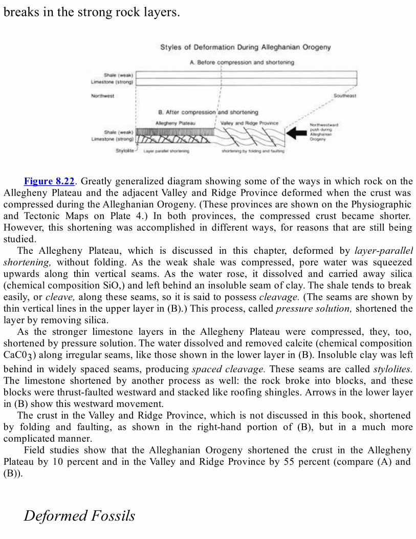
breaksinthestrongrocklayers.
Figure8.22.Greatlygeneralizeddiagramshowingsomeofthewaysinwhichrockonthe
AlleghenyPlateau and the adjacentValley andRidgeProvince deformedwhen the crustwascompressedduringtheAlleghanianOrogeny.(TheseprovincesareshownonthePhysiographicand Tectonic Maps on Plate 4.) In both provinces, the compressed crust became shorter.However, this shorteningwas accomplished in differentways, for reasons that are still beingstudied.
The Allegheny Plateau, which is discussed in this chapter, deformed by layer-parallelshortening, without folding. As the weak shale was compressed, pore water was squeezedupwards along thin vertical seams. As the water rose, it dissolved and carried away silica(chemicalcompositionSiO,)andleftbehindaninsolubleseamofclay.Theshaletendstobreakeasily,orcleave,alongtheseseams,soitissaidtopossesscleavage.(Theseamsareshownbythinverticallinesintheupperlayerin(B).)Thisprocess,calledpressuresolution,shortenedthelayerbyremovingsilica.
As the stronger limestone layers in the Allegheny Plateau were compressed, they, too,shortenedbypressuresolution.Thewaterdissolvedandremovedcalcite(chemicalcompositionCaC03)alongirregularseams,likethoseshowninthelowerlayerin(B).Insolubleclaywasleftbehind inwidely spacedseams,producingspacedcleavage.These seams are calledstylolites.The limestone shortened by another process as well: the rock broke into blocks, and theseblockswerethrust-faultedwestwardandstackedlikeroofingshingles.Arrowsinthelowerlayerin(B)showthiswestwardmovement.
Thecrust in theValleyandRidgeProvince,which isnotdiscussed in thisbook,shortenedby folding and faulting, as shown in the right-hand portion of (B), but in a much morecomplicatedmanner.
Field studies show that the Alleghanian Orogeny shortened the crust in the AlleghenyPlateauby10percent and in theValleyandRidgeProvinceby55percent (compare (A)and(B)).
DeformedFossils
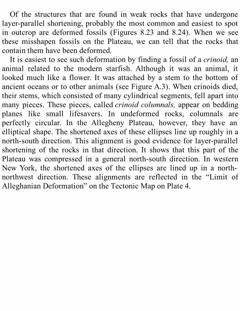
Of the structures that are found in weak rocks that have undergone
layer-parallelshortening,probablythemostcommonandeasiesttospotin outcrop are deformed fossils (Figures 8.23 and 8.24).When we seethese misshapen fossils on the Plateau, we can tell that the rocks thatcontainthemhavebeendeformed.Itiseasiesttoseesuchdeformationbyfindingafossilofacrinoid,an
animal related to the modern starfish. Although it was an animal, itlookedmuch like a flower. Itwas attached by a stem to the bottomofancientoceansortootheranimals(seeFigureA.3).Whencrinoidsdied,theirstems,whichconsistedofmanycylindricalsegments,fellapartintomanypieces.Thesepieces, calledcrinoidcolumnals,appearonbeddingplanes like small lifesavers. In undeformed rocks, columnals areperfectly circular. In the Allegheny Plateau, however, they have anellipticalshape.Theshortenedaxesoftheseellipseslineuproughlyinanorth-southdirection.Thisalignmentisgoodevidenceforlayer-parallelshortening of the rocks in that direction. It shows that this part of thePlateau was compressed in a general north-south direction. In westernNewYork, the shortened axes of the ellipses are lined up in a north-northwest direction. These alignments are reflected in the “Limit ofAlleghanianDeformation”ontheTectonicMaponPlate4.
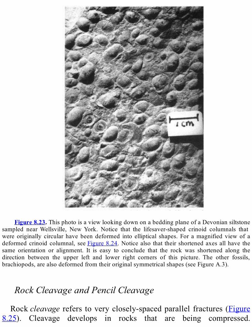
Figure8.23.ThisphotoisaviewlookingdownonabeddingplaneofaDevoniansiltstone
sampled nearWellsville, NewYork. Notice that the lifesaver-shaped crinoid columnals thatwere originally circular have been deformed into elliptical shapes. For amagnified view of adeformed crinoid columnal, seeFigure8.24.Noticealso that their shortenedaxesallhave thesame orientation or alignment. It is easy to conclude that the rock was shortened along thedirection between the upper left and lower right corners of this picture. The other fossils,brachiopods,arealsodeformedfromtheiroriginalsymmetricalshapes(seeFigureA.3).
RockCleavageandPencilCleavageRockcleavage refers toveryclosely-spacedparallel fractures (Figure
8.25). Cleavage develops in rocks that are being compressed.
Sedimentary rock contains water in the microscopic openings (porespaces) between its grains. When the rock is compressed, the waterpressure is raised, and the water is forced upwards along microscopicpassageways.Asthewaterrisesitdissolvessilica(chemicalcompositionSiO2) in the rock. This process is calledpressuresolution. It results inleavingbehindparallelseamsofinsolubleclayminerals.Thisremovalofrockmaterial by solution along the cleavage planes causes the rock toshorten at right angles to the cleavage.As the rockweathers, it breakseasily along these clay seams to produce very visible cleavage (Figure8.26). If the rockhas thin beddingplanes aswell as cleavage, the rockbreaksalongboth,toformlongnarrowpiecescalledpencils.Thiskindofcleavage is calledpencilcleavage.Whereexposurescontainbothpencilcleavage and crinoid columnals, we find that the pencils pointperpendicular to the shortened axesof thedeformedcrinoid columnals.Thus, pencil cleavage also shows that the layer-parallel shorteninghappenedinanorth-southdirectionintheFingerLakesdistrict.
SpacedCleavageAnother kind of rock cleavage, calledspacedcleavage, is a structure
foundintheTullyandOnondagaLimestonesofwesternNewYork.Likepencil cleavage, it forms in rocks under pressure, when pore waterdissolves part of the rock and leaves an insoluble residue of clay. Themineral that dissolves in limestones is calcium carbonate (chemicalcomposition CaCO3). The insoluble clay seam in limestones are thin,black, irregular surfaces that run through the rock (Figure 8.26). Inoutcrops of limestone, these irregular structures are calledstylolites.When lime stonesweather, the rock breaks easily along these surfaces.This kind of cleavage is called spaced cleavage because the stylolitesform at regular intervals in the rock. The layer-parallel shortening iscausedbythesolutionandremovalofcalciumcarbonatebywaterrisingalongthesesurfaces.Theshorteningdirectionisthereforeperpendicular
to the cleavage, as was the case for the cleavage in shales describedabove.
Figure8.24.Microscopeenlargementofathinrocksliceofadeformedcrinoidcolumnal
taken from the rock shown inFigure 8.23. The elliptical shape of the crinoid shows thedeformationofafossilthatwasinitiallycircularincrosssection.(Thiscrinoidcolumnalisabout5mminthelongdirection.)
Spaced cleavage indicates the same north-south shortening directionshownbydeformedfossilsandpencilcleavage.However,fieldstudiesofthe spaced cleavage show that much less layer-parallel shortening hastakenplaceinthelimestonelayersthanintheshaleformationsthatlieontopofit.Itishardtoseehowonelayercouldshortenlessthanonenexttoit;bothwouldbeexpectedtoshortenthesameamount.Thisseemingcontradictionsuggeststhatsomeadditionalshorteningprocessmustalsohavetakenplaceinthelimestonelayers.Furtherfieldstudiesconfirmedthishypothesis,asdescribedbelow.
BlindThrustingCarefulsearchledtothediscoverythatwhilethethickbutweaklayers
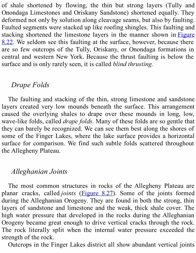
of shale shortened by flowing, the thin but strong layers (Tully andOnondagaLimestonesandOriskanySandstone)shortenedequally.Theydeformednotonlybysolutionalongcleavageseams,butalsobyfaulting.Faultedsegmentswerestackeduplikeroofingshingles.Thisfaultingandstacking shortened the limestone layers in themanner shown inFigure8.22.Weseldomseethisfaultingatthesurface,however,becausethereare so few outcrops of theTully,Oriskany, orOnondaga formations incentral andwesternNewYork.Because the thrust faulting isbelow thesurfaceandisonlyrarelyseen,itiscalledblindthrusting.
DrapeFoldsThe faultingandstackingof the thin, strong limestoneandsandstone
layers created very lowmounds beneath the surface. This arrangementcaused the overlying shales to drape over these mounds in long, low,wave-likefolds,calleddrapefolds.Manyofthesefoldsaresogentlethattheycanbarelyberecognized.Wecanseethembestalongtheshoresofsomeof theFingerLakes,where the lake surfaceprovides a horizontalsurface for comparison.We find such subtle folds scattered throughouttheAlleghenyPlateau.
AlleghanianJointsThe most common structures in rocks of theAllegheny Plateau are
planar cracks, calledjoints (Figure 8.27). Some of the joints formedduringtheAlleghanianOrogeny.Theyarefoundinboththestrong,thinlayersof sandstone and limestone and theweak, thick shale cover.Thehighwater pressure that developed in the rocks during theAlleghanianOrogenybecamegreatenoughtodriveverticalcracks throughtherock.The rock literally split when the internal water pressure exceeded thestrengthoftherock.OutcropsintheFingerLakesdistrictallshowabundantverticaljoints
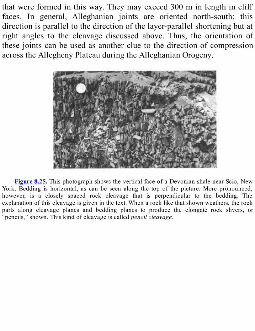
thatwereformedinthisway.Theymayexceed300minlengthinclifffaces. In general, Alleghanian joints are oriented north-south; thisdirectionisparalleltothedirectionofthelayer-parallelshorteningbutatright angles to the cleavage discussed above. Thus, the orientation ofthese jointscanbeusedasanotherclue to thedirectionofcompressionacrosstheAlleghenyPlateauduringtheAlleghanianOrogeny.
Figure8.25.ThisphotographshowstheverticalfaceofaDevonianshalenearScio,New
York. Bedding is horizontal, as can be seen along the top of the picture.More pronounced,however, is a closely spaced rock cleavage that is perpendicular to the bedding. Theexplanationofthiscleavageisgiveninthetext.Whenarocklikethatshownweathers,therockparts along cleavage planes and bedding planes to produce the elongate rock slivers, or“pencils,”shown.Thiskindofcleavageiscalledpencilcleavage.
Figure8.26. Spaced cleavage in theOnondagaLimestone nearGeneva,NewYork.The
viewislookingdownonbeddingwhereveryirregularstylolitescutverticallythroughthebed,asshowntotherightofthejackknife.

Figure8.27.Straight,planarcrackscalledjointsareseenherecuttingsiltstonesnearIthaca,
New York. These joints, which are oriented north-south, are characteristic of many of theoutcropsintheFingerLakesDistrictofNewYork.
During the Mesozoic Era, some north-south joints in central andwestern New York became the passageways for magma that movedupwardfromtheearth’smantle.Themagmasolidifiedtoformkimberlitedikes,whicharemostconcentratedinthevicinityofIthaca.(Kimberliteisadark-coloredigneousrock.)Mostofthedikesareafewcentimetersthick,butsomereachseveraltensofcentimetersinthickness.
Clarendon-LindenFaultZoneUptothispoint,wehavebeendiscussingstructuresthatformedduring
the Alleghanian Orogeny. However, some important structures in theAllegheny Plateau formed at other times. These structures include aprominentfaultzoneandtwodifferentkindsofjoints.The most prominent deformation feature on the Plateau is the
Clarendon-Linden structure located south of Rochester.At the surface,the structure is a north-south-trending fold (see the Tectonic Map onPlate4).Drillholesshowthatatdepthitisafaultzonemadeupofthreeor more segments. We think that the fault zone originated about 650millionyearsago,whentheGrenvillesupercontinentwasbreakingup,orrifting(seeChapter3).TheClarendon-Lindenfaultzonecutsthroughtheentirefixedsection
and probably extends into thebasement rock—the Proterozoicmetamorphic rock that lies under the younger sedimentary layers.Geologists are still debatingwhetherornot the fault zonealsocuts thetransporteduppersectionofthePlateau.Below the surface, some of the Middle and Upper Ordovician
sedimentary rock units thicken near the Clarendon-Linden fault zone.This factsuggests thatdownwardmovementoccurredalongonesideofthefaultataboutthattimetocreatelowareaswheresedimentspiledupthicker than elsewhere. On this basis, we conclude that the Clarendon-Linden fault zone was either still active or again active in Ordoviciantime.Evidence also exists that the fault zone may have been active in
Devonian time,during theAcadianOrogeny.At thepresent time, smallearthquakes are detected periodically in the vicinity of the Clarendon-Linden structure. These earthquakes suggest that the fault zone is stillactive.Fromalltheseobservations,itappearsthattheClarendon-LindenfaultzoneisthemostactivestructureoftheAlleghenyPlateau.Periodicactivityalong thiszonedates fromLateProterozoic time to thepresentday.
ReleaseJointsAtthetimetheAlleghenyPlateauregionwasundergoinglayer-parallel
shortening, sedimentswere pouring out onto it from a risingmountainrange to the southeast thatwas, at the same time, undergoing vigorouserosion.Later,duringtheMesozoicEra,greatthicknessesofsedimentaryrock were eroded away. Thus rock that was once deeply buried andtherefore under great pressure was unloaded and brought closer to thesurface.Withalesseningofpressure,therockexpanded.Thisexpansionstretchedthecrustandledtotheformationofjoints.Jointsformedinthisway are calledrelease joints.These release joints lineup roughly east-westintheFingerLakesdistrict,atrightanglestotheAlleghanianjoints.
Late-FormedUnloadingJointsOther joints formed even later as the rock cooled. these late-formed
jointslineuproughlyeast-northeast.thisdirectionisparalleltostressesfound in the crust there today. some geologists have used these late-formed joints to draw amap of themodern stresses in the appalachianmountains.
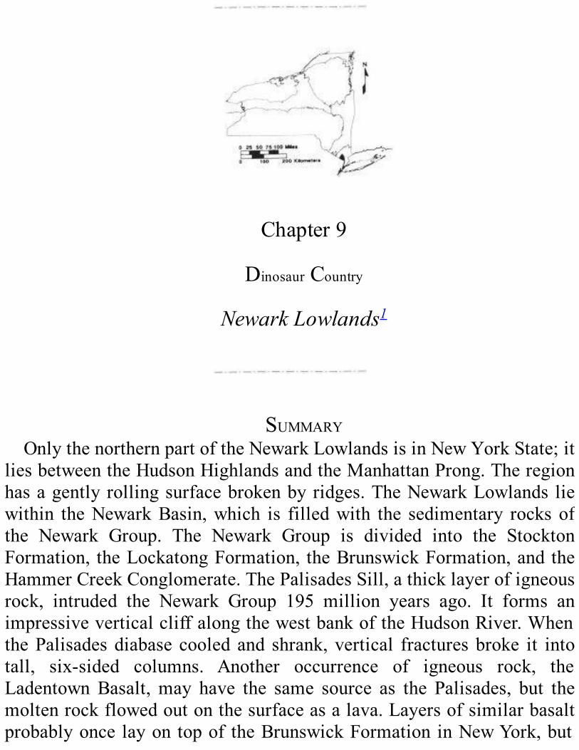
Chapter9
DinosaurCountry
NewarkLowlands1
SUMMARYOnlythenorthernpartoftheNewarkLowlandsisinNewYorkState;it
liesbetweentheHudsonHighlandsandtheManhattanProng.Theregionhasagentlyrollingsurfacebrokenbyridges.TheNewarkLowlands liewithin theNewarkBasin,which is filledwith the sedimentary rocksofthe Newark Group. The Newark Group is divided into the StocktonFormation, theLockatongFormation, theBrunswickFormation,andtheHammerCreekConglomerate.ThePalisadesSill,athicklayerofigneousrock, intruded the Newark Group 195 million years ago. It forms animpressiveverticalcliffalongthewestbankoftheHudsonRiver.WhenthePalisadesdiabase cooled and shrank,vertical fracturesbroke it intotall, six-sided columns. Another occurrence of igneous rock, theLadentownBasalt,may have the same source as the Palisades, but themoltenrockflowedoutonthesurfaceasalava.Layersofsimilarbasaltprobablyoncelayontopof theBrunswickFormationinNewYork,but
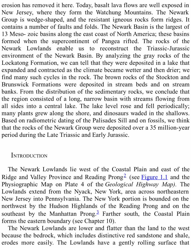
erosionhasremovedithere.Today,basaltlavaflowsarewellexposedinNew Jersey, where they form the Watchung Mountains. The NewarkGroup iswedge-shaped, and the resistant igneous rocks form ridges. Itcontainsanumberoffaultsandfolds.TheNewarkBasinisthelargestof13Meso-zoicbasinsalongtheeastcoastofNorthAmerica;thesebasinsformed when the supercontinent of Pangea rifted. The rocks of theNewark Lowlands enable us to reconstruct the Triassic-Jurassicenvironment of the Newark Basin. By analyzing the gray rocks of theLockatongFormation,wecantellthattheyweredepositedinalakethatexpandedandcontractedastheclimatebecamewetterandthendrier;wefindmanysuchcyclesintherock.ThebrownrocksoftheStocktonandBrunswick Formations were deposited in stream beds and on streambanks.Fromthedistributionof thesedimentaryrocks,weconcludethatthe regionconsistedofa long,narrowbasinwith streams flowing fromall sides into a central lake. The lake level rose and fell periodically;manyplantsgrewalongtheshore,anddinosaurswadedintheshallows.BasedonradiometricdatingofthePalisadesSillandonfossils,wethinkthattherocksoftheNewarkGroupweredepositedovera35million-yearperiodduringtheLateTriassicandEarlyJurassic.
INTRODUCTIONThe Newark Lowlands lie west of the Coastal Plain and east of the
RidgeandValleyProvinceandReadingProng2 (seeFigure1.1 and thePhysiographic Map on Plate 4 of theGeological Highway Map). TheLowlands extend from the Nyack, NewYork, area across northeasternNewJerseyintoPennsylvania.TheNewYorkportionisboundedonthenorthwest by the Hudson Highlands of the Reading Prong and on thesoutheast by the Manhattan Prong.3 Farther south, the Coastal Plainformstheeasternboundary(seeChapter10).TheNewarkLowlandsare lowerand flatter than the land to thewest
becausethebedrock,whichincludesdistinctiveredsandstoneandshale,erodes more easily. The Lowlands have a gently rolling surface that
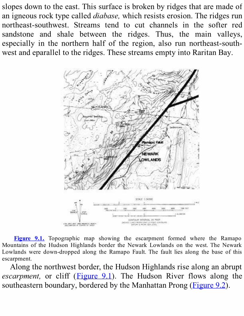
slopesdowntotheeast.Thissurfaceisbrokenbyridgesthataremadeofanigneousrocktypecalleddiabase,whichresistserosion.Theridgesrunnortheast-southwest. Streams tend to cut channels in the softer redsandstone and shale between the ridges. Thus, the main valleys,especially in the northern half of the region, also run northeast-south-westandeparalleltotheridges.ThesestreamsemptyintoRaritanBay.
Figure 9.1. Topographic map showing the escarpment formed where the Ramapo
Mountains of the Hudson Highlands border the Newark Lowlands on the west.The NewarkLowlands were down-dropped along the Ramapo Fault.The fault lies along the base of thisescarpment.Alongthenorthwestborder,theHudsonHighlandsrisealonganabrupt
escarpment, or cliff (Figure 9.1). The Hudson River flows along thesoutheasternboundary,borderedbytheManhattanProng(Figure9.2).

ROCKSOFTHENEWARKLOWLANDSThe rocks of the Newark Lowlands lie in a large basin called the
NewarkBasin(Figure9.2).WecallthesedimentaryrocksinthebasintheNewark Group. Also present are several igneous intrusions and lavaflows.TheNewarkGroupisdividedintofourunits:theStocktonFormation,
the Lockatong Formation, the Brunswick Formation, and the HammerCreekConglomerate(Figure9.3).Thelowestandoldestoftheseunitsisthe Stockton Formation. It contains thick layers of sandstone andconglomerate that are rich in feldspar.These layers alternatewith siltyandshaleymudstone.TheLockatongFormation, in themiddleof theNewarkGroup, isnot
exposedinNewYork.Itcontainsdarkgraytoblackshalesrichinorganicmaterials4 and limymudstone.These rockswere probably deposited assediments in a large lake. The Lockatong contains superb freshwaterfossils,especiallyoffish.ThefossilsarefoundintheoldGrantonQuarrynearNorthBergen,NewJersey.TheBrunswickFormationconsistsofreddish-brownshaleymudstone.
Themudstonealternateswithlayersofred-brownsandstone.Theserocksgraduallymergewith the coarse-grainedHammerCreekConglomerate.Thisconglomeratecontainsblocksandboulders(calledclasts)ofvariousolderrocks,mainlyCambrianandOrdovicianlimestonesanddolostones.Some of these clasts are as large as onemeter across.We can see theconglomeratebestnear thewesternedgeof theNewarkBasinalongtheRamapoFault.Of the igneous rocks in theNewarkLowlands, themostprominent is
thePalisadesSill. It consists of the rock diabase; it ismedium to darkgraywhenitisfreshlybroken.Diabaseismademainlyofthedarkgreenmineralpyroxeneandthelightgraymineralfeldspar.Together,thesetwominerals give the rock a dark-colored “salt-and-pepper” appearance.Withinthediabase,about12-15mabovethebase,wefindanearlypurelayerofthemineralolivine,about4.5to6mthick.
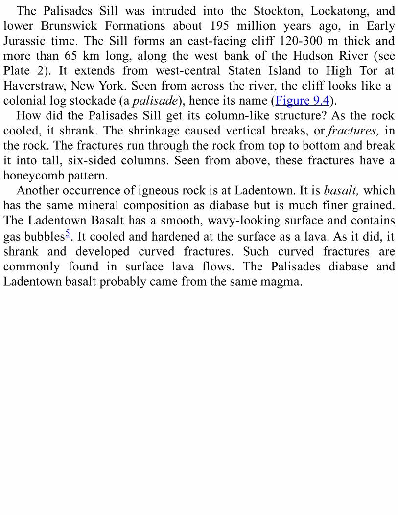
The Palisades Sill was intruded into the Stockton, Lockatong, andlower Brunswick Formations about 195 million years ago, in EarlyJurassic time. The Sill forms an east-facing cliff 120-300m thick andmore than 65 km long, along the west bank of the Hudson River (seePlate 2). It extends from west-central Staten Island to High Tor atHaverstraw,NewYork.Seenfromacrosstheriver,theclifflookslikeacoloniallogstockade(apalisade),henceitsname(Figure9.4).Howdid thePalisadesSillget its column-like structure?As the rock
cooled, it shrank.The shrinkage caused vertical breaks, orfractures, intherock.Thefracturesrunthroughtherockfromtoptobottomandbreakit into tall, six-sided columns. Seen from above, these fractures have ahoneycombpattern.AnotheroccurrenceofigneousrockisatLadentown.Itisbasalt,which
has thesamemineralcompositionasdiabasebut ismuchfinergrained.TheLadentownBasalthasasmooth,wavy-lookingsurfaceandcontainsgasbubbles5.Itcooledandhardenedatthesurfaceasalava.Asitdid,itshrank and developed curved fractures. Such curved fractures arecommonly found in surface lava flows. The Palisades diabase andLadentownbasaltprobablycamefromthesamemagma.
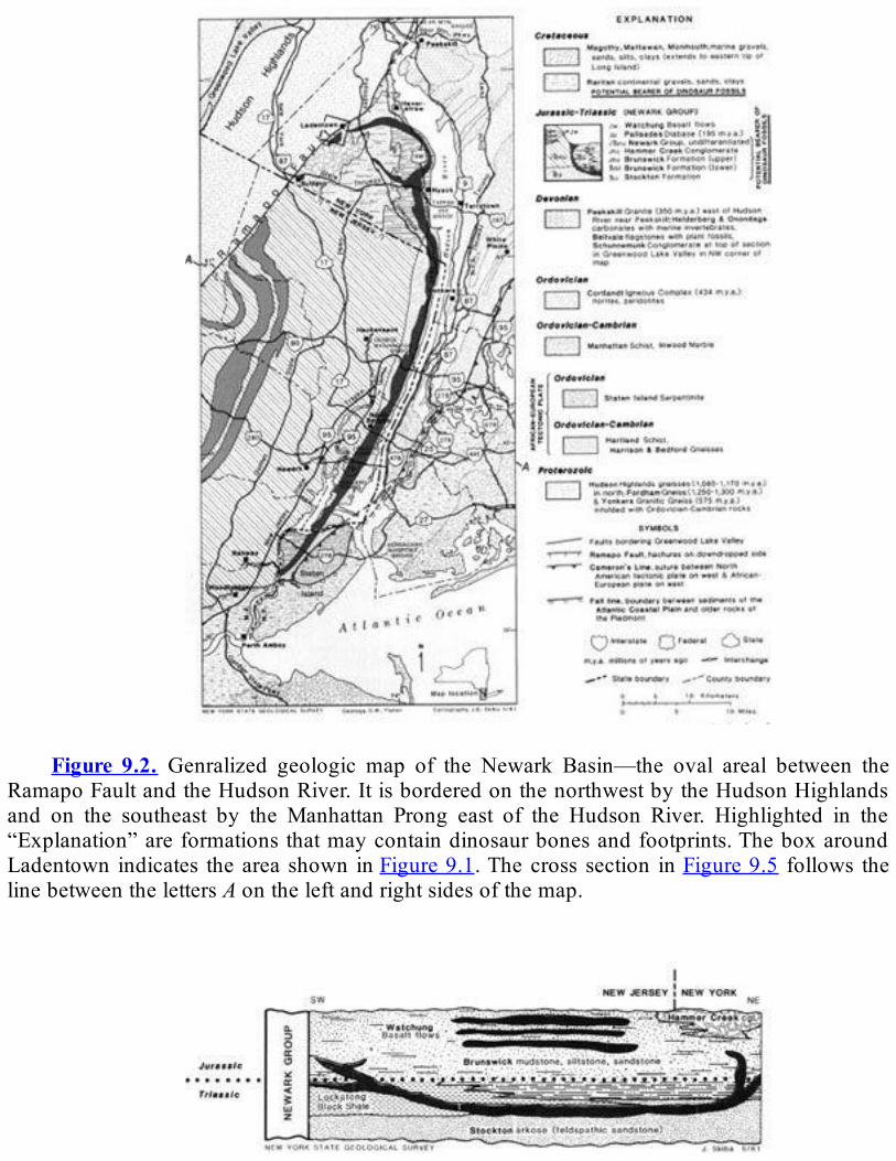
Figure 9.2. Genralized geologic map of the Newark Basin—the oval areal between the
RamapoFaultandtheHudsonRiver.ItisborderedonthenorthwestbytheHudsonHighlandsand on the southeast by the Manhattan Prong east of the Hudson River. Highlighted in the“Explanation”areformationsthatmaycontaindinosaurbonesandfootprints.TheboxaroundLadentown indicates thearea shown inFigure9.1.Thecross section inFigure9.5 follows thelinebetweenthelettersAontheleftandrightsidesofthemap.
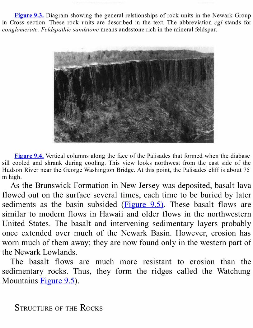
Figure9.3.DiagramshowingthegeneralrelstionshipsofrockunitsintheNewarkGroup
in Cross section.These rock units are described in the text.The abbreviation cgl stands forconglomerate.Feldspathicsandstonemeansandsstonerichinthemineralfeldspar.
Figure9.4.VerticalcolumnsalongthefaceofthePalisadesthatformedwhenthediabase
sill cooled and shrank during cooling. This view looks northwest from the east side of theHudsonRiverneartheGeorgeWashingtonBridge.Atthispoint,thePalisadescliffisabout75mhigh.AstheBrunswickFormationinNewJerseywasdeposited,basaltlava
flowedouton thesurfaceseveral times,each timetobeburiedby latersediments as the basin subsided (Figure 9.5). These basalt flows aresimilar tomodern flows inHawaii and older flows in the northwesternUnited States. The basalt and intervening sedimentary layers probablyonce extended over much of the Newark Basin. However, erosion haswornmuchofthemaway;theyarenowfoundonlyinthewesternpartoftheNewarkLowlands.The basalt flows are much more resistant to erosion than the
sedimentary rocks. Thus, they form the ridges called the WatchungMountainsFigure9.5).
STRUCTUREOFTHEROCKS
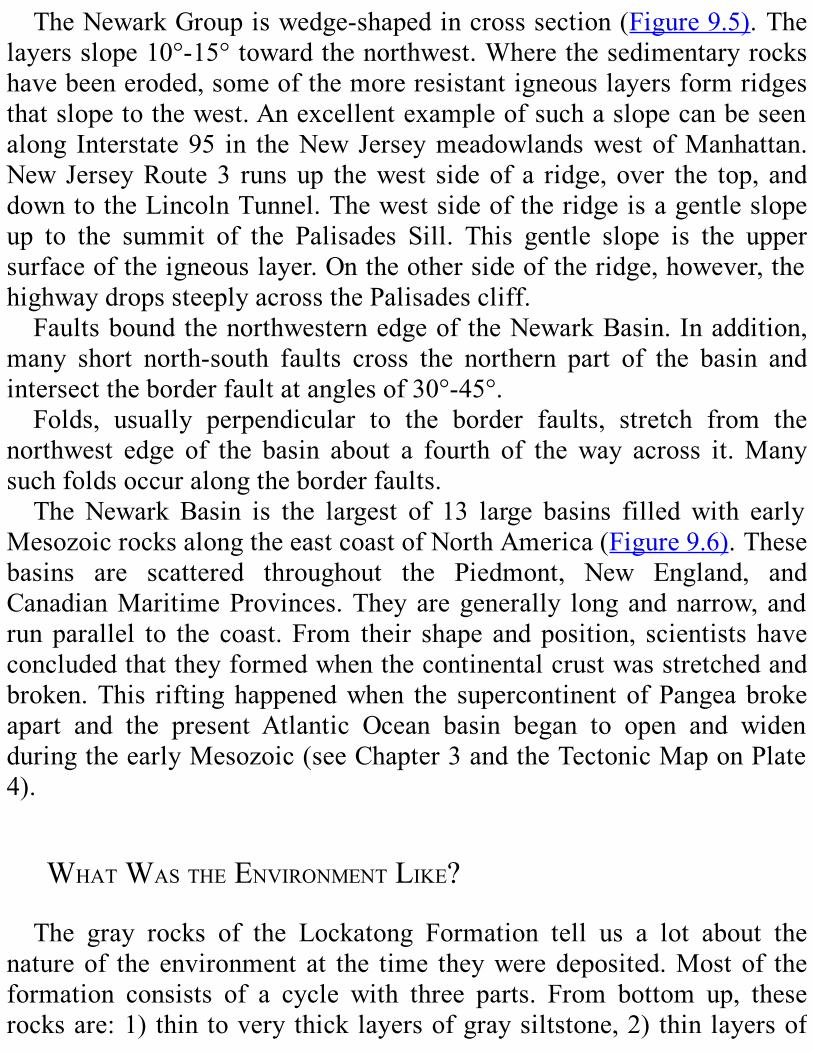
TheNewarkGroupiswedge-shapedincrosssection(Figure9.5).Thelayersslope10°-15°towardthenorthwest.Wherethesedimentaryrockshavebeeneroded,someofthemoreresistantigneouslayersformridgesthatslopetothewest.Anexcellentexampleofsuchaslopecanbeseenalong Interstate95 in theNewJerseymeadowlandswestofManhattan.New JerseyRoute3 runsup thewest sideof a ridge, over the top, anddowntotheLincolnTunnel.Thewestsideoftheridgeisagentleslopeup to the summit of the Palisades Sill. This gentle slope is the uppersurfaceoftheigneouslayer.Ontheothersideoftheridge,however,thehighwaydropssteeplyacrossthePalisadescliff.Faultsboundthenorthwesternedgeof theNewarkBasin.Inaddition,
many short north-south faults cross the northern part of the basin andintersecttheborderfaultatanglesof30°-45°.Folds, usually perpendicular to the border faults, stretch from the
northwest edge of the basin about a fourth of theway across it.Manysuchfoldsoccuralongtheborderfaults.TheNewark Basin is the largest of 13 large basins filledwith early
MesozoicrocksalongtheeastcoastofNorthAmerica(Figure9.6).Thesebasins are scattered throughout the Piedmont, New England, andCanadianMaritimeProvinces.Theyaregenerally longandnarrow, andrunparallel to the coast. From their shape andposition, scientists haveconcludedthattheyformedwhenthecontinentalcrustwasstretchedandbroken.This riftinghappenedwhen the supercontinent ofPangeabrokeapart and the present Atlantic Ocean basin began to open and widenduringtheearlyMesozoic(seeChapter3andtheTectonicMaponPlate4).
WHATWASTHEENVIRONMENTLIKE?The gray rocks of the Lockatong Formation tell us a lot about the
natureof theenvironment at the time theyweredeposited.Mostof theformation consists of a cycle with three parts. From bottom up, theserocksare:1)thintoverythicklayersofgraysiltstone,2)thinlayersof
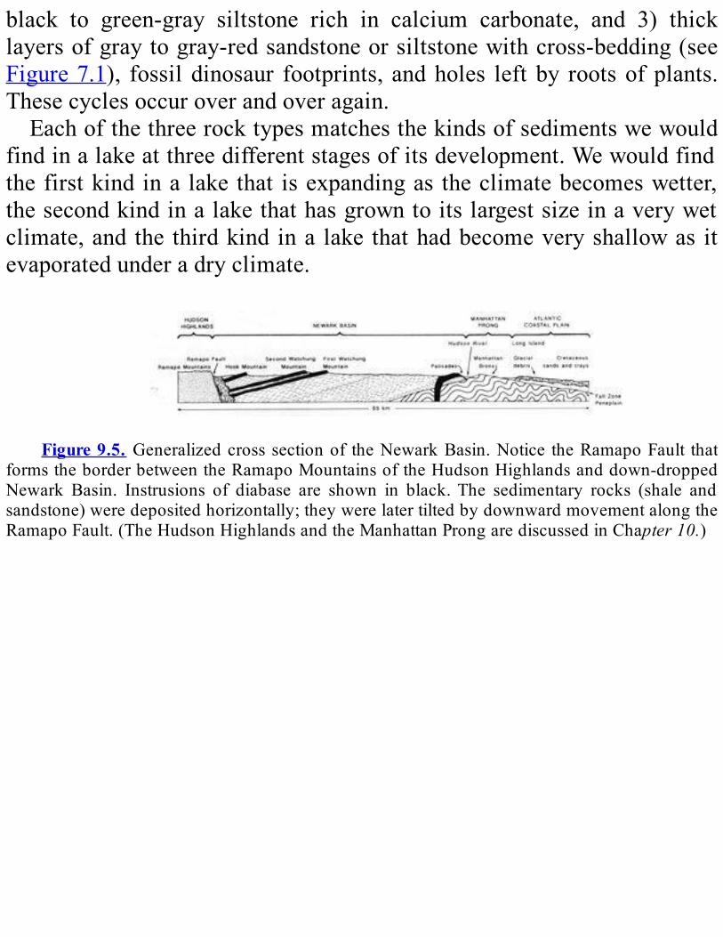
black to green-gray siltstone rich in calcium carbonate, and 3) thicklayersofgraytogray-redsandstoneorsiltstonewithcross-bedding(seeFigure7.1), fossildinosaur footprints, andholes leftby rootsofplants.Thesecyclesoccuroverandoveragain.Eachofthethreerocktypesmatchesthekindsofsedimentswewould
findinalakeatthreedifferentstagesofitsdevelopment.Wewouldfindthefirstkindina lakethat isexpandingas theclimatebecomeswetter,thesecondkindinalakethathasgrowntoitslargestsizeinaverywetclimate,and the thirdkind ina lake thathadbecomeveryshallowas itevaporatedunderadryclimate.
Figure9.5. Generalizedcrosssectionof theNewarkBasin.Notice theRamapoFault that
formstheborderbetweentheRamapoMountainsoftheHudsonHighlandsanddown-droppedNewark Basin. Instrusions of diabase are shown in black.The sedimentary rocks (shale andsandstone)weredepositedhorizontally;theywerelatertiltedbydownwardmovementalongtheRamapoFault.(TheHudsonHighlandsandtheManhattanProngarediscussedinChapter10.)
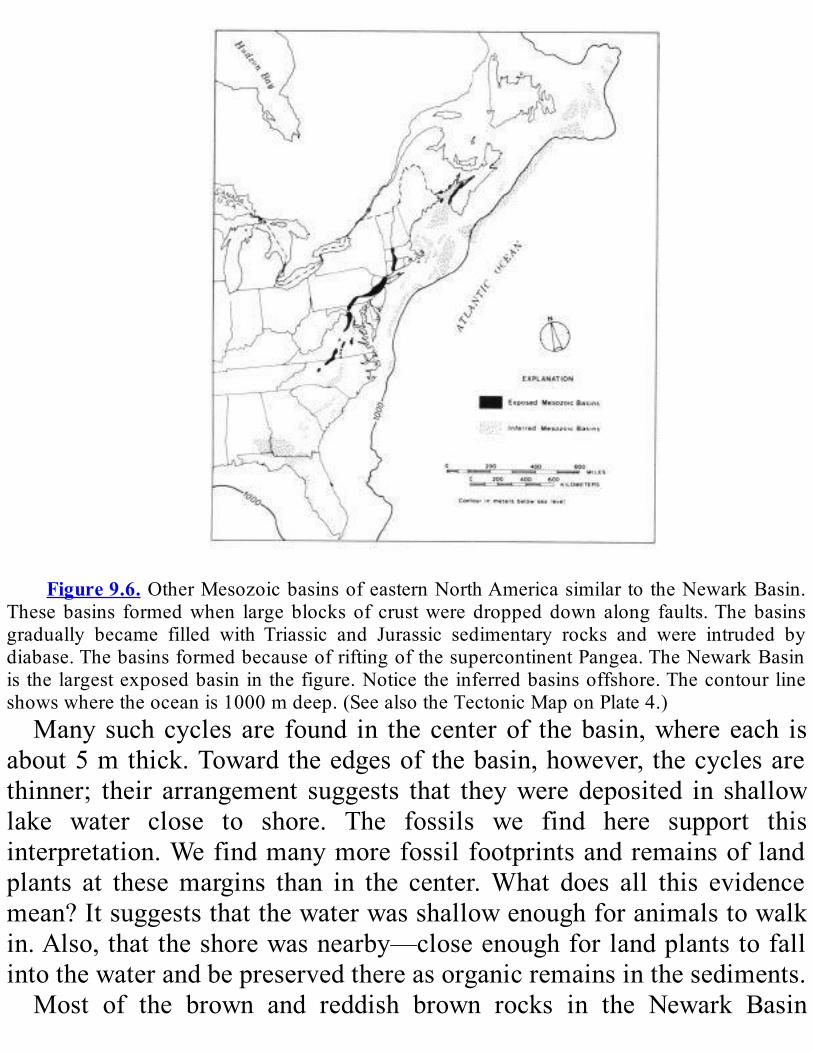
Figure9.6.OtherMesozoicbasinsofeasternNorthAmericasimilartotheNewarkBasin.
Thesebasins formedwhen largeblocks of crustwere droppeddownalong faults.Thebasinsgradually became filled with Triassic and Jurassic sedimentary rocks and were intruded bydiabase.ThebasinsformedbecauseofriftingofthesupercontinentPangea.TheNewarkBasinisthelargestexposedbasininthefigure.Noticetheinferredbasinsoffshore.Thecontourlineshowswheretheoceanis1000mdeep.(SeealsotheTectonicMaponPlate4.)Manysuchcyclesare found in thecenterof thebasin,whereeach is
about5mthick.Towardtheedgesofthebasin,however, thecyclesarethinner; their arrangement suggests that theyweredeposited in shallowlake water close to shore. The fossils we find here support thisinterpretation.Wefindmanymorefossilfootprintsandremainsoflandplants at thesemargins than in the center.What does all this evidencemean?Itsuggeststhatthewaterwasshallowenoughforanimalstowalkin.Also,thattheshorewasnearby—closeenoughforlandplantstofallintothewaterandbepreservedthereasorganicremainsinthesediments.Most of the brown and reddish brown rocks in the Newark Basin

orginated as stream sediments. How do we know that? Some of thesandstones have cross bedding,which indicates theywere deposited bymoving water. The sandstone and the conglomerate are typical of therocks formed in the stream beds or at the mouths of streams. In themudstonesoftheBrunswickFormation,wefindtheimpressionsofrootsanddinosaurfootprints(Figure9.7).Themudswerenotdepositedinthestreambeds,butonnearbystreambanksandatstreammouths. Insuchplaces,therunningwaterwouldnotwashthemaway.Whenweputallthisinformationtogether,wecanmakeagoodguess
aboutthekindofenvironmentinwhichtheNewarkrockswereformed.Itwas a long, narrow lowplace in the landscapewith streams flowing infromallsides.Thesestreamsdeposited thesediments that laterbecamethebrown rocks in the area. In the centralpartof thedepressionwasalakewhoseshorelineexpandedandcontractedasthelakelevelroseandfell.Inthislakeweredepositedthesedimentsthatbecamethegrayrocksof theNewark Basin. The fossils show us that thereweremany plantsalongthelakeshoreandthestreamcourses.Fromthefootprints,wealsoknow that dinosaurs walked along the water’s edge and waded in theshallows.RadiometricdatingtellsusthattheigneousrocksofthePalisadesSill
wereintrudedintotheNewarkGroupabout195millionyearsago,duringthe Early Jurassic. That age helps us to determine the age of thesedimentary rocksaswell.This sill cuts through the lower sedimentaryrocks. These rocks must therefore have been deposited before the sillintruded.The upper layers thatwere not cut by the igneous rocksweredepositedaftertheintrusiontookplace.ThesedimentaryrocksoftheNewarkBasinhavemanydifferentkinds
of fossils, both plants and animals. we find pollen, spores, and plantremains as well as many holes in the sediments made by plant roots;plants must have been abundant. we have found the footprints andremains of dinosaurs and an earlypterosaur, or flying reptile.Manyofthese fossils have been found in New Jersey. so far, the only dinosaurfossils found in NewYork State are the footprints of the carnivorousdinosaurcoelophysis (Figure 9.7). We have also found the remains of
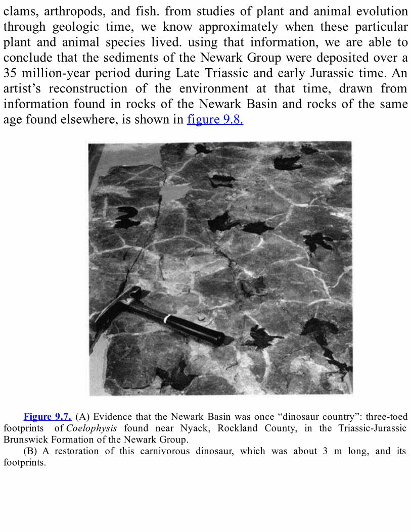
clams, arthropods, and fish. from studies of plant and animal evolutionthrough geologic time, we know approximately when these particularplant and animal species lived. using that information, we are able toconcludethatthesedimentsoftheNewarkGroupweredepositedovera35million-yearperiodduringLateTriassic andearly Jurassic time.Anartist’s reconstruction of the environment at that time, drawn frominformation found in rocksof theNewarkBasin and rocksof the sameagefoundelsewhere,isshowninfigure9.8.
Figure9.7. (A)Evidence that theNewarkBasinwasonce“dinosaurcountry”: three-toed
footprints ofCoelophysis found near Nyack, Rockland County, in the Triassic-JurassicBrunswickFormationoftheNewarkGroup.
(B) A restoration of this carnivorous dinosaur, which was about 3 m long, and itsfootprints.
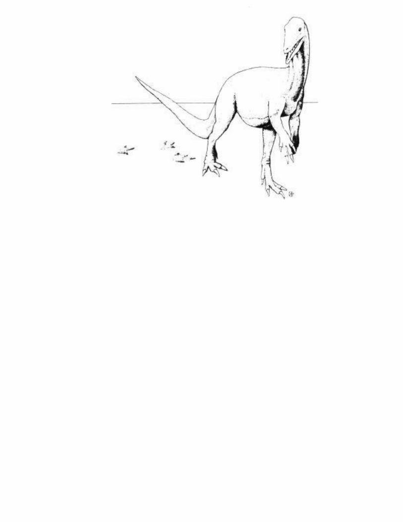

Figure9.8. TheNewark Lowlands, as theymay have appeared about 180million years
ago.Coelophysis,seenintherightforeground,wasabout3mlong.
REVIEWQUESTIONSANDEXERCISESMost of the bedrock in this region is which type—igneous,
sedimentary,ormetamorphic?
Therearefourmajorrockformationsinthisregion.Describethem.In
whatkindofenvironmentsdidtheyform?
What was happening in geologic history as the Newark Lowlandsbedrockwasformed?Howdidthatcreatetheenvironmentwhereitwasformed?
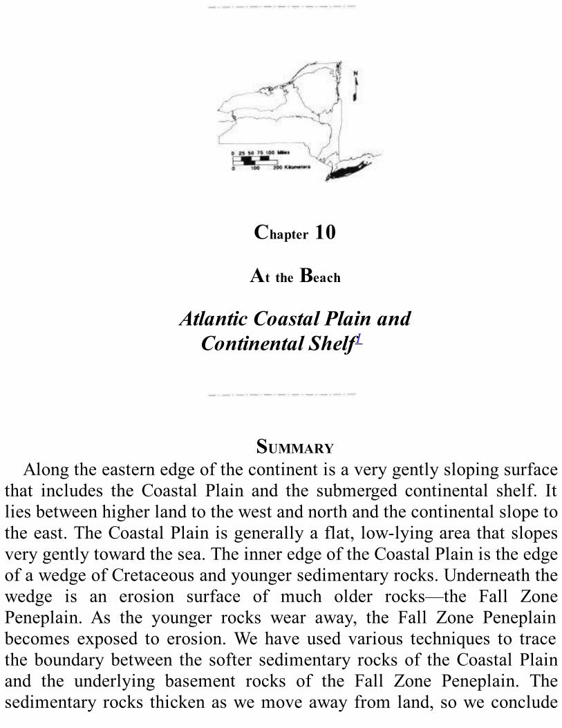
Chapter10
AttheBeach
AtlanticCoastalPlainandContinentalShelf1
SUMMARYAlongtheeasternedgeofthecontinentisaverygentlyslopingsurface
that includes the Coastal Plain and the submerged continental shelf. Itliesbetweenhigherlandtothewestandnorthandthecontinentalslopetotheeast.TheCoastalPlainisgenerallyaflat,low-lyingareathatslopesverygentlytowardthesea.TheinneredgeoftheCoastalPlainistheedgeofawedgeofCretaceousandyoungersedimentaryrocks.Underneaththewedge is an erosion surface of much older rocks—the Fall ZonePeneplain. As the younger rocks wear away, the Fall Zone Peneplainbecomes exposed to erosion.We have used various techniques to tracetheboundarybetween the softer sedimentary rocksof theCoastalPlainand the underlying basement rocks of the Fall Zone Peneplain. Thesedimentaryrocks thickenaswemoveawayfromland,soweconclude

thattheeasternedgeofNorthAmericaisslowlysinking.Oftherocksinthis wedge, some were deposited slightly above sea level, and othersslightly below sea level. Based on fossil evidence, we think that olderrocksarefoundfartheroffshore;thisconclusionreinforcestheideathattheedgeofthecontinentissinkingandtheshorelineiscreepinginland.TherocksoftheFallZonePeneplain,allolderthanMiddleJurassic,havebeen tilted seaward. The younger rocks above the erosion surfaceweredepositedatatimewhentheedgeofthecontinentwasgraduallysinking.TheedgeofNorthAmericawasheatedandupliftedwhenPangearifted;it has been sinking gradually since then. Sediments eroded fromhighlands to the west built the wedge of sedimentary deposits as theshoreline gradually crept inland. This process began in the MiddleJurassicandcontinuestoday.TheCoastalPlainslopesgentlytowardtheseabecausetheedgeofthecontinenthasbeensinking.Theerodededgesofmoreresistant layersonthis tiltedsurfacestandupasridges.Onthecontinentalshelf,wefindchannelsthatwerecutbyriverswhentheshelfwas above sea level during the Pleistocene Epoch.We also find broadridgesthatmarkformerpositionsof theshoreline.Greatcanyonsin theedgeofthecontinentalshelfandthecontinentalslopemayhavebeencutbycurrentsfilledwithchurned-upsedimentwhentheshelfwasabovesealevel.
IntroductionTheAtlanticCoastalPlain is a very gently sloping land surface near
theeasternedgeof thecontinent. It ispartofacontinuous surface thatextendsoffshore.Theunderwater section is called thecontinentalshelf.The section above the shoreline is called theCoastalPlain (seeFigure1.1 and the Physiographic Map on Plate 4 of theGeological HighwayMap).TheAtlantic Coastal Plain and continental shelf combined run from
Newfoundland to Florida (Figure10.1; see also the PhysiographicMapand text on Plate 4). The surface is about 300 kmwide for that entire
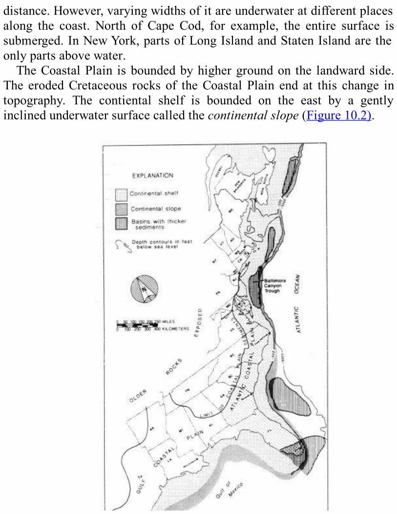
distance.However,varyingwidthsofitareunderwateratdifferentplacesalong the coast. North of Cape Cod, for example, the entire surface issubmerged.InNewYork,partsofLongIslandandStatenIslandaretheonlypartsabovewater.TheCoastalPlain isboundedbyhighergroundon the landwardside.
The erodedCretaceous rocksof theCoastalPlain end at this change intopography. The contiental shelf is bounded on the east by a gentlyinclinedunderwatersurfacecalledthecontinentalslope(Figure10.2).
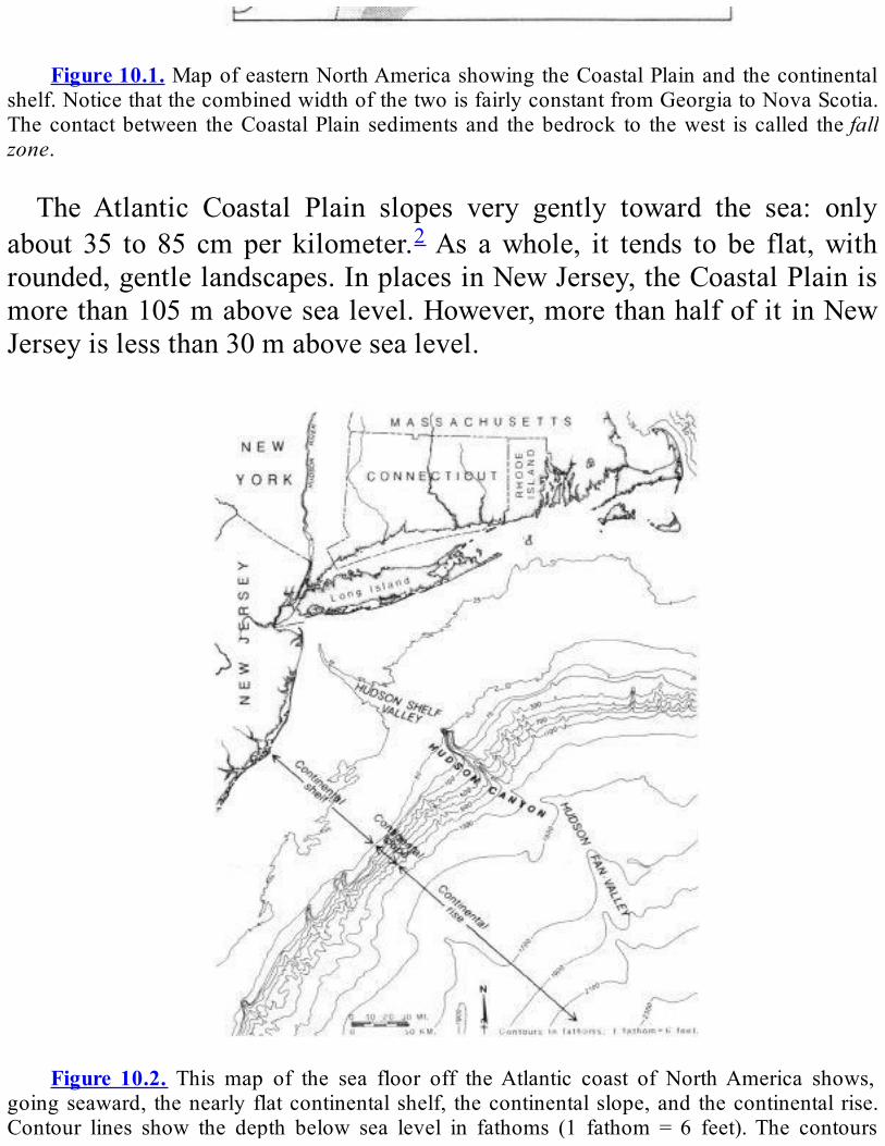
Figure10.1.MapofeasternNorthAmericashowingtheCoastalPlainandthecontinental
shelf.NoticethatthecombinedwidthofthetwoisfairlyconstantfromGeorgiatoNovaScotia.Thecontactbetween theCoastalPlain sedimentsand thebedrock to thewest iscalled thefallzone.
The Atlantic Coastal Plain slopes very gently toward the sea: onlyabout 35 to 85 cmper kilometer.2As awhole, it tends to be flat,withrounded,gentlelandscapes.InplacesinNewJersey,theCoastalPlainismorethan105mabovesealevel.However,morethanhalfofitinNewJerseyislessthan30mabovesealevel.
Figure 10.2. This map of the sea floor off theAtlantic coast of NorthAmerica shows,
goingseaward, thenearlyflatcontinentalshelf, thecontinentalslope,and thecontinental rise.Contour lines show the depth below sea level in fathoms (1 fathom = 6 feet).The contours
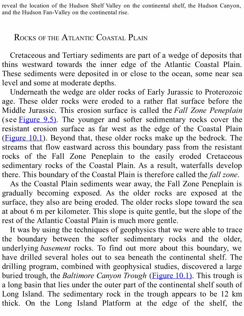
reveal the location of theHudson ShelfValley on the continental shelf, theHudsonCanyon,andtheHudsonFan-Valleyonthecontinentalrise.
ROCKSOFTHEATLANTICCOASTALPLAINCretaceousandTertiarysedimentsarepartofawedgeofdepositsthat
thins westward towards the inner edge of the Atlantic Coastal Plain.Thesesedimentsweredeposited inorclose to theocean,somenearsealevelandsomeatmoderatedepths.UnderneaththewedgeareolderrocksofEarlyJurassictoProterozoic
age. These older rocks were eroded to a rather flat surface before theMiddle Jurassic. This erosion surface is called theFallZonePeneplain(seeFigure 9.5). The younger and softer sedimentary rocks cover theresistant erosion surface as far west as the edge of the Coastal Plain(Figure10.1).Beyond that, theseolder rocksmakeup thebedrock.Thestreams that floweastwardacross thisboundarypass from the resistantrocks of the Fall Zone Peneplain to the easily eroded Cretaceoussedimentary rocks of the Coastal Plain.As a result, waterfalls developthere.ThisboundaryoftheCoastalPlainisthereforecalledthefallzone.AstheCoastalPlainsedimentswearaway,theFallZonePeneplainis
gradually becoming exposed. As the older rocks are exposed at thesurface,theyalsoarebeingeroded.Theolderrocksslopetowardtheseaatabout6mperkilometer.Thisslopeisquitegentle,buttheslopeoftherestoftheAtlanticCoastalPlainismuchmoregentle.Itwasbyusingthetechniquesofgeophysicsthatwewereabletotrace
the boundary between the softer sedimentary rocks and the older,underlyingbasement rocks. To find out more about this boundary, wehave drilled several holes out to sea beneath the continental shelf. Thedrillingprogram,combinedwithgeophysicalstudies,discoveredalargeburiedtrough,theBaltimoreCanyonTrough (Figure10.1).ThistroughisalongbasinthatliesundertheouterpartofthecontinentalshelfsouthofLong Island. The sedimentary rock in the trough appears to be 12 kmthick. On the Long Island Platform at the edge of the shelf, the
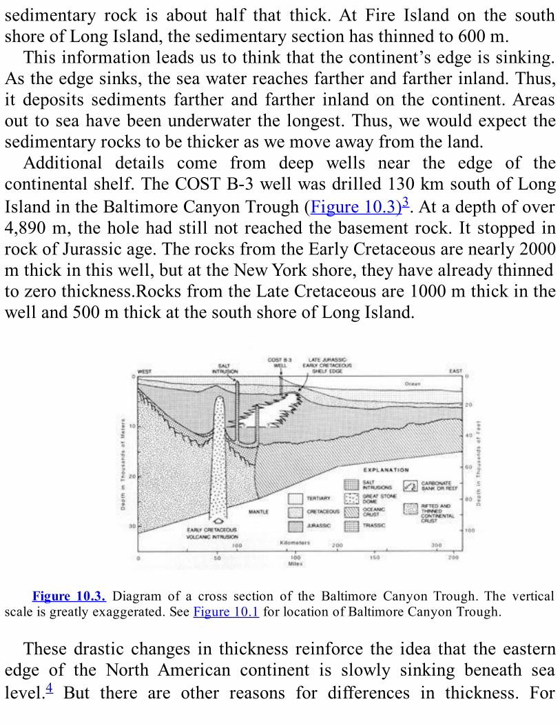
sedimentary rock is about half that thick.At Fire Island on the southshoreofLongIsland,thesedimentarysectionhasthinnedto600m.Thisinformationleadsustothinkthatthecontinent’sedgeissinking.
Astheedgesinks,theseawaterreachesfartherandfartherinland.Thus,it deposits sediments farther and farther inland on the continent.Areasout toseahavebeenunderwater thelongest.Thus,wewouldexpect thesedimentaryrockstobethickeraswemoveawayfromtheland.Additional details come from deep wells near the edge of the
continentalshelf.TheCOSTB-3wellwasdrilled130kmsouthofLongIslandintheBaltimoreCanyonTrough(Figure10.3)3.Atadepthofover4,890m, theholehadstillnot reached thebasement rock. It stopped inrockofJurassicage.TherocksfromtheEarlyCretaceousarenearly2000mthickinthiswell,butattheNewYorkshore,theyhavealreadythinnedtozerothickness.RocksfromtheLateCretaceousare1000mthickinthewelland500mthickatthesouthshoreofLongIsland.
Figure 10.3. Diagram of a cross section of the Baltimore CanyonTrough.The vertical
scaleisgreatlyexaggerated.SeeFigure10.1forlocationofBaltimoreCanyonTrough.
Thesedrastic changes in thickness reinforce the idea that the easternedge of the North American continent is slowly sinking beneath sealevel.4 But there are other reasons for differences in thickness. For
example,sedimentscan,undersomecircumstances,pileupfasterinoneplace than another during the same time period. In addition, thesesedimentsweredepositedonanuneven surface. Itwaswarpedandhadlowspotsandhighspots.Areaswithlowbasementrocksfloodedfirstastheedgeoftheseacreptinland,andtheyreceivedathickersequenceofsediments. Meanwhile, areas with a higher basement stayed above thewaterforalongertime.Asaresult,sedimentswillbethickerintheareaswithadeepbasementandthinnerinareaswithashallowbasement.Mostof the rocks in the sedimentarywedgeare sandstoneand shale.
We also find some clay mixed with carbonate sediments (calledmarl)andalittlelimestone.Mostoftheserocksmayhavebeendepositednearshore,butslightlyabovesealevel,inriversandswamps.Therestwouldhavebeendeposited in shallowwater near the shore in an environmentlike thepresent continental shelf.The sediments depositedon the shelfcontainagreenmineralcalledglauconite,whichisfoundonlyinmarinerocks.TheoldestrockswehavefoundoffshoreareJurassic,asshownbythe
fossilstheycontain.Thesefossils,especiallypollenandspores,alsotellusthatsedimentspiledupalmostcontinuouslyfromtheJurassicthroughtheTertiary.Thisfossilevidencefurtherreinforcestheideathattheoceanwateris
slowly advancing over the edge of the continent. The areas fartheroffshorehaveolderrocks;thisfactshowsthattheyhavebeenunderwaterlonger.Areasclosertoshorehaveyoungerrocks,whichshowsthattheywerefloodedmorerecently.
GEOLOGICHISTORYTherocksoftheFallZonePeneplainthatlieundertheAtlanticCoastal
PlainareallolderthanMiddleJurassic.Theyincluderocksofavarietyof ages and structures. These older rocks have beenwarped downward,and thiswarpingmakes for a steeper slope for theFallZonePeneplainthanfortheAtlanticCoastalPlain.

Above these basement rocks, we find Jurassic and Early Cretaceousrocks. They were originally deposited near sea level. Today, they arefoundatmuchgreaterdepths—5kmbelowsealevelneartheedgeofthecontinental shelf. Thus, we deduce that the continental shelf has beengraduallysinkingasthesedimentsaccumulated.Thissinkinghasallowedahugewedgeofsedimenttobedepositedalongtheedgeofthecontinent,awedgethatgetsthickerthefartheroffshorewego.WhenPangeabegantobreakupintheLateTriassicandEarlyJurassic
(seeChapter 3), easternNorthAmerica began to separate fromAfrica.Convectioncellsinthemantletransferredheattothelithosphereinthisgreatarea.Asthelithospherewasheated,itexpandedslightlyinvolumeandfloatedhigheronthemantleasabroadupland.Asthisuplandbegantorise,itcracked,andmoltenrock(magma)wasinjectedintothecracks.Theconvectioncellsflowedinoppositedirectionsandworkedtopullthispart of Pangea apart. The Atlantic Ocean began to develop in a riftbetween eastern NorthAmerica andAfrica. As the edge of the NorthAmerican continent got farther and farther from the magma thatcontinues,even today, to riseat the riftzone, itcooled,becamedenser,andgraduallysank.Asitgotlower,theseacreptoveritsedge.Sedimentswere eroded from thehighlands in thewest anddeposited
alongtheseashore.Theygraduallybuiltupintoawedgeofsedimentarydeposits.The locationof theshorelinevaried through time. Itdependedonhowfastthelandwassinking,aswellastheratethatsedimentsweredeposited.However,moreimportant,probably,wasthespreadingrateofthe growingAtlantic Ocean. During rapid spreading, more lavas wereintruded along the rift in the center of the mid-oceanic ridge. Thisactivity increased thesizeof theridgeandcausedsea level torise.Theeffectwouldbe the sameaspilinga ridgeof rocks, forexample, alongthe bottom of a bathtub filledwithwater. The final effect of all thesefactors was that, slowly but surely, the shoreline crept inland until itreacheditspresentposition.Attimes,theshorelinewasoutalongtheedgeofthecontinentalshelf.
Atthosetimes,sedimentspoureddowncanyonsonthecontinentalslopetoformgreatsedimentaryapronsatitsbase.

Astheshorelinecreptlandwardpasttheedgeofthecontinentalshelf,the shelf began to become covered by sedimentary deposits. Thesedepositsincludeddeltaslaiddownbystreamsthatflowedintotheocean.They also included near-shore marine sediments. These depositscontinued to accumulate through the Middle and Late Jurassic, theCretaceous,andtheTertiary.Thisprocesscontinuestoday.The sedimentary layers thatmakeup theAtlanticCoastalPlainwere
oncehorizontal.Theynowdipgently(between1/3°and1°)seaward.Thisslope was created by the gradual sinking of the edge of the continent.Some of the sedimentary layers resist erosion better than others. Theerodededgesof theharder layers formridges.Theystandupabove thesofter rocks that have been worn away around them. The ridges andvalleysweseeontheAtlanticCoastalPlainwereformedinthisway.Fifteenthousandyearsago,duringthePleistoceneEpoch,sealevelwas
100m lower than it is today (seeChapter 12).With sea level somuchlower,theshorelinewasoutnearthepresentshelfedge.Riversflowedtothisdistantshorelineacrosswhatisnowthesubmergedcontinentalshelf.Thechannelsoftheseriverswerepartlyfilledwithsedimentsasthesealevel roseagain.However,wecan still see themon the shelf.Theyarecalledshelf valleys. One good example is the Hudson Shelf Valley(Figure10.2andthePhysiographicMaponPlate4).ItextendsfromNewYork Bay across the shelf to the shelf edge, where it merges with theHudsonCanyon.Onthecontinentalshelf,wealsofindbroadridges.Theyrungenerally
parallel to the present shoreline. We believe that these ridges are oldbarrierislandsthatmarkformerpositionsoftheshoreline.Theseislandswerefloodedasthesealevelroserapidly.Moderncurrentsaregraduallywearingthemaway.Theedgeof thecontinentalshelfandthecontinentalslopearecutby
greatcanyonserodedintothesedimentaryapron.Wedon’tknowexactlyhowthesecanyonswereformed.However,whentheshorelinewasclosetothepresentedgeofthecontinentalshelf,riversoccupiedshelfvalleysand flowed to the shelf edge.We think that sedimentsmay have beendumpedatthepointswheretheriversreachedtheseanearthetopofthe
continentalslope.Thisaccumulationcausedgiantslumpsandsediment-laden currents to careen down the continental slope, eroding theunderwatercanyonsontheway.
REVIEWQUESTIONSANDEXERCISESMostofthebedrocknearthelandsurfaceinthisregioniswhichtype
—igneous,sedimentary,ormetamorphic?
Howdoesthethicknessofthebedrockinthisregionvary?Howdoestheageofthebedrockvary?
Thevariationsinageandthicknesstellusaboutaprocessthatisstillgoingontoday.Whatisthatprocess?Whyisithappening?

PartIII
SurficialGeology
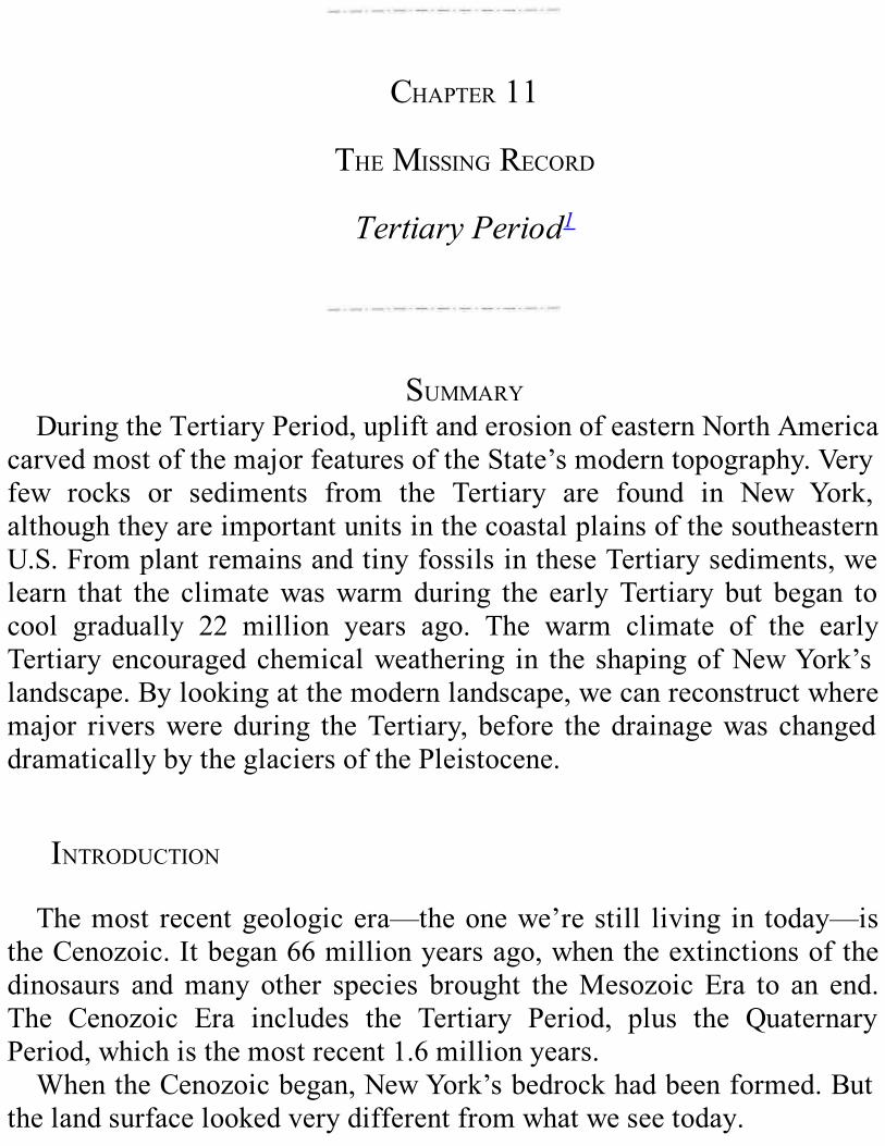
CHAPTER11
THEMISSINGRECORD
TertiaryPeriod1
SUMMARYDuringtheTertiaryPeriod,upliftanderosionofeasternNorthAmerica
carvedmostofthemajorfeaturesoftheState’smoderntopography.Veryfew rocks or sediments from the Tertiary are found in New York,althoughtheyareimportantunitsinthecoastalplainsofthesoutheasternU.S.FromplantremainsandtinyfossilsintheseTertiarysediments,welearn that the climatewaswarmduring the earlyTertiary but began tocool gradually 22 million years ago. The warm climate of the earlyTertiaryencouragedchemicalweathering in the shapingofNewYork’slandscape.Bylookingatthemodernlandscape,wecanreconstructwheremajor riverswereduring theTertiary, before thedrainagewas changeddramaticallybytheglaciersofthePleistocene.
INTRODUCTIONThemost recentgeologicera—theonewe’restill living in today—is
theCenozoic.Itbegan66millionyearsago,whentheextinctionsofthedinosaurs andmany other species brought theMesozoicEra to an end.The Cenozoic Era includes the Tertiary Period, plus the QuaternaryPeriod,whichisthemostrecent1.6millionyears.WhentheCenozoicbegan,NewYork’sbedrockhadbeenformed.But
thelandsurfacelookedverydifferentfromwhatweseetoday.
CARVINGTHELANDSCAPEBytheMiddleJurassic,NewYork’sbedrockhadbeenerodeddownto
a flat plain. This erosion surface is called theFall Zone Peneplain.During themiddle part of theCretaceous, the Fall ZonePeneplainwasuplifted,andrunningwaterbegantocutintoit.Totheeast,thePeneplaindipped beneath the wideningAtlantic Ocean. There, it was covered byCoastal Plain deposits and is still preserved deep beneath the surface.However,wherever the Fall Zone Peneplainwas exposed inNewYorkState,itwasdestroyedbyerosionthataccompaniedslowupliftalongtheeasternseaboard.Themodern landscapesofNewYorkdeveloped in theCenozoicEra.
Duringthattime,mostofeasternNorthAmericacontinuedtobeuplifted,weathered,anderoded.As the landwasuplifted,water flowedfromthehigh areas down to the seas. The rush of water over millions of yearssculptedthefeaturesofthelandscape.By the end of the Tertiary, the major features of our modern
topographyhadalreadybeenformed.(ThecircularAdirondackMountaindomemaybeanexception.Itmayhaveonlybegunrisingatthattime.)Thesefeatures,andespeciallydrainage,werelatermodifiedbyicesheetsduring the Pleistocene Epoch.We’ll discuss glacial effects in the nextchapter.
TERTIARYROCK—MISSINGONTHEMAINLANDThe sediments from the erosion of eastern North America were
depositedduringtheTertiaryPeriod.Insomewesternstates,sedimentaryrocks and igneous intrusions from the Tertiary Period are extensive.However,very little rockof thatage remains inNewYorkState.Someexists in nearby areas, though.We find a smallOligocene deposit of akind of brownish-black coal calledlignite in western Vermont nearBrandon.SomeTertiaryrockexistsintheCoastalPlaindepositsofstatesto the south and offshore on the continental shelf. Fromthe amount of

sediment on the shelf today,we deduce that several kilometers of rockwereerodedfromNewYorkandNewEnglandduringtheCretaceousandearlyTertiary.
RECONSTRUCTINGTHETERTIARYCLIMATEWithnoTertiaryrockexposedinNewYorkState,canwestillfigure
outwhat happened in our regionduring that time?Yes,we can,with alittle geological detective work. For evidence, we look at the Tertiarysedimentsonthecontinentalshelfandslopeoffourshore.DeepholeshavebeendrillednearthecoastlineofcentralNewJersey
and on the outer part of the continental shelf south of Long Island tosample to rock there.These samples showus that theTertiary depositsareabout130mthickalongtheshorebutmuchthicker—1500m—neartheshelfedge.MuchofthisincreasedthicknesswasdepositedduringthemiddleMioceneEpoch.We know the age of these deposits by studying the fossils found in
them.Thefossilsaresmallandunspectacularlooking,buttheygiveusagreat deal of useful information. They include microscopic plants andpollenaswellasone-celledanimals.Thesefossilstellustheageofthesedimentsandwhethertheyweredepositedonseaoronland.Theyalsotelluswhattheclimatewasatthetime.Wherewe find tiny one-celled animals calledforaminifera,weknow
thatthesedimentwasdepositedintheocean.Incontrast,wherewefindabundantplantpollen,weknowthatthesedimentwasdepositedonland.Byidentifyingthepollenfoundin thesediments,wecanseehowthe
climatechangedover time.Each typeofplantproduces itsownkindofpollen.Suppose,forexample,wefoundpollenfromspruceandfirtreesinonelayerandpollenfrompineandoaktreesinayoungerlayer.Spruceand fir trees live in subarctic to cool temperate climates, which arewarmerthanarcticclimates,butstillfairlycold.Pineandoaktreesliveintemperateclimatesthatarestillwarmerandmorehospitable.Aplantsuccession like theonedescribed in thisparagraphwouldshowthat the
climategraduallybecamewarmer.We can find similar climate clues in the foraminifera. The various
specieschange,dependingon the temperatureanddepthof thewateratthetime.Inamannerlikethatdescribedabove,wehaveassembledtheevidence
provided by fossil pollen and foraminifera from the Tertiary Period.From this evidence, we have concluded that the Tertiary climate innortheasternNorthAmerica varied from humid subtropical to arid andcold.Inmostof theearlyTertiary,NewYorkwasmuchwarmer than it is
today—it was between warm temperate and subtropical. The averageannual temperature was about 5 degrees higher than today‗s annualaverageof8°C.Frostymorningswererare,evenduringthewinter.About22millionyearsago,theclimatebegantocoolgradually.AttheendoftheTertiary, about 1.6millionyears ago, a cool temperate climatewasestablished. This climate was interrupted by four long “cold snaps,”whichwillbediscussedinthenextchapter.
TERTIARYWEATHERINGANDEROSIONTemperatureandprecipitationstronglyinfluencedtheshapingofNew
York State’s landscapes during the Tertiary. In warm moist climates,chemicalweatheringisrelativelyrapid.Rocksarechangedchemicallybybeingexposedtowater,oxygen,carbondioxide,andacidsderivedfromthedecayofplants.In thewarm climate ofmost of the Tertiary,NewYork experienced
deep chemical weathering.Water carried away the dissolved and fine-grainedproductsof theweathering.Saproliteswere leftbehind—deeplyweathered rock material composed of the resistant grains that did notdissolve. Saprolite disintegrates easily and is eroded quickly by runoff,landslides,andthesteadypullofmaterialsdownslopebygravity.Italsobecomes hidden by plant growth. Scattered remains of saprolites havebeen uncovered during highway construction in the Adirondacks, the
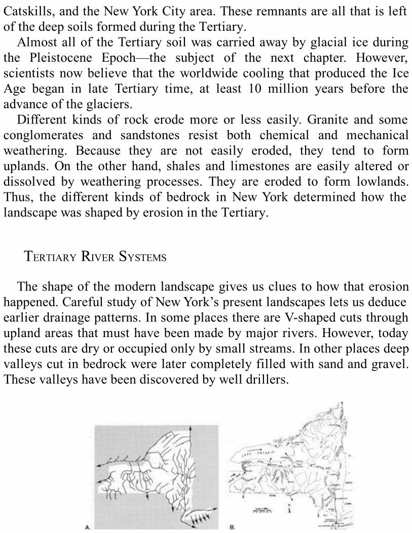
Catskills,andtheNewYorkCityarea.TheseremnantsareallthatisleftofthedeepsoilsformedduringtheTertiary.AlmostalloftheTertiarysoilwascarriedawaybyglacial iceduring
the Pleistocene Epoch—the subject of the next chapter. However,scientistsnowbelieve that theworldwide cooling that produced the IceAge began in late Tertiary time, at least 10 million years before theadvanceoftheglaciers.Different kinds of rock erodemore or less easily. Granite and some
conglomerates and sandstones resist both chemical and mechanicalweathering. Because they are not easily eroded, they tend to formuplands.On the other hand, shales and limestones are easily altered ordissolved by weathering processes. They are eroded to form lowlands.Thus, the different kinds of bedrock in NewYork determined how thelandscapewasshapedbyerosionintheTertiary.
TERTIARYRIVERSYSTEMSTheshapeofthemodernlandscapegivesuscluestohowthaterosion
happened.CarefulstudyofNewYork’spresentlandscapesletsusdeduceearlierdrainagepatterns.InsomeplacesthereareV-shapedcutsthroughuplandareasthatmusthavebeenmadebymajorrivers.However,todaythesecutsaredryoroccupiedonlybysmallstreams.Inotherplacesdeepvalleyscutinbedrockwerelatercompletelyfilledwithsandandgravel.Thesevalleyshavebeendiscoveredbywelldrillers.
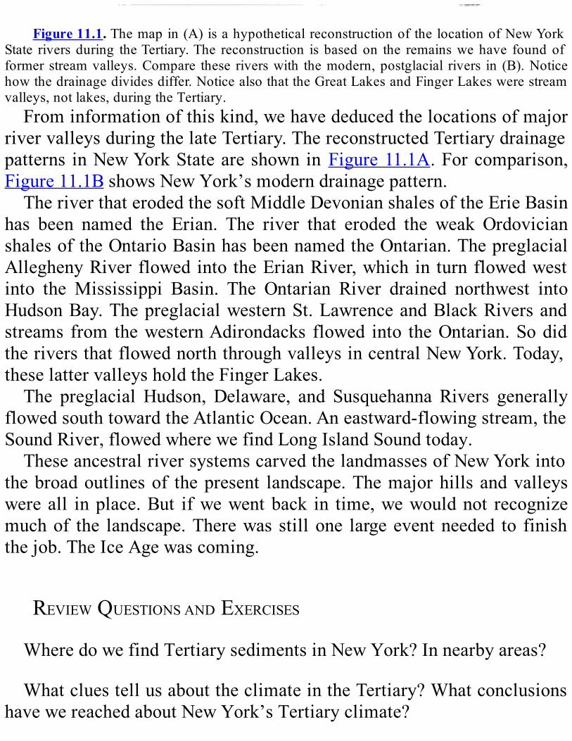
Figure11.1.Themapin(A)isahypotheticalreconstructionofthelocationofNewYork
State riversduring theTertiary.The reconstruction isbasedon the remainswehave foundofformerstreamvalleys.Compare these riverswith themodern,postglacial rivers in (B).Noticehowthedrainagedividesdiffer.NoticealsothattheGreatLakesandFingerLakeswerestreamvalleys,notlakes,duringtheTertiary.Frominformationofthiskind,wehavededucedthelocationsofmajor
rivervalleysduringthelateTertiary.ThereconstructedTertiarydrainagepatterns inNewYorkStateareshownin Figure11.1A.Forcomparison,Figure11.1BshowsNewYork’smoderndrainagepattern.TheriverthaterodedthesoftMiddleDevonianshalesoftheErieBasin
has been named the Erian. The river that eroded the weak OrdovicianshalesoftheOntarioBasinhasbeennamedtheOntarian.ThepreglacialAlleghenyRiverflowedintotheErianRiver,whichin turnflowedwestinto the Mississippi Basin. The Ontarian River drained northwest intoHudsonBay.ThepreglacialwesternSt.LawrenceandBlackRiversandstreams from thewesternAdirondacks flowed into theOntarian.SodidtheriversthatflowednorththroughvalleysincentralNewYork.Today,theselattervalleysholdtheFingerLakes.The preglacial Hudson, Delaware, and Susquehanna Rivers generally
flowedsouthtowardtheAtlanticOcean.Aneastward-flowingstream,theSoundRiver,flowedwherewefindLongIslandSoundtoday.TheseancestralriversystemscarvedthelandmassesofNewYorkinto
thebroadoutlinesof thepresent landscape.Themajorhillsandvalleyswereall inplace.But ifwewentback in time,wewouldnot recognizemuchof the landscape.Therewasstillone largeeventneeded to finishthejob.TheIceAgewascoming.
REVIEWQUESTIONSANDEXERCISESWheredowefindTertiarysedimentsinNewYork?Innearbyareas?
WhatcluestellusabouttheclimateintheTertiary?WhatconclusionshavewereachedaboutNewYork’sTertiaryclimate?

HowdoweknowwhereriversflowedduringtheTertiary?

Chapter12
THEBIGCHILL
ThePleistoceneEpoch1
SUMMARYDuring the Pleistocene Epoch, which began 1.6 million years ago,
climatesgrewcolderaroundtheworldforreasonsthatarenotyetclear.Huge ice sheets advanced and retreated several times in the northernhemisphere.Thelastadvanceoftheseicesheets,whichoccurredduringtheWisconsinanStage, reached itsmaximum inNewYorkState about21,750yearsago.Theglacieraccomplishedspectacularerosion,scrapingawaysoilandloosesediments,wearingawaybedrock,andgougingrivervalleysintodeeptroughs.Italsodepositedtherockdebrisitcarriedinavarietyofdistinctivelandforms.Glacialdebrisdammedmanyriversandchanged the State’s drainage profoundly. The Wisconsinan ice sheetretreatedfromNewYorkabout10,000yearsago.Asitmelted,itreleasedhuge volumes ofmeltwater.Where glacial debris had dammedvalleys,vasttemporarylakeswereformed.Manyoftheseglaciallakeshavelongsince drained, although small remnants, including the Great Lakes andthe Finger Lakes, still exist.At the close of the Pleistocene,meltwaterfromglaciersaroundthenorthernhemisphereraisedsealevel.Theoceanfloodedlow-lyingareasthathadbeendepressedbytheweightoftheice.Sincethen,thelandhasrebounded,causingtheshorelinestoshifttotheirpresentpositions.Inspiteoftheharshclimateduringiceadvance,arichvarietyofplantsandanimalsthrivedsouthoftheicefront.Manyofthespeciesstillexist,butmanyothershavebecomeextinct.

IntroductionSoils form by chemical and physical breakdown of the underlying
bedrock.However, inmuch of the northern hemisphere, includingNewYork State, the composition of the soil is different from that of thebedrock beneath. The soil, therefore, could not have formed in place.HowdidNewYork’s soil come tobewhere it is?Howcanweexplainunusual features of New York’s rivers and streams? What unusuallandforms do we find, and how did they get here? Why is WhitefaceMountain such a steep-sided peak? Why do ocean tides flow up theHudson River halfway to Canada? How did the Finger Lakes and themany other lakes in theState come to be?What do the remains of thewooly mammoth and other animals tell us about the past? Thesequestionsmayseemverydifferent,buttheanswersareallrelated.TheyallhavetodowiththePleistoceneEpoch—alsocalledtheIceAge.InthischapterwewilldiscusswhatweknowabouttheIceAge.Why
dowe think thatacontinental icesheetoncecoverednearlyallofNewYorkState?Whenwastheicehere?Howdoweknowwhichwaytheicesheetmoved,how thick itwas,orhow itaffected the landscape?Thesequestions and others were asked by geologists in the past, and wecontinuetoseekanswerstoday.Fromtheanswerswehavesofar,wecanreconstructageologichistoryofthePleistoceneEpoch.Nearly all of NewYork State is covered by a variety of loose rock
debris carried southward by glaciers. The glaciers formed in the arcticregions, grew, and merged into large ice sheets that slowly flowedsouthwardintonormallytemperatezones.Eventually,immenseblanketsof ice, perhaps 2 km thick, covered much of the northern hemisphere(Figure12.1). The glaciers changed the landscape at an amazing speedcompared to other geologic processes.We see their effects everywhereacrossNewYork.
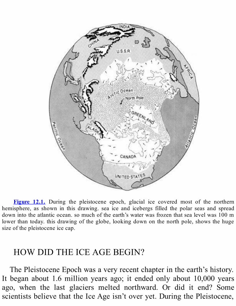
Figure 12.1. During the pleistocene epoch, glacial ice covered most of the northern
hemisphere, as shown in this drawing. sea ice and icebergs filled the polar seas and spreaddownintotheatlanticocean.somuchoftheearth’swaterwasfrozenthatsealevelwas100mlower than today. thisdrawingof theglobe, lookingdownon thenorthpole, shows thehugesizeofthepleistoceneicecap.
HOWDIDTHEICEAGEBEGIN?ThePleistoceneEpochwasaveryrecentchapterintheearth’shistory.
It began about 1.6million years ago; it ended only about 10,000 yearsago, when the last glaciers melted northward. Or did it end? SomescientistsbelievethattheIceAgeisn’toveryet.DuringthePleistocene,
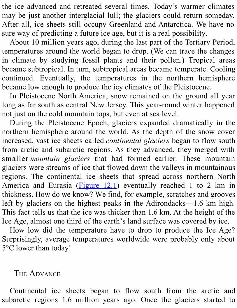
the ice advanced and retreated several times. Today’swarmer climatesmaybe justanother interglacial lull; theglacierscouldreturnsomeday.After all, ice sheets stilloccupyGreenlandandAntarctica.Wehavenosurewayofpredictingafutureiceage,butitisarealpossibility.About10millionyearsago,duringthelastpartoftheTertiaryPeriod,
temperaturesaroundtheworldbegantodrop.(Wecantracethechangesin climate by studying fossil plants and their pollen.) Tropical areasbecamesubtropical.Inturn,subtropicalareasbecametemperate.Coolingcontinued. Eventually, the temperatures in the northern hemispherebecamelowenoughtoproducetheicyclimatesofthePleistocene.InPleistoceneNorthAmerica, snow remainedon thegroundall year
longasfarsouthascentralNewJersey.Thisyear-roundwinterhappenednotjustonthecoldmountaintops,butevenatsealevel.During the Pleistocene Epoch, glaciers expanded dramatically in the
northern hemisphere around theworld.As the depth of the snow coverincreased,vasticesheetscalledcontinentalglaciersbegantoflowsouthfrom arctic and subarctic regions.As they advanced, theymergedwithsmallermountain glaciers that had formed earlier. These mountainglacierswerestreamsoficethatfloweddownthevalleysinmountainousregions. The continental ice sheets that spread across northern NorthAmerica and Eurasia (Figure 12.1) eventually reached 1 to 2 km inthickness.Howdoweknow?Wefind,forexample,scratchesandgroovesleft by glaciers on the highest peaks in theAdirondacks—1.6 kmhigh.Thisfacttellsusthattheicewasthickerthan1.6km.AttheheightoftheIceAge,almostonethirdoftheearth’slandsurfacewascoveredbyice.How low did the temperature have to drop to produce the IceAge?
Surprisingly,average temperaturesworldwidewereprobablyonlyabout5°Clowerthantoday!
THEADVANCEContinental ice sheets began to flow south from the arctic and
subarctic regions 1.6 million years ago. Once the glaciers started to

move,achainofeventssustainedthefrigidnewconditions.When warm air from the south reached the glacier, it rose over the
surfaceoftheiceandcooledabruptly.Astheaircooled,themoistureinitcondensedandfellassnow.Moreandmoresnowpiledup.Theweightof new snow continuously compacted the snow beneath into ice. Thepressure continued to build up and forced the ice to flow out in alldirections (Figure 12.2). Centimeter by centimeter, kilometer bykilometer, theglaciercreptalong.Howfastdid itmove?Somemodernglaciers advance a meter or so each day. We can guess that thePleistoceneglaciersbehavedinthesameway.Eventually the ice front reached a warmer area—either at a lower
elevationorfarthertothesouth.Whentheaveragetemperaturewashighenough,theicealongthefrontmeltedasfastastheicebehinditpushedforward.As long asmelting balanced forward flow, the glacier’s frontremainedinoneplace.
Figure12.2. This diagram is a simplified cross section of an ice sheet. Notice the snow
feeding the glacier behind the ice front and the ice flowing, even riding over low hills. (Theverticalscaleishighlyexaggerated.)
The ice sheet that invaded NewYork is called theLau- rentide IceSheet(Figure12.3).ItstartedintheLaurentianMountainsofQuebecandthe uplands of eastern Quebec and Labrador.Almost all of NewYorkState,nearly130,000km2,wascoveredbytheice.Evenso,thatwasonlyabout one percent of the total area covered by the ice sheets in NorthAmerica. About 21,750 years ago, the Laurentide Ice Sheet covered
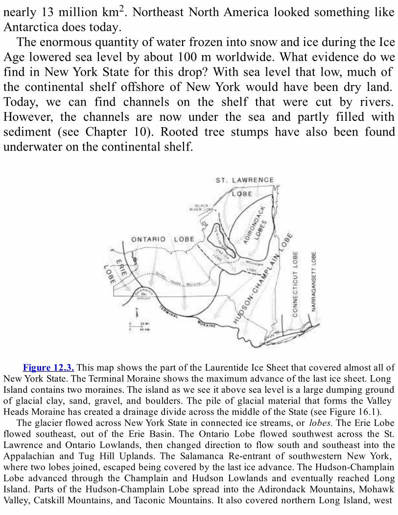
nearly13millionkm2.NortheastNorthAmerica looked something likeAntarcticadoestoday.TheenormousquantityofwaterfrozenintosnowandiceduringtheIce
Ageloweredsealevelbyabout100mworldwide.Whatevidencedowefind inNewYorkState for thisdrop?Withsea level that low,muchofthe continental shelf offshore of NewYorkwould have been dry land.Today, we can find channels on the shelf that were cut by rivers.However, the channels are now under the sea and partly filled withsediment (see Chapter 10). Rooted tree stumps have also been foundunderwateronthecontinentalshelf.
Figure12.3.ThismapshowsthepartoftheLaurentideIceSheetthatcoveredalmostallof
NewYorkState.TheTerminalMoraineshowsthemaximumadvanceofthelasticesheet.LongIslandcontainstwomoraines.Theislandasweseeitabovesealevelisalargedumpinggroundof glacial clay, sand, gravel, and boulders.The pile of glacialmaterial that forms theValleyHeadsMorainehascreatedadrainagedivideacrossthemiddleoftheState(seeFigure16.1).
TheglacierflowedacrossNewYorkStateinconnectedicestreams,or lobes.TheErieLobeflowed southeast, out of the Erie Basin. The Ontario Lobe flowed southwest across the St.Lawrence andOntarioLowlands, then changeddirection to flow south and southeast into theAppalachian and Tug Hill Uplands. The Salamanca Re-entrant of southwestern NewYork,wheretwolobesjoined,escapedbeingcoveredbythelasticeadvance.TheHudson-ChamplainLobe advanced through the Champlain and Hudson Lowlands and eventually reached LongIsland.Partsof theHudson-ChamplainLobe spread into theAdirondackMountains,MohawkValley,CatskillMountains,andTaconicMountains.ItalsocoverednorthernLongIsland,west
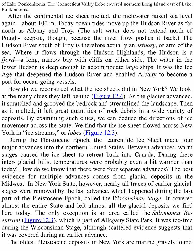
ofLakeRonkonkoma.TheConnecticutValleyLobecoverednorthernLongIslandeastofLakeRonkonkoma.After the continental ice sheetmelted, themeltwater raised sea level
again—about100m.TodayoceantidesmoveuptheHudsonRiverasfarnorth as Albany and Troy. (The salt water does not extend north ofPough- keepsie, though, because the river flow pushes it back.) TheHudsonRiversouthofTroyisthereforeactuallyanestuary,orarmofthesea. Where it flows through the Hudson Highlands, the Hudson is afjord—a long, narrow bay with cliffs on either side. The water in thelowerHudsonisdeepenoughtoaccommodatelargeships.ItwastheIceAge that deepened the Hudson River and enabledAlbany to become aportforocean-goingvessels.HowdowereconstructwhattheicesheetsdidinNewYork?Welook
atthemanycluestheyleftbehind(Figure12.4).Astheglacieradvanced,itscratchedandgroovedthebedrockandstreamlinedthelandscape.Thenas itmelted, it left great quantities of rock debris in awide variety ofdeposits.By examining such clues,we candeduce thedirectionsof icemovementacrosstheState.WefindthattheicesheetflowedacrossNewYorkin“icestreams,”orlobes(Figure12.3).During the Pleistocene Epoch, the Laurentide Ice Sheet made four
majoradvancesintothenorthernUnitedStates.Betweenadvances,warmstages caused the ice sheet to retreat back into Canada. During theseinter- glacial lulls, temperatureswere probably even a bitwarmer thantoday!Howdoweknowthattherewerefourseparateadvances?Thebestevidence for multiple advances comes from glacial deposits in theMidwest.InNewYorkState,however,nearlyalltracesofearlierglacialstageswereremovedbythelastadvance,whichhappenedduringthelastpart of thePleistoceneEpoch, called theWisconsinanStage. It coveredalmost the entire State and left almost all the glacial deposits we findhere today. The only exception is an area called theSalamanca Re-entrant(Figure12.3),whichispartofAlleganyStatePark.Itwasice-freeduringtheWisconsinanStage,althoughscatteredevidencesuggeststhatitwascoveredduringanearlieradvance.TheoldestPleistocenedepositsinNewYorkaremarinegravelsfound

in deep wells on Long Island, soils preserved in a ravine near CayugaLake,sedimentsunearthedinexcavationsnearOtto,CattaraugusCounty,and buried soils inwells in theSchoharieValley.Thesematerialsmayhavebeendepositedduringanyof thewarm interglacialperiodsbeforethe Wisconsinan Stage. They may also have been deposited during atemporaryretreatoftheglacierinthemiddleoftheWisconsinanStage.Theglacieraffectedthelandscapethroughtwoprocesses—erosionand
deposition.Weconsidertheseprocessesnext.
Figure12.4. Thismap ofNewYork State and surrounding areas shows the locations of
morainedeposits;italsoincludesfeatureslikedrumlinsandstriationsthatindicatethedirectionofglacialflow.ItwasbylookingatsuchevidencethatscientistsreconstructedthehistoryofthePleistoceneEpochinNewYork.Themapalsoindicatespositionoftheedgeoftheicesheetat
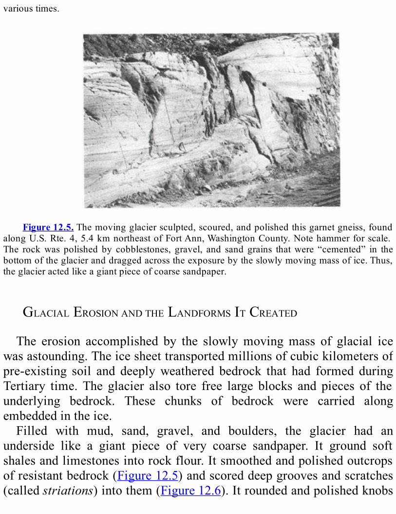
varioustimes.
Figure12.5.Themovingglaciersculpted,scoured,andpolishedthisgarnetgneiss,found
alongU.S.Rte.4,5.4kmnortheastofFortAnn,WashingtonCounty.Notehammerforscale.The rockwas polished by cobblestones, gravel, and sand grains thatwere “cemented” in thebottomoftheglacieranddraggedacrosstheexposurebytheslowlymovingmassofice.Thus,theglacieractedlikeagiantpieceofcoarsesandpaper.
GLACIALEROSIONANDTHELANDFORMSITCREATEDThe erosion accomplished by the slowlymovingmass of glacial ice
wasastounding.Theicesheettransportedmillionsofcubickilometersofpre-existing soil and deeplyweathered bedrock that had formed duringTertiary time. The glacier also tore free large blocks and pieces of theunderlying bedrock. These chunks of bedrock were carried alongembeddedintheice.Filled with mud, sand, gravel, and boulders, the glacier had an
underside like a giant piece of very coarse sandpaper. It ground softshalesandlimestonesintorockflour.Itsmoothedandpolishedoutcropsofresistantbedrock(Figure12.5)andscoreddeepgroovesandscratches(calledstriations)intothem(Figure12.6).Itroundedandpolishedknobs

ofbedrock,calledrochesmoutonnees(Figure12.7).Aftertheicemelted,large boulders, callederratics, had been transported kilometers fromtheirplacesoforigin(Figure12.8).Someoftheseerraticshavestriationsthatwereformedastheerraticsweredraggedalonginthebottomoftheglacier.WhereglaciersflowedparalleltoV-shapedrivervalleys,theygouged
thevalleysintodeeptroughswithU-shapedcrosssections(Figure12.9).NewYork’sFingerLakeslieinformerrivervalleyscarvedintoU-shapedtroughsofthistype.Tributarystreamsthatenteredthesevalleysatnearlyright angles to the direction of the ice flowwere not eroded nearly asdeeplybytheice.Aftertheicemelted,thefloorsofsuchtributaryvalleyswerelefthighonthewallsofthemainvalleys.(Theyarecalledhangingvalleys.)Tributarystreamsformedspectacularwaterfallsastheydroppeddirectly fromhangingvalleys into the steep-walledmainvalleys.Sincethe retreat of the ice, runningwater has graduallyworn the rock away,causingthewaterfallstomoveupthetributaryvalleysandawayfromthemainvalley.TaughannockFalls(Figure12.10)andseveralwaterfallsandcascades near Ithaca and at Watkins Glen are striking examples ofstreams that once plunged from hanging valleys; since the ice sheetretreated,thesefallshaveallmovedupstream.TheancestralHudsonRivervalleywasparalleltothedirectionofice
flow.Where the river flows through theHudsonHighlands, the glacierscoured the valley’sbedrock floor to a depth of 240mbelow sea level.(Webase this figureondrill hole testsmade for theCatskillAqueducttunnelthatcrossestheHudsonRiveratStormKingandcarriesdrinkingwatertoNewYorkCity.)Manytributaries,includingtheMohawkRiver,occupied hanging valleys and now cascade down a series of waterfallsandrapidstotheHudsonRiver.
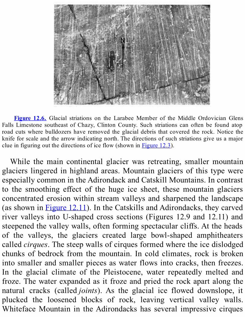
Figure 12.6. Glacial striations on the Larabee Member of the Middle Ordovician Glens
Falls Limestone southeast ofChazy,ClintonCounty. Such striations can often be found atoproad cutswhere bulldozers have removed the glacial debris that covered the rock.Notice theknifeforscaleandthearrowindicatingnorth.Thedirectionsofsuchstriationsgiveusamajorclueinfiguringoutthedirectionsoficeflow(showninFigure12.3).
While themain continental glacier was retreating, smallermountainglaciers lingered inhighlandareas.Mountainglaciersof this typewereespeciallycommonintheAdirondackandCatskillMountains.Incontrastto the smoothing effect of the huge ice sheet, these mountain glaciersconcentratederosionwithinstreamvalleysandsharpened the landscape(asshowninFigure12.11).IntheCatskillsandAdirondacks,theycarvedriver valleys intoU-shaped cross sections (Figures 12.9 and12.11) andsteepenedthevalleywalls,oftenformingspectacularcliffs.Attheheadsof the valleys, the glaciers created large bowl-shaped amphitheaterscalledcirques.Thesteepwallsofcirquesformedwheretheicedislodgedchunks of bedrock from themountain. In cold climates, rock is brokenintosmallerandsmallerpiecesaswaterflowsintocracks, thenfreezes.In the glacial climate of the Pleistocene, water repeatedly melted andfroze.Thewaterexpandedasitfrozeandpriedtherockapartalongthenatural cracks (calledjoints). As the glacial ice flowed downslope, itplucked the loosened blocks of rock, leaving vertical valley walls.WhitefaceMountain in theAdirondacks has several impressive cirques

encirclingitspeak(Figure12.12).
GLACIALDEPOSITIONANDTHELANDFORMSITCREATEDErosionwas one of themajor effects of the Pleistocene glacier. The
other was deposition—the dropping of the rock debris that the glaciercarried.Withthesedeposits,theglacierdammedriversandchangedtheircourses.Itleftvastamountsofmud,sand,andgravelthatcoveredmuchofthebedrock.Italsocreatedanumberofdistinctivelandforms(Figure12.7).We have found buried stream valleys inChautauqua,Onondaga, and
CortlandCountiesthatexistedbeforetheglacieradvanced.Today,thesevalleysarefilledwithover300mofglacialdebris.WestofGlensFalls,theHudsonRivermeandersforashortstretchacrossaburiedpre-glacialriver channel that once drained the Lake George valley. That channel,now filledwith glacial debris, passes southwardbeneathSaratogaLakeandRoundLake.ThepostglacialHudsonRiverhascutanewchanneltotheeast.

Figure 12.7. These diagrams show various types of landforms and glacial deposits left
behindbycontinentalglaciers.WestudysuchfeaturesofNewYork’slandscapeandcomparethemwithfeaturesofareasbeingglaciatedtoday.Withthisinformation,weareabletodeducethe glacial history of our State. (FromGeomorphology byA.K. Lobeck. Copyright® 1939.PublishedbyMcGraw-Hill,Inc.,NewYork,NY.ReproducedbypermissionofMcGraw-Hill.)
The most widespread type of glacial debris istill. Till is a dense,unsortedmixtureofclay,sand,gravel,andboulders(Figure12.13).In places, after depositing till, the ice continued to move over it,
molding it. Insuchareas, tilldepositsareusuallystreamlinedorgentlyrounded. Cigar-shaped hills of till are calleddrumlins. These hills aresteeper on the upstream end—the direction fromwhich the ice flowed(Figure12.14).HillCumorahnearPalmyra,whereJosephSmithreportedseeingavisionthatledhimtofoundtheMormonchurch,isadrumlin.(ItisshowninthelowerleftcornerofFigure12.15.)Somedrumlinshaveabedrock core with till plastered on the outside. They are calledrockdrumlins.ThelowlandbetweenRochesterandSyracuseisstuddedwithdrumlins
—some10,000of them.(Figure12.16shows theirgeneral location;seealsoFigure12.15andPlate1oftheGeologicalHighwayMap.)It isoneofthegreatestdrumlinfieldsintheworld.As glacial ice melted, streams of meltwater flowed over, under,
through, and beside the glacial ice. These streams deposited sand andgravel in avarietyof forms.Because thesedepositswere laiddownbyrunningwater,theytendedtobesortedintolayersbysize,incontrasttounsorteddepositssuchastill.Aneskerwasformedbyastreamflowingin an ice tunnel under or on the surface of a glacier (Figures 12.7 and12.17).Akameisasteep-sidedmoundofsandandgravel,usuallypoorlysorted(Figures12.7and12.18).Astreamthatflowedintoalakebetweenaglacierandthewallofavalleyformedakamedelta(Figure12.19).
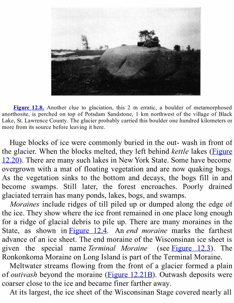
Figure 12.8. Another clue to glaciation, this 2 m erratic, a boulder of metamorphosed
anorthosite, is perched on top of PotsdamSandstone, 1 kmnorthwest of the village ofBlackLake,St.LawrenceCounty.Theglacierprobablycarriedthisboulderonehundredkilometersormorefromitssourcebeforeleavingithere.
Hugeblocksoficewerecommonlyburiedintheout-washinfrontoftheglacier.Whentheblocksmelted,theyleftbehindkettlelakes(Figure12.20).TherearemanysuchlakesinNewYorkState.Somehavebecomeovergrownwithamatof floatingvegetationandarenowquakingbogs.As the vegetation sinks to the bottom and decays, the bogs fill in andbecome swamps. Still later, the forest encroaches. Poorly drainedglaciatedterrainhasmanyponds,lakes,bogs,andswamps.Moraines include ridgesof tillpiledupordumpedalong theedgeof
theice.Theyshowwheretheicefrontremainedinoneplacelongenoughfora ridgeofglacialdebris topileup.Therearemanymoraines in theState, as shown inFigure 12.4. Anend moraine marks the farthestadvanceofanicesheet.TheendmoraineoftheWisconsinanicesheetisgiven the special nameTerminal Moraine (seeFigure 12.3). TheRonkonkomaMoraineonLongIslandispartoftheTerminalMoraine.Meltwaterstreamsflowingfromthefrontofaglacierformedaplain
ofoutivashbeyondthemoraine(Figure12.21B).Outwashdepositswerecoarserclosetotheiceandbecamefinerfartheraway.Atitslargest,theicesheetoftheWisconsinanStagecoverednearlyall
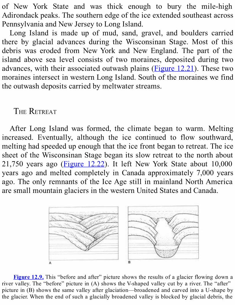
of New York State and was thick enough to bury the mile-highAdirondackpeaks.ThesouthernedgeoftheiceextendedsoutheastacrossPennsylvaniaandNewJerseytoLongIsland.Long Island is made up of mud, sand, gravel, and boulders carried
there by glacial advances during the Wisconsinan Stage. Most of thisdebris was eroded from NewYork and New England. The part of theisland above sea level consists of two moraines, deposited during twoadvances,withtheirassociatedoutwashplains(Figure12.21).ThesetwomorainesintersectinwesternLongIsland.Southofthemoraineswefindtheoutwashdepositscarriedbymeltwaterstreams.
THERETREATAfter Long Island was formed, the climate began to warm.Melting
increased. Eventually, although the ice continued to flow southward,meltinghadspeededupenoughthattheicefrontbegantoretreat.TheicesheetoftheWisconsinanStagebeganitsslowretreattothenorthabout21,750 years ago (Figure 12.22). It left NewYork State about 10,000years ago andmelted completely in Canada approximately 7,000 yearsago.Theonly remnantsof the IceAgestill inmainlandNorthAmericaaresmallmountainglaciersinthewesternUnitedStatesandCanada.
Figure12.9.This“beforeandafter”pictureshowstheresultsofaglacierflowingdowna
rivervalley.The“before”picturein(A)showstheV-shapedvalleycutbyariver.The“after”picturein(B)showsthesamevalleyafterglaciation—broadenedandcarvedintoaU-shapebytheglacier.Whentheendofsuchaglaciallybroadenedvalleyisblockedbyglacialdebris,the
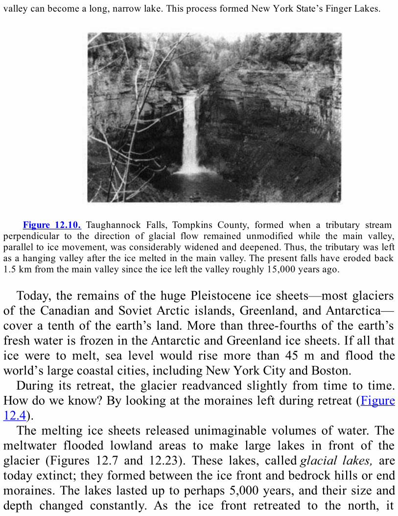
valleycanbecomealong,narrowlake.ThisprocessformedNewYorkState’sFingerLakes.
Figure 12.10. Taughannock Falls, Tompkins County, formed when a tributary stream
perpendicular to the direction of glacial flow remained unmodified while the main valley,paralleltoicemovement,wasconsiderablywidenedanddeepened.Thus,thetributarywasleftasahangingvalleyaftertheicemeltedinthemainvalley.Thepresentfallshaveerodedback1.5kmfromthemainvalleysincetheiceleftthevalleyroughly15,000yearsago.
Today, the remainsof thehugePleistocene icesheets—mostglaciersof theCanadian andSovietArctic islands,Greenland, andAntarctica—covera tenthof theearth’s land.More than three-fourthsof theearth’sfreshwaterisfrozenintheAntarcticandGreenlandicesheets.Ifallthatice were to melt, sea level would rise more than 45 m and flood theworld’slargecoastalcities,includingNewYorkCityandBoston.During its retreat, the glacier readvanced slightly from time to time.
Howdoweknow?Bylookingatthemorainesleftduringretreat(Figure12.4).Themelting ice sheets released unimaginable volumes ofwater.The
meltwater flooded lowland areas to make large lakes in front of theglacier (Figures 12.7 and 12.23). These lakes, calledglacial lakes, aretodayextinct;theyformedbetweentheicefrontandbedrockhillsorendmoraines.Thelakeslasteduptoperhaps5,000years,andtheirsizeanddepth changed constantly. As the ice front retreated to the north, it
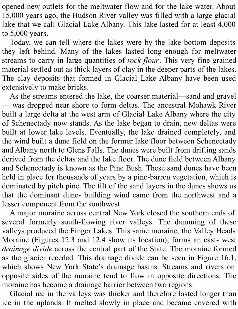
openednewoutletsforthemeltwaterflowandforthelakewater.About15,000yearsago,theHudsonRivervalleywasfilledwithalargeglaciallakethatwecallGlacialLakeAlbany.Thislakelastedforatleast4,000to5,000years.Today,wecan tellwhere the lakeswereby the lakebottomdeposits
they left behind. Many of the lakes lasted long enough for meltwaterstreams tocarry in largequantitiesofrockflour.Thisveryfine-grainedmaterialsettledoutasthicklayersofclayinthedeeperpartsofthelakes.The clay deposits that formed in Glacial LakeAlbany have been usedextensivelytomakebricks.Asthestreamsenteredthelake,thecoarsermaterial—sandandgravel
—wasdroppednearshore to formdeltas.TheancestralMohawkRiverbuiltalargedeltaatthewestarmofGlacialLakeAlbanywherethecityofSchenectadynowstands.Asthelakebegantodrain,newdeltaswerebuilt at lower lake levels. Eventually, the lake drained completely, andthewindbuiltadunefieldontheformerlakefloorbetweenSchenectadyandAlbanynorthtoGlensFalls.Theduneswerebuiltfromdriftingsandsderivedfromthedeltasandthelakefloor.ThedunefieldbetweenAlbanyandSchenectadyisknownasthePineBush.Thesesandduneshavebeenheldinplaceforthousandsofyearsbyapine-barrenvegetation,whichisdominatedbypitchpine.Thetiltofthesandlayersinthedunesshowsusthat the dominant dune- buildingwind came from the northwest and alessercomponentfromthesouthwest.AmajormoraineacrosscentralNewYorkclosedthesouthernendsof
several formerly south-flowing river valleys. The damming of thesevalleysproducedtheFingerLakes.Thissamemoraine,theValleyHeadsMoraine (Figures 12.3 and12.4 show its location), forms an east-westdrainagedivideacrossthecentralpartoftheState.Themoraineformedas theglacier receded.Thisdrainagedividecanbe seen inFigure16.1,which showsNewYork State’s drainage basins. Streams and rivers onopposite sides of the moraine tend to flow in opposite directions. Themorainehasbecomeadrainagebarrierbetweentworegions.Glacial iceinthevalleyswasthickerandthereforelastedlongerthan
ice in the uplands. Itmelted slowly in place and became coveredwith

debris carried by tributary streams. Meanwhile, the main ice frontcontinuedtoretreat.The receding ice sheet made its last major readvance into northern
NewYorkmore than 11,000 years ago. The ice readvanced across theAdirondacks and Tug Hill Plateau and across the Erie and OntarioLowlands (Figure 12.3). In the Erie andOntario Lowlands, it filled anearlier gorge of the Niagara River with debris and rode over earlierglaciallakedeposits.
Figure12.11. (A)showstheroundedpreglacialtopographyofamountainousregion.(B)
shows how mountain glaciers sharpened the topography. In theAdirondacks and Catskills,mountain glaciers didn’t last long enough to create a landscape like that shown in (C).Thepresent-day landscape is between (A) and (C). For example, Whiteface Mountain in the
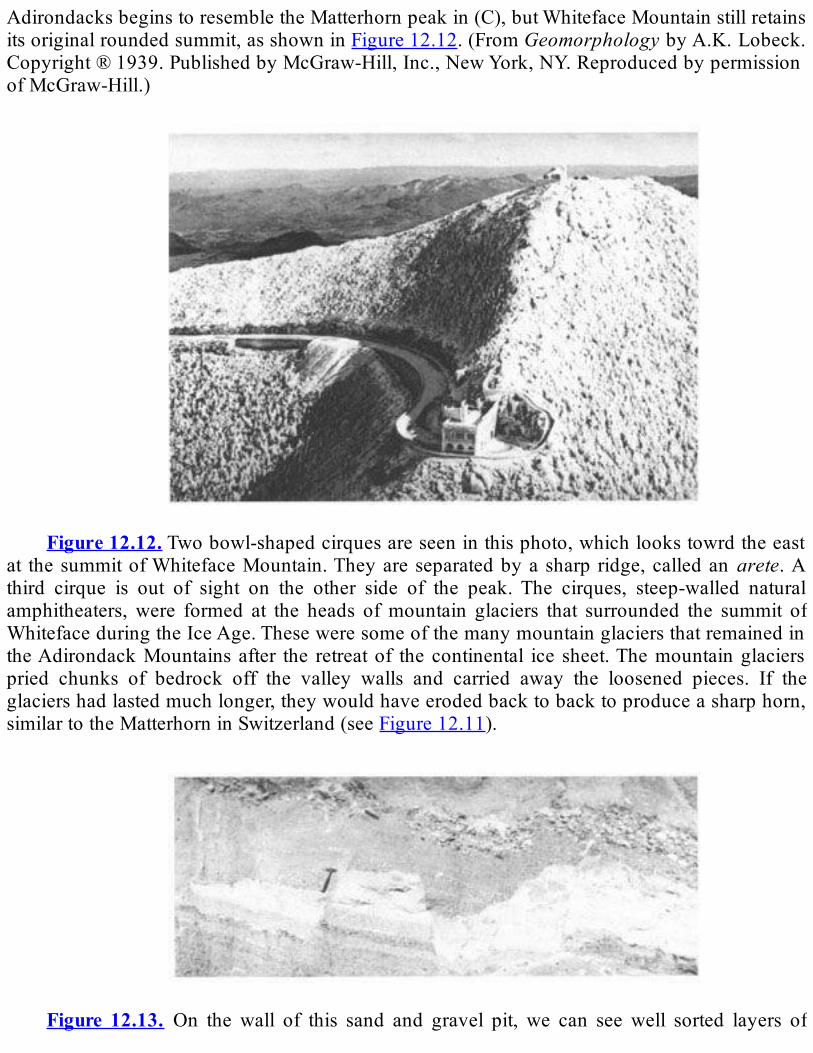
AdirondacksbeginstoresembletheMatterhornpeakin(C),butWhitefaceMountainstillretainsitsoriginalroundedsummit,asshowninFigure12.12.(FromGeomorphologybyA.K.Lobeck.Copyright®1939.PublishedbyMcGraw-Hill,Inc.,NewYork,NY.ReproducedbypermissionofMcGraw-Hill.)
Figure12.12.Twobowl-shapedcirquesareseeninthisphoto,whichlookstowrdtheeast
at thesummitofWhitefaceMountain.Theyareseparatedbyasharp ridge,calledanarete.Athird cirque is out of sight on the other side of the peak. The cirques, steep-walled naturalamphitheaters,were formed at the heads ofmountain glaciers that surrounded the summit ofWhitefaceduringtheIceAge.TheseweresomeofthemanymountainglaciersthatremainedintheAdirondackMountainsafter the retreatof thecontinental ice sheet.Themountainglacierspried chunks of bedrock off the valley walls and carried away the loosened pieces. If theglaciershadlastedmuchlonger,theywouldhaveerodedbacktobacktoproduceasharphorn,similartotheMatterhorninSwitzerland(seeFigure12.11).
Figure 12.13. On the wall of this sand and gravel pit, we can see well sorted layers of
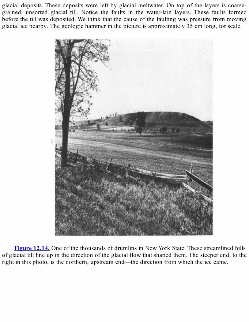
glacialdeposits.Thesedepositswere left byglacialmeltwater.On topof the layers is coarse-grained, unsorted glacial till. Notice the faults in the water-lain layers. These faults formedbeforethetillwasdeposited.Wethinkthatthecauseofthefaultingwaspressurefrommovingglacialicenearby.Thegeologichammerinthepictureisapproximately35cmlong,forscale.
Figure12.14.OneofthethousandsofdrumlinsinNewYorkState.Thesestreamlinedhills
ofglacialtilllineupinthedirectionoftheglacialflowthatshapedthem.Thesteeperend,totherightinthisphoto,isthenorthern,upstreamend—thedirectionfromwhichtheicecame.
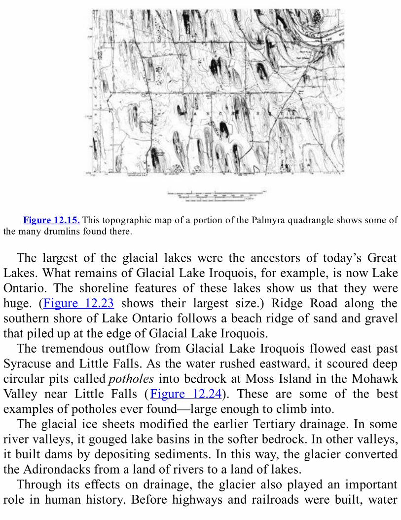
Figure12.15.ThistopographicmapofaportionofthePalmyraquadrangleshowssomeof
themanydrumlinsfoundthere.
The largest of the glacial lakes were the ancestors of today’s GreatLakes.WhatremainsofGlacialLakeIroquois,forexample,isnowLakeOntario. The shoreline features of these lakes show us that they werehuge. (Figure 12.23 shows their largest size.) Ridge Road along thesouthernshoreofLakeOntariofollowsabeachridgeofsandandgravelthatpiledupattheedgeofGlacialLakeIroquois.The tremendousoutflowfromGlacialLake Iroquois flowedeastpast
SyracuseandLittleFalls.Asthewaterrushedeastward,itscoureddeepcircularpitscalledpotholes intobedrockatMossIslandintheMohawkValley near Little Falls (Figure 12.24). These are some of the bestexamplesofpotholeseverfound—largeenoughtoclimbinto.Theglacial icesheetsmodified theearlierTertiarydrainage. Insome
rivervalleys,itgougedlakebasinsinthesofterbedrock.Inothervalleys,itbuiltdamsbydepositingsediments.Inthisway,theglacierconvertedtheAdirondacksfromalandofriverstoalandoflakes.Through its effects on drainage, the glacier also played an important
role in human history.Before highways and railroadswere built,water

travel was crucial in NewYork State. It was by far the bestmeans oftransportation and communication through the Hudson and MohawkvalleysandwestintotheOntariobasin.ThecoloniststookadvantageoftheserouteswhilefightingtheRevolutionaryWar.Theyused theriverstomovetheirowntroopsandsuppliesbutblockedcriticalwaterwaystostoptheadvanceoftheBritish.After the Revolution, the waterways also helped greatly in the
industrialdevelopmentoftheState.TheywerethemostefficientwaytomovegoodsthroughNewYorkState.Riversandstreamsalsobecamethesourceofpowerforgristmillsandsawmills.While glacial ice lay as a thick blanket over New York, the great
weightcausedthecrusttosag.Therefore,astheicemelted,oceanwaterfloodedintothenorthernpartsoftheChamplainandSt.Lawrencevalleysforashorttime(Figure12.23)tocreatetheancientChamplainSea.Howdoweknowaboutthisancientflood?Wefindtheshellsofmarineclamsandthebonesofwhalesandsealsintheglacialsandsandgravelsinthesevalleys(Figure12.25).Wealsofindbeachridgesthatpiledupalongtheshoreofthesea.Theseridgesarenowfoundashighas110mabovesealevel (Figure 12.26). These features enable us to map the old marineshoreline.
Figure 12.16. This physiographic diagram of central NewYork State shows the large
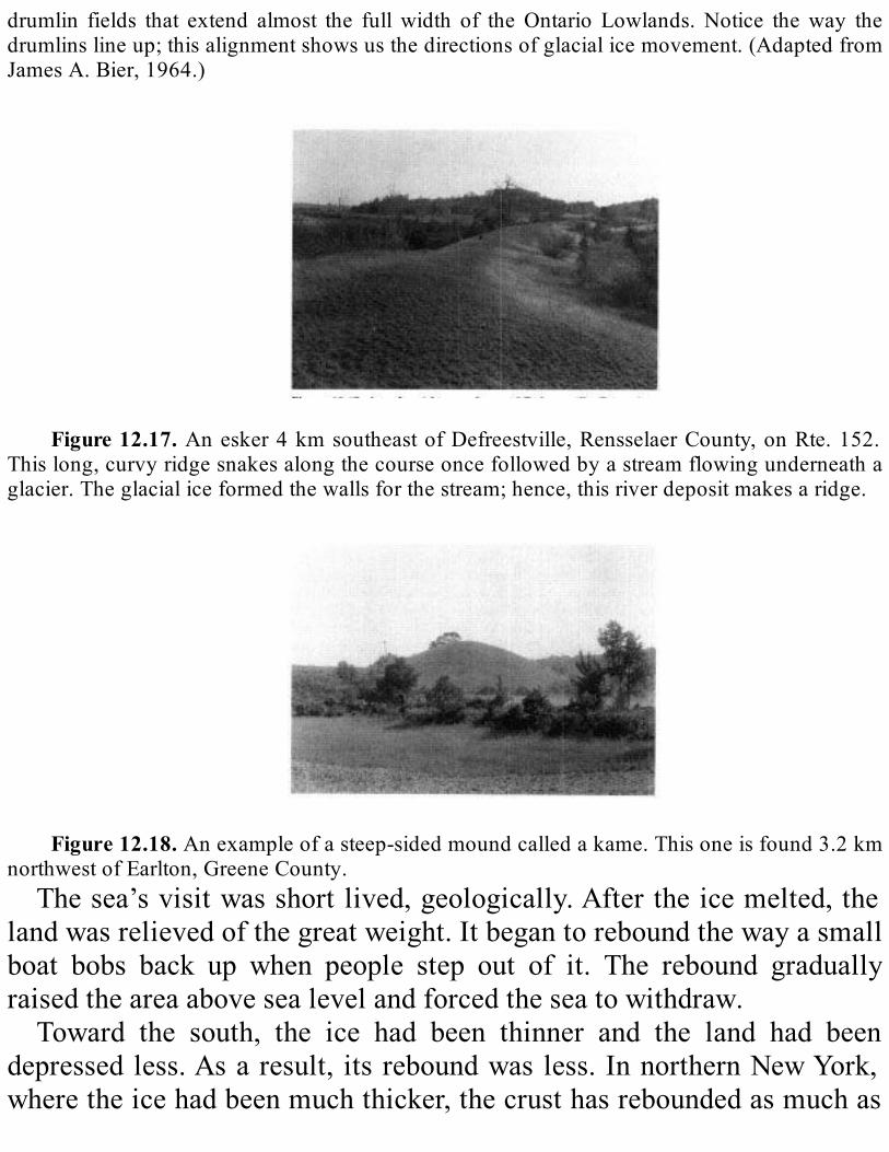
drumlin fields that extend almost the fullwidth of theOntario Lowlands.Notice theway thedrumlinslineup;thisalignmentshowsusthedirectionsofglacialicemovement.(AdaptedfromJamesA.Bier,1964.)
Figure12.17. Anesker4kmsoutheastofDefreestville,RensselaerCounty,onRte.152.
Thislong,curvyridgesnakesalongthecourseoncefollowedbyastreamflowingunderneathaglacier.Theglacialiceformedthewallsforthestream;hence,thisriverdepositmakesaridge.
Figure12.18.Anexampleofasteep-sidedmoundcalledakame.Thisoneisfound3.2km
northwestofEarlton,GreeneCounty.Thesea’svisitwasshortlived,geologically.Aftertheicemelted,the
landwasrelievedofthegreatweight.Itbegantoreboundthewayasmallboat bobs back up when people step out of it. The rebound graduallyraisedtheareaabovesealevelandforcedtheseatowithdraw.Toward the south, the ice had been thinner and the land had been
depressedless.Asaresult, itsreboundwasless.InnorthernNewYork,wheretheicehadbeenmuchthicker,thecrusthasreboundedasmuchas

150m.WecanseetheresultsofthisunevenreboundthroughoutnorthernNewYork.Glaciallakedepositsthatwereoncehorizontalnowslopeuptothenorth.TheeffectofthisreboundontheLakeOntariobasinisquitedramatic.Thedifferingamountsofreboundhavetiltedtheentireregionso that it slopes down from the north to the south. Harbors along thesouthshoreofLakeOntarioslowlygrewdeeperas the lakebasin tiltedsouthward.Harborson thenorth shoregrewshallower.We find similartilting in the Lake Champlain basin. Postglacial rebound is nowcompletedinNewYorkState,however.
Figure12.19. Akamedeltaalongtheeastsideof theChenangoRiverValleynearNorth
Norwich,ChenangoCounty.Itwasformedbyastreamflowingbetweenamountainglacierandthevalleywall;itisaspecialtypeofstreamdeposit.
Figure12.20.Thisdiagramshowshowkettlelakesformwhenaniceblock,leftbehindby
a retreatingglacier, isburiedbyglacialoutwashdeposits.After theglacier retreats, theburiedblockmelts, leavingahole that fillswithwater.Debris thatoncecovered the icecollapsedasthe icemelted and now covers the lake bottom. Notice how trees and other vegetation havereturnedtotheoncebarrenregion.(DrawingbyMikeStorey.)
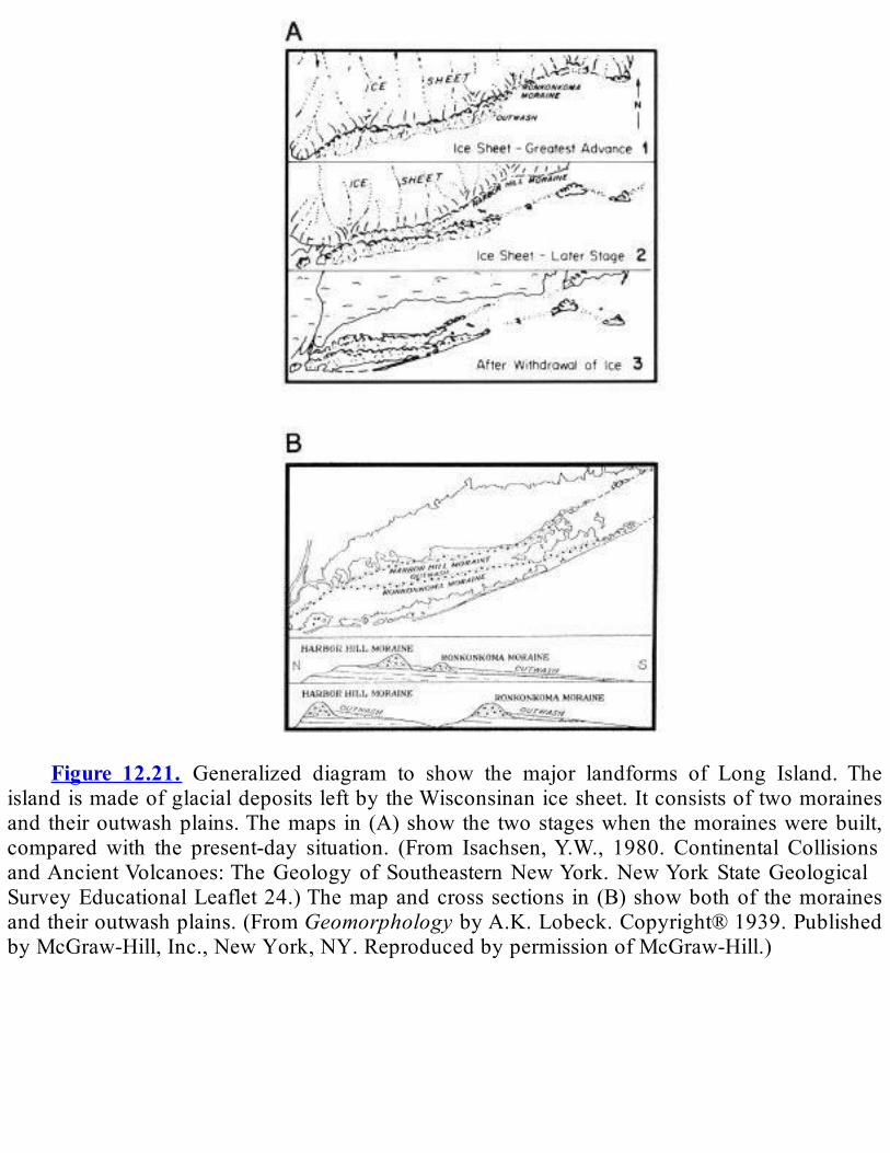
Figure 12.21. Generalized diagram to show the major landforms of Long Island. The
islandismadeofglacialdepositsleftbytheWisconsinanicesheet.Itconsistsoftwomorainesandtheiroutwashplains.Themaps in(A)showthe twostageswhenthemoraineswerebuilt,comparedwith the present-day situation. (From Isachsen,Y.W., 1980. Continental CollisionsandAncientVolcanoes:TheGeologyofSoutheasternNewYork.NewYorkStateGeologicalSurveyEducationalLeaflet24.)Themapandcrosssections in(B)showbothof themorainesandtheiroutwashplains.(FromGeomorphologybyA.K.Lobeck.Copyright®1939.PublishedbyMcGraw-Hill,Inc.,NewYork,NY.ReproducedbypermissionofMcGraw-Hill.)

Figure 12.22. Thesemaps show various steps in the retreat of theWisconsinan glacier.
They arebasedon theglacial depositswe find inNewYorkState and the agesofwood andbone found in these deposits. The ages were found through radiometric dating using theradioactive isotope carbon- 14. (A) shows the maximum reach of the glacier, about 21,750years ago, when the entire State except the Salamanca Re-entrant was covered with ice. (B)shows the situation about 14,000 years ago, when the climate had begun to warm and theglacierhadbegun to retreat. (C)hasbeendatedapproximately12,000 to13,800yearsago. Itwasatthisstagethattheglacierbuilt theValleyHeadsMoraineincentralNewYork(seealsoFigure12.3).

Thenextthreestages—(D),(E),and(F)—happenedbetween11,000and13,000yearsago.
Unfortunately, few of the features that were built by these stages have been datedradiometrically, so we can’t be more precise about the ages. However, we can see that theretreat continued. (G), the final stage in the figure, shows what New York State was likeapproximately 11,000 years ago. (Adapted fromAllers, R.H., 1984. Pleistocene geology ofcentral New York State. In B.J. Tewksbury and R.H. Allers, Hamilton College Field TripGuidebook:GeologyoftheBlackandMohawkRiverValleys,p.43-61.)

Figure12.23.TheseglaciallakesofthePleistoceneformedfrommeltwaterastheicesheet
retreated. The outlets show the directions in which these lakes eventually drained. TheChamplain Sea in the north shows the area that was flooded by ocean water as the glaciersmelted.
Figure12.24.ThisgiantpotholeisfoundonMossIslandintheMohawkValleynearLittle
Falls.ItwasscouredintothebedrockbythetremendousoutflowfromtheancestralGreatLakesrushingtothesea.(PhotobyB.K.Goodwin.)
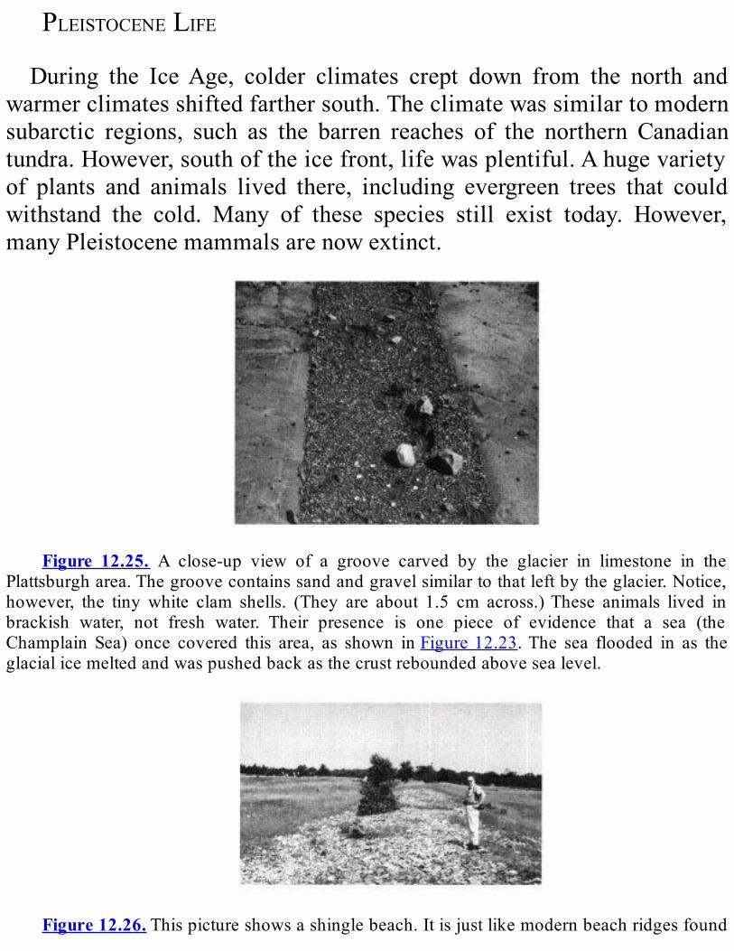
PLEISTOCENELIFEDuring the IceAge, colder climates crept down from the north and
warmerclimatesshiftedfarthersouth.Theclimatewassimilartomodernsubarctic regions, such as the barren reaches of the northern Canadiantundra.However,southoftheicefront,lifewasplentiful.Ahugevarietyof plants and animals lived there, including evergreen trees that couldwithstand the cold. Many of these species still exist today. However,manyPleistocenemammalsarenowextinct.
Figure 12.25. A close-up view of a groove carved by the glacier in limestone in the
Plattsburgharea.Thegroovecontainssandandgravelsimilartothatleftbytheglacier.Notice,however, the tinywhite clam shells. (They are about 1.5 cm across.)These animals lived inbrackish water, not fresh water. Their presence is one piece of evidence that a sea (theChamplain Sea) once covered this area, as shown inFigure12.23.The sea flooded in as theglacialicemeltedandwaspushedbackasthecrustreboundedabovesealevel.
Figure12.26.Thispictureshowsashinglebeach.Itisjustlikemodernbeachridgesfound
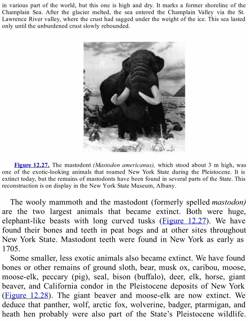
in various part of theworld, but this one is high and dry. Itmarks a former shoreline of theChamplain Sea. After the glacier melted, the sea entered the Champlain Valley via the St.LawrenceRivervalley,wherethecrusthadsaggedundertheweightoftheice.Thissealastedonlyuntiltheunburdenedcrustslowlyrebounded.
Figure12.27. The mastodont(Mastodonamericanus),which stood about 3m high,was
one of the exotic-looking animals that roamed NewYork State during the Pleistocene. It isextincttoday,buttheremainsofmastodontshavebeenfoundinseveralpartsoftheState.ThisreconstructionisondisplayintheNewYorkStateMuseum,Albany.
Thewoolymammoth and themastodont (formerly spelledmastodon)are the two largest animals that became extinct. Both were huge,elephant-like beasts with long curved tusks (Figure 12.27). We havefound their bones and teeth in peat bogs and at other sites throughoutNewYork State.Mastodont teethwere found inNewYork as early as1705.Somesmaller,lessexoticanimalsalsobecameextinct.Wehavefound
bonesorother remainsofgroundsloth,bear,muskox,caribou,moose,moose-elk, peccary (pig), seal, bison (buffalo), deer, elk, horse, giantbeaver, andCalifornia condor in the Pleistocene deposits ofNewYork(Figure 12.28). The giant beaver and moose-elk are now extinct. Wededuce thatpanther,wolf, arctic fox,wolverine,badger,ptarmigan,andheath hen probably were also part of the State’s Pleistocene wildlife.
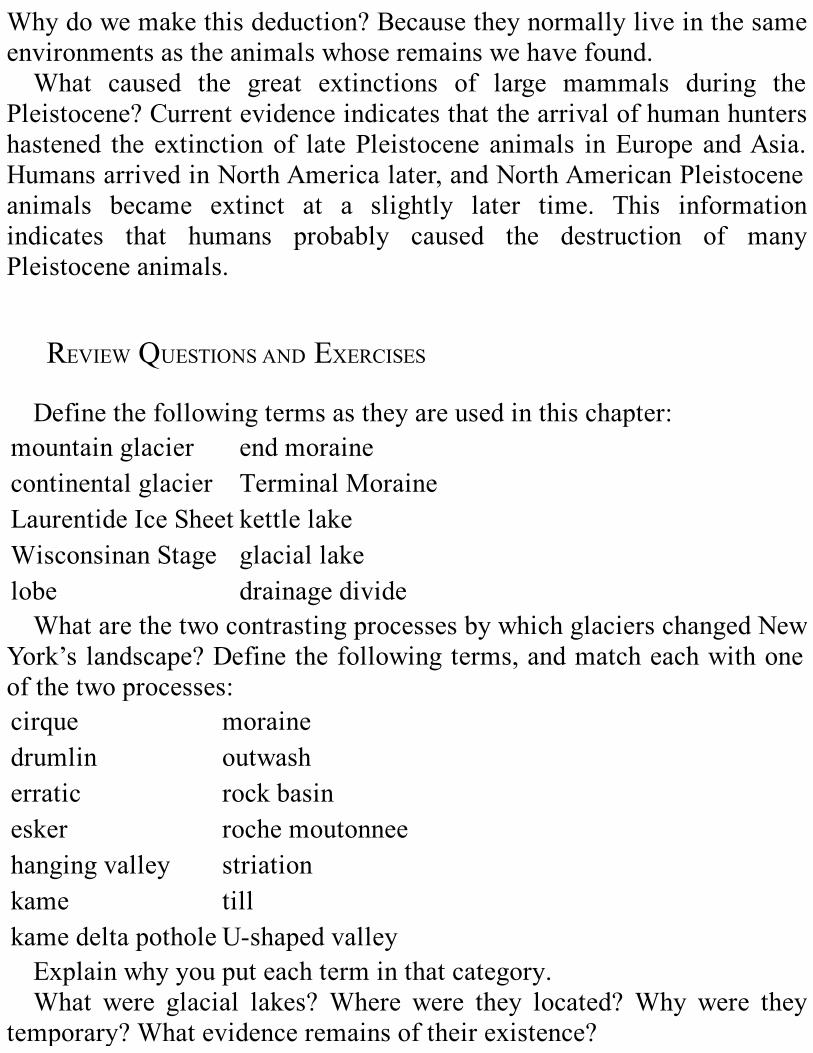
Whydowemakethisdeduction?Becausetheynormallyliveinthesameenvironmentsastheanimalswhoseremainswehavefound.What caused the great extinctions of large mammals during the
Pleistocene?Currentevidenceindicatesthatthearrivalofhumanhuntershastened the extinctionof latePleistocene animals inEurope andAsia.HumansarrivedinNorthAmericalater,andNorthAmericanPleistoceneanimals became extinct at a slightly later time. This informationindicates that humans probably caused the destruction of manyPleistoceneanimals.
REVIEWQUESTIONSANDEXERCISESDefinethefollowingtermsastheyareusedinthischapter:
mountainglacier endmorainecontinentalglacier TerminalMoraineLaurentideIceSheet kettlelakeWisconsinanStage glaciallakelobe drainagedivideWhatarethetwocontrastingprocessesbywhichglacierschangedNew
York’slandscape?Definethefollowingterms,andmatcheachwithoneofthetwoprocesses:cirque morainedrumlin outwasherratic rockbasinesker rochemoutonneehangingvalley striationkame tillkamedeltapothole U-shapedvalleyExplainwhyyouputeachterminthatcategory.What were glacial lakes?Where were they located?Why were they
temporary?Whatevidenceremainsoftheirexistence?

WhatdidglaciershavetodowiththeformationoftheFingerLakes?WhatwastherebeforetheIceAge?Canyounameotherlargevalleysinthe region that also run north-south but arenot lake-filled? Suggest anexplanation for their formation. See the PhysiographicMap on Plate 4andaroadmap.Ifacaradvancesandthenretreats,itusesthesameprocesstomovein
bothdirections—rollingalongonitstires.Whentheglacieradvancedandretreated, though, the processes were different. Explain how a glacieradvancesandretreats.Whywas sea level lowerduring thePleistocene than today?Howdo
weknowthatitwaslower?Whatismeantbypost-glacialrebound?Whatevidencedowehavethat
ithasoccurred?Name5or10citiesoftheworldthatwouldbesubmergedbeneaththe
seaifalloftheiceintheworld’sglacierssuddenlymelted.(Hint:Lookataglobeoraworldmaptohelpyouanswer.)
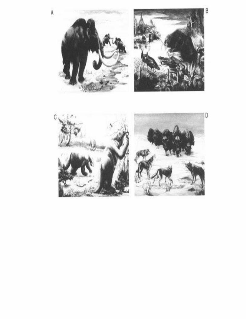
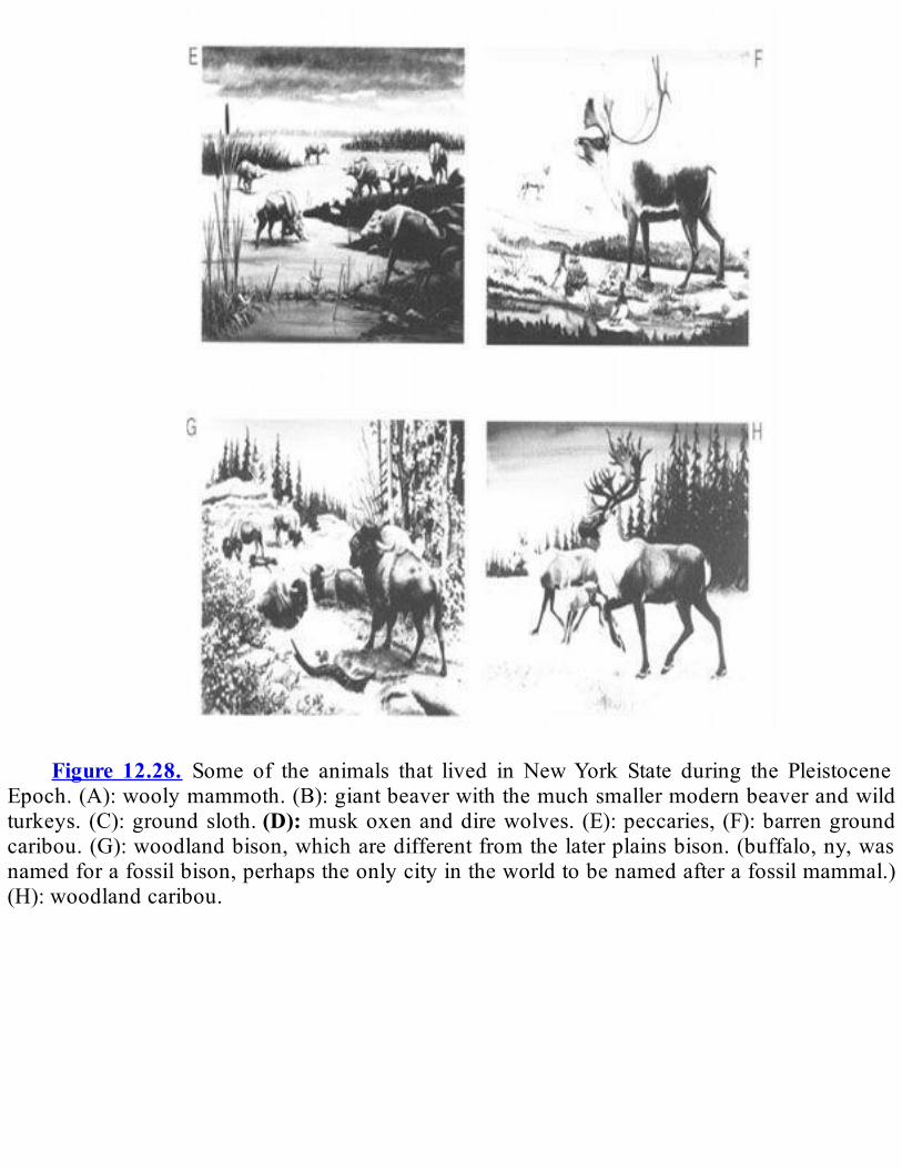
Figure 12.28. Some of the animals that lived in NewYork State during the Pleistocene
Epoch.(A):woolymammoth.(B):giantbeaverwiththemuchsmallermodernbeaverandwildturkeys. (C):groundsloth.(D):muskoxenanddirewolves.(E):peccaries,(F):barrengroundcaribou.(G):woodlandbison,whicharedifferentfromthelaterplainsbison.(buffalo,ny,wasnamedforafossilbison,perhapstheonlycityintheworldtobenamedafterafossilmammal.)(H):woodlandcaribou.
CHAPTER13
ICESCULPTING
GlacialFeaturesofNewYorkState1
SUMMARYAlmostalloftheglacialdepositsinNewYorkStateweremadeduring
thelastadvanceoftheWisconsinanicesheet,whichoccurredduringtheWoodfor-dianSubstage.Theglaciercreateddifferentkindsoffeaturesinregionswithdifferentbedrockandphysiography.ThischapterlistssomeimportantglacialfeaturesfoundineachofnineregionsacrossNewYorkState.TheregionsdiscussedaretheAdirondackMountains,theHudson-MohawkLowlands,theSt.Lawrence-ChamplainLowlands,theErieandOntarioLowlands,theTugHillPlateau,theAppalachianPlateaus(whichincludetheAlleghenyPlateauandtheCatskillMountainsinNewYork),the New England Province (which includes the Hudson Highlands, theManhattan Prong, and the Taconic Mountains), the Newark Lowlands,andtheAtlanticCoastalPlain(includingLongIsland).
INTRODUCTIONThe Pleistocene Epoch was marked by four major intervals of
glaciation; some of these intervals had multiple advances of ice. Theglacial features we see today in New York State were made by theadvances and retreats of the last ice sheet, the Laurentide, during theWisconsinanStage. Its lastadvanceoccurredduring the lastpartof theWisconsinanStage,calledtheWoodfordianSubstage.Itdestroyednearly
allofthesignsleftbyearlierglaciersinourState.InafewshelteredplacesinNewYorkwestillfindevidenceofearlier
Pleistocene deposits that underlie the deposits of the WoodfordianSubstage.TwoexamplesaresoilspreservedinaravinenearCayugaLakeandsoilsnearOttoinwesternNewYork.Thesesoilsare35,000-60,000yearsoldandprobablyformedduringawarminterglacialepisode.(Thelast glacier retreated between 8,000 and 15,000 years ago.) We doradiocarbon dating of the plant and animal remains in the soils to findtheseages.As it retreated, the ice sheet of theWoodfordian Sub- stage did not
meltuniformly.Sometimesthemeltingwasbalancedbytheforwardflowoftheice;atthosetimes,depositspiledupalongsidethestationaryfrontof the ice sheet. Other times the ice readvanced and disrupted earlierdeposits and mixed them into new ones. Thus, we have to study eachglacial deposit carefully.We need to figure out whether a deposit wasformed when the glacier was retreating, when it was standing still, orwhenitwasadvancing.Agreatvarietyofglacialdeposits are found inNewYorkState.The
icesheetsadvancedandretreatedindifferentwaysandtimesindifferentareas. The kind of bedrock and the shape of the landscape in a regionstrongly influenced the formation of glacial features. For example, theAdirondackMountains,madeupofcontorted,hard,metamorphicrocks,havedifferentglacialfeaturesthantheAlleghenyPlateau,withitssofter,flat- lying, sedimentary rocks. Because of such differences, we havedivided the State into regions (seeFigure 1.1) and will look at eachregionseparately.Alistofalltheglacialfeaturesineachregionwouldbeverylong.We
will discuss only themost important. For an explanation of unfamiliartermsforglacialfeatures,seeChapter12ortheGlossary.
ADIRONDACKMOUNTAINSThe last glacier moved southwest across theAdirondackMountains.
Howdoweknowthedirection?Theglaciermadestriationsandgroovesin thebedrock. It also carved rochesmoutonnées in thebedrockor leftbehindrockdrumlins.Thescratches,grooves,andstreamlinedlandformspoint in the direction of the ice movement (compareFigures 12.3 and12.4).Tilliswidespreadhere,asitiselsewhereintheState,However,inthe
AdirondacksthetillismuchmoresandyWhyisthatthecase?Thereasonis thekindofbedrocknearby.Themovingglacierpickedup rocks andsoil,ground them,and laterdeposited them.But itdidn’tcarrymostofthedebrisveryfar—usually less than15km.Thus, the tillwefind inaregion is made up of nearby rock. The hard metamorphic rock of theAdirondacks is made of sand-sized or larger mineral grains. Glacialgrindingproducedsand-sizedfragmentsfromthisrock.Therefore,thetillin the Adirondacks is sandy. In other areas, like the St. Lawrence-Champlain Lowlands, the bedrock is dominantly softer, finer-grainedshale and limestone.Theglacierground these rocks into silt- andclay-sizedparticles.Thetillinthelowlandsisthereforecomposedofsiltandclay,whichsticktogethermuchbetterthansand.
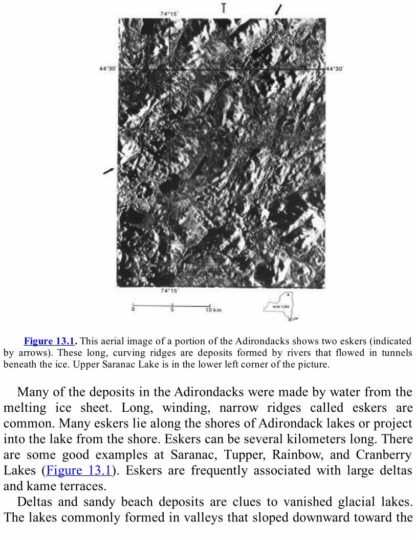
Figure13.1.ThisaerialimageofaportionoftheAdirondacksshowstwoeskers(indicated
by arrows).These long, curving ridges are deposits formed by rivers that flowed in tunnelsbeneaththeice.UpperSaranacLakeisinthelowerleftcornerofthepicture.
ManyofthedepositsintheAdirondacksweremadebywaterfromthemelting ice sheet. Long, winding, narrow ridges called eskers arecommon.ManyeskersliealongtheshoresofAdirondacklakesorprojectintothelakefromtheshore.Eskerscanbeseveralkilometerslong.Thereare some good examples at Saranac, Tupper, Rainbow, and CranberryLakes (Figure 13.1). Eskers are frequently associated with large deltasandkameterraces.Deltas and sandy beach deposits are clues to vanished glacial lakes.
Thelakescommonlyformedinvalleysthatslopeddownwardtowardthe

glacier.They lasteduntil theglacier retreated far enough tounplug thelowplacesandpermitthewatertoflowout.Thelakesthendrained.The Saranac, Placid, Elizabethtown, and Wilmington basins once
contained glacial lakes. Before they drained, these lakes overflowedthroughnotches in thesouthwest rimof theirvalleys.Howdoweknowthat?Theoverflowformed rivers that left longnarrowdepositsof sandandgravelintheirbeds.Thesedepositsendinlargedeltas,whichtellusofanotherlakedownstream.AverylargedeltaatForestportwasdepositedbywaterflowingdown
the Fulton- Chain-of-Lakes and through the Plains area of the MooseRiver.GlacialLakeElizabethtown spilled throughUnderwoodGap intoGlacialLakeWarrensburg.GlacialLakeWarrensburgfilledwhatisnowtheSchroonRivervalley.
It also stretched fromDeadwater Pond to Corinth in theHudsonRivervalley.ThewaterinthislakewasheldinbyawalloficethatextendedfromGlensFallstoSaratogaSprings.GlacialLakeWarrensburgmayhavebeenfedbymeltwaterfromsmall
glaciers that remained behind in themountains.Whydowe infer that?WecanstillseethecirquesformedbytheseglacierswestofPisecoLakeandonGiantandWhitefaceMountains(seeFigure12.12).Some ranges in the Adirondack Mountains were at an angle to the
directionof ice flowand formedanobstruction to the ice sheet’s flow.Such obstructions locally shielded some fragile preglacial soils fromglacial erosion. We have found Tertiary soils and deeply weatheredbedrockdatingfrombeforetheWisconsinanStageinanumberofplaceswhere road cuts have been blasted. These Tertiary soils are soft,commonly rust-colored, completely decomposed rock. These exposuresthereforequicklydeteriorate,butsomecanbeseealongRoute9andtheNorthwaynorthofLakeGeorge.OthersoccurnearHonnedagaLakeandnearLakePleasant.At Tahawus in theAdirondacks also, there are Pleistocene deposits
older than the Woodfordian Substage. Here, we have found woodfragmentsandplantdebrismorethan40,000yearsoldinnonglaciallakesediments preserved between two layers of till. This site therefore
provides evidence for two episodes of glaciation in the centralAdirondackMountains.
ReviewQuestionsandExercisesHowcanwetellwhatdirectiontheglaciermovedinthisregion?Whatsortofcluestellusaboutthelocationsofglaciallakes?What is the till like in this region? Why is it different from other
regionsintheState?
HUDSON-MOHAWKLOWLANDSBetween 20,000 and 13,000 years ago, a large lake, Glacial Lake
Albany,filledtheHudsonValley(see Figure12.23).GlacialLakeAlbanywas 50 kmwide at Schenectady, itswidest point. Itwas 320 km long,extendingfromGlensFalls toNewYorkCity.AtAlbany, itwas120mdeep. Its southern end was dammed by the Terminal Moraine of theWisconsinan ice sheet, in theNewYorkCityarea (see Figure12.3). Itsnorthernendwasblockedbythefrontoftheretreatingglacier.At first, theTerminalMoraine extended as a ridge acrossNewYork
Bay from Long Island to Staten Island (seeFigure 12.3). Exactly howLakeAlbanydrainedisstillanunansweredquestion.Itmayhavedrainedthrough gaps that developed in the TerminalMoraine.Alternatively, itmay have drained farther north, at Sparkill Gap nearNyack: thewatercould have passed through this narrow gap into the headwaters of theHackensackRiver.Many of the cities and towns of the Hudson Valley are located on
deltasbuiltbystreamsandriversthatdrainedintoGlacialLakeAlbany.Examples of such deltas can be found at Croton Point, Newburgh,Kingston, Red Hook, Hudson, Kinderhook, Albany, Schenectady,Schaghticoke,SaratogaSprings,andGlensFalls.OntheeastsideoftheHudson River valley, between Poughkeepsie and Troy, we find old
beachesformedonGlacialLakeAlbany’sshores.The broad sand plains of today are the ancient lake floors of glacial
time.Thesandwasdepositedinshallowwaterneartheshoresofthelake.Afterthelakedrained,thewindpiledupthesandsofthelakefloorandbeaches intodunes.ThePineBushbetweenAlbany andSchenectady isonesuchdune field.Thereareothers inSaratogaandWarrenCounties.TheNorthwaybetweenAlbanyandGlensFalls alternately cuts throughsanddunesandridesalongglaciallakeplains.By looking carefully at the sand in the dunes, we can tell in what
directionthewindswereblowing.Theslopinglayersinthedunestellusthatwindsgenerallyblewfromthenorthwest.Moraines are rare in theHudsonValley, although a largemoraine is
foundnorthwestofGlensFalls.Itwasformedbetweentwolobesoftheglacier.ThereisalargechannelinitbetweenFortAnnandHudsonFalls,cutbythewaterdrainingfromGlacialLakeVermont.In the Mohawk Valley, we find clues to the origin of Glacial Lake
SchoharieandGlacialLakeAmsterdam.Theselakeswerecreatedwhenatongue of ice called the Mohawk Sublobe occupied the valley nearSchenectady. They drained through channels at Duanesburg and WestHill.Thechannelsstillexist,buttheynolongercarrywater.ThecityofAmsterdamislocatedonadeltabuiltbywaterflowingintoGlacialLakeAmsterdam.WaterdrainingfromGlacialLakeIroquoisintheOntarioBasinflowed
over theGlacialLakeAmsterdamandGlacialLakeSchohariedeposits,cuttingdeepchannels.Thelargesizeofthesechannelssuggeststhattheywere cut by heavy flows. It may be that water was released suddenlywhenanicedambroke.Whateverthecause,thefloodsalsomadethemagnificentpotholeson
MossIslandatLittleFalls(seeFigure12.24).Theydepositedthesandofthe Fonda Sand Plain between the Noses and Tribes Hill. When theyreached theHudsonValley, they cut theBallston Lake, Saratoga Lake,andRoundLakeChannels.Northville,Edinburg,Gloversville, and Johnstown are built on deltas
formedbystreamsthatflowedintoGlacialLakeSacandaga.Thereisalso
adeltaatSaratogaSprings thatwasbuiltbya large floodofmeltwaterspilling from Glacial Lake Warrensburg into Glacial Lake AlbanythroughtheKayderosserasValley.A number of temporary glacial lakes were formed in the Hudson
Lowlands, as the Hudson Lobe readvanced several times. At times itblocked the low points in the northern or eastern parts of valleys andallowed temporary lakes to form in those valleys. Some examples areLakeTillsonintheWallkillValley,LakeElizavilleintheRoecliffJansenKillValley,andLakeDurhamintheCatskillValley.Duringonebriefperiodofstationaryice,theHudsonLobeformedthe
Meadowdale moraine. This moraine was built during a pause in theretreatoftheicefront.Atthesametime,theHudsonLobebuiltakameterraceatSchodackandeskerandkamedepositsatWestSandLake.
ReviewQuestionsandExercisesWherewasGlacial LakeAlbany?What are some of the clues to its
existencewe see today?What clues tell us about other glacial lakes inthisregion?
ST.LAWRENCE-CHAMPLAINLOWLANDSThe St. Lawrence Valley is made up of gently rolling farmland.
UnderneaththesoilareglacialsedimentsdepositedduringthelastpartoftheWisconsinanStage.Inplaces,theglaciermoldedtillintodrumlins.In this region, the ice sheet flowed through the St. LawrenceValley
and into theAdirondacks. When the glacier began to retreat from thelowlands, themeltwaterwasheldinsomevalleysbytheretreatingwalloficetothenorth.Thisprocesscreatedtemporarylakes.Today,wefinddeposits associated with these lakes—kame deltas at Parishville andStalbirdandeskers,includingoneatSt.RegisFalls.At Chateaugay, there are long, deep channels that no longer carry
water. They were created by glacial meltwater as it flowed westwardalongtheedgeoftheiceintoGlacialLakeIroquoisintheOntarioBasin.As the ice retreated, the longnortheast armofGlacialLake Iroquois
expanded.Beachesanddeltasformedalongitssouthernshore.Layersofclayweredepositedindeeper,quieterwaterfartherfromshore.PotsdamandMalonearebuiltonlargeLakeIroquoisdeltas.Eventually, the glacier retreated past the northeastern tip of the
Adirondacks at Covey Hill near the Canadian border. This retreatprovided an outlet that drained Glacial Lake Iroquois abruptly. Theroaring torrent carved deep channels. It created waterfalls and plungepools2atCoveyHill.ItalsoerodedthePotsdamSandstoneledgesatRatRocks near Altona. Where the flow entered Glacial Lake Vermont, itdepositedalargedeltanearChazy.During thePleistocene, thegreatweightof the2km- thick ice sheet
caused the crust and underlying mantle to sag.As the ice melted, thecrustslowlyrebounded.However,therewasaperiodinbetweenmeltingand rebound of the crust, during which sea water from the AtlanticfloodedtheSt.LawrenceandChamplainLowlands.How do we know that this region was covered by sea water? The
retreatingglacierhadleftbehindmorainesandglaciallakedeposits,butontopofthesedepositsaresands,silts,andclayswithabundantmarineclamsandoccasionalwhaleandsealbonesasfarsouthasWhitehall.Inaddition, many of the drumlins in the St. Lawrence Lowlands haveboulders on the top. These large stones were left behind when the seawavessweptawaythefinersediments.We have found deltas built by streams that drained north into this
Champlain Sea at Malone and Hannawa Falls. Later, northwest windspickedupsandfromthedeltatopsandbuiltdunes.Deltasandsandridgesthat formed at the shore of theChamplain Sea can be found fromPortKent to the Canadian border. Such deltas are found at Port Kent andAltona.Well-preservedbeachridgescanbeseenatPlattsburgh.In theChamplainValley,wehave foundclayand siltwithout fossils
thatweredepositedinaglaciallake.Athigherelevations,wefinddeltas
andbeachesfromthesamelake.Thislake,calledGlacialLakeVermont,drainedsouththroughanotchcalledtheWoodCreek-FortAnnGap.Thewater poured into theHudsonValley and carved a channel fromBattleHilltoFortEdward.WecanfindLakeVermontdeltasatthevillagesofMor- risonville,Clintonville,Keeseville,CrownPoint,andStreetRoad.TherearealsobeachridgesbuiltbystormwavesatBeekmantown.NearPlattsburghistheIngra-hamEsker,along,snake-likeridgethatformedinameltwaterstreambeneaththeretreatingglacier.The sand deposited in glacial lakes and shallow seas makes rich
farmlandintheLowlands.Thebeachesanddeltasaresourcesofsandandgravel.Theyalsomakegoodaquifers.3Sand and gravel deposits provide well-drained sites for cities and
towns. However, the marine clay is a poor foundation. It has littlestrengthandtendstoflowdownhill.Thispropertyhascausedslumpsonmanyhillsidesandthecollapseofmanybuildings.
ReviewQuestionsandExercisesWhatcluestelluswhatdirectiontheglaciermovedinthisregion?WherewasGlacialLakeIroquois?Whydiditdrain?Howdoweknow
that?HowdoweknowtheSt.LawrenceandChamplainvalleyswereonce
extensionsof theAtlanticOcean?Whydid thathappen?Whyare thesevalleysnowabovesealevel?
ERIEANDONTARIOLOWLANDSTheErieandOntarioLowlandsarerenownedfortheirsplendiddisplay
ofdrumlins.Thisdrumlinfieldisoneof the largestonearth,extendingfromOswego toBatavia (seeFigure12.16).More than10,000drumlinsrise above the nearly flat plains of the Lowlands.Many of them havebeen named, for example Chimney Bluffs and LeRoy Island in Sodus
Bay,HillCumorahnearPalmyra,andMountOlympusatSyracuse.TheOntario Lobe passed across the Lowlands and molded these drumlinsfromglacialtill.Some drumlins have channels cut in them by meltwater from the
retreatingglacier.Themost spectacular channels arenearSyracuseandNewark. The channelswere carved aswater flowed eastward along theedgeof theglacier into theMohawkValley.Wehave frequently foundwoolymammothandmastodontskeletons inpeatbogsat thebottomoftheseoldmeltwaterchannels.Plunge pools are common in the floor of the Syracuse channels.A
plunge pool is a basin formed in bedrock at the base of a waterfall,createdbytheforceoffallingwater.Thewaterfallsaredrytoday,butthepoolsremain.GreenLake,eastofSyracuse,isaveryfineexample.Manymorainesandeskerswere formedalong the receding ice front.
ThePinnacleHillsandMendonPondsKameMorainesnearRochesterareamongthebestknown.OthermorainesarefoundnearBuffalo,includingtheHamburg,NiagaraFalls,andAlbionMoraines.TheStanwixMorainelieseastofLakeOneida.TheErieandOntarioLowlandsalsocontainoneofthefinestrecordsof
glacial lakes in NorthAmerica. There are layers of lake sand and siltaround many of the drumlins. Old lake beaches lie at the base of thehillsides. Ridge Road runs east-west across the Lowlands along levelsurfacesandridgesthatwerebuiltbywavesonglaciallakebeaches.These beaches formed the old shoreline alongGlacialLake Iroquois,
whichonceoccupiedtheOntarioLakeBasin.ThelakedrainedeastwardintotheMohawkValleythroughawidegapatRome.There,wefindpilesofsediments—spits,terraces,andbars4—leftbytheoutflow.ThecityofRochester isbuilt ona thin layerof lake sediments that coverbedrock.MontezumaSwamp,westofSyracuse, isanunfilledremnantofGlacialLakeIroquois.Usingradiocarbondating,weconcludethatGlacialLakeIroquoiswasinexistence12,400yearsago.Severalolderlakes,GlacialLakeWarrenandGlacialLakeWhittlesey,
drained west into the Mississippi River system. We find beaches and
deltas at higher elevations along the western edge of theAppalachianUpland. They extend from Pebroke to the Pennsylvania state line. ThevineyardsofFredoniagrowonthesebeaches.Tonawan-daCreekflowsthroughaclay-filledbasinthatuntil10,000yearsagoheldaremnantofGlacialLakeWarren.OakOrchardSwampisaremnantofGlacialLakeTonawanda.NiagaraGorgeandFallsareamongthebestknownscenicfeatures in
theState(Figure13.2).About12,000yearsago,astheglacierretreated,the Niagara River began to flow over the cliff called the NiagaraEscarpment.Theancientplungepoolcarvedbythefallingwatercanstillbe seen at Lewiston and Queenston. The top layer of the NiagaraEscarpment—called thecaprock—is made of a massive dolostoneformationthatresistserosion.ThedolostoneliesontopoftheRochesterShale, amuchmore erodible rock.The fallingwater continues todig ahuge plunge pool in the shale and undercut the dolostone caprock.Thecaprockbreaksalongjoints(naturalcracksintherock)andfallsdowntheescarpment in great blocks. Over the past 12,000 years, the falls havecrept11kmupstreambecauseofthiserosion.TheuppertwothirdsoftheNiagaraGorge, leading to thepresent falls,wascutafter theendof thePleistocene.But thepresent falls areonly the latestversionofa recurring theme.
Before theWoodfordian Substage, an earlier Niagara River cut the St.DavidsGorge,whichflows8kmbetweentheWhirlpoolandSt.Davids.Today,thegorgeisfilledwithglacialdeposits.
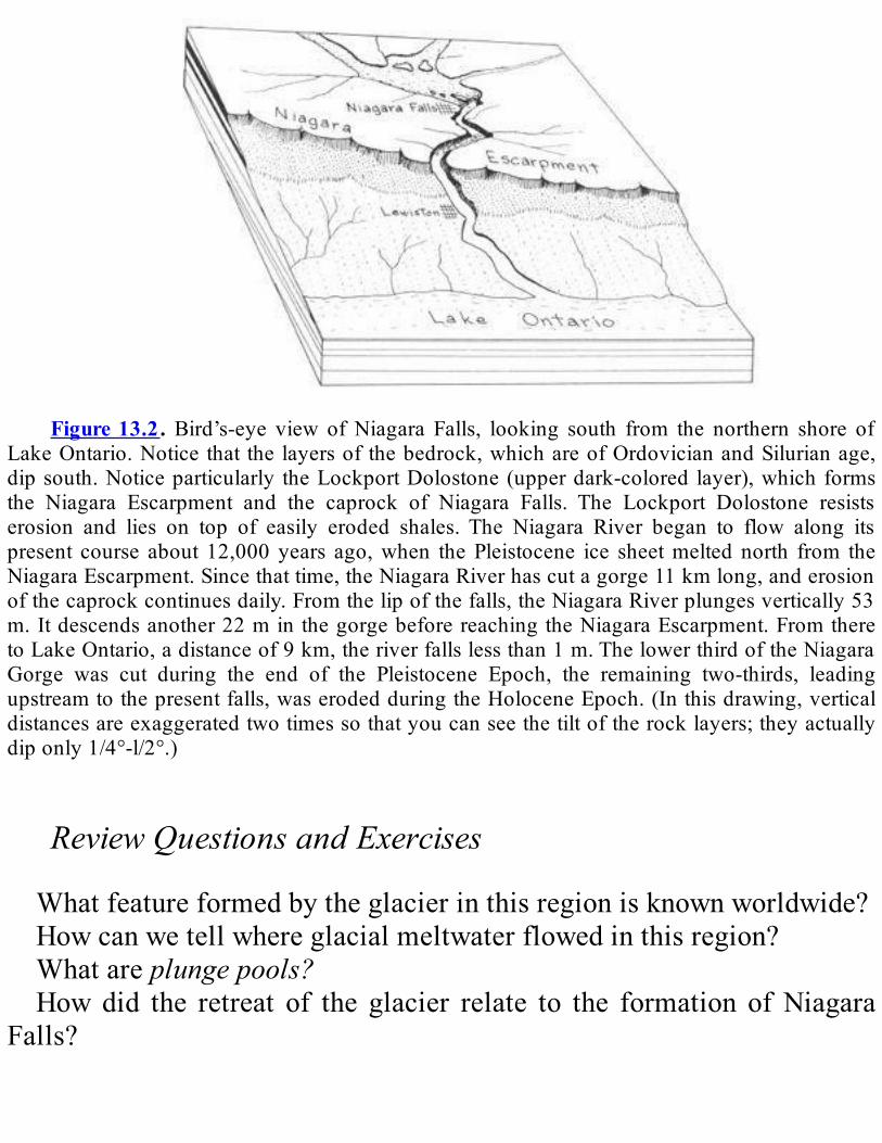
Figure13.2. Bird’s-eye view ofNiagara Falls, looking south from the northern shore of
LakeOntario.Noticethat thelayersofthebedrock,whichareofOrdovicianandSilurianage,dipsouth.Noticeparticularly theLockportDolostone(upperdark-colored layer),whichformsthe Niagara Escarpment and the caprock of Niagara Falls. The Lockport Dolostone resistserosion and lies on top of easily eroded shales.The Niagara River began to flow along itspresent course about 12,000 years ago,when thePleistocene ice sheetmelted north from theNiagaraEscarpment.Sincethattime,theNiagaraRiverhascutagorge11kmlong,anderosionofthecaprockcontinuesdaily.Fromthelipofthefalls,theNiagaraRiverplungesvertically53m.Itdescendsanother22minthegorgebeforereachingtheNiagaraEscarpment.FromtheretoLakeOntario,adistanceof9km,theriverfallslessthan1m.ThelowerthirdoftheNiagaraGorge was cut during the end of the Pleistocene Epoch, the remaining two-thirds, leadingupstreamtothepresentfalls,waserodedduringtheHoloceneEpoch.(Inthisdrawing,verticaldistancesareexaggeratedtwotimessothatyoucanseethetiltoftherocklayers;theyactuallydiponly1/4°-l/2°.)
ReviewQuestionsandExercisesWhatfeatureformedbytheglacierinthisregionisknownworldwide?Howcanwetellwhereglacialmeltwaterflowedinthisregion?Whatareplungepools?Howdid the retreat of the glacier relate to the formation ofNiagara
Falls?
TUGHILLPLATEAUThefewpeoplewholiveon theTugHillPlateaumaysense that it is
barelyfreeoftheIceAgebecauseitreceivessuchtremendoussnowfalls.The winter storms at Booneville frequently produce the lowesttemperaturesanddeepestsnows in theState.5Thestonysoilsandshortgrowing season discourage farming. Thus, most of the Tug Hill iscoveredwithforestthathasreclaimedabandoned19th-centuryfarms.TheicethatcoveredthePlateauduringtheWisconsinanStageformed
rockdrumlinsandscratchedtheexposedrocksurfaces.Thesetracestellusthattheiceflowedsoutheast.As the flowing ice thinned, the Tug Hill Plateau divided the glacier
intoseveraltongues(seeFigure12.3).ItcausedtheOntarioLobetosplitinto theOneida andBlackRiver Sublobes. Similarly, theHudsonLobewassplitintotheAdirondackandMohawkSublobes.The lobesdammed theBlackRiverandWestCanadaCreekand thus
created glacial lakes.The largestwasGlacialLakePortLeyden.WaterdrainingfromLakePortLeydencarvedtheBoonevilleGorge.
ReviewQuestionsandExercisesWhatcluestellusabouthowtheglaciersmovedinthisregion?
APPALACHIANPLATEAUSInNewYorkState, theAppalachianPlateaus are subdivided into the
AlleghenyPlateauandtheCatskillMountains(Figure1.1).Thetypesofglacialactivityinthesetwoareasdiffered.Thesedifferencesarerelatedt orelief—the local difference in elevation between valley floors andmountaintops.TheAlleghenyPlateauhasareliefof245to425m.Therelief ismuch greater in theCatskillMountains—600 to 900m.We’lldealwiththeAlleghenyPlateaufirst.
AlleghenyPlateauMostof theglacialfeatures in theAlleghenyPlateauwereformedby
thecontinentalicesheet.Exceptonsteepslopes,thebedrockofthehillsis generally covered by one to three meters of unsorted till. In manyvalleys,ontheotherhand,layereddebrismaybeuptoahundredmetersthick. Such layered debris is deposited by the action of water—eitherstreams or lakes or in conical hills calledkames that formed whensediment-ladenstreamsflowedofftheicefront.Theactionofthewatersortsthesedimentsintodifferentlayersbyparticlesize.When the edge of the glacierwas near the head of the Susquehanna
River,meltwater flowed freely to the south. It left outwash deposits ofsand and gravel in the valleys.When the glacier had retreated a littlefarther,itsometimesreachedanareawherewaterwouldnormallydrainto the north. With that direction blocked by the glacier, however,meltwaterwouldcollectinthevalley.Foratime,theforwardflowoftheicebalancedthemelting,andtheglaciercontinuedtodepositsedimentsalongitsedge.Theresultwasamassivepileofdepositsthatblockedthevalley.Thiscomplex,calledtheValleyHeadsMoraine(see Figure12.3),today divides the Susquehanna and St. Lawrence drainage basins (seeFigure 16.1). Streams north of themoraine flow into the St. LawrenceRiversystem,andthosesouthofthemoraineflowintotheSusquehannaRiversystem.WefindmanymagnificentexamplesofglacialerosioninthePlateau.
An outstanding one is a series of U- shaped valleys carved out by theglacier. Today, these valleys are filled by the FingerLakes 6 and other,smaller lakes to thewest (Conesus,Hemlock,Canadice, andHoneoye).TheFingerLakesare theremnantsof largerglacial lakes that filled thevalleys.These extinctmeltwater lakes laybetween the retreating ice inthenorthandtheValleyHeadsMoraineinthesouth.The Finger Lake valleys were widened and deepened by the glacier
becausetheyraninthesamedirectionastheiceflow.Streamvalleysthatwereperpendiculartothemainiceflowdirectionwerenotdeeplycarved.
Insuchprotectedravines,wemaystillfinddebrisfromearlierglaciers.ThevalleysofSixMileCreekandGreatGully,whichflowfromtheeastintotheCayugaLakevalley,containthisolderdrift.Layersofstratifieddrift occur between the sheets of glacial till exposed in these ravines.Radiocarbondatingofplantandanimalremainstellsusthatthiswater-depositedmaterial hasbeen theremore than30,000years.AtFernbankonthewestshoreofCayugaLakeafewkilometersnorthofIthaca,thereare sediments that contain plant remains and shells of freshwaterorganisms.Radiocarbondatingof the plants and shells tells us that theCayugaTroughheldaglaciallakemorethan50,000yearsago.As the glacier advanced, it carved striations, grooves, and roches
moutonneesinthebedrock.Suchfeaturesareusuallyfoundalongvalleywallsandinuplandareas.Theglacieralsodepositedavarietyofsedimentsonthevalleyfloors.
Most were left by meltwater flowing from the glacier. Moraines andotherdepositsformedattheedgeoftheicearecommonlyintermixedtillandlayereddepositsmadebymeltwater.Manyexamplesofsuchdepositsexist in theSusquehannaRiverbasin.Aparticularlygoodplace to findthem is along the Chenango River at the Chenango Valley State Park.Here,wefindtill,out-wash,kames,eskers,kameterraces,andkettles.
CatskillMountainsIntheCatskillMountains,manyoftheglacialfeaturesmayhavebeen
formed by mountain glaciers instead of the continental ice sheet. TheglacialhistoryoftheCatskillsisverycomplicated,especiallywherelocalmountainglaciersmergedwiththemainicesheet.In much of the Catskills, we find striations, roches moutonnees,
cirques,andU-shapedvalleys,allfeaturesmadebyglacialerosion.Theglaciers also left deposits behind in the Catskills—moraines, kames,outwash, and kame deltas. In addition, there are many kames, kameterraces,andkamedeltasleftbythecontinentalicesheetinthevalleysofSchoharieCreekandtheBataviaKill.

A large lake formed in front of the ice in the Schoharie Valley.BetweenNorthBlenheimandPrattsville,wecanfindsandandclayfromthelakebottom.Wecanalsofindsandandgraveldepositedindeltasbystreamsflowingintothelake.
ReviewQuestionsandExercisesWhatisrelief?WhatarethetwosubregionsoftheAppalachianPlateausinNewYork
State?How are they different?Howwere the glaciers that affected thetwosubregionsdifferent?How did the glacier affect drainage in theAllegheny Plateau? How
weretheFingerLakesformed?WhatwastherebeforethePleistocene?Whatkindofevidencedidtheglacierleaveonthewallsofvalleysin
theAlleghenyPlateau?Onthevalleyfloors?WhatkindofglacialevidencedowefindintheCatskillMountains?
NEWENGLANDPROVINCEThelandformtypesoftheNewEnglandProvincearequitevaried.The
mountainous areas are rather extensive, as you can see on thePhysiographicDiagramonPlate4of theGeologicalHighwayMap.TheentireNewEnglandregionwascoveredbyiceduringthePleistocene.Astheiceretreated,itthinnedfirstoverthehillyregions.Thehigherpeaksgraduallyprotruded through the ice.The sunwarmed theexposed rock,whichwasdarkerthantheicearoundit.Thewarmrockinturncausedtheiceclosesttothemountaintomeltfastest.As the ice melted, it left deposits of sediment on the land. These
deposits showuswhere the edge of the icewas.A number of kinds ofglacial deposits are found in the mountainous areas: outwash, kames,kameterraces,kamedeltas,andeskers.Wealsofindsedimentsdepositedinmeltwater lakesnear theedgeof the ice,channelseroded inoutwash

bywaterflowingoverit,andmoraineswithmanykamesinthem.NeartheRensselaerPlateau,wecanfindanexcellentexampleofthis
ice-melting process. First, the mountains in this upland began to peekthrough the glacial ice. Then, a large kame moraine was built nearGraftonLakesStatePark east ofTroy.This kamemorainewas formedwhenmeltwater streams deposited sand and gravel between the glacierandthemountain.LargekamedeltasarealsofoundatLebanonSpringsandGarfield, eskers and kame terraces at Lebanon Springs andCherryPlain,andmarginallakedepositsintheHoosicValley.Farther south, at the northern edge of the Hudson Highlands, the
Shenandoah Moraine formed during the retreat of the Wisconsinanglacier.Thismoraineismadeoflayersofglacialdriftthatwasdepositednexttothemeltingglacier.Whiletheicewasatthislocation,meltwaterflowedsouthalongCloveCreekandFoundryBrooktowardColdSpring.The meltwater left numerous deposits. We can see kame deltas andoutwashfromitalongRoute9neartheDutchess-PutnamCountyborder.NearPinePlains,wecanfindmoreevidenceofameltingglacier.The
PinePlainsMorainecanbetracedaroundStissingMountain.Wecanalsofind an outwash plain left by meltwater flowing south from the PinePlainsMoraineintoWappingersCreek.Commonly, outwash was deposited bymeltwater downstream of the
moraineattheicemargin.However,notalloutwashplainsareconnectedwith such moraines. We find major outwash plains without morainesalongFishkillCreekatHopewellJunction,intheHarlemValleyatDoverPlains,intheheadwatersoftheRoeliffJansenKillbetweenHillsdaleandAncram, along theClaverackCreek betweenChatham andMellenville,andintheBattenKillValleynearCambridge.Farther south, inWestchesterCounty,we findnumerous signsof the
ice sheet’s passage. Examples of glacial streamlining, polishing, andstriationsofbedrockcanbeseennearPocanticoHillsandPeekskill.NearShrubOak is an esker and an erratic thatwas transported some tensofkilometers by the ice.Another erratic, left perched atop three smallerboulders,isfoundinNorthSalem.ThereareanumberofdrumlinsnearGraniteSpringsandanexposureofoutwashinagravelpitneartheNew
CrotonReservoir.
ReviewQuestionsandExercisesHow did the ice sheet begin to melt in this region? What sort of
evidencedidtheicesheetleavebehindasitwasmelting?
NEWARKLOWLANDSA small part of the Newark Lowlands is in Rockland County, New
York.Sand,gravel,andclaydepositedinGlacialLakeAlbanycovertheTriassic rocksatHaver- straw.A thickwedgeofLakeAlbanyclay liesunder theriver-bottomsedimentsof theHudsonRiver.Drumlinson thePalisadesbetweenDeForestLakeandthestatelinearemadeofredtill.The glacier made this till by grinding up the red Triassic rocks as itmovedsouth-southwestacrosstheregion.Twomorainesare foundatTappen.Thesemoraineswerebuilt at the
edgeoftheiceintheNyack-Crotonarea.A gap in the Palisades Ridge is found at Sparkill, near Tallman
MountainStatePark.Thisgapmayhavebeen anoutlet forwater fromtheHudsonValleyandGlacialLakeAlbany.Fromthere,thewaterwouldhave flowed across the sand plains at Northvale, New Jersey, into theHackensackValley.
ReviewQuestionsandExercisesWheredidthetillinthisregioncomefrom?Whyisitdifferentfrom
tillinotherregionsoftheState?Whatotherkindofevidencewasleftbytheglaciersinthisregion?

ATLANTICCOASTALPLAIN(LONGISLAND)ThehighesthillsoftheislandsoffthesoutherncoastofNewEngland,
includingLongIsland,BlockIsland,FishersIsland,andStatenIsland,arepartsoftheTerminalMoraineoftheWisconsinanicesheet(seeFigures12.3and12.21).ThesemorainesaremadeofdebrisfromthebedrockofNewEnglandandNewYorkand from theCretaceous strataunderlyingLongIsland.Astheglacierpassedovertheregion,itpickeduppiecesofrock,ground themup,and thendeposited them.Someof thesedepositsarecompletelyunsortedtills.Othersareout-wash,depositedaslayersofsandandgravel.BeneaththeglacialdepositsofLongIslandarerelativelysoft,crumbly
Cretaceousrocks.Theseweakrockswereeasilytornapartbytheglacier,thenredepositedonLongIslandastillandoutwash.WehaveevidenceonLong Island for two advances of the ice sheet during theWisconsinanStage (seeFigure12.4). The endmoraine of the first advance is partlyburied by the moraine of the second advance. In places, the youngermoraine is separated from the older bymarinemud.This fact suggeststhatthetwoadvanceswereseparatedbyaninterglacialperiod.Figures 12.4 and12.21B show the location of the end moraines on
LongIsland.LakeRonkonkomaisanexcellentexampleofakettle lakethatformedinthemoraine.WecanseesomeoftheglacialdepositsofLongIslandintheStateand
county parks in Nassau and Suffolk Counties. An exposure of glacialoutwashandunderlyingCretaceousrockscanbeseenonthenorthshoreofLongIslandinCaumsettPark,northofLloydHarbor.Thebluffalongthebeachcontainslayersofsandandgravel,carriedfromtheglacierbyameltwaterstream.TheStonyBrookMoraineextendsthroughSunkenMeadowParkalong
the north shore near Smithtown. This moraine is made of variableamounts of sand, gravel, and till jumbled together. This variedcomposition suggests that the deposition of this moraine wascomplicated. However, its glacial outwash streams deposited sand andgravelinwellorganizedlayers.InbluffsalongthecoastlineinMontauk

StatePark,wecanseeexposuresofglacialtill.An end moraine commonly makes rolling hills. The Manetto Hills
Moraine in Bethpage State Park, eastern Nassau County, is a goodexample.
ReviewQuestionsandExercisesHowwere the highest hills on the islands in this region built?What
doesthattellusabouttheadvanceoftheglacier?whatotherkindsofglacialevidencedowefindhere?

CHAPTER14
YESTERDAY,TODAY,ANDTOMORROW
HoloceneEpoch1
SUMMARYWe are living in the Holocene Epoch. This epoch follows the
Pleistocene Epoch. By studying the pollen in Holocene sediments, wehave traced a progression of climate from the earlier cold, dry glacialclimate to the warm, moist climate of today. River erosion in theHolocenehascarvedmanyspectacularfeaturesinourState.Althoughthematerialeroded in theStateeventuallyendsup in theAtlantic, some istemporarilydepositedasdeltasintolakesinmanyplaces.Inotherplaces,rising ocean and lake water drowns the mouths of streams, formingestuaries.Estuariesarecommonalong thesouthshoreofLakeOntario;the crust has rebounded unevenly from the weight of glacial ice, thustiltingtheentirebasintothesouth.Withthemeltingoftheice,sealevelhasrisendramaticallyintheHolocene.ThisrisehasdrownedtheHudsonRiverasfarnorthasTroy,aswellasthemouthsofmanyoftheHudson’stributaries. Many of the Holocene environments around us changecontinually.Windandwatercurrentsrearrangethebarrier islands,bars,andspitsalongtheshoresofLongIslandandinLakeOntario.Lagoonsand marshlands develop behind them, and the wind piles up sand intodunes.Along the banks of rivers, floodplains offer sites for towns andgood farmland, although some of them flood nearly every year.Landslides are common along steep river and stream banks; they alsooccurontheverysteepslopesoftheAdirondackpeaks.TheAdirondack

MountainscontinuetoriseintheHolocene.
INTRODUCTIONWeliveintheHoloceneEpoch,sometimescalledtheRecentEpoch.It
isthetimesincetheIceAge,themostrecentpartoftheCenozoicEra.Itbegan10,000yearsago,astheLaurentideIceSheetretreatednorthoftheGreatLakes. “Holocene”means “completelymodern.”Thename refersto the fact that the plants and animals of this epoch distinguish themodernworldfromprevioustimes.BecausewearestillintheHolocene,wecanobserveitsclimatesandgeologicprocesses.Manyofthefeaturesthat we see daily—streams, waterfalls, beaches, harbors, soil—wereformedormodifiedduringtheHolocene.
HOLOCENECLIMATESGlaciersaregonefromNewYorkState.Thecontinentalicesheetleft
the State about 12,000 years ago. The last mountain glaciers in theAdirondacks probablymelted 10,000 years ago.Wemust travel to theRocky Mountains, to Alaska, or to the Canadian Archipelago to seeremnantsoftheIceAgeinNorthAmerica.As the continental ice sheet retreated, the climate changed rapidly.
Whatcluesdowehave to theclimate12,000yearsago?Thepollenwefind in sediments from that time is especially useful. It tells us whatkindsofplantsgrewthen.Fromthisinformation,wecandeducewhattheclimatewaslikeintheearlyHolocene.Climatic conditions along the ice front were very severe. Coldwind
poured off the glacier. Frigid meltwa- ters flowed from its front.Scientists have studied the remainsof theplants that grewnear the icefront.Theyhavefoundtheseplantstobesparseandlow-growing,suchasgrass,lichens,mosses,andherbs.Thiskindofvegetationisjustthesortweseetodayintundraclimates.Soilswereverythinandeasilyeroded.
Silt and sandwere blown about by the glacialwinds. Coarser particleswerecarriedawaybymeltwaterstreams.Farther south, the climatewas less influenced by the glacier. Eighty
kilometersfromtheicefront,blackspruce,willow,andbirchtreesgrewwith the tundra plants. These trees need a warmer, more stableenvironment to flourish. We have found the bones of mammoth,mastodont,caribou,andelkthere,too.Someoftheseanimalsdiedwhentheyweremiredinpeatbogsthatdevelopedinthetundraandtheblackspruceforests.As the ice retreated, the tundra vegetation was replaced by white
spruce, balsam fir, jack pine, paper birch, and aspen. This change inplantstellsusthatthecold,dry,glacialclimatehadchangedintoacool,moistone.Between10,000and8,000yearsago,thespruceforestwasreplacedby
awhitepine forest, indicating that theclimatehadbecomewarmeranddrier. As precipitation decreased, streams became smaller and thevegetationmoresparse.Plantremainstellusthatabout8,000yearsagotheclimatechangedto
thewarm,moistclimateweliveintoday.Theforestthatdevelopedwasdominatedbyredoak,hemlock,hickory,andchestnut.Europeansettlersexploited this“primeval” forestandalmostdestroyed it.Today,wecanseeonlysmallremnantsoftheforestthatoncecoveredmostofourState.OneexampleistheGreatBasininAlleganyStatePark.
HOLOCENELAKESANDRIVERSDuring the past 12,000 years, river erosion has carved many
spectacularfeatures.CohoesFallsmigratedupstreamalmost5kmfromthe point where theMohawk and Hudson Rivers joined. Niagara Fallsmigrated12kmupstream.The2km-longAusableChasmwasformedbythe upstream migration of the ancestral Rainbow Falls. Lake George,whichusedtodrainsouthbeforeitwasdammedbyglacialdeposits,nowdrains northward through a series of cascades into Lake Champlain at
Ticonderoga. The Genesee River carved the magnificent LetchworthGorge and deposited a large alluvial fan at Shaker Crossing nearRochester. The hanging valleys of the Finger Lakes region were alsoerodedfarupstreamsinceglaciersleftthevalleys.In the cool,moist climate that developed after the ice retreated, the
rivers flowing through the spruce-dominated forests were larger thantoday.Weknowtheirsizefromthedepositstheyleftbehind.Largefan-shapeddepositsofcoarse sediments, calledalluvial fans,weremadebystreamsatthefootofsteepslopes.Wecanstillseethesefanstodayalongtheedgesofriverfloodplains.SomegoodexamplesarefoundalongtheHudsonRiver betweenWaterford andHudsonFalls, and along parts oftheSusquehannaandGeneseeRivers.SimilaralluvialfansweredepositedalongtheedgesoflakesatBolton
Landing on LakeGeorge, at Sheldrake onCayuga Lake, and at SenecaPointonCanandaiguaLake.Smallvillageshavebeenbuiltonthesefans.Verylargealluvialfanswerecreatedatthebaseofhighmountains.Thesites of Palenville andWest Shokan are good examples; these villageswerebuiltonlargefansatthefootoftheCatskillMountains.Thestreamsthatmadethefansarestillflowingacrossthem.AlongthelowerHudsonRiverinWestchesterCounty,CrotonPointisaprominentexampleofanalluvialfan.Itextendsalmosthalfwayacrosstheriver.Today, most of the material eroded by rivers in New York is
transported to theAtlantic Ocean. However, some of it is temporarilytrapped in lakes.KayderosserasCreek, for example, is building a deltainto Saratoga Lake. Ticonderoga Creek and the Ausable and SaranacRiversareconstructingsimilardeltasintoLakeChamplain.AtRochester,alargedeltawasconstructedatthemouthoftheGeneseeRiver.Ariseinthe water level of Lake Ontario has since submerged this delta.CanadawayandCattaraugusCreekshavebuiltsimilarbutsmallerdeltasinLakeErie.Alongsomestreamsflowingintolakes,lakelevelhasrisenuntilitis
higherthanthemouthofthestream.Insuchplaces,thestreamdoesnotform a delta. The drowned part of the stream is called anestuary.Estuaries are common along the south shore of Lake Ontario. Some

examplesareIrondequoit,SodusBay,LittleSodusBay,andtheGeneseeandOswegoRivers.WhydosomanyestuariesexistalongthesouthshoreofLakeOntario?
Theshorehasslowlysunkbeneaththewatersofthelake.Thesinkingoftheshoreallowedthelakewaterstofloodthemouthsofstreams.Butwhydidtheshoresink?Theanswergoesbacktoaneffectofthecontinentalicesheet,discussedinChapter12.Theweightofthecontinentalicesheetdepressedtheearth’scrust.Thecrustwasdepressedmorealongthenorthshore,wheretheicewasthicker,thanalongthesouthshore.Sincetheiceretreated, therefore, thecrusthas reboundedmore in thenorth.For thisreason,theentirelakewastiltedtothesouth.Atthesametimeaswaterfloodedthemouthsofstreamsalongthesouthernshore,therivermouthsalongthenorthshorebecameshallower.
SEALEVELINTHEHOLOCENEA rise in sea levelcanalsodrownpartofa river to formanestuary.
The Hudson River became an estuary as far north as Troy partly as aresultoftheIceAge.Theglacial icewidenedanddeepenedtheHudsonValley;later,meltwaterflowerodedthevalleydeeply.AsthePleistoceneglaciersmelted, sea level rose. Salt water now extends as far north asPoughkeepsie, and daily tides reach as far north as Troy. LargeoceangoingshipsregularlysailuptheestuarytotheportofAlbany.As the level of the Hudson River rose, it drowned the mouths of
tributaries flowing into it. Catskill, Hudson, and many other HudsonValley communities are located at the farthest point reached by dailytides on these drowned tributaries.Themouths of streams flowing intotheoceaninsouthernWestchesterCountyandonLongIslandwerealsofloodedbytherisingsea.AtthepeakoftheIceAge,somuchwaterwasstoredasglacialicethat
thesealeveldroppedaroundtheworld.Astheicemelted,sealevelbeganto rise again. We estimate that sea level has risen 100 m during theHolocene.About7,000yearsago,mostoftherisehadoccurred,butsea

level was still 10 m lower than today.About 4,000 years ago, the seareachedapproximatelyitspresentlevel.However,sealeveliscontinuingtoriseabout15cmeachcentury.
THEHOLOCENELANDSCAPES—STILLCHANGINGBy the end of the Pleistocene, huge quantities of sediment had been
deposited in glacial lakes, along the shores of the ocean, and on thecontinental shelf.Long Island is a prime exampleof suchdeposits laiddownneartheocean(seeChapter12formoreinformation).Sincethen,thesedimentsalongthecoasthavebeencontinuallyrearrangedbywindand by water currents. Coastal currents have built a series of barrierislands,bars,andspitsalongbothshoresofLongIslandandalsoinLakeOntario.Wavescontinuetoerodecliffsalongtheshore.GoodexamplesofsuchcliffsarevisibleatMon-taukPointonLongIslandandHamlinBeachonLakeOntario.Such erosionprovidesmore sediments to formtemporarybarsandoffshoreislands.AnextensivebarrierislandchainstretchesfromConeyIslandtoSouth
Hampton. These islands can be seen on Plate 1 of theGeologicalHighwayMap.IndividualislandsgrowaswaveserodethecliffsbetweenSouthHampton andMontauk. Spits on theNorthShore ofLong Islandpartiallyblockthemouthsofbays.Thecoastalislandsandspitsareveryrecent inorigin.Weknow their agebecause theycouldonlyhavebeenbuiltaftertheseareacheditspresentlevelabout4,000yearsago.Thesecoastal landforms are like sandcastles in geologic time. Storms canchangetheirshapesovernight.Astheseislandsandbarsgrow,theybegintocloseoffsmallstretches
ofseawaterneartheshoreline.Thestretchesdevelopintolargepoolsofsalt water (calledlagoons) and wet marshlands. In a similar way,freshwatermarshlandshave formedon the south shoreofLakeOntariobehind barrier islands, bars, and spits between Braddock Heights andSandy Point. In such environments, the wind piles beaches into dunes.

These dunes change in shape as the wind blows. In most places, dunegrasses will grow over the dunes and stabilize them unless carelesshumanactivitydestroystheplantcover.Floodplains are another kind of constantly changing Holocene
environment.Theyareflatareasbesiderivers.Theyarebuiltofsedimentlaid down by rivers during flood stages. Towns and villages arecommonly built on floodplains. Floodplains also hold some of the bestfarmlandinNewYork.Somefloodplainsfloodnearlyeveryyear.Goodexamplesare theStockade inSchenectady,partsof thecityofCorning,andthevillageofSchoharie.Manycitiesand townsbuiltonfloodplains in theSouthernTierwere
devastated by Tropical Storm Agnes on June 23, 1972. By studyinghistoricalrecords,whichtellofrecurringfloods,weseethatthiskindoffloodinghasbeengoingonforaverylongtime.Wealsofindevidenceofrepeatedfloodinginarcheologicalsitesonthefloodplains.Landslidesareanotherwaythatthelandscapeischangingtoday.Parts
oftheSt.Lawrence,Erie-Ontario,Champlain,andHudsonLowlandsarepronetolandslides.Silt,clay,andclaymixedwithglacialdepositsformsteepbanksalongmanyriversandstreams.Flowingstreamwatererodesthe lower part of the bank, especially during storms and spring melts.This erosion undercuts the slope. Landslide-prone soils are less stablewhen they arewet. They are also less stablewhen people build on theupper part of a landslide-prone area. We can find the scars left bylandslidesalongmanystreams.SomegoodexamplesarefoundalongtheNormans Kill in Albany County, the Bouquet River in Essex County,CatskillCreek inGreeneCounty,andCattaraugusCreek inCattaraugusCounty.Dramatic landslides also occur on some of the very steep slopes of
Adirondackpeaks.Severalhoursofveryheavy raincan soak the forestmat so thoroughly that it slides like a giant carpet down the rock face(Figure 14.1). Whiteface Mountain was named from such a landslidescar.AsurprisingHolocenedevelopmentisthattheAdirondackMountains
appear to be rising at the present time. This observation is based on
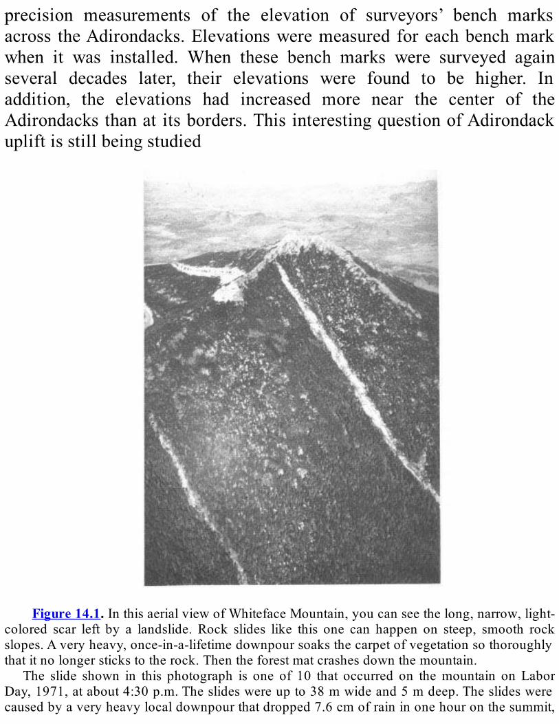
precision measurements of the elevation of surveyors’ bench marksacross theAdirondacks.Elevationsweremeasured foreachbenchmarkwhen it was installed. When these bench marks were surveyed againseveral decades later, their elevations were found to be higher. Inaddition, the elevations had increased more near the center of theAdirondacksthanatitsborders.ThisinterestingquestionofAdirondackupliftisstillbeingstudied
Figure14.1.InthisaerialviewofWhitefaceMountain,youcanseethelong,narrow,light-
colored scar left by a landslide. Rock slides like this one can happen on steep, smooth rockslopes.Averyheavy,once-in-a-lifetimedownpoursoaksthecarpetofvegetationsothoroughlythatitnolongerstickstotherock.Thentheforestmatcrashesdownthemountain.
The slide shown in this photograph is one of 10 that occurred on themountain on LaborDay,1971,atabout4:30p.m.Theslideswereupto38mwideand5mdeep.Theslideswerecausedbyaveryheavylocaldownpourthatdropped7.6cmofraininonehouronthesummit,
while 5 cm fell at the base of themountain and none in the valley.This oddweather eventoccurredonadayof recordhumidity.As thehumidair roseover themountain top, itcooleduntilitsuddenlydroppedthemoistureitcarried.
This photograph was taken looking toward the northeast. Compare it with the photo inFigure12.12,whichwastakenfromalocationjusttotheleftofthisone.
REVIEWQUESTIONSANDEXERCISESHowdidtheclimatechangeastheglacialiceretreatedandafterwards?
Howdoweknowaboutthesechanges?
Whatisanestuary?WhydowefindmanyofthemonthesouthshoreofLakeOntario?HowdidtheHudsonRiverbecomeanestuary?
Nameseveralwaysthatthelandscapeischangingtoday.
PartIV
Geologyandpeople

CHAPTER15
MONEYFROMROCKS
MineralResources1
SUMMARYMineralresourcesareanimportantpartofNewYorkState’seconomy.
This chapter divides them into three categories: nonmetals,metals, andmineral fuels. The nonmetals section covers these resources (inalphabeticalorder):carbonaterock,clay,emery,garnet,granite,gypsum,halite (common salt), ilmenite (titanium ore), peat, sand and gravel,sandstone, slate, soil, talc, and wollastonite. Each entry answers thefollowingquestions:What is it?Howdid it form?What is it used for?Howimportantisit?Whereisitfound?Insomecases,othersignificantinformation on the resource is added. The same format is used in themetalssection,whichisdividedintotwoentries:irondeposits;andlead,silver,andzinc.Themineral fuels section discussesNewYork’s oil and natural gas,
foundmainlyinthesouthwesternpartoftheState.NewYorkhasenoughof these resources tocontribute to local economies.Oil andnaturalgaswere originally discovered byAmerican Indians, who showed them toEuropeancolonists.The modern oil industry began in Pennsylvania in 1859, with the
drillingofthefirstoilwell.AnunsuccessfulwildcatwellwasdrilledinAlleganyCounty in1860, andNewYork’s first successfuloilwellwasdrilled in 1865 in Cattaraugus County. An oil boom began, and NewYork’sproductionreacheditspeakin1882.Theboomendedbythelate
1890s. A new technique for extracting more oil from depleted wellsstarted another increase in production, which lasted from 1919 until itreached a secondpeak in1938.Since1942,NewYork’soil productionhas declined. Oil in New York is produced from Upper Devoniansandstones—theCanadawayGroupandtheWestFallsGroup—andfromUpper Silurian and Middle Devonian carbonate rocks—the AkronDolomiteandtheOnondagaLimestone.Theoilfromthecarbonaterocksis contained in a structural trap called the Bass Island Trend; thediscoveryofthisstructuraltrapboostedoilproductionin1983.ThefirstnaturalgaswellintheU.S.wasdrilledin1821nearFredonia
and the gas used for lighting. In the early days of oil drilling, muchnaturalgaswasallowedtoescapeintotheatmosphere,untiltheinventionofagas-poweredwellpumpinthe1890s.Sincetheturnofthecentury,natural gas production has increased. Natural gas has been found innumerous formations, including rocks that do not contain oil, but onlysome of these formations contain commercial quantities of gas.FormationsproducinggasinNewYork(fromoldesttoyoungest)arethePotsdam Sandstone, the Trenton Limestone, the Queenston Shale, theMedinaGroup(NewYork’sbestgasproducer),theAkronDolomite,theOriskany Sandstone, the Onondaga Limestone, and theWest Falls andCanadaway Groups. New York’s natural gas will be important to thesouthwestern and central parts of the State for many years. Depletednaturalgasfieldsareusedtostoregasproducedelsewhere.
INTRODUCTIONNewYork State is rich inmineral resources. 2 Nationwide, the State
ranksbetween10thand15thinthevalueofnonfuelmineralproduction.Crushedstoneistheleadingmineralcommodity.Itmakesup25percentof the totalvalueof theState’smineralproduction.Other commoditiesthat are important in NewYork’s economy are portland cement, salt,constructionsandandgravel,andzinc.Thereareroughly2,000minesinNew York, and 85 percent of them are involved in sand and gravelproduction.Inourdiscussion,wehavedividedNewYork’smineralresourcesinto
three categories: nonmetals, metals, and mineral fuels (oil and naturalgas).Note:Inotherchapters,wehaveexplainedunfamiliarwordsinthetext
soyouwouldnothavetoturntotheGlossarymanytimesoneachpage.In this chapter, though,we have not done so. The question-and-answerformatofthefirsttwosectionsofthischaptermakesiteasiertolookupspecific facts rather than to read straight through. Therefore, having toturntotheGlossarywillnotbreakuptheflowofyourreading.
NONMETALS
CarbonateRock
Whatisit?Limestone,dolostone,marble.
Howdiditform?Limestone and dolostone are sedimentary rocks deposited in theoceanascarbonatesediments.Marble ismetamorphosed limestoneordolostone.
Whatisitusedfor?Mainly construction (concrete, portland cement, crushed stone,highwaypavingmaterial). In thepast,carbonate rockwasused fornaturalcement.Atpresent,mostofNewYork’scarbonaterockisusedforconcrete,highway paving material, and cement. Of the remainder, some isburned to make quicklime or hydrated lime, which are used inchemistry, industry, and farming, and some is used formiscellaneous purposes (railroad beds, riprap, precast architecturalunits,groundforuseinfarming).
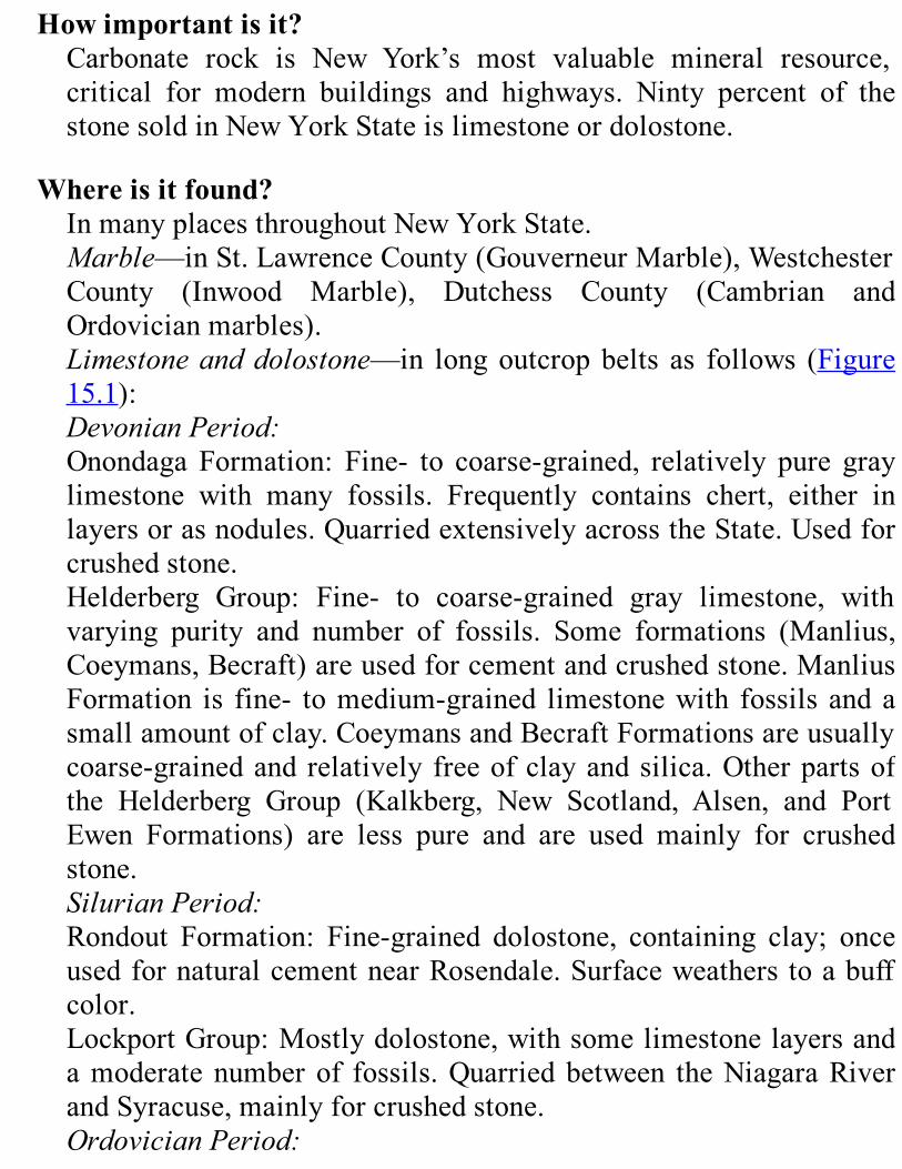
Howimportantisit?Carbonate rock is New York’s most valuable mineral resource,critical for modern buildings and highways. Ninty percent of thestonesoldinNewYorkStateislimestoneordolostone.
Whereisitfound?InmanyplacesthroughoutNewYorkState.Marble—inSt.LawrenceCounty(GouverneurMarble),WestchesterCounty (Inwood Marble), Dutchess County (Cambrian andOrdovicianmarbles).Limestoneanddolostone—in longoutcropbelts as follows (Figure15.1):DevonianPeriod:Onondaga Formation: Fine- to coarse-grained, relatively pure graylimestone with many fossils. Frequently contains chert, either inlayersorasnodules.QuarriedextensivelyacrosstheState.Usedforcrushedstone.Helderberg Group: Fine- to coarse-grained gray limestone, withvarying purity and number of fossils. Some formations (Manlius,Coeymans,Becraft)areusedforcementandcrushedstone.ManliusFormation is fine- tomedium-grained limestonewith fossils andasmallamountofclay.CoeymansandBecraftFormationsareusuallycoarse-grainedand relatively freeofclayandsilica.Otherpartsofthe Helderberg Group (Kalkberg, New Scotland, Alsen, and PortEwen Formations) are less pure and are used mainly for crushedstone.SilurianPeriod:Rondout Formation: Fine-grained dolostone, containing clay; onceusedfornaturalcementnearRosendale.Surfaceweathers toabuffcolor.LockportGroup:Mostlydolostone,withsomelimestonelayersandamoderatenumberof fossils.Quarriedbetween theNiagaraRiverandSyracuse,mainlyforcrushedstone.OrdovicianPeriod:

TrentonGroup: Fine- to coarse-grained gray limestonewithmanyfossils;relativelyfreeofimpurities,butwithmanythinshalebeds.Usedmainlyforcrushedstone;alsousedbyonecementproduceratGlensFalls.Black River Group: Limestone locally underlying the TrentonGroup, finer grained and darker than limestones of the Trenton.Main formation is the Lowville, a relatively pure, fine-grainedlimestone.Useforcrushedstone.Chazy Group: Fine- to coarse-grained limestone. Quarried forcrushedstoneinthenorthernChamplainValley.Beekmantown Group: Dolostone containing silica and occasionallayers of limestone. Quarried for crushed stone in the Champlain,upperHudson,andlowerMohawkValleys.CambrianandOrdovicianPeriods:Wappinger Group: Dolostone and limestone similar to theBeekmantown. Layers quarried for crushed stone in southeasternNewYorkareprobablyEarlyOrdovician.
OtherinformationAboutCement.—There are two kinds of cement.Naturalcement ismade by burning and grinding a special kind of limestone thatcontains just the necessary amount of clay minerals. The groundrock,mixedwithwater,willdryintoahardmass.Portlandcementis different. It is made by heating a mixture of certain rocks andminerals—includinglimestone—togetherinakiln.Portlandcementis manufactured in the mid- Hudson Valley (Albany and GreeneCounties)andatGlensFalls.NaturalcementwasfirstusedtobuildtheErieCanal.ItisnolongerproducedinNewYork.
Figure15.1.Mapof themineral resources (other than oil and natural gas) ofNewYork
State.Thismapshowsonlythoseresourcesthatwerebeingexploitedinsignificantamountsasof1989.Therefore,itdoesnotincludesomeoftheresourcesdiscussedinthischapter.
NewYorkisoneoftheleadingcement-producingstates.Ithasagoodsupplyof the rightkindofstone,aswellasmajor transportation routes(rivers, highways, railroads) for shipping the bulky product. It is alsolocatedneardenselypopulatedregionswherethereisahighdemandforcement.
Clay
Whatisit?Anearthy,extremelyfine-grainedsedimentmadeofclayminerals.
Howdiditform?Clayminerals settled to the bottom in the deeperwater of ancientglaciallakestoformlayersofclay.
Whatisitusedfor?
Making bricks, pottery and stoneware dishes, and lightweightconcrete.As awaterproof lining and cover for landfills to preventcontaminationofgroundwater.
Howimportantisit?NewYorkhasalotofclay.
Whereisitfound?Pleistoceneclays(formedinthedeepestpartsofglaciallakes):ErieCountysouthofBuffalo,middleHudsonValleybetweenAlbanyandNewburgh,OnondagaCountynearSyracuse.Cretaceous clays: Raritan Formation on Staten Island (no longerused).
OtherinformationLightweightConcreteAggregate.—Concreteisusuallymadeoftwosubstances, anaggregate of sand, gravel, or crushed stone and acementthatholdsthemasstogether.A lightweight concrete can be made by substituting differentaggregate material. When clay and shale are heated together in akiln, they begin tomelt and fuse. Thismelting turns the clay andshale into a stickymass. Gases are released in the process. Thesegasesformbubblesinthemassandconvert it toafroth.Whenthefrothcoolsandhardens,itformsaverystrong,lightweightmaterialthatcanbeusedinconcreteasasubstitutefortheheaviergravelandcrushedstone.Thislightweightconcreteisjustasstrongasregularconcreteandisidealforbridgesandmodernofficebuildings.
Emery
Whatisit?Metamorphic rock made of the minerals magnetite, corundum,sillimanite,andsapphirineorcordierite(proportionsvary).
Howdiditform?Moltenrock(magma)intrudedintotheManhattanSchist.Alongthecontact, heat metamorphosed the schist further and turned it toemery.
Whatisitusedfor?Extremely tough abrasive. Used in industry for grinding andpolishing and to make nonslip surfaces for stair treads and somekindsofflooring.
Howimportantisit?EmerywaslastproducedinNewYorkin1989.Artificialabrasivesreplacedemerybecausetheyareharderandtheircompositionvariesless.
Whereisitfound?NearPeekskill,WestchesterCounty.Thesemines,theonlysourceofemeryintheU.S.,arenowclosed.
OtherinformationAbrasives.—Abrasives are gritty materials. They are used incommonhouseholdproducts like sandpaper and emeryboards (forfilingfingernails).
Garnet
Whatisit?A hard redmetamorphicmineral. In theAdirondacks, crystals areusuallybetween2mmand2.5cmacross.However,crystalsaslargeas 1m in diameter have been found at the GoreMountain garnetmine,whichclosedin1983.
Howdiditform?
When the igneous rocks olivine gabbro and gabbroic anorthositewere metamorphosed, garnet was formed as one of the newmetamorphicminerals.
Whatisitusedfor?Animportantabrasive.Used for sandpaperandpowderedabrasive.When broken, garnet from GoreMountain has a chisel-like edge;garnet sandpaper does not clog when used, so it is desirable forwoodworking. Garnet is also used in grinding and polishing glassand metal. Television picture tubes are polished with New Yorkgarnet before phosphors are applied. Garnet is also used forsandblasting, filtering water, and in water jet for cutting stone.Garnet crystals canbeused as gemstones, butNewYorkproducesveryfewgarnetswithoutinternalcracksthataresuitableasgems.
Howimportantisit?New York is a leading producer of garnet. The original GoreMountain mine was the largest garnet mine in the world; it firstproduced garnet in 1878. The mining operation shifted to RubyMountain in 1983. Garnets from Ruby Mountain make especiallyhighqualityabrasives.
Whereisitfound?RubyMountain near North Creek is the biggest of several garnetdepositsintheeastcentralAdirondacks(Figure15.1).
Granite
Whatisit?Asusedinthestoneindustry,“granite”referstoavarietyoflight-colored igneous andmetamorphic rocks. InNewYork State,mostcommercial“granites”areactuallygneisses.

Howdiditform?Granite gneiss can form from the metamorphism of intrusivegranite,rhyolitelava,orarkosicsandstone.
Whatisitusedfor?Construction—itiscrushedforconcreteaggregate;someiscutintoblocksforbuildingsorcurbstones.Blocksaremorevaluable.
Howimportantisit?Asabuildingstone, itwasmorepopular formerly than it is today;the industry declined because of competition from cheapermanufacturedbuildingmaterials.However,granite isaparticularlygoodbuildingstone,andtheindustryrecoversfromtimetotime.
Whereisitfound?IntheAdirondacksandinWestchesterCounty.
Gypsum
Whatisit?A sedimentary evaporite mineral with the chemical compositionCaS04·H20.
Howdiditform?Evaporationofverysaltyshallowseasproducedevaporiteminerals:gypsum andminor amounts of anhydrite. Burial of these depositsconverted them into anhydrite (chemical composition CaS04).However,whenerosionbringsanhydrite layersnear to thesurface,groundwaterconvertstheanhydritetogypsum.
Whatisitusedfor?It is processed to make plaster and wallboard. It is also a minoringredientinportlandcement.
Howimportantisit?Veryimportantinbuilding.
Whereisitfound?Inseveralunusual layersof theLateSilurianSalinaGroup(Figure15.1;seealsoPlates2and3oftheGeologicalHighwayMap).FoundinGeneseeCounty;minedandprocessedinOakfield,nearBatavia.Out-of-state gypsum is processed in Rensselaer, Rockland, andWestchesterCounties.
Halite(CommonSalt)
Whatisit?An evaporite mineral made from sodium and chlorine (chemicalcompositionNaCl).
Howdiditform?Evaporationofshallowseaswithverysaltywater.
Whatisitusedfor?NewYorkStatesaltisusedinthechemicalindustryandforde-icinghighways.Saltdepositsarebeingconsideredasplaces to storeoil,radioactivewaste,andsensitivephotographicproducts,becausetheygenerallylackfracturesandcracksthroughwhichliquidscanflow.
Howimportantisit?Very important resource throughout the history ofNewYork. TheRetsofmine,nearGeneseo, is the largestundergroundsaltmine intheworld. Ithadproducedmore than138millionmetric tons(138billionkilograms,or125milliontonsinEnglishunits)by1990.In1990,NewYorkwasthethirdlargestproducerofsaltinthenation.
Whereisitfound?
About3.9trillionmetrictonsofrocksaltlieundermorethan26,000square kilometers in central andwesternNewYork ( Figure 15.1).ThisareastretchesfromMadisonandChenangoCountiesintheeasttoErieandChautauquaCountiesinthewest.Salt layers are found in parts of the Salina Group—the middleVernonShaleandtheSyracuseFormation(seePlates2and3).Theyrange from 1 m to over 30 m thick and alternate with layers ofdolostone and anhydrite-rich shale. Layers are thickest and mostnumerous in the southern part of Syracuse Formation, along thePennsylvaniaborder.LikemostsedimentarylayersinwesternNewYork, the Salina Group slopes to the south about 25-50 m perkilometer.AtthePennsylvaniastateline,itis1,350munderground.Today, salt is produced from brine at six places in Onondaga,Schuyler,andWyomingCounties.ItisminedasrocksaltatMyers,onCayugaLake,andatRetsof,nearGeneseo.
OtherinformationHistoryofSaltinNewYorkState.—NewYork’ssaltindustrystartedin theSyracusearea.Amajor reason for foundingSyracuseduringcolonial times was to use the salt springs near Onondaga Lake.ThesesaltspringswerepreviouslywellknownamongtheAmericanIndians.Asdemandforsaltincreased,peopledrilledwellstotrytofindmoresalty water (calledbrine) underground. For quite some time, theyfailed. Groundwater had dissolved the salt beds for several milesback from the outcrop. Thus, nothing was there to drill into.Eventually, they found a salt layer near Tully, 10 miles south ofSyracuse.Thisdiscoverysetoffanewburstofactivity.During the last quarter of the 19th century, brine wells and saltmines expanded rapidly, especially in Livingston and WyomingCounties.
Ilmenite(TitaniumOre)

Whatisit?Ilmenite is a black, shiny mineral made of iron, titanium, andoxygen (chemical composition FeTiO3). Although it could be thesourceofthemetaltitanium,inNewYorkitisminedforotheruses.
Howdiditform?Crystallized from an anorthosite magma. MetamorphosedanorthositeformslargerockbodiesintheAdirondacks.
Whatisitusedfor?AllofthetitaniumproducedinNewYorkisusedtomaketitaniumdioxide—a brilliant white pigment used in paints. As refiningtechniquesimproveandcostscomedown,NewYorkcouldbecomeable to produce themetal titanium,which is used tomake strong,lightweight,corrosion-resistantmetalfortheaerospaceindustry.
Howimportantisit?Miningceasedin1982.
Whereisitfound?Ilmenite is found on the southwest border of the main body ofmetamorphosedanorthositeintheAdirondacks.Layersareupto600m long and 100 m or more thick. These layers dip steeply. TheSanford Lake ore body at Tahawus, Essex County, is worked out;anotherdepositnearCheneyPondisprobablyaslargeandcouldbeusedifdemandbecomeshighenough.
OtherinformationHistory of Titanium inNew York.—The Sanford Lake deposit wasdiscovered in 1826. It contains both ilmenite andmagnetite(magneticironore).Peopletriedrepeatedlytouseittoproduceiron.They always failed, because they could not separate the ilmenitefromthemagnetite.At the beginning of the 20th century, a French chemist,who used
Sanford Lake ore in some of his work, discovered that titaniumdioxidemakesan idealwhitepigmentforpaint.Titaniumbegantobeusedmoreandmore for thispurpose.However, theAdirondackdeposits were not used. The United States purchased most of itstitanium ore from other countries until World War II made thatdifficult.Toget the titaniumneeded for thewar, a largemineandmillwere setupatTahawus,anda railroad linewasbuilt tocarrytheoresouth.Theminingoperationcontinuedtobesuccessfulafterthewarbecausetitaniumdioxidewasneededduringpeacetime.RefiningTitanium.—Theorefromwhichtitaniumisrefinedcontainsilmenite (chemical composition FeTiO3) mixed with magnetite(chemicalcompositionFe3O4)Infact,onlyabout20percentoftheoreistitaniumdioxide(chemicalcompositionTiO2).Topurify thetitanium ore, these ore minerals are ground very fine and thenseparatedbymeansofmagneticandfloatationseparators.Magneticseparators are devices that usemagnets to help separatemagneticminerals (like magnetite) from nonmagnetic minerals (likeilmenite).Floatationseparatorsare tanksofspecialchemicals intowhichairbubblesareblown.Whenore isadded, ilmenitesticks tothe bubbles that form a froth on the top of the tank. The froth iscollected,andtheilmeniteiswashedoutofit.After the ilmenite is purified, the leftovermagnetite is sold to beusedincoalprocessing.
Peat
Whatisit?Partlycarbonizedremainsofswampandbogplants—mosses,reeds,sedges.
Howdiditform?Fromplants thatweresubmergedafterdeath.MostNewYorkpeat
formed inoldglacial lakeswhen theywere later filled inorpartlydrainedtobecomebogsorswamps.
Whatisitusedfor?Soilconditionerandmulch.
Howimportantisit?AminorindustryinNewYork.
Whereisitfound?Producedcommercially inDutchess,Westchester,Broome,Seneca,andCattaraugusCounties (Figure15.1). Ifdemand increases,otherdepositscouldbeusedaswell.
SandandGravel
Whatarethey?Manykindsofnaturallybrokenrock.Sandandgravelcomposedoflimestone, dolostone, sandstone, and igneous rocks are strongenoughforconstruction;largeamountsofweakrocks—shale,slate,and schist—make some deposits of sand and gravel unsuitable forthispurpose.
Howdidtheyform?New York’s commercial sand and gravel come from glacialdeposits.Moldingsands are glacial lake sands thatwere reworked bywind.Theyoriginallycontainedmanyshaleparticles.Over thecenturies,theseparticlesweatheredintoclaythathelpsbindthemoldingsand.
Whataretheyusedfor?Tomake concrete for building and highway construction.Moldingsandisusedtomakemetalcastings.

Howimportantarethey?Vital to building and highway construction. Molding sand isparticularlyvaluable.
Wherearetheyfound?Suffolk,Dutchess,andRensselaerCountiesareleadingproducersofsandandgravel.Underwaterdepositscanbebrought to thesurfacebydredgingorthroughpipelines.Molding sand is found in the Capital District and around OneidaLake.
OtherinformationMetal Castings.—Because molding sand contains clay, it can bemolded intocomplexshapes. Itwill retain thoseshapesevenwhenhot. Liquidmetal is poured into the sandmold and hardens. Thisprocessallowsustoformthemetalintoavarietyofshapes.LeadingSandandGravelAreas.—Suffolk,Dutchess,andRensselaerCounties are New York’s leading producers of sand and gravel.Although they do not have higher quality or greater quantities ofsand and gravel than other areas, they are closest to potentialmarkets.Theirlocationcutsdownonshippingcostsandmakestheoperationsprofitable.GlacialSandandGravelDeposits.—Themajorsourcesofsandandgravel are glacial deposits:moraines, out-wash plains, valley fill,kames,kameterraces,anddeltas.SeeChapters12and13formoreinformationabouttheseandotherkindsofglacialdeposits.
Sandstone
Whatisit?In economic usage, “sandstone” refers to graywacke,metamorphicquartzite,conglomerate,andsedimentarysandstones.
Howdiditform?Mineral grains and rocky fragments were deposited in bodies ofwater, mainly ancient seas, but locally in Tri- assic-Jurassic riftbasinsintheRamapoarea.
Whatisitusedfor?Cut into blocks for building, flagstone, and curbing. Somesandstonesarecrushedtomakeconcreteaggregate.Someisusedforriprap.Purequartzsandstonecanbeusedtomakehigh-qualityglass,butsandstonesinNewYorkcontaintoomuchironandaluminaforthispurpose.
Howimportantisit?NewYork and Pennsylvania are the only sources of bluestone, aparticulartypeofcommercialsandstone(Figure15.1).
Whereisitfound?Commercialsandstonelocations.—FoundwidelyinNewYorkState;quarried in Orleans County, Delaware County, and around theAdirondacks.MiddleandLateDevonianPeriod:Fine-grained graywackes, bluish gray to olive green, calledMilestones.(Forlocationsoftheformations,seePlates2and3.)SilurianPeriod:MedinaSandstone.Usedforcrushedstoneandbuildingstone.LateCambrianPeriod:PotsdamSandstone.Usedforveneerstoneandflagging.CambrianPeriod:Rensselaer Graywacke. Used for crushed stone.Was once used asbuildingstone.Potentiallycommercialsandstones:SilurianPeriod:Herkimer, Thorold-Kodak-Oneida, Shawangunk, Whirlpool. Couldbeusedforcrushedstoneorbuildingstone.
OrdovicianPeriod:Oswego,Heuvelton-Mosherville.Couldbeusedforcrushedstoneorbuildingstone.CambrianPeriod:Poughquag.Couldbeusedforcrushedstoneorbuildingstone.
Slate
Whatisit?Metamorphosed shale. Colors are red, green, gray green, purple,black,orcombinedpurpleandgreen(calledvariegated).
Howdiditform?Metamorphosedshale.
Whatisitusedfor?Flagstones,flooringtile,androofing.
Howimportantisit?TheNewYork-Vermont slate belt is the only one in theU.S. thatproducescoloredslates:red,green,purple,andvariegated.
Whereisitfound?WashingtonCountyandacrosstheborderinVermont( Figure15.1).Mostredslate,apopularkindforbuilding,isontheNewYorkside.
OtherinformationSecondary Cleavage.—Shale splits easily along its sedimentarylayers. When the shale is metamorphosed and becomes slate, itdevelopsasecondarycleavage.Thistermmeansthattheslatesplitsin a new direction that is frequently different from the originallayers.Wecanfrequentlyseetheoriginalsedimentarylayerswherethey intersect the secondary cleavage. They form ribbons of

differenttexturesorcolorsonthesplitslatesurface.NewYorksSlateIndustry.—Atonetime,slateforroofswasalargerpartofNewYork’sslateindustrythanitistoday.Butthetechniquesused toquarryandprocess thisslateareold,and this situationhaskeptcostshigh.Meanwhile,otherroofingmaterialsweredeveloped.Among these materials is asphalt roofing, which uses only smallgranules of slate on the surface. These low-cost substitutes havetakenawaymuchofthemarketforNewYork’sslate.
Soil
Whatisit?Surface layer of the land where plants can grow. Contains bothnaturalmineralsandlivinganddeadorganicmatter.
Howdiditform?Mainly from weathering of the glacial deposits that blanket theState.HasbeenformingsteadilysincethelasticesheetretreatedinNewYork.
Whatisitusedfor?Agriculture.
Howimportantisit?Avital resourceof theState.Allplantsdependon thesoil,andallanimals(includinghumans)dependonplantsforfood.
Whereisitfound?ThroughouttheState.
OtherinformationSoil Formation.—After the ice sheet retreated, soils slowlydeveloped from a thin litter of organic materials on the surface.
Gradually,thesoilsbecamedeeperandmorefertile.Theparentmaterial of a soil is the weathered product of rock orsediment.Theparentmaterialdeterminessomeofthechemicalandphysicalcharactersofsoil.Parentmaterials thatare rich inquartz,such as gneiss, weather and form soil slowly. Shale, on the otherhand, weathers and forms soil quickly. Parent materials that arepermeable (allowairandwater toflowthroughthem)willweatherquickly.Thesoilwillbedeeperinthoseplaceswheretheunderlyingmaterialispermeable.Climateandplantcommunitiesaffecthowsoilsformandhowthickthey become. For example, warm, moist regions develop thickersoilsthandryregions,whilethehightemperaturesandheavyrainoftropical rain forests dissolve away soils almost as fast as theydevelop.Inaddition,theslopeofthelandaffectshowsoilsformandaredistributed.Most of New York’s soils developed from deposits left by theretreating ice sheet. The ice sheet began retreating in the southernpartof theState21,750yearsagoandleft thenorthernpart10,000yearsago.Theglacialdepositscanrangefromafewcentimeterstoameterormorethick.Theglacialdepositsmaybetill—athick,densemixtureofboulders,gravel,sand,andclay.Tillisimpermeable,butotherglacialdepositsmayconsistofloose,permeablesandandgravel.Fine-grained deposits (like till or the silt and clay deposited inglacial lakes) tend to be poorly drained. Coarser grained deposits(likesandandgravel) tendtobewelldrained.Thesandandgraveltendstocomefromsuchglacialdepositsasoutwashandkames.SeeChapters 12 and 13 for more information on glacial deposits.Theyoungest soils of the State formed from sediments deposited bymodernstreamsandrivers.
Talc
Whatisit?True talc isaverysoft, flaky,whitemineralwithmanyuses.NewYork’s industrial “talc,” however, actually contains less than 50percentofthemineraltalc.Therestisamixtureofotherminerals—tremolite,antho-phyllite, serpentine,anddolomite.Becauseof thepresenceof theseminerals,NewYork’s industrial “talc” is fibrous(madeoflong,thin,needle-likecrystals).
Howdiditform?Talcdepositsarefoundnearfaultsandshearzoneswheretremolite-anthophylliteschistswerechangedintotalcandserpentine.
Whatisitusedfor?Usedindustriallywhereawhitepowderymineralisneeded:aspaintextender; as a carrier for insecticide dust; in ceramics; as filler inasphaltroofing,putty,linoleum,andsimilarproducts.AcompanyinJeffersonCountygrindstruetalcfromoutofStateforcosmetics.
Howimportantisit?NewYorkisthefourthlargestproducerinthenation.
Whereisitfound?Gouverneur district, northwest Adirondacks, in narrow, contortedbelts of Proterozoic schist (Figure 15.1). Found together withserpentine.Depositsupto60mthickoccuralongan8kmbeltoftheschist.
Wollastonite
Whatisit?Awhite fibrous industrial mineral with the chemical compositionCaSi03.
Howdiditform?Layers of wollastonite, together with the minerals diopside andgarnet, formed when Proterozoic sandy limestone wasmetamorphosedathightemperaturebyintrudingmagma.
Whatisitusedfor?Chieflyusedformakingceramictile,porcelain,andpaint,insuper-plastics, and for replacingshort-fiberasbestos inbrake liningsandsimilaruses.
Howimportantisit?Wollastonitewas the basis for a new industry inNewYork State.Morethan99percentofthewollastoniteproducedintheU.S.comesfromNewYork.
Whereisitfound?Willsboro Mine and Lewis open pit, both in Essex County. Alsoproduced from an underground mine and open pit mine nearHarrisville,LewisCounty(Figure15.1).
OtherinformationHistory of Wollastonite in New York.—In 1810, wollastonite wasfoundnearWillsboro,EssexCounty.Themineralwas then almostforgottenforthenext135years.AfterWorldWarII,thedepositwascarefullymapped. Itwas found tobequite large andconcentrated.Asa result,uses forwollastoniteweredeveloped,anda successfulminingandmillingoperationwasbegun.Refining Wollastonite.—The deposit consists of layers ofwollastonite together with diopside and garnet. The diopside andgarnet are weakly attracted by magnets. The milling operationconsists of grinding the ore fine and passing it by strongelectromagnets. These magnets pull away the diopside and garnetandleavepurewollastonite.
METALSMostofNewYork’smetalminingisintheAdirondackregion( Figure
15.2).Metalsproducedtheretodayorinthepastareiron,zinc,lead,andsilver. Copper is the only other metal that has been important in NewYork’smineralindustry.ItwasminednearEllenville,UlsterCounty,byDutchsettlersinthe17thcentury.Tobeprofitable formining,oredepositshave tocontainmuchmore
metalthanweusuallyfindinthecrust.It’sverydifficultandexpensivetoextractmetalfromorewhenthemetalislessconcentrated.However,astheeconomychanges,peoplemayneedmoreandmoreofaparticularmetal.When such changes increase demand, people are willing to paymore for the metal. Mine operators then can spend more to mine andrefine the ore and stillmake a profit.At the same time, technology isimproving;weare findingbetter andcheaperways to extract themetalfromtheore.Thus,inthefuturewemaybeabletouseoredepositsthataretooexpensivetominetoday.
IronDeposits
Whatarethey?ThecommonironoreintheAdirondacksandtheHudsonHighlands(Figure15.2) ismagnetite, a blackmagneticmineralmade of ironandoxygen.IthasthechemicalcompositionFe3O4.
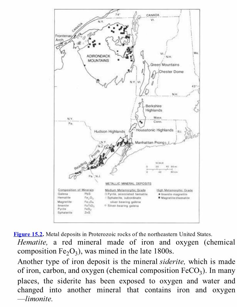
Figure15.2.MetaldepositsinProterozoicrocksofthenortheasternUnitedStates.Hematite, a red mineral made of iron and oxygen (chemicalcompositionFe2O3),wasminedinthelate1800s.Another typeof irondeposit is themineralsiderite,which ismadeofiron,carbon,andoxygen(chemicalcompositionFeCO3).Inmanyplaces, the siderite has been exposed to oxygen and water andchanged into another mineral that contains iron and oxygen—limonite.
Howdidtheyform?Geologists disagree on how the magnetite deposits were formed.One idea is that they are sedimentary iron deposits that weremetamorphosed.Another is that a liquid rich in iron and oxygensolidified along with other molten rock. Some think that hotsolutions that flowed through the granitic gneisses deep below thesurface dissolved scattered grains of magnetite and concentratedthemintoorebodies.ThehematiteintheAdirondackswasformedfromthemineralpyritein a rusty gneiss. Some of the iron in the pyrite combined withoxygen tomake hematite.Hematite and siderite beds are found inparts of the Lower Silurian Clinton Group of central and westernNewYork.These sedimentary iron oreswere deposited in shallowsea environments and contain fossil shells that are replaced byhematite and siderite. The hematite was deposited in shallower,more wave- agitated, and more highly oxygenated environmentsthanthesiderite.
Whataretheyusedfor?Magnetiteisamajorsourceofiron.RedhematitefromasmallundergroundmineinOneidaCountywasonce used for paint pigment. Siderite is a source of iron, butNewYork’sdepositsareunprofitabletouse.
Howimportantarethey?Magnetite is not beingmined inNewYork today.However, largeamounts of ore remain in the closed underground and open pitmines.Theymaybecomeprofitableagainatsomefuturetime.LayersofsedimentaryhematiteinNewYorkareseldommorethanonemeter thick.Though theyweremined in the last century, theyarenolongerprofitable.Sideritedepositswereminedinthe1880s.However,theyaresmallandwereabandoned.
Wherearetheyfound?
Magnetite forms minable layers in some granitic gneisses of theAdirondacks; itwas longmined as a source of iron (Figure 15.2).Magnetite also occurs as an impurity in titanium ore inmetamorphosedanorthosite(seesectiononilmenite,above).ThereareclosedmagnetiteminesnearChateaugay,ClintonCounty;Mineville,EssexCounty;andStarLake,St.LawrenceCounty.Themine at Star Lakewas the largest open pitmagnetitemine in theworld. It was closed in the mid-1970s. Smaller, long-abandonedmagnetiteminesalsoexistintheHudsonHighlands(Figure15.2).Hematite is found as a sedimentary rock in the Early SilurianClintonGroup (Figure15.2). Several layers occur near the surfacebetween Wayne and Cayuga Counties and in Oneida County.Hematite mines— now abandoned—lie along a narrow belt in St.LawrenceandJeffersonCounties.Siderite is found in Cambrian and Ordovician limestones anddolostonesineasternColumbiaandDutchessCounties.
OtherinformationMagnetite Mining in New York.—Magnetite has a very specialproperty—it is attracted by magnets. Because the needles oncompasses are magnetized, they will point toward masses ofmagnetite. Some of the earliest iron discoveries in the State weremade by surveyorswhen their compass needleswere drawn astrayby masses of magnetite. Throughout remote sections of theAdirondacks, we can still see abandoned pits dug by earlyprospectorssearchingforironore.Sincethefirstundergroundmagnetitemineswereopenedmorethan200yearsago, ironorehasbeenoneofNewYork’smostvaluablemineralresources.AftertheRevolutionaryWar,NewYorkwasoneofthemostimportantiron-producingstates.Itproducedasmuchasone quarter of thewhole output of theUnited States. It competedonly with small iron ore deposits in Alabama, Wisconsin, andMichigan.Thenin1890,richironoredepositswerediscoveredintheMesabi
Range inMinnesota. These new deposits were huge and could bemined cheaply in great open pits; thus, the great costs ofundergroundminingwereavoided.The rich Minnesota ore could also be used directly in the blastfurnace.InNewYorkores,theironwassparser;theoreshadtogothroughacomplicatedconcentrationprocessbeforepureironcouldbeobtained.First,therockswerecrushed.Then,largemagnetswereused to separate out themagnetite. The concentrated orewas thenheatedtofuseitintochunks.Thesechunkscouldbehandledbytheblastfurnaceswherepuremoltenironwasextracted.The Minnesota discovery proved to be too much competition forNewYorkore.ExceptforabriefrecoveryduringWorldWarI,theState’sironoreproductionkeptdeclininguntil1938.Then,inthemid-20thcentury,productionmadeastrongerrecovery.Onereasonwasthegreat increaseindemandfordomestic ironoreduringWorldWarII.At thesame time, the ironoredepositswerestarting to get used up. This shortage of iron ore spurred thedevelopment of new techniques so that less rich deposits, like theonesinNewYork,couldstillmakeaprofit.Today,however,magnetiteisnolongerminedinNewYork.Thelastmineclosedinthemid-1970s.
Lead,Silver,andZinc
Whatarethey?TheBalmatmineproducesthemineralsphalerite,whichismadeofzinc and sulfur (chemical composition ZnS). A by-product is themineralgalena, which is made of lead and sulfur (chemicalcompositionPbS).Galenaorealsocontainssmallamountsofsilver.When the galena is heated to extract the lead, the silver is alsorecovered.
Howdidtheyform?
Marine sedimentary rocks containing zinc and lead deposits orscattered zinc and lead minerals were metamorphosed during theGrenvilleOrogeny.Depositswereconcentratedandrecrystallizedatthattime.
Whataretheyusedfor?Zinc is used to make tires, galvanized steel (for car bodies), andmetalalloys.Leadisusedinbatteries,buildingconstruction,andcommunicationssystems.
Howimportantarethey?Two mines are operating today, although abandoned mines andexploratory holes are scattered throughout the Balmat-Edwardsdistrict inSt.LawrenceCounty.TheBalmatmineat thesouthwestend of the region is one of the largest zinc mines in the UnitedStates.In1990,NewYorkwasthesecondlargestproducerofzincinthenation.
Wherearetheyfound?Lead, silver, and zinc aremined in theBalmat-Edwardsdistrict ofSt.LawrenceCounty(Figures15.1and15.2).Thezincandleadoreisfoundinabelt12kmlongbyabout2.5kmwide.ItstretchesfromSylvia Lake northeast to Edwards. Another rich deposit is minedfarthernorth,atPierrepont.
MINERALFUELS:OILANDNATURALGASOfthethreemineralfuels—coal,oil,andnaturalgas—NewYorkState
produces two: oil and gas. Both resources are found primarily in thesouthwesternpartof theState.NativeAmericanswhosettledheremusthavebeenintriguedbytheuniquespringsandseepsofblackpetroleumfoundinthisregion.However,thehistoryofoilproductioncanbetraced

back only to the late 1860s. Oil production has now greatly declined.Natural gas production was begun at the turn of the century and thehighestmodernproductionwasreachedin1986.Bothoilandgasoccurinthespacesbetweengrainsinporousrocks.Aftergashasbeenpumpedoutofthesenaturalreservoirs,theformationscanbeusedfortostorenaturalgas.Thisnewindustryiscalledundergroundstorage.
Figure15.3.A“Christmastree”consistsofpipesandvalvesontopofawellthatcontrol
andmeasure the flowofoil andgas.Pressuregaugesmeasure thepressures producedby theflowing oil or gas.Valves are used to control or shut down the flow of oil or gas.The viewbelowgroundlevelshowsthepipingorcasingthroughwhichtheoilorgasflows.Threesizesofcasingareshowninthisdiagram.Thefirst,thewidestindiameter,extendsfromthesurfaceto down below thewater table.This casing prevents oil or gas from seeping into the soil orwater table. The second casing, which fits inside the first, extends from the surface to thecaprock.(Thecaprockistheimpermeablerockunitthattrapstheoilorgasintheunitbelowit.)Insidethesecondcasinggoesathird,whichextendsfromthesurfaceall thewaydowntotheproducing formation.This casing is perforated to allow the oil or gas to flow to the surface.(FromOil from Prospect to Pipeline, Fifth Edition by Robert R.Wheeler MaurineWhited.Copyright1985byGulfPublishingCompany,Houston,Texas.Usedwithpermission.Allrightsreserved.)
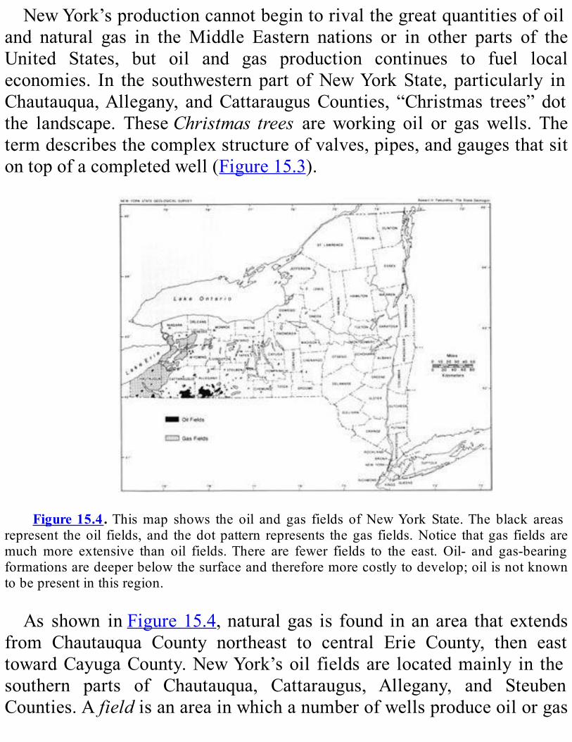
NewYork’sproductioncannotbegintorivalthegreatquantitiesofoiland natural gas in theMiddle Eastern nations or in other parts of theUnited States, but oil and gas production continues to fuel localeconomies. In the southwestern part ofNewYorkState, particularly inChautauqua,Allegany, andCattaraugusCounties, “Christmas trees” dotthe landscape. TheseChristmas trees areworking oil or gaswells. Thetermdescribesthecomplexstructureofvalves,pipes,andgaugesthatsitontopofacompletedwell(Figure15.3).
Figure15.4.Thismap shows the oil and gas fields ofNewYork State.The black areas
represent theoil fields, and thedotpattern represents thegas fields.Notice thatgas fields aremuchmore extensive than oil fields.There are fewer fields to the east. Oil- and gas-bearingformationsaredeeperbelowthesurfaceandthereforemorecostlytodevelop;oilisnotknowntobepresentinthisregion.
As shown inFigure15.4,naturalgas is found inanarea thatextendsfrom Chautauqua County northeast to central Erie County, then easttowardCayugaCounty.NewYork’soil fieldsare locatedmainly in thesouthern parts of Chautauqua, Cattaraugus, Allegany, and SteubenCounties.Afieldisanareainwhichanumberofwellsproduceoilorgas
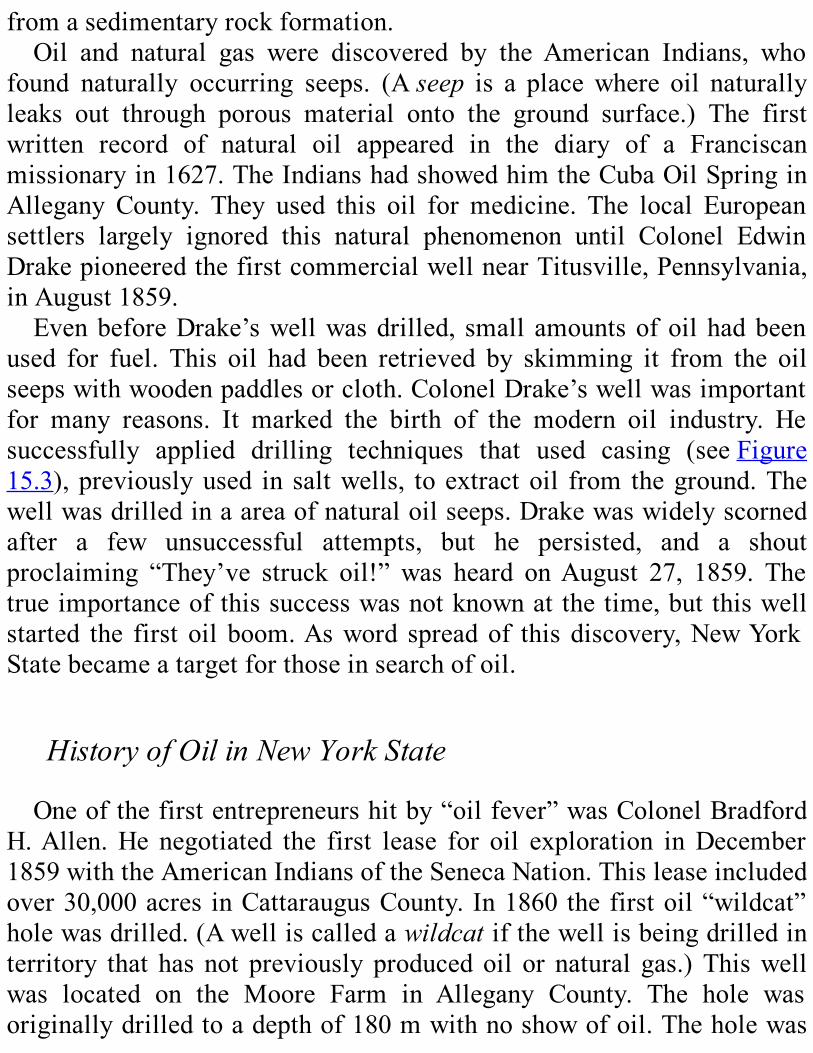
fromasedimentaryrockformation.Oil and natural gas were discovered by the American Indians, who
found naturally occurring seeps. (Aseep is a placewhere oil naturallyleaks out through porous material onto the ground surface.) The firstwritten record of natural oil appeared in the diary of a Franciscanmissionaryin1627.TheIndianshadshowedhimtheCubaOilSpringinAllegany County. They used this oil formedicine. The local Europeansettlers largely ignored this natural phenomenon until Colonel EdwinDrakepioneeredthefirstcommercialwellnearTitusville,Pennsylvania,inAugust1859.EvenbeforeDrake’swellwasdrilled, small amountsofoilhadbeen
used for fuel. This oil had been retrieved by skimming it from the oilseepswithwoodenpaddlesorcloth.ColonelDrake’swellwasimportantfor many reasons. It marked the birth of the modern oil industry. Hesuccessfully applied drilling techniques that used casing (seeFigure15.3),previouslyused in saltwells, toextractoil from theground.Thewellwasdrilledinaareaofnaturaloilseeps.Drakewaswidelyscornedafter a few unsuccessful attempts, but he persisted, and a shoutproclaiming “They’ve struck oil!” was heard onAugust 27, 1859. Thetrueimportanceofthissuccesswasnotknownatthetime,butthiswellstarted the first oil boom.Asword spreadof this discovery,NewYorkStatebecameatargetforthoseinsearchofoil.
HistoryofOilinNewYorkStateOneofthefirstentrepreneurshitby“oilfever”wasColonelBradford
H.Allen.He negotiated the first lease for oil exploration inDecember1859withtheAmericanIndiansoftheSenecaNation.Thisleaseincludedover30,000acres inCattaraugusCounty. In1860thefirstoil“wildcat”holewasdrilled.(Awelliscalledawildcatifthewellisbeingdrilledinterritory that has not previously producedoil or natural gas.)Thiswellwas located on the Moore Farm in Allegany County. The hole wasoriginallydrilledtoadepthof180mwithnoshowofoil.Theholewas
thendeepened to275m,but againnooilwas found.Drilling ahole tothis depth took six to nine weeks at that time in the history of welldrilling.Thiswellwasconsideredadeepwildcathole for the time; theDrakewellhadhitoilatonly21mdeep.Thefirstknownproducingoilwellwasdrilledin1865byJobMosesin
Cattaraugus County. It produced seven barrels of oil a day from theUpper Devonian Bradford Third Sandstone of the Canadaway Group(Figure15.5).During these early years, oil was sold by the barrel, but the size of
barrelsvaried.Thebuyerprovidedthebarrel;therefore,thebuyerscouldgetmoreoilfortheirmoneyiftheyprovidedbarrelsabitlargerthantheregularbarrel.Thispractice soonangered theoil producers.OnAugust30, 1866, in Venago, Pennsylvania, a meeting of oil producersunanimously adopted a resolution to standardize the oil barrel at 40gallons,plustwogallonstocoverleakageandevaporation.Thisstandard42-gallon barrel is still used today to measure oil production. A“standard”barrelis55gallonsinotherindustries.As the lone oil producer of the State, Job Moses profited greatly.
Moses developed the oil industry in Cattaraugus County. The town ofLimestonedevelopedfromsmall,sleepycommunityof200toatownofmore than 1200with the growth of oil production. East ofCattaraugusCounty, the oil boom was starting to take off. O.P. Taylor, called thefather ofAllegany oil fields, developed the first oil wells inAlleganyCounty. The chart inFigure 15.6 shows that NewYork oil productionreached itspeak,6.7millionbarrels, in1882.By the late1890s, theoilboom was over and many towns went bust. This was one of the firstboom-and-bustcyclesintheoilandgasindustry;therehavebeenmanysince.As oil production declined, oil developers started to pull casingfromdepletedwellsandabandonthem.Atthesametime,strangely, therateofoilproductionwasincreasing
from wells nearby—without the discovery of new oil fields. A newmethod had been discovered:waterflooding. This process consists ofinjecting water into a depleted field. The water created pressure that
forcedtheremainingoiltoaselectedwell.3The“five-spot”floodpattern,withfourwaterinputwellsonthecorner
andanoilwellinthecenter,becamethestandardwaterfloodingpractice;itisstillusedtoday.WaterfloodingwaslegalizedinNewYorkin1919.As a result, leasing of land to produce more oil from existing wellsincreased. Wildcat drilling also increased. As shownFigure 15.6,productionofoilincreasedfrom1919untilitreachedasecondpeak,5.5millionbarrels,in1938.
Figure15.5.Drawingof the first commercial oilwell inNewYorkState, the JobMoses
No.1, inLimestone,CattaraugusCounty.This earlywellwasdrilledby steampower.Noticetheoiltransportedinbarrelsandthewoodentower,calledaderrick.
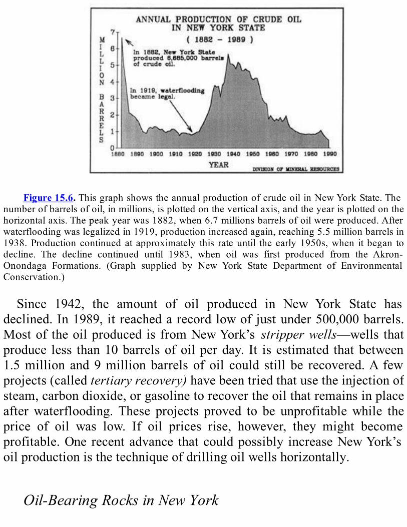
Figure15.6.ThisgraphshowstheannualproductionofcrudeoilinNewYorkState.The
numberofbarrelsofoil,inmillions,isplottedontheverticalaxis,andtheyearisplottedonthehorizontalaxis.Thepeakyearwas1882,when6.7millionsbarrelsofoilwereproduced.Afterwaterfloodingwaslegalizedin1919,productionincreasedagain,reaching5.5millionbarrelsin1938.Production continuedat approximately this rateuntil the early1950s,when it began todecline. The decline continued until 1983, when oil was first produced from the Akron-Onondaga Formations. (Graph supplied by New York State Department of EnvironmentalConservation.)
Since 1942, the amount of oil produced in New York State hasdeclined.In1989,itreachedarecordlowofjustunder500,000barrels.MostoftheoilproducedisfromNewYork’s stripperwells—wells thatproduce less than10barrelsofoilperday. It isestimated thatbetween1.5million and9millionbarrels of oil could still be recovered.A fewprojects(calledtertiaryrecovery)havebeentriedthatusetheinjectionofsteam,carbondioxide,orgasolinetorecovertheoilthatremainsinplaceafterwaterflooding. These projects proved to be unprofitablewhile theprice of oil was low. If oil prices rise, however, they might becomeprofitable.One recentadvance thatcouldpossibly increaseNewYork’soilproductionisthetechniqueofdrillingoilwellshorizontally.
Oil-BearingRocksinNewYork
Oil in NewYork is produced fromUpper Devonian sandstones, andfromUpperSilurianandMiddleDevoniancarbonaterocks(Figure15.7;seealsoPlate3).OilfoundintheCanadawayGroupandtheWestFallsGroup (Figure 15.7) is stratigraphically trapped in shallow permeablesandstonelenses(Figure15.8).Thepermeablesandstonethatcontainstheoil is surrounded by impermeable sandstones (calledtight sands). Theporespacebetweenthegrainsofthesetightsandsissmallandfewspacesconnect the pores. Therefore, the amount of oil that can be trapped intheserocksormovethroughthemislow.TheserockswerethesourcefornearlyallofNewYorkState’soiluntilthediscoveryof“TheBassIslandStructuralTrend”in1981.Theoil-bearingrocksoftheBassIslandTrendaretheUpperSilurian
Akron Dolomite and the Middle Devonian Onondaga Limestone. TheBassIslandTrendwasnamedaftertheBassIslandFormationinOhio.Before1981,naturalgasandminorquantitiesofoilhadbeenproduced
from the Akron Dolomite, but it was not considered an importantproducing formation. In 1978, however, a geologist doing subsurfacemappingdiscoveredalong,narrow,structurallycomplexanticlinaltrendthat extends from southwestern Chautauqua County to southern ErieCounty(Figure15.9).Theoilalong this trend isstructurally trappedbyreversefaults.(TheTectonicMaponPlate4oftheGeologicalHighwayMapmayhelpyoudiscoverwhattectoniceventmighthavecreatedthisstructural trap.) Oil production up to 2,400 barrels per day have beenreported from these rocks. Oil from this trend boosted production in1983,whenover1millionbarrelswereproduced.

+IncludesGlade,Bradford1st,Chipmunk,Bradford2nd,HarrisburgRun,Scio,PennyandRichburg.
#IncludesBradford3rd,Humphrey,Clarksville,Waugh&PorterandFulmerValley
Figure15.7.ChartsummarizingthePaleozoicrocksfoundinsouthwesternNewYork.The
oldest rocks are on the bottom and the youngest rocks on the top. This chart also listsapproximate thicknessesof each formation (inmeters) andwhether or not anyoil or gaswasproduced from each formation. The following abbreviations are used for rock types: cgl(conglomerate),dol(dolostone),gyp(gypsum),Is(limestone),sh(shale),ss(sandstone).NewYork’s oil production is declining.With current technology, it
maylastonlyintothelate1990s.NewYork’snaturalgasindustryhasashorterhistorythantheoilindustry,butabrighterfuture.
HistoryofNaturalGasinNewYorkStateEuropeans first learned of natural gas in New York in 1669, when
American Indians showed French explorers a gas vent near the presentcityofCanandaiguainOntarioCounty.Thefirstknownoccurrenceswereassociatedwithnaturallyoccurringoilseeps.In1821,WilliamA.HartdrilledthefirstnaturalgaswellintheUnited
States.Thewellwas locatednext toawaterspring thathadnaturalgasbubbling in it. This springwas located on theCanadawayCreek in theChautauquaCountytownofFredonia.Fredoniagainedinternationalfamebecauseitwastheonlycityintheworldatthetimetousenaturalgasforlighting.ThenaturalgaswassuppliedmostlybytheHartwell,butotherholes were driven to supplement this supply. The Hart well wasproductiveuntil1858.Manyshallowgaswellsweredrilledintheregiontoprovideindependentlightingandheatingforlocallandowners.Inthemid-1860s,asoildrillingbegan,muchnaturalgasescapedfrom
thewellsintotheatmosphere.Thedrillersrealizedthatnaturalgasmightbe a byproduct of oil production. Therefore, during these early years,whenevernaturalgaswasfound, itwas thought thatoilwouldbefoundalso. It soon became common practice to let the gas blow into the airuntiloilflowedfromthewell—averywastefulpractice.Inthe1890s,asNewYorkoilproductiondeclinedandbecamecostlier,anewinventiongavethewellsneweconomiclife.Thegascylinderenginewasfueledbynatural gas. Theywere used to powerwell pumpsmore efficiently andcheaply than the steam-powered pumps used earlier. Natural gasproductionhas increasedgraduallysince the turnof thecentury(Figure15.10). Large supplies of natural gaswere discovered in rockswithoutoil.
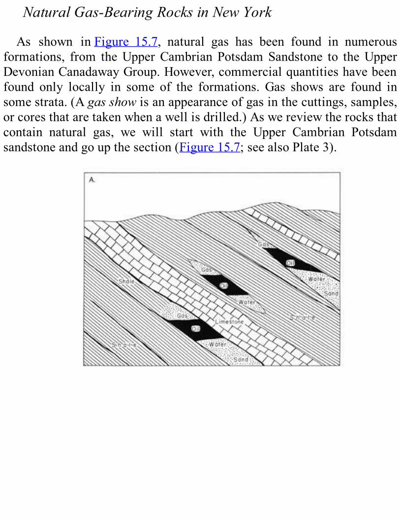
NaturalGas-BearingRocksinNewYorkAs shown inFigure 15.7, natural gas has been found in numerous
formations, from theUpperCambrianPotsdamSandstone to theUpperDevonianCanadawayGroup.However,commercialquantitieshavebeenfound only locally in some of the formations. Gas shows are found insomestrata.(Agasshowisanappearanceofgasinthecuttings,samples,orcoresthataretakenwhenawellisdrilled.)Aswereviewtherocksthatcontain natural gas, we will start with the Upper Cambrian Potsdamsandstoneandgoupthesection(Figure15.7;seealsoPlate3).
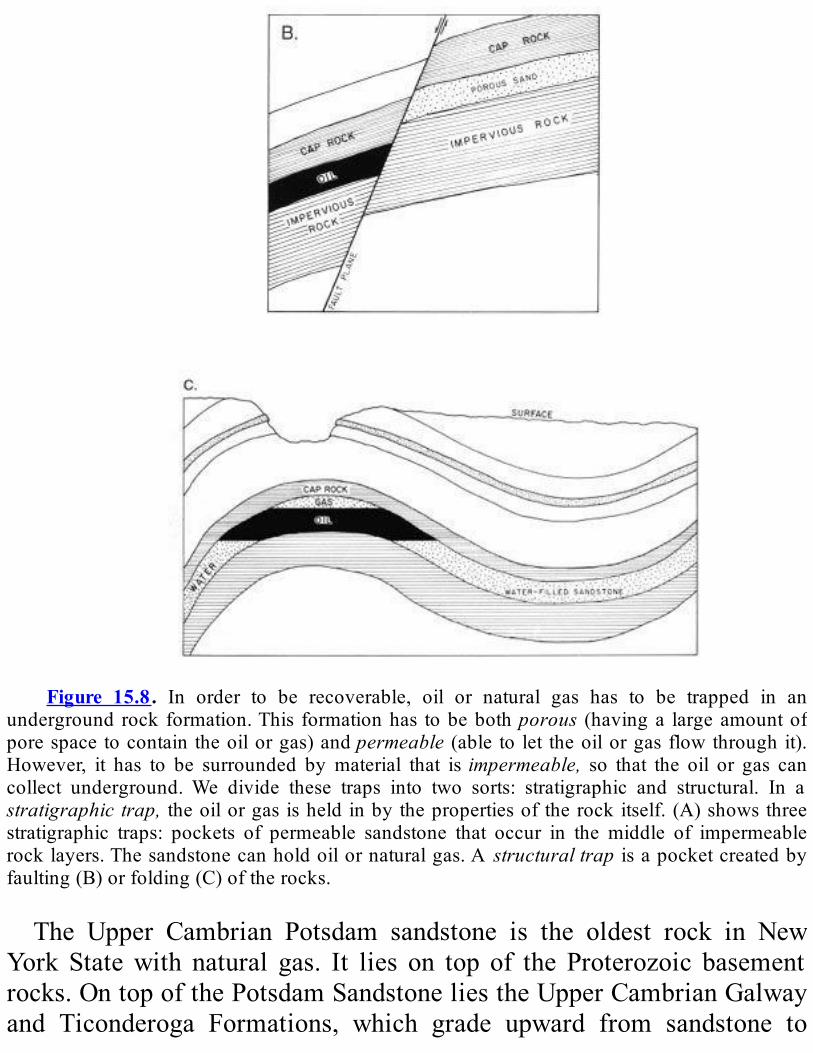
Figure 15.8. In order to be recoverable, oil or natural gas has to be trapped in an
underground rock formation.This formationhas tobebothporous (havinga largeamountofporespacetocontaintheoilorgas)andpermeable (able to let theoilorgasflowthroughit).However, it has to be surrounded bymaterial that isimpermeable, so that the oil or gas cancollect underground.We divide these traps into two sorts: stratigraphic and structural. In astratigraphictrap, theoilorgasisheldinbythepropertiesoftherockitself.(A)showsthreestratigraphic traps: pockets of permeable sandstone that occur in the middle of impermeablerocklayers.Thesandstonecanholdoilornaturalgas.A structuraltrap isapocketcreatedbyfaulting(B)orfolding(C)oftherocks.
The Upper Cambrian Potsdam sandstone is the oldest rock in NewYork Statewith natural gas. It lies on top of the Proterozoic basementrocks.OntopofthePotsdamSandstoneliestheUpperCambrianGalwayand Ticonderoga Formations, which grade upward from sandstone to
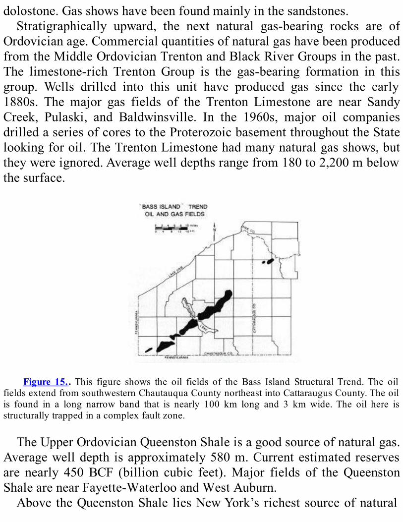
dolostone.Gasshowshavebeenfoundmainlyinthesandstones.Stratigraphically upward, the next natural gas-bearing rocks are of
Ordovicianage.CommercialquantitiesofnaturalgashavebeenproducedfromtheMiddleOrdovicianTrentonandBlackRiverGroupsinthepast.The limestone-rich Trenton Group is the gas-bearing formation in thisgroup. Wells drilled into this unit have produced gas since the early1880s. The major gas fields of the Trenton Limestone are near SandyCreek, Pulaski, and Baldwinsville. In the 1960s, major oil companiesdrilledaseriesofcorestotheProterozoicbasementthroughouttheStatelookingforoil.TheTrentonLimestonehadmanynaturalgasshows,buttheywereignored.Averagewelldepthsrangefrom180to2,200mbelowthesurface.
Figure 15..This figure shows the oil fields of the Bass Island StructuralTrend.The oil
fieldsextendfromsouthwesternChautauquaCountynortheastintoCattaraugusCounty.Theoilis found in a long narrow band that is nearly 100 km long and 3 km wide.The oil here isstructurallytrappedinacomplexfaultzone.
TheUpperOrdovicianQueenstonShaleisagoodsourceofnaturalgas.Averagewelldepth isapproximately580m.Currentestimatedreservesare nearly 450BCF (billion cubic feet).Major fields of theQueenstonShalearenearFayette-WaterlooandWestAuburn.AbovetheQueenstonShale liesNewYork’srichestsourceofnatural
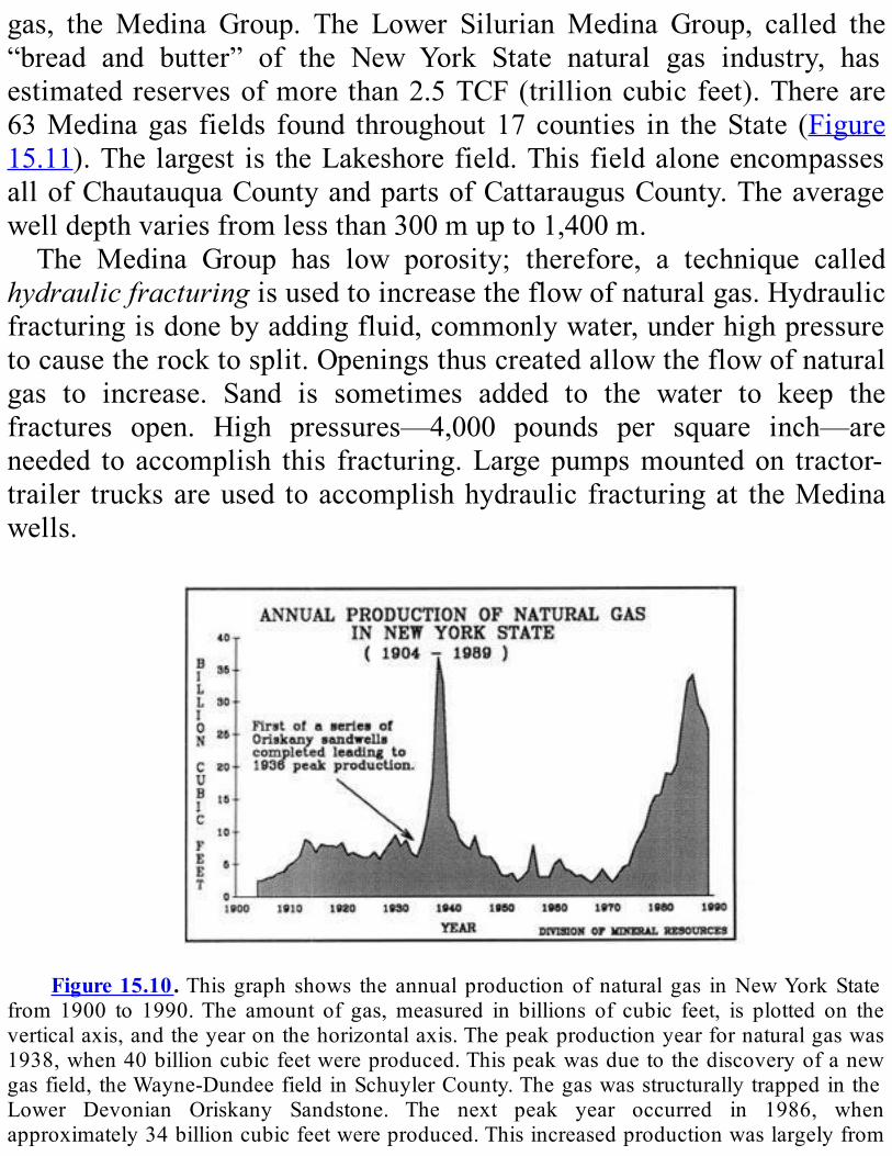
gas, the Medina Group. The Lower SilurianMedina Group, called the“bread and butter” of the New York State natural gas industry, hasestimated reservesofmore than2.5TCF(trillioncubic feet).Thereare63Medinagas fields found throughout17counties in theState (Figure15.11).Thelargest is theLakeshorefield.ThisfieldaloneencompassesallofChautauquaCountyandpartsofCattaraugusCounty.Theaveragewelldepthvariesfromlessthan300mupto1,400m.The Medina Group has low porosity; therefore, a technique called
hydraulicfracturingisusedtoincreasetheflowofnaturalgas.Hydraulicfracturingisdonebyaddingfluid,commonlywater,underhighpressuretocausetherocktosplit.Openingsthuscreatedallowtheflowofnaturalgas to increase. Sand is sometimes added to the water to keep thefractures open. High pressures—4,000 pounds per square inch—areneeded to accomplish this fracturing.Largepumpsmountedon tractor-trailer trucksareused toaccomplishhydraulic fracturingat theMedinawells.
Figure15.10.This graph shows the annual productionof natural gas inNewYorkState
from 1900 to 1990.The amount of gas,measured in billions of cubic feet, is plotted on theverticalaxis,andtheyearonthehorizontalaxis.Thepeakproductionyearfornaturalgaswas1938,when40billioncubicfeetwereproduced.Thispeakwasduetothediscoveryofanewgasfield,theWayne-DundeefieldinSchuylerCounty.ThegaswasstructurallytrappedintheLower Devonian Oriskany Sandstone. The next peak year occurred in 1986, whenapproximately34billioncubicfeetwereproduced.Thisincreasedproductionwaslargelyfrom
the Bass Island Structural Trend. (Graph supplied by New York State Department ofEnvironmentalConservation.)
TheMedinaGroupisdividedintothreeproducingstrata(seePlate3).TheWhirlpoolSandstone(nicknamed the“WhiteMedina”)overlies theQueenstonShale.Agreatervolumeofnaturalgas isproduced from theWhirlpoolSandstonethanfromtheotherformationsintheGroup.Aboveit, the Power Glen Shale is sandwiched between two sandstones, theWhirlpool Sandstone and theGrimsby Sandstone (also called the “RedMedina”). Gas shows also occur in the Irondequoit Limestone, but nomajorquantitieshavebeenfoundinthisformation.BothoilandnaturalgasareproducedfromtheUpperSilurianAkron
Dolomite.Most of thenatural gasproductionoccurs in theBass Islandstructuraltrend.Initialgasflowsweregaugedat60,000cubicfeetofgasperday.4Averagewelldepthvariesfrom760to900m.Exploitation of the LowerDevonianOriskany Sandstonewas largely
responsibleforNewYork’shighestrecordedproductionofnaturalgas—40million cubic feet—in 1938 (Figure 15.10). The largest field at thetime was the Wayne-Dundee field, located in Schuyler County. TheOriskany Sandstone is being explored for gas in Allegany andCattaraugus Counties. While most of the huge gas reserves of thisformationhavebeentapped,thefieldisstilluseful.StructuraltrapsintheOriskanySandstonearenowusedtostorenaturalgasproducedelsewhere(Figure15.12).Duringthesummermonths,gasfrompipelinesisinjectedintowells in theOriskany Sandstone. This gas is extracted for heatingneedsinthewinter.Overlying the Oriskany Sandstone is the Onondaga Limestone of
Middle Devonian age. Today, the natural gas produced from thislimestoneismainlyfromtheBassIslandtrend.Inthepast,commercialamounts have been produced from pinnacle reefs. Apinnacle reef isahighbuildupproducedbycoralsandothermarineorganisms.Thetotalporespacebetweenthisfossildebristhatformsthereefislarge.Thefirstpinnacle reefwas discovered in the townof Jasper, SteubenCounty, in1967. These pinnacle reefs are presently being considered for use as
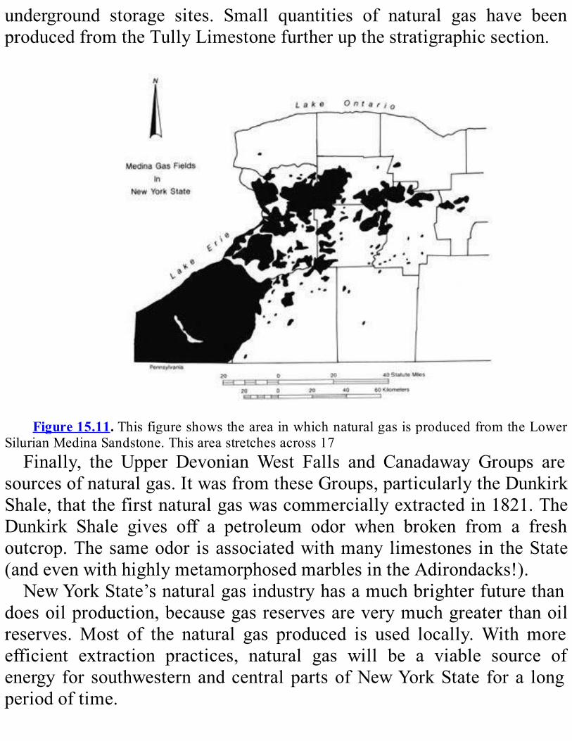
underground storage sites. Small quantities of natural gas have beenproducedfromtheTullyLimestonefurtherupthestratigraphicsection.
Figure15.11.ThisfigureshowstheareainwhichnaturalgasisproducedfromtheLower
SilurianMedinaSandstone.Thisareastretchesacross17Finally, the Upper DevonianWest Falls and Canadaway Groups are
sourcesofnaturalgas.ItwasfromtheseGroups,particularlytheDunkirkShale,thatthefirstnaturalgaswascommerciallyextractedin1821.TheDunkirk Shale gives off a petroleum odor when broken from a freshoutcrop.Thesameodor isassociatedwithmanylimestones in theState(andevenwithhighlymetamorphosedmarblesintheAdirondacks!).NewYorkState’snaturalgasindustryhasamuchbrighterfuturethan
doesoilproduction,becausegasreservesareverymuchgreaterthanoilreserves.Most of the natural gas produced is used locally.With moreefficient extraction practices, natural gas will be a viable source ofenergy for southwesternandcentralpartsofNewYorkState fora longperiodoftime.
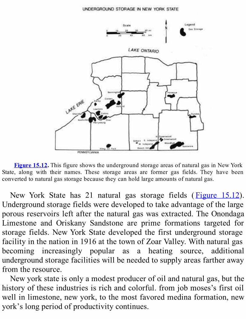
Figure15.12.ThisfigureshowstheundergroundstorageareasofnaturalgasinNewYork
State, along with their names. These storage areas are former gas fields. They have beenconvertedtonaturalgasstoragebecausetheycanholdlargeamountsofnaturalgas.
New York State has 21 natural gas storage fields ( Figure 15.12).Undergroundstoragefieldsweredevelopedtotakeadvantageofthelargeporousreservoirsleftafterthenaturalgaswasextracted.TheOnondagaLimestone and Oriskany Sandstone are prime formations targeted forstorage fields.NewYorkState developed the first underground storagefacilityinthenationin1916atthetownofZoarValley.Withnaturalgasbecoming increasingly popular as a heating source, additionalundergroundstoragefacilitieswillbeneededtosupplyareasfartherawayfromtheresource.Newyorkstateisonlyamodestproducerofoilandnaturalgas,butthe
historyoftheseindustriesisrichandcolorful.fromjobmoses’sfirstoilwellinlimestone,newyork,tothemostfavoredmedinaformation,newyork’slongperiodofproductivitycontinues.

REVIEWQUESTIONSANDEXERCISESNameseveralmineralresourcesthatareimportantinNewYorkState’s
economy.WhatimportantmineralresourcesarefoundinyourpartoftheState?SelectthreeofNewYork’smineralresources.Describewhattheyare,
wheretheyarefound,whattheyareusedfor,andhowimportanttheyaretotheState’seconomy.WhichismoreimportanttoNewYorkState’seconomy:oilornatural
gas?Why?Whatiswaterflooding?Whyisitimportanttooilproduction?Isthepinnaclereefastructuralorstratigraphictrap?Explain.Oncethenaturalgasreservesinaformationhavebeenusedup,what
canthatformationbeusedfor?
CHAPTER16
WATER,WATEREVERYWHERE
Hydrogeology1
SUMMARYHydrogeologydealswith surfacewater—rivers, streams, and lakes—
andgroundwater—waterthathassoakedintotheground.The rivers inNewYorkStatedrainninemajordrainagebasins.New
York’s lakes are temporary features. They were created mainly by thePleistoceneglaciersand,more recently,by theconstructionofartificialdams. Lakes reflect the chemical makeup of nearby rock and soil, sosomearemoresusceptibletoacidrainthanothers.NewYorkStatereceivesitsgreatestprecipitationinlatesummerand
its least in winter; however, rivers are not always highest at times ofgreatest rainfall. One concern of hydrogeology is flooding and how tocontrol it. Groundwater can provide a continuing supply of water forpeople if they neither overdraw it nor pollute it. The water table—thelevel below which all openings in soil and rock are saturated withgroundwater—risesandfallswiththeamountofrainandtheamountofwater that has been pumped out of any given local area. The largestaquifersinNewYorkStatearePleistocenesandandgraveldepositsand,onLongIsland,CretaceousCoastalPlaindeposits.Asdemandforwaterrises,thedangerofgroundwaterpollutionrisesas
well;bothindividualsandindustryhavetotakecarenottocontributetotheproblem.
SURFACEWATERHydrogeology deals with water—both water at the surface of the
ground and water that has soaked down into the soil.We will discusssurfacewaterfirst.Surface water refers to water in rivers, streams, springs, and lakes.
New York has many large rivers. The largest are the St. Lawrence,Niagara, Hudson, Susquehanna, Delaware, Genesee, Oswego, andAllegheny (seeFigure 11.1B). The Richelieu River in Quebec is alsoimportantinNewYork’sdrainage:thewaterfromLakeChamplainflowsnorth into theRichelieuandeventually into theSt.LawrenceRiver.Allthese rivers are sources of water for towns and cities. They are alsotransportationroutesandimportantsourcesofhydroelectricpower.Figure16.1 showsNewYork State’s ninemajor drainage basins and
thedividesbetweenthem.IfyoucomparethatfigurewithFigure11.1B,youcanseehowthemajorriversdrainthoseninebasins.NewYorkalsohassomeofthefinestlakesinthenation.Mostofthese
lakesaretheresultofPleistoceneglaciation,althoughsomewerecreatedartificially by the construction of dams. Ice sheets gouged many lakebasinsinthebedrock.Someofthebasinswerescouredbelowsealevel.Lakeswerealsocreatedwhenthemeltingiceleftearthdamsinvalleysorwhen piles of glacial deposits redirected streams. In addition, the icesheets left behind many large blocks of ice that were then buried byglacial deposits. When these blocks melted, they left holes that filledwithwatertoformkettlelakes(seeFigure12.20).Alllakesaretemporaryfeaturesofthelandscape.Thestreamsflowing
into them carry soil and sediments eroded from the surrounding hills.Thismaterialmayeventuallyfillinthelakescompletely.Lakescanalsodisappearwhenerosionopensupanew,loweroutletthatdrainsthelake.Lake waters reflect the chemical makeup of nearby rock and the
sedimentsthroughwhichrainwatersoaksonitswaytothelake.Normalrainwater isslightlyacidicbecauseitdissolvescarbondioxidefromtheairtoformweakcarbonicacid(chemicalcompositionH2CO3).Industrial
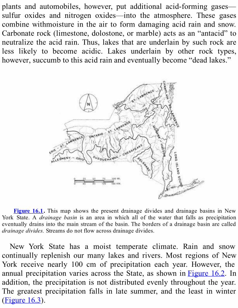
plants and automobiles, however, put additional acid-forming gases—sulfur oxides and nitrogen oxides—into the atmosphere. These gasescombinewithmoisture in the air to formdamaging acid rain and snow.Carbonaterock(limestone,dolostone,ormarble)actsasan“antacid”toneutralize theacid rain.Thus, lakes that areunderlainby such rockareless likely to become acidic. Lakes underlain by other rock types,however,succumbtothisacidrainandeventuallybecome“deadlakes.”
Figure 16.1.This map shows the present drainage divides and drainage basins in New
York State. A drainage basin is an area in which all of the water that falls as precipitationeventuallydrainsintothemainstreamofthebasin.Thebordersofadrainagebasinarecalleddrainagedivides.Streamsdonotflowacrossdrainagedivides.
New York State has a moist temperate climate. Rain and snowcontinually replenish our many lakes and rivers.Most regions of NewYork receive nearly 100 cm of precipitation each year. However, theannualprecipitationvariesacross theState, as shown inFigure16.2. Inaddition, theprecipitation isnotdistributedevenly throughout theyear.The greatest precipitation falls in late summer, and the least in winter(Figure16.3).
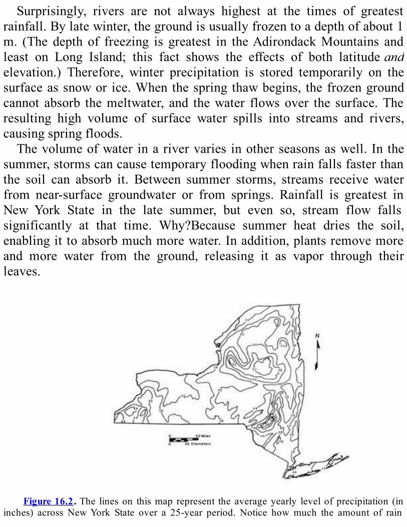
Surprisingly, rivers are not always highest at the times of greatestrainfall.Bylatewinter,thegroundisusuallyfrozentoadepthofabout1m. (The depth of freezing is greatest in theAdirondackMountains andleast on Long Island; this fact shows the effects of both latitudeandelevation.) Therefore, winter precipitation is stored temporarily on thesurfaceassnowor ice.Whenthespring thawbegins, thefrozengroundcannot absorb themeltwater, and thewater flowsover the surface.Theresulting high volume of surface water spills into streams and rivers,causingspringfloods.Thevolumeofwater inarivervaries inotherseasonsaswell. In the
summer,stormscancausetemporaryfloodingwhenrainfallsfasterthanthe soil can absorb it. Between summer storms, streams receive waterfrom near-surface groundwater or from springs. Rainfall is greatest inNew York State in the late summer, but even so, stream flow fallssignificantly at that time. Why?Because summer heat dries the soil,enablingittoabsorbmuchmorewater.Inaddition,plantsremovemoreand more water from the ground, releasing it as vapor through theirleaves.
Figure16.2.The lineson thismap represent the averageyearly levelofprecipitation (in
inches) across NewYork State over a 25-year period. Notice howmuch the amount of rain
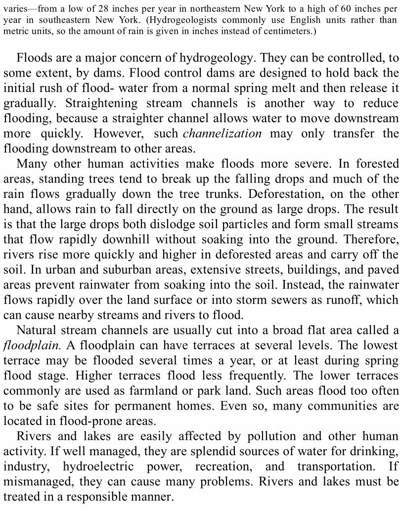
varies—fromalowof28inchesperyearinnortheasternNewYorktoahighof60inchesperyear in southeastern New York. (Hydrogeologists commonly use English units rather thanmetricunits,sotheamountofrainisgivenininchesinsteadofcentimeters.)
Floodsareamajorconcernofhydrogeology.Theycanbecontrolled,tosomeextent,bydams.Floodcontroldamsaredesignedtoholdbacktheinitialrushofflood-waterfromanormalspringmeltandthenreleaseitgradually. Straightening stream channels is another way to reduceflooding,becauseastraighterchannelallowswatertomovedownstreammore quickly. However, suchchannelization may only transfer thefloodingdownstreamtootherareas.Many other human activities make floods more severe. In forested
areas,standing trees tend tobreakup thefallingdropsandmuchof therain flows gradually down the tree trunks. Deforestation, on the otherhand,allowsraintofalldirectlyonthegroundaslargedrops.Theresultisthatthelargedropsbothdislodgesoilparticlesandformsmallstreamsthat flow rapidly downhill without soaking into the ground. Therefore,riversrisemorequicklyandhigherindeforestedareasandcarryoffthesoil.Inurbanandsuburbanareas,extensivestreets,buildings,andpavedareaspreventrainwaterfromsoakingintothesoil.Instead,therainwaterflowsrapidlyoverthelandsurfaceorintostormsewersasrunoff,whichcancausenearbystreamsandriverstoflood.Naturalstreamchannelsareusuallycutintoabroadflatareacalleda
floodplain.A floodplain canhave terraces at several levels.The lowestterrace may be flooded several times a year, or at least during springflood stage. Higher terraces flood less frequently. The lower terracescommonlyareusedasfarmlandorparkland.Suchareasfloodtoooftento be safe sites for permanent homes. Even so,many communities arelocatedinflood-proneareas.Rivers and lakes are easily affected by pollution and other human
activity.Ifwellmanaged,theyaresplendidsourcesofwaterfordrinking,industry, hydroelectric power, recreation, and transportation. Ifmismanaged, they can causemany problems.Rivers and lakesmust betreatedinaresponsiblemanner.
Figure 16.3. The dashed line in this graph shows the average number of inches of
precipitation in theHudsonRiverdrainagebasineachmonth.Thesolid lineshowsvolumeofwaterdischargedintotheAtlanticOceanbytheHudsoneachmonth.Althoughthegraphcoverstheyears1899-1902, thepattern is similar towhatwesee today. (HydrogeologistscommonlyuseEnglishunitsratherthanmetricunits,sothevolumeofwateriswaterisgivenincubicfeetinsteadofcubicmeters.)
GROUNDWATER
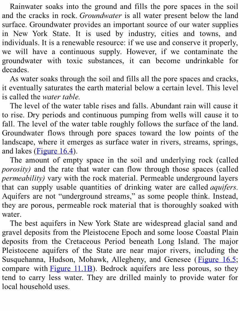
Rainwater soaks into the ground and fills the pore spaces in the soiland thecracks in rock.Groundwater isallwaterpresentbelowthe landsurface.Groundwaterprovidesanimportantsourceofourwatersuppliesin New York State. It is used by industry, cities and towns, andindividuals.Itisarenewableresource:ifweuseandconserveitproperly,we will have a continuous supply. However, if we contaminate thegroundwater with toxic substances, it can become undrinkable fordecades.Aswatersoaksthroughthesoilandfillsalltheporespacesandcracks,
iteventuallysaturatestheearthmaterialbelowacertainlevel.Thisleveliscalledthewatertable.Thelevelofthewatertablerisesandfalls.Abundantrainwillcauseit
torise.Dryperiodsandcontinuouspumpingfromwellswillcauseit tofall.Thelevelofthewatertableroughlyfollowsthesurfaceoftheland.Groundwater flows through pore spaces toward the low points of thelandscape,whereitemergesassurfacewaterinrivers,streams,springs,andlakes(Figure16.4).The amount of empty space in the soil and underlying rock (called
porosity) and the rate thatwater can flow through those spaces (calledpermeability)varywiththerockmaterial.Permeableundergroundlayersthat can supply usable quantities of drinking water are calledaquifers.Aquifers arenot “underground streams,” as somepeople think. Instead,theyareporous,permeablerockmaterialthatisthoroughlysoakedwithwater.Thebestaquifers inNewYorkStatearewidespreadglacial sandand
graveldepositsfromthePleistoceneEpochandsomelooseCoastalPlaindeposits from the Cretaceous Period beneath Long Island. The majorPleistocene aquifers of the State are near major rivers, including theSusquehanna, Hudson, Mohawk,Allegheny, and Genesee (Figure 16.5;compare withFigure 11.1B). Bedrock aquifers are less porous, so theytend to carry less water. They are drilled mainly to provide water forlocalhouseholduses.
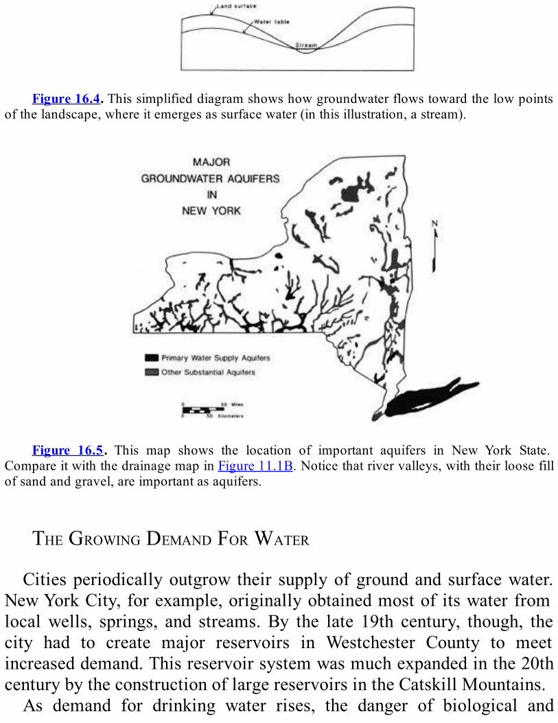
Figure16.4.Thissimplifieddiagramshowshowgroundwaterflowstowardthelowpoints
ofthelandscape,whereitemergesassurfacewater(inthisillustration,astream).
Figure 16.5. This map shows the location of important aquifers in New York State.
CompareitwiththedrainagemapinFigure11.1B.Noticethatrivervalleys,withtheirloosefillofsandandgravel,areimportantasaquifers.
THEGROWINGDEMANDFORWATERCitiesperiodicallyoutgrow their supplyofgroundandsurfacewater.
NewYorkCity,forexample,originallyobtainedmostofitswaterfromlocalwells, springs, and streams.By the late 19th century, though, thecity had to create major reservoirs in Westchester County to meetincreaseddemand.Thisreservoirsystemwasmuchexpandedinthe20thcenturybytheconstructionoflargereservoirsintheCatskillMountains.As demand for drinking water rises, the danger of biological and
chemical pollution rises as well. Perhaps the greatest pollution threatcomes from chemical fertilizers and pesticides, because their use is sowidespread. The next greatest danger comes from improperly locateddumps,landfills,andtoxicchemicalwastesites.Rainandsurfacewatercontinuallysoakthroughthegroundtoreplenishthegroundwatersupply.Where this water flows through ground containing such pollutants, itbecomescontaminated.A growing pollution problem is caused by excessive pumping of
groundwater in coastal areas such as Long Island. In such areas, thegroundissaturatedwithfreshwaternearthesurfaceandwithsaltwaterbeneath that. As fresh groundwater is pumped out, the water tablesurrounding the sourcewell is lowered. If the water table is not givenenough time to recover, the fresh water may be replaced by saltygroundwater.Everyone,notjustindustriesandlargecities,mustbecarefultoavoid
contributingtothepollutionofgroundwaterandsurfacewater.Individualhomeowners can easily contaminate their own well water by having abadlylocatedordesignedsepticsystem.
DEALINGWITHENVIRONMENTALPROBLEMS”Environmental problems” can mean damage caused by natural
hazards such as earthquakes, floods, or landslides. However, themajorenvironmentalproblemfacingNewYorkStateinvolvespollutionof thewater causedbyhumanbeings. Significant changes in human activitieswillberequiredtoeliminatetheseproblemsandrestorethehealthofournaturalenvironment.Industrialandagriculturalchemicals, radioactivewastes,sewage,and
road salt pollute streams, lakes, reservoirs, and groundwater in manyplaces. Unless proper procedures are used, human activities such asmining and smelting, petroleum production, stream damming anddredging, clear cutting of forests, and disposal of biological and toxicwastes can also cause severe environmental problems. When such
operations are planned, hydrogeologistsmust analyze both the site andthesurroundingregion.Thisanalysiscanmakeitpossibletodesignandrun these operations safely or can provide warning about whichoperations cannot be made safe and must be cancelled. For example,commercial development of natural areas can severely deplete orcontaminatethegroundwater.Tounderstandthepotentialdamagetothegroundwater,weneedtoknowthesize,shape,andphysicalandchemicalproperties of the aquifers at the proposed development site and in thesurroundingarea.Ahydrogeologistwouldbeneededtomaketherequiredstudyofthearea.Topreventdanger topeople fromnaturalhazards, the first step is to
findouthowgreattheriskis.Estimatesofpotentialriskarebasedonthegeology of an area and past occurrences of hazardous events. Risk isexpressed as afrequency of recurrence, that is, how often a particulareventwilloccur.However,thefrequencyofrecurrencecannottellusforcertainwhetheradangerouseventwillhappen—onlyhowprobableitis.Forexample,a“100-yearflood”isafloodofasizethathasaprobabilityof occurring every 100 years. But we all know that a flipped coin cancome up heads five consecutive times, even though the probability foreach flip is 50/50. In the same way, it is possible to have “100-yearfloods” twoyears in a row.Twosuch floods, for example,happened inwesternNewYorkin1972and1973.
REVIEWQUESTIONSANDEXERCISESWhat is thedifferencebetween surfacewater andgroundwater?How
aretheyrelated?Howdoesgroundwatermove,andwhy?What is adrainage basin? Describe the major rivers and drainage
basinsinNewYorkState.Whichdrainagebasindoyoulivein?HowlonghavemostofNewYorkState’slakesexisted?Whatcanyou
sayabouttheirprobablefutureinthenaturalcourseofevents?Atwhat timeofyeardoesthegreatestamountofprecipitationfall in
New York State? The least? How does the precipitation relate to the

amountofwaterinrivers?Explain.What is thewater table?What controls its shape?What are someof
thethingsthatcauseittovary?What is anaquifer?Whatkindofmaterialscan itbemadeof?What
canthreatentheusefulnessofanaquifer?What kinds of environmental problems might a hydro- geologist be
expectedtodealwith?

CHAPTER17
EARTHQUAKE!
What,Where,When,Why1
SUMMARYThe study of earthquakes starts with the study of earth vibrations,
calledseismicwaves,whichtravelatdifferentspeeds indifferentkindsofrock.ThetwobasictypesofseismicwavesarePwavesandSwaves.Pwaves travel faster and can travel through solids, liquids, and gases. Swavescan travelonly in solids.Themost commonkindof earthquakeshappenwhenrocksuddenlymovesalonganexistingfaultorwhenrockbreaks to formanew fault.Formostearthquakes, the forces thatbreakthe rock come from themotion of the earth’s plates. Every year,morethan 50,000 earthquakes large enough to be felt by people happen onearth; about 5 to 10 of them occur in New York State. When anearthquakeisdetected,weusewhatweknowaboutthespeedsofseismicwaves to find where it originated. We can describe the size of anearthquakeinthreeways:magnitude,maximumintensity,andthesizeoftheareainwhichitwasfelt.Magnitudescales,forexampletheRichterscale, are based on amplitude of groundmotion and are related to theenergy of seismic waves. The greater the energy released by anearthquake, the greater itsmagnitude. Intensity describes the effects ofthegroundshaking.Weassignintensityvaluesbasedonpeople’sreportsofwhattheyobservedatthetimeofanearthquake.Suchreportsgatheredfrom a wide area allow us to determine the total area in which anearthquake was felt. For earthquakes that happened before measuring
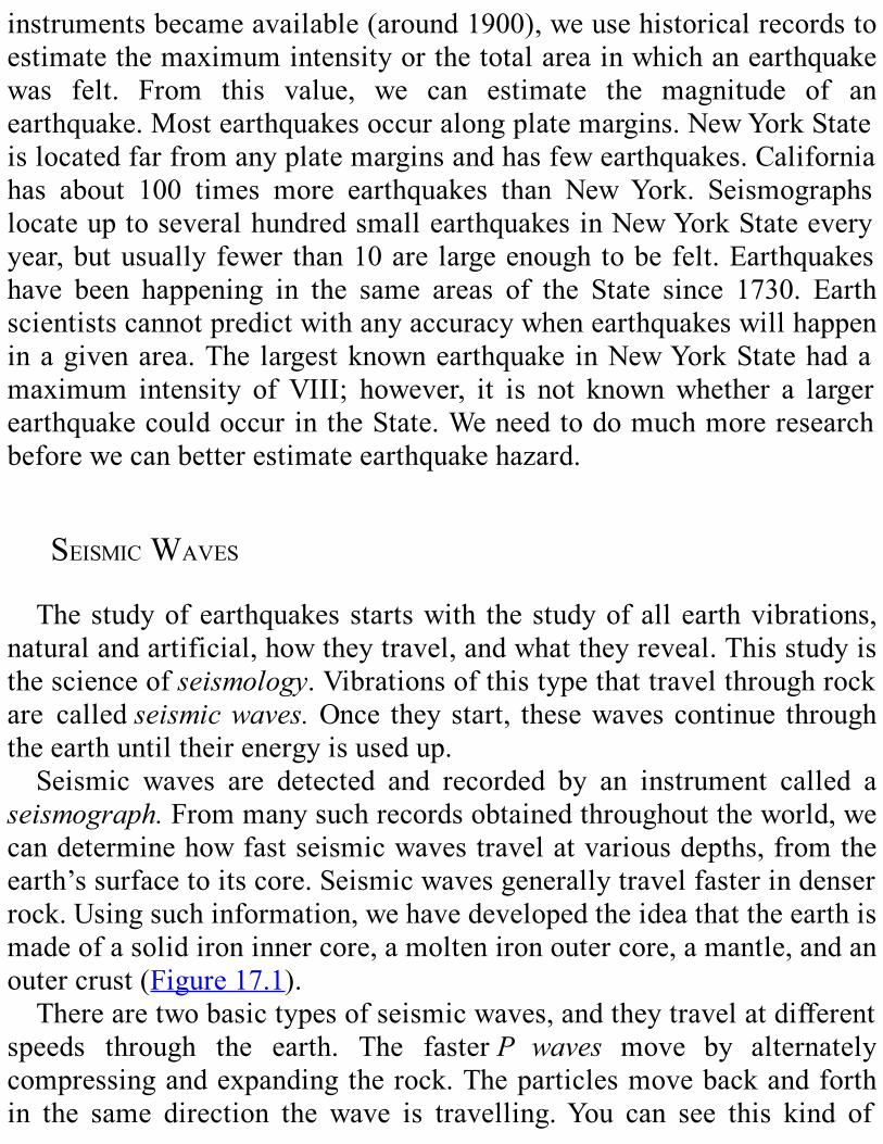
instrumentsbecameavailable(around1900),weusehistoricalrecordstoestimatethemaximumintensityorthetotalareainwhichanearthquakewas felt. From this value, we can estimate the magnitude of anearthquake.Mostearthquakesoccuralongplatemargins.NewYorkStateislocatedfarfromanyplatemarginsandhasfewearthquakes.Californiahas about 100 times more earthquakes than NewYork. SeismographslocateuptoseveralhundredsmallearthquakesinNewYorkStateeveryyear,butusuallyfewer than10are largeenoughtobefelt.Earthquakeshave been happening in the same areas of the State since 1730. Earthscientistscannotpredictwithanyaccuracywhenearthquakeswillhappeninagivenarea.The largestknownearthquake inNewYorkStatehadamaximum intensity ofVIII; however, it is not knownwhether a largerearthquakecouldoccurintheState.Weneedtodomuchmoreresearchbeforewecanbetterestimateearthquakehazard.
SEISMICWAVESThestudyofearthquakesstartswith thestudyofallearthvibrations,
naturalandartificial,howtheytravel,andwhattheyreveal.Thisstudyisthescienceofseismology.Vibrationsofthistypethattravelthroughrockare calledseismicwaves.Once theystart, thesewavescontinue throughtheearthuntiltheirenergyisusedup.Seismic waves are detected and recorded by an instrument called a
seismograph.Frommanysuchrecordsobtainedthroughouttheworld,wecandeterminehowfastseismicwavestravelatvariousdepths,fromtheearth’ssurfacetoitscore.Seismicwavesgenerallytravelfasterindenserrock.Usingsuchinformation,wehavedevelopedtheideathattheearthismadeofasolidironinnercore,amoltenironoutercore,amantle,andanoutercrust(Figure17.1).Therearetwobasictypesofseismicwaves,andtheytravelatdifferent
speeds through the earth. The fasterP waves move by alternatelycompressingandexpandingtherock.Theparticlesmovebackandforthin the same direction the wave is travelling.You can see this kind of
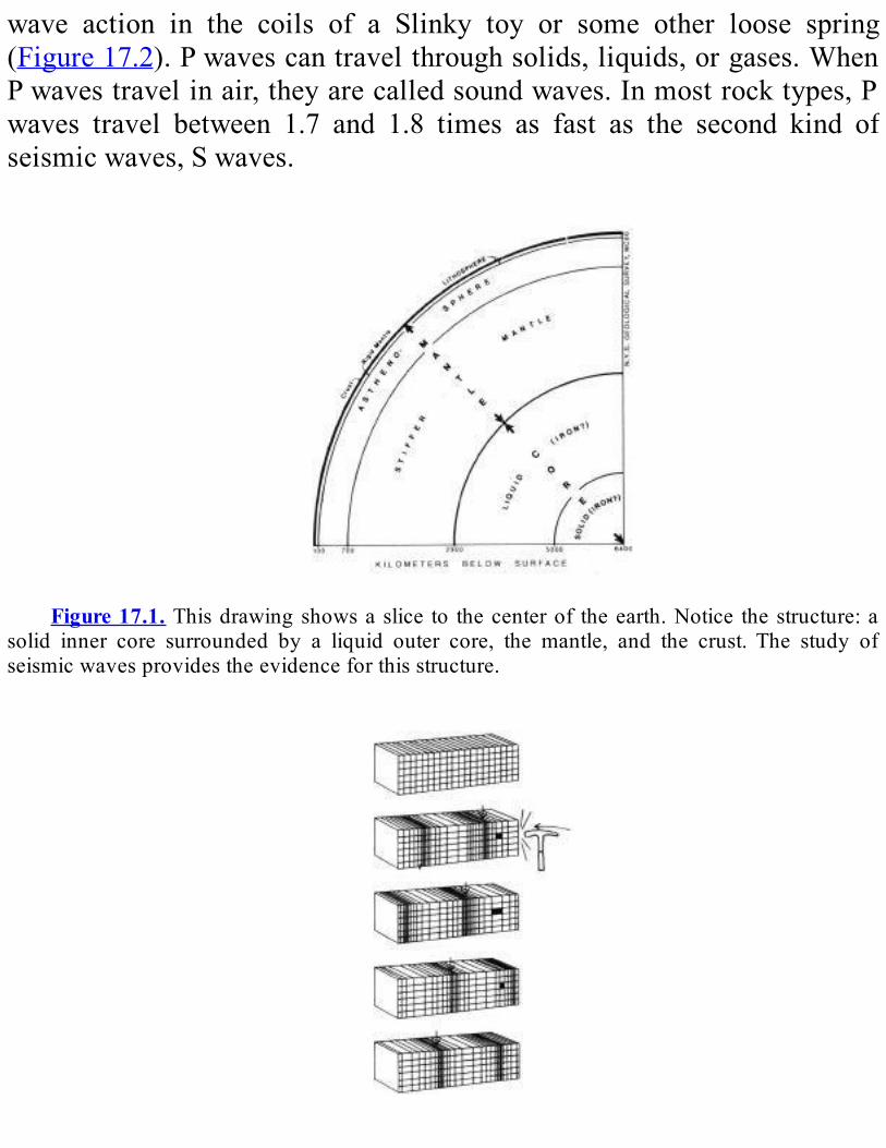
wave action in the coils of a Slinky toy or some other loose spring(Figure17.2).Pwavescantravelthroughsolids,liquids,orgases.WhenPwavestravelinair,theyarecalledsoundwaves.Inmostrocktypes,Pwaves travel between 1.7 and 1.8 times as fast as the second kind ofseismicwaves,Swaves.
Figure17.1. Thisdrawingshowsaslice to thecenterof theearth.Notice thestructure:a
solid inner core surrounded by a liquid outer core, the mantle, and the crust. The study ofseismicwavesprovidestheevidenceforthisstructure.
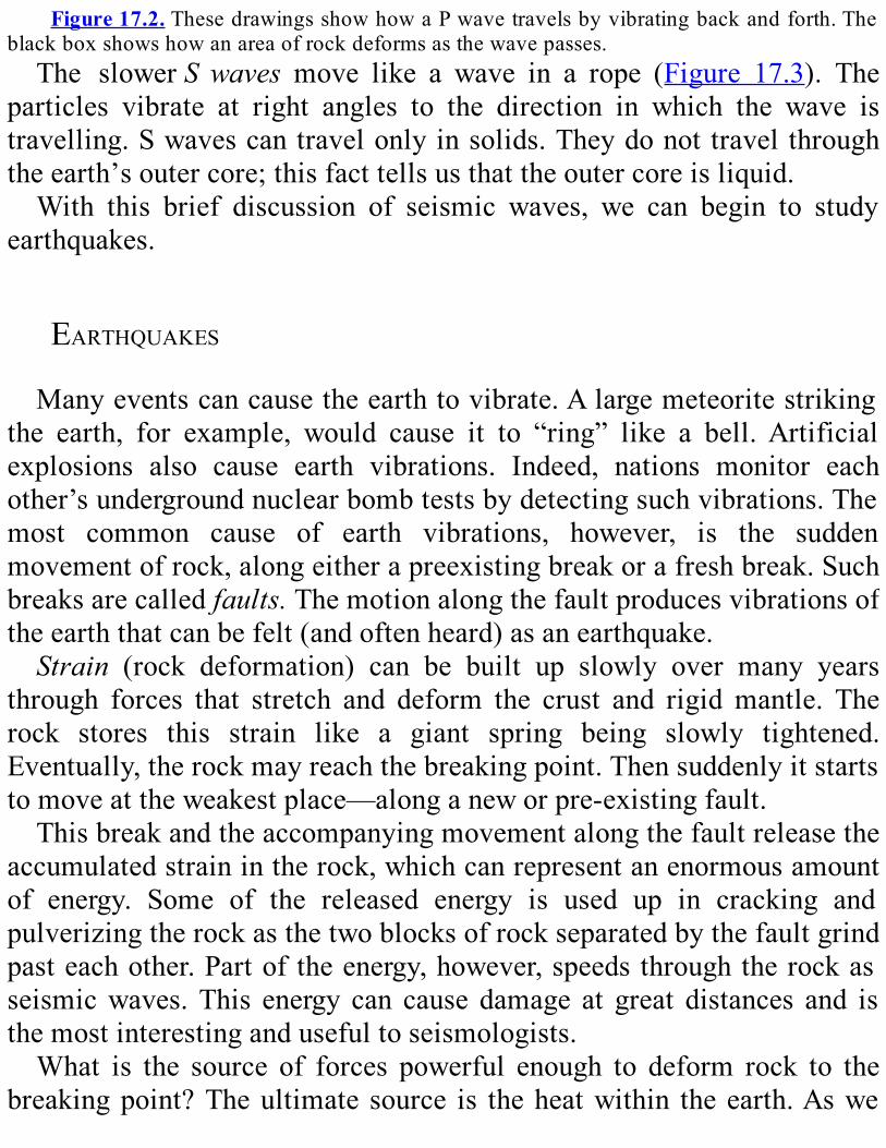
Figure17.2.ThesedrawingsshowhowaPwavetravelsbyvibratingbackandforth.Theblackboxshowshowanareaofrockdeformsasthewavepasses.The slowerSwaves move like a wave in a rope (Figure 17.3). The
particles vibrate at right angles to the direction in which the wave istravelling.Swavescantravelonlyinsolids.Theydonottravelthroughtheearth’soutercore;thisfacttellsusthattheoutercoreisliquid.With this brief discussion of seismic waves, we can begin to study
earthquakes.
EARTHQUAKESManyeventscancausetheearthtovibrate.Alargemeteoritestriking
the earth, for example, would cause it to “ring” like a bell.Artificialexplosions also cause earth vibrations. Indeed, nations monitor eachother’sundergroundnuclearbombtestsbydetectingsuchvibrations.Themost common cause of earth vibrations, however, is the suddenmovementofrock,alongeitherapreexistingbreakorafreshbreak.Suchbreaksarecalledfaults.Themotionalongthefaultproducesvibrationsoftheearththatcanbefelt(andoftenheard)asanearthquake.Strain (rock deformation) can be built up slowly over many years
through forces that stretch and deform the crust and rigidmantle. Therock stores this strain like a giant spring being slowly tightened.Eventually,therockmayreachthebreakingpoint.Thensuddenlyitstartstomoveattheweakestplace—alonganeworpre-existingfault.Thisbreakandtheaccompanyingmovementalongthefaultreleasethe
accumulatedstrainintherock,whichcanrepresentanenormousamountof energy. Some of the released energy is used up in cracking andpulverizingtherockasthetwoblocksofrockseparatedbythefaultgrindpasteachother.Partoftheenergy,however,speedsthroughtherockasseismicwaves.This energy can cause damage at great distances and isthemostinterestingandusefultoseismologists.What is the source of forces powerful enough to deform rock to the
breakingpoint?Theultimate source is theheatwithin theearth.Aswe
know from the study of plate tectonics (see Chapter 3), heat fromradioactivedecaycausesmotioninthepartlymeltedrockofthemantle.The mantle moves in convection currents like those in a slowlysimmeringpotofoatmeal.Floatingontopofthismovingmantle,platesof thelithosphere (made up of the crust and hard outer mantle) arepushed from below. This motion deforms rocks and generatesearthquakes.One million or more earthquakes are detected by sensitive
seismographs on earth every year. By analyzing the records of allearthquakes, we learn that small earthquakes are much more frequentthan largerones.How-ever,over50,000of thoseearthquakesare largeenoughtobefeltbypeopleeachyear(Table17.1).About5to10ofthesefeltearthquakes occur annually inNewYorkState, although the actualnumbervariesconsiderablyfromyeartoyear.
Figure17.3. Thisdrawing showshowanSwave travelsbyvibratingupanddown.The
blackboxshowshowanareaofrockdeformsasthewavepasses.
Table17.1
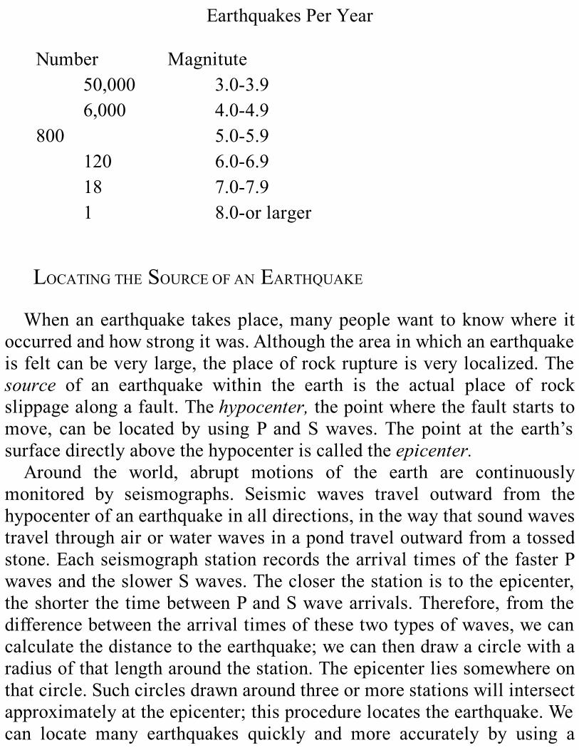
EarthquakesPerYear
Number Magnitute50,000 3.0-3.96,000 4.0-4.9
800 5.0-5.9120 6.0-6.918 7.0-7.91 8.0-orlarger
LOCATINGTHESOURCEOFANEARTHQUAKEWhenanearthquake takesplace,manypeoplewant toknowwhere it
occurredandhowstrongitwas.Althoughtheareainwhichanearthquakeisfeltcanbeverylarge,theplaceofrockruptureisverylocalized.Thesource of an earthquake within the earth is the actual place of rockslippagealongafault.Thehypocenter,thepointwherethefaultstartstomove, can be located by usingP andSwaves.The point at the earth’ssurfacedirectlyabovethehypocenteriscalledtheepicenter.Around the world, abrupt motions of the earth are continuously
monitored by seismographs. Seismic waves travel outward from thehypocenterofanearthquakeinalldirections,inthewaythatsoundwavestravelthroughairorwaterwavesinapondtraveloutwardfromatossedstone.EachseismographstationrecordsthearrivaltimesofthefasterPwavesandtheslowerSwaves.Thecloserthestationistotheepicenter,theshorterthetimebetweenPandSwavearrivals.Therefore,fromthedifferencebetweenthearrivaltimesofthesetwotypesofwaves,wecancalculatethedistancetotheearthquake;wecanthendrawacirclewitharadiusofthatlengtharoundthestation.Theepicenterliessomewhereonthatcircle.Suchcirclesdrawnaroundthreeormorestationswillintersectapproximatelyattheepicenter;thisprocedurelocatestheearthquake.Wecan locate many earthquakes quickly and more accurately by using a

computerprogramtomatchthecalculatedarrivaltimesofPandSphasestomanyrecordingstationswiththeobservedtimesatthesestations.Thismethodistheonlyoneusedbyseismologiststoday.
THESIZEOFANEARTHQUAKEThebestwaytodescribethesizeofanearthquakewouldbetostatethe
totalamountofenergyreleasedwhentherockbroke.However,wedon’thave a way of measuring that energy directly. Instead, we use severalindirect measures. One indirect measure ismagnitude, a second ismaximum intensity, and a third is thesize of the area over which theearthquakewasfelt.Severalmagnitude scales have been devised. The best- known is the
Richtermagnitudescale(Table17.2).Itisbasedontheheight(calledtheamplitude)ofcertainseismicwavesasrecordedbyseismographs.Itwasdevised during the 1930s to classify California earthquakes. Othermagnitude scales measure the amplitude of different kinds of seismicwaves and are adapted to different regions.Magnitude does not tell usdirectly how much energy is released by an earthquake. However, weknowthatthegreatertheenergy,thegreaterthemagnitude,althoughtheexactrelationshipisdifficulttodetermine.Anotherway todescribe the sizeof anearthquake isby itsmaximum
intensity.Intensityisadescriptionoftheeffectsoftheearthmovement—on people, buildings, and the landscape. The intensity varies in anearthquake region, depending on how far the observers are from theepicenterandwhethertheyarestandingonsoftorhardground.
Table17.2ComparisonofModifiedMercalliintensityandRichtermagnitudeand
effectsonpeople,buildingsandthelandscape.
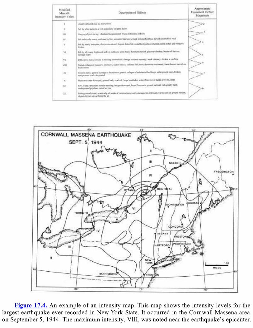
Figure17.4. Anexampleofanintensitymap.Thismapshowstheintensitylevelsforthe
largestearthquakeeverrecordedinNewYorkState.ItoccurredintheCornwall-MassenaareaonSeptember5,1944.Themaximumintensity,VIII,wasnotedneartheearthquake’sepicenter.

The intensity levels on this map are based on what people experienced at the time of theearthquake(Table17.2).Notice that themap also shows us the size of the area inwhich theearthquakewasfelt.Anintensityscaleincludeslevelsthatrangefrombarelyperceptibleup
to total destruction of buildings. The scalewe use today in theUnitedStatesistheModifiedMercalliscale—abbreviatedMM(Table17.2).TheMM scale has 12 levels of intensity. These intensity levels are usuallyindicatedbyRomannumeralstodistinguishthemfrommagnitudelevels,whichareshownbyArabicnumbers.Becauseearthquakeintensitydependsonpeople’sobservations,weuse
questionnaires to investigateearthquakes.Questionnairesaredistributedinanearthquakeareatoaskpeoplewhattheyheard,saw,andfeltatthetime of the earthquake. Based on the responses for each location, weassignintensityvaluesandthenprepareamap(Figure17.4).Suchamapshows the various intensity values and the total area in which anearthquakewasfelt.For earthquakes that happened before seismograph readings became
available around 1900, we can obtain an estimate of magnitudes bystudying news stories and other descriptions of historical earthquakes.Usingthisinformation,weassignintensityvaluesanddeterminetheareaover which a particular earthquake was felt. Then, we assign themagnitude thatmatches themaximum intensity or the size of the area.Wedetermine the relationship betweenmagnitude,maximum intensity,and size of the area through studies of contemporary earthquakes, forwhichwecandetermineallthreevalues.
EARTHQUAKESINNEWYORKSTATEAccording to plate tectonic theory, we would expect to find most
earthquakes along divergent margins (where plates separate), alongtransform margins (where plates grind sideways past each other), andalongconvergentmargins(wheretwoplatescollide).Thetheoryofplatetectonics was strengthened when investigators observed that over 95percentofearthquakesoccurinthesethreekindsofareas.

NewYorkStateisfarfromanyplatemargins.Therefore,wewouldnotexpectmuch earthquake activity here. Indeed,NewYork has far fewerearthquakes than parts of the country that are near plate margins.Southern California, which lies along a transform margin (the famousSanAndreasFaultsystem),hasarateofearthquakeactivity100timesasgreat as New York’s. The Pacific coast of Alaska is located along aconvergentmarginandisevenmoreactive.Between1730and1986,morethan400earthquakesforwhichlocation
couldbedeterminedoccurredinNewYorkState.Theseearthquakeshadamagnitudegreater thanabout2.0.During thisperiod,NewYorkStatehas had the third highest earthquake activity of states east of theMississippiRiver.Only SouthCarolina andTennessee have beenmoreseismicallyactive.But why does NewYork, located far from plate margins, have any
earthquakes at all? We don’t really know what causes earthquakes inregions far from plate margins. They probably are caused by platemotionsinsomewaywestilldon’tunderstand,orbysomeotherprocesswehaven’tyetdiscovered.It is well known that smaller earthquakes are much more numerous
worldwide than larger ones (Table 17.1). Such is also the case inNewYork State. Of the up to several hundred earthquakes detected bysensitiveseismographsinNewYorkeveryyear,generallyfewerthan10arelargeenoughtobefelt.AnearthquakeinthecentralAdirondacksonOctober7,1983,providesanexample.Theearthquakehadamagnitudeof5.1.Duringthefollowingthreemonths,morethan50aftershockswererecordedinthatareaalone,mostofthemtoosmalltobefelt.Figure17.5showsthesizeandlocationofalltheearthquakesthatwere
located by seismographs in the northeastern United States and nearbyCanadafrom1975to1987.Table17.3listsalltheearthquakeslargerthanmagnitude4detectedinNewYorkStatethrough1989.Fromourstudyofthehistoricalrecord,weconcludethatearthquakes
have been recurring in the same areas of NewYork since 1730. Willearthquakes continue to occur where they do now, or will they slowlyshift them to other parts of theState? In fact, 260 years is a relatively

shorttimeintermsofearthquakerecurrence.Wewouldneedtostudyamuchlongertimespantotellwhetherthispatternisacontinuingoneorjustatemporarystateofaffairs.Aswementionedabove,California’srateofearthquakeoccurrenceisa
hundred times that of New York State. However, there are somesimilarities between earthquake activity in the two states. Therelationship between the magnitude and number of earthquakes, forexample,isaboutthesameinbothstates:foreachearthquakeofacertainmagnitude, there are about 10 earthquakes of onemagnitude lower.Ontheotherhand,thecrustanduppermantleinNewYorkareolder,cooler,andmorerigid than inCalifornia;asaresult,anearthquakehere is feltoveramuchlargerareathanoneofthesamesizeinCalifornia.
EARTHQUAKEHAZARDINNEWYORKSTATEHowmuch danger of earthquakes is there inNewYorkState?There
are two ways to look at that question. One way is to estimate thelikelihood thatacertain sizeearthquakewilloccurataparticularplaceandtime.Thislikelihoodiscalledearthquakehazard,anditdependsongeologic factors. Earth scientists, using their knowledge of geologicprocessesand localearthquakehistories, try topredict the likelihoodofanearthquakeinanyparticularregion.Ontheotherhand,wecanlookatthelikelihoodofpeoplegettinghurt
or killed and property being damaged because of an earthquake. Thisdanger is calledearthquakerisk.Earthquakeriskdepends inparton theearthquakehazard,but italsodependsonadditionalfactors,suchas thenumberofpeopleandpopulationdensityinaregion,howwellbuildingsare designed to resist earthquakes, and how well the public and theauthoritiesarepreparedtoreacttoearthquakes.Earthquakeriskistheconcernofagreatnumberofpeopleinaddition
to seismologists and earth scientists— for example, architects,governmentofficials,cityplanners,thepolice,themedia,educators,andthe general public. It would be impossible in this book to cover all of
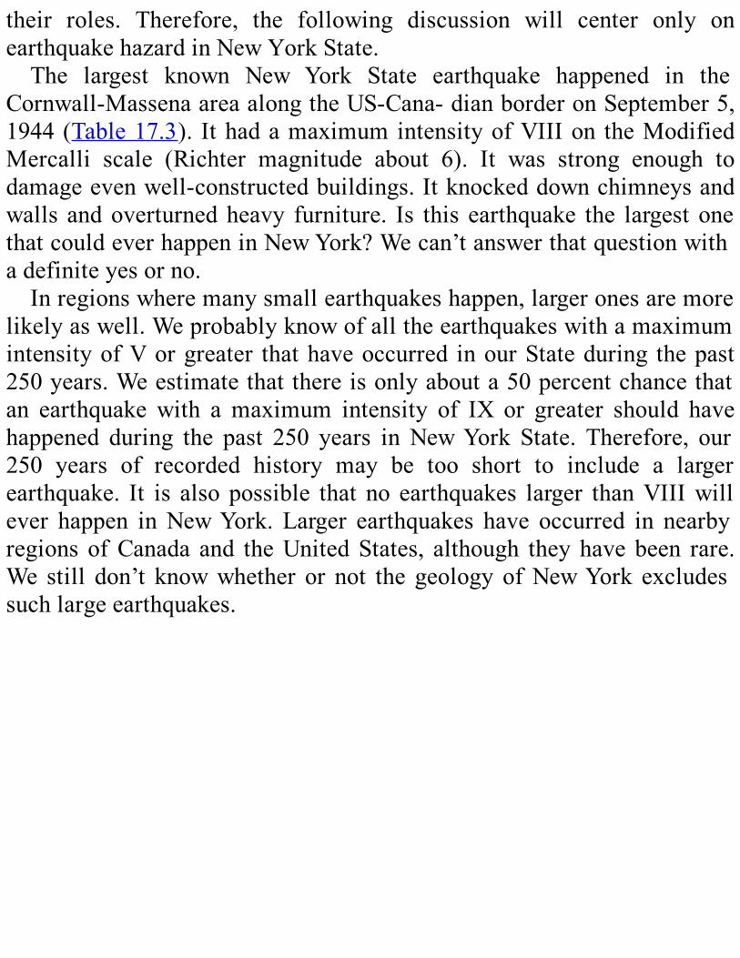
their roles. Therefore, the following discussion will center only onearthquakehazardinNewYorkState.The largest known New York State earthquake happened in the
Cornwall-MassenaareaalongtheUS-Cana-dianborderonSeptember5,1944(Table17.3). IthadamaximumintensityofVIIIon theModifiedMercalli scale (Richter magnitude about 6). It was strong enough todamageevenwell-constructedbuildings.Itknockeddownchimneysandwalls andoverturnedheavy furniture. Is this earthquake the largest onethatcouldeverhappeninNewYork?Wecan’tanswerthatquestionwithadefiniteyesorno.Inregionswheremanysmallearthquakeshappen,largeronesaremore
likelyaswell.WeprobablyknowofalltheearthquakeswithamaximumintensityofVorgreater thathaveoccurred inourStateduring thepast250years.Weestimatethatthereisonlyabouta50percentchancethatan earthquake with amaximum intensity of IX or greater should havehappened during the past 250 years inNewYork State. Therefore, our250 years of recorded history may be too short to include a largerearthquake. It is also possible that no earthquakes larger thanVIIIwillever happen inNewYork. Larger earthquakes have occurred in nearbyregions ofCanada and theUnitedStates, although theyhavebeen rare.We still don’t knowwhether or not the geologyofNewYork excludessuchlargeearthquakes.

Figure 17.5. This map shows the locations and magnitudes of earthquakes in the
northeasternUnitedStatesandnearbyCanadafrom1975through1987.
Table17.3NewYorkState’slargestearthquakes,from1737through1999
I0=MaximumModifiedMercalliIntensity
M=MaggnitudeIn order to better estimate earthquake hazard inNewYork,we need
additionalinformation.WehaveevidencethatthecrustisunderstressinNewYorkStateandthroughouttheeasternandcentralUnitedStates.Wesuspect that the stresses are related in some way to tectonic platemotions,althoughwedonotyetunderstand thedetails.Future researchcould tell us more about known faults in NewYork and how tectonicforces affect them.Such researchmay eventually enable us to estimatethesizeofthemaximumpossibleearthquakeinourState.If we could match earthquakes with known faults, it might help us
solvethisproblem.However,eventheshallowestearthquakesareatleasta few kilometers underground. The deepest known earthquakes in theStateoccurabout20kmbelowthesurface.Surfacefaultscanbemappedaccurately, but the sources of earthquakes can be located onlywithin aradius of a few kilometers. As a result, we’ve been able to matchtentativelyonlya fewverysmallearthquakes (detectedby instruments)in New York State with surface faults. The true relationship of mostearthquakestofaultsstillneedstobedeterminedbymoreresearch.
REVIEWQUESTIONSANDEXERCISESWhatarethreewaysofdescribinghowlargeanearthquakeis?
Whereontheearthdowefindfrequentearthquakes?Why?WhatdoesthattellusaboutthelikelihoodofearthquakesinNewYorkState?
Whatisthedifferencebetweenearthquakehazardandearthquakerisk?how do scientists go about estimating earthquake hazard in new yorkstate?

CHAPTER18
TOBUILDORNOTTOBUILD
EngineeringGeology1
SUMMARYEngineering geology deals with planning and designing construction
projects. It helps develop and safeguard the water supply and protectpeople from natural geologic hazards. In NewYork State, there are anumberofspecificgeologicconditionsthatareimportanttoengineeringgeology: effects of the Pleistocene glaciers and the nature of glacialdeposits, pockets of saprolite, areas of stress in bedrock, shale thatexpandsandbreaksdownwhenexposedtoair,thestabilityofslopesandthepossibilityoflandslides,andregionsofkarsttopography.Engineeringgeologydealswithglacialdepositsacross theState—till
thatishardtodigthrough,sandandgravelthatformaquifersthatmustbeprotected frompollution, glacial lake clays that canbeunstable andcauselandslides,andtheeasilyerodedglacialoutwashthatmakesupthesouthern part of Long Island. Early construction projects, like the ErieCanal, did not benefit from geologic advice. By the end of the 19thcentury,though,engineershadbeguntoconsultgeologistsregularly.Forexample,engineeringgeologyhashelpedNewYorkCitymeet its growing demands for water. Other projects using such
advicehavebeen the constructionof hydroelectric plants, the interstatehighwaysystem,andtheSt.LawrenceSeaway,aswellasthelocationofsitesforpowerplants.Today,engineeringgeologistsareworkingonNewYork’senvironmentalproblems likeprotectingdrinkingwater,cleaning

up toxic waste sites, finding a place for low-level radioactive wastedisposal,andreducingthedangeroflandslidesontheState’shighways.
WHATISENGINEERINGGEOLOGY?Geology has a great number of practical applications. One good
example is using geologic principles to find fossil fuels and mineraldeposits. (See Chapter 15 for more information.) In this chapter wediscuss how geologic principles are used in engineering. This field iscalledengineeringgeology. It involves thegeologicaspectsofplanninganddesigningconstructionprojectsofmanykinds.Themostvitalofsuchprojectsinvolvetheworld’smostvaluableand
essential resource, fresh water. Engineering geologists, along withhydrogeologists,helpdevelopsurfacewaterandgroundwatersuppliesforcities and towns, clean up toxic wastes that contaminate groundwatersupplies,andselectnew,safesitesforthedisposaloftoxicandnontoxicwastes.Engineering geologists also study ways to evaluate natural geologic
hazardsandminimizethedangertopeopleandtheirproperty.Onesuchhazard in the northeast United States is coastal erosion, which can besevere during major storms. Another is landslides. We can recognizelandslide-proneareasbasedonkindofmaterial, steepnessofslope,andotherfactorsandcanshowthemonmapsforthebenefitofbuilders.
GEOLOGICCONDITIONSINNEWYORKSTATEIn New York State, several geologic conditions are important to
engineeringgeology:
1.During thePleistocene, theglaciersworeawayalmostallof thesoft, weathered bedrock in the State, exposing fresh bedrockunderneath.Theicealsoburiedthisfreshbedrockunderalayerof
glacialsoildeposits.
2.Theglacialdepositsvaryenormouslyinthicknessandtype.It isvery important that engineering geologists understand all thesetypes of deposits and their engineering properties, such asstrength,plasticity (deformingunderpressurewithoutbreaking),porosity (the amount of empty space between particles), anddrainagecharacteristics.
3. Near New York City, some areas of soft, weathered bedrock(calledsaprolite) remain. These old Tertiary and interglacialsedimentsoccurindeeppocketsinthemetamorphicrocksurfaceandpresentpoorfoundationconditions.Severalsaprolitepocketswerefoundduringexploratoryworkdoneduring theplanningofthecity’swatersupplytunnels.
4.AreasofstoredgeologicstressinNewYork’sPaleozoicbedrockcan affect large construction projects. One example is in theNiagaraFalls-Buffalo area.There, the stored stresses caused thenorth-south walls of bedrock excavations to close suddenly asmuchas45cm.SimilarstressinthegneissbedrockofNewYorkCity has caused problems in tunnel building. In some limestonequarries in western NewYork, the release of this stored stresswhentheoverlyingrockwasremovedcausedquarryfloorstopopup.
5.IntheErie-OntarioandHudson-MohawkLowlands,wefindshalefromtheOrdovicianandSilurianPeriods.Thisshaleisstrongandstableaslongasit’sburied.Whenit’sexposedtotheair,though,itexpandsandbreaksdownquickly.
6.Limestoneinsomepartsof theStatemaycontainkarst features.These features are formed when groundwater dissolves parts ofthe rock. Karst features include fractures enlarged by water,
caverns, sinkholes, and sharp pinnacles on the surface of thebedrock.
SPECIFICPROBLEMSDenseglacialtill2thatwascompressedbytheweightoftheicecovers
muchof theState’s bedrock. It is aptly called “hardpan” in this regionand is oftendifficult todig throughwithmachinery.The thickness andmakeupofthetillvariesgreatly.Inotherplaces, there aremanykindsof layeredglacial deposits that
were formed in meltwater streams or glacial lakes. They are usuallyfound in valleys and lowlands. The engineering properties of thesesedimentscanbeveryimportant.Forexample,glacialdepositsofsandorgraveloftenformaquifers3.Manycommunitiesdependontheseaquifersfortheirwatersupply.Maintainingapollution-freewatersupplyfromtheaquifersisvitaltothesecommunities.Thicklayersofclayweredepositedinthedeeperpartsofglaciallakes
in the lower and mid-Hudson Valley. These clays can be unstable,especially when they are soaked with water. When soaked, they maycauselandslidesevenonmoderateslopes.IntheSt.LawrenceValley,wefindclaysthatweredepositedintheshallowseathatenteredtheregionafter the melting of the Pleistocene ice sheet. These clays can besimilarlyunstable.Landslides are a significant problem in New York State. They do
approximately $20million in damage statewide every year. In the past160years,landslidesinNewYorkhavekilled74people.ThesouthernpartofLongIslandismadeupofextensivesandplains.
This sand is glacialoutwash, washed out of the end of a glacier bymeltwater. It is loose and easily eroded. Thus, waves and currentscontinually move the sand. Hurricane-driven waves and currents cancauseenormouschanges in thebeachesandbarrier islandsof the southshore.Long Island’s barrier islands face an uncertain future. Sea level is

rising. Human activity, such as the dredging of inlets for harbors andbuilding of piers, stops the movement of sand that would have beenwashedwestwardtorebuildthebarrierislands.Theeffectsarebecomingmore and more obvious as the waves and currents eat away at theseislands.In1988and1989,thegovernordeclaredastateofemergencyinSuffolkCounty. Erosion hadmoved the shoreline towithin 6m of theSouthShoreParkwayatseveralplacesonJonesIsland.Otherhazardstothecoastalzoneareevenmorevisible:wastedisposal
andproblemswithoilspills.
HISTORYOFENGINEERINGGEOLOGYINNEWYORKSTATEWe have to understand how earth materials behave in order to plan
major construction projects successfully. Mew York State has a longhistoryofsuchprojects.Manyearlyprojectsinthe19thcenturydidnotbenefitfromgeologic
science.Noone studiedwhatgeology layunder the surfaceof the landbefore beginning excavation or construction. Problemswere handled asthey occurred. People learned to deal with earthmaterials by trial anderror.The 363-mile-long Erie Canal was started in 1817. The canal gave
naturalists a unique opportunity to study the soil and bedrock acrossmuchoftheState.Scientistsstudiedthecanalextensively,aswellasthequarries that provided materials for it. However, we have found noevidencethattheengineersconsultedgeologistsduringheconstruction.Whenthecanalwasrebuiltandenlargedbetween1835and1856, the
canalengineersoccasionallyaskedStateGeologistJamesHallforadvice.Bytheendofthe19thcentury,engineershadbeguntoconsultgeologistsregularly.They had recognized the value of geologic evaluation and ofdrilling holes to get samples of the materials below the surface. Theysoon realized that these evaluations should be done even before theprojectsweredesigned.Some of the earliest construction projects in the State were in the

rapidlygrowingcityofNewYork.Thecityhadquicklybecomeamajorcommercialcenter incolonialAmerica.The firstpublicwaterwellwasdug inManhattan in 1677. Since that time, trying to plan and build anadequatewatersupplyforNewYorkhasbeenacontinuousproject.During the 1830s, New York City’s inadequate water supply had
becomeacrisis.Pollutedwellsspreadcholera.Withoutenoughwatertoput them out, fires burned incessantly, casting a thick pall over thedowntown. The problem spurred action: the Old CrotonAqueduct wasbuilttocarrywaterfromtheCrotonRiver70kmsouthtoNewYorkCity.AlthoughtheAssyriansandRomanshadbuiltsuchaqueducts(structuresthatcarrywater)longagowithmuchthesametechnology,itwasthefirstofitskindintheUnitedStates.TheOldCrotonDamwasbuilttostorethewateroftheCrotonRiver.
From there, there were ridges to pass under and valleys to cross byspecialaqueducts.Constructionbeganin1837,andthefirstwaterflowedfiveyearslater.Thewatertook22hourstotraveldownthegentleslopetoNewYorkCity.Constructionwascompletedin1848.Theprojecthadbeen designed to supplyNewYork City’swater needs for centuries tocome. The city’s population growth, however, soon outstripped allexpectations. The Old Croton Aqueduct was superseded by the NewCrotonAqueduct,threetimesthelengthofitspredecessor.Itwasbegunin1885anddeliveredwaterfromtheCatskillMountainsfiveyearslater.Itisstillsupplyingthecity,butplannersarelookingatevenmoredistantsourcesofwaterforfutureneeds.TheNewYorkCityBoard ofWater Supplymay have been the first
engineeringorganizationinNewYorkStatetoroutinelyseekadvicefromgeologists. In 1905, it appointed Professor James Kemp of ColumbiaUniversityasitsconsultinggeologist.Tenyearsearlier,ProfessorKemphad participated in the design and construction of the New CrotonSystem.Inthatactivity,heprovedthevalueofengineeringgeology.Later, Professor C.P. Berkey of Columbia made a study of the first
aqueducttoserveNewYorkCityandpublishedareportin1911.Inthe20thcentury,engineeringgeologyhasplayedaneverincreasing
roleinmajorconstructionprojects.Hydroelectricgeneratingplantswere
built atNiagara Falls and atmany other sites across the State between1920and1940.Geologists investigateddamand reservoir sites,aswellas routes for the power lines. After 1950, the Federal governmentprovided funds for building an interstate highway system. New YorkStatebegantoemployengineeringgeologistsintheDepartmentofPublicWorks(nowtheDepartmentofTransportation)tohelpinhighwaydesignand construction. Another major project, the St. Lawrence Seawayproject,alsorequiredextensivegeologicstudies.Thedecadebetween1965and1975mayhaveseenthegreatestdemand
for engineering geology studies in New York State. Geologists madedetailed investigationsofmore than20possiblesites fornuclearpowerplants. State and Federal laws require a series of thorough geologicstudies before a nuclear plant can be licensed or built. These studiesbecome part of a required environmental impact statement. Fewer thanone-third of the proposed plants were ever built and licensed. Becauseearthquakepotentialissuchavitalconsiderationinnuclearpowerplantsiting,thestudiestaughtgeologistsagreatdealaboutseismicactivityintheState.
CURRENTPROBLEMSFORENGINEERINGGEOLOGYDuring the past 20 years, most of the major engineering geology
projects in NewYork have concerned protecting the environment andreducingenvironmentalhazards.FederalandStatelawsrequirethattoxicwaste sites be cleaned up. They also require that sources of drinkingwater, like aquifers, streams, and rivers, be protected from pollution.Modern sewage treatment facilities have been built across theState. InRochester,milesof tunnelshavebeendug through thebedrockbeneaththecity.Thesetunnelsaredesignedtocontrolrunoffofstormwaterandreduce pollution in Lake Ontario. Geologists and other scientists havebeenstudyinggroundwaterpollutionintheBuffalo-NiagaraFallsareaforanumberofyears.Engineering geology studies at a radioactive waste burial site in
CattaraugusCountywillhelpplannersselecta location forNewYork’sfirststatewidelow-levelradioactivewastedisposalsite.Inaddition,thereare several hundred toxicwaste disposal sites throughout theState thatarenolongerbeingused.Governmentandprivateengineeringgeologistsare studying these sites in an effort to determine the best means ofcleaningthemup.In1989, theStateThruwayAuthoritybeganamajor landslidehazard
reductionprogram,basedinpartongeologicstudiesoflandslidesacrosstheState.Thisprogramhasmade theThruway’s559milesof highwaysafer.
REVIEWQUESTIONSANDEXERCISESWhatisengineeringgeology?Whatkindofprojectsdoesitworkon?What are some of the problems from across the State engineering
geology has coped with in the past? What projects in your owncommunityhaveusedengineeringgeology?Whataresomeoftheproblemsengineeringgeologyis tryingtocope
withtodayinNewYorkState?Whatengineeringgeologyproblemsexistinyourcommunity?

OH,BYTHEWAY…
Appendix
THEAPPENDIXCONTAINSTHEFOLLOWING:
FIGUREA.l.OURRESTLESSEARTH.The first drawing showsearth’s continents andoceanbasins40millionyears ago.Africa touched Eurasia. Rapid expansion of the Mid-OceanRidgeraisesthesealevel,floodingcontinentalmargins.India,aseparatecontinent,movesnorthwardtowardsAsia.
Theseconddrawingshowsearth’scontinentsandoceanbasinstoday.TheMediterraneanSeahasshrunk,thesouthAtlanticOceanhaswidened,andIndia has collided with Asia. The northward push of India continuestoday,causingtheloftyHimalayasandtheTibetanPlateaunorthofittoriseametereachcentury.1page.
FIGUREA.2. Physiographic diagram of the continental United States. 1page.
FIGUREA.3.DrawingsofsometypicalfossilsfromPaleozoicrocksofNewYork.Allillustrations are natural size, unless indicated otherwise. (EnlargementsandreductionsareindicatedbyXfollowedbyanumber.Forexample,X2means two times natural size; X1 /5 means one-fifth natural size.) 4pages.
FIGUREA.4.

AsummaryofthegeologichistoryofNewYorkinaseriesof61cross-sectionblockdiagrams.12pages.
FIGUREA.5.Simplified map showing the extent of brittle deformation (faults andfractures)inNewYorkState.IntheAdirondacksandHudsonHighlands,the lines represent known faults and fracture zones, aswell as straightvalleys thatwe suspect are fracture zones. In the rest of the State, thelinesshowstraightsegmentsofstreams;thesesegmentsmayflowalongzoneswithcloselyspacedjointsorotherfractures.1page.
TABLEA.1.List of maps of New York State available from the New York StateGeologicalSurvey.1page.
TABLEA.2.CommonmetricmeasurementsusedinthisbookwiththeirequivalentsinEnglishunits.1page.
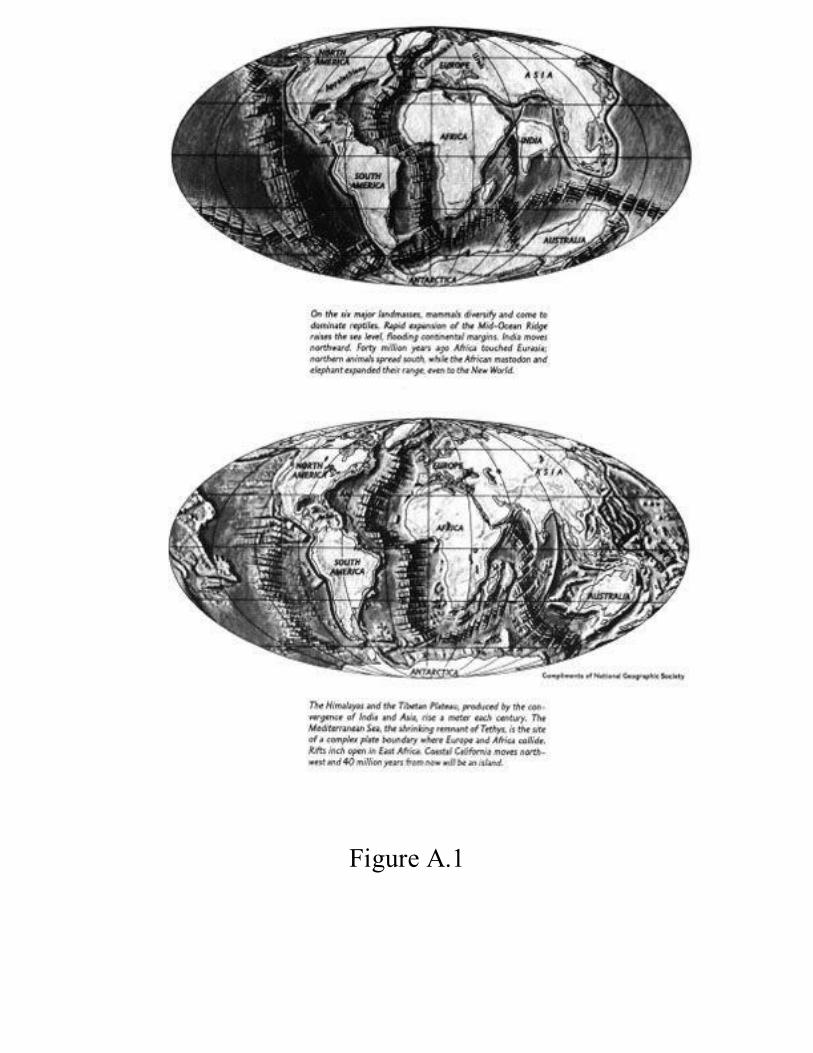
FigureA.1

FigureA.2
FigureA.3


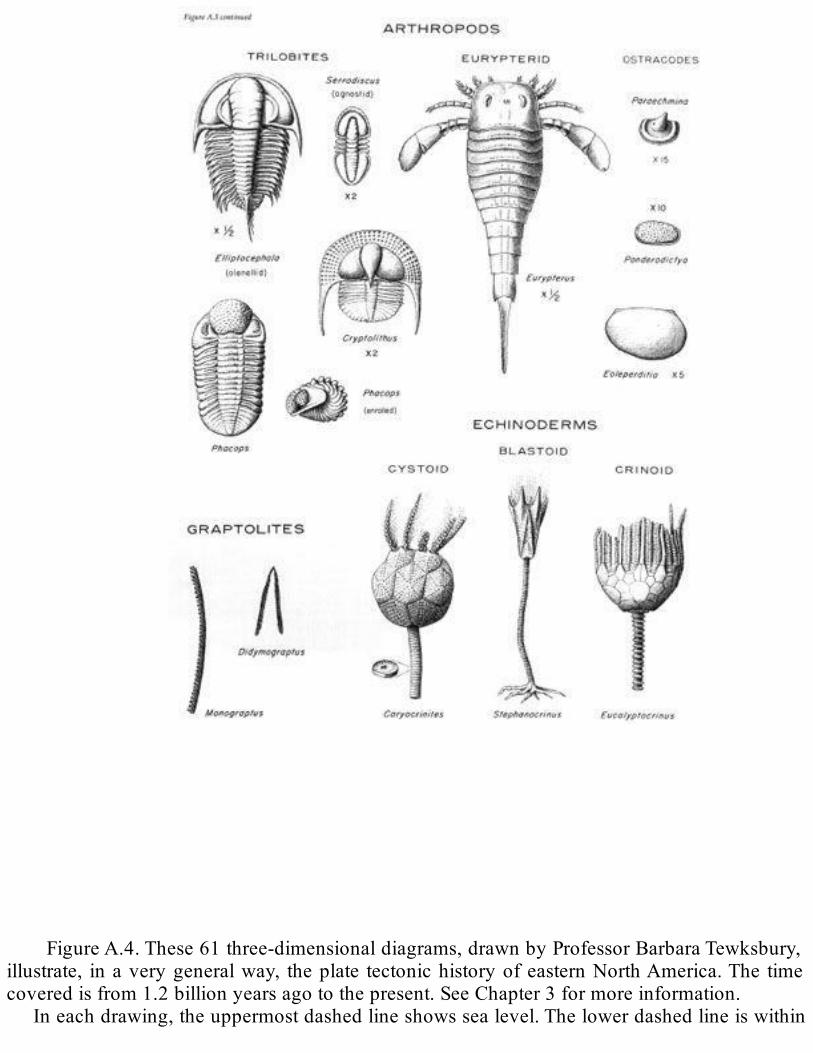
FigureA.4.These61three-dimensionaldiagrams,drawnbyProfessorBarbaraTewksbury,illustrate, inaverygeneralway, theplate tectonichistoryofeasternNorthAmerica.The timecoveredisfrom1.2billionyearsagotothepresent.SeeChapter3formoreinformation.
Ineachdrawing,theuppermostdashedlineshowssealevel.Thelowerdashedlineiswithin

themantleandmarksthebaseofthelithosphere.Beneathitistheasthenosphere,onwhichtheplates of the lithosphere glide. Black represents oceanic crust.Within the continental crust,curvedlinesrepresentfoldsandstraightlinesrepresentfaults.Arrowsshowrelativemovementalong some faults. The “tear drop” shapes that appear in many of the diagrams representintrudingmagma.
Notice that the NewYork State area of each diagram is indicated by NY beneath it.TheabbreviationMa stands for “million years ago.” For example, the notation ~1100 Ma istranslatedas“approximately1100millionyearsago”or“approximately1.1billionyearsago.”
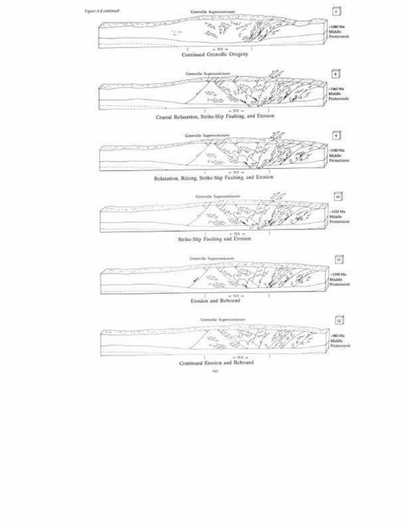

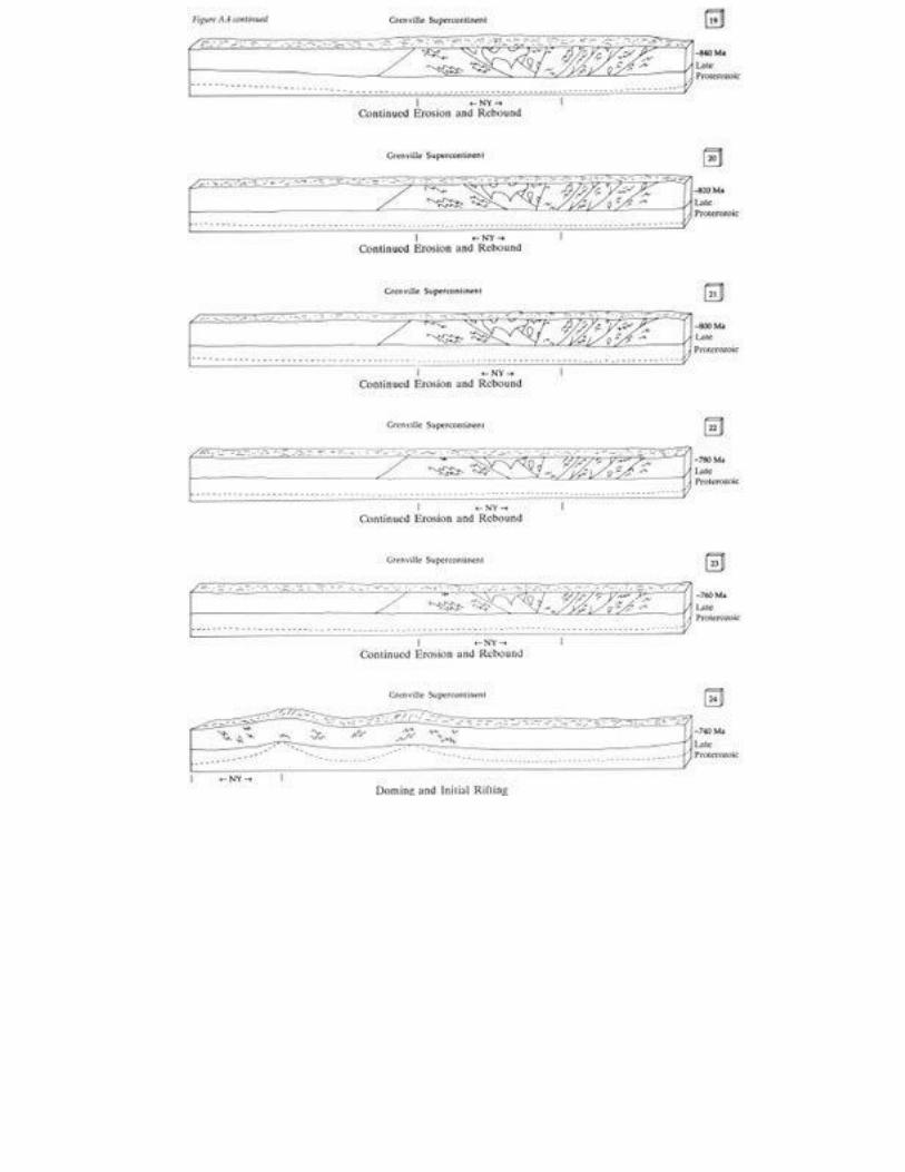

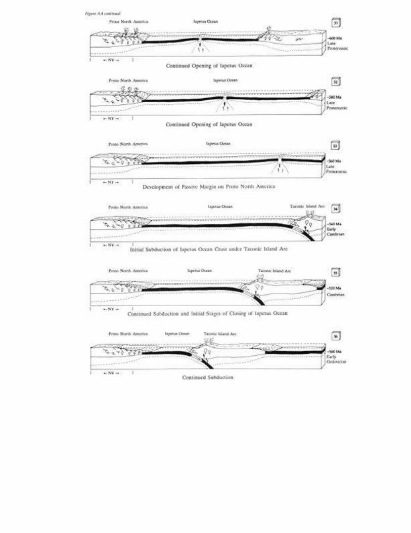

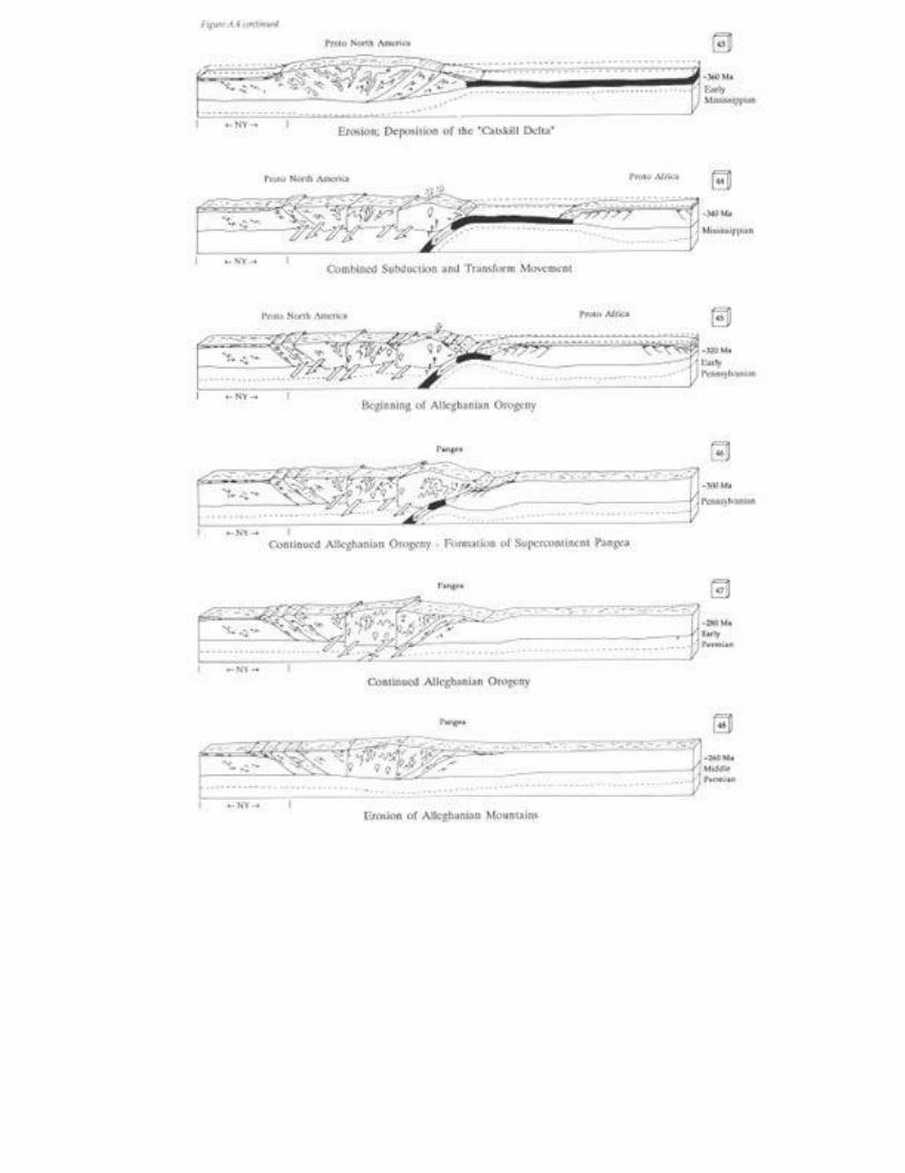
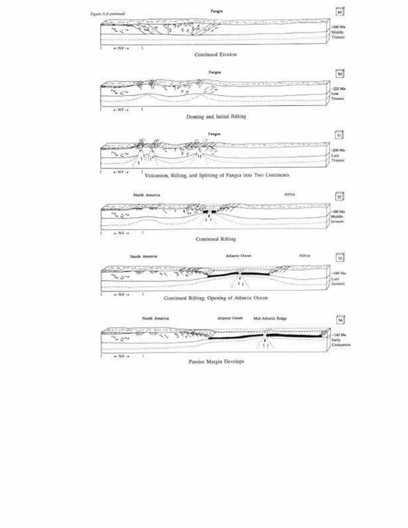
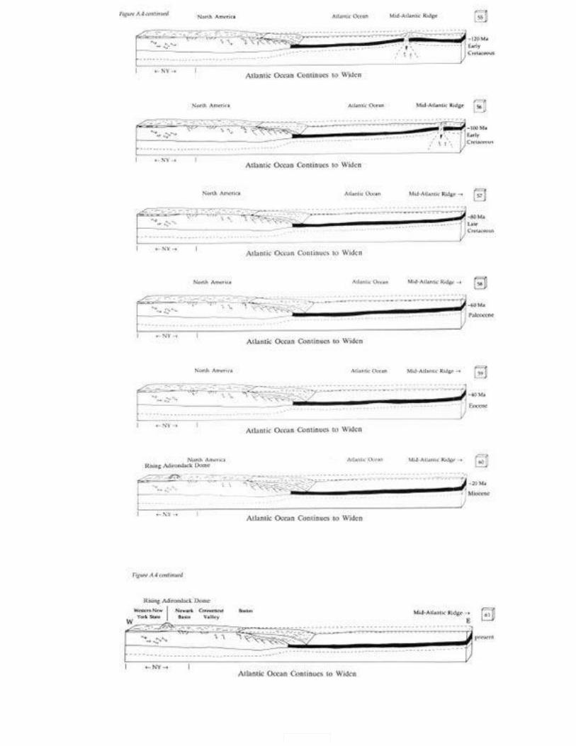
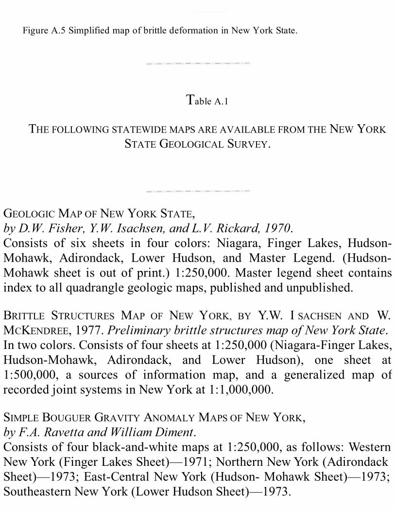
FigureA.5SimplifiedmapofbrittledeformationinNewYorkState.
TableA.1
THEFOLLOWINGSTATEWIDEMAPSAREAVAILABLEFROMTHENEWYORKSTATEGEOLOGICALSURVEY.
GEOLOGICMAPOFNEWYORKSTATE,byD.W.Fisher,Y.W.Isachsen,andL.V.Rickard,1970.Consists of six sheets in four colors: Niagara, Finger Lakes, Hudson-Mohawk, Adirondack, Lower Hudson, and Master Legend. (Hudson-Mohawk sheet isoutofprint.) 1:250,000.Master legend sheet containsindextoallquadranglegeologicmaps,publishedandunpublished.
BRITTLE STRUCTURES MAP OF NEW YORK, BY Y.W. I SACHSEN AND W.MCKENDREE,1977.PreliminarybrittlestructuresmapofNewYorkState.Intwocolors.Consistsoffoursheetsat1:250,000(Niagara-FingerLakes,Hudson-Mohawk, Adirondack, and Lower Hudson), one sheet at1:500,000, a sources of information map, and a generalized map ofrecordedjointsystemsinNewYorkat1:1,000,000.
SIMPLEBOUGUERGRAVITYANOMALYMAPSOFNEWYORK,byF.A.RavettaandWilliamDiment.Consistsoffourblack-and-whitemapsat1:250,000,asfollows:WesternNewYork(FingerLakesSheet)—1971;NorthernNewYork(AdirondackSheet)—1973;East-CentralNewYork(Hudson-MohawkSheet)—1973;SoutheasternNewYork(LowerHudsonSheet)—1973.
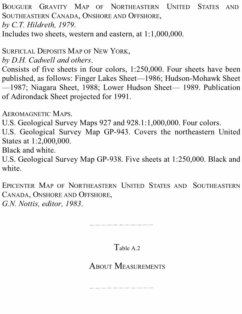
BOUGUER GRAVITY MAP OF NORTHEASTERN UNITED STATES ANDSOUTHEASTERNCANADA,ONSHOREANDOFFSHORE,byC.T.Hildreth,1979.Includestwosheets,westernandeastern,at1:1,000,000.
SURFICLALDEPOSITSMAPOFNEWYORK,byD.H.Cadwellandothers.Consistsof five sheets in fourcolors,1:250,000.Four sheetshavebeenpublished,asfollows:FingerLakesSheet—1986;Hudson-MohawkSheet—1987;NiagaraSheet, 1988;LowerHudsonSheet—1989.PublicationofAdirondackSheetprojectedfor1991.
AEROMAGNETICMAPS.U.S.GeologicalSurveyMaps927and928.1:1,000,000.Fourcolors.U.S. Geological Survey Map GP-943. Covers the northeastern UnitedStatesat1:2,000,000.Blackandwhite.U.S.GeologicalSurveyMapGP-938.Fivesheetsat1:250,000.Blackandwhite.
EPICENTER MAP OF NORTHEASTERN UNITED STATES AND SOUTHEASTERNCANADA,ONSHOREANDOFFSHORE,G.N.Nottis,editor,1983.
TableA.2
ABOUTMEASUREMENTS

Inthisbook,weusethemetricsystem.Incaseyouarenotfamiliarwiththissystemofmeasurement,thischartgivesyouapproximateEnglish
systemequivalentsforcommonmetricunitsusedinthisbook.1centimeter(cm) = .39inches1meter(m) = 1.09yards1kilometer(km) = .62miles1squarekilometer(km2) = .39squaremiles
Toconverttemperatureindegreescelsius(°C)todegreesFahrenheit(°F),usethisformula: (temperaturein°C)+32=temperaturein
°F
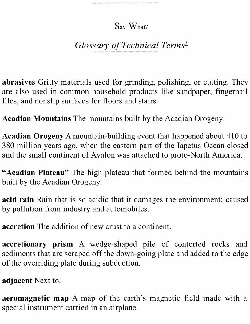
SayWhat?
GlossaryofTechnicalTerms1
abrasivesGrittymaterialsusedforgrinding,polishing,orcutting.Theyare also used in commonhousehold products like sandpaper, fingernailfiles,andnonslipsurfacesforfloorsandstairs.
AcadianMountainsThemountainsbuiltbytheAcadianOrogeny.
AcadianOrogenyAmountain-buildingeventthathappenedabout410to380millionyearsago,whentheeasternpartoftheIapetusOceanclosedandthesmallcontinentofAvalonwasattachedtoproto-NorthAmerica.
“AcadianPlateau”Thehighplateau that formedbehind themountainsbuiltbytheAcadianOrogeny.
acidrainRainthatissoacidicthatitdamagestheenvironment;causedbypollutionfromindustryandautomobiles.
accretionTheadditionofnewcrusttoacontinent.
accretionary prism A wedge-shaped pile of contorted rocks andsedimentsthatarescrapedoffthedown-goingplateandaddedtotheedgeoftheoverridingplateduringsubduction.
adjacentNextto.
aeromagneticmap A map of the earth’s magnetic field made with aspecialinstrumentcarriedinanairplane.
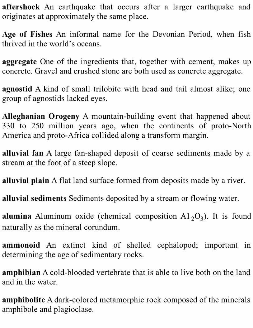
aftershock An earthquake that occurs after a larger earthquake andoriginatesatapproximatelythesameplace.
Age of Fishes An informal name for the Devonian Period, when fishthrivedintheworld’soceans.
aggregateOne of the ingredients that, togetherwith cement,makes upconcrete.Gravelandcrushedstonearebothusedasconcreteaggregate.
agnostidAkindof small trilobitewith head and tail almost alike; onegroupofagnostidslackedeyes.
AlleghanianOrogenyA mountain-building event that happened about330 to 250 million years ago, when the continents of proto-NorthAmericaandproto-Africacollidedalongatransformmargin.
alluvial fanA large fan-shapeddeposit of coarse sedimentsmadeby astreamatthefootofasteepslope.
alluvialplainAflatlandsurfaceformedfromdepositsmadebyariver.
alluvialsedimentsSedimentsdepositedbyastreamorflowingwater.
alumina Aluminum oxide (chemical composition A12O3). It is foundnaturallyasthemineralcorundum.
ammonoid An extinct kind of shelled cephalopod; important indeterminingtheageofsedimentaryrocks.
amphibianAcold-bloodedvertebratethatisabletolivebothonthelandandinthewater.
amphiboliteAdark-coloredmetamorphicrockcomposedofthemineralsamphiboleandplagioclase.
amplitudeTheheightofvibrationofawave.
ancestralAdjectivedescribingafeaturethatexistedinthepast.
anhydrite A light colored mineral found in evaporite deposits. ItschemicalcompositionisCaSO4.
anorthositeAn igneous rock composed almost entirely of the mineralplagioclase.
anthracite grade The metamorphic grade that produces the highestqualityofcoal.
anthraxoliteAblacksubstancesimilartohardasphaltfoundinveinsinsedimentaryrocks.
anticlinaltrendThemapdirectionofthelongaxisofananticline.
anticlineAfoldinrockthatisconvexupward.
anticlinoriumAlargeanticline.
Appalachian Basement Rock in eastern New York that lies belowyoungerrockthatwasdeformedduringtheformationoftheAppalachianMountains.
AppalachianBasinAbasinthatheldashallowinlandseaduringmostofthePaleozoicEra.ManyofthesedimentaryrocksexposedinNewYorkStateweredepositedintheAppalachianBasin.
Appalachianmountain-building episodes The Taconian,Acadian, andAlleghanianOrogenies.
Appalachian Upland An area of high elevation in the AppalachianMountains.
aqueductAstructurethatcarriesalargequantityofflowingwater.
aquiferAnundergroundbodyofsaturatedrockorsedimentthatisbothporousandpermeableenoughtoprovideuseablequantitiesofwater.
archaeocyathans Sponge-like creatures that built reefs in the Early toMiddle Cambrian seas. Note:Archaeocyathans is the plural ofarchaeocyathid.
ArcheanAdjectivereferringtotheoldestpartofgeologictime,fromtheformationoftheearthupto2.5billionyearsago.
arcticclimateAverycoldclimatefoundnorthofthearcticcircle.
arêteAsharpridgeinruggedmountains,formedbyglacialerosion.
arkoseAsandstonerichinthemineralfeldspar,commonlypinkorredincolor.
arkosic sandstone A coarse-grained sandstone rich in the mineralfeldspar.
arthropodAninvertebrateanimalwithajointedbodyandlimbs,usuallywithahardcovering.Insects,spiders, lobsters,crabs,barnacles,andtheextincttrilobitesareallarthropods.
asthenosphereAsoft,flowinglayeroftheuppermantle;itliesunderthelithosphere.
atdepthDeepbelowtheearth’ssurface.
AtlanticCoastalPlainThelow,wideplainalongtheeastcoastofNorthAmerica.
attached echinoderms An echinoderm that grows attached to the sea

bottom.
Avalon A small continent that was attached to proto- North AmericaduringtheAcadianOrogeny.
axesThepluralofaxis.Anaxisisastraightlinethatdividesashapeintotwosymmetricalhalves.
BaltimoreCanyonTroughAlargeburiedbasinonthecontinentalshelfsouthofLongIsland.
barAbankmadeofsandorothersediments,atleastpartlyunderwater,alongtheshoreorinariver.
barrierislandAlong,narrow,sandyisland,builtbywavesnearabeach.
barriershoalAnunderwatersandbankorsandbarroughlyparalleltotheshoreline.
basalt A dark-colored, dense rock formed from molten rock. Oceaniccrustismadeofbasalt.
basalt flow Basalt formed from molten rock that flowed out onto thesurfaceoftheearthandhardened.
basalticlavaMoltenrockthatflowsoutontotheearth’ssurface,whereitcoolsandhardenstobecomebasalt.
basalticvolcanismVolcanicactivitythatproducesbasalticlava.
BasementHingeZoneThezoneinanoffshoresedimentarybasinwherethedepthofthebasementincreasesrapidly.
basementrockThedeeplyerodedmetamorphicbedrock that isusuallycoveredbyyoungersedimentaryrocks.
basinAdepressionor lowarea thatholds (oronceheld)a lake, sea,orocean.
Bass Island Structural Trend A complex anticline found below theearth’ssurfaceinwesternNewYork.It isastructuraltrapthatcontainsoilandnaturalgas.
beachridgeAlongsandymoundonabeach,beyondthereachofstormwaves or high tide. Itwas built bywaves and currentswhen thewaterlevelwashigher.
bedAlayerofrock,usuallysedimentaryrock.
beddingLayersinsedimentaryrock.
bedding plane The flat to undulating surface that physically separateslayersofsedimentaryrock.
bedding surface A surface within a layered sedimentary rock thatrepresentstheoriginalsurfacewheresedimentsweredeposited.
bedrockThesolidrockthatliesunderthesoil.
bedrock geology The solid rock of the earth’s crust exposed at thesurface of the earth; also, the study of that rock. Itmay be covered bysurficialgeology.
benchmarkAmarkonapermanentobjectindicatingelevation;usedasareferenceintopographicmapping.
bentoniteAclay-richrockthatismadefromvolcanicash.
biotite A dark brown to black mineral found in both igneous andmetamorphicrocks.
bioturbationChurningandstirringofsedimentbylivingthings.
birdseye A cavity in limestone or dolostone filled with the mineralcalciteordolomite.
bisonBuffalo.
bivalve mollusk An invertebrate animal with a soft body and a shellmadeupoftwoparts.
blackmicaAdark-coloredmineralofthemicagroup,usuallybiotite.
blastfurnaceThetypeoffurnaceusedtorefineironore.
blastoidAkindofstalkedechinoderm.
blindthrustThrustfaultinrocksbelowthesurfaceoftheearth,whereitcan’tbeseen.
block diagram A diagram that shows three dimensions; for example,geologiccross sections (as inFigureA.4) that also includedrawingsofthelandsurface.
bluestoneAfine-grainedkindofgraywacke,bluishgraytoolivegreenincolor.Itsplitseasily into thinslabsandisusedforbuildingandpavingstone.
bluffAhigh,steepbankorcliff.
bodyfossilFossils that represent themineralizedororganic internalorexternal skeleton of organisms or the impression of the form of theorganism.Shells,bones,petrifiedwood,leaves,andbodyimpressionsaretypesofbodyfossils.
bogWet,spongyground,frequentlysurroundingabodyofopenwater.

brachiopod An invertebrate sea animal with a two-part shell.Brachiopods have existed from theCambrianPeriod to the present andareanimportantfossilinthecorrelationofmarinesedimentaryrocks.
brackishwaterWaterthatissomewhatsalty.
braidedstreamsStreamsthatdivideintoanumberofsmallerchannelsthatreunitefartherdownstream.
brecciaArockmadeofsharp-edgedpiecesofotherrocksthathavebeencementedtogether.
brineWaterwithahighamountofdissolvedsalts.
brittle deformation The breaking of rock by faulting or fracturing.Brittledeformationtakesplaceinrockatornearthesurfaceoftheearth.
brittle structure A break in rock caused by faulting, fracturing, orjointing.
bryozoanAninvertebrateseaanimal that lives inpermanentlyattachedcolonies.
buoyantAdjectivereferringtocrust that is lighter thanthesurroundingcrust.
calcareousComposedpartlyorcompletelyofcalciumcarbonate.Usedtodescribesediments,rock,orshellsoforganisms.
calcareousnodulesLumpsoflimestonethatformwithinsediments.
calciteAwhitetocolorlessmineral(chemicalcompositionCaCO3).Oneofthetwocarbonateminerals;theotherisdolomite.
calcificContainingthemineralcalcite.
calciumcarbonateAsubstance(chemicalcompositionCaCO3)foundinthemineralcalciteandinanimalbonesandshells.
calcsilicaterockAmetamorphicrockformedfromimpurelimestoneordolostone.
“Cameron’s Line” A major geologic boundary in southeastern NewYork and New England. It separates rocks formed as part of NorthAmericafromrocksformedelsewhere.
CanadianShieldThelargeareaofeasternCanadawheretheoldestrocksinNorthAmericaareexposedatthesurface.
caprockAhardrocklayer,usuallysandstoneorcarbonate,thatformsthetopofacliff.Alsorefers toan impermeablerocklayer that trapsoilornaturalgasinthepermeablerocklayerbelowit.
carbon-14 A naturally occurring radioactive isotope of the chemicalelementcarbon.
carbonate environment An environment in which carbonate rock isdeposited.
carbonatemineralsThemineralscalciteanddolomite.
carbonate rock Sedimentary rock (like limestone, dolostone, andmarble) that was originally formed from sediments rich in carbonateminerals.
carbonatesedimentsSedimentsrichincalciumcarbonate.
carbonatesequenceStrataofcarbonaterock.
carbonateshelfAflat,shallowareawherecarbonaterockisdeposited.
caribouAkindoflargedeerrelatedtothereindeer.
carnivorousMeat-eating.
Carthage-ColtonMyloniteZoneAnarrowzoneof intenselydeformedrocks in the Adirondack region; it separates the Northwest LowlandsfromtheCentralHighlands.
cascadeAsmallwaterfall,especiallyoneinaseries.
castsofgrooves,tracks,trails,andflutesBulgesformedonthebottomof a sedimentary layer when the sediment fills in various kinds ofdepressionsintheunderlyinglayer.
“CatskillDelta”A hugewedge of sedimentary rock formed in easternproto-North America during Devonian time. The sediments of the“Catskill Delta” were eroded and transported westward from themountainsbuiltduringtheAcadianOrogeny.
cementationTheprocessbywhichloosesedimentsbecomeconsolidatedintohardrocks.
CentralHighlandsThe largestpart of theAdirondack region; includestheHighPeaksregion.
cephalopodA group ofmarine animals that havewell- defined heads.Includessquid,octopus,ammonoids,andnautiloids.
ChamplainSeaTheseathatformedwhenmarinewaterfloodedpartsofthe St. Lawrence and Champlain valleys after the last Pleistocene icesheethadretreatedfromtheregion.
chaincoralAkindofcoralthatgrowsinabranching,chain-likeform.
channelization Straightening of stream channels to reduce flooding
upstream.
charnockiteAnigneousrockthatissimilarincompositiontogranitebutalsocontainsthemineralpyroxene.
chemicalcompositionAdescriptionofthechemicalelementsthatmakeupasubstance.Itisusuallyrepresentedbyabbreviationsfortheelementsand numbers that show the number of atoms of each element. Forexample, water has the chemical composition H2O; this means that awatermoleculeismadeoftwoatomsofhydrogenandoneofoxygen.Theabbreviations for elements used in this book include: Ag=silver,Al=aluminum, C=carbon, Ca=calcium, Cl=chlorine, Fe=iron,H=hydrogen, K=potassium, Mg=magnesium, Na=sodium, Ni=nickel,O=oxygen,Pb=lead,S=sulfur,Si=silicon,Ti=titanium,Zn=zinc.
chemicalelementAsubstancethatconsistsofonlyonekindofatom.
chemicalweatheringThebreakdownofrockbychemicalaction.
chertAhard,densesedimentaryrockmadeofmicro-crystallinequartz.Flintandjasperarevarietiesofchert.
chloriteAgreen-coloredmineralfoundinmanymetamorphicrocks.
“Christmas tree” Informal name for the complex structure of valves,pipes,andgaugesontopofanoilorgaswell.
chromiteAnunusualbrown-blacktoblackmineral;itisthemajororeofchromium.
cirqueA large bowl-shaped area dug out of bedrock at the head of amountainglacier.
Clarendon-Linden structure A prominent structure on the AlleghenyPlateau. At the surface, it is a north-south- trending fold. Below the
surface,itisafaultzonemadeupofthreeormoreseparatefaults.
clastAn individual grain or piece of a larger rockmass that has beenbrokenapartbyweathering.
cleavageThesurfacealongwhicharockormineraltendstobreak.
coastalplainAgentlyslopingplainattheedgeofacontinent.
cobbleArockfragmentbiggerthanapebbleandsmallerthanaboulder.
CoelophysisAmeat-eatingdinosaur.ItsfootprintshavebeenfoundintheNewarkLowlandsofNewYorkState.
commercialquantityTheamountofamineralresourceneededtomakeitprofitabletouseorproducetheresource.
commodityAproductofminingoragriculturethatcanbesoldforprofit.
compaction The reduction in volume of a sedimentary rock due to theweightoftheoverlyingsediment.
compositionThemineralsarockismadeof.
compressionPushingtogether.
concreteAbuildingmaterialmadeofanaggregate(forexample,gravelorcrushedstone)andacementthatholdstheaggregatetogether.
concretionGeneral termforahard,densemassmadeofcalcite,pyrite,silica,orothermineralsthatformswithinsedimentsorsedimentaryrock.
conglomerate A coarse-grained sedimentary rock with large roundedpebblesorboulderssurroundedbyfinergrainedsediments.
conodontAn extinct swimming animal known only from small, tooth-shapedfossils.ConodontfossilsareimportantindeterminingtheageofPaleozoic-agesedimentaryrocks.
contactThesurfacebetweentwodifferenttypesoragesofrock.
continent-continentcollisionAconvergentmarginatwhichcontinentalcrustcollideswithcontinentalcrust.
continentalcrustThickandrelativelylightcrustthatfloatshighontheasthenosphereandcommonlyformsland.
continentalglacierAthickicesheetthatcoversalargearea.
continental ice sheetA large glacier that forms on relatively flat landandflowsoutfromitscenter.
continental rise The relatively smooth, gently sloping offshore areabetweenthecontinentalslopeandthedeepoceanfloor.
continentalshelf The gently sloping (less than 1°) edge of a continentthatextendsintotheoceanasarelativelyshallowunderwaterplatform.
continental slope The steeper (3° to 6°) underwater area between thecontinentalshelfandthecontinentalrise.
contourContourline.
contourlineAlineonatopographicmapconnectingpointsofthesameelevation.
convectioncellsA systemof convection currents in the earth’smantlewherehottermaterialslowlyrisesandcoolermaterialsinks.
convection currents The circular motion within a fluid created when
warmer,lessdensematerialrisesandcooler,moredensematerialsinks.
convergentmargin The boundary between two tectonic plates that arebeingpushedtogether.
convergingMovingclosertogetherataconvergentmargin.
convoluted bedding Very thin crumpled or folded sedimentary layersthatoccurwithinabedthatisotherwiseundisturbed.
cordieriteAblue-coloredmineralfoundinsomemetamorphicrocks.
coreThecenterpartoftheearth;itisdividedintoasolidinnercoreandaliquidoutercore.
coronaAringofmineralsthatsurroundsanothermineralorminerals.
correlateTomatchuptworockunitsasbeingofthesameage.
correlationchartAdiagram that shows the sedimentary rocks that arepresentinoneormoreregions,theirgeneralarrangement,andtheirages.The columns on the chart represent geographic areas; older rocks areshownatthebottomandyoungerrocksatthetopofacolumn.ThelegendonPlate3oftheGeologicalHighwayMapisanexampleofacorrelationchart.
CortlandtComplexA large body ofmafic rock found inWestchesterCountyinsoutheasternNewYork.
cratonTheoldestandmoststablepartofacontinent.
crinoidAkindofmarineinvertebratethatgrowsfastenedbyastemtoafirmsurface,usuallytheseafloor.Alsocalledsealily.
crinoid columnals One of many disk-shaped pieces that make up the
stemofacrinoid.
crop out To appear at the earth’s surface; applies to a geologicformation.
cross-bedding Thin, inclined sedimentary layers deposited by wind orwatercurrents(seeFigure7.1).
cross-laminationCross-bedding.
cross sectionA drawing ofwhat somethingwould look like if it wereslicedthroughthemiddle.
crustThethin,solidshellofrockthatformstheoutermost layerof theearth.
crustacean A type of arthropod. Most are marine. Some modernexamplesarelobsters,shrimp,andbarnacles.
crustalblocksBlocksofcrust.
crustalruptureThebreakingof thecrust into twoormorepieces at aparticularplace.
crustalshorteningThemakingshorterofsectionsoftheearth’scrustbyfolding,thrustfaulting,andlayer-paral-lelshortening.
crustalstretchingStretchingofthecrust.
crystalline Composed of large individual mineral grains; refers to anigneousormetamorphicrock.
crystallize To form crystals; refers to igneous rock solidifying frommagmabytheformationofmineralcrystals.
cyanobacteriaBlue-greenalgae.
cystoidAn extinctmarine invertebrate that grew fastened by a stem afirmsurface,usuallytheseafloor.
daughterAn isotope that is produced when a radioactive isotope (theparent)decays.
dècollement A horizontal fault along which much movement hasoccurred.
deforestationLarge-scalecuttingdownorclearingawayofforests.
deformationThefoldingandfaultingofrockbygeologicforces.
deformed fossils Fossils whose original shape was changed when therockthatcontainsthemwasdeformed.
deltaAfan-shapedlow-lyingareaformedbysedimentsdepositedatthemouthofariver.
densitycurrentAnunderwater current that contains a large amount ofsedimentinsuspension.
deposit Earth material, such as sediment, laid down by water, ice, orwind.
depositionTheprocessofdepositingsediments.
depositionalenvironmentThe place inwhich sedimentwas deposited,suchasalake,anocean,astream,abeach,orland.
depositional landform A feature of the earth’s surface formed bysedimentsdepositedbyaglacier,stream,orwind.

depressTopressdownorcausetosink.
derrickAtowerbuiltoveranoilornaturalgaswell.
dew point The temperature at which water vapor in the air begins tocondenseintoaliquid.
dewateringTheremovalofwater.
diabase A kind of intrusive igneous rock primarily made up of themineralsplagioclaseandpyroxene.
diabasefeederSourceofmagmaofdiabasecompositionthatreachedtheearth’ssurface.
digitizeTorepresentsomething(forexample,data)bynumbervalues.
dikeAmassofigneousrockformedwhenmoltenrockispushedupintooverlyingrocks,cuttingacrossthepreexistinglayers.
dipToslopedownward;or,theamountofdownwardslopeindegrees.
direwolfAlargewolfthatlivedinPleistoceneNorthAmerica.
divergent margin The boundary between two tectonic plates that arebeingpulledapart;newcrustisformedatadivergentmargin.
dolomite A light-colored mineral (chemical composition (Ca, Mg)(CO3)2).Oneofthetwocarbonateminerals;theotheriscalcite.
dolomiticContainingthemineraldolomite.
dolostoneAcarbonaterockprimarilymadeofthemineraldolomite.
domalDome-shaped.
down-droppedSaidofthesideofafaultthathasmoveddownward.
downfaulted Adjective referring to a crustal block that has moveddownwardalongahigh-anglefault.
downwarpingAslightbendingdownwardsofa largeareaof thearth’scrust.
downwindInthedirectionthatthewindblows.
drainageTherivers,streams,andlakesofaregion.
drainage basin An area in which all of the water that falls asprecipitationeventuallydrainsintoonemainstream.
drainage divide The border of a drainage basin. Streams do not flowacrossdrainagedivides.
drainagepatternThemappatternmadeby streamsand rivers flowingacrossaregion.
drapefoldsLong,low,wave-likefoldsthatforminweakrockssuchasshalewhentheunderlyingrocksarefaulted.
driftGlacialdrift.
drillholetestThedrillingofahole in theearth’ssurface todeterminewhatrocksorsedimentsliebeneaththesurface.
drumlinAlong,low,cigar-shapedhillmadeofglacialtill.
ductile deformation The deforming of rocks by flowing instead ofbreaking, for example by folding. Occurs at high temperatures andpressuresfarbelowtheearth’ssurface.
ductile normal faultA normal fault where the rock has deformed byflowingratherthanbybreaking.
ductileshearThedeformationcausedbytwoblocksofrockslidingpastoneanotherdeepbelowtheearth’ssurface.
ductile shear zone The area of intensely deformed rocks along whichductileshearhastakenplace.
duneAhillorridgeofsandpiledupbythewind.
earthquakehazard The chance that an earthquake of a given sizewillhappenataparticularplacewithinacertainperiodoftime.
earthquakeriskThechancethatpeoplewillbekilledorhurtorpropertywillbedamagedbyanearthquake.
EastCoast Boundary Fault The boundary along the east coast of theUnitedStatesbetweenhighly thinnedcontinental crust andcrust that ispartcontinentalandpartoceanic.
echinodermAn invertebrate sea animal. Echinoderms includemodern-daycrinoids,starfish,andseaurchinsandtheirancientrelatives.
elevationHeightabovesealevel.
elkAkindoflargedeer.
elliptical Having the shape of a circle that has been stretched in onedirection.
emergentAbovesealevel.
emeryAmetamorphic rock primarilymade of theminerals corundumand magnetite. It is an extremely hard abrasive used for grinding and

polishing.
endmoraineAmorainethatmarksthefarthestadvanceofanicesheet.
engineeringgeology The study of how rocks and other earthmaterialsareusedinandaffectedbyconstruction.
EnglishsystemAsystemofweightsandmeasuresbasedonthefootandthepound.
epicenterThepointontheearth’ssurfacedirectlyabovethehypocenter,orundergroundsourceofanearthquake.
erosionThewearingawayof rock,sediment,orsoilbywater,wind,orglacialice.
erosionsurfaceAlandsurfaceshapedbyerosion.
erraticA boulder transported from its place of origin by a glacier andleftwhentheicemelts.
escarpmentAlong,continuouscliff.
eskerAlong,narrowridgeformedfromdepositsofameltwaterstreamflowingbeneathaglacier.
estuaryThepartofastreamorriveraffectedbyoceantides.
eurypteridAlargeseascorpionthatlivedinthesaltyseasoftheSilurianPeriod.TheeurypteridistheNewYorkStatefossil.
evaporiteA sedimentary rock that forms in shallow, saltywater as thewaterevaporates.Rocksalt,gypsum,andanhydriteareallevaporites.
exoticAdjectivereferringtoarockorbodyofrockthathasbeenmoved
farfromitsplaceoforiginbyoneofseveralpossibleprocesses.
exposure A place where rock or sediment can be seen at the earth’ssurface.
extrusionAvolcanicrock.
faciesThekindsof rock, sedimentary structures, and fossils found in aparticular sedimentary rock unit that indicate what the depositionalenvironmentwaslike.
fall zoneA narrow area along the boundary between an upland and alowland.Riversflowingfromtheuplandto the lowlandformwaterfallsatthefallzone.
Fall Zone PeneplainA flat eroded rock surface that had developed inNew York and surrounding areas by the mid-Jurassic and was latercoveredbyyoungersediments.
false color Photographic technique used to show part of theelectromagnetic spectrum outside the range of human vision. Forexample,infraredenergyisshownasredontheLandsatimageonPlate1oftheGeologicalHighwayMap.
fault A break or fracture in rock along which movement occurs oroccurredinthepast.
faultblockA largepieceof theearth’s crust that ispartially separatedfromtherestofthecrustbyafaultorfaults.
faultbrecciaBrecciathatcontainsfragmentsshatteredbymovementonafault.
faultzoneAfaultthatconsistsofanarrowareaofmanysmallfractures.

featheredgeThevery thinedgeofa rockorbedwhere it thins tozerothickness.
feldsparAn important group of minerals that are found in almost allcrystalline rocks.Feldsparsaremadeof twomineral series:plagioclaseandpotassiumfeldspar(orthoclase).
felsicComposedoflight-coloredmineralssuchasquartzandfeldspar.
felt earthquake An earthquake large enough to be felt or noticed bypeople.
fibrousMadeupoflong,thin,needle-likecrystals.
fieldAnareainwhichanumberofwellsproduceoilorgasfromasinglerockformation.
field studies Geologic studies that involve studying a region’s rocks,sediments,andgeologicfeatureswheretheynaturallyoccur.
fillSoilorlooserockusedtoraisethesurfaceoftheland.
“five-spot” floodpatternA procedure for producing oil inwhich fourwellsonthecornersofasquareareusedtoinjectwater,whichforcesoiltoafifthwellinthecenter.
fjordAlong,narrowbaybetweencliffs.Formedbyglacialerosion.
flaggingFlagstone.
flagstoneFlatstoneusedforpaving.
floodplainAflatareanext toa river that tends to floodwhen the riverrises.

flotationseparatorAdeviceusedtopurifytitaniumore(ilmenite).
fluoriteAtransparentortranslucentmineral.
fluteandgroovecastsBulgesorridgesonthebottomofasedimentarylayer.They formwhencurrentserodea small trough into sedimentandthendepositablanketofsandorsiltthatfillsthegroove.
foliationAlayer-likestructurethatformswhenarockisdeformed.
foraminiferaMicroscopicone-celledanimalsthatliveinoceanwater.
formationAbodyofrock,usuallysedimentaryrock,thatformedunderrelativelyuniformconditions.Formationsarethebasicrockunitusedforgeologicmapping; theymay be combined in groups or subdivided intomembers.
formationcontactTheboundarybetweentwoformations.
fossilhashAsedimentarylayerofjumbledandbrokenanimalremains.
fractureAcrackorbreakinrock.
fracturesystemAgroupoffracturesthathavethesameorientation.
fracture zone An area where rock has shattered in place but with nomotionalongthezone.
frequencyofrecurrenceTheamountof time thatwill probably elapsebetweentwogeologiceventsofacertainsize,likefloodsorearthquakes.
FrontenacArchA narrow zone of Proterozoic rock that connects theAdirondackregionandtheGrenvilleProvinceofsoutheasternCanada.Itsrocks,whichresisterosionstrongly,formtheThousandIslandsintheSt.LawrenceRiver.
gabbroA dark-colored igneous rockmade of the minerals plagioclaseandpyroxene.
galenaAdarkgray,densemineralwithchemicalcompositionPbSthatisthemostimportantsourceofleadore.
garnetA hard, commonly redmetamorphicmineral that is used as anabrasive and as gemstones.Garnet is the officialmineral ofNewYorkState.
garnet gneiss A layered metamorphic rock that contains the mineralgarnet.
gasshowEvidencethatnaturalgasispresent.
gastropodAnanimal thathasaheadwitheyesandabroad foot.Mostgastropodshaveasingleshell.Asnailisoneexampleofagastropod.
geologiccrosssectionAdrawingthatshowsthearrangementofrockaswouldbeseeninaverticalcutthroughtheearth’scrust.
geologicmapAmapthatshowsthetype,distribution,age,andstructureofbedrockorsurficialdepositsinaregion.
geologicprovinceAregionthathasrelativelysimilarbedrock,structure,andgeologichistory.
geologictimescaleAnarrangementofgeologiceventsintheordertheyhappened. If the time scale includes actual ages in years, it is called aquantitativetimescale.Ifitdoesnot,itiscalledarelativetimescale.
geomorphologistA scientist who studies the processes that shape thelandsurface.
geophysicsThebranchofearthsciencethatappliesphysicstothestudy

ofgeologicstructuresandprocesses.
giant beaverAn animal of PleistoceneNorthAmerica, now extinct. Itwassimilartothemodernbeaver,butmuchlarger.
glacialdebrisGlacialdrift.
glacialdepositGlacialdrift.
glacialdriftAllrockmaterialtransportedbyaglacieranddepositedbytheiceorbymeltwater.
glacial erosion The erosion accomplished by themoving ice and rockfragmentsofaglacierandbyitsmeltwaterstreams.
glacial feature A feature of the landscape created by the action ofglaciers.
glaciallakeAlakemadeofthewatermeltingfromaglacier.
glacialsedimentsGlacialdrift.
glaciationCoveringwithaglacier;subjectingtoglacialaction.
glacierAlargemassofcompactedicethatlaststheentireyear.
glauconite A dull green mineral found in sediments and sedimentaryrocksdepositedintheocean.Thepresenceofglauconitesuggeststhatthesedimentsweredepositedslowly.
gneissAcoarse-grainedmetamorphicrockwithastrongfoliation.
GondwanaA large continent that existed during the Paleozoic Era. ItincludedthemoderncontinentsofAfricaandSouthAmerica.
grabenA large blockof the earth’s crust that has droppeddown alongfaults.
GradeMetamorphicgrade.
Grade into To gradually change into. For example, conglomerate thatgradually becomes finer and finer upward in an outcrop until it issandstoneissaidtogradeintosandstone.
graniticgneissA layeredmetamorphic rockhaving the compositionofgranite.
graphiteAdarkgraytoblackmineralfoundinmetamorphicrocks.Itiscomposedentirelyoftheelementcarbon.
graptoliteAn extinct animal that lived in colonies.Grap- tolite fossilsare important in determining the age of sedimentary rocks depositedduringthePaleozoicEra.
gravityanomalyAvariationinthestrengthofgravityat thesurfaceoftheearth;itiscausedachangeinthedensityoftheunderlyingrock.
graywacke A coarse, usually dark gray, clay-rich sandstone or fine-grainedconglomerate.
GrenvilleBasementTheoldermetamorphicrockthatunderliesmostofNewYorkState.
GrenvilleOrogenyAmountain-buildingevent thathappenedabout1.1billion years ago when another continent collided with proto-NorthAmerica.
“GrenvillePlateau”ThehighplateauthatformedbehindthemountainsbuiltbytheGrenvilleOrogeny.
Grenville Province A large belt of “basement” rock that wasmetamorphosed and deformed during the Grenville Orogeny about 1.1billionyearsago.
Grenville supercontinent A supercontinent that began to split apartabout660millionyearsago.
ground slothA large, plant-eatingmammal, now extinct, that lived inPleistoceneNorthAmerica.Itwasrelatedtotoday’streesloth.
groundwaterWaterthatisfoundbelowthesurfaceoftheground.
gypsum An evaporite mineral with the chemical compositionCaSO4•H2O. It was produced by the evaporation of very salty shallowseas.
habitatTheenvironmentorplacewhereaplantoranimalnormallylivesandgrows.
hachuresShort,straightlines.
halite Common salt. It is an evaporite mineral with the chemicalcompositionNaCl.
hangingvalleyThevalleyofatributarystreamlefthanginghighabovethevalleyofthemainstreamthatwascarvedoutbyaglacier.
hardpanAdenselayerofglacialtill.
headwatersThesourceofastream.
heathhenAkindofgrouse,nowextinct.
HelderbergEscarpmentAcliffsouthwestofAlbanywhere limestonesoftheHelderbergGroup,whichresisterosion, lieontopofmoreeasily
erodedsandstoneandshale.
hematiteAreddishbrownmineralwithchemicalcompositionFe2O3. Itwasmined inNewYorkState in the late 19th century for ironore andwasusedasapaintpigment.
hematiticlimestoneLimestonethatcontainsthemineralhematite.
“HerkimerDiamonds” Relatively large quartz crystals that formed incavitiesintheLittleFallsDolostone.
high-anglefaultAfaultthatissteeperthan45withrespecttotheearth’ssurface.
highlandElevatedormountainousland.
hogbackAridgewithsteepslopesonbothsides.
honeycomb coral A kind of coral that grows in honeycomb-shapedcolonies.
horncoralAhorn-shapedcoralthatdoesnotgrowincolonies.
Hornblende A dark green to black mineral found in igneous andmetamorphicrocks.
horstAlong,narrowblockof theearth’scrust thathasbeenpushedupalongfaults.
hydratedlimeAdrywhitepowdermadebytreatinglimewithwater.
hydraulic fracturing Pumping water under high pressure into a rockformationtocauseittocrackandincreasetheflowofoilandnaturalgasthroughit.

hydroelectricpowerElectricityproducedbymeansoffallingwater.
hydrogensulfideAfoulsmelling,poisonousgas.
hydrogeologyThestudyoftheeffectofgeologyonwateratthesurfaceoftheearthandunderground.
hypocenter The underground source of an earthquake; the placewheretherockactuallybreaks.
Iapetus Ocean An ocean formed by the rifting of the Grenvillesupercontinent. The IapetusOcean lay of the east coast of proto-NorthAmerica.
Ice Age An informal name for the glaciation during the PleistoceneEpoch;alsoreferstoanytimeofwidespreadglaciation.
icecapAsmallicesheet.
icedamFloatingblocksoficeinariverthatpileupandpartiallyblocktheflowofwater.
icefrontTheleadingedgeorfrontofaglacier.
icemarginTheedgeofaglacier.
icesheetAcontinentalglacierthatcoversalargearea.
icebergAlarge,floatingmassoficethatbrokefromaglacier.
igneous intrusion Igneous rock that was pushed up into cracks inoverlyingrocks,whereitcooledandhardened.
ilmeniteAshinyblackmineralwiththechemicalcompositionFeTiO3.Itisasourceofthemetaltitaniumandthebrilliantwhitepigmenttitanium
dioxide.
impermeableNotallowingliquidorgastoflowthroughit.
in suspension Mixed with a liquid but not dissolved in it; refers tosedimentbeingcarriedbywater.
inferred Known or discovered by reasoning, instead of directobservation.
infraredPartoftheelectromagneticspectrum;itistoolowinfrequencytobeseenbythehumaneye.
inlandseaAshallowseathatliesontopofcontinentalcrust.
inner core The solid innermost layer of the earth.We think that it ismadeprimarilyofiron.
insolubleNotabletobedissolved.
intensity A description of the effects of an earthquake observed at aparticularplaceontheearth’ssurface.
intensity map A map showing the locations of the intensity levelsobservedforaparticularearthquake.
interglacialOfordatingfromatimeofwarmerclimatebetweenglacialadvances.
interlayeredConsistingofalternatinglayers.
intertidalBetweenhighandlowtide.
intrude To push into; refers to magma that is pushed into rock andhardensthereasanigneousintrusion.

intrusiveForminganigneousintrusion.
intrusive contact The boundary between an igneous intrusion and thesurroundingrock.
invertebrateAnanimalthatdoesnothaveabackbone.
islandarcAchainofvolcanicislandsontheoverridingplateatthesiteofanocean-oceancollision.
isotopeOneoftwoormoreformsofachemicalelement.Eachisotopeofanelementhas thesamenumberofprotons in itsnucleusbutdiffers inthenumberofneutrons.
J-3 fault scarpTheboundary along the east coast of theUnitedStatesbetweenoceaniccrustandcrustthatispartoceanicandpartcontinental.
jointAcrackinrockalongwhichnomovementhasoccurred.
jointsystemTwogroupsofjointsthatintersect.
kameAlong,low,steep-sidedmoundmadeoflayersofsandandgraveldepositedbymeltwaterstreamsfromaglacier.
kamedeltaAsteep, flat-toppedhillmadeofsandandgraveldepositedbymeltwaterstreamsflowingintoaglaciallake.
kameterraceAflatridgemadeoflayersofsandandgraveldepositedbymeltwaterstreamsfromaglacier.
karst topography A landscape that includes caves, disappearing andreappearingstreams,springs,andsinkholes.Thesefeaturesareformedbygroundwaterdissolvinglimestone.
kettleAbowl-shapeddepressionformedinglacialdriftwhenablockof

iceburiedinthedriftmelts.
kettle lake A lake in a large, bowl-shaped depression that formed inglacialdepositswhenblocksoficemixedinthedepositsmelted.
kimberliteAdark-coloredigneousrockcontainingthemineralsolivineandgarnet.Kimberlitesarethoughttobeformedbymagmaderivedfromtheuppermantle.
KnoxUnconformityTheunconformitythatseparatesLowerOrdovicianrocksfromyoungerMiddleOrdovicianrocks.
lagoonAlargebodyofsaltwaternearorconnectedwiththeocean.
laminationsVerythinlayersinsedimentaryrock.
landfillAplacewheresolidwastegeneratedbyhumansisburied.
landformAnaturalfeatureoftheearth’ssurface.
landwardTowardtheland.
latitudeAngulardistancenorthorsouthfromtheearth’sequator.
Laurentide Ice Sheet The ice sheet that invaded New York and thesurroundingregionduringthePleistoceneEpoch.
lava flow Rock that formed when molten rock flowed out onto thesurfaceofthelandandhardenedthere.
layer-parallelshorteningShorteningoftheearth’scrustwithoutfoldingorfaulting.
leucograniteGranitethathasafewdark-coloredminerals.
leucogranitic gneiss A layered metamorphic rock that has thecompositionofleucogranite.
ligniteBrownish-blackcoal.
limeAwhitesubstancewiththechemicalcompositionCaO.Itisusedtomakemortarandplasterandinagriculture.
limemudFine-grainedcarbonatesediments.
limemudstoneAveryfine-grainedkindoflimestone.
limestoneAsedimentaryrockmadeprimarilyofthemineralcalcite.
limestoneconglomerateConglomerate thatcontains largefragmentsoflimestone.
limoniteAgroupofironoxideminerals;minedasanironore.
limyContainingsignificantamountsoflimestoneorthemineralcalcite.
lineationStreaksofmineralsorotherline-likefeaturesthatformwhenarockisdeformedormetamorphosed.
lithosphereTheouter,morerigidlayeroftheearth,madeupofthecrustandalayerofrigidmantle.
lobe A large, rounded area of ice projecting from the margin of acontinentalglacier.
locallyOccurringinsomeplacesbutnotinotherplaces.
low-angle fault A fault that makes an angle of less than 45° with ahorizontalplane.

lowlandLandthatisrelativelylow-lyingandlevel.
mafic Composed of dark-colored minerals, especially those rich inmagnesium(Mg)andiron(Fe).
magmaMoltenrock.
magmaticarcAmountainchainformedontheedgeofacontinentatthesiteofanocean-continentcollision.
magnesium calcium carbonate The mineral dolomite (chemicalcomposition(Ca,Mg)(CO3)2).
magnetic separator A device used to purify ores. It uses magnets toseparatemagneticandnonmagneticminerals.
magnetite A black, strongly magnetic mineral with the chemicalcomposition Fe3O4. It is the most common iron ore found in theAdirondacksandtheHudsonHighlands.
magnitude A number describing the size of an earthquake; it iscalculated from the amplitude of the seismic waves as recorded byseismographs.
mammothA hairy, very large, elephant-like animal of the PleistoceneEpoch. Mammoths had teeth with broad grinding surfaces identical tothoseoflivingelephants.Theyarenowextinct.
mangeriteAn igneous rock similar in composition to charnockite butcontaininglessquartz.
Manhattan Prong The region underlain by metamorphic rocks in theNewYorkCity-WestchesterCountyarea.
mantleA thick layer of dense rock that lies above the outer core and
belowthecrustoftheearth.
mapunitAsinglerockunitoragroupofrelatedrockunitsshownbyacolororpatternonageologicmap.
marble A metamorphic rock composed of the minerals calcite ordolomite.Itisformedbythemetamorphismoflimestone.
margin The edge of a continent, ocean basin, or other feature of theearth’ssurface.
marineOforrelatingtothesea.
marlAsoft,loosesedimentcomposedofclayandcalciumcarbonate.
marshlandAnareaofsoft,wetland.
mastodont An extinct, elephant-like, hairy animal of the PleistoceneEpoch. It was very similar to the mammoth, but had teeth with high,cone-like bumps on the upper surface that served to chop twigs andbranches.(Formerlyspelledmastodon.)
matrix In conglomerate rocks, the fine-grained material in which thelargerfragmentsareembedded.
maximum intensity The highest intensity level observed during anearthquake.Itisusedasanindirectmeasureofthesizeofanearthquake.
meandering stream A stream that flows along an intricate windingcourse.
mechanicalweathering Themechanical breakdown of rock into smallpieceswithoutchemicalchange.
megaconglomerateAconglomeratethatcontainsverylargeboulders.

meltwaterWatermeltingfromglacialice.
metagabbroGabbrothathasbeenmetamorphosed.
metalcastingsMetalobjectsproducedbypouringhotliquidmetalintoamoldandallowingittocoolandharden.
metamorphic grade A description of the temperature and pressureconditionsduringmetamorphism.Forexample,highmetamorphicgradereferstorockmetamorphosedathightemperaturesandpressures.
metanorthosite Metamorphic rock formed from the igneous rockanorthosite.
metaplutonic rock Metamorphic rock that has been formed bymetamorphism ofplutonic rock—igneous rock that hardenedunderground.
metasedimentary rock Metamorphic rock that has been formed bymetamorphismofsedimentaryrock.
metatonaliteTonalitethathasbeenmetamorphosed.
metavolcanic rock Metamorphic rock that has been formed bymetamorphism ofvolcanic rock—igneous rock that hardened at theearth’ssurface.
metricsystemAsystemofweightsandmeasuresbasedonthemeterandthekilogram.
microcontinentAsmallcontinent.
mid-oceanicridgeAhugeunderwatermountainchain thatformsat thedivergentmargininthemiddleofawideningocean.
migmatiteA layered rock that is part igneous and part metamorphic;formedathightemperaturesandpressuresdeepintheearth’scrust.
mineralassemblageThecollectionofmineralsthatmakesupaspecificrock.
mineralfuelsCoal,oil,andnaturalgas.NewYorkStateproducesoilandnaturalgas.
mineralresourcesMineraldepositsthatareeconomicallyvaluable.
ModifiedMercalliintensityscaleTheintensityscaleusedtodayintheUnitedStatestodescribeearthquakes.
moldingsandSand thatcontainsclayandcanbemolded intocomplexshapes.
molluskAn invertebrate animalwith a nonsegmented body and a hardoutershell.Snailsandclamsareexamplesofmollusks.
monoclineA fold in horizontal or gently inclined rockwith one steeplimb.
montmorilloniteA kind of clay formed from volcanic ash; it expandsgreatlywhenwet.
moose-elk A large deer, now extinct, that lived in Pleistocene NorthAmerica.
moraineApileofunsortedglacialdriftdepositedalongthemarginofaglacier.
mottledMarkedwithspotsorblotchesofdifferentcolors.
mountainglacierArelativelysmallglacierthatformsinthemountains
andfrequentlyflowsdownavalleythere.
mudcracksCracksthatforminclay,silt,ormudasitdries.Thecracksformapatternofirregularpolygonsonbeddingsurfaces.
mudstoneAsedimentaryrockmadefrommud.Itdoesnothavethethinlayeringfoundinshale.
mulchAsubstancespreadonthegroundtoenrichthesoil.
multispectralscannerAdeviceusedinsatellitestotakepicturesoftheearthfromspacewithouttheuseoffilm.
muskoxAlarge,shaggywildoxthatlivesincoldclimates.
myloniteTheintenselydeformedrockformedinaductileshearzone.
naturalcementAkindofcement that isproducedbyburningand thengrinding a special kind of limestone that contains just the necessaryamount of claymaterials.The ground rock,mixedwithwater,will dryintoahardmass.
naturalgasAflammablegasfoundintheearth’scrust.
naturalistAscientistwhostudiesnaturalhistory.
nautiloidA shelled cephalopod.These squid-like animals existed fromtheCambrianPeriodtothepresent.
nearshoreInshallowwater,closetotheshoreline.
neutronAnunchargedparticle thatmakesuppart of thenucleusof anatom.
NewarkBasinAriftbasinformedduringopeningoftheAtlanticOcean
inwhichtherocksoftheNewarkGroupweredeposited.
NewarkGroupThesedimentaryrocksofTriassicagethatmakeupmostofthebedrockoftheNewarkLowlands.
normalfaultAsteepfaultalongwhichtheblockofrockabovethefaultmovesdownrelativetotheotherblock.
NorthwestLowlandsThenorthwesternpartofthe
Adirondack region; it is divided from the Central Highlands by theCarthage-ColtonMyloniteZone.
nucleus The central part of an atom; made up of protons and usuallyneutrons.
ocean basin A low area made from oceanic crust and filled with seawater.
ocean-continent collisionA convergentmargin at which oceanic crustcollides with continental crust. The dense oceanic crust is subductedbeneaththelightercontinentalcrust.
ocean-ocean collision A convergent margin at which oceanic crustcollideswithoceaniccrust.
oceanic crust Thin and relatively dense crust that floats low on theasthenosphereandcommonlyformsoceanbasins.
offshoreDistantfromtheshore.
oil A naturally occurring thick liquid found in the earth’s crust. It isrefinedintogasolineandotherproducts.
olenellidAkindofspike-tailed trilobitewithmanybodysegments that
livedduringtheEarlyCambrian.
olivineAgreen-coloredmineralfoundinigneousrocks.
orebodyAmassoforethatiseconomicalenoughtomine.
organicmaterialsOrganicmatter.
organicmatterCarbon-richmaterialderivedfromlivingorganisms.
orientation The position of an object in space, oriented Arranged inspace.
orogenyA mountain-building event caused by the collision of two ormoretectonicplates.
ostracodeAsmall,bean-shapedcrustacean.
outcropBedrockthatisexposedattheearth’ssurface.
outcropbandOutcropbelt.
outcropbeltAnareainwhichoutcropsofasinglerockunitorofagroupofrelatedrockunitsarefound.
outercoreThelayerofmoltenironthatliesbetweenthemantleandtheinnercoreoftheearth.
outletTheplacewhereastreamflowsoutofalake.
outwash Layers of sand, gravel, and other debris deposited by glacialmeltwaterstreams.
outwash plainA broad, flat sheet of sediment deposited bymeltwaterstreams.

overlieTolieoverorontopof.
overridingplateAtaconvergentmargin,thetectonicplatethatremainsatthesurfacewhiletheotherplateissubductedbeneathit.
overthrustA low-angle fault inwhichmovementof severalkilometersofmorehastakenplace.
oxygenatedContainingdissolvedoxygen.
P wave A seismic wave that moves through rock by alternatelycompressing and expanding it in the direction of travel. P waves arefasterthanSwaves;theycantravelthroughsolids,liquids,andgases.
packerInhydraulicfracturing,apieceofrubberthatisexpandedagainstthewallofadrillholetokeepthewaterpressurehighenoughtofracturetherock.
paleogeographyThephysicalgeographyofpastgeologicages.
PalisadesAnescarpmentalongthewestbankoftheHudsonRivermadeofdiabasethatsolidifiedinEarlyJurassictime.Itgotitsnamefromthefact that it resembles a colonial log fence, orpalisade. The mass ofdiabasethatformsthecliffiscalledthePalisadesSill.
Pangea A supercontinent that formed as a result of many orogenies,includingtheTaconian,Acadian,andAlleghanian.Pangeabrokeapartinaworldwideriftingeventthatbeganabout220millionyearsago.
parent A radioactive isotope that decays into another isotope (thedaughter)byemittingparticles,orenergy,orboth.
parentmaterialWeatheredrockorsedimentthatlaterbecomessoil.
passivemarginAcontinentaledgethatistectonicallyquiet.
“pearlylayer”Alayerofshalethatiscrowdedwithbrokenbrachiopodshells.
peat The carbon-rich remains of swamp and bog plants that weresubmergedandchemicallyaltered.
peatbogAlow-lyingwetareawherepeatisformed.
peccaryAkindofwildpig.
pegmatiteAnextremelycoarse-grainedigneousrock.
pelecypod A bottom-dwelling bivalve mollusk. Clams, oysters, andmusselsareexamplesofpelecypods.
pelmatozoanAnechinodermthatlivesattachedtoasolidpartoftheseafloor.
pencil cleavage A kind of cleavage that causes rock to break, whenweathered,intolong,narrowpiecesthatlooklikepencils.
perforatedHavingaholeorholes.
permeableAllowingliquidorgastoflowthroughit.
permeabilityTheabilityofwatertoflowthroughaparticularmaterial.
petroleumOilandnaturalgas.
phosphaticContainingormadeofphosphateminerals.
phosphorsSubstancesthatemitlightwhenexcitedbyradiation.
phyllite A metamorphic rock intermediate in metamorphic gradebetweenaslateandaschist.Thefoliationgivestherockasilkysheen.

physiographicdiagramAdrawingofthephysicalfeaturesofpartoftheearth’ssurface.
physiographic province A region in which the shape ol the land’ssurface is fairly constant, and is different from that of surroundingregions.
physiographicmapAmapthatshowstheshapeoftheearth’ssurface.
physiographyThephysicalfeaturesoftheearth’ssurface.
piedmontLandatthebaseofamountainormountainrange.
pillowlavaAlavaflowthatformedintubesunderwater.Thelavatubeslooklikeapileofpillows.
pinchoutTheplaceatwhichabodyofrockthinsuntilitdisappears.
pine-barrenvegetationPlants thatareadaptedtogrowonwelldrainedsandysoils.
pinnacle reef A column of carbonate rock built by corals and othermarineorganismsinshallowwater.
pitchpineAkindofpinetree.
placodermAnextinctkindofarmor-skinnedfish;placo-dermfossilsarefoundinrocksfromLateSilurianandDevoniantime.
plagioclaseOneofthemostimportantrock-formingminerals;partofthefeldspargroupofminerals.
planarFlatorlevel;lyinginaplane.
plasticAdjectivereferringtodeformationthatpermanentlychanges the
shapeofanobjectwithoutbreakingit.
plasticityHowmaterialsdeformunderpressurewithoutbreaking.
plateArigidsegmentof theearth’s lithosphere.Today, thereareabouteightlargeandseveralsmallerplates.
platetectonicsThetheorythattheouterlayeroftheearthisdividedintorigid plates, whichmove and interact along their edges. The theory ofplatetectonicsisveryimportantinmoderngeology.
platformThepartofacontinentcoveredbyflat-lyingsedimentaryrocks.
plunge pool A round depression carved in the rock at the foot of awaterfallbytheforceofthefallingwater.
plutonic rock Igneous rock that formed when magma cooled andhardenedbelowtheearth’ssurface.
pollenTinysporesproducedbyaplant.
poorlysortedHavingsedimentsofalldifferentsizesdepositedtogether.
pore spaces The small unfilled spaces between grains in rock orsediment.
porosityThepercentageofemptyspaceinacertainvolumeofmaterial.
porousContainingalargeamountofporespacebetweengrains.
portlandcementAkindof cementmanufacturedbyheating limestoneandshaletogetherinakiln.
postglacialOfordatingfromatimeafterretreatoftheglaciersfromaregion.
potassiumfeldsparAn important rock-formingmineral of the feldspargroup.
potholeAcircularholeformedinbedrockofariverbedbyabrasionofpebblesandcobblesinastrongcurrent.
precipitationRain,snow,sleet,hail,ormist.
preglacialOfordating fromthe timebefore theglacialadvanceof thePleistoceneEpoch.
pressuresolutionAprocessinwhichrockisdeformedbycompression,which raises the pressure of the water in the rock’s pore spaces. Thewater dissolves the silica in the rock and leaves behind seams ofinsolublematerial.
primaryrecoveryProducingoilbydrillinganewwell.
proto-AfricaThecontinent thatwas later tobecomeAfrica. It collidedwith proto-North America along a transform margin during theAlleghanianOrogeny.
proto-North America The continent that was later to become NorthAmerica.
protonApositivelychargedparticlethatmakesuppartofthenucleusofanatom.
ptarmiganA kind of grouse that lives in cold climates, pterosaurAnextinctflyingreptile.
pyrite A yellow, metallic-looking iron sulfide mineral (chemicalcompositionFeS2).Largerpiecesareknownas“fool’sgold.”
pyroxene A group of dark-colored minerals common in igneous and

metamorphicrocks.
quadrangleA rectangular section of land represented by a topographicmap(orbysomeotherkindofsystematicmapping).
quantitativetimescaleAtimescalethatgivestheageinyearsofeventsorobjects.
quarryAlargeexcavationtoobtainstone,usuallyforbuilding.
quartzAcommonrock-formingmineral(chemicalcompositionSiO2).
quartziteAmetamorphicrockformedbymetamorphismofsandstoneorchert.
QueenstonDeltaA thickwedgeof sedimentary rock formed ineasternproto-NorthAmericaduringLateOrdoviciantime.ThesedimentsoftheQueenston Delta were eroded from the mountains built during theTaconianOrogeny.
quicklimeLime.
radialdrainageThepatternofstreamsflowingoutinalldirectionsfromacentralhigharealikespokesofawheel.
radioactivedecayTheprocessbywhichanunstableisotope(theparent)changesintoanotherisotope(thedaughter)byemittingparticles,energy,orboth.
radioactivity The instability of some isotopes, so that they can changeintootherisotopesbyradioactivedecay.
radiocarbondatingRadiometricdatingusingcarbon-14.
radiometricdatingAmethodformeasuringtheageofobjectsinyears
byusingthedecayrateofradioactiveelements.
Ramapo Fault A fault in southeastern New York and northern NewJersey that separates the western and central areas of the HudsonHighlands.
ReadingProngThegeologicprovinceofmetamorphicrocksthatextendsfromPennsylvaniatoConnecticut.
rebound Upwardmovement of the earth’s crust due to removal of theweightofglacialicesheetsbymeltingorofoverlyingrockbyerosion.
recrystallizeFormnewcrystalsinarockduringmetamorphism.
reefcarbonatesDepositsofcarbonatesedimentsmadebyreef-buildinganimals,suchascorals.
referencesectionAsectionofrocksthatserveasatimelineforacertainpart of geologic history.Geologists try tomatch rock units from otherareas to the reference section to determine where those units fit ingeologichistory.
relativetimescaleAtimescalethatrankseventsorobjectsfromoldertoyounger,butdoesn’tgivetheirageinyears.
releasejoints Joints that form in rock thatwasoncedeeplyburiedandundergreatpressure.Aserosionremovestheoverlyingrock,thepressureisdecreasedontheburiedrockanditexpands,formingjoints.
relief The local difference in elevation between the lowest and thehighestpointsofthelandscape.
reservoirAnartificiallakewherewateriscollectedandkeptforuse.
residualmountainsMountains that remain after the erosion of a high
plateau.TheCatskillMountainsareanexample.
resistantNoteasilyeroded;appliestorockorothermaterial.
resolutionTheabilitytotellapartobjectsthatareclosetogether.
reversefaultAsteepfaultalongwhichoneblockofrockhasmovedupandoverthelowerblock.
rhyolite lava A kind of igneous rock that has the same chemicalcompositionasgranitebutcooledattheearth’ssurface.
RichtermagnitudescaleThemostcommonlyusedmagnitudescale. Itwasdevisedinthe1930stomeasureCaliforniaearthquakes.
riftbasinAriftvalleythathasfilledwithwatertobecomeasea.
rift valley A long, narrow valley that forms at the place where acontinentisrifting.
riftingTheprocessof splittingone lithosphericplate into twoormorepiecesbyplatetectonicforces.
rigidmantleThestrongouterlayerofthemantlethattogetherwiththecrustmakesupthelithosphere.
riprapAlayeroflargepiecesofrockusedtopreventerosionbywavesorcurrents.
roadcutAplacewherepart of ahillsidehasbeen cut away tobuild aroad,exposingtherocks.
rocdrumlinRockdrumlin.
rochemoutonnéeAsmall,rounded,streamlinedknobcarvedinbedrock

byaglacier.
rockdebrisAnyloosematerialproducedbytheweatheringofbedrock.
rockdrumlinAdrumlinwithabedrockcore.
rockflourRockthathasbeengroundintoclayandsilt-sizedparticlesbyaglacier.
rock record The bedrock of a region. It contains clues that allowgeologists to reconstruct the geologic history of the area; therefore,wesayit“records”thathistory.
rockunitAbodyofrockthatcanbetreatedasaunitbecausealltherockin it shares the same characteristics (for example, color, structure,mineralcomposition,andgrainsize).
roottracesMarksleftinsedimentbytherootsofplants.
runoffWaterflowingoverthesurfaceoftheground.
rusty The color of rust; caused by the weathering of iron- bearingmineralssuchaspyrite.
S wave A seismic wave that vibrates the rock at right angles to thedirection thewave is travelling.Swavesare slower thanPwaves; theycantravelonlythroughsolids.
Salamanca Re-entrant A small area in southwestern New York thatremainedice-freeduringtheWisconsinanStage.
salinityTheamountofdissolvedsaltsinseawater.
San Andreas fault A large transform fault system in California thatseparatesthePacificplatefromtheNorthAmericanplate.
sandstoneAsedimentaryrockmadeupofroundquartzgrainscementedtogether.
saproliteThesoft,earthyresidueleftbehindwhenrocksarechemicallyweathered.
scavengerAnanimalthatfeedsondeadanimals.
scour To clear, dig, or remove by a powerful current of water or byglacialice.
scour and fill Preserved water channels that were later filled in withsediment;commonlyshowscross-bedding.
seaiceFrozenseawater.
sealilyCrinoid.
seawardInthedirectionofthesea.
secondarycleavage The tendency of a deformedormetamorphic rock,such as slate, to split in a direction different from the originalsedimentarylayers.
secondary recovery Producing the remaining oil from an oil field bywaterfloodingaftermostoftheoilinthefieldhasbeenpumpedout.
sectionTheseriesofrockunitsfoundinagivenregion.
sediment Rock material transported and deposited by water, wind, orglaciers.
sedimentary structure Any feature in sediment or sedimentary rockformedatthetimeofdeposition.Sedimentarystructuresincludebedding,cross-bedding,ripplemarks,mudcracks,andflutecasts.

seepAplacewhereoilnaturallyleaksoutontothegroundsurface.
seismicwavesVibrationsthattravelthroughtheearth,whethergeneratedbynaturalorartificialmeans.
seismographAdevicefordetectingandrecordingseismicwaves.
seismology The study of earthquakes and the interior structure of theearthbymeansofseismicwaves.
septariannoduleAlargeconcretionthat isbrokenintoirregularblocksbycracksthatarefilledorpartlyfilledwithmineralcrystals.
sequenceAseriesofrockunits.
serpentiniteRockmadealmostentirelyofthemineralserpentine.Someserpentiniteisthoughttobepreservedpiecesofancientoceaniccrust.
serpentinizationTheprocess inwhichmafic andultra-maficmineralsarechangedintothemineralserpentine.
shaleA fine-grained sedimentary rock composed of silt- and clay-sizeparticles.Itbreakseasilyalongthebeddingplane.
shalebasinAseabasininwhichshaleisdeposited.
shear Deformation caused by two objects moving sideways past oneanother.
shelfContinentalshelf.
shelfvalleyAchannelcutinthecontinentalshelfbyariverthatflowedacrosstheshelfwhensealevelwaslower.
shingle beach A narrow, steep-sided beach made of very coarse
sediments.
shorezoneTheareaalongtheshorelineaffectedbywavesortides.
shorewardInthedirectionoftheshore.
short-fiberasbestosMineralsoftheasbestosgroupthatreadilyseparateintoflexiblefibers.
sideriteAyellow-brownmineralwiththechemicalcompositionFeCO3;usedforironore.
silicaA substance made of silicon and oxygen (chemical compositionSiO2)It is present in many minerals, sediments, and rocks, includingquartzandchert.
silicateAnyofthemineralsbuiltaroundastructureofonesiliconatomand fouroxygenatoms.The earth’s crust ismostlymadeupof silicateminerals.
sillAbroad,flatsheetof igneousrockthat liesparallel to the layersofthesurroundingrock.
sillimanite A mineral made up of long, needle-shaped crystals; it isfoundinsomemetamorphicrocksthatformedathightemperatures.
siltstoneAsedimentaryrockmadeupofsilt-sizedparticles.
slopeContinentalslope.
slumpAsuddendownwardslideofland.
soilSurfacelayerofthelandwhereplantscangrow.
solubleAbletobedissolved.
solutionTheprocessofdissolvingsomething.
sortedDepositedwiththesamesizeparticlestogether.
spaced cleavage A kind of cleavage in which the cleavage forms atregularintervalsintherock.
spectralbandApartoftheelectromagneticspectrum.
sphaleriteAmineralwithchemicalcompositionZnSthatisasourceofzinc.
spitAtongueoflandthatextendsfromtheshoreintoabodyofwater.
stalkedechinodermAnechinodermthatgrowsattachedtothesolidseabottombyastalk.
stippledDottedorspeckled.
strainThedeformationofrockastheresultofstressappliedtoit.
strata Layers of sedimentary rock or sediment.Strata is the plural ofstratum.
stratifieddriftGlacialdriftdepositedinlayersbyameltwaterstreamorinaglaciallake.
stratigraphictrapAnundergroundlayerofpermeablesedimentaryrocksurroundedbyimpermeablerock;itholdsoilornaturalgas.Thiskindoftrapisformedbythewaysedimentsaredeposited.
stratigraphic unit An interval of sedimentary rocks regarded bygeologists as a natural, easily recognizable unit; we recognize astratigraphicunitbasedonrocktypesorfossils.
stratigraphically upward In undeformed sedimentary rock, movingfromlower,olderrocktohigher,youngerrock
stratigraphy The description, classification, and interpretation ofsedimentaryrocksandtheenvironmentsinwhichtheyweredeposited.
stress Force applied per unit of area. Rock deformation is caused bystressappliedtothebodyofrock.
striationAscratchleftonarocksurfacebythepassageofaglacier.
stripperwellAnoilwellthatproduceslessthan10barrelsofoilperday.
stromatoliteA layered mound-like structure built by blue-green algaelivinginshallow,well-litwater.
stromatoporoidAnextinctkindofcolonialcoral-likesponge thatbuiltreefs.
structuralhistoryThefoldingandfaultingthathaveaffectedabodyofrockandtheeventsthatcausedthem.
structural trapAnundergroundpocket of permeable sedimentary rockthatholdsoilornaturalgassurroundedbyimpermeablerock.Thiskindoftrapisformedbyfoldingorfaultingoftherock.
structural unit A unit of rocks that have undergone a similardeformationhistory.
structureLargeorsmallfeatureinabodyofdeformedrockthattellussomething about its history. Examples of structures are folds, faults,cleavage,andfoliation.
styloliteAn irregular surface that runs through a rock. It ismarked byinsoluble material left behind when silica is dissolved by pressure
solution.
subaerialExposedtotheopenair.
subarcticAcold,dryclimatefoundinareasnearthearcticcircle.
subductionTheprocessofonelithosphericplatesinkingbeneathanotherataconvergentmargin.
subductionzoneAlong,narrowbeltwheresubductionisoccurring.
submarinesedimentsSedimentsdepositedintheocean.
submergenceFloodingorplacingofsomethingunderwater.
subordinateAdjectivereferringtoaminoramountofsomething,suchasamineral.
subsurfaceBelowthesurfaceoftheearth.
subtropicalAhot,humidclimatefoundinareasnearthetropics.
suiteCollectionorarrangement;appliestoagroupofrockunits.
sulfide A mineral that contains the element sulfur, such as pyrite orgalena.
sun-synchronousAdjectivereferringtoasatelliteorbitinwhichthesunasthesamepositionwitheachpassofthesatellite.
supercontinentAsinglecontinentthatcontainsmostoralloftheearth’scontinentalcrust.
SuperiorProvinceAreaofveryold(2.7billionyears)“basement”rocks;locatedtothewestoftheGrenvilleProvince.
superpositionTheideathat,inanundisturbedsequenceoflayeredrock,theupperlayersareyoungerthanthelowerones.
surfacewaterWaterfoundinstreams,rivers,andlakes.
surficial deposits Loose sediments lying at the surface of the earth,abovethebedrock.
surficialgeology The loose deposits, such as soil and glacial deposits,thatlieonthesurfaceoftheearth;also,thestudyofsuchdeposits.
sutureThelinealongwhichtwocontinentshavebeenattachedtogether.
suturezoneTheareainwhichasutureisfound,
swampLow-lying,wetland,sometimespartiallyflooded,
synclineAfoldinrockthatisconcaveup.
synclinoriumAlargesyncline.
tabularAdjective referring to shapes that are much longer and widerthantheyarethick.
tabulatecoralAkindofcoral.
TaconianOrogenyAmountain-buildingevent thathappenedabout450millionyearsago,whenavolcanic islandarccollidedwithproto-NorthAmerica.
TaconicMountains Highlands in eastern NewYork and western NewEngland.ThemountainsbuiltbytheTaconianOrogenyarecalledancientorancestralTaconicMountains.
TaconicSequenceThesedimentaryrocksineasternNewYorkStateand
westernNewEnglandoriginallydepositedindeepwater.Theywerelaterstacked together by the collision of an island arc with proto-NorthAmericaduringtheTaconianOrogeny.
TaconicUnconformityThe unconformity that lies between theMiddleOrdovicianrocksandtheyoungerSilurianandDevonianrocksontopofthem.
talcAverysoft,whitetolightgreen,flakymineral.The“talc”minedinNewYorkStateactuallycontainslessthan50%ofthemineraltalc.
tectonicmapAmapthatshowsthekindsandagesofdeformationoftherocksinaregion.
tectonicprovinceAregionthathasundergoneasimilartectonichistory.
tectonismPlatetectonicactivityormotion.
temperateModerateormild;referstoclimate.
tentaculitid An extinct marine invertebrate animal characterized by asmall,cone-shapedshell.
TerminalMoraineThe endmoraine left by theLauren- tide IceSheetduringtheWisconsinanStage.
terraceArelativelyflatsurface,somethinglikeastep,builtontothesideofaslope.
terraneA large part of the earth’s crust that has undergone a similartectonichistory.
terrainThephysicalfeaturesofanareaofland.
terrestrial sedimentary rock Sedimentary rockmade up of sediments

depositedonland.
tertiary recovery Producing oil from an oil field after pumping andwaterfloodinghavebeenused.
thrustfaultAnearlyhorizontalfault.Thesheetofrockabovethefaultispushedupandovertherockunderneath.
thrustsheetAbodyofrock transportedasasinglemassalonga thrustfault.
thrustsliceAbodyofrockboundedaboveandbelowbythrustfaults.
Tibetan Plateau An extensive high plateau north of the HimalayanMountains.Boththemountainsandtheplateauwerebuiltbythecollisionbetween India andAsia,which started 40million years ago and is stillgoingontoday.
tidalflatTheflat-lyingareaalongtheseashorethatiscoveredbywaterathightideanduncoveredatlowtide.
tidalzoneTheareaofashorelinebetweenhighandlowtide.
tightsandsImpermeablesandstone.
tillAn unsorted mixture of clay, sand, gravel, and boulders depositeddirectlybyaglacier.
time-correlation The matching of rock units of the same age fromdifferentareas.
timemarkerAfeature, suchasa fossil, in rock thathelpsshowwheretherockbelongsingeologictime.
titaniumAstrong,lightweightmetalusedintheaerospaceindustry.The
mineralilmeniteisthemajorsourceoftitanium.
titaniumdioxideA brilliant white pigment used in paints. It is madefromthemineralilmenite(titaniumore).
tonaliteAnigneousrockcomposedprimarilyofthemineralsplagioclaseandquartz.
tonaliticgneissAlayeredmetamorphicrockthathasthecompositionoftonalite.
topographic map A map with contour lines showing the shape andelevationofthelandsurface.
topographicreliefRelief.
topographyTheshapeandheightoftheearth’ssurface.
tracefossilAmark, likeaburroworatrack, leftbyananimalorplantrootinsedimentandpreservedwhenthesedimentbecomesrock.
transformmargin The boundary between two tectonic plates that aremovingsidewayspasteachother.
transformmovementSidewaysmovement.
trend The compass direction in which a rock body or other geologicfeatureruns.
tributaryAstreamthatflowsintoalargerstreamorlake.
trilobiteAnextinct,Paleozoic,sea-livingarthropod.
tropicalclimateAhot,humidclimatefoundinthetropics.
troughAlong,narrowstreamchannel;along,shallowdepressionintheseafloor.
tubecoralAkindofcoral.
tundraAtreelessplainfoundinarcticandsubarcticregions.
tundraclimateAverycoldclimate.
turbidite A sedimentary rock formed from sediments deposited by aturbiditycurrent.
turbidity current An underwater current that carries a large load ofsedimentinsuspension.
ultramaficAdjectivereferringtoadark-coloredigneousrockcomposedchieflyofmaficminerals.
unconformityAsurface ina rocksequencewhere there isagap in thegeologic record.An unconformity formswhen rock is eroded and newrocksaredepositedontheerodedsurface.
unconsolidatedLooseoruncemented.
underground storage The practice of storing natural gas producedelsewhere in underground sedimentary rock layers. These layers oncecontainednaturalgas,butthegashasalreadybeenpumpedout.
underlieTolieunderorbelocatedunderneath.
undulatoryHavingawavysurfaceorstructure,
unitRockunit.
unsortedDepositedwithdifferentsizeparticlestogether.

uplandAnareaoflandrelativelyhighinelevation.
upliftTheupwardmovementofpartoftheearth’ssurface.Alsoreferstoaregionthathasbeenuplifted.
U-shaped valley A steep-sided valley that has been carved out by aglacier.ThecrosssectionofthevalleyisshapedliketheletterU.
valleyfillSediments leftbehind inavalleybya streamora retreatingglacier.
Valley Heads Moraine A moraine built by the Laurentide Ice Sheetacross central NewYork. It dammed the southern ends of the FingerLakesandformedaneast-westdrainagedivide.
variegatedHavingvariedcolors.
veneerstoneAthinornamentalsurfaceofcutstone.
vertebrateAnanimalthathasabackbone.
visiblespectrumThepartoftheelectromagneticspectrumthatisvisibletothehumaneye.
volcanicrockRockthatisformedwhenmoltenrockflowsoutontothesurfaceoftheearthandhardensthere.
volcanismVolcanicactivity.
V-shapedvalleyAvalleycutbyastream.ThecrosssectionofthevalleyisshapedliketheletterV.
watergapAdeep,narrownotchcutthrougharidgebyariver.
waterjetAthinstreamofhigh-pressurewaterusedforcutting.
water table The top of the underground layer that is saturated bygroundwater.
waterflooding The practice of injectingwater into a depleted oil field.The water pressure forces oil that remains in the ground to a selectedwell.
weathering The physical and/or chemical decomposition of earthmaterialsatorneartheearth’ssurface.
wellsortedHavingallthesedimentparticlesofapproximatelythesamesizedepositedtogether.
wildcatwellAnoilorgaswelldrilledinaregionthathadnotpreviouslyproducedoilornaturalgas.
winnowing Washing away of fine particles of sediment, leaving thecoarsergrainsbehind.
WisconsinanStageThelastpartofthePleistoceneEpoch,duringwhichNewYork’slastepisodeofglaciationoccurred.
wollastonite A white, fibrous mineral with the chemical compositionCaSiO3.Itisusedinceramicsandinpaints.
WoodfordianSubstageThelastpartoftheWisconsinanStage.
wooly mammoth A hairy, very large, elephant-like animal of thePleistoceneEpoch.Itisnowextinct.

SUBJECTINDEXabrasivesAcadianMountainsAcadianOrogenyaccretionaryprismAdirondackMountains
CentralHighlandsNorthwestLowlandsuplift
AfricaaftershocksaggregatematerialagnostidsAkronDolomiteAlabamaAlaskaAlbany
CountyAleutianIslandsalgaeAlleganyStateParkAlleghanianOrogeny
proto-AfricaPangearockbehavior
AlleghanianMountainsAlleghenyPlateau
layer-cakegeologyAlleghanianRiveralluvialfanalluvialplainAlsenFormationammonoid

amphibiansAmsterdamAndesMountainsanhydriteanorthositeAntarcticaanthraxoliteAppalachian
basinmountainsplateausupland
aqueductsaquifersarchaeocyathansaretearthropodsash,volcanic122asthenosphereAtlanticCoastalPlainAtlanticOcean150AusableChasmAustinGlenFormationAvalonBalmatBallstonLakeBaltimoreCanyonTroughBargeCanalbarrierislandsbarsBartonMineatGoreMountainbasalt
LadentownBasaltbasement
Proterozoicrocks
BasinandRangeProvinceBataviaKillBecraftFormationbeddingbentoniteBerkshireMtsBlackRiverBlackRiverGroupBlenheimblindthrustingblockdiagrambogsbrachiopodbraidedtreamsbrecciabrittledeformationBrunswickFormationbryozoansBuffaloburrowscalcareoussedimentscalciteCaliforniaCanadaCanadawayGroupCanadianMaritimeProvincesCanajoharieCaribbeanIslandsCarlisleCenterCarlisleCenterFormation
CarlisleSpringsCarthage-ColtonMyloniteZoneCascadeMountainsCatskillCreek“CatskillDelta”CatskillfaciesCatskillMountainsCapeCodcaprockcarbonate
rocksedimentsequence
CattaraugusCountyCreekfacies
cavernsCayuga
CountyLake
cementcentipedescephalopodsChamplainLowlandsChamplainSeaChamplainValleychannelizationChateaugayChautauqua
CountyLake
ChazyGroup
limestoneseachemicalweatheringChemungfaciesChenangoCherryValleychertchromitecirquesclamsClarendon-LindenstructureclaycleavageclimatesClintonGroupcoalbedscoastalerosionCoastalPlain193CoelophysisCoeymans
faciesFormation
CohoesFallsColumbiaCountyconcrete
aggregateConewango
CreekGroup
conglomerateConneautGroupConnecticutconodonts

continentmargins
continent-continentcollisionscontinentalcrust
double-thickenedcontinentalglaciers(icesheets)continentalrisecontinentalshelfcontinentalmarginscontinentalslopeconvectioncurrentsconvergentmarginsCortlandCountycorals
reefscore(Earth)coronasCortlandtComplexCranberryLakecrinoids
deformedcrosssectioncross-beddingcrushedstonecrust
double-thickenedoceanicaspartoflithospherecontinental
cyanobacteriaDeadSeadeformation
brittleductile

DelawareRiverdeposition118depositionalenvironmentdikesdivergentmarginDevonianPeriod
AgeofFishesplantsandanimalsrockunitssea
diabasedikessills
dinosaursfootprintsfossilsdivergentmarginsDolgevilleFormationdolomitedolostonedrainage
basinsdividespatterns
drapefoldsdrinkingwaterdrumlinsrockductiledeformation
shearzonesshearing
DunkirkShaleDutchessCounty
earthquakeCornwall-Massenaepicenterhazardsmagnitude
EastRiverechinodermsEdgecliffMemberEdinburgendmorainesengineeringgeologyepicenterErianRiverErieandOntarioLowlandsErieCanalErieCountyerosionerraticseruptionsescarpment
HelderbergEscarpmentNiagaraEscarpmentPortageEscarpment
eskersEsopusFormationestuariesEurasiaeurypteridsfaciesfallzoneFallZonePeneplainfaults
Alleghanianbreccias

Clarendon-LindonZonefeltearthquakesFingerLakes
regionFireIslandfishfjordfloods
controlflood-pronefloodwater
FloridaKeysflowingmantlefolds86foldingfoliationfootprints,dinosaurformaniniferaFordhamGneissForestportFortAnnfossils
dinosaurearliestlifeformsfootprintsfuelshashplantsstarfishstromatolitesastimemarkers
FrankfortFranklinmarble

freshwaterFrontenacArchGalwayFormationGarfieldgarnetgas(seenaturalgas)gastropodsGenesseCounty
GorgeatRochesterGroupRiver
geologicprovincesgeologicregionsgeologictimegeologictimescalegeomorphologistsGilboaFormationGilboaReservoirglacialdebrisglacialdepositsglacialdriftglacialerosionglacialfeaturesglacialiceglaciallakesglaciallakedepositsglacialoutwashglacialtillglacialLakeAlbanyglacialLakeAmsterdamglacialLakeElizabethtownglacialLakeIroquoisglacialLakeSacandagaglacialLakeSchoharie
glacialLakeTonawandaglacialLakeVermontglacialLakeWarrenglacialLakeWarrensburgglacialLakeWhittleseyglaciationglaciersglauconiteGlenerie-OriskanyGlensFallsGloversvilleGondwanagrabensGraftonLakesStateParkGrandBahamasBanksgranitegraniticgneissesGrantonQuarrygraptolitesgrassgravelGreatBasinGreatBritainGreatLakesGreatSaltLakeGreeneCountyGreenMountainsGreenPondOutlierGreenlandGrenville
OrogenyPlateauProvincesupercontinent
GrimsbyFormationgroundwatergypsumHackensackRiverhaliteHamiltonGroupHammerCreekConglomeratehangingvalleyshardpanHarlemRiverHelderbergescarpmentHelderbergGrouphematiteHerkimerCountyHerkimerdiamondHerkimerSandstoneHighPeaksregionHillCumorahHimalayanMountainsHoffmanshogbackHonnedagaLakehorstshotspotHudsonCanyonHudsonRiverHudsonHighlandsHudsonLowlandsHudsonShelfValleyHudsonValleyHudson-MohawkLowlandshydraulicfracturinghydroelectricplantshydroelectric

hydrogeologyhydrogeologistHyolithellushypocenterIapetusOceaniceageicesheetsIcelandigneousrockIndianLakeinlandseainsectsintensityinterglacialsedimentsInwoodmarbleIrelandironandtitaniumoxidesironoreisotopesJohnstownjointsJuanDeFucaplateKalkberg
faciesFormation
kamedeltamoraineterrace
Karst,topographyKayderosserasValleykettlelakesKingstonKnoxunconformity
LabradorLadentownBasaltlagoonsLakeAlbanyLakeChamplainLakeErieLakeGeorgeLakeIroquoisdeltasLakeOntarioLakePleasantLakeVermontlakeslandformslandslidesLatePaleozoic
plantandanimallifeLateProterozoicLaurentideIceSheetLaurentianMountainslavalayer-parallelshorteningleadmineralsLebanonSpringsLetchworthGorgelichenslife-forms,earliestlightweightconcretelignitelimemudlimestoneconglomerate(s)limoniteLincolnTunnellineation

lithosphereoceanic
LittleFallsLockatongFormationLockportGroupLongIsland
PlatformSound
LongLakeLorraineGrouplowercrustLowerreQuartziteMacluritesmagma47-52magmaticarcmagnetiteMalonemammothManettoHillsMoraineManhattanProngManhattanSchistManliusFormationmantle
convectioncurrentslithosphererigid
MarcellusFormationMarcyMassifMarlboroMountainsmarshlandsMastodontMedinaGroupmegaconglomerates
metagabbrosmetalsmetamorphicrockmetamorphism
effectsofeffectsonradiometricdatingmetanorthosite
metaplutonicrocksmetasedimentaryrocksmetavolcanicrocksmeteoriteMexicomid-oceanicridgemigmatitemineralassemblagemineraldepositsmineralfuelsmineralsMississippiRivermitesMohawkValleyMohawkRiverMohawkRiverwatergapsmollusksmoltenrock(seemagma)montmorilloniteMoorehousemoraines
PinePlainsMossIslandmossesMountMarcymountainglaciersmountain-buildingmountains

Mt.Coldenmudcracksmylonites
mylonitezonenaturalcementnaturalgas
storagewells
nautiloidsNedrowNewCrotonAqueductSystemNewEnglandProvinceNewJersey150NewJerseyHighlandsNewScotlandFormationNewYorkBayNewYorkCity239-241NewYorkStateThruwayNewarkBasinNewarkGroupNewarkLowlandsNewfoundlandNiagaraEscarpmentNiagaraFallsNiagaraGorgeNiagaraRivernonmetalsNorthAmericaNorthAmericanplateNorthBergenNewJerseyNorthMountBeacon

northernlowlandsNorthvillenuclearpowerplantsocean-oceancollisionsoceaniccrustoiloilwellsOldCrotonAqueductOleanRockCityolenellidsolivineolivinemetagabbroone-celledanimalsOneidaCountyOnondagaCountyOnondagaFormationOntarianRiverOntarioBasinOntarioLowlandsoredepositsorganicmatterOriskanySandstoneOrangeCountyorogenyostracodesOswegoCountyOswegoSandstoneOttooutwash
plainsPwavePacificOceanPacificPlatepaleogeography
PalisadesSillPanamaRockCityPangeapassivemarginpeatbogspegmatitepelecypodspencilcleavagePennsylvaniapermeabilityPetrifiedGardensPhilippinesPiedmontPillowlavapinchoutPineBushpinnaclereefPisecoLakeplacodermsplantsplasticityplates
marginsmotionsNorthAmerican
platetectonicsplatetectoniccollisionplungepoolPoconofaciespollenpollutantsporosityPortEwenFormationPortJervisFormation
PortageEscarpmentPortlandcementpotholesPotsdamFormation,(Sandstone)PoughkeepsiePowerGlenFormationprecipitationpressuresolutionProto-Africaproto-NorthAmericaproto-ScandinaviapterosaurPulaskiFormationPutnamCountypyritequantitativetimescalequarriesquartz95-96quartziteQuassaicFormationQueenstonDeltaQueenstonFormation,(Shale)radialdrainagepatternradioactivity
radioactivedecayradioactivewaste
radiocarbondatingradonRamapoFaultRamapoMountainsRaritanBayReadingProngreefs
relativetimescalegeologictime
releasejointsrelief,topographicRensselaerPlateauReservoirFaultreservoirsRetsofMineRevolutionaryWarRichtermagnitudescaleRidgeandValleyProvincerift
basinsvalleyszone
riftingriftingofPangeaRioGrandeRiftripplemarksriskRochester
ShalerockcleavagerockdrumlinsrockflourrockpackagesrocksaltRocklandCountyRonkonkomaMoraineRoundLakechannelsSwaveSalamancare-entrantSalinaGroup
salt
saltlayerssaltyseas
sandandgravelconstructionsandSaranacRiverSaratogaLakeSaratogaSpringsSchenectady
FormationSchoharieCountySchoharieCreekSchoharieFormationSchoharieValleySchroonLakeSchuylervillescorpionssealevelsealiliesorcrinoidssealbonessedimentsedimentsourcesedimentaryrockssedimentarystructuresseepsseismology
seismicactivityseismicwavesseismographseismologists
SenecaLakeSenecaMemberSharkBayShawangunkConglomerate,(Formation)ShawangunkMountains
shearzonesshelfdepositsshelf
shelfvalleysShenandoahMoraineshorezonesideritesillPalisadessilversinkholesSlideMountainslope,continentalslope-riseslumpssnailsSnakeHillSonyeaGroupSouthCarolinaSouthernCaliforniaspacedcleavagespidersspitsSplitRocksporesspringfloodsSt.DavidsGorgeSt.LawrenceLowlands
RiverSeawayprojectSeawayValley
St.Lawrence-ChamplainLowlandsStark’sKnob
StatenIslandserpentiniteStockadeinSchenectadyStocktonFormationStonyBrookMorainestrainstratifieddriftstrengthstressstromatolitesstromatoporoidsstructuraltrapsstylolitessubduction
zonesupercontinent
GrenvillePangea
SuperiorProvincesuperpositionsurfacewaterSusquehannaRiversuturezoneSyracuseTaconicMountains
OrogenysequenceUnconformity
TahawusTallmanMountainStateParkTaughannockFallstectonicplates(seeplates,platetectonics)Tennesseetentaculitids
terminalmorainetetradiumcoralTheNosesThousandIslandsthrustfaultthrustfaultingTibetanPlateauTiconderogaFormationtilltimescaleTiogaashbedstitaniumoretoxicwastetracefossiltransformmarginstreefernstrenchTrentonGrouptrilobitesTristatesGrouptroughTroyTugHillPlateauTullyLimestoneturbiditesturbiditycurrentsU-shapedvalleysUnadillaRiverunconformitiesuraniumUticaShaleV-shapedvalleyvalleys
longstraight
ValleyHeadsMorainevegetationVermontvibrationsvolcanicislandarcvolcanicislandsvolcanoesWallkillValleyWalloomsacSchistWashingtonCountywasteWatchungMountainswater
freshsalttable
waterfloodingWatkinsGlenweatheringWestchesterCountyWestFalls,GroupwetmarshlandswhaleWhetstoneGulfWhitefaceMountainWilmingtonbasinwindowWisconsinanglacierWisconsinanStageWoodfordianSubstagewoolymammothwormsYonkersGneisszinc

zirconzoophycus

Chapter11ByY.W.IsachsenChapter21AdaptedfromamanuscriptbyP.R.Whitney.Chapter31ByA.E.Gates.Chapter41AdaptedfromamanuscriptbyP.R.Whitney.2Basementrockreferstothedeeplyerodedmetamorphicbedrockthatisusuallycoveredbyyoungersedimentaryrocks.3Thedrainagepatternofaregionisthepatternmadebystreamsandrivers.Bylookingatthispatternonamap,wecantellagreatdealabouttheshapeofthelandscape.Forexample,theradialdrainagepatternintheAdirondacksistheonewewouldexpecttodeveloponanewlyformeddome.4Atthesetemperatures,themineralassemblageswithinarockmaypartiallymelt.Rockpressuresmaythenforcethenewlymeltedmaterialtoconcentrateintolayers.Rocksformedinthisway,calledmigmatites,havealayeredappearance(Figure4.6).Theyarepartigneousandpartmetamorphic.Today,wefindmigmatitesintheAdirondacks.Manyofthemcontainwhiteorpinklayersofquartzandfeldsparthatformedduringthispartialmeltingprocess.5TheshapeofthestromatolitesisalsoveryusefulinourstudyoftherocksoftheAdirondacks.Theirshapetellsuswhethertheyarerightsideuporupsidedownwherewefindtheminthefoldedrocks.WecanseethatthestromatolitesinFigure4.9Aareupsidedown—soweknowthatthemarblethatcontainsthemhasbeenfoldedenoughtooverturnonelimbofthefold.ThesefossilsgaveusthefirstreliablewaytotellwhichwayisupinthefoldedandrefoldedmetasedimentaryrocksoftheAdirondacks.6Metasedimentaryrockscannotbedateddirectly.However,wethinkthatthemetasedimentaryrocksarethesameageasthemetavolcanicrocksbecausetheyareoftenfoundtogether.Chapter51ByY.W.IsachsenandA.E.Gates.2Thetermproto-NorthAmericareferstothecontinentthatwouldlaterbecomemodernNorthAmerica.IthasalsobeencalledLaurentia.Chapter61AdaptedfromamanuscriptbyE.Landing.2TheserockswereoriginallycoveredbylayersformedduringtheSilurianandDevonianPeriods.ThoseyoungerlayershavebeenerodedawaytoexposetheOrdovicianrocksbeneath.3Itmayhaveonlyafewmillionyearsforanimalstoenvolvehardparts.Thatisveryfast
onthegeologictimescale.4Somemodern-dayexampleofarthropodsareinsects,spiders,lobsters,crabs,andbarnacles.5Conodontsareanextinctgroupofanimalsthatareknownfromsmalltooth-likefossils.TheyareveryimportantindetermingrelativeagesofPaleozoicthroughTriassicrocks.Wedon’tKnowhowconodontsarerelatedtootheranimals,butitispossiblethattheywereswimminganimalsrelatedtoearlyfish.6Calcareousmeanscontainingcalciumcarbonate.Dolomiticmeanscontaingthemineraldolomite.7Phosphaticmeanscontainingphosphateminerals.8Acrustaceanisatypeofarthropod.Somemodernexamplesarelobsters,shrimp,andbarnacles.9Agastropodisananimalthathasaheadwitheyesandabroadfoot.Mostgastropodshaveasingleshell.Asnailisoneexampleofagastropod.Chpater71AdaptedfromamanuscriptbyL.V.Rickard.2Unconformitiesaregoodwaystoseparaterockpackagesbecausetheyrepresentsignificantchangesingeologicactivity.3Sedimentarystructuresarefeatureslikecross-bedding,ripplemarks,andmudcracksfromedassedimentisdeposited.4Caprockisthehardrocklayerthatformsthetopofacliff.5Nautiloidsaresquid-likeanimalswithshells.6Echinodermsincludemodern-daycrinoids,starfish,andseaurchinsandtheirancientrelatives.Acystoidisanextincttypeofechinodermthatgrewattachedtoasolidseabottomlikeacrinoid(seeFigureA.3).7Apelmatozoanisanechinoderm,withorwithoutastem,thatlivesattachedtoasolidseabottom.8Paleogeographyreferstothegeographyofpastgeologicages.9Calcareousmeanspartlycomposedofcalciumcorbonate.10Stalkedechinodermsareechinodermsthatgrowattachedtoasolidseabottombyastalk.11Thissituationcontrastswithearlierrocks,whichcontainreefsbuiltbyalgaeandbryozoans.12Molluskshaveasoftbodyandahardshell.Someexamplesaresnails,clams,andsquids.13Evaporitesaresedimentaryrocksmadeofmineralsaltsthatweredissolvedinwater.Asthewaterevaporates,theevaporitesform.Chapter8
1AdoptedfromamanuscriptbyL.V.Rickard.2SeeFigureA.3fordrawingsofbrachiopods.3Calcareoussedimentsarecomposedofcalciumcarbonate(chemicalcompositionCaCO3)andoftenmadeuplargelyfromthehardpartsofanimalsandplants—forexample,shells,Limestone,akindofcarbonaterock,isformedfromcalcareoussediments.4Limymeansrichincalciumcarbonate(whichisalsocalledlime).5Wehavetobecarefulwhenweinterpretfossils,though.Fromtimetotimefossilsdon’tmatchtheenvironment.Forexample,afterashallowwateranimaldies,oceancurrentsmaycarryitsremainsintodeeperwater.Ifitbecameafossilsthere,wewouldfinditinanenvironmentwhereitdidn’tlive.6ThelimestonesfromtheManlius,Coeymans,andBecraftFormationsareusedtomakeportlandcement.Portlandcementismadebyheatingamixtureofcertainrocksandmineralstogetherinaklin.Formoreinformation,seeChapter15.7Ifthesequenceisundisturbed,thebottomrocklayeristheoldest.Therefore,thistableliststheoldestformationatthebottomandtheyoungestatthetop.8Whenrocksareerodedandyoungersedimentsaredepositedontheerodedsurface,itleavesagapinthegeologicrecordbecausesomerockshavebeendestroyedbyerosion.Thesurfaceintherockthatrepresentsthisgapiscalledanunconformity.9Atracefossilisatrack,trail,orburrowmadebyananimalorplantrootthatispreservedasafossilwhenthesedimentbecomesrock.Theskeletalremainsorimpressionsofplantsandanimalsareknownasbodyfossils.10Chapters3and4havemoreinformationaboutcontinentalcollisionsandmountain-building.11Stressistheforcethatisappliedperunitofarea,suchasgramsofforcepersquarecentimeterorpoundsofforcepersquareinch.12CarboniferousisanothernamefortheMississippianandPennsylvanianPeriodscombined.13Apinchoutistheplacewhereabodyofrockthathasbeengettingprogressivelythinnerreacheszerothickness.Chapter91AdaptedfromamanuscriptbyW.B.Rogers.2TheHudsonHighlandsarepartoftheReadingProng.SeeChapter5formoreinformation.3TheManhattanProngformsthelowlandsofWestchesterCountyandtheNewYorkCityregion.SeeChapter5formoreinformation.4Organicmaterialsarecarbon-bearingremainsoflivingthings,suchasplantmaterialthathasbeenpartiallyturnedtocoal.5ThisstructureissimilartotheancientWatchunglavaflowsinNewJerseyandmodern
lavaflowsinHawaii.Chapter101AdaptedfromamanuscriptbyW.B.Rogers.2TheCoastalslopestwiceassteeplyasthecontinentalshelf.Thatisstillaverygentleslope.3COSTstandsforContientalOffshorestratigraphicTest.4Accordingtogeophysics,theedgeofthecontinentisonthecontinentalslope.Itistherethatthecrustchangesfromcontinentalcrusttooceaniccrust.Chapter111AdaptedfromamanuscriptbyW.B.Rogers.Chapter121AdaptedfromamanuscriptbyD.H.Cadwell.Chpater131AdaptedfromamanuscriptbyD.H.Cadwel.2Aplungepoolisabasininthebedrockformedatthebaseofawaterfallbytheforceofthefallingwater.3Anaquiferisanundergroundlayerthatisporousandpermeableenoughtoletgroundwaterflowthroughit.4Aspitisasmallpointoflandprojectingintoabodyofwaterfromtheshore.Spitsarecommonlycomposedofsandandgravelthatwasaccumulatedbytheactionofwavesandcurrents.Aterraceisarelativelyflatsurface,somethinglikeaverybroadstep.Thebarswementionherearelong,narrowridgesofsandandgravelthataccumulatedinthefloorofstram.5SuchstromshappenbecausetheTugHillPlateauisanuplandthatislocateddownwindfromLakeOntario.Thislakehaslittleicecoverduringthewinter.WaterevaporatedfromitssurfacefallsassnowwhenthemoistairmassesriseoverthePlateauandcoolbelowthedewpoint.6ThesevenFingerLakesareCanandaigua,Keuka,Seneca,Cayuga,Owasco,Skaneateles,andOtisco.Chapter141AdaptedfromamanuscriptbyR.J.Dineen.Chapter151AdaptedfromamanuscriptbyW.M.Kelly,H.Bailey,andR.E.Nyahay.2Amineralresourceisanygeologicmaterialthatisvaluableeconomically.3Theproductionofoilbyflushingremainingoilfromadepletedfieldbywaterfloodingiscalledsecondaryrecovery.4Aftertheinitialflowfromanaturalgaswell,thereisarapiddecreaseintheamountof

gasproduced.Chapter161AdaptedfromamanuscriptbyR.J.Dineen.Chapter171AdaptedfromamanuscriptbyW.Mitronovas.Chapter181AdaptedfromamanuscriptbyR.H.FickiesandR.H.Fakundiny.2Tillisamiscellaneousmixtureofclay,sand,gravel,andbouldersdepositedbyaglacier.3Anaquiferisanundergroundlayerofrockorsedimentthatcanproduceauseablesupplyofwater.Glossary1ByJ.M.LauberandT.D.Mock.
Related Documents