GEOLOGICAL, GEOPHYSICAL AND GEOCHEMICAL REPORT ON THE BETA CLAIM GREENWOOD MINING DIVISION, B.C. NTS: 82E/2 WEST: LONG. 118" 54', LAT. 49" 03' S.S. TAN, P. ENG. JULY 21, 1984 OWNER AND OPERATOR OF CLAIM: S.S. TAN (RAND RESOURCES INC. ) GEOLOGICAL BRANCH .~.S~ESSMF:?:T P:~PORT

Welcome message from author
This document is posted to help you gain knowledge. Please leave a comment to let me know what you think about it! Share it to your friends and learn new things together.
Transcript

GEOLOGICAL, GEOPHYSICAL AND GEOCHEMICAL REPORT
ON THE BETA CLAIM
GREENWOOD M I N I N G D I V I S I O N , B.C.
NTS: 8 2 E / 2 WEST: LONG. 118" 5 4 ' , LAT. 4 9 " 0 3 '
S.S. TAN, P. ENG.
JULY 2 1 , 1 9 8 4
OWNER AND OPERATOR OF CLAIM: S.S. TAN (RAND RESOURCES INC. )
G E O L O G I C A L B R A N C H .~.S~ESSMF:?:T P : ~ P O R T

CONTENTS
page
INTRODUCTION
LOCATION AND ACCESS
PROPERTY
PHYSI CAL FEATURES
AREAL GEOLOGY
LOCAL GEOLOGY
- L i tho logy - S t r u c t u r a l Geology - M i n e r a l i z a t i o n
GEOPHYSICAL SURVEY (VLF-EM, RONKA-16)
- Resul ts
GEOCHEMICAL SURVEY
- Discussion o f Resul ts
CONCLUSIONS AND RECOMMENDATIONS
REFERENCES
CERTIFICATE OF QUALIFICATIONS
ITEMIZED COST STATEMENT
APPEND1 X
C e r t i f i c a t e o f Analys is
I LLUSTRATIONS
DRAWING 1. Index Map A t Rear
2. Claim Locat ion A t Rear
3. Gr id Locat ion and Claim Map Pocket
4. Geology - Beta Claim Map Pocket
5 . VLF-EM Contour Plan Map Pocket
6. Soi 1 Geochemical Plan (Au.-ppb. ) Map Pocket

INTRODUCTION
The 16 un i t s Beta Claim i s approximately 10 km. northwest of the Village of Midway. The claim is access ible by road from Midway via Highway #3 and thence from the Kett le River Bridge f o r 3 km. of we1 1 maintained gravelled road.
Geophysical, geochemical and geological surveys were conducted on par t of the claim to t a l l i ng 9 Line Km. of Survey of which 4.5. Line Km. were survey gr id l i ne s . In the qeochemical survey, 158 so i l samples and 14 rock-chip samples were collected and analysed f o r gold. The Electromagnetic survey (Ronka EM-16) t o t a l l ed 4.5 Line Km. a t 25 meter s t a t i on within the gr id area. Geological mapping and prospecting t o t a l l ed 9 Line Km. The east-west flagged grid l i n e s , a t 100 metre i n t e rva l s , were chain and compass surveyed. Likewise, the access road along the southern segment of the claim and along Bubar Creek Valley were s imi la r ly surveyed. The gridded area covers a l l of un i t 1 and segments of un i t 2 , and u n i t 16. The 2 km. Base 1 ine extends along the e a s t claim boundary. Areas covered outside the survey gr id include par t s of uni ts 3, 4, 17 and 27 which were prospected. The r e su l t s of the surveys a r e presented i n 1:2500 scale maps.
LOCATION - & ACCESS
NTS: 82E/2 West Approximate Co-ordinates: Long. 118" 54' ( Greenwood) - a t property center - Lat. 49" 03'
The Beta claim i s 10 km. northwest of the Village of Midway in t he Boundary D i s t r i c t of south central Br i t i sh Columbia. The claim i s access ible from Midway via Highway #3 t o the Kett le River Bridge thence along 3 km. of gravelled road. The Kett le River and the abandoned Canadian Pacif ic Railway l i n e occupy the southwest segment of the property area. Greenwood, with a population of about one thousand, i s 10 km. e a s t of Midway. I t i s the supply centre f o r the a rea , ca ter ing mainly t o the logging and ranching indus t r i es . Greenwood was an important mining camp from the 1890's t o 1919 when the Granby Consolidated Mining, Smelting and Power Company operated several nearby copper mines contai ni ng by-product go1 d and s i 1 ver. Granby began open p i t mining a t the nearby Phoenix copper mine in 1955 and continued production unti 1 1978.
Figure 1 depic ts the property location and access routes.
PROPERTY
The 16 un i t s Beta claim i s in the Greenwood Mining Division.
Claim Name -- No. Units -- Record - No. Expiry Date
Beta 16 3528 Feb. 24, 1985

PHYSICAL FEATURES
Elevat ions on the proper ty range f rom 600 meters t o 900 meters a.m. s. 1. Segments o f t h e proper ty a re w i t h i n the Bubar Creek Val l e y . The t e r r a i n var ies from moderately steep t o rugged slopes w i t h a s c a t t e r i n g o f l o c a l c l i f f s . The lower slopes are grass covered and the upper slopes are t h i n l y f o res ted w i t h good s ized p ine. The area i s dra ined by Bubar Creek and i t s t r i b u t a r i e s which f l o w i n t o the K e t t l e R iver a t the southwest sec tor o f the proper ty . The area i s i n a semi-ar id b e l t w i t h moderate t o low annual p r e c i p i t a t i o n .
AREAL GEOLOGY
The reg iona l geology o f t he area i s documented i n Map 6-1957, K e t t l e R iver East Ha l f , scaled a t 1 i nch = 4 mi les, issued by the Geological Survey o f Canada.
Paleocene o r Eocene rocks o f t he Phoenix Volcanic Group and t h e K e t t l e R iver Formation u n d e r l i e the area. The K e t t l e R ive r Formation cons i s t s o f r h y o l i t e and d a c i t e t u f f , sandstone, shale and r h y o l i t e . The Phoenix Volcanic Group inc ludes andesi te , t rachy te , minor b a s a l t and 1 ocal l y i n t e r - bedded t u f f , shale and s i l t s t o n e . The government map shows two n o r t h e r l y t rend ing f a u l t s a t t he west h a l f o f t he proper ty .
LOCAL GEOLOGY
S i x rock u n i t s were mapped w i t h i n t h e g r i d area. These a re (1 ) Q u a r t z i t e , (2) Greywacke, (3 ) Hornfe ls , (4 ) Quartz-Feldspar Porphyry ( i n t r u s i v e p o r p h y r i t i c r h y o l i t e ) , (5 ) Granod ior i te and ( 6 ) Basa l t . The s t r i k e o f t he rock u n i t s i s approximately nor thwester ly . F a u l t and shear zones and gossans were a1 so mapped.
L i tho1 ogy
(1 ) Q u a r t z i t e : This u n i t i s f rom 100 m. t o 200 m. wide and l i e s a t t h e cent re o f t he mapped area bounded by t h e quar tz - fe ldspar porphyry t o the west, g ranod ior i t e t o t h e south and b a s a l t t o t h e east. I t s eastern and western contacts a re de f ined by f a u l t zones. I t i s f i n e grained, l i g h t grey and massive. The maf ic cement i s o f t e n c h l o r i t i z e d . The bedding, where d i sce rn ib le , s t r i k e no r theas te r l y and d i p s teep ly from 65" t o 80° northwest. ( 2 ) Greywacke: The rock i s f i n e grained, dark-grey and massive. The maf ic cons t i t uen ts a re c h l o r i t i z e d . The bedding s t r i k e s n o r t h e a s t e r l y and d ips about 70" northwest. (3 ) Hornfe l s : This u n i t i s a t t he southeast o f t h e mapped area. I t i s b lack, massive and hard. The rock conta ins abundant quar tz healed f rac tu res . The bedding s t r i k e s nor theas t and d ips 80" NW. ( 4 ) Quartz-Feldspar porphyry: The rock i s l i g h t coloured, massive and conta ins anhedral t o subhedral phenocrysts from 2 mm. t o 5 mm. long. L o c a l l y i t i s

a1 tered via s i 1 ic i f ica t ion and chlori t ization. The outcrops form prominent ridge tops. This u n i t i s probably an intrusive rhyolite dyke. ( 5 ) The Granodiori t e i s probably an apophysis of a larger body to the south. I t i s equigranular, medium grained and massive. I t s greenish to mauve tinge i s due to hydrothermal a1 teration via chlori- t i zation and secondary k-fel dspar a1 teration. (6) Basalt: The edges of the basalt outcrops form prominent c l i f f faces expressed in f a u l t scarps. The rock i s brown to maroon coloured. Vesicular, amygdaloidal, and massive variet ies are present. Epi dote, ch lor i te , ca lc i te and zeolites commonly f i 11 the vesicles.
Structural Geology
The regional s t r ike of the mapped rock units i s northeasterly and dipping steeply to the northwest. Two northeasterly s t r iking fau l t s conformable with the bedding of the sediments and acting as l i thological contacts were mapped. Both fau l t s dip from 80" t o 87" northwest. Another regional f a u l t a t N20°E s t r ike and 85" dip to the northwest i s located a t the eas t edge of the mapped area. A ser ies of shorter east-west s t r iking fau l t s dipping 80" south were also mapped. Most f a u l t scarps are topographically expressed as c l i f f faces.
Mineralization
Three gossan zones were found within the quartzite u n i t . They are iron stained 1 imoni te-hemati t e s i 1 i ca boxwork derived mostly from pyrite. Disseminated pyrite and quartz-pyri t e s t r ingers are present in the wall rock adjacent to the gossans. Quartz masses and veinlets are common i n the vicini ty of the gossans.
The resul ts obtained i n the geological mapping w i 11 be discussed further in conjunction w i t h resul t s from the geochemical and geophysical surveys i n the conclusion section of th i s report.
GEOPHYSICAL SURVEY (VLF-EM, RONKA-16)
The survey was conducted over the east-west grid l ines a t 100 m. spacing, with readings taken a t 25 m. s ta t ion.
A Ronka EM-16 manufactured by Geonic Limited was used in the survey. The Seat t le transmitter s ta t ion a t the new frequency of 24.8 KHz was used in the survey. This s ta t ion was selected to best suit the east-west grid l ines.
The quadrature and in-phase components expressed in percentage were taken a t each s tat ion. These resul ts were then f i l t e red using the Fraser's method (Geophysics: Vol. 34, No. 6 , Dec. 1969). The f i l t e red data are presented i n a contour plan, accompanied by the basic data, i n Drawing 5.

Results
Two moderately strong EM anomalies and two weaker anomalies were disclosed i n the survey. The two former a r e subparal le l . The s t rongest and l a rge s t anomaly a t the west s ide of the gr id has a peak f i l t e r e d value of 49%. I t i s from 50 m. t o 150 m. wide i n a length of 600 m. t h a t i s opened a t i t s southwest and northeast ends, The second 1 a rges t anomaly i s a t the northeast corner of the gr id area. I t i s subparallel t o the l a rge s t anomaly. This consisted of two adjacent anomalies each of about 75 m. wide i n a measured length of 200 m. I t s northern extension i s open. The o ther two weaker anomalies a re a t the south central segment of the gr id area. Both a r e about 75 m. wide, trending northwesterly and have a determined individual length of 80 m. t h a t i s opened t o the southeast.
The two s t rongest anomalies appear t o correspond t o the s t r i k e of the f e l dspar-porphyry u n i t and associated faul ts and t o the qua r t z i t e u n i t ' s geologic boundary a t the northeast of the survey area where gossans occur.
GEOCHEMICAL -- SURVEY
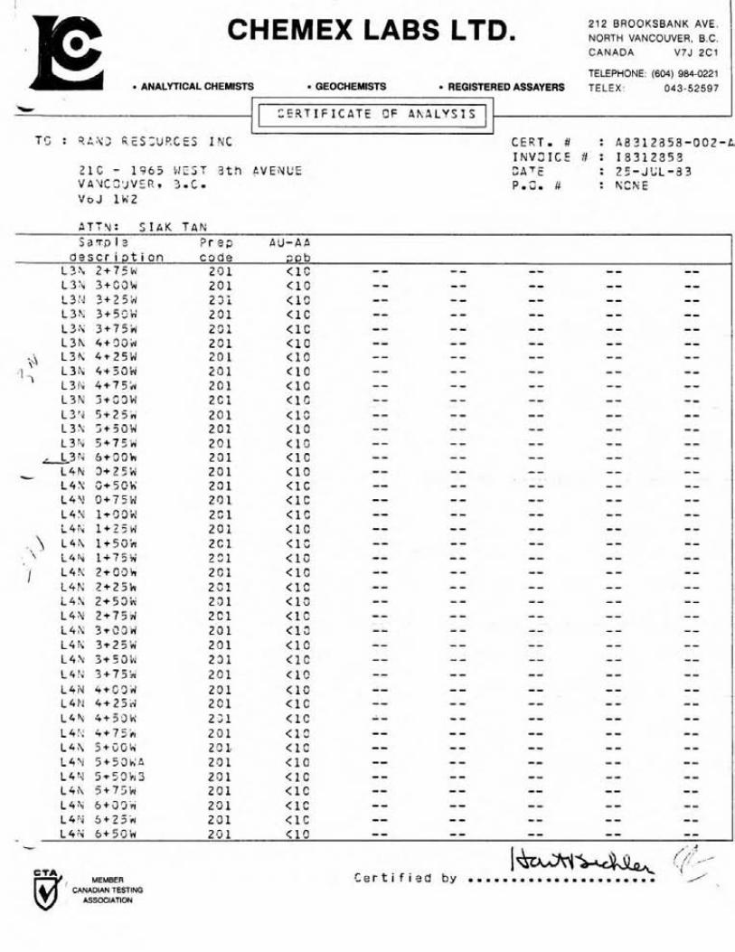
A t o t a l of 158 soi 1 samples were col lec ted during the survey. Of these 138 samples were col lec ted a t 25 m. s t a t i on from the gridded area and 20 samples were taken a t 100 m. i n te rva l s along the north bank of the main access road. Fourteen (14) rock chip samples were taken within the gr id . The s o i l samples were taken w i t h a mattock. Soil sample depths vary from 20 cm. t o 80 cm. The "B" so i l horizon was sampled. The rock chip-samples were taken f rom outcrops of quartz-fel dspar porphyry, greywacke, qua r t z i t e , granodiori t e , and mineral i zed showings (e . g. gossans) . The basal t u n i t W ~ S not sampled.
The samples were analysed f o r gold content by Chemex Labs Ltd. of North Vancouver. In ex t rac t ion , the -80 mesh sieved f rac t ions of the samples were digested i n aquaregia. The gold contentsin the samples were then analysed by the atomic absorption (A-A) method and the r e su l t s given i n par ts per b i l l i on ( p p b ) .
Discussion of Results
The background gold content i n the s o i l samples collected i s l e s s than 10 ppb. Au. Values i n excess of 40 ppb. A u . a r e considered anomalous in t h i s survey. Three spot value anomalies were disclosed.
The s t rongest , a t 140 ppb. Au. peak value, i s centred a t Line 3N, 1+25W. I t i s approximately 50 m. wide by 100 m. long. Related t o this i s a weaker anomaly, a t 40 ppb A u . , s i t e d 50 m. t o the west. Both anomalies a r e j u s t down-slope from an east-west f a u l t zone along a hydro thermally

a l t e r e d g ranod io r i t e outcrop. The t h i r d anomaly, a t 40 ppb. Au. peak value, i s i n L ine 6N, 3+50W. I t i s approximately 25 m. by 60 m. I t i s near a greywacke outcrop and l i e s a long the p ro jec ted s t r i k e o f a no r theas te r l y f a u l t .
Two rock ch ip samples taken from a1 te red granod ior i t e a t 100 m. south o f the f i r s t two s o i l anomalies showed 20 ppb. Au. and 30 ppb. Au. respect ive ly . The go ld content i s considered anomalous i n these two rock-chip samples, s ince t h e granod ior i t e background value f o r gold i s l e s s than 10 ppb. Au. Rock chips from q u a r t z i t e i n d i c a t e a background o f l ess than 10 ppb. Au. Two anomalous samples a t 40 ppb. Au. and 20 ppb. Au. were taken from q u a r t z i t e associated w i t h a gossan a t L ine 3N, 4+50W. One anomalous quar tz - fe ldspar porphyry rock ch ip sample a t 40 ppb. Au. was sampled a t L ine 6N, 1+50W.
CONCLUSIONS - & RECOMMENDATIONS
The surveys i n d i c a t e a good c o r r e l a t i o n amongst t h e geo log ica l , geo- chemi ca l and electromagnetic (VLF-EM) r e s u l t s . The boundary o f t he st rongest VE-F-EM anomaly t o the west appears t o o u t l i n e the contact o f t he quartz- f e ldspar porphyry u n i t w i t h the q u a r t z i t e i n a d d i t i o n t o d e f i n i n g the mapped f a u l t s contained w i t h in . The second EM anomaly 1 i kewise co r re la ted w i t h the q u a r t z i t e u n i t t o the nor theast . One s o i l gold anomaly i s w i t h i n the boundary o f the s t rongest EM anomaly. The o the r go ld s o i l anomalies are outs ide and downhi l l from weaker EM anomalies b u t are c lose t o an east-west f a u l t i n hydrothermal l y a1 te red granod ior i te . I t appears t h a t these are associated w i t h the f a u l t zone. Anomalous go ld value were obta ined from q u a r t z i te, greywacke and a1 te red granod ior i t e t h a t are n o t associated w i t h f a u l t o r shear zones.
I n d i c a t i o n o f the presence o f go ld m i n e r a l i z a t i o n w i t h i n the proper ty has been confirmed i n the geochemical so i l l r o c k survey. The quartz-fc:bspar porphyry and quartz i te lgreywacke members are geo log ica l l y favorable l o c i f o r t he occurrence o f bedded go ld deposits. Such geologic type go ld deposi ts are a c t i v e l y being explored f o r present ly .
I t i s the re fo re recommended t h a t t he balance o f the proper ty be sub jec t t o an exp lo ra t i on program.
Ju l y 21, 1984 , i_-
S.S. Tan, P. Eng.

REFERENCES
1. Cairnes , E.E. . 1940
2 . Litt le , H . W . 1957
4. Monger, J.W.H. 1967
K e t t l e River (West H a l f ) , B . C . , Geol . Surv. , Canada, Map 538A.
Nelson (West H a l f ) , B . C . , Geol . Surv. , Canada, Map 3-1956
Kettle River ( E a s t H a l f ) , B . C . Geol. Surv . , Canada, Map 6-1957
Ear ly T e r t i a r y S t r a t i f i e d Rocks, Greenwood Map-Area. Geol . Surv. , Canada, Paper 67-42
Various B. C. Dept. Mines Annual Reports.

CERTIFICATE OF QUALIFICATIONS
I , Siak S. Tan, residing i n the City of Vancouver, Province of Br i t i sh Columbia, hereby c e r t i f y t ha t :
1. I am a consulting Geological Engineer with o f f i ces a t 207 - 2170 West 44th Avenue, Vancouver, B . C . , V6M 263.
2. I was graduated i n Geology (B.Sc., 1964) from Carlton University, Ottawa, Ontario and completed one year of post graduate s tud ies a t the University of Toronto (1965). My courses included geophysics and geochemistry.
3. I am a regis tered member of the Association of Professional Engineers of the Province of Br i t i sh Columbia i n the Geological Engi neeri ng Di vi si on.
4. I have been engaged i n my profession f o r the pas t nineteen years , having been employed by various mining companies and consulting engineering firms in my capacity a s a geological engineer and geol ogi s t .
5. The attached assessment repor t on the Beta Claim, Greenwood Mining Division, i s based on my personal f i e l d work on the property during June 9 , 1983 t o June 26, 1983 inclusive.
Dated a t Vancouver, B . C . , t h i s 21st day of July, 1984.
Siak S. Tan, P. Eng.

ITEMIZED COST STATEMENTS
The following costs were incurred i n the geological , geochemical and geophysical surveys of the Beta Claims, Greenwood Mining Division.
Personnel: ( a ) M. Tan - f i e l d a s s i s t a n t ( b ) S.S. Tan, P. Eng.
1. Food & Accommodati on : June 9-26, 1983 = 18 days $47.80/man day ( r men)
2. Transportation: June 9-26, 1983 = 18 days Vehicle,expenses and mileage @$44.75/day
3. Instrument Rental (EM-16) : @$lO/day
4. Field Supplies and Sundries: @$8.50/man day
5. Analyses: Chemex Labs: 158 soi 1s and 14 rock samples Soil @$6.40, Rock @$7.50
6. Wages : M. Tan (June 9-26, 1983) : 13 working days @$50
Fees : S. Tan, P . Eng. Field Time June 9-26, 1983 = 18 days @$400/day
= $7200 Preparation of Report: 4 days @$400/day
= $1600
TOTAL
S.S. an, P. Eng.

A P P E N D I X
C e r t i f i c a t e o f Analys is

I I
CHEMEX LABS LTD. 212 BROOKSBANK AVE NORTH VANCOUVER, B C CANADA V7J 2C1
TELEPHONE (604) 984-0221 ANALYTICAL CHEMISTS GEOCHEMISTS REGISTERED ASSAYERS TELEX 043-52597
*Cr
T 2 : 9 A N C P E S C d R C E S I N C C E R T * # : A 3 3 1 2 3 5 S - 2 S l - A I N V Z I C E 1 : 1 5 3 1 2 3 5 8
2 1 0 - 1 9 6 5 M E S T 3 th bVENUE QATE : 2 5 - J e L - 3 3 ' J A h t Z 5 V C R q 3.C. P.C* # : N C N f VsJ l k ! 2
S a r a l e P r e p O'J-CA i e s c r i p t i c n c o d e S F L
3 / L 4+3*2iY 20 1 < l C -- - - -- -- -- 2 / L 4+50N 2 3 1 < l o -- - - -- -- -- 3/L 5+0i)tV 2 3 1 < l C -- - - -- -- -- ? / L 5+5GN Z C 1 < 1 C - - - - - - -- -- 3 / L 6+:30h; 2 0 1 < 1 C -- - - -- -- - - 3 / L b+SOF< 2 0 i < 1 3 -- - - -- -- -- 3 / L 7+09h Z C 1 < 1 C -- - - -- -- --
--C-
i l k l + ' S O P d l z i 2C1 < 1 C -- -- -- -- -- L l ' i i + 7 5 k 14) 2 C l < 1 C -- - - - - -- --
IF' L ~ N Z + C G ~ (,i 2 c i (10 -- - - -- -- -- L Z h 2 + 2 5 4 ( J 2 9 1 < 1 C -- - - -- - - -- L l X 2+58k i I \ ) 2 0 1 < 1 0 -- - - -- -- --
-- - - -- - - -- - L 1 \ 2 + 7 % I . ' 2 0 1 < 1 C L Z Y l +39W 2 0 1 1 C -- - - -- - - -- - L2N i+25'v\! 2 9 1 < L C - - - - - - -- -- LZpd i + 5 0 K 2 0 1 < 1 C -- - - -- -- -- L Z 4 1 + 7 5 2 2 3 1 <I3 -- - - - - -- -- L Z Y 2 + c c l j 2 3 1 (10 - - - - -- -- -- i Z X 2+25W Z O i < l 2 -- - - -- -- -- LZ"Y+53bJ 2 0 1 < I S -- - - -- -- -- i 2 h 2 t75k i 2 3 1 < 1 C -- - - -- -- -- t 2 ; 3+3C'ri 2 0 1 < I S -- - - -- -- -- i 2 N 3 + 2 5 ' ~ 231 ( 1 0 -- - - -- -- --
i t ' L Z H ~ + ~ C I A 2 0 1 1 c -- - - -- - - -- L2h 3+75i.; 2 0 1 (10 -- - - -- -- -- L Z h , 4+OCI'N' 2 0 1 < 1 C -- - - -- -- -- L Z Z 4 + 2 5 % 2 C i <1c - - - - -- -- -- LZ 'L 4*3i)k 2 3 1 < l C - - - - -- - - -- LZS 4+75'f-i 2C1 < 19 -- - - -- - - -- L Z S 5+?32X 2 3 1 < I 2 -- - - -- -- -- L Z ? \ 5+Z?'r : 20 1 :tl -- - - - - -- - - LZ'U 5 + ' ; 3 * 2 s 1 (13 - - - - -- - - -- L2: ! 5 + 7 5 k 2 5 1 < 1 S -- - - -- -- -- I-?\ ~ + G C ' N i n ~ -- - - -- -- -- - L3:\. 1+Z5k 2 7 1 ' "7 1 4 s -- - - -- -- - - L 3 . b 1 + 5 G i ~ 2 2 1 < L C -- - - -- - - -- L3": I t 7 5 8 2 2 1 -- - - -- -- --
<IC J -- L3h 2+Cbk 2C1 4 C - - -- -- -- L 3 2 r 2+25ih( 2 $2 1 I f -- - - -- -- - - 131. 2+33i.r 201 1 C -- - - -- - - -- - - , 9 -.
I- C , l , C e r t i f i e d by ..,.. .... d MEMBER B CANADIAN TESTING
ASSOCIATION
CHEMEX LABS LTD. 212 BROOKSBANK AVE. NORTH VANCOUVER, B C CANADA V7J 2C1
TELEPHONE (604) 984-0221 ANALYTICAL CHEMISTS GEOCHEMISTS REGISTERED ASSAYERS TELEX 043-52597
ATT3: S I k K T A R S a s p l a P r e p AU-AP
d e s c r i p t i on c o d e s o b L3Fv 2 + 7 5 k 201 < 1 C - - - - -- -- -- L 3 h 3+S3k 201 (10 -- -- -- -- -- L3:d 3 + 2 5 k i 23i (10 -- - - -- -- -- L34 3350'ri' 201 <1C -- - - -- - - -- L3M 3+?5h 251 <1C -- - - -- - - -- L3h 4 + 3 3 h 2Cl < l o -- a - -- - - --
' L3h 4+25W 20 1 < : C -- -- -- - - -- 34 1 , L 3 h 4++SOiY 201 < 1 C -- - - -- -- --
L 3 h 4 + 7 5 k 201 < 1 C -- - - -- -- -- L 3 Y 5+531.1 2Ci < 1 C -- - - -- -- -- L3'u 5+25rr 201 <1C -- -- -- -- -- L32 ;+33Y 201 < 10 -- - - -- -- -- L 3 h 5+75iY 201 < 1 '3 -- - - -- -- --
&3t; 6+31)k 201 <1C -- - - -- -- -- L 4 % 3+25h 201 <1C -- -- -- -- -- - L 4 N i;+50\i 231 <1C -- - - -- - - -- L 4 V rJi75iri 201 <1C -- - - -- -- -- L 4 Y ltri9in! 2Sl < l C -- - - -- -- -- i 4 i u 1+25w 201 < 1 C -- - - -- -- - -
\ L 4 h 3+50k 2 C l < 1 .S -- - - -- -- -- if+:u 1+756 - 721 < i o -- - - -- - - --
I L 4 h 2 + G 9 h 2C1 <1C -- - - -- - - -- L 4 K 2 + 2 5 k 2 3 1 < 1 C -- - - -- -- -- i4h 2+53k 201 (10 -- - - -- - - -- L 4 X 2 i 7 S d 2Cl (12 -- - - -- -- -- 14s ?+i!3w 201 < 1 2 -- - - -- - - -- 1 4 9 3 t 2 S w 201 (10 -- -- -- -- -- L 4 \ 3+59k 2 3 1 < 1 C -- - - -- - - - - L4:4 3+752 201 (10 -- -- -- -- -- L 4 N 4 t C l j d 231 < 1 C -- - - -- -- -- L 4 i . j 4 + 2 5 d 2C1 <1C -- - - -- - - -- L4'L 4+59h' 2;1 <1c -- - - - - -- -- L 4 i : 4+75,v 2 0 1 < 1 c -- - - -- - - -- L 4 X 5+GG\.c 20 1. < L C -- - - -- - - -- L42! 5+53K.;8 291 < i O -- - - -- - - -- L4.4 5+53!45 231 <LC -- - - -- -- -- L4f\ 5+?5'yu 2 0 1 <LC - - - - -- -- -- L 4 h 6+33ir 2.51 <1C -- -- -- -- -- 14% Sc23i.r 231 < 1 C -- - - -- - - -- L4 : i 6+5rJt i 201 <10 - - - - -- -- -- -
, MEMBER CANADIAN TESTING
ASSOCIATION

I CHEMEX LABS LTD. 212 BROOKSBANK AVE
NORTH VANCOUVER, B C CANADA V7J 2C1
TELEPHONE (604) 984-0221 ANALYTICAL CHEMISTS GEOCHEMISTS REGISTERED ASSAYERS TELEX 043-52597
C E R T - # : 58312853-CC3-A I N V O I C E # : 1 8 3 1 2 8 5 8 O A T % : 2 5 - J U L - 3 3 ?*C* # : N S K E
- Z I C - 1 3 6 5 A Z S T 3 t h AVEYUE ' J A Y C G U V % t 3 - C - VoJ l k 2
I C E i t T I F I C P T E OF ANALYSIS I 1 1
S z ~ a l e 2 r ep A U - A A ~4 4,3cr O .-. i p t i o n code s p b
L4'4 6 + 7 5 M 201 <1C -- - - -- -- --
L51; 4+3aw Z C 1 <1C -- - - -- -- -- L5i . i 4+25Li 231 (1.9 - - -- -- - - -- L5P! 4+5Cr4 201 (10 -- - - -- - - -- i s h 5 + 3 3 g 2.9 1 <l? -- - - -- -- --
-- -- -- - - - - - L5Y X 5 C i Z 5 k 201 < 1 C i S N G+i)i)k 2 0 1 ( 1 0 -- -- -- -- -- i b N C + 2 5 k 231 <1C -- - - -- -- -- Lo'; C+53w 2 0 1 < I S - - - - -- -- -- LS":+75h 291 <1C -- - - -- -- -- Li;'.r 1+22b! 2 2 1 < 1 C - - - - -- -- -- L 5 Y 1+25ini 271. <lZ -- - - -- - - -- LoY 1r23G& 2G1 < L O -- - - -- -- -- L 6 9 1 + 7 5 k 2 0 1 (10 -- - - -- - - -- i 4 v 2+c3;.r 201 <1C -- - - -- -- -- L 6 U 2 + 2 3 k 2C1 <1C -- - - -- - - -- L 4 L6\! z + j 9 i 2 3 1 <lo -- - - -- -- -- LSS 2 + 7 5 k A 2.3 f < 1 C -- - - -- - - -- ~kt! 2 i 7 5 4 3 231 (13 - - - - -- -- -- i s h 3+L?(3iJ 201 (12 -- - - -- -- -- LO'\ 3 + 2 5 H 2C1 -- - - -- - - -- L 6 Y 3 + 5 3 h 231 < l C J 4G -- - - -- -- -- Lbiv 7,+75'E;' 291 1 C -- - - -- -- -- L S Y j 4 * 1 5 i j H 201 < I 3 -- - - -- -- -- 1-6"- 4+25W 2 3 1 < L 9 -- - - -- -- -- -
-C
1 MEMBER CANADIAN TESTING
ASSOCIATION
C e r t i f i e d by

CHEMEX LABS LTD. 212 BROOKSBANK AVE NORTH VANCOUVER, B.C CANADA V7J 2C1
TELEPHONE (604) 984-0221 ANALYTICAL CHEMISTS GEOCHEMISTS REGISTERED ASSAYERS TELEX 043-52597
1' I ] T C : Z A M 2 R E S C Y R S E S INC CESTa # : A 8 3 1 2 5 5 8 - 0 0 4 - C
I N V 3 1 C E 3 : I3312550 2 1 0 - 1 3 6 5 d E S T 8 th PVE!dUE S A T E : 2 5 - J U L - 4 3 V A ) ! C O U V i R * a,c. 2.c, 3 : K G ~ E V 6 J li42
vrrr
L TT?,,: S I A K TAR:
I C E R T I F I C A T E CF ANBL'/jISI
3 e s c r i p t i o n c o d e p p b L7V 0 + 2 5 t j 2 0 1 < l C -- - - -- - - - -
CANADIAN TESTING ASSOCIATION

CHEMEX LABS LTD. 212 BROOKSBANK AVE. NORTH VANCOUVER, B.C. CANADA V7J 2C1
TELEPHONE: (604) 984-0221 ANALYTICAL CHEMISTS GEOCHEMISTS REGISTERED ASSAYERS TELEX : 043-52597
2 ~ a ; l o = r c c A d - C P a ? s c r i ~ t i c n c o d e FIsc
?iz+i3& 2 1 + 2 5 d 2 3 5 2 c -- - - -- -- - - ; L 2 + 2 f A ? + 5 C h 2 2 5 3C -- .. - -- - - -- 7 L 3 h ? . 4 + 3 3 k ; 2 C f 2 c * -- - - -- - - -- F L 3 2 ? 4 + 4 G k T 2 C 5 4 c * - - - - -- -- - - F i j ; , ; 5 + 2 C h ? ? s < 1 C -- - - -- -- -- ? L 3 + 3 2 h 2 4 + 2 5 h G 2 8 5 < i C -- - - - - - - ? L 4 V ! 2 + 7 J k 2 C 3 1 C -- - - -- - - -- F,L?;\ ? 1 + 2 F h 2 C 5 < 1 C - - - - -- - - -- =LJ!< i i l + E C k 2 c d r < l C -- - - -- - - -- 7 L S h i ? + 3 o f \ - - -
L ," 5 < 1 C - - - - -- - - - - "L6'*, C 2 + 7 C h : c 5 < 1 C -- - - - - - - - - 2LS*sq ?.l+ 5 S h L ~ r - r u 2 4C -- - - - - -- - - 717P4 ;2+62h 2 ~ r " A 2 c - -- - - -- - - -- K L 4 5 f l ? C + 5 2 2 2 i 5 2 ; -- - - -- -- --
b Sr 4rr/ 12r+sod
CANADIAN TESTING ASSOCIATION


Related Documents