Geography Basics Chapter One

Geography Basics
Dec 31, 2015
Geography Basics. Chapter One. Pre Test. Fill out the 50 states without help from your neighbor. Bellringer. Why is Geography important to you? Do you think it is relevant?. Atlas. Take a look at the various atlas’ in the front of the book. - PowerPoint PPT Presentation
Welcome message from author
This document is posted to help you gain knowledge. Please leave a comment to let me know what you think about it! Share it to your friends and learn new things together.
Transcript

Geography BasicsChapter One
Pre Test• Fill out the 50 states without
help from your neighbor.
Bellringer• Why is Geography important to
you?
• Do you think it is relevant?

Atlas• Take a look at the various atlas’
in the front of the book.
Maps: http://video.about.com/geography/How-to-Read-a-Map.htm

Geography Basics
• Defined as: The study of Earth and
its people
• This is studied in “themes”– Five in total

Place• Refers to where things are and what makes it distinctive

LocationRefers to the position of a place
This can be broken into two kinds:
1. Absolute: Exact spot on Earth you are
2. Relative: An approximate area

Human Environment Interaction
• Studies the natural surroundings and its affects
Movement• Why goods, ideas, and people move from place to place
Regions• Refers to the areas of the world that have common things like people, resources, population, food, etc

Take 5• Share one example of each
theme with a partner
• Be ready to share your answers with the class
Five Themes Game
• Be the first group to identify the word as the correct theme and win!
• I will say each word. When you know the answer raise your hand.


Time• Time is broken into blocks:• Year: 365 days• Decade: 10 yrs• Century: 100 yrs• Millenium: 1000 yrs
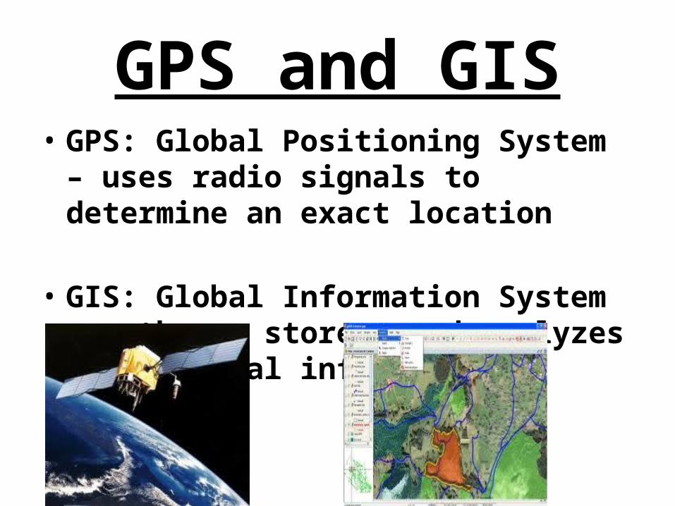
GPS and GIS• GPS: Global Positioning System –
uses radio signals to determine an exact location
• GIS: Global Information System – gathers, stores, and analyzes geographical information
Map Projections
• Page 23 in your book:
• Goodes Interrupted Knuckle Map• Robinsons Projection – Flat top
and bottom• Mercator Projection – Flat Map• Winkel Triple Projection – Short
Circle Map
Types of Maps• Physical: Shows landforms and water
features
• Political: Names and boundaries of countries
• Historical: Show events over time
• Contour: Has lines for change in elevation
• Vegetation: Shows types of plants in a region

Latitude• Imaginary Circles that run East to West
around the globe• AKA – parallels
• The Equator is the center line
• The letter N or S that follows the degree of latitude tells you if it is N or S of the equator
• Example 60 N, 35 S
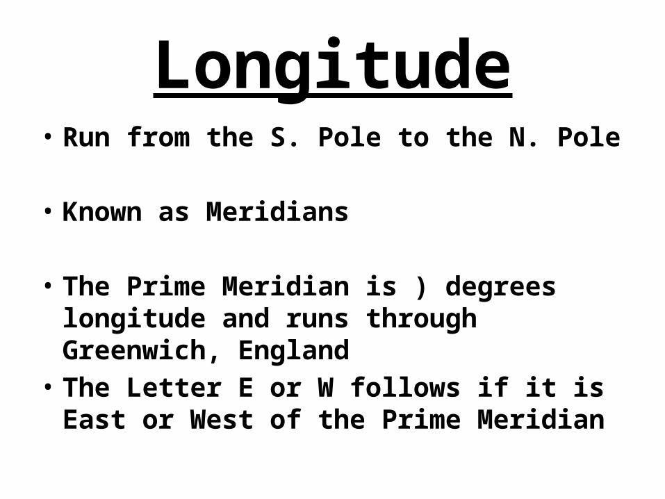
Longitude• Run from the S. Pole to the N. Pole
• Known as Meridians
• The Prime Meridian is ) degrees longitude and runs through Greenwich, England
• The Letter E or W follows if it is East or West of the Prime Meridian
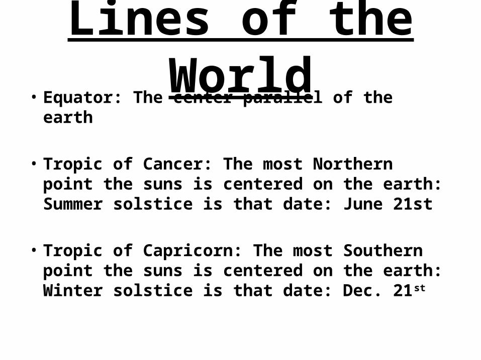
Lines of the World
• Equator: The center parallel of the earth
• Tropic of Cancer: The most Northern point the suns is centered on the earth: Summer solstice is that date: June 21st
• Tropic of Capricorn: The most Southern point the suns is centered on the earth: Winter solstice is that date: Dec. 21st
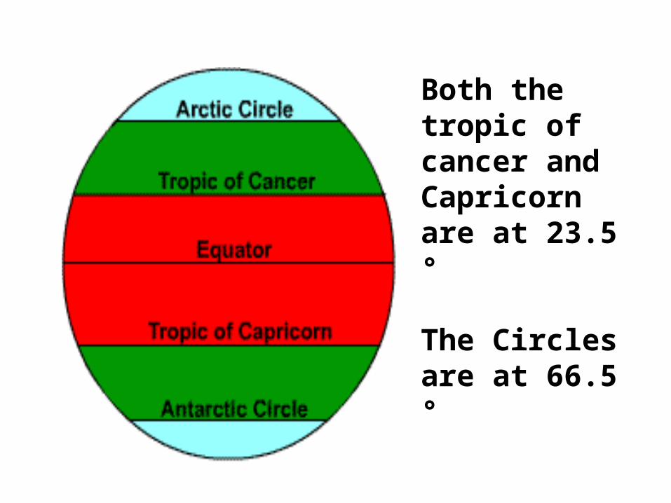
Both the tropic of cancer and Capricorn are at 23.5 °
The Circles are at 66.5 °

Hemispheres• There are four hemispheres in
the world

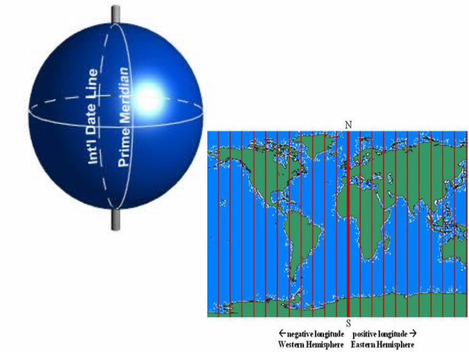
International Date Line
• Is the 180 degree mark of longitude• It is half way around the world from
the Prime Meridian
Finding Location:To mark a spot on the earth you use both the latitude and longitudeExample: Tokyo, Japan is 36 N 140 E

Map Drawing• Using all the information about
the Earth we have learned so far lets draw them out on a map and see where they are.
Where am I?• Follow the instructions on the
sheet provided for Longitude and Latitude lines
Continents• There are seven continents in
the world:– Africa– Antarctica– Asia– Australia– Europe–North America– South America
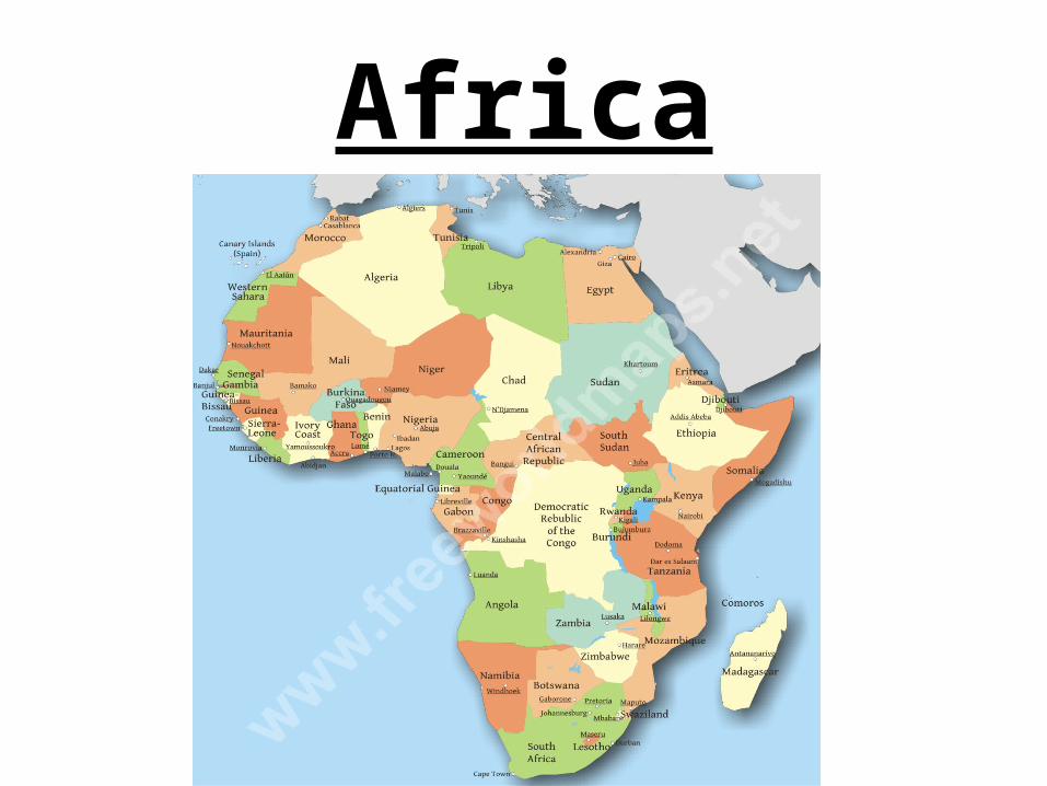
Africa
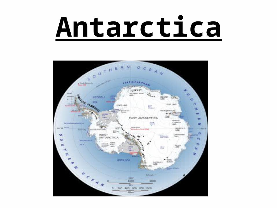
Antarctica

Australia
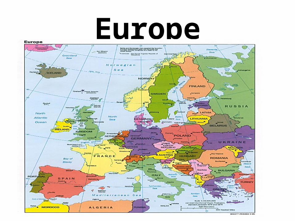
Europe

Asia

South America
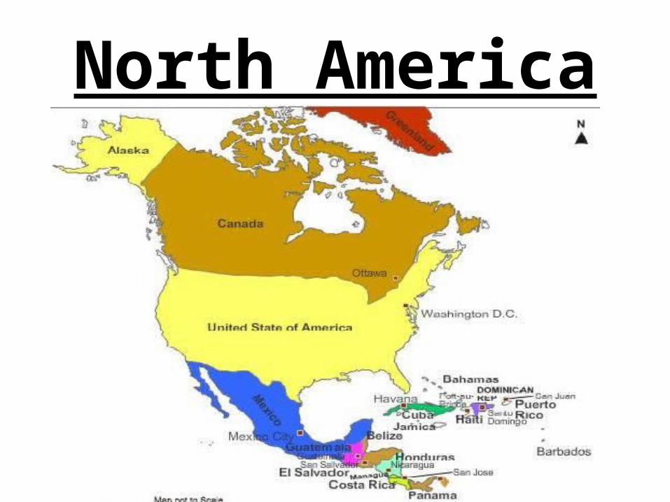
North America
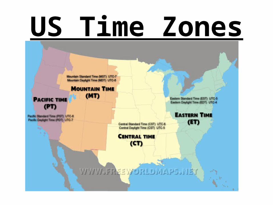
US Time Zones

Reading Time Zones
• https://www.youtube.com/watch?v=widWLhIIbzs
• See Time Zone Activity – 24 hrs a day = 24 time zones– 360 degrees/24 = 15 – Therefore
every 15 degrees is a new time zone!
– Lets practice
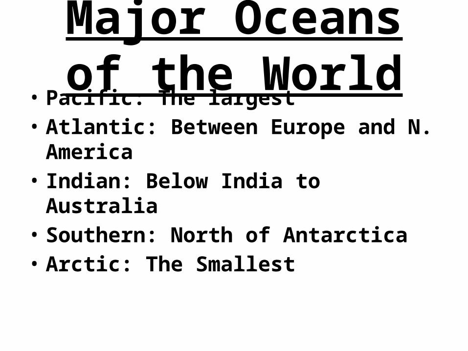
Major Oceans of the World
• Pacific: The largest• Atlantic: Between Europe and N.
America• Indian: Below India to Australia• Southern: North of Antarctica• Arctic: The Smallest

Climate and Weather
• http://www.sciencemuseum.org.uk/climatechanging/climatescienceinfozone/exploringearthsclimate/1point1.aspx
Wind• Wind is caused by air pressure
colliding with each other
• When high and low pressure hit each other wind is felt here on earth
Weather• Made from differences in air
pressure• Air pressure is made from air
molecules.–High Pressure: More weight– Low Pressure: Less weight
• On high pressure days there are less clouds because the weight keeps them from forming

Precipitation• Rain, Snow, Hail, and Sleet are all
precipitation
• They are formed in clouds• When dust particles meet water vapor in a
cloud they are to big for the cloud to hold and they fall
• Snow: Frozen particles• Sleet: Freeze on the way down to Earth• Hail: Rain droplets wont fall and keep
freezing to each other then drop

Tornados• Caused by colliding winds and an
unstable atmosphere
• In the Great Plains dry air from the Rockies and Moist from the Gulf of Mexico collide
Hurricanes• Also called Typhoons or Cyclones.
Only Atlantic storms are Hurricanes• If it is above the equator they spin
counterclockwise, opposite for Southern storms
• Moist air rises leaving low air at the surface. This rises and spins and its feeds itself.
• More moist hot air means more storms and bigger storms

Hurricanes

Test Tomorrow• Be prepared on all material since
the beginning of school– Five themes – Weather
– Fill in the Blank–Matching–Multiple Choice– Short Answer– 100 Points
Related Documents


