Geography and Environment Dr. Derya Ozgoc-Caglar Department of Geography MES101: Introduction to the Middle East January 27, 2010

Welcome message from author
This document is posted to help you gain knowledge. Please leave a comment to let me know what you think about it! Share it to your friends and learn new things together.
Transcript
Geography and Environment
Dr. Derya Ozgoc-Caglar
Department of Geography
MES101: Introduction to the Middle East
January 27, 2010

Outline
• Forms of the Land
• Water
• Climate
• Soils
• Natural vegetation

Introduction
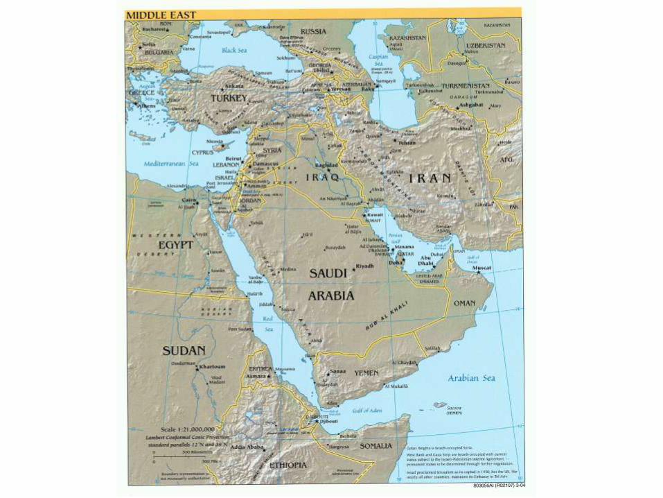
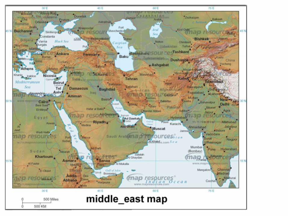
• The Middle East sits where Africa, Asia and Europe meet
• No precisely defined borders
• The physical environment influence, sometimes powerfully, many aspects of human activities
• Each environmental factor interacts with every other factor

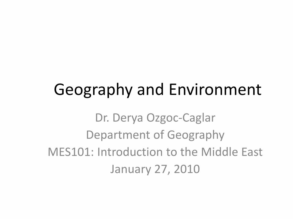
Forms of the Land
• Four land areas– Anatolian Plateau (Anadolu)
• Peninsular bridge to southeastern Europe
– Iranian Plateau• Extends into Asia proper
– Arabian Peninsula• Split from Africa along the axis of the Red Sea
– Fertile Crescent• Occupies the zone between the northern (Anatolian-Iranian) and
southern (Egyptian-Arabian) belts of the region
• Also– Mediterranean Sea– Africa
• INSERT MAP
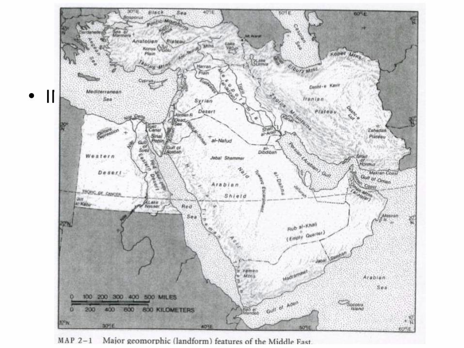
Fertile Crescent
http://staff.4j.lane.edu/~holte/2003website/ancient_civilizations.htmlhttp://www.bible-history.com/shelley/images/fertile_crescent_globe.jpg
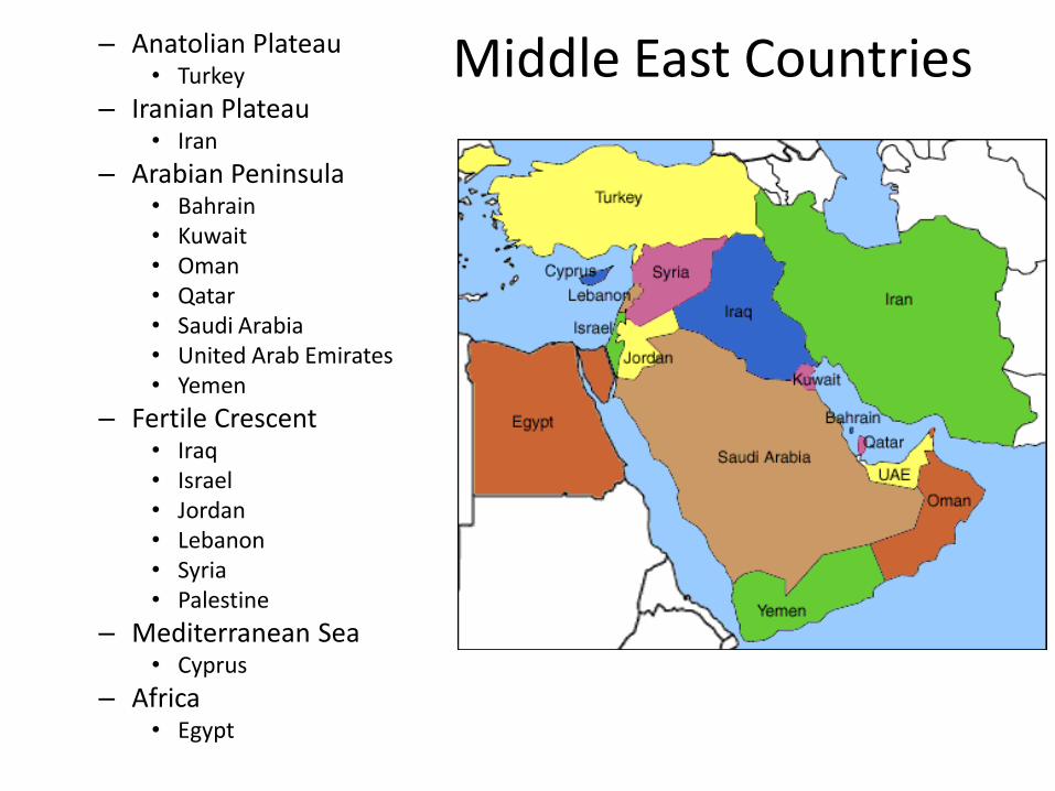
Middle East Countries– Anatolian Plateau• Turkey
– Iranian Plateau• Iran
– Arabian Peninsula• Bahrain• Kuwait• Oman• Qatar• Saudi Arabia• United Arab Emirates• Yemen
– Fertile Crescent• Iraq• Israel• Jordan• Lebanon• Syria• Palestine
– Mediterranean Sea• Cyprus
– Africa• Egypt
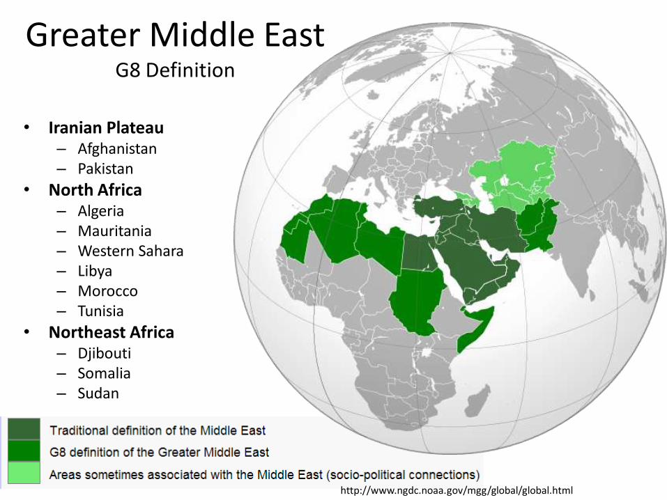
Greater Middle EastG8 Definition
• Iranian Plateau– Afghanistan– Pakistan
• North Africa– Algeria– Mauritania– Western Sahara– Libya– Morocco– Tunisia
• Northeast Africa– Djibouti– Somalia– Sudan
http://www.ngdc.noaa.gov/mgg/global/global.html

Greater Middle EastSocio-political Connection
• Caucasus– Armenia– Azerbaijan– Georgia
• Central Asia– Turkmenistan– Kazakhstan– Uzbekistan– Kyrgyzstan– Tajikistan
http://www.ngdc.noaa.gov/mgg/global/global.html
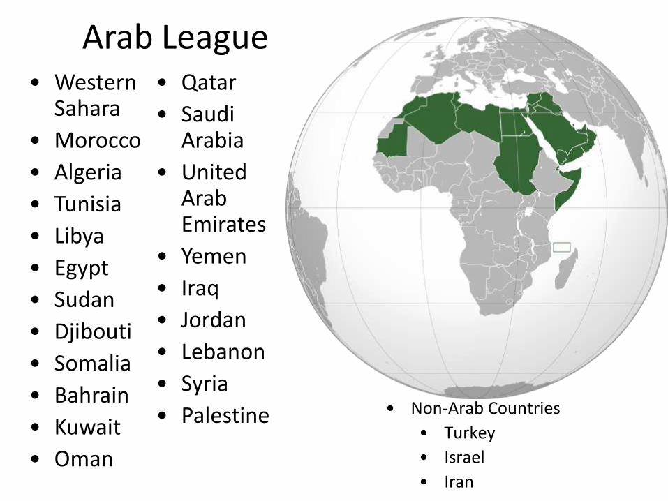
Arab League• Western
Sahara
• Morocco
• Algeria
• Tunisia
• Libya
• Egypt
• Sudan
• Djibouti
• Somalia
• Bahrain
• Kuwait
• Oman
• Qatar
• Saudi Arabia
• United Arab Emirates
• Yemen
• Iraq
• Jordan
• Lebanon
• Syria
• Palestine • Non-Arab Countries
• Turkey
• Israel
• Iran
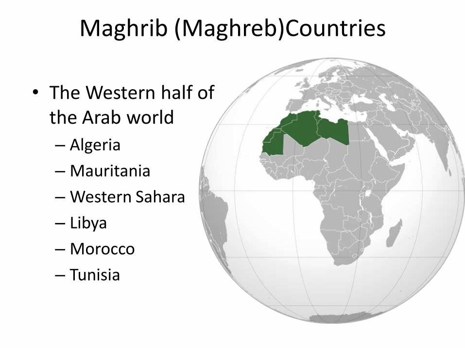
Maghrib (Maghreb)Countries
• The Western half of the Arab world
– Algeria
– Mauritania
– Western Sahara
– Libya
– Morocco
– Tunisia
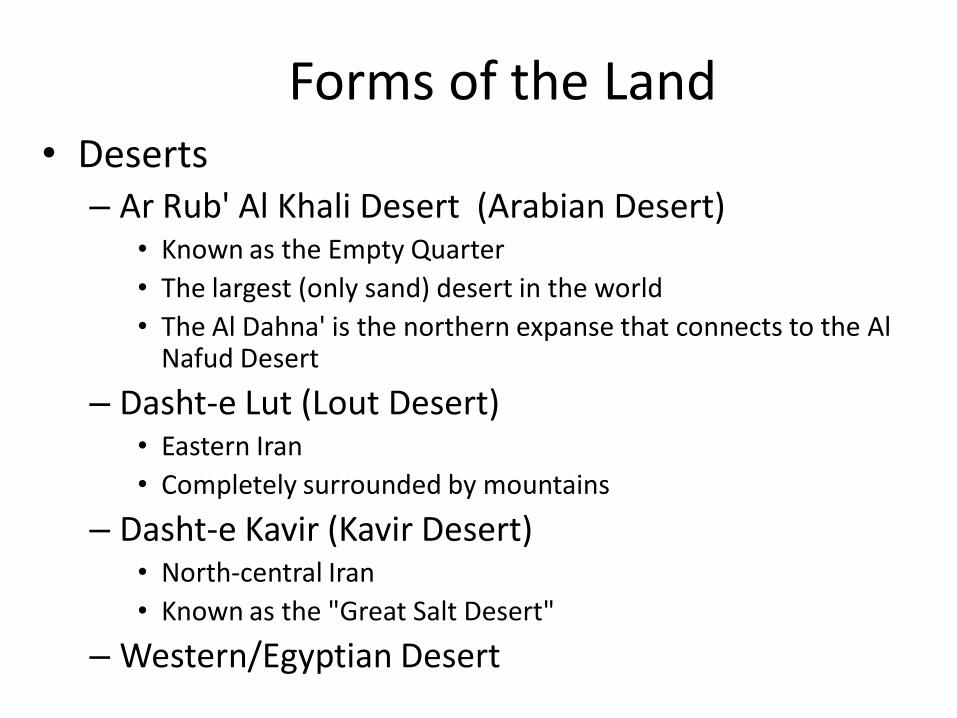
Forms of the Land• Deserts
– Ar Rub' Al Khali Desert (Arabian Desert)• Known as the Empty Quarter
• The largest (only sand) desert in the world
• The Al Dahna' is the northern expanse that connects to the Al Nafud Desert
– Dasht-e Lut (Lout Desert) • Eastern Iran
• Completely surrounded by mountains
– Dasht-e Kavir (Kavir Desert)• North-central Iran
• Known as the "Great Salt Desert"
– Western/Egyptian Desert

• INSERT MAP
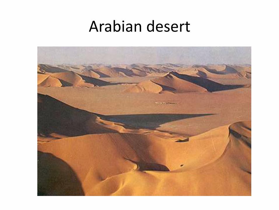
Arabian desert

Al Dahna Desert
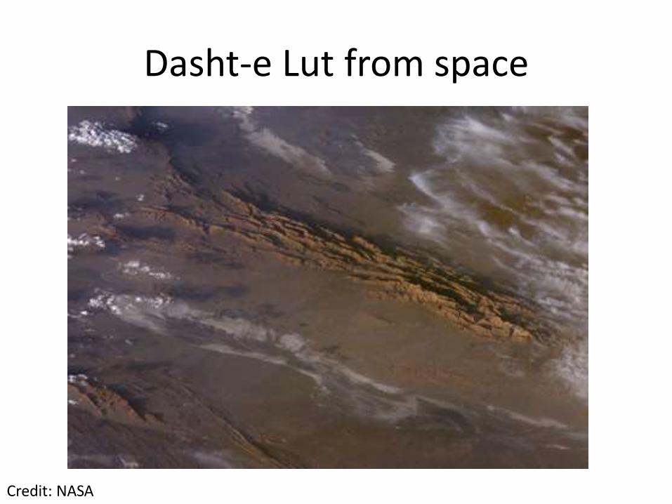
Dasht-e Lut from space
Credit: NASA
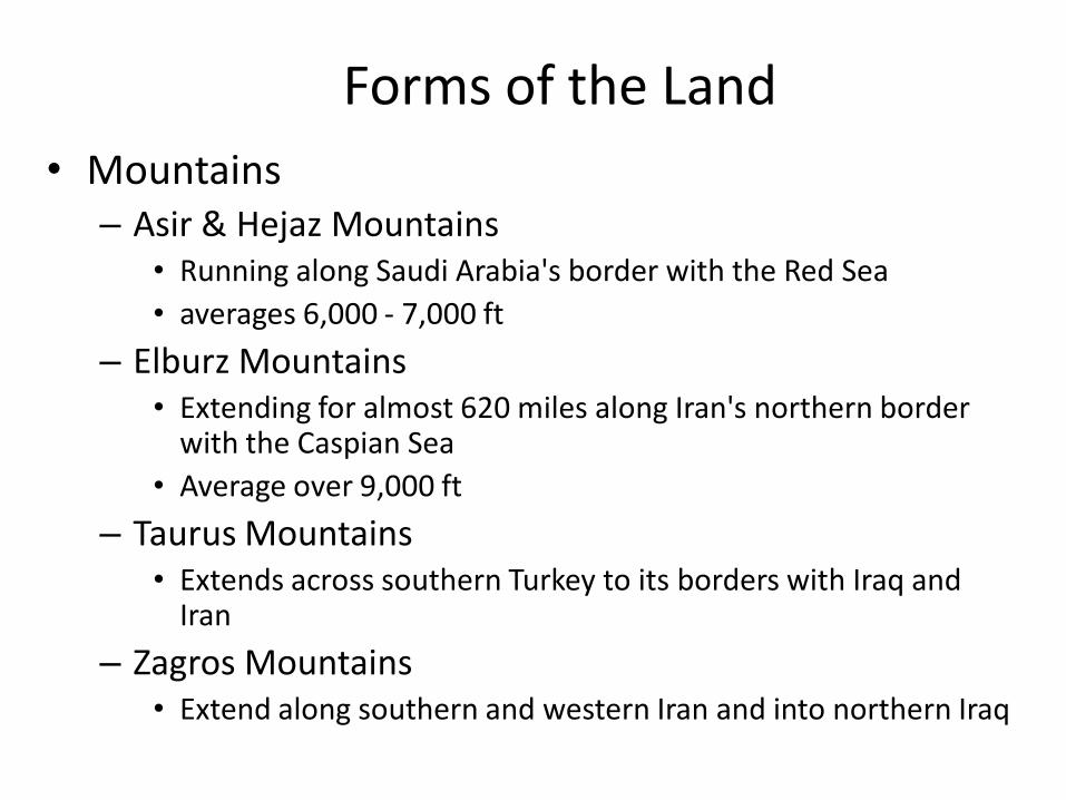
Forms of the Land
• Mountains– Asir & Hejaz Mountains
• Running along Saudi Arabia's border with the Red Sea
• averages 6,000 - 7,000 ft
– Elburz Mountains • Extending for almost 620 miles along Iran's northern border
with the Caspian Sea
• Average over 9,000 ft
– Taurus Mountains• Extends across southern Turkey to its borders with Iraq and
Iran
– Zagros Mountains • Extend along southern and western Iran and into northern Iraq

Taurus Mountains, Turkey
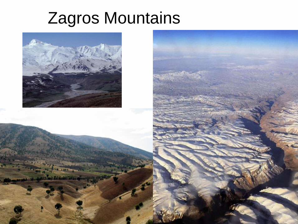
Zagros Mountains
Hamid Sedghinejad
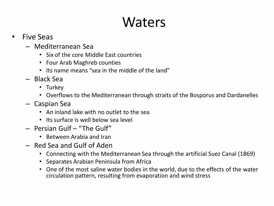
Waters• Five Seas
– Mediterranean Sea• Six of the core Middle East countries• Four Arab Maghreb counties• Its name means “sea in the middle of the land”
– Black Sea• Turkey• Overflows to the Mediterranean through straits of the Bosporus and Dardanelles
– Caspian Sea• An inland lake with no outlet to the sea• Its surface is well below sea level
– Persian Gulf – “The Gulf”• Between Arabia and Iran
– Red Sea and Gulf of Aden• Connecting with the Mediterranean Sea through the artificial Suez Canal (1869)• Separates Arabian Peninsula from Africa• One of the most saline water bodies in the world, due to the effects of the water
circulation pattern, resulting from evaporation and wind stress
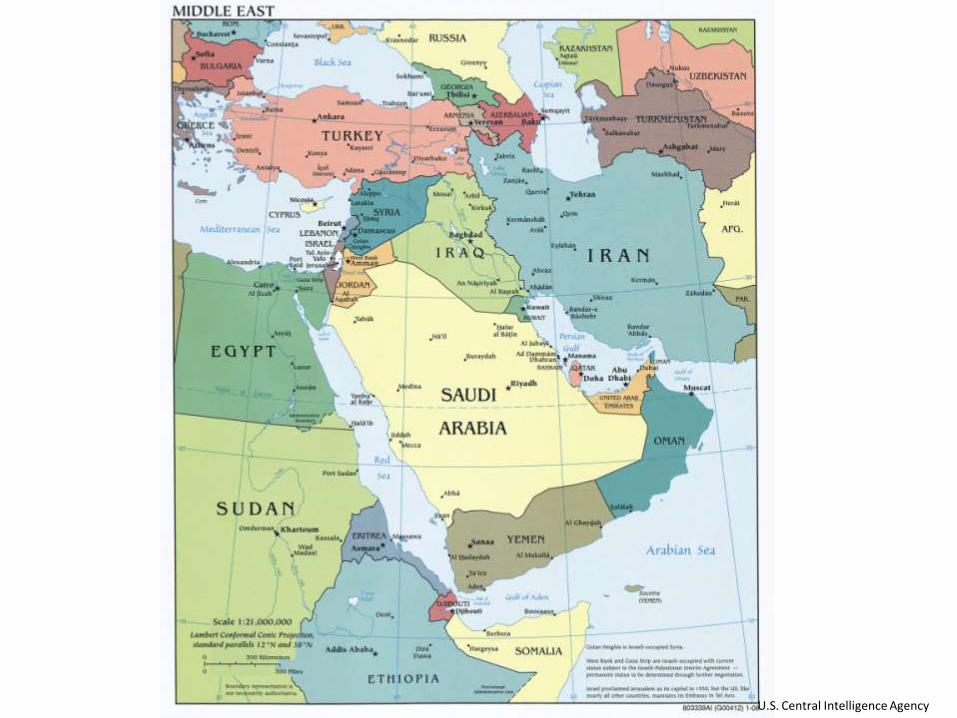
U.S. Central Intelligence Agency

Waters• Rivers
– Euphrates (Fırat)• it flows southwesterly across west-central Turkey, then
generally southeast through Syria and Iraq, ending in the waters of the Persian Gulf
• It joins with the Tigris in southern Iraq, and from that junction continues on as the Shatt al Arab
• The longest river in the Middle East
– Tigris (Dicle)• Rising in the mountains of southern Turkey, it flows southeast
through Iraq
– Nile– Other Rivers in Asia Minor and Iran
• Büyük Menderes, Gediz, Sakarya, Kızılırmak, Aras, Seyhan, Ceyhan, Karun

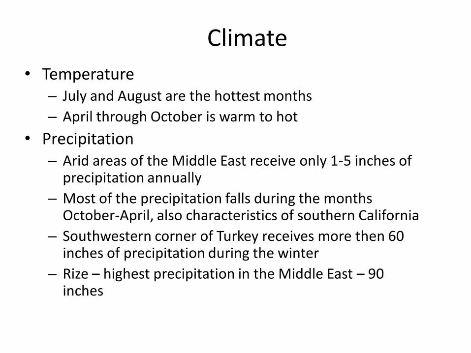
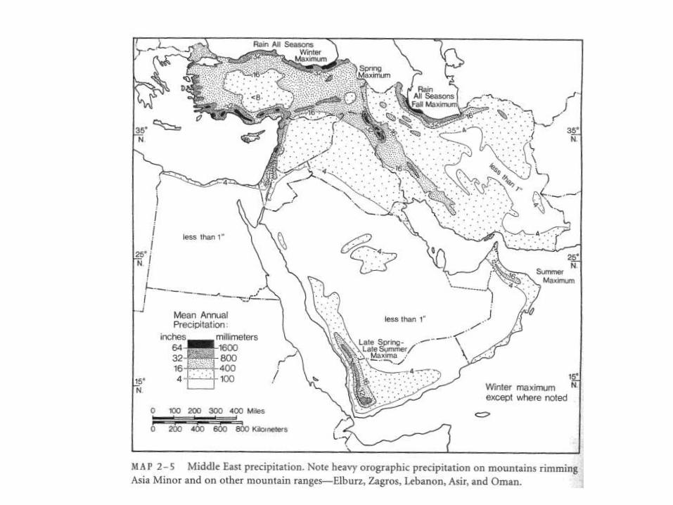
Climate
• Temperature– July and August are the hottest months
– April through October is warm to hot
• Precipitation– Arid areas of the Middle East receive only 1-5 inches of
precipitation annually
– Most of the precipitation falls during the months October-April, also characteristics of southern California
– Southwestern corner of Turkey receives more then 60 inches of precipitation during the winter
– Rize – highest precipitation in the Middle East – 90 inches


Issues in the Middle East, Atlas, 1973

Rize

Soils• Barren sands and rock and Other Non-soils
– Western Egypt, part of Iran
• True soils of the Desert
– Vegetation is thin and scattered
– Can be quite productive when irrigated
• Alluvial Soils
– Among the most intensively cultivated and productive
– Nile Valley and Delta, floodplains of the Tigris and Euphrates, valleys of west-central Iran
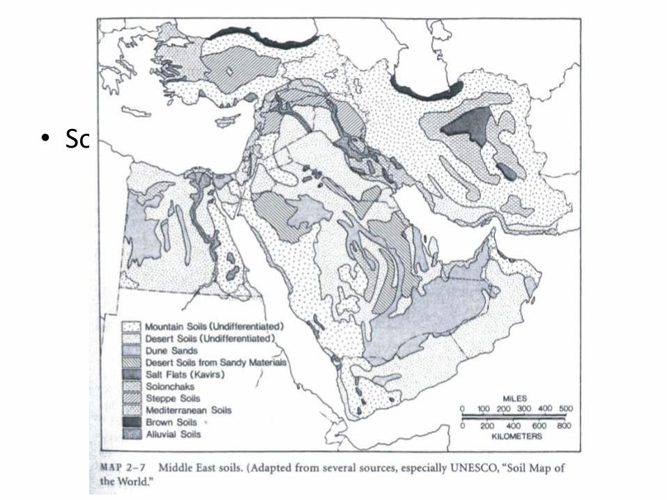
• Soil map

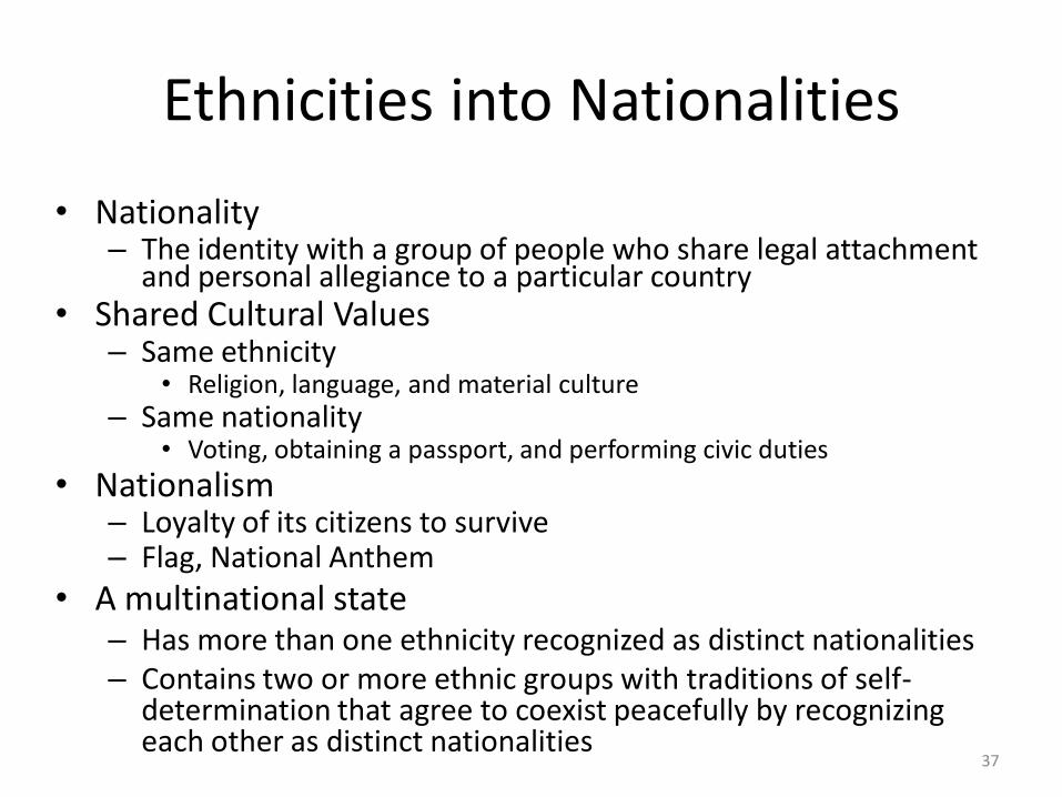
Ethnicities into Nationalities
• Nationality – The identity with a group of people who share legal attachment
and personal allegiance to a particular country• Shared Cultural Values
– Same ethnicity • Religion, language, and material culture
– Same nationality • Voting, obtaining a passport, and performing civic duties
• Nationalism– Loyalty of its citizens to survive– Flag, National Anthem
• A multinational state – Has more than one ethnicity recognized as distinct nationalities– Contains two or more ethnic groups with traditions of self-
determination that agree to coexist peacefully by recognizing each other as distinct nationalities
37


Ethnic Diversity in Southwest Asia
40

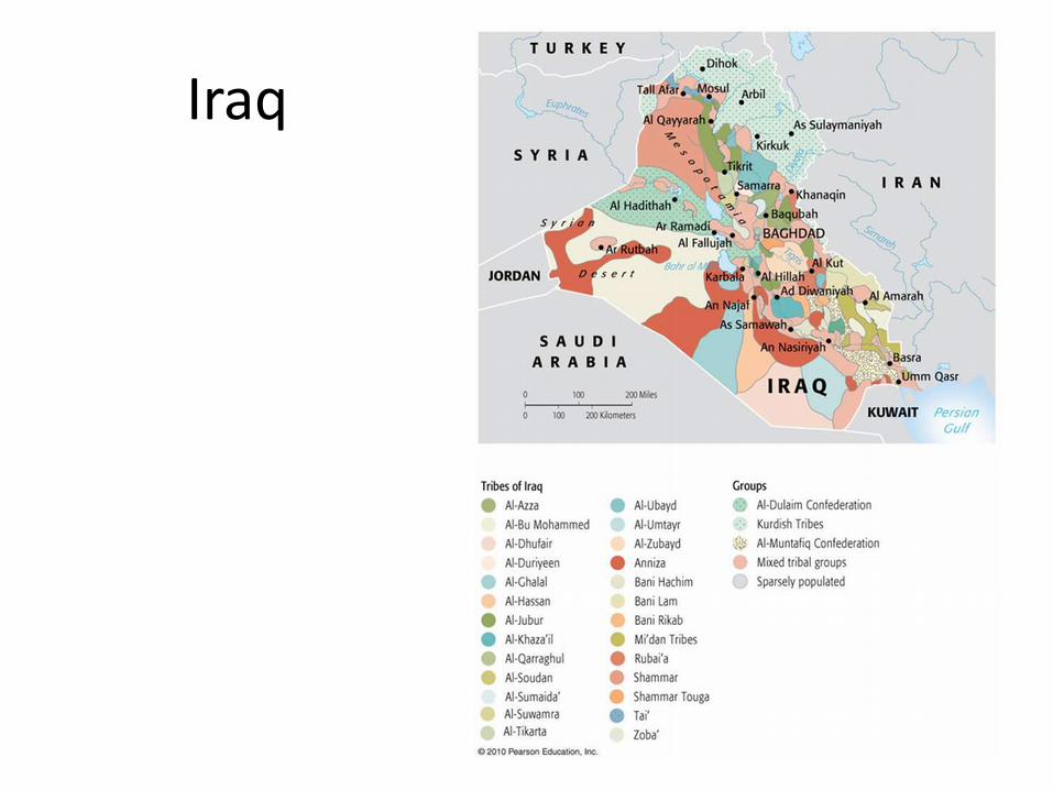
Iraq
42
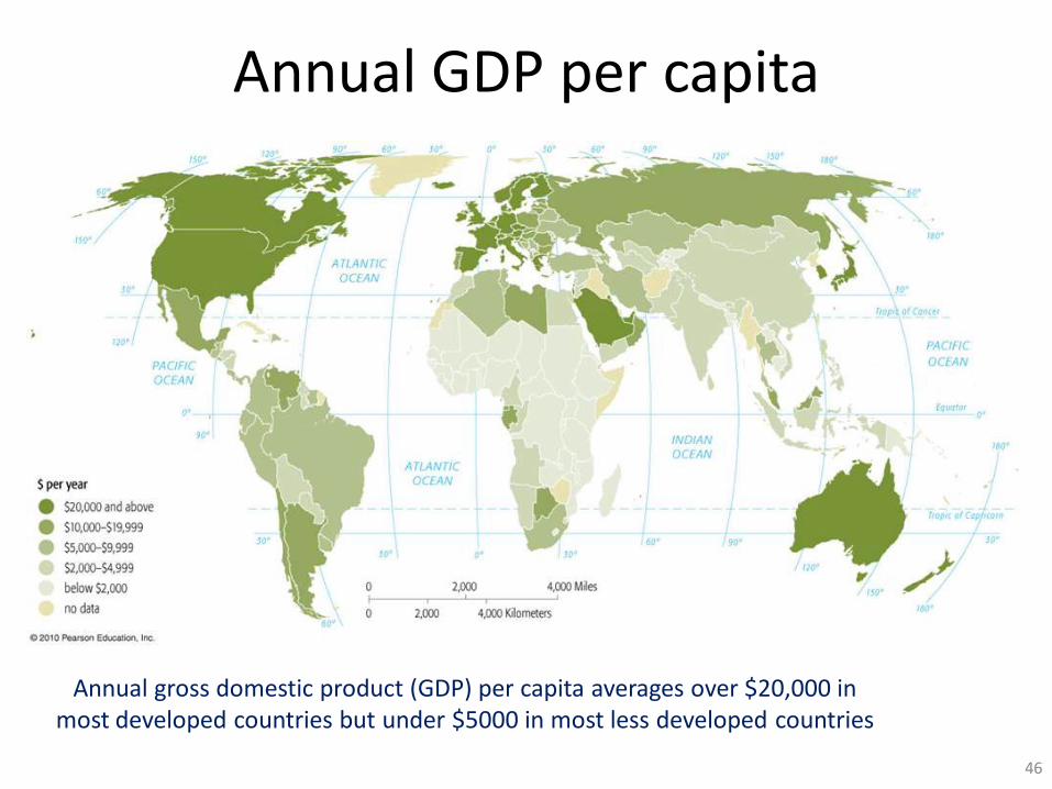
Annual GDP per capita
46
Annual gross domestic product (GDP) per capita averages over $20,000 in most developed countries but under $5000 in most less developed countries

Percent GDP from Services, 2005
47
Services contribute over two-thirds of GDP in more developed countries, compared to less than one-half in less developed countries
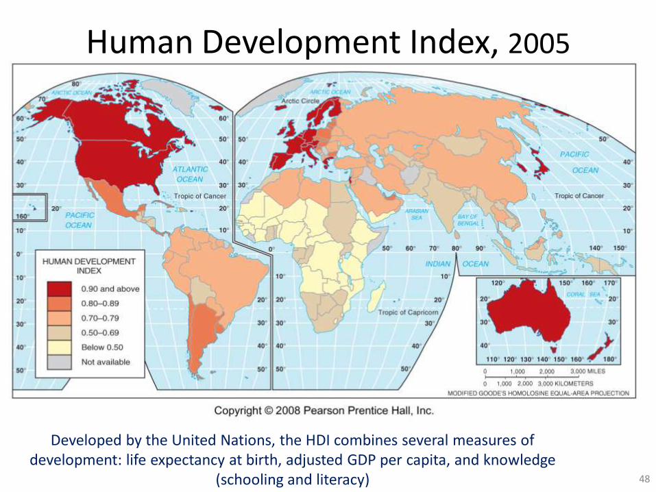
Human Development Index, 2005
48
Developed by the United Nations, the HDI combines several measures of development: life expectancy at birth, adjusted GDP per capita, and knowledge
(schooling and literacy)

Female-Male Income Differences
49
Female income as a percent of male income, 2005. Women’s income is lower than men’s in all
countries, but the gender gap is especially high in parts of the Middle East, South Asia, and Latin
America

Gender Differences in School Enrollment
50
As many or more girls than boys are enrolled in school in more developed countries, but fewer girls than boys are enrolled in many LDCs
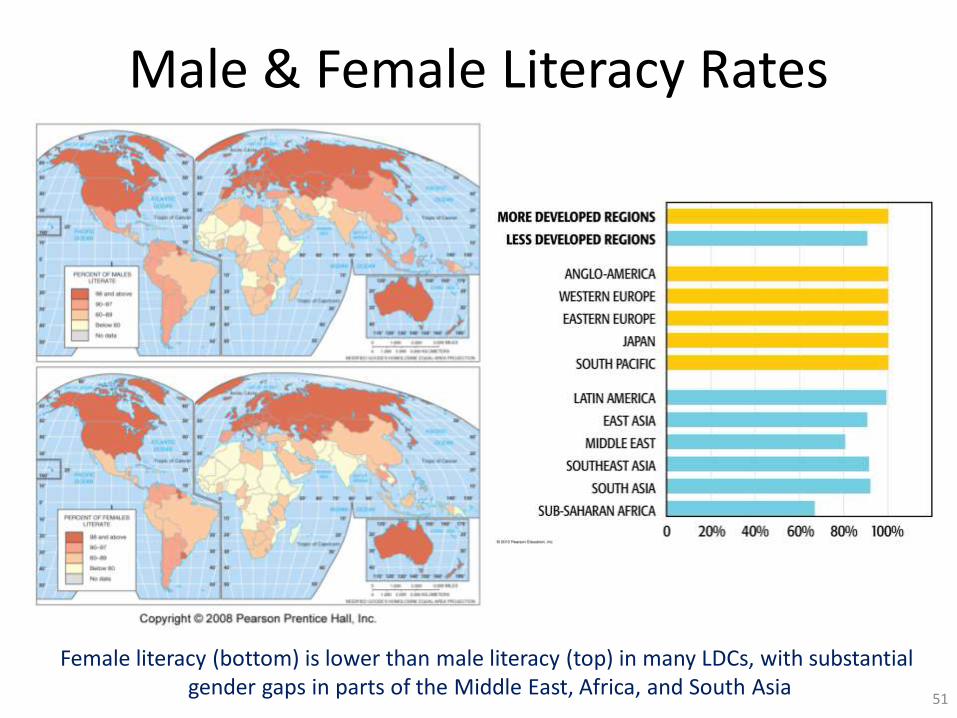
Male & Female Literacy Rates
51
Female literacy (bottom) is lower than male literacy (top) in many LDCs, with substantial gender gaps in parts of the Middle East, Africa, and South Asia

Life Expectancy & Gender, 2005
52
Differences between male & female life expectancy. Women’s life expectancy is several years longer than men’s in MDCs, but only slightly longer in many LDCs
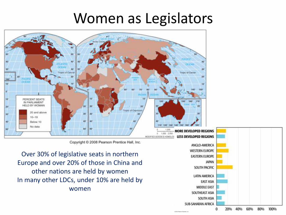
Women as Legislators
53
Over 30% of legislative seats in northern Europe and over 20% of those in China and
other nations are held by womenIn many other LDCs, under 10% are held by
women

Percent Enrolled in School
54
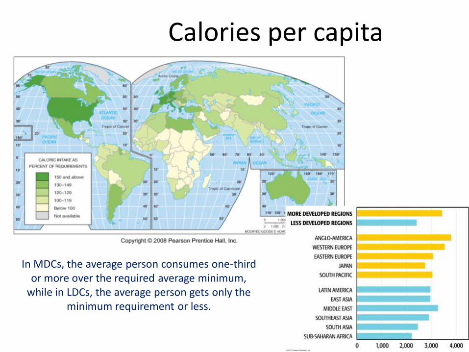
Calories per capita
55
In MDCs, the average person consumes one-third or more over the required average minimum,
while in LDCs, the average person gets only the minimum requirement or less.

Physicians per Population
56
MDCs have three or more physicians per 1000 people compared to less than one in
most LDCs.

Private Health Care Expenditures
57
Except for the US, health care is considered a public service in most MDCs. In most
LDCs and in the US, most health care costs are paid by individuals.

World Agriculture Regions
Locations of the major types of subsistence and commercial agriculture.

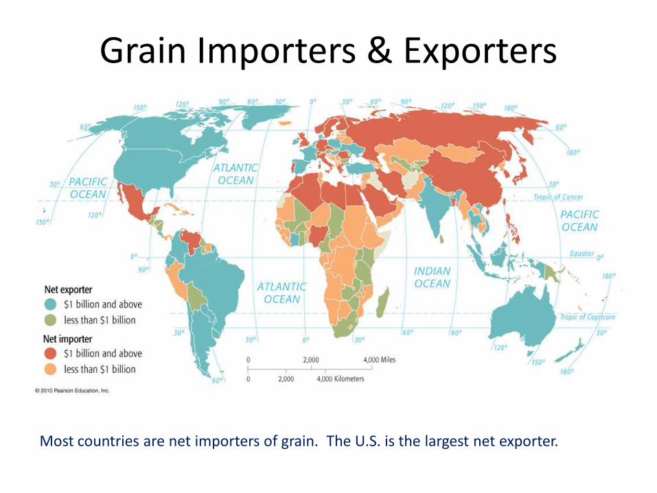
Grain Importers & Exporters
Most countries are net importers of grain. The U.S. is the largest net exporter.
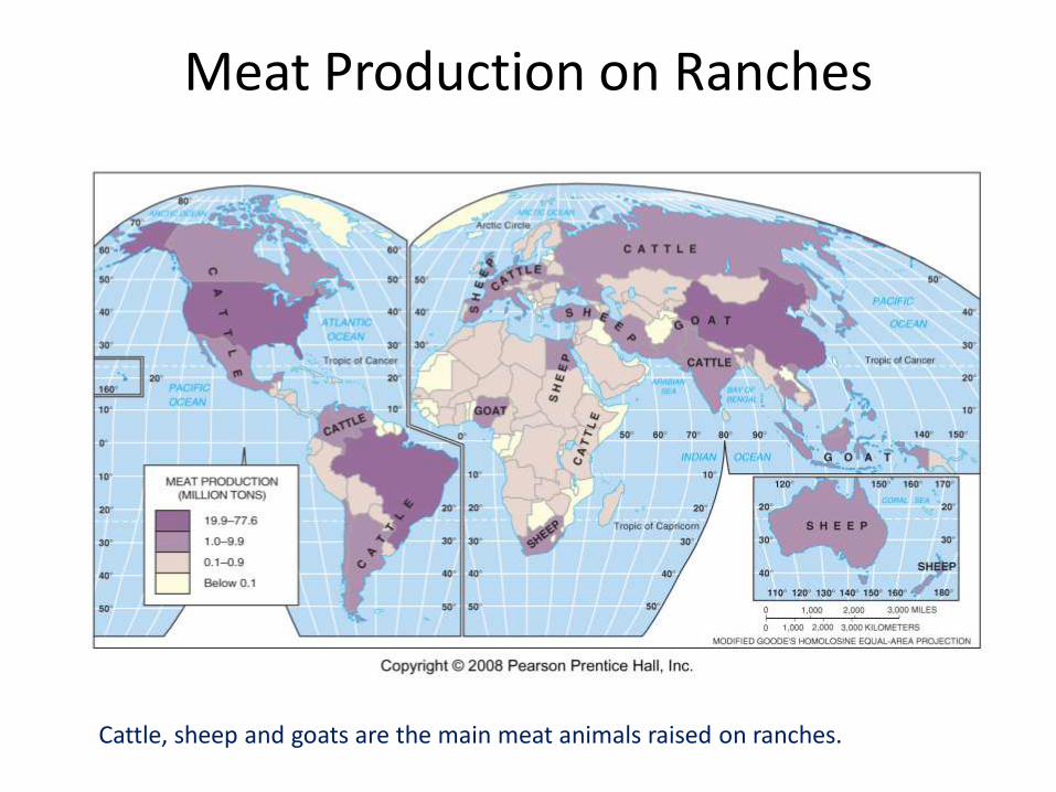
Meat Production on Ranches
Cattle, sheep and goats are the main meat animals raised on ranches.

Annual wine production
63
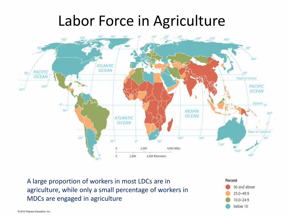
Labor Force in Agriculture
A large proportion of workers in most LDCs are in agriculture, while only a small percentage of workers in MDCs are engaged in agriculture
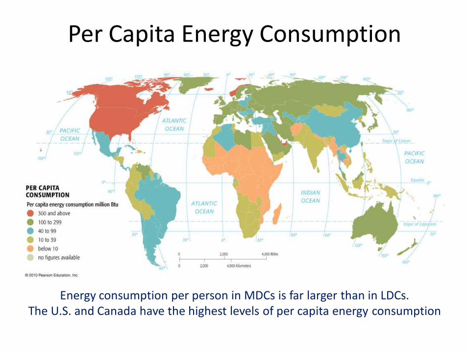
Per Capita Energy Consumption
Energy consumption per person in MDCs is far larger than in LDCs. The U.S. and Canada have the highest levels of per capita energy consumption

World Energy Consumption
The U.S., with about 5% of world population, consumes about 22% of world energy

Natural Gas Reserves
Russia has the world’s largest natural gas reserves. Iran and other Mid-Eastern countries have large reserves, but the U.S. has
relatively little.

Natural Gas Production
Russia, the U.S. and Canada are the world’s largest natural gas producer
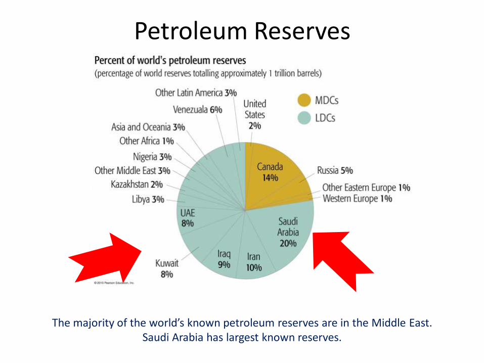
Petroleum Reserves
The majority of the world’s known petroleum reserves are in the Middle East. Saudi Arabia has largest known reserves.

Petroleum Production, 2004
Saudi Arabia, Russia, and the U.S. are the world’s largest petroleum producers

Hydroelectricity Production
Percent of electricity from hydroelectric power. Many countries in South America and Africa depend heavily on hydroelectric
power.
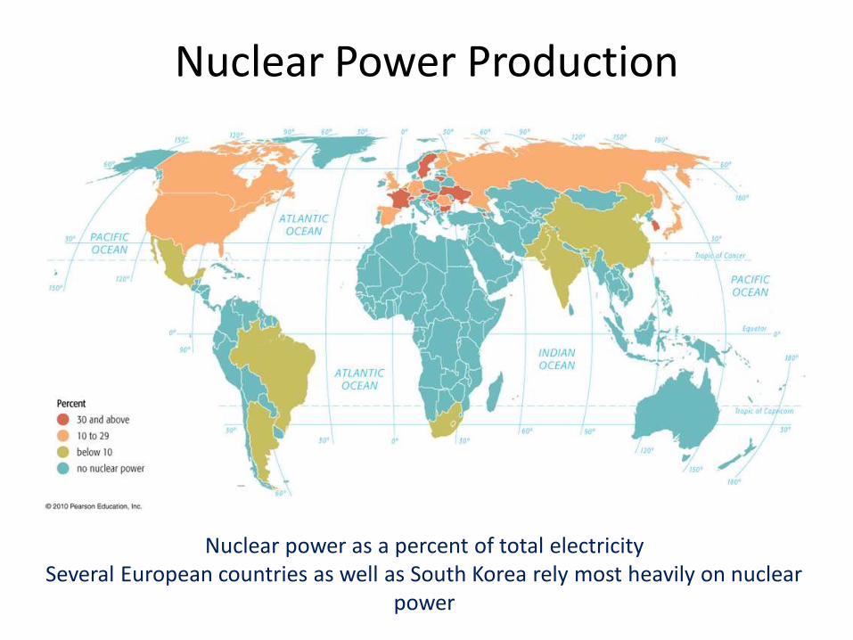
Nuclear Power Production
Nuclear power as a percent of total electricitySeveral European countries as well as South Korea rely most heavily on nuclear
power
Related Documents