Geography 465 GIS Database Programming Getting Started with GIS Database Programming

Geography 465 GIS Database Programming Getting Started with GIS Database Programming.
Dec 22, 2015
Welcome message from author
This document is posted to help you gain knowledge. Please leave a comment to let me know what you think about it! Share it to your friends and learn new things together.
Transcript

Geography 465 GIS Database Programming
Getting Started with GIS Database Programming


What is GIS Database Programming?
• Geoprocessing - application of GIS operations on a set of data inputs for generating information.
• Database (DB) programming – the part of geoprocessing focusing on DB manipulation; not quite spatial analysis but almost.
• Use scripting to automate DB programming

Why write scripts?
• Scripts supply the added benefit of decision making logic and looping functionality
• Automate a work flow, for example:– Copy all incoming data into a geodatabase– Perform a project, clip, buffer operation on
multiple data sets (iterate)
• Easily distribute code– A script is a self-contained, single file

Why use Python for Scripting?
• An open-source, object-oriented, scripting language
• Offers IDE (integrated development environment) with debugging tools
• Modular, can be broken apart
• Ability to compile scripts
• Installed with ArcGIS 9 and ESRI samples provided

Writing code in Python
• Writing Python code– Python command line – IDE (integrated development environment)
e.g., PythonWin, IDLE, Komodo– Michalis suggests using Komodo Edit
http://www.activestate.com/Products/komodo_ide/komodo_edit.mhtml
• IDE allows you to perform all jobs from one location– Write, Save, Run, and Debug code
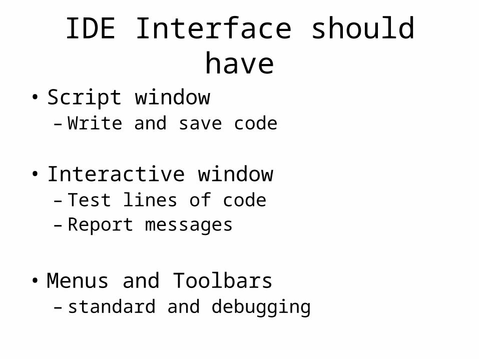
IDE Interface should have
• Script window– Write and save code
• Interactive window– Test lines of code– Report messages
• Menus and Toolbars– standard and debugging
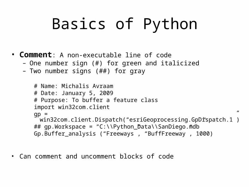
Basics of Python
• Comment: A non-executable line of code– One number sign (#) for green and italicized– Two number signs (##) for gray
# Name: Michalis Avraam# Date: January 5, 2009# Purpose: To buffer a feature classimport win32com.clientgp =
win32com.client.Dispatch(“esriGeoprocessing.GpDispatch.1”)## gp.Workspace = “C:\\Python_Data\\SanDiego.mdb”Gp.Buffer_analysis (“Freeways”, “BuffFreeway”, 1000)
• Can comment and uncomment blocks of code
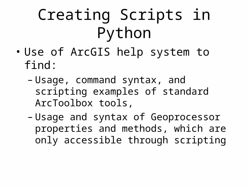
Creating Scripts in Python
• Use of ArcGIS help system to find:– Usage, command syntax, and scripting
examples of standard ArcToolbox tools,– Usage and syntax of Geoprocessor properties
and methods, which are only accessible through scripting
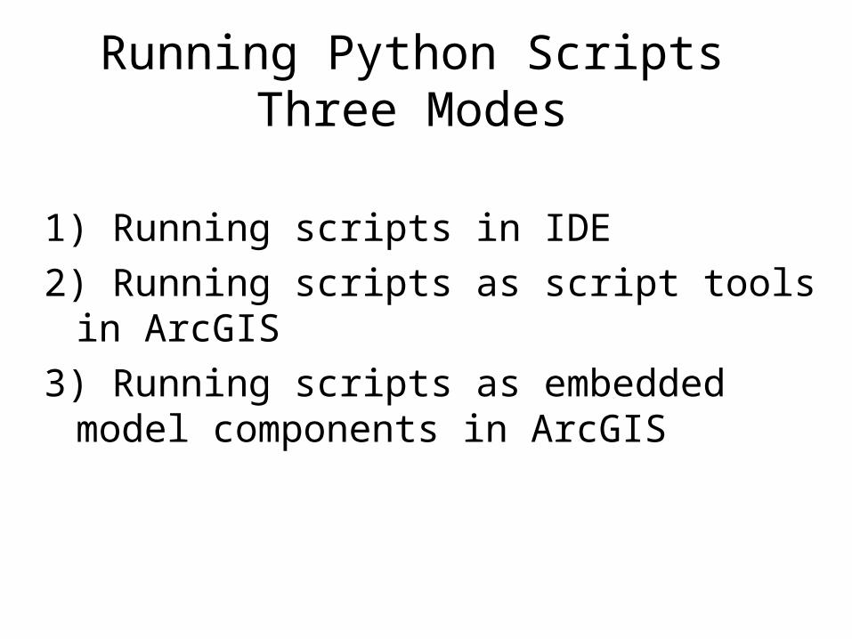
Running Python Scripts Three Modes
1) Running scripts in IDE
2) Running scripts as script tools in ArcGIS
3) Running scripts as embedded model components in ArcGIS
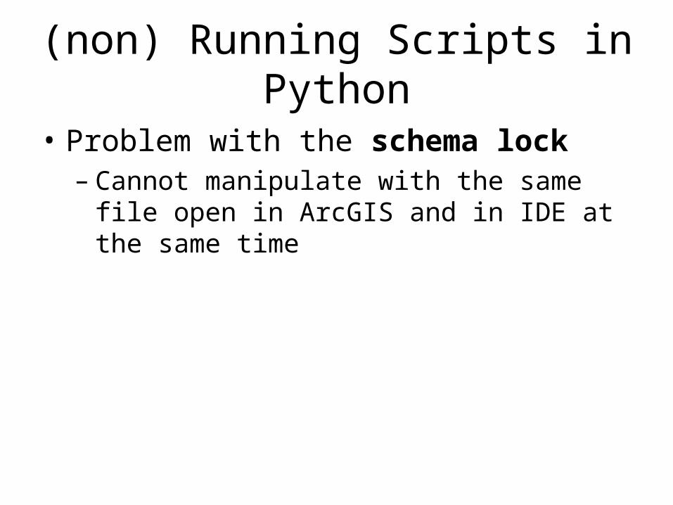
(non) Running Scripts in Python
• Problem with the schema lock– Cannot manipulate with the same file open in
ArcGIS and in IDE at the same time

Running scripts in PythonWin
Example of a simple script to buffer a feature class
# Name: Tim Nyerges
# Date: January 5, 2009
# Purpose: To buffer a feature class
import win32com.client
gp = win32com.client.Dispatch("esriGeoprocessing.GpDispatch.1“
gp.Workspace = "C:\\Python_Data\\SanDiego.mdb”
gp.Buffer_analysis ("Freeways", "BufferedFreeways", 1000)
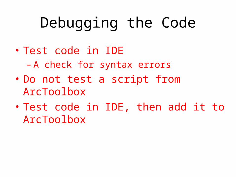
Debugging the Code
• Test code in IDE– A check for syntax errors
• Do not test a script from ArcToolbox• Test code in IDE, then add it to ArcToolbox
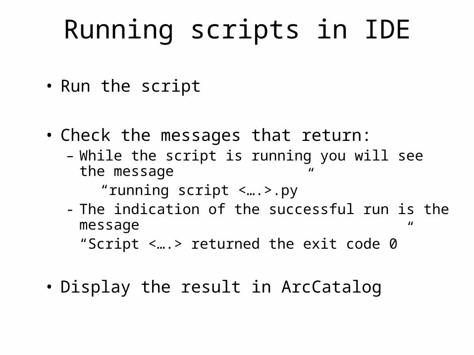
Running scripts in IDE
• Run the script
• Check the messages that return:– While the script is running you will see the message “running script <….>.py”- The indication of the successful run is the message
“Script <….> returned the exit code 0”
• Display the result in ArcCatalog
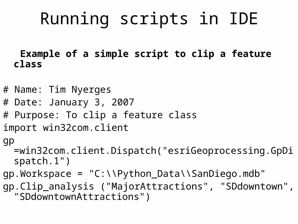
Running scripts in IDE
Example of a simple script to clip a feature class
# Name: Tim Nyerges# Date: January 3, 2007# Purpose: To clip a feature classimport win32com.clientgp =win32com.client.Dispatch("esriGeoprocessing.GpDispatch.1")gp.Workspace = "C:\\Python_Data\\SanDiego.mdb"gp.Clip_analysis ("MajorAttractions", "SDdowntown",
"SDdowntownAttractions")

Running scripts in IDE
Example of a simple script to buffer and clip a feature class
# Name Tim Nyerges# Date: January 5, 2009# Purpose: To buffer SD freeways first and then to clip the downtown section# of freewaysimport win32com.clientgp = win32com.client.Dispatch("esriGeoprocessing.GpDispatch.1")gp.Workspace = "C:\\Python_Data\\SanDiego.mdb"if gp.Exists(gp.Workspace + "\\bufferedFreeways"): gp.Delete_management(gp.Workspace + "\\bufferedFreeways")gp.Buffer_analysis ("Freeways", "bufferedFreeways", "500")gp.Clip_analysis ("bufferedFreeways", "SDdowntown", "downtownFreeways")

Michalis will get you started in labb session… “hands-on”
Python and Komodo edit
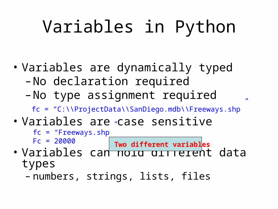
Variables in Python
• Variables are dynamically typed– No declaration required– No type assignment required fc = “C:\\ProjectData\\SanDiego.mdb\\Freeways.shp”
• Variables are case sensitivefc = “Freeways.shp” Fc = 20000
• Variables can hold different data types– numbers, strings, lists, files
Two different variables

Numbers
• Variables can hold numbers and expressions
num1 = 1.2 num2 = 3 + 5

Strings
• Variables can hold strings folder = “c:/Student”
• Strings are surrounded in double (“) or single (‘) quotes
• Pathnames use two back (\\) or one forward (/) slashOne backslash (\) is a reserved escape
character and a line continuation character
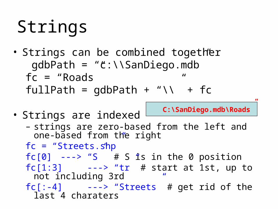
Strings• Strings can be combined together
gdbPath = “c:\\SanDiego.mdb”fc = “Roads”fullPath = gdbPath + “\\” + fc
• Strings are indexed– strings are zero-based from the left and one-based from
the rightfc = “Streets.shp”fc[0] ---> “S” # S is in the 0 positionfc[1:3] ---> “tr” # start at 1st, up to not including 3rdfc[:-4] ---> “Streets” # get rid of the last 4 charaters
C:\SanDiego.mdb\Roads”
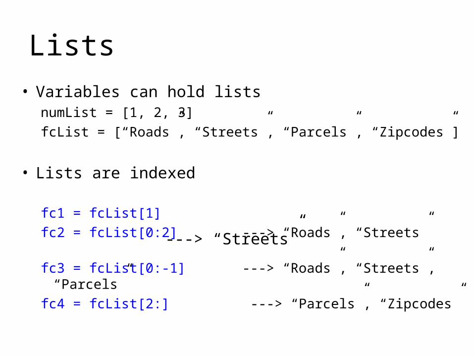
Lists
• Variables can hold listsnumList = [1, 2, 3]
fcList = [“Roads”, “Streets”, “Parcels”, “Zipcodes”]
• Lists are indexed
fc1 = fcList[1]
fc2 = fcList[0:2] ---> “Roads”, “Streets”
fc3 = fcList[0:-1] ---> “Roads”, “Streets”, “Parcels”
fc4 = fcList[2:] ---> “Parcels”, “Zipcodes”
---> “Streets”
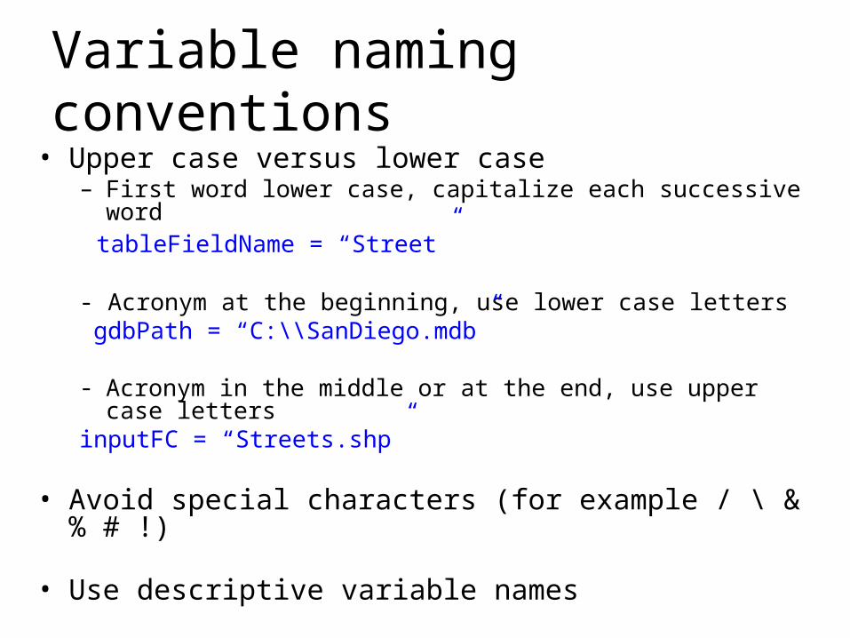
Variable naming conventions
• Upper case versus lower case– First word lower case, capitalize each successive word tableFieldName = “Street”
- Acronym at the beginning, use lower case letters gdbPath = “C:\\SanDiego.mdb”
- Acronym in the middle or at the end, use upper case lettersinputFC = “Streets.shp”
• Avoid special characters (for example / \ & % # !)
• Use descriptive variable names
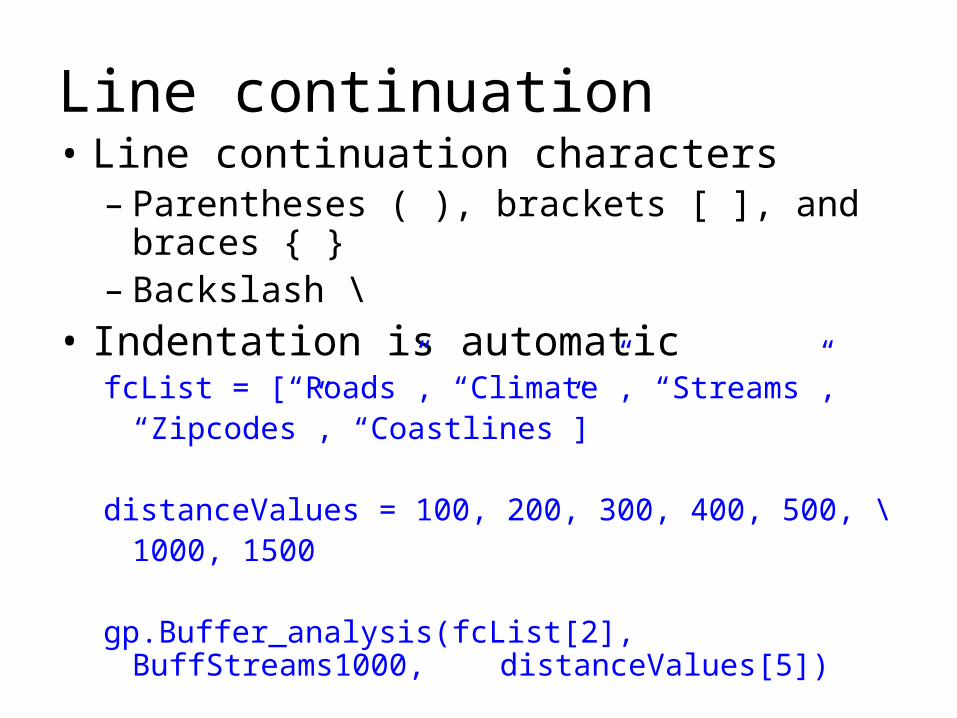
Line continuation• Line continuation characters
– Parentheses ( ), brackets [ ], and braces { }– Backslash \
• Indentation is automaticfcList = [“Roads”, “Climate”, “Streams”,
“Zipcodes”, “Coastlines”]
distanceValues = 100, 200, 300, 400, 500, \1000, 1500
gp.Buffer_analysis(fcList[2], BuffStreams1000, distanceValues[5])
Related Documents