Geographic Access to Primary Care Physicians in New Mexico Prepared for: Geog. 491(Problems) and Geog. 499 (Python programming) Fall Semester, 2014 Larry Spear M.A., GISP Sr. Research Scientist (Ret.) Division of Government Research University of New Mexico http://www.unm.edu/~lspear Presented 12/02/14 (revised version 3.3 – 01/07/15)

Geographic Access to Primary Care Physicians in New Mexico Prepared for: Geog. 491(Problems) and Geog. 499 (Python programming) Fall Semester, 2014 Larry.
Dec 16, 2015
Welcome message from author
This document is posted to help you gain knowledge. Please leave a comment to let me know what you think about it! Share it to your friends and learn new things together.
Transcript
Geographic Access to Primary Care Physicians in New Mexico
Prepared for: Geog. 491(Problems) and Geog. 499 (Python programming)Fall Semester, 2014
Larry Spear M.A., GISPSr. Research Scientist (Ret.)
Division of Government ResearchUniversity of New Mexico
http://www.unm.edu/~lspear
Presented 12/02/14 (revised version 3.3 – 01/07/15)

Background
• Project originally prepared by the Division of Government Research at the University of New Mexico (DGR, UNM) for the New Mexico Health Policy Commission (NM HPC).
• Most of GIS work done under contract as part of a larger body of data management work and special reports including Hospital Inpatient Discharge Data (HIDD) from 1998 to 2002.
• Never a formal academic publication.• Used both SAS (Statistical Analysis System) and ArcGIS in
combination.
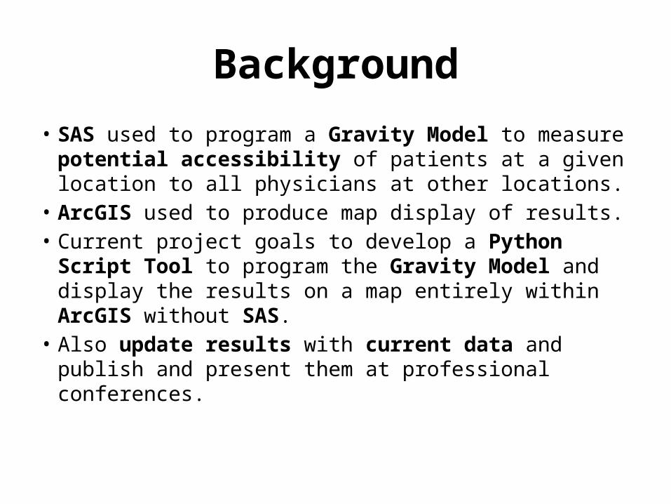
Background
• SAS used to program a Gravity Model to measure potential accessibility of patients at a given location to all physicians at other locations.
• ArcGIS used to produce map display of results.• Current project goals to develop a Python Script
Tool to program the Gravity Model and display the results on a map entirely within ArcGIS without SAS.
• Also update results with current data and publish and present them at professional conferences.

2002 ESRI SWUG (Taos, NM) – Winning Poster

DGR used well developed commercial software packages• SAS for data management and data analysis• ArcGIS for GIS spatial data display and analysis• University educational versions (affordable at UNM)

The Problem - Measurement
• How to measure geographic access to healthcare providers and facilities?
• Solution – Develop a reliable method to measure (and compare) the distribution of facilities and providers and the population. Note: Does not solve physician shortages, provides a better way to monitor change.
• Reliable measurement requires a geographic framework in which to collect and organize observations.
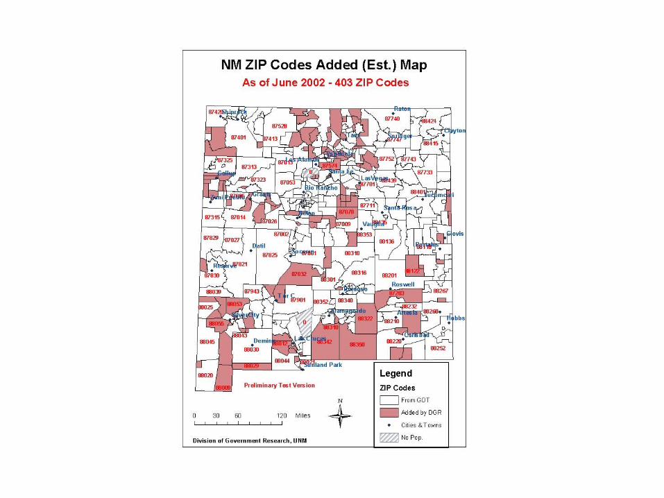
• We used ZIP Codes (centroids) for calculations and estimated boundaries (polygons) for data display.
The Problem(s)
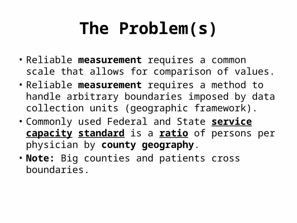
• Reliable measurement requires a common scale that allows for comparison of values.
• Reliable measurement requires a method to handle arbitrary boundaries imposed by data collection units (geographic framework).
• Commonly used Federal and State service capacity standard is a ratio of persons per physician by county geography.
• Note: Big counties and patients cross boundaries.
A Common Measurement Scale
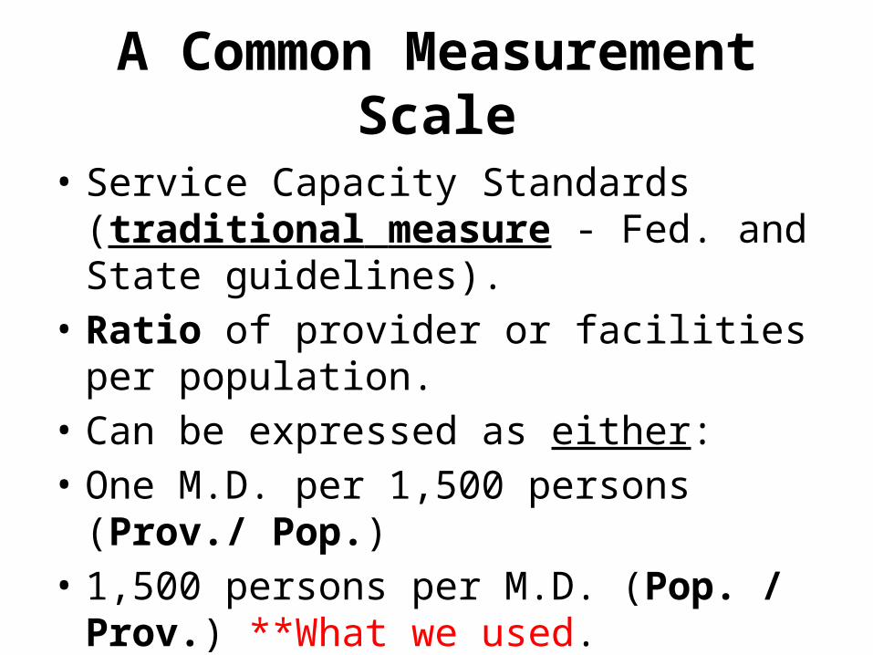
• Service Capacity Standards (traditional measure - Fed. and State guidelines).
• Ratio of provider or facilities per population.• Can be expressed as either:• One M.D. per 1,500 persons (Prov./ Pop.)• 1,500 persons per M.D. (Pop. / Prov.) **What
we used.

Geographic Framework – ZIP Codes
• Healthcare data (patients, providers, facilities, etc.) have many geographic (locational) components.
• Some geographic components used for healthcare data collection are: geographic coordinates, county, census block and tract.
• An address with a ZIP Code is another more widely available component of most healthcare data.
• Geocoding (address locators) not widely available yet.• This study uses ZIP Codes as the geographic framework
(estimation of many boundaries in rural New Mexico).

n
i
iij
n
i
iij
j
provdf
popdfPA
1
1
Potential AccessibilityDGR’s Gravity Model
Code for ZIPity Accessibil PotentialPAjCode ZIPa of Population ipop
Code in ZIP FacilitiesProviders/ ofNumber iprov
100 d if 0
100 d 35 if 235 d if 1
ddij

Distance Decay(Rule-Based “piecewise” Function)
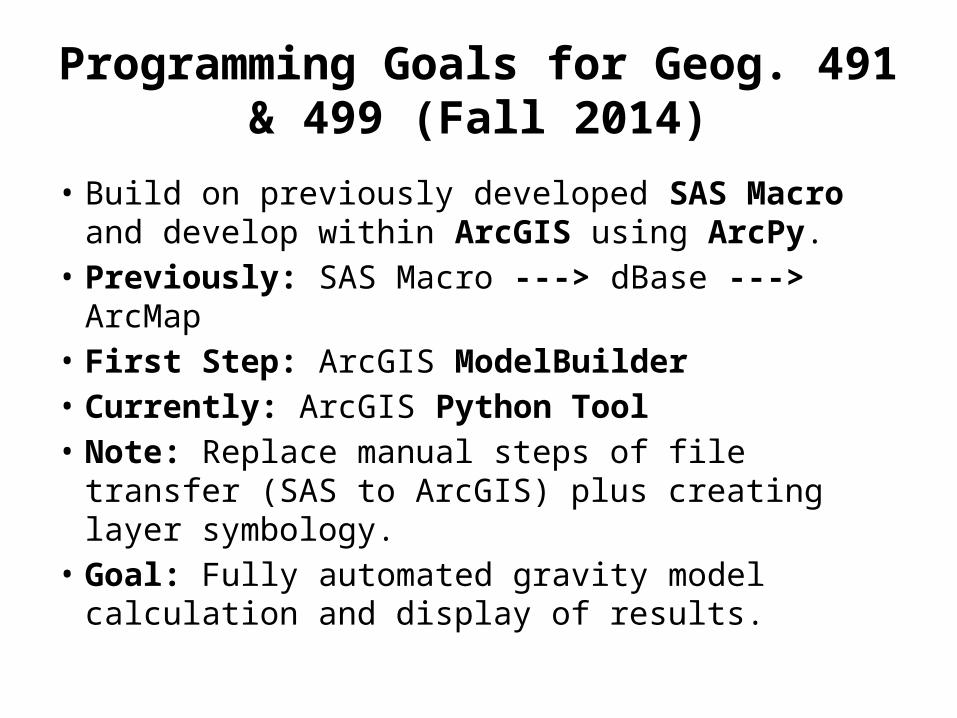
Programming Goals for Geog. 491 & 499 (Fall 2014)
• Build on previously developed SAS Macro and develop within ArcGIS using ArcPy.
• Previously: SAS Macro ---> dBase ---> ArcMap• First Step: ArcGIS ModelBuilder• Currently: ArcGIS Python Tool• Note: Replace manual steps of file transfer (SAS
to ArcGIS) plus creating layer symbology.• Goal: Fully automated gravity model calculation
and display of results.
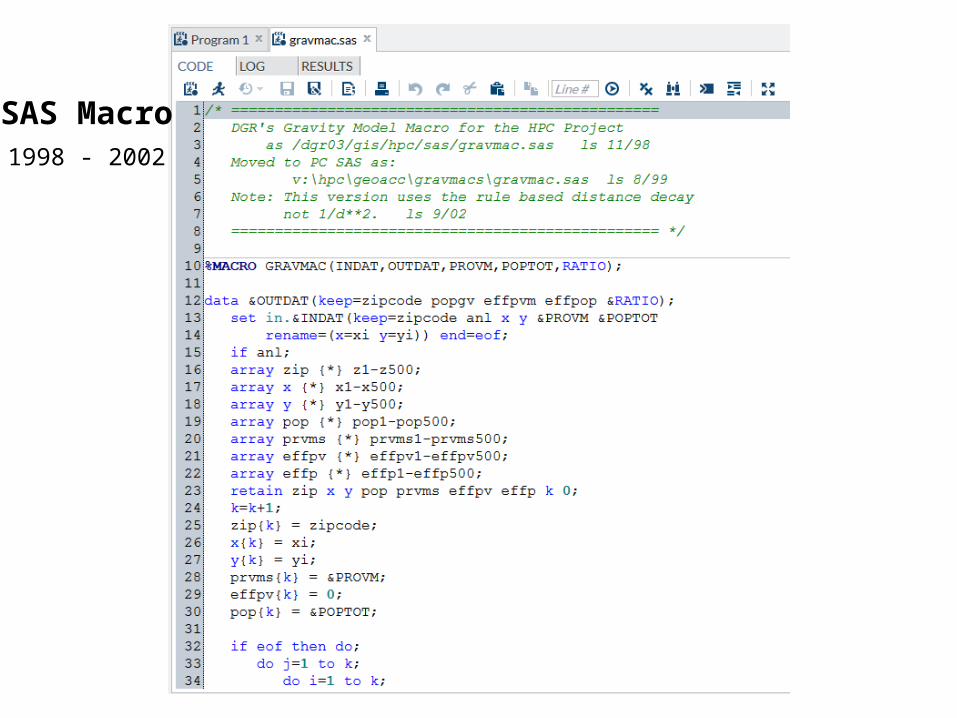
SAS Macro1998 - 2002
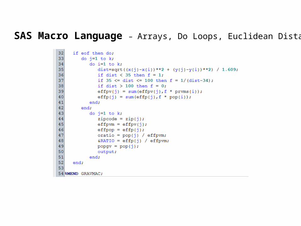
SAS Macro Language – Arrays, Do Loops, Euclidean Distance

ArcGIS Python Script DevelopmentModelBuilder was first step
Created initial Python ScriptRequired substantial editing and testing
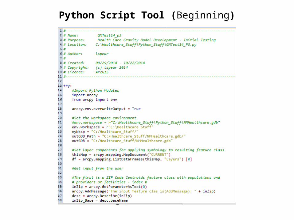
Python Script Tool (Beginning)
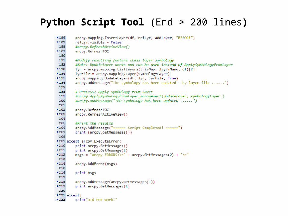
Python Script Tool (End > 200 lines)

Current Problem – User Defined Class Breaks (additional code)

ArcGIS Python Script DevelopmentArcMap User Interface (ModelBuilder and Script Tool)

ArcGIS Python Script Development Script Tool Next Step
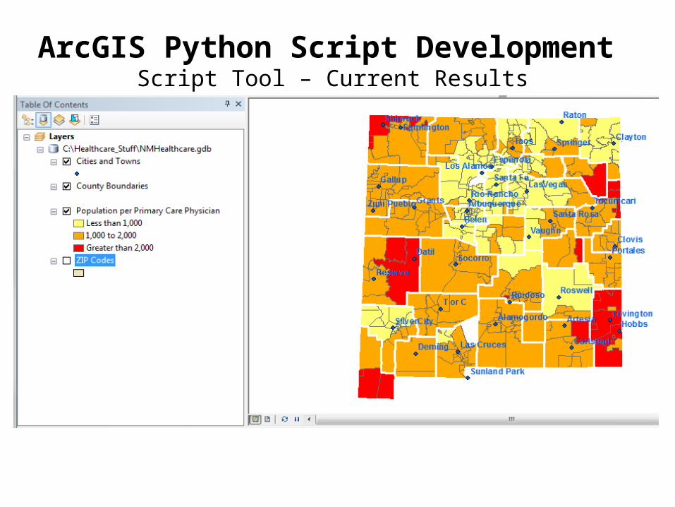
ArcGIS Python Script Development Script Tool – Current Results

Problems Encountered update v3.3 01/07/15
• Slow, takes about 5 minutes on a Pentium I3 Desktop (perhaps quicker on faster PC).
• Perhaps too many ArcGIS Tools and conversions (Feature Class to Layers and Table Views and back and forth).
• Joined files do not work with some tools (especially layer symbology – update layer files not manual).
• Also cursors seem only to work as a stand-alone script but in this case not as a python script tool.
• Possible Solution: Replace as many ArcGIS Tools as possible with dedicated Python Code.

Current and Future Research
• Comparing results using DGR’s compound gravity model with other recently developed methods (need recent data from NM HPC now DOH, also DOH’s Small Area Geographic units).
• The Kernel estimation method (in ArcGIS) that uses distance decay and various functions (some problems in low density rural areas) has potential.
• Also, the Two Step Floating Catchment Area (2SFCA) method (service provider capacity and population data) is very interesting (similar to DGR method).
• Road network distance replacing Euclidean distance (not available for entire state yet)?
Related Documents