© J.M. Piwowar 1 Geog 405: Advanced Spatial Analysis Spatial Data Models Characteristics of Raster Data Longley et al., 2001. Geographic Information Systems and Science. Wiley.

Geog 405: Advanced Spatial Analysis © J.M. Piwowar1Spatial Data Models Characteristics of Raster Data Longley et al., 2001. Geographic Information Systems.
Dec 16, 2015
Welcome message from author
This document is posted to help you gain knowledge. Please leave a comment to let me know what you think about it! Share it to your friends and learn new things together.
Transcript
© J.M. Piwowar 1Geog 405: Advanced Spatial Analysis Spatial Data Models
Characteristics of Raster Data
Lon
gley
et a
l., 2
001.
Geo
grap
hic
Info
rmat
ion
Syst
ems
and
Scie
nce.
Wile
y.
© J.M. Piwowar 2Geog 409: Advanced Spatial Analysis & Modelling Spatial Data Models
Spatial Data Models
How do we represent spatial information in a computer?
The rules to convert real geographical variation into discrete objects.
© J.M. Piwowar 3Geog 409: Advanced Spatial Analysis & Modelling Spatial Data Models
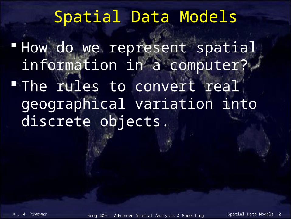
Spatial Data Models
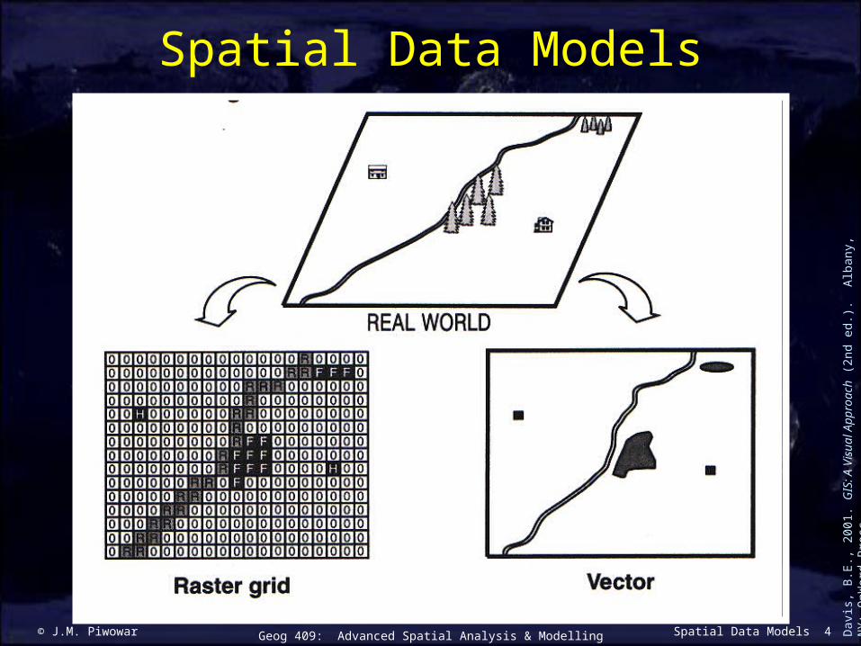
© J.M. Piwowar 4Geog 409: Advanced Spatial Analysis & Modelling Spatial Data Models
Spatial Data Models
Dav
is, B
.E.,
2001
. GIS
: A
Vis
ual A
ppro
ach
(2nd
ed.
). A
lban
y, N
Y: O
nWor
d Pr
ess.
© J.M. Piwowar 5Geog 409: Advanced Spatial Analysis & Modelling Spatial Data Models
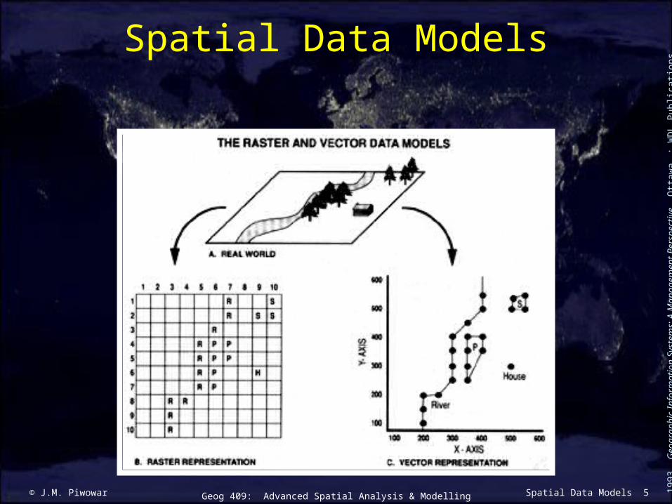
Spatial Data Models
Aro
noff
, 199
3. G
eogr
aphi
c In
form
atio
n Sy
stem
s: A
Man
agem
ent P
ersp
ectiv
e. O
ttaw
a : W
DL
Pub
licat
ions
.

© J.M. Piwowar 6Geog 409: Advanced Spatial Analysis & Modelling Spatial Data Models
The Vector Data Model
Feature Representationpoints
vertices nodes label points
lines lines arcs
areas polygons
Dav
is, B
.E.,
2001
. GIS
: A
Vis
ual A
ppro
ach
(2nd
ed.
). A
lban
y, N
Y: O
nWor
d Pr
ess.
© J.M. Piwowar 7Geog 409: Advanced Spatial Analysis & Modelling Spatial Data Models
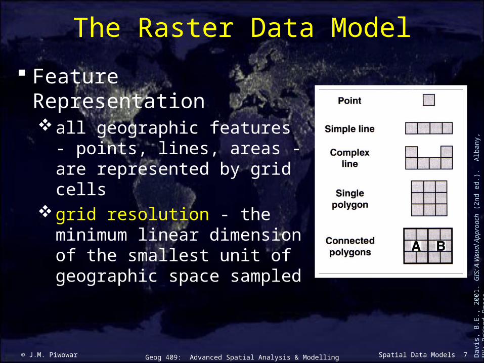
The Raster Data Model
Feature Representationall geographic features -
points, lines, areas - are represented by grid cells
grid resolution - the minimum linear dimension of the smallest unit of geographic space sampled
Dav
is, B
.E.,
2001
. GIS
: A
Vis
ual A
ppro
ach
(2nd
ed.
). A
lban
y, N
Y: O
nWor
d Pr
ess.

© J.M. Piwowar 8Geog 409: Advanced Spatial Analysis & Modelling Spatial Data Models
Raster Data Layers
Lo
& Y
eung
, 200
2. C
once
pts
& T
echn
ique
s of
Geo
grap
hic
Info
rmat
ion
Syst
ems.
Pre
ntic
e-H
all.

© J.M. Piwowar 9Geog 409: Advanced Spatial Analysis & Modelling Spatial Data Models
The Raster Data Model
http
://w
ww
.aw
i-br
emer
have
n.de
/GE
O/M
arin
e_G
IS/P
rinc
iple
s_G
IS.h
tm
Field representation Object representation
© J.M. Piwowar 10Geog 409: Advanced Spatial Analysis & Modelling Spatial Data Models
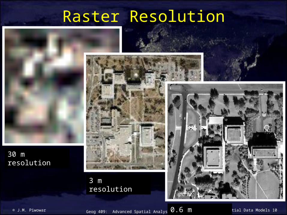
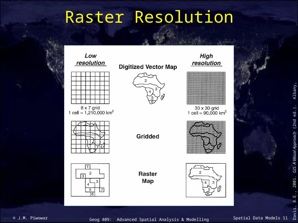
Raster Resolution
30 m resolution
3 m resolution
0.6 m resolution
© J.M. Piwowar 11Geog 409: Advanced Spatial Analysis & Modelling Spatial Data Models
Raster Resolution
Dav
is, B
.E.,
2001
. GIS
: A
Vis
ual A
ppro
ach
(2nd
ed.
). A
lban
y, N
Y: O
nWor
d Pr
ess.

© J.M. Piwowar 12Geog 409: Advanced Spatial Analysis & Modelling Spatial Data Models
Raster Resolution
30 m resolution
625 cells3 m resolution62,500 cells

© J.M. Piwowar 13Geog 409: Advanced Spatial Analysis & Modelling Spatial Data Models
Raster Advantages
Dav
is, B
.E.,
2001
. GIS
: A
Vis
ual A
ppro
ach
(2nd
ed.
). A
lban
y, N
Y: O
nWor
d Pr
ess.
© J.M. Piwowar 14Geog 409: Advanced Spatial Analysis & Modelling Spatial Data Models
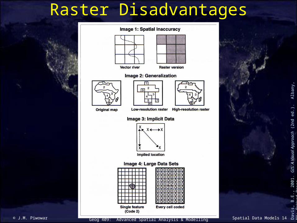
Raster Disadvantages
Dav
is, B
.E.,
2001
. GIS
: A
Vis
ual A
ppro
ach
(2nd
ed.
). A
lban
y, N
Y: O
nWor
d Pr
ess.

© J.M. Piwowar 15Geog 409: Advanced Spatial Analysis & Modelling Spatial Data Models
Vector Advantages
Dav
is, B
.E.,
2001
. GIS
: A
Vis
ual A
ppro
ach
(2nd
ed.
). A
lban
y, N
Y: O
nWor
d Pr
ess.
© J.M. Piwowar 16Geog 409: Advanced Spatial Analysis & Modelling Spatial Data Models
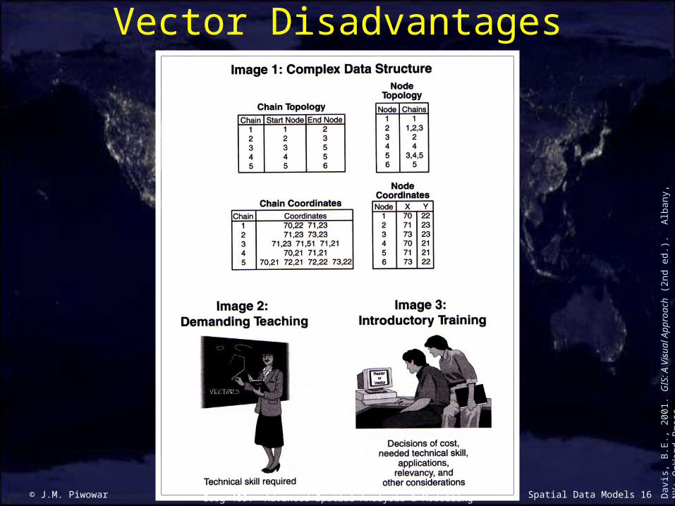
Vector Disadvantages
Dav
is, B
.E.,
2001
. GIS
: A
Vis
ual A
ppro
ach
(2nd
ed.
). A
lban
y, N
Y: O
nWor
d Pr
ess.
© J.M. Piwowar 17Geog 409: Advanced Spatial Analysis & Modelling Spatial Data Models
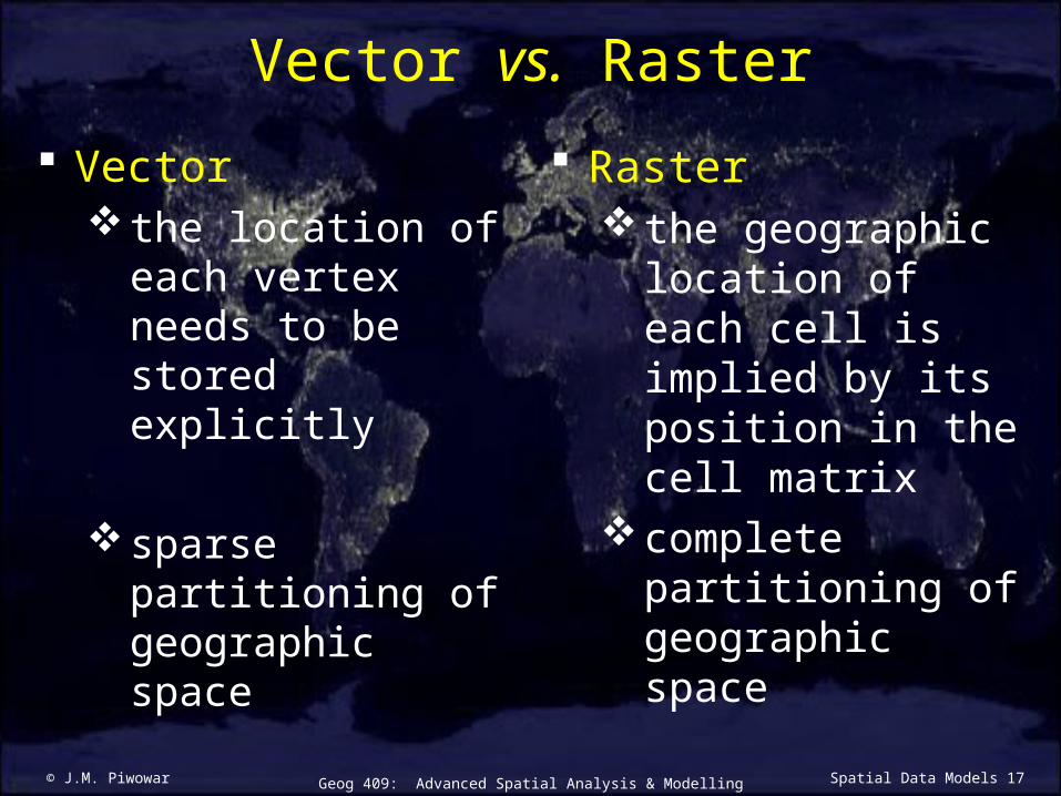
Vector vs. Raster
Vector the location of
each vertex needs to be stored explicitly
sparse partitioning of geographic space
Raster the geographic
location of each cell is implied by its position in the cell matrix
complete partitioning of geographic space
© J.M. Piwowar 18Geog 409: Advanced Spatial Analysis & Modelling Spatial Data Models
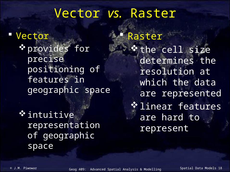
Vector vs. Raster
Vectorprovides for
precise positioning of features in geographic space
intuitive representation of geographic space
Raster the cell size
determines the resolution at which the data are represented
linear features are hard to represent
© J.M. Piwowar 19Geog 409: Advanced Spatial Analysis & Modelling Spatial Data Models
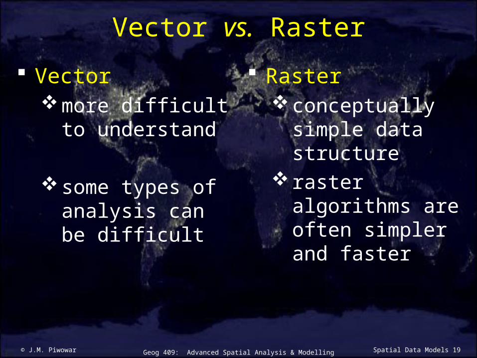
Vector vs. Raster
Vectormore difficult to
understand
some types of analysis can be difficult
Rasterconceptually
simple data structure
raster algorithms are often simpler and faster
© J.M. Piwowar 20Geog 409: Advanced Spatial Analysis & Modelling Spatial Data Models
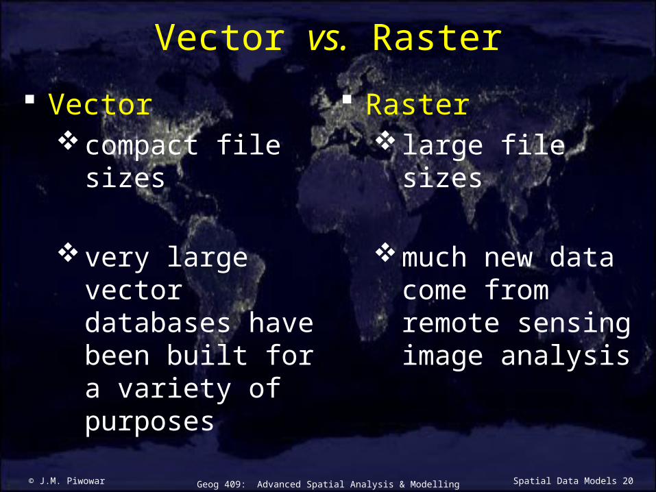
Vector vs. Raster
Vectorcompact file sizes
very large vector databases have been built for a variety of purposes
Raster large file sizes
much new data come from remote sensing image analysis
© J.M. Piwowar 21Geog 409: Advanced Spatial Analysis & Modelling Spatial Data Models
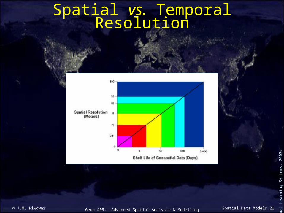
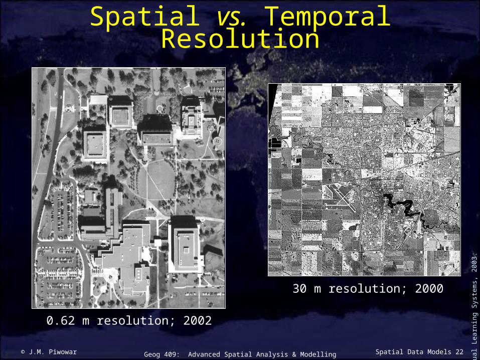
Spatial vs. Temporal Resolution
Vis
ual L
earn
ing
Syst
ems,
200
3.
© J.M. Piwowar 22Geog 409: Advanced Spatial Analysis & Modelling Spatial Data Models
Spatial vs. Temporal Resolution
Vis
ual L
earn
ing
Syst
ems,
200
3.
0.62 m resolution; 2002
30 m resolution; 2000
© J.M. Piwowar 23Geog 409: Advanced Spatial Analysis & Modelling Spatial Data Models
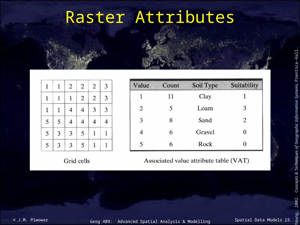
Raster Attributes
Lo
& Y
eung
, 200
2. C
once
pts
& T
echn
ique
s of
Geo
grap
hic
Info
rmat
ion
Syst
ems.
Pre
ntic
e-H
all.

© J.M. Piwowar 24Geog 409: Advanced Spatial Analysis & Modelling Spatial Data Models
Common Raster Data Formats
TIFF (Tagged Image File Format)
JPEG (Joint Photographic Editors Group)
GIF (CompuServe Graphics Interchange Format)
MrSID (Multi-resolution Seamless Image Database)
BIL (ERDAS Band-Interleaved-by-Line Format)
IMG (could be any type of image)
Related Documents