Geo-Spatial Technologies for Customs Pragmatics Solutions and Examples Tokyo, November 2 nd 2017

Welcome message from author
This document is posted to help you gain knowledge. Please leave a comment to let me know what you think about it! Share it to your friends and learn new things together.
Transcript
Geo-Spatial Technologies for Customs
Pragmatics Solutions and Examples
Tokyo, November 2nd 2017

2
Outline
Geographic Information Systems
• Concepts
• Requirements
• Some examples in Tunisia
GIS Combined with Remote Sensing
Some examples
• Truck Traffic assessment in Syria
• Informal Trade in Mali - Algeria
• Ports activity in Malaysia - Indonesia
3
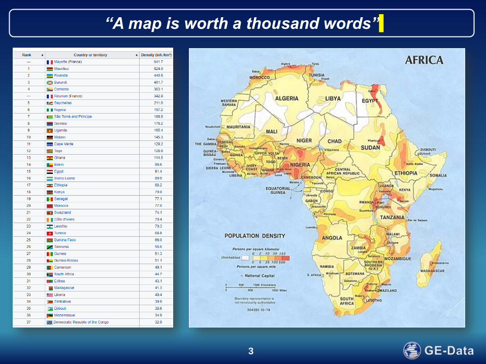
“A map is worth a thousand words”
4
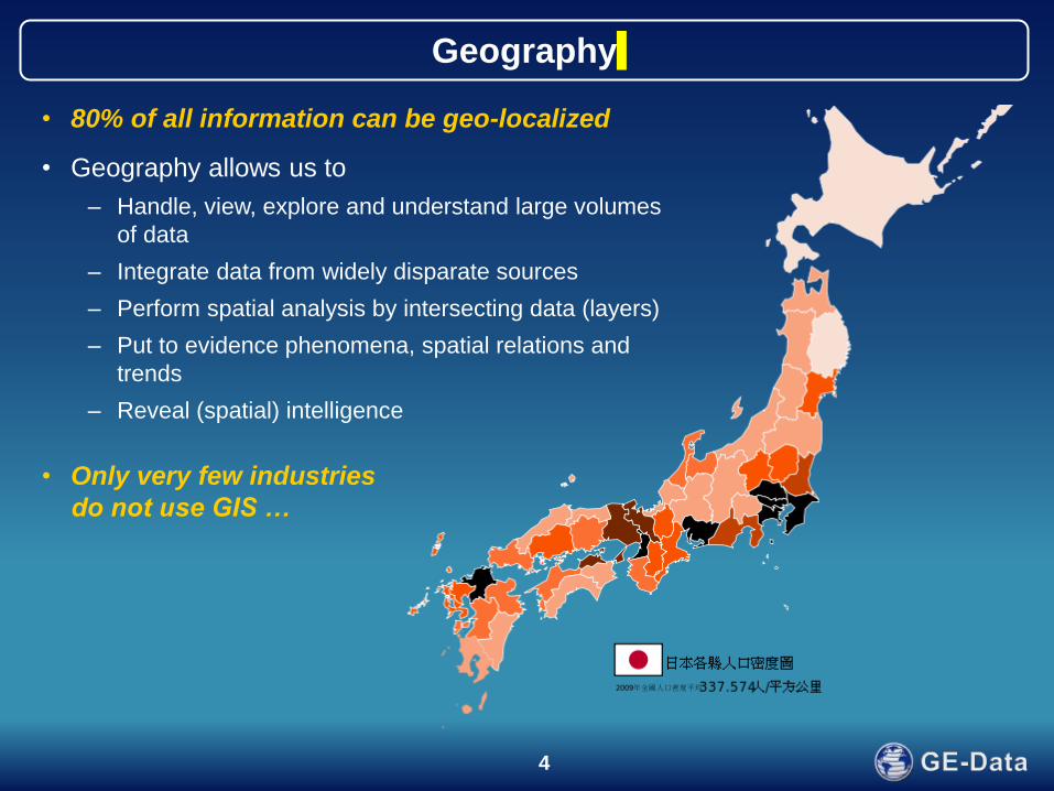
Geography
• 80% of all information can be geo-localized
• Geography allows us to
– Handle, view, explore and understand large volumes
of data
– Integrate data from widely disparate sources
– Perform spatial analysis by intersecting data (layers)
– Put to evidence phenomena, spatial relations and
trends
– Reveal (spatial) intelligence
• Only very few industries
do not use GIS …
5
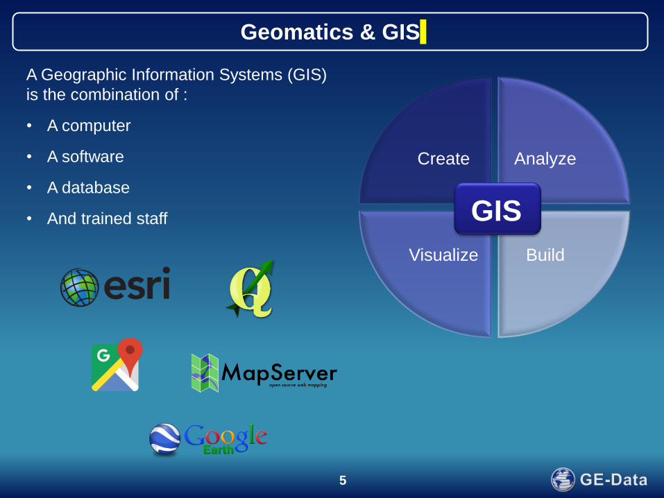
Geomatics & GIS
A Geographic Information Systems (GIS)
is the combination of :
• A computer
• A software
• A database
• And trained staff
Create Analyze
Build Visualize
GIS

6
Introducing GIS
Database
Add spatial component
GIS
Collect new data
Existing data Restructure
Access to GIS
• Open source Software
• Computers are affordable
• Huge amounts of public
georeferenced data
• Technical means to easily
collect new data (smart
phones..)
• Little investments required
(HR, training, …)
Typical situation
• Already “pre-historic” GIS in place (wall map with pin points)
• Much data available but stored in different formats, databases, paper files….
• Hardware underutilized (smart phones, computers, …)

7
A pragmatic approach can consist in :
1) Initiate discussion:
Break the paradigm
“What can you do Vs. What do you need for your daily activity”
2) Define your needs (not your wants) towards actions
For this Meeting / Report / Planning / …………....I need…………………….
Transitioning from Wall maps to Digital maps
8
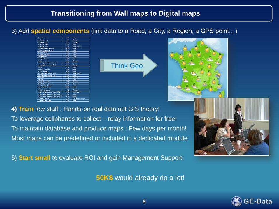
3) Add spatial components (link data to a Road, a City, a Region, a GPS point…)
4) Train few staff : Hands-on real data not GIS theory!
To leverage cellphones to collect – relay information for free!
To maintain database and produce maps : Few days per month!
Most maps can be predefined or included in a dedicated module
5) Start small to evaluate ROI and gain Management Support:
50K$ would already do a lot!
Transitioning from Wall maps to Digital maps
Think Geo

9
Tunisia Demonstrator
10
Tunisia – Reference Data Layers
• Land & Sea
• Tunisian border
• Water
• Administrative boundaries 1
• Administrative boundaries 2
• Cities
• Road network
• Rail roads
• Customs Posts
• Intervention zones
Tunisia
Algeria
Libya
Tunis El Kala
Sfax
Monastir
Tripoli

11
Examples of flows:
- Volumes of goods
- # Vehicles
- # Declarations
- ….
Tunisia – Monitoring Flows
Tunisia
Algeria
Period: February 2017
Period: March 2017
12
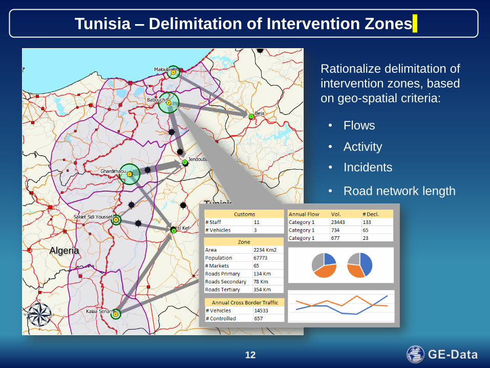
Tunisia – Delimitation of Intervention Zones
Rationalize delimitation of
intervention zones, based
on geo-spatial criteria:
• Activity
• Incidents
• Road network length
• ……
• Flows
Tunisia
Algeria

13
Tunisia – Monitoring Markets
Tunisia
Algeria
Period 1
Period 2

14
Tunisia – Local Operations & Logistics
• Plan patrol tours
• Position road blocks
• Assess security
• …..
Tunisia
Algeria

15
Reporting

16
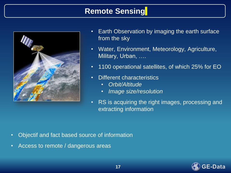
Remote Sensing
17
Remote Sensing
• Earth Observation by imaging the earth surface
from the sky
• Water, Environment, Meteorology, Agriculture,
Military, Urban, ….
• 1100 operational satellites, of which 25% for EO
• Different characteristics
• Orbit/Altitude
• Image size/resolution
• RS is acquiring the right images, processing and
extracting information
• Objectif and fact based source of information
• Access to remote / dangerous areas

18
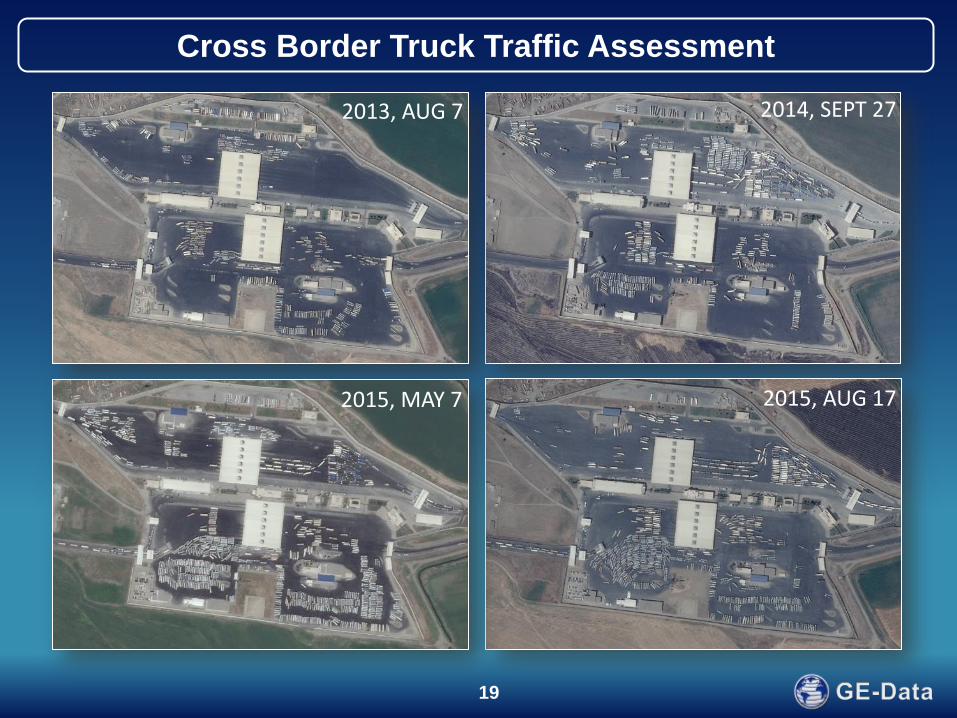
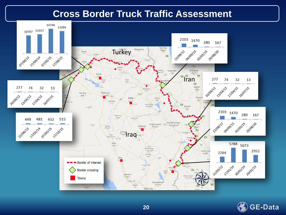
• Estimation of trade across
the Kurdistan border (Syria,
Turkey, Iraq, Iran)
• Counting trucks on border
crossings on 4 different
dates.
• Trucks were semi-
automatically identified on
50 cm resolution imagery
and categorized in small
(6m), medium (9m) and
large (12m) trucks.
Cross Border Truck Traffic Assessment
Turkey
Iraq
Iran
19
Cross Border Truck Traffic Assessment
2013, AUG 7
2015, MAY 7 2015, AUG 17
2014, SEPT 27
20
Turkey
Iraq
Iran
Cross Border Truck Traffic Assessment
21
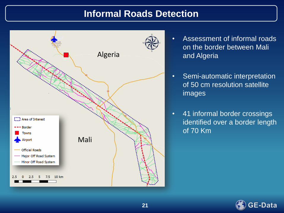
Informal Roads Detection
Mali
Algeria
• Assessment of informal roads
on the border between Mali
and Algeria
• Semi-automatic interpretation
of 50 cm resolution satellite
images
• 41 informal border crossings
identified over a border length
of 70 Km

22
Informal Roads Detection
23
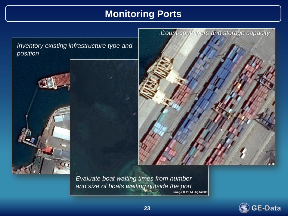
Inventory existing infrastructure type and
position
Evaluate boat waiting times from number
and size of boats waiting outside the port
Monitoring Ports
Count containers and storage capacity

24
Major Benefits for Customs
• Border Post Management for Local Operations
– Optimize Staff and resources
– Better targeting of locations to control
• Smart Reporting :
– Great support to initiate discussion with local population – Get Intel
– Send enhanced report to your Management - Other border posts – Security
– A powerful economy monitoring tool
• Formalize knowledge formal and Informal
– Build a legacy of Information in your insitution
• Intel: Reveal intel / Unusual behaviors – Produce Intel Reports
• Transparency should help in reducing corruption….
25
Conclusions
• Huge gain by introducing geography
– Communication
• Internally
• Externally
• Cross border: map are universal (bypass language barrier)
– Decision Aid: assess performance, reallocate resources, organize operations
– Create (reveal) geo-intelligence
– Detect irregularities (monitoring)
– Strategy, Tactics, Operations
– Capture and store field knowledge / expertise, build historical database
Related Documents