Fundamentals of Fundamentals of Geographic Information Geographic Information Systems and Spatial Data Systems and Spatial Data Laurie Schretlen & Leah Vanderjagt Netspeed October 20, 2005

Fundamentals of Geographic Information Systems and Spatial Data Laurie Schretlen & Leah Vanderjagt Netspeed October 20, 2005.
Dec 19, 2015
Welcome message from author
This document is posted to help you gain knowledge. Please leave a comment to let me know what you think about it! Share it to your friends and learn new things together.
Transcript
Fundamentals of Fundamentals of Geographic Information Geographic Information
Systems and Spatial DataSystems and Spatial Data
Laurie Schretlen & Leah VanderjagtNetspeed October 20, 2005
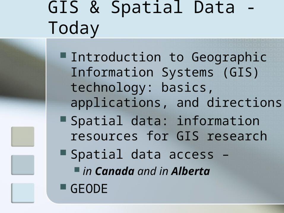
GIS & Spatial Data - Today
Introduction to Geographic Information Systems (GIS) technology: basics, applications, and directions
Spatial data: information resources for GIS research
Spatial data access – in Canada and in Alberta
GEODE


GIS Components
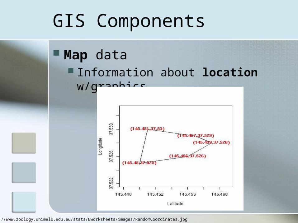
Map data Information about location
w/graphics
http://www.zoology.unimelb.edu.au/stats/Eworksheets/images/RandomCoordinates.jpg
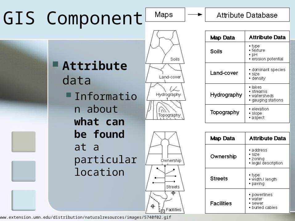
GIS Components:
Attribute data Information
about what can be found at a particular location
http://www.extension.umn.edu/distribution/naturalresources/images/5740f02.gif

http://utca.eng.ua.edu/projects/final_reports/02403fnl_files/image004.jpg
GIS as database
Spatial data examples
Road networks Vegetation inventories Soil inventories Census results Municipal boundaries Elevation values Climate readings Habitat ranges …

GIS Components Software
A technology for storing and analyzing location and attribute data
http://www.l.hsr.ch/skripte/gisscripts/media/softwarescreen1.jpg

GIS Components
Hardware Systems to support rapid graphic
analysis and processing
http://www.gdf-hannover.de/pics/gisrechner.png
GIS Personnel
PeopleProject coordinatorsData analystsProgrammersData and knowledge managers
Librarians

GIS Components
Methods The analysis to be performed on
the data
http://www.wwf.org.co/colombia/images/a28_c.gif

GIS Methods and Analysis
GIS is used to answer questions and support decisions
The quality of the answer depends on: The METHODS chosen The DATA (more on that later)
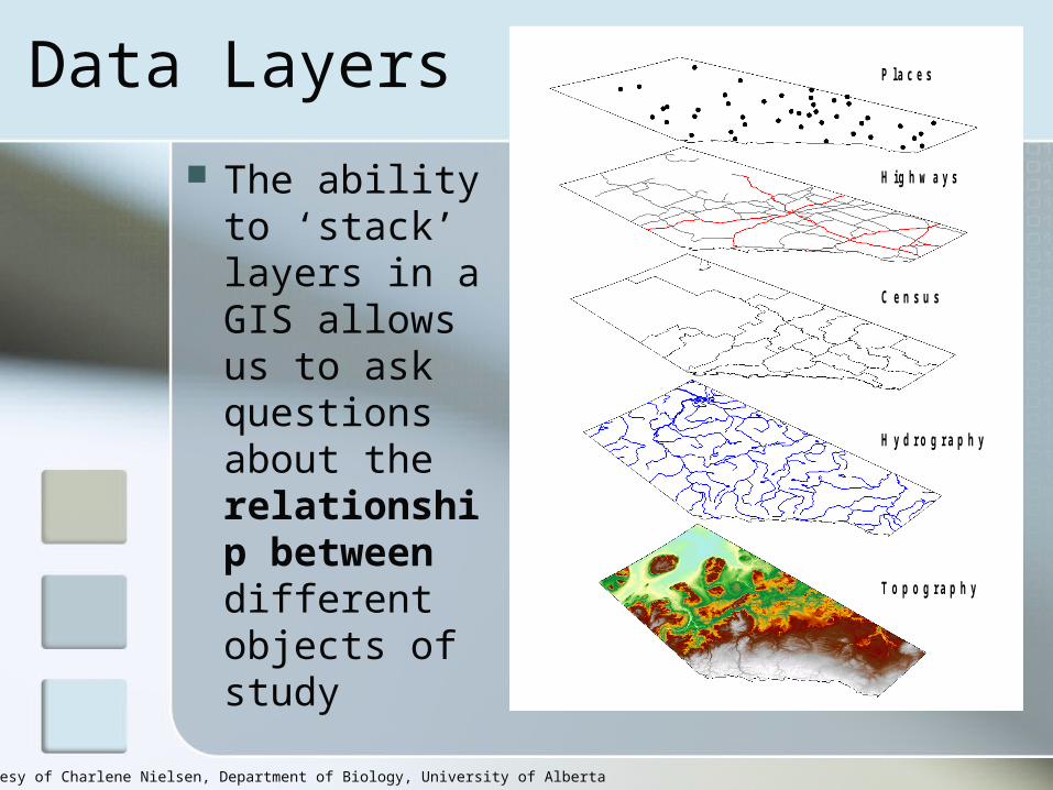
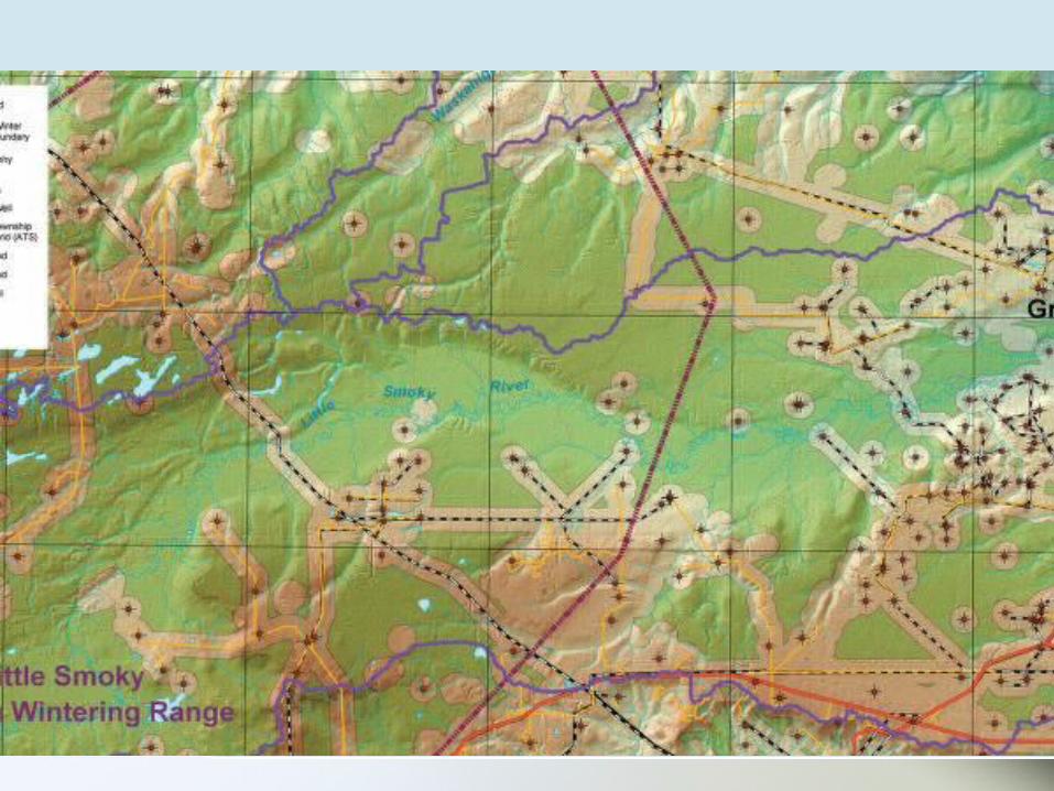
Data Layers
T o p o g r a p h y
H y d r o g r a p h y
C e n s u s
H i g h w a y s
P l a c e s
The ability to ‘stack’ layers in a GIS allows us to ask questions about the relationship between different objects of study
Image courtesy of Charlene Nielsen, Department of Biology, University of Alberta

Overlay
What two things occur at the same location?
http://www.orthogate.com/guide/workshops/images/image002.gif
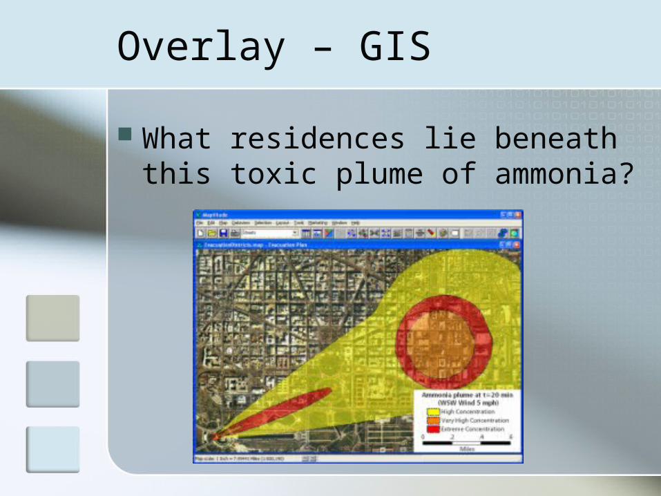
Overlay – GIS
What residences lie beneath this toxic plume of ammonia?
Overlay GIS
http://www.saultc.on.ca/GIS/images/RedPineTraill_sm.jpg
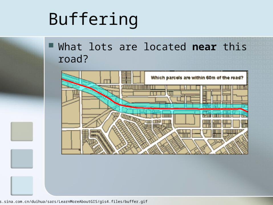
Buffering What lots are located near this
road?
http://news.sina.com.cn/duihua/sars/LearnMoreAboutGIS/gis4.files/buffer.gif
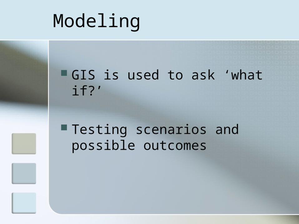
Modeling
GIS is used to ask ‘what if?’
Testing scenarios and possible outcomes

Modeling
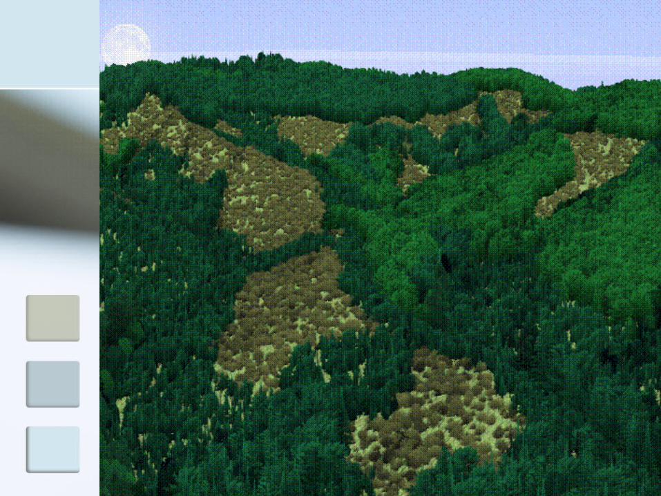
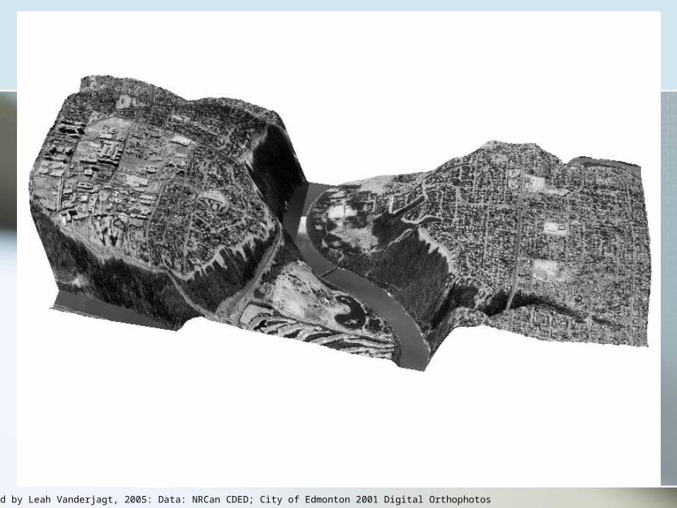
Image created by Leah Vanderjagt, 2005: Data: NRCan CDED; City of Edmonton 2001 Digital Orthophotos
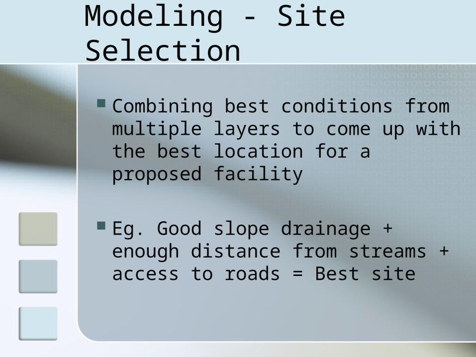
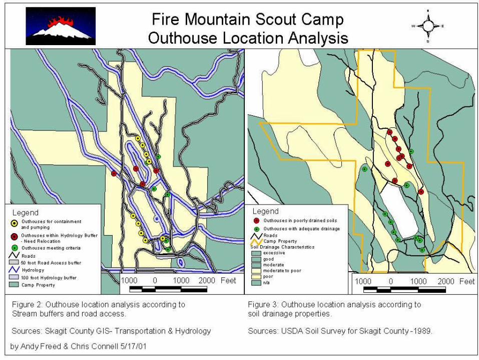
Modeling - Site Selection
Combining best conditions from multiple layers to come up with the best location for a proposed facility
Eg. Good slope drainage + enough distance from streams + access to roads = Best site
Modeling

GIS Applications
GIS applications combine multiple analytical processes to support decision-making
Some examples from non-profit and government sectors:
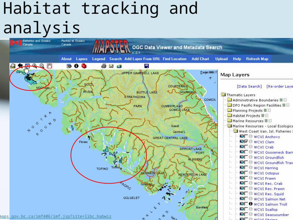
Habitat tracking and analysis
maps.gov.bc.ca/imf406/imf.jsp?site=libc_habwiz
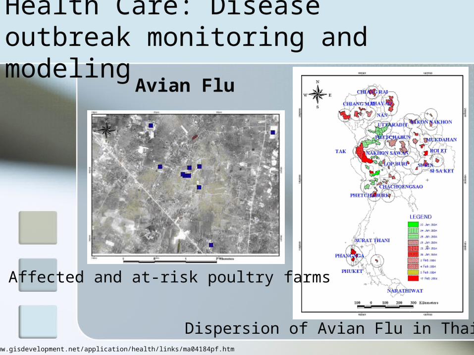
Health Care: Disease outbreak monitoring and modeling
Dispersion of Avian Flu in Thailand
Affected and at-risk poultry farms
Avian Flu
http://www.gisdevelopment.net/application/health/links/ma04184pf.htm
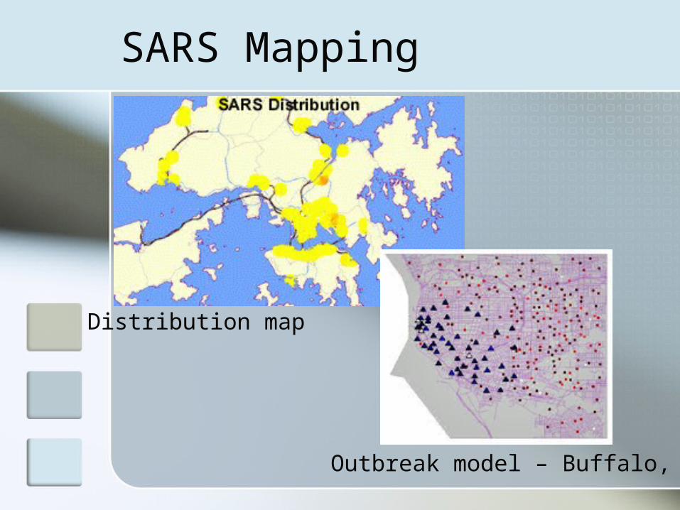
SARS Mapping
Distribution map
Outbreak model – Buffalo, NY

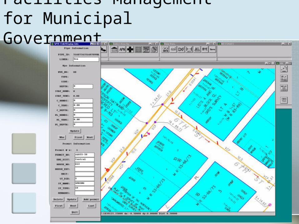
Facilities Management for Municipal Government

Route Optimization Modeling
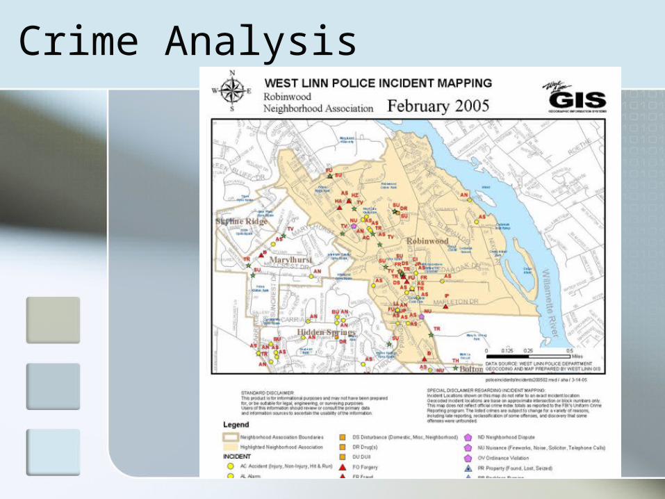
Crime Analysis
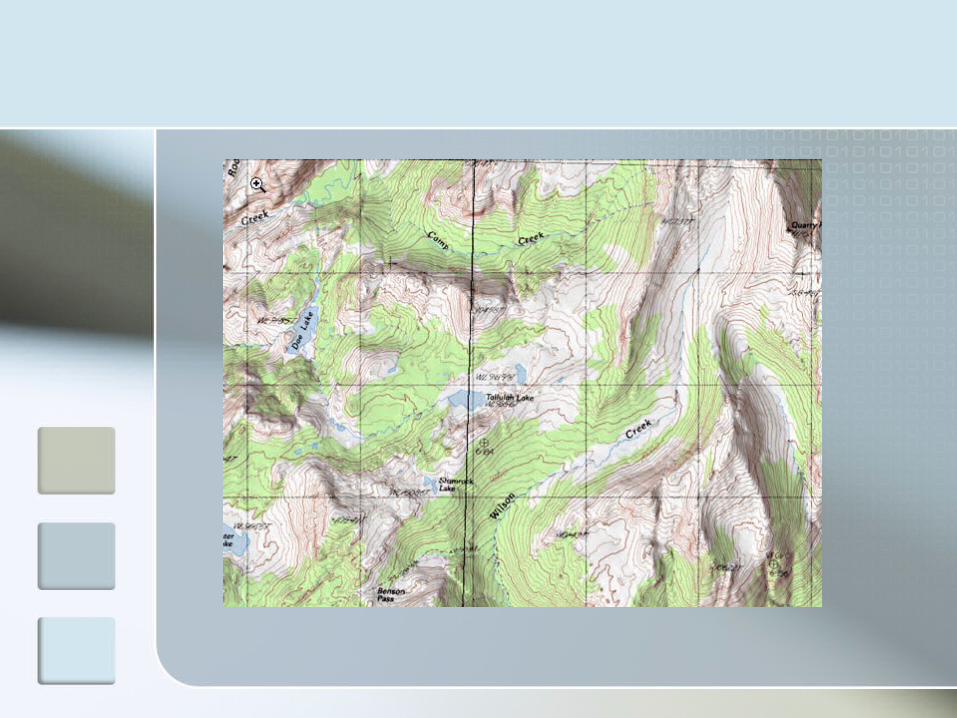
Other uses
Many groups still need to create paper maps to support operations - nearly always GIS-based
GIS is also used for storage of information – there is an archiving function

Directions for GIS
WEB APPLICATIONS Standards Unlocking the GIS black box -
distributed experimentation and collaboration
GIScience

GIS in Academic Institutions GIS is used extensively in
science/ecology disciplines: Renewable resources management Forestry Biology (ecology) Geography Earth and atmospheric sciences Geology
GIS in Academic Institutions Also used in:
Civil engineering Business Economics History Psychology Health …
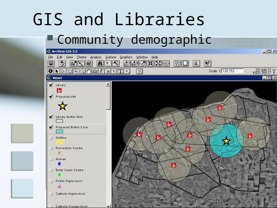
GIS and Libraries Community demographic
analysis
GIS - Bibliography
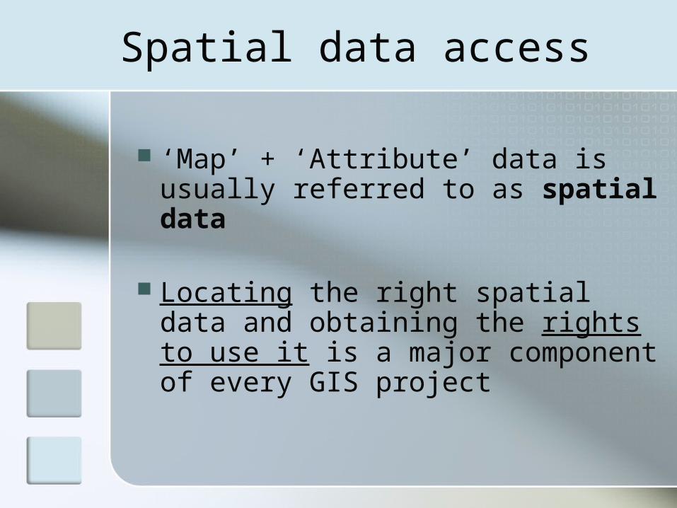
Spatial data access
‘Map’ + ‘Attribute’ data is usually referred to as spatial data
Locating the right spatial data and obtaining the rights to use it is a major component of every GIS project
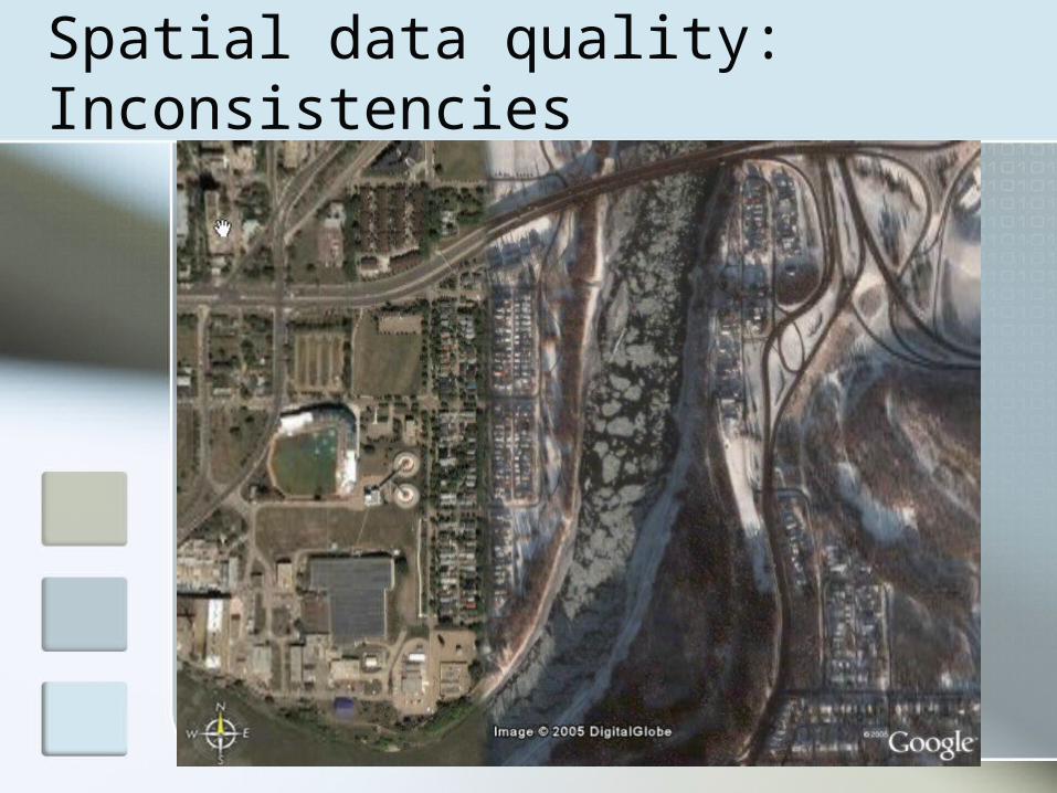
Spatial data quality: Inconsistencies
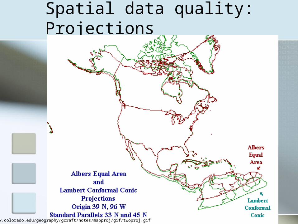
Spatial data quality: Projections
http://www.colorado.edu/geography/gcraft/notes/mapproj/gif/twoproj.gif
Spatial data access
Spatial data is expensive to create and update
Government agencies and large corporations can afford it
Data sharing is not necessarily a part of the plan
Spatial data access
If it’s shared, spatial data is either sold by the producer or by a designated value-added reseller
Public consultations have resulted in open sharing of more and more spatial data sets at the federal level
Some federal data is made available through the Depository Services Program

Canadian Geospatial Data Infrastructure
Spatial data access There is much more data available for
purchase
Therefore, there is a spatial data economy in Canada
This economy is driven by cost-recovery policies
Government agencies charge other agencies, corporations, and individuals for data access
Different models of access
United States – wide, very open access to drive commercial development
Canada – stewardship model of cost-recovery
Provincial economy examples: Manitoba Alberta
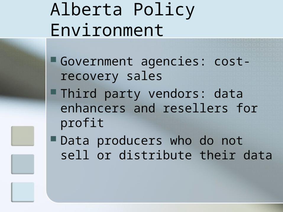
Alberta Policy Environment
Government agencies: cost-recovery sales
Third party vendors: data enhancers and resellers for profit
Data producers who do not sell or distribute their data

Challenges to Access
What is the result of Alberta’s policy environment?
Data creators don’t have sufficient resources to respond to individual researcher demand
Data suppliers do not document or support data products
Data suppliers’ primary business is not data supply, ie. creating happy data customers
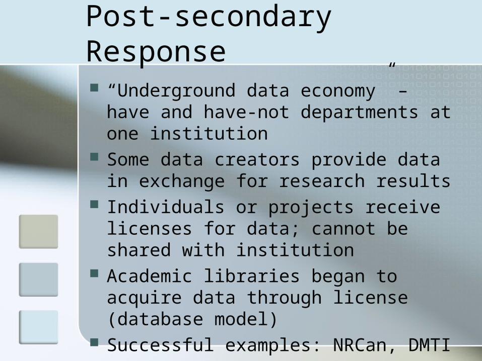
Post-secondary Response
“Underground data economy” – have and have-not departments at one institution
Some data creators provide data in exchange for research results
Individuals or projects receive licenses for data; cannot be shared with institution
Academic libraries began to acquire data through license (database model)
Successful examples: NRCan, DMTI

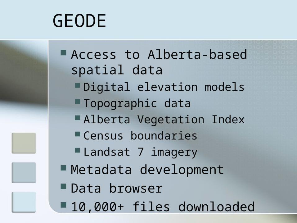
GEODE
To address issues of access to spatial data in Alberta, the GEODE project was launched in 1999
Participating institutions: University of Alberta University of Calgary SAIT University of Lethbridge Miistakis Institute for the Rockies
GEODE
Access to Alberta-based spatial data Digital elevation models Topographic data Alberta Vegetation Index Census boundaries Landsat 7 imagery
Metadata development Data browser 10,000+ files downloaded

Benefits to GIS Researchers
Consortium-wide access to high quality data
Centralized price and acquisition negotiations
The opportunity to work with industry-standard Alberta data
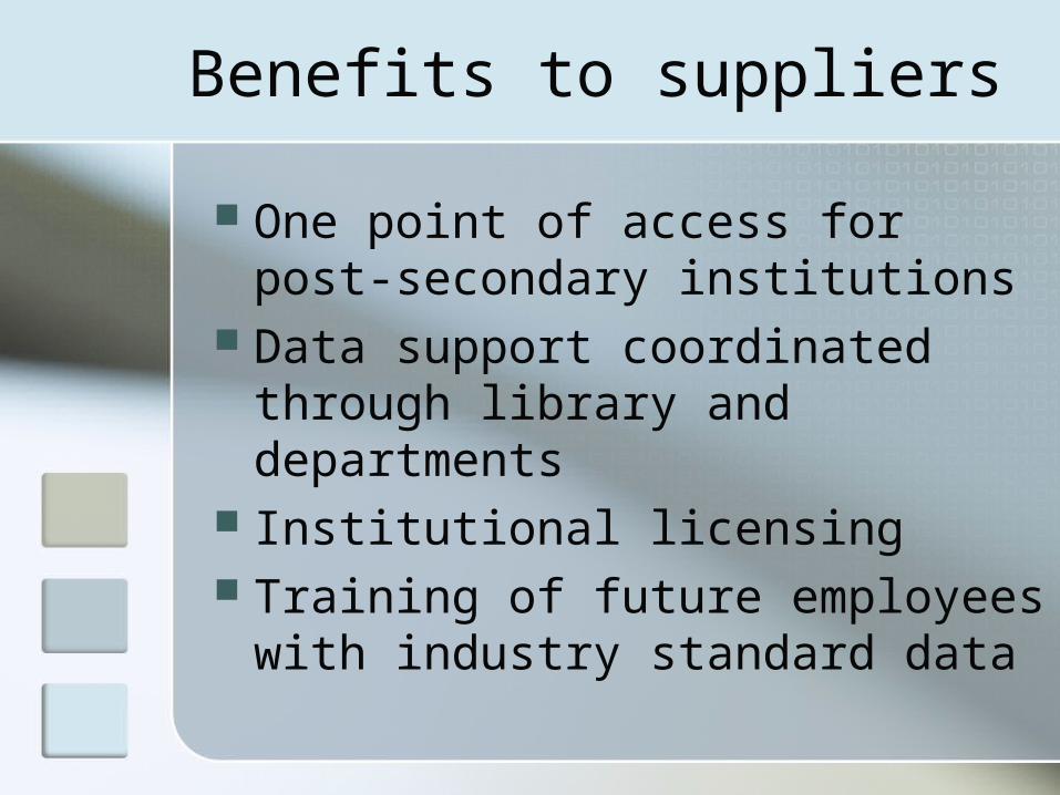
Benefits to suppliers
One point of access for post-secondary institutions
Data support coordinated through library and departments
Institutional licensing Training of future employees
with industry standard data

GEODE’s Transformation
GEODE was reconceived in late 2004 as a consortium – to facilitate and promote access to spatial data for post-secondary education in Alberta
Objectives: Develop new funding strategies Enhance contents of collection Expand institutional membership

Benefits of institutional membership
Access to GEODE collections Training and assistance with
GEODE service delivery Advocacy and liaison with
vendors Cost-sharing Technology/infrastructure
guidance Collaborative development of
best practices
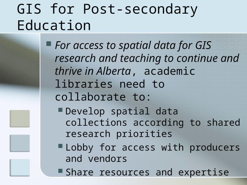
GIS for Post-secondary Education
For access to spatial data for GIS research and teaching to continue and thrive in Alberta, academic libraries need to collaborate to: Develop spatial data collections
according to shared research priorities
Lobby for access with producers and vendors
Share resources and expertise

Moving forward
Long-range technology goal: database-driven web service delivery of spatial data files
GEODE is seeking assistance with the development of a province-wide licensing model for spatial data use in research and teaching
Questions? Discussion?
Laurie Schretlen – lschretl @ ucalgary.ca
Leah Vanderjagt – leahv @ ualberta.ca
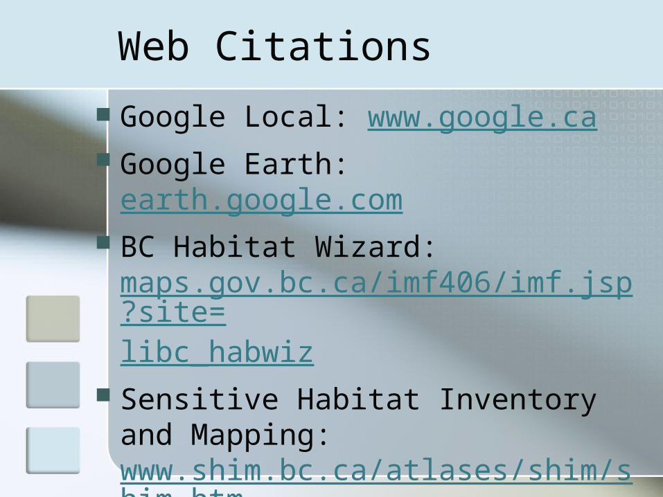
Web Citations
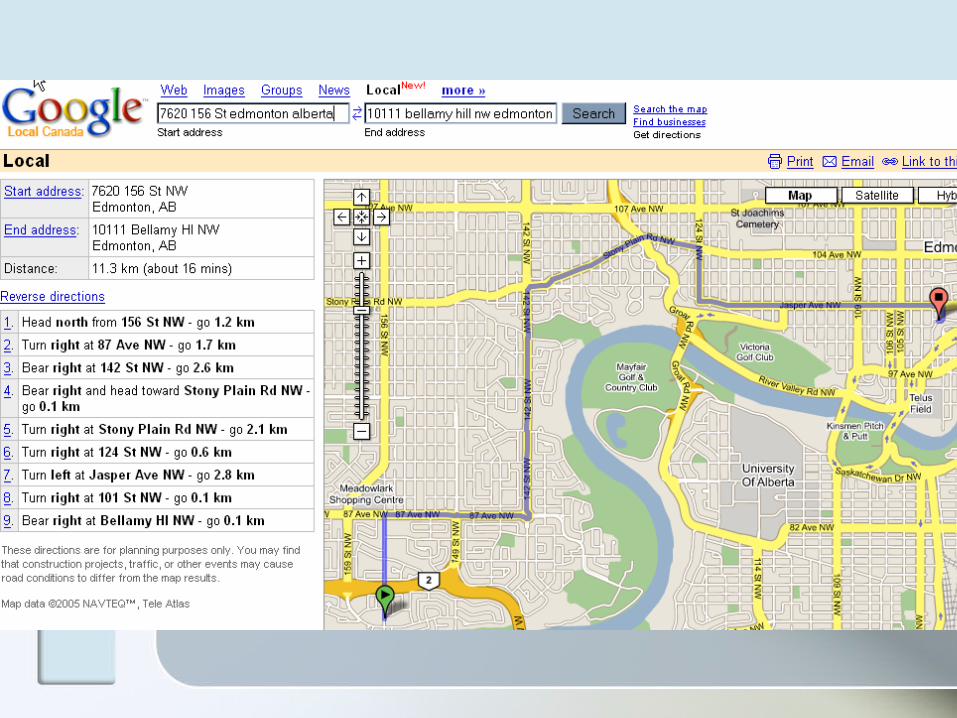
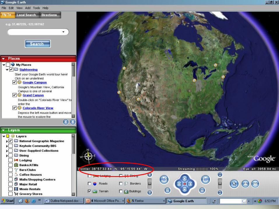
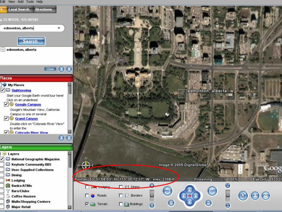
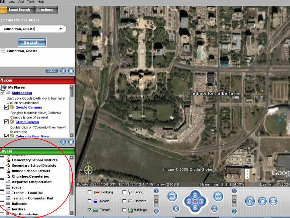
Google Local: www.google.ca Google Earth: earth.google.com BC Habitat Wizard:
maps.gov.bc.ca/imf406/imf.jsp?site=libc_habwiz
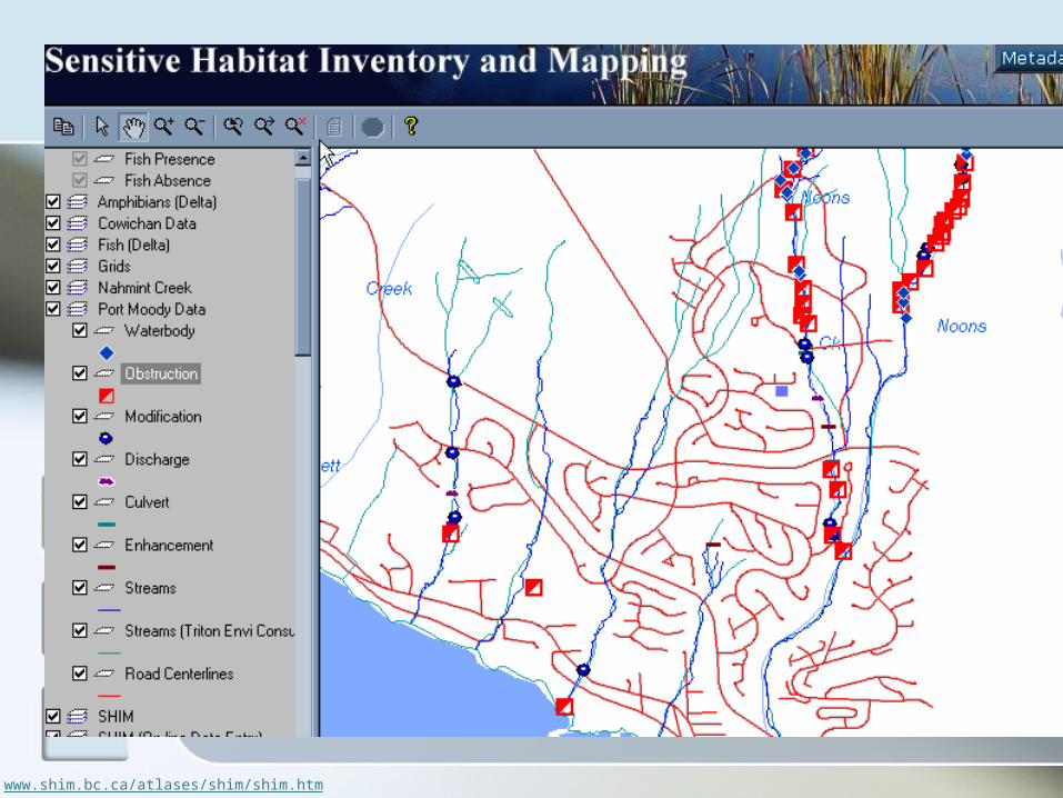
Sensitive Habitat Inventory and Mapping: www.shim.bc.ca/atlases/shim/shim.htm
Related Documents