From Plane Table to Satellites: The Changing Role of Technology in Military Mapping over 100years Dr Dennis Puniard Lecturer Faculty of Business Government and Law University of Canberra Major(R), Royal Australian Survey Corps

Welcome message from author
This document is posted to help you gain knowledge. Please leave a comment to let me know what you think about it! Share it to your friends and learn new things together.
Transcript
From Plane Table to
Satellites:
The Changing Role of
Technology in Military
Mapping over 100years Dr Dennis Puniard
Lecturer
Faculty of Business Government and Law
University of Canberra
Major(R), Royal Australian Survey Corps
RA Svy 1915 -1996
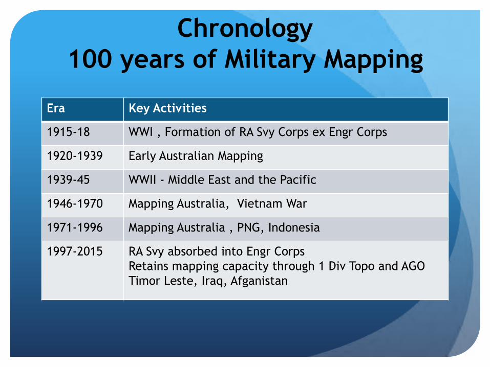
Chronology
100 years of Military Mapping
Era Key Activities
1915-18 WWI , Formation of RA Svy Corps ex Engr Corps
1920-1939 Early Australian Mapping
1939-45 WWII - Middle East and the Pacific
1946-1970 Mapping Australia, Vietnam War
1971-1996 Mapping Australia , PNG, Indonesia
1997-2015 RA Svy absorbed into Engr Corps
Retains mapping capacity through 1 Div Topo and AGO
Timor Leste, Iraq, Afganistan

Technology Milestones
100 years of Military Mapping
Era Technology
1915-18 Plane Table, Triangulation Surveys
1920-1939 Field mapping , first air photos(RAAF)
1939-45 Emergency wartime mapping, Australia and the
Pacific (especially PNG)
Aerial photography
1946-1970 Photogrammetry, Start of digital mapping, Electronic
Distance Measuring(EDM) (Tellurometers)
1971-1996 Satellite Positioning (Geoceivers), Automated map
production (AUTOMAP), orthophotos, Geographic
Information Systems, Satellite imagery
1997-2015 RA Svy absorbed into Engr Corps
Retains mapping capacity through 1 Div Topo and AGO
Military GIS, Remote Sensing and image analysis

Technology Milestones
100 years of Military Mapping
Era Field Survey/
Topo Mapping
Cartography Reproduction and
Distribution/Litho
1915-18 Plane Table,
Triangulation Surveys
1920-1939 First Air photos, Photo
mosaics
Mulitplex plotters,
Fair drawing
Early Litho
(outsourced?
1939-45 Emergency mapping,
aerial photogrpahy,
Fair drawing
Large format reproduction
cameras
Lithographic presses
1946-1970 Aerodist,
EDM,
Photogrammetry, Start of
digital mapping
Full litho capability
from cameras to
printing
1971-1996 Geoceivers
GPS
Automap I, II, Parare
GIS, Satellite imagery
Paper and Digital
1997-2015 RA Svy disbanded Military GIS, Remote
Sensing and image analysis
Mostly digital

Early Survey
Technology
Vernier theodolites,
Gunter’s chain
by Bicycle!!
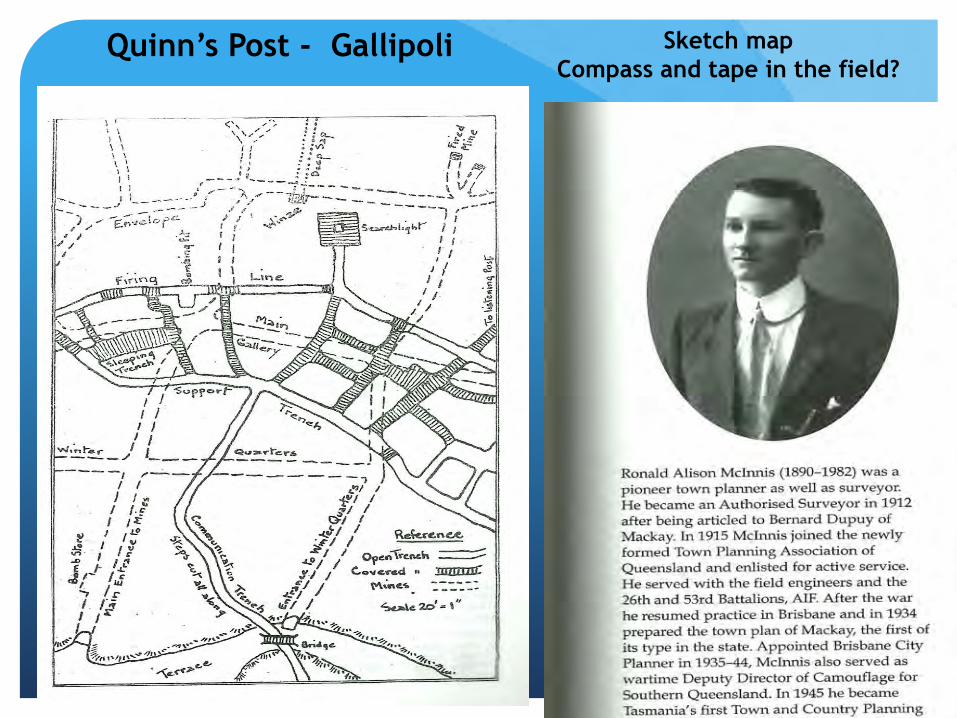
Quinn’s Post - Gallipoli Sketch map
Compass and tape in the field?

World War I per Lt Col Peter Jensen ACT Survey Corps Newsletter 2015
Technical methods were:
trigonometric survey by geodetic triangulation,
topographic survey by plane table,
colour separated fair drawing by ink draughting on linen from the plane table sheets,
lithographic photography print preparation and printing by the Victorian Government Printer supervised by the draughting sub-section.
In the operational areas Intelligence updates were routinely overprinted on the operations maps by the deployed GHQ Printing Section which used hand-powered lithographic presses for printing panoramas, sketch maps and diagrams before the landings and topographical and trench maps afterwards.

Plane Table
Mapping
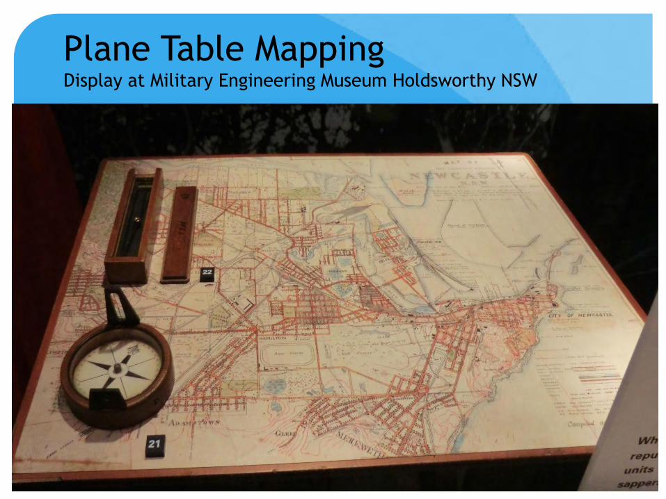
Plane Table Mapping Display at Military Engineering Museum Holdsworthy NSW

Warrant
Officer Vic
Aldred
and military
trainees
1940 near
Kilcoy Qld

Plane Table field work
required survey marks of
known coordinates
Accurate base lines
(gunter’s chain/steel
band)
and
triangulation with vernier
theodolites
supplemented by
Astronomical observations
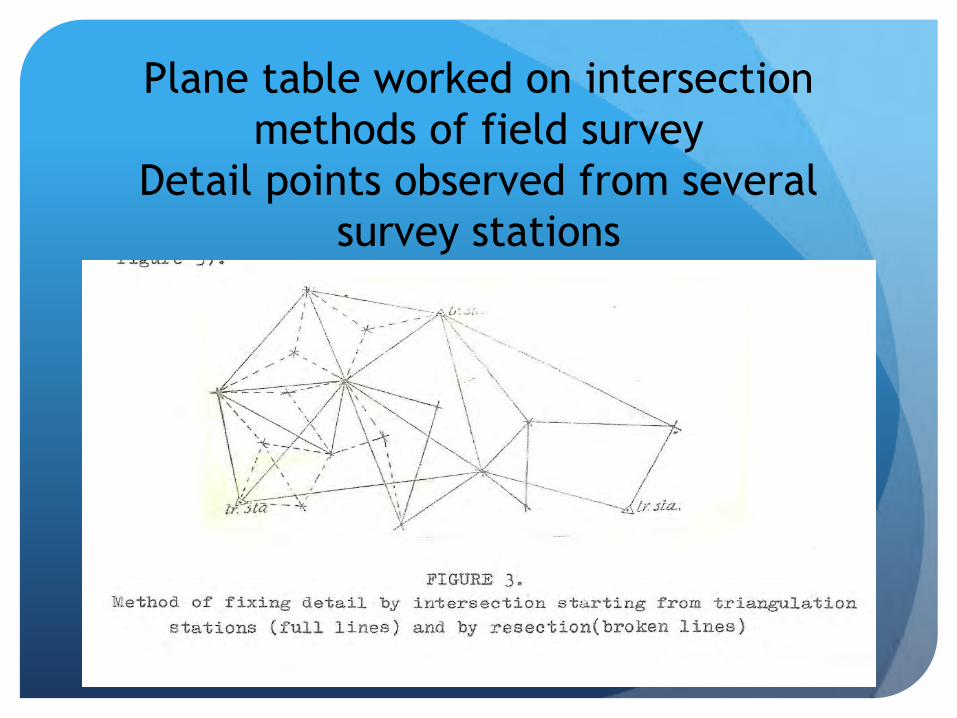
Plane table worked on intersection
methods of field survey
Detail points observed from several
survey stations
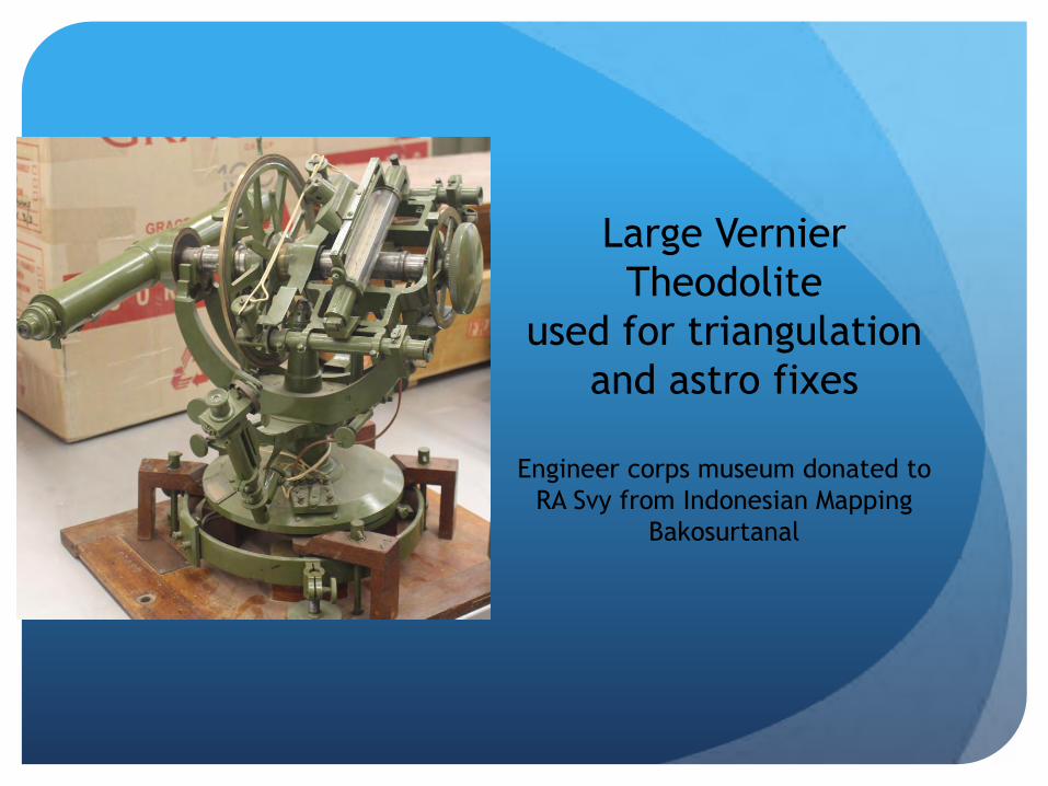
Large Vernier
Theodolite
used for triangulation
and astro fixes
Engineer corps museum donated to
RA Svy from Indonesian Mapping
Bakosurtanal

Early Trig stations
Australia and
Turkey WWI

Height determination by first order
leveling and aneroid barometers First order level Engineer Museum Holdsworthy
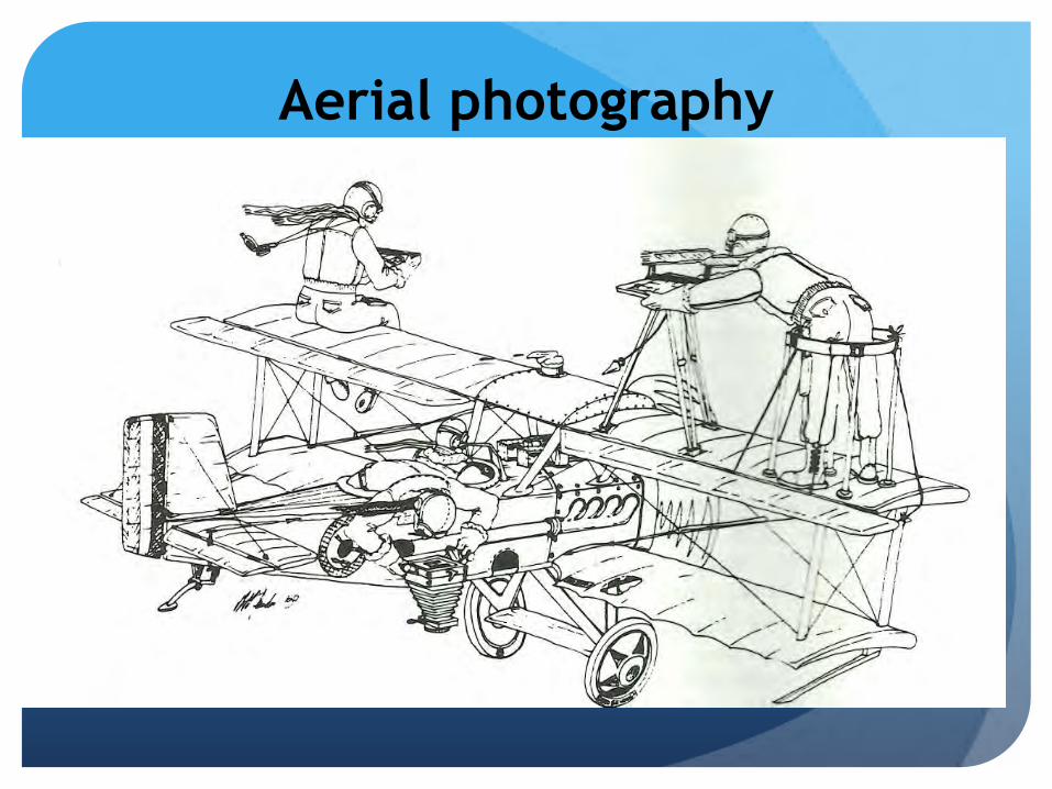
Aerial photography

Those magnificent men in their
flying machines!
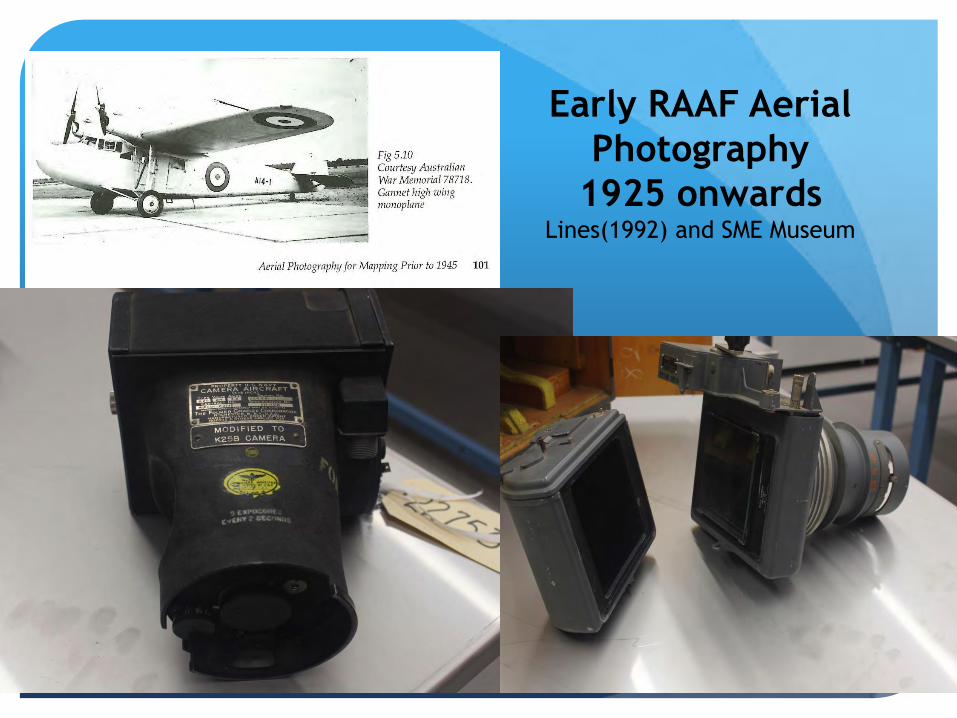
Early RAAF Aerial
Photography
1925 onwards Lines(1992) and SME Museum

Air Photos
Box Hill Melbourne
RAAF 1930 Eagle IV Camera and 1990 (RC 10?)
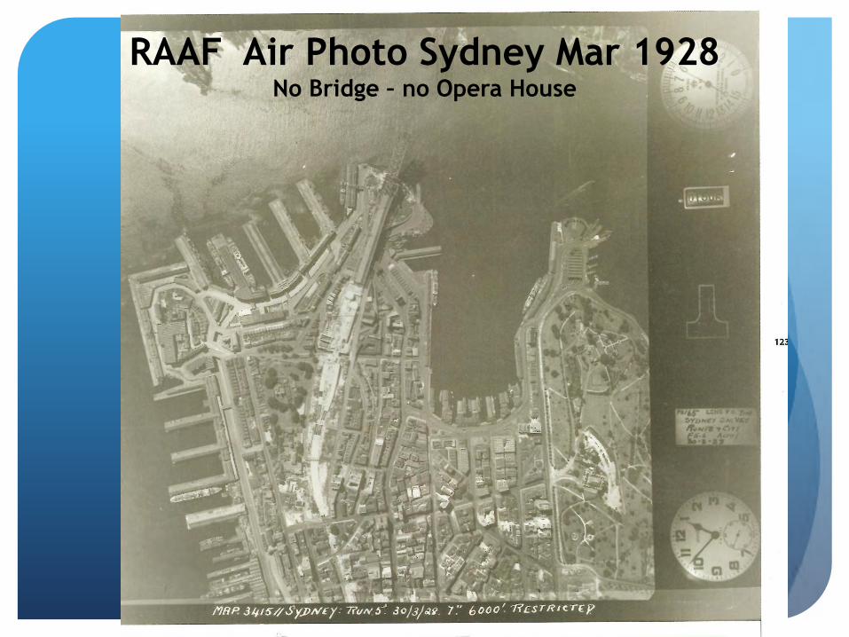
RAAF Air Photo Sydney Mar 1928 No Bridge – no Opera House

Capt Thomas Alexander Vance
1938
Visited many civilian and military mapping organisations in
the United States and Canada,
formed the view that the Australian Survey Corps work
compared very favourably ‘both in accuracy and cost’ to
anything done in North America.
noted the range of knowledge and competence of
Australian Survey Corps personnel was much broader
than their counterparts in North America
Early Photogrammetry
Photo mosaics
and
Multiplex plotters

Mulitiplex Plotters
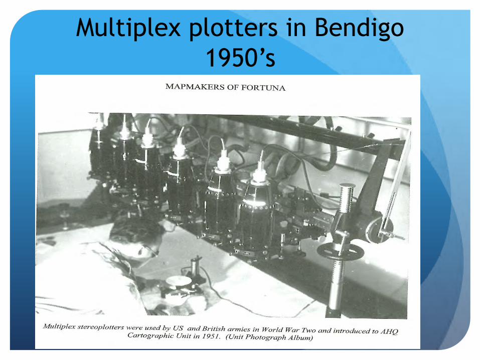
Multiplex plotters in Bendigo
1950’s
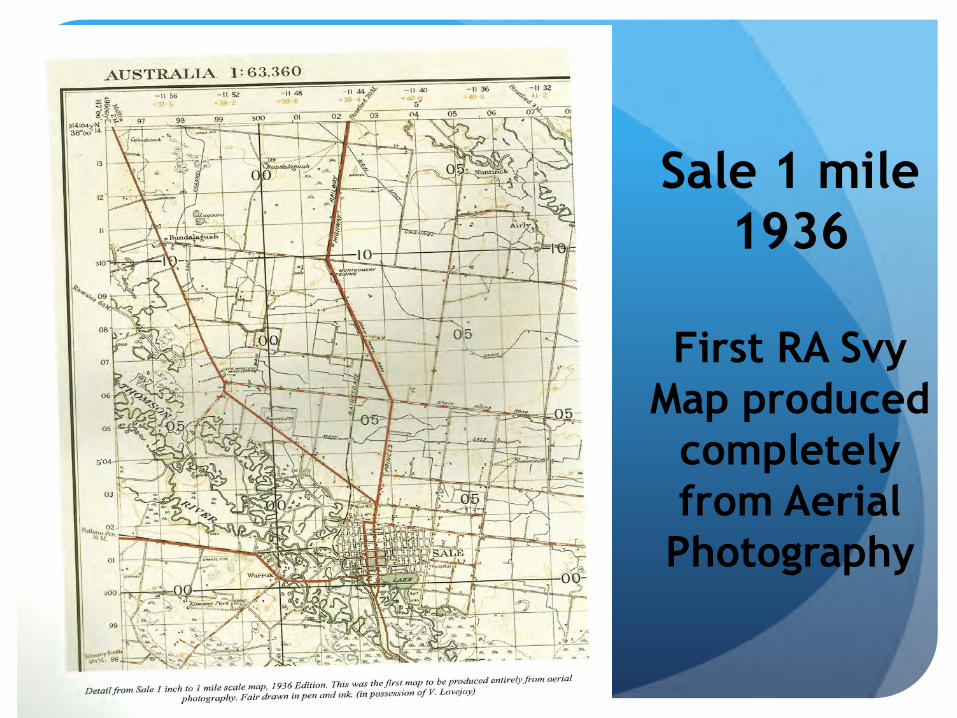
Sale 1 mile
1936
First RA Svy
Map produced
completely
from Aerial
Photography

World War II
The Homeland
Middle East
PNG
Kokoda
Rabaul
Wewak

Australian Mapping
1” to 1 Mile pre War 1939

Coverage in1945

WWII Aerial Photography

Wartime in
Bendigo
1960-1996 Adjutant’s Office
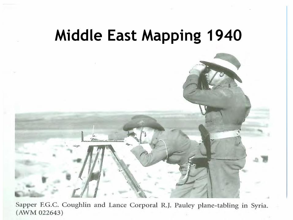
Middle East Mapping 1940
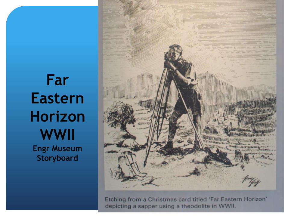
Far
Eastern
Horizon
WWII Engr Museum
Storyboard

Kokoda
1942
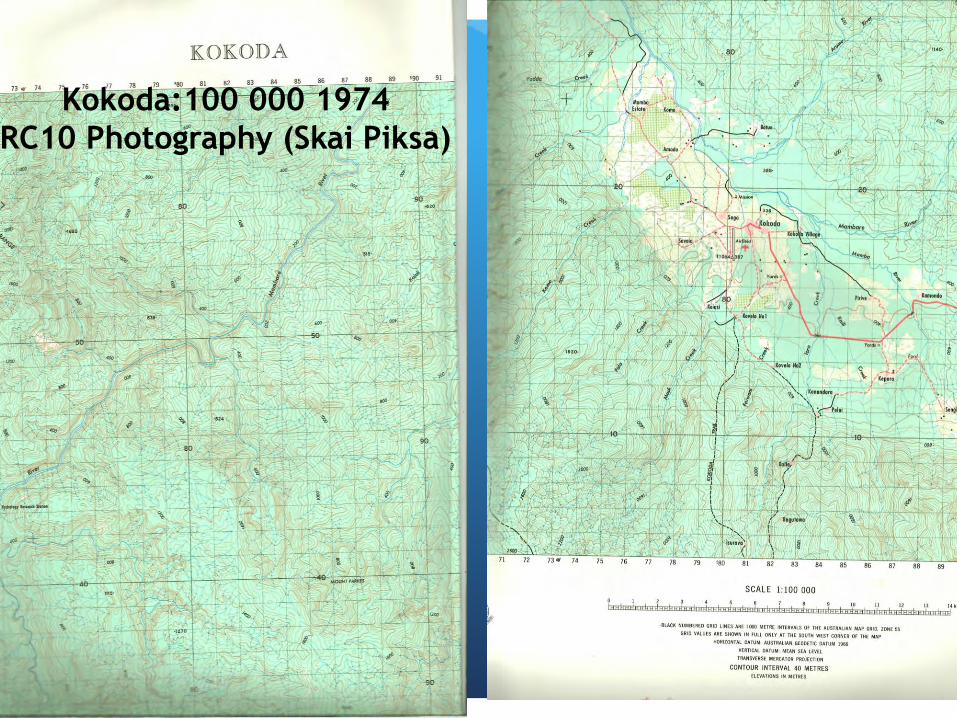
Kokoda:100 000 1974
RC10 Photography (Skai Piksa)

Rabaul 1943
1:63 360
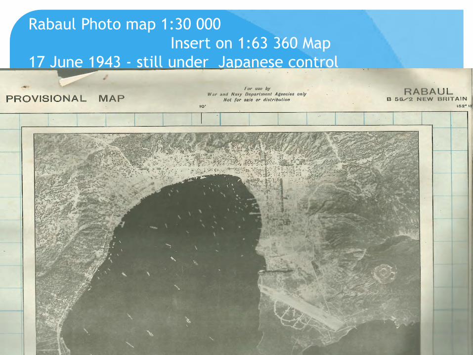
Rabaul Photo map 1:30 000
Insert on 1:63 360 Map
17 June 1943 - still under Japanese control
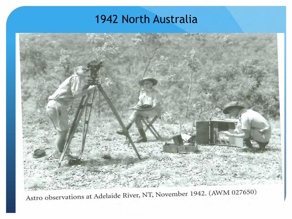
1942 North Australia
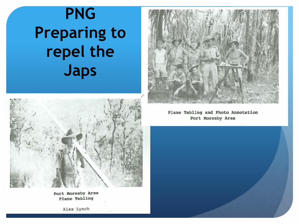
PNG
Preparing to
repel the
Japs

1:63 360
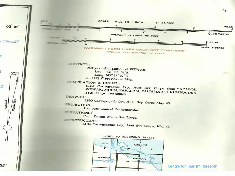
Produced 1945
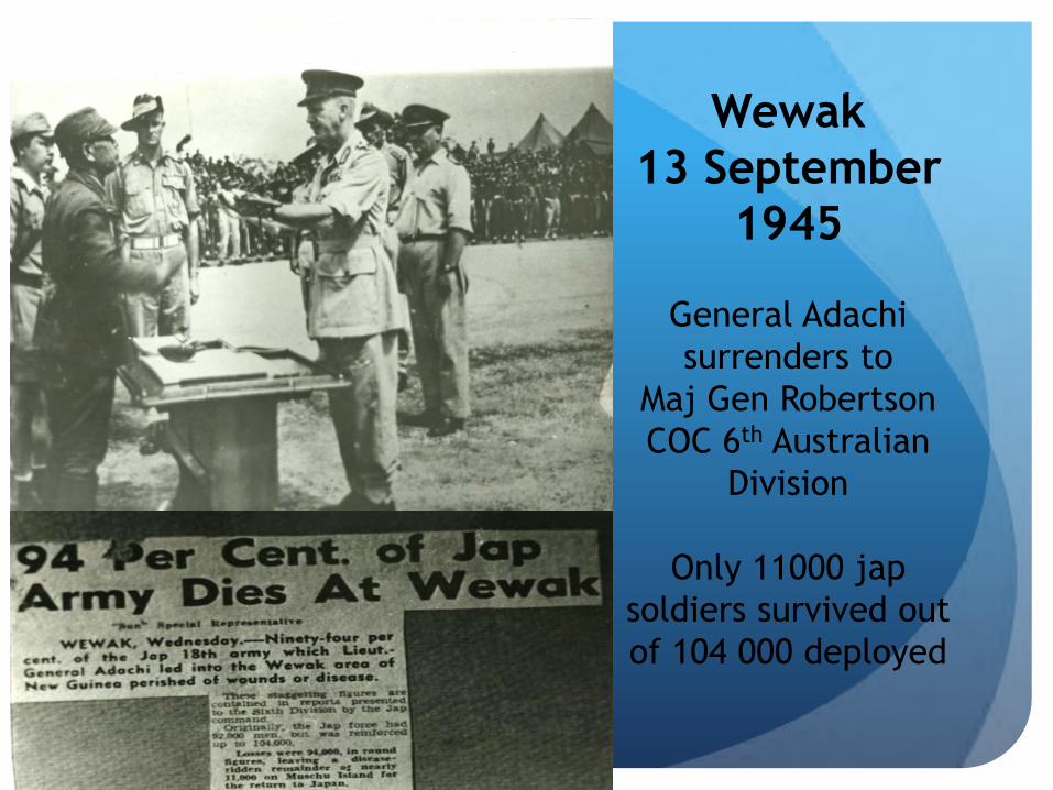
Wewak
13 September
1945
General Adachi
surrenders to
Maj Gen Robertson
COC 6th Australian
Division
Only 11000 jap
soldiers survived out
of 104 000 deployed
Centre for Tourism Research
42

Moem
1:25 000 Feb
1946
Home for
8 Fd Svy Sqn
1975 -1980

Moem 1:25 000 1946
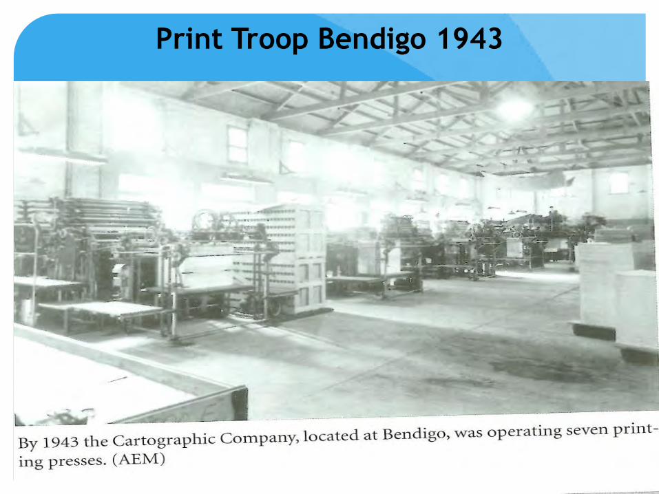
Print Troop Bendigo 1943

Post WWII Australia
Typesetting direct to film New 5 colour printing presses
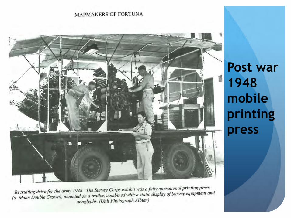
Post war
1948
mobile
printing
press
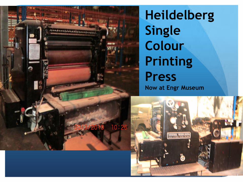
Heildelberg
Single
Colour
Printing
Press Now at Engr Museum

R504 1:250 000 series completed
1968 - 56% by RA Svy Corps

Vietnam 1966
Extract From: DET 1ST TOPOGRAPHICAL SURVEY TROOP
OPERATION ORDER 1/66
3.EXEC a. General outline
NUI DAT is to be co-ordinated by tellurometer measurement
and angle observation from the 1st order point"NOUVEAU
PHARE CAP ST JACQUES" GR 279 428.
In carrying out this task, the reliability of the control point is
to be tested by connexion between three known control
points in the VUNG TAU area and by the introduction into t h
e observed figure of astronomical azimuths.
Related Documents