From Grizzlies to Geysers: Creating the Atlas of Yellowstone Rodman, Andrew Marcus, Jim Meacham, Alethea Steingisser, & Carrie Guiles llowstone National Park & University of Oregon

From Grizzlies to Geysers: Creating the Atlas of Yellowstone
Jan 01, 2016
Yellowstone National Park & University of Oregon. From Grizzlies to Geysers: Creating the Atlas of Yellowstone. A n n Rod m an, Andrew Marcus, Jim Meacham, Alethea Steingisser, & Carrie Guiles. The Atlas Concept. The Atlas of Yellowstone will be a comprehensive, authoritative reference. - PowerPoint PPT Presentation
Welcome message from author
This document is posted to help you gain knowledge. Please leave a comment to let me know what you think about it! Share it to your friends and learn new things together.
Transcript
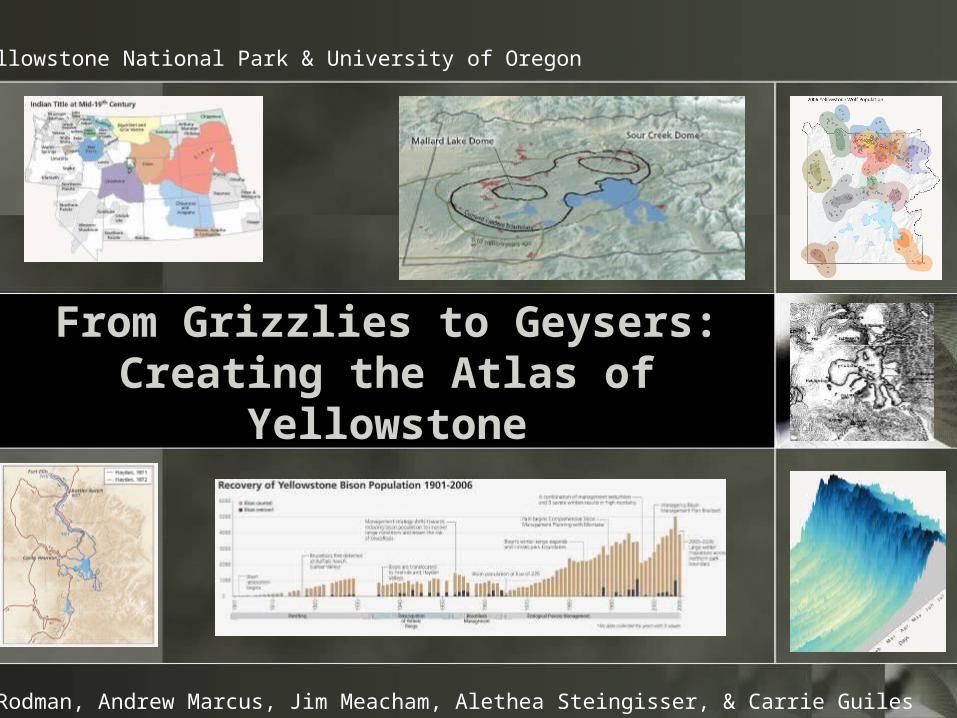
From Grizzlies to Geysers:Creating the Atlas of
Yellowstone
Ann Rodman, Andrew Marcus, Jim Meacham, Alethea Steingisser, & Carrie Guiles
Yellowstone National Park & University of Oregon
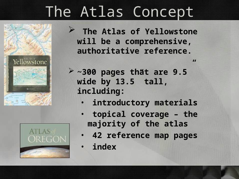
The Atlas Concept The Atlas of Yellowstone will be a
comprehensive, authoritative reference.
~300 pages that are 9.5” wide by 13.5” tall, including:• introductory materials• topical coverage – the majority
of the atlas• 42 reference map pages• index

The Atlas Concept - contents
Human and Economic Geography
Yellowstone in the WorldEarly MapsAmerican IndiansArcheologyExplorationHistory of the ParkManaging the ParkEarly TourismPopulation Density and GrowthIncome and EducationEconomic ActivityLand Ownership
Themes for all topics
Variations Connections Human Imprint Importance
Physical Geography
LandformsCross-sectionsGeologyGeothermal ActivityGlaciationClimateWaterVegetationFire HistoryWildlife

The “variations” themeThe Yellowstone environment is constantly changing over time scales
ranging from the geologic to the almost instantaneous
and over spatial scales ranging from the microscopic to the regional.

The “connections” themeYellowstone does not exist in isolation.
Yellowstone influences places far removed from the park boundaries.
What occurs in other places affects Yellowstone
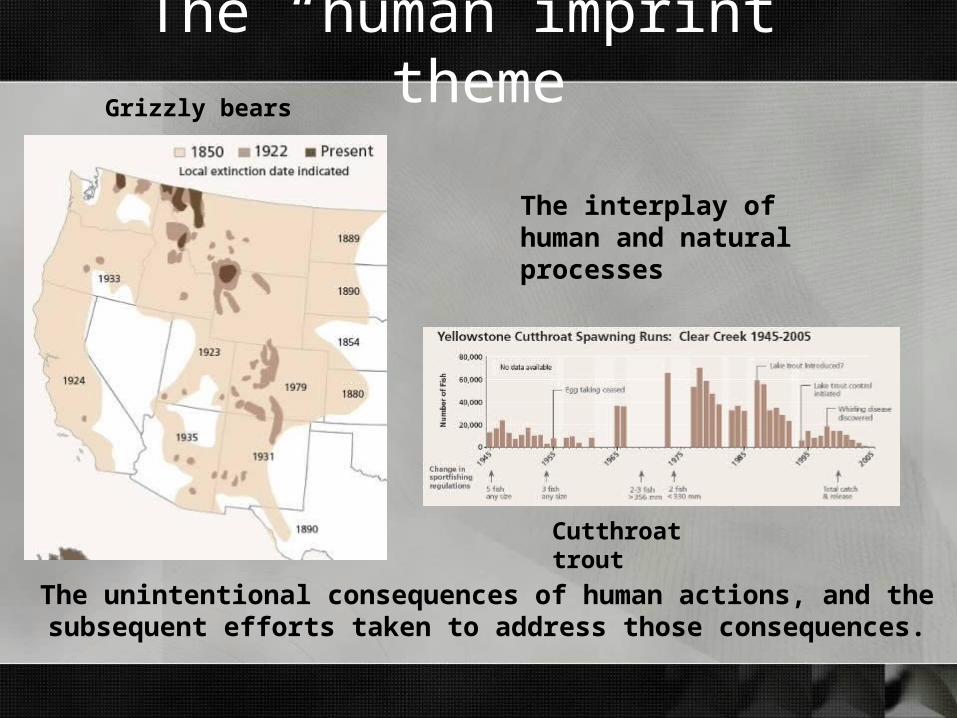
The “human imprint” theme
The unintentional consequences of human actions, and the subsequent efforts taken to address those consequences.
The interplay of human and natural processes
Grizzly bears
Cutthroat trout
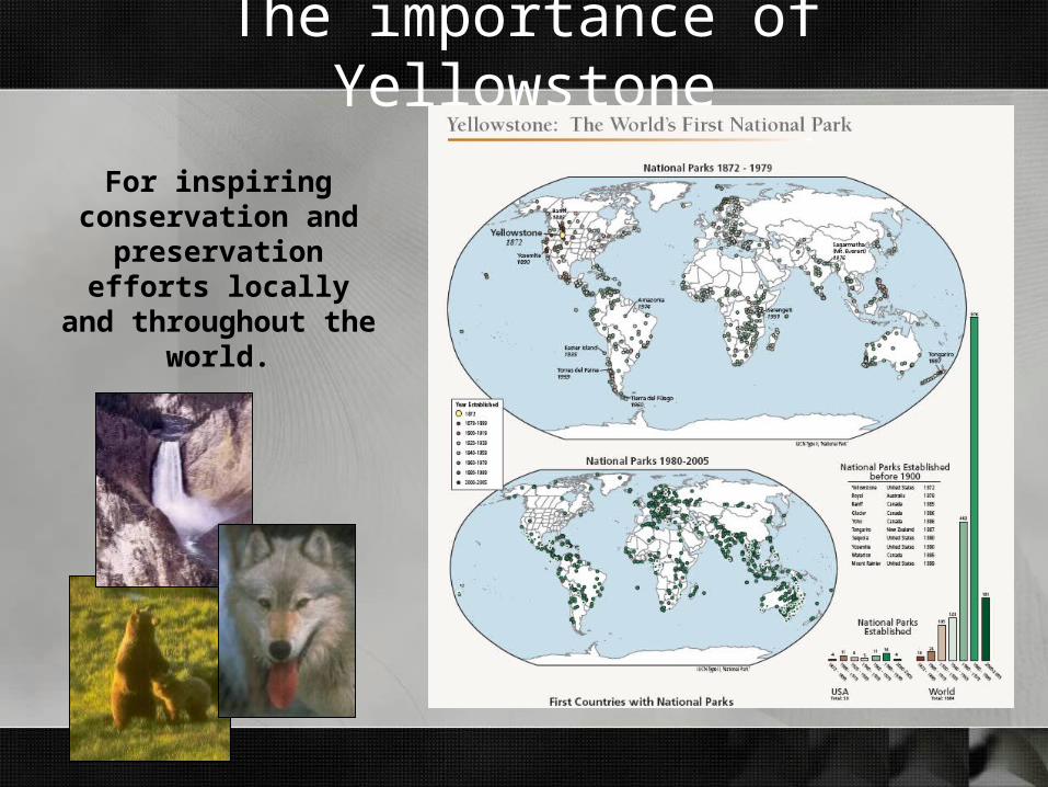
The importance of Yellowstone
For inspiring conservation and
preservation efforts locally and throughout
the world.

The Atlas Concept – page pairs
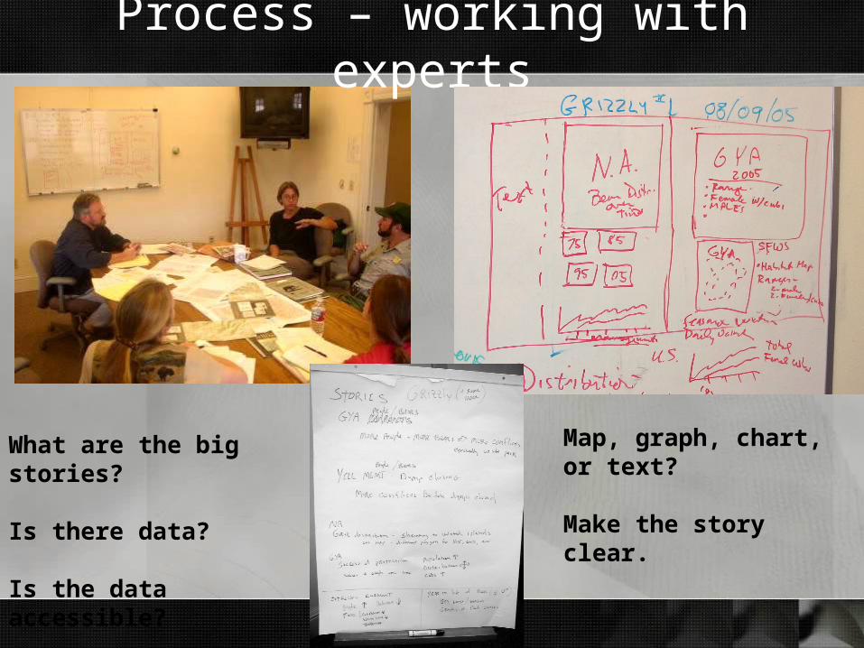
Process – working with experts
What are the big stories?
Is there data?
Is the data accessible?
Map, graph, chart, or text?
Make the story clear.
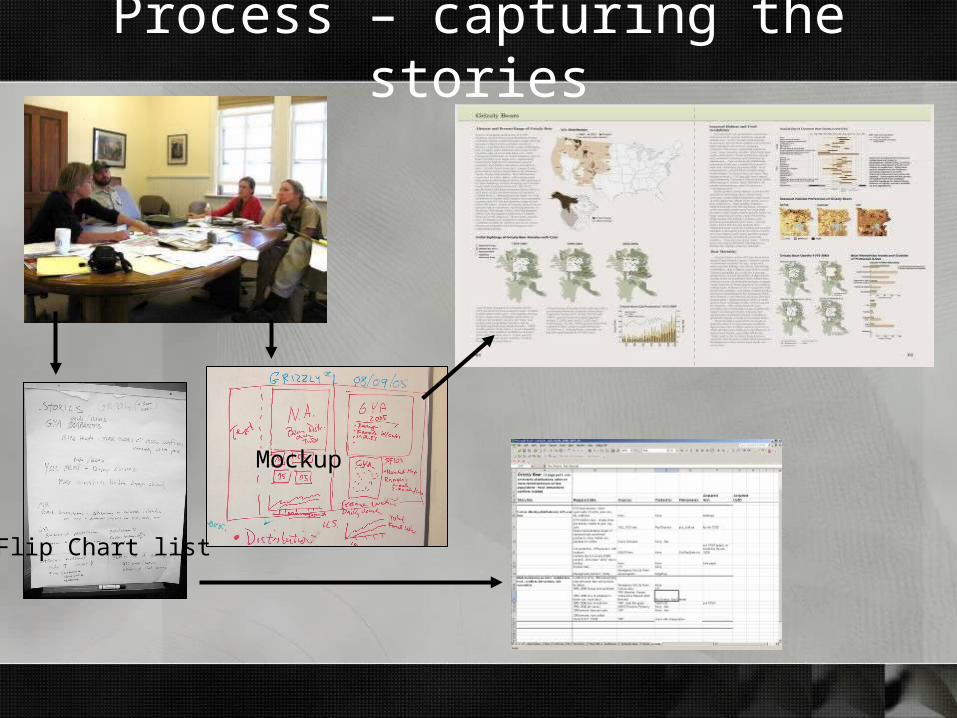
Process – capturing the stories
Flip Chart list
Mockup
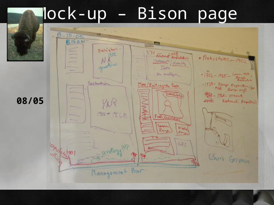
Mock-up – Bison page
08/05

Draft 1 – Bison page
12/06
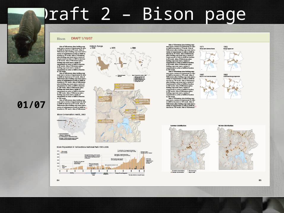
Draft 2 – Bison page
01/07
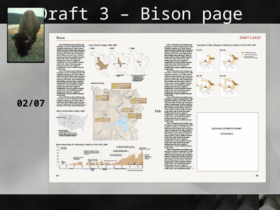
Draft 3 – Bison page
02/07

Draft 4 – Bison page
03/07
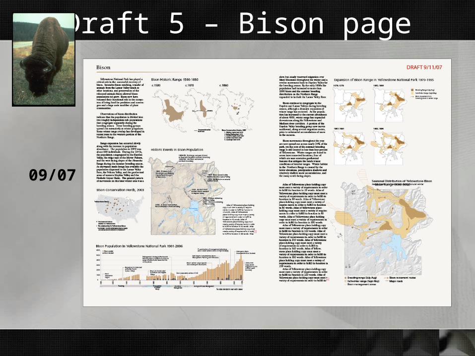
Draft 5 – Bison page
09/07
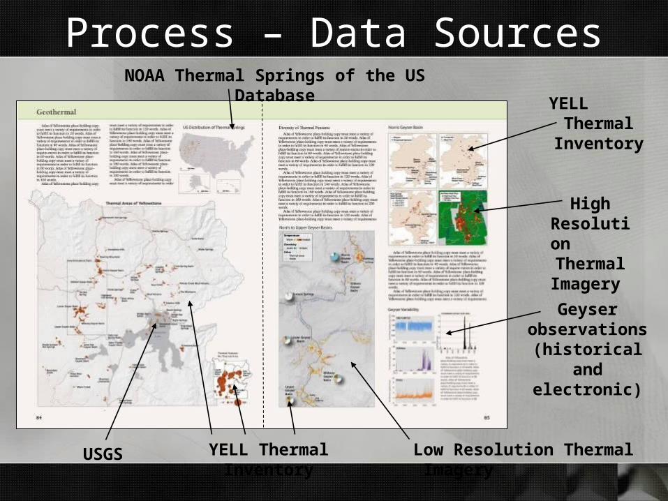
Process – Data SourcesNOAA Thermal Springs of the US Database
YELL Thermal Inventory
YELL Thermal
Inventory
Low Resolution Thermal Imagery
High Resolution
Thermal
Imagery Geyser
observations (historical and
electronic)
USGS
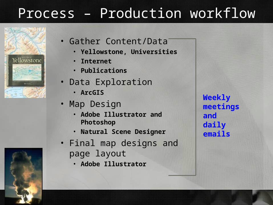
Process – Production workflow
• Gather Content/Data• Yellowstone, Universities• Internet• Publications
• Data Exploration• ArcGIS
• Map Design• Adobe Illustrator and Photoshop• Natural Scene Designer
• Final map designs and page layout• Adobe Illustrator
Weekly meetings anddaily emails
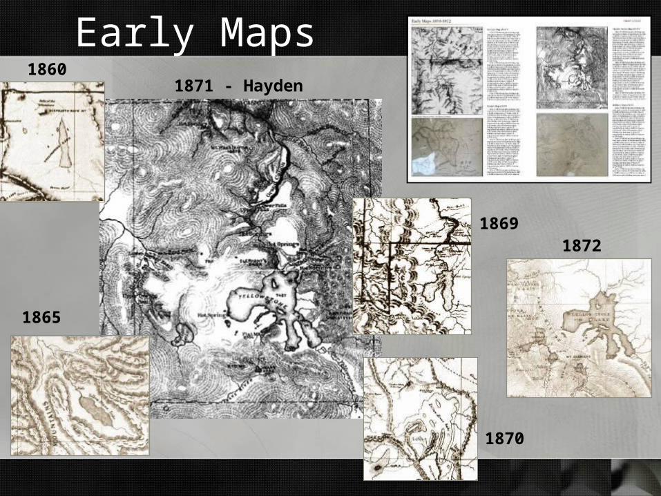
Early Maps1860
1870
18691872
1865
1871 - Hayden

Early Explorers
First Euro-American contact, 1806-1813
Journeys of a Trapper, 1835 – 1840
The Search for Gold, 1863 – 1970
Exploration, 1860 – 1870
Surveys, 1871 - 1872

American Indians
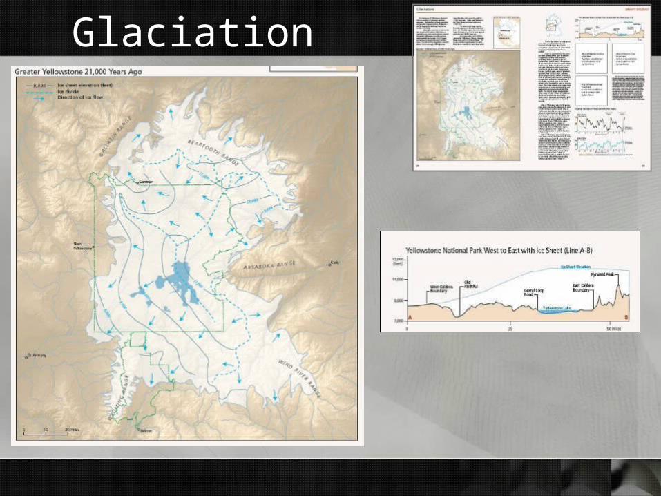
Glaciation
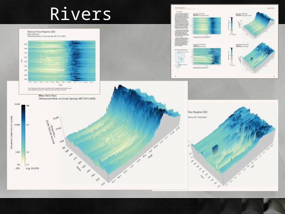
Rivers
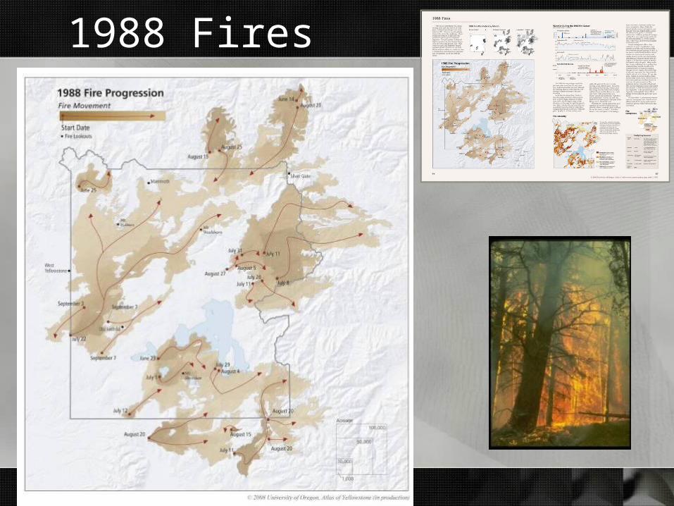
1988 Fires
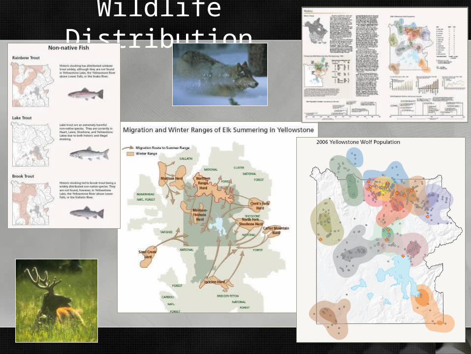
Wildlife Distribution

New Reference Maps – 1:200K

New Reference Maps – 1:100K
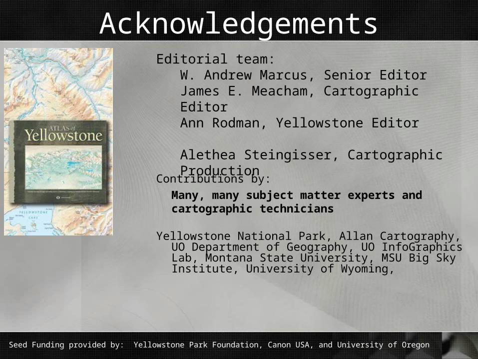
Acknowledgements
Contributions by:
Many, many subject matter experts and cartographic technicians
Yellowstone National Park, Allan Cartography, UO Department of Geography, UO InfoGraphics Lab, Montana State University, MSU Big Sky Institute, University of Wyoming,
Editorial team:W. Andrew Marcus, Senior EditorJames E. Meacham, Cartographic EditorAnn Rodman, Yellowstone Editor
Alethea Steingisser, Cartographic Production
Seed Funding provided by: Yellowstone Park Foundation, Canon USA, and University of Oregon
Related Documents