1 GOVERNMENT FOREIGN MANPOWER POLICY INFORMATION SHARING PLATFORM BIM SINGAPORE For Sustainable Urban Development IMPROVE PRODUCTIVITY CONSTRUCTION’S COST PLANNING

Welcome message from author
This document is posted to help you gain knowledge. Please leave a comment to let me know what you think about it! Share it to your friends and learn new things together.
Transcript

1
GOVERNMENT FOREIGN MANPOWER
POLICY
INFORMATION SHARING PLATFORM
BIM SINGAPORE
For Sustainable Urban
Development
IMPROVE PRODUCTIVITY
CONSTRUCTION’S COST PLANNING

AGENDA
1
• Introduction to BIM
2 • What has Singapore done?
3
• What about Land Surveyors’ Journey in BIM?
4
• Integration and Collaboration with Stakeholders
5
• Other Benefits from BIM

Courtesy of Autodesk

Introduction to BIM
BIM Definition
BIM is a 3D modelling technology that
allows the exploration of the building
project digitally for better visualisation. It is
an essential tool for professionals to
improve the construction productivity and
the integration across the various
disciplines.

Benefits & Barriers of BIM
Increase productivity & profit
Improve management & quality
Reduce clashes and errors Decrease reworks Cost & project duration
reduction Increase collaboration Project control &
predictability Visualisation
✗ Lack of experience ✗ Data Interoperability ✗ Collaboration between
different disciplines ✗ Authorisation & Legislation ✗ Cost of software & hardware ✗ Culture (new technology vs
“old school”) ✗ Awareness

Difference between 3D CAD, GIS and BIM

Raise industry awareness by conducting seminars,
workshops and conferences on the benefits of BIM
technology
Collaboration with Institutes of Higher Learning for BIM
training
2009 Pioneering BIM use in public housing by the Housing &
Development Board (HDB)
2010 BIM funds: training, consulting, hardware and
collaboration software
2015 BIM e-submission for all projects greater than 5,000sqm
BCA implement the world’s first BIM e-submission
7
What has Singapore done?

8
JUL 2013 Architectural BIM e-submission for GFA > 20,000 sqm.
JUL 2014 Engineering BIM e-submission for GFA > 20,000 sqm.
JUL 2015 All BIM e-submission for GFA > 5,000 sqm.
OCT 2016 Mandatory submission in Native BIM format for all BIM e-submission for GFA > 5,000 sqm: Architectural plans – second half of 2017 Engineering plans – second half of 2018
regulatory approvals Mandated BIM e-submissions for
What has Singapore done? cont…

9
BIM Roadmap (2010) 80% of construction industry use BIM by 2015
Singapore BIM Guide Version 2.0 Outline the roles and responsibilities of project
members at different stages of a project
BIM Essential Guide Series References on good BIM practices in an illustrated,
easy-to-read format, for new BIM users in Singapore.
Building & Construction Authority (BCA)
What has Singapore done? cont…

10
Collaborations in BIM Implementation
Programme
What has Singapore done? cont…

11

12
Collaboration between
Singapore Institute of
Surveyors & Valuers (SISV),
Singapore Land Authority
(SLA), Housing Development
Board (HDB), architects and
Austodesk
Assist surveyors in preparing
BIM site model that meets the
requirement of architect for their
submission to authority
Essential guide for development
life cycle
BIM Guide for Land Surveyors

13
Two-dimentional technical drawings with zero visualisation and possible misinterpretation
Spatial dimensions and data render into three-dimensional forms that can be viewed from various angles and planes in real-time TR
AD
ITO
NA
L WITH
BIM
Traditional & Current

Evolution of Land Surveyor’s Role
Tape or chain measures,
theodolites, dumpy levels,
staffs
Total station, GPS, GIS, laser
scanning technology
Land survey technique + BIM
technology

BIM for Land Survey
• Provide geolocation information
• Model existing site contour and
location
• Surface model and condition,
orientation and georeferenced


Softwares
Revit (Autodesk)
• Supports a multidiscipline design
process for collaborative design
• Interoperability capability (imports,
exports, and links your data with
commonly used formats, including IFC,
DWG™ and DGN)
Softwares cont…
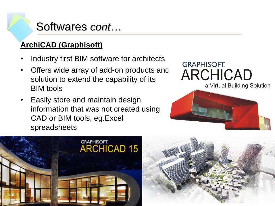
ArchiCAD (Graphisoft)
• Industry first BIM software for architects
• Offers wide array of add-on products and
solution to extend the capability of its
BIM tools
• Easily store and maintain design
information that was not created using
CAD or BIM tools, eg.Excel
spreadsheets

Data Interoperability
• can be easily solved by using the most common
software or IFC format.
• establishment of BIM library & standardization of
BIM objects
Technology issues include data interoperability
problems, accuracy of extracted data or transferring
from BIM design and simulation software (Bernstein &
Pittman, 2004)
“
”
DWG IFC
DXF RVT NWD

Other Disciplines Benefiting
from BIM

Facility Management
• Includes multiple disciplines
to ensure building is fully
functional
• To coordinate the demand
and supply of facilities and
services
• Manage operation and
maintenance of buildings
throughout the operational
lifecycle
Courtesy of alexandermac.com

Facility Management cont…
Facility Manager finds value in how much the
building operation benefit from enhanced
data in BIM model.
• Better Space Management
• Accurately Updated Maintenance System
• Efficient Use of Energy
• BIM Model Representation of Building Facilities
• Enhanced Lifecycle Management
Courtesy of safety-smart.co.uk

Cost Estimation
• Estimators typically digitise the architect’s paper
drawings, or importing their CAD drawings into a cost
estimating package, or doing manual takeoffs from
their drawings.
• Using BIM, when a change is made in the design, it will
automatically reflect to all related construction
documentation and schedules

Do not require manual calculation
Save time
Save cost
Reduce the potential for human error
Cost Estimation cont…
By adopting BIM in cost estimating
process...

Sustainability Simulation
• Cost-effective technique of supporting energy efficient design
and the subsequent operation and maintenance of buildings
• Foresee the potential errors in design and prevent the possibility
of project failure
• Validate the performance of design enable designers to improve
their designs
Courtesy of Autodesk

• Competency of professionals in BIM could be achieved
by a more multidisciplinary approach
• Communication and collaboration between
stakeholders make significant contribution to overall
project success
• BIM requires collaboration between the public and
private sector’s stakeholders

Thank You
Related Documents