Focus on surface wind events in Ireland on the morning of 18 th January 1 Michelle Dillon, Aviation Forecaster November 2007

Focus on surface wind events in Ireland on the morning of 18 th January 1 Michelle Dillon, Aviation Forecaster November 2007.
Dec 16, 2015
Welcome message from author
This document is posted to help you gain knowledge. Please leave a comment to let me know what you think about it! Share it to your friends and learn new things together.
Transcript
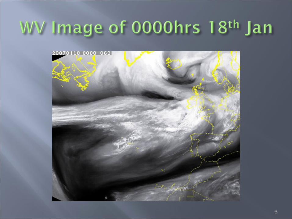
Focus on surface wind events in Ireland on the morning of
18th January
1
Michelle Dillon, Aviation ForecasterNovember 2007
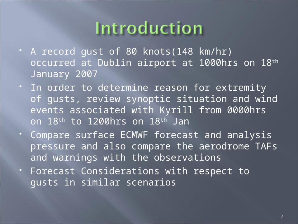
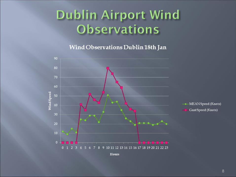
A record gust of 80 knots(148 km/hr) occurred at Dublin airport at 1000hrs on 18th January 2007
In order to determine reason for extremity of gusts, review synoptic situation and wind events associated with Kyrill from 0000hrs on 18th to 1200hrs on 18th Jan
Compare surface ECMWF forecast and analysis pressure and also compare the aerodrome TAFs and warnings with the observations
Forecast Considerations with respect to gusts in similar scenarios
2
3
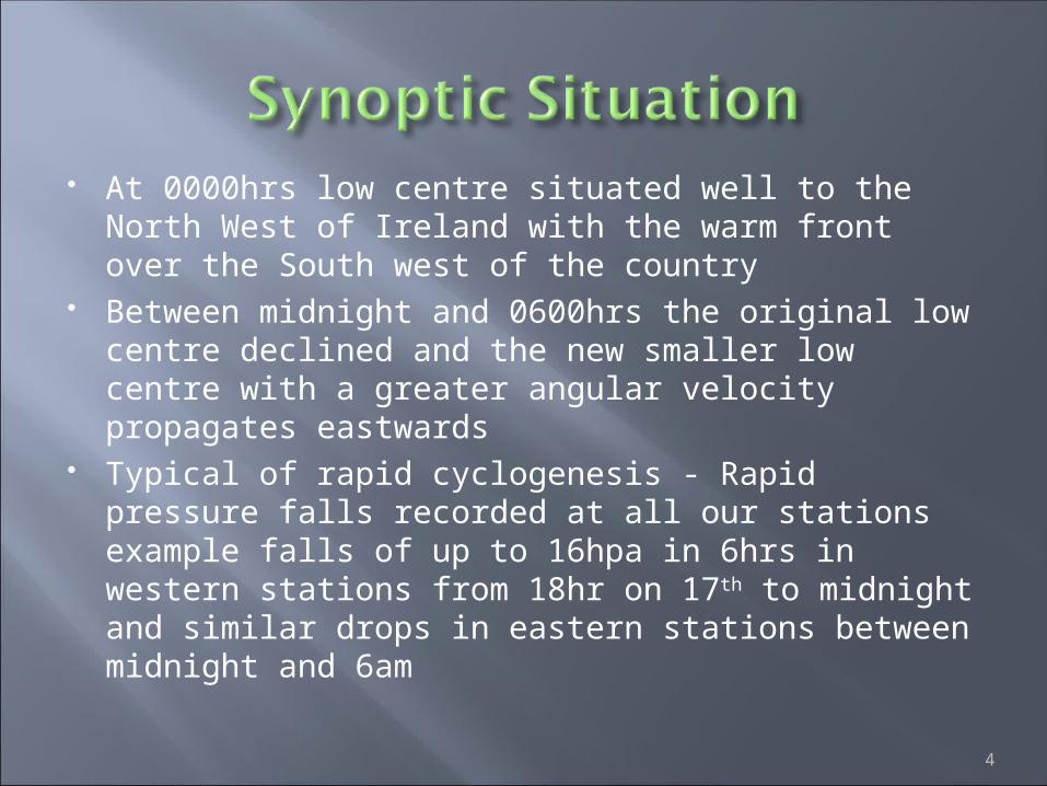
At 0000hrs low centre situated well to the North West of Ireland with the warm front over the South west of the country
Between midnight and 0600hrs the original low centre declined and the new smaller low centre with a greater angular velocity propagates eastwards
Typical of rapid cyclogenesis - Rapid pressure falls recorded at all our stations example falls of up to 16hpa in 6hrs in western stations from 18hr on 17th to midnight and similar drops in eastern stations between midnight and 6am
4

UK Met Office Analysis Charts at 0600hrs and 1200hrs
5

6
7
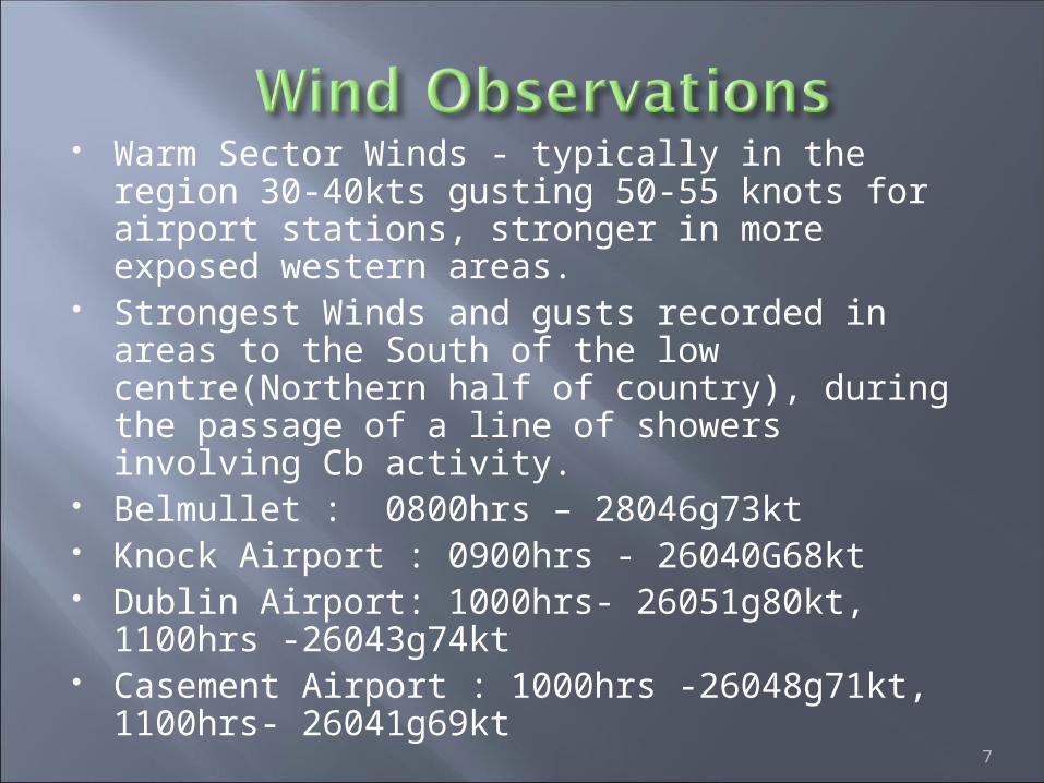
Warm Sector Winds - typically in the region 30-40kts gusting 50-55 knots for airport stations, stronger in more exposed western areas.
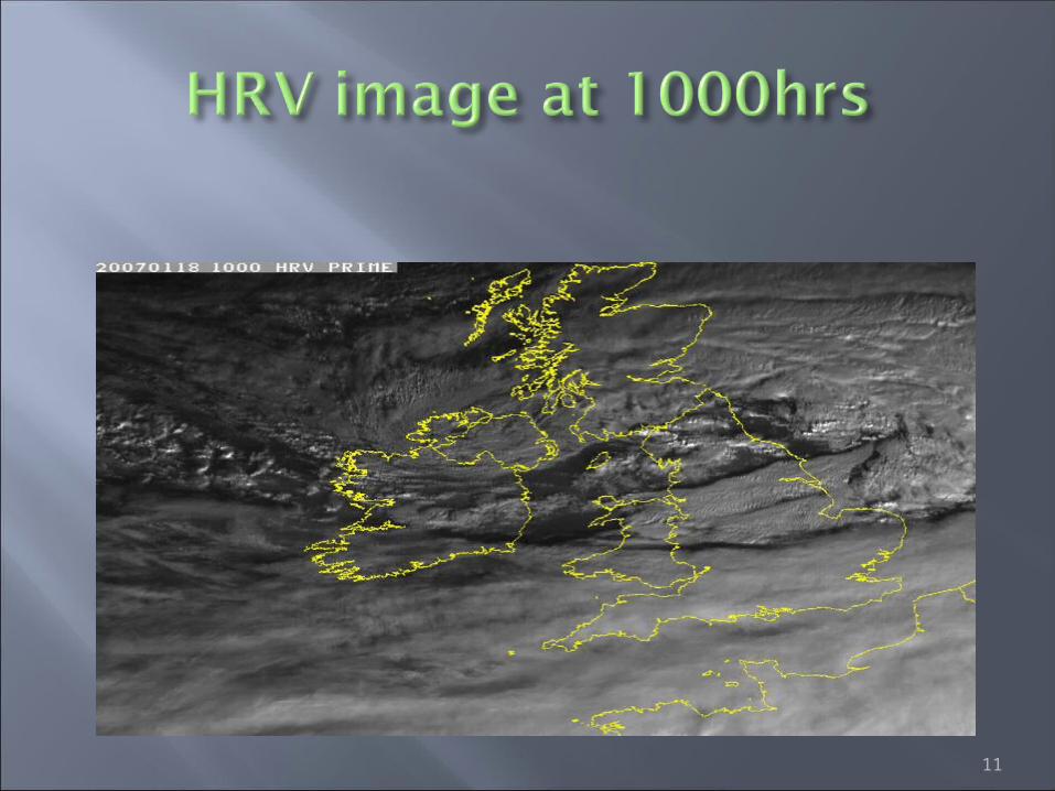
Strongest Winds and gusts recorded in areas to the South of the low centre(Northern half of country), during the passage of a line of showers involving Cb activity.
Belmullet : 0800hrs – 28046g73kt Knock Airport : 0900hrs - 26040G68kt Dublin Airport: 1000hrs- 26051g80kt,
1100hrs -26043g74kt Casement Airport : 1000hrs -26048g71kt,
1100hrs- 26041g69kt
8
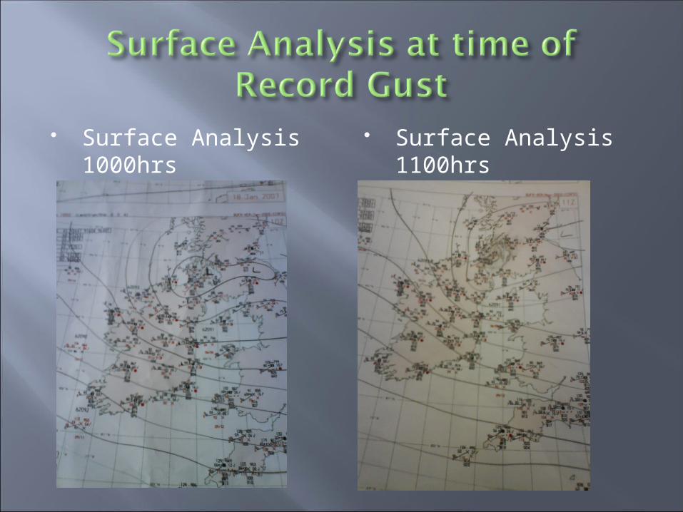
Surface Analysis 1000hrs
Surface Analysis 1100hrs

Strongest gusts in Dublin at 1000hrs and 1100hrs where gradient very tight to the South West of Low centre and associated with a line of showers and cb activity
10
11
12
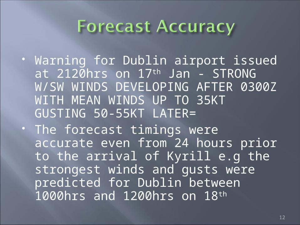
Warning for Dublin airport issued at 2120hrs on 17th Jan - STRONG W/SW WINDS DEVELOPING AFTER 0300Z WITH MEAN WINDS UP TO 35KT GUSTING 50-55KT LATER=
The forecast timings were accurate even from 24 hours prior to the arrival of Kyrill e.g the strongest winds and gusts were predicted for Dublin between 1000hrs and 1200hrs on 18th
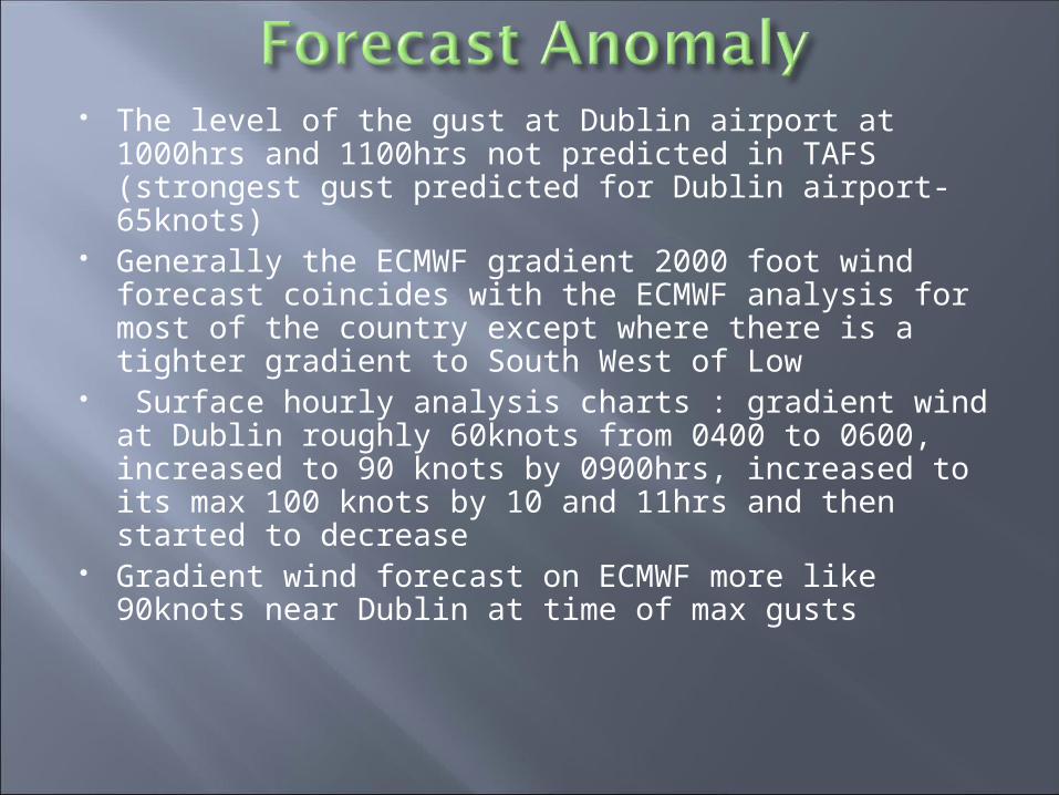
The level of the gust at Dublin airport at 1000hrs and 1100hrs not predicted in TAFS (strongest gust predicted for Dublin airport- 65knots)
Generally the ECMWF gradient 2000 foot wind forecast coincides with the ECMWF analysis for most of the country except where there is a tighter gradient to South West of Low
Surface hourly analysis charts : gradient wind at Dublin roughly 60knots from 0400 to 0600, increased to 90 knots by 0900hrs, increased to its max 100 knots by 10 and 11hrs and then started to decrease
Gradient wind forecast on ECMWF more like 90knots near Dublin at time of max gusts
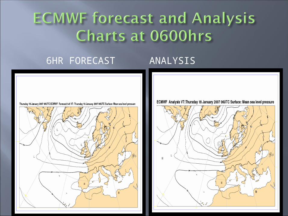
6HR FORECAST ANALYSIS
14

12HR FORECAST ANALYSIS
15
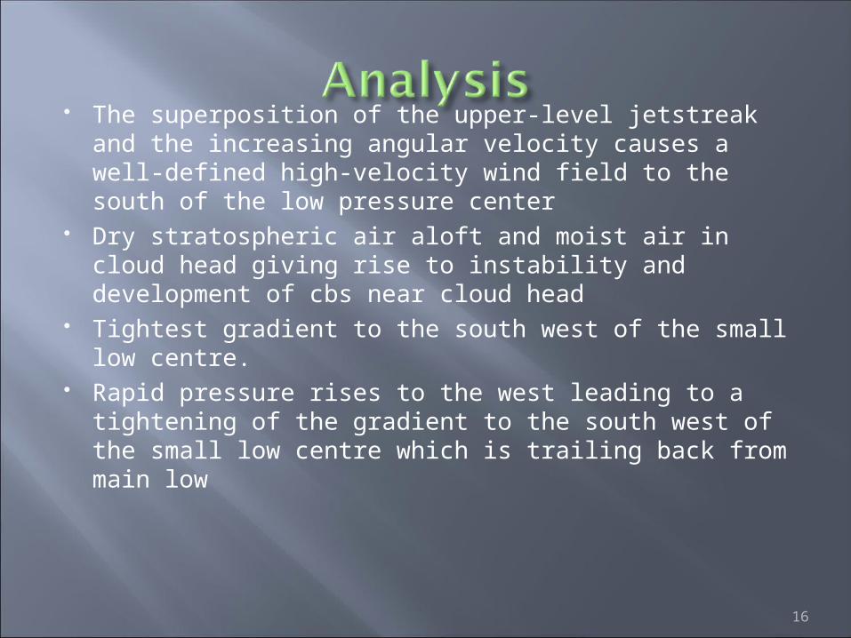
The superposition of the upper-level jetstreak and the increasing angular velocity causes a well-defined high-velocity wind field to the south of the low pressure center
Dry stratospheric air aloft and moist air in cloud head giving rise to instability and development of cbs near cloud head
Tightest gradient to the south west of the small low centre.
Rapid pressure rises to the west leading to a tightening of the gradient to the south west of the small low centre which is trailing back from main low
16

17

18
Conceptual model theory - "Very strong gusts in the transition zone between dark and white in the WV channels near the cold front and the cloud head"
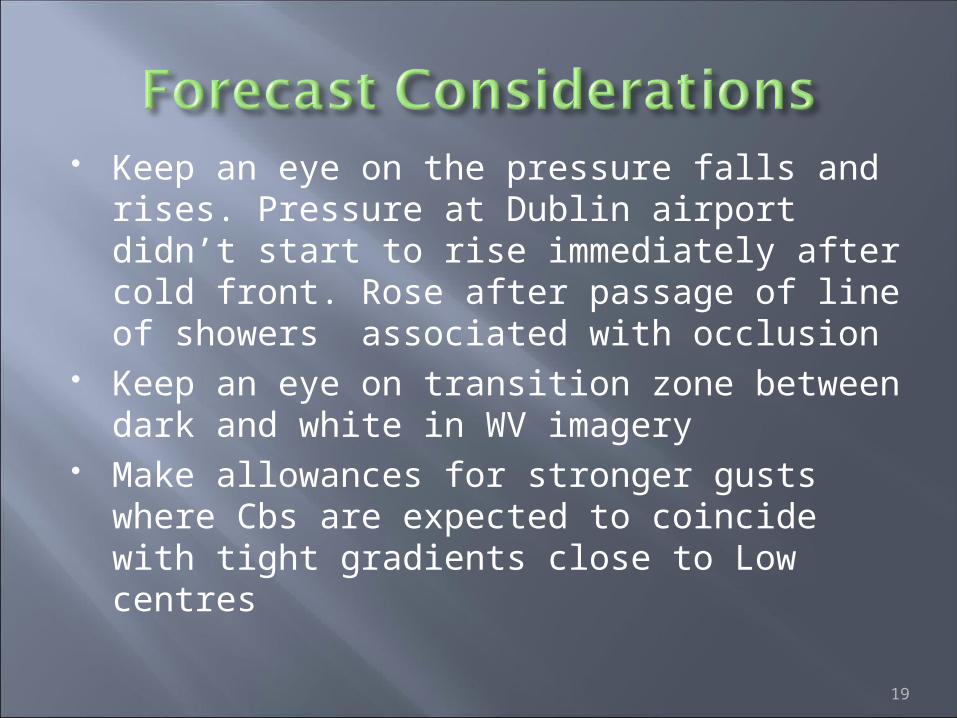
Keep an eye on the pressure falls and rises. Pressure at Dublin airport didn’t start to rise immediately after cold front. Rose after passage of line of showers associated with occlusion
Keep an eye on transition zone between dark and white in WV imagery
Make allowances for stronger gusts where Cbs are expected to coincide with tight gradients close to Low centres
19

20
Related Documents