Welcome message from author
This document is posted to help you gain knowledge. Please leave a comment to let me know what you think about it! Share it to your friends and learn new things together.
Transcript


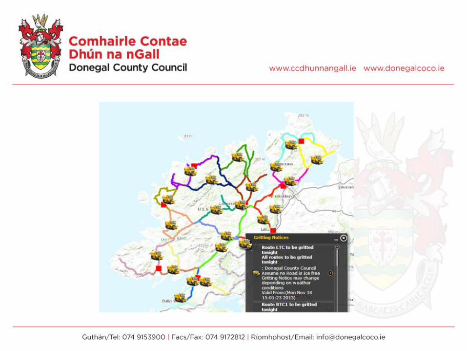
Using FME to enhance the Winter Maintenance
WebMap
Daragh McDonough
GIS Project Leader
Donegal County Council
@DonegalMaps
http://donegal.maps.arcgis.com

FME & Donegal County Council
•Invested in 2004 single desktop license
•2015 considered Essential Software
•Originally used to move data “around”
•Potential for added value was what really
caught my eye
•There is a particular FME language!!

Winter Maintenance Programme:
•11,000 tonnes
•Mid-Oct to End April
•1000km max of road to be gritted/night
•€13k per night per call
•Fleet 25 gritters + TC fleet
•9m3 70km NP road
•Ploughs mounted 5-6 times
•50 rota drivers; 4 trained engineers
•~100 Callouts per season

Heading Text Can Go Here
Sub Text Can Go Here
Body text can here

Project Initiation Toolkit:
Twitter @RoadsDCC
#gritters
Tweet everynight

Twitter: @RoadsDCC•FME twitter status fetcher #gritters
•Preformatted structured tweet
•Map routes to route centrepoint
•Output as GeoRSS (to use the GeoRSS widget in
Flexviewer)


And then the storms started rolling
in…..
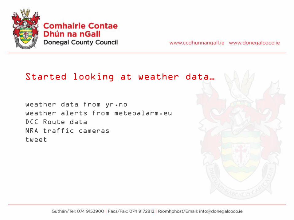
Started looking at weather data…
weather data from yr.no
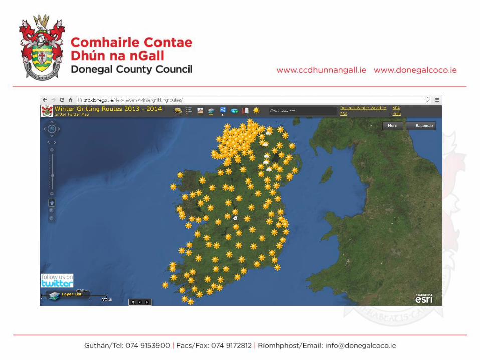
weather alerts from meteoalarm.eu
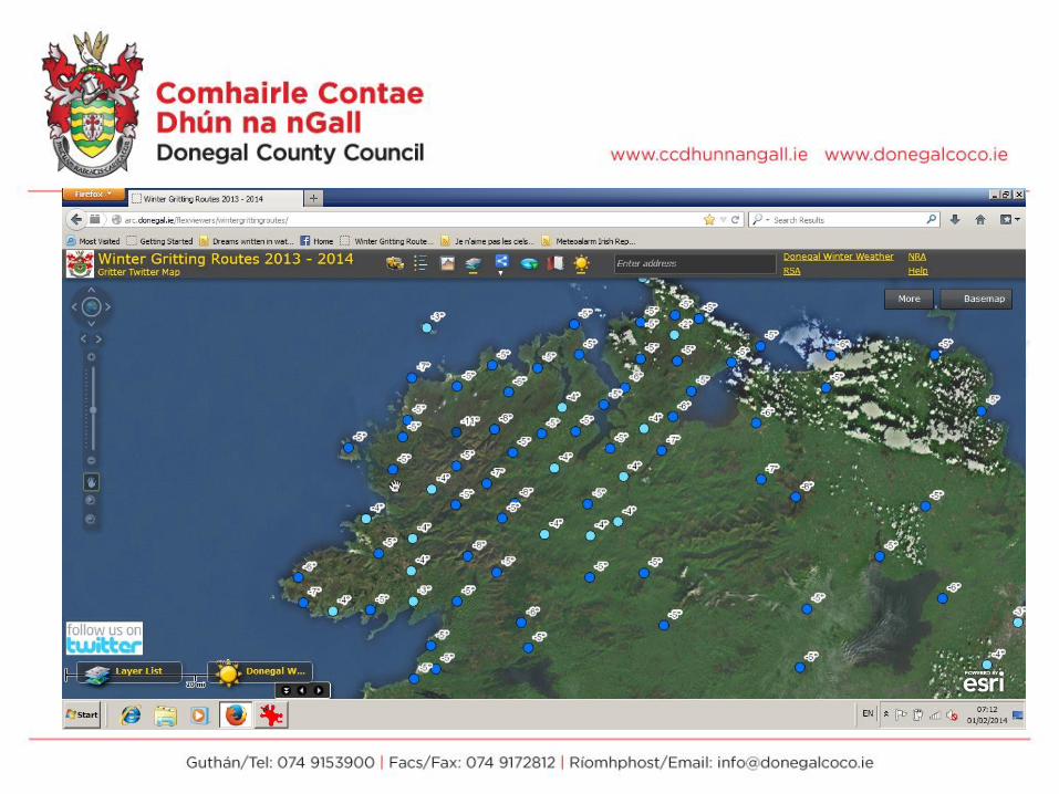
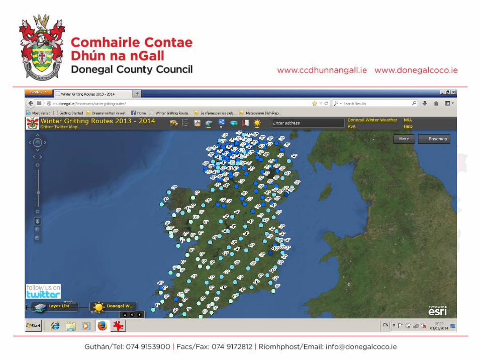
DCC Route data
NRA traffic cameras
tweet

Data
•Yr.no is our forecast of choice
forecast provide hourly as xml for 12 or
24 hour period
•Meteoalarm provide County/Region alerts as
RSS
•Traffic Cameras: we license updated images
from Vaisala on routes through the North
•DCC routes, grit dumps, Salt barns


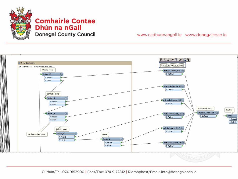
Yr.no
Wind speed/direction, temperature,
pressure, precipitation, summary
Parse out required fields per location, run
through FME workspace to:
format summary
day/night
map it
create hyperlinks
output to geodatabase


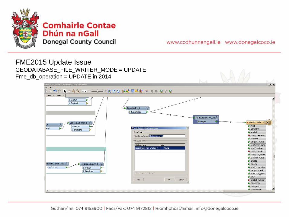
FME2015 Update IssueGEODATABASE_FILE_WRITER_MODE = UPDATE
Fme_db_operation = UPDATE in 2014

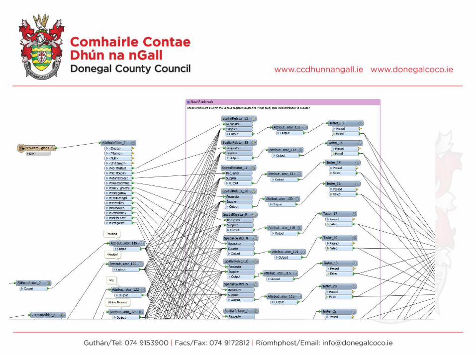
Can we add value?
Generate Alerts in 12hrs


Meteoalarms: National alerts supplied by MetEireann


ArcMap
Configure the mxd.
Thematic icons for weather, alerts, wind etc…

Timings Task Time
Tweet: #gritters on rte 1,2,3 etc
5 minutes before top of the hour
Twitter Status Fetcher (FME) Top of the hour
Yr.no XML forecast published On the hour every hour
Weather FME 10 past the hour (~5mins)
Alerts FME 20 past hour (~5 mins)
Meteoalram FME 45 mins every 6 hours


Summary
•OpenData can be consumed by Local
Authorities
•FME is one of the most powerful GIS tools
we have
•There are many right ways to translate data
in FME
•Think laterally & Spatially about your
data/GI Software
•Social Media is a GI Dataset
•Enjoy
•Other uses for tourism maps, sport maps
etc….

Next:
•Working with UU Coleraine for coastal
alerts, tides etc Marine Institute;
Magicseaweed.com
•Rainfall radar Met Office UK Datapoint(WMS)
•Other added value: Reports, graphs,
records…..

Aurora Borealis from North Donegal Coastline
Thank you
&
Drive Safely
Related Documents