2905 ISSN 2286-4822 www.euacademic.org EUROPEAN ACADEMIC RESEARCH Vol. I, Issue 9/ December 2013 Impact Factor: 0.485 (GIF) DRJI Value: 5.9 (B+) Flood Risk Analysis by Using Geographic Information System at Sarankhola Upazila, Bagherhat SK. ABU JAHID Institute of Water and Flood Management Bangladesh University of Engineering and Technology (BUET) Dhaka, Bangladesh A. K. M. HUMAYAN KABIR DEWAN Department of Geography and Environment University of Dhaka Dhaka, Bangladesh M. SHAHJAHAN MONDAL Institute of Water and Flood Management Bangladesh University of Engineering and Technology (BUET), Dhaka, Bangladesh Abstract: Bangladesh is one of the most disaster prone country in the world community, especially to flood hazards. Due to the geographical location the South-Western coastal region of Bangladesh is a highly risky zone of flood - a common phenomenon in this area. The flood risk has been assessed against non-spatial data by using the Geographic Information Systems (GIS) tool. The equation R =∫ [(H + V – C) / 3] (Blaikie, 1994) was used to calculate the risk score. According to Rahman, 2004, the variables are measured at a scale from 1 to 4, where the upper value indicates the highest limit of any variable. (Rahaman, 2004). The Southkhali is the most risky Union in the Sarankhola Upazila because of the large water body on three sides. Key words: Disaster, Community, Flood Hazard, Flood Risk, GIS and Coastal Region. 1. Background of the Study Nowadays, Earth is facing disastrous phenomena on an unprecedented scale, 1 out of 25 people worldwide being

Welcome message from author
This document is posted to help you gain knowledge. Please leave a comment to let me know what you think about it! Share it to your friends and learn new things together.
Transcript

2905
ISSN 2286-4822
www.euacademic.org
EUROPEAN ACADEMIC RESEARCH
Vol. I, Issue 9/ December 2013
Impact Factor: 0.485 (GIF)
DRJI Value: 5.9 (B+)
Flood Risk Analysis by Using Geographic
Information System at Sarankhola Upazila,
Bagherhat
SK. ABU JAHID Institute of Water and Flood Management
Bangladesh University of Engineering and Technology (BUET)
Dhaka, Bangladesh
A. K. M. HUMAYAN KABIR DEWAN Department of Geography and Environment
University of Dhaka
Dhaka, Bangladesh
M. SHAHJAHAN MONDAL Institute of Water and Flood Management
Bangladesh University of Engineering and Technology (BUET),
Dhaka, Bangladesh
Abstract:
Bangladesh is one of the most disaster prone country in the world community, especially to flood hazards. Due to the geographical
location the South-Western coastal region of Bangladesh is a highly
risky zone of flood - a common phenomenon in this area. The flood risk has been assessed against non-spatial data by using the Geographic
Information Systems (GIS) tool. The equation R =∫ [(H + V – C) / 3]
(Blaikie, 1994) was used to calculate the risk score. According to
Rahman, 2004, the variables are measured at a scale from 1 to 4,
where the upper value indicates the highest limit of any variable.
(Rahaman, 2004). The Southkhali is the most risky Union in the Sarankhola Upazila because of the large water body on three sides.
Key words: Disaster, Community, Flood Hazard, Flood Risk, GIS and Coastal Region.
1. Background of the Study
Nowadays, Earth is facing disastrous phenomena on an
unprecedented scale, 1 out of 25 people worldwide being

Sk. Abu Jahid, A. K. M. Humayan Kabir Dewan, M. Shahjahan Mondal - Flood Risk
Analysis by Using Geographic Information System at Sarankhola Upazila,
Bagherhat
EUROPEAN ACADEMIC RESEARCH - Vol. I, Issue 9 / December 2013
2906
affected by natural disasters (Guha-Sapir et al. 2004). Natural
disasters are of the highest concern of the various types of
disaster. Natural disasters include earthquakes, floods,
cyclones, droughts, tornadoes, landslides, hurricanes and
tsunamis (Melelli and Taramelli 2004; McInnes 2006).
According to Guha-Sapir et al. (2004), over the past 30 years,
the number of reported natural disasters has increased
steadily, from slightly fewer than 100 in 1974 to a little more
than 400 in 2003, an almost four-fold increase. South and East
Asia, like Bangladesh, India and China, are still in the utmost
group with a high quantity of its population having been
affected by natural disasters. All of these countries have a high
population density, particularly in river catchments. In
addition, most of the people’s livelihoods are based on
agriculture. When floods occur, then the number of affected
communities quickly reaches into the hundred thousand and in
some cases millions.
Bangladesh is most vulnerable to several natural
disasters and every year natural calamities upset people’s lives
in some part of the country. The geographical setting of
Bangladesh makes the country vulnerable to natural disasters.
Floodplains occupy 80% of the country. Mean elevations range
from less than 1 meter on tidal floodplains, 1 to 3 meters on the
main river and estuarine floodplains, and up to 6 meters in the
Sylhet basin in the north-east (Rashid 1991). Only in the
extreme northwest there are elevations higher than 30 meters
above the mean sea level. The northeast and southeast parts of
the country are hilly, with some tertiary hills over 1000 meters
above mean sea level (Ahmed et al. 1999). The South-West
coastal zone of Bangladesh is the most risk prone area to
disasters like cyclones and tidal surges. In Sarankhola Upazila
under Bagherat District, one of the coastal areas which is
characterized by its proximity to sea, and in Sundarbans
reserve forest, rivers have been experiencing many natural
disasters for a long time. As a result, development activities are

Sk. Abu Jahid, A. K. M. Humayan Kabir Dewan, M. Shahjahan Mondal - Flood Risk
Analysis by Using Geographic Information System at Sarankhola Upazila,
Bagherhat
EUROPEAN ACADEMIC RESEARCH - Vol. I, Issue 9 / December 2013
2907
hindering and people are in the grasp of poverty for long years.
Floods occur frequently and regularly in the study area.
This study has analyzed the vulnerability of people to
flood and assessed the risk of inhabitants of this area by using
the Geographic Information Systems (GIS). In order to develop
an integrated assessment method, GIS technique is applied to
measure vulnerability with respect to spatial factors, which is
important for several disasters such as flood, cyclone, and river
erosion. Apart from the spatial analysis, GIS is also used to
produce various thematic maps (e.g. hazard map, vulnerability
map and risk map) derived from the calculation. Along with
secondary data retrieved from the national survey (e.g. BBS), a
social survey and a PRA study were conducted to determine the
devastation intensity of hazards as well as the factors of
vulnerability.
Figure 1: Location of the study area in Bangladesh and Bagherhat
district
2. Methodology
The Participatory Disaster Risk Analysis (PDRA) method has

Sk. Abu Jahid, A. K. M. Humayan Kabir Dewan, M. Shahjahan Mondal - Flood Risk
Analysis by Using Geographic Information System at Sarankhola Upazila,
Bagherhat
EUROPEAN ACADEMIC RESEARCH - Vol. I, Issue 9 / December 2013
2908
been used in this study. It is not a new method but a modified
version of the Disaster Crunch Model of Blaikie and a
coordination of some prevailing methods to analyze people’s
vulnerability and risk. In the PDR analysis it is believed that
‘Risk’ is an outcome of probable magnitude of any particular
hazard and its impact upon any population group or other
physical or non-physical features after considering the capacity
to reduce the impact of the cumulative total of the hazard and
the vulnerability.
Logically it can be described as:
Risk = ∫ (hazard + vulnerability – capacity)
For simplifying the mathematics of any ‘disaster risk’ units of
all tree variables (hazard, vulnerability & capacity), these are
considered here as the same unit and scores of the variables are
made average to get a unique scale of risk perception.
Each of the variables are measured at a scale from 1 to 4, where
the upper value indicates the highest limit of any variable
whether it is ‘hazard’ or ‘vulnerability’ or ‘capacity’ (Rahaman
2004). The value of hazard threat, vulnerability and capacity
factors are categorized under high (4), medium (3), moderate (2)
and low (1) and assigned their respective score. To evaluate the
risk for disaster, each of these variables: hazard, vulnerability
and capacity are assessed by fixing some criteria. Furthermore
each of these criteria can be assessed separately to make it
more logical, especially for any participatory assessment which
made people’s opinion more analytical and judgmental. The
GIS tool has been used against the total score of the risk for
So, mathematically, risk can be described as:
R =∫ [(H + V – C) / 3]
(Blaikie, 1994)
Where,
R = Risk
H = Hazard
V = Vulnerability
C = Capacity

Sk. Abu Jahid, A. K. M. Humayan Kabir Dewan, M. Shahjahan Mondal - Flood Risk
Analysis by Using Geographic Information System at Sarankhola Upazila,
Bagherhat
EUROPEAN ACADEMIC RESEARCH - Vol. I, Issue 9 / December 2013
2909
each Union to understand the risk for union basis.
3. Results and Discussions
3.1 Hazard assessment
For assessing hazard in case of flood, the criteria should be:
Frequency: To assess the score of flood hazard
frequency, trend line or time line and seasonal calendar
have been taken in to consideration.
Intensity: The duration of flood and the water level have
been considered.
Magnitude: Magnitude of flood due to high tide and dam
collapse.
Associated disasters: The considered factors are:
diseases / pest attacks / others after flood, duration of
associated disasters, and causality of associated
disasters.
Criteria Scale of Scoring
(Scale range = 1 to 4 )
Total score
S.khali D.sagar Royenda K.takata
Frequency Occurs in every year =4 3.72 3.8 3.81 3.73
Occurs in two- three years
gap =3
Occurs in four years gap
=2
Occurs in five and over
five years gap =1
Intensity Over 10 feet water height
=4
3.49 1.43 2 2.3
6 to 9 feet water height =
3
1 to 5 feet water height=2
Little flooding =1
Magnitude Loss of human life or
property value 40000 and
more =4
3.89 1.65 3.5 2.5
Property value of Tk.
Less than 40000 =3
Complete destruction of
houses or farms=2
Minimum destruction=1
Associated Starvation or 3.73 2.3 3.4 2.8

Sk. Abu Jahid, A. K. M. Humayan Kabir Dewan, M. Shahjahan Mondal - Flood Risk
Analysis by Using Geographic Information System at Sarankhola Upazila,
Bagherhat
EUROPEAN ACADEMIC RESEARCH - Vol. I, Issue 9 / December 2013
2910
disasters unemployment for a long
time =4
Disasters and defray of
Tk. 5000 and more =3
Loss of cattle foods or
disasters of low harm =2
Loss of reserve food or low
defray for associated
disaster =1
Table 1: Hazard assessment of flood in Sarankhola Upazila
(S.khali=Southkhali, D.sagar = Dhansagar, K.takata= Khontakata)
Now, Calculation of Hazard Scores for Royenda Union = (3.81+2+3.5+3.4)/4 = 3.17
Calculation of Hazard Scores for Dhansagar Union = (3.8+1.43+1.65+2.3)/4=2.23
Calculation of Hazard Scores for Khontakata Union = (3.73+2.3+2.5+2.8)/4 =2.84
Calculation of Hazard Scores for Southkhali Union = (3.72+3.49+3.89+3.73)/4 =3.7
3.2 Vulnerability assessment
These are the criteria for assessing the vulnerability of people
against flood:
1. Location of the house ( near to river / shelter / killah / in
low land)
2. Increase income source
3. House structure
4. Local coping mechanism
5. Relief
6. Awareness
7. Reserve food
8. Repair tool
9. Infrastructure
Criteria Scale of Scoring
(Scale range = 1 to 4 )
Total score
S.khali D.sagar Royenda K.kata
Location of
the house
Location within walking
distance to high place =1
1 2.13
1.06
1.6
Within 1 km. of high
place =2
Location within 2 to3
km. =3
Location more than 3

Sk. Abu Jahid, A. K. M. Humayan Kabir Dewan, M. Shahjahan Mondal - Flood Risk
Analysis by Using Geographic Information System at Sarankhola Upazila,
Bagherhat
EUROPEAN ACADEMIC RESEARCH - Vol. I, Issue 9 / December 2013
2911
km. =4
Insecure
income
source
Percentage of people
lives on daily wage =4
3.8 2.13
3.37 2.8
Percentage of people
lives on monthly wage =3
Percentage of people
lives on income after
certain period =2
Percentage of people
lives on Govt. service
men =1
House
structure
House with pacca
structure =1
4 4
4 4
House with pacca floor
and wall =2
House with pacca mud-
made floor and wood
wall =3
Katcha house structure
=4
Criteria Scale of scoring (Scale
range =1 to 4)
S.khali D.sagar Royenda K.kata
Local coping
mechanism
Practice of effective
coping mechanism =1
3 2 2 3
Presence of coping
mechanism but not so
effective =2
Presence but not
Practice =3
No presence of coping
mechanism =4
Relief
availability
Easy access and
sufficient relief =1
2.54 3 2.68 3.1
Hard access but
sufficient relief =2
Hard access and non-
sufficient relief =3
No relief available =4
Awareness Most of the people are
aware of disasters =1
1 1 1 1
More than 50% people
are aware =2
Less than 50% people
are aware =3
Less than 25% people
are aware =4
Availability of Sufficient reserve food 4 3.26 3.75 3.8

Sk. Abu Jahid, A. K. M. Humayan Kabir Dewan, M. Shahjahan Mondal - Flood Risk
Analysis by Using Geographic Information System at Sarankhola Upazila,
Bagherhat
EUROPEAN ACADEMIC RESEARCH - Vol. I, Issue 9 / December 2013
2912
Reserve food =1
Moderate Sufficient
reserve food =2
Non- sufficient =3
No reserve food =4
Repair tool Immediate availability of
repair tool in low
expense =1
1.6 1.4 1.25 1.1
Availability in affordable
expense =2
Availability in moderate
expense after long time
=3
No tool =4
Infrastructure Good =1 3.14 2 3.18 2.2
Moderate =2
Satisfactory =3
Low =4
Table 2: Vulnerability assessment of flood in Sarankhola Upazila
(S.khali=Southkhali, D.sagar = Dhansagar, K.kata= Khontakata)
Now, Calculation of Vulnerability Scores for Royenda Union
= (1.06+3.37+4+2+2.68+1+3.75+1.25+3.18)/9 = 2.47
Calculation of Vulnerability Scores for Dhansagar Union
= (2.13+2.13+4+2+3+1+3.26+1.4+2)/9 = 2.32
Calculation of Vulnerability Scores for Khontakata Union
= (1.6+2.8+4+3+3.1+1+3.8+1.1+2.2)/9 = 2.51
Calculation of Vulnerability Scores for Southkhali Union
= (1+3.8+4+3+2.54+1+4+1.6+3.14)/9 = 2.67
3.3 Capacity Assessment
Capacity assessment criteria against flood:
1. Physical protection system
Dam or embankment & Vegetation belt
2. Shelter
Killa or high place
House of relative or neighbors
3. Communication
Road surface type (pucca / Kutcha/ Semipucca)
Mode of communication
Availability of mobile / telephone etc.

Sk. Abu Jahid, A. K. M. Humayan Kabir Dewan, M. Shahjahan Mondal - Flood Risk
Analysis by Using Geographic Information System at Sarankhola Upazila,
Bagherhat
EUROPEAN ACADEMIC RESEARCH - Vol. I, Issue 9 / December 2013
2913
Accessibility to mobile phone / telephone etc.
4. Management system
Disaster warning tools (Radio / Mike)
Disaster management committee (active / inactive)
Disaster management plan
Skilled /unskilled volunteer
Availability of standing order
NGO ( work on disaster)
5. Financial support
From relative / rich men / NGO / Mahajan
Loan availability
Repayment process
6. Medical support
Availability of health centre
Availability doctor and medicine
Criteria Scale of scoring
( scale range = 1 to 4 )
Score for union
R.da D.sagar K.kata S.khali
Physical
protection system
Presence of physical
protection system =4
2 2 3 2
Presence but moderate
condition =3
Presence but condition is
unsatisfactory =2
No physical protection
system =1
Shelter
Presence of high
place/Killa with proper
capacity =4
2 2 2 2
Presence with medium
capacity =3
Presence with low capacity
=2
No availability =1
Communication
Pucca road =4 2 1 2 2
Semi-pucca road =3
Kutcha road =2
Kutcha road with bad
surface =1

Sk. Abu Jahid, A. K. M. Humayan Kabir Dewan, M. Shahjahan Mondal - Flood Risk
Analysis by Using Geographic Information System at Sarankhola Upazila,
Bagherhat
EUROPEAN ACADEMIC RESEARCH - Vol. I, Issue 9 / December 2013
2914
Easy availability of energy
driven device =4
2 2 2 2
Moderate availability of
energy driven device=3
Low availability of energy
driven device = 2
no availability =1
Adequate no. of accessible
telephone/mobile=4
2 2 2 2
Presence of
telephone/mobile but hard
access=3
Presence but limited
number and limited
access=2
No presence = 1
Management
system
Presence of adequate no. of
disaster warning tools=4
2 2 2 2
Limited no. of disaster
warning tools and easy
access =3
Limited no. of disaster
warning tools and limited
access=2
No warning tools=1
Properly active disaster
management committee =4
2 2 2 2
Moderate active DMC=3
Presence of DMC but
inactive=2
No DMC =1
Availability of adequate
skilled volunteer =4
1 1 1 1
Availability of moderate
no. of skilled volunteer =3
Presence but not available
in time = 2
Unskilled volunteer = 1
Presence and
implementation of local
disaster management
plan=4
1 1 1 1

Sk. Abu Jahid, A. K. M. Humayan Kabir Dewan, M. Shahjahan Mondal - Flood Risk
Analysis by Using Geographic Information System at Sarankhola Upazila,
Bagherhat
EUROPEAN ACADEMIC RESEARCH - Vol. I, Issue 9 / December 2013
2915
Table 3: Capacity assessment of flood in Sarankhola Upazila
(S.khali=Southkhali, D.sagar = Dhansagar, K.kata= Khontakata, R.da =
Royenda)
Presence and limited
implemented = 3
Presence but no
implementing DMP= 2
Criteria
No DMP = 1
Scale of scoring
( scale range = 1 to 4 )
R.da D.sagar K.kata R.da
Presence and
implementation of
standing order =4
1 1 1 1
Presence and limited
implemented SO = 3
No implementation of SO
= 2
No SO = 1
Local / regional NGOs
working on disaster solely
= 4
4 3 3 4
Local / regional NGOs
working on other matters
but provide support in
disaster = 3
Support from outsider
NGO = 2
No support from NGOs = 1
Financial support
Financial support from
relatives/rich/NGO as
relief =4
4 4 4 4
Loan support with easy
repayment=3
Loan with high interest=2
No loan available =1
Medical support
Presence of clinic/health
center/doctor get easy
support =4
3 2 2 2
Presence but provide
moderate support =3
Very few no. and/or hard
to get support =2
No medical support =1

Sk. Abu Jahid, A. K. M. Humayan Kabir Dewan, M. Shahjahan Mondal - Flood Risk
Analysis by Using Geographic Information System at Sarankhola Upazila,
Bagherhat
EUROPEAN ACADEMIC RESEARCH - Vol. I, Issue 9 / December 2013
2916
Now, Calculation of Capacity Scores for Royenda Union
= (2+2+2+2+2+2+2+1+1+1+4+4+2+)/13 = 2.15
Calculation of Capacity Scores for Dhansagar Union
= (2+2+1+2+2+2+2+1+1+1+3+4+2)/13 = 1.84
Calculation of Capacity Scores for Khontakata Union
= (3+2+2+2+2+2+2+1+1+1+4+4+2)/13 = 2.07
Calculation of Capacity Scores for Southkhali Union
= (2+2+2+2+2+2+2+1+1+1+3+4+2)/13 = 2.07
Name of
the union
Hazard(H)score Vulnerability(V)
score
Capacity
(C) score
Risk score
(H+V-C)/3
Royenda 3.17 2.47 2.15 1.16
Dhansagar 2.23 2.32 1.84 0.90
Khontakata 2.84 2.51 2.07 1.09
Southkhali 3.7 2.67 2.07 1.43
Table 4: Flood risk index of Sarankhola upazila (based on non-spatial
factors)
Map 2: Flood risk map of Sharonkhola Upazila based on non-spatial
factors
This map is based on the non-spatial data of the Sharonkhola
Upazila. The risk score of the Royenda, Dhansagar,
Khontakata, Southkhali are 1.16, 0.90, 1.09 and 1.43
Sk. Abu Jahid, A. K. M. Humayan Kabir Dewan, M. Shahjahan Mondal - Flood Risk
Analysis by Using Geographic Information System at Sarankhola Upazila,
Bagherhat
EUROPEAN ACADEMIC RESEARCH - Vol. I, Issue 9 / December 2013
2917
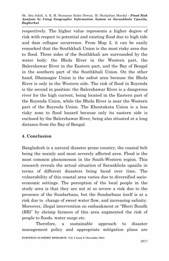
respectively. The higher value represents a higher degree of
risk with respect to potential and existing flood due to high tide
and dam collapse occurrence. From Map 2, it can be easily
remarked that the Southkhali Union is the most risky area due
to flood. Three sides of the Southkhali are surrounded by the
water body: the Bhola River in the Western part, the
Balershawar River in the Eastern part, and the Bay of Bengal
in the southern part of the Southkhali Union. On the other
hand, Dhansagar Union is the safest area because the Bhola
River is only in the Western side. The risk of flood in Royenda
is the second in position: the Balershawar River is a dangerous
river for the high current, being located in the Eastern part of
the Royenda Union, while the Bhola River is near the Western
part of the Royenda Union. The Khontakata Union is a less
risky zone to flood hazard because only its eastern side is
enclosed by the Balershawar River, being also situated at a long
distance from the Bay of Bengal.
4. Conclusion
Bangladesh is a natural disaster prone country, the coastal belt
being the mainly and most severely affected area. Flood is the
most common phenomenon in the South-Western region. This
research reveals the actual situation of Sarankhola upazila in
terms of different disasters being faced over time. The
vulnerability of this coastal area varies due to diversified socio-
economic settings. The perception of the local people in the
study area is that they are not at so severe a risk due to the
presence of the Sundarbans, but the Sundarbans itself is at a
risk due to change of sweet water flow, and increasing salinity.
Moreover, illegal intervention on embankment or “Bheri Bundh
(BB)” by shrimp farmers of this area augmented the risk of
people to floods, water surge etc.
Therefore, a sustainable approach to disaster
management policy and appropriate mitigation plans are

Sk. Abu Jahid, A. K. M. Humayan Kabir Dewan, M. Shahjahan Mondal - Flood Risk
Analysis by Using Geographic Information System at Sarankhola Upazila,
Bagherhat
EUROPEAN ACADEMIC RESEARCH - Vol. I, Issue 9 / December 2013
2918
crucial for this area. It is essential to take better disaster
mitigation and prepared efforts involving local people.
According to them, mainstreaming disaster management
activities with mainstreaming of development issues is
essential to reduce the disaster damage over time.
BIBLIOGRAPHY:
BBS. 2005. Population Census, Bangladesh Bureau of
Statistics. Ministry of Planning, Bangladesh.
Blaikie, Plers, Cannon Terry, Davis Lan, and Wisner Ben.
1994. At Risk: Natural hazards, People’s vulnerability
and disasters. London: Routledge. 9-10.
Guha-Sapir, D., D. Hargit, and Ph. Hoyois. 2004. Thirty years of
natural disasters 1974-2003: The numbers. Louvain-La-
Neuve: Presses Universitaires de Louvain.
Huq, S., Z. Karim, M. Asaduzzaman and F. Mahtab (Eds.) 1999.
“Vulnerability of Forest Ecosystems of Bangladesh to
Climate Change.” In Vulnerability and Adaptation to
Climate Change for Bangladesh. Dordrecht: Kluwer
Academic Publishers.
McInnes, R. G. 2006. Responding to the risks from climate
change in coastal zones, a good practice guide. Ventnor:
Isle of Council.
Melelli, L. and A. Taramelli. 2004. “An example of debris-flows
hazard modeling using GIS.” Nat. Hazards Earth Syst.
Sc 4: 347–358. http://www.nat-hazards-earth-syst-
sci.net/4/347/2004/.
Rahman, M. A. 2004. Understanding Climatic Risk: A
Participatory Analysis of Koyra Impact Zone of
Sundarban. Jagrato Juba Shangha, Khulna.
Rashid, H. 1991. Geography of Bangladesh. Dhaka: UPL. 33-34.
Related Documents